Cloudburst


The Federation of Mountain Clubs of British Columbia (FMCBC) is a province-wide umbrella organization dedicated to protecting and maintaining access to BC’s backcountry.
Since 1972, we have represented the interests of outdoor clubs from every corner of the British Columbia and have provided a united voice on issues related to non-motorized backcountry recreation.
Our membership is comprised of a diverse group of thousands of non-motorized backcountry recreationists, including hikers, rock climbers, mountaineers, mountain bikers, trail runners, kayakers, backcountry skiers, and snowshoers. Many of our member clubs also build and maintain trails and backcountry huts, ensuring safe and sustainable access to BC’s wilderness for both their members and the public.
As an organization, we believe the enjoyment of these pursuits in the natural environment is a vital component of the quality of life for British Columbians, and by acting under the policy of “talk, understand, and persuade” we advocate for these interests. Learn more on our website


Executive
President: Liz Bicknell
Treasurer: Paula McGahon
Secretary: Judy Carlson
Board of Directors
Dave King, Monika Bittel, Adam Steele, Jim Spencer, and Hélène Sorel
Staff
Communications
Manager: Jacqueline Rimmer
Bookkeeper: Rachelle Dyer

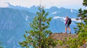
Liz Bicknell, President
I hope this message finds you all in good spirits and ready for the exciting year ahead! 2025 promises to be a progressive chapter for our Federation as we work together to increase access to nonmotorized outdoor recreation. A chapter filled with new adventures and opportunities to connect with nature and one another.
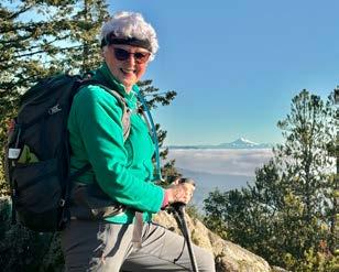
Liz Bicknell, President
This year, we’ll be launching our Webinar and Roundtable discussions with the kickoff Webinar on February 19th, on Strategic Planning, with guest speaker Annelies Tjebbes. Don’t forget to register. The focus of these events is to celebrate our shared passion and continue to strengthen the bond that makes our Federation so unique. Make sure you’re subscribed to our newsletter for upcoming details on these events. I guarantee you won’t want to miss what’s in store.
There is no question that we are living in challenging times. As the Federation rolls out its Strategic Plan over the next 4 years, diversity and equity remain priorities for us. Even as some governments appear to retreat from prioritizing diversity, we understand it remains critical
“Diversity enriches our workplaces, strengthens our communities and cultivates a more inclusive and equitable society...”
for communities, organizations and individuals to champion this as a core value. Diversity enriches our workplaces, strengthens our communities and cultivates a more inclusive and equitable society where everyone feels safe and welcome and has a chance to thrive.
As we look forward to the adventures ahead, I must also share some personal news. After many rewarding years serving as your President, I will be retiring from this role in October 2025. This decision comes with mixed emotions, however, I am excited about the chance to pass the torch to a dynamic new leader who will bring fresh energy and ideas to the role. I will continue to serve on the Board of FMCBC in the capacity of Past President.
If you or someone you know is interested in taking on this fulfilling leadership role, please reach out. We’ll share more details about the transition process in the coming months. In the meantime, I am committed to ensuring a smooth handoff and to making 2025 a year to remember.
Thank you all for your enthusiasm, camaraderie and dedication not only to your own clubs and your own communities, but also for your support of the Federation. I look forward to making this year unforgettable alongside each of you.

Paula McGahon, Treasurer
The FMCBC is in good financial shape at Dec 31, 2024. Our Net Income on November 13th, 2024 was $31,750 with 4 months remaining in the financial year.
This year we welcomed two new roles. Previously our administrative assistant carried out both bookkeeping and communications tasks - these roles have now been divided. Our new FMCBC Communications Manager, Jacqueline Rimmer, joined us in June. She works on all communications including rolling out our strategic plan in the new year. We also welcomed Rachelle Dyer who will carry out our bookkeeping function.
To further support our accounting, we engaged a contractor, SDI Consulting Inc, to transfer our books into QuickBooks. This systems upgrade was completed in November and it has already provided greater efficiency allowing the Federation to have access to financial documentation and summaries in a timely manner.
--
The annual FMCBC grants are aimed at supporting and empowering our incredible outdoor clubs. These grants help fund various projects, from operations to skills sessions and beyond. Below are the five clubs who were the recipients of the 2024 FMCBC Grant. The Grant Committee, Dave King, Adam Steele, and Judy Carlson would like to congratulate all recipients, and look forward to learning more about the success of their projects. Learn more about how to apply for the 2025 FMCBC Grants. 1 2 3 4 5
1. Apex Community Association Creating a “Trail Building Tool Library” – providing tools to build & maintain trails for all outdoor recreation. $400
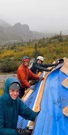
2. Varsity Outdoor Club Vancouver Provide building materials to repair Phelix Hut enabling usage for recreation by members and non-members. $1700
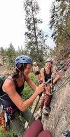
3. Rock On Collective To facilitate rock climbing mentorship opportunities for people facing systemic barriers in the Okanagan.
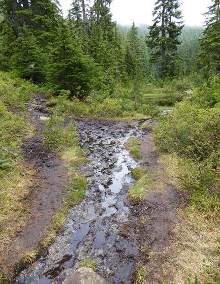
4. Prince George Backcountry Recreation Society To improve and maintain the quality of trails leading to Tabor Mountain, to increase accessibility and safety.
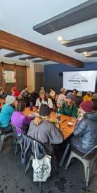
5. Kootenay Wild Mentors
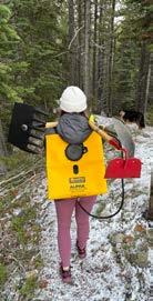
To facilitate skills and training events to share informed backcountry recreation info & safety for marginalized genders, non-binary, and gender non-conforming individuals.

$850
$600
$1450

FMCBC’s Recreation and Conservation Committee (Rec & Con), led by Monika as the committee chair, advocates for the interests of non-motorized backcountry recreation in BC.
“We review potential impacts on non-motorized recreation areas of interest in BC.
The Rec & Con tends to focus on issues arising in southwest BC because for most Committee members this is their primary recreation area. Virtual Zoom meetings allow members from across BC to participate in the monthly meetings. The Rec & Con listserve allows members to stay informed or to contribute to matters of interest to them. When province-wide or regional matters come to the Committee’s attention, the Committee solicits input and feedback from member clubs through their representatives or designated club contacts.
If interested in joining the Rec & Con Committee or listserve, or if there are matters of concern to your club, please contact the Committee Chair (mbittel9@gmail. com). The FMCBC and Committee welcome suggestions to strengthen our advocacy.
Advocacy highlights since the last Cloudburst report: FMCBC comments on commercial tenure application and referrals The Committee reviews commercial applications for potential impacts on non-motorized recreation areas or interests. Committee submitted comments on the following referrals:
• Forest Stewardship Plan: Chilliwack Natural Forest District
In October, the FMCBC was invited to comment on a Forest Stewardship Plan within the Chilliwack Natural Resource District, a popular recreation destination with many trails and recreation sites. While 13 popular trails are legally established under s. 56 of the Forest Range and Practices Act
with objectives, most trails within the District are unregistered or if legally established, are registered without measures or conditions specified to minimize impacts from logging activities. Since Recreation Sites and Trails BC (RSTBC) has limited capacity to register trails and it can take multiple years for an application to be assessed for acceptance, the Committee compiled a list of more than 50 trails, which are located outside protected areas. With respect to these trails, the FMCBC asked to be notified should logging activities be planned within the vicinity of these trails. The list of trails was compiled with the assistance of Mike Stewart (Valley Outdoor Association) and feedback from the Chilliwack Outdoor Club. The FMCBC received assurance that if forestry activities are planned within the vicinity of the listed trails, the plan holders will contact the FMCBC for further comment and discussion of possible management recommendations.
• Yukon Alpine Heliski Application, Crown Land File Number: 6408427
The proponent applied to add “Zone 4” (83,928 ha) to their existing licence of occupation for guided heli-skiing and non-mechanized ski touring; and, to add heli-assisted guided glacier walks and heli-sightseeing to their “Zone 2”. The latter activities are of concern because Zone 2 lies south of the Chilkoot Trail National Historic Site, a world-renowned protected area. While the proposed heli-flight path and the two glaciers to be used for the proposed glacier tours lie outside the park boundary (glaciers located east of Chilkoot Pass and southeast of Crater Lake), the Committee opposed the additions on the following grounds:
1. The proposed heli-flight path, while outside the protected area, would nevertheless detract from the remote, wilderness experience of the historic trail:
a. The glacier tours would run from June 1 to September 30, coinciding with the Chilkoot Trail hiking season (mid-June into October);
b. The projected client days between June 1 and September 30, 2025, is 1000, increasing to 1200 client days in 2026, 2027 and 2028; and
c. Each guided tour would require 4 flights – flight to glacier drop-off, return; pick-up flight to glacier, return – substantially impacting the visual and audio experiences of the remote traverse.
2. Heli-assisted sports should not be promoted: With increasingly severe manifestations of climate change in BC (i.e., extensive wildfires, heat dome, intense windstorms, rapidly retreating glaciers and melting snowpacks), heli-assisted day excursions to remote areas should not be encouraged or promoted. The focus should be on minimizing one’s carbon footprint, consistent with the province’s Climate Strategy.
3. Impacts on wildlife: Although the operating area contains significant wildlife values and habitat, the proponent’s management plan only addresses winter activities, offered primarily from mid-March to the third week of April. The plan does not appear to address the wildlife impacts of the proposed summer heli-assisted guided glacier tours, including the multiple heli-flights required for each tour. The wildlife mitigation report prepared by a professional biologist in 2016, which the Committee did not have the opportunity to review, predates the proposed addition of the summer heli-assisted glacier tours.
In early 2023, BC Parks initiated recreation facility planning processes for Mount Seymour, Golden Ears, Cultus Lake and the Howe Sound Crest Trail (HSCT), all heavily used parks in southwest BC. The FMCBC and member clubs participated in all four processes. Infrastructure and facilities (e.g. trails, washrooms, access, signage) requiring upgrades or improvements were identified, as well as strategies to expand recreation opportunities and improve accessibility and the visitor experience. In early December 2024, BC Parks released the engagement summary results for Mount Seymour, Golden Ears and Cultus Lake:
» Mount Seymour Provincial Park Engagement Summary
» Golden Ears Provincial Park Engagement Summary
» Cultus Lake Provincial Park Engagement Summary
BC Parks advised they are continuing to consult First Nations and will be engaging with Equity, Inclusion and Diversity groups. Their feedback will be incorporated in the draft plans, which will be available for public review and comment before being finalized.
With respect to the HSCT, BC Parks advised they are working on the environmental overview assessment and archaeological permitting process for the project. They hope to share the draft plan soon. It is unclear if BC Parks will be releasing engagement summary results for the HSCT.
The following are highlights from the engagement summary results for Mount Seymour, Golden Ears and Cultus Lake.
• Number of participants and responses collected:
• All three parks experience high visitor numbers. Most visitors travel from adjacent communities:
» Mt Seymour: Most popular with North Shore (59%) and Vancouver (24%) visitors.
» Golden Ears: Highest user group is from Maple Ridge (55%), with other visitors traveling from Langley, Tri-Cities, Vancouver and Surrey (28% combined).
» Cultus Lake: Cultus Lake and Chilliwack visitors (59%) are the highest user group.
• Half, full day, weekday and weekend visitors: Half-day visits (45-67%) are more popular than full day visits (21-33%). Weekday and weekend visitors are similar in number.

Sylvie Wallace
• Seasonal use: Maximizing use of existing facilities by increasing year-round use was identified as a positive strategy for all three parks.
• Mt Seymour: Already sees year-round use. The highest use is in winter likely due to downhill skiing. Many participants requested earlier access in winter.
• Golden Ears: Summer sees the highest use, followed closely by spring and fall. The winter season has the lowest use, although winter visits are significant. Winter closures due to weather or lack of snow plowing may account for lower winter use.
• Cultus Lake: Highest use occurs in summer, fall and winter.
• Mode of transportation to parks: In all three parks, most visitors arrive by car. Lack of public transit, alternate transportation options (i.e., shuttles) or inadequate shuttle service was identified as a challenge/barrier for all three parks. Poor road conditions and road safety issues deter bikes as a mode of transport to the parks.
• Most popular outdoor activities in the parks: Respondents were asked to identify all the activities they participate in when visiting the parks.
The chart on the following page summarizes the activities of greatest interests to member clubs. At Seymour, downhill and backcountry skiing were similar at 41%, with snowshoeing at 52%. No motorized activities are offered at Seymour. In Golden Ears and Cultus Lake, motorized activities are boating, jet skiing and water skiing: each at less than 20%.

• Park challenges and barriers in all three parks include poor condition of trails, bridges and facilities (washrooms, toilets, signs); insufficient trail and facility maintenance; limited parking; lack of clarity and communication with signage. Day passes are considered both a park “strength” and a park “challenge or barrier”.
• Top facility suggestions in all the parks include more trails, more and better backcountry facilities (tent pads, food caches, trails); more and better signage; upgrades to existing facilities; more and improved parking; improvements to access road; and better road safety for cyclists.
• Top strategies identified include improvements/upgrades to existing park facilities, e.g. washrooms, signage, trails; protection of environmental values; maximizing use of existing park facilities by increasing year-round use; more transportation options to the parks (e.g., transit, trails, bike routes); greater distribution of uses throughout the parks.
For Golden Ears, suggested strategies include another access road and snow plowing of roads in the winter.
For Seymour, suggested strategies include allowing earlier access to the park in winter, more trails up the mountain from lower parking lots, and loop trails.
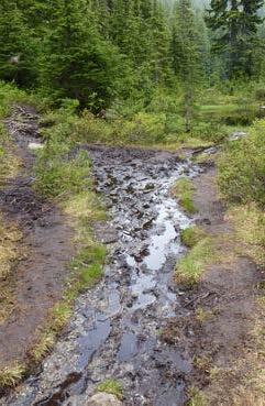
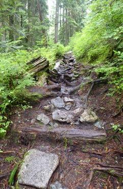
All three parks currently have poor conditions for their trails, bridges, and public facilities
all of which require improvements to increase public accessiblity and safety.
While provincial parks and outdoor recreation were not central in the 2024 provincial election campaign, they featured to varying degrees in the three parties’ platforms. This is a recognition of the growing importance of outdoor recreation as an economic driver, contributor to residents’ wellbeing, community amenity and opportunity to advance Indigenous reconciliation.
After winning the bare minimum required to form a majority government, it was not surprising that the BC NDP entered a four-year agreement with the BC Greens to secure their support in exchange for advancing Green initiatives on healthcare, housing, renter support, homelessness, transit, climate, forestry, tax and legislative reform. While greater stability has been secured, the NDP’s limited elected rural MLAs may require the NDP to rely on regional-based collaboration and decision-making to gain public support and trust. Greater public input and accountability in all phases of decision-making would be welcome, particularly as it relates to provincial parks and outdoor recreation on provincial public lands. Lack of transparency and accountability in how funds are allocated within BC Parks and RSTBC undermines confidence in the executive decision-making, particularly BC Parks. On January 16, 2025, Premier Eby released his mandate letters, which provide insights on the Premier’s objectives for each Minister, as well as the pressing challenges to be addressed by Minister. Of particular interest is the mandate letter to the new Minister of Parks & Environment, Tamara Davidson, as well as those Indigenous Relations & Reconciliation, Water, Land & Resource Stewardship, Forests, Tourism, Arts, Culture and Sports and Transportation & Transit.
Parks are of particular importance to the non-motorized recreation community because most parks are designated as non-motorized. Under-staffing and lack of resources however continue to impact services provided by both BC Parks and RSTBC. Many parks, recreation sites and trails are less accessible due to neglected trails, campsites, infrastructure, facilities and access roads. Seasonal closures due to lack of funding for plowing of roads and parking areas and maintenance of facilities in winter mean parks suitable for winter recreation are inaccessible (i.e., Brandywine Falls). Further, many parks remain closed or partially closed due to damage from severe weather events, flooding and wildfires. Examples are Carmanah Walbran Provincial Park, Pinecone Burke Provincial Park, Juan de Fuca Provincial Park, Golden Ears Provincial Park, Top of the World Provincial Park, Cathedral Provincial Park, Valhalla Provincial Park, Stein Valley Provincial Park. Such closures place pressure on parks and recreation sites which remain open and accessible, or which are unmanaged or managed by volunteers. Under-staffing and protracted planning processes also mean many parks created in the 1990s (i.e., Pinecone Burke) are still without management plans to guide development of much needed recreation opportunities. Outdated plans also do little to advance Indigenous Reconciliation.
By Steven Jones
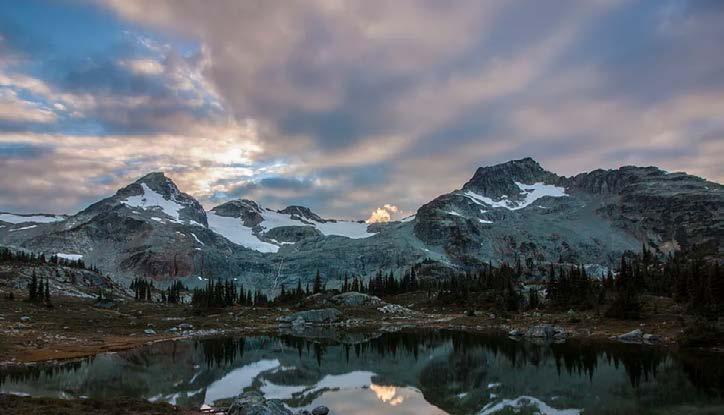
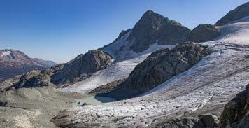
S“ The waterfall draining from the train glacier provides a constant soundtrack for visitors to Semaphore Lakes.
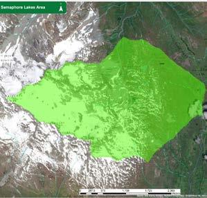
emaphore Lakes is a subalpine meadow that sits below a magnificent alpine cirque guarded by a number of mountain peaks. It is accessed off of the Hurley Forest Service Road between Pemberton and Gold Bridge. It is within the traditional territory of the St’át’imc Nation (with a corner also in the traditional territory of the Lil’Wat Nation). A rough foot trail provides efficient access to the meadows from the road with only 250m of elevation gain. Some people choose to visit as a day hike. Others set up camp in the meadows before summiting one or more of the mountains.
In the past, it did not see an unreasonable number of visitors. It’s a long trip from Vancouver and it requires driving on a gravel road. The trail was not a part of the BC Parks or Recreation Sites and Trails BC systems so information was hard to come by. Over time, visitation levels increased. I believe that there were a number of factors. For starters, information about the trail became much more widely available. The trail was included in multiple guidebooks and was promoted by Destination BC. The internet and social media made it easier for hidden gems to be discovered by large numbers of people. On top of that, there has been increased pressure on trails in general as hiking becomes increasingly accessible due to gear availability (including GPS navigation devices,) and our population continues to grow more
quickly than the development of recreational trails. Finally, management decisions in nearby parks that limit access through day passes and overnight reservations have accelerated the growth of visitation to unregulated areas. The summer closure of Keyhole Falls Hot Springs and the permanent closure of Meager Creek Hot Springs have also reduced recreation opportunities in the area. In recent years, this started to create serious problems at Semaphore Lakes. Even if everyone had been following perfect Leave-No-Trace principles, when the number of visitors becomes so large, it’s hard to find a place to dig a cat hole that hasn’t already been used. With no clearly identified camping areas, damage was occurring in many areas of the meadows. Unfortunately, some visitors were also not following Leave-No-Trace principles.
Wood is an important part of the subalpine meadow ecosystem but was being scavenged and burned at an unsustainable rate. If something didn’t change, Semaphore Lakes would lose a lot of the beauty that attracted visitors in the first place.
It was not clear if it would be possible to gain some level of protection for Semaphore Lakes. The provincial government makes small strategic additions to existing parks but has generally not been interested in creating new parks from scratch. Designation as a recreation site was another option but that system relies very strongly on volunteers from local organizations. The remote nature of this site would make that a challenge as the small group of local volunteers were already investing a significant amount of time into Tenquille Lake and other recreation trails in the area.
A petition was started in 2016 to create a Semaphore Lakes Provincial Park and collected over 200 signatures. Although nothing happened immediately, it started a long and slow process. I am incredibly grateful to Alistair McCrone, the Recreation Officer for the Sea to Sky Recreation District. He heard the request from the community with an open mind and gave it serious consideration. He became a champion for the area and exercised a lot of persistence and patience to move the ball forward over a number of years. During that period, there was also great collaboration with community organizations. Tourism Pemberton came forward to fund the purchase and installation of three urine diverting toilets. The Don’t Love It To Death program provided a trailhead kiosk. Recreation Sites and Trails BC provided food caches, signage, alpine kiosks, rehab supplies/work, trail deactivation work, campsite construction and
helicopter support. The years of work culminated in 2024 with the creation of the Semaphore Lakes Recreation Site. In the words of Jim Standen, Assistant Deputy Minister of the Conservation and Recreation Division: “Establishment of the site will allow Recreation Sites and Trails BC (RSTBC) to enter into partnerships to steward the site and provides regulatory tools for management of use. This establishment recognizes both the significance of the site for local recreation and the sensitivity of its setting.”
Like all glaciers in BC, the glacier above Semaphore Lakes is melting. I hope that designation of this site as a formal recreation site will ensure that generations of British Columbians are able to safely and sustainably visit this area to witness what is happening with their own eyes. I believe that most people who have the opportunity to visit this incredible location will leave with an increased sense of responsibility for safeguarding our natural world. I would be remiss to not acknowledge the potential risks of an area coming under formal management. It is possible that the government will turn to tools such as reservations and day passes to maintain visitation at a sustainable level. Like a set of dominos, that will push crowds to the next unmanaged area. Protecting existing trails is important but the only way to properly get ourselves back to a good place is to also invest in the creation of net-new trails.
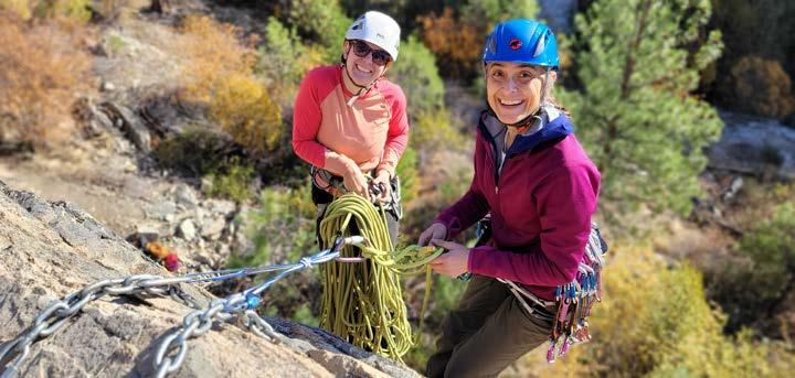
Our vision is to empower our community to explore, grow, and shine as their authentic selves.
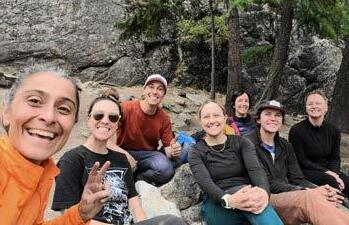
Rock On Collective was founded in 2023 by Zanna Ekeroth and Robyn Solland with the aim to break down barriers in the outdoors and change the narrative of what it means to be a climber—a sport that has historically been dominated and shaped by masculinity, boldness and a “conquering the mountains” mindset.
Our vision is an inclusive rock climbing community in which everyone is empowered to explore, grow, and shine as their authentic selves. Based in the Okanagan, we provide rock climbing mentorship opportunities aimed to foster equity and belonging for people facing systemic barriers.
The FMCBC grant supported our initiative “Train the Mentors”—a critical component to the mentorship
program as it equips the mentors with practical skills, confidence and improved safety practices through courses with certified guides.
We are so grateful to be able to use this grant money to hire two queer non-binary rock guides who bring such immense climbing expertise as well as lived experience into their guiding and mentorship.
This course empowered participants to feel confident carrying out basic rescue scenarios in high angle environments. Having the skills, preparedness, and knowledge to assist in decision making processes and rescue systems is a vital safety net when out on the wall.
Keenan is an ACMG Apprentice Rock Guide aiming to foster inclusive avenues into outdoor recreation that feel intentional, safe, and counter to present norms.
Quote from participant: “The rock rescue workshop with Keenan was such an incredible experience. We learned a handful of super practical rescue systems for both single and multi-pitch… and had a great time doing it! I loved the opportunity to play around on the ropes and bond with other ROC members outside of my mentorship group. Thanks ROC!”
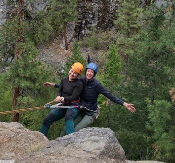
This course introduced the participants to the fundamentals of multi-pitch climbing systems, such as belaying methods, anchor building, rope management and rappel descents.

Ren is a ACMG Rock Guide who believes in the power of affinity spaces and takes joy in collaborating with local grassroots organizations to offer outdoor rock climbing courses that are accessible, supportive and welcoming.
Quote from participant: “This course was absolutely out of this world! Ren is a gifted instructor, and their passion for their craft shone at every step of the way”
ROC is celebrating one year as an incorporated non-profit at the end of 2024! We are currently gearing up for our first AGM and are using the winter season for grant writing, impact assessment, and program development to make next year’s mentorship program even better!
Outside of the mentorship program, our goal for 2025 is to organize more subsidized climbing courses and free educational workshops. These events are open to anyone in the Okangan climbing community, and will prioritize people who experience identity-related or other barriers in the outdoors.
See our website to find out more about us and for details on upcoming events.

For 50 years, the Penticton Outdoor Club (POC) has been blazing trails, building friendships, and leaving lasting footprints in the heart of the Okanagan’s backcountry. Founded in 1975 by four passionate mountaineers—Fred Van Seters, Tom Landecker, Stu Patterson and Ann Kiefer —the POC has grown into a vibrant community of outdoor enthusiasts dedicated to exploring and protecting the wilderness.
When the FMCBC team interviewed POC members and were asked to describe the club’s energy and vibe, members offered four words that perfectly capture its spirit: “Hardcore. Keen. Fit. Friendship.” These traits shine through in everything the POC does, from multi-day expeditions to stewardship efforts that preserve the trails they love.
Focused mainly on hiking, the POC has expanded over the decades to occasionally include outings
like backpacking, snowshoeing, kayaking, cycling, and backcountry skiing. Today, the club boasts 47 active members, primarily retirees in their 50s and 60s. “New members often say they’re inspired to keep up with us!” shared longtime member Bev Krieger with a laugh.
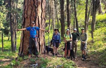
From half-day local hikes to multi-day backpacking trips, the Penticton Outdoor Club is all about adventure and camaraderie. A hallmark of the
club’s calendar is the Guy’s Cache Hike every September trek honouring early member Guy Duvent, complete with a hidden bottle of whiskey to toast his memory. Other memorable moments include tubing down Washington’s Kettle River post-hike, hiking the summit of Mt. Baker, and an unexpected night in Lillooet when members on opposite sides of a flooding river had to rely on the kindness of strangers.
Quirky stories are part of the club’s charm. One member once filled their backpack with 40 cans/15 kgs of cat food as training for a major hike. Another famously taped their boots with first aid tape mid-hike to keep going. “We’ve seen it all,” Bev recounted, “but it always makes for great memories.”
The POC’s members are experts at finding hidden gems across the South Okanagan. Their favorites include Brent Mountain in the Apex area, and the Three Blind Mice trails between Naramata and Penticton. However, for breathtaking views and a truly rewarding hike, McIntyre Bluff remains a perennial favorite.
The Penticton Outdoor Club is more than just a hiking group; it’s a community deeply committed to
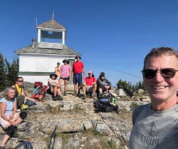

conservation and stewardship. Members regularly engage in trail maintenance, often contributing their time and personal resources to keep the backcountry safe and accessible.
Over the years, the club has helped maintain popular trails like those in the Apex area and around Brent Mountain, clearing debris after storms and ensuring markers are visible for hikers. “The club at one point had their own saws and distinctive trail markers to keep trails open,” Bev explained. “It’s all about giving back to the spaces we love.”
As the Penticton Outdoor Club celebrates its 50th anniversary, members are focused on inspiring the next generation of outdoor enthusiasts. Events like the Bird-a-Thon on December 29th and mentorship programs for younger hikers are just a few ways the club is paving the way for its future. “We hope to see more young people join,” said Bev. “Sharing our knowledge, inspiring new leaders, and fostering a love for the outdoors are key to continuing our legacy.”
The Penticton Outdoor Club is more than just a place for outdoor recreation—it’s a community of adventurers, storytellers, and nature lovers who
• Favorite Hike: McIntyre Bluff—for unparalleled views and memories.
• Funniest Gear Moment: That time someone trained with a backpack full of 40 cans of cat food (15 kgs) —talk about commitment!
• Best Post-Hike Tradition: Relaxing under Josiane’s pear tree in Keremeos, sharing snacks and stories.
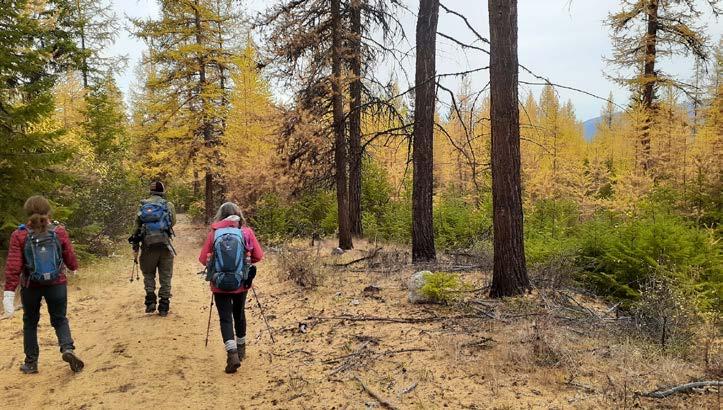
are united by their passion for the backcountry. Whether it’s hiking McIntyre Bluff, sharing snacks under Josiane’s pear tree in Keremeos, or discovering the next hidden gem, POC members find connection, adventure, and lifelong friendships.
If you’re looking for a club that’s “hardcore, keen, and full of friendship,” the Penticton Outdoor Club is the perfect place to start your next adventure!
From summit views to quiet trails, decadesold traditions to spontaneous adventures, the Penticton Outdoor Club has spent the past 50 years proving that the best journeys are the ones shared. Here’s to the next 50 years of friendship, stewardship, and countless memories made in the great outdoors.
Find out more on our website
Follow us on Facebook
A vital force in preserving backcountry recreation in the region
TNew Grizzly Den Cabin
Rebuilt in 2024

he Prince George Backcountry Recreation Society (PGBRS), based in the Central Interior of British Columbia, is a coalition of non-motorized clubs and organizations. Established in 1998, the society was created to enhance communication and foster collaboration among non-motorized recreation groups in the Central Interior, particularly in the Prince George and Robson Valley regions. Entirely volunteer run, PGBRS has become a vital force in preserving backcountry recreation opportunities in the region.
Currently, PGBRS consists of 13 member groups and a dozen directors but does not offer individual memberships. Early in its history, the society entered into agreements with BC Parks and Recreation Sites and Trails BC (RSTBC) to take on key responsibilities such as resupplying backcountry cabins with firewood—often using helicopters—clearing trails, and performing
cabin repairs, including constructing new woodsheds and toilets.
Over time, PGBRS expanded its role to manage bookings for backcountry cabins. It now oversees reservations for six cabins: three within Sugarbowl-Grizzly Den Provincial Park and three on lands under RSTBC jurisdiction. In addition to cabin management, PGBRS undertakes other infrastructure projects, such as rebuilding footbridges and, notably, repairing the Tacheeda Fire Lookout in 2022.
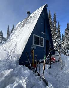
Declared a heritage site, the lookout required significant restoration to ensure its preservation.
Original Longworth Lookout

In recent years, PGBRS has taken on even greater responsibilities, including seeking authorization, funding, contracting, and overseeing the construction of new cabins to replace aging structures. During the summer of 2024, in partnership with BC Parks, PGBRS replaced the original Grizzly Den Cabin (built in 1973) with a new, larger two-story cabin. Although the work extended into the fall snow season, the new cabin is now available for public use. Similarly, PGBRS collaborated with RSTBC to replace the aging fire lookout cabin atop Longworth Mountain with a new overnight cabin.
The Longworth Lookout replacement was funded by the Rural Economic Diversification and Infrastructure Program ($333,637.50). The Grizzly Den Cabin replacement was supported by funding from the Province of BC’s Destination Development Fund ($241,050.00), the Northern Development Initiative Trust Recreation Infrastructure Program ($89,049.00), BC Parks (~$150,000.00), and PGBRS’s own savings. Both cabins will undergo final touch-ups in the summer of 2025 but are already available for public booking through the PGBRS website at pgbrs.org.
As PGBRS looks to the future, the society is exploring new sustainability initiatives, including solar energy installations for backcountry cabins.
New Longworth Lookout under construction in 2024
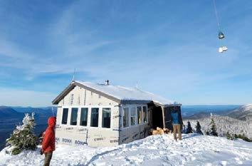
These initiatives aim to reduce the environmental impact of cabin operations while ensuring longterm energy efficiency. The society’s dedication to its 2021–2026 Strategic Plan, which prioritizes collaboration, responsible management, and conservation, continues to guide its efforts to enhance backcountry access while preserving the wilderness for generations to come.
• Founding Year: 1998, to unite 13 non-motorized recreation clubs in the Central Interior.
• Cabin Availability: Six cabins are available for public booking via their website.
• Helicopter Heroes: Volunteers use helicopters to deliver firewood and materials to remote cabins!
• 2024 Milestone Projects: Rebuilding two key cabins in 2024—Grizzly Den and Longworth Lookout.
• Unique Heritage Site: The restored Tacheeda Fire Lookout.

by Timothy Chen
In the 2024 Great Cycle Challenge, the Pacific Northwest Outdoor Association (PNOA) GCC 2024 team achieved remarkable results. We set a goal of 5,000 kilometers of cycling, and the total cycling distance reached an amazing 9,621 km, almost double the original plan. In addition, our fundraising goal was set as $5,000, and we finally raised $8,579, which will be used to support the SickKids Foundation to help research and treat childhood cancer.
This year, a total of 17 team members participated in the challenge, of which 8 were first-time participants. Particularly worth mentioning are the youngest members of our team - 8-yearold Zoe and 5-year-old Avi. Zoe participated in the challenge for the second year, cycling 554.1 kilometers and raising $1,507 for Sick Kids Charity. Avi, the younger brother, participated for the first time, completing 82 kilometers of cycling and raising $306. Their courage and hard work deeply inspired other team members and demonstrated the unlimited potential of the younger generation.
At the same time, the team’s senior rider Lao Qi played an important role. He rode 2,850.9
kilometers alone, contributing greatly to the team’s success. His persistence and perseverance set an example for all team members and inspired everyone to pursue their goals together.
Through this challenge, the PNOA GCC 2024 team not only exceeded expectations in cycling and fundraising, but more importantly, raised awareness of childhood cancer. We understand that the efforts of each team member are igniting the light of hope for those children in need. Looking into the future, we will continue to participate in next year’s challenge, contribute to more children, and achieve even better results!

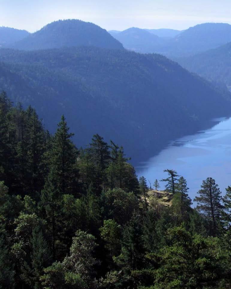
The Jocelyn Hill hike, located in Gowlland Tod Provincial Park on Vancouver Island, is a favorite among outdoor enthusiasts. This moderate-to-difficult trail offers a stunning mix of forested paths, rocky viewpoints, and panoramic vistas. Jocelyn Hill is part of the larger Gowlland Tod trail network, which is known for its biodiversity and proximity to the sparkling Saanich Inlet. Whether you’re an avid hiker or looking for a peaceful escape into nature, this trail will impress.
Four of us started from the Mount Work Ross Durrance parking area and headed up Anderson Hill which is a steady but steep incline that takes you through a canopy of lush Douglas firs and arbutus trees. The path meanders through rugged terrain, dotted with moss-covered rocks and ferns. Along the way, hikers encounter viewpoints that provide glimpses of the inlet and the Gulf Islands in the distance. The trail is a mix of gentle climbs and more challenging sections, making it a rewarding but fairly strenuous hike.
As you ascend to Jocelyn Hill, the views become increasingly breathtaking. The summit, perched at 420 meters above sea level, offers sweeping views of the Saanich Inlet, Mount Finlayson, and even the Olympic Mountains on a clear day. The rocky outcrop at the top is an ideal spot for a well-deserved rest and a picnic. The natural beauty of the surrounding landscape is mesmerizing, making the effort to reach the summit well worth it.
Liz Bicknell, left, with members of the Outdoor Club of Victoria
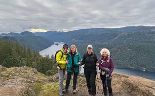
Beyond the physical rewards, the Jocelyn Hill hike is also an opportunity to immerse yourself in the tranquility of Vancouver Island’s wilderness. The trail is rich in wildlife. We spotted bald eagles, deer (a good-sized buck greeted us as we came up Buxey) and of course the ever curious ravens. The combination of serene forest trails, stunning viewpoints, and a sense of accomplishment makes Jocelyn Hill a must-visit destination for anyone exploring Vancouver Island’s outdoors. Today’s hike was 14 kms with a 500 m elevation which took us 6 hours. Well worth the effort. - Liz Bicknell

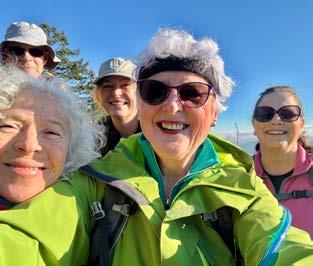

On a winter Wednesday morning 5 of us participated in a hike on Vancouver Island. All of us are members of the Outdoor Club of Victoria, and tackling Mount Work was on our agenda today. We gathered at the trail head for the usual safety pre-hike brief of bears, cougars, ticks and the like before setting off at a quick clip as it was very nippy.
Everything was looking green and lush after the heavy rainfall of the past few weeks. Thank goodness there was no bomb cyclone although evidence of strong winds was on display with lots of downed trees and general debris on our trail.
We hiked nonstop for an hour and a half before reaching Puddle Rock for a well-deserved coffee, tea and snack. Mount Baker was looking lovely in the distance across the Juan de Fuca Straight, known locally as the Salish Sea.
We went on to summit Mount Work which is 450 m above sea level. The hike is 10.5 kms and it took us 4 hours, including stops for lunch. As you can see from the smiling faces of the 5 of us, hiking and being in nature is our happy place.
by Liz Bicknell
By Brian Norwick
The Vancouver Island Trail is more than just a hiking route; it’s a shared experience that has the opportunity to connect people to the land and to each other.
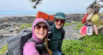
We exited the North Coast Trail after five days of hiking. The maintained path ended abruptly at the edge of the dense forest along the remote north coast. A few pieces of flagging tape marked the continuation of the route.
Reports from previous hikers described this area as difficult to pass through. However, as we turned the corner past the first flagging, we noticed that someone had cleared a path through the dense vegetation. We were grateful to the volunteers who had worked to maintain this section. We could feel a sense of community on the trail.
The Vancouver Island Trail (VIT) is an 800-kilometer trail, a hidden gem that spans the length of the island. It utilizes existing trails, such as the North Coast Trail, Port Alberni Inlet Trail and the Trans Canada Trail along with logging roads, and newly created routes. The VIT provides hikers with the
The Vancouver Island Trail (VIT) is an 800-kilometer trail, a hidden gem that spans the length of the island.
opportunity to experience the island’s wilderness and explore its various communities. My wife, Krysta Norwick, and I completed this hike over 40 days this year.
The Vancouver Island Trail Association oversees the trail. I am a newly appointed board member and Communications Director for the association. This non-profit organization, which relies on volunteer support, began developing the trail nearly two decades ago. Formerly known as the VI Spine Trail, the organization has rebranded and received a new logo. The Vancouver Island Trail or VIT for short is divided into seven sections, with the most challenging and remote sections located north of Port Alberni.
Some sections of the trail are easy to follow, allowing us to hike up to 40 kilometers in a single day. Other, more remote sections required
significant effort. Some days we covered only 7 to 8 kilometers due to obstacles like fallen trees, overgrown vegetation, and steep terrain. These challenging sections offered a rewarding experience, providing opportunities to experience true wilderness, pristine campsites, and clear rivers, and sometimes for days at a time without encountering other people. Logging roads provided efficient travel between sections. Since these roads were carefully selected, we often encountered little to no traffic, making them feel more like wide gravel trails. These roads offered a welcome break from the dense forest and allowed us to cover significant distances quickly.
Many sections of the Vancouver Island Trail follow a “route” rather than a traditional, well-marked trail. This means that traversing is possible, but the path may not be clearly defined. As we traveled along these routes, we reflected on the effort required to establish the trail, including securing land agreements, clearing the area, and fundraising.
Hiking the VIT provided an opportunity to connect with communities and explore less traveled areas. During our 40 day trip, we experienced the island in greater detail and developed a deeper connection to the land. I realized the importance of contributing to these communities and subsequently volunteered for the association.
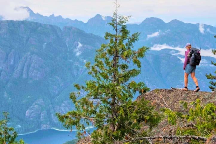
The Yutswholaht Range (Beaufort Mountains) offered impressive views of the mid-island communities. This range lies within the traditional territories of the Hupačasath, Tseshaht, and K’omoks First Nations. The Indigenous name translates to “walking through the face of the mountains.” As I reflect on my experience as a hiker and now a volunteer with the trail association, I hope to encourage and build new memories with the communities along the trail. It will start with learning more about their stories.
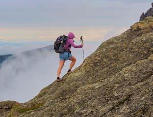
The Vancouver Island Trail is more than just a hiking route; it’s a shared experience that has the opportunity to connect people to the land and to each other. Sharing our trail stories with others, we contribute to building a common memory of this remarkable place. This shared memory fosters a stronger sense of community and ensures the trail remains accessible for generations to come.
During a recent public engagement, the former Minister of Justice and Attorney General of Canada Jody Wilson-Raybould shared this quote on community: “Where common memory is lacking, where people do not share in the same past, there can be no real community. Where community is to be formed, common memory must be created.”
-Georges Erasmus
For more information about the Vancouver Island Trail or the association, please visit the website: vancouverislandtrail.ca, or reach out to us at: info@vancouverislandtrail.ca. You can find daily video updates and weekly short films of our 2024 Vancouver Island Trail thru hike experience on Krysta’s outdoor-content social media channels @krystanorwick (YouTube & Instagram).
Heroes of the Trails
The Tetrahedron Outdoor Club (TOC), based on the Lower Sunshine Coast in BC, embodies the spirit of community and dedication that defines backcountry recreation in British Columbia. This year, their remarkable volunteers undertook a second (Steele Creek bridge completed 2022) critical project: the rebuilding of the Chapman Bridge, a vital connection on the Chapman/McNair Lake Trail in Tetrahedron Provincial Park.
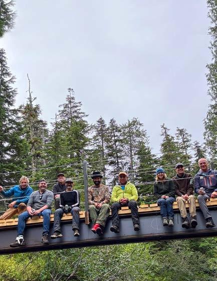
The original bridge, a precarious structure of uneven logs, had become a safety hazard, especially during winter. It was impeding creek flow, causing erosion, and posing significant risks to hikers, skiers and snowshoers. Recognizing the urgency, TOC obtained support from BC Parks to initiate a plan to rebuild the bridge with safety, sustainability, and community access in mind.
The Chapman Bridge project was no small feat.
Volunteers coordinated an inspiring fundraising campaign, securing support from the Sunshine Coast Community Forests and the Outdoor Research Council of BC. These funders covered major expenses like steelwork, welding, and helicopter transport for the bridge’s beams, while the engineering design was generously donated. Most of the work, from planning to on-the-ground construction, was carried out by dedicated TOC volunteers. Gerry Marcotte, TOC’s President, explained the impressive teamwork: “We built both Chapman and Steele Creek bridges offsite, then disassembled and prepped for transport and helicoptered in the bridge components. It took one day to prep the foundation and one day to complete the onsite installation—all thanks to the incredible effort of our volunteers.”

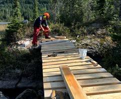
The rebuilding process wasn’t without its challenges. From navigating the administrative hurdles of working within a provincial park to the logistical demands of transporting heavy materials into the backcountry, every step required careful planning and coordination. Despite this, the community rallied around the project. The public response has been overwhelmingly positive. Social media platforms like Facebook became hubs of appreciation, with users praising the efforts of TOC volunteers. “We’ve received so many thank-you’s and positive comments –particularly on social media,” Gerry shared. “The signage on the Chapman Bridge even says, ‘Please shovel the bridge,’ and it’s amazing to see the public taking ownership, keeping it clear and accessible.”
The Chapman Bridge isn’t just a crossing—it’s a connection to the heart of Tetrahedron Provincial Park. The bridge provides access to the McNair Cabin, one of four iconic shelters built by TOC in 1987 before the park was established. The park and cabins, now managed by BC Parks with the TOC as the park stewards, remain open to the public and are a testament to TOC’s longstanding commitment to accessibility and stewardship. Rebuilding the bridge ensures safer public access and increases inclusivity for backcountry users. It also reflects the club’s deep partnership with BC Parks, which limits park entry to protect the environment while prioritizing sustainable recreation opportunities. 1 2
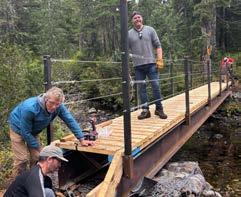
The Chapman Bridge project is just one example of TOC’s dedication to preserving and enhancing the backcountry experience. Looking to the future, the club has completed the installation of solar panels at the McNair Cabin, with plans to expand this sustainable energy initiative to the other three cabins. “This project isn’t just about a bridge—it’s about creating opportunities for people to safely enjoy the backcountry and building a sense of community around these spaces,” Gerry emphasized.
Through the hard work of its volunteers, the Tetrahedron Outdoor Club has restored more than just a bridge—it has reinforced the values of connection, stewardship, and adventure. The Chapman Bridge now stands as a symbol of what can be achieved when passionate individuals come together to protect and enhance BC’s wilderness.
The Tetrahedron Outdoor Club continues to depend on community support to sustain its trail and cabin maintenance projects. Donations are critical to funding initiatives like the Chapman Bridge and other essential backcountry infrastructure. If you’d like to contribute to TOC’s mission, visit their Chapman Bridge Fundraiser page or learn more about their work on their website. Your support helps ensure BC’s backcountry remains accessible, safe, and sustainable for generations to come. -Written by the FMCBC team
Mary hiking Mt. Service
Photo by Sheron Chrysler
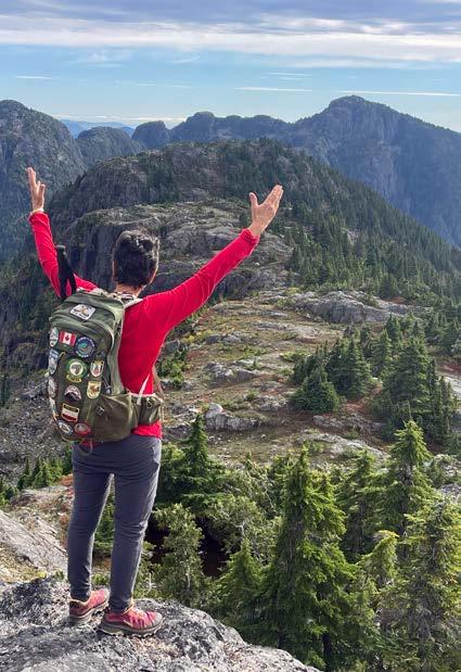

by Mary Hof
As I take a moment on Thanksgiving Day to give thanks for the many blessings I have received in my life, I am thankful that nature and hiking are on that list.
I started hiking over 30 years ago, first with the Alpine Club of Vancouver Island and Cowichan Hikers, then with the Outdoor Club of Victoria, and the last 8 years with the Island Mountain Ramblers. It was the Outdoor Club of Victoria that made a huge impact in my life. It was when I joined in 1996 that I got to hike with leaders that truly were into hiking the way I wanted to hike.
Mary resides on Vancouver Island and is a member of the Outdoor Club of Victoria, Cowichan Hikers, and Island Mountain Ramblers. She has been an avid hiker for over 30 years.
I was introduced to hikes like Mt. Whymper, Al Capitan, Mt Service, Mt, Landale, and Heather Mountain. These hikes are beyond Youbou on Vancouver Island and Copper Canyon. As I got more into the club, I also led these hikes over the years for club members. With the gates in place, it was harder and harder to get accessibility, but a bike at times came in handy to ditch along the logging road and hike the rest. Times come along in your life, when those logging roads are just too much to do as hiking from the trailhead is a very long day hike in itself.
At the beginning of summer, I had a thought or a dream that maybe this year would be the year
I would try to get back to all these mountains once again. September came along and I had not started yet, but then I made that call to a friend who had access to a key for Mt. Whymper and off we went. I remembered the hike like I did 25 years ago, even the road we used to drive but now not driveable had great memories. It was so great to reach the summit. While on Mt. Whymper, I sat there and saw Mt. Landale, and El Capitan right across and Mt. Service further back; I dreamed to do them also. That day came when I got my team to do Lomas Lake, El Capitan and Mt. Landale; oh man it was tiring but so rewarding, I was in awe of it all. Early October, we set out for Mt Service, on a beautiful day and there we could see those three mountains that I climbed earlier. Mt. Baker was above Whymper, and thoughts came to when I climbed that in 2010. Mt Service was not an easy climb, this body is not getting any younger, but it was sure a feeling of gratitude. Thanksgiving weekend, I led a hike on Mt. Tzouhalem on a beautiful 21-degree weather day and there in the distance stood those mountains far away looking so beautiful. Soon, snow will cover them all. Knowing I was able to go back and complete them all was a dream. Thank you, past leaders, for showing me the way.
Believe in yourself. You are braver than you think, more talented than you know, and more capable of more than you imagine.
For me, I live by this quote. “Be led by the dreams in your heart instead of worrying about what you cannot control, shift your energy to what you can create.” “Believe in yourself. You are braver than you think, more talented than you know, and capable of more than you imagine.”
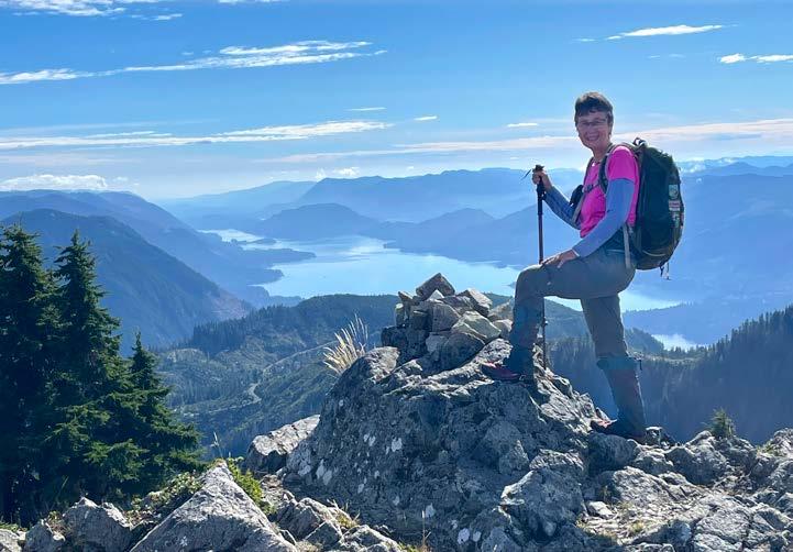
Mary hiking Heather Mountain
by Ron Dart
September 16-18/19
Partial Lunar Eclipse | Harvest Supermoon
Itimed our COC Whistler-Blackcomb trek to coincide with the Partial Lunar Eclipse or the Harvest Supermoon-such a sight to see for those who took to the night darkness under the thick star night, lamp of the night brightening mountains and lowlands. Whistler-Blackcomb in the snow white winter and Whistler-Blackcomb in the varied hued colours of autumn are different places to be.
Most arrived on Monday September 16th and we did a 3:00-5:00 pm round trip from the Hostel in Function Junction to see the much decorated and graffiti lush train wreck (occurred in 1956), box cars strewn in all directions— we minced across the swaying bridge that spans foaming Cheakamus river, fine photos taken of the many box cars now almost 70 years in the forest. Then, back to the Hostel for a lingering dinner and planned trek by Gondola to Blackcomb next day.
We had a slight delay on the gondola Tuesday September 17, so Vail gave us each $10 coupons. We were on Overlord-Decker loop trek from about 10:30 am-3:30 pm, a detour up the mountainside to Blackcomb Lake, then the Decker loop to lovely little Decker tarn (where we lunched). Owen, Carmen and Sue were so taken by Decker Peak, they summited the beauty (and such a beauty it is with spacious views) Thursday September 19th the day after our formal trek was over. We ended the day

with a variety of pizza dinners at the much admired Creekbread-Wood-fired Pizza in Creekside (site of the original Whistler back in 1965). We managed to negotiate much cheaper costs for the gondolas, so the easier elevation gain was not as expensive as initially thought.
Wednesday September 18th, it was up the gondola from Blackcomb, then Peak to Peak larger gondola across Fitzsimmons to Whistler. The mood was misty, not much to see as we headed up above Harmony Lake, higher still past Sun Bowl to Symphony Lake, clouds parting the higher we ascended, lush meadows before us, rock faces and ridges above us, Symphony Bowl a spacious gift, trail leading us onwards, upwards and forwards, High Note our mentor and guide. It was then to the crossroads near Piccolo Peak, Musical Bumps going in one direction, High Note backside of
Piccolo the other direction, azure blue Cheakamus Lake below us, across the Valley imposing Tusk. We concluded doing Half Note to Pika’s Traverse, a few in the group hoping to get to Whistler Peak but construction crews being stubborn and an obstinate No. The day ended with a fine dinner at Roland’s Pub and Restaurant in Creekside.
As mentioned above, a few in the group lingered at WB until September 19, Sue, Carmen and Owen doing a climb and scramble to the summit of Decker—it was a splendid 3-4 trip to WB and so much yet more to see—ski-snowshoe adventures yet before us at WB and the Callaghan Valley this winter.
history of the Canadian Group of 7—also one of the finest permanent collections in Canada of Emily Carr paintings—a must see if in WB Thursday-Sundays.

There was a light skiff of snow on the summit of Whistler and the upper ridge of 7th Heaven this week, so hopefully one and all last Spring did their deed to ULLR and we will have a snow bounty this winter, COC on the hills regularly.
Trip participants: Carmen Pellegrino, Owen Williams, Monique Simard, Irene Hofler, Heather Ramsay, Greg Schlitt, Tristin Bowman, Susan Abegg, Carol Campbell, and Ron Dart (trip organizer).
I might add that Audain Art Museum has a special collection of the paintings of Tom Thomson on until October 14th for those interested in the
Piz Gloria
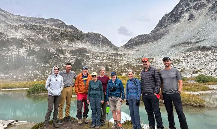
First, we acknowledge the Roland Burton hut lies on Squamish, Lil’wat, and St’at’imc lands. We also thank the ACC Whistler Section, the FMCBC, the AMS, and a number of individuals whose monetary contributions made this project possible.

My first experience of the Garibaldi Lake area was descending the icy Rubble Creek trail with a heavy pack after completing the Neve traverse. After that, I thought “This sucks, I think I won’t mind never visiting Burton hut”.
The week of the workhike as we paddled towards the hut in the rain and the dark; as we shivered through rain, sleet, snow, and wind socked in with no views, my sentiment about the hut remained the same. On Friday, the clouds revealed the vista
Read more about VOC’s adventures & hut repairs over the years on their website.
of Sphinx Bay. At that moment, I realized what a gem the hut was, and that I had to come back. This report draws from the following VOC Trip Reports. I recommend reading them, they’re all quite entertaining.
Gatorade Is A Spice: By Ryan Macdonald Fixing Roland’s Hut: By Duncan Macintyre
The Big Burton Hut Restoration: By Anton Afanassiev (Much of this report draws from Anton’s) Red Heather day trip: By Jeff
In mid-June, Joanna Gower, Simon Tsianikas, Parham Zarei, Julia Jancelewicz, and Luzie Hugger hiked up to Burton Hut to check on a reported roof leak. They found a roof in desperate need of care. This roof was made of an outer shell of sheet metal, a layer of tongue and groove (boards that can slide into each other to hold shape), insulation, and then plywood. The sheet metal was full of holes. The tongue-and-groove was waterlogged and rotten. The gothic arches supporting the roof had begun to delaminate. The roof had stood nobly for 50 years but was now on its last legs – Burton hut would need a new hat or it wouldn’t survive the winter.
With this news, the VOC community sprang into action. Cassandra Elphinstone led a small contingent of VOCers (Shu Yu Fan, Tom Curran, and Gabriel Csizmadia) up midweek to take some precise measurements of the roof. Jeff Mottershead took on the monumental task of redesigning the hut. Anton Afanassiev coordinated helicopters and VOC volunteers. The club’s experiences from 2023 building a new roof at the Brian Waddington hut proved invaluable and momentum built quickly. Crew rotations were established, arches were bent into shape, helicopters were booked, everyone was ready to spring into action. Everything came to a stuttering halt when BC Parks told us that we could not proceed until we received a Parks Use Permit (PUP). At this point, we had already spent tens of thousands of dollars and committed hundreds of man-hours. Waiting 180 days for the PUP to be reviewed meant construction wouldn’t start until December. Thankfully, once BC Parks understood the urgency of this project, they were very helpful and willing to work with us provided we met insurance and other requirements. Their responses were quite fast, but by the time authorization came our start date had to be pushed back. We would build from Sept. 23rd to Oct. 8th. It would be cold, the weather would be bad, and people would have classes to attend. Nonetheless, we were confident we could do it.
On Monday (Sept. 23), Ryan Macdonald and Duncan Macintyre trekked up to the hut with tool-laden packs. Their objective: Tear down the old roof, get as much debris out as possible when helicopters come. This small-but-mighty team worked furiously and had torn down ½ of the roof come Tuesday morning. Back at Rubble Creek on Monday night, Jeff, John Sherk, and Anton start staging materials for the helicopters. They stayed up all night bringing in supplies and watched for bandits who may want to steal $20,000 in lumber and metal. Tuesday was heli day. At base, the helicopter crew arrive with a fuel truck. Jeff arrives with a second flatbed of wood along with Alex Rigby and Dave Mackenzie. They start rigging slings and nets to transport 14,000 lbs in material up to the hut. At the hut, Ryan and Duncan continue demolition only pausing to unload the helicopter and reload it with debris. With 14 planned flights, the round-trip flying time of 15 minutes, and sling faff, the helicopter wranglers were in for a long day. While things were happening smoothly in the air, boots started to arrive on the ground. Will Beattie arrived at the hut in his packraft around 2pm. Jeff, John, Anton, Quintus Zhou, and Aaron Lee paddled across the lake in the dark around 9pm. At this point, the rain had begun, and a storm was brewing. It proved to be a restless night as winds picked up tents and tarps.
Wednesday was wet and cold. Most of our layers were still damp from last night’s rainy paddle - this would be the norm for the next couple of days. After a quick breakfast, we continued the demolition. The remaining tongue and groove came off, stubborn nails were ground down, and insulation was shoveled into bags. The insulation, dear reader, was particularly memorable. Firstly, since none of the original hut design documents survived, we did not expect to find spun fibreglass insulation. Second, this insulation was saturated
in mouse feces. In most places it was 50% feces, 50% insulation. In others, there were glorious piles of solid goods. Of course, for the duration of the demolition, a tropical cyclone paid us a visit and brought heavy rain. Result: a “poop soup” that slowly soaked the hut contents below. The shopvac we had brought up was a true saving grace. Since sheltering inside the hut was no longer palatable, John set up his Super-tarp. This tarp became a sanctuary and mess hall for the following weeks. Duncan and Quintus spearheaded a lunch from Emma Ghelfi’s cookbook, and we dug the Gatorade out of the box of spices for Gatorade tea. Gatorade would hereby be known as the Spice of Sphinx Bay. Invigorated by lunch, we finished demolition and by the end of the day there was new tongueand-groove (T&G) on the roof. Despite the conditions, we were quite productive and though we were physically quenched this day showed that the VOC’s fiery spirit is unquenchable.
the improved weather. With the arrival of Melissa Chen, Nolwenn Deschamps, Connor Jakes, Katie Sattler, Jacob Grossbard, and a ladder, progress through the weekend would be swift. We fastened the remaining arches, raised the apex beam, and raised the hut to replace ground beams and floor joists. After the (small) bout of rain, sunsets in the following days were truly glorious.
We dug the Gatorade out of the box of spices for Gatorade tea. Gatorade would hereby be known as the Spice of Sphinx Bay.
The snow came on Thursday, and it wasn’t long before we were again soaked and freezing. The snowline dropped to a couple hundred meters above the hut. Snow accumulated on our homemade scaffolding making it slightly sketchy. This didn’t stop us from finishing the T&G, applying roofnado (weatherproofing), and reinforcing the old arches with new ones. Around lunch we parted ways with Will, and Anton discovered Gatorade tuna. We fell asleep that night to the promise of better weather.
Friday was a good day. The Sun showed its face, Anton and Jeff upped the ante with tuna-oatorade (tuna, Gatorade, and oatmeal). Ryan and Aaron paddled home bringing boats for the fresh crew. They haul out awkwardly large bags of insulation and steel and leave reluctantly seeing
In Anton’s words, the weekend can only be described as toil: “The roof arches would need to be joined together with joists. 10 joists between each pair of arches, [14 pairs of arches]. These joists would attach to the arches with more of the dreaded Simpson Strong Ties. These took something like 16 nails per side…. [The nails] would bend the metal of the tie as they went in, ringing like pitons. They would also bend themselves as they went in due to the awkward angles (upside down, right next to the joist, etc..). For every set of nails we would hammer in, we would invariably spend 15 or more minutes battling with the ones we bent”.
On Monday (Sept. 30), the crew finished the tedious job of mounting roof joists. Melissa, Nolwenn, Connor, Katie, Quintus, and Duncan head home but not before hauling out more insulation. Jeff, John, Anton, and Jacob will hold the fort over the week. Packing new insulation was the next step and critically required dry conditions. This set the stage for a 24+ hour epic racing an incoming storm. The crew started packing insulation on the south side sometime after 1pm. This process went quickly. Framing over the insulation took much longer. Picture yourself trying to hammer a nail into springy wood onto a curved roof - the nails didn’t want to be driven in, nor stay in place.
As we worked past sunset, headlamps started dying. The raising of a moon-tower was called for (Milwaukee light ski-strapped to a 2x4). Around 2am, we finished framing and started putting on plywood. This was no easy task either: the curved roof again provided its challenges and there was a lot of exploratory nailing to find the studs under the plywood. The second layer of plywood would be screwed in which was nice relief from hammering. Soon the moon-tower set, and the sun rose Tuesday morning to a nearly sealed roof. Opting to forge on rather than tarp up and rest, the crew ripped through the roofnado application. By 8:30am, the job was done – just in time for the rain to arrive. With the last of their strength, Jeff, John Jacob, and Anton ate some food and crawled into their tents to sleep out the rain. What legends.
Tuesday would be a restday for all but Jeff. At some point in the afternoon, Jeff paddled across the lake to pick up supplies dropped by Joseph Chiao late Monday night. While the 4-man crew had their epic, Joseph had one of his own hauling up white gas, screws and nails, bleach, and morale boosting treats (read beer). Leaving 11pm Monday, Joseph – being an academic menace – was back in Vancouver for class Tuesday morning.
Wednesday rolled around and the 4-man crew tackled the north side of the roof. Very similar to Monday’s epic: the insulation must stay dry and bad weather was on the horizon. Armed with experience, the process was much smoother, and work finished at 3am. The clear night provided views of the Milky Way and a promise of good weather in the morning. Jacob took some amazing timelapses of this process.
There was indeed good weather Thursday, the storm would come later. To take advantage of the weather we worked on flashing; these are the roof’s end caps. This work required precision over brute force. There was more sheet metal snipping than hammering which was a relief. Two layers of flashing would go on with wire mesh in between to keep out the mice. We worked into the night to ensure everything was aligned well.
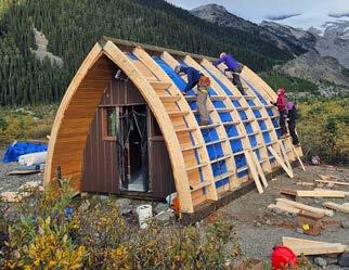
I think this is an appropriate place to sing an ode to Jeff. Throughout this project, Jeff uplifted morale, provided direction, and was patient with everyone as we learned how to hammer in nails or use impact drivers. Duncan remarked in his trip report, “Jeff works like a waterfall: ceaseless and always pounding. He starts shortly after dawn and ends well past dusk, taking only three twenty-minute breaks in the day to eat large quantities of food, without apparent care as to whether the food is delicious or bizarre.”
Rain arrived on Friday: perfect time to work on the hut’s interior. We would put up new insulation and panelling on the hut’s faces. We would also reassemble furniture as all this got torn out during the demolition due to mouse poop juice. As Anton recalled, “We only had a bale of Roxul [insulation] to cover all the gaps, so we had to be efficient. The bale had been manually hauled up by Anya Boardman in the days before, so it was extra valuable. This insulating task made the air itchy. It was a welcome break to go out in the rain and look for the missing panels”. There wasn’t enough insulation or vapour barrier to cover the whole roof, so we got creative and used scraps from the old hut and Tuck Tape. As the day progressed, it became clear that the weekend support crew wouldn’t arrive today. We kept busy filling air gaps anywhere in the hut and by re-assembling furniture. Since the furniture

had to be assembled very specifically and to sleepdeprived brains, this was a monumental challenge. Along with Saturday’s sunrise came fresh faces. Tom Curran, Ross Campbell, Haley Foladare, Daniel Schmidov, Jacob Ticehurst-Wong, and Stefanija Rekasius would be weekend force-multipliers. We started with sheet metal roofing where there was some panic when we realized our screws were too short to penetrate the ridges of the sheet metal into the plywood. However, brainstorming concluded we could just go through the flat part of the sheet metal instead. This left pre-drilled holes which Jeff would fill in his epic “day trip”. As people worked on the roof, Anton finished the interior and filled mouse-sized gaps with wood scraps. As people got tired, they came down to help. Daniel and Jacob TW helped with the table and later in the evening, Haley would help with the door’s weather stripping. This crew truly worked as a unit and by 2am, roofing was complete.
Sunday was spent rodent proofing, finishing the flashing, and shifting to clean-up mode. There was also a 15-person crew hiking up to pack out tools, trash, and other supplies. For some, this would
be their first VOC trip or their first time hiking with a large pack. Some packs weighed over 35kg, others were awkwardly loaded with tarps and bags of insulation. After making notable progress on flashing and putting wire mesh down to keep rodents out, it was time for Tom, Ross, Jacob TW, Haley, and Daniel to head home. They too packed out bulky or heavy loads.
In the evening, the rodent-proofing received its seal of approval when a stoat and a mouse tried entering the hut to no avail. As night fell, Jacob, John, and Anton shifted to clean-up mode as Jeff and Stefanija put finishing touches on the flashing. We recycled some material by building a boardwalk over puddles. We cut everything else into small pieces.
Anton describes the project’s closing moments: “Around 2:30 am, the moment came. Everything was done, everything was cleaned up. There was just one finishing touch left: the tall, shiny marker at the top of the hut. Jeff did the honors. We popped a bottle of champagne. Life felt good. We felt accomplished. That night Jacob, John, and I would stay in the hut. We had sent our tents away to make more room to carry down tools the next day. To celebrate more, we cracked some of the beers Joe had carried up for us. I got about 1/4 of a can down before I fell asleep mid-conversation”.
Monday (Oct. 7) morning, the crew woke up with a finished hut. Basking in this glorious moment, bags were packed, and they paddled across the lake. Packs were so heavy they needed to help each other stand (Jeff’s pack weighed 100lbs!). Needless to say, the hike down was a sufferfest. But soon, everyone was in town and the project was a complete success.
To find out more about the Varsity Outdoor Club UBC, head over to our website.
by Dave Wharton

Ifirst met Barry in early March, 2017. Brian Wood and Pat Harrison (both well known, well respected members of the FMCBC) and I, were coming to a long day of interviews for the position of Executive Director for the FMCBC. There had been some strong candidates! Barry was the last candidate we would interview. It was quickly apparent that Barry had taken considerable time to prepare for this interview, and he arrived with a briefcase of materials that he described as; “This is the homework I have been doing to learn about the FMCBC”.
Following the interview, Barry thanked us for the opportunity, shook our hands, and left to catch a ferry back to his home in Gibsons. The 3 of us were quickly unanimous in deciding that Barry be the first to be offered the position, and an offer letter was composed, and sent to Barry. Within a few
weeks he commenced his employment with the FMCBC.
Barry was a long time resident of Gibsons, and shared a home there with his wife Jane, and their 3 sons. When he accepted the position of Executive Director, Barry was perhaps known both in his home town, and beyond, as having served 4 terms as Mayor of Gibsons. He began his career in local politics as a member of the Gibsons Municipal Council in the ‘90s. And prior to that had worked as both a helicopter and small plane pilot, as well as working as a log scaler in the forest industry. But that work history in the forest industry did not prevent Barry becoming involved in environmental issues such as the Tetrahedron Resource Use Plan, which helped lead to the creation of Tetrahedron Provincial Park.
Barry was the Executive Director of the FMCBC while I was FMCBC President. As a result I had many occasions to travel to Gibsons to meet with Barry. To state that Barry was not only well known, but also well liked and respected, would be a significant understatement! One could hardly walk down the street with him or join him for coffee, without being constantly interrupted by well wishers stopping to chat and shake his hand. If you met Barry for the first time and perhaps thought him familiar, you may have seen him as a movie extra in the hit TV show, The Beachcombers.
I attended a number of gatherings with Barry; meetings in Victoria with sitting Ministers and MLAs, and also, and equally, with members of the opposition, but also with municipal government officials at the annual “Union of BC Municipalities”
convention. He was always prepared and knew the issues from every angle. His non-confrontational approach helped to assure that those with numerous competing priorities, would do their best to make time to meet with us. I fully believe that Barry’s warm personality, thoroughness in learning and understanding all sides of an issue, and confidence, was key in helping others appreciate the important role that the FMCBC has in advocating on behalf of self propelled backcountry recreation in B.C. Barry, as I got to know him, became a friend. I will miss him, his honesty and integrity, his equal treatment of everybody, no
matter who they where. Barry was diagnosed, in 2023, with a type of brain cancer. He responded quite well to initial treaments, and was able to live comfortably until his illness returned aggresively in summer, 2024. He died on November 26th. He was 71. As I have heard numerous times since then; “The world could do with a lot more people like Barry Janyk, it would be a better place”.
My sincerest condolences to Jane and his sons, to his extended family, his close friends, and all others whose lives are a little better for having met him.
I have sitting before me Jack Christie’s, The Whistler Outdoors Guide (1992), The Whistler Book: An All-Season Outdoor Guide (2005) and Brian Finestone/Kevin Hodder’s Whistler Hiking Guide (2009). Needless to say, there have been other Whistler hiking guide books before these three books, but all previous books shrink in comparison to the recently published book by Marc Bourdon, Whistler Hiking (2024).
Whistler Hiking is divided into three main sections with, understandably so, the front stage given to a detailed, visual and evocative approach to the shorter, medium and longer treks in the Whistler area. Part I of the book (“Introduction”), rightly so, highlights some of the need to know historic background to Whistler and basic safety precautions for trekking in the mountains.
Part II (“Whistler Hikes”) is the main actor on the stage and Part III (“Wildflowers”) is an almost exhaustive overview of many of the alpine and subalpine flowers in the region. But, to the main stage and actor—the varied hikes.
“Whistler Hikes” occupies the bulk of the book (pages 40-265) and 56 hikes are aptly described in a nuanced and attractive way and manner. Although the title of the book seems to be about Whistler hikes, there is much more than only Whistler hikes in this comprehensive overview of rambles in the area. The 1st hike noted is Garibaldi Lake (lingering in the Garibaldi
by Marc Bourdon
area for a few hikes), then inching northward to the multiple treks in the Whistler area and the tome comes to a fit end further north of Whistler into the Joffre Lakes and Anniversary Glacier (#56) bounty of a hike, Motel 66 not to miss.
The sheer abundance of photographs, sketches, paintings, maps, elevation gain, distances and return times makes this a must have hiking guide from north of Squamish to Marriot Basin-Wendy Thompson Hut (#54), Rohr Lake (#55) to Anniversary Glacier. The Glossary makes for a fine bookend and for those unacquainted with mountain lore and jargon a few more words to up the vocabulary. My wife, friends and I have trekked about in the area since the late 1970s, enjoyed many a full moon meander under the star thick lamps of the night, bunked in at huts and tents, lived through many a white out, blue canopy day and sun burning off mist mornings-memories aplenty. I have not a moments doubt in recommending Whistler Hikes as the finest and best book now published on those keen and eager to explore and see the many beauties waiting to be seen for those willing to do the work—a real 10 bell book that one and all curious about seeing more than most tourists do should own as their mountain guide and mentor, their friend of sorts on the trails, rock ridges and inviting peaks.
montani semper liber, Ron Dart
by Diane Whiteley
Photo by Diane Whiteley
It was mid-July, almost time. My husband, Don, and I, as organizers of the 2024 North Shore Hikers (NSH) Summer Camp in the West Kootenays, were keeping a close eye on the fire situation. The snowpack had been higher in the West Kootenays than elsewhere in the province, and there were no fires anywhere near our destination.
So, on July 19th, when we headed out, we were smiling. Seventeen enthusiastic hikers were getting ready to come to camp and life was good! We left for camp a few days early, planning to stay in Summerland for 4 days at a home exchange right on Okanagan Lake. From there we’d head for Kokanee Creek campground on July 23rd, a day before the start of camp.
Oh no! The best laid plans… Our home exchange in Summerland got cancelled. We quickly pivoted and found another one further south just a few minutes’ walk from Osoyoos Lake. Thank goodness, we thought. But, it was 37 C when we arrived and got up to 42 C one day! We spent our time in the lake.
It was cooler (26 C) on the 23rd, the day we left for the first 3 days of camp, based at Kokanee Creek near Nelson. We were worried, though. There were now fires near New Denver, our base camp after Kokanee Creek, and they were growing. The town was on evacuation alert.
Oh no! I started getting emails. Our hikers were cancelling. They were hearing stories of heavy smoke and out-of-control fires. By the time we got to Kokanee Creek, the only campers left were Don and me and Craig, originally from nearby Trail.
Ironically, the air quality at the campground was fine and the warm, inviting Kootenay Lake was great for swimming.
Craig arrived on the 24th and set up a gold medal winning camp: a large tent with sitting room in the front and bedroom in the rear, a large barbecue for grilling luscious steaks and a variety of musical instruments for entertaining guests. At future camps, consider sharing a campsite with Craig, if we don’t get there first!
On the morning of July 25th the sky was blue, and the air was clear. We set out to hike in Kokanee Glacier Park, planned destination, the Glacier cabin. The air got a bit smoky as we drove to the trailhead, but it was still pretty good when we set out. The wildflowers were in full bloom, the trail conditions were excellent, and we were a happy group of 3. After about an hour we turned a corner and saw heavy smoke in the distance. Oh no! We continued as far as Kokanee Pass. The smoke was getting worse. Craig and I were keen to continue. But, after an impromptu lecture from Dr. Don (retired) on fine particulate matter and what it does to your lungs, we agreed to turn around.
On the way down, we met a dad and his young son. We stopped to chat, and Dr. Don got into a discussion with them about which is worse for hikers—mosquitoes or smoke? The youngster said his dad thought mosquitoes were worse. By the time Dr. Don, expert on tropical medicine, finished his impromptu lecture on mosquitoes that carry malaria, dengue fever, zika virus etc., the young boy’s eyes were wide and worried. Dad and son continued into the smoky haze. Hopefully, they did not run into any mosquitoes!
As we drove back to camp, we heard lots of thunder. Oh no! A heavy cloudburst had hit the campground. Craig hadn’t put the fly on his tent. Not good. And, the washrooms and showers were closed. The thunderstorm had brought down a tree on a nearby powerline. So much for automatic flush

and motion sensor faucets! Luckily, there were a couple of outhouses. The power did not come on until the following morning.
The 26th was clear and sunny. We headed for a hike at Whitewater ski area. We started our hike on the Alpine trail that took us across ski slopes abundant with wildflowers —beargrass, lupins, arnica, valerian, paintbrush, aspen fleabane etc. We came to an intersection and followed the trail along a high ridge over the minor summits of Hummingbird and Prospector. On the way back we got to watch a pika eat his lunch. So cute!
On the 27th, we parted ways with Craig. Before he left, we awarded Craig 3 gold medals—for showing up, having the best camp and for sharing his copious knowledge of local lore. Craig headed for Mable Lake. Don and I headed north through smoky New Denver and Nakusp to the ferry across Arrow Lake at Galena Bay. We saw several, small fires en route. Indeed, there were fires very close to Shelter Bay where the ferry docks. During the drive I managed to book the last available camping cabin at Canyon Hot Springs. We wanted a roof over our head because rain was in the forecast.
It didn’t rain and the 28th dawned sunny and clear. There was smoke in the valley below but the
alpine area in Revelstoke National Park was clear and perfect for the hike to Jade and Eva Lakes, a spectacular trail!
The last two days of summer camp were supposed to be at Sol Mountain Lodge, where 8 of us had booked 2 nights. Our time there got cancelled, but we had the option to book in August or September.
So, on July 29th, we headed for Manning Park. We were in no hurry since it was showery. We decided to take highway 5A from Kamloops to Princeton. There were few cars. It’s a beautiful drive along a valley with lake after lake, surrounded by rolling hills and grasslands. Highly recommended!
We arrived at Manning. All the tenting campsites were full. So, we tried the new RV campground, Skyview, near Lightening Lake. Tent: no problem. We camped there for 2 nights. It’s designed for RVs but turned out to be a good choice for tenting too. We had our own water tap and electrical outlet where we hooked up our cooler, which has an electric option. The shower building is brand new, and the two ‘outhouses’ had flush toilets and sinks. We were puzzled about the forest all through Manning Park. The trees are brown and unhealthy looking. We found out the park has been invaded by Spruce Bud Worms. We wondered. Was this also a result of climate change?
From the campground, it was a short walk to Lightening Lake where Don headed off to fish. The fishing was good—two fresh Rainbow trout for supper! The next day we hiked to the peak of Mt. Frosty, a hike that Don had never done. It was a perfect day in all respects.
As mentioned, the last two days of summer camp were supposed to be in the Monashees at Sol Mountain Lodge, but our reservation got cancelled due to a fire on the access FSR. We had the option to book later and did. We opted for September 20th and 21st 2024, the last two nights the lodge was open for hiking.
It was a splendid time of year to be at Sol. On the 21st we decided to hike Mt. Fosthall, an icon in Monashees Provincial Park. It was a stunning hike on a perfect, sunny day. The frost quickly disappeared, and we were stripping off layers after the first hill. The first part of the trail is moderate uphill as it wends it way towards South Cariboo Pass. Then it heads downhill before getting to the steep climb to the summit (2697 m) over rocks, small boulders and scree. The summit is an 1177 m climb from the trailhead at the lodge. The last section was steep and slippery. I stopped to put on my Yak Tracks and was glad I had them.
The effort of the climb was well worth it. The views of the surrounding Monashees are indescribably beautiful. There are vistas of lakes and mountains in every direction! It was not windy. Mt. Fosthall is known for the roaring winds at the summit. We were extremely lucky! The 20 km round trip took us about 6 hours. We thought we were slow but learned that was a good time, given the routefinding and slippery slopes.
Much to our surprise, it was a darn good summer camp in spite of oppressive heat, wildfires, smoke and pestilence.
• Preparation always beats planning. Planning expects order; preparation expects chaos. (Sahil Bloom, venture capitalist)
• Flexibility is key, if your planned itinerary can’t be done.
• Keep an open mind. Be ready for new discoveries.
• Listen to Dr. Don. Don’t hike in moderate to heavy smoke and avoid mosquitoes!
• If possible, avoid fire season when you schedule summer camp. The climate has changed, and we need to adjust.
by Mike Nash

Jasper is a National, not a Provincial Park and we all have an interest in it. This is especially the case for Prince George, with a driving distance on the lightly travelled and wonderfully scenic Yellowhead Highway of only 375 kilometres. We can be there in four or five hours of easy driving. By comparison, the other closest cities to Jasper are Edmonton at 364 kilometres and Kamloops at 445 kilometres, all within half a day’s drive of the park.
Jasper National Park (JNP) shares a long border with BC’s flagship Mount Robson Provincial Park, a highlight of which is Robson Pass where JNP’s North Boundary Trail meets BC’s world class Berg Lake Trail, which will be fully reopened in 2025. JNP also borders Alberta’s Wilmore Wildness Provincial Park to the north, which in turn connects with another significant BC park, Kakwa. And through it all runs the increasingly popular Great Divide Trail (GDT). Starting from Waterton Lakes, where it connects with the U.S. Continental Divide Trail
JASPER IS IN ALBERTA— WHAT’S ITS RELEVANCE TO BC?
(CDT), it criss-crosses in and out of BC and Alberta before ending at Kakwa Lake in the heart of Kakwa Provincial Park. To the south, JNP borders BC’s lesser-known Hamber Provincial Park; and at its southern boundary connects with Canada’s iconic Banff National Park. BC’s mighty Fraser River rises in Mount Robson Provincial Park, just west of JNP’s popular Amethyst Lakes area. And if all this isn’t enough, BC’s Fort St. James National Historic Site is part of JNP’s remit.
Many Prince Georgians use JNP’s front and backcountry trails and campsites, all seemingly on our doorstep. For myself, when I became a septuagenarian and began stepping back from exploratory backpacking trips in remoter parts of BC, I re-embraced the popular backpacking trails in Jasper and other Rocky Mountain parks, including JNP’s Skyline Trail, the Brazeau Loop and Amethyst Lakes. We would typically stage each of these trips at both the front and back end with a frontcountry camp in Jasper and the welcome opportunity for
a restaurant meal. (Unfortunately, my favourite Jasper restaurant did not survive the fire).
From a group perspective, the Caledonia Ramblers Hiking Club and the Prince George Section of the Alpine Club of Canada (ACC) sometimes hold multi-day camping, hiking, skiing and climbing trips in JNP, typically on long weekends. My neighbour, a retired cop, even joined the Jasper Section of the ACC in order to participate in their climbing and ice-climbing trips in the park. For these recreational reasons, JNP is important to the people of BC and is why we have asked them for many years to extend their annual public forum to Prince George, as they used to do for Edmonton; which, thanks to the Covid pandemic and the rise of Zoom they have now begun to do.
Jasper is even more relevant to its immediate neighbours in BC. I had a conversation in Tête Jaune in September with a Valemount resident who told me that his community had been hard hit by the loss of tourists on the traditional circle route through JNP and the Robson Valley as a consequence of the fire. Coming on the heels of the pandemic and the recent departure of pipeline workers, this created a triple economic whammy for Valemount. This individual felt that JNP could have been doing more prescribed burns south of Jasper. However, given the scale of the MPB impact, planning complexity, waiting for ideal burn conditions, risk of loss of control of large scale burns close to the community with its scattered tourist facilities throughout the interface, this was probably infeasible. In any event, extreme winddriven flying embers of the July firestorm would likely have rendered such efforts moot.
Most importantly for BC, the lessons learned in the July 2024 Jasper wildfire are yet another wakeup call for forest-based communities throughout the province. On a personal level, we all now have to be cognizant of the new weather regime we are living with. My wife and I hiked out of Berg Lake early in June 2021 to avoid 40 C temperatures in the midst of the Heat Dome, missing the flood
and debris flow disaster there by just two days. In July 2024, we cancelled a four-day backpacking trip we had booked into Amethyst Lakes because of yet another heat wave, thus avoiding hiking out to the Portal Creek trailhead, near the worst of the conflagration, on the morning of the Jasper wildfire evacuation.
Wildfire has been top-of-mind in JNP annual public forums held each spring in the town of Jasper for the past several years. The risk had become increasingly obvious as whole mountainsides turned red with mountain pine beetle (MPB) killed trees. In reality, the danger had been growing for many years as a result of century-long changes to the fire regime. The shift away from historic indigenous cultural burning, increased suppression of naturally-caused wildfires, and the reintroduction of elk impacting deciduous tree succession, meant that the grassland, shrub, and young open forests of the early 20th century slowly gave way to late-succession conifer forests. The resulting overabundance of mature conifers posed an increasing fire danger to Jasper, but it took the MPB and our increasingly hot summers to make that starkly clear. As we had already learned in BC, the loose bark of dead conifers combined with high winds can result in burning embers flying for kilometres, causing widespread spot fires that can quickly overwhelm fire-fighting efforts. In the August 2003 Okanagan Mountain Park Fire in Kelowna, burning embers were easily able to cross Lake Okanagan and ignite fires on the other side; and in the Prince George area, embers were reported as having traveled up to 11 kilometres. This seems to have become a defining feature of wildfires in Canada and the U.S. in this changing climatic era.
In response to the increasing risk, JNP undertook significant wildfire mitigation work over the past two decades. Concern about fire threat from BC as the MPB spread into adjacent Mount Robson Provincial Park led to the large Moose Lake prescribed burn a decade or so ago in the Yellowhead Pass, creating a natural fire break in the Highway 16 corridor west of Jasper. Then, about six years ago JNP undertook
a multi-year logging program on the benches immediately above and west of the town, further protecting it from fire on its northwest side.
However, as the MPB spread farther into JNP, the fire risk became very evident south of the town with vast swaths of newly dead trees. Given the scale of the changes, there wasn’t much to be done on most of the affected landscape short of large, risky prescribed burns; but much work was done clearing dead trees from the three main front country campsites immediately south of the town. It seemed that Jasper stood a good chance of avoiding a fire disaster given a few years for MPB-killed trees to lose their bark and start falling down, and for more fire resilient deciduous trees to colonize new forest openings. Unfortunately, Nature didn’t wait, and in the face of July’s southerly winds reportedly in excess of 100 kph driving lightning-caused fires rapidly northward, the work that had been done was not enough.
There was no denying to anyone who has spent time camping and hiking in the valley south of Jasper in recent years that the specter of vast areas of dead and dying pine was sobering. I had previously asked about fire evacuation plans at more than one Jasper public forum as I had not seen any posted signs in campgrounds or at trailheads, such as BC Parks had done on the nearby Berg Lake Trail. That premonitory action by BC Parks may have helped in the evacuation there during the 2021 flood and debris flow disaster that closed much of that trail for four years. In the case of JNP, the large number of variables likely limited the posting of specific muster and evacuation plans; but it appears they had done the essential ‘what-if’ work behind the scenes.
Looking at the map of lost and damaged property in Jasper, it is tragic to see how much was lost, but also a relief that most of the town and key infrastructure remained intact with no loss of life among thousands of residents and visitors. The planning and mitigation work, together with the remarkable
job that firefighters did in extreme circumstances, paid off. JNP and town officials successfully evacuated, on the one remaining open highway west into BC, some 25,000 residents and visitors in the middle of the night, plus front country, and later, backcountry campers. The outcome could have been so much worse, although tragically one firefighter died a few days later after being struck by a falling tree. The key point is that Jasper appears to have punched above its weight relative to other forest communities with respect to wildfire preparedness, and it wasn’t enough. Nothing could stop the wind-driven firestorm that swept up the valley from the south in July 2024.
The extent of the JNP fire complex in the aftermath of the disaster is staggering: 35 kilometres of the Icefield Parkway corridor from Athabasca Falls north to the town of Jasper, extending to the treeline on both sides of the wide valley, burned.
Infrastructure will be rebuilt over time, and the valley south of the community will be ecologically more resilient because of the fire. The inevitable criss-crossed downed tree stems will make travel difficult for wildlife and might pose risks of soildamaging ground fires, but the principal firestorm risk has likely been alleviated for now, and the downed trees will decay in time. From what I could see from the highway, the July 2024 wildfire was mostly a canopy fire with green vegetation evident just a few weeks later. However, high on the west side of the valley, I could see large swaths of
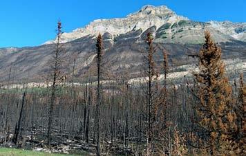
forest that appeared from a distance to have been flattened, reminiscent of the 1908 Tunguska event in Siberia. Indeed, there is speculation about a 1,000+ Celsius fire-driven tornado there that literally tore trees from the ground. Nothing could stand in the way of that.
In time, Jasper may come to be seen as a success story, not unlike the aftermath of the 1988 Yellowstone fire. However, one cannot easily speak of this to a resident or business owner who has lost their property and/or livelihood. The bottom line is that it’s time for B.C. and Canada to put more resources into wildfire mitigation and fire management planning. We can either do this up front, or pay a heavier price on the back end of the inevitable fires to come.
I spent two nights in Jasper on the week of November 11th and from what I could see, rapid progress is being made both in the town and outside, with a lot of construction equipment and activity in evidence. Along the Icefield Parkway, for example, many fire-killed trees have been cut adjacent to the highway since I was last there in early September, presumably to remove future danger trees. Similar work is starting on some trails. Jasper is open for business and they are anxious to welcome visitors to help support residents renew their economy. However, I was told by a hotel desk clerk that there is still a lot of post-traumatic stress disorder (PTSD) in the community that’s likely to persist for some time, and folks are happy to talk about everything EXCEPT how they were affected by the fire. Tellingly, the mini-bus driver who took us from Jasper to Lake Louise (I had arrived the evening before from Prince George on Via Rail) gave interpretive commentaries as we drove over the Icefield Parkway, but not a single word about the fire or its aftermath through the entire 35-kilometre fire zone. I imagine that will change with time and it will become an essential interpretive feature, but for now it’s too raw.
As for things to do in Jasper, there are plenty of stores, restaurants, hotels, gas stations now open, and almost all of the day-use trails around the town are also open. Directly affected parts of the town itself, and much of the backcountry remained closed as of early November, although apparently the Skyline Trail was already open for winter use from its south end at Maligne Lake as far as Tekarra campsite. The north end of the Skyline down to the Maligne Canyon area, as well as the side trail west out from Curator via Wabasso Lake are closed. Indeed, the day use trails into Wabasso Lake and the nearby popular Cinq Lakes area appear for the moment to be fire-burned wastelands and are still closed. It is likely that extensive trail clearing and danger tree removal will have to be done before these trails can be reopened. The physical pavement up to the popular Mount Edith Cavell and the Tonquin Valley trailhead was relatively undamaged, so most restoration there will presumably be removal of danger trees. The ambience will obviously be different, but on the flip side it will be interesting to watch the gradual vegetation renewal begin next spring. The Marmot Basin ski hill (my favourite, anywhere) escaped intact (just) and will likely be open for this winter season.
As for next year’s plans for backcountry trails, the JNP Ranger with whom I spoke told me to watch Parks Canada’s website from January on as there will likely be staggered openings as access, trailhead and trailside restoration work proceeds. A few days later, on November 15th it was officially announced that most of JNP’s frontcountry campsites, with the exception of Wabasso and Whirlpool, and all backcountry campsites will be open in 2025. An interactive map gives real-time updates on open facilities and sites. Rather than staying away, therefore, we can support Jasper by visiting and spending money in the community, at the same time taking an opportunity to experience the wonder of Nature’s renewal, and human infrastructure reconstruction. My suggestion to FMCBC members is to consider a skiing, hiking, backpacking or climbing trip to Jasper in the next 12
months. Whether you choose to stay in a hotel or camp, it will likely be rewarding both for you and for the local community. You could combine this with a backpacking trip on the newly re-opened Berg Lake Trail that is planned for the summer of 2025. Or, if you’re coming from the lower mainland or Vancouver Island, an option to avoiding the two-day drive to Jasper, would be to fly to Prince George, spend a day or two here to enjoy our city trails such as Forests for the World, the Cranbrook Hill Greenway, the Heritage River Trail or the Gunn Trail, then take a step back in time with an economical, eight-hour Via Rail ride through the Rocky Mountain Trench to Jasper.
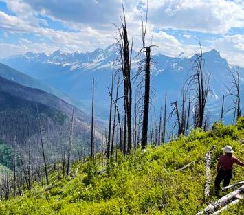
Photo by Jill Harvey

by Paula McGahon
In May 2024, 25 members of the Outdoor Club of Victoria (OCV) spent two enjoyable and exciting weeks hiking in three US National parks and 1 Utah state attraction. The majority of hikers flew to Las Vegas and rented SUVs and gathered the following day at Yavapai lodge in Grand Canyon village. Yavapai lodge was, frankly, chosen as it is the most economical lodge in the village, and very close to the coach system servicing the trailheads.

We spent three days and offered three hikes at various levels in each day in the Grand Canyon. The weather was warm, about 24C: all of the hikers enjoyed the views and the orangey purple views of the canyon. Hikers photographed the three major hiking areas—South Kaibob, Bright Angel and the Grand Canyon Rim trail. An interesting note: The canyon has exhausted the water available from the Colorado river and is working on a project to siphon water up to the Canyon Rim from Bright Angel River.

Bryce Canyon proved to be the group’s favourite national park - located at 9,000 ft—the weather conditions differed from the Grand Canyon: - 4C at night and + 6C during the day. The hoodoos at Bryce are extraordinary—a picture replaces a thousand words. We spent two full days enjoying a wide variety of hikes in the area.
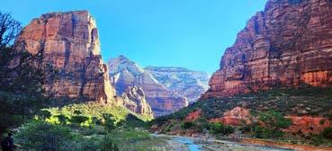
The group moved forward to Lake Powell for a single full day to visit Antelope Canyon—a worldfamous slot Canyon located on Navajo territory. The weather did not cooperate, a major sandstorm resulted in some tours being postponed to the following day. Hiking was challenging: a friend wondered about the bad fake tan on my legs, before realizing the wind had imbedded the local red sand into my sunscreen cream!
Zion is magnificent; a huge massif eroded by the Virgin River. Mountains were named by the Mormon elders for Old Testament prophets. Slabs of rock plunge down 3,000 feet. Our group was not successful in obtaining a ticket to hike Angel’s Landing, a very challenging hike on a narrow precipitous trail. The unique trail follows a semicircle formed by ancient volcano core. Most of our hikers did the ascent to the start of Angel’s Landing via Walter’s wiggles. Suddenly, the weather became a challenge, reaching 30C daily. As usual we provided three hikes daily for a variety of levels. Hiking the famous “Narrows” was not possible as the river was running too high.


