portfolio
FLAVIO GRIMALDI
Landscape Architect Consultant
• Landscape Architecture
• Urban Design
• Geographic Information System (GIS)
• Graphics


Landscape Architect Consultant
• Landscape Architecture
• Urban Design
• Geographic Information System (GIS)
• Graphics
Landscape Architect Consultant
PERSONAL INFORMATION
I am an adaptable, innovative and creative Landscape Designer, working through the Path to Chartership.
I am a Licentiate Member of the Landscape Institute with over 9 years of experience in practice.
I have a Master’s Degree in Urban and Regional Design which enhances my understanding of planning and environmental issues.
Able to demonstrate a high level of proficiency with different design software to produce high quality graphics that clearly communicate information, concept and data with a particular ability with the use of the Geographic Information Systems to manage and manipulate data useful to support visual documentation such as LVIA, LVA, ES, EIA, Landscape Character Assessments, Capacity Studies, Habitat Classification, BNG metrics
flaviogrimaldi@hotmail.it
Landscape Architect Consultant Apr 2024 – Current Ecus ltd
• Responsible for the LVIA and LVA baseline and desktop studies: writing reports, GIS support, site visits, visual representation, liaising with authorities and clients.
• Delivering drawings for multiple phases of planning submissions with particular attention to Landscape Masterplans, Planting Plans and Outline Specifications.
Graphics Lead/ Landscape Architect Oct 2020 – Apr 2024
Burton Reid Associates
• nvolved in graphics tasks for Ecological and Landscape purposes. Graphics include marketing packages for brochures, project sample sheets, report templates, CAD layouts, illustrations. Responsiblefor the rebranding and marketing strategy process of the organisation,
• Providing GIS support mapping, digitising, and provinding various alternatives to show data and analysis. Responsible for data management, licenses, data contracts, Wales Landmap data management.
• Involved in preparation of: Landscape Character Assessments, LVA, LVIA, Capacity/Sensitivity Assessment, DAS.
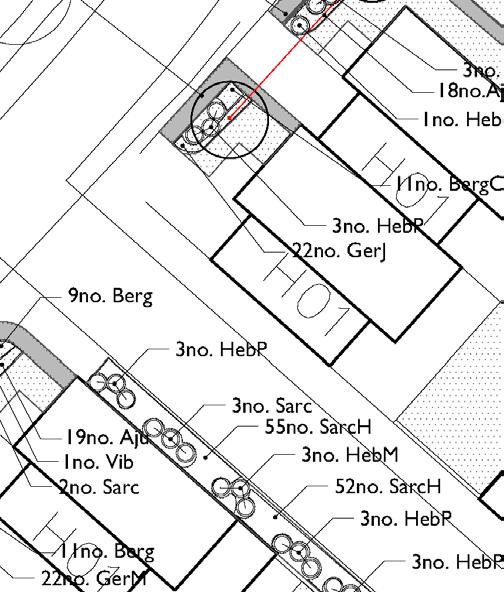
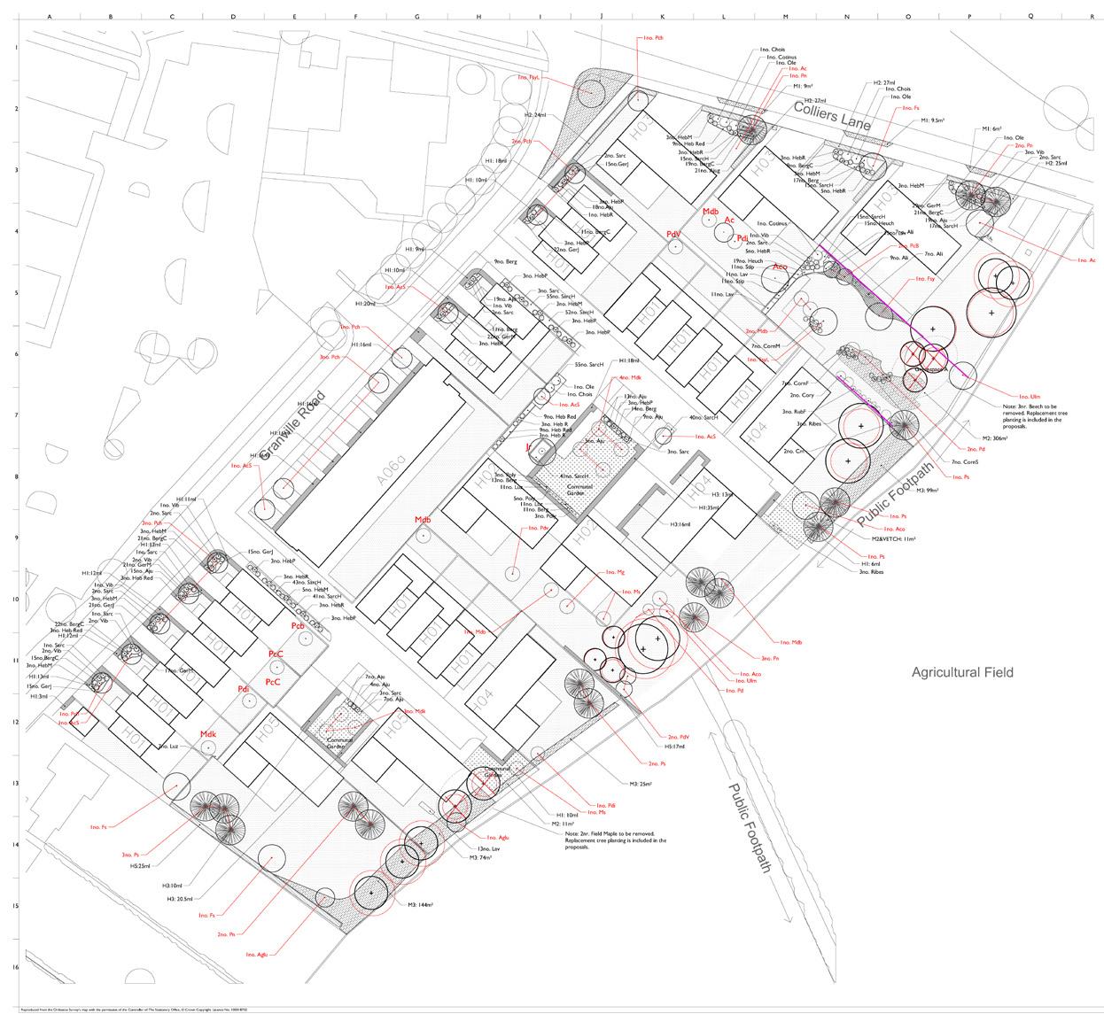
• Preparation of documentation for planning submissions, such as concept plans, parameter plans, cross sections, DAS, masterplans, planting plans, general arrangement, housing development layouts, transport schemes and landscape specifications.
GIS Professional/ Graduate landscape Architect Nov 2015 – Aug 2020
Nicholas Pearson Associates
Providing GIS support for Landscape and Visual Impact Assessment, Environmental Impact Assessment and Ecology Survey with attention to National policies and Designations. Proficiency with Zone of Theoretical Visibility analysis, feasibility for new developments, 3D modelling, Lidar and other simulations.
First OS point of contact, and responsible for data management, Licenses, data contracts. Ability to conduct studies and assessments to use in the writing and development of urban design and planning.
Proficient with providing solutions and high quality graphics such as drawings and maps for multiple phases of the planning submissions that clearly communicate information and proposals to different audience and expertise, in particular public consultation, exhibition, authorities, developers, stakeholders. Occasionally working on 3D Studio Max models for visual purpose.
Internship: Graduate GIS 2013 – 2014
Tuscan Regional Committee, Legambiente Toscana
Monitoring, evaluating, land management for reducing hydro-geologic risk; GIS analysis of geotechnical and geohazard risks;
• Regeneration of open spaces design with attention on the flood risk of the areas;
Publication of scientific reports: guidelines for future urban expansions and potential risking areas.
Internship: Junior GIS 2012
Council of Florence,Planning and Urban Direction
GIS Procedures regarding the coordination of urban development (urban planning, urban services and functions, infrastructure and mobility). Database management.
My UK experience includes:
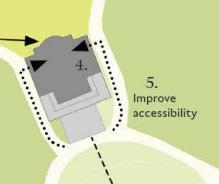
• Tintagel Castle Footbridge and Footpath Improvements for English Heritage,
• The A30 Honiton to Devonshire inn Road improvement scheme for Devon County Council,
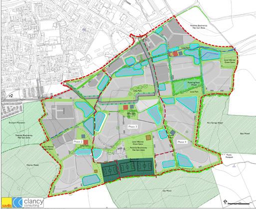
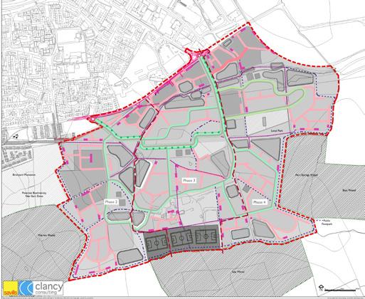
• Gainsborough Nothern Neighbourhood urban expansion Masterplan,
• North Stevenage Landscape Masterplan.
• Eand north east of Redbourne LVIA and Masterplan,
• Ensleigh South residential open spaces Landscape Masterplan,
• Roath Brook flood defence scheme,
• Warren Wood, Urban Extension and Landscape Masterplan,
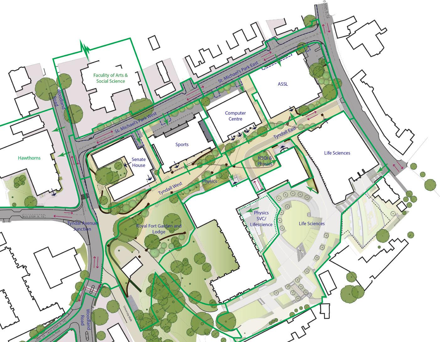
• Tyndall Avenue public realm in Bristol.
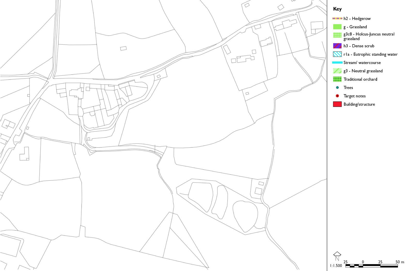
• Teignbridge District Landscape Character Assessment GIS and report update.
• Landmap data management for (LCA) Carmarthenshire County Council (Wales)
• Stowe Gardens Design, Buckinghamshire, for the National Trust
• Angel Gardens, Liverpool Landscape Masterplan
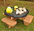
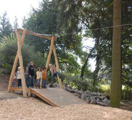
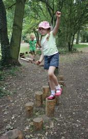
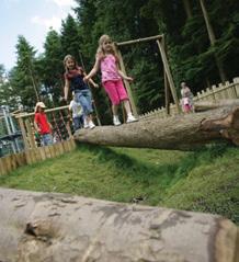
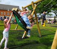
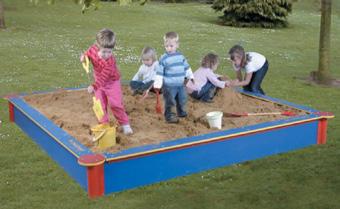
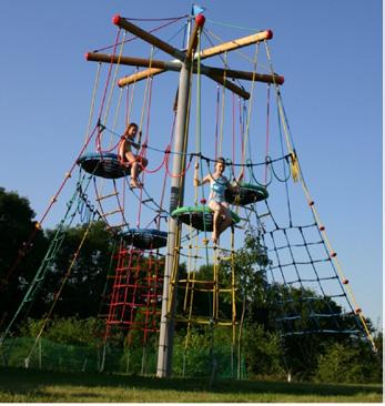
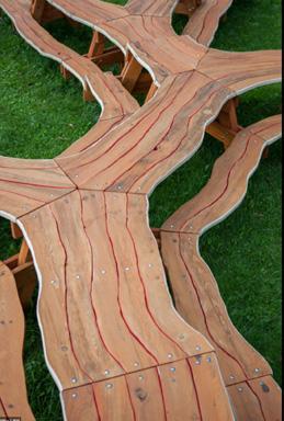
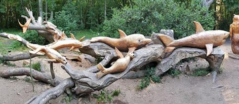
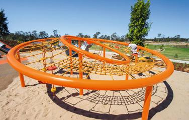
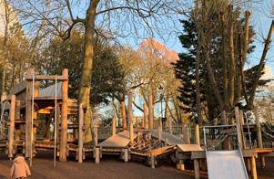
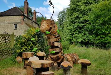
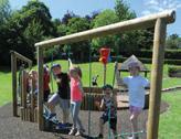
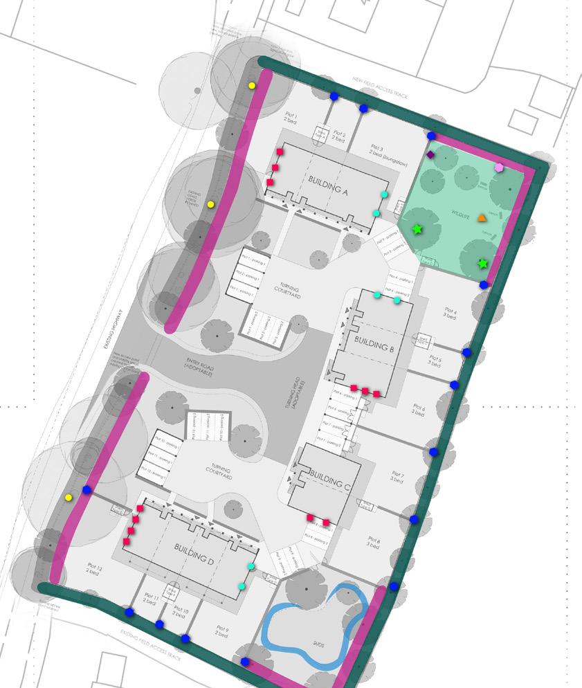
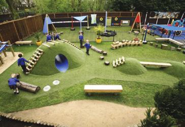
• Barnby Dun Landscape Masterplan and Playground Design,
• MSc (Hons), BSc
• Licentiate Member of the Landscape institute
• Associate Member of the Royal Town Planning Institute
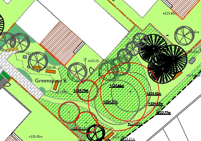
Ensleigh South General

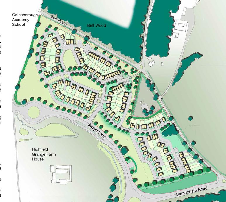
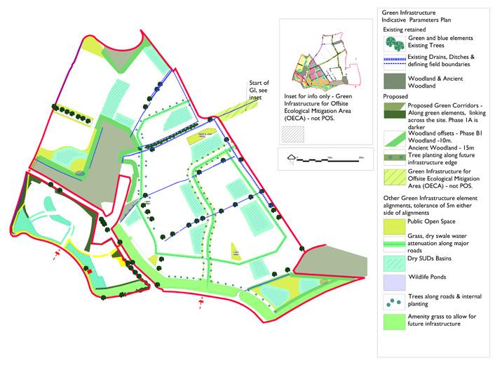
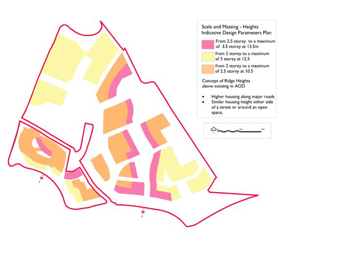
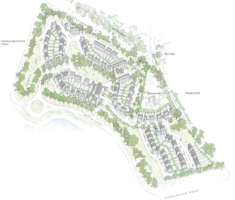
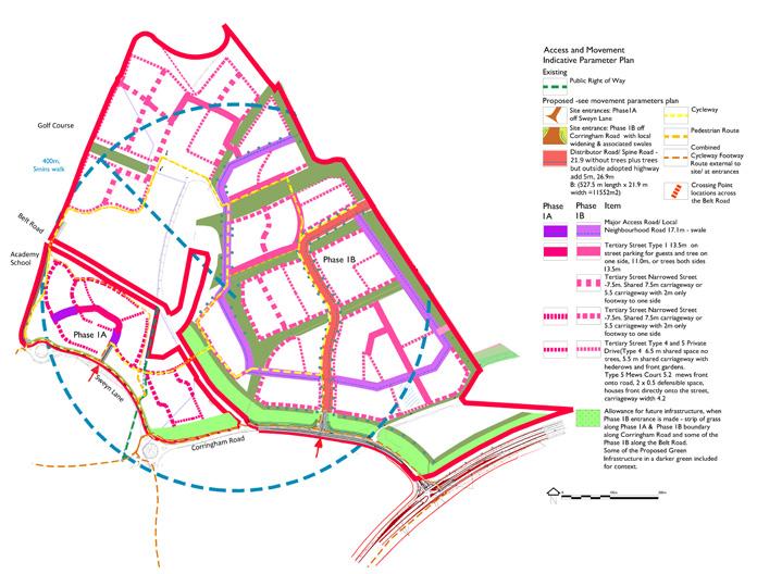
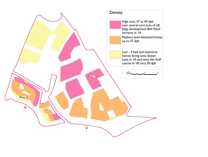
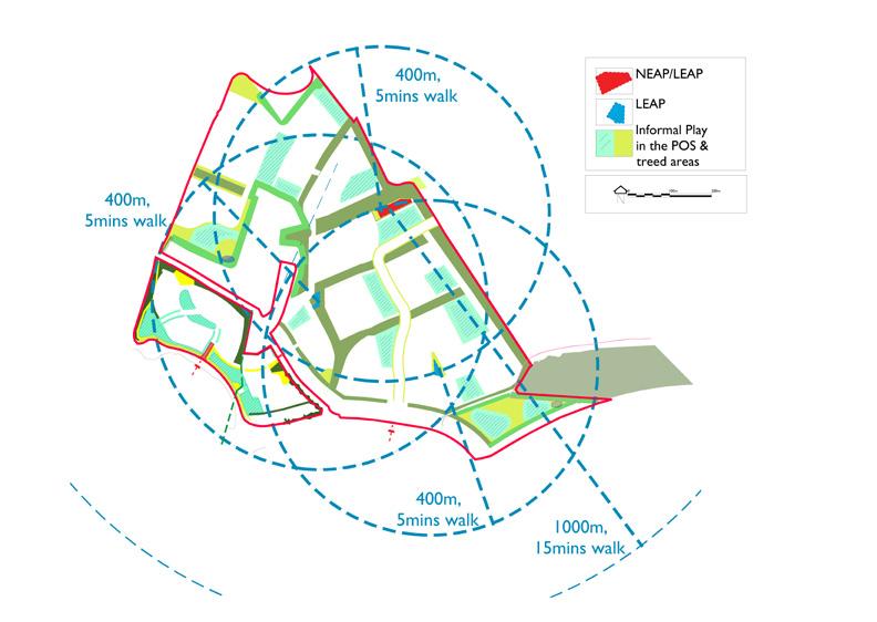
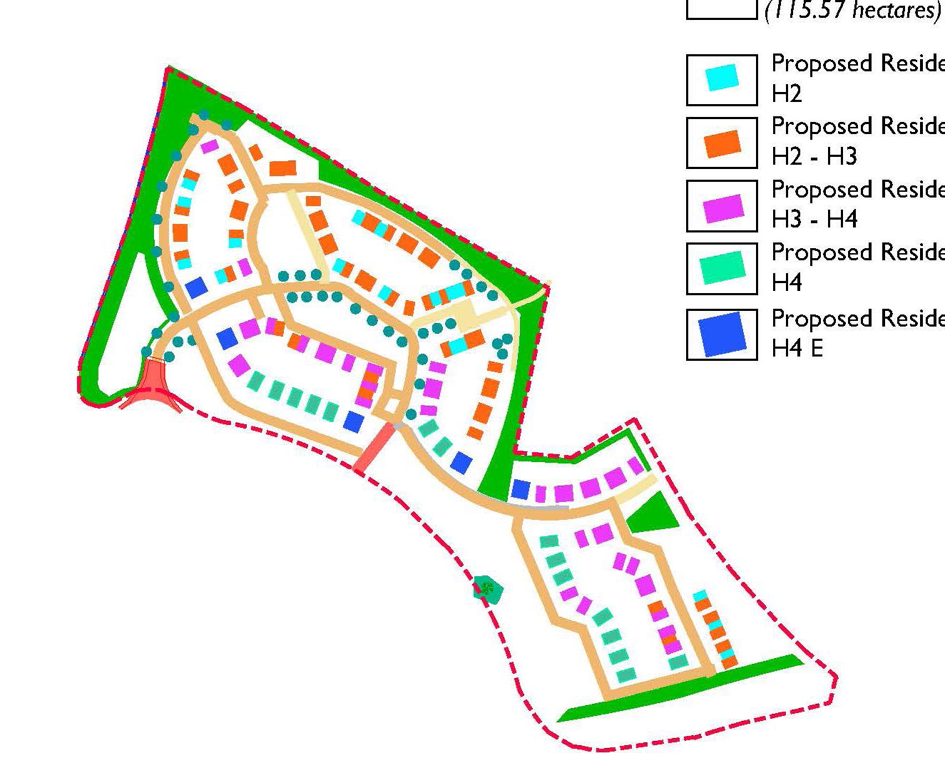
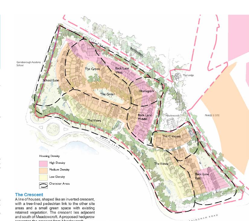
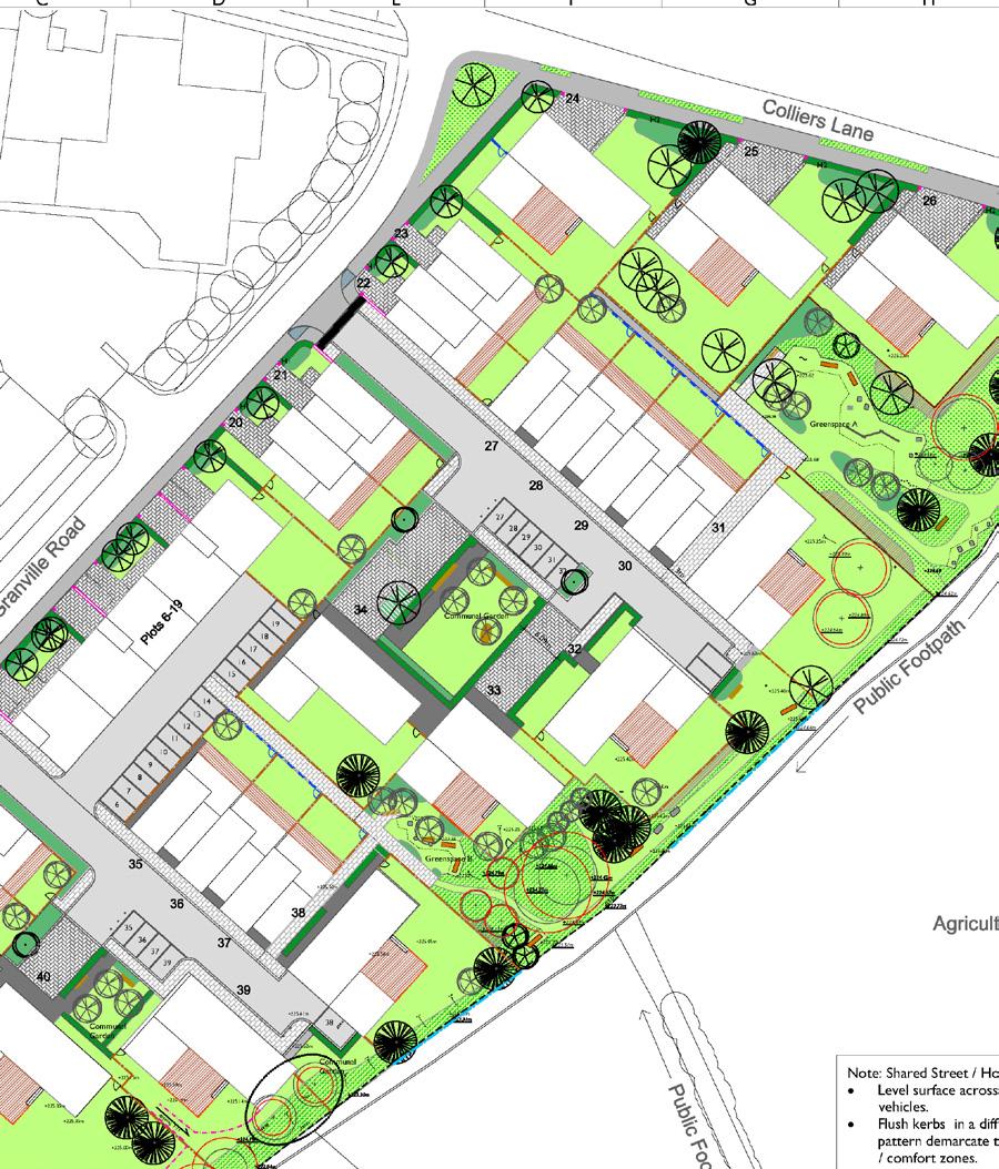
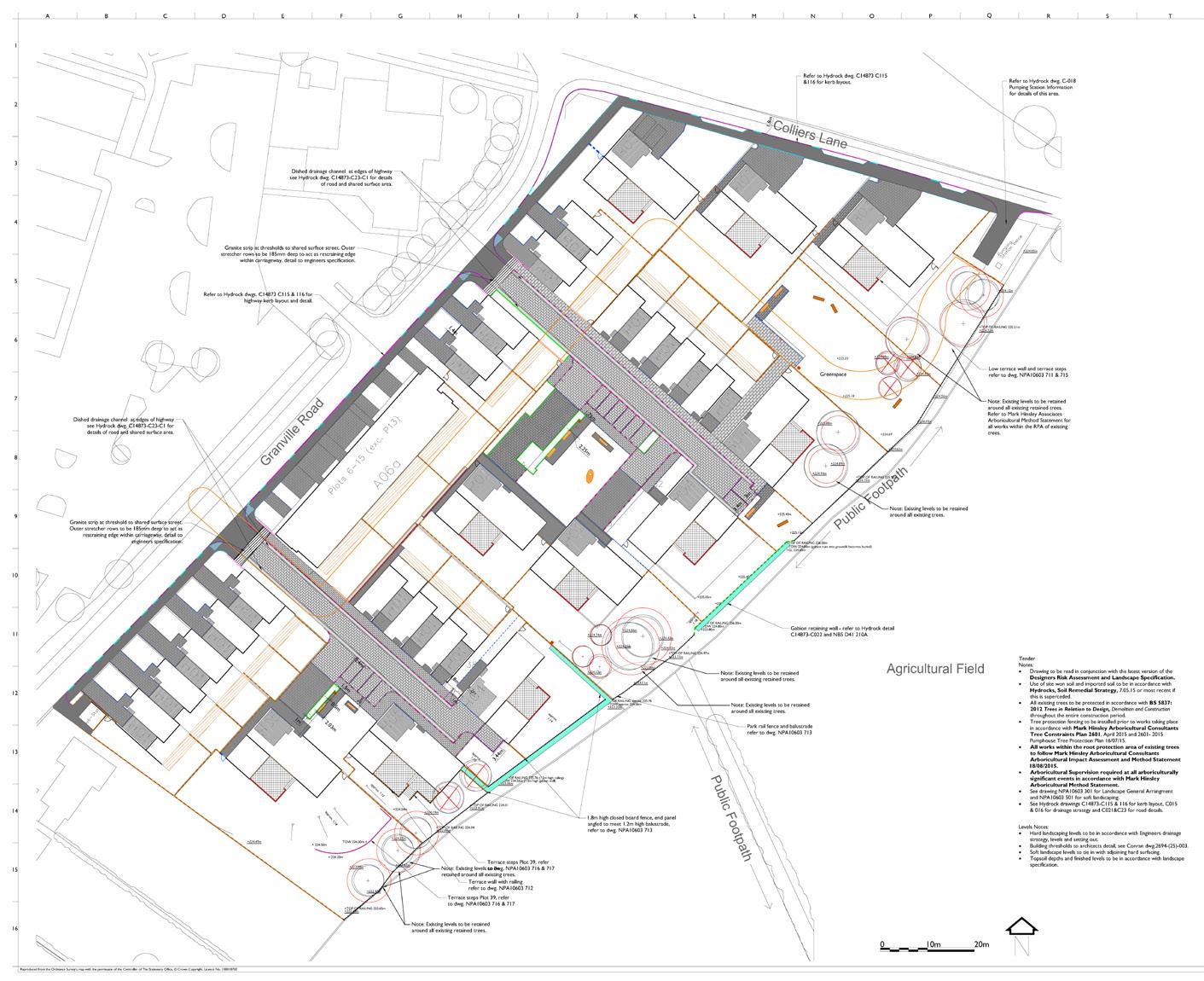
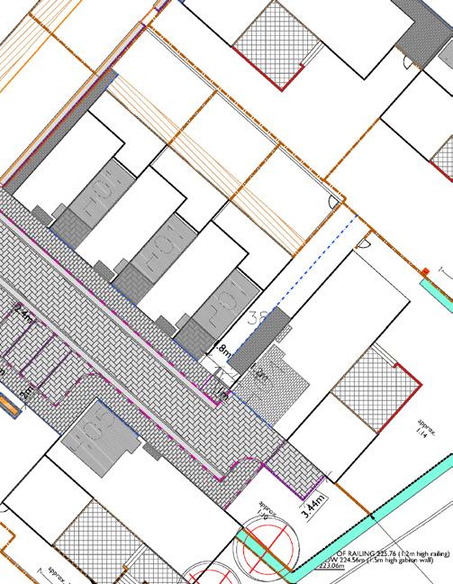
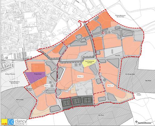
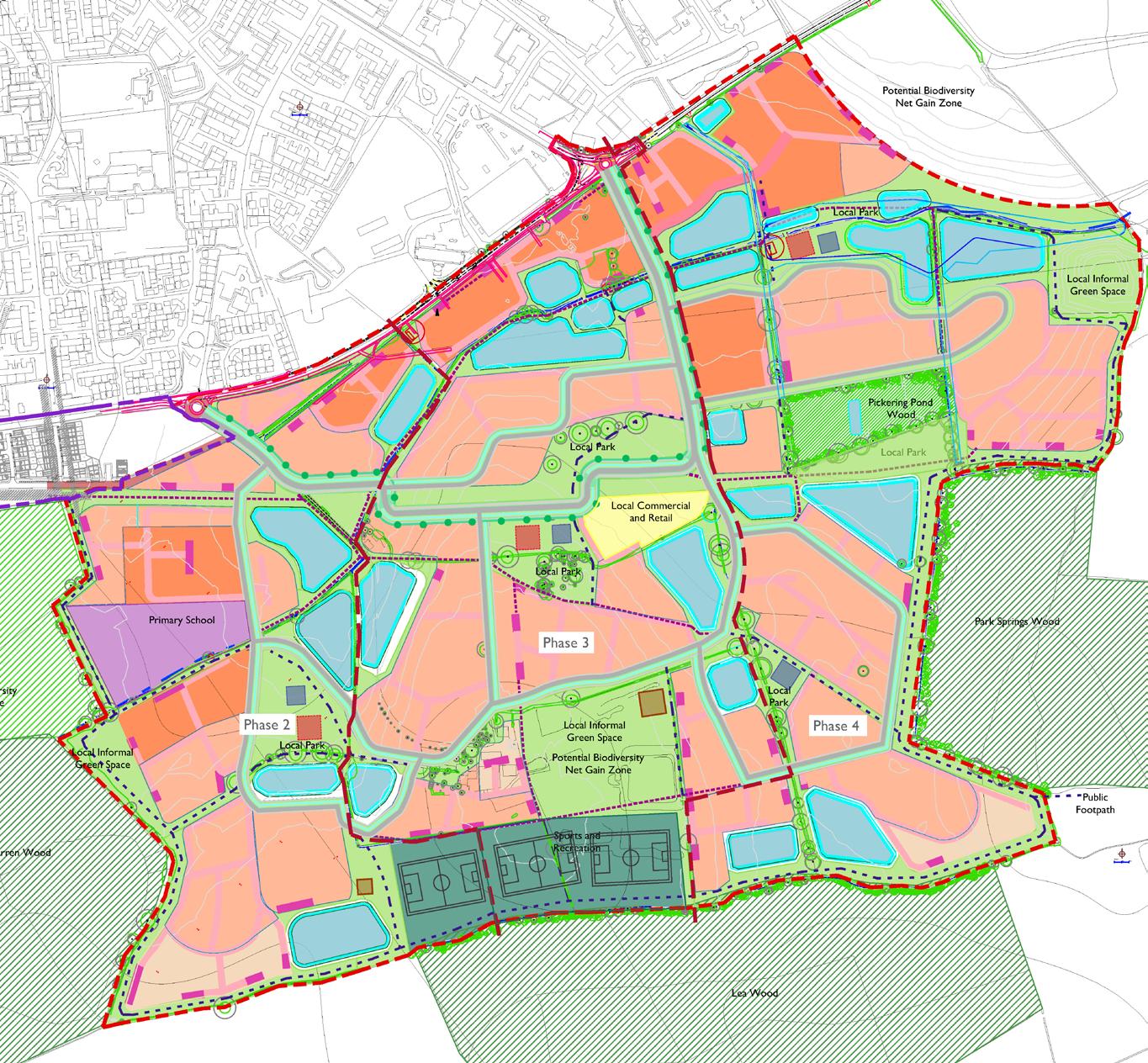
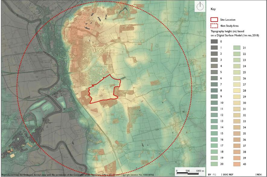
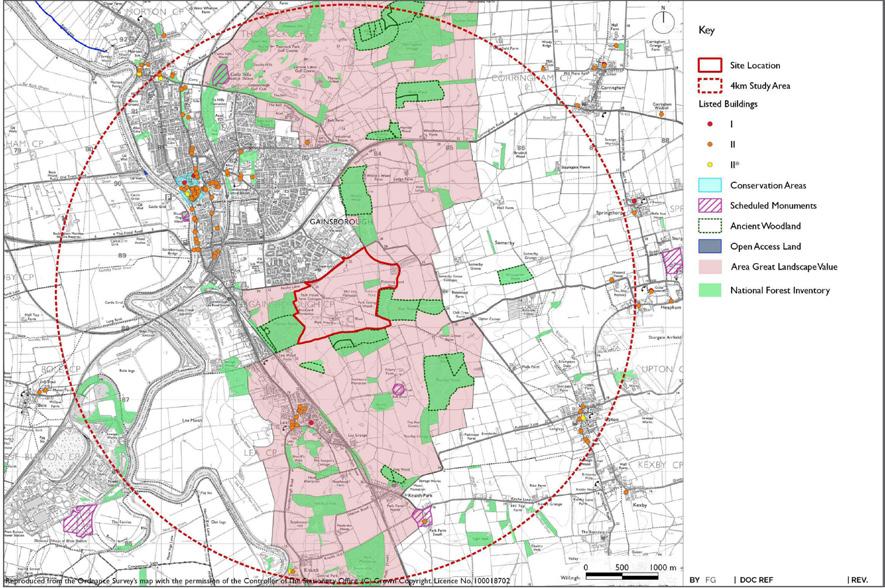
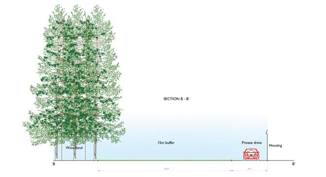
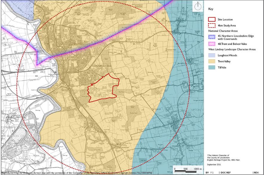
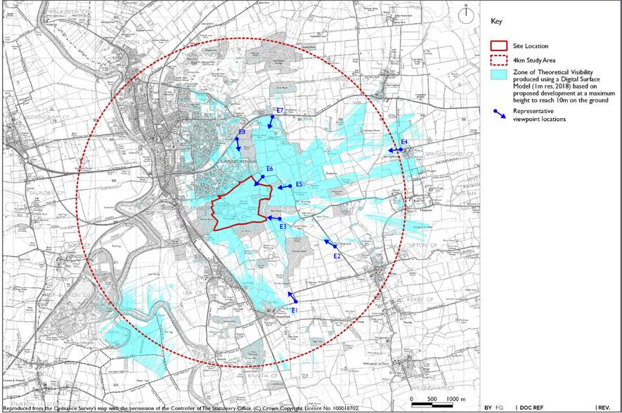
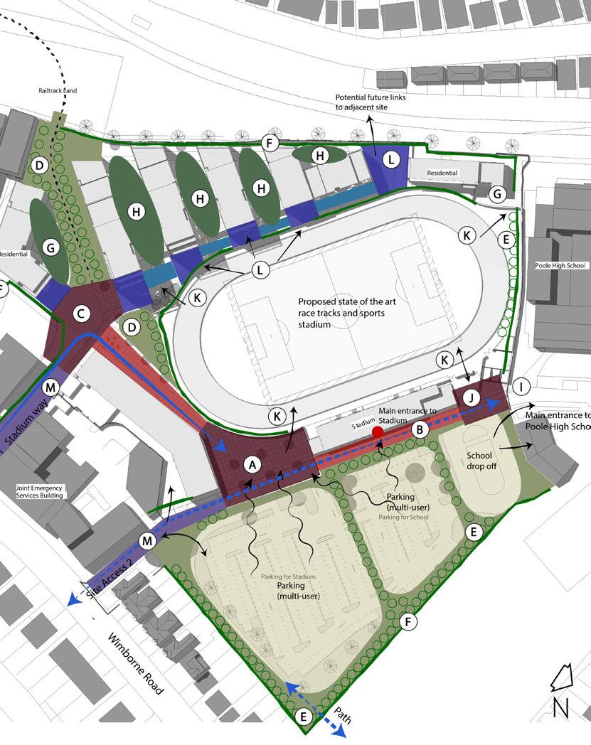
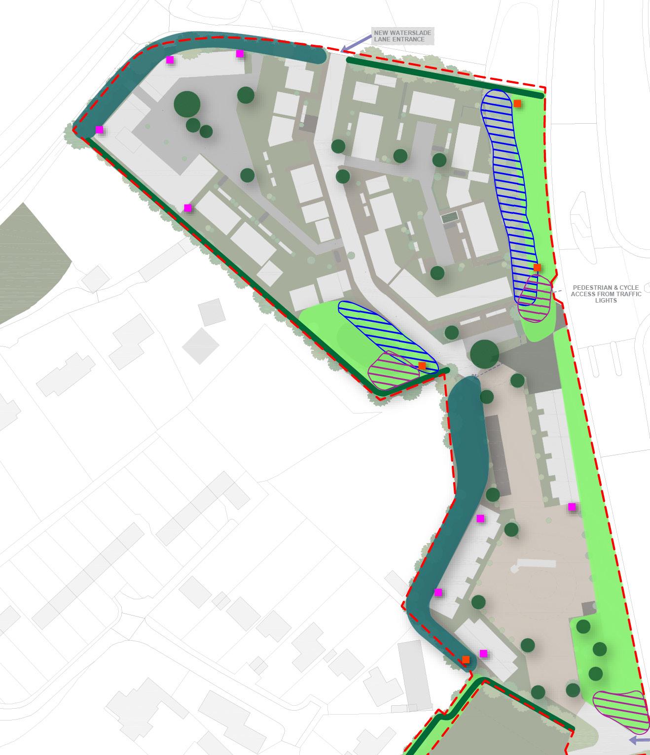
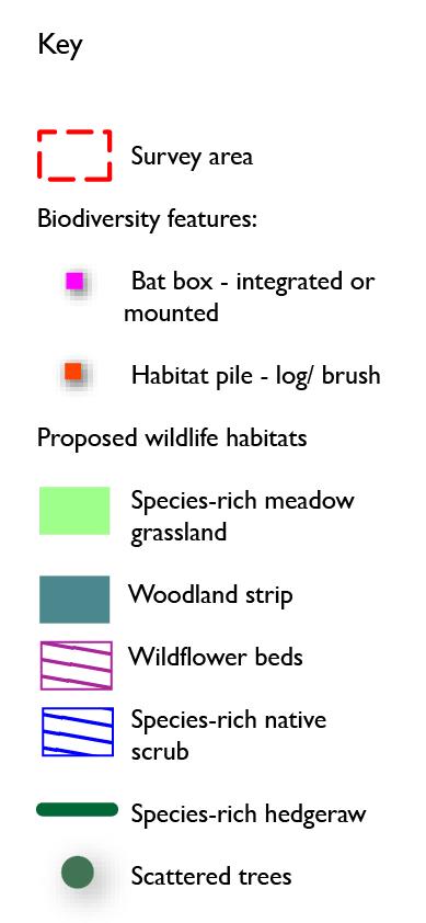
Warren Wood Gainsborough, Lincolnshire
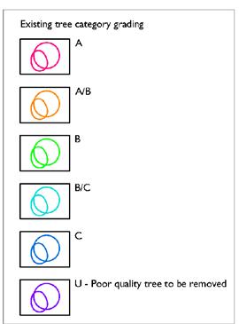
Preparation of ES Chapter for the Landscape and Visual Impact Assessment (LVIA). Preparation of Design and Access Statement (DAS) and Landscape and Ecology Management Plan (LEMP)
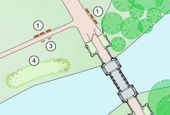
Folly Inn, Bath
Preparation of ES Chapter for the Landscape and Visual Impact Assessment (LVIA) and Landscape Masterplan
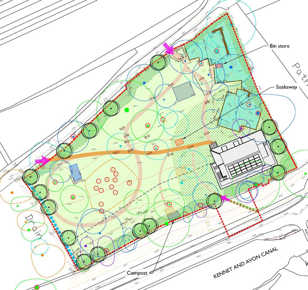
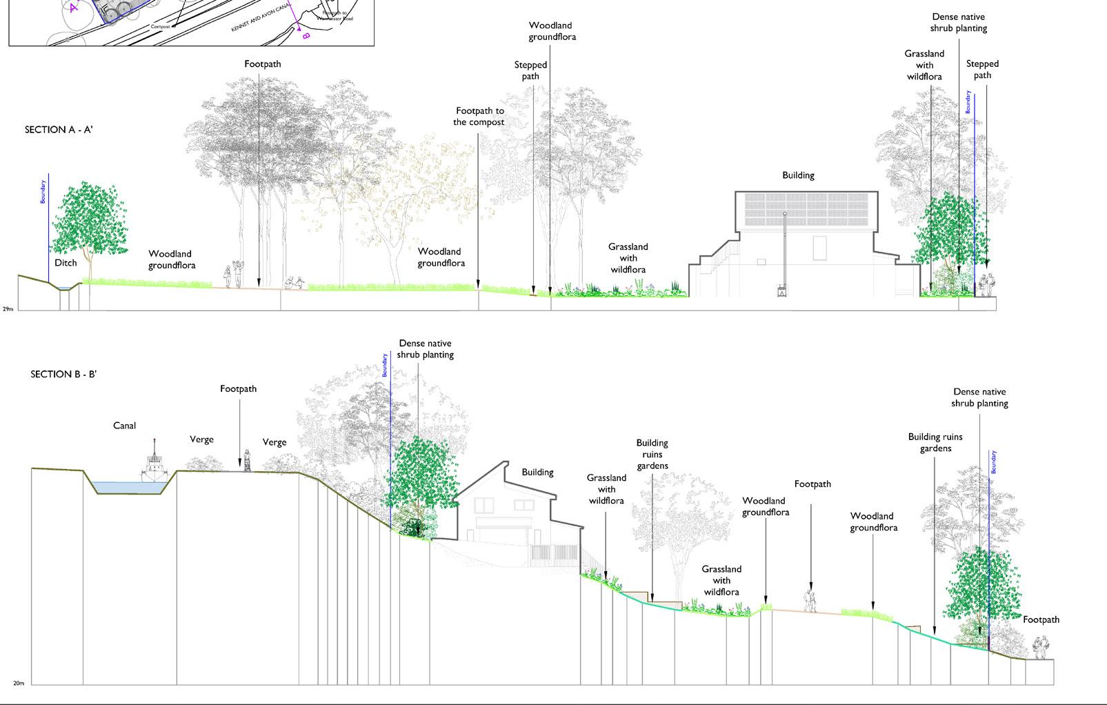
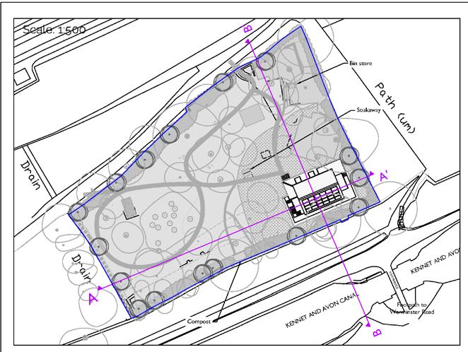
Concept Plans, Ecological, Enhancement, Mitigation and BNG Plans


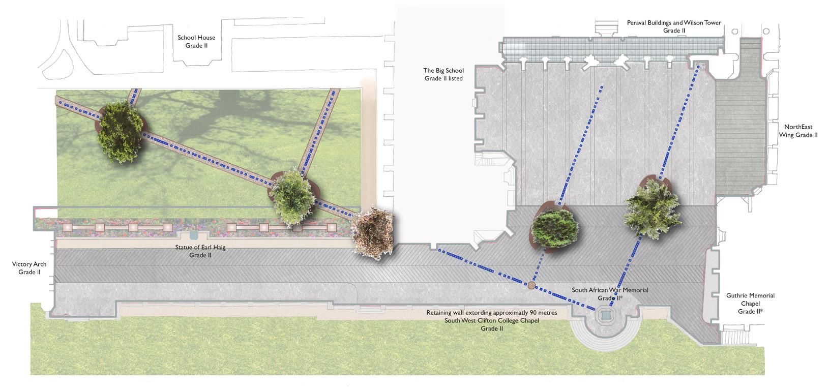
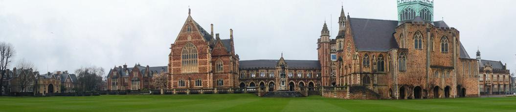
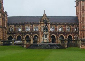
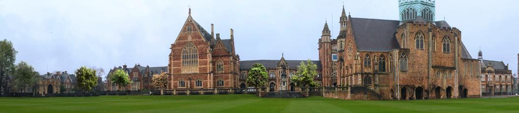
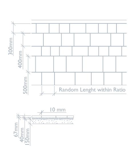
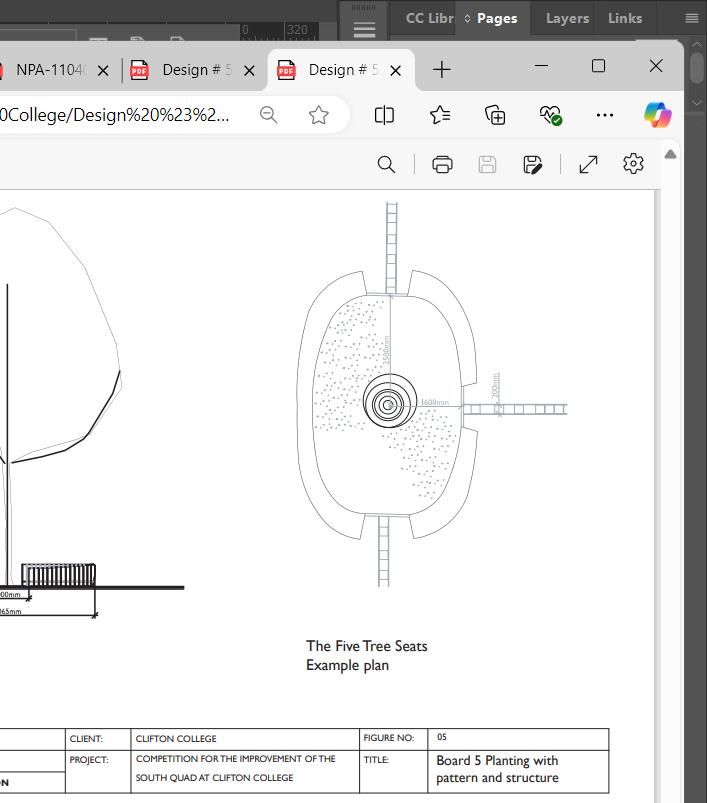
Clifton College, Bristol
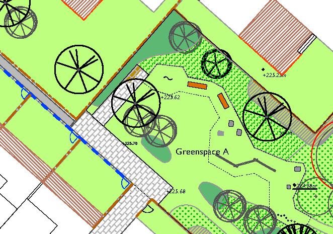
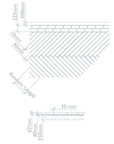
Illustrative Plans: Pavement and Sections
Details with AutoCAD, Photoshop and Illustrator


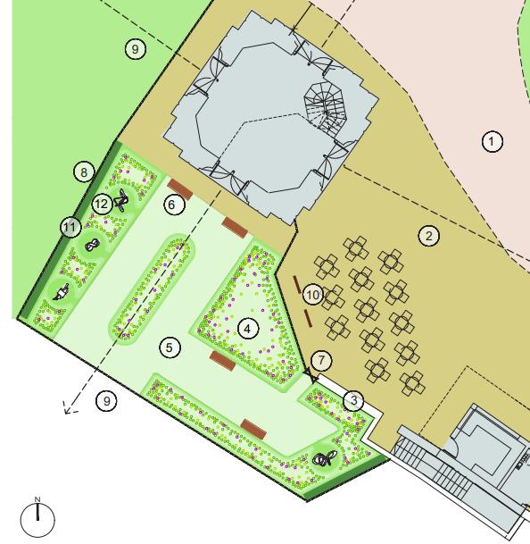
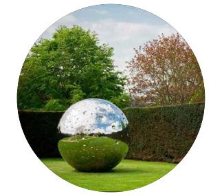
Stowe Gardens, National Trust
Landscape Concept Design Options of the Stowe Four Glories:
• East Boycott Pavilion
• Palladian Bridge
• Queen’s Temple
• Bourbon Tower


Alice Park, Bath
Leaflets - Design for the improvement of the Park


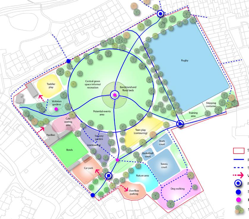
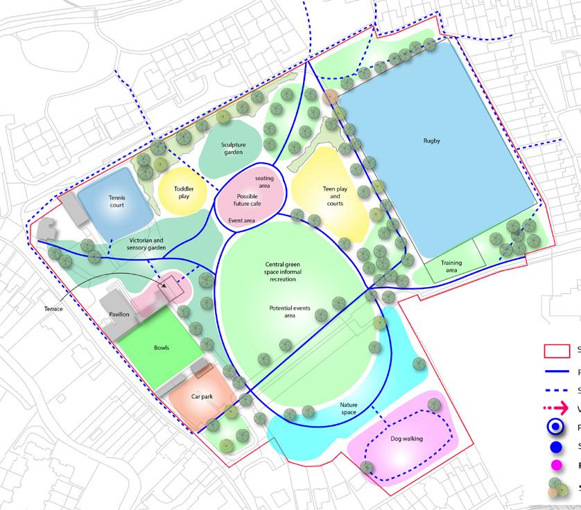
Calne, Wiltshire
Development of options for a concept vision plan of the recreational ground


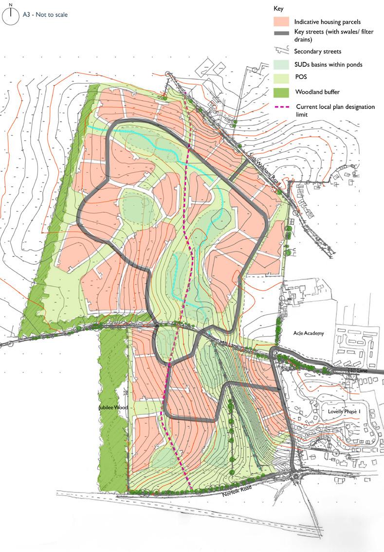
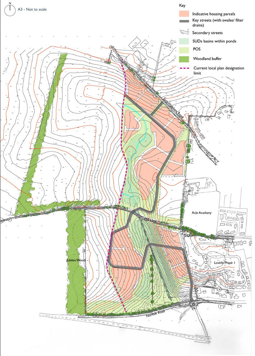
Acle, Norflok
Masterplan Option A and B
Other Graphics
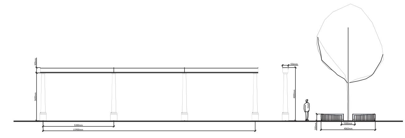
Transport Illustrative Scheme, Illustrative Sections