Subject
Data Provided By: First American Title Ins Co

11475 E Via Linda Scottsdale AZ 85259 APN: 217-28-009-X
Property
© 2023 CoreLogic. All rights reserved

Data Provided By: First American Title Ins Co
This report is not an insured product or service or a representation of the condition of title to real property. It is not an abst ract, legal opinion, opinion of title, title insurance commitment or preliminary report, or any form of Title Insurance or Guaranty. This report is issued exclusively for the benefit of the Applicant therefor and may not be used or relied upon by any other person. This report may not be reproduced in any manner without First American or Title Security's prior written consent. First American or Title Security does not represent or warrant that the information herein is complete or free from error, and the information herein is provided without any warranties of any kind, as-is, and with all faults. As a material part of the consideration given in exchange for the issuance of this report, recipient agrees that First American or Title Security's sole liability for any loss or damage caused by an error or omission due to inaccurate information or negligence in preparing this report shall be limited to the fee charged for the report. Recipient accepts this report with this limitation and agrees that First American or Title Security would not have issued this report but for the limitation of liability described above. First American or Title Security makes no representation or warranty as to the legality or propriety of recipient's use of the information herein.

This REiSource report is provided "as is" without warranty of any kind, either express or implied, including without limitations any warrantees of merchantability or fitness for a particular purpose. There is no representation of warranty that this information is complete or free from error, and the provider does not assume, and expressly disclaims, any liability to any person or entity for loss or damage caused by errors or omissions in this REiSource report without a title insurance policy.
The information contained in the REiSource report is delivered from your Title Company, who reminds you that you have the right as a consumer to compare fees and serviced levels for Title, Escrow, and all other services associated with property ownership, and to select providers accordingly. Your home is the largest investment you will make in your lifetime and you should demand the very best.

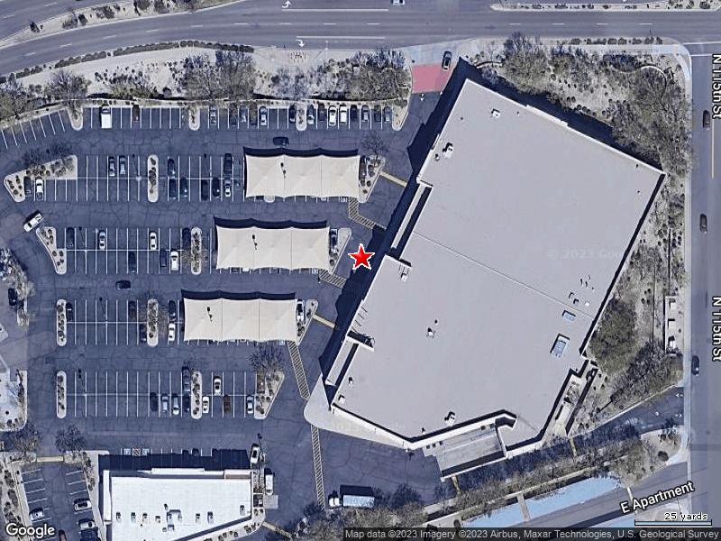
Subject Property : 11475 E Via Linda Scottsdale AZ 85259
Owner Information
Owner Name : Aci Real Estate Spe 157 Llc Mailing Address : Po Box 800729, Dallas TX 75380-0729 B006
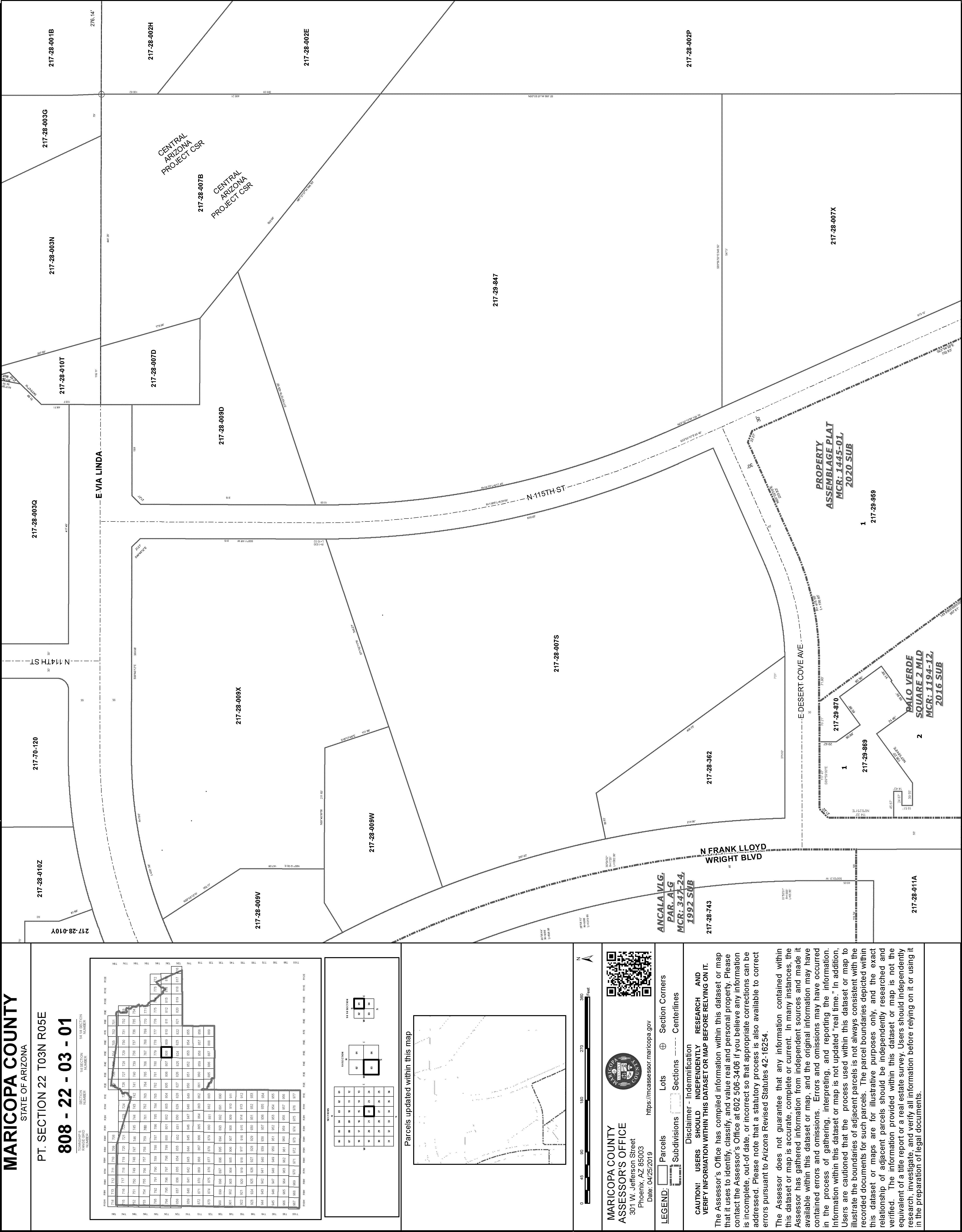
Township-Range- Sect : 03N-05E-22
APN : 217-28-009-X
Owner Transfer Information
Recording/Sale Date : 06/08/2020 / 06/08/2020
Document # : 491592
Last Market Sale Information Recording/Sale Date : 02/08/2016 / 02/08/2016
Neighbor Code : 05-017
Type : Special Warranty Deed Sale Price : $9,000,000 Price Per SqFt : $152.97
Document # : 81377
Title Company : First American Title
Seller Name : Spirit Spe Hg 2015-1 Llc
Prior Sale Information
Rec/Sale Date : 05/28/2015 / 05/27/2015
Doc Number : 375613
Prior Sale Price : $9,999,255 Prior Deed Type : Special Warranty Deed
Property Characteristics
Gross Area : 58,836
Living Area : 58,836
Year Built / Eff : 1998 / 1998
# of Stories : 1
Construction : Concrete Air Cond : Package
Heat Type : Package
Quality : Good
Cooling Type : Package Equipment : Ja
Exterior wall : Stucco/masonry

Property Information

Customer Name : Kariann Keomaka
Customer Company Name : First American Title Insurance Company Prepared On : 05/30/2023

© 2023 CoreLogic. All rights reserved
Customer Name : Kariann Keomaka
Customer Company Name : First American Title Insurance Company Prepared On : 05/30/2023
© 2023 CoreLogic. All rights reserved
 Subject Property : 11475 E Via Linda Scottsdale AZ 85259
Customer Name : Kariann Keomaka
Customer Company Name : First American Title Insurance Company Prepared On : 05/30/2023
© 2023 CoreLogic. All rights reserved

11218 N FRANK LLOYD WRIGHT BLVD Distance 0.12 Miles
Owner Name : Landrace Holdings Llc
Sale Date : 01/26/2000
Total Value : $377,100
Recording Date : 01/26/2000
Sale Price : $10
Property Tax : $4,344.54
Land Use : Shopping Center Lot Acres : 0.50
Subdivision : Ancala Village Prcl A-g
APN : 217-28-741-D
11355 E VIA LINDA Distance 0.14 Miles
Owner Name : Valley National Bank Of Arizon
Sale Date : 01/26/2000
Total Value : $3,149,400
Recording Date : 01/26/2000
Sale Price : $10
Property Tax : $30,646.38
Land Use : Financial Building Lot Acres : 1.98
Stories : 1
Yr Blt / Eff Yr Blt : 2000 / 2000
Subdivision : Ancala Village Prcl A-g
11463 E ALTADENA AVE
Owner Name : Adobe Ranch Villas Homeowners
Living Area : 4,910
APN : 217-28-742
Distance 0.14 Miles
Subdivision : Adobe Ranch Villas
Total Value : $500 Lot Acres : 0.27
Land Use : Open Space
APN : 217-28-885
11218 N FRANK LLOYD WRIGHT BLVD # 100 Distance 0.14 Miles

Owner Name : Levy & Co Llc
Sale Date : 04/06/2010
Total Value : $570,800
Recording Date : 04/09/2010
Sale Price : $550,000
Property Tax : $7,097.16
Land Use : Restaurant Building Lot Acres : 0.32
Stories : 1
Yr Blt / Eff Yr Blt : 1999 / 1999
Subdivision : Ancala Village Prcl A-g
Living Area : 2,650
APN : 217-28-741-C
11548 N 114TH PL Distance 0.15 Miles
Owner Name : Jrs Investments Llc Subdivision : Adobe Ranch Villas
Sale Date : 01/13/2020
Recording Date : 01/21/2020
Total Value : $332,200 Sale Price : $355,000
Bed / Bath : / 3 Property Tax : $1,790.78
Land Use : Townhouse/rowhouse Lot Acres : 0.08
Stories : 1 Living Area : 1,595
Yr Blt / Eff Yr Blt : 1994 / APN : 217-28-882
11759 N 114TH PL Distance 0.15 Miles
Owner Name : Adobe Ranch Villas Homeowners Subdivision : Adobe Ranch Villas
Total Value : $500 Lot Acres : 0.36
Land Use : Open Space APN : 217-28-889
11560 N 114TH PL Distance 0.15 Miles
Owner Name : Gifford Janeen A Subdivision : Adobe Ranch Villas
Sale Date : 04/11/2005
Recording Date : 04/14/2005
Total Value : $279,800 Sale Price : $306,500
Bed / Bath : / 3 Property Tax : $1,178.92
Land Use : Townhouse/rowhouse Lot Acres : 0.07
Stories : 1 Living Area : 1,243
Yr Blt / Eff Yr Blt : 1994 / APN : 217-28-883
11416 E DESERT COVE AVE Distance 0.16 Miles
Owner Name : Landj Investments Llc Recording Date : 07/31/2009
Sale Date : 07/31/2009 Sale Price : $675,000
Total Value : $934,300
Property Tax : $12,009.62
Land Use : Greenhouse Lot Acres : 1.33
Stories : 1 Living Area : 432
Yr Blt / Eff Yr Blt : 1996 / 1996 APN : 217-28-362
Customer Name : Kariann Keomaka Customer Company Name : First American Title Insurance Company Prepared On : 05/30/202311543 N 114TH PL Distance 0.16 Miles
Owner Name : Lynn Marie Bible Subdivision : Adobe Ranch Villas
Sale Date : 09/00/1999
Total Value : $335,200
Recording Date : 10/01/1999
Sale Price : $166,000
Bed / Bath : / 3 Property Tax : $1,504.98
Land Use : Townhouse/rowhouse Lot Acres : 0.08
Stories : 1
Living Area : 1,595
Yr Blt / Eff Yr Blt : 1994 / APN : 217-28-881
11555 N 114TH PL Distance 0.16 Miles
Owner Name : Mcwilliams Morris D Subdivision : Adobe Ranch Villas
Sale Date : 08/08/2006
Total Value : $332,200
Recording Date : 08/24/2006
Sale Price : $360,000
Bed / Bath : / 3 Property Tax : $1,500
Land Use : Townhouse/rowhouse Lot Acres : 0.09
Stories : 1
Living Area : 1,595
Yr Blt / Eff Yr Blt : 1994 / APN : 217-28-880

Customer Name : Kariann Keomaka
Customer Company Name : First American Title Insurance Company
Prepared On : 05/30/2023
© 2023 CoreLogic. All rights reserved
Customer Name : Kariann Keomaka
Customer Company Name : First American Title Insurance Company
Prepared On : 05/30/2023
© 2023 CoreLogic. All rights reserved
Customer Name : Kariann Keomaka
Customer Company Name : First American Title Insurance Company
Prepared On : 05/30/2023
© 2023 CoreLogic. All rights reserved


PARCEL: 217-28-009X
PARCEL: 217-28-009X 5
OWNER: ACI REAL ESTATE SPE 157 LLC
SITUS: 11475 E VIA LINDA SCOTTSDALE
MAIL: 250 E PARKCENTER BLVD BOISE, ID 83706
SECTION: 22 TWP 3N RNG 5E
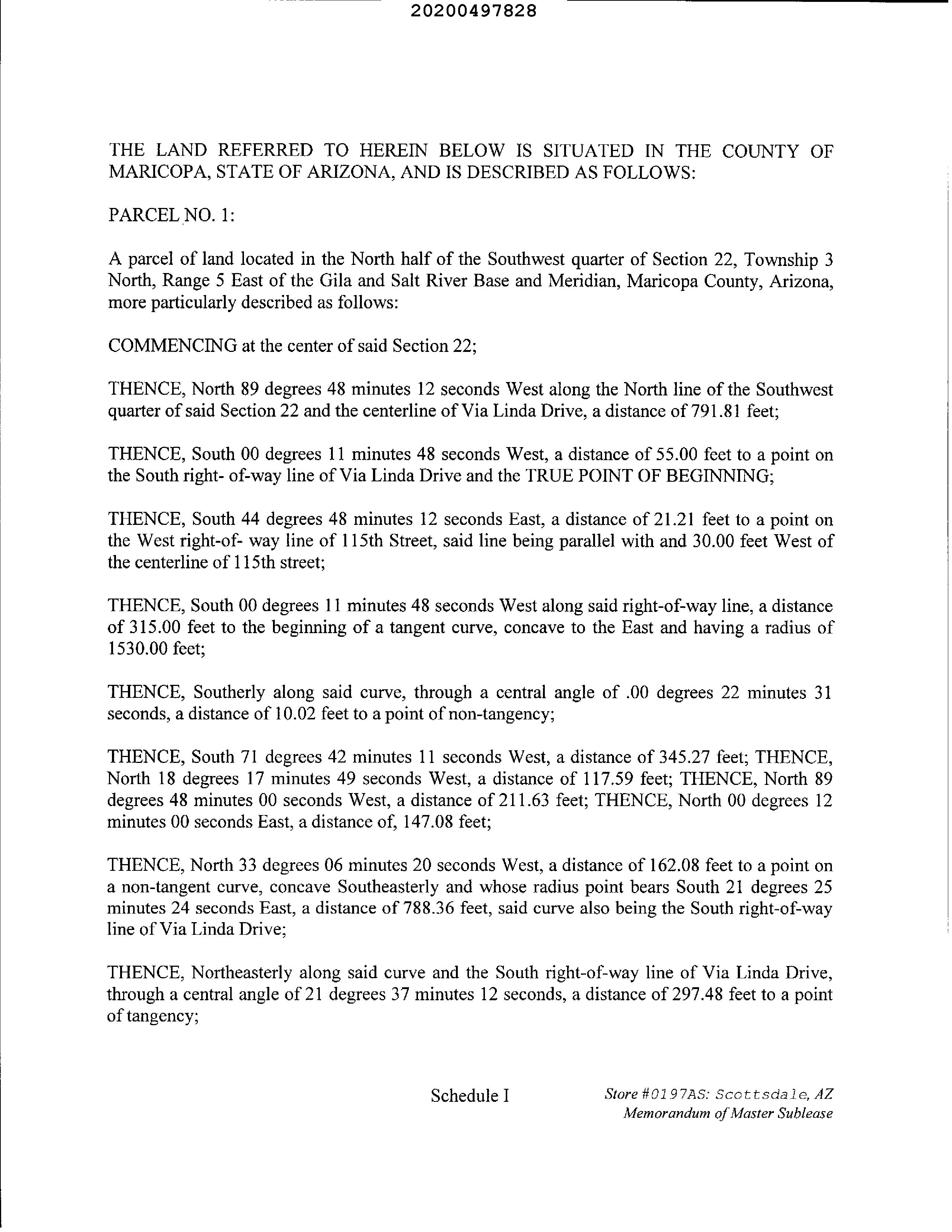
LEGAL: PT N2 SW4 SEC 22 DAF COM CENTER SEC 22 TH W ALG N LN SW4 SD SEC 22 & C/L VIA LINDA DR 791.81F TH S 55F TO PT ON S R/W LN SD VIA LINDA DR & TPOB TH S 44D 48M E 21.21F TO PT ON W R/W LN 115TH ST TH S 315F TO BEG TAN CUR CONC TO E HAV RAD 1530F TH SLY ALG SD CUR 10.02F TO PT NON-TAN TH S 71D 42M W 345.27F TH N 18D 17M W 117.59F TH W 211.63F N 147.08F N 33D 03M W 162.17F TO PT NON-TAN CUR CON SELY SD CUR BEING S R/W LN VIA LINDA DR TH NELY ALG SD CUR 297.36F TO PT TANG TH E CONT ALG SD S R/W LN 359.
(LEGAL CONTINUES)
ADDITIONAL PROPERTY INFORMATION
STANDARD LAND USE: