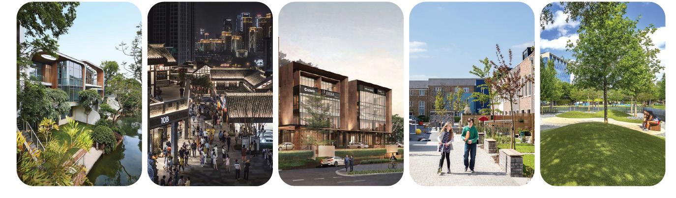
Architecture & Urban Design Portfolio

F I E R A A L I F A

Architecture & Urban Design Portfolio
F I E R A A L I F A
URBAN DESIGN
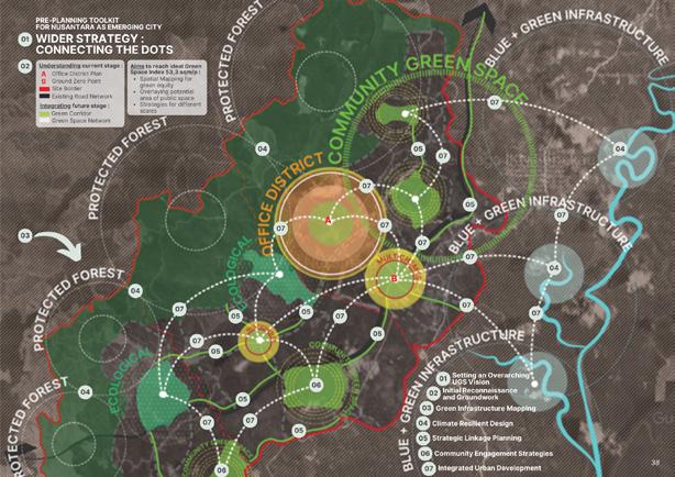
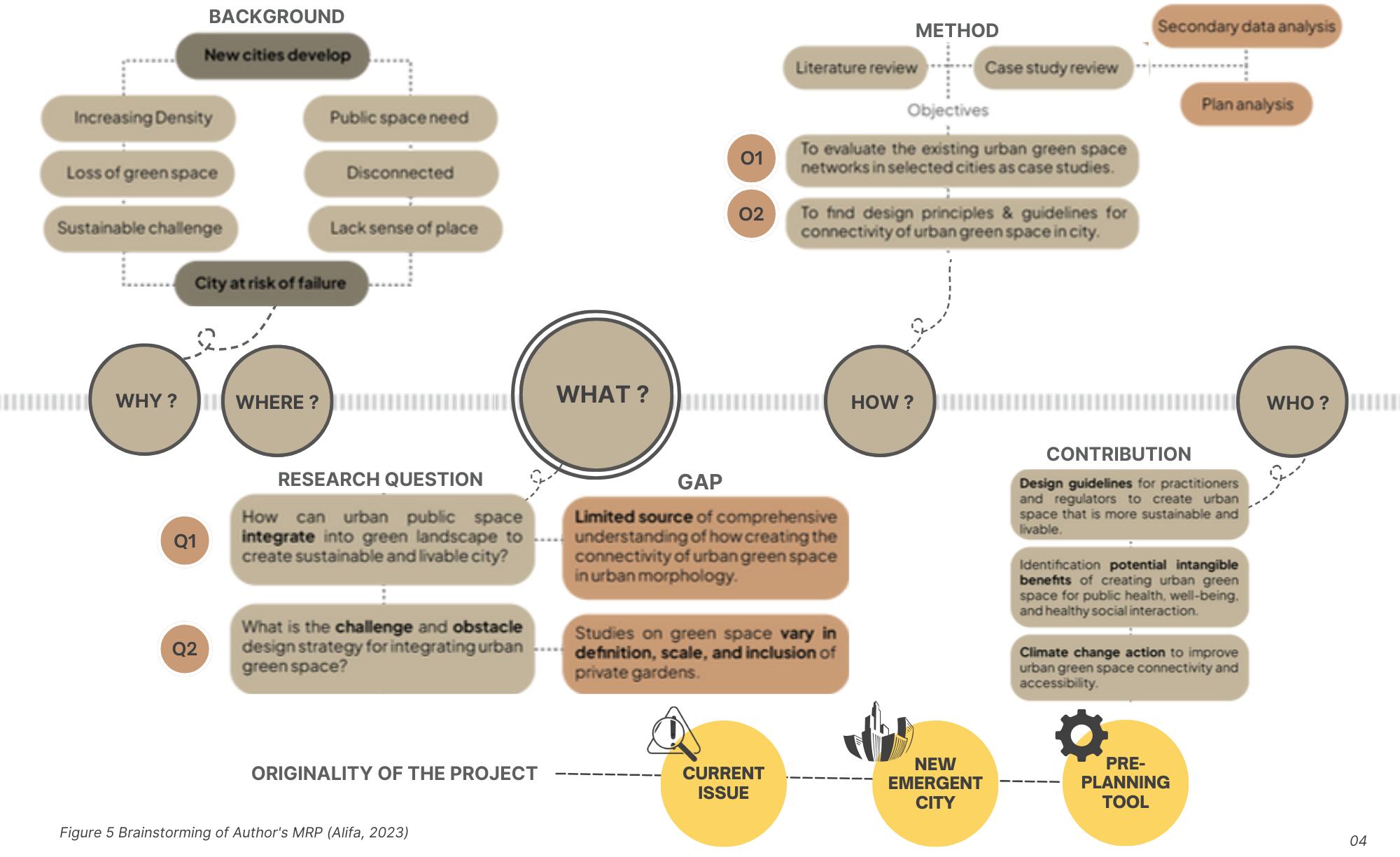
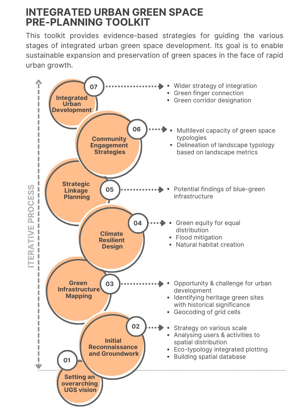
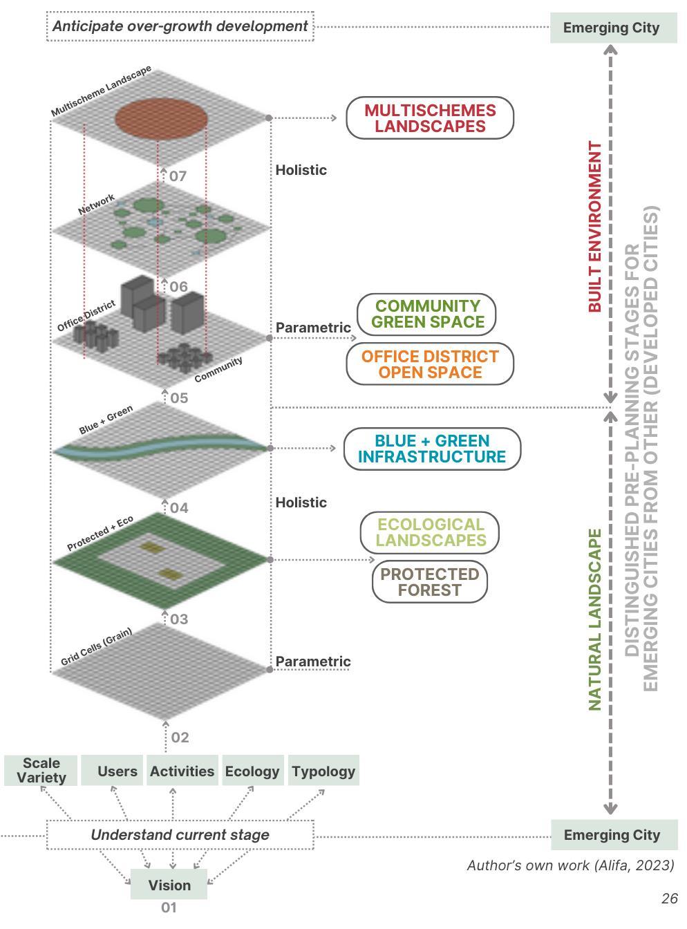
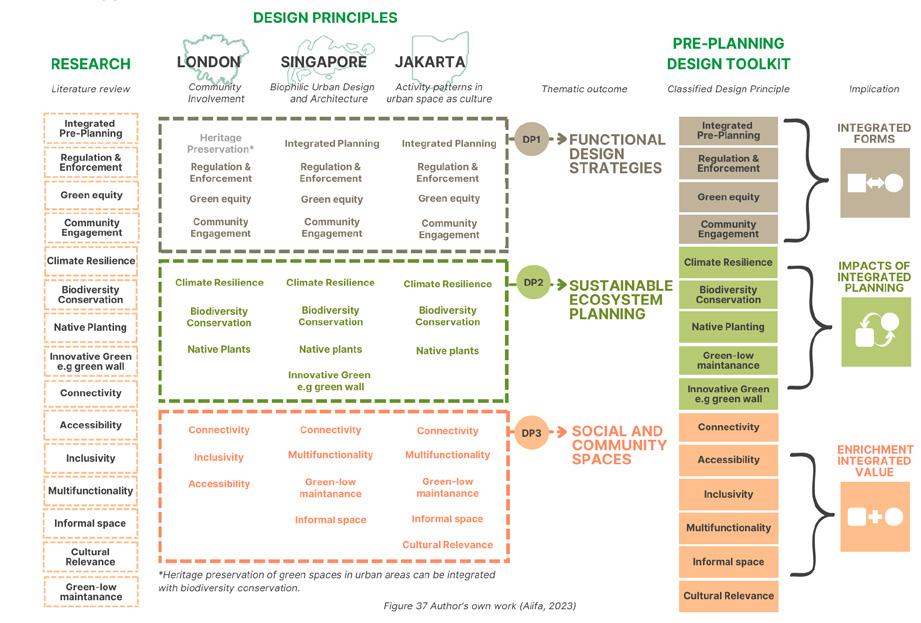
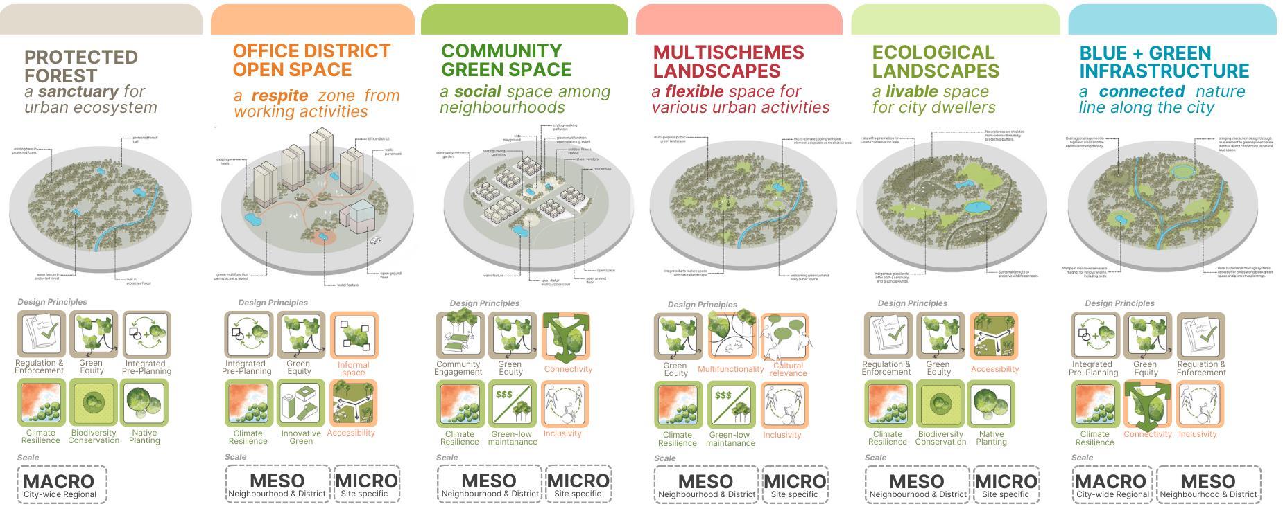
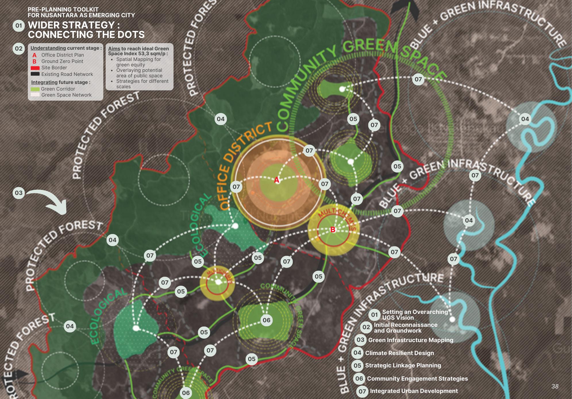
GREENING EMERGING CITIES, PRE-PLANNING TOOLKIT
SOUTHEAST ASIA
Academic - Major Research Project, 2023
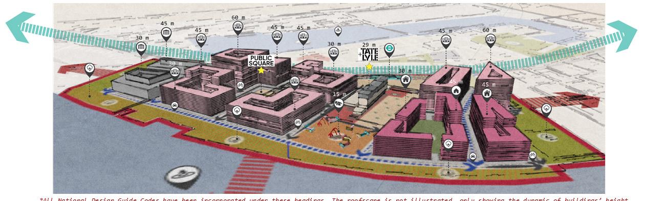

BARKING NEIGHBOURHOOD, LONDON
Academic
ARCHITECTURE
LINKED NEIGHBOURHOOD
SOUTH POPLAR, LONDON
Academic - Density & Form, 2022
THE DEWA SIHANOUKVILLE SATELLITE CITY, CAMBODIA
Professional - Urban Design Proposal, 2022
VISION PROJECT
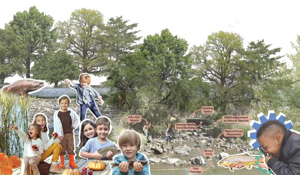
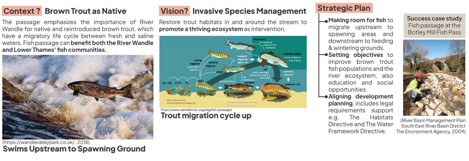
BROWN TROUT FOR FUTURE LIFE WANDLE RIVER, LONDON
Academic - Sustainable Futures by Design, 2023


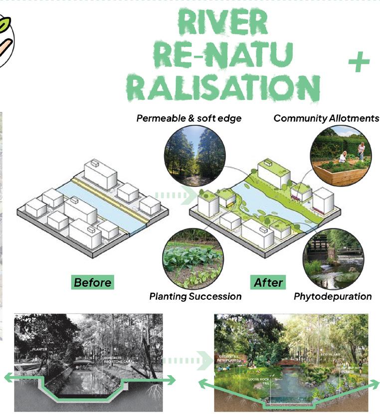
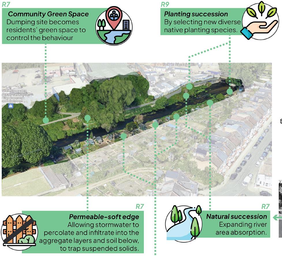
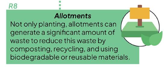
WANDLE RIVER RENATURALISATION, LONDON
Academic - Sustainable Futures by Design, 2023


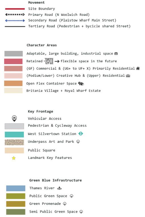
Design Principles for the Design Code
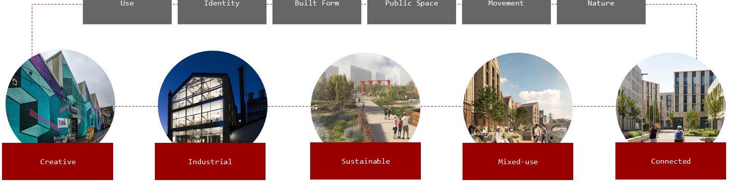
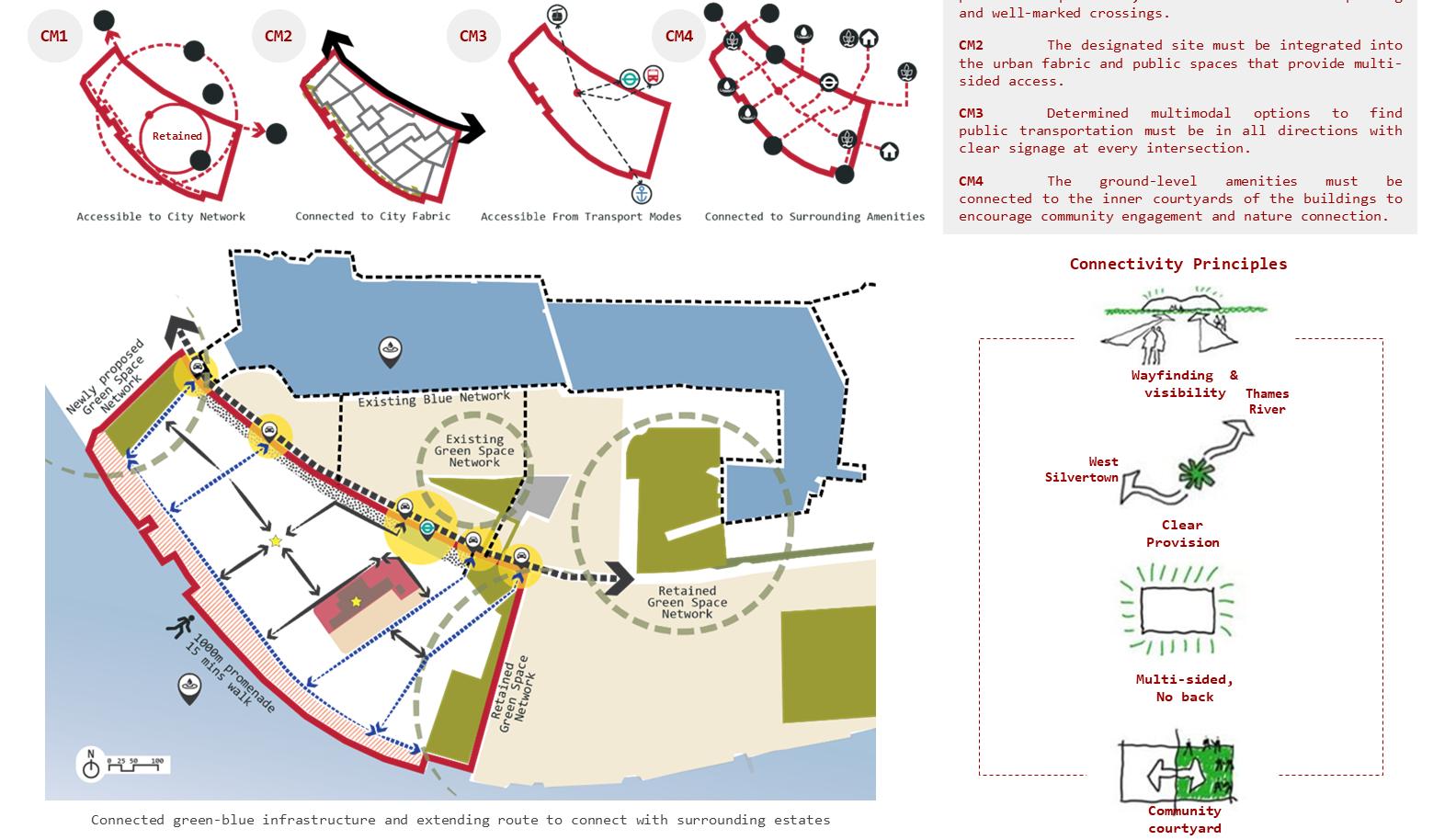
Connectivity & Movement
To prioritise green-blue infrastructure and multi-modal transportation options in order to create a sustainable, inclusive, and connected community. This includes pedestrian and
that are safe and accessible, efficient public transportation, and green spaces that enhance the natural environment and promote
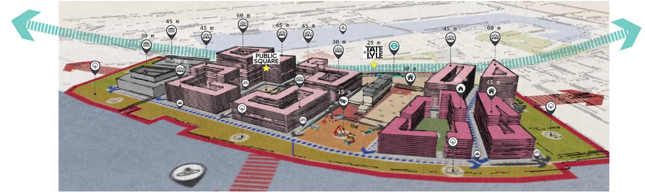
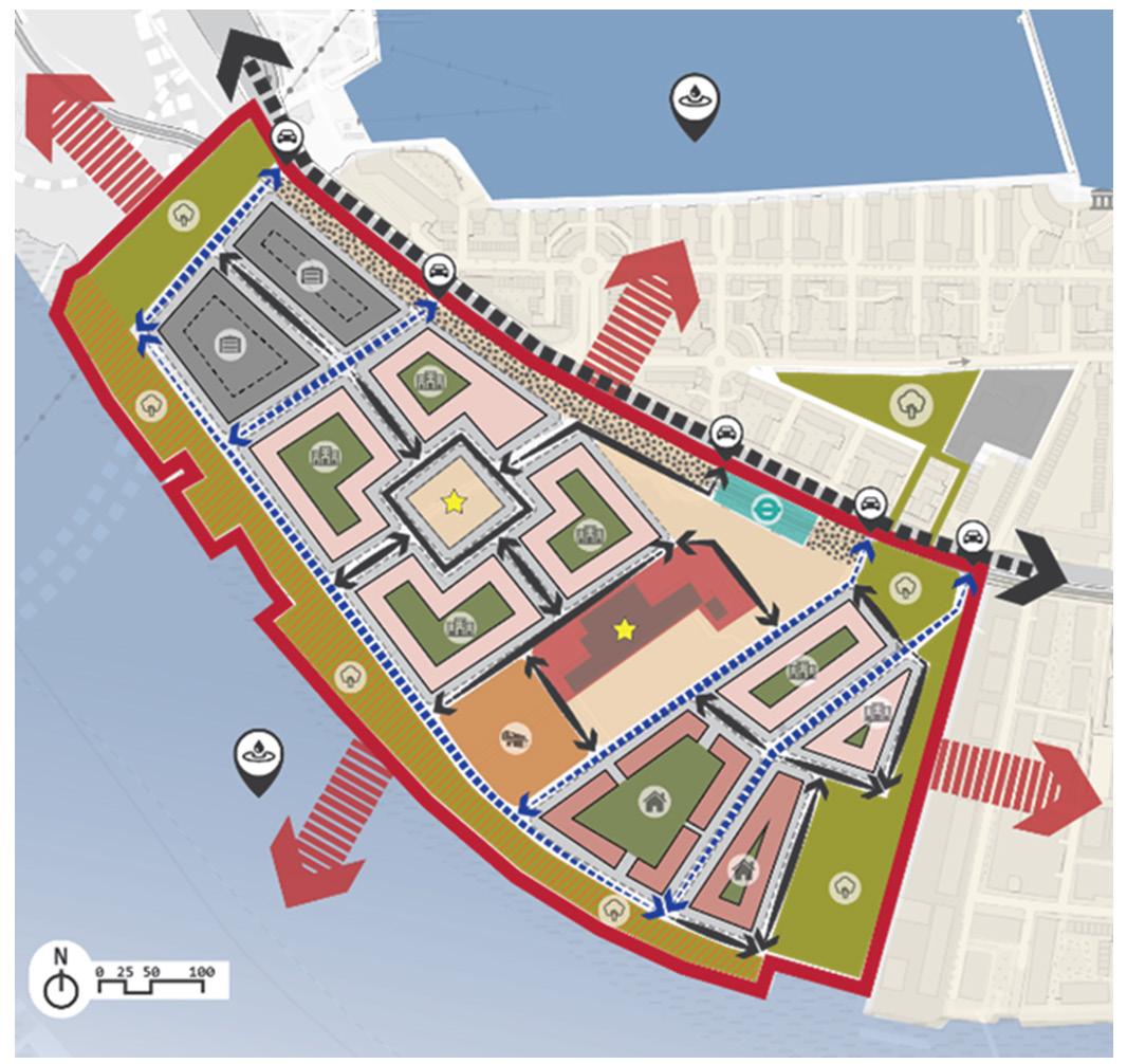
Design Code Regulatory Plan
Design Code
CM1_The connectivity must provide pedestrians and cyclists with an easily accessible pathway to public transportation, as well as secure bike parking and well-marked crossings.
CM2_The designated site must be integrated into the urban fabric and public spaces that provide multi-sided access.
CM3_Determined multimodal options to find public transportation must be in all directions with clear signage at every intersection.
CM4_The ground-level amenities must be connected to the inner courtyards of the buildings to encourage community engagement and nature connection.
Connectivity Principles
Activity Performed
› Synthesised data and policy research from multiple sources to provide actionable insights for masterplans and design visions, ensuring alignment with broader urban development goals, with great communication and team collaboration.
› Leveraged expert skills in using SketchUp and graphic software (Adobe Illustrator, Photoshop, InDesign) for presentable design visual.
› Conducted site and context analysis using Digimap and 3D study modelling to improve spatial understanding and support informed decision-making in urban projects.

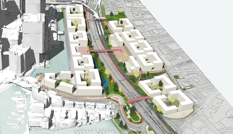
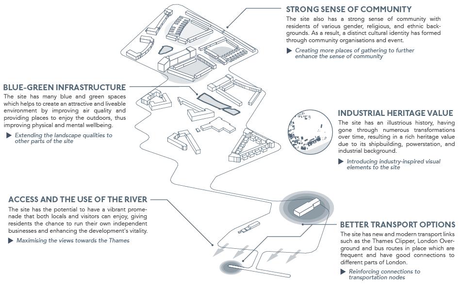
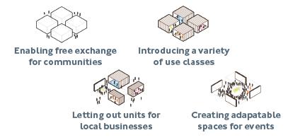
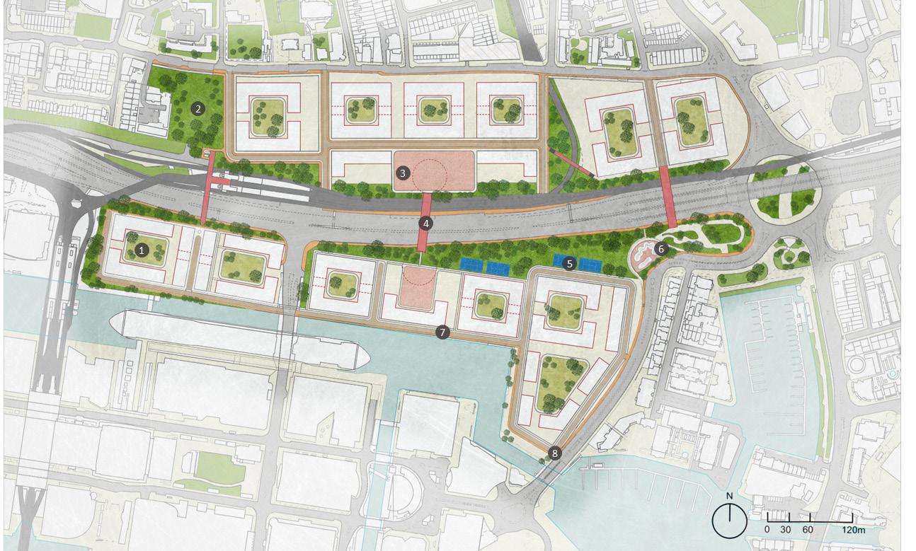
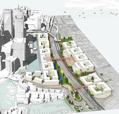
The project involves designing a public space that enhances community engagement. The design proposal will apply placemaking principles to be actionable strategy. The aim is to create vibrant, functional spaces as urban design framework to accomplish partial intervention to Barking Riverside, that promote social interaction and community well-being.
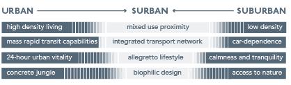
To foster bottom-up ideals through urban design interventions which allow residents to develop their own identity organically, in diverse, connected and engaging spaces, that improve legibility and develop a unique sense of place, thus answering the question, ‘what is Barking Riverside’?
The Gateway as a critical arrival space
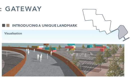
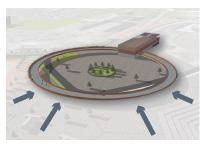
A unique ambitious design creates a significant landmark that boots site legibility, and viewed from the Thames. Thoughtfully, the corten steel references industrial past-times on-site, and is a corrosion-resistant material that improves in aesthetic value with weathering, which is expected in this riverside (Bupesh Raja et al., 2021).
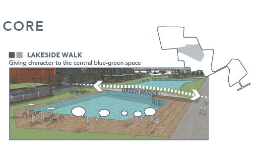
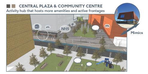
The Core as a focal point of the development

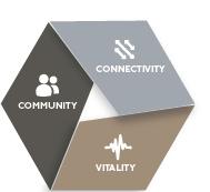
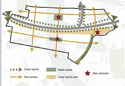
CONNECTIVITY
Ensuring more feasible and realistic active travel
COMMUNITY
Fostering local identity and community cohesion for community capacity-building
VITALITY
Harnessing urban vitality for community capacity-building while considering socio-economic and health benefits.
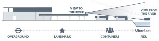
How do we beautify and improve the linkage between the two action areas?
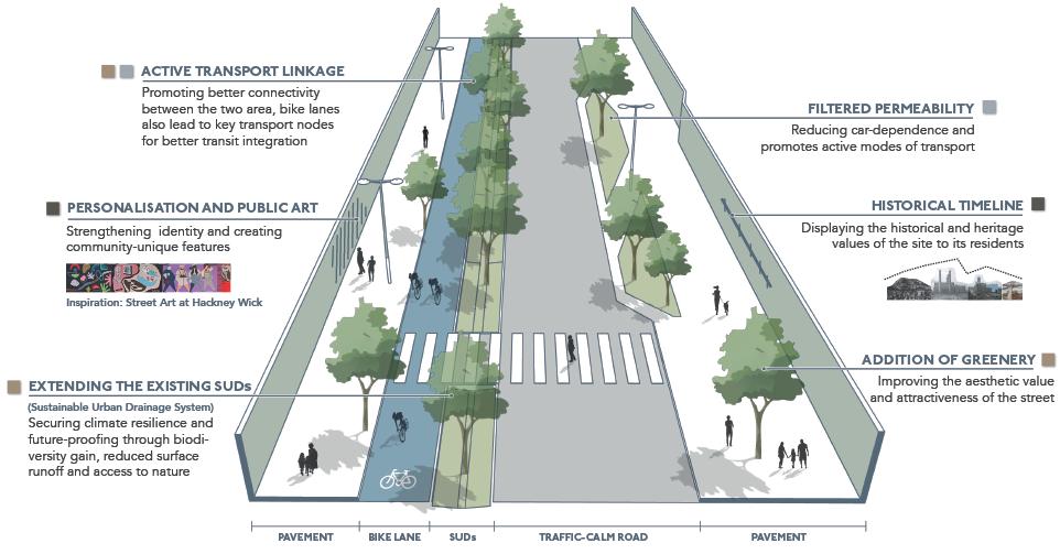
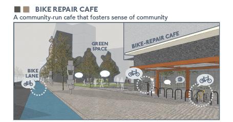
This strategy attempts to create a smoother transition and effortless legibility between the urban gateway and surban core, and a welcoming experience of place and sense of arrival before getting into the core. Tree lined streets and integrated cycle paths create a green blend between the two, as well as a safer route for the pedestrians.
Activity Performed
› Leveraged expert skills in using SketchUp and graphic software (Adobe Illustrator, Photoshop, InDesign) for design communication
› Conducted site and context analysis using Digimap and 3D study modelling to improve spatial understanding and support informed decision-making in urban projects.
› Synthesised data and policy research from multiple sources to provide actionable insights for masterplans and design visions, ensuring alignment with broader urban development goals.
› Applied evidence-based approaches to conduct comprehensive research on planning for masterplan and strategic plan.
How can we integrate Barking Riverside with its surrounding contexts and the London area
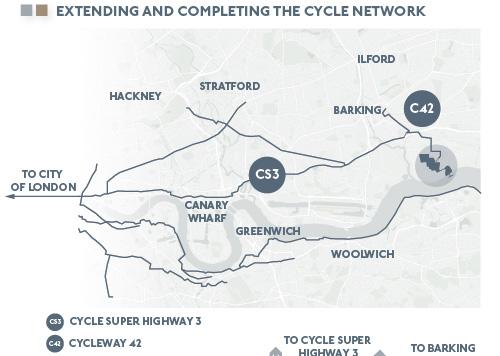
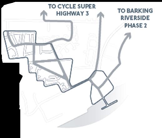
INTEGRATING TO LONDON AS A WHOLE, CYCLE SUPERHIGHWAY CS3 WILL BOOST ACTIVE TRAVEL UPTAKE, AND RESPOND TO THE PREVALENT FRAGMENTATION & ISOLATION (BUEHLER & DILL, 2016).
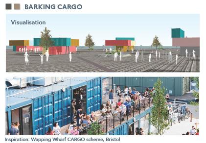
SMOOTHENING THE TRANSITION USES BETWEEN INDUSTRIAL AND RESIDENTIAL
Good urban design “blends in and disappears and we do not notice that it is there” (Carmona, 2021). In Barking Riverside transition between residential and industrial is rather abrupt at the moment, therefore the plan is trying to include employmentled mixed use building zones and green spaces in between to better blend in the two contrasting uses and create a seamless transition.

Academic - Density and Form, Tutored by Paula Morais (2022)
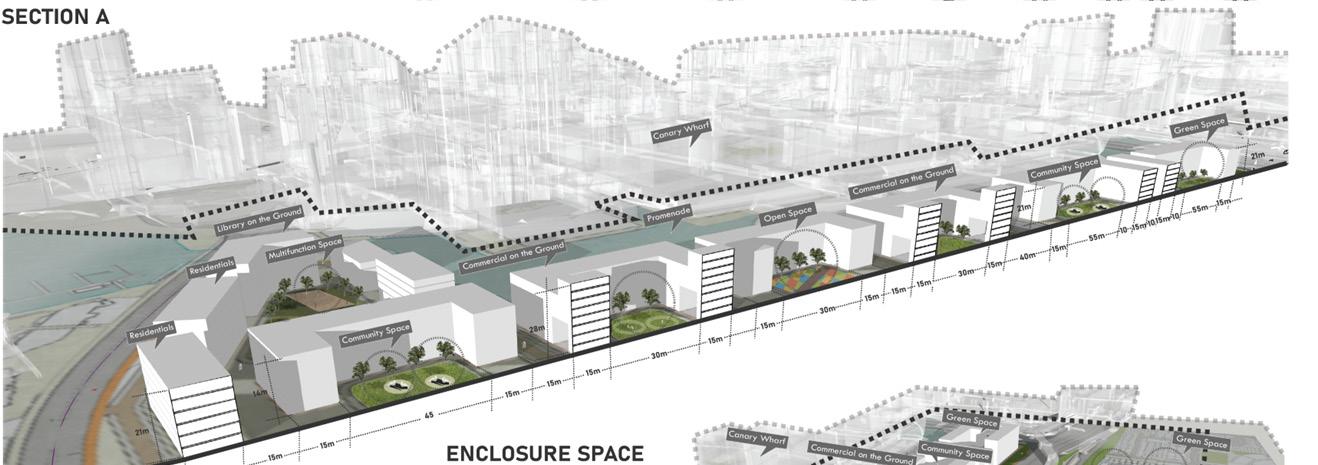
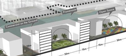
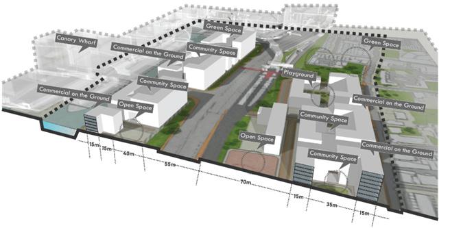
This introduction to urban form covers essential concepts like density, spatial structure, and the scales of the built environment, enhancing understanding and graphic skills. It encourages applying these principles in design practice, experimenting with typologies and densities in urban contexts, and creatively rethinking urban form to address density optimization and sustainability. Selecting South Poplar for the project strategically addresses the regeneration gap with nearby Canary Wharf, offering an opportunity to balance development and integrate diverse community needs.
Overarching Vision : Luminious Commons
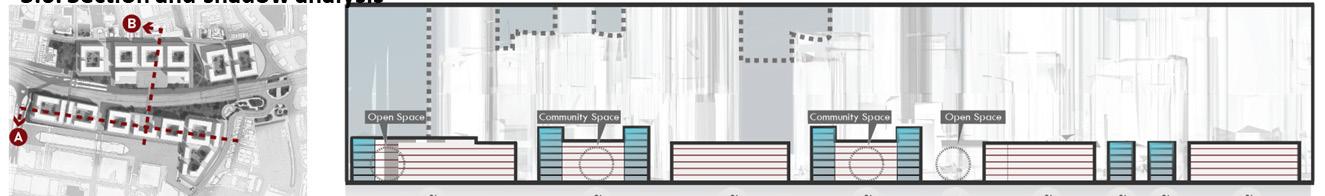
The inner courtyard offers a versatile, serene environment that fosters communal vibrancy and provides potential for commercial development along South Poplar’s canal and main road. The design optimises light penetration, even as shadow simulations indicate minimal sunlight during winter, enhancing both the functionality and ambience of the space.
Activity Performed
› Showcased proficiency in using AutoCAD, SketchUp, Rhinoceros and graphic software (Adobe Illustrator, Photoshop, InDesign) to visualize design insights.
› Applied evidence-based approaches to conduct comprehensive research on planning and design issues for masterplan and strategic plan.
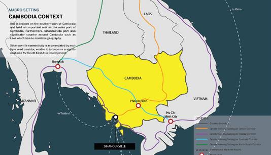
The Cambodia Satellite City Shihanoukville is an exemplary model of urban innovation that harmonizes modernity with nature. Situated in the vibrant heart of Cambodia, this development reimagines urban living through sustainable architecture and lush green spaces that invigorate the cityscape. Envisioned as a beacon of progress, it offers a tranquil residential setting, bustling commercial areas, and a rich cultural tapestry, setting a new benchmark in urban development. It fosters a community-centric approach with seamless connectivity and sustainability at its core, promising a future where urban and serene landscapes blend effortlessly.
Initial Feasibility Studies in Macro and Micro Analisis
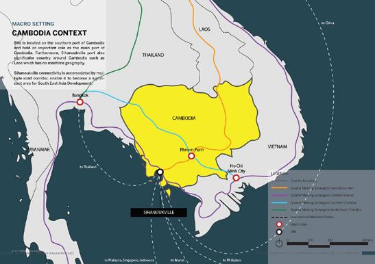

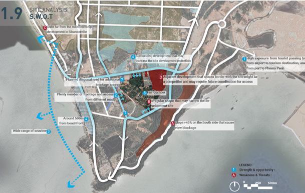
Expanding on this vision, the project proposes a resort-style, mixed-use development tailored for an international community, spanning approximately 39.9 million square meters in Sihanoukville. The terrain’s varied elevations provide unique vantage points with breathtaking sea views, with the highest peak reaching 71 meters above sea level. A comprehensive feasibility study is currently underway, aligning with the sustainability goals of the Sihanoukville 2038 Masterplan, ensuring that the development not only meets contemporary needs but also serves as a sustainable model for future expansions.


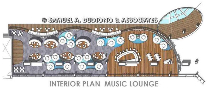
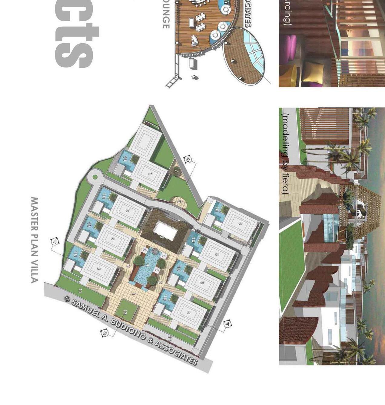
Pleasenotethatthedetailsofthisprojectremainconfidential.Thesharedimagesareonlytosharegeneralinformationaboutthescaleoftheprojects withoutspecificaspectsordata
Activity Performed
› Showcased proficiency in using AutoCAD, SketchUp, and graphic software (Adobe Illustrator, Photoshop, InDesign) to deliver precise modelling and technical drawings.
› Conducted site and context analysis using Geographic Information System (GIS) and 3D study modelling to improve spatial understanding and support informed decision-making in urban projects.
› Demonstrated a stellar record in urban design: shaping significant initiatives and crafting zoning plans that aligned with overarching development goals, effectively streamlining approvals and influencing policy adoption.
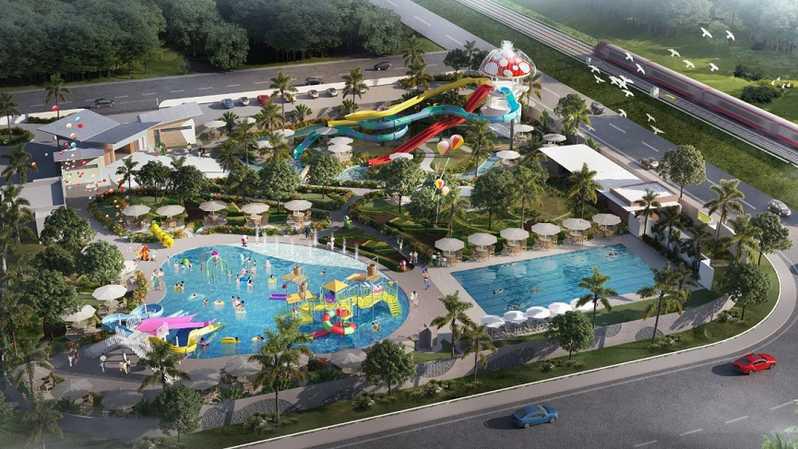
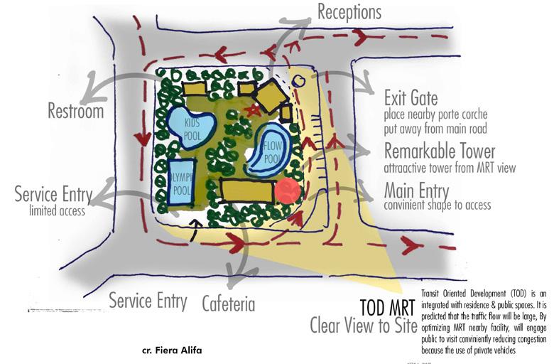
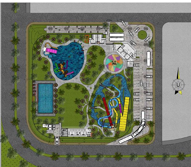
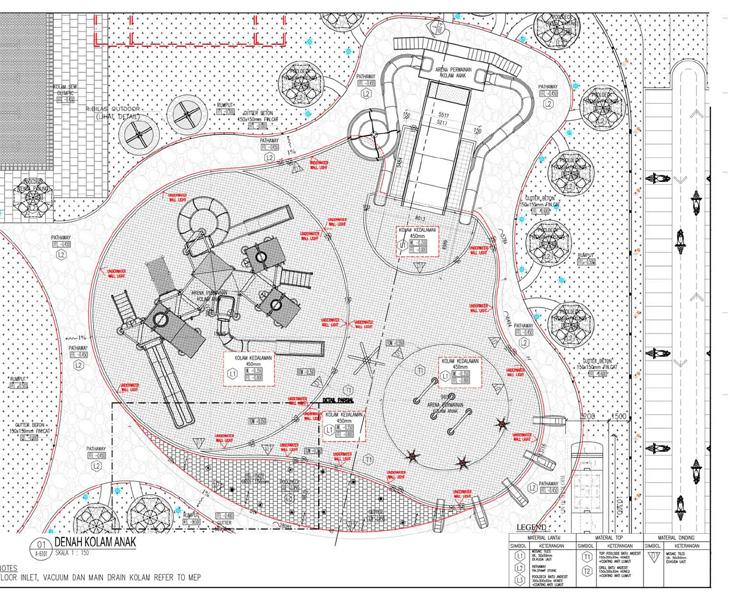
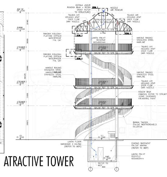
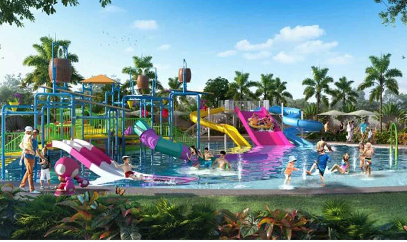
The Water Amusement Park, spanning 1.4 hectares, is a key component of the expansive Milenia City development project in Cibitung. It features a playful children’s pool area, a flowing river pool (Kolam Arus) for more adventurous visitors, and an Olympic-standard pool that meets the needs of serious swimmers and provides facilities for competitive events. This range of aquatic facilities ensures that all visitors, regardless of age or swimming ability, have enjoyable and suitable options. This project covers a total area of 20 hectares multifaceted urban complex, as an extensive outdoor recreational activities and a vibrant hub for enhancing the urban landscape.

Activity Performed
› Led the development of innovative architecture projects through manual sketch and digital modelling.
› Demonstrated advanced proficiency design visualisation in AutoCad, Sketchup, and graphic software (Adobe Illustrator, Photoshop, InDesign) to deliver modelling and technical drawings.
› Collaborated closely with multidisciplinary teams (structural engineers, MEP consultant, contractor, suppliers, etc) during planning and design phases to ensure effective communication and coordination).
› Played a pivotal role in a rigorous six-month phase of the project, efficiently producing over 100 construction drawings from conceptual designs. ensuring successful breakdown of design specifications.
› Meticulously planned project budgets to align with financial objectives and precise project requirements.
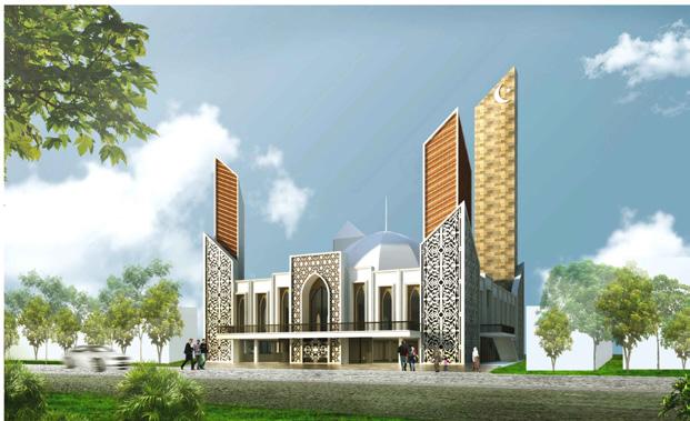
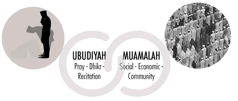
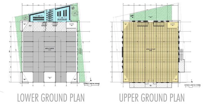
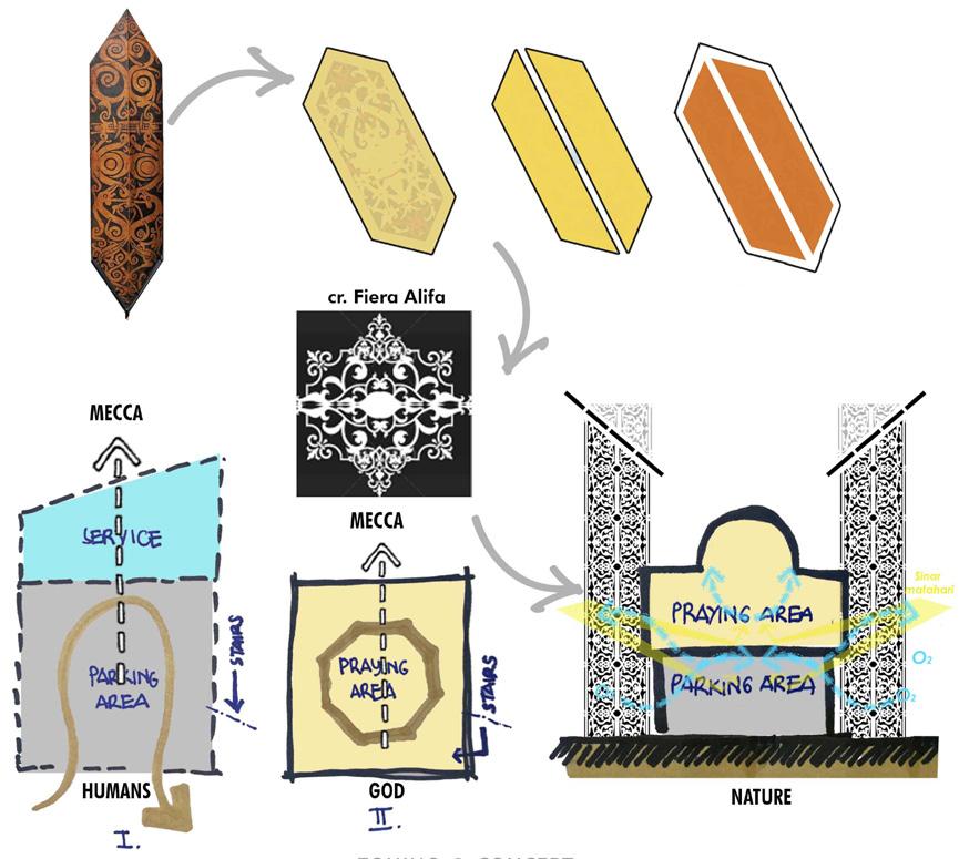
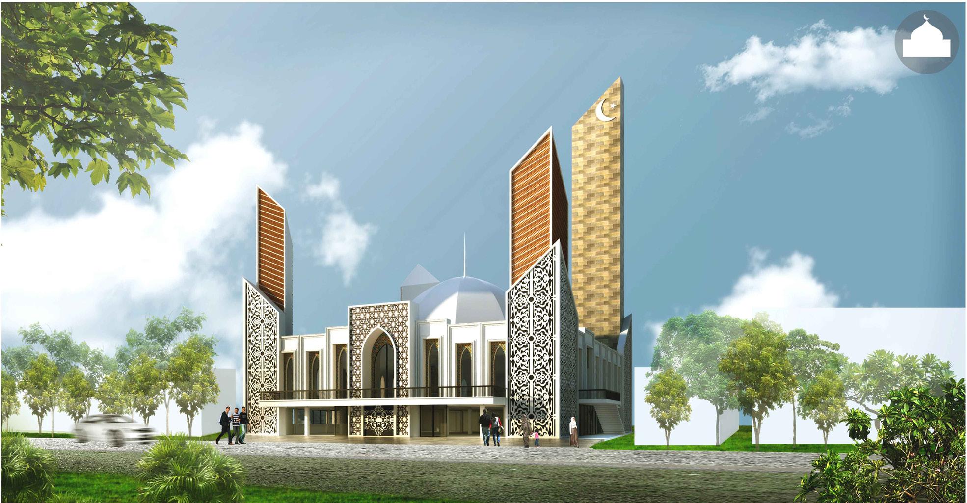
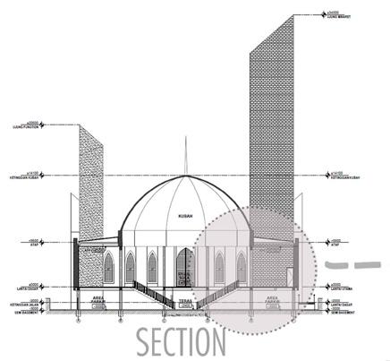
Muslim performs the series of set pray movements to connect :
• Relationship with God - Mihrab angle towards the qibla, strengthening the mass orientation to space eficiency
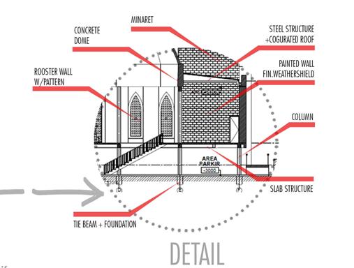
• Relationship with Nature - contextual response through natural lighting and air circulation in conjungtion with sustainibility
• Relationship with Human - Limited sites requires vertical zoning to devide functions.
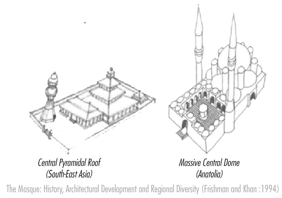
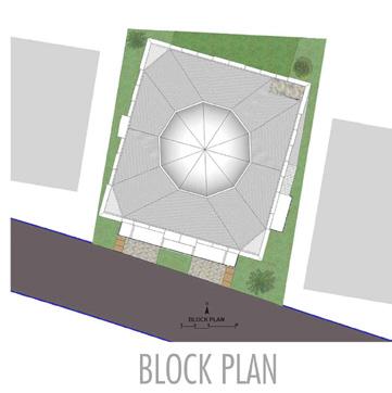
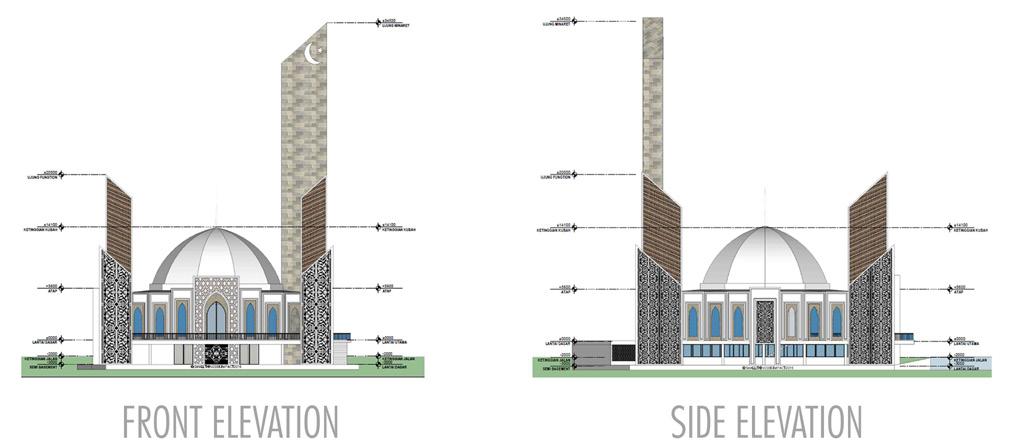
Mosque identity is recognized by locals through its distinctive dome and minaret. Its strategic location on a connecting road between two remote cities serves as a visual representation of its purpose. The mosque’s architectural details incorporate prominent local elements, blending tradition and modernity.
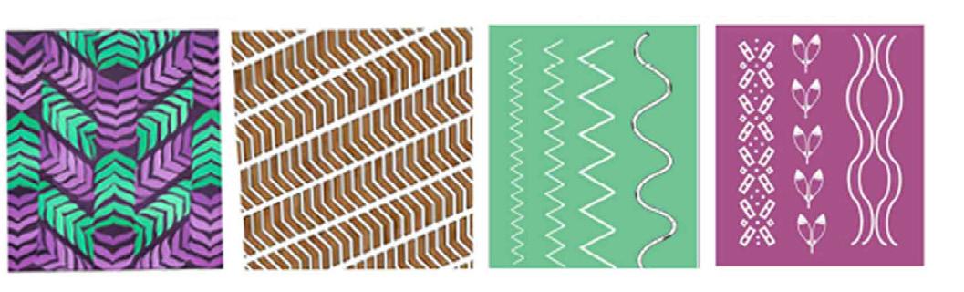
Local fabric of South Kalimantan named Sasirangan means “to stitch together” which illustrates the delicate process of hand stitching and weaving traditionally.

Professional Competition - Architecture & Landscape - In Collaboration with Ihsan R, UCL / Satria AP, TU Delft (2023)
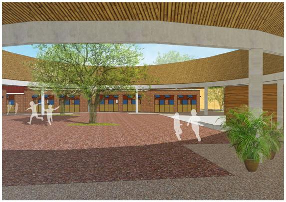
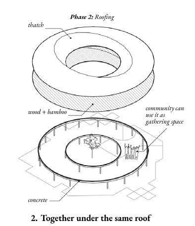
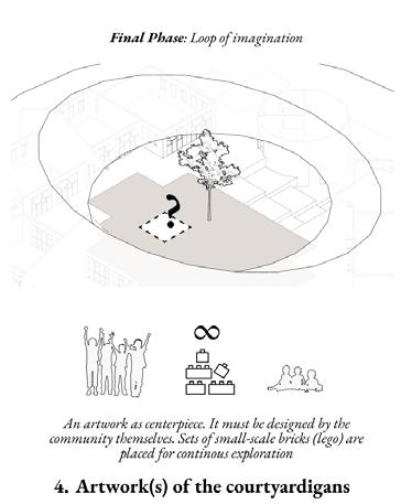
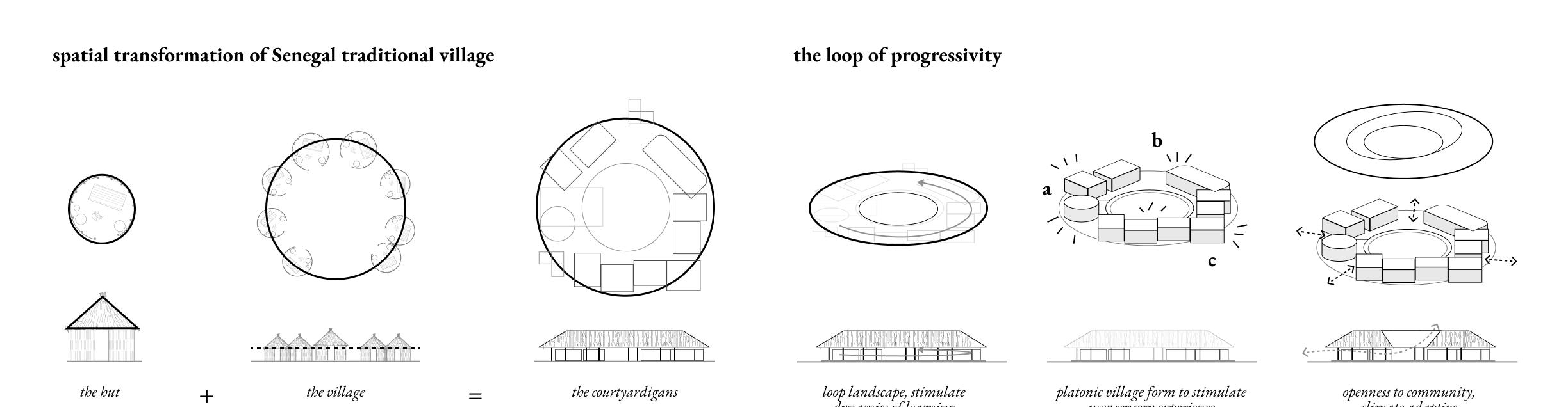
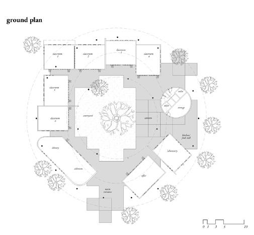
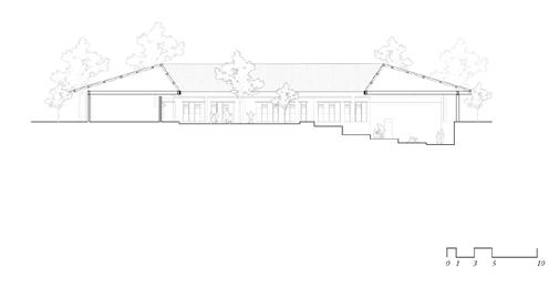
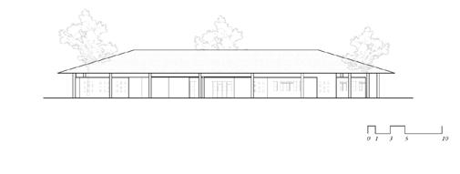
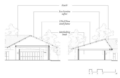
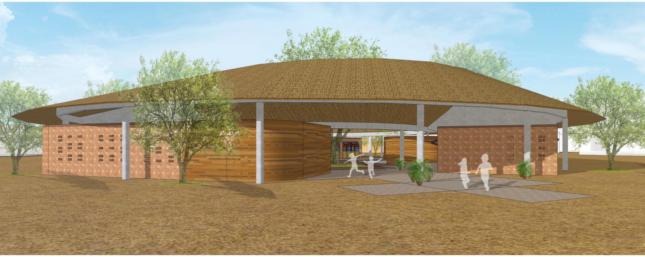
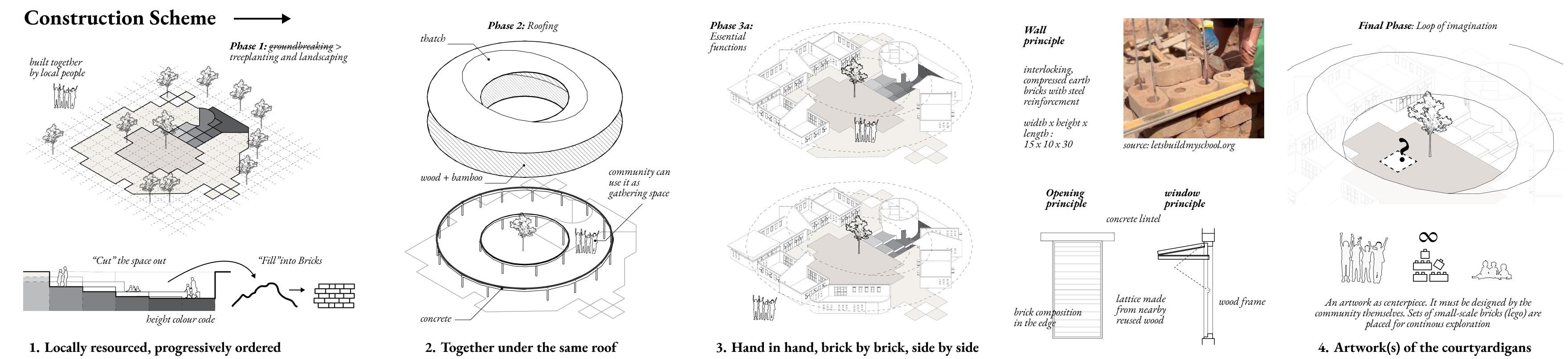
A process for the community to re-gain confidence by collaboratively building a school where infinite dreams, imagination, and explorations can flourish.
“it takes village to raise a child”
In the form of mini village with a cluster of masses, an open courtyard and mini corners, the school is set as a stage that inspires the courtyardigans (the community) for yet another fantasy, everyday. As the Courtyardigans keep reinventing theirselves in this mini village, a generation thrive to reign the future.
Activity Performed
› Managed remote collaboration from the initial brainstorming of ideas through to the creation of final deliverables, by employing tools such as Figma and Miro to ensure effective work delegation and ongoing communication.
› Led the development of innovative architecture projects through manual sketch and digital modelling.
› Demonstrated advanced proficiency design visualisation in AutoCad, Sketchup, and graphic software (Adobe Illustrator, Photoshop, InDesign) to deliver modelling and technical drawings.
› Translated design philosophies into tangible architectural projects, ensuring that conceptual visions were effectively realised with available materials and sustainable construction techniques for local communities built initiatives.
› Meticulously planned project budgets to align with financial objectives as project requirements.
Professional Competition - Architecture & Landscape - In Collaboration with Faris K, AECOM and Denny LB, Modular WIKA (2019)
Arctic
Runner Up ASA International Design Competition, 2019
Top Five Jacques Rougerie Architecture International Awards, 2020
Activity Performed
› Managed work collaboration from the initial brainstorming of ideas through to the creation of final deliverables.
› Led the development of innovative architecture projects by translating design visionary in professionals level to propose bold projects addressing major sustainable issues related to climate, the sea, and space.
› Demonstrated advanced proficiency design visualisation in AutoCad, Sketchup, and graphic software (Adobe Illustrator, Photoshop, InDesign) to deliver modelling and technical drawings.
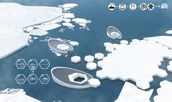
The Intergovernmental Panel on Climate Change (IPCC) confirms the model estimates of global scale warming Extensive investigations have recently uncovered a number of surprises, many somewhat counter intuitive, each having significant consequences in the Arctic to the rest of our planet.
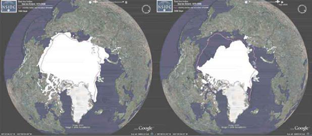
The potential effects of Arctic regime shift or tipping points- when a natural system, such as the ice cap, undergoes a dramatic change on the rest of the world are substantial, yet poorly understood. Human Driven climate change greatly increases the risk of Arctic regime shifts, so reducing global greenhouse gas emissions is crucial to reducing the risk.
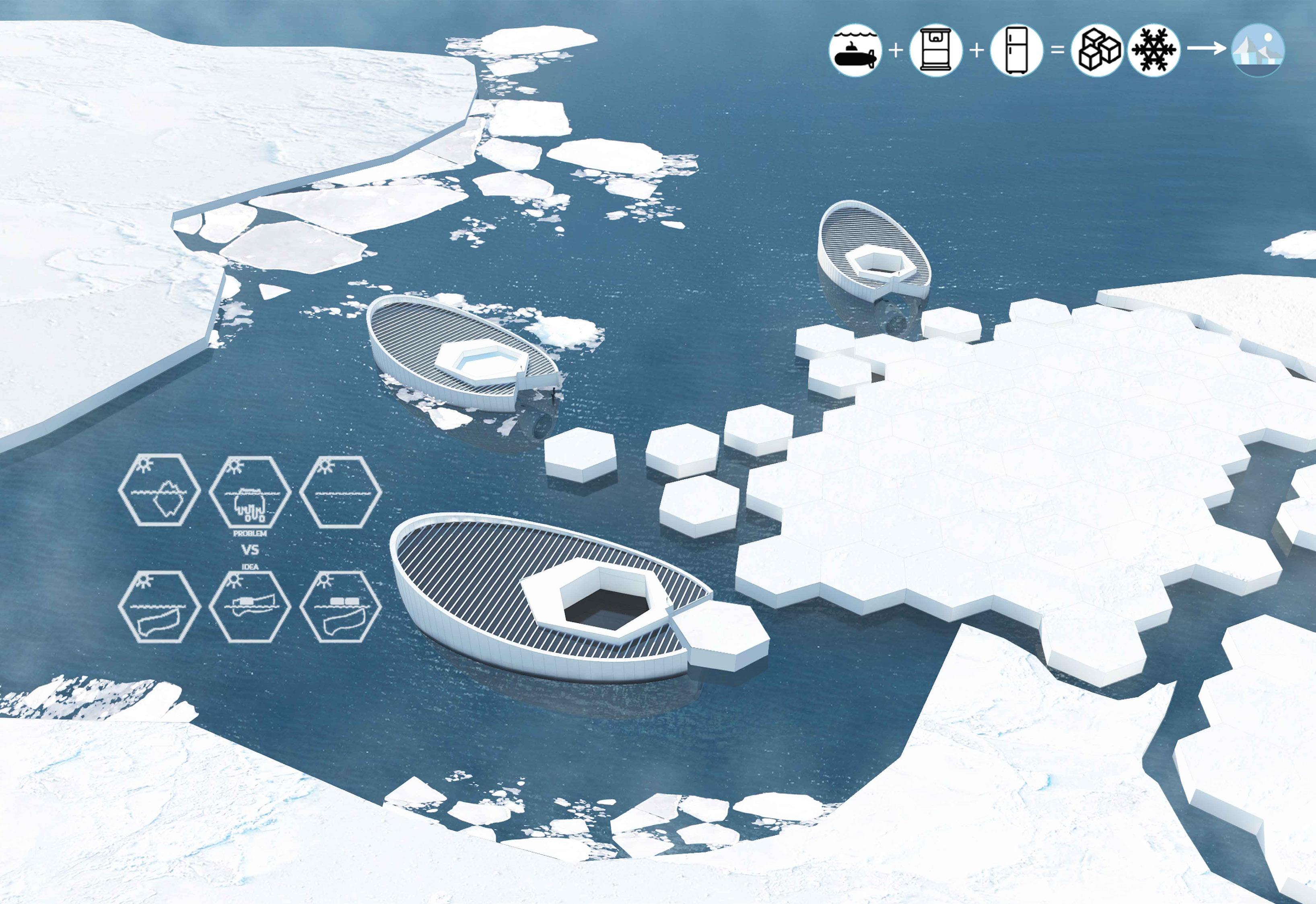
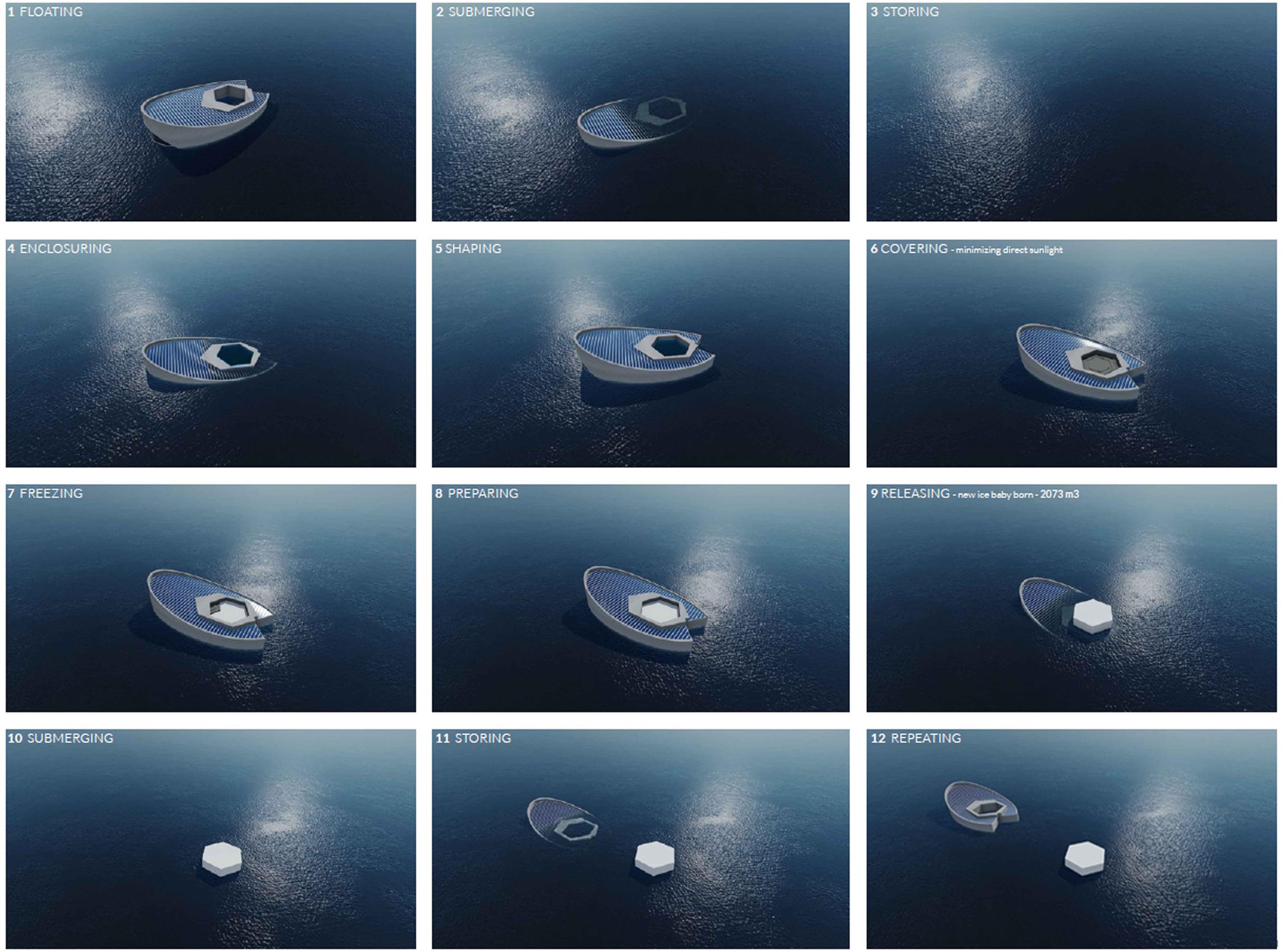
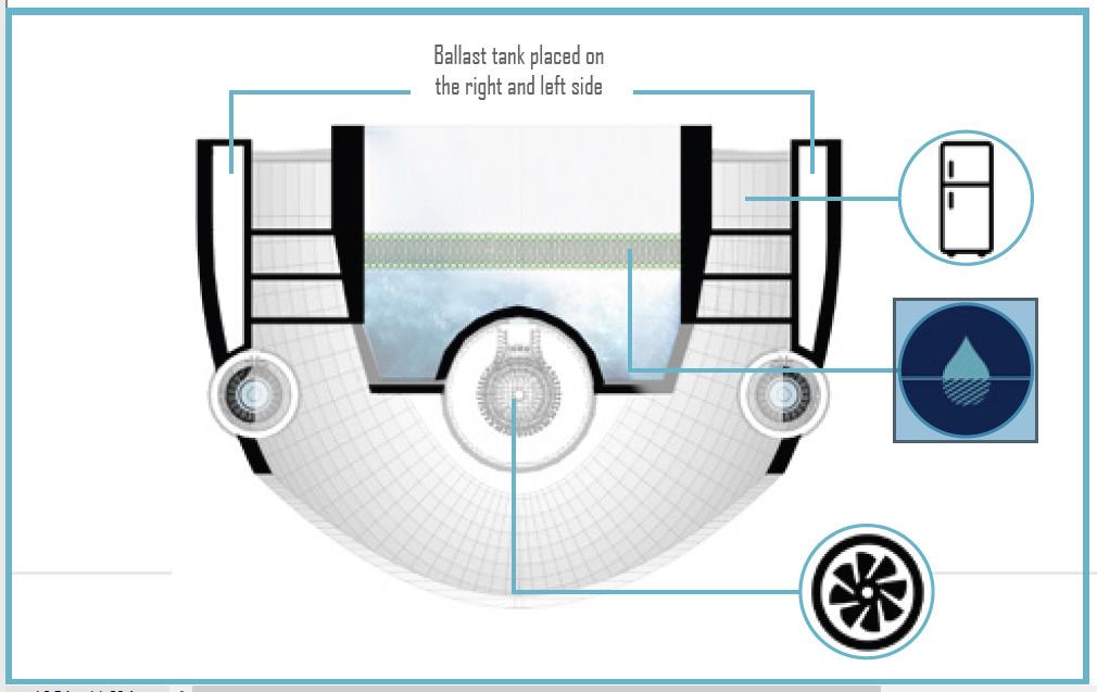
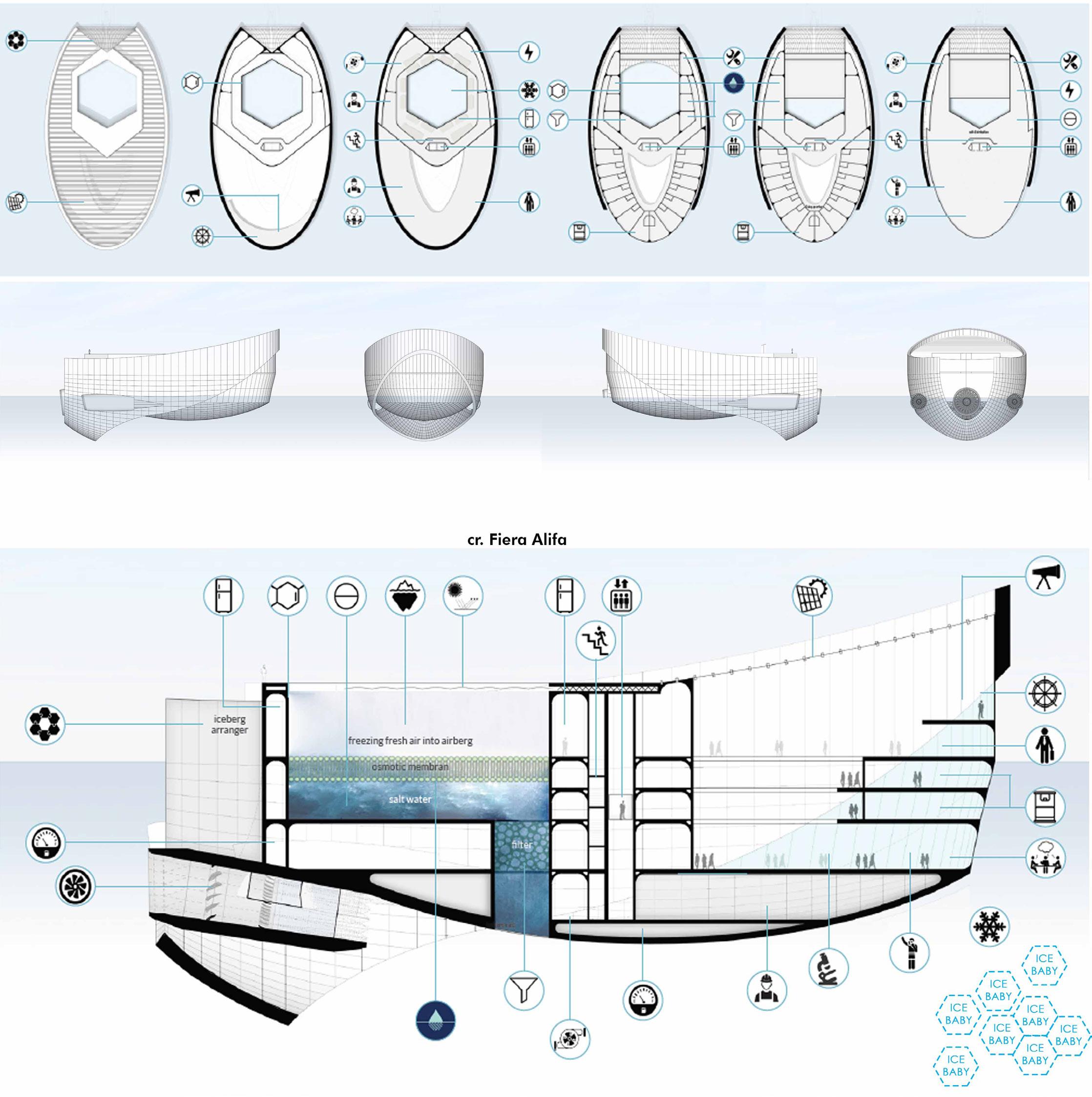
Iceberg needs a year to be established and three years to be released as water again. In order to alter ice to be frozen immediately, air turbines move actively to maintain the prospective ice in ideal temperature. Prior to the water being placed, reverse osmotic layers would filter the water from salt to keep the purity of water in cut short the time efficiency of ice-making.
Global issue is the main concern brought by the question what will be happened if the tropical area without tree. Same as, how would Arctic without ice?
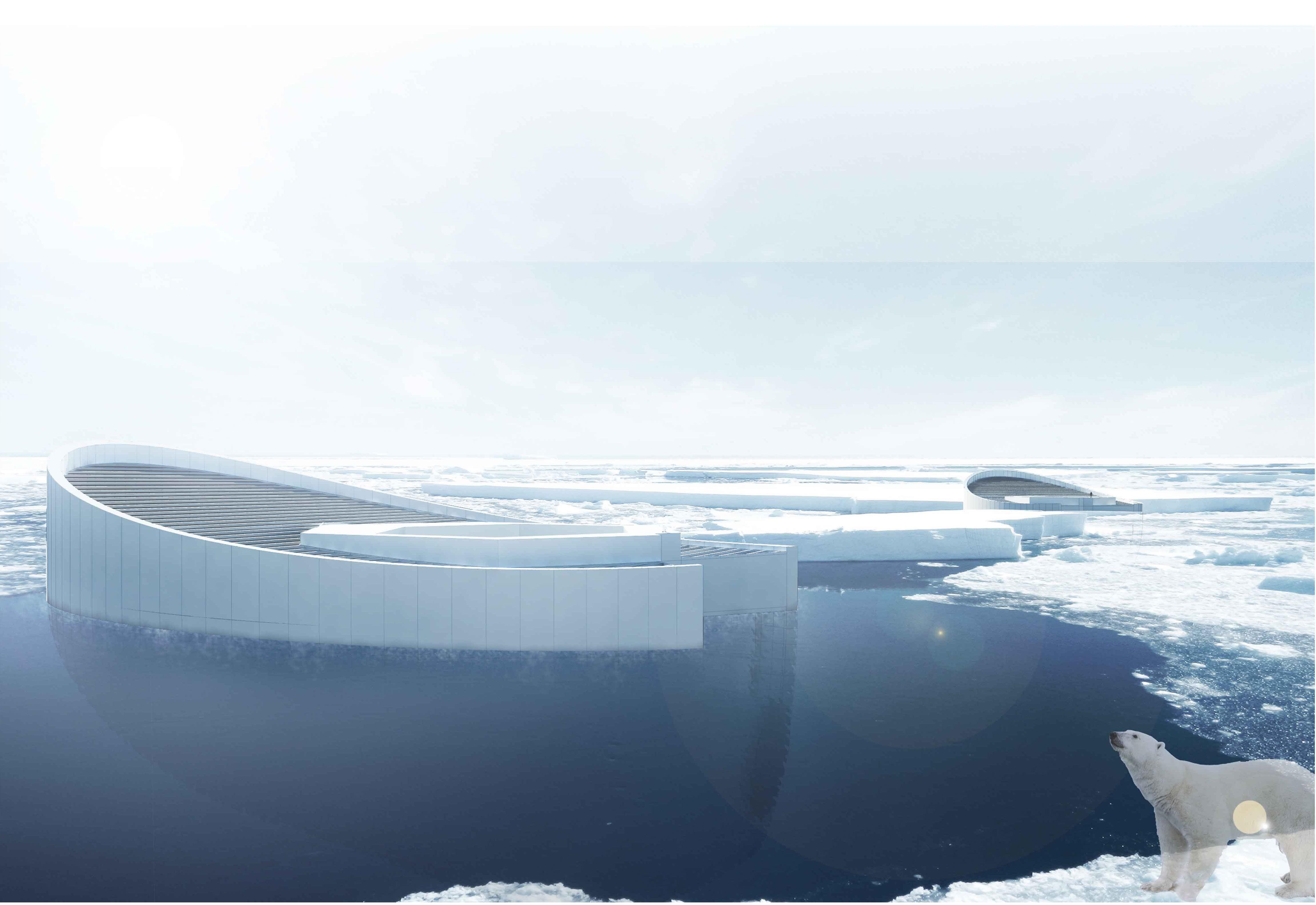
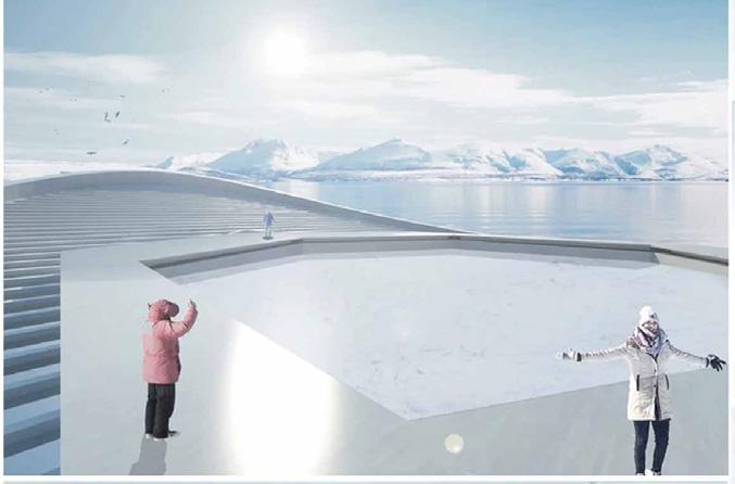
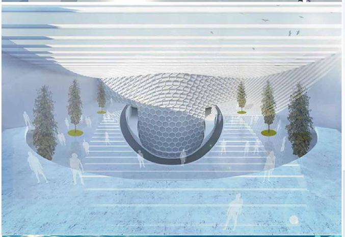
Re-iceberg-isation as the term to explain as in re-forestation but to recover iceberg. Refer to research, ice containing salt melts faster. The freezer is designed with osmotic layers inside the hexagonal ice cast to separate the pure water and salt water. The air moving tunnel surrounds the cast to press the cold temperature. Its cover will be opened after frozen, then the iceberg will be released with hexagonal shape to be puzzling with other hexagonal ice. The Upnormal Freezer is movable prototype, future development would be a high possibility to save the arctic.
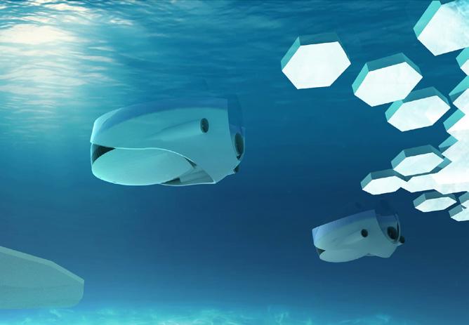
Besides the main function as Icebeerg molder, it accomodates for Underwater Sightseeing, Research, Living Quarter and Arctic Eco-Tourism.
Submarine system is adapted as movable molder. The freezer stays floating in the Arctic Sea normally. It sinks then floats with the water inside the hexagonal cast. After on-going reverse osmotic process, the salt water will be filtered out to the crystallization salt area – while fishes and microorganisms thrown back to sea through the bottom valve. The top lid closes to enclose the cold temperature. After the desalinate process, it goes up to the surface and repeats to sink.
The project challenged a comprehensive understanding of sustainability—social, cultural, economic, and environmental by tackling key urban design and planning issues, such as inclusivity, collaboration, resource efficiency, nature integration, and climate change.
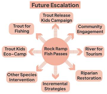
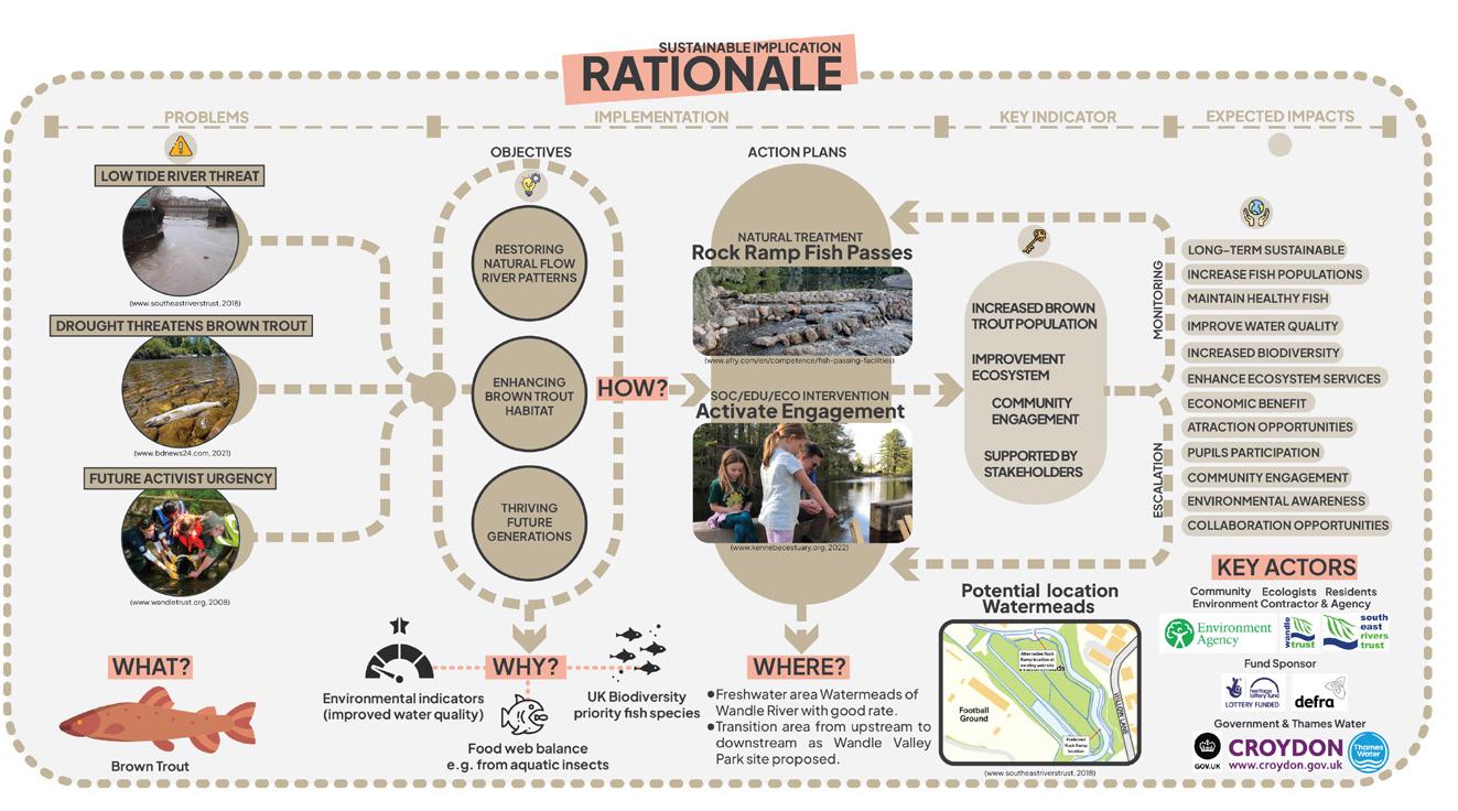

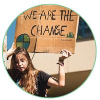
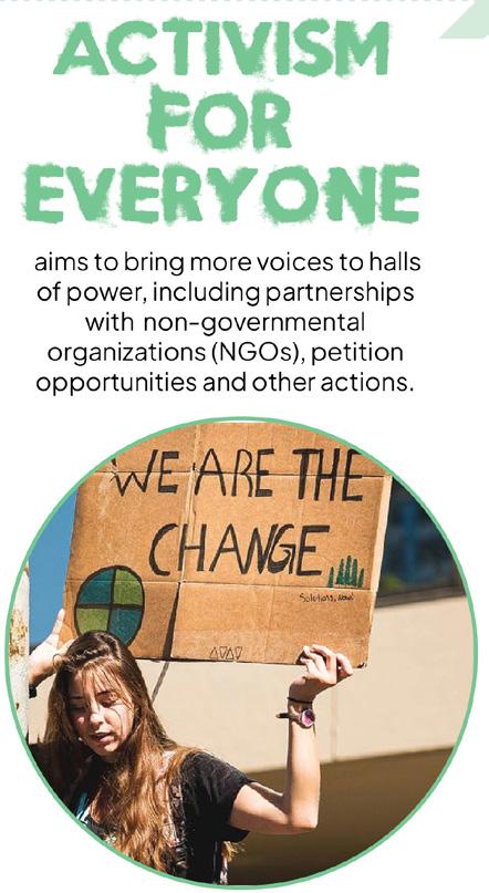
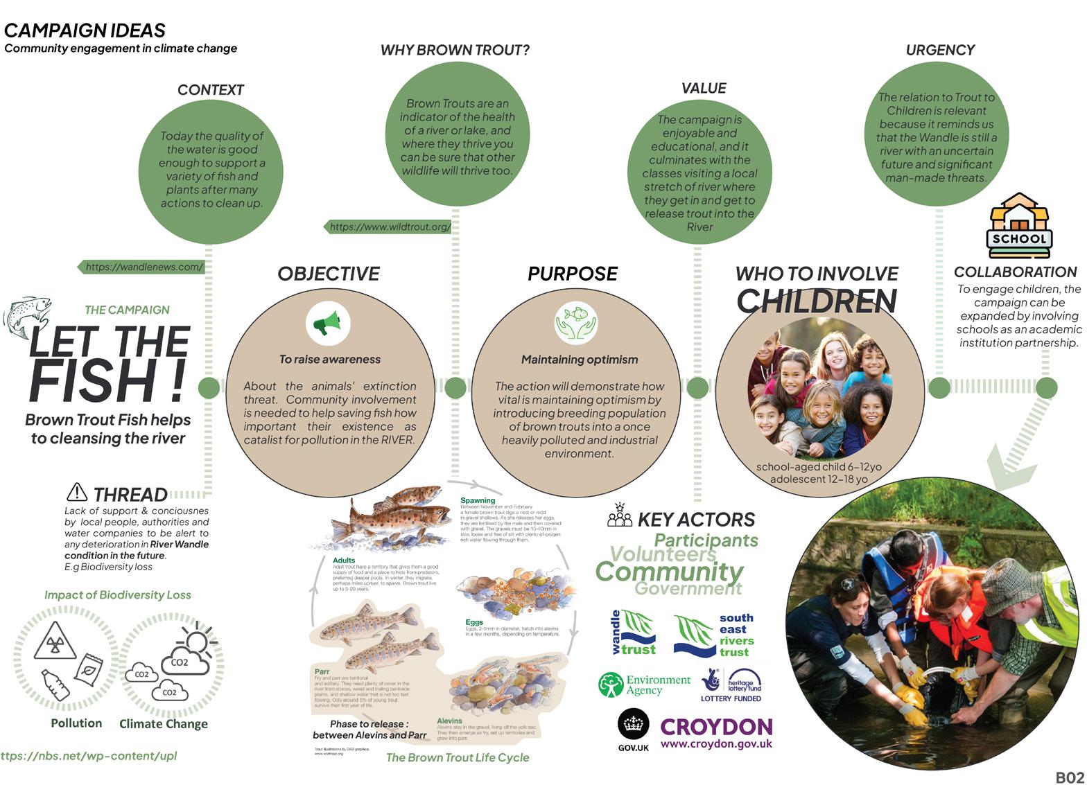
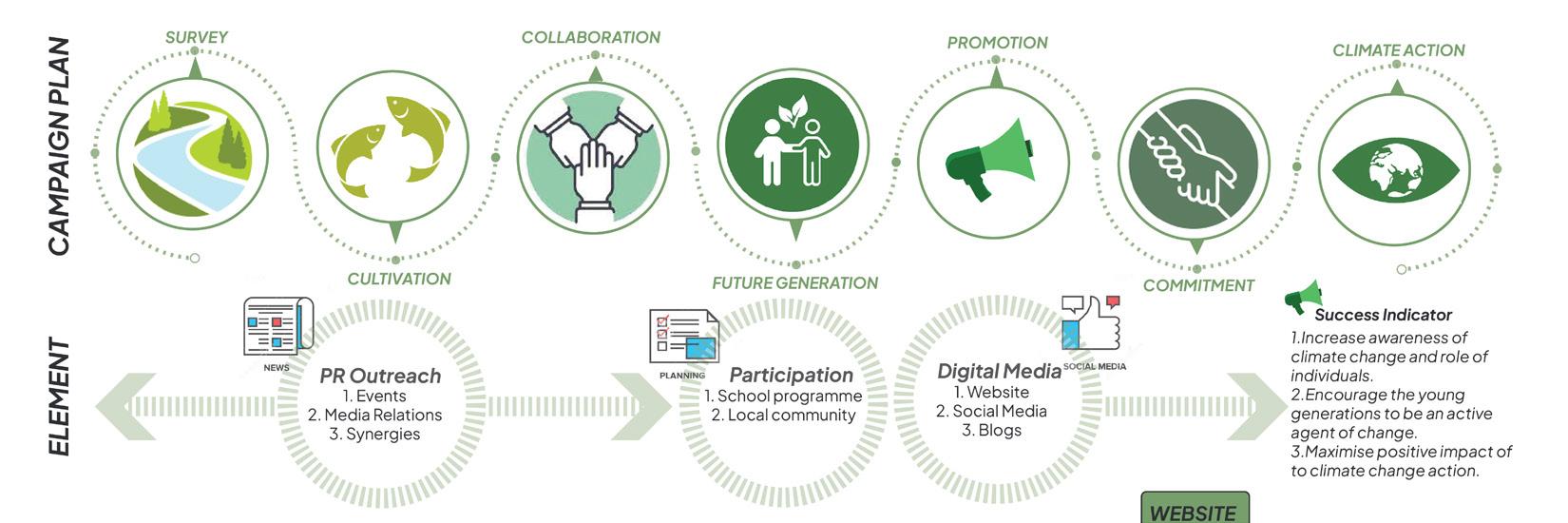
CAMPAIGN IDEAS
Community engagement in respond to climate change actions


Type of work :
Academic - Course Project, 2023
Role :
Student (Individual)
Contribution :
Creating collaborative games for sustainable planning approach
Term’s project :
Sustainable Futures by Design
Project’s Supervisor :
Dr Pablo Sendra / Dr Tse-Hui Teh
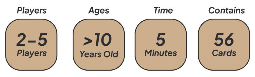
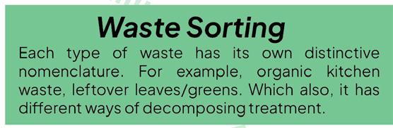
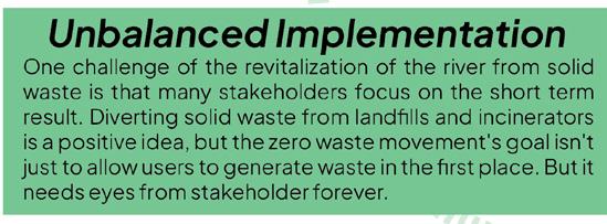
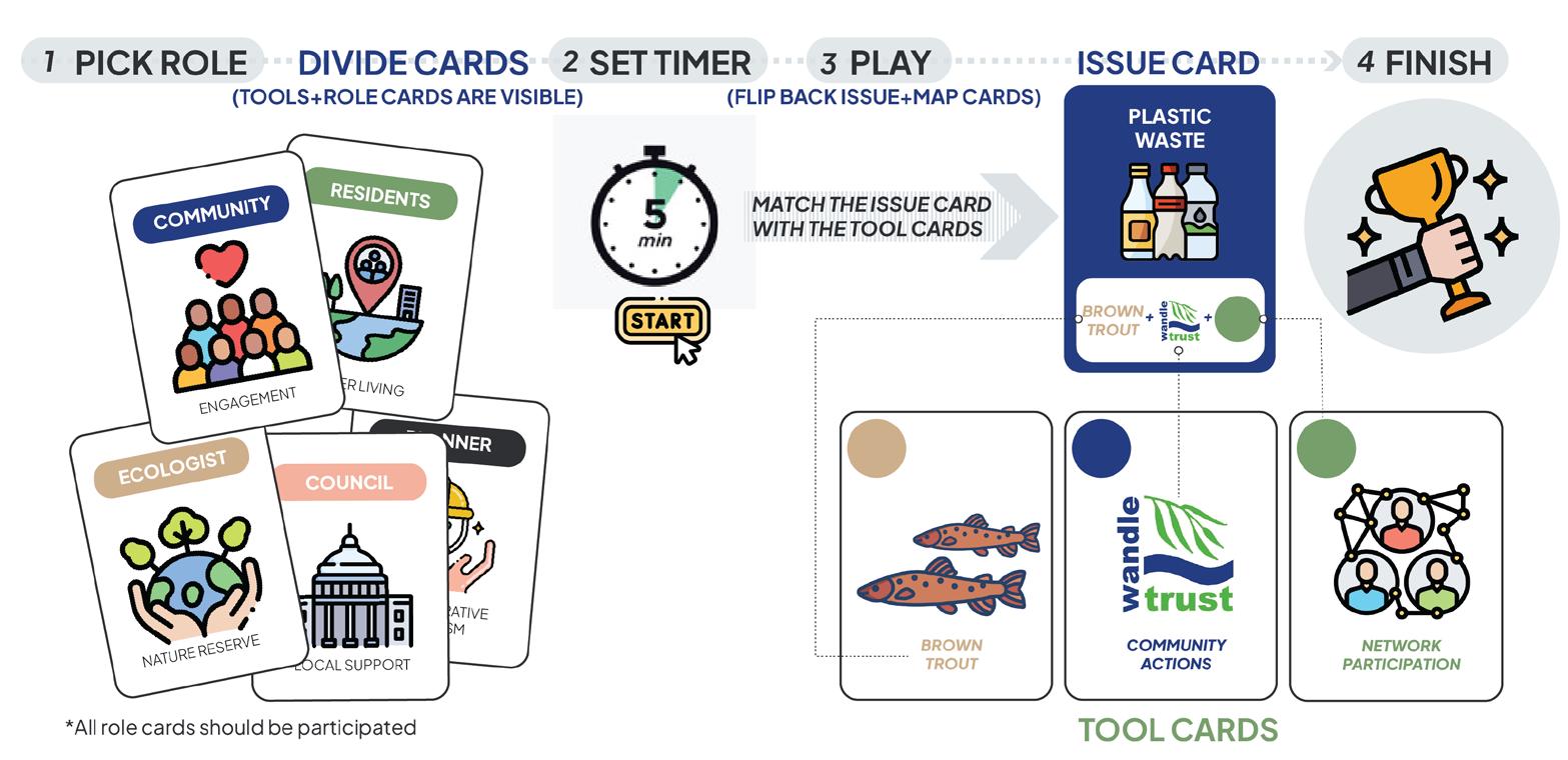
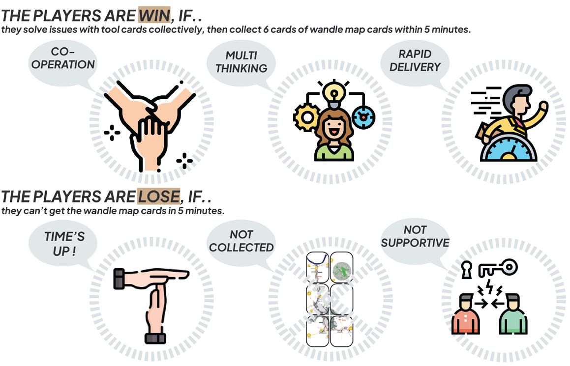
Wonder-Wandle is a cooperative game, all Players may win or lose together. Players win the game if they collectively uncover and assemble all (6) Wandle Map Cards before time runs out, but lose if they are unable to accomplish the objective tackling climate change immediately.
Type of work :
Academic - Course Project, 2023
Role :
Student (Group)
Contribution :
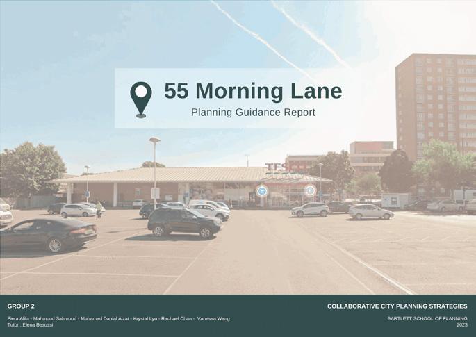
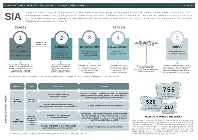
Planning Guidance Report with SIA approach
Term’s project :
Collaborative City Planing Strategies
Project’s Supervisor :
Elena Besussi
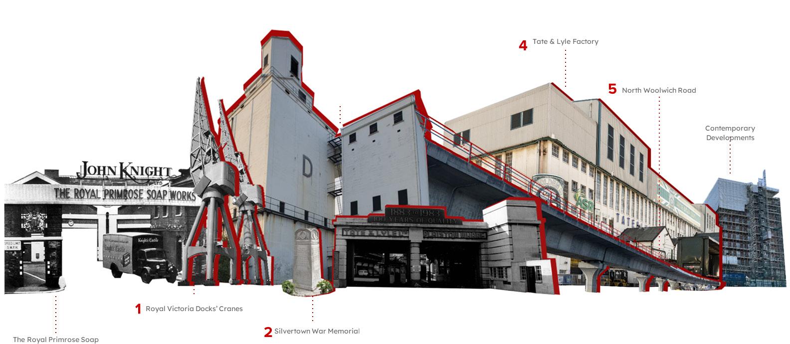
As Hackney Council redevelops the site at 55 Morning Lane, this document re-evaluates the site environment and proposes potential suggestions for its development. By comprehensively integrating the site’s planning and development background, as wel l as counting community voices in creating planning guidance, this proposal aims to meet the actual needs of the Hackney local community as a reliable development and planning alternative for the site’s renewal.
Sample of Planning Guidance Report
Type of work :
Academic - Course Project, 2023
Role :
Student (Group)
Contribution :
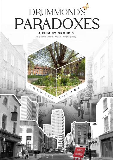
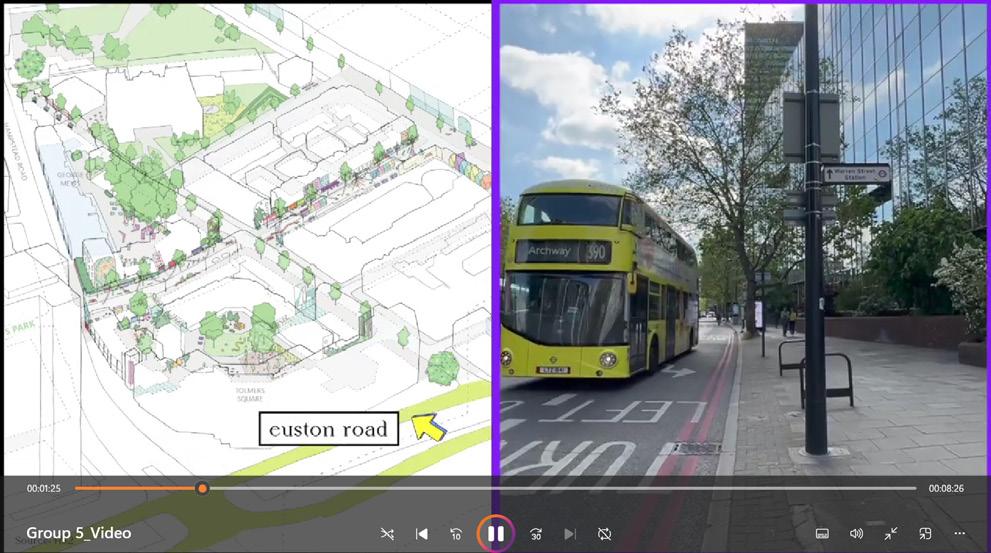
Video Producing of HS2 Development Project in Euston
Term’s project :
Project’s Supervisor :
Design & Real Estate
Prof Peter Rees
The objective of this course is to present the urban characteristics (“unique set of fingerprints”) of designated site. The short film visualizes the paradoxical relationship between the place and the HS2 project brings opportunity to nurture back the community around Euston. By bringing the same manner the 1970s development pressure drove the community together. Drummond street’s local shop and the tranquil ambience of Tolmers Square possess equal potential for wider use in the community.

Activity Performed
› Showcased proficiency in using AutoCAD, SketchUp, and graphic software (Adobe Illustrator, Photoshop, InDesign) to deliver precise modelling and technical drawings.
› Translated design philosophies into tangible architectural projects, ensuring that conceptual visions were effectively realized in advanced materials and construction techniques for design excellence.
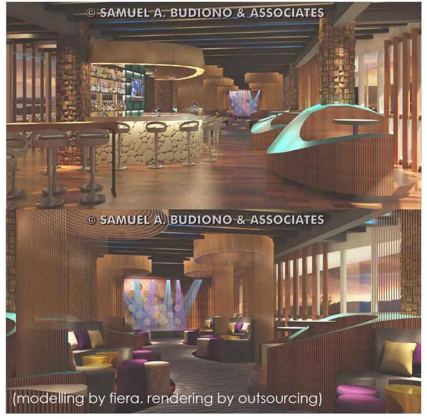
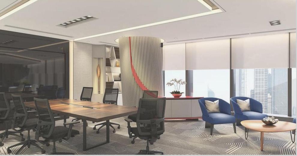
& Construction
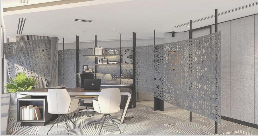
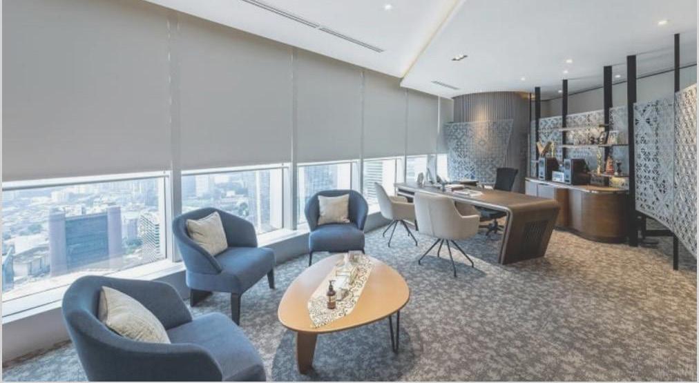
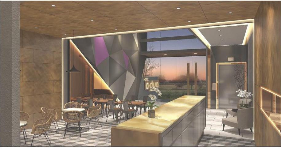
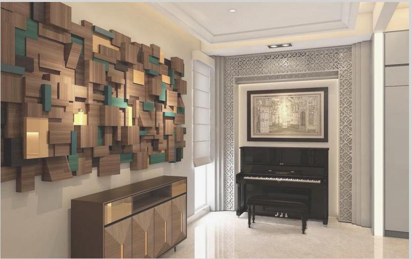
Board of Director Office (Indonesia,
Conceptual & Construction Drawings - MORPHE Architecture & Interior
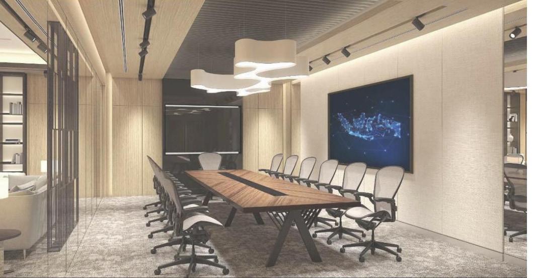
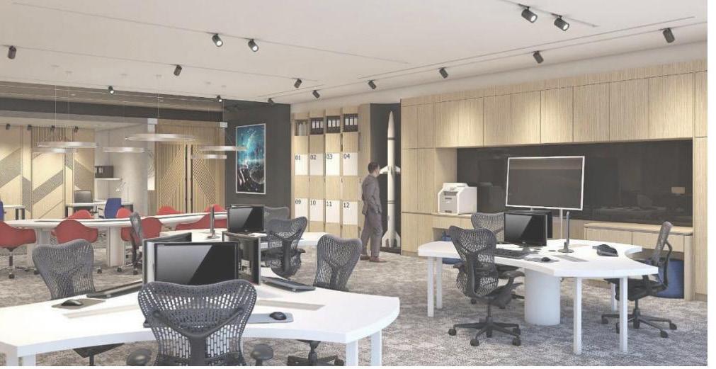
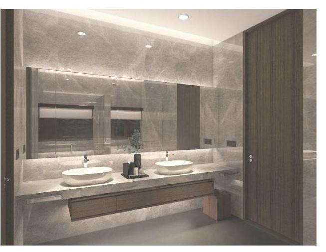
Executive Floor (Indonesia, 2021)
Conceptual & Construction Drawings - MORPHE Architecture & Interior
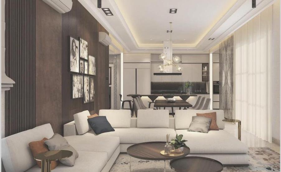
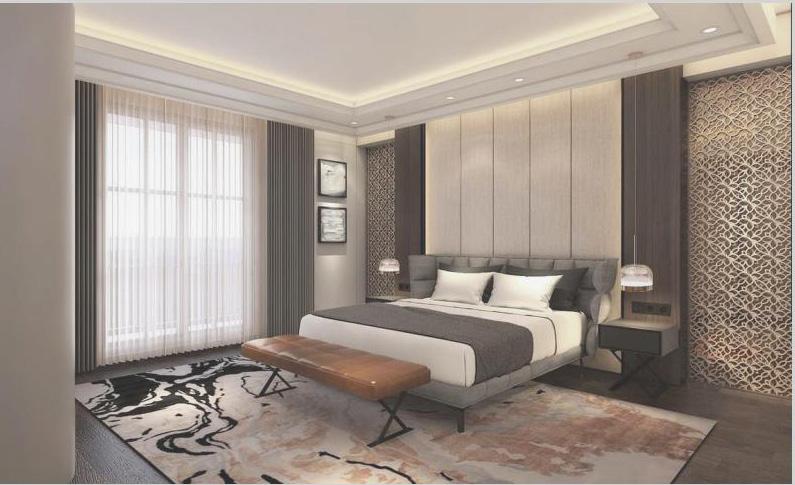
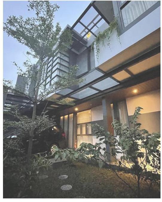
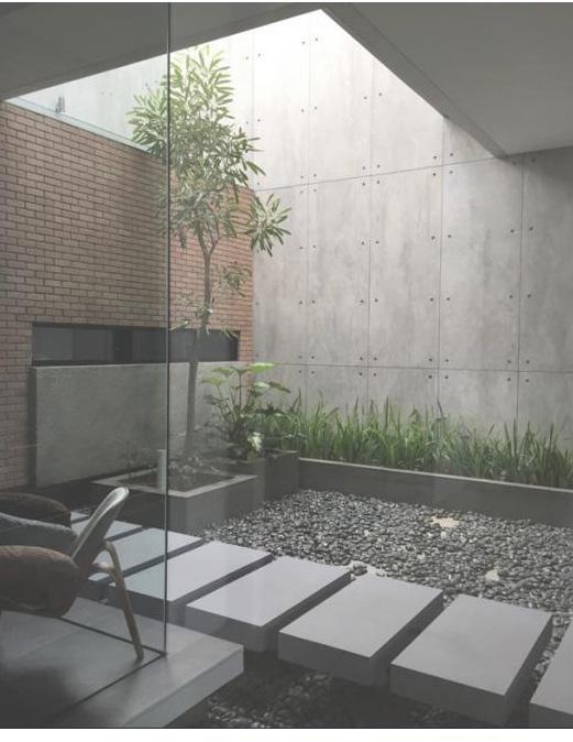
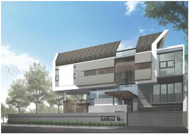
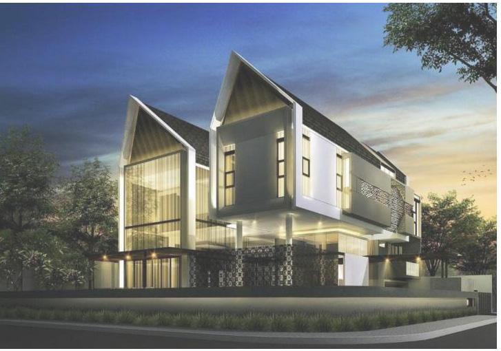
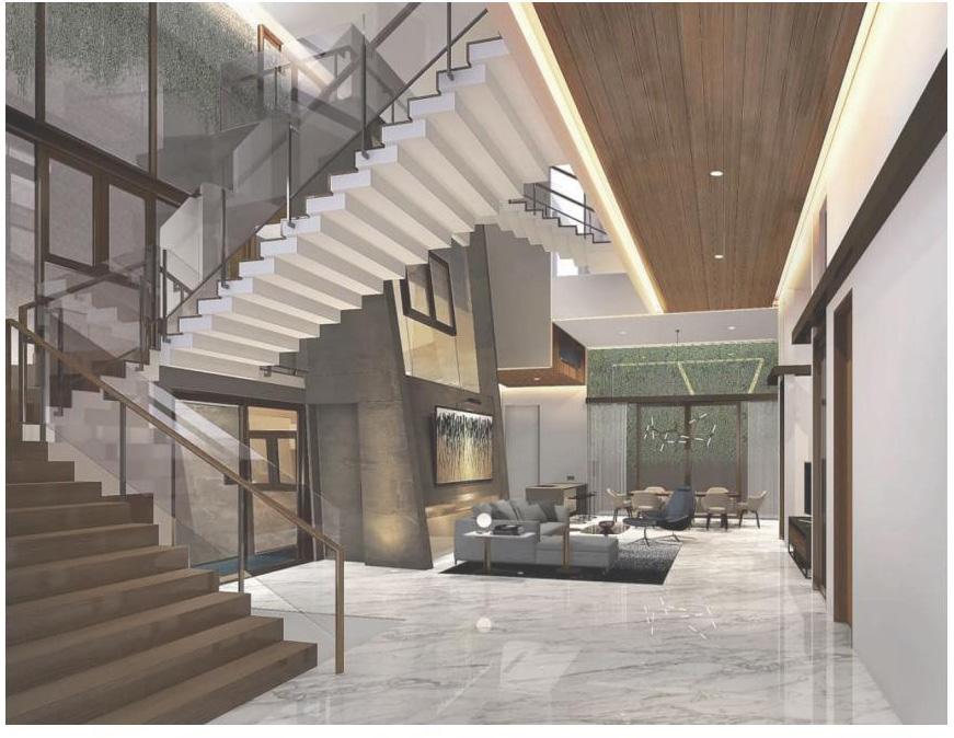
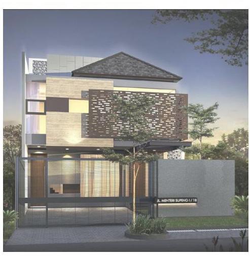
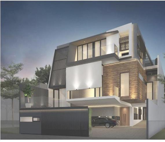
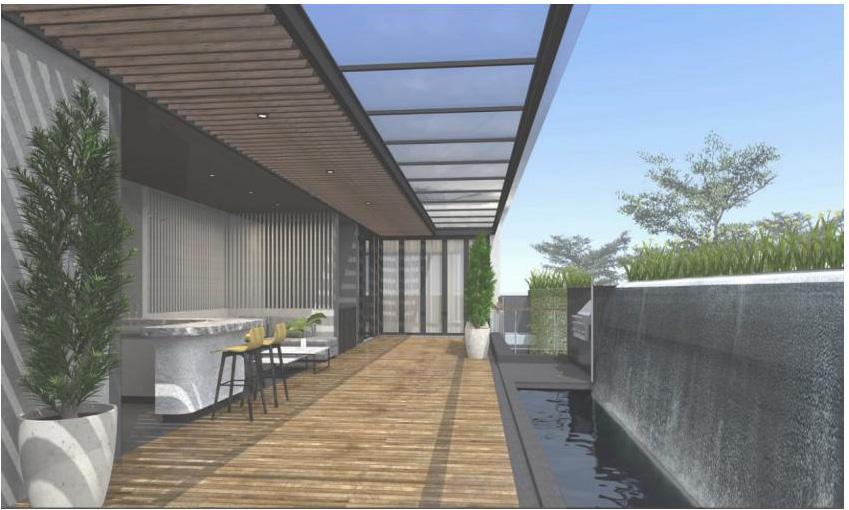
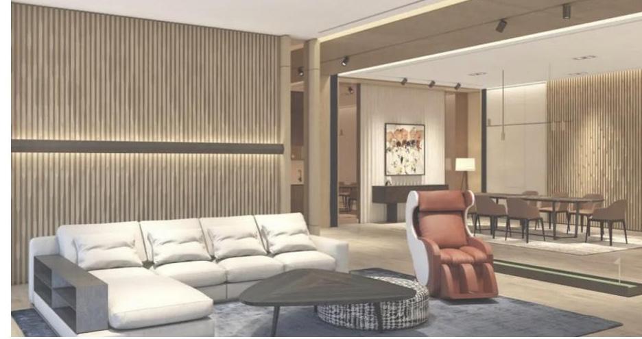
Private Residence (Indonesia, 2021)
Conceptual & Construction Drawings - MORPHE Architecture & Interior
Activity Performed
› Led the development of innovative architecture projects through manual sketch and digital modelling.
› Demonstrated advanced proficiency design visualisation in AutoCad, Sketchup, and graphic software (Adobe Illustrator, Photoshop, InDesign) to deliver modelling and technical drawings for architectural & interior projects.
› Collaborated closely with multidisciplinary teams (structural engineers, MEP consultant, contractor, suppliers, etc) during planning and design phases to ensure effective communication and coordination).
› Meticulously planned project budgets to align with financial objectives and precise project requirements, ensuring successful breakdown of design specifications.