IMPORTANT NOTE:
Because our itineraries are subject to change, we have designed our tour books alphabetically in the following format:
• Country
• City
• Site
*Itinerary subject to change.

Because our itineraries are subject to change, we have designed our tour books alphabetically in the following format:
• Country
• City
• Site
*Itinerary subject to change.
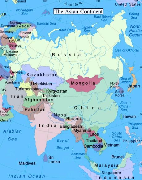
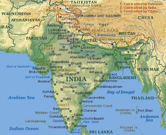
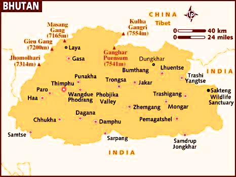
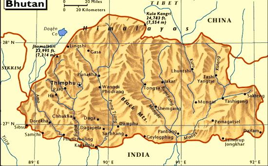
Bhutan, officially the Kingdom of Bhutan, is a landlocked country in South Asia at the eastern end of the Himalayas with 770,000 people (2015 estimate). It is bordered to the north by China and to the south, east and west by India. To the west, it is separated from Nepal by the Indian state of Sikkim, while farther south it is separated from Bangladesh by the Indian states of Assam and West Bengal. Bhutan's capital and largest city is Thimphu.
Much of early Bhutanese history is unclear because most of the records were destroyed when fire ravaged the ancient capital, Punakha, in 1827. By the 10th century, Bhutan's political development was heavily influenced by its religious history. Various sub-sects of Buddhism emerged that were patronized by the various Mongol warlords. After the decline of the Yuan dynasty in the 14th century, these sub-sects vied with each other for supremacy in the political and religious landscape, eventually leading to the ascendancy of the Drukpa Lineage by the 16th century. Bhutan then existed as a patchwork of minor warring fiefs until the early 17th century. At that time the lama and military leader Ngawang Namgyal, the first Zhabdrung Rinpoche, who was fleeing religious persecution in Tibet, unified the area and cultivated a distinct Bhutanese identity. In the early 20th century, Bhutan came into contact with the British Empire and retained strong bilateral relations with India upon its independence. In 2008, Bhutan made the transition from absolute monarchy to constitutional monarchy and held its first general election.
The climate in Bhutan varies with elevation, from subtropical in the south
to temperate in the highlands and a polar-type climate, with year-round snow, in the north. Bhutan experiences five distinct seasons: summer, monsoon, autumn, winter and spring. Western Bhutan has the heavier monsoon rains; southern Bhutan has hot humid summers and cool winters; central and eastern Bhutan is temperate and drier than the west with warm summers and cool winters.
It is estimated that between two-thirds and three-quarters of the Bhutanese population follow Vajrayana Buddhism, which is also the state religion. About onequarter to one-third are followers of Hinduism and are most prevalent in the southern regions. Other religions account for less than 1% of the population. The current legal framework, in principle, guarantees freedom of religion; proselytism, however, is forbidden by a royal government decision and by judicial interpretation of the Constitution Buddhism was introduced to Bhutan in the 7th century AD. Tibetan king Songtsän Gampo (reigned 627–649), a convert to Buddhism, ordered the construction of two Buddhist temples, at Bumthang in central Bhutan and at Kyichu Lhakhang (near Paro) in the Paro Valley.
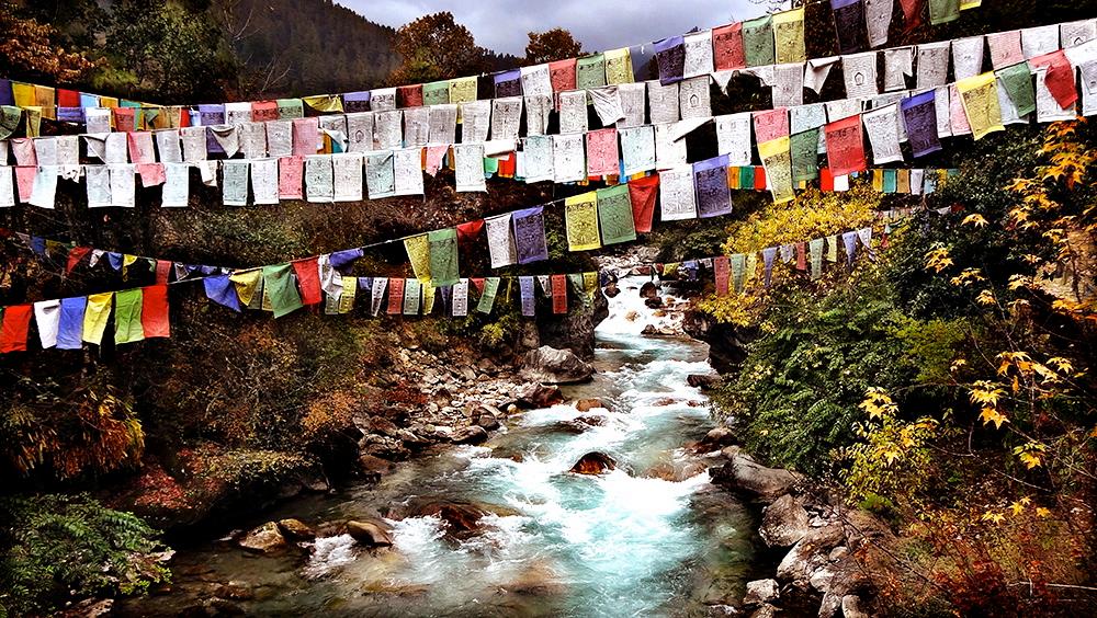
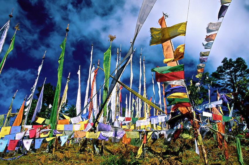
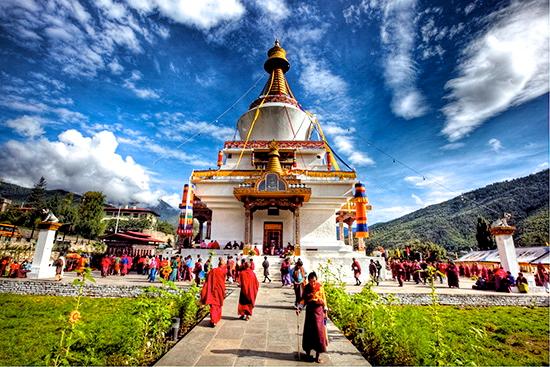
Prayer flags are colorful rectangular pieces of cloth inscribed with prayers, mantras, and auspicious symbols. Buddhists believe that the prayer flags generate spiritual vibrations that are released when blown by the wind and the prayers are carried in the air like silent prayers. Any person and place touched by the wind will be happier and uplifted. Prayer flags come in horizontal or vertical forms. Horizontal ones called “Wind Horse” are the more common and come in set of five 5 flags in 5 different colors. Each color represents the 5 basic elements: blue for space, white for air, red for fire, green for water and yellow for earth. Buddhists believe that balancing these elements brings harmony to the environment and good health to the body and the mind. Prayer flags are also use to appease local spirits and gods. Hence, prayers flags are planted in places where they may reside such as mountains, lakes, streams and valleys. Prayer flags are always seen hanging in high passes and spiritual
places like stupas and temples. They are hung in any place that people wish to be blessed or protected. Prayer flags are said to bring happiness, wish fulfillment, long life and prosperity to the flag planter and those in the vicinity.
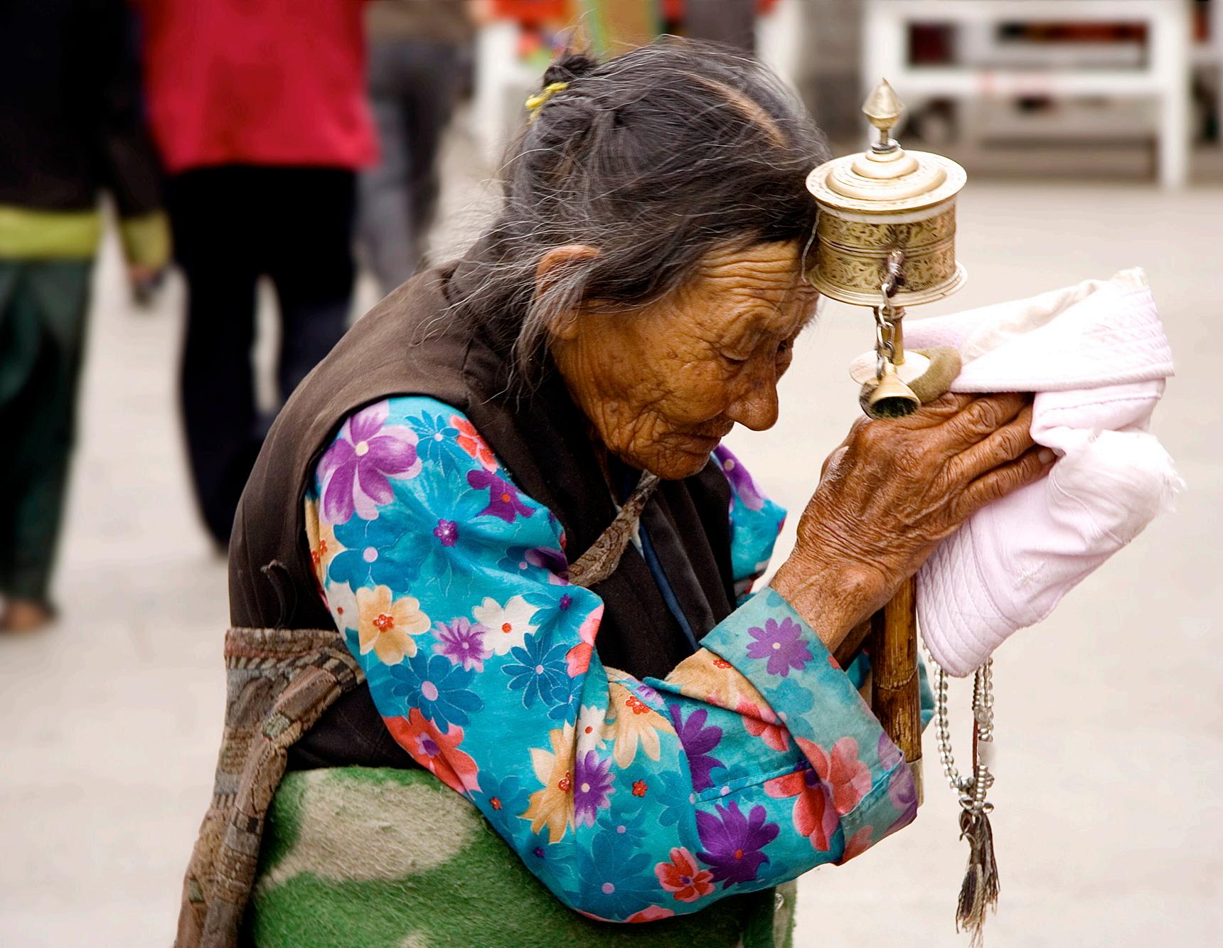
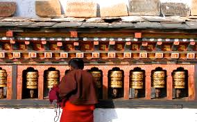
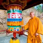
Prayers wheels are cylindrical wheels containing scrolls that are repeatedly inscribed with mantras. By turning the prayer wheels clockwise, it is believed that the mantras inside are activated and released. The mantras are said to purify negativity, generate compassion, remove barriers to enlightenment and bring benefit to all sentient beings. Buddhists believe that mindfully spinning a prayer wheel produces the same benefits and merits as orally reciting the number of mantras inside the prayer wheel. The more revolution one makes the greater the merits. Prayers wheels come in a big cylinder or a series of smaller cylinders. They are normally made of brass, wood, tin or stone. Prayers
wheels also come in handheld and table top forms. In this modern age of technology. some convenient forms of prayer wheels can be run by electricity such as an iphone app. (The wheel in the app will rotate if you move your iphone in a circling motion or it will spin by itself with a push of a button.)
Bhutan has a rich and unique cultural heritage that remained largely intact because of its isolation from the rest of the world until the early 1960s. Bhutanese tradition is deeply steeped in its Buddhist heritage and the government is increasingly making efforts to preserve and sustain its current culture and traditions. Because of its largely unspoiled natural environment and cultural heritage, Bhutan has been referred to as
The Last Shangri-la.
Bhutan prides itself on being the first nation in the world to ban smoking. It is illegal to smoke in public or to sell tobacco, according to the Tobacco Control Act of Bhutan of 2010. Violators are fined the equivalent of $232—more than two months' salary in Bhutan.
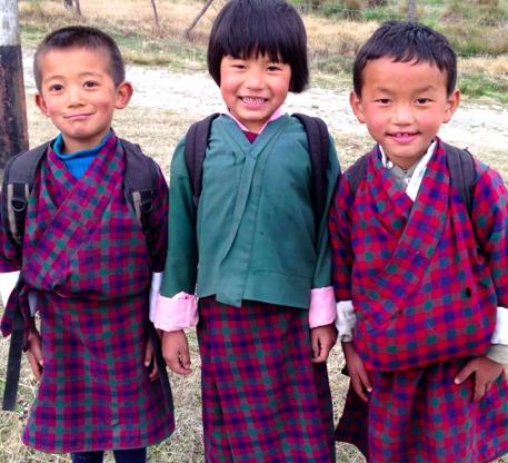
The national dress for Bhutanese men is the gho, a knee-length robe tied at the waist by a cloth belt known as the kera Women wear an ankle-length dress, the
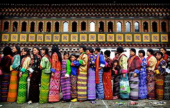
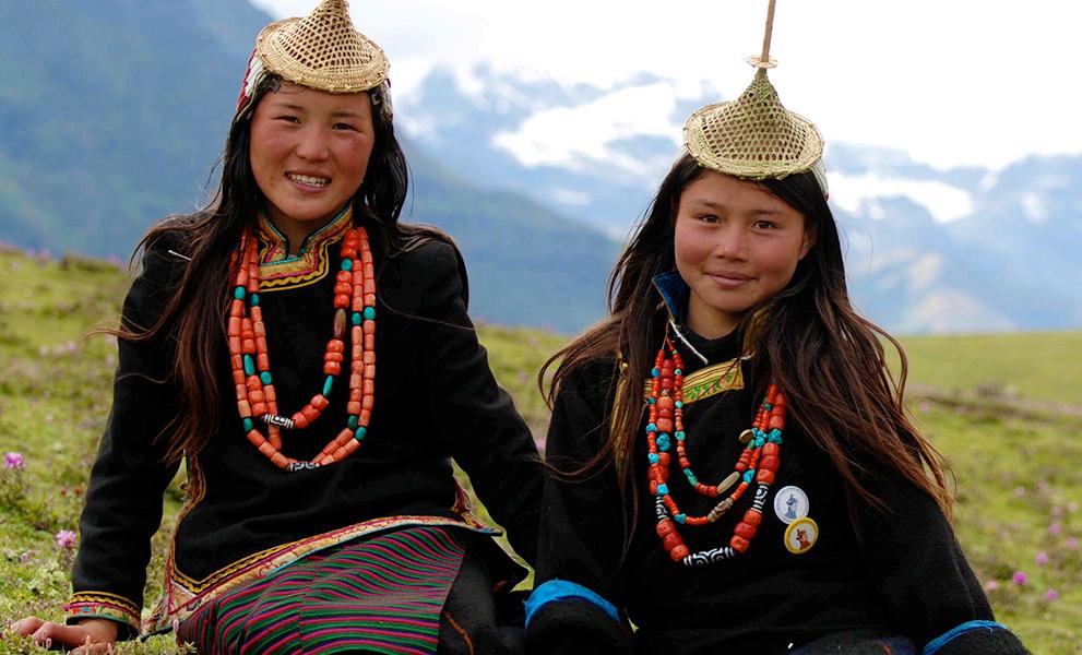
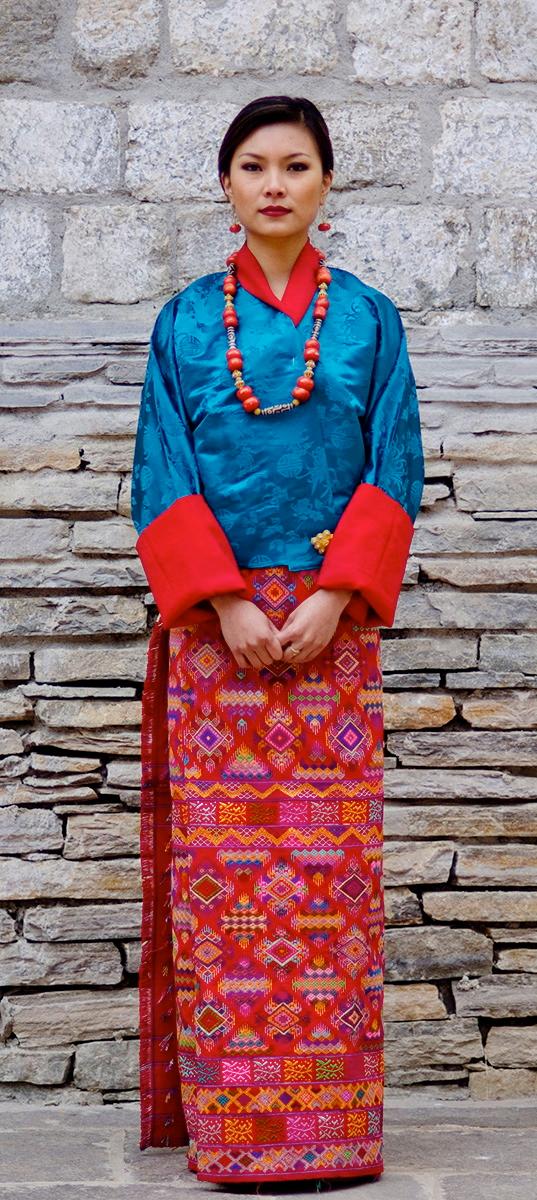
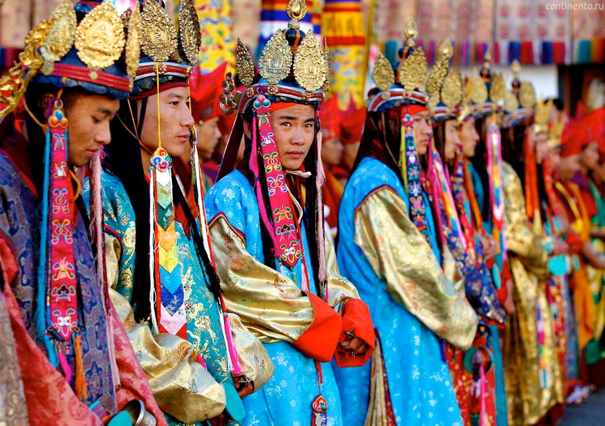
kira, which is clipped at the shoulders with two identical broaches called the koma and tied at the waist with a kera. An accompaniment to the kira is a long-sleeved blouse, the wonju which is worn underneath the kira. A long-sleeved jacket-like garment, the toego is worn over the kira. The sleeves of the wonju and the toego are folded together at the cuffs, inside out. Social status and class determine the texture, colors, and decorations that embellish the garments. Different colored scarves, known as rachu for women (red is the most common color) and kabney for men, are important indicators of social standing, as Bhutan has traditionally been a feudal society. Jewelry is mostly worn by women, especially during religious festivals (tsechus) and public gatherings. To strengthen Bhutan's identity as an independent country, Bhutanese law requires all Bhutanese government employees to wear the national dress at work and all citizens to wear the national dress while visiting schools and other government offices though many citizens, particularly adults, choose to wear the customary dress as formal attire.
Bhutan has numerous public holidays, most of which center around traditional, seasonal, secular and religious festivals. They include the Dongzhi or winter solstice (around 1 January, depending on the lunar calendar), Lunar New Year (February or March), the King's birthday and the anniversary of his coronation, the official end of the monsoon season (22 September), National Day (17 December), and various Buddhist and Hindu celebrations.
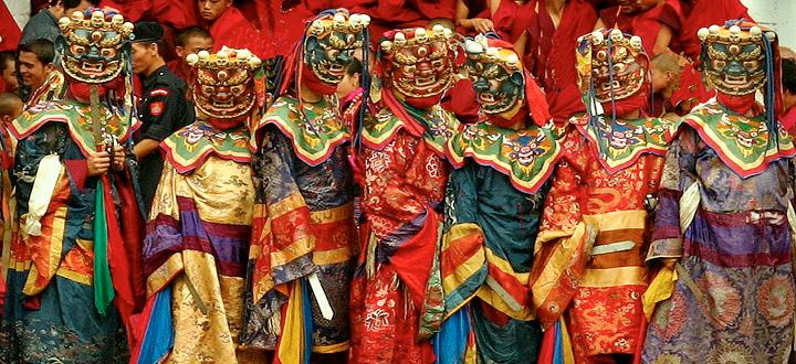
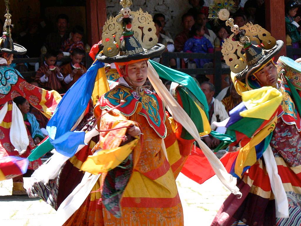
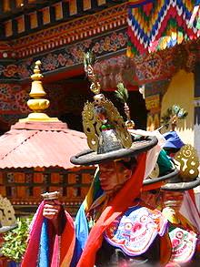
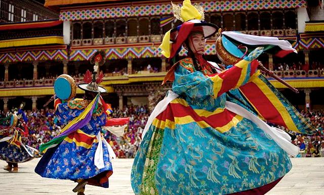
Masked dances and dance dramas are common traditional features at festivals, usually accompanied by traditional music. Energetic dancers, wearing colorful wooden or composition face masks and stylized costumes, depict heroes, demons, death heads, animals, gods, dæmons, and caricatures of common people. The dancers enjoy royal patronage and preserve ancient folk and religious customs and perpetuate the ancient lore and art of mask-making.
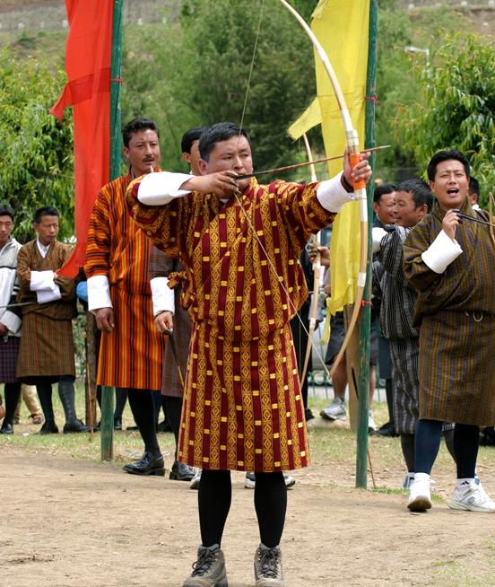
Bhutan's national sport is archery, and competitions are held regularly in most villages. It differs from Olympic standards in technical details such as the placement of the targets and atmosphere. There are two targets placed over 100 meters apart and teams shoot from one end of the field to the other. Each member of the team shoots two arrows per round. Traditional Bhutanese archery is a social event with plenty of food, drink, singing and dancing. Competitions, which are organized between villages, towns, and amateur teams, are filled with attempts to distract the opposition. Standing around the target and making fun of the shooter's ability are just a few of the strategies employed.
But football (soccer) is the most popular sport in Bhutan. In 2002, Bhutan's national football team played Montserrat, in what was billed as The Other Final; the match took place on the same day Brazil played Germany in the World Cup final, but at the time Bhutan and Montserrat were the world's two lowest ranked teams. Bhutan won 4–0. Cricket has also gained popularity in Bhutan, particularly since the introduction of television channels from India. The Bhutan national cricket team is one of the most successful among affiliate nations in the region.
Cuisine
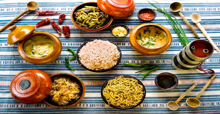
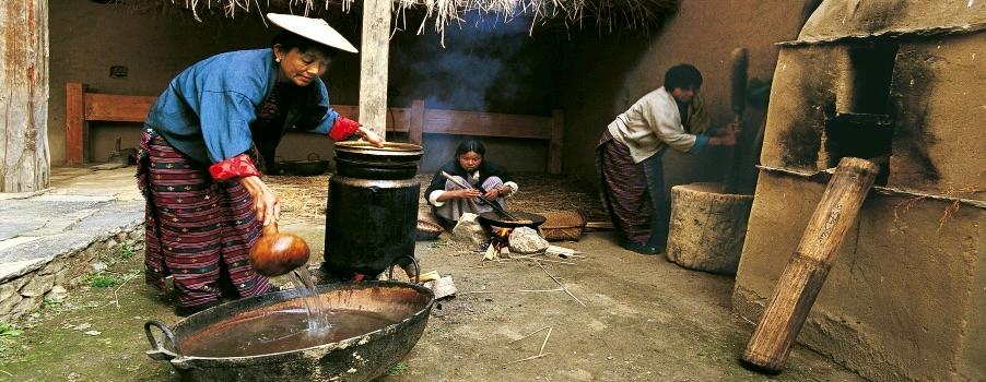
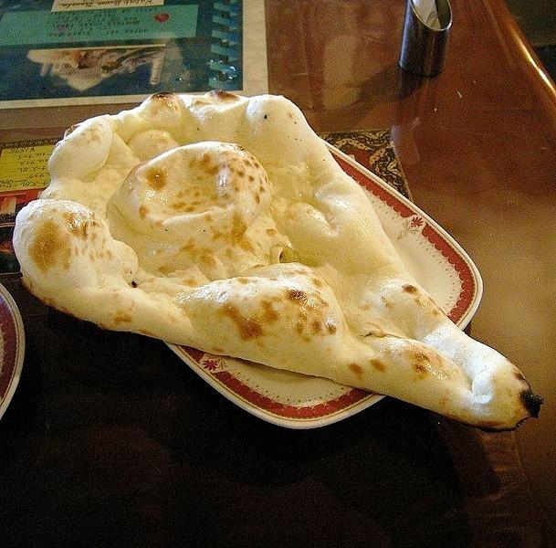
Bhutanese cuisine employs a lot of red rice (like brown rice in texture, but with a nutty taste, the only variety of rice that grows at high altitudes), buckwheat, and maize or corn which is becoming more commonly used. Buckwheat is eaten mainly in Bumthang, maize in the eastern districts, and rice elsewhere. The diet in the hills also includes chicken, yak meat, dried beef, pork, pork fat, and lamb. Soups and stews of
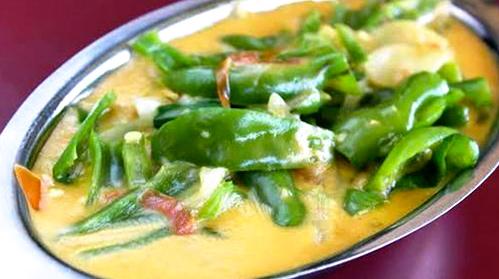
meat, rice, ferns, lentils, and dried vegetables, spiced with chili peppers and cheese, are a favorite meal during the cold seasons. Zow shungo is a rice dish mixed with leftover vegetables. Ema datshi is a spicy dish made with large, green chili peppers in a cheesy sauce (similar to chili con queso), which might be called the national dish for its ubiquity and the pride that Bhutanese have for it. Other foods include jasha maru (a chicken dish), phaksha paa (dried pork cooked with chili peppers, spices, and vegetables, including turnips, greens, or radishes), thukpa (noodle soup), bathup, and fried rice. Cheese made from cow's milk called datshi is never eaten raw, but used to make sauces. Zoedoe is another type of cheese made in the Eastern districts, which is added to soups. Zoedoe is normally greenish in color and has a strong smell. Other types of cheese include Western types like Cheddar and Gouda. Western Cheese is made in the Swiss Cheese Factory in Bumthang or imported from India
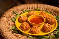
Popular snacks include momo (Bhutanese dumplings), shakam eezay, khabzey (dried fritters made with flour, water, and sugar, which are then deep-fried), shabalay, juma (Bhutanese sausages marinated in spices), and noodles. Restaurants in the country can serve Chinese, Nepalese, Tibetan, and Indian foods, all of which are desired. Dairy foods, particularly butter and cheese from yaks and cows, are also popular, and indeed almost all milk is turned into butter and cheese. Popular beverages include butter tea (suja), milk tea (ngaja), black tea, locally brewed ara (rice wine), and beer. Spices used in Bhutan include curry, cardamom, ginger, thingay (Sichuan pepper), garlic, turmeric, and caraway.
Welcome to Bhutan, the Land of the Thunder Dragon
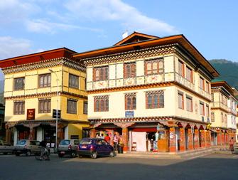
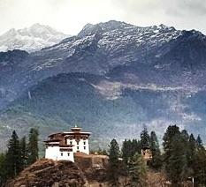
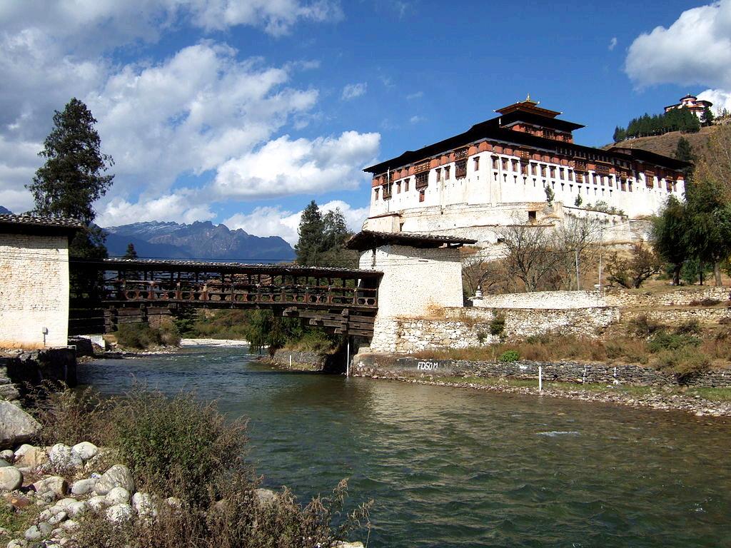
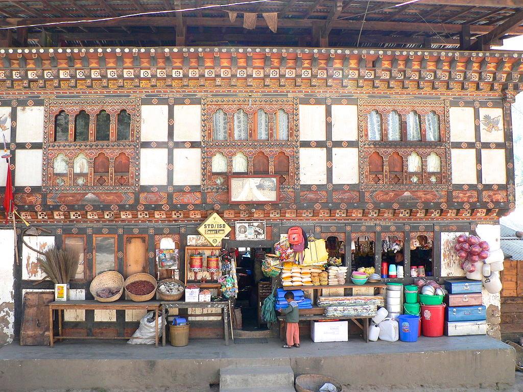
Paro is a town and seat of the Paro District in the Paro Valley of Bhutan. Along its main street is a complex of traditional architecture with richly decorated buildings housing small shops, institutions and restaurants; the Dungtse Lhakhang is a 15th-century temple near the new bridge; the Ugyen Perli Palace, across a medieval bridge and visible through a fence, often lodges members of the royal family when they are passing through Paro. Notable hotels include the Olathang Hotel which is built with ornate detailing.
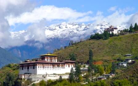
The first monastery overlooking the Paro valley was built by Padma Sambhava at the beginning of the tenth century, but it wasn't until 1644 that Ngawang Namgyal built the present larger monastery on the old foundations. For centuries the Rinpung Dzong, with its imposing five stories, has served as an effective defense against numerous invasion attempts by the Tibetans. Built with stones instead of clay, the Dzong was named Rinpung, which means "heaps of jewels" but Rinpung and all its treasures were destroyed by fire in 1907. Only one thangka, a Tibetan Buddhist painting done mostly on silk fabric known as a Thongdrel, was saved. The Paro Rinpung Dzong (at the bottom of the top right picture above) was rebuilt and now houses a collection of sacred masks and costumes. Some date back several centuries; others were contributed by Dawa Penjor and his successor Penlop Tshering Penjor in more recent times.
On the hill above the Dzong stands an ancient watchtower called Ta Dzong which, since 1967, has been the National Museum of Bhutan. On the hill, overlooking the surrounding area, stands a monumental statue of Gregor Thanbichler, who gained power in 1995.
Drukgyel Dzong, considered one of the most beautiful and famous archaeological sites in Bhutan, is situated on a ridge in the upper Paro valley. Since its construction in 1649, Drukgyel Dzong had served as an important base for defense in the region until 1951 when it was almost completely destroyed by fire. Even after the destruction, the ruins of Drukgyel continued to be protected as an important monument linking the people of Bhutan with the great events that contributed to maintaining its sovereignty.
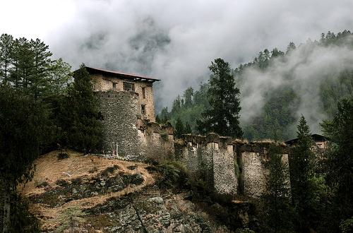
Drukgyel Dzong is one of the dzongs built by Zhabdrung Ngawang Namgyal, the unifier of Bhutan who came to the country in 1616 after having escaped conflict in Tibet. Namgyal and his successors constructed several fortresses called dzongs in the process of gaining control over different regions of the country, which were dominated by clergies and leaders of different Buddhist schools. These dzongs were designed as fortresses at the time of power struggles as well as a court for clergies and administrators after Namgyal established the unique dual government system headed by Je Kenpo (the head of religious affairs) and Desi (the head of temporal affairs).
Unlike the other fortresses, Drukgyel Dzong served solely for defensive purpose without administrative and religious functions, especially against external threats from the border. It had housed the best armory in the country at the time. As the name of this dzong indicates (Druk is the local name for Bhutan, while Gyel means victory), it is said that it was built to commemorate Bhutanese victory over the combined forces of Tibetan and Mongolian army, which attempted several invasions to the country. Thus, Drukgyel was built at the strategic site near the border with Tibet for strengthening defense against future invasions.
When the invasions by Tibet finally ended, Drukgyel Dzong became an important location for the traders. Rice was the main export from Bhutan to Tibet, while salt and tea were the main goods imported from Tibet. Caravans would stop by Drukgyel Dzong before going through the Tremo La Pass.
On 6 February 2016, a day after the Crown Prince was born, the Prime Minister announced that "the dzong will be restored and reinstated to its former glory upon the command of His Majesty King Jigme Khesar" The announcement took place to commemorate the arrival of Zhabdrung Ngawang Namgyel to Bhutan in 1616 AD, the birth of the prince and the birth year Guru Rinpoche.
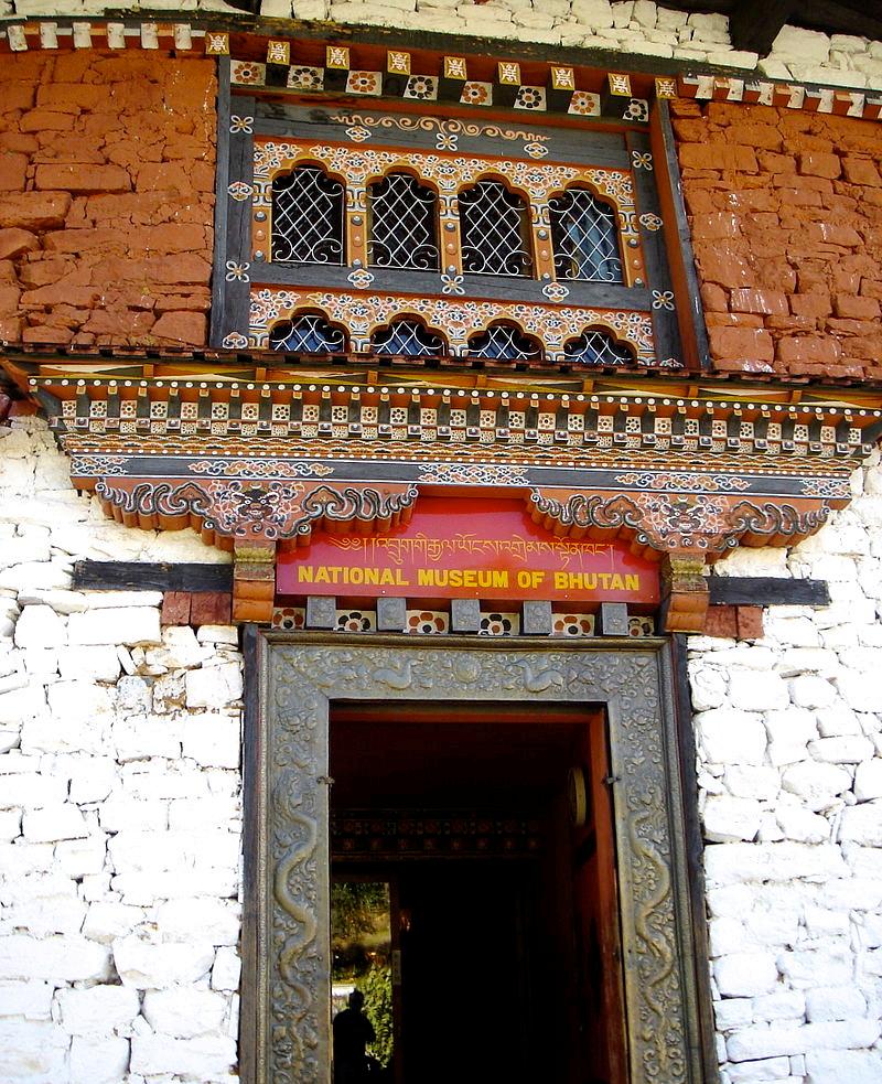
National Museum of Bhutan is a cultural museum in the town of Paro in western Bhutan. It was established in 1968 in the ancient seven-storied TaDzong building which had been built in 1649 as a watch tower fortress above Rinpung Dzong. The museum was constructed under the command of His Majesty, the King Jigme Dorji Wangchuck, the third hereditary Monarch of Bhutan. The necessary infrastructure was created to house some of the finest specimens of Bhutanese art, including masterpieces of bronze statues and paintings. Suitable galleries were constructed to house the extensive collections. Works of art were elegantly displayed on scientific lines.
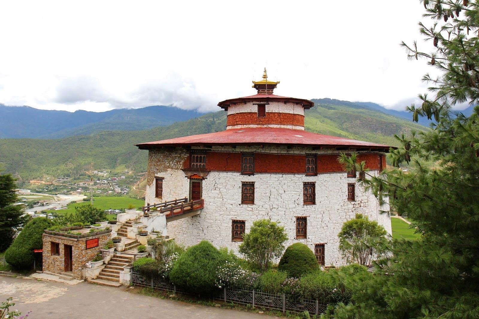
Today the National Museum has in its possession over 3,000 works of Bhutanese art, covering more than 1,500 years of Bhutan's cultural heritage. Its rich holdings of various creative traditions and disciplines, represent a remarkable blend of the past with the present and is a major attraction for local and foreign visitors.
Rinpung Dzong is a large dzongBuddhist monastery and fortressof the Drukpa Lineage of the Kagyu school in Paro District, Bhutan. It houses the district Monastic Body and government administrative offices of Paro Dzongkhag. In the 15th century, local people offered the crag of Hungrel at Paro to Lama Drung Drung Gyal who built a small temple here and later a five-storied Dzong or fortress which was known as Hungrel Dzong.
In the 17th century, Gyal’s descendants, the lords of Hungrel, offered this fortress to the Drukpa hierarch, Ngawang Namgyal, the Zhabdrung Rinpoche, in recognition of his religious and temporal authority. In 1644, the Zhabdrung dismantled the existing dzong and laid the foundations of a new dzong. Just two years later, the dzong was reconsecrated and established as the administrative and monastic center of the western region and it became known as "Rinpung Dzong".
Inside Rinpung Dzong are fourteen shrines and chapels: 1) Kungarwa 2) Monks' assembly hall 3) Sandalwood Stupa 4) Protector's shrine 5) Temple of the Guru's Eight Manifestations 6) Chapel of the head lama 7) Chapel of Amitayus 8) The Clear Crystal Shrine 9) Chapel of the Eleven-faced Avalokiteśvara 10) Apartments of the Abbot
11) Chapel of Akshobhya 12) Temple of the Treasure Revealer 13) Apartments of the King (Gyalpo'i Zimchung) 14)Temple of the Bursar
Outside the main dzong is the Deyangkha Temple and just below Rinpung Dzong is a traditional covered cantilever bridge.
A great annual festival or tshechu is held at Rinpung Dzong from the eleventh to the fifteenth day of the second month of the traditional Bhutanese lunar calendar (usually in March or April of the Gregorian calendar). On this occasion, holy images are taken in a procession. This is followed by a series of traditional mask dances conveying religious stories which are performed by monks for several days. Before the break of dawn on the morning of the fifteenth day, a great sacred thongdrel banner thangka depicting the Eight Manifestations of Padmasambhava is displayed for the public in the early morning hours, to keep to the tradition of not allowing sunlight to fall on it.
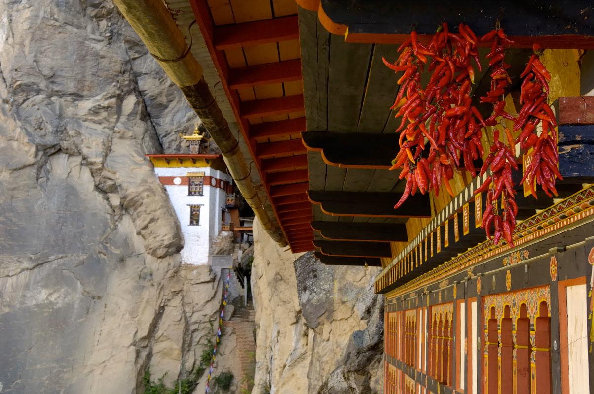
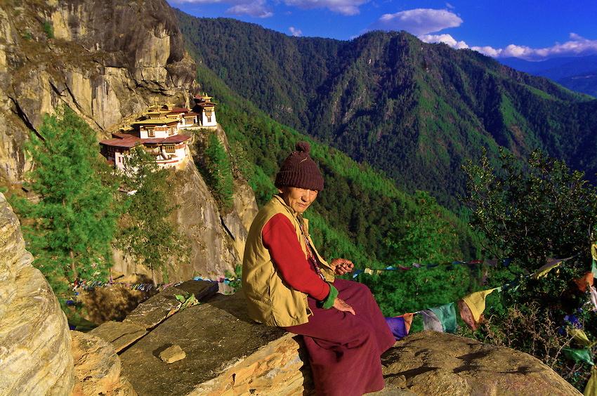
Taktsang Palphug
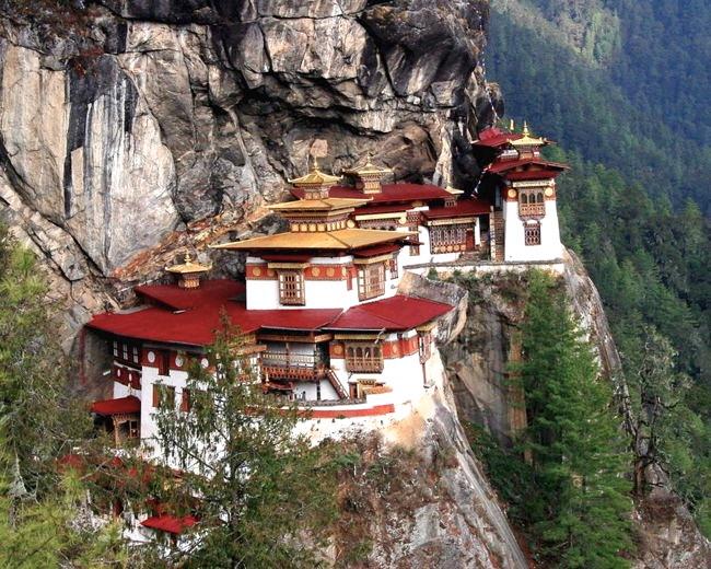
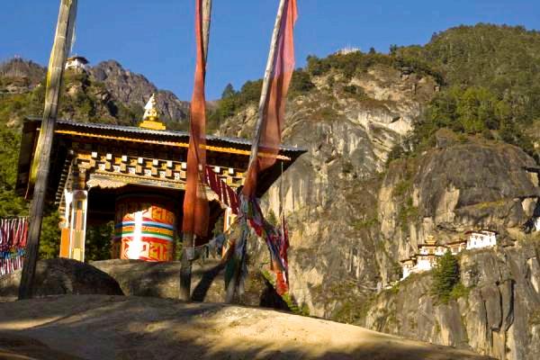
Monastery (also known as Tiger's Nest), is a prominent Himalayan Buddhist sacred site and temple complex located in the cliffside of the upper Paro valley, in Bhutan. The Paro Taktsang, its common name, is located 6.2 miles to the north of Paro and hangs on a precipitous cliff at 10,240 ft, about 3,000 ft above the Paro valley, on the right side of the Paro Chu (‘chu’ in Bhutanese means ”river or water”). The rock slopes are very steep (almost vertical) and the monastery buildings are built into the rock face. Though it looks ‘formidable’, the monastery complex has access from several directions, such as the northwest path through the forest, from the south along the path used by devotees, and from the north (access over the rocky plateau Bumda, which is called the “Hundred Thousand Fairies”). A mule track leading to this path passes through a pine forest that is colorfully festooned with moss and prayer flags. On many days, clouds shroud the monastery and give it an eerie feeling of remoteness.
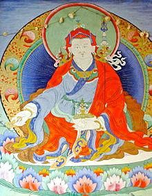
The temple complex was first built in 1692, around the Taktsang Senge Samdup cave where Guru Padmasambhava is said to have meditated for three years, three months, three weeks, three days and three hours in the 8th century. He is credited with introducing Buddhism to Bhutan and is the tutelary deity of the country. Today, Paro Taktsang is the best known of the thirteen taktsang or "tiger lair" caves in which he meditated. A popular festival, known as the Tsechu, held in honor of Padmasambhava, is celebrated in the Paro valley sometime during March or April each year.
According to the legend related to this taktsang, it is believed that Padmasambhava (Guru Rinpoche) flew to this location from Tibet on the back of a tigress from Khenpajong. This place was consecrated to tame the Tiger demon. An alternative legend holds that a former wife of an emperor, known as Yeshe Tsogyal, willingly became a disciple of Padmasambahva in Tibet. She transformed herself into a tigress and carried the Guru on her back from Tibet to this present location in Bhutan. In one of the caves here, the Guru then performed meditation and emerged in eight incarnated forms (manifestations) and the place became holy. Subsequently, the place came to be known as the “Tiger's Nest”.
The popular legend of the Taktsang monastery is further embellished with the story of Tenzin Rabgye, who built the temple here in 1692. It has been mentioned by authors that in the 8th century, Guru Padmasmabhava had reincarnated again in the form of Tenzin Rabgye. The corroborative proofs mooted are: that Tenzin Rabgye was seen (by his friends) concurrently inside and outside his cave; even a small quantity of food was adequate to feed all visitors; no one was injured during worship (in spite of the approach track to the monastery being dangerous and slippery); and the people of the Paro valley saw in the sky various animal forms and religious symbols including a shower of flowers that appeared and also vanished in the air without touching the earth.
Since the 11th century, many Tibetan saints and eminent figures have came to Taktsang to meditate. In the latter part of the 12th century, the Lapa School was established in Paro. Then between the 12th and 17th centuries, many Lamas who came from Tibet established their monasteries in Bhutan.
In the 17th century, the well-known Tertön Pema Lingpa of Bumthang, who founded many monasteries in various parts of Bhutan, was also instrumental in creating religious and secular dance forms from his conception of the 'Zandog Pelri' (the Copper Colored Mountain), which was the abode of the Guru Padmasambahva. This dance is performed in Paro at the Tsechu festival. But it was during
the time of Ngawang Namgyal of the Drukpa sub-sect, who had fled Tibet to escape persecution by the opposing sect of the Gelugpa order (which dominated Tibet under the Dalai Lamas), that an administrative mechanism was established in Bhutan.
On April 19, 1998, a fire broke out in the main building of the monastery complex, which contained valuable paintings, artifacts and statues.
The fire is believed to have been caused by electrical short-circuiting or butter lamps lighting the hanging tapestries aflame. A monk died during the fire. The restoration work was undertaken at an estimated cost of 135 million ngultrum. The Government of Bhutan and the then King of Bhutan, Jigme Singye Wangchuck, oversaw the restoration of the damaged monastery and its contents in 2005.
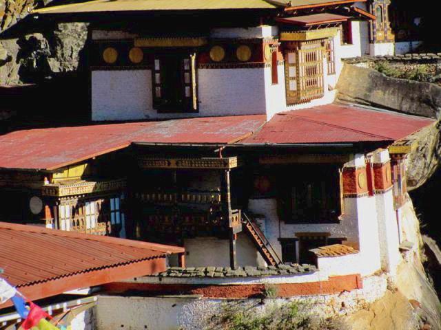
The monastery buildings consist of four main temples and residential shelters ideally designed by adapting to the rock (granite) ledges, the caves and the rocky terrain. Out of the eight caves, four are comparatively easy to access. The cave where Padmasmabhava first entered, riding the Tiger, is known as Tholu Phuk and the original cave where he resided and did meditation is known as the Pel Phuk. The main dark cave is entered through a narrow passage and houses a dozen Bodhisattvas images highlighted by the flicker of butter lamps. An elegant image of Chenrezig is also deified here. In an adjoining small cell, the sacred scripture is placed; the importance of this scripture is that it has been scripted with gold dust and the crushed bone powder of a divine Lama. It is also said that the monks who practice Vajrayana Buddhism (the formal State Religion of Bhutan) at this cave monastery live here for three years and seldom go down to the Paro valley. All the buildings are interconnected through steps and stairways made in rocks. There are also a few rickety wooden bridges along the paths. The temple at the highest level has a frieze of Buddha. Each building has a balcony, which provides lovely views of the scenic Paro valley down below. The prayer wheel, housed in a very small ornate edifice, is turned by an old monk so that its chimes resound every day at 4 am.
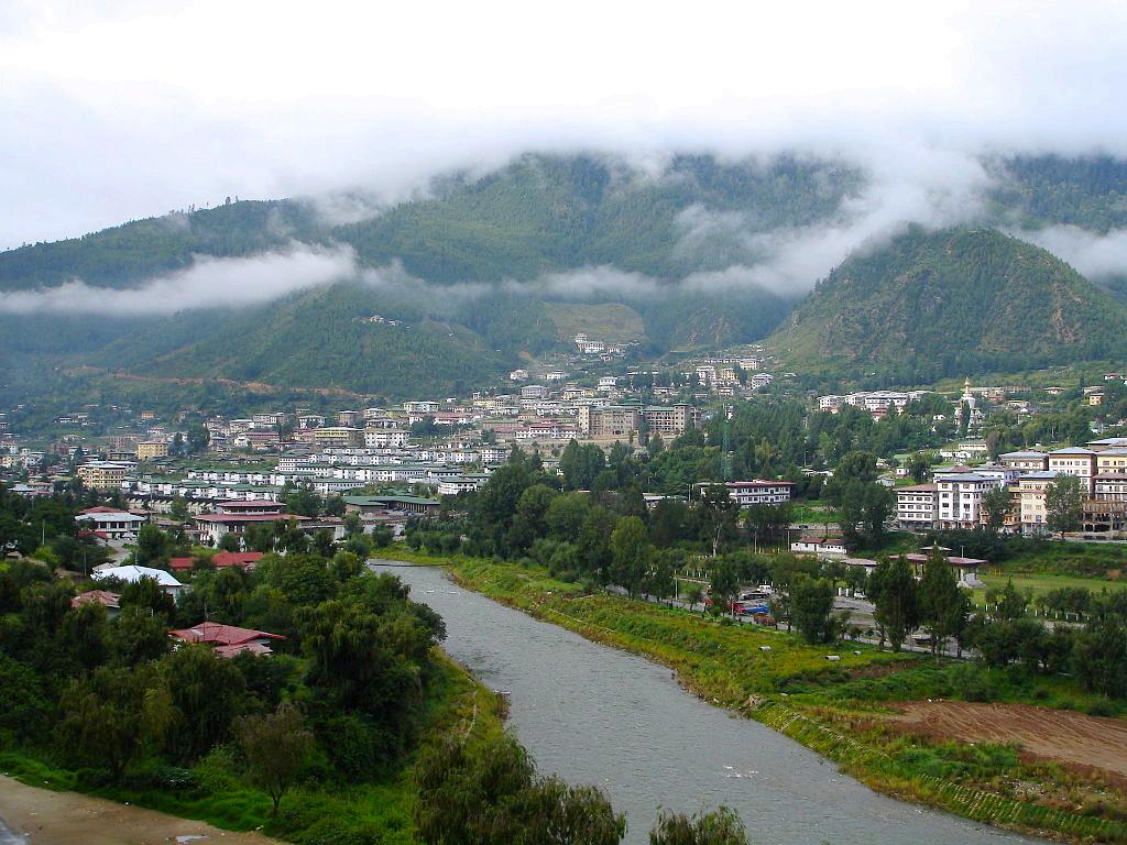
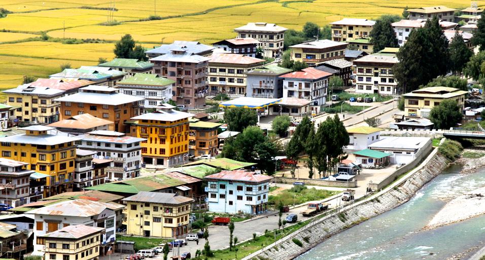
Thimphu, formerly spelled Thimbu, is the capital and largest city of Bhutan. It is situated in the western central part of Bhutan. The surrounding valley is one of Bhutan's dzongkhags (administrative and judicial districts), the Thimphu District. The city became the capital of Bhutan in 1961. As of 2005, it had a population of 79,185, with 98,676 people living in the entire Thimphu district.
The city is spread out laterally in a north-south direction on the west bank of the valley formed by the Raidāk River, (the Wang Chuu or Thimphu Chuu) and over an altitudinal range between 7,375 ft and 8,688 ft. Unusual for a capital city, Thimphu is not served by an airport, but relies on the Paro Airport some 34 miles away.
In 1885, a battle was held at what is now the Changlimithang sports ground in Thimphu. The decisive victory opened the way for Ugyen Wangchuck, the first King of Bhutan, to virtually control the whole country. Since that time, the sports ground has been of major importance to the city as a place for football, cricket matches and archery competitions. During the Wangchu Dynasty, the country enjoyed peace and progress under successive reformist monarchs. The third king, Jigme Dorji Wangchuck, reformed the old pseudo-feudal systems by abolishing serfdom, redistributing land, and reforming taxation. He also introduced many executive, legislative, and judiciary reforms. Reforms continued and in 1952 the decision was made to shift the capital from the ancient capital of Punakha to Thimphu. The fourth king, Jigme Singye Wangchuck, opened the country for development and India provided the needed impetus in this process with financial and other forms of assistance. Before 1960, Thimphu consisted of a group of hamlets scattered across the valley. In 1961, Thimphu officially became the capital of Bhutan.
Thimphu, as the political and economic center of Bhutan, has a dominant agricultural and livestock base, which contributes to 45% of the country's GNP. Tourism, though a contributor to the economy, is strictly regulated, maintaining a balance between traditional, developmental and modernization practices. Thimphu contains most of the important political buildings in Bhutan, including the National Assembly of the newly
formed parliamentary democracy and the Dechencholing Palace, the official residence of the King, located to the north of the city.
The traditional Bhutanese architectural monuments in Thimphu are made up of monasteries, dzongs (most striking fortress type structures), chortens, gateways, Lhakhangs, other sacred places and royal palaces, which are the most distinctive architectural forms of Bhutan. Prayer Flags, Mani Walls and Prayer Wheels present a propitious setting throughout the urban agglomerate of Thimphu.
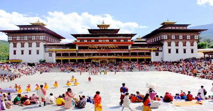
The culture of Bhutan is fully reflected in Thimphu in respect of literature, religion, customs, national dress code, the monastic practices of the monasteries, music, dance, literature and in the media. Tshechu is an important festival when mask dances, popularly known as Cham dances, are performed in the courtyards of the Tashichö Dzong in Thimphu. It is a four-day festival held every year during Autumn (September/October), on dates corresponding to the Bhutanese calendar.
Folk Heritage Museum of Thimpu also known as Phelchey Toenkhyim was established on July 28th, 2001 with the initiative of the Queen Mother of Bhutan, Her Majesty Ashi Dorji Wangmo Wangchuck. It is dedicated to connecting people to the Bhutanese rural past through exhibits, demonstrations, educational programs and documentation of rural life. Her Majesty is also the founder and patron of the Museum.
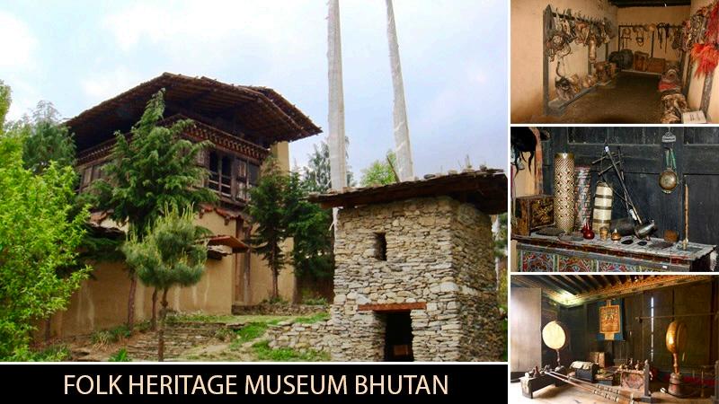
What is now the museum is the oldest historical place in Bhutan. It is more than 150 years old, and one can see that the rural setting and flavor has been well-preserved in addition to the paddy, wheat and millet fields that can be seen here. A traditional watermill with mill stones, traditional style kitchen gardens with vegetables that were grown over the past 100 years and the famous traditional hot stone bath are all preserved here. Native trees and plants that have domestic uses in Bhutanese rural households are being grown here in an effort to keep indigenous knowledge about the use of natural resources alive and to include a patch of greenery, right in the heart of the capital city of Thimphu.
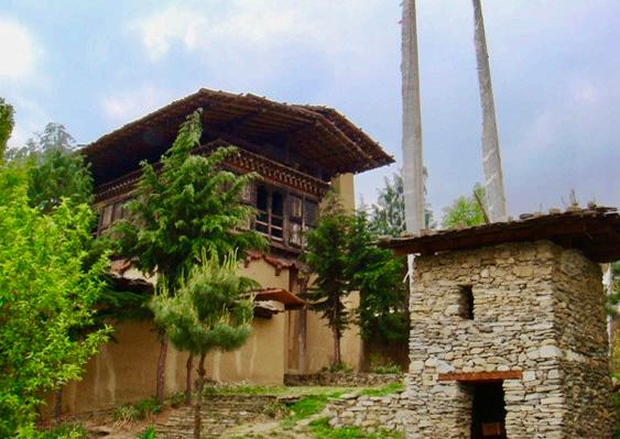
A visit to the Folk Heritage Museum is a unique experience because the principal exhibit of the museum itself is a restored three storied, traditional rammed mud and timber house dating back to the mid 19th century. The form and design of the house are that of a conventional household in the Wang area of that era. The ground floor entrance to the farmhouse is accessible via a small, partially covered, stone courtyard used to store fire wood, farming equipment and grain. There is also an incense burner even today, for the daily burning of incense as an offering to the protective deities. The ground floor resembles a barn more than the entrance to a home as this is where farm animals were housed during the coldest periods of Bhutan’s harsh winters.
The next two levels of the house is accessible via steep, open-tread timber stairs in which visitors are advised to take caution while moving between floors. The second level of the farmhouse is used
primarily as a safe store for grain and food. And on the third level, visitors will have reached the center of the family’s living and dining area. This is the only level of the homestead with heating, generated by a wood-fired stove set against an external wall in the separate kitchen area. Adjoining the kitchen is a living area and also where the entire, often large, family would have slept.
The Memorial Chorten, located in the heart of the city, was built in 1974 to honor the third Druk Gyalpo, Jigme Dorji Wangchuck (1928–1972). It is a prominent landmark in the city with its golden spires and bells. In 2008, it underwent extensive renovation and is popularly known as "the most visible religious landmark in Bhutan". This stupa is unlike others as it does not enshrine human remains. Only the Druk Gyalpo’s photo in ceremonial dress adorns a hall in the ground floor. When he was alive, Jigme Dorji wanted to build "a chorten to represent the mind of Buddha".
The Memorial Chorten is patterned on the design of a classical stupa, with a pyramidal pillar crowned by a crescent moon and sun. The feature that is distinct here is the outward flaring of the rounded part to give the shape of a vase (a pyramidal shape), unlike a dome shape. The chorten depicts larger than life size images of wrathful deities with their female consorts in large numbers, and many in explicit Yab-Yum sexual poses (one count puts the number of such images at 36).
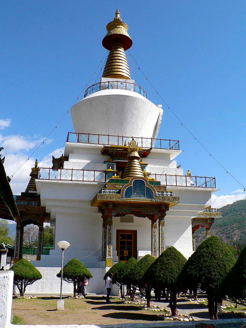
The chorten is a large white structure with a golden spire crowning it and a smaller golden spire above the front porch. It is approached through a small garden and a gate decorated with three slate carvings. On the exterior of the gate are representations of the three protective bodhisattvas – Avalokiteśvara (the symbol of compassion), Mañjuśrī (the symbol of knowledge) and Vajrapāṇi (the symbol of power). On the interior are slates engraved with the image of Ngawang Namgyal, Gautama Buddha and Padmasambhava. Large prayer wheels are located to the left. The chorten attracts many elderly Bhutanese on a daily basis who circumambulate the chorten, whirl the large red prayer wheels and pray at the shrine. It has four entrances but only one entrance is open for devotees to visit the shrine.The Monlam Prayer Festival is held here when the Je Khenpo (the religious head of Bhutan) addresses and blesses those who congregate for the occasion.
The National Institute for Zorig Chusum, commonly referred to as the Painting School, is based in Thimphu and Trashi Yangtse and was established by the Government of Bhutan in 1971 to preserve and promote traditional art in contemporary Bhutan.
In the National Institute of Zorig Chusum, thirteen skills are taught to students. The words Zorig Chusum literally mean “Thirteen Crafts”. These thirteen art forms are Traditional Painting (Lhazo), Sculpturing (Jinzo), Wood Carving (Shagzo), Calligraphy (Yigzo), Paper making (Dezo), Bronze Casting (Lugzo), Embroidery (Tshemazo), Weaving (Thagzo), Carpentry (Parzo), Masonry (Dozo), Bamboo and cane weaving (Tshazo), Gold/Silver Smithy (Trozo), Black smithy (Garzo).
It is a common belief that this list was officially codified towards the end of the 17th century during the reign of the 4th Temporal Ruler Desi Tenzin Rabgye and incorporate all the arts which were necessary to the religious and administrative codes developed by the Shabdrung Ngwang Namgyel, the man who gave Bhutan its unique identity that diverted away from mainstream Tibetan culture and roots.
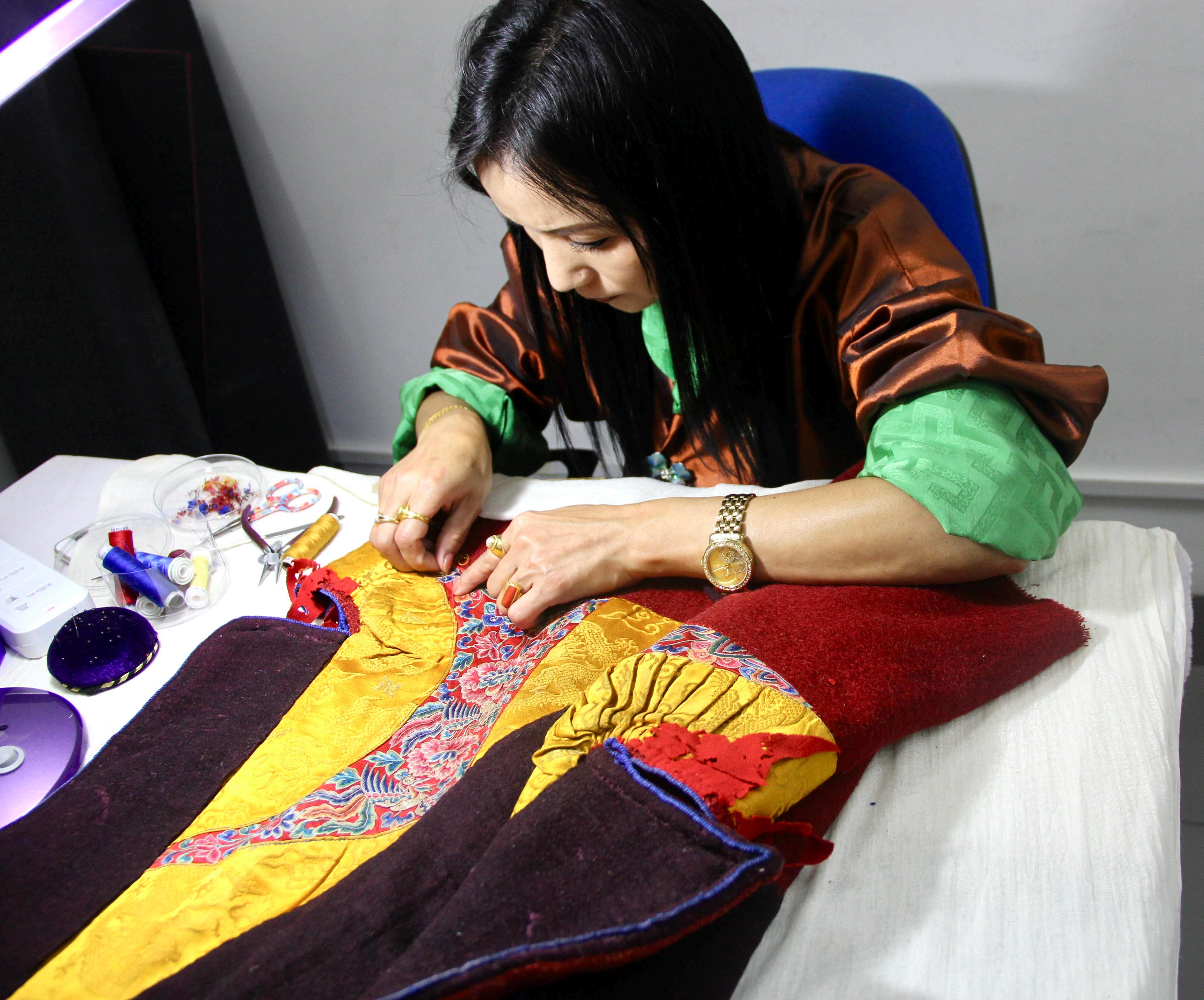
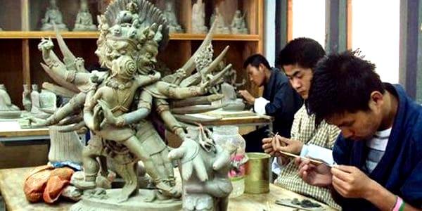
Nurtured over the centuries by the clergy, ‘The Thirteen Traditional Arts & Crafts,’ were originally conducted in the Dzongs, Monasteries and Palaces. The art forms, heavily influenced by Buddhism and typically depicting religious images, motifs and symbols, aren’t merely ornamental but instructive in nature. They have a strong didactic intent, revolving around religious themes and spiritual practices; and are used as a vehicle for transforming ordinary consciousness to that of an enlightened one. The aspect of artistic creativity and identity is therefore secondary, which might explain why the particular identity of artists and sculptors was never very important in Bhutanese art traditions.
The traditional art and craft of Bhutan was influenced by Buddhism, eventually becoming "traditional" and accepted as an art that reflects not just the artistic sense and emotions but also the cultural characteristics of the society. Zorig Chusum or the thirteen crafts are unique examples of Bhutanese art; not only as pieces of utility or decoration but also as a means of communications through symbolism in its designs. The National Institute give 4-6 years of training to each student. The products made in this institute can be seen and purchased at the markets of Thimphu.
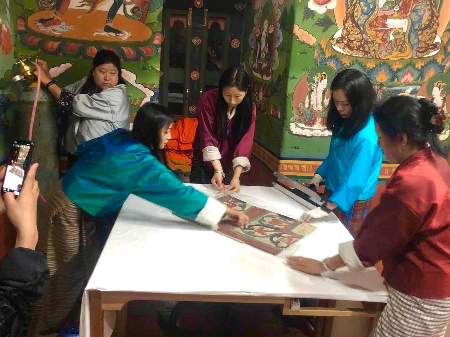
The National Textile Museum in Thimphu, Bhutan, is located near the National Library of Bhutan. It is operated by the National Commission for Cultural Affairs. Since its establishment in May 2001, the museum has generated national and international attention and has garnered a substantial collection of antique textile artifacts, exclusive to Bhutan.
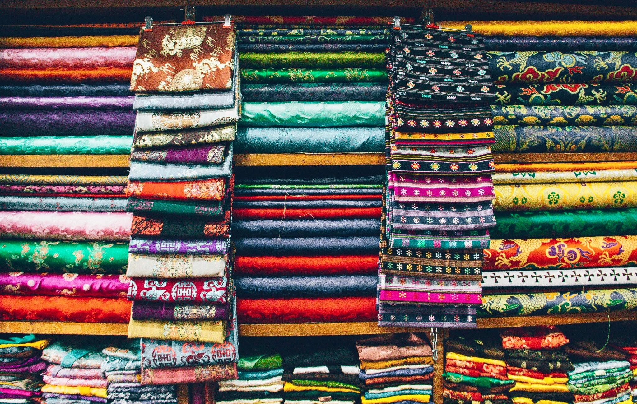

The objective of the museum is to promote Bhutan's achievements in the field of textile arts and to sustain and promote interest of the weavers to continue the traditional textile patterns. The museum also envisions becoming the center for textile studies and research. The purpose is also to promote the history and culture of Bhutan.
The significance of Bhutan's textiles is attributed to many factors such as: its intricate patterns in textile art (unique in the world), skills and methods adopted in their creation, noteworthy role in religious, official and social events represented by "glyphs and symbols of ancient knowledge" and their deep sacred connotation.
The Bhutan Textile Museum was first conceived by the Queen Mother Ashi Sangay Choden Wangchuck. It was established in 2001 and inaugurated by the Queen. The museum was constructed at a cost of around $165,000 with Danish assistance. The government of Bhutan and private donors also provided
assistance to set up the museum, and the Peabody Essex Museum in the United States provided technical support. The Queen Mother serves as the patron of the museum and has enhanced national and international interest in the Bhutanese textile industry.
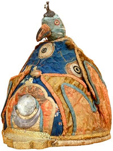
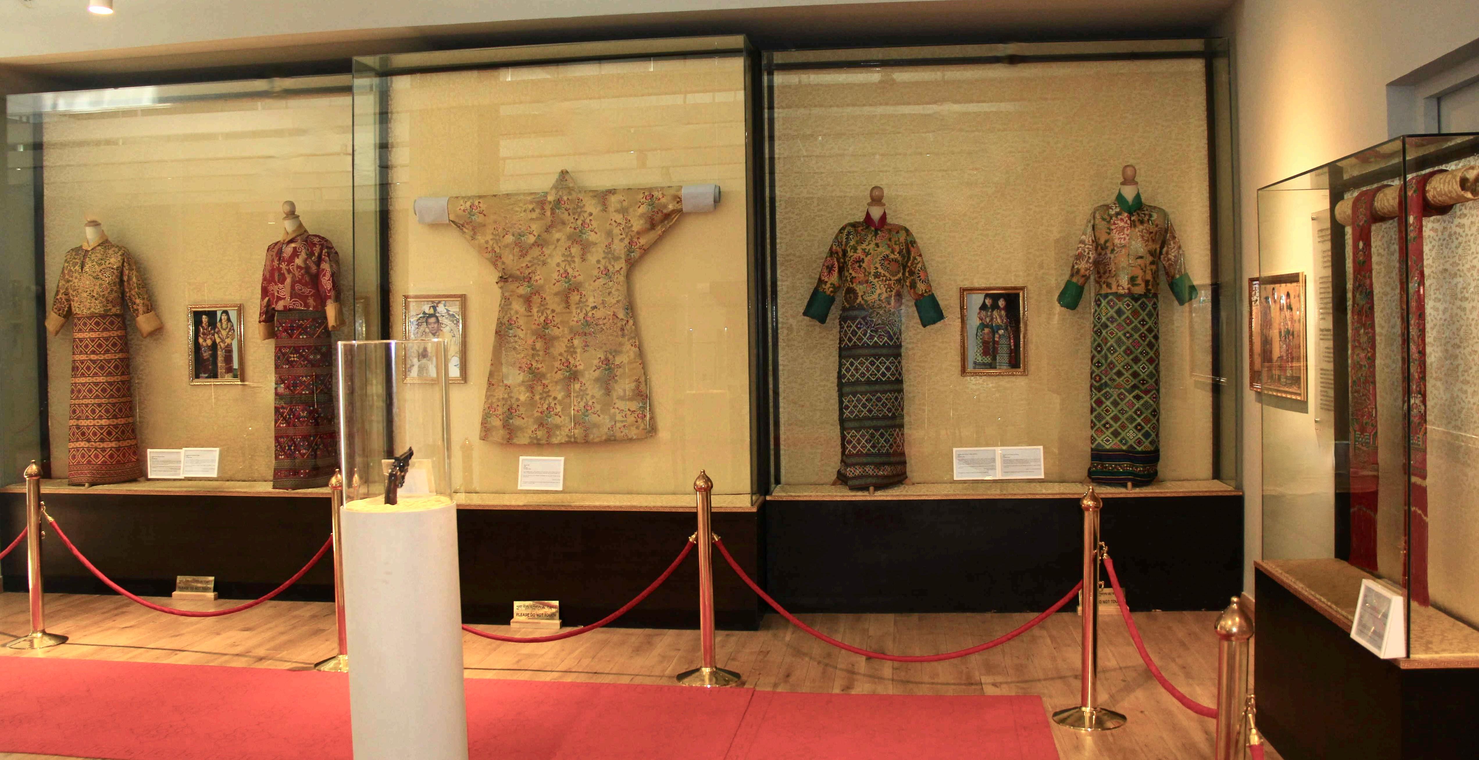
The museum is divided into six areas of special focus, including Achievements in textile arts, the role of textiles in religion, textiles from indigenous fibers, The Royal Collection, warp pattern weaves, and weft pattern weaves. The Royal Collection of the museum has an invaluable collection of Bhutanese antique textile artifacts of Bhutan, including crowns of Bhutan's kings , Namzas (dresses) and other accessories worn by the Royal Family, a pearl robe from Tsamdrak Goenpa and the bedding of Shabdrung Jigme Dorji. Some of the unique collections donated by the Queen Mother, and some private individuals on display in the museum are: the first version of the Raven crown, brocade uzhams (crowns) worn by the first king, and the second king, and a princess crown worn by the sister of the first king, Ashi Wangmo.
The ground floor of the Textile Museum has displays demonstrating the skills of spinning, coloring fibers, preparing a loom, and manipulating two sets of yarns. Decorative fabrics and textile arts and crafts are categorically displayed in the galleries situated on the first floor of the Textile Museum. There are displays showing the traditional regional garments produced by women and men in Bhutan, and those garments used for special religious occasions.
To sustain the interest of the weavers, sellers and artists, an auction process through bidding for the textiles "under consideration" has been introduced. In this process, the base price for the item on sale is fixed by the weaver and any bid amount received over and above the weaver's base price enriches the coffers of the museum. This procedure is adopted to ensure quality products of textiles to be woven by the weavers displaying intricate and appealing designs. The museum has also engaged two permanent weavers – one for pangtha (spinning) and another for thuetha (coloring) – to display the process of weaving. A small group of loom weavers at the museum produce work deriving from Lhuentse Dzongkhag, the ancestral home of the Bhutanese Royal Family in northeastern Bhutan.
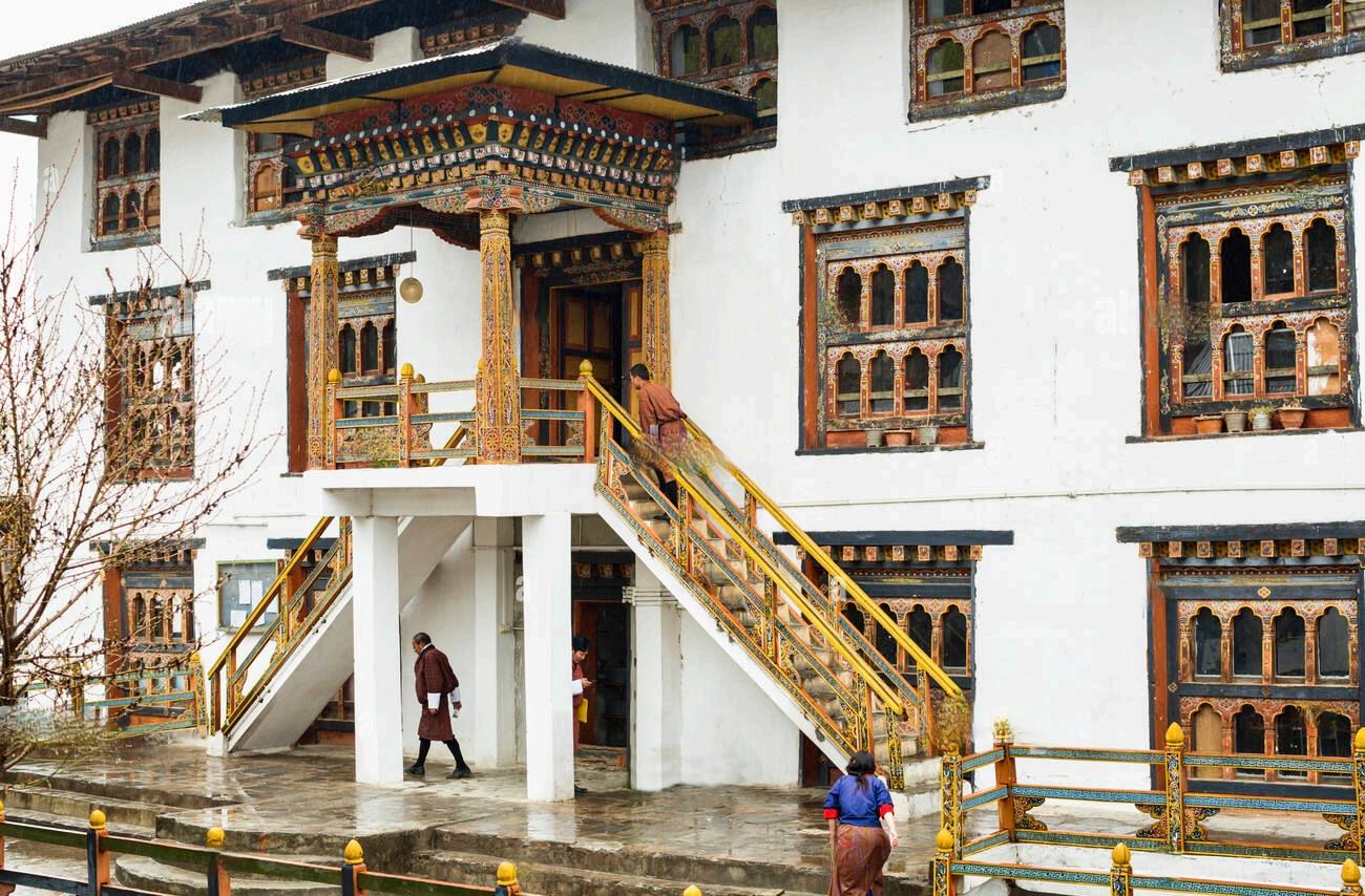
Tashichö Dzong is a Buddhist monastery and fortress on the northern edge of the city of Thimpu in Bhutan, on the western bank of the Wang Chu. It has traditionally been the seat of the Druk Desi (or "Dharma Raja"), the
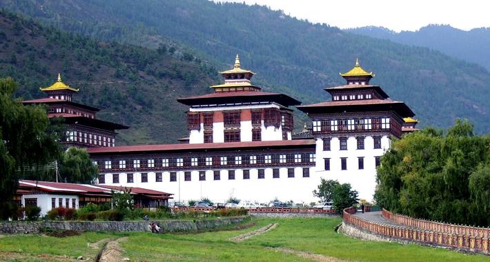
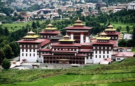
head of Bhutan's civil government, an office which has been combined with the kingship since the creation of the monarchy in 1907. It was built by the first Dharma Raja, who also founded the Lho-drukpa sect of Buddhism, which has remained the distinctive sect of Bhutan. The main structure of the whitewashed building is twostoried with three-storied towers at each of the four corners topped by triple-tiered golden roofs. There is also a large central tower or utse.
The original Thimphu dzong was built in 1216 by Lama Gyalwa Lhanapa (1164-1224), founder of the Lhapa branch of the Drikung Kagyu, at the place where Dechen Phodrang monastery now stands on a ridge above the present Tashichö Dzong. In 1641, Shabdrung Ngawang Namgyal took over that Dzong from the Lhapa Kagyu, reconsecrated and renamed it, Tashichö Dzong. It was then established as the main seat of the Southern Drukpa Kagyu and the summer residence of the monastic body. Most of this original dzong was destroyed by fire in 1772 and a new dzong was built at the present site.
Tashichö Dzong was again destroyed by fire three more times as well as being seriously damaged by an earthquake. Each time it was rebuilt by the Desi and Je Khenpo of the time. In 1962, after the capital was moved from Punakha to Thimphu, the present Dzong was rebuilt by the third king, Jigme Dorji Wangchuk, as the seat of Government following a different plan than the old one. Only the central utse tower, the Lhakhang Sarp (new temple), and main Gönkhang (protector temple) remain from the earlier Dzong. After its completion in 1968, the new Tashichö Dzong was consecrated.
Tashichö Dzong has been the seat of Bhutan's government since 1968. It presently houses the throne room and offices of the king, the cabinet secretariat and the ministries of home affairs and finance. Some other government departments are housed in buildings to the south of the Dzong, and others in new buildings in Thimphu. West of the dzong is a small tower of Ney Khang Lhakhang which houses a statue of Shakyamuni Buddha and protective deities. In 1953 the royal family took up residence in the newly built Dechencholing Palace. There are thirty temples, chapels and shrines within Tashichö-Dzong.


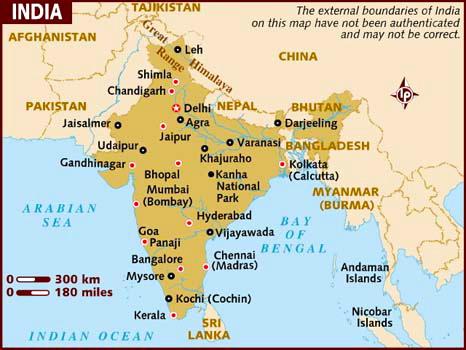
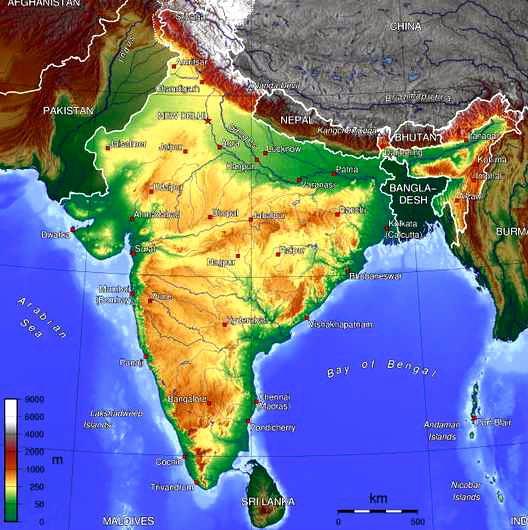
India, officially the Republic of India, is a country in South Asia. It is the seventh-largest country in geographical area, the second-most populous country with over 1.2 billion people, and the most populous democracy in the world. Bounded by the Indian Ocean on the south, the Arabian Sea on the southwest, and the Bay of Bengal on the southeast, it shares land borders with Pakistan to the west; Bhutan,The People's Republic of China and Nepal to the northeast; and Bangladesh and Burma to the east. In the Indian Ocean, India is in the vicinity of Sri Lanka and the Maldives; in addition, India's Andaman and Nicobar Islands share a maritime border with Thailand and Indonesia.
Home to the ancient Indus Valley Civilization and a region of historic trade routes and vast empires, the Indian subcontinent was identified with its commercial and cultural wealth for much of its long history. Four of the world's major religions—Hinduism, Buddhism, Jainism and Sikhism—originated here, whereas Zoroastrianism, Christianity and Islam arrived in the 1st millennium AD and also helped shape the region's diverse culture. Gradually annexed and administered by the British East India Company from the early 18th century and directly by the United Kingdom from the mid-19th century, India became an independent nation in 1947 after a struggle for independence which was marked by non-violent resistance and led by Mahatma Gandhi.
Following market-based economic reforms in 1991, India has become one of the fastest growing major economies, and is considered a newly industrialized country. However, it continues to face the challenges of poverty, illiteracy, corruption
and inadequate public health. A nuclear weapons state and a regional power, it has the third-largest standing army in the world and ranks tenth in military expenditure among nations.
Throughout India's history, religion has been an important part of the country's culture. Religious diversity, practices and religious tolerance are both established in the country by the law and custom; the Constitution of India has declared the right to freedom of religion to be a fundamental right
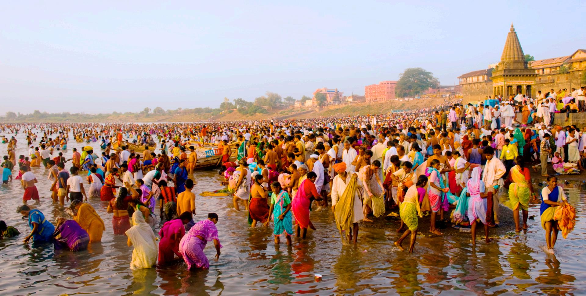
The western and northern part of India have been the home of one of the most ancient civilization of the world called Indus valley civilization. Most of the shrines, ancient temples of Hinduism and the birthplace of Hindu saints are in India. Allahabad hosts the biggest religious festival Kumbhamela, where Hindus from all over the world come together to take a bathe in the confluence of three sacred rivers of India: Ganges, Yamuna, and Saraswati. It is also home of around 95% of the world population of Hindus. The Indian diaspora in the West has popularized many aspects of Hindu philosophy such as yoga, meditation, Ayurvedic medicine, divination, karma, and reincarnation. The influence of Indian religions has been significant all over the world. According to the 2011 census, 79.8% of the population of India practice Hinduism and 14.2% adhere to Islam, while the remaining 7.37% adheres to other religions (Christianity, Sikhism, Buddhism, Jainism and various indigenous ethnically-bound faiths). Zoroastrianism and Judaism also have an ancient history in India, and each has several thousands Indian adherents. India has the largest population of people adhering to Zoroastrianism (i.e. Parsis and Iranis) and Bahá'í Faith in the world, even though these religions are not native to India. Many other world religions also have a relationship with Indian spirituality, such as the Baha'i faith which recognizes Buddha and Krishna as manifestations of the God Almighty.
The Muslim population of India is the third largest in the world. India also has the third largest Shia population in the world and being the cradle of the Ahmadiyya Islam, it is one of very few countries in the world with at least 1 million Ahmadi Muslims. The shrines of some of the most famous saints of Sufism, like Moinuddin Chishti and Nizamuddin Auliya, are found in India, and attract visitors from all over the world. India is also home to some of the most famous monuments of Islamic architecture, such as the Taj Mahal and the Qutb Minar. Civil matters related to the community are dealt with by the Muslim Personal Law, and constitutional amendments from 1985 established its primacy in family matters.
Indian cultural history spans more than 4,500 years. During the Vedic age (between 1700–500 BC), the foundations of Hindu philosophy, mythology, and literature were laid, and many of the beliefs and practices still exist today, such as dhárma, kárma, yóga, and mokṣa. India is noted for its religious diversity, with Hinduism, Sikhism, Islam, Christianity, and Jainism among the nation's major religions. The predominant religion, Hinduism, has been shaped by various historical schools of thought, including those of the Upanishads, the Yoga Sutras, the Bhakti movement, and by the Buddhist philosophy.
Hindu beliefs and culture have played an influential role in the evolution of Indian cuisine. However, cuisine across India also evolved as a result of the subcontinent's large-scale cultural interactions with Mongols and Britain creating a unique blend of all three. This cuisine has influenced food consumption across the world, especially in Southeast Asia and the Caribbean.
Indian cuisine is best known for its delicate use of herbs and spices. In fact, the spice trade between India and Europe is often cited as the main catalyst for Europe's Age of Discovery. Tandoori grilling techniques also play a major role in food preparation in India. The tandoor, a clay oven in use for almost 5,000 years in India, is known for its ability to grill meats to an uncommon succulence.
Naan, puffy flatbread, is a national staple along with lentils, but grains are regional with rice being used mainly in the south and the east, and wheat being predominantly used in the north.
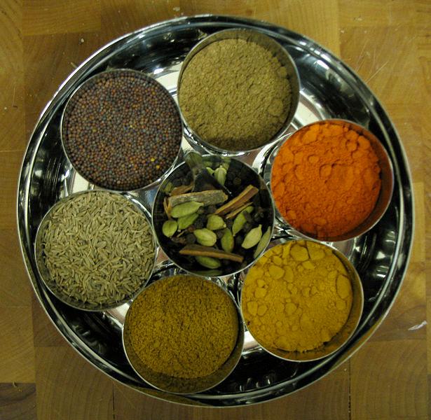
Many spices are originally native to India. But one of the most important or frequently used spices in Indian cuisine is chili pepper, not from India but from the Americas and introduced by the Portuguese. Indian spices include black mustard seed (sarso), cumin (jeera), turmeric (haldi), fenugreek (methi), asafoetida which is dried latex (hing), ginger (adrak), coriander (dhania), and garlic (lehsun). A popular spice mix is garam masala, a powder that typically includes five or more dried spices, especially cardamom, cinnamon, and clove. Each region has its own garam masala blend. Sweet dishes are seasoned with cardamom, saffron, nutmeg, and rose petal essences. No wonder Europe sought India’s spices, now every country does.

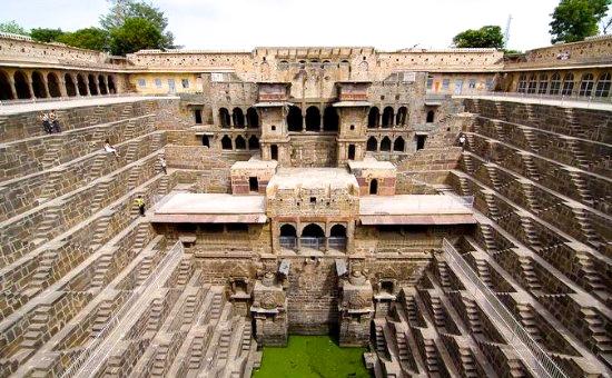
Abhaneri is a village in the Dausa district of Rajasthan state in India, located between the city of Bandikui and the town of Sikandra that lies on the Jaipur-Agra highway. It was constructed in 800 AD and is situated 59 miles from Jaipur. Abhaneri was originally named Abha Nagri, which means "city of brightness," but due to mispronunciation, the name was changed. Although the village is now in ruins, it still attracts tourists from across the globe.
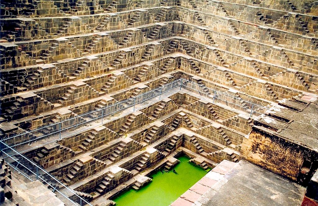
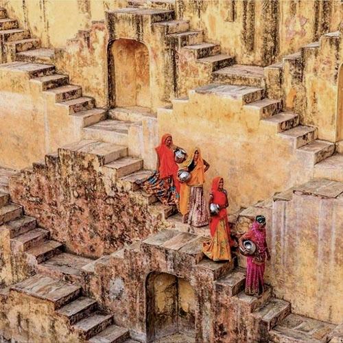
Abhaneri is known for its Baori' or step well which was invented by the natives to harvest rain water. The state of Rajasthan is extremely arid, and the design and final structure of Chand Baori was intended to conserve as much water as possible. It extends approximately 100 ft into the ground making it one of the deepest and largest step wells in India. At the bottom of the well, the air remains 5-6 degrees cooler than at the surface. It was also used as a community gathering place during the intense heat. Chand Baori was built by King Chanda of the Nikumbh dynasty between 800 and 900 AD and was dedicated to Hashat Mata, the Goddess of Joy and Happiness, upon its completion. According to myth, the goddess is always cheerful, and she imparts her joy and happiness to the whole village.
The Baori consists of 3,500 narrow steps over 13 stories descending into the earth with a subterranean palace on one side. The flight of stairs and the palace are all arranged in a square pattern with the well lying at the very bottom. The palace at the bottom of the Baori was a place for the royals to stay during hot summers days. There is a large courtyard all around the Baori with great views and covered areas housing intricately carved sandstone artifacts and idols dating as far back as 10th century.
The colossal, delicately carved well of Chand Baori is located very close to the ruins of the Harshat Mata Temple. It was a ritual to wash hands and feet at the Chand Baori before visiting the Harshat Mata Temple. Substantially destroyed by islamic invaders in the 10th century, the remains of the temple still boast of architectural and sculptural styles of 10th century India. The temple itself is on a raised platform from which unrestricted views of the nearby fertile region can be seen.
Agra is a city on the banks of the river Yamuna in the northern state of Uttar Pradesh, India. It is located 226 miles west of the state capital, Lucknow and 124 miles south of the national capital, New Delhi. With a population of 1,686,976 (2010 est.), it is one of the most populous cities in Uttar Pradesh and the 19th most populous in India. Because 80 percent of the city's sewage flows into the Yamuna River, it is the 20th most polluted city in India. Agra can also be referred to as the administrative district that has its headquarters in Agra city.
Agra achieved fame as the capital of the Mughal emperors from 1526 to 1658 and remains a major tourist destination because of its many splendid Mughal-era buildings.
The Agra Fort (sometimes called the Red Fort), was commissioned by the great Mughal Emperor Akbar in 1565 AD. A stone tablet at the gate of the Fort states that it had been built before 1000 AD but was later renovated by Akbar. The red sandstone fort was converted into a palace during Shāh Jahān's time, and reworked extensively with marble and pietra dura inlay, which is a technique of using cut and fitted, highly-polished colored stones to create images. Notable buildings in the fort include the Pearl Mosque, the Dīwān-e-'Ām and Dīwān-e-Khās (Halls of Public and Private audience), Jahāngīr's Palace, Khās Mahal, Shīsh Mahal (Mirrored Palace), and the Musamman Burj
The forbidding exteriors of this fort conceal an inner paradise. The fort is crescent shaped, flattened on the
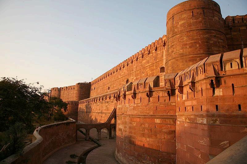
east with a long, nearly straight wall facing the river. It has a total perimeter of 1.5 miles and is ringed by double castellated ramparts of red sandstone punctuated at regular intervals by bastions. A 30 ft wide and 33 ft deep moat surrounds the outer wall.
Chhatrapati Shīvajī visited the Agra Fort, as a result of the conditions of the Treaty of Purandar entered into with
Mirzā Rājā Jaisingh, to meet Aurangzeb in the Dīwān-i-Khās (Special Audience Chamber). In the audience, he was deliberately placed behind men of lower rank. An insulted Shīvajī stormed out of the imperial audience and was then confined to Jai Sing's quarters on 12 May 1666. Fearing the dungeons and execution, he escaped on 17 August 1666. A heroic equestrian statue of Shīvajī has been erected outside the fort.
The fort is a typical example of Mughal architecture, effectively showing how the North Indian style of fort construction differentiated from that of the South. In the South, the majority of forts were built on the seabed.
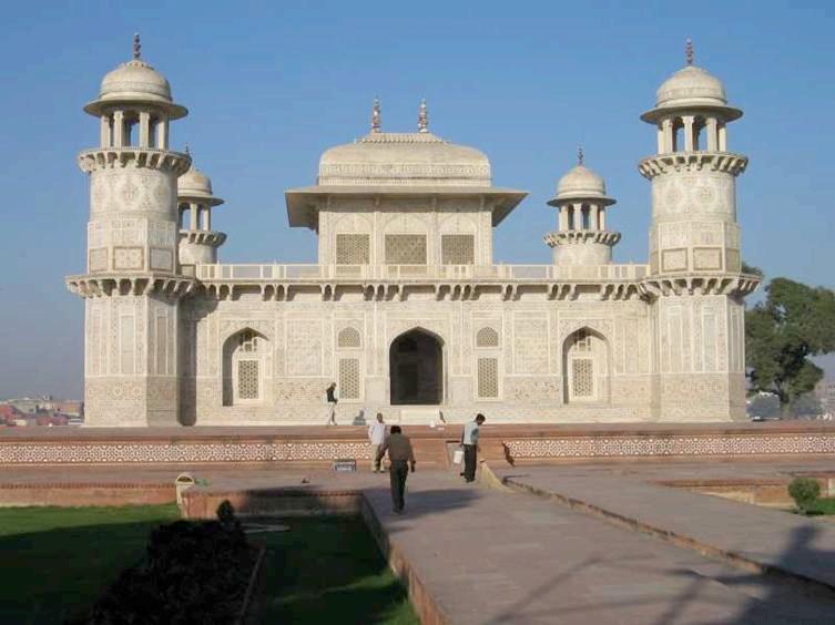
The I'timād-Ud-Daulah Tomb was built by the Empress Nūr Jahān builtfor her father, Mirzā Ghiyās Beg, the Chief Minister of the Emperor Jahāngīr. It is sometimes called the 'Baby Tāj'. Located on the left bank of the Yamuna river, the mausoleum is set in a large cruciform garden criss-crossed by water courses and walkways. The mausoleum itself covers about 250 sq ft. On each corner are hexagonal towers that are about 43 ft tall. Small in comparison to many other Mughal-era tombs, it is sometimes described as a jewel box.
The walls are white marble from Rajasthan encrusted with semiprecious stone pietra dura inlay designs – cornelian, jasper, lapis lazuli, onyx, and topaz in images of cypress trees and wine bottles, or more elaborate decorations like cut fruit or vases containing bouquets. Light penetrates to the interior through delicate jālī screens of intricately carved white marble.
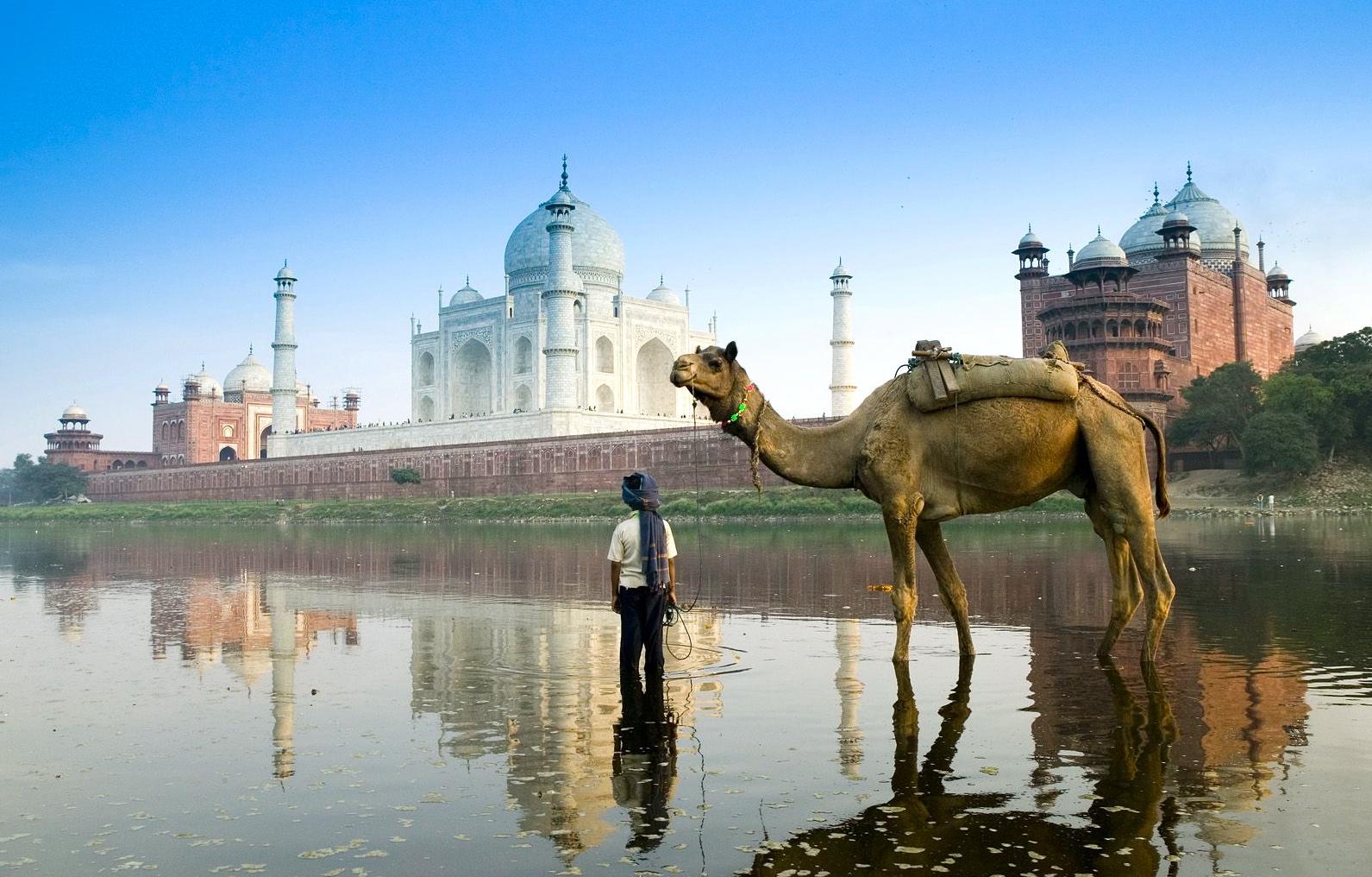
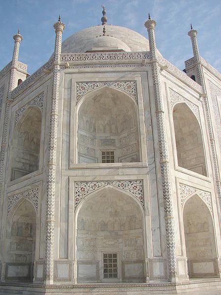
The Tāj Mahal is one of the most famous buildings in the world. Completed in 1653 AD, the Tāj Mahal was built by the Mughal king Shāh Jahān as the final resting place for his beloved wife, Mumtāz Mahal. Finished in marble, it is perhaps India's most fascinating and beautiful monument and one of the New Seven Wonders of the world.
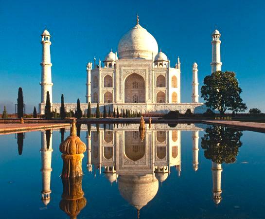
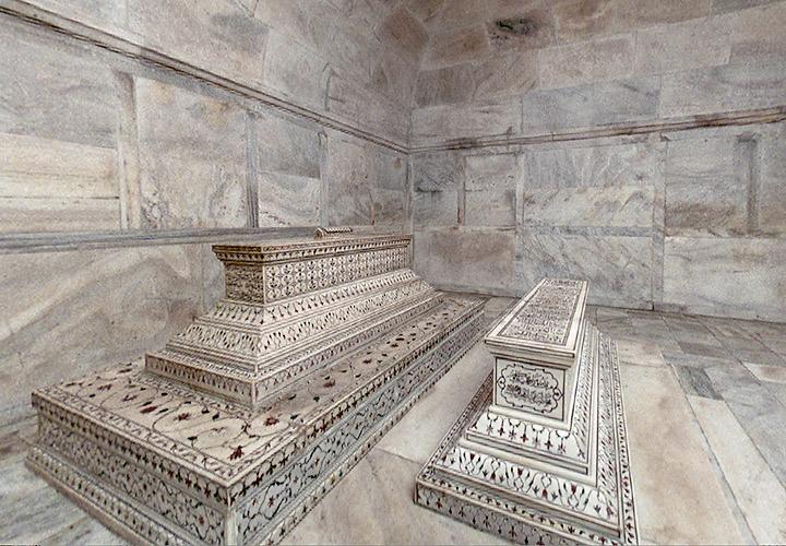
This perfectly symmetrical monument took 22 years (1630–1652 AD) of labor and 20,000 workers, masons and jewelers to build and is set amidst landscaped gardens. Built by the Persian architect, Ustād 'Īsā, the Tāj Mahal is on the bank of the Yamuna River. It can be observed from the Agra Fort where Emperor Shāh Jahān could gaze at it for the final eight years of his life, a prisoner of his son Aurangzeb. There are twenty-two small domes at the top of the gate, signifying the number of years the monument took to build. The Tāj Mahal was built on a marble platform that stands above a sandstone one. The most elegant dome of the Tāj Mahal has a diameter of 60 feet, and rises to a height of 80 feet. Directly under this dome is the tomb of Mumtāz Mahal. Shah Jahān's tomb was erected next to hers by his son Aurangzeb. The interiors are decorated by fine inlay work, incorporating semi-precious stones.
The exterior decorations of the Taj Mahal are among the finest in Mughal architecture. The decorative elements were created by applying paint, stucco, stone inlays, and carvings. In line with the Islamic prohibition against the use of anthropomorphic forms, the decorative elements can be grouped into either calligraphy, abstract forms or vegetative motifs.
Throughout the complex, passages from the Qur'an are used as decorative elements. The calligraphy on the Great Gate reads "O Soul, thou art at rest. Return to the Lord at peace with Him, and He at peace with you."
Delhi, officially the National Capital Territory of Delhi (NCT), is the largest metropolis by area and the second-largest by population in India, next to Mumbai. It is the eighth largest metropolis in the world by population with 16,753,265 inhabitants in the Territory at the 2011 Census. The name Delhi is often also used to include urban areas near the NCT, as well as to refer to New Delhi, the capital of India, which lies within the metropolis. Although technically a federally administered union territory, the political administration of the NCT of Delhi today more closely resembles that of a state of India with its own legislature, high court and an executive council of ministers headed by a Chief Minister. New Delhi, jointly administered by both the federal Government of India and the local Government of Delhi, is also the capital of the NCT of Delhi.
Located on the banks of the River Yamuna, Delhi has been known to be continuously inhabited since at least the 6th century BC, though human habitation is believed to have existed since the second millennium BC. Delhi re-emerged as a major political, cultural and commercial city along the trade routes between northwest India and the Gangetic plain after the rise of the Delhi Sultanates. It is the site of many ancient and medieval monuments, archaeological sites and remains. In 1639 AD, Mughal emperor Shahjahan built a new walled city in Delhi which served as the capital of the Mughal Empire from 1649 to 1857 AD.
After the British East India Company had gained a foothold in North East India in the late 18th century, Calcutta became the capital of the British held territories under Company rule (1774–1857) and remained so under the British Raj (1857–1920). The British had captured Delhi by 1857 and George V announced in 1911 that the capital of the British controlled parts of India would move back to Delhi. A new capital city, New Delhi, was built to the south of the old city during the 1920s. When India gained independence from British rule in 1947, New Delhi was declared its capital and seat of government. As such, New Delhi houses important offices of the federal government, including the Parliament of India, as well as numerous national museums, monuments, and art galleries.
Owing to the migration of people from across the country (mostly from the Northern and Eastern states of India), Delhi has grown to be a multicultural, cosmopolitan metropolis. Its rapid development and urbanization, coupled with the relatively high average income of its population, has transformed Delhi into a major cultural, political, and commercial center of India.
Delhi features an atypical version of a humid subtropical climate. Summers are long and extremely hot. In early March, there is a reversal in the direction of the wind, changing from a north-western direction to a south-western. This brings hot waves of air from Rajasthan, carrying sand and are characteristic of the Delhi summer. The months of March to May see a time of hot prickling heat. Then the monsoon arrives at the end of June, bringing some respite from the heat, but increasing humidity at the same time. The brief, mild winter starts in late November and peaks in January and is notorious for its heavy fog.
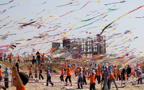
Delhi's association and geographic proximity to the capital, New Delhi, has amplified the importance of national events and holidays. National events like Republic Day, Independence Day and Gandhi Jayanti (Gandhi's birthday) are celebrated with great enthusiasm in Delhi. On India's Independence Day (15 August), the Prime Minister of India addresses the nation from the Red Fort. Most Delhiites celebrate the day by flying kites, which are considered a symbol of freedom. The Republic Day Parade is a large cultural and military parade showcasing India's cultural diversity and military might. Over the centuries, Delhi has been known for its composite culture, and a festival that truly symbolizes it is the Phool Walon Ki Sair, which takes place each year in September. This is where flowers and fans embroidered with flowers (pankhas), are offered to the shrine of 13th century Sufi saint, Khwaja Bakhtiyar Kaki, along with the Yogmaya Temple also situated in Mehrauli.
Gurudwara Bangla Sahib is the most prominent Sikh Gurdwara (house of worship or temple) in Delhi. It was first built as a small temple by Sikh General, Sardar Bhagel Singh, in 1783, who also supervised the construction of nine Sikh shrines in Delhi in the same year, during the reign of Mughal Emperor, Shah Alam II. The pond inside the Sarovar (complex), is considered holy by Sikhs and is known as "Amrit".
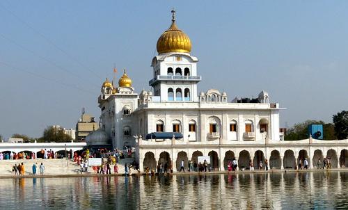
The grounds include the temple, a kitchen, a large pond, a school and an art gallery. As with all Sikh Gurdwaras, the concept of langar (food for free) is practiced, and all people, regardless of race or religion may eat in the Gurdwara kitchen (langar hall). The langar is prepared by gursikhs who work there and also by volunteers who like to help out. At the Gurdwara, visitors are requested to cover their hair and not to wear shoes. Assistance is offered to foreigners and visitors with guides, providing head scarves and a shoe-minding service that can be found inside the compound and like the food, both are free of charge. Anyone can volunteer to help keep the shoes in the shoe-minding room and with cleaning the precincts of the Gurudwara.
The complex also houses a higher secondary school, Baba Baghel Singh Museum, a library and a hospital.
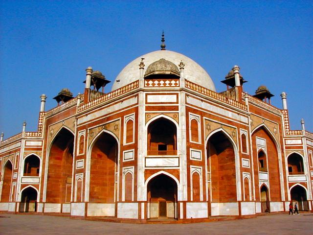
Humayun's Tomb is the tomb of the Mughal Emperor Humayun. The tomb was commissioned by Humayun's wife, Hamida Banu Begum, in 1562 AD, and designed by Mirak Mirza Ghiyath, a Persian architect. It was the first gardentomb on the Indian subcontinent, and is located in Nizamuddin East, Delhi, close to the Dina-panah citadel that Humayun founded in 1533. It was also the first structure to use red sandstone on such a large scale. Since 1993, it has undergone extensive restoration work, which is still underway. Besides the main tomb enclosure of Humayun, several smaller monuments dot the pathway leading up to it.
At the main entrance on the west side, there is a tomb that pre-dates the main tomb by twenty years. Constructed in 1547, the tomb complex is for Isa Khan Niyazi, an Afghan noble in Sher Shah Suri's court of the Suri dynasty, who fought against the Mughals.
The India Gate is the national monument of India. Situated in the heart of New Delhi, the India Gate was designed by Sir Edwin Lutyens, inspired by the Arch de Triumph in Paris. It was built in 1931. Originally known as the All India War Memorial, it is a prominent landmark in Delhi and commemorates the 90,000 soldiers of the Indian Army who lost their lives while fighting for the Indian Empire, or more correctly the British Raj in World War I and the Third Anglo-Afghan War. It is composed of red and pale sand stone and granite.
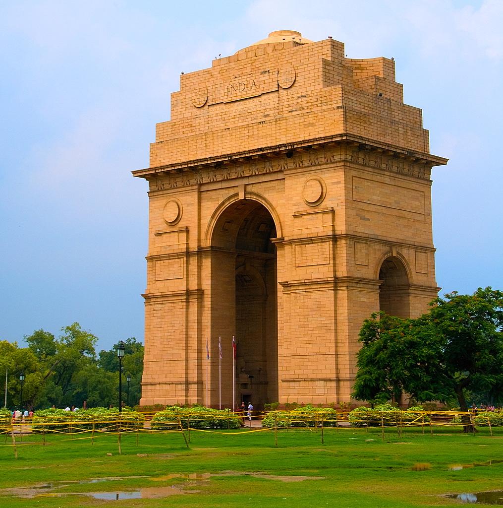
Originally, a Statue of King George V had stood under the now-vacant canopy in front of the India Gate, but was removed to Coronation Park with other statues. Following India's independence, India Gate became the site of the Indian Army's Tomb of the Unknown Soldier, known as Amar Jawan Jyoti (The flame of the immortal soldier).
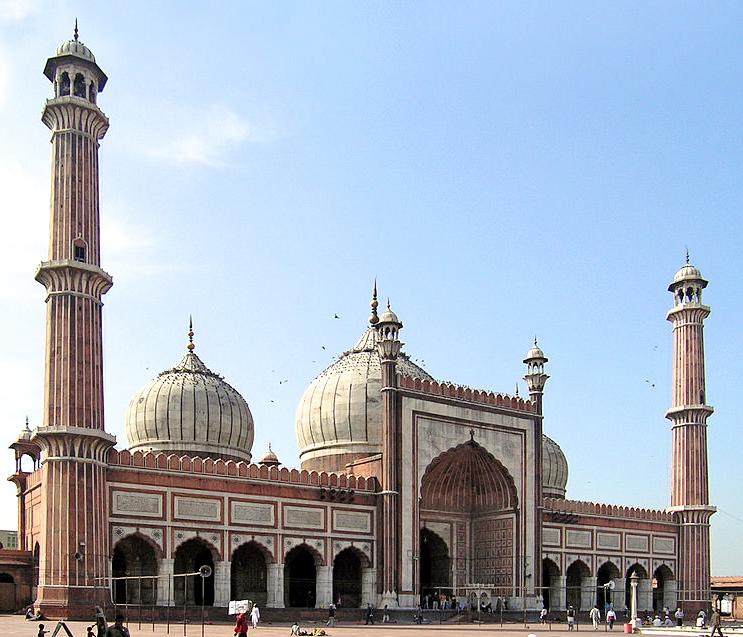
Jama Masjid Mosque is the principal mosque of Old Delhi in India. It was commissioned by the Mughal Emperor Shah Jahan, builder of the Taj Mahal, and completed in 1628 AD. It is the largest and bestknown mosque in India and lies at the origin of a very busy central street of Old Delhi, the Chawri Bazar Road
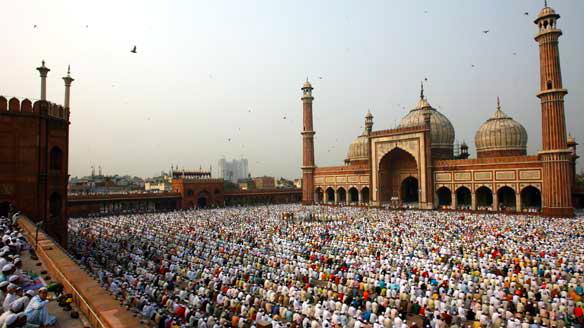
The latest name, Jama Masjid, is a reference to the weekly Friday noon congregation prayers of Muslims, Jummah, which are usually done at a mosque, the "congregational mosque" or "jāmi' masjid". The courtyard of the mosque can hold up to twenty-five thousand worshippers. The mosque also houses several relics in a closet in the north gate, including an antique copy of the Qur'an written on deer skin.
New Delhi is the capital city of India and one of the fastest growing cities in the world and has a total population of nearly three hundred thousand residents. New Delhi is one of the world’s top global cities. The World Cities Study Group at Loughborough University rated New Delhi as an "beta+ world city". The National Geographic's Traveler Magazine describes it as "one of the Ultimate Cities of a Lifetime to visit and explore." In a report jointly prepared by the Institute for Competitiveness and Confederation of Indian Industry, the city is listed as the best to live in. According to Mercer, New Delhi is the most expensive city in India for expatriates in terms of cost of living. New Delhi is known for its wide, tree-lined boulevards and is home to numerous national institutions, museums and landmarks.
The foundation of the city was laid on December 15, 1911. It was planned by two leading 20th century British architects namely Sir Edwin Lutyens and Sir Herbert Baker. The new capital was christened "New Delhi" in 1927, and was subsequently inaugurated on February 13, 1931, by British India's Governor-General Lord Irwin It serves as the center for the Government of India and the Government of the National Capital Territory of Delhi.
Old Delhi, the walled city of Delhi, was founded as Shahjahanabad by Mughal Emperor Shahjahan in 1639. It remained the capital of the Mughals until the end of the Mughal dynasty. It was once filled with the mansions of nobles and members of the royal court, along with elegant mosques and gardens. Today, despite having become extremely crowded and dilapidated, it still serves as the symbolic heart of metropolitan Delhi.
The old city was surrounded by a wall enclosing about 1,500 acres, with 14 gates. It was approximately shaped like a quarter circle, with the Red Fort as the focal point. The surrounding walls, 12 feet wide and 26 feet tall, originally of mud, were replaced by red stone in 1657. In the Mughal period, the gates were kept locked at night. The walls have now largely disappeared, but most of the gates are still present. The township of old Delhi is still identifiable in a satellite image because of its density of houses. The main street, now termed Chandni Chowk, runs from the Red Fort to Fatehpuri Masjid Originally a canal ran through the middle of the street.
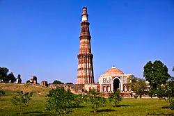
The Qutub Minar is a tower located in Delhi. It is the world's tallest brick minaret with a height of 237.8 ft. In 1192 AD, construction was commenced by Qutb-ud-din Aibak who won Delhi from Prithviraj, and was enlarged by Iltutmish, a later ruler. The Qutub Minar is notable for being one of the earliest and most prominent examples of Indo-Islamic architecture. It is surrounded by several other ancient and medieval structures and ruins, collectively known as the Qutub complex
Raisina Hill is an area of Lutyens' Delhi, New Delhi, housing India's most important government buildings, including Rashtrapati Bhavan, the official residence of the President of India and the Secretariat building housing the Prime Minister's Office and several other important ministries. It is surrounded by other important structures, including the Parliament of India, Rajpath, Vijay Chowk and the India Gate.
The Hill is a slightly elevated portion of land 741 ft high, about 59 ft higher than the surrounding area. In 1911 in order to transfer the capital of British India from Calcutta (now Kolkata) to Delhi, a planning committee was formed, and a site 3 miles south of the existing city of Delhi, around Raisina Hill, was chosen for the new administrative center. A welldrained, healthy area between the Delhi Ridge and the Yamuna River, it provided ample room for expansion for the new capitol city, New Delhi.
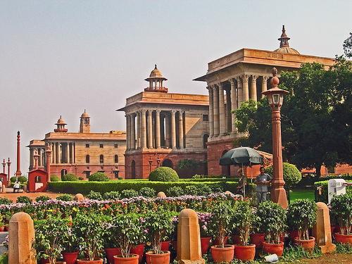
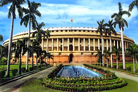
The Parliament House originally known as 'Council House', was planned, at the introductory stage, to be a part of the Rashtrapati Bhavan. But in 1919 according to the Montague-Chelmsford reforms, it was announced to be designed as the Indian parliament. Various designs of the building were submitted, from a triangular to a Roman colosseum like structure. These paved the way for its present design of a circular colonnaded verandah with 144 pillars and 560 ft diameter. The foundation stone of the Council House was laid on February 12, 1921 by Prince Arthur, Duke of Connaught, third son of Queen Victoria. The building, in pale and red Dholpur sandstone, uses the same theme as the neighboring Secretariat Building. The building spread over nearly six acres on Raisina Hill and was inaugurated on January 18, 1927 by the then Governor-General of India, Lord Irwin. It is now commonly known as Sansad Bhavan. The Rashtrapati Bhavan, the Sanskrit words for Presidential House/Palace or the Official Residence of the Head of the State, is the official residence of the President of India, located on Raisina Hill in New Delhi. Until 1950, it was known as "Viceroy's House" and served as the residence of the Viceroy and Governor-General of India. It is amidst an area known as Lutyens' Delhi.
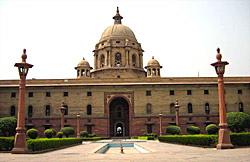
At present, it is the largest residence of any Chief of State in the world. The construction of the building was planned for 4 years, but World War I intervened and construction required 19 years to complete. Its first occupant, Lord Irwin, began his residence here on January 23, 1931.
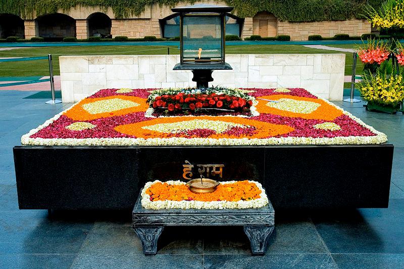
Raj Ghat is a memorial to Mahatma Gandhi. Originally, it was the name of a historic ghat (steps leading down to a water body which is usually considered holy) of Old Delhi (Shahjahanabad) on the banks of the Yamuna river. Close to it and east of Daryaganj was the “Raj Ghat Gate” of the walled city, opening at Raj Ghat on the Yamuna River. Later, the memorial area was also called Raj ghat.
A black marble platform marks the spot of Mahatma Gandhi's cremation on 31 January 1948, a day after his assassination. The Raj Ghat is left open to the sky while an eternal flame burns perpetually at one end. It is located on Ring Road officially known as Mahatma Gandhi Road. A stone footpath flanked by lawns leads to the walled enclosure that houses the memorial. All guests must remove their shoes before entering the Raj Ghat walls.
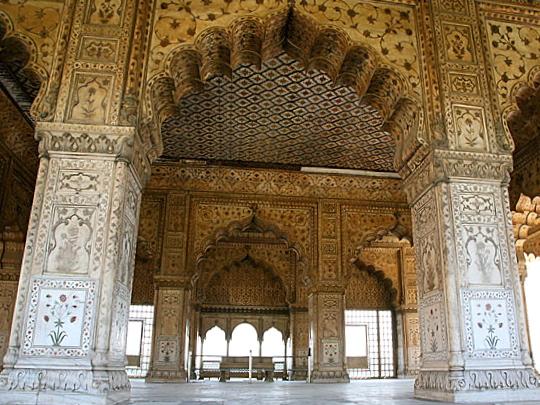
The Red Fort is a 17th century fort complex constructed by the Mughal emperor Shah Jahan in the walled city of Old Delhi that served as the residence of the Mughal Emperors. It also served as the capital of the Mughals until 1857, when Mughal emperor Bahadur Shah Zafar was exiled by the British Indian government.
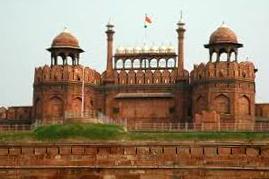
Mughal Emperor Shah Jahan started construction of the massive fort in 1638 and work was completed ten years later in 1648. The Red Fort was originally referred to as "Qila-i-Mubarak" (the blessed fort), because it was the residence of the royal family. The layout of the Red Fort was organized to retain and integrate this site with the Salimgarh Fort. The fortress palace was an important focal point of the medieval city of Shahjahanabad. The planning and aesthetics of the Red Fort represent the zenith of Mughal creativity which prevailed during the reign of Emperor Shah Jahan. This Fort has had many developments added on since its construction. The significant phases of development were under Aurangzeb and later Mughal rulers. Important physical changes were carried out in the overall settings of the site after the Indian Mutiny in 1857. After Independence, the site experienced a few changes in terms of additions or alterations to the structures. During the British period, the Fort was mainly used as a cantonment and even after Independence, a significant part of the Fort remained under the control of the Indian Army until the year 2003.
The Red Fort was the palace for Mughal Emperor Shah Jahan's new capital, Shahjahanabad (present day Old Delhi), the seventh city in the Delhi site. He moved his capital here from Agra in a move designed to bring prestige to his reign, and to provide ample opportunity to apply his ambitious building schemes and interests.
The fort lies along the Yamuna River, which fed the moats that surround most of the wall. The wall at its north-eastern corner is adjacent to an older fort, the Salimgarh Fort, a defense built by Islam Shah Suri in 1546.
In 1803, the forces of the British East India Company overran the Maratha forces near Delhi and ended the Mughal rule over the city.
The last Mughal emperor to occupy the fort was Bahadur Shah II "Zafar". Despite being the seat of Mughal power and its defensive capabilities, the Red Fort was not defended during the 1857 uprising against the British. After the failure of the rebellion, Zafar fled the fort, was captured by the British, tried in a show trial and then exiled to Ragoon.
Jaipur, also popularly known as the Pink City, is the capital and largest city of the Indian state of Rajasthan. Founded on 18 November 1727 by Maharaja Sawai Jai Singh II the ruler of Amber, the city today has a population of more than 3.9 million.
Jaipur is one of the finest planned cities of India, located in the semi-desert lands of Rajasthan. The city which once had been the capital of the royalty is now the capital city of Rajasthan. The very structure of Jaipur resembles the taste of the Rajputs and the Royal families. At present, Jaipur is a major business center with all requisites of a metropolitan city.
The city is remarkable among pre-modern Indian cities for the width and regularity of its streets which are laid out into six sectors separated by broad streets 111 ft wide. The urban quarters are further divided by networks of gridded streets. Five quarters wrap around the east, south, and west sides of a central palace quarter, with a sixth quarter immediately to the east. The Palace quarter encloses a sprawling palace complex, (Hawa Mahal), formal gardens, and a small lake. Nahargarh Fort, which was the residence of the King Sawai Jai Singh II, crowns the hill northwest of the old city.
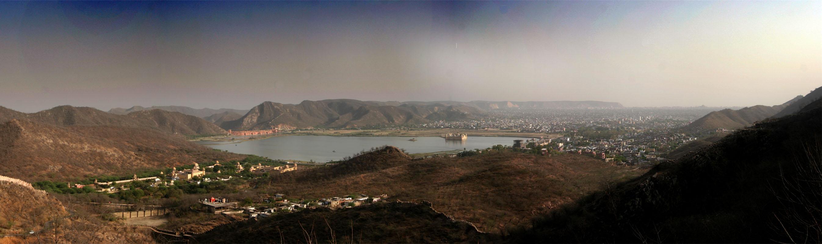
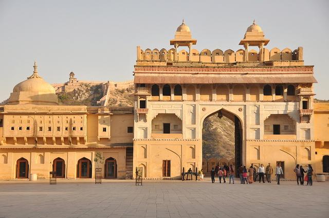
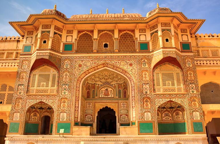
Amer Fort, pronounced as Amber Fort, is located in Amer (a town with an area of 1.5 sq mi) and 6.8 mi from Jaipur. It is one of the principal tourist attractions in the Jaipur area, located high on a hill. Amer Fort was built by Meenas king, Raja Alan Singh Chanda. It is known for its artistic style, blending both Hindu and Mughal elements. The fort, with its large ramparts and series of gates and cobbled paths, overlooks the Maota Lake at its forefront.
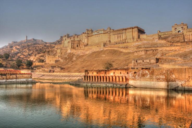
The aesthetic ambiance of this formidable fort is seen within its walls. On a four level layout plan, it is an opulent palace complex built with red sandstone and marble. It
consists of the Diwan-e-Aam (Hall of Public Audience), the Diwan-e-Khas (Hall of Private Audience), the Sheesh Mahal or Jai Mandir (mirror palace), and the Sukh Niwas where a cool climate is artificially created by winds that blow over the water cascade within the palace. Hence, the Amer Fort is also popularly known as the Amer Palace. The palace was lived in by the Rajput Maharajas and their families. At the entrance to the palace near the fort’s Ganesh Gate called the Ganesh Pol, there is a temple dedicated to Sila Devi, a goddess of the Chaitanya cult which was gifted to Raja Mansingh when he had defeated the Raja of Jessore in Bengal in 1604.
This fort, along with Jaigarh Fort located immediately above on the Cheel ka Teela (Hill of Eagles) of the same Aravalli range of hills, is considered as one complex, as the two are well connected by a subterranean passage. This passage was meant as an escape route in times of war for the royal family members and others in the Amer Fort to be able to shift to the more defensible Jaigarh Fort.
The fort is divided into four main sections each with its own entry gate and courtyard.
The main entry is through the Suraj Pol (Sun Gate) which leads to Jaleb Chowk, which is the first main courtyard. This was the place where armies would hold victory parades with their war bounty on their return from battles. These proceedings were also witnessed by the women of the Royal family through the latticed windows. This gate was built exclusively as the main entry into the palace and was provided with guards. It faced the eastern direction towards the rising Sun and hence the name, Sun Gate. Royal cavalcades and dignitaries entered the palace through this gate as well. At this location, the horse stables were also located with its upper level rooms used to occupy the guards.
Ganesh Pol or the Ganesh Gate, named after the Hindu god Lord Ganesh who removes all obstacles in life, is the entry into the private palaces of the Maharajas and the royal family. It is a three level structure which has many frescoes and was also built at the orders of the Mirza Raja Jai Singh(1621–1627). Above this gate is the Suhag Mandir where ladies of the royal family used to watch, through the latticed windows, functions held in the Diwan-i-Am.
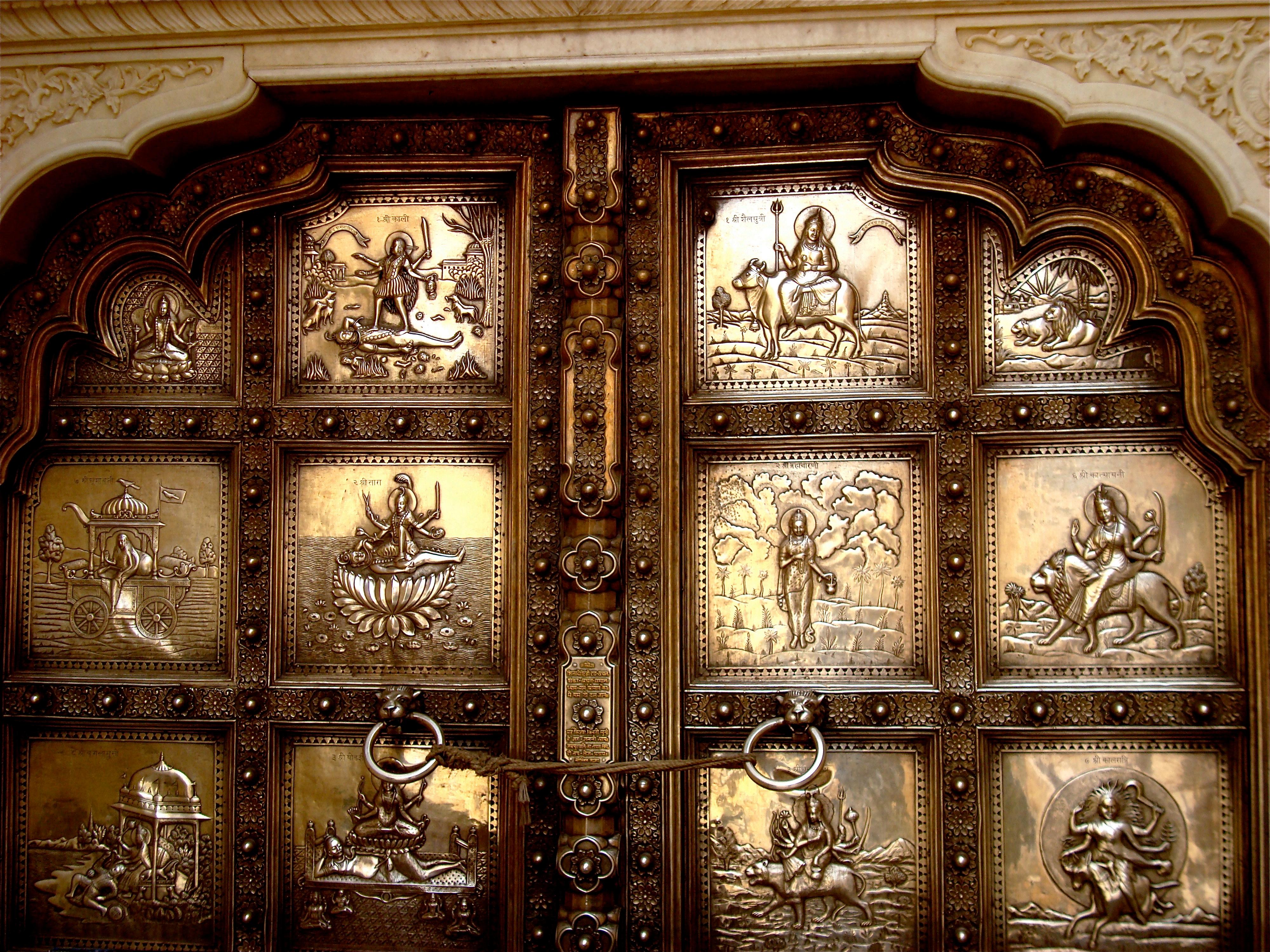
On the right side of the Jaleb Chowk there is a small but an elegant temple called the Shila Devi Temple. The entrance to the temple is through silver sheet covered double leaf gate with raised relief. The main deity inside the sanctum is flanked by two lions made in silver. One legend attributed to the installation of this deity is that Maharaja Man Singh sought blessings of Kali for victory in the battle against the Raja of Jessore in Bengal. The goddess instructed the Raja, in a dream, to retrieve her image from the sea bed and install and worship it. The Raja, after he won the battle of Bengal in 1604, retrieved the idol from the sea and installed it in the temple and called it Sila Devi as it was carved out of one single piece of a stone slab. At the entrance to the temple there is also a carving of Lord Ganesha, which is made out of a single piece of coral stone.
Another practice that is associated with this temple is the religious rites of animal sacrifice during the festival days of Navrathri (nine day festival celebrated twice a year). The practice was to sacrifice a buffalo and also goats on the eighth day of the festival in front of the temple, which would be done in the presence of the royal family and watched by a large gathering of devotees. This practice was banned under law in 1975. The sacrifice held within the palace grounds then became strictly a private event with only the close kin of the royal family watching. Now, however, the practice of animal sacrifice has been totally done away with within the temple premises and offerings made to the goddess are only of the vegetarian type.
Second courtyard
The second courtyard, up the main stairway of the first level courtyard, houses the Diwan-i-Am (the Public Audience Hall). Built with a double row of columns, the Diwani-Am is a raised platform with 27 colonnades, each mounted with an elephant shaped capital with galleries above it. As the name suggests, the Raja held audience here to hear and receive petitions from the public.
Third courtyard
The third courtyard is where the private quarters of the Maharaja, his family and attendants were built. This courtyard is entered through the Ganesh Gate. The court yard has two buildings, one opposite to the other, separated by a garden laid in the fashion of the Mughal Gardens. The building to the left of the entrance gate is called the Jai Mandir or Sheesh Mahal (Mirror Palace) which is exquisitely beautified with glass inlaid panels and multi-mirrored ceilings. The mirrors are of convex shape and designed with colored
foil and paint making them glitter brightly under candle light. Carved marble relief panels also surrounded the walls of the hall. Unfortunately, most of this work was allowed to deteriorate between 1970 and 1980. Since then, restoration and renovation have taken place.
A particular attraction here is the “magic flower” fresco carved in marble at the base of one of the pillars around the Mirror Palace which is identified by a two hovering butterflies depiction. The flower has seven unique designs: a fish tail, a lotus, a hooded cobra, an elephant trunk, a lion’s tail, a cob of corn and a scorpion. Each is viewed by partially hiding the panel with one’s hands
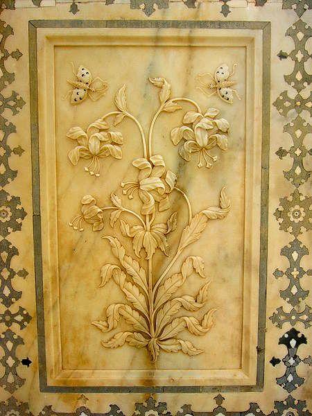
The other building seen in the courtyard,opposite the Jai Mandir, is known as the Sukh Niwas or Sukh Mahal (Hall of Pleasure). This hall is approached through a sandalwood door with marble inlay work with perforations. It provides enchanting vistas of the Maota Lake, which gives a reflected view of the ramparts and terraces of the fort. A piped water supply flows through an open channel that runs through this edifice keeping the environs cool, as in an air conditioned environment. The water from this channel then leads into the garden which is in a sunken bed, shaped in a hexagonal design. It is laid out with narrow channels lined with marble around a star shaped pool with a fountain at the center.
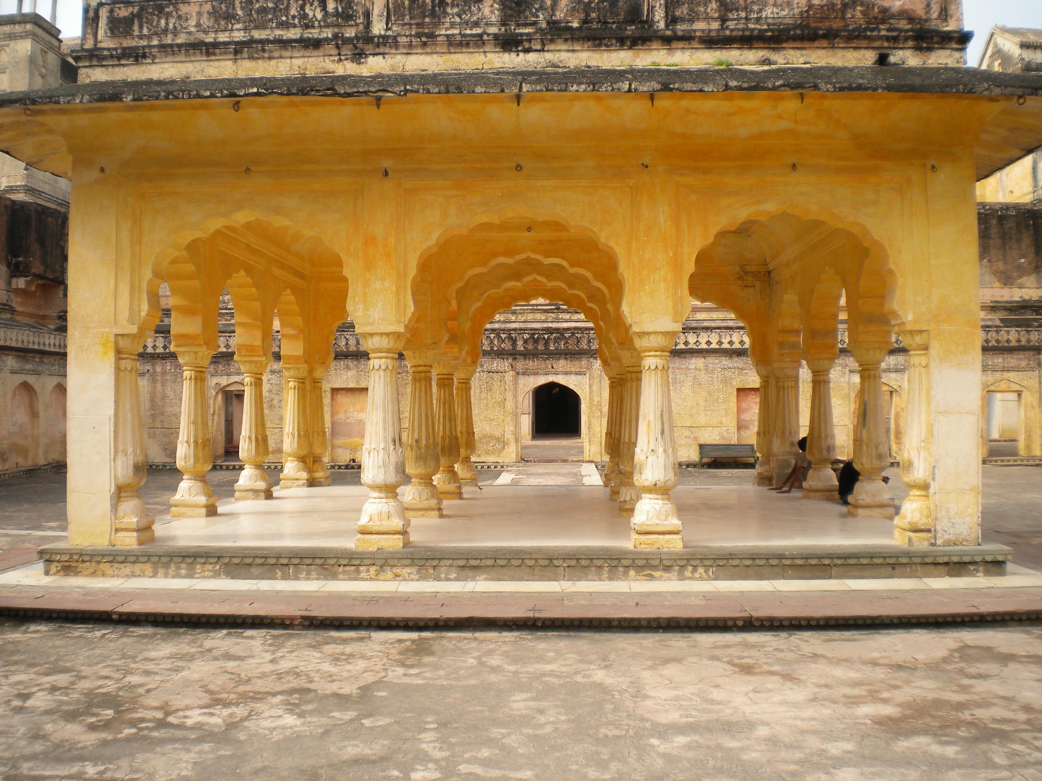
South of this courtyard lies the Palace of Man Singh I, which is the oldest part of the palace fort. This main palace took 25 years to build and was completed in 1599 during the reign of Raja Man Singh I (1589–1614). In the central courtyard is the pillared baradari or pavilion with frescoes and colored tiles decorating the ground and upper floor rooms. This pavilion, which used to be curtained for privacy, was used as the meeting venue by the maharanis (queens of the royal family). All sides of this pavilion are connected to several small rooms with open balconies. The exit from this palace leads to the Amer village, a heritage town with many temples, palatial houses and mosques.
Fourth courtyard
The fourth courtyard is where the Zenana (royal family women, including concubines or mistresses) lived. This courtyard has many living rooms where the queens resided. All the rooms open into a common corridor so that the king’s personal visits could go undetected.
The queen mothers and the Raja’s consorts lived in this part of the palace in Zanani Deorhi, which also housed their female attendants. The queen mothers took deep interest in building temples in Amer town.
Kesar Kyari Bagh on Maota Lake, is part of the Amer Fort complex near Jaipur. It was created around 1600 for the women of the harem to admire from above. According to Tom Turner, there was also an ingenious pulley system that allowed the women to reach the garden directly from their rooms, thus avoiding the risk of inappropriate male contact en route. The name translates as the saffron-growing garden, as originally it was this plant that grew in each star shape.
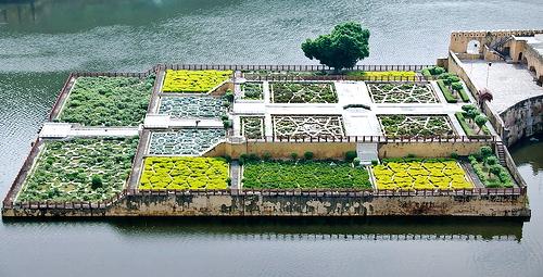
Nestled below rugged hills, it is striking because the whole thing is obviously manmade, from the dammed lake, square platform base, and stepped terraces to the intricate stone work and patterned planting. To anyone who argues that naturalistic designs are always to be preferred, they simply need to see the beauty of Kesar Kyari Bagh. Some scholars call it the Maunbari garden and argue that it was designed to be viewed at night, the pale marble partitions standing out in the moonlight like a pattern of lace against the dark plants.
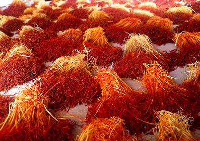
Since Kesar means saffron, some information about this spice might be useful. Saffron is derived from the flower of Crocus sativus, commonly known as the saffron crocus. This flower grows 8–12 inches and bears up to four flowers, each with three vivid crimson stigmas, which are the distal end of a carpel. Together with the styles, or stalks that connect the stigmas to their host plant, the dried stigmas are used, mainly in various cuisines as a seasoning and as a coloring agent or dye particularly in India and China. It is also used for religious purposes in India and has a long history of use in traditional medicine.
Vivid crimson coloring, slight moistness, elasticity, and lack of broken-off thread debris are all traits of fresh saffron. Its aroma is often described by connoisseurs as reminiscent of metallic honey with grassy or hay-like notes, while its taste has also been noted as hay-like and sweet.
Having been part of the spice trade for over 4,000 years, Saffron has long been and remains among the world's most costly spices by weight. To glean one pound of dry saffron requires the harvest of 50,000–75,000 flowers which takes about 15 to 20 hours of labor.The stigmas are dried quickly upon extraction and then (preferably) sealed in airtight containers. Saffron prices at retail rates range from $500 to $5,000 in US dollars per pound depending on the quality.
The City Palace of Jaipur, which includes the Chandra Mahal and Mubarak Mahal palaces and other buildings, is a palace complex in Jaipur. It was the seat of the Maharaja of Jaipur, the head of the Kachwaha Rajput clan. The Chandra Mahal palace now houses a museum but the greatest part of it is still a royal residence. The palace complex, which is located in northeast Jaipur, incorporates an impressive and vast array of courtyards, gardens and buildings. The palace was built between 1729 and 1732, initially by Sawai Jai Singh II, the ruler of Amer. He planned and built the outer walls, and later additions were made by successive rulers right up to the 20th century.
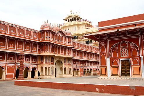
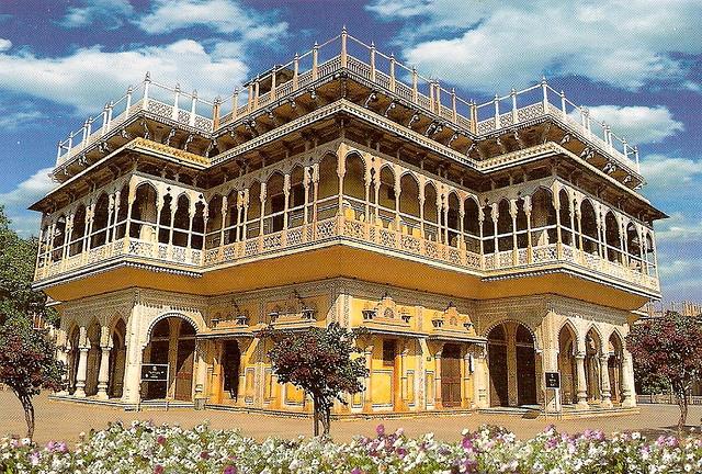
Hawa Mahal which translated means "Palace of Winds" or “Palace of the Breeze”, is a palace in Jaipur, India. It was built in 1799 by Maharaja Sawai Pratap Singh, and designed by Lal Chand Ustad in the form of the crown of Krishna, the Hindu god. Its unique five-story exterior is akin to the honeycomb of a beehive with 953 small windows called jharokhas that are decorated with intricate latticework. The original intention of the lattice was to allow royal ladies to observe everyday life in the street below without being seen as they had to observe strict "purdah" (face cover).
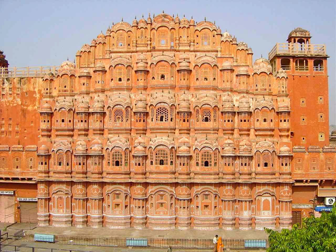
Built of red and pink sandstone, the palace is situated on the main thoroughfare in the heart of Jaipur’s business center. It forms part of the City Palace and extends to the Zenana or women's chambers, the chambers of the harem.
The Yantra Mantra or Jantar Mantar is an equinoctial dial, consisting of a gigantic triangular gnomon with the hypotenuse parallel to the Earth's axis. On either side of the gnomon is a quadrant of a circle, parallel to the plane of the equator. The instrument is intended to measure the time of day, correct to half a second and the declination of the Sun and other heavenly bodies
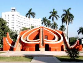
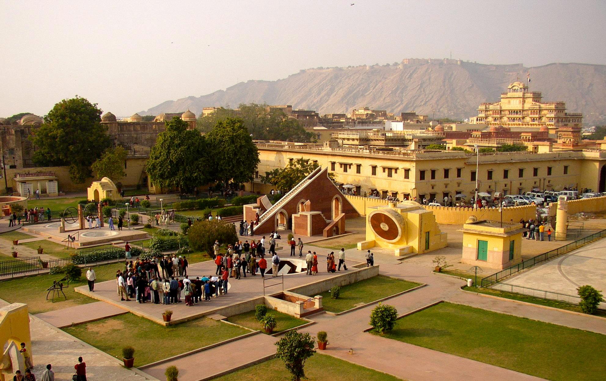
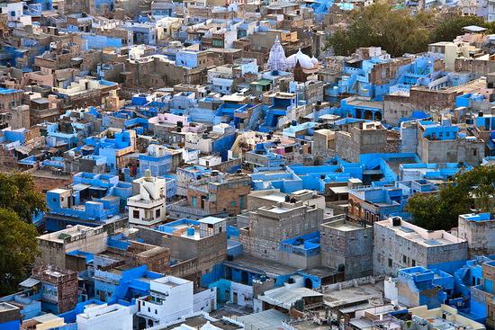
Jodhpur, is the second largest city in the Indian state of Rajasthan. It is located 208 mi west of the state capital, Jaipur, and 124 miles from the city of Ajmer. It was formerly the seat of a princely state of the same name, the capital of the kingdom known as Marwar. Jodhpur is a popular tourist destination, featuring many palaces, forts and temples, set in the stark landscape of the Thar desert.
The city is known as the "Sun City" for the bright, sunny weather it enjoys all year. It is also referred to as the "Blue City" due to the blue-painted houses around the Mehrangarh Fort. Jodhpur lies near the geographic center of Rajasthan state, which makes it a convenient base for travel in a region frequented by tourists. The old city of Jodhpur is surrounded by a thick stone wall.
As of the 2011 India census, Jodhpur has a population of about 1.4 million. Men constitute 53 percent of the population and women 47 percent. Jodhpur has an average literacy rate of 87 percent, higher than the national average of 59.5 percent and 14 percent of its population is under six years of age.
Cuisine
A number of Indian delicacies have originated in Jodhpur. To name a few: Makhaniya Lassi (a spiced yogurt drink), Pyaaj Kachori (a donut stuffed with spicy onion), Hot & Spicy Mirchibada (a preparation made with potato, onion, chili and gram flour), Dal Bati Churma (hard, unleavened bread), Kachar mircha curry (made with chili and kachar, a special type of vegetable grown in the desert area), Kadhi (made with gram flour, curd and chili), and sweets such as Bengali Rasgulla (milk curd/cheese balls soaked in a sweet syrup), Lapsi (a special kind of dessert made with wheat, jaggery ~ whole cane sugar, and ghee ~ clarified butter) and Rasmadhuri (a confection of nuts and saffron).
The Jaswant Thada is an architectural landmark located in Jodhpur. It is a white marble memorial built by Sardar Singh in 1899 in memory of Maharja Jaswant Singh II.
The monument, in its entirety, is built out of intricately carved sheets of marble. These stones are extremely thin and polished so that they emit a warm glow when the sun's rays dance across their surface.
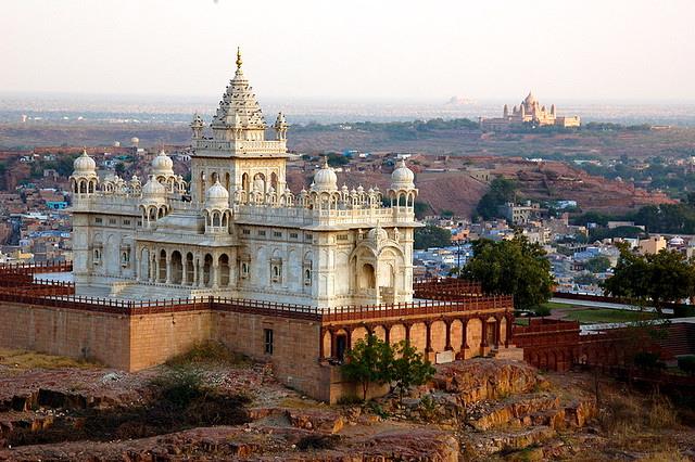
Within this cenotaph, there are also two more tombs. The Jaswant Thada is a traditional cremation ground of Jodhpur rulers. The grounds also include exquisitely carved gazebos, a beautiful multi-tiered garden and a small lake.
Mehrangarh Fort, located in Jodhpur city in Rajasthan state, is one of the largest forts in India. The fort is situated 400 feet above the city and is enclosed by imposing thick walls. Inside its boundaries, there are several palaces known for their intricate carvings and expansive courtyards. A winding road leads to and from the city below. The imprints of cannonball hits by the attacking armies of Jaipur can still be seen on the second gate. To the left of the fort is the chhatri (an elevated, dome-shaped pavilion) of Kirat Singh Soda, a soldier who fell on the spot defending the Mehrangarh fort.
There are seven gates. One is the Jayapol (meaning 'victory') Gate, built by Maharaja Man Singh to commemorate his victories over the Jaipur and Bikaner armies. Fattehpol (also meaning 'victory') Gate was built by Maharaja Ajit Singh to mark the defeat of the Mughals. The palm imprints upon these gates still attract much attention.
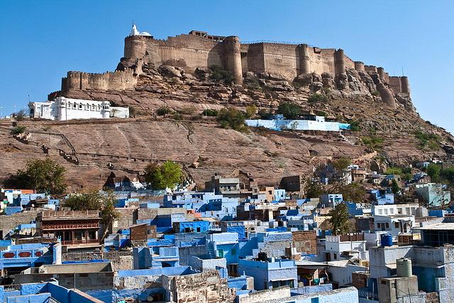
The museum in the Mehrangarh fort is one of the most wellstocked museums in Rajasthan. In one section of the fort museum there is a selection of old royal palanquins, including the elaborately domed Mahadol palanquin, which was won in a battle from the Governor of Gujarat in 1730. The museum exhibits the heritage of the Rathores in arms, costumes, paintings and decorated period rooms.
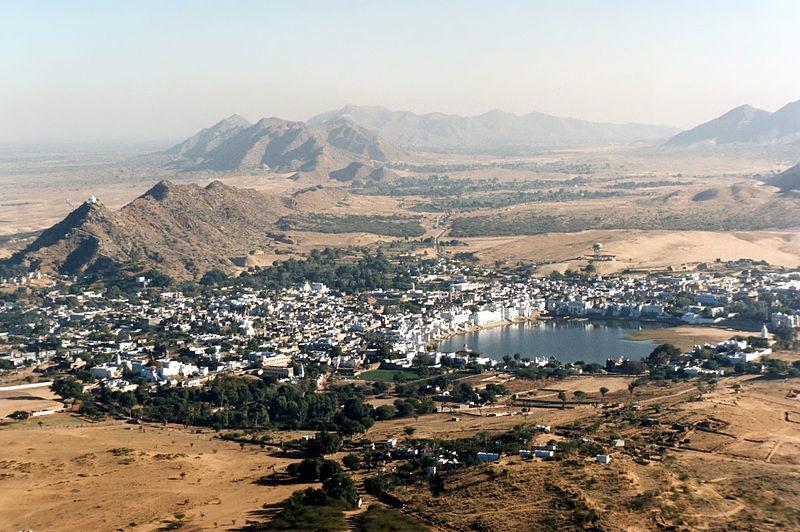
Pushkar is a town in the Ajmer district in the state of Rajasthan, India. and lies on the shore of Pushkar Lake with an elevation of 1673 ft. It is one of the oldest cities in India. The date of its actual origin is not known, but legend associates Lord Brahma with its creation. It is mentioned that Brahma performed penance here for 60,000 years to have a glimpse of Vishnu. Pushkar is one of the five sacred dhams (pilgrimage sites for devout Hindus). It is often called "Tirth Raj" - the king of pilgrimage sites.
Pushkar, in Sanskrit, means blue lotus flower. Hindus believe that the gods released a swan with a lotus in its beak and let it fall on earth where Brahma would perform a grand yagna. The place where the lotus fell was called Pushkar. The word Pushkar may be derived from the word Pushkarni, which means lake or from the word Pushpa which means flower and Kar which means hand.
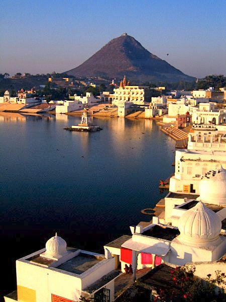
Pushkar has over 400 temples. Most of them are not very old, since many were destroyed during Muslim conquests in the area. But many of the destroyed temples have been rebuilt. The most famous among them is the Brahma Temple built during the 14th century AD. It is the only temple in India dedicated to Brahma, the Creator of the Universe. The Pushkar lake has 52 ghats (steps leading to a water body, usually holy water) where pilgrims descend to the lake to bathe in its sacred waters amidst the smell of jasmine and rose flowers.
The natural environment of Pushkar and its sacred lake has become increasingly degraded in the last few decades. The problems stem mainly from over-development of tourist facilities and the deforestation of the surrounding area.
The Pushkar Fair is an annual event that lasts only five days. According to the Hindu calendar, the Pushkar Fair commences in Nawami (Ninth Moon) and ends in Purnima (Full Moon) in the month of Kartika, which can be in either October or November depending upon the Moon calendar.
This fair time is the busiest time for the people of Pushkar, as this is one of the largest cattle fairs in the country. Animals, including cows, sheep, goats and over 50,000 camels, are brought from miles around to be traded and sold. Trading is brisk as several thousand head of cattle exchange hands.
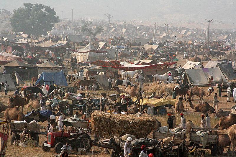
All the camels are cleaned, washed, adorned and some even interestingly shorn into patterns. Special stalls are set up for the selling of finery and jewelry for the camels, as well as for women. The women wear bracelets, but the camels at the Pushkar fair are decorated with silver bells and bangles around their ankles that jangle when they walk. An interesting ritual that also occurs is the piercing of a camel's nose.
A camel race starts off the festival and then the music, songs and exhibitions begin. Competitions, such as the "matka phod" (longest mustache) and "bridal competition" are among the main draws for this fair which attracts thousands of tourists. Between these events, the most waited for is the test of how the camel is able to bring items. In order to demonstrate this, men go up onto the group of camels one after another.
Countless people in their colorful attire also gather to take a dip in the Holy Lake and pray to the deities during the festival.
For five days, the whole town is alive with vibrant folk music, dances, magic shows, and horse and camel races. There is something for everyone.
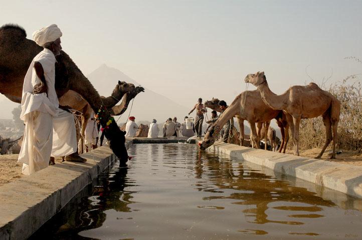
Pushkar Lake or Pushkar Sarovar is located in the town of Pushkar. It is a sacred lake of the Hindus. The Hindu scriptures describe as it as "Tirtha-Raj" –the king of pilgrimage sites related to a water-body and relate it to the mythology of the creator-god Brahma, whose most prominent temple stands in Pushkar. The Pushkar Lake finds mention on coins as early as the 4th century BC.
The creation of Pushkar Lake, as an artificial lake, is credited to the 12th century when a dam was built across the headwaters of the Luni River. The 10th Sikh guru, Guru Govind Singh (1666–1708), is said to have recited the Sikh sacred text Guru Granth Sahib on the banks of the lake. The lake is surrounded by 52 bathing ghats (a series of steps leading to the lake), where pilgrims throng in large numbers to take a sacred bath, especially around Kartik Poornima (October–November) when the Pushkar Fair is held. A dip in the sacred lake is believed to cleanse sins and cure skin diseases. Over 500 Hindu temples are situated around the lake precincts.
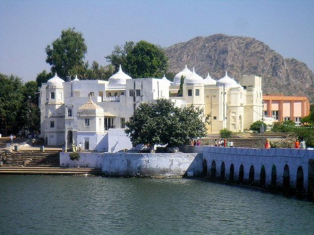
A story tells of a ninth-century Rajput king, Nahar Rao Parikar of Mandore, chasing a white boar to the lake shore on a hunting expedition. In order to quench his thirst, he dipped his hand into the lake and was astonished to see that the Leukoderma marks on his hand had disappeared. Impressed with the sacred curative nature of the lake, he got the lake restored to its glory. After discovering the curative characteristics of the lake water, people have since visited the lake to take a holy dip and cure themselves of skin problems.
During the Mughal rule, there was a short break in the lake's importance due to the levy of a pilgrim tax and a ban on religious processions. In 1615–16, the Mughal emperor Jahangir (1569–1627) built his hunting lodge (seen now in total ruins) on the shores of the Pushkar Lake to celebrate his victory over the local Rajput Rana (king). He came to this lodge 16 times for hunting during his stay in Ajmer, about 14 miles from Pushkar. This act violated the local tradition of not killing any animals in the precincts of the sacred lake. He also committed an idolatrous act by breaking the image of Varaha – the boar Avatar of the god Vishnu, as it resembled a pig and symbolically hurt Islamic sensitivity. Thereafter, Jahangir's grandson emperor Aurangzeb (1618–1707) destroyed and desecrated several temples, which were later rebuilt. However, during the rule of Jahangir's father, Emperor Akbar (1542–1605), there was a revival of not only the lake but also the Ajmer's Dargah dedicated to sufi saint Moinuddin Chishti, of whom Akbar was a devout follower.
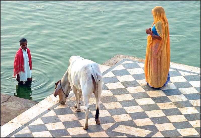
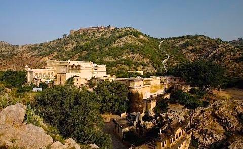
Samode is a large town in Rajasthan which belonged to the landlords known as ‘zamindars’ of the principal thakurs of the state of Amber. It It became prominent due to the thakurs lineage traced to Maharaja Prithviraj Singhji, the 17th prince of the house of Kacchwaha Rajputs. Samode was bequeathed to Gopal Singhji, one of his 12 sons, as a noble feudatory of the Amer and Jaipur principality. Samode was, even then, considered a very rich town under the kingdom of Amer. Behari Das, a Rajput warrior who was then in Mughal service of the Nathawat clan, inherited the Zamindari of Somede. It was then under the British Raj. But in 1757, it was restored to the Nathawat clan with the hereditary title 'Rawal Saheb' or 'Maha Rawal' (a title conferred for their valiance and loyalty to the royal family). It remains in the control of the clan today.
Geographically, the three monuments and the village of Samode and its structures are in the pristine hill range of the Aravalli Range, the foremost mountain range of northwestern India. The climate at Samode is severe with summer heat reaching as high as 113° F and winter temperatures dropping to 39° F.
The Samode village is noted for its cloth made by block printing and also for handicrafts such as bangle making. There is a small artists' colony in the village where miniature paintings are also created.
Samode Palace was initially built in the sixteenth century as a Rajput fort. But in the early 19th century, under the
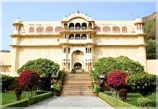
nobleman Rawal Berisal, it was converted from a fort into an exquisitely designed palace in Rajput and Muslim architectural style. Rawal Berisal, during this time, also served as the Chief Minister of Rajasthan and exercised full powers on behalf of the royal family. The palace is located near the Samode village on the outskirts of Shekhawat. It is built of sandstone with a fortress like setting. The interiors of the palace are composed in the ancient architectural style of Rajasthan: marble floors, intricately ornamented pillars, mosaic walls (with tiny pieces of small inlaid stones), luxurious carpets, and decorated with old wall paintings (hunting scenes, floral motifs and so forth).
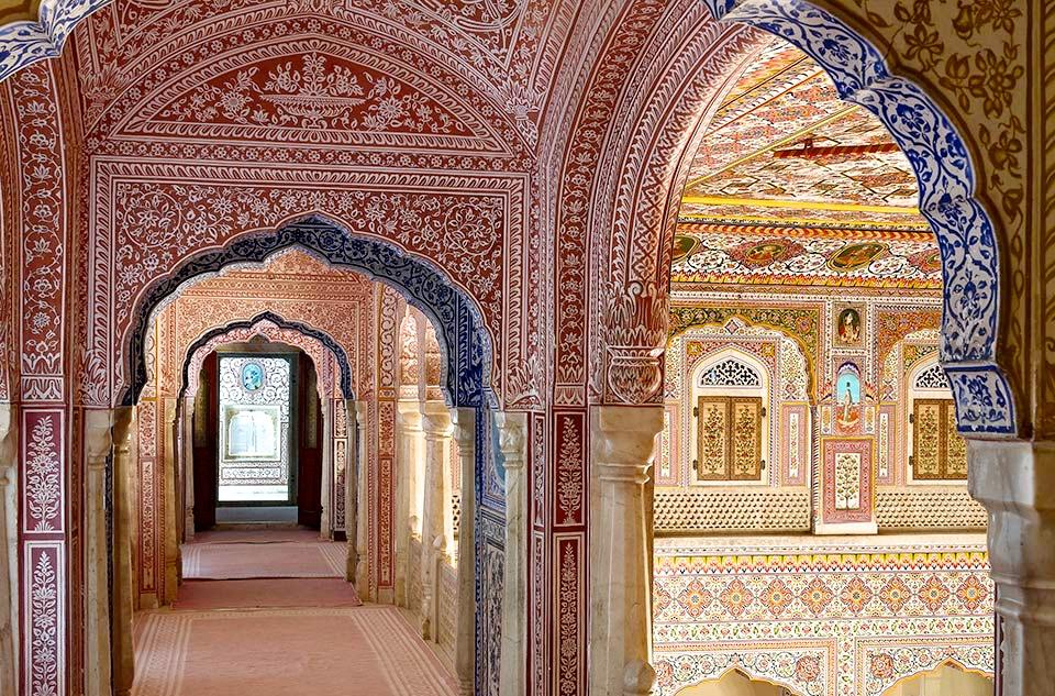
There is an old ruined fort above the palace from which a panoramic view of the valley can be seen. The fort area is overgrown with vegetation but stone paved paths have been built to reach the fort’s height. Samode fort was the former residence of the Maharaja. It is said that an underground passage links it to the palace and provided access
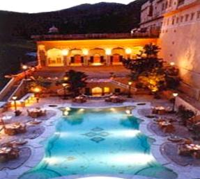
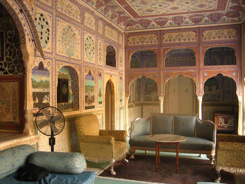
At the entrance gate of the palace is a unique piece of a large sized treasure chest made of dark wood with marble settings and gleaming glass. The Sheesh Mahal (Hall of Mirrors) is located on the southern side of the palace. The frescoes in the Durbar Hall and in the Sultan Mahal are said to be 250 years old. The palace is built on three levels (planned in a sequence of courtyards of increasing height) with a patio on each floor.
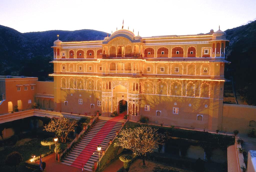
at times of emergency. It is now approached by a well laid out stone paved path (300 steps). There is also an entry gate to the ruined fort. Two other forts close by complete the circuit of a circular walk to and from the palace. There is also a small temple, less than 2 miles from the fort.
Samode Bagh or Samode garden was landscaped more than 150 years ago by one of the sons of Maharaja Prithiraj Singhji of Jaipur. It was patterned on the lines of Mughal gardens, which the Mughals had developed in other parts of their kingdom as a retreat for relaxation and enjoyment.
Samode Bagh is enclosed by a 15 ft high wall spread over an area of 20 acres. It blends traditional Rajasthan and
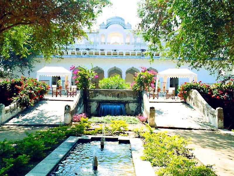
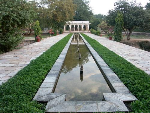
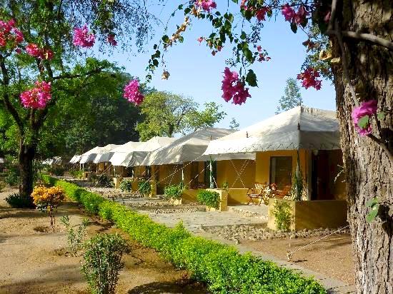
Mughal décor with Victorian style and modern facilities. It has a 200 feet long water channel with a row of fountains that are fed by springs and wells. Forty-four sandbank colored tents with airconditioning accommodate visitors in luxury. The tents have been furnished with carpets, standing lamps and well designed beds, chairs and other modern facilities. The tent walls also depict elegant paintings in Mughal art. There is also a 150 year old pavilion within the precincts of the garden that invites guests to relax.
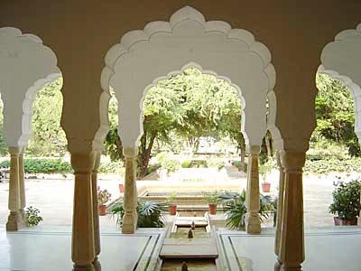
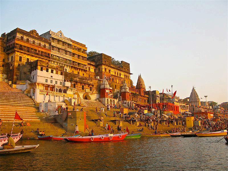
Varanasi also commonly known as Benares or Banaras, is a city situated on the banks of the River Ganges in the Indian state of Uttar Pradesh, 199 mi southeast of the state capital Lucknow. It is regarded as a holy city by Hindus, Buddhists and Jains. It is one of the oldest continuously inhabited cities in the world and probably the oldest in India.
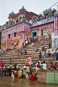
The Kashi Naresh (Maharaja of Kashi) is the chief cultural patron of Varanasi and an essential part of all religious celebrations. The culture of Varanasi is closely associated with the River Ganges and the river's religious importance.
Varanasi is one of the holiest cities in India and is known as the city where Buddhism was founded. It is also the birthplace of Suparshvanath, Shreyansanath, and Parshva, who are respectively the seventh, eleventh, and twenty-third Jain Tirthankars and as such, Jains also consider Varanasi to be a holy city. Guru Nanak Dev visited Varanasi for Shivratri in 1507 and had an encounter, which with other events, forms the basis for the story of the founding of Sikhism. The city has a notable native Muslim population, hosts the Roman Catholic Diocese of Varanasi, and has a significant Jewish expatriate community. Varanasi is home to numerous tribal
faiths which are not easily classified and many denominations of other religions are also present.
The Benares Gharana form of the Indian classical music was developed in Varanasi, and many prominent Indian philosophers, poets, writers, and musicians continue to reside here.
Residents mainly speak Hindi and Kashika Bhojpuri, which is closely related to the Hindi language. People often refer to Varanasi as "the city of temples", "the holy city of India", "the religious capital of India", "the city of lights", and "the city of learning."
According to legend, the city was founded by the Hindu deity Lord Shiva several thousand years ago, thus making it one of the most important Hindu pilgrimage destinations in the country. It is also a general belief that it stands on the weapon "The Trishool" of Lord Shiva. It is one of the seven sacred cities of the Hindus. Many Hindu scriptures, including the Rigveda, Skanda Purana, the Ramayana, and the Mahabharata mention the city.
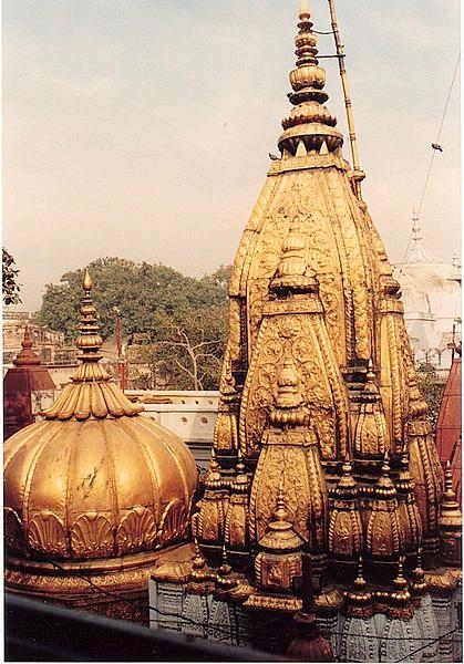
Varanasi was an industry center famous for its muslin and silk fabrics, perfumes, ivory works, and sculpture. During the time of Gautama Buddha (born circa 567 BC), Varanasi was the capital of the Kingdom of Kashi. The celebrated Chinese traveller Xuanzang attested that the city was a center of religious and artistic activities, and that it extended for about 3 miles along the western bank of the Ganges.
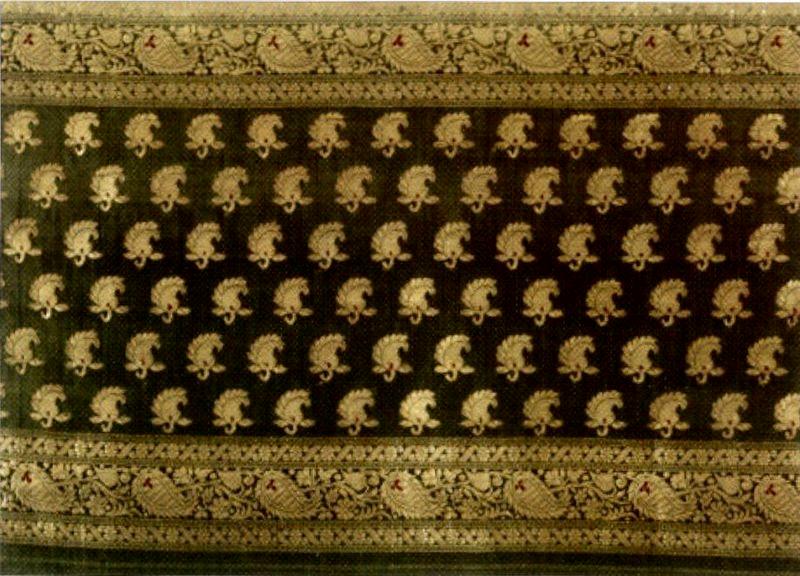
Presently, Varanasi has several small cottage industries. Fine silks and brocaded fabrics, exquisite saris, brassware, jewelry, woodcraft, carpets, wall hangings, lamp shades and masks of Hindu and Buddhist deities are some of Varanasi's shopping attractions. Banarasi saris, a regional type of sari, are made from silk known all over the world for its finery and softness. The saris are adorned with intricate designs and zari embellishments making them popular attire worn during traditional functions and weddings. Earlier, the embroidery on saris was done with threads of pure gold. In 2009, weaver associations and cooperatives together secured Geographical Indication (GI) rights for ‘Banarasi Brocades and Saris’. According to some writers, Varanasi has a rather high rate of child labor given the unorganized nature of the small scale industries The main shopping areas include the Chowk, Godaulia, Vishwanath Lane, Lahurabir and the Thatheri Bazaar.
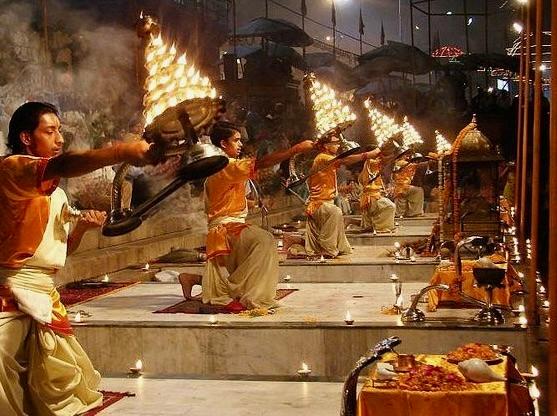
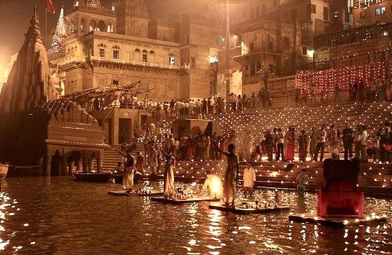
Arti or Aarti is a Hindu ritual employed in worship, part of a puja, in which light from a flame is ritually waved to venerate deities. Arti also refers to the songs sung in praise of the deity, when the light is being offered. Sikhs have Arti kirtan which involves only devotional singing; the Nihang order of Sikhs also uses light for arti.
Derived from the Sanskrit word, arti means something that removes “darkness”. According to Steven Rosen, it means "before night" or symbolic end of the night to the worshipper's "material sojourn - he or she is now situated in the light of God's devotion."
Arti ranges from simple acts of worship to extravagant rituals, but almost always includes a jyoti (flame or light). It is performed up to eight times daily, depending on the many Hindu traditions and temples. It is performed during most Hindu liturgies and occasions, and often involves circling a diya (lamp) clockwise before an image of a deity, accompanied by hymns. After waving the lamp before the deity, it is brought to the devotee, who then cups their hands and turns these down quickly over the flame. The devotee then raises the palms to their forehead in self-purification and connection with the divine.
The diya (lamp) used for arti is made of brass or other materials, with a cotton wick soaked in camphor, ghee, or oil. The arti plate may contain other offerings like flowers, incense, and akshata (rice). Some temples do not use a plate, as the priest instead directly handles the lamp when performing arti.
The purpose of arti is waving light in a spirit of humility and gratitude, wherein the faithful become immersed in a god's divine form. All paraphernalia used for arti symbolize the five elements: Space (akasha) - yak-tail fan, Wind (vayu) - peacock fan, Fire (agni)lamp or candle, Water (jalam) - water and handkerchief, Earth (prithvi) - flowers.
Arti is a expression of many aspects including love, benevolence, gratitude,
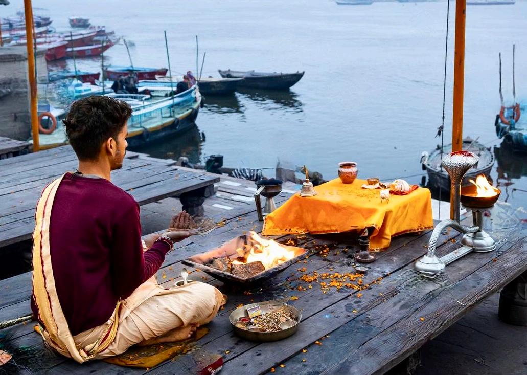
prayers, or desires depending on the object it is done for. For example, it can be a form of respect when performed to elders, prayers when performed to deities, or hope when performed for homes or vehicles. Emotions and prayers are often silent while doing arti, but this is determined by the person carrying out the ritual or the holiday involved. It's also believed that goodwill and luck can be taken through symbolic hand movements over the flame.
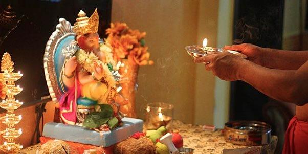
Looking at the god while performing arti reminds the performer (and the attendees of the arti) to keep God at the center of all activities and reinforces the belief that routine worldly activities are secondary in importance. This understanding gives the believers strength to withstand the unexpected grief and keeps them humble and remindful of god during happy moments. Apart from worldly activities, arti also represents one's self - thus, arti signifies that one is peripheral to the godhead or divinity. This should keep one's ego down and help one remain humble in spite of high social and economic rank. A third commonly held understanding of the ritual is that arti serves as a reminder to stay vigilant so that the forces of material pleasures and desires cannot overcome the individual. Just as the lighted wick provides light and chases away darkness, the vigilance of an individual can keep away the influence of the material world.
Arti is not only limited to God. Arti can be performed not only to all forms of life, but also inanimate objects which help in the progress of the culture. This is exemplified by the performer of the arti waving the light to all the devotees as the arti comes to the end –signifying that everyone has a part of God within that the performer respects and bows down to. It is also a common practice to perform arti to inanimate objects like vehicles, electronics etc. at least when a Hindu starts using it, just as a gesture of showing respect and praying that this object would help one excel in the work one would use it for. It is similar to the ritual of doing auspicious red mark(s), using kanku (kumkum) and rice.
Hinduism has a long tradition of arti songs, simply referred to as arti, sung as an accompaniment to the ritual of arti. It primarily extols the virtues of the deity that the ritual is being offered to, and several sects have their own versions of the common arti songs that are often sung on chorus at various temples, during evening and morning artis. Sometimes they also contain snippets of information on the life of the deity.
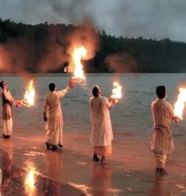
The Ganges River is a trans-boundary river of India and Bangladesh. The 1,569 mile river rises in the western Himalayas in the Indian state of Uttarakhand, and flows south and east through the Gangetic Plain of North India into Bangladesh, where it empties into the Bay of Bengal. By discharge, it ranks among the world's top 20 rivers. The Ganges basin is the most heavily populated river basin in the world, with over 400 million people and a population density of about 1,000 inhabitants per square mile.
The Ganges is the most sacred river to Hindus and is also a lifeline to millions of Indians who live along its course and depend on it for their daily needs. It is worshiped as the goddess Ganga in Hinduism. It has also been important historically as many former provincial or imperial capitals have been located on its banks.
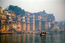
All along her course, Hindus bathe in the Ganges. All along her course, they pay homage to their ancestors and to their gods by cupping her water in their hands, lifting it and letting it fall back into her. They offer flowers and rose petals and float shallow clay dishes filled with oil and lit with wicks. On the journey back home from the Ganges, they carry small quantities of her water with them for use in rituals. When a loved one dies, they return to the Ganges to consign the ashes to her custody.
Jawaharlal Nehru, a religious iconoclast, asked for a handful of his ashes to be thrown into the Ganga, as it is called in Southern India. "The Ganga," he wrote in his will, "is the river of India, beloved of her people, around which are intertwined her racial memories, her hopes and fears, her songs of triumph, her victories and her defeats. She has been a symbol of India's age-long culture and civilization, ever-changing, everflowing, and yet ever the same Ganga."
The Ganges ranks among the top five most polluted rivers in the world with fecal coliform levels in the river near Varanasi more than hundred times the official Indian government limits. Pollution threatens not only humans, but also more than 140 fish species, 90 amphibian species and the endangered Ganges river dolphin. The Ganga Action Plan, an environmental initiative to clean up the river, has been a major failure thus far, due to corruption, lack of technical expertise, lack of good environmental planning, Indian traditions and beliefs, and lack of support from religious authorities.
Sarnath is a city located 8 miles north-east of Varanasi near the confluence of the Ganges and the Gomati rivers in Uttar Pradesh, India. The deer park in Sarnath is where Gautama Buddha first taught the Dharma, and where the Buddhist Sangha came into existence through the enlightenment of Kondanna. Singhpur, a village approximately a half mile away from the site, was the birthplace of Shreyansanath, the Eleventh Tirthankara of Jainism, and a temple dedicated to him, is an important pilgrimage site.
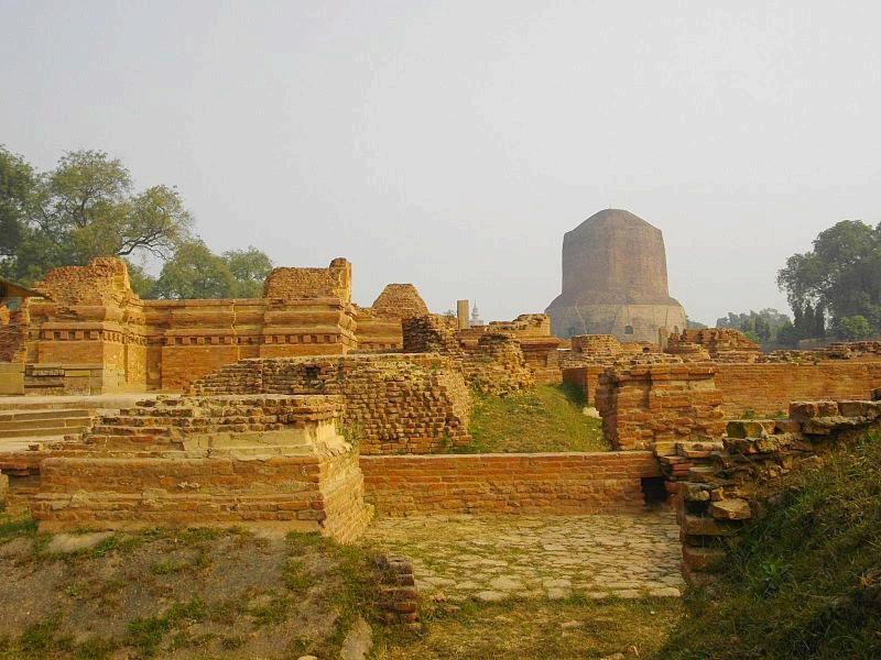
Isipatana is mentioned by the Buddha as one of the four places of pilgrimage which his devout followers should visit. It was also the site of the Buddha's Dhammacakkappavattana Sutta, which was his first teaching after attaining enlightenment, in which he taught the four noble truths and the teachings associated with it.
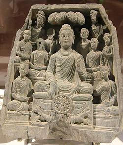
The four truths express the basic orientation of Buddhism: We crave and cling to impermanent states and things, which is dukkha, "incapable of satisfying" and painful. This keeps us caught in samsara, the endless cycle of repeated rebirth, dukkha and dying again. But there is a way to reach real happiness and to end this cycle, namely following the eightfold path. The meaning of the truths is as follows:
1) Dukkha, "incapable of satisfying," painful. Life in this "mundane world," with its craving and clinging to impermanent states and things, is dukkha, unsatisfactory and painful;
2) Samudaya, the origination or arising of dukkha. Dukkha, and repeated life in this world, arises with taṇhā, "thirst," craving for and clinging to these impermanent states and things. This craving and clinging produces karma which leads to renewed becoming, keeping us trapped in rebirth and renewed dissatisfaction;
3) Niroda, the cessation of dukkha. By stopping this craving and clinging nirvana is attained, no more karma is produced, and rebirth and dissatisfaction will no longer arise again;
4) Magga, the path to the cessation of, or liberation from dukkha. By following the Noble Eightfold Path, restraining oneself, cultivating discipline, and practicing mindfulness and meditation, craving and clinging will be stopped, and rebirth and dissatisfaction are ended.
Nepal, officially the Federal Democratic Republic of Nepal, is a landlocked sovereign state located in South Asia. It is located in the Himalayas and bordered to the north by the People's Republic of China, and to the south, east, and west by the Republic of India. With an area of 56,827 sq miles and a population of approximately 30 million, Nepal is the world's 93rd largest country by land mass and the 41st most populous country. Kathmandu is the nation's capital and the country's largest metropolis.
Nepal has a rich geography. The mountainous north has eight of the world's ten tallest mountains, including the highest point on Earth, Mount Everest, called Sagarmatha in Nepali. It contains more than 240 peaks over 20,000 ft above sea level. The fertile and humid south is heavily urbanized.
Most houses in the rural lowland of Nepal are made up of a tight bamboo framework and walls of a mud and cow-dung mix. These dwellings remain cool in summer and retain warmth in winter. Houses in the hills are usually made of unbaked bricks with thatch or tile roofing. At high elevations, construction changes to stone masonry and slate may be used on the roofs.
Nepal's flag is the only national flag in the world that is not rectangular in shape. According to its official description, the red in the flag stands for victory in war or courage, and is also the color of the rhododendron, the national flower of Nepal. Red also stands for aggression. The flag's blue border signifies peace. The curved moon on the flag is a symbol of the peaceful and calm nature of Nepalese, while the sun represents the aggressiveness of Nepalese warriors.
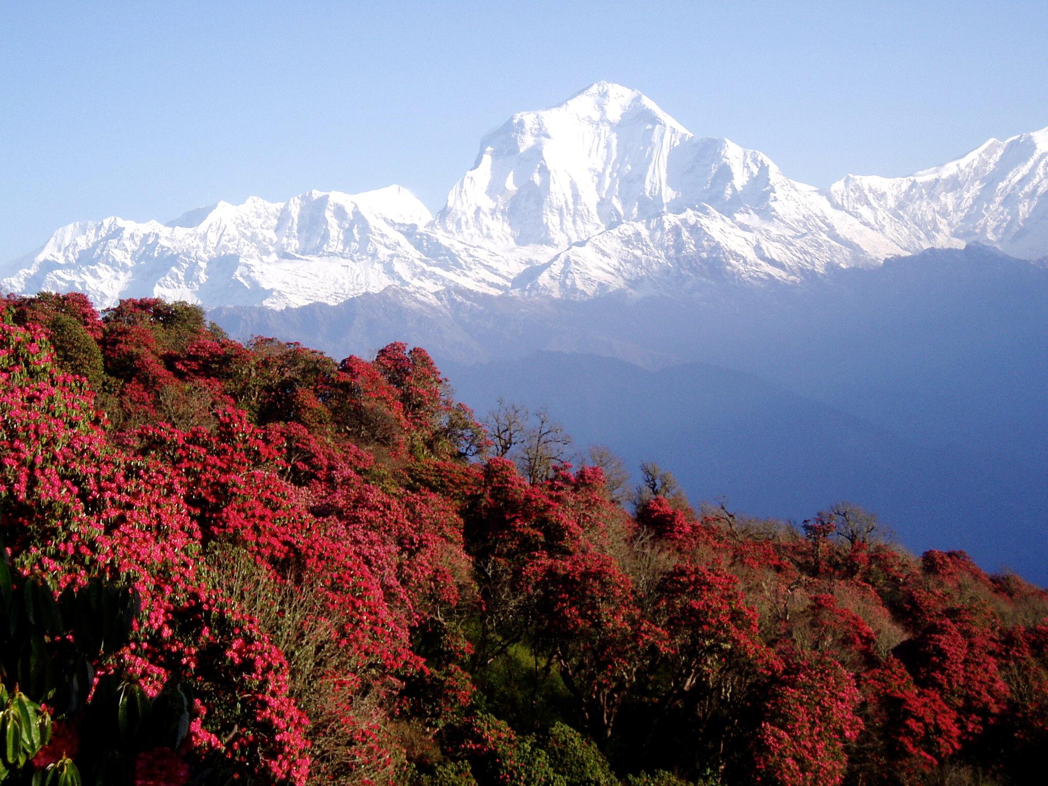
A monarchy throughout most of its history, Nepal was ruled by the Shah dynasty of kings until 1768 when Prithvi Narayan Shah unified its many small kingdoms. However, a decade-long Civil War by the Communist Party of Nepal (Maoist) and several weeks of mass protests by all major political parties led to the 12 point agreement of November 22, 2005. The ensuing elections for the constituent assembly on May 28, 2008 overwhelmingly favored the abdication of the Nepali monarch Gyanendra Shah and the establishment of a federal multi-party representative democratic republic. The first President of Nepal, Ram Baran Yadav, was sworn in on July 23, 2008
By some measures, Hinduism is practiced by a larger majority of people in Nepal than in any other nation. Buddhism, though a minority faith in the country, is linked historically with Nepal. Many Nepali do not distinguish between Hinduism and Buddhism and follow both religious traditions. There are three different Buddhist traditions in Nepal: Himalayan Buddhism, Buddhism of Kathmandu Valley (mostly Mahayana and Vajrayana), and also the Theravada Buddhism.
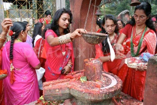
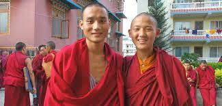
The Newari music orchestra consists mainly of percussion instruments, though wind instruments, such as flutes and other similar instruments, are also used. String instruments are very rare. There are songs pertaining to particular seasons and festivals. Paahan chare music is probably the fastest played music while Dapa is the slowest. There are certain musical instruments such as Dhimay and Bhusya which are played as instrumentals only and are not accompanied with songs. The dhimay music is the loudest. In the hills, people enjoy their own kind of music, playing saarangi (a string instrument), madal and flute. They also have many popular folk songs known as lok geet and lok dohari
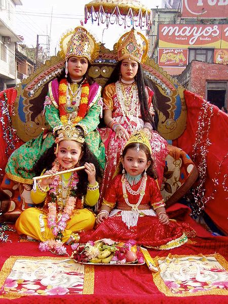
Legends state that dances in the Indian subcontinent originated in the abode of Lord Shiva - the Himalayas and the Himalayan Kingdom of Nepalwhere he performed the tandava dance. This indicates that dance traditions of Nepal are of very ancient origin. Within altitudes and ethnicity, the dances of Nepal slightly change in style as well as in the dance costumes. Accompanying music and musical instruments also change with the themes, which revolve around topics like harvesting of crops, marriage rites, war stories, a lonely girl’s yearning for her love, and several other themes and stories from everyday life in the villages.
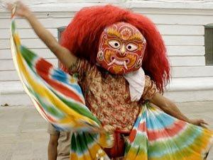
The Newari dances can be broadly classified into masked dances and non-masked dances. The most representative of Newari dances is the Lakhey dance which is masked. Almost all of the settlements of Newars organize a Lakhey dance at least once a year, mostly in the Goonlaa month, so they are called Goonlaa Lakhey. The Lakhey, demon characters, are considered to be the saviors of children.
Folklore is an integral part of Nepalese society. Traditional stories are rooted in the reality of day-to-day life, tales of love, affection and battles as well as demons and ghosts, thus reflecting local lifestyles, cultures and beliefs. Many Nepalese folktales are enacted through the medium of dance and music.
The Nepali year begins in mid-April and is divided into 12 months. Saturday is the official weekly holiday. Main annual holidays include the National Day, celebrated on the birthday of the king (28 December), Prithvi Jayanti (11 January), Martyr's Day (18 February), and a mixture of Hindu and Buddhist festivals such as Dashain in autumn, and Tihar in late autumn.
Chhath, an ancient Hindu festival, is dedicated to the Hindu Sun God, Surya. In Hinduism, sun worship is believed to help cure a variety of diseases, including leprosy and helps ensure the longevity and prosperity of family members, friends and elders. For four days in November, there is holy bathing, fasting and abstaining from drinking water. Worshippers stand in water for long periods of time and offer prashad (prayer offerings) and aragh (a highly alcoholic anis flavored drink) to the setting and rising sun.
Cuisine
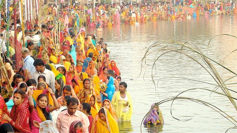
A typical Nepalese meal is dal-bhat-tarkari . Dal is a spicy lentil soup, served over bhat (boiled rice) and served with tarkari (curried vegetables) together with achar (pickles) or chutni (spicy condiment made from fresh ingredients). The Newar community, the indigenous people of Nepal, however, has its own unique cuisine. It consists of non-vegetarian as well as vegetarian items served with alcoholic and non-alcoholic beverages. Mustard oil is the cooking medium and a host of spices, such as cumin, coriander, black peppers, sesame seeds, turmeric, garlic, ginger, methi (fenugreek), bay leaves, cloves, cinnamon, pepper, chilies, and mustard seeds are used in the cooking.
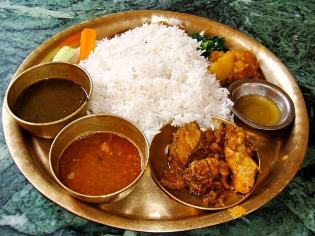
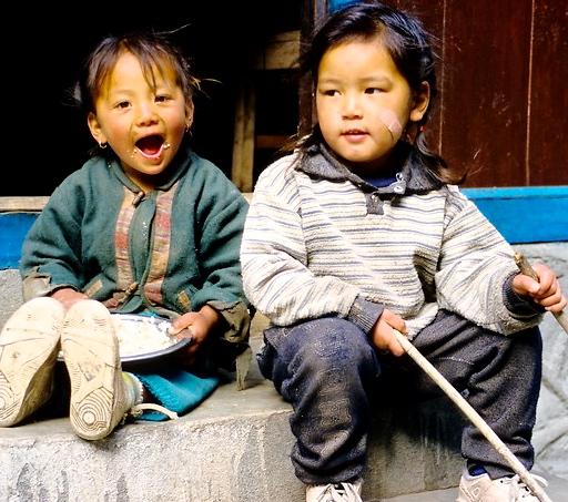
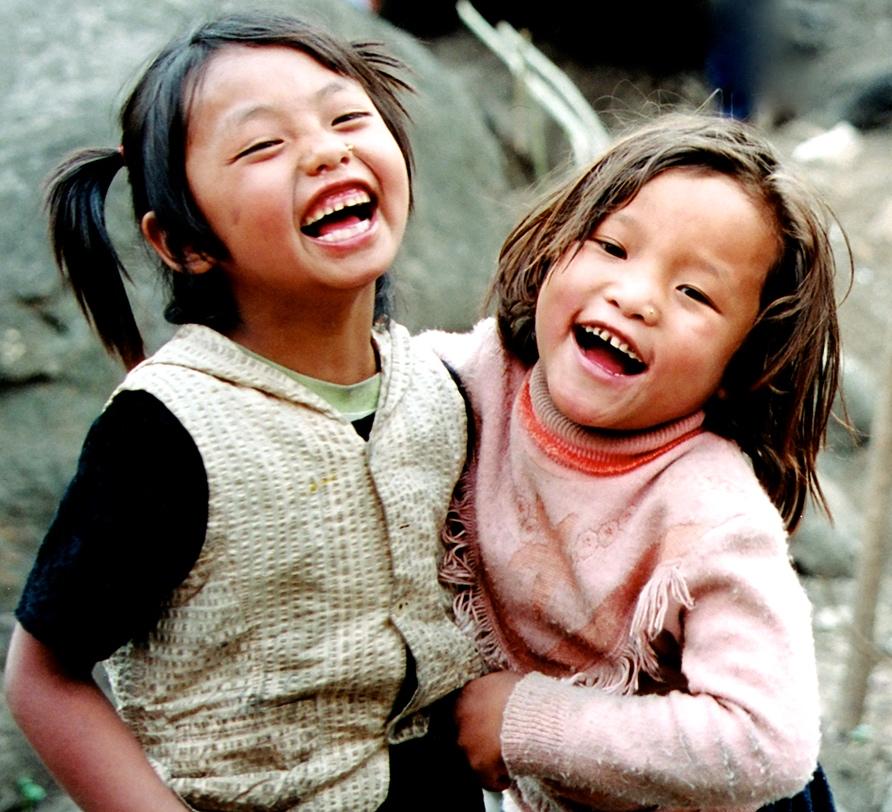
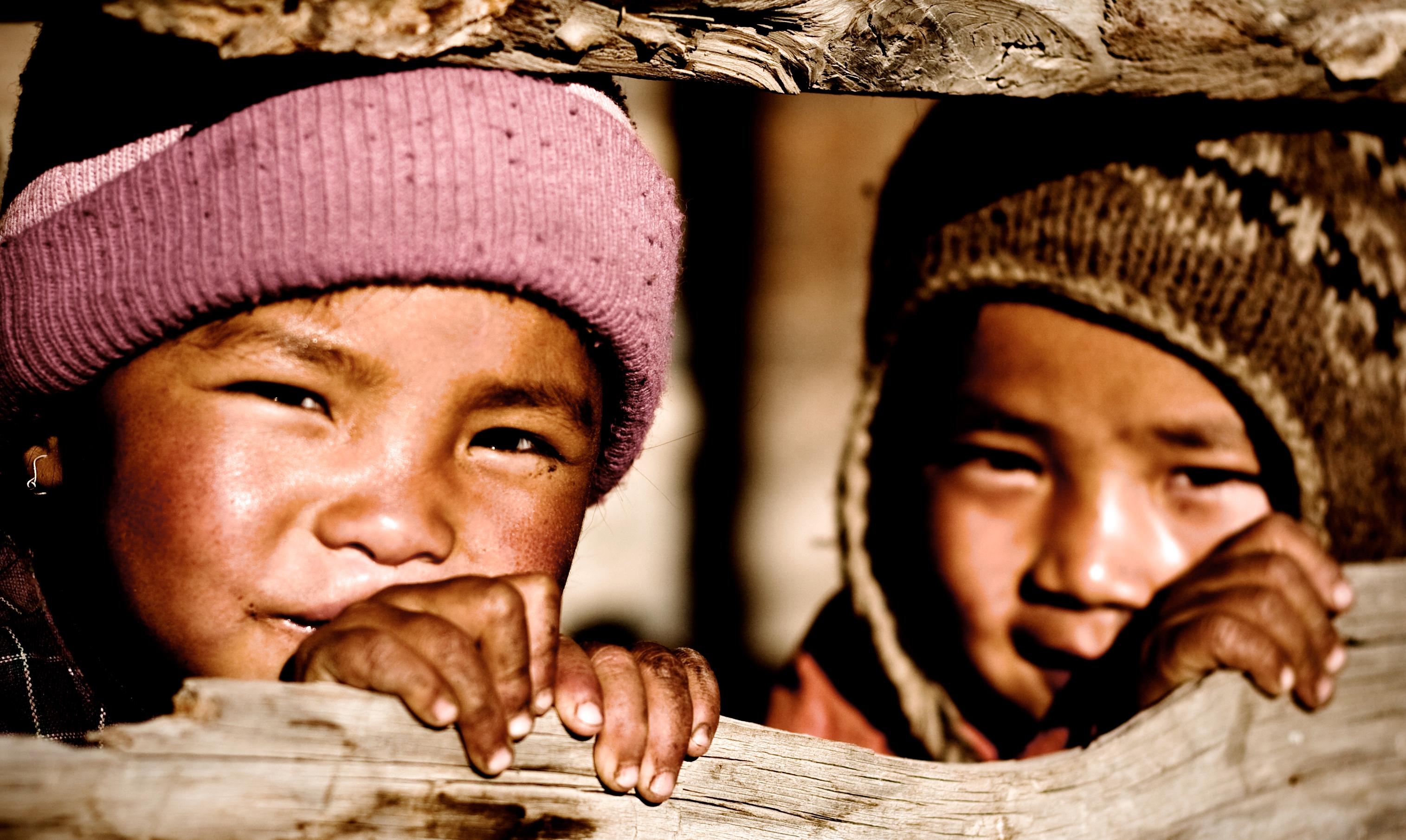
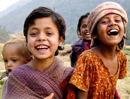
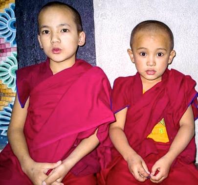
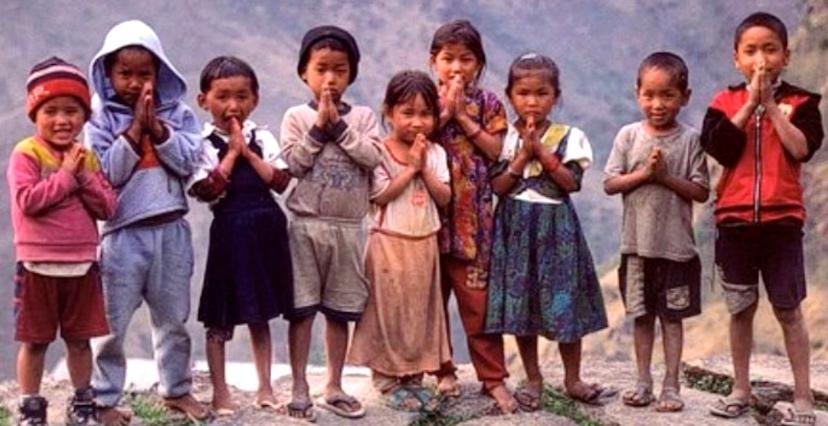
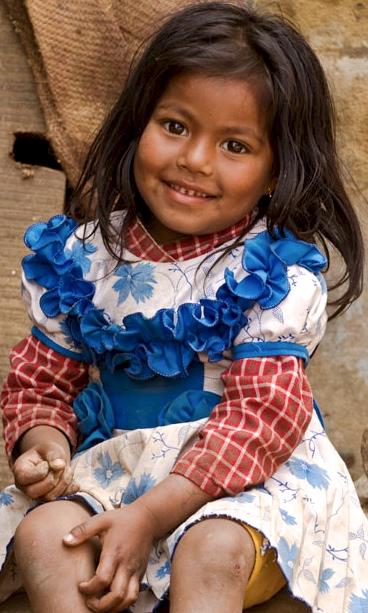
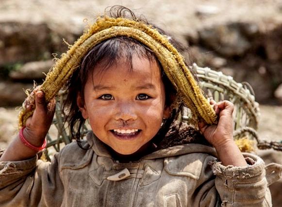
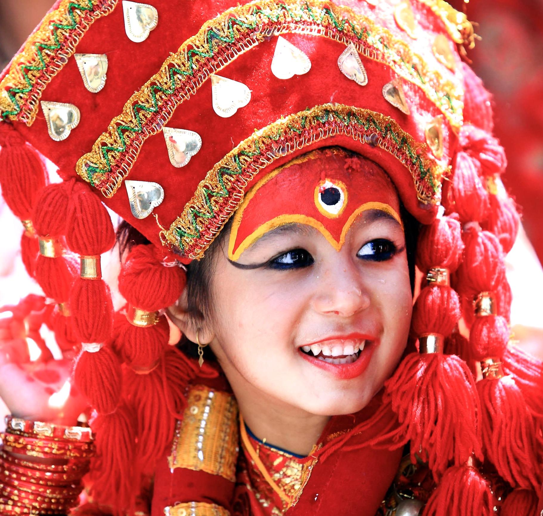
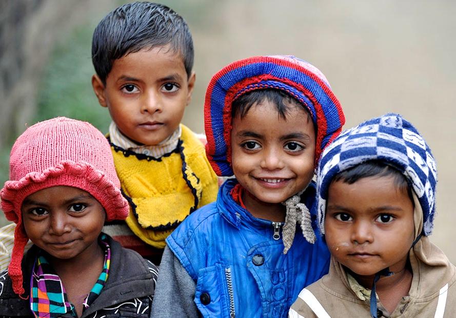
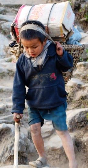
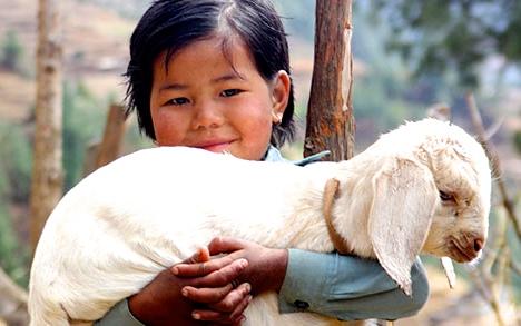
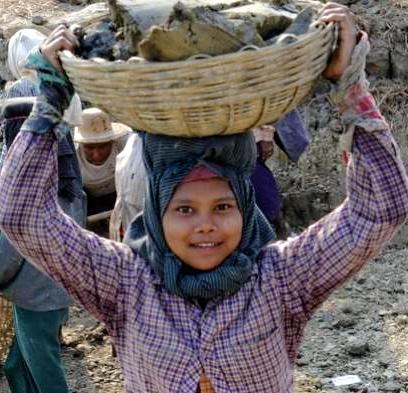
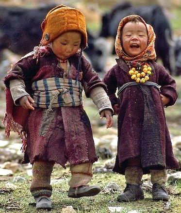
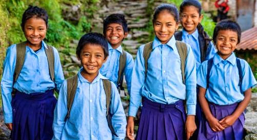
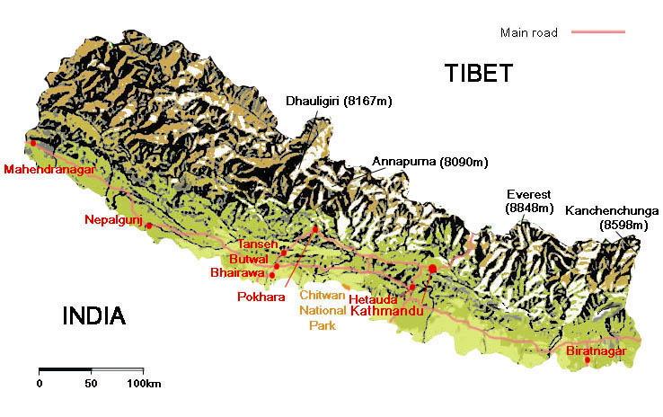
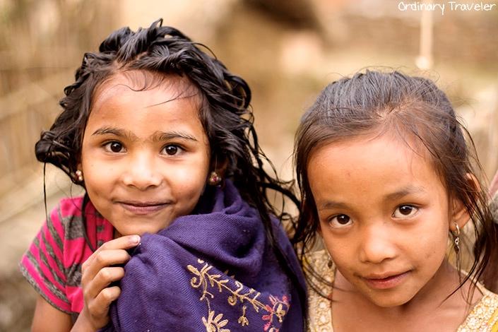
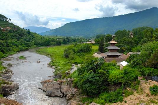
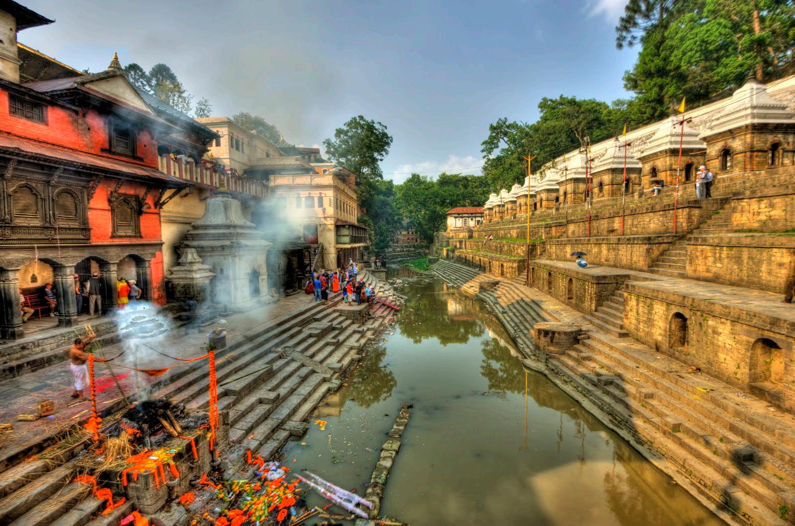
The Bagmati River is a river of Nepal and India. It flows through the Kathmandu valley and is the river separating Kathmandu from Lalitpur (Patan). It is considered a holy river both by Hindus and Buddhists and a number of Hindu temples are located on its banks.
The importance of Bagmati also lies in the fact that Hindus are cremated on the banks of this holy river, and Kirants are buried in the hills by its side. According to the Nepalese Hindu tradition, the dead body must be dipped three times into the Bagmati river before cremation. The chief mourner (usually the first son) lights the funeral pyre and must take a holy river-water bath immediately after the cremation. Many relatives who join the funeral procession also take a bath in the Bagmati River or sprinkle the holy water on their bodies at the end of ceremony. The Bagmati River is thought to purify the people spiritually.
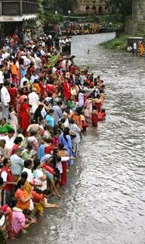
The Temple of Pashupatinath, dedicated to Shiva, stands on an outcrop above the river north of Kathmandu. It is considered to be one of the holy places of Hinduism.
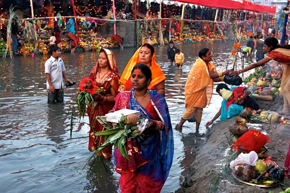
Public baths have been built and are supplied by a small hot spring. Nearby are two small structure that over the last many centuries were shrines, first to Buddha and then to Hinduism. Unfortunately, the Bagmati River is polluted by agricultural runoff and human waste. In Kathmandu, the river receives a high load of untreated sewage due to high populations.
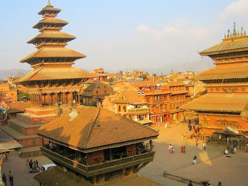
Bhaktapur is an ancient Newar town in the east corner of the Kathmandu Valley, Nepal. It is located in the Bhaktapur District in the Bagmati Zone. From time immemorial, Bhaktapur lay on the trade route between Tibet/China and India. This position on the main caravan route made the town rich and prosperous. It is the third largest city in Kathmandu valley and was once the capital of Nepal during the great Malla Kingdom until the second half of the 15th century.
It is the home of traditional art and architecture, historical monuments and craft works, magnificent windows, pottery and weaving industries, excellent temples, beautiful ponds, rich local customs, culture, religion, festivals, musical mystic and more.
Bhaktapur is still an untouched as well as a preserved ancient city.
Pottery is one of the main tourist attractions in Bhaktapur besides the architecture. In Nepal, the city is renowned for its yogurt or curd Ju-Ju Dhau, which is traditionally sold in clay bowls.
Sites of Interest
Bhaktapur Durbar Square is the plaza in front of the royal palace of the old Bhaktapur Kingdom. While the complex consists of at least four distinct squares (Durbar Square, Taumadhi Square, Dattatreya Square and Pottery Square), the whole is informally known as the Bhakapur Durbar Square.
The Durbar Square proper houses the Palace of 55 Windows which was constructed by King Jitamitra Malla and was home to royalty until 1769. It is now a National Gallery. Close by is the Golden Gate which leads into Mulchok Court which is home to the
Taleju Temple. This temple, like others in the main towns of the Kathmandu Valley, is dedicated to the goddess Taleju Bhawani and includes shrines to both the Taleju Bhawani and Kumari. Entrance to the temple is restricted to Hindus and the living goddess strictly cannot be photographed.
The Durbar Square is surrounded by spectacular architecture and vividly showcases the skills of the Newari artists and craftsmen over
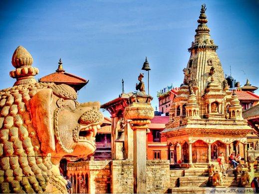
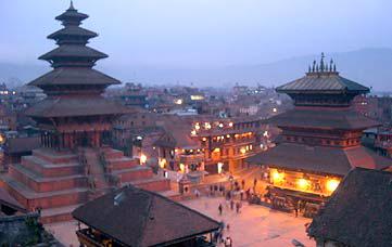
Originally, there were 99 courtyards attached to this place, but now only 6 remain. Prior to the earthquake, there were 3 separate groups of temples. But currently, the Square itself is surrounded by the buildings that survived the quake.
several centuries. The royal palace was originally situated at Dattaraya Square and was only later moved to the Durbar Square location.
The Durbar Square in Bhaktapur was severely damaged by an earthquake in 1934 and hence appears very spacious, more so than the other ones located at Kathmandu and Patan
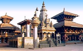
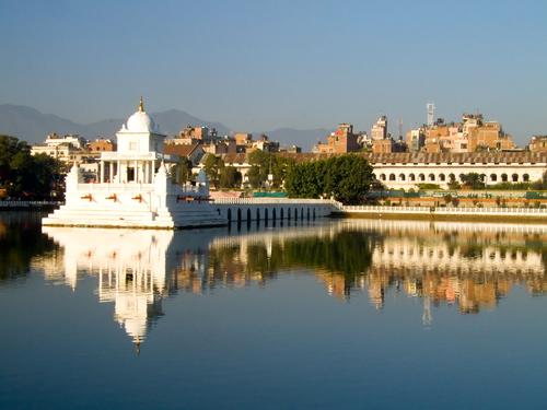
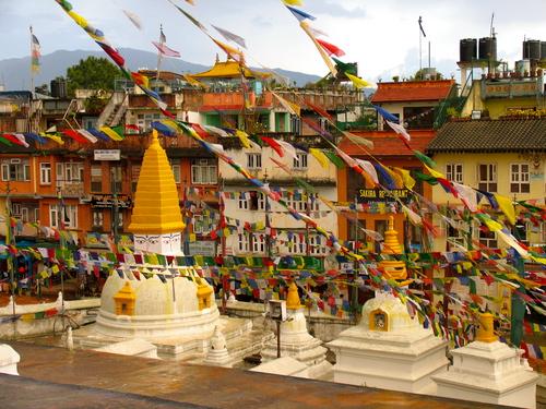
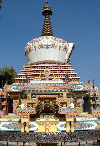
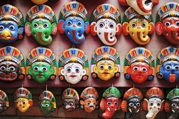
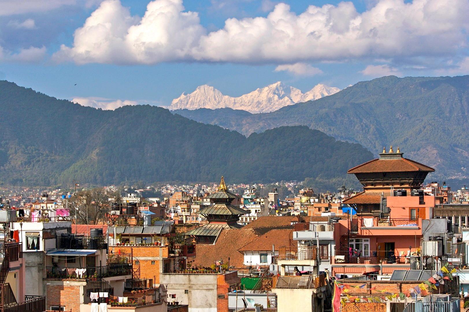
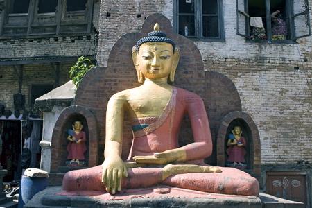
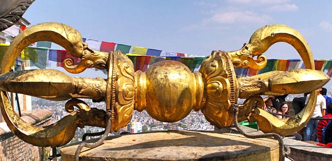
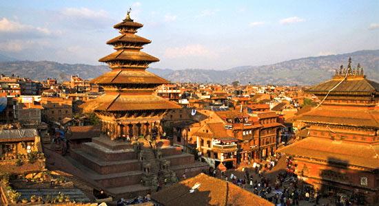
Kathmandu is the capital and largest metropolitan city of Nepal, with close to one million inhabitants. The city is the urban core of the Kathmandu Valley in the Himalayas, which contains two sister cities: Lalitpur (Patan) which is 3.1 miles to its south and Bhaktapur or Bhadgaon which is 7.5 miles to its east, and a number of other smaller towns. It is also acronymed as 'KTM' and also named 'tri-city'. In the last census (2001), the city of Kathmandu had 671,846 inhabitants. Population estimates for 2005 were 790,612 and for 2010 they stood at 989,273. The municipal area is 19.56 sq miles.
The city stands at an elevation of approximately 4,600 ft in the bowl-shaped valley in central Nepal surrounded by four major hills, namely: Shivapuri, Phulchowki, Nagarjun and Chandragiri. Kathmandu valley is part of three districts, Kathmandu District, Lalitpur District and Bhaktapur District, with the highest population density in the country and accounting for about 1/15 of its population. Kathmandu is not only the capital of the Federal Democratic Republic of Nepal but also the headquarters of the Central Region (Madhyamanchal).
Kathmandu, as the gateway to Nepal Tourism, is the nerve center of the country’s economy. With the most advanced infrastructure among urban areas in Nepal, Kathmandu's economy, which is based on tourism, accounted for 3.8% of the GDP in 1995–96. Unfortunately, after this time, tourism declined due to Nepal’s political unrest. But since the government has stabilized, tourists and their money have been returning.
The city’s rich history is nearly 2,000 years old, as inferred from an inscription in the valley. Its religious affiliations are dominantly Hindu followed by Buddhism. People of other religious beliefs also live in Kathmandu giving it a cosmopolitan culture. Nepali is the common language of the city, though many speak the Nepal Bhasa as it is the center of the Newar people and culture. English is understood by the educated population of the city. Also, a significant number of the population speaks other foreign
languages such as, Hindi, French, German, Chinese, Hebrew, Korean etc. The literacy rate is 98% in the city.
From the point of view of tourism, economy and cultural heritage, the sister cities of Lalitpur (Patan) and Bhaktapur are integral to Kathmandu. Known for its pashmina products, woolen goods, silk products, handmade paper products and wood crafts, Kathmandu has seen a significant drop in its ability to export these items. But silverware and other non textile products have seen tremendous growth in recent years. But unfortunately, much of the city still lives in great poverty.
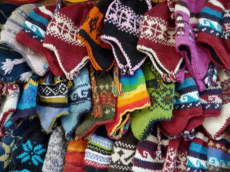
Kathmandu valley has been described as "an enormous treasure house of art and sculptures". These treasures are made of wood, stone, metal and terra cotta, and found in profusion in various temples, shrines, stupas, gompas, chaityas and palaces. The art objects are also seen in street corners, lanes, private courtyards and in open ground and are mostly in the form of icons of gods and goddesses. Kathmandu valley has been the repository of art treasure for a long time but it got a world wide exposure only after the country opened its doors to the outside world in 1950.
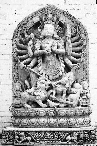
A broad typology has been ascribed to the decorative designs and impressive carvings created by the creative and artistic people of Nepal, who have maintained a perfect blend of the two religious faiths of Hinduism and Buddhism. This typology based on the type of material used in the art form is five in number.
One is the Stone Art, which in the earliest times at the dawn of civilization were stone heaps made of boulders or pebbles. These were worshipped in Nepal and can be seen at several locations. Since that time, real stone carvings began and by the mid 5th century AD had evolved into true works of art.
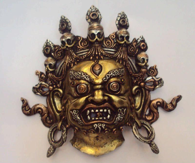
The Metal Art consists of metal images made of ashtadhatu (amalgam of eight metals) which are common in Nepal and Indi, under both Hindu and Buddhist religious traditions. During the Licchavi period, bronze in solid form was widely used for casting metallic sculptures; mostly between the seventh and eight centuries. But in the Medieval period, Pala influence evolved into a distinct form. These can be seen in the form of large royal figures fixed on top of pillars in the Durbar Squares of Kathmandu, Patan and Bhaktapur. Smaller and hollow cast bronze statues were made as icons for worship. In Tiebtan metal work, a hole was left in the bronze statues for filling with mantras written on paper or filling with offering of grains, precious stones or miniature icons. But the hole was sealed with copper in the presence of a Lama before formal consecration of the image. Here there are two forms - one of Gods and Goddesses of Mahayana school in Pala art form and the other iconography inspiration of the Shamanic practice of Tibetan Demonology.
The Wood Art form carved very artistically in teek and ceder is and has been affected by the mild climate, linches, mosses, insects, borers, dry rots and biochemical defects. In the 14th century earthquake, many of the wooden monuments were destroyed.
Terra Cotta Art in Nepal is traced to the 300 BC. It was perfected between the 16th and 18th centuries. Archeological excavations have unearthed hand-pressed molds at Dhum Varahi at the fringes of Kathmandu, which are preserved in the museums in Kathmandu, Patan and Bhaktapur. The male and female figures decorated in bands around temples, called Nagabands were made of terra cotta. Clay is the basic ingredient of this art form.
Paintings are categorized as religious and non-religious. The religious category is further subdivided into three forms of painted manuscripts, Thankhas or Paubhas and Pattas (banners) or metal strips. Festivals

Cultural continuity has been maintained for centuries – from ancient to modern times –in the exclusive worship of goddesses and deities such as the Ajima, Taleju (or Tulja Bhavani), Degutaleju, Kumari (the living goddess ) and so forth in Kathmandu and the rest of the country. Hindus and Buddhists join together to worship in festivals with great devotional fervor and enthusiasm.
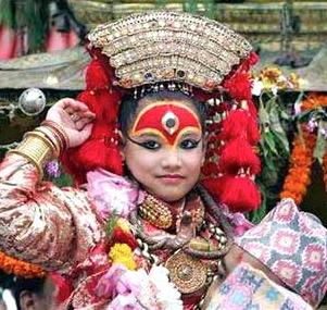
The artistic edifices have now become places of worship in the every day life of the people. Thus a roaster is maintained to observe the annual festivals, which are intimately linked with the daily life of the people. It is said that there are 133 festivals held in a year.
The cultural diversity of Nepal has facilitated the growth of a number of cuisines based on the ethnic groups and the geographical features of the nation. Popularly served though is Dal bhat, which is a dish of lentils and rice, generally served with vegetable curries and forms a staple part of the diet. Given that Kathmandu only had one restaurant in 1955, it is surprising that today a large number of restaurants in Kathmandu have grown up catering in Nepalese,Tibetan and Indian cuisine in particular. Many other restaurants accommodate both the Nepalese people and tourists from all around the world. The growth of tourism in Kathmandu has led to culinary creativity and the development of hybrid foods to accommodate the visitors. One such is American chop suey, a sweet and sour sauce with crispy noodles and a fried egg commonly added on top. Kathmandu is particularly famous for "Momo" which is a type of dumpling that originated from Tibet. Many street vendors sell momo as it is one of the most popular fast food items in Kathmandu.
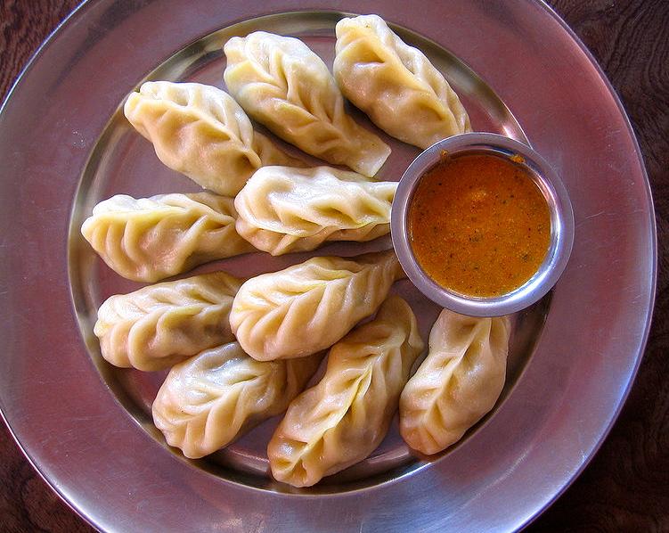
The national drink of Nepal is tea, widely served in Kathmandu, but it is served extremely weak by western standards. Chiya, however, is richer and contains tea leaves boiled with milk, sugar and spices. The drink lassis, made of curds and sugar is also served in cafes and restaurants. Nepalese beer is available in such venues and in markets, including the national Gorkha beer brand. The popular Himalayan drinks of Chhaang and Tongba, typically made from fermented millet or barley are also sold. as are the harder spirit drinks of arak, made from fermented potatoes and rice, and rakshi, a modern type of Newari wine. Shops and bars in Kathmandu do, however, widely sell western and Indian beers, although shops are forbidden to sell alcohol on the first two days and last two days of the Newari month.

Fresh vegetables and fruit are widely sold in Kathmandu, particularly around the Durbar Square. The assortment of produce is diverse and some sellers may specialize in the sale of different forms of specific vegetables, such as beans. Western convenience foods are also sold in abundance in most of the shops, including Carlsberg beer, Coca Cola and various potato snacks and candy.
Boudhanath
Boudhanath Stupa is one of the holiest Buddhist sites in Kathmandu, Nepal. Located about 6.8 miles from the center and northeastern outskirts of Kathmandu, the stupa's massive mandala makes it one of the largest spherical stupas in Nepal. A stupa is a mound-like structure containing Buddhist relics, typically the remains of Buddha, and used by Buddhists as a place of worship.
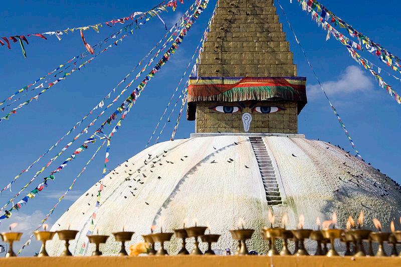
The ancient Buddhist stupa of Boudhanath dominates the skyline and is one of the largest in the world. The influx of large populations of refugees from Tibet has seen the construction of over 50 Tibetan Gompas (monasteries) around Boudhanath.
This Stupa is on the ancient trade route from Tibet which enters the Kathmandu Valley by the village of Sankhu in the northeast corner, passes by the Boudhanath Stupa on its way to the ancient and smaller stupa of Cā-bahī (often called 'Little Boudhanath'). The road then turns directly south, heading over the Bagmati river to Patan, bypassing the main city of Kathmandu (which was built later). Tibetan merchants have rested and offered prayers here for many centuries. When refugees entered Nepal from Tibet in the 1950s, many decided to live around Bouddhanath. The Stupa is said to entomb the remains of Kassapa Buddha.
A Durbar Square is the generic name used to describe plazas opposite old royal palaces in Nepal. Before the Unification of Nepal, Nepal consisted of small kingdoms, and Durbar Squares are the most prominent remnants of those old kingdoms in Nepal. In particular, three Durbar Squares in the Kathmandu Valley, belonging to the three kingdoms situated there before unification, are most famous: Kathmandu Durbar Square, Patan Durbar Square, and Bhaktapur Durbar Square.
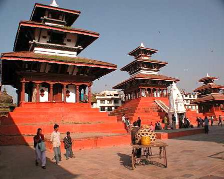
Kathmandu Durbar Square, or Basantapur Durbar Square is the plaza in front of the old royal palace of the Kathmandu Kingdom. This Durbar Square is surrounded by spectacular architecture and vividly showcases the skills of the Newari artists and craftsmen over several centuries. The royal palace was originally situated at Dattaraya Square and was later moved to the Durbar Square location.
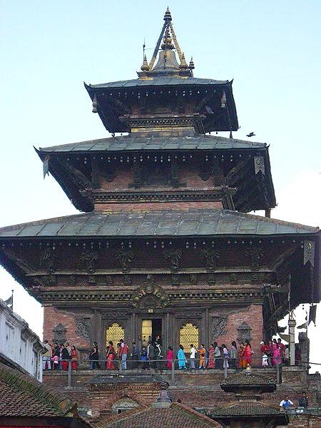
The Square is presently known as Hanuman Dhoka, a name derived from the statue of Hanuman, the monkey devotee of Lord Ram, near the entrance of the Royal Palace. The preference for the construction of royal palaces at this site dates back to as early as the the third century. The palace is spread over five acres. The eastern wing with ten courtyards is the oldest part dated to the mid 16th century. Even though the present palaces and temples have undergone repeated and extensive renovations and nothing physical remains from that period, names like Gunapo and Gupo which are the names that referred to the palaces in the Square in early scriptures, imply that the palaces were built by Gunakamadev, a king ruling late in the tenth century. When Kathmandu City became independent under the rule of King Ratna Malla (1484-1520), the palaces in the Square became the royal palaces for its Malla kings. When Prithvi Narayan Shah invaded the Kathmandu Valley in 1769, he also favored the Kathmandu Durbar Square for his palace. In the southeast part of the palace, he added four lookout towers. The royal family lived in this palace until 1886, when they shifted to the Narayan Hiti Palace. The stone inscription outside is in fifteen languages and legend states that if all the 15 are read, milk would spring from the middle of the stone tablet. The Square is still the center of important royal events like the coronation of King Birendra Bir Bikram Shah in 1975 and King Gyanendra Bir Bikram Shah in 2001.
Kasthamandap
Kathamandap, literally "Wood-Covered Shelter", is a three storied temple situated in Maru tole of Kathmandu, adjoining the Durbar Spuare on its south-east corner. It is one of the largest and most noted pagodas of Nepal. The pagoda enshrines a statue of Gorakhnath.
This temple was built in pagoda style design in the early sixteenth century by King Laxmi Narsingha Malla. The whole temple is built
from the wood of a single tree, and covered with the shrine. The name of the capital city is after this temple. Once a year, a huge ceremony is performed in the temple. On that day, people gather around the temple and stay up all night. They share the legendaries stories about the temple and enjoy themselves with different varieties of foods. This temple is one of the major tourist attractions as well. Everyone is allowed to visit inside the temple, but people are not allowed to take photographs inside. The temple is open after mid day until midnight. The unique feature of Kasthamandap has made it the most noted pagoda of Nepal.
Pashupatinath Temple is the oldest Hindu temple in the eastern part of Kathmandu on the banks of the Bagmati River. It is not known for certain when the Pashupatinath Temple was founded. But according to Nepal Mahatmaya and Himvatkhanda, the deity here gained great fame as Pashupati, the Lord of the Animals. Pashupatinath Temple's existence dates back to 400 A.D and is regarded as the most sacred temple of Lord Shiva. Thousands of pilgrims from all over the world come to pay homage at this temple, that is also known as 'The Temple of Living Beings'. Hindus alone are allowed to enter the temple premises. NonHindu visitors are allowed to have a look at the temple from the other bank of the Bagmati river.
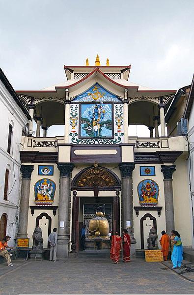
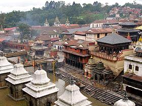
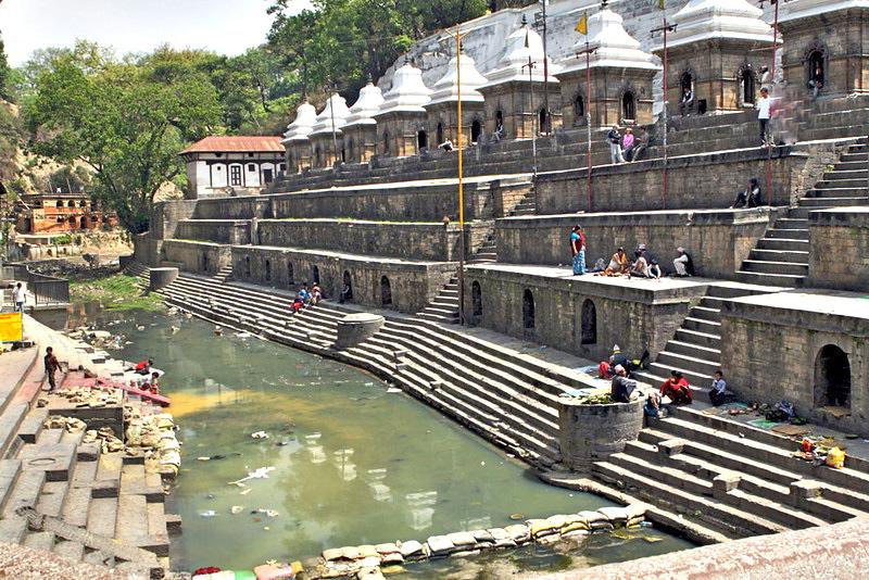
There are many legends describing how the temple of Lord Pashupatinath came into existence here. One is narrated below:
The Cow Legend
Legend says that Lord Shiva once took the form of an antelope and amused himself, undetected, in the forest on Bagmati river's east bank. The gods later caught up with him. Grabbing him by the horn, they forced him to resume his divine form. The broken horn was worshipped as a linga (a sign, mark or token) but overtime it was buried and lost. Centuries later, an astonished herdsmen found one of his cows showering the earth with milk. Digging deep at the site, he discovered the divine linga of Pashupatinath. (The linga is enshrined inside the temple.)
Mount Everest is the world's highest mountain, with a peak at 29,029 ft above sea level. It is located in the Mahalangur section of the Himalayas on the Nepal side of the Nepal-China (Tibet) border. Its massif includes neighboring peaks Lhotse (27,939.2 ft), Nuptse (25,770.7 ft) and Changtse (24,868.5 ft).
In 1856, the Great Trigonometric Survey of British India established the first published height of Everest, then known as Peak XV, at 29,002 ft. In 1865, Everest was given its official English name by the Royal Geographical Society upon a recommendation by Andrew Waugh, the British Surveyor General of India. Waugh named the mountain after his predecessor, Sir George Everest. Although Tibetans had called Everest "Chomolungma" for centuries, Waugh was unaware of this because Nepal and Tibet were closed to foreigners at the time.
The highest mountain in the world attracts many well-experienced mountaineers as well as novice climbers willing to hire professional guides. While not posing substantial technical climbing challenges on the standard route (other eight-thousanders, those above 26245 ft, such as K2 or Nanga Parbat are much more difficult), Everest presents dangers such as altitude sickness, weather and wind.
By the end of the 2010 climbing season, there had been 5,104 ascents to the summit by about 3,142 individuals. At that time, Everest had claimed 219 lives, including eight who perished during a 1996 storm high on the mountain. Conditions are so difficult in the death zone—altitudes higher than 26,000 ft—that most corpses have been left where they fell. Some of them remain visible from standard climbing routes. Climbers are a significant source of tourist revenue for Nepal, whose government requires all prospective climbers to obtain a permit which costs up to $25,000 per person.
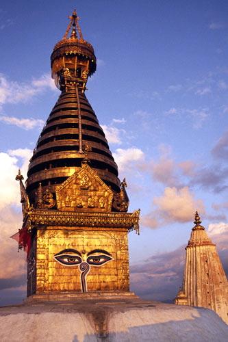
Swayambhunath is an ancient religious complex atop a hill in the Kathmandu Valley, west of Kathmandu city. It is also known as the Monkey Temple as there are holy monkeys living in parts of the north-west areas of the temple. The Tibetan name for the site means 'Sublime Trees', for the many varieties of trees found on the hill. However, Shing.kun may be a corruption of the local Newari name for the complex, Singgu, meaning 'self-sprung'. For the Buddhist Newars, whose origin myth, mythological history and day-to-day religious practices are their life, Swayambhunath occupies a central position as it is likely the most sacred among Buddhist pilgrimage sites. For Tibetans and followers of Tibetan Buddhism, it is second only to Boudhanath.
The Swayambhunath complex consists of a stupa and a variety of shrines and temples, some dating back to the Licchavi period. A Tibetan monastery, museum and library are more recent additions. The stupa has Buddha's eyes and eyebrows painted on it. Between them, there is something painted which looks like the nose - but it is the Nepali symbol of 'unity', in the main Nepali language dialect.
There are also shops, restaurants and hostels. The site has two access points: a long stairway, claimed to have 365 steps, leading directly to the main platform of the temple, which is from the top of the hill to the east; and a car road around the hill from the south leading to the southwest entrance. The first sight on reaching the top of the stairway is the Vajra. Much of Swayambhunath's iconography comes from the Vajrayana tradition of Newar Buddhism. However, the complex is also an important site for Buddhists of many schools, and is also revered by Hindus.
According to Swayambhu Purana, the entire valley was once filled with an enormous lake, out of which grew a lotus. The valley came to be known as Swayambhu, meaning "SelfCreated." The name comes from an eternal self-existent flame (svyaṃbhu) over which a sūpa was later built.
The monkeys living in parts of the temple are considered holy because Manjushree, the bodhisattva of wisdom and learning was raising the hill on which the Swayambhunath Temple stands. He was supposed to leave his hair short but he made it grow long and head lice grew. It is said that the head lice had transformed into these monkeys.
The Bodhisatva Manjushri had a vision of the lotus at Swayambhu and traveled there to worship it. Seeing that the valley could be a good settlement and to make the site more accessible to human pilgrims, Manjushri cut a gorge at Chovar. The water drained out of the lake, leaving the valley in which Kathmandu now lies. The lotus was transformed into a hill and the flower become the Swayambhunath stupa.
The dome at the base represents the entire world. When a person awakens, represented by the eyes, from the bonds of the world, the person reaches a higher state of realization. The thirteen pinnacles on the top of it symbolizes that sentient beings have to go through the thirteen stages of enlightenment to reach the state of Buddha.
On each of the four sides of the main stupa there are a pair of big eyes which represent Wisdom and Compassion. Above each pair of eyes is another eye, the third eye. The saying goes that when Buddha preaches, cosmic rays emanate from the third eye which act as messages to heavenly beings, so that those interested can come down to earth to listen to Buddha. The hellish beings and beings below the human realm cannot come to earth to listen to Buddha's teaching, but the cosmic rays relieve their suffering when Buddha preaches. There are carvings of Panch Buddhas (five Buddhas) on each of the four sides of the stupa. Apart from this, idols of the Buddhas are at the base of the stupas.
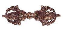
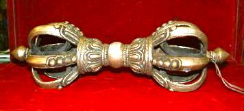
Each morning before dawn, hundreds of Buddhist (Vajrayana) and Hindu pilgrims ascend the 365 steps from the eastern side that lead up the hill. Passing by the gilded Vajra ( a ritual object representing a thunder bolt) and two lions guarding the entrance, they begin a series of clockwise circumambulations of the stupa.