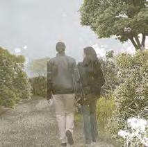
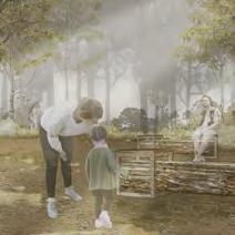
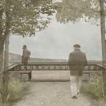
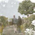
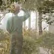
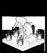
what landscape design means to me...
Being able to create something from scratch is always something I am passionate about. As an ongoing landscape architecture student, this passion in creation has drove me forward for many times in both designing process and the presenting of the project. With the help of the knowledge in landscape design, I am able to look at the environment around me in several new perspectives that are previously neglected, and all the presentation skills I learnt allow me to represent my ideas as full as I can.
My experience of studying in a foreign institution is valuable. Although there were inconveniences caused by the global pandemic, the way how people from another part of the planet about the pandemic and its relationship with life collides with the ones back home catalyzes alternative thinking on the way see the future of designing environment.
It is inevitable for the design to be adaptive to the everlasting changes occurring around the world, and the opportunity to find common ground and bring out characteristics from different landscapes lies within the adaptation of design. The value of fluctuation and differences is crucial, and I am passionate to learn and design with the goal to excavate that hidden value of landscape.
education
National
University of Singapore, landscape
architecture (MLA)
contact
phone: +86 15979095232 (CN) / +65 8067 0478 (SG) email: 3490192122@qq.com / e1168807@u.nus.edu
skillset
language skills
mandarin - native speaker | english: everyday speaker, ILETS average 8.0
Proficiency in English and Mandarin in academic and daily scenario, with understanding of cultural subtleties in both contexts. Confident in presentation for professionals. Experienced in preparing multilingual demonstrational materials, skilled in visual and oral representation Experienced in networking with the visiting professionals and forming lasting co-operation
design skills
adobe softwares photoshop indesign illustrator premier design softwares autocad sketchup lumion microsoft softwares word powerpoint excel
professional skills
Proficiency in MS Office; Familiar with Google Docs, Miro, Canva; Familiar with the use of ChatGPT 4o in project research and structure; Experienced in working with teams of diverse professions and nationalities; Experienced in project management and cross-department co-ordination. Experienced in information analysis for project
kent ridge, singapore | 2023 - 2025
GPA: 4.5 (Top 10%) Ongoing
The University of Edinburgh, landscape architecture (MA hons) scotland, united kingdom | 2019 - 2023
GPA: 4.0 (Top 5%). Graduated with Honor with Distinction
Landscape Architecture Design: Designing Streets of Old Town Edinburgh, Design in Open Spaces, Designing Edinburgh Urban Coastline, Independent Landscape Research and Design Landscape Architecture Theory: General European Landscape History, General World Landscape History, General Geology and Geography, Contemporary Landscape Design, Interdisciplinary Theories
Landscape of Abandonment and Inhabitant: Basic Natural Philosophy, Present and Historic Landscape Ruins, Post-industrial Landscape, Shrinking City, Temporary Landscape
Academic Interests: Vertical Garden, Green Roof, Landscape Framework Design, Sustainable Design
key academic projects
analyzing and designing the landscape of whitesand natural reserve in dunbar, edinburgh edinburgh, scotland, united kingdom, year 3 | 2021
- Preformed field investigations with teammates in Whitesand Natural Reserve, with follow-up video and exhibition to abstractly narrate the findings and understandings of the site’s landscape
- Enhanced the ecological and social value of the natural reserve as a lifescape based on the existing and potential human and more-than-human interactions in the landscape. Visualization via hand drawn, Procreate, Photoshop, and Sketchup.
analyzing and designing the landscape of west hendon playing field, london london, england, united kingdom, year 4 | 2022-2023
- Site-scale design proposal is put forward based on the theme of flow of human and more-than-human users. landscape furniture inspired by tactical urbanism designs was proposed to make connection between the two user groups.
- Detailed techiques used to configurate landscape furnitures were produced using sketchup and hand-drawn plan and sections in the first semester. Second semester was focused on model making to realize designs.
work experience
intern, hangzhou g.e.d. architecture and landscape design., ltd
hangzhou, china | summer 2022 JUN - AUG
Participated in the urban planning project of Longgang New District in China. Responsible for project grounding research, progress documentation and report with designers and clients, and rendering
· Project Research Expand 20 quality examples by including foreign projects, offering international scope with localized analysis. Boosted the progress of designer-client communication
· Client-side Report: Accompany lead designers for on-site government client report of Longgang project. Responsible for material gathering, visualization, PPT slides, and record keeping
intern, shanghai shuishi architectural design & planning corp., ltd
shanghai, china | summer 2021 MAY - JUL
Tasked with the design and documentation of 5-6 commercial demonstrative projects
·Project Promotion: Organize materials including 20+ photography works and 40 pages of slides under tight schedule for client’s business promotion
·Project Design: Assist with the planning of 5 demonstrative projects and 2 public park projects
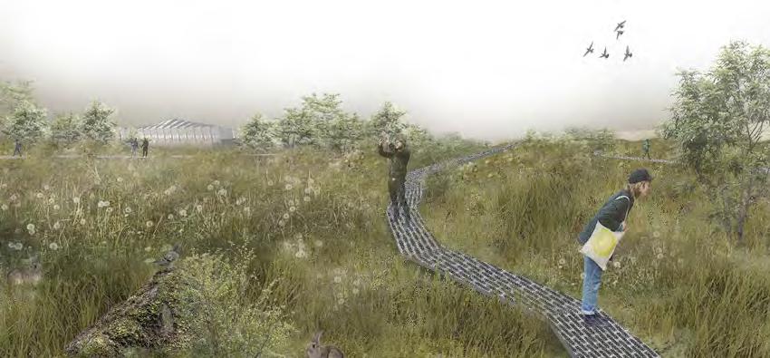
capital trails
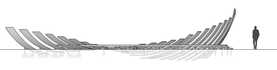
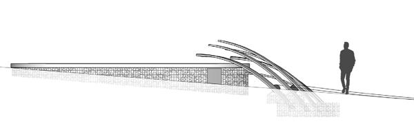
urban park barnet, london, uk | 2022-2023
wave foams
waterfront cramond, edinburgh, uk | 2020
whitesand renewal
post-industrial whitesand, dunbar, uk | 2021
steelworks remediation
regeneration ravanscraig, motherwell, uk | 2020
the green holder
urban renewal granton, edinburgh, uk | 2021
garden visits
sketch practice classic english garden tour | 2019

academic researches & dissertation
Green Resort Outside Office Window: The Influence of Vertical Landscape Applied to Office Building on the Health and Wellbeing of Office Workers
Dissertation, Landscape of Abandonment and Inhabitation, 2021
Hub of Urban Life: Transit-Oriented Development Design of Shanghai Greenland Centre Research Essay, Landscape Architecture Placement: Design, 2022
Pop-Up Urbanism: Present and Future of Implementing Temporary Landscape Design in Cities Research Essay, Landscape of Abandonment and Inhabitation, 2021
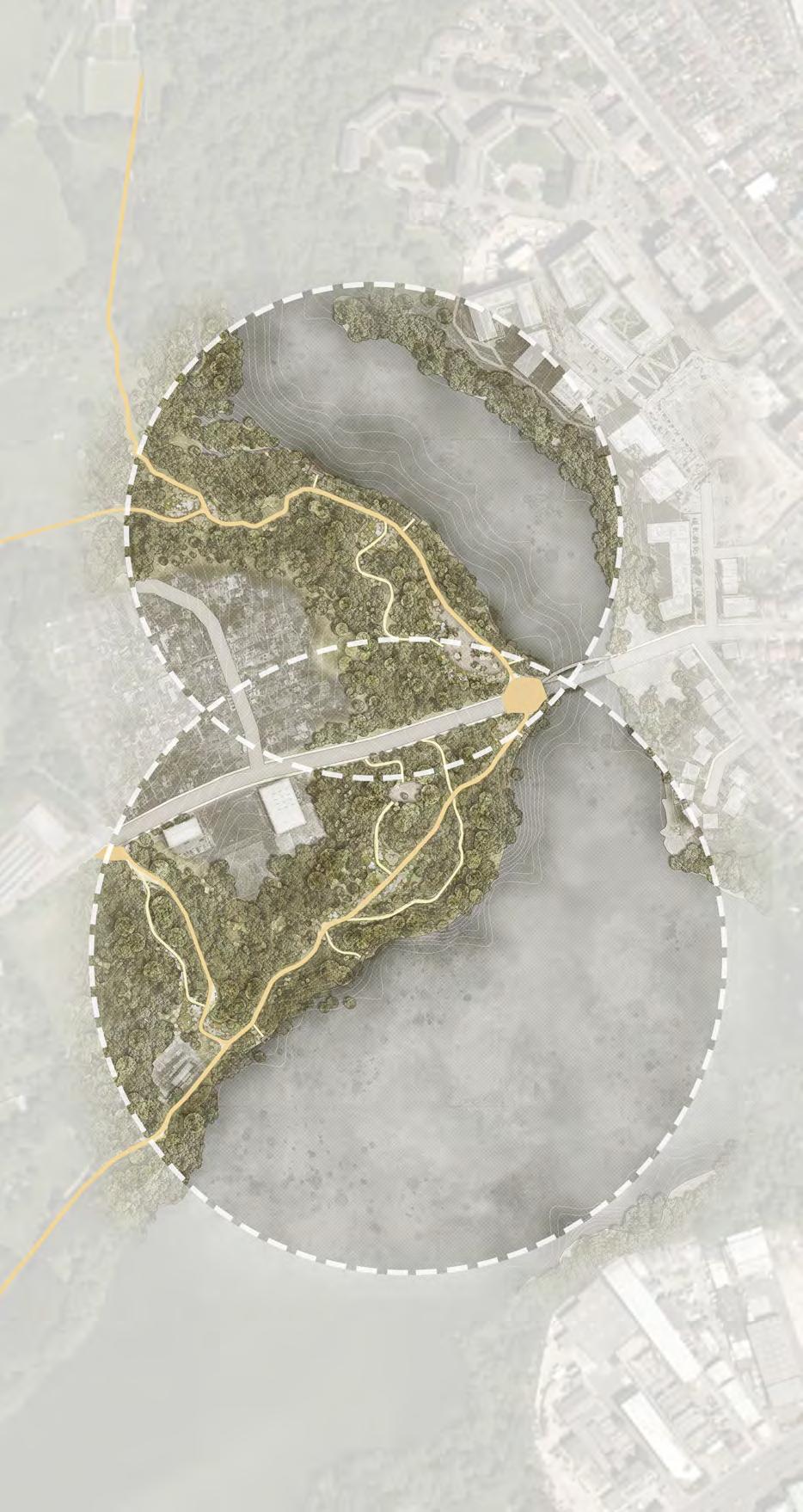
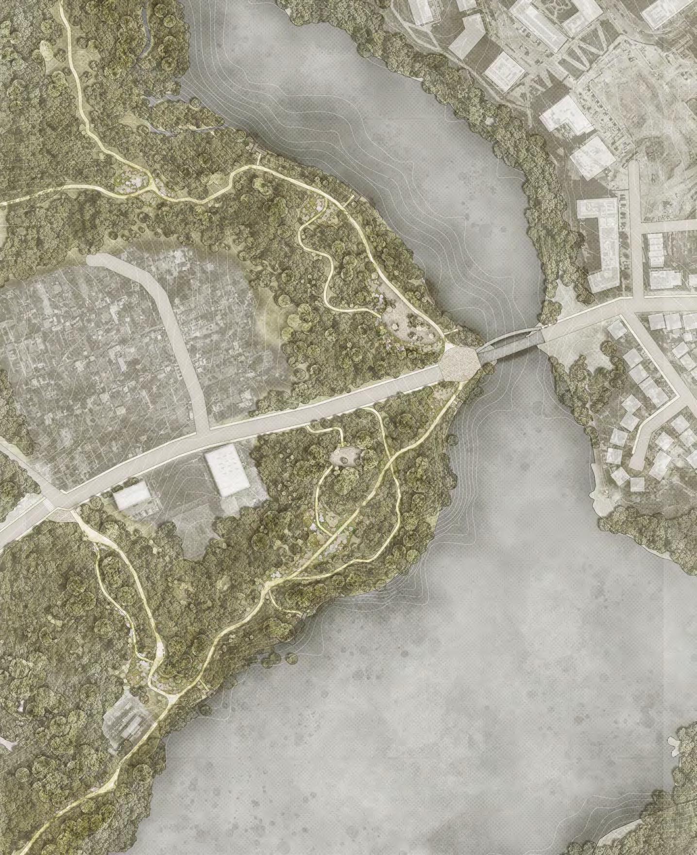
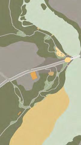
capital trails urban park
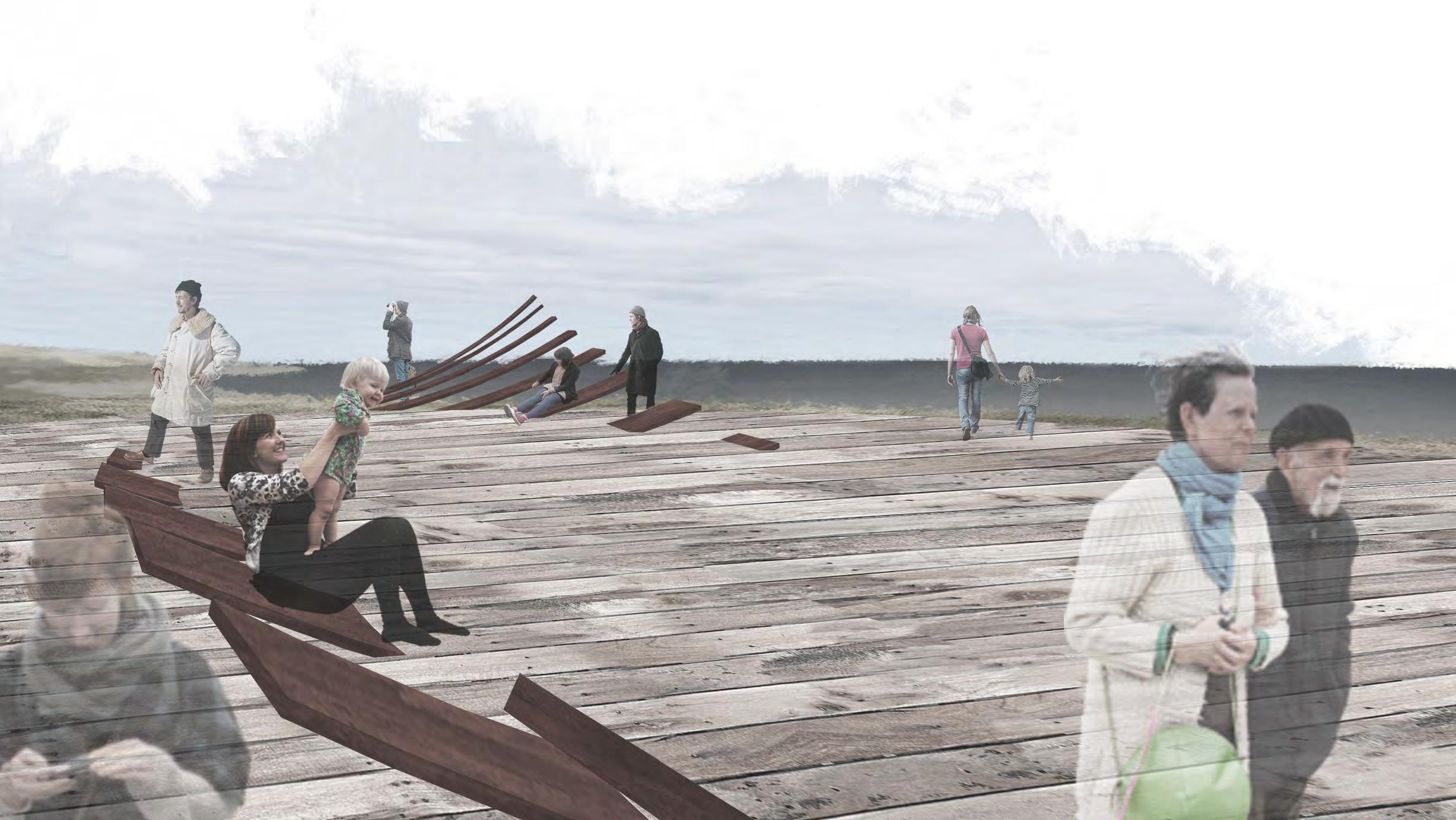
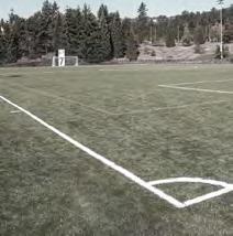
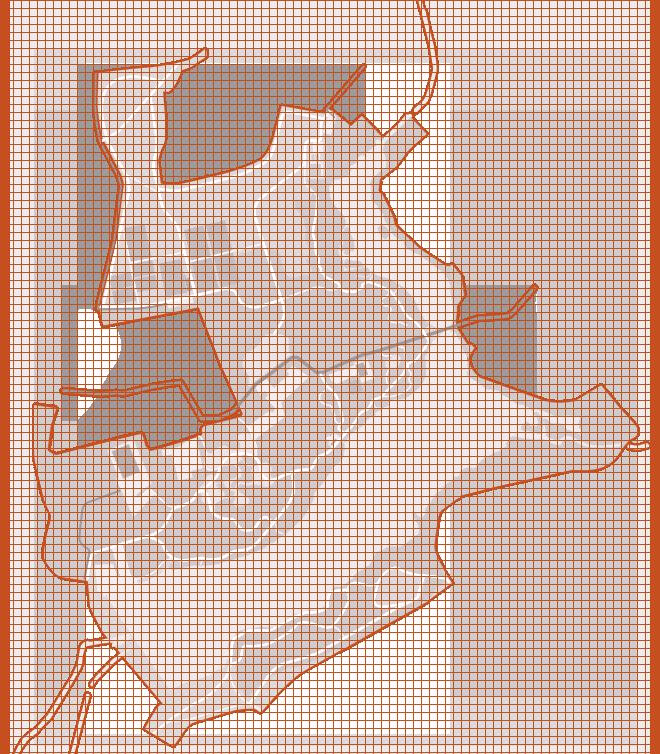
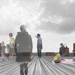
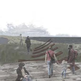
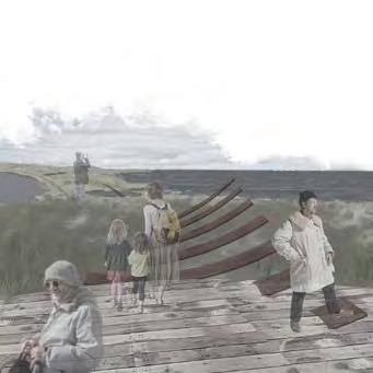
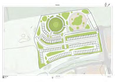
capital ring, west hendon playing field & welsh harp reservoir london, england year 4 | semester 1-2 | 2022-2023
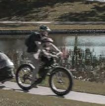
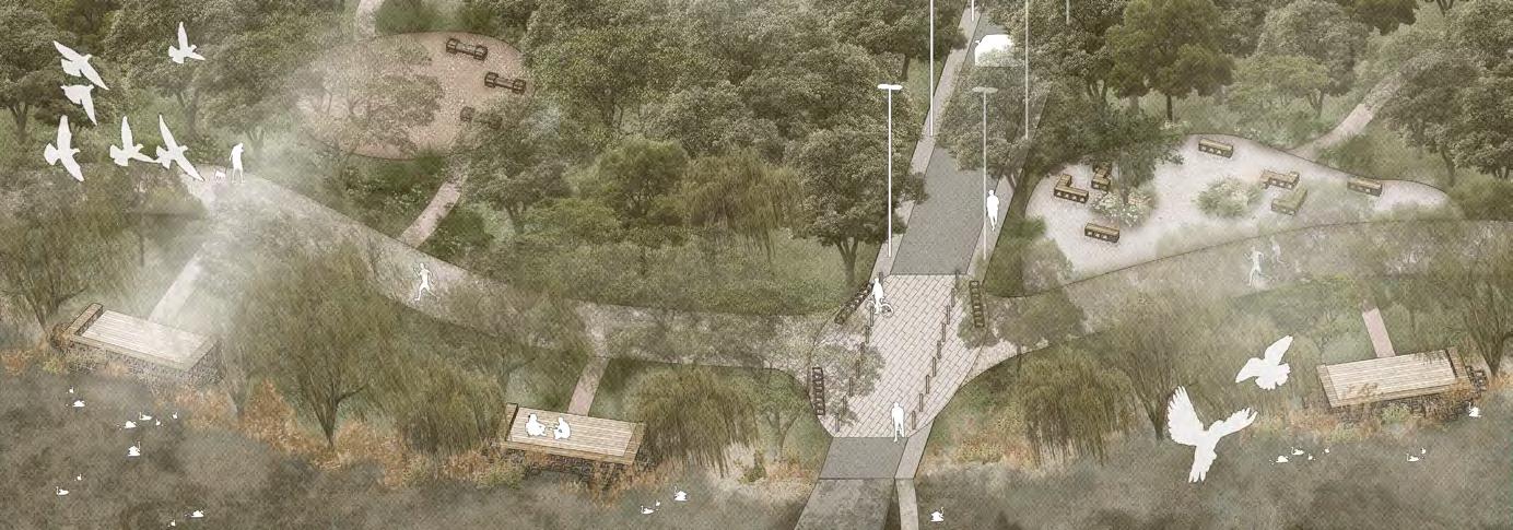
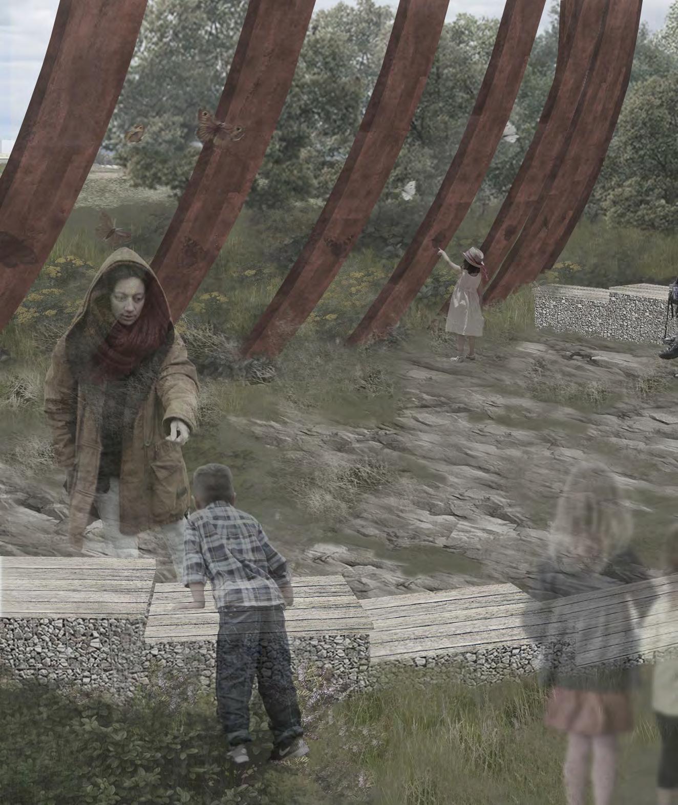
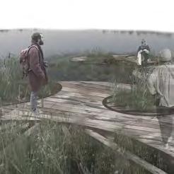
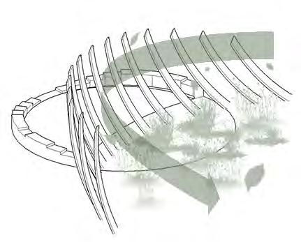
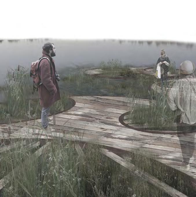
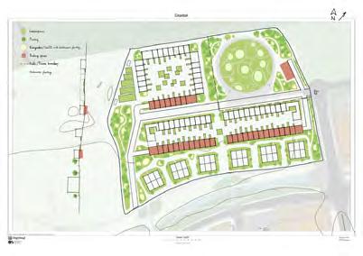
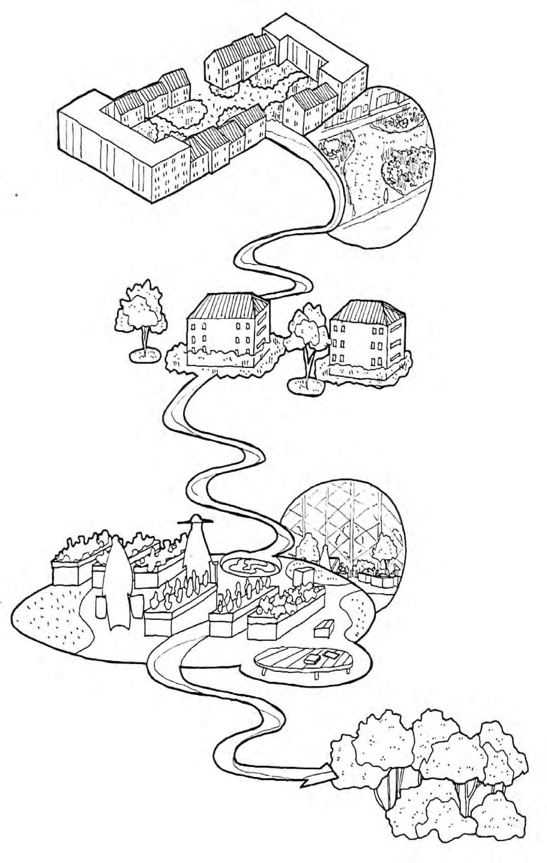
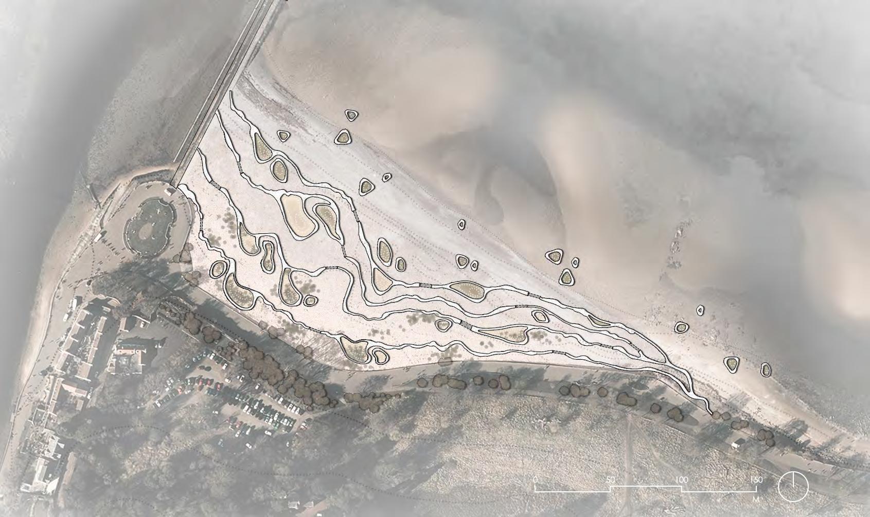
West Hendon Playing Field is one of the most important public parks in Barnet, north-west of London. The park's open lawn and the numerous sports fields established for ball games. Located next to Welsh Harp Reservoir and surrounded by rich canopy of trees and high grasses, the ecological and scenery values of the park are also widely appreciated by the visitors.
However, as the effect of climate change led to intense fluctuations in the recent years, urban green spaces are facing great challenges regarding the sustainability of their eco systems. Research has shown that traditional open lawn, similar to what West Hendon Playing Field possesses, will not be able to withstand the long drought during summer, and will not contribute to the soil's structure integrity due to the lawn grass's shallow root.
In order to improve the user's experience on site and the park's climate resilience, project capital trail focuses on the trajectories of elements on site and considers them as "flow". A network of interventions is proposed to implement interventions around the site to regulate the "flows" similar to currents under the sea. When both human and more-than-human users are in the park, the network should regulate their flow on both spatial and temporal scale to ensure the quality and sustainability of user's experience.
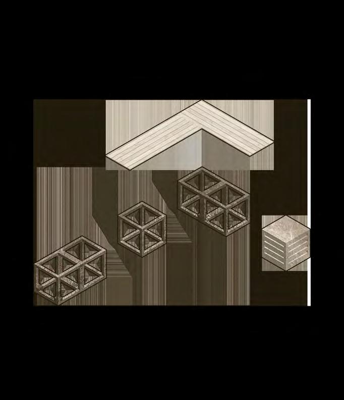
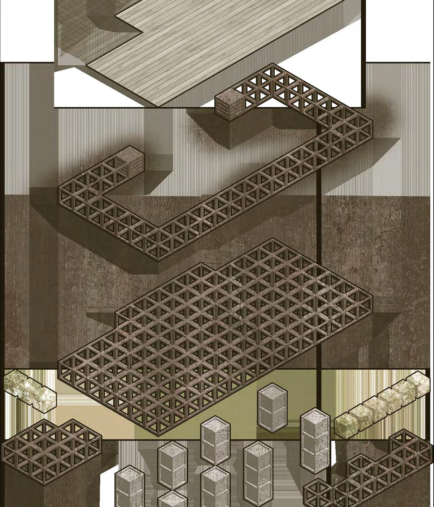
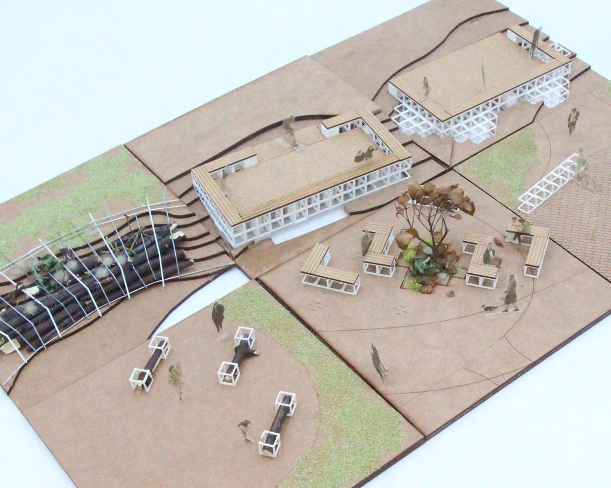
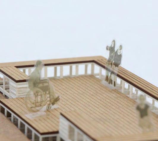
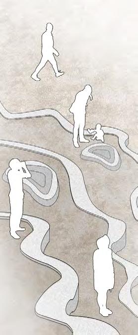
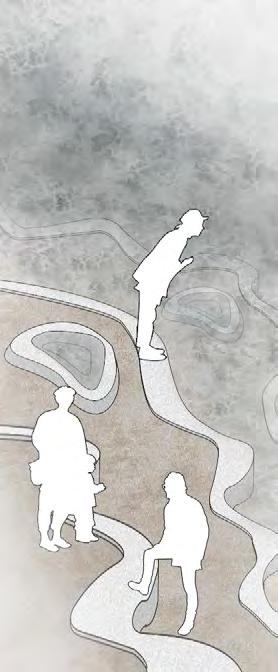
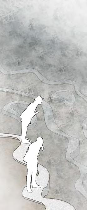
In order to unify the different parts of the park under the concept of flow and network-building, an universal landscape unit (ULU) design is proposed as the fundamental building blocks of the landscape network, used for ecological structures and placemaking, links places of the park together.
design concept


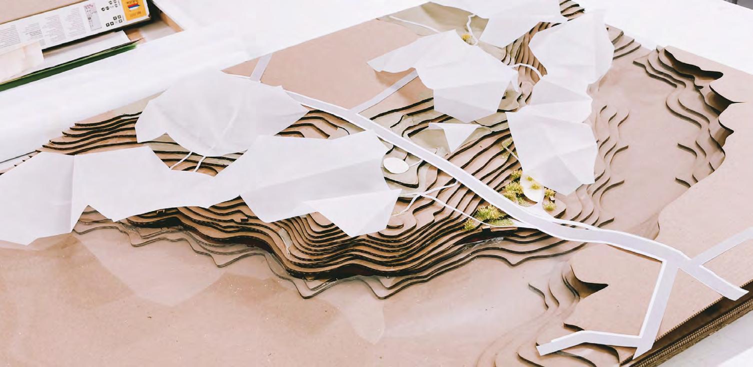
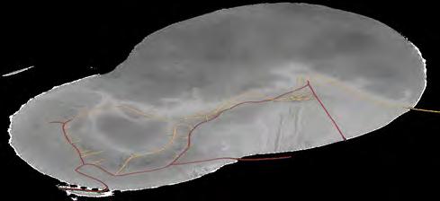
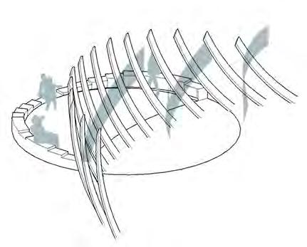
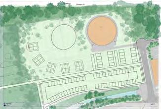
Initial site analysis reveals prominent issues on park's external and internal accessibility. For human users, the pedestrain traffic leading in and out the site is very limited. For more-than-human users, the disconnection between habitats and erosion has made internal park access difficult and unsustainable.
Based on the issue revealed by site survey, I proposed a network design aims to regulate the flow of users within the site. The intervention involves a general planning, and a series of configuration of ULUs to realize the planning and regulate on small scale


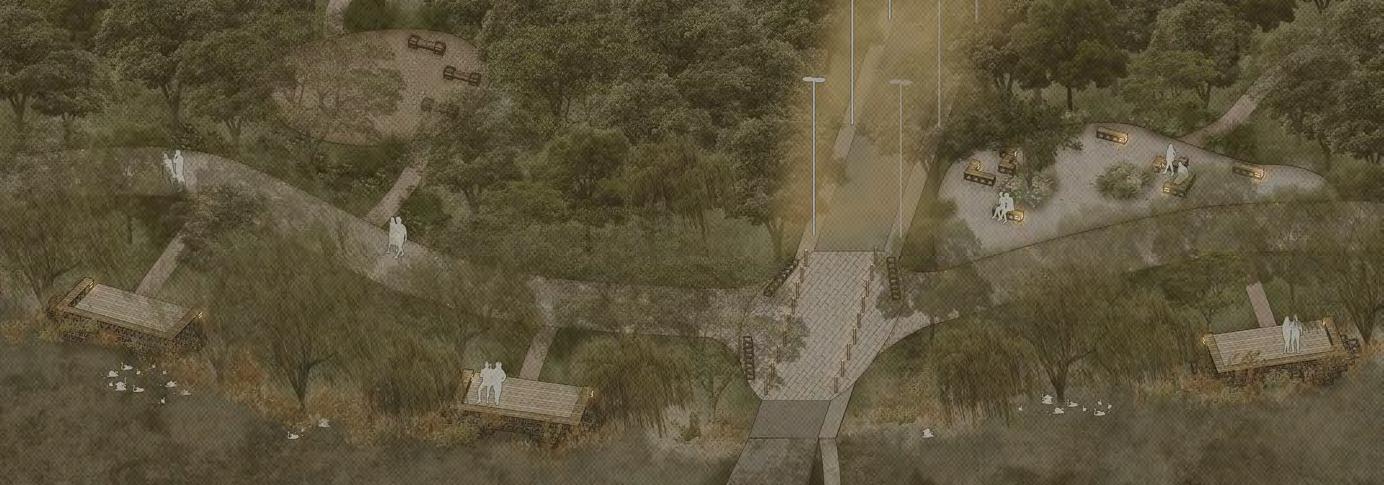
connection movement

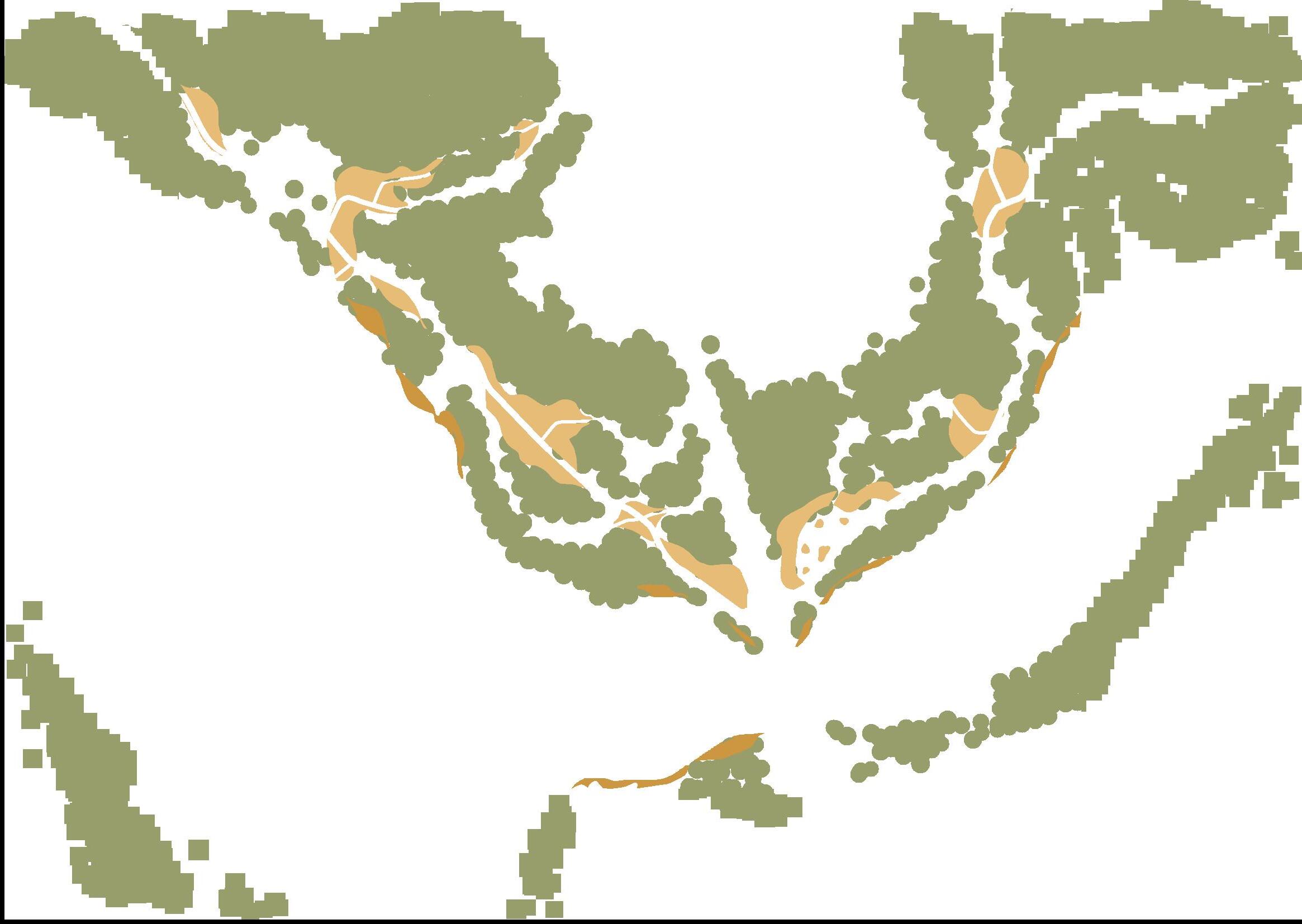
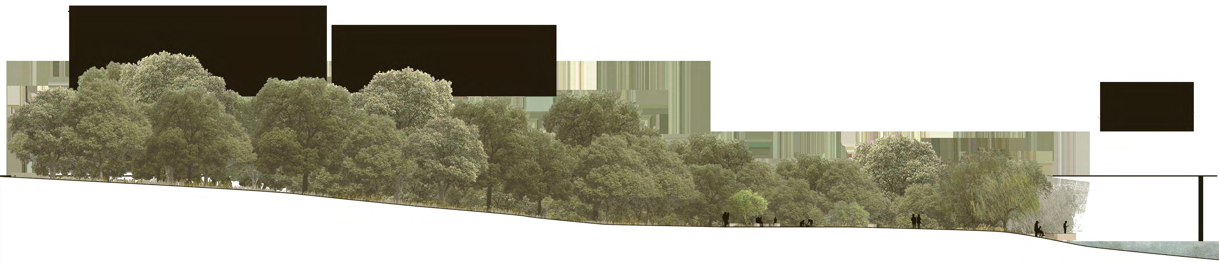
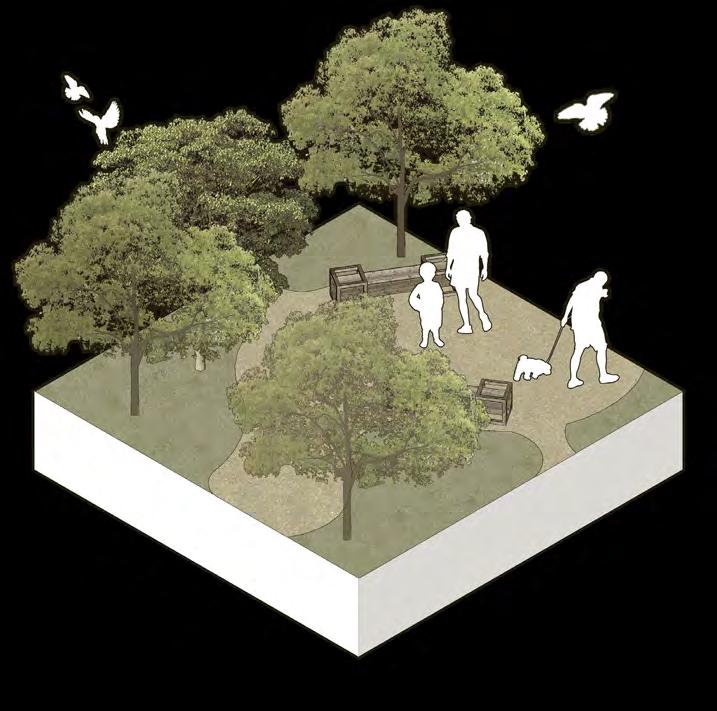
the existing woods are kept and expanded, creating a tick canopy to shield the wildlife and lower plantings in the woods from external disturbances, primarily noises
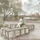
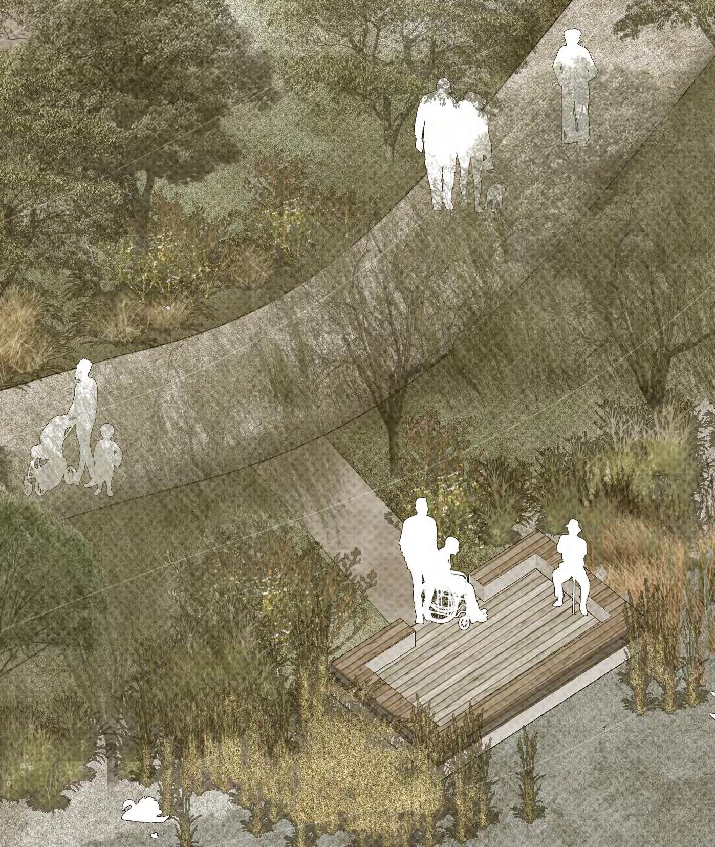
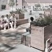
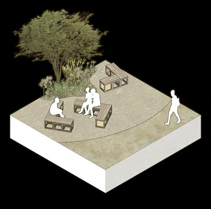
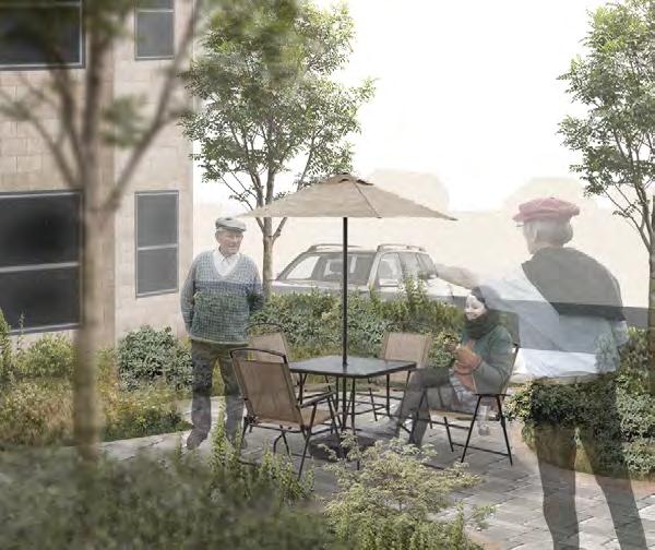
public space is converted from an empty ground on the waterfront, covered with firm plain soil. benches arranged in both face-to-face configuration and viewing configuration, encourages conversation as well as resting in a safe space
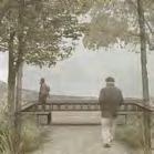
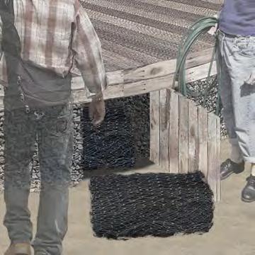
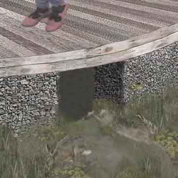
formal trails are improved existing trails, with a metal mesh and gravel on top to distinguish the trails from the surroundings, providing the visitors a clear main access through capital trails
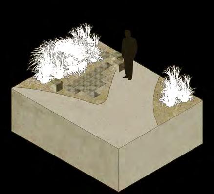
informal trails are planned according to existing desire lines, adjusted according to topography. the paving of informal trails is firm bare soil and gravel to keep the rustic style while highlight the trails
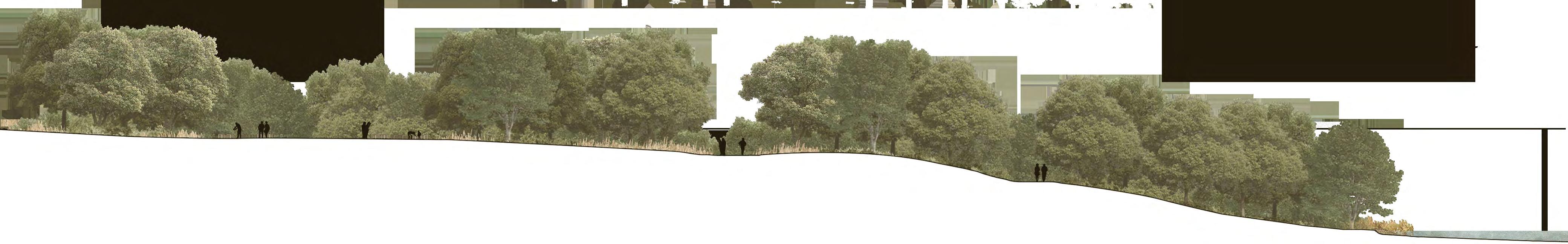
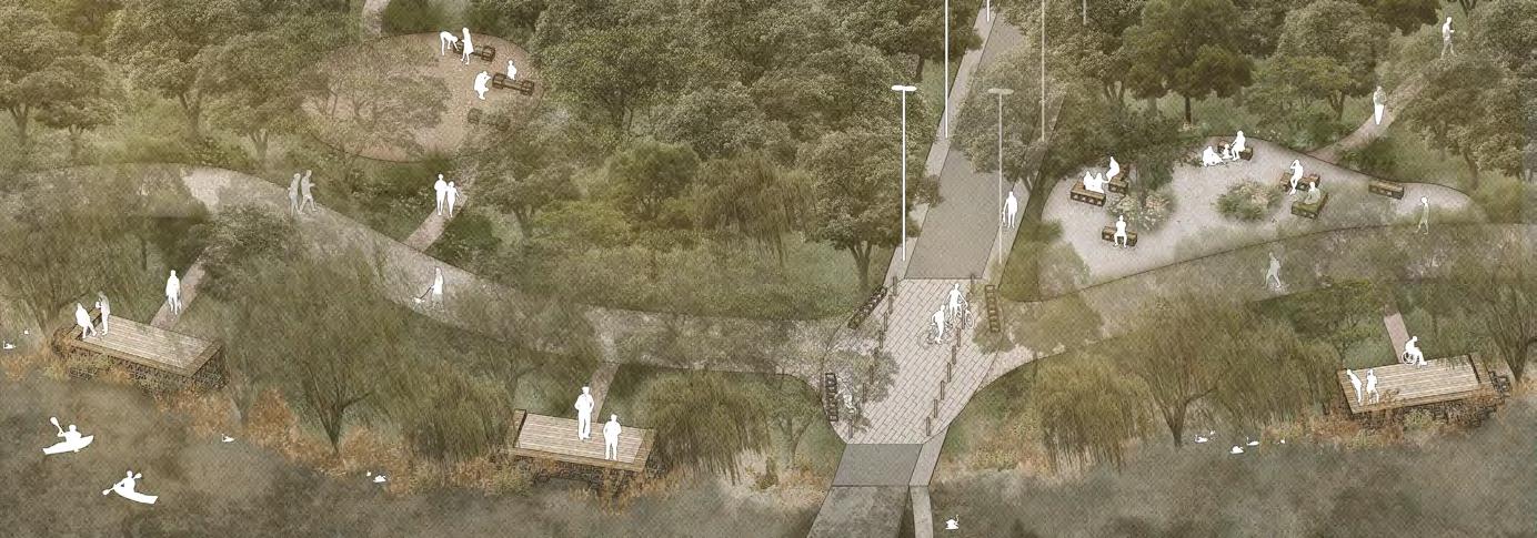
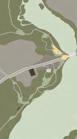


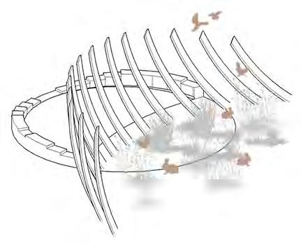
The park improved with the network design now have an extended time of service, which users are able to access the park without concern over safety from daylight to early evening. Various interventions were inserted to create equal rights for both human and MTH users to access the resources they need without disrupting one another
tree canopy
the trails going underneath the vary densities of the tree canopy provides unique experience compare to open space experience
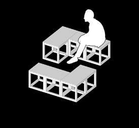
ULU bench
benches placed on the extra spaces on the trail to provide resting places for senior citizens
formal trail
the formalized trails with gravel paving to distinguish from muddy ground
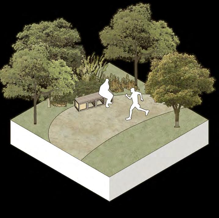
ULU bench
the benches in the public space are arranged to create safe space to start conversation and interaction
public space
the public space utilizes a different gravel paving to distinguish from the trails
planting pool
as some dwarf trees and herbaceous is growing on the existing clearings, they are kept and reinforced by adding nutrients and soft pavings for future development
informal trail/deck trail
informal trails and deck trails are bare soil cover with firmer surfaces, more rustic and blend into the environment
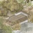
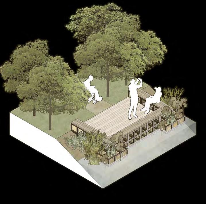
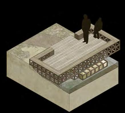
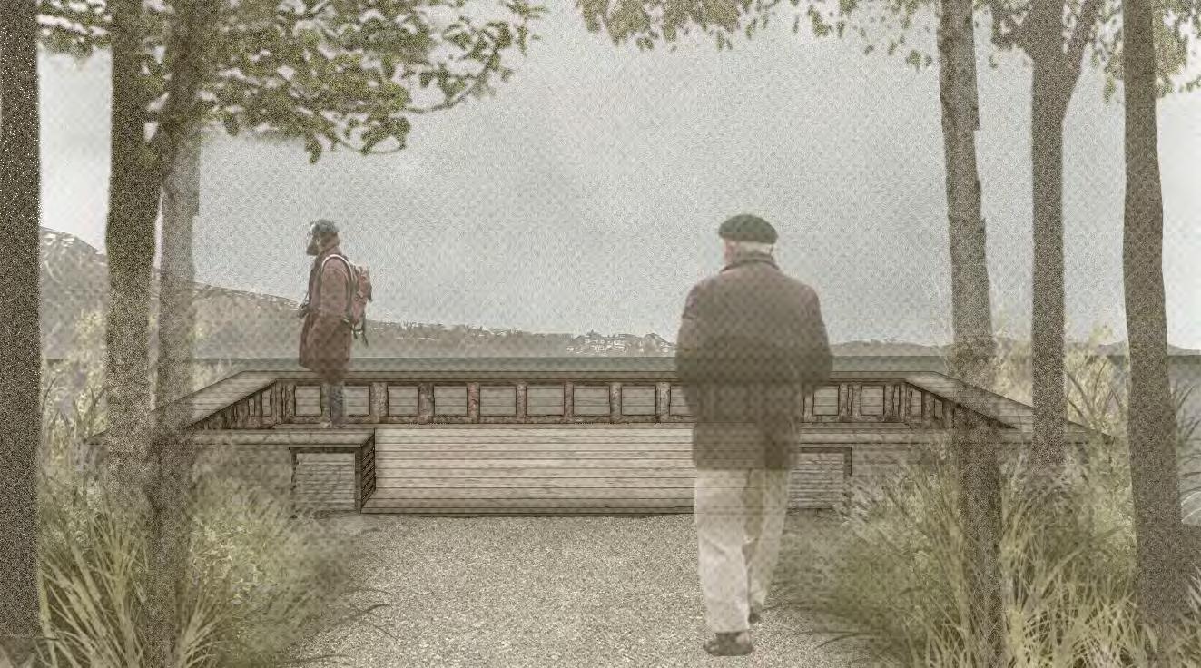
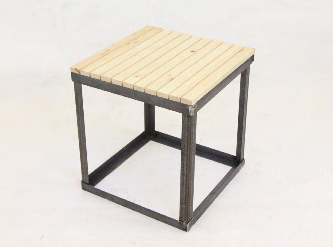
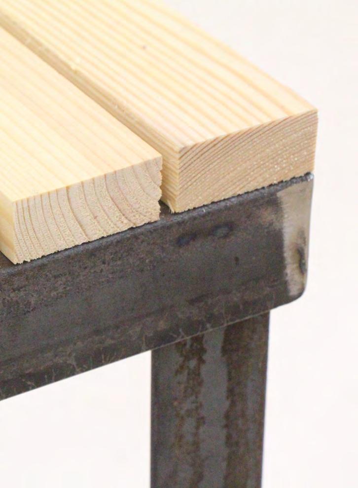
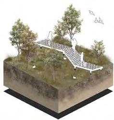
ULU deck
ULU frames stacked and welded together to form decks extended from the shore, offering viewing and resting space
ULU deck
planter edge
planter edge provides aquatic plants room and nutrients to develop and expand, which also provide soft shielding between human and MTH users
trail viewing deck
clearings
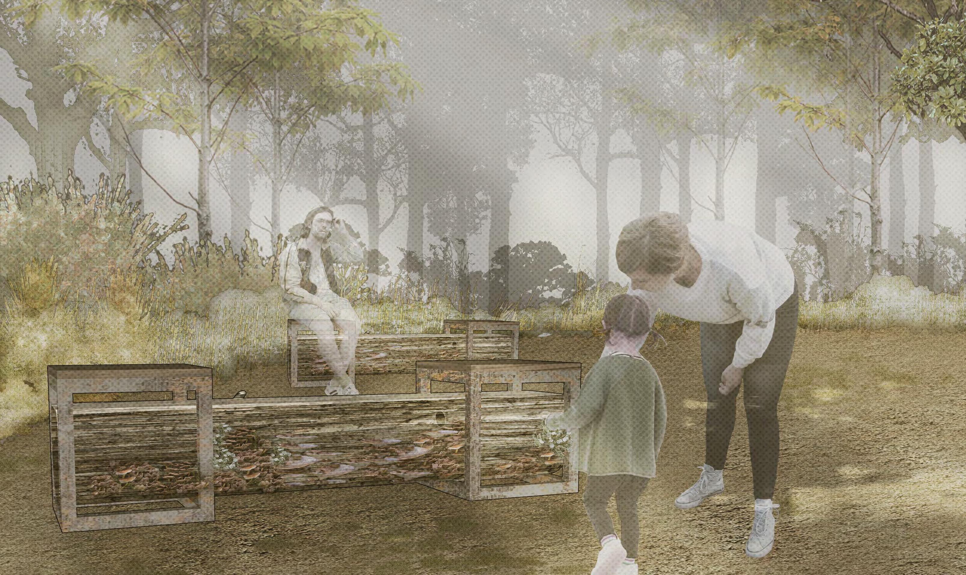
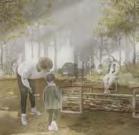
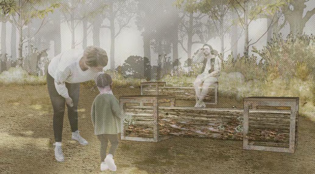
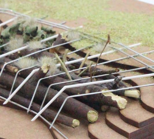
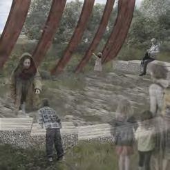
the small clearings in the woods will serve as sensational spaces with fungi benches placed inside for visitors to have a closer look at the local ecosystem, and the atmosphere provides a sense of tranquility, while the larger space will serve as play space or gathering place for childrens or other groups
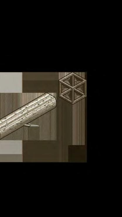
fungi bench made up with two ULU frames and a downed tree trunk, the fungi bench encourages both local and transplanted mushroom growth, and expected to be source of nutrient for local small mammals and plants
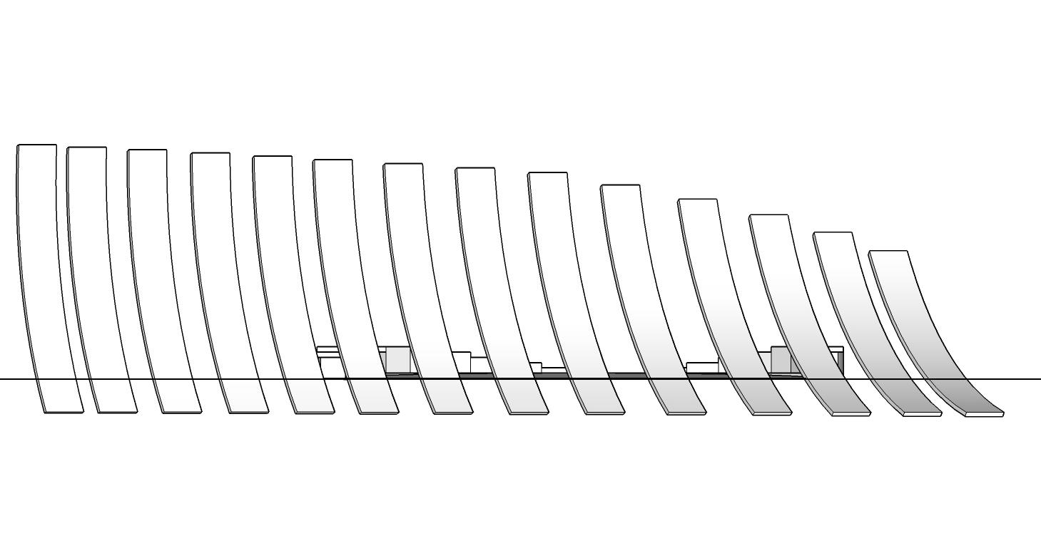
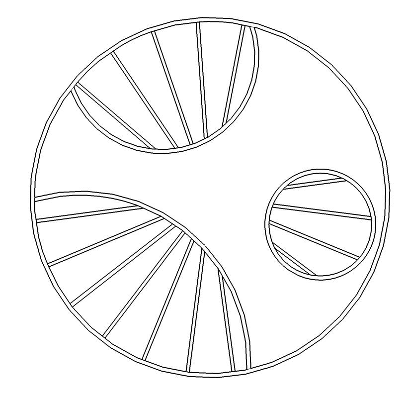
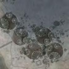
universal landscape unit (ULU)
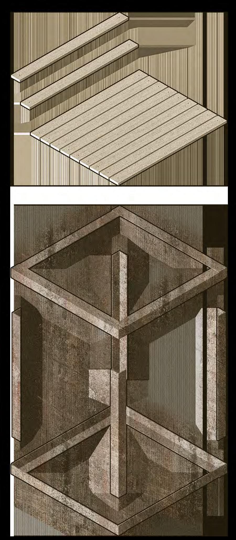

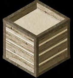
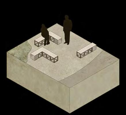
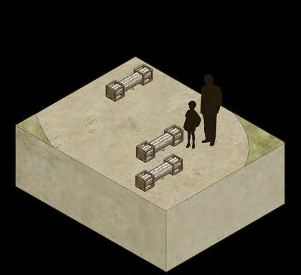

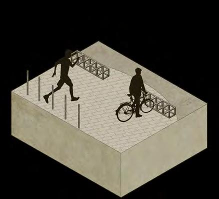
Universal Landscape Units are the building blocks of the design. Interventions realized by different configurations of the six basic units filled in the proposed network, making spaces into places. The benefit of using unified blocks to make landscape is the compatability and the flexibility of structures, meaning landscape can be regulated to adapt changes or meet user's new demands, without the need to build or tear down specific structures entirely.

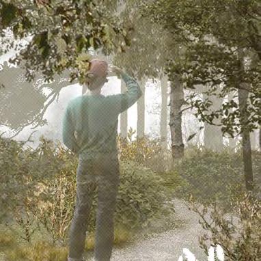
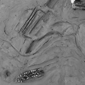
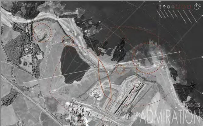
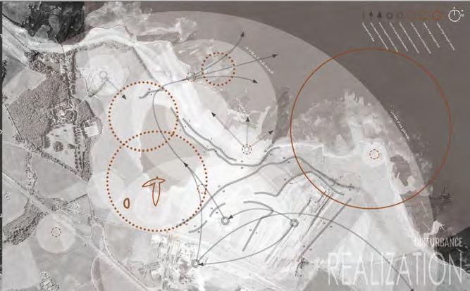
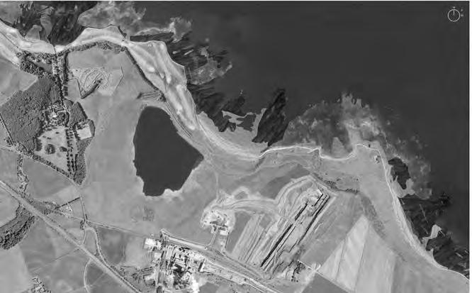
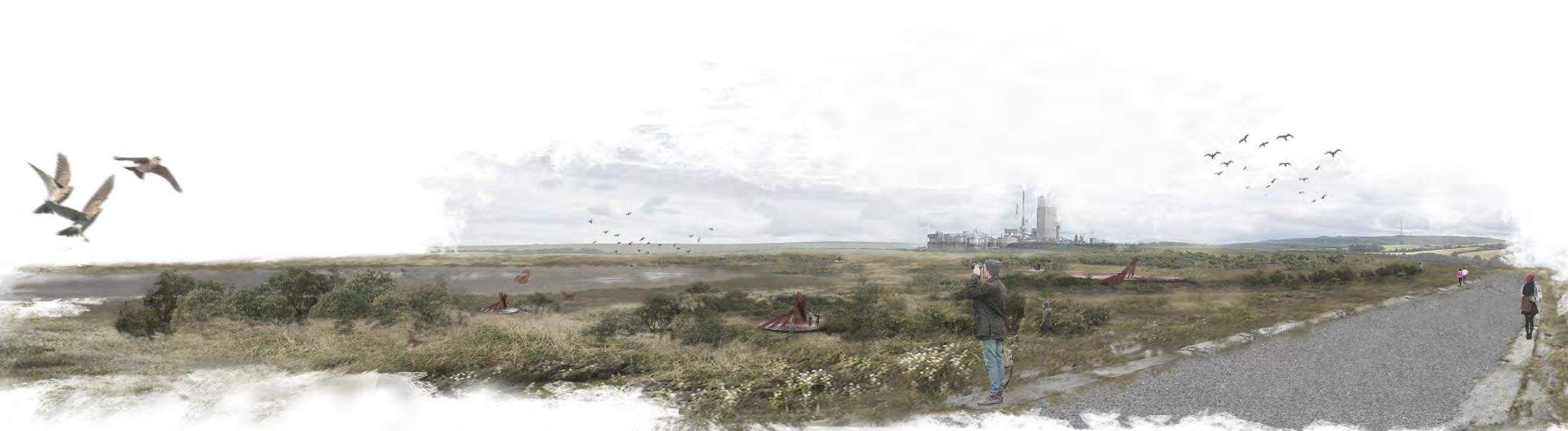
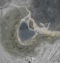
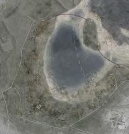
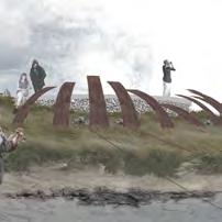
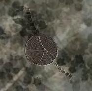
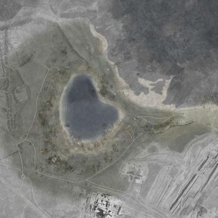
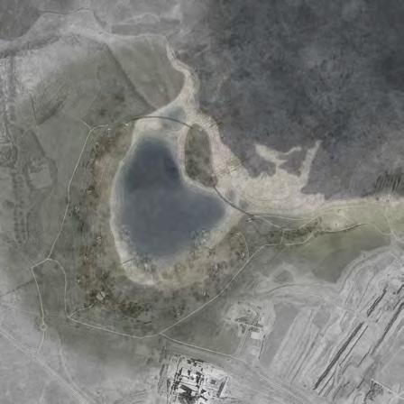
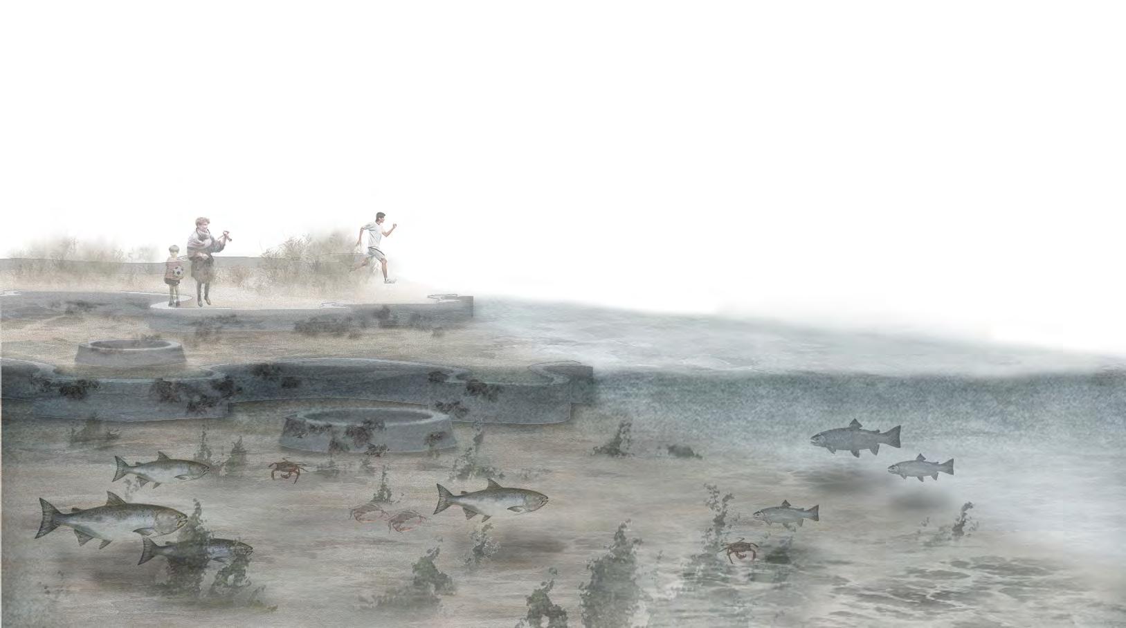
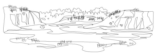
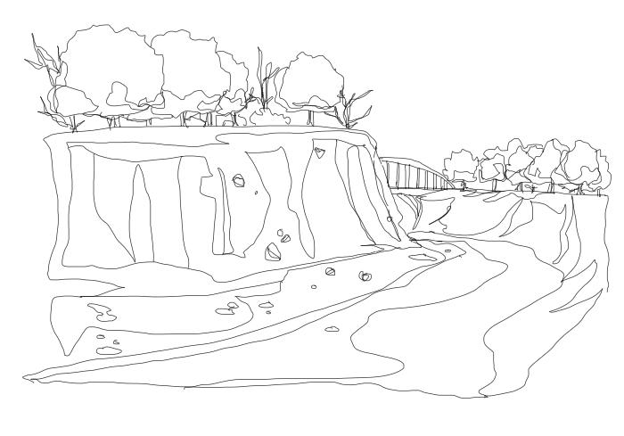
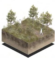
whitesand renewal post-industrial
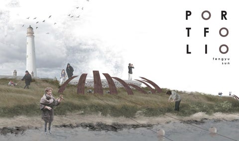
whitesand nature reserve and barn ness lighthouse region dunbar, scotland year 3 | semester 1 | 2021
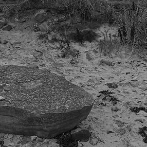
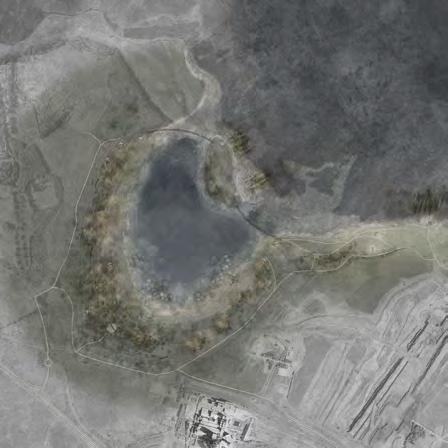
Located on the coastal outskirt of Edinburgh's city-range, Whitesand is historically famous for being at the end of John Muir Path, and archaeologically well-known for its abundant amount of fossil deposite. Yet, despite its significance, the commercial limestone mining process started from the late 1970s has drastically changed its topography and the ecological system. Nowadays, aside from the coastal edge where mining activities are limited, the limestone excavation has reformed the former dunecovered beach into a giant hole surrounded by barren, sandy soil.
As mining industry has evacuated from its original site, landscape designers are given the opportunity to activate the heavily damaged landscape by utilizing the newly formed landscape. While the land is mostly barren, hardy
plants still occupy some of the land in clusters; the excavation site, after long period of time, has also accumulated rainwater, forming an intriguing sight of freshwater lake next to the salt water estuary that is Fifth of the Forth.
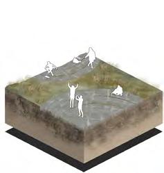
For this project, I envisioned a future which sea rising will continue to shape the landscape as human activities once did. The design aims to capture the temporal fluctuations on-site, using them as opportunity to catalyse a new, closer connection between the nearby inhabitants, onsite inhabitants, and the landscape by introducing a network of infrastructure for expanding biodiversity, supporting leisure and sustainable marine business, and amplifying the fluctuation as a major theme of the landscape. Overtime, I expect the design to eventually merge with the landscape, as well as Edinburgh's storytelling.
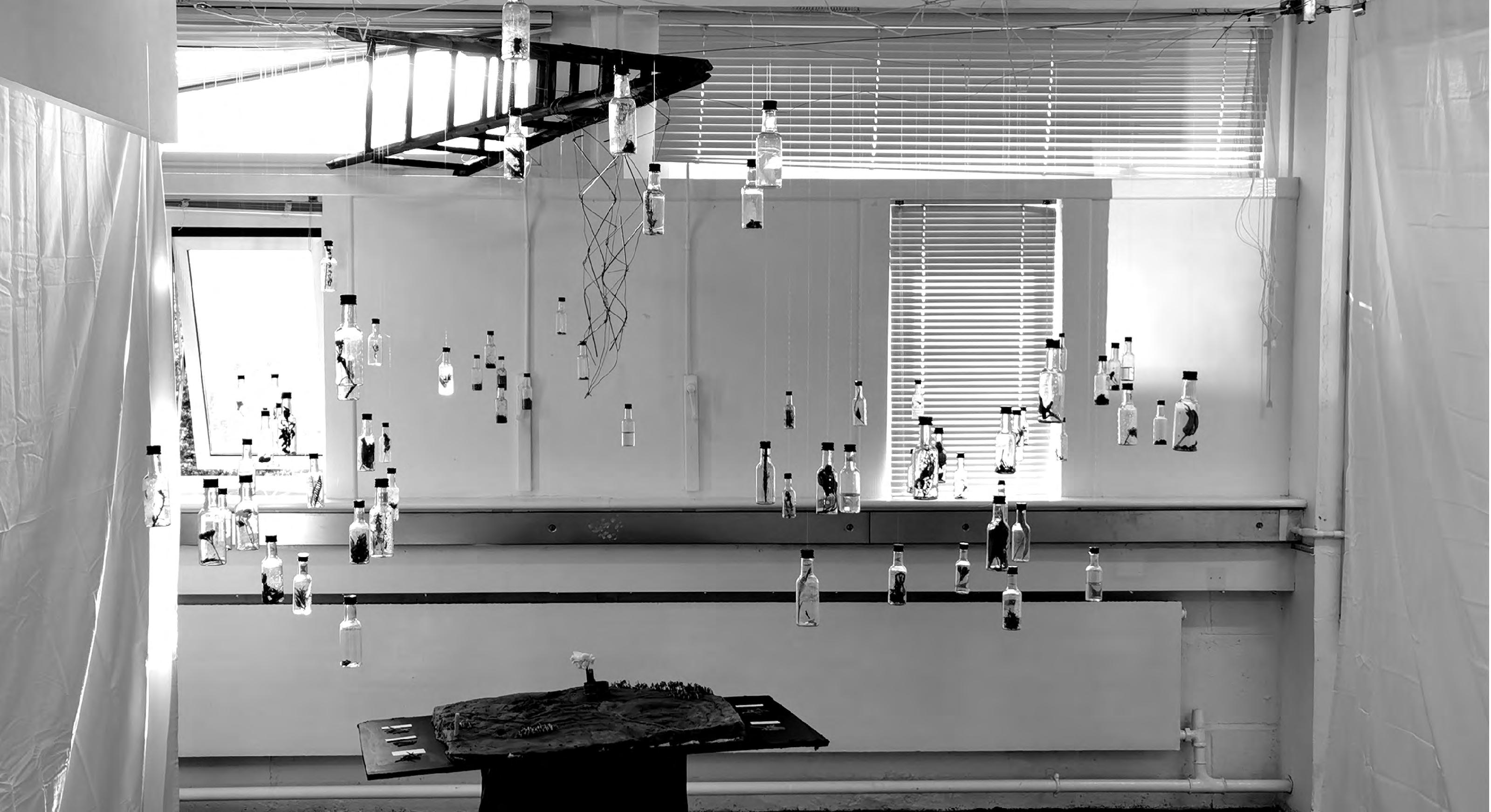
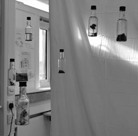
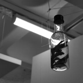
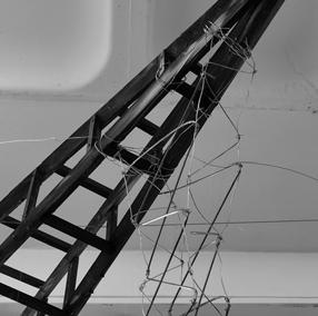
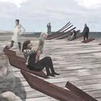
An installation made with the materials that the team collected on site was produced to express the current experience of a visitor.

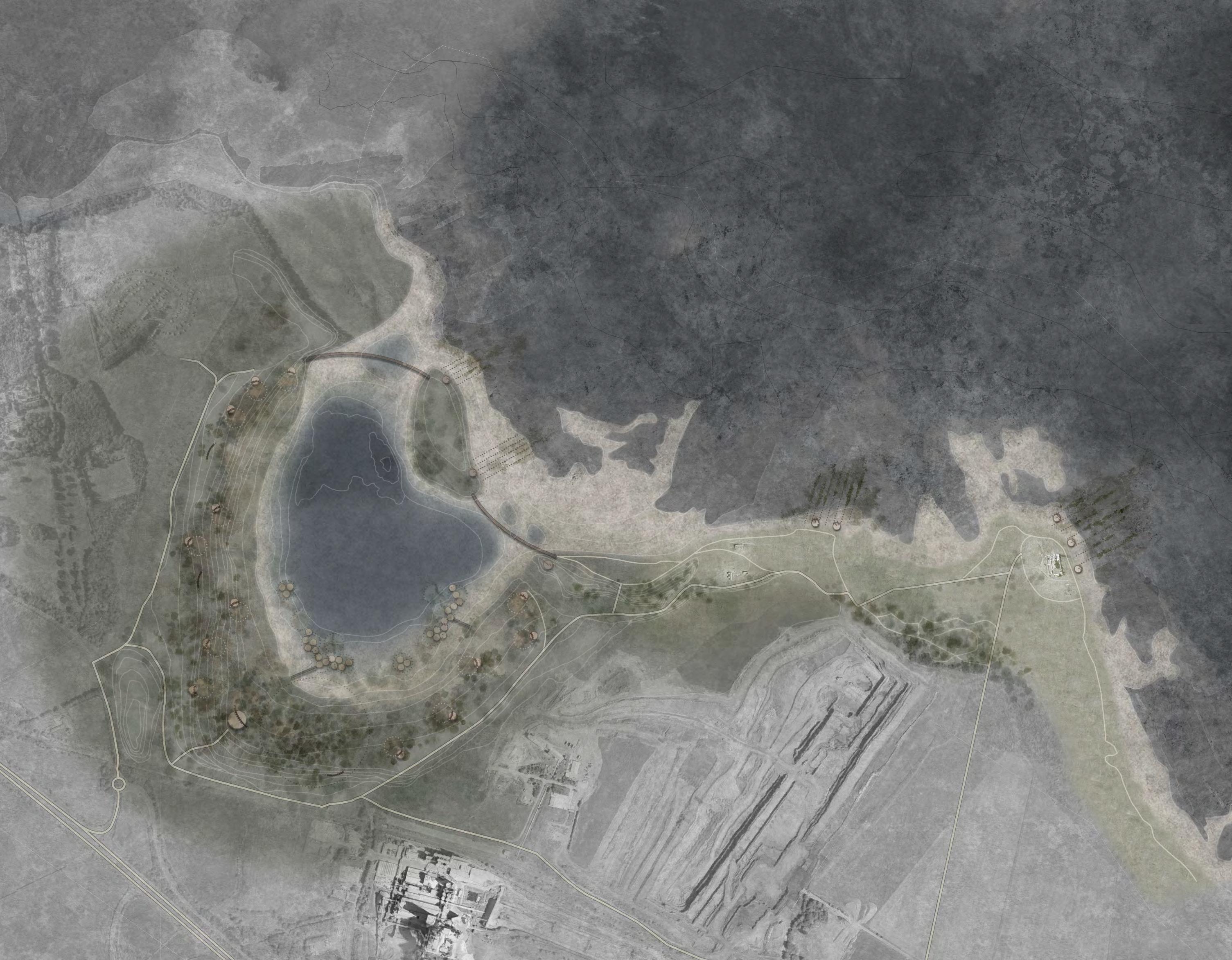
Viewing and playing space for human visitors and natural habitat for herbaceous plants, insects, small mammals and migrating birds
Used mostly by aquatic plants and animals, the island habitats built on the lifted terrains unerwater also allow visitor access to experience the lake up close
View to the tarmac factory
The largest inland platform serves as the visitor centre and distributor, where people will get a first glance of the landscape and decide on their destination
The utility hut can be used as storage, information booth, and bathroom, building up the infrastruture network around the site
limestone excavated on-site will serve as the paving for pedestrian access and structure for moss to attach to
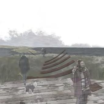
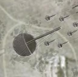
the sea sphere
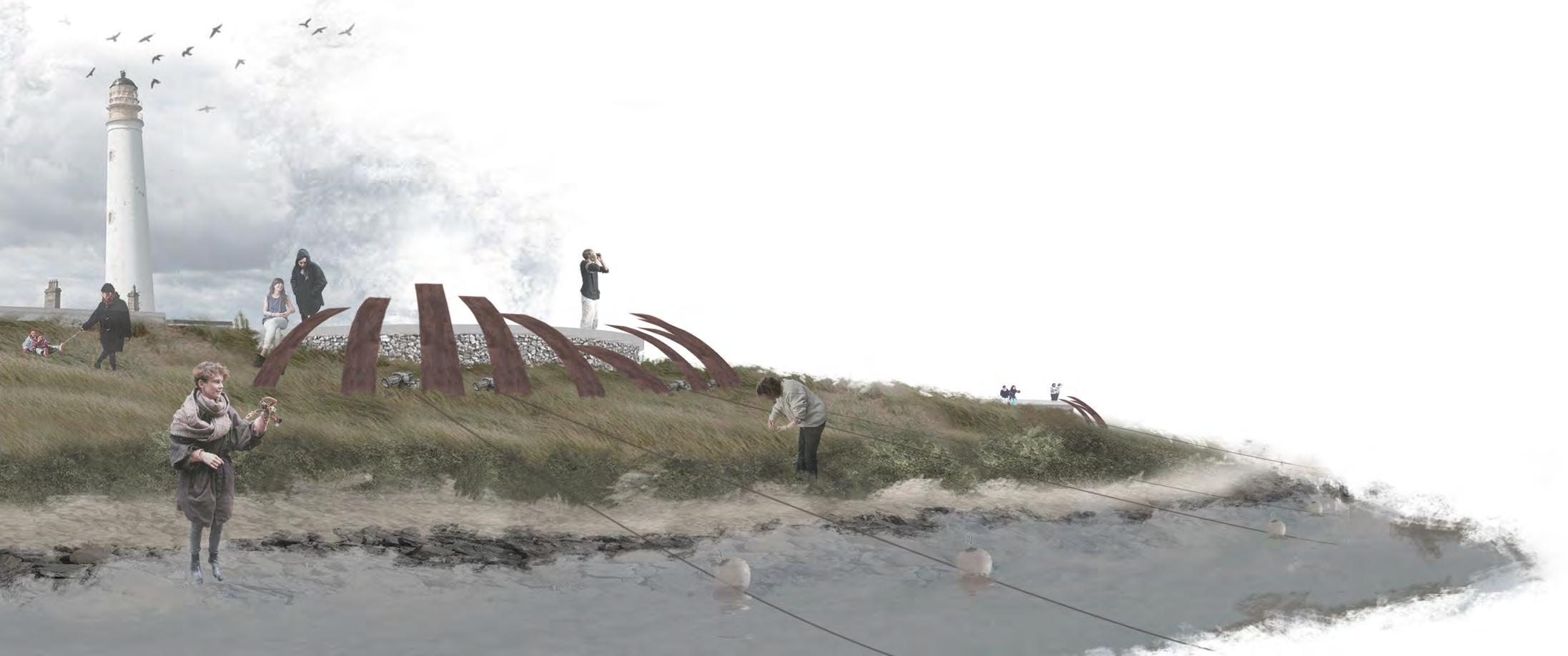
The main viewing platform near barn ness lighthouse where visitors can enjoy view to the sea and take part in seaweed & shellfish farming activity
Seaweed farm for food production / managed by family / community
phase 1
Fossil beach as landscape feature and farm anchorpoint
phase 2 (20 years)
phase 3 (50 years)
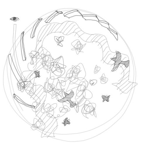
Demonstration of how the tidal ponds in the Ecotone area changes as sea level rises. The tide and sea level changes are the main sceneries of the Fulcrum observatory, as well as the transitional space between the two spheres
View to the barn ness lighthouse
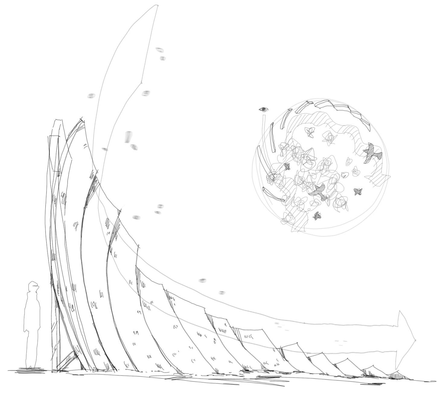
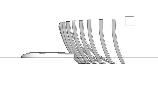
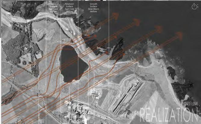
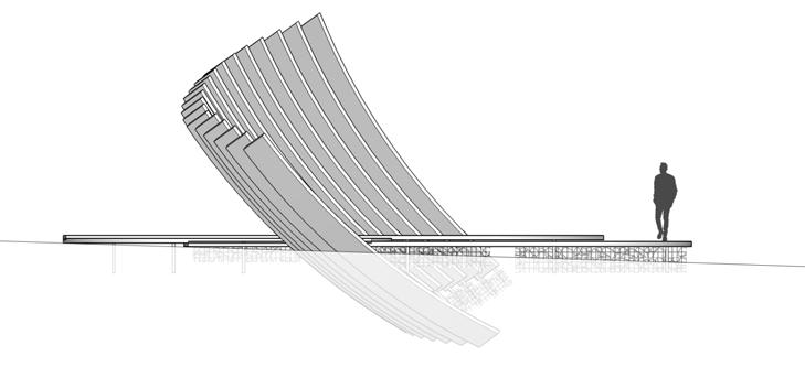
Inspired by aircraft's trailing edges, the deflector habitat is designed to regulate wind on site, using the wind to enhance the experience of the visitor's and spread biodiversity across the site


harbour for local residents


A network of deflector habitats will help to redirect the windflow site-wide to create a circulation of seeds for ecological purpose and a circulation of users for improving their expieriences
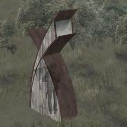
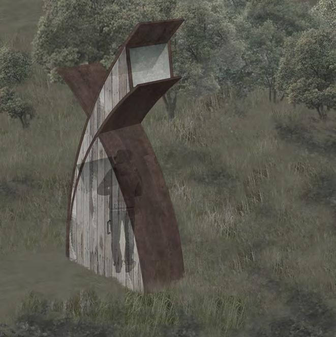
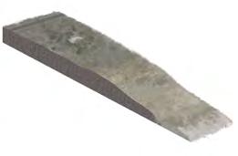
utility hut
Utility hut is built with same material that used to construct other structures on site, used as information booth, bathroom, and storage space, forms up the site-wide infrastructure network
Natural light enters the hut's top window, and reflected by the mirrow on the ceiling
Island habitats accommodate aquatic and wetland planting for sheltering, as well as for terminal stormwater filtration. The growth of the plants will also act as indication of bio mass condition of the area.
The mirrow in front of the user receives the light and illuminates the interior
metal edge supports deck surface
underwater bump
Same material is used to construct all structures across the site to reduce the cost of manufacture, waste, and emission. The approach also achieves consistency in style to make the structures connected
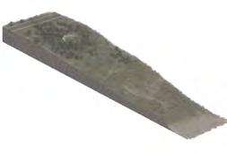
landscape observatory
Larger platforms using same materials as the habitats are placed stratigically on the entrances or intersections of the site, serving as main visitor hubs so that visitors can enjoy a good overview of the different spheres of the site, aided by the utility services provided by the utility huts
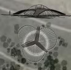
Spaces below the platforms used for storage or sheltering depending on location the vertex "to wrap up the journey" the fulcrum "to guide the flow" the pivot "to impress and distribute"
early sketches of platforms and habitats
temporal interventions
Drastic tidal fluctuation and rising sea level in the future will slowly alter the relation between fresh water and salt water ecosystem on site. Therefore, the design incorporates process of natural progression over the next hundred years so that the residents of the landscape will be able to adapt to the climate change, and visitors will be able to observe the change taking place during each visit
activities


The focus of the project is to enhance the existing ecological, historical, and social value of the whitesand nature reserve, highlighting the previously unseen characters, and integrate catalysts into the landscape to initiate new uses
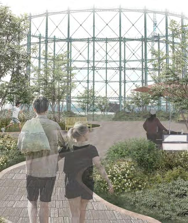
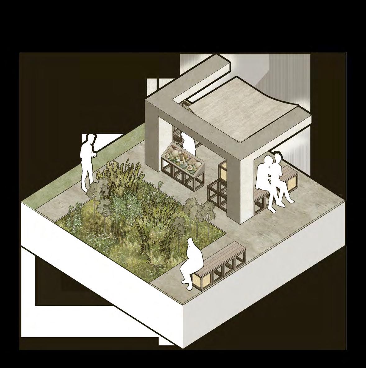
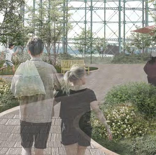
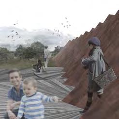
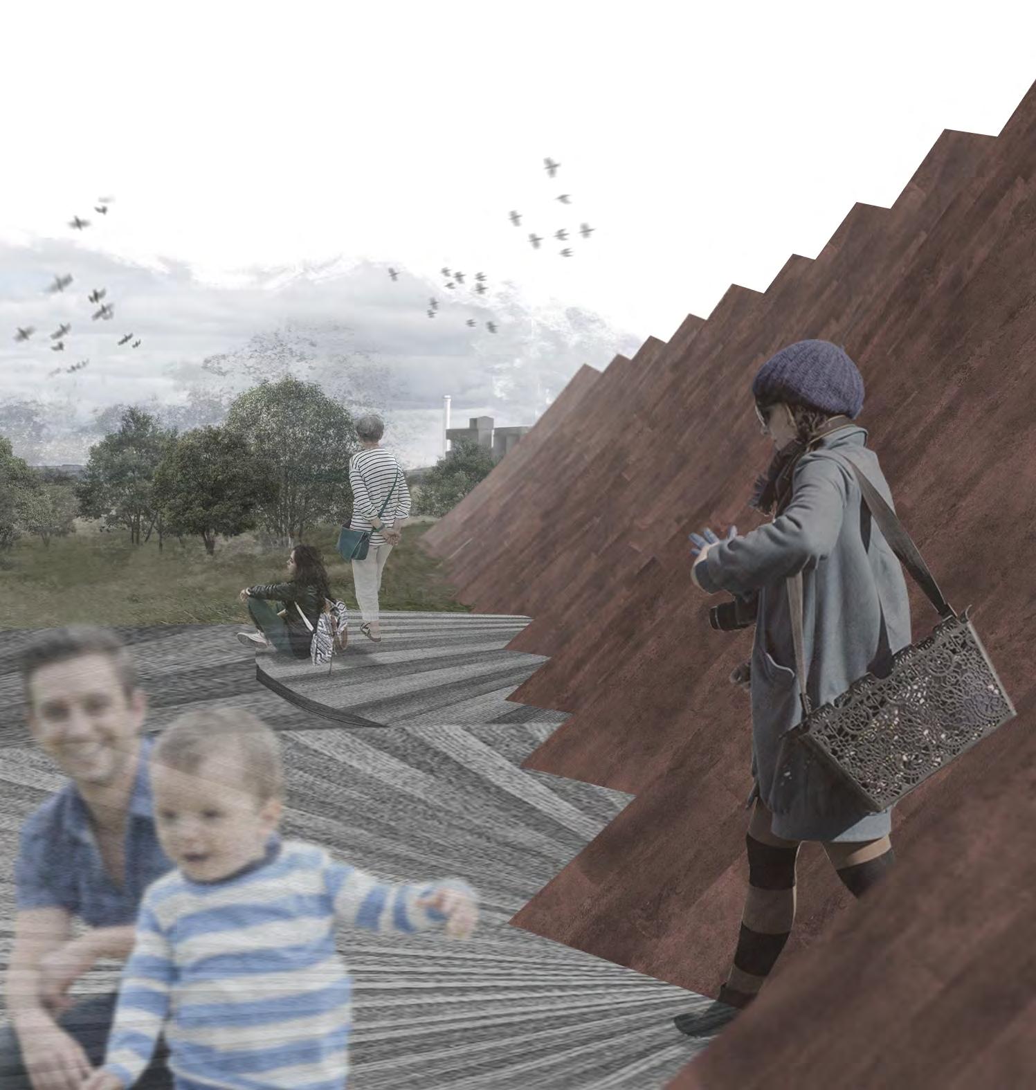
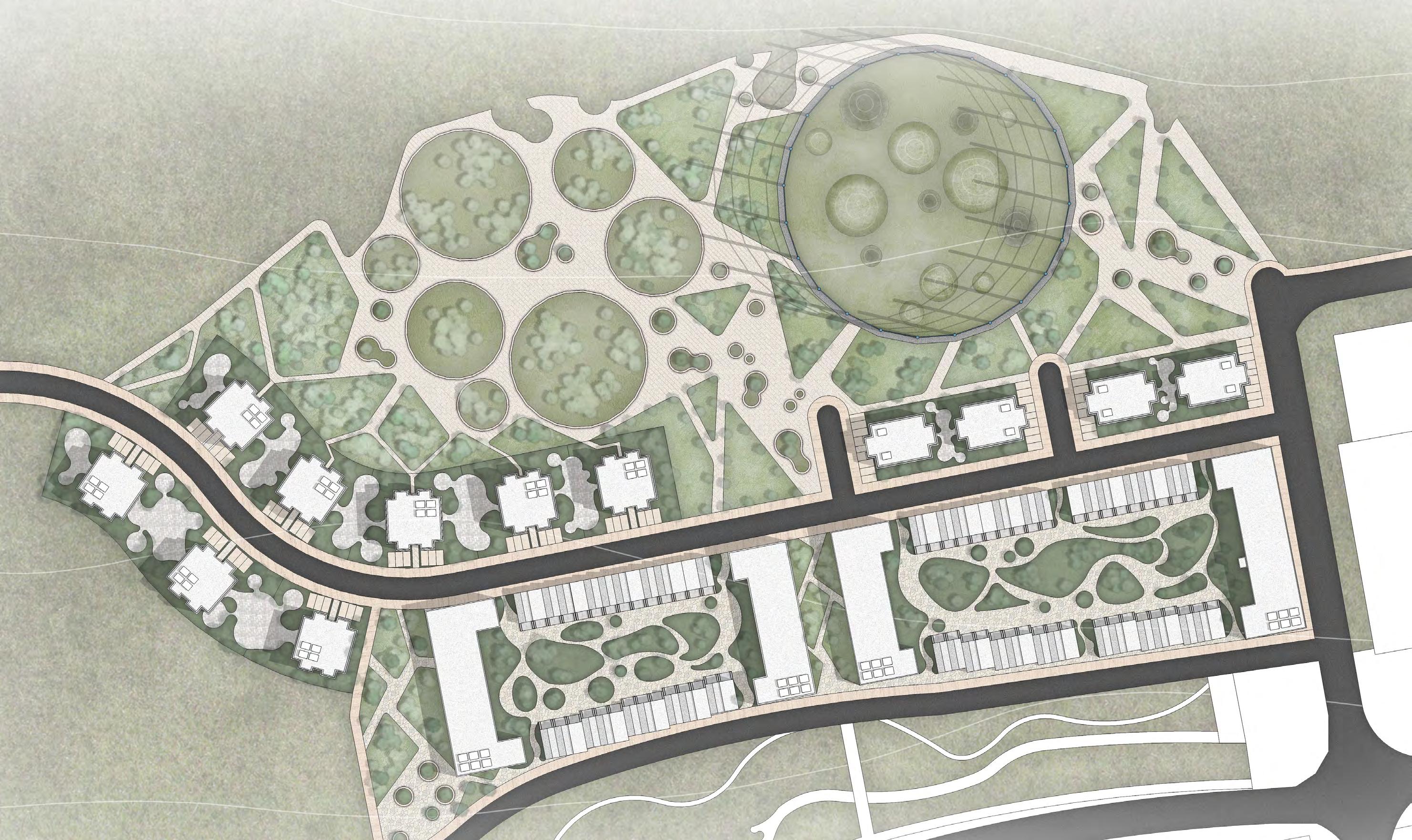
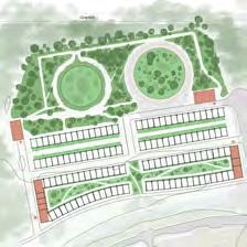
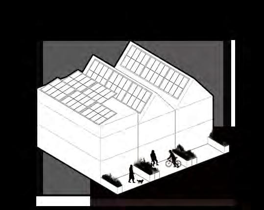
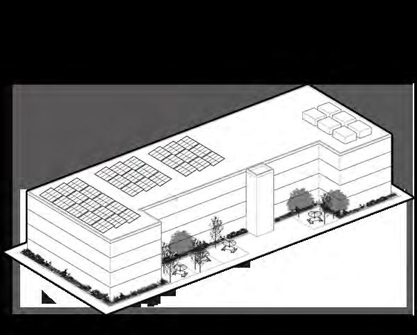
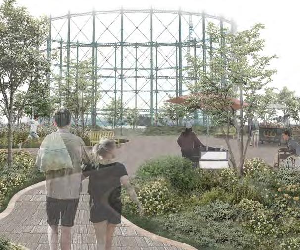
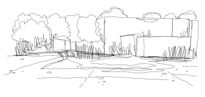
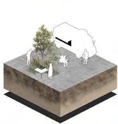
the green holder urban renewal
former granton gasworks edinburgh, scotland year 2 | semester 2 | 2021
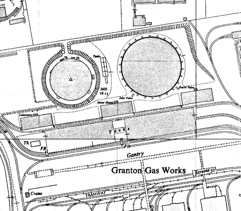
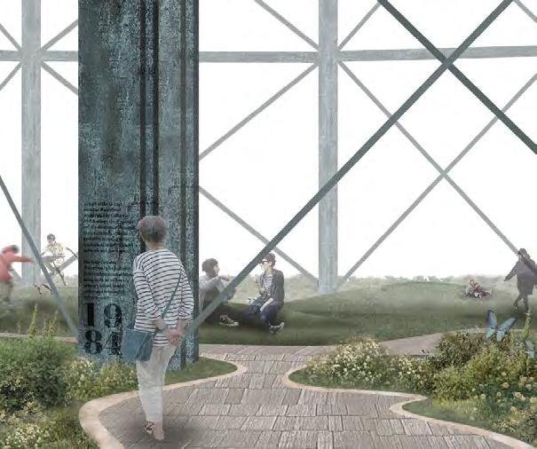
Granton Gasworks was once an industrial site of high importance, comprised of a ground level gas holder and a sub-terrain gas holder that provide gas for street lighting and residential use along the coast. The gasworks was gradually shut down in the late 20th century as electricity became the dominant civil power source. signified by the demolish of one of the gas holders in the late 1990s, the site was decommisioned and unattended ever since.
The remaining gas holder at Granton Gasworks is still a landmark of Edinburgh's urban coastline, However, there is no visitor near the area, and the neighbourhood suffers a high rate of crime and unemployment. Due to the regression in the last century, industry-based economy has suffered and the population had no chance catching up with the new economy based on green industry and internet.
As successful post-industrial landscape projects emerges from all around the world, the project green holder aims to adapt Granton Gasworks for new generation of community living and economic opportunity. The project integrated residential and social content with ecological design into the industrial remenant, using the gas holder as a historical attraction to gain attention and a variety of community housing to repopulate the underused land. park, public square, and gathering spaces are also planned to support different community events.
To adapt to the future of challenging climate condition, the design utilized decorative plantings to create sustainable urban drainage system that filter stormwater to provide irrigation water. Any leftover water can then used for urban farming as community-building activity, and for the regeneration of nearby woodland.
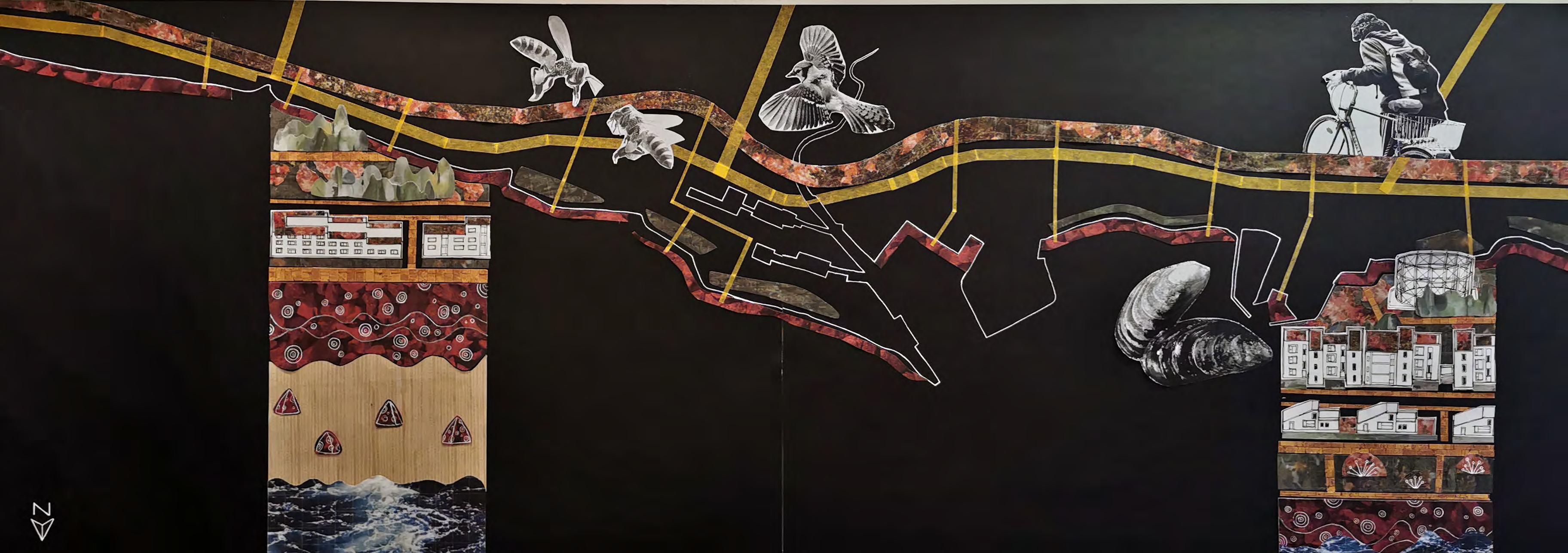
A collage work demonstrating the coastal structure of Granton, looking into the inland area. The coloured strips indicate the travel of marine inhabitants, land inhabitats, and human inhabitats, with zoom-in visual of the habitats


1
pattern study lighting variations
To call back to the site's industrial heritage, the planning draws several inspirations from the layout of the old garworks, including the placing of warehouses, railways, and pipes around the site.
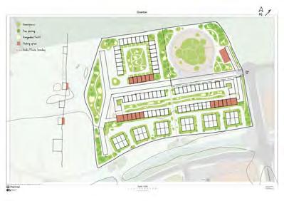
housing options
SuDS design community spaces
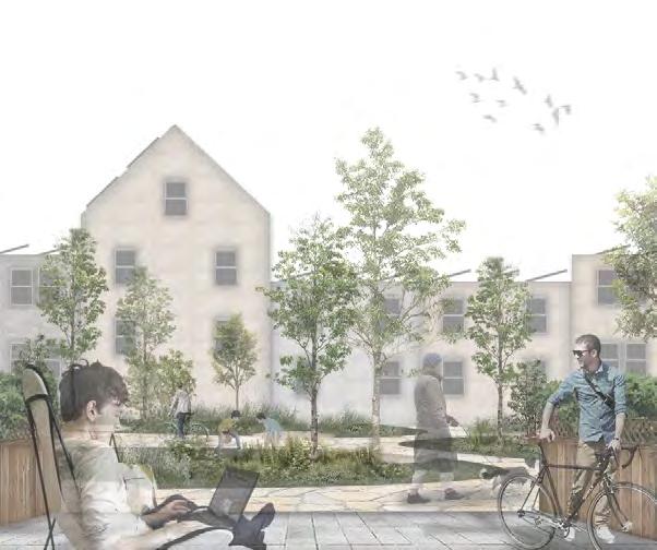


public spaces


Stormwater fall into the community and residential garden will be purified by the herbaceous plantings and passed down along the topography
The processed water will be used in garden irrigation and support urban farming to reduce the need for extra water supply
Same process will take place in each greenspace the water flows over , in which the plant got irrigated, and the excessive water will be passed down
The water left in the final process will be passed down into local woodland to support its regeneration
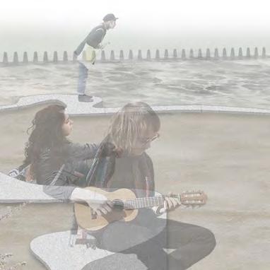
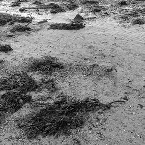
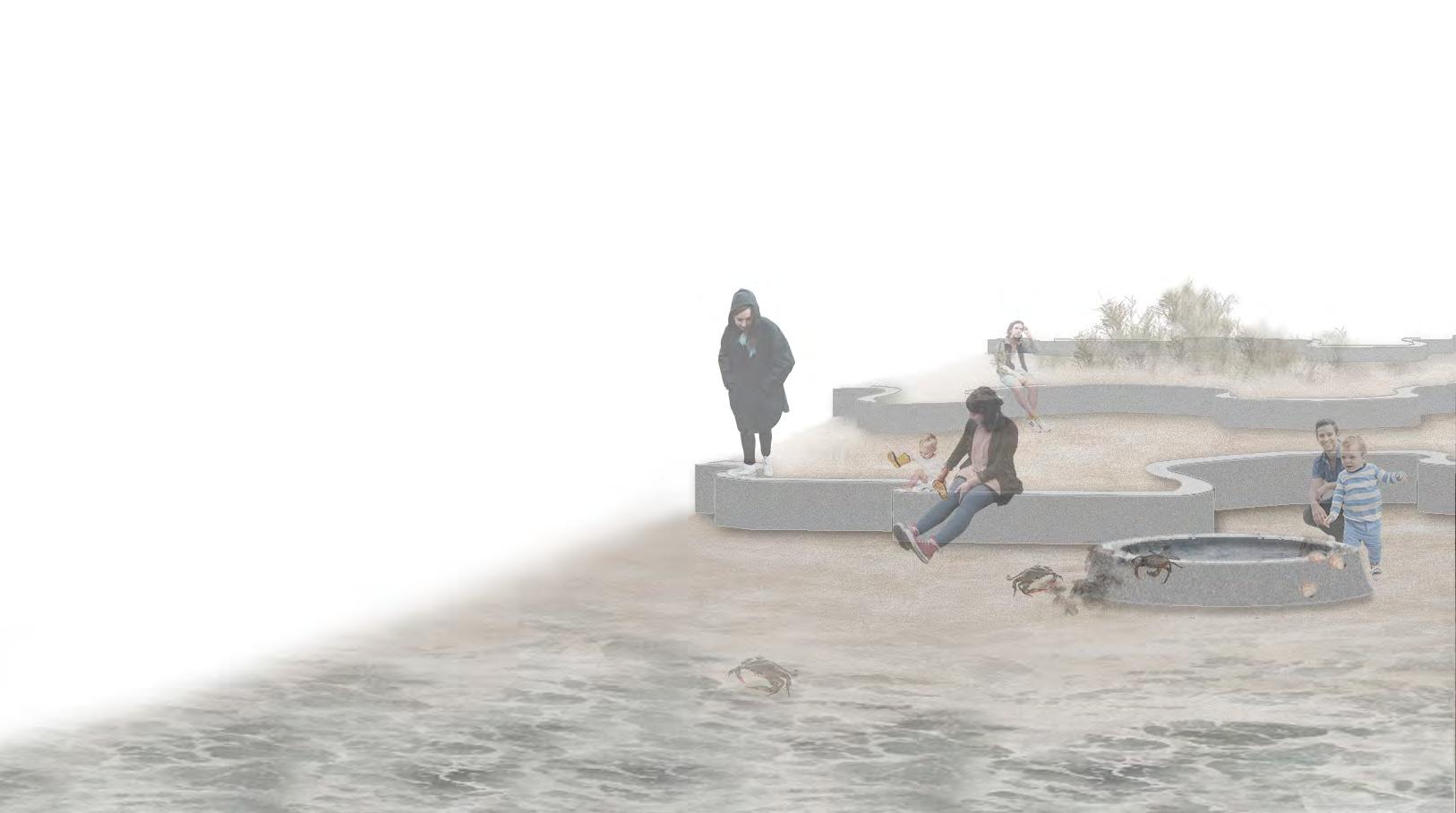
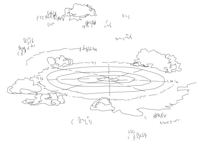
wave foams waterfront
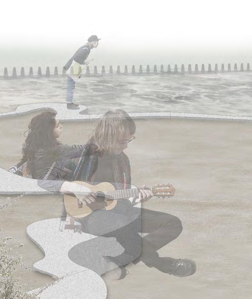
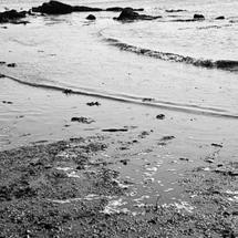
cramond beach, cramond edinburgh, scotland year 1 | semester 2 | 2020
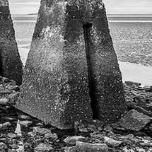
Located at the mouth of River Almond, where the river runs into the Firth of Forth, Cramond is a suburban village that rarely sees much visitors. Yet, the site is high in historic value, which dated back to the WWII era, when a set of underwater pylons were placed along the causeway, aided with the batteries on Cramond Island to stop German U-boats. The iconic causeway and pylons can still being seen and used today during low tides.
Aside from the historic context, the beach and waterbodies of Cramond are home to many of the Scottish marine life. The dunes on the beach cultivate a series of hardy, drought and salt tolerant plants, and the causeway surfaces become the anchor point of seaweed and shellfish. However, the climate change in the recent years let to rapid rise of sea level, and the fluctuation of tidal wave intensifies at Cramond,
endangering the existing coastal ecosystem.
In order to prepare the Cramond's waterfront for the future challenges, project Wave Foams seeks to improve its value as marine habitat, fortify the site's on-shore ecosystem, and integrate social context in the design to raise people's awareness on the coastal cultural and ecological value.
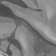
The design begins with the study on the effect of tidal fluctuation, using the traces left by the water as an overall theme to develop organic and iconic pattern, upon which a set of hard structures are planned to both retain the dunes and act as shelters for marine life. In the meanwhile, temporal dimension is also considered in the design to prolong the lifespan of the beach and allow access to the waterfront at all time, minimizing the impact of the rising sea level.

patterns of wave and on man-made structure were the most prominent elements we noticed on site. produced a series of sketches capture these patterns and how it can be applied to installations functioned similar to the existing site features, like the pylons inhabited by shells and seaweeds, and its visibility determined by the tide.
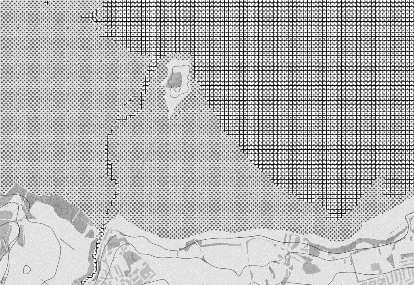
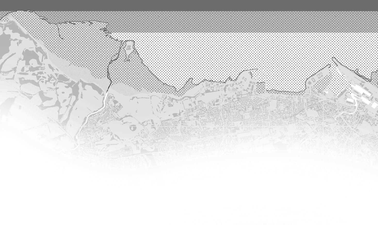
Cramond beach and causeway, like every other coastal features of edinburgh, are dratically influenced by the tidal pattern. As global warming
granton
cramond
leith
port of leith
granton
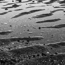

The effect of tidal fluctuation on the coast of Cramond is prominent. Therefore, the best way to understand the site's ecological and historical context is to record the traces of the tidal waves on the residents and the structures.


1
2
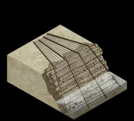
retaining edge

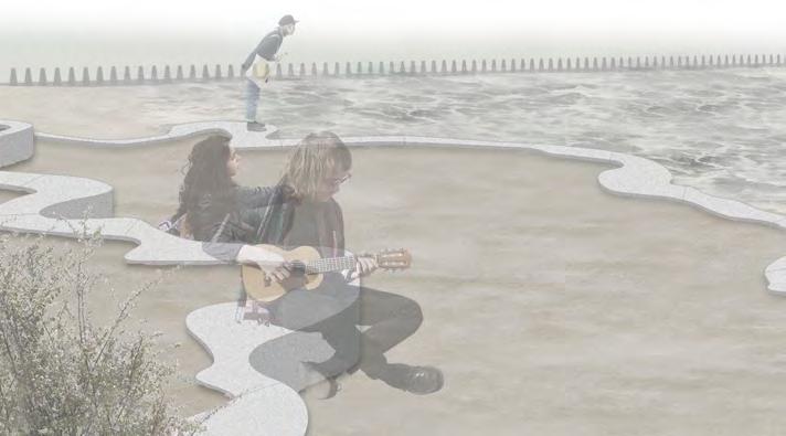


For everyday uses, the beach is mostly accessible for short walks, resting and socializing. The retaining edges act as seats when above water surfaces, and keep the wet and dry part of the beach separated
Retaining edges separate the beach into different levels to prevent erosion and ensure space of movement during high tides. As the sea level rises, the edges underwater will become artificial reefs
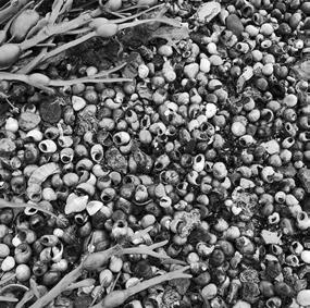
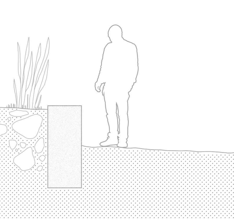
tidal pond "foams"
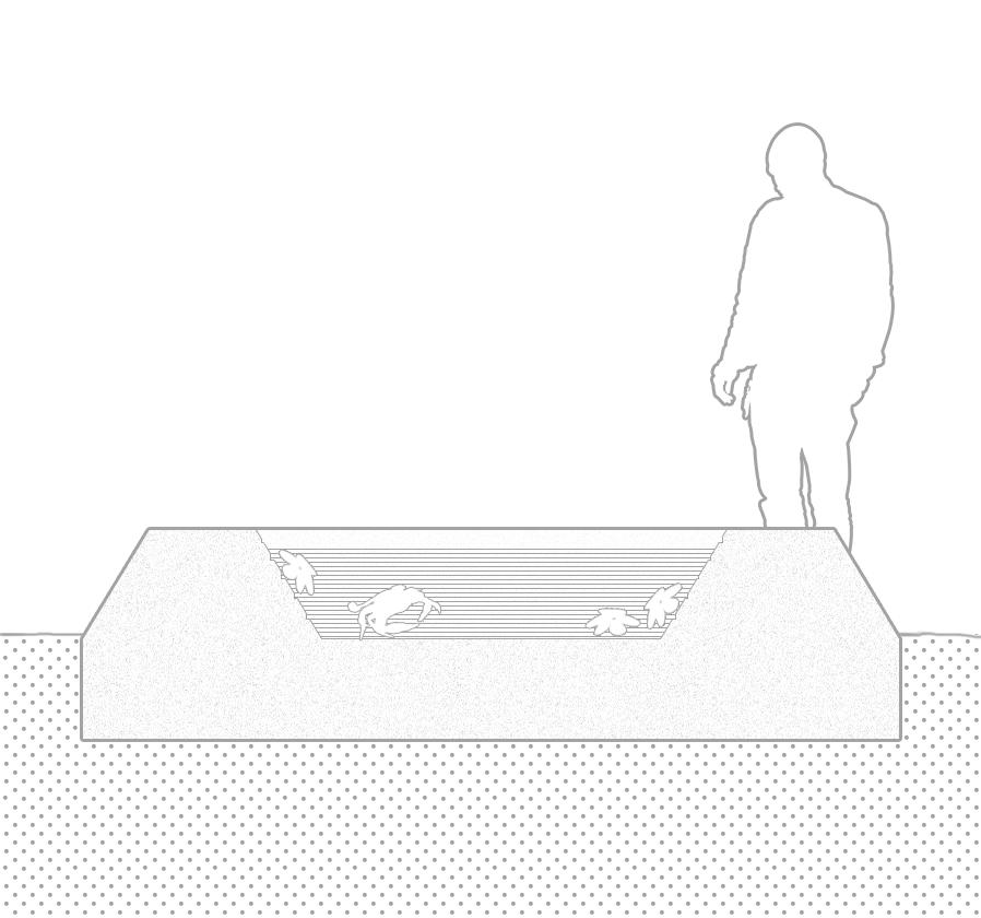


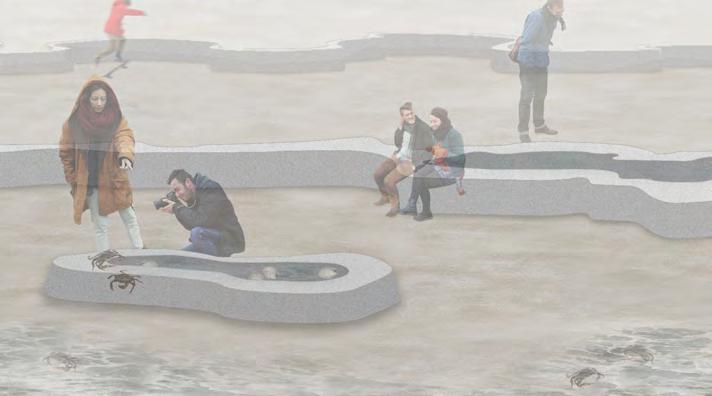


During high tides, FOAMs act as artificial reefs, providing shelters for seaweeds and small marine creatures. During low tides, FOAMs keep small animals and plants inside them, forming small demonstration of local marine ecology
The tidal pond "foams" provides temporary shelter for marine life left on the beach when water retreats. The ponds, when filled up, also provides visitors a closer look at the local aquatic ecology
low tide
The beach is occupied by human users during low tides. The hard structures serves as recreational and educational uses.
beach plants
the existing, delicate beach planting are secured by the retaining edge so that the unique ecosystem will endure a longer lifespan than its current, unprotected state
retaining edges
the retaining edges ensure the structure integrity of each level to prevent erosion. they also serve as benches for visitors to rest on
lower beach
the lowest level of the beach is accessible during low tides. visitor can enjoy a close contact with the ocean and sense the fluctuation
tidal pond "foams" "foams", during low tides, keep a small portion of salt water and the marine life left inside when water retreats. the ponds provide visitor a closer look at the coastal wildlife in a natural temporary aquarium
The waterfront is generally submerged, serves primarily more-than-human users in aquatic environment
retaining edges & "foams" above water the levels devided by the retaining edges ensure limited access of human visitors during high tides, allowing them to observe the dratical change of the beach's scenery
retaining edges & "foams" submerged when submerged, the structures become the habitats for all different kinds of aquatic life. shellfish and seaweed can attach to the carvings on the surfaces, while fish would swim in between the ponds. the structures provide shelter, food, and breeding place for all the coastal life
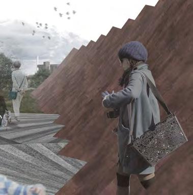
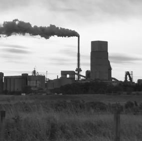
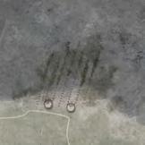
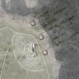
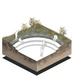
steelworks remediation regeneration
former ravenscraig steelworks and nearby woodland motherwell, clyde catchment, uk year 2 | semester 1 | 2020
sitting next to motherwell, ravenscraig was one of scotland's largest steelworks in the last century, supplied steel for all over the country and directly led to the founding of nearby towns and cities. the steelworks' closure, however, left behind a massive contaminated land, disrupted ecosystem, and the large population unemployed for decades.
project remedy ravenscraig is based on research of local ecological history
and the relationship between the population and the industrial culture. the present day ravenscraig is seen as an ecotone on temporal dimension, with integration of various spatial repurpose interventions, both the site's future and the prospect of community can be based on green development, which is a sustainable callback to the site's industrial history.
ravenscraig

community


industrial

educational

automobile

glasgow
coatbridge
hamilton
motherwell
lanark wishaw
1850s
basic infrastrcutures were built in motherwell south calder water corridor was intact
development
stage 1 remediation
1950s
construction of ravenscraig steelworks began ecology were disrupted to make ways for development
the stage which contaminants will be removed from the site, via both artificial removal and phytoremediation process

placemaking

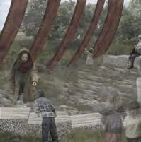
adding overpass to separate visitor access from habitats, while the view and sunlight access stays the same
1960s
ravenscraig became the largest steel production site in scotland ecological corridor was fragmented
1990s
Steel production ended, steelworks were demolished Landscape was polluted, original ecosystem distorded
stage 2 integration
visitor infrastructures are built upon developed green infrastructures, integrating leisure and educational contents
2000s - future
construction of sports centre and ravenscraig park
woodland and grassland struggle to regenerate in ruins
stage 3 expansion
the implementation of the project will require workforce and professionals, which can make green economy the new driving forces of local economy


differentiate footpath from surrounding environment to ensure healthy plant development

repurpose remaining pavings as play space, inhance the way visitor interacts with the landscape

repurpose remaining structures as amplitheatre, providing visitor with quality social space

converting concrete surfaces as public square, integrating benches, tables, and business venues

set up testbed area for plant cultivation for both future site development and educational uses
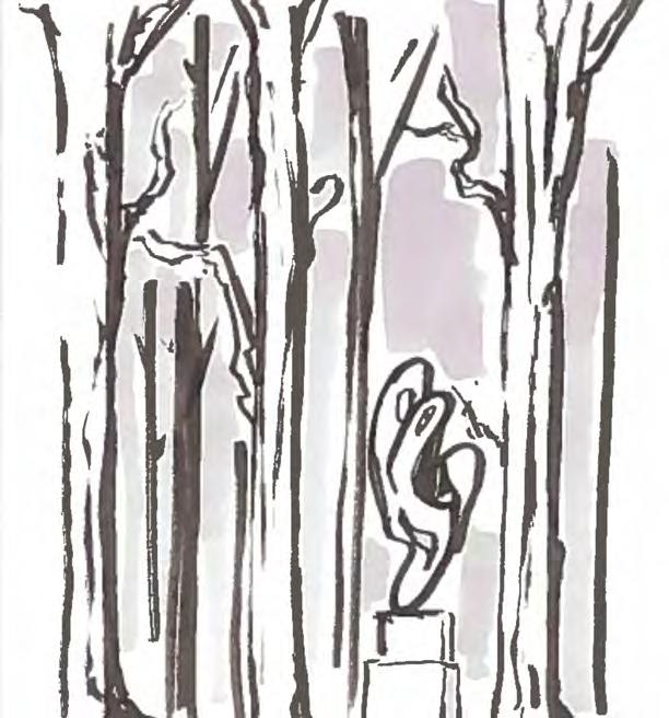
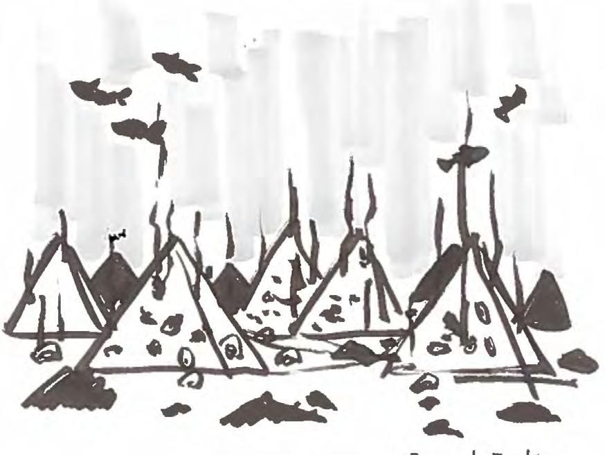
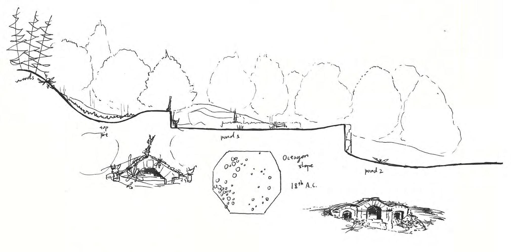
garden visits sketch practices
classic english gardens across the uk year 1 | semester 1 | 2019
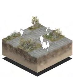
The English garden visits in the first year of undergraduate study is meant to provide the students a close look at the intepretation of design themes and aesthetic interventions of some of the classic landscape designs across the UK. Although some of the approaches are outdated for modern practice, the visits were intended to establish an artisitc pallet for floral designs, geometry, atmospheric designs, and so on, that designers would benefit from. The sketch practices also helped to establish a sense of scale and the means to express design details in early stages of planning.
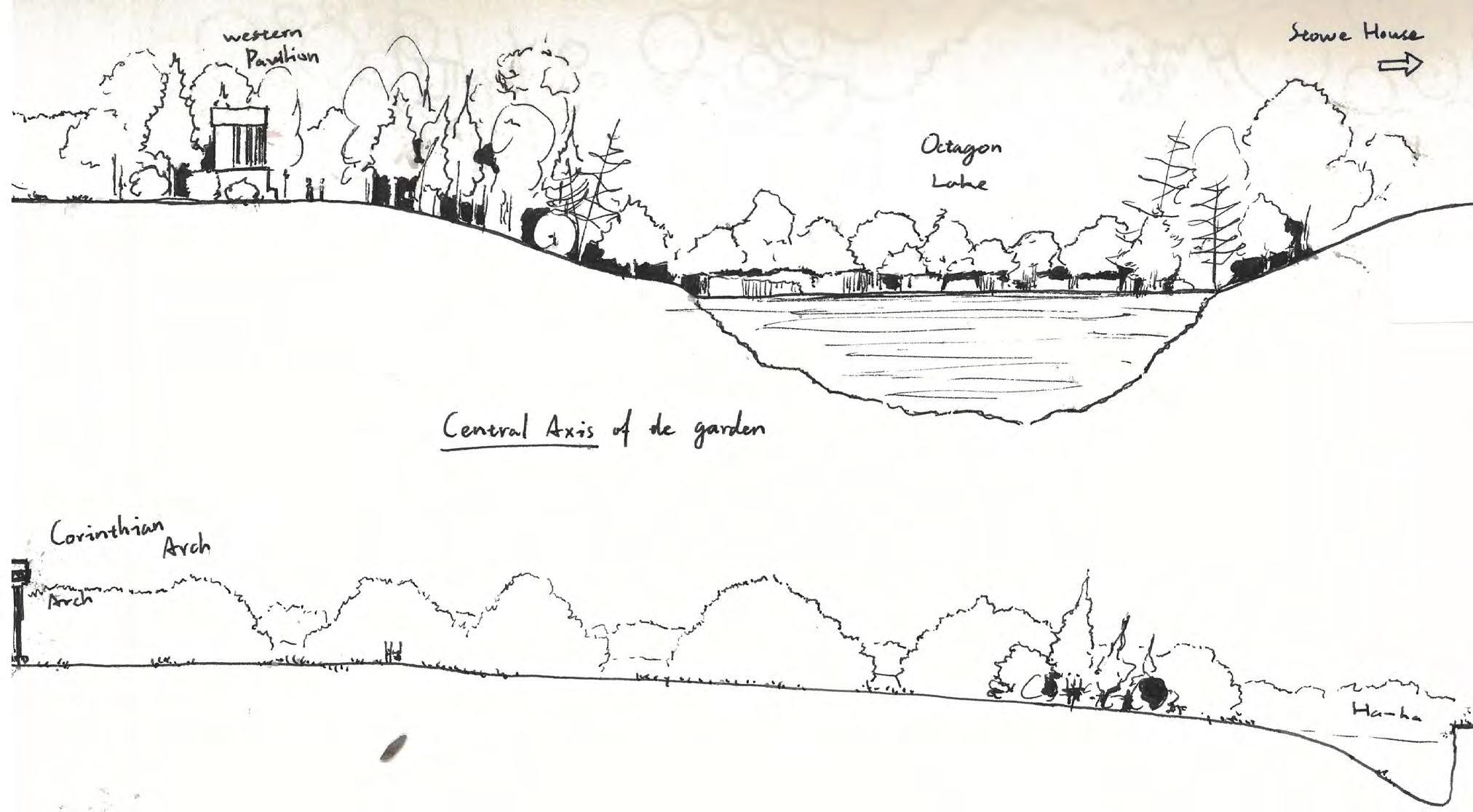
Bramham Park
Fountain Abby & Studley Royal Stowe
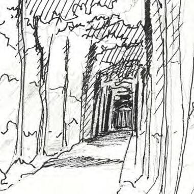
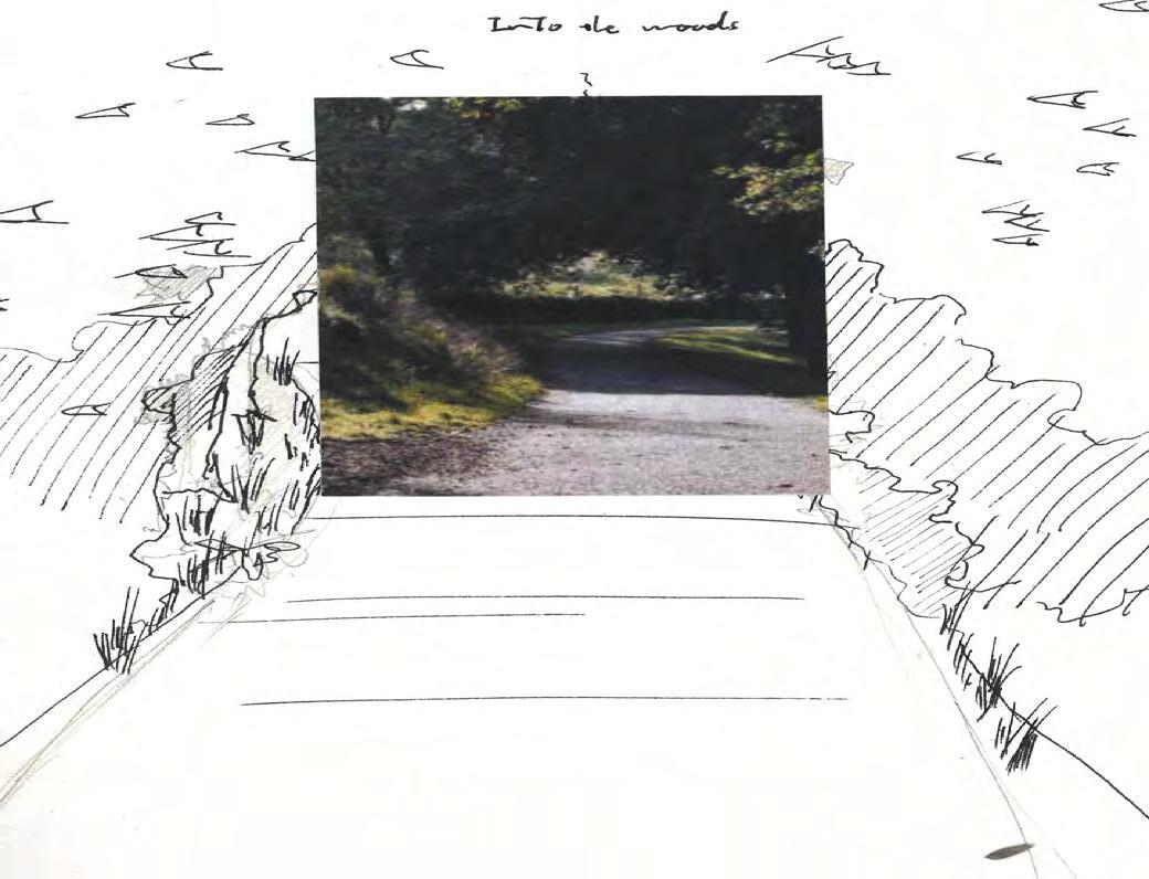
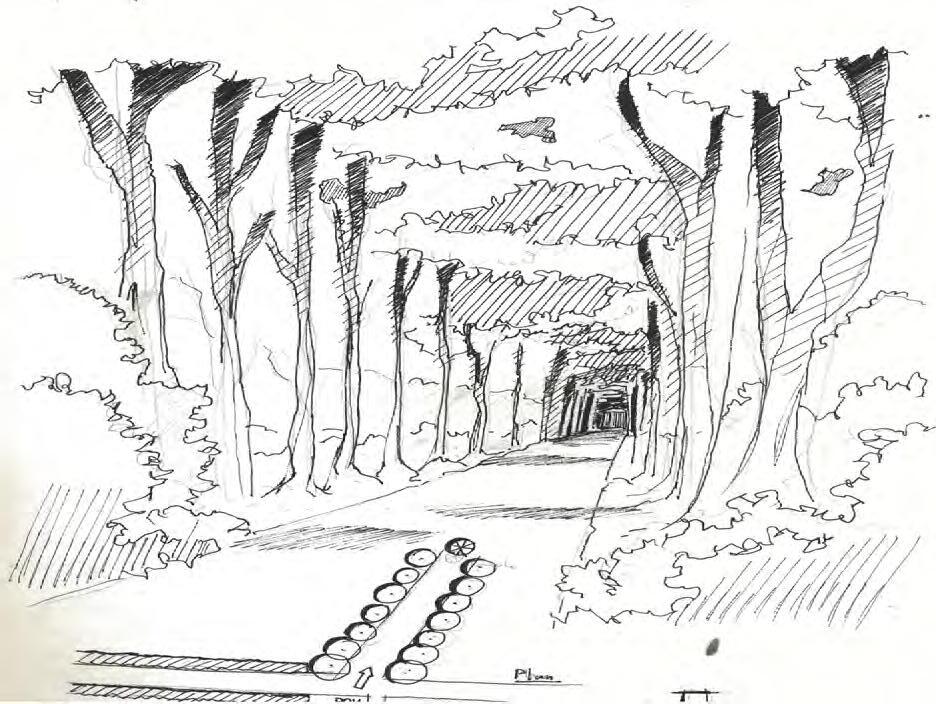
into the woods into the high canopy
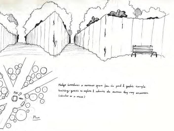
centre of the maze
cascading gardens
darkness in the woods