Planning and Urban Design
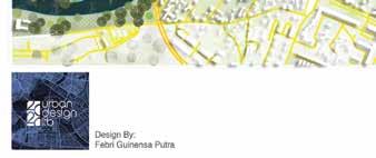
Febri Guinensa Putra
2020-2022 Edition
My name is Febri Guinensa Putra, Graduate Master of Urban Design Bandung in stitut of technology and Profesional Experience Planning and Urban Design | Gis Specialist | Regional Planning | Tourism | Environment

Holla!
2020-2022 Edition
Personal
ParticipantCourseProfessionalDetailsWorksAcademicWorksUrbanDesignCompetition
TABLE OF CONTENT

PERSONAL DETAILS
Inside Studo 45 • Bandung, Province West Java Jun 2017 - Dec 2017
International Course Local Culture and Architectural Design
Autocad Sketchup Lumion Enscape ArcGis Global Mapper Agisoft PIX4D Garmin GPS DJI Drone PhotoshopAdobe IllustratorAdobe InAdobeDesign


Asistant Coordinator Urban Planner -Create regional and environmental scale designs in slum areas with Autocad, -ArcGis, Sketchup, and Lumion -Coordinationsoftwarewithlocal government -Supervising the progress of facilitators -Compiling reports and development studies -Conducting designs with facilitators
TPA Bappenas (2022)
PT. Bumi Matra Indonesia • Bandung, Province West Java Jun 2017 - Dec 2017
Technical Personnel -Helps coordinate data with experts -Creating infographics on the results of studies from experts -Creating presentation designs for Sucofindo clients
PT. Inomata Konsultama • Bandung, Province West Java Jun 2017 - Dec 2017
Team Creative Governance Pangkalpinang City • Pangkalpinang, Province Bangka Belitung Jun 2017 - Dec 2017
As Expert Asisstan Urban Planning and GIS -As an assistant to GIS mapping experts -Analysis and Feasibility study studies -Supporting senior experts in compiling reports -Coordination with clients and field surveys -Mapping aerial photos with drones
Personal DatePlaceof Birth
Deep understanding about Creative Culture and Urban Commons Bandung Institute of Tehcnology - ITB Bandung Agustus 2020 - 2022
Ministry of Public Works and Public Housing, BPPW Province Babel Program KOTAKU • Bangka, Province Bangka Belitung Jun 2017 - Dec 2017
Consultant Freelance • Bandung, Province West Java Jun 2017 - Dec 2017

PT. Andalan Rereka Consultindo • Bandung, Province West Java Jun 2017 - Dec 2017
Comceptual and Critical Thinking Team Work and Communication Time CreativityAdaptabilityLeadershipProblemManagementSolving
Martial Status
Asisstant Senior Professional Assisting experts in preparing data Assisting experts in implementing the WSUD concept Assisting experts in data processing analysis of green open space mapping Coordination with surveyors in conducting surveys Conducting supervision over surveyors Assisting experts in presentations and compiling final reports
Kota Pangkalpinang
Office of Public Works - Human Settlements and Spatial Planning DKI Jakarta Jun 2017 - Dec 2017
Urban Design Lab - Photoshop Masterclass (2020)
Urban Design and Spatial Planning
Computer / Digital Skills
Universitas Komputer Indonesia - Unikom Bandung Agustus 2014 - Oktober 2018
Master’s of Urban Design, School of Architecture, Planning, and Policy Development Current, GPA: 3.67 / 4/00
Indonesian Institute of Urban Designers - Indonesia (Member) | Dec 2021IndonesianPresent

Building Design in Autocad (2022)
Personal Skills
Freelance - Part time -Part-time urban design and 3d simulation -Part-time mapping and aerial photography with drones -Part-time supporting RTRW, RDTR, and RTBL studies -Part-time advanced mapping analysis
TOEFL ELPT ITB (2021)
PT. SUCOFINDO (PERSERO) • Jakarta, DKI Jakarta Jun 2017 - Dec 2017
Urban Design Lab - Photoshop Masterclass (2021)
International Virtual Course - SAPPD ITB and University of Auckland (2021)

Indonesia,IndonesianMoeslimMaleSingle English
Certificates and Achievements
-Use Drone, Arcgis, and Autocad, in determining the results of field surveys and analysis -Supporting data and field surveys with teams and personnel expert -Conducting a feasibility study for sea transportation of Merak-bakauheni -Conducting analysis studies in the development of the port of Merak-bakauheni
Internship Surveyor & Gis Analysis


-Use Arc-gis, GPS, and Global mapper, in conducting map analysis and initial survey -Making presentations, reports, and analyzing -Cooperating with the team and making the achievement of the final target -Conducting field surveys and coordinating with related agencies
Young Entrepreneurs Association - Bangka Belitung (Member) | Sep 2021 - Present
Geospatial Webinars Series (2020)

Coordinator Planning, Urban Design & Architecture -Design projects that have been built are landmarks, pedestrian paths, parks, and commercial areas, generated from the design -Support urban design and architectural design -Explain the design to the mayor of Pangkalpinang City -Coordinate with local governments regarding design implementation -Map aerial photos with drones
Febri Guinensa Putra
WorkEducationExperience
WEBINAR PLUSCOURSE VOL 7 (2021)

Papua Mapping Drone Collaboration with Bangka Belitung University Bustan Studio Architectural and Urban Design (2019)
:::::::
-Use ArcGIS and 3D Arcgis in flood susceptibility analysis -Assisting experts in conducting advanced mapping analysis -Supporting experts in data collection and final analysis -Advanced mapping analysis training, related to flood disaster -Conducting field surveys and coordinating with related agencies

Planning and Urban Design
Design Approach + Method (2020)


As Expert Asistant GIS -Use ArcGis and excel in processing land capability data -Supporting spatial data and analyzing the land capability unit of Palu City -Preparing presentations of experts -Making final reports, and coordinating with related parties
The University of Auckland Agustus 2021-Agustus 2021
The Instituation Engineers Indonesia - Kota Pangkalpinang, Indonesia (Vice-Chairman) | Feb 2021 - Present

Bachelor’s degree Engineering Departement Urban and Regional Planning GPA: 3.29/4.00
LanguageNationalityReligionGender
03 Februrary 1996
Indonesian Association of Planners - Indonesia (Member) | 2018 - Present
Internship and Trainings
Surveyor Assistant
Urban Social Forum-Solo ArcgisHardwareEntrepreneurship-UNIKOM(2018)(2018)Computer-UNIKOM(2017)Training-PT.InomataKonsultama (2017)
Certificates and Achievements
PT. LAPI ITB • Bandung, Province West Java Jun 2017 - Dec 2017
PROFESSIONALWORKS
Location: Opas Indah, Taman Sari, Pangkal Pinang City, Bangka Belitung Islands
TheWinning).emergence
Year: 2020
- Imam Sodikun S.Ars
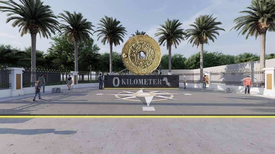
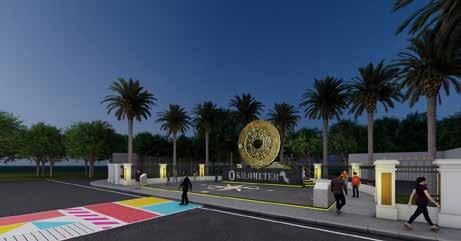
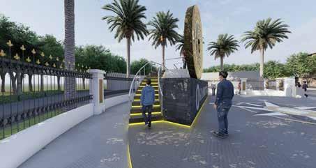
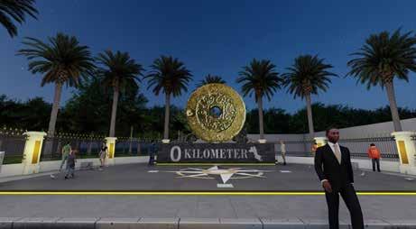
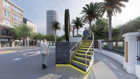
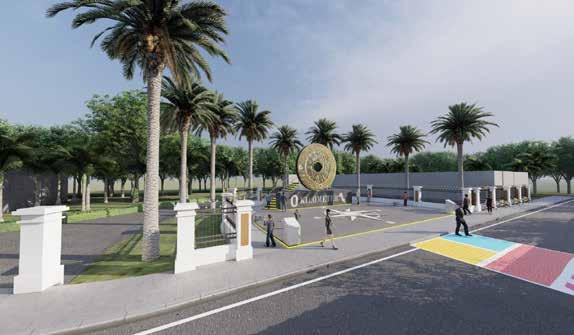
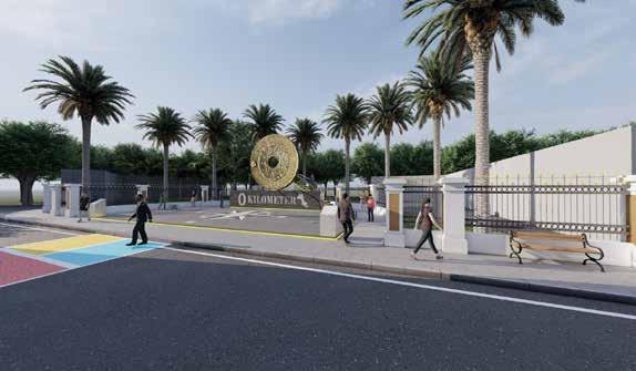
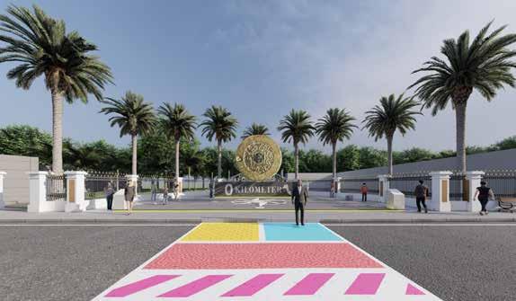
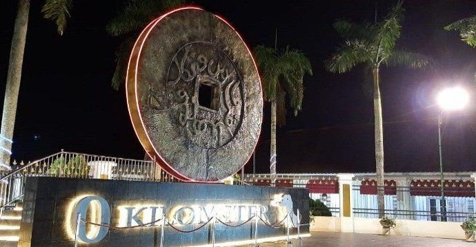
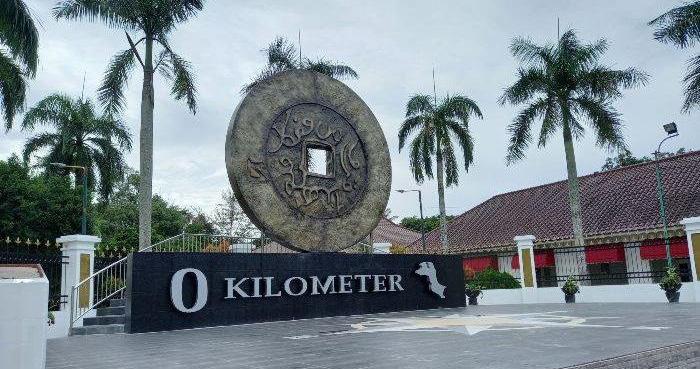
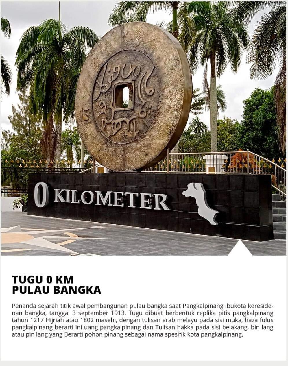
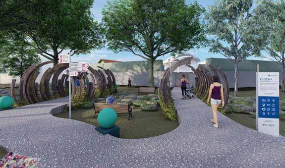
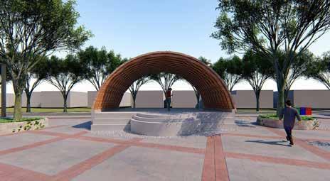
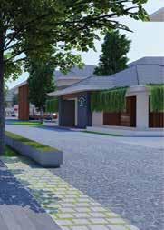
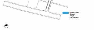
Name: Tugu 0 Kilometer Pangkalpinang
of the new icon for the city of Pangkalpinang was specially designed as a form of identity for the city of Pangkalpinang, this has been planned for a long time, but the implementation of the new development will be carried out at the end of 2021.
The front of the coin, facing the street, reads Arabic Malay “Haza Falus Pangkalpinang,” which translates to “This is Money (Kongsi) from Pangkalpinang,” while the back, facing the Mayor’s official house, reads Hakka “Bing Lang Gong Si (Pin Long). Kung Se,” which translates to “Development and progress significantly.”

Tugu 0 Kilometer Kota Pangkalpinang
- Febri Guinensa Putra S.T
Project Name
According to historians and culturalists, the Zero Kilometer Monument was established on September 3, 1913, when Pangkalpinang was designated as the capital of the Bangka Residency and became the center of government administration (bestuur), replacing Mentok City, which became the administrative center of tin mining (tinmijn) with the establishment of BTW (Bankatin
- Suci Chairunissa S.Ars
Planning and Urban Design

Function Analysis Principle Design
The Zero Kilometer Monument, Picis Van Pangkalpinang, is shaped like a coin. The currency was used in Pangkalpinang City in 1217 Hijri, or 1802 AD. This monument has a diameter of 4.8 meters and weighs around 600 kilos.
Client: Pemerintah Kota Pangkalpinang
Landmark, Monument, Icon
Perspektif Image
Implementation Design
Planning and Urban Design - Febri Guinensa Putra S.T
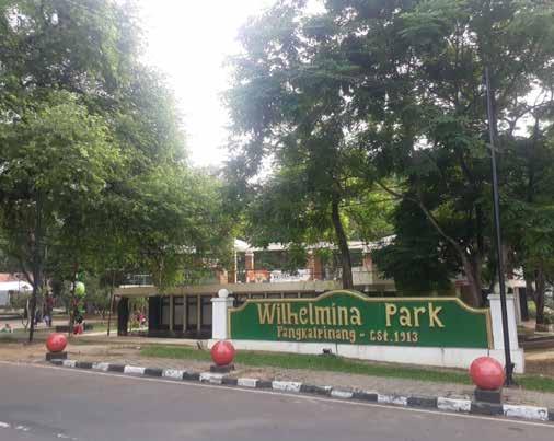
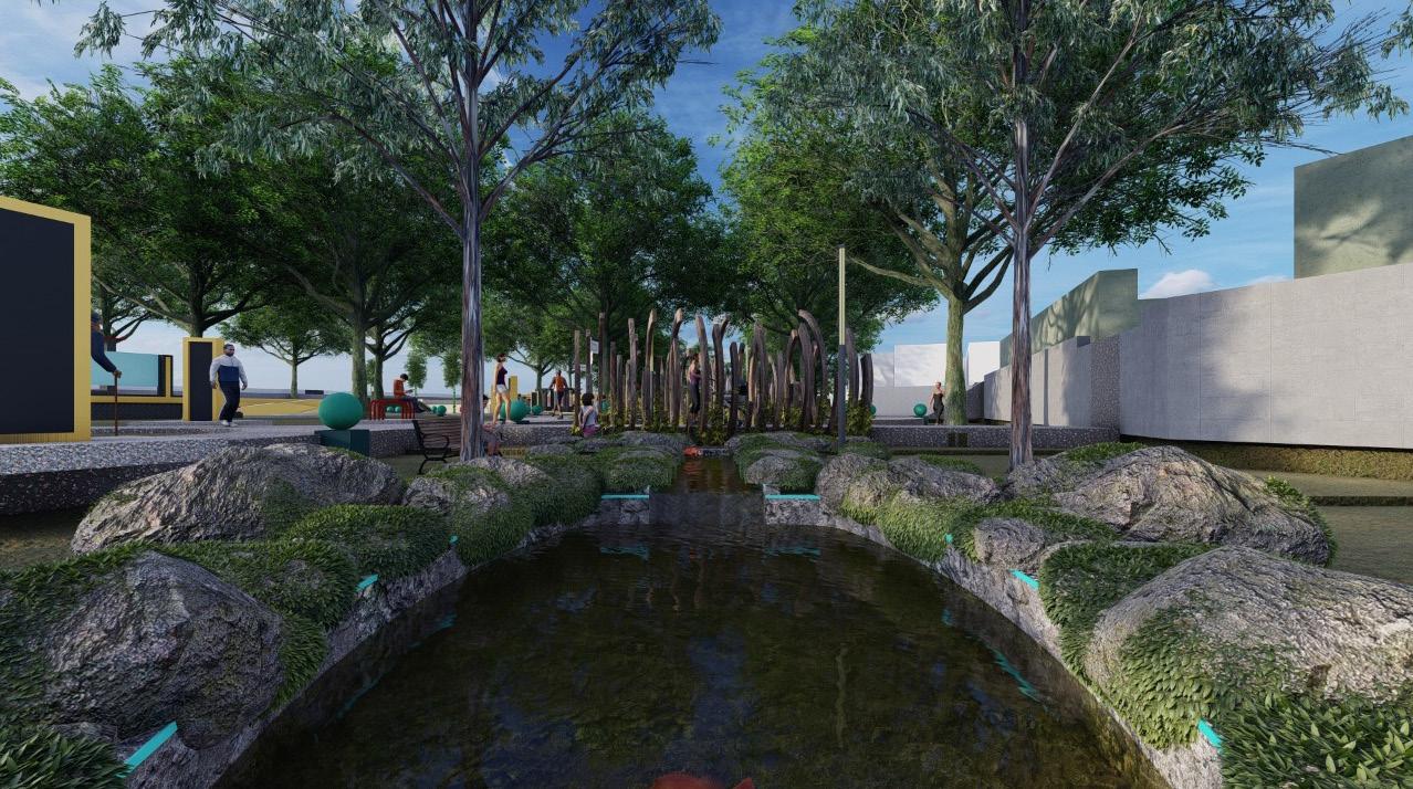
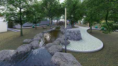
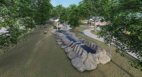
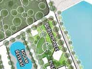
Location: Taman Wihelmina Park, Kota Pangkalpinang
Project Name Function Analysis Principle Design
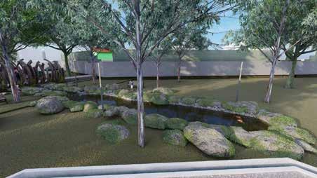
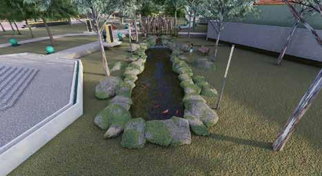
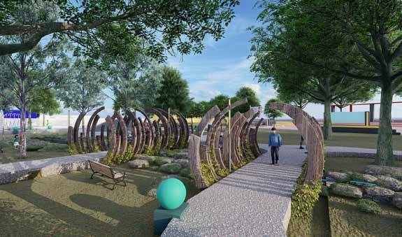
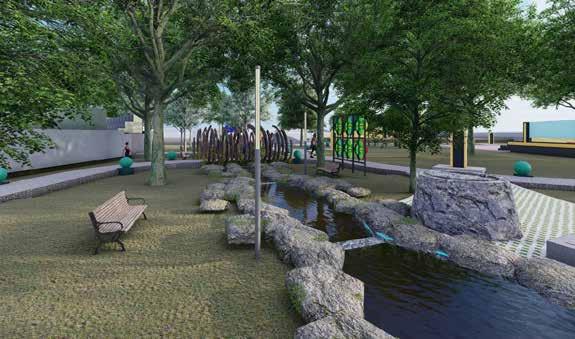
Year: 2020 Pond Garden
Design Kolam Taman Wihelmina Park
The design of the wihelmina park fish pond which is used as a water tourism recreation area, the design is designed to be useful for reviving a pond that was previously unused, and then a design simulation is carried out, by providing water flow, and also using garden lights in the fish pond. On the side of the pond is used as a place for water recreation with fish which can also be used as a reflection of health.
Name: Kolam Wihelmina Park
Client: Pemerintah Kota Pangkalpinang
Perspektif Image
Project Name Function Analysis Principle Design
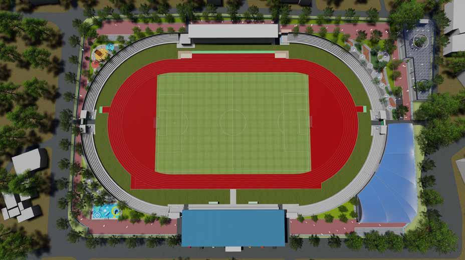
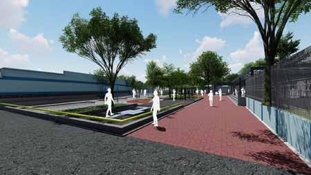
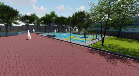
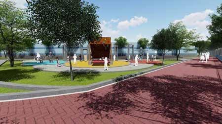
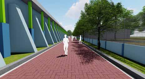
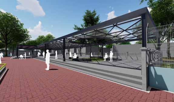
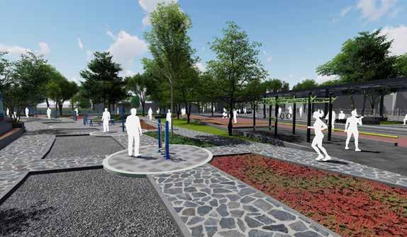
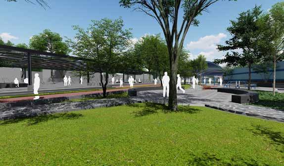
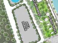
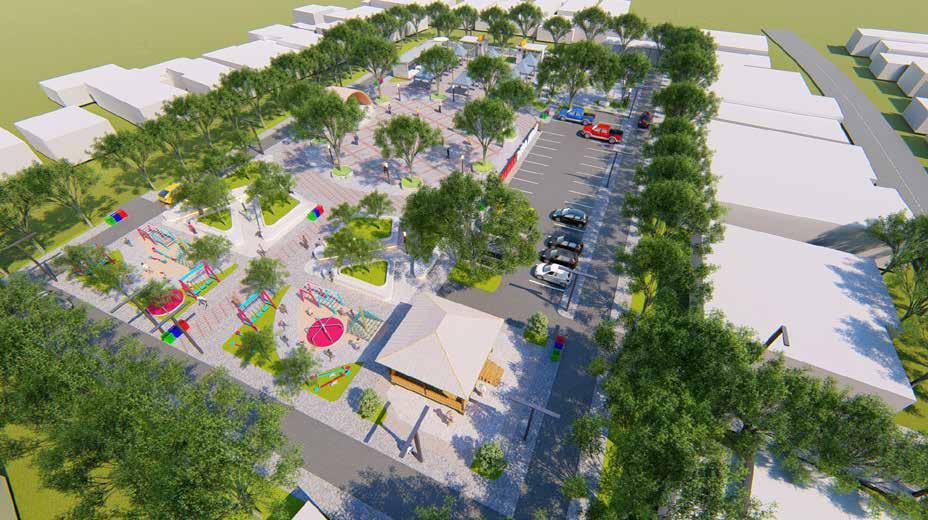
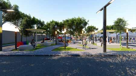
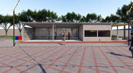
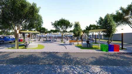
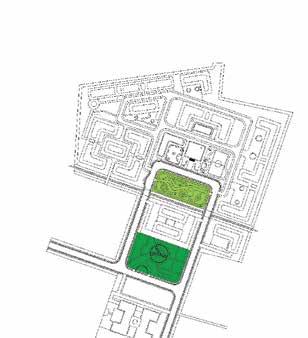
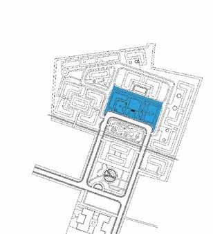
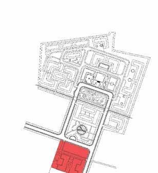
As for the layout made at the Depati Amir Stadium, it was done by creating a space outside the stadium that could be used for facilities like public parks, sports centers, and galleries. The arrangement will be carried out later with the help of the CSR program and the Pangkalpinang city government budget.
Client: Pemerintah Kota Pangkalpinang - Dinas Pemuda dan OlahLocation:raga Stadion Depati Amir, Kota Pangkalpinang
Year: 2020
Depati Amir Stadium is a national-level stadium that is the flagship stadium of Pangkalpinang City. was formed on August 6, 2005. Depati Amir Stadium which stands on an area of 2 hectares has a seating capacity of between 12,000 to 15,000 people.
Name: Masterplan Stadion Depati Amir
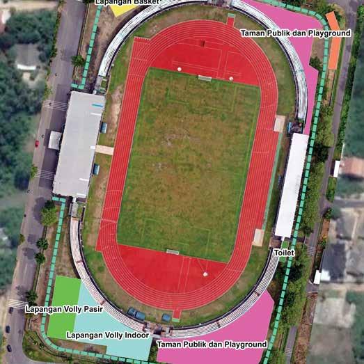
Masterplan Stadion Depati Amir
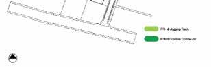
Open Space, Green Area, Jogging Track, Recreation Park Planning and Urban Design - Febri Guinensa Putra S.T - Suci Chairunissa S.Ars - Imam Sodikun S.Ars
This area has a jogging track with high-quality materials in addition to being a soccer facility. Depati Amir Stadium will host national football clubs from Bangka Belitung and Pangandaran, as well as competitive foreign teams and regional and national football competitions.
Perspektif Image
Client: Program KOTAKU, BPPW Provinsi Bangka Belitung
Year: 2020
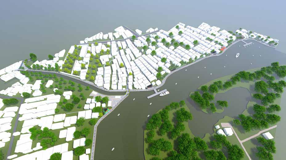
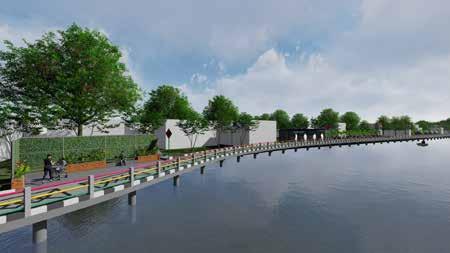
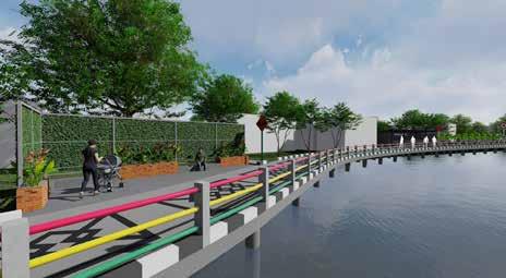
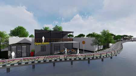
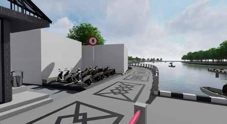
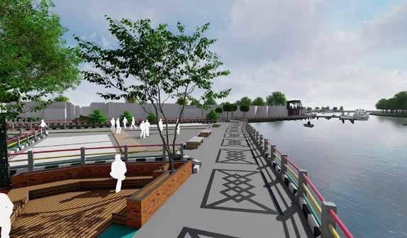
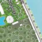
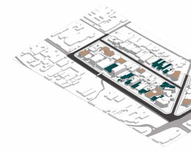
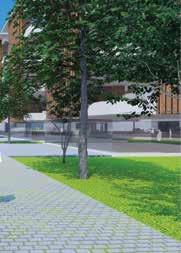
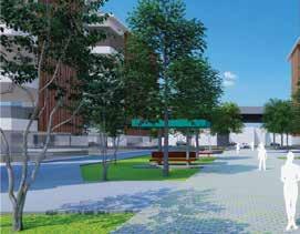
There is a river flow in the neighborhood of the lovely village of Opas, as well as a lot of trade and services. The main issue in the kampung opas indah area is flooding, which affects the settlements as well as slum communities. In this case, the city of Pangkalpinang’s government partnered with KOTAKU as well as urban planning and architectural specialists to redesign the region of the lovely village of Opas.
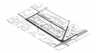
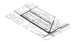
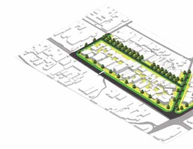
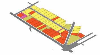
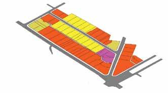
Masterplan Penanganan Kumuh Skala Kawasan Kampung Opas
Name: Penataan Kawasan Kumuh Opas Indah
Jalan Inspeksi Skala Kawasan, Parkir, Ruang Terbuka Publik, Foodcourt Planning and Urban Design - Febri Guinensa Putra S.T - Suci Chairunissa S.Ars - Imam Sodikun S.Ars
Function Analysis
Principle Design
The land allocation in the Opas Indah area consists of high density villages, and Kampung Opas Indah is a community located in the center of Pangkalpinang. The possibility for developing a village with a riverfront idea in the lovely opas village location is enormous.
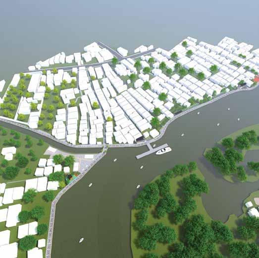
Location: Kampung Opas Indah, Kota Pangkalpinang
Project Name
Perspektif Image
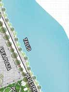
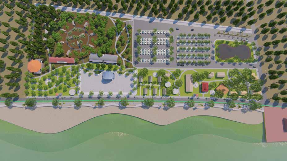
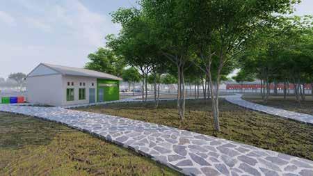
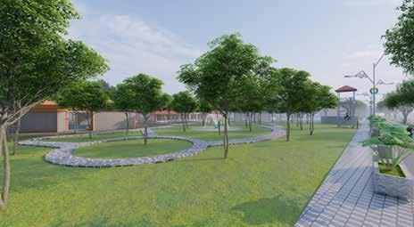
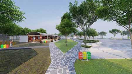
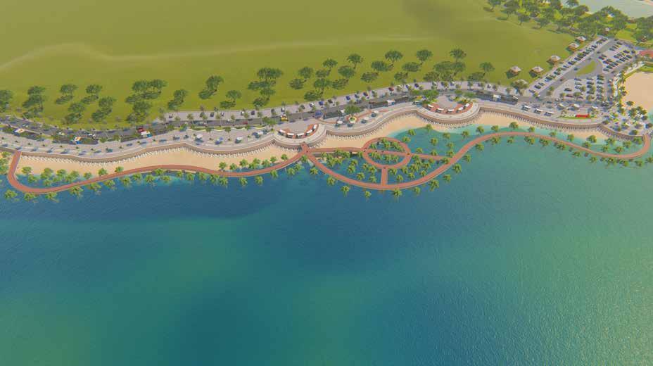
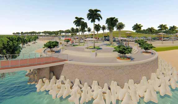
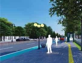
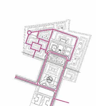
Pasir Padi Beach is a popular tourist destination, particularly among the residents of Pangkalpinang City and its environs. Tourist visits peak at 6,000 persons each day during the vacations. In addition to taking in the stunning natural beauty of the beach. Swim, play kites, beach volleyball, soccer, motorcross, or simply enjoy the freshness of young coconut ice in the center of the beach wind are all options for visitors.
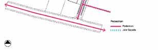
Pedestrian Path, Talud, Open Space, Parking Area, Retail and Shooping Center
Pasir Padi Beach is located in Temberan Village, approximately 8 kilometers from Pangkalpinang City’s core. In Pangkalpinang City, it is a prospective tourist attraction. The white sand beach of Pasir Padi stretches for 2 kilometers. Pasir Padi Beach is unique in that it has a sloping beach structure and dense sand contours that make it easy to walk on and can even be traversed by two-wheeled, four-wheeled, and tronton-type trucks.
Function Analysis


Year: 2021
Planning and Urban Design - Febri Guinensa Putra S.T - Suci Chairunissa S.Ars - Imam Sodikun S.Ars
Cv.Company:Arycons
Masterplan Waterfront Pantai Pasir Padi

Principle Design
Project Name
Client: Pemerintah Kota Pangkalpinang
Location: Pantai Pasir Padi, Kota Pangkalpinang
Name: Penataan Pesisir Pantai Pasir Padi
Perspektif Image

Project Name
- Suci Chairunissa S.Ars
- Imam Sodikun S.Ars
Year: 2021
Planning and Urban Design
Retail Center, Building
Principle Design
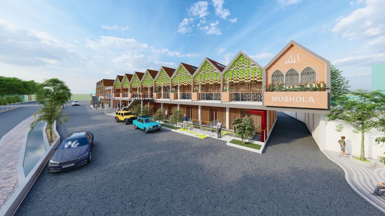
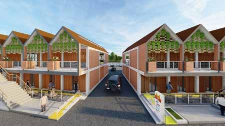
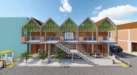
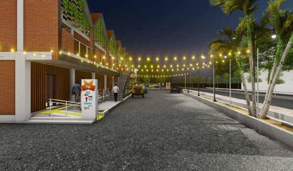
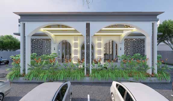
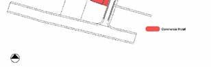
With a minimalist idea and a touch of the facade with wooden embellishments, the Girimaya Shophouse with a Minimalist Concept developed by the Pangkalpinang City Creative Expert Team can add to the impression of a modern minimalist list. there is a small prayer room and a staircase connecting the shophouse blocks which are integrated between the 1st and 2nd floors.
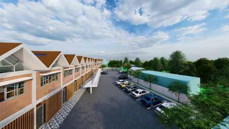
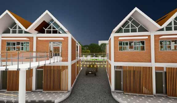
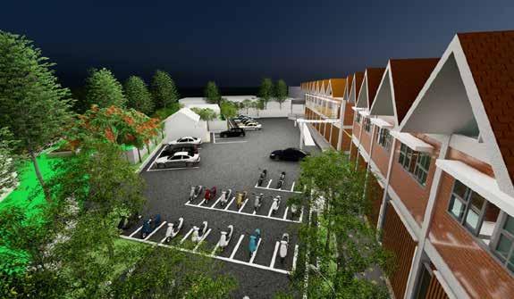
Name: Penataan Retail Shooping Center
Function Analysis
Redesign Kawasan Retail Kota Pangkalpinang
Location: Kecamatan Girimaya
The Girimaya shophouse is located in Girimaya District and serves as a trade and service center for Pangkalpinang City. The shophouse on the Girimaya road row was previously an asset of the Pangkalpinang City government, but it was deemed unfit for habitation and was repurposed as a trade and service center. As a result, the Pangkalpinang City Government set aside a specific budget for the Girimaya Ruko’s rehabilitation.
Client: Kota Pangkalpinang
- Febri Guinensa Putra S.T
Perspektif Image
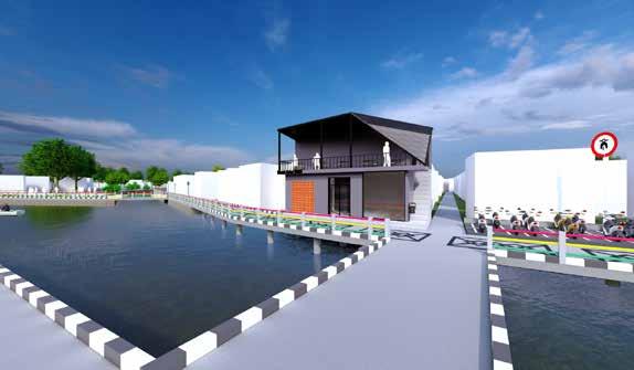
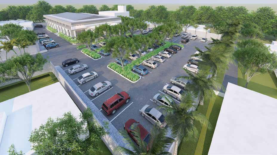
Location: SMPN 5 Pangkalpinang
The site is located at 2° 8’2.56”S and 106° 5’48.22”E in the Rangkui District, from the north of Jalan Bathin Iso to the south of SMPN5, from the west of Jalan Pahlawan 12 to the east of Jalan Dewi Sartika.
Planning and Urban Design - Febri Guinensa Putra S.T - Tiara AratakaCompany:S.Ars+Partners
Year: 2021
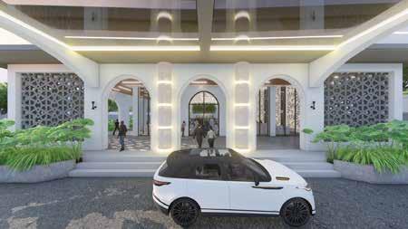
Project Name Function Analysis
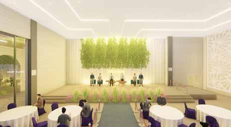
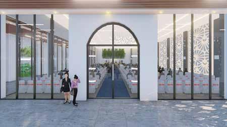
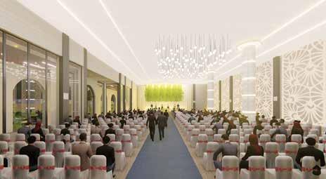
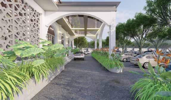
Name: Wedding Hall
Client: Tika dan Restu
WeedingConventionHall
Gedung Weeding Hall
With the partition of unoccupied land blocks, rented house land, existing house land, and house land with negotiation status, the site area footprint is 7294,09 m2.
Principle Design
Perspektif Image
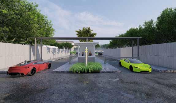
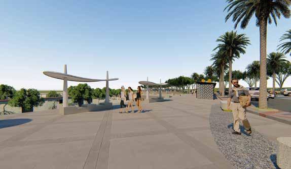
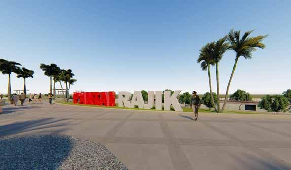
Client: Pemerintah Desa Rajik
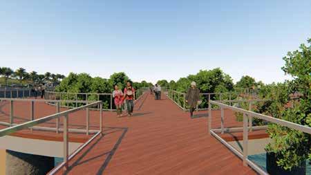
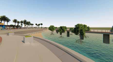
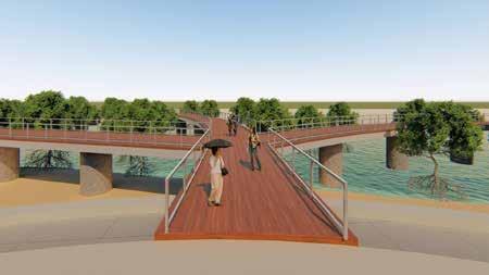
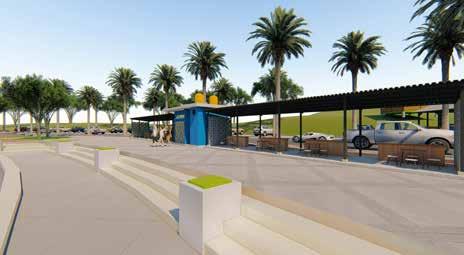
Plaza, Skywalk, Pedestrian Path, Parking Area, Open Space, Foodcourt, Sheating, Viewing Deck
Location: Desa Rajik, Kabupaten Bangka Selatan
Rajik Settlement is a village in the Bangka Simpang Rimba Regency of the South Bangka Regency of the Bangka Belitung Islands, Indonesia. Rajik Village has the potential to be improved,
Project Name Function Analysis
Principle Design
Planning and Urban Design - Febri Guinensa Putra S.T
Masterplan Waterfront Rajik Village
Year: 2021
Particularly with regard to the beach, which may serve as a new tourist attraction for Rajik Village and, of course, as a new source of revenue. Of course, there is a need to encourage the Rajik village to realize its potential by creating a planning idea or master plan that may be used as a new tourist emblem for the Rajik village.
Name: Penataan Pesisir Pantai Desa Rajik
Perspektif Image
- Febri Guinensa Putra S.T
Principle Design
Name: Design Taman Terbuka Desa Jeriji
Year: 2021
- Imam Sodikun S.Ars
Jeriji Village
Client: Pemerintah Desa Jeriji
Masterplan Public Space
Location: Desa Jeriji, Kabupaten Bangka Selatan
Project Name
Stage, Culinary Night, Pondopo, Open Space, Park, Sheating Area, Parking, Planning and Urban Design
- Suci Chairunissa S.Ars
Toboali District, South Bangka Regency, Bangka Belitung Province Site Area: 0.58 Ha
Function Analysis
Site JerijiLocationVillage,
Perspektif Image
ACADEMICWORKS
Principle Design
4. The LRT plan is passed and it is planned to be integrated by technology-based public transportation facilities (SAUM)
The building which is a cultural heritage is maintained in terms of the building, but the function adjusts to the land use plan Rehabilitation
6. Pedestrian path Ir. H. Juanda has complied with the standard criteria of shopping street
Project
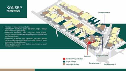
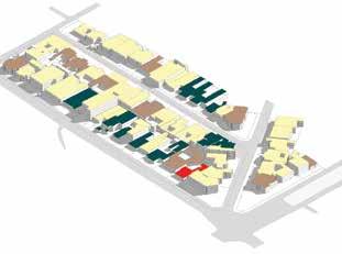
Rehabilitasi Cagar Budaya Preservasi Redevelopment Rehabilitasi Non Cagar Budaya
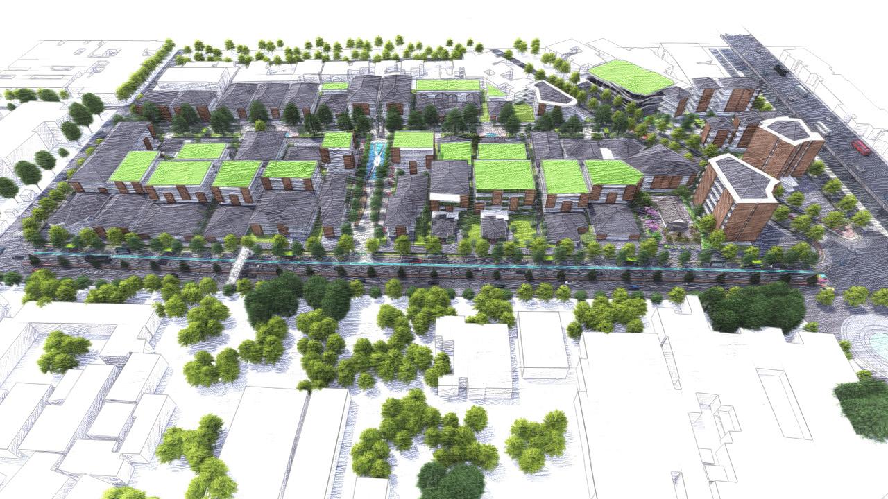
Vision Reimagining Dago Villas into an integrated heritage shopping street.
Mission Optimizing the Theme for Area Management Based on the detailed spatial plan directions for Cibeunying as a Shopping Center. Making shopping street inclusive through the realization of a space that is disability-friendly and proportionate to the human scale.
Making a sustainable shopping street by applying the biophilic concept to bring nature to the area in the form of form, analogy, and nature. Integrating the Transportation System in the Area with the Transportation System Plan in the City of Bandung Aligning buildings and the environment in the shopping street area with heritage characters.
3. Having a residential character as a residential villa
Buildings that do not support the character of the area are demolished (destruction)
1. Have a corner building
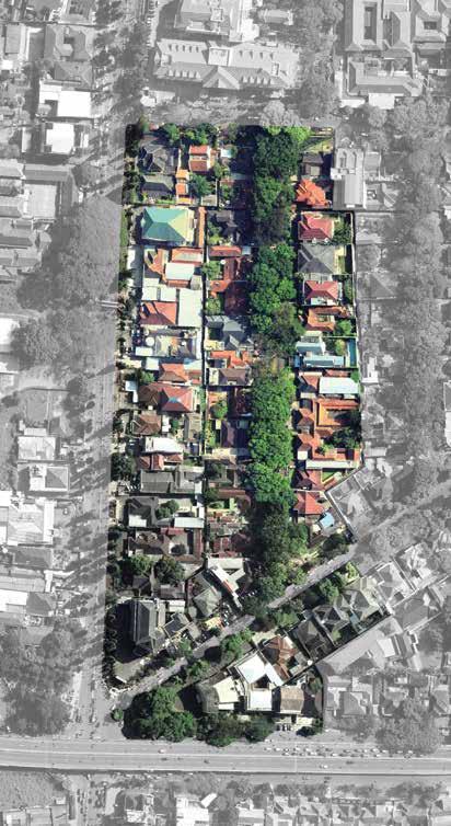
IntroductionScopeofRegion
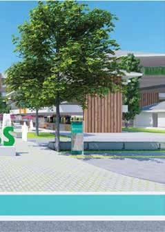
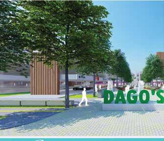
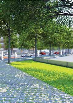
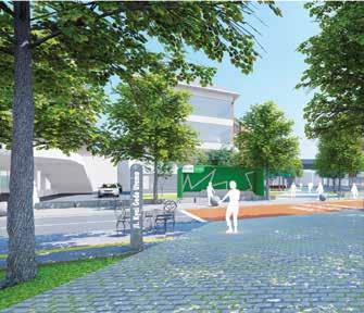
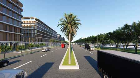
Dagoss Shopping Street Name
Potential
Non-cultural heritage buildings that have a colonial character, partially preserved, and partially reconstructed Redevelopment
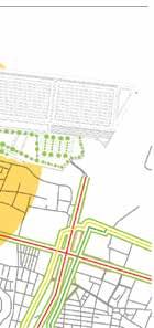
As the region ages in Indonesia, irregular areas appear, economic productivity declines, experiencing environmental degradation, urban heritage is damaged, and not a few areas have decreased location value. The city of Bandung is one of them, especially the corridor area of Jalan Ir. H Djuanda, which is currently dominating, has changed its function as one of the centers of activity and trade activities in the city of Bandung.
Urban Design Studio 1
preservation
2. Has 11 cultural heritage buildings
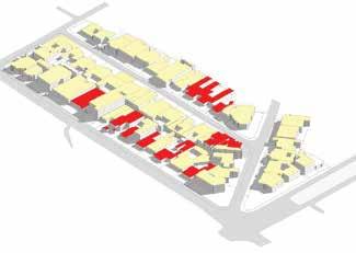
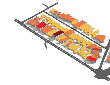
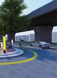
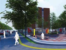
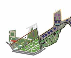
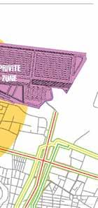
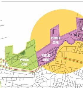
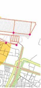
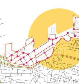
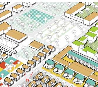
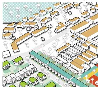
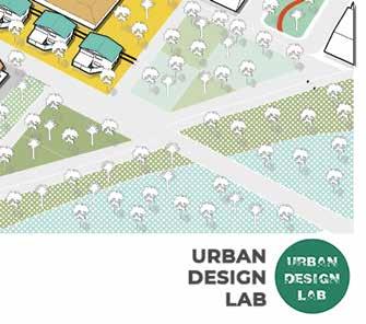
Design Commercial Dago Shooping Street DagoSS, Mixeduse Building, Commercial Area, Pedestrian Path Connection, Landmark Febri Guinensa Putra Doddi Septian Riyad FazaMuntazerySyamilMaulanaMumtazMustaidGhilman
5. It is a trade & service area
Function Analysis
Massing and Building
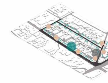


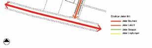
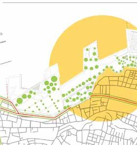
Penanda Rambu Lalu Lintas Penanda Indentitas Bangunan Pemadatan Temporary Sign Penempatan Penanda Belum Sesua Ruang Terbuka Publik Ruang Terbuka Pr vat Element Analysis


Land Use Preservation OpenSignageSpaceLinkage System n & jasa kan an Pola Ruang eruma a Perdaga ga SPU Pendidik SPU Kesehata Eksisting Arter Pr me (J Surapa i) Ko ek or Pr me J Ir H D uanda Loka (J Hasanudd n J Kya Gede J D pa ukur Akses eks st ng Akses rekomendasi JPO Cagar Budaya Non Cagar Budaya Karakter Cagar Budaya 1 Lant ai 2 Lant ai 3 Lant ai 4 Lant ai


Perspektif Image


Apartement, Open Space, Park, Commercial Area, Pedestrian Path, Sport Center Febri Guinensa Putra Khairul Syarif Pramudito Riyad AmeliaMaulanaPandani
Function Analysis

Principle Design


MisionVision
Urban Design Studio 2
- Creating a pedestrian -friendly area - Creating an environmentally friendly area with a low carbon footprint - Creating an area with easy access


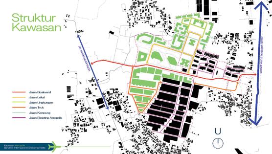
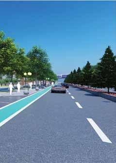
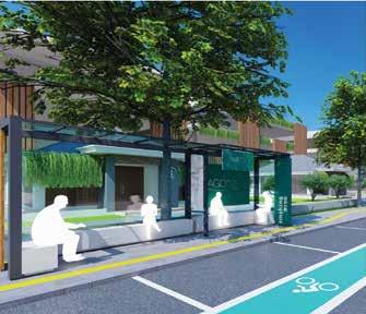
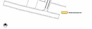
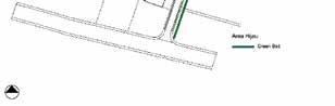
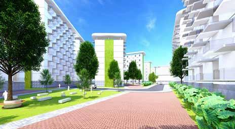
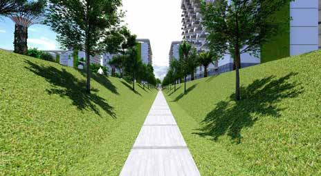
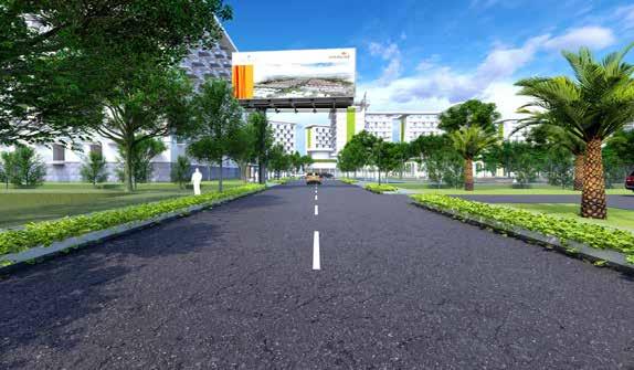
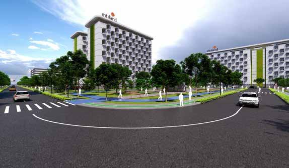
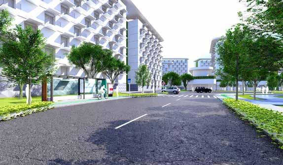
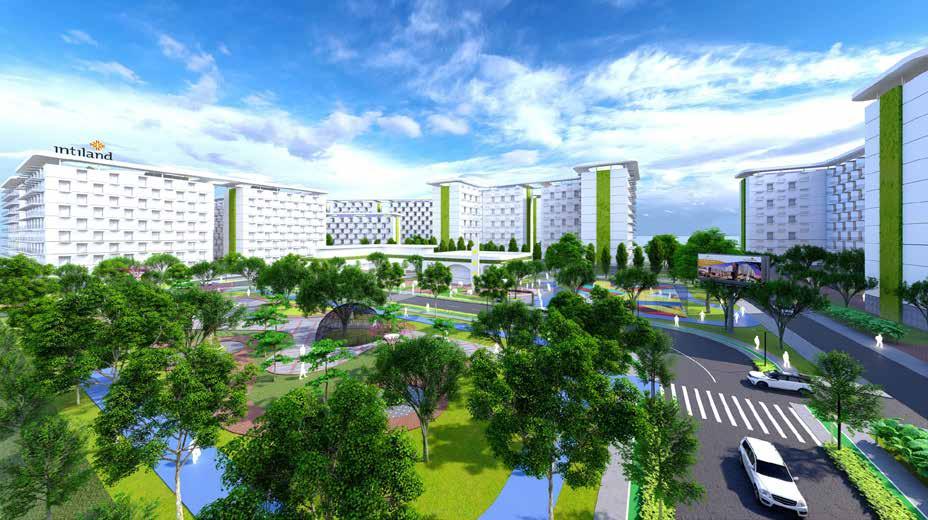
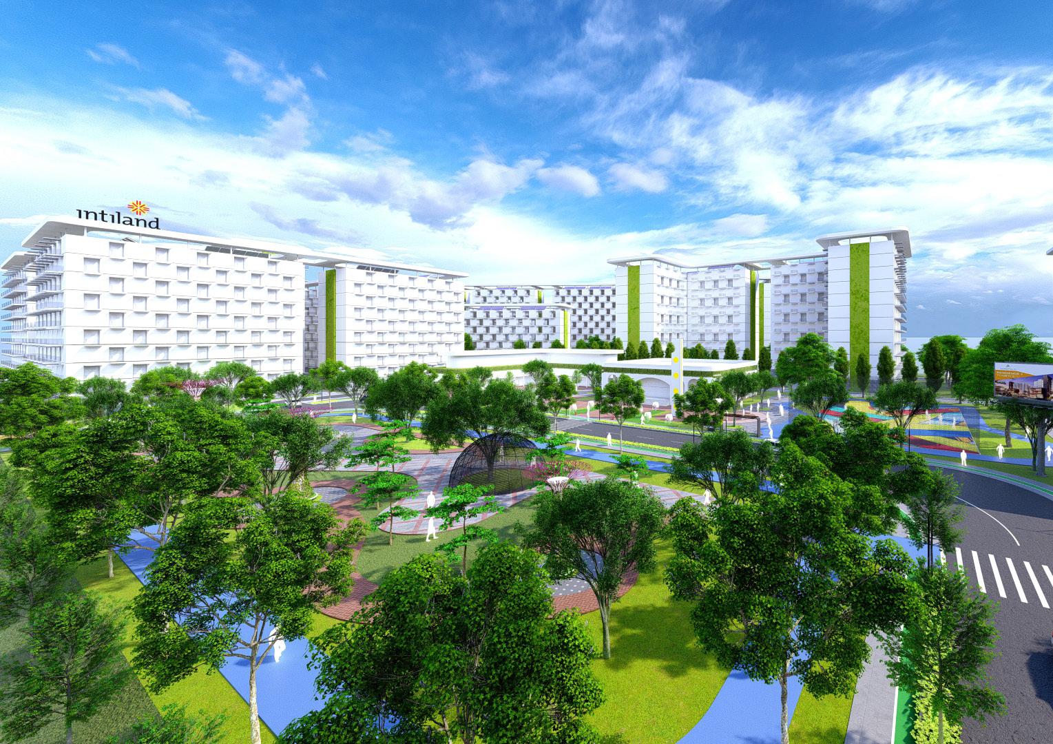
Design Aeropolis Block C PT. INTILAND

“Realizing Aeropolis as a livable Neighborhood that is integrated with sustainable regional economic activities”

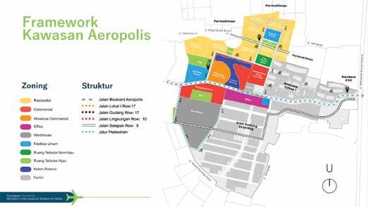
- Fulfilling residential needs that respond to the tropical climate for economic actors in the Soekarno-Hatta Airport area and its surroundings
- Providing supporting facilities for adaptive and resilience areas
- Creating a business-based area that supports airport activities.
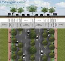
6.0 mm1.2m1.3 m0.5 m0.5 m1.2 m1.3 Jalan KendaraanSepedaJalurWayKavling KavlingPotongan Jalan Jalan Lingkungan Jalur 10.0 mm1.0m1.2m1.3 m1.3m1.2 Jalan KendaraanPlanterSepeda SepedaJalurKavling KavlingPedestrian Way
- Providing green open space that integrates between blocks in Aeropolis.


Project Name


Aeropolis PT. INTILAND

Circulation Pedestrian Way Green Belt Residential Analysis
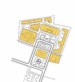
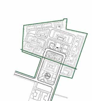
Element
Commercial Public Facilities Public Space
Perspektif Image
Project Name Function Analysis
International Virtual Course ITB with Auckland University
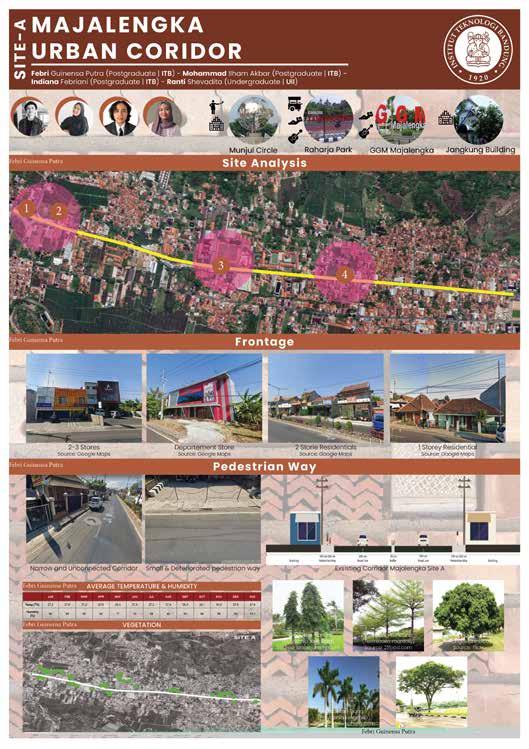
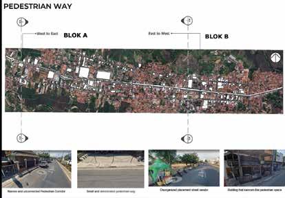
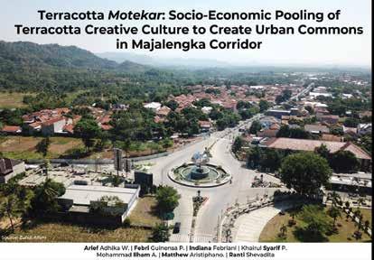
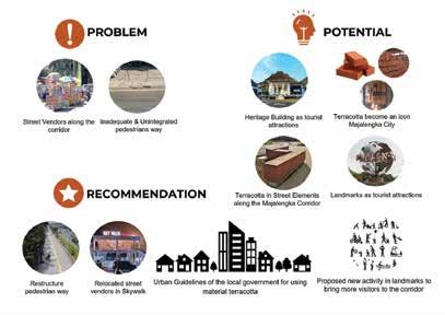
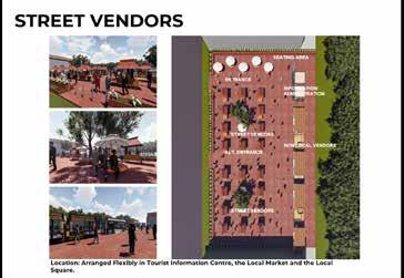
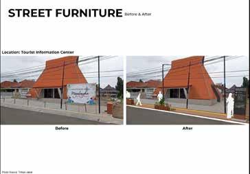
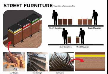
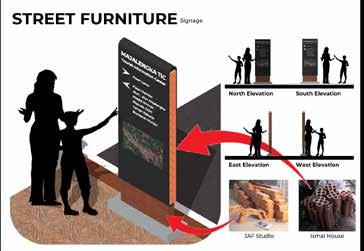
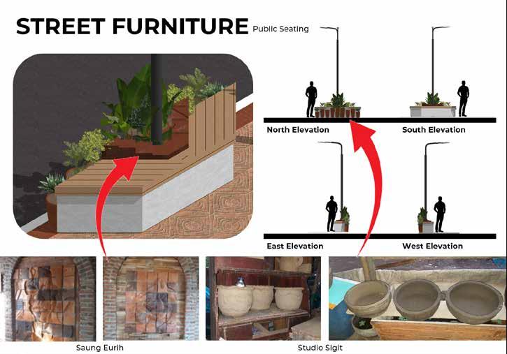
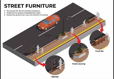
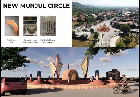
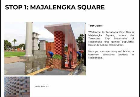
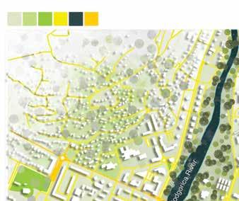
Terracota, Majalengka Corridor Pedestrian Path, Landmark, Frontage, Foodcourt, Public Space, Street Furniture Team Majalengka Corridor
Principle Design
Perspektif Image
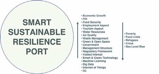
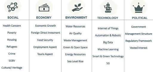
Sintesa Driving Forces
3. Reducing the negative environmental impacts of regional operations and development.
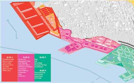
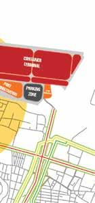
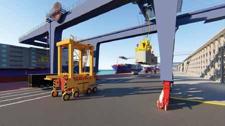
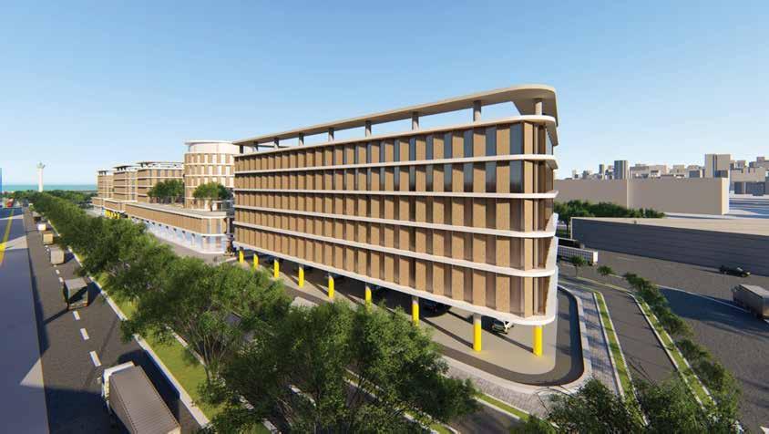
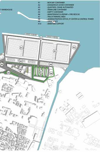
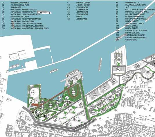
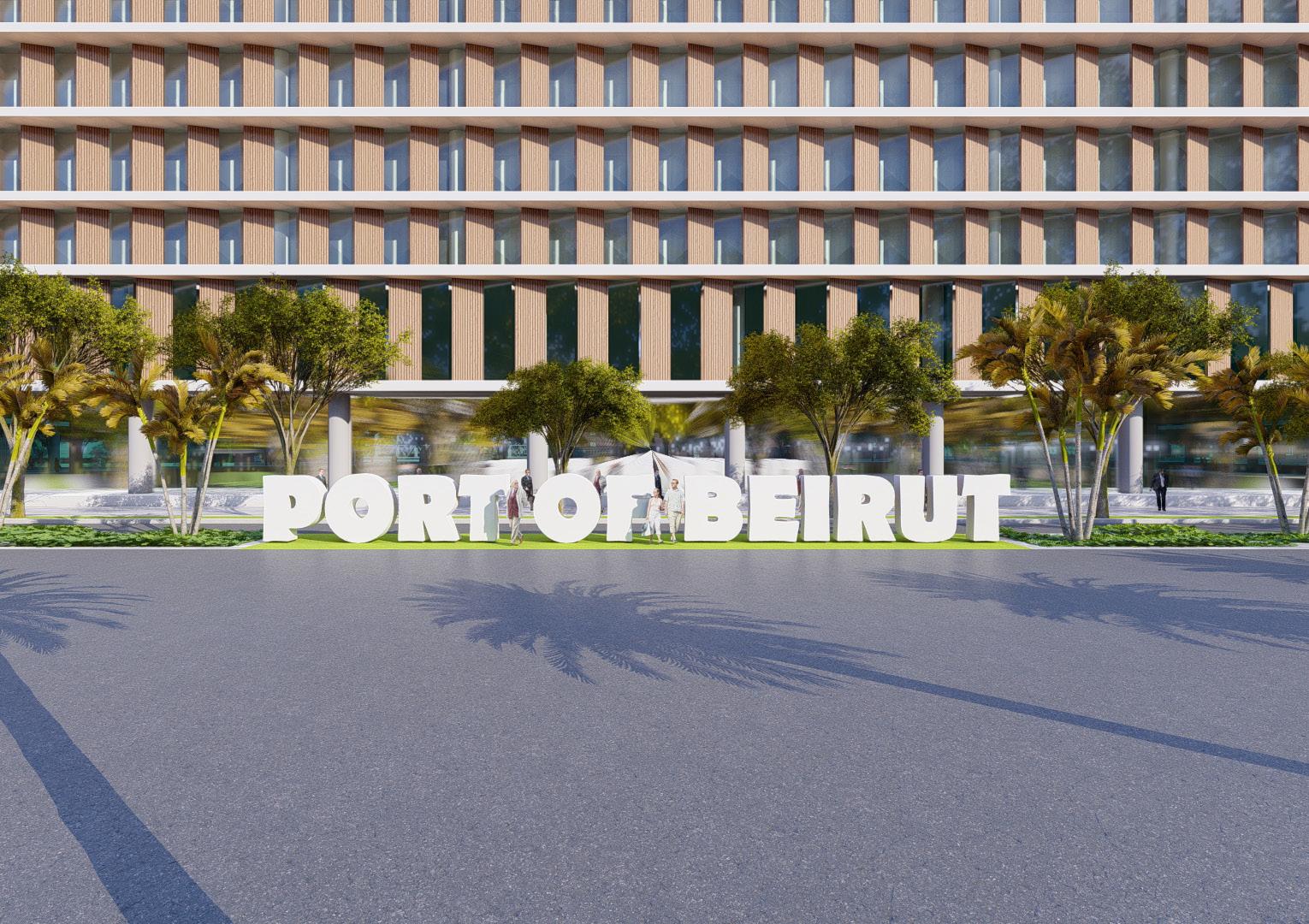
Port of Beirut Renewal
Febri Guinensa Putra Faza TatangMuntazeryGhilmanMustaidMarshelino
Toward Smart, Sustainable & Resilient Port
Scenario Development
Visi
Principle Design
Project Name
Terminal Port, Office, Commercial Area, Landmark, Shipping Cargo, Parking Area, Gate, Park, Public Space, Skywalk, Green Corridor
Misi
6. Developing a disaster-responsive area Health (Next Normal)
Introduction Function Analysis
International Virtual Course ITB with Auckland University
1. Develop an area that refers to port development based on SMART PORT Technology
2. Improve the environment through the application of sustainable design principles.
5. Developing infrastructure that is resilient to Climate Change
The Beirut port towards a smart, sustainable and resilient area is a regional development vision that is formulated based on the results of driving force synthesis and selected scenarios from the existing driving force scenarios. The three keywords contained in the smart, sustainable & resilient vision are the keys to the success of regional development because they are considered to be able to overcome the possibilities that become opportunities and challenges for Beirut ports in the future. To answer this vision, it is lowered into a mission based on the keywords contained in the vision toward smart, sustainable & resilient port as follows.
4. Building a social and economic environment that is resilient
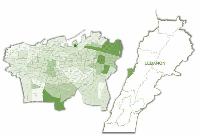
Beirut is the capital of Lebanon which was born from its port as a node in the Middle East region that connects many continents. However, at present it can be said that the port is not developing well, the past and present are not in direct proportion to trigger decision makers, planners, and students to be able to find the best solution if the Beirut port can rise and re-emerge as a port that has competitiveness and improves economic, social, cultural values of the city of Beirut to Lebanon.
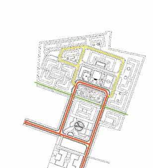
Linkage System Programing
Element Analysis
MasterplanSpaceFinal

Blok Zoning Macro Zoning Green
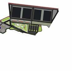
Perspektif Image
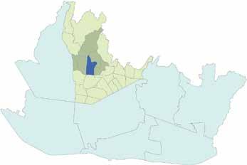
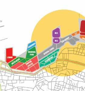
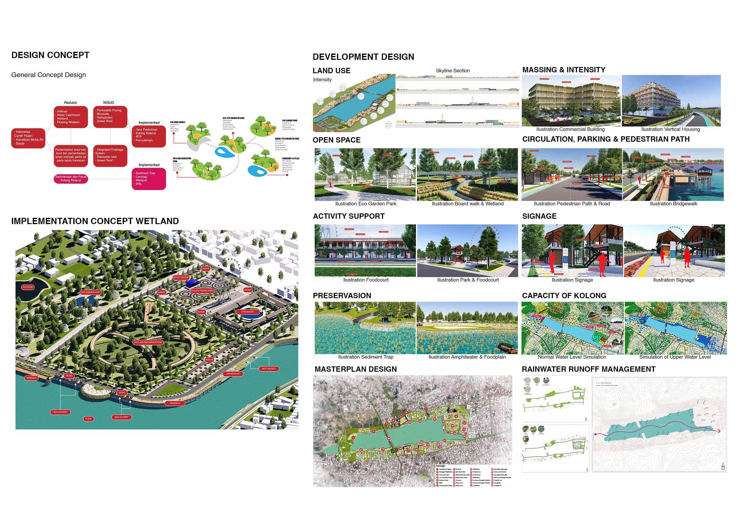
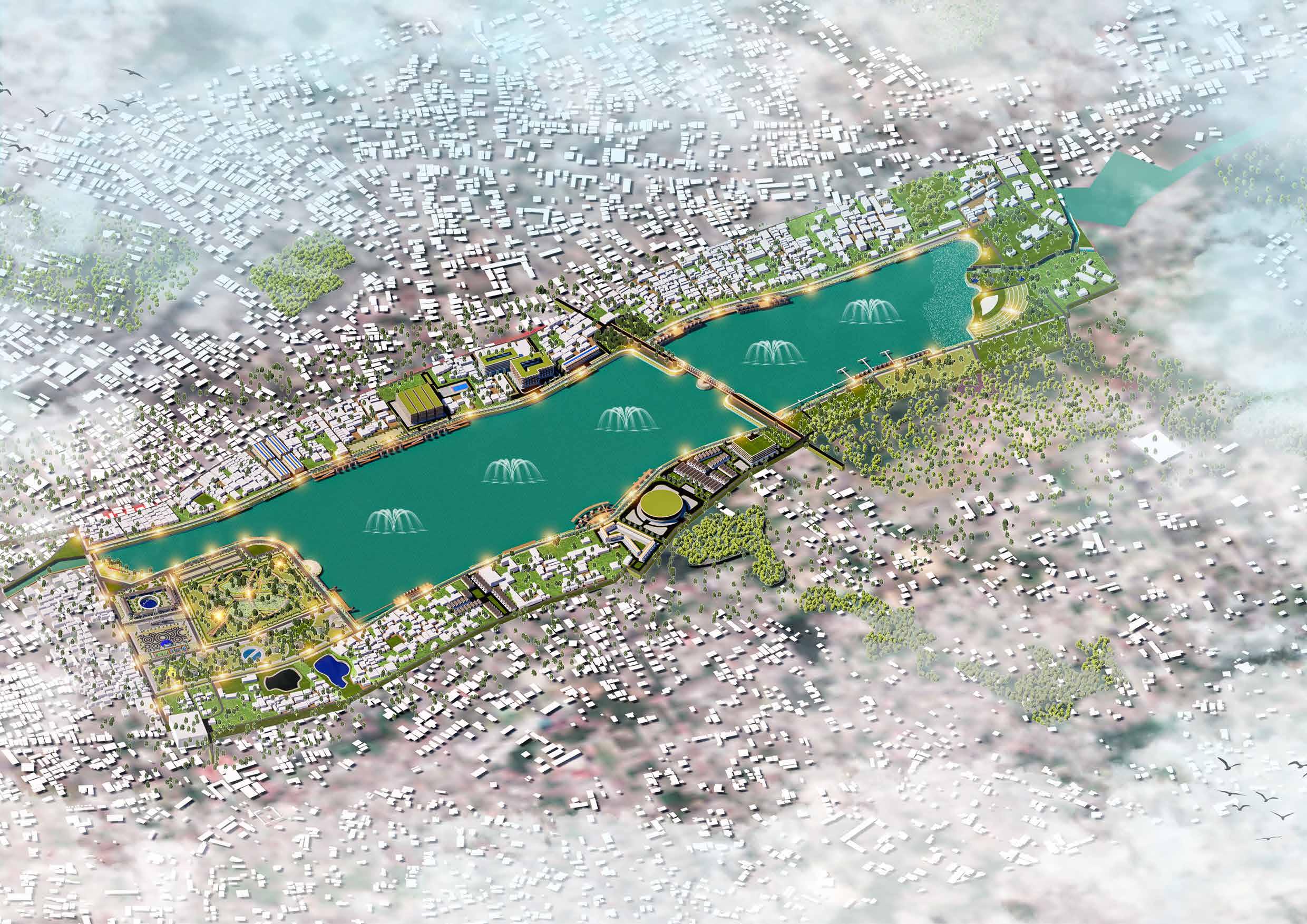
The scope of the design area includes the area under the Kacang Pedang retention area which consists of residential areas, offices, and trade and services. The location of Kacang Pedang retention pond is located in Rangkui District, District Attorney’s Office, Pangkal Pinang City. Delineation The area of the case study area in this thesis has a design area of ± 94 Ha.


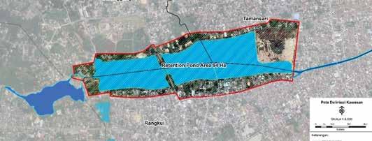
If the intensity of rainfall is high and the capacity under the retention basin is not controlled properly, it causes a rise in water level which then flows into the area under the retention and the Rangkui river causing excessive water runoff resulting in flooding that spreads to residential areas and the center of Pangkal Pinang City.
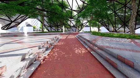
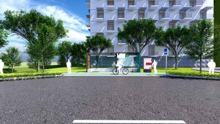
Introduction Method Design Design ProgramResponFungsionSite DesignAnalysisPrinciple


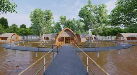
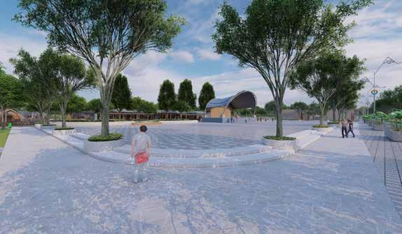
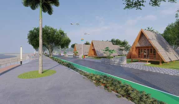
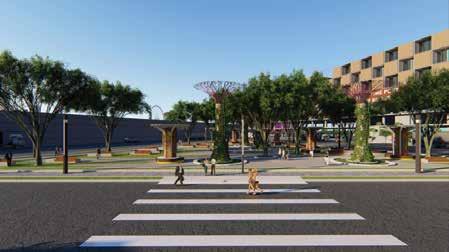
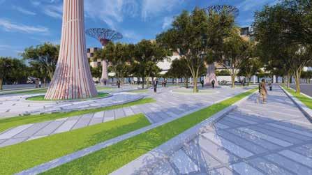
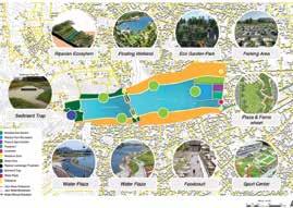
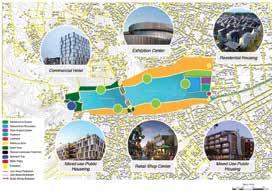
Name: Perancangan Kawasan Kolong Retensi sebagai Ruang Rekreasi Wisata Air


Amphiteater floodplain, Dermaga & Retail, Commercial Area, Residential, Drypond, Eco Garden Park, Wetland Recreation Park, Plaza & Sport Center, Foodcourt, Parking Area, Viewing Deck, Street Furniture, Pedestrian Path, Bycycle Path, Landmark
Case Study
Element Principle
The issue of changes in natural conditions, Pangkal Pinang City as a downstream area of the Batu Rusa Watershed (DAS) with a city center whose city morphology is in the form of a basin has resulted in Pangkal Pinang City receiving surface water runoff from the upstream area plus land deforestation due to illegal mining in the upstream river. which is directly adjacent to Central Bangka Regency.

Year: 2022

Final Project Academic Thesis of Urban Design


Design Principle of Place People


Client: Location:- Kolong Retensi Kacang Pedang, Kota Pangkalpinang
Project Thesis: - Febri Guinensa Putra S.T., M.R.K


Principle Design
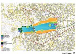
Design response recommendations to the development of the site footprint that can be described based on urban design elements and focus on problems of flooding, sedimentation, wastewater problems and open space in the area, the arrangement of the site that will be carried out later will also be designed with the application of techniques adopted by the Water Sensitive Urban concept. Design as a representation of water sustainability management.
The method used in the preparation of this thesis uses the fragmental rational design method. The fragmental method has a process that is almost the same as the synoptic method, or in the form of a combination of synoptic and intuitive methods, but does not use the entire design process of the synoptic method. The fragmental method was chosen because the steps carried out do not have to be sequential and are classified as shorter.
Deisgn-Enduring-Diverse-Connected-EnhanchingPrinciple of


Project Name Function Analysis


-Walkable-Safety-Vibrant-Comfortable

International Urban Design Course
Name: Perancangan Kawasan Kolong Retensi sebagai Ruang Rekreasi Wisata Air
Project Name
Year: 2022
WSUD, Green Area, Open Space, Foodcourt, Pedestrian Path Project Thesis: - Febri Guinensa Putra S.T., M.R.K
Final Project Academic Thesis of Urban Design
Typology
Client: Location:- Kolong Retensi Kacang Pedang, Kota Pangkalpinang
Principle Design
Participant International Competition and Summer Course
TatangPARTICIPANTCERTIFICATEFORMuntazeryMustaidFebriGuinensaPutraFazaGhilmanMarshelinoSubagyoinCategory:URBANDESIGN


Febri Guinensa Putra +62 guinensa03@gmail.com82279734217