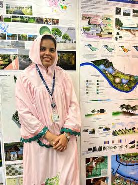
Fatema is a passionate advocate for the harmonious coexistence of the built and natural environments. Driven by a strong belief in designing for a better world, she brings a confident and experienced perspective to her work. With a solid academic foundation marked by a 2:1 achievement in her first year of postgraduate studies, Fatema has actively immersed herself in site visits, assisted in producing Landscape and Visual Impact Appraisals and Assessments, and attended team meetings and workshops. Her experience includes conducting baseline research and analysis and liaising with members of multi-disciplinary project teams, continually expanding her knowledge and expertise.
This is her collection of work showing her journey throughout her academic life from her undergrad to her postgrad level till date. It particularly aims to show the skills she has obtained progressively at each level that evidences development and enhancement each time. The range of her work also aims to show her acquired good knowledge and experience of design process starting right from site analysis through concept development and finally masterplanning. Each of the visuals be it technical drawings, rendered sheets, construction detailed sections, planting plans and planting schedules, visualizations or collages are exclusively picked to showcase the diversity of her projects.
University Courtyard Detail Design - Material Planning - Construction Detail - Planting Plan
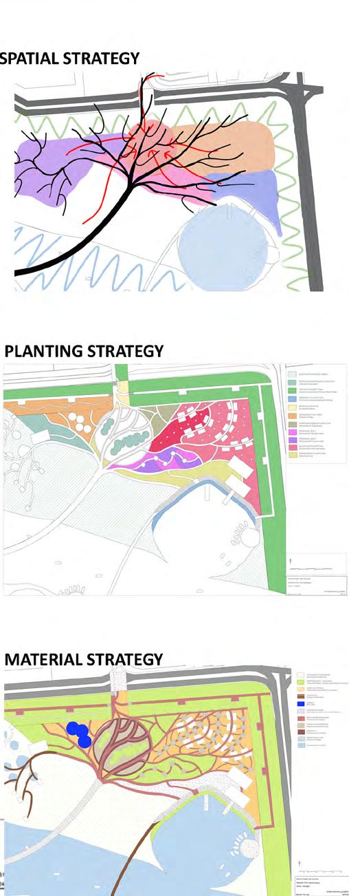
Planting Strategy
Hoar Bangladesh Collaboration -Design for flood resilience -Sustainable Drainage Systems (SUDs) -Ecological Terraces
Showground Design for Climate Change
-Design for flood resilience -Sustainable Drainage Systems (SUDs) -Ecological Terraces
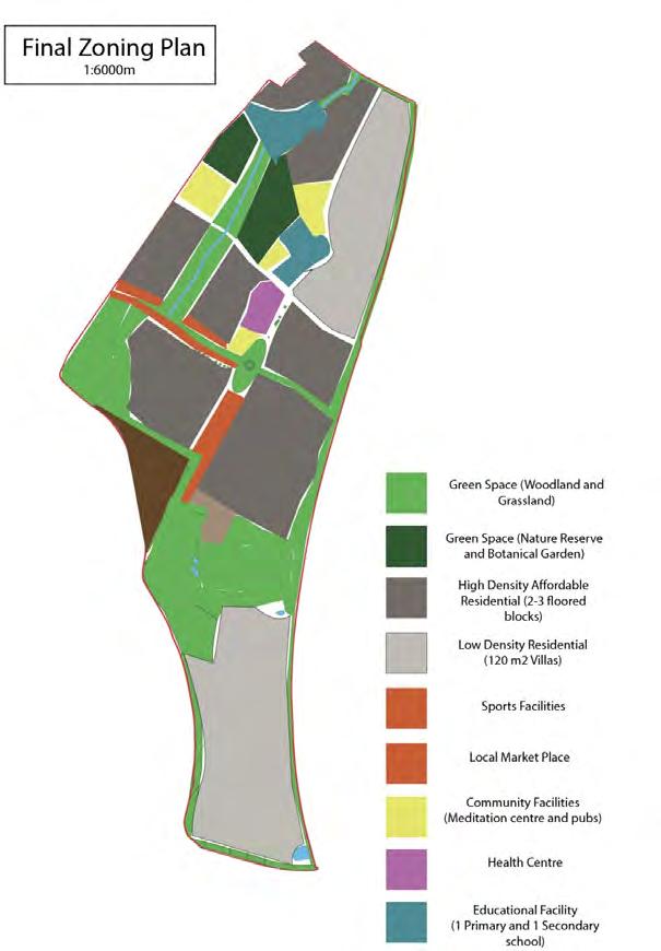
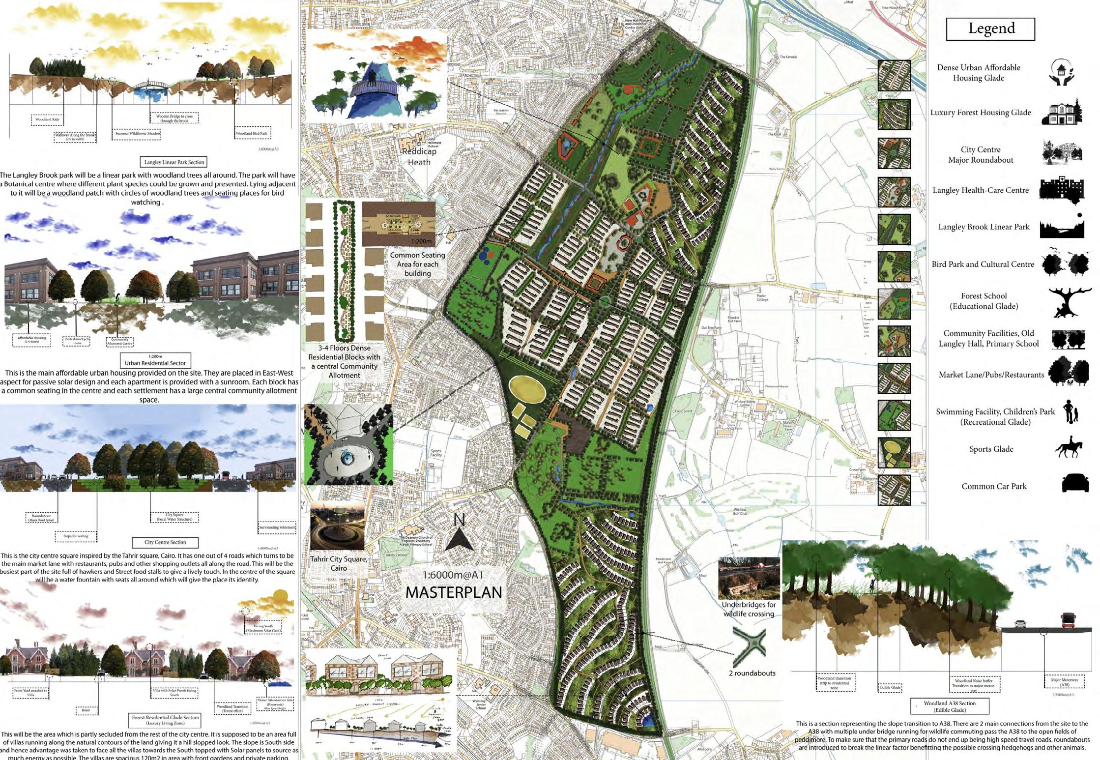
Langley Sustainable Urban Extension -Urban Designing - City Planning - Community Planning
-Community Growing -Sustainibility and Design
Haughmond Hill Rewilding Project
- Designing for Biodiversity - Carbon Sequestration
Interior Design
Undergraduate Work
-Color rendering -Interior Design
-Residential Plans -Elevations
Gramar
Mithi
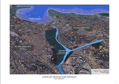
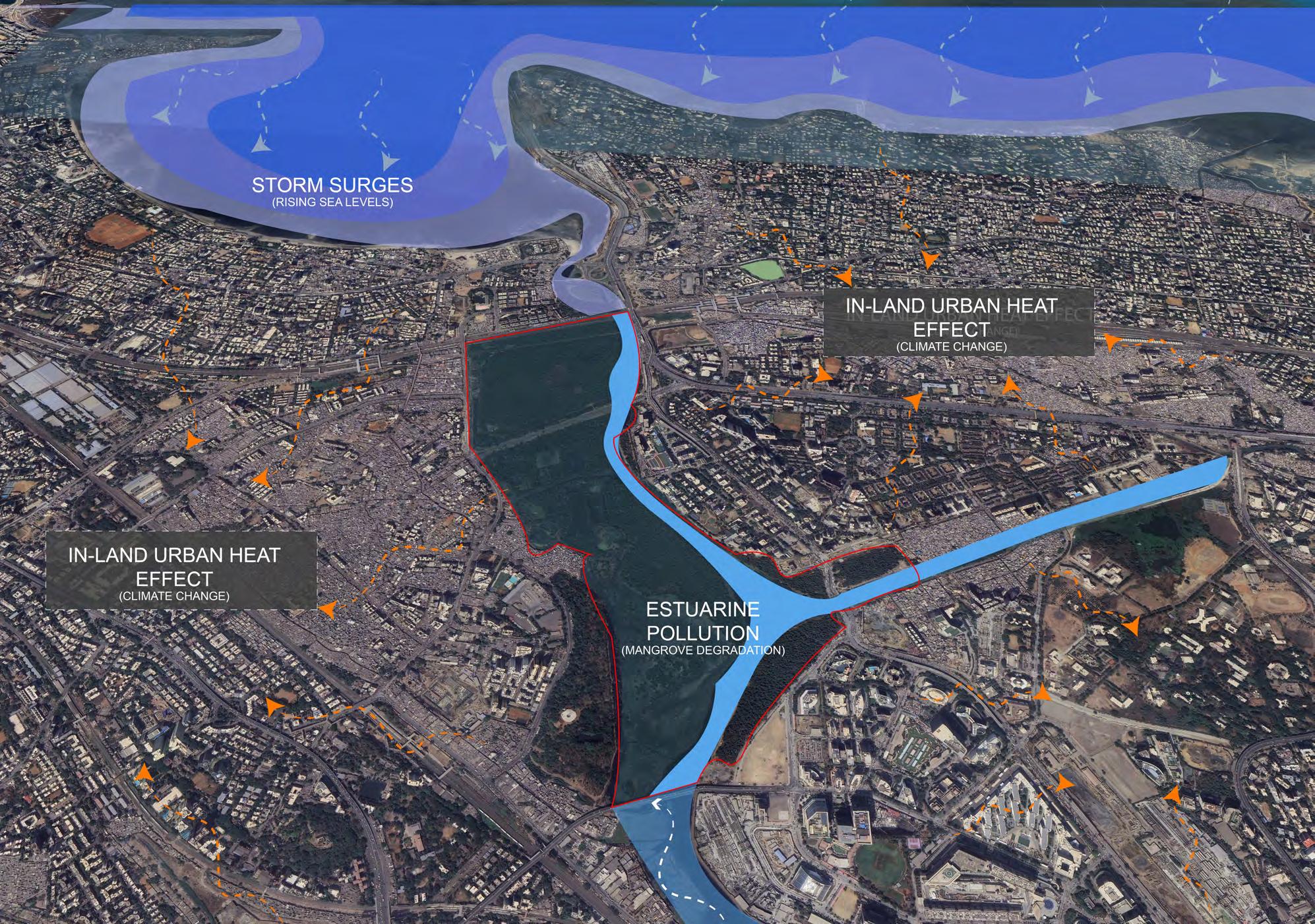
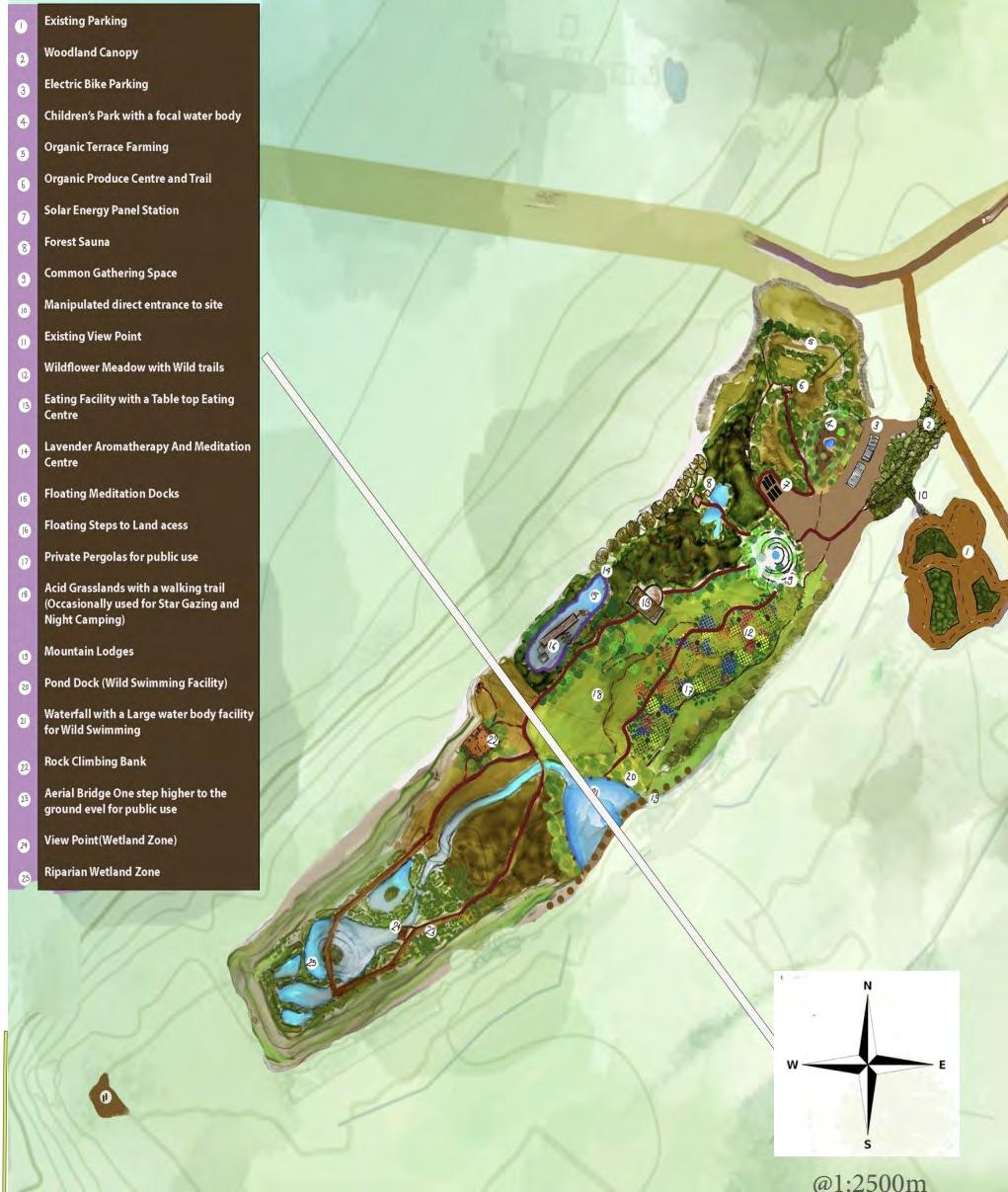
1. MITHI MANGROVE PARK Thesis Design
-Mithi river-a monsoon-fed river
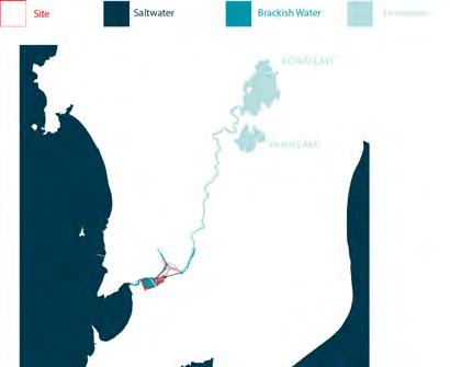
-river then runs through the city suburbs finally flowing into the Mahim Bay which drains the river out to the Arabian Sea
-higher flow rate in its upstream parts and gets slower as it gets closer to the sea forming an estuary downstream at the Mahim Creek
-is the point where the freshwater of the upstream river meets the Saltwater from the sea forming a rich ecology-driven brackish water environment
-Mithi mangroves which guard the city coast from the sea tides.
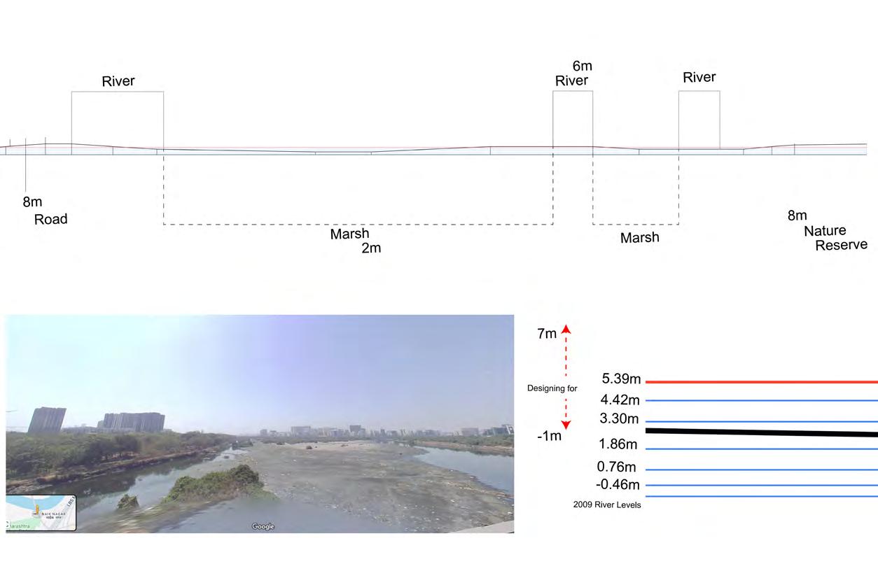
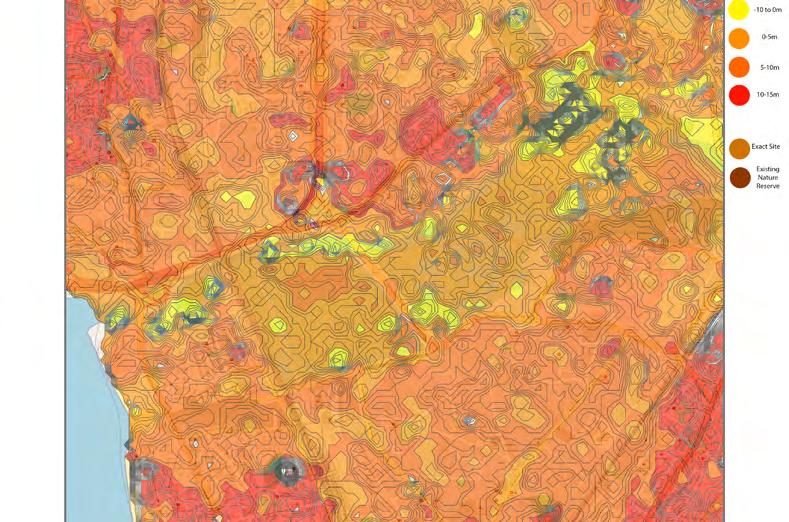
-due to lack of proper gauging or data publication, I couldn’t find recent river levels -estimated a rise according to the recent sea level rise and increased rainfall. -designing for a 6m flood level was the decided benchmark for designing
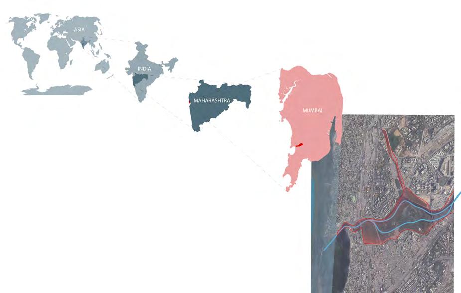
SITE LOCATION
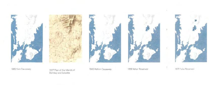
HISTORY OF THE RIVER SITE
-Mumbai was once a city of 7 different islands connected by a rich network of swamps and creeks
-Through the 18th and 19th centuries under the colonization of Portuguese and the British, these uncultivated swamps and outcrops were inked in a cut and fill operation called reclamation to build land for trade purposes
-The river was initially wider and not tamed. The Portuguese and English considered the swamps and the outcrops as a waste and of no use economically
Time-line: 1800s
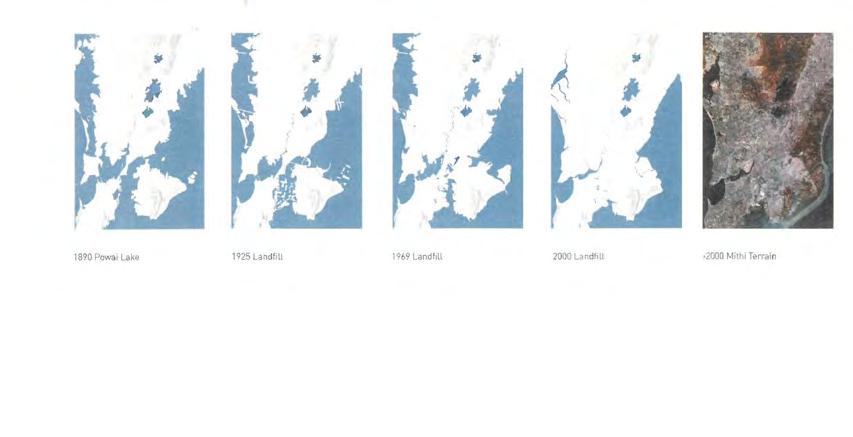
-The mangroves swamps were filled with the cutting of outcrops and land was reclaimed for residential and economic uses
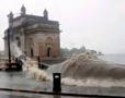
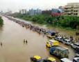
-The river is blamed for the deluge of 2005 that costed many lives in the coastal city. The reality is due to channelization and narrowing of the river, the water carrying capacity of the river has decreased considerably.
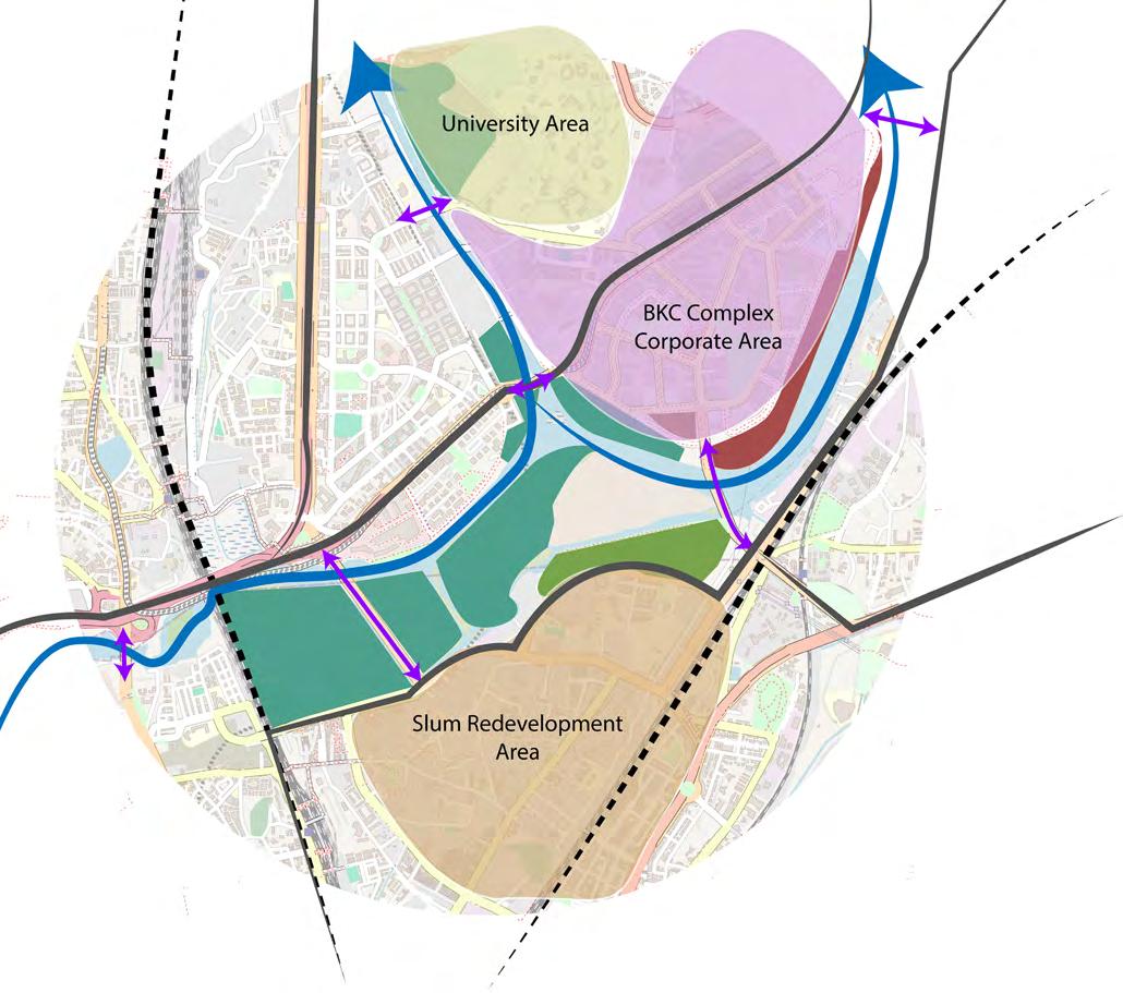
-Mumbai is a densely populated city situated on India’s west coast.
-The site is located on the western coast of this city and is an estuary formed at the draining-point of the river Mithi at the Mahim bay and finally into the sea.
EXISTING RIVER LEVELS
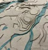
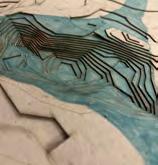
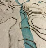
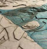
TOPOGRAPHY ANALYSIS
Time-line: 19 and 20 Century
The site owing to its characteristic estuary properties has dramatic elevation changes which are difficult to visualize virtually. This contour model helped me understand the land levels and how the river flows in the crevices and what flood strategies would be better.
A devastating flood event which claimed 1094 lives in Mumbai
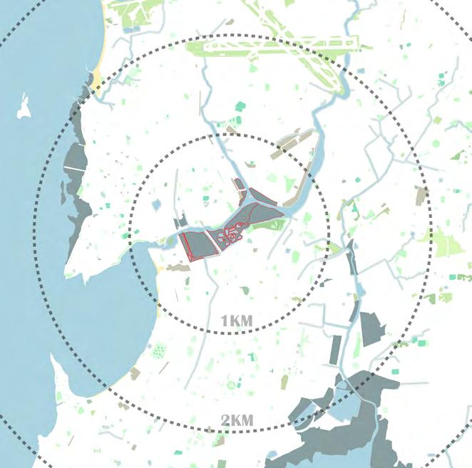
GREEN INFRASTRUCTURE ANALYSIS
There are a number of prominent parks and green spaces in the city. As evidenced by the map below, the city proves to be rather grey and the ratio of green spaces to the grey infrastructure is considerably very less.
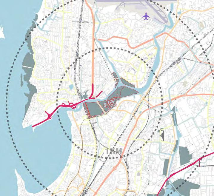
TRANSPORT ANALYSIS
EXISTING LAND USE
BANDRA TRAIN STATION
BKC BULLET TRAIN STATION
DHARAVI BUS DEPOT
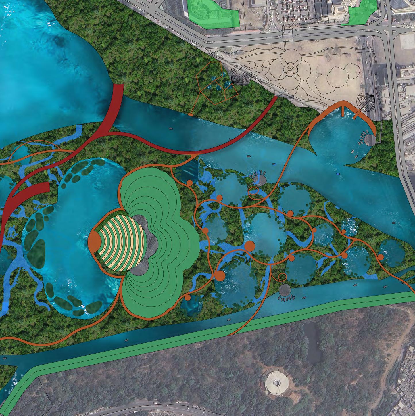
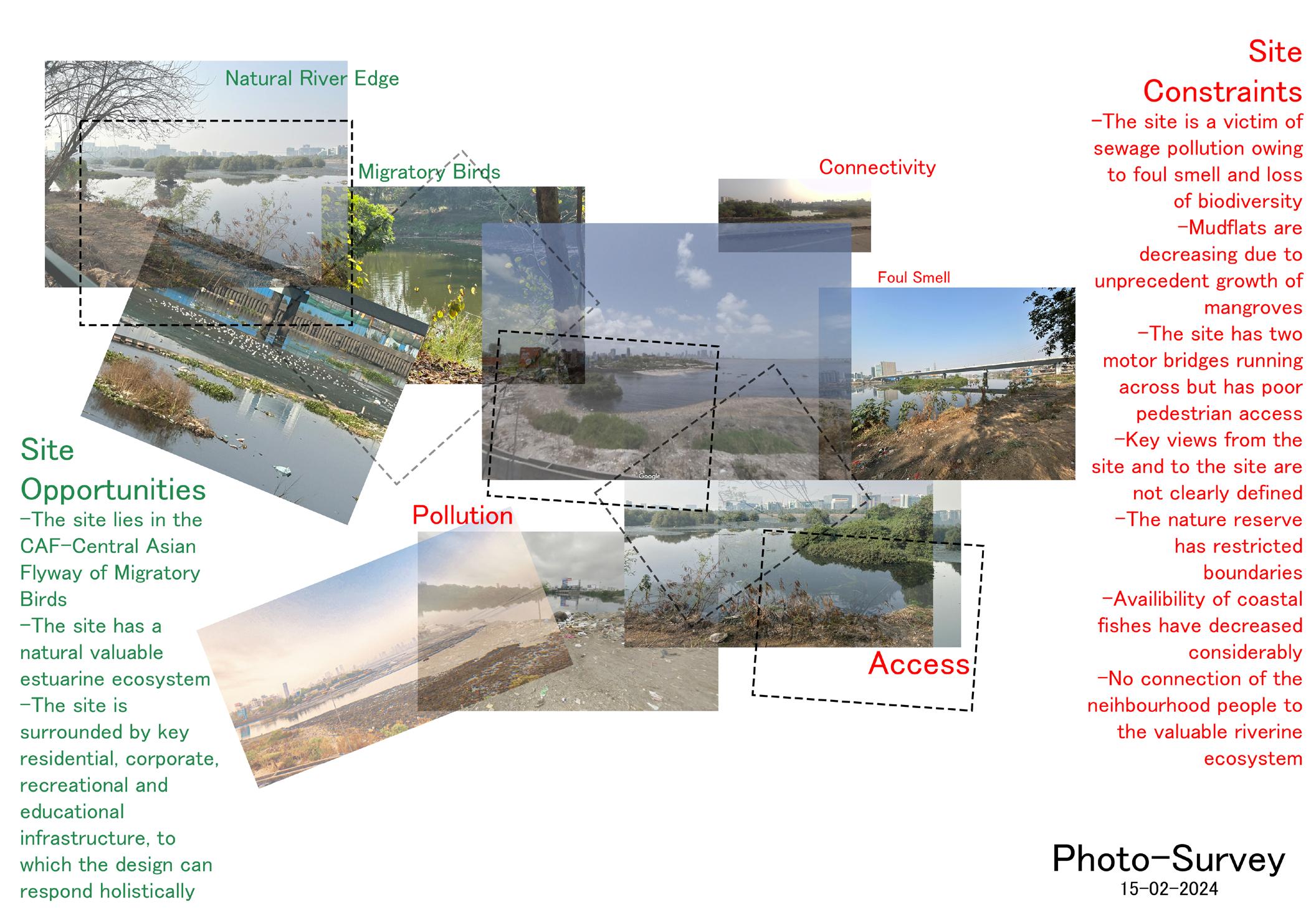
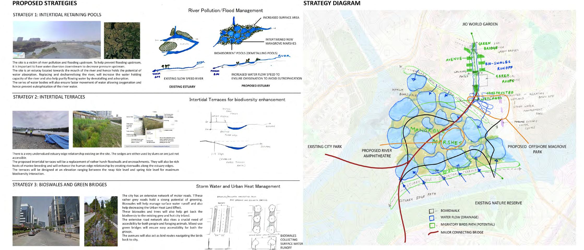
nature-based strategies like inter tidal terraces as natural flood barriers, water cleansers and potential breeding grounds for the marine ecology. the sponge-like terrain to soaks high amount of water during extreme rainfall events downstream thereby relieving the water pressure upstream
recognizes the river’s pollution from untreated sewage and chemical release from encroachments and proposes a series of dematalling ponds inter weaved with the mangroves to purify the river water by adsorption before draining it into the sea
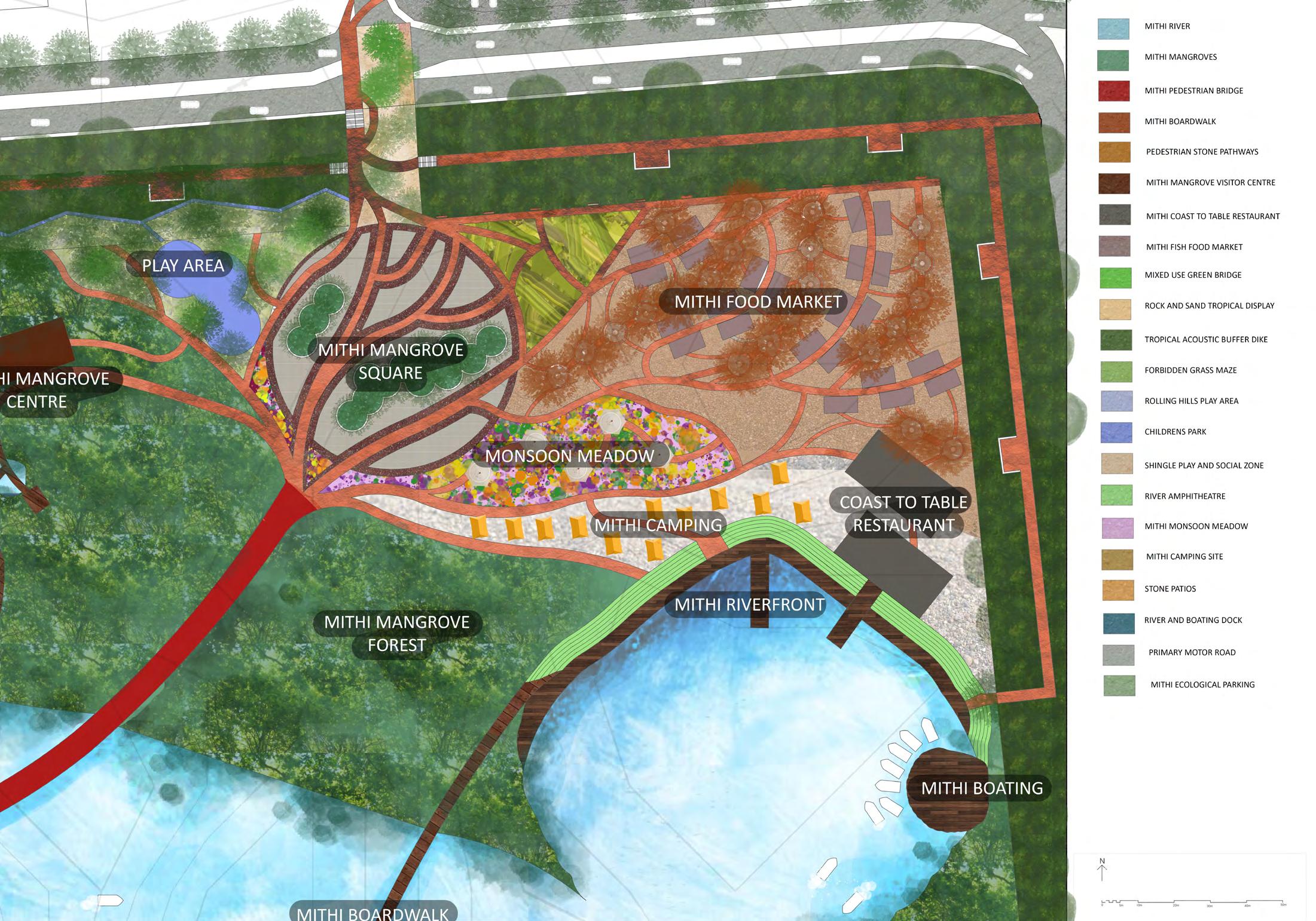
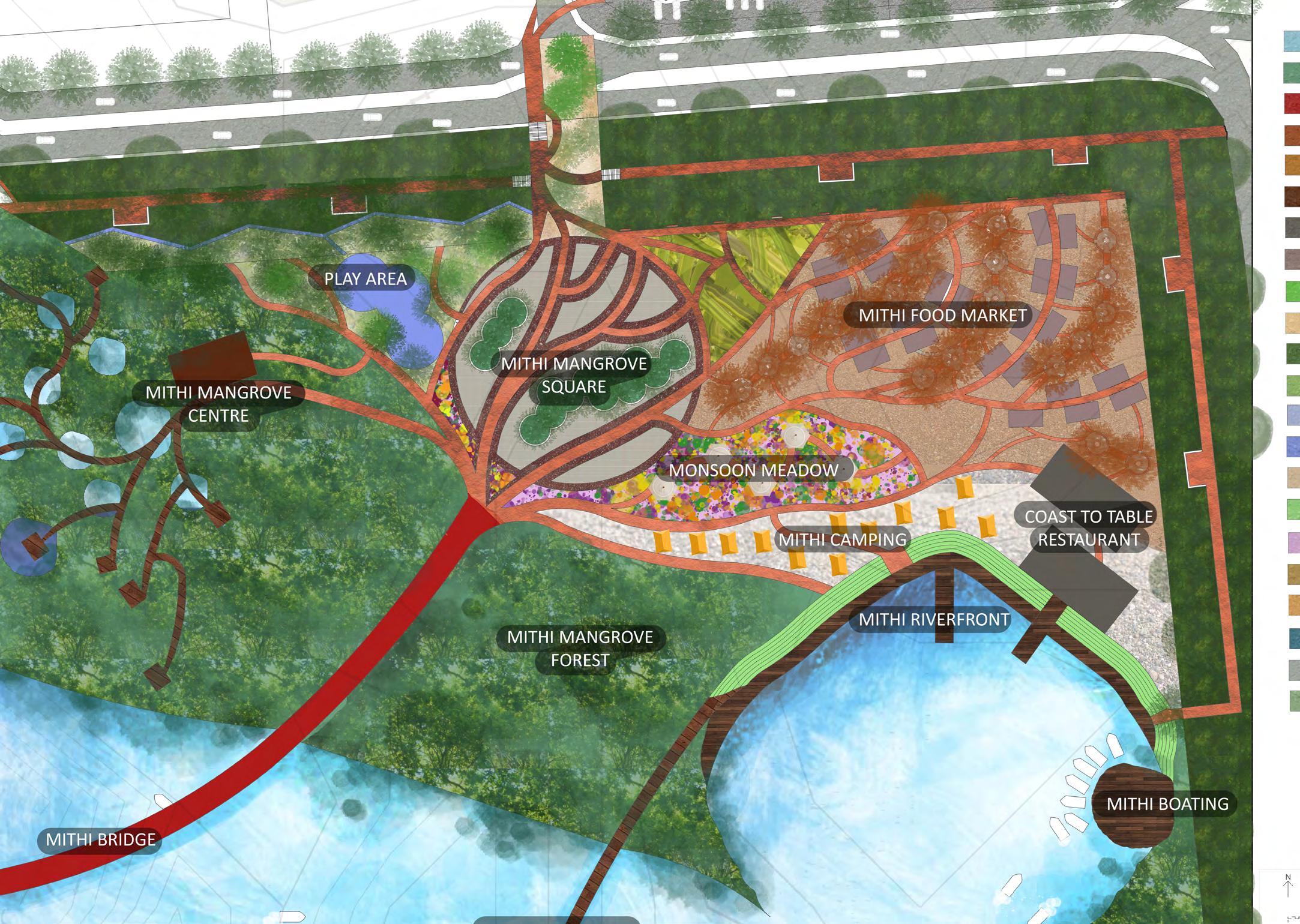
a coastal retreat with amenities like fishing ponds, coast to table restaurant to cook one’s own catch, mangrove boardwalk, bird watching towers, canoing and a designated area for a sea food market
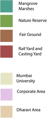
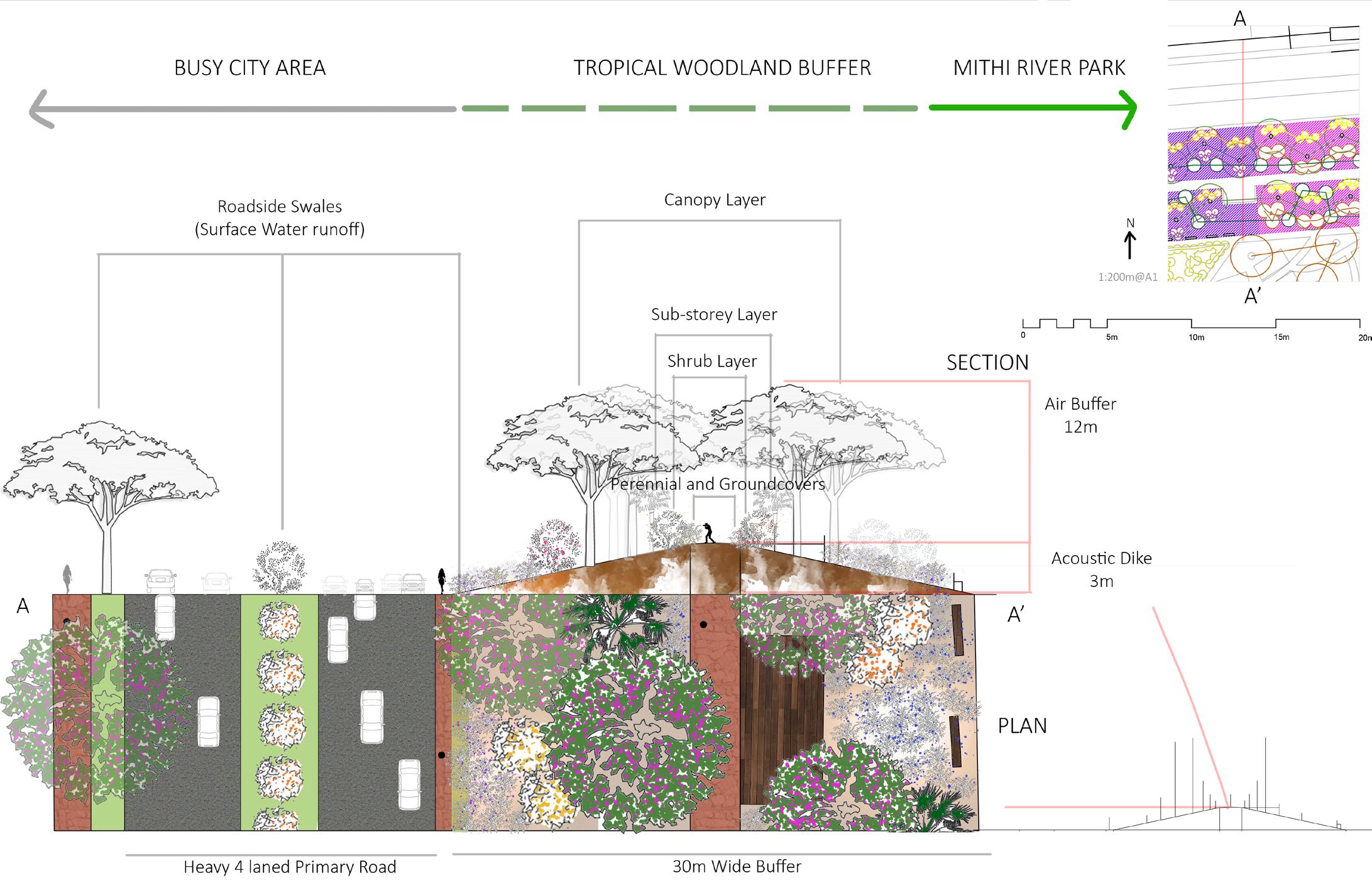
Climate Change is taking the unintended lead today in every aspect of life and proves to be the major driving force for landscape architects to design for climate resilient cities. One such city destined to be partly underwater by 2050 as per reports and hence in dire need of planning for climate change-induced sea-level rise and urban flooding is the coastal city of Mumbai located on the western coast of India. With sea level rise inevitable and extensive loss of mangroves to rapid urbanization, recognizing and reviving these tropical woods is more important for the mega city now than ever.
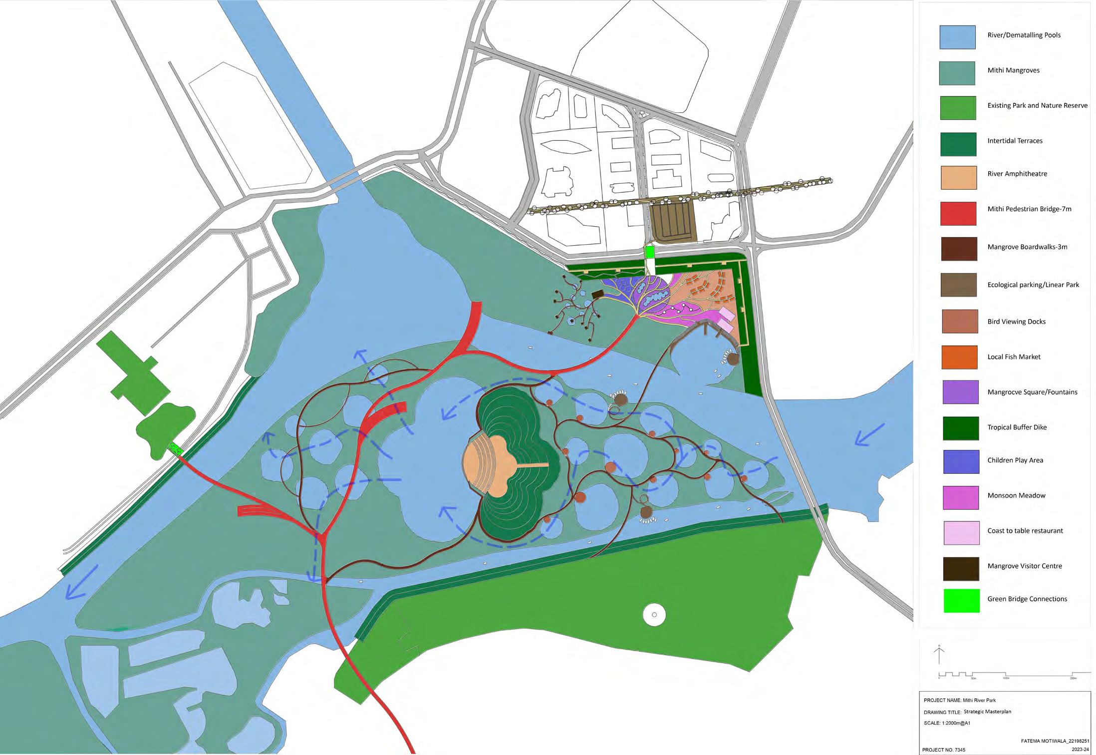
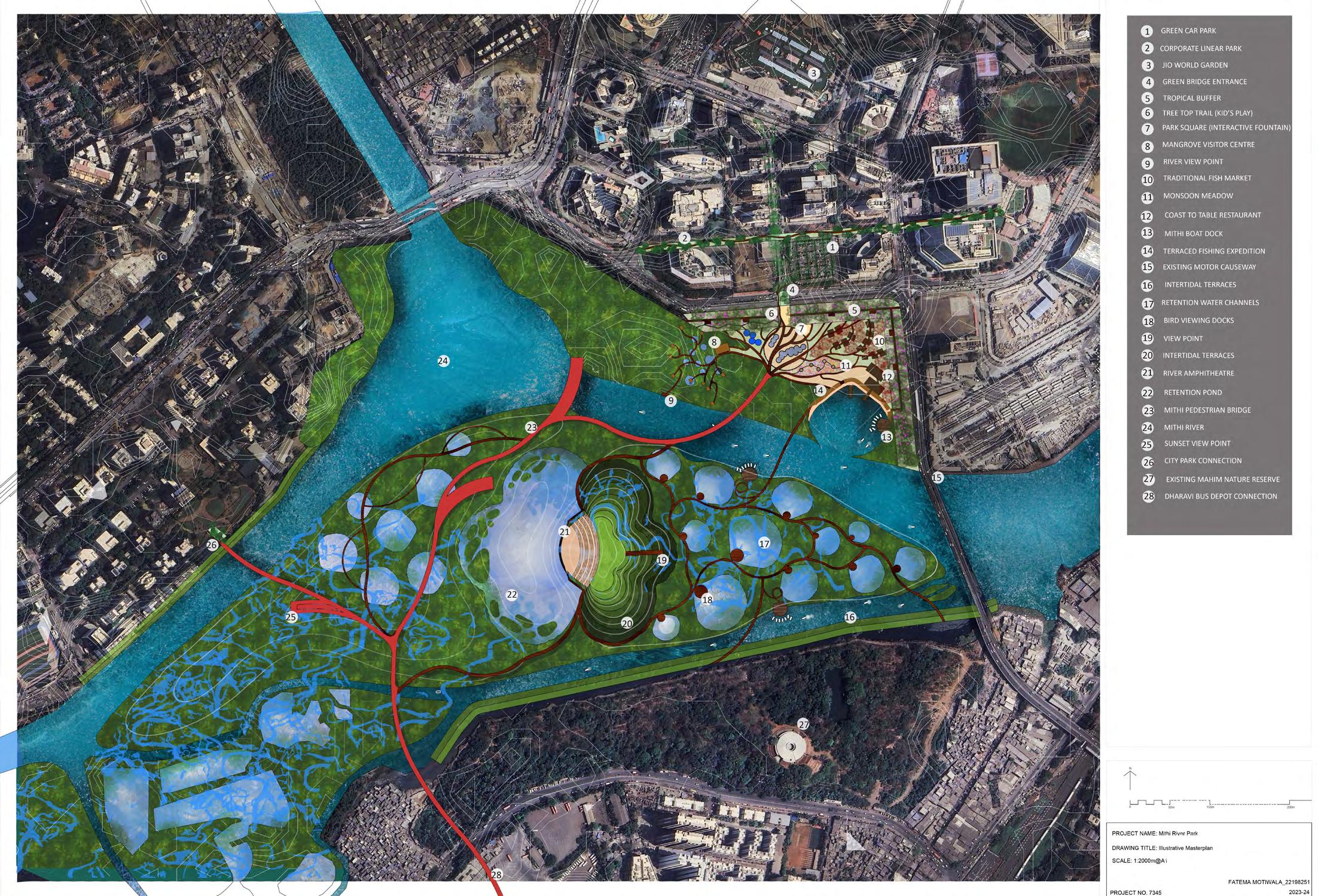
The Mithi Mangrove Park:
-gets an imperative relief to the vulnerable mangroves of the island city
-aims to be an exemplar of urban resilience by recognizing, relating and reviving the river
- builds a water resistant landscape by being permeable in all ways
-befriends the naturally occurring estuary at the convergence of the Mith River and the Arabian Sea
-primarily establishes a much required pedestrian connection between the Northern and Southern Coast of the river
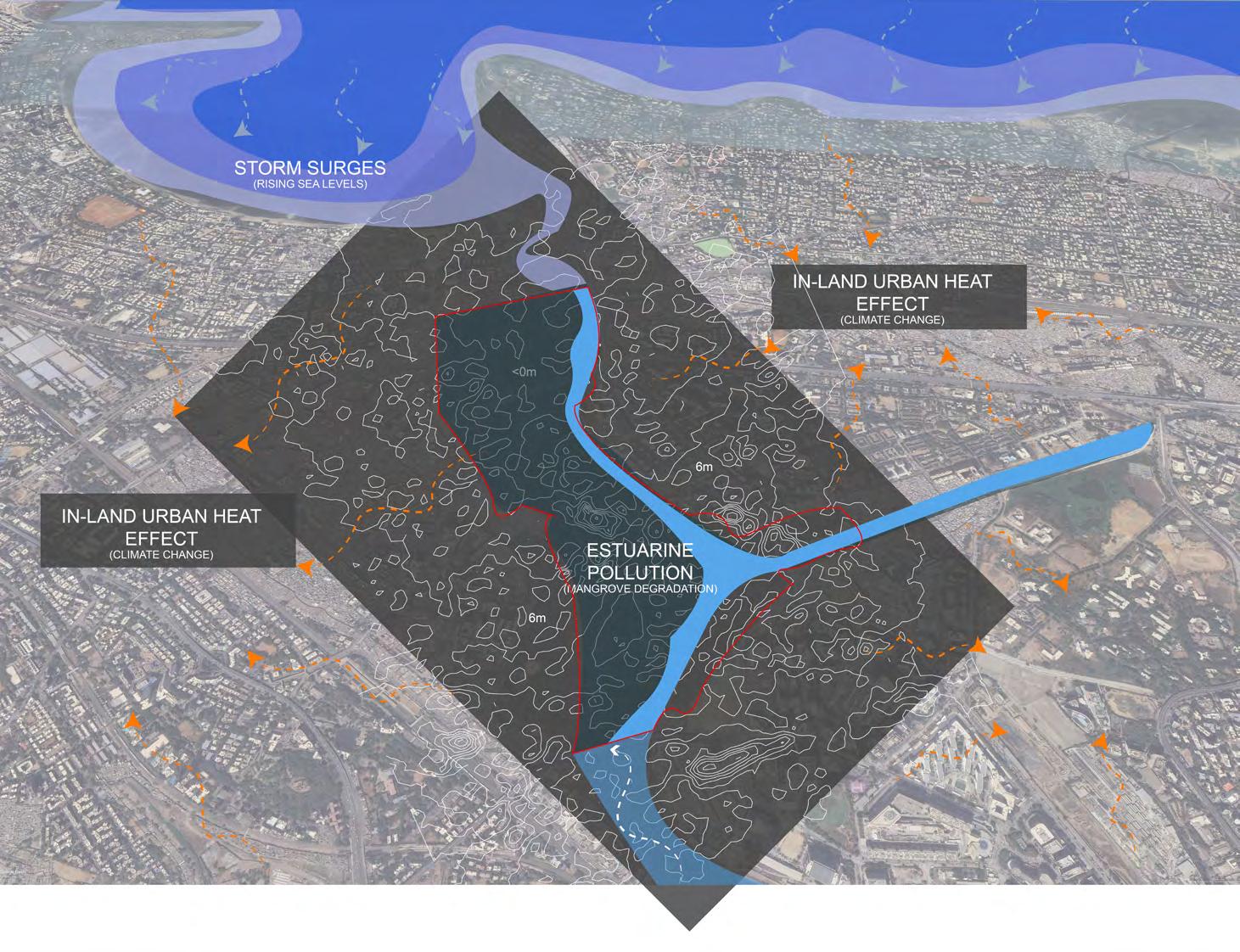
KEY ISSUES MUMBAI IS FACING IN VIEW OF CLIMATE CHANGE (MUMBAI CLIMATE ACTION PLAN 2022)
1. URBAN HEAT RISK
Mumbai presents a warming trend over a period of 47 years (19732020), with an increase of 0.25°C per decade observed between 1973 and 2020
2. COASTAL RISK
Climate projections for Mumbai estimate that by 2080, the likelihood of a 2005-like event will more than double, under an “upper bound”8 climate scenario (Ranger et al., 2010).The IPCC A6 Atlas (IPCC, 2021) indicates that owing to an increase in intense rainfall events, there is medium confidence that the region will be exposed to increased fluvial and pluvial flood events.It states with high confidence that regional mean sea level will continue to rise, warning that Mumbai along with 11 other Indian coastal cities will witness sea level rise of 0.1-0.3 m over the next three decades due to climate change.
3. RIVER POLLUTION
The city’s coastal waterways are contaminated by continued untreated sewage disposal and effluent discharge from the cottage industries functioning in the Dharavi slum area.
Based on baseline surveys carried out by surveyors in a report by Maharashtra Pollution Control Board (2014), the prominent sources of Mithi river’s water pollution are:
-Urban Development
The ratio of water consumed, and wastewater generated is increasing with the increase of population mainly due to migration to the city for better educational and employment infrastructure
-Industrial Wastewater
There are many small-scale industries majority of which are illegal which function on the banks of the river which consume freshwater from the river and release toxic untreated water into the river back
Resurfacing of previously deposited pollutants
The extent of accumulated pollution caused by oil and leather tanning industries which once functioned in the Dharavi slums, now closed since 2006 might have traversed through the banks to the waters and ultimately piled up in the sediments mainly via runoffs
-Solid waste dumping
In most of the stretches of the river, slums and residential areas treat the river as a dumping drain which ruins the chemical as well as aesthetic composition of the riverine ecology.
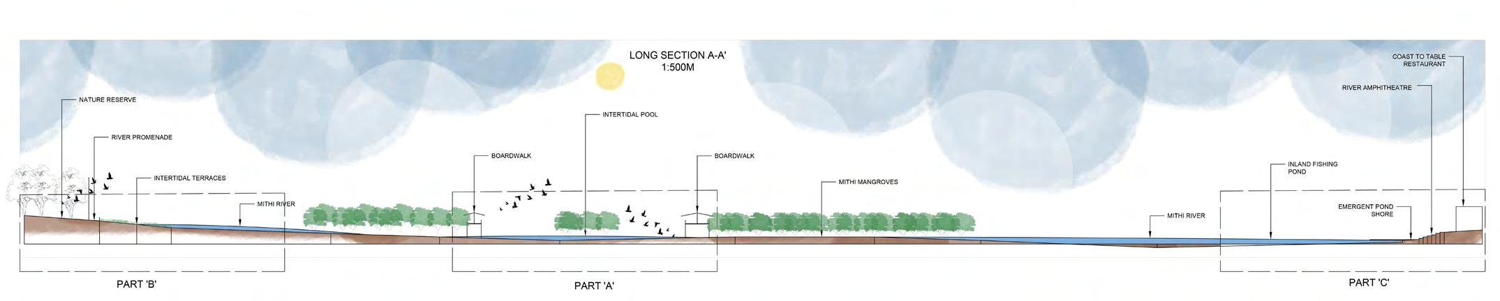
This long section shows the elevation change between the northern and southern coast of the river. The section runs from the existing nature reserve in the south right to the proposed mithi coastal park to the north. The section evidences the level change of the proposed design features like intertidal terraces, boardwalks, intertidal pools to the corresponding river levels.
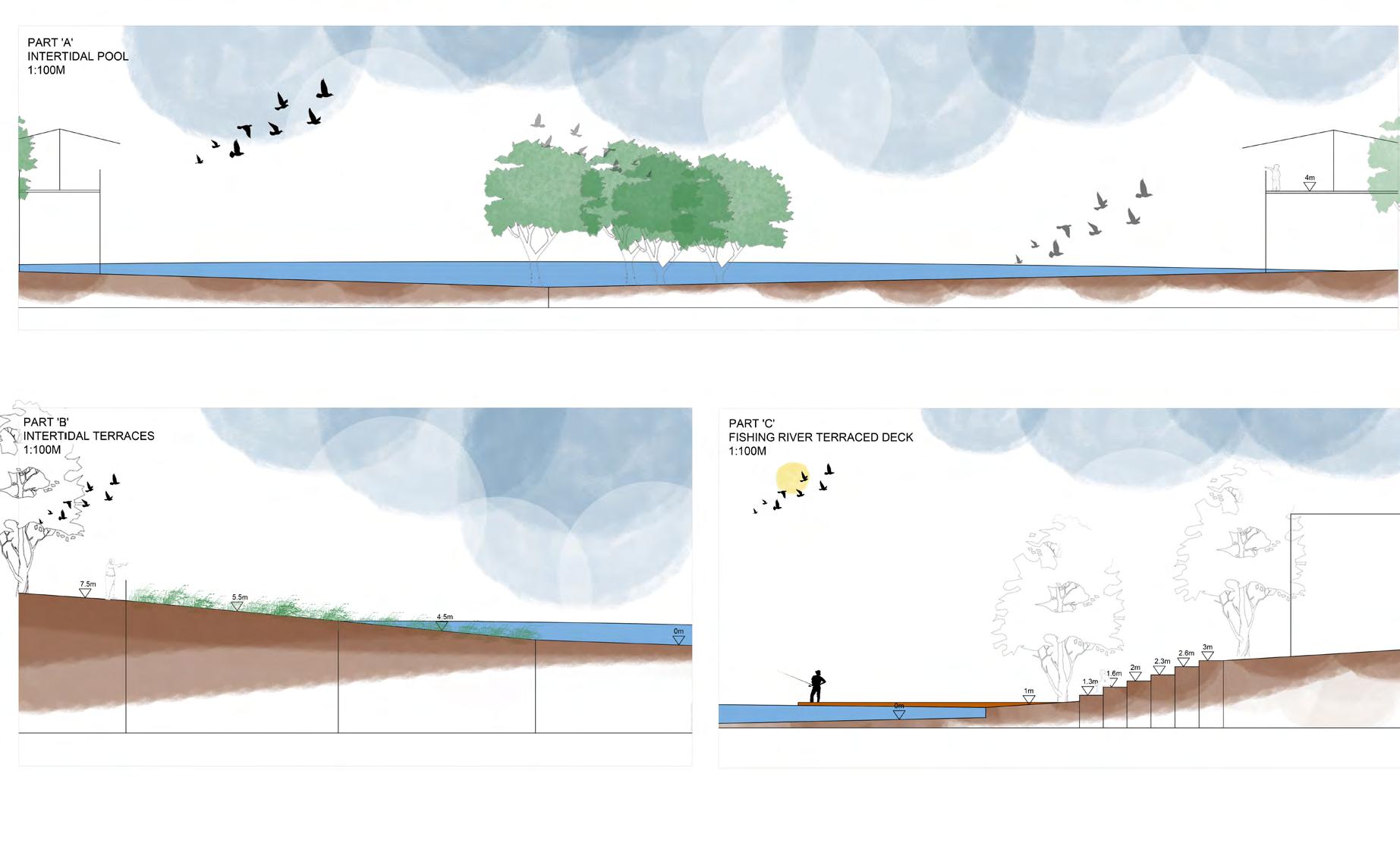
Part ‘A’ shows a section of a proposed intertidal pool with boardwalks running on both the sides. Viewers can spot migratory birds. The base of the pond can be layed with a substrate mixture of sand, gravel, 15% clay and organic matter to achieve the charceteristic of a constructed wetland pond for water purificication and demetalling.
Part ‘B’ shows a section of a proposed intertidal terraced estuary edge shared by the nearby Mahim Nature Reserve and the river. For fish breeding and the terraces to function as a good marine biodiversity host the terraces are built at a gradient of 1:10 and lies in the
Part ‘C’ shows a section of the proposed connection of the existing mithi river to the proposed coastal riverfront park. It shows the terraced riverfront and the floating docks designed for fishing.
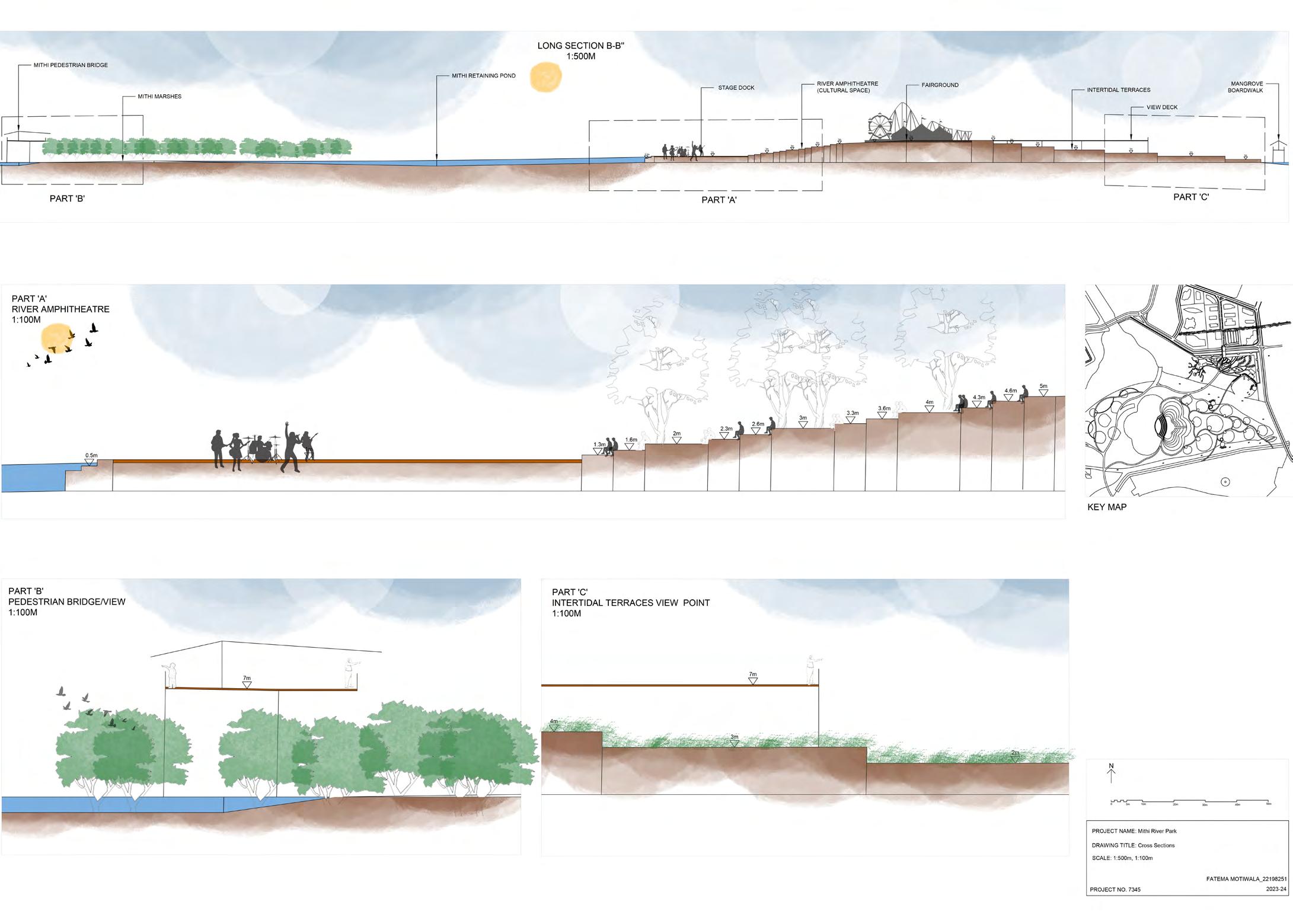
Part ‘A’ shows a section of the central river amphitheatre. The amphitheatre will remain functional every season leaving the monsoon season. In times of heavy rainfall, the terraces can get submerged with each rising tide of the Mithi river. The amphitheatre will host various concerts, music shows, events which were once held at the MMRDA fairground.
Part ‘B’ shows a section of the main pedestrian link between the coasts. The bridge is 10m wide and lies at an elevation of 7m which ensure accessibility even during the worst of floods.
Part ‘C’ shows a section of the viewing dock which lies on top of the intertidall terraces.
This long section shows the elevation change right from the Mithi pedestrian bridge to the intertidal terraces. It covers a critical section where the level first rises with each amphitheatre step and the fairground being the highest point. The level then gradually drops back to the river level with the dropping intertidal terraces. The design is meant to be submergable and permeable.
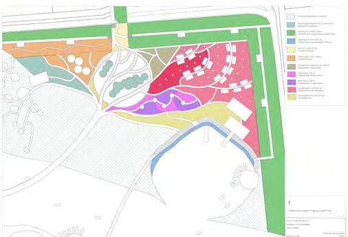
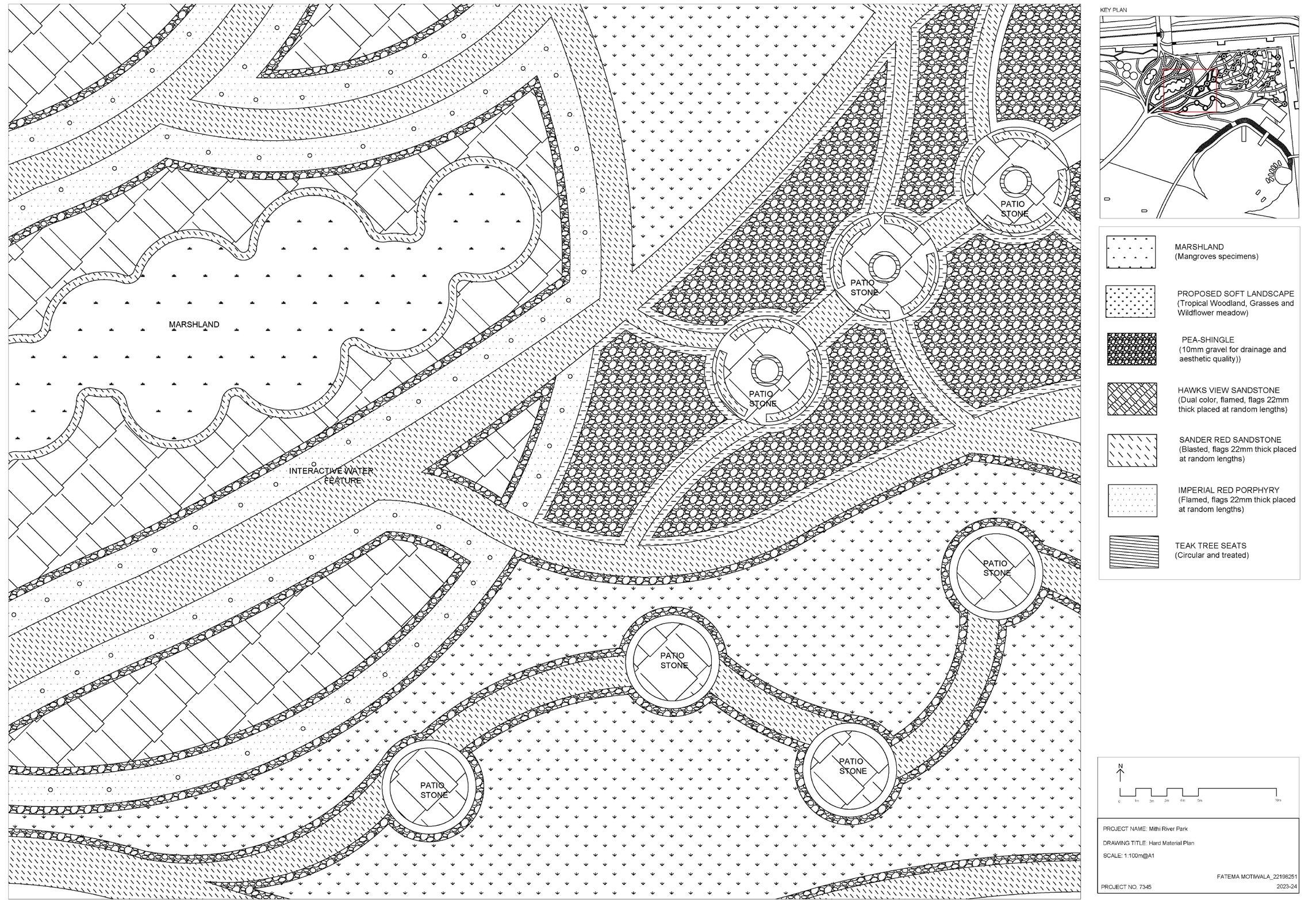
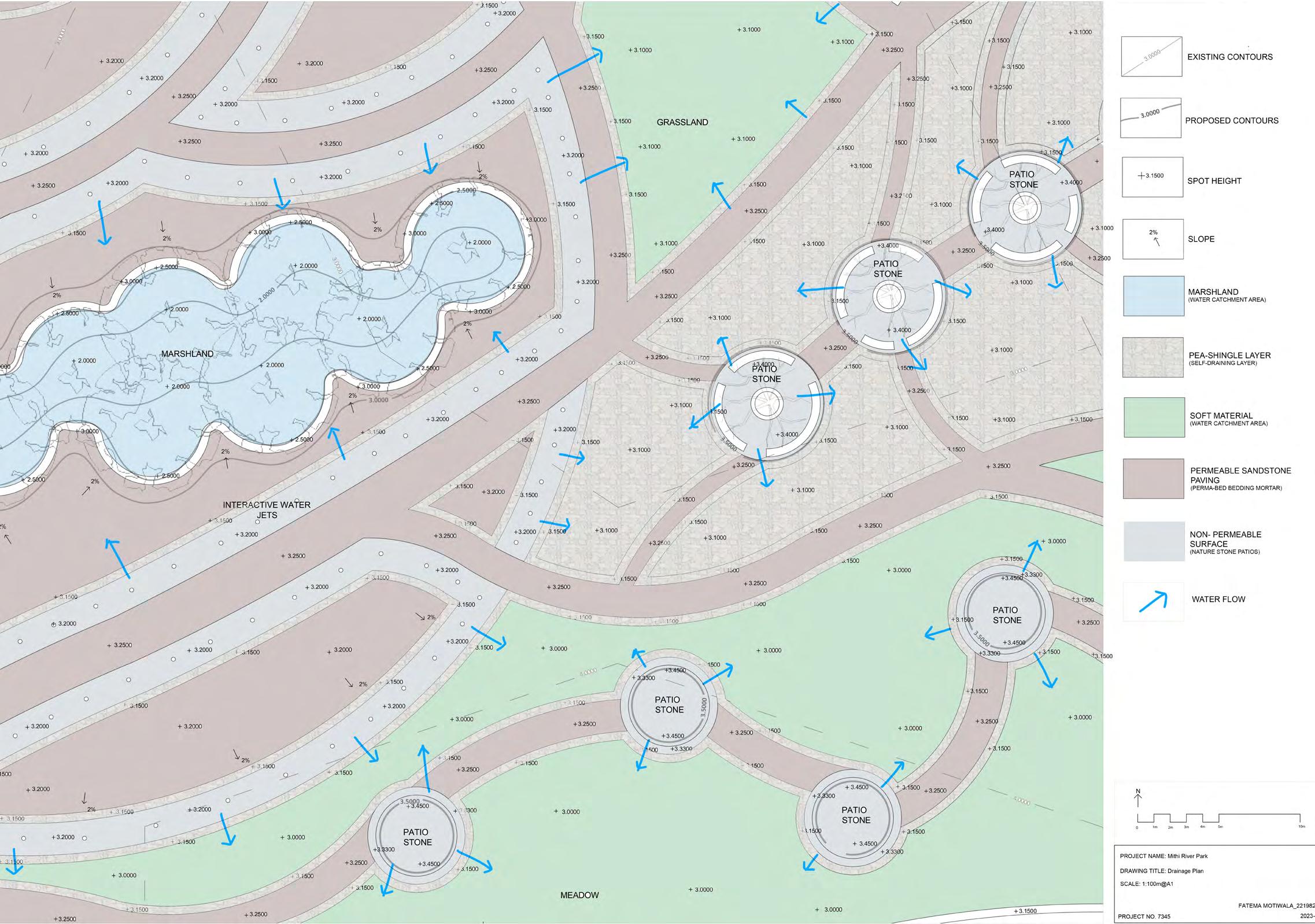
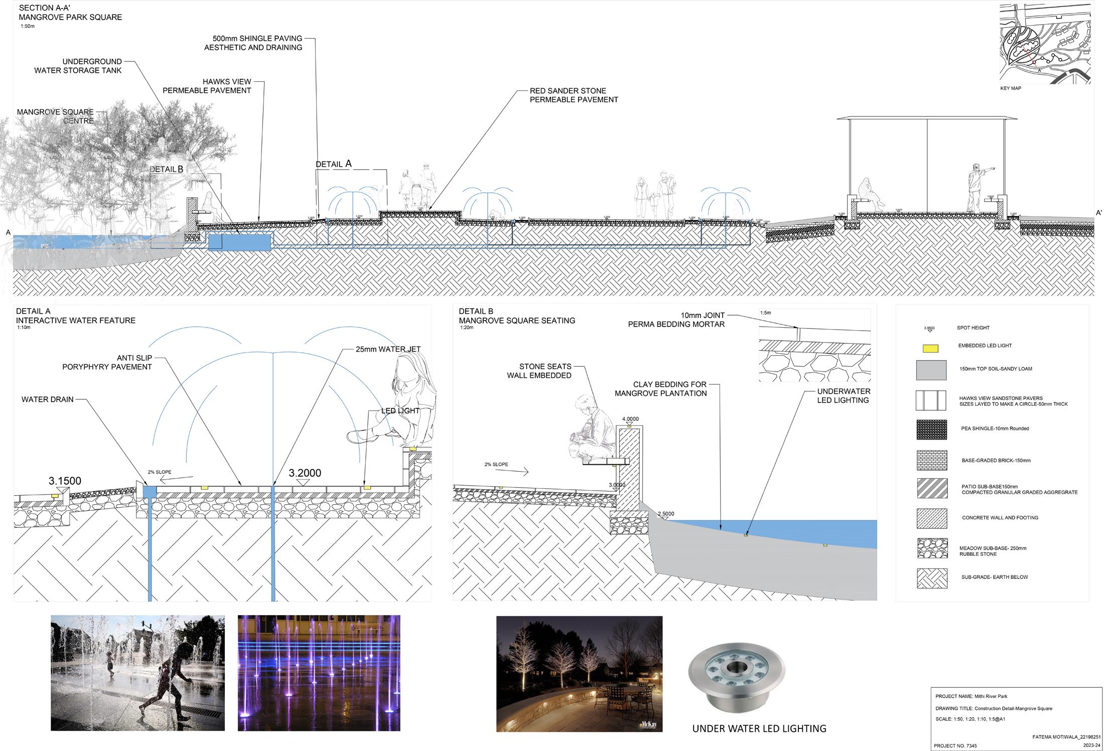
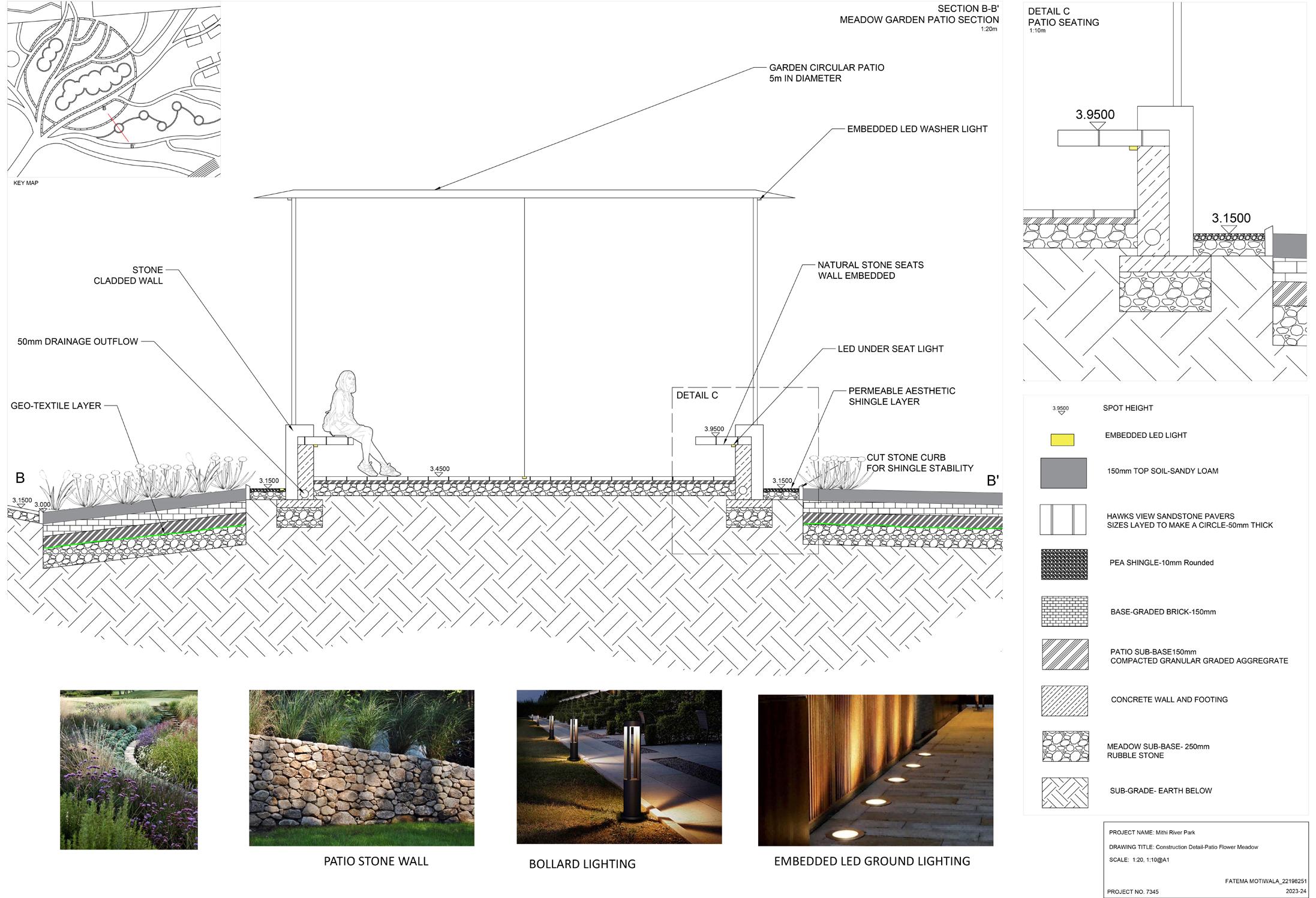
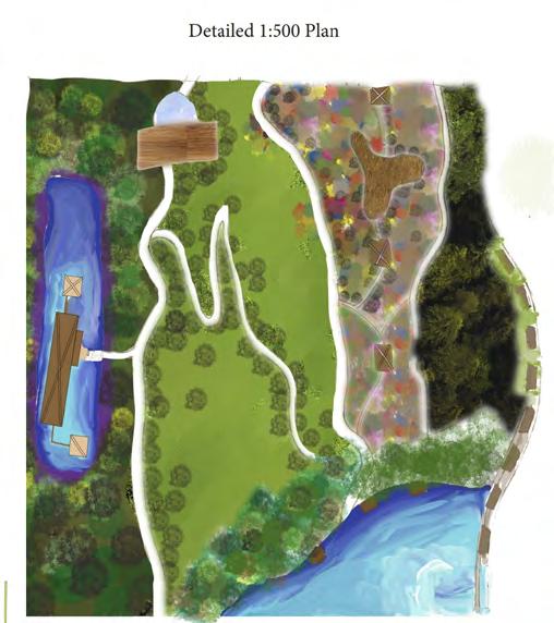
DETAIL DESIGN
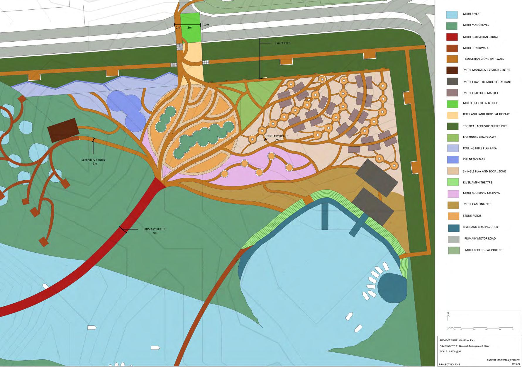
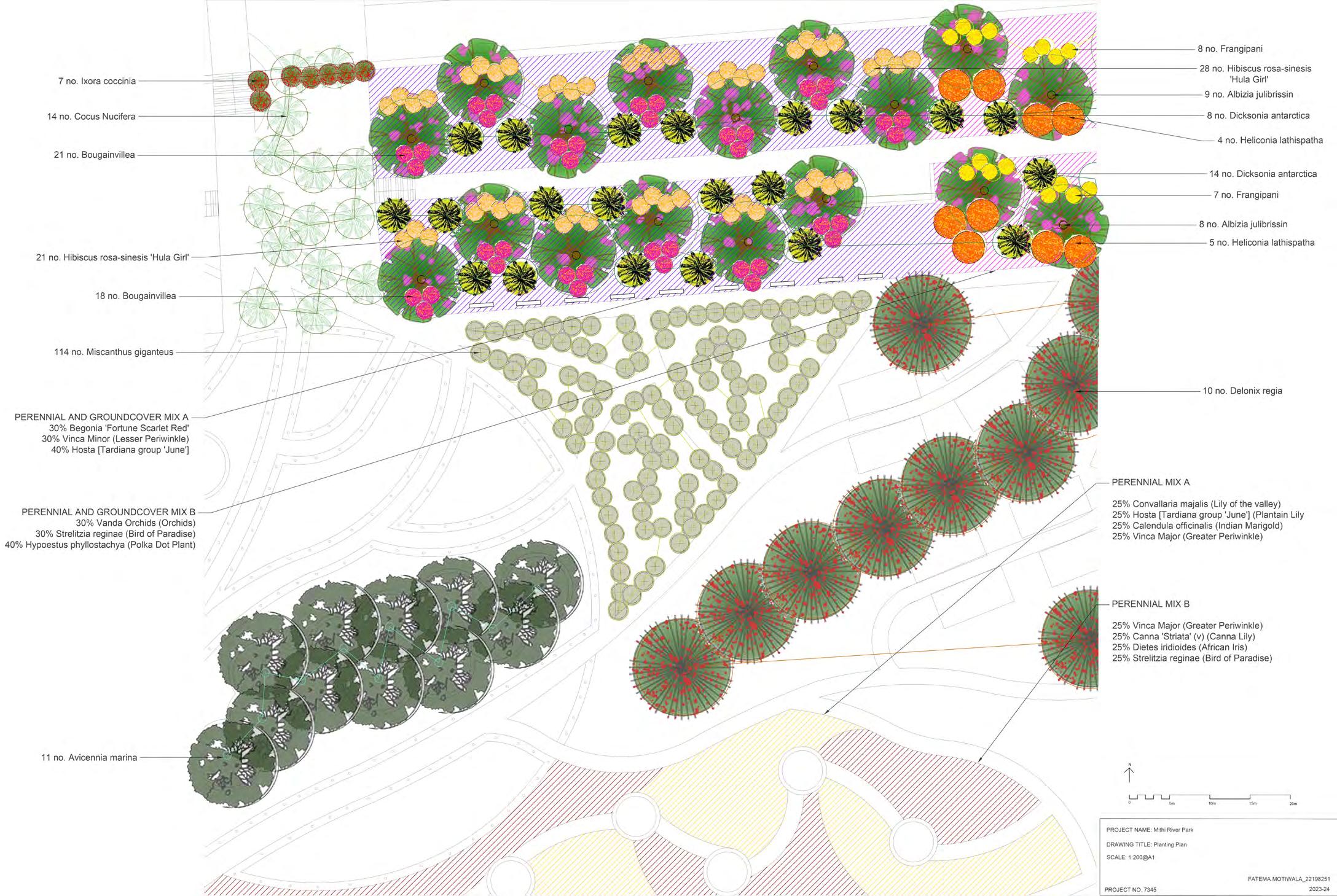
GENERAL ARRANGEMENT PLAN
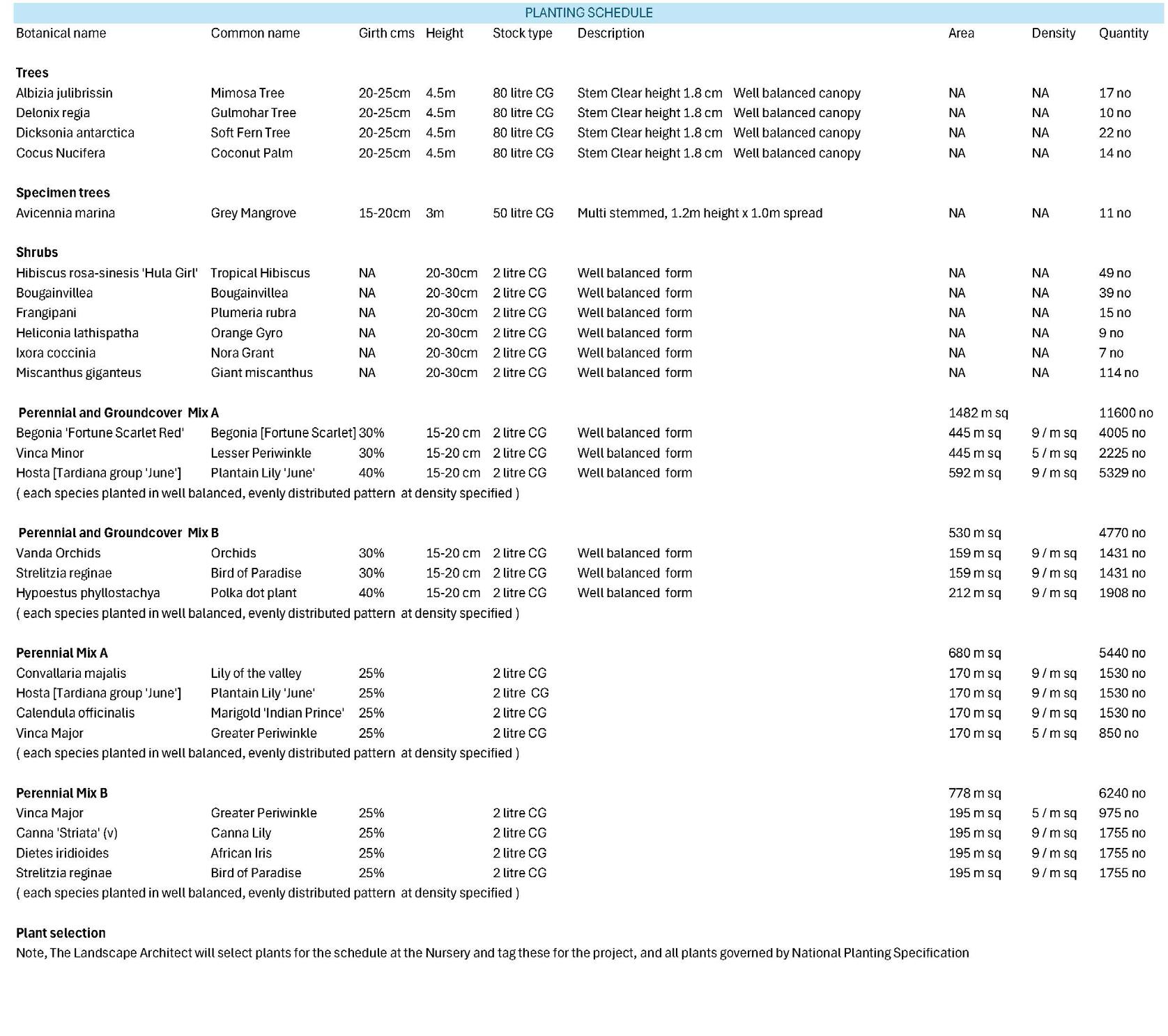
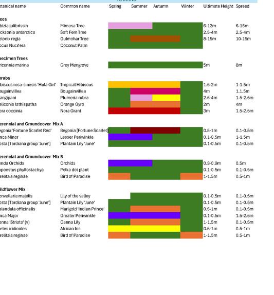
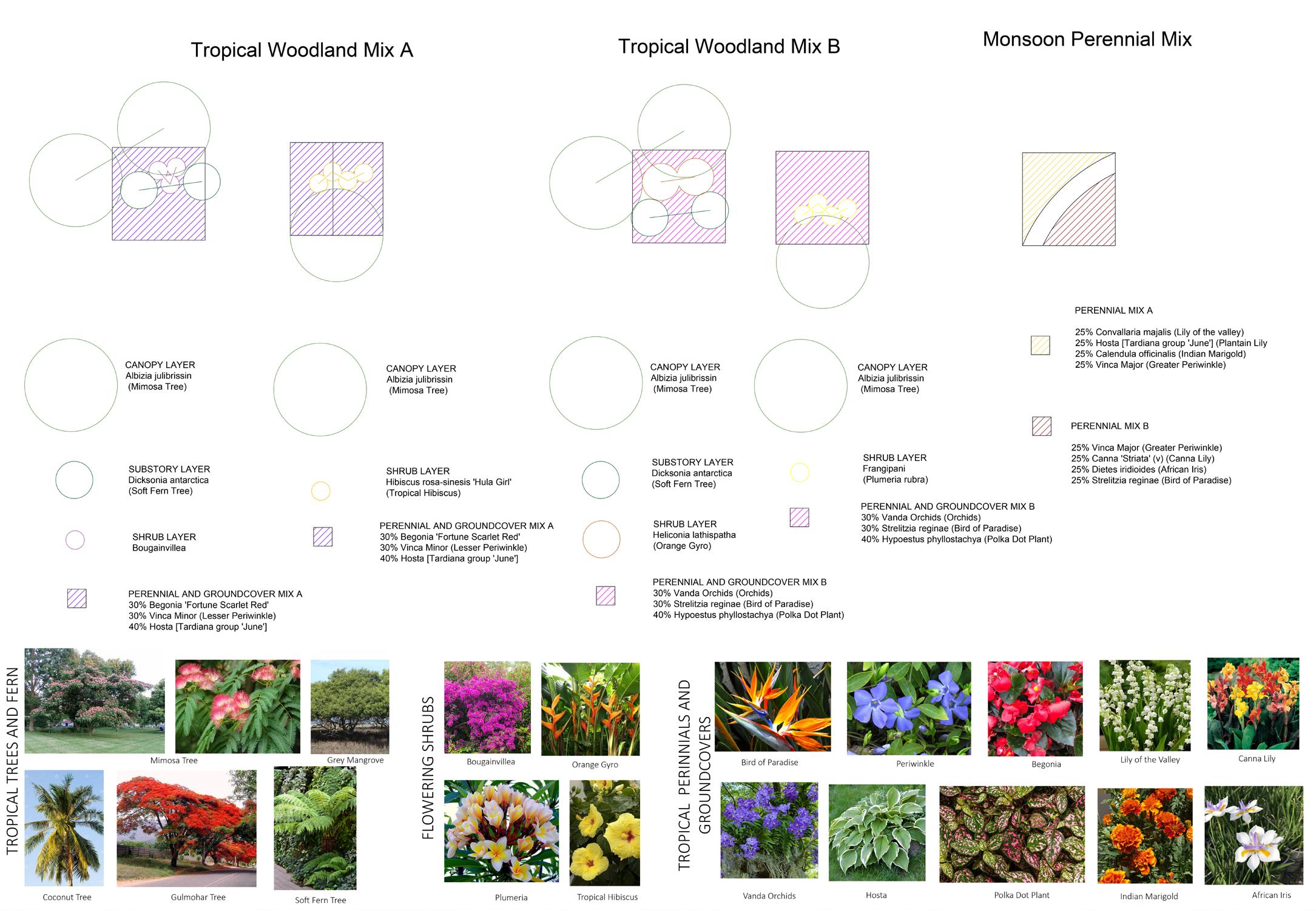
PLANTING SCHEDULE AND ITS DIVERSE SEASONALITY
2.UNIVERSITY FOREST COURTYARD
Detail Design
Living Graphical Ambience achieved by introduction of features that aid to elevate an exhausted user’s sensory experiences!
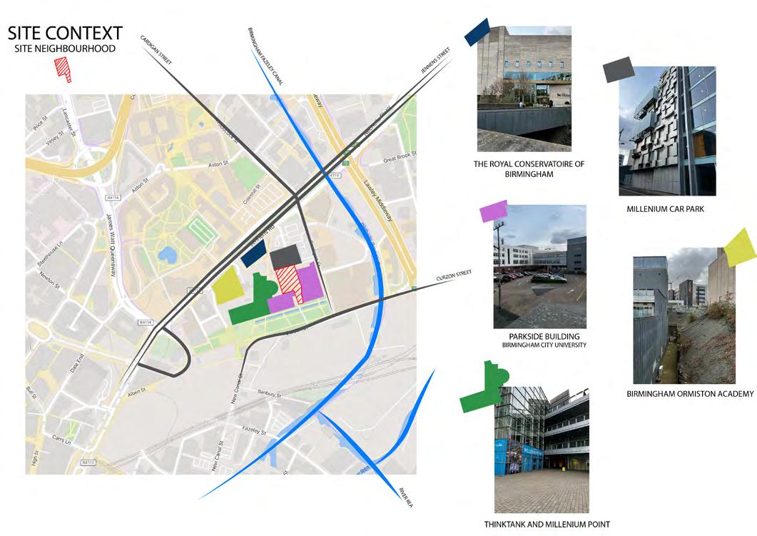
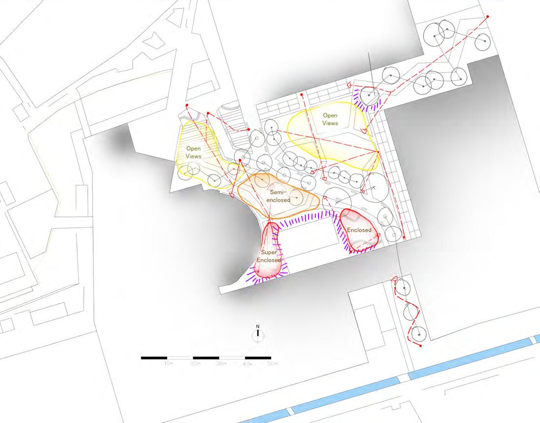
The site was a centrally placed space surrounded by key utility infrastructures like the BCU Parkside building and the Royal Conservatoire and is an asset primarily used as a transit from the Car Park to the utility buildings.
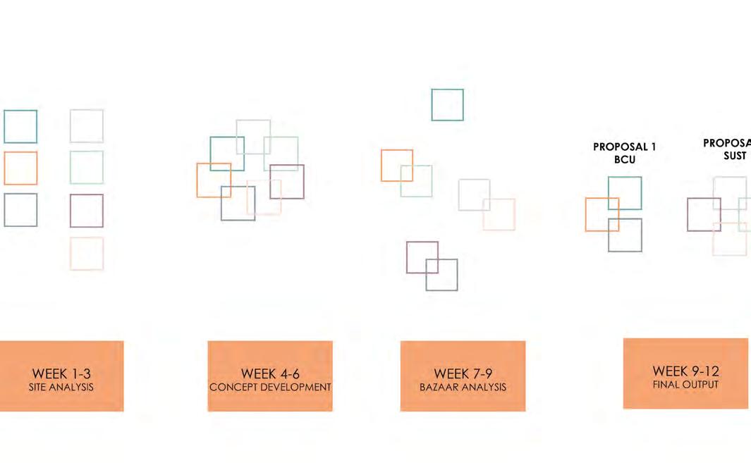
I started with looking at the site location and its shared neighbourhood.
I realized the site is surrounded by some significant buildings and is used by a good number of professionals.
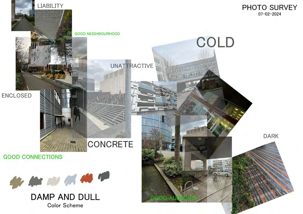
After conducting the photo survey, I had got the initial idea of my concept. I definitely wanted to change the existing cold and grey toned area to a bustling, chirpy and contrastingly hued area.
The key facilities that the design aimed to cater to were:
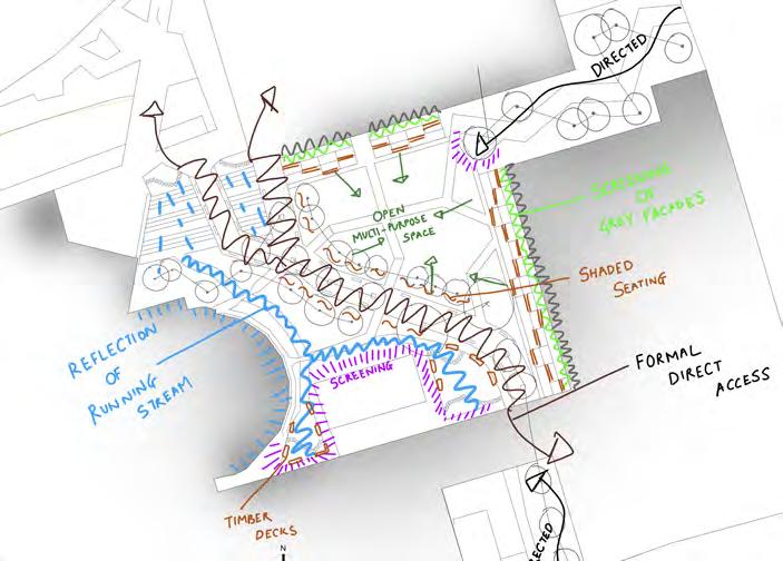
1. Providing an interesting, captivating and quick transit route between the Car Park and the Parkside building using a dramatic ramp
2. Providing a place for the key identified users for respite from the daily routine
A convenient route which is a conbination of crispness and pleasure for users aiming to saving time
RESPITEFUL
A space for relaxation from the day routine for students and staff DIRECT
DRAMATIC
Dramatic and Captivating in response to level changes and facilities
Design Brief
The site is a centrally placed space surrounded by key utility infrastructures like the BCU Parkside building and the Royal Conservatoire and is an asset primarily used as a transit from the Car Park to the utility buildings.
The key facilities that the design will aim to cater to are:
1. Providing an interesting, captivating and quick transit route between the Car Park and the Parkside building using a dramatic ramp
2. Providing a place for the key identified users for respite from the daily routine
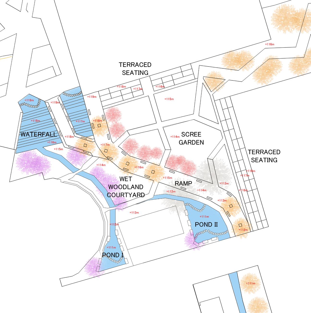
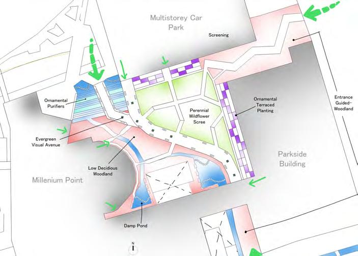
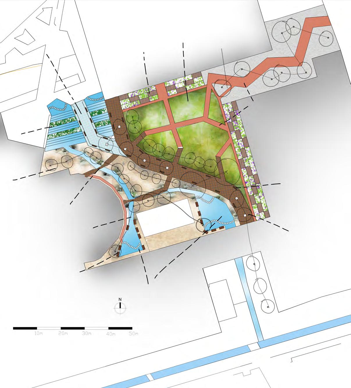
GENERAL ARRANGEMENT PLAN
(With Spot Heights)
HARD LANDSCAPE FEATURES
MATERIALS PALLETTE Design Development
SOFT LANDSCAPE FEATURES
MATERIALS PALLETTE Design Development
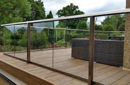
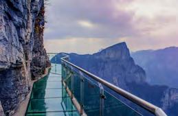
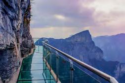
Glass Ramp
6m×3m×100mm
Toughened Glass fitten over 1m×1m Steel Frame with stainless steel balustrades
Retaining Wall Steps 6m×3m×100mm
Toughened Glass fitted over 1m×1m Steel Frame with stainless steel balustrades
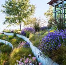
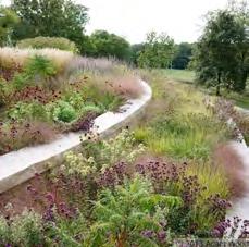
Scree Garden
With planting layers of groundcover, herbacuous perennials, shrubs and canopy towards the edges.
Water Purifiers and Oxygenators like Hornworts and Frogbite
Deciduous Woody Plantation
Swamp Cypress and Marginal and emergent species
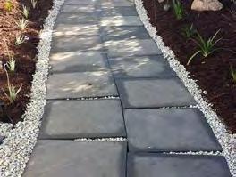
Pavement
450mm×450mm×75mm Flags
Sander Red Sandstone Pavement@ Marshalls
Layered over Recycled Concrete pavement crushed chips
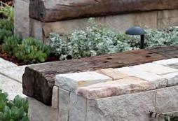
Bench Seats
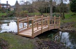
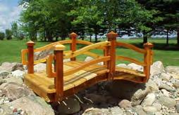
Recycled concrete pavers topped with a larch wood slat for seating Wooden Foot Bridges
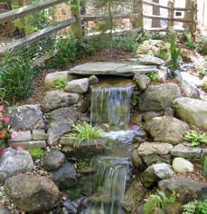
Artificial Stream
45m×2m×500mm
Recycled Concrete Pavements as river boulders, rocks and gravel
Artificial Stream
45m×2m×500mm
Recycled Concrete Pavements as river boulders, rocks and gravel
Pond Deck 2m×1m Douglas Fir Slats
Pond I and II 1m deep
Ramp
6m×200mm×100mm placed at 25mm gaps
European Redwood Slats
Layed on 1m×1m Steel frame with toughned glass infill stainless steel panel balustrades.
MATERIALS
DESIGN
WOODEN BRIDGES
LARCH WOOD
TOUGHENED GLASS
DOUGLAS FIR DECKS
EUROPEAN REDWOOD
SANDER STONE
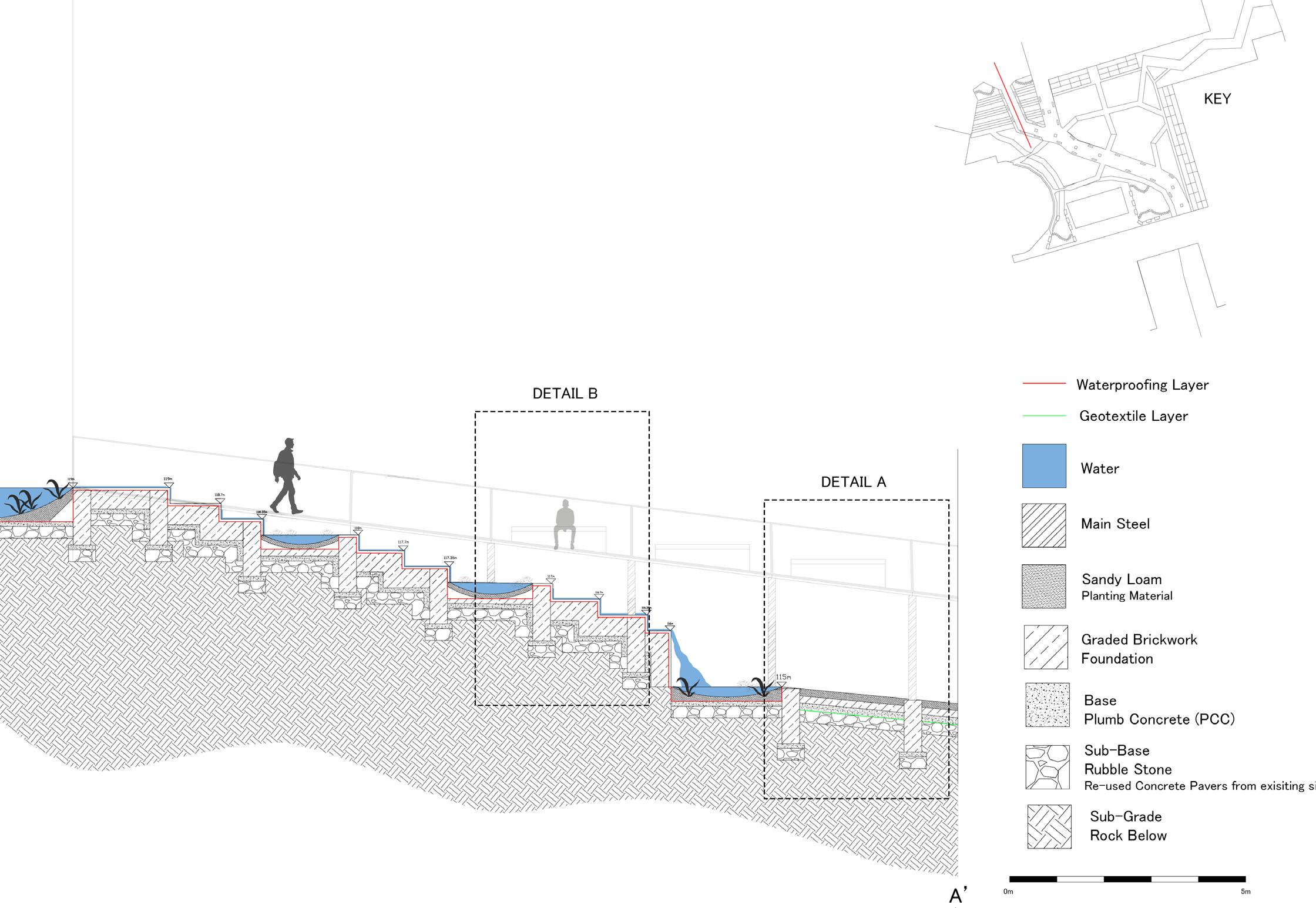
WATERFALL DETAIL SECTION
1:200m
Water Storage Pond at the highest level of the site-119m
50mm Slate Tiling
Water Cascades with water plants to purify and oxygenate water
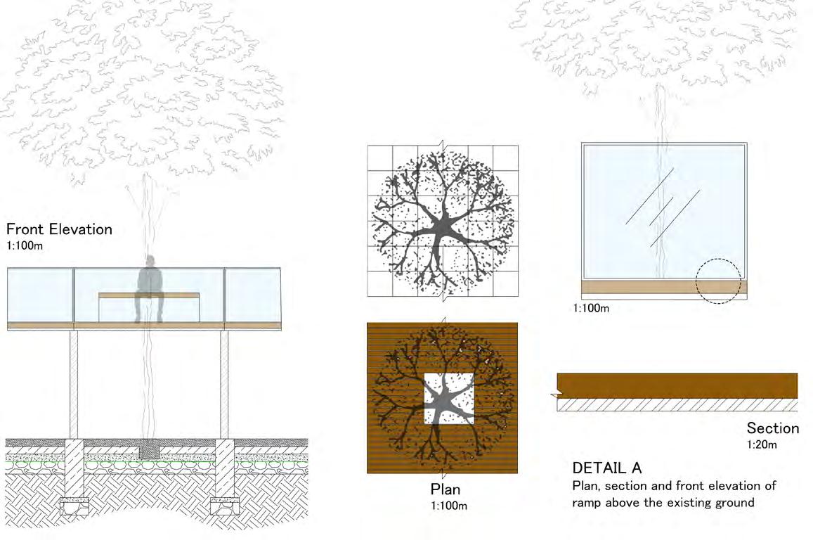
DETAIL A
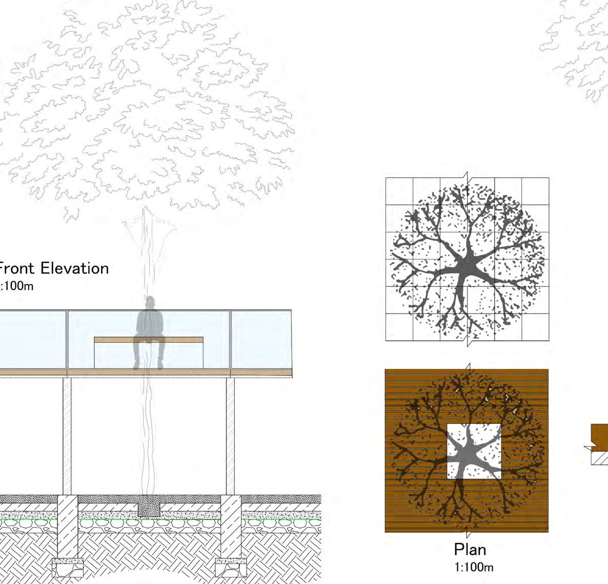
PLAN, SECTION AND FRONT ELEVATION OF RAMP RUNNING
ABOVE THE EXISTING ROUND LEVEL
Ramp with tree avenue running on the central axis
6m×200mm×100mm placed at 25mm gaps European Redwood Slats
Layed on 1m×1m Steel frame with toughned glass infill stainless steel panel balustrades.
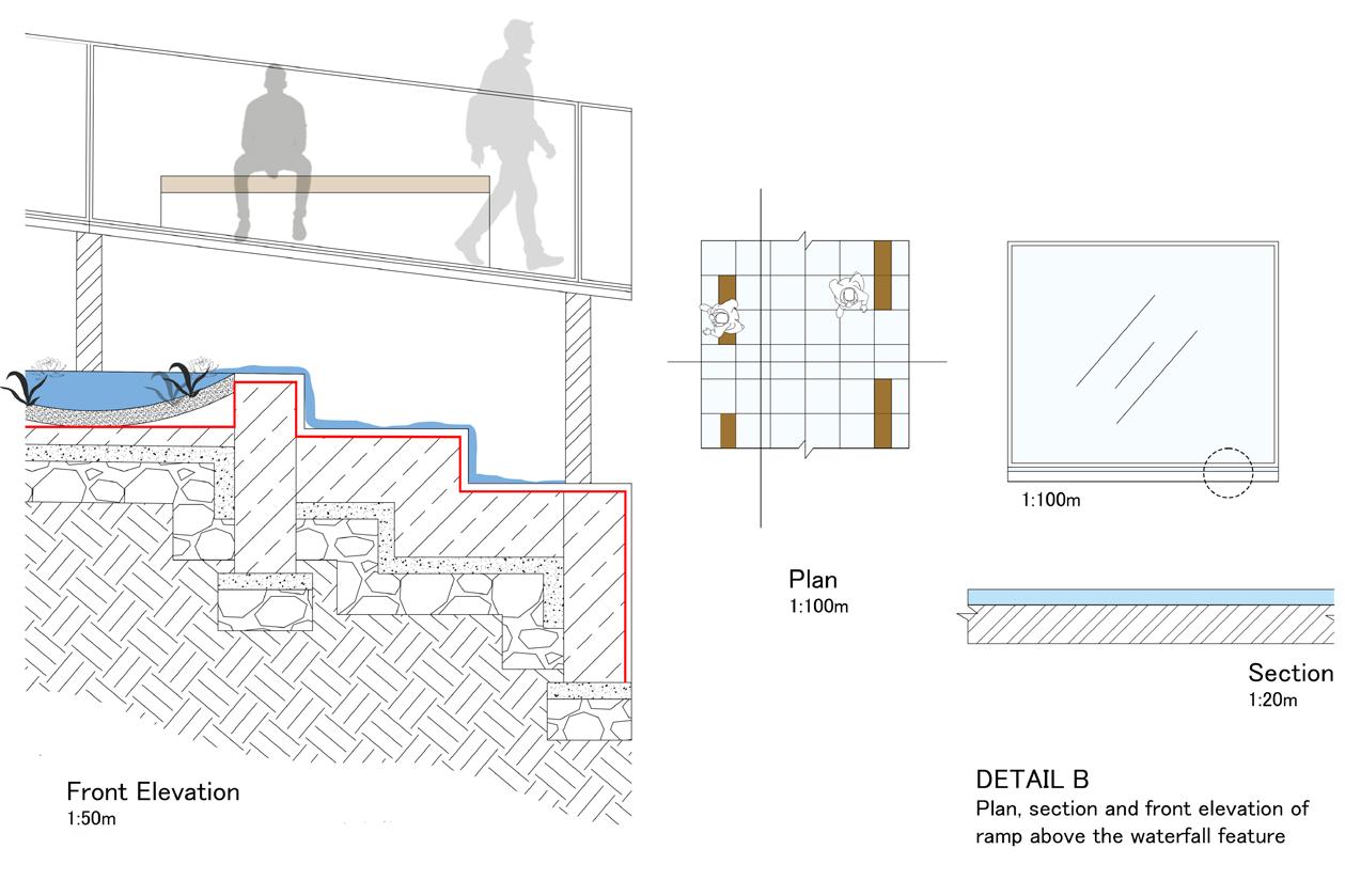
DETAIL B
PLAN, SECTION AND FRONT ELEVATION OF RAMP RUNNING ABOVE THE PROPOSED WATERFALL FEATURE
6m×200mm×20mm
Toughened Glazed glass with glass balustrades and stainless steel structural frame
Toughened
Toughened Laminated Glass structure with a strenghthening glazing interlayer to avoid glass spilling when broken
Glass Balustrades:
Collaboration Project
As part of our course we designed in collaboration with SUST university in Bangladesh to intervene and design for a small public space in a rural village located in Bnagladesh.
The purpose of me adding this work in my portfolio is that, this collaboration bought about a significant learning about working with multi-disciplinary professionals to achieve a collaborative design solution to my skill set.
I had to liase with Architects and Interior Architects from Bnagladesh and Urban Designers from the UK. I leaded the team meetings and organized routine work flow for the team.This opportunity enhanced my leadership and team management skills considerably.
An important virtue that was instilled in me through this project was the ability to approach a task with full professionalism, individuality but also to balance it with good team work and strong understanding for my colleagues. It was a different experience as all of my other projects had me designing by myself starting right from the early site analysis stage through the concept development and finally the design solution. This project got its challenges and lots of learning in its way which gave me a feel of working in practice with multi-disciplinary colleagues.
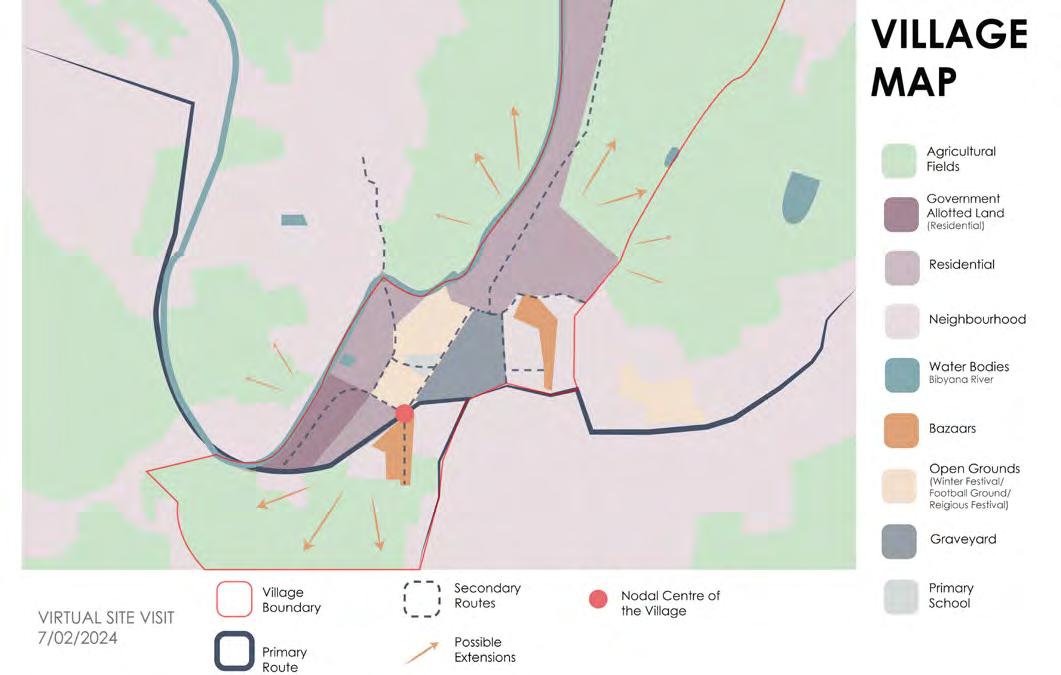
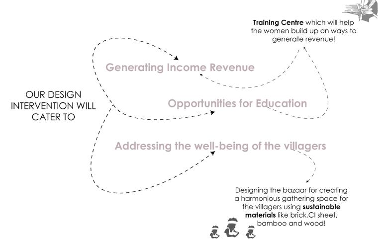
Site Brief:
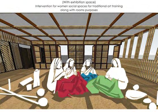
KazirBazaar is a historically significant place that has served eight neighborhoods over the past 70-80 years. It was a lively site not only for shopping but also for communal gatherings on “hoot day”. However, the marketplace became mundane with time. We seek to revive the essence of traditional Bangladeshi bazaars. Our proposed design intervention is characterized mainly by a socio-economic and public well-being approach. The goal of our proposed design intervention will be to enhance the Kazirganj bazaar area specifically, providing greater sustainable places for community gathering and creating a pathway for the women of the village towards recognition by designing for multiple training areas intertwined in the bazaar area for practicing the long lost art of weaving-Nakshikatha, that will provide the villagers a
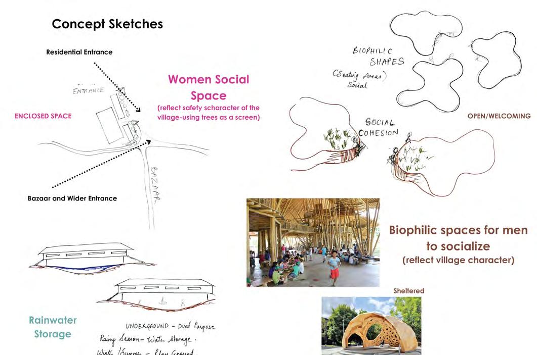
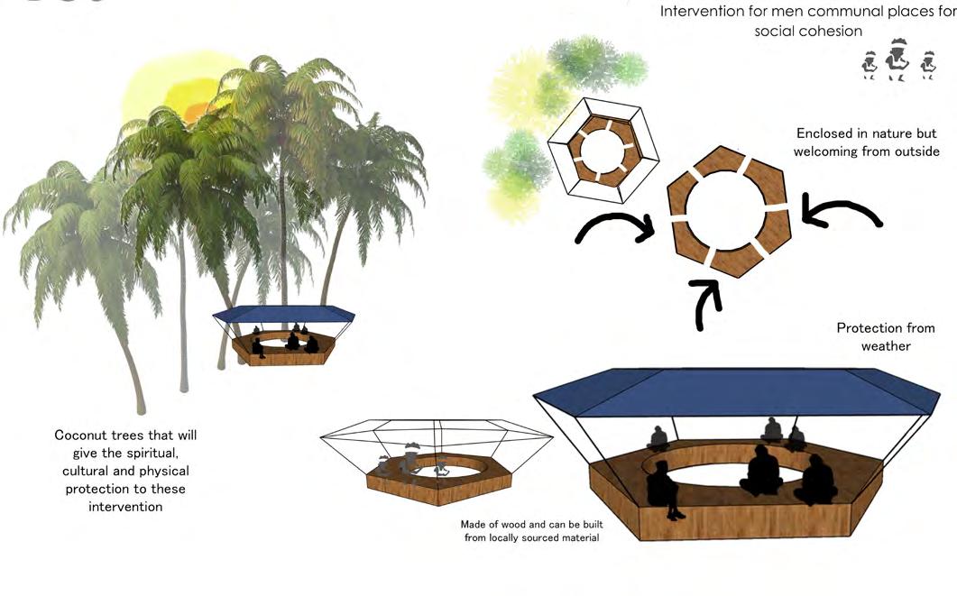
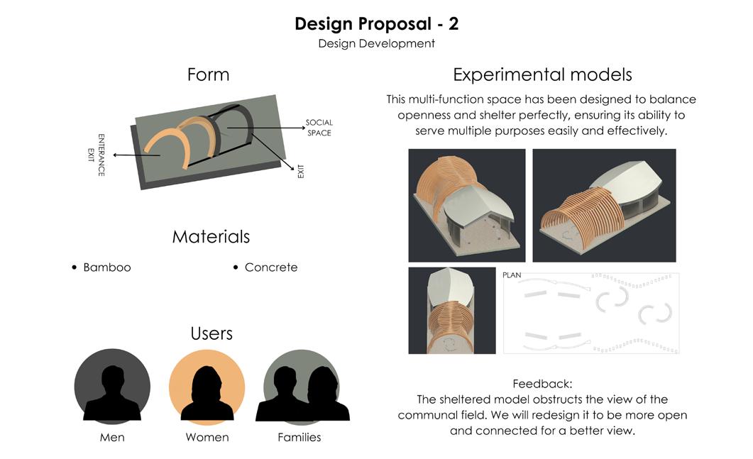
We designed for a pavilion for the women of the village to practice their traditional art of weaving. I as a Landscape Architect in the team looked at plantation and orientation of these pavilions. I ensured they were well connected to the wider village.
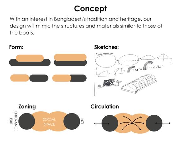
From my social economic analysis I decided to look into the opportunity that the surrounding area is well linked by canal/rivers. Bangladesh boats offer inland water transportation. Boats and rivers have played an important role in Bengali culture, inspiring generations and shaping the art of boatmaking.
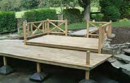
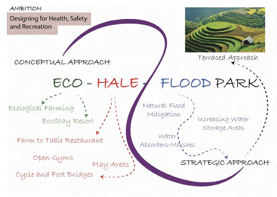
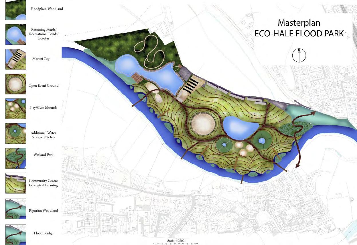
4.West Midlands Agricultural Showground
Design for Climate Change
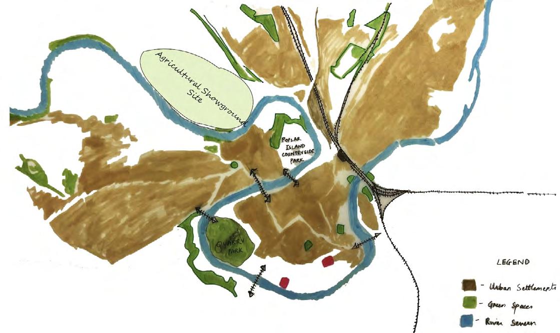
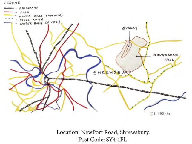
Site Location: SHREWSBURY, UK
- Opportunity for innovation and exploration of new approaches to deal with climate change, biodiversity loss and resilience.
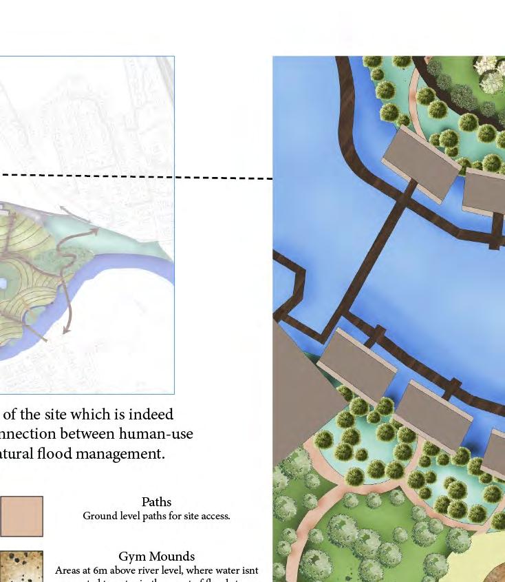
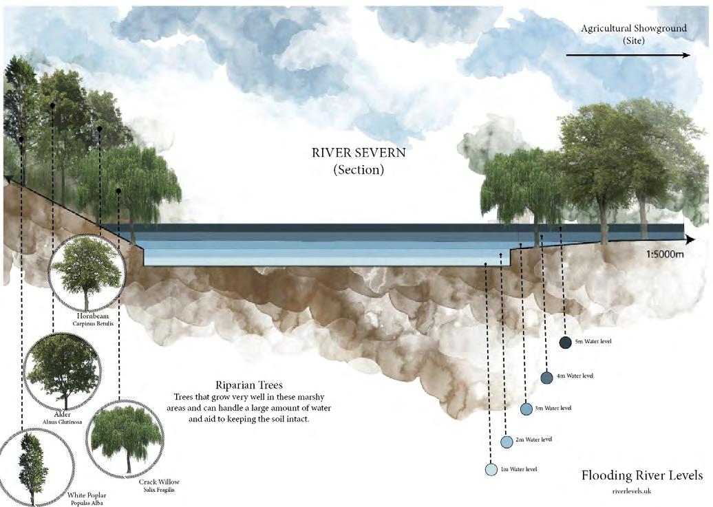
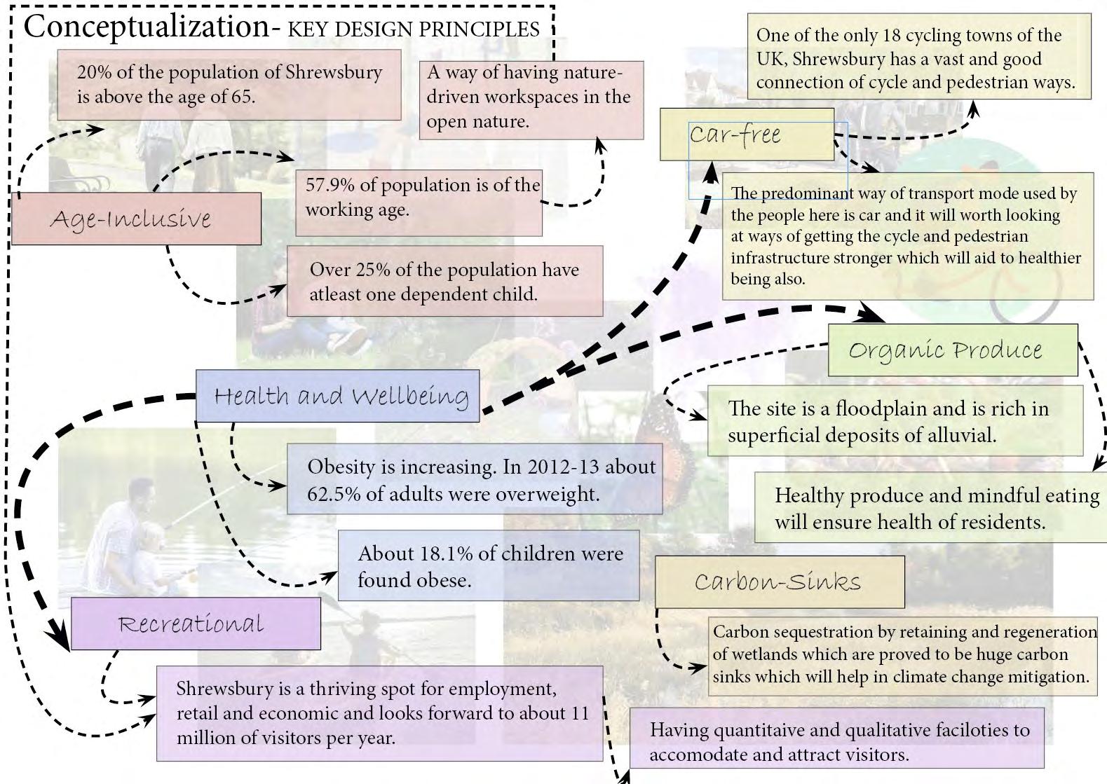
-The site is a floodplain site victimized of flooding. The design brief was to find a solution for the current and future climate change.
-My approach to the site catered to a flood level of 6m. All the facilities including a flood bridge, stay, market and play areas were designed keeping the 6m level in mind.
Designing for 6m Flood level
Providing a nature-based solution for the flooding
Taking full advantage of the fertile alluvial soil
Making the site more accessible
MY DESIGN APPROACH
A park which aims to build a healthy community and caters to the ecological as well as recreational needs of society and the environment with future climate change being the leading light.
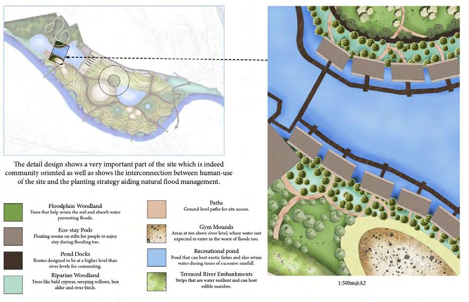
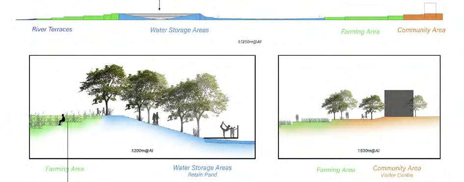
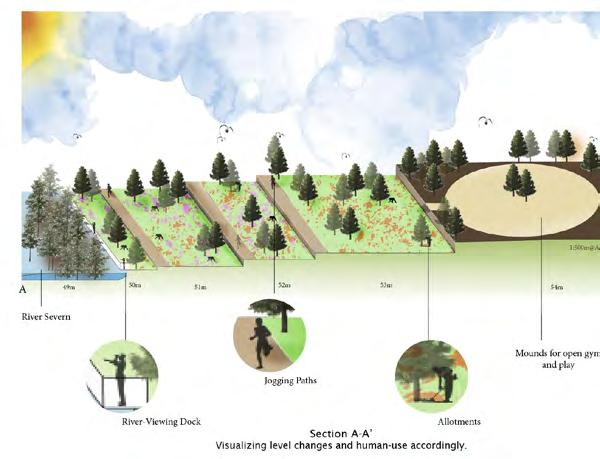
DETAILED DESIGN
Cross-sections and perspectives visualizing proposed design ideas
Flood Strategies used
-Flood Bridge
-Bio-Swales
-Vegetated Terraced strips
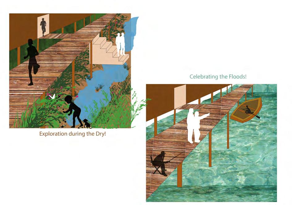
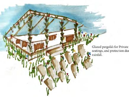
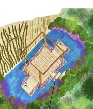
This first scenario shows the site use during the dry-80% of the all times. The dry grounds can then be used as play grounds or for camping or even hosting events like cultural shows and weddings too.
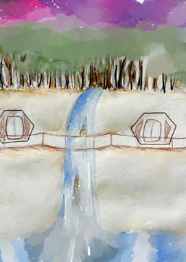
This is a visualization showing how people will use this part of the site in two different situations. As we are designing for climate change, the main scenario that will effect the site will be flooding. Hence, scenarios of flooding situation has been shown. The visualization below shows times of heavy rainfall event, when the site is expected to have water in the retaining ponds. The eco stay houses can be accessed using the stilted pond docks. These pond docks can alternatively be used for fishing too.
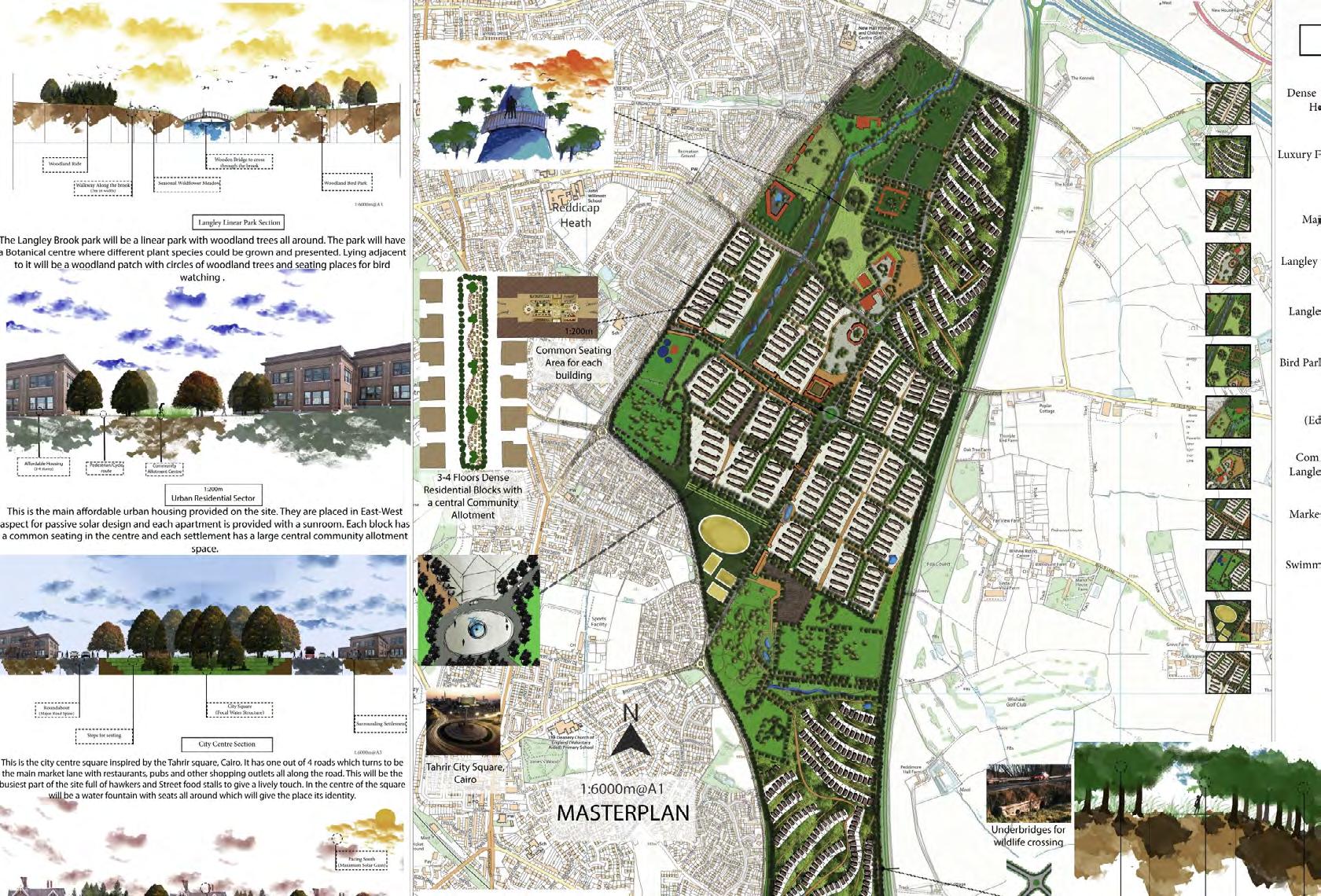
5. Langley (SUE)
Sustainable Urban Extension Project
Design Concept
The housing shortfall across the UK has “re-enacted” ambitions of creating “high quality, attractive and well designed”villages and towns. As a consequence, more recently, new programmes/initiatives emerged, e.g. the NHS Healthy new Towns, New Garden villages and towns, New Garden Communities. However, aspirational, they are guided by more sustainable (eco) approaches (perhaps driven by allocated funding streams).
LANGLEY is located in Sutton Coldfield, Birmingham. Land has been removed from the Green Belt to provide a sustainable urban extension (SUE). The site is delimited on one side by the town of Sutton Coldfield and on the other by the A38.
The site will be developed as a sustainable urban extension (a sustainable neighbourhood) to provide for new housing to meet the needs of the City’s growing population.
- The development aims to achieve the highest standards of sustainability and design, and to provide a range of supporting facilities to help foster a strong sense of community
- The new neighbourhood will have a strong sense of place and distinctive character
- Connectivity - the creation of well connected, integrated and sustainable transport links will be essential, including a network of integrated pedestrian and cycle routes throughout the site
- Existing heritage assets in the area should be protected and enhanced
- Existing green and blue heritage should be protected and enhanced and integrated in a network of connected green/blue spaces.
-Green infrastructure is key for this development to provide a range of ecosystem services and benefits
-The new neighbourhood will provide for a mix of housing sizes, types and tenures, including affordable housing in line with the requirements in Policy TP31.
-A range of supporting facilities should be provided, including new schools and other services
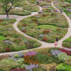
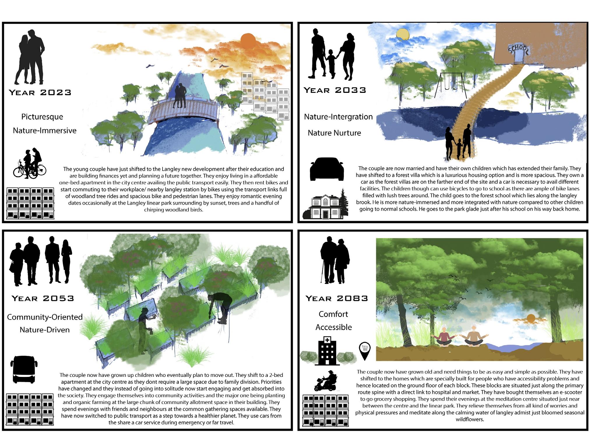
Story Board-Showcasing the life envisioned by the proposed design
6. HaughmondRewildingHillProject
-This quarry is one of four mineral extraction industries within a 5 mile radius all which exploit the unique geology of this region and is a well established, highly organised extraction industry produces high performance graded aggregates for the Civil Engineering Industry, like roadstone and rail ballast.
-Due to commercial pressures the quarry submitted proposals for expansion of its extraction operations and as part of the Planning Proposals details were put forward by their consultants to mitigate the loss of woodland amenity with environmental improvement measures.
-opportunity to provide a design solution that uses the principles of Designed Ecologies to create a living theatre and stage so that the forest and industrial landscape created by quarry operations is imagineered to achieve the design objectives.
Proposed Design Brief
Creating a mosaic landscape capable of absorbing great quantities of carbon and supporting a rich assortment of wildlife, including grassland, heathland and riparian wetlands. The Post-Covid times have been difficult for all living beings be it humans, plants or animals. The idea is to create a small place where all feel comfortable, healthy and rejuvenated away from city life.
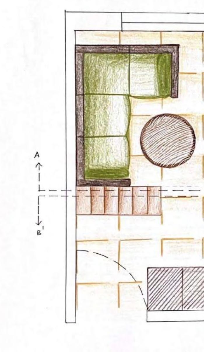
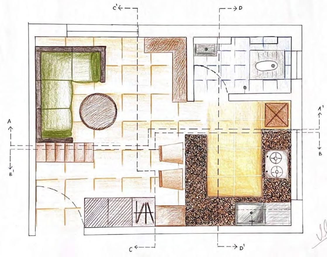
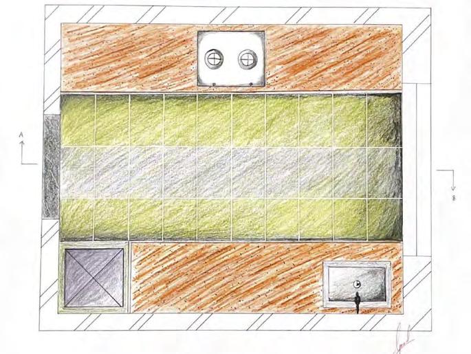
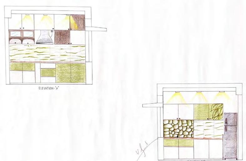
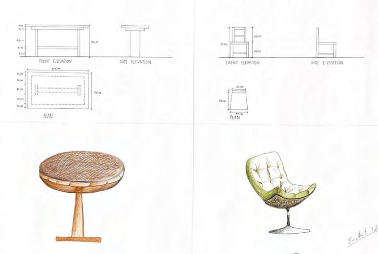
7. Interior Design
Undergraduate Level Work
This section includes my best design work from my interior design degree.
The design brief was to design for a studio apartment. On the right hand side, the kitchen plan and sections show a design for a parallel counter-top kitchen and some of my furniture designs in sections and also rendered by hand in 3D.