
WORKS


FARIBA SAMIA OMI
DOCUMENTATION AND CONSERVATION
PLANNING FOR BUILDING NUMBER 13
PANAM CITY
Client: Ministry of Cultural Affairs, Government of Bangladesh.
Location: Panam city, Bangladesh
Time Period: July 2020 - December 2020
Role: Lead Architect and Team Leader.

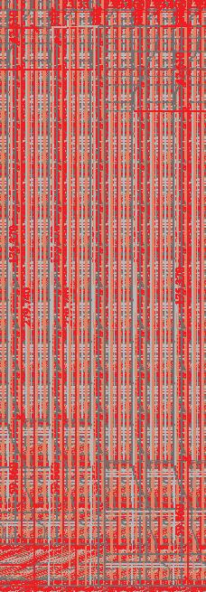
Floor Plans: Conditional Survey and Documentation
The survey follows the metric survey methodology, ensuring precision, reliability, and repeatability in heritage documentation. This first phase focuses on mapping the historic environment’s current condition to plan and record conservation actions. It begins with a conservational sketch, followed by directly plotted drawings, measured drawings, and sketch diagrams. Measurements, recorded in centimeters using laser distance meters, are synchronized with photogrammetry for accuracy.
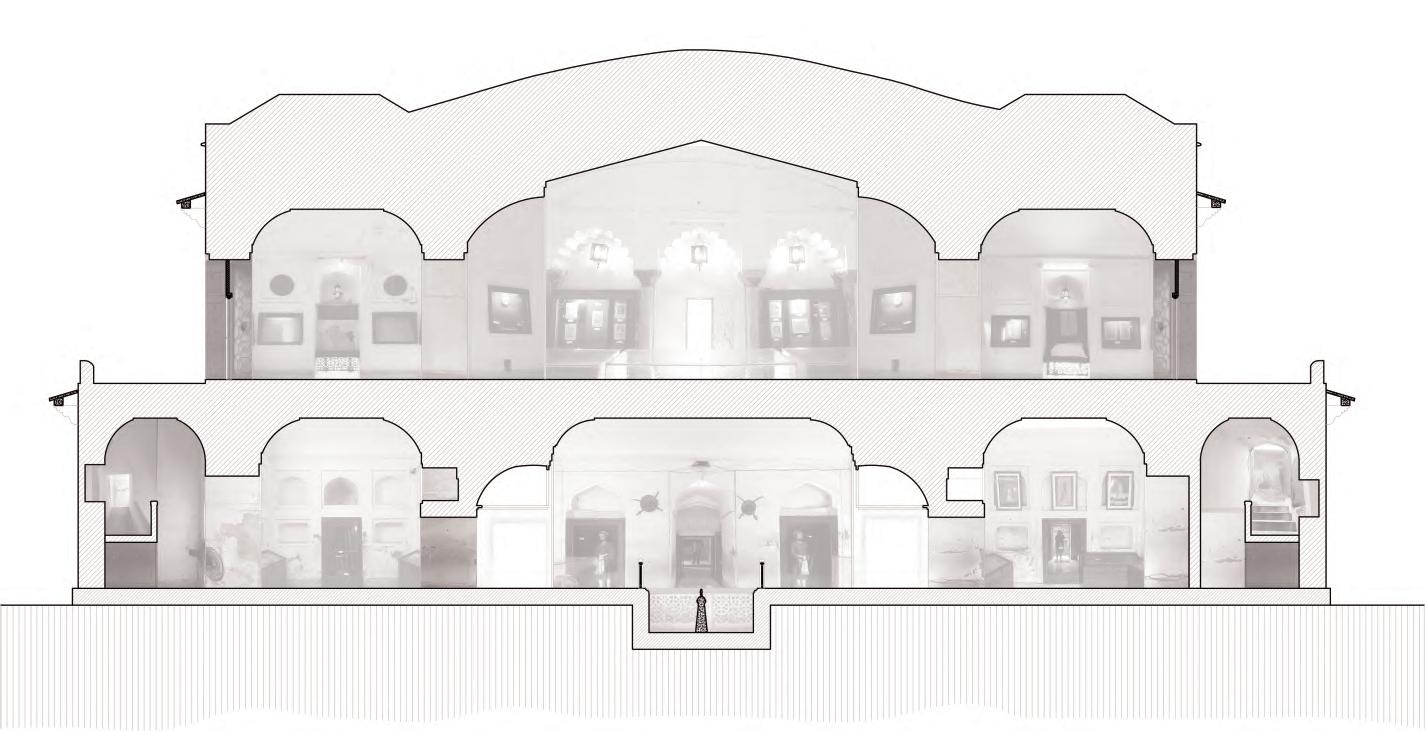
SECTIONS
Vertical sections were created through the existing building using parallel projection photographs and photogrammetry to reveal its internal spatial organization. Parallel projection photographs provided precise two-dimensional representations of the building’s geometry, while photogrammetry generated a detailed three-dimensional reconstruction, capturing external surfaces, material textures, and structural conditions. By integrating these techniques, the study enabled a comprehensive analysis of volumetric composition, spatial relationships, and intricate architectural details. This method ensures a precise and reliable foundation for architectural documentation, facilitating informed conservation efforts.
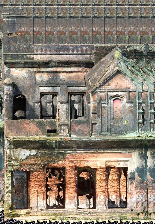
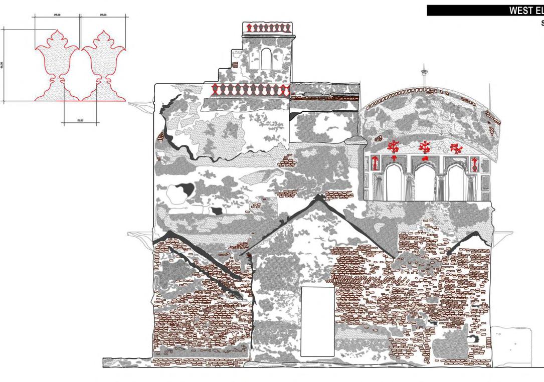
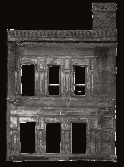
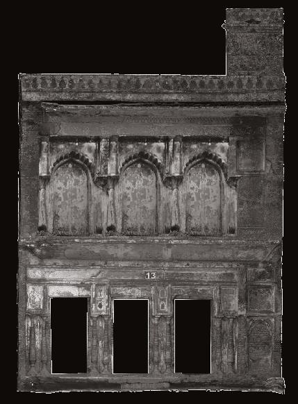
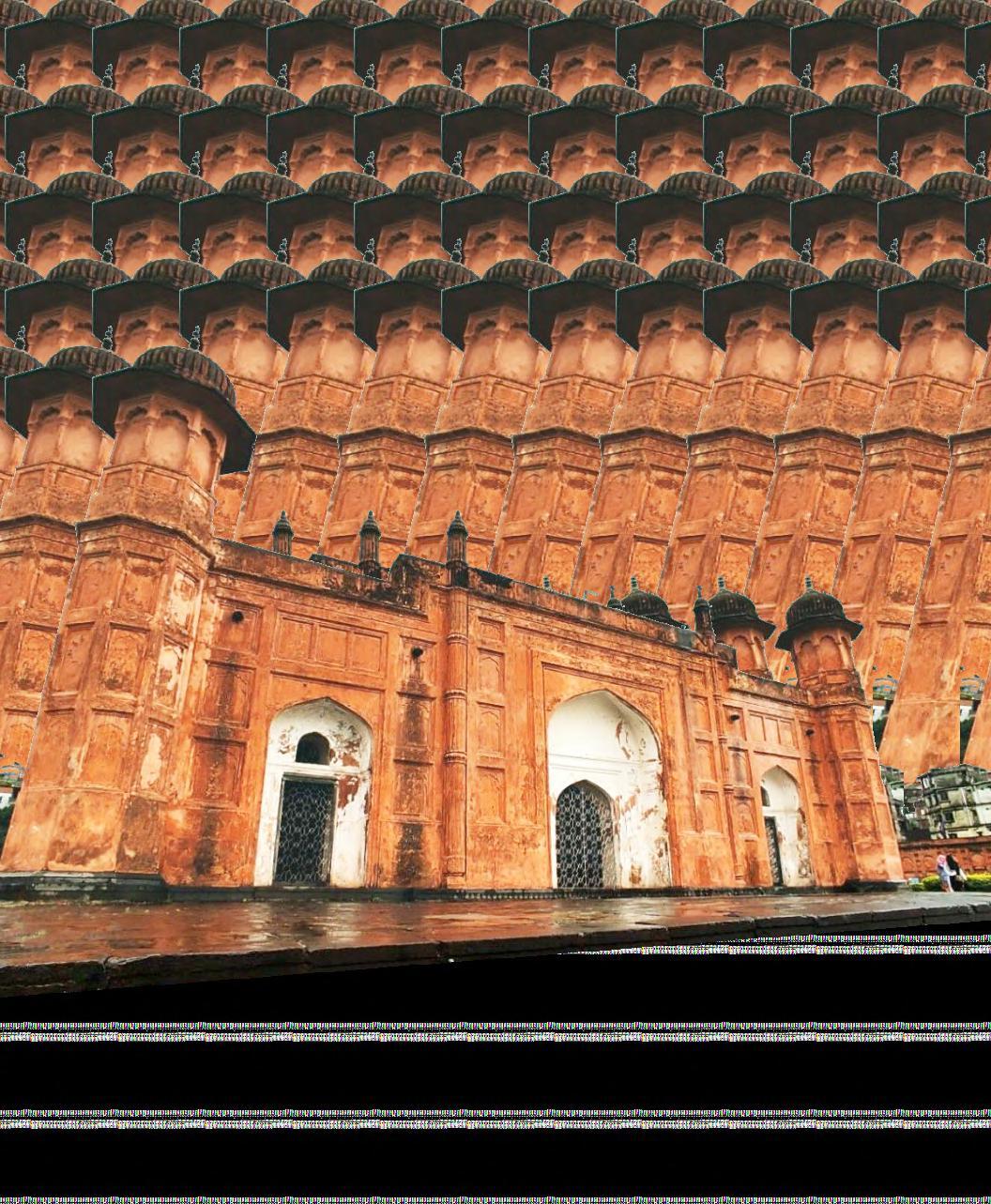
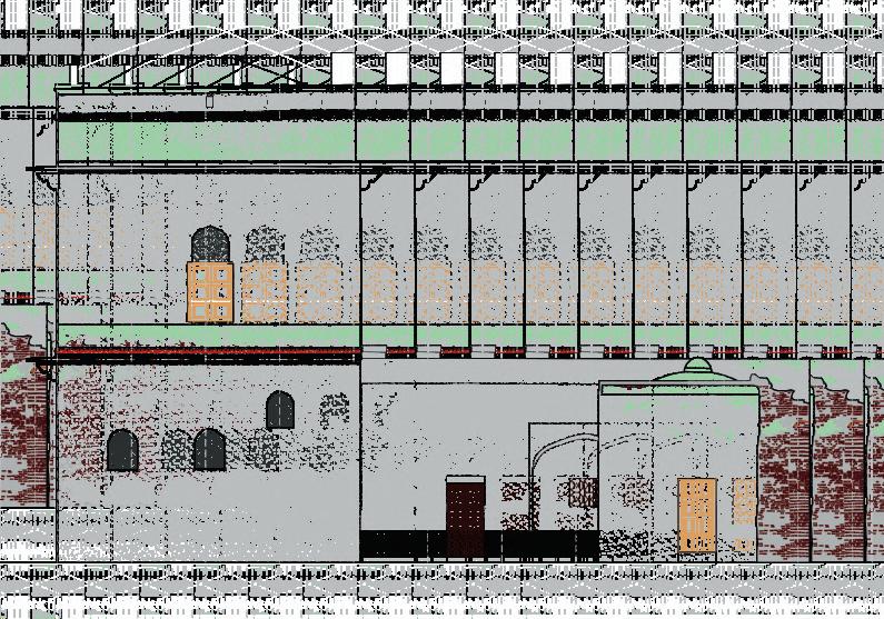
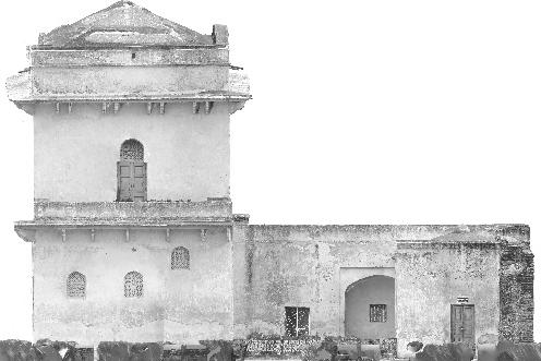
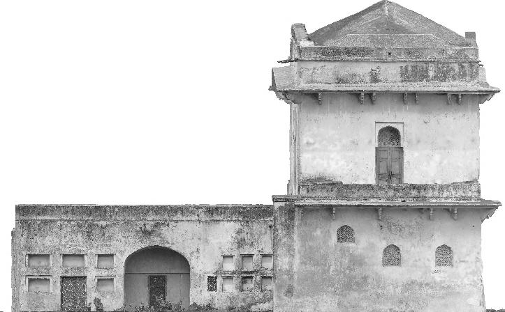
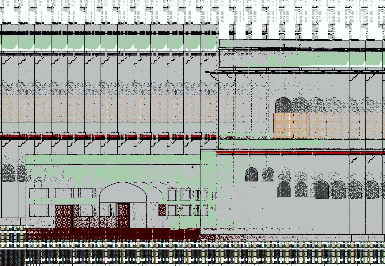
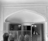
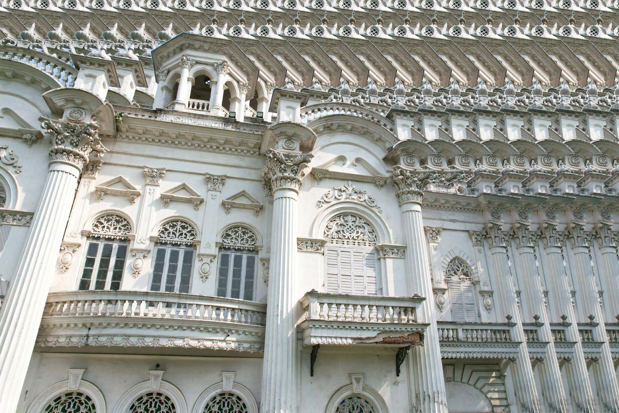
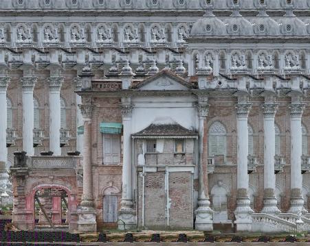
ELEVATION
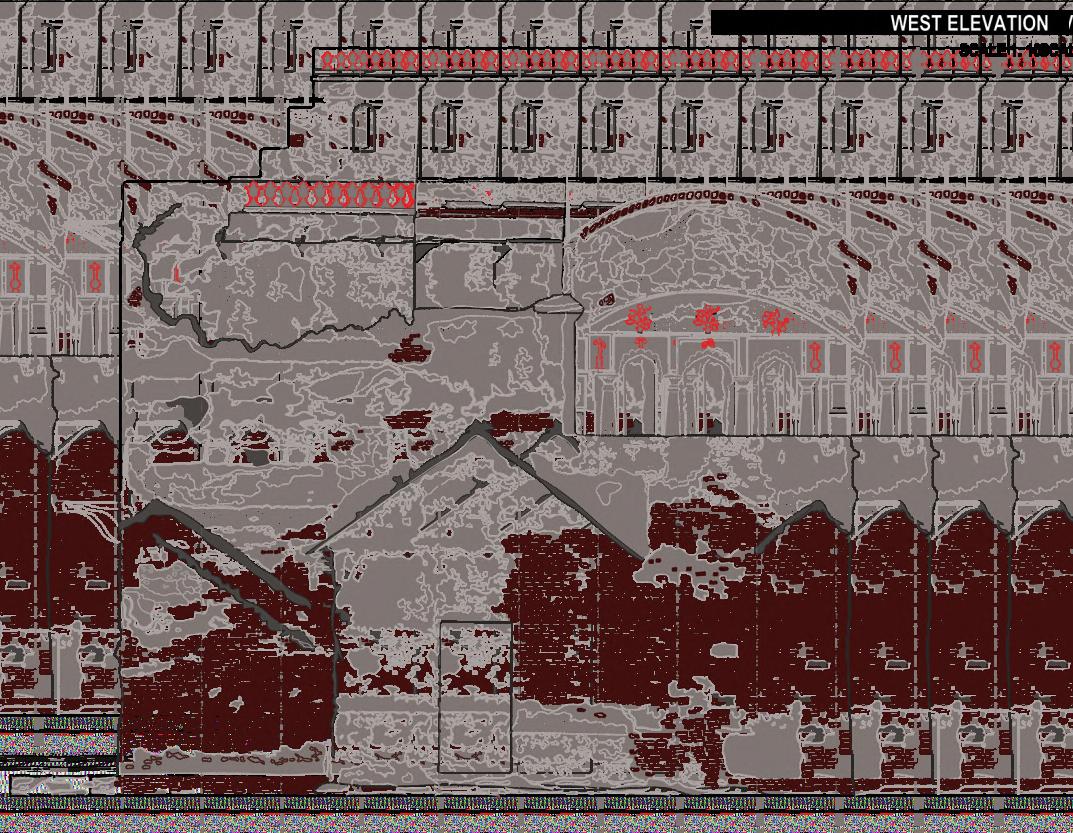
The documentation integrated traditional surveys and digital photogrammetry to comprehensively capture the structure’s essence. Manual surveys meticulously recorded fine details such as material patterns, cracks, vegetation growth, and surface irregularities, while photogrammetry enabled precise 3D reconstructions of textures, depths, and spatial proportions. This combined approach ensured accuracy and consistency, highlighting material degradation, structural vulnerabilities, and key areas for intervention. By preserving both visual and structural intricacies, the process provides a detailed foundation for future conservation efforts.

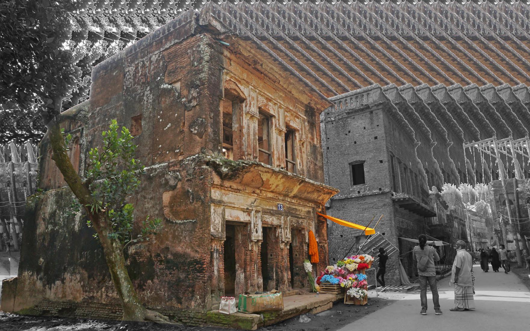
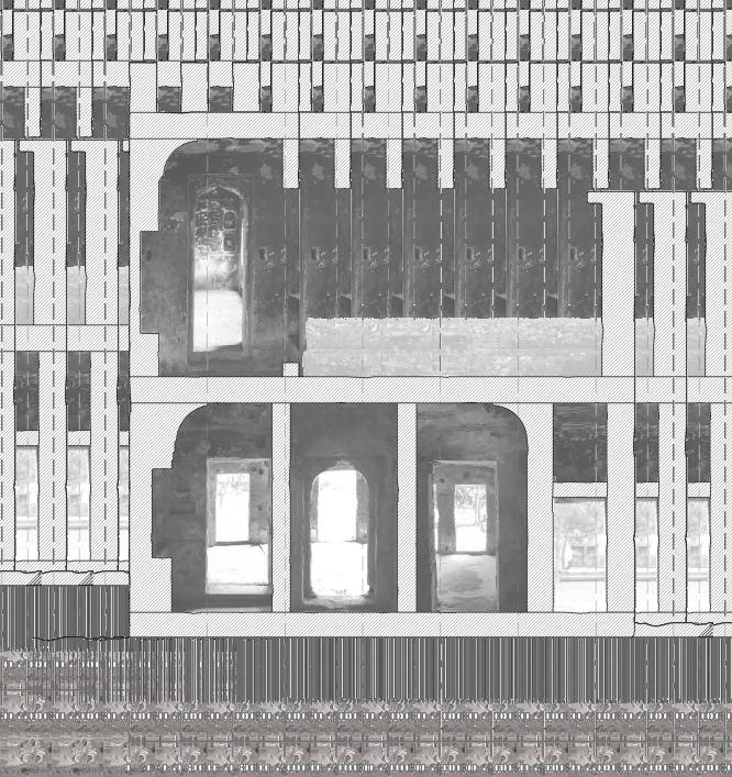
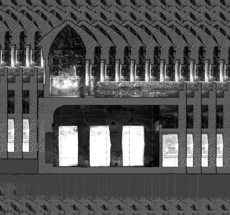
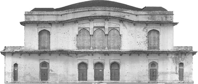
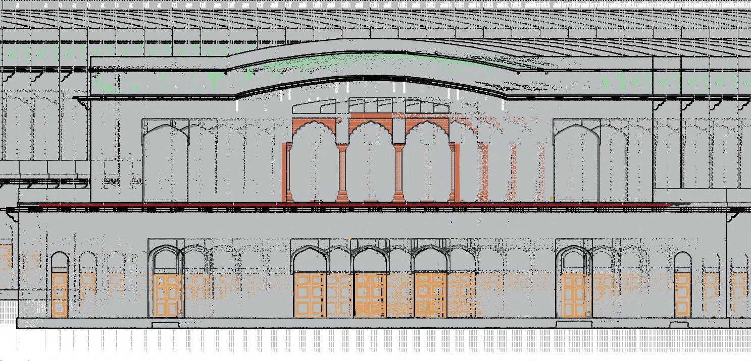
South Elevation
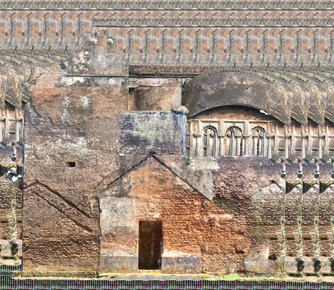
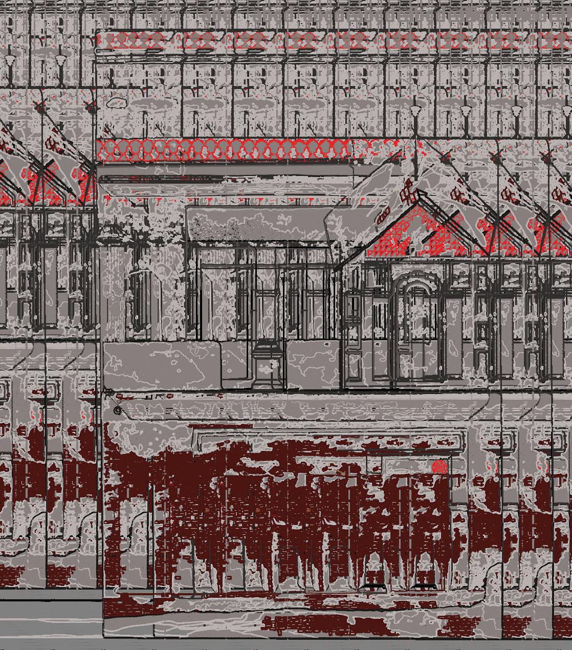
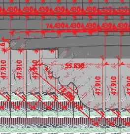
The bricks, limes, and plasters, the broken lines and cracks, the patterns and niches, the vegetations and fungus, the curved surfaces and structural elements were surveyed, measured, and shown in the CAD drawing. From the detailed photogrammetry, 3D files were created with actual texture and depth. These files were later rendered to produce highquality elevation images. Besides manual drawing, elevations were done. This combined approach ensured the accuracy of the documentation while capturing the building's material decay and intricate details. The rendered elevations and 3D files provided a comprehensive visual reference, facilitating deeper analysis of both the structural condition and architectural nuances of the site.
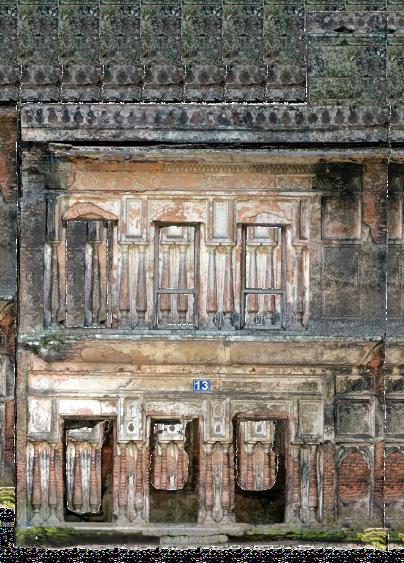
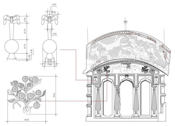
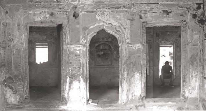
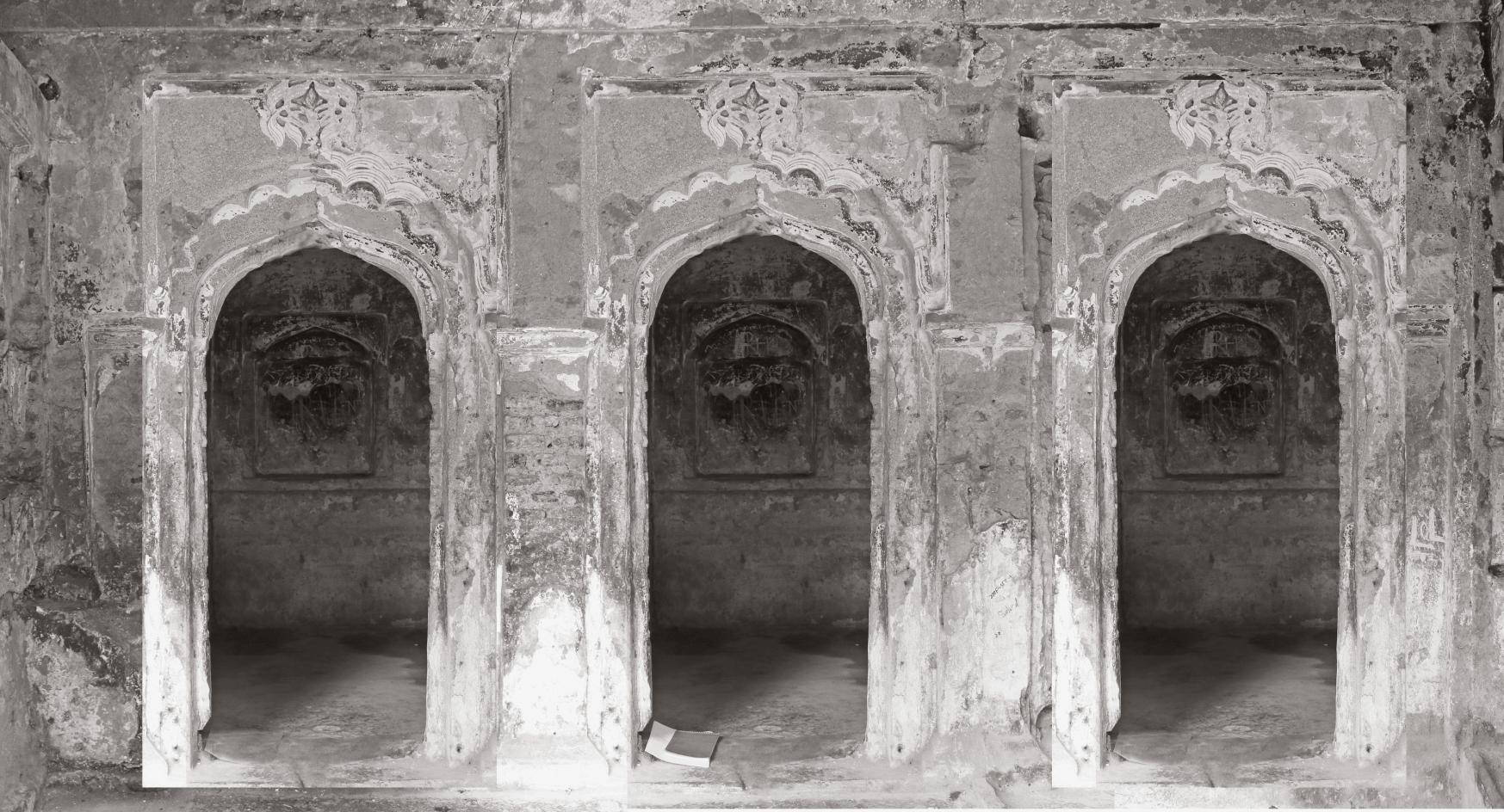
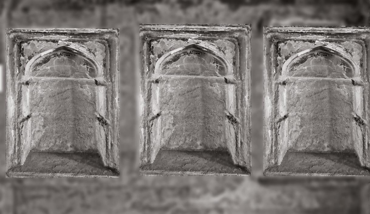
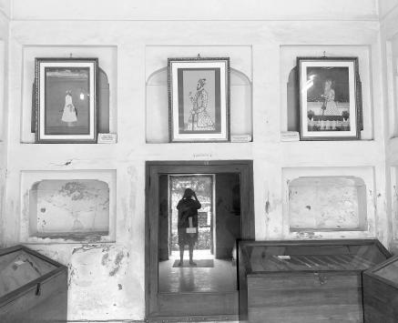
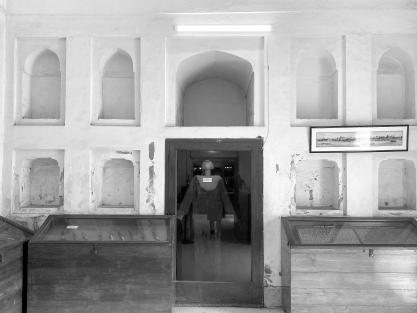
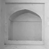
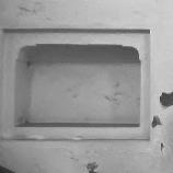
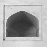
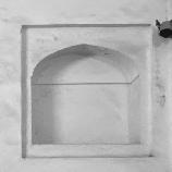
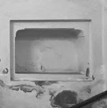
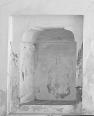
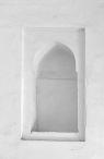
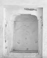
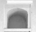
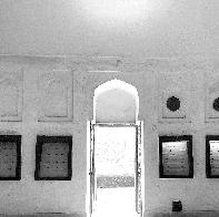
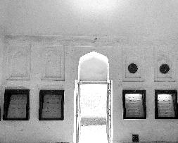
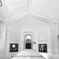
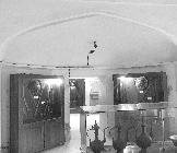
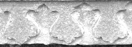
Blow Ups & Interior Details
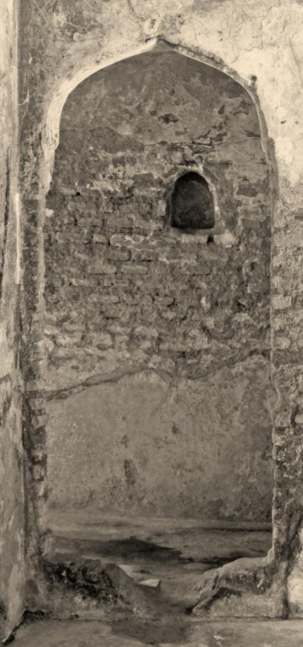
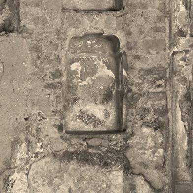
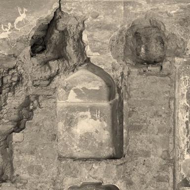
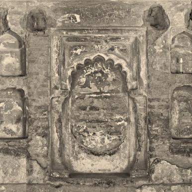
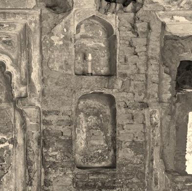
T h e s e m a n u a l l y d r a w n sketches on graph paper are later converted into CAD drawings, ensuring actual site measurements. The method progresses from whole to parts, maintaining coherence within the framework.
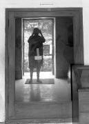
Room 1 South Wall
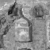
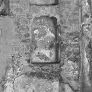
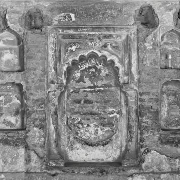
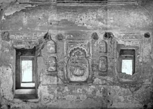
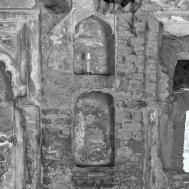

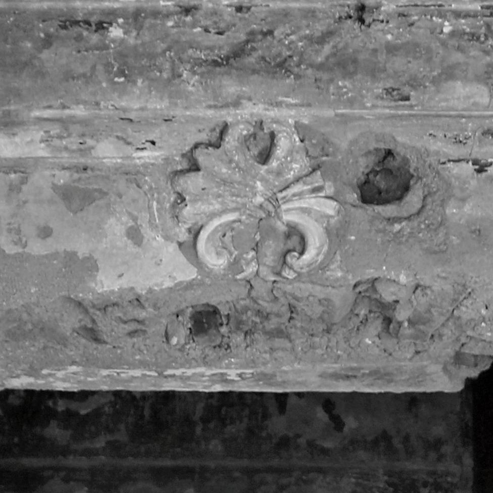
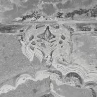
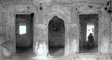
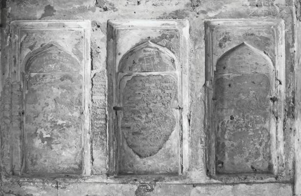
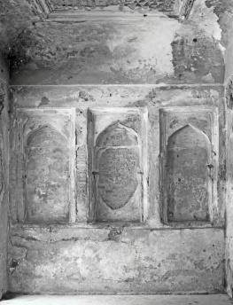

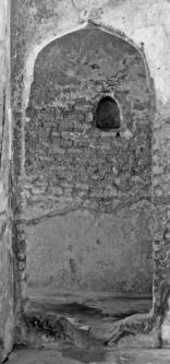
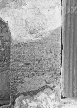

Details of Elevations
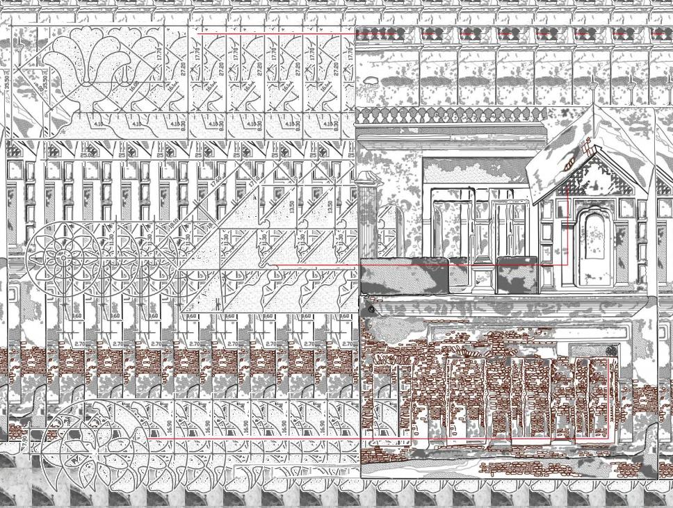
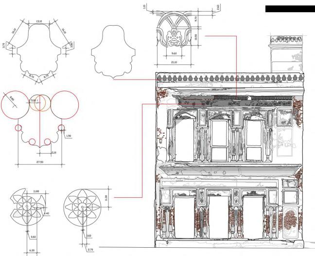
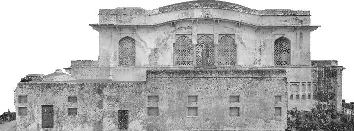
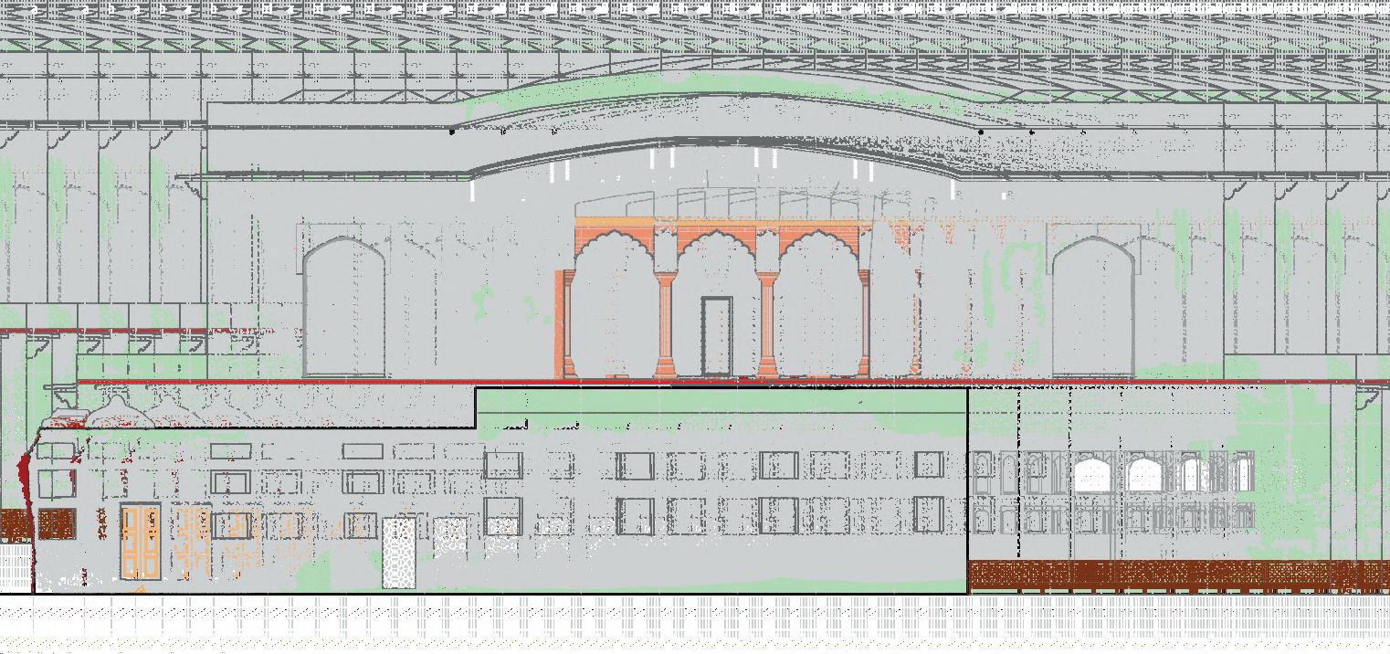
South Elevation
West Elevation
INTERVENTIONS AND PROPOSAL
RESTORING,
RETROFITTING & 3D ARCHITECTURAL DOCUMENTATION OF HISTORICAL MUGHAL HAMMAM OF LALBAGH FORT
Client: Ministry of Cultural Affairs, Government of Bangladesh.
Time Period: February 2021 - December 2021
Role: Lead Architect and Team Leader.

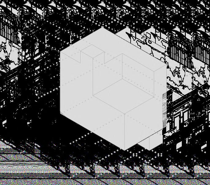
Ground Floor Plan at 5’-0” Level
The Mughal Hammamkhana of Lalbagh Fort is a historic structure located in Lalbagh, Dhaka, Bangladesh. his Hammamkhana embodies the elaborate planning and the majestic essence of the Mughal era. Consequently, the careful restoration and retrofitting, along with the meticulous 3D architectural documentation of this notable cultural heritage site, are poised to offer profound understanding and knowledge about the social and cultural dynamics, as well as the architectural methodologies that were prevalent during the time of the Mughals.
Conservation
This initiative goes beyond safeguarding the Hammamkhana; it captures its three-dimensional architectural layout for future restoration. Advanced documentation enhances visual exploration, revealing overlooked elements. Given restricted access due to floor cracks, a scientific assessment ensures safety and occupancy limits. Beyond conservation, the project holds lasting value for tourism and scholarship.
The project for restoring, retrofitting, and 3D architectural documentation of the Mughal Hammamkhana at Lalbagh Fort seeks to preserve its historical integrity while enhancing contemporary understanding and relevance. Through meticulous restoration and advanced techniques like 3D documentation, the initiative ensures precise preservation of its architectural brilliance. This effort not only safeguards the site’s unique heritage but also enriches cultural and educational engagement, offering future generations an immersive window into the Mughal era.
Background History
The Royal Bathhouse, or Mughal Hammamkhana, within Lalbagh Fort is a testament to Mughal architectural sophistication, likely built during Emperor Aurangzeb’s reign. This square structure comprises five domed chambers, each featuring an oculus for natural light and ventilation. The peripheral rooms served functional purposes, including changing areas, restrooms, and water heating spaces, while a water tank to the north, connected by copper pipes, ensured a steady supply of heated water. The hexagonal blue and white tiles not only enhance the visual elegance of the space but also provide a non-slip surface for safety. Embodying both aesthetic refinement and advanced engineering, the hammam reflects the Mughals’ meticulous attention to artistic detail and functional design, cementing its significance as a cultural and historical landmark.
Heritage Significance
The Lalbagh Hammamkhana, a historic bathhouse within Dhaka’s Lalbagh Fort, exemplifies Mughal architectural ingenuity with its domed chambers and intricate tile work. As a well-preserved structure, it offers insights into the period’s lifestyle, engineering, and artistic preferences, reinforcing its significance in South Asian Islamic heritage. Its continued study and preservation are vital for safeguarding the cultural narratives embedded in its architecture.
Hammam of Lalbagh Fort and its Heritage Significance
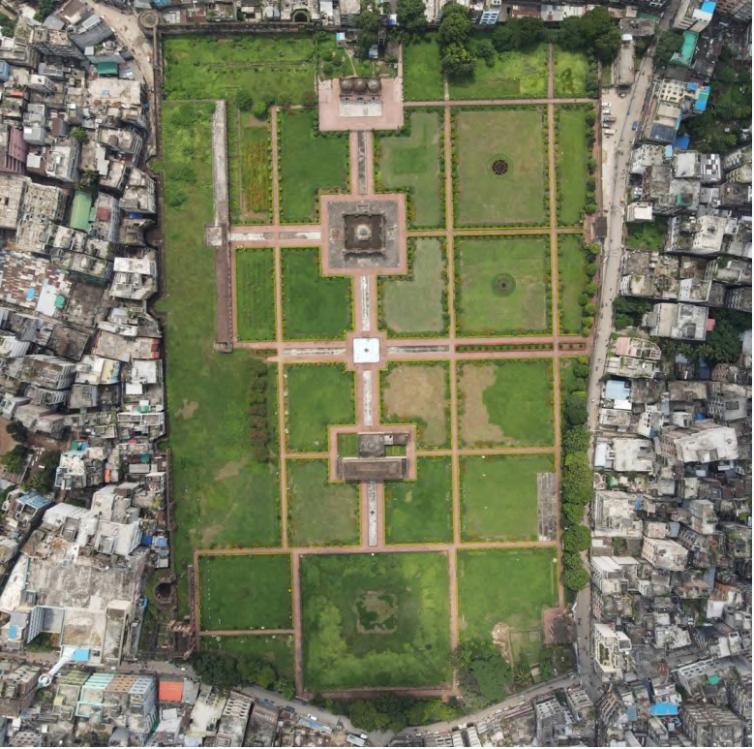
Site details
The Project Details
Architectural Documentation
Floor Plans: Conditional Survey and Documentation
This comprehensive process not only preserves the integrity of the architectural elements but also establishes a dynamic workflow adaptable to various scales and complexities of heritage documentation. By systematically moving from broader spatial contexts to intricate details, the method captures both the physical and intangible qualities of the structure, including its cultural significance and spatial narratives. The integration of manual sketches with CADbased precision ensures that every dimension, alignment, and materiality is represented accurately, allowing for enhanced clarity in restoration or reconstruction efforts. Additionally, the resulting documentation becomes a cornerstone for interdisciplinary research, fostering dialogues between architects, historians, and conservationists.
Ground Floor Plan at 2’-6” level
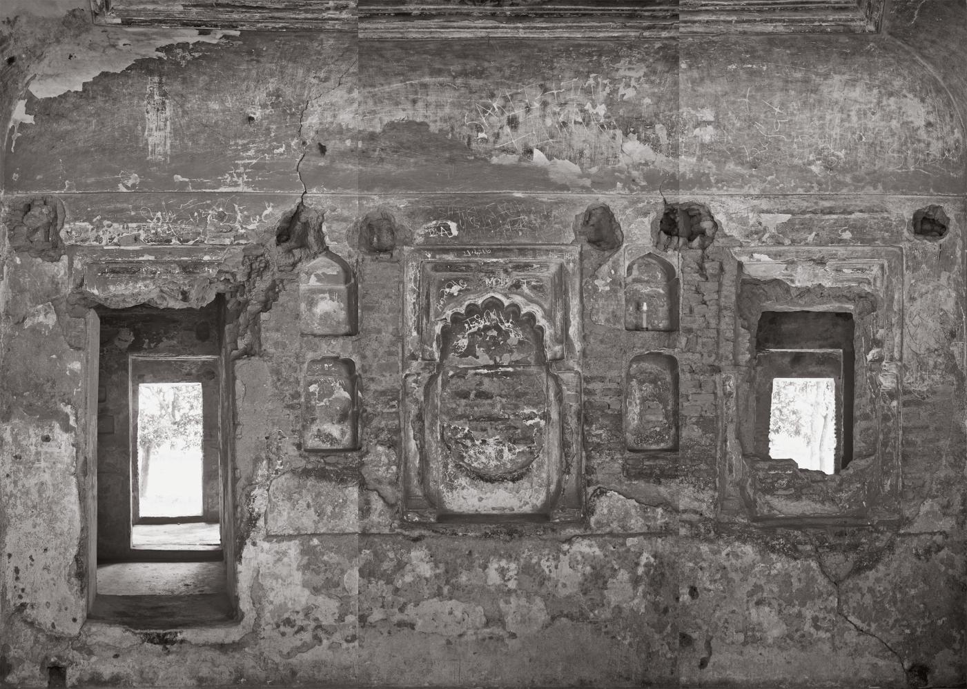
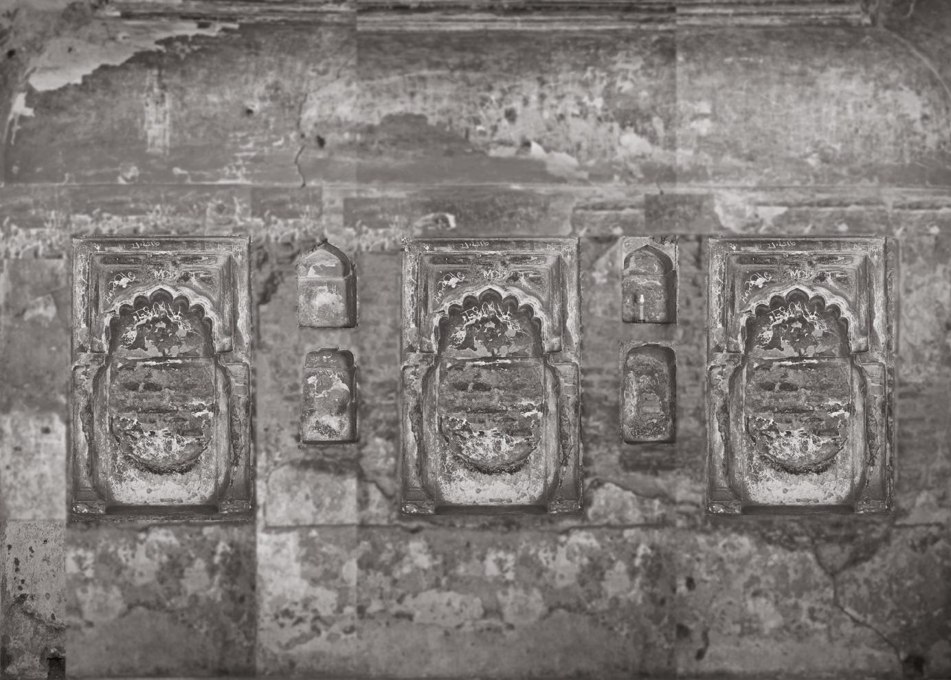
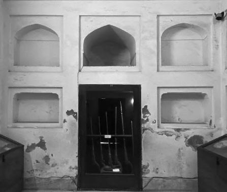
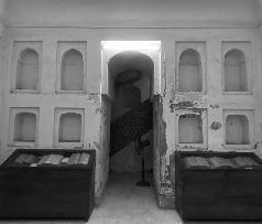
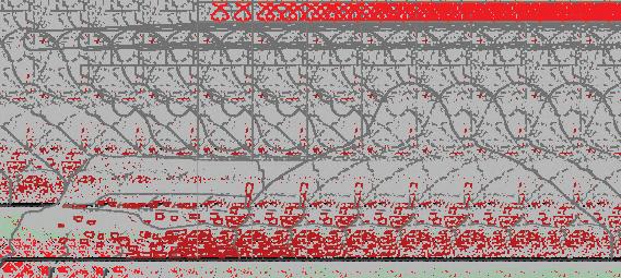
Blow Ups and Details [Interior]


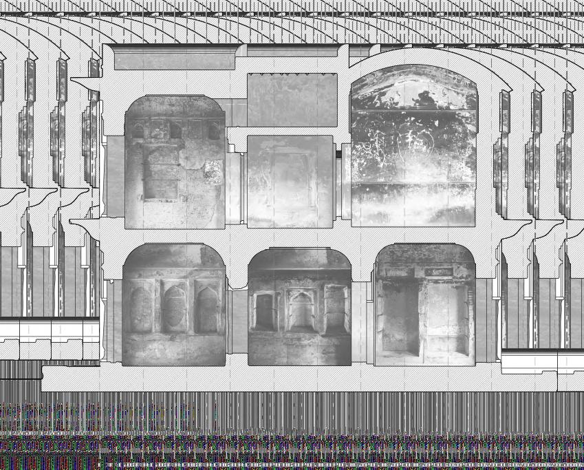
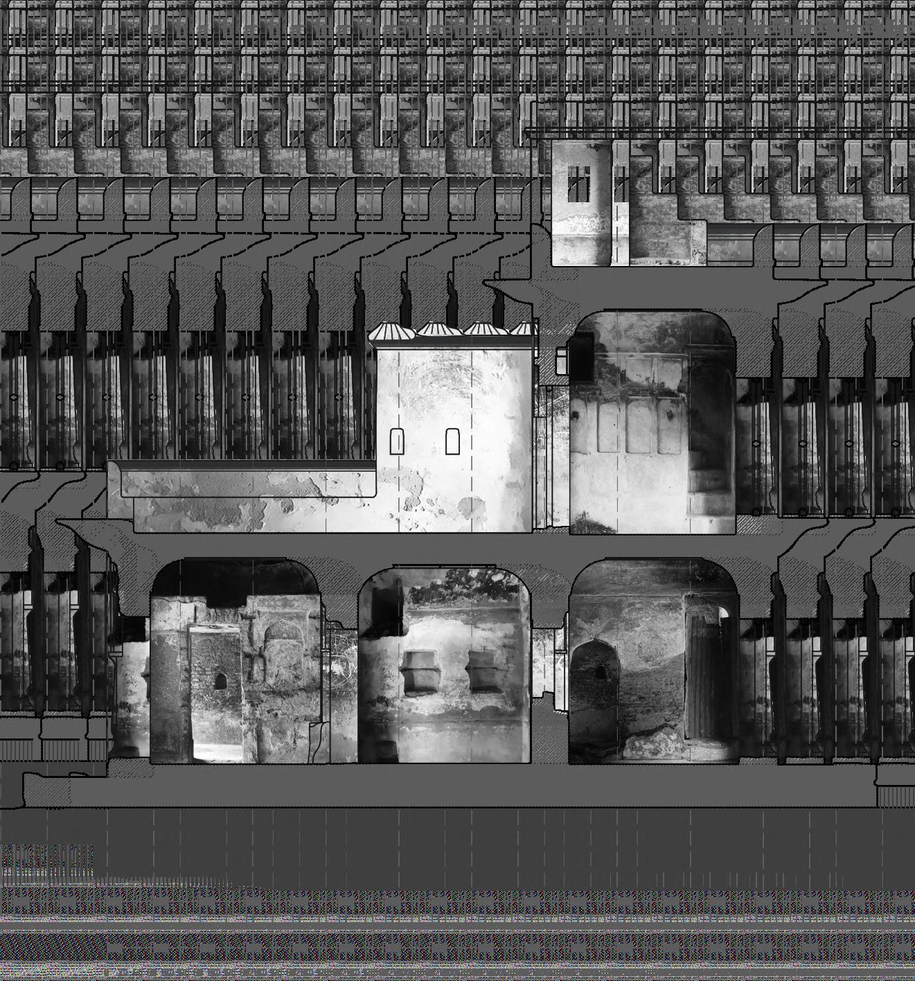
Elevations
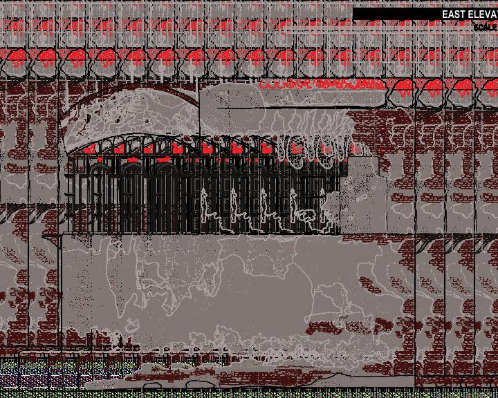
For this project, the elevation documentation began with a conditional survey conducted using photogrammetry to capture high-resolution images of the structure from multiple angles, ensuring complete coverage of all façades. These overlapping images were processed with advanced software to generate an accurate 3D model of the building, reflecting its current condition, including weathering, material inconsistencies, and past alterations. The 3D model provided a precise basis for analyzing the façade, identifying areas of deterioration, structural vulnerabilities, and decorative details. Using this data, elevations were drafted in CAD with precise dimensions and annotations, capturing every element from structural outlines to intricate ornamental details. The process ensured that even the smallest features, such as cracks or material textures, were accurately represented.
North Elevation
South Elevation
East Elevation
West Elevation
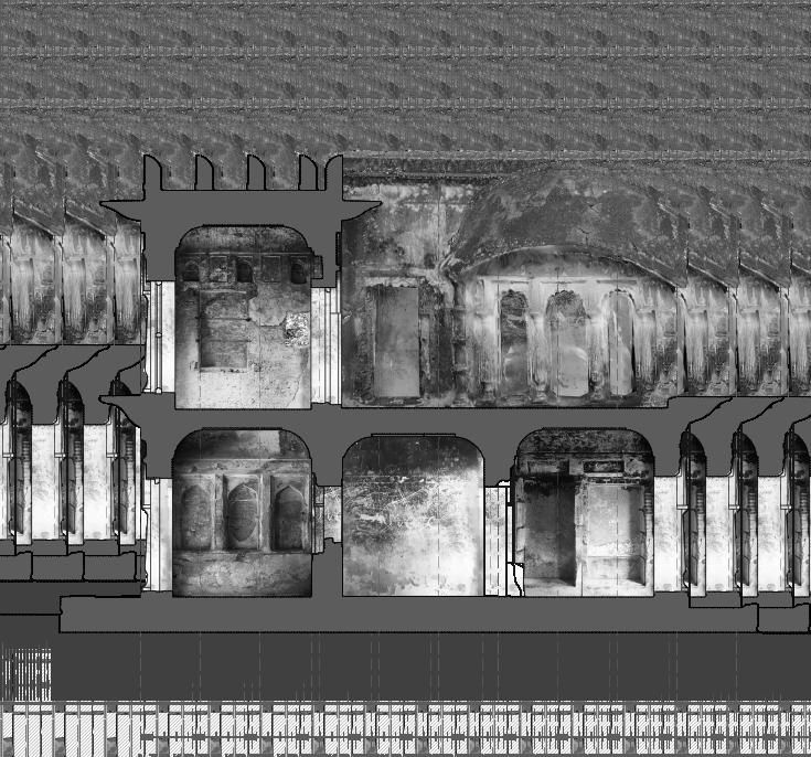
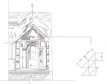
Sections and Details
[Section CC]
[Section BB]
[Section DD]
[Section CC’]
[Section AA]

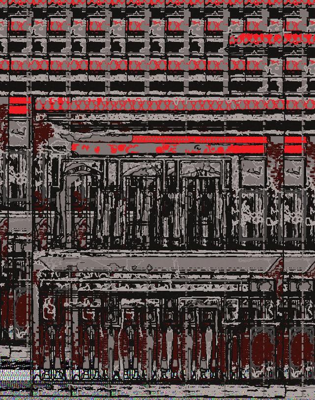
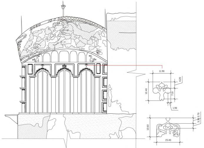
East Elevation Details
East Elevation Details
ARCHAEOLOGICAL CONSERVATION OF THE HISTORIC ROSE GARDEN PALACE DHAKA
Client: Ministry of Cultural Affairs, Government of Bangladesh.
Time Period: February 2022 - August 2022
Role: Lead Architect and Team Leader.
Floor Plans: Conditional Survey and Documentation
The survey for Rose Garden employs the 'metric survey' methodology, ensuring precise, reliable, and repeatable measurements for heritage documentation. This initial phase maps the site's current condition to guide conservation actions. It begins with a conservation sketch, followed by plotted drawings, measured diagrams, and sketches. Measurements are recorded in centimeters using laser distance meters, with outer surfaces aligned and synchronized with photogrammetry results for enhanced accuracy
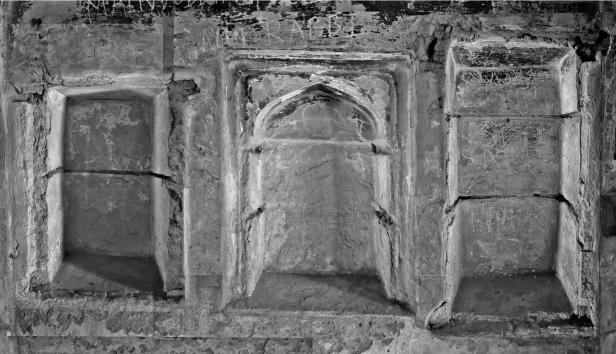
Blow Ups and Details
[Entrance corridor_West wall]
[Corridor_East wall]
[Entrance Corridor Wall Details]
Elevation
The documentation of Rose Garden combined traditional surveys with d i g i t a l p h o t o g r a m m e t r y t o comprehensively capture its architectural essence. Manual assessments detailed material patterns, cracks, vegetation growth, and surface irregularities, while digital reconstructions ensured precise spatial proportions and textural accuracy. The resulting 3D models and elevation drawings highlight structural vulnerabilities and material degradation, providing a critical resource for guiding conservation strategies. Beyond preservation efforts, these outputs serve as an invaluable archival record for future
r e s e a r c h a n d h e r i t a g e documentation.
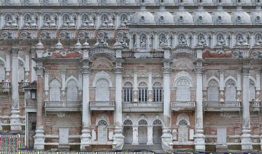
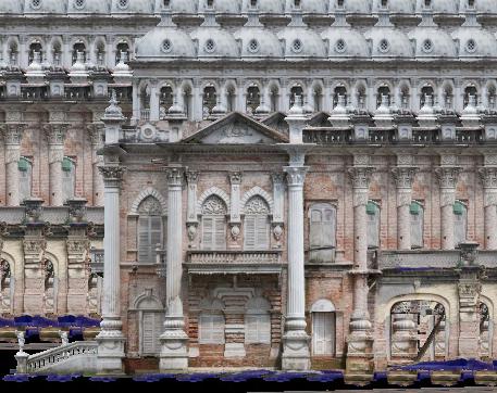
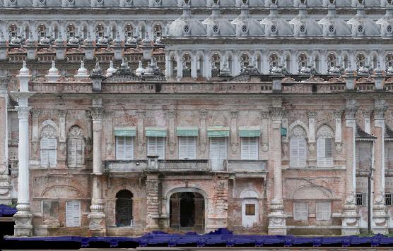
South Elevation
Elevations from Photogrammetry
For the Rose Garden, sections were created using parallel projection photography and photogrammetry to reveal internal spatial organization and external material textures. This method provided precise 2D representations and detailed 3D reconstructions, highlighting structural vulnerabilities and material degradation. The outputs offer a reliable foundation for analyzing the building's current condition and planning conservation efforts.
All rights reserved. No part of this publication may be reproduced, stored, or transmitted by any means without prior written permission from the publisher.