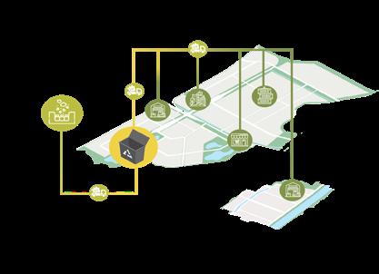


Assistant Urban Designer
Urban Designer based in Jakarta. Equipped with visual, spatial & strong design skills, aced with 3+ years working experience and academic background in Urban Planning. Passionate and highly interested in Master Planning, Sustainability, Livability, People Oriented Design and New Urbanism
2022 - Now Townland International, ID
Junior Urban Designer 2021 - 2022
Shirvano Consulting, ID
Project Intern
ESRI, ID
Urban Design Intern
PDW, ID
1st Place Kampung Sehat Design Competition 2021
Indonesian Association of Urban & Regional Planners
Top 10 Demak City Expansion Design Competition 2021 Demak Government
Excellence in Public Relations Awards 2021 AIESEC Indonesia
Bachelor of Urban & Regional Planning (S.PWK) 2017 - 2021 Diponegoro University, ID
Assistant Professor 2021 Laboratory of Urban Design, Diponegoro University
Research Assistant - Water Sensitive Urban Design 2021 Laboratory of Urban Design, Diponegoro University
Head of External Relations 2020 - 2021
AIESEC in Semarang, ID
Exchange Participant
AIESEC in Brno, Cz
AutoCAD, Adobe Illustrator, Adobe Photoshop, Adobe Indesign, Adobe Premier Pro, GIS (ArcGIS/ QGIS), Modelur, Sketchup, Enscape
Other Skills
Graphic Design, Partnerships & Negotiation, Hand & Digital Drawing/Coloring
Edutown Masterplan, Tangerang
New Town Masterplan, Bekasi
Residential Masterplan, Bandung
Slum Revitalization, Jakarta
Urban Expansion Masterplan, Demak
Water Sensitive Urban Design Masterplan, Klaten
Industrial Estate Masterplan, Batam
Heritage Area Redevelopment, Blora
Public Space Revitalization, Kolkata
Hotel Landscape Conceptual Design, Xiamen
Residential Masterplan, Bali (Support)
Integrated Tourist Masterplan, Wakatobi (Support)
Resort Masterplan, Golomori (Support)


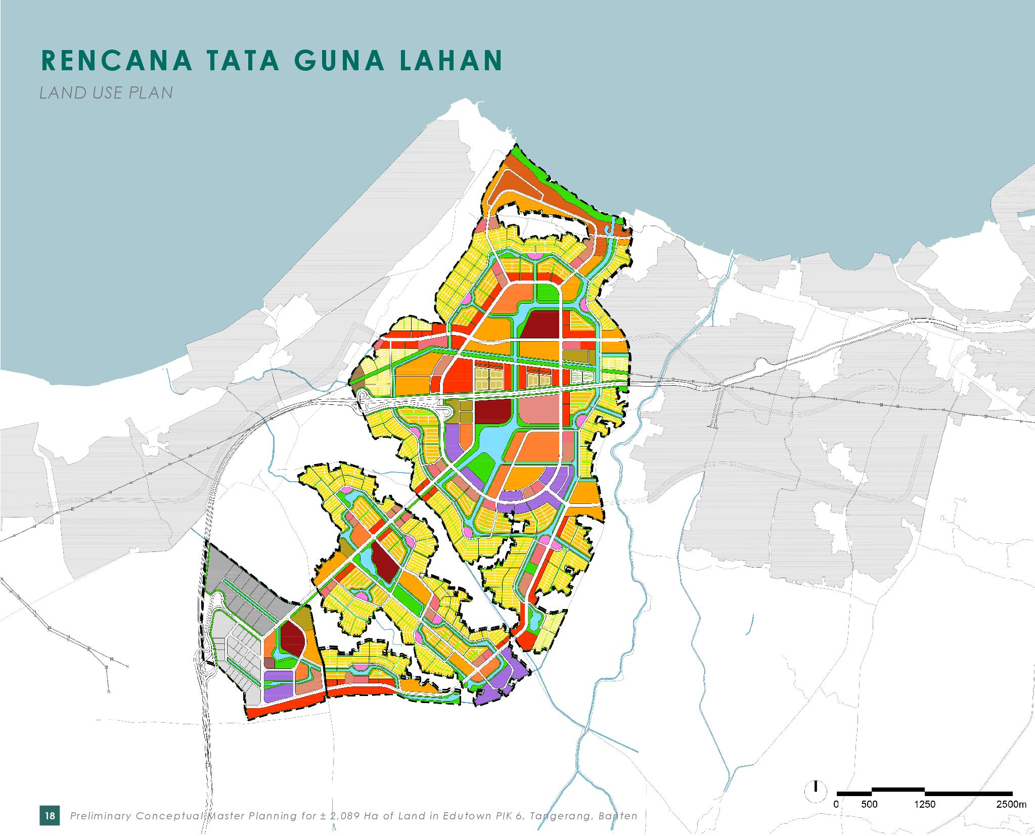
Contribution : Spatial Analysis, Map Illustration, Concept Formulation, Design Analysis, Illustrative Masterplan, 3D Diagram, & Report Creation
Typology : Township/New Town
Scope : Urban Design & Master Planning
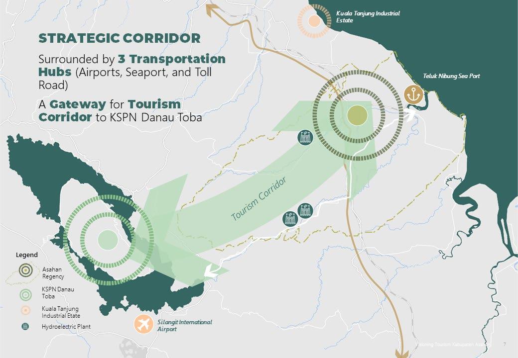
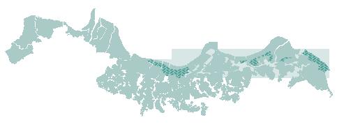
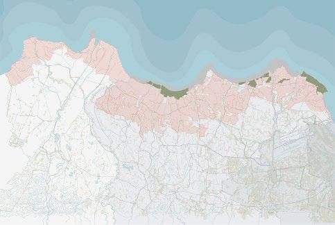
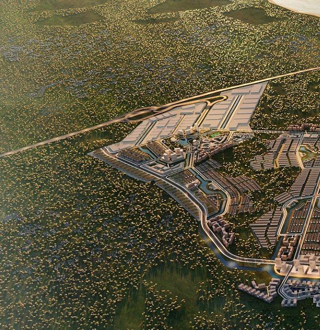
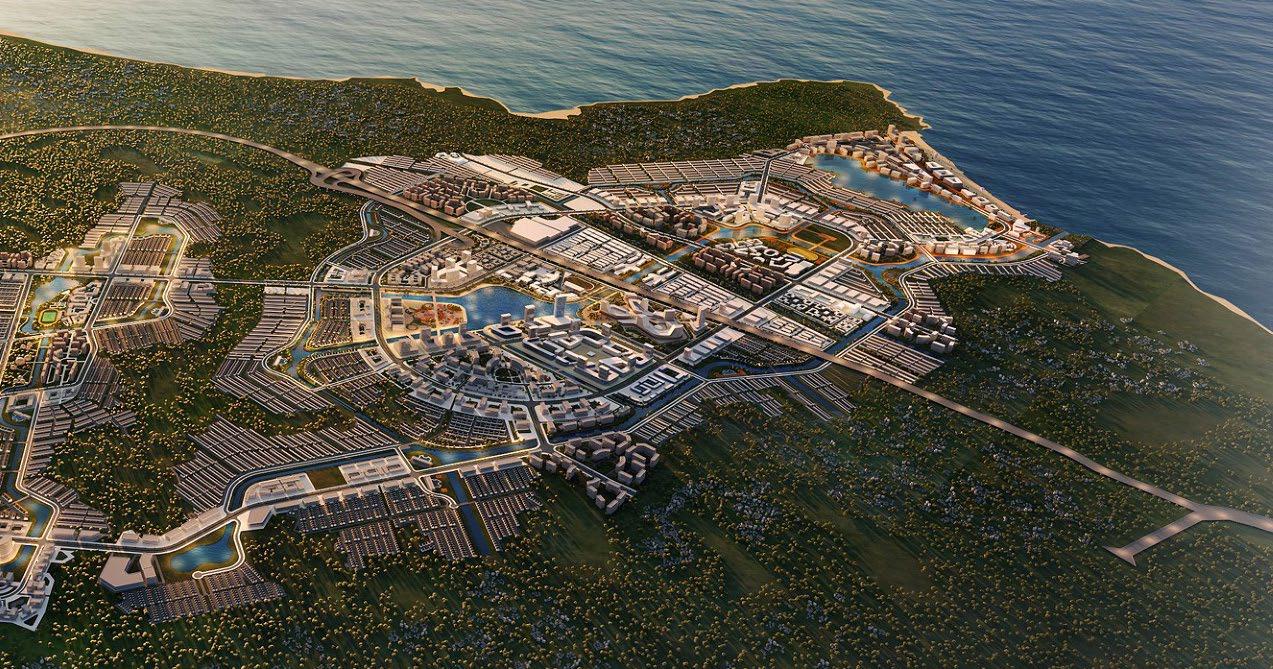
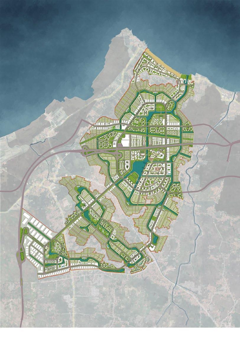
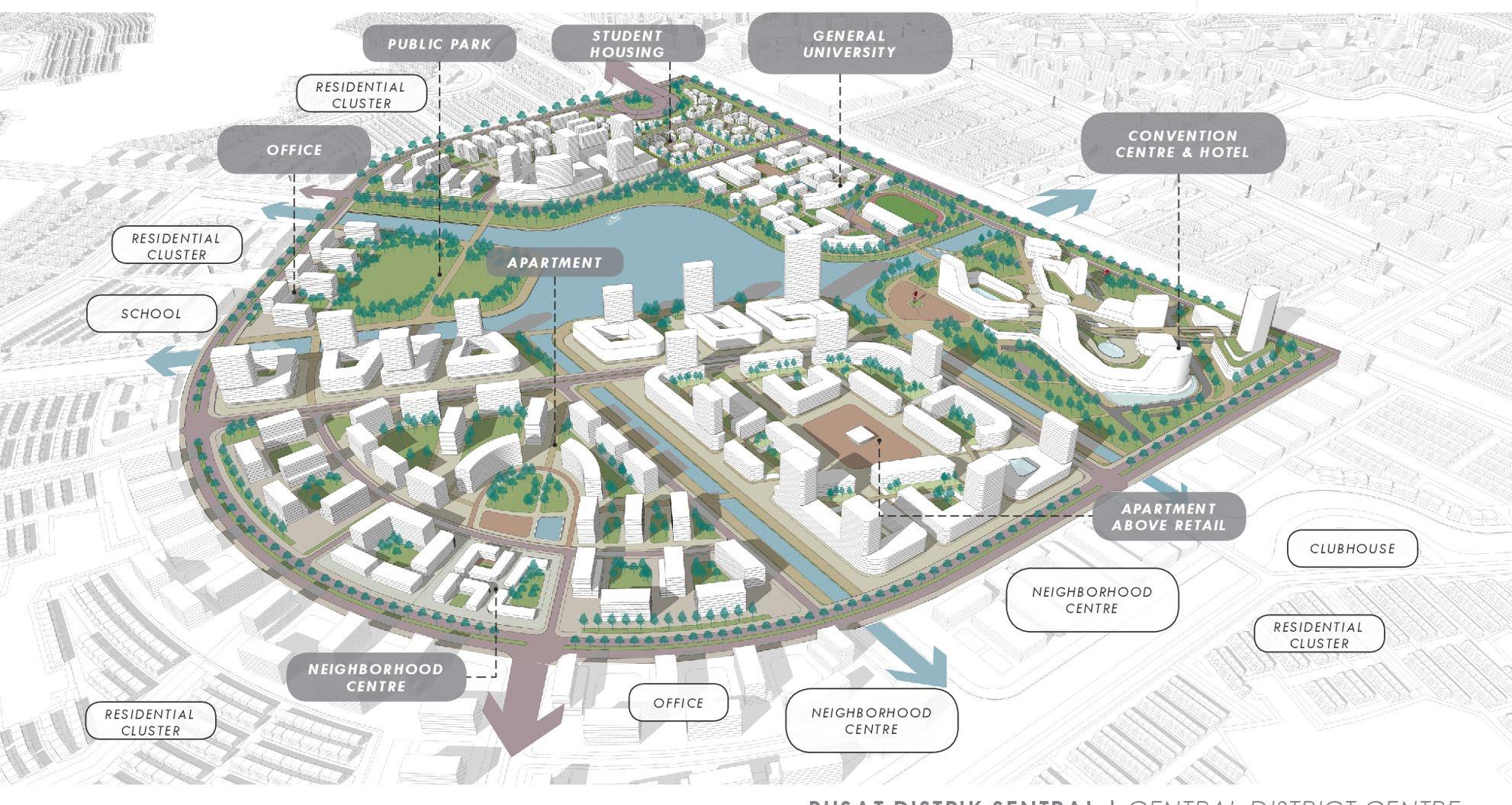
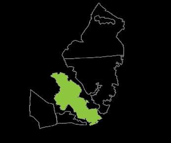
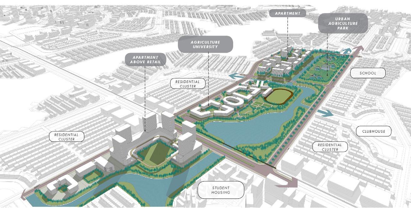
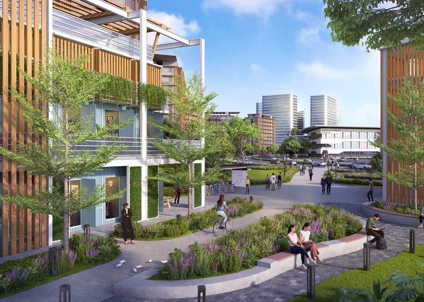
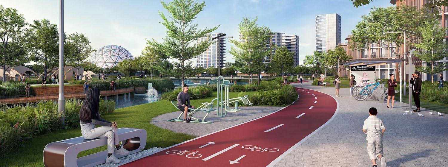
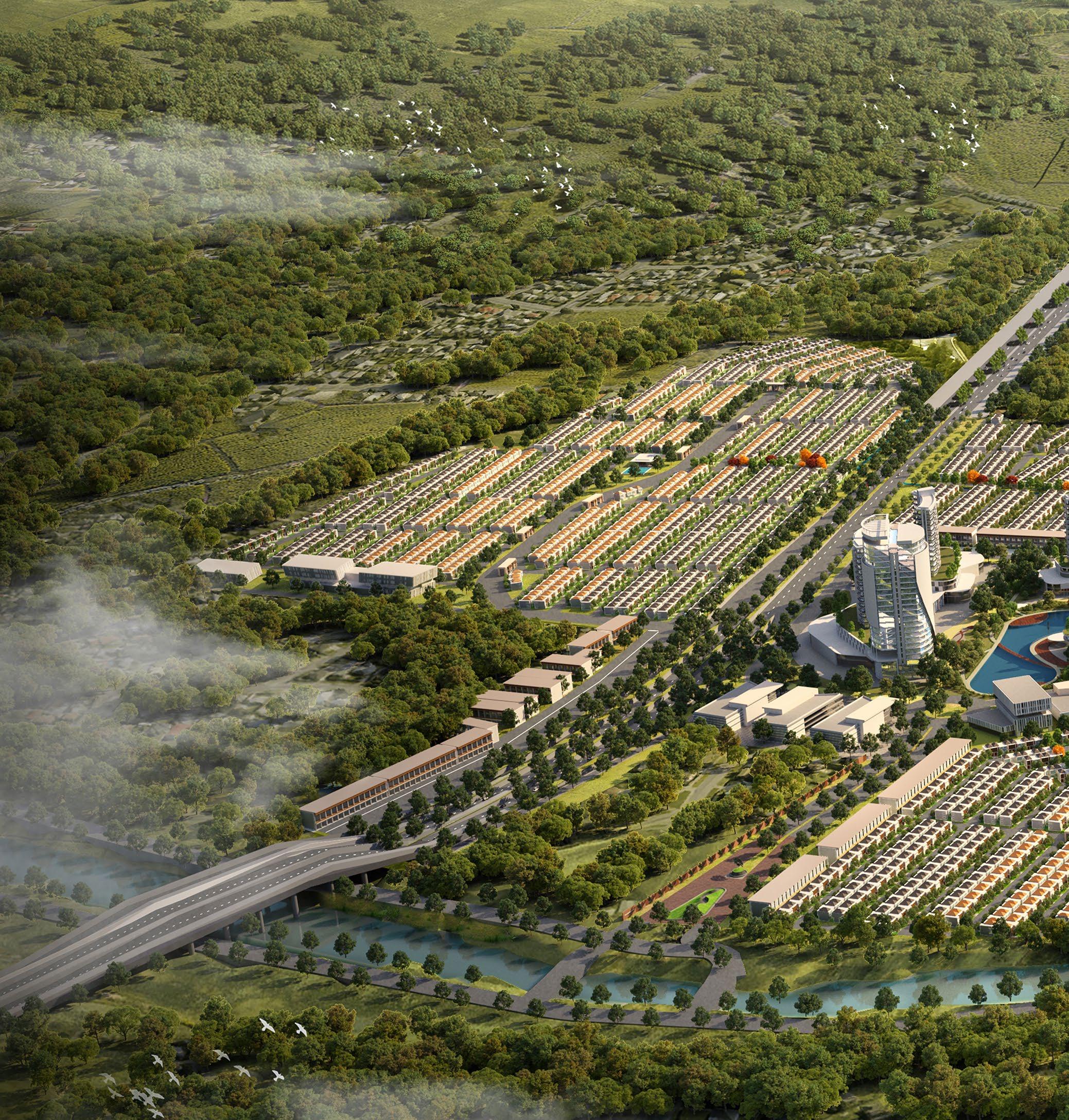
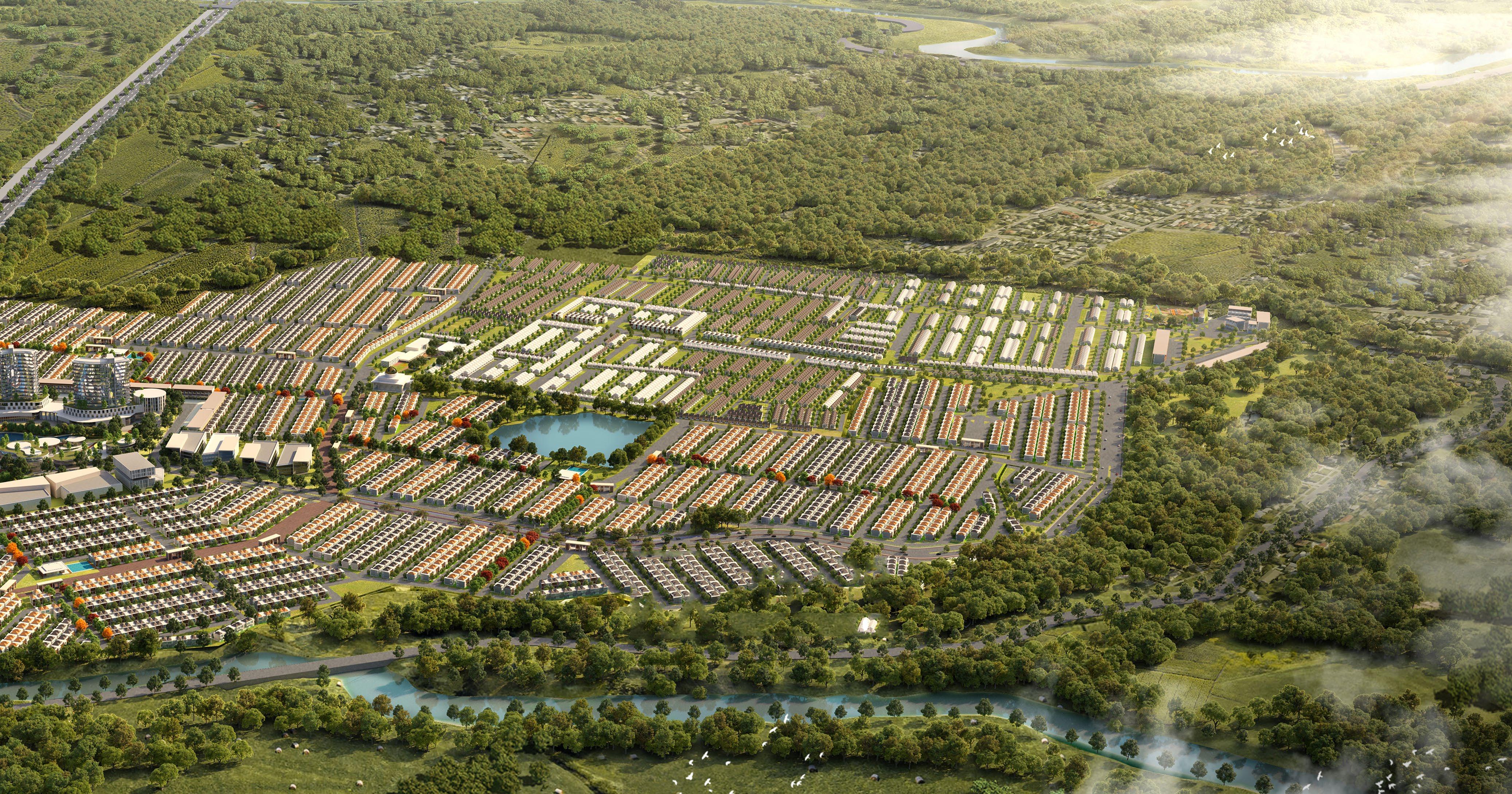
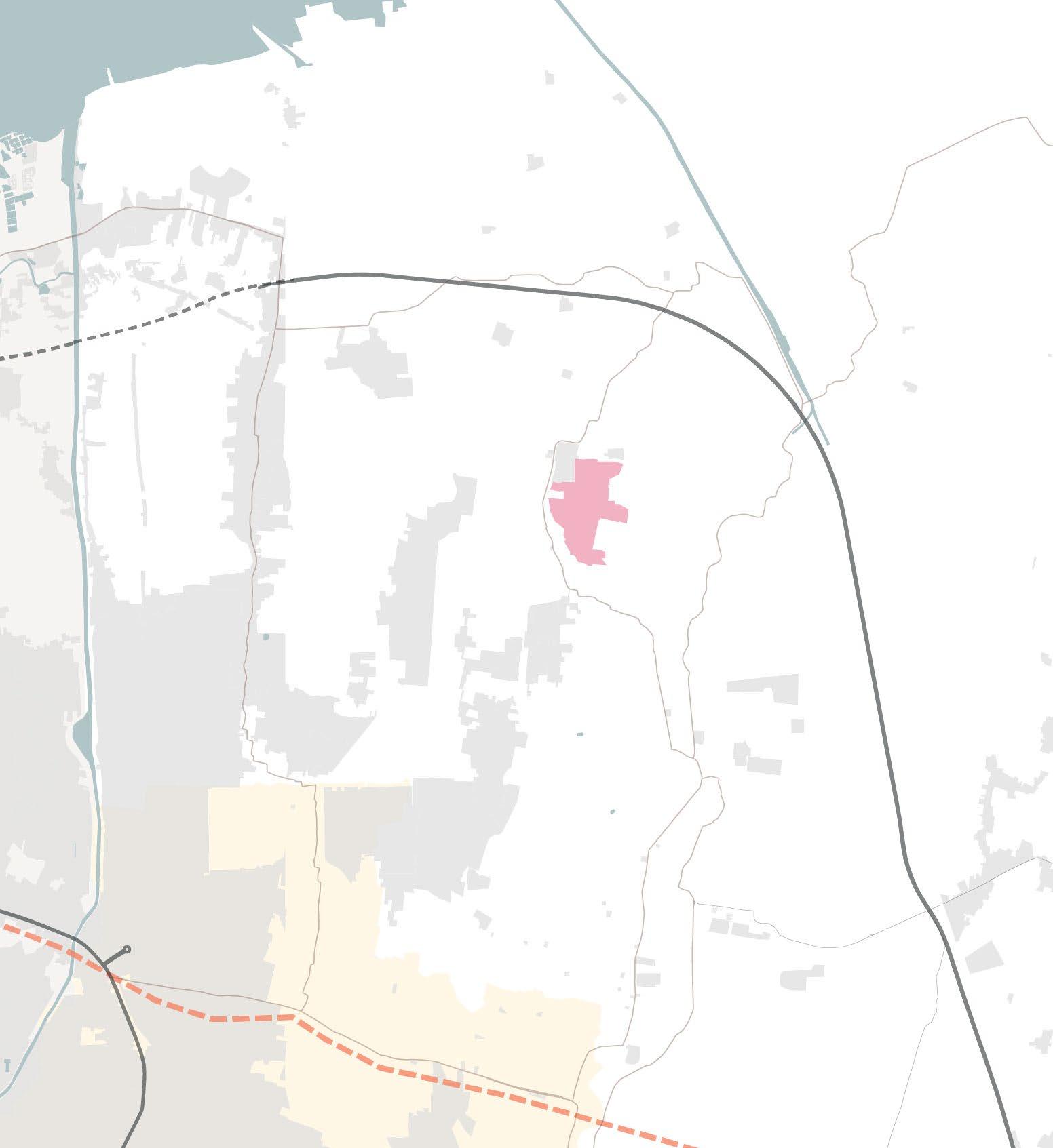
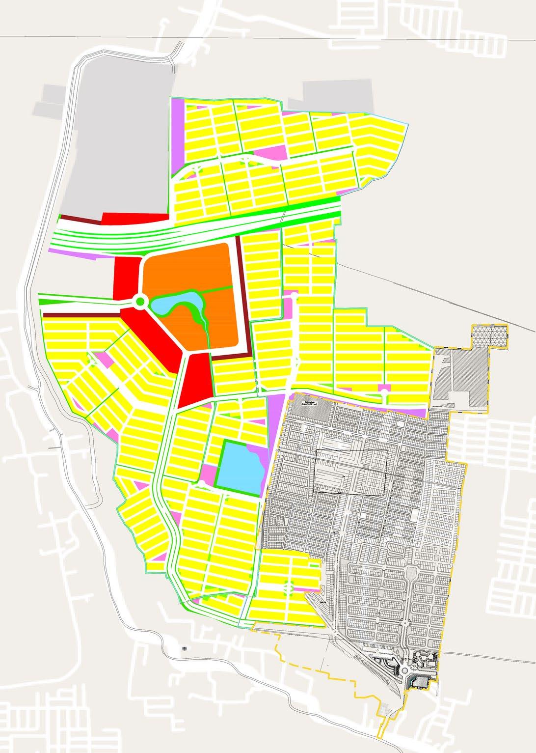
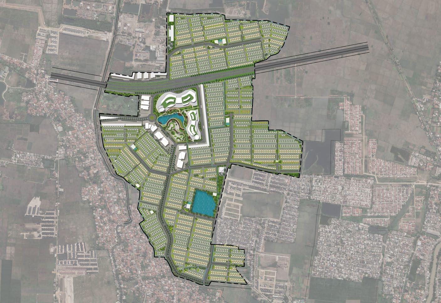
Tangerang Regency, Indonesia (2024)
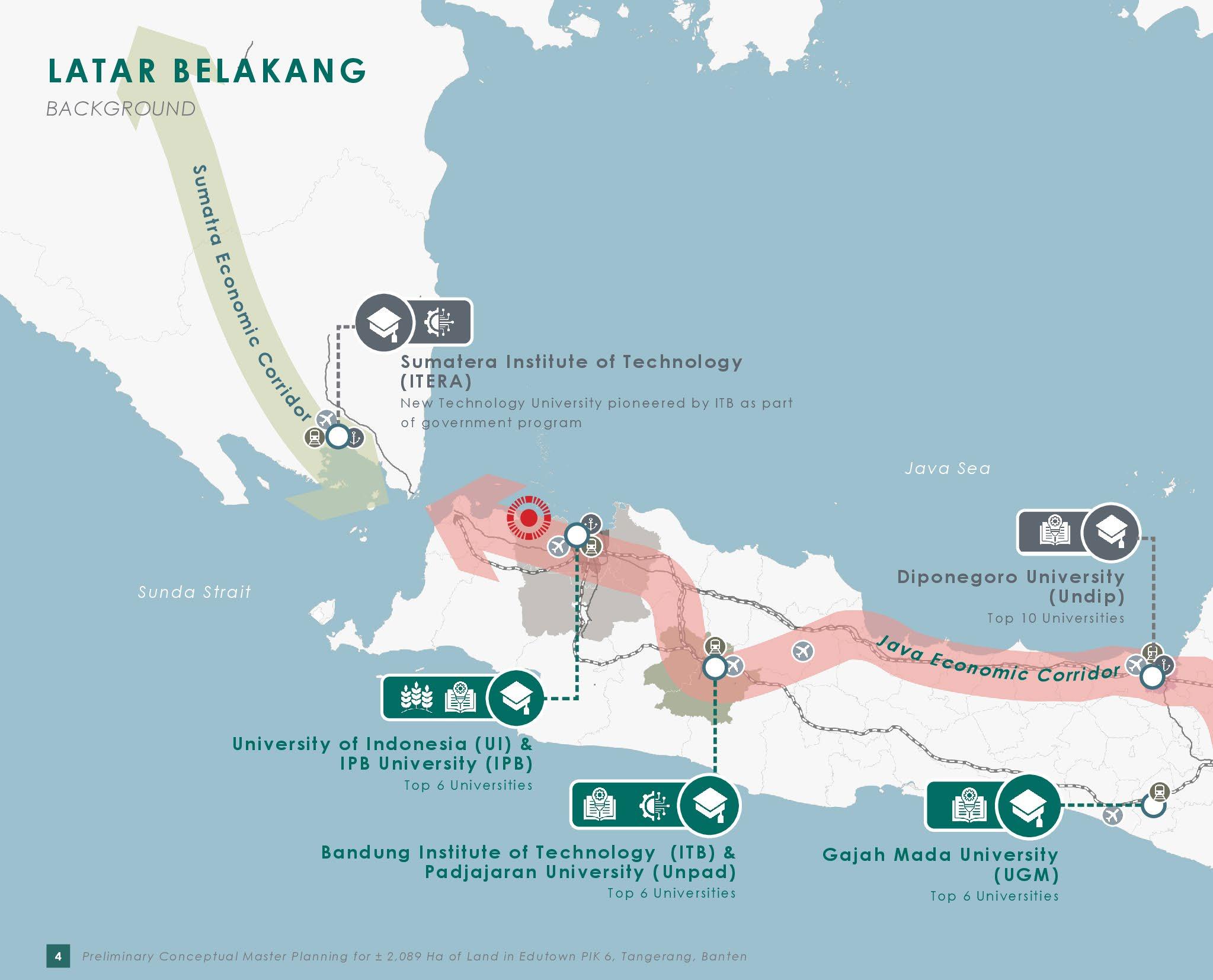
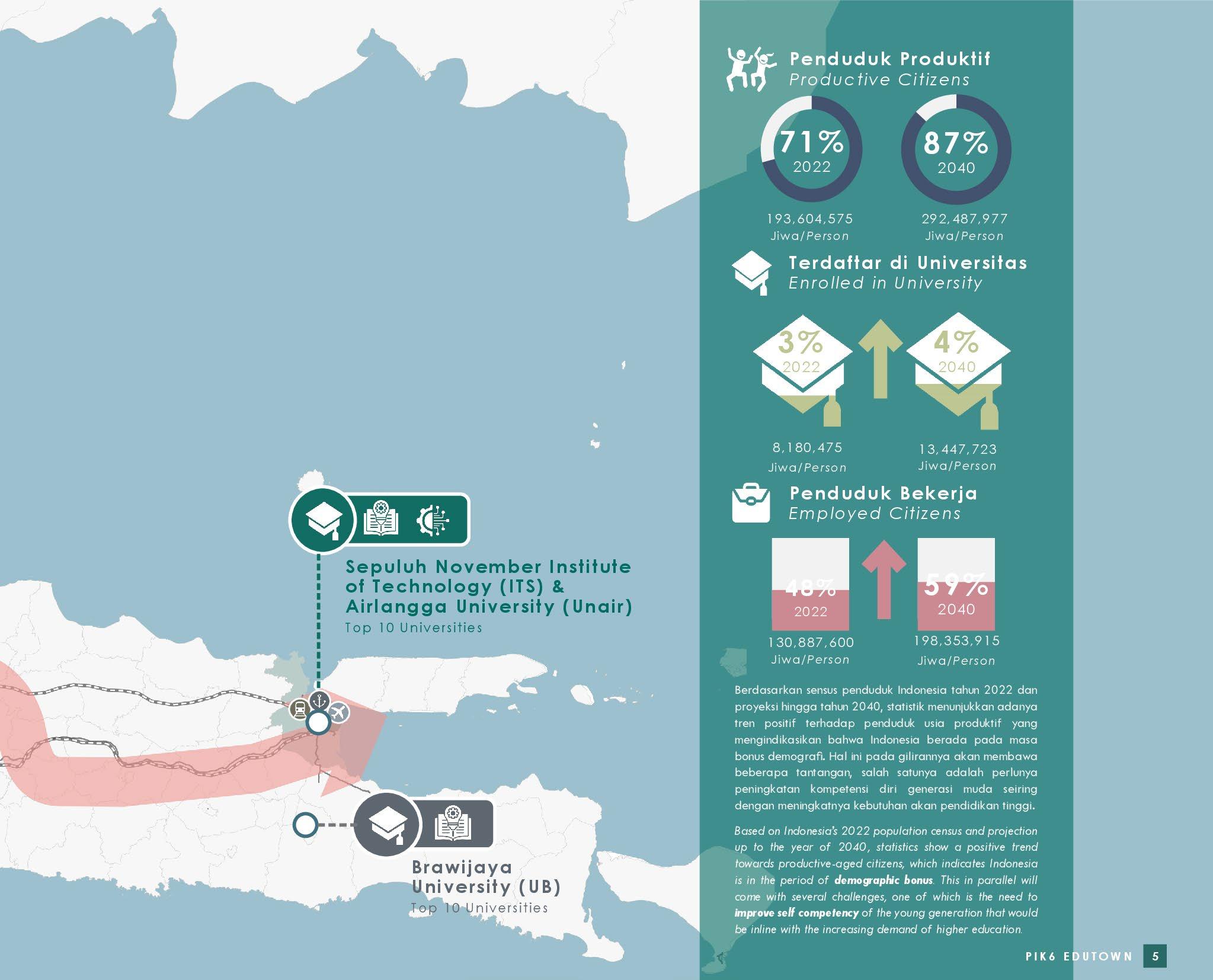
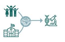
Based on Indonesia’s 2022 population census and projection up to the year of 2040, statistics show a positive trend towards productive-aged citizens, which indicates Indonesia is in the period of demographic bonus. This in parallel will come with several challenges, one of which is the need to improve self competency of the young generation that would be inline with the increasing demand of higher education.
Site is located on the north coast of Tangerang Regency. About 30 km from the city center of Jakarta and 15 km from Soekarno Hatta International Airport. Currently the Site can be accessed via the Jakarta Airport Toll Road, then continued via the Local Road (Jl. Raya Mauk - Teluk Naga).
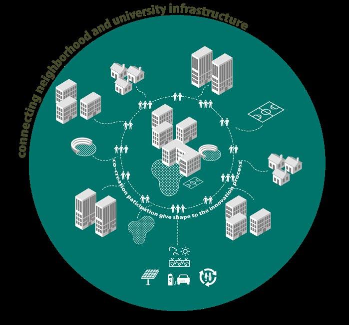


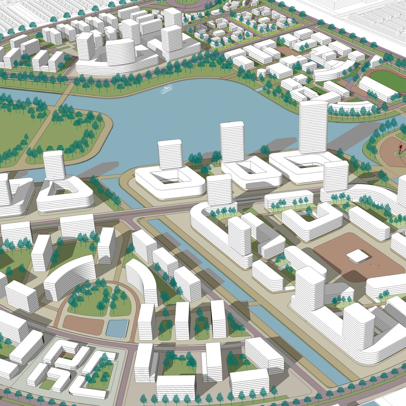
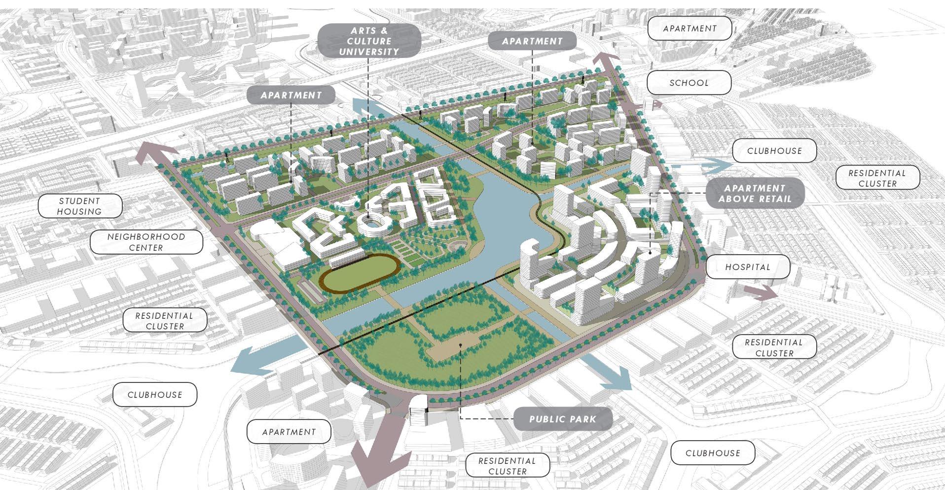
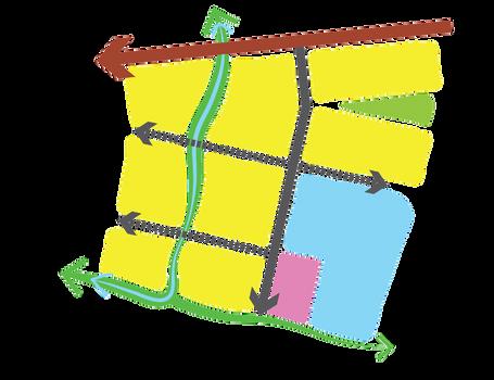
Diminish boundary between university institution and the city. University acts as anchor and growth driver
Invite & involve the community through participatory process and transform the community together (living lab initiatives)
Establish connection & interaction between university and the community through shared public parks and facilities
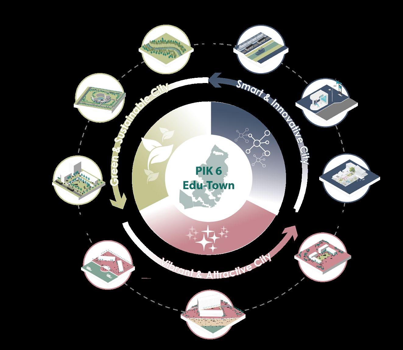


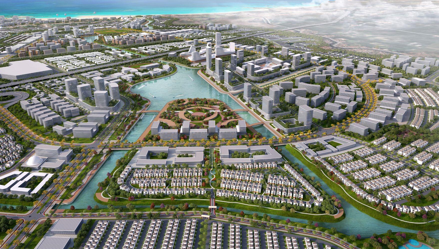
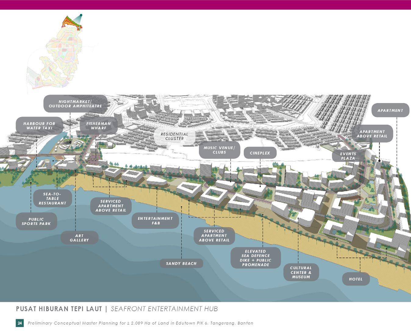
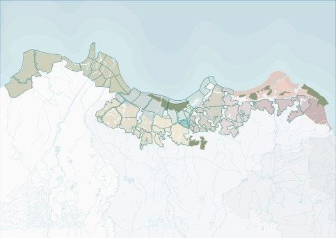
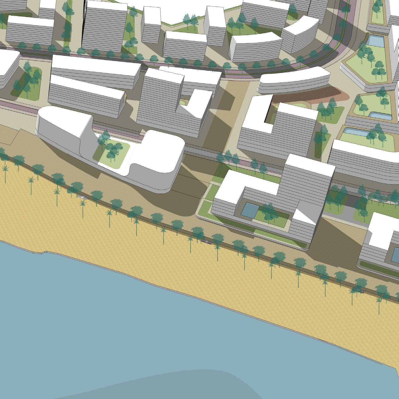
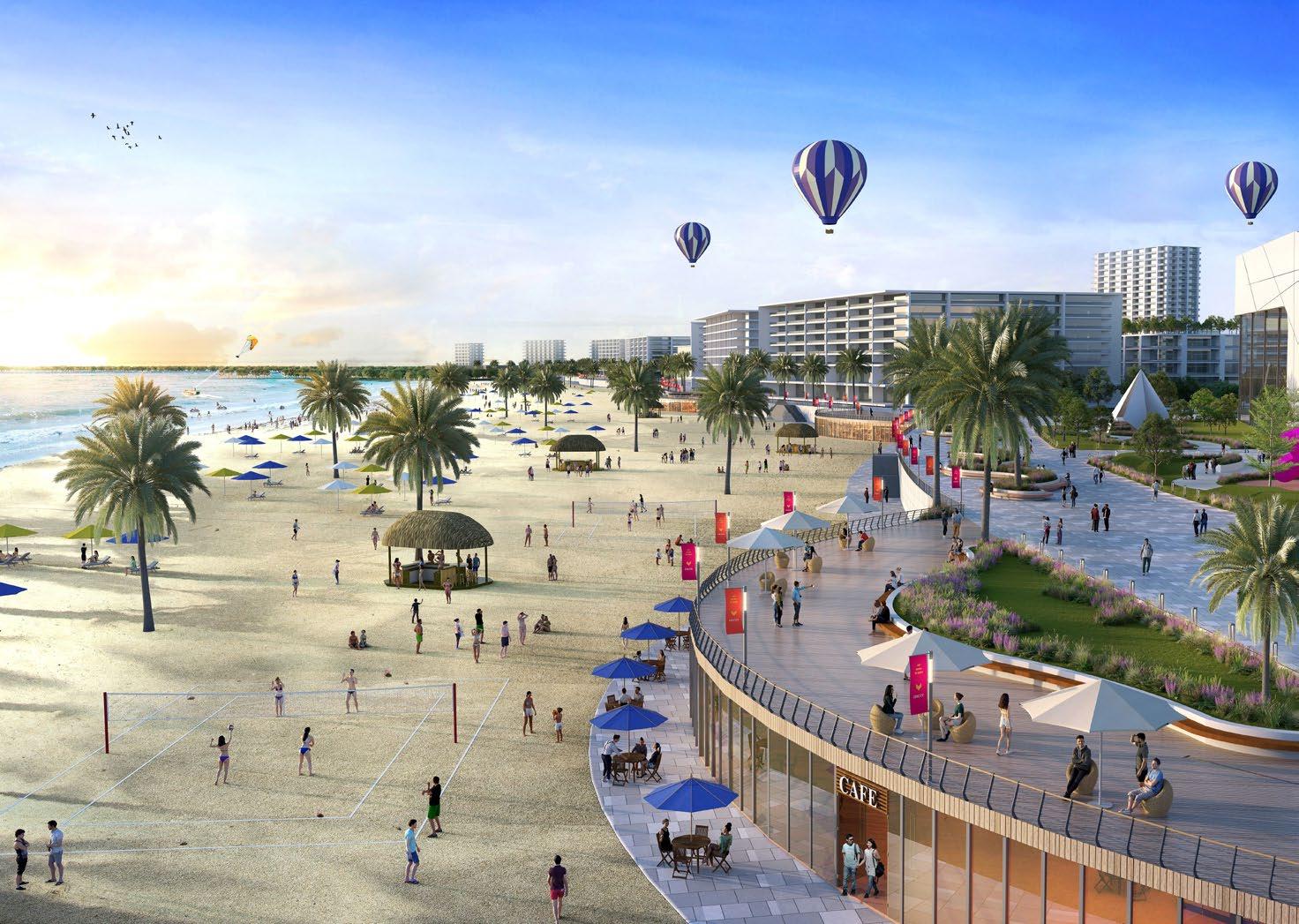
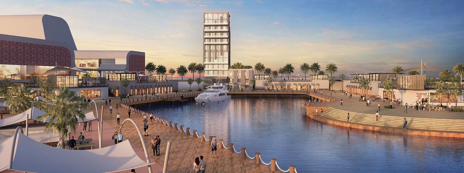
Vibrantbeachfrontentertainmentcenterwithlivelybeachactivities anddiversemeltinghubsofhospitality,beachfrontapartments, active commercialdevelopments&fishermanwharfs
Vibrantandlivelyarts-entertainmentdistrictconnectingvarious meltinghubsalongtheseafrontwithdiverseculturaldrivenneighborhoodcenters.
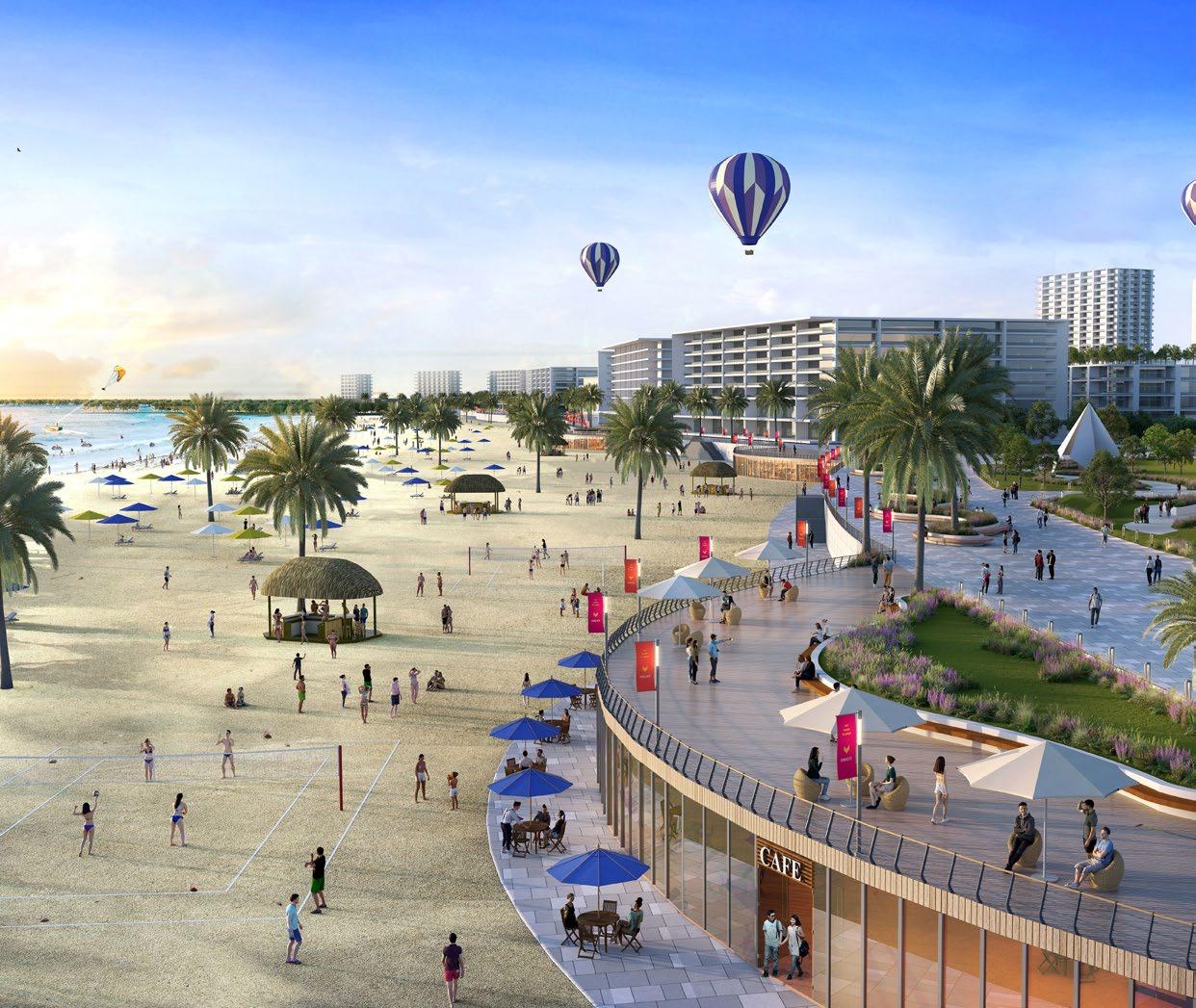 Beach Area
Art District Park
Beach Area
Art District Park
Vibrantbeachfrontentertainmentcenterwithlivelybeachactivities anddiversemeltinghubsofhospitality,beachfrontapartments, active
Vibrantandlivelyarts-entertainmentdistrictconnectingvarious meltinghubsalongtheseafrontwithdiverseculturaldriven neighborhoodcenters.
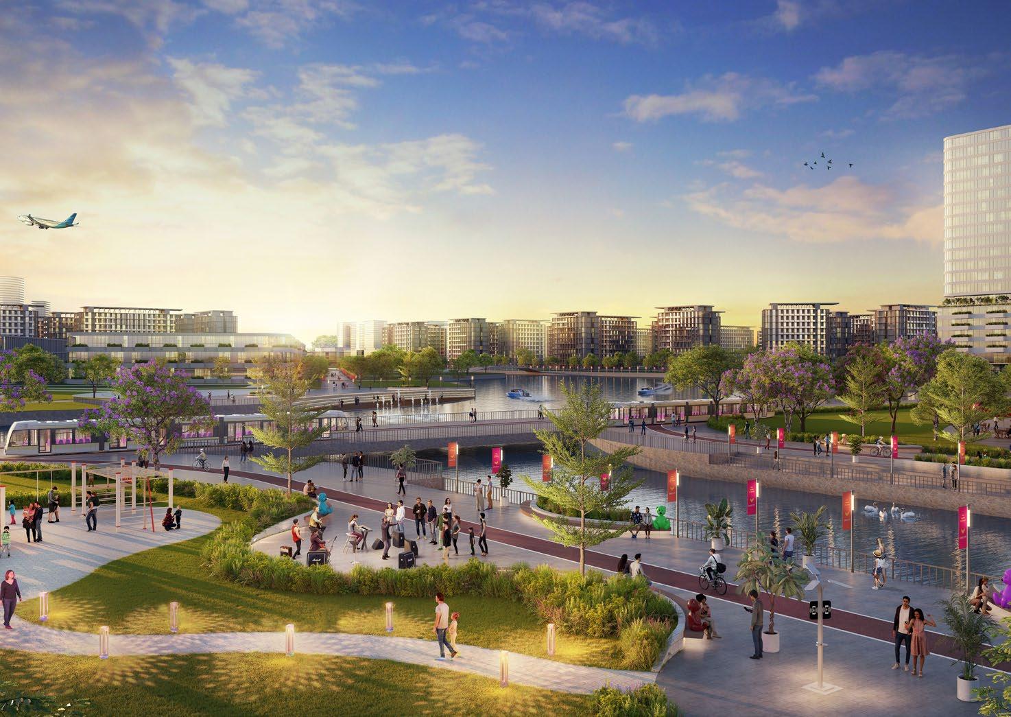
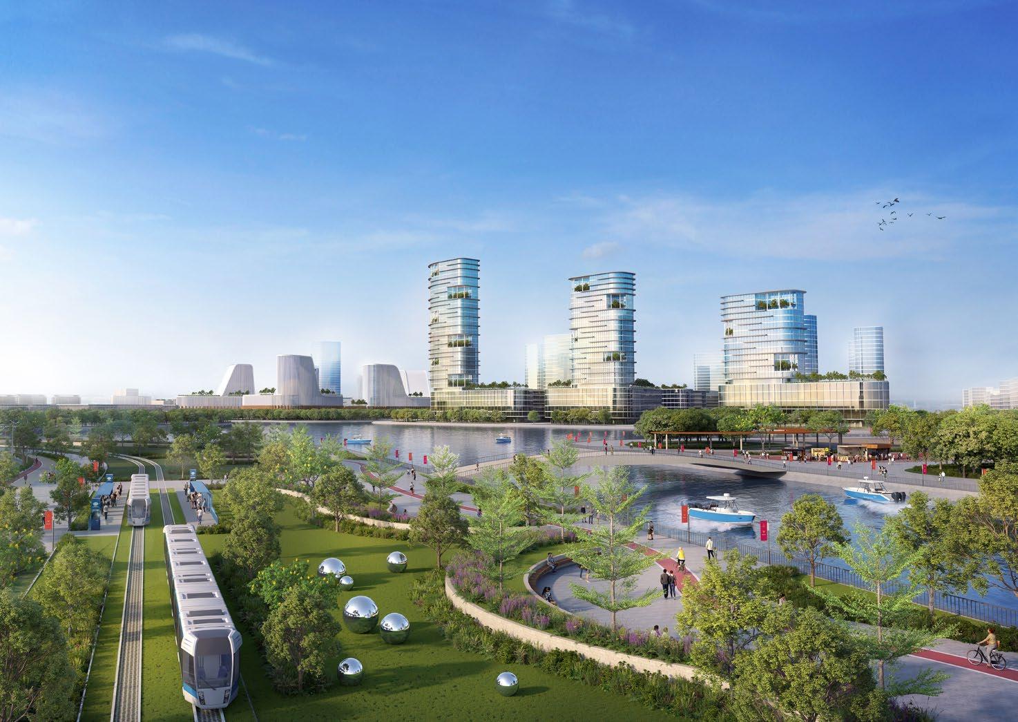
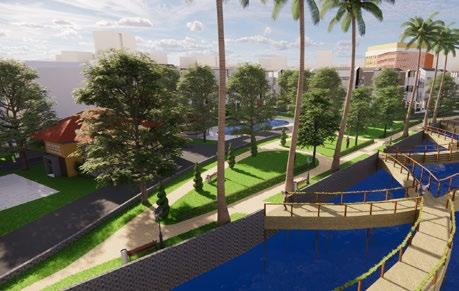
 Central Park & City Centre
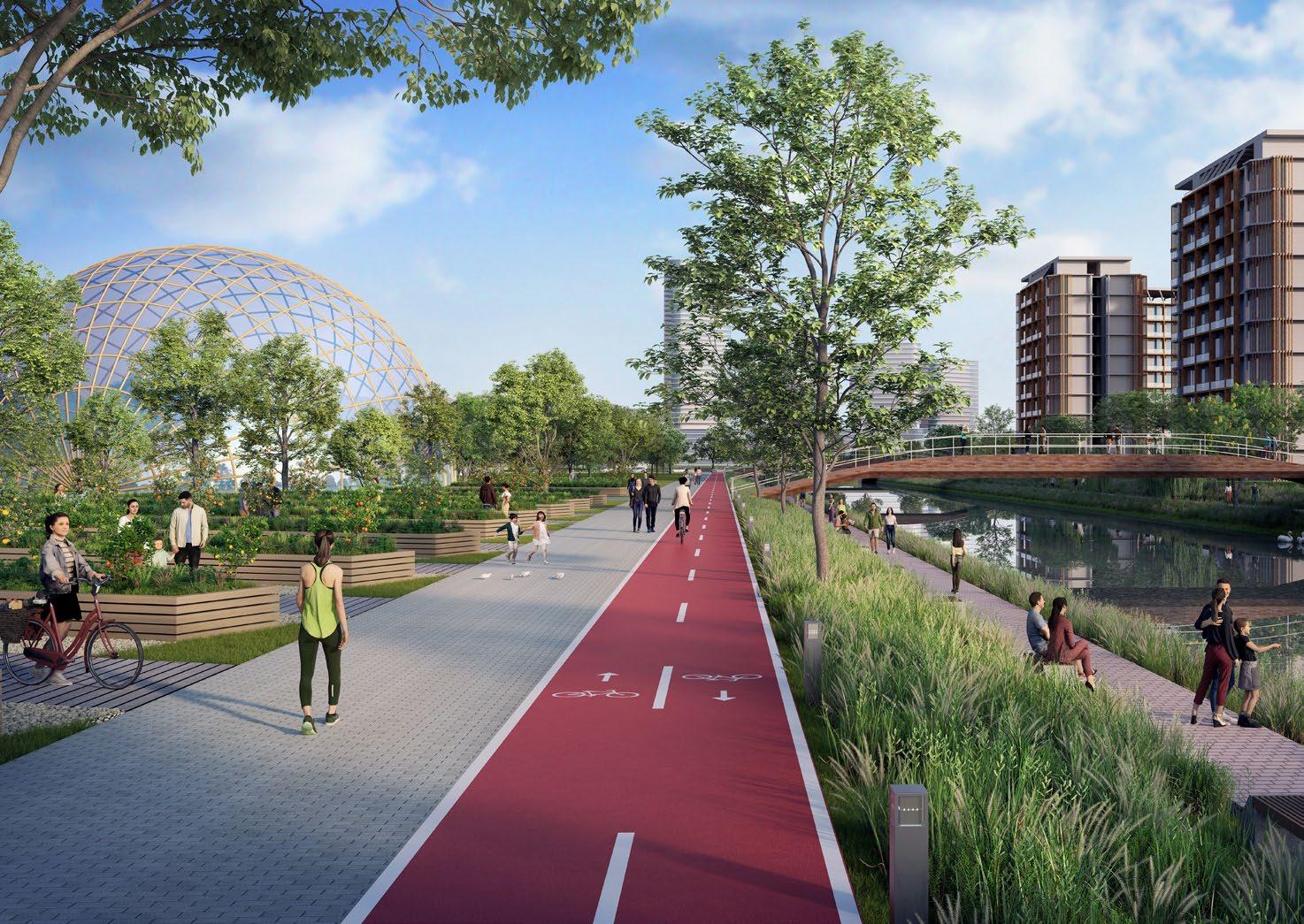
Urbam Farm & Garden
Central Park & City Centre
Urbam Farm & Garden
Enableclosecollaboration/co-creationbetweentheuniversity andindustrial/manufacturingfacilities.
 Lakeside Residential Area
Marina & Fisherman Wharf
Lakeside Residential Area
Marina & Fisherman Wharf
Contribution : Spatial Analysis, Map Illustration, Concept Formulation, Design Analysis, Illustrative Masterplan, 3D Diagram, & Report Creation
Typology : Township/New Town
Scope : Urban Design & Master Planning
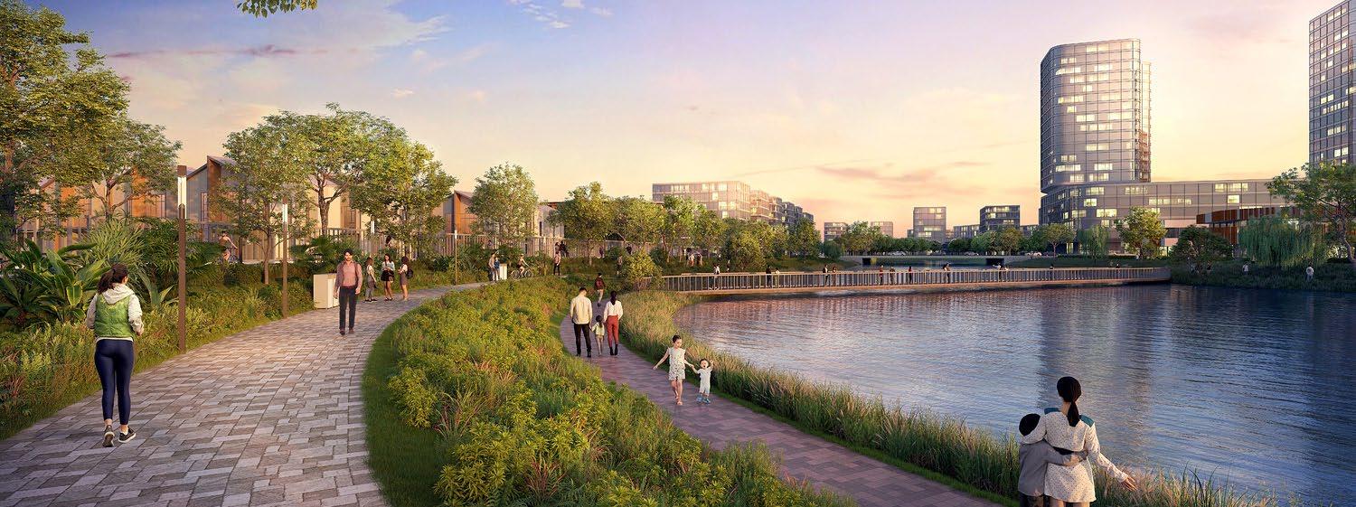
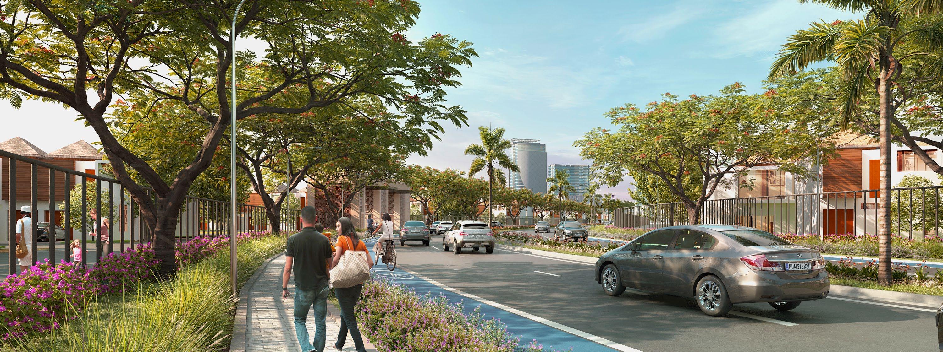
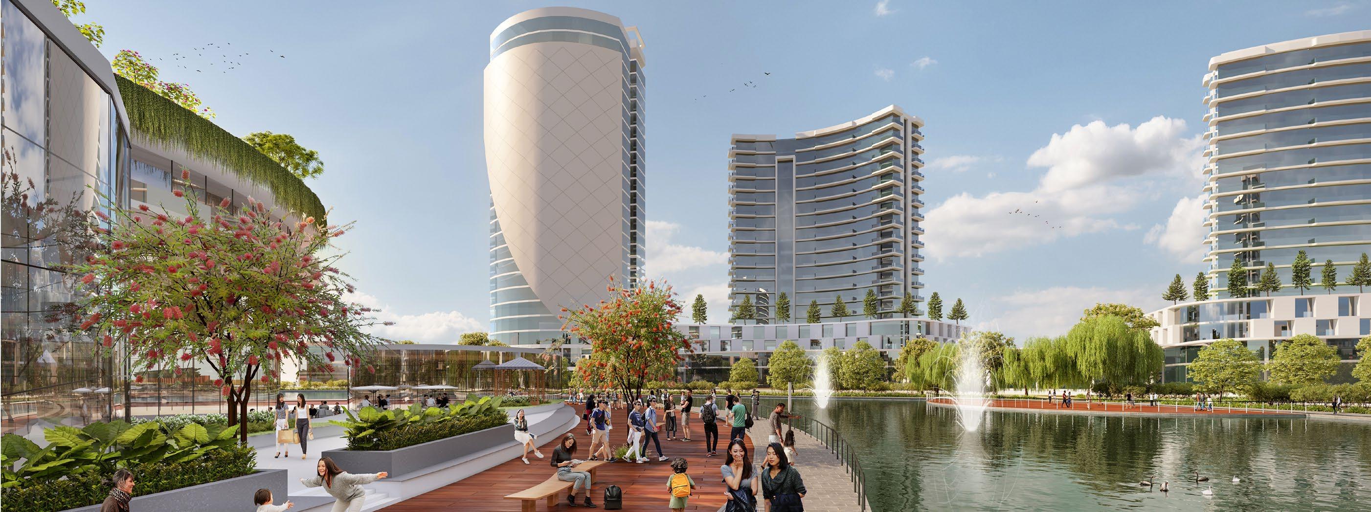
Bekasi, Indonesia (2023)
City : Harmonious living within a green-environment
Panjibuwono
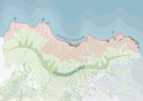
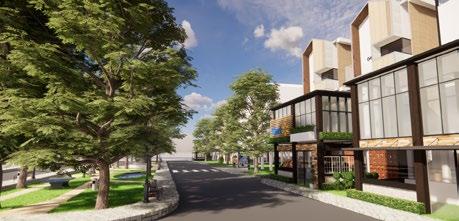
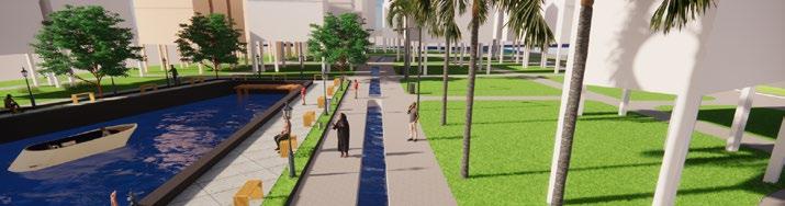
The project is envisioned to become a new standard for Bekasi suburbia to achieve harmonious living with a greenenvironment in the heart of rapidly growing urban development. The Site has an opportunity to provide a new sustainable township by adopting the water-sensitive urban design across the Site and green spine application to connect clusters.
Major commercial and mixed-use are concentrated in the Central Lake CBD District Site - a combination of openair waterfront dining and retail that is envisioned to become a signature and branding feature for the Site that connects with a green spine and open space network to promote pedestrian and bicycle activity. The planned toll road plan across the Site is expected to boost economic value with the visual frontage of the CBD area and access to adjacent future toll exit with direct access to the Site.
Contribution : Spatial Analysis, Map Illustration, Concept Formulation, Design Analysis, Illustrative Masterplan, 3D Modelling & Report Creation
Typology : Township/New Town
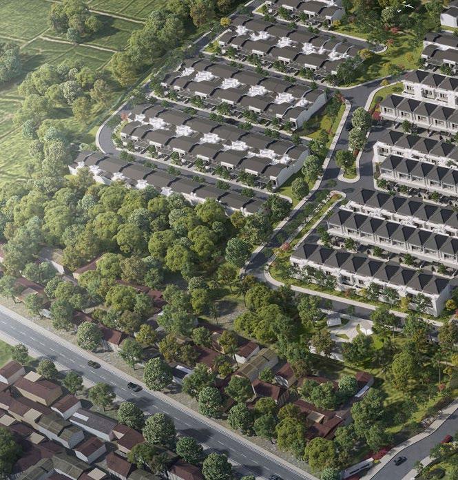
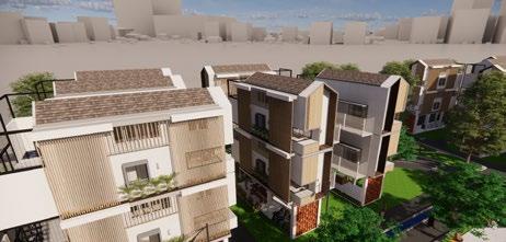
Scope : Urban Design & Master Planning Bandung, Indonesia (2023)
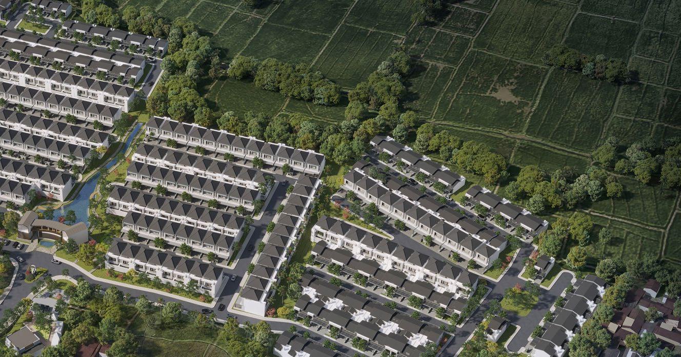
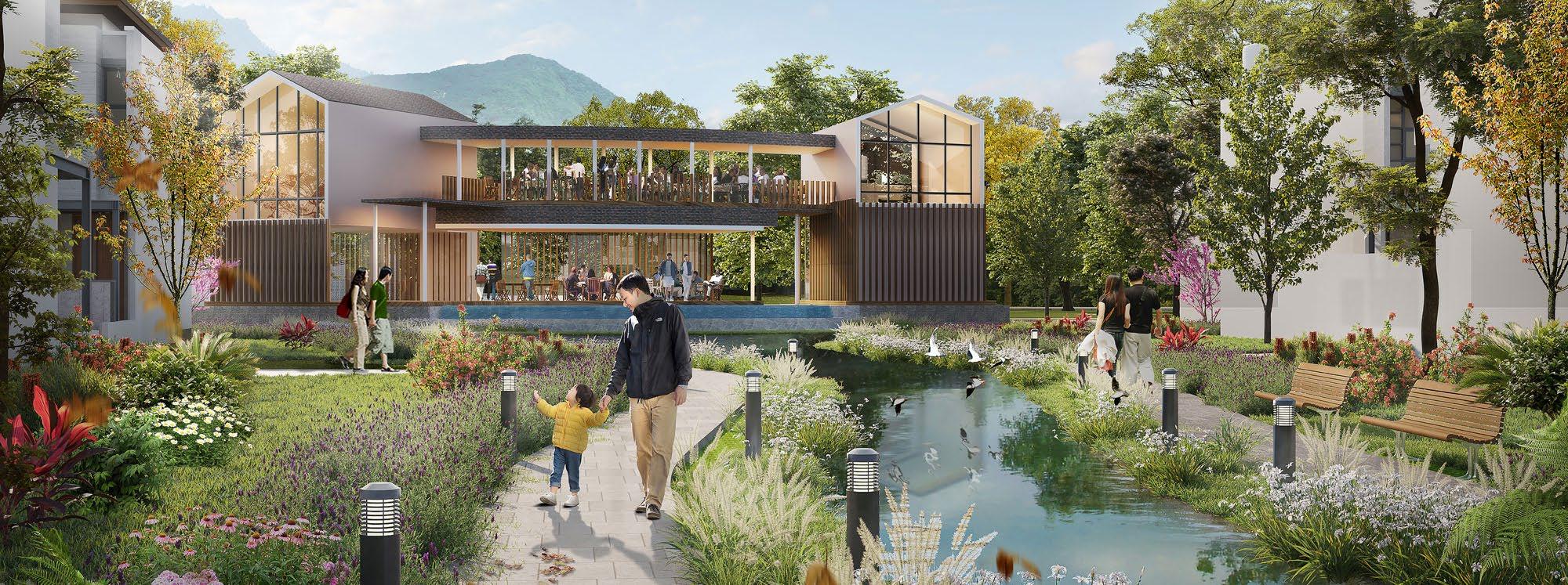
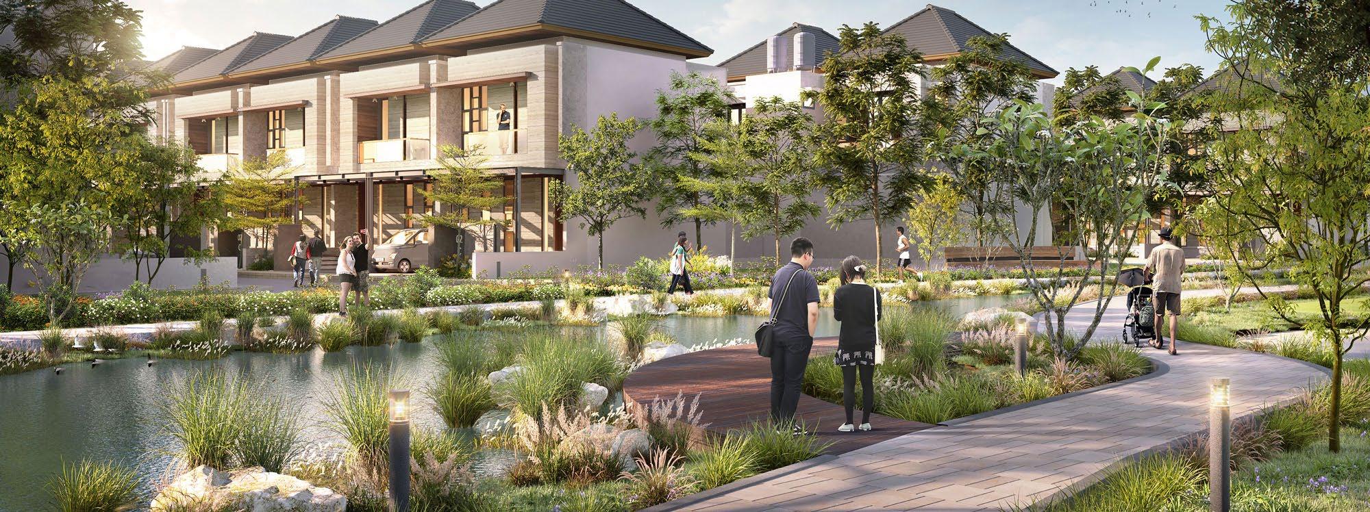
Kawasan perumahan compact dengan suasana yang intimate dan lingkungan yang asri, dilengkapi dengan fasilitas yang memadai, ruang-ruang luar yang berkualitas dan jaringan hijau-biru yang saling terintegrasi.
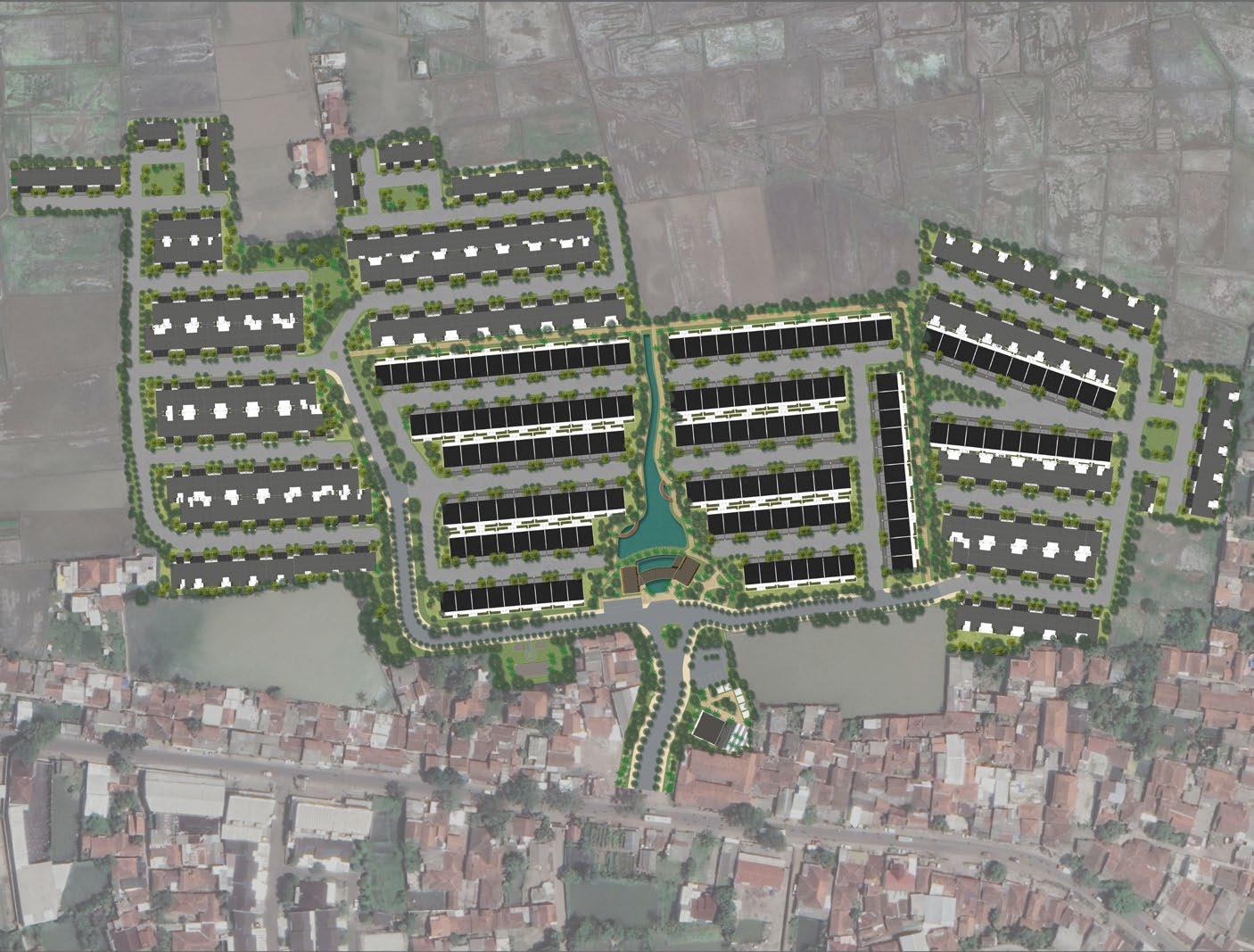
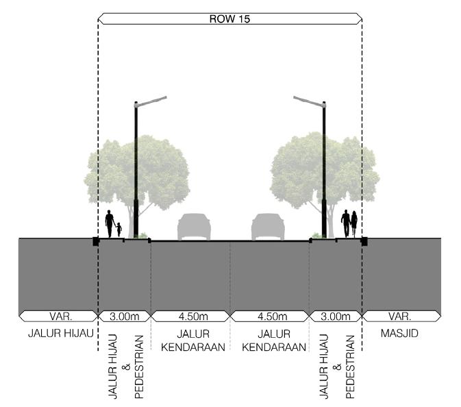
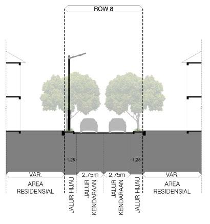
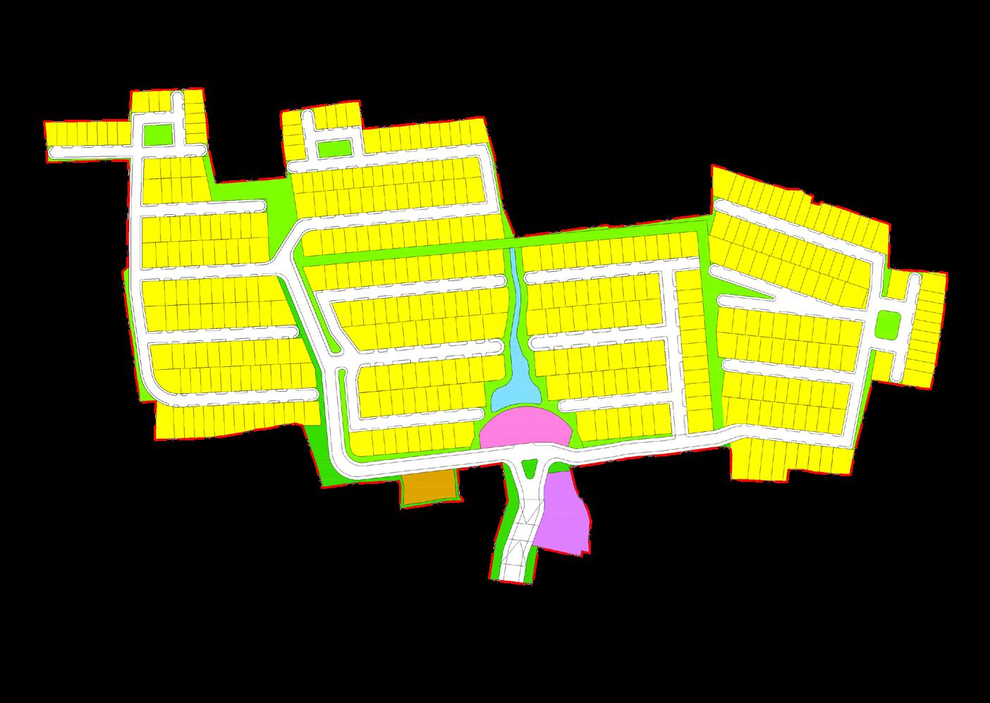
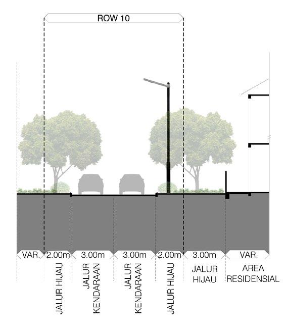
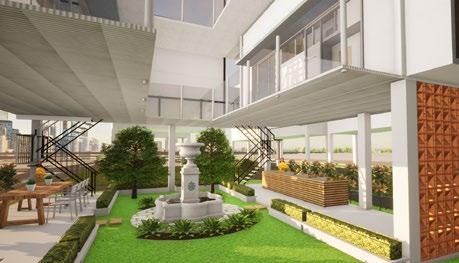
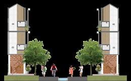
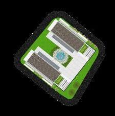
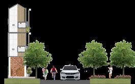
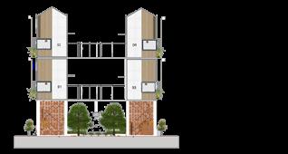
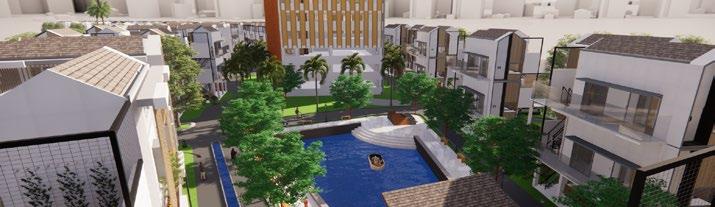
Ciheulang Residence is envisioned as a compact neighbourhood with a green and attractive environment. The Residential Estate provides a centralised facility at the heart of the Development comprising of a Mosque & Retail Kiosks adjacent to the Entrance Gateway and a Central Clubhouse & Marketing Gallery at the end of the Estate’s main boulevard axis, creating a termination point which defines a clear transition between the public and private spaces in the Development.
The Residential Estate comprises of 419 housing units spread across 5 clusters. All houses are within walking distance and interconnected through a continuous green loop corridor to the Central Clubhouse and Lake Park which is the Neighbourhood’s communal hub located at the centre of this Residential Estate. The Central Lake Park features various sports facilities, a playground, and seating pockets where residents can enjoy the outdoors for exercise and play, as well as to relax and spend leisure time with family and friends in a lush green open space.
1st Place Design Competition IAP (Sayembara Design Kampung Sehat)
Contribution : Spatial Analysis, Map Illustration, Concept Formulation, Design Analysis, Illustrative Masterplan, 3D Diagram, & Report Creation Typology : Kampung Kota
Scope : Urban Design & Master Planning
Jakarta, Indonesia (2021)
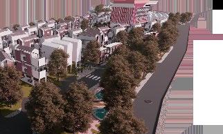
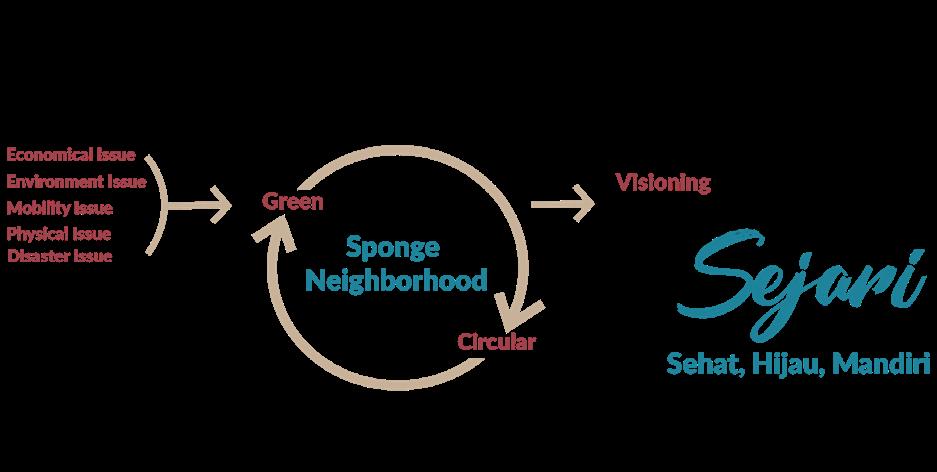
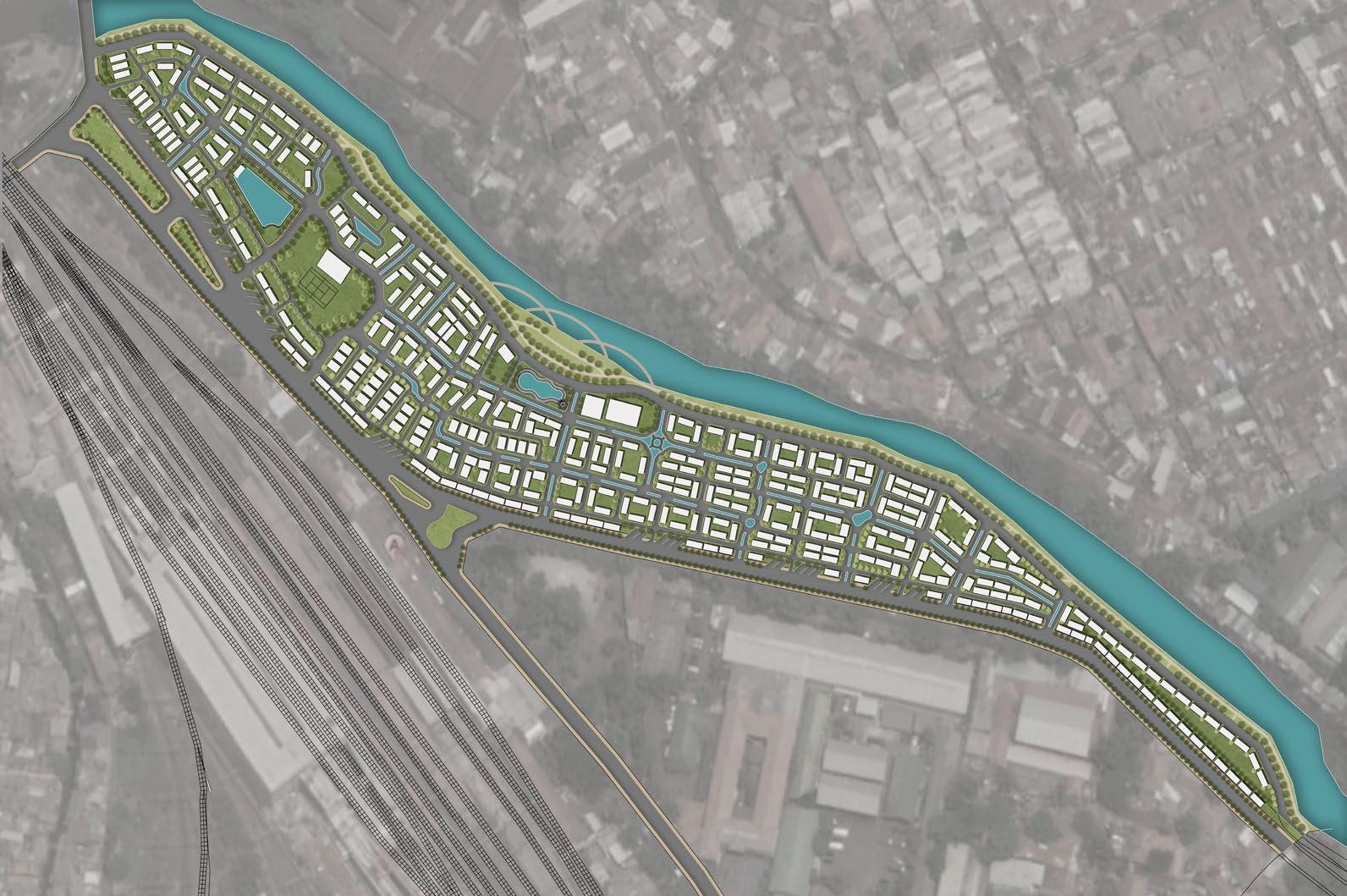
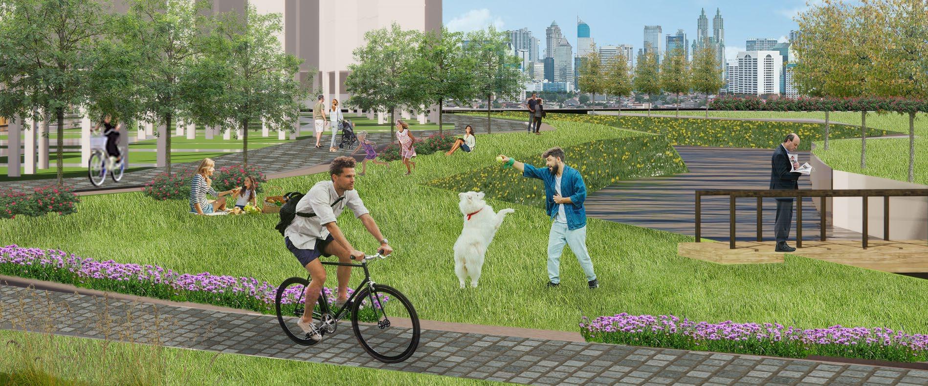
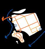
With Sponge Neighborhood Concept for future development and planning, RW 004 Mangarai could easily be a healthy, green and independent urban kampong with vision to be an urban vilage filled with social and local values, healthy, responsive to future crisis and climate change. The area’s vision is also known as “Kampung Sejari” or Kampung Sehat, Hijau dan Mandiri (Healthy, Green and Independent Neighborhood). To ensure the vision comes true there are some points to be consider:
1. A healthy and livable neighborhood
2. Equipped with abundant open space and social/public space
3. Integration with Nature
4. Good water management system.
5. Independent and Sustainable in utilizing energy and resources.
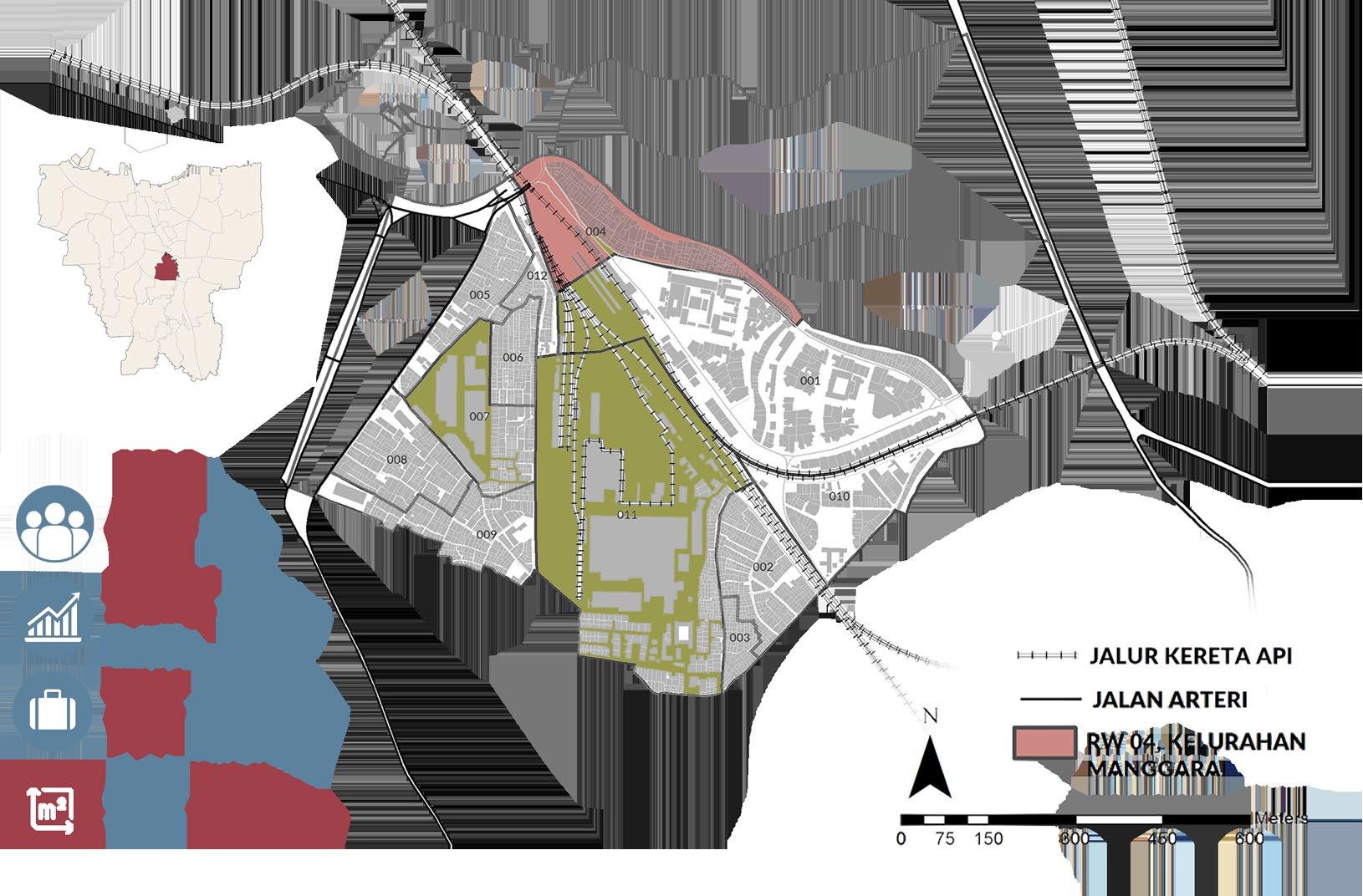
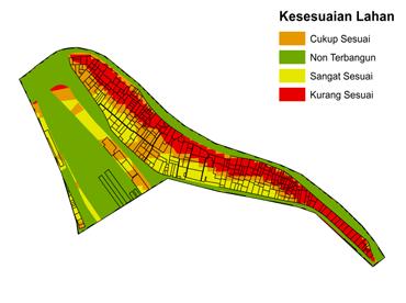
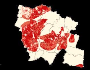
Based on geographical context and land suitability analysis, it is concluded that :
- 50% of site area are not suitable and compatible as it resides on the Riverbanks.
- Based on Detaild Spatial Plan (RDTR) almost 90% of site area’s land uses are NOT suitable
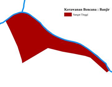
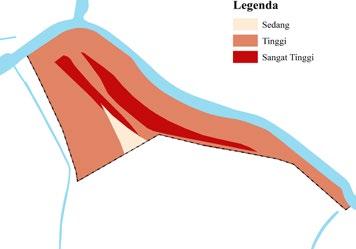
- The area is prone to flooding, Dengue fever and COVID-19 Pandemic.
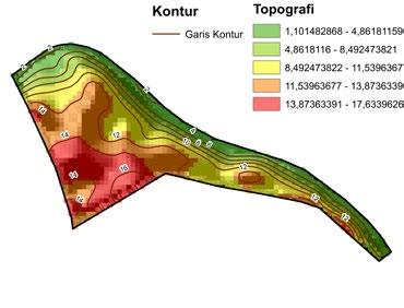
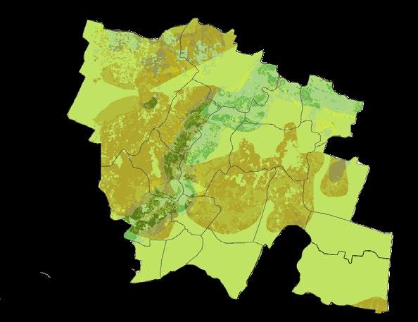
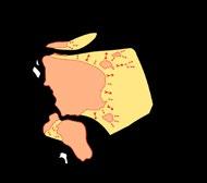
Site Analysis
Sun & Wind Direction

Noise

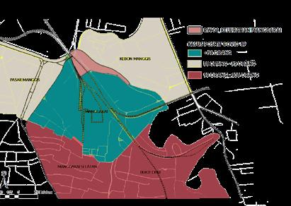
Access

Building Density

Zoning & Existing Landuse

Based on site analysis, there are some constraints and problems found in the site:
1. Incompatible existing land use from the detailed spatial plan.
2. High building density and ocupying the Ciliwung Riverbanks.
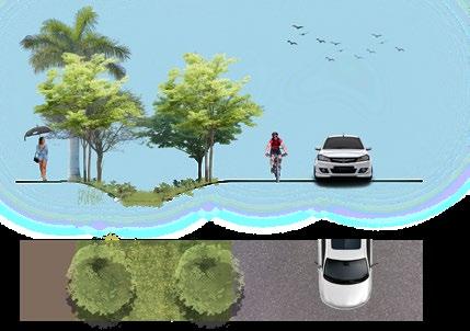
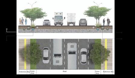
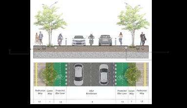
3. Bad quality road networks, which increases the urgency to improve the quality street network with shared stret concept. \
4. Several points too close to noice source (Train station and road intersection) Housing should be pushed farther away from noise source.
5. Building orientation needs to consider sund and wind direction.
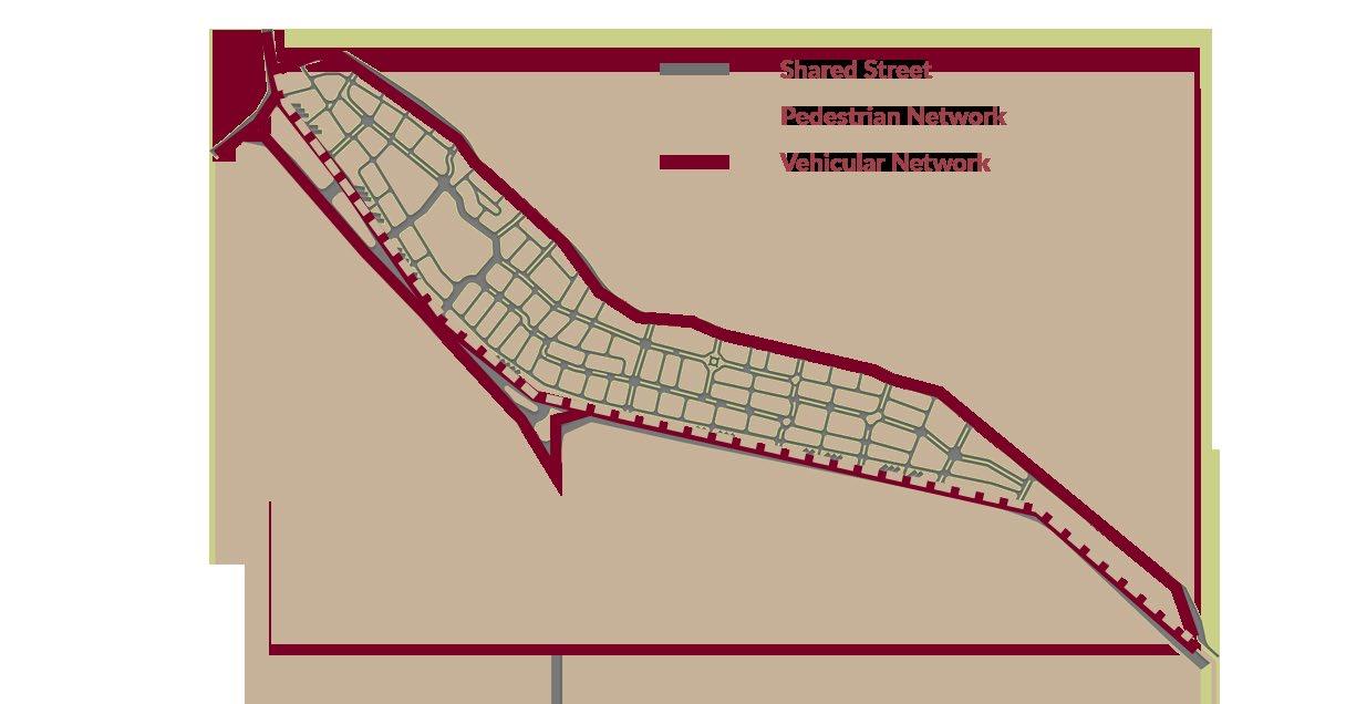
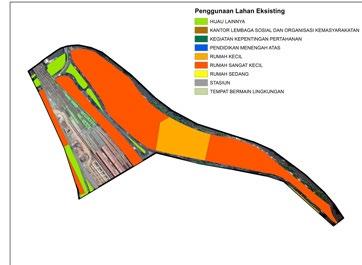
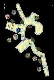
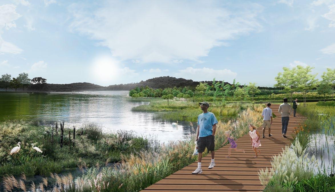
Street networks is divided into two based on it’s hierarchy. Ensuring walkability and distributions of activities within walking distance.
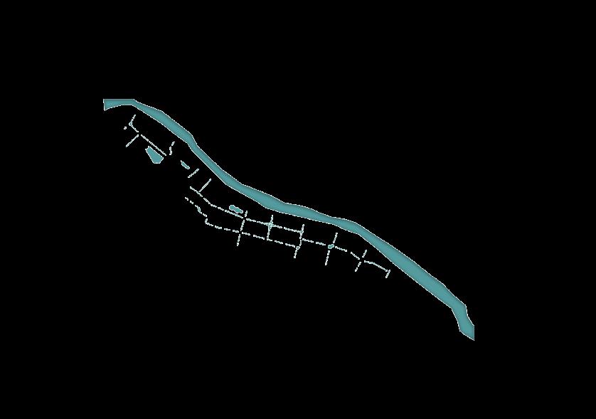
‘Water Sensitive Urban Design” approach. Highlighted by river rechanneling and retention pond addition to ensure provision of fresh water distribution equipped with filtration and stormwater management.

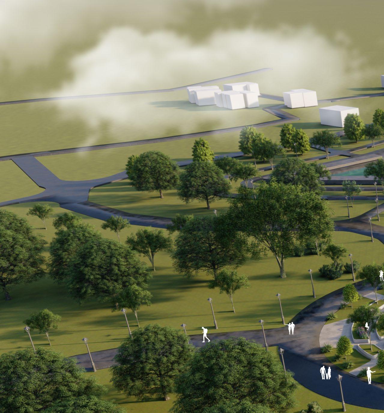
to ensure good water filtration within the area, green open spaces are integrated and introduced as the main component of the area. 60% of the area consist of gren open spaces (public and private)
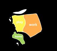
 Walkable Neighborhood Water Rechanneling Green Open Space Medium Density

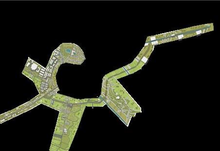
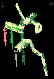
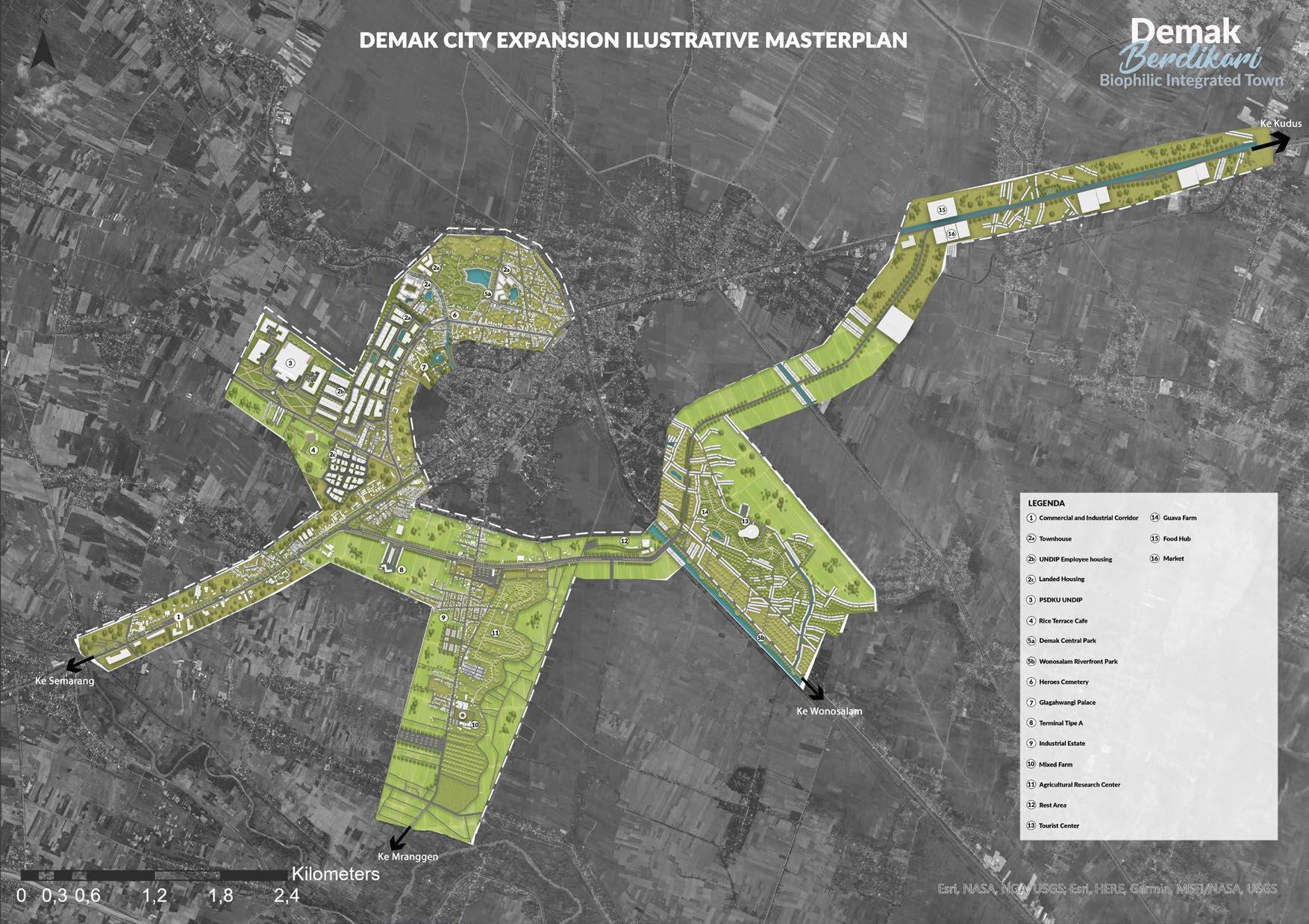
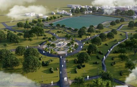
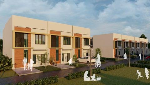
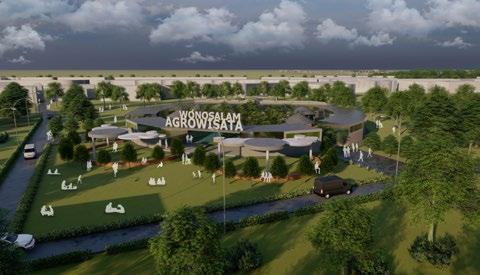
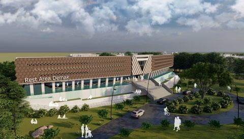
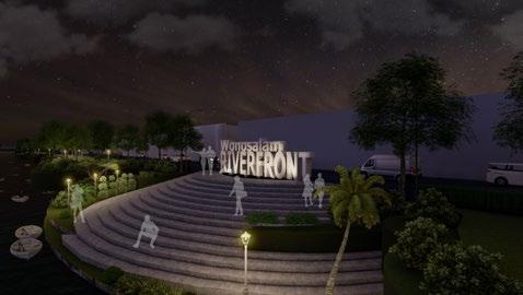
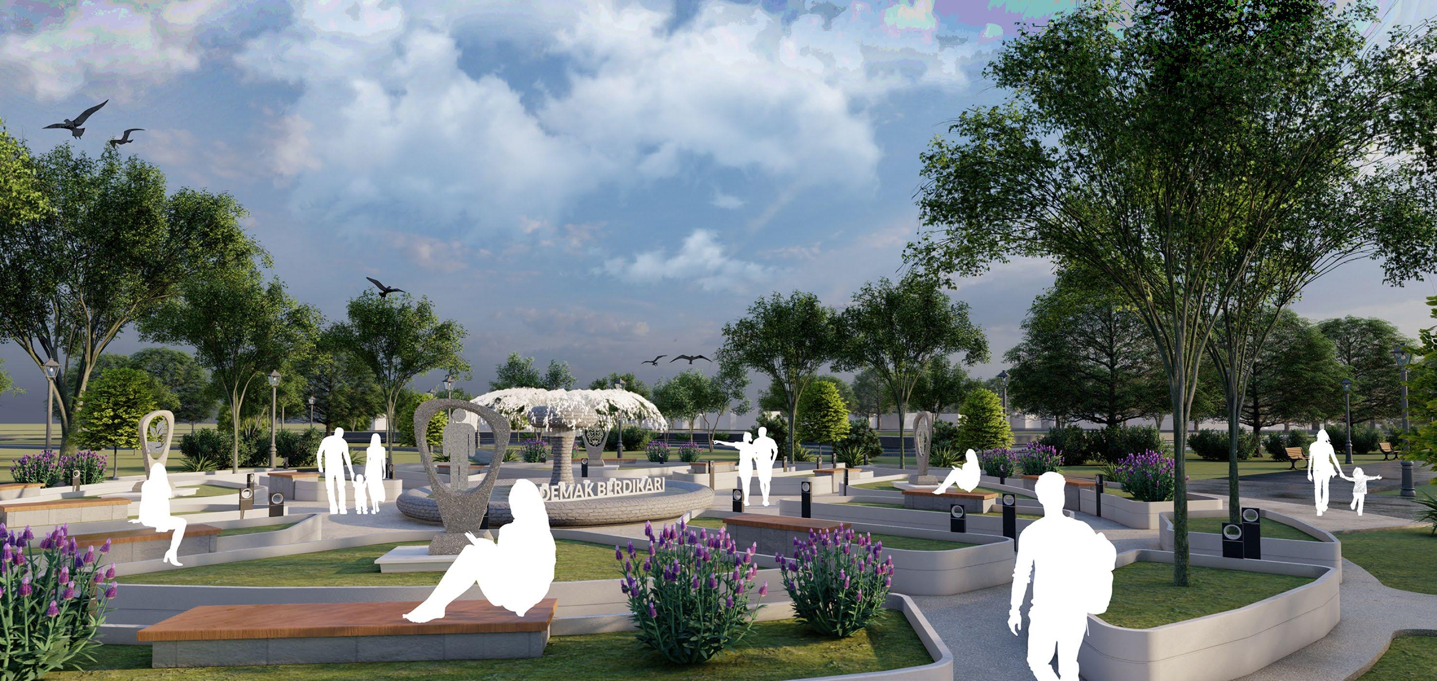
Top 10 Design Competition Pemerintah Provinsi Demak (Sayembara Design Perluasan Kota Demak)
Contribution : Spatial Analysis, Map Illustration, Concept Formulation, Design Analysis, Illustrative Masterplan, 3D Modelling & Report Creation
Typology : Redevelopment
Scope : Urban Design & Master Planning
Demak, Indonesia (2021)
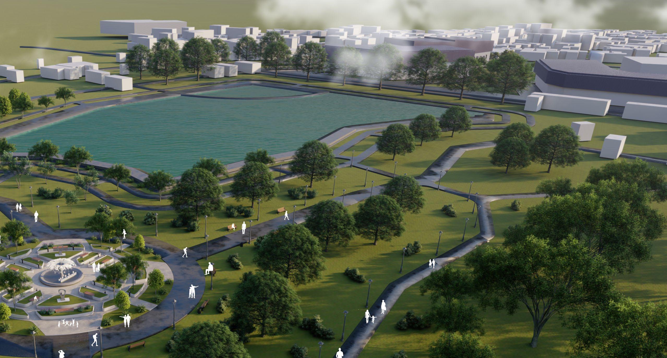
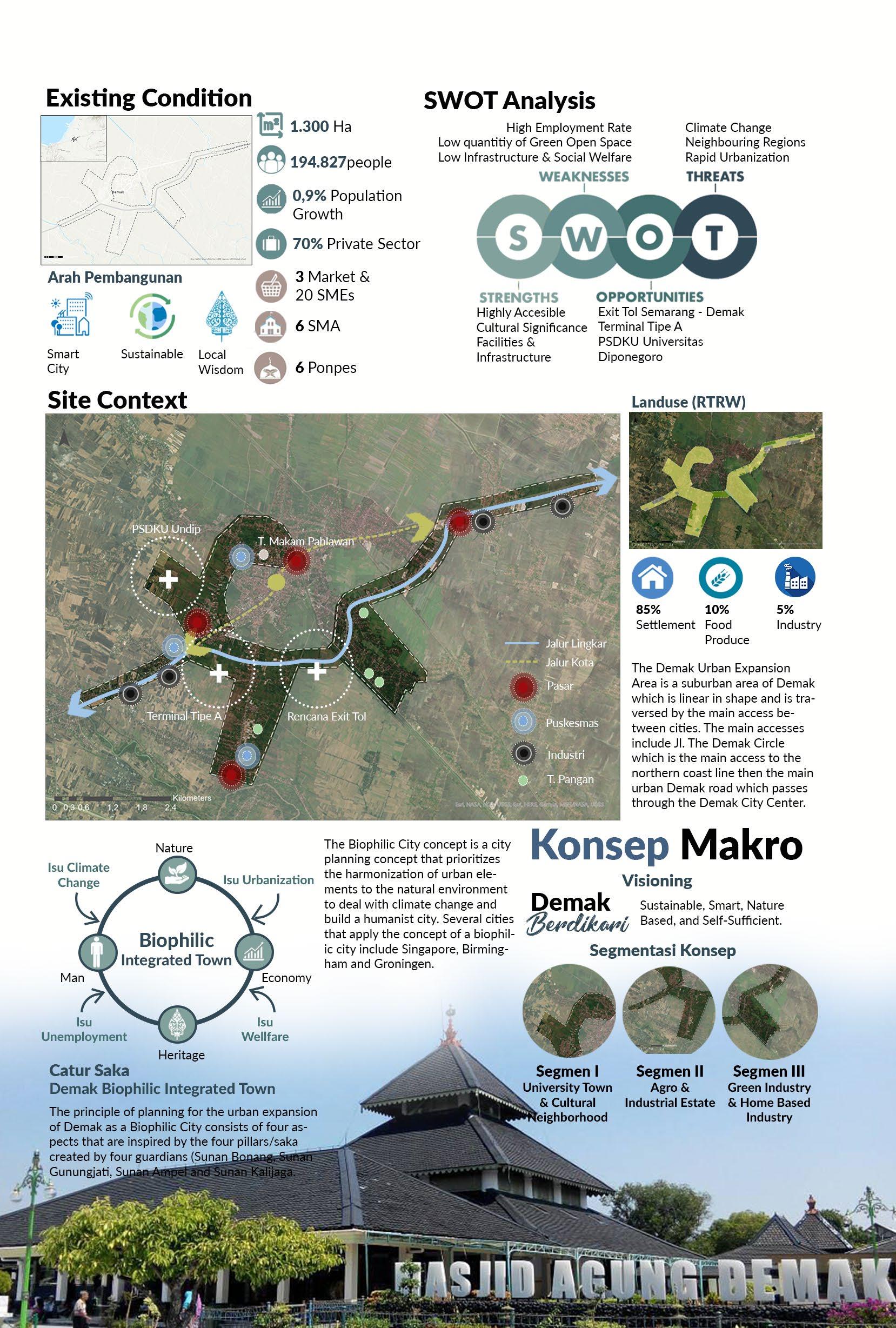
Demak is a fast growing city with focus sector in industry and trade and prone to cimate disaster like flood. Thus, we present a concept of “Demak Biophilic Integrated Town” bridging nature based solutions and local wisdom. The concept rely on four pillars which are inspired by “Catur Saka” the four original pillars of Grand Mosque of Demak built by Four of The Walisongo. Those Four Pillars are : Man, Nature, Economy, and Heritage. We believe this four pillars are the key to transform Demak as a modern, smart, cultured and based on nature solutions. (Demak Berdikari : Sustainable, Smart, Nature based, Independent).


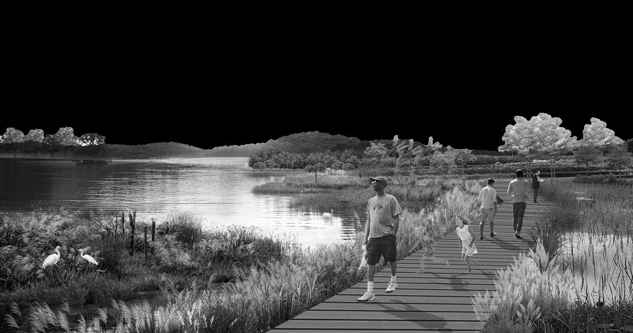
Contribution : Spatial Analysis, Map Illustration, Concept Formulation, Design Analysis, Illustrative Masterplan, 3D Modelling & Report Creation
Typology : Rural Public Space
Scope : Public Space
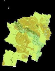
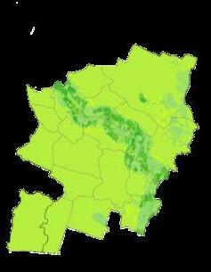
Klaten, Indonesia (2021)
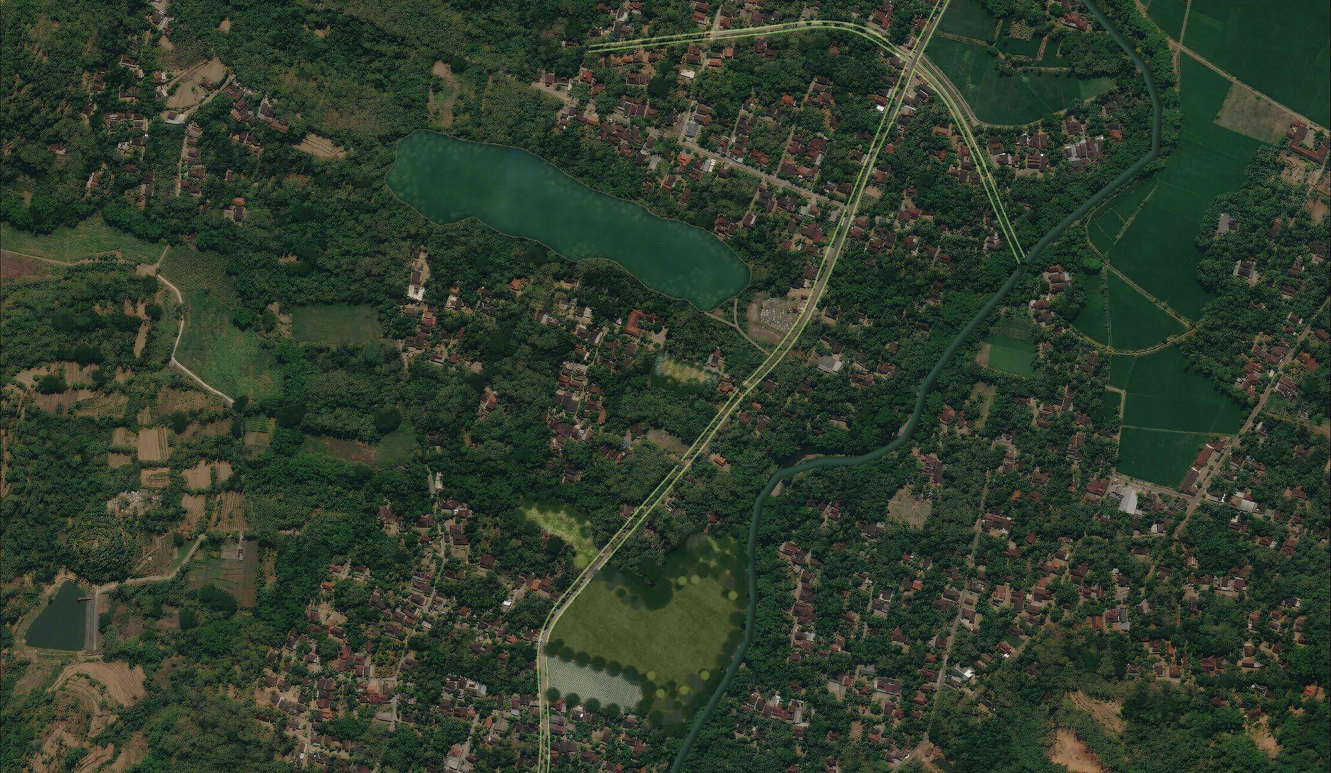
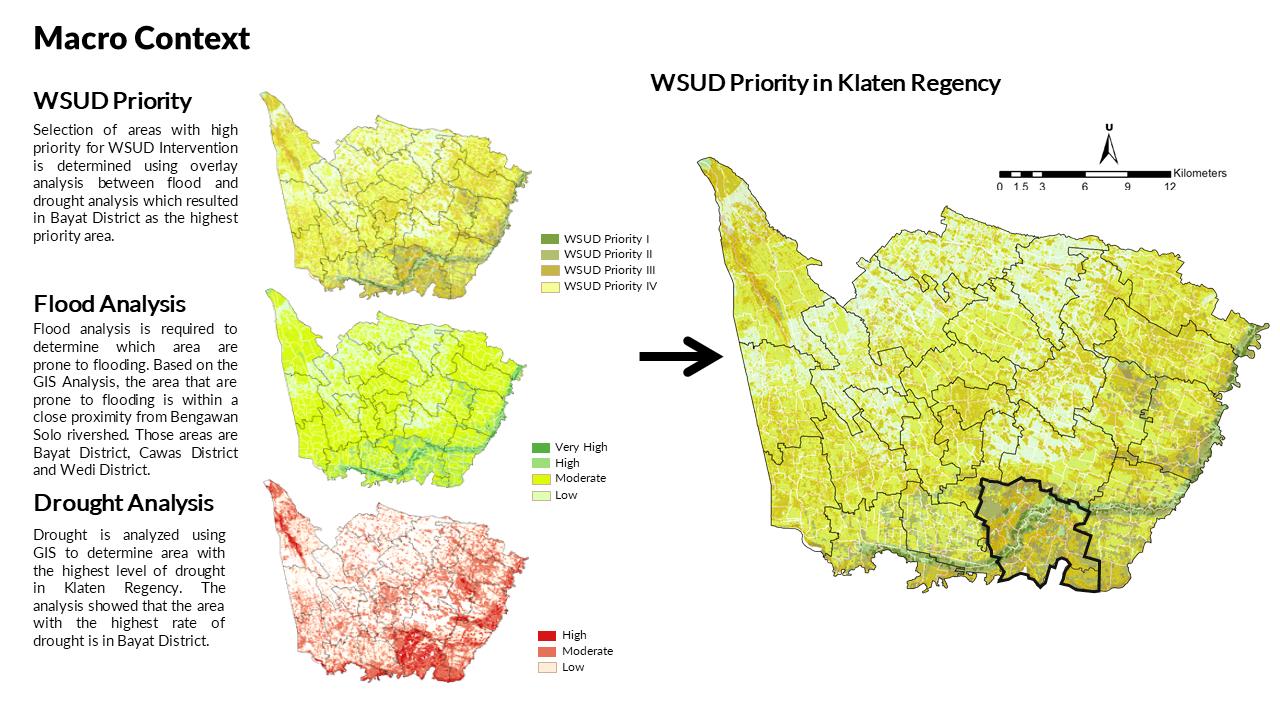
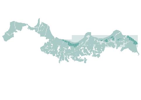
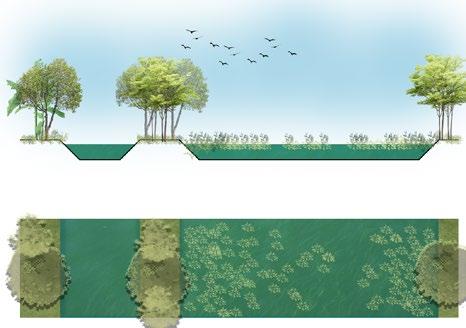
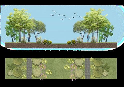
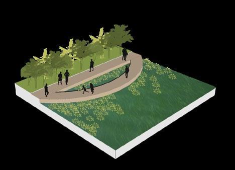
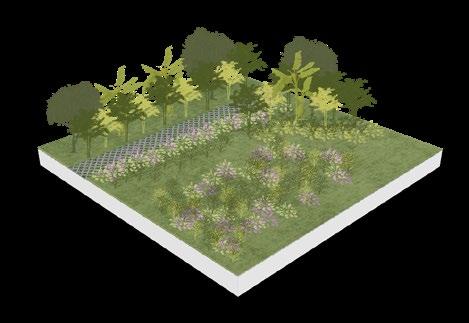
Based on the Macro context analysis, Bayat District is the area with the highest possibility of drought and prone to flooding. Using this result, further overlay is required to determine which are the sub-district is the most vulnerable. After overlaying with the administrative boundary, it is concluded that Krikilan and Jotangan Vilage is the most vulnerable.


Contribution : Spatial Analysis, Map Illustration, Concept Formulation, Design Analysis, Illustrative Masterplan, 3D Modelling & Report Creation
Typology : Rural Public Space
Scope : Public Space
Klaten, Indonesia
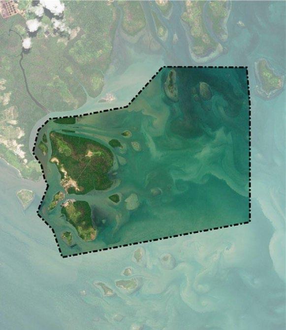
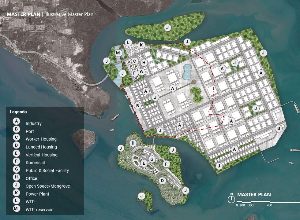
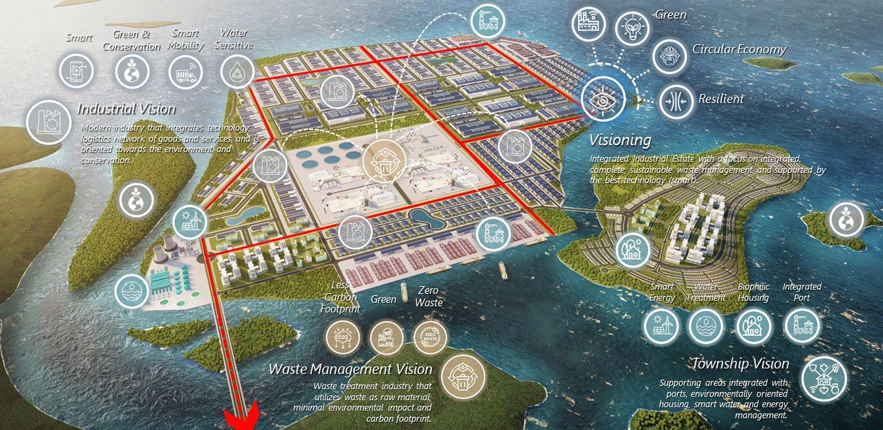
Ladi Island is an island located south of Batam, Riau Island Province, Indonesia (961 Ha). This island is planned as an industrial area with main focus of waste management and processing facility. The vision for this area is to be an integrated industrial area with three main focus which area green, minimizing waste and sustainable. To achieve this vision, the masterplanning process also included reclamation process to expand the land area. This project also refers to 6 design principles, such as :


Contribution : Spatial Analysis, Map Illustration, Concept Formulation, Design Analysis, Illustrative Masterplan, 3D Modelling & Report Creation
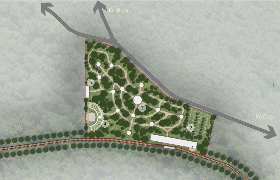
Typology : Heritage Conservation
Scope : Public Spacev& Heritage Blora, Indonesia (2022)
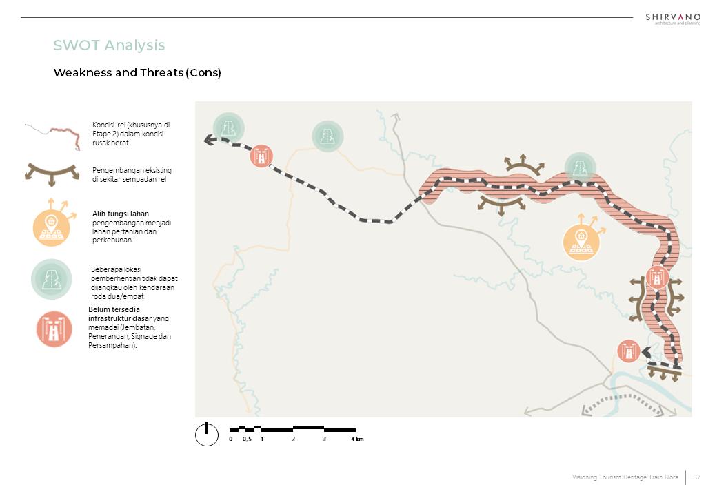
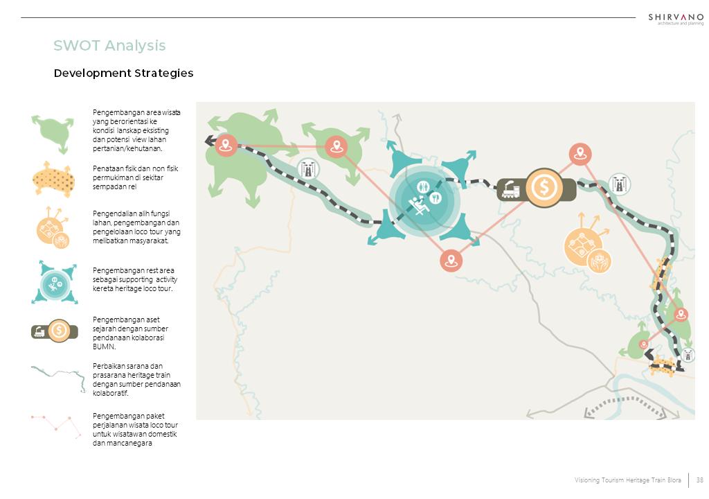
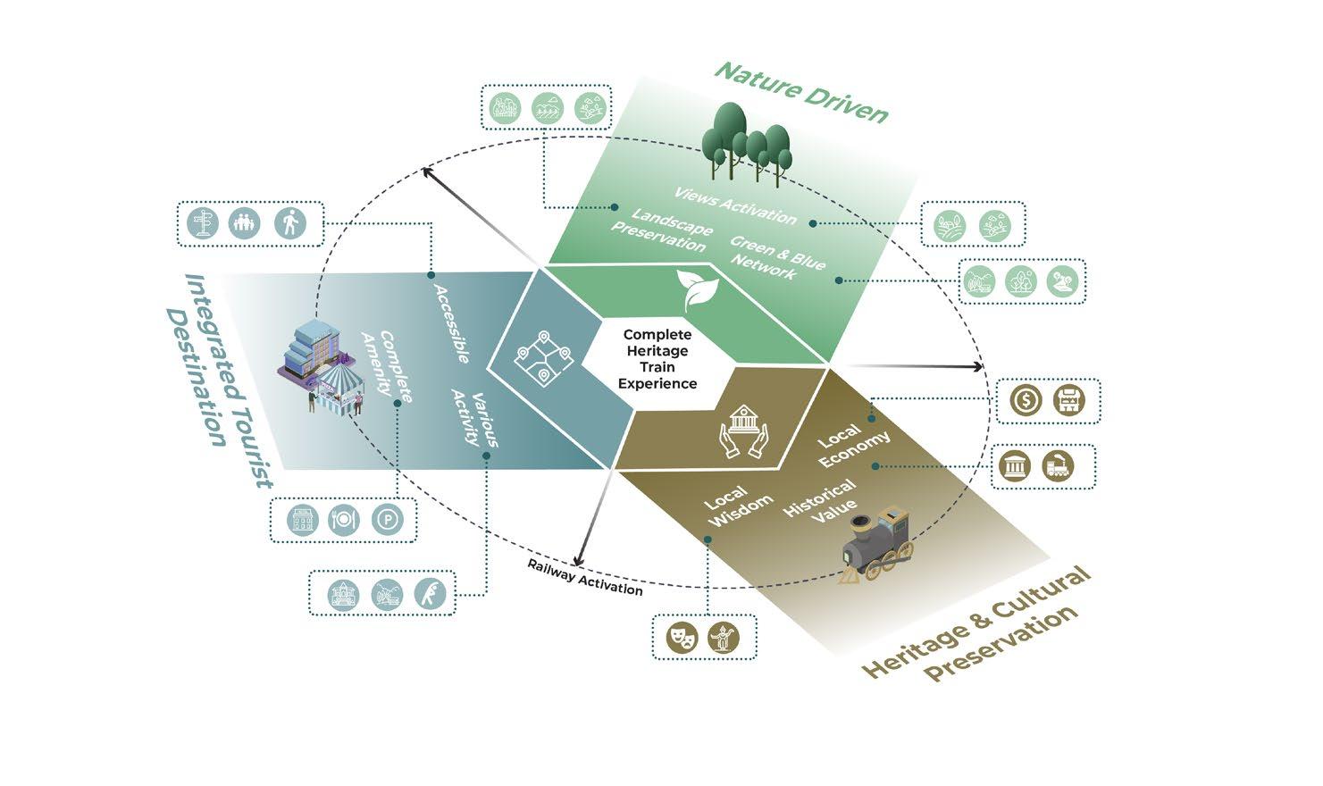

Local Wisdom Integration
Form Follows Nature
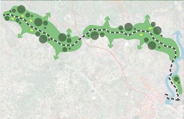
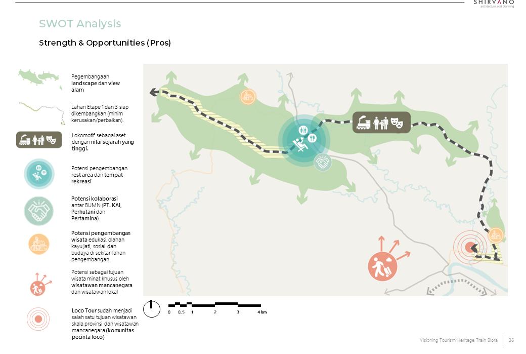
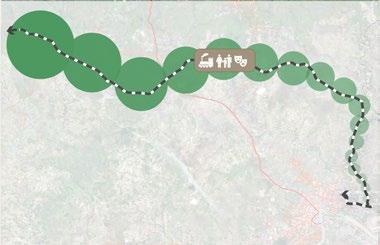
Pengembangan dan perencanaan fisik dan non-fisik memperhatikan integrasi kebudayaan dan kearifan lokal setempat. Rute rel Kereta Heritage melalui titik – titik simpul kebudayaan dan komunitas dengan nilai heritage dan kebudayaan yang tinggi. Adapun lokasi simpul kebudayaan tersebut diantaranya adalah Heritage Train Loco Tour (KPH Cepu), TPK (Tempat Penampungan Kayu) Batokan.

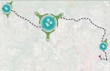
Masing – masing lokasi pemberhentian memiliki signifikansi dan nilai heritage masing – masing. Pengembangan Kawasan dengan prinsip storynomics diperlukan untuk menciptakan perjalanan wisata yang berkualitas, diperlukan pengembangan. Hal ini juga untuk memastikan kualitas perjalanan wisata. Prinsip ini dapat melalui melalui elemen fisik & non fisik.
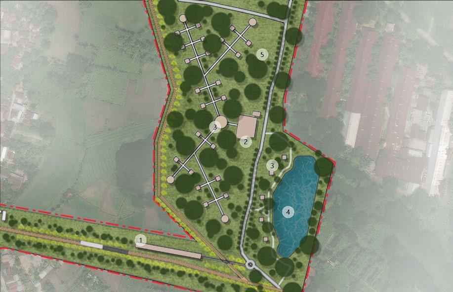
Pengembangan wisata Kereta Sejarah memperhatikan dan mempertahankan bentang alam serta elemen alam seperti pohon, badan air dan jalur hijau. Pembangunan akan dilakukan dengan mengikuti pola maupun kondisi eksisting elemen elemen alam yang ada. Hal ini dilakukan untuk menempatkan kawasan pengembangan sebagai kawasan yang integral dengan alam.


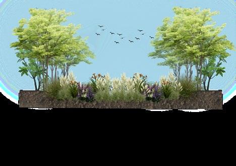
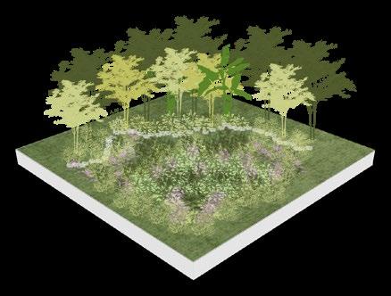
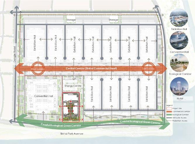
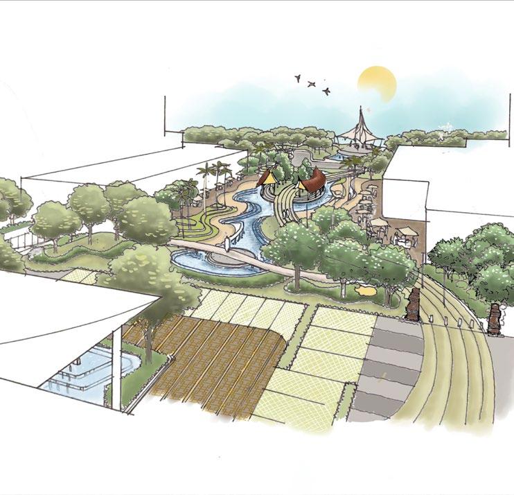
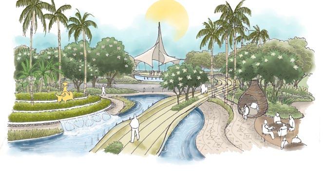
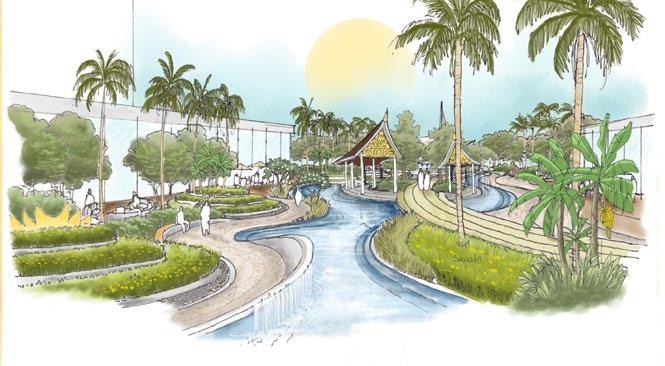
Contribution : Spatial Analysis, Map Illustration, 3D Modelling & Report Creation.
Typology : Public Space Design
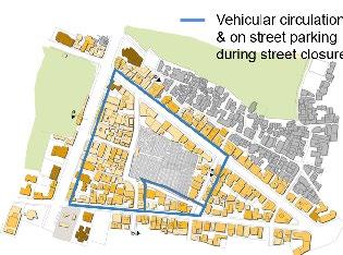
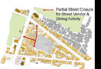
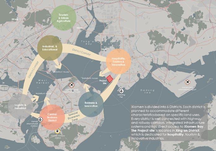
Scope : Public Space & Landscape Design India (2021) & China (2024)
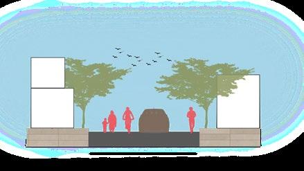
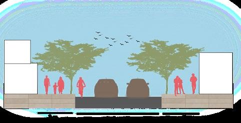
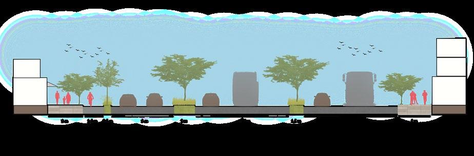
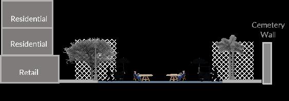
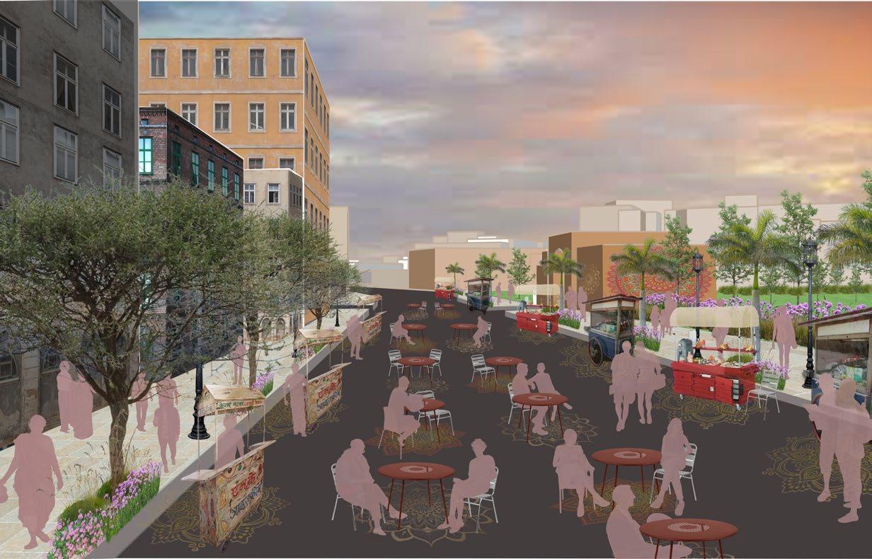
In order to revitalize the street activity, street is activated through enhancing greeneries and street furniture while also providing a comfortable space for pedestrian to walk in. Partial street closure is implemented to make sure Street vendors and dining space are provided in the street during weekend. Each street vendor cart and the dining table has it’s own space, marked with the “mandala” marking on the street. This concept is inspired by tactical urbanism while also trying to create a more responsive public space during new normal through providing social distancing. Street vendors preferred are food & beverage to create a sense of community through culinary. This concept also providing job opportunity for locals especially since the area are surrounded by informal settlements. A more vibrant, safe and lively street like this one hopefully could bring more life to the once out of place neighborhood.
Contribution : Spatial Analysis, Map Illustration, 3D Modelling & Data Visualization