IOP Conference Series: Earth and Environmental Science| Human natural and artificialintelligencecollaborationinurbandesign:acasestudyofIndonesiasnew capitalcity|Status:Published
IOP Publishing | Harmonizing Urban Life with Natural Ecosystems in New Nusantara Capital City Through Biodiversity-Sensitive Urban Design | Status: Accepted
IOP Conference Series: Earth and Environmental Science | Analyzing The Land Use/Land Cover Changes And Its Influence Related To Urban Heat Island: Case
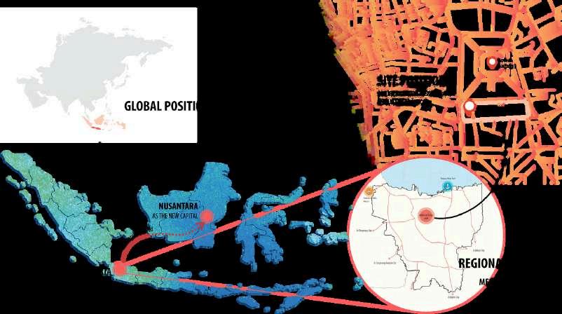
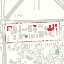
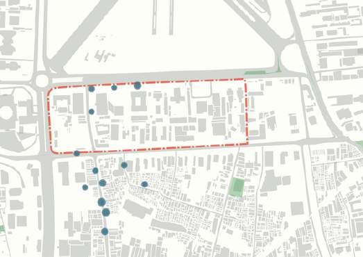
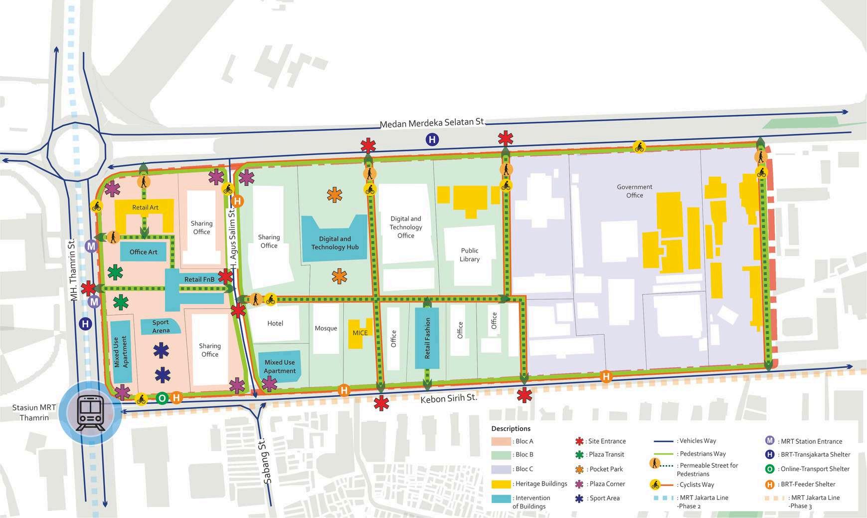
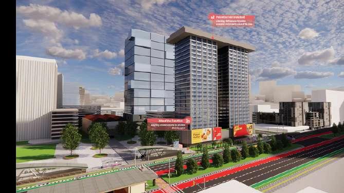
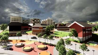
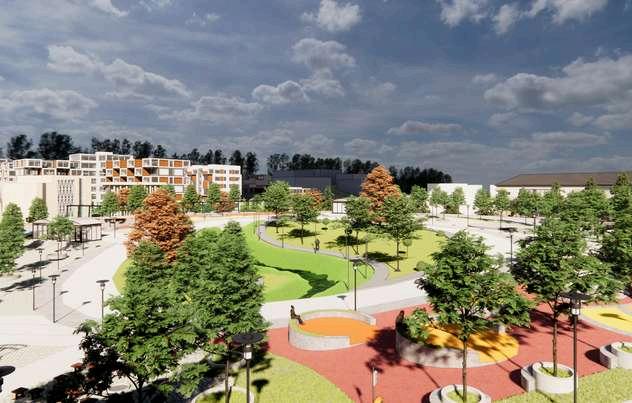
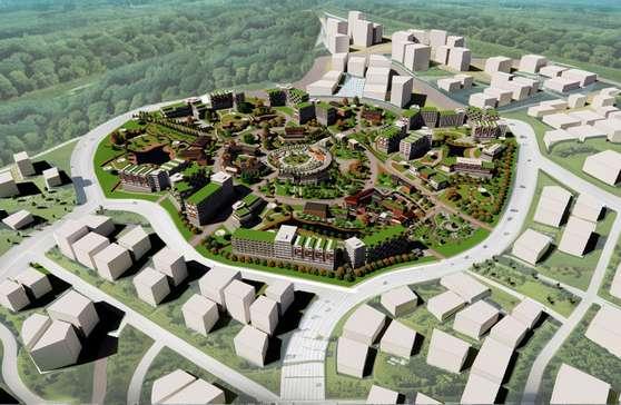
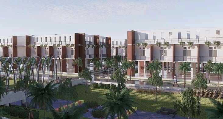
Medan Merdeka area is one of the important areas in downtown Jakarta, Indonesia This area has an important role in the history and also home to national government offices and various ministryoffices.
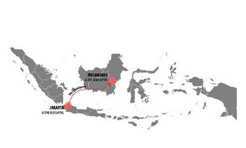
However in 2020, the Indonesian government decided to move the nationalcapital,andthisareathat previously functioned as the centerofthenationalgovernment needs to be revitalized and plannedtore-useit
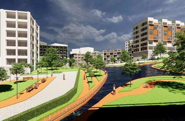
Our site is located in the South Medan Merdeka area with an area of ±18 Ha with the boundaries starting from the north side bordered by Medan Merdeka Selatan Street, the east side is bordered by the United States Embassy lot, the south side is bordered by Kebon Sirih Street, and the west side is bordered by ThamrinStreet
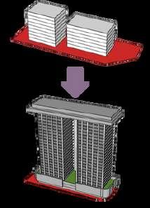
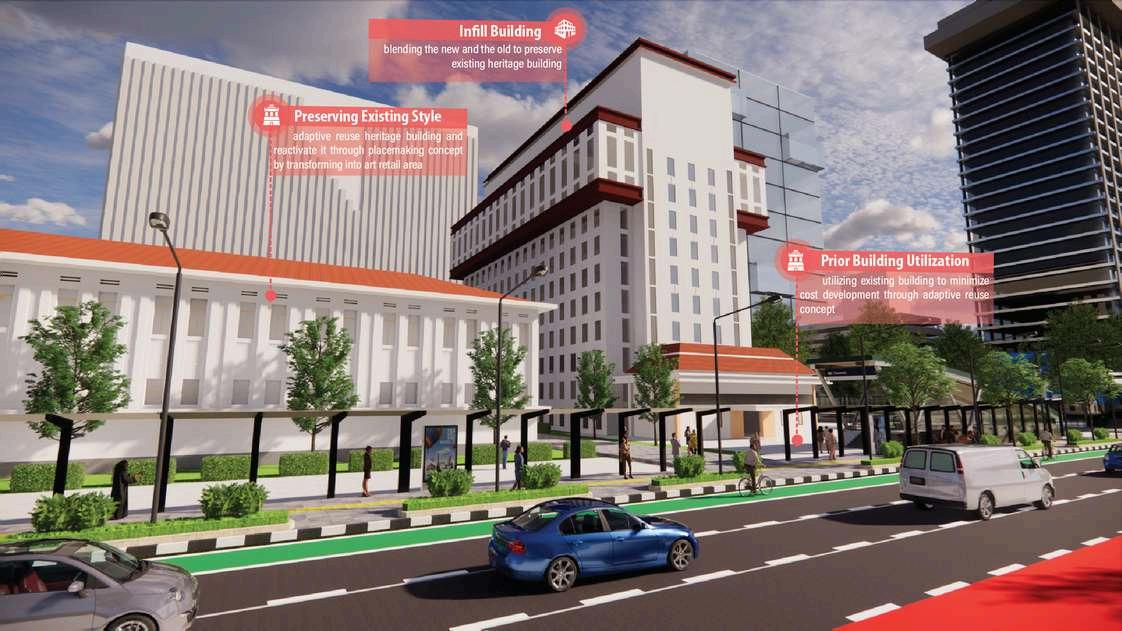
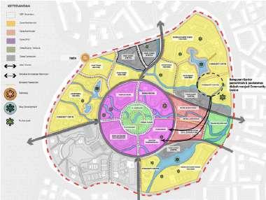
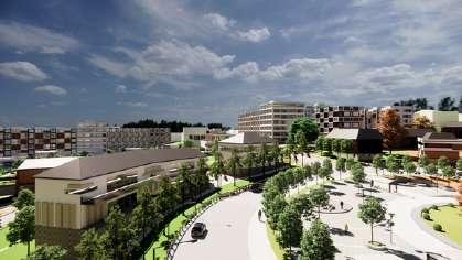
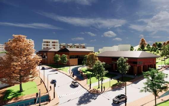
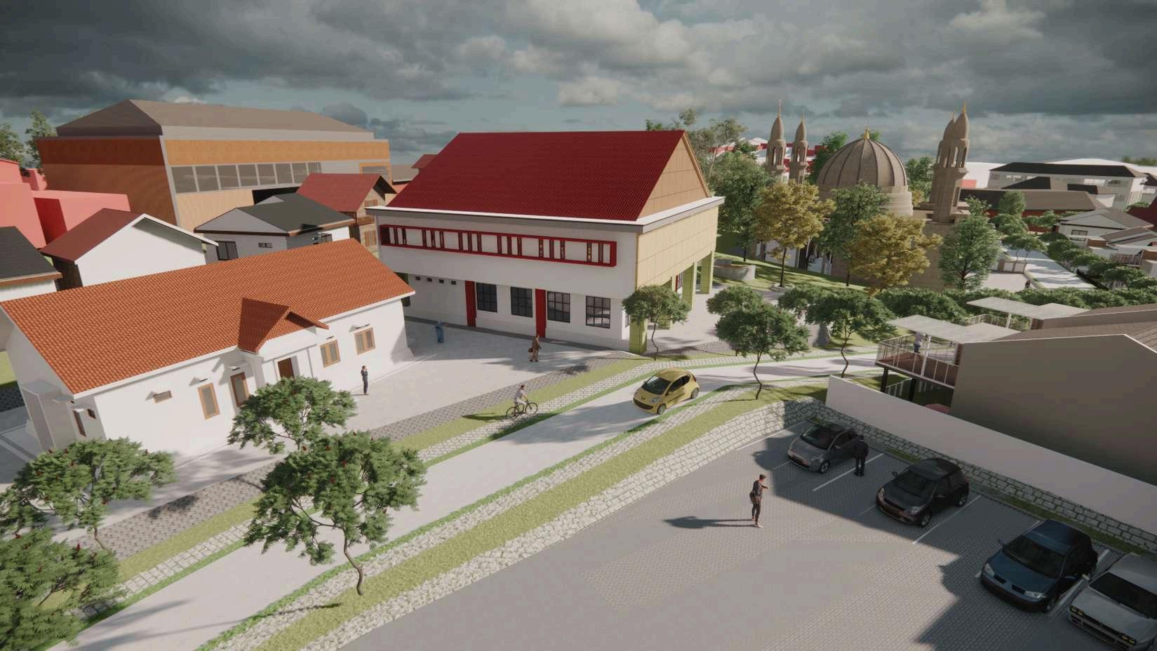
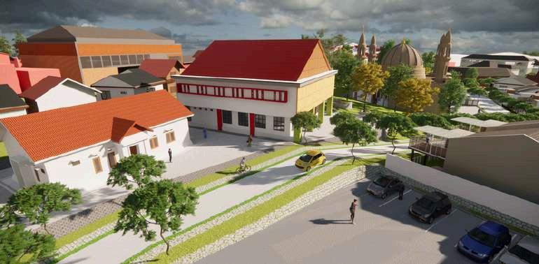
ThisstrategybeingimplementedpertainstotheformerESDMbuildingthathasahighlyadvantageousdue to its proximity to MRT Statioresence of historic structures and the abandont surrounding buildings that offeringopportunityforasingularblocdevelopment.Inresponse,repurposingadaptivereuseforheritage buildingsalongsideapplyingcreativeplacemakingconcepthathaspotentialtoelicitplaceattachment.
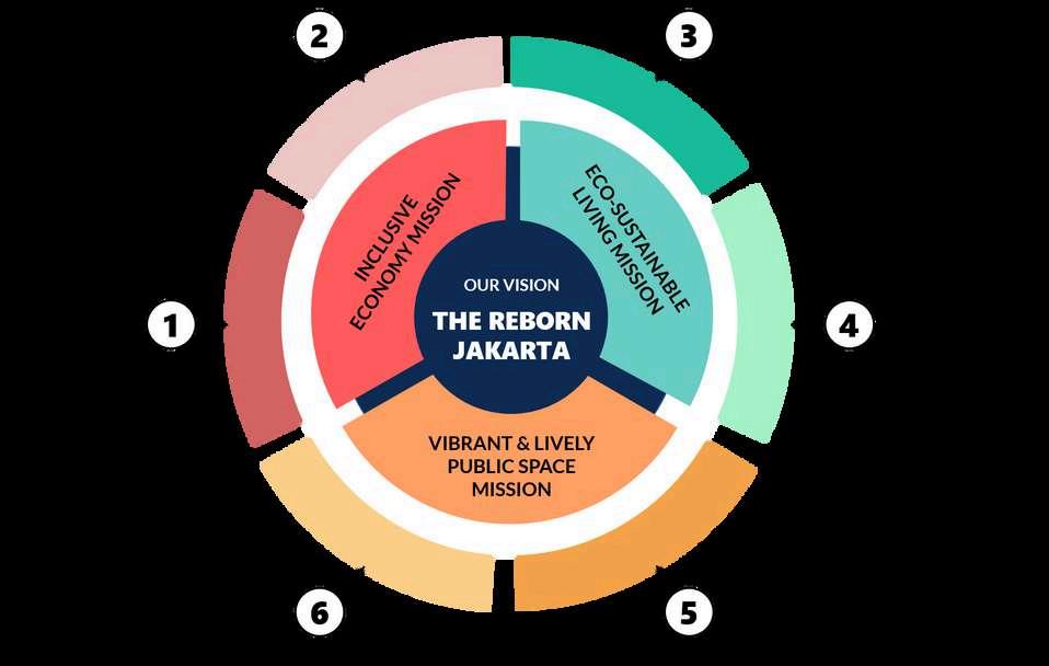
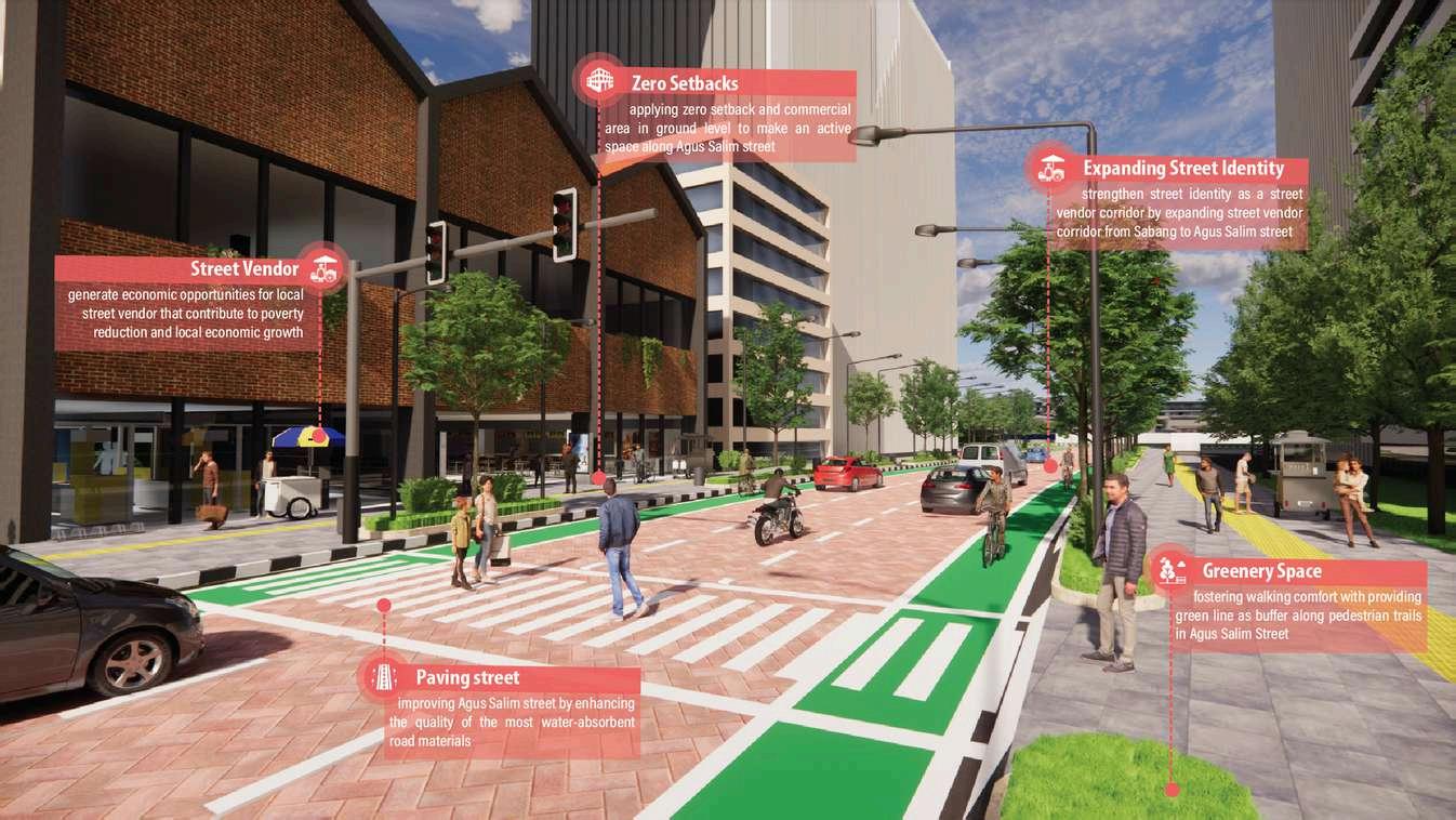
CELEBRATINGLOCALECONOMY
This strategy promotes economic diversity within the area by accommodating both upscale retail and SMSEs establishments through designated zones Not only does it promote inclusivity among different user groups, but it also playsasignificantroleinreducingpovertyratesandfosteringoveralleconomicgrowthwithinthelocalcommunity
DESIGNSTRATEGY
PROMOTINGLOW-CARBON&
BREATHABLEENVIRONMENT
FORALL
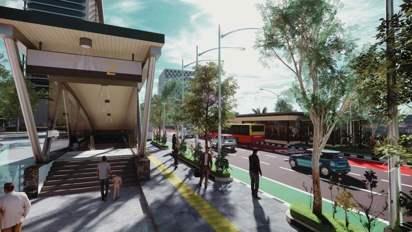
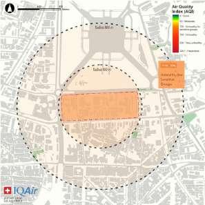
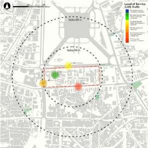
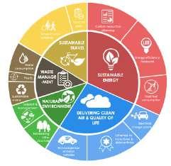
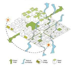
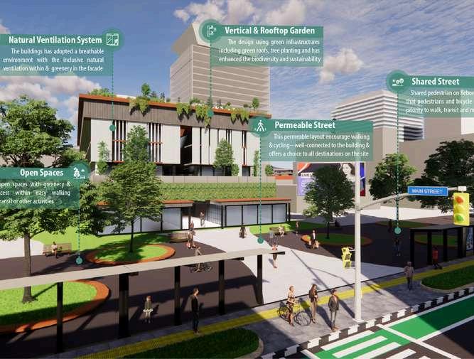
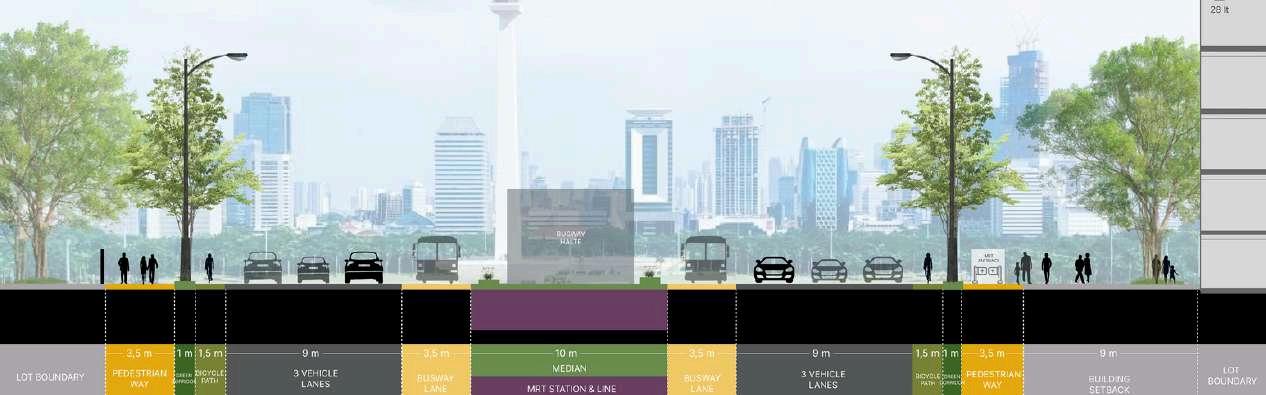
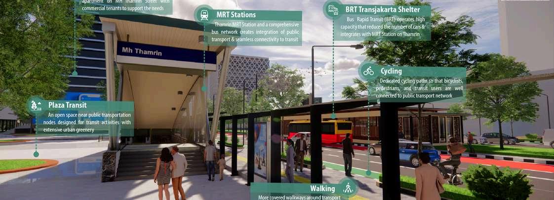
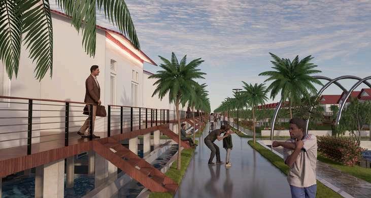
To resolve the air pollution issues, The RebornJakartahavetopromoteLow-Carbon Urban Design adopts environmentally friendly approaches, which includes: Mobility & connectivity ;extensive use of public transport systems and pedestrianized areas Smart growth & green infrastructures; construction of green buildings; Compact and optimal building density; mixed use development with vertical lateral structures; Urban greenery ; open spaces with extensive greeneryandnaturalventilation.
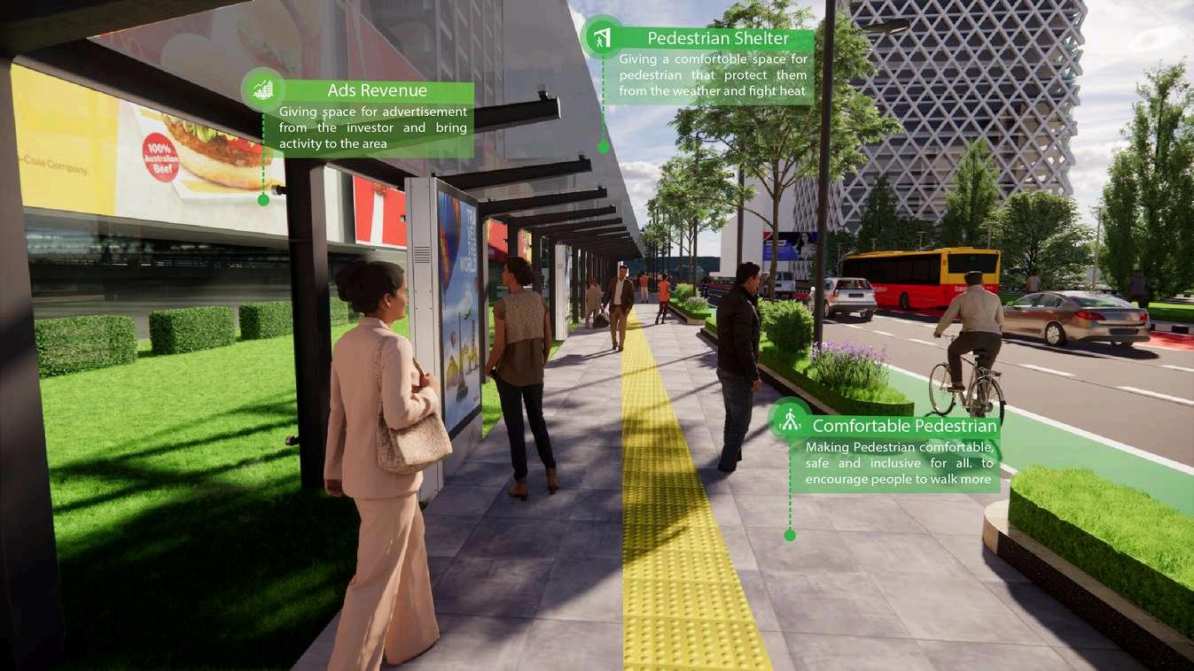
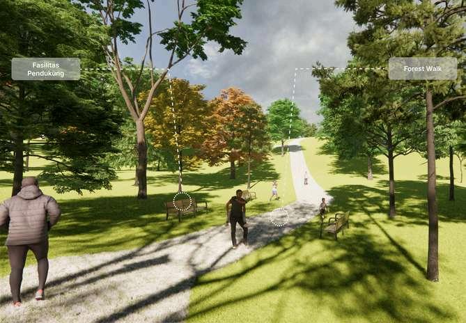
ENHANCINGCLIMATEFRIENDLY TOBEATTHEHEAT
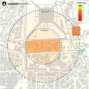
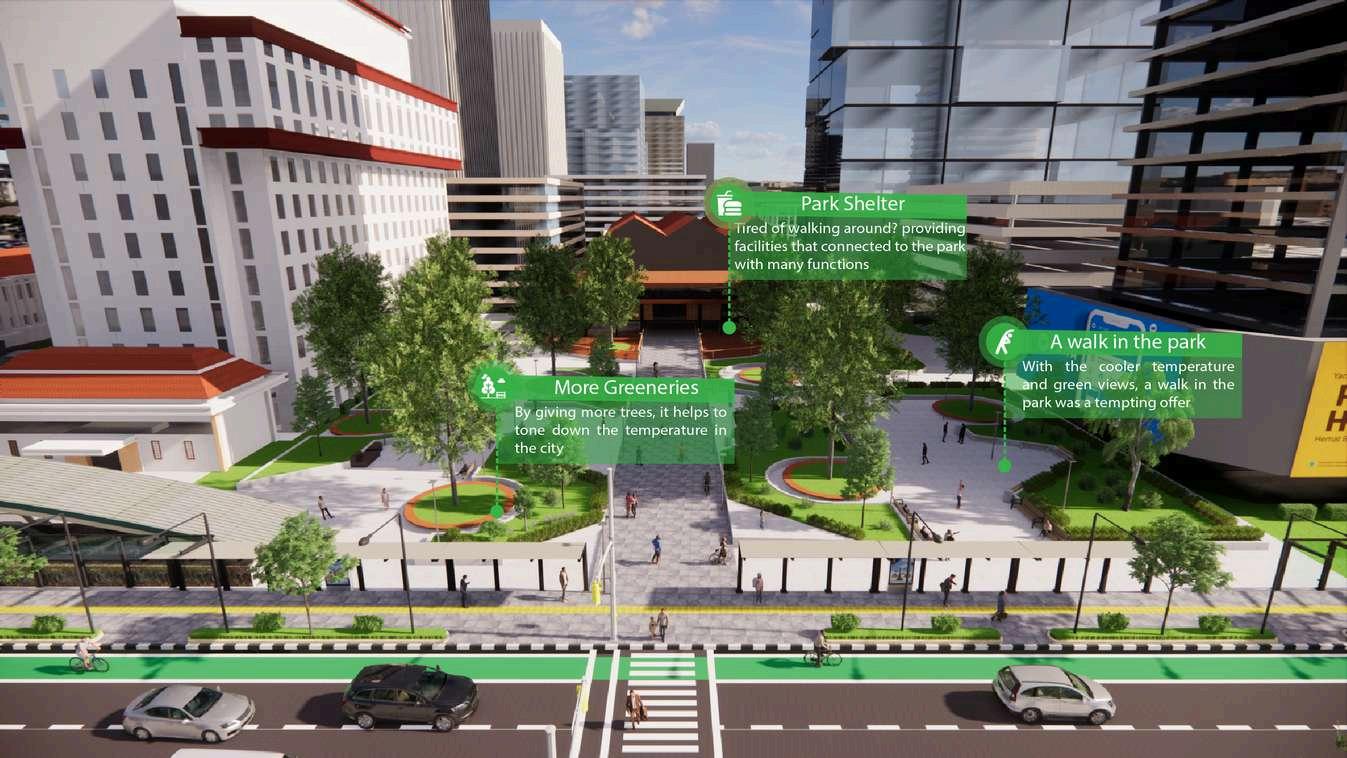
In dismissing asumption that a tropical country is not suitable for pedestrian because of the hot weather, these was some ofthemethodthathelpnotonlytogivescomforttothepedestrian,butalsohelpthecitytofightoftheheatbytheclimate change.
DESIGNSTRATEGY
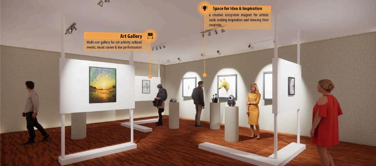
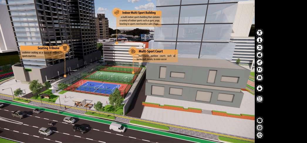
EMPOWERINGYOUTHEXPRESSION
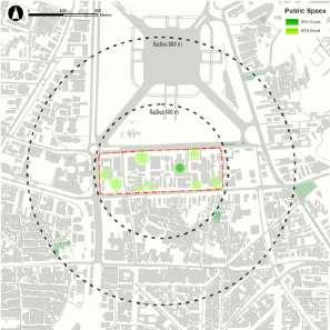
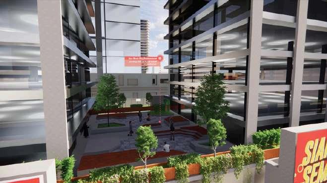
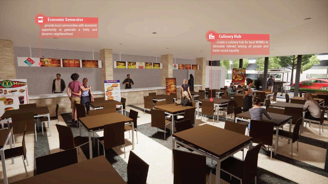
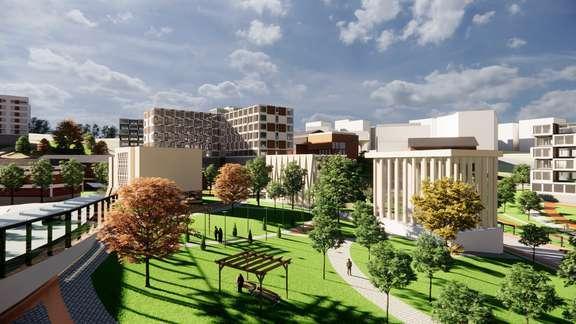
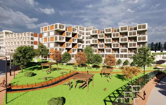
The Empowering Youth Expression strategy centers around creating a harmonious balance between work and play in the vibrant neighborhood of the South Medan Merdeka It emphasizes the convergence of sports, art fashion hangout spots, food and beverages (FnB), with the aim of fostering a dynamic and creativelifestyle.Bycuratinganalluringexperienceandcultivatingsocialinteractions,thisapproachaims tocatertothediverseneedsofyouthseekingalivelyandfulfillinglifestyle.
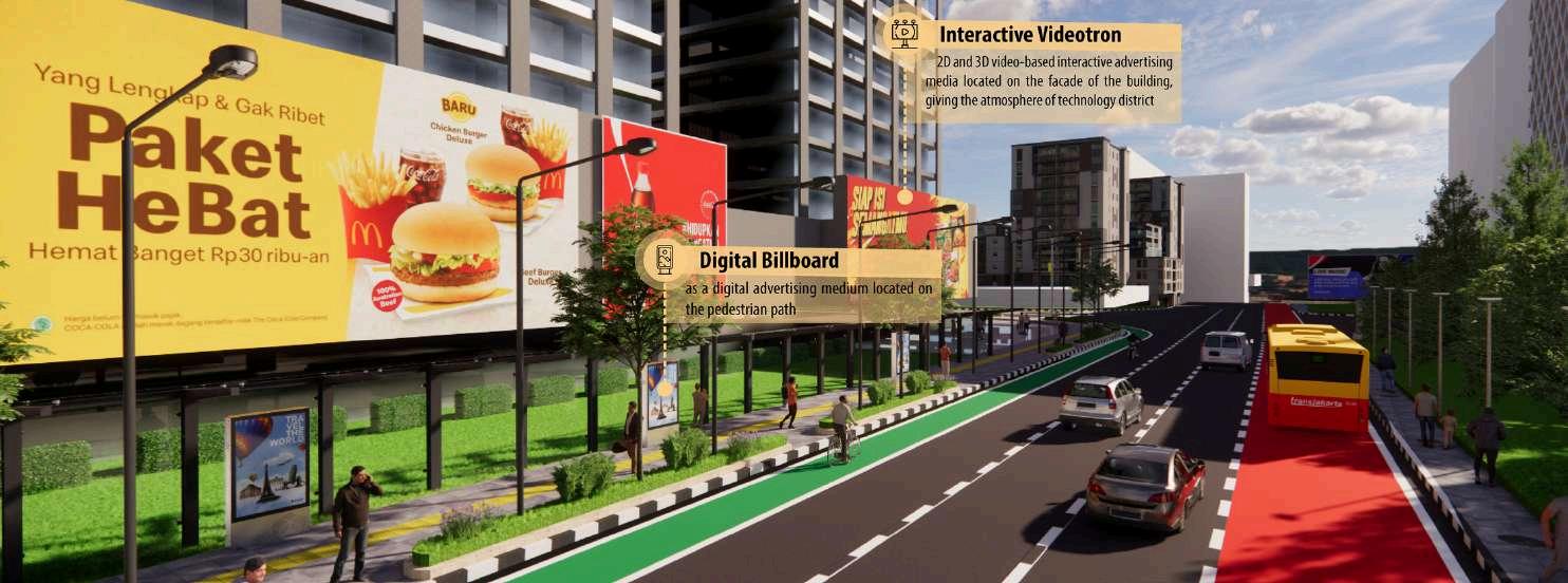
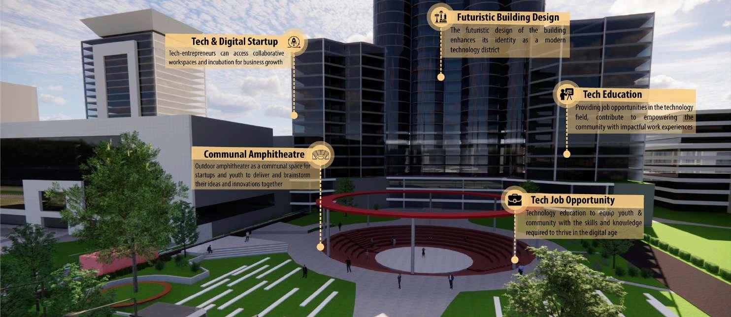
STRENGTHENINGDIGITAL&TECHNOLOGYECOSYSTEM
The Strengthening Digital and Technology Ecosystem strategy revolves around creating a vibrant technology district in the South Medan Merdeka, providing a nurturing environment for digital startups, job opportunities for youth tech-enthusiast and education knowledge-hub in technology. The goal of this strategy is to establish a dynamic digital district that drives innovation, creativity, and economic growth in the technology sector that attracts and supports digital businesses and startups
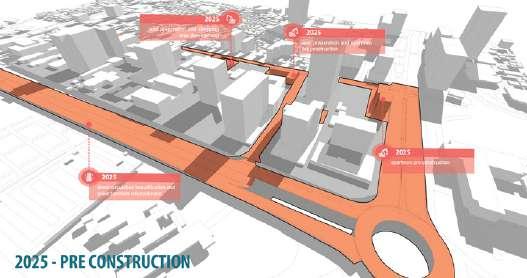
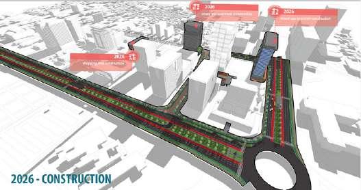
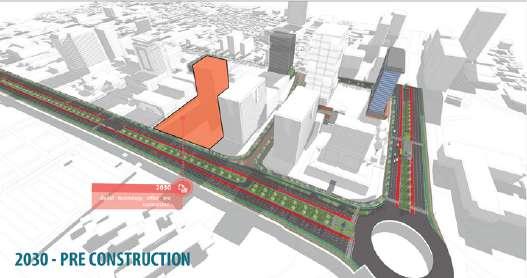
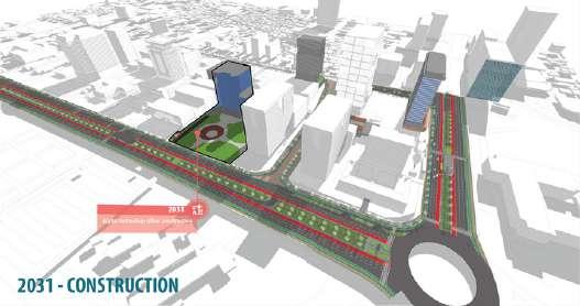
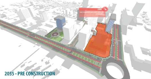
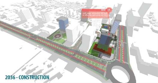
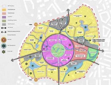
DEVELOPMENTSTAGES
FINANCINGFEASIBILITY
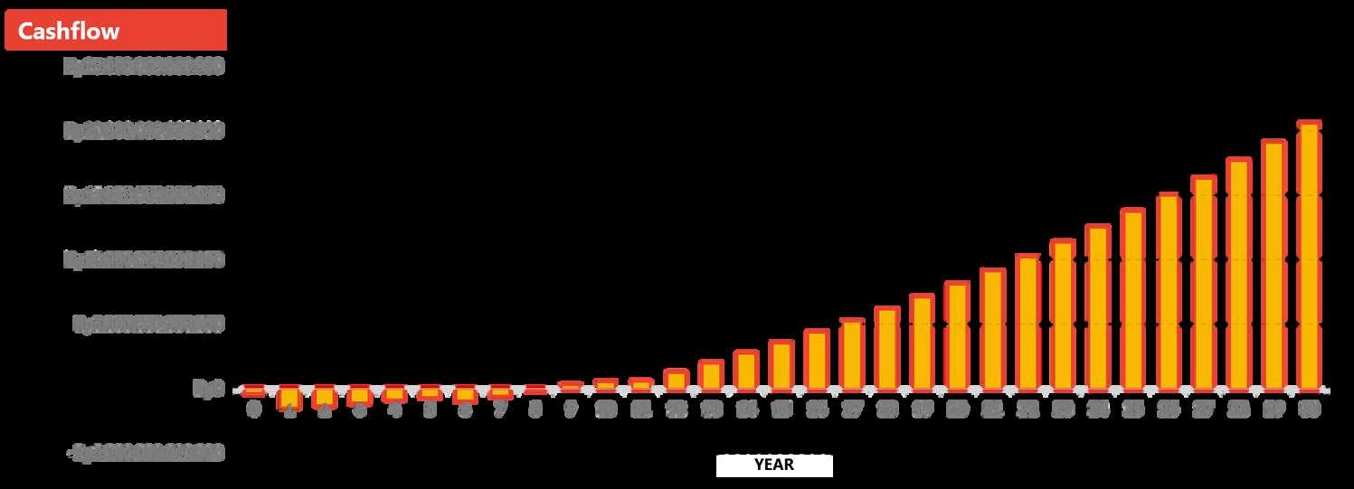
The financial calculations of each component are utilized to determine the cash flow of the area over the next 30 years. The present value of the financial components is adjusted to a future value based on predicted inflation rates while calculatingthecashflow.
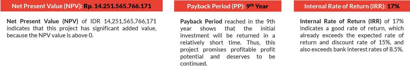
The results show a positive feasibility outcome,withthecashflowgraphindicating steady growth each year. Showcasing a net present value (NPV) of 14 trillion, a payback period of 9 years and an internal rate of return (IRR) of 17%, which surpasses the bankinterestrate.
This research aims to demonstrate how AI might be used in the urban design process, as well as how HNI (Human Natural Intelligence) could balance the technological developmentsthatareoccurring
This research uses an exploratory qualitative method by exploring AI as a supporting tool in the planninganddesignprocess,such as data collection and initial conception
The result of this research has revealed how AI as part of digital transformation,couldplayitsrolein designing a sustainable area. Nevertheless, human intervention would still be necessary to comprehendadesign'scontext.
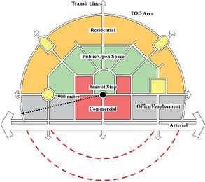
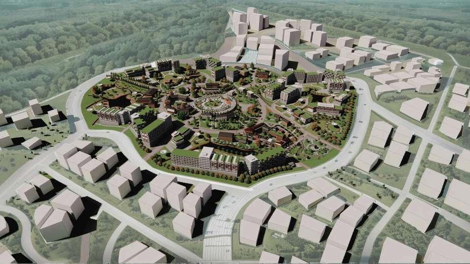
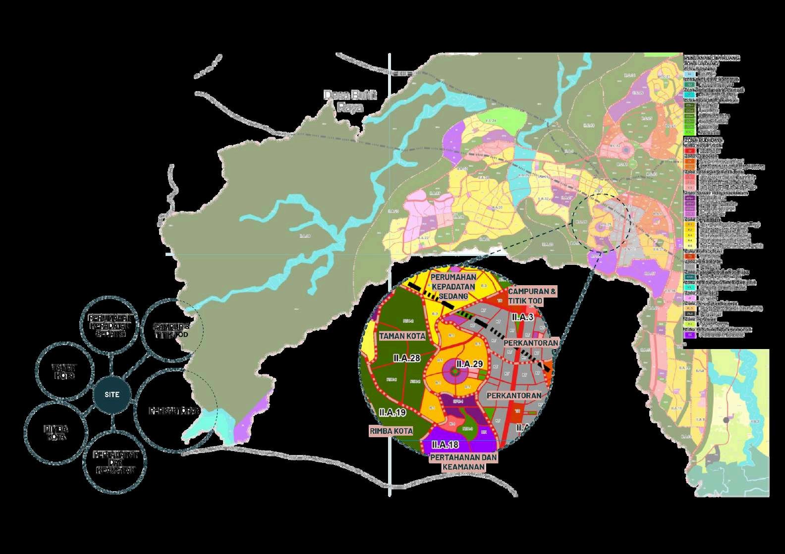
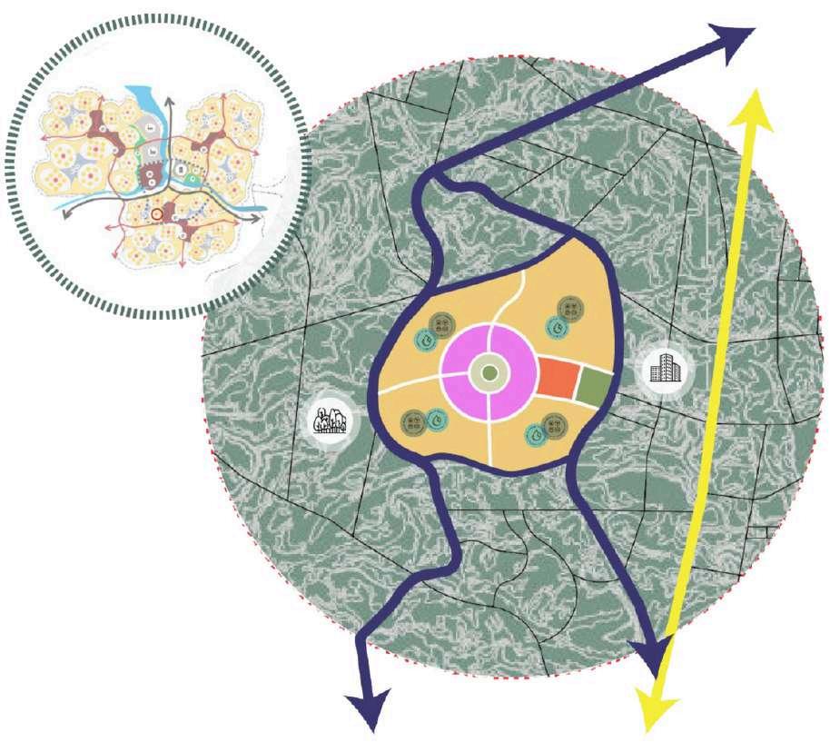
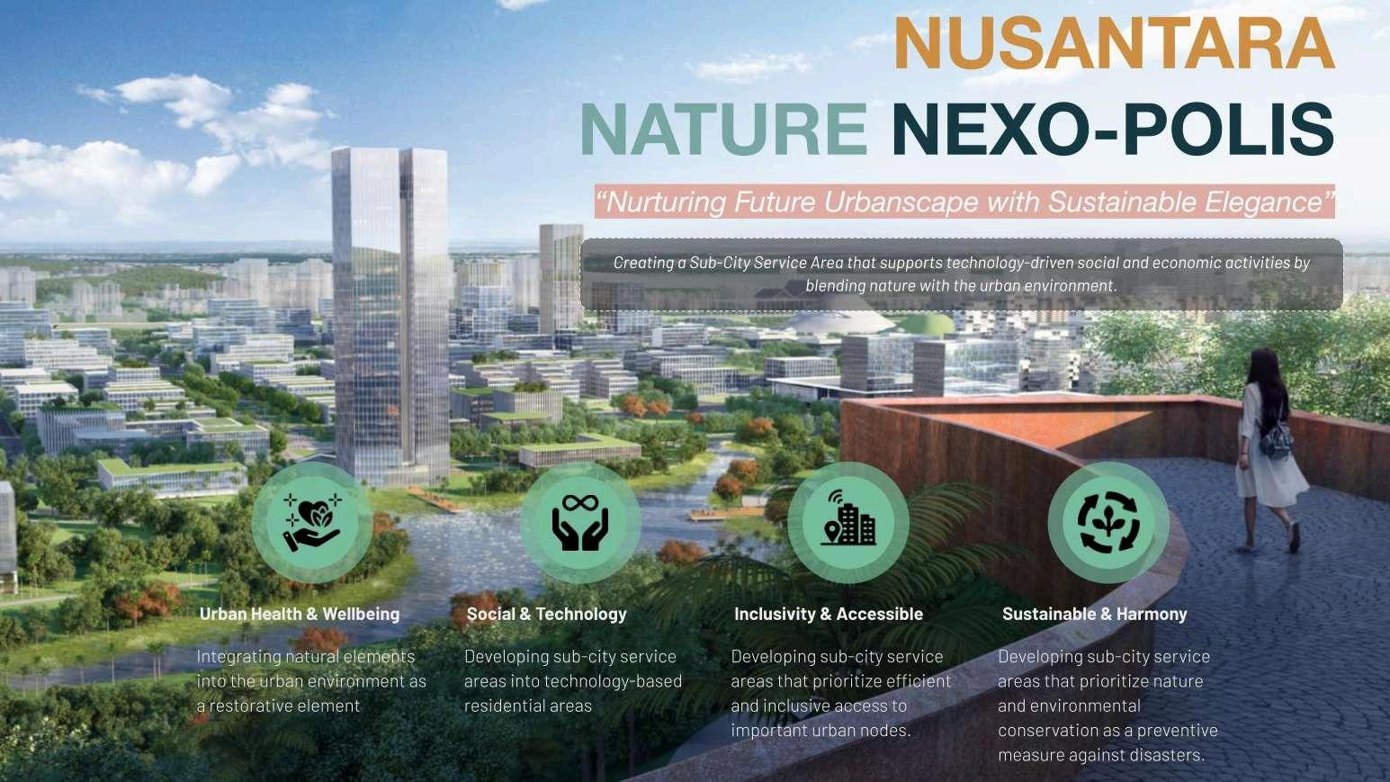
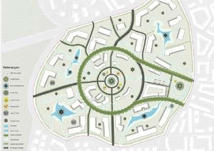
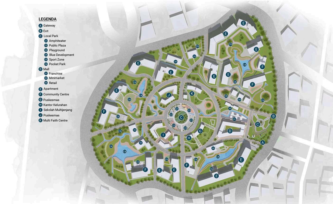
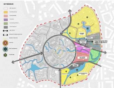
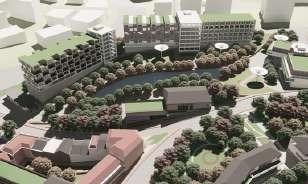
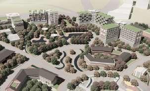
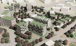
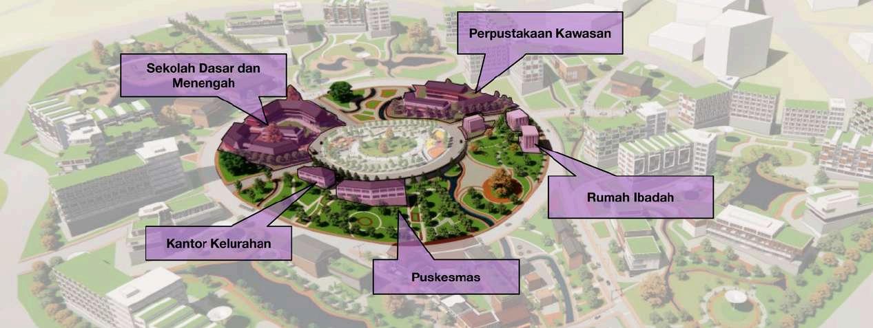
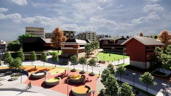
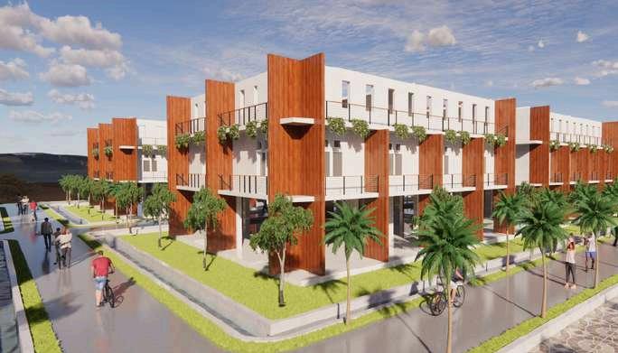
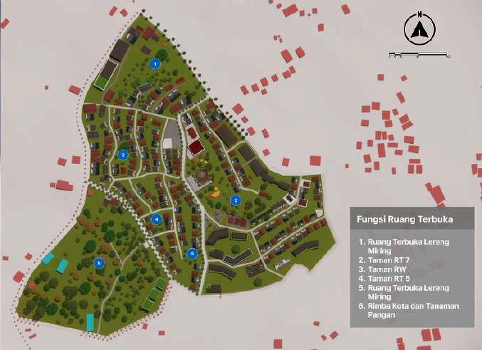
The site is situated at the Sub-City Service Center, where development is focused on social economic, and environmental administration. Additionally, the site is located near a TOD (Transit-Oriented Development) point, office area, mixed-use zone andresidentialareas. Sitelanduse
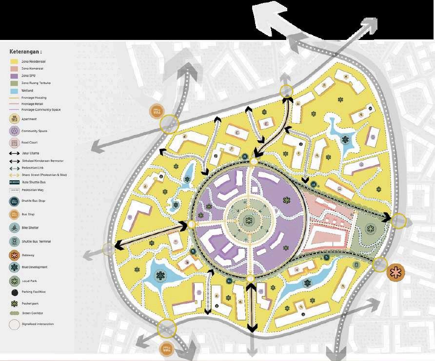
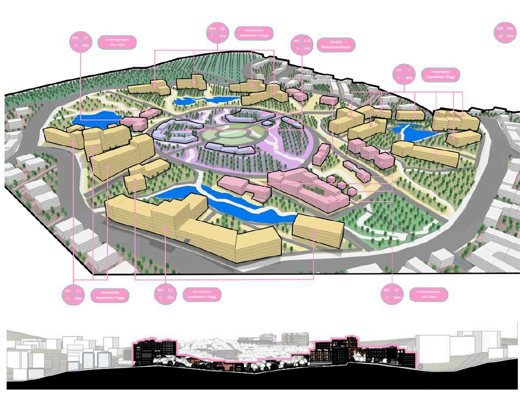
(1) Very High Density Residential Areas, (2) Sub-district Scale Public Service Units (SPU), (3) Sub-district Scale Trade and Services,and(4)Sub-districtParks.
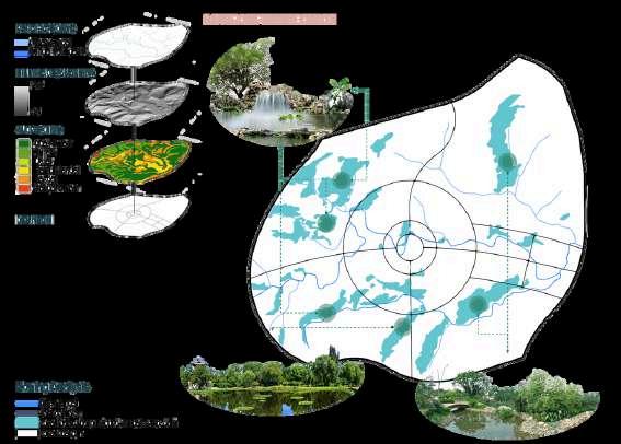
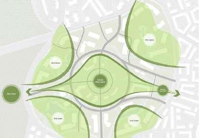
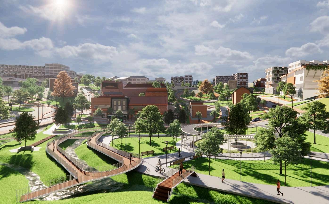
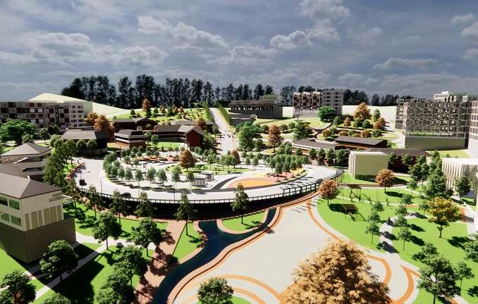
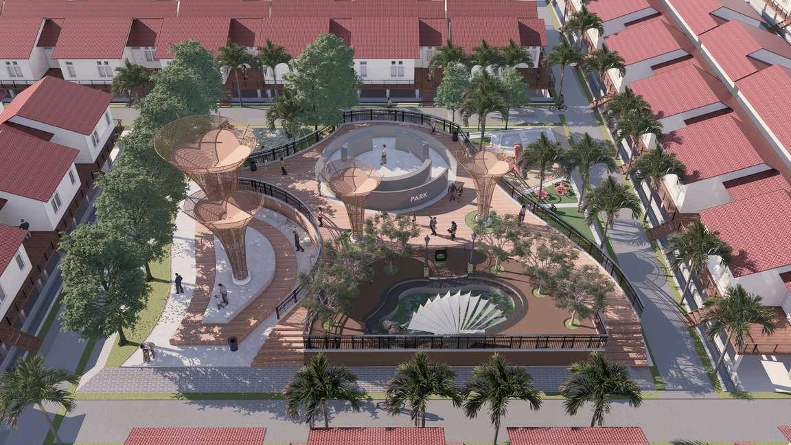
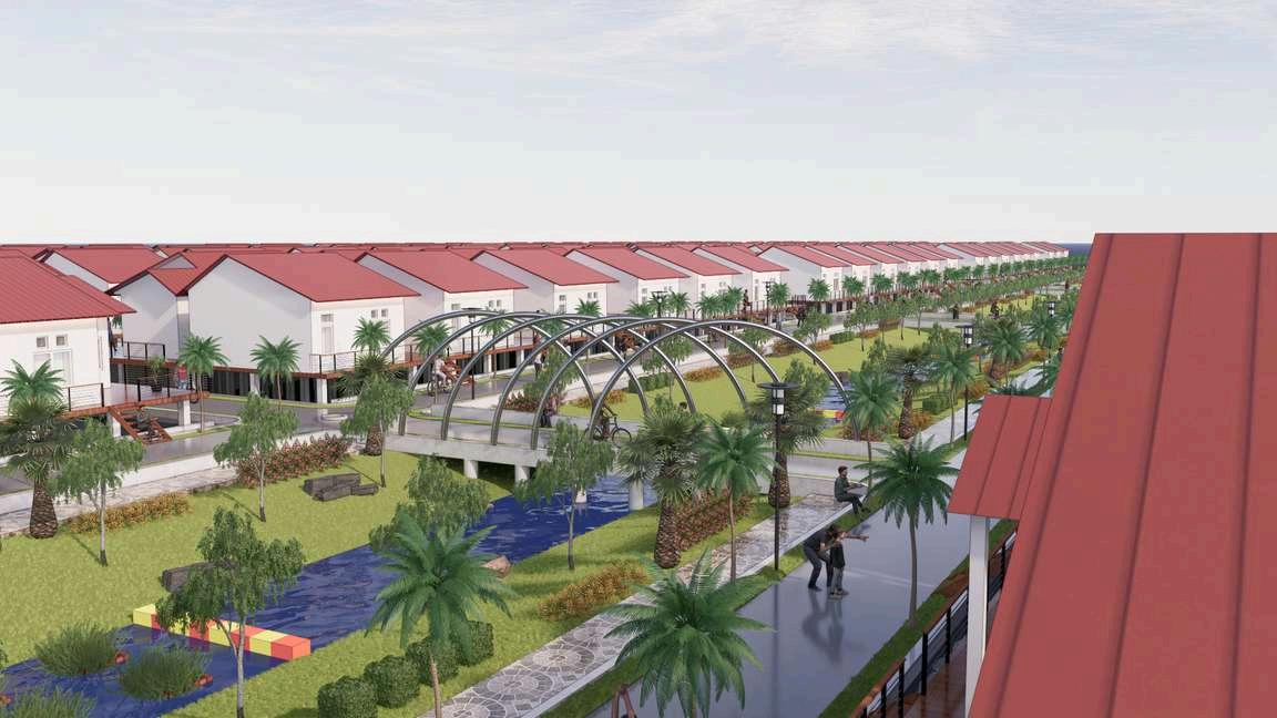
In developing this area, there are 5 green zone with the concept of integrated green area development is applied in each zone of the area, these 5 green zone are: 1. Gateway Open Space that located in the east, 2. Central Open Space that located in the middle 3 Blue Development that locatedneartheresidentialarea,4.PocketParkthatlocatedscatteredinall area, 5. Green Corridor and Buffer that located throughtout pedestrian way
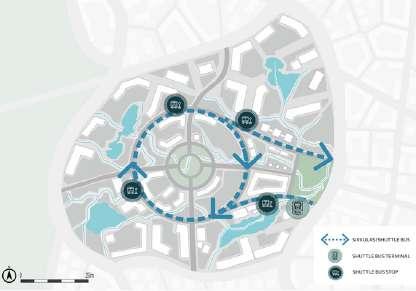
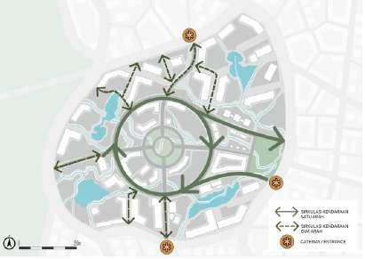
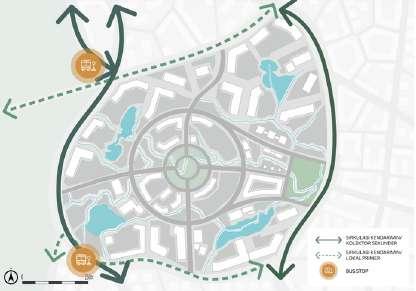
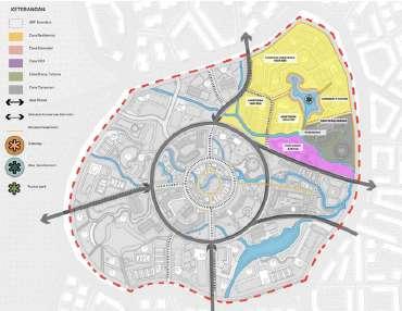
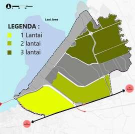
In general, the area is divided into 4 zones, consisting of residential zones, commercial zones, SPU zones, and open space zones. To minimize the use of private vehicles, the use of shuttle buses is also implemented in the area to facilitate connectivity between zones that are quite contoured The function of open space in this case is to become an intermediate space that encourages the formation of social activities for area users, and also encourageshealthinurbanareas
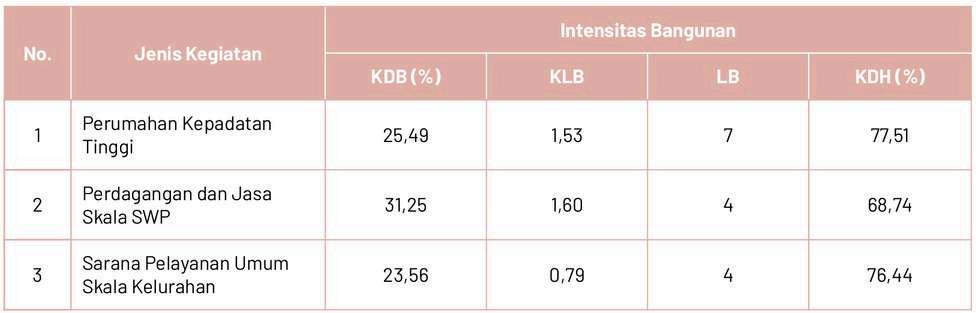
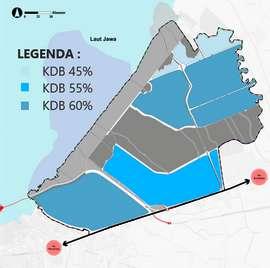
TheregulationofbuildingmassintensityintheNusantaraNatureNexopolis(NNN)area is determined by four key indicators: the Basic Building Coefficient (KDB), Building Floor Coefficient (KLB), Maximum Building Floors (LB), and the Green Open Space Coefficient(KDH)
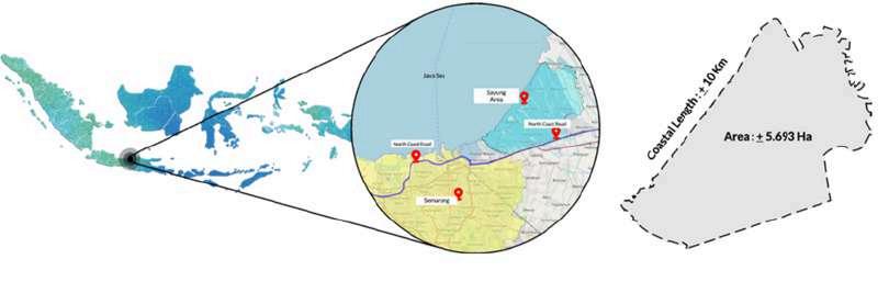
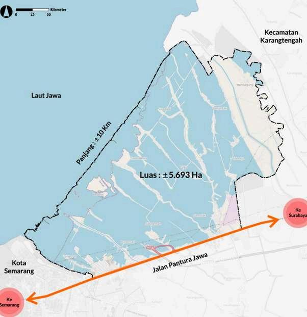
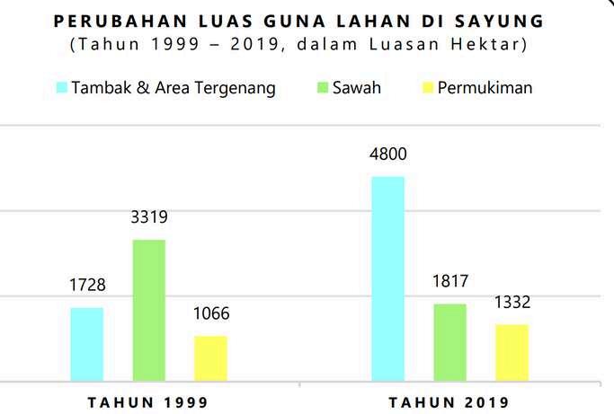
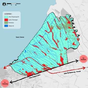
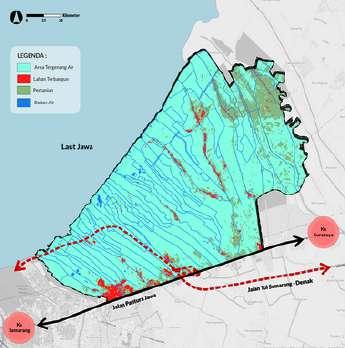
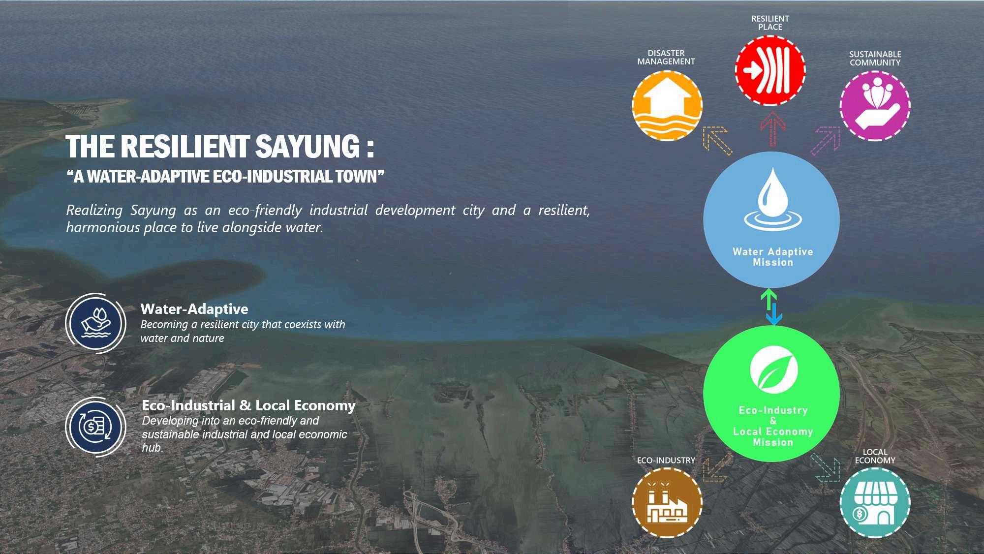
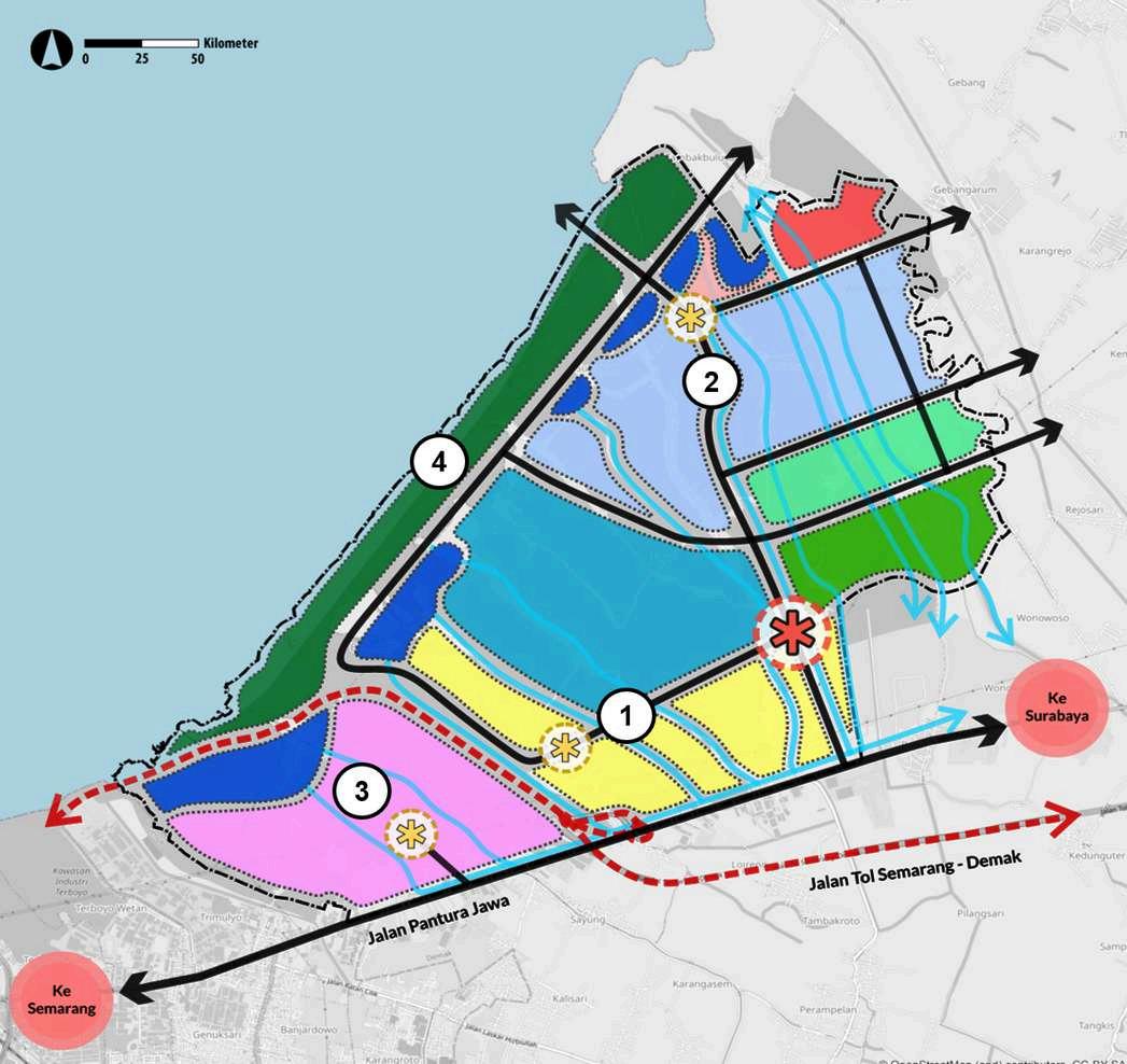
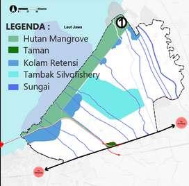
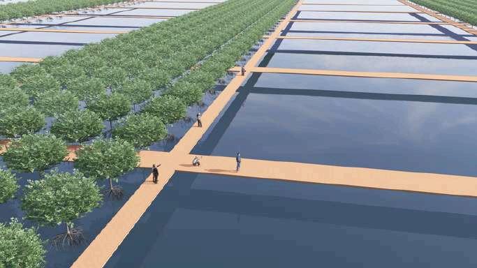
Sayung is a 5.693 hectares waterfront area bordered by the Java Sea, located in Demak Regency, Central Java Province, Indonesia, and is about 14 kilometers from the capital of Demak.
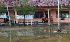
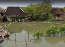
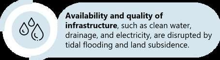
Despite its potential for marine tourism with beach attractions such as Morosari Beach and Surodadi Beach, Sayung also faces coastal issues like climate change and exacerbated by extreme land subsidence that causes non-receding coastal floods that inundate the local settlements.
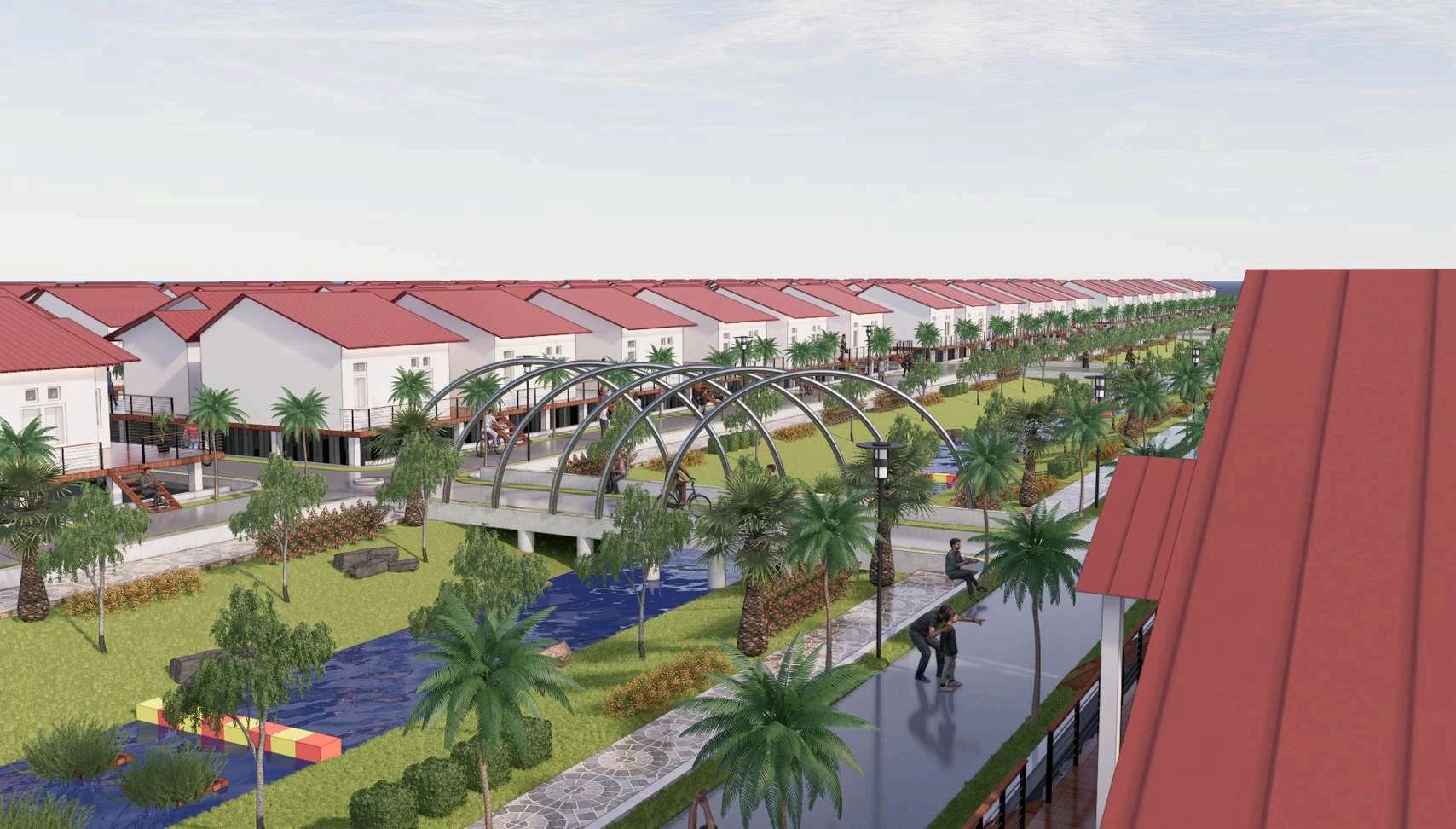
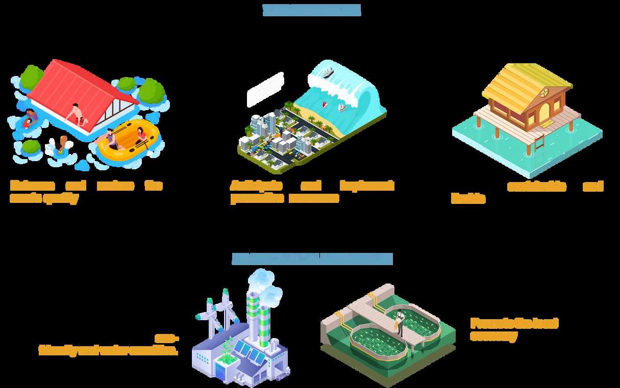
The goal of this project is to create a resilient and adaptive area that lives side by side and harmoniously with water through effective planning anddesignapproaches.
The coastal area of Sayung Subdistrict is located in Sayung,DemakRegency,CentralJava Indonesia
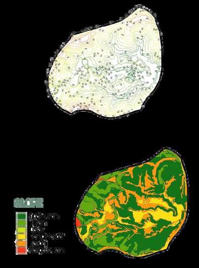
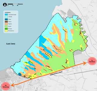
This area consists mostly of fish ponds and muddy beachesalongthecoast,whichoverthespanof20years, there was a drastic change in land use in the Sayung area and by 2019, the area was primarily covered by waterbodies
3072Ha
Fish pond areas and inundated areas have increased over thepast20years.
1502Ha
Ricefieldareashavedecreasedoverthepast20years.
266Ha
Residentialareashaveincreasedoverthepast20years
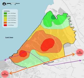
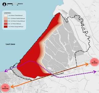
LandSubsidenceAnalysis TidalFloodAnalysis
extreme land subsidence predominantly occurs with rate of approximately -4 to morethan-5cmperyear. Tidal flooding caused by a combination of sea wave abrasion due to climate changeandlandsubsidence.
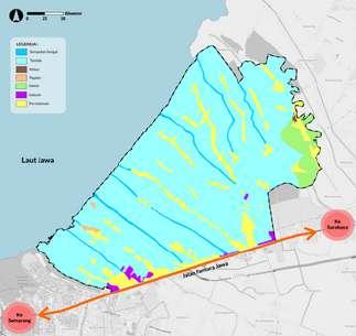
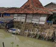
SayungRecentCondition
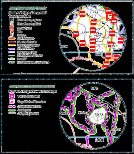
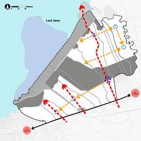
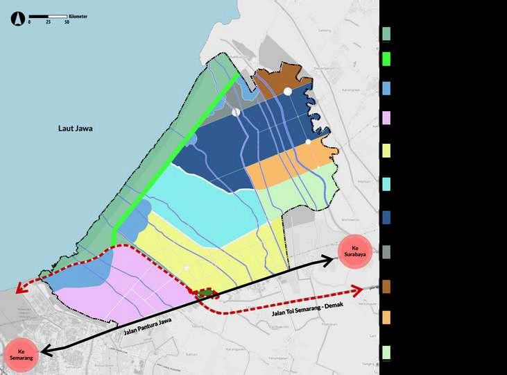
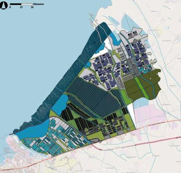
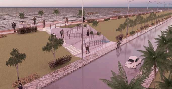
URBANDESIGNFRAMEWORK DESIGNSTRATEGY
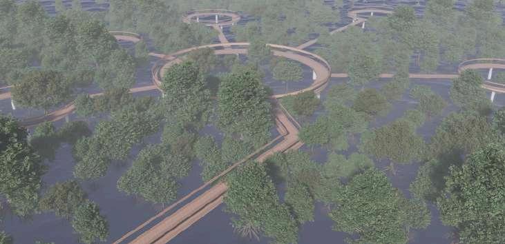
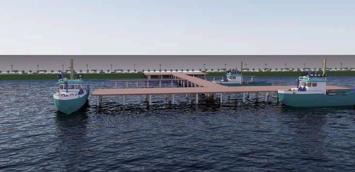
PrimaryNodes
The main activity hub in the Sayung area serves asthecentralmeetingpointbetweenzones
SecondaryNodes
Supporting hubs are located within each of the primary zones in the area. The planning and design of the Sayung area include three primary zones:
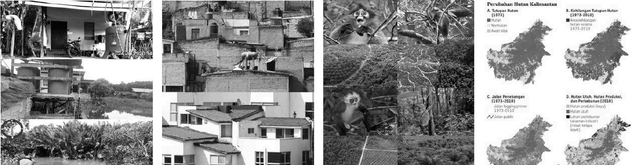
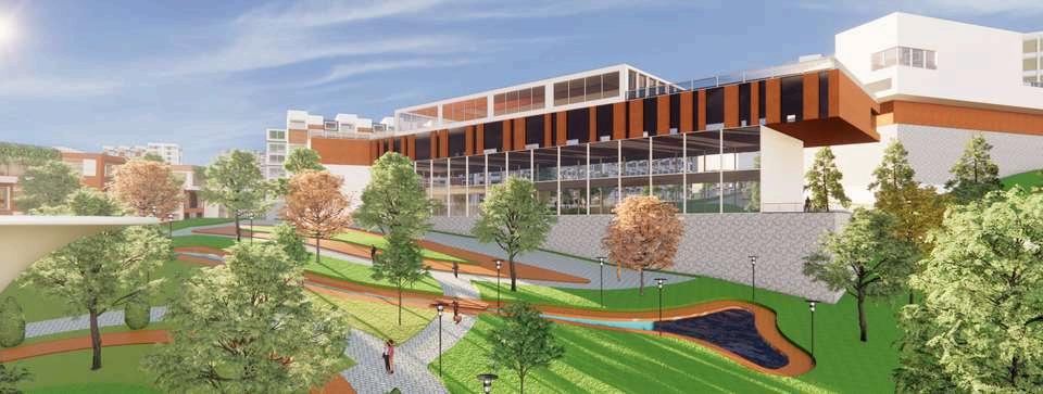
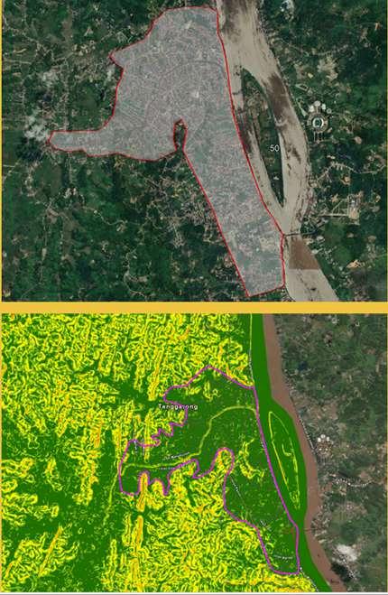
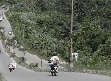
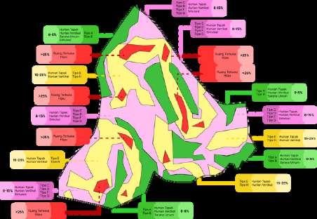
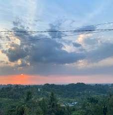
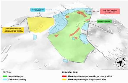
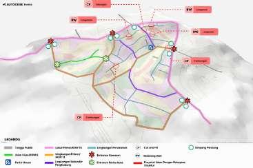
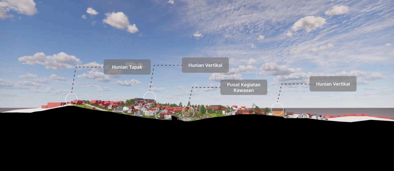
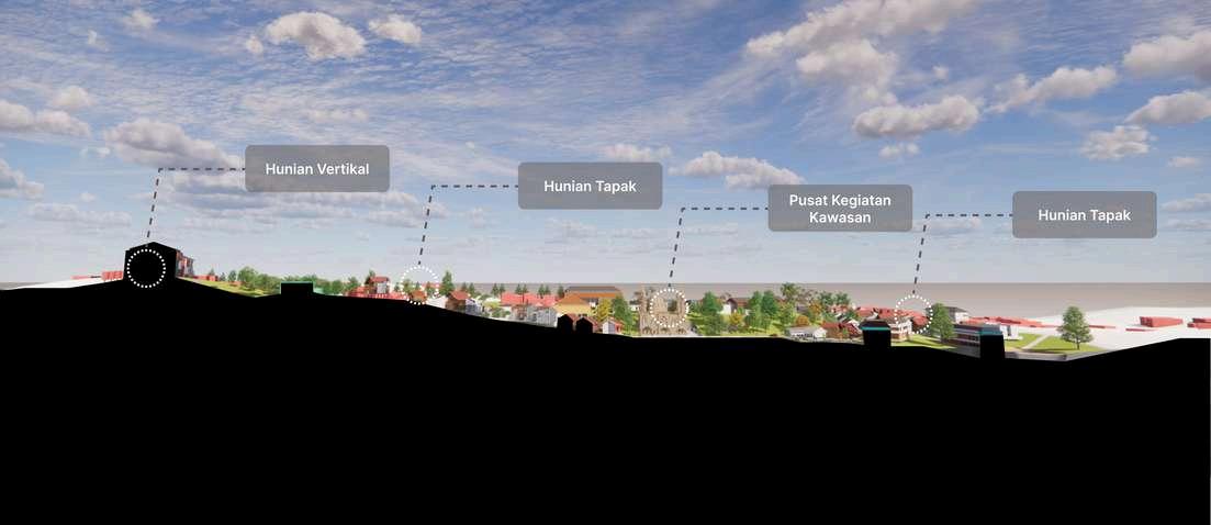
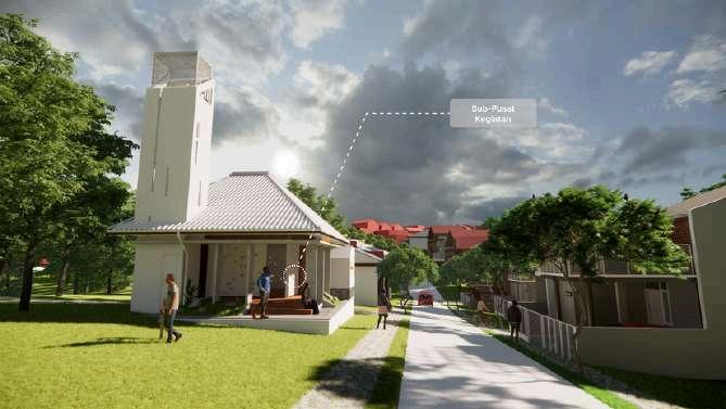
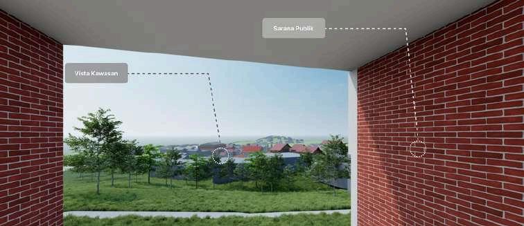
Tenggarong, East Kalimantan, is a town that also functions as the capital of Kutai Kartanegara Regency. As capital, Tenggarong facing a scarcity of lands too, where the flat land normally use as development are already run out, and the remaining land that available are the one with hilly contour.
This thesis are researching the ideal development on a land withchallengingcontour,inthis case a hilly contour, using a topographically-sensitive urbanismapproach.
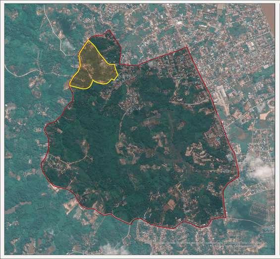
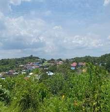
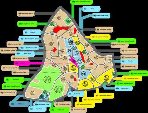
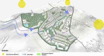
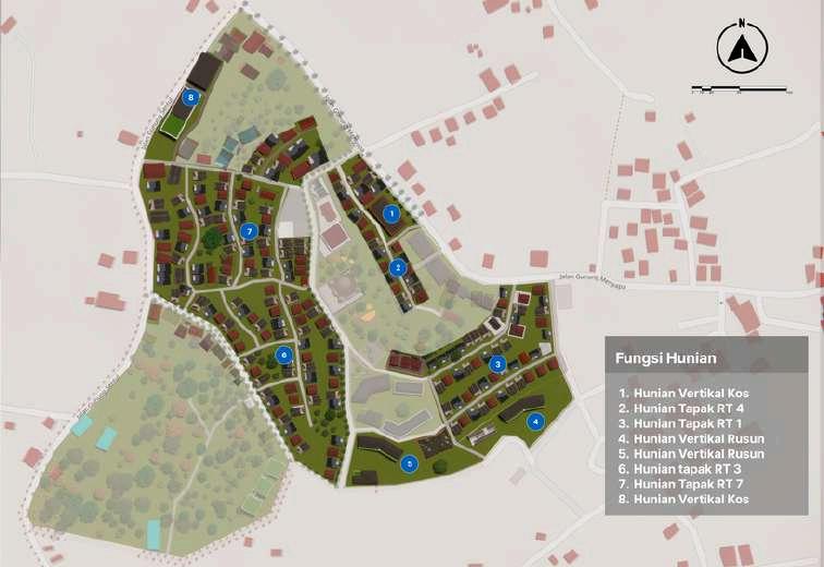
The meso-design area delineation is located across three sub-districts Timbau Sub-district, Bukit Biru Sub-district, and Melayu Sub-district. The majority of the site is situated within Timbau Sub-district covering a total area of 345 hectares
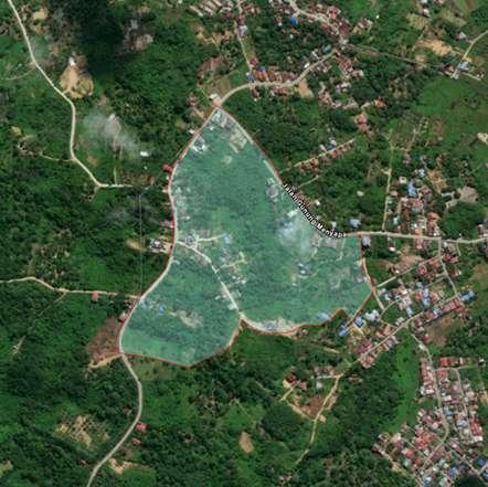
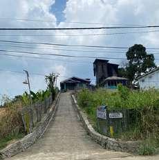
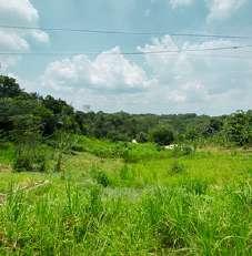
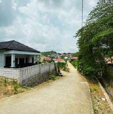
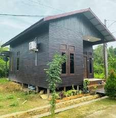
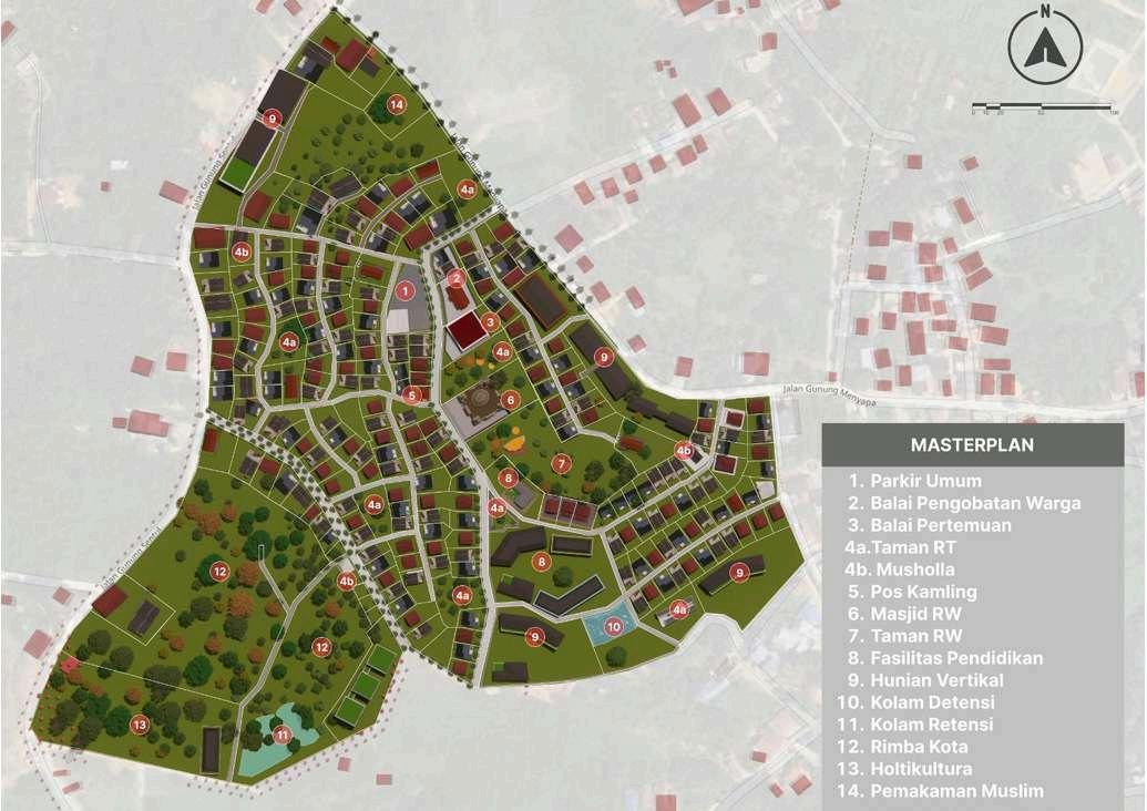
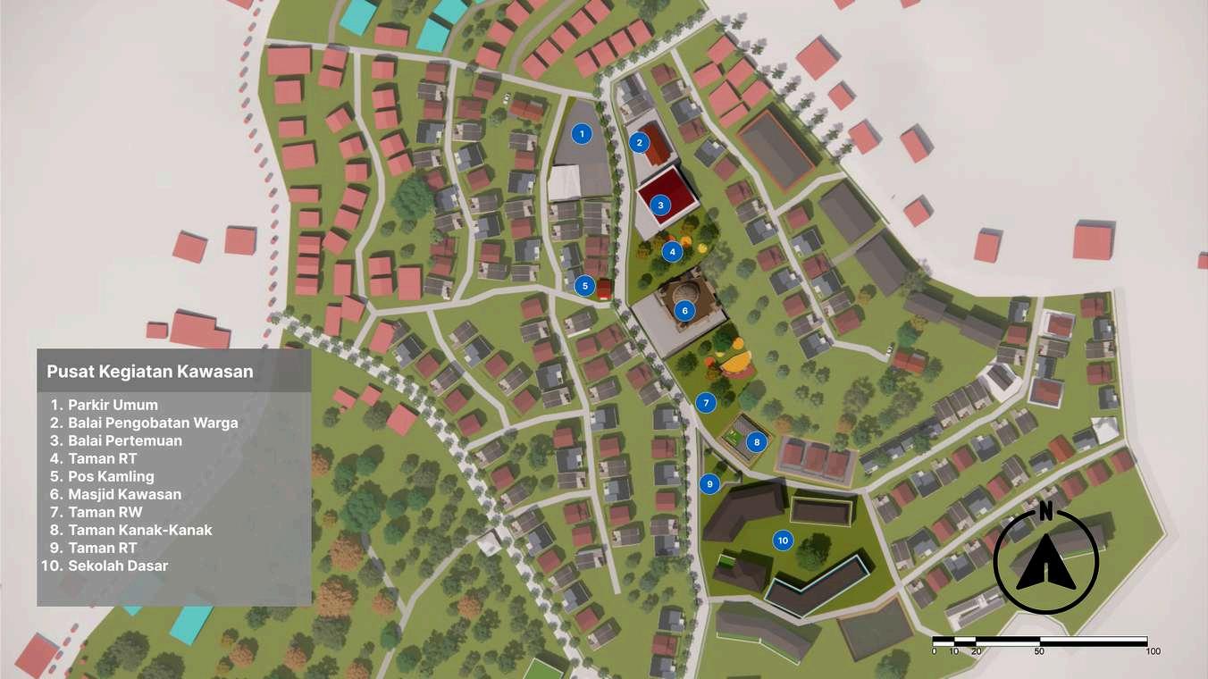
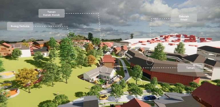
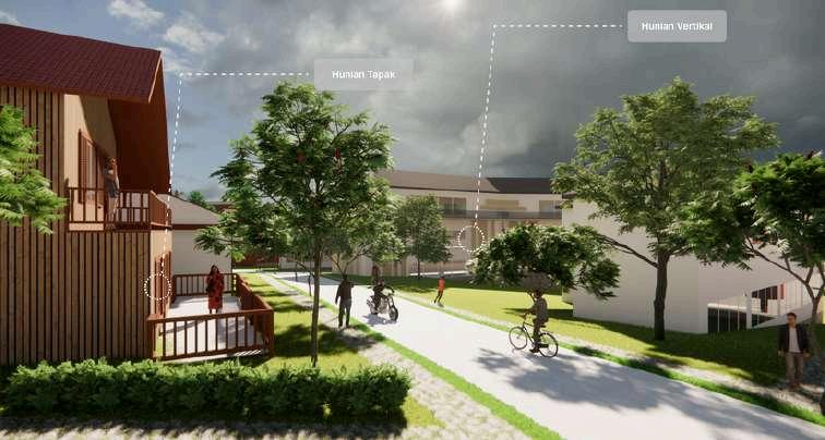
The selected micro area situated in the northern part of the meso area delineation It falls under the administration of Timbau Village. The area is predominantly vacant land,withsomesectionsalreadydevelopedasresidentialareas Itsprimaryfunctionis toserveasamedium-densityurbansettlementcombinedwithanurbanjung e
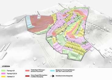
DESIGNASPECT
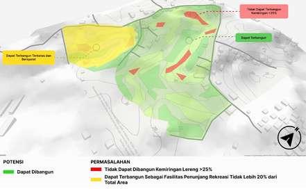
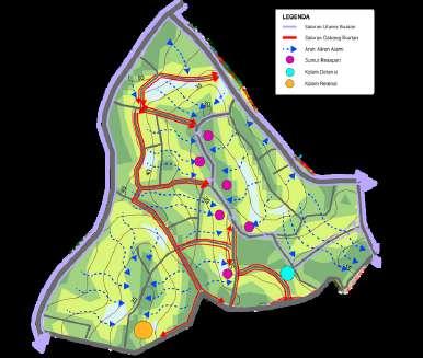
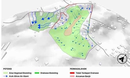
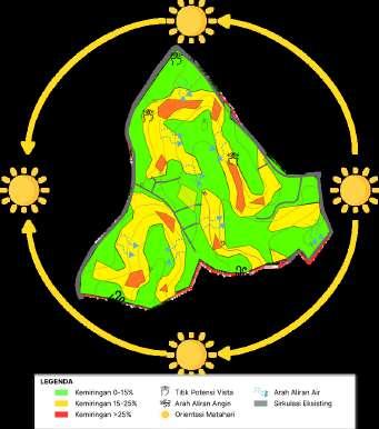
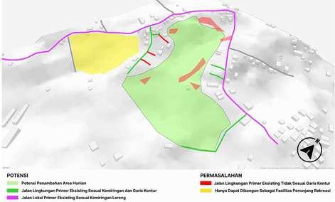
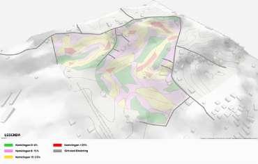
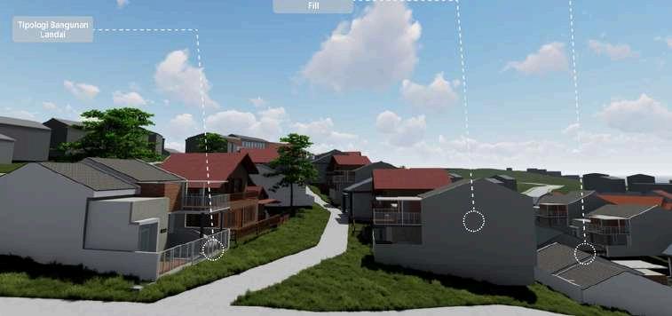
Site stability in practice is strongly influenced by factors such as and slope, soil condition and type, the presence of water bodies and the existing landuseandlandcover
In this aspect several elements that need to be designed include those related to drainage, vegetation/tree cover and erosion
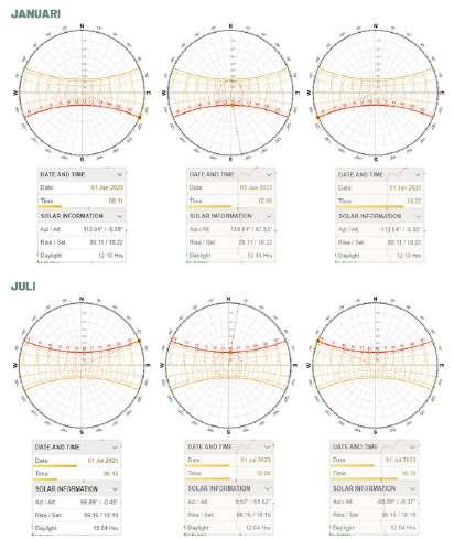
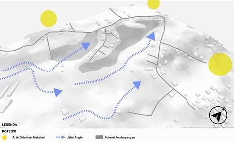
In this aspect elements related to climate and energy as considerations for design such as sun orientation and cardinal directions as well as regionalhumidity
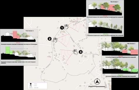
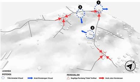
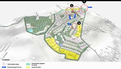
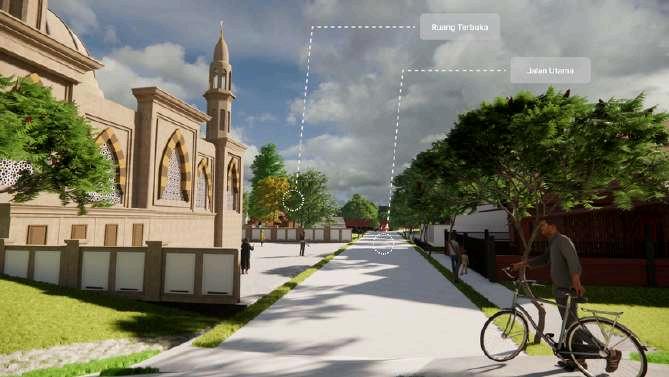
In this aspect designer needs to pay attention to the visual elements in the area which are able to make the design area accordance with the surroundingenvironment
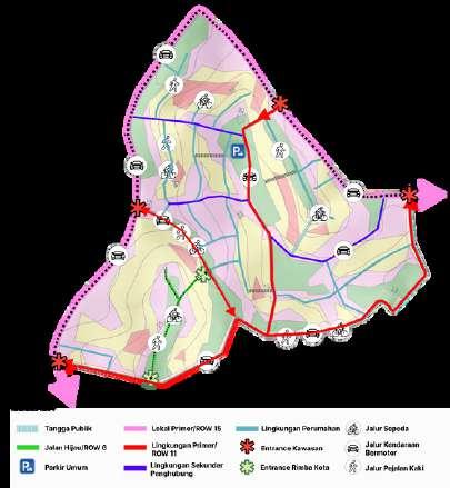
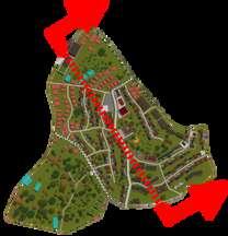
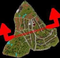
In this aspect designer needs to pay attention to road planning and connectivity inthearea
In th s aspect several elements that need to pay attention are the building need to built according to theenvironmenr
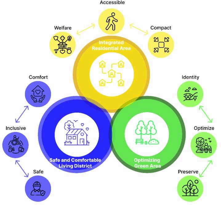
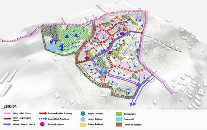
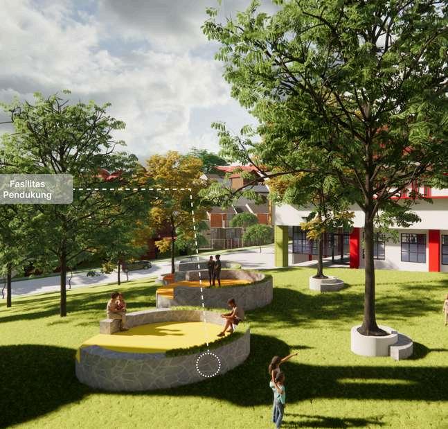
Creat ng resident al areas that are equipped with supporting faci ities n the area
Deve oping residentia areas that are integrated w th each other and can be easi y reached
Creat ng c rculation n areas that are comfortable and supportive for pedestrians and cyc ists to pass through
Enhanc ng and preserv ng ex sting vegetat on as a key des gn element in open spaces
Strateg cally placing vegetat on and open spaces to enhance therma comfort throughout the area
Leveraging the natura topography and characteristics to reinforce the area s ocal dentity.
afterword
Looking back, working on these projects for the past two years has significantly enriched my understanding of urban designs that are not only visually appealing but also had an impact and can enchance the life of the people around it. This growing awareness of urban design has fueled my commitment to designing urban space and places around our city and make ittobeapartofthepeople.