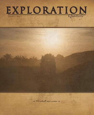
Volume 1, Issue 1
= We shall not cease =
Quarterly EXPLORATION

Camp 6 Road by Graham Jackson (N. Hindman, E. Stockmann, G. Jackson photos)
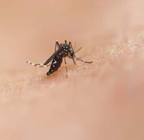
World’s Deadliest Animal by Jonathan Hanson
30 Our Ridiculous World (Trip) by Matt Bishop (Reece Gilkes, photos)
Tragedy Frozen on Linen by Jonathan Hanson
Blood & Leather by Roseann Hanson (Jonathan Hanson, photos)
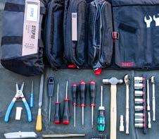
Missionspecific Tool Kits by Jonathan Hanson

Hudson’s Bay Point Blanket by Jonathan Hanson
Exploration Quarterly ~ We shall not cease 4 EXPEDITION . . . . . . . . . . . .16 DOCUMENTARY . . . . . . . . . 38 8
ADVENTURE . . . . . . . . . . . .
EQUIPPED . . . . . . . . . . . . .
ARTIFACT . . . . . . . . . . . . . 100
BESTIARY . . . . . . . . . . . . . . 8
CLASSIC KIT. . . . . . . . . . . . 94
LIBATION . . . . . . . . . . . . . . . 90 The Drink that Unleashed an Empire by
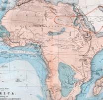
CARTOGRAPHIA . . . . . . . . . 12 Mountains of the Moon
78
Roseann Hanson
FIELD ARTS
FIELD JOURNAL
64
8 Historical and Future Importance of the Field Arts by Roseann Hanson
. 69 From Alaska to Arizona in Deep Winter
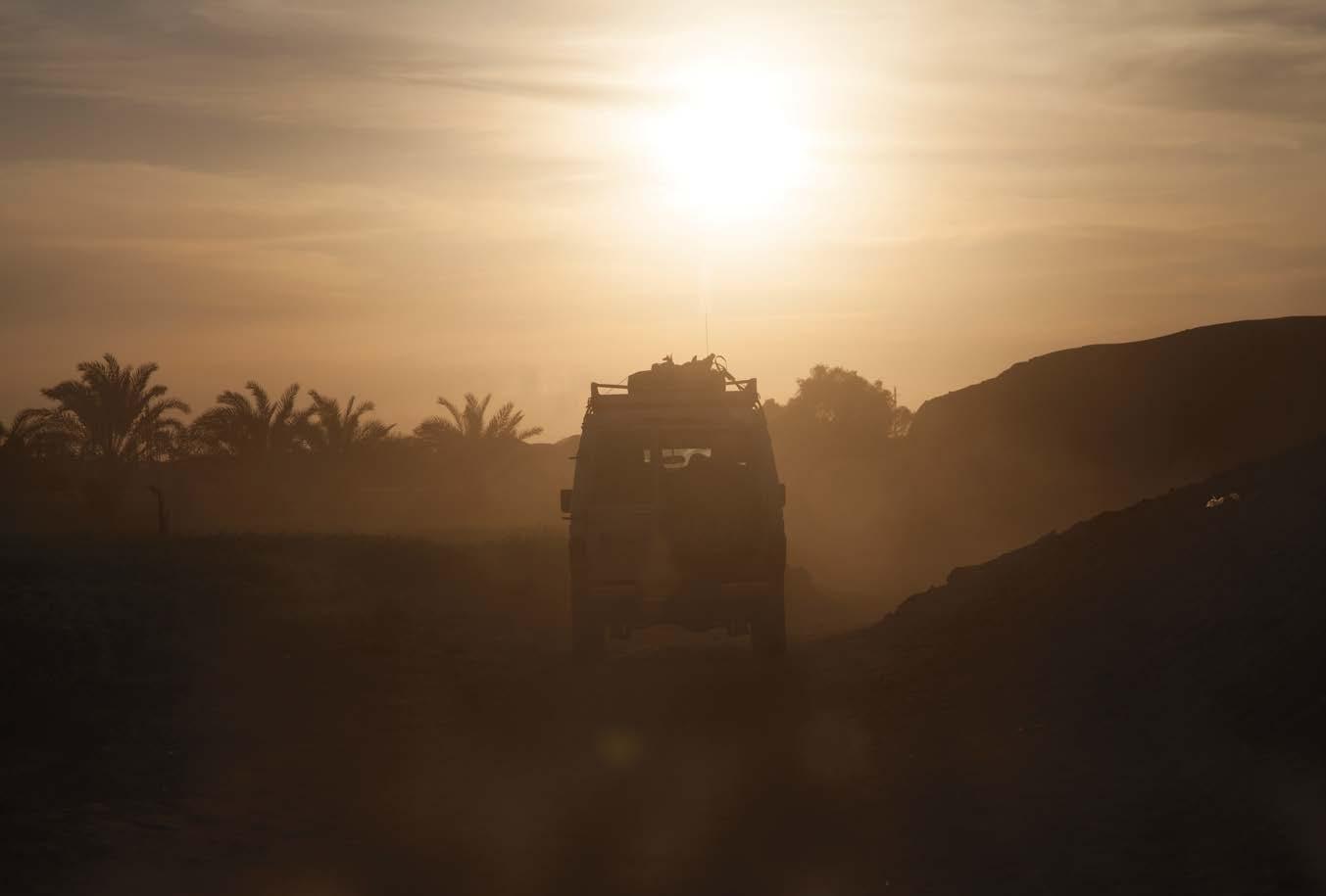
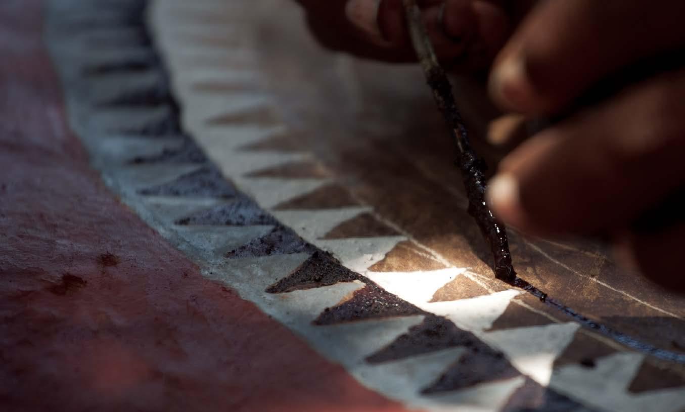
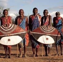
ABOVE: Painting a newly made Maasai war shield, ochre pigment mixed with cow blood at Olkiramatian, South Rift, Kenya (1°51’09.4”S 36°06’18.9”E); Jonathan Hanson photo. OVERLEAF: Volcán Licancabur, Bolivia, viewed from north of San Pedro de Atacama, Chile (22°47’54.5”S 68°06’08.0”W); Roseann Hanson photo. COVER: Dakhla oasis, Egypt (25°41’28.4”N 28°48’58.3”E); Jonathan Hanson photo.
Volume 1, Issue 1
“ WE SHALL NOT CEASE FROM EXPLORATION
And the end of all our exploring Will be to arrive where we started And know the place for the frst time.” – T.S. Eliot
Welcome to Exploration Quarterly, the publication for those who do not cease to BE CURIOUS . . . to LEARN . . . to EXPLORE . . .
We defne exploration in the broadest sense:
Exploration can be geographical.
Exploration can be fractal.
Exploration can be introspective.
Exploration can be expansive.
Exploration can be structured.
Exploration can be unplanned.
Exploration can happen every day.
Exploration is continuously seeking new places, new ideas, new knowledge.
Exploration is the essence of being human, what brought us from the forests into the savannah, and beyond the horizons of Earth to the edges of the known universe.
We shall not cease from exploration.
Thank you for joining us.
Jonathan Hanson Roseann Hanson Founders, Curators, Editors, Designers
Printed twice a year by Modern Litho in the USA on recycled paper with vegetable inks. Forest Services Council-certifed.

Annual subscriptions are available as hybrid (two printed issues, two digital-content issues) or all-digital. For print subscriptions we offer pricing for USA delivery and international delivery. Our parent company is Exploring Overland LLC, based in Arizona, USA.
ExploringOverland.com/explorationquarterly info@exploringoverland.com l
. . . . . . . . . . .
. . . . .
ARTS AND LETTERS . . . . . 98 SPONSORS . . . . . . . . . . . . . 104 EXPLORER’S MOMENT . . 111
EXPLORATION
.
Quarterly
5
— Camp 6 — Vendetta with a Road
 By Graham Jackson
E XP E DITION
16
Photos by Nathan Hindman, Eric Stockmann, and Graham Jackson
Q: What is a man on a road? A: Time.
(Mayan riddle, translated by Munro Edmonson)
There was no emergency room.”
My doctor was not amused by my wry assessment of the medical facilities in the remote Chiquibul forest of Belize.
“Getting to one would have been a good idea,” she asserted.
I had just returned from a month-long expedition in Central America, and had brought back with me a parasite, a bacterial infection, a viral infection, and was slowly recovering from diabetic keto-acidosis.
So, a pretty good trip?
To be fair, the expedition had not had the intention of testing my immune system and my diabetes control to the limit; that came as an unfortunate side effect. The real goal had been, well, a vendetta.
I’m considered an expert in four-wheel mobility, after having spent the greater part of my life completing and guiding expeditions and overland trips all over the globe. From a very young age I’d always had a fascination with roads (and especially tracks) on maps. I’d spend hours paging through our family’s Times Atlas of the World studying routes across the Sahara, tracks across Australia, imagining what they might look like. This fascination did not stop when I started exploring those places. Inevitably, on every trip, there would be roads and tracks that forked off my planned route and I’d try to keep track of them, promising myself that I would return one day to explore and fnd out where they lead. You could say that I collect routes. But while that is an on-trip distraction
for me, the real exercise that causes my route-collecting obsession to fare is not being able to complete a planned route.
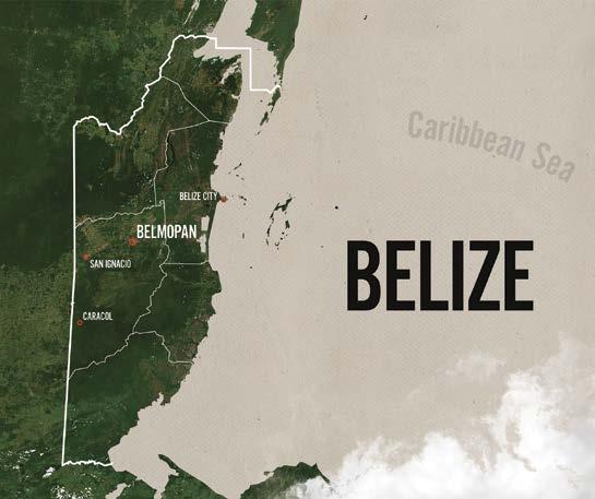
In 2010 I discovered Camp 6 Road. It was the inaugural trip in Central America for a new tour company, and as lead guide I had put the route together with their guidelines, poring over maps and Google Earth images to fnd junctions and roads. Camp 6 is a small encampment in Belize, just north of the Chiquibul Forest that has a hard-to-fnd history. Back in the 1920s it was the headquarters for the Mengel logging company which used it as a base of operations and the head of their rail line to extract mahogany from the forest. Before that—long, long before that—it was on the outskirts of the Mayan Caracol city-state and still has several small Mayan ruins. In a 1931 report to the Field Museum of Natural History in Chicago, J. Eric Thompson, then a lead archeologist in studies of the Mayan civilization, mentioned Camp 6 and the logging connection in his description of the route from El Cayo, central Belize, to the then-largest known ruin site complex called Mountain Cow. Thompson would do that route by foot with donkeys, but I wanted to trace it by vehicle.
In 2010 we planned to go from Caracol—a Mayan site so large that Mountain Cow has all but been forgotten—
ExploringOverland.com 17
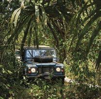
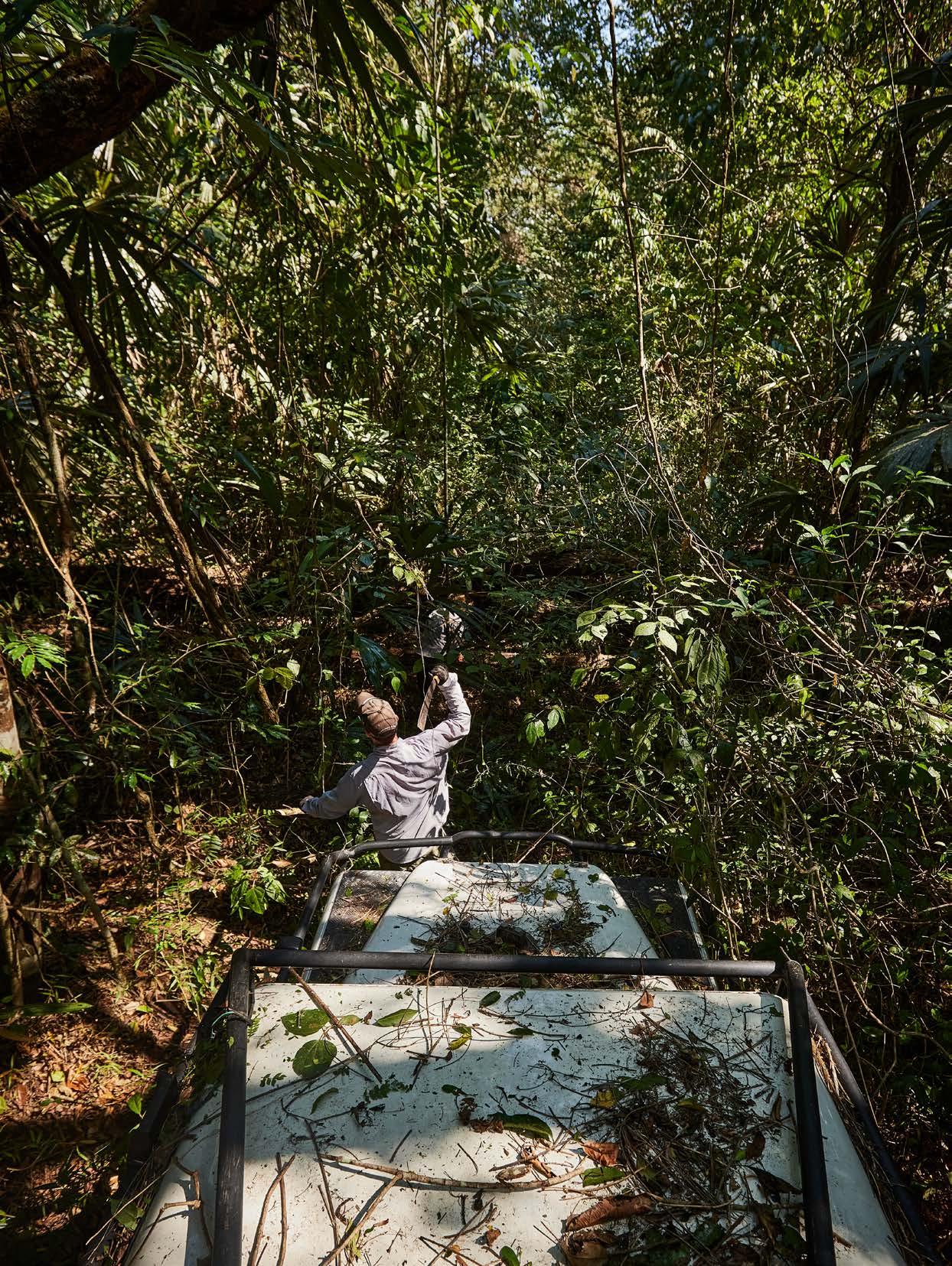
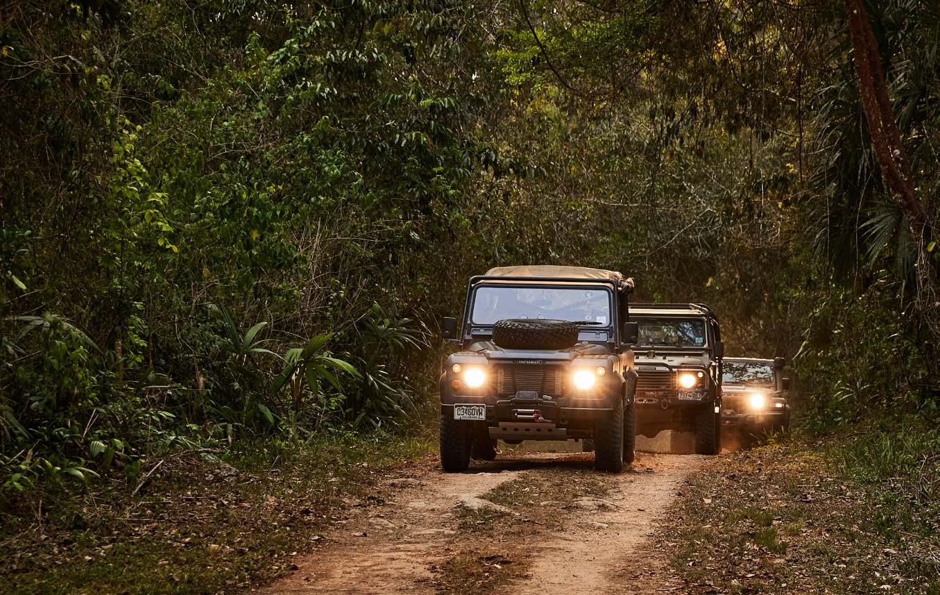
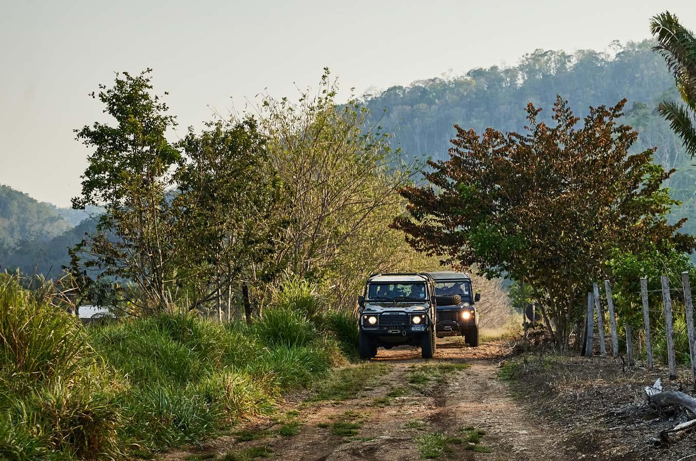
north to Camp 6 and then on from there. Knowing that the track existed is one thing, but fnding it on the ground in the dense jungle was something else. In what I consider a navigation coup, I was able to pull a waypoint off a 1:400,000 scale map that showed the track and then fnd the track on the ground less than 50 meters from the waypoint. That was the start. Our group of eight in two Land Rover Defender 110s (sad that I have to mention they were ‘classic’ Defenders, not the new thing Land Rover gave the same name) started up the track at less than walking pace, clearing thick jungle overgrowth that had not (I later learned) been disturbed for at least two years.
By nightfall we had penetrated 1.7 kilometers into the jungle after an immense amount of machete work, and found a clearing of sorts to make camp. In my hammock
at midnight I heard the rain start to fall. Not just light rain, but a real jungle downpour that went on and on. I knew there was no way we could continue to Camp 6, due to the time constraints of having to complete this inaugural trip and get clients to their fights back to the U.S. on time.
The morning brought no let-up in the rain; the rapidly deteriorating track surface was quickly becoming a river. The return 1.7 kilometers was done one 80-foot winch pull at a time and took all day as the rain continued. By evening we had found a nice lodge with plenty of beer and welcome warm showers. That trip continued on to Guatemala, but I was left with the empty feeling of having not completed the route to Camp 6, something that gnawed at me for 13 years, and would be later termed by a friend as my ‘vendetta’ with Camp 6.
Exploration Quarterly ~ We shall not cease
18
In 2012, again on a tour in the area, we started up the Camp 6 track, but it was more a quick reconnaissance with the vague hope the track was open than a real attempt. After about 50 meters we turned back.
On at least half a dozen subsequent trips in the area, we always passed the turn-off to Camp 6, completely obscured by the jungle again, like a closed door beckoning to be opened to fnd the mysteries behind.
The intervening years allowed time for many different threads to come together for a new expedition. I would occasionally check on Google Earth to see if newer imagery indicated any changes, but it all seemed very much the same. I would talk at times with my good friend Nick Taylor, who was on the original trip, about
going back to complete the route. Those talks led to more research, which inevitably led to wanting to go back even more.
In 2020, I was talking to Will Mathers, who had lived and worked in Belize and had run part of the Camp 6 Road in 2008. He mentioned a new roadbuilding project in Belize to put in a paved highway all the way to Caracol. Checking Google Earth revealed the massive project well underway. With a major artery soon to be in position to bring busloads of tourists to Caracol, the remote secret of Camp 6 Road may be ruined. This led me, after 13 years, to set a date for a return to fnally complete Camp 6 Road.
PAGE 16: Despite appearances, the track was easy to follow.
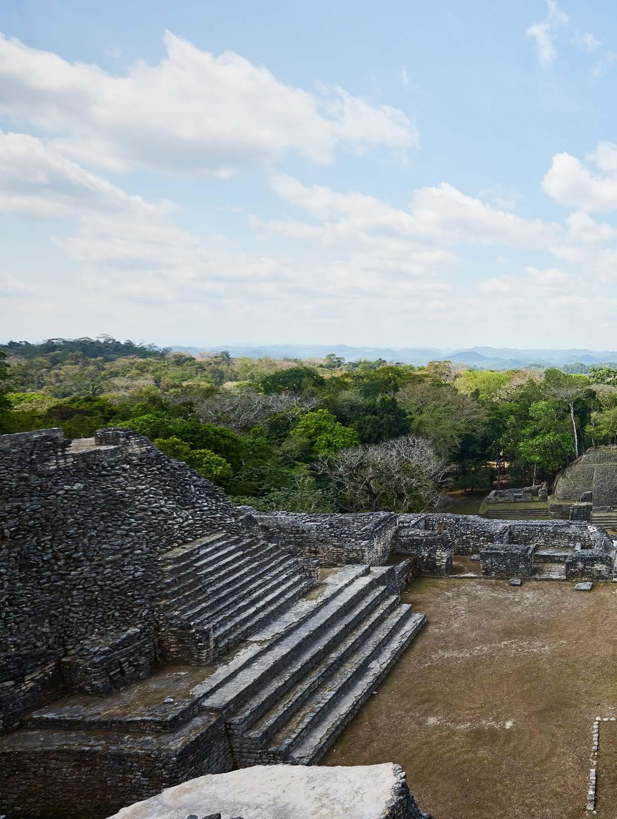
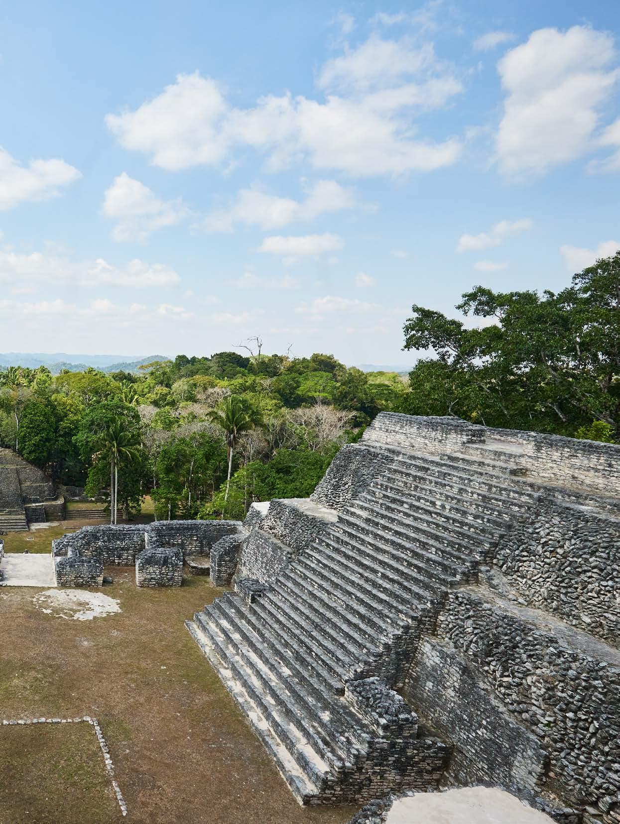
PAGE 17: Exhaustion was catching up with everyone by day three. THIS PAGE: View from the top of Caana at
ExploringOverland.com 19
Caracol.
So what is Camp 6 Road? What was it used for? Who built it? To start with, the name origin seems to be lost to history. I initially thought it was from the British Military who used the area for jungle training, but it pre-dates their use by many decades. Most likely it comes from the logging operations, though Camps 1 to 5 don’t seem to exist. My research into its purpose and construction led me to that report by J. Eric Thompson detailing (or at least describing) the old route from El Cayo to Mountain Cow watering hole, a distance of approximately 30 miles. He also mentioned that the Mengel logging company had built a nine-mile railroad through Camp 6 for timber extraction, though that had been dismantled and moved to Guatemala by 1931. Going further back, looking at the most recent LIDAR data revealing the Mayan landscape (approximately 1000 BCE to 900 CE), the Camp 6 ruins were visible, but there was no obvious causeway from them back to the main complex at Caracol. That being said, the topography of the land would make the trace of Camp 6 Road the most obvious and likely for a Mayan road (or
path) from Caracol center to Camp 6. It was during this research that I learned something very interesting about Mayan culture: their obsession with roads.
Mayan culture and mathematics was extremely advanced in some ways, and backwards in others. They could accurately calculate the position of the planets on a date four million years ago, yet there is no evidence they used the wheel or had even invented it. But they did build roads, or causeways as they are referred to today.
In the Mayan language Yucatec, the word beh means road, but it also means life-course, destiny, matter or affair. The common greeting ‘how is it going’ in Yuactec translates to ‘how is your road?’ To accomplish a goal is to fnish a road, while to get married is to complete one road and to start the ‘husband road’ or the ‘wife road.’ Today is ‘the road right here.’ Sakbeh (white road) is the Yuactec word for the giant causeways that the Mayans built and fnished in white limestone and it is also the
Exploration Quarterly ~ We shall not cease 20
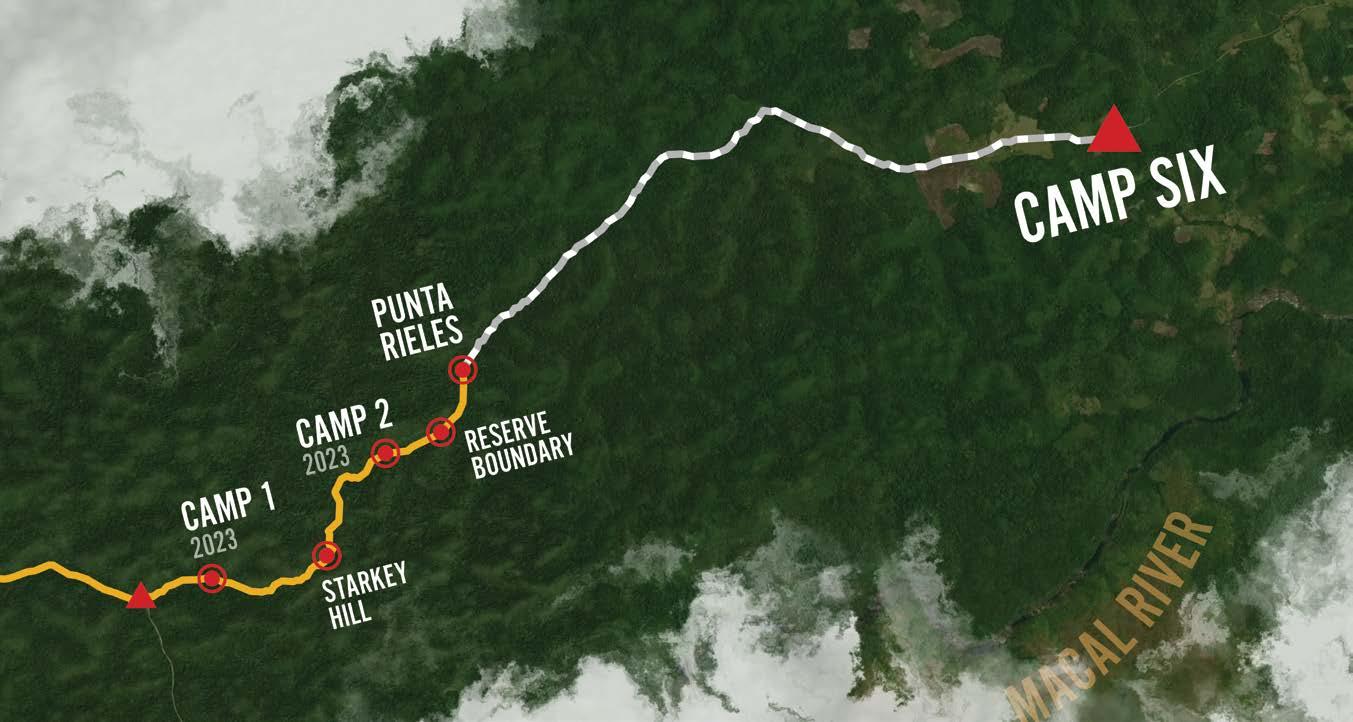
<CARACOL
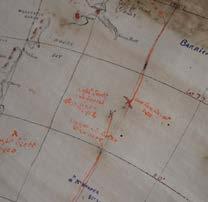
Maps by Tom Napper (TomNapper.com); satellite imagery ©Mapbox and ©OpenStreetMap.
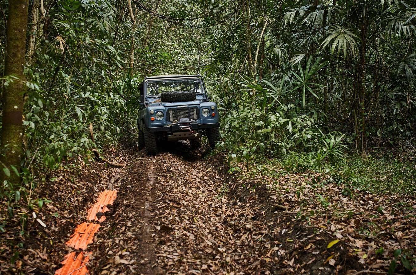
TOP: After Punta Rieles the new challenge was deep ruts from the rainy season.
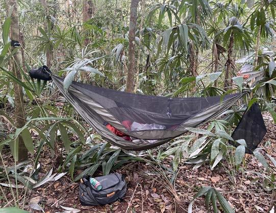
LEFT: A hammock is the only way to camp as it allows you to rest clear of the ground, away from the wildlife, and anchor trees are plentiful—you can almost feel a part of the jungle as you are connected to the living entities around you.
CENTER: Day three and Graham gets a sandfy bite while resting on the track during a lunch break. This would result in leishmaniasis.
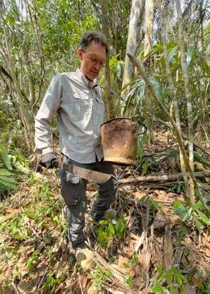
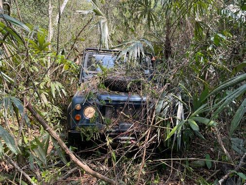
RIGHT: Graham holds a steel bucket left over from the 1920s logging operations while documenting fnds at Punta Rieles.
ExploringOverland.com 21
word they use for the Milky Way, which is seen as a celestial highway that reaches down to earth and allows the initiated to converse with the ancestors and further, is also understood to be the umbilical cord.
I reached out to the archeologists working in southern Belize with the idea that, as experts in mobility, we could possibly ground-truth some of their remote sensing data. Alas, they were not interested in the ground-truthing idea, but they were interested in the route of the rail line as it was not marked on any maps that they (or we) have found. We agreed that I would trace the rail line as best as I could and give them the track log and any pertinent waypoints along the way.
Something that has grown on me during my life of expedition work and that now permeates every trip I plan, is the idea that the remote wild places I love to explore are being pressured more and more by human expansion and the growth in numbers of people like me going out to explore them. These wild places need our protection, but how can we protect them while enjoying
them at the same time? Certainly there are foundations we can donate to and trail cleanups we can participate in, but I have come to believe one of our greatest strengths as overlanders and expeditioners is the very expertise in mobility that we use on every trip. That expertise can be leveraged to collect data in remote areas to help scientifc study, it can be used to help conservation by assisting in anti-poaching or other conservation projects, and it can keep routes open so they do not disappear.
For Camp 6 I wanted to do as much of this remote area conservation work as I could. Helping the study of the area by tracing the rail line was one key element. I also wanted to complete a remote-area, ground-level atmospheric carbon dioxide survey. This is something I have the instrumentation and expertise to do since I work in that feld professionally. Most remote CO2 surveys are done by aircraft and do not penetrate to the ground especially in jungle areas. A ground level survey would be new and I had interest in the results from the Colorado State University Department of Atmospheric Science.
Exploration Quarterly ~ We shall not cease 22
The fnal element of my conservation agenda would not come to light until we were in Belize.
So the expedition was set in my head; now I needed a team and vehicles and all the logistics that go with actually getting to Belize and doing it. The minutiae of that doesn’t need to be detailed here, but suffce to say there was a delay due to a pandemic and lots of other complications.
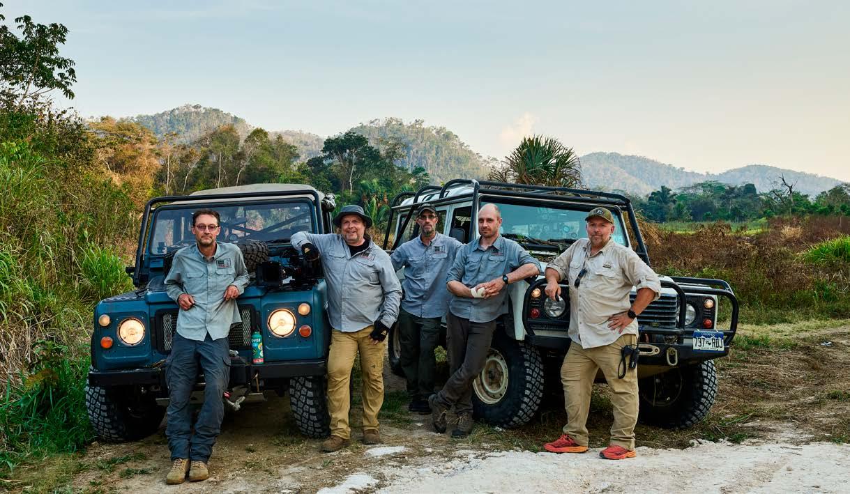
Eventually I decided to use my two Land Rover Defenders and the third vehicle would be a Jeep Gladiator for the flm crew. My friend Josh White, an Emmy award-winning flmmaker, had convinced me it would be a good idea to flm a documentary. Unfortunately Nick Taylor had to pull out of the trip, so I invited another friend, Eric Stockmann, who had been on the 2012 trip to the area. Will Mathers, who I had never met in person, agreed to come, and Nathan Hindman, also a friend, came as the still photographer and assistant for Josh. The fnal seat was taken by another friend I met in Mauritania in 2019 and can only identify as ‘Lenny’ for complicated legal reasons and whose primary job was team medic.
We set the departure date for April 7, 2023. The intention was for fve of us to drive through Mexico to Belize where we would meet Will who would fy in from the UK. April is the dry season in Belize, and my hope was to avoid the same rain issues that had foiled the frst trip.
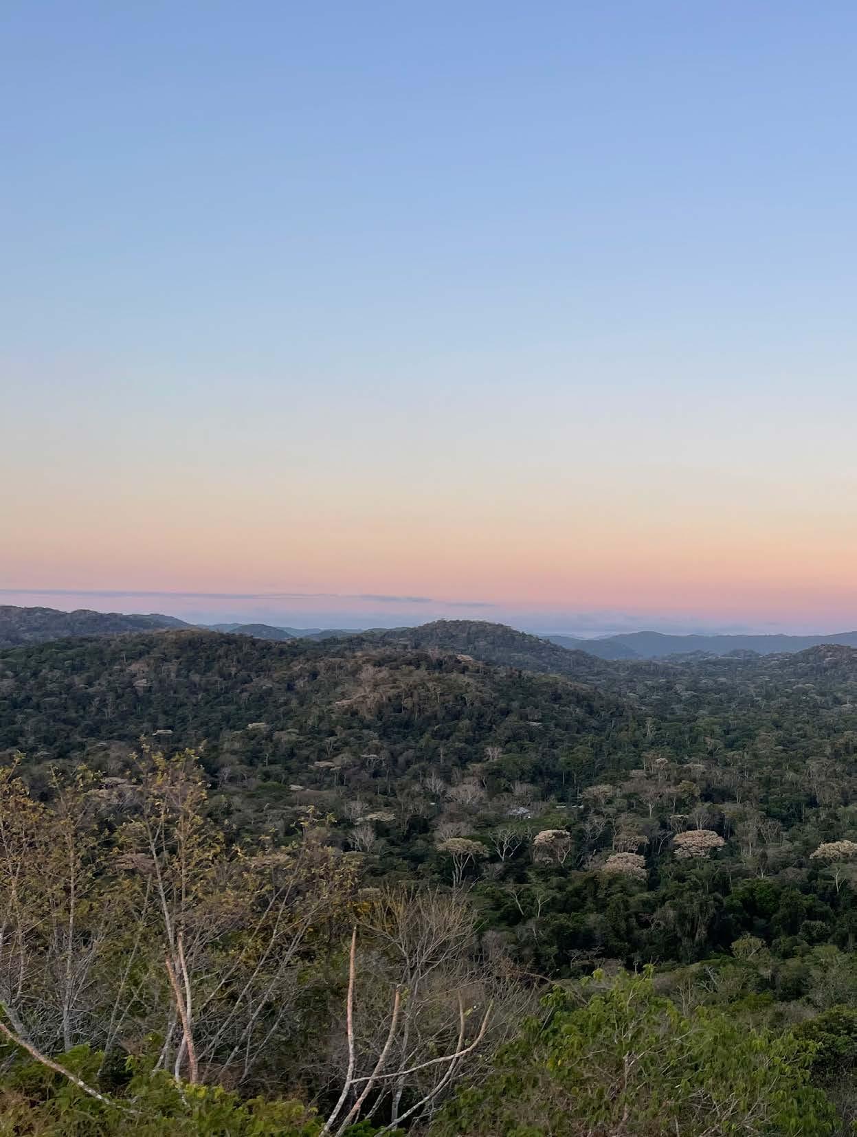
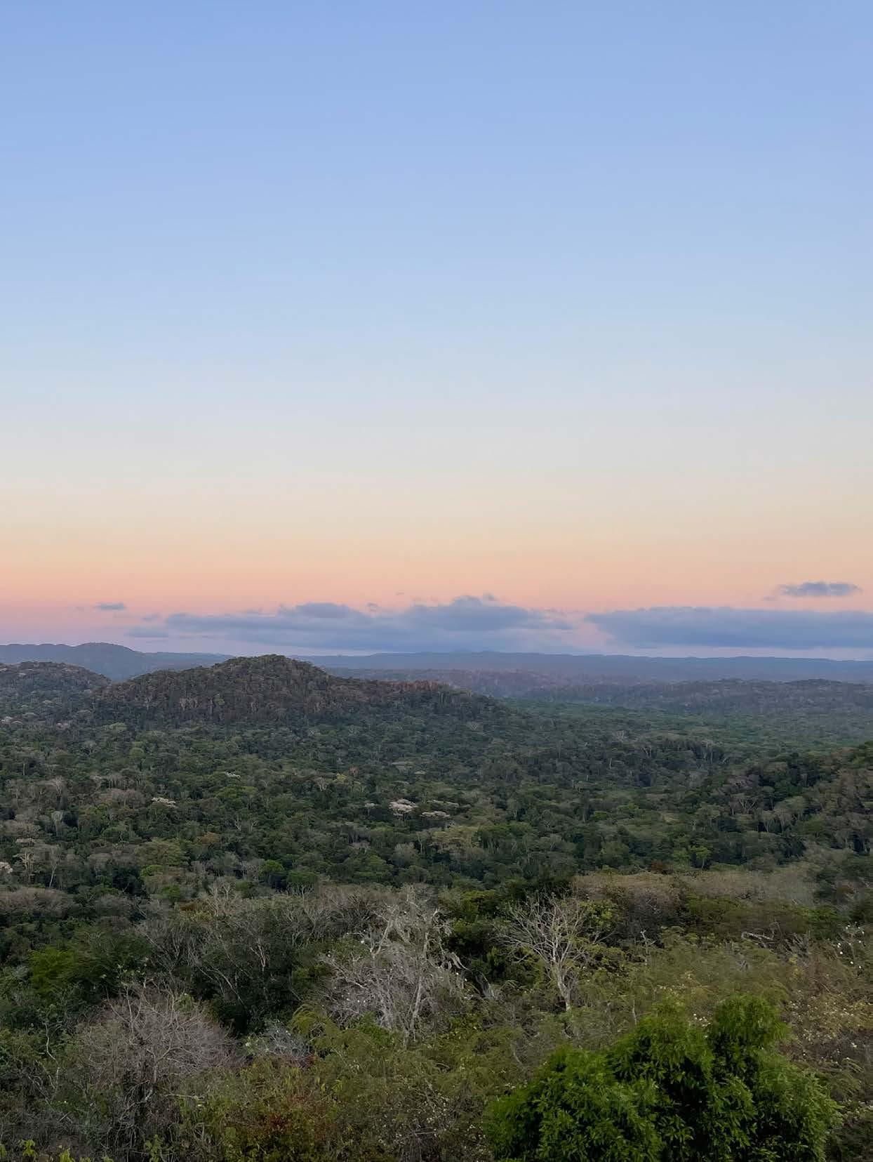
Belize is a beautiful country, and most people who visit go for the ocean where there is exceptional diving on the second-largest barrier reef in the world. But the interior jungles are some of the most dense and pristine in Central America and are home to thousands of Mayan ruins. Caracol, the largest ruin site in Belize, is an ancient city-state with over 50,000 structures covering some 300 km2. At its height, estimates have Caracol’s population at 150,000–200,000 people, far more than the 16,000 who live in Belmopan, the current capital. Caana (Sky Palace), the largest structure at Caracol, remains one of the largest buildings in the country; its summit towers above the surrounding jungle, providing immense views of a sea of green. In Mayan times the
MAIN: Vehicles chosen for the expedition were the author’s two Land Rover Defenders and a Jeep Gladiator for the flm crew.
ExploringOverland.com 23
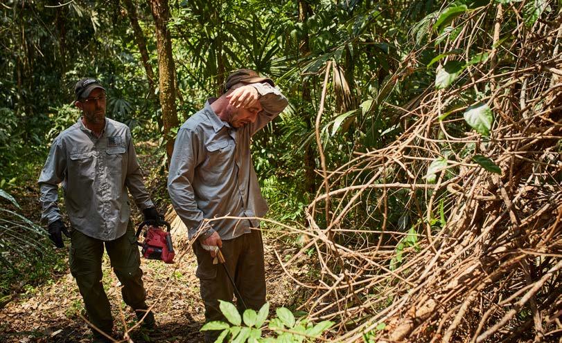
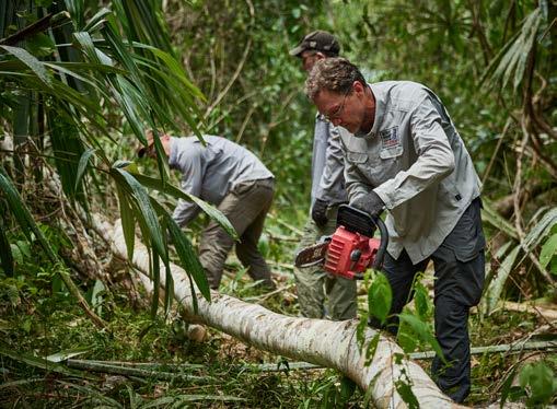
RIGHT: Deadfall across the trail was the major obstacle encountered. The chainsaw saw continuous use and its batteries had to be cooled in one of the fridges.
view would have been of a massive city with terraced felds on all the surrounding hills and wide causeways connecting plazas, each surrounded by pyramids.
Our jumping-off point for the expedition and our meeting point for Will was Pook’s Hill Lodge close to the small town of Teakettle Bank. The transit through Mexico went without any issues and the meetup with Will was all on schedule. We had a last provisioning shop in Belmopan and then we were off into the jungle along the new, albeit still under construction, Mountain Pine Ridge Road. That the road is being built is great for Belize so long as some of the revenue generated goes back to the jungle, but it was pretty devastating to see the wound being cut across the land.
We spent two days at a research station deep in the Chiquibul for fnal preparation, and it was here that the fnal conservation puzzle piece fell into place. We had to get permits from the Belize Forest Department, the Belize Film Commission, and the Institute of Archeology to enter the forest and to see some of the remote ruins as well as flm the planned documentary. I had secured all but the forestry permit and Mr. Ramos at the research station was kind enough to email his contact at forestry to ask the status. The reply was that while we
did need the permit, they were willing to waive it in our case, but that they were very excited for us to open the track to Camp 6 so they could use it for anti-poaching operations. There is a lot of poaching of scarlet macaws and other wildlife in the area, mostly by people illegally crossing from Guatemala. The ability of the antipoaching patrols to move quickly was deemed extremely important.
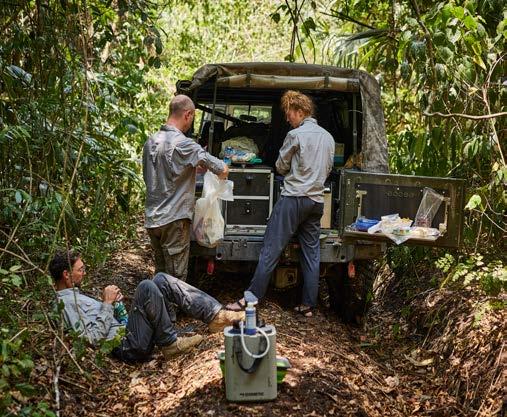
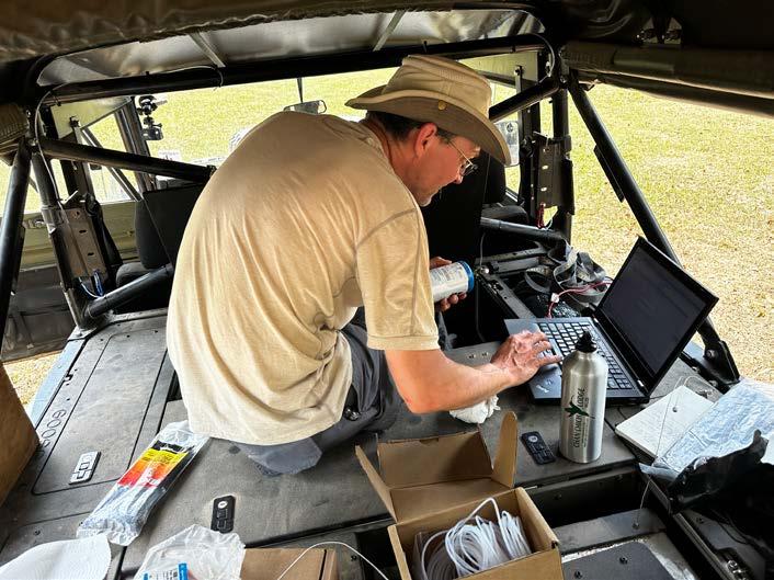
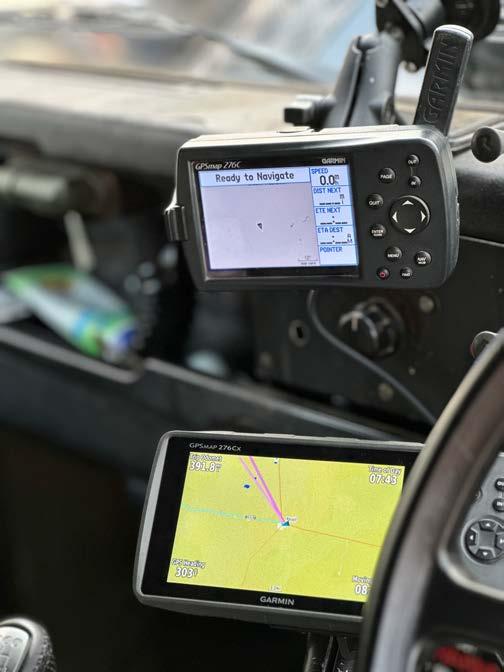
I was very excited to have that last piece fall into place. We had a micro gas chromatograph courtesy Agilent Technologies for the CO2 measurements for the science missions; four GPS units for the track log and the rail waypoints; and a chainsaw, three machetes, a Silky saw, two winches, and three recovery kits for opening the track. For the flming, we had 32 terabytes of digital storage and enough battery packs to supply the cameras for a week.
On April 19th at 08:01, under clear skies and 93°F air temperature, we departed the research station bound for Camp 6. First stop was a tour of the ruins at Caracol where I also set up the CO2 instrument, verifed the calibration, and zeroed the trip odometer on all the GPS units. I set the instrument to record atmospheric CO2 every 15 minutes in duplicate until stopped.
Exploration Quarterly ~ We shall not cease 24
ABOVE: The author calibrates the CO2 instrument before the expedition plunged into the jungle.
RIGHT: Multiple GPS units in each truck were used to trace the route and the old rail line.
At 14:47 we turned off into the jungle onto the Camp 6 track after waiting a few minutes for a grader to get out of sight. It was more overgrown than I had ever seen, not helped by the road construction pushing debris off the road onto the track. Pace was very slow with a lot of cutting. When we reached the frst downed tree the chainsaw came out and the pace got even slower. I had hoped to reach the same camp that we got to in 2010 on day one, but soon found there was no way that would be possible. By 16:32 we were 780 meters from the turnoff and, fnding an open-ish spot, we stopped on the track to make our frst camp. The day had been very hot and with all the ‘extreme gardening,’ as Will called the brush clearing, we were consuming a lot of water. First camp with a new group always takes extra time as some had never used a hammock before and so stopping early was well worth it. Lenny found a small Mayan wall close to camp and set up camp there. Examination along the track had shown that the terraces the Maya had built were everywhere, proof to the edict that almost every bit of topography in the area is a ruin.
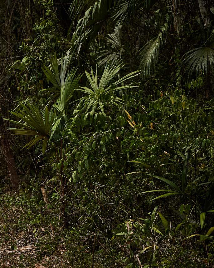
I’m a desert person, but the frst time I camped in the jungle I fell in love. The environment is so rich, and, away from human settlements, the colloquially dreaded insect scourge is not there. Howler monkeys can be heard in late evening making the jungle raucous with their cries, adding to the baseline white noise of the trees and vines gently drifting in what little breeze can be felt under the canopy. It can feel a bit claustrophobic if you are used to big-sky country, but the sheer mass of fora around you makes every step an adventure in fnding new things. Snakes are always a worry, especially the fer-de-lance, the most venomous local viper, an ambush predator whose bite would require abandoning the expedition and speeding to the closest hospital.
No rain came on the frst night, about which I had mixed feelings. Mud would make the drive more challenging, and more like the frst trip. I felt that I missed the mud element, something I would come to change my mind about very quickly.
Day two was a delayed start as breaking frst camp is always slow. We had stopped just shy of a massive amount of deadfall, so the frst job was to get to cutting—so Will and Lenny went ahead of the rest of us to start on that huge task. By 08:59 we were moving. Ambient temperature was still high, necessitating high water consumption, and everyone was working
extremely hard. In 2010 we encountered one tree down across the track. This time, still shy of the 2010 camp, we had a half-a-dozen and the chainsaw was seeing constant use.
The team was really starting to gel. For a group that had never traveled together, and had actually only all met each other a few days prior, everyone was switching out and taking turns helping each other to overcome each obstacle as we encountered it. We had no drama, just good teamwork. Will’s jungle experience was put to good use and everything seemed to be going very well. The heat was still an issue and water consumption began to worry me after Eric pointed it out. We had 145 liters for six people which should have given us four to fve days of range, but consumption was much higher than I had estimated.
We found some old rail machinery next to the track that was being consumed by the jungle. I remembered this same point from 2010 and we marked the point for the rail track while taking the opportunity to have lunch.
At 13:46 we reached the top of Starkey Hill, at 645 meters, the only real topography on the track. From here the track was all downhill to Camp 6, something I had not realized in 2010. Mayan terracing was very evident on the hill.
By mid-afternoon everyone was really suffering from the heat. I was getting extremely dehydrated despite my efforts (and constant reminders) to drink. At 17:58 we stopped to camp, again on the track. We were still 130 meters shy of the 2010 camp and only 1.5 km from the turn-off. At this rate the 25 kilometers to Camp 6 would take us a month.
Day three did not dawn well for me. Out of my hammock I vomited almost immediately. And again before breakfast. Convinced that I had eaten something bad, I did not pay it too much attention. We pushed ahead and as we passed the camp waypoint from 2010 we could not see much of a clearing, so I was somewhat glad we had not tried harder to push to that camp.
At 09:08 we came to another milestone on the route reaching the sign marking the edge of the Chiquibul National Park, a sign that Will had helped install in 2008. After the park boundary, the track opened up just a bit, indicating more recent traffc, though trees down across the track were still a regular thing. I was
ExploringOverland.com 25
still vomiting, and extremely thirsty, and no one else was sick, implying it was not a food issue, but maybe heat- related. Lenny started mixing up rehydration salts for me, but I could not keep those down, either. We decided to switch truck positions and have the white Defender lead and I would follow. I was now out of action for the extreme gardening element, but the rest of the team stepped in, and I only had to lend my recovery experience for winching tree trunks out of the way.
At 11:38 we reached Punta Rieles, a known point on the map and one of my main targets of interest for the rail line track. We found a rusting stack of fuel containers, a rusty axle housing as well as a large excavated pit that may well have been a Mayan water reservoir. It was a large fat area with fewer trees and could easily have been the loading point for timber going onto the rail line. No rolling stock or tracks were evident, but that was expected. We marked the point, took pictures, and kept moving. The track was now opening up even more, and the brush-clearing challenge was replaced by a new one: deep wheel ruts from vehicles traversing the track in the rainy season.
By lunch it was clear that everyone was suffering from the heat and the work. I could not eat anything, and, exhausted, I sat down on the track in the sand, something that would later prove a mistake. We were still pounding through the water at an alarming rate. We did have a flter system onboard if we needed to re-supply water in the jungle, but the dry season meant we would have to wait until we reached Cacao Camp Creek for that to be a possibility.
My situation continued to deteriorate. What I did not mention up to this point is that I’m a type 1 diabetic and my blood sugar had been running very high since early on day two, and kept getting higher and higher even as I kept giving myself more and more insulin. We realized that we would have to make it out on day three both because of my health condition and the water situation. Ambient temperature was up to 95°F, which felt even higher in the muggy confnes of the jungle. At one point the batteries for the chainsaw stopped taking charge as they got too hot, and Eric resorted to putting them in the fridge to get them to recharge. On the good side, our pace had picked up with the improving track conditions,
Exploration Quarterly ~ We shall not cease 26
and apart from clearing downed trees, which was going fairly smoothly with the chainsaw, the winches, and great teamwork, it looked like we might be able to make Camp 6 by nightfall.
As the jungle opened up, the track got more and more rutted and we reached a long stretch where we had to use Maxtrax and logs to lift the vehicles out of the ruts to allow the differentials to clear. I had stopped sweating, which was the fnal clue to me that it was not food or heat that was my main problem, but that, due to the high heat, the insulin in my pump had gone bad. I was deep into a condition called diabetic keto-acidosis (DKA for short), where my blood sugar was so high that my body was using all the water available to try to fush the sugar from my system. I had gotten to the point of dehydration where I could not sweat and could not salivate, so I could no longer control my body temperature properly. Coma and possibly death were a short way down that road.
At 14:50 we suddenly broke out of the jungle onto the foodplain next to Cacao Camp Creek. The relief
was immense, as Camp 6 was only a few kilometers ahead. Josh launched the drone for a look, but one fnal tree proved to be a big last challenge. With everyone suffering from exhaustion, our problem-solving was less than ideal, and it took a good while to cut and move that last tree, number 21 on the track.
As we pulled past that last timber obstacle and rounded a slight bend we saw fences and cattle and a regularly used dirt track. And beyond that, the buildings of Camp 6.
“I’ve never been so happy to see cows in my life!” was Will’s comment over the radio.
At 17:06 we pulled up to the Camp 6 junction, all completely exhausted, but also elated at having made it. We took pictures and I fnally pulled my insulin out of the fridge to refll my pump reservoir. That I had not done this hours earlier after discerning the problem just shows how poor my decision-making had become. At the Camp 6 junction a new dirt road was being built south, and though I had intended to camp at Camp 6, we
ExploringOverland.com 27
decided it was far wiser to head in to San Ignacio and fnd a hotel. The next 36 kilometers took us an hour while the previous 22 had taken us 50.
After checking in to the hotel we adjourned to one of my favorite restaurants in Belize, Hode’s, and had a good feed. My blood sugar was dropping, and by 07:00 the following morning was back in normal range. That is not to say I was better. I had lost six pounds, had a mighty bladder infection, and had a sand fy bite on my back from sitting in the sand track. That bite would result in lechmaniasis (a parasitic infection). It would take over a month to recover completely from the DKA, during which time I also got Covid-19 to complete the trifecta I presented to my doctor.
My goals for the trip had been partially met. We had opened the track, we had traced what we could fnd of
the rail line, but the CO2 data was not safely stored on the instrument. Sometime late on day two the instrument had run out of helium, something I knew would happen, but I then discovered, that due to an incorrect setting, it had not been storing data onboard as I had planned. With so much going on during the expedition, I had failed to double-check to see that the data was being collected. The best I can do is call it a proof of concept for the next one.
I would love to be able to say that the vendetta had been resolved, and I suppose for Camp 6 it has. But the route J. Eric Thompson described goes all the way to Mountain Cow watering hole . . . Now, I have to go back and do that section.
As the Maya would say, my Camp 6 Road is not quite complete.
For information about the new feature flm and to see more content from the expedition, please visit OverlandPassage.com
Exploration Quarterly ~ We shall not cease 28
LEFT: Emerging from the dense rainforest at the edge of Camp 6 was an immense relief to the exhauted crew.
BELOW: The elated expedition team from left: Graham Jackson, Josh White, Eric Stockmann, Will Mathers, and Nathan Hindman (Lenny, full name and image withheld by request, is not shown).
ExploringOverland.com 29
If you enjoyed this sample issue, consider subscribing or purchasing individual copies (when available) at:
http://www.ExploringOverland.com/explorationquarterly
“The real voyage of discovery consists not in seeking new landscapes, but in having new eyes.”
- Marcel Proust