EDGE EFFECTS: DERRY/LONDONDERRY
 ESALA 2023 Master of Architecture
Iain Scott Mark Bingham
ESALA 2023 Master of Architecture
Iain Scott Mark Bingham
LON D ON DERRY
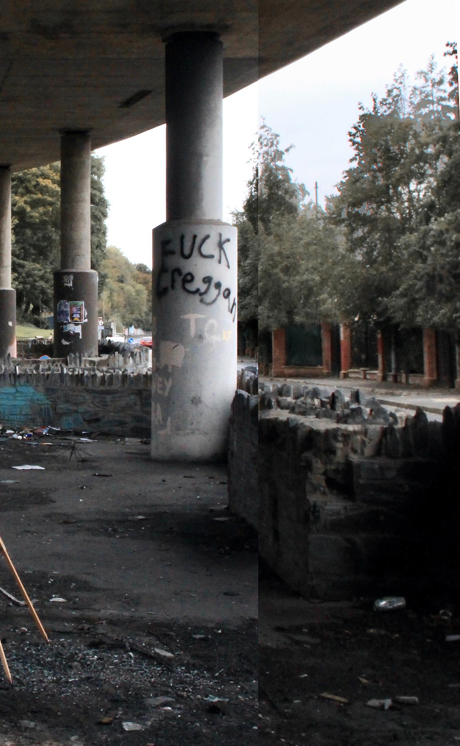
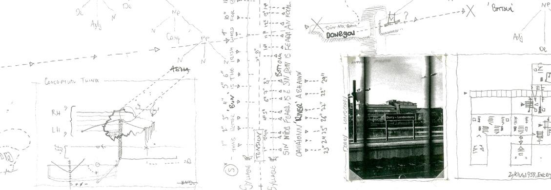
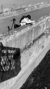
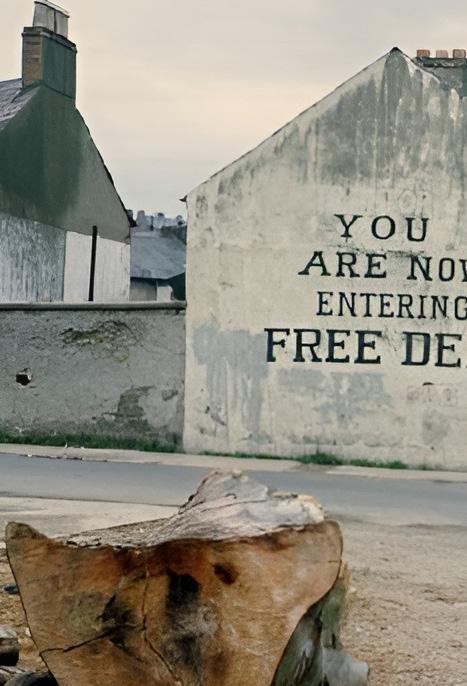 Free Derry Corner
Photographer unknown.
Free Derry Corner
Photographer unknown.
This catalogue is part of a collection published by the Edinburgh School of Architecture and Landscape Architecture (ESALA), Edinburgh College of Art, University of Edinburgh. It documents student design work produced in the Master of Architecture (MArch) programme in 2022-23. Each catalogue describes one of the following six design studios in the MArch programme. The full collection is available to view online at issuu.com/eca.march.
Catalogues 2022-23:
BRNO: Building Belvederes.
Edge Effects: Derry/Londonderry.
Grounding Naples.
island territories viii: Scapeland Ávila. Sender Berlin.
The Panamá Projects.
ESALA, Minto House, 20-22 Chambers Street, Edinburgh, EH1 1JZ.
Edge Effects: Derry/Londonderry.
ISBN 978-1-912669-50-9
ESALA 2023 Master of Architecture
EDGE EFFECTS: DERRY/LONDONDERRY
LONDON DERRY
Iain Scott Mark Bingham
- THE CITY WITH TWO NAMES IAIN SCOTT | MARK BINGHAM 1 CONTENTS ACKNOWLEDGEMENTS 134137 BIBLIOGRAPHY & IMAGE REFERENCES 01 PLAYWRIGHT PROVOCATIONS ADAM BLACKNELL JAMES MAIDMENT 02 03 SOAK YULIANG CAO NETWORK DERRY WULFRIC CLACKSON 20 36 40 04 05 BREAKING BREAD CHARLOTTE CUMMINGS 44 50 06 07 PERMEATING A FORGOTTEN LANDSCAPE JESS GARDNER SUSTAINABLE RE-USE ELEANOR HYDE 56 62 URBAN VOIDANCE CURTIS ENGLISH
11 12 EYES IN THE CITY TONY LI DERRY MOSS INSTITUTE JIATONG LIU 80 86 13 14 ON THE FRINGE OF THE FOYLE Á INE LYNCH FOLDED LONDONDERRY SHUO PAN 90 96 15 16 TOWARDS AN ARCHITECTURE OF TOUCH BECKY WHITEHEAD FROM THE ASHES OF THE BOGSIDE BONFIRE GEORGIA WHITEHEAD 100 108 17 18 DERRY’S ECHO DERIN BEREN YALÇIN THROUGH THE PEACE WALL YU YU 114 118 19 BOOK ENDING YANGJIE ZHAN 122 08 09 C É IDE HILL HAMISH JACKSON DERRY THROUGH COLOUR CATHERINE JONES 66 72 10 THE SEPARATING EFFECT OF URBAN CACOPHONY TIM LI 76
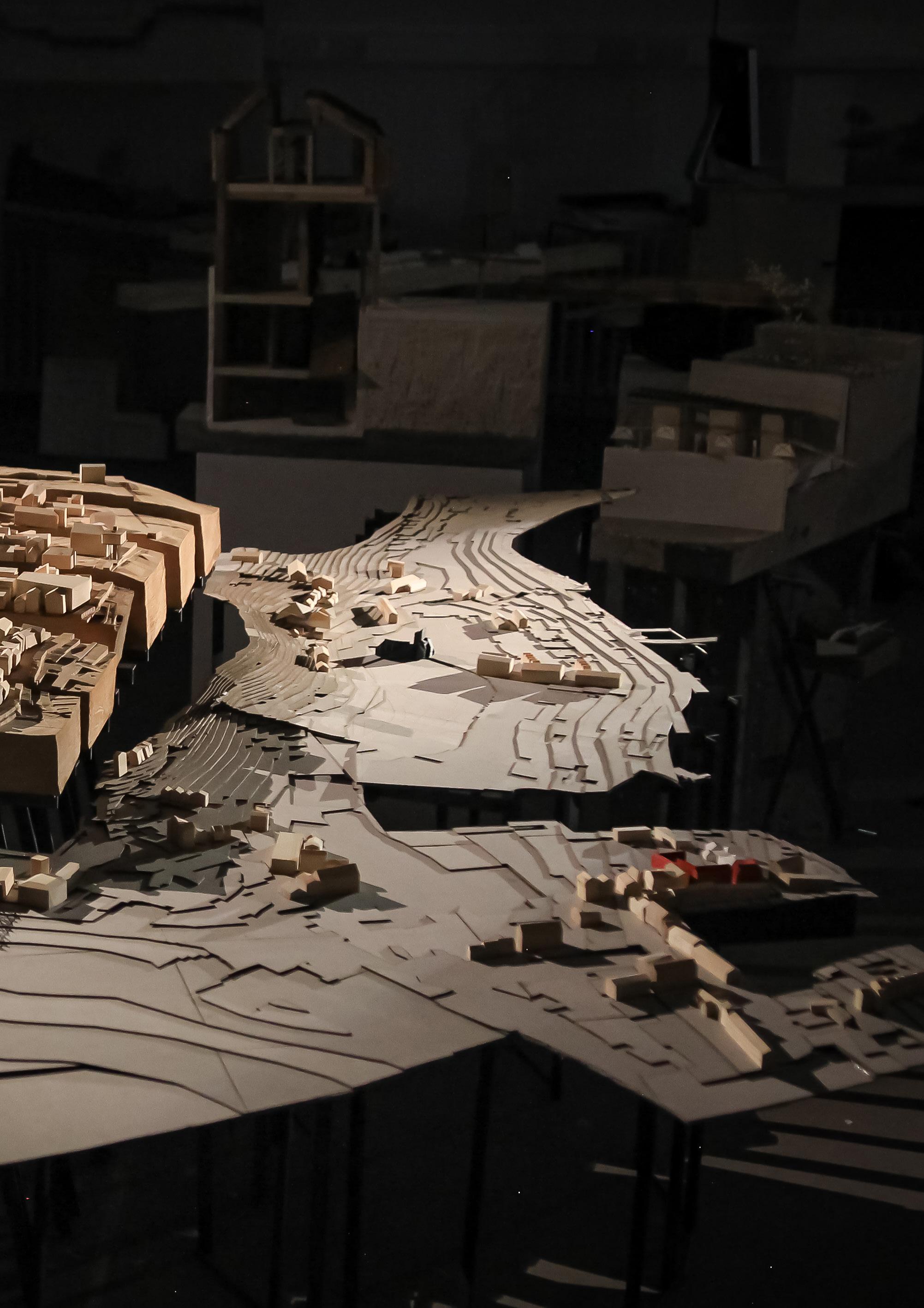
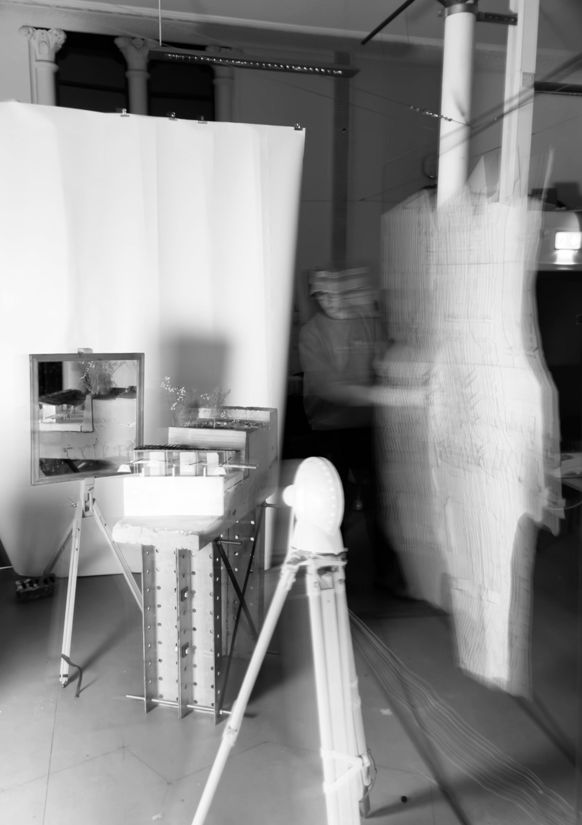
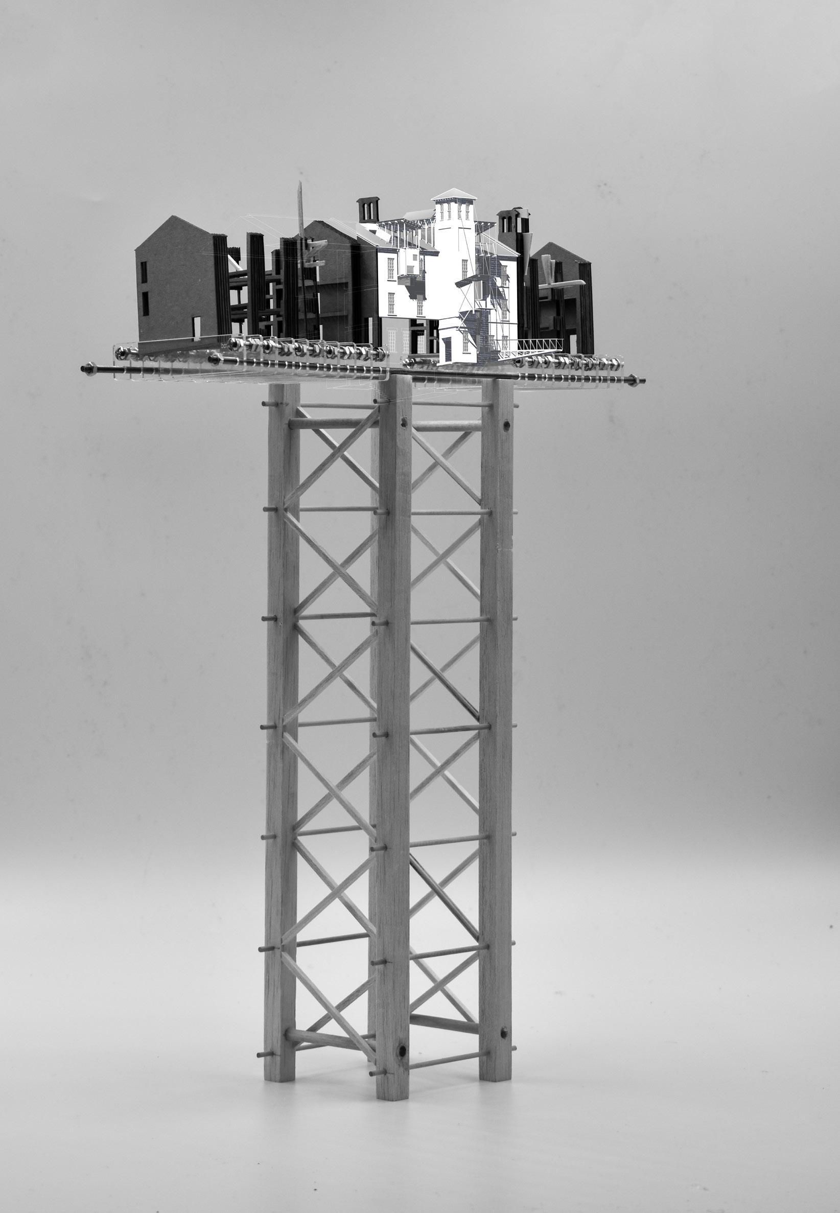
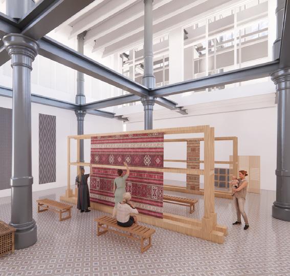
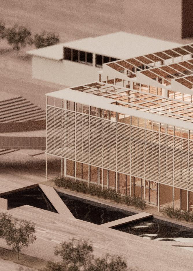
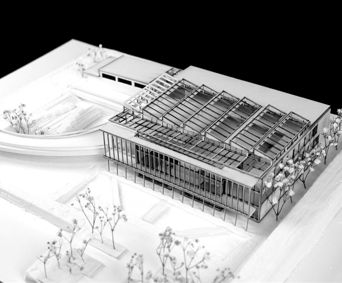
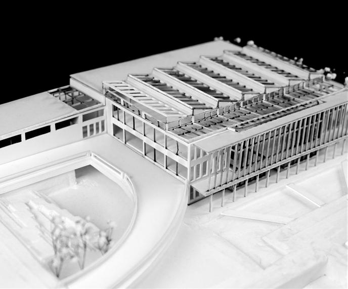
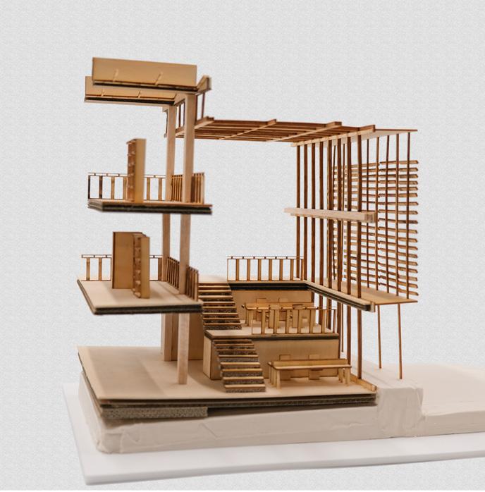
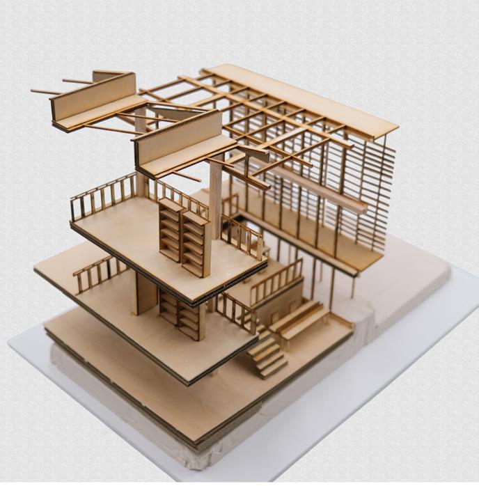
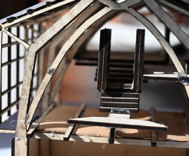
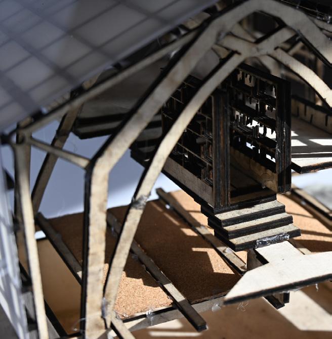
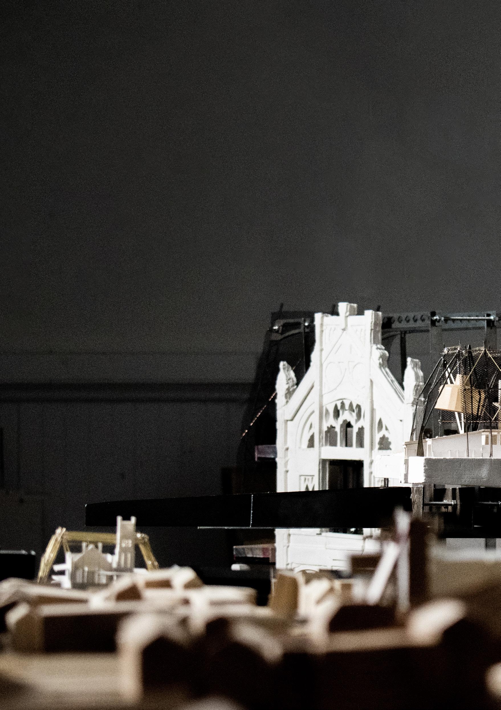
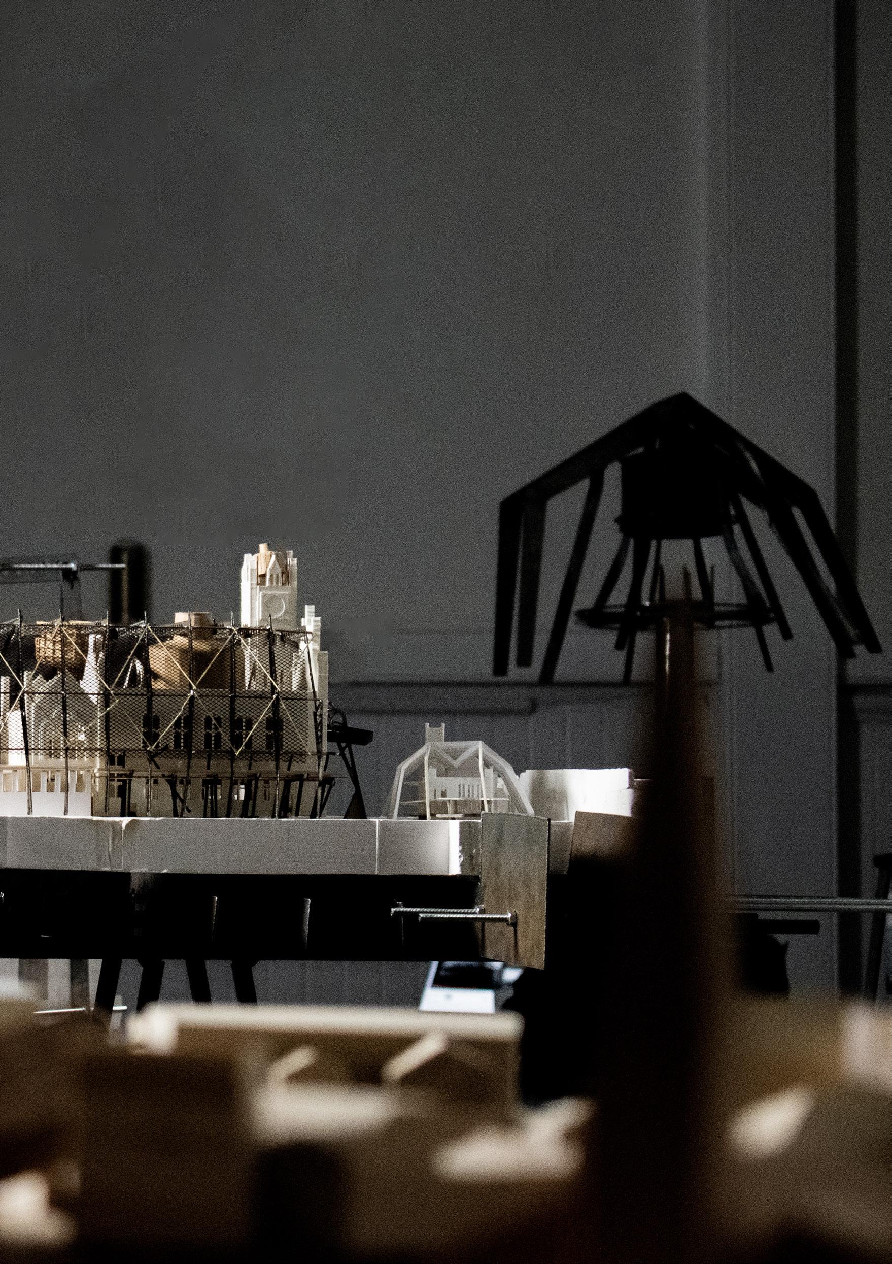
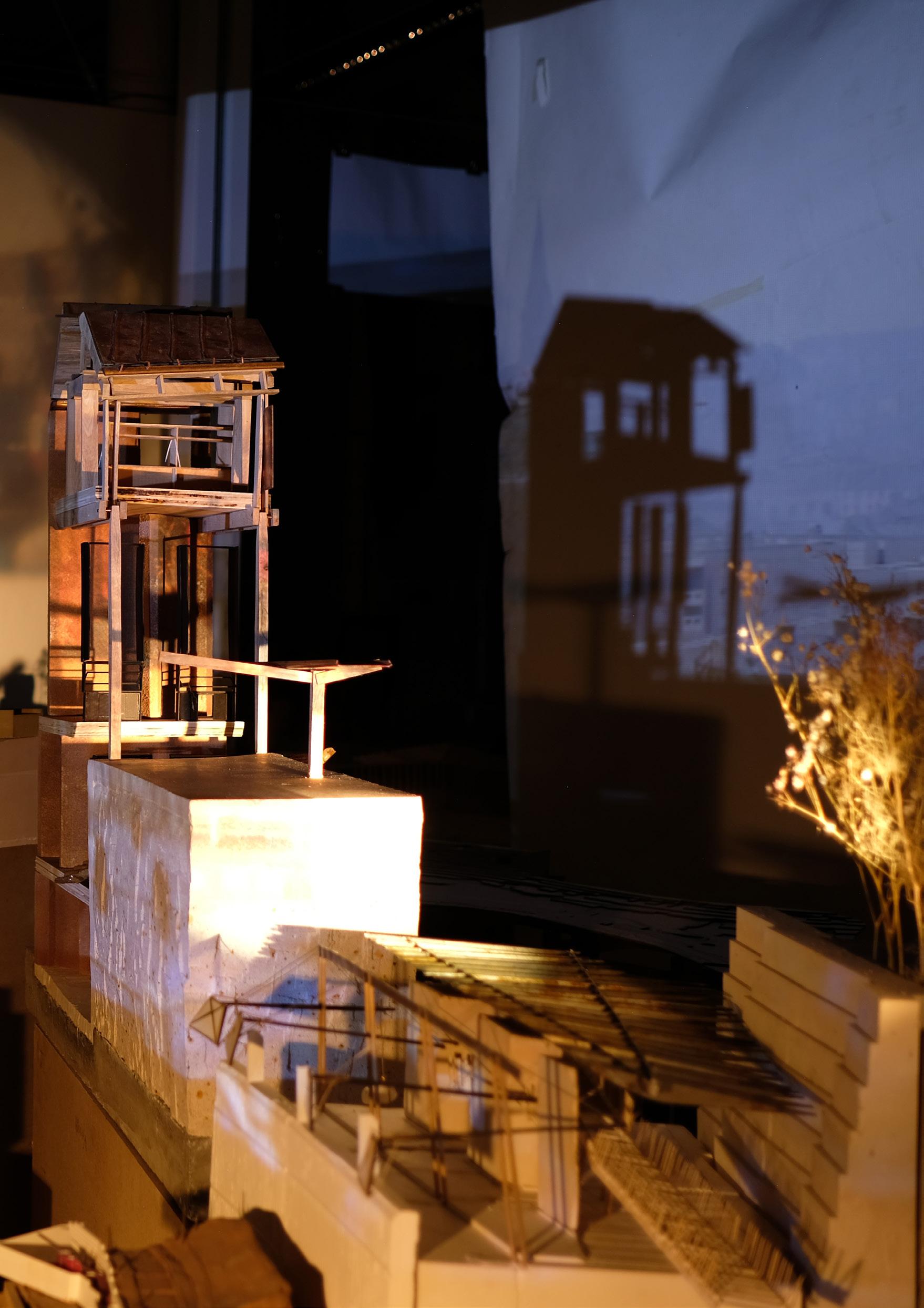
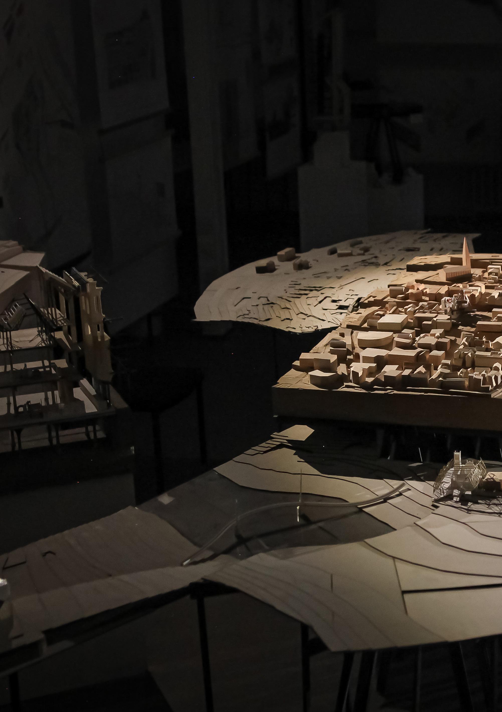 Derry City Model
Jess Gardner | Hamish Jackson
Derry City Model
Jess Gardner | Hamish Jackson
I x
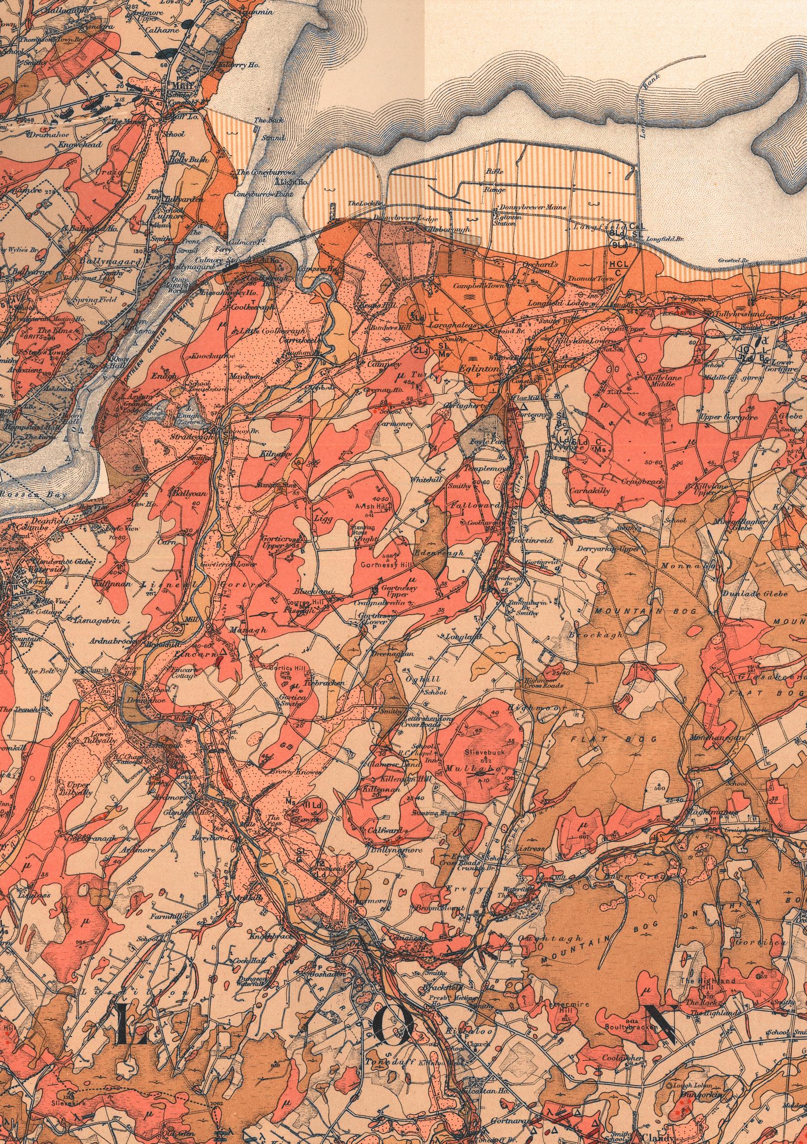
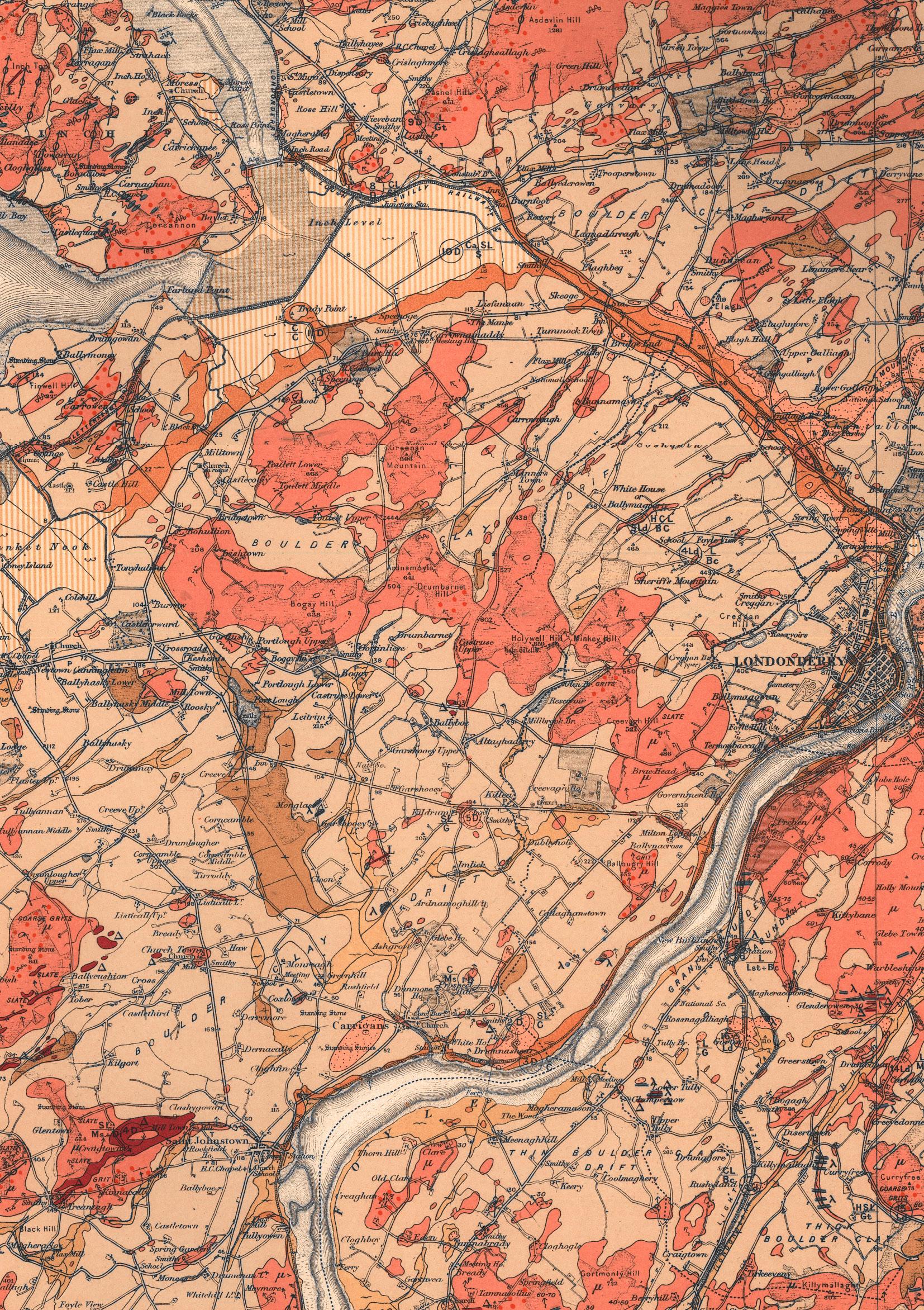 Geological Survey of Ireland, 1884 Londonderry District
x I
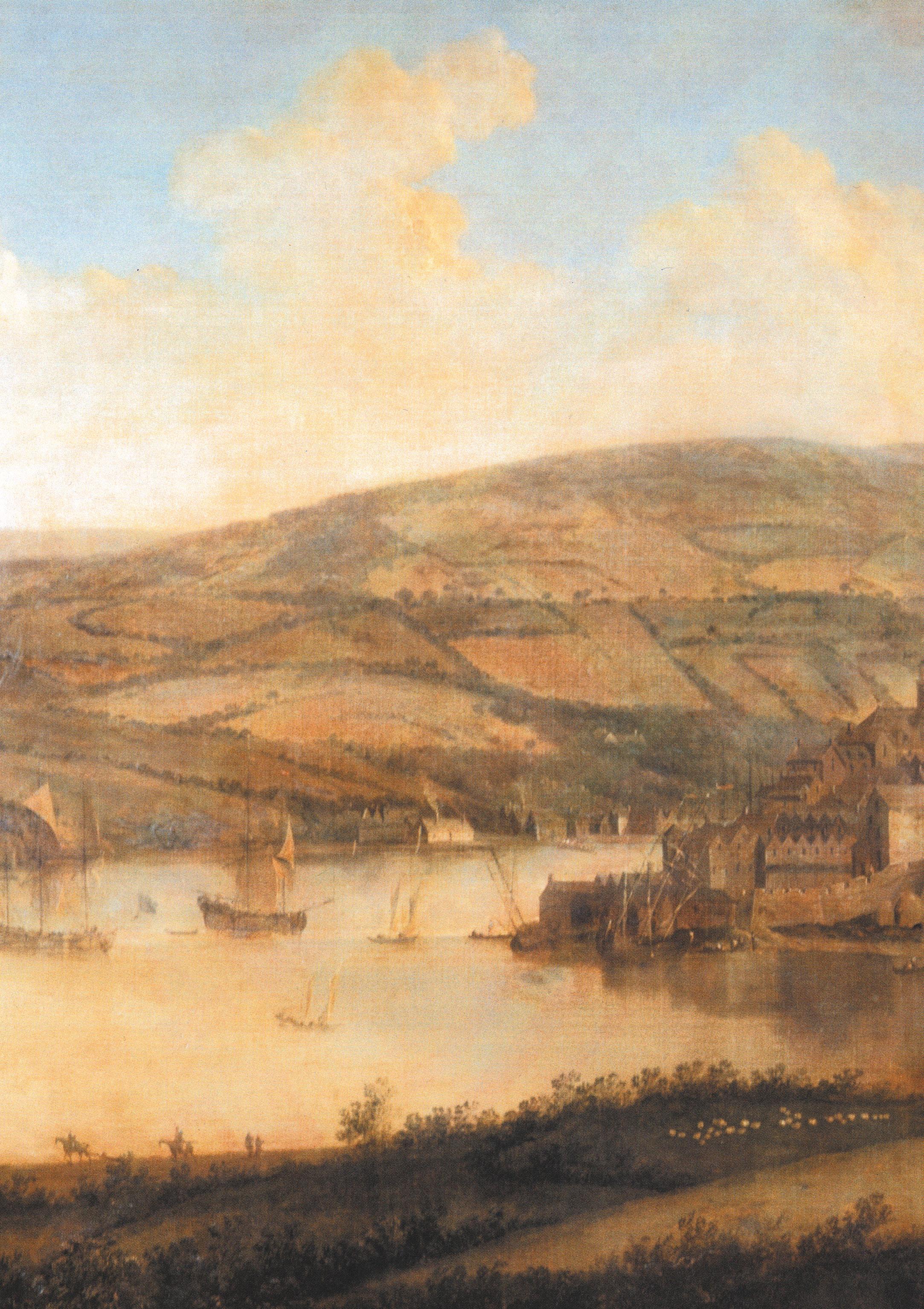
Siege of Londonderry, 1688
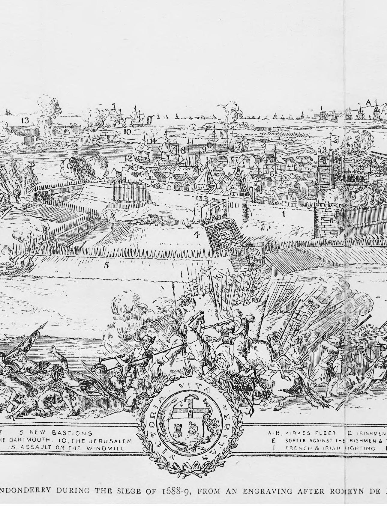
Walker, G, 1893
THE CITY WITH TWO NAMES
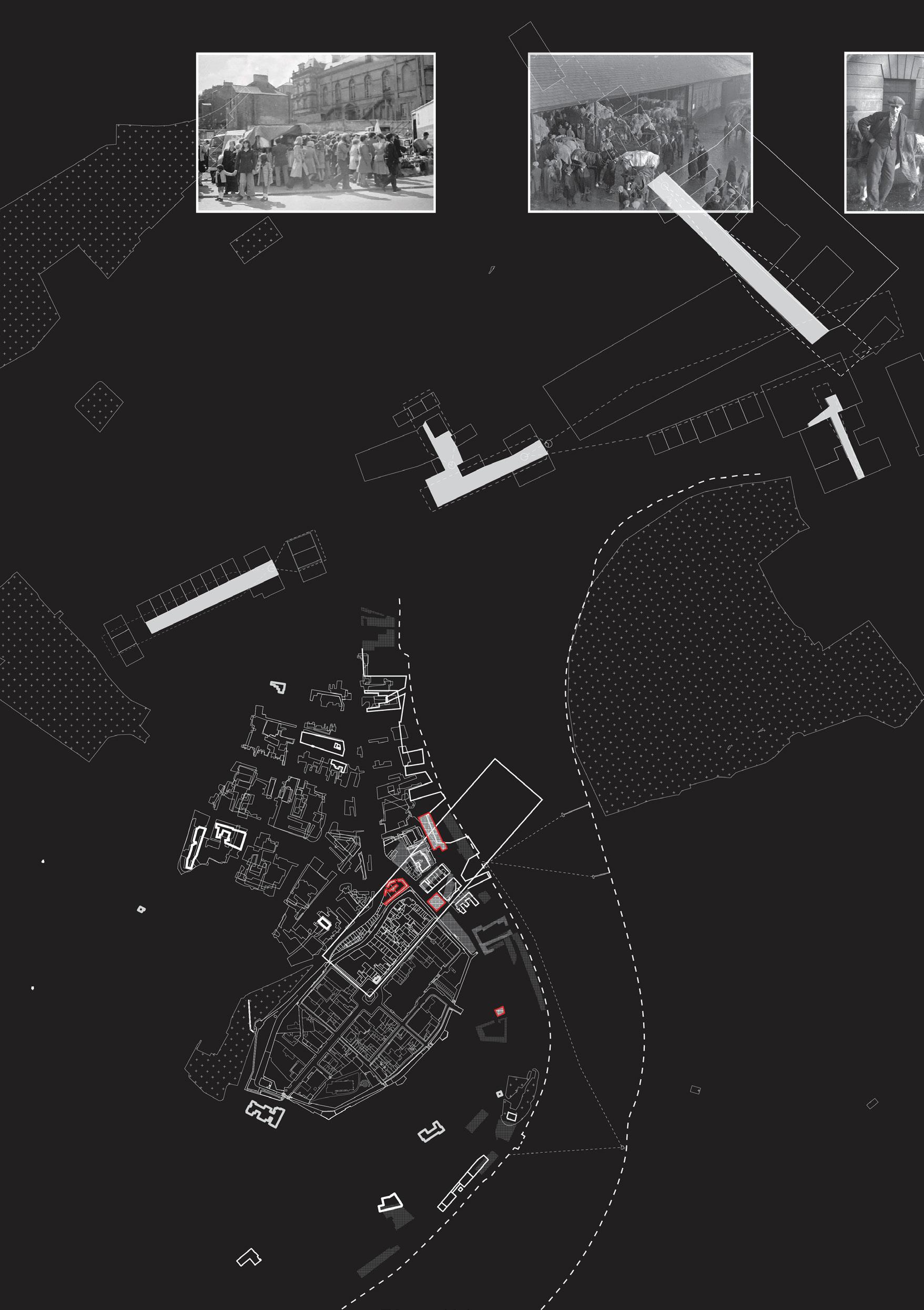
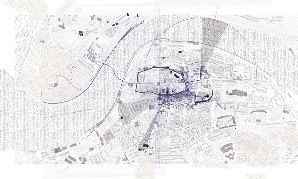
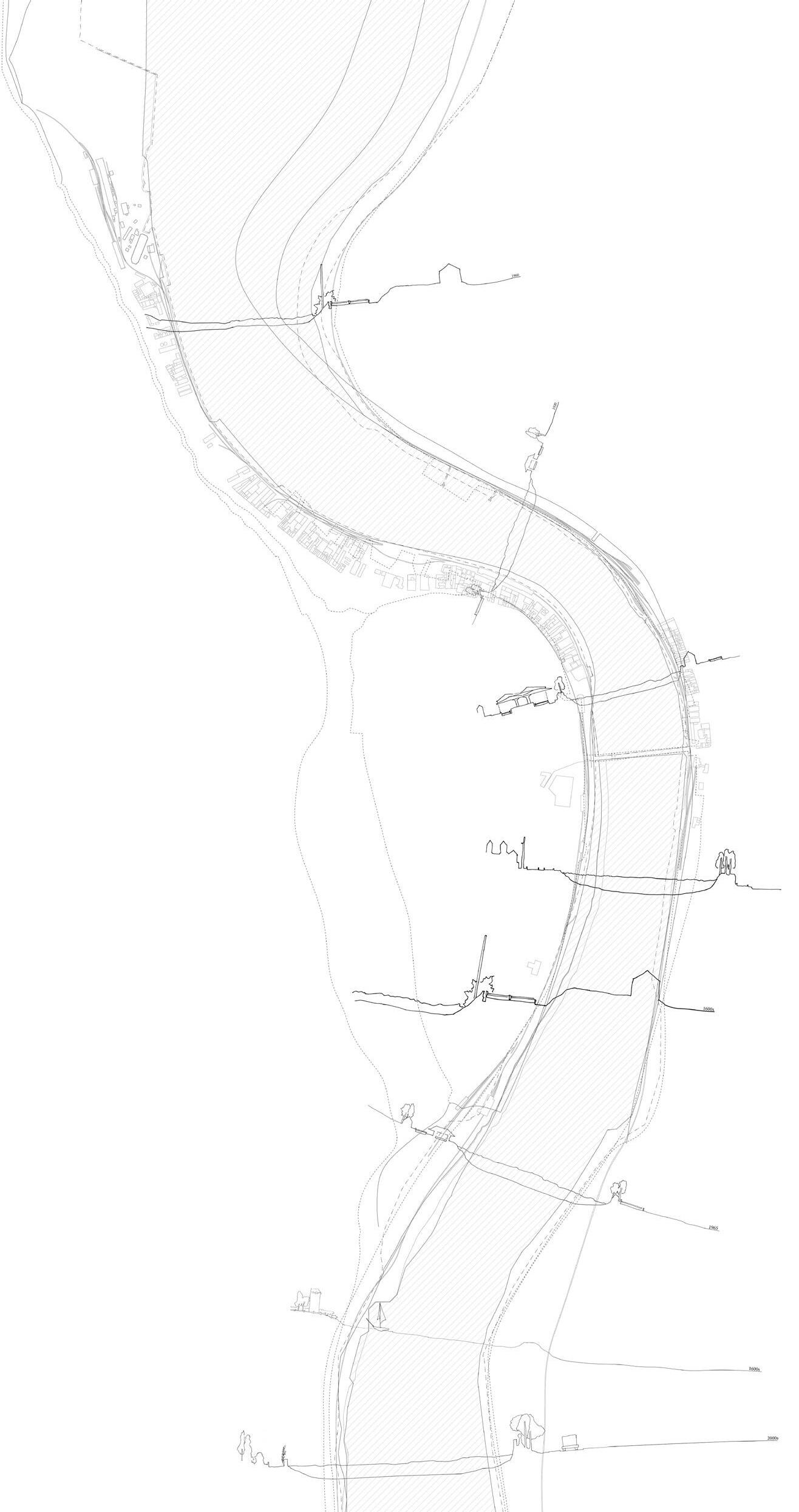
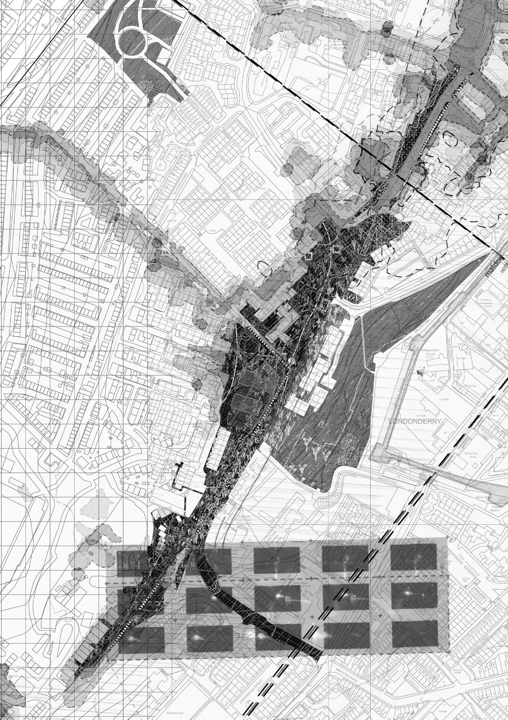
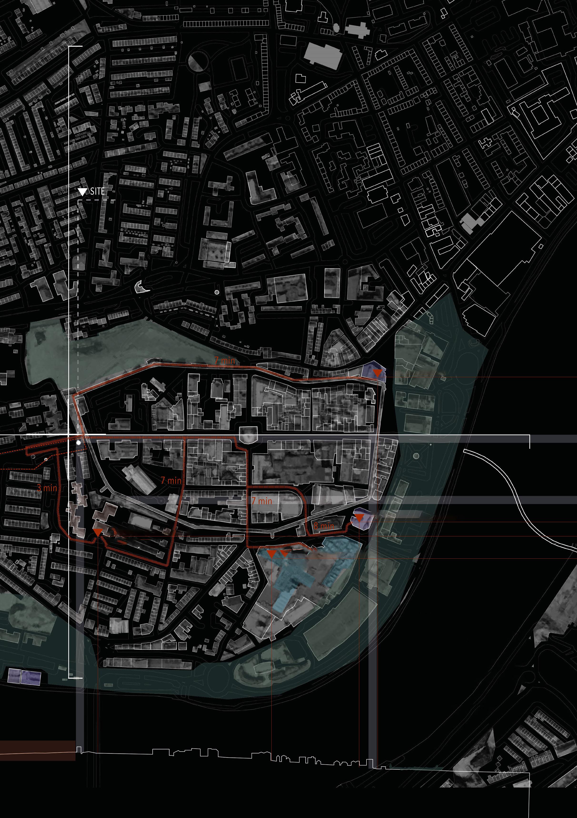
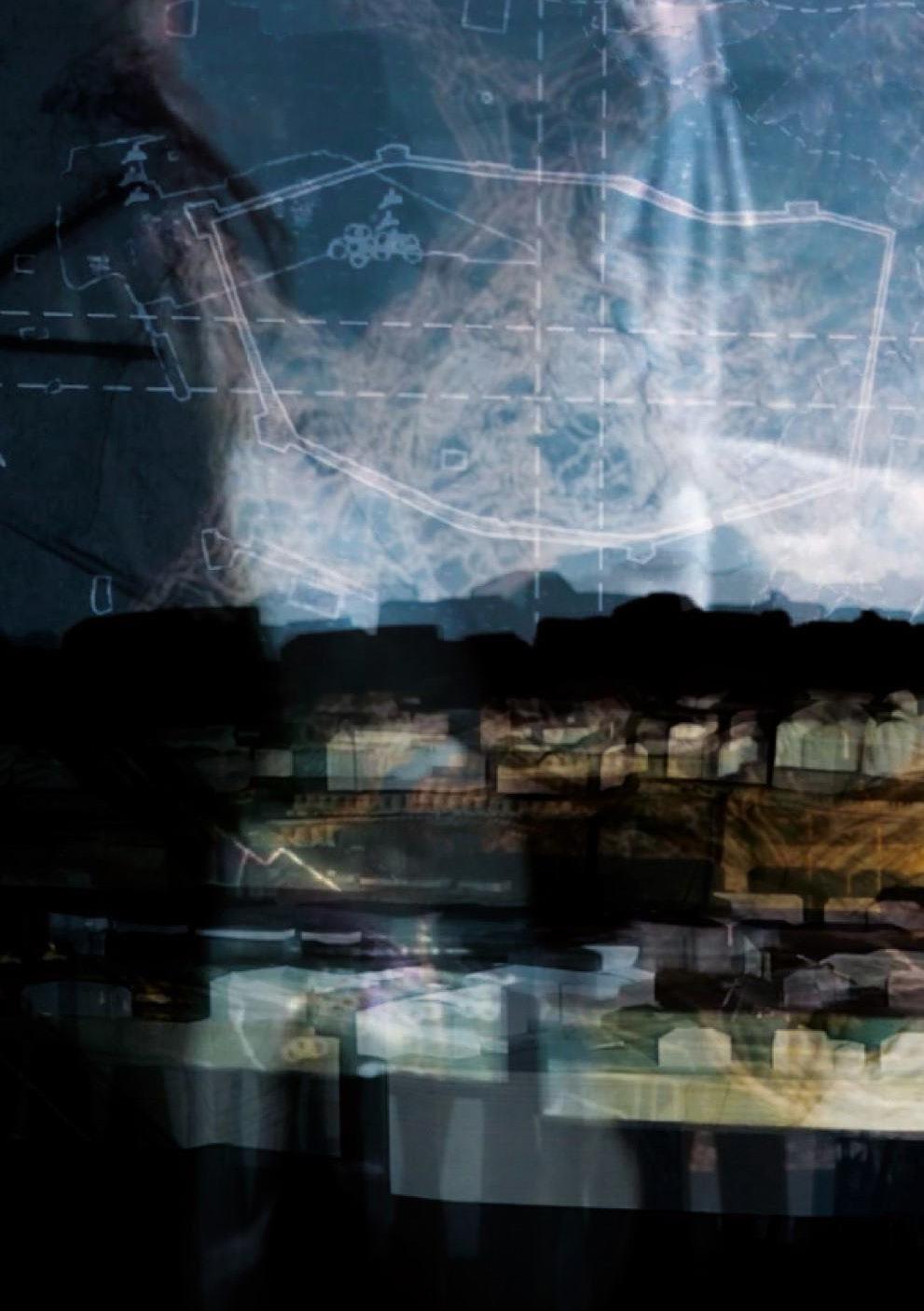
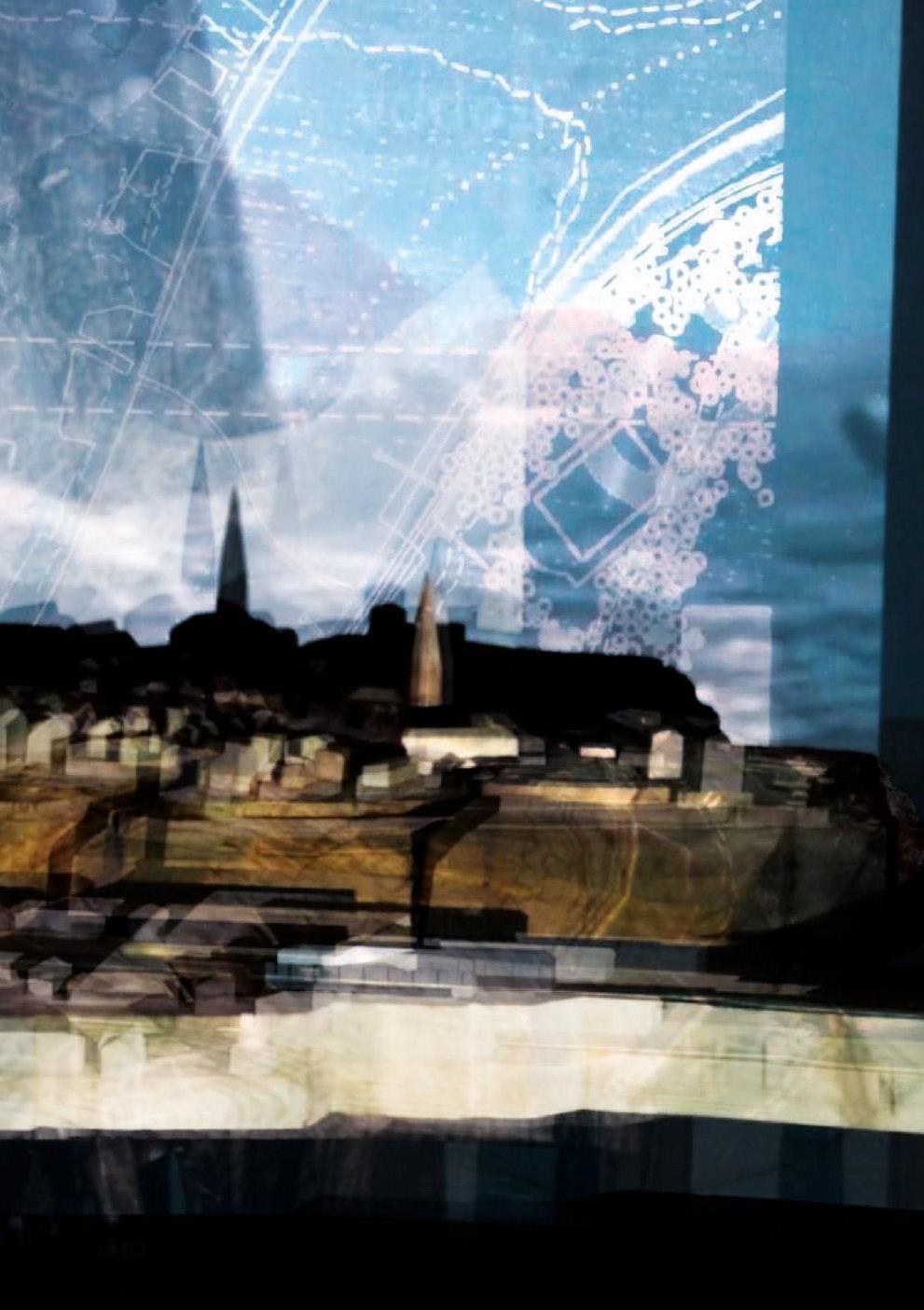
The City of Derry (‘Doire’- Irish and ‘Londonderry’- anglicised) along with its River Foyle and Lough Foyle to the north, sits in the Foyle basin in the north-west corner of Northern Ireland. It is a post-glacial landscape formed over millions of years within the Antrim plateau.
The recorded history of Derry begins around 545 AD with the ‘Annals of Ulster’ recording the inception of a monastery, ‘The Doire of Calgach’ or ‘Oakwood of Calgach’ founded by Collum Cille, (St. Columba).
The name was changed from Derry to Londonderry in 1613 during the Plantation of Ulster to reflect the fortification of the city by the City of London Guilds and the establishment of the Honorable Irish Society. The Plantation of Ulster was the organised colonisation (plantation) by people from Great Britain during the reign of King James I. Most of the settlers (or planters) came from southern Scotland and northern England. Small privately funded plantations instituted by wealthy landowners began in 1609. Most of the colonised land had been confiscated from the native Gaelic chiefs or earls, several of whom had fled Ireland for mainland Europe in 1607 following the Nine Years’ War against English rule. Derry was the principal plantation in Ulster.
The legacy of the Plantation remains disputed. According to one view, it has created a society segregated between native Catholics and settler Protestants in Ulster and created a Protestant and British concentration of people in north-east Ireland. This argument also sees the Plantation as one of the long-term causes of the Partition of Ireland in 1921, where the north-east of Ireland remained part of the United Kingdom as Northern Ireland. It can also be seen as a generator of ‘The Troubles’.
1
|
IAIN
SCOTT AND MARK BINGHAM
THE CITY WITH TWO NAMES
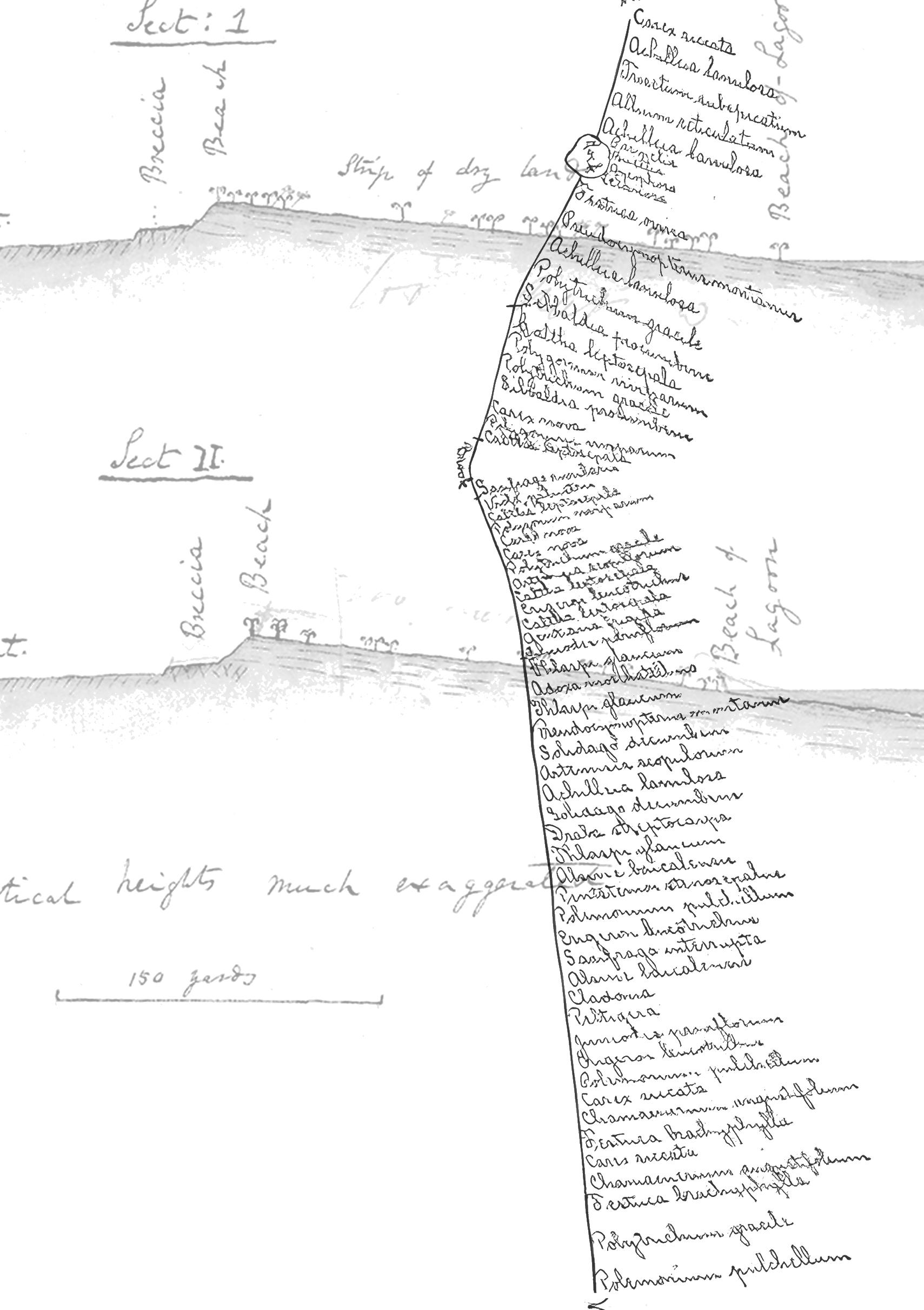
Clements Transect
Darwin, C, 1837
The Troubles were an Irish nationalist – British government conflict in Northern Ireland that lasted around 30 years from the late 1960s to the late 1990s. Also known as the Northern Ireland conflict. The conflict is usually deemed to have ended with the Good Friday Agreement of 1998. One of the key incidents which formed part of ‘The Troubles’ was the Bloody Sunday massacre on 30 January 1972 when British soldiers shot 26 unarmed civilians during a protest march in the Bogside area of Derry where fourteen people died. Although the Troubles mostly took place in Northern Ireland, at times violence spilled over into parts of the Republic of Ireland, England and mainland Europe.
Derry has been used as the name of the local government district and council since 1984, when the council changed its name from Londonderry City Council to Derry City Council. This also changed the name of the district, which had been created in 1973 and included both the city and surrounding rural areas. However, according to the city’s Royal Charter of 10 April 1662, the official name is still Londonderry. This was reaffirmed by a British High Court decision in 2007.
Data shows that around 78% of protestant unionists prefer to use the name Londonderry, while 94% of catholic nationalists prefer Derry. Many businesses, clubs and other organisations in the area will avoid using Derry or Londonderry in their names often preferring to use the suffix Foyle, after the river Foyle. (BBC Radio Foyle). This is partly so that they can avoid alienating potential customers or users from either side of the community.
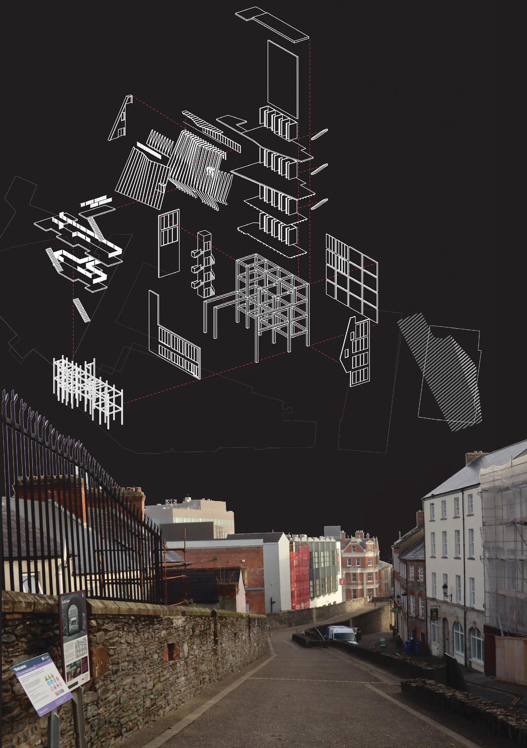
DERRY STUDIO PEDAGOGY
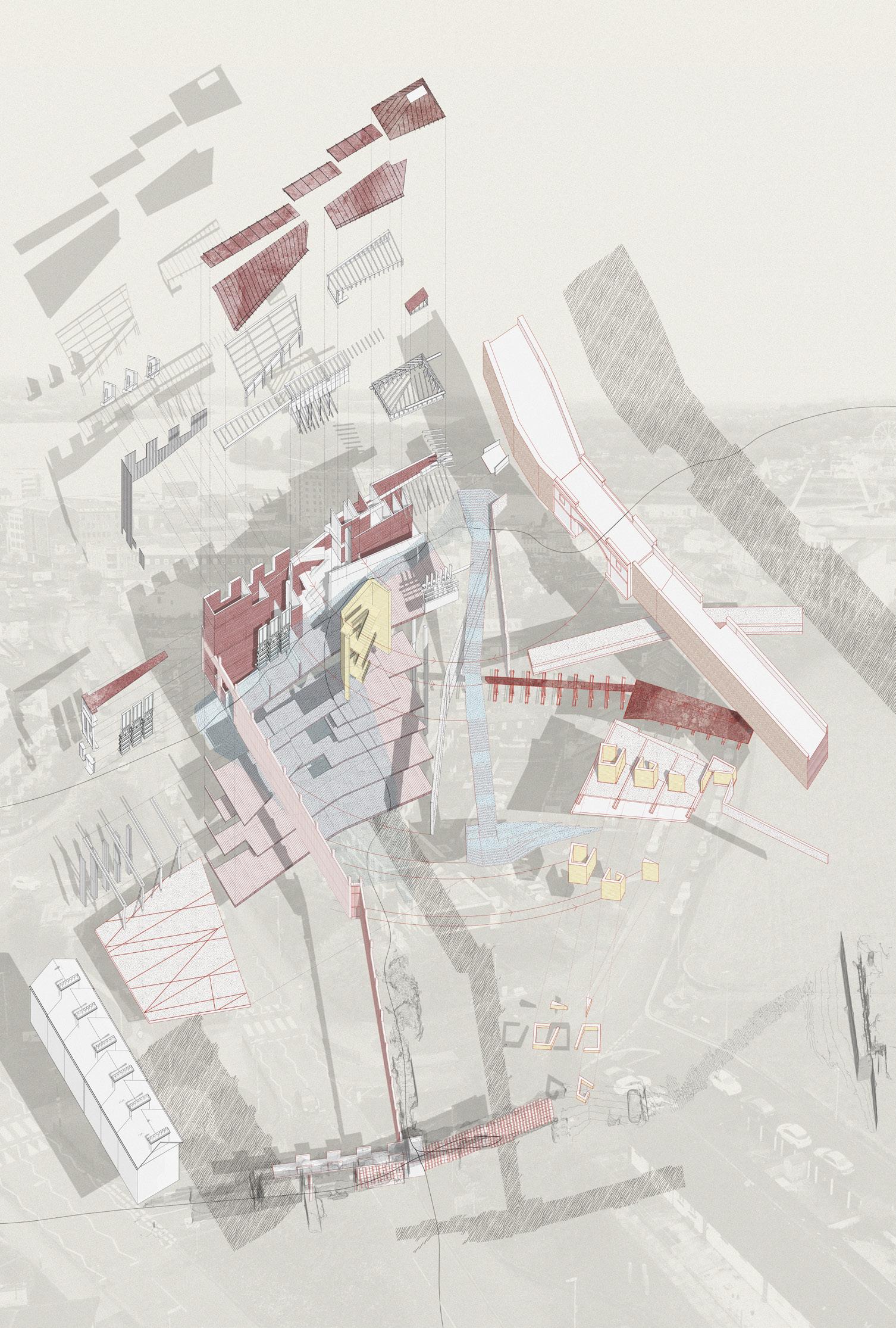
The core idea for this ESALA MArch studio has been to research ‘edge effects’, (changes in population or community structure that occur at the boundary of two or more habitats) and the ‘in-between’ they generate, referred to in ecology as the ‘ecotone’, (a region of transition between two biological communities).
We contextualised this research in the natural and constructed world by looking at the layers which underpin the city of Derry across a series of different time-periods.
The old walled city of Derry lies on the west bank of the River Foyle, which is spanned by two road bridges and one footbridge. The city now covers
3 IAIN SCOTT AND MARK BINGHAM | THE CITY WITH TWO NAMES
Reflecting Proximal Memory
 Hamish Jackson
both banks. (Cityside on the west and Waterside on the east). This has been our canvas, our test bed for exploration, synthesis, and ideation.
As a studio we physically, digitally, and metaphorically walked our selected edges, uncovering, recording, unpicking and extracting narratives, as a springing-off point for a series of architectural and landscape propositions, driven by place-based, thesis-driven narratives. We have borne witness to the narrowing of the eco-tone of these urban edge conditions, at an ecological, sociological and urban level, where diversity and uniqueness is replaced by mono-culture and predictability.
Our activities have included group and individual working. We have talked, drawn, and modelled together, and worked intensively through a process of iteration. We have gathered in big data using digital tools and devices, but we have also slowed down and spent time embracing a physical process of field research, drawing and modelling.
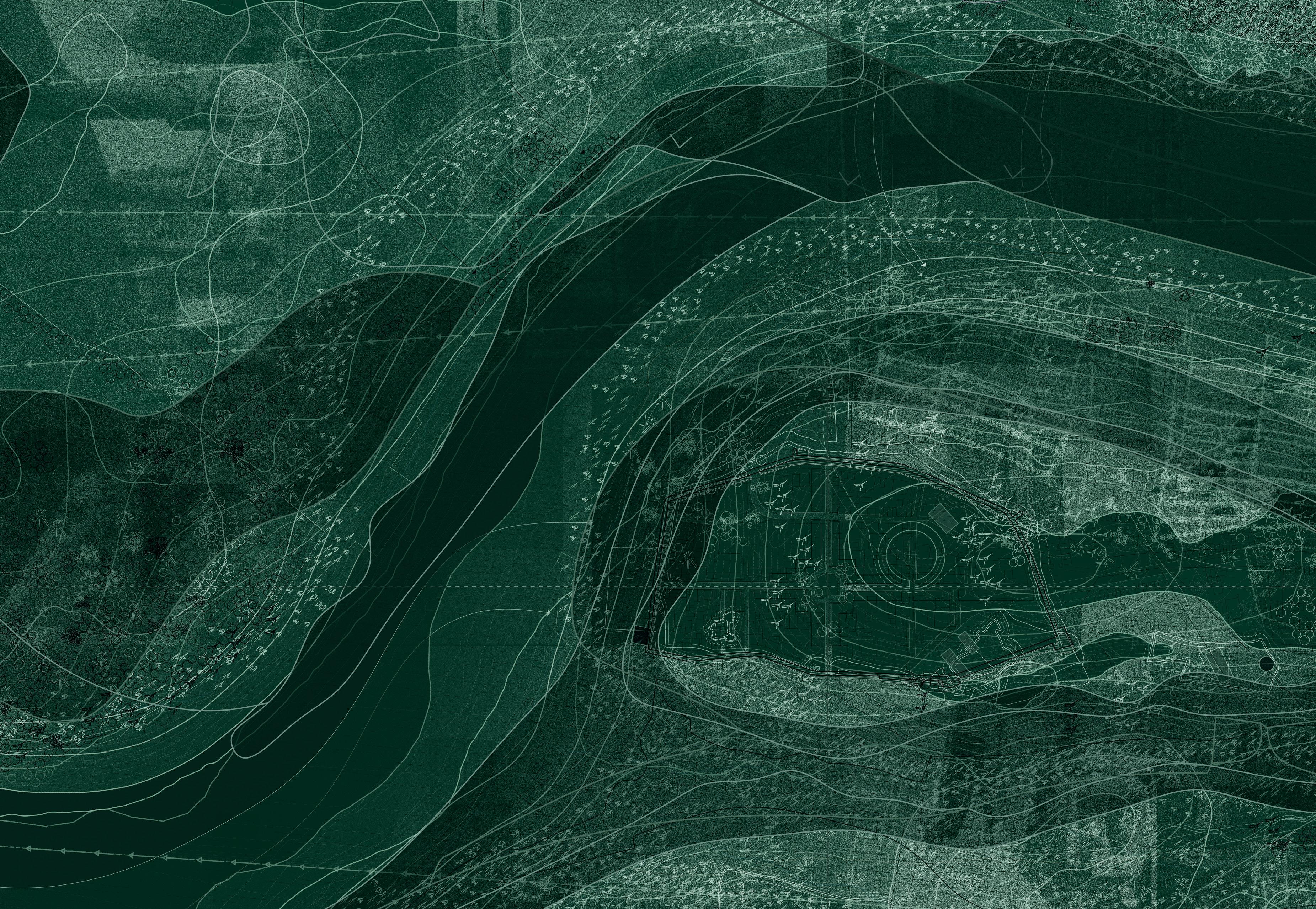
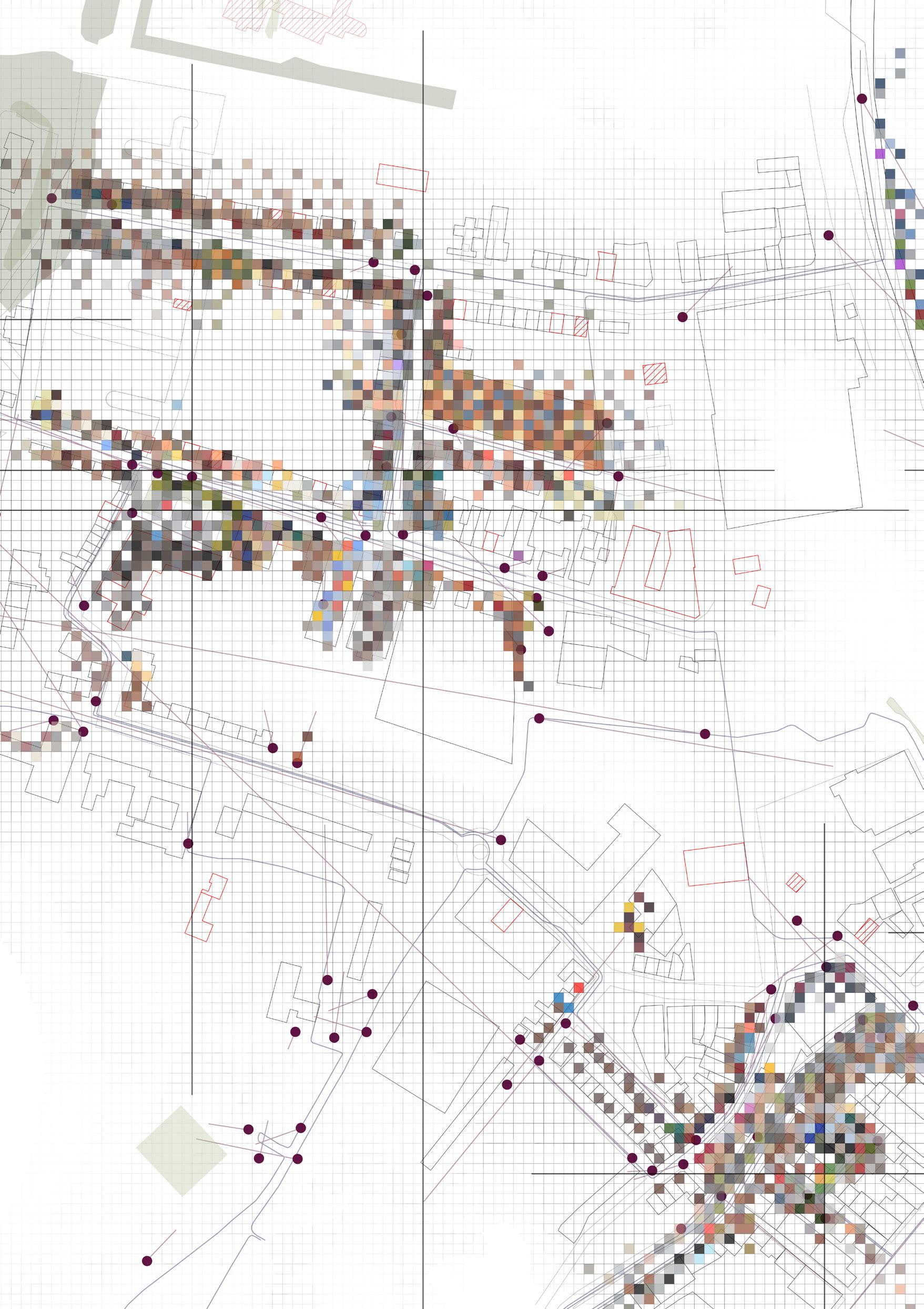
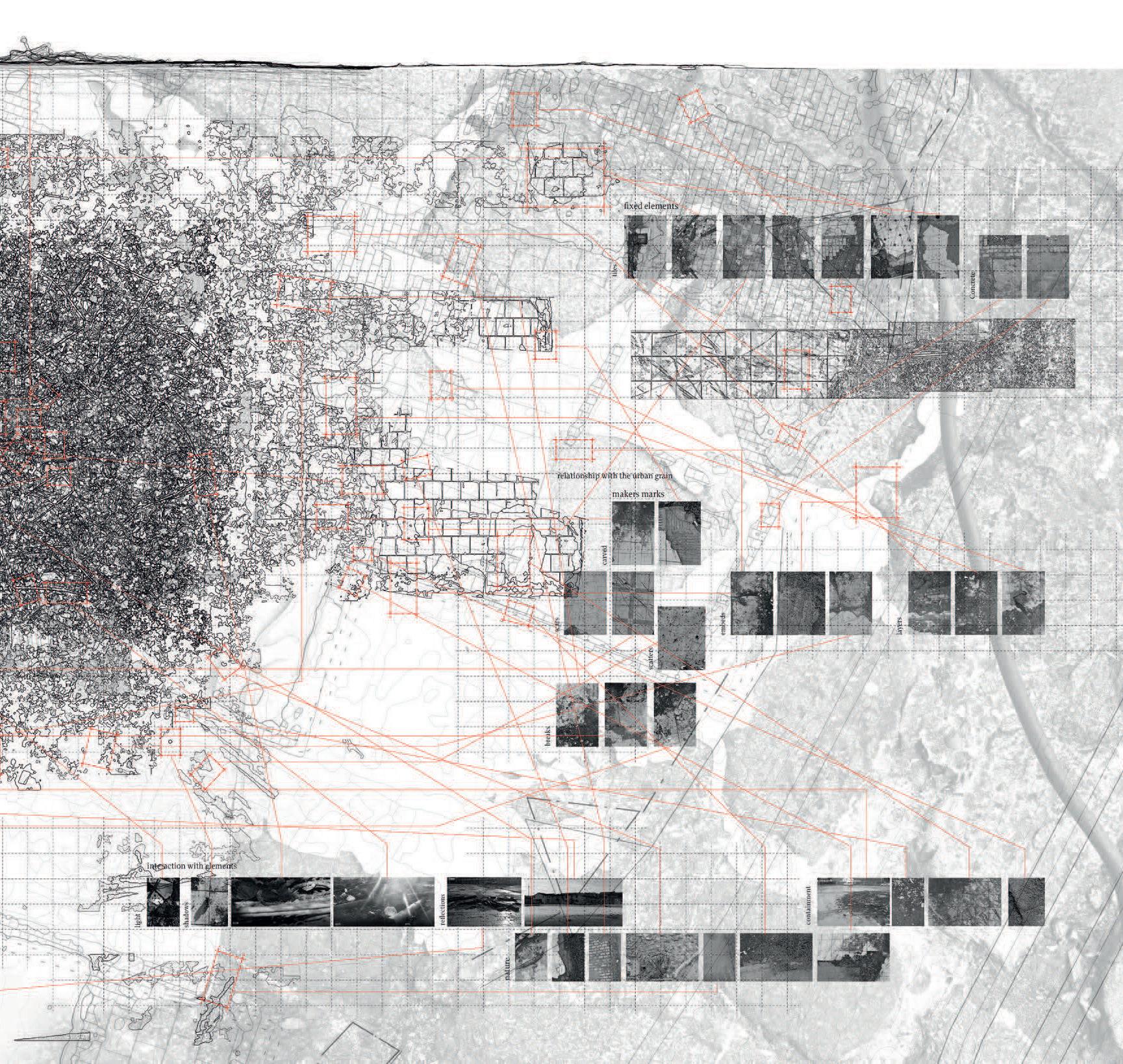
HARNESSING BIG DATA ACROSS EPOCHS
The digital world has great power, as well as distraction. It lacks scale, has no material quality and is perpetually changing. However, if controls and parameters are prescribed it can become a great asset, particularly for collective working and tasks involving mapping of phenomena and understanding the complex assembly of those phenomena with both accuracy and efficiency. We therefor began our research remotely using desktop processes which involved both physical and digital assets.
5 IAIN
AND
BINGHAM | THE CITY WITH TWO NAMES
SCOTT
MARK
Water, Earth Air, People
Becky Whitehead (and Armature 4)
WEAP DRAWINGS & INDIVIDUAL RESEARCH INQUIRY
Our first concern as a studio has been to find ways of recording, analysing and representing existing ‘edge effects’ or ‘eco-tones’. These existing edge effects have been found to operate within physical, socio-political, environmental and technical realms.
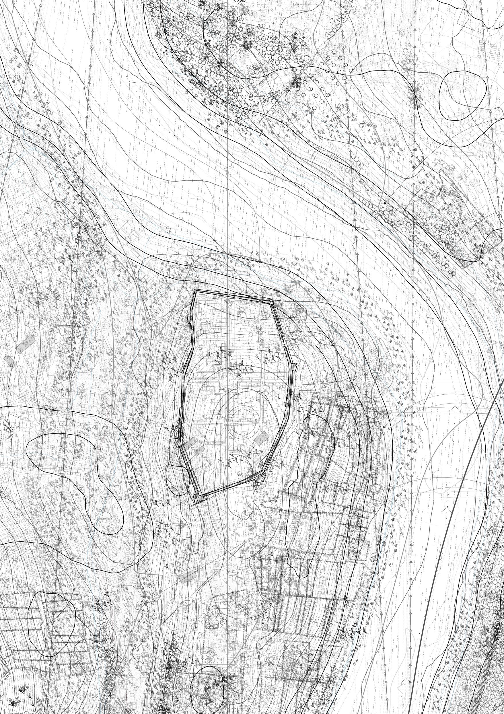
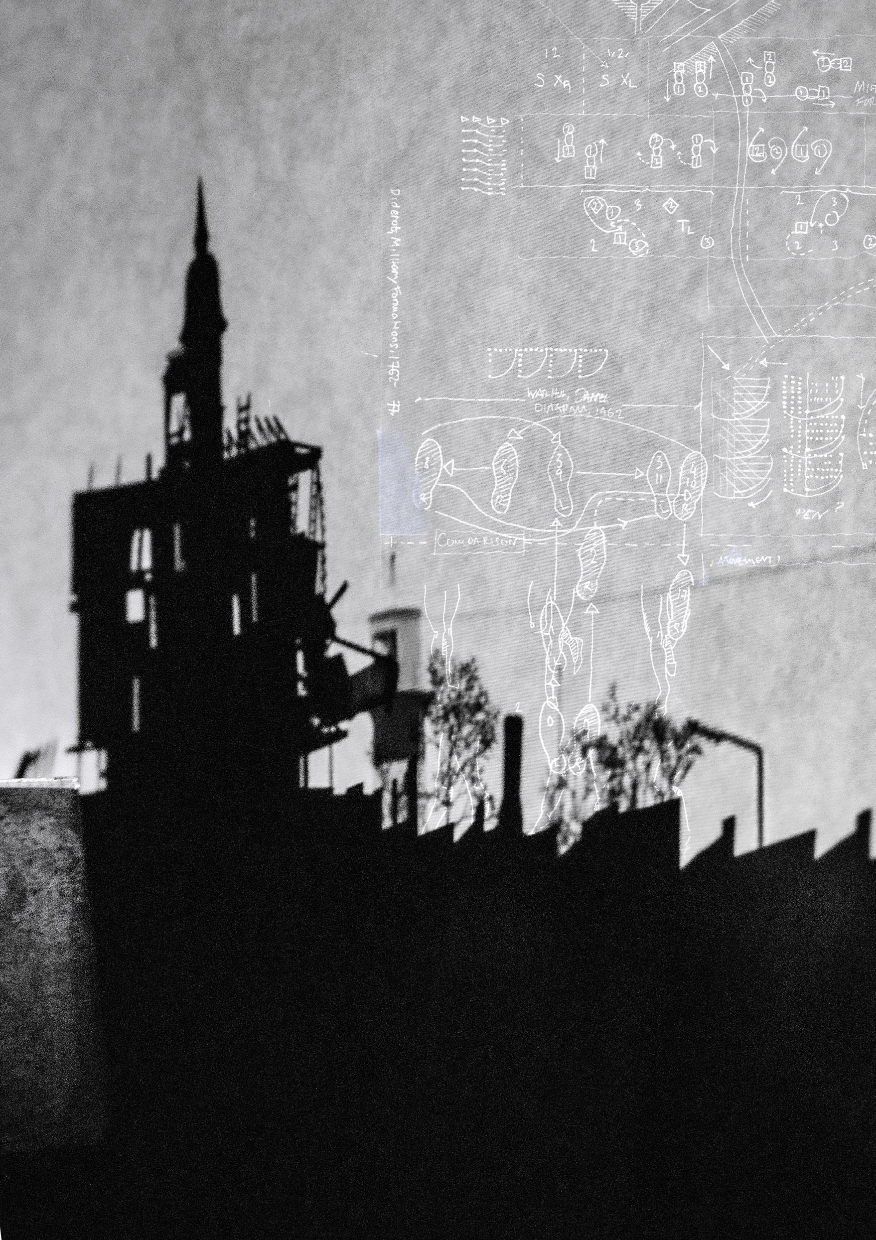
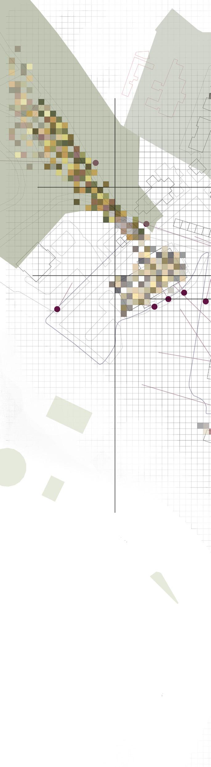
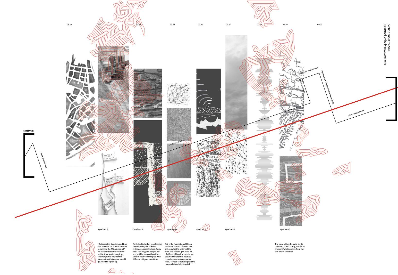
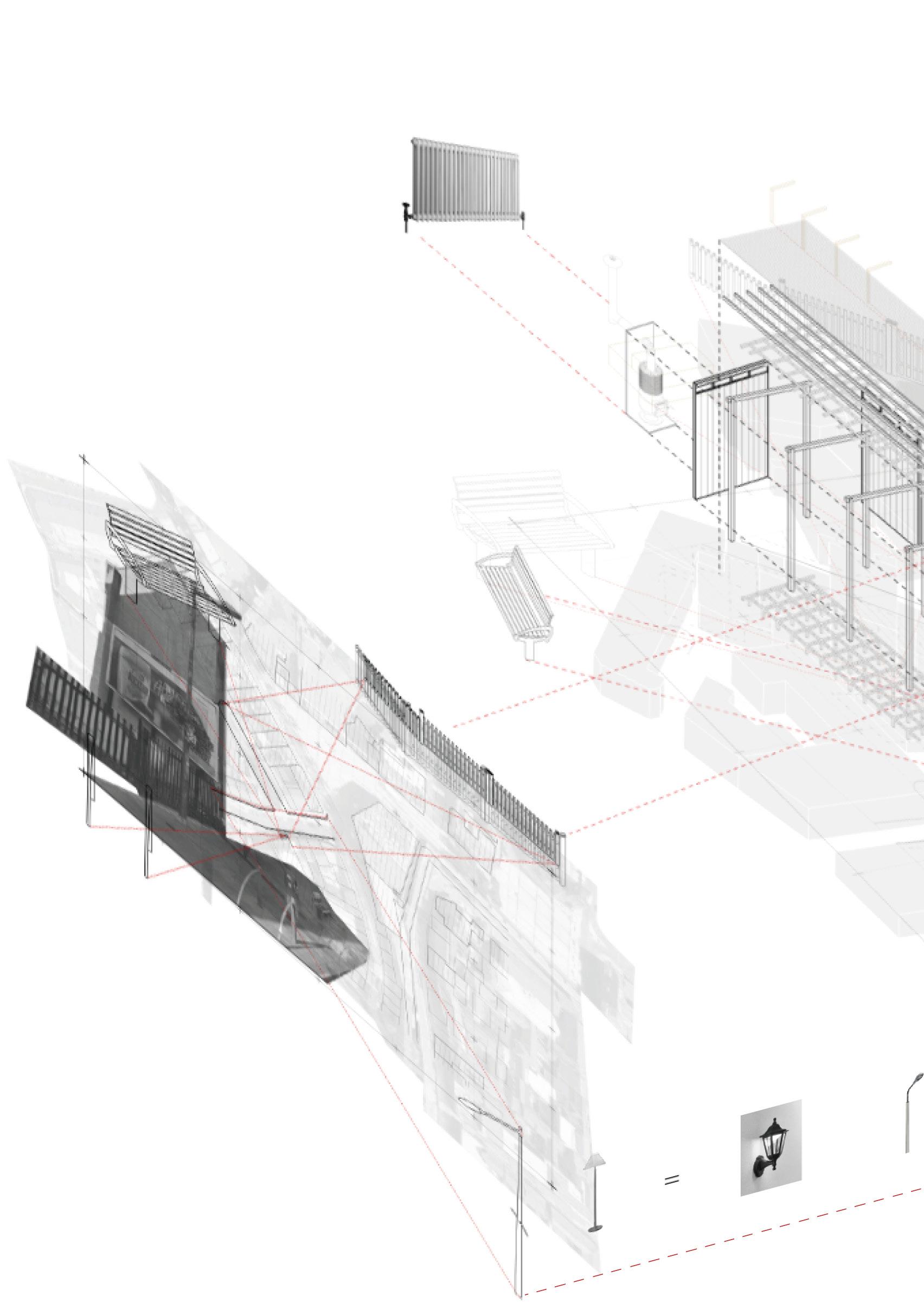
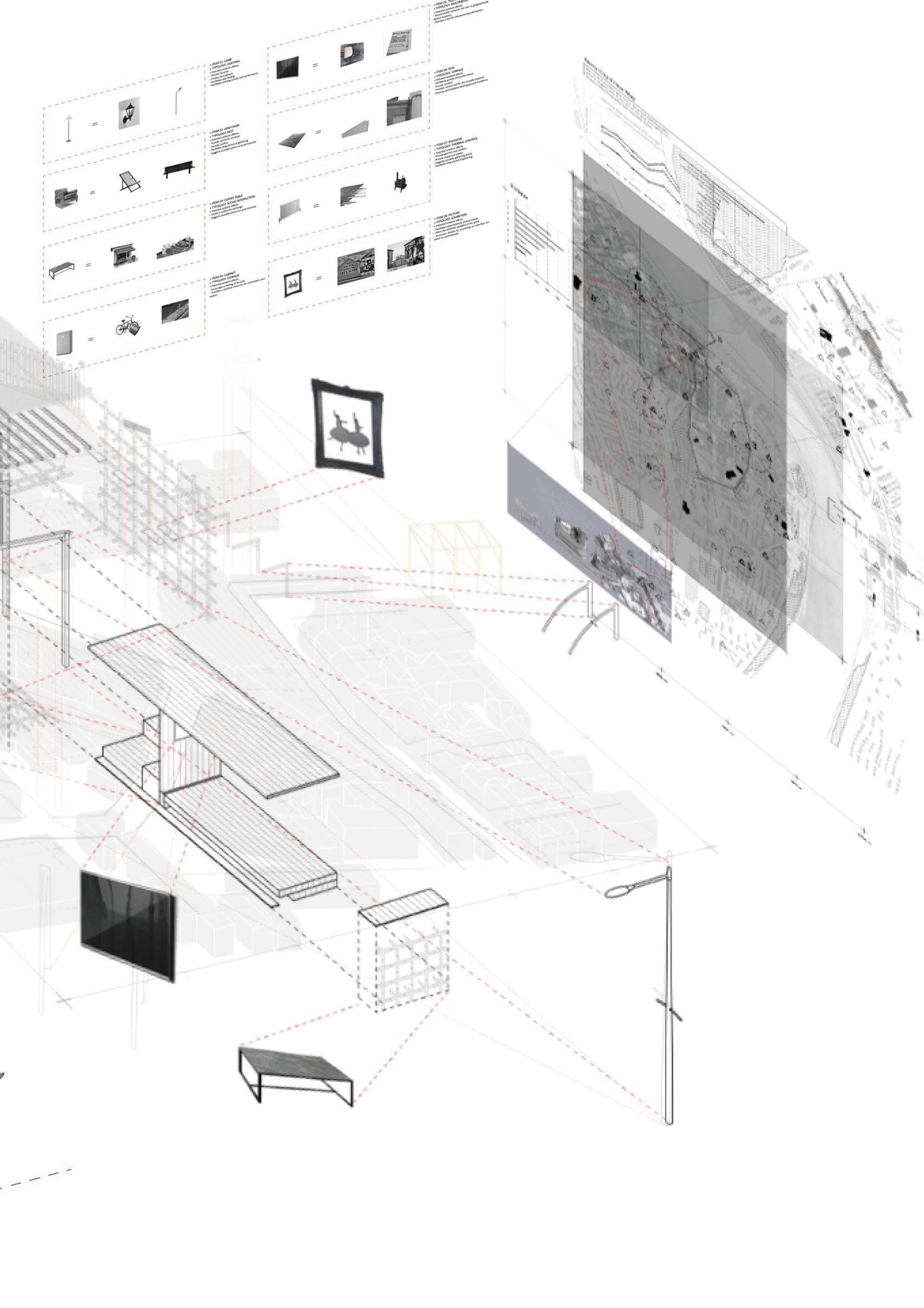
Beginning with an exhaustive desktop process we carefully researched, constructed and drew a series of maps within 4 pre-determined land armatures, each incorporating one quarter of the walled city, which we framed as ‘WEAP’ drawings, recording the environmental phenomena of Water, Earth, Air and People across four principal time-zones. Namely agricultural, industrial, post-industrial and digital (the present). This exhaustive data set, produced through an iterative process over a number of weeks, allowed for a broad but critical understanding of the interaction of these various phenomena over time in the city of Derry.
The WEAP drawing data set also allowed for individual students to establish their own distinct research ‘lines of inquiry’ through a critical analysis of various combinations of layers, eventually leading to a set of bespoke, group and individual research outputs, incorporating key layers of the WEAP and supplemented by group and individual research and analysis. A series of short analytical films, presenting each student’s interpretation of the WEAP was another key early output, in the interests of establishing a range of methods of representation. Lastly we introduced the idea of a post-graduate ‘thesis’ project. A thesis being by definition ‘a tentative explanation for a particular phenomenon’ to be proven or disproven by research. In the context of the architectural project, the thesis is defined by the early research inquiry, to be substantiated or proven through an iterative process of research, analytical thinking, creative propositioning and technical research and synthesis.
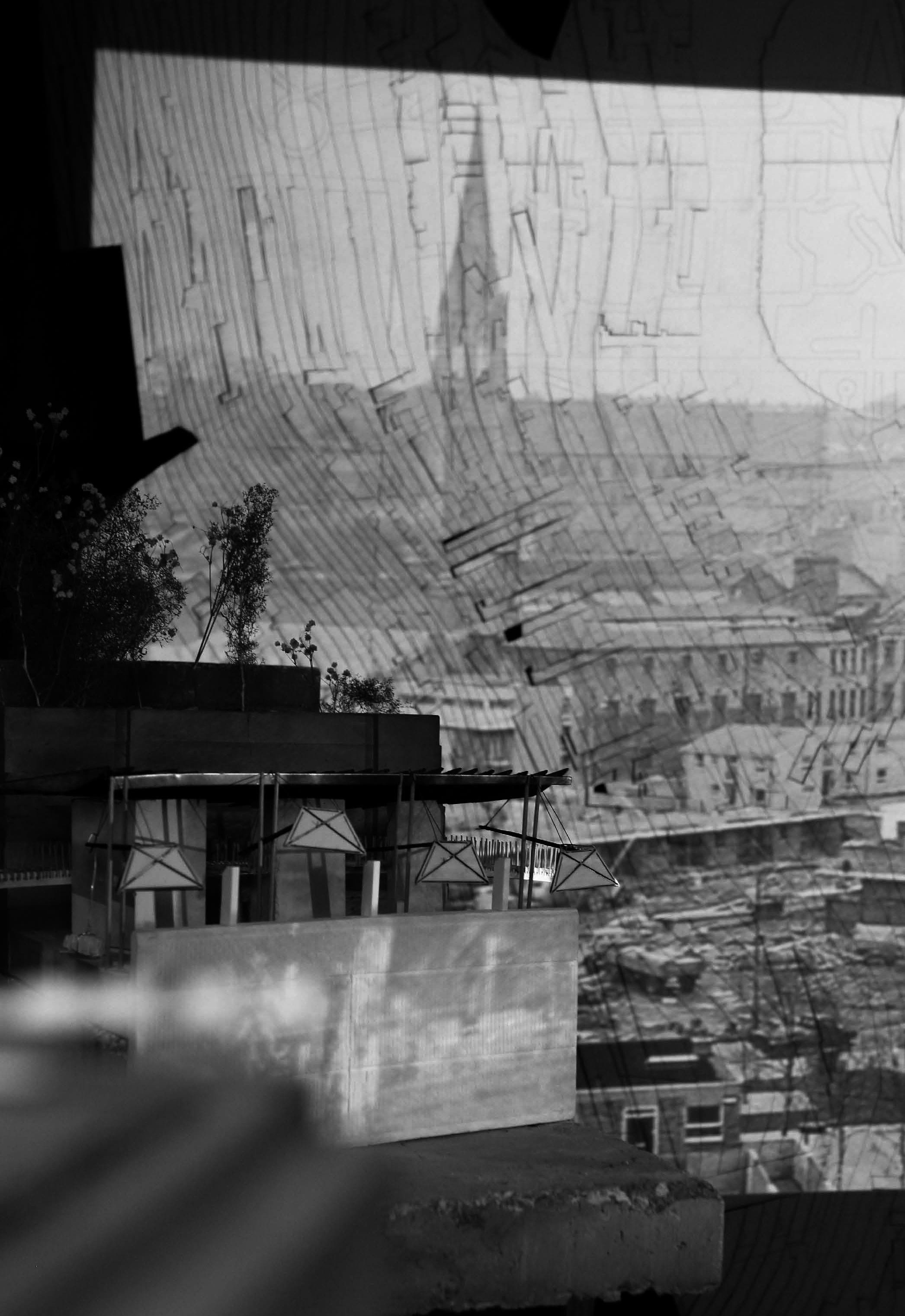
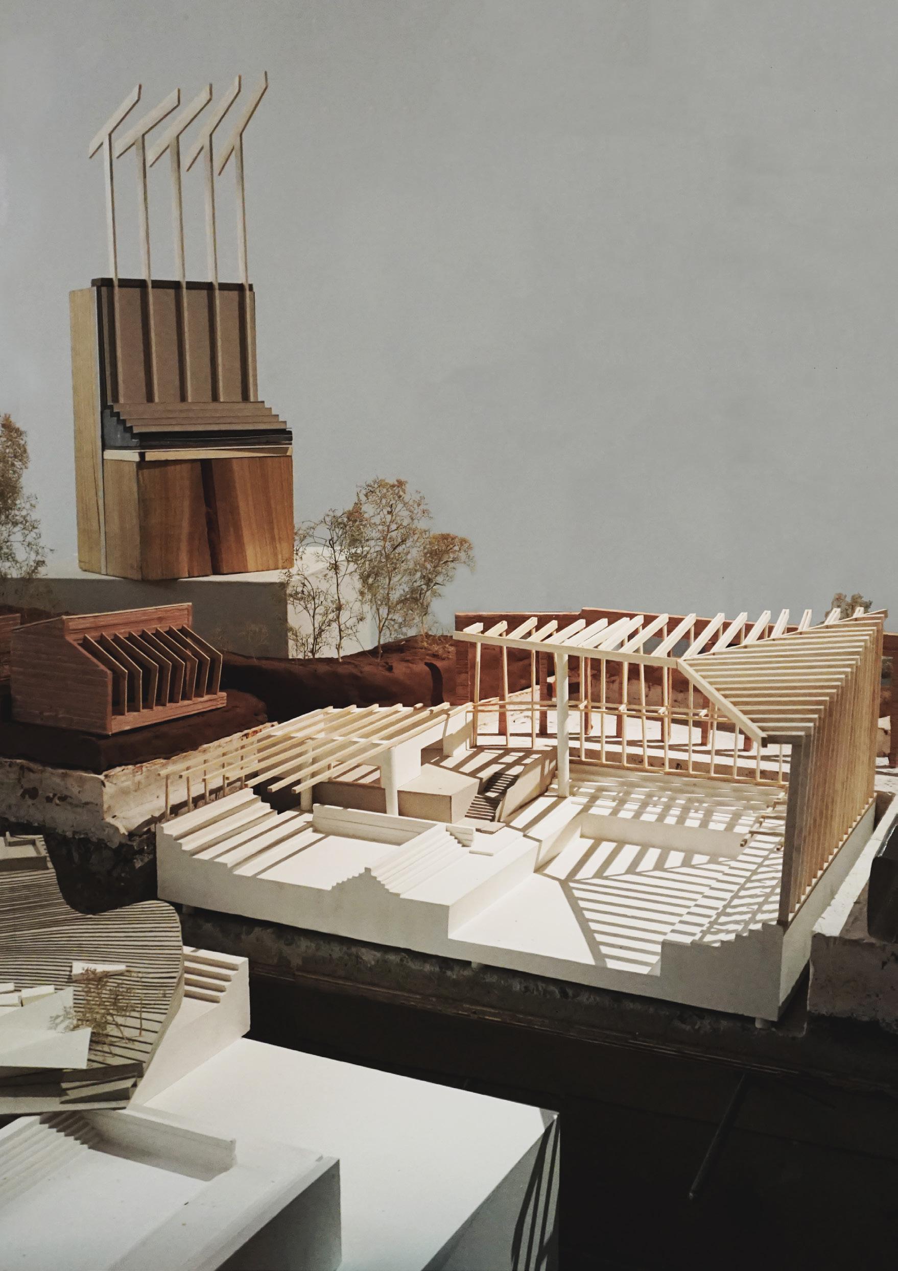
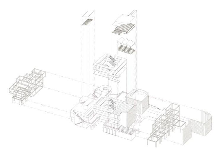
One of the key pedagogical tools employed in semester 1 was the concept of ‘putting yourself at the centre of the brief’ allowing for each student to critically position themselves in relation to the themes and methods proposed, further establishing a post-graduate ‘taking of ownership’ of the studio prerogatives. Lastly, as a group we designed and produced a 1:500 Derry city model of the 4 land armatures, with the walled city or ‘Diamond’ at its centre, to be used both as a working and presentation tool over the course of both semesters.
7 IAIN SCOTT AND MARK BINGHAM | THE CITY WITH TWO NAMES
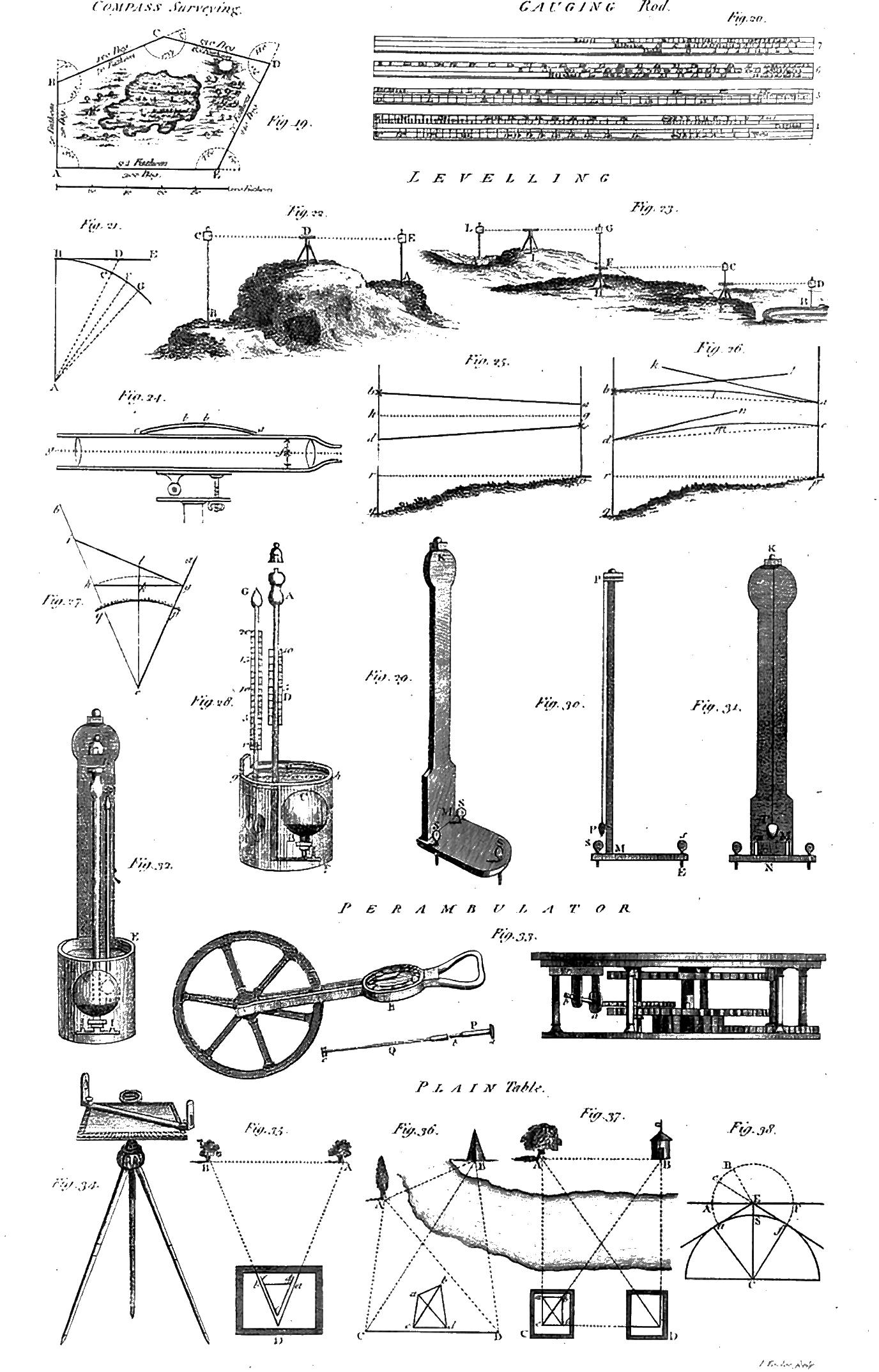
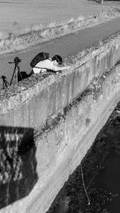
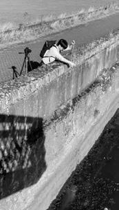
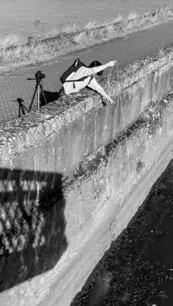
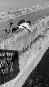
Surveying Instruments Parker, D
FIELDWORK - AN IMMERSIVE PHYSICAL PROCESS
A physical and immersive process was a requirement of field trip activities, with students employing bespoke, place-specific techniques and tools for their work in the field. These tools were to be seen as deeply personal to the researcher, their concerns and the process of inquiry, the equivalent of a particular musical instrument to a musician, or a canvas to a painter. To become deeply entangled with individual cognitive process. By asking students to work in this way, slow down and take an immersive route, students were able to focus more clearly on the limits and potential of the tools being used, to generate bespoke forms of data and creative outputs, specific to lines of inquiry and personal concerns.
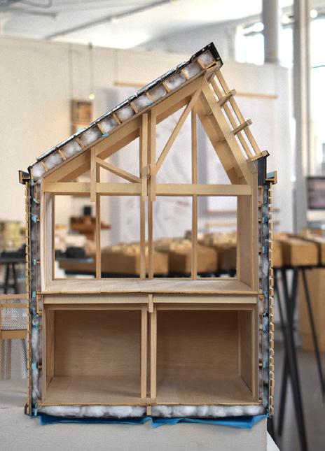
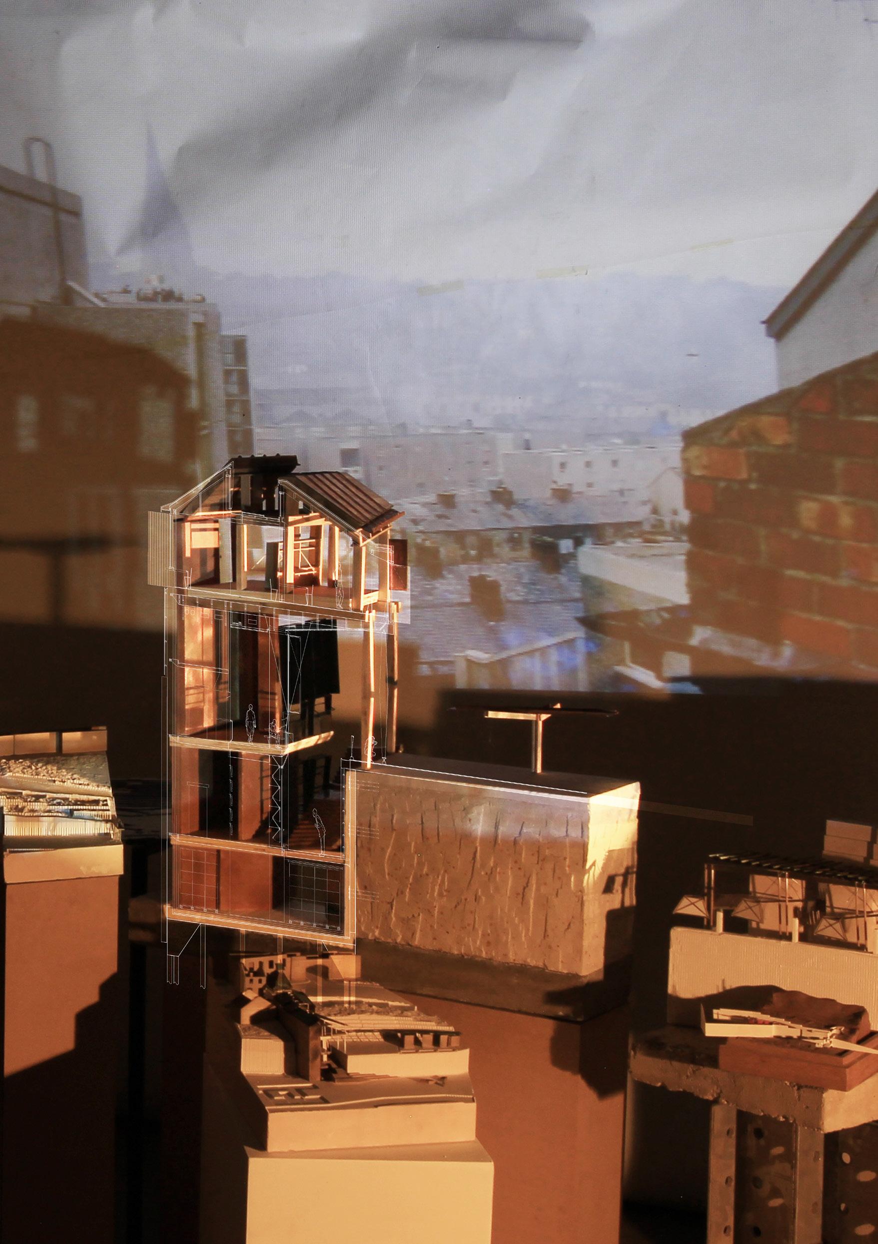
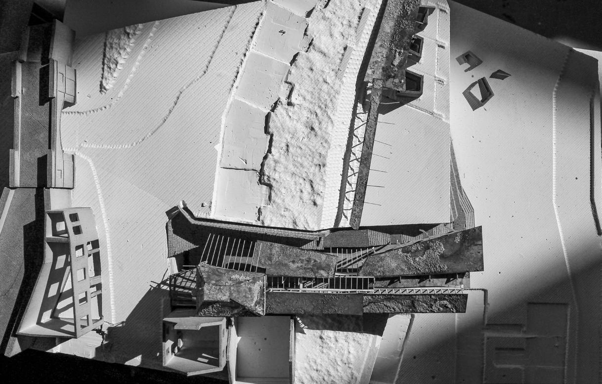
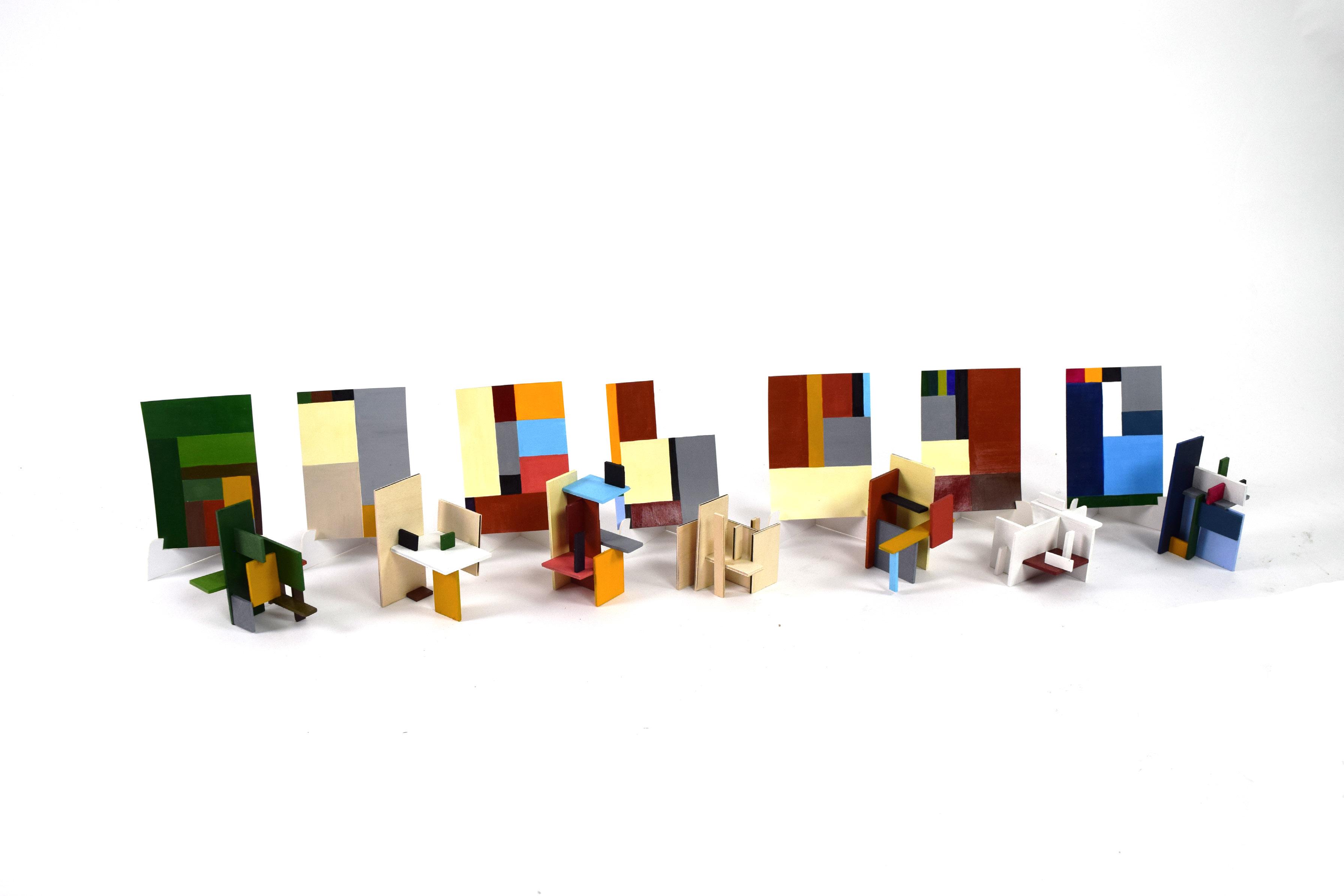
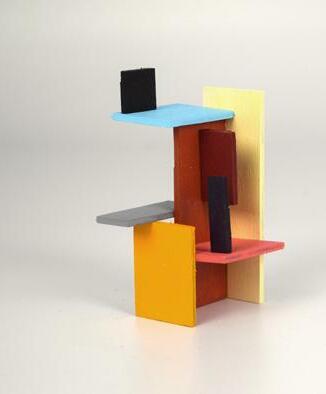
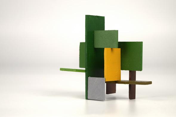
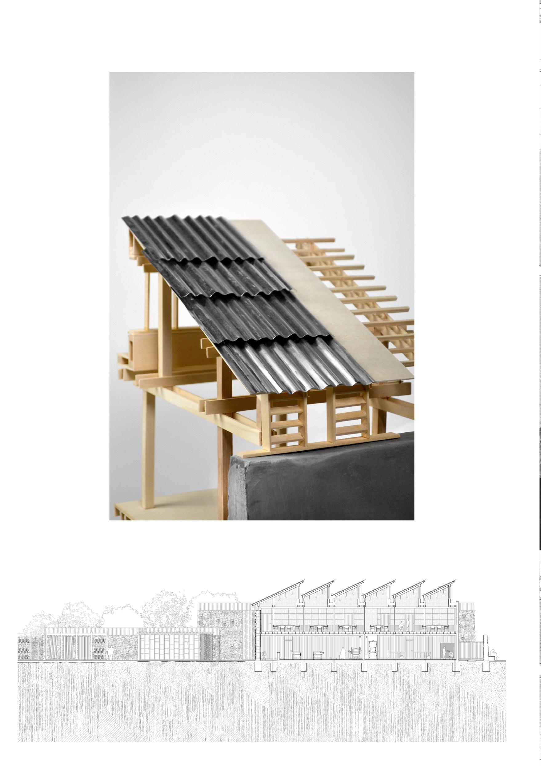
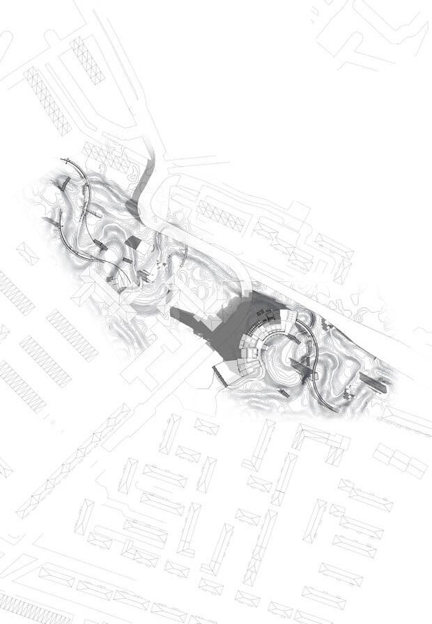
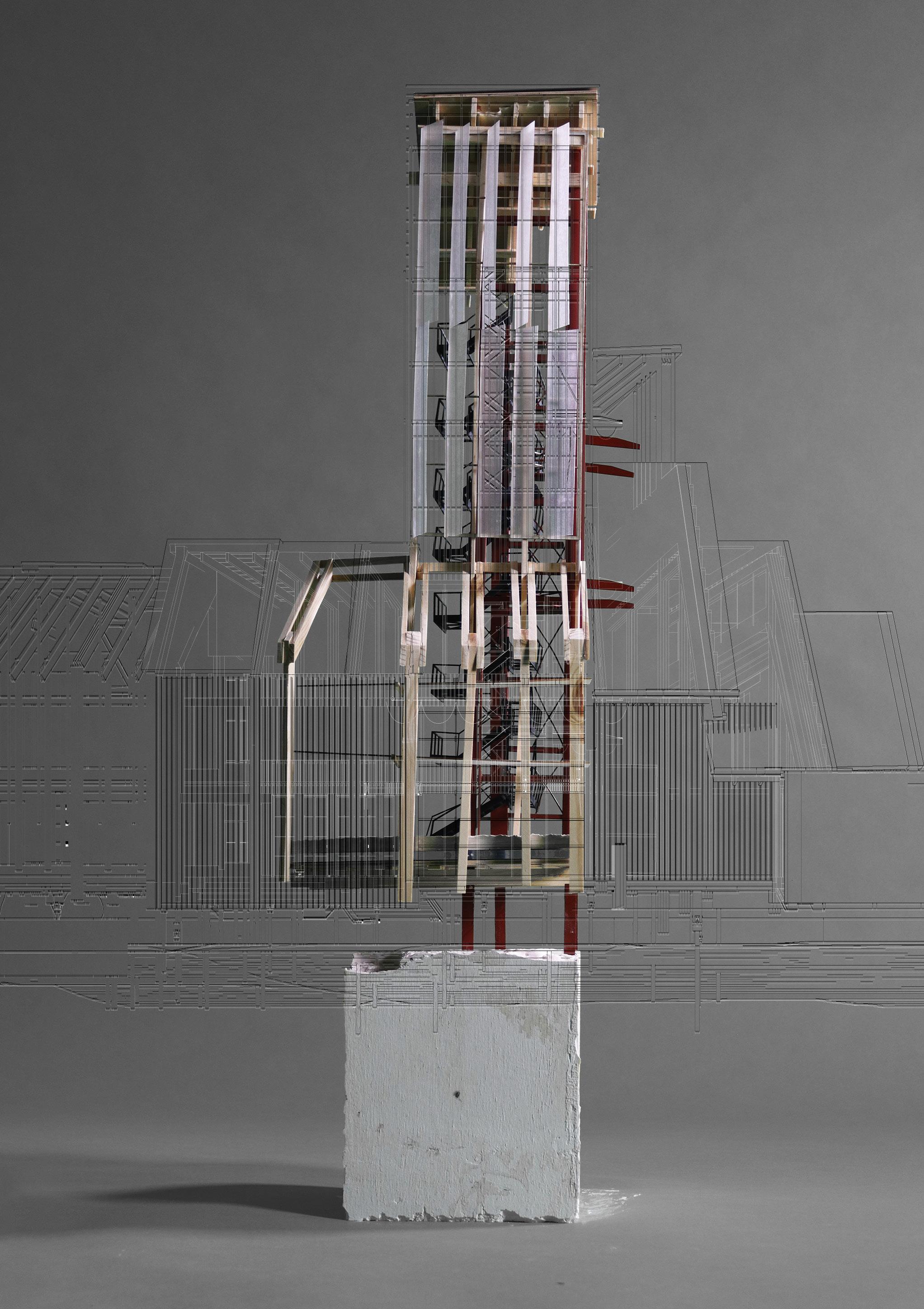
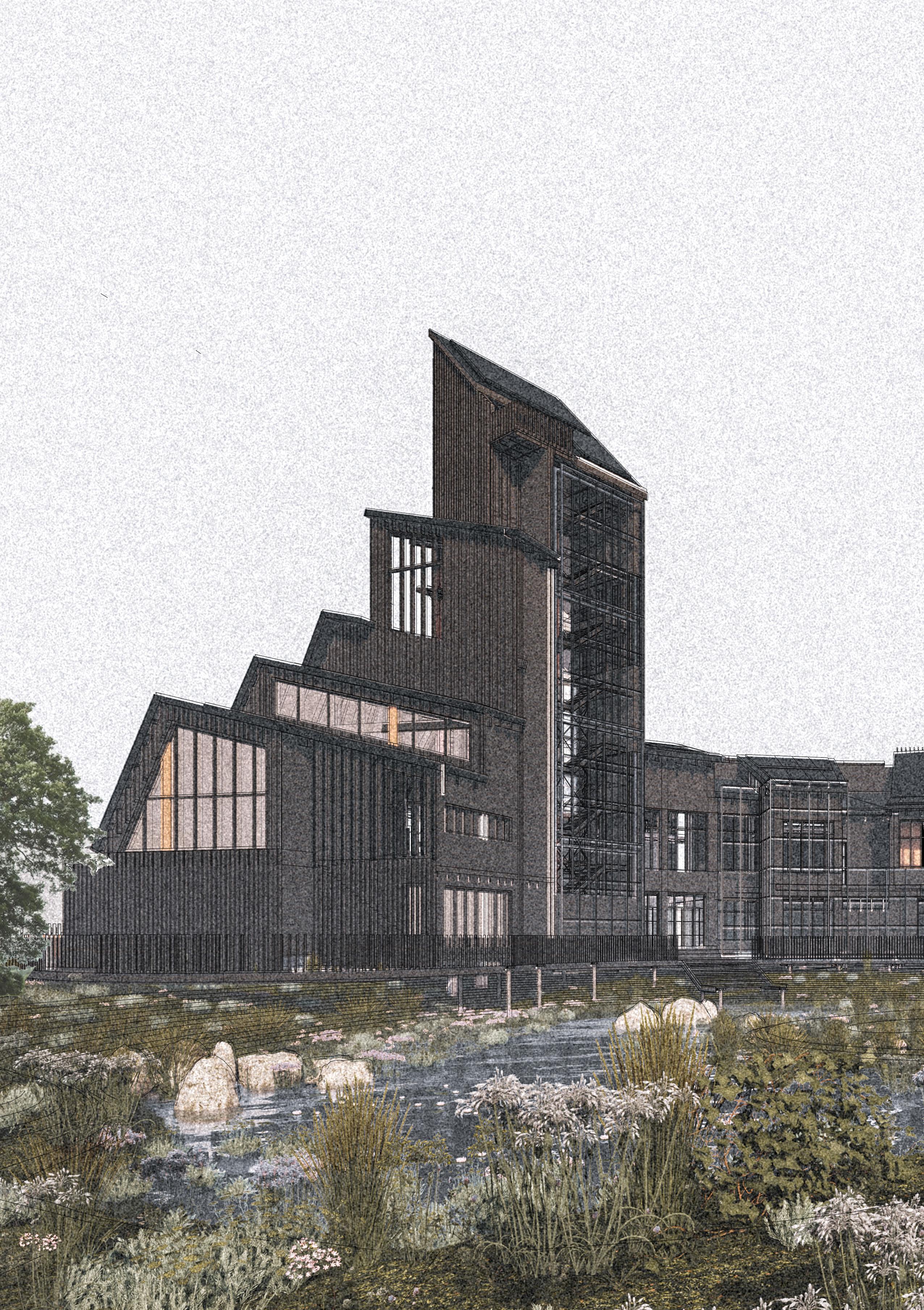
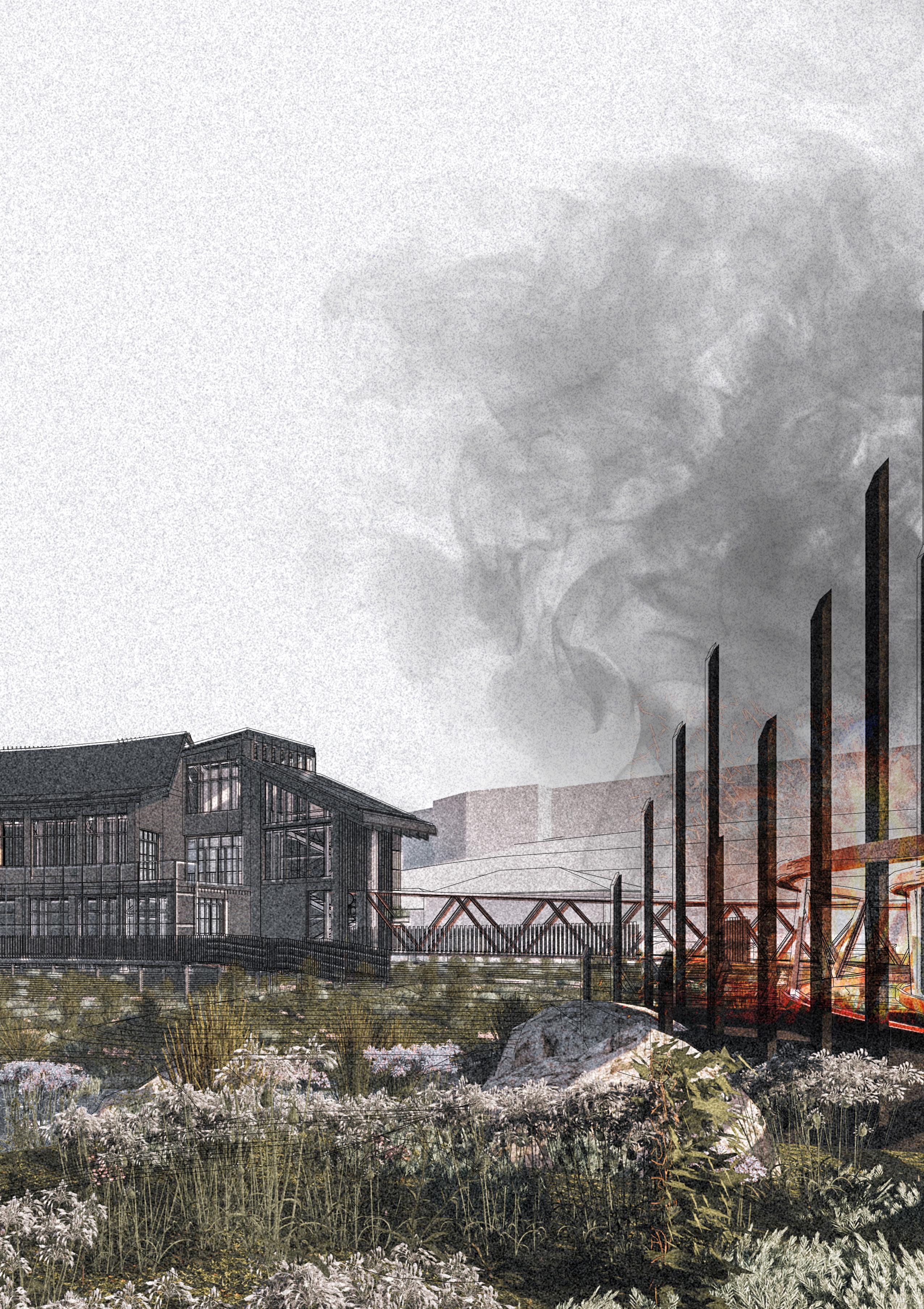
EDGE STRUCTURES: A TEST-BED PROJECT OF THE ‘IN-BETWEEN’
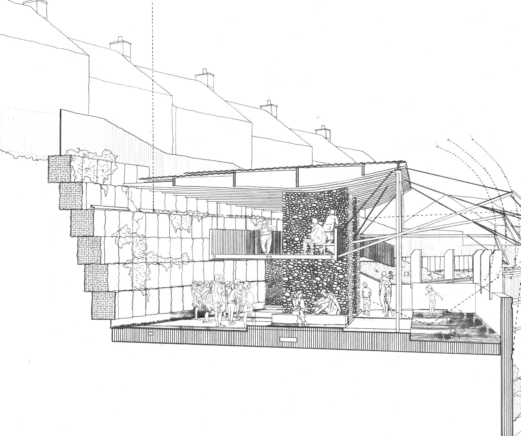
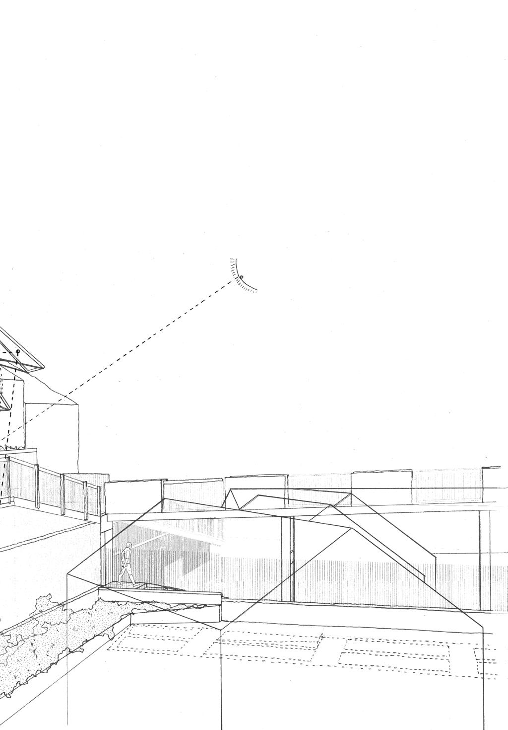
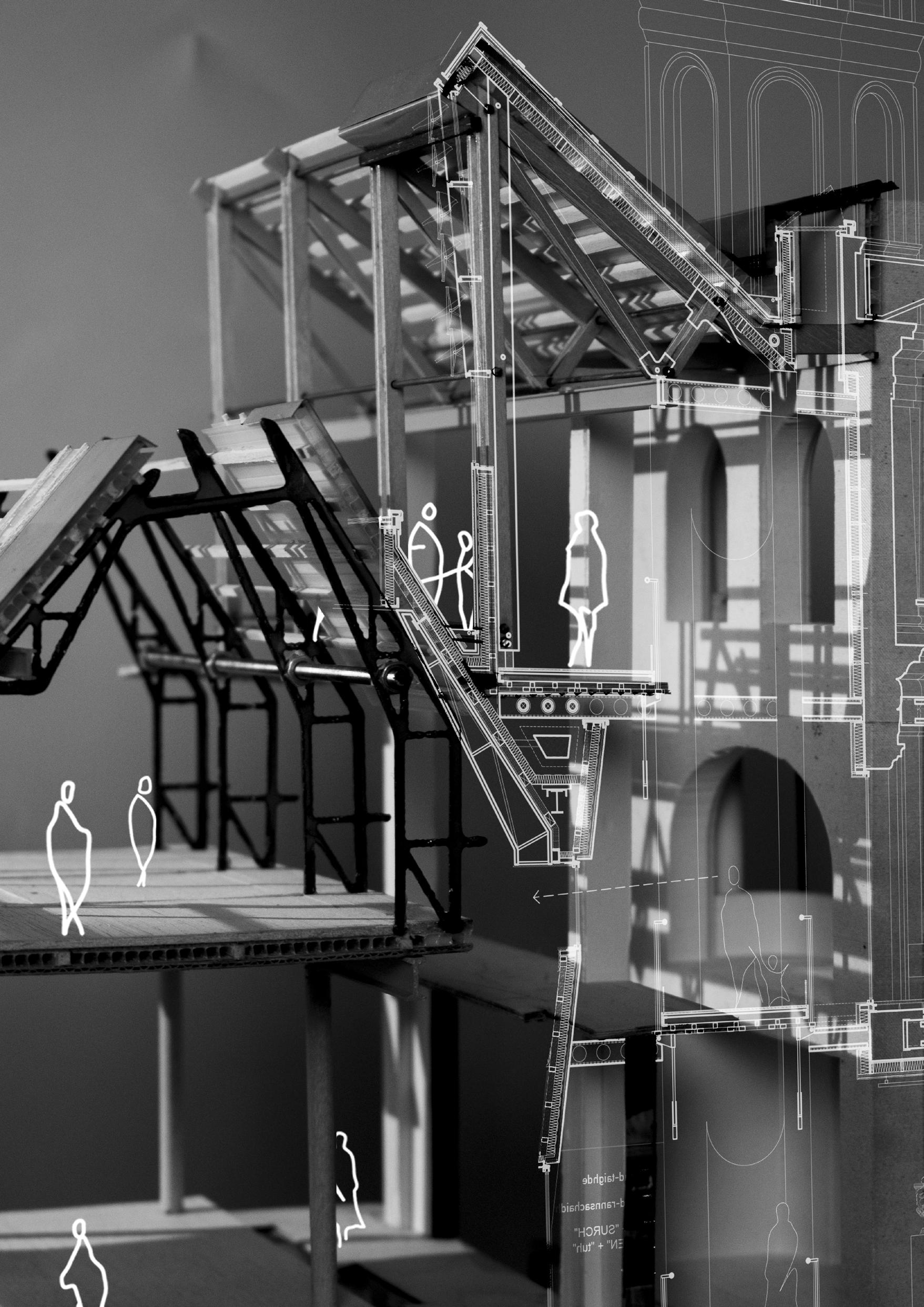
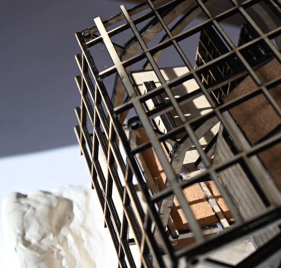
Following our field trip we began to consider more carefully the selected edge where we would propose an architectural intervention, (which we titled an ‘edge structure’), the central premise being that through a careful manipulation of the site, ground, and a selected set of architectural elements and components we could enhance, subvert or transform the existing edgeeffect previously uncovered. We constructed and drew thoughtfully crafted models and drawings of the critical context related to the proposal. The ‘edge structure’ was not to be imbued with any pre-determined programme, although particular use patterns could be proposed by the individual designers. One pre-requisite was that the structure would harness some form of environmental force, potentially returning to one or more of the four themes of the WEAP, water, earth, air, people. The form, structure and materiality of the edge structure required to respond in a clear and considered way to the researched lines of inquiry. It was also the intention that the tectonic language employed by the edge structure would be capable of being re-assimilated in the second semester in a larger project for a public building sited inside, on or outside the Walls of Derry, the principal edge structure in the city. The ‘edge-structure’ was therefore to be seen as a ‘testbed’, laboratory project or prototype for the spatial, material, environmental and tectonic prerogatives of the semester 2 project. This could involve the assimilation and synthesis of a variety of approaches from conceptual concerns to relationship to landscape and context, environmental objectives, structural & material strategies, tectonics and construction of atmosphere.
9 IAIN
| THE CITY
SCOTT AND MARK BINGHAM
WITH TWO NAMES
 Derry Studio Drawing
Mark Bingham
Derry Studio Drawing
Mark Bingham
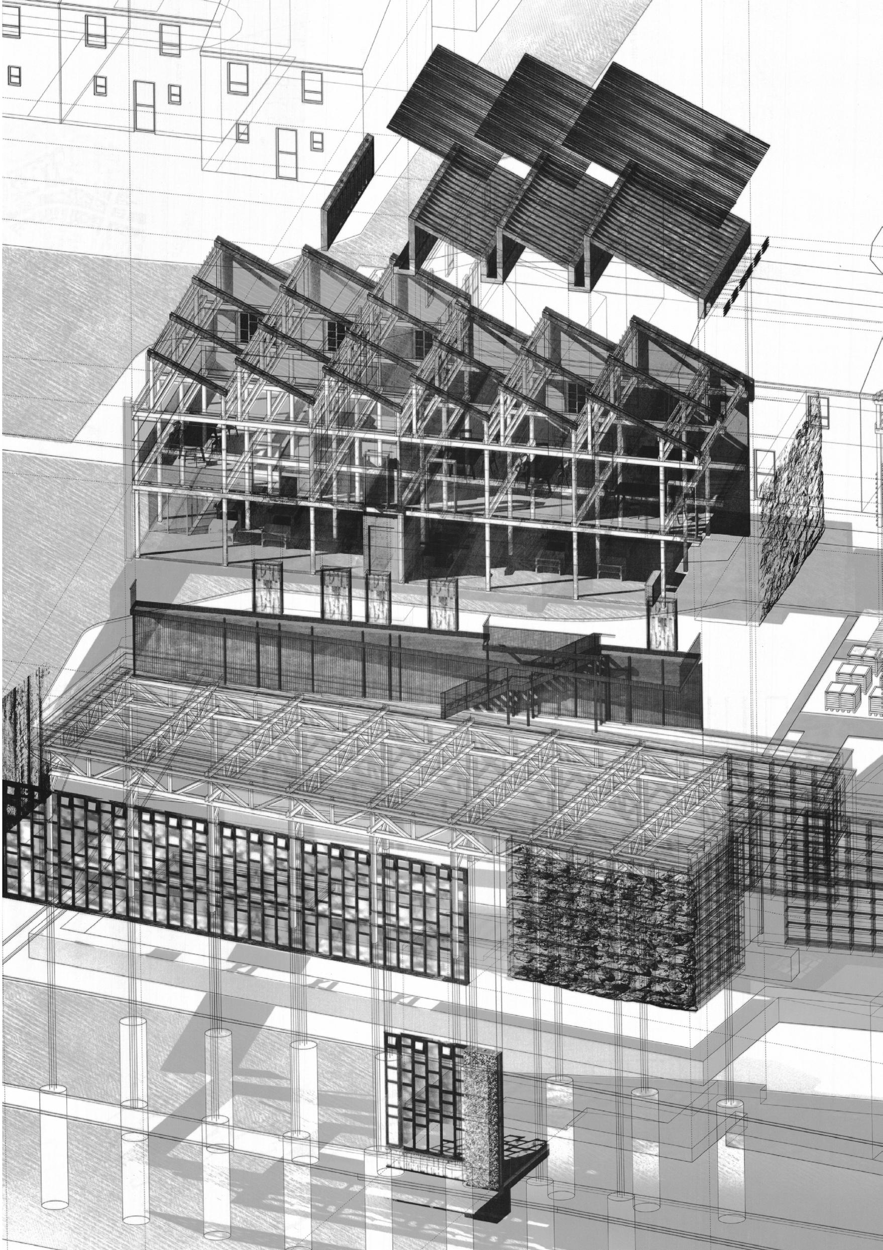
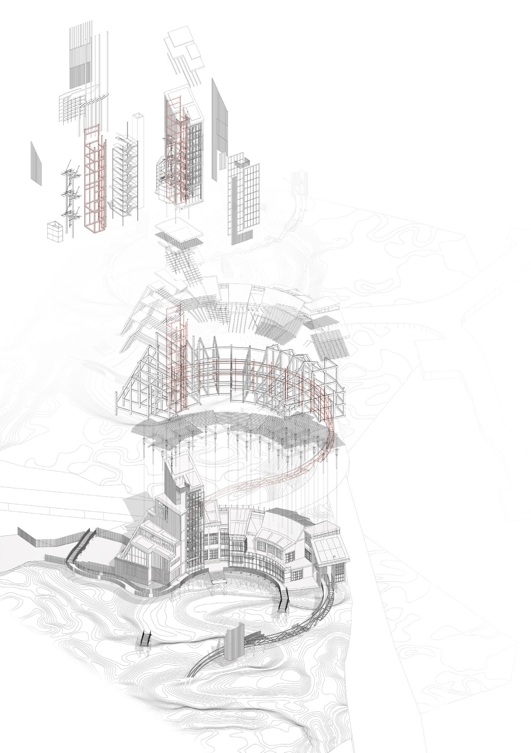
PRINCIPAL ‘IN-BETWEEN’ PROJECT
The site for the second project was required be positioned in a critical relationship to the principal ‘edge-structure’ in the city of Derry, ‘the Mother-Ship’, the walled city itself. A public building related to the themes of education, knowledge exchange and well-being which was calibrated to be Derry-specific and to allow students to further pursue the themes and prerogatives of their urban and architectural thesis. The engagement with the WEAP was to continue throughout semester 2 informing the concept, programme and spatial and material language of all projects. At the beginning we engaged with the WEAP at regional, landscape and urban scales. At this stage we developed our WEAP themes through individual projects at neighbourhood, building and body-scales. Work at these scales was required to carefully consider JJ. Gibson’s ‘Theory of Affordance’, particularly during the stage of ‘Detail Design for Human & Environmental Affordance’ and to consider the theories of Juhani Pallasmaa and Peter Zumthor in relation to the production of atmosphere. The working methodology in architectural design has involved continued production and representation through imagining, presenting and testing. Study models, two-dimensional and three dimensional architectural drawings and renderings, movies and walk-throughs have been used intensively as critical tools to reveal the projects. All of this work has been produced and displayed in studio. A series of engagements with other built-environment specialists has formed part of the studio programme during the second semester.
OUTCOMES
In a place as contested as the city of Derry, students have worked intensively to generate a thesis which responds to the issues which have presented themselves and been revealed through careful and painstaking research and propositioning.
A particularly rich series of thetic strands in a series of charged and contested locations have emerged including:
Prioritising the subjective nature of bodily experience and using the sensuality of textural surface as a mechanism to tell stories which do not continue former colonial narratives of power and empire in the pursuit of an architecture of touch; Acknowledging processes of Post-memory and considering how proximal and formulating events, in the past, present and future, occurring through Derry civic life, continue to influence and
11
|
IAIN SCOTT AND MARK BINGHAM
THE CITY WITH TWO NAMES
 Céide Hill, Reflecting Rossville
Hamish Jackson
Céide Hill, Reflecting Rossville
Hamish Jackson
define the urban behaviours of the city; Repairing the the inter-species, ecological communities damaged in the post-Anthropocene, through an understanding of the effects of non-native, human interventions and using creative concepts and locations inspired by Kerri Ni Dochartaigh’s book, ‘Thin Places’; Re-establishing and recalibrating a new urban, feminine ‘in-between’, once an established phenomenon in the city of Derry during its flagship days as a centre of female dominated craft process and linen production; Proposing the transformation and repair of the relationship between the city and its River Foyle to a place of ecological richness, human agency and well-being. A relationship broken by industrialisation and technological change in the 19th and 20th centuries; Imagining an architecture of renewal from the ashes of the Bogside Bonfire as a place for reflection, re-growth and re-use as part of a regenerated wetland, recalling the historic wet landscape of Derry’s bog; Translating and re-appropriating existing colonial typologies and motifs through concepts of irrational rhythm, indigenous structure and vernacular spatial sequencing inspired from Irish myths and literature; Traversing both the tangible and intangible edges of the ‘in-between’ of the Bogside and the old city walls to regenerate historic green and blue connectivity within a newly enriched ecotone, which forms part of an aquatic landscape of human well-being.
Architectural projects include an Assembly of Postmemory; centres of material re-use and recycling; synesthetic arts based workshops, exhibition and residence space; library and knowledge exchange programmes which recalibrate the relationship to historic walls within the city; an interspecies Guildhall; a sustainable transport hub; a forum of Irish language and gathering; programmes related to food production and consumption in the shape of markets, community kitchen and an urban farm; Programmes centred on strategies of ‘wild-swimming’ within re-wilded and ecologically enriched water based landscapes.
IAIN
| THE
13
Iain Scott & Mark Bingham
SCOTT AND MARK BINGHAM
CITY WITH TWO NAMES
 Céide Hill, Reflecting Rossville
Hamish Jackson
Céide Hill, Reflecting Rossville
Hamish Jackson
15
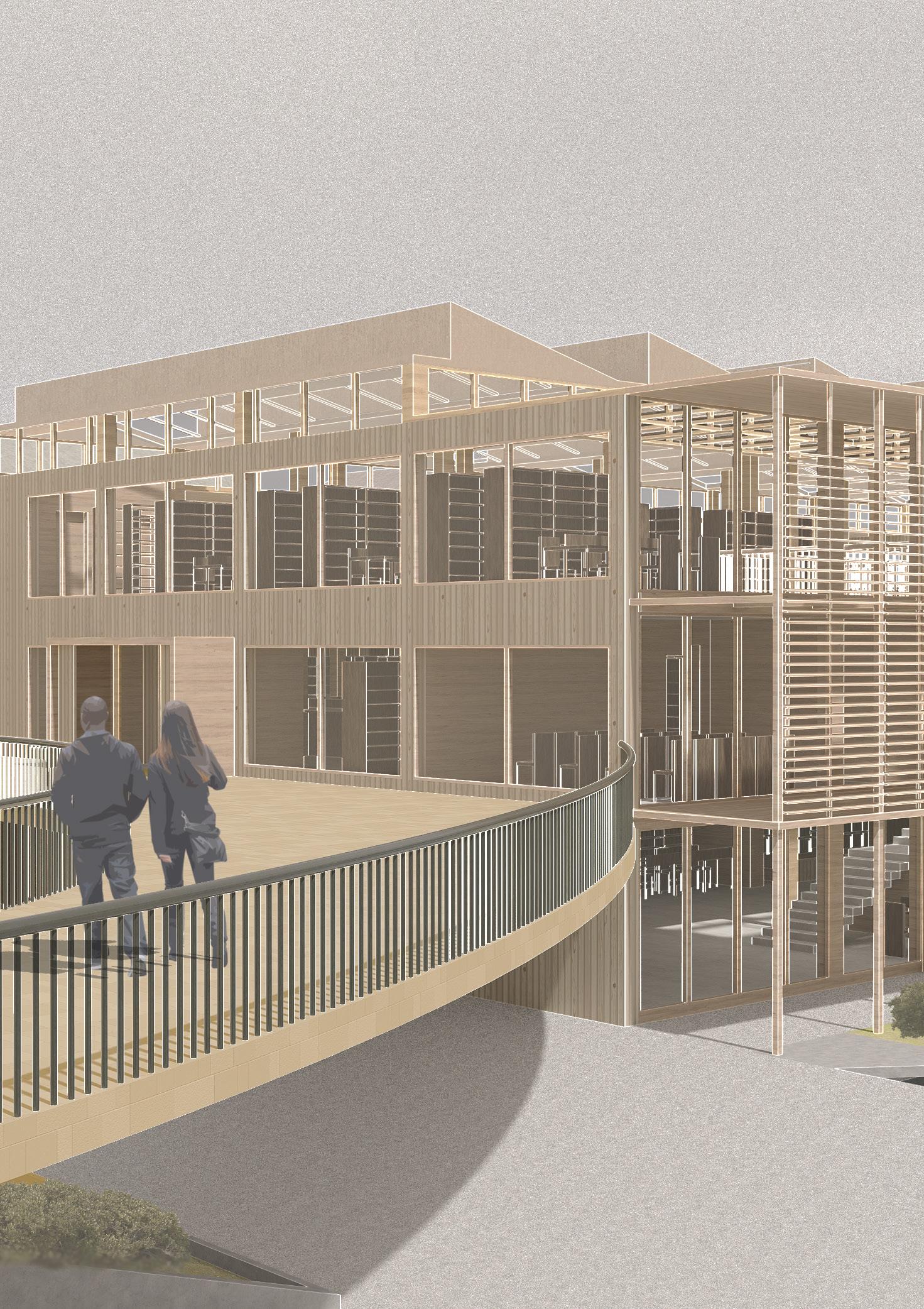
The Forum of Irish Language, Ebrington Square Reading Room Adam Blacknell
 Londonderry c. 1730, oil on canvas Van der Hagen, W
17
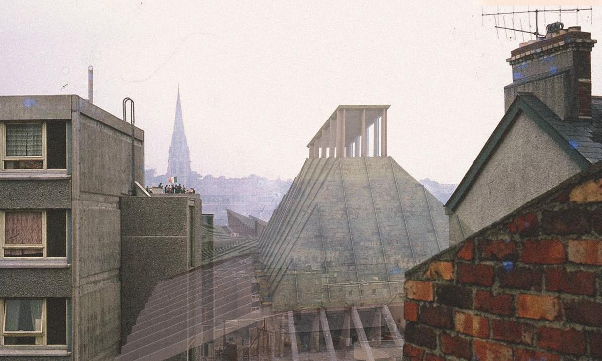
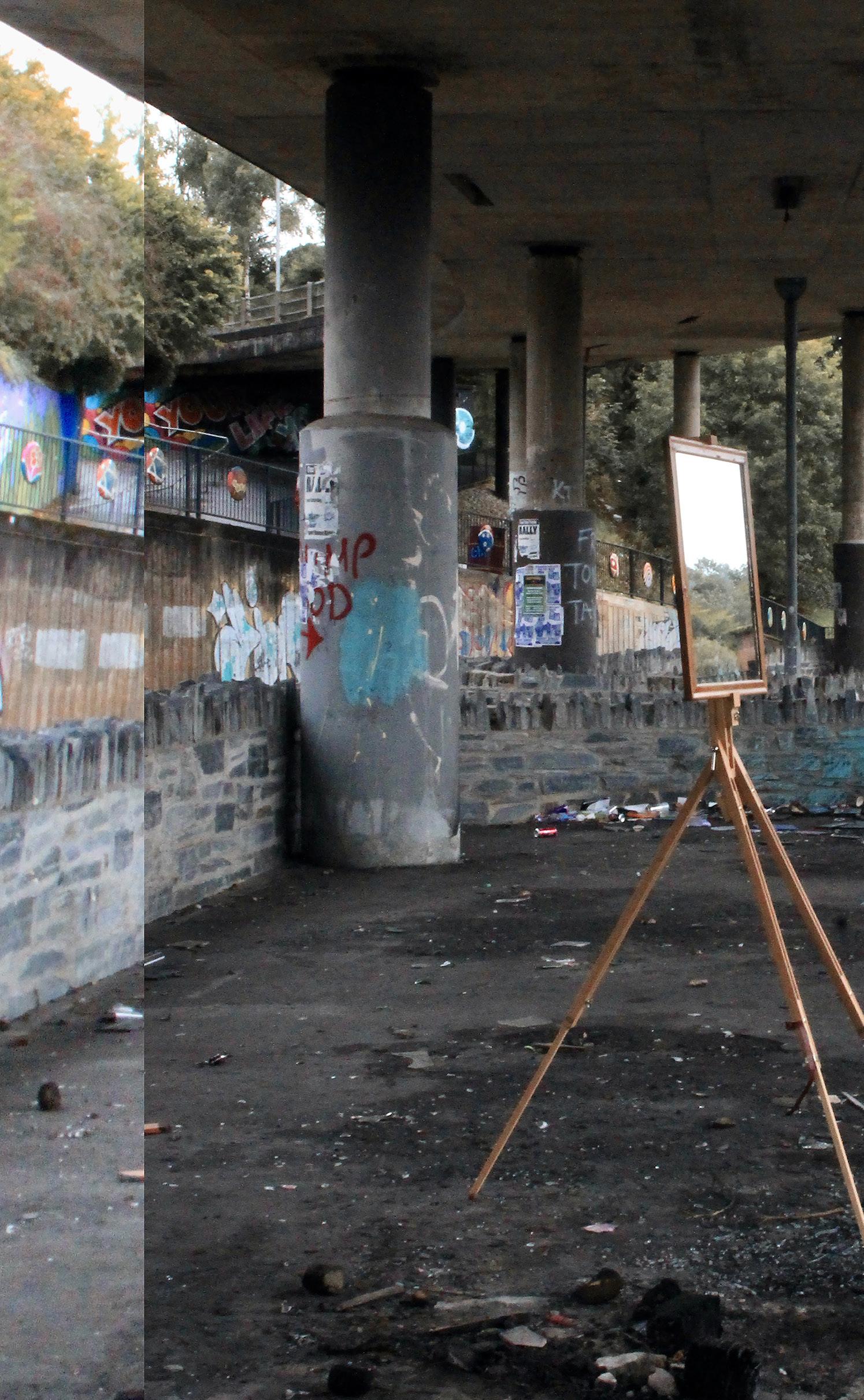 Reflecting Conflict Infrastructures, Lecky Road Flyover
Hamish Jackson
Reflecting Conflict Infrastructures, Lecky Road Flyover
Hamish Jackson
LONDON DERRY
19
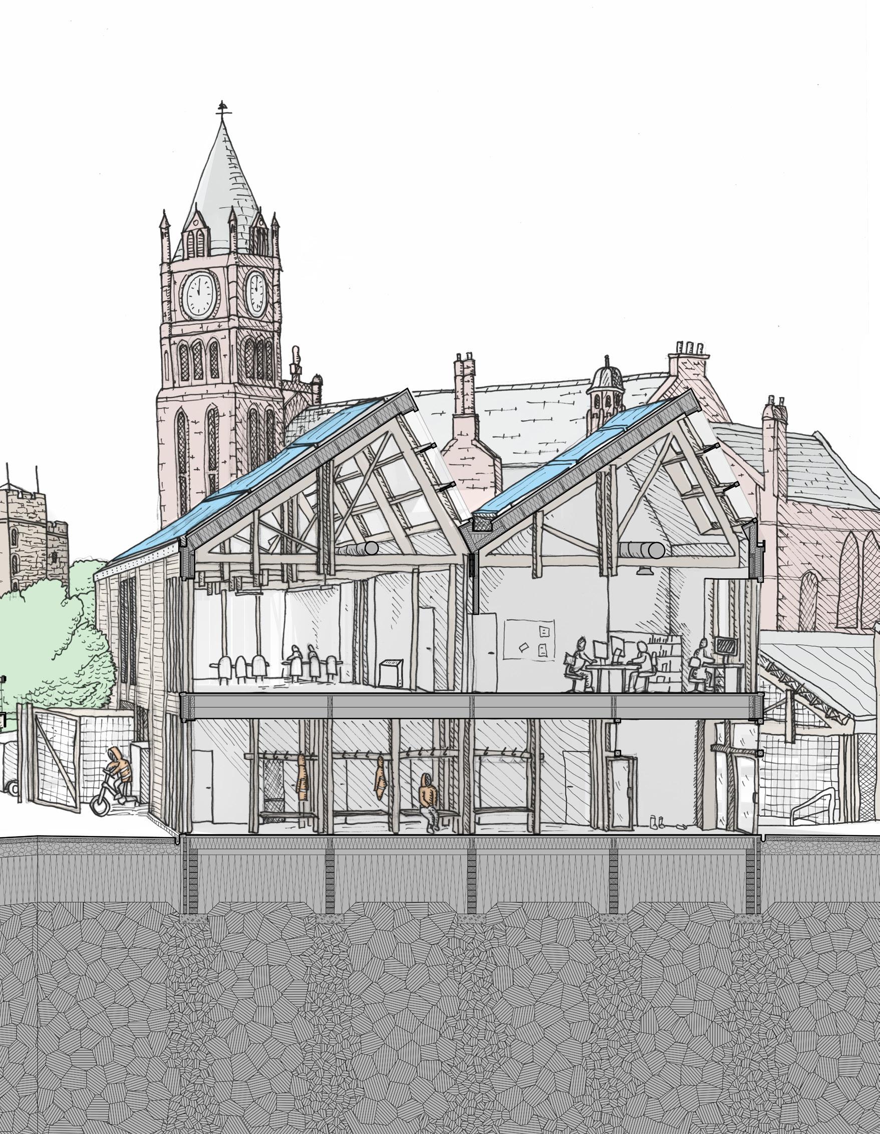
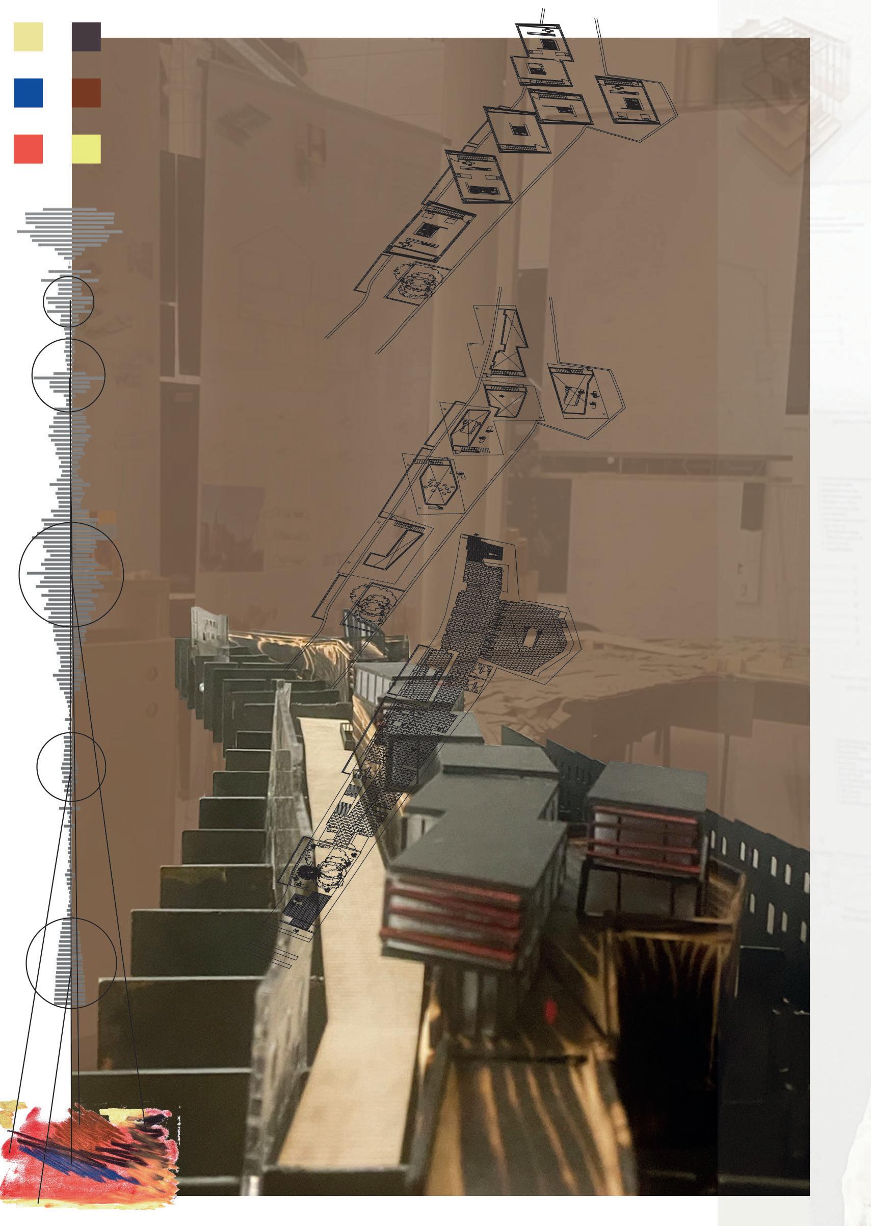
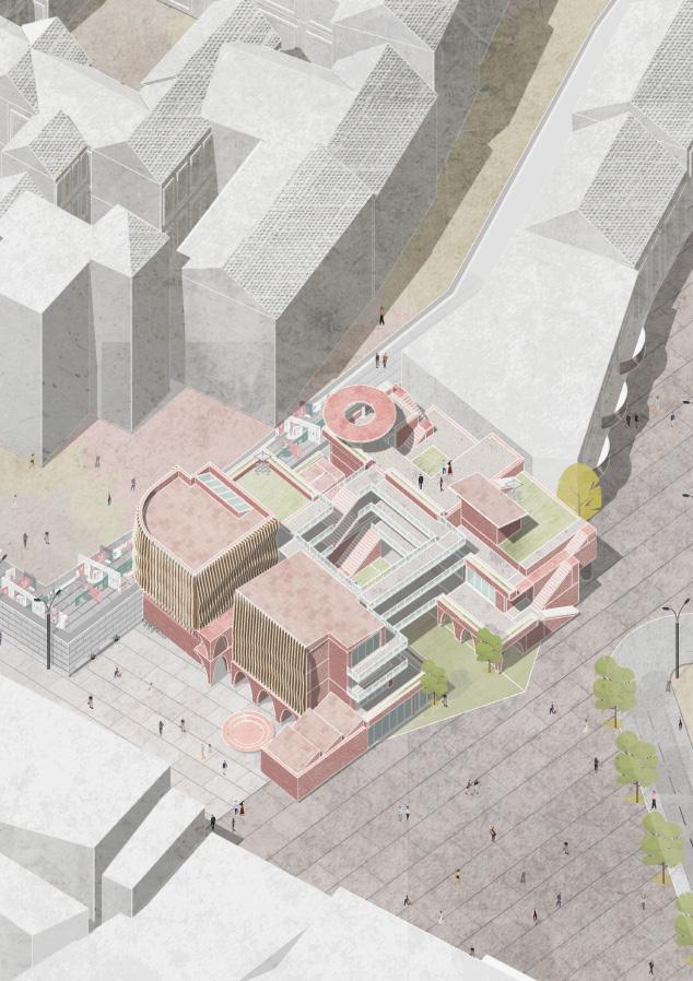
PLAYWRIGHT PROVOCATIONS DECONSTRUCTING COLONIAL LONDONDERRY
ADAM BLACKNELL JAMES MAIDMENT
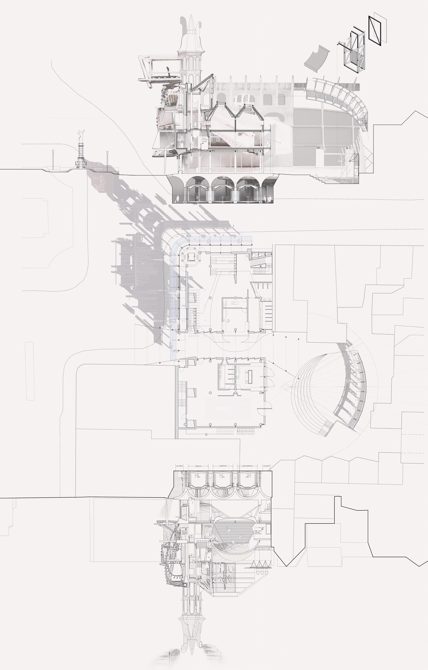
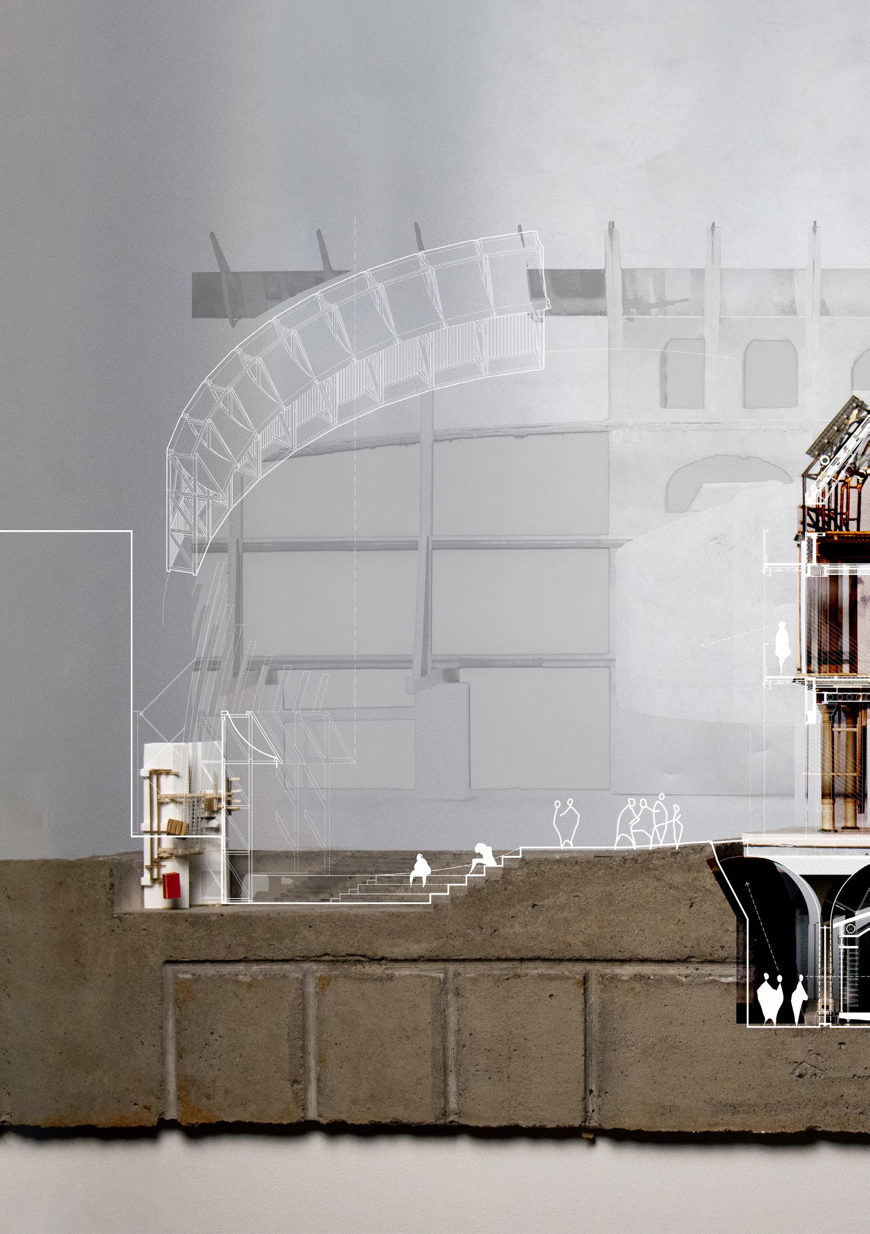
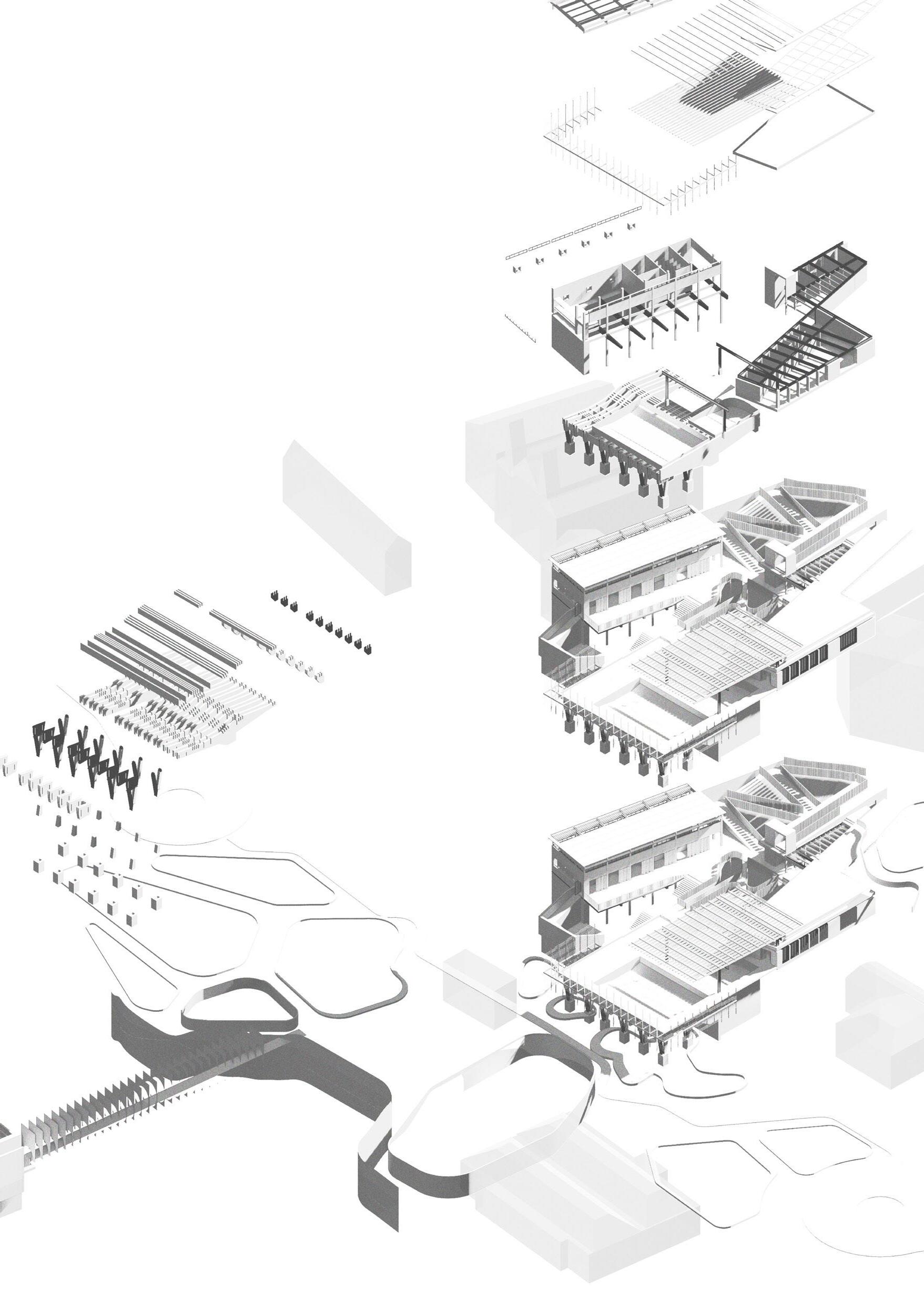
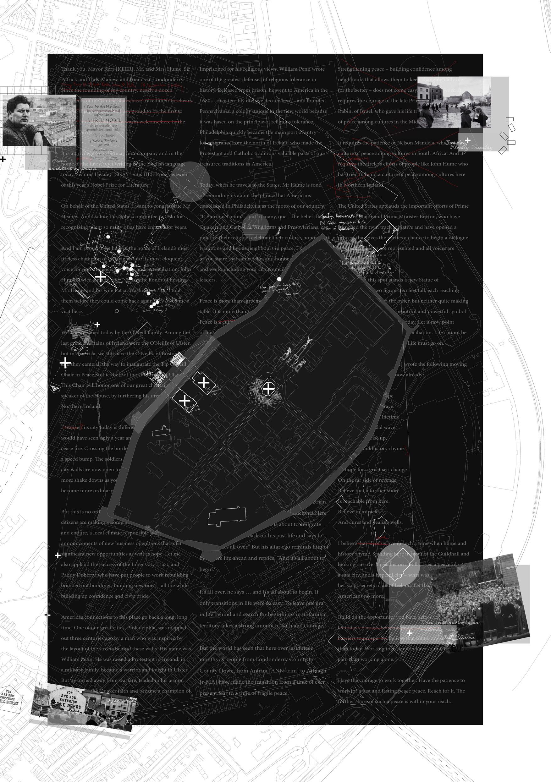
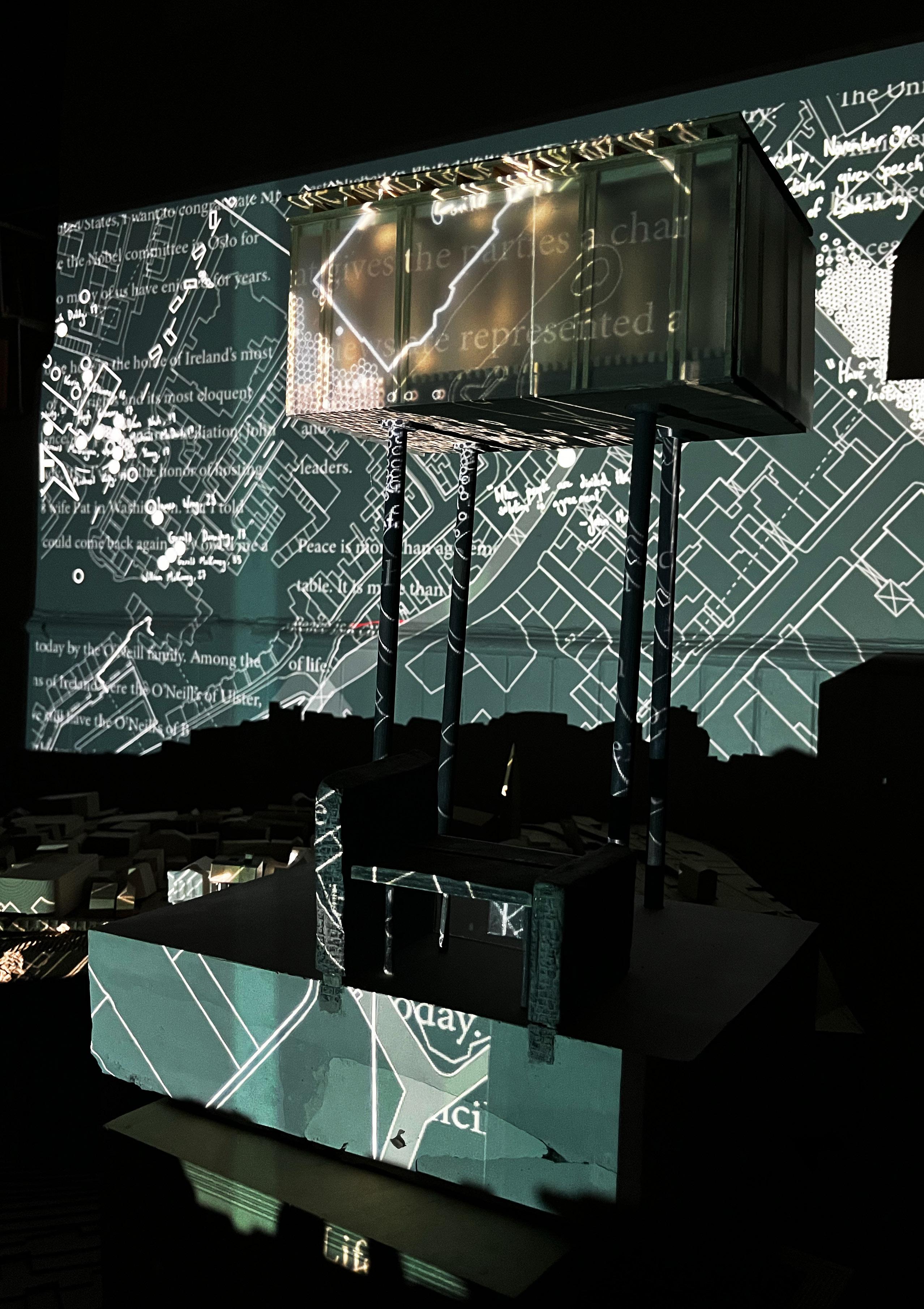
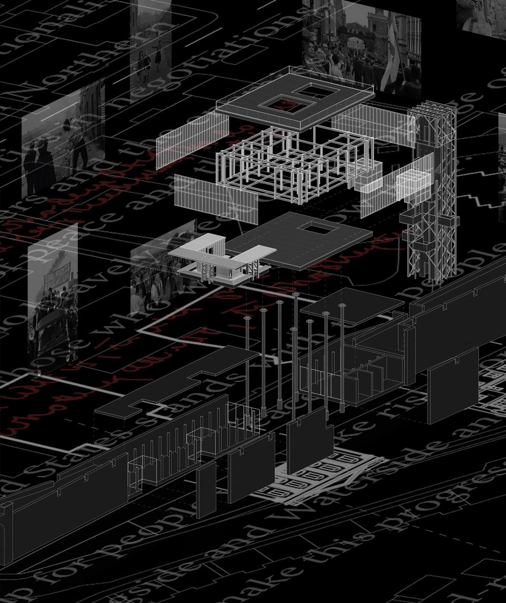
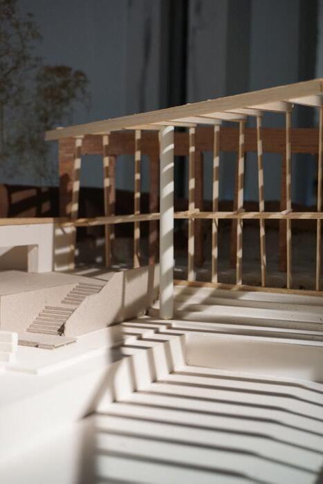
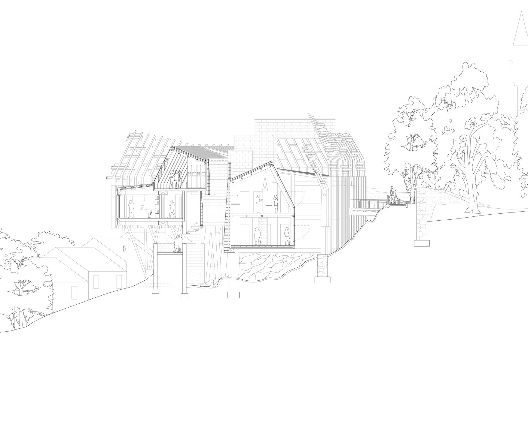
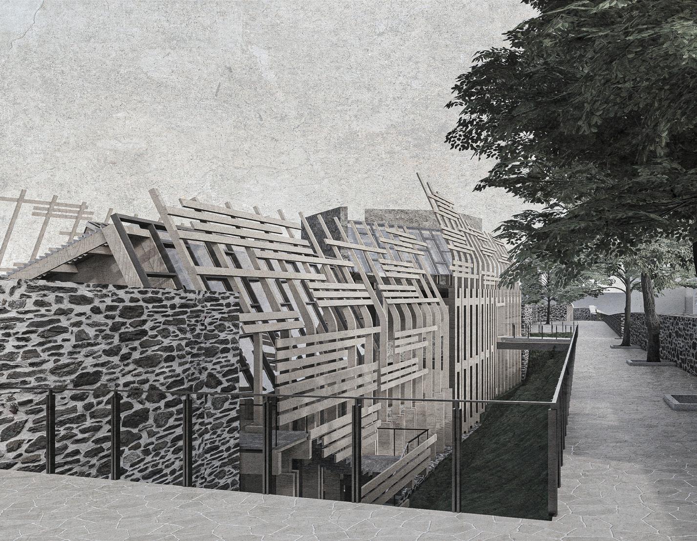
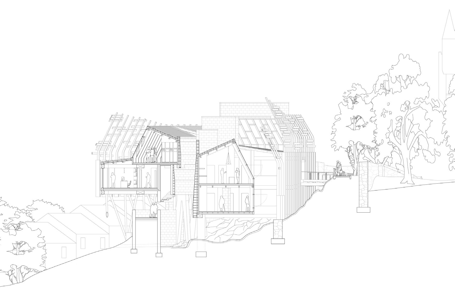
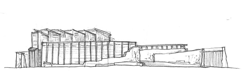
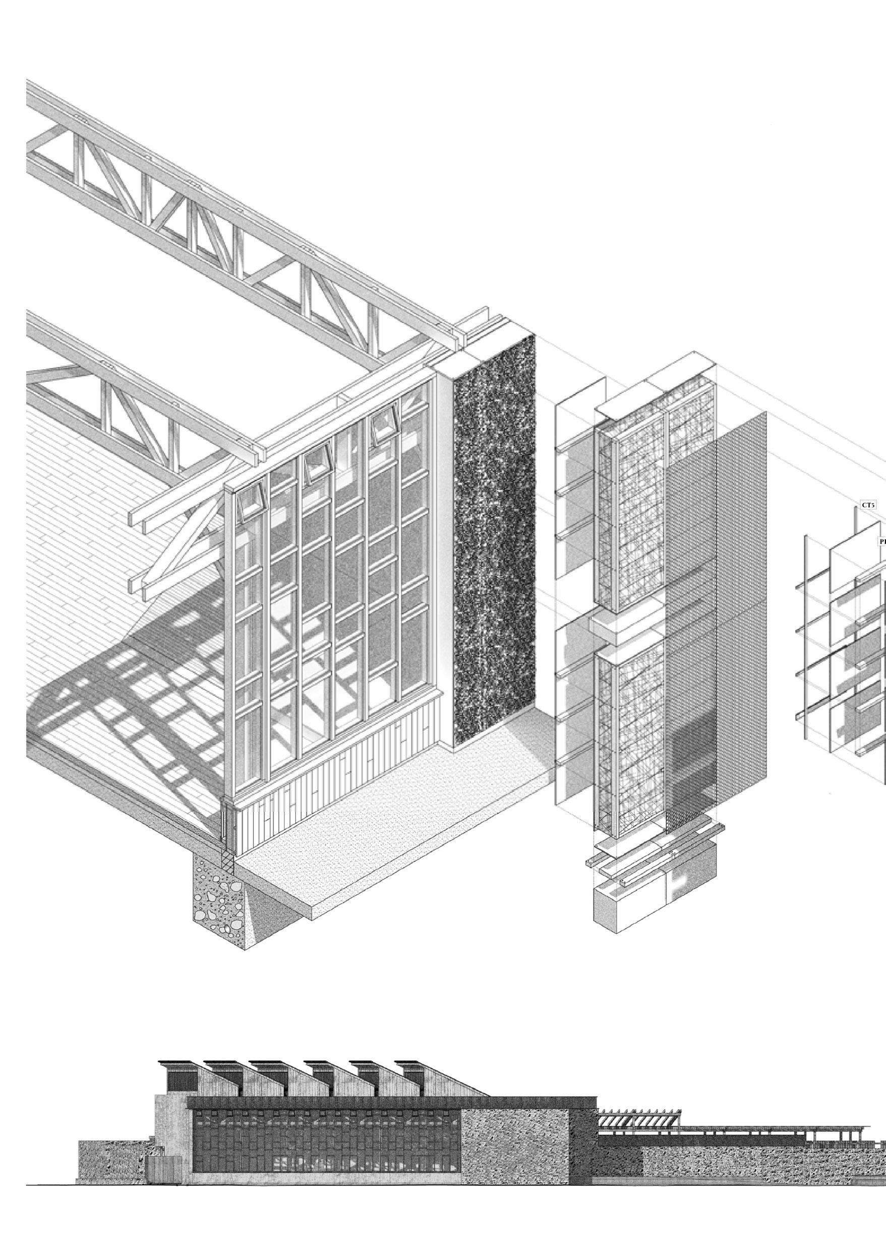
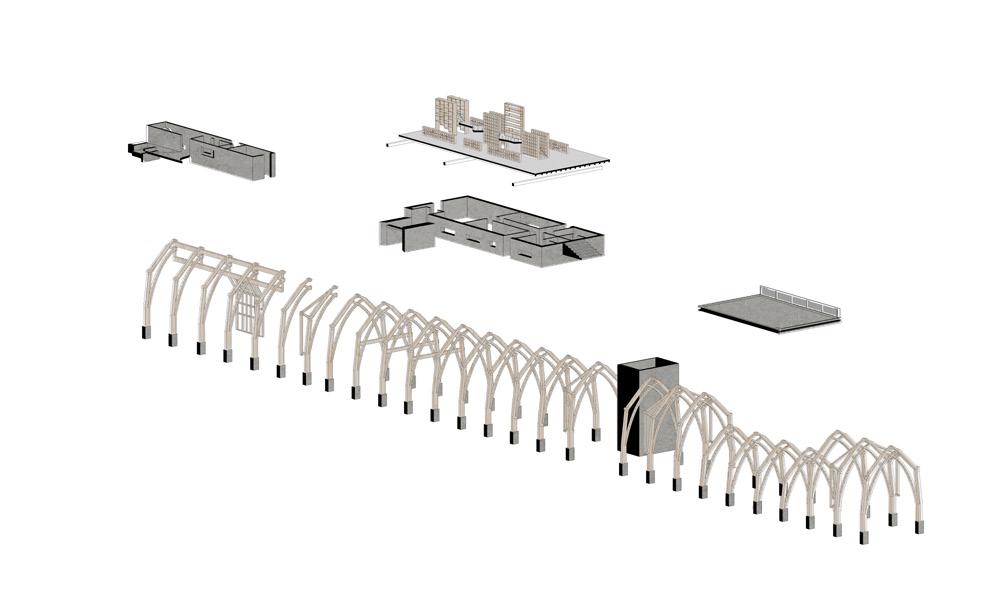
A dichotomy between projects of separate theses with interwoven narratives. The Forum of Irish Language and Daire’s Ark situate themselves within the same temporal landscape of Derry. The first is a cultural institution that translates the motifs of British and international colonialism in celebration of the Irish language, and the second invites ‘nature’ into a multispecies guildhall of debate and theatre. These architectures widen the entrenched ecotone between nature/culture and invite entanglement, opening the existing structures they inhabit to a geography broader than the existing townscape. Prominent Londonderry master Architect, M.A. Robinson, former Chairman of the colonising Apprentice Boys, authored the original colonial façades on each side of the city’s fortified stone walls. Through provocations of translation and freedom, the architectures invoke a state of fracture inspired by the work of Derry playwright Brian Friel. Re-used and re-appropriated structural steel elements from non-loadbearing sections of Austin’s append to the load-bearing stone of the Guildhall. The language of castellated beams, shells, and frames mirror each other, yet the form and functions supported remain independent. The corridor between the projects becomes a promenade of activity that connects the walled city’s diamond to a softened water’s edge, succumbing to the tidal Foyle and drawing biodiversity past the reclaimed sands of the riverbank and towards the epicentre of the historic siege.
01
21
ADAM BLACKNELL & JAMES MAIDMENT | PLAYWRIGHTS PROVOCATIONS
23
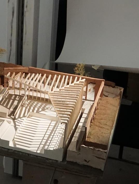
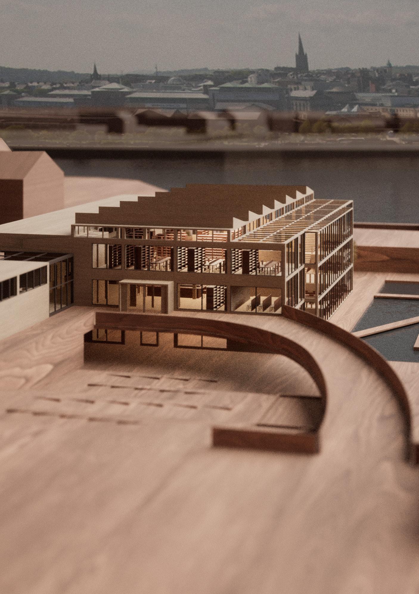
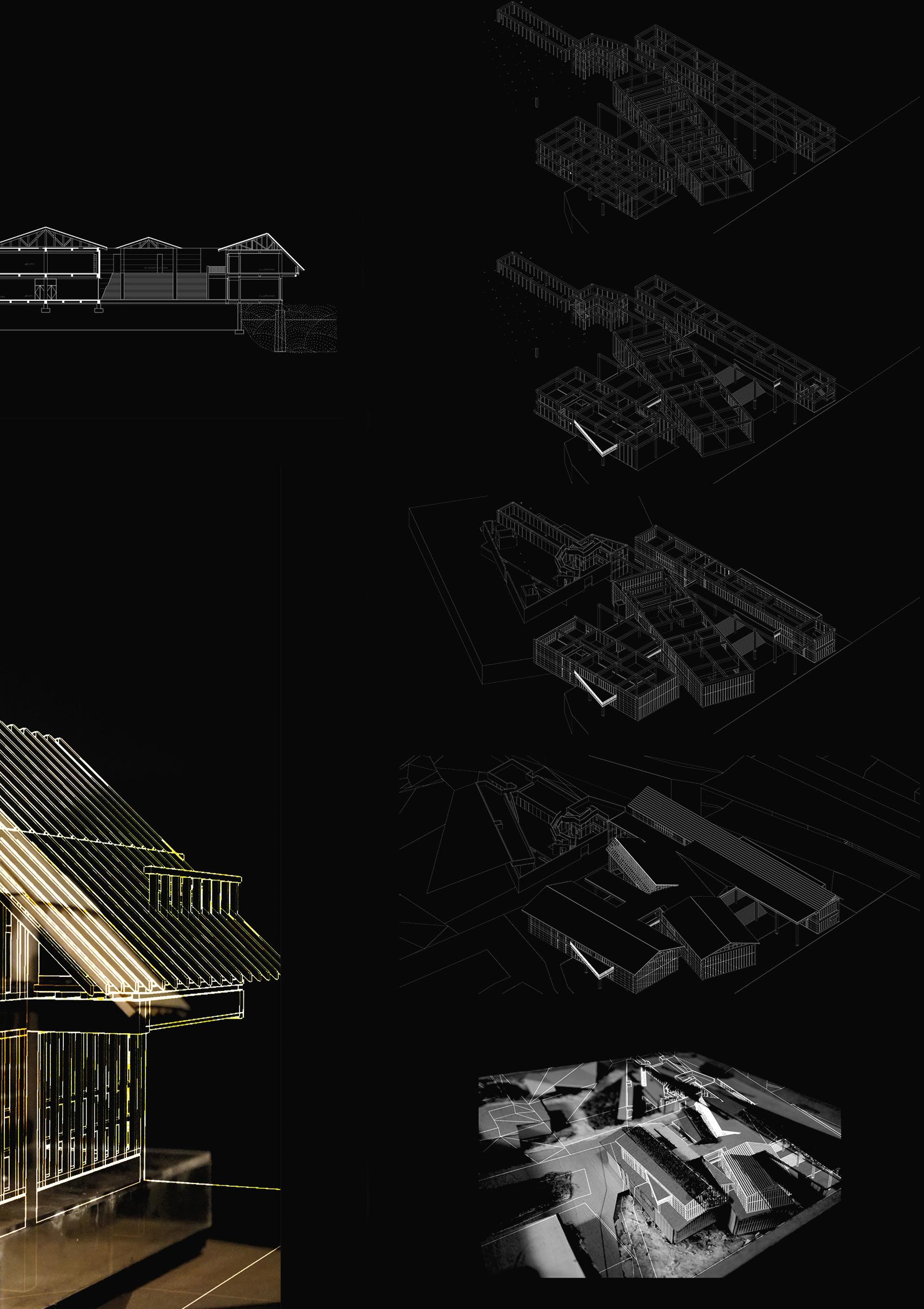
Previous. Creating Dialogue. 1:200 model photo Left. The Forum of Irish Language in Perspective. 1:200 model photo Above. Daire’s Ark in Perspective. 1:200 model photo
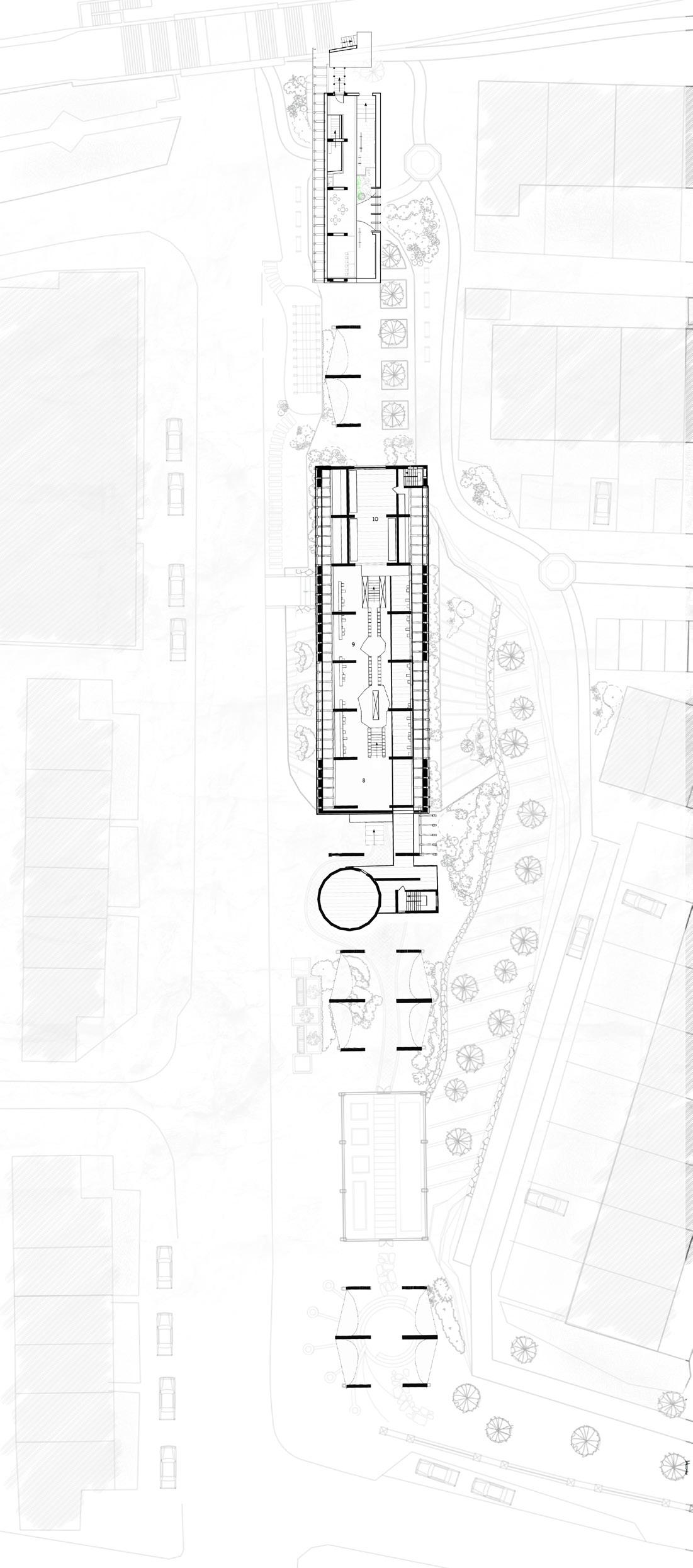
Site: 2-6 The Diamond, Derry/Lderry
Programme: Linguistic Archive and Research Facility
THE FORUM OF IRISH LANGUAGE
TRANSLATING THE MOTIFS OF BRITISH AND INTERNATIONAL COLONIALISM
ADAM BLACKNELL
“Colonial in nature, a conflict [between Ireland and England] has assumed many faces throughout its history”1
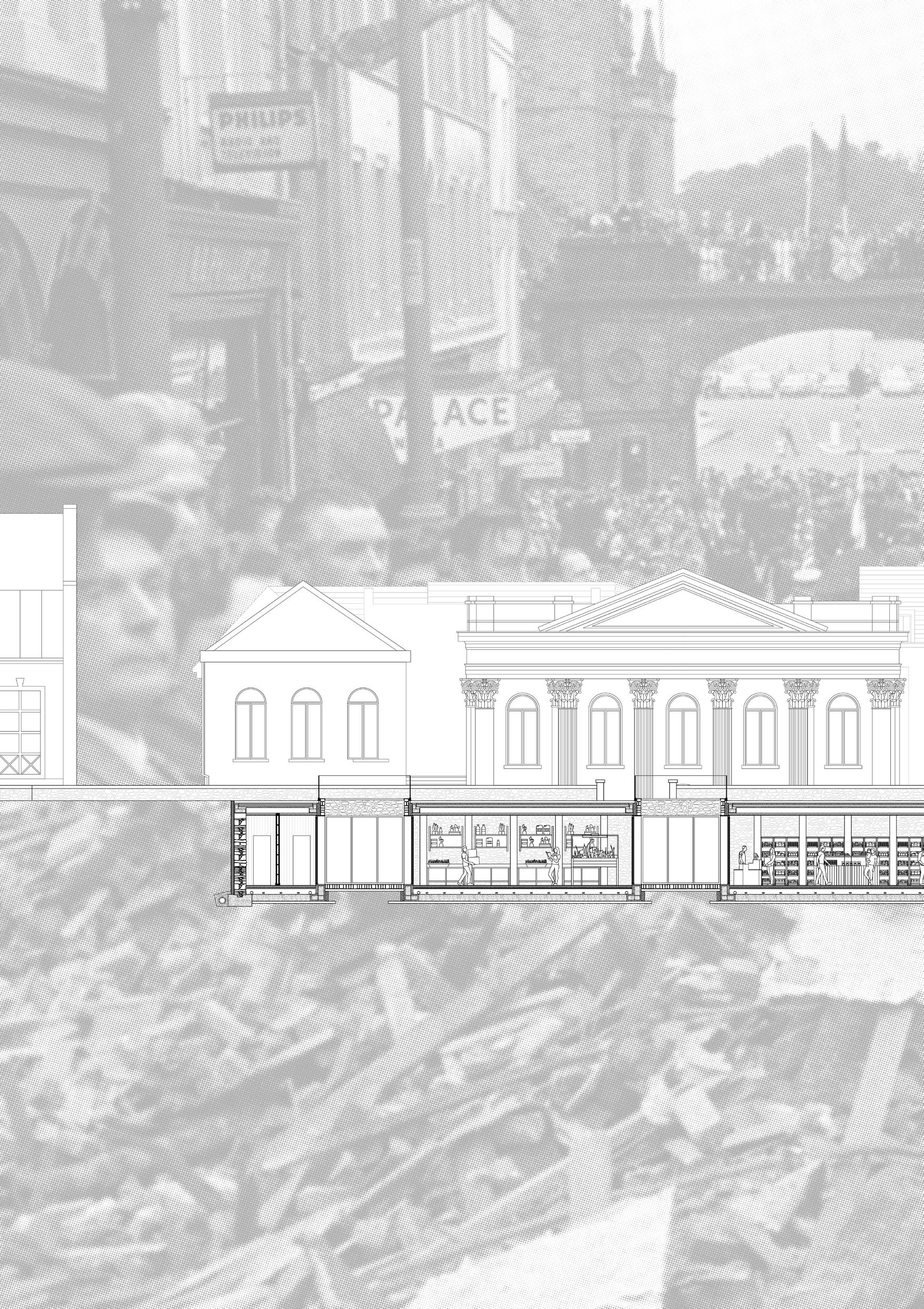
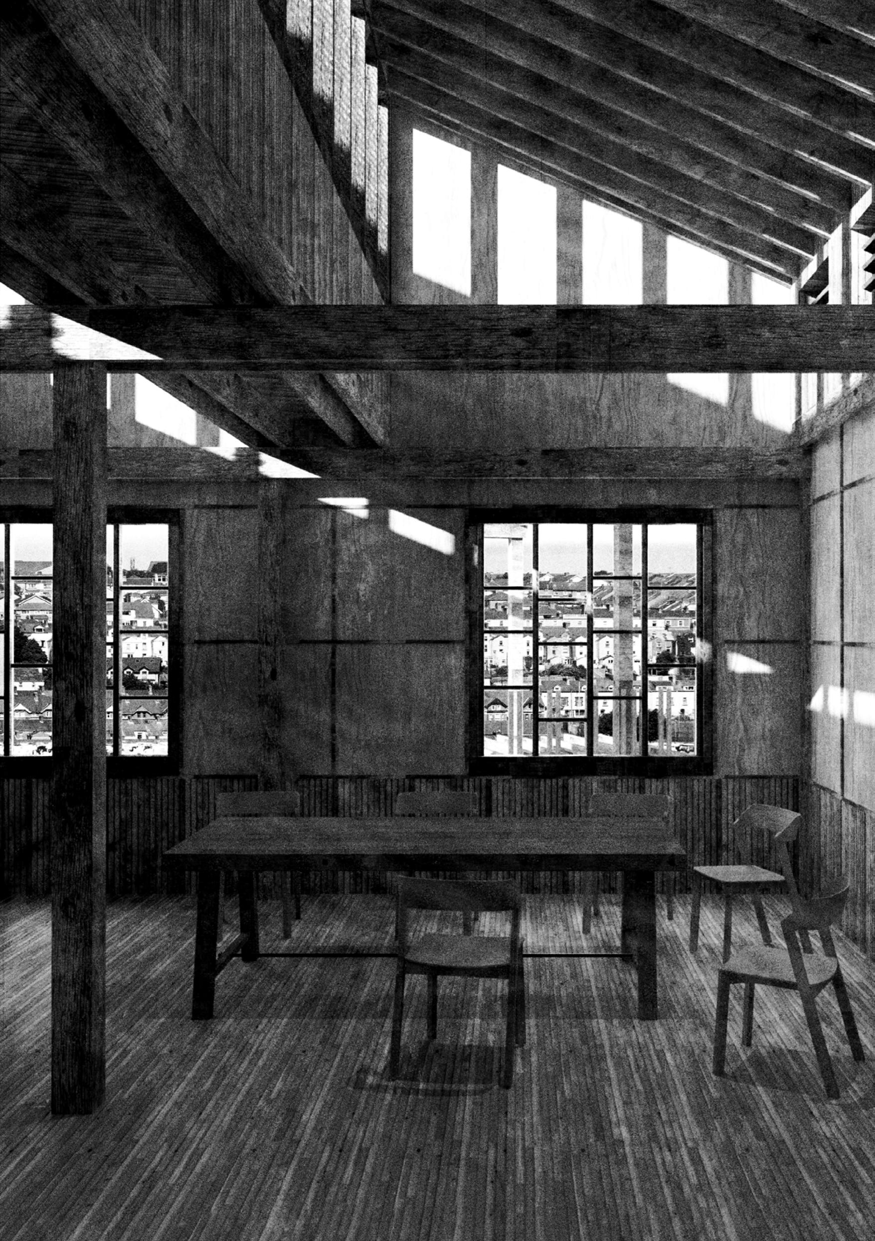
Residing within the central urban Diamond of Derry’s walled city, ironically depleted by economic decline, lies Austin’s department store. A colonial façade, disguised as a swelling, European baroque ‘palace of delights’. The former consumer centre of Derry lies lonely and neglected. Decaying symbols and ornamentation, recall in the mind it’s former glories.
In a previous life this high density, social and economic condenser operated as a highly effective agent in the interested of internal capitalism and consumerism. By re-conditioning Austin’s and addressing its immediate context, in particular ‘The Diamond’, this design thesis aims to translate and re-appropriate an existing colonial, consumerist typology through a set of carefully choreographed design moves. Utilising spatial concepts of irrational rhythm, indigenous structures and vernacular compression & expansion, inspired by Irish myths, metaphors and juxtapositions, poetically communicated in the Brian Friel play ‘Translations’. The project predicates itself on re-appropriating the previous socio-economic ecotone that resided within the centre of Derry, to a new form of 21 century, ‘Irish’ spatial typology centred around language, knowledge exchange and social gathering.
1 Hays, Timothy, 1997 01A
25
Previous. The Forum of Irish Language. Model projection
Above. Detail and Occupation. Composite drawing
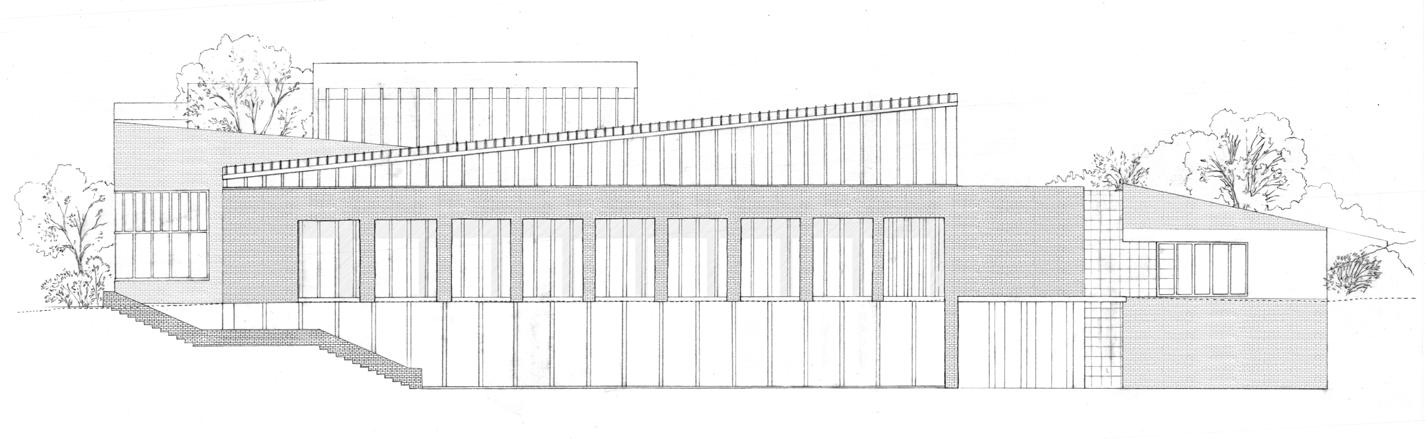
Right. Unfolded. 1: 100 Orthographic, Plan, Section, Elevation
ADAM BLACKNELL | THE FORUM OF IRISH LANGUAGE 27
Above. Celebration Piece. Composite drawing
ADAM BLACKNELL | THE FORUM OF IRISH LANGUAGE 29
01B
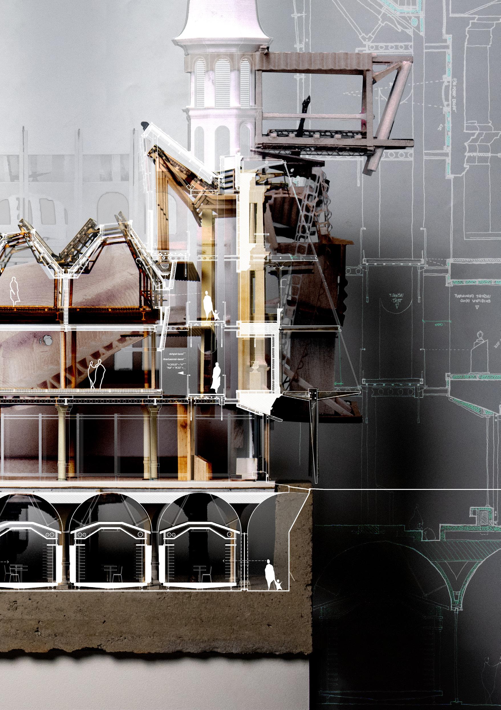
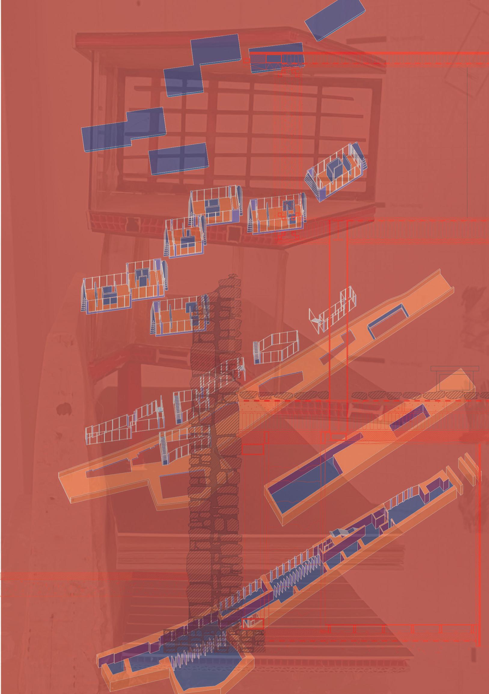
DAIRE’S ARK OF THE POST-ANTHROPOCENE: REPAIRING INTERSPECIES GUILD
JAMES MAIDMENT
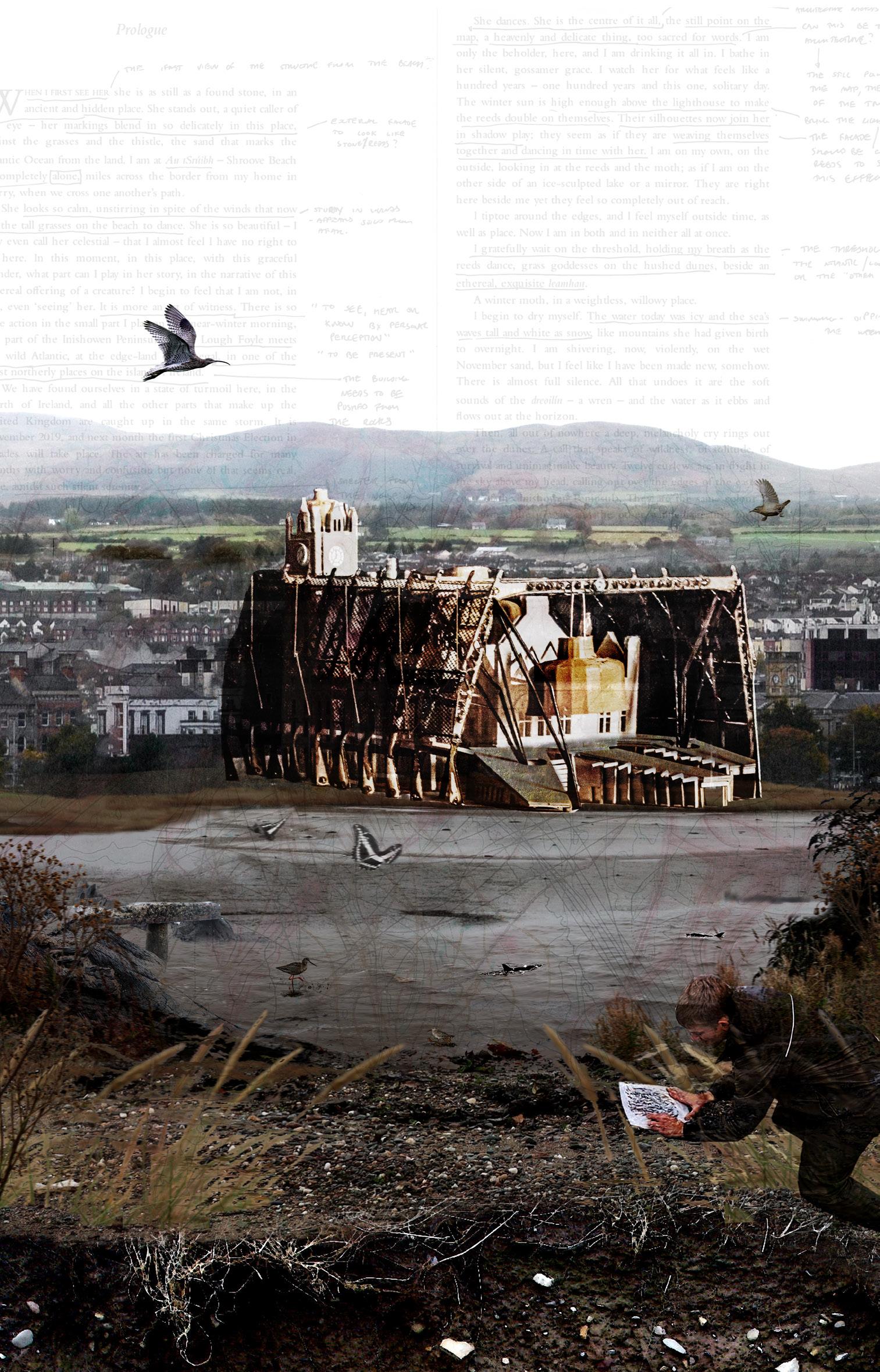
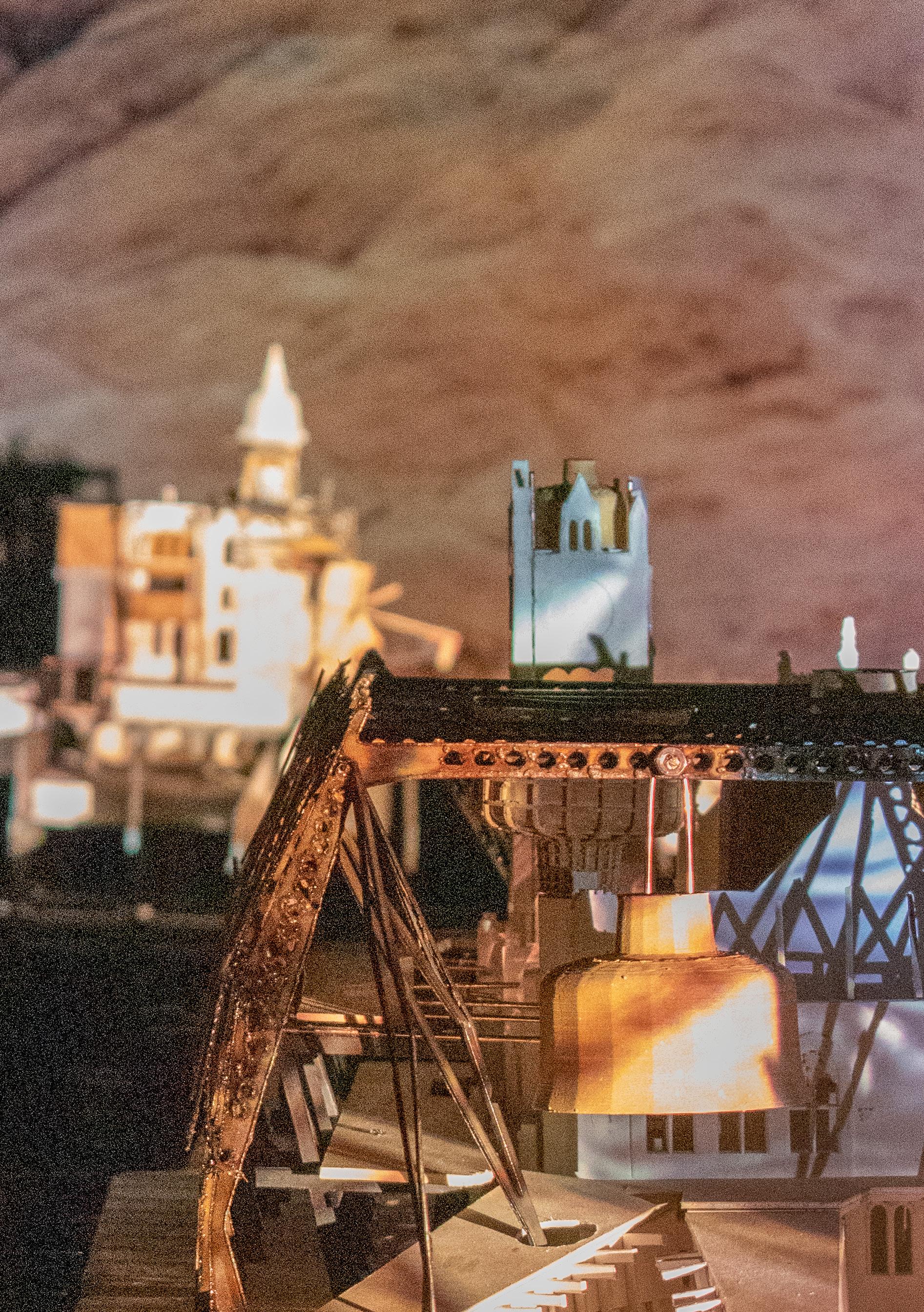
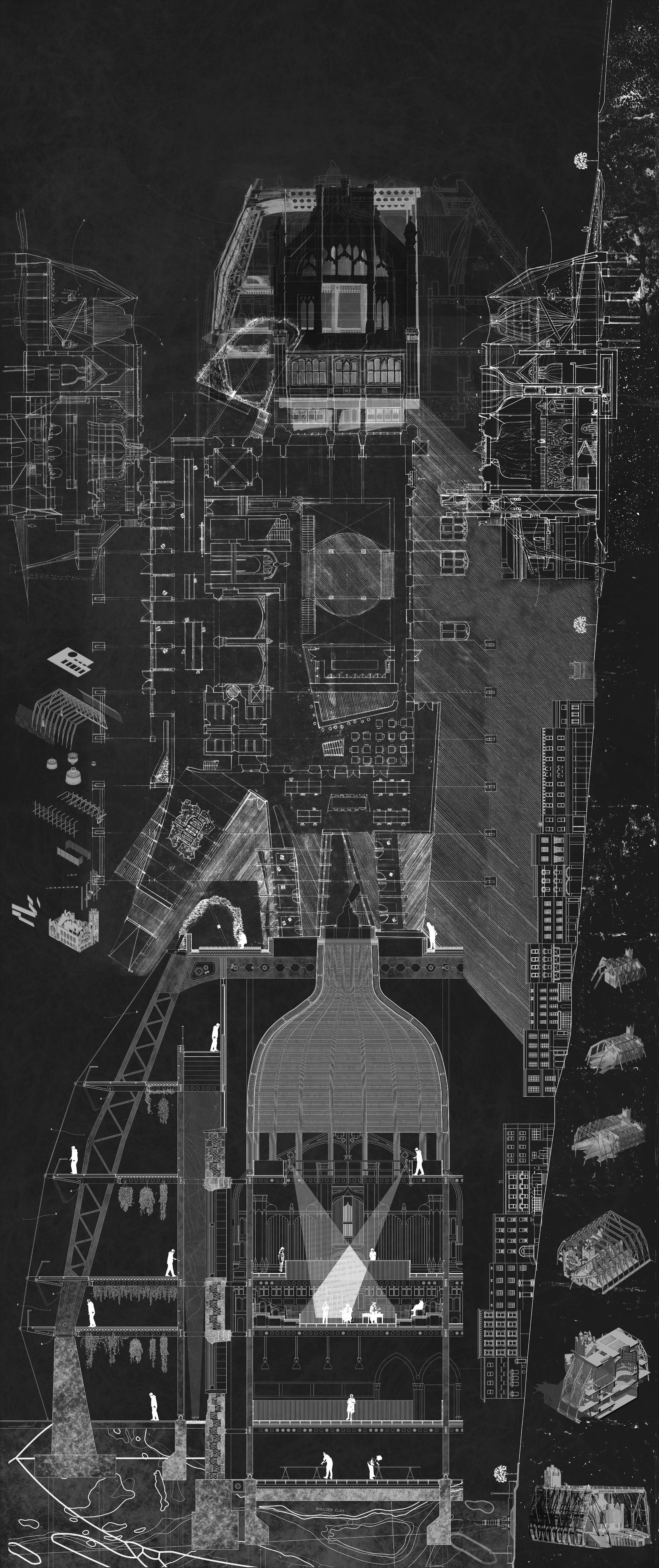
Transecting the banks of the river Foyle, from the centre of the armature to the tip of the Inishowen Peninsula, Daire’s Ark reincorporates a city segregated by human borders into Gaia theory narratives of earth geology and meandering tidal waters. By understanding the critical relationship of Londonderry’s stone walls with that of the proposed start date of the Anthropocene, the thesis highlights non-native human interventions as the starting point for longstanding unease. The project hypothesizes on repairing interspecies communities damaged in the post-Anthropocene by using concepts and locations inspired by Kerri Ni Dochartaigh’s Thin Places. The ecological condenser at Shroove beach, the moment Lough Foyle meets the wild Atlantic, communicates with the fortified banks of Londonderry upstream, the colonial plantation of the Honourable Irish Society. The edge structure sits upon a weathered jetty, owned by the sea and gathers in its environment. By transforming, multiplying, and transporting this logic upon the encapsulated Guildhall, the leviathan structure invites the world onto the Barony Glen stone façade. Its new canopy attunes its dark interior rooms to the environment, creating microclimates for a plethora of multispecies entanglements and performances. Interconnected ‘Thin Places’ within the scheme amplify the relationship between heaven and earth through bell-like structures, reverberating performances, debates and the noise of interspecies dialogue. Small birds, insects and flowers blossom and dance within the ecotone of inside/outside.
 Site: Shroove Beach & 2-6 The Diamond, Derry
Programme: Interspecies Guildhall - Centre for non-anthropocentric debate/Theatre on the Round
Site: Shroove Beach & 2-6 The Diamond, Derry
Programme: Interspecies Guildhall - Centre for non-anthropocentric debate/Theatre on the Round
31
JAMES MAIDMENT | DAIRE’S ARK OF THE POST-ANTHROPOCENE
Previous. Daire’s Ark. Composite Drawing
Left. Surveying the Expanse of Lough Foyle. Transect drawing of Daire
33
Above. Leviathan Drawing. Across the Foyle
 Above. Playwright Provocations. 1:200 model photo
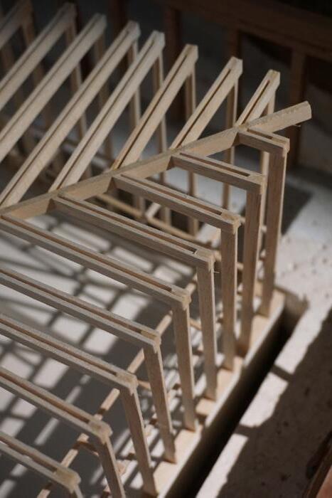
Right. Structuring the Leviathan. 1:50 Construction Drawing
Above. Playwright Provocations. 1:200 model photo
Right. Structuring the Leviathan. 1:50 Construction Drawing
35
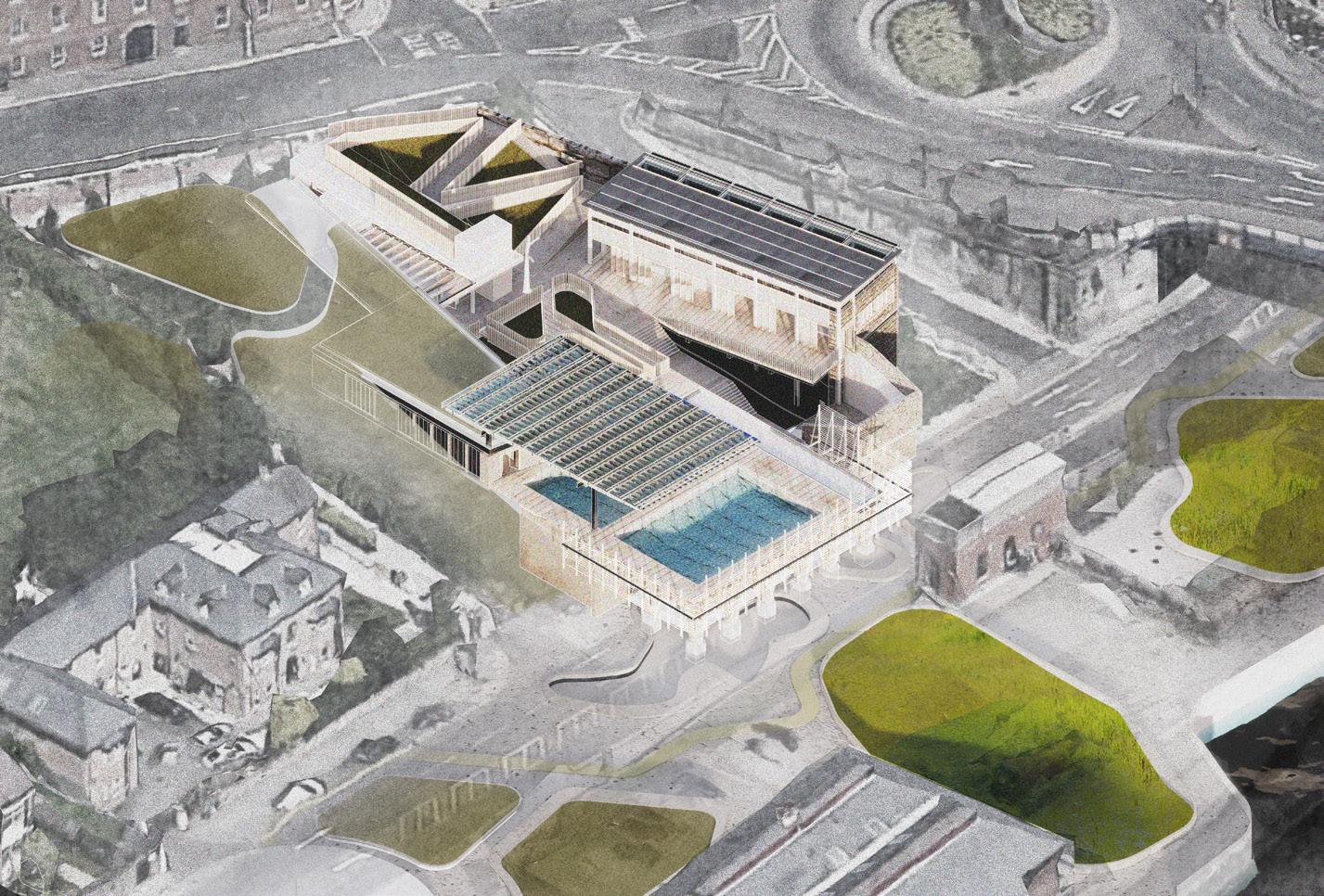
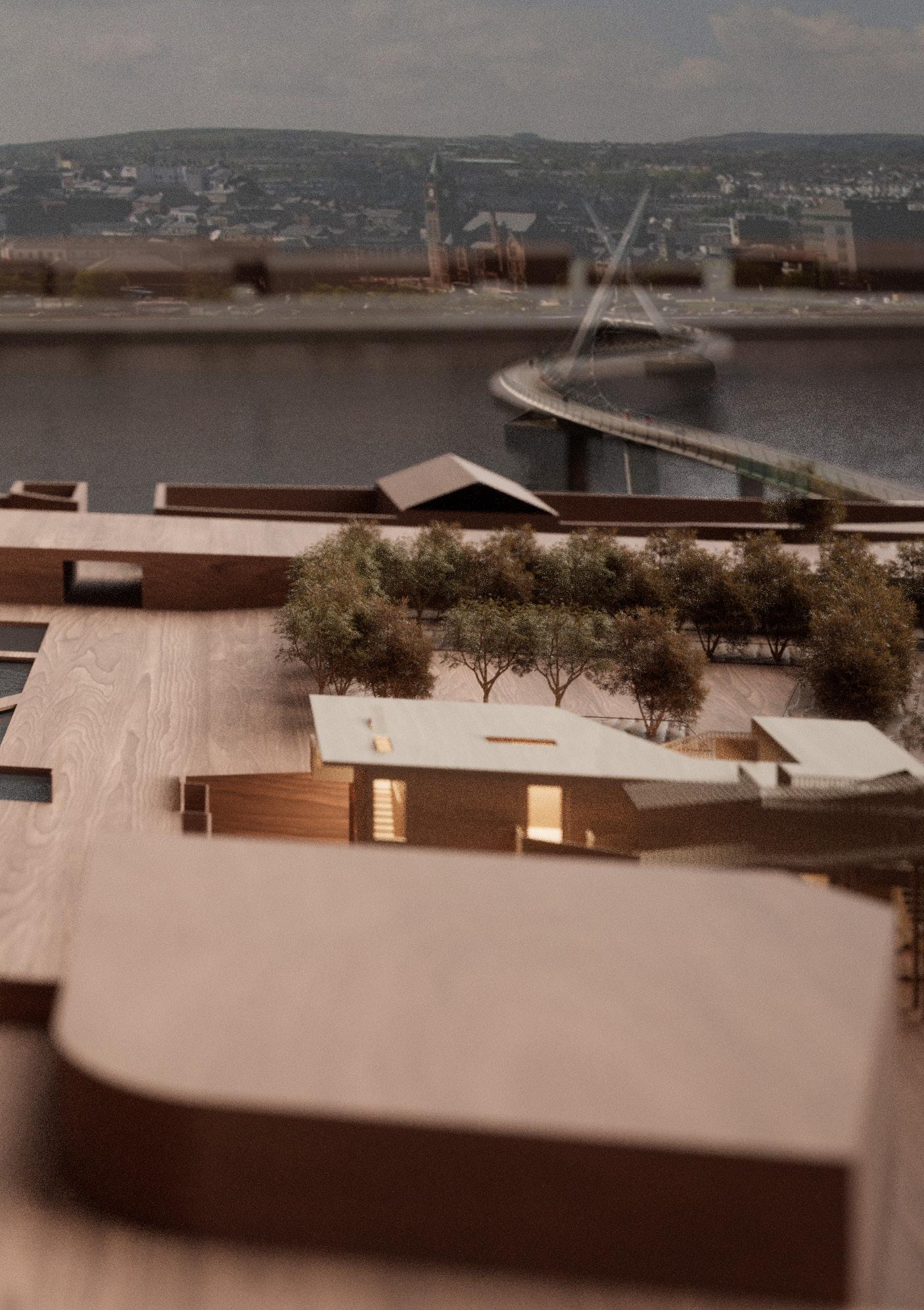
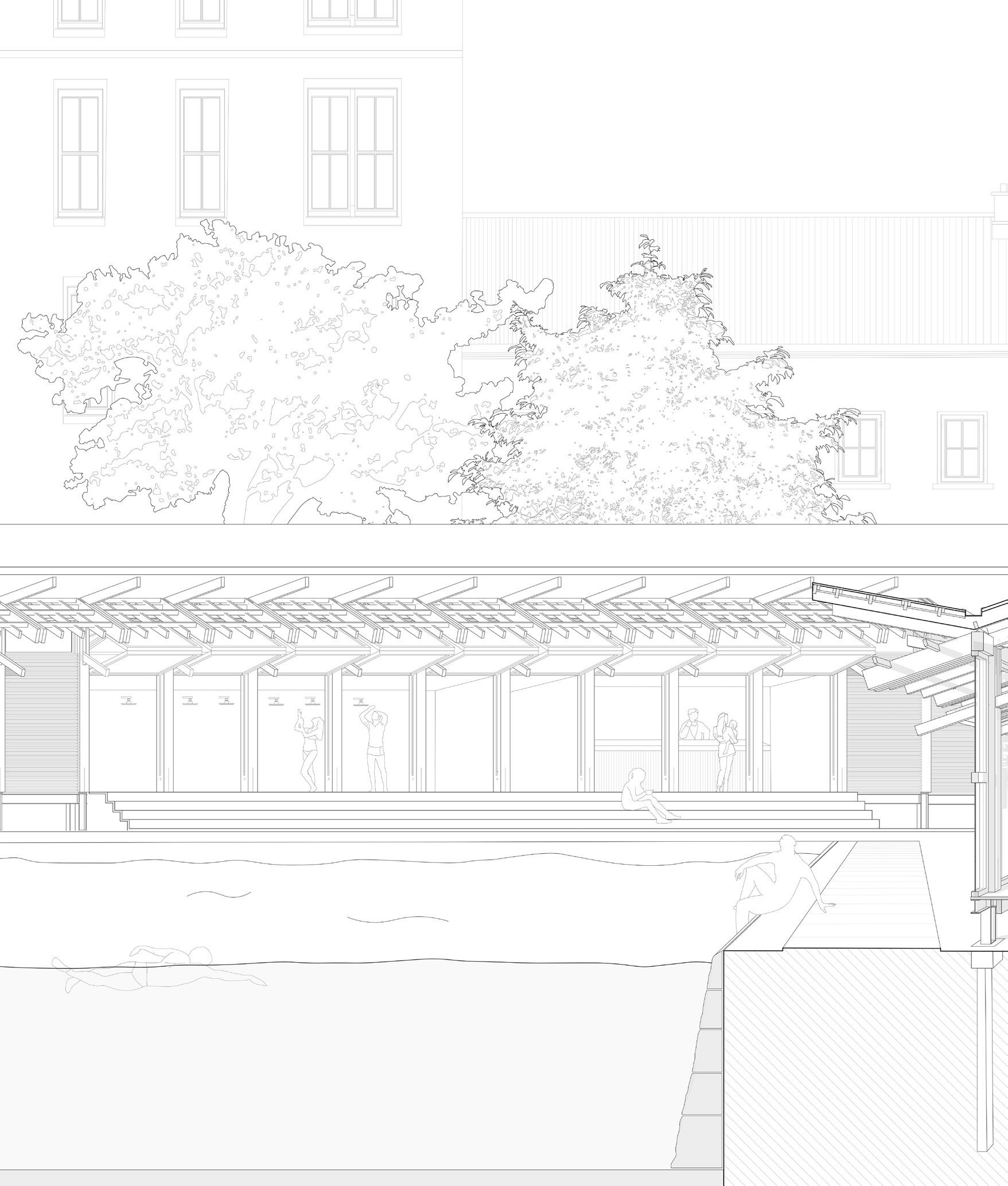
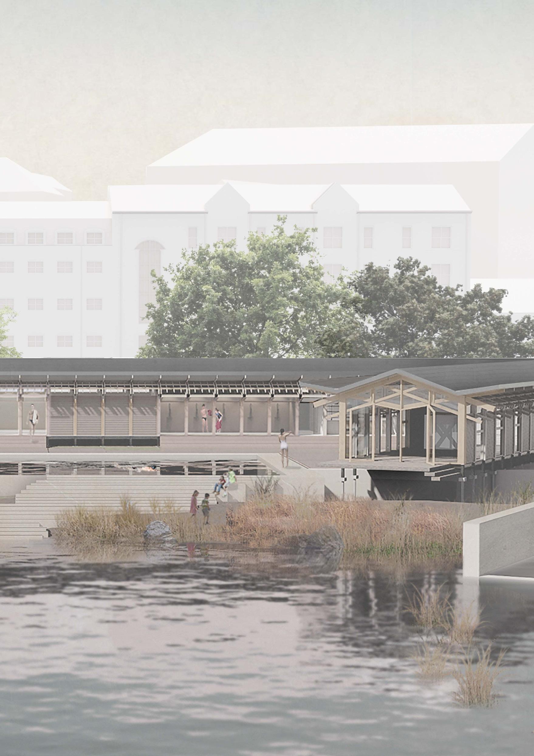
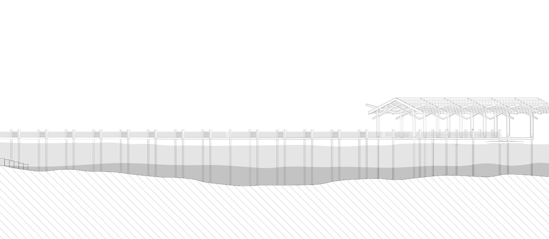
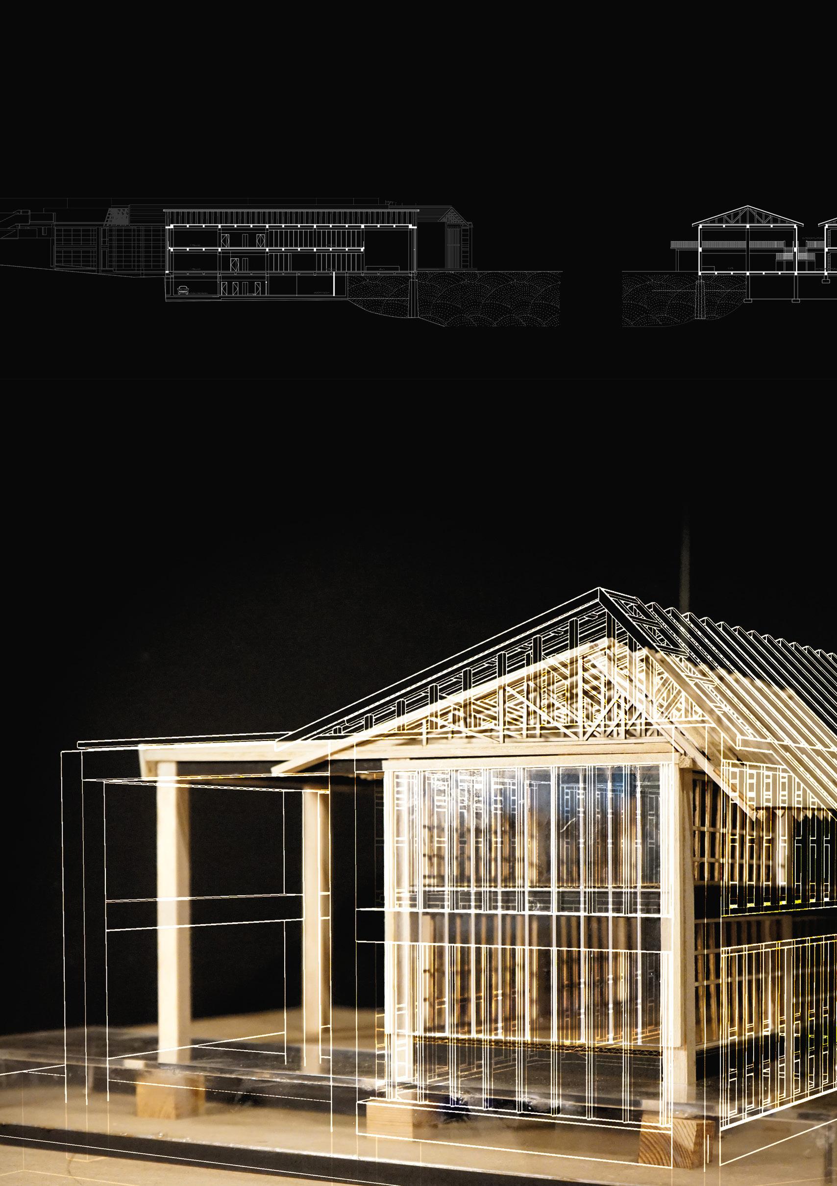
Site: Foyle Road/ River Foyle, Derry Programme: Soak01 - River Foyle laboratory and test centre, with public swimming platform. Soak02 - Community gathering space, public swimming pool, seasonal café and re-wilded riverside landscape.
SOAK
RE-CALIBRATING THE ECO-TONE BETWEEN RIVER AND CITY YULIANG CAO

“The line between land and water is not taken for granted” 1
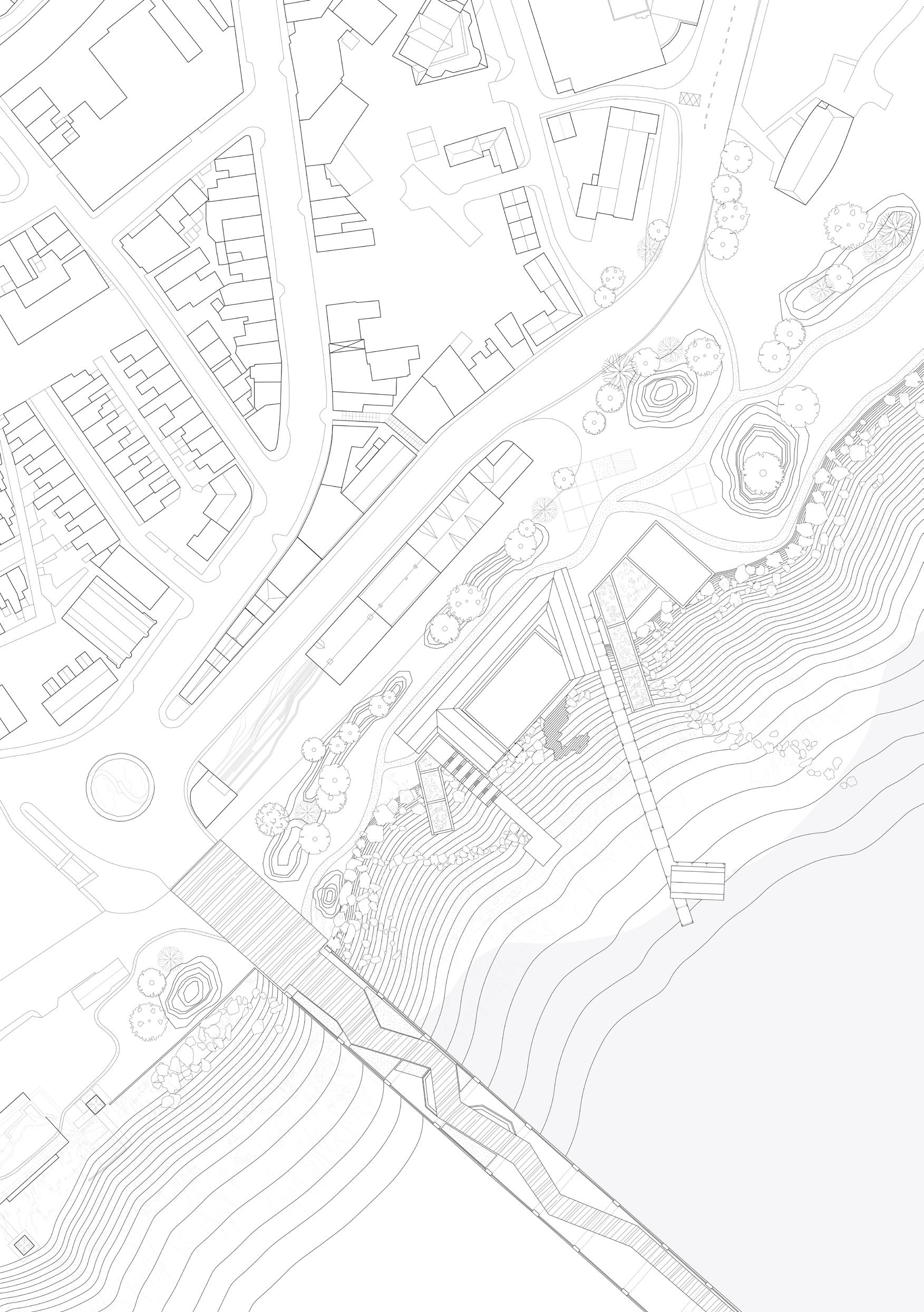
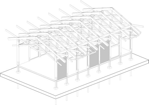
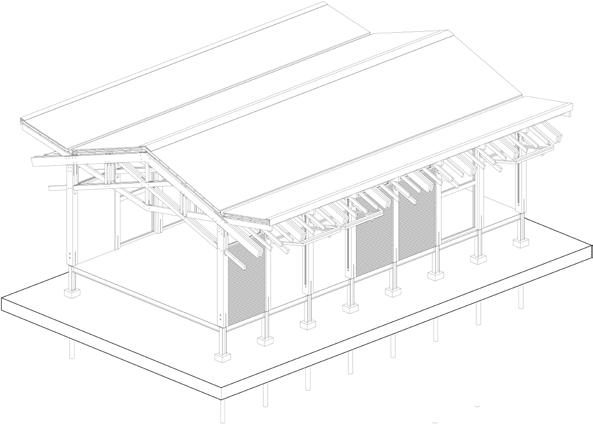
From the centre of the walled city of Derry to the bed of the river Foyle, disruptive, solid man-made edges have shaped the entanglements of the city’s history. Rapid industrialisation and the rise of the railway in the 19th and 20th centuries, while driving the city’s economy cut the river off from its walled community. Around the site of the Craigavon bridge, one of the few double-decker bridges to exist in Europe and previously serving railway freight wagons, this sense of separation is most keenly felt by the abandoned railway and the derelict site of the Tillie & Henderson shirt factory, once the largest shirt factory in Europe. This project aims to re-connect the city with the river, transforming the existing ‘eco-tone’ using the concept of ‘soak’ both as a research methodology and design principle to break down the post-industrial, man-made edge and replace it with a new, re-wilded, tidal landscape which celebrates the relationship between Derry’s people and the river. The concepts of infiltration, percolation, and sedimentation represent different hydrological and engagement processes between people and water. Through embodied and psychological immersion, the project reintroduces a hydrological cycle into the site as part of an inter-species pathway to the river. Soak provides space for wild swimming, community gathering and ecological learning in a re-wilded, tidal landscape.
02
1 ‘The invention of Rivers: Alexander’s Eye and Ganaga’s Descent’. Dilip da Cunha.
37


Previous. Sedimentation. Masterplan
Top. Sedimentation. Section
Middle. Percolation. Aerial view
Bottom. Infiltration. Field guide
Right. Sedimentation. Structural axonometric drawing
YULIANG CAO | SOAK
39
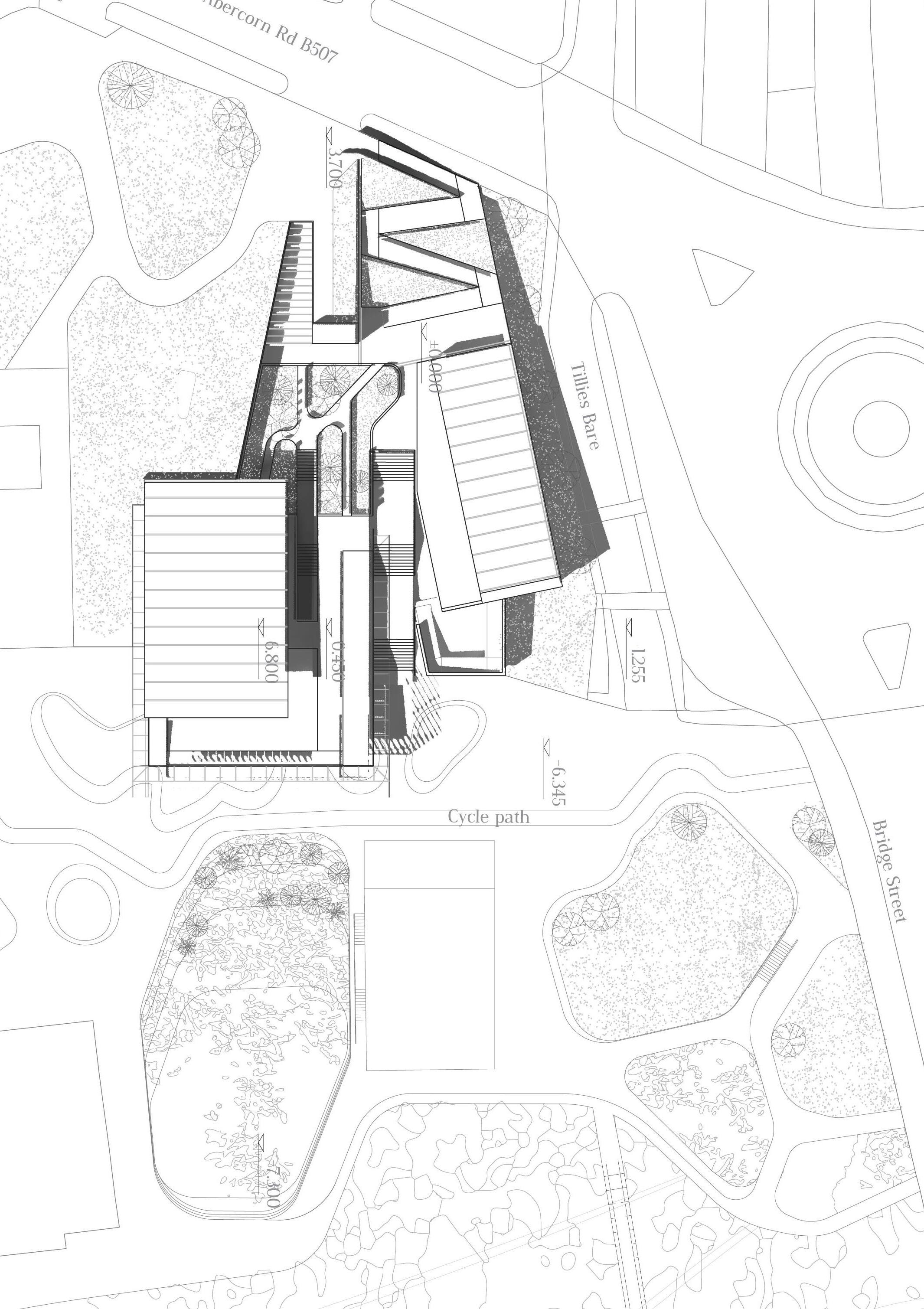
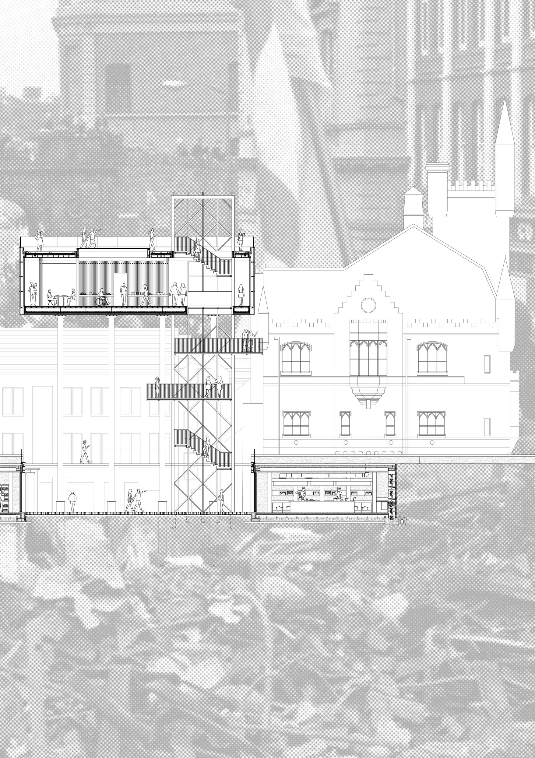
Site: Foyle Street, Derry, Northern Ireland
Programme: Cycle distribution centre, cycle storage, public shower and changing facilities, cycle repair shop.
NETWORK DERRY
FOYLE SUSTAINABLE TRANSPORT HUB
WULFRIC CLACKSON
Transport and distribution are fundamental functions of the city. Over the history of Derry, the river Foyle and its banks have been in constant flux to support transport’s technological developments. Banks which initially housed docks and wharfs gave way to developed harbours, railways, and more recently, major roads.
Over the last few decades, it has increasingly become clear that our present car-centric cities are not only damaging to the environment but also to people’s health and wellbeing. Developments in some European cities, most notably Amsterdam and Copenhagen, have made it clear that the bicycle has the potential to replace cars in many urban situations. In the UK there has more recently been a focussed political drive to encourage sustainable and active transport, through organisations such as Sustrans. Newer developments in cargo bicycles and other electrically assisted micromobility devices show that these vehicles also have the potential to fulfil many other roles in the city, most notably, last mile delivery. With online shopping becoming ever more prevalent, exploring the infrastructural requirements for sustainable delivery is increasingly important.
This project explores the creation of a micro-mobility hub in the centre of Derry, on the banks of the Foyle, providing space for both public cycle storage as well as cycle-based parcel distribution.
03
41
WULFRIC CLACKSON | NETWORK DERRY
Previous. Circulation. Ground Floor Plan
Left. Detail. Sectional Model Photograph (Ryan Hillier)
Middle. Distribution Centre Facility. 1.25 sectional model
Right. Internal View. 1.25 sectional model
43
Behind. Inhabitation of the Distribution Centre. Hand drawn perspective section
BREAKING BREAD
TOWARDS COMMUNITY RECONCILIATION CHARLOTTE CUMMINGS
“May this food restore our strength, giving new energy to tired limbs, now thoughts to weary minds. May this drink restore our souls, giving new vision to dry spirits, new warmth to cold hearts” 1
Northern Ireland has long been a country defined by religion, from the school you attend to the pub you drink in, much of Northern Irish life is defined by religious identity. This identity has been the backdrop for centuries of division and violence, most famously during The Troubles. In 1994, politicians commenced a truly revolutionary peace process requiring huge sacrifices and concessions on both sides of the divide.
However, Northern Ireland remains a country divided between two Christian faiths. Underpinned by research conducted through a series of scales on the church’s physical and psychological impact on the people of Derry, this thesis seeks to understand the enduring human impacts of church power structures and influence on daily life. By de-constructing these power structures, the project seeks to suggest a new spatial typology of reconciliation for the people of Northern Ireland. The project navigates a tightly contested site which sits on the Derry Walls, between both protestant and catholic spaces of control. Inspired by the ancient traditions of Irish hospitality, and the religious ritual of breaking bread the project seeks to bring people together for the common good - a celebration of growing, making and eating. Elevated above the city walls this project seeks to be a beacon of unity for both communities.
 Site: The Derry Walls (critically located on axis between the First Presbyterian Church, Apprentice Boys Hall and the Bogside Free Derry Museum)
04
Programme: Community Kitchen and Urban Farm
1 Irish dinner blessing, author unknown
45
Previous left. Sitting on the Wall. Axonometric
Previous. Community Reconciliation. Masterplan
Left. Mapping Derry’s Past. Mapping drawing
Behind. Breaking Bread. Model projections
Right. Breaking Bread. Exploded axonometric
CHARLOTTE CUMMINGS | BREAKING BREAD: TOWARDS COMMUNITY RECONCILIATION 47
Above. Programmatic Organisation. 1:50 detail section
CHARLOTTE CUMMINGS | BREAKING BREAD: TOWARDS COMMUNITY RECONCILIATION 49
URBAN VOIDANCE RE-ASSEMBLING THE UNSEEN CITY
CURTIS ENGLISH
Situated adjacent to the historic city walls and the current Visit Derry Museum along William Street, an unsightly void space within the city centre of Derry has emerged amidst demolition. Historically, the site has been a Corn Market, Ulster bank and a Spinning Mill. However, the destruction of these structures during ‘The Troubles’ has manifested in a series of under-utilised void spaces within and around the old city walls.
‘Urban Voidance’ uses Trancik’s theory of lost space to develop a spatial language that highlights these forgotten urban spaces that make little or no positive contribution to their immediate surroundings.
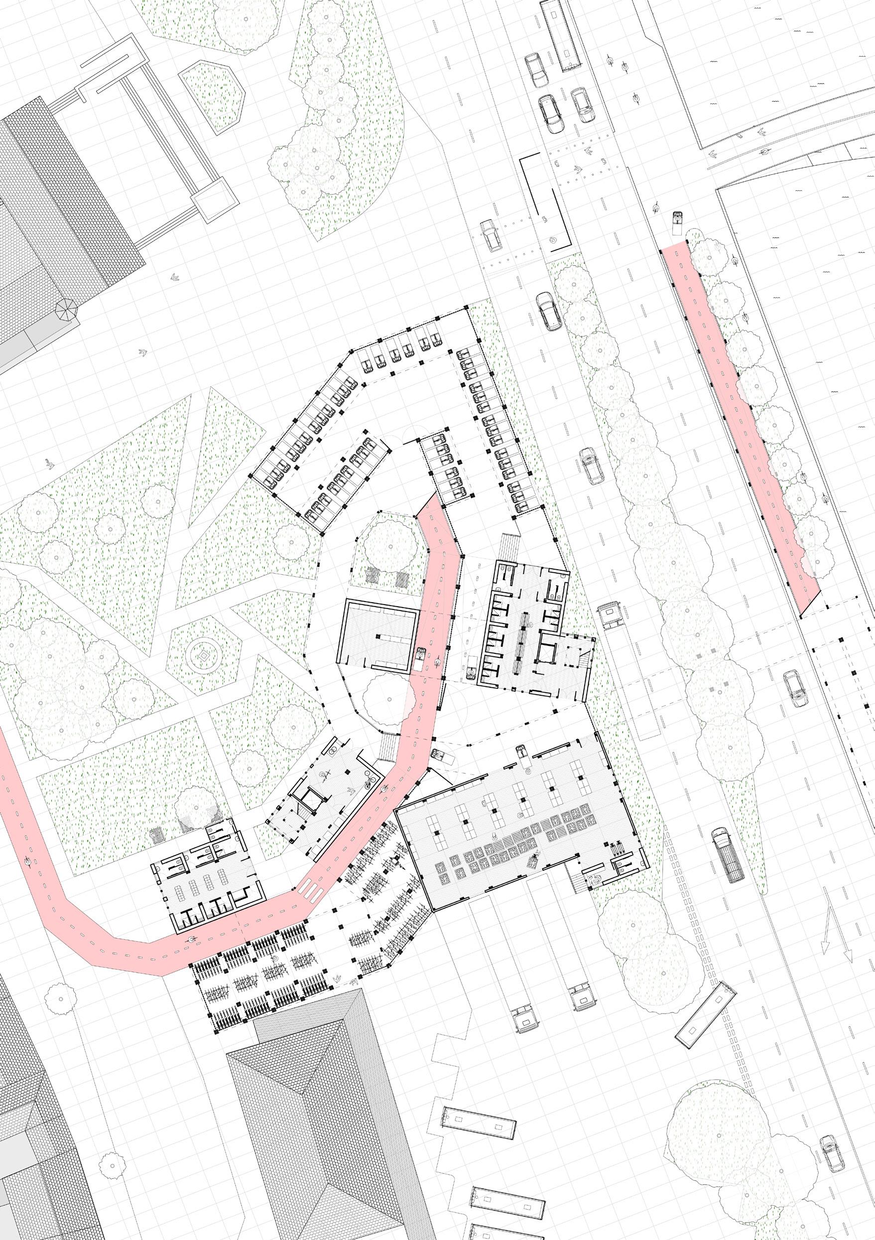
Connecting these sites of abandonment across the city, through a reinvention of the urban fabric, the unseen city of Derry becomes reassembled, inviting communities back into these urban areas through the developing architectural language of lost space. The proposed market hall celebrates the rich history of this commercial and social, urban typology throughout Derry’s history and acts as a gathering space that re-invites the market community back into the heart of the city through the reclamation of the void. The architecture aims to revitalise the city wall, providing sustainable solutions to connect these sites of abandonment, offering space for communities to gather, socialise and enjoy the city anew.
05
Site: William Street, Derry, Northern Ireland Programme: Market hall, wet and dry markets, pop up market in the public square.
“As
professionals who permanently influence the urban environment, architects have a major accountability to meet the challenge of reshaping lost spaces that have emerged in the modern city.”
1
1 Roger Trancik in ‘Finding Lost Space
51

Previous left. Architectures of Lost Space. Axonometric
Previous. Tectonic Assemblage. Derry City wall collage and exploded isometric
Left. Reassembling the Unseen City. Mapping diagram
Above. Urban [un]avoidance. Axonometric view
CURTIS ENGLISH | URBAN VOIDANCE
53
Light, Sound and Touch Route Becky Whitehead
55
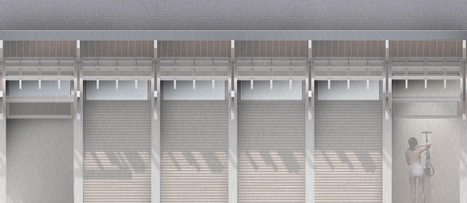
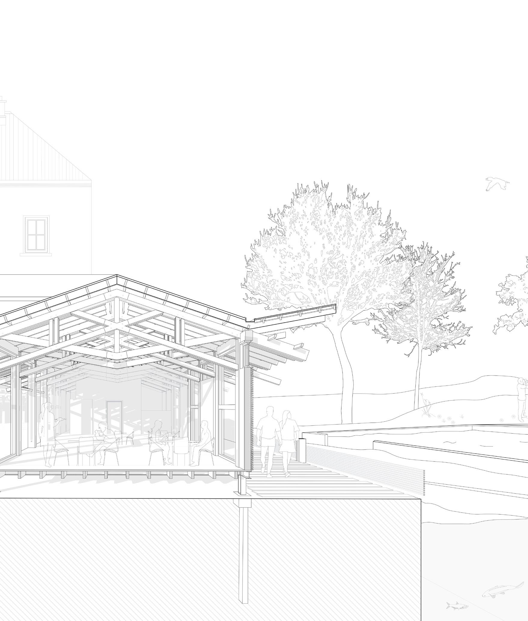
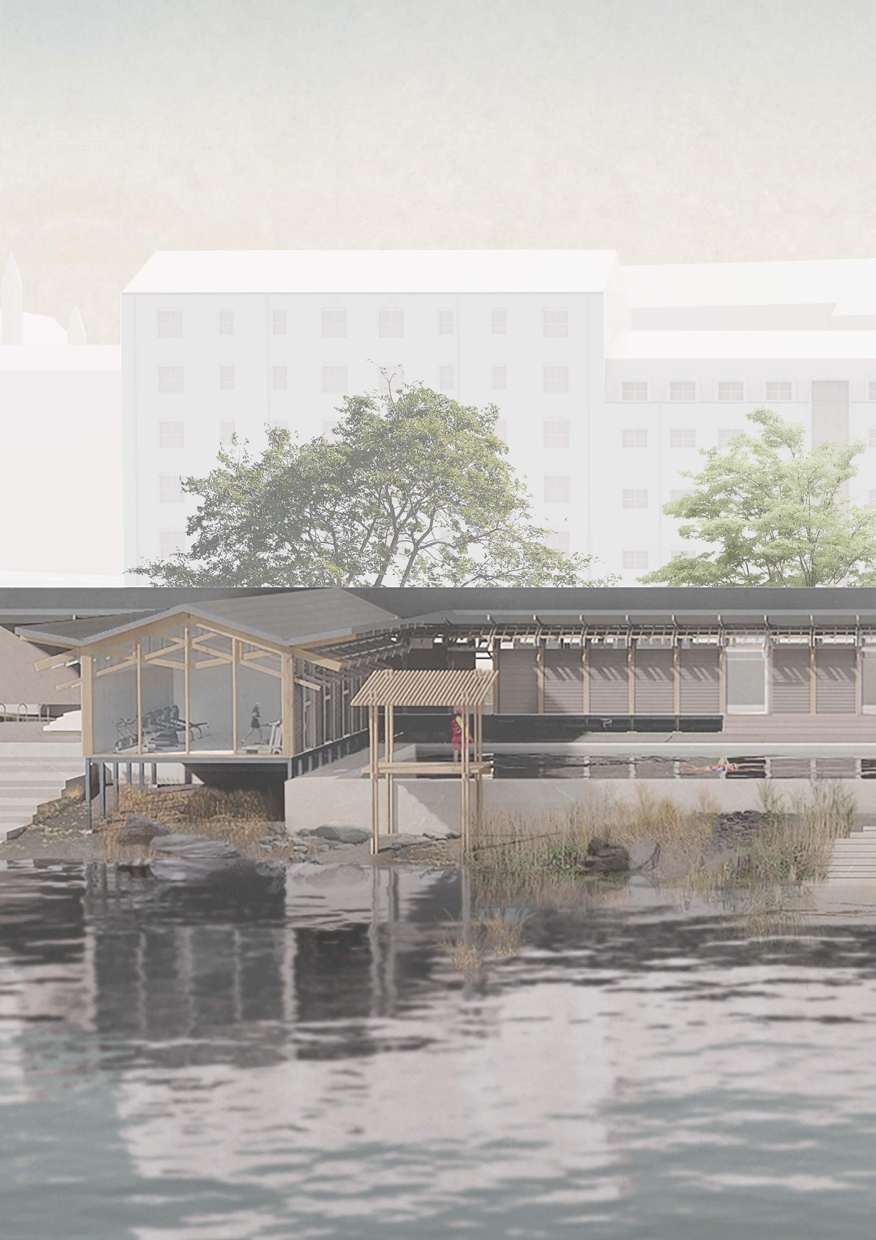
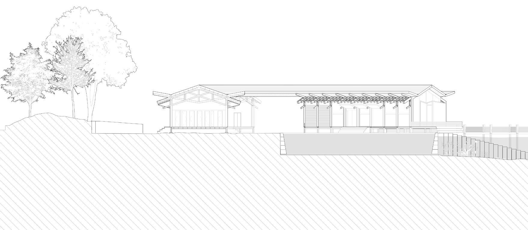
Site: The inclined green space, south-east of the city walls between Lecky Road and Bishop Street, Derry, Northern Ireland Programme: A series of naturally filtered swimming ponds and gym alongside associated facilities and a café.
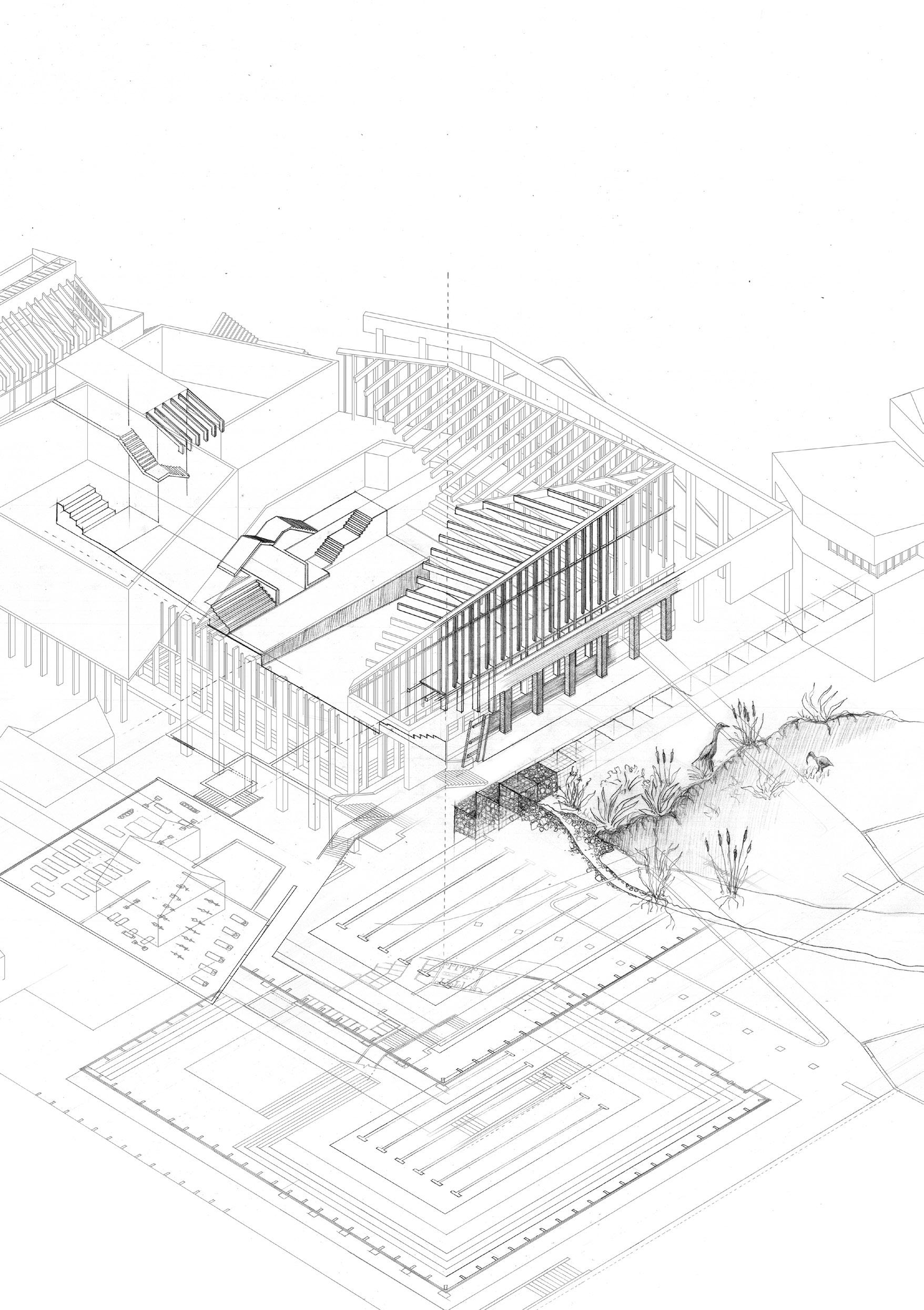
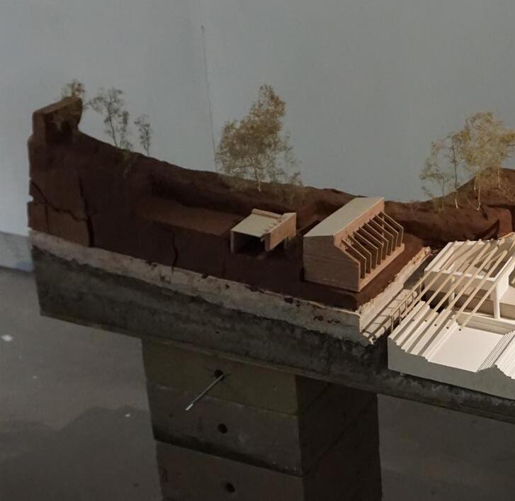
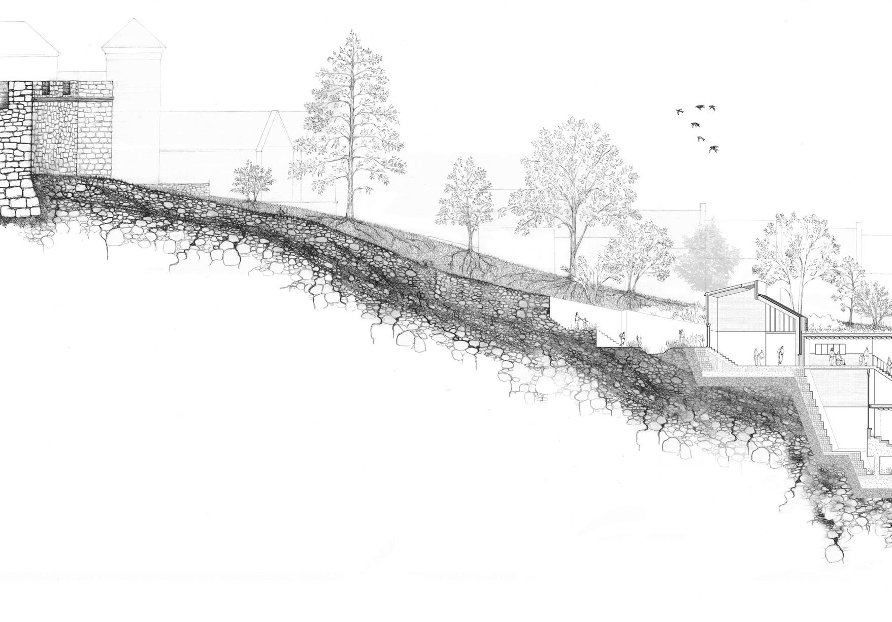
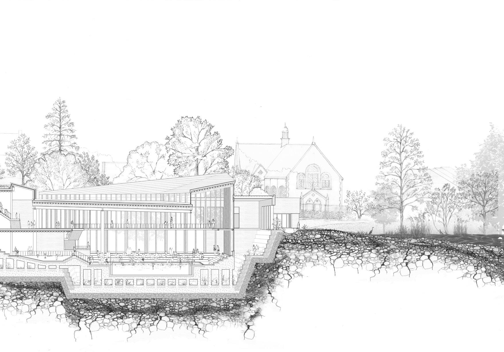
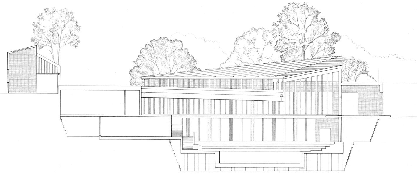
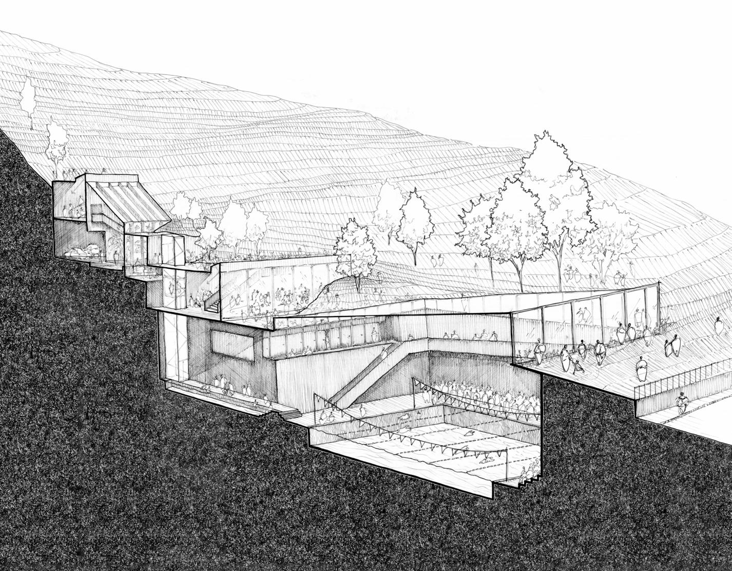
PERMEATING A FORGOTTEN LANDSCAPE
A CONVERSATION ON WATER AND HERITAGE
JESS GARDNER
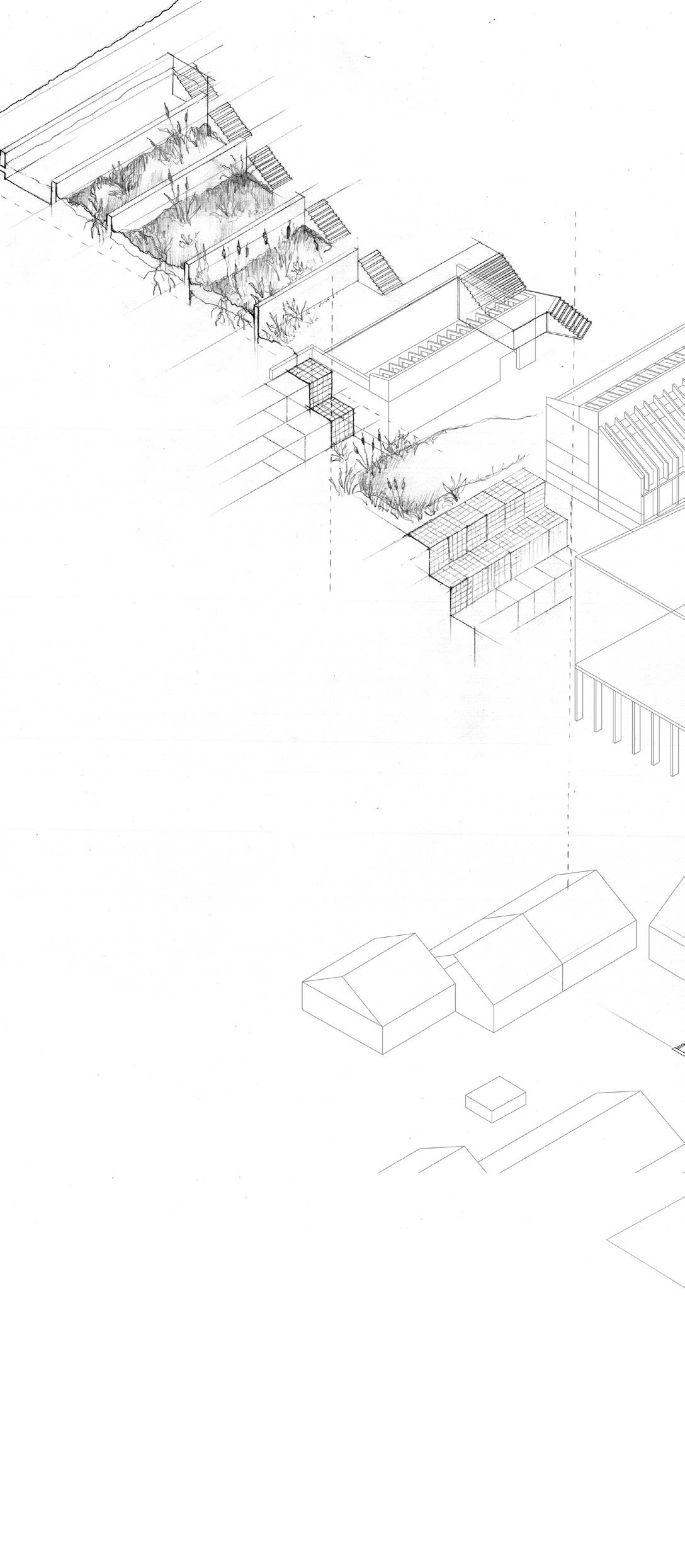
‘The Bogside’ in Derry, named after its historical landscape, lies at the bottom of the hill upon which the city walls sit. This thesis attempts to transverse the tangible and intangible edge between the two habitats by regenerating historic green and blue connectivity within the resultant ‘ecotone’.
Like a pebble, routed into a grind hole in a riverbank, the new aquatic landscape sits within a cutting to the buffer zone. The valley created becomes a channel for water to flow under and around the structure, a collection point for surface water from the city walls and home to the wetland plants of the historical landscape.
Within the wet bog landscape, my architecture provides a boundary where ground water intersects with and becomes purified water for swimming. Through a system of reed beds descending the hill, surface water from the city journeys throughout the architecture. The flow of water mirrors the flow of people. At its destination, the end of the narrative journey down through earth and history, the purified water fills and flows through three pools, including a place to swim outside, in a stepwell environment amongst the peaceful sounds and smells of the forgotten landscape.
The proposal recognises the potential of the eco-tone to be transformed into a place to gather and dwell. With the opportunity to swim, or simply engage with water and nature, communities are encouraged to interact socially with each other and the eco-tone through living, water and heritage.
06
57
Previous. Narrative Journey of Water and People. Hand drawn axonometric route of water filtration and human occupation
Left. Light and Shadow. 1:100 physical model aerial
Middle. Narrative Stair. 1:100 physical model detail
Right. Intersection. 1:100 physical model detail
Above. Environmental Regeneration. 1:50 hand drawn detailed section, embedded within an enriched green landscape
JESS GARDNER | PERMEATING A FORGOTTEN LANDSCAPE 59
 Left. Terracing Within the Descending Landscape. 1:100 hand drawn section
Middle. Facade Layering. 1:100 Lecky Road elevation
Left. Terracing Within the Descending Landscape. 1:100 hand drawn section
Middle. Facade Layering. 1:100 Lecky Road elevation
61
Below. Occupation of Required Spaces . A study of required spaces and their programmatic uses Above. Installation Across Scales. An amalgamation of physical models from conception to completion
Site: The Diamond, Walled-city, Derry, Northern Ireland
Programme: A Gathering Chamber of the In-Between, ‘The Centre for Femininity’ facilities and a café.
SUSTAINABLE RE-USE
A FEMININE RE-SEEDING OF DERRY’S DIAMOND
ELEANOR HYDE
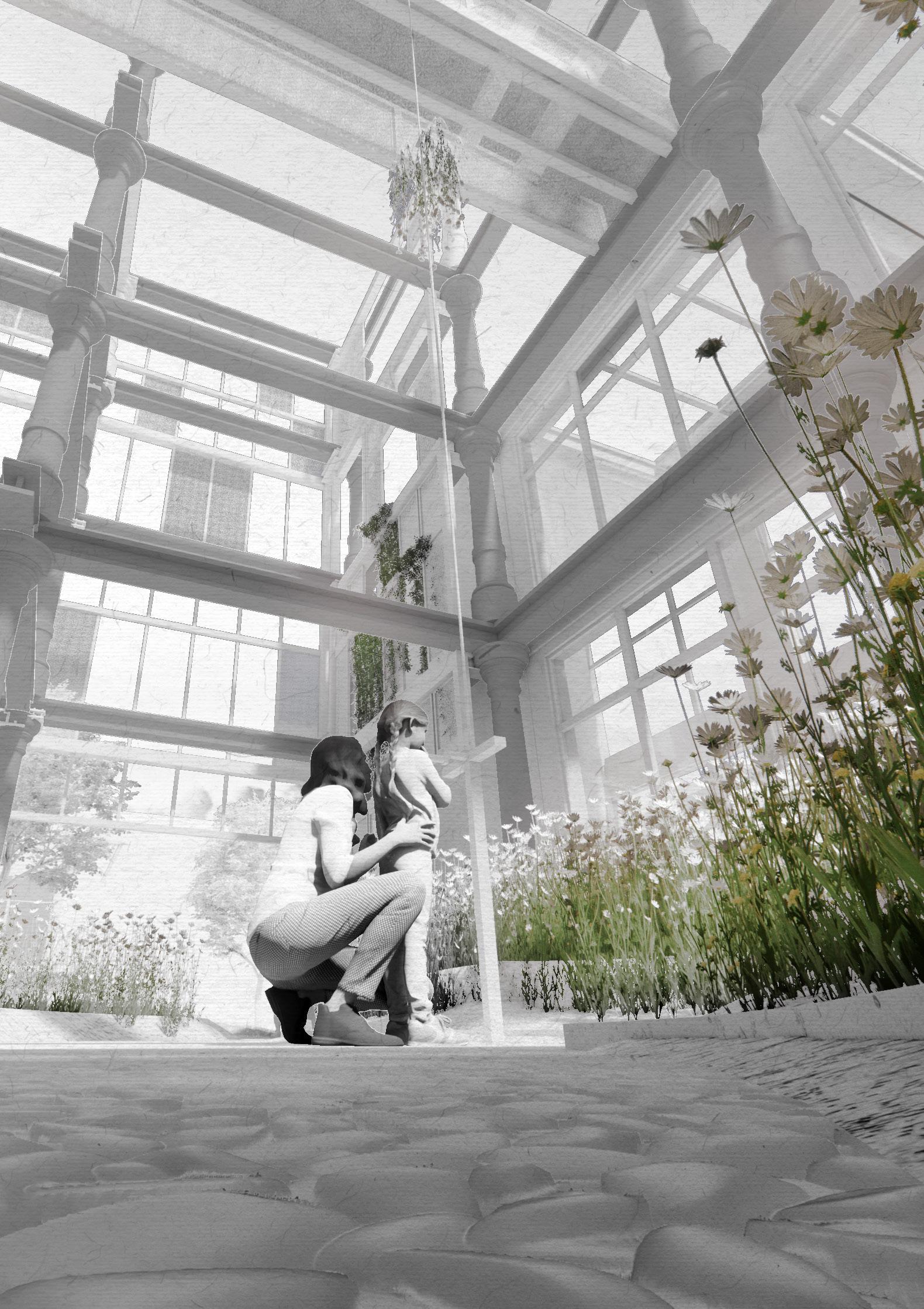
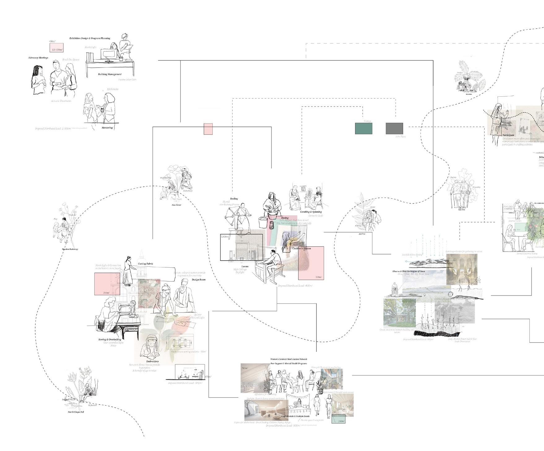
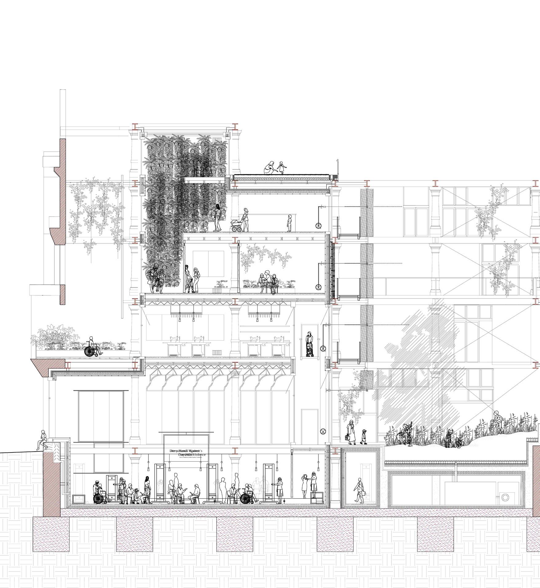
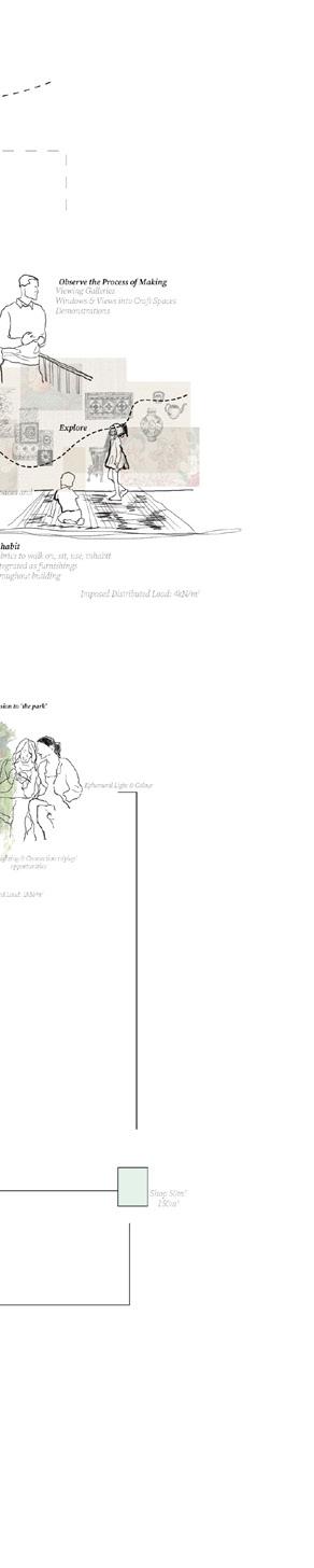
Once an Oak Grove, where humans existed in harmony with Mother Nature, Derry’s walled city is defensively located overlooking the River Foyle. This advantageous position has led to dense urbanisation and the depletion of ‘Mother Nature’, generated by masculine constructs of urban planning and territorialisation. Historically, a wealth of female influences upon the city have invisibly crafted Derry’s culture through the act of gathering in the ‘in-between’.
During the industrial revolution, the arrival of Derry’s linen factories allowed traditionally female-led craft processes to occupy the city. This united women ‘en-masse’ in conversation, textile craft and activism. Today, abandoned linen factories orbit the Diamond and opportunities to gather in the in-between have eroded.
The Centre for Femininity proposes the re-occupation of Austin’s Department Store. The centre acts as a place for feminine conversation through craft programs and the provision of urban green space for gathering and well-being. The teaching of traditional feminine craft provides local women with greater employment opportunities whilst embracing traditionally feminine culture. The design reintroduces femininity to a masculine city across multiple scales, thus creating a new ecotone by: Extending the nature of the feminine in-between and working within the existing, towards the future adaptation of historic linen factories. Sustaining linen craft & the female origins of linen.
07
63
Previous left. Introducing Femininity. Tackling the masculine construct of Derry’s Diamond
Previous. The in-between Flax Garden. Celebrating the origins of linen
Left. The Centre for Femininity. Combining traditional craft with feminine tectonics: Mother nature, Fabric & Reuse
Above top. Reseeding a Historic Courtyard Realm. Internal render

Middle. Facilitating the Teaching of Traditionally Female Textile Craft. Internal render
Bottom. Restoring a Heritage Landmark through Sustainable Reuse. Physical model
ELEANOR HYDE | SUSTAINABLE RE-USE
65
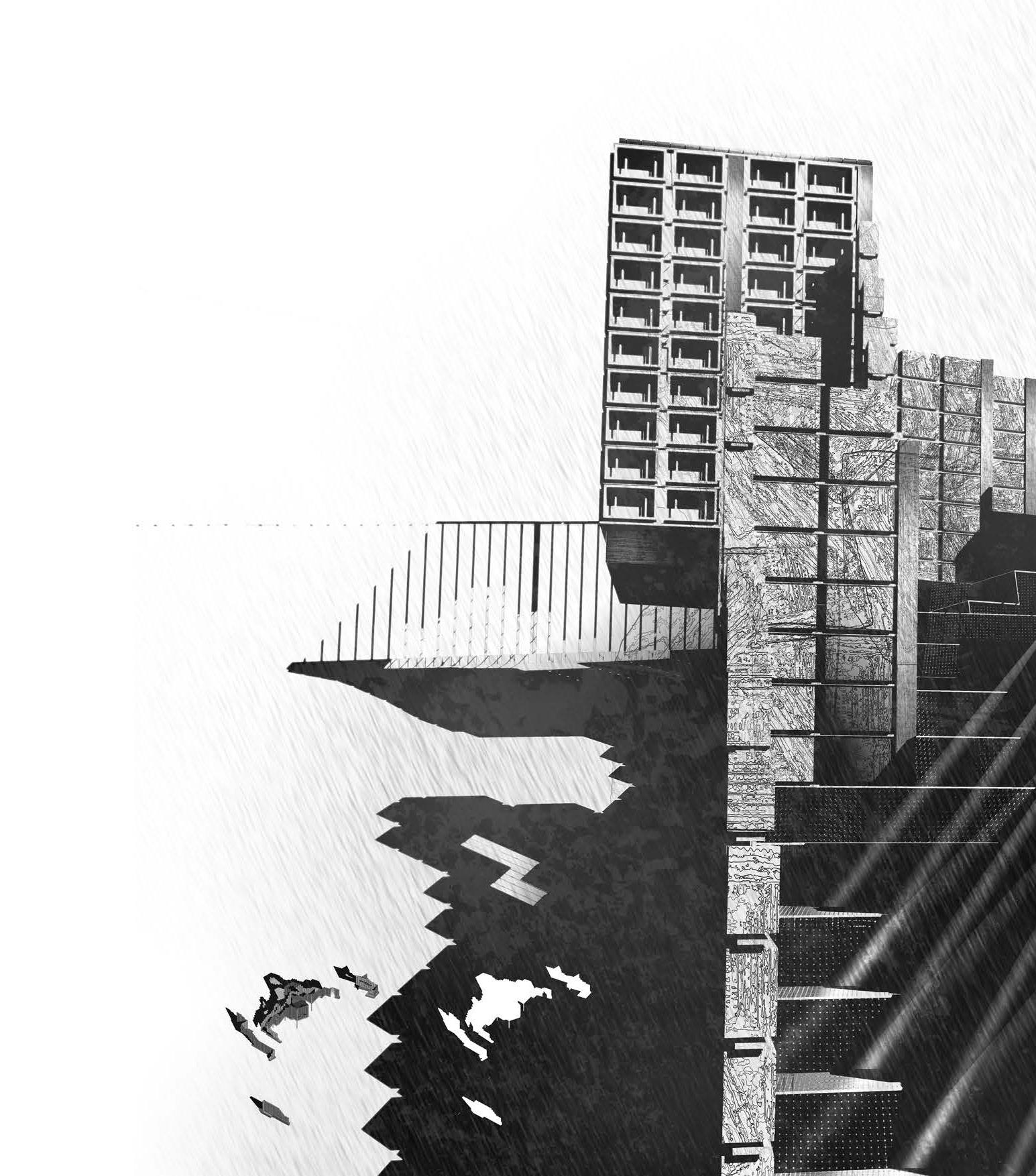
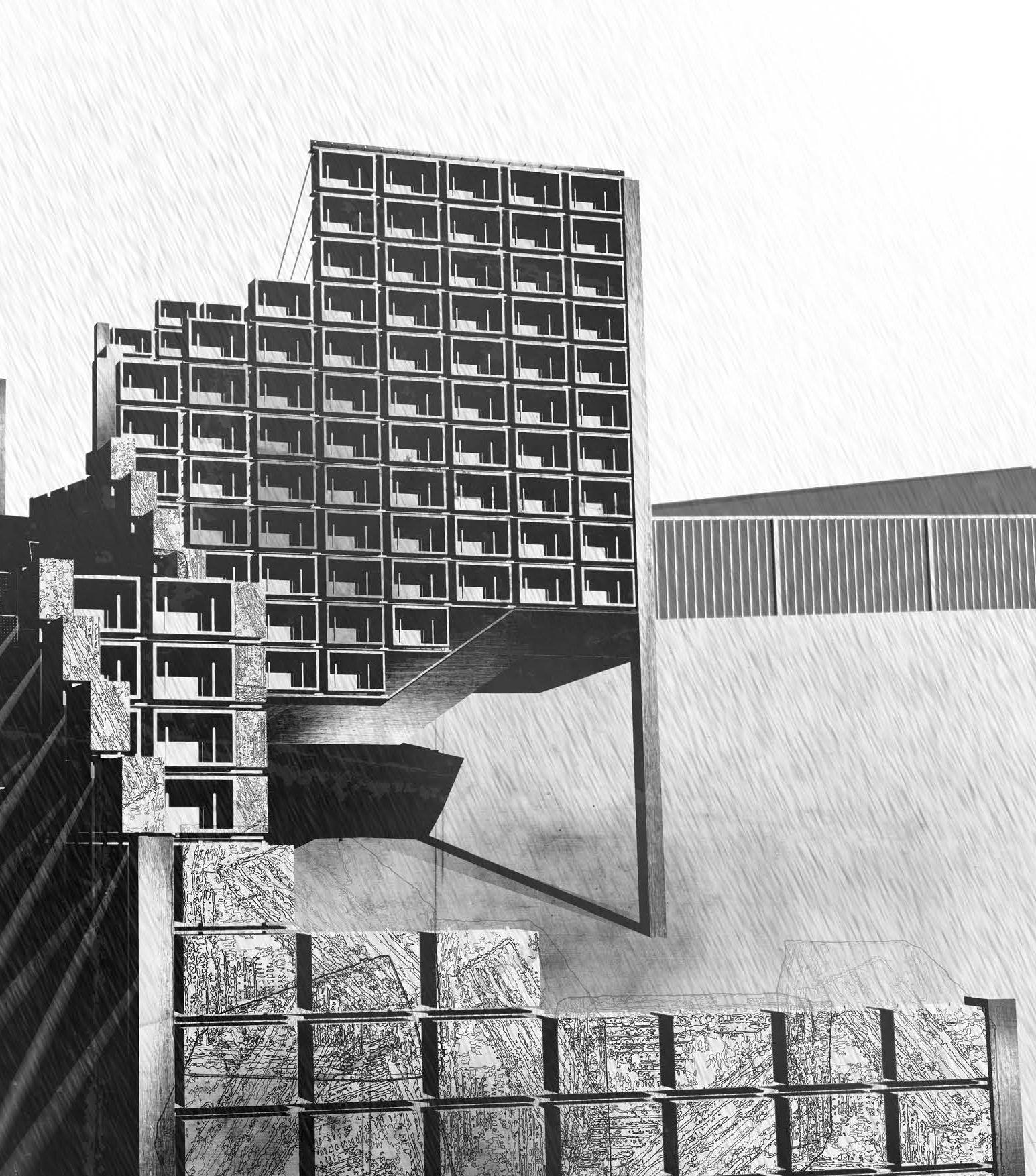
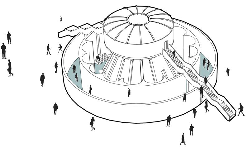
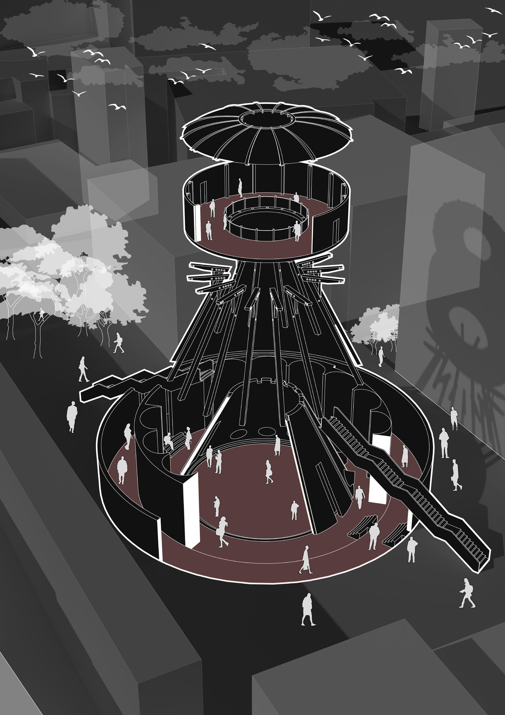
CÉIDE HILL
THE POSTMEMORY ASSEMBLY
HAMISH JACKSON
Céide Hill acknowledges the processes of Postmemory and considers how proximal events, occurring throughout Derry civic life, continue to influence and define the urban behaviours of the city. Through a process of re-collecting and re-remembering, the architecture affords an opportunity for the re-navigation of photographic archives, principally for the younger ‘hinge generation’, to clarify their Postmemories.
The Postmemory Assembly elevates a place of public gathering, framed between an ancillary space of reflection and a foundation of photographic archive, research, teaching and civic activity. The architecture supplements a new civic route in dialogue with the existing community and religious routes that traverse the topographic approaches to the city. Running parallel to this axis of light and movement, a family of apertures mediate between the inner programme of the Assembly and the lively public steps, affording a threshold space for an urban photographic display that rotates to a calendar of community-curated exhibitions. Assimilating the proximal geological processes of ‘dry gaps’, found local to the site’s underlying geology, and the precise, mechanical inner workings of film cameras, the architecture presents a hinge, both spatially and psychologically, traversing the public route and enabling memory-centric spatial conditions to anchor the building within its unique fissure of complex political, historical, constructional and psychological strata.
08
Site: Rossville Street - Fahn Street, Derry, Northern Ireland Programme: Public steps and square, photographic archive with research, teaching and lecture space, café and exhibition.
“Postmemory describes the frequently subconscious relationship of the second [hinge] generation to powerful, sometimes traumatic, experiences that preceded their births but that were nevertheless transmitted to them so deeply as to seem to constitute memories in their own right.”
1 67
Previous left. Reflecting Proximal Memory. Conflict Infrastructure mapping
Previous. The Postmemory Assembly. Projecting tectonic memories
Left. Assembling Mechanisms of Memory. Tectonic assembly axonometric
Above top. Re-hinging a Public Thoroughfare. Rendering through history
Bottom. A fissure of Conflict Infrastructure. Inhabitation through public movement and memory
HAMISH JACKSON | CÉIDE HILL
69
HAMISH JACKSON | CÉIDE HILL
Left. Camera Body Mechanisms. Tectonic projections section
Top. Inhabiting the Dry Gap between Rossville and the Present. Rendering through history
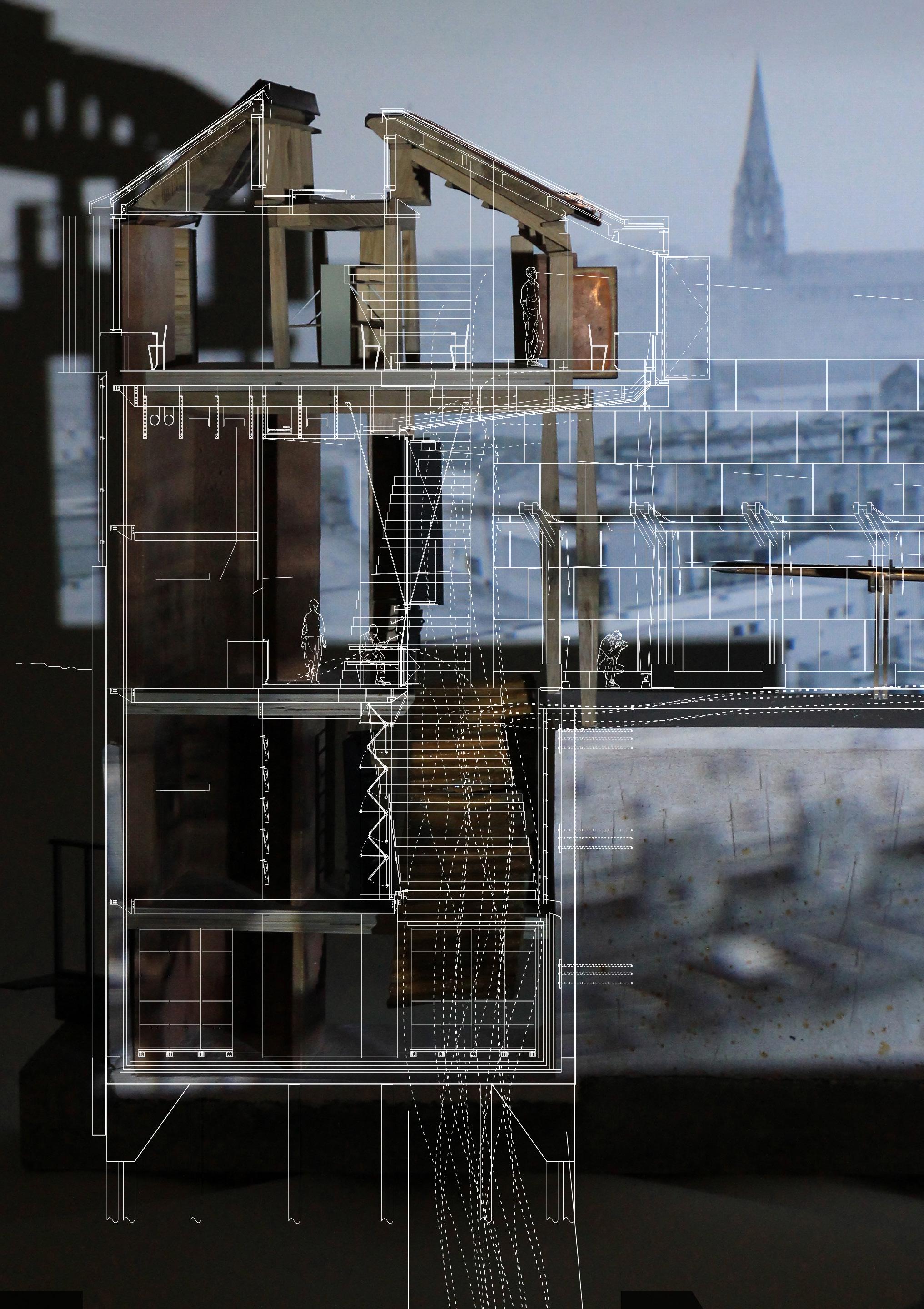
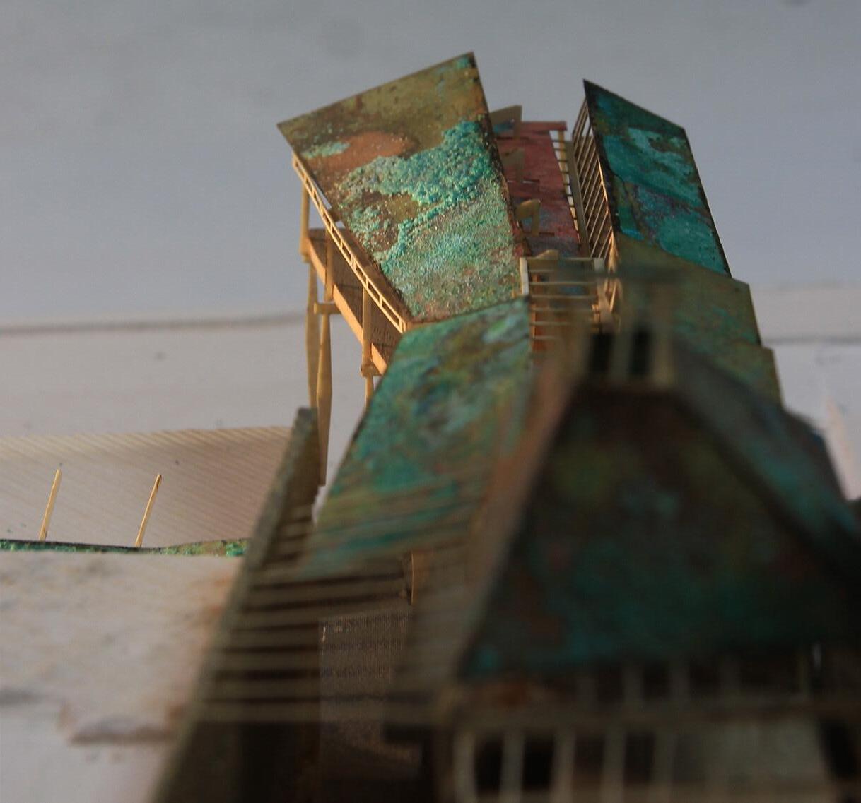
71
Bottom. Returning Focus to the City. Copper patina roof of 1 :200 model
Site: Great James Street, Derry, Northern Ireland
Programme: Integrated Health and Well-being Centre
DERRY THROUGH COLOUR
A CENTRE OF INTEGRATED HEALTH & WELL-BEING
CATHERINE JONES
Derry is a city on the edge, struggling to find its place socially, politically and economically. This seems to create feelings of unsettlement, a feeling of unease that often translates into poor mental and emotional health.
Working with this growing mental health crisis, this thesis explores the siting and design of an integrated health centre that brings together health promotion as well as treatment to improve mental well-being. The integrated well-being centre aims to create a place of both solace and wellness in the city. A haven focused on improving physical and mental health that brings people together and integrates itself physically and socially with the existing community of Derry.
Many key places which are part of Derry’s identity are seen and emotionally experienced through colour; a particular example being the pain and trauma still felt from ‘The Troubles’ through a series of monumental, political murals in the community of the Bogside. The phenomena of colour has continued to spread and take hold in recent years and in many ways has become an integral part of the character of Derry as well as its architectural form, showing colour can be used as a positive environmental force, in the interest of community health and well-being. A carefully choreographed set of environmental explorations of place including those into architectural colour, have been an important asset in shaping and grounding a community minded project that has well-being at its heart. This has resulted in a design driven by the related concepts of environmental and social sustainability.
09
73
Previous. Analysing the Colour of Derry. Masterplan mapping through colour analysis
Left. Depicting Colour and Space. Model images

Below. Exploring the Architecture of Colour. Model images
Bottom. Great James Street. South elevation
CATHERINE JONES | DERRY THROUGH COLOUR
75
Site: Reconstruction of the Peace Garden, Derry/Londonderry, Northen Ireland, UK Programme: A Sound Pavilion, Concert Hall and Arts Centre
THE SEPARATING EFFECT OF URBAN CACOPHONY
A CONVERSATION WITH NATURAL SOUNDSCAPE
TIM LI
Among the five senses of human beings, vision and hearing are typically considered to be the most important. Our sense of hearing connects us to a ‘world in motion’, often protecting us from danger, be it air agitated by straining vocal cords, the honking of a car horn, or the whirring siren of an ambulance, in cities, sound is a key dimension of urban landscape, often called ‘soundscape’. Derry can throughout history have been considered as a place of conflict, noise and disturbance from the sound of cannons during the siege of the city in 1689 to the rattle of gunfire during the period of ‘The Troubles’. Sound can also have a considerable impact on people’s mental health, and is often associated with stress, sleeplessness and higher risk of hypertension and heart attacks.
Conversely sounds generated by nature have been proven to have positive effects on human health, such as reduced anxiety, improved attention and positive mood. Through a soundscape analysis of a key urban route through the hard, urban landscape of today’s Derry, the level and complexity of urban ‘white noise’ and the ‘separation’ of human beings from sounds of nature has been evidenced and illustrated. A further correlation with the lack of sounds from nature and the level of urban white noise is the impact this has on social relations.
This project proposes 3 new ‘sound-routes’ through the city. The moment of intersection incorporating auditory programmes such as a Guildhall Sound pavilion and Derry Concert Hall with associated Arts Centre.
10
77
Previous. Occupation and Circulation. Aerial view Behind. Sectional Journey. Axonometric view
1600M 1600M
Cloud Mapping Derry Jiatong Liu
79
Site: Ebrington Square, Derry/ Londonderry, Northern Ireland
Programme: Ebrington Square masterplan with sunken recreational garden, library and archive, café and gathering space.
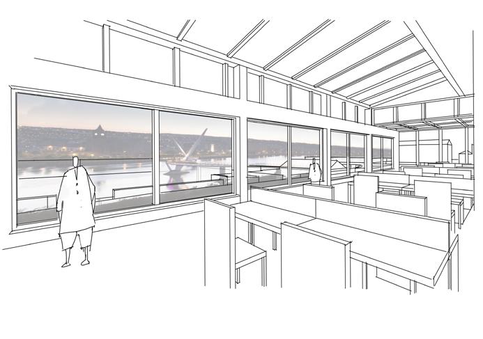
EYES IN THE CITY IN[VISIBLE] DERRY
TONY LI
1
Urban surveillance has played a vital role in Derry’s history of political and social conflict, with the use of surveillance technology becoming more widespread in recent years for public safety, crime prevention and potentially social surveillance.
This thesis aims to investigate urban surveillance in Derry, with a focus on ‘the wall’ as the primary tool of surveillance, particularly in a historic context and the edge effects it has created. It explores the ways in which visible and invisible urban elements shape our physical experience of the city’s past, present, and future, and how architecture and design can reveal or obscure layers of history and meaning embedded in the city’s fabric. The thesis also examines how the confluence of the visible and invisible can shape our perception of the city.
The project aims to regenerate Ebrington Square as a city-wide focal point, connecting the old walled city and the Waterside community. The proposal involves sinking the site down into the ground, to explore notions of visible and (in)visible through the relationship of landscape to built form in a new form of archi-tectonic sub-terrain, which becomes revealed experientially as one moves through the site.
11
“ The City of Derry, a place of beauty and pain, With walls of stone built to protect and restrain. A city with two faces divided by the river Foyle, The walled city and Waterside, each with its own soil.”
1 A short historic introduction presented in the form of a poem by the Author
81
Previous. A Panoramic View From the City. Render towards the library
Left. Sectional Detail. 1:50 model
Middle. Library Model with Landscape. 1:200 model
Bottom. Library Main Entrance Facade. Render from the Waterside
Behind. Library Bridge. Render towards ground level
TONY LI | EYES IN THE CITY
83
 Behind. A Panoramic View From the City. Render towards the library
TONY LI | EYES IN THE CITY 85
Site: Bogside City Wall, Derry, Northern Ireland
Programme: Environmental Monument, Moss institute, Moss Garden, Vertical Infrastructure.
DERRY MOSS INSTITUTE
ARCHITECTURAL OBSERVATIONS ON ATMOSPHERIC MOISTURE
JIATONG LIU
Londonderry, Northern Ireland, has a complex and turbulent history marked by division and conflict, a city with a turbulent history, blessed with a unique climate. The rich humidity of the Atlantic Ocean is brought to Derry by the prevailing south-westerly winds. The resultant high humidity levels in the area create the perfect environment for moss to thrive. Moss, a delicate plant, stands in stark contrast to the city’s rugged walls and buildings. Yet, it also represents resilience and adaptability. Moss has the ability to grow and flourish in harsh environments, much like the people of Derry who have faced centuries of conflict and strife.
The moss, with its soft texture and vibrant green colour, offers a stark contrast to the city’s harsh walls and gritty streets. It serves as a reminder of the city’s natural beauty, even during turbulent times. The moss represents hope, growth, and renewal, all essential values for a city that has endured so much. As an infrastructure, The Moss Institute breaks down the city walls, which were originally built to separate the inside from the outside of the city. Seeking to blur the boundaries between inside and outside spaces. The project involves removing a section of the city wall and transforming it into a moss garden, a green oasis in an unremitting urban landscape. The Moss Institute comprises a moss garden, moss cafe, exhibition space, laboratory, reading room and workshop. The spatial concept is focused on creating a new type of public space, one that promotes interaction, collaboration, and creativity.
12
87
Previous. Volumes and Occupation. Construction section
 Above. Architectural Intersection with the City Wall. Site plan
Right. Inhabitation of the Slope. Section
Below. View from the Wall. Exterior render
Above. Architectural Intersection with the City Wall. Site plan
Right. Inhabitation of the Slope. Section
Below. View from the Wall. Exterior render
JIATONG LIU | DERRY MOSS INSTITUTE 89
Site:
Programme:
ON THE FRINGE OF THE FOYLE REPAIR, SEDIMENTATION & AFFORDANCE
The Foyle River is Derry’s founding and key ecological element. Through County Donegal, County Tyrone and the city of Derry, discharging into Lough Foyle and finally the Atlantic Ocean the waters of the Foyle have flowed freely long before borders, roads and railway tracks defined its ever-changing edges. The rich eco-tone between land and river in Derry is fractured and requires a programme of repair looking to the future. This thesis is founded upon a site specific, hydrological concern sympathetic to the ideology of Derry existing once again in harmony with the flow of the river Foyle. Designed to restore the historic banks of the Foyle to its natural condition, the project fundamentally aims to alter the narrative the river plays in modern Derry and reinstate an agrarian, pre-industrial attitude and relationship between the people of Derry and the river.
Acknowledging ebbs and flows of the river, a sequence of biological filtering pools feed a larger set of two ‘open water’ swimming pools with associated facilities which bring people back once again to the banks of the Foyle. A new approach is adopted to the banks of the Foyle as an ecological corridor that works with rather than against its tidal range and biodiversity. Located on the city side of the Foyle adjacent to the Craigavon Bridge the project lies in direct response to the historic railway that once terminated in this location. Through speculatively re-wilding the river’s edge and removing the existing retaining wall that carves the river’s banks, the project looks towards projected sea level rise, allowing the existing, man-made edge to soften and welcoming an increase in the river water.
13 Á INE LY NC H
91
Previous left. Tracing the Foyle. An affordance through time
Previous. Re-Imagining the Ecotone. Site plan
Top left. Tectonic Anatomy. Aerial diagrams
Top right A Horizontal Expression. Elevation study
Behind Pavilion Cafe. Perspective section
ÁINE LYNCH | ON THE FRINGE OF THE FOYLE
93
Above. A Conversation with the Tide. Section through the Foyle Behind. Low Tide at Noon. Render looking across the Foyle
ÁINE LYNCH | ON THE FRINGE OF THE FOYLE 95
FOLDED LONDONDERRY
THE NEWLY FOLDED ‘IN-BETWEEN’
SHUO PAN
Derry’s city walls, standing in a defensive position overlooking the river Foyle, are the oldest structure in the city. Despite the cultural and political conflicts that have occurred throughout Derry’s history, the walls have remained a constant in the urban fabric, providing a sense of safety and continuity in an often-contested landscape. However, in areas where different communities and cultures converge, education, communication and exchange of knowledge are crucial.
To address this city-wide need for cultural and community integration, a new building is proposed as a hinge between the Irish and British communities, located adjacent to the over 100-year-old Craigavon Bridge, the principal access road to the city centre. The site was once the location of the largest shirt-making factory in the UK but has long since been abandoned and covered in vegetation. The design seeks to form a bridge between; the city of Derry and it’s river; the urbanity of the town and a renewed natural riverside landscape and the two cultural communities.
The project’s design strategy is to intersect with the river’s edge, forging from the existing site gradient an embedded relationship between landscape and built form and a canopy design which incorporates both formal structural approaches and walk-able landscape. The project programme aims to foster communication and understanding between communities through a place of learning, social engagement, knowledge exchange and improved natural habitat.
Site: Foyle Road, Valley Railway Museum site and River Foyle, Derry Programme: School of Learning, lecture space, library, café and exhibition. Public square and stepped landscape.
14
97
Previous. A Folded City. Mapping through folds
Top left. Through the River. Section
Bottom left. Tectonic Anatomy. Construction model
Top left. Elemental Layers. Exploded axonometric
SHUO PAN | FOLDED LONDONDERRY
99
Site: The Bogside, Derry, Northern Ireland.
Programme:
TOWARDS AN ARCHITECTURE OF TOUCH
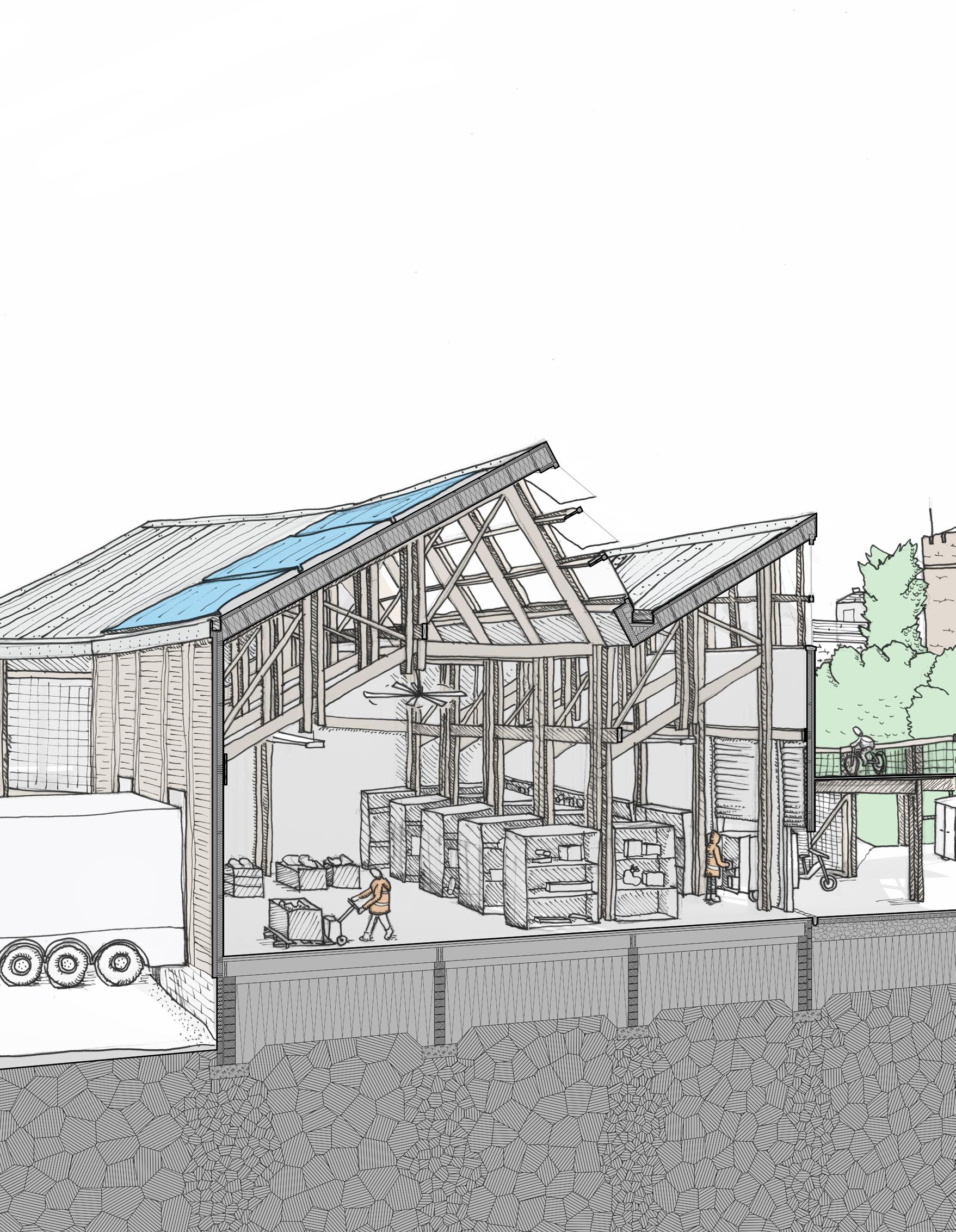
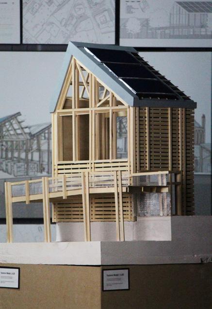
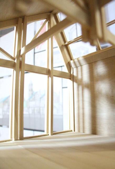
THE REUSE SCRAPYARD
BECKY WHITEHEAD
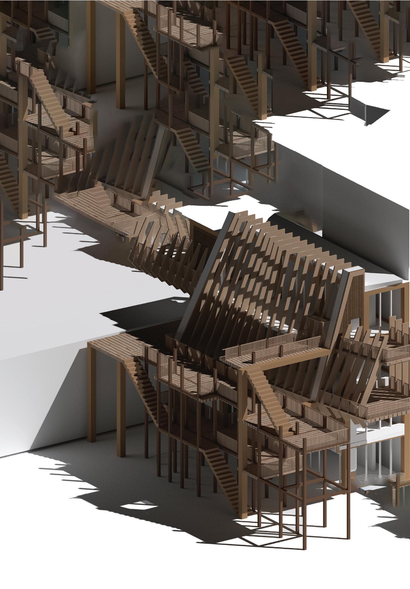
Many of the stories we are told about our world are colonial fictions; our landscapes are shaped and carved by forces of empire and power. Nowhere is this more evident than in the city of Derry in Northern Ireland. By rooting investigation in the tactile, this thesis aims to prioritise the subjective nature of bodily experience and use the sensuality of textural surface as a mechanism to tell stories which do not continue these colonial practices. An emotionally charged exploration of material displacement over time manifests in the reintroduction of craft, and more careful representation of the stories and significances held within architectural material. An experimental edge structure prototypes these themes and is the precursor to a broader urban intervention which responds to histories of displacement, exploitation and importation of architectural material with empathy and resourcefulness. At the edge of the Bogside, the notorious Meenan square site and the stretch of Lecky Road underneath the flyover are reclaimed, serving as the testing ground for new ways of building with material from derelict sites across Derry. A core is formed from the very material which holds centuries of architectural history and provides the tools for the design and construction of any number of further experimental structures across the community. Construction skills are shared, and new ideas are tested which show greater empathy to the people, and material, which comprise these communities. An architecture of touch provides two affordances for communities within Derry; a sense of intimacy with one’s surroundings, and the agency to work with and improve them.
Construction material repurposing centre; classrooms, workshops, salvage and testing yards. Further experimental structures along a reclaimed streetscape.
15
101
Previous left. An Experiment of Reclamation. Sketch elevation
Previous. A View into the Classroom. Rendered view
. Elevation
BECKY WHITEHEAD | TOWARDS AN ARCHITECTURE OF TOUCH
Left. The Reuse Scrapyard
103
Right. Material Study. 1:2 model
 Above. The Reuse Scrapyard. 1:20 structural and detail model Behind. An Agency to Construct and Improve Workshop section Right. Back to the Body 1:50 exploded view
BECKY WHITEHEAD | TOWARDS AN ARCHITECTURE OF TOUCH 105
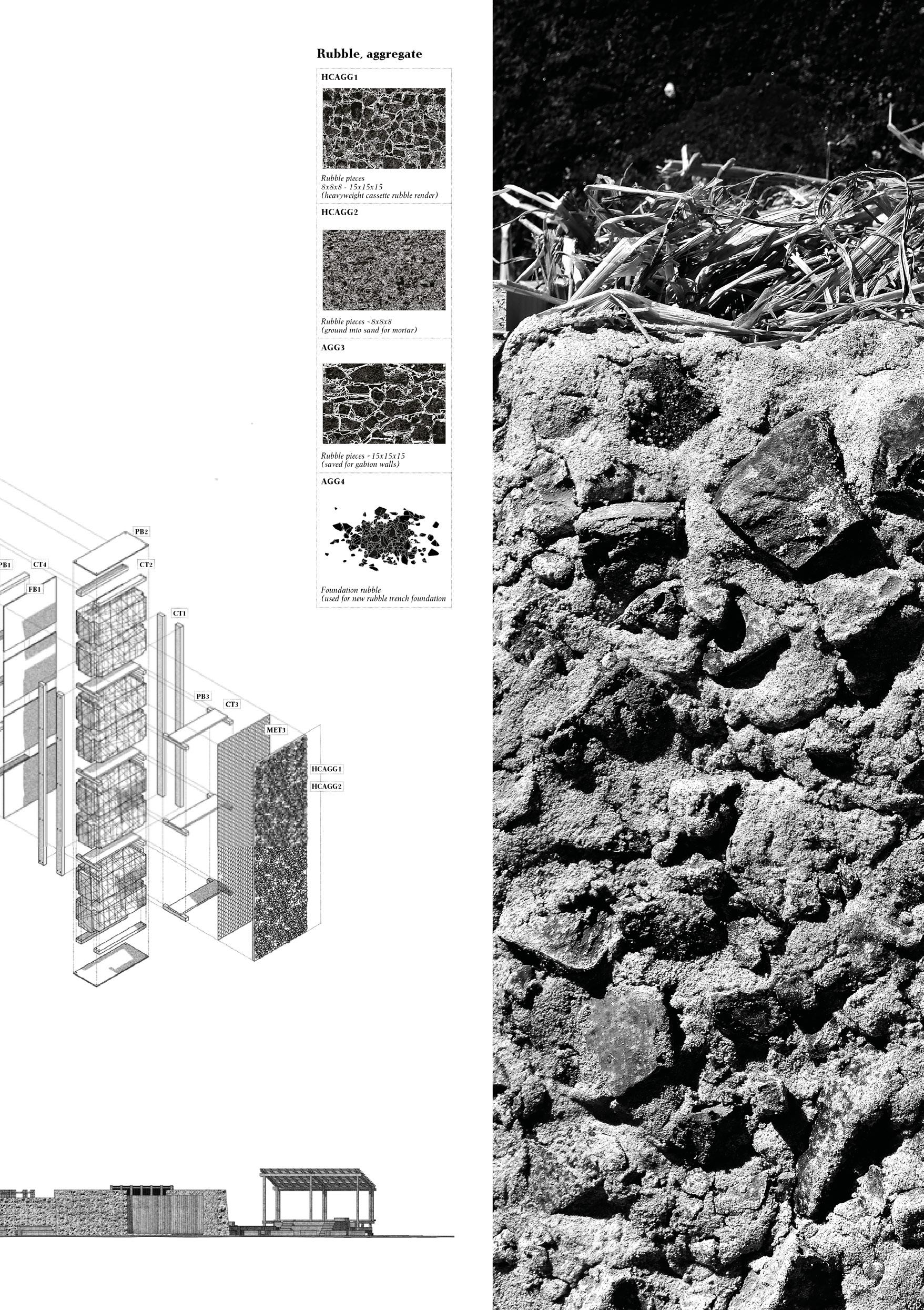
Bonfire Material Taxonomy
Georgia Whitehead
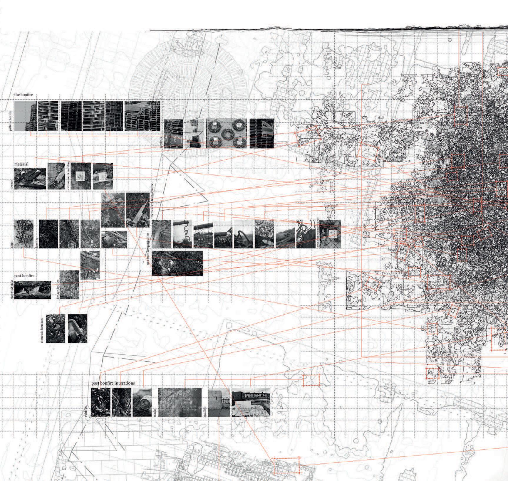
107
Site: Meenan Square, The Bogside, Derry Programme: Renewal, reuse, re-purpose and re-wilding.
FROM THE ASHES OF THE BOGSIDE BONFIRE
AN ARCHITECTURE OF RENEWAL, REUSE, RE-PURPOSE AND RE-WILDING.
A lost landscape, rediscovered through time by a physical mapping of air flows and pollen movement across its topography and river morphology uncovered a past Derry, once viewed as an island, clasped in the branching River Foyle and its dense unpassable reeds.
Over time air flows became disrupted with cannon fire as new men announced their arrival in this place and to begin colonial occupation and a cleansing of culture and nature. The bog-land, diminished by fire, land cultivation and built urban infrastructure, is now left scorched and dried to become a ‘field’ of societal discontent, hate and prejudice.
Scattered with the remnants of rituals; rusted nails, shattered glass and charred timber palettes, the scorched field sits below the Derry walls. A symbol of protest and commemoration for each side of the cultural divide constructed in the fleeting bonfire, casts permanent scars on the land. Its construction unites the people of the Bogside, whilst its burning ignites the division between the two communities. Within the flame the displacement of air creates a temporal spatial moment which disperses immediately, creating space for a new circumstance. As fire in ecology renews, the destruction caused by the fire sparks an opportunity for repair and renewal of the ecological imbalance.
This thesis ignites the restoration of the forgotten landscape sparked from the conceptual framework of the flame, to re-establish a new affordance between the city as a manmade construct and the ecology it too often overrides and replaces. A carbon sink to restore and replenish the Bogside. A place of ritual and memory beyond the impermeable conflict infrastructures currently in place. A place for recycling and repurposing of material, water and craftsmanship.
16
GEORGIA WHITEHEAD

109
Previous left. Shadow-Dancers. Site plan
Previous. A New Threshold to the Bogside. 1.500 concept masterplan Left. Assembling Mechanisms of Deconstruction. Exploded structural axonometric.
Above. A Complex Assemblage. 1.50 sectional model
111
GEORGIA WHITEHEAD | FROM THE ASHES OF THE BOGSIDE BONFIRE Above. A Positive Form of [Re]Construction for the Community of Derry. View in the wetland 113
Site: City Walls [between New Gate and Ferryquay Gate], Derry.
Programme:
DERRY’S ECHO
A SYNESTHETIC JOURNEY THROUGH THE CITY WALLS
DERIN BEREN YALÇIN
There lies the oldest structure still standing in Derry – the city walls. The journey on which this project is based is a route on and around the old city wall, a journey which has been the subject of a combination of phenomenological research methods, both quantitative and qualitative; empirical and impressionistic. The old city of Derry, inside the city walls might be considered in the present day as a place of loneliness and isolation, particularly in the evening, due to the lack of a housed, living population combined with retail and commercial vacancy. The surrounding townscape, in contrast, is often a place of thriving commercial and social activity. The walls of Derry have been an ‘in-between’ for centuries. In-between inside and outside, urban and landscape, safety and danger, comfort and discomfort, presently quiet and thriving. This project is based upon the perceptions of a synesthete, (the author) where one experiences a particular sense [hearing] through another one [sight]. Walking along the walls, a synesthete can simultaneously feel comfort provided by the beautiful view and the discomfort that can be caused by noise. This design approach requires the interpretation of feeling and emotion generated by synesthetic perceptions of colour and sound and the application of these emotive states to spatial, material and tectonic design approaches.
The proposal offers a series of working and learning spaces (in a multiplicity of relationships to the city wall depending on their function), enabling various forms of art production for the people of Derry, including retreats for artists in residence and associated social activities in the heart of the city.
Artist retreats, writer’s retreat, artist workshop, reading room, exhibition space, common areas, gathering & event space, conference facility and sculpture garden.
17
Series of videos and sounds have been recorded Series of lidar scanes have been done in the area Series of texture recordings Series of videos and sounds have been recorded Series of lidar scanes have been done in the area Series of texture recordings Spot 2 Spot 2 Spot 3 Spot 4 Spot 5 Spot 3 Spot 4 Spot 5 Series of rubbings to record the texture series of recordings were done with a sound meter Spot 1 Spot 1 series of sound recordings Series of rubbings to record the texture series of lidar scanes have been done series of sound recordings Series of videos and sounds have been recorded Series of lidar scanes have been done in the area Series of texture recordings All The Analised Spots and the reaserch Sound or Video Recording Sound emission level been recorded Market Street DERRY Quadrant 1 Quadrant 2 Quadrant 3 Quadrant 4 Quadrant 5 Quadrant 6 Quadrant 7 Quadrant 8 Ground Texture + Point 1 + 2 Wall Texture Texture + Point 3 Point 4 Point 5 Point 6 + 7 Texture + Wall + Point 8 52.1 52.1 59.3 62.8 66.3 66.2 67.9 68.4 61.5 Section Cut 1 Identifying the site 2 Organizing in response to topography 3 Extruding in order to capture the views 115
Previous. Recorded Scars on the Earth’s Layers. Site analysis studies.
DERIN BEREN YALÇIN | DERRY’S ECHO 117
Left. The Different Layers of the Wall. Model photo with isometric view. Above.
A Synesthetic Journey Through the Architecture. Axonometric view
18
THROUGH THE PEACE WALL TRANSFORMING THE THRESHOLD
YU YU
Derry has long been established as a city of walls. During ‘The Troubles’ in Northern Ireland a series of ‘Peace Lines’ or ‘Peace Walls’ sprang up in most cities in an attempt to prevent acts of violence and anti-social behaviour between religious communities. The Fountain Peace Wall is Derry’s last remaining Peace wall, separating the protestant, unionist community from the more catholic communities which surround it. It can be considered in a sense to be one of the most contested conditions of the ‘in-between’ in all of Derry. The Fountain itself sits on the site of the old Derry City jail, demolished in 1953 but for its castellated brick tower.
In recent years the existing Peace Wall, an entirely unremarkable structure, has been tentatively re-configured to include a partially concealed Bishop’s Gate entrance and the incorporation of exhibition material on the history of Derry. This thesis purports that the Fountain Peace Wall, (and similarly any remaining Peace-wall structures in Northern Ireland), can be reimagined and transformed as a new and enriched urban ‘eco-tone’ or inbetween which not only prevents anti-social behaviour but makes a positive contribution to tolerance, social togetherness and knowledge exchange between divided communities.
The project proposes a contemporary, open, multi-level structure, which can be accessed from both Bishop’s Street and The Fountain. It defines different use patterns, critically including a library and café, whilst maintaining privacy for Fountain residents.
 Site: The Peace Wall. The Fountain Estate/ Bishops Street, Derry Programme: Threshold and entry to the Fountain Estate from Bishops Street. Community gathering space. Library and associated reading spaces, café, greenhouse.
119
Previous. Transforming the Threshold. First floor plan Left. City Context of Learning City-scale analysis
Above. Constructing a Threshold. 1.50 model images.
Right. A Contemporary Multi-level Structure. Long section.
YU YU | THROUGH THE PEACE WALL
121
Site: Waterloo Place, Derry
Programme: Green educational route with urban living room, bookstore and exchange, reading room, café and resting space.
19
BOOK-ENDING
THE
URBAN LIVING ROOM IN DERRY’S WALLED CITY
YANGJIE ZHAN
For residents of cities both in the UK and world-wide urban crime is a reluctantly accepted part of city living. From theft to anti-social behaviour, to more serious forms of violence, sometimes leading to loss of life. Derry is no different in this regard and has a chequered history of sectarian violence to add to this mix, thankfully in decline in recent years but not entirely eradicated. A careful study of crime type and levels across Derry’s urban spaces revealed a site of particularly high crime rate as the urban square of Waterloo Place, at the north-east corner of the old walled city.
The theme of this thesis draws on Gaston Bachelard’s theory of ‘The Poetics of Space’ about ‘home’ and aims to provide an urban space of familiarity. The ‘urban living room’ as a public space which through a translation of the features and elements of safe and protected domesticity, can impart to the urban realm feelings of comfort, safety, togetherness and affordance. Studies in sociology illustrate that one of the key indicators of criminal behaviour is lack of education and literacy, alongside poverty and the influence of family up-bringing. Derry has a clear deficit in the provision of libraries and reading spaces for its population, ironic given the immense and proud literary tradition of the island of Ireland. The project proposes an ‘edge-structure’, sited in Waterloo Place, used as a test-case to develop a formal and spatial language of the urban living room in preparation for a second larger project of a book-store and exchange, with reading rooms and associated leisure functions, connecting the city wall with Waterloo Place as part of a newly formed green, educational urban route.
123
Previous. An Urban Living Room. Axonometric view Above. The Poetics of Space. Exploded Isometric
YANGJIE ZHAN | BOOK ENDING 125
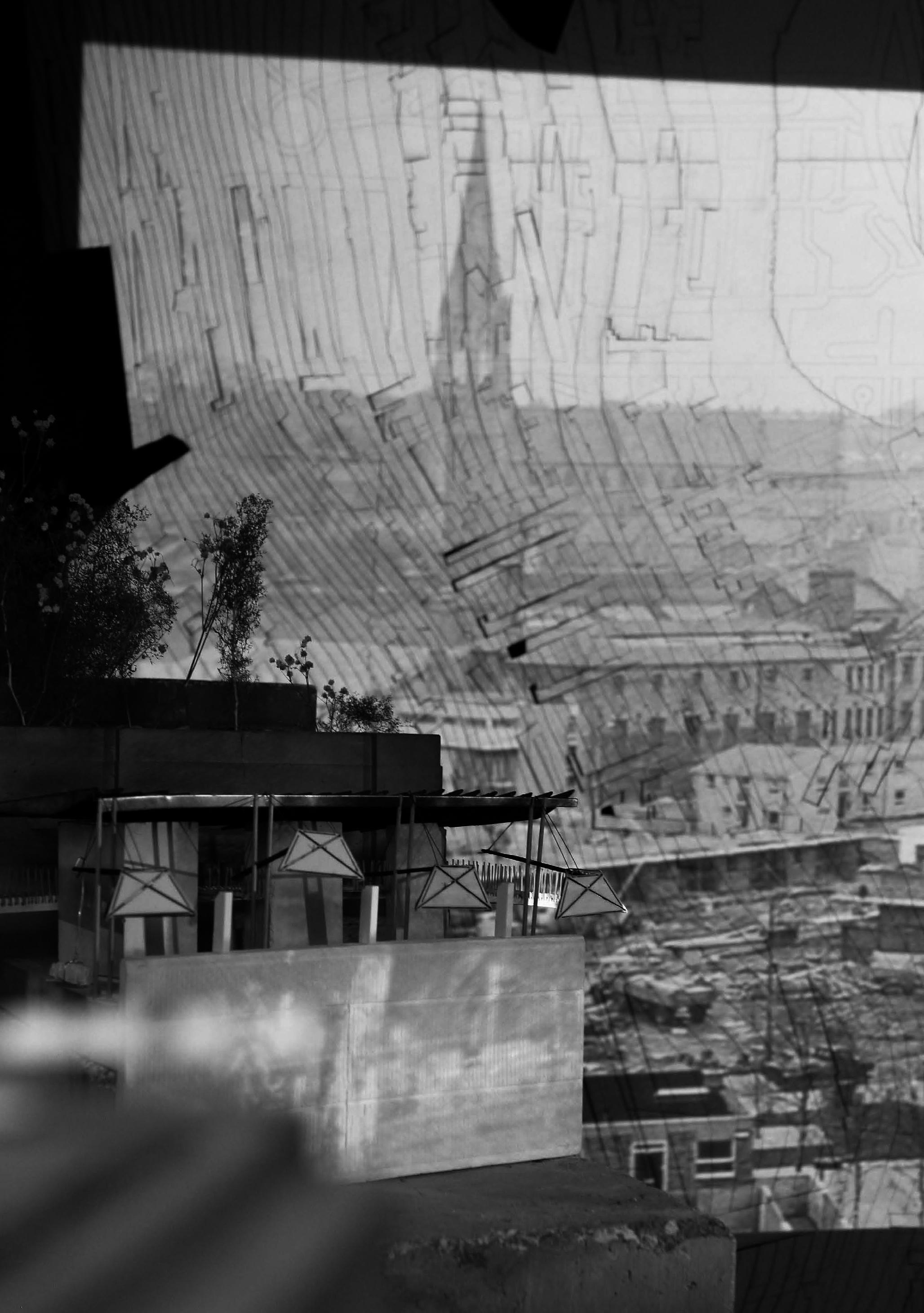
 Derry City Model with WEAP Projections
Georgia Whitehead
Derry City Model with WEAP Projections
Georgia Whitehead
127
 Playwright Provocations
James Maidment
Playwright Provocations
James Maidment
129
 The Forum of Irish Language
Adam Blacknell
The Forum of Irish Language
Adam Blacknell
131
 Céide Hill Model Assembly
Hamish Jackson
Céide Hill Model Assembly
Hamish Jackson
133
BIBLIOGRAPHY
Zumthor P. (2006) Atmospheres. Birkhauser
de Graaf R. (2014) Four Walls and a Roof. Harvard University Press
Pallasmaa, J. (2005) The Eyes of the Skin: Architecture and the Senses. J. Wiley & Sons. England
Mitchell W.J. (1994) City of Bits: Space, Place, and the Infobahn. MIT Press
Fonseca, M. F. (2008) Edge Effect. In ‘Encyclopedia of Ecology’. Pp 1207-1211. Ed. Jorgensen & Fath. Academic Press.
Fukuoka, M. (1972) “The One Straw Revolution” Rodale Press, PA.
Friel, B. (1973) “The Freedom of the City” A Play
Roche, A. (2011). ‘The Politics of Space: Renegotiating Relationships in Friel’s Plays of the 1970s,’ in Theatre and Politics, pp. 105-129. London: Palgrave Macmillan.
Komarova & O’Dowd (2016) Belfast, ‘The Shared City? Spatial Narratives of Conflict Transformation’. In ‘Spatializing Peace & Conflict’ pp 265-285. Ed. Bjorkdahl, A. Palgrave Macmillan.
Kelly, L. (2003) Language, Memory & Conflict: Acts of Interrogation. In ‘Deterritorialisations: Revisioning Landscape & Politics’. Pp 309-320. Ed. Dorrian & Rose. Blackdog Publishing.
Gibson, J. J. (1977). The Theory of Affordances. In Shaw, R., Bransford, J. (Eds.), Perceiving, Acting, and Knowing: Toward an Ecological Psychology (pp. 67–82). Hillsdale, NJ: Erlbaum.
Gibson, J. J. (1979). The Ecological Approach to Visual Perception. Boston, MA: Houghton Mifflin.
Zeisel, J. (2006) Inquiry by Design: (Environment/ Behaviour/ Neuroscience in Architecture, Interiors, Landscape, and Planning) Norton: New York.
Cadwell, M. (2007) Strange Details; MIT Press.
Schwarz C. (2017) Introducing Architectural Tectonics: Exploring the Intersection of Design & Construction. Routledge NY.
Deplazes, A. (2005). Constructing Architecture: Materials, Processes, Structures, a Handbook. Basel; Boston: Birkhäuser
Web-links
Derry Walls Conservation plan and Management Plan and Historic Environment Record of Northern Ireland (HERoNI)
https://www.communities-ni.gov.uk/articles/derry-walls#toc-3
The Great Parchment Book of the Honourable Irish Society, ‘History of the Plantations’. www.greatparchmentbook.org
Derry & Strabane Strategic Growth Plan 2017-2032.
https://www.derrystrabane.com/Subsites/Community-Planning/An-Update-on-Our-Community-Plan
Derry & Strabane Local Development Plan LDP (2032) draft documents. Part F (Place-making & Design Vision), Includes Derry & Strabane settlement studies part A & B.
https://www.derrystrabane.com/Subsites/LDP/LDP-draft-Plan-Strategy-(dPS)/LDP-Plan-Documents
IMAGE REFERENCES
Cover
- Water, Earth, Air, People Drawing. Becky Whitehead (and Armature 04)
Prologue
- Free Derry Corner. Photographer unknown
- Derry City Model. Minto House, Studio 3. Jess Gardner and Hamish Jackson
- District, Londonderry. “GeologicalSurveyofIreland.” Drift Series. 1884.
A City with Two Names
0 Walker, George. “TheSiegeofDaire.” View of LondonDerry During the Siege of 1688-89. Walker, 1893.
2 Darwin, Charles. “ClementsTransect.” The structure and distribution of coral reefs. 1842.
4 Reflecting Proximal Memory. Hamish Jackson
6 Water, Earth, Air, People Drawing. Becky Whitehead (and Armature 04)
8 Parker, David. “SurveyingInstrumentsAndTechniques.” Fine Arts America. 2014.
10 Bingham, Mark. “DerryStudioDrawing.” 2022.
12 Céide Hill, Reflecting Rossville. Hamish Jackson
14 Céide Hill, Reflecting Rossville. Hamish Jackson
15 The Forum of Irish Language. Adam Blacknell
16-17 Van der Hagen, William. “LondonDerry,oiloncanvas”. Derry of the Past. 1730.
18-19 Reflecting Conflict Infrastructures, Lecky Road Flyover. Hamish Jackson.
[Edge Effects]
52-53 Light, Sound and Touch Route. Becky Whitehead
78-98 Cloud Mapping Derry. Jiatong Liu
105-106 Bonfire Material Taxonomy. Georgia Whitehead
Epilogue
126-157 Installation with WEAP Projection. Georgia Whitehead
128-129 Playwright Provocations. Minto House, Studio 3. James Maidment
130-131 The Forum of Irish Language. Minto House, Studio 3, Adam Blacknell
132-133 Céide Hill Model Assembly. Minto House, Studio 3, Hamish Jackson.
136 Reflectional Spaces. Minto House, Studio 3, Hamish Jackson.
135
Reflectional Spaces
 Hamish Jackson
ACKNOWLEDGEMENTS
Tutors
Iain Scott
Mark Bingham
Mark Hilley
Students
Adam Blacknell, Yuliang Cao, Wulfric Clackson, Charlotte Cummings, Curtis English, Jess Gardner, Eleanor Hyde, Hamish Jackson, Catherine Jones, Tim Li, Tony Li, Jiatong Liu, Áine Lynch, James Maidment, Shuo Pan, Becky Whitehead, Georgia Whitehead, Derin Beren Yalçın, Yu Yu, Yangjie Zhan
Reviewers
Mark Dorrian, Dorian Wisniewski, Killlian Doherty, John Brennan, Chris French, Kevin Adams, Sepideh Karami, David Seel, Lucie Tinsdale, Adrian Carter.
Technical Consultants
Structural: Jonathan Narro, Murray Thomson, Steve Wood, Greig Sandilands (Narro Associates)
Environmental: Andrew Leiper, Howard Schofield (Max Fordhams)
Technical Support: Malcom Cruikshank, Paul Diamond, Paul Charlton & Rachel Collie
Special thanks to staff from the MSc Architectural & Urban Design for field-trip companionship and the sharing of resources.
Edge Effects: Derry Designed and edited by Jess Gardner and Adam Blacknell
Hamish Jackson , Georgia Whitehead
Mark Bingham and Iain Scott
The format of this catalogue has developed annually, evolving from the inaugural catalogue series produced for the ESALA MArch studios 2017-18, designed by Emma Bennett and Rachel Braude. Printed by J Thomson Colour Printers Ltd., Glasgow
137
 Derry Studio Exhibition
Jess Gardner
Derry Studio Exhibition
Jess Gardner
139