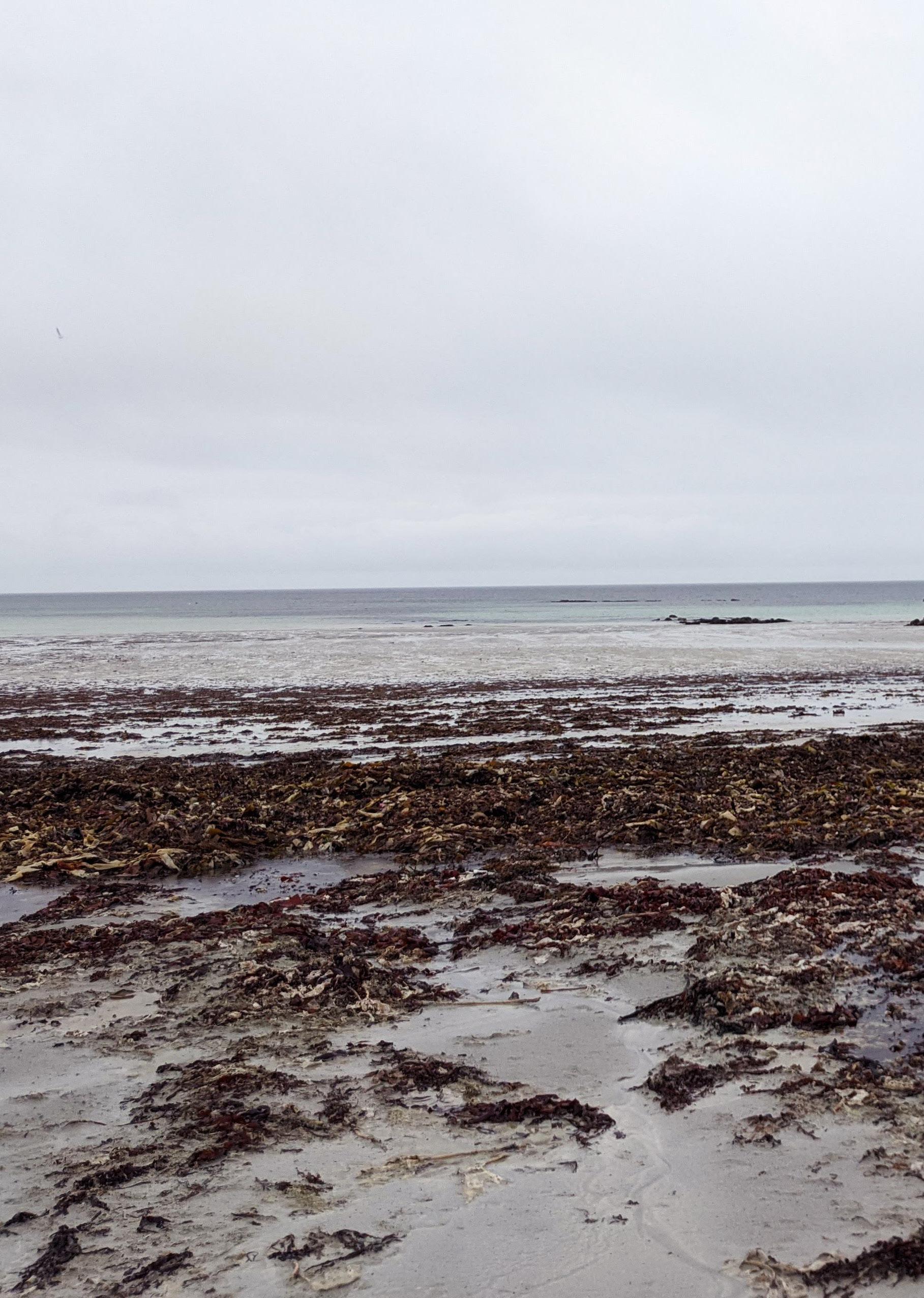
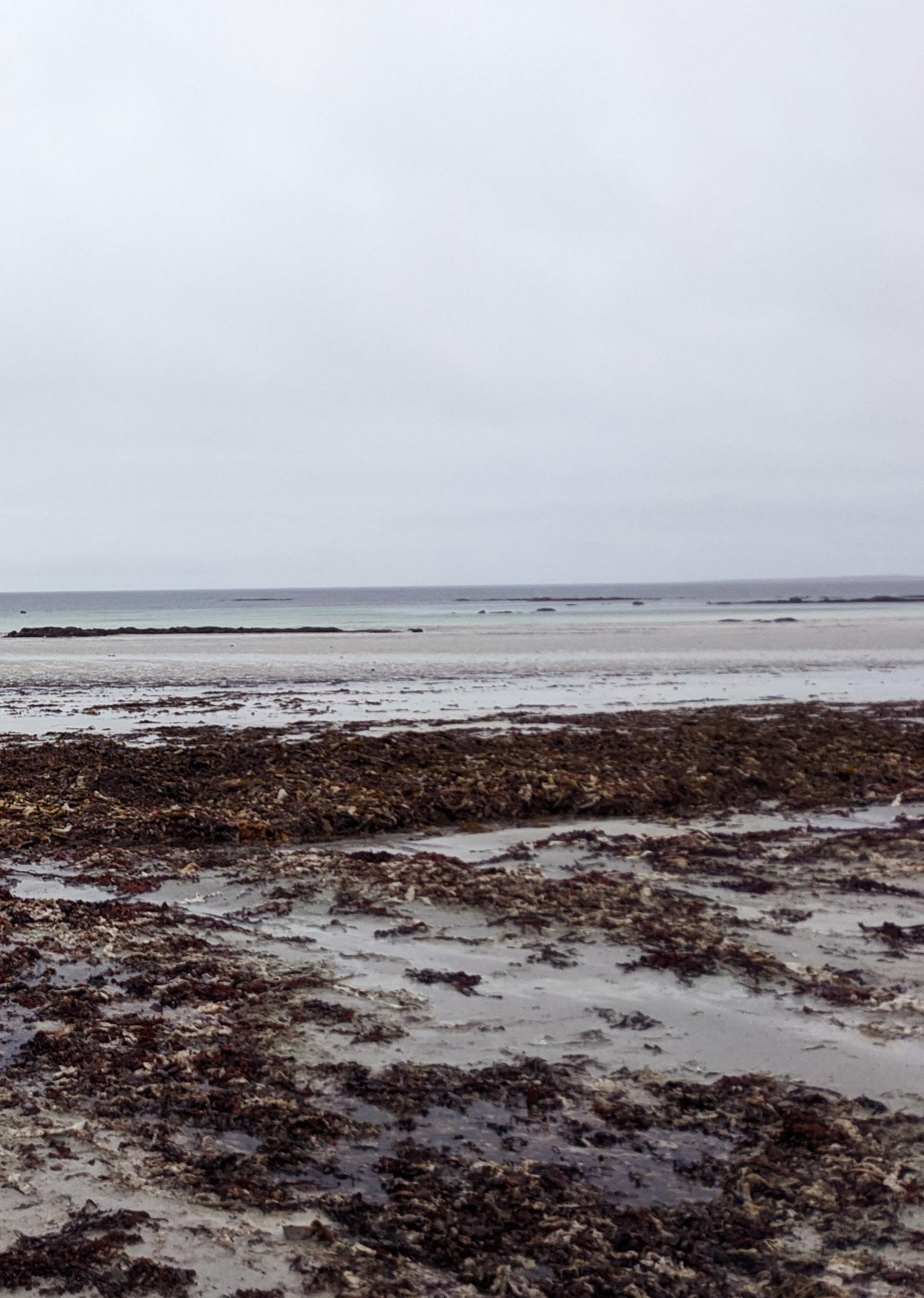
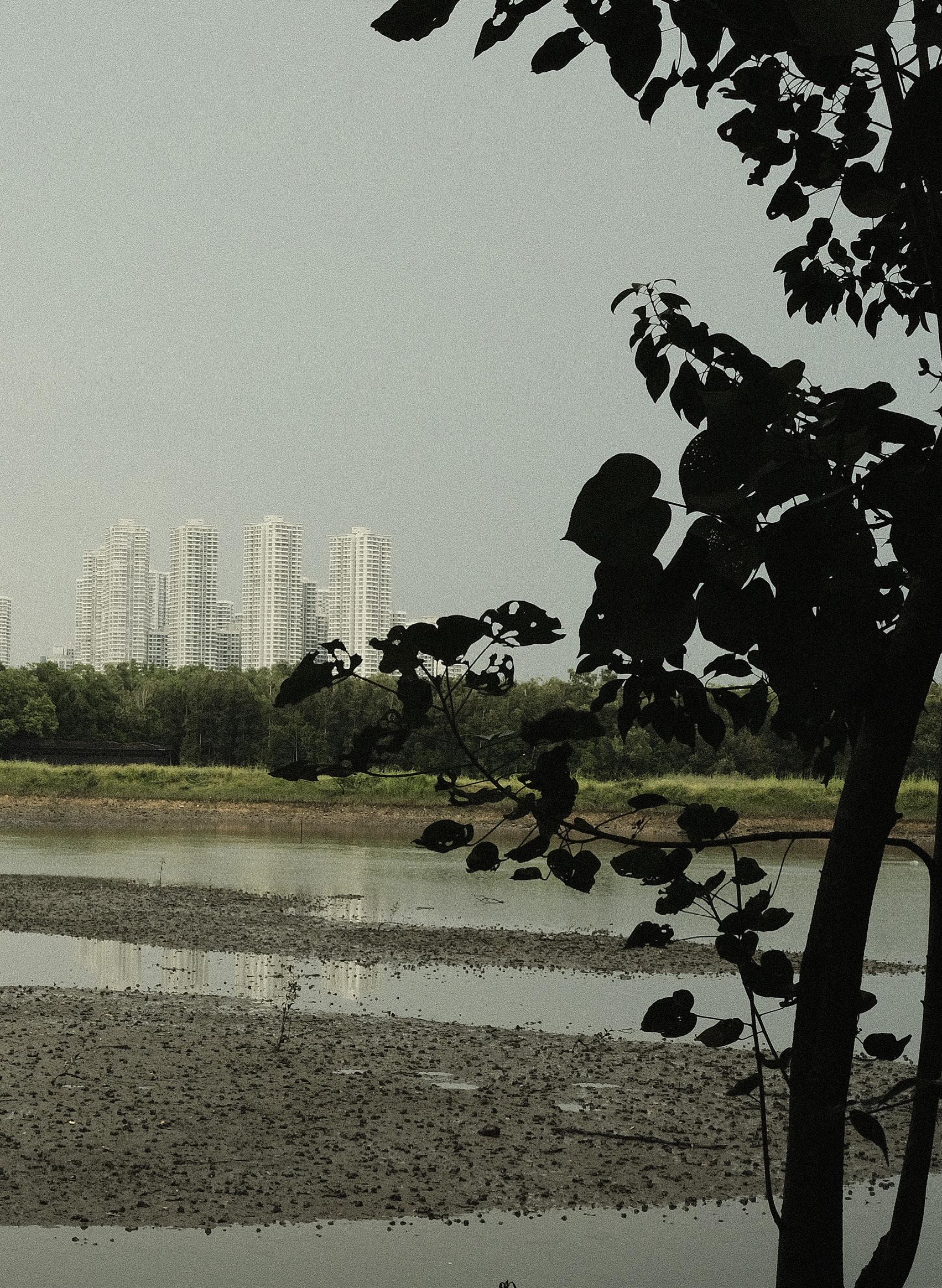
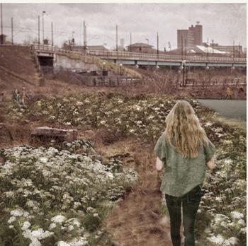
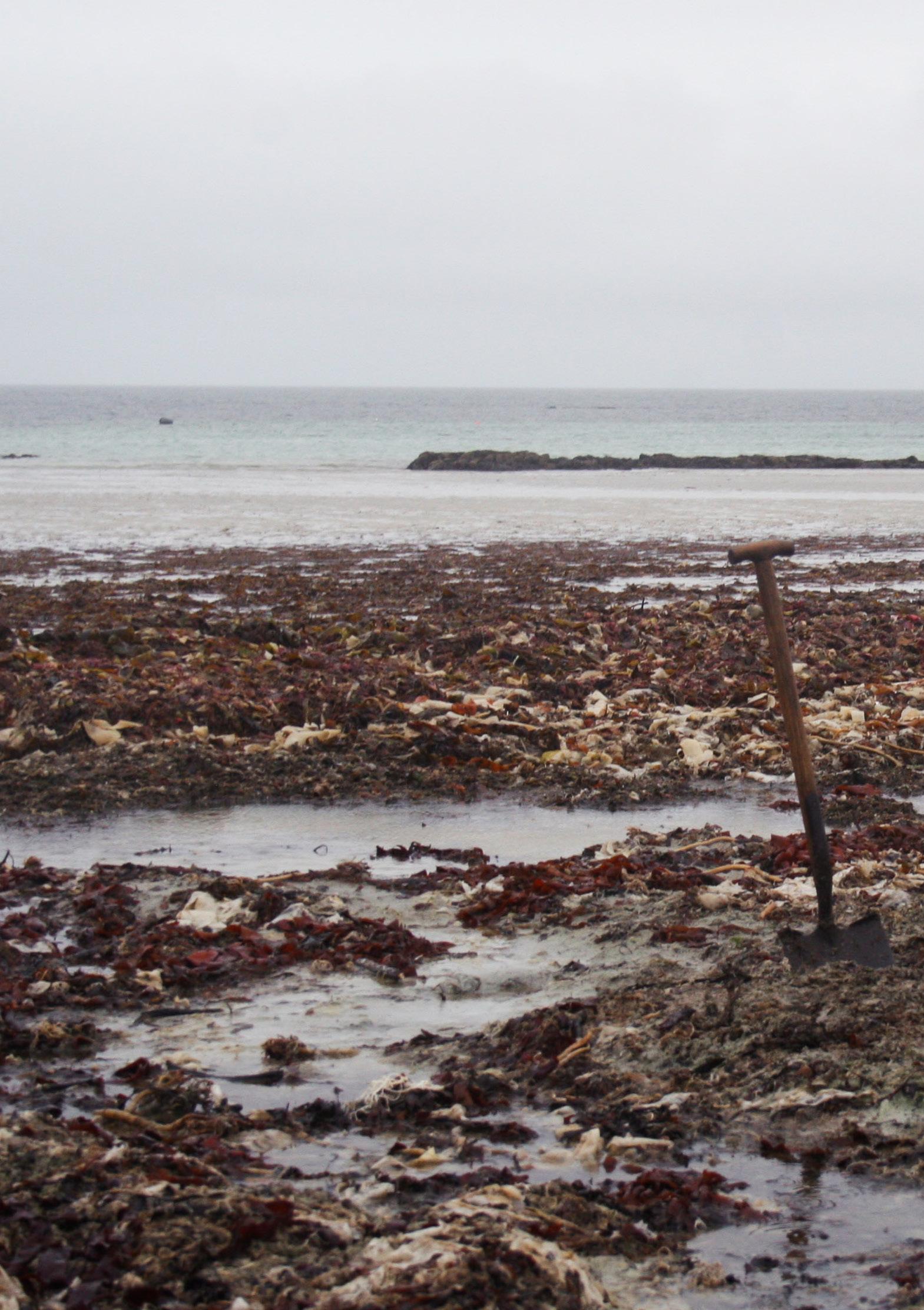
Mol Mòr, An t-Ìochdair, Uibhist a Deas. October, 2020. Sigi Whittle.
This catalogue is part of a collection published by the Edinburgh School of Architecture and Landscape Architecture (ESALA), Edinburgh College of Art, University of Edinburgh. It documents student design work produced in the Master of Architecture (MArch) programme in 2020-21. Each catalogue describes one of the following five design studios in the MArch programme. The full collection is available to view online at issuu.com/eca.march.
Catalogues 2020-21: Animate Matter. At Home. Where I am is Here.
Countryside [Outside] Architecture. island territories vii: Island Temporalities.
Catalogues 2019-21: Parasituation [Ahmedabad].
COVID-19
Over this past year, the work of the Master of Architecture programme has continued to negotiate the disruption caused by the Covid-19 Pandemic. While our normal studios and workshops have remained closed, during the first semester, we managed to implement a form of hybrid teaching where groups of students and tutors could be safely seated around large tables with those working remotely joining via digital screens. Unfortunately, with a further tightening of lockdown at the start of the second semester, we were forced to return to working from home. During this period, for both students and staff alike, teaching days and their associated forms of online group tutorials, reviews and events became as important socially as they were academically. While we all miss the physicality of finely crafted models and ink drenched paper, the work presented through these volumes continues as a testament to the invention, creativity and resilience of the student body and the unfaltering commitment of the MArch programme staff.
First published in 2021, eBook published in 2024. Published by The University of Edinburgh, under the Creative Commons Attribution Non-Commercial Non-Derivative 4.0 International License (CC BY-NC-ND 4.0).
French, Chris and Michael Lewis. Countryside[Outside] Architecture. Edinburgh: University of Edinburgh, 2021.
Countryside [Outside] Architecture. ISBN (eBook): 978-1-83645-001-6
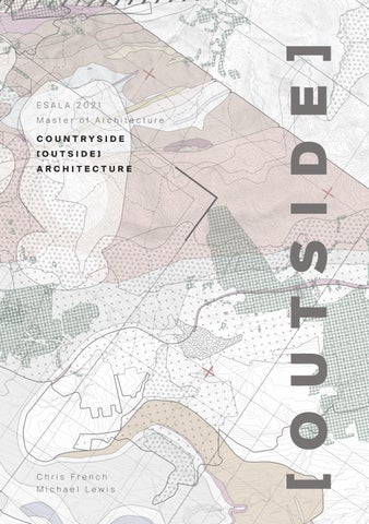
ESALA 2021
Master of Architecture
COUNTRYSIDE
[OUTSIDE] ARCHITECTURE
Chris French
Michael Lewis
OUTSIDE
FRAGILE WATERS
ADAM CORNHILL
RE-GROUNDING THE CITY OF GOLD
CAREL COETZEE
MOUNTAIN OBSERVATORIES
RYAN MORTIMER
CHRONICLE OF A DEATH FORETOLD
MIHAIL PANDREA
CULTIVATING THE CITY
ALICE
TOPOGRAPHIES OF MUD, CLAY AND SALT
MATERIAL GATHERINGS, THICKENINGS, THINNINGS AND THINGS
NICOLE URQUHART
INTERSECTIONS WITH OSPREYS
DAMON
HUSKS AND HULLS
CRYSTAL JIN
CONTESTING COUNTRYSIDING
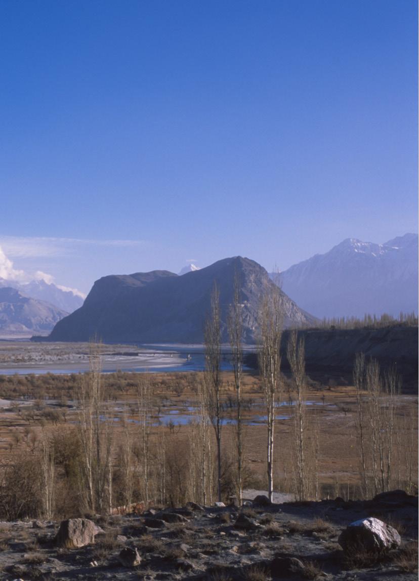
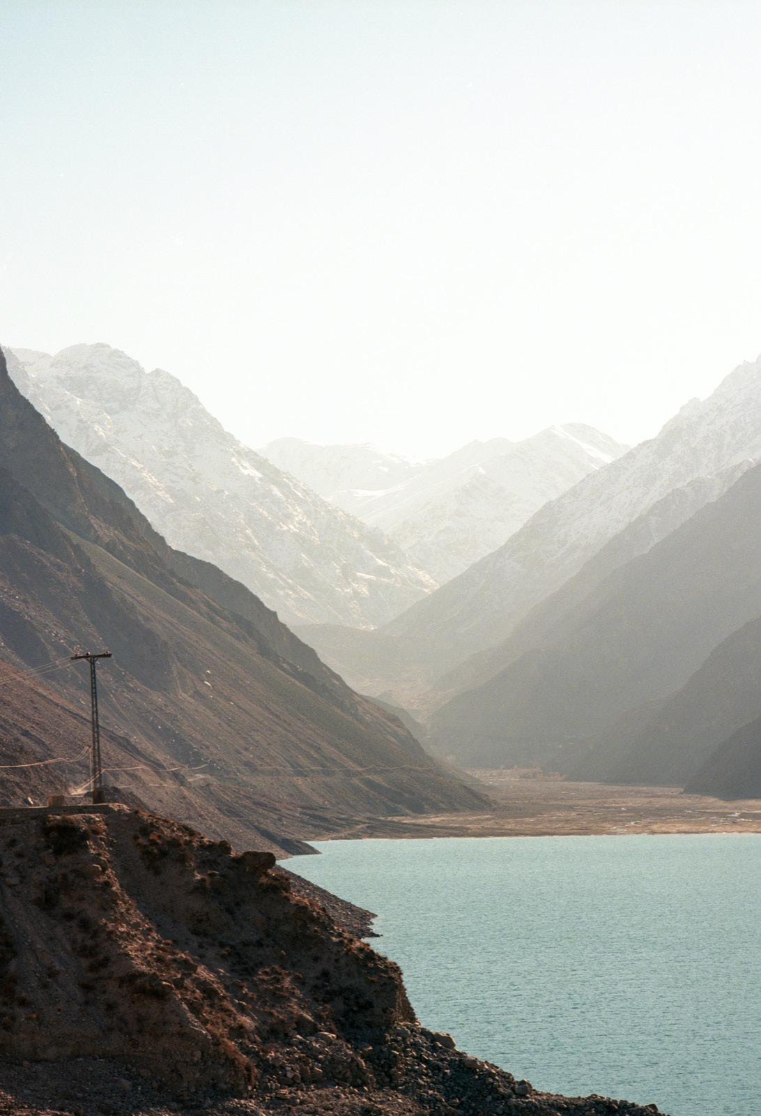
Satpara Dam Lake, Skardu, Pakistan. November, 2018. Mohammad Talha Malik.
COUNTRYSIDE, A RETORT: WORKING FROM THE OUTSIDE.
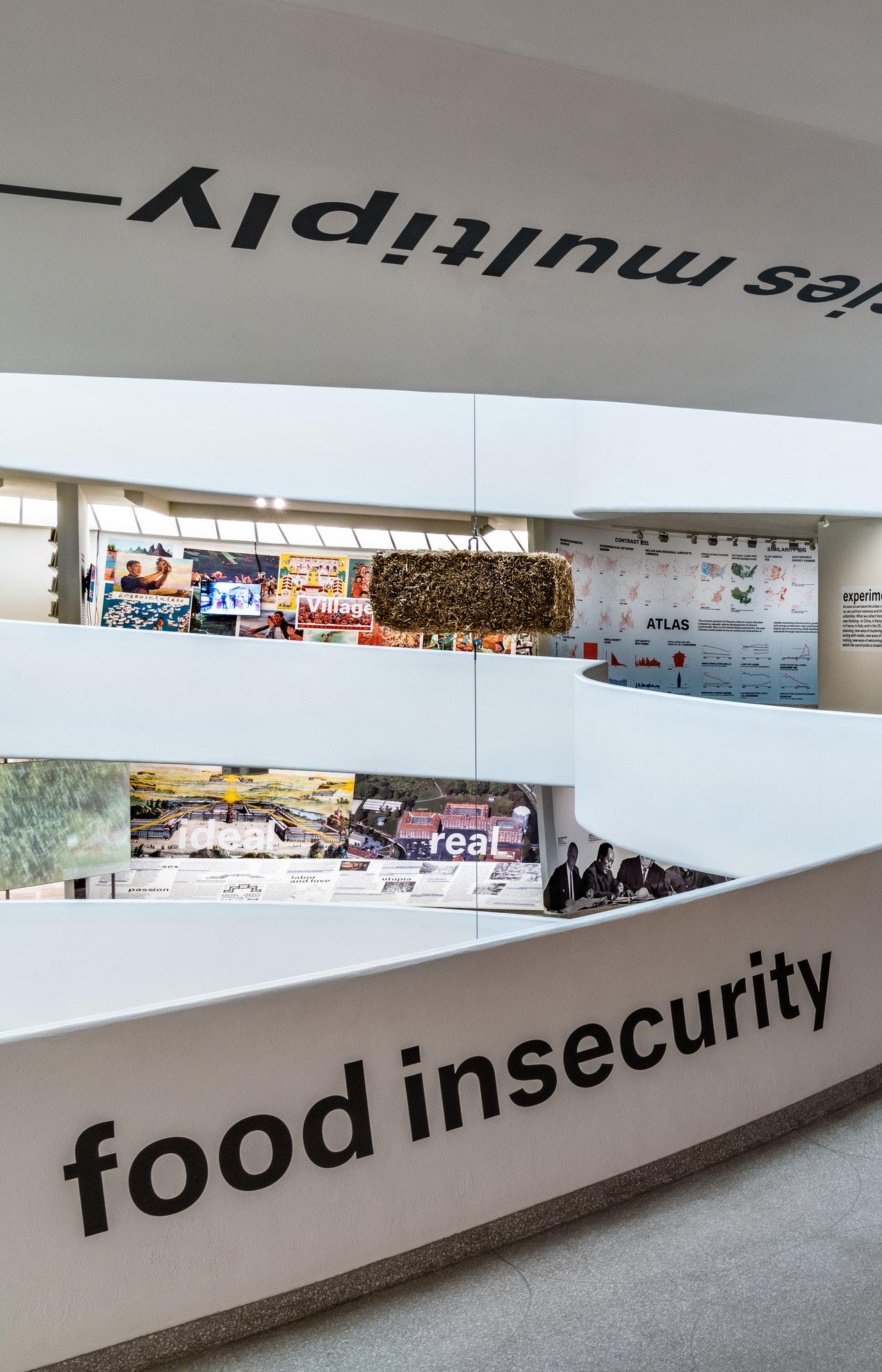
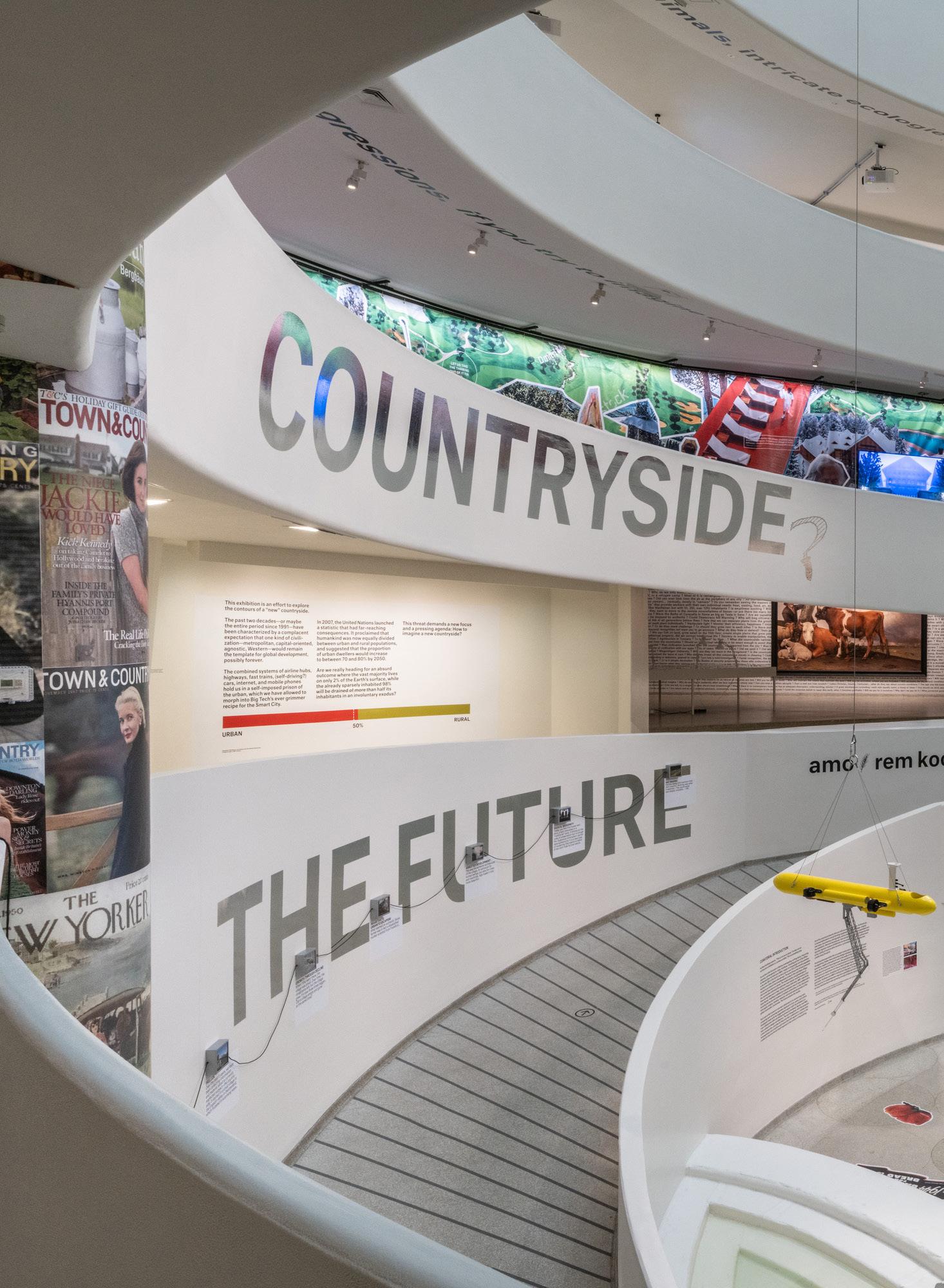
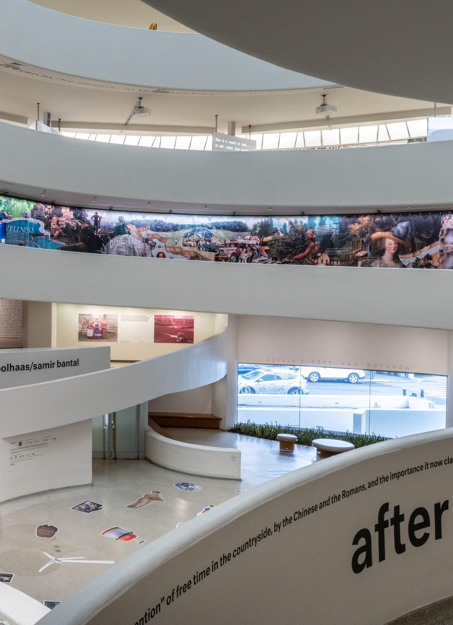
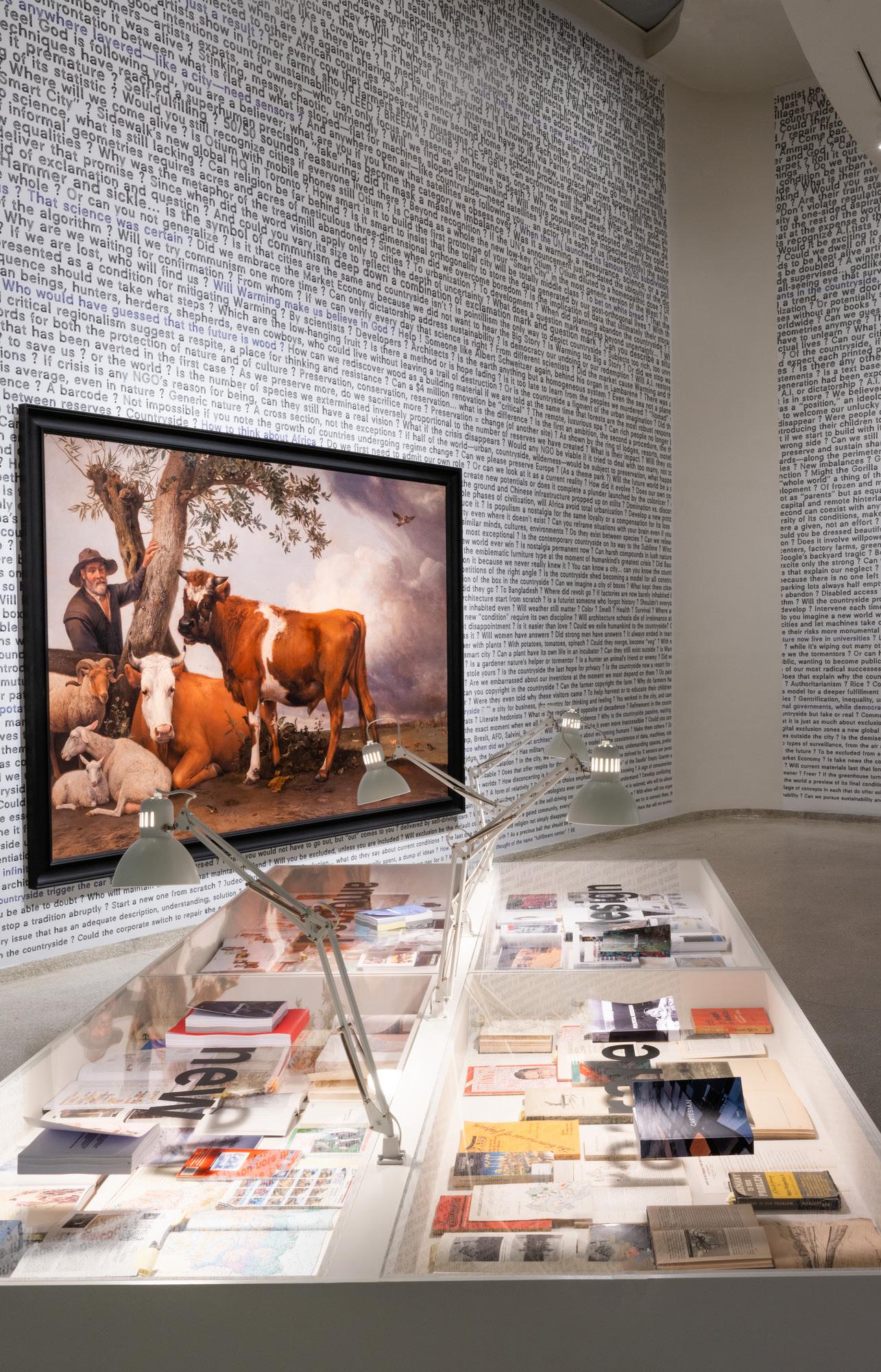
In January 2020, the exhibition Countryside, The Future opened at the Guggenheim, New York. Curated by Troy Conrad Therrien, the exhibition compiled research conducted by AMO and Rem Koolhaas into a “composite picture of the current condition of “countryside”.”1 Wrapping the balustrades and cladding the soffits of Frank Lloyd Wright’s famous ramp, proclamations of ‘food insecurity’ and declarations of ‘a new continent’ trace texts in space. The extensive research with which AMO have been involved emerges, a manifesto in exhibition format and “pointillist portrait” of the various terrains that constitute the ex-urban world. Compressed into the spaces of this 5th Avenue institution (site of Koolhaas’ first major exhibition) are descriptions of the formation of the saline territory of the Salton Sea in the Nevada desert, the sinking permafrost and glacial rock formations of Yakutsk, dairy farms carved out of the Qatari sands and ‘buffer zones’ in Uganda separating local people and mountain gorillas. Traversing the galleries, one ranges across the landscapes of Fukushima Daiichi now occupied by disaster relief crews, the alternative ‘off grid’ communities of the American mid-west, Chile’s network of national parks and the greenhouses which cover Taobao village outside Beijing. Along the walls behind the ramp images form a collage, wrapping the circulatory route and columns. The galleries, rising from bottom to top, are occupied by distinct projects wrapped in more text and collaged images. “Text-heavy displays combine multiple typefaces in many colours and sizes with addled collages of pixelated images.” 2 The exhibition, Luke Studebaker observes, is visually aggressive, information-
1 Rem Koolhaas, ‘Ignored Realm’ in Countryside, A Report (New York: Taschen, 2020), 3.
2 Luke Studebaker, ‘The Countryside in Question’, Log, No.49 (Summer 2020), 80.
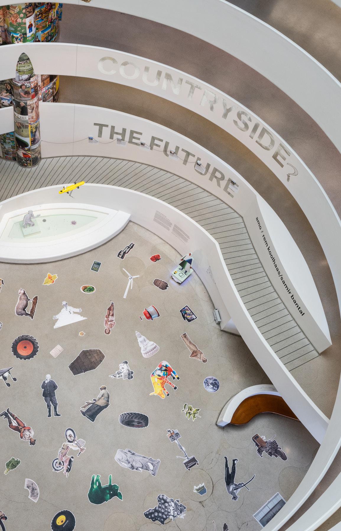
dense, and certainly firmly positioned. The only doubt detectable in AMO’s declaration that the countryside is indeed the future is a sickle following the ‘e’ in ‘Countryside’ in a decal on the ramp wall facing the entrance. Intended, one assumes, as a comma, this notional question mark slips away from the exhibition title, as though attached to the wall with less conviction or commitment than other content. 3 A storey below, separated by a turn of the ramp, the curatorial credits positioned to the right of the final two words of the exhibition title do not seem so demure. ‘The Future’. Space. ‘amo/rem koolhaas/samir bantal’.
In many respects, the exhibition represents a departure for Koolhaas, shifting attention, as AMO state, from familiar predictions that “2 percent of the earth’s “overpopulated” surface” will be occupied by cities to the 98 percent of the world “inhabited by only one-fifth of humanity.”4 What links these sites for Koolhaas and Bantal is the sense that the countryside has become, unwittingly or without conscious design or intent, the locus of contemporary modernity. It is no longer the city, but the countryside that is the site of rapid cultural change, the site where, as Koolhaas declares in the trailer for the exhibition, “the most radical, modern components of our civilization” are evident. In engaging with this 98 percent the exhibition and its associated catalogue, Countryside, a Report, are, as Koolhaas immodestly declares, extraordinarily ambitious, and as a ‘pointillist’ image the exhibition is constructed as much by the obvious gaps as by the points of intense, focused colour. Studebaker, acknowledging the intensity of the work displayed, observes: “the dual rhetorical strategies of urgency and novelty are meant to distract from gaps and blind spots.”5 For Therrien, curator of the exhibition, these gaps are methodological. In the essay ‘Ignored Realm’ in Countryside, a Report they are described as strategic, “an opening.”6 Koolhaas even acknowledges and dismisses one such gap, namely that ‘countryside’ is “a glaringly inadequate term for all the
3 The same sickle appears on the cover of Countryside, A Report where, in another curious agrarian blurring, a wheatsheaf stands in for an oblique.
4 Koolhaas, Countryside, A Report, 3.
5 Studebaker, ‘The Countryside in Question’, 81. Other reviewers were less appreciative. The Architectural Record review ‘Rem to the Rescue’ describes the exhibition as a “hot mess… at once provocative, fascinating, enraging, disturbing, barely hopeful, and contradictory,” while ArtNet declared it “obnoxious naval gazing.” See: Alexander Gorlin, ‘Rem to the Rescue: Review of Countryside, The Future’, Architectural Record, 24th February, 2021; and Janelle Zara, “Rem Koolhaas’s Frequently Obnoxious ‘Countryside’ Exhibition at the Guggenheim Prizes Navel-Gazing Over Relevance,” ArtNet, 16th March, 2020.
6 Troy Conrad Therrien, “Along for the Ride” in Countryside, A Report (New York: Taschen, 2020), 14. Therrien asks: “Ignored by whom? Rem Koolhaas, for one. But the rest of us as well. To say so is not a crime of hubris, but a declaration of method.”
territory that is not urban” gathered in the exhibition, and that speaking of the countryside as a singular condition is problematic.7 The exhibition, Koolhaas states, was never intended to be comprehensive, but was to put the “countryside back on the agenda.” 8 These rhetorical feints, as Janelle Zara has observed, seem insufficient given current climate emergencies, and ultimately despite its claims to futurity the exhibitions risks “landing just outside questions of present urgency.” 9 AMO’s thesis appears largely formal (concerned with patterns of crops and agricultural settlements observed from drones and satellites) and technological (lauding advances in pixel farming and automated harvesting), not structural or ecological. The changes in the countryside documented by the exhibition are driven by automation, economics and efficiencies, those logics that proliferate and propagate in cities and concerned with yield, profit and sustenance not sustainability, ecology, survival. As such, while the exhibition may appear to represent a turning away from the city for Koolhaas, the city, it seems, is never far from his thoughts. “Cities,” Koolhaas declares in a lecture on the research documented in the exhibition in 2017, “are now places of cuteness… generated at the expense of the… countryside,”10 places of whimsicality enabled by the hyper-rationality of automation and surveillance that dominates the countryside. Once a space of radical politics, the city is becoming a place of comfort.
This is one of the key tensions underlying AMO’s exhibition. The countryside, as a site, now makes evident the political and economic forces that are central to the operation of the city. Where once the city as a spatial figure declared its organisational logics and imperatives, today these declarations occur out of sight, elsewhere. The city evolves. The countryside might well be the site in which the impact of technological advancement and human action is most marked, but as far as Koolhaas and AMO’s exhibition is concerned the domination that Marx predicted in the Grundrisse remains,
7 Koolhaas, Countryside, A Report, 3. “We know that “countryside” is to some extent a misnomer because “countryside” implies a degree of cultivation. Countryside in itself doesn’t include wilderness, doesn’t include desert, doesn’t include the Himalayas. But we did not find another default name for this entire territory that would actually be more correct or more precise.” Rem Koolhaas and Samir Bantal, “Introduction from Koolhaas and Bantal,” recorded 20th February, 2020 at The Guggenheim, audio, 4:01.
8 Carolyn Kormann, “Rem Koolhaas’s Journey to the Countryside,” The New Yorker, 9th March, 2020.
9 The exhibition “savors quirkiness over relevance, landing just outside questions of present urgency. Populism and waning globalism are neatly brushed away as “only the most obvious effects” of rural neglect. The existential crisis of climate change is limited to a chapter on melting permafrost—important, yes, but the world is literally on fire.” Zara, ‘Rem Koolhaas’s Frequently Obnoxious ‘Countryside’ Exhibition,’ ArtNet, 16th March, 2020.
10 Rem Koolhaas, “Rem Koolhaas and David Gianotten on Countryside,” MTalks, University of Melbourne, 3rd October, 2017.
the rural world, it seems, is indeed gradually succumbing to the forces of urbanization.11 Countryside, the Future appears seduced by these forces, forces that still subjugate, marginalise and exploit the countryside and those who dwell there. Ensnared in Frank Lloyd Wright’s famous spiral ramp, and viewed, consumed, most clearly at distance across the void at the centre of the gallery the countryside still appears subservient to the city.
WORKING FROM THE OUTSIDE
Koolhaas, in his various projects, revels and excels in these tensions, finding fascination and potential in situations others see as problematic. Rather than dismiss the exhibition based on perceived limits or denounce AMO’s work, which doubtless provides valuable insights into current practices in the ‘countryside’, the work in this catalogue takes up prompts offered by the exhibition to augment AMO’s pointillist portrait. It does so by invoking architecture as an urban-rural outsider. Koolhaas insists that the exhibition “has nothing to do with architecture.”12 The work documented here does. “In terms of contrast to the city,” Koolhaas declares, “I think [the countryside] has a strong potential to be really its opposite.”13 Acknowledging the thinking behind this statement, the projects presented in this catalogue seek to contest this opposition. They question not just definitions of the countryside and the city which posit the countryside as either the “residual, enabling domain” derided in Koolhaas’ introduction to Countryside, a Report, 14 or as an exotic source beyond architecture’s concern, but also opposition as the basis of any relationship between the two conditions. They seek to engage with the ‘countryside’ (a term we understand as problematic) outside the regime of the city, involving others (animal, mineral, vegetal) in the processes (politics) by which our social and political formations evolve. Countryside [Outside] Architecture seeks to frame an ‘outside’ from where the countryside, the city, and its dominant spatial figure, architecture, might enter into dialogue.
11 “The history of classical antiquity is the history of cities, but of cities founded on landed property and on agriculture… the modern [age] is the urbanization of the countryside, not ruralization of the city as in antiquity.” Karl Marx, “Notebook IV: The Chapter on Capital, Forms which precede capitalist production,” Grundrisse: Foundations of the Critique of Political Economy (London & New York: Penguin, 1993).
12 Wainwright, ‘‘The Countryside is where the radical changes’, The Guardian, 11th February, 2020.
13 Rem Koolhaas and Samir Bantal, “Introduction from Koolhaas and Bantal,” recorded 20th February, 2020 at The Guggenheim.
14 Koolhaas, Countryside, A Report, 3.
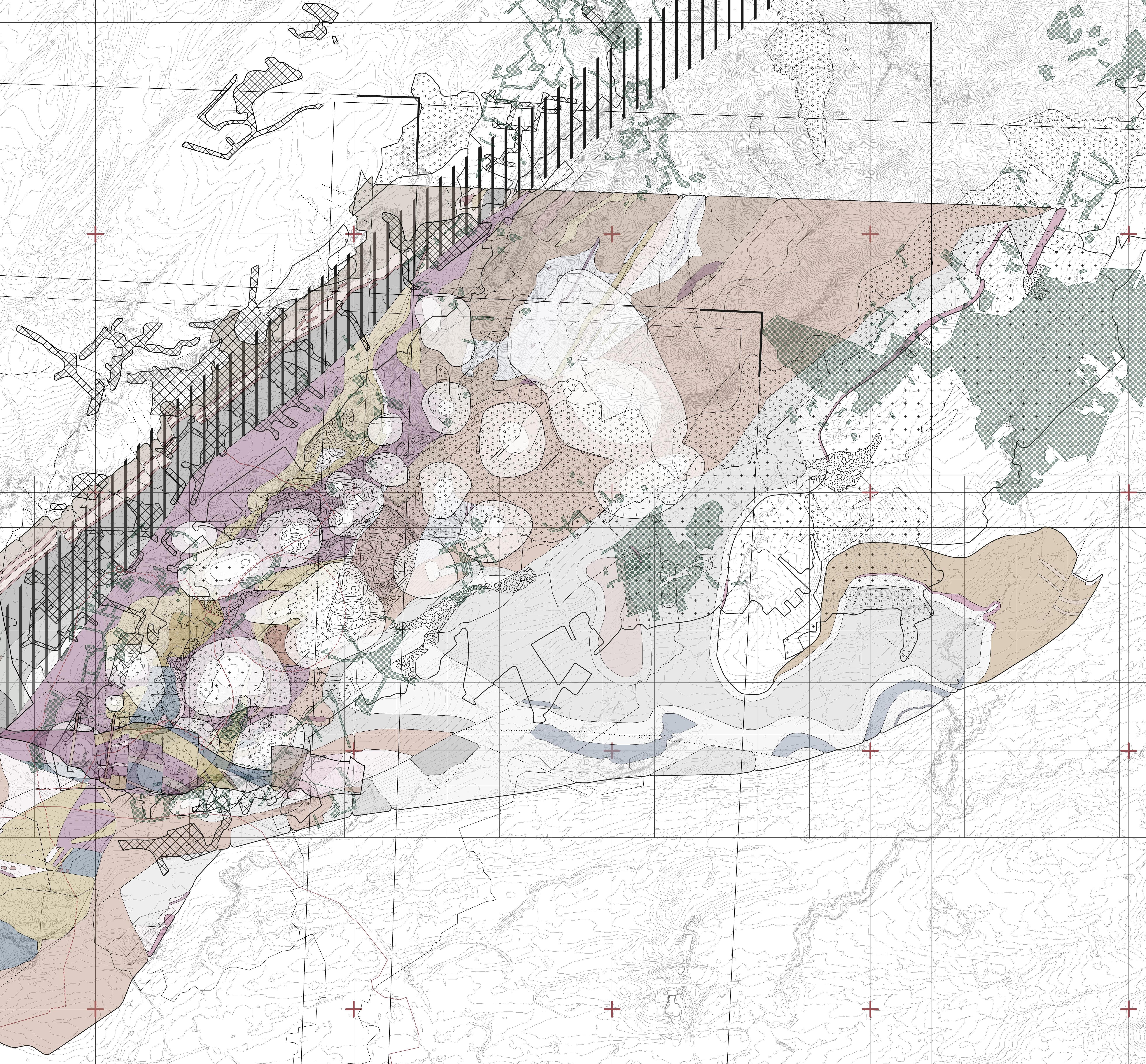
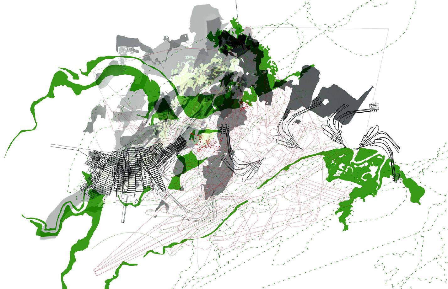
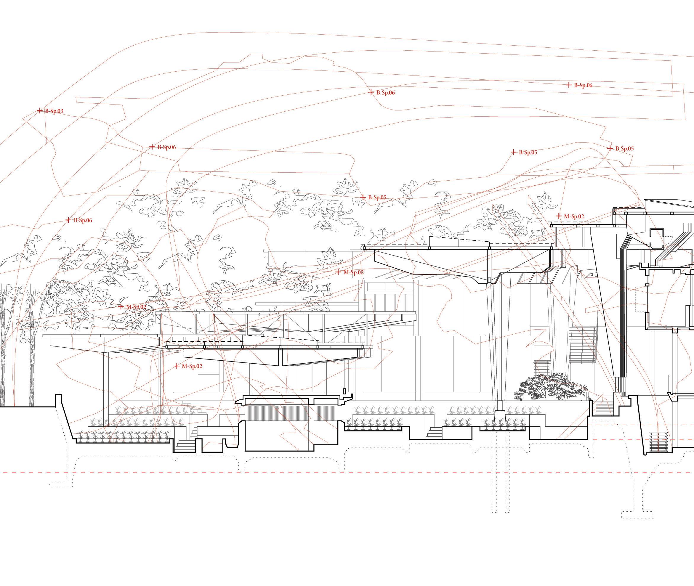
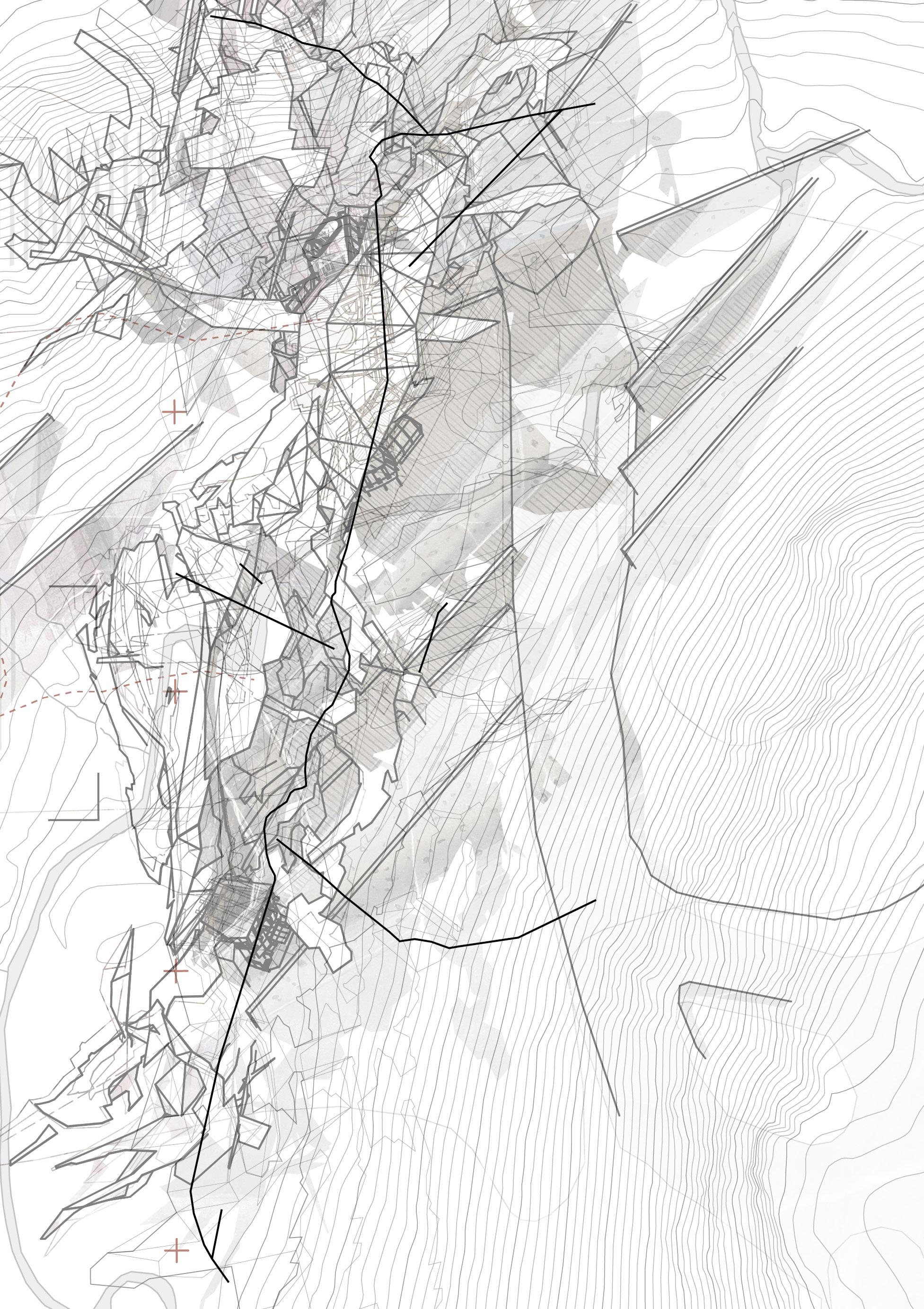
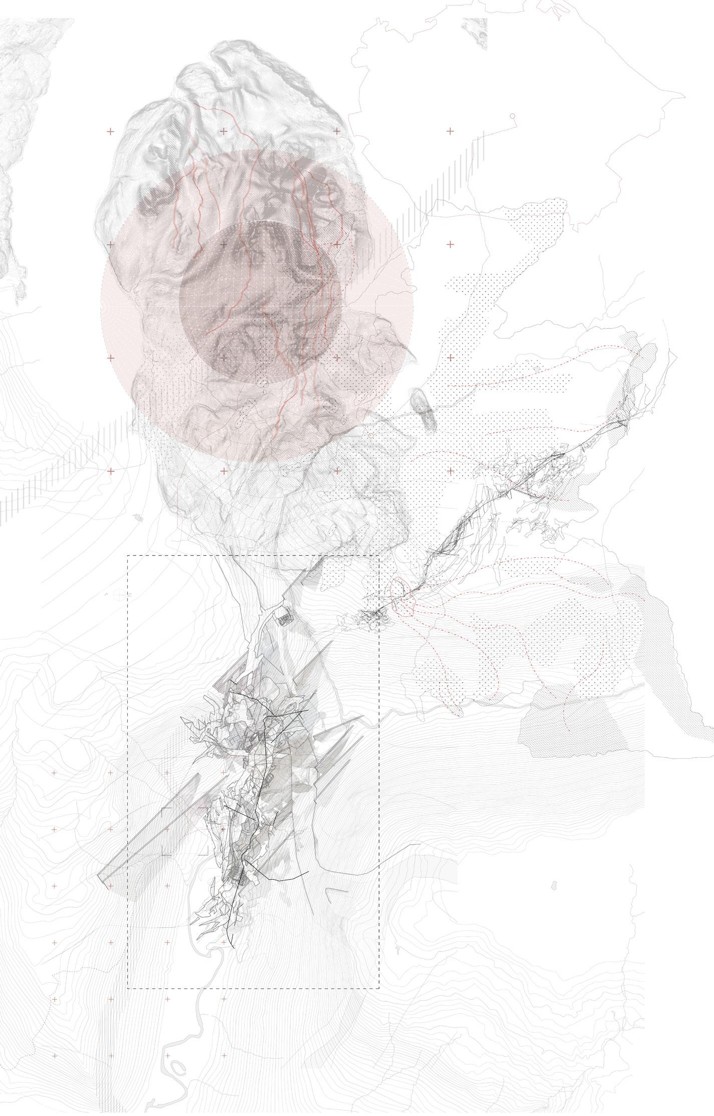
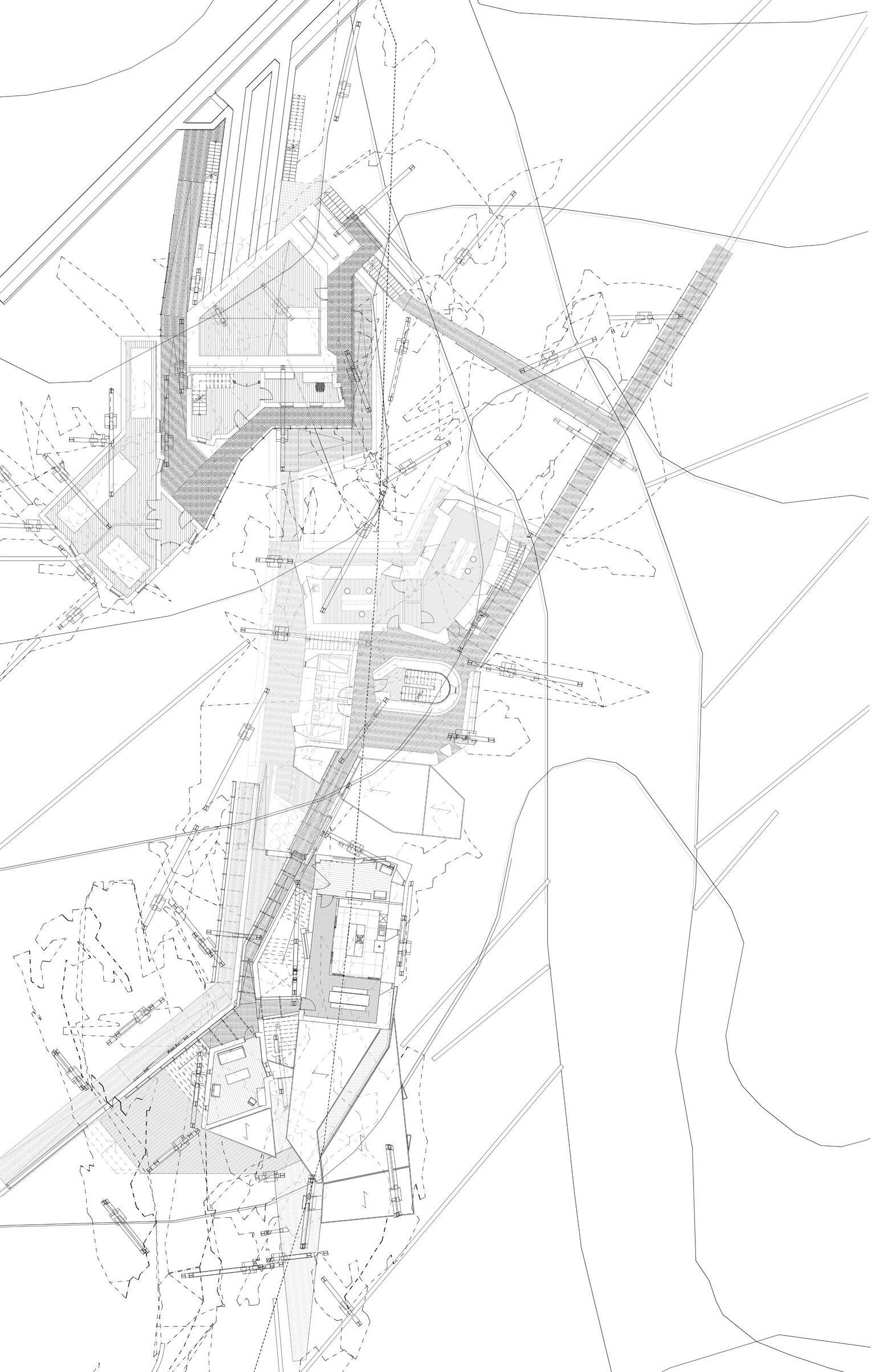
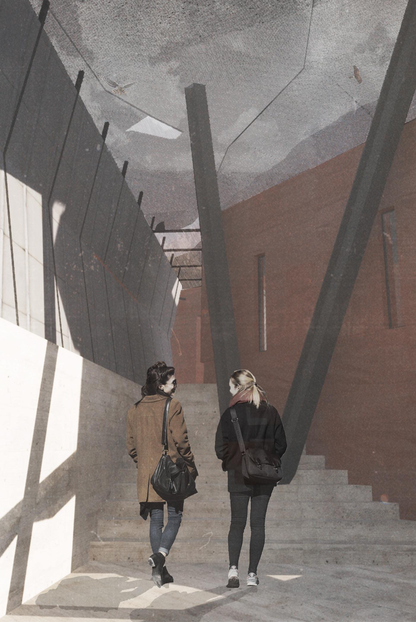
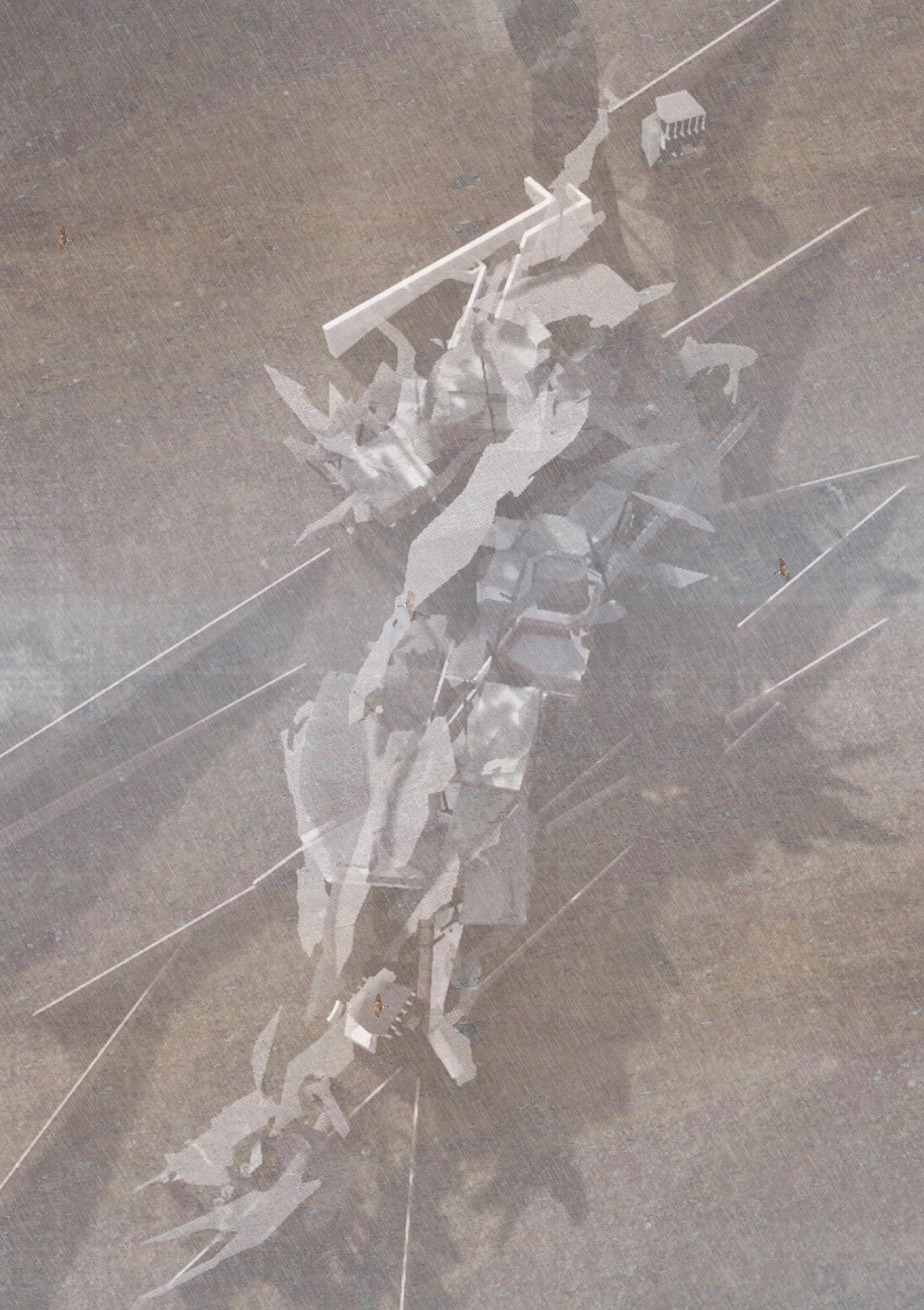
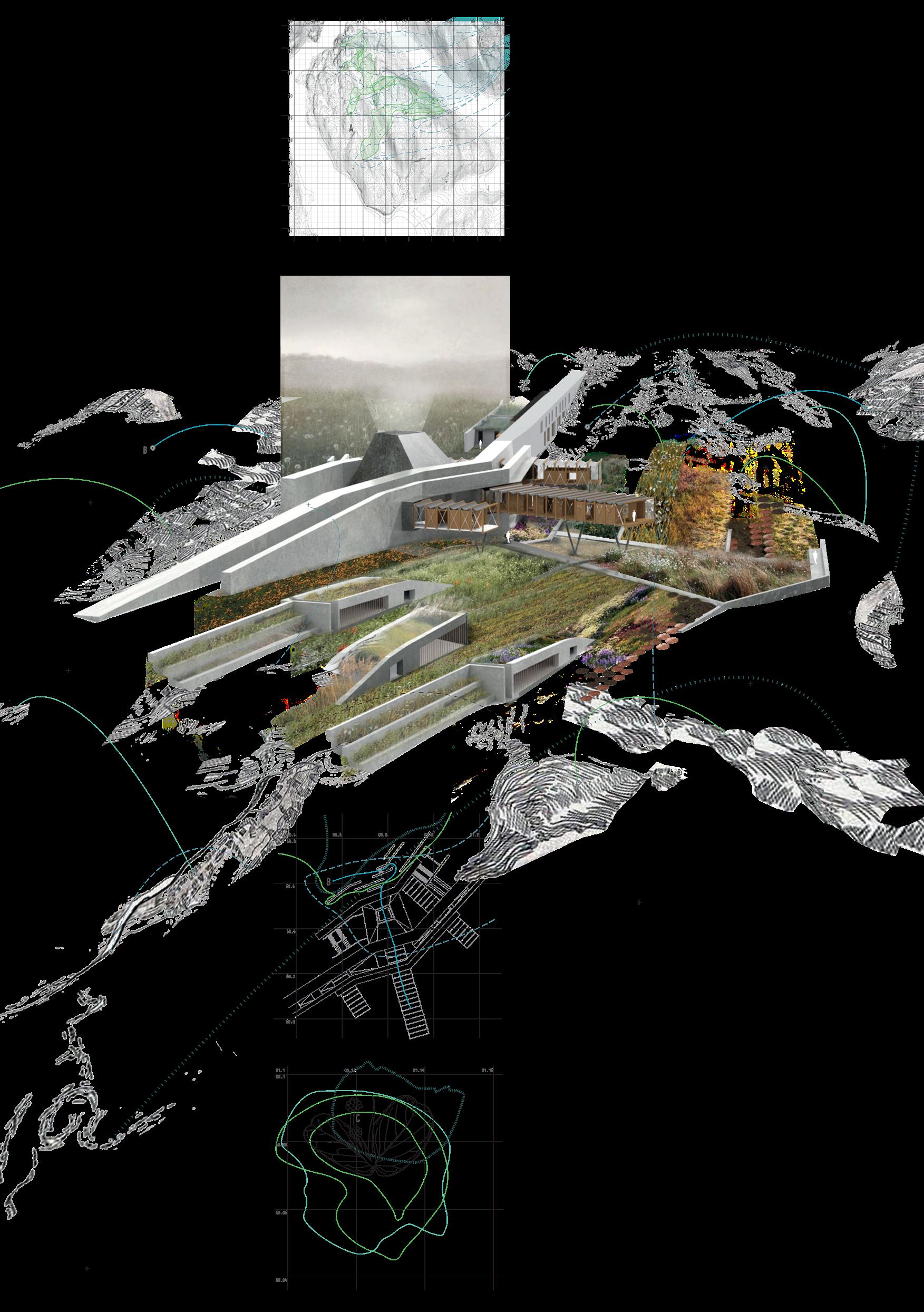
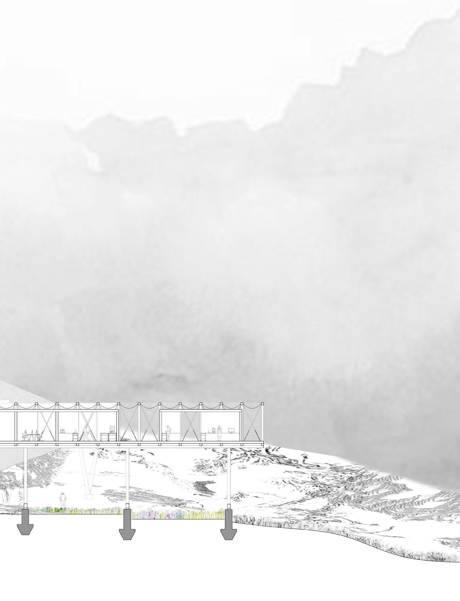
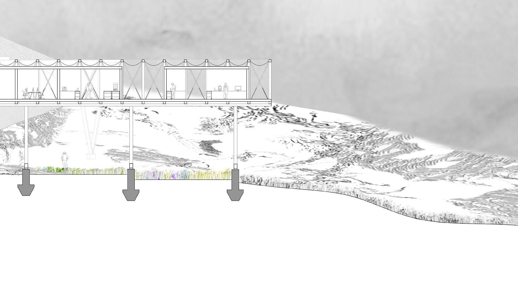
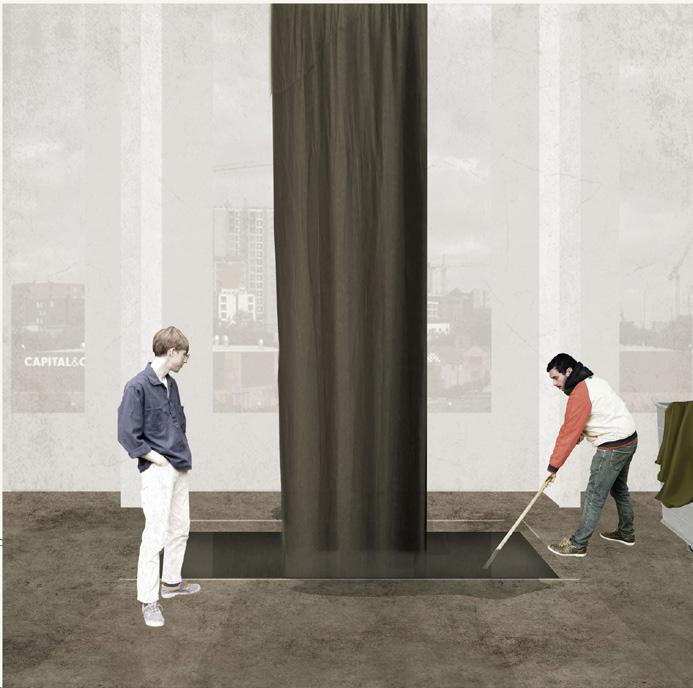
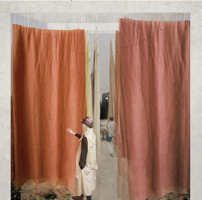
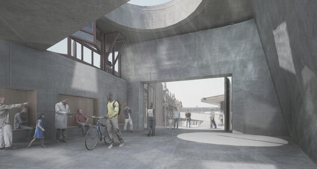
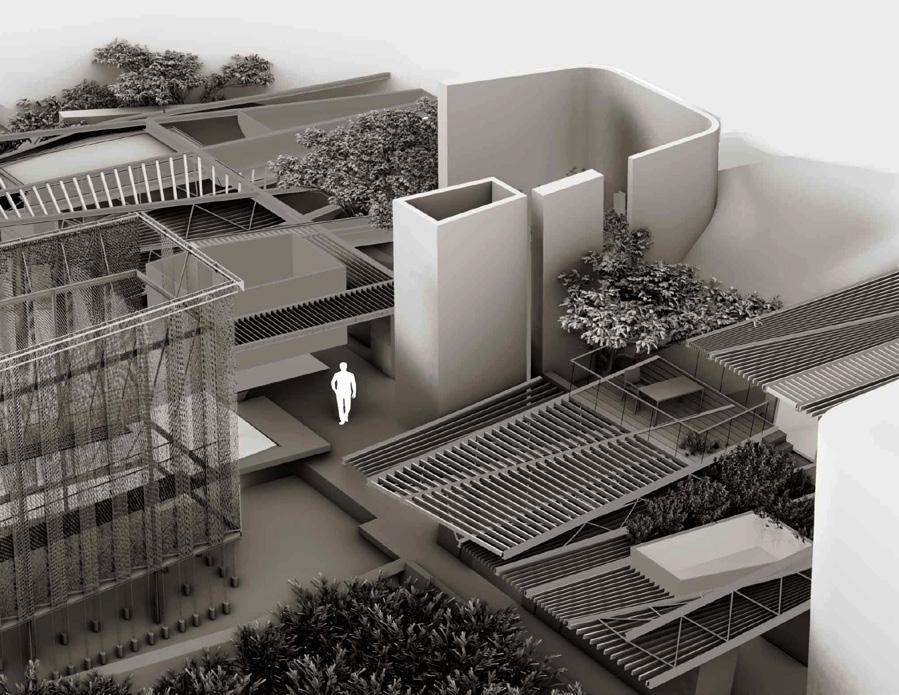
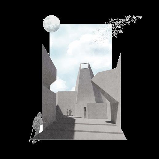
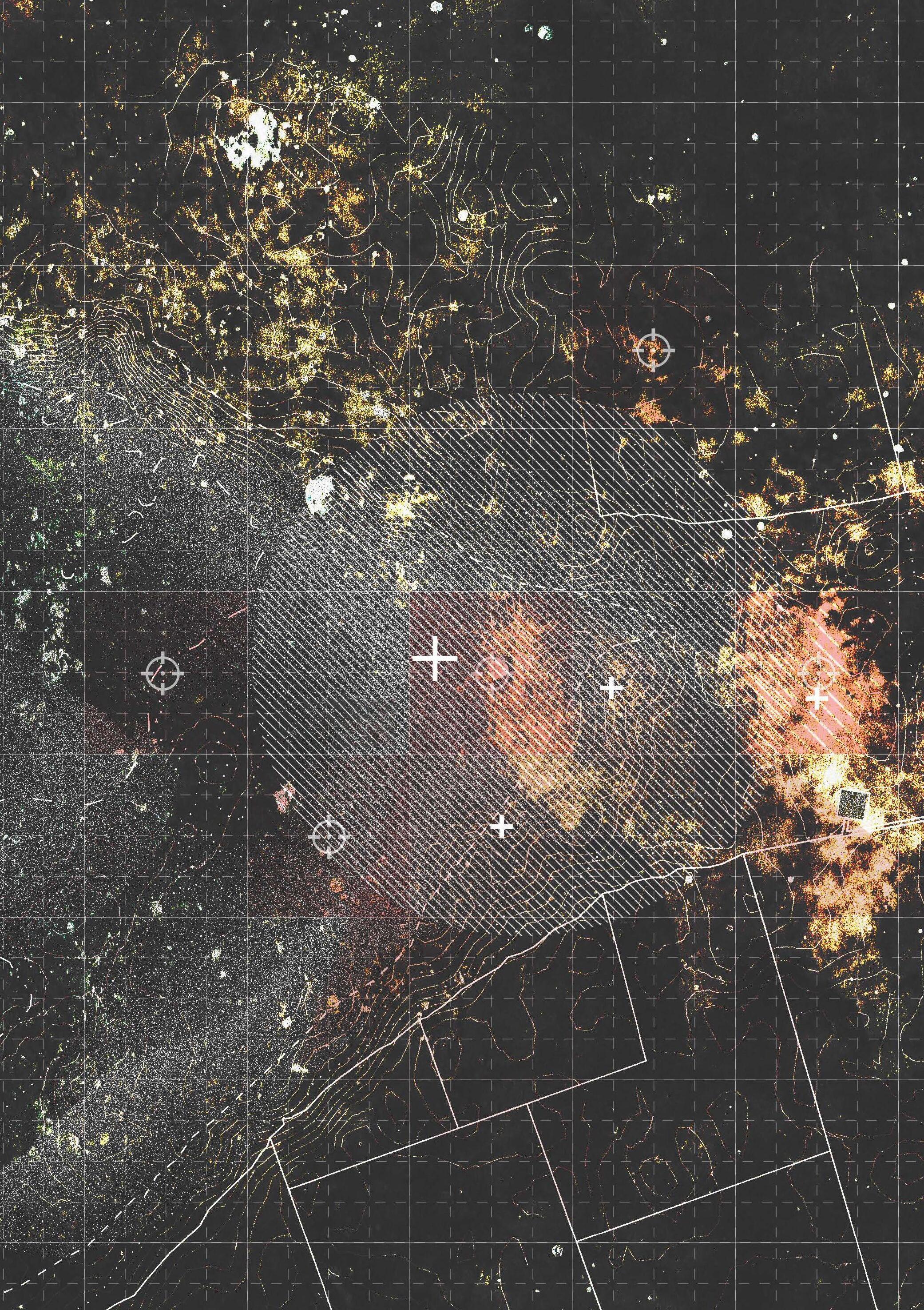
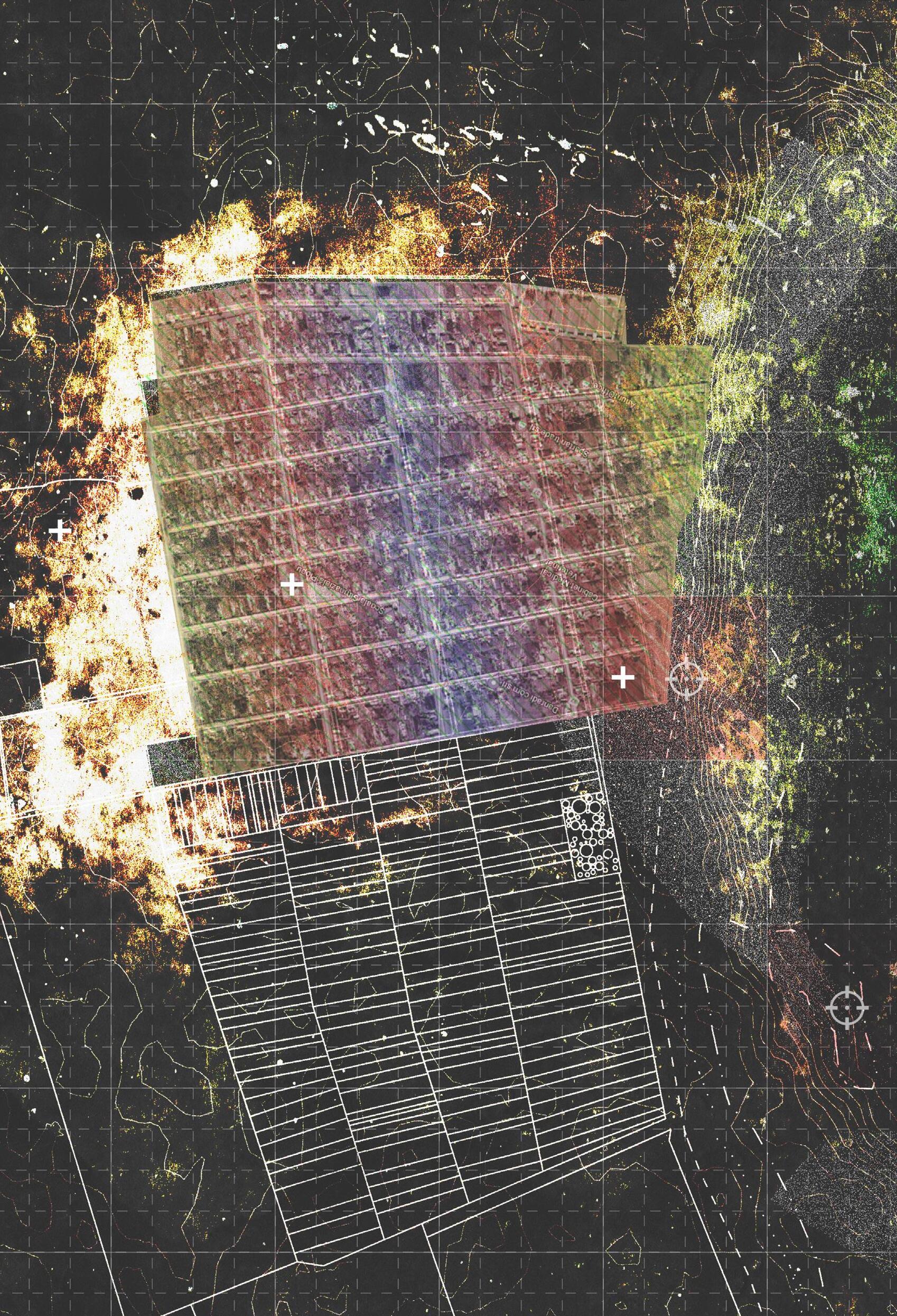
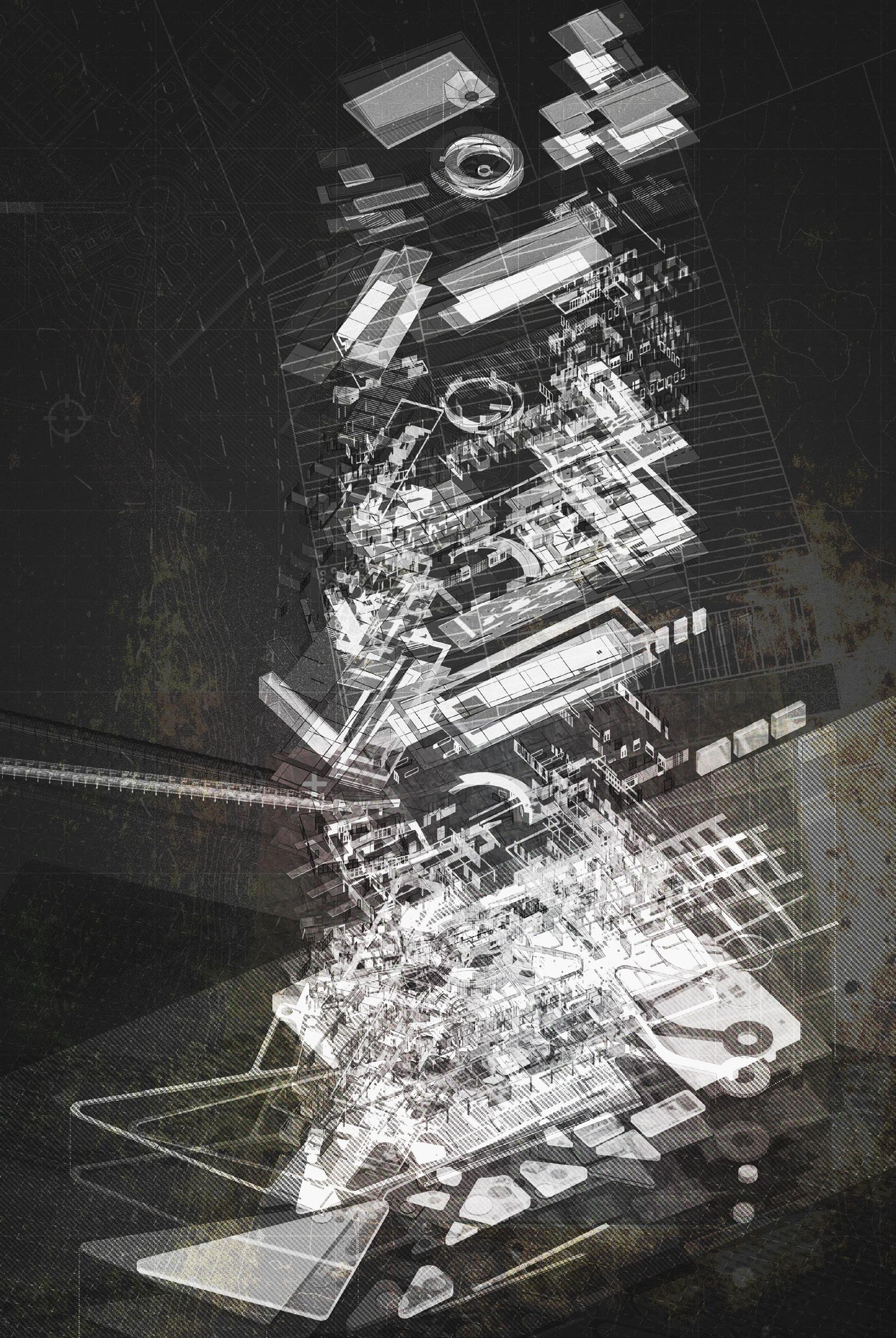
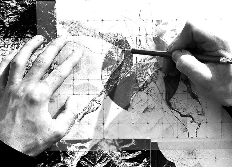
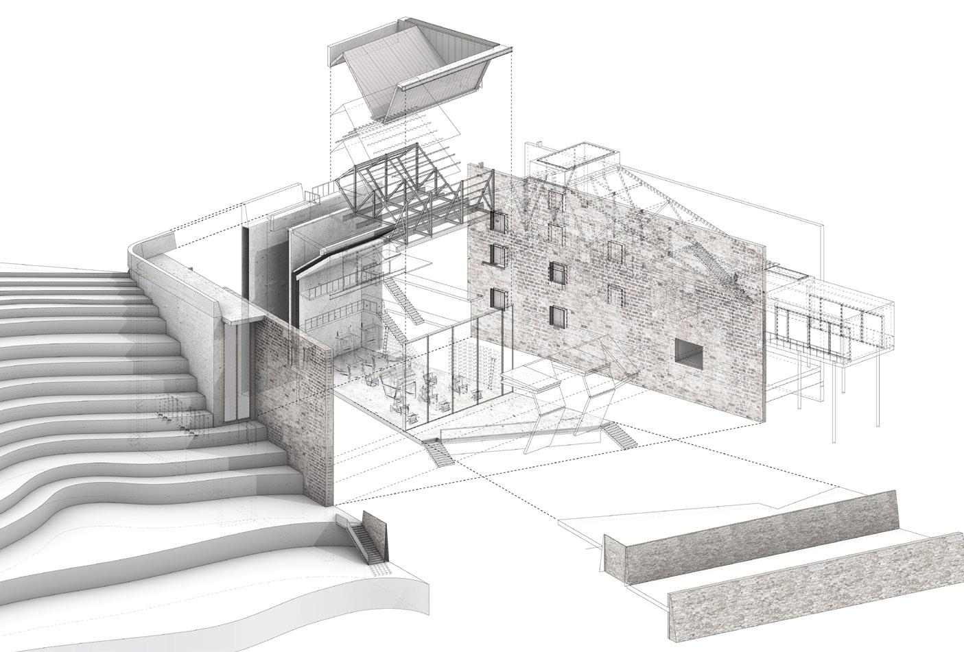
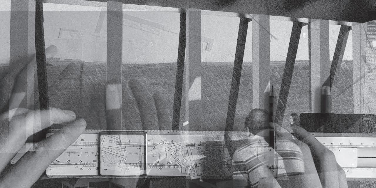
In the work documented in this catalogue this ‘outside’ is understood in two senses. Firstly, the ‘outside’ refers to things beyond the usual concerns of architectural practice and the cultural/colonial/cultivational impulses of what is conventionally referred to as ‘countryside’. Animal movements and migrations, the growth cycles of plants and trees, soil densities, foragable matter, species decline and maintenance, muir burning, and oceanic pollution become instigators for architectural projects. Each of these has its own territoriality, its own means of occupying and engaging with particular landscapes, its own programmatic and material possibilities and demands. The work engages with these demands through selected Field Stations, sites addressed toward the recording and promotion of specific environmental and ecological concerns, or habitats within which a given species thrives. These Field Stations become sites in which the architectural project, the building, is not only located but actively participates in fostering and forming habitats. Secondly, and following Elizabeth Grosz, the ‘outside’ is understood not as a literal space, but as a position between two disciplines. For Grosz, this space is one in which philosophy (Grosz’ first discipline) and architecture (her second) might be brought into equal dialogue, a space between in which neither term of a dialectic (in this case the countryside and the city) is privileged, but in which both terms are made present to one another.15 The studio proposed the term ‘rendering’ to describe this process of making present. While the term has come to refer—in the language of architects—to the production of a particular type of image usually produced through 3D software and the application of a ‘render’ (a covering) to a base model, for the purposes of this studio we take rendering as in art practice to mean to portray a particular condition or, more pertinently, to translate something so as to make it legible to another, the making-visible of a certain character.16 Working from the outside, ‘rendering’ becomes a technique to describe the intersecting patterns, structures, inferences, influences, rhythms, spatiality and materiality of the city and the countryside, to translate through drawing between urban and rural concerns.
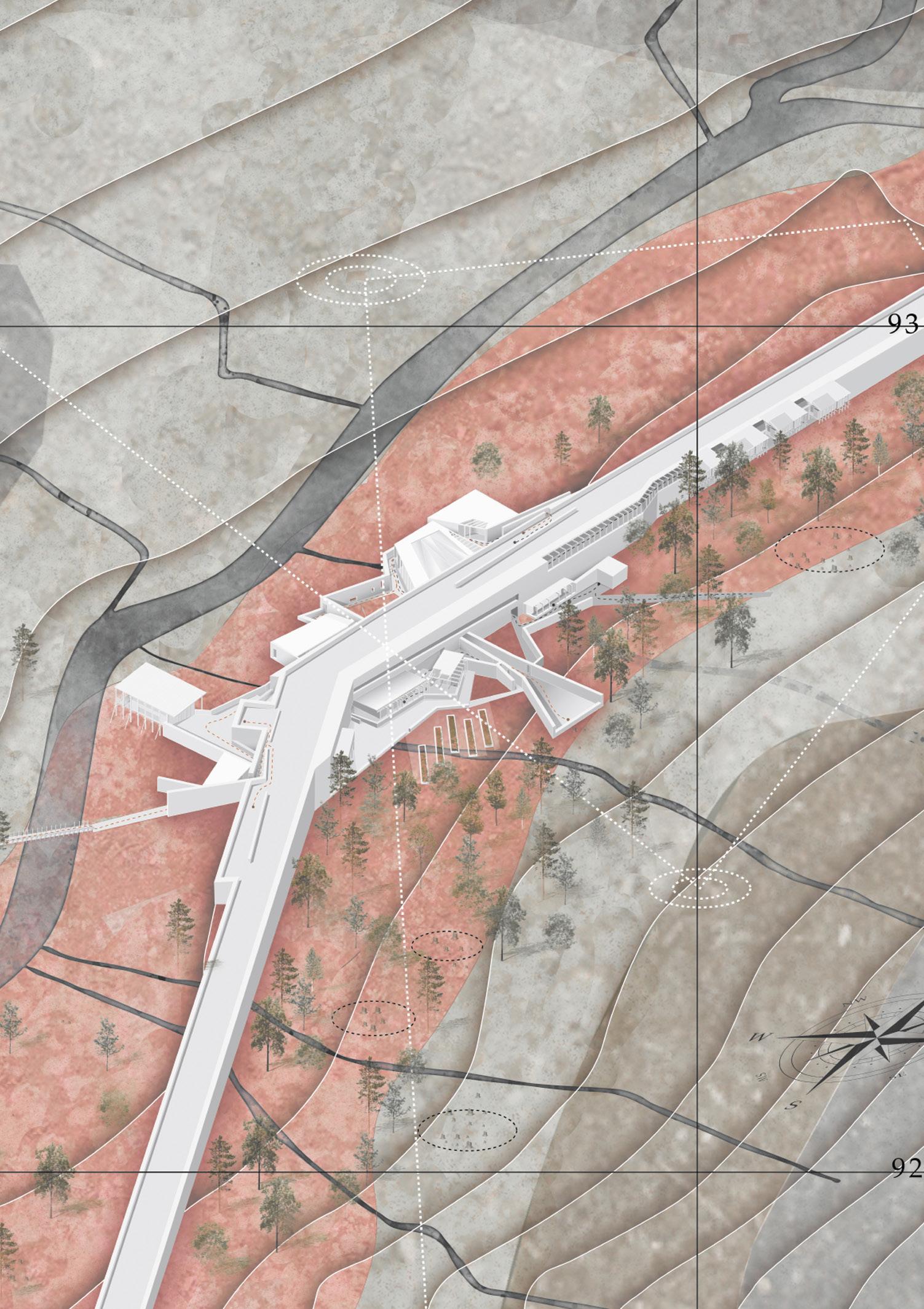
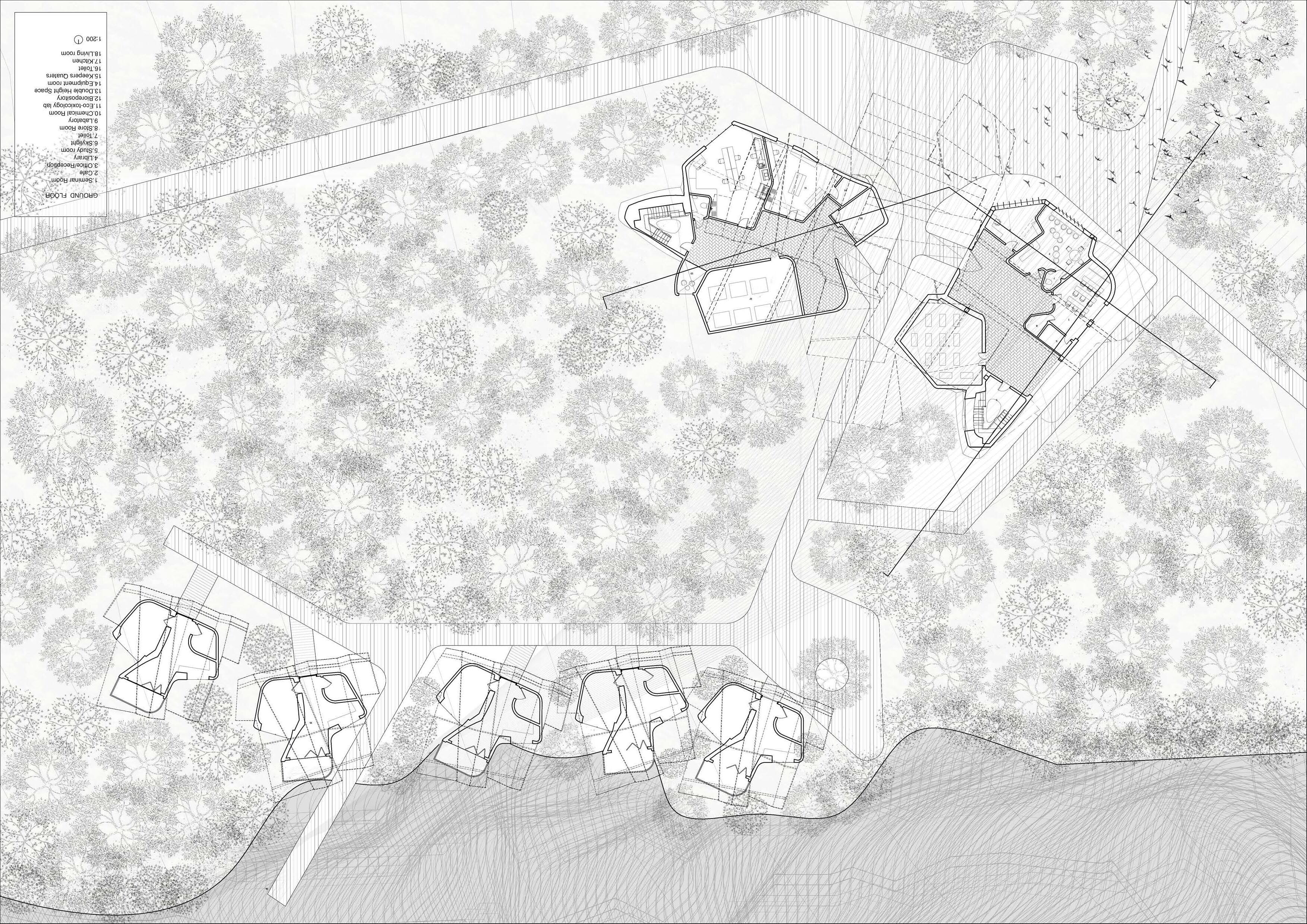
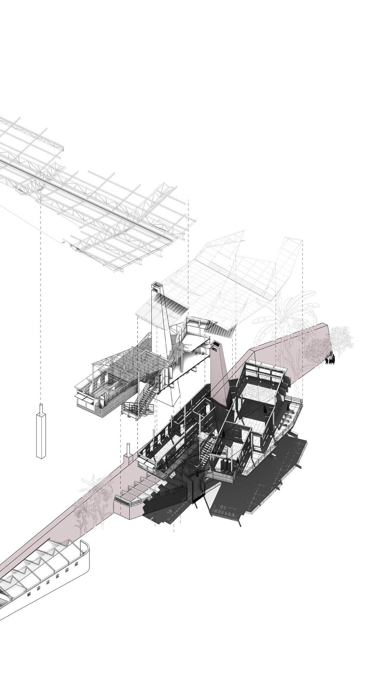
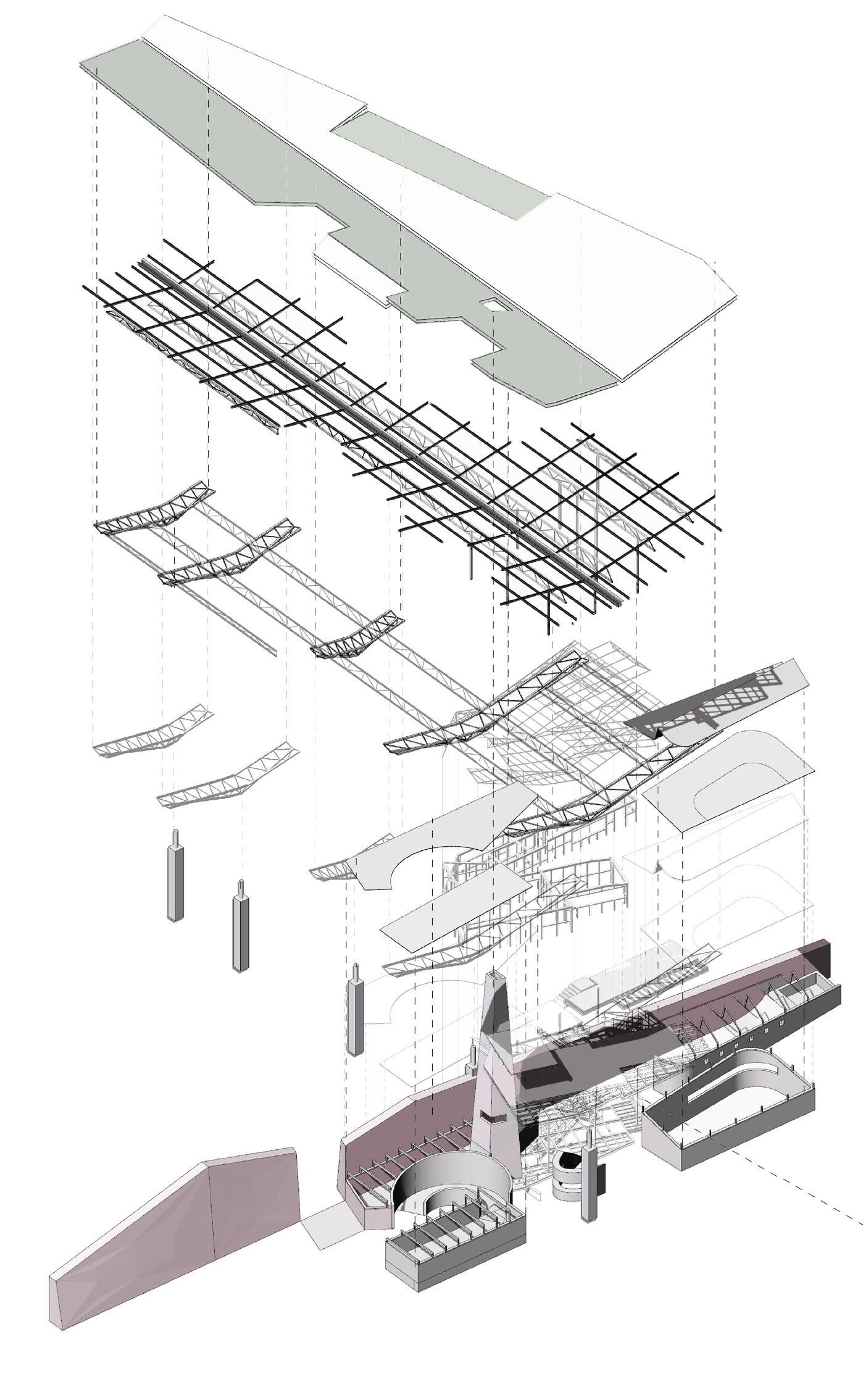
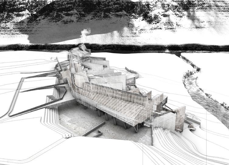
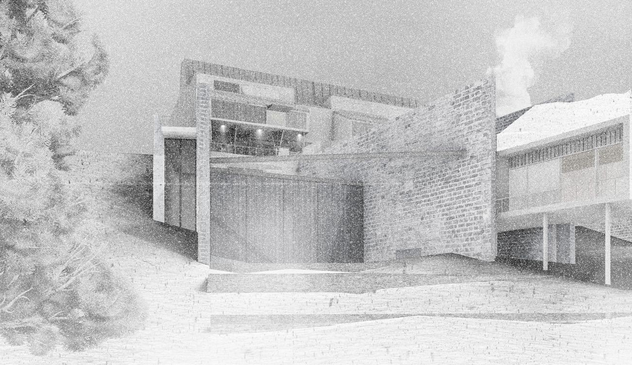
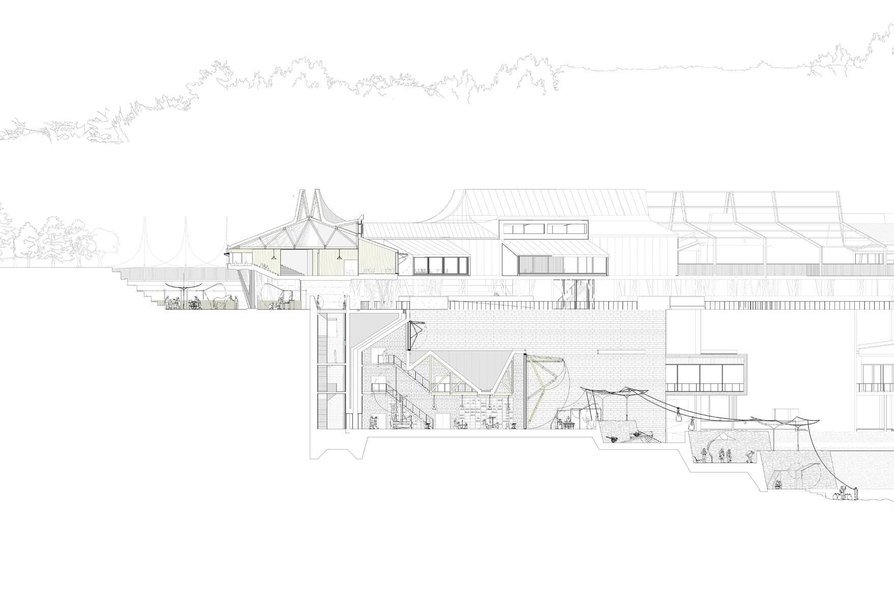
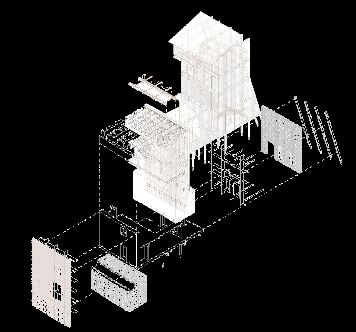
Within each project, a series of four ‘Field Station Renderings’ engage with different scales and urgencies of the Field Stations identified; these renderings appear throughout this catalogue. Field Station Rendering 01
15 See the Introduction to Elizabeth Grosz, Architecture from the Outside: Essays in Virtual and Real Space (Cambridge, MA: MIT Press, 2001), xv-xxi.
16 A now somewhat obsolete definition of the term. ‘render’, Oxford English Dictionary Online. Oxford University Press, 2020.
consists of a speculative site survey, gathering, documenting, inventing and arranging information found and/or made on the specific Field Stations under investigation. Field Station Rendering 02 is a constructed recording of this field through film, combining found and made footage to activate recording and film as a speculative and documentary device. These drawings are detached, enabling the students to work on a site from off site, to explore at a distance (from outside) an outside inaccessible to them at the time the studio was running. Field Station Renderings 03 and 04 are both concerned with ‘being within’ either the building or site. Field Station Rendering 03 describes the scale of the body, developing the material, atmospheric, technical and environmental aspects of the student propositions; Field Station Rendering 04 describes the scale of the building, and its relationship to its immediate surroundings. Together, this suite of drawings, films, models and performances, coupled with the developed descriptions of the projects, fill in some gaps in AMO’s pointillist portrait, merging points or pixels into new composite colourations, adding new points and in so doing creating more gaps. As part of the projects documented herein, they aim to intensify the architectural description of the countryside in order to make the conditions of the contemporary countryside visible.
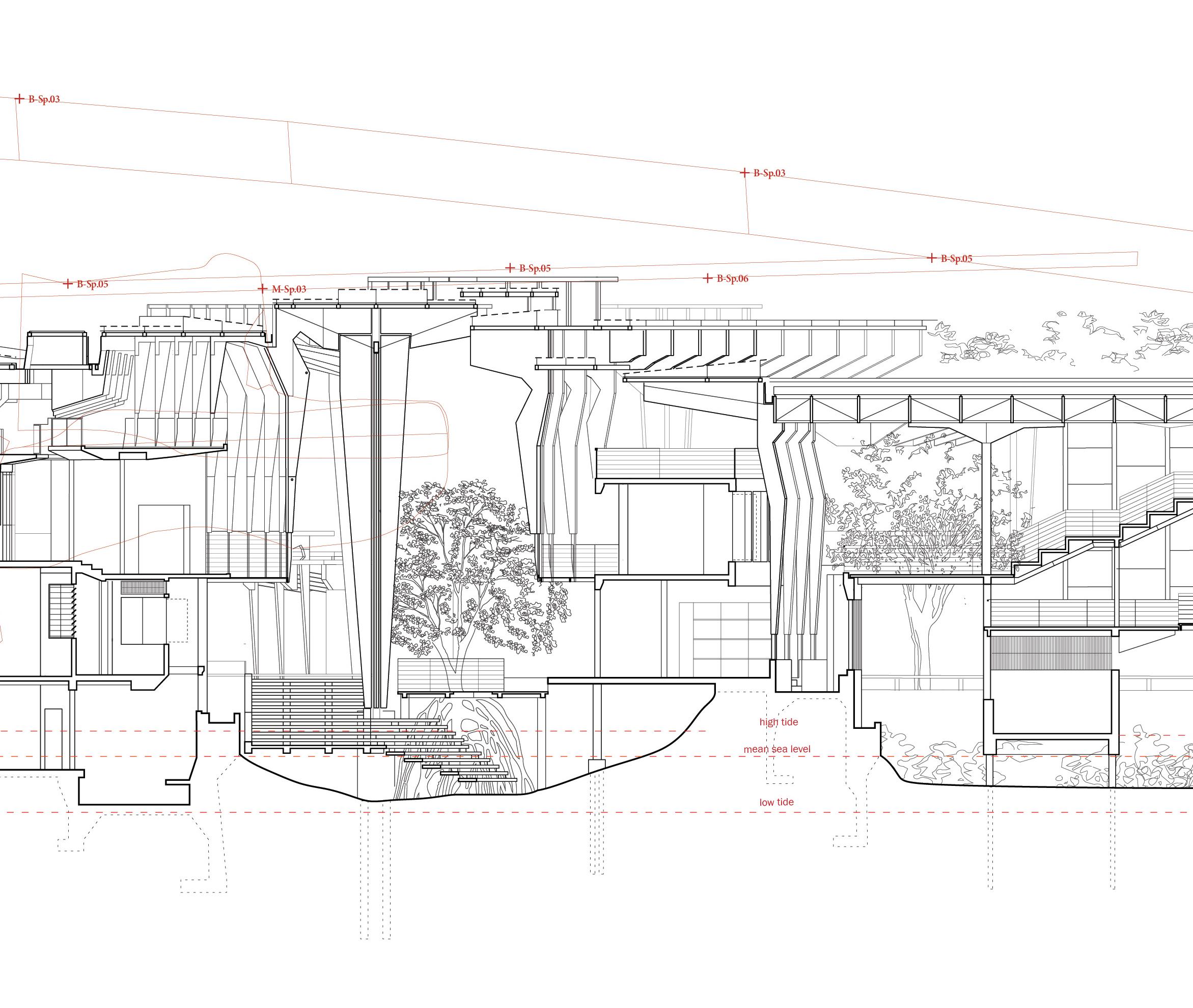
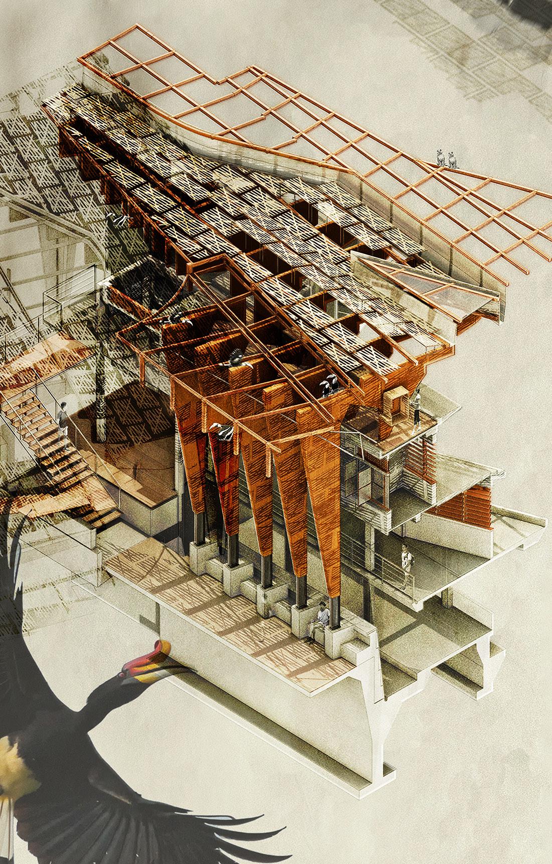
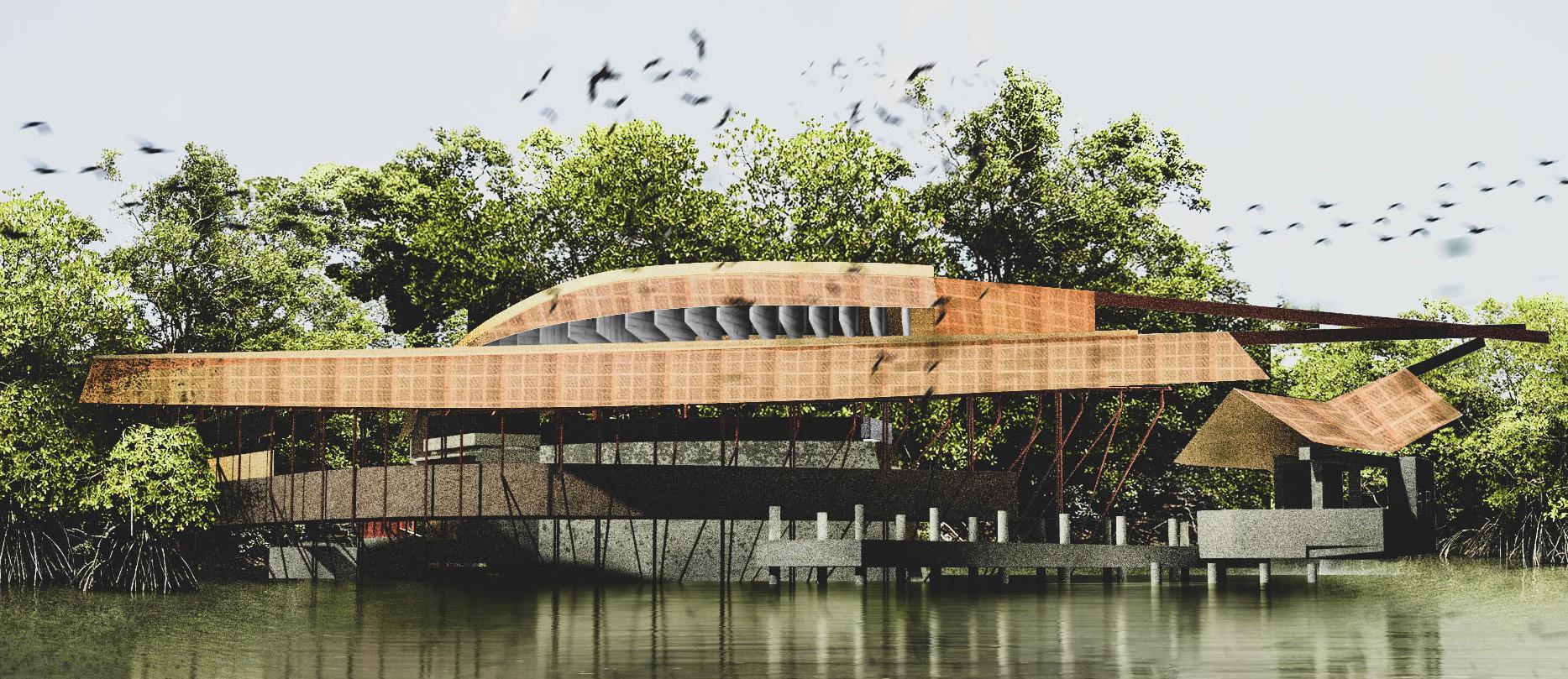
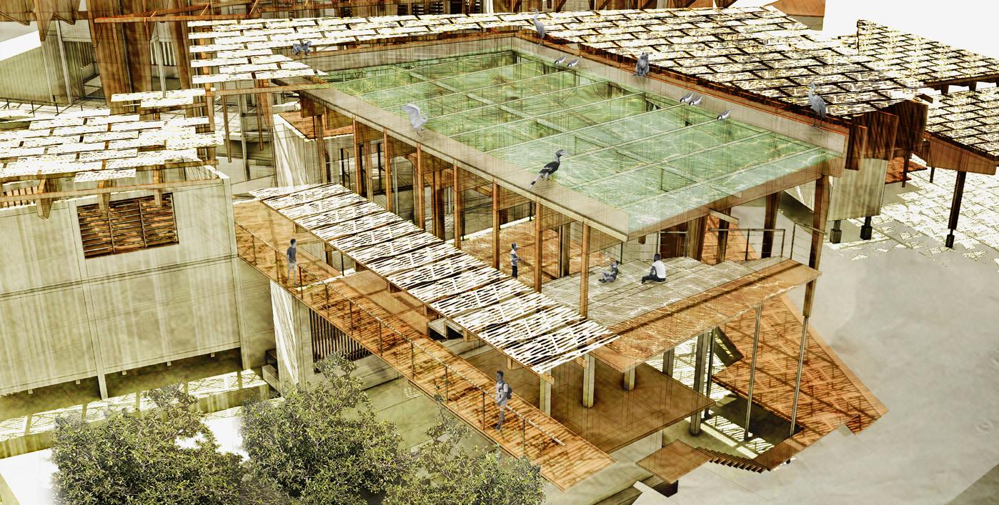
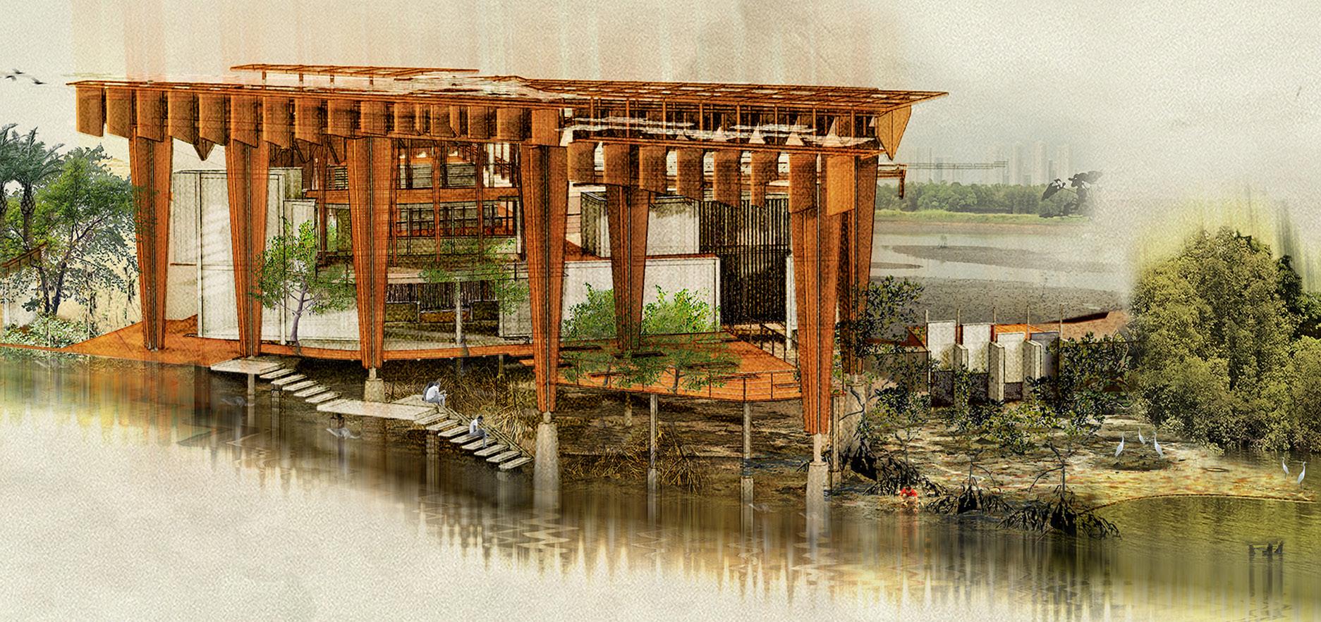
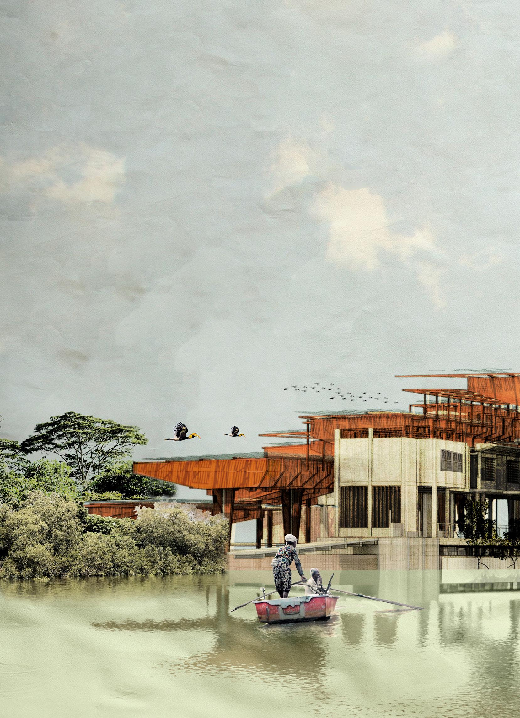
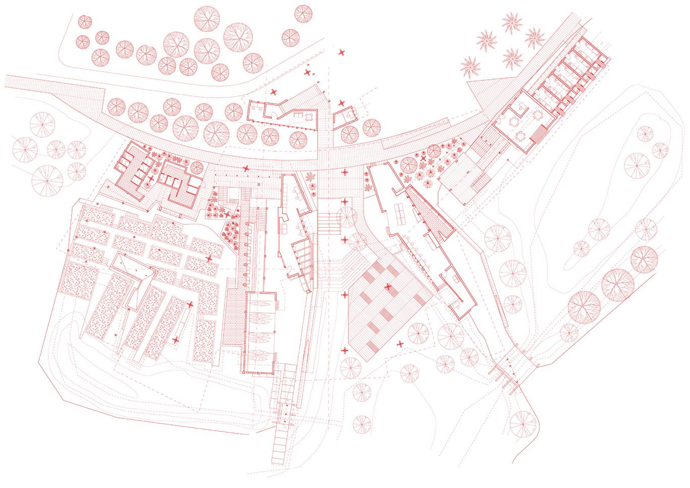
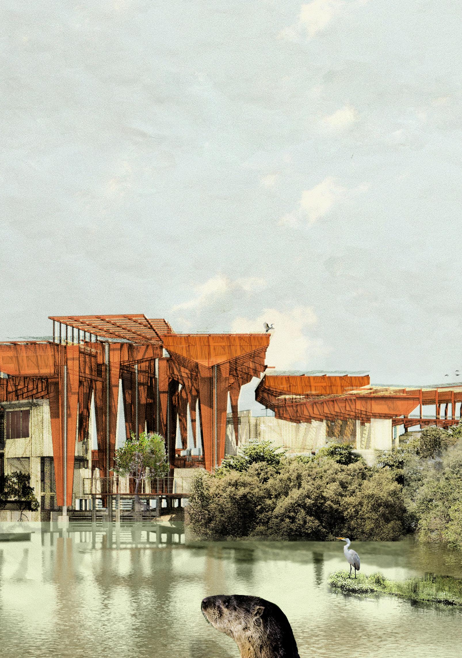
Site: Straits of Johor, Singapore/Malaysia. Programme: Mangrove Institute for Multispecies Affairs.
01
TANAH/AIR
CASTING INTERSPECIAL SHADOWS
TOUFIQ ANDRY
Anthropocentric approaches to the countryside (kampung, palm plantations, farms, aquaculture ponds, motorways) are destroying untouched mangrove ecosystems along the Straits of Johor. Tanah/Air, referencing the Malay phrase meaning ‘homeland’ and combining the words tanah (‘land’) and air (pronounced ‘ah-yer’, meaning ‘water’), explores the enforced expulsion of the indigenous Orang Seletar and the selective emigration of non-human dwellers (otters, hornbills, bats) from the Straits, and the effects of these displacements on the mangroves. Old and new ecological narratives contest the boundary line between Malaysia and Singapore, drawn down the middle of the Strait, and inform a rendering of this tentacular landscape based on wayang kulit, a storytelling form practised throughout the Malay Archipelago employing shadow puppets to narrate myths, and frequently depicting anthropo-animal figures as key protagonists. A new fiction materialises for the Straits of Johor, in which species mingle in blurred edges between things, gathering into complex enmeshings of material, politics and myth. In these points of gathering, following Donna Haraway, Tanah/Air proposes a new way of living in a multispecies world, one that is terran, muddled and mortal. Two sites of making-kin emerge, sympoeitic niches spinning out loopy tendrils like the roots of the rhizophora. An Outpost for Otters and Orang Seletar monitors the mangroves; a Mangrove Rehabilitation Institute provides space for research (human), mangrove nurseries (plant) and non-human species (otters, hornbills, bats) to remake, together, and re-cast the space between (political and organic) beings.
Re-Seeding the Straits of Johor. Propogating Indigenous Stewardship through Seed Disperal.
Field Station Recording. Monitoring Station Outpost, Sungei Buloh. Opposite. Tentacular Landscapes. Performing an Ecological Nation in Wayang Kulit.
Above. Architectural Propagules. From Institute to Outpost across the Straits.
Below. Making Kin in Sungai Perapat. Section through the Mangrove Institute.
Right. Performing and Puppeteering Canopies. Choreographing shadow patterns.
Above. Otter’s Arrival. Monitoring Station Outpost, Sungei Buloh, Singapore. Centre. Tidal Poolings. Persidangan dengan Tok Batin / Meeting with the Village Chief.
Below. Making Kin through the Mangroves. Section through the atrium, from mudflat to coastal forest. Left. Nest. Sang Enggang dan Si Pakar Burung / The Hornbill and the Ornithologist.
Otter’s Return. Mangrove Rehabilitation Institute, Sungai Perepat, Johor. Inset. Mangrove Piers of Sungai Perepat. Ground Floor Plan.
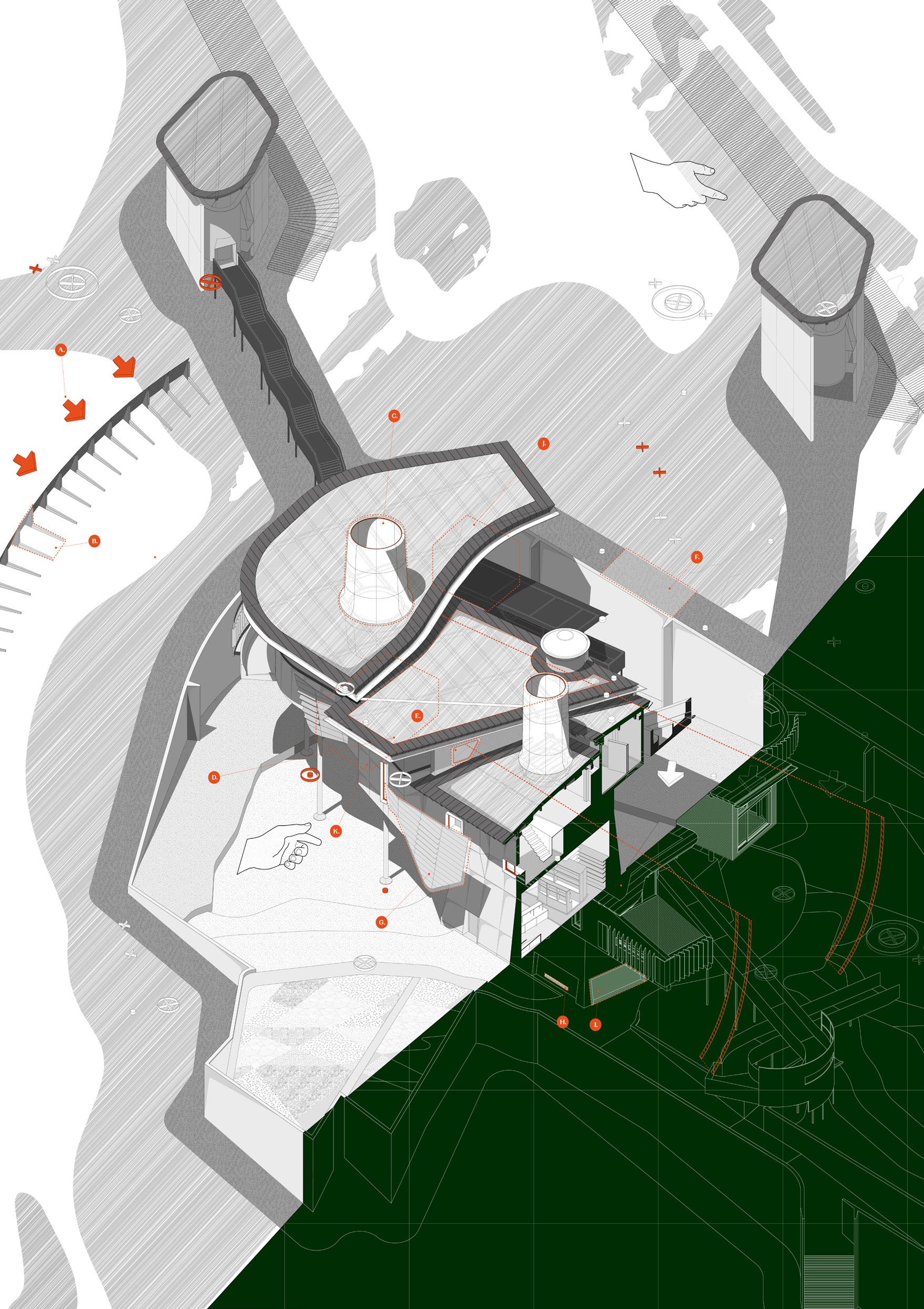
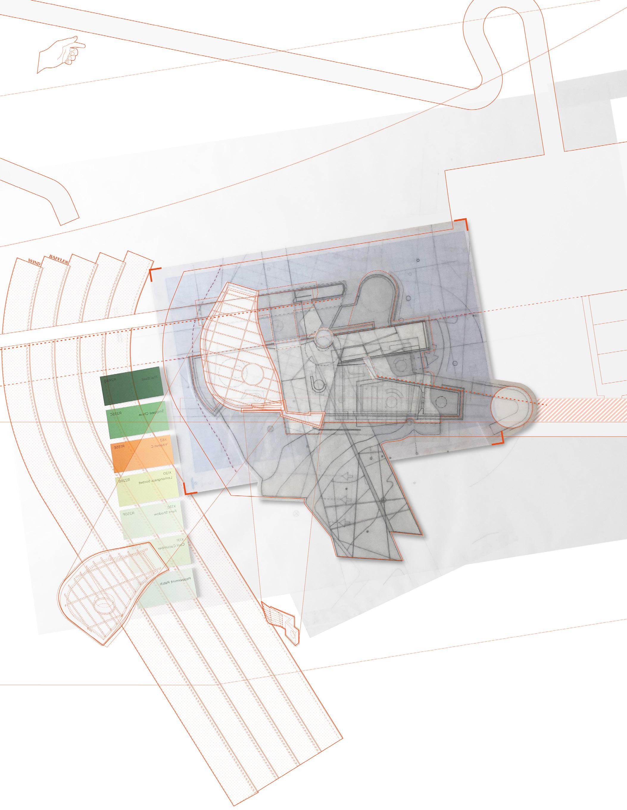
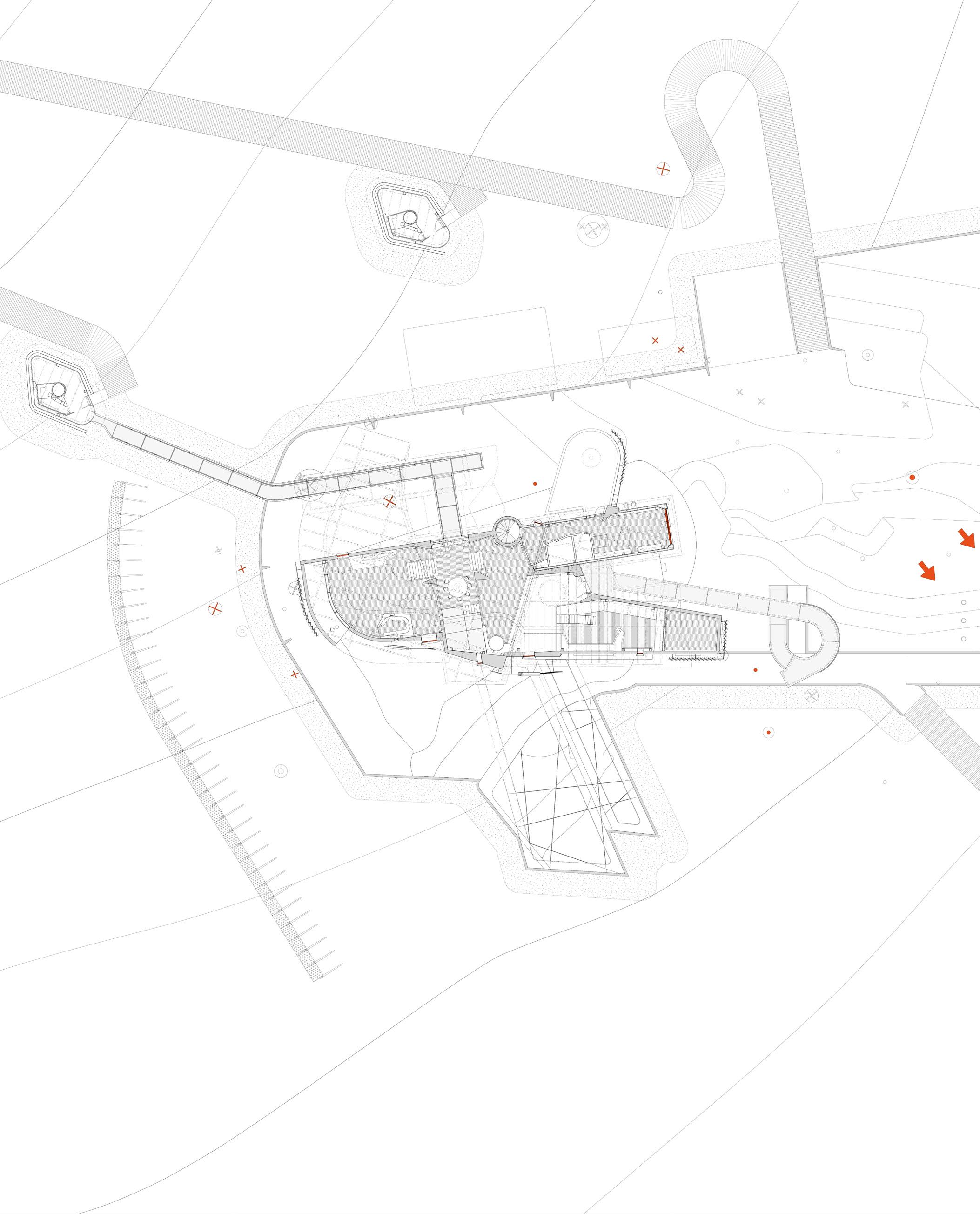
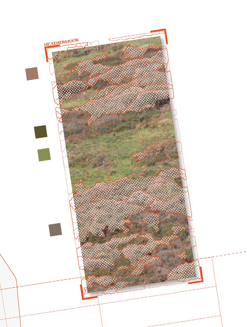
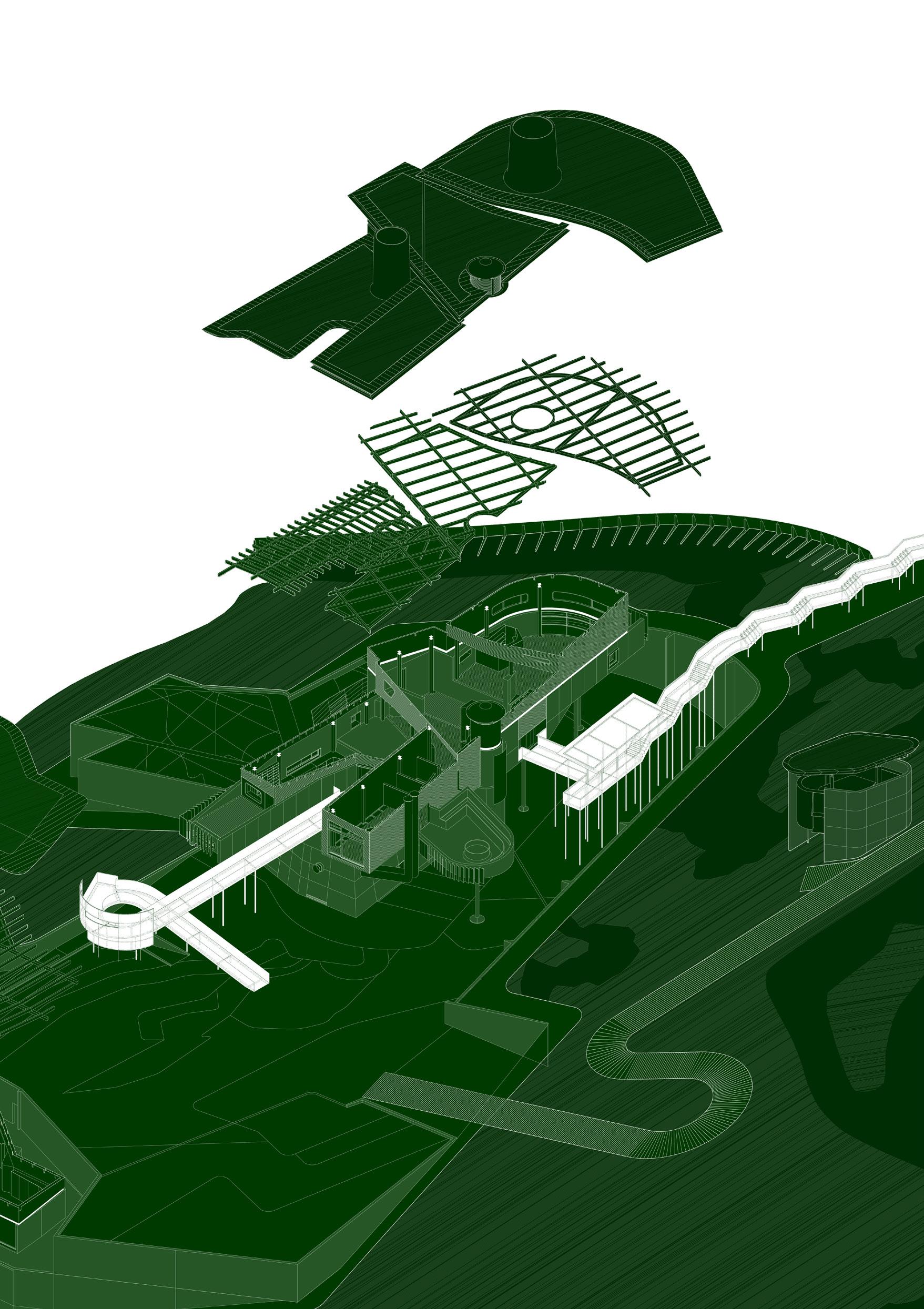
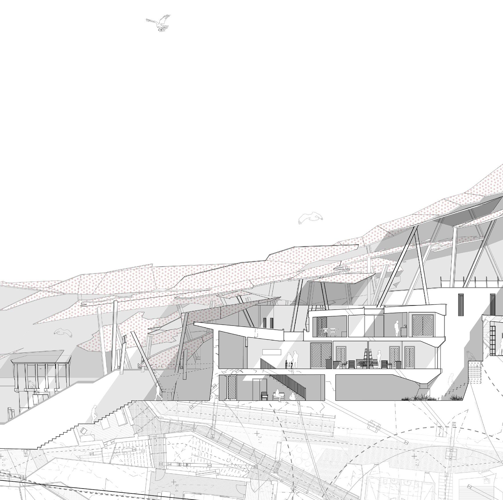
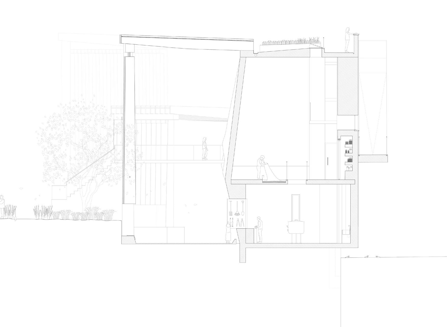
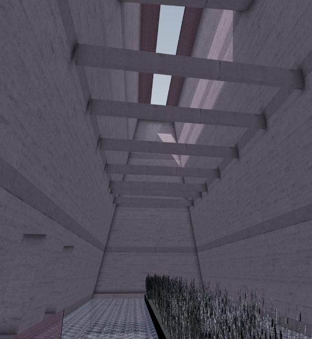
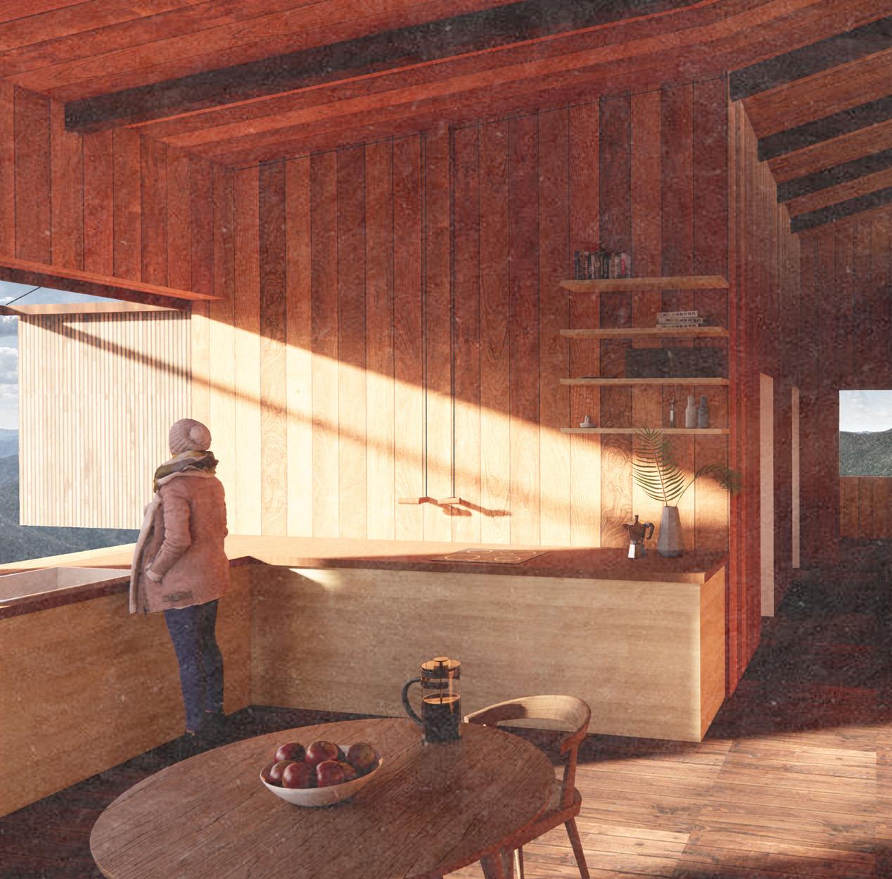
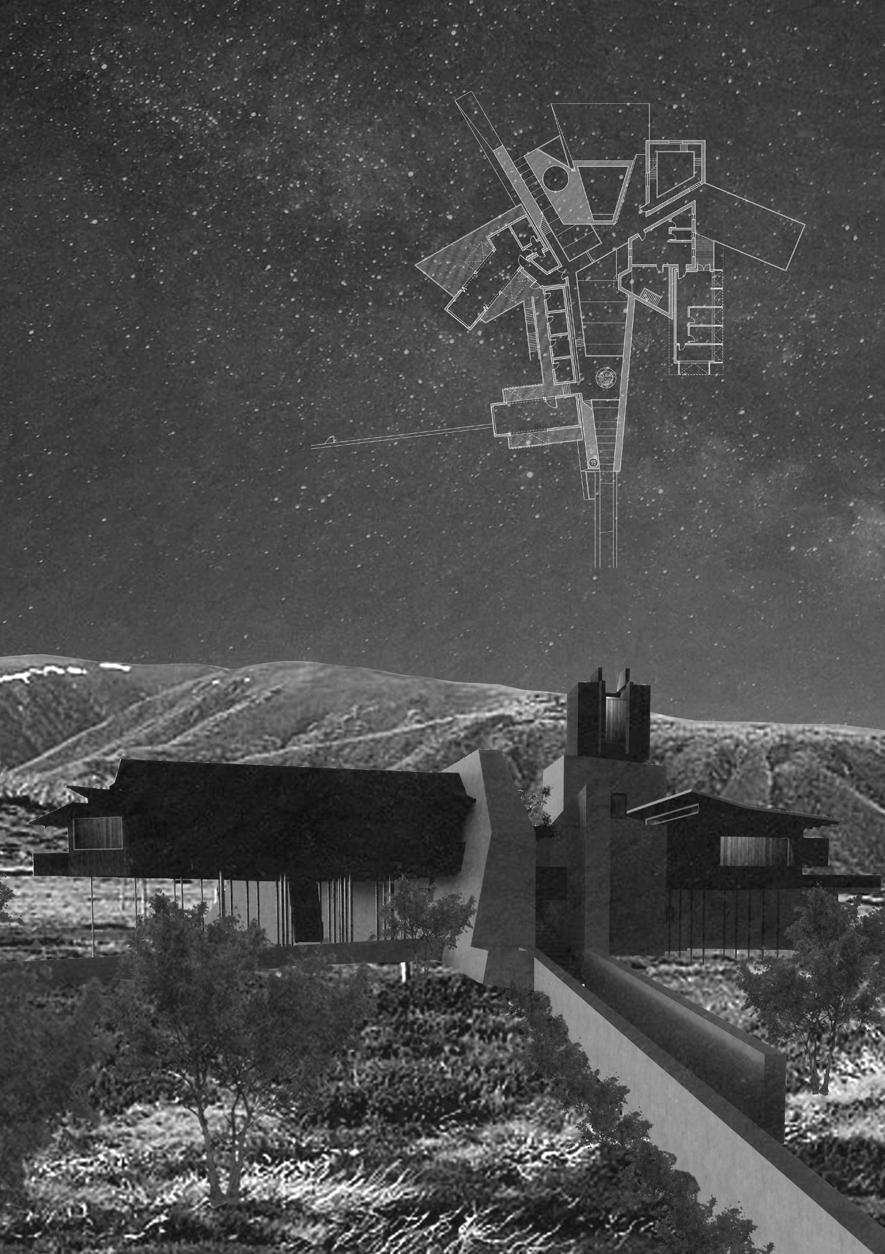
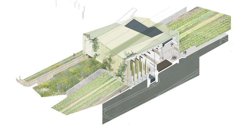
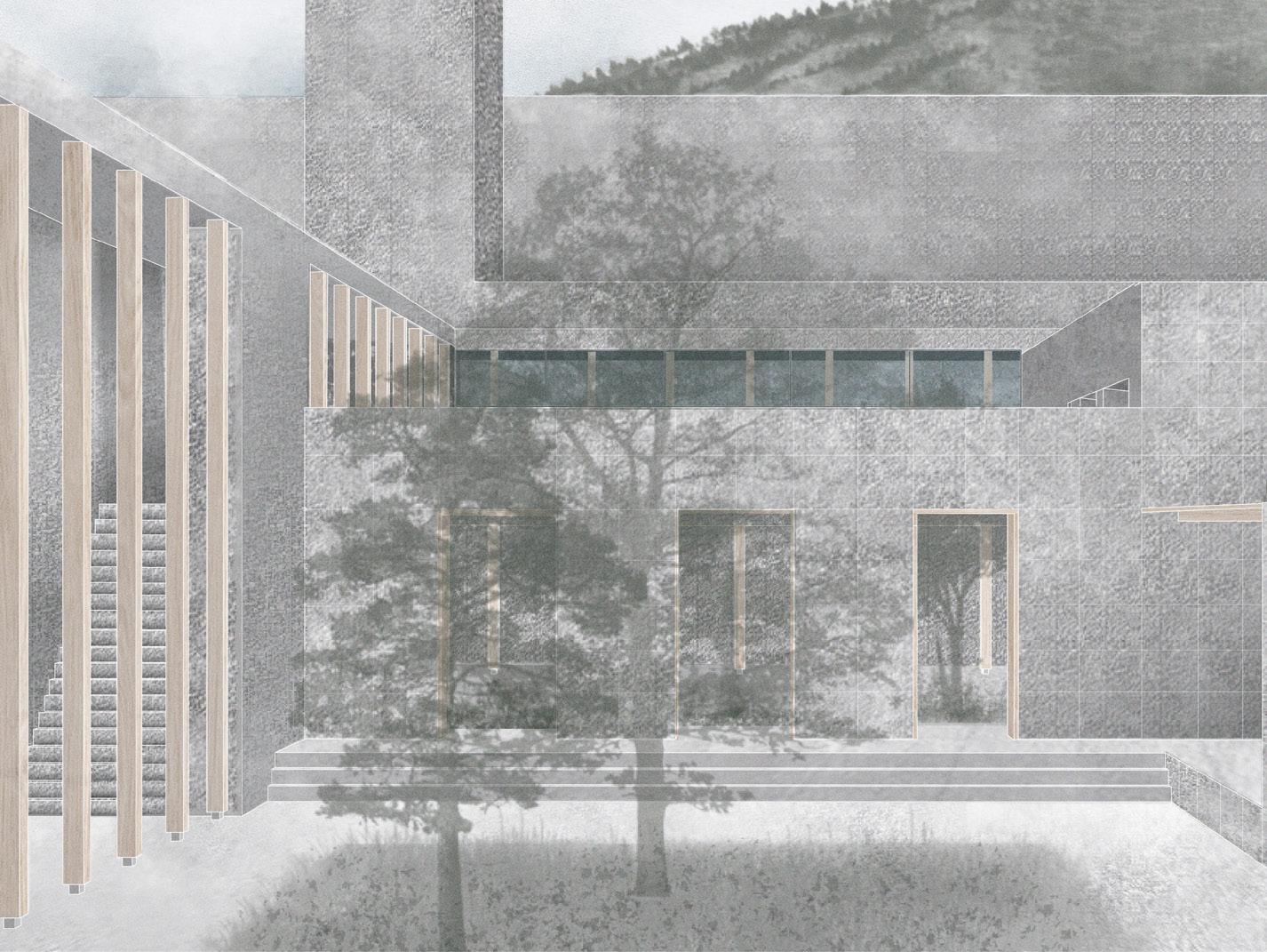
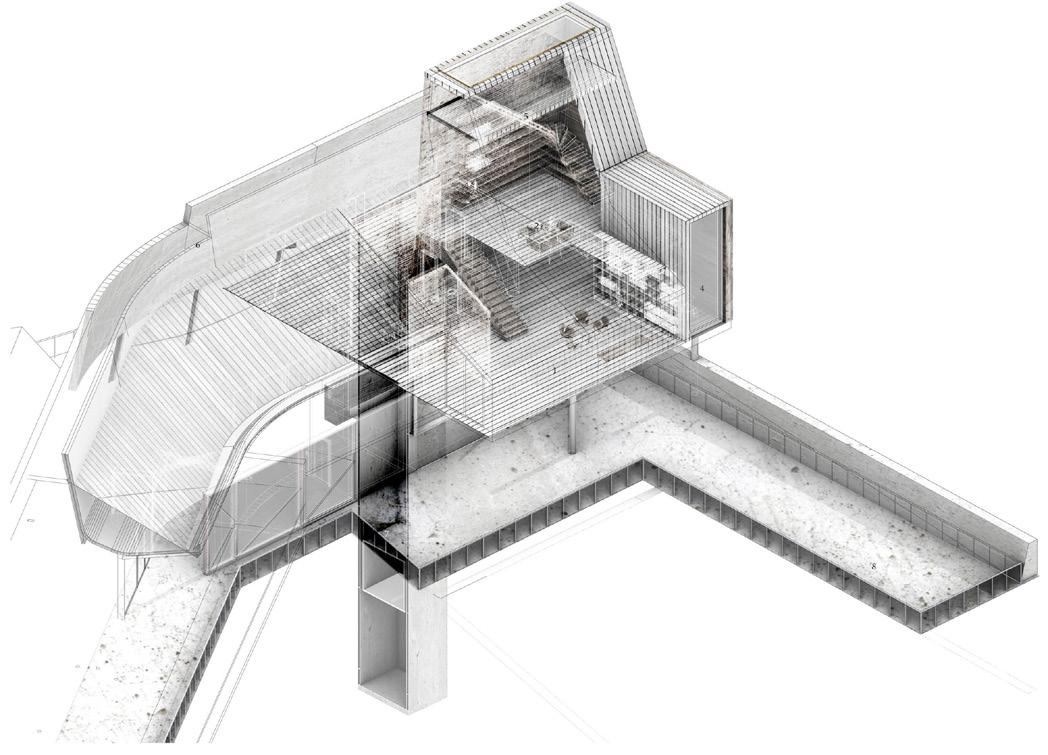
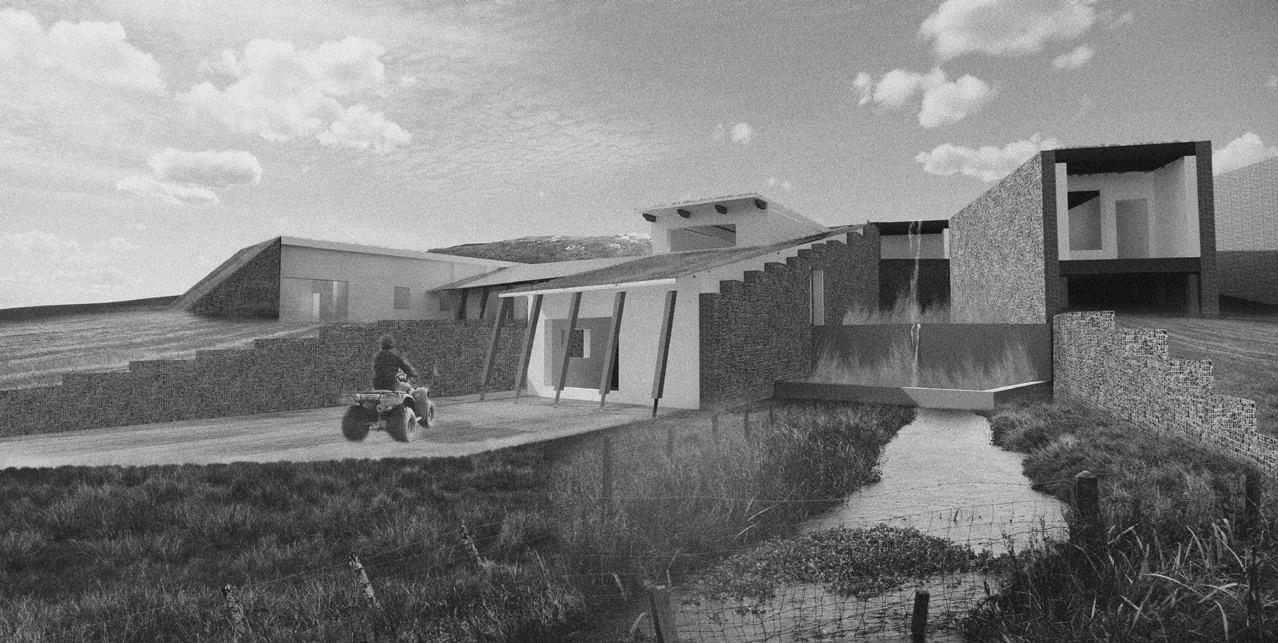
Site: East Cairn Hill, The Pentland Hills Regional Park, Edinburgh. Programme: Forager’s Residence and Preparation/Preservation Workshops, Boot Rooms, Dining Room, Kitchen, Battery Banks, Root Cellars, Herb Gardens.
OUTSIDE:MIND
SEEING AND BEING IN THE COUNTRYSIDE
ALEX MORIARTY
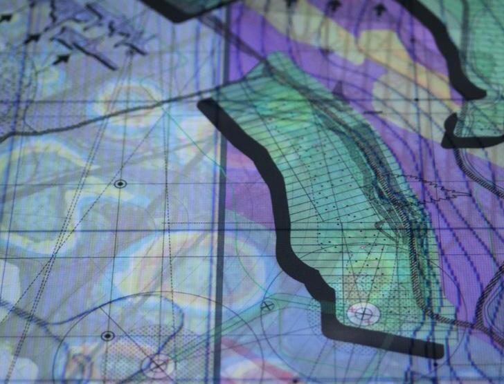
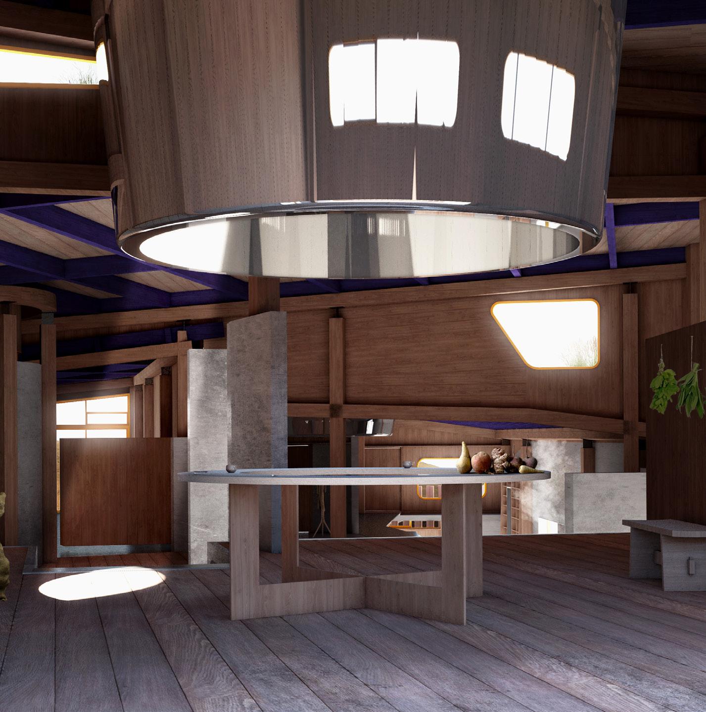
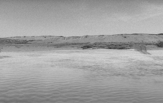
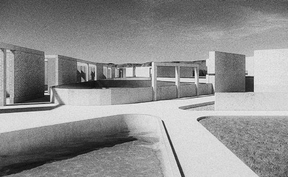
The closing passage of Stanley Kubrick’s 2001: A Space Odyssey pans across the hallucinogenic surface of Jupiter, interrupted by close-ups of protragonist David Bowman’s eye. The scene, in which the Isle of Harris stands in for the desolate landscape of Jupiter, situates a seeing anew, a first sight of Jupiter, but also of Harris. Following Kubrick’s ‘making-alien’ of the Scottish landscape, and a reading of the essays gathered in Vilém Flusser’s Natural:Mind, Outside:Mind explores the complexities, oddities and temporalities of the Pentland Hills through a series of ‘renditions’ or imagings of that landscape. These aim to make this landscape unfamiliar to us. They employ analogue and digital drawing techniques in order to draw out and fathom the various vast narratives which describe the fundamental complexity of nature, and which have historically informed our understanding of geology and the natural world. Three distinct representational paradigms or lenses are developed, informed by three Scottish ‘champions of the natural world’ in John Muir (the naturalist), James Hutton (the geologist) and Sir Robert Sibbald (the forager). In dialogue, they generate a proposal which materialises these visual paradigms. A forager’s workshop and residence (Sibbald) supplies a seasonal Pentlands restaurant by continuously re-stocking root cellars set into the hills with foraged produce. A kitchen uses these gathered foods to teach cooking, and allows people to experience the landscape though considered consumption (Muir). A cloistered garden gathers seeds, and sets the building against the wind, allowing metal sheets to rattle and ripple and stone walls to be set firm against muir burnings, wind and rain (Hutton).
Field Station Rendering 03: When Sibbald meets Muir.. Sectional Isometric through the Preserving Space.
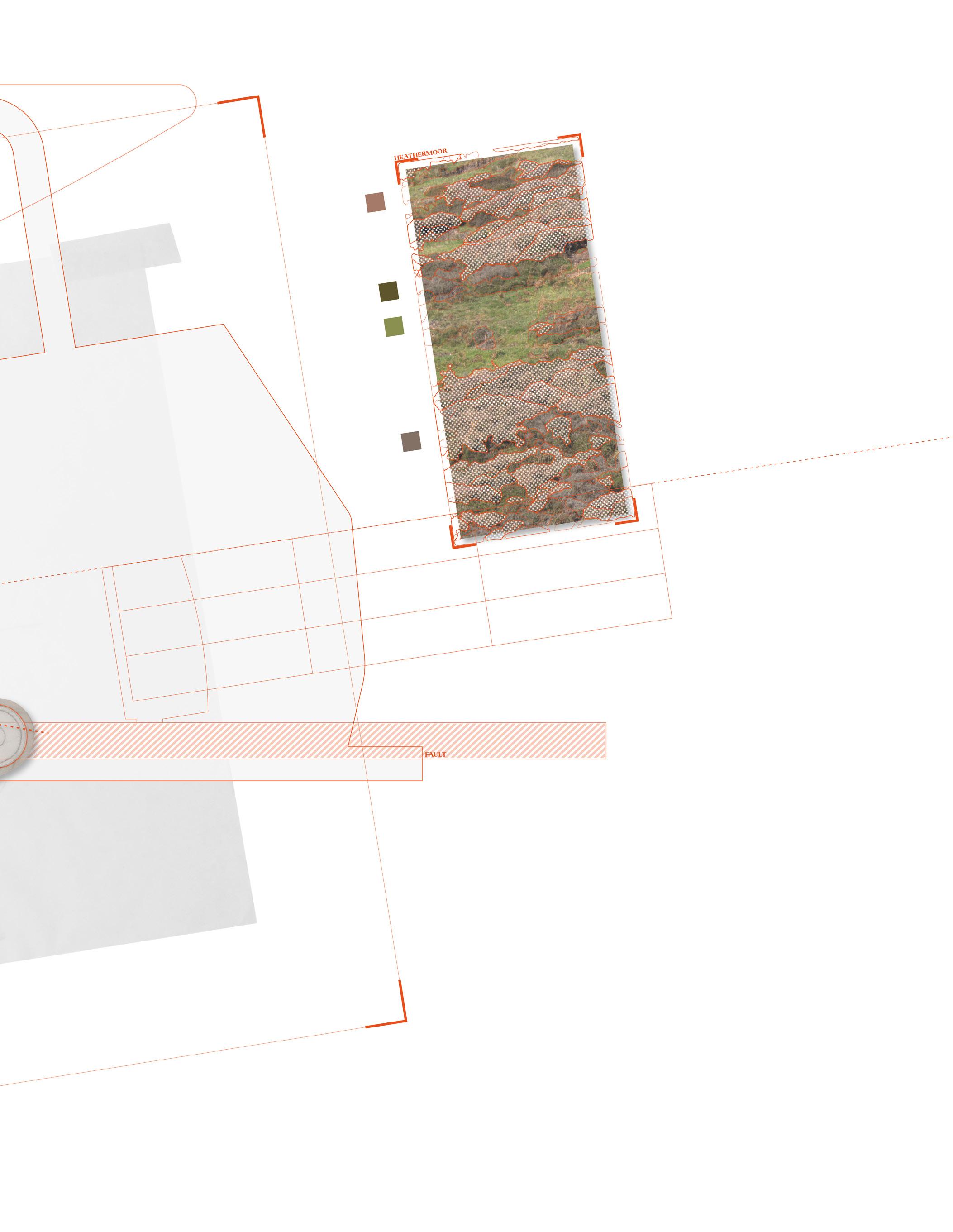
Above. Sibbald Maps the Pentland Hills. Mapping East Cairn Hill through the lens of a Forager.
Left. Field Station Rendering 01: Making Muir Visible. Re-Mapping Pentlands Cartographies.
Architectonic Foraging: The Gathering of Muir, Sibbald and Hutton. Principal Floor Plan.
HUTTON [H]
SIBBALD [S]
MUIR [M]
Above. Forager’s Workshop and Preserving Space. Interior Perspective.
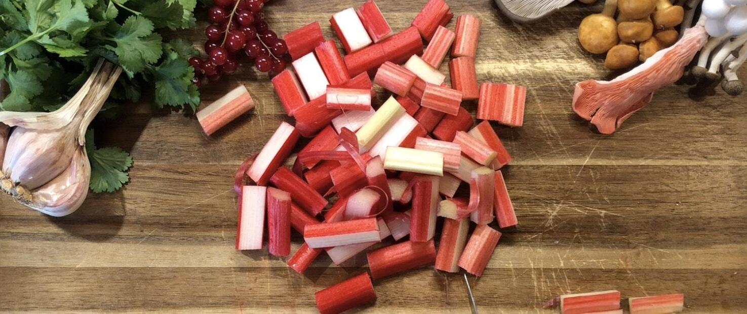
Below. Rendering Rhubarb. Scene from ‘The Preservation of Rhubarb’.
Right. Sibbald’s Restaurant. Dining Space and view to the Kitchens. Section/Elevation and Plan.
Inset. Forager’s Workshop and Preserving Space. Section.
Below. FIeld Station Rendering 04: Deconstructing an Ecological Gathering. Exploded Isometric.
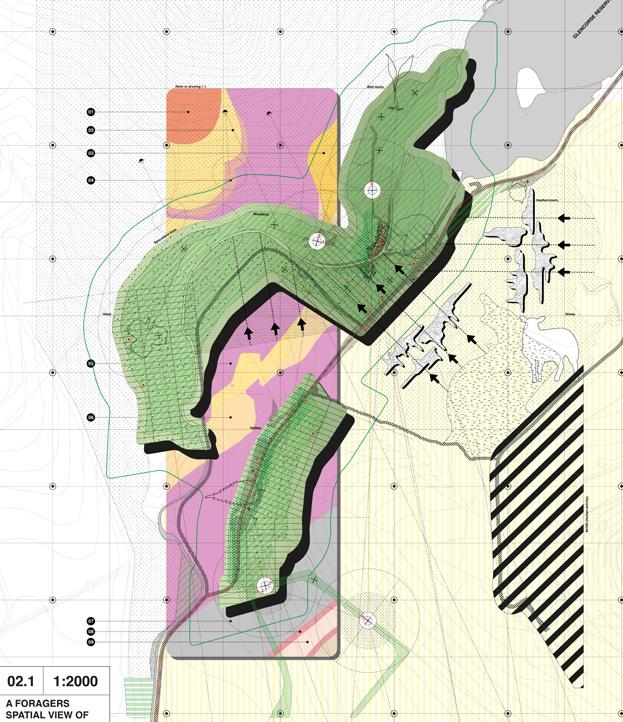
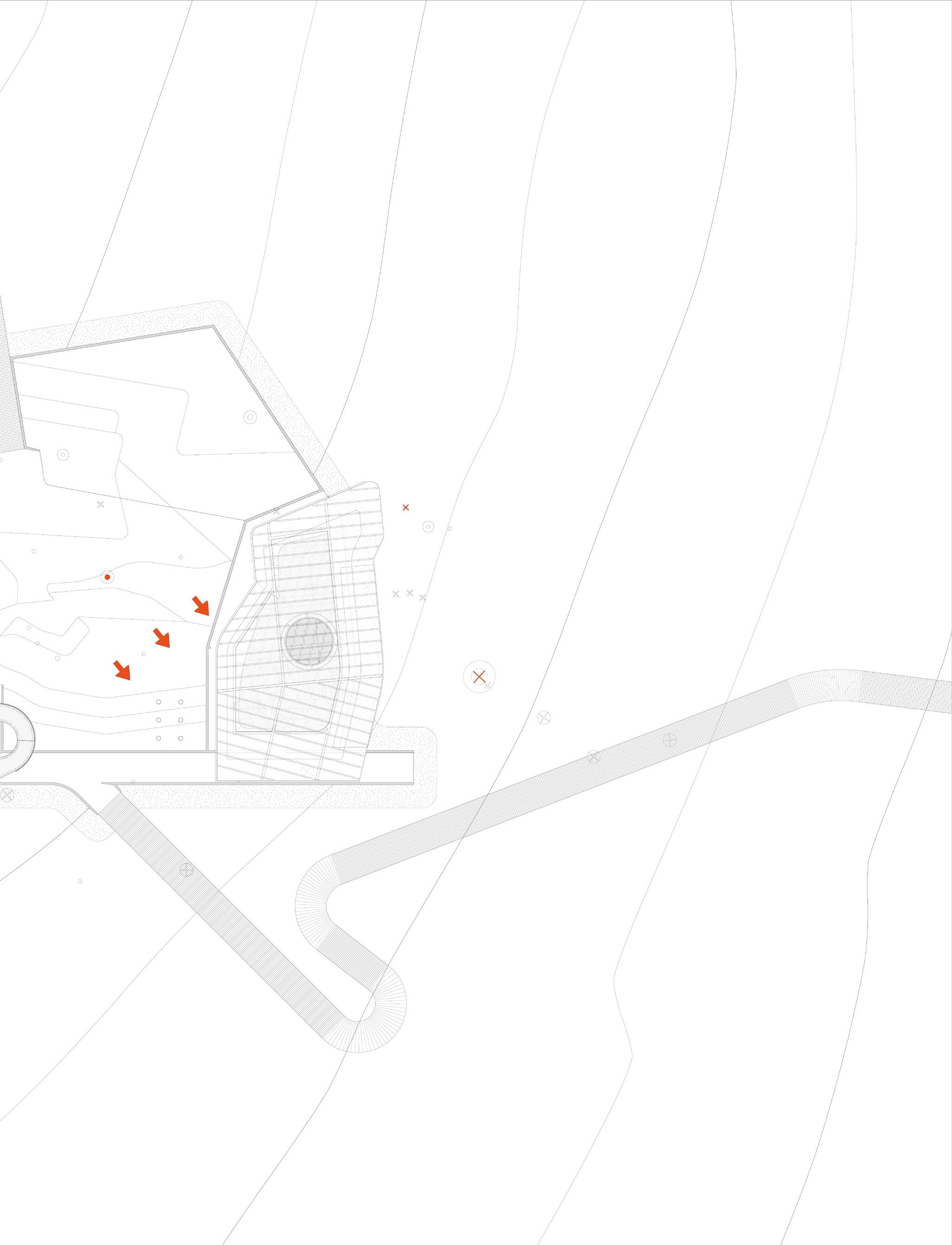
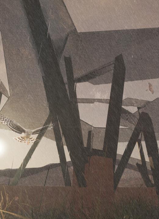
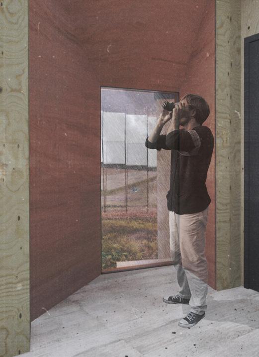
[RE]Faulting Enclosures re-enacts ancient geological processes as a generative architectural practice, compressing, fracturing and faulting the line of the Highland Boundary Fault into the landscape of Arran. Inspired by the cinematography of Stanley Kubrick’s film 2001: A Space Odyssey, [RE]Faulting Enclosures explores Arran as an unknown landscape, mapped anew to reveal concealed shifting fields of force and fracture. Through a process of drawing, forming and figuring a fault, an absence, [RE]Faulting Enclosures makes present that which is presently invisible to (or not seen by) architecture: the animal, geological, and botanical. Through such a [RE] Faulting, the landscape is intensified, and a making-present of material (sandstone) and animal conditions makes space for new moorland, in which the ongoing (man-made) conflict between the Hen Harrier and the Grouse might be diffused.
Within this intensified landscape, outposts become places of sanctuary, of protection. They both shelter various species from and intensify external environmental conditions, challenging the definition of an enclosure by blurring boundaries between inside and outside, human and non-human space, and conditioned and un-conditioned environments. An associated aviary supports the rearing and monitoring of Hen Harriers and a Field Station (a series of research, orienteering and land management spaces) enables the navigation of geological faults, occupying the threshold of the open enclosure, the space between, the /, the fault, on the line.
Embedding Outposts. Unfolding an Aviary through a Fault Line.
Left. Embedding Outposts. [RE]Faulting National/Island/Site Territories. Centre. Harrier Conservation Centre. Principal Floor Plan.
Right. [RE]Faulting Arran. Exploratory Faulting, Folding and Fracturing Models.
Above. Non-Human Occupants and Red Sandstone Reveals. Perspective Views.
Below. Sectioning a Fault Line. Outpust Section.
Right. Aviary Structures. Exploratory Digital Model.
Field Station Rendering 01: Re-Seeding Bute. Mapping Botanical Disseminations and Trajectories.
BÓT, BUTE AND EPISODIC ARCHITECTURE
Site: North Bute SSSI, Isle of Bute, Argyll & Bute, Scotland. Programme: Nurseries, Studios, Workshops, Seedbank, Land Management Resources, Visitor’s Housing, Residences for a Gardener and a Botanist.
BÓT, BUTE AND EPISODIC ARCHITECTURE
LARA GUELDNER | LUCY POTTS
The most recent report conducted by Scottish Natural Heritage (SNH) noted that the ‘upland assemblage’ of the North Bute Site of Special Scientific Interest (SSSI) had failed condition assessments, with fewer than 25% of habitats being in favourable condition. Over-management of the land has disturbed this upland ecosystem, causing invasive species to drain the soil of its nutrients. The resultant dry landscape has increasesd the risk of local back burning, intended to clear heather, becoming uncontrolled wild fires (as happened in 2010, 2016, 2017 and 2019). Bót, Bute and Episodic Architecture seeks to reconsider the management of species on Bute (a derivative of the Gaelic term ‘Bót’, referring to signal fires), and to gradually restore plants native to this assemblage of wet and dry heathland and blanket bog. A 150-year research-based management strategy will work in tandem with the current and future states of this ecosystem to implement site specific regeneration methods for improving habitat conditions.
At the centre of this strategy is a site for storing and safeguarding seeds, and growing and disseminating seedlings. The facility, cared for by two permanent residents (a Gardener and a Botanist), accommodates visiting researchers and volunteers for planting in a residential wing, arranged around a series of planted courtyards. A public ‘beacon’ flanked by thick protective walls provides space above the seed vault for travelling groups to help pot plants and pick seeds. In times of fire the building contracts, labs collapse and sacrificial flammable barriers protect precious material within.
Field Station Rendering 04: Marking Progressive Restorations. Signalling Fire and Flowerings.
Inset. Bót/Bute Botanical Institute. Facilities during a cultivation cycle. Right. Conflagrations. Lab Wings retreat in response to approaching fires.
Below. Bót/Bute Botanical Institute. Beacon, Seedbank and Lab Wings. Section.
Above. Selected Flora. A Directory of Floral Planting for Bute. Below. Seasonal Residences. Courtyards, Gardens and Seed Wells.
Site: Pomona Island, Salford Quays, Manchester. Programme: Natural Dye Production, Public Gardens, Orchards.
05
DOCKLAND DYES
DE/RE-COLONISING
BETH RAWSTHORNE
POMONA ISLAND
Situated on the outskirts of Manchester city centre, Pomona Island, trapped between the meandering River Irwell and the Bridgewater Canal (the first canal in Britain built without following a natural watercourse), is enmeshed in conflicting natural and social histories. The island, formerly Cornbrook Strawberry Gardens, was renamed Pomona after the Roman Goddess of orchards. In the 19th Century it housed Pomona Palace and Gardens, and subsequently docklands, developed as part of the expansion of Manchester’s waterways and funded by imports of cotton harvested by enslaved peoples. Today, the man-made island is disused, forgotten, looked upon covetously by developers but otherwise broadly overlooked. This inattention has allowed wildlife to reclaim Pomona. Behind the blunt front to the Bridgewater Canal, and surrounded by factories and commercial buildings, around 150 different species of flora now occupy the island, seemingly paradoxically sustained by attempts by developers to strip the island of its biological life by raking over the soil. Dockland Dyes seeks to further, not frustrate, this biological re-colonisation of the island. It proposes the creation of dyes on Pomona, made from site-grown produce that will allow spontaneous growth to remain the controlling organising force on the island. A thickened dock edge provides space for the production of dyes from vegetables harvested in the gardens, and the dyeing of ethically-sourced fabric. The public, invited to the island in summer (the building goes into hibernation in winter), are encouraged to watch the dye-making and dyeing processes unfold, to directly explore seasons of growth, blooming, production and hibernation.
Above. Field Station Rendering 04: Edges and Embankments of Pomona Island. Spring flowers in bloom. Left. Recolonising Pomona. Development Collages.
Above. Autumn Sheddings. View from across the Pomona Docks. Recolonising Pomona. Development Collages.
Right. Winter Decay. Sectional Isometric studies.
Below. Interior/Exterior Vegetable Gardens and Dye Baths. Section.
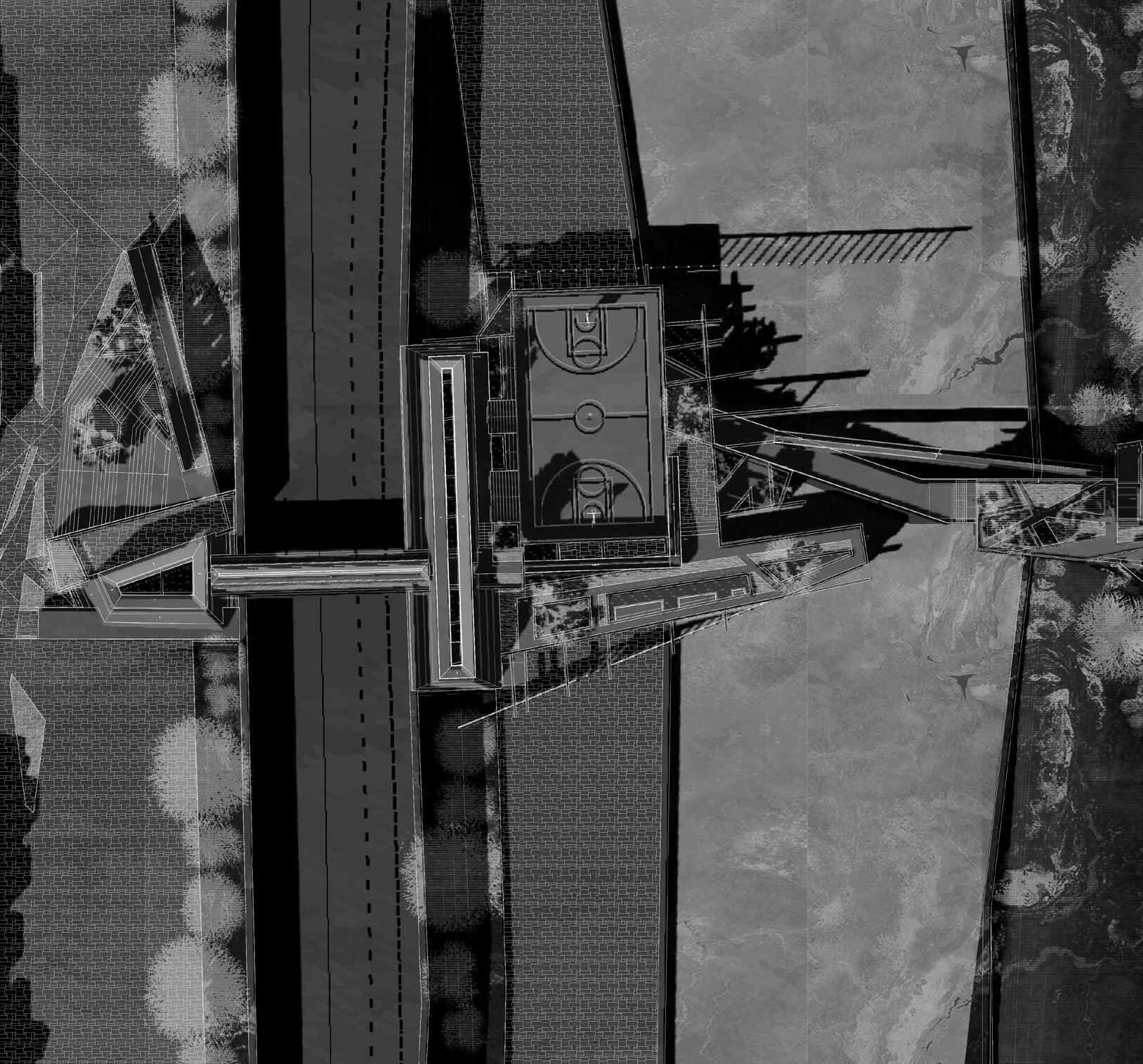
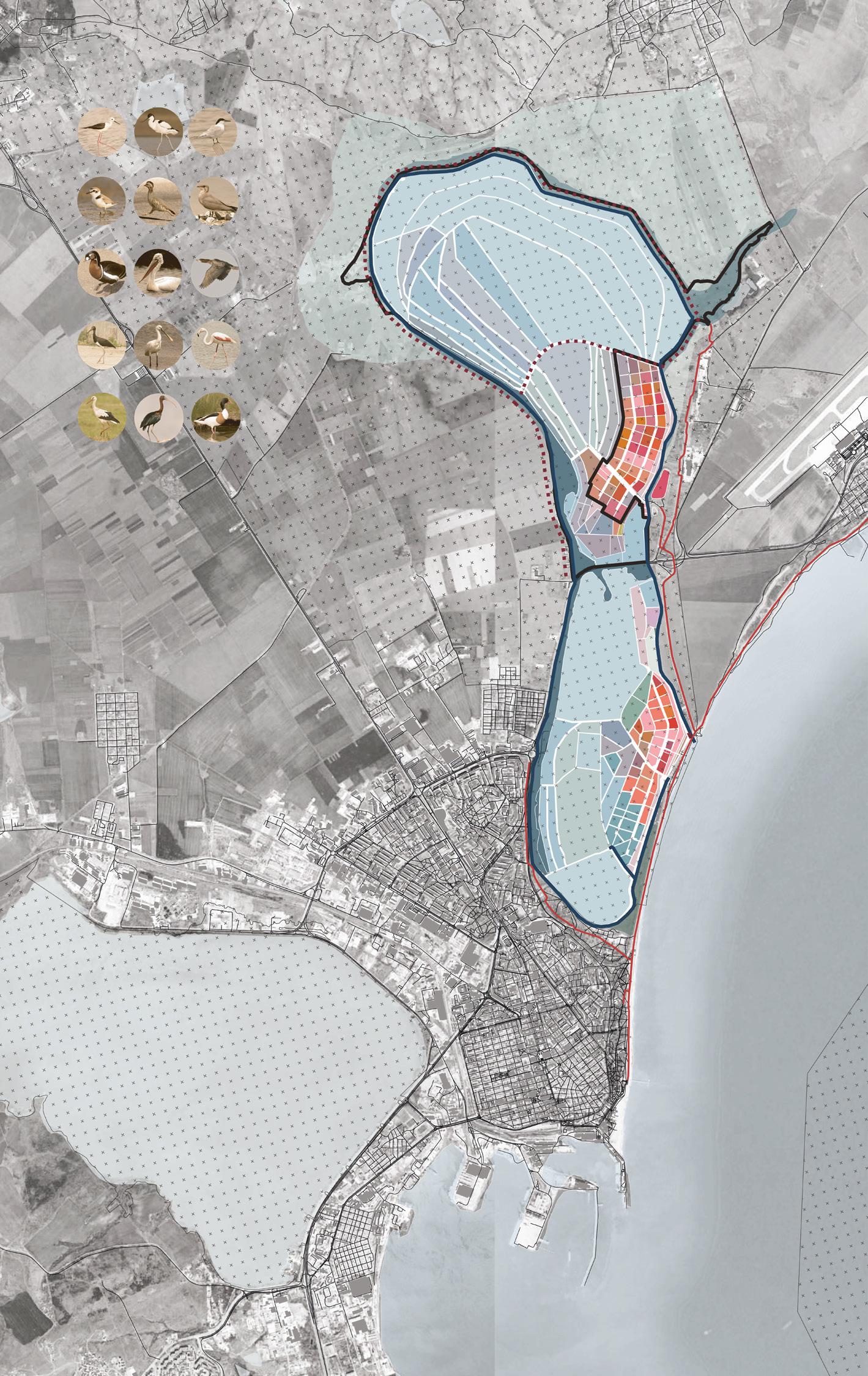
Site: Texcoco Basin/Lake, Mexico City, Mexico. Programme: Wetland Centre, Algae Lots, Spirulina Farming, Basketball Courts.
GROWING WATER
SETTLING THE LOST LAKES OF MEXICO CITY
MIRANDA LYLE PEREZ
Mexico City’s relationship with water reaches its unsustainable nadir in Lake Texcoco basin, a seemingly forgotten area of land that the rapid encroachment by Mexico City into surrounding towns and villages appears to have bypassed. A large water treatment works sits near polluted, canalised channels of water, neighbourhoods with no fresh supply await tankers for their daily drinking water, rains cause flash floods in concrete-encased roadways. Water is abundant, but unusable; the ancient aquifer is depleted and, consequently, the city is sinking. Growing Water occupies the non-urban ‘island’ of Lake Texcoco, one of the ancient lakes within which the Aztec city of Tenochtitlán was built, to re-establish a sustainable relationship between Mexico City and its hydropolitan region. A series of wetlands treat runoff water, and encourage diverse plant life, gradually returning the lake to the basin. These wetlands support new agricultural practices, either through the provision of ‘algae lots’ for spirulina farming, or the development of traditional chinampa-style agricultural plots (constructed within the lake).
A Wetland Centre manages these interventions, cleaning and capturing water, and reconnecting the city with the lake by including training facilities for low-income neighbourhoods to learn to farm and manage the wetlands.
A new housing typology emerges from the lake, with district heating and combined heat and power generation from the sludge extracted in the pretreatment stage of the wetland water treatment works. The Centre, formed of a series of buildings spanning existing urban barriers, brings people to water and carries water to people.
Above. City-Site Cycles. Environmental Dynamics and Linear Time. Inset. Blue Fingers. Mexico City’s Settled Lakes.
Below. Cistern, Well, Aqueduct, Lake. Planning shifting perceptions and programmes of water.
07 ONGOING (AB)USES OF EMPIRE
Field Station Rendering 02: Collaging Contexts
Assembled photographs, footage and field notes. Compiled Screenshots.
MOHAMMAD TALHA MALIK AARON FRENCH
ONGOING (AB)USES OF EMPIRE
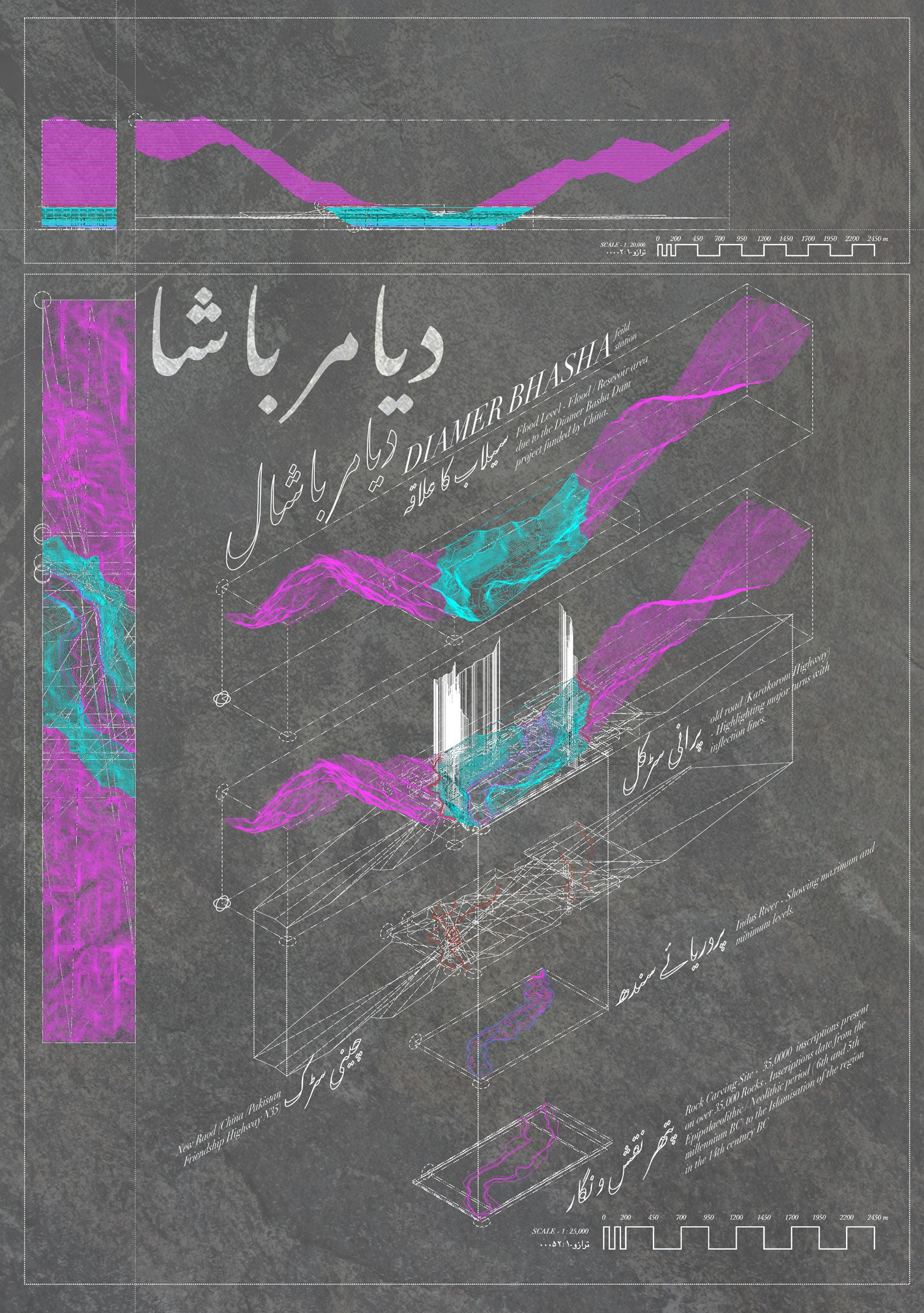
Site: Diamer Basha, Gilgit-Baltistan, North Pakistan. Programme: Truck Stop, Markets (Temporary and Permanent), Weaving and Dyeing Studio, Petroglyph Research Centre, Tribal Meeting Pods, Stone Keeper’s House.
INFLECTIONS AND INSCRIPTIONS
AFFECTIVE PERIPHERAL OBJECTS ALONG A (SHORT)
SECTION OF THE SILK ROAD
MOHAMMAD TALHA MALIK
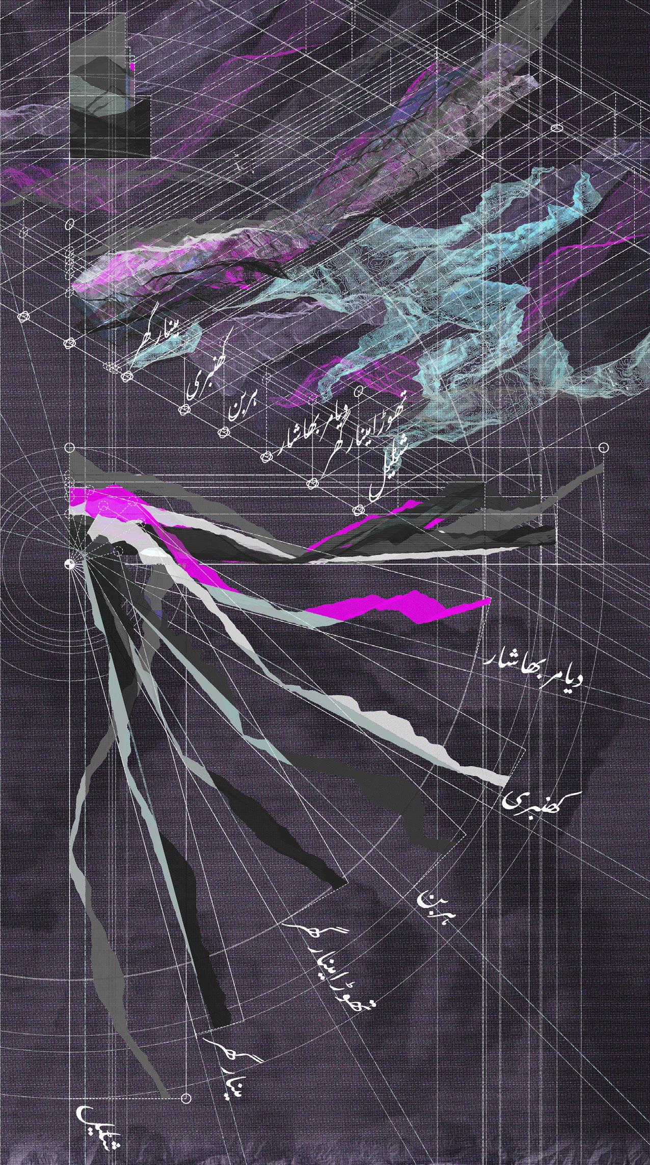
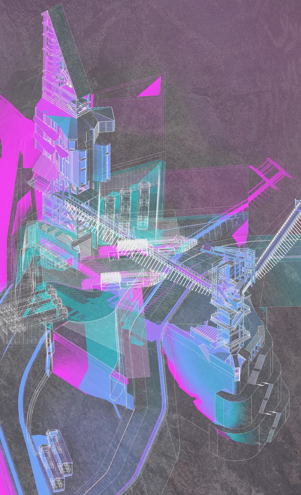
The Karakoram highway between China and the Pakistani coast carves through Gilgit-Baltistan, providing Chinese goods with easier access to the shipping channels of the Arabian Sea. This new road is built on the line of the ancient Silk Road, the former cradle of and connection between civilizations along the Indus valley, which once bridged peoples throughout the Karakoram range. Where infrastructure and civilization once cooperated, this new road - and an associated project for the Diamer Bhasha dam, which seeks to bring much needed electricity to the surrounding cities - highlights the tension between the needs of distant cities (of production in China, and consumption in Europe) and the local countryside. The road cuts adrift villages bypassed by the new highway. The dam will not only flood much of the Indus valley, its arable land and villages, but will also subsume “at least 37,051 carvings on 5928 boulders or rock faces” of international historic significance in the process.1 Inflections and Inscriptions takes these carvings as examples of affective peripheral objects capable of acting against megainfrastructural projects. By setting these static but communicative objects alongside the communicative capabilities of the meandering Silk Road, it proposes sites of inflection, of gathering, set against highspeed traffic flows. By combining marketplaces for the sale of apricots and cherries, a workshop for scanning petroglyphs and weaving cloth, and a tribal meeting hall, these inflections inscribe gatherings of commerce, crops, production and people.
1 Suhail Yusuf, ‘Threatened Rock Carvings of Pakistan,’ Dawn, 18th May, 2011, online.
Field Station Rendering 01: Inflections in the Silk Road. Sections through the Indus Valley.
Left. Diamer Bhasha Field Station Inflections. Site Axonometric.
Storing and Sharing Affective Objects. Petroglyph Research Site and Markets. Axonometric.
TALHA
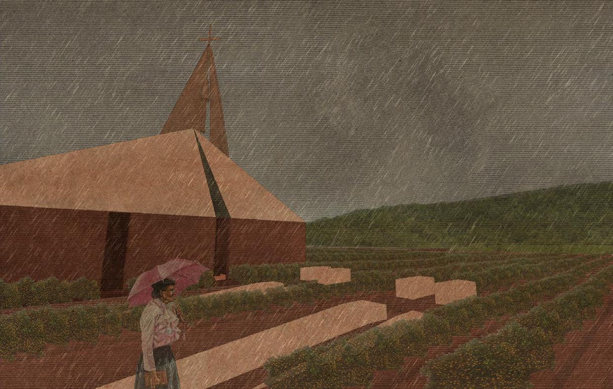
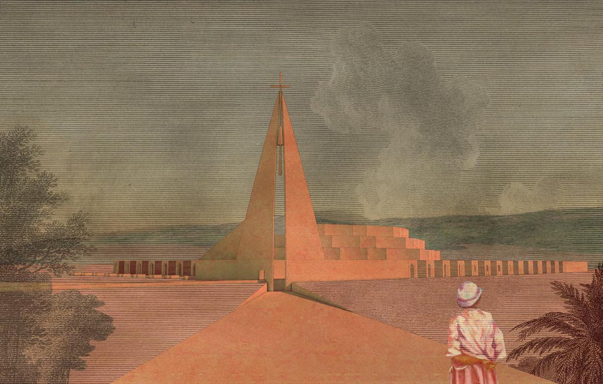
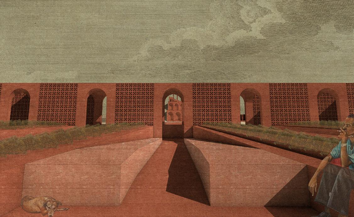
Site: Windalco Residual Lake, Mandeville, Jamaica. Programme: Botanical Library, Ceramics Workshop, Restaurant, Non-Denomenational Chapel and Cemetery, Vegetable Market, Vegetable Allotments.
PROWS AND PLOUGHSHARES
ANCHORING GROUNDED GOOD(S) IN A FOREST BY A (RESIDUAL) LAKE AARON FRENCH
On the outskirts of Mandeville, Jamaica, is a vast patch of red land known as Residual Lake. The site is a marker of an economic, social, and political decision-making that is ignorant of the long-term impact of extraction on a landscape and its local populous. The bright soil, a bleeding scar from literal lashings of the land, is what remains of an opencast bauxite mine operated by Windalco (West Indies Alumina Company), the ‘joint venture’ between Russian firm UC RUSAL (who held a 93% stake) and the Jamaican Government. Prows and Ploughshares proposes to return the land of Residual Lake to the local populous in a manner that both restores the adjacent rainforest which was stripped to enable mining, and provides employment following the closure of the bauxite mine. A series of public programmes (a botanical library, non-denominational chapel and cemetery, ceramics factory and restaurant) sit above a vegetable market, selling produce grown in the rehabilitated land of Residual Lake. The goods for trade offer an implicit critique of the abuses suffered by the people of colonial Jamaica (a time when doing good and goods were clearly at odds if people (slaves) could be traded) and the detached exploitative practices of contemporary economic Empire. A light-weight architecture referencing the prows and sails of ships is set against a solid surrounding earthwork, suggesting a permanence, a secure fixing within the shifting forest replanted around the lake. The building registers time, a becoming of place. Through making goods the project makes good, cultivates, provides work, sieving and cleaning the landscape to refortify the forest.
Field Station Rendering 04: Prows and Plougshares. Unfolding Canopies in Bauxite Ceramic. Axonometric.
Left. Field Station Rendering 01: Framing Axes of Residual Lake. Plan and Perspective Study. Above. A Non-Denomenational Chapel to Ground and Sky. Perspective Views.
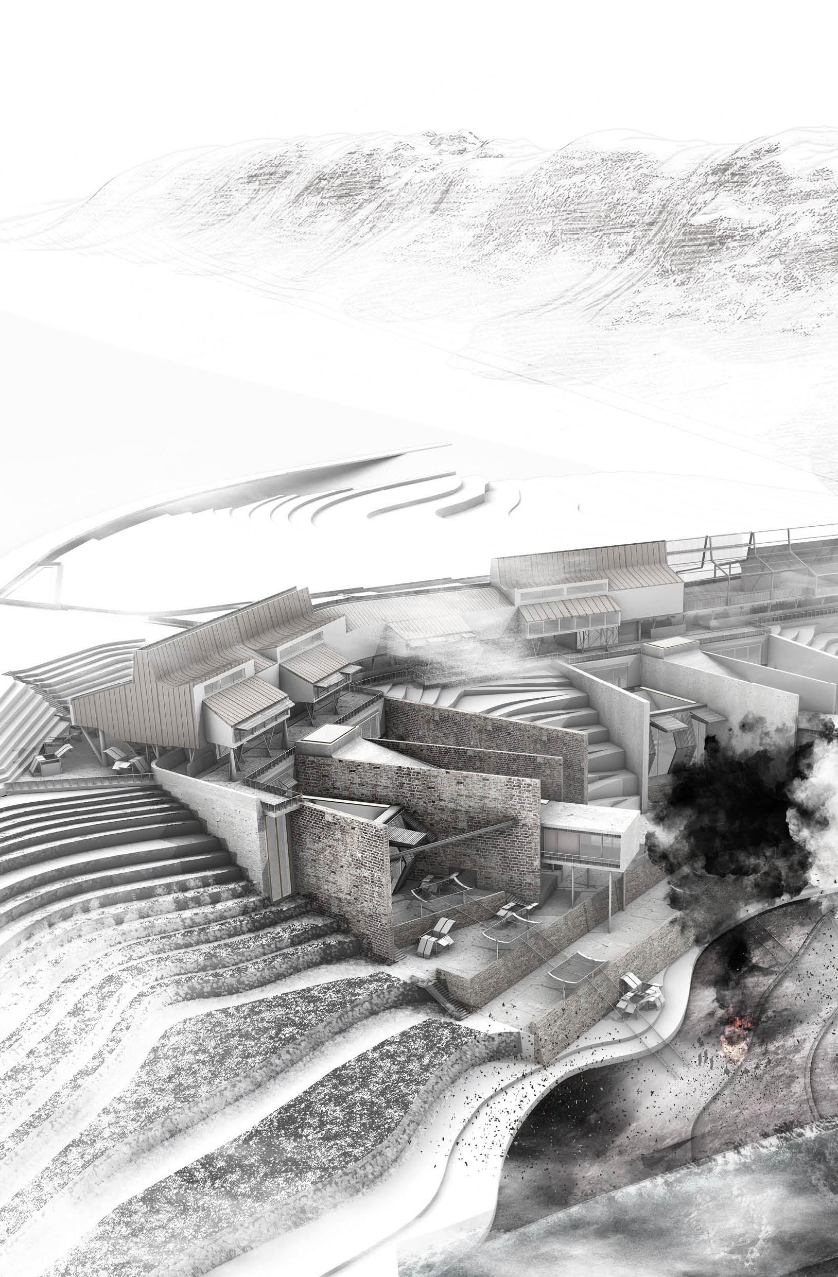
Site: Cuilcagh Mountain, County Fermanagh and County Cavan. Programme: Caving Centre, Peat Keeper’s Residence, Auditorium, Laboratory, Tool Yard.
08
BOGLAND TRACKS
MARKINGS, TRACES AND CUTS ACROSS BORDERS, POTHOLES AND PEAT
RACHAEL BURLEIGH
Straddling the border between Ireland and the United Kingdom, Cuilcagh Mountain, County Fermanagh and County Cavan shelter precious peat bogs, carbon sinks endangered by fuel poverty and national economic instability. Bogland Tracks examines the cultural, economic and architectural potential latent within this contentious cross-border bogland.
Amongst a maelstrom of historic tensions, Brexit after-shocks and looming economic uncertainties, Bogland Tracks draws upon the space of the Northern Irish mountain boardwalk as an instigator of touristic and cultural cooperation, nurturing the healing of two communities marked by conflict and a brittle cease-fire through the tending of a shared landscape. An orchestrated series of spaces aims to bridge generational divides through education, utilising the nearby Marble Arch Cave network to bring people to a site that monitors ever-changing bog growth, and investigates links between the conditions of this Irish field and the global climate crisis. By inscribing itself into these sites, Bogland Tracks attempts to break new ground in the Irish border palimpsest-condition. Seamus Heaney describes the Irish peatbog as capturing history and time in its slow accumulation of layers. Bogland Tracks gestures towards these layers. Modern, local steel punctures the bog-terrain, Irish limestone roots the architecture in a readily-identifiable substrate, gabion walls allow peat-stained water to seep into channels, and warm timber echoes farmland tools used for centuries to cultivate the landscape and provide sustenance to its settlers.
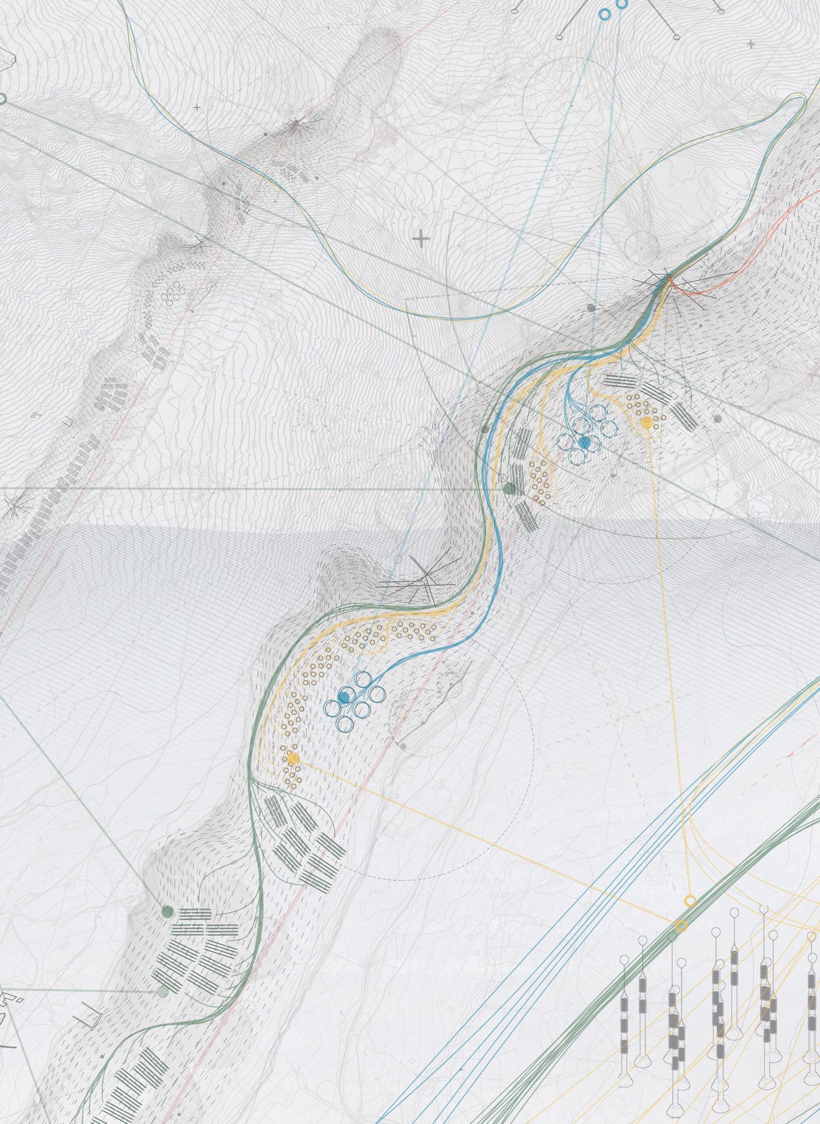
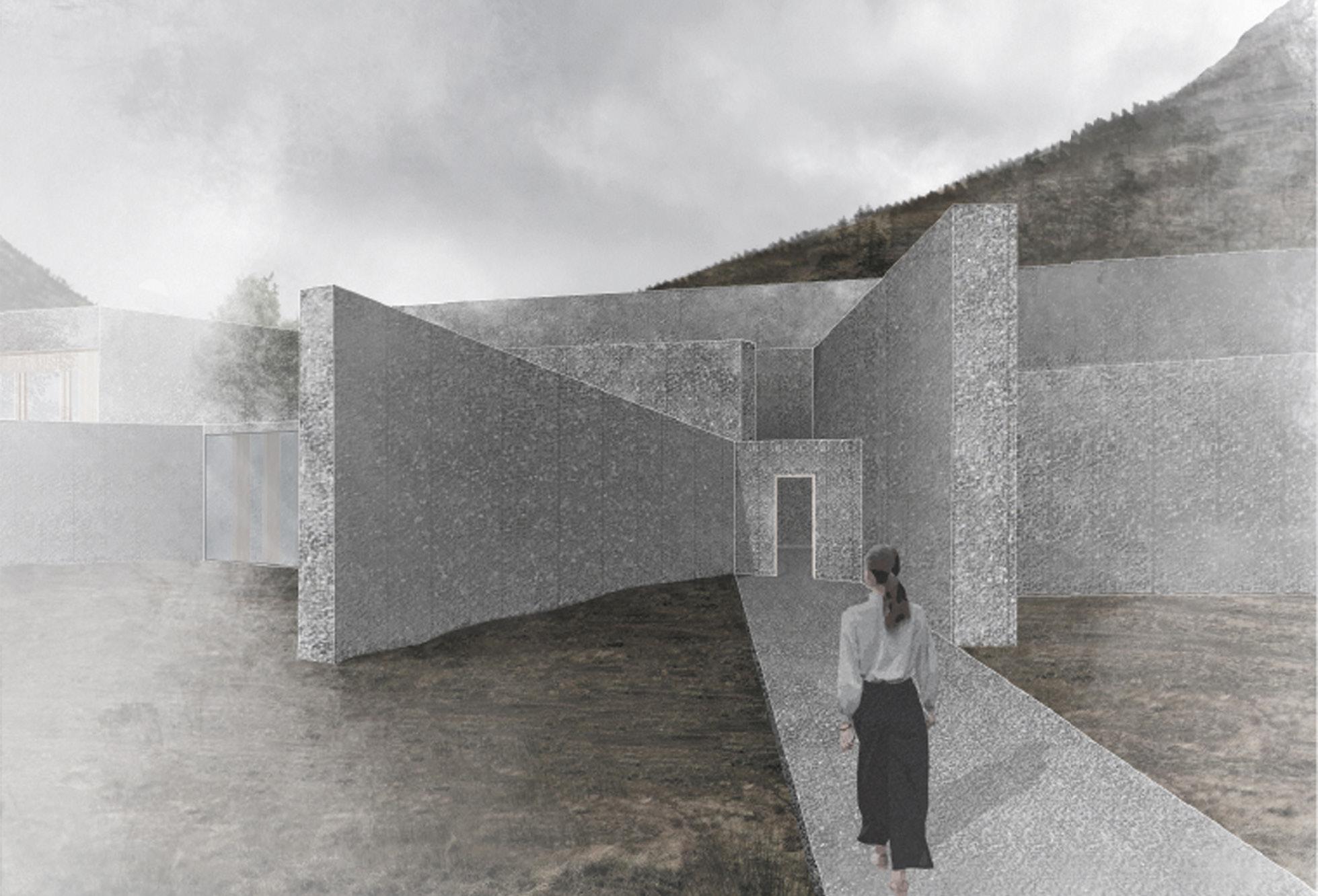
Site: Arrochar, Loch Long, Firth of Clyde, Scotland. Programme: Aquaculture Pools, Ferry Terminal, Water Testing Labs, Planning Office.
09
FRAGILE WATERS
ACTIVATING CONTAMINANTS AND LOST FIGURES OF
THE LOCH LONG MINISTRY OF WATER
ADAM CORNHILL
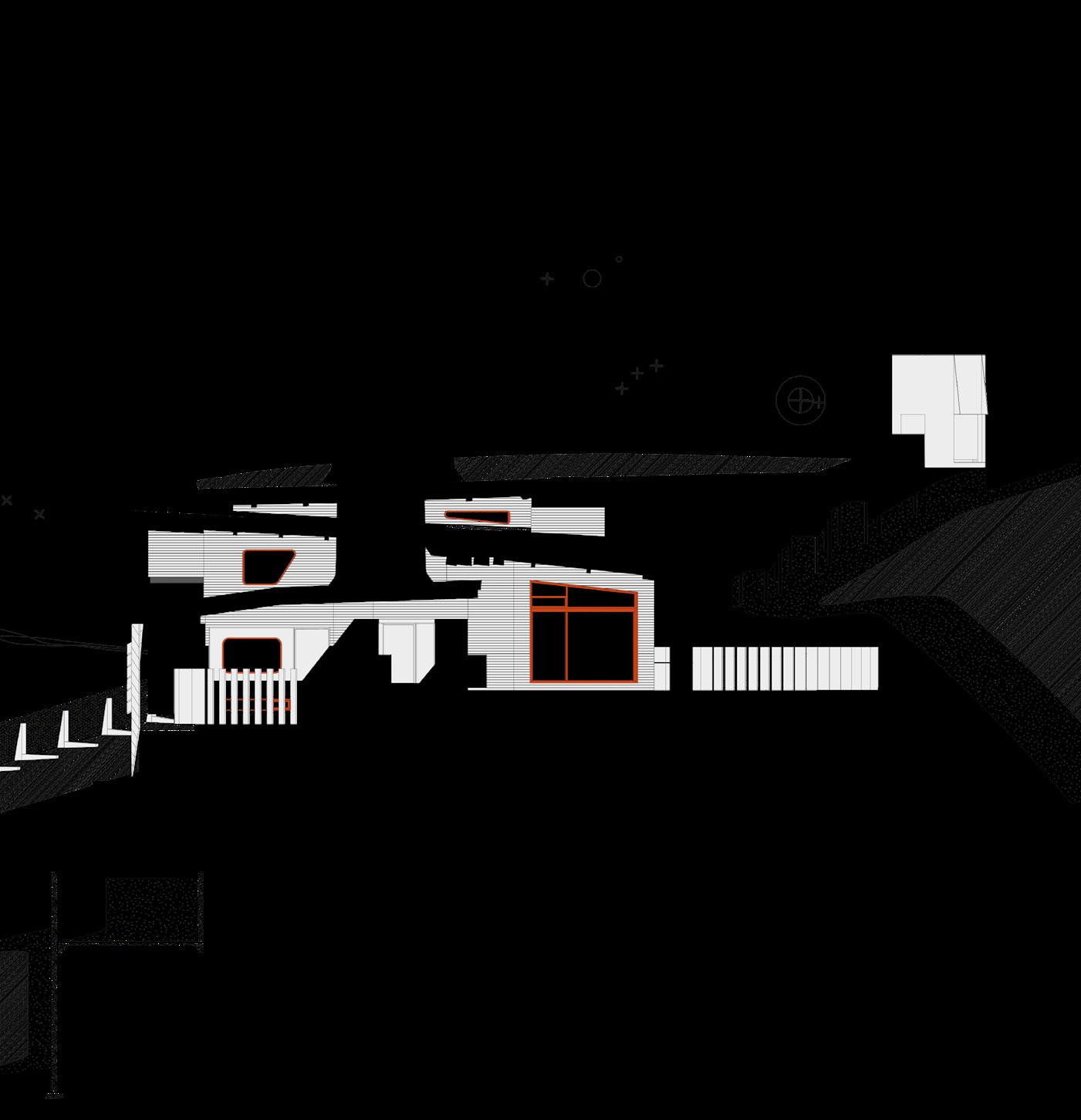
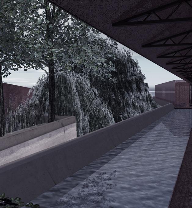
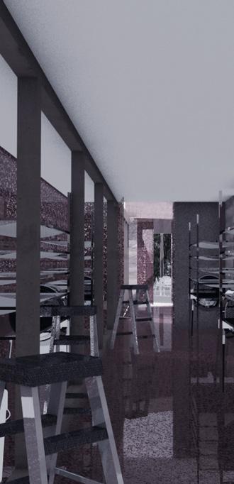
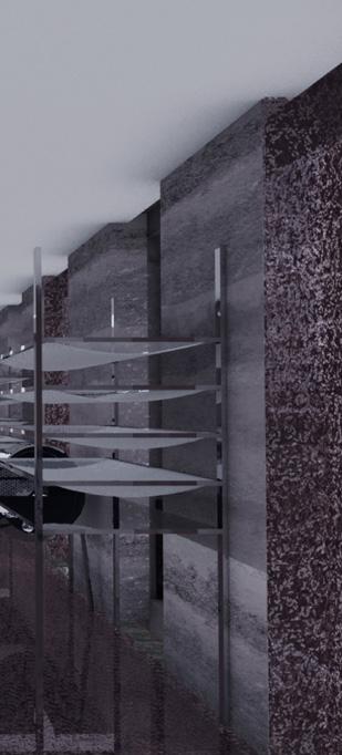
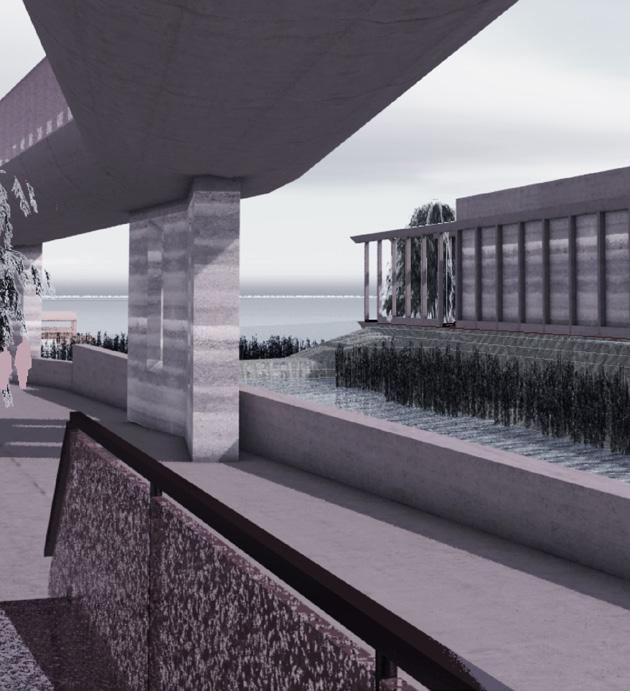
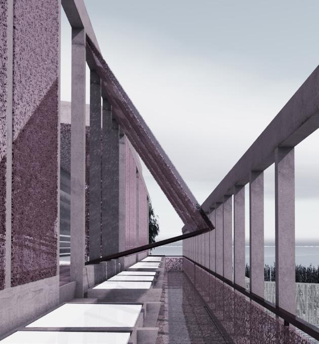
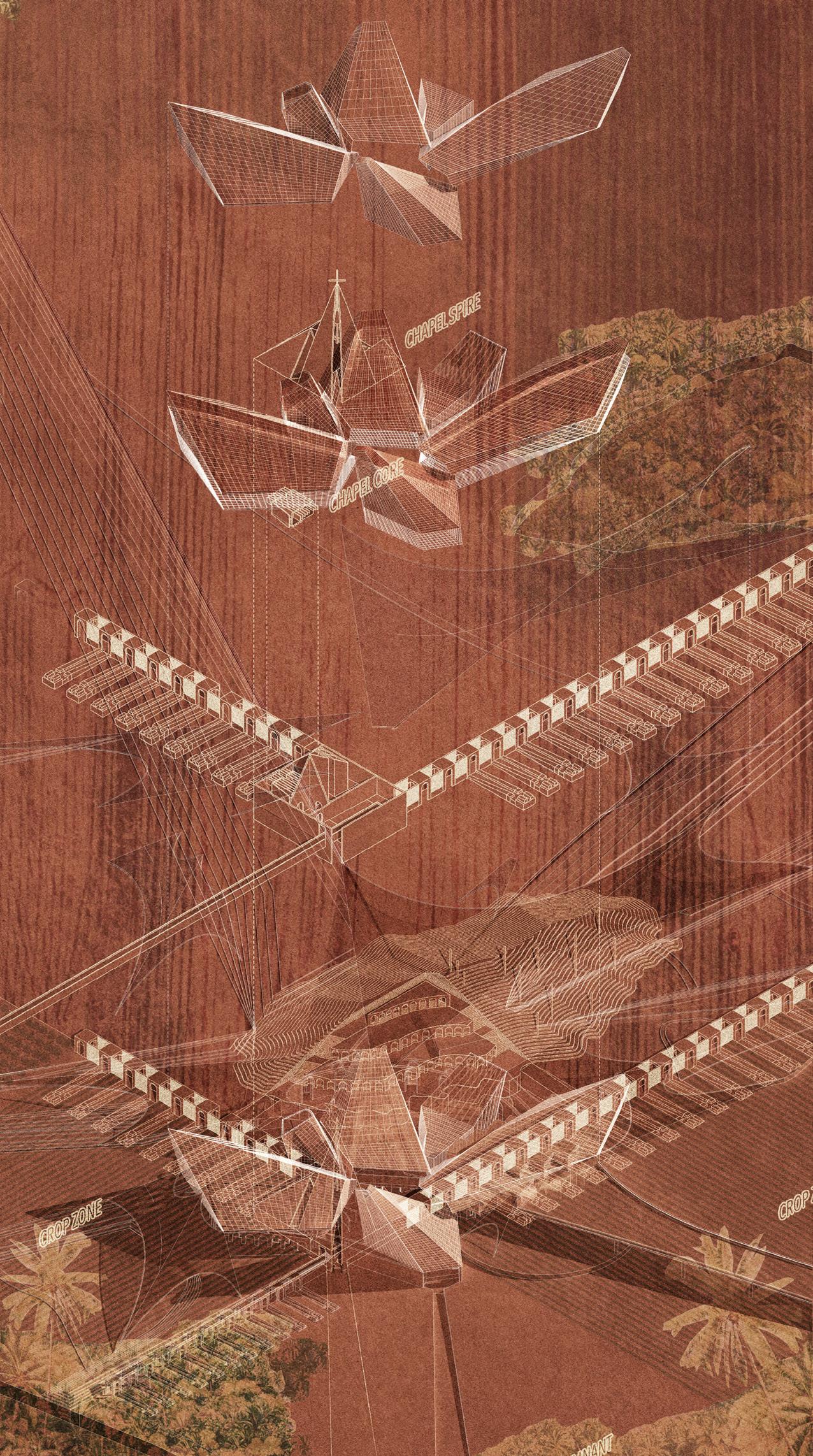
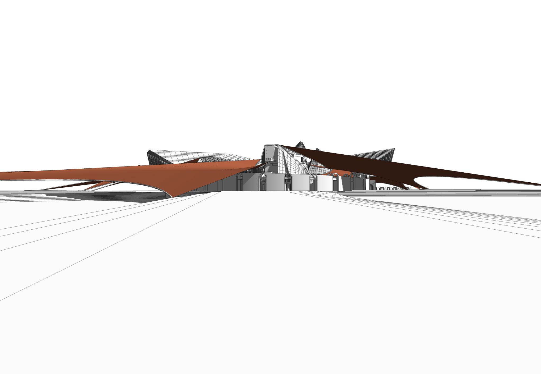
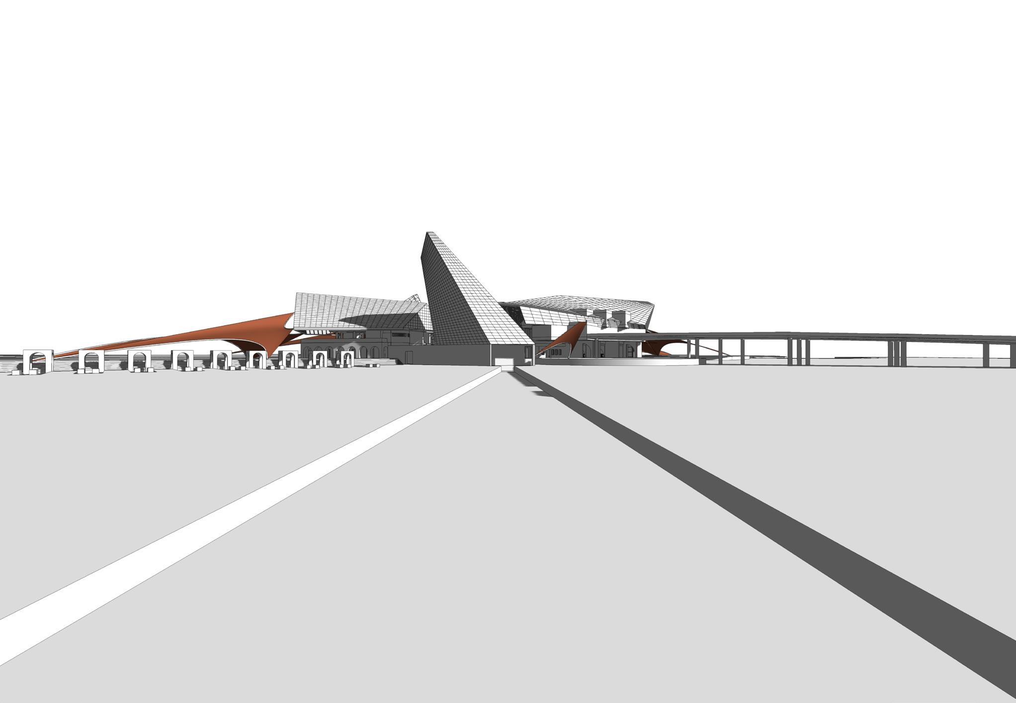
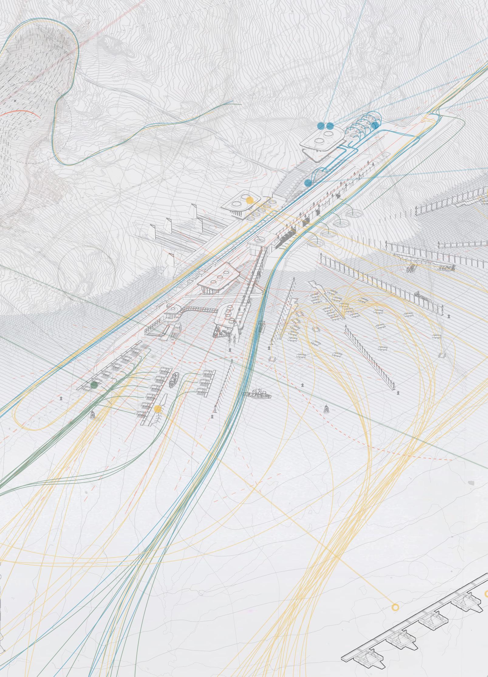
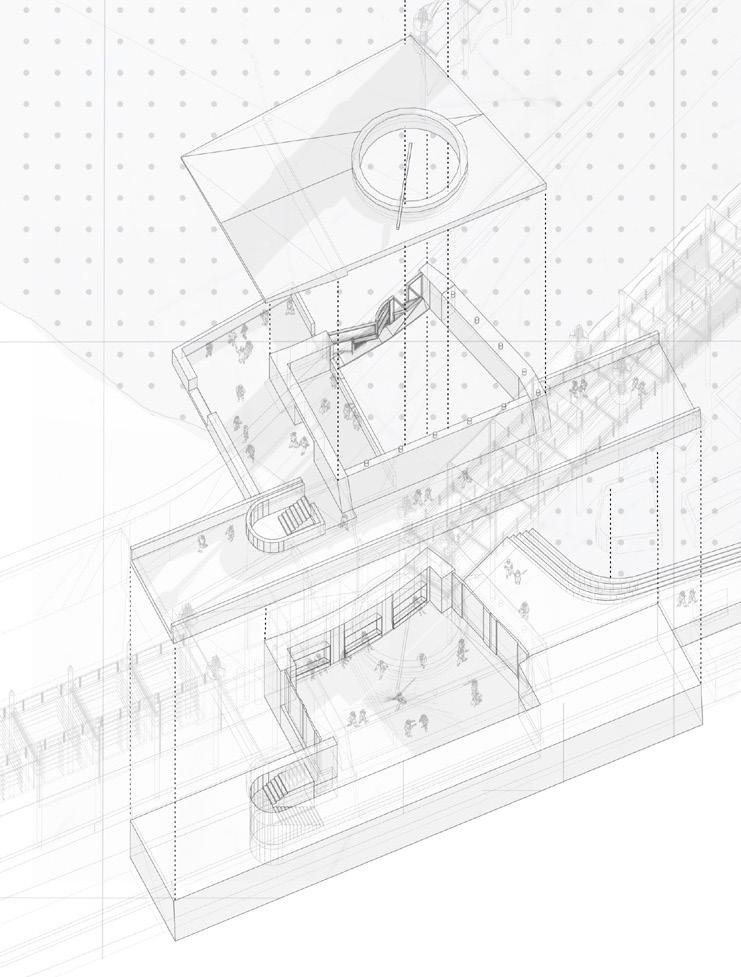
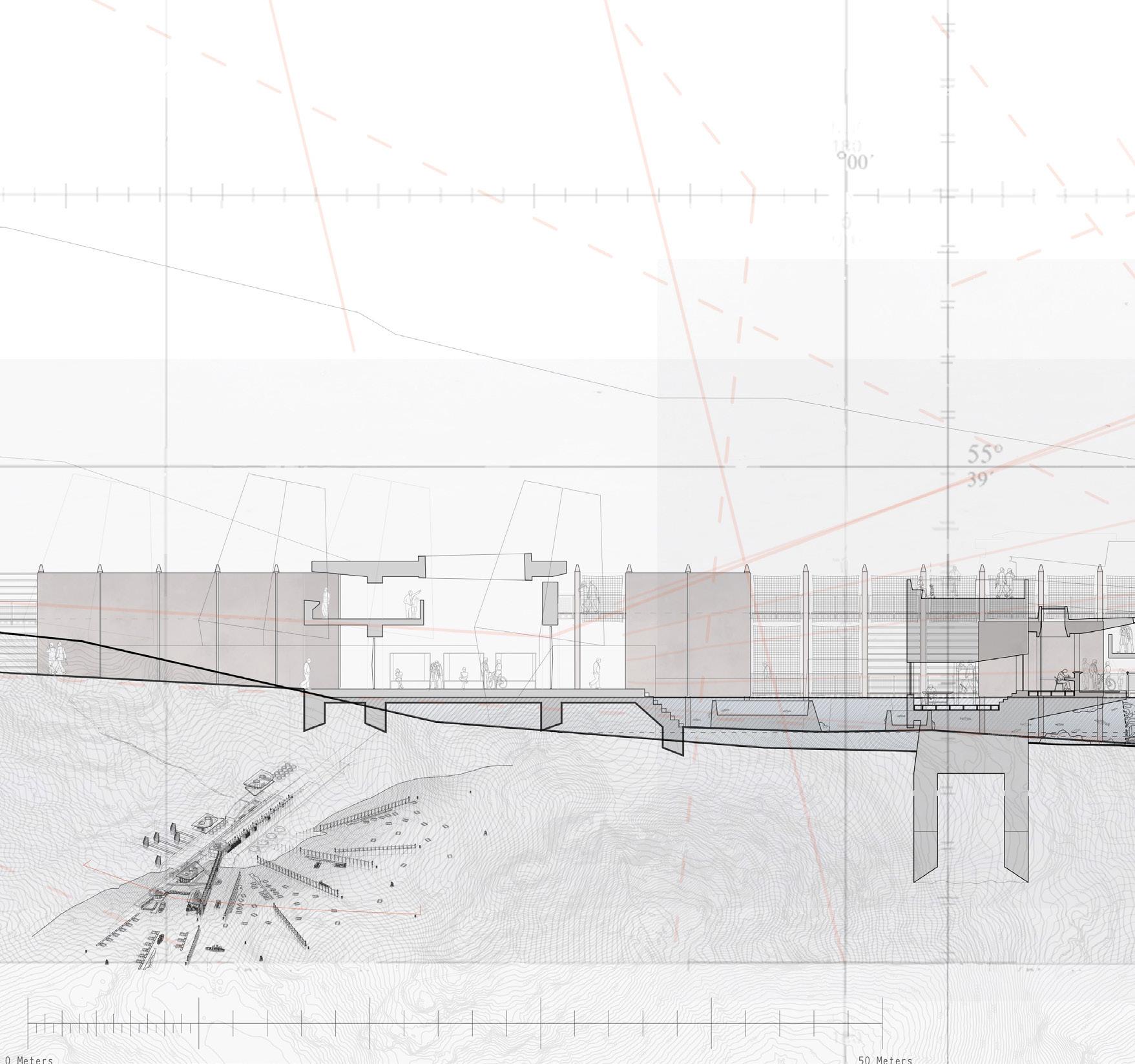
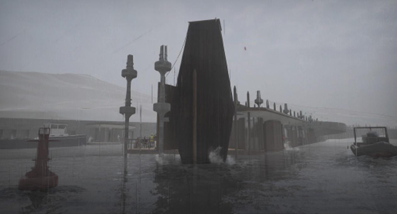
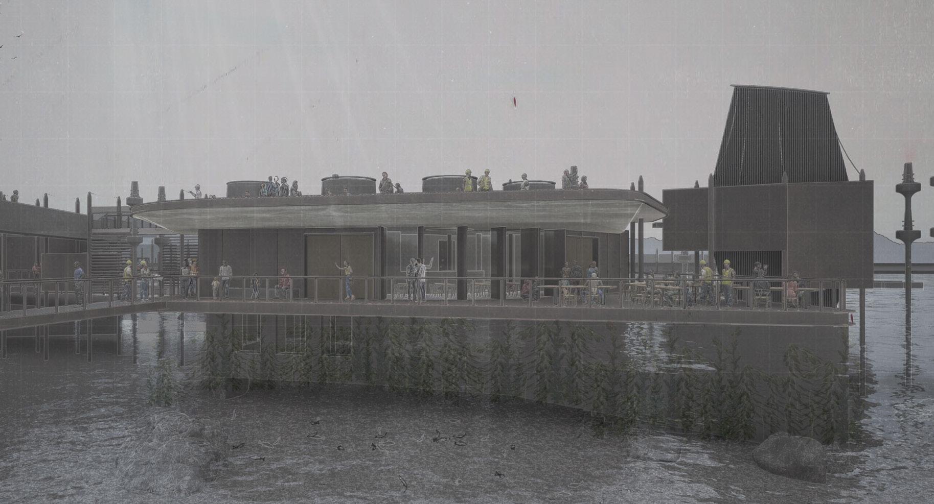
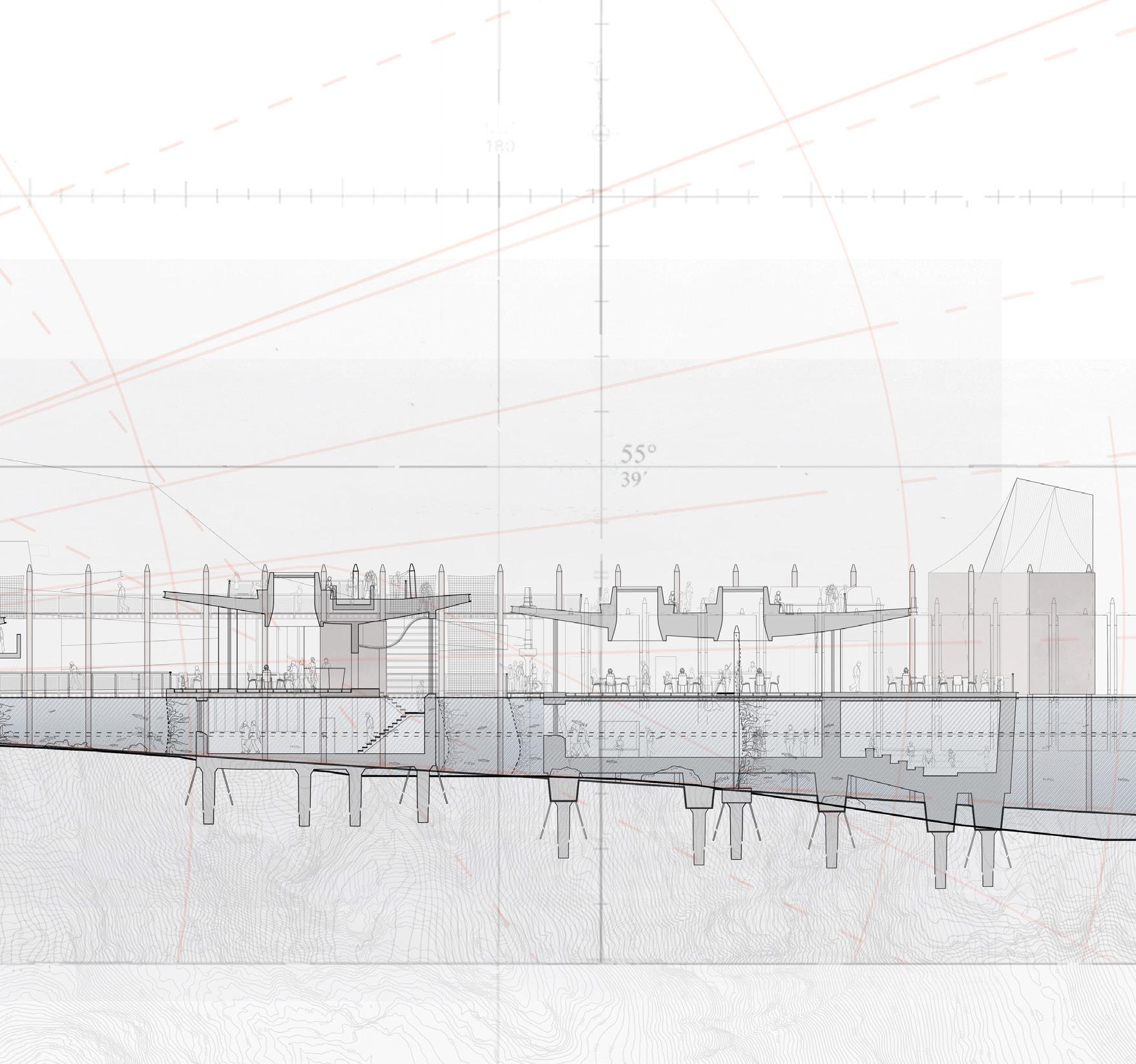
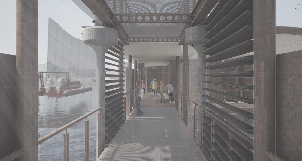
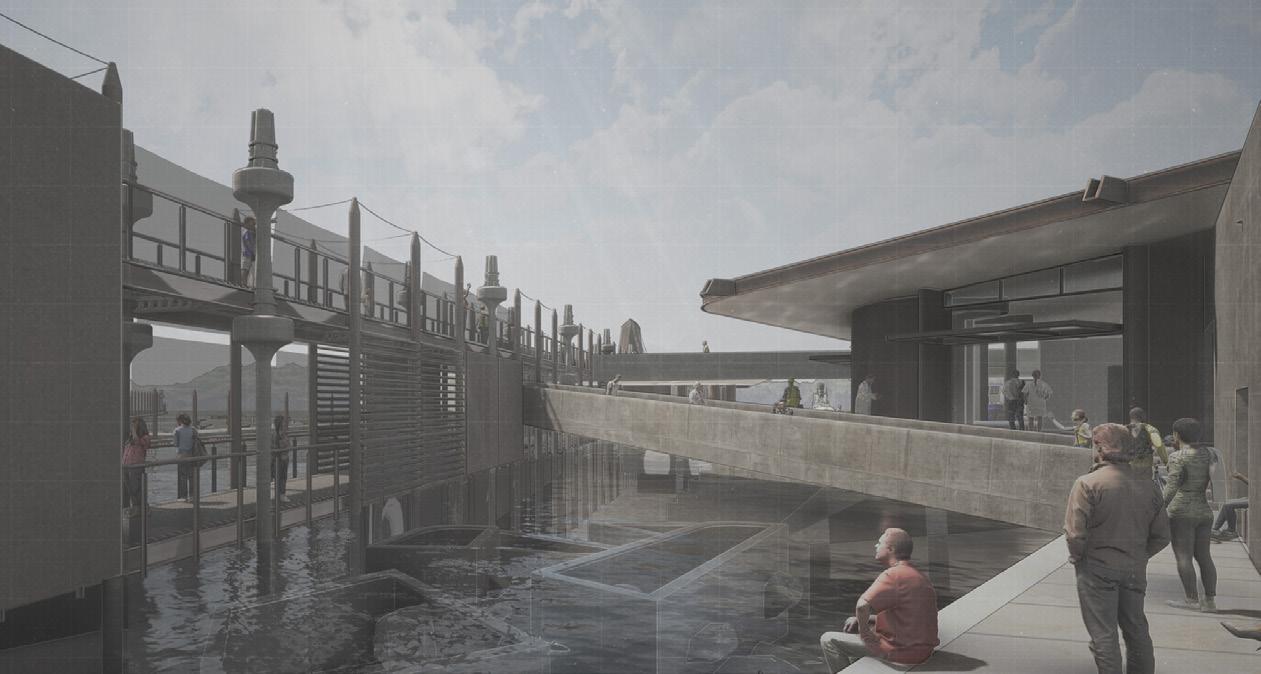
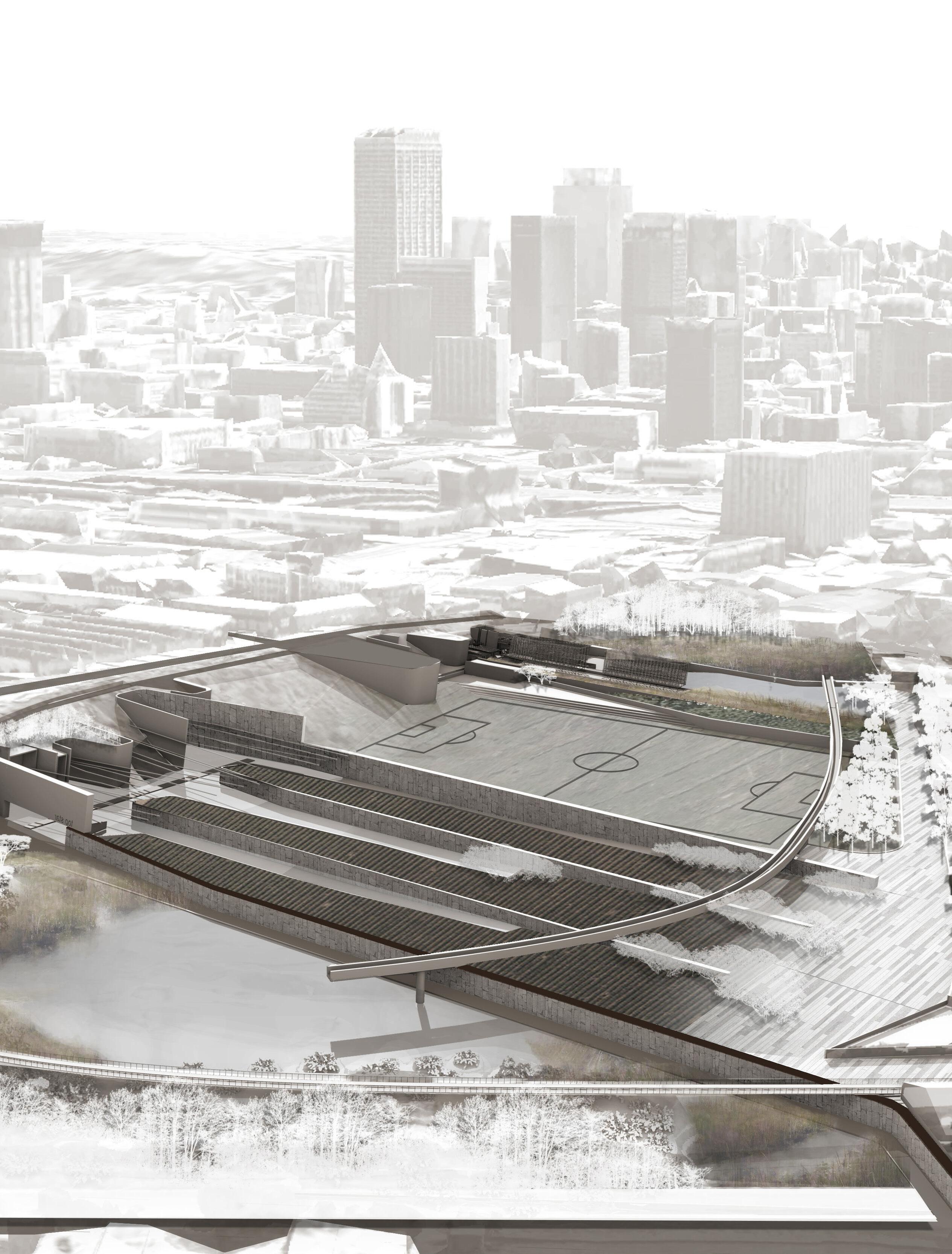
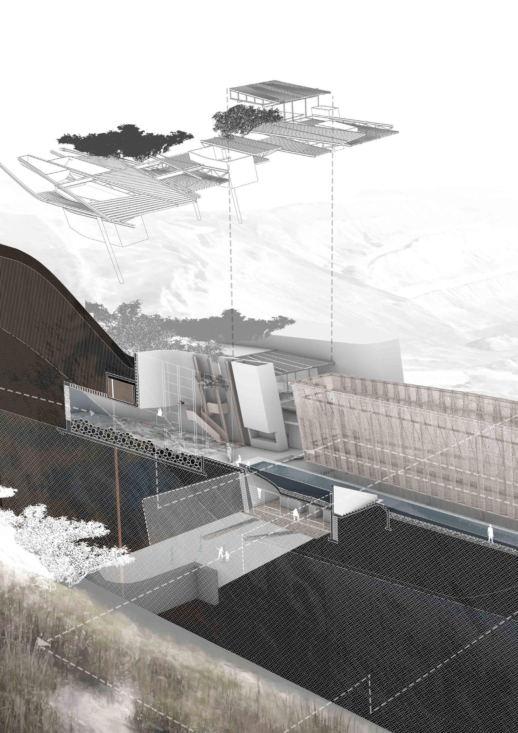
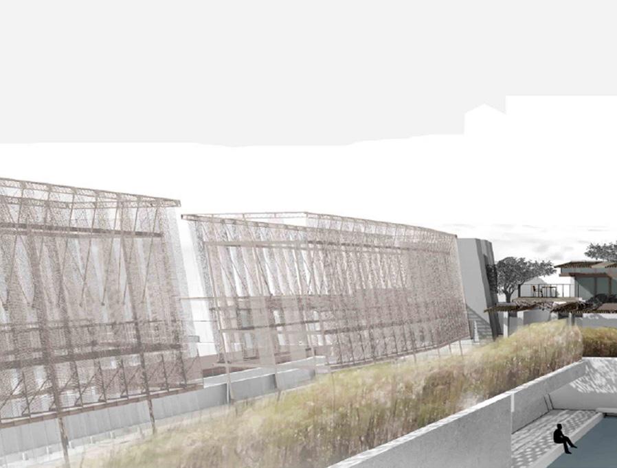
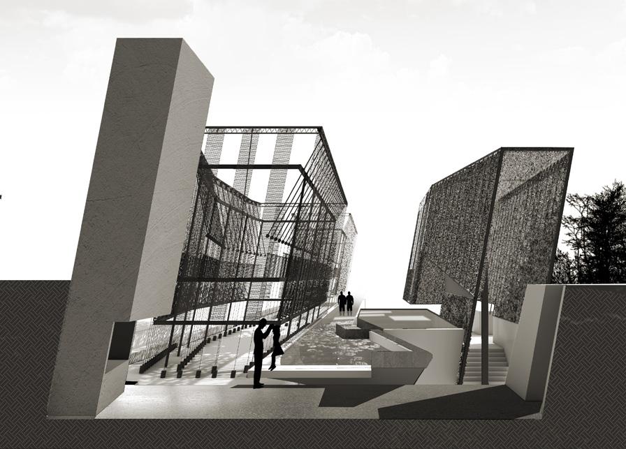
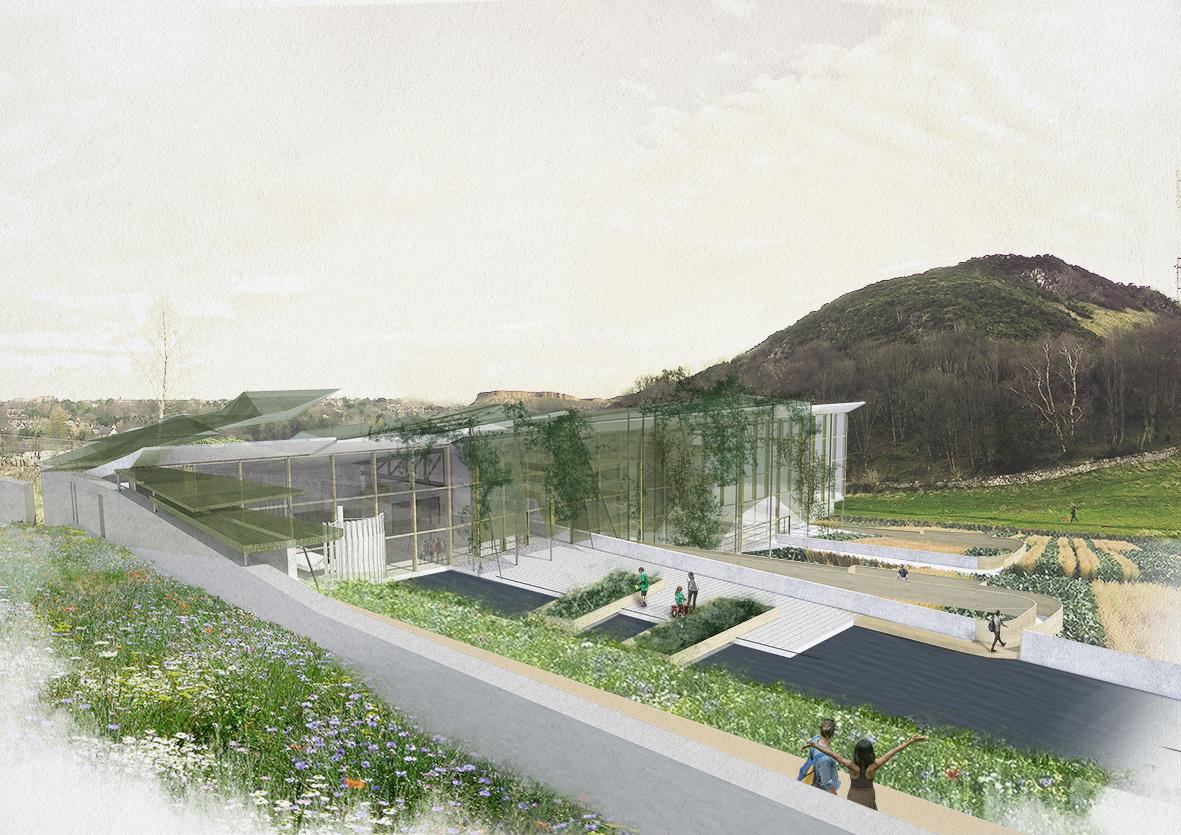
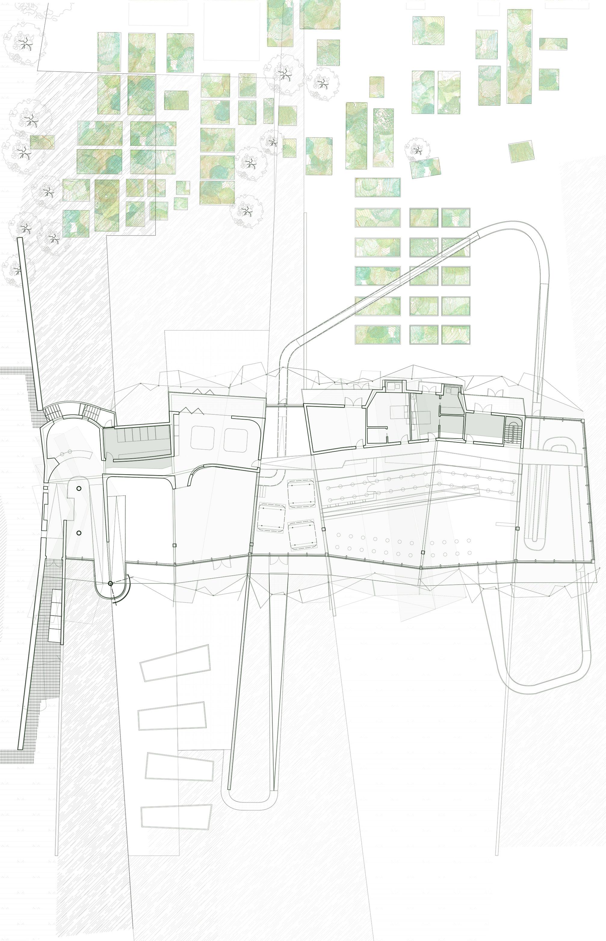
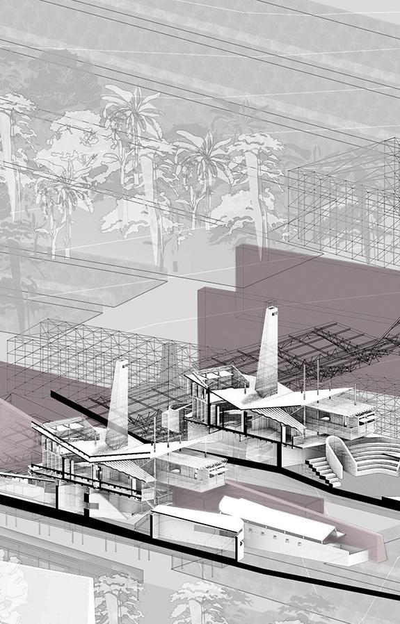
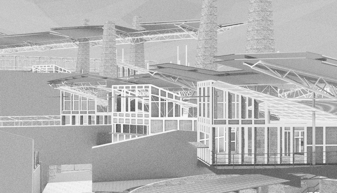
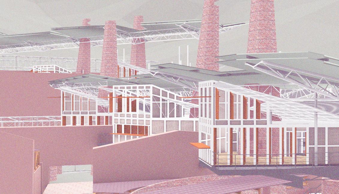
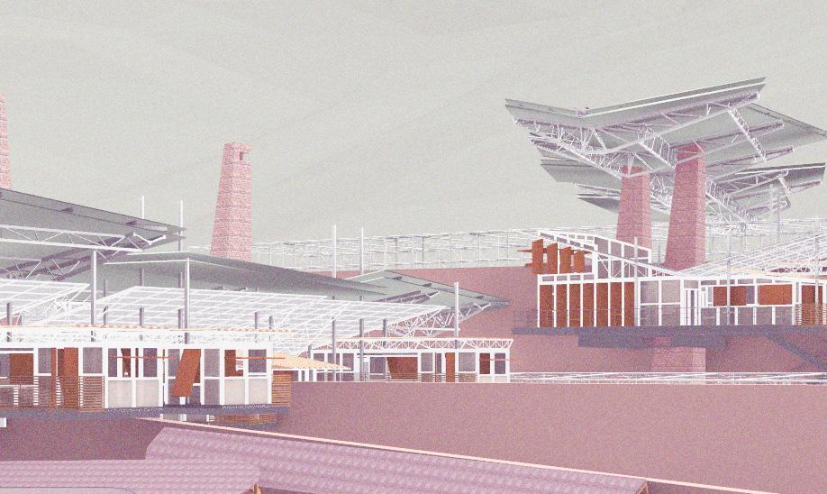
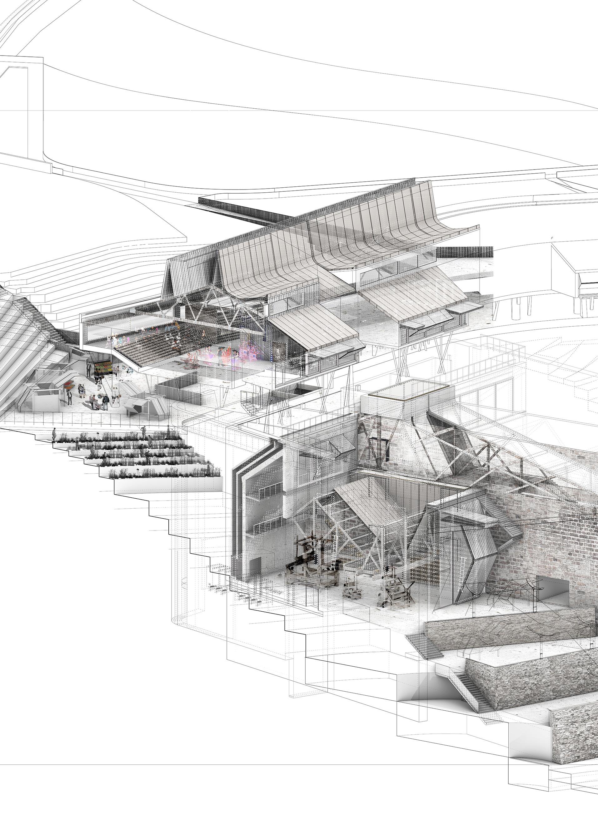
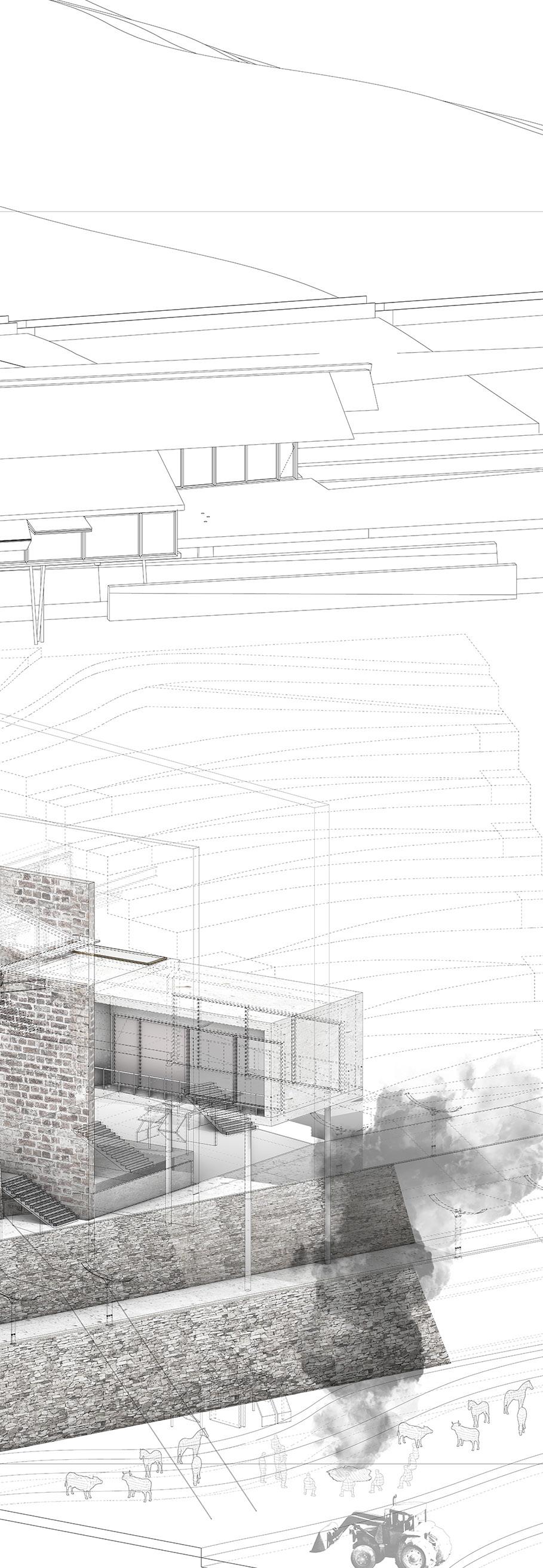
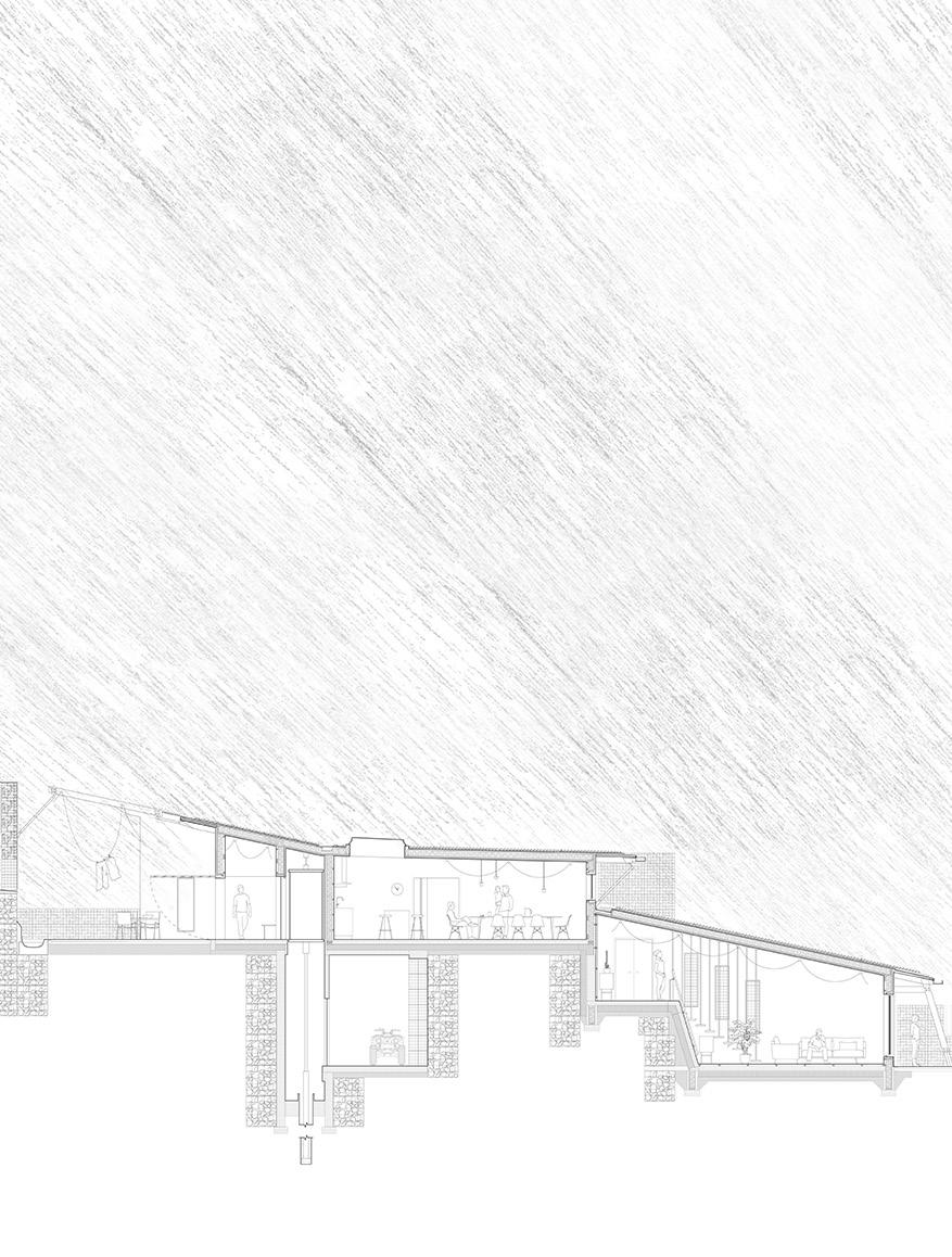
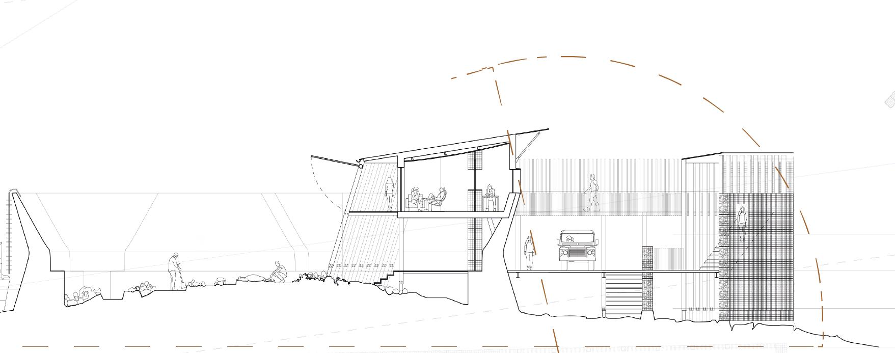
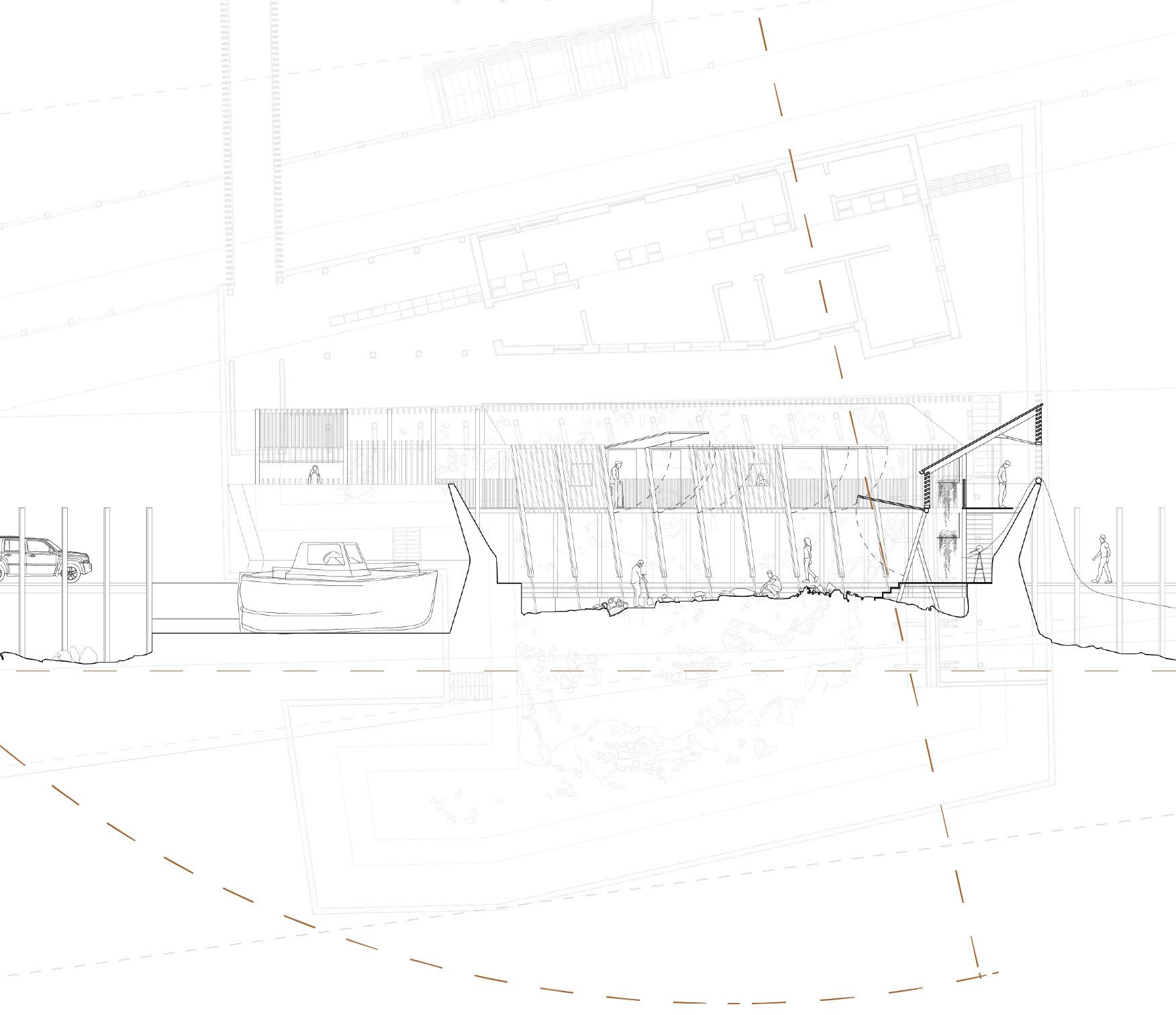
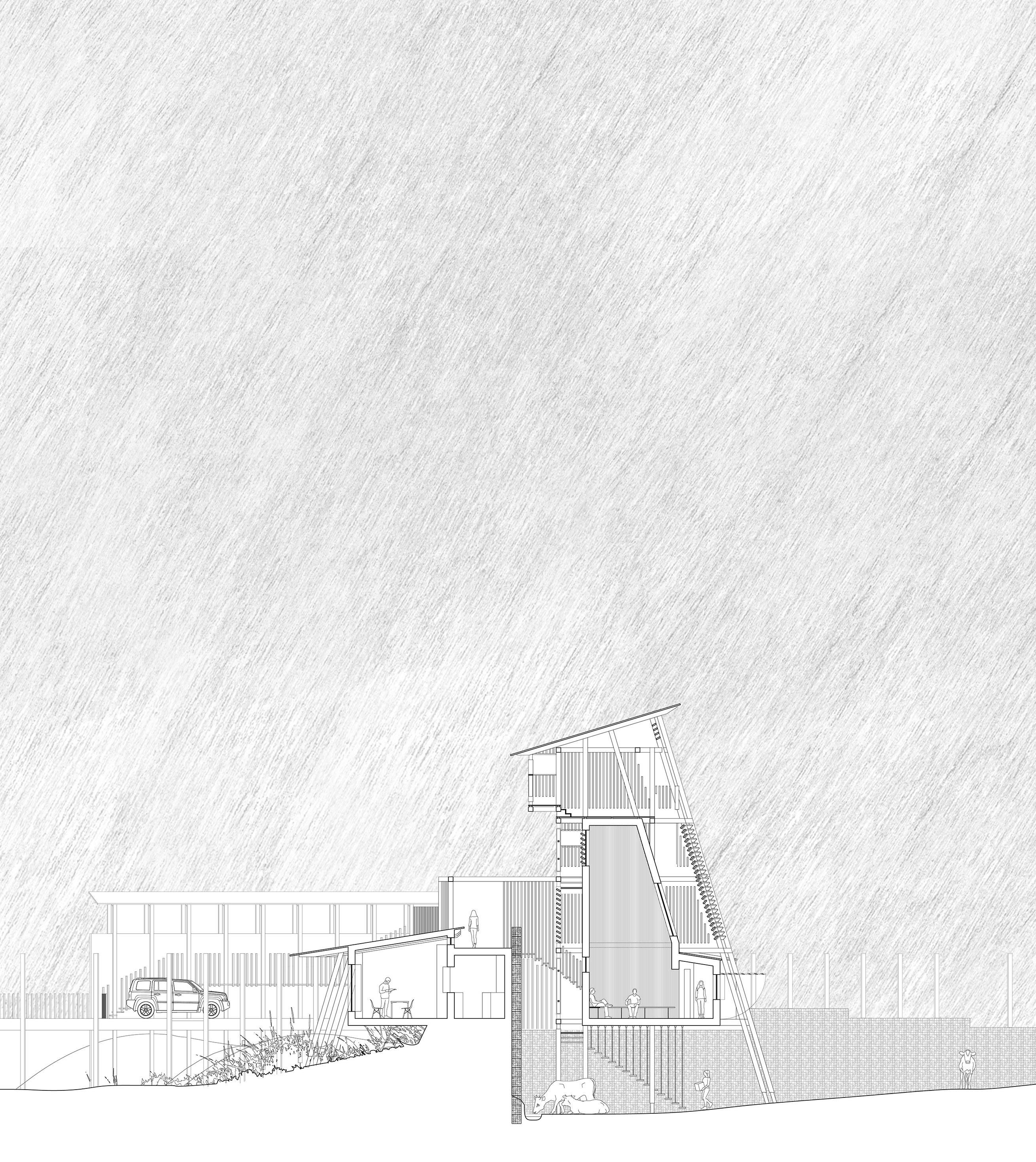
At the intersection of trans-Atlantic oceanic currents and the outpouring from the Firth of Clyde is Loch Long, a sea loch on the west coast of Scotland. The intersection of oceanic and fluvial currents causes seaweed to gather in Loch Long and be deposited on the shore, providing local farmers with fertiliser and migrating fish with sites to spawn. As ocean health deteriorates, ever-incresing levels of anthropogenic contaminants, micro-plastics and pollutants attach themselves to the seaweed, making it unusable as fertiliser and harmful to marine life. Fragile Waters defends and regenerates the waters of Loch Long and those species dependent on the water for their survival, by introducing a series of aquacultural devices and architectural installations to the (contaminated) intertidal fringes of the sea loch. Over time, these installations gather contaminants, produce algae to consume microplastics, and provide feeding grounds for fish and space for sustainable fishing. A derelict, decommissioned torpedo testing facility which acted as an indirect defender of the loch (the testing range discoured large boats from dredging the area) is re-purposed as research, aquacultural, and social programmes to analyse and monitor water quality, protecting the welfare of the loch and reinforcing a healthy relationship between the loch, visitors and local residents. This new Ministry of Water is connected to the neighbouring village of Arrochar via a re-instated ferry link. A series of architectural ‘binnacles’ (cabinets designed for housing precious equipment on ships) provide spaces in which travellers across the loch can rest and experience the rehabilitation of the loch around them.
Field Station Rendering 01: Complexities of (a) Place. Exploring Arrochar.
Field Station Rendering 04: Loch Long Minstry of Water. Aquacultural Movements and Processes.
Left. Architectural and Environmental Animations. Axonometric Study.
Above. Immersion Binnacle (Meeting Room) and Restaurant Terrace. Perspective Views.
Below. Binnacles and Lake Beds of the Loch Long Ministry of Water. Section.
Left. Architectural and Environmental Animations. Axonometric Study.
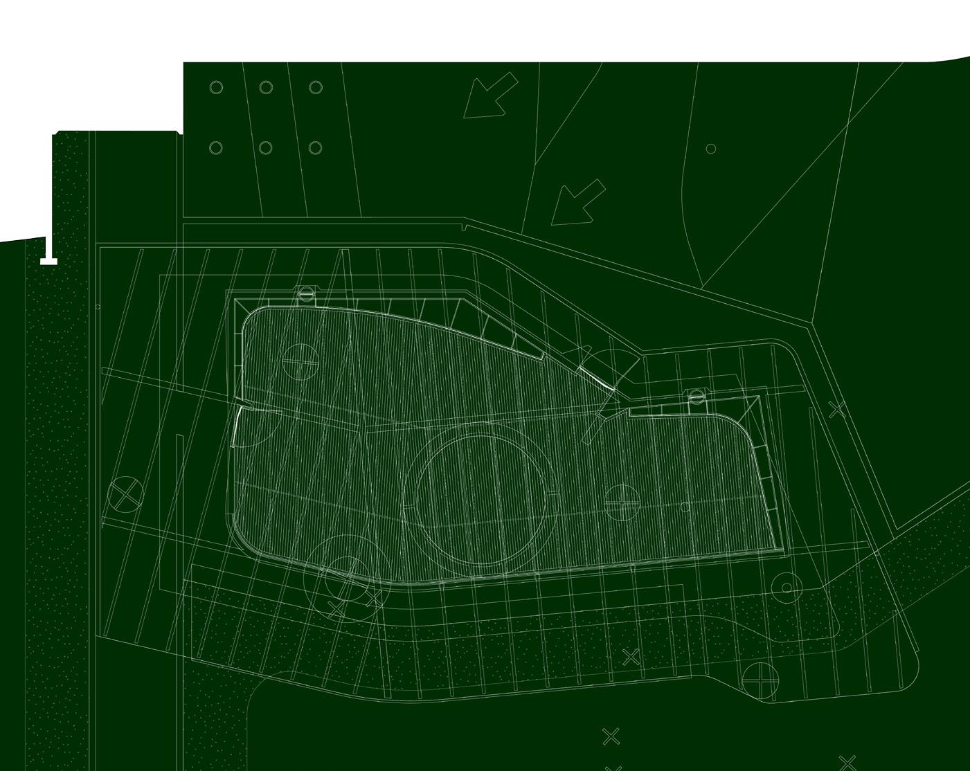
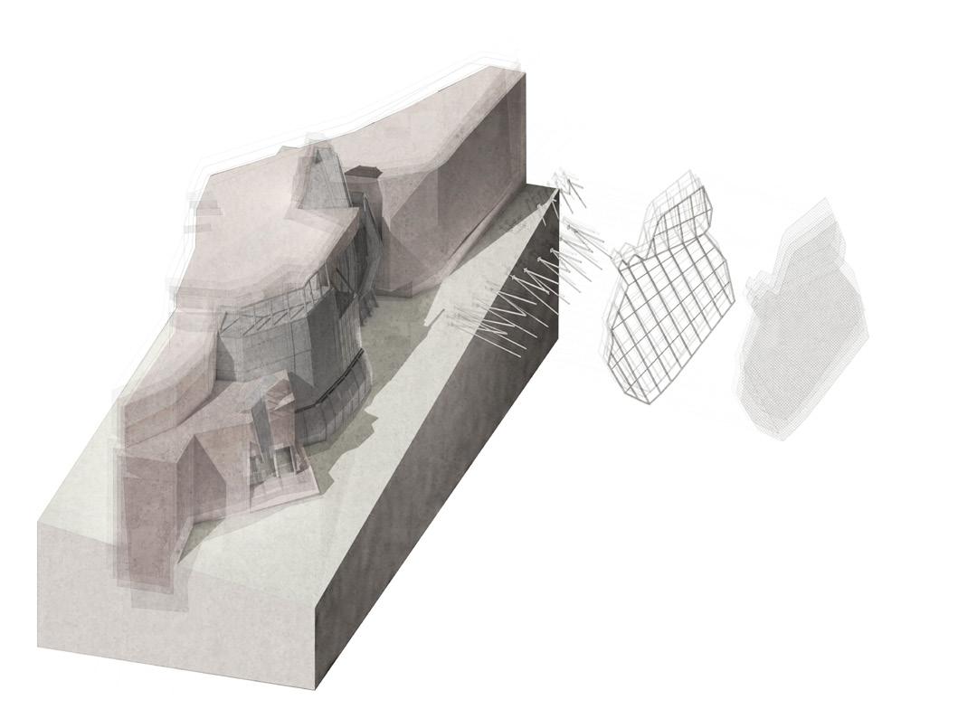
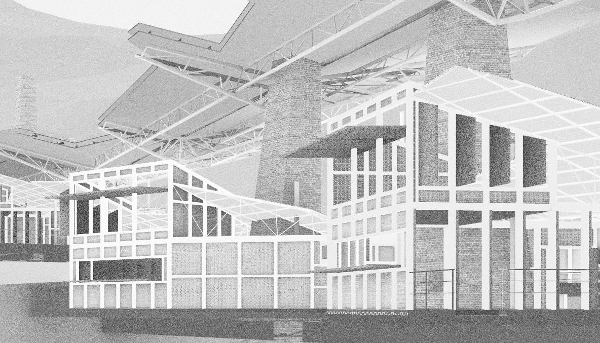
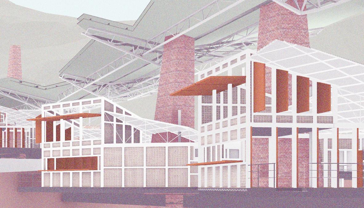
Site: Top Star Mine Dump, Witwatersrand, Johannesburg, South Africa. Programme: Wetlands, Baptismal Pools, Changing Rooms, Water Filtration.
RE-GROUNDING THE CITY OF GOLD
SIFTING, SETTLING AND SHIFTING SUBSURFACE
SCRATCHINGS AND SINKINGS
CAREL COETZEE
Just two kilometres south of the centre of the city, surrounded by industrial estates, are the remains of one of the many man-made hills that were formed from the waste of Johannesburg’s goldmining belt. Together, these hills formed a geological, environmental and socio-political rift through the city. When mining operations ceased, the most secure parts of the hills were occupied by industrial premises, while informal housing, religious ceremonies and recreational activities appropriated the remainder of this post-mining countryside (despite the toxic waste within the hills contaminating the soil and water). Since 2008, these mine dumps have been re-excavated, formed into slurry and sifted for any remaining flakes of gold. The result: a further disruption in the uneasy relationship between this urban countryside, topography, geology and Johannesburg’s inhabitants.
All that remains of the Top Star Mine Dump today is an open space with a steep, sandy cliff to the east. Re-Grounding the City of Gold occupies this abandoned topography, held between informal settlements to the south and the CBD to the north. Through a strategic programmatic overlay of water filtration systems (both active and passive), sites for baptisms, recreational uses and programmes for soil regeneration and urban agriculture, it stakes a claim for the former mine dump. An architectue of texture responds to the coarseness of the barren, polluted countryside, to excavation, sedimentation, erosion, and the parching of soil. This architecture does not attempt to veil the legacy of a battered countryside but to celebrate its reoccupation.
Field Station Rendering 04: Wetlands and Weeping Walls. Retaining walls filter waste water.
Left. Socio-Ecological Workings and Waterings. Vertical Flow Wetlands, Filtering Walls and a Baptismal Pool.
Above. Textural Tectonics. Geological surfaces, exposed and made.
CAREL
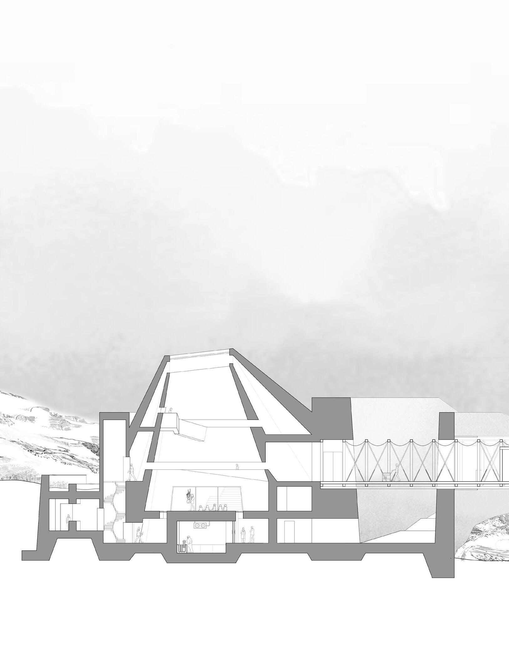
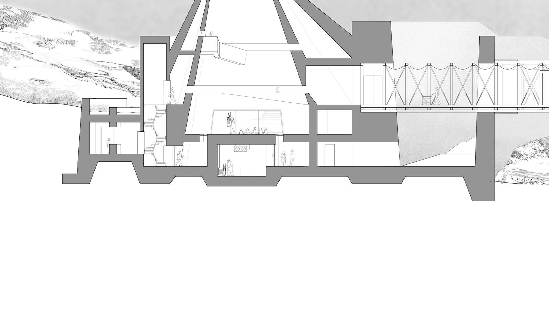
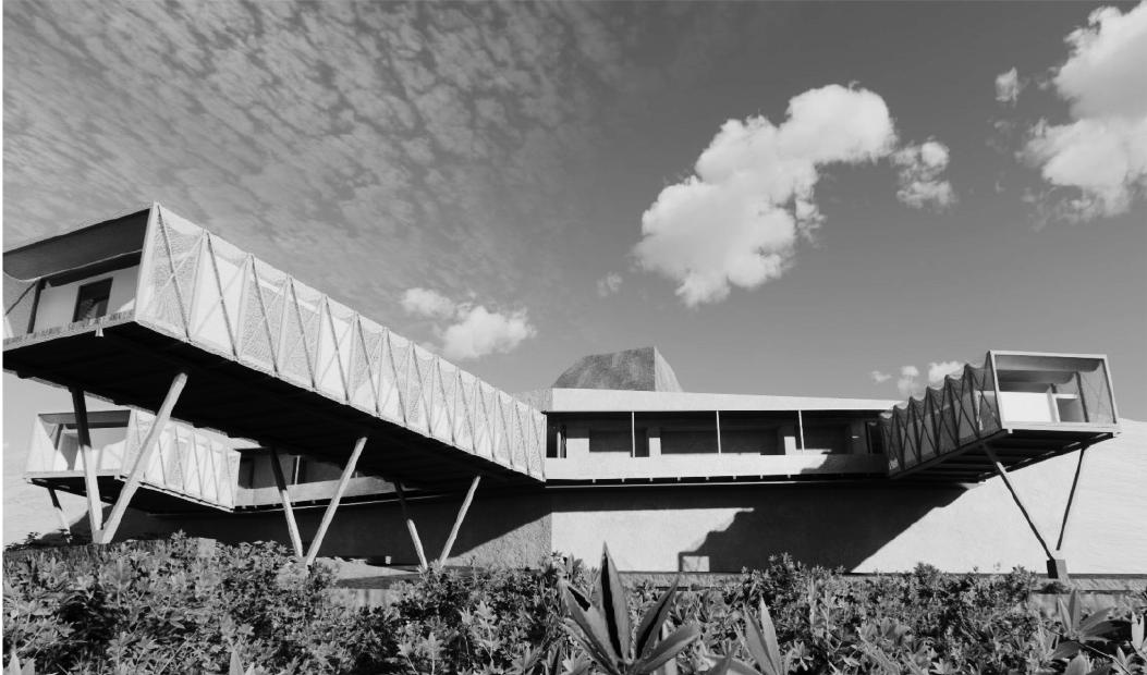
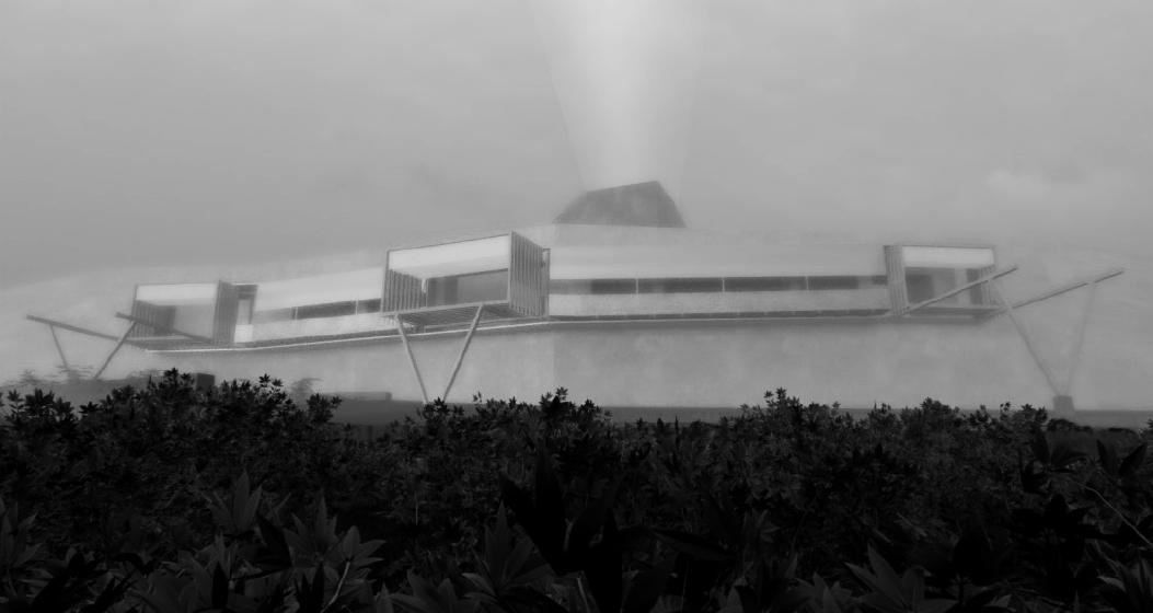
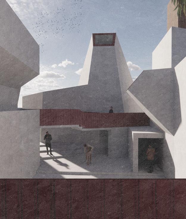
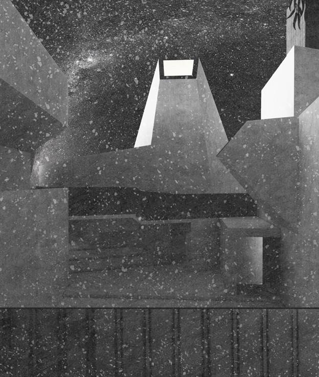
Site: Thredbo, New South Wales, Australia. Programme: Observatory, Bogong Biscuit Kitchen, Astronomer’s Rest.
11 MOUNTAIN OBSERVATORIES
CHARTING MOONLIGHT, MIGRATIONS AND MOUNTAINS
RYAN MORTIMER
“For me, it is that the clouds should change so swiftly, you and I so slowly, and the mountains least of all.”
Poet Mark O’Connor on the Australian Alps
The former gold-mining village of Thredbo located on the slopes of Mount Kosciuszko, the highest peak in the Australian Alps, hosts overlapping species, multiple migrations and population fluxes. Historically, the alpine climate of the granite caves and outcrops above Thredbo has marked the end of a journey taken by Bogong Moths, escaping the summer heat of Queensland and South Australia. The arrival of the moths provided a vital injection of protein for the local mountain pygmy possum, and prompted the gathering of Aboriginal tribes, who would travel the Bundian Way across the country to smoke out the moths. However, recent changes in temperatures in their breeding sites have significantly reduced moth numbers, with devastating effects for the bio-region. As the pursuit of gold once transformed the geological subsurface of Thredbo, anthropogenic climate change now affects populations of moths and marsupials. Mountain Observatories aims to highlight this human-caused catastrophe, and reverse the decline of the possum population. An observatory where moths, travelling by night, are seen alongside stars by local astronomers and a kitchen for producing food for the possums are ensconed in the immobile material of the mountains, embedded in granite scree and clad in roughhewn panels of rock. A new resting point is formed on the Bundian Way, bringing together people, possums, matter and moonlight.
Field
Above. Void (by Day and Night). Entrance to the Observatory. Perspective Studies.
Below. The Station Keeper’s Living Quarters. Interior.
Right. Following Constellations. Approaching the Observatory along the Bundian Way. Perspective and Plan.
Situated between two former salt lakes, Plopu Village lives under severe threat of impending desertification. According to EU reports, the soil in the area is morphing, from chernozem (fertile black ground) to sierozem (salinated sandy soil), as dry winds drive north and temperatures increase. With the withdrawal of centralised management, and as these soils degrade, the community is slowly dispersing. A settlement is wilting, dehydrating, in plain sight, the village is increasingly deserted and the farmland is becoming desert. Just as Gabriel Garcia Marquez’s novel Chronicle of a Death Foretold, this change has been predicted, observed and has come to pass, yet no action has been taken to slow or reverse the process.
Morphing between Salt, Sand and Soil aims to aid the adaptation of agricultural activities to the emergent land and soil type of Plopu Village. It gradually attempts to restore pieces of land by employing various environmental and landscape strategies, introducing fertile ground implants, installing reservoirs, generating micro-climates and recreating microbiological layers within the subsurface by planting forests in the bed of the dried salt lake. Acknowledging that this site is enmeshed in global climatic issues, these measures will not enable a complete rehabilitation of the landscape. Rather, through a series of emphemeral architectural installations the project will seed future landscapes as oases within a new desert. Buildings are designed to decay over time, feeding the soil and leaving only a trace behind in a newly formed landscape. The building will dissolve. Its death, too, foretold.
Field Station Rendering 01: Between Salt and Sand. Salt encroachment and Soil Health, Plopu Village.
Above. Field Station Rendering 02: Building Toward and For Decay. Animation Screenshots.
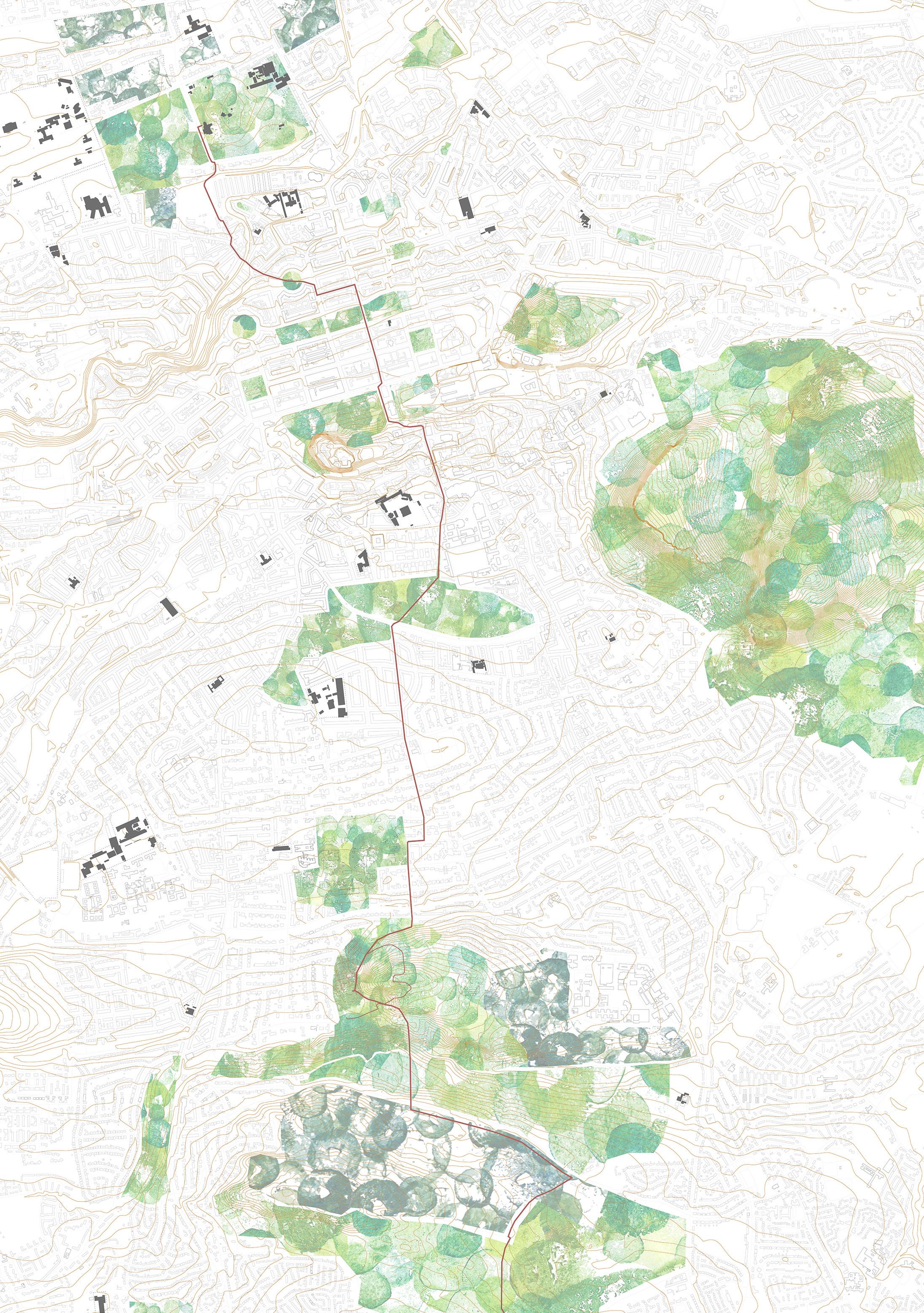
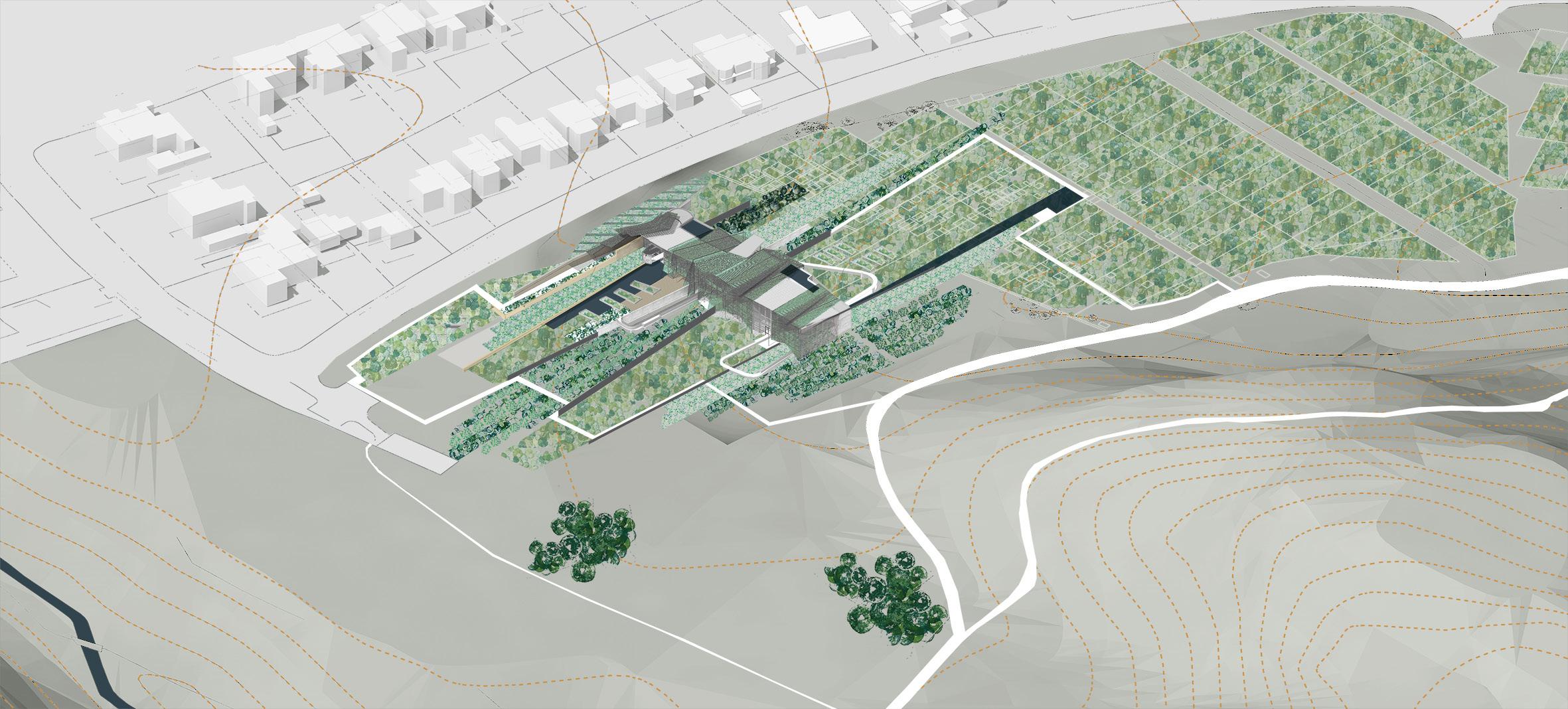
Site: Midmar Gardens, Blackford Hill, Edinburgh. Programme: Hydroponic Greenhouses, Allotment Gardens, Compost Production, Research Labs.
13
CULTIVATING THE CITY
FEEDING, FENCING, PLOTTING, PLATING
ALICE LOUDON
Our food system is imbalanced. Large swathes of land in the UK are taken up by farming, but we still import vast quantities of fresh food, much of which is wasted. Pesticides designed to ensure high crop yields are creating species imbalance and causing soil degeneration. In contrast, countries such as the Netherlands, which have invested in high-intensity farming, have reduced water demands and almost completely eliminated the use of chemical pesticides on plants grown in greenhouses. If the UK grew food more efficiently, most likely indoors, and more locally, in cities, we could potentially give farmland back to the wild, increase tree cover, reducing flash flooding and, gradually, improving biodiversity. In Scotland, sites around Edinburgh could host native trees, and the ancient Caledonian forest could be re-formed, making the countryside wild again. Cultivating the City encourages a discussion around food production in this larger ecological context, and framed by a centre for allotment gardening, food education and vegetable production. Allotment farming as a historically significant, community-led activity provides a strong foundation for education about growing food. At the foot of Blackford Hill on the site of the Hermitage of Braid, one of Edinburgh’s largest allotment sites Midmar Allotments and the neighbouring paddock become a test site for urban food production, a material filter gathering water and compost to feed allotments, wildflower meadows and hydroponic labs. This building is a prototype, associated with the nearby University science departments, which could be replicated throughout Edinburgh, on sites aligned with schools and existing park land.
Above. Cultivating Edinburgh. The City as a Collection of Growing Spaces. Inset. Sectioning and Condensing
. Sectional Isometric.
Above. Field Station Rendering 04: Sectioning and Condensing Allotments. Isometric.
Site: Lake Atanasovsko, Burgas Province, Bulgaria. Programme: Park Rangers’ Stations, Bird Hides, Bathing Pools, Changing Rooms, Lake Atanasovsko Visitor Centre.
14
HEALING (WITH) MUD, CLAY AND SALT
SHAPING SALINE AND PELOID SPECIES AND SPACES
CHRISTINA TANTCHEVA
The coexistence of salt pans, marshes, birds and bathers at Lake Atanasovsko on the coast of the Black Sea are a rare example of a symbiotic relationship between people and landscape. Annually, in this fragile ecosystem, the largest and most diverse bird population in Bulgaria nests and roosts before its journey south. The water, made multi-coloured by the mineral properties of the salt and soil, attracts both these birds and human visitors, who visit in the summer months to bathe in the black healing mud and float in the salt pools. Formed through natural processes and controlled landscaping which have shaped the salt pans and set out islands to keep migratory birds safe from predatory jackals, the saline and peloid territories of the lake are delicately poised, threatened by surrounding developments that are slowly enclosing the lake. Healing (with) Mud, Clay and Salt proposes to further the gentle relationships already practiced in and around the lake to safeguard against these ill-considered developments, animating the ground through key points of contact and conservation. Outposts around the lake, open at certain times of year to coincide (or not) with animal migrations, enable access for rangers and salt workers, provide towers for birdwatching, and spaces of contemplation alongside bathing pools. The thin strip of land between the Black Sea and the salt pans becomes a gatehouse, directing open-air spa tourists into the broader territory of the lake. The proposals develop existing touristic functions (bike rental systems, educational spaces), and link with the salt works. Visual connections are established, protecting the lake and its occupants from jackals, literal or metaphorical.
Habitats for Birds and Bathers. Spaces of protection, healing and bathing.
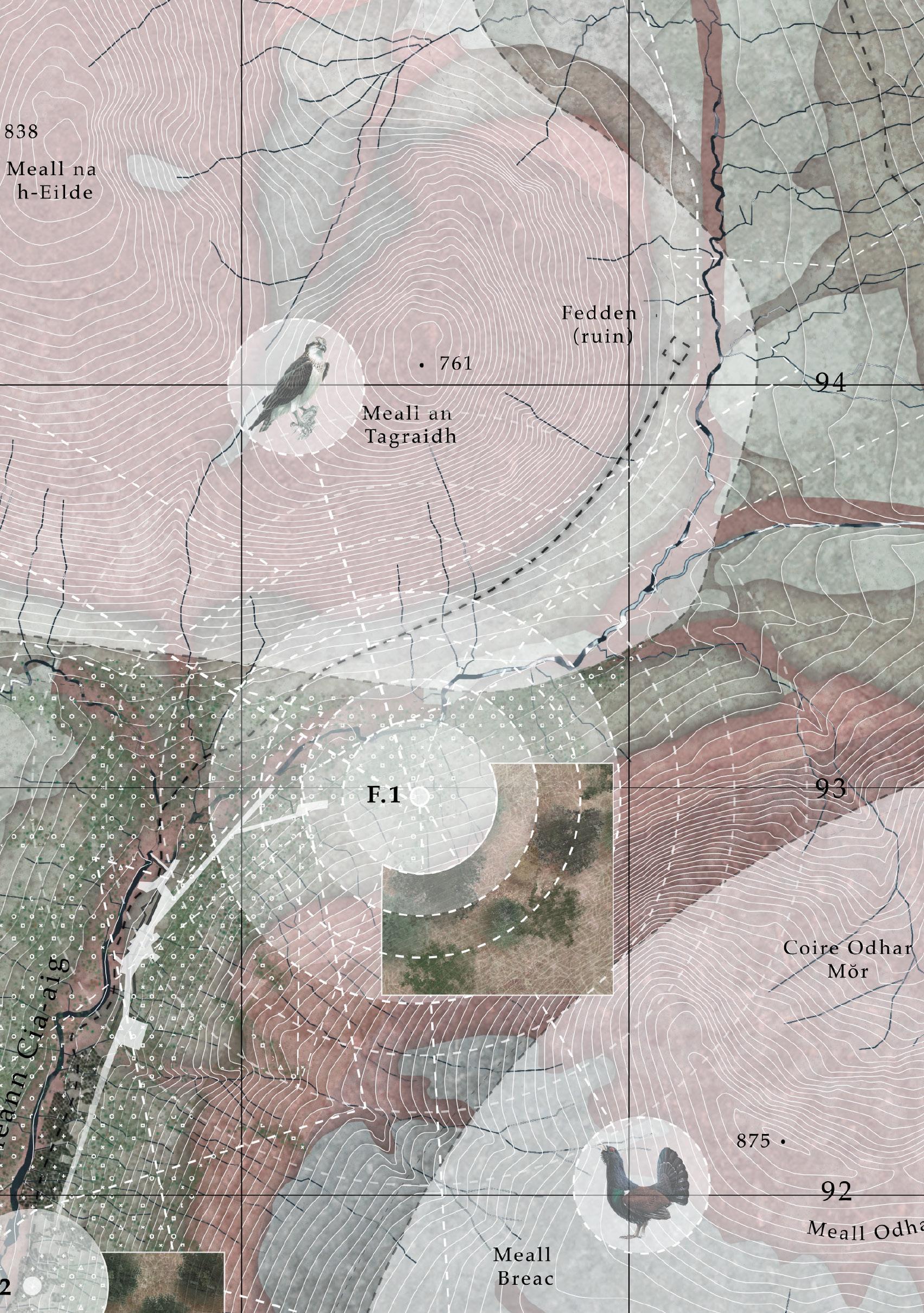
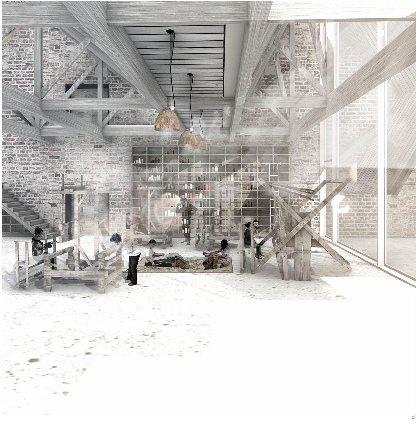
Site: Gleann Cia-aig, Fort William, Lochaber, Scotland. Programme: Sawmill, Biomass Plant, Papermill, Forestry Management Centre.
15
MATERIAL GATHERINGS, THICKENINGS, THINNINGS AND THINGS
NICOLE URQUHART
Situated north of Fort William, in Gleann Cia-aig, Material Gatherings, Thickenings, Thinnings and Things proposes an outpost that negotiates between forestry conservation, sustainable forestry management and related timber industries. It explores the fineness of carvings and paper production, and the robust processes used in the production of timber for construction. Navigating this range of wood-workings, this outpost is sensitive to both the requirements of conservation and the demands of a productive timber industry. By combining analyses of soil types, animal migrations, tree categorisations and seasonal weather patterns, it prompts the rehabilitation of a degraded landscape, and provides and maintains a sustainable production line, arranged on the principles of a circular economy. Small-scale interventions (a sawmill, biomass plant, forestry conservation and management centre, papermill and small hydroelectric power station), are situated on a rammed earth concrete and gabion plinth that cuts through and structures a landscape of planting, unifying various industries associated with timber and forestry management and consolidating energy generation. In close proximity to the nurseries which prepare trees for replanting schemes, this cluster of programmes feed off the ‘waste’ matter of commercial forestry. The project thus advocates for a developed forestry sector, one concerned with maintaining and enhancing the landscape while still generating timber. By considering land capacity and soil quality in relation to architectural and forestry decisions it aims to protect ecological and animal habitats, improve soil quality and increase biodiversity.
Above. Exterior Rooms. Timber-lined gabion walls in the Conservation Centre courtyard.
Below. Arrival at Glenn Cia-aig. Approaching the Forestry Management and Conservation Centre.
Right. Field Station Rendering 04: Animal, People and Arboreal Blooms. Summer Occupancies.
16
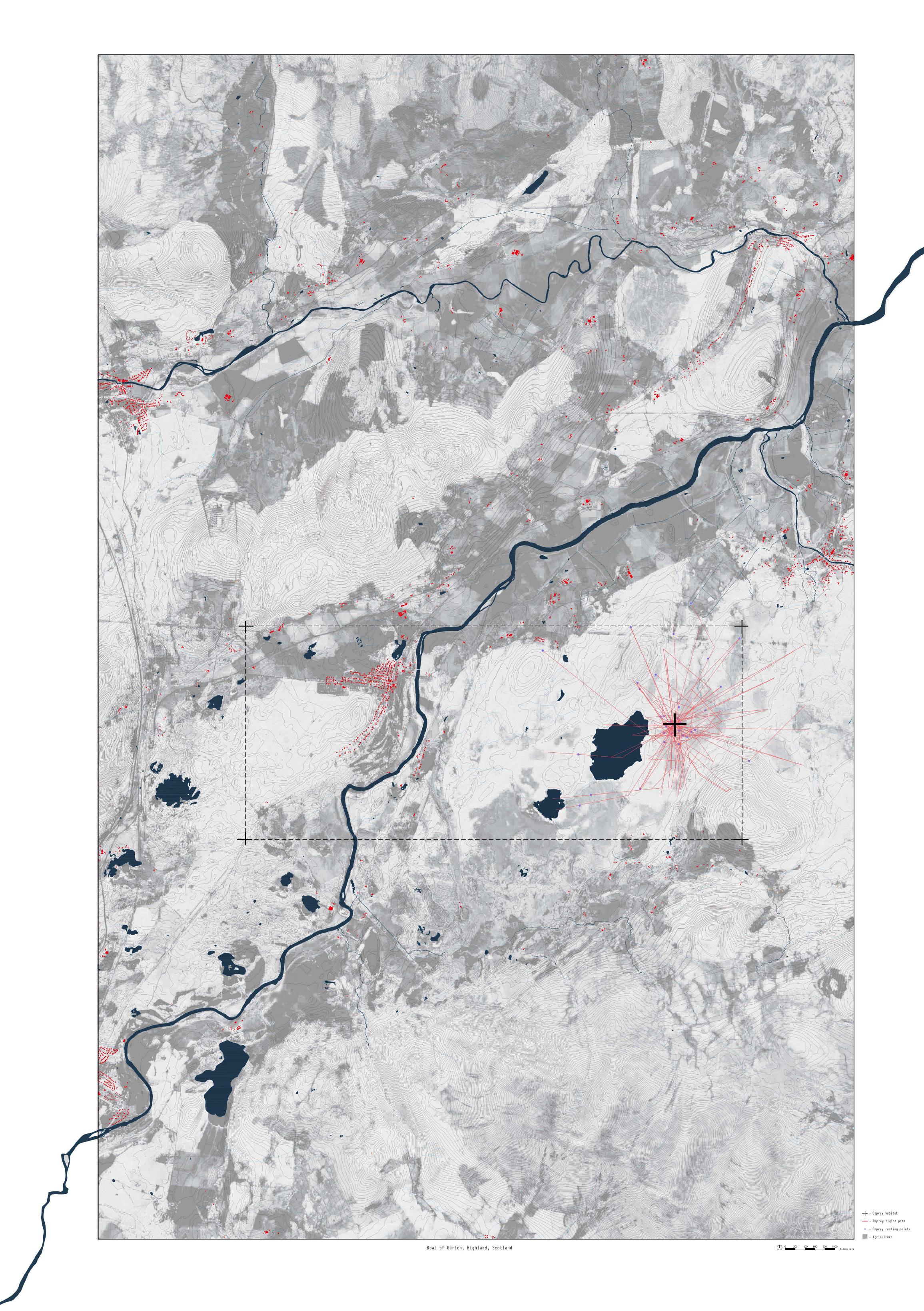
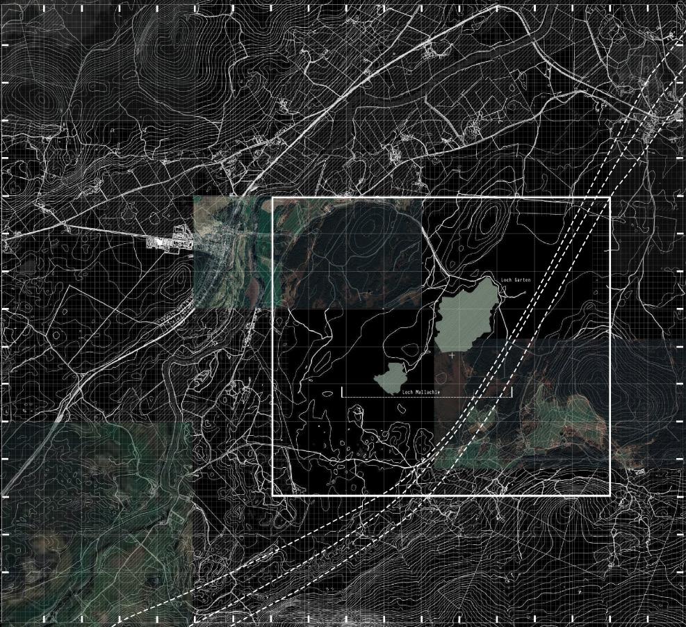
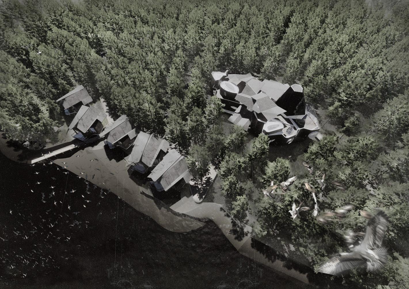
Site: Loch Garten, Cairngorms National Park, Scotland. Programme: Bird Hides, Researchers’ Residences, Library and Exhibition Space.
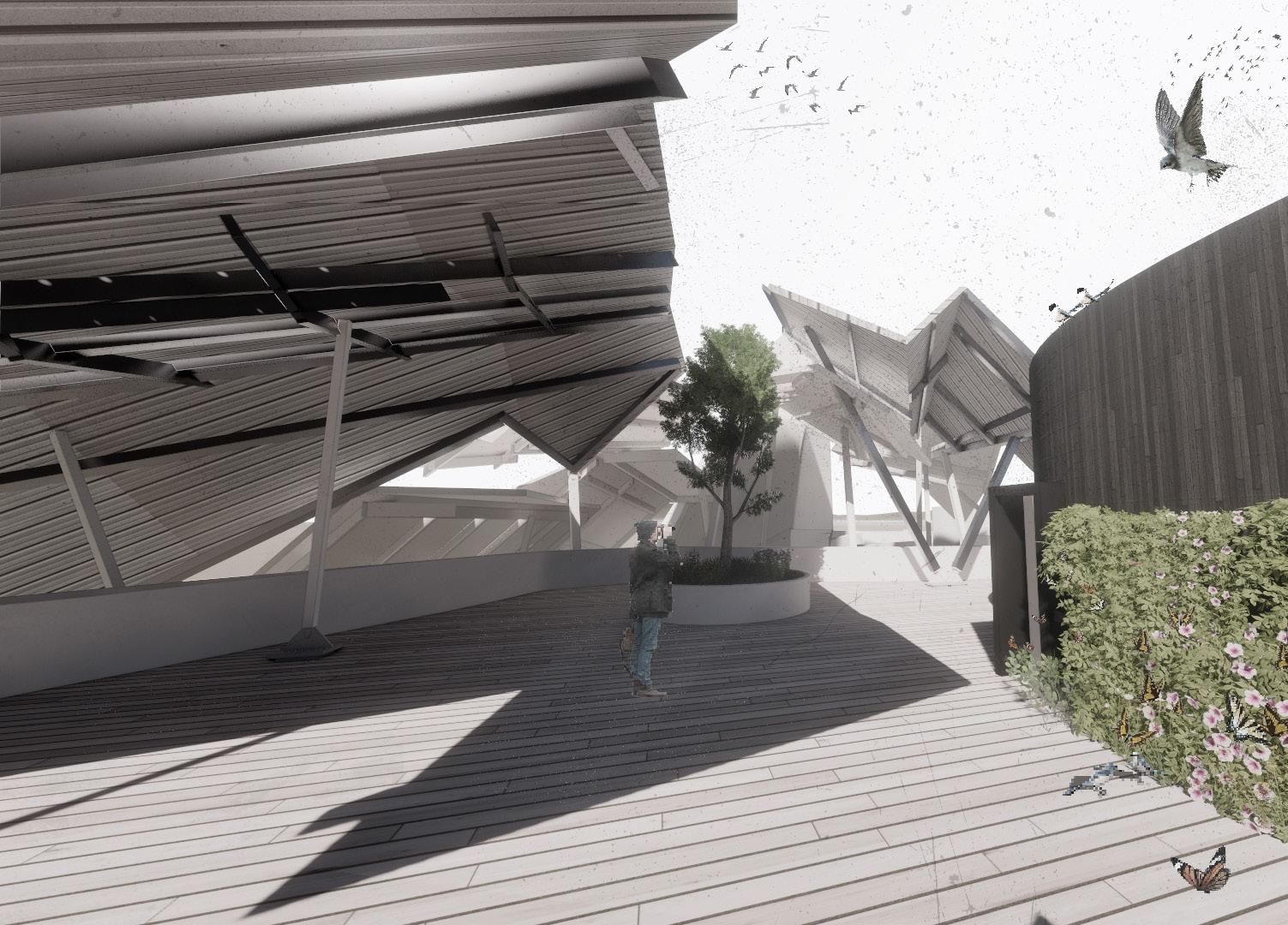
INTERSECTIONS WITH OSPREYS
MIGRATING, MATING, MEETING
DAMON LEE
Ospreys once ruled the skies over Scotland, but the mindless pursuits of poachers, egg hunters and skin collectors forced these apex predators (Ospreys are capable of carrying fish equal to their own size) from the country. They were absent for forty years, from the First World War until 1950, when the area around Loch Garten in the Cairngorms National Park was recolonised, naturally, by returning migratory birds travelling from east Africa. Intersections with Ospreys: Migrating, Mating and Meeting engages with both the vast migratory patterns of the Osprey, and the local ground, sky and tree-top conditions of the forests of Loch Garten (some of the last fragments of the ancient Caledonian forest) to provide new spaces for this species to roost.
This thickened space, between ground and sky, forms the basis of an architecture that accommodates radical swings in occupation through time; it is an architecture of migrations and meetings. The body movements of the Osprey, its hunting gestures and habitat generate spaces for shading and sheltering, creating an architecture that accommodates the changing seasons. Labs monitor the Ospreys, and preserve the surrounding ecosystem to enhance, protect, and preserve species diversity. Libraries and bedrooms for visitors allow people to study and settle with and around the birds. Sheltered terraces provide opportunities for hides, hives and nests. Together, these interspecial spaces remind us of the fundamental interconnections required for the survival of human and non-human species alike.
Above. Migrating, Meeting and Mating. Human and Osprey Migrations through Loch Garten. Inset. An Osprey Swoops. Drawing study of an Osprey approaching water while hunting.
Above. Between Ground and Sky. Roof Terraces for roosting and resting.
Below. A Building in a Clearing in a Forest. The Visitor Centre re-seeds the Caledonian Forest.
Right. Flights and Flows through Architecture. Plan drawing exploring the movements of Ospreys and Visitors.
DISPARITIES, SEPARATIONS AND TERRITORIES OF A COFFEE ORCHARD IN PANAMA
CRYSTAL JIN
Coffee, as an international commodity and unique agricultural product, materialises global economic disparities. Consumers in urban cafés, while showing increasing concern for the origins and supply chain of their coffee, pay prices significantly higher relatively than the wages paid to those who pick the coffee. Among those countries in which coffee can be grown, this disparity is particularly pronounced in Panama. Panama possesses a unique combination of nutritious volcanic soil and humid climatic conditions which make it ideal for coffee production, making it the source of the world’s most expensive coffee. And yet, most coffee orchards are reliant on seasonal migrant workers from a protected indigenous reserve for labour. These workers, in turn, are dependent on the income from the orchards (from both picking the coffee and a growing economy of coffeetourism) to engage with the society within which their indigenous group finds themselves enmeshed. Through different, overlapping architectural approaches to the rainforest around the coffee orchards and local weather conditions, which together offer a systematic response to the challenges faced by the workers, Husks and Hulls proposes to sustainably (both economically and environmentally) occupy the volcanic landscape of Panama. It proposes accommodation for workers, coffee production spaces, and a re-organisation of the coffee plantation to restore lost rainforest space. These approaches work across scales: a roof extends the surrounding tree canopy, water walls service and shelter, and hull-like houses form enclosures protecting against moisture. All engage with water, with shade and growth.
Phased Constructions: Water Walls, Canopy Roofs and Workers’ Accommodation. Exploded Isometric.
Above. Brick Stacks and Steel Canopies. Perspective Views. Left. Cutting through a Constructed Coffee Orchard. Sectional Perspective.
“The truth is that, in the days of yore, the Gypsies had a country. Now they keep searching for it in vain, the wheels of their wagons wearing ruts in the road as they travel them back and forth, looking for a hidden spot of earth somewhere under an out-of-the-way patch of sky. Only in their souls does the hope still exist that one day they will find their country. Then they will gather together from the farthest corners of the world where they have been scattered, and they will never leave it again.” 1
Surrounded by hills, mountains and valleys, and despite its proximity to Brasov and a neighbouring village, the Roma settlement at Garcini is neglected and isolated, socially and physically. The Roma community there exist outside urban and rural development frameworks. This community exemplifies, as Troy Conrad Therrien would term it, ‘countrysiding’, a “funnelling” of “populations into the countryside of the mind.” Contesting Countrysiding is aware of the fragile existence of Garcini, and the social and environmental instability of the landscape within which it exists. It explores movements within this territory (of the Roma, of goods, animals and water), and develops an architecture that interacts with the muddy, frozen ground between the Roma settlement and the neighbouring village. It takes the craft practices for which the Roma were celebrated, and provides an opportunity for these practices to be passed on. Workshops for making, farming, and recycling, and spaces for gatherings and social events offer the Roma a place of their own, and at the same time reinforce the dialogue between the Roma and other local urban communities.
1 Luminita Mihai Cioaba, The Lost Country , trans. Adam J. Sorkin and Christina Cristea (SocialCultural Foundation of Roma, 2002).
Field Station Rendering 01: Watersheds and Snow Shadows of Garcini Village
Above. Field Station Rendering 03: Stratifications of Culture and Craftsmanship
Right. Field Station Rendering 02: Developing the ‘Lost Country’. Screenshots from ‘Lost Country’.
Above. A Retreat for Winter. Perspective (Winter).
Below. The Market, School and Workshops. Section (Summer).
Right. The Writer’s Rooms. Axonometric.
Left. View from the South-Western hills Above. Weaving Workshop. Interior. Below. Assembling the Weaving Workshop. Exploded Axonometric.
19 MOVING MACHAIRS
STANDING STONES AND SHIFTING SHELLS
KATIE-MAY MUNRO
SIGI WHITTLE
Field
MOVING MACHAIRS STANDING STONES AND SHIFTING SHELLS
Site: South Uist, Outer Hebrides, Scotland. Programme: Residences (permanent and temporary), Workshops, Forum, Archive.
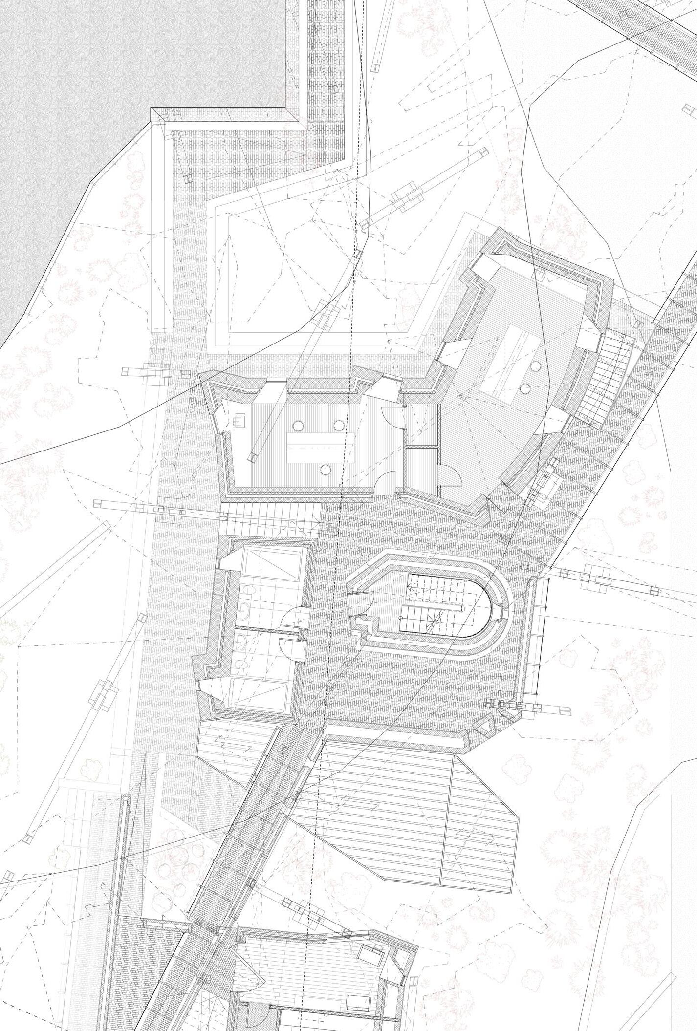
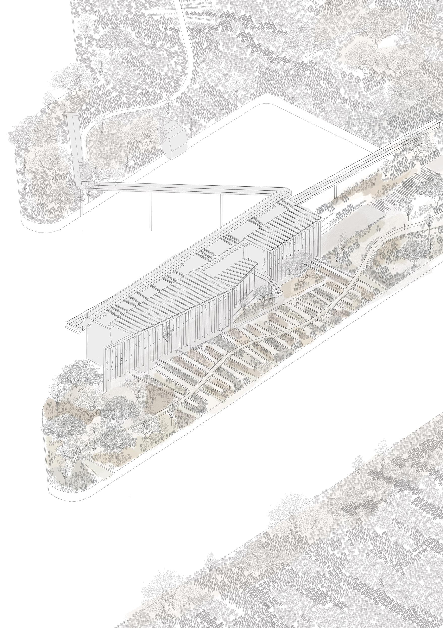
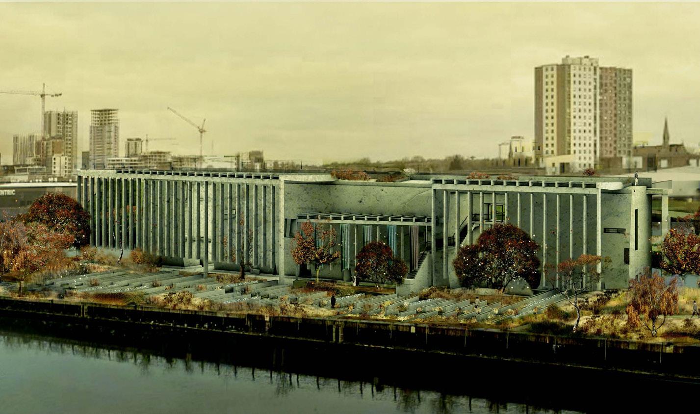
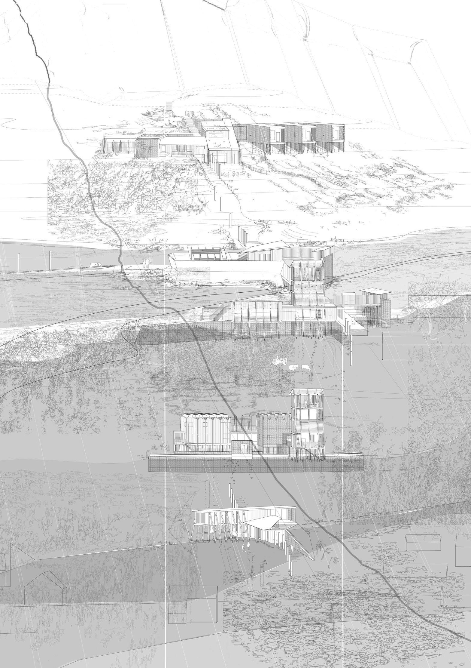
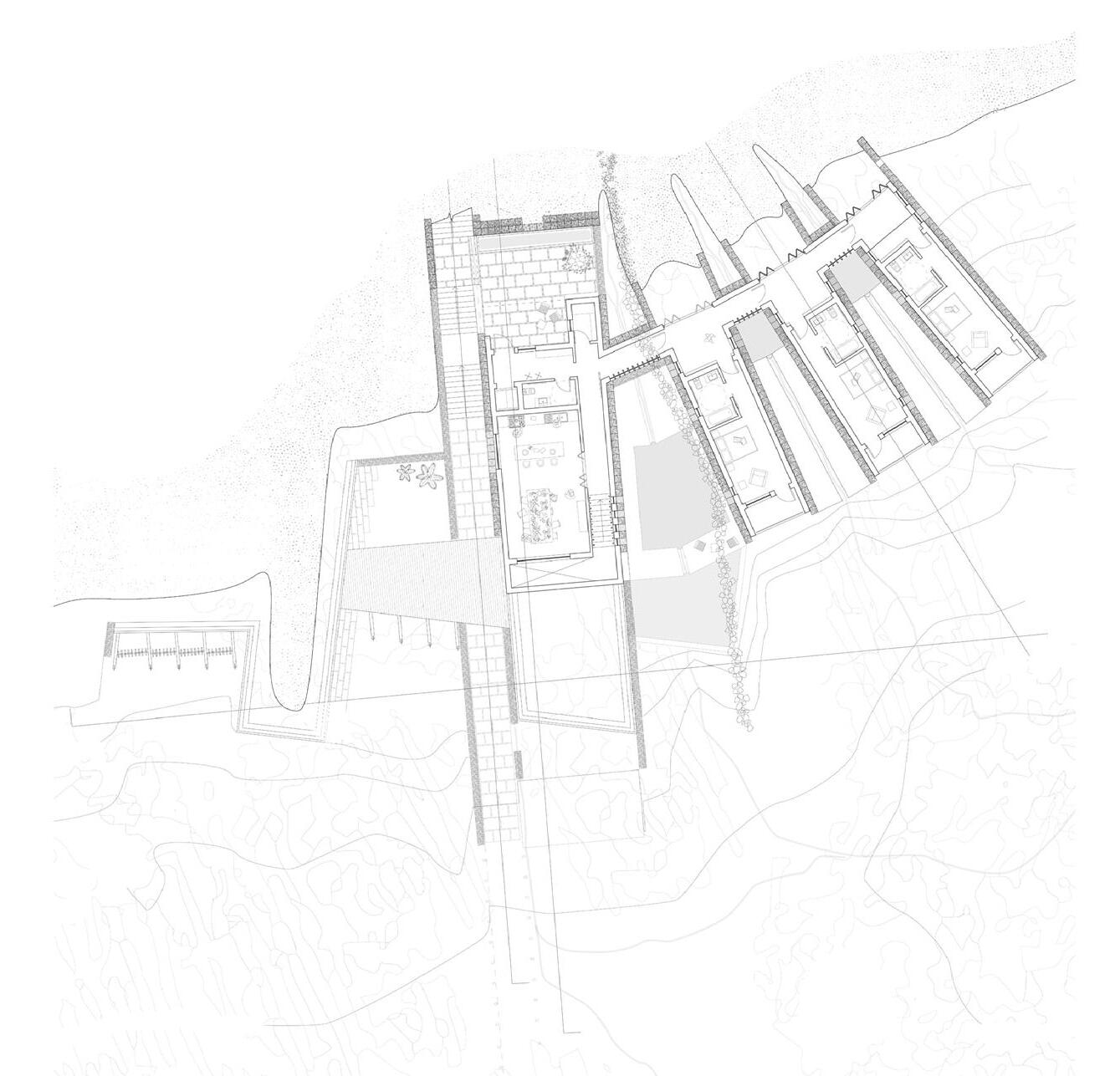
MOVING MACHAIRS
STANDING STONES AND SHIFTING SHELLS
KATIE-MAY MUNRO | SIGI WHITTLE
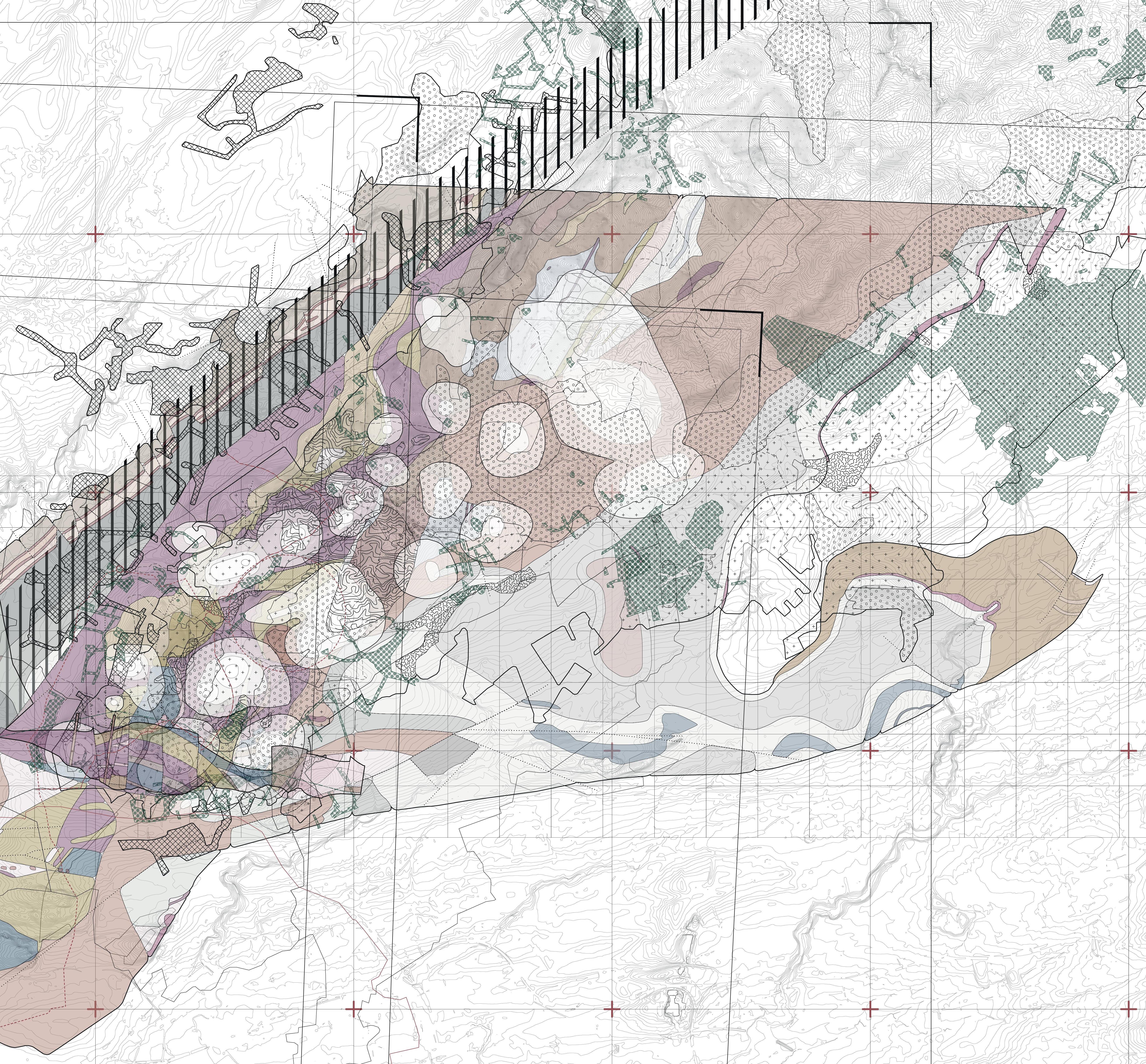
The machair, an ecosystem unique to the western isles of Scotland and west coast of Ireland, is a barrier, a buffer against and gentle embrace of Atlantic waves. It is a land made by two makers, elemental and human. An otherwise-wet desert is brought to life by the cutting of soil by crofters, the pouching of grasses by hoofs which makes space for birds to nest, and the surges of wind which blow sand onto the flat plain. The crofters lay out kelp from the shore to give it nutrients, and harvest seaweed from the shore, but the machair is finite and fragile. The dunes that protect it move, and coastal erosion and sea level rise hastened by climate change has left this territory under threat. As the machair is pushed back, the land which gives its community meaning and sustenance is reclaimed by the sea.
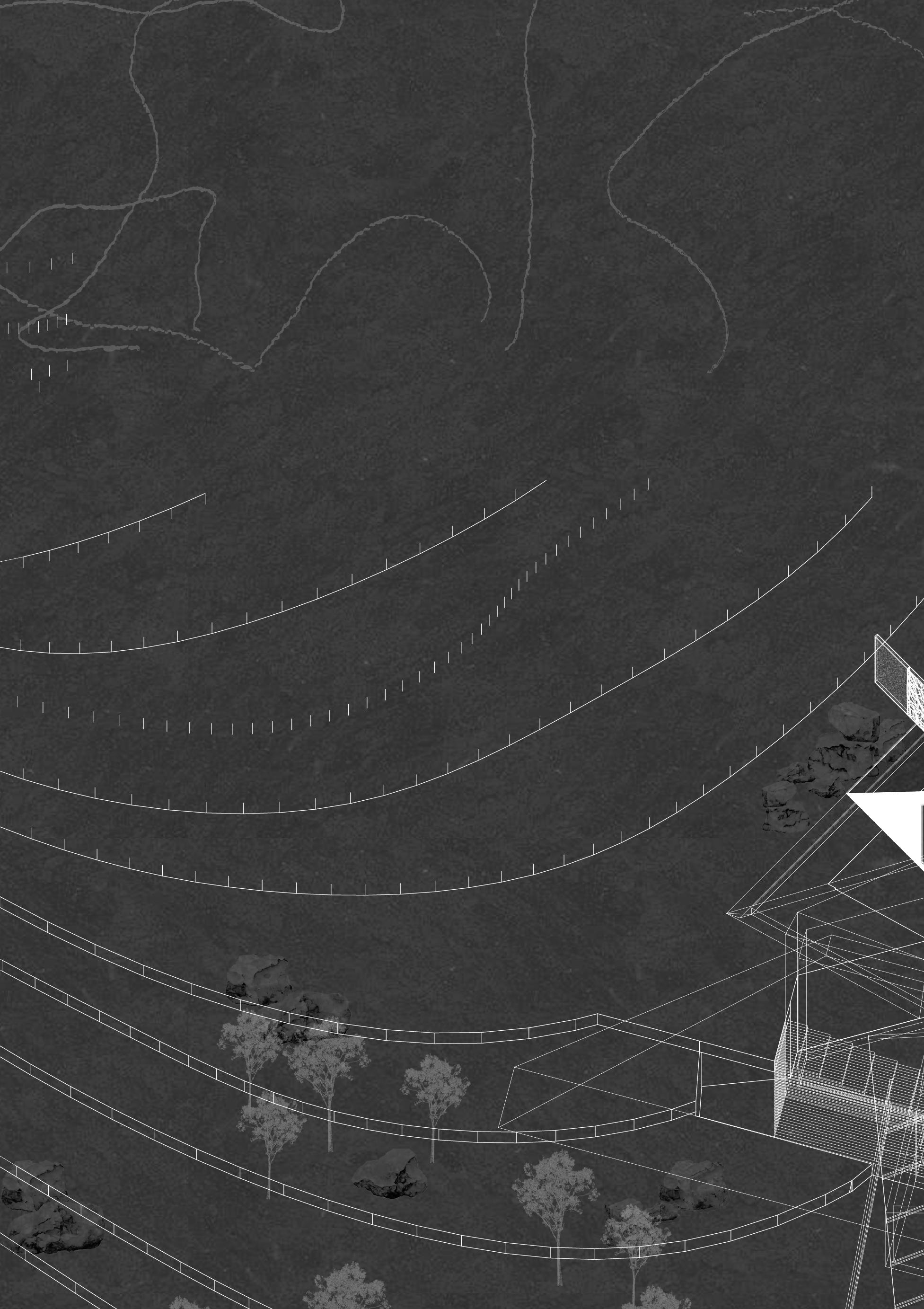
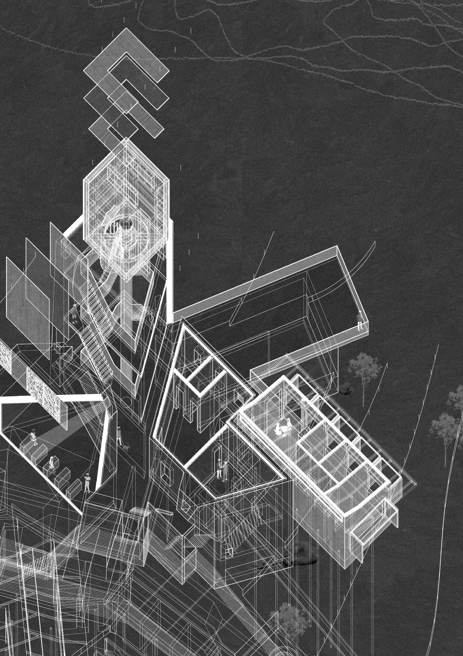
The machair of South Uist, where crofting is still commonplace, is owned by the local community. Moving Machairs proposes a series of programmes for this community that engage with the fragility of the machair. A series of spaces where people can work, gather and debate are unpacked along the line of a croft plot, forming spaces where community ownership is practiced. A crofting diversification centre, a facility for the land management group ‘Storas Uibhist’ with workspace for visiting ecologists, a forum for discussions on coastal land management, an archive and rooms for the custodian of the machair engage with the shells, sands and subsurface of the machair. An elevated, occupied boardwalk connects these programmes, measuring and making visible the movement of the machair over time.
Field Station Rendering 04: Unpacking Moving Machairs. Stacked Oblique.
Above. View of the Machair. Screenshot from ‘Moving Machairs’. Cutting the Machair. Screenshot from ‘Moving Machairs’. Station Keeper’s Quarters, Isle of Orasaigh. Perspective.
Inset. The Station Keeper’s Quarters. Ground Floor Plan.
Below. The Station Keeper’s Quarters. Section.
Above. Recalibrating the Machair. Screenshot from ‘Moving Machairs’. An Doirlinn Archive. View from Orasaigh. Cutting and Re-Cutting the Machair. Screenshot from ‘Moving Machairs’.
An Doirlinn Archive. Sections.
Above. Stòras Uibhist Land Management Offices. Perspective. Recalibrating the Machair. Screenshot from ‘Moving Machairs’. Stòras Uibhist Land Management Offices. Interior Perspective, Meeting Room.
Above. Stòras Uibhist Land Management Offices. Exploded Axonometric.
Below. Community Land Forum. Section.
Community Land Forum.
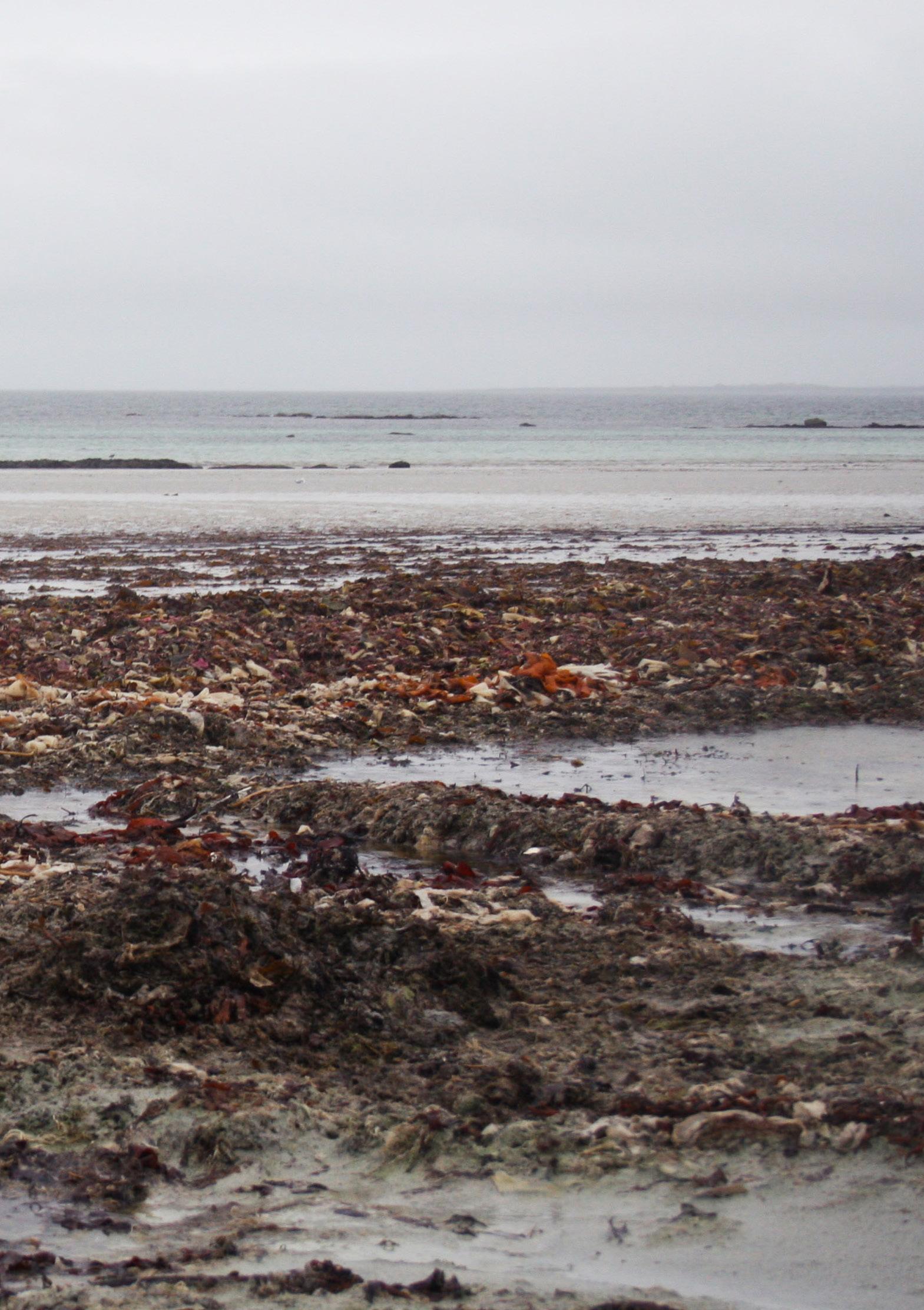
Machair Meanach, An t-Ìochdair, Uibhist a Deas. October, 2020. Sigi Whittle.
BIBLIOGRAPHY
Agrest, Diana. Architecture of Nature: Nature of Architecture. Novato, CA: Applied Research and Design Publishing, 2018.
Bolchover, Joshua and John Lin. RuralUrbanFramework:TransformingtheChineseCountryside . Basel: Birkhauser, 2014.
Branzi, Andrea. WeakandDiffuseModernity:TheWorldofProjectsatthebeginningofthe21stcentury . Milan and New York: Skira, distributed in North America by Rizzoli, 2006.
Cache, Bernard. EarthMoves:TheFurnishingofTerritories. Edited by Michael Speaks, translated by Anne Boyman. Cambridge, MA: MIT Press, 1995.
Clément, Gilles. “ThePlanetaryGarden”andOtherWritings. Translated by Sandra Morris. Philadelphia: University of Pennsylvania Press, 2015.
Rancière, Jacques. ThePoliticsofAesthetics,TheDistributionofTheSensible , translated by Gabriel Rockhill. London: Continuum, 2005.
Serres, Michel. The Natural Contract , trans. Elizabeth MacArthur and William Paulson. Ann Arbor, MI: University of Michigan Press, 1995 (1990).
IMAGE REFERENCES
Cover
- Field Station Rendering 01: Seeing and Being in the Pentlands Alex Moriarty.
Prologue
- Mol Mòr, An t-Ìochdair, Uibhist a Deas. Sigi Whittle.
- Satpara Dam Lake, Skardu, Pakistan. Mohammad Talha Malik.
Countryside, a Retort
2, 4-5, Installation views: Countryside, The Future; 20th February, 2020 - 14th February, 2021, Solomon R. 8 & 10. Guggenheim Museum, New York. Photograph by David Heald. Reproduced with permission from the Solomon R. Guggenheim Museum, New York.
[OUTSIDE]
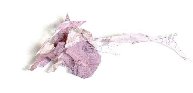
12-13 Exposed Mudflats in Sungei Buloh Wetland Reserve, Singapore. Toufiq Andry. 130-31 Machair Meanach, An t-Ìochdair, Uibhist a Deas. Sigi Whittle.
Epilogue
134 Skardu Valley, toward Shigar, Pakistan. Mohammad Talha Malik.
- Mol Mòr, An t-Ìochdair, Uibhist a Deas. Sigi Whittle.
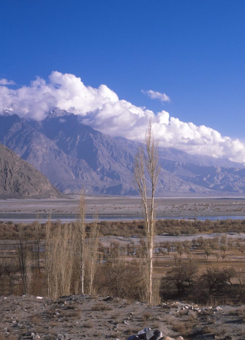
Skardu Valley, towards Shigar, Pakistan. November, 2018. Mohammad Talha Malik.
ACKNOWLEDGEMENTS
Tutors
Chris French
Michael Lewis Students
Toufiq Andry, Vlad Bucsoiu, Rachael Burleigh, Carel Coetzee, Adam Cornhill, Aaron French, Lara Gueldner, Ellie Hindle, Crystal Jin, Damon Lee, Alice Loudon, Miranda Lyle Perez, Mohammad Talha Malik, Katie-May Munro, Alex Moriarty, Ryan Mortimer, Mihail Pandrea, Lucy Potts, Valeria Oncean, Beth Rawsthorne, Christina Tantcheva, Nicole Urquhart, Sigi Whittle
Visitors
Kevin Adams, Paddi Benson, Victoria Clare Bernie, Anaïs Channon, Ricardo Flores, Andrew Friend, Harriet Garbutt, Laura Harty, Ita Jansen, Eva Prats, Jason O’Shaughnessey
Consultants
John Innes and Matt Thomas (Max Fordham) Yvonne McKean and Jonathan Narro (David Narro Associates)
Countryside [Outside] Architecture edited by Ellie Hindle, Vlad Bucsoiu and Alex Moriarty
The format of this catalogue has developed annually, evolving from the inaugural catalogue series produced for the ESALA MArch studios 2017-18, designed by Emma Bennett and Rachel Braude. Printed by J Thomson Colour Printers Ltd., Glasgow
Mol Mòr, An t-Ìochdair, Uibhist a Deas. October, 2020. Sigi Whittle.