Praxis Studio (Course Work)
Landscapes along the coast
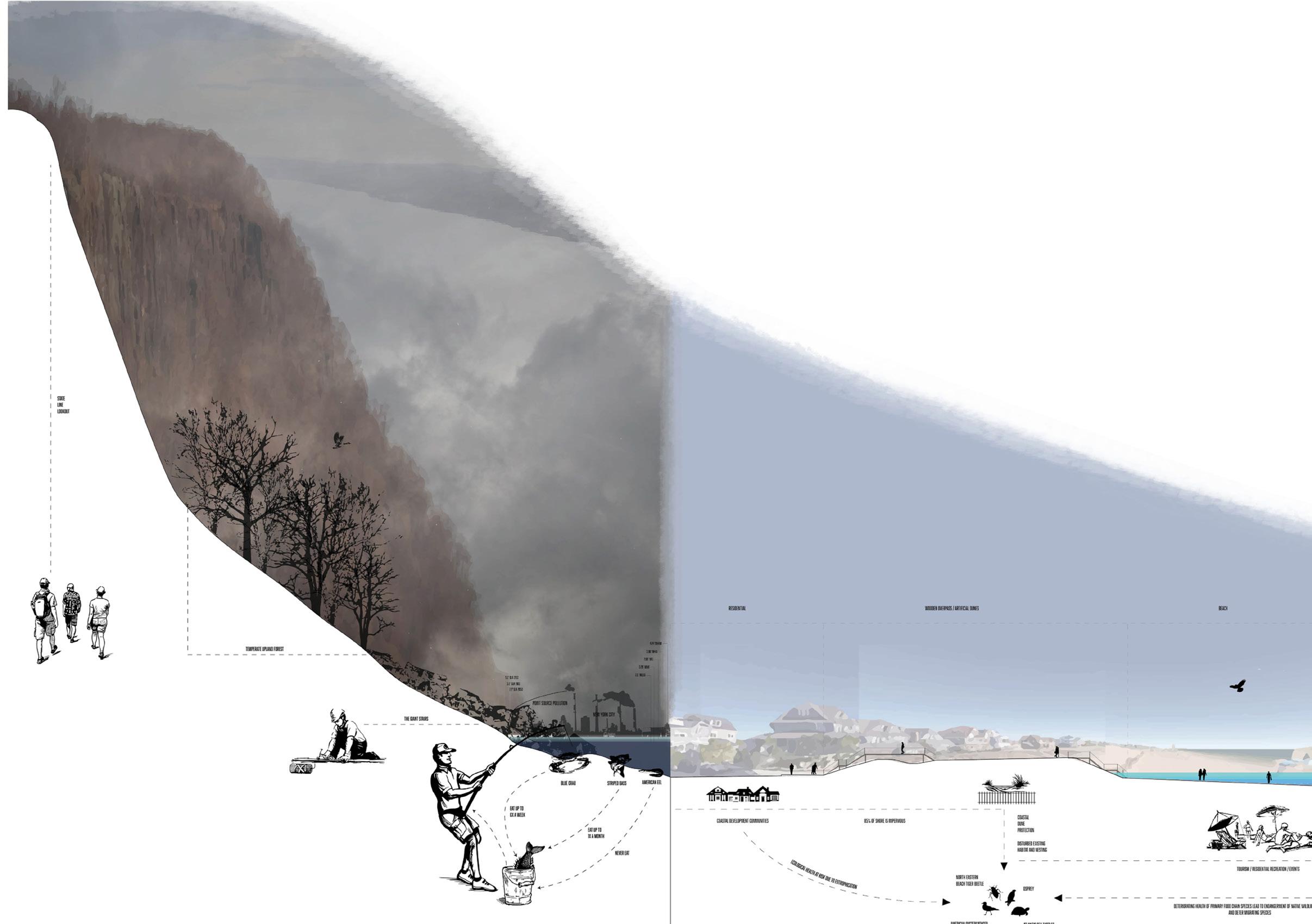
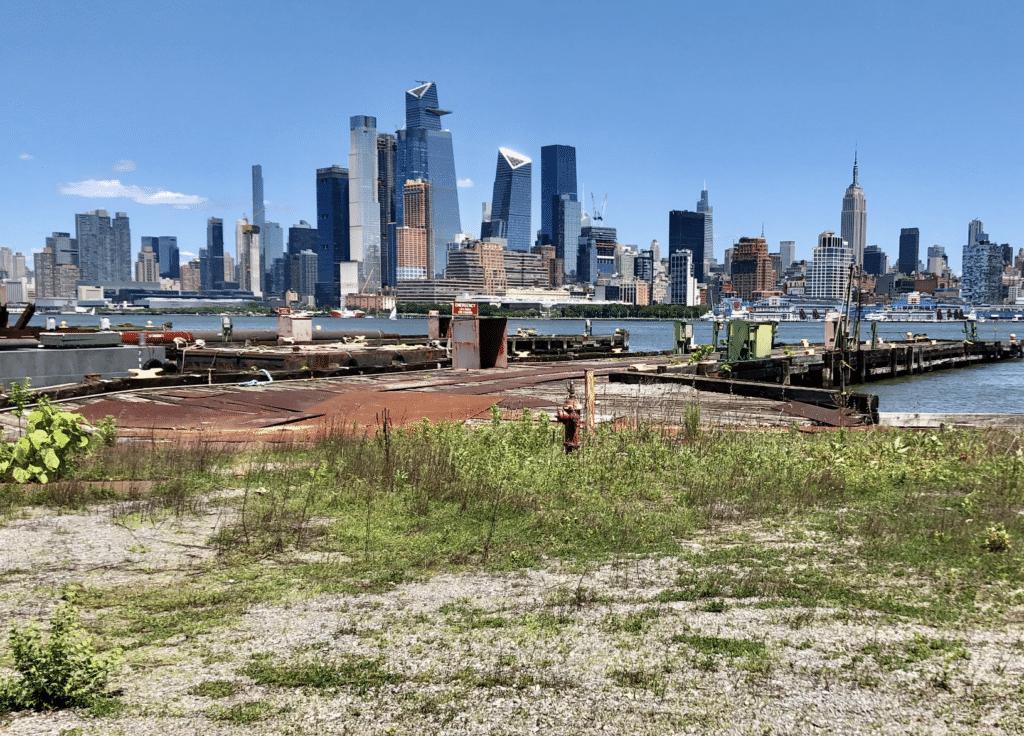
About the project: The New Jersey coast is diverse in it’s environmental conditions. There is a gradual gradient that changes conditions from industrial to urban to natural.
This project involves understanding the New Jersey coast to develop a design concept for a public works shoreline project that could be funded by the New Jersey infrastructure bill.
The objectives were:
• Creating an analysis of the New Jersey Coastline
• Researching case studies of existing coastline resilience projects
• Designing a New Jersey coastline project

5
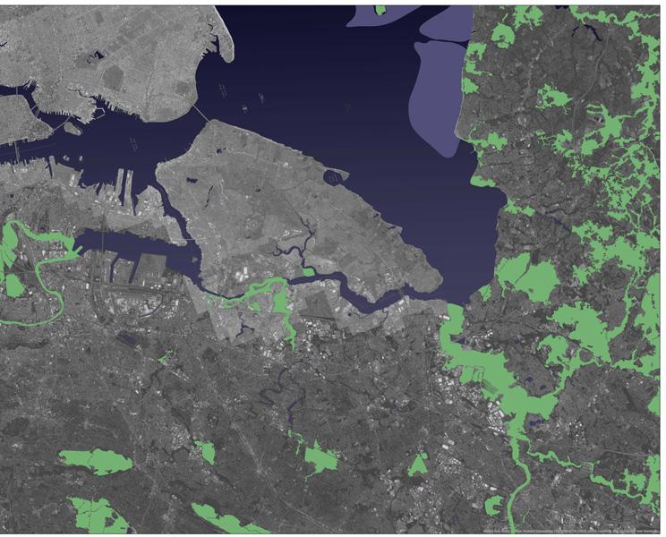
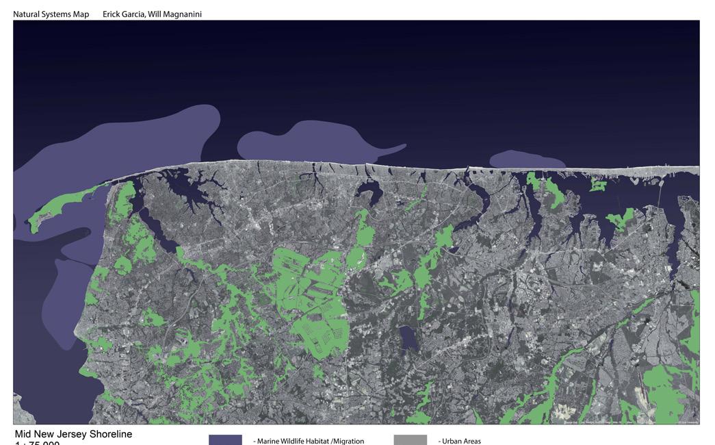
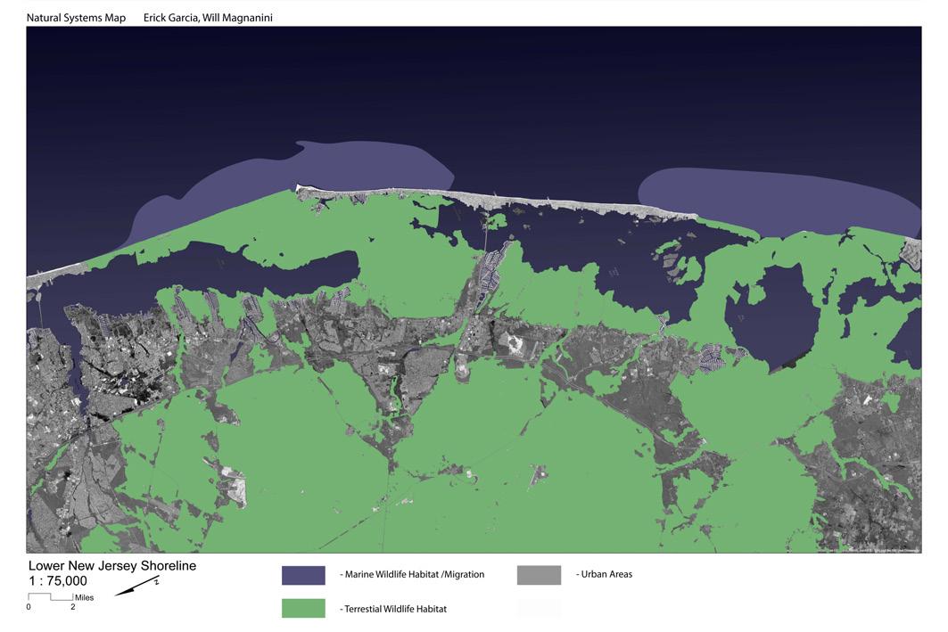
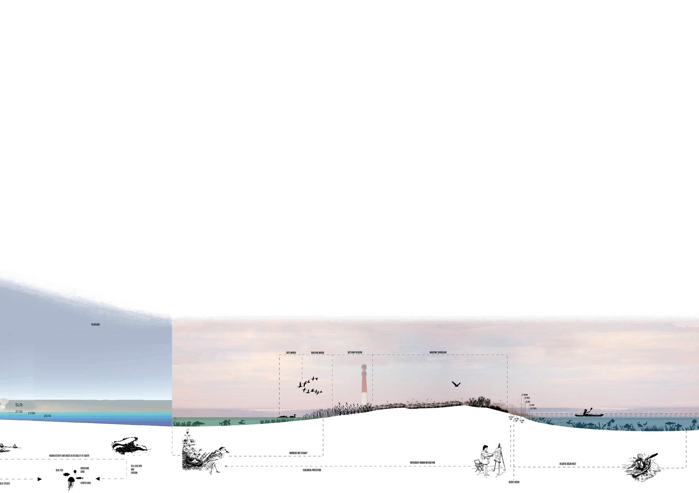
 North Jersey
Central Jersey
North Jersey
Central Jersey
6
South Jersey

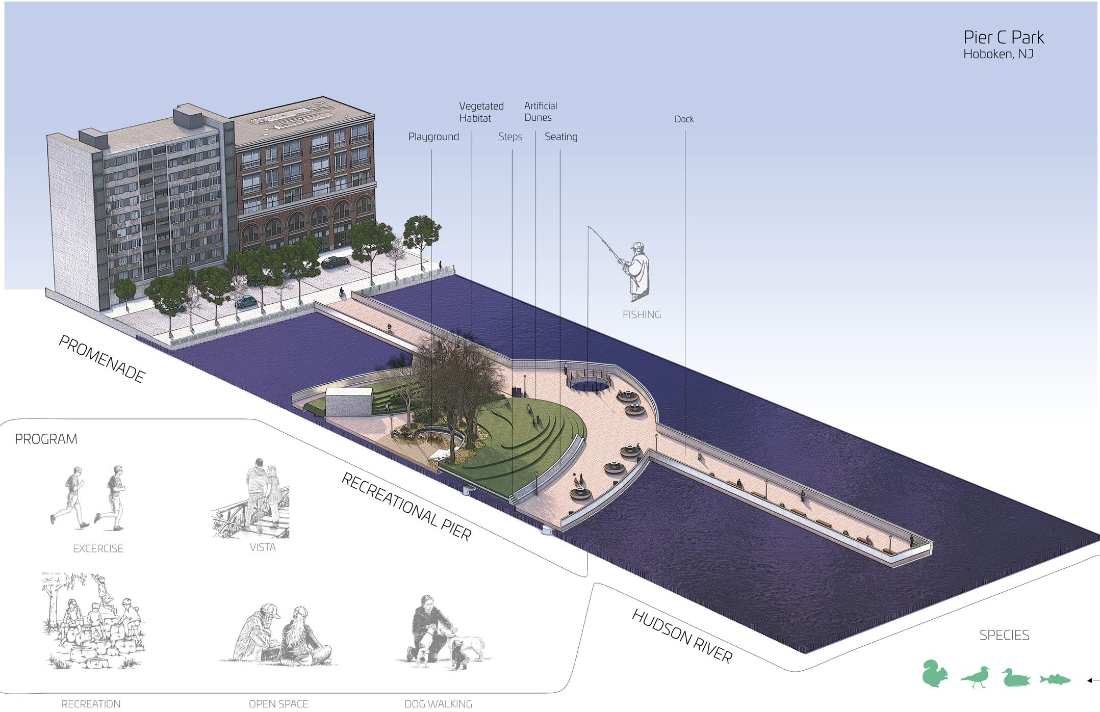

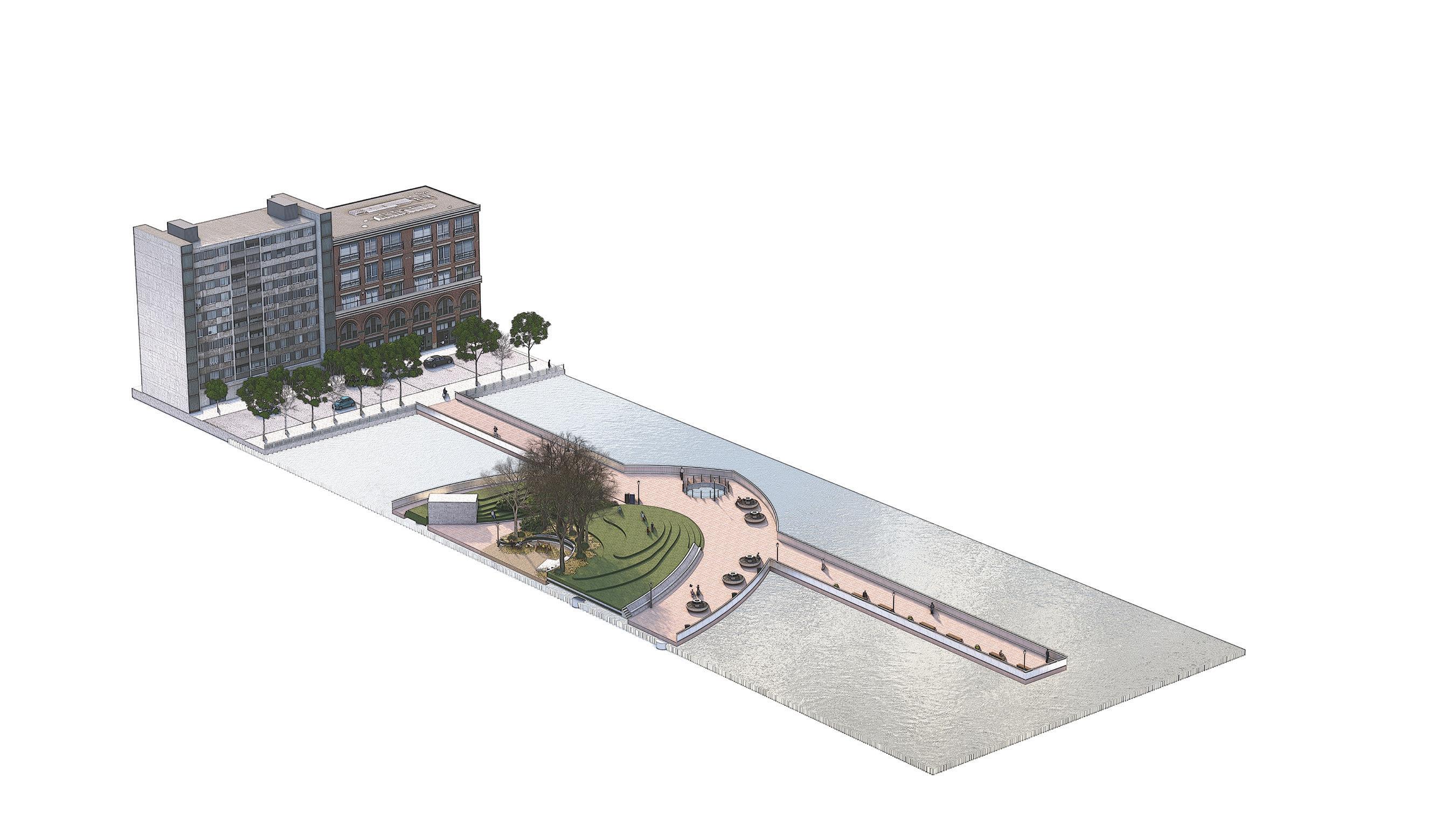
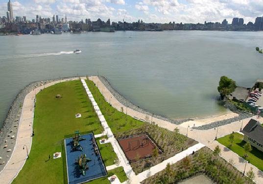
Pier C Park (Hoboken, NJ)
7
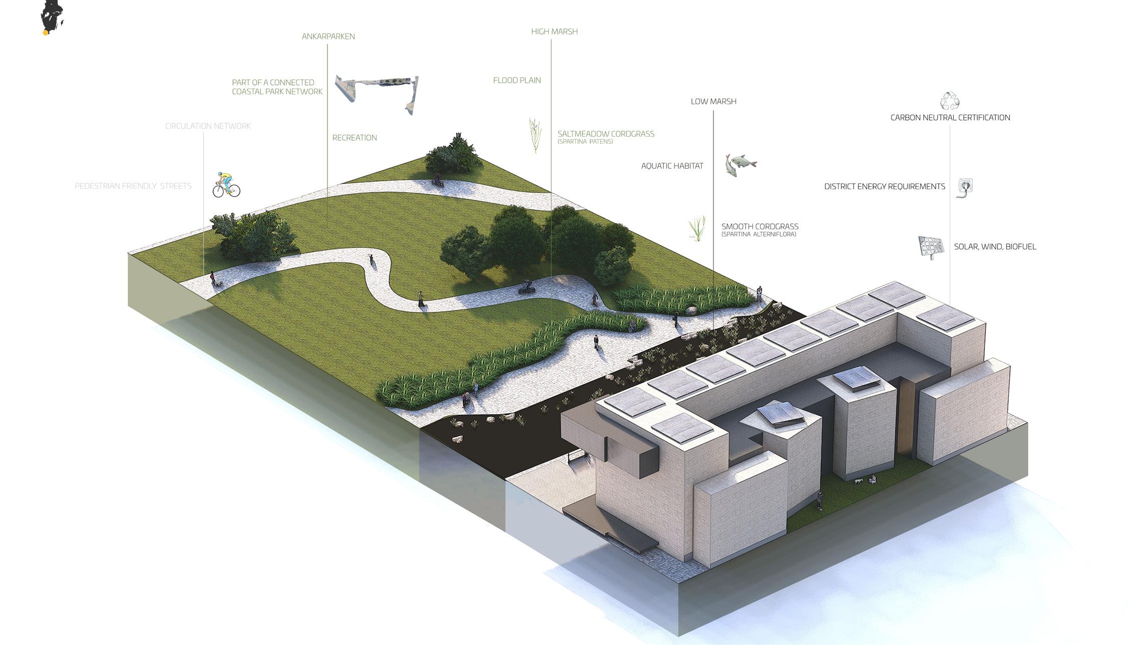
Vastra Hamnen District (Malmo, Sweden)

Analysis breakdown
• The artificial landscape is a sculptural park designed by MVVA.
• The design’s purpose is to simulate the features of a barrier beach in a dense urban environment.
• The park includes a playground, dune lawns for sun bathing, and a fishing pier that takes advantage of the New York skyline.
• The public park is a living lab designed by Mathews Nielsen LA.
• The design’s purpose is meant to harbor a marsh that is inhabited by the local sea life and capture runoff water to filtrate and release into the Harlem River.
• The park serves as a connection to the river and an educational experience.
• Originally an abandoned shipyard, a sustainable housing district emerged through the collaboration of multiple architect firms.
• The purpose was to restore an industrial wasteland into a carbon neutral city that combines living, working, education, and leisure.

PROGRAM OPEN SPACE EDUCATION
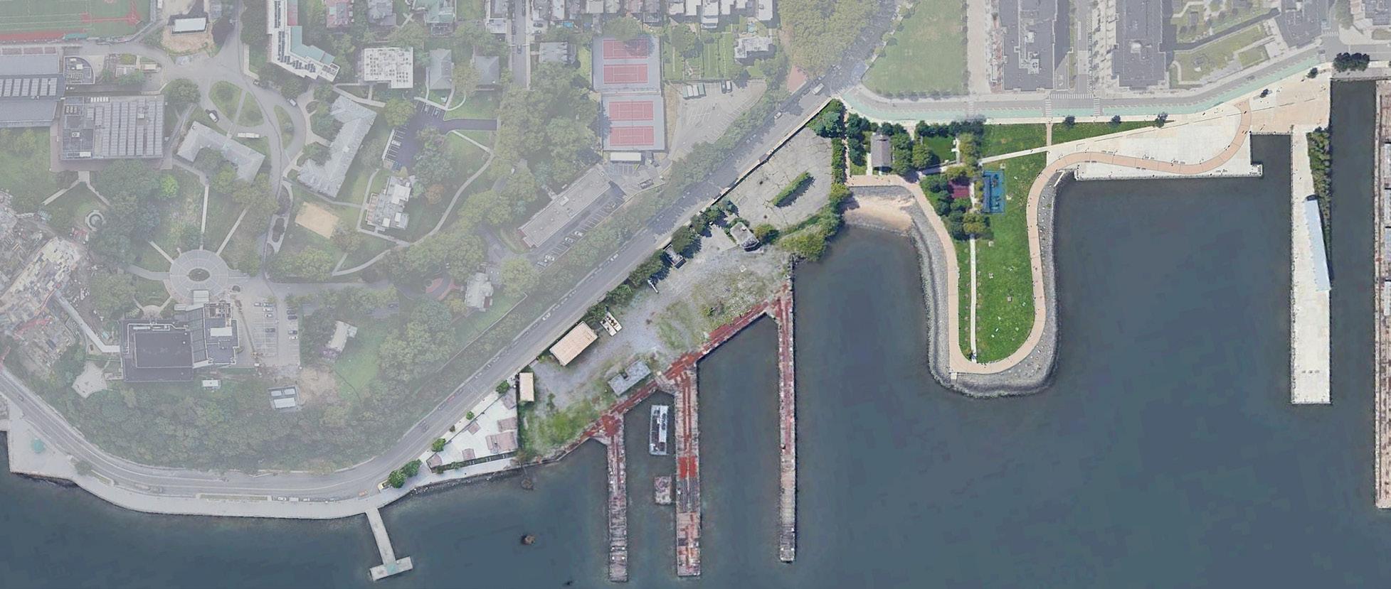
Inter-Tidal Pool Bronx, NY
Plaza Seating Area Scrub Shrub Fresh Water Wetland Elevated Walkways Tidal Channel Tidal Marsh Crenels PROGRAM SPECIES VEGETATION COMMUNITY ENGAGEMENT OPEN SPACE RESIDENTIAL YARD EDUCATION VISTA
Inter-Tidal Pool Bronx, NY
8
Inter-Tidal Pool (Bronx, NY)
Pier C Park:
Inter-Tidal Pool:
Vastra Hamnen District:
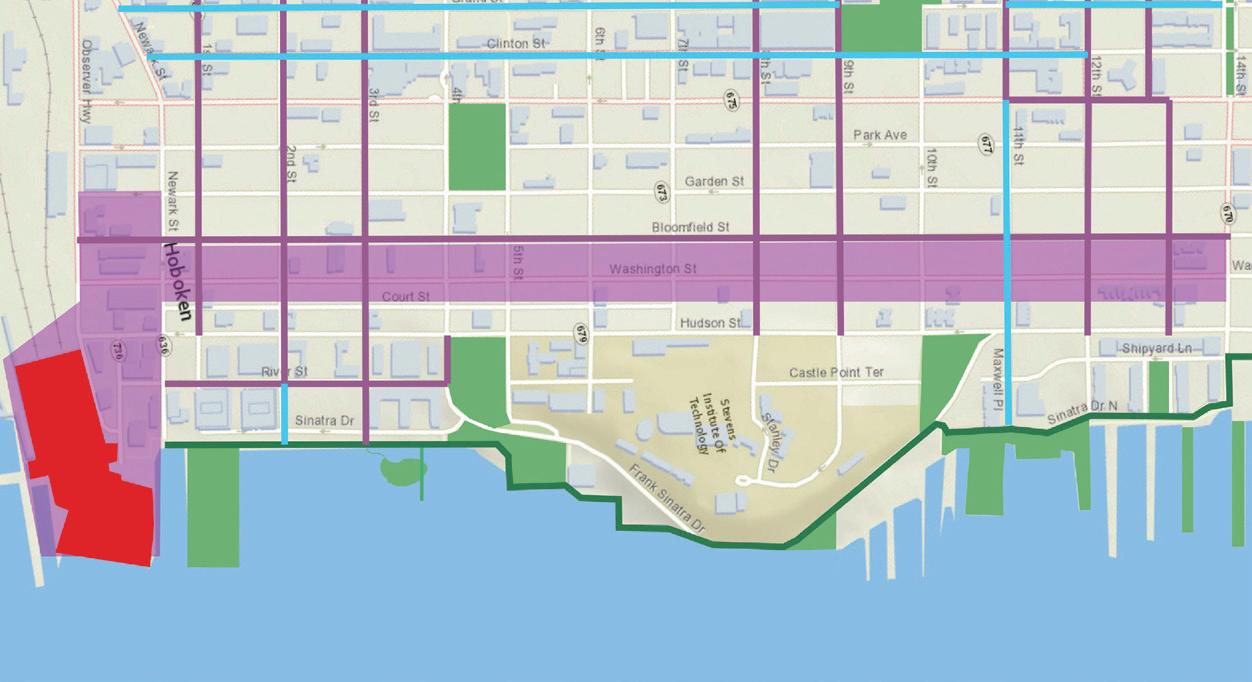

Green-way Map (Hoboken, NJ)
Waterfront
Traffic flow Map
9
Land Use Map
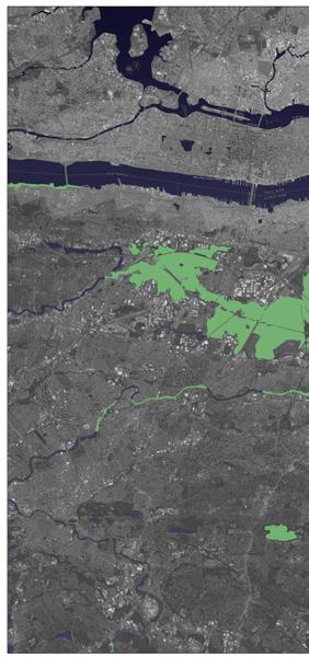
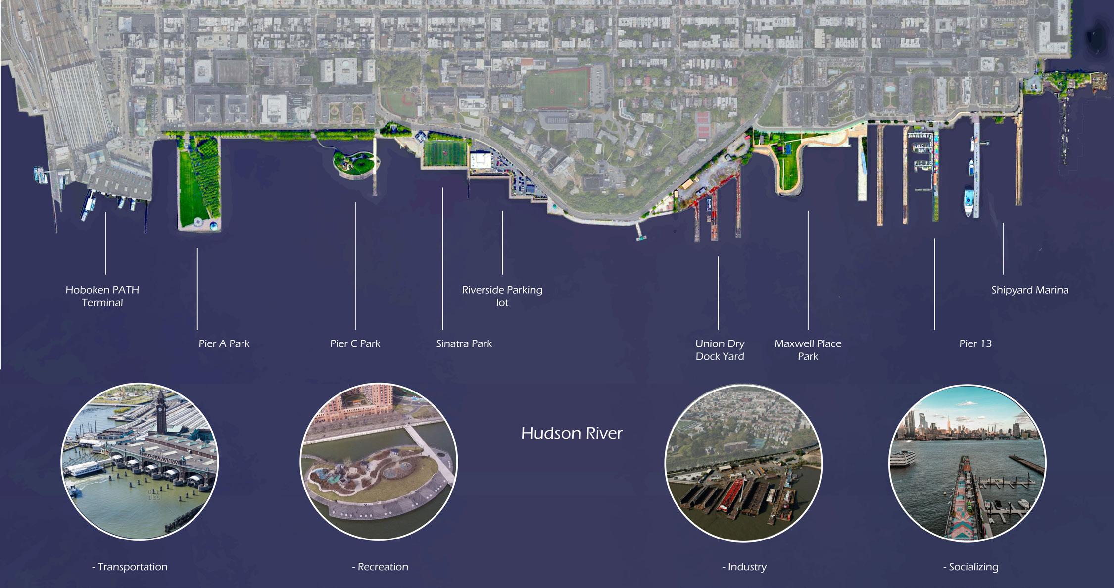
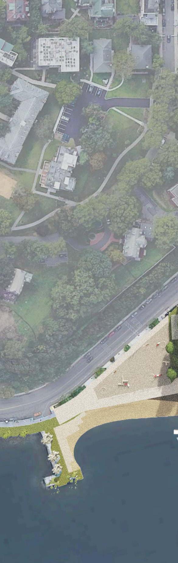
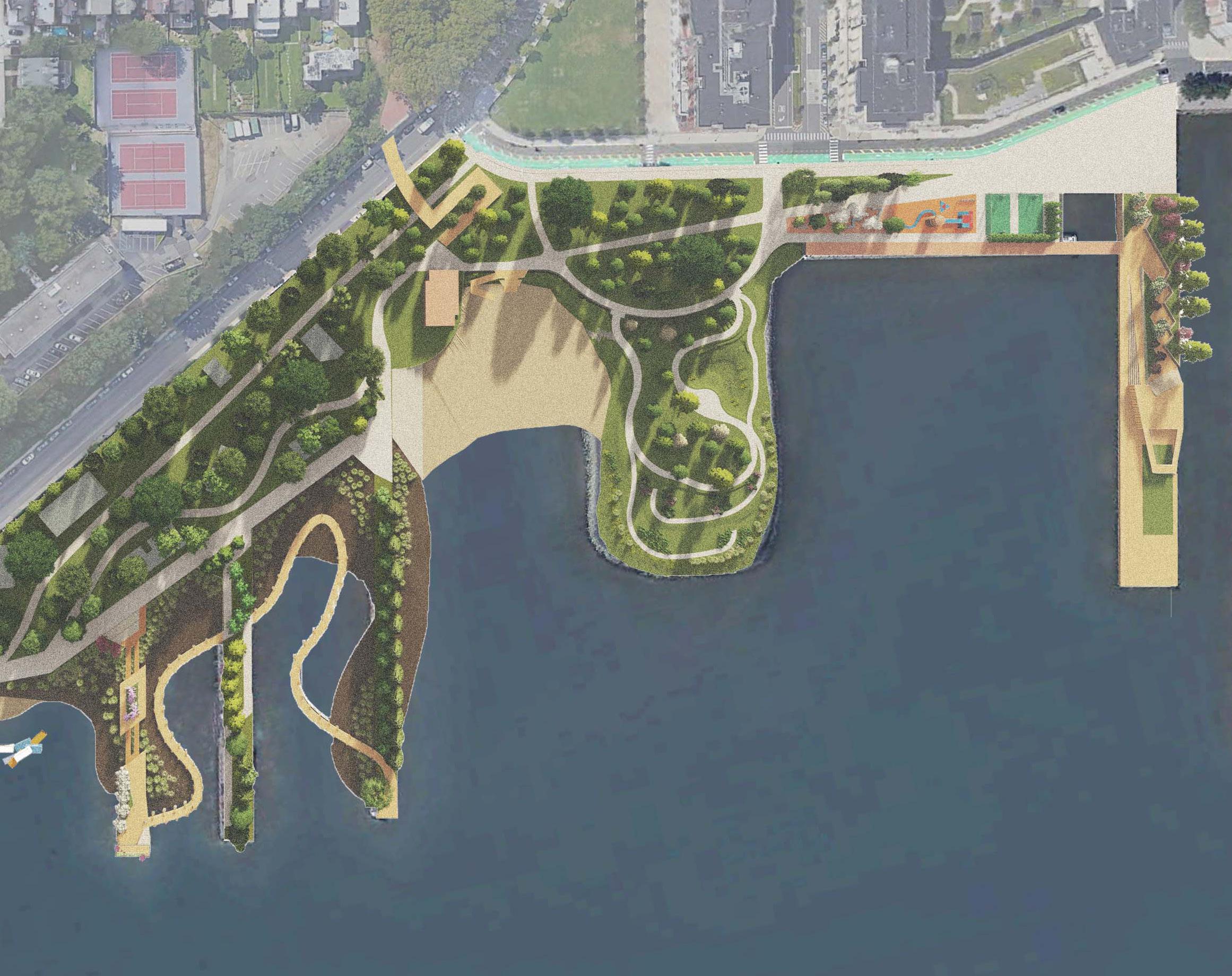
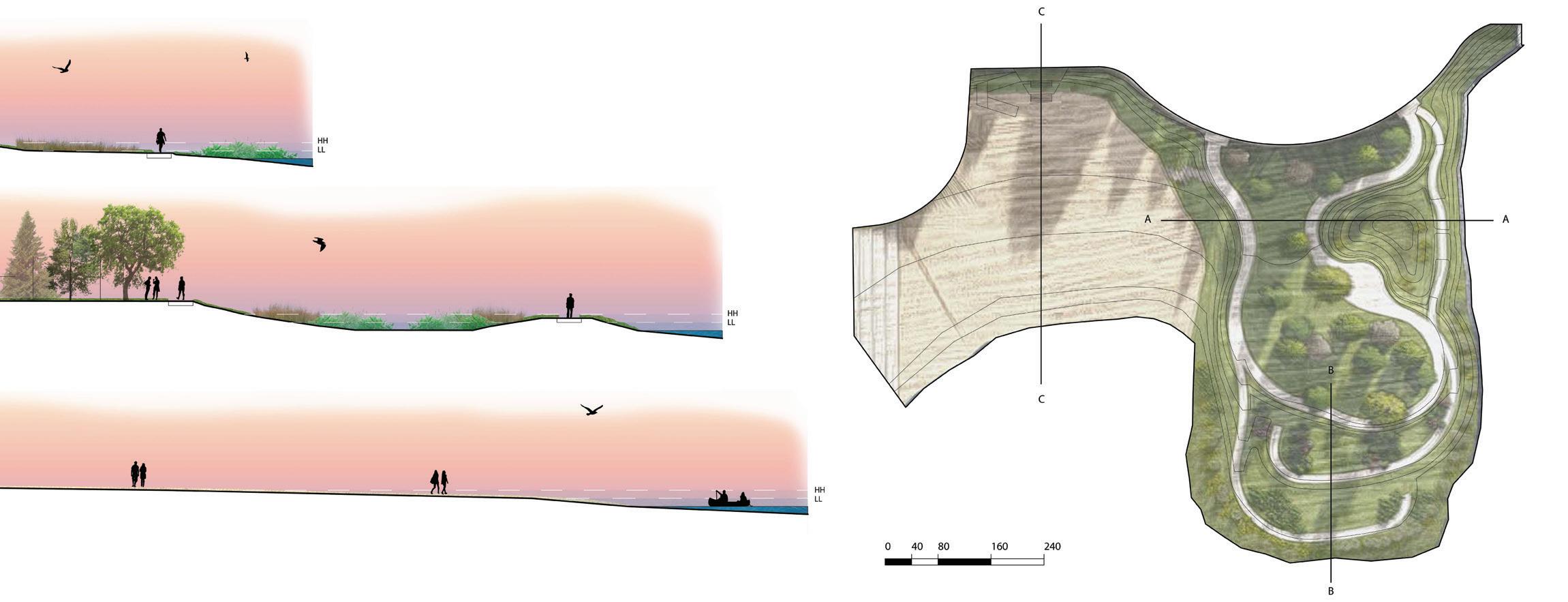
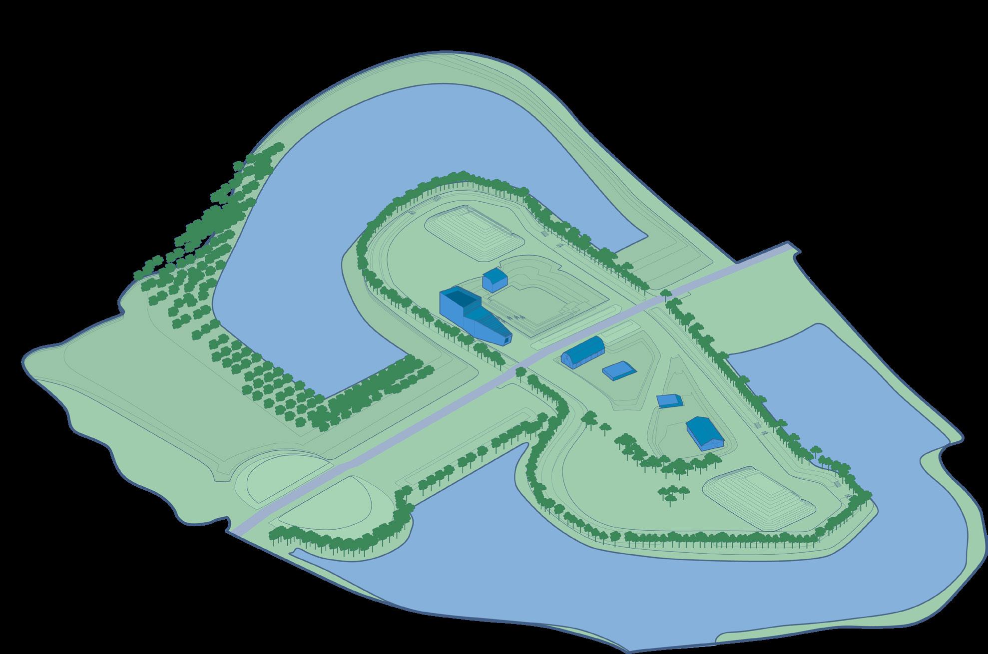
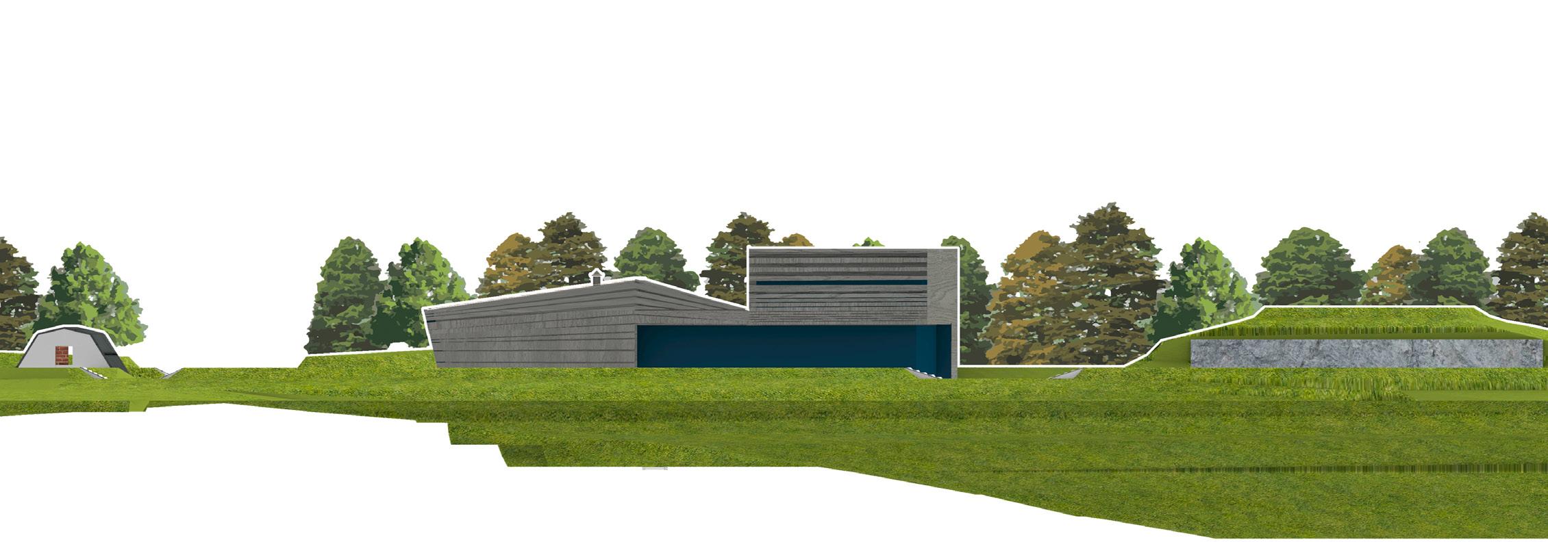
Project summary: The location we believed to have the best potential for the New Jersey infrastructure bill was the Hoboken waterfront. This waterfront is one of the few locations on the NJ coast to be nonprivately owned and somewhat connected through a series of existing green spaces.
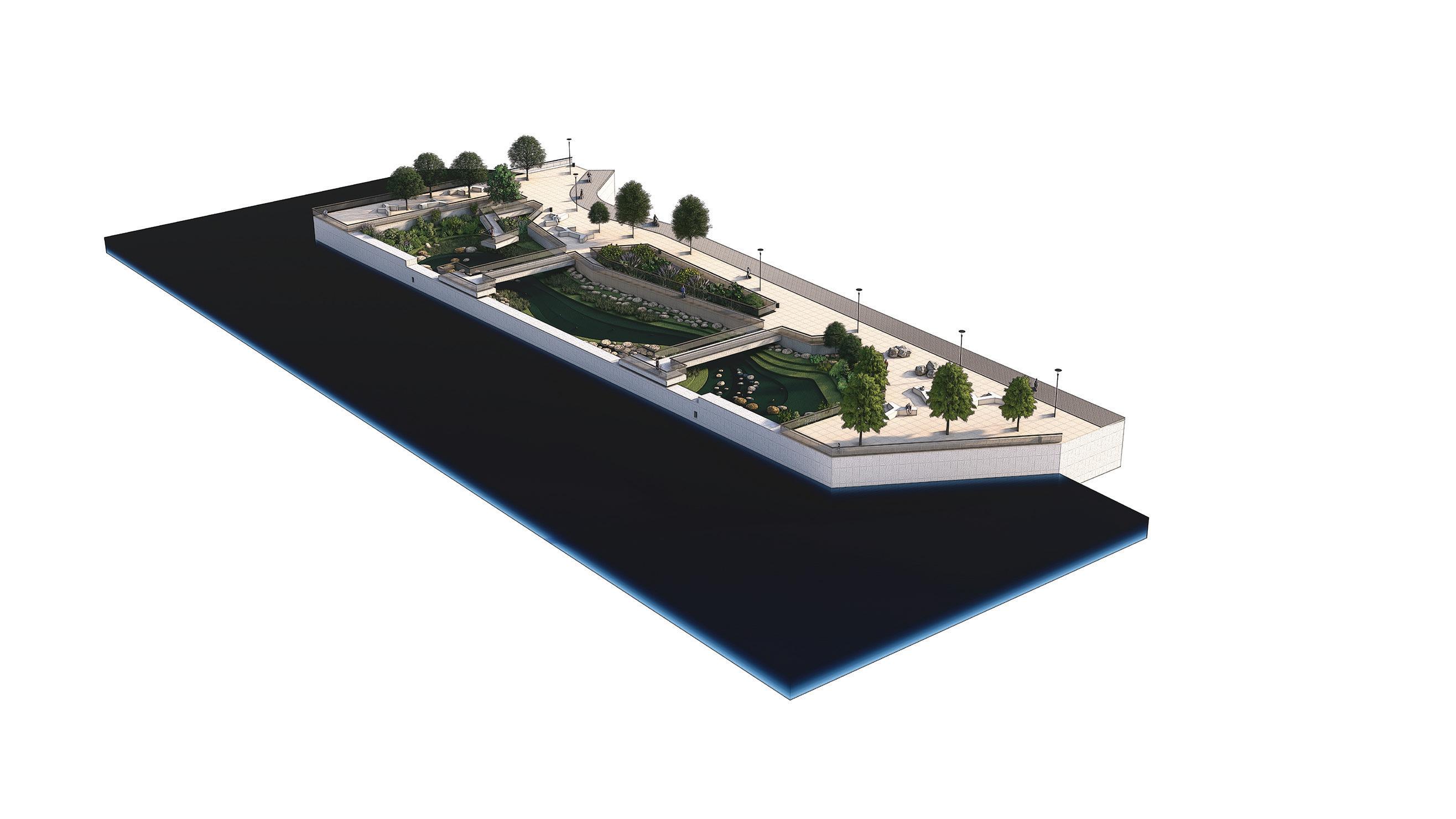
An series of analysis maps were produced to understand the connection of the waterfront and its relationship to the residents of the city. Union Dry Dock Yard, an abandoned ship yard, was discovered to be one of the town’s most desired space to be revitalized.
For our design, we decided to transform the abandoned dock into a botanical garden, use the piers to create views that frame the space, and transform the existing park into a tidal marsh.
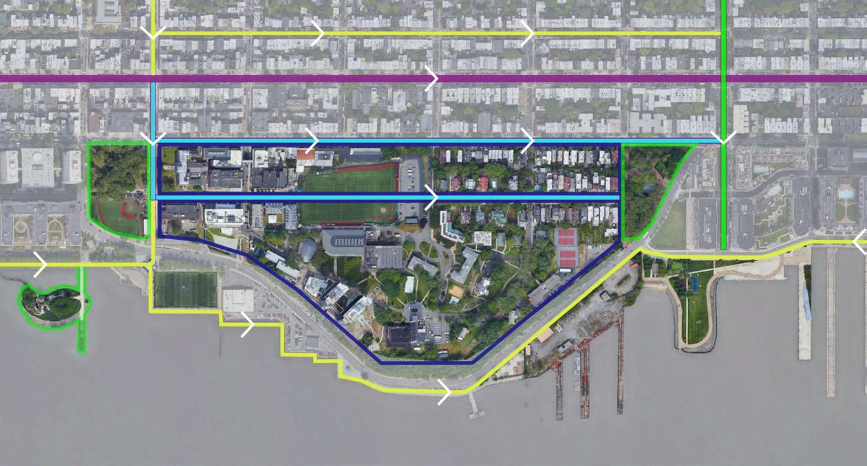
 Site location Map
Existing Park Union Dry Dock Yard
Site location Map
Existing Park Union Dry Dock Yard
10
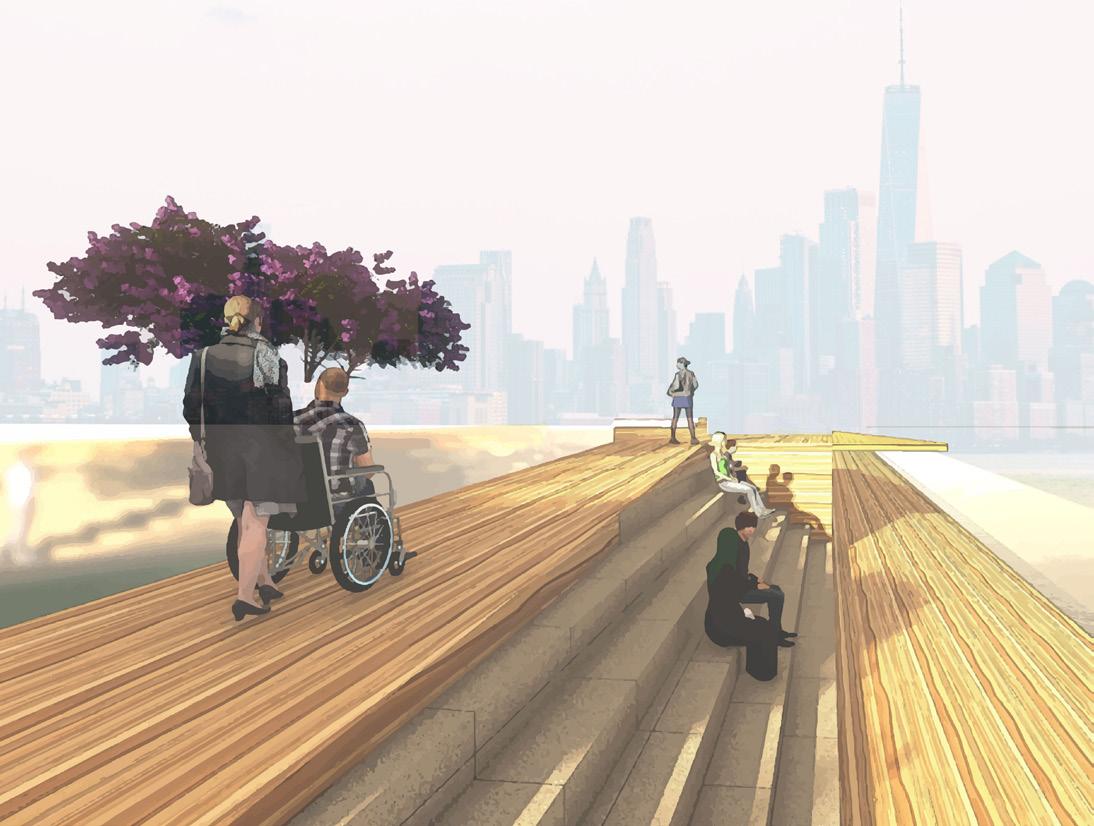
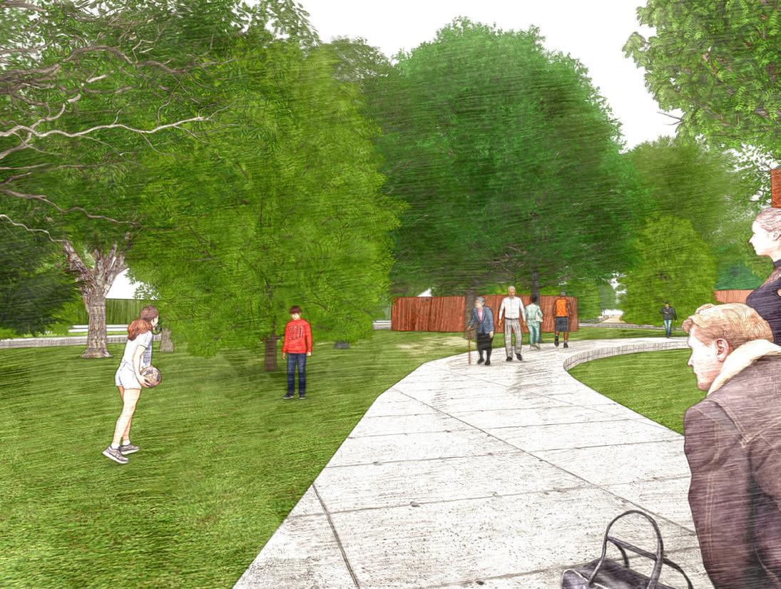
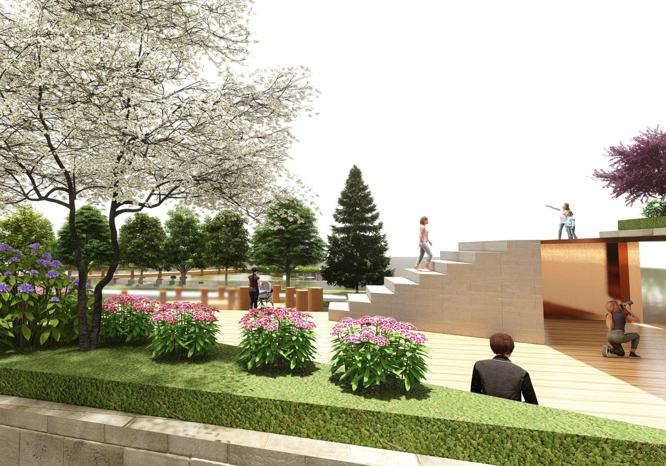
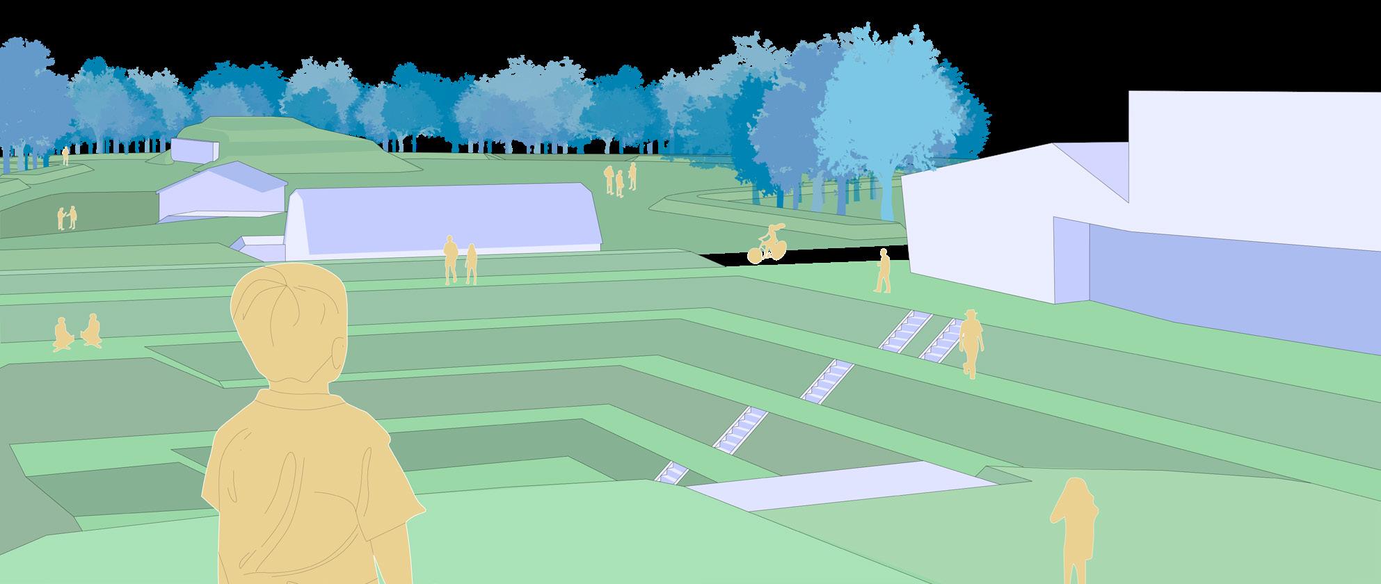
Lookout Pier
Tidal Marsh Park
11
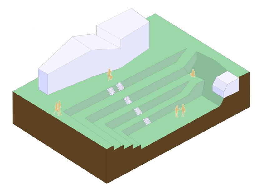
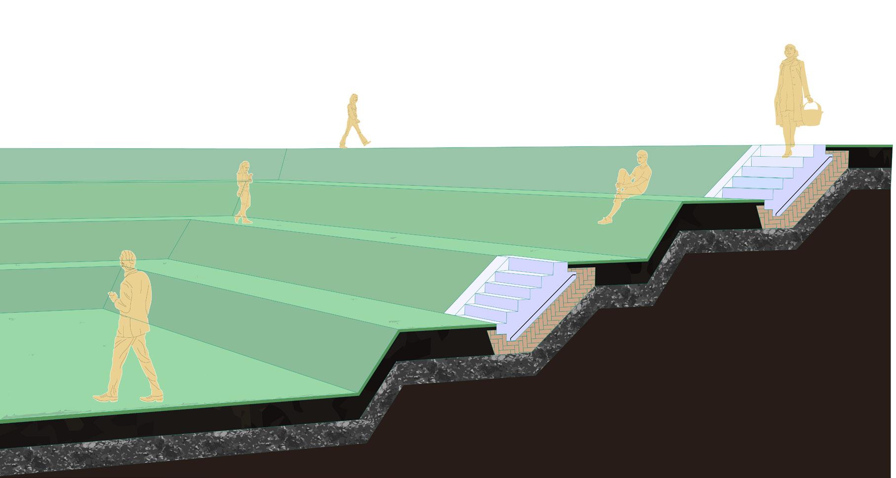
Botanical Garden
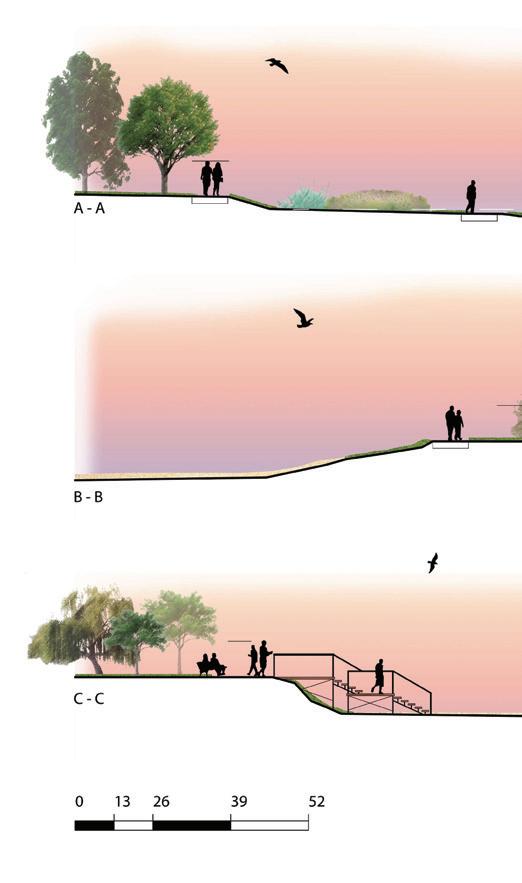
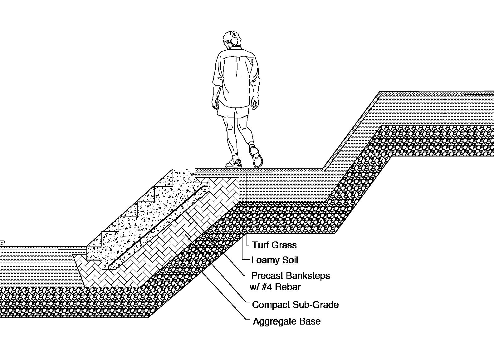
Park Sections
12
Proposed Design
Research and Rendering Case Study (Course Work)
Designed green spaces around the world
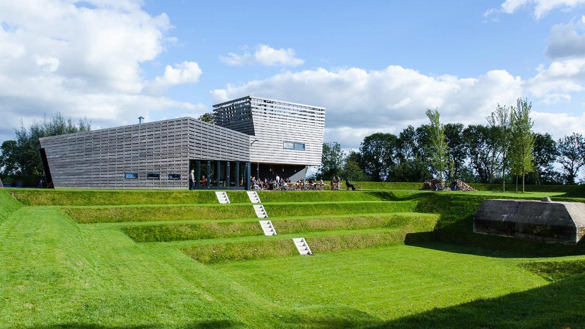
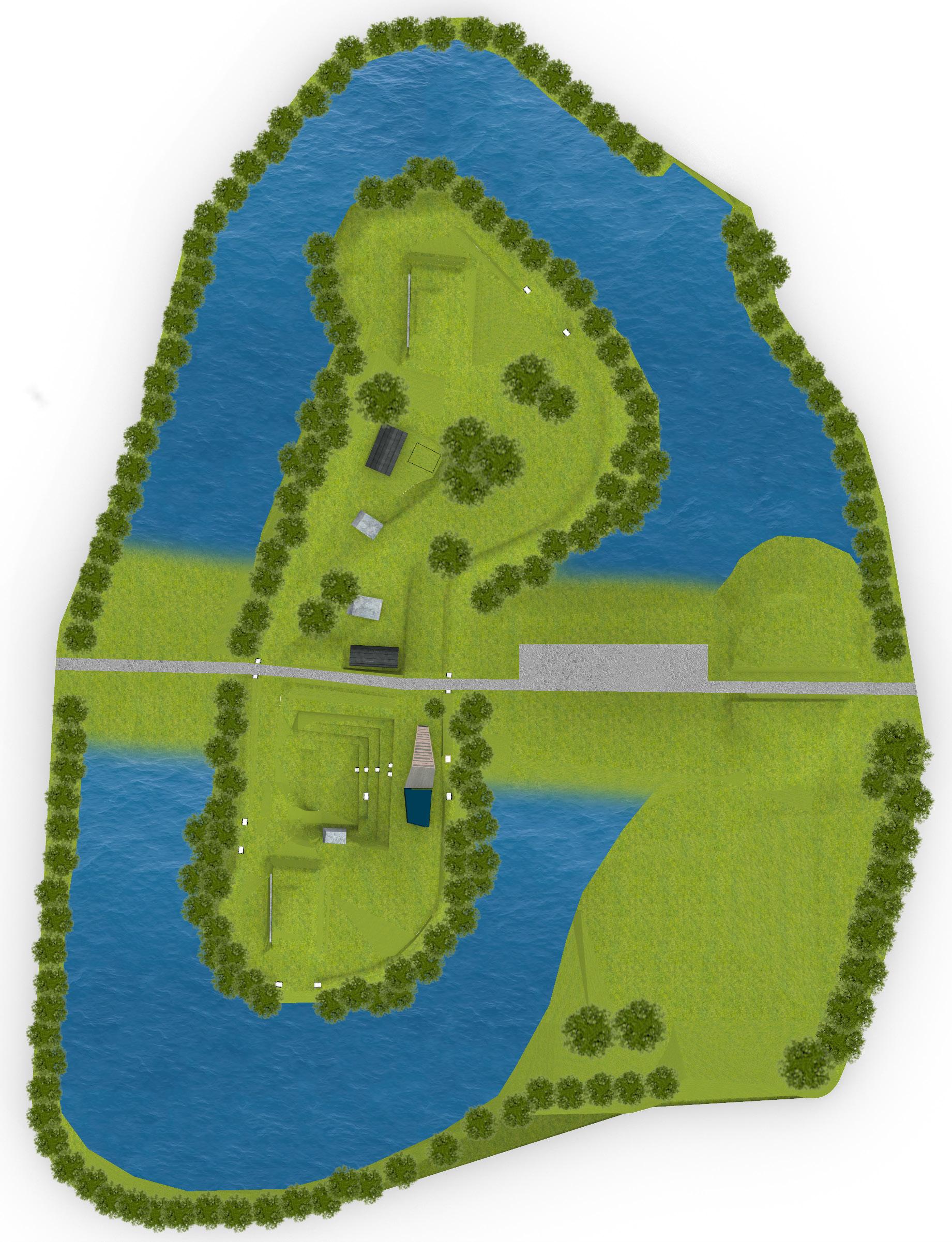
About the project: For this course, we were assigned to research a green space to render in Rhino and learn about it’s purpose/history. The green space I chose was Fort Werk ann het Spoel, designed by RAAAF & Atelier de Lyon.
An analysis of the space was made to learn about the contours of the terrain, it’s relationship to water and where it drains, as well as how people interact with the space.
The objectives were:
• Creating maps and diagrams in CAD
• Modeling the space in Rhino
• Research the history and intention of the design
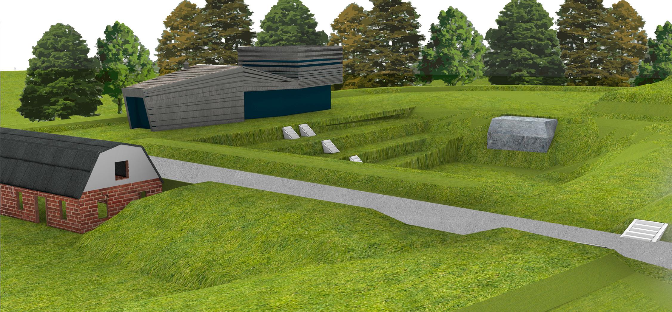
 Fort Werk ann het Spoel
13
Photo by: © Werk aan het Spoel
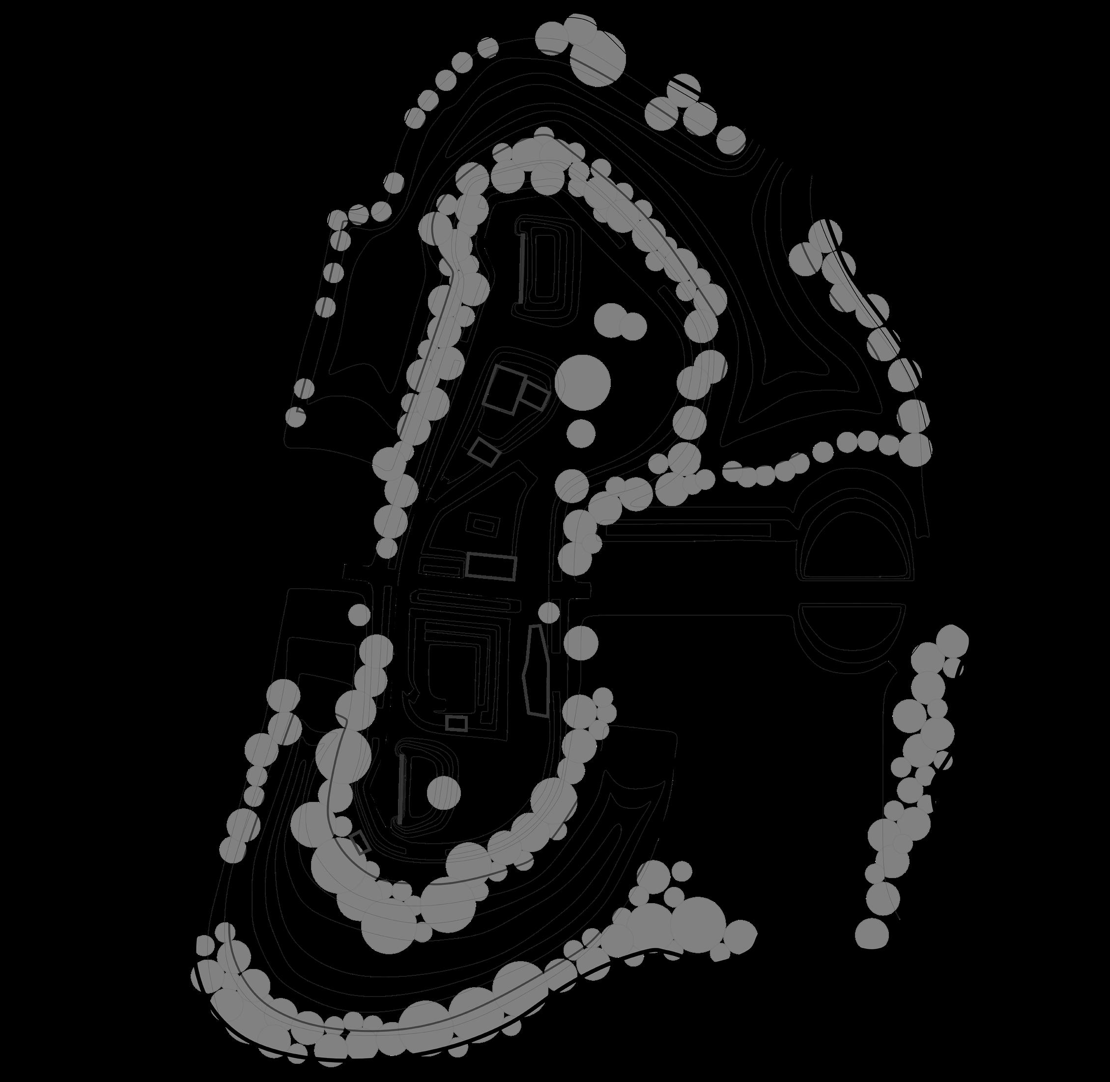
Buildings and road

Contours
Vegetation and water
Site Map
14
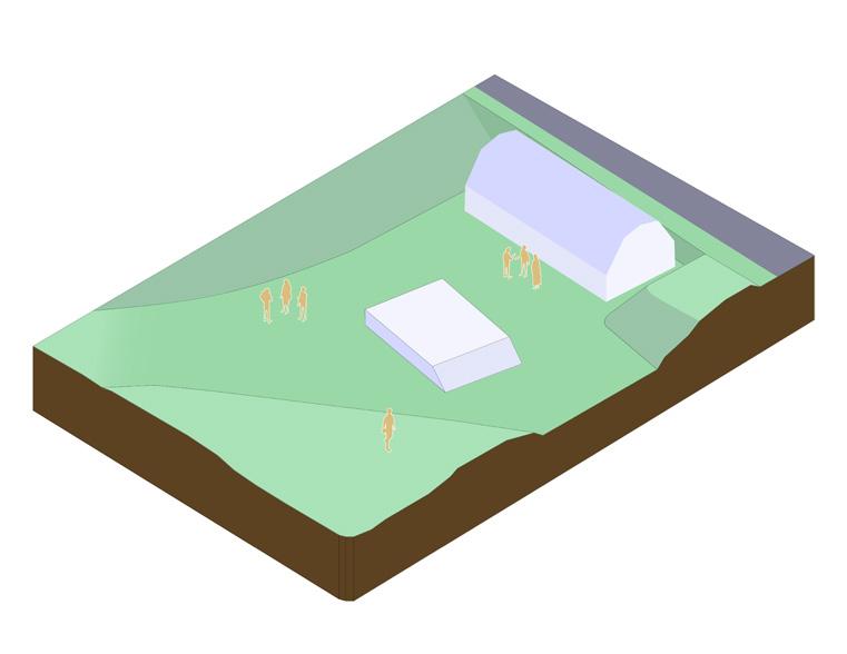 Restaurant and Amphitheater
Re-purposed bomb shelters
Elevated Paths
Restaurant and Amphitheater
Re-purposed bomb shelters
Elevated Paths
15
Community Buildings
Amphitheater Detail
Perspective Render Detail Perspective 16
Analysis breakdown
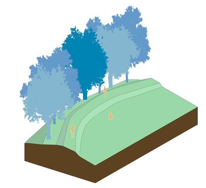
Topography:
History:
Structures:
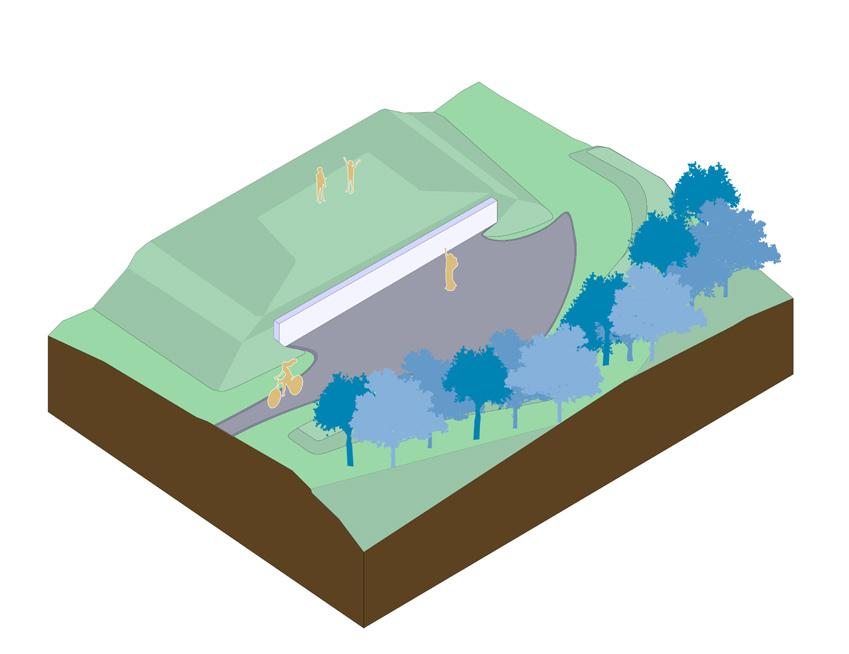
• The space consists of depressions and mounds with varying elevations.
• The depressions are artificial and are used to create man made lakes.
• Elevated paths frame and border the space.
• Originally, the site was a military defense fort designed to be inundated. The purpose was to create terrain difficult for intruders to enter through the waterline.
• Bomb shelters and buildings were preserved and renovated to be offices/spaces for events.
• Now the space is a public attraction of the New Dutch Waterline.
• Bomb shelters are now buildings for art and culinary classes.
• The amphitheater is an enormous grass sculpture that hosts events.
• A new building was added to be a restaurant/conference building.
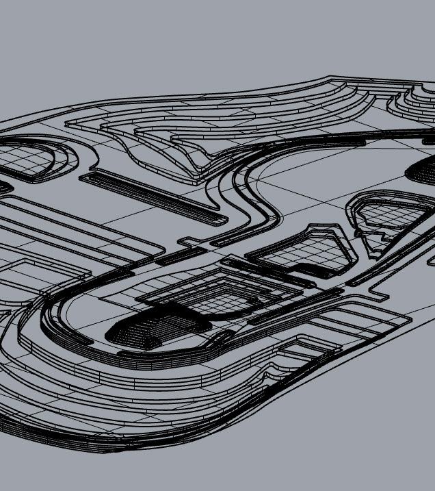
3D perspective (Rhino) 17
 3D Section (Rhino)
18
3D Aerial (Rhino)
CAD Work examples (Course Work)
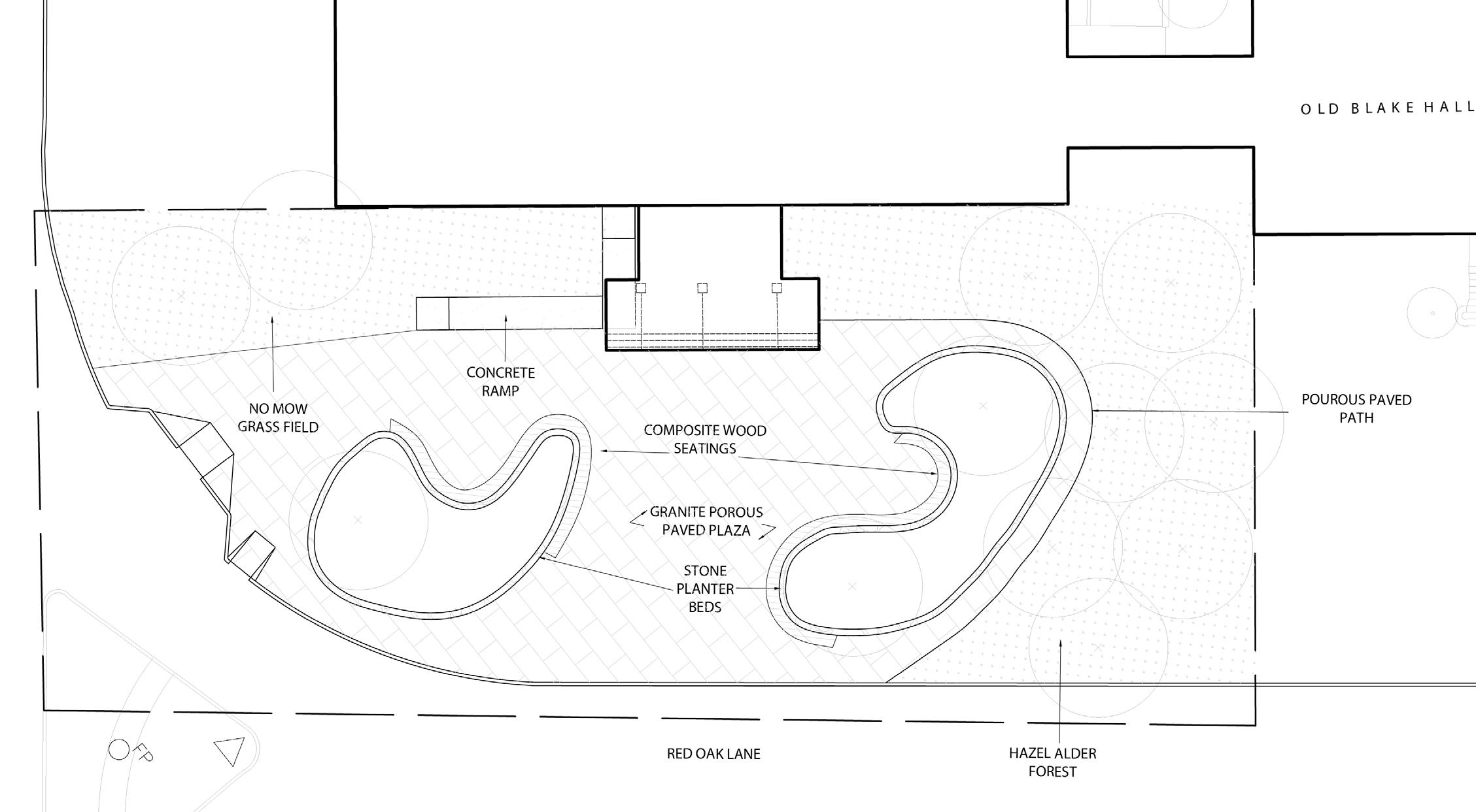
About the project: When design concepts get passed the conceptual phase, planning the construction of it follows. Construction documents are produced to assess the coordination and materials necessary to build the design.
For this course, the focus was to learn how to produce these documents.
The objectives were:
• Draft a design for Blake Hall entrance
• Create multiple CAD plans and sections
• Revise work based of critiques and redlinings
• Compile construction documents into a set
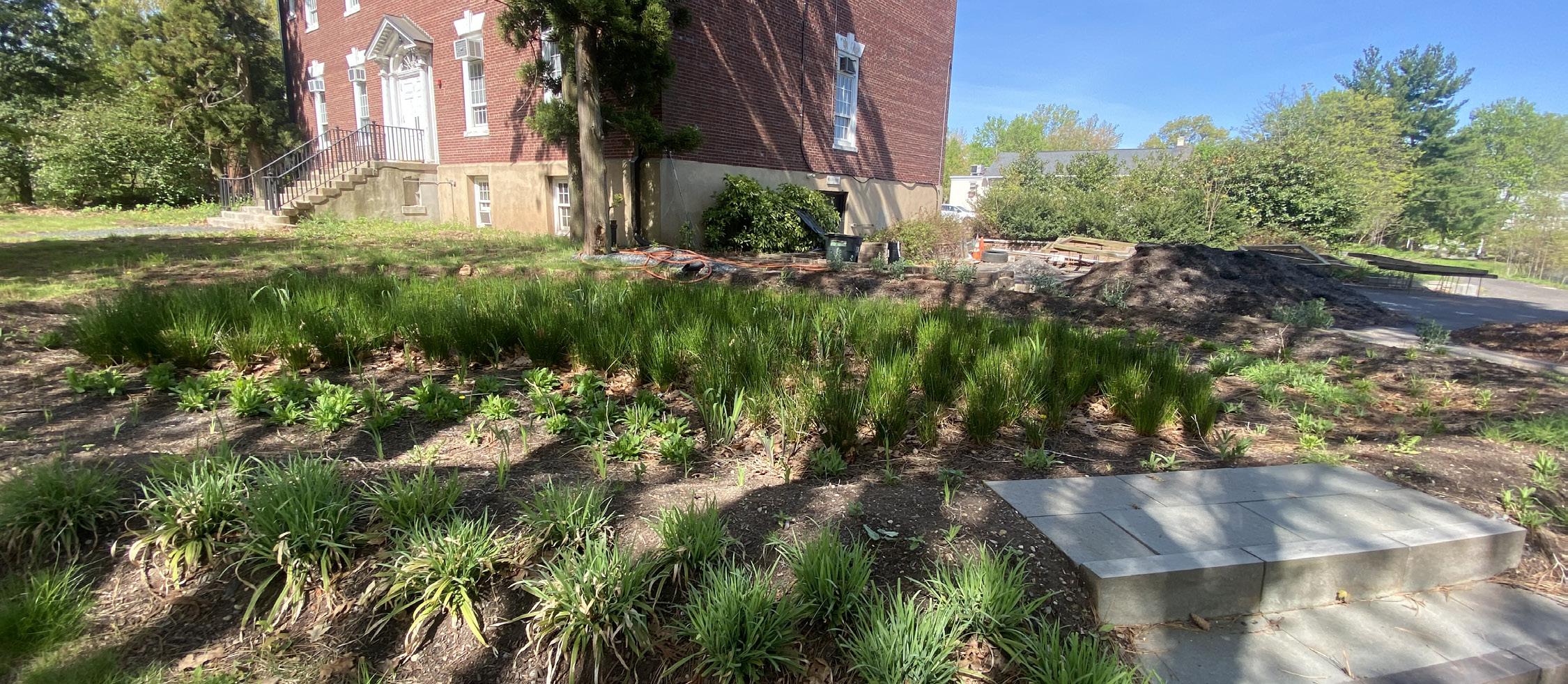
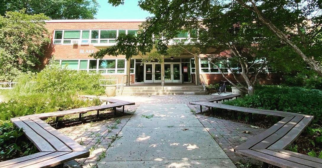 Photo by: Rutgers Department of Landscape Architecture
Blake Hall entrance redesign
Photo by: Rutgers Department of Landscape Architecture
Blake Hall entrance redesign
19
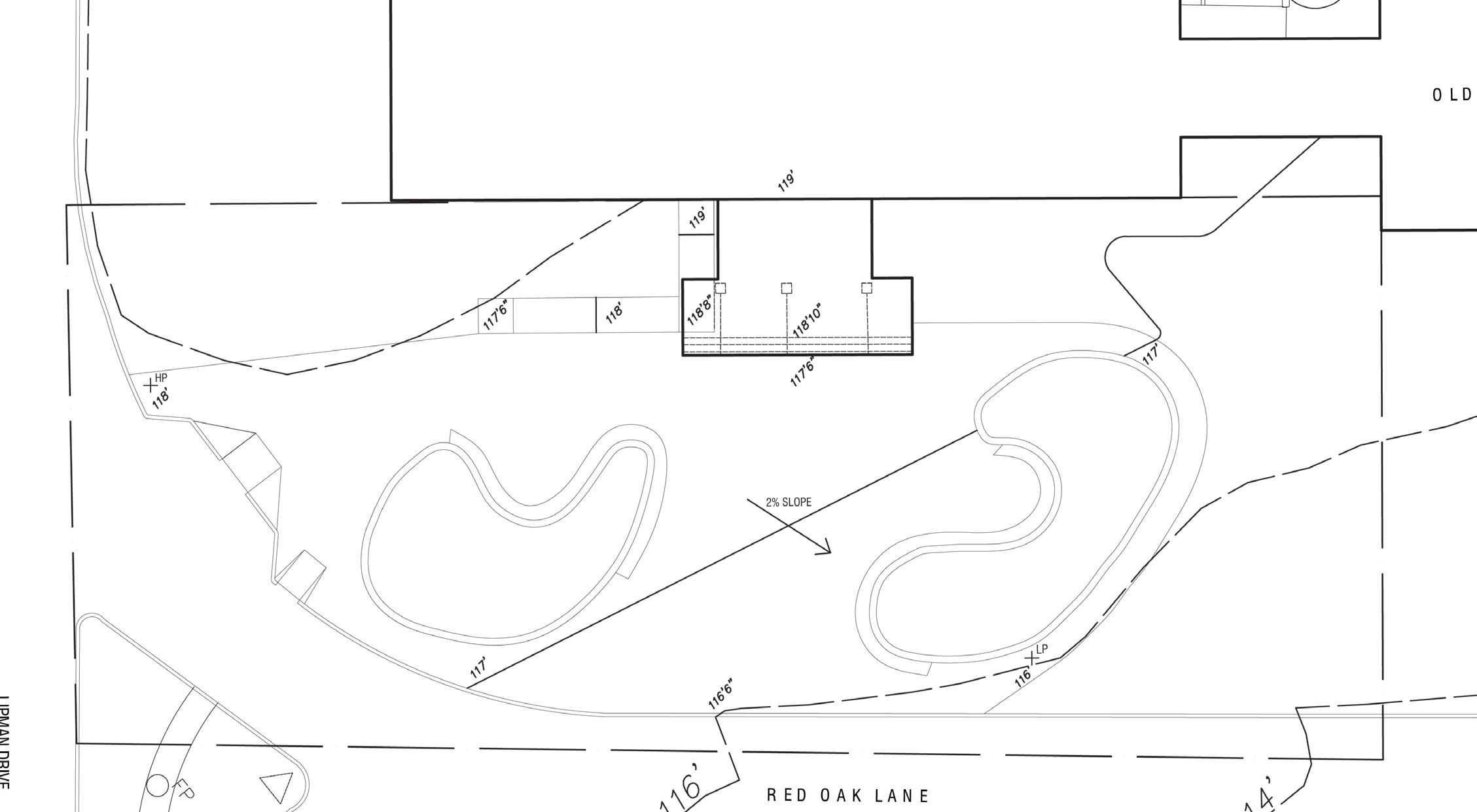
Blake Hall entrance
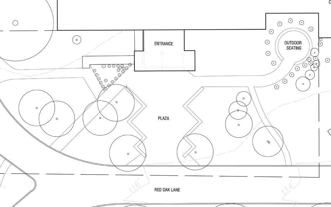
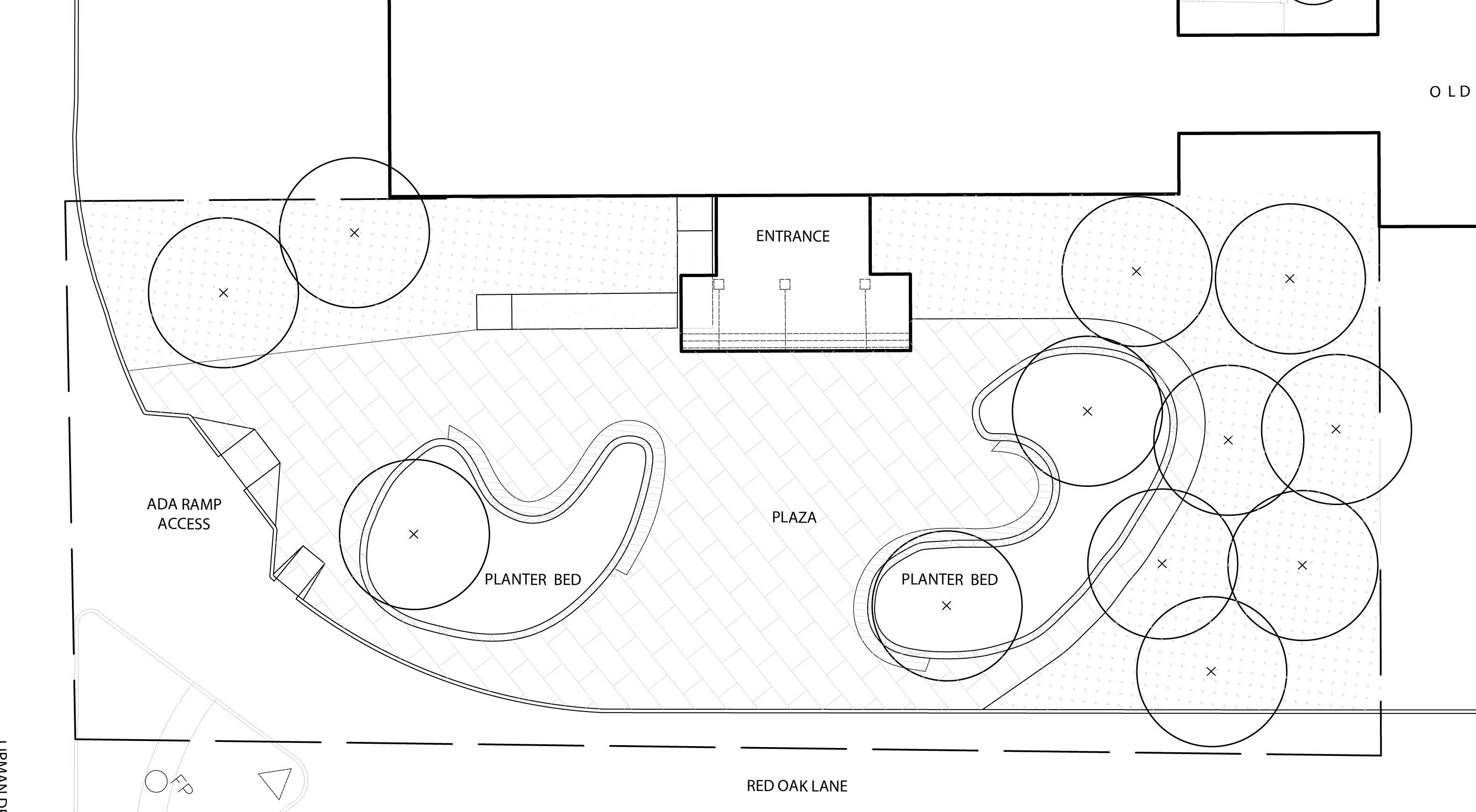
Site Plan
20
Proposed Design Plan
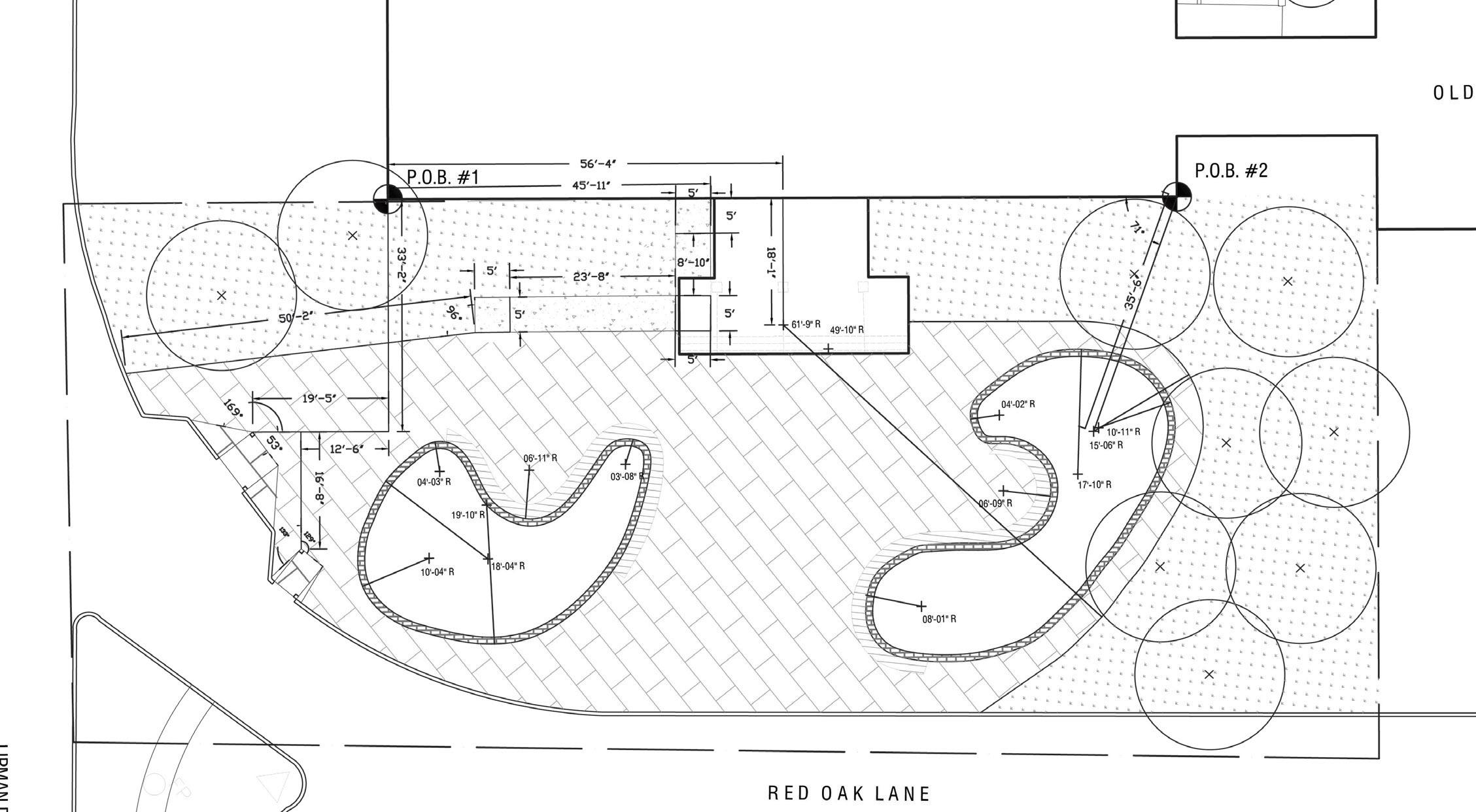
Layout Plan
21
Drainage Plan
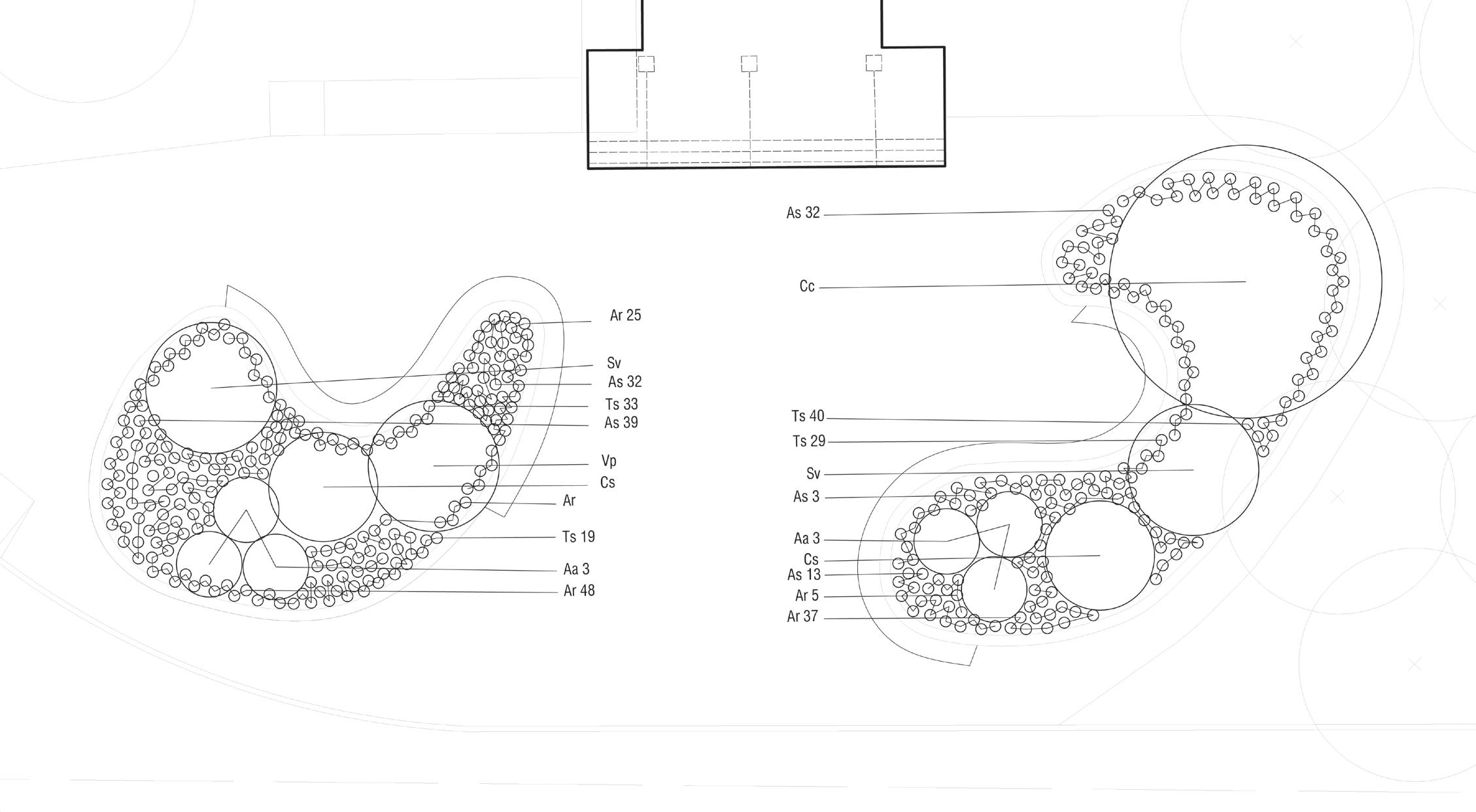
Planting Plan
22
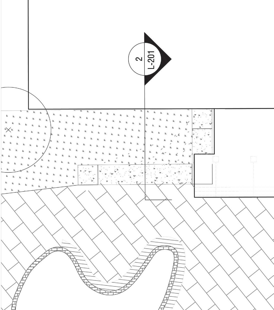
Material Plan
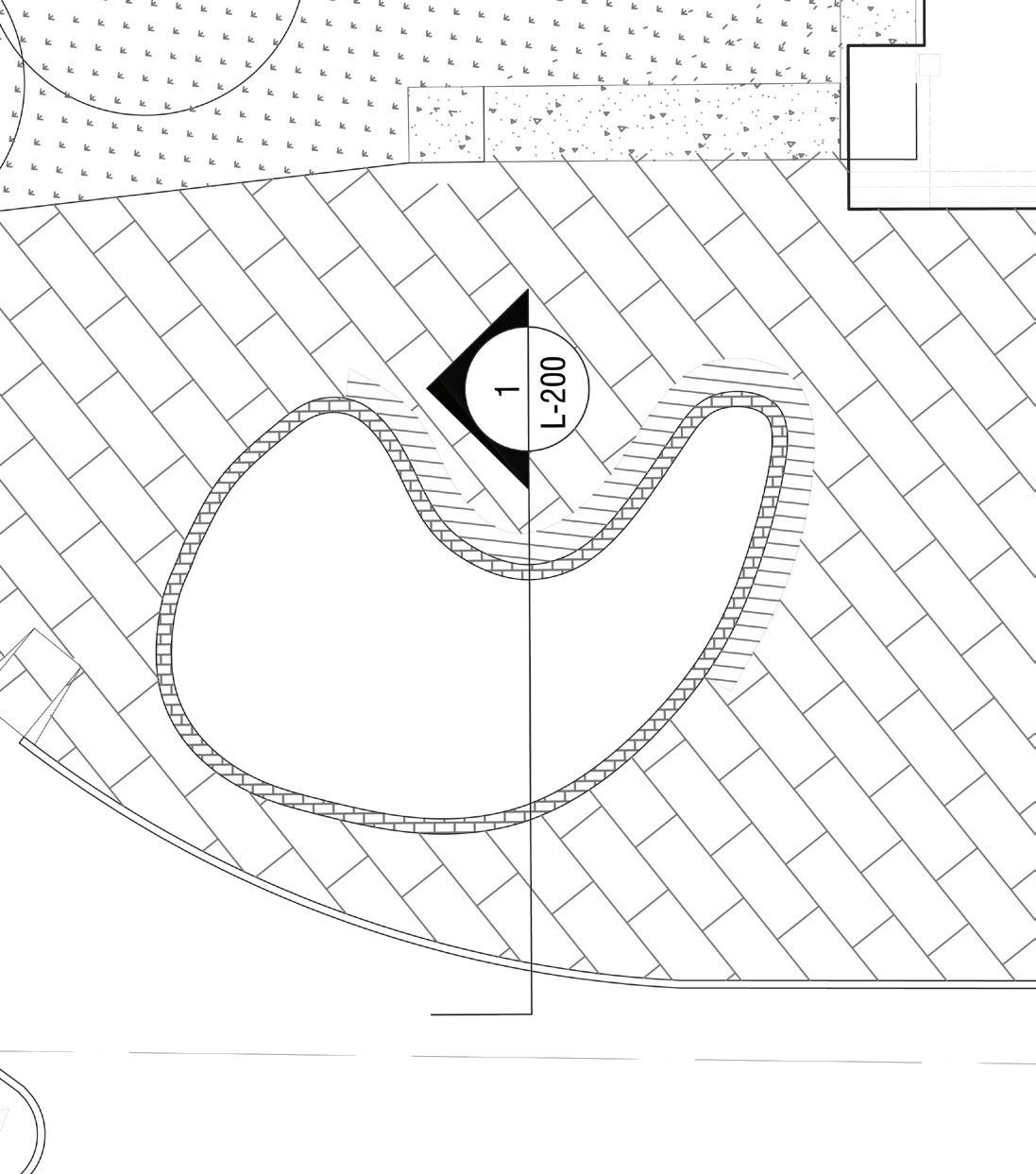

Enlargement Plan 1
23
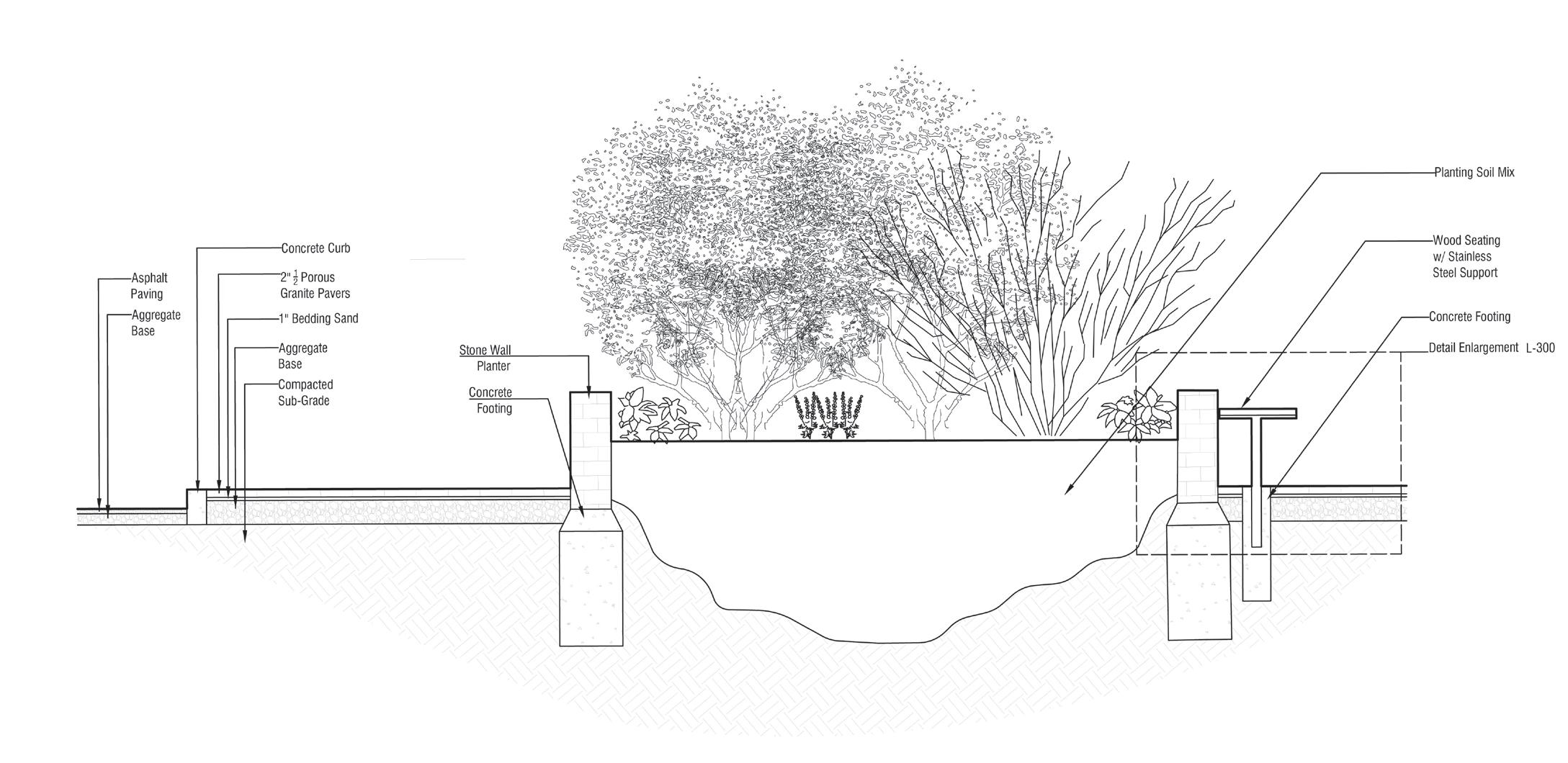
Section Detail 1
Section Detail 2
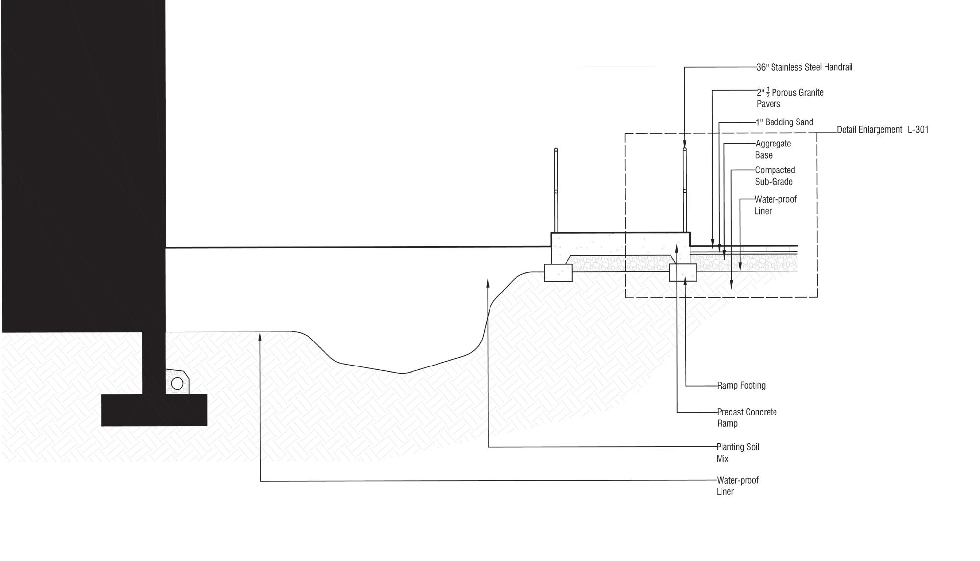

Enlargement Plan 2
24
Pocket park designs (Course Work)
Designing green spaces in the urban sprawl
About the project: Wood-bridge, New Jersey is an emerging transit village that is going through an urban revitalization During the peak COVID, people were reminded of the importance of outdoor spaces that would allow for interaction while maintaining social distance.
An analysis was made of the town’s amenities, green spaces, infrastructure, parking spaces and etc. It was discovered that Wood-bridge had an abundance of parking lots that saturated the neighborhood.
The objectives were:
• Creating analysis maps of the town
• Crafting a vision for the future of Wood-bridge’s revitalization
• Designing a master plan that would create a green connection throughout Wood-bridge
Location
Site
25
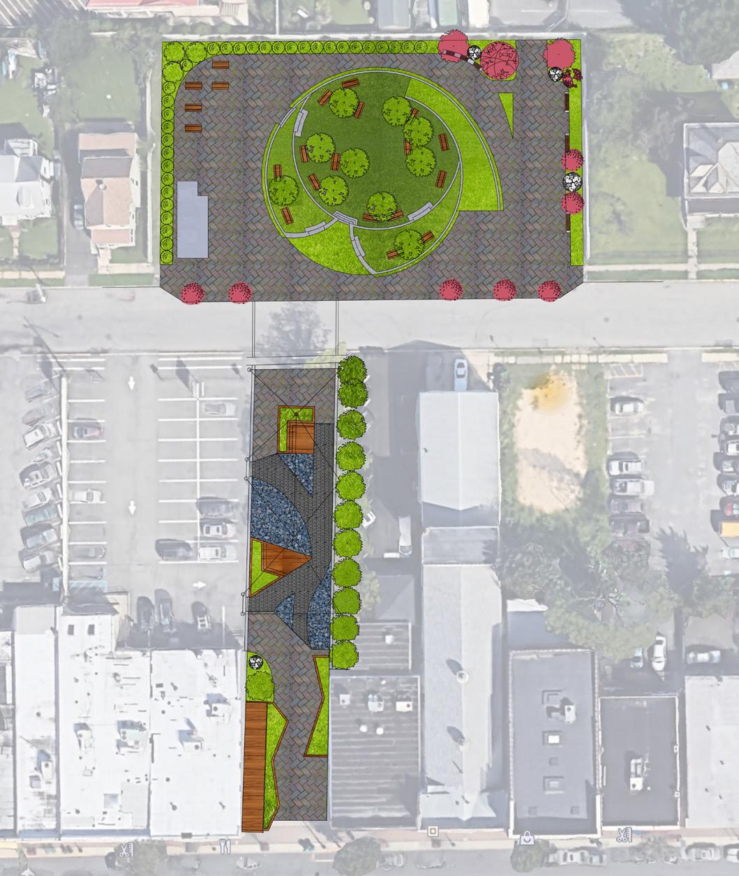
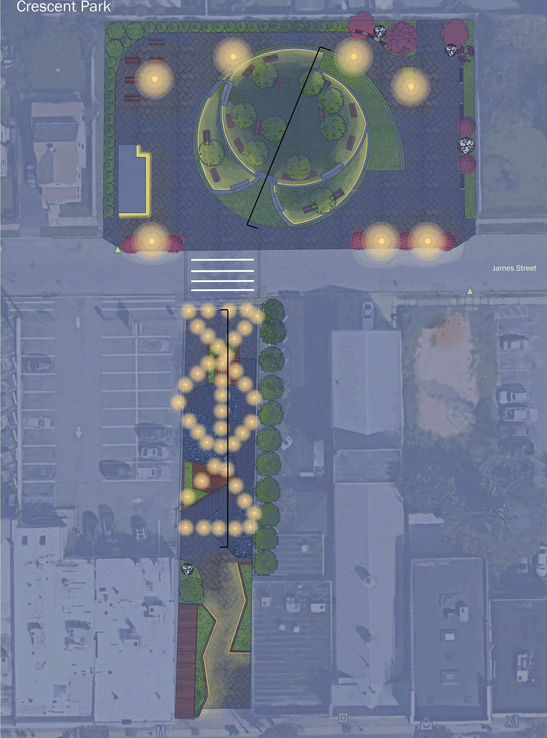
Project summary:
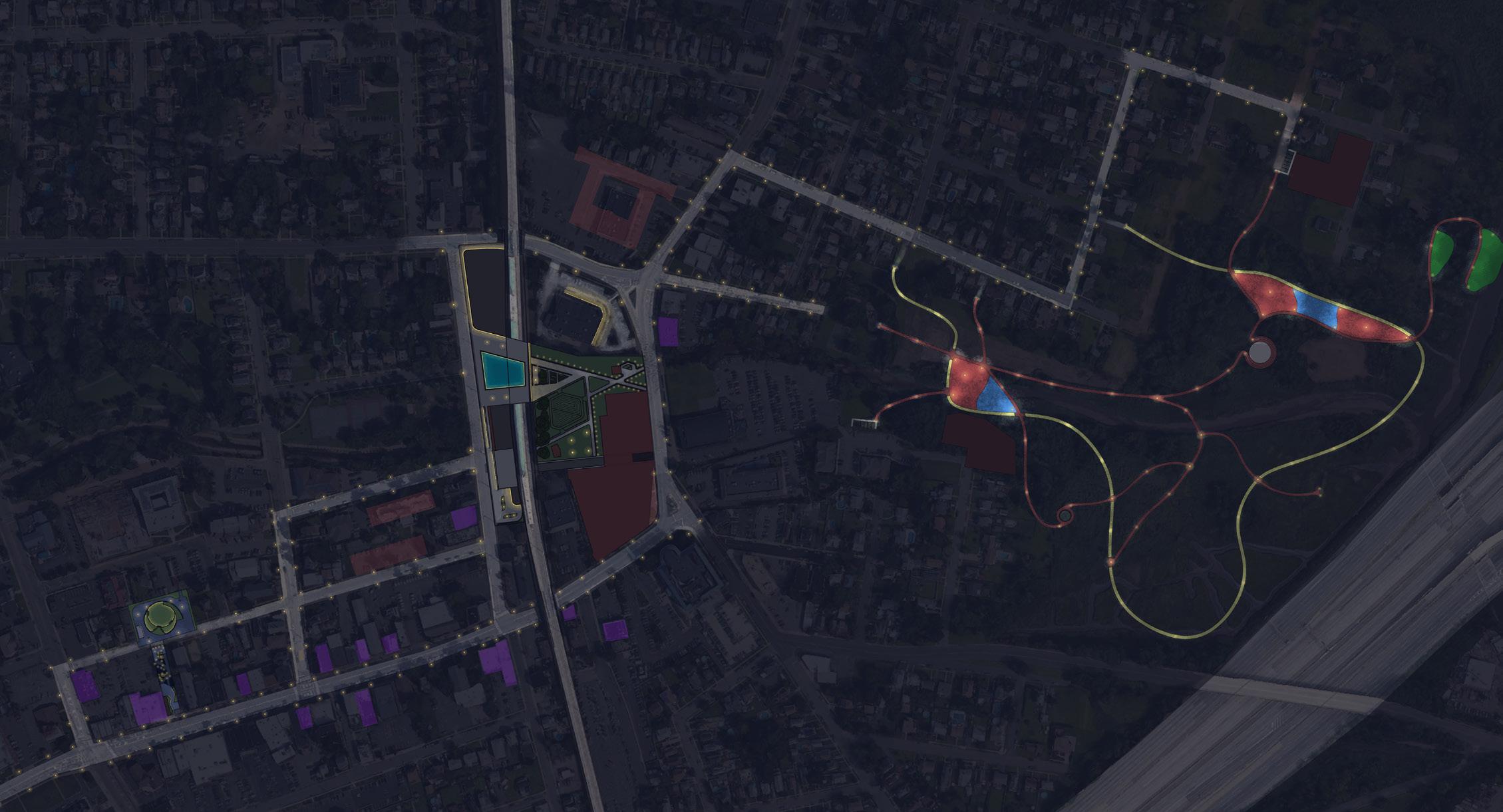
The master plan for Wood-bridge consisted a total of three locations that would promote outdoor activity during the day and night. For this portion of the master plan, a community green space and pocket park was designed to allow pedestrians on the main street to find an oasis of vegetation.
The community green space would serve as a playground that would have a concession stand and benches during the day. And during the evening/night, the space would be utilized as a beer garden for adults and provide an outdoor space for the night life.
The pocket park near the main street is a designed to guide pedestrians from the main street into the green space on the street above. It also functions as a resting place for pedestrians to take a moment to sit in leisure or as a landmark for people to meet.
Proposed Design Plan
26
Proposed Master Plan
27
Proposed design Plan
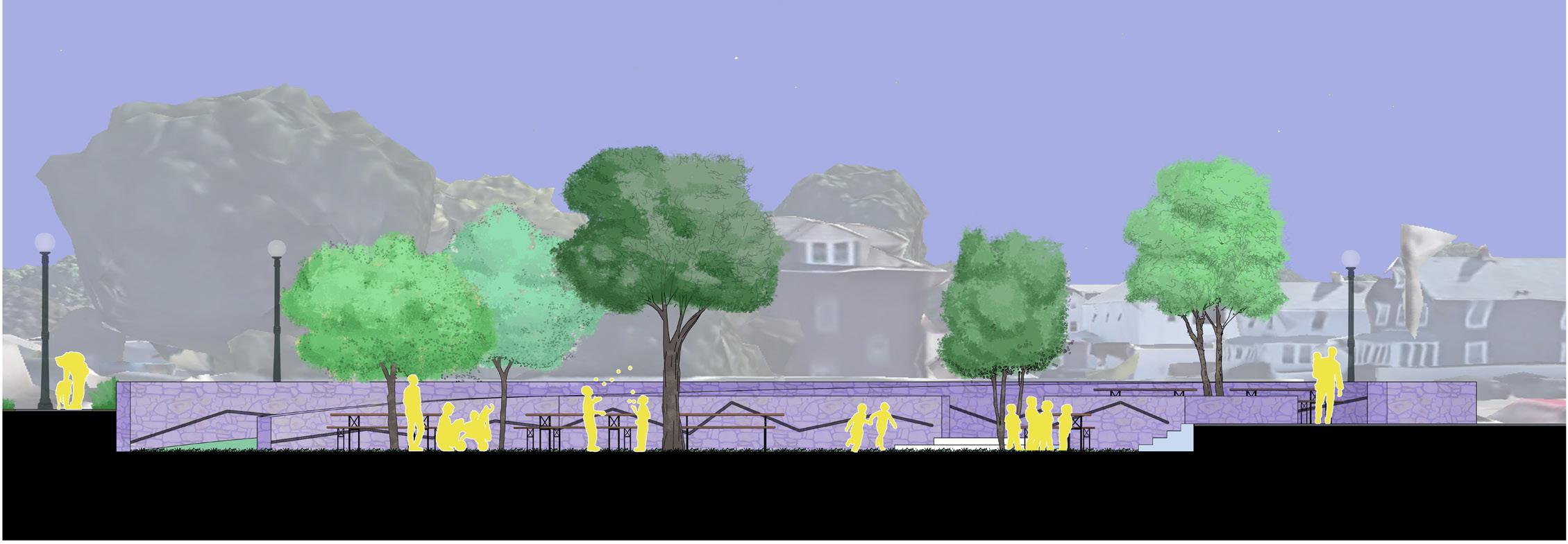
Beer Garden Section (Day)
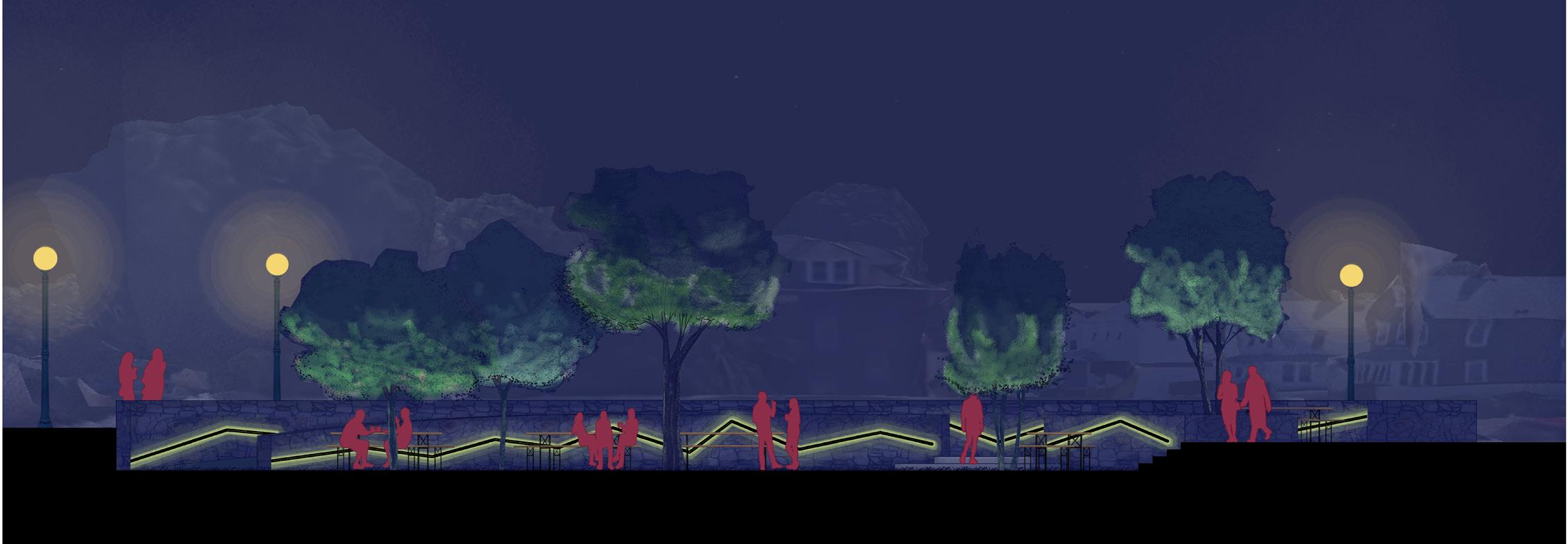
Beer Garden Section (Night)
Pocket Park Section (Evening)
28
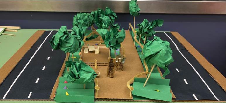
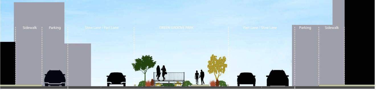
Project summary:
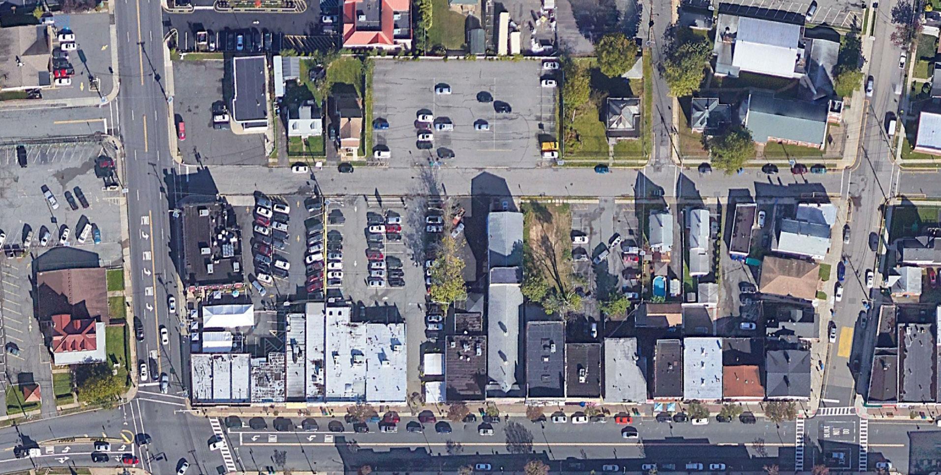
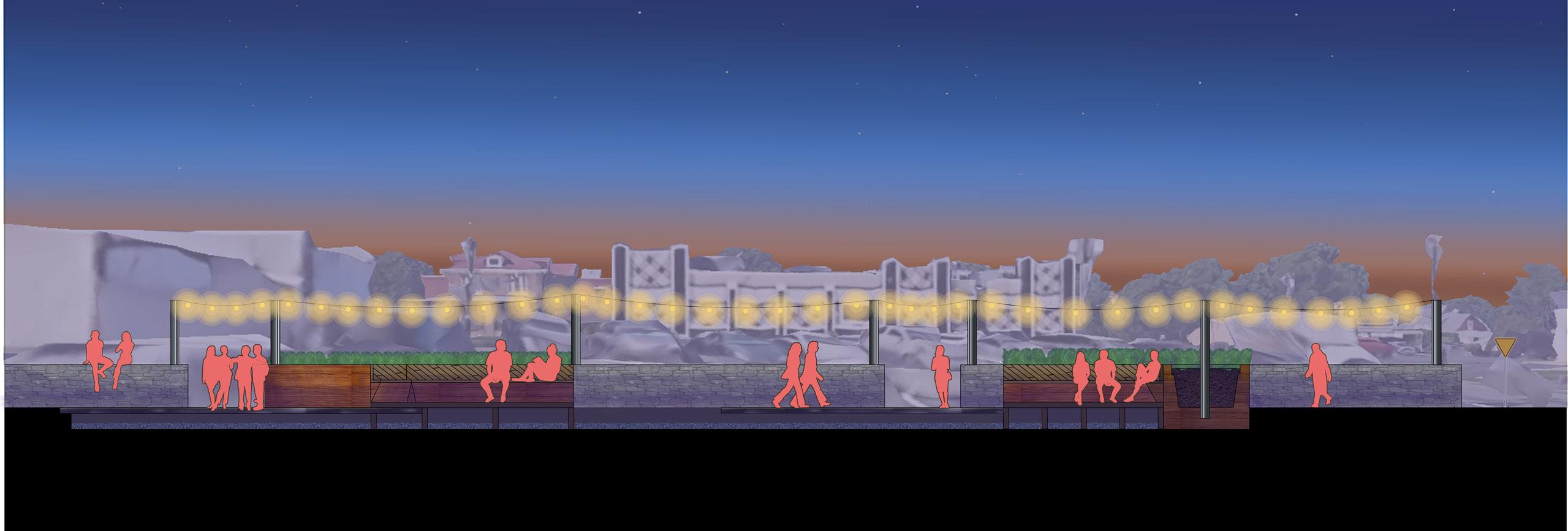
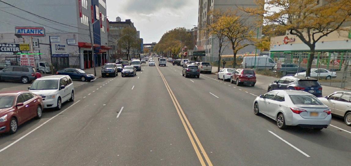
21st street Queens New York, adjacent to the Queens-bridge Houses, is a safety hazard for pedestrians and residents who regularly commute. It is a wide main street with long crossing distances and very few signals to control traffic speed or jay-walking.
To improve quality of life and promote safer commutes, a green “pedestrian path” was designed to intersect the existing street. This path serves as a pedestrian refuge and a green space. The refuge allows pedestrians to walk protected from traffic and soften the rigid views of the concrete heavy street.
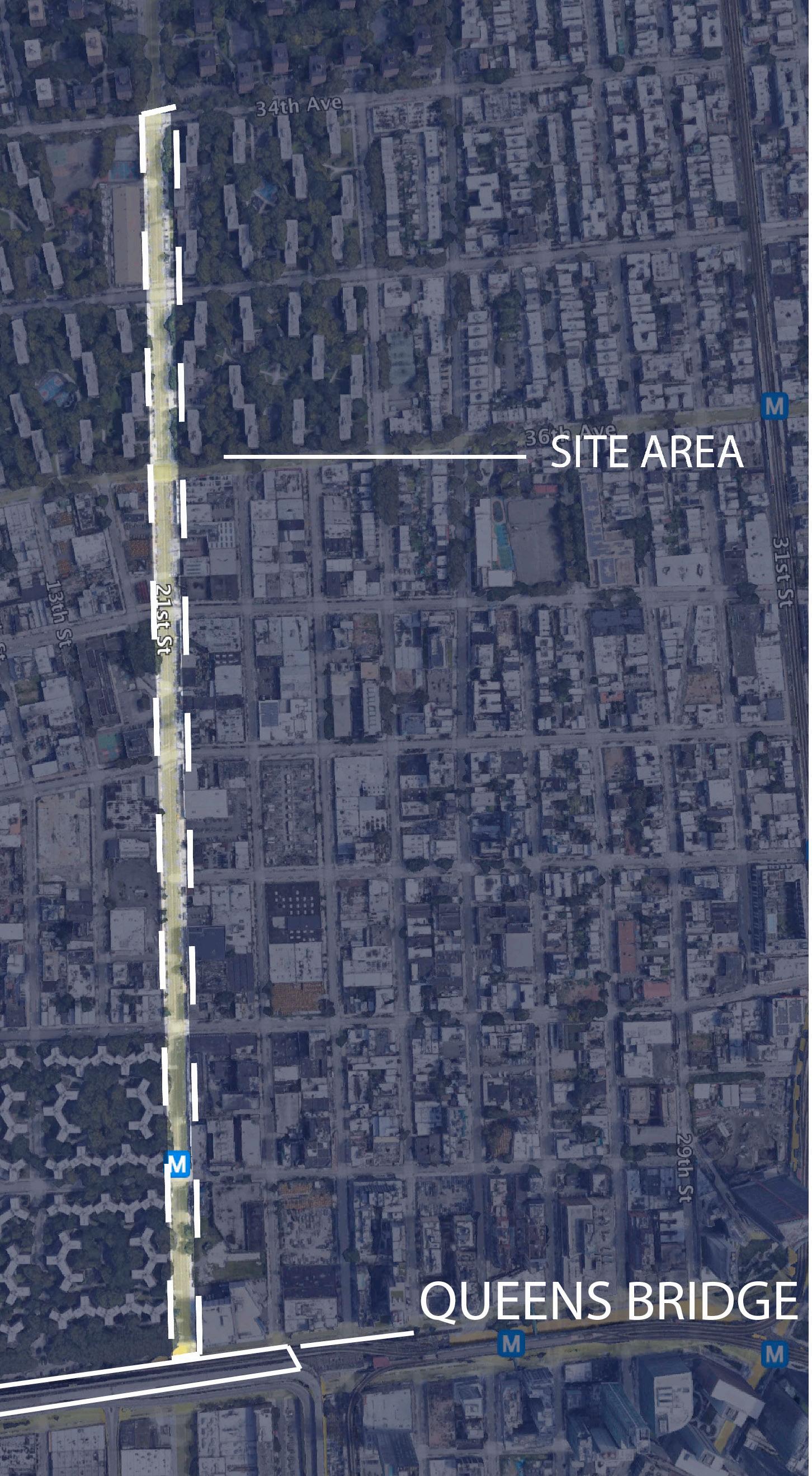
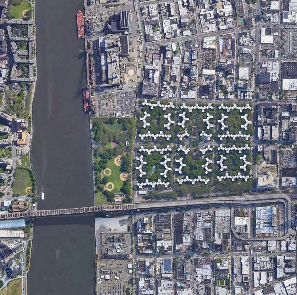
 Aerial View
Site Location
Aerial View
Site Location
29
Street View
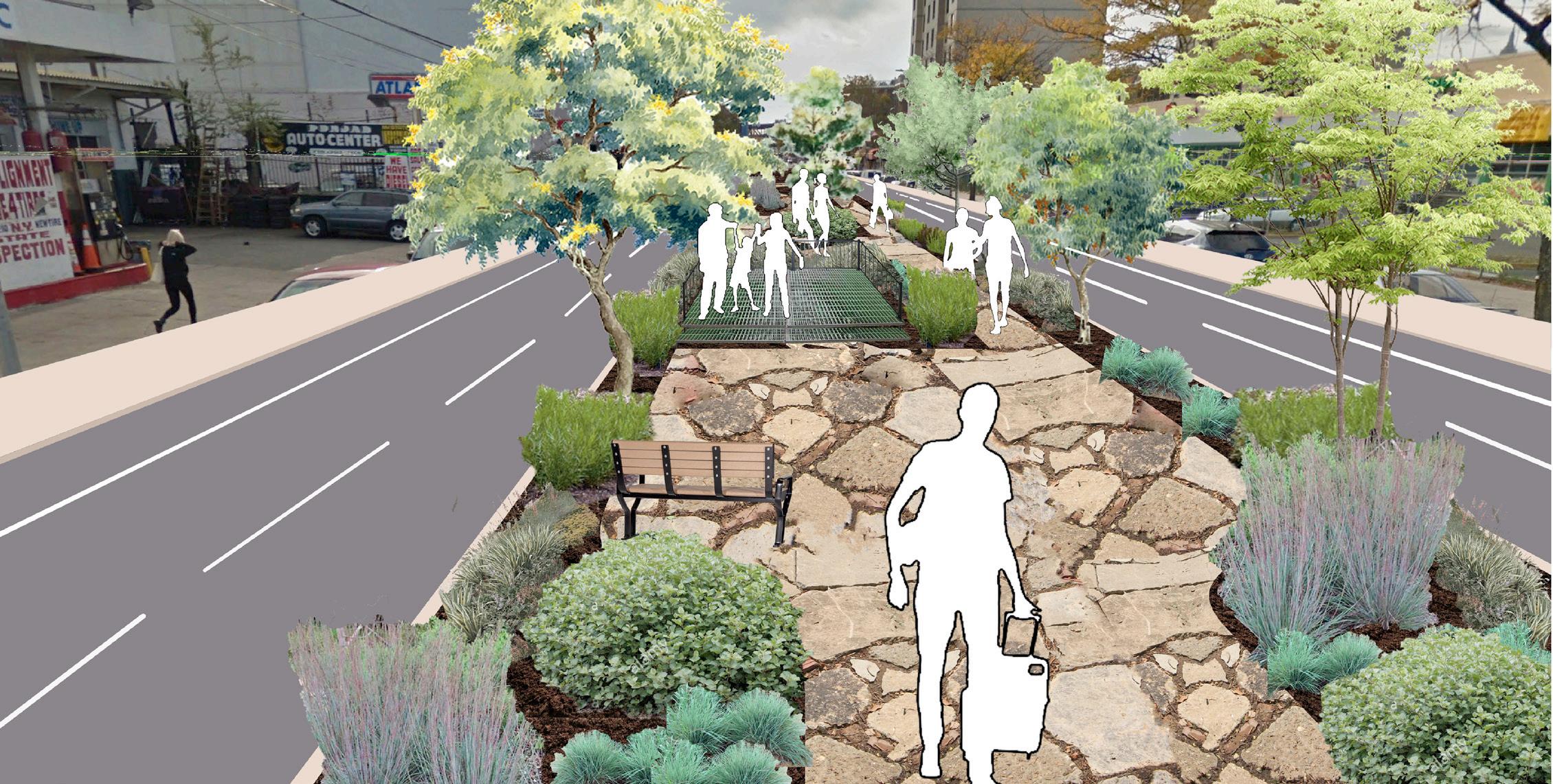
Render
Study
30
Perspective
Model
Section
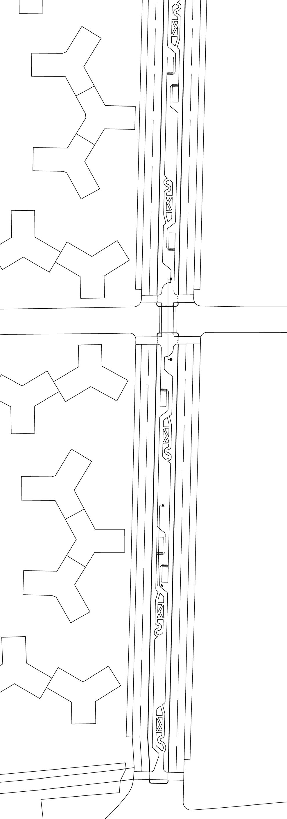
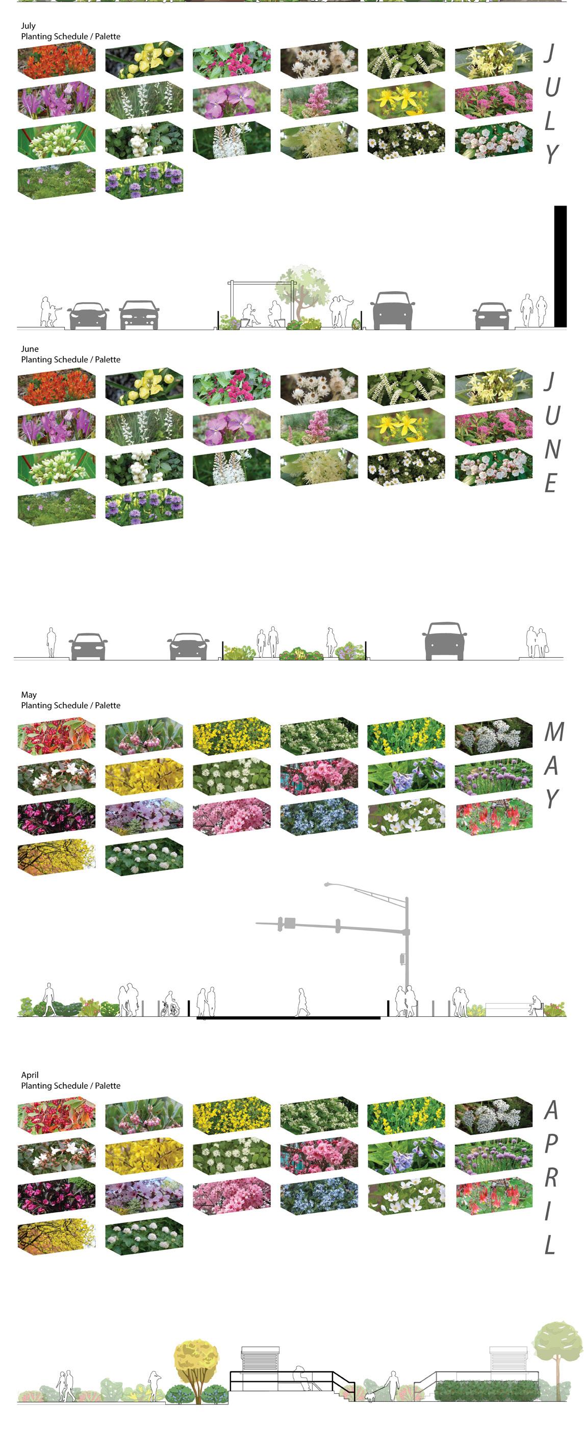
Site Plan Plant Schedule and Sections 31
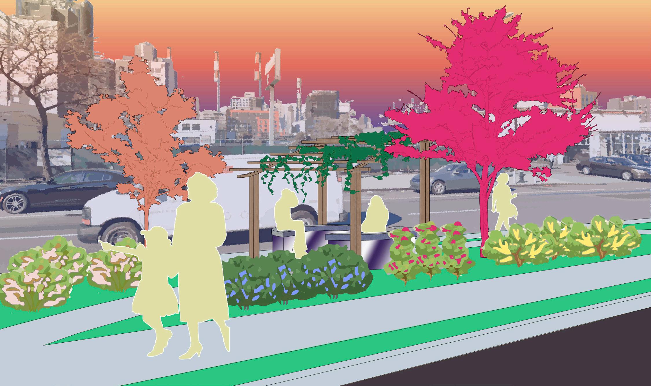

Perspective Render Perspective Render 32


 Landscape Designer and Landscape Architect
PORTFOLIO
Erick Garcia
Landscape Designer and Landscape Architect
PORTFOLIO
Erick Garcia