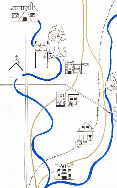
Portfolio
Urban Studies and Design
Emily Jackson DAAP
Education Skills Experience
The University of Cincinnati Cincinnati OH
Graduating 2025, College of Design, Architecture, Art, and Planning (DAAP), Urban Planning Major.
Participating in the Professional Practice Program, alternating semesters of classroom study with work in the field of design.
3.6/4.0
KU Leuven, Brussels BE
Fall 2023
Study Abroad
Centennial High School, Franklin TN
Graduated 2019
Professional Goals
My main planning interests involve environmental justice, place making, landscape architecture, and affordable housing am looking to gain more experience focusing on design aspects of planning as well as become more proficient with industry technologies like ArcGIS and Rhino.
Ricondo Inc, Airport Planning Intern , Cincinnati, OH
Co-op May – September 2023
• Collaborated and completed technical and analytical work with major airports such as Atlanta, Dallas, and San Juan.
• Worked across the country with different branches of Ricondo to assess flight schedules using Excel and adjust plane parking logistics for Atlanta using AutoCAD.
• Organized over 2000 files by reviewing them and assigning their subject and usefulness into an excel graph
• Green Umbrella, Communications and Graphic Intern , Cincinnati, OH Co-op August – December 2022
• Developed strong multi-tasking skills by working on projects with 6 environmental justice non-profits simultaneously. Green Umbrella is a non-profit incubator where created graphics through Canva and managed social media posts for the 501(c)(3)s.
• Encouraged community involvement at numerous city improvement project events that coordinated logistics for.
• Increased adaptability through day-to-day involvement with Climate Action, Cincy Food Policy Council and Common Orchard.
City of Centerville Planning Intern, Oh Intern for the Planning Department
Co-op January-May 2022
• Enhanced interpersonal and listening skills through extensive faceto-face contract with Centerville citizens where was in charge of communicating current permit and zoning details to city engagement meeting attendees.
• Researched and collected data on residential permit information, where then used InDesign to create and organize both digital and physical brochure platforms. This helped educate current & future homeowners on complicated permit information.
Table of Contents
Adobe
• InDesign
• Illustrator
• Premiere Pro ArcGIS Pro and ArcMap
SketchUp
AutoCAD
Designing impression, imageability, thematic, and analysis maps by hand
Creating horticulture perennial garden designs for mock clientele
Certificates Makerspace Lab
• Lasercutting
• 3D printing
• Sewing
• Woodworking A
• Soldering and Circuits
• Pursuing Revit and Lumion Certificates
Emily Jackson (615) 934-5303 jackse9@mail.uc.edu
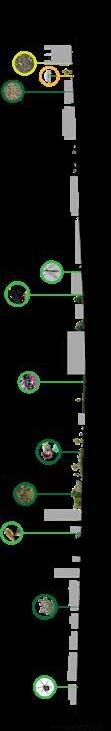
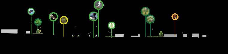
Site Planning in English Woods, Cincinnati, OH pg.12-13 Mill Creek Analysis and Strategy, Cincinnati, OH pg. 6-11 Specialized Certificate Skills Model Skills pg. 4 & 26
Garden and Landscape Design Hand-drawn Drafts pg. 14-19 Pacheco Proposal Brussels, BE pg. 4 & 26
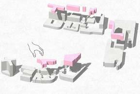
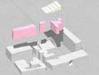
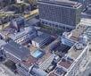
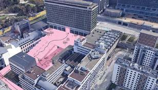
Brussels Studio Work - Fall 2023
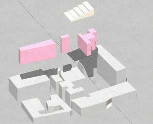
Proposal Area for Student and Resident Connection
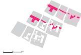
This project analyzes the relationship between street space, public space, and private space within the study area of the Pacheco space in Brussels. This map is inspired by a classic Noli Map to illustrate the different levels of open space and their functions.
Strategic proposals on the micro, meso, and macro scale were proposed in order to connect the buildings, blocks, and neighborhoods respectively. A larger green pedestrian “highway” connects the North and South open spaces like a taproot in the system.
This project used an industrial UV Printer to emboss the design in white and pink on the contrasting black background.


Process
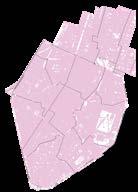
GIS Data from Belgian Database showing densification of Brussels.
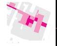
Inside the Block. Final Presentation for Brussels Studio
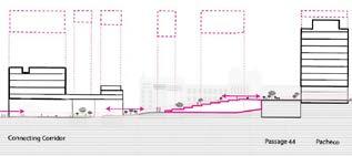
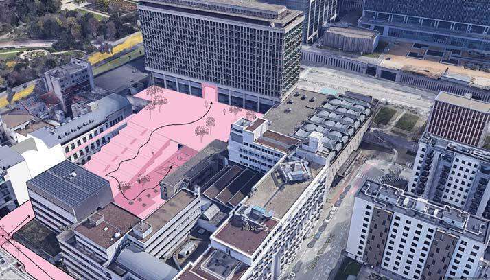
50 100 250m Between the streets and hidden spaces By inverting the map reveiling (semi-) public and private open outdoor space Between the streets and hidden spaces By inverting the map reveiling (semi-) public and private open outdoor space Strategic interventions Strategic intervention seeds are planted to ensure positive developement of identities and connection of the neighbourhood Open space Micro Corporate Bigger high rise buildings Larger streets between buildings High intensity car traffi Bigger hidden private open space Main activity offices and hotels Smaller low rise buildings Smaller streets between buildings Low intensity car traffic Small private gardens Main activity living Bigger medium rise buildings Pedestrian, walkable streets between buildings Few or no cars Shops on bottom floor Main activity: consuming Mixed buildings Mixed area Busy roads surrounding Heavy student foot traffic within the blocks Main activity: learning Residential Consumption Educational (Semi-) public open space Meso Private open space Macro FROM NEGATIVE TO POSITIVE space Open up underused space to connect identities between the neighbourhood, to ensure a vibrant spacial and socio-economic neighbourhood where education can thrive. Micro Meso Macro Emily Jackson, Floor Loos, Ubbe Vandenameele Sources Illustratorfile KU Leuven, maps.google.com, more sources here Between the streets and hidden spaces Function areas Strategic interventions Open space Mic o Corpor t Bi er high rise buildings La er e ween buildings Bi er hidden pri at open space Smaller o rise buildings Smaller e ween buildings Small pri ate dens living Bi er medium rise buildings ede trian, wal able ts ween buildings w or no onsuming • Mi ed buildings • Mi ed ea • Bu oads sur ounding • within the bloc (Semi-) public open space Meso Pri ate open space Macro mily Jac son, Floor Ubbe Vandenameele Sou ces Gehl, Jan. een Buildings: Using ublic Space. Washin on C.): Island ress, 2011. ,2002. FACULTY ARCHITECTURE 600 HA KU LEUVEN CITY & UNIVERSITY Studio Brussels 2023-2024 Group ABSTRACT: Student population in Brussels will keep increasing untill 2050. Learning will become more digital and individual. The world needs to adapt to these conditions and this implies significant increase in need for flexible spaces and shared facilities The analyses establishes that on the north side of the Kruidtuinlaan there are inner court yards with mostly qualitative green and on the south side the area mostly mineralized and most inner courtyards lack quality. Additionally there are buildings which functions are the end their life cycle, such as shopping malls, large parking lots and monofunctional office buildings. This poses threat to the available space an already dense area. This project aims to connect academic sites with buildings with adapted programs and the lost historical east to west connexion. doing so, inspiration was drawn from historical Brussels qualities, particularry its galleries. Through extraction of the building blocks, alternative pedestrian routes are created with quality inner courtyards, sunlight exposure is increased and flexible, mixed and shared spaces are incorporated. INSIDE THE BLOCK EXTRACTING THE BLOCKS: concept image Inner spaces east-west connection Building blocks Extraction Creating places by extraction Jackson Emily, Loos Floor, Vandenameele Ubbe cluster pacheco Historical east-west connection Densification Needs Brussels Through inner blocks Existing street HISTORY OF THE BUILDING BLOCK BRUSSELS WHY INSIDE THE BUILDING BLOCK EXTRACTING THE BLOCKS 100 qualitative green inner spaces filled inner spaces Growth student population Less need commercial office spaces FACULTY ARCHITECTURE 600 HA KU LEUVEN CITY UNIVERSITY Studio Brussels 2023-2024 Group SECTION Scale 1/750 SECTION Pacheco City Passage Conference Center Pacheco Connecting Corridor Legend Connection Connected innerblocks Covered Extracted buildings The master plan for this project focuses on extracting buildings and forming covered corridors to create new places within the city blocks and connect them easily. We want to reconstruct the spatial reading of the area through new facades and clear pathways between blocks. The blocks connected to the student space will promote multi functional corridors and inner block spaces as well as programs to encourage student integration into the local area. The lateral project lines repeated throughout the master plan reflect the historic east-west connections of the area. The creation these spaces and pathways between them serves to manifest meeting places for students, bring natural light into the inner blocks, and grow the quality of the spaces through programs and spatial interventions.
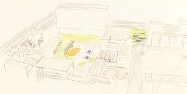
The final project represented proposals to transform the scattered campus space in a way that my group saw important. We tackled topographical challenges of the region along with creating third places for students and residents through east west pedestrian connection. worked in AutoCAD and Illustraotr to create 3D renderings of building extractions and elevations like the top one of the second page showing the change in buildings and topography. of how open space will be created through the extraction of buildings.
Inside the Block.
Final Presentation for Brussels Studio


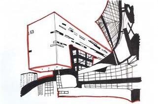
Individual spread for project. My personal proposal involded restructuring academic buildings in order to make space for a large stair like structure not only for students to use like a courtyard but also to form a pathway from the campus to the inner pedestrian pathways of the city. There are several different universities that neighbor each other and a universal campus space would provide a sense of unity and identity in the students within Brussels.
Staircase in Individual Strategy.
Conception to Proposal.
Brussels Studio
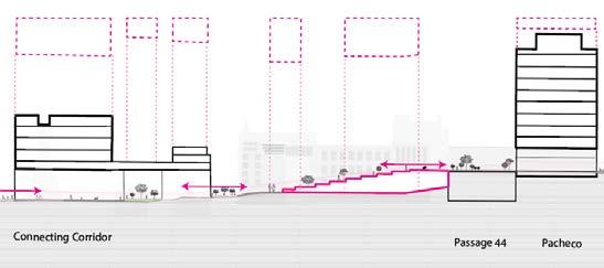
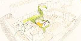
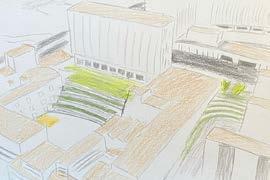
600 HA KU LEUVEN CITY UNIVERSITY Studio Brussels 2023-2024 Group Detailed Intervention 1 SECTIONS: DEMONSTRATING THE SUBSTRACTION AND UNIQUE SOLUTIONS TAKING THEIR PLACE INTERVENTION: 3D DESIGN CONCEPTUAL EXTRACTION AND ADDITION OF NEW FUNCTIONS PACHECO CONNECTING TOPOGRAPHY Self Portrait Jackson Emily SELF PORTRAIT: DAY IN THE LIFE OF STUDENT AT THE PACHECO CAMPUS Connecting Students to an Enriching Environment Sciences PO Paris Academic Communal Area Welcoming Corridor Plan: Before and After The intervention found in this area consists of the blocky terrace like steps leading from the future common area courtyard to the garden behind Pacheco. This interventions goal to erase the divisions between institutions and create unified community for all the academics in the area by providing space where all academics can connect. The steps represent more than means of topography connection, but can provide space relax between classes, meet with friends, or study! The space would host variety of activities with tables, sport courts, shaded areas, and community garden. The inspiration this comes from the Science PO building in Paris can be seen below. Walking through the site in 2050, the student should feel like walking through the city filled with spacious and inviting places. The open air community area in between the block and the widened and heightened corridor present spaces that are large on human level and filled with natural light. The first snapshot would fill student needs primarily while the welcoming corridor oriented toward the student block but able be used as marriage between student and non-student life in the northern pentagon region. Brussels Studio Work - Fall 2023
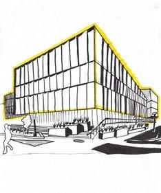
AutoCAD to SketchUp model of the block pertaining to the campus pathway.
Using Q GIS and Adobe Illustrator, created an elevation of the proposed exctractions pertaining to my strategy.
Adobe Illustrator render of students using the large staircase as a pathway and common area.
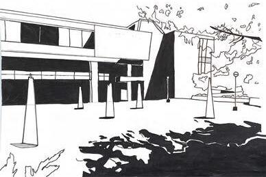
Handdrawn initial concepts
Illustrator
final piece
Student and Environmental Analysis work from Brussels, BE - 2023
Where I live, study, spend my free time, spend my virtual time, what makes up my campus and my city
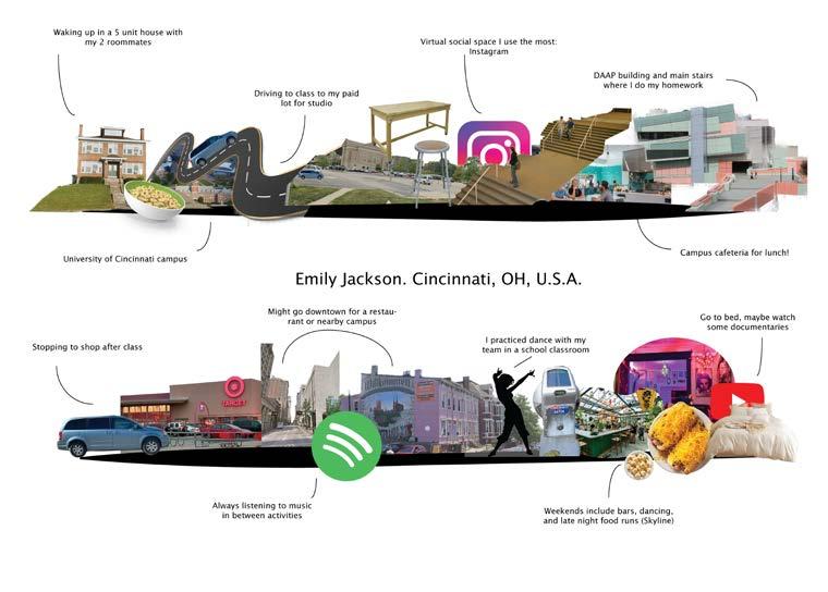
Through this group project created elevations, designed through Illustratot, and learned how to use a new form of GIS called QGIS.


Sectio 1 Sectio 2 possibilities Channel possibilities brown eld conversion possibilities Pocketparks green streets By focusing soft banks, biodiversity can redevelop and this can have strong uence on the surrounding fauna and ora. Next this, lowered and soft bank of the canal can also new opportunities to the campus area. By making the water accessible, the canal can become part the campus for recreation and relaxation possibilities and reference projects Although the area around the Abattoir still actively and productively used, is noticeable that many old buildings and vacant lots are also visible the area. To maintain the character the environment and increase biodiversity the area, The dens neighborhoods around the canal often have narrow and inaccessible roads. the mobility plan revised, less used starts could be used as green corridor between various existing green zones the area. In this way, green network created the area and the quality of the fauna and ora the area increases. possibilities Old Senne possibilities by rooftop conversion possibilities for Pocketparks green streets By reopening the old (said arms) of the zen and restoring original state, this can help ensure cooler climate the city center, and this can have positive ect on the Heat Island ect, which weighs heavily the stong paved area. Opening the river can also be incentive green the environment the neighbourhood possibilities and reference projects In order create natural connections the center of the city, necessary also support private initiatives order create coherent connections. Initiatives such the Swedish BeUrban can be possible stimulator promote both rooftop gardens and biodiversity projects that benethe city and the people. During the construction the North-South connection, many places were heavily paved and fell into disuse. These scars are still visible today over-dimensioned redundant roads,... These forgotten places could be an ideal location the future set up softening or greening projects. Between city and swamps The ecological heritage of the Brussels metropolis Thijs Gellynck, Mathias Janssens, Emily Jackson and Emma Loosveld 100 250m References: leefmilieu.brussels, geodata.envirennement.brussels, curieuzenair BXL, geobru, brussels.be Plantes_biodiversit, Science direct, convention on bioloical diversity, erfgoed.brussels, bruciel.brussels, kbr, bruzz, datastore.brussels. oldmapsonline, archiviris, google earth pro, topographic-map. 100 250m Section Section Reopening the old arms the Senne and restoring the river to original state could help ensure cooler climate the city center. The Senne's presence could help reduce the Heat Island ect, which weighs negatively the heavily paved area. Opening the river can also an incentive to green the environment in the neighbourhood order create natural connections the center the city, necessary to support private initiatives order create coherent connections. Initiatives such as the Swedish BeUrban can possible stimulator promote both rooftop gardens and biodiversity projects that bene the city and the people. During the construction the Nort-South connection, many places were heavily paved and fell into discuse. These scars are still visible today over-dimensioned redundant roads,.. These forgotten places could an ideal location the future softening greening projects. possibilities and reference projects Delacroix
Student
Self Portrait of
Life
Ecology of Study Region in Brussels
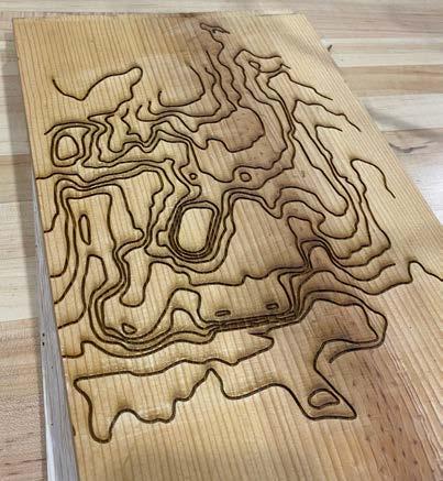
Lasercutting Final Personal Project
As a personal project for the past Fall 2022 semester, chose to learn lasercutting and topography technology in order to create a 3D topography production. For this project I chose the University of Cincinnati campus as my area of interest and played around with multiple test strips and worked through trial and error.
This type of 3D conceptualization has always interested me and through this project I was able to learn new skills with topography data, woodworking, and lasercutting machinery.
Lasercutting Topography Files Trial of Lasercut 3D Topography Map
Pictured below is the initial draft of all topography maps of UC Campus etched into a trial piece of wood using a lasercutting machine.
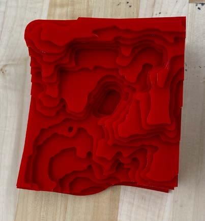
Pictured below is first trial cutting the topography map into acrylic material. This piece was too small of a scale and gave the campus an appearance of steep mountainous terrain.
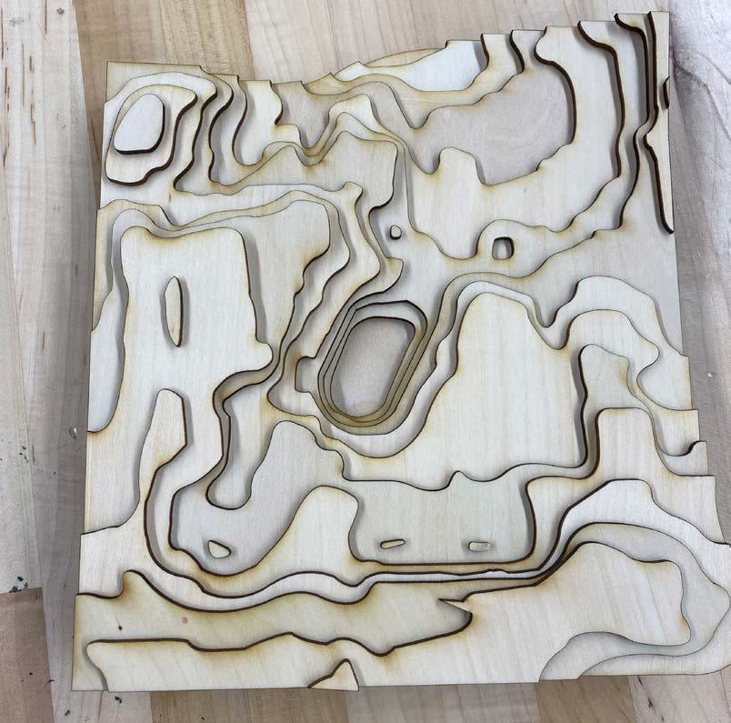
Final Product
Lasercut 3D Topography Map
Pictured to the right is the final product made on 3mm birch wood cut into 15 layers by a lasercutting machine and assembled on top of each other with wood glue (and a great deal of patience). The UC campus contains a stadium (noted by the deep circle cut into the middle of the piece) and several hills that students must traverse via stairs and streets to get to their classes.
Certificate and Model Skills
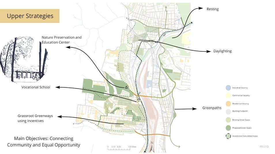
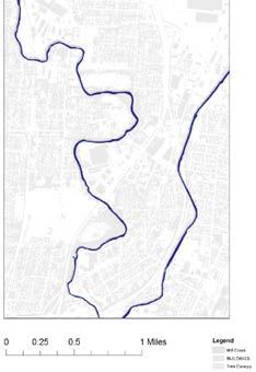
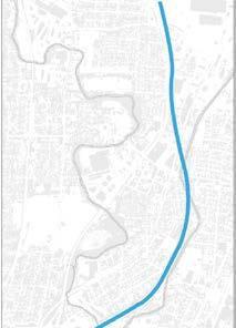
Strategic Map of Mill Creek Cincinnati, OH - 2022
Mill Creek Strategic Planning
These next pages cover the most recent work done in my summer studio of 2022 on the development of a park trail and supporting infrastructure along the Mill Creek in Cincinnati Ohio
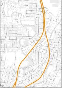
Pictured on the right shows a strategic plan to add a variety of spaces within the trail area using GIS and Illustrator tools.
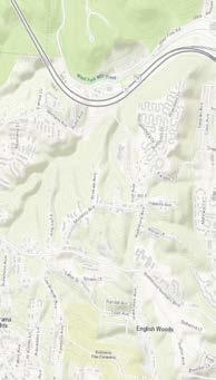
Mill Creek: English Woods
Site Planning
Pictured on the right shows a site plan for redesigning an underutilized area towards promoting more environmental awareness and ecological benefits while maintaining and improving the current residents quality of life. These are displayed through adding parks, trails, pocket naturalization, and a nature preservation and education center.
Tools used: GIS and Illustrator

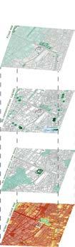
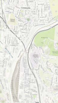
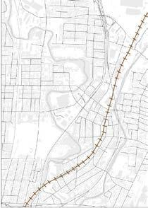
Mill Creek Site Analysis
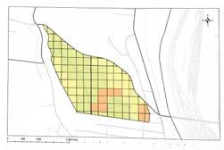
Pictured on the left is a vacancy map meant to emphasize the areas being left by their residents or industrial occupants and can be targeted for areas of development. This map was made in ArcGIS Pro.
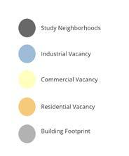
Pictured on the right is another GIS Map used to talk about the variety of land use codes the different parcels of the area fall under.
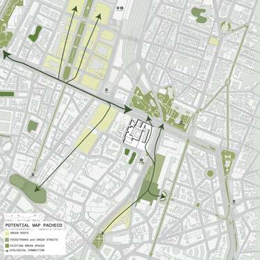
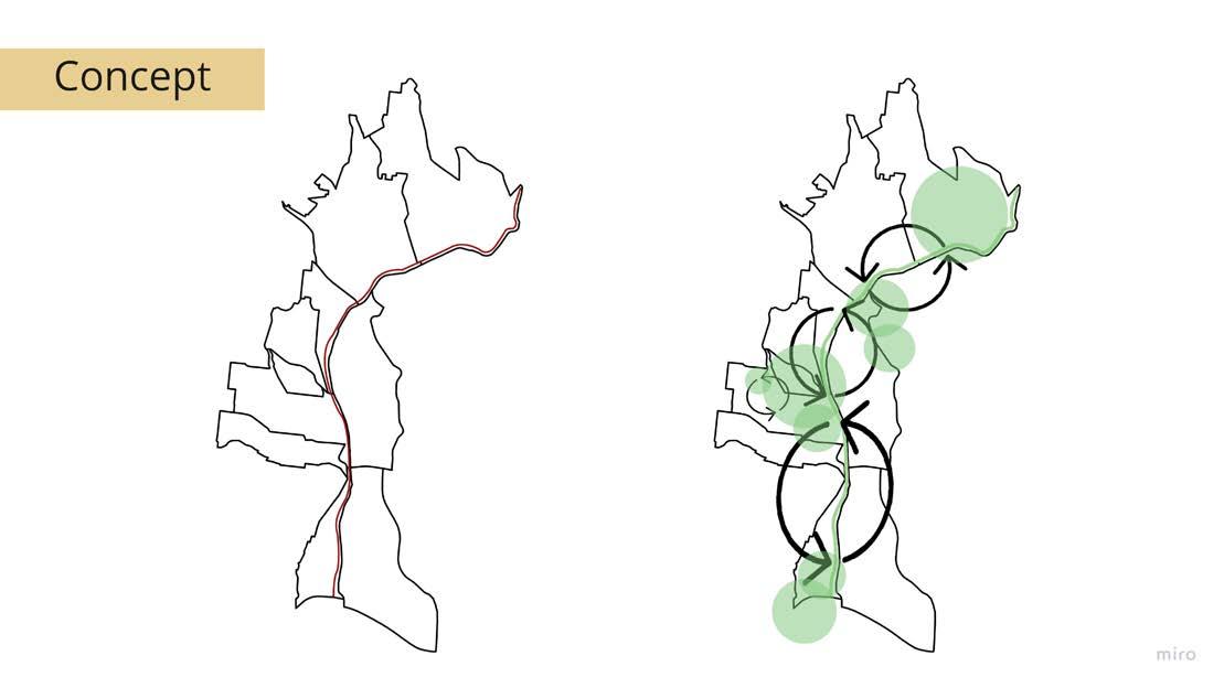
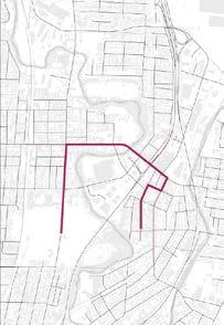
Mill Creek Project Concept
Pictured on the right is the concept design for the Mill Creek project. This diagram shows converting from a simple straight trail to a trail that emphasizes large green spaces and circulation through them.
0 1 2 0.5 Miles Analysis of Mill Creek Area, Cincinnati, OH - 2022
Strategic Map of Mill Creek Cincinnati, OH - 2022
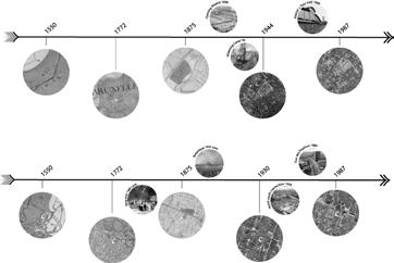
Pictured on the right is a illustration of the Mill Creek’s history with pollution and community effects
Mill Creek Timeline
Site Planning in English Woods, Cincinnati, OH
Site Planning
This page takes a look at the work I did for a project during Fall Semester of 2021 where used GIS, hand-mapping, and illustrator to detail works for a theoretical redevelopment of English Woods- a mostly vacant area in Cincinnati Ohio.
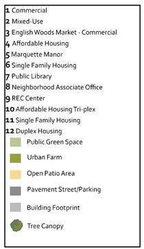
The final site plan pictured on the immediate right was created with illustrator tools and provided a look at a community surrounding the identity of the current affordable housing tenants with added housing, local markets, and community resources.
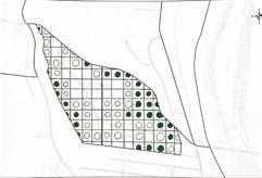
Pathway and Trail Development Suitability
Setting up interconnectivity between green spaces, community spaces, and the built environment through paths and trails is an element that would improve the site. The suitability for trails would depend on the soil for foot travels or building sidewalks. The slopes are detrimental to paths due to the difficulty of travel. The tree canopies provide scenic advantages for the potential trails.
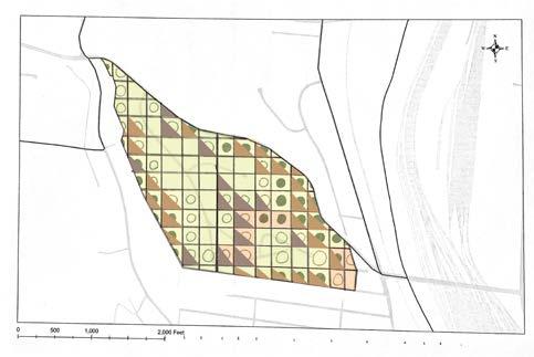
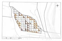
Suitability and Analysis
Pictured on the right is a GIS map detailing the parcel borders of the site intended to be used
Pictured on the left and below is one of the suitability analysis diagrams made through hand drawing and illustrator. Examining the suitability of trails and pathing according to elements of the site.
1 2 0.5 Miles
Cincinnati_Statistical_Neighborhood_Approximations
Hamilton_County_Parcel_Polygons
Building_Footprints
Cincinnati_SNA_Boundary
Zoning_Designation_(Cincinnati_Only)
development
development
less than ideal for development
City of Cincinnati, Esri, HERE, Garmin, INCREMENT USGS, METI/NASA, EPA, USDA
Contains steep slope Parcel with a portion of slope No steep slope found Soil ideal for
Soil okay
Soil
Tree Canopy covers whole parcel
Canopy partly covers marked areas No canopy present
for
Tree
Garden and Landscape Concept Design
The next two pages are drafts from my Perennial Design class from the Summer of 2022 where we focused on designing welcoming and natural spaces at a conceptual level. I traveled to many site visits studying garden’s made by other passionate horticulturists and landscapers. This course helped me find the ‘feeling’ gardens can give based on the structure and types of perennials planted and strengthened my understanding of the intersection between landscape design and placemaking.
Crevice Continuation
These designs are created through hand-drawn drafts scaled to the area of interest.
Crevice Continuation
Concept Planning
This garden concept design developed from visiting my professors personal garden which he renovates every year or two and developing a design he can bring to life in the next year. His crevice garden near the front of his house was inspiring and so continued the crevice rock sculptures into the front of his yard as a call back. The center was very low to the ground so I chose complementing colors and larger bushes/trees to contrast the ground plants.
Theme: Crevice Continuation
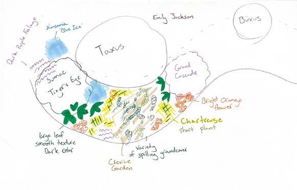
This garden is in the front yard of Jim Hansel and will be extended from the current garden area with the Taxus and Buxus.
Flower Design
Theme: Crevice Continuation
The gardens center contains a continuation of the crevice garden with plants spilling over the rocks and edges. The grand cascade butter y plants provides an eye catching purple ower with height to match and will be complimented with a bright orange ower in front on one side and large smooth leaf foliage to contrast the airy feel of the cascade. A short chartreuse plant will accompany this vignette and then the colors will be repeated on the left side as well. The cool color of the cascade would be replaced by the Amsonia “Blue Ice” The orange owers will tie into the Sumac “Tiger’s Eye” and the dark purple foliage on the back side of the Tiger’s Eye.
Care
This garden is in the front yard of Jim Hansel and will be extended from the current garden area with the Taxus and Buxus.
Flower Design
The owers would need to be watered attentively in the rst year and pruned back once their bloom time is over. The next year or two should be less nicky with the water levels and any plants that did not make it can be dug up and replaced
The gardens center contains a continuation of the crevice garden with plants spilling over the rocks and edges. The grand cascade butter y plants provides an eye catching purple ower with height to match and will be complimented with a bright orange ower in front on one side and large smooth leaf foliage to contrast the airy feel of the cascade. A short chartreuse plant will accompany this vignette and then the colors will be repeated on the left side as well. The cool color of the cascade would be replaced by the Amsonia “Blue Ice” The orange owers will tie into the Sumac “Tiger’s Eye” and the dark purple foliage on the back side of the Tiger’s Eye.
Care
The owers would need to be watered attentively in the rst year and pruned back once their bloom time is over. The next year or two should be less nicky with the water levels and any plants that did not make it can be dug up and replaced
Concept Planning Part 2
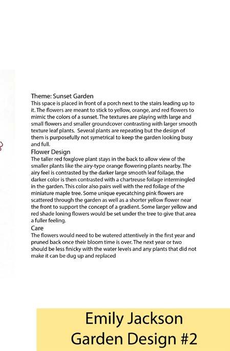
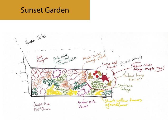
The “Sunset Garden” is based on creating a filled out garden space filled with flowers whose colors rangie from reds, pinks, oranges, and yellow This was meant to be a concept piece rather than specifying the exact flowers we would choose for a ‘client’.
Jackson Jim’s House
Emily
Garden and Landscape Design and Planning
The next two pages demonstrate my understanding of seasonal perennials and the careful consideration taken when placing different sizes and types of plants together. Our instructor taught us hand-drawn scaling with architectural rulers and gave prompts for what the garden should achieve for the mock client.
Planning Perennial Landscape
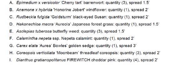
For “A Spring Perennial Assortment” the mock client requirements were to create a lively garden filled with flowers blooming during the spring season. This was my first conceptual design and shows a rudimentary understanding of developing designs on paper.
This project also demonstrates my knowledge on spring perennials and how to appropriately document plants in landscape design projects
have full confidence that I posses the ability to recreate this design (or any other design in this section) in Adobe Illustrator if required.
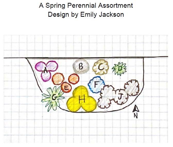
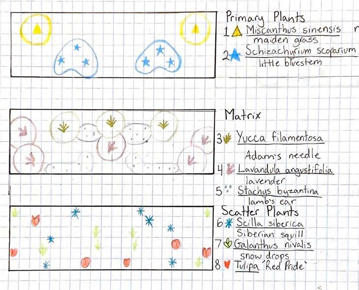
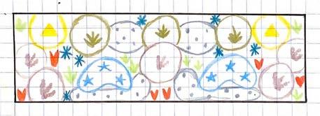
Finding Plants’ Purpose
For this project pictured on the right, display my understanding of different plants and their purpose for this garden. use different distinctive symbology to notate the distinctive plant and whether they fit in as focal points, matrix plants, scatter type in the design, I exhibit critical thinking skills through recognizing the height and spread of the plants, as well as their behaviour with other plants in order to interlock them in harmony.


Garden and Landscape Design and Planning
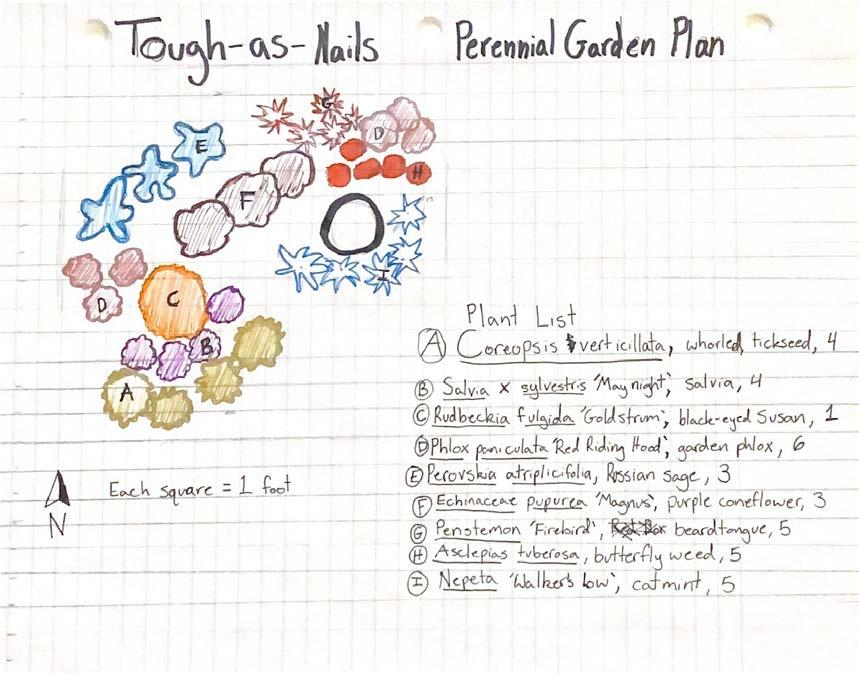
Garden Design
In the “Tough-as-Nails” project, selected plants known for their hardiness and gave each plant a different symbology in color and shape so the mock clientele could envision the ‘feeling’ their space would give them better than simpley stating the space their perenial would take up.
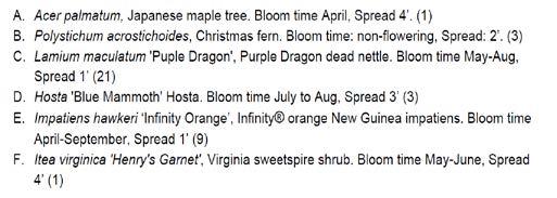
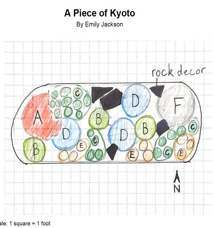
A Piece of Kyoto
“A Piece of Kyoto” developed around the prompt that the garden design must include a Japanese Maple tree. I took the tree’s origin and picked out perennial plants that complemented the Japanese Maple during its April bloom time as well as the structure of the unbloomed tree throughout the year.

and 3D Modeling
This page holds a collection of hand-drawn elevations, maps, and vignettes for both the Lockland and Arlington Heights neighborhood and the University of Cincinnati campus.
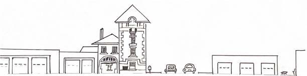
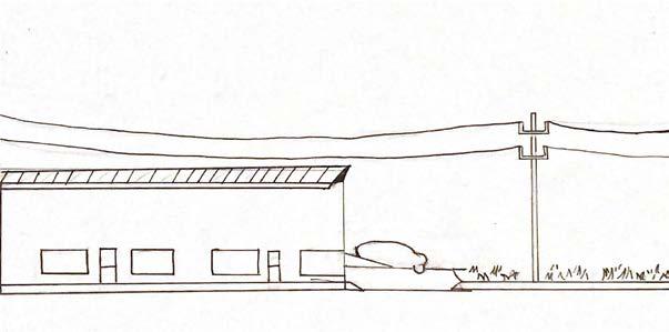
Lockland Elevation
Lockland Vignette
Pictured below are elevations created with hand drawing and architectural rulers. These elevations show the different type of street environments that can be found in the area.
Pictured below is the vignette of the Lockland main street created with SketchUp and hand drawings
Covid Restrictions on the University of Cincinnati
Pictured below is a map detailing the different Covid restrictions placed on UC Campus buildings in 2020. AutoCAD and hand drawing skills were used to create this.
Pictured above are the vignette hand drawn illustrations depicting notable buildings used for studying around campus.
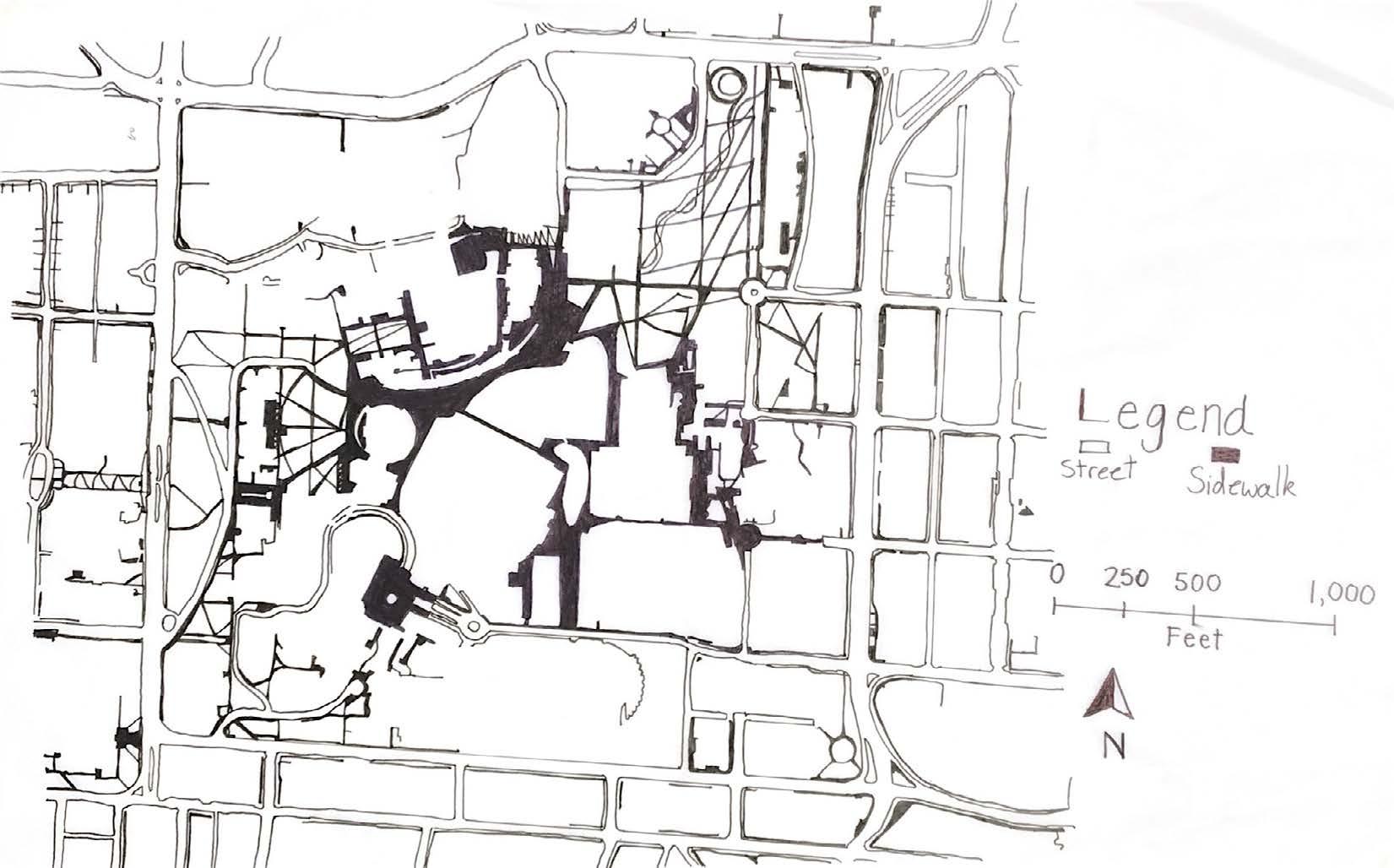
Hand-drawn Mapping, Illustration,
UC Campus maps and themes
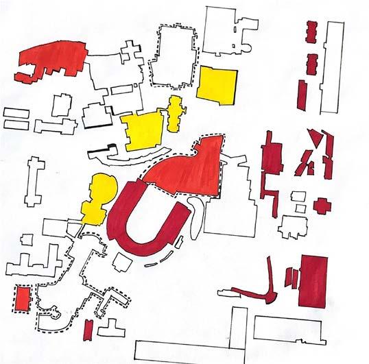
Pictured below is a thematic map of University of Cincinnati’s campus and the different borders and districts that can be found on the block. Using tracing paper, architectural rulers, and hand drawing
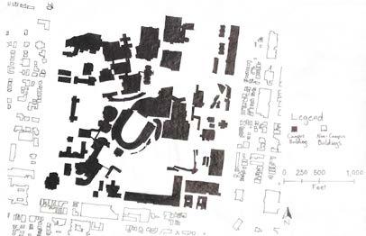
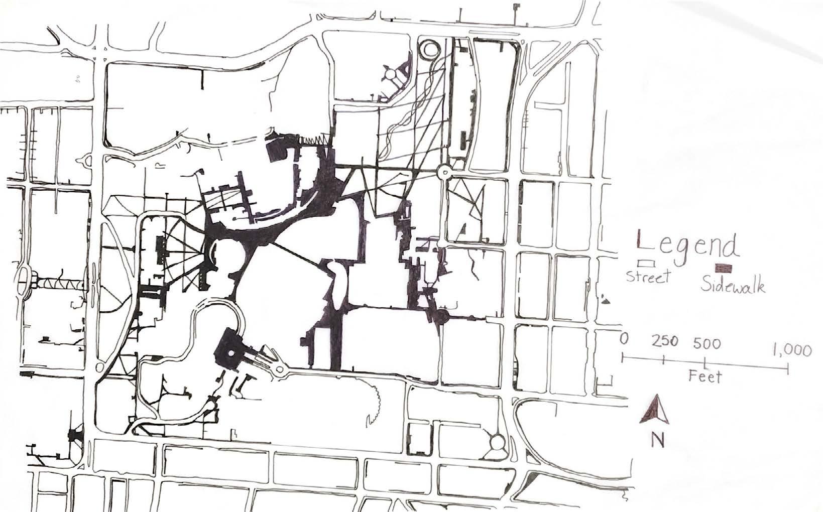
Pictured on the right is a building map of the UC campus and below is a street and pedestrian map of the area. These were both hand drawn to scale
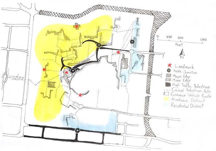

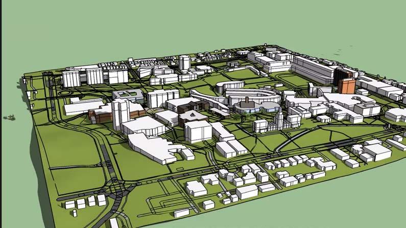
Pictured on the left is a SketchUp model with multiple views of the UC campus. Created using ArcMap for the buildings, lifting the buildings to the correct height, and using SketchUp to illustrate specific buildings for the views
https://www.youtube.com/watch?v=OQyV4lymllQ
Illustration,
Hand-drawn Mapping,
and 3D Modeling
Sketchup UC Campus Model
and 3D Modeling
The Lockland and Arlington Heights area were investigated and conceptualized through a variety of illustrations.
Interactive Timeline
Pictured below is the timeline of the Lockland area based on the development of different types of transportation methods. The original was an interactive PDF that would pop up history facts when the buttons on the PDF are pressed.
1780-1820
1820-1850
1850-1910
1910-1950
1950-Present
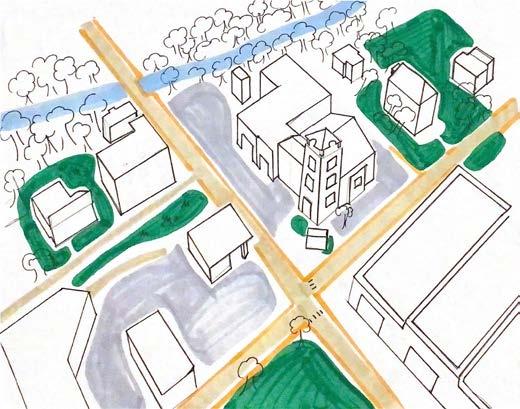
Concept Map and Illustration
Pictured on the left is a concept map of the area created with hand drawing.
Pictured on the right is a cover of Arlington pictured with some of its most iconic buildings. This was created with illustrator.


Lockland and Arlington Heights Timeline Transport Community Economic development Hydrology N Designed by Emily Jackson & Mohamed Alobaidani Narrative Importance ARLINGTON HEIGHTS LOCKLAND Arlington Heights Town Hall Lockland High School Highway75 MillCreek Emily Jackson & Mohamed Alobaidani ARLINGTON 1889
Hand-drawn
Illustration,
Mapping,
3D Printing
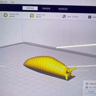
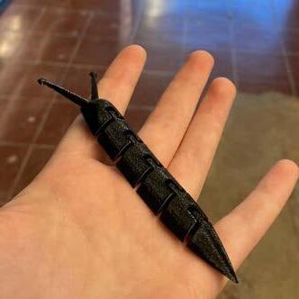
Pictured on the right are pictures I took during the process of learning how to go through the 3D printing program offered by UC and one of my final ‘fidget toy’ bugs I was able to print through this certificate.
have future plans to 3D print building footprints or SketchUp models to provide more interactive planning designs into my portfolio.
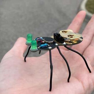
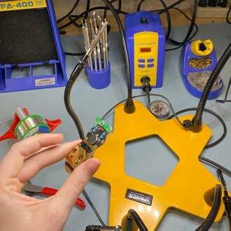
Soldering and Circuits
Pictured on the left is the progress of learning how circuit boards work and creating a small ‘walking’ bug by soldering the legs and electronic mechanisms needed for the bug to light up and vibrate.
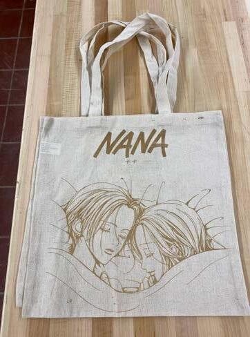
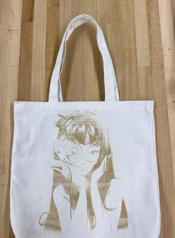
Sewing and Lasercutting AI Files
Pictured on the right are two different pieces made after taking the sewing and lasercutting certificates. was able to sew my own tote bag during this experience and proceeded to use low settings on the lasercutting machinery in order to burn an AI file design into the bags.
Certificate and Model Skills
“All the cities of the world are going to expand. We need to have a better understanding of what makes good urban habitat for homosapiens. We have an obligation to make the new places more livable, more sustainable, more healthy. We have the tools.”
- Jane Gehl
Emily Jackson Urban Planning