Emily Pietrantone
Urban Planning Portfolio

TABLE OF CONTENTS
Creating a ‘Park Like’ Setting - Site Planning Studio
Zoning Change in Cincinnati - Smart Growth for Climate Resiliency
Work at University of Cincinnati: Planning +Design + Construction
3
Overview of site Page 5 Conceptual Plan Page 7 Land Use Plan Pages 6-7 Final Plan Page 8
Background Page 9 Proximity and Density Matrix Pages 10-11 Creation of Overlay Zones Pages 12-13 Phasing Page 14 Strategies Page 15 Work at Cuyahoga County Planning Commission Lake Erie Public Access Plan Map Page 17 Center Ridge Building Frontage Changes Page 18 East Cleveland Parks Buffer Map Page 19
Revit Renderings Page 21 AutoCAD Phasing Plans for USquare Pages 22-23
Creating a ‘Park Like’ Setting Site Planning Studio
My third semester at the University of Cincinnati my studio focused on the steps it takes to plan a site. From researching the site and its respective zoning codes to creating a proposed plan. The site, outlined in red, is located in Middletown, Ohio which is about a 45 minute drive from the University of Cincinnati campus. The site is located just east of the major highway I-75 and just west of a Fischer homes development.
4
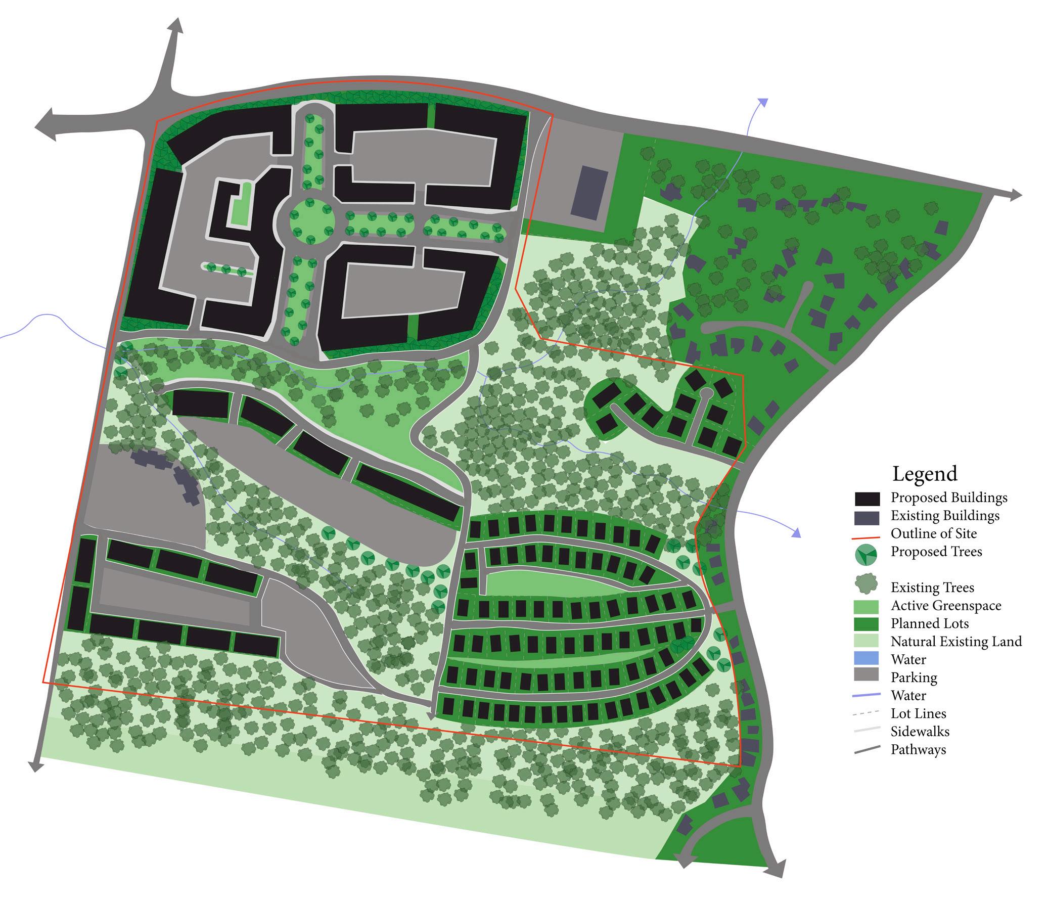
Legend
Proposed Buildings
Existing Buildings
Outline of Site
Proposed Trees
Existing Trees
Active Greenspace
Planned Lots
Natural Existing Land
Water
Parking
Water
Lot Lines
Sidewalks
Pathways
5
Conceptual Plan

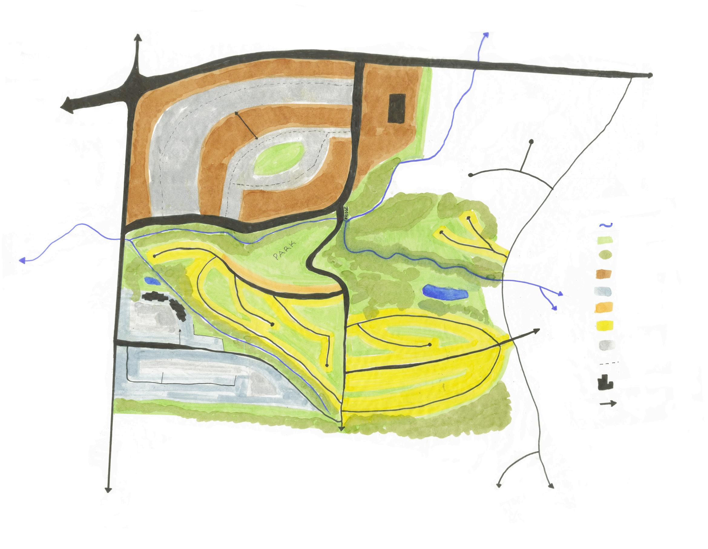
This map hows a conceptual plan for the site. Planning out zoning districts based on the existing zoning ordinance and comprehensive plan for the area. My goal for the site was to make a ‘park-like’ setting. I focused on separating the types of uses on the site so the residential area was quiet and not disturbed my the commercial area near the highway west of the site. By using a topographic map as a base I was able to plan around large changes in topography.
Land Use
This map shows the proposed zoning for the site. the northwest and then have a smaller center just mixed use buildings pedestrians become the focus
6
Legend
Used
Density Residential
Density Residential
Density Residential
ce
Outline
Greenspace
Existing Land
Sidewalks Pathways site. The goal was to one large neighborhood center at just south of the main center. With the addition of focus of the area.
Use Plan
Overall Plan
This overall plan was the final product from the site planning studio. Taking pieces from the conceptual plan, I was able to modify the plan to account for changes to square footage of parking lots, buildings and greenspace. These changes were made so the plan would be in line with the conceptual plan for Middletown as well as zoning ordinances. Additionally, turning the focus from car to pedestrian based modified the plans roadways.
7
Mixed
Commercial High
Medium
Low
Institutional Commercial/O
Site
Active
Natural
Water Parking Water
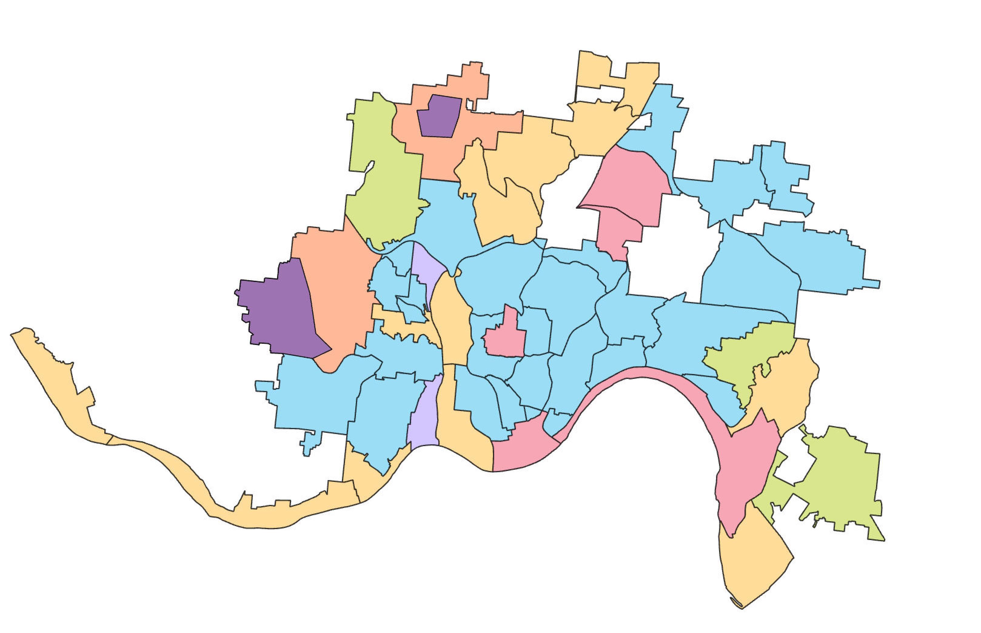
Zoning Change in Cincinnati Application of Smart Growth for Climate Resiliency
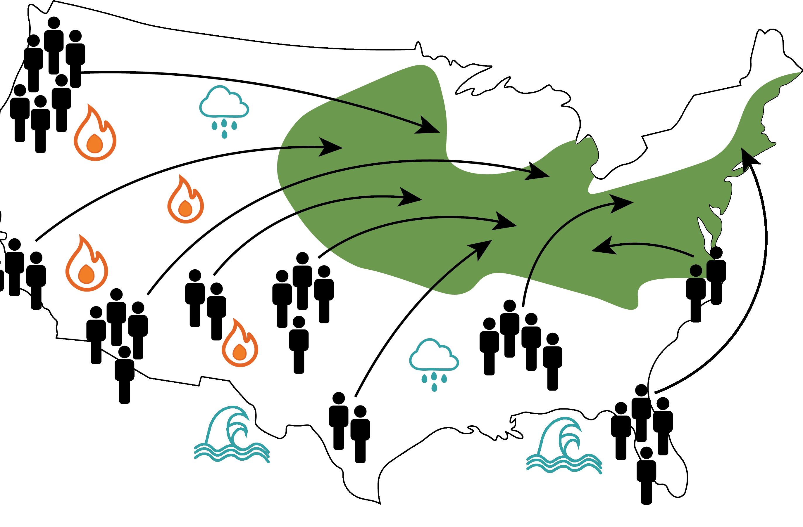
This studio began with the premise of Climate Havens. Research shows that as climate change impacts the world, the people of southern and coastal areas of the United States will move to areas that provide them more comfort. These areas were deemed as ‘climate havens’ and Cincinnati was included as one. In order to accommodate the anticipated population growth, Cincinnati should implement Smart Growth principles.

8
9
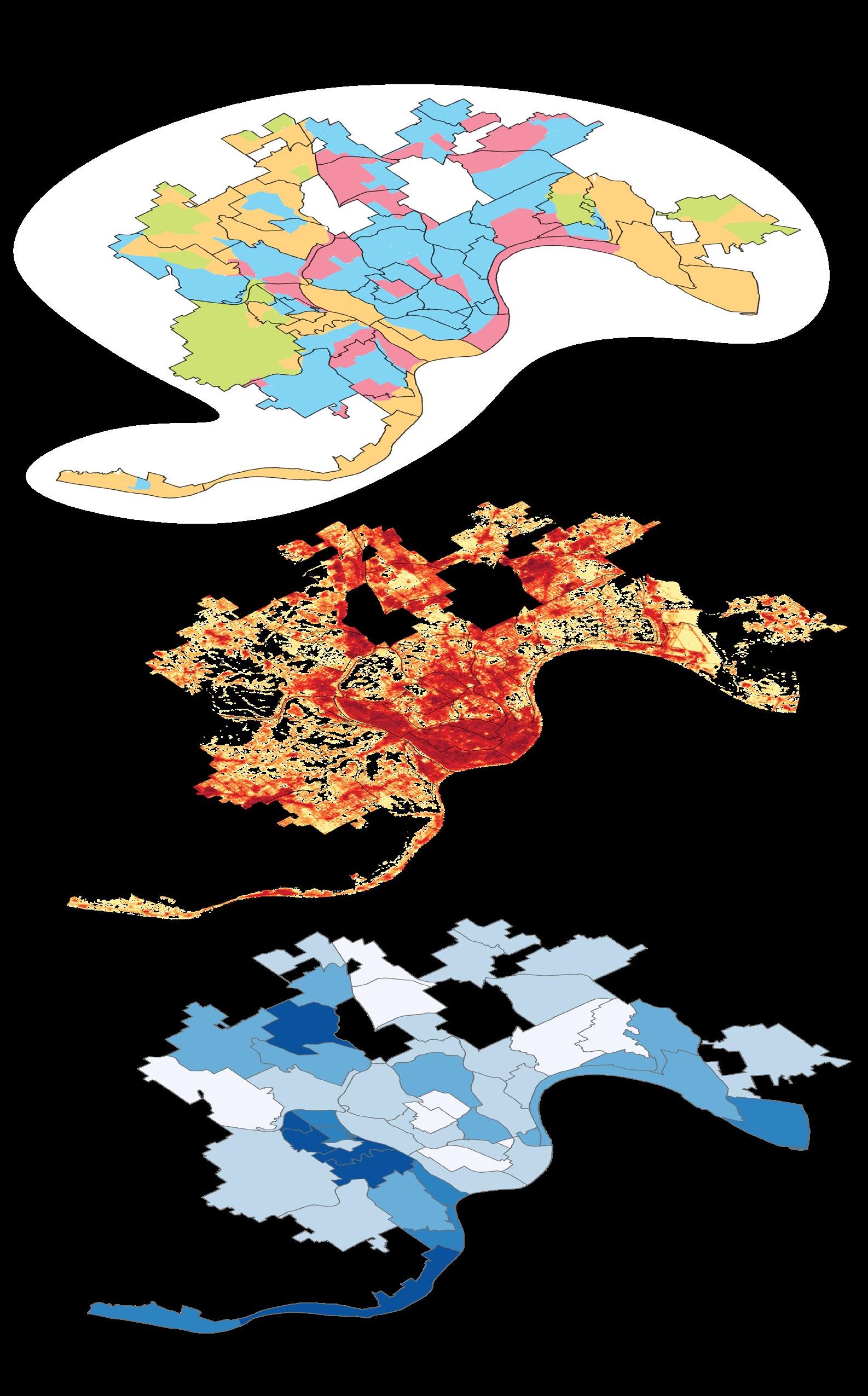
Cincinnati is fairly developed, leaving little room to grow. A large portion of the land in Cincinnati is devoted to sprawling single family housing. To accommodate the increase in population as a result of climate change, without consuming much land, density needs to increase while preserving greenspace.
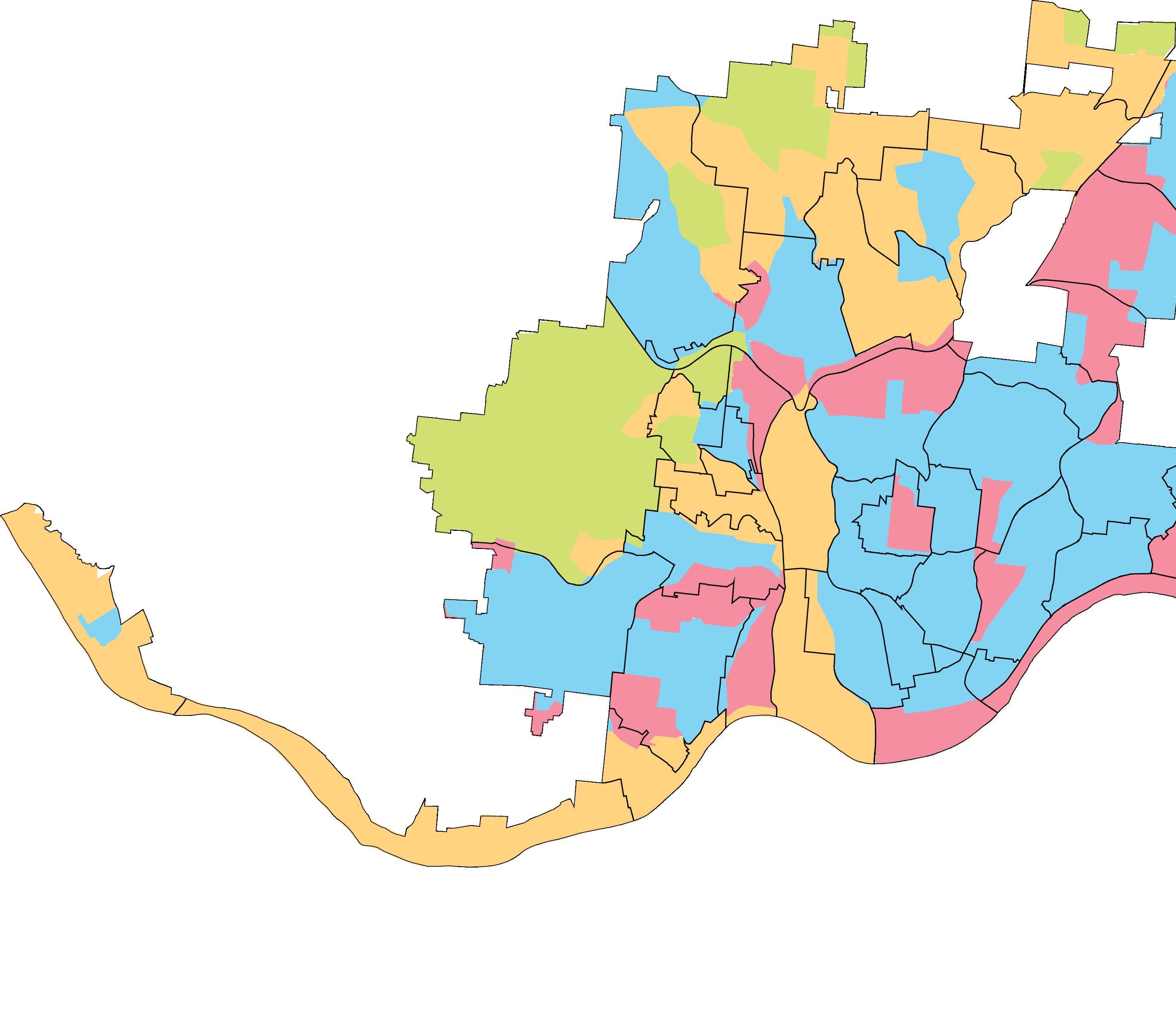
In order to determine what areas would be best suited for growth a matrix was developed that combined proximity and residential density. This resulted with four typologies: low proximity low density, low proximity high density, high proximity low density and high proximity high density.
10
Proximity measures access to basic necessities and amenities based on the concept of a 15 minute city. Amenities include care, learning, groceries, culture, and recreation. Proximity scores ranges from zero to one (no to high access to amenities).
Density measures residential density. Measured by the number of dwelling units per acre based on block groups. Dwelling units for each block group was obtained from the U.S Census Data portal.
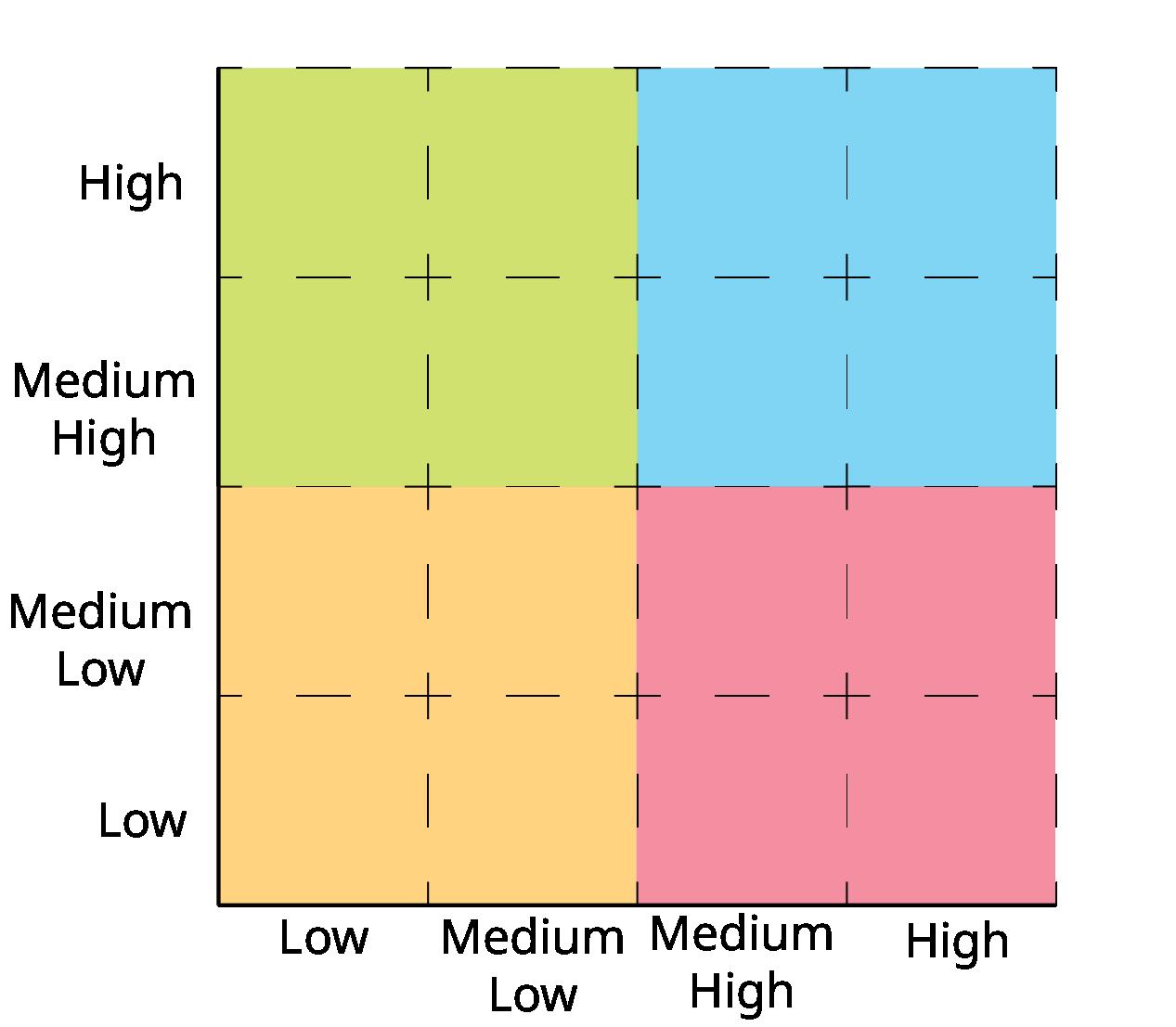
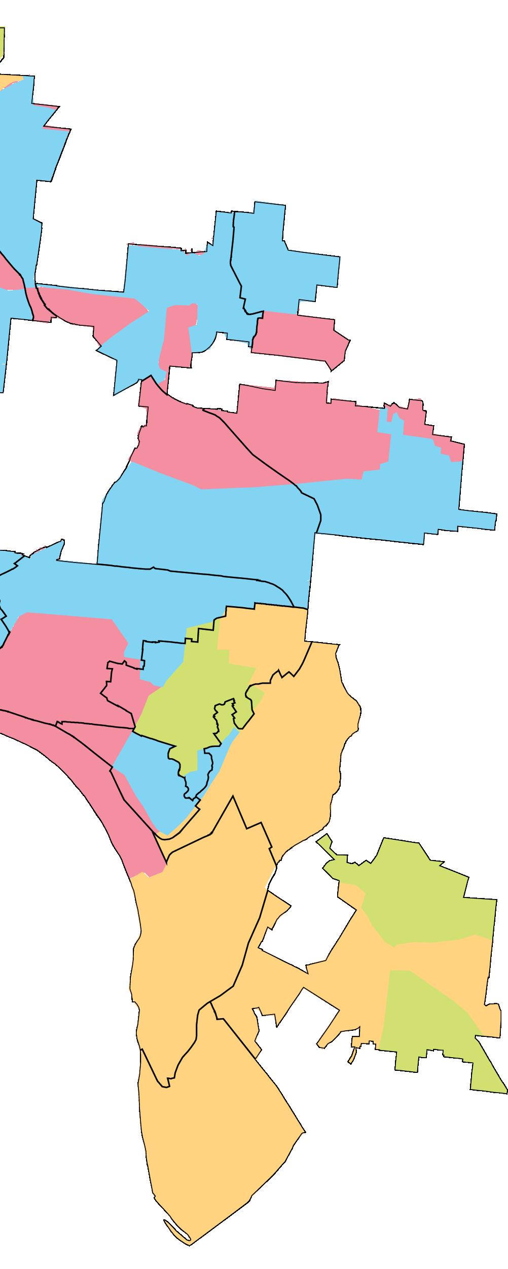
11 Proximity Density
In order to prioritize areas for implementation, we chose to use the strategy of overlay zones. Overlay zones are districts that have been placed over existing zoning and stipulate additional regulations, standards, contingencies, or permitted uses. These overlay zones would focus on the principles of Smart Growth. The typologies identified above were used for prioritization. The prioritization should be as follows:
Typologies
Typologies

Greenspace Needs Assessment
The goal is to tackle the low-hanging will be easier to achieve. For instance, already has high proximity allows on increasing density in those areas. assessment and the areas of high beneath the density/proximity typologies. then able to determine areas where most and determined two overlay from high proximity, low-density areas from the low proximity, high-density
12
Vacancy
1. High proximity, low density
2. Low proximity, high density
3. Low proximity, low density
4. High proximity, high density.
Vacancy
Greenspace Needs Assessment
Overlay Zones
Overlay Zones
low-hanging fruit first. This way, goals instance, focusing on an area that allows planners to focus entirely areas. The green space needs vacancy were overlayed typologies. Visually, we were where all elements overlapped the overlay zones—one based on areas low-density typology, and one based on high-density typology.
Overlay Zone 1

Areas with:
High Proximity, Low Density
High Greenspace Need
High Vacancy
Overlay Zone 2
Areas with:
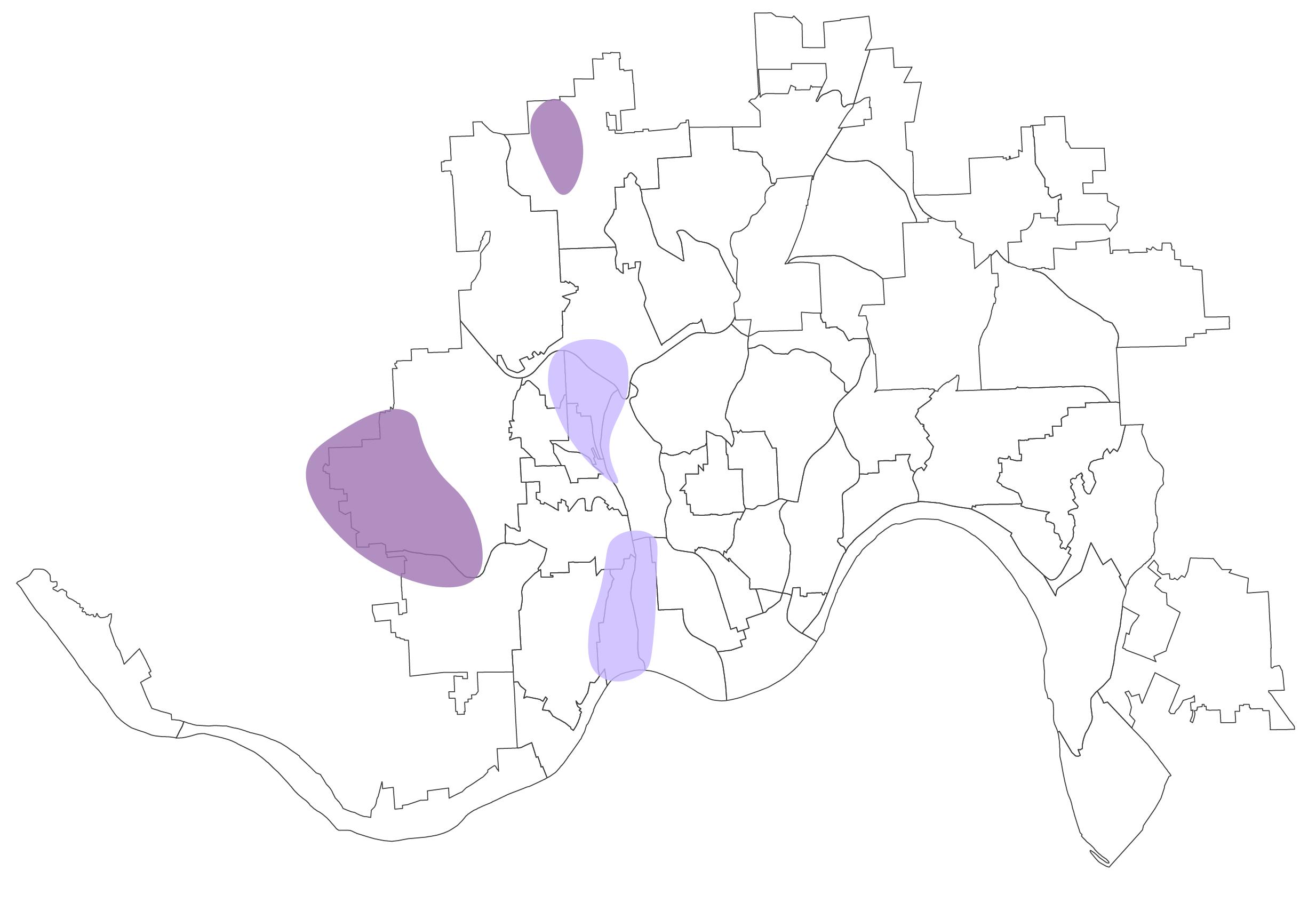
Low Proximity, High Density
High Greenspace Need
High Vacancy
13
In order to make the most efficient return on investment, Cincinnati should implement strategies beginning with areas of highest need. Areas of high proximity, low density should be considered easy wins as proximity is already achieved. Strategies in these areas focus on densification. Areas of low proximity, high density have little room for development. Strategies in this area will focus on increasing proximity. Areas of low proximity, low density will need significant improvement. Finally, areas of high proximity, high density will have little room for work and should be left alone for the most part.

14
Phasing
Strategies to be Applied in Each Typology


Strategies to be Applied in


15
All
LEED Certification Impervious-Based Billing Increase Public Knowledge Preserve at Least 25% Increase Biodiversity Conserve 1/3 Available Land
Proximity,
Density: Eliminate Single Family Zoning Change Lot Sizes Increase Affordable Housing Convert Vacant Buildings Infill Development
Proximity,
Density: Maintain High Density Increase Affordable Housing
Proximity, High Density: Eliminate Single Family Zoning Increase Affordable Housing Infill Development Increase MixedUse Development
Proximity,
Density: Eliminate Single Family Zoning Increase Affordable Housing Convert Vacant Buildings Infill Development Increase MixedUse Development Change Lot Sizes
Typologies:
High
Low
High
High
Low
Low
Low
Work at Cuyahoga County Planning Commission

My third co-op was in my hometown, Cleveland, Ohio. I worked for Cuyahoga County Planning Commission (CCPC) as a planning intern. My work primarily focused on creating plans and plan elements in Adobe Creative Cloud and Sketchup. I additionally prepared research in the form of case studies, grant background and more. Additional impactful work included community outreach. Navigating community outreach during COVID-19 created an interesting challenge, especially when engaging with a community with very limited Internet access.

16
CLAGUE RD CLAGUE RD REVOD RETNEC DR NOOHAC REKCORC BRADLEY RD DETROITRD AS M YWKP RETLAW DR KERD BMULOC A DR HTSEW L DVLB LORAINRD HOR EOHS B DV RUBRETNAC DR DR WOLFRD W 210TH ST LLARDBLV BMULOC A DR BASSETT RD RAGAW DR PORTER RD RANNEY PKWY FORDHAM PKWY UP R SA EVA HLL RDBLVD W 220TH ST WESTCHESTER KWY WESTWOODRD BASSETTRD DG PAR BLVD M R UE VD DR ATONRD PEN REC DR GES NERRD BLO OMB V KRALC YWKP ROOT RD LAKERD OS teer F u e On-Stre Futu On-Street:Future nOrtS e t F ut e On-Stree F ure On-Street: Future OS r e t F ut e HILIARDBLVD On-S e Fuure N R G R MASTCK RD MOR W ODPKWY LAKEFRONT G H RD CE ER R D D C 90 90 10 10 6 6 6 254 254 252 252 BAY VILLAGE ROCKY RI FAIRVIEW PARK WESTLAKE NORTH OLMSTED
Bradstreet
1 2 Miles 0 Cuyahoga County
ROCKY RIVER PARK BRADSTREET’S LANDING COLUMBIA PARK CAHOONPARK HUNTINGTON RESERVATION LEGEND TLCI Study Area Euclid Waterfront Project Area Lake Erie Water Trail Paddle Access Point Cuyahoga Greenway Plan Routes County Public Works Projects Lakefront Public Access Plan (LPAP) Cities Non-Lakefront Public Access Plan (LPAP) Cities Companion Projects
Rocky River
Landing
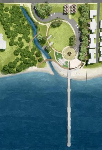
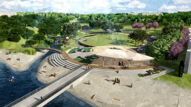
Lakefront Public Access Plan
County Lakefront Initiatives Plan and Companion Projects

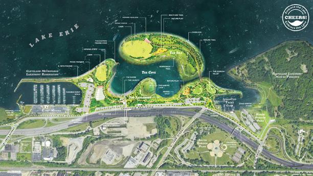


One of the most exciting this about being an intern is that you enter projects in every stage. I was fortunate enough to be at CCPC during the tail end of the Lakefront Public Access Plan.
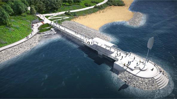
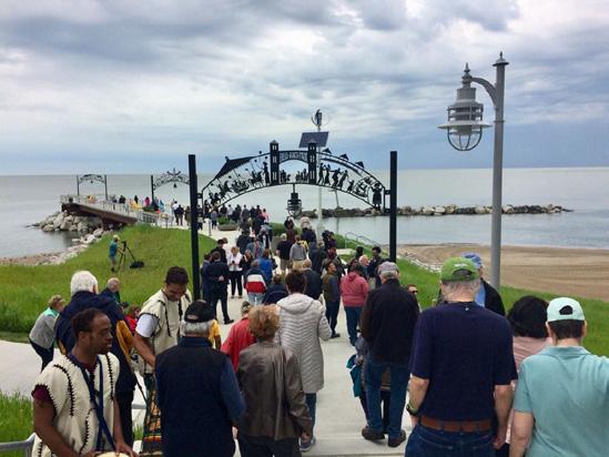
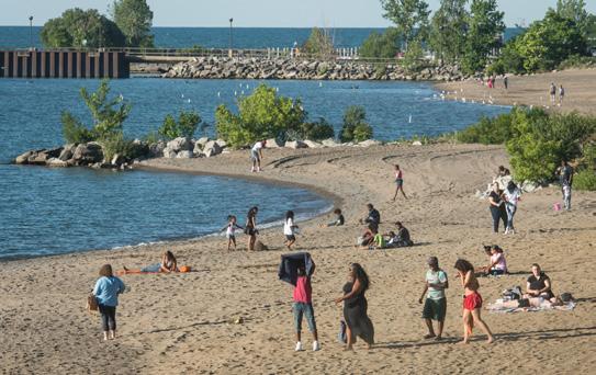
The Lakefront Public Access Plan is a plan to connect the public to the lakefront and fortify the shoreline to prevent any future erosion. On the left, is a map of the area with corresponding project pictures. This was created to be placed in a news article to help promote the project. A huge part of this project was getting individual property owners on board.
17 E HT052 TS E 2 DN2 TS E 156TH ST E 152ND ST EDDY RD EDDYRD E 55TH ST W 711 H TS W HT711 TS TSEW LB D HOUGH O EC AV RAN E W 25TH ST DRLESNA W OD NDAVE STCLARAV MA SONAVE EU DAVE NOTNARCS DR E 1 HT TS ES R E RICHMOND RD STO YRD W C NOTF DVLB RDEDSREVIR CEDARRD DRELBON BEX B D B POHS DR RDG BUR B V QUILLIAMS RD DETRO AVE L ELA D D ROVLEBS DVLB M D D COMMUNTYCOLLEGEAE M D ONAVE CEN ALAV E 200TH ST BABB TT RD W JAMESPKWY ADDISON RD DRRETSOOW WOO W RT AV E 30TH ST STOKESBLVD ORAN VE NOTLUF DR E 79TH ST NTAYLORRD WARRENSVILLE CENTER RD W 41ST ST W 14TH ST EHDNALEVELC STHG LB D D R AV EDA AVE NPARKBLVD C RK E SU R O AV LAK NDBLVD ORANGEAVE E 185TH ST R KL D WLS NM S D ROCKY RIVER DR S NEERG DR CARN G AVE WH Q CY AVE ST73RDW W DR341 TS EUCLDAVE COITRD PR N ETON BLVD E HT062 TS LANDER RD F R RD W 130TH ST LEE RD WSUPE O AVE MEADOWBROOK BLVD HILLIARD RD E HT062 TS NOTTINGHAMRD DRNERRAW MONTCELLOBLVD W 051 H TS RIDGE RD E 9TH ST BUCKEYERD FRANKLNBLVD DRLLHDOOW NORTHBLV W HT041 TS E 140TH ST HO MESAVE W 142ND ST LA SH REBLV ER YKS DR 22 DN TS SLSB RD HTROWSOB R BR U S R E S D C AR ON R ANDERSON RD RESSAG DVLB 22ND ST H DNALHG DR NEFFRD E N2 TS BRAINARD RD ONTARIOST M T NONREV B HT ORN URY D DENSONAVE LAKERD S B OV R B D S YAT RO DR E ERSON VE LAYOR O A DVLBK SHAWAVE BROWN RD KINSMANRD DRDROFWARC DNARG B L VD SO THBLVD M R A M R VLB D LCUE D KEERC YWKP MEA OWWOOD BLV BLUES ONERD CO TAVE IVANHOERD RDMUNN FT N D E 4 TSHT YRAC J A Y DVLB E 20 ST ST E E B V C EROMYA VLB SOR B DV STNUB DR DVLBNOTRABMUD MTCARMELRD F LKNAR N DVLB GREEN RD HIGHLANDRD CU TSSWRGHTP WY CHA ELDAVE C FTONBLVD S VE N LVD HARRIS RD YWKPYELLAV U - 2 P EDSKRA VD HG WY KRBYAVE AE WY UES ONE BLV LAK AN FWY RE RD LORAIN CYCLETRACK SUPERIOR M DWAY LORAIN CENTRAL DETROIT AVE WHITERD LORAIN KAMMS DRALLIDNOSIRRAH B I K WE AY EUCLIDAVE EUCLIDAVE SEW T B HTUOSDVL LAKEFRONT GREENWAY E3 SUPERIOR E EUCLID AVE AL K E LOT A K ARTE IL E U C L D RC EEK OC N N OTCE R CHESTER AVE On-Street: Future nOtS e t F ut e OS e : tuF er OffStre t Futur On-Street:Future nOS e :t tuF er On-Street:Future O -S ee : F ure On- e F re On-St e Fu ure O nS er t F u u r e Off-Stree : F ure Off-S ree Fu u On-S r Futu e nOS r e t F u e On-S F OS e tuF er nOrtS e utuF e On-Street: Future On-Street: Future On-Sreet Future On-S e Futu On-St eet:Future On-Street: Future On-Street: Future O - e F u On-Street:Future On-Sree:Future On-S e Fu u nOrtS e t F ru nOS er :t tuF er OertS uF On-Stee:Future nOrtS e F u e On-Street:Future On-Street:Future Off-Street:Futu On-St e:Future O -Stre Fu r On-St e Fuure On-Street: Future O -Sreet:Future fO fS er : utuF e nOtS tee tuF er On-Street:Future On-Street: Future On-S e F u e O -S Fu re OS er : uF r Off-Street:Fu u e On-Street: Future Off-Street:Future OffSreet Fuure O -Stree : F ure O -Stree : Futu W HURONRD Off-SteetFuture F I TSR ENERGY LAKEWOODGREENWAY E1 REENWAYW2 BLVD FFNBE RYBLV ROCKY R VER RESERV NOITA LLA UP R P ESO T LIAR O - S :Futu e BEACHCL LVD S AN KEWOODHEGHTSBLVD LAKEFRONTGREENWAYW1 OFu T S T D On-Sre t F u ur WEST SHOREWAY TRA L REDL NE WENDYPARK CONNECTO R EVELANDMEMORALSHOREWAY TOWPATHTRAIL DOWNTOWNCONNECTOR(SLAVIC V I )EGALL OPPORTUNITY CORRIDOR C DA GEN W RMOUNT VL D On-Street: F ure WASH I NGTONBLVD UC DHE G S VD SUPERORRD FO ES H LLSBLVD LAKEFRONTGREEWAYE2 LAK H REBLVD S B E L VOIR B L V D BELVO R VD LAKEFRONTGREENWAYE2 EUCLID CREEKCONNECT RO SWETLAN VD E 260THST 283 283 175 175 175 90 90 90 90 90 90 90 90 90 90 490 71 77 77 20 6 20 20 20 6 322 20 42 20 10 10 20 20 254 237 87 EUCLID LAKEWOOD VER CLEVELAND BROOKLYN CLEVELAND HEIGHTS EAST CLEVELAND H GHLAND HE GHTS LYNDHURST MAYF ELD MAYF ELD HE GHTS R CHMOND HE GHTS SHAKER HEIGHTS SOUTH EUCL D UNIVERSITY HE GHTS BRATENAHL
Metroparks Lakefront Reservation Wildwood Park
Park & Solstice Steps
Waterfront Improvement Plan
Harbor Eastern Embayment Resilience Study (CHEERS)
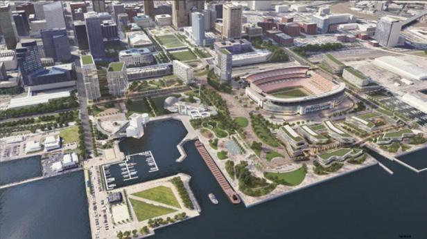
Stadium Proposed Development & Land Bridge
Cleveland
Lakewood
Euclid
Cleveland
Browns
COMMUNITY CONFLUENCE TLCI STUDY AREA PERKINS BEACH PADDLE CRAFT BEACH (TBD) EUCLID WATERFRONT IMPROVEMENT PLAN EUCLID PARK Cleveland Metroparks Lakefront Reservation Wildwood Park CLEVELAND LAKEFRONT NATURE PRESERVE GORDON PARK LAKEFRONT RESERVATION EAST 55TH STREET MARINA LAKEFRONT RESERVATION -NORTHCOAST HARBOR -VOINOVICH PARK WENDY PARK LAKEFRONT RESERVATION EDGEWATER PARK LAKEFRONT RESERVATION LAKEWOOD PARK & SOlSTICE STEPS RIVER SIMS PARK BROWNS STADIUM PROPOSED DEVELOPMENT & LAND BRIDGE CLEVELAND HARBOR EASTERN EMBAYMENT RESILIENCE STUDY (CHEERS)
At the beginning of my internship I worked extensively on the Center Ridge Corridor Plan for Westlake, Ohio. This plan was about creating a safer more appealing Center Ridge Rd.
The figures on your left show the existing (top) and proposed (bottom) storefronts on Center Ridge Rd. The plan is to bring buildings closer to the road and put parking in the back, to allow for a more welcoming environment for all users.
Parking moved to side or rear
18 60’Setback RightofWay Parking CENTERRIDGERD Sidewalk COMMERCIAL COMMERCIAL CENTERRIDGERD 25’SetbackRightofWay BuildtoZone Parking Parking Sidewalk 5’Landscapebuer COMMERCIAL COMMERCIAL RESIDENTIAL OFFICE 1 2 3 4 1 2 3 4 Reduce building setbacks Allow Mixed-Use developments
Landscape
ribbon
One that I touched very frequently was the East Cleveland Parks and Greenspace Plan. East Cleveland is an area that has been consistently loosing population since 1970. The area has a very low median household income and limited access to Internet and other amenities.
Something the city of East Cleveland wants to focus on is a safer and more desirable place to live. During the study it was found that 90% of residents live within a 10 minute walk to a park. So, the city decided to focus on the parks and the surrounding areas. This map shows a 10 minute walk shed around the park, highlighting what areas should be prioritized for repair.
19
EUCLID AVE EUCLID AVE EUCLID AVE SUPERIOR AVE SUPERIOR AVE HAYDEN AVE HAYDEN AVE SHAW AVE COIT AVE NTAYLORRD TERRACE RD NOBLERD TERRACE RD LEE BLVD FOREST HILLS BLVD RECREATION CENTER CUMBERLAND PARK FOREST HILL PARK FOREST HILL PARK LAKE VIEW CEMETERY LAKE VIEW CEMETERY LAKE VIEW CEMETERY PATTISON PARK HAWLEY PARK CALDONIA PARK MANN AVENUE PARK FOREST HILLS PARK FOREST HILLS PARK ENDORA PLAYFIELD EAST CLEVELAND CLEVELAND HEIGHTS CLEVELAND HEIGHTS CLEVELAND CLEVELAND CLEVELAND LEGEND Parks Cemeteries Other Greenspaces & Recreation Areas 1/4 Mile Buffer From Park or Greenspace Priority Sidewalks
Work at University of Cincinnati: Planning +Design +Constuction
My first two co-op rotations were at University of Cincinnati: Planning, Design and Construction (PDC). I worked in the renovations department to make changes to existing buildings and structures on campus. Most of the work I touched involved making changes to existing plans through redlining, creation of phasing plans and helping visualize the designs through Revit renderings.
20
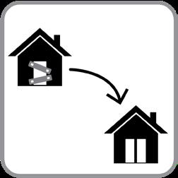
One project that I worked on heavily was the transformation of a lab space. The space consisted of many rooms connected through doors.
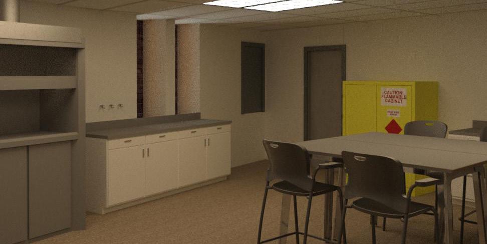
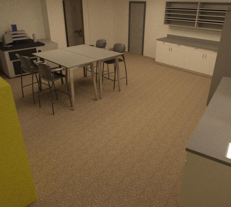
The room was reconfigured and refurnished to accommodate upcoming classes as well as two large pieces of equipment. The vent hood shown in the bottom left corner of the bottom image had to stay in place because of existing venting. But a new piece of very sensitive equipment was being added to the room, shown in the top left of the top image.
It was an interesting challenge to create a workable space, as the existing room was obviously not updated or taken care of for a long time.
These renderings were used to show the proposed renovations to the space.
21
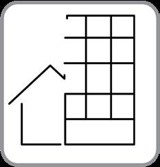
Another project I was involved in was the reconstruction of the offices off-campus inside of USquare. This image shows the first of three phases in a phasing plan to create new spaces for two groups at University of Cincinnati. The office of Gender Equity and Inclusion and the Faculty Senate. The plan created three office spaces, one to become empty for potential use in the future.
22 5/8" TYPE "X" GYPSUM BOARD 3 5/8" STEEL STUD 16" O.C. 5/8" TYPE "X" GYPSUM BOARD STEEL TRACK MECHANICALLY FASTEN 24" O.C. MAX. 3" MIN. ROXUL SOUND INSULATION FLEXIBLE SEALANT (OPTIONAL) EXISTING CORRUGATED METAL DECK POLYISO TPO FASTEN STEEL TRACK TO Z-CLIPS SCRAPE AWAY EXISTING FIRE-PROOFING TO INSTALL 20 GA. Z-CLIPS @ 16" O.C. MAX., FILL GAPS WITH MINERAL WOOL 1/4" MIN. EXIST. STEEL BEAM EXIST. 1 HOUR SPRAY-APPLIED FIRE RESISTIVE MATERIAL UL N782 A901 CR DWGS 6/1/12 ELASTOMERIC SPRAY FIRESTOP OR FIRE CAULK MINERAL WOOL INSULATION WALL IS NOT RATED Drawing Title of Drawing No. Scale Date Reviewed Checked U.C. Project No. Bldg No. Drawn Project Title University Hall, Suite 600 Cincinnati, Ohio 45219 51 Goodman Drive CAD File Fax 513-556-4885 Phone 513-556-5200 Cincinnati, Ohio 45221-0186 PO Box 210186 Planning + Design + Construction Division of Administration and Finance USQAURE TEMPORARY OGE & I USQUARE, Calhoun, Cinti OH 45221 X 18249 2019 DEMOLITION PLAN SCALE: 1/8" = 1'-0" 1 AE-101 1 X DEMOLITION PLANS & RENOVATION PLAN As Noted DEMOLITION NOTES RENOVATION NOTES 1. PAINT ALL WALLS TO MATCH EXISTING 2. NEW SOLID COLOR CARPET TILE SUBMIT 3. NEW WALL METAL STUDS @ 16" O.C. W/ 5 8 DRYWALL EACH SIDE, TERMINATE WALL AT UNDERSIDE OF BEAM. CENTER WALL ON COLUMNLINE. REFER TO 3/AE101 3A. NEW WALL METAL STUDS @ 16" O.C. W/ 8 DRYWALL EACH SIDE. EXTEND STUDS TO DECK TYPICAL UNLESS NOTED OTHERWISE. 4. RELOCATED ALL GLASS DOOR WITH CARD SWIPE. REFER 5/AE 101 5. TEMPORARY PLYWOOD DOOR, 4'-0" WIDE X 7' HEIGHT 6. RELOCATED SYSTEMS FURNITURE (BY FURNITURE CONTRACTOR) 7. NEW POWER POLE 8. TEMPORARY WALL 3 5 8 METAL STUDS @ 16" O.C. W/ DRYWALL, ONE SIDED AT CORRIDOR WALL. TERMINATE WALL AT UNDERSIDE OF GRID. 9. NEW WALL METAL STUDS @ 16" O.C. W/ 5 8 DRYWALL EA. SIDE. TERMINATE WALL AT UNDERSIDE OF SOFFIT. 10. 36" DOOR X 84" RELOCATED DOOR. REFER TO 6/AE-101. INSTALL FULL LITE KIT 11. NEW WALL - METAL STUDS @ 16" O.C. W/ DRYWALL ONE SIDED ON OCCUPIED SIDE (PLAN NORTH). METAL STUDS SHALL EXTEND FROM FLOOR TO ROOF DECK. 11A. NEW WALL - METAL STUDS @ 16" O.C. W/ DRYWALL ONE SIDED ON OCCUPIED SIDE (PLAN NORTH). METAL STUDS SHALL EXTEND FROM FLOOR AND TERMINATE AT GRID. 12. FRAME METAL STUDS FOR FUTURE OPENING (APPROXIMATELY 3'-4" X 7'-2" OPENING) 13. FRAME METAL STUDS FOR FUTURE OPENING, REFER TO 4 AE-101 D1. REMOVE SYSTEMS FURNITURE (BY OWNER) STORE OFF SITE D2. REMOVE DOOR, OCCUPANCY SENSOR, CARD SWIPE, SALVAGE FOR RE-USE D3. REMOVE GLASS. REMOVE BULKHEAD ABOVE FOR ENTRANCE WALL FRAMING GENERAL NOTES G1. GC SHALL REMOVE ABANDONED EQUIPMENT G2. ELECTRICIAN REMOVE ALL ABANDONED CONDUIT BRIAN 13500ARCHITECTS REGISTERED STATE O F OHIO PHALEN C. BRIAN PHALEN, LICENSE #13500 EXPIRATION DATE: 12/31/2020 RENOVATION PLAN SCALE: 1/8" = 1'-0" 2 D1 D2 D1 1 4 2 3 6 7 DE1. REMOVE ELECTRIC FROM SYSTEMS FURNITURE. TD CONTRACTOR REMOVE TD CABLE AND COIL UP AND PLACE IN CEILING OF 300C DE2. REMOVE SECURITY WIRE VERIFY DOOR CONTACT DE1 D3 DE2 3A 9 13 8 E1 E1. NEW POWER POLE E2. POWER FOR DOOR AND CARD SWIPE REFER TO AE-102 E3. POKE THROUGH, USE CIRCUIT FROM ABANDONED WHIP. E4. INSTALL DUPLEX RECEPTACLE. USE CIRCUIT FROM ABANDONED WHIP. E5. JUNCTION FOR WHIP TO SYSTEMS FURNITURE. USE CIRCUIT FROM ABANDONED WHIP. E2 DE1 10 SECTION THROUGH WALL SCALE: 3" = 1'-0" 3 DETAIL PLAN SCALE: 1/2" = 1'-0" 4 7 E1 E3 12 12 11A 304 SUITE 304A OFFICE 304B OFFICE AE101 3 DOOR ELEVATION SCALE: 1/2" = 1'-0" 6 DOOR ELEVATION SCALE: 1/2" = 1'-0" 5 S2 300B OFFICE 300A OFFICE 300C OFFICE 300.01 300.01 304.01 300.02 304.02 352 SUITE 352A CLOSET 351 BATH 353 OFFICE 349 BATH 350 SUITE 310 SUITE 310F OFFICE 310E OFFICE 310C OFFICE 310A OFFICE 310D OFFICE 310B OFFICE 397A CLOSET 398A STAIR 300H OFFICE 300C OFFICE 300F OFFICE 300 SUITE 300D OFFICE 300E OFFICE 300B OFFICE 300C OFFICE 300A OFFICE 352 SUITE 351 BATH 350 SUITE 310 SUITE 310F OFFICE 310E OFFICE 310C OFFICE 310A OFFICE 310D OFFICE 310B OFFICE 300H OFFICE 300C OFFICE 300F OFFICE 300.04 300.02 300.03 300.05 300.06 300.07 300.09 300.08 300.19 300.10 300.11 300.13 300.15 300.14 300.16 300.12 300.18 300.17 352A CLOSET 397A CLOSET 398A STAIR 304C 308K OFFICE 308A CONF. 6 S1 S3 S3 S2 S1 10 E4 11 E4 E4 300Z CORRIDOR 5 AE101 5 349 BATH E5 11 300 SUITE
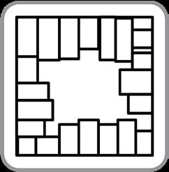
The above plan details the second phase of the three part phasing plan for the offices at USquare. The priority was to get the office of Gender Equity and Inclusion up and running as soon as possible. That office would be temporarily held in the north section of the building, highlighted in phase 1. Then moved to their permanent place in the south side of the building, show in phase 2. In the 3rd and final phase, the north offices would be converted to the Faculty Senate space and an empty office for future use.
23 DOOR SCHEDULE Drawing Title of Drawing No. Scale Date Reviewed Checked U.C. Project No. Bldg No. Drawn Project Title University Hall, Suite 600 Cincinnati, Ohio 45219 51 Goodman Drive CAD File Fax 513-556-4885 Phone 513-556-5200 Cincinnati, Ohio 45221-0186 PO Box 210186 Planning + Design + Construction Division of Administration and Finance USQAURE TEMPORARY OGE & I USQUARE, Calhoun, Cinti OH 45221 X 18249 2019 DEMOLITION PLAN SCALE: 1/8" = 1'-0" 1 AE-101 1 X DEMOLITION PLANS & RENOVATION PLAN As Noted DEMOLITION NOTES RENOVATION NOTES 1. PAINT ALL WALLS TO MATCH EXISTING 2. INFILL CARPET AT DEMOLISHED WALL TO MATCH EXISTING 3. NEW WALL METAL STUDS @ 16" O.C. W/ 5 8 DRYWALL EACH SIDE, TERMINATE WALL AT UNDERSIDE OF DECK. 4. NEW ALL GLASS DOOR WITH CARD SWIPE. REFER 5/AE 101 D1. DEMOLISH TEMPORARY WALL D2. DEMOLISH DOOR D3. DEMOLISH WALL D4. DEMOLISH GLASS AND WALL. SALVAGE GLASS FOR REUSE. D5. REMOVE PORTION OF WALL FOR NEW OPENING. D6. RELOCATE SALVAGED DOOR REFER TO 2/AE-101 GENERAL NOTES G1. GC SHALL REMOVE ABANDONED EQUIPMENT G2. ELECTRICIAN REMOVE ALL ABANDONED CONDUIT BRIAN 13500ARCHITECTS REGISTERED STATE O F OHIO PHALEN C. BRIAN PHALEN, LICENSE #13500 EXPIRATION DATE: 12/31/2020 RENOVATION PLAN SCALE: 1/8" = 1'-0" 2 DE1. REMOVE ELECTRIC FROM SYSTEMS FURNITURE. TD CONTRACTOR REMOVE TD CABLE AND COIL UP AND PLACE IN CEILING OF 300C DE2. REMOVE SECURITY WIRE VERIFY DOOR CONTACT E1. POWER FOR DOOR AND CARD SWIPE REFER TO AE-102 AND 3/AE-101 E2. INSTALL DUPLEX RECEPTACLE (TYP.) E3. NEW JACK 300 SUITE 300D OFFICE 300E OFFICE DOOR ELEVATION SCALE: 1/2" = 1'-0" 6 DOOR ELEVATION SCALE: 1/2" = 1'-0" 5 300B OFFICE 300C OFFICE 300A OFFICE 300.01X 300.01 300.04X 300.02X 300.03X 352 SUITE 352A CLOSET 351 BATH 353 OFFICE 349 BATH 350 SUITE 310 SUITE 310F OFFICE 310E OFFICE 310C OFFICE 310A OFFICE 310D OFFICE 310B OFFICE 397A CLOSET 398A STAIR 308D OFFICE 308F OFFICE 308G OFFICE 300 SUITE 300D OFFICE 300E OFFICE 300B OFFICE 300C OFFICE 300A OFFICE 352 SUITE 351 BATH 350 SUITE 310 SUITE 310F OFFICE 310E OFFICE 310C OFFICE 310A OFFICE 310D OFFICE 310B OFFICE 300H OFFICE 300C OFFICE 300F OFFICE 300.04 300.02 300.03 300.05 300.06 300.07 300.09 300.08 300.19 300.10 352A CLOSET 397A CLOSET 398A STAIR 300w 308K OFFICE 308A CONFERENCE 399 CORRIDOR 349 BATH 308J OFFICE 308E OFFICE 308B HUDDLE 308C OFFICE 300y OFFICE 300x CONFERENCE S1 S2 6 5 4 2 1 7 8 9 EX EX EX EX EX EX 1 2 D1 D2 D6 D3 D4 D3 S2 S1 ENLARGED PLAN SCALE: 1/2" = 1'-0" 3 4 E1 D5 D5 1 1 1 1 1 1 PHASE 2 8 DOOR ELEVATION SCALE: 1/2" = 1'-0" 7 10 1 1 11 1 1 3 E3 E2 308H CLOSET 308
Programs Used:
Adobe CC
ArcGIS
AutoCAD
Sketchup
24
