
LANDSCAPE ARCHITECTURE PORTFOLIO EMILY MOORE

ABOUT ME
Hello my name is Emily Moore and I will be completing my Master of Landscape Architecture in May 2024.
To give you a short introduction of myself, since an early age, I have had a strong desire to do something to help the environment. I have spent much of my time learning about the natural world through school, books, videos, and observing the landscapes that surround me. I am fascinated by nature and deeply concerned about the negative impacts we, as humans, have made to the environment and its impacts on people.
I also love art and capturing the world through any medium I can get my hands on, whether it is ink, graphite, photography, paint, or digital drawing. I strive to use my artistic abilities in most of my work to communicate stories, ideas, and draw people in.
If you are interested in the Strengths tests, my strengths are Responsibility, Adaptability, Learner, Individualization, and Developer. I believe my strongest skill is the ability to think critically and deeply about problems and ideating creative solutions.



Tree Collection
Interdisciplinary Design
The Apprenticeshop | Rockland, Maine
Campus Master Planning
Tom Minor Creek Institute | Emigrant, Montana
Climate Resilient Design
Marlatt Agricultural and Ecological Center | Manhattan, Kansas
Construction Documentation
Prairie Hills Multi-Family | Savannah, Texas
Brownfield Redevelopment
Southside Agrihood | Des Moines, Iowa
Professional Work
Galleria South Entry | Dallas, Texas | StudioOutside
Hand Drawing & Painting
A collection of artwork
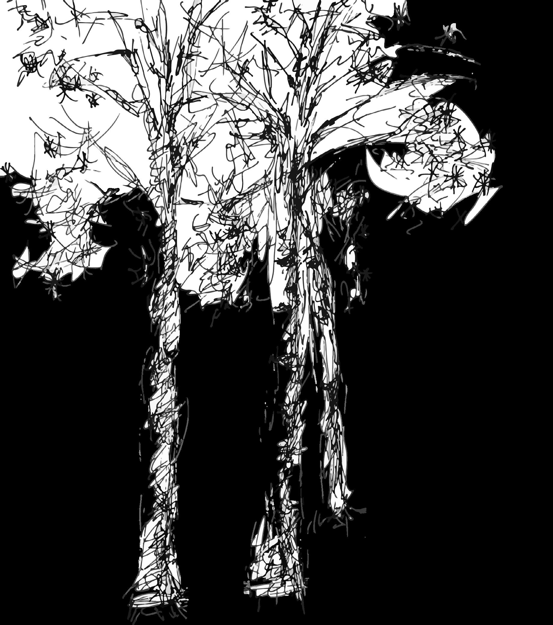
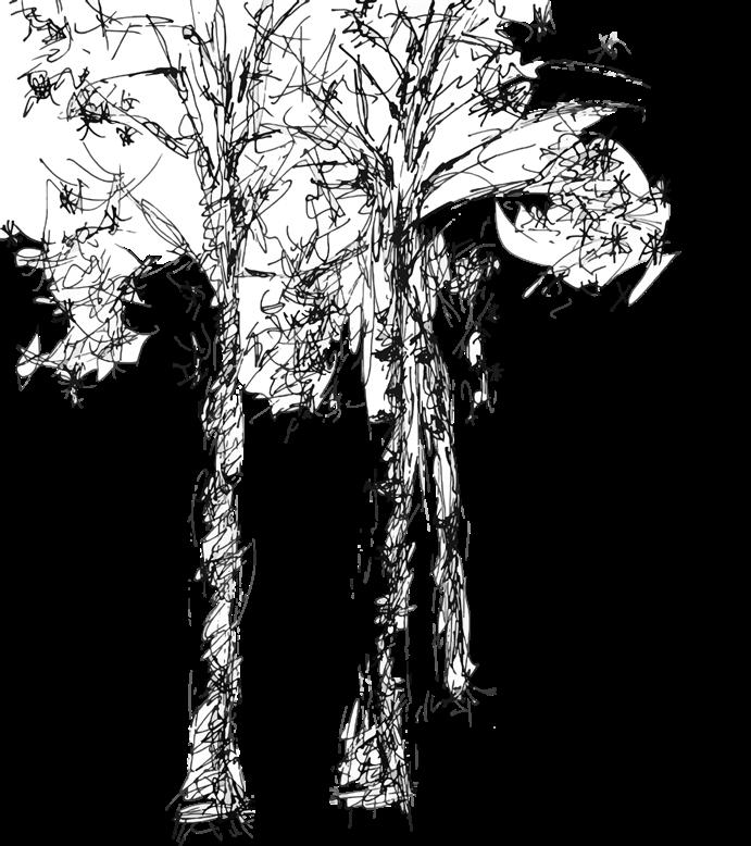
These trees were drawn with various drawing tools on Adobe Fresco on the iPad. I have used Fresco in many of my projects from initial diagrams to renders to easily add hand-drawn elements.
CONTENT
01 02 03 04 05 06 07
40' 0' 20' 1 5 4 3 2 6 7 8 9
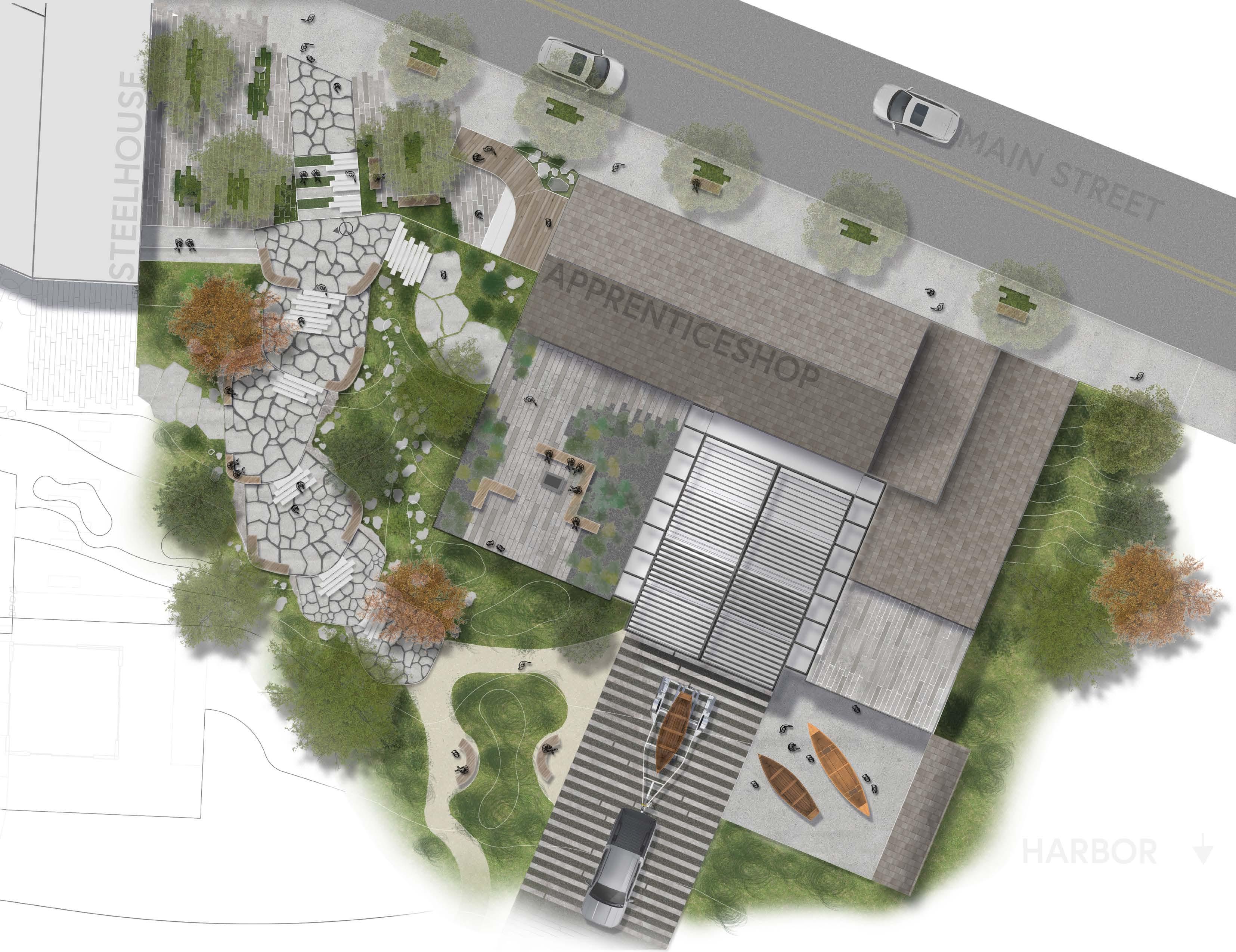
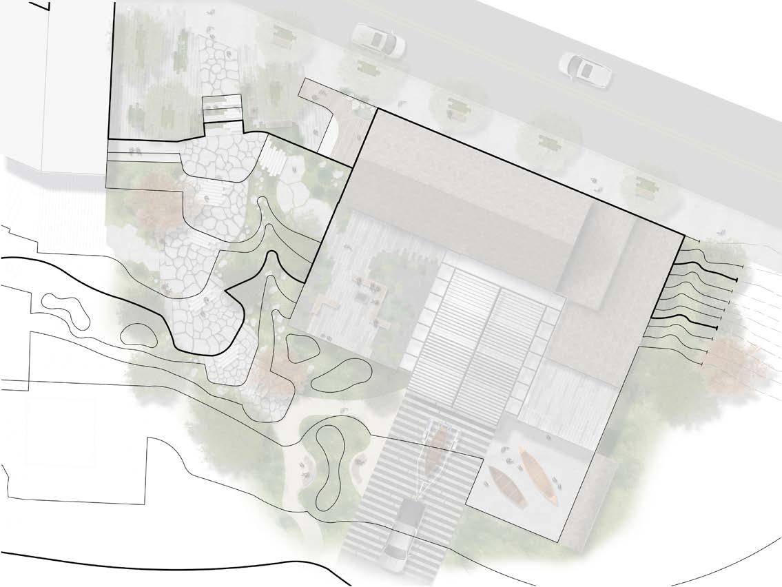
1. Apprentice Plaza
2. Display room
3. Rock Terraces
4. Rocky swale
5. Rooftop overlook
6. Commission space
7. Rooftop lounge
8. Loading ramp
9. Exterior workspace
Interdisciplinary Collaboration
The Apprenticeshop | Rockland, Maine
Team: Jay Olson (I.A.) & Wilhelm Wiedow (Arch)
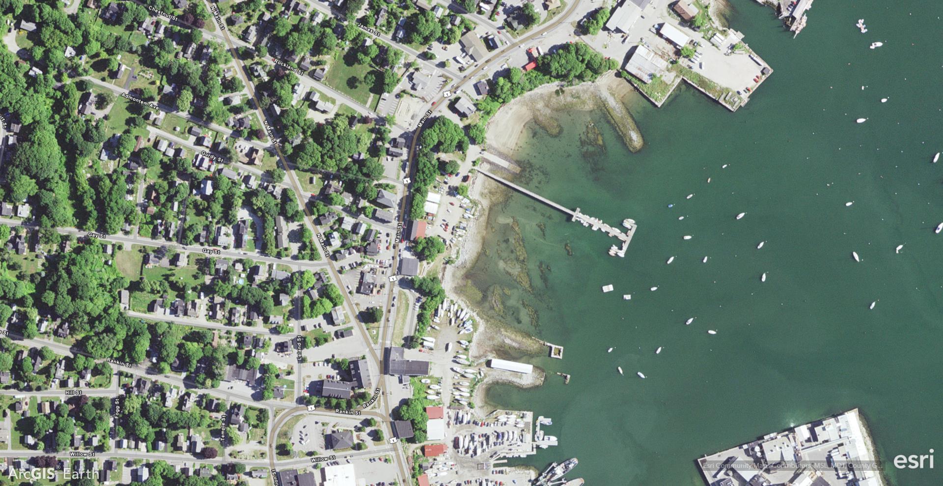
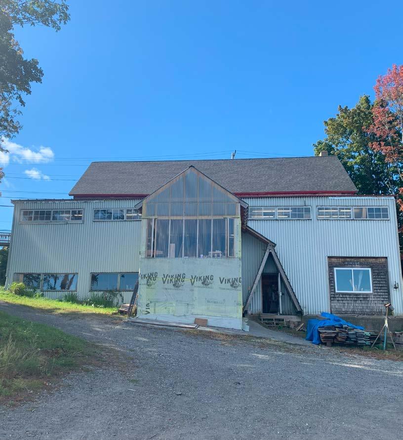
The Apprenticeshop is an existing traditional boat-building school in Rockland, Maine. Through an engagement event, where we travelled to Rockland, we learned about the school’s mission, problems, needs, and desires. From this, our interdisciplinary team created a set of goals that helped guide our design decisions and worked as a team to create active and passive spaces for both the Apprentices and public to use.
Main Street
Apprenticeshop
Downtown Rockland
5
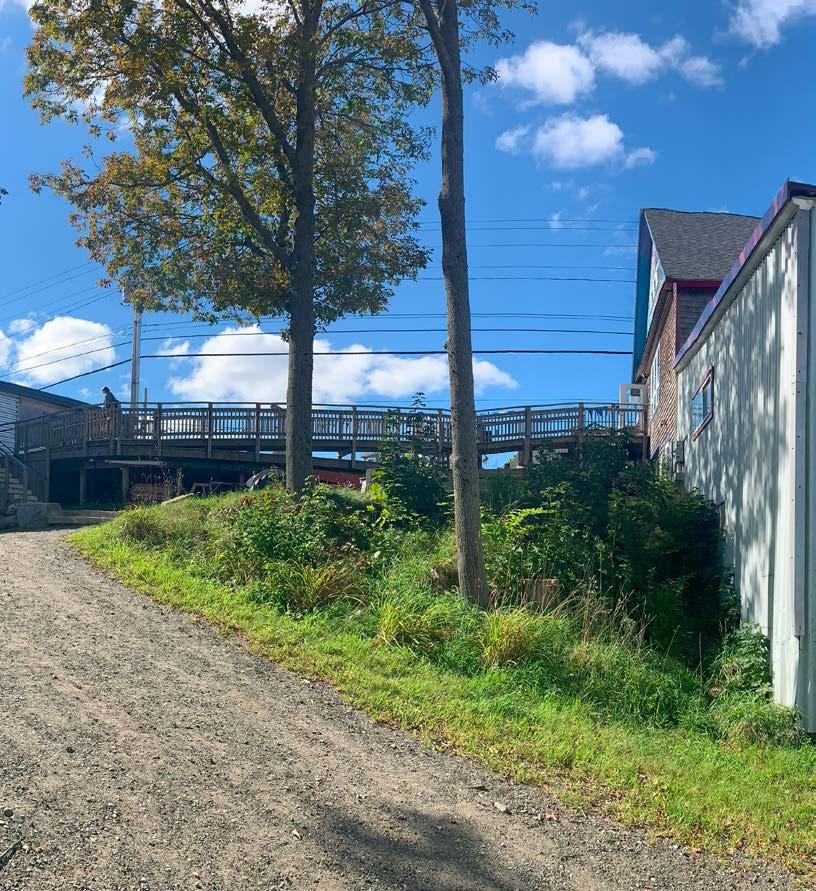
Existing Conditions
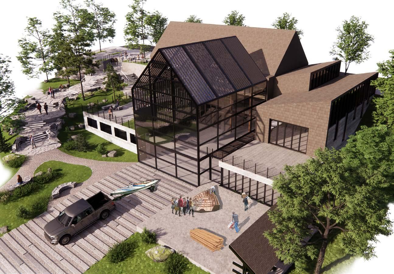
Proposed Design
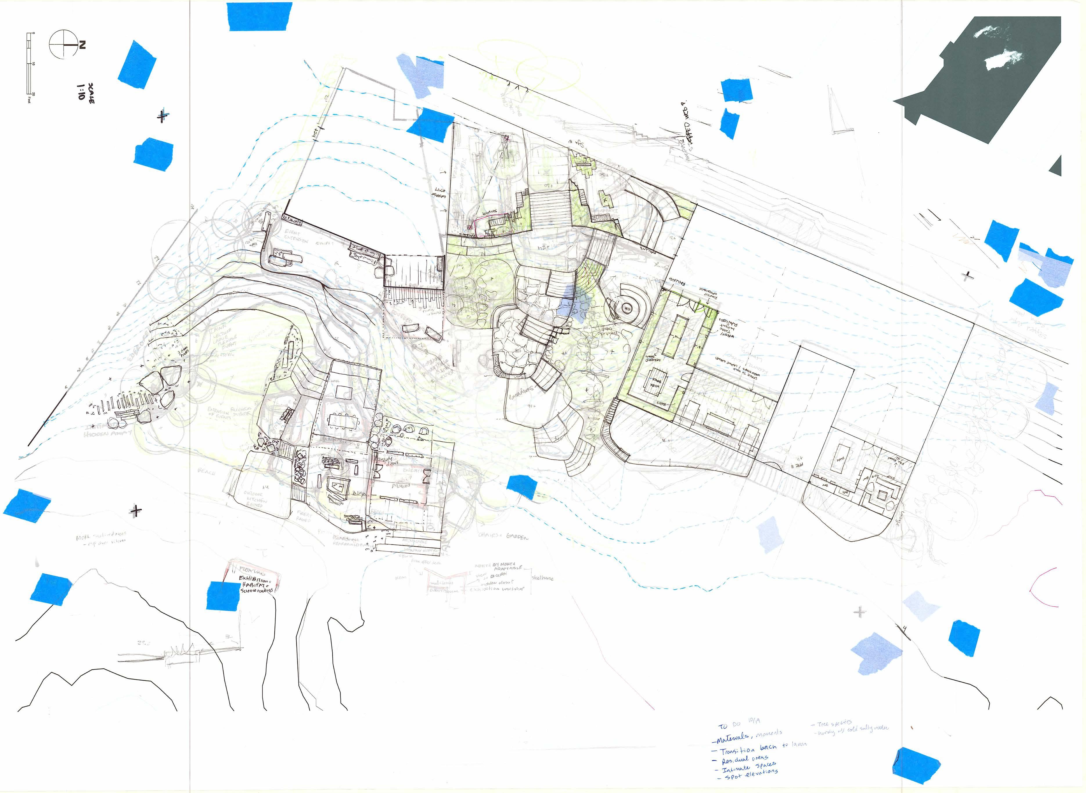
Process Sketching
Many layers of trace were used to explore various geometries, spatial relationships, and grading solutions. Here, trace was combined with an adjacent project’s site plan to connect the two.
6
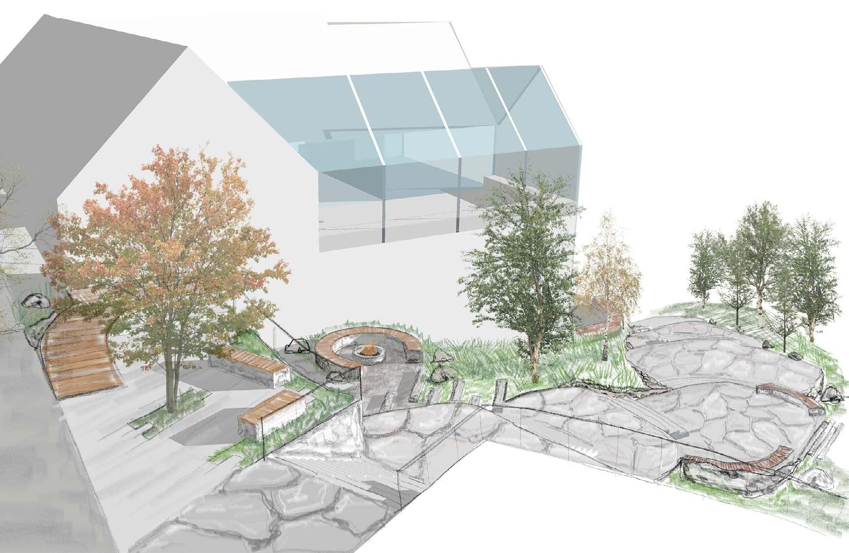
Schematic Modeling
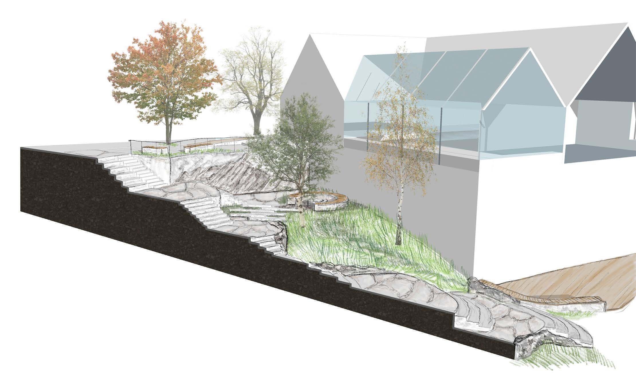
An early concept was built in Sketchup to create a base to sketch on. This helped visualize slopes, building heights, and how the spaces felt and flowed. Scenes from the model were imported into Adobe Fresco to sketch on and explore materials and plants.
Modeling for Grade Changes
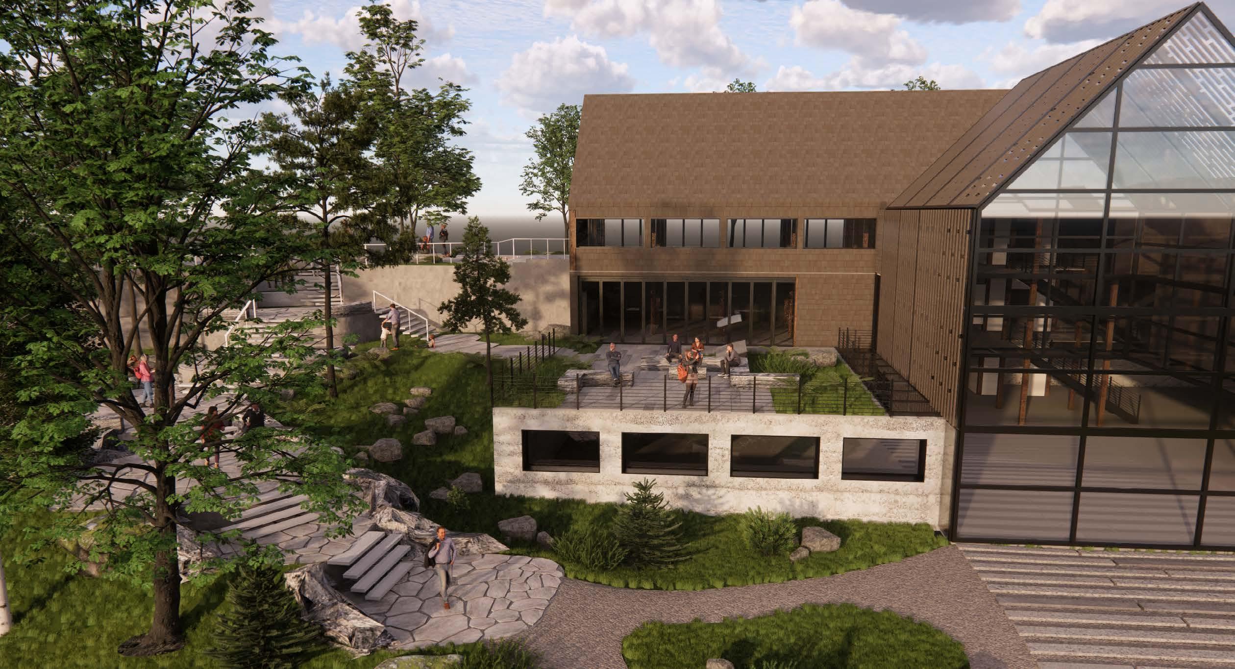
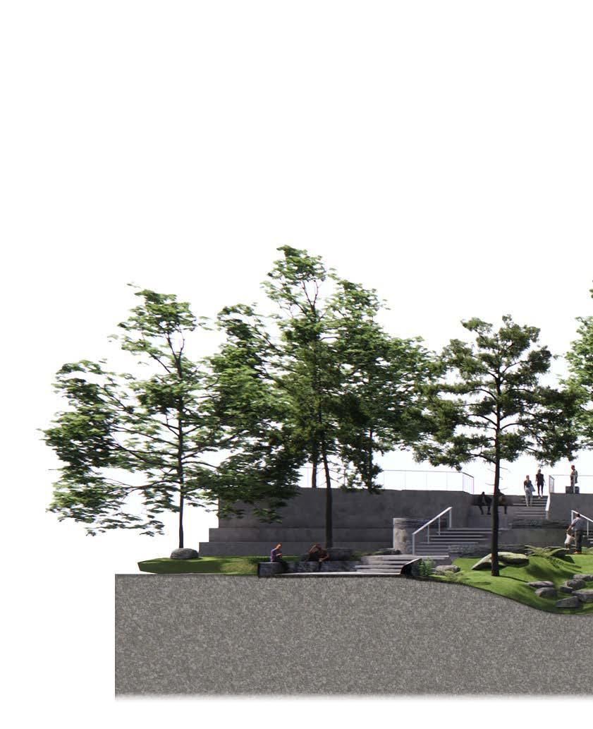
Modeling helped plan how the landscape met with the building. From this, it was decided to make changes to the building to have an outdoor, rooftop greenspace that seamlessly met up with the adjacent landscape to invite the public to watch boat building or the harbor.
7
Materials and Plants
One of the challenges of this site was its location right on the harbor edge. The Apprentice shop members stated they experience flooding in their basement level, damages from the salty air and winds, and poor building heating and cooling.
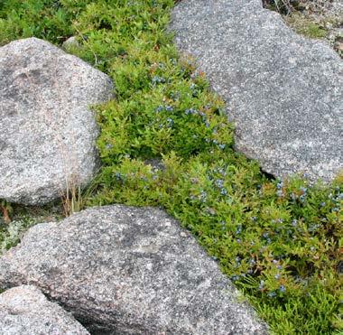
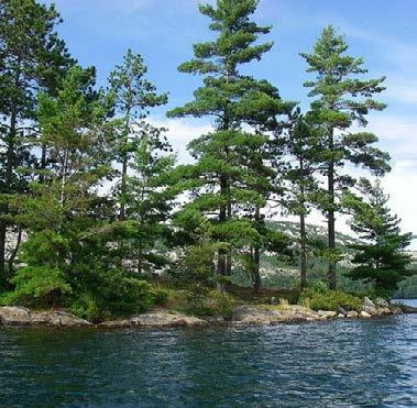
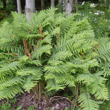
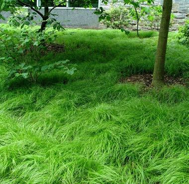
The plant palette includes native plants such as low-bush blueberry, Jack pines, cinnamon ferns, and sedges that are resilient to the extreme, coastal conditions that Maine experiences.
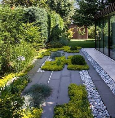
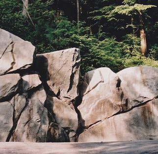
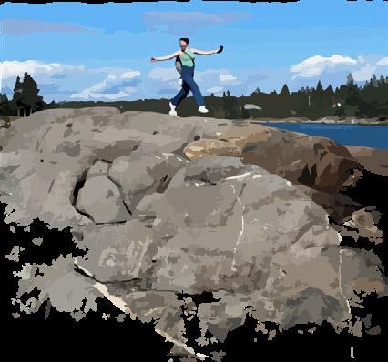
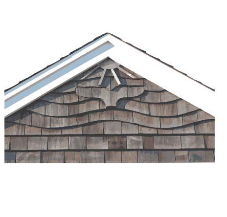
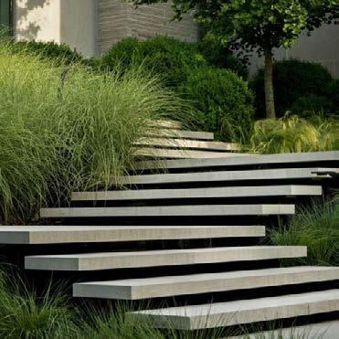
For hardscape materials, locally sourced limestone and granite was used to create the terraced plazas, steps, retaining walls, and benches. The building exterior uses cedar shingles to continue the characteristic shingle-style house, and to be resilient to the salty air and extreme conditions. Rammed concrete was used on the lower level to create a sturdy base that can withstand storms.

8
Rocky shore
Shingle-style
Cedar shingles
Granite stone
Limestone wall
Rammed concrete
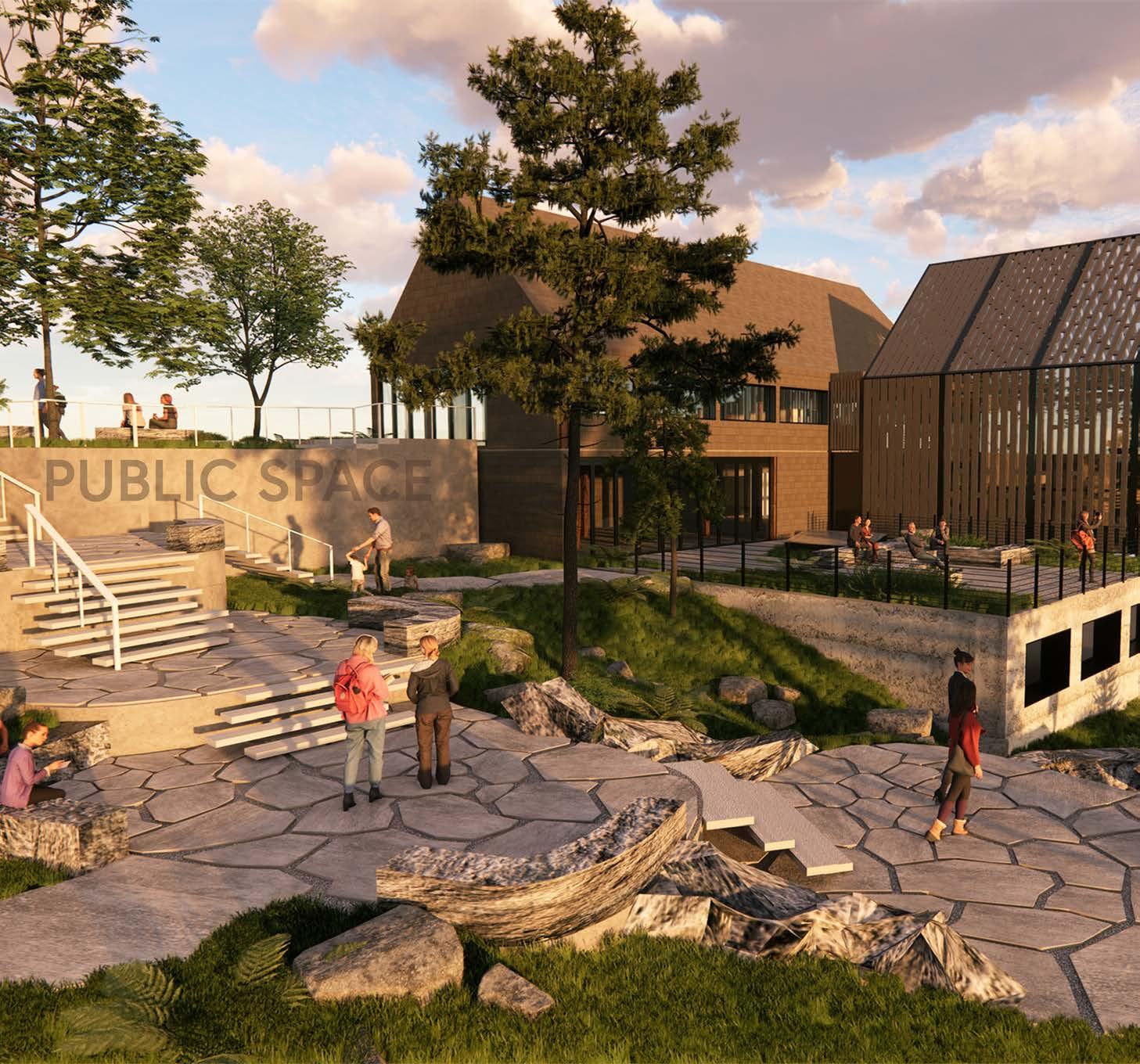
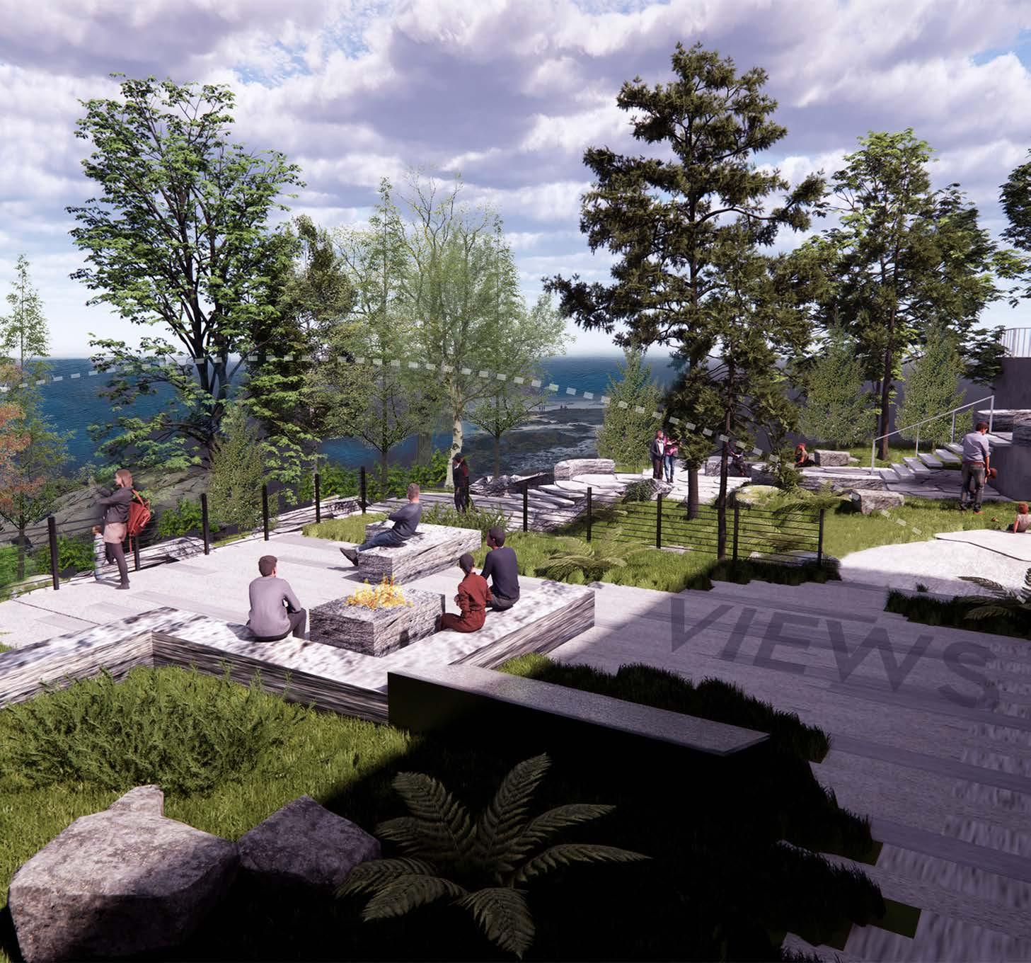

The Apprentice shop members stated they want to increase engagement with the public to teach others about traditional boat-building and Rockland’s histories and culture. To do so, an outdoor, public space was designed to make an inviting area that draws people to the Apprenticeshop where they can view built boats in the Display Room or watch the process of building boats in the Commission Area. It retains the character of Rockland through local materials and plants.
Rock terraces
9
Rooftop Overlook
Display Room
Commission
Loading ramp
Apprentice plaza
Rock terraces
Rooftop overlook

The rock terraces are made of large flagstones of granite with decomposed granite between the stones. This allows the water to seep through to the ground and produce less runoff.
bioswales.See grading and drainage diagram to the
Street-Level
Middle-Level
Basement-Level
(left) Creating connections between the landscape and building
The terraces are embedded into the steep slope. Between the terraces and building, a rocky swale slows the runoff water from the building and and directs it to
right.
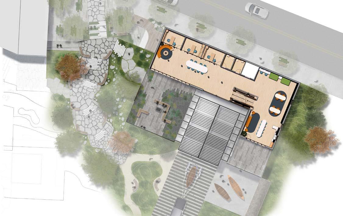
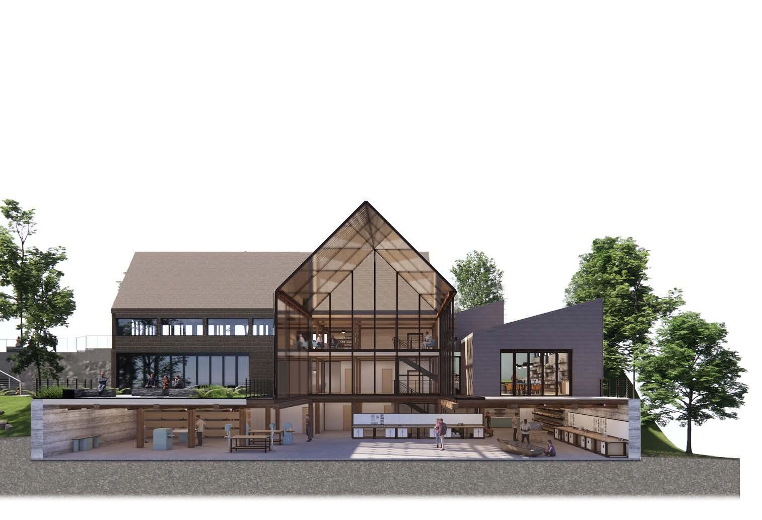
The rooftop terrace has low-growing planting areas that captures additional roof runoff and directs it to collect in adjacent bioswales.
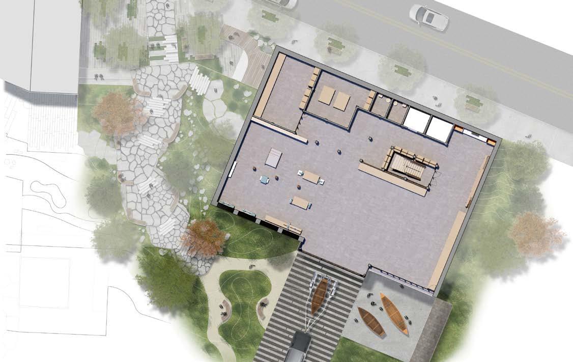
In addition, sky-lights allow light to penetrate through and provide more natural light to the basement-level workshops
The main commission area was designed to provide more room for large boats to be built. This portion of the building is a “glassbox” that allows for viewing on all three levels and outside. It provides warmth in the winter by allowing filtered sunlight to come through.
A private terrace allows the apprentices to have a space away from public areas and the workshop to take breaks or research in the library. It is connected to the kitchen and library inside of the building.
11
Water runoff collection areas

12
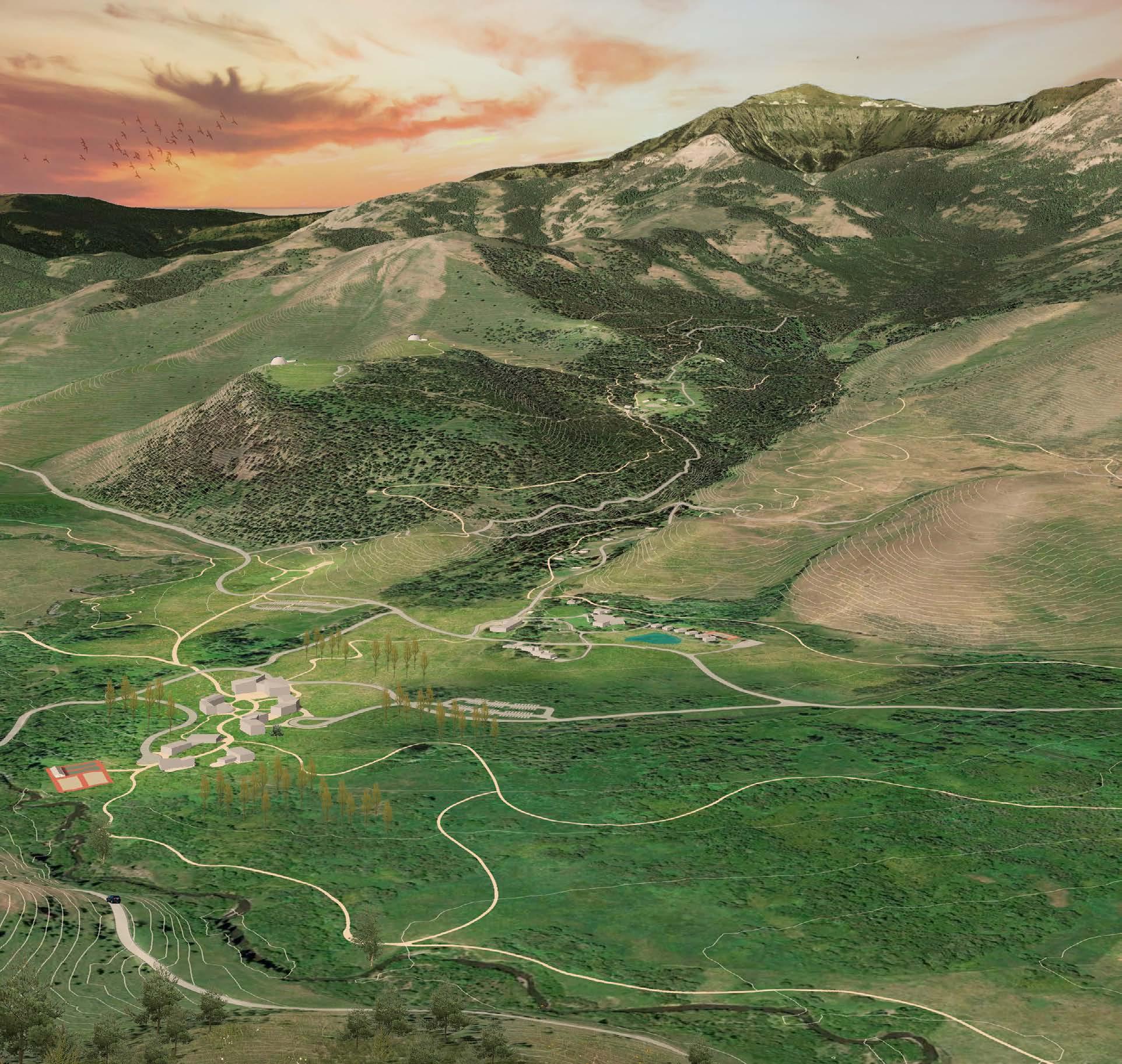
1. Existing B-Bar Ranch
2. Gallatin Equine Campus
3. Existing West Bunk House
4. University Core
5. Wildlife Research Station
6. Ramshorn Amphitheater
7. Creekside Bungalows
8. Observatory Point
1 5 4 3 2 6 8 9 7
9. Artist Studios
Campus Master Planning
Tom Minor Creek Institute | Tom Minor Basin, Montana
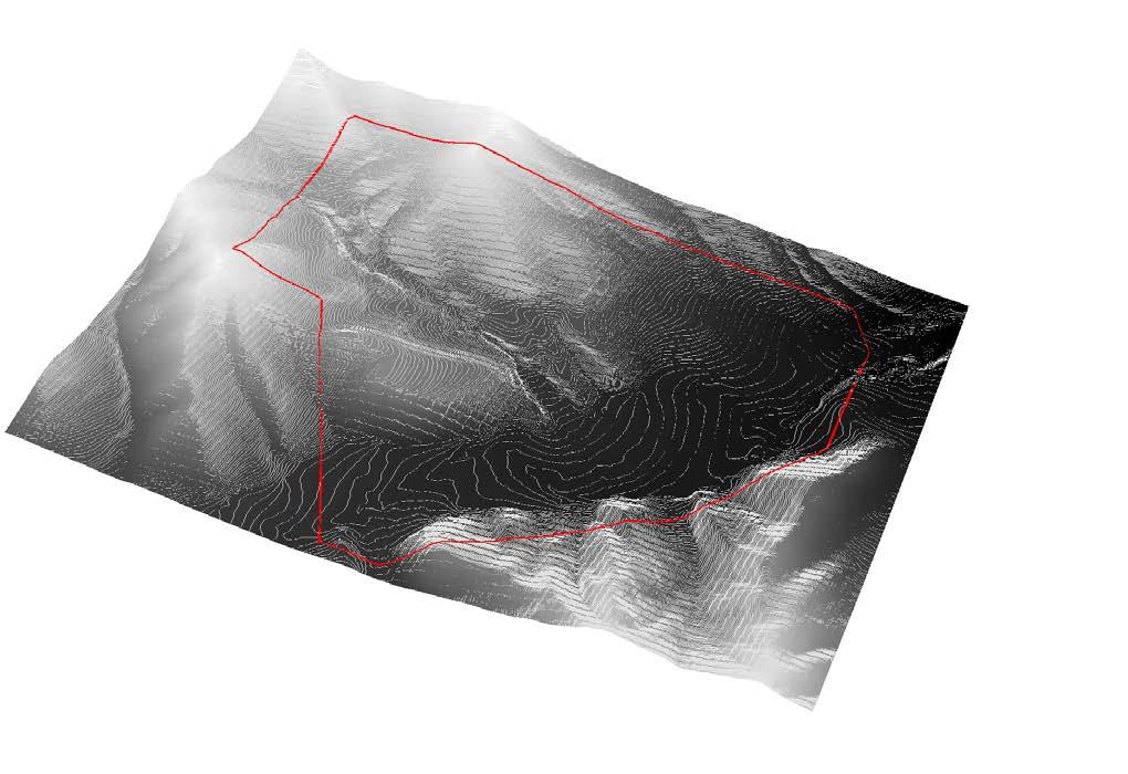
Tom Minor Creek Institute is a 2,000 acre arts and sciences extension campus of Montana State University. The Institute is partnered with B Bar Ranch, an existing ranch, and continues their values of stewardship to the land and protecting natural resources. It is intended to be a ‘retreat’ for the arts and sciences students and faculty to immerse themselves in the flourishing Tom Minor Valley and Gallatin
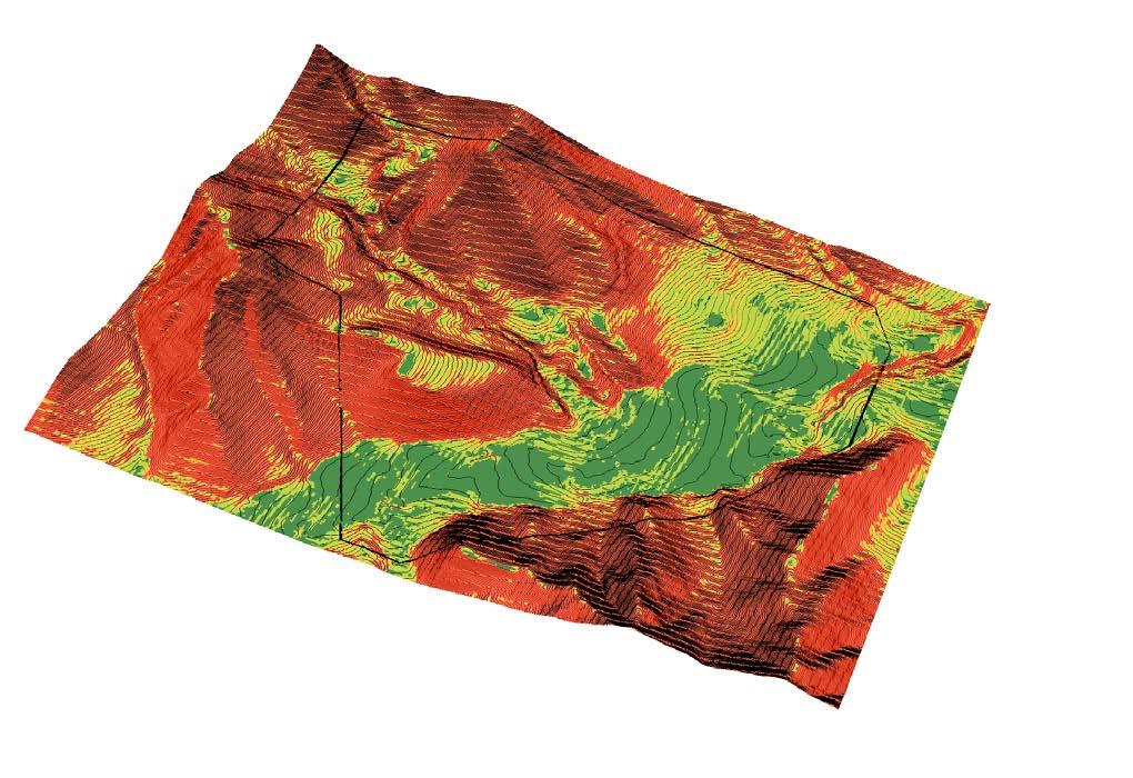
National Forest. It provides recreational and educational opportunities for students and visitors through a network of hiking and horseback riding trails, wildlife research buildings, art studios, and observatories. Site selection and planning was done through a series of GIS maps to identify where national forests are for trail access, trail planning, and building placement.

13
USA NLCD Landcover
Elevation
Slope analysis
Observatory Point
West Bunk House
University Core
Wildlife Research
Ramshorn Amphitheater
Artist Studios
Creekside Bungalows
University Core
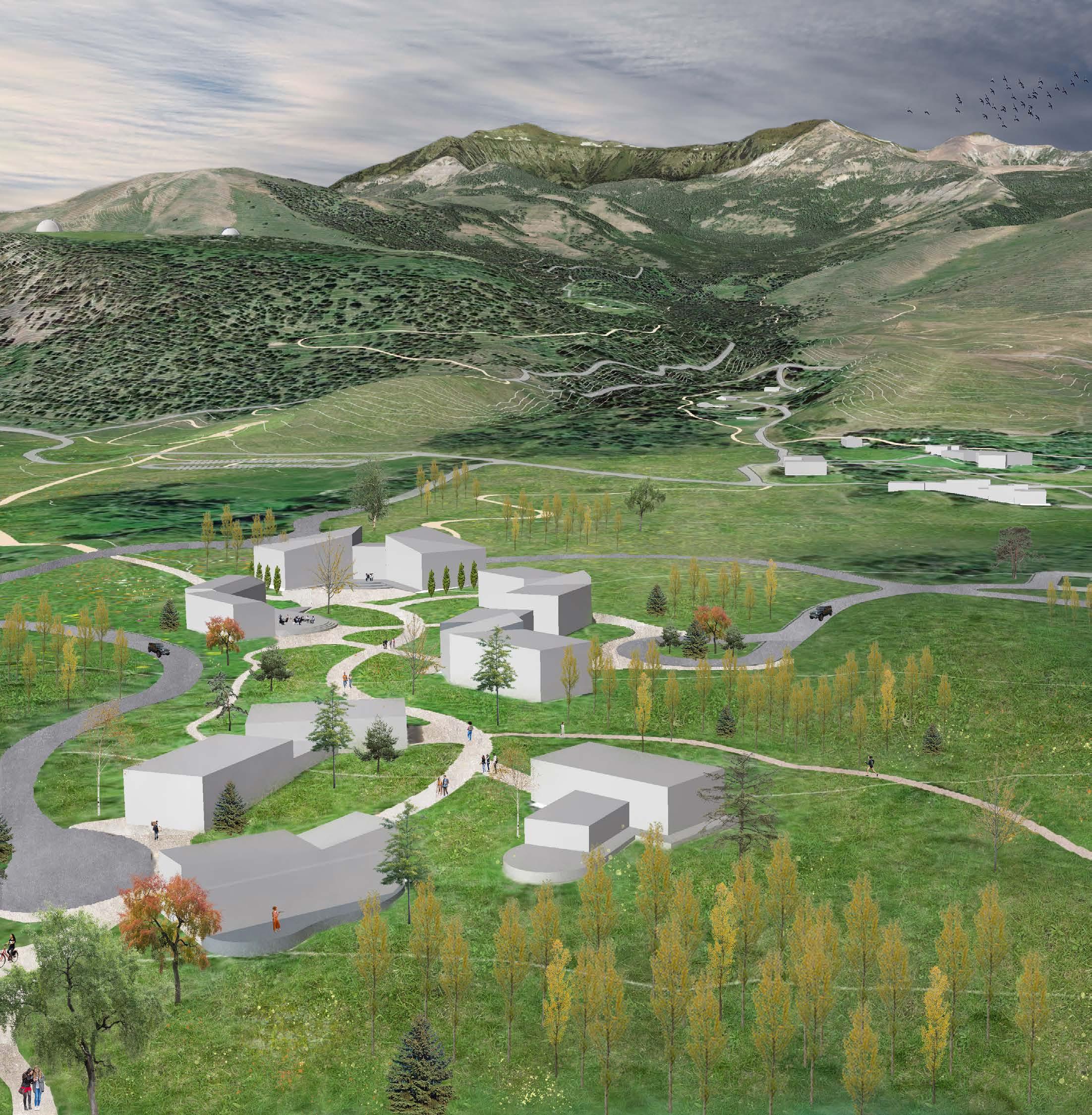
The University Core is where highercapacity buildings are located including the convention center, educational buildings, and dorms. This was intended to consolidate where the majority of development occurs.
The campus is oriented to maximize the views to Ramshorn Peak and has direct access to nature trails from the campus.
The convention center, where large events are held, is strategically placed at the terminus of the campus and is oriented to provide a direct view of the mountain range. Dorms and the food hall are conveniently placed near the convention center.
Educational and recreational buildings are grouped together and have direct access to trails, athletic courts, and a circle drive for transportation to field research stations, the equine campus, and artist studios in the mountains.
SketchUp models and site plans were imported into Google Earth Pro to visualize the campus master plan in 3D. This helped with building orientation and placement.
14
Natural Sciences
Student Dorms
Ramshorn Peak
Creekside Bungalows
Existing Vacation Rentals
Gallatin Forest
Convention Center
Food Hall
Fine Arts
Recreation
Gallatin Equine Campus
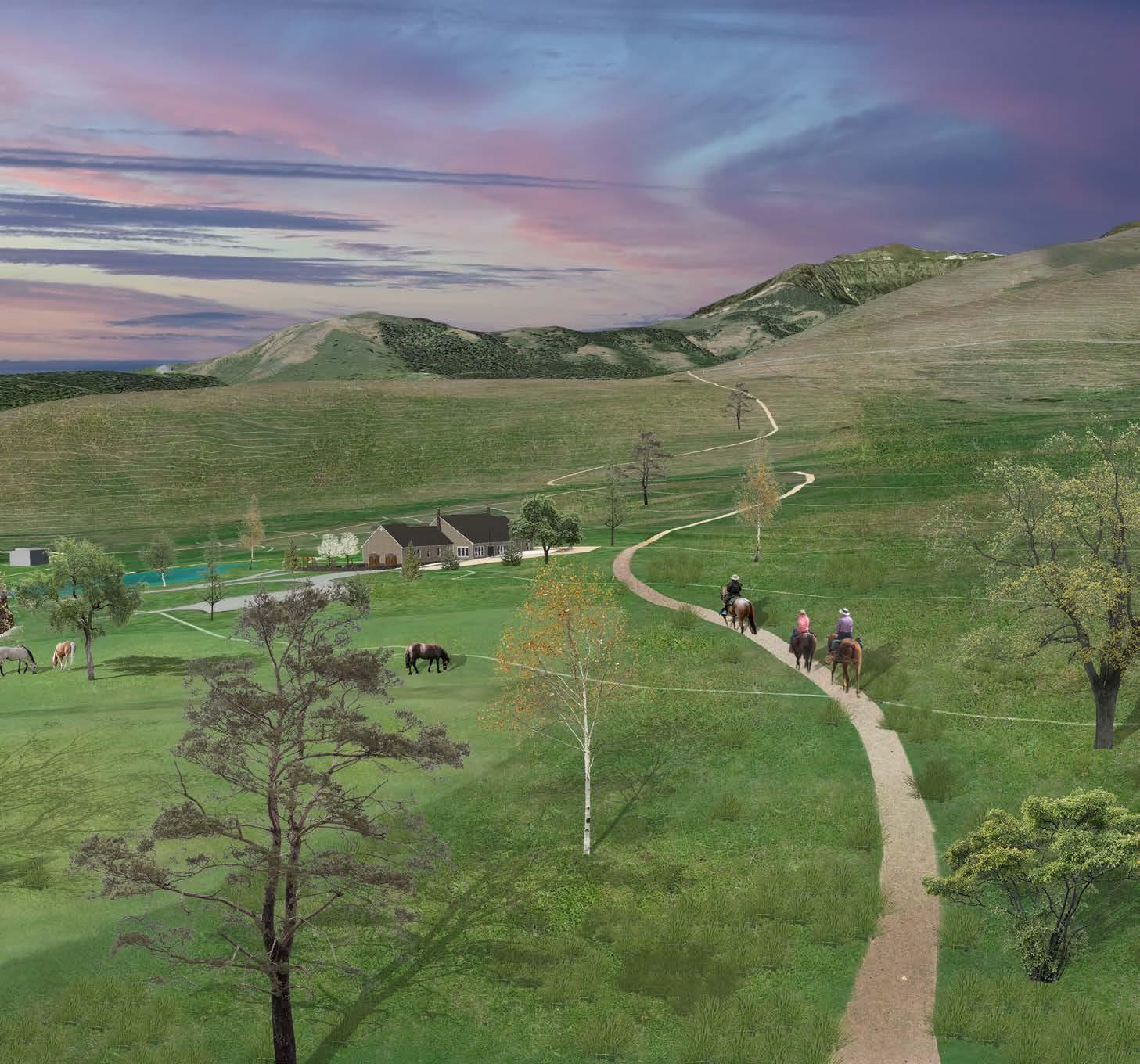
The equine campus features a 16-horse barn, three 2-acre enclosed pastures, a training arena, and horse back riding trails. Several bungalows are available for students to stay in and a main house for year-round ranchers to stay. It is located on a gently sloped pasture with direct trail access to the Gallatin Forest for trail rides.
Observatory Point
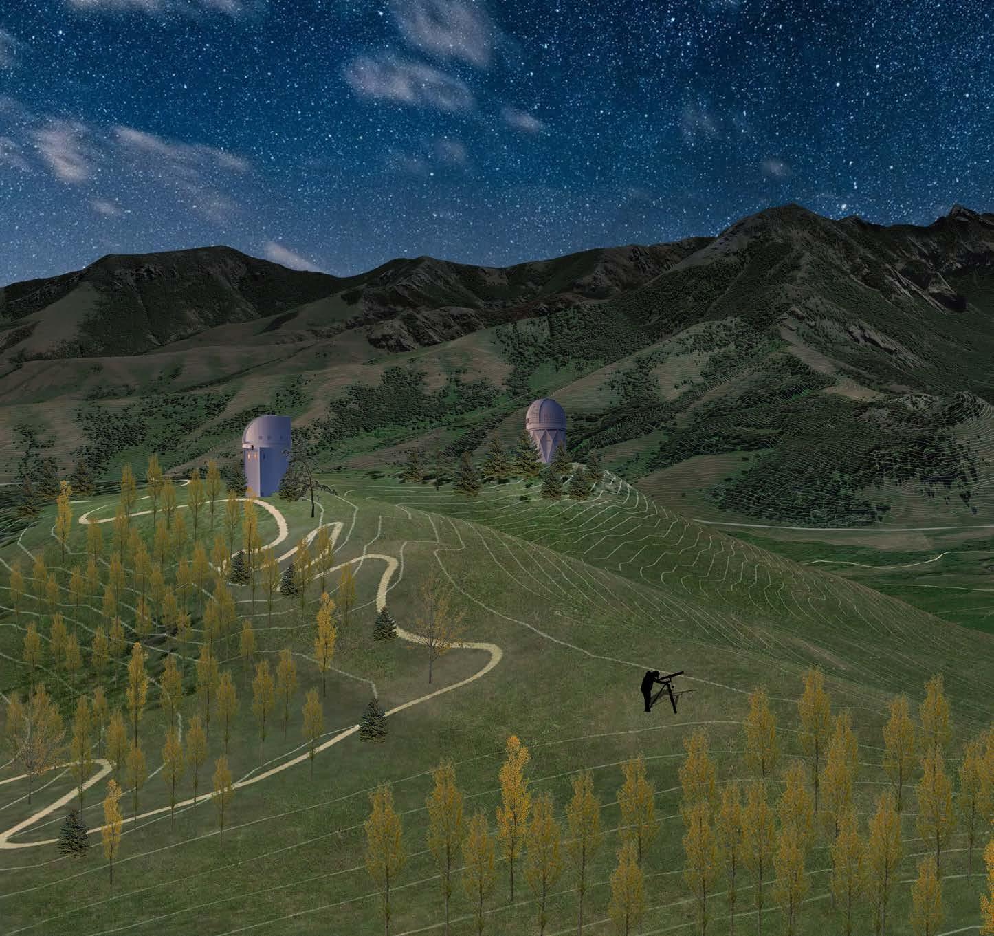
Located on a tree-less plateau on the mountain, the Observatory Point features two observatories and a surrounding park. It is where both students and visitors can observe the stars and planets. It is accessible by hiking trail and ATV paths.
15
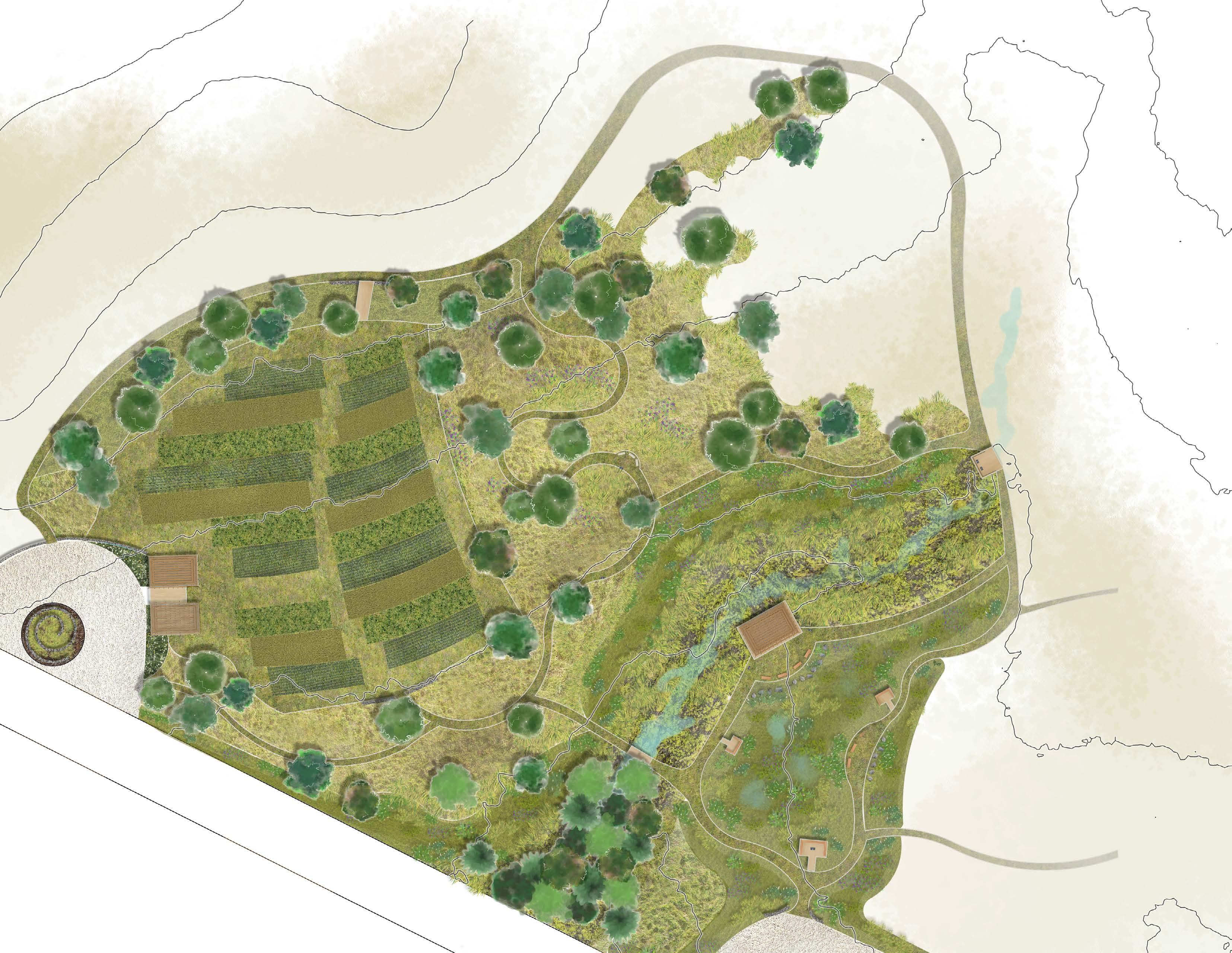
1. Parking
2. Observation dock
3. Nature play area
4. Marlatt rain gardens
5. Creekside pavilion
6. Oak savannah
7. Perennial-Drought crops
8. Agricultural center
16 4 5 2 3 1 8 7 6
Ecological Restoration
Marlatt Agricultural and Ecological Center | Washington
Marlatt Memorial Park, Manhattan, Kansas
Team: Sabreena Leach
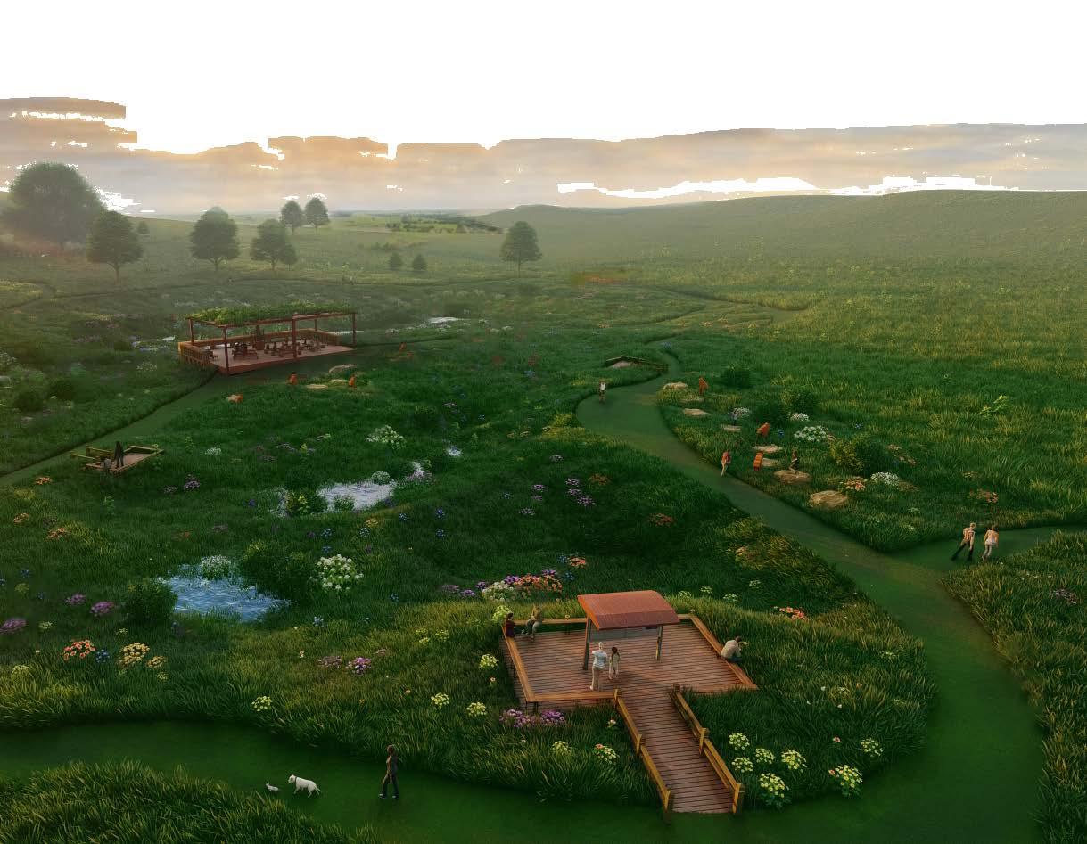
Marlatt Agricultural and Ecological Center is an experimental micro-park situated within the greater Washington Marlatt Memorial Park that responds to the predicted climatic change that could alter the Flint Hills ecoregion. It serves as a public educational park where people can learn about the adaptation of the Flint Hills to the polarizing water situations of extreme drought and precipitation in the future.
selection adapted to dry or flooded conditions, and cisterns to store extra runoff for agricultural use. Various trails, rest stops, and viewing platforms are immersed within the gardens so visitors can experience each ecosystem’s plants and wildlife personally.
This project had an emphasis on the research stage to learn about climate change predictions in the region and the formation of the Flint Hills. Research included gathering information on hydrology, geomorphology, physiography, soils, native vegetation and wildlife, and macroclimate. Then, ArcGIS was used to create a set of suitability maps to select sites best suited for perennial drought crops and rain gardens.

100-year flood Rain Gardens
Restored Oak Savanna
Perennial-Drought Crop research area
Educational trail route
17
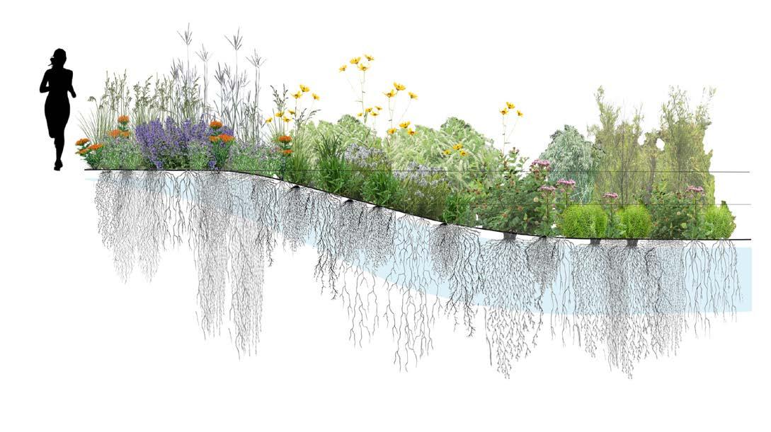
Marlatt Rain Gardens | Designed to capture
Dry zone
Mesic zone
Wet zone
Observation dock
Rain gardens
Nature play area
Creekside pavillion
560.48 560.48 560.34 TC 560.48 BC 559.98 TC 560.24 BC 559.74 560.82 TC 560.95 BC 560.45 TC 562.03 BC 561.53 561.66 561.18 TC 560.24 BC 559.74 TC 559.94 BC 559.44 TC 560.27 BC 559.77 560.48 560.48 560.48 560.34 P 560.34 561.3 561.24 TP 559.58 TP 559.38 560.48 560.14 560.14 560.28 559.8 559.92 560.4 560.28 560.48 560.48 TP 559.48 TP 559.3 559.3 TC 561.07 BC 560.57 TP 560.3 560.24 TC 560.24 BC 559.74 TC 560.48 BC 559.98 TC 560.24 BC 559.74 559.98 TC 560.24 BC 559.74 TC 561.12 BC 560.62 TC 561.92 BC 561.42 559.64 559.64 TP 559.84 TP 559.84 559.84 559.84 560 559.64 560.48 559.74 560.48 TC 559.32 BC 558.82 TC 559.5 BC 559 560.34 TP 559.53 TC 561.28 BC 560.78 561.34 559.98 LEASING OFFICE FFE 560.5 TC 562.4 BC 561.9 TC 562.04 BC 561.54 TC 561.7 BC 561.2 560.54 560.3 560.24 1.2% 1.2% INV 553.1 INV 554.44 INV 554.67 PL 1.0% RIM 558.5 INV 555.05 RIM 558.5 INV 555.45 PL 1.0% INV 555.75 RIM 561.7 INV 555.95 INV 556.5 INV 557 INV 557.57 INV 558.17 PL 1.0% PL1.0% 555 554 553 552 551 550 549 556 557 558 559 560 560 561 561 18
Construction Documentation
Prairie Hills Multi-Family | Savannah, Texas
Prairie Hills is a multifamily development project with an emphasis on the construction documentation stages. Code compliance and ADA were considered in design decisions and grading. A set of technical plans and drawings were created using Civil3D and LandFX, including site analysis maps, a material plan and schedule, dimensional control plan, fine grading plans, and planting plans and schedules, and details. Details were drawn for an entry sign, retaining wall, a wood deck, and pool deck paving.
PRAIRIE
4'-4" R4" R1" 1'-0" 1'-0" 3'-2" 8'-4" 6'-0" 2" 6" 2'-0" LIMESTONE CAP MORTARED IN PLACE CONCRETE FOOTING 2'-8" 8" 8" 8" 6" 1'-4" 11'-10" 2 4x12 POSTS SECURED TO PIER WITH BLACK POWDER COATED STEEL POST BASE 4X8 WOOD BEAM SECURED TO POST WITH 6" BOLTS 4X16 WOOD BEAM SECURED TO POST WITH 6" BOLTS 8X8X16 SPLIT CMU BLOCK, GROUT AND REBAR REINF. WITH MORTARED LIMESTONE VENEER BLACK POWDER COATED STEEL LETTERS 6'-0" 4" 2'-6" 2'-0" 1'-0" 6" 1'-4" 2 - 4X12 WOOD POST 4X8 WOOD BEAM 4X16 WOOD BEAM BLACK POWDER COATED STEEL POST BASE SECURED WITH TIMBER BOLTS COARSE AGGREGATE 6" STAINLESS STEEL BOLT 1, 3, 7, 9 2, 4 5 6 8 8x8x16 8x8x16 8x8x16 8x8x16 ROW# BLOCK SIZE WOOD BEAM 9 3'-2" LIMESTONE CAP MORTARED IN PLACE WOOD BEAMS SUPPORTED BY CUT CMU BLOCKS AND MORTARED VENEER 8X8X18 GROUT-FILLED BLACK POWDER COATED U-STRAP C D CONSULTANTS C D 1 2 3 4 5 Surveyor Architect Engineer ENTRY SAVANNAH, EMILY ekmoore01@ksu.edu CMU BLOCK LAYERS SCALE: 3/4" = 1'-0" 6.4 4.0 4A ENTRY SIGN ELEVATION SCALE: 3/4" = 1'-0" 6.4 4.0 4B SANDWICH POST SCALE: 3/4" = 1'-0" 6.4 4.0 4C CONCRETE FOOTING 1'-4" 2'-6" 2'-0" 1'-4" COARSE AGGREGATE 1, 3, 7, 9 2, 4 8x8x16 8x8x16 x x x x 2'-8" 8X8X16 GROUT-FILLED CMU BLOCKS #4 REBAR HOOP #4 VERTICAL REBAR @ 24" O.C. 1" OF TYPE S MORTAR 2 1/4" 4" 2" DRY STACKED LIMESTONE VENEER 1'-0" 1'-0" 6" 3'-8" 1 2 3 4 5 6 7 8 9 8" 3" 3'-2" LIMESTONE CAP MORTARED IN PLACE #4 VERTICAL REBAR #4 REBAR HOOP WOOD BEAMS SUPPORTED BY CUT CMU BLOCKS AND MORTARED VENEER 1" OF TYPE S MORTAR CONCRETE FOOTING 8X8X18 GROUT-FILLED SPLIT CMU BLOCKS PRAIRIE HILLS 1'-7" 2" BLACK POWDER COATED U-STRAP 4X8 WOOD BEAM 4X16 WOOD BEAM 6" BLACK POWDER COATED U-STRAP TIMBER BOLTS BLACK POWDER COATED SIGN LETTERS FONT: DROID SERIF 1 A B 2 3 C 4 5 CHECKED BY: ENTRY SIGN DETAIL ISSUE: PROJECT NO: CAD DWG FILE: DRAWN BY: MARK DESCRIPTION DATE A B C ENTRY SIGN SAVANNAH, L - 6.4 HDH EKM Moore_Construction_Details_EntrySign.dwg 001 17, February, 2022 XXX XXX XXX Professor Howard Hahn CMU BLOCK LAYERS SCALE: 3/4" = 1'-0" 6.4 4.0 4A COLUMN SECTION - ROW 1 SCALE: 3/4" = 1'-0" 6.4 4.0 4D ENTRY SIGN ELEVATION SCALE: 3/4" = 1'-0" 6.4 4.0 4B COLUMN SECTION B SCALE: 3/4" = 1'-0" 6.4 4.0 4E SANDWICH POST SCALE: 3/4" = 1'-0" 6.4 4.0 4C HANGING BEAM SCALE: 3/4" = 1'-0" & 1 1/2" = 1'-0" 6.4 4.0 4F
19
HILLS
CONSTRUCTION DETAILS
Entry signage
(Left) Grading plan
END POST PULL LOCK AND POST PROTECTOR TUBE
3'-2 1/2" 4'-3 1/2"
1" x 4" CUT OUT IN DECKING FOR RAILING POSTS
1'-0 3/4"
3'-8 1/2"
2" x 4" DECKING 90° TO JOISTS
OVERHANGING FASCIA BY 1"
4" X 4" RAILING POST ATTACHED WITH TWO THROUGH BOLTS
FASCIA ATTACHED BY DECKING
SPACED 16" O.C.
1A
DECK PLAN
SCALE: 1/4" = 1'-0" 6.1 4.0
INTERMEDIATE POST DRILLED WITH 5 32" HOLE FOR CABLE
2" X 4" RAILING SUPPORT
2" X 6" RAILING CAP
3'-7" O.C.
SPACE CABLES EVENLY BETWEEN RAILING SUPPORT AND DECKING
3 3/4"
END POST CABLE RECEIVER AND SWAGING STUD
2" X 8" JOISTS
SPACED 16" O.C.
STAINLESS STEEL WASHER
STAINLESS STEEL CAP
4" x 4" RAIL POST
2" X 6" RAILING CAP
4" X 4" RAIL POST ATTACHED WITH TWO THROUGH BOLTS
2" X 4" DECKING SPACED 1 8" APART AND OVERHANGING FASCIA BY 1"
2" x 4" DECKING
2" X 12" FASCIA BOARD ATTACHED WITH DECK SCREWS
SCREWED INTO JOISTS
1C
CABLE RAILING ELEVATION
2" X 4" RAIL SUPPORT
SCALE: 1/2" = 1'-0" 6.2 4.0
6" CONCRETE ANCHOR BOLTS
SPACED 12" APART ON LEDGER
STAINLESS STEEL JOIST HANGER
4" X 4" POST
2" X 8" JOISTS
4" X 12" LEDGER BOLTED TO CONCRETE
12" BELOW FROST LINE
10" DIAMETER FOOTING 12" BELOW FROST LINE
6" COARSE AGGREGATE SUB-BASE
29 64" HOLE, 1 3 4" DEEP FOR STAINLESS STEEL PULL LOCK
1 4" HOLE, 1" DEEP FOR STAINLESS STEEL POST PROTECTOR
47'-10 1/2"
Wood deck design and details
PULL LOCK FITTING
JOIST HANGER CONNECTS
JOIST TO BEAM
*SEE JOIST TO BEAM DETAIL
10" DIAMETER CONCRETE FOOTING
6" COARSE AGGREGATE SUB-BASE
SWAGING STUD FOR 1 8" CABLE
4" x 4" RAIL POST
1 8" CABLES SPACED EVENLY BETWEEN RAIL SUPPORT AND DECKING
DECKING FLUSH WITH CONCRETE LANDING
*SEE DECK TO CONCRETE TRANSITION DETAIL
29 64" HOLE FOR STAINLESS STEEL CABLE RECEIVER ON END POST
STAINLESS STEEL WASHER
SWAGING STUD AND END RECEIVER
12" REBAR O.C.
1 2" EXPANSION JOINT
4" CONCRETE PAVING
3'-2 1/2"
4.0 1D
EARTH STARTS 4" BELOW LEDGER
SCALE: 1/4" = 1'-0" 6.1 4.0 1B
DECK ELEVATION
10" DIAMETER CONCRETE FOOTING 6"
4'-0" 8"
2'-0"
1'-10"
COARSE AGGREGATE SUB-BASE
B C D
550 552 553 554
558 559
551
555 556 557
8'-6 3/4" 7'-6 3/4" 6'-6 3/4" 5'-6 3/4" 4'-6 3/4" 3'-6 3/4" 2'-6 3/4" 1'-6 3/4" 4'-3
6 3/4" 1'-10"
1/2"
39'-7"
25'-3 1/2" RAIL
8'-0"
10"
1'-0 3/4"
4'-0" O.C. 3'-8 1/2"
20
DECKING FLUSH WITH CONCRETE LANDING
2'-0" 3'-2 3/4"
4" EXISTING CONCRETE PAVING
2"
1 1 2" CONCRETE CAP ATTACHED WITH TYPE S MORTAR
2" X 3" FLUTED CONCRETE VENEER ATTACHED WITH TYPE S MORTAR
REINFORCED CONCRETE STEM WITH FLUTED VENEER
#4 REBAR REINFORCEMENT
#4 VERTICAL REBAR REINFORCEMENT
CONCRETE FOOTING
2" DIAMETER WEEP HOLES @ 4"
Prairie Hills Savannah, TX
AGGREGATE BACKFILL
ISSUE:
PROJECT NO:
CAD DWG FILE:
DRAWN BY:
CHECKED BY:
WOOD DECK
DETAILS
Retaining wall
8'-6 1/2" 8'-3 1/2" 559
1'-0"
MARK DESCRIPTION DATE A B C Engineer
L - 6.1 HDH EKM MOORE_CONSTRUCTION_DETAILS.dwg 001 17, FEBRUARY, 2022 XXX XXX XXX
Howard
Professor
Hahn CONSTRUCTION
1'-6" 6'-0" 1'-10" 1'-0" 3" 3" 5'-0" 1'-11" 3'-1"
O.C.
X
4" KEY O.C. OF STEM
UNDER DRAIN
8'-11 1/2"
1'-8" 2" 20'-0" SECTION A 44'-0" 12"X24" CONCRETE 4" OF 3 4 MINUS 12"X12" 12"X30" B C D 1 2 3 RETAINING WALL SECTION SCALE: 3/4" = 1'-0" 6.3 4.0 2A MODULAR PAVING - PLAN SCALE: 1/4" = 1'-0" 6.3 4.0 3A 21
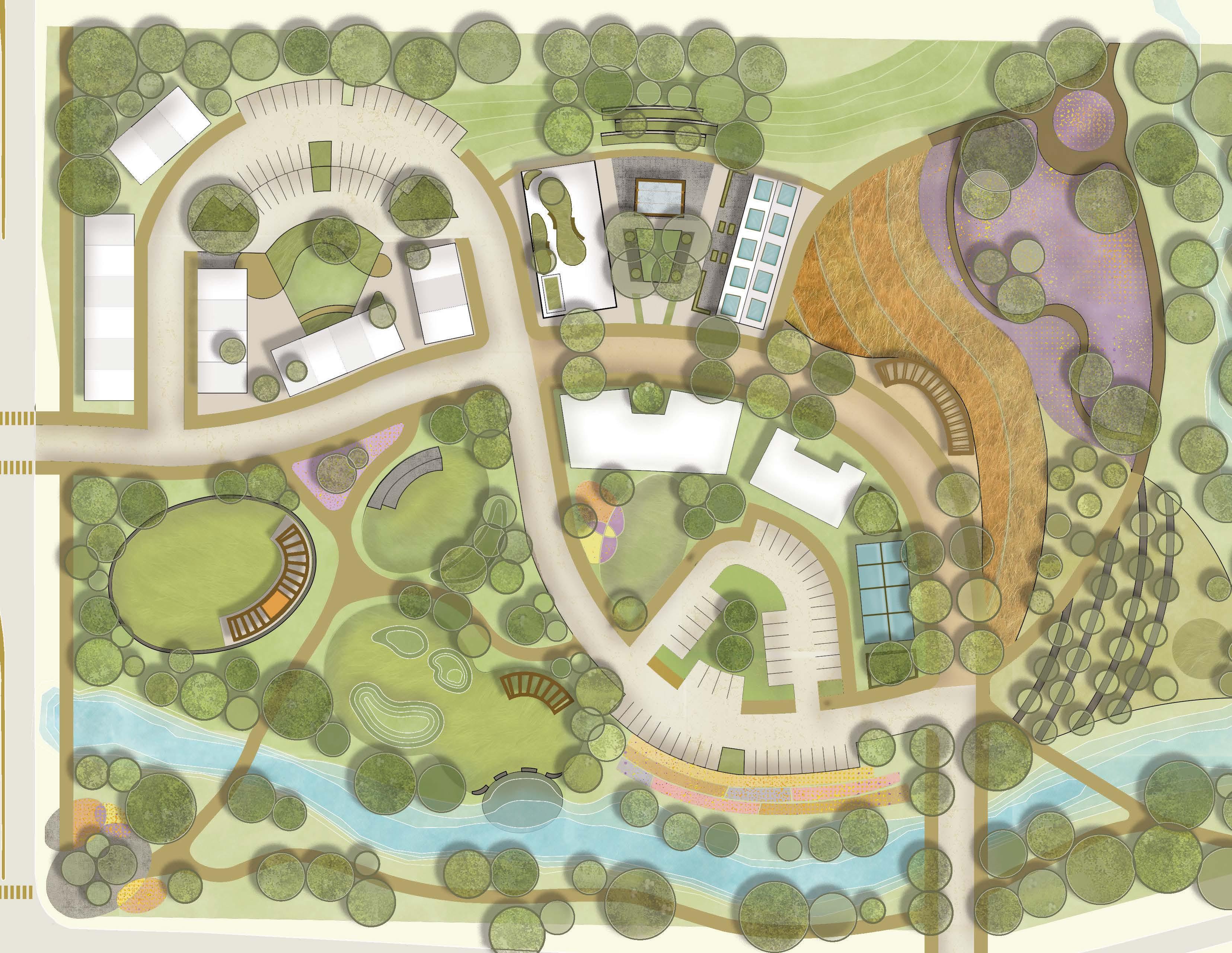
4 1 2 3 6 8 5 9 7 10
Brownfield Redevelopment
Southside Agrihood | Des Moines, Iowa
Team: Alyssa Paulson, Jenna Goldsmith, Maly Sears
Southside Agrihood is situated in southern Des Moines where the SE 14th Corridor, an automotive centered corridor, presents social, resource, and accessibility barriers to its residents. Through engaging community members, the Southside Agrihood transforms a 16 acre parking lot to a space that provides sustainable living through urban agriculture, community gathering spaces, and restorative landscapes.
Challenges of SE 14th Corridor
• Pedestrian safety and comfort
• Food desert
• Limited local services
• Lack of community
• Disconnection from neighborhoods and surrounding greenspaces
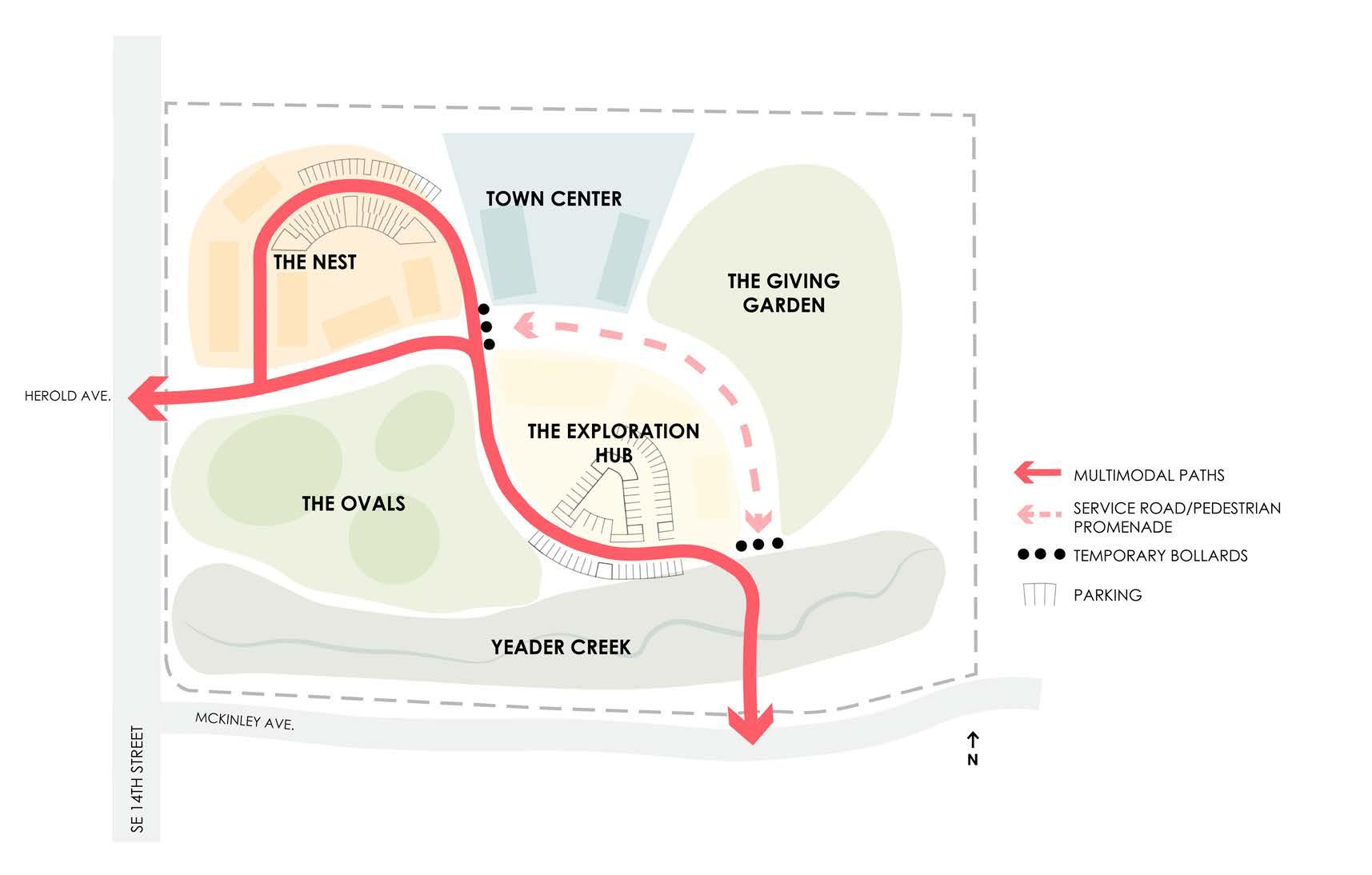
Plan Rendered by Maly Sears
CAD linework by Emily moore
1. Entry plaza
2. Play and Recreation
3. Creek landing
4.Town Houses
5. Town Center Plaza
6. Community Center
7. Crops
8. Greenhouse cafe
9. Restorative trail
23
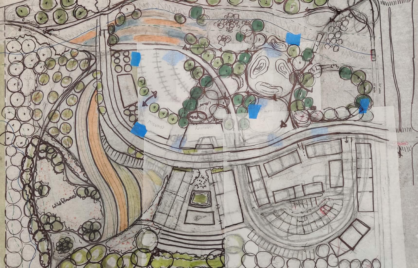
10. Orchard Team process work
SUSTAINABLE LIVING
Town Center Plaza
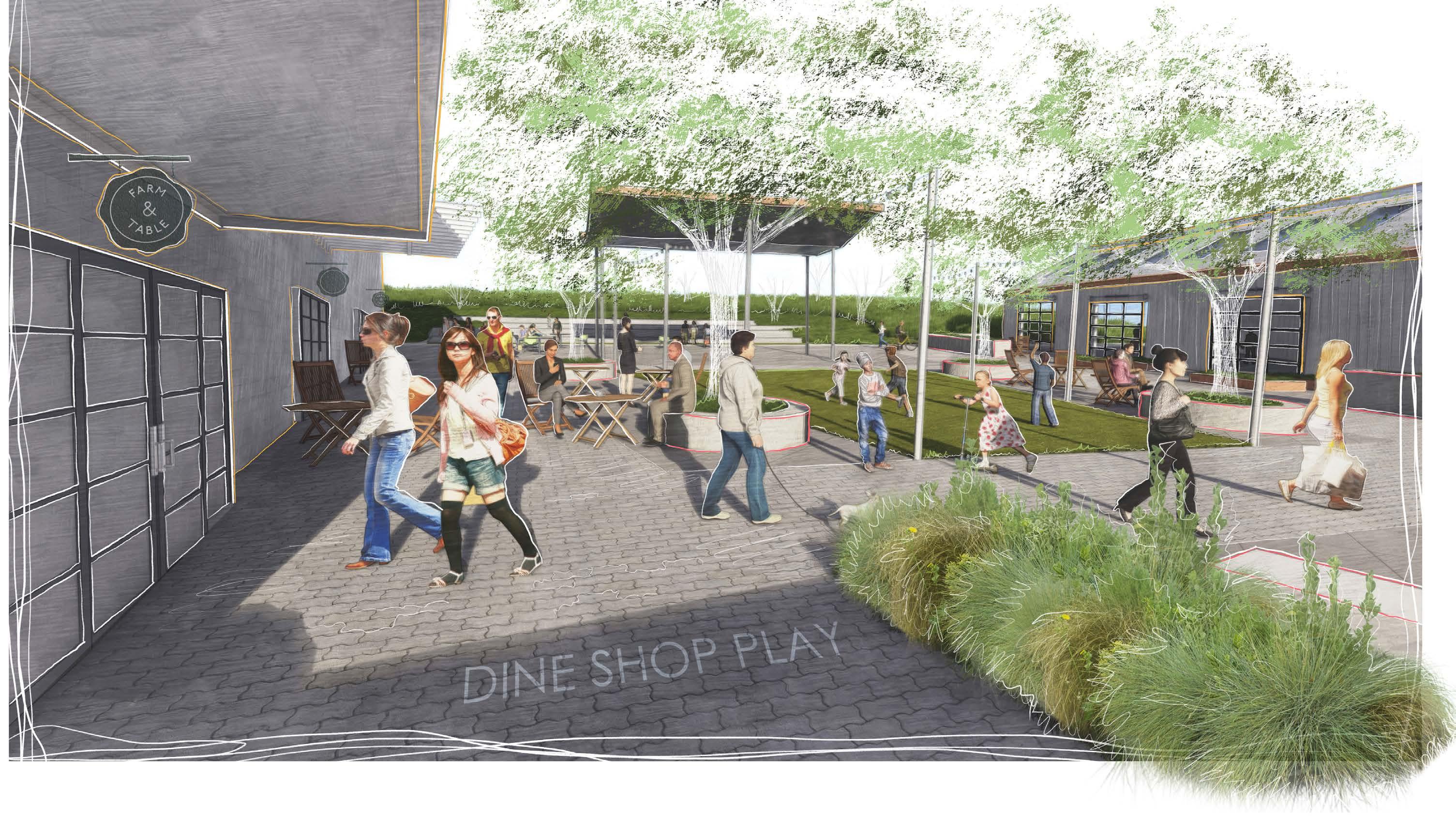
At the heart of the agrihood, the plaza bustles with activities. It is the place where community events can take place, local entrepreneurs can start their business, and people can buy fresh foods year-round.

24
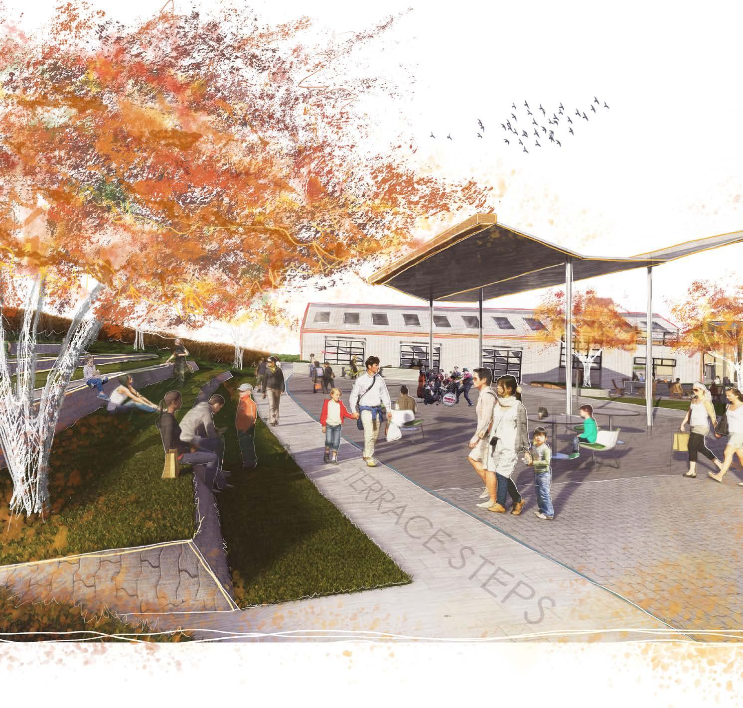

Flexible Spaces
The Town Center Plaza was designed to have the ability to transform to serve the community’s needs in every season.
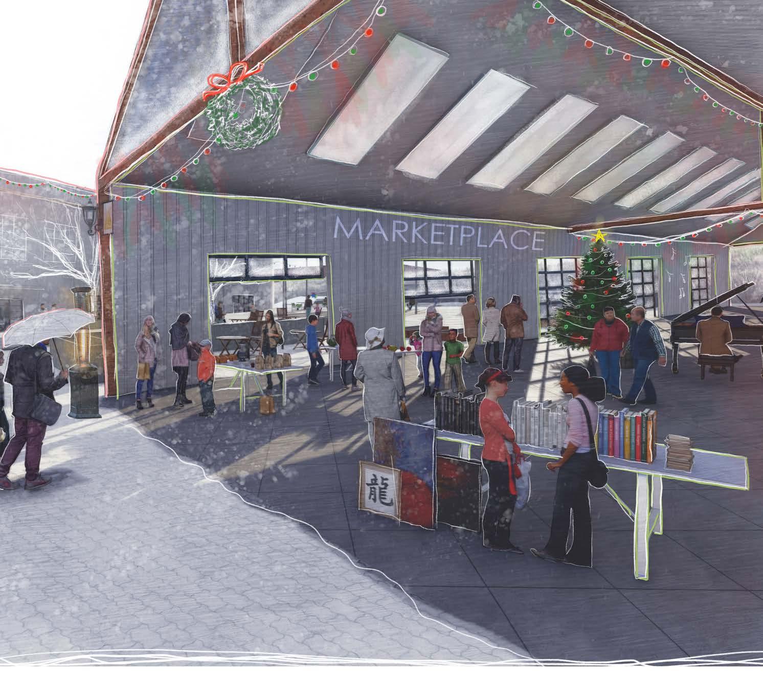
The Marketplace

25
Terrace Steps at the Town Center
LEGEND
Sloped Planting Area in 4” Concrete Wall
Planting Area in 12” Metal Curb
Planter Pot Collection (Varies Size)
Flush Wood Deck
Casual Seating Area
Tenant Patio Space with Porcelian Tile
Concrete Pavers (Ref. Material Images)
30” Concrete Wall
Valet
Bollards
Paver Band - Concrete Pavers
Specimen Multi-trunk Live Oak
Ornamental Tree
Wood Bench
1" =20’-0” SITE PLAN - FULL BUILD OUT
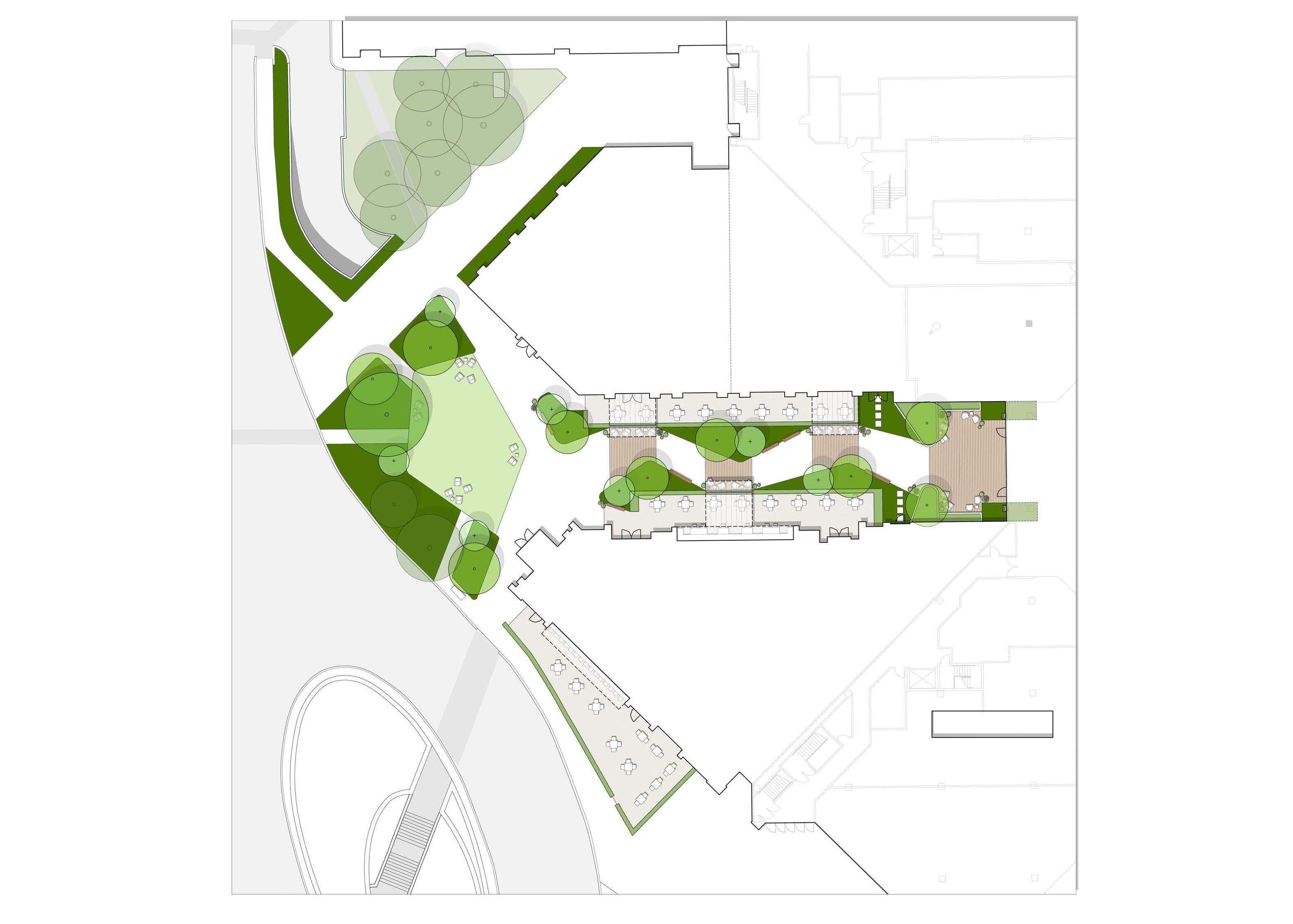
ENTRY FRONT PORCH NORTH ITALIA 1,200 SF PATIO VALET DROP-OFF 2 2 5 5 5 6 8 8 8 6 6 7 1 3 DEAD SPACE NEW TENANT 4 4 1 9 10 13 13 11 11 14 12 BLUE FISH 820 SF PATIO 455 SF PATIO LAWN 1,500 SF GALLERIA ‘THE ALLEY’ REVISIONING ON STRUCTURE EXTENTS NOBUILDZONE 1" =20’-0”
GALLERIA
GALLERIA ENTRY FRONT PORCH NORTH ITALIA 1,200 SF PATIO VALET DROP-OFF 2 2 2 5 5 5 6 6 8 8 8 8 6 6 7 7 1 3 3 DEAD SPACE NEW TENANT 4 4 4 1 1 9 9 10 13 13 13 11 11 11 10 14 14 12 12 BLUE FISH 820 SF PATIO 455 SF PATIO LAWN 1,500 SF
9 | 2023.04.28 ON STRUCTURE EXTENTS NOBUILDZONE
GALLERIA ‘THE ALLEY’ REVISIONING DALLAS, TEXAS
Professional Work
Galleria Mall South Entry | Dallas, Texas
StudioOutside Team Members: Jessica Clements (Principal), Josh Emerson (Senior Associate), and Rosie Manzo (Project Manager)
This project started and completed during my internship (January 2023 - July 2023) and is currently being constructed.
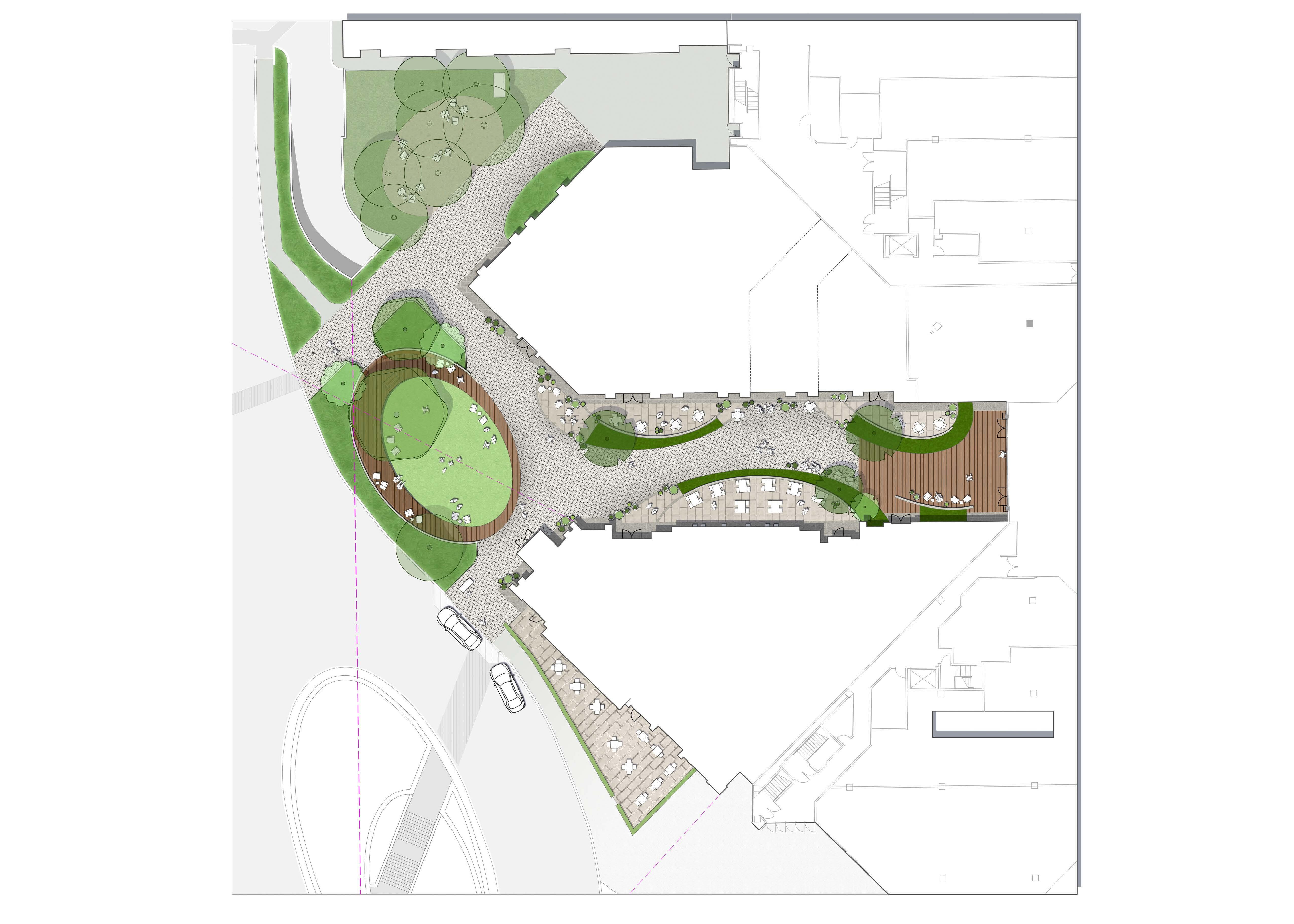
Goal: Redesign the Galleria South entry to provide more outdoor gathering spaces for restaurant dining and mall events. The concept was to create a “front porch” feeling where people can come and lounge, dine, and play with their friends and family.
This project was a rewarding experience as I worked closely with the team throughout the entire project – from Schematic Design to Construction Documentation.
My role in this project ranged from base cleaning, site analysis, bubble diagramming spatial organizations, sketching concepts in both plan and perspective, drafting in AutoCAD, 3D modeling in Sketchup, surveying onsite, rendering the conceptual and schematic plans, selecting plants and materials, and drawing and editing construction and detail drawings.
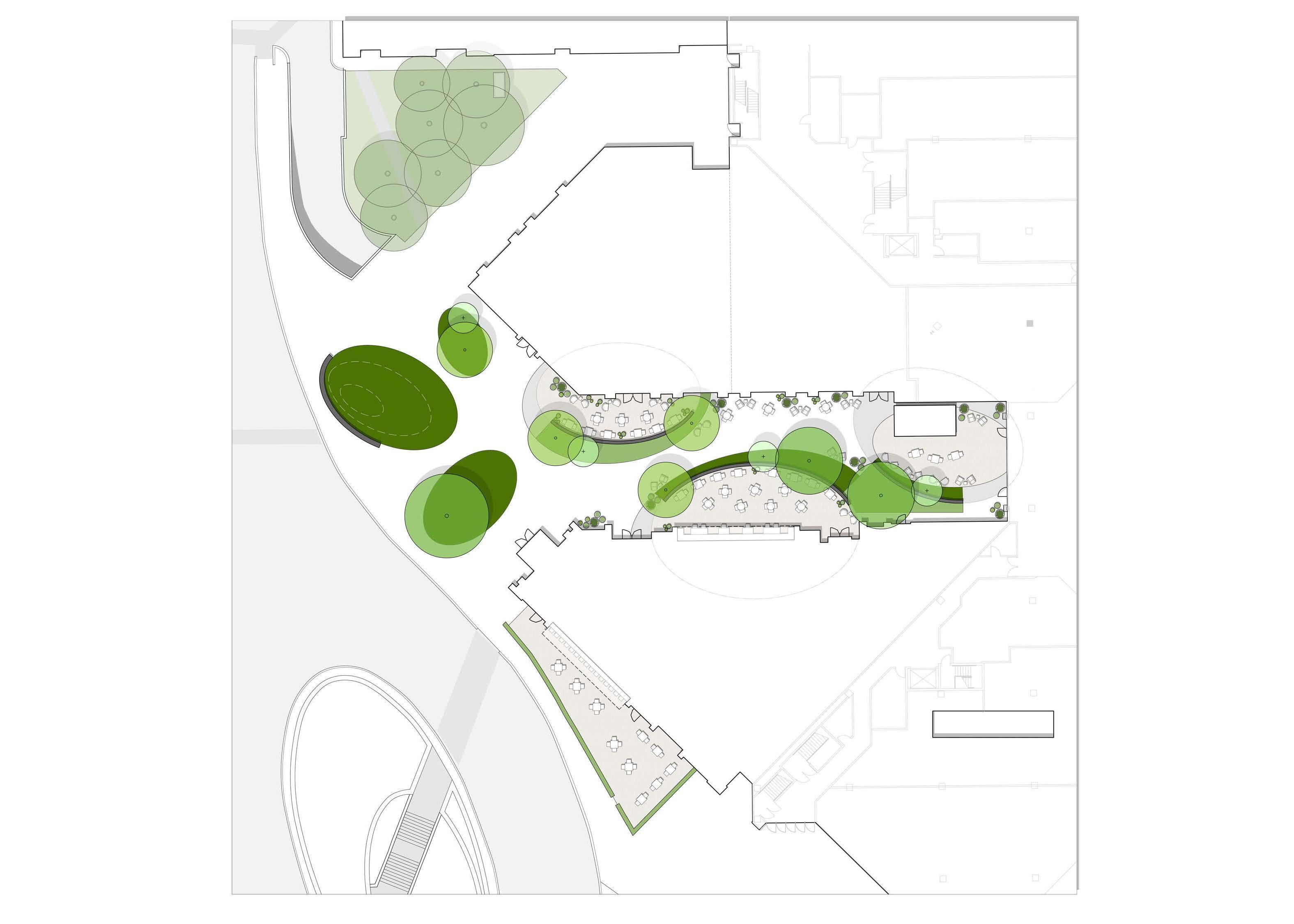
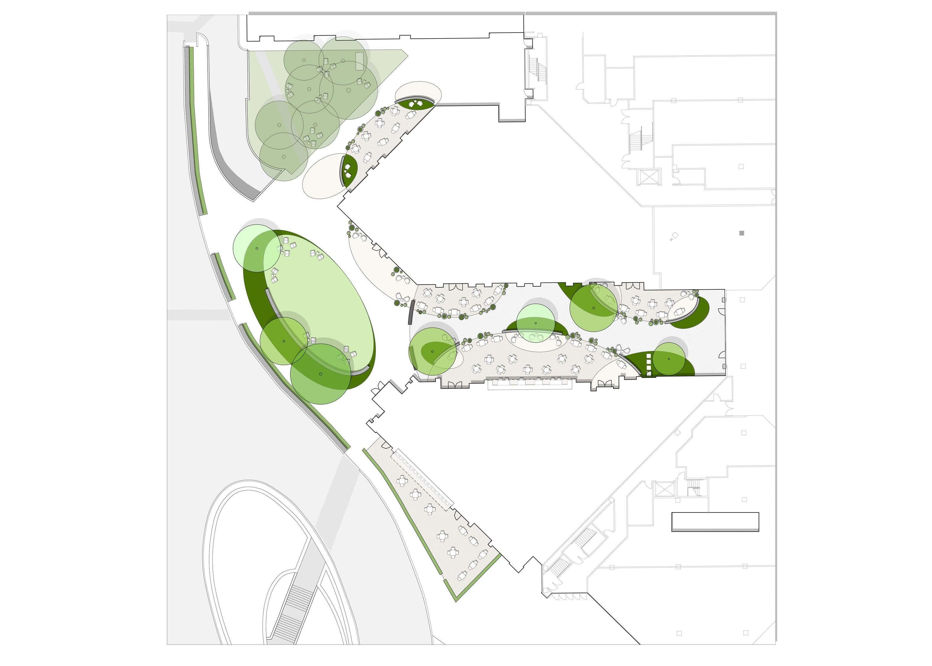
OPTION 2 MEANDERING LAWN 2 3 7 OPTION 3 FRONT PORCH GALLERIA ENTRY FRONT PORCH LAWN BLUE FISH NORTH ITALIA VALET DROP-OFF 2 1 2 3 3 5 4 4 6 6 7 9 7 7 8 27
Concepts Presented to Client
Schematic
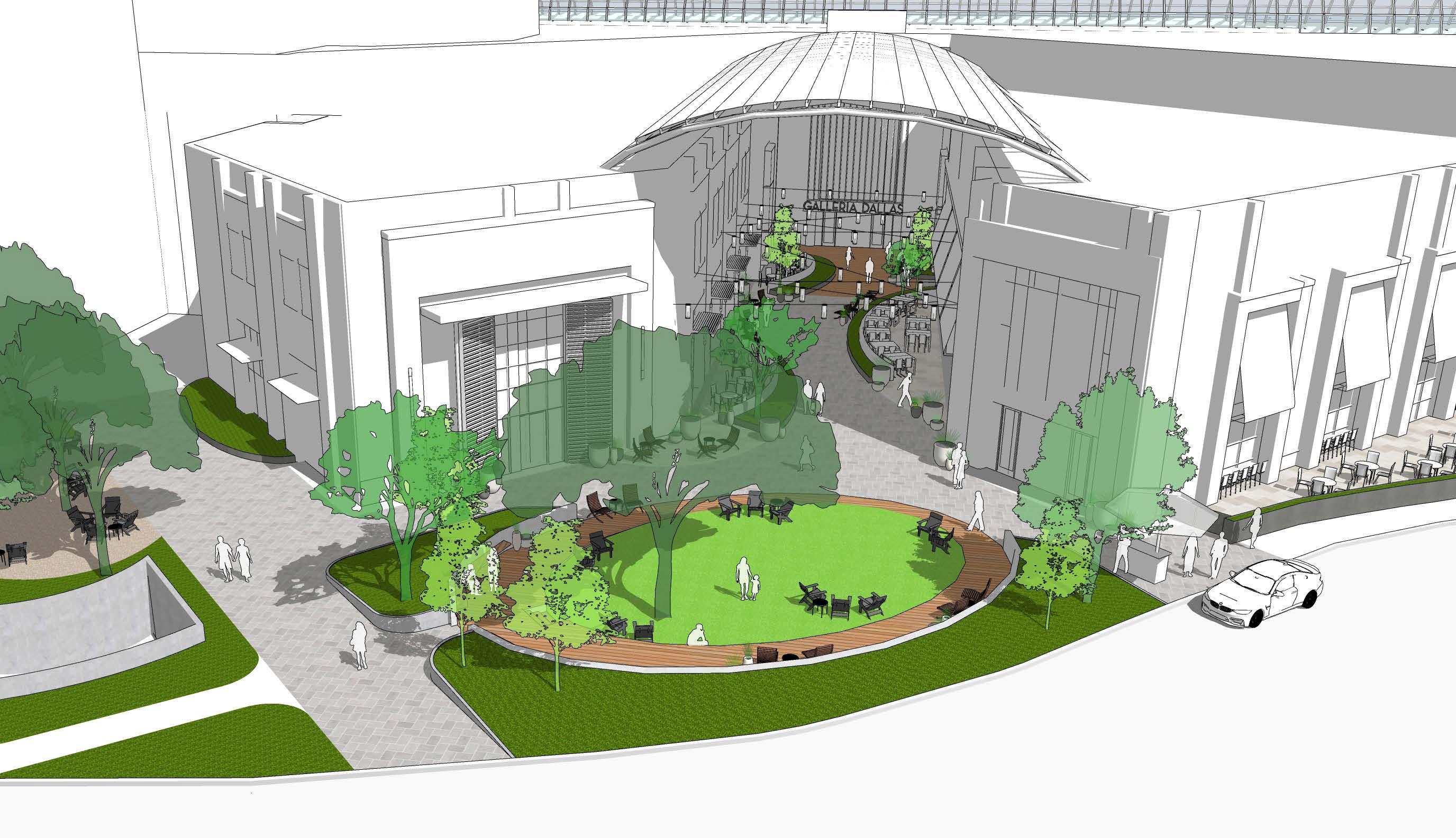
SOUTH ENTRY
Event/play lawn
Restaurant patios
Floating lantern lights
Wood deck
Planted berm to create a space that feels safe and blocks views to the road
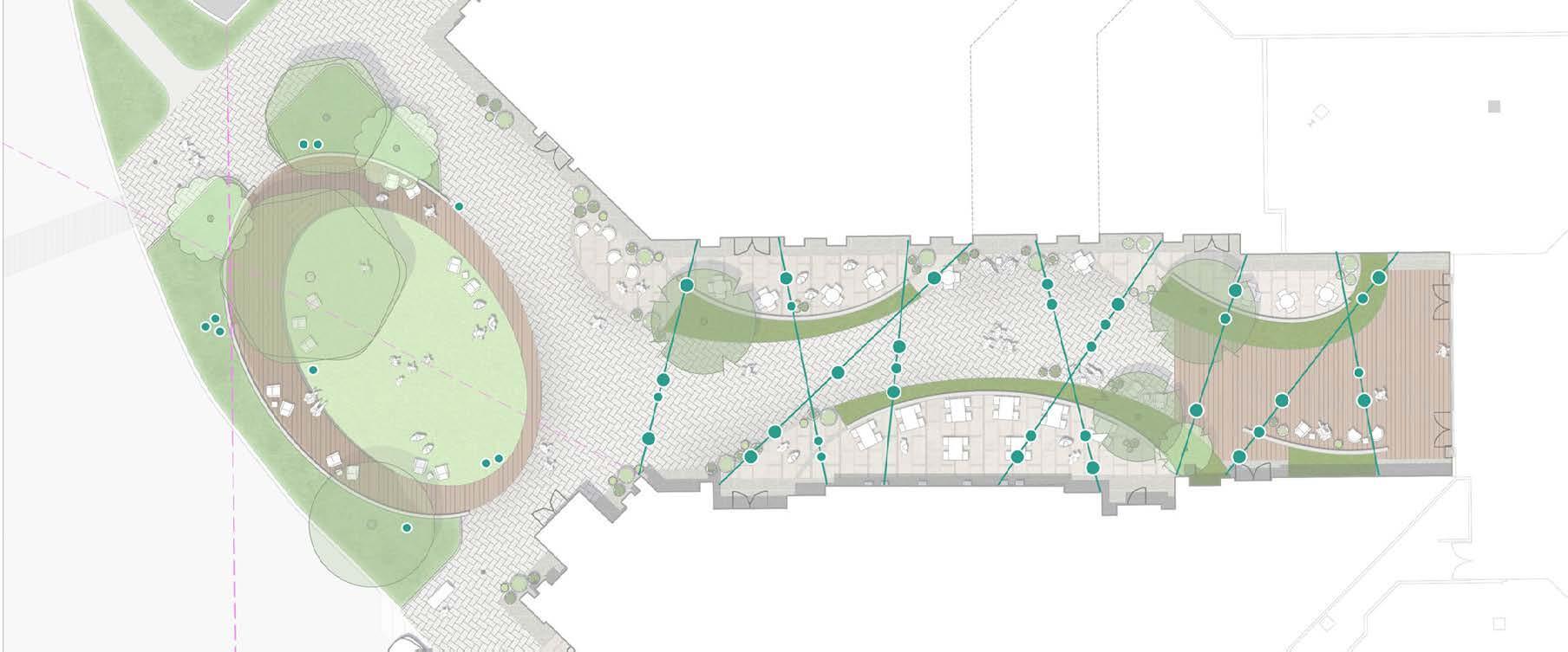

(Top Left) Lighting Study
We did some initial diagrams to explore what kind of overhead and ground lighting would fit the design. This option was preferred by the client and the design was then developed with the help of a lighting designer.
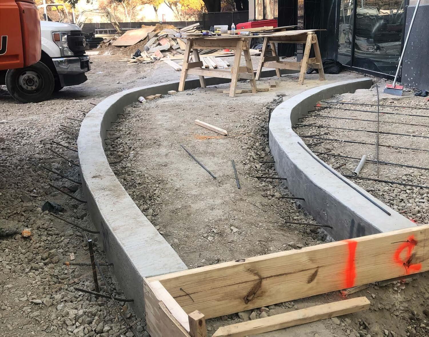
(Left) Construction Update (Jan 2024)
(Opposite) Schematic Modeling
To understand spatial relationships and scale, we created several Sketchup Models for our various concepts. This was the last model we created to show to the client how the spaces would be activated, the grading of the planting areas and lawn, material change, and lighting.
OPTION 3 - LINEAR CANTENARY REVISIONING 29
(Above) Construction Update (Jan 2024)

30
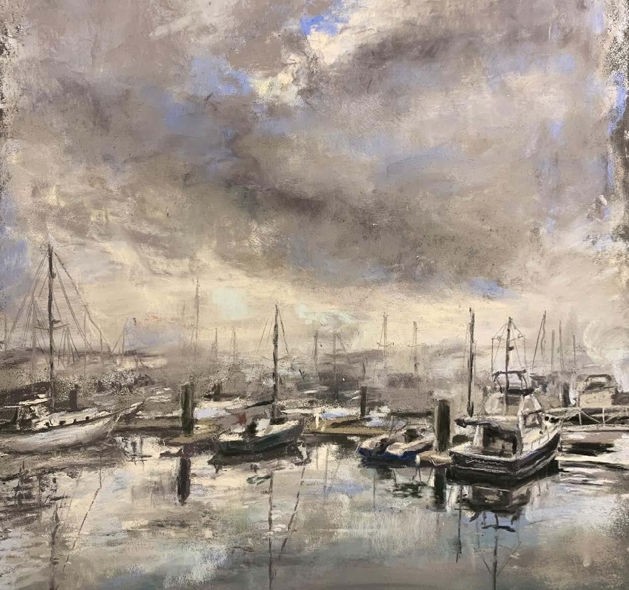
Soft Pastel | Beaufort, SC
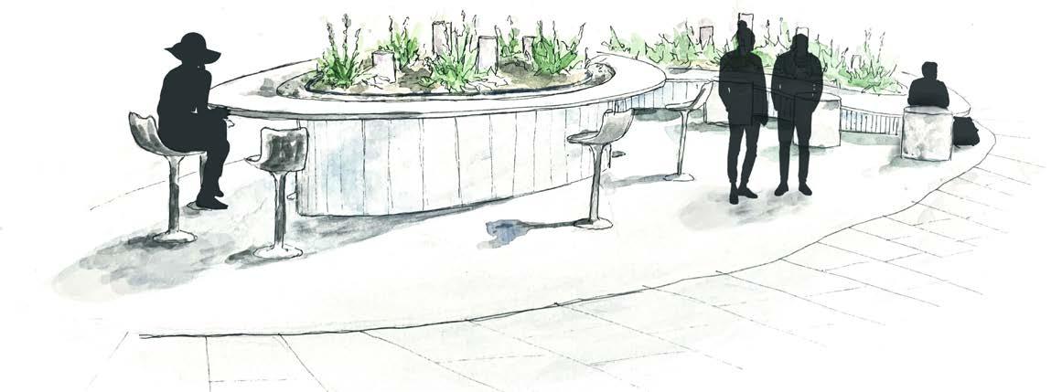
Watercolor & Sketchup Modeling | K-State Quad Re-Design,
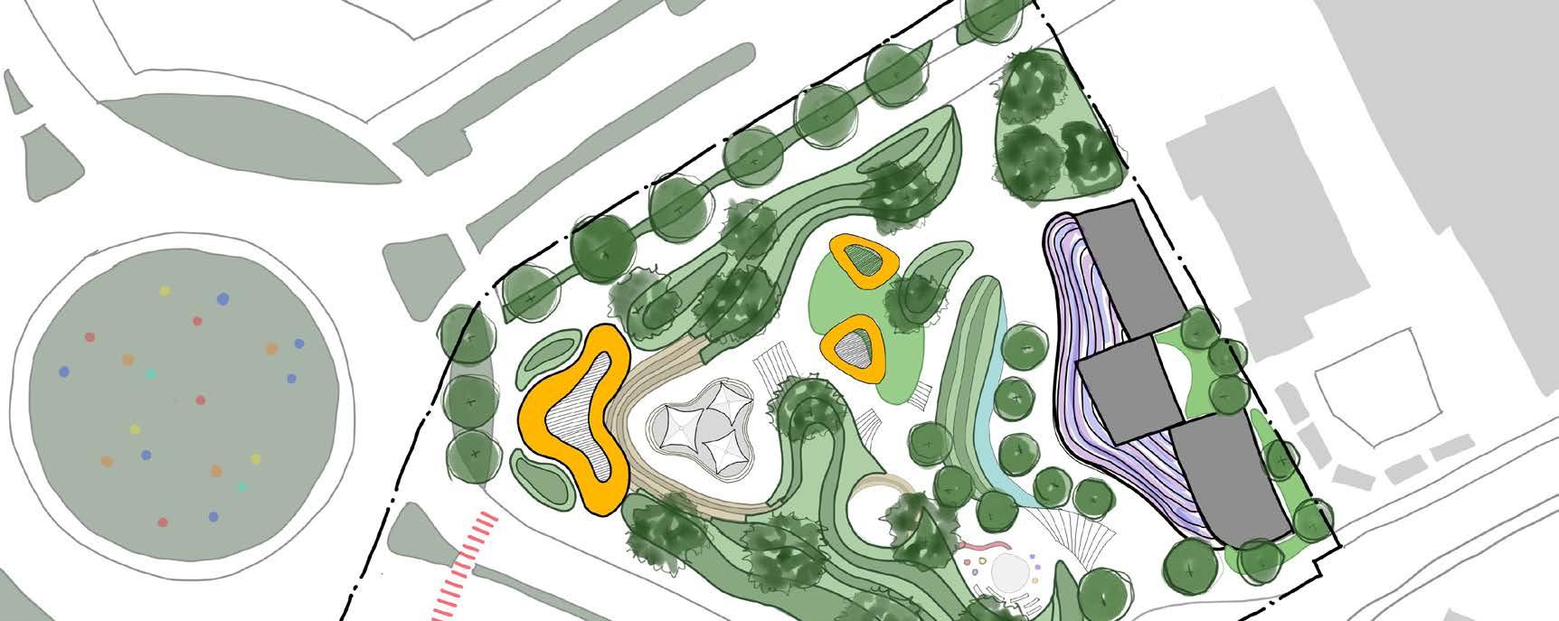
Adobe Fresco Drawing | Nashville Park Concept, TN
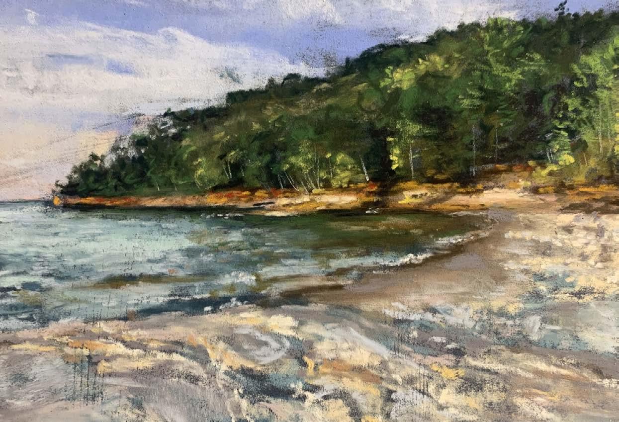
Soft Pastel | Pictured Rocks National Lakeshore, MI
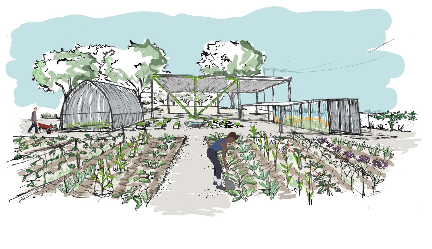
Hand Drawing & Painting
I am passionate about working with my hands and believe sketching is a critical part of how we, as landscape architects, communicate our ideas with each other and with clients. I work in a variety of media (pencil, pen, watercolor, digital, and charcoal) to graphically communicate my
ideas and solutions. I also enjoy creating art in my free time to explore new media. Recently, I have been using soft pastels and watercolors. Art has always been a part of my life and I aim to incorporate drawing in most of my future work.


31
Acrylic | Snowy Bear
Watercolor & Digital Modeling | K-State Quad Re-Design
Watercolor & Digital Modeling | K-State Quad Re-Design
Adobe Fresco Drawing | StudioOutside Internship Project, TX

EMILY MOORE 913-940-1138 emily.moore1@icloud.com Contact Information:


