emerson Goo landscape architecture portfolio 2018
2023
—

2 emerson goo California Polytechnic State University, San Luis Obispo Bachelor of Landscape Architecture, c/o 2023 emersongoo.blot.im emersonyiwengoo@gmail.com 808.385.3305 (text/SMS only)
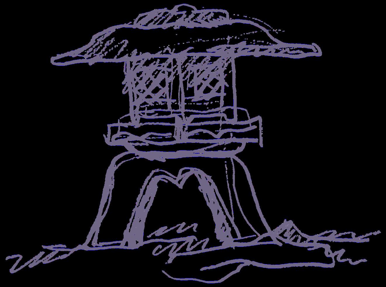
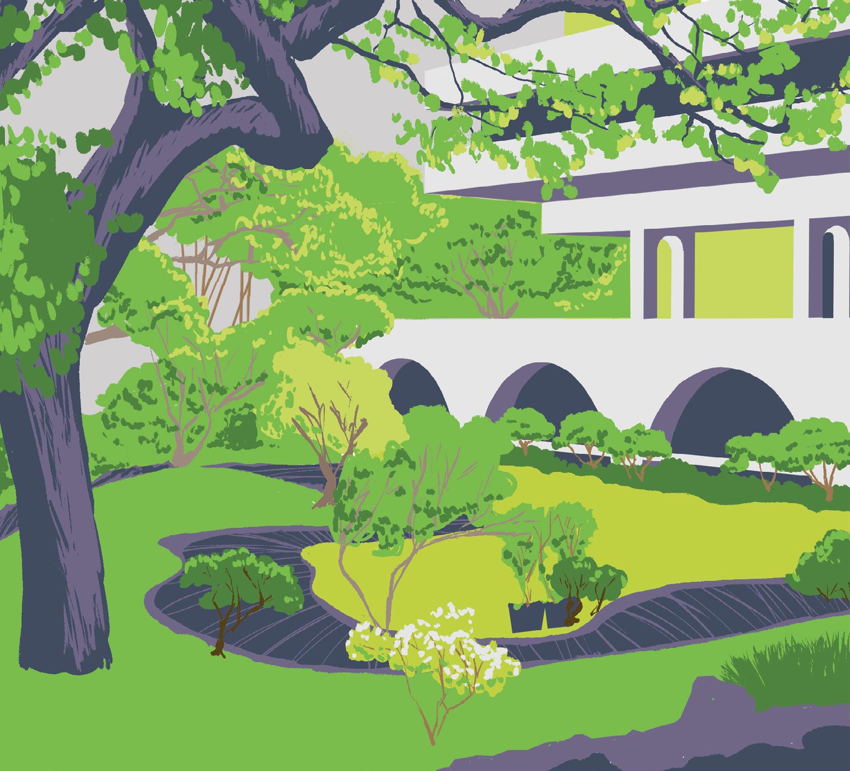
COVER: East-West Center, University of Hawaiʻi.
Architecture by I.M. Pei, gardens by Leland Miyano.
Digital painting made for LA 436, a traditional and digital media graphics course.
Between the Schoolyard and the
Honolulu, HI
Blueshift: Remembering Old Oakland
Oakland, CA
Unreeling the Past: Harvey Milk Plaza
San Francisco, CA
Signs of Life along the Merced
Mariposa County, CA
Julia Morgan by the Beach
San Simeon, CA
HHF
Honolulu, HI
contents
Playground
Planners
other works grading & drainage design-build photography writing & speaking contents 4 Oakland, CA 14 20 San Francisco, CA 26 Mariposa County, CA 30 St. Helena, CA 34 Honolulu, HI 38 drawings writings furniture models photography
between the schoolyard and the playground
Honolulu, HI
4
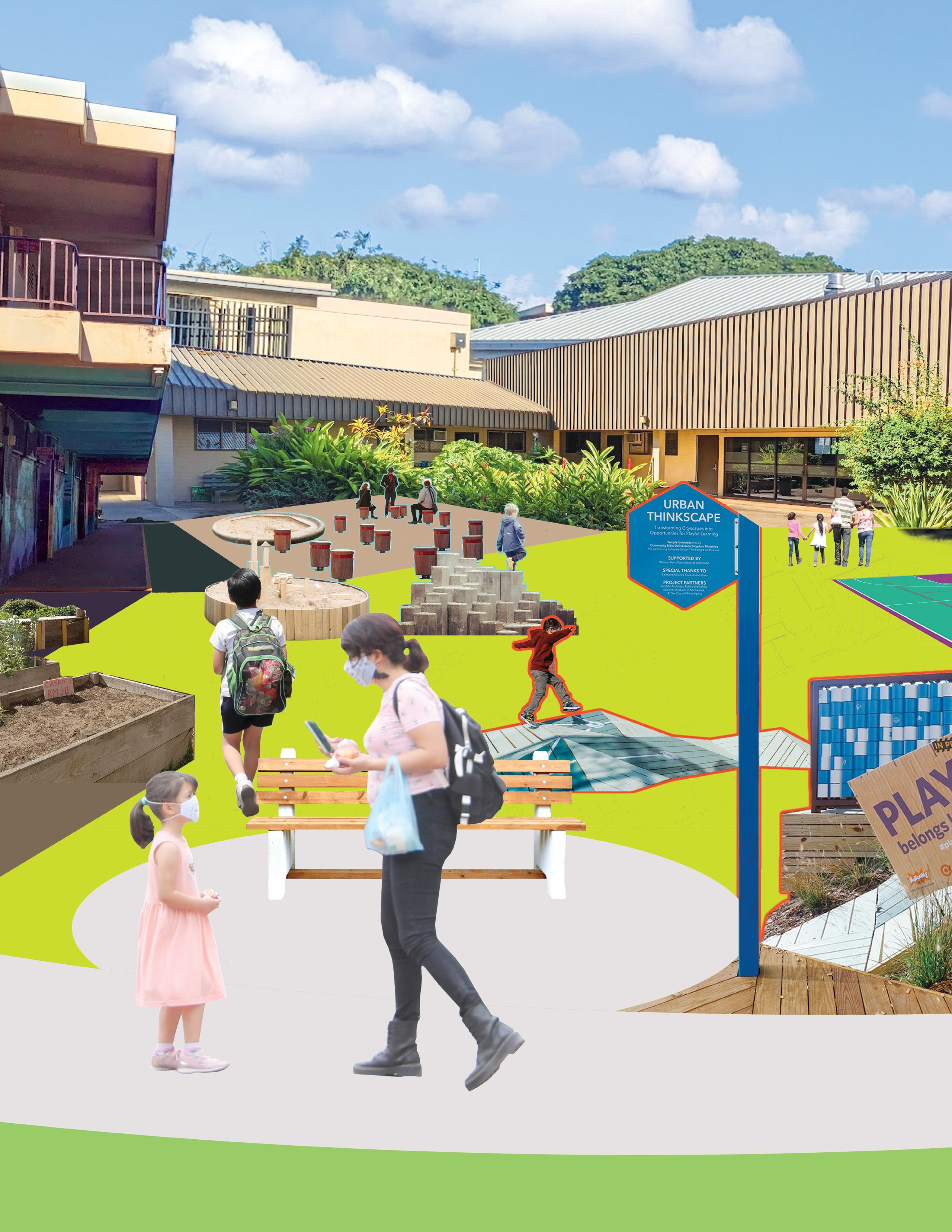
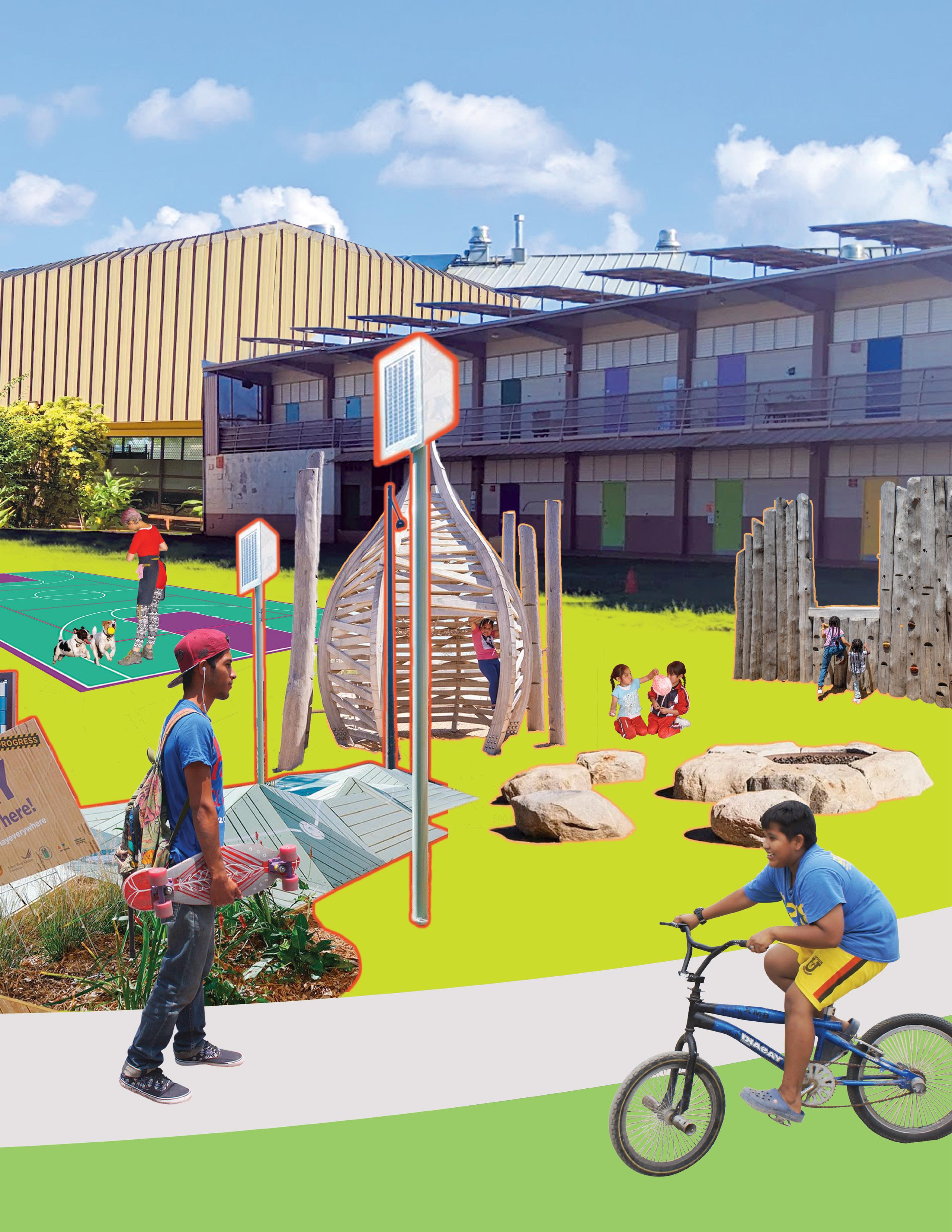
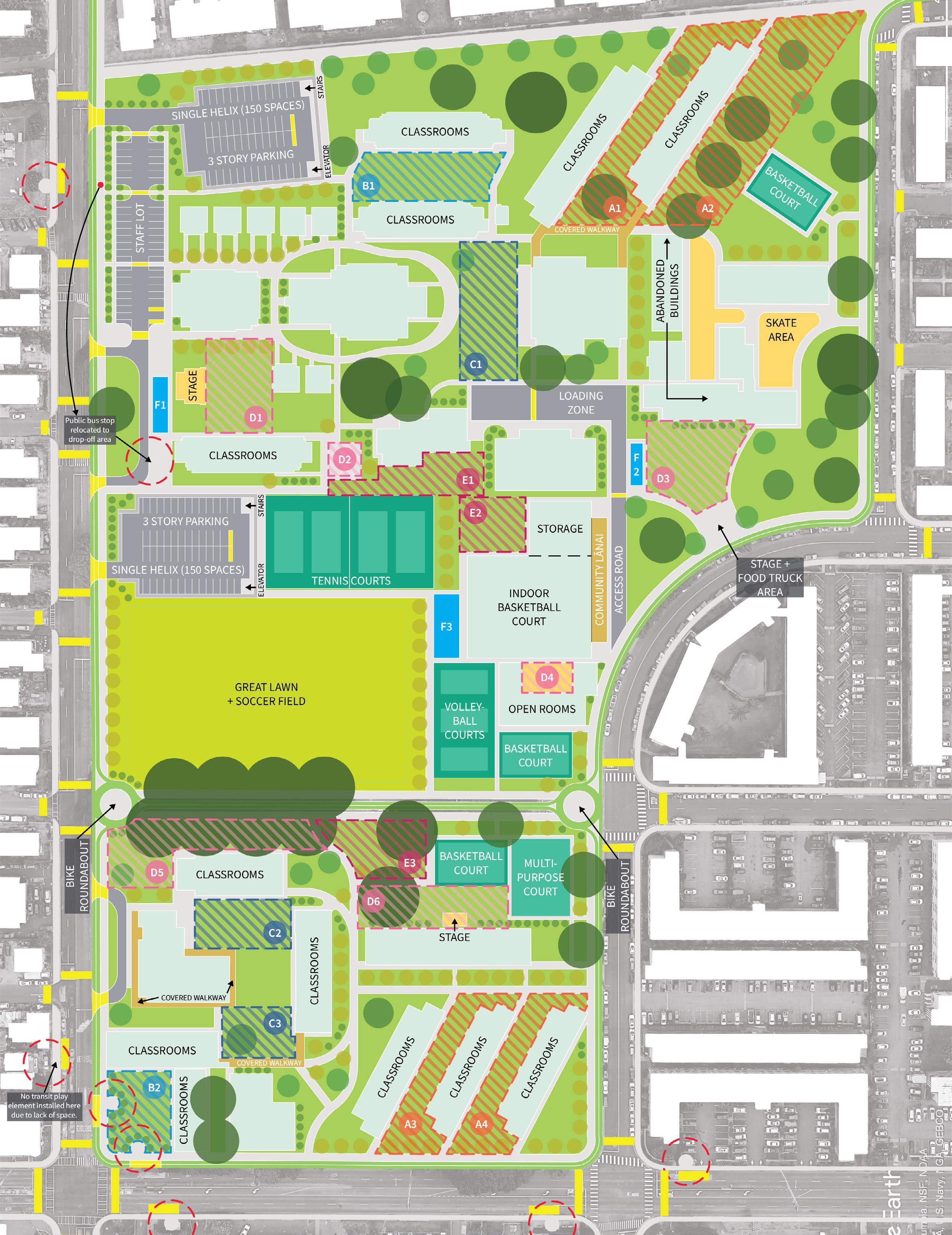
Connecting neighborhoods through a playscape spanning two schools, Kalihi Kai Elementary and Kalakaua Middle, and a park, Kalakaua District Park, in Kalihi, Honolulu, Hawaiʻi. The design makes the campuses and park more playful and accessible for children, while creating circulatory and functional connections between them.
5
lA 461 - wInter 2023 - 5tH YeAr senIor cApstone studIo césAr torres-bustAmAnte
Rather than create one large playground, which would not be feasible in this dense matrix of buildings, the project adapts to space constraints by introducing play into the spaces between existing buildings, utilizing the full areas of the outdoor campuses. Surface area devoted to parking is heavily reduced by consolidating it into two multi-story parking structures. By taking a decentralized, interstitial approach to playscape design, the project adapts to the island-based constraints and climate of the site, rather than imposing continental models of landscape design onto it.

6
Define play spaces
ABOVE: Site plan legend.
FACING PAGE: Site plan, not to scale. Hatched color-coded areas correspond to playscape typology on following pages.
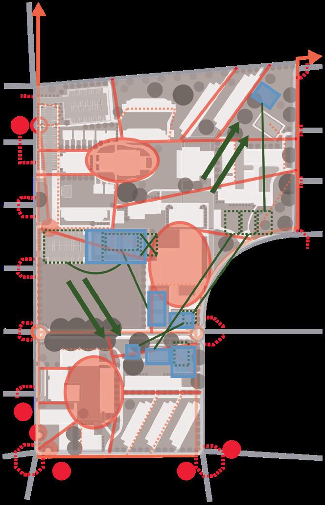
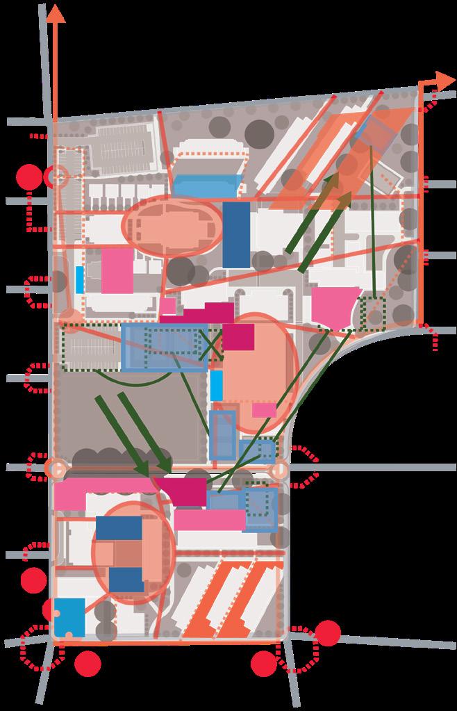
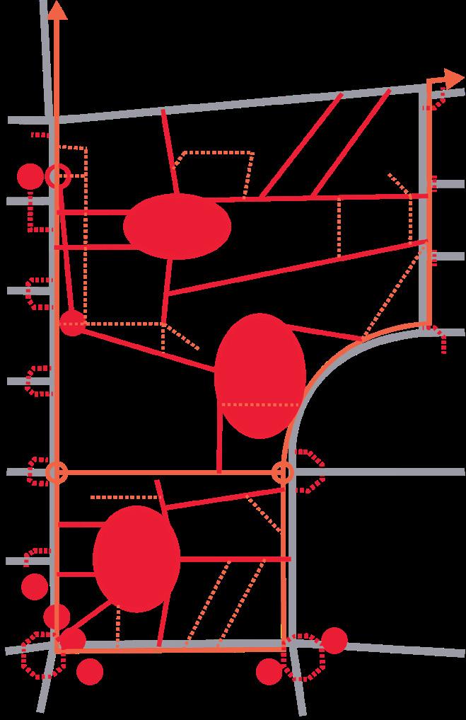
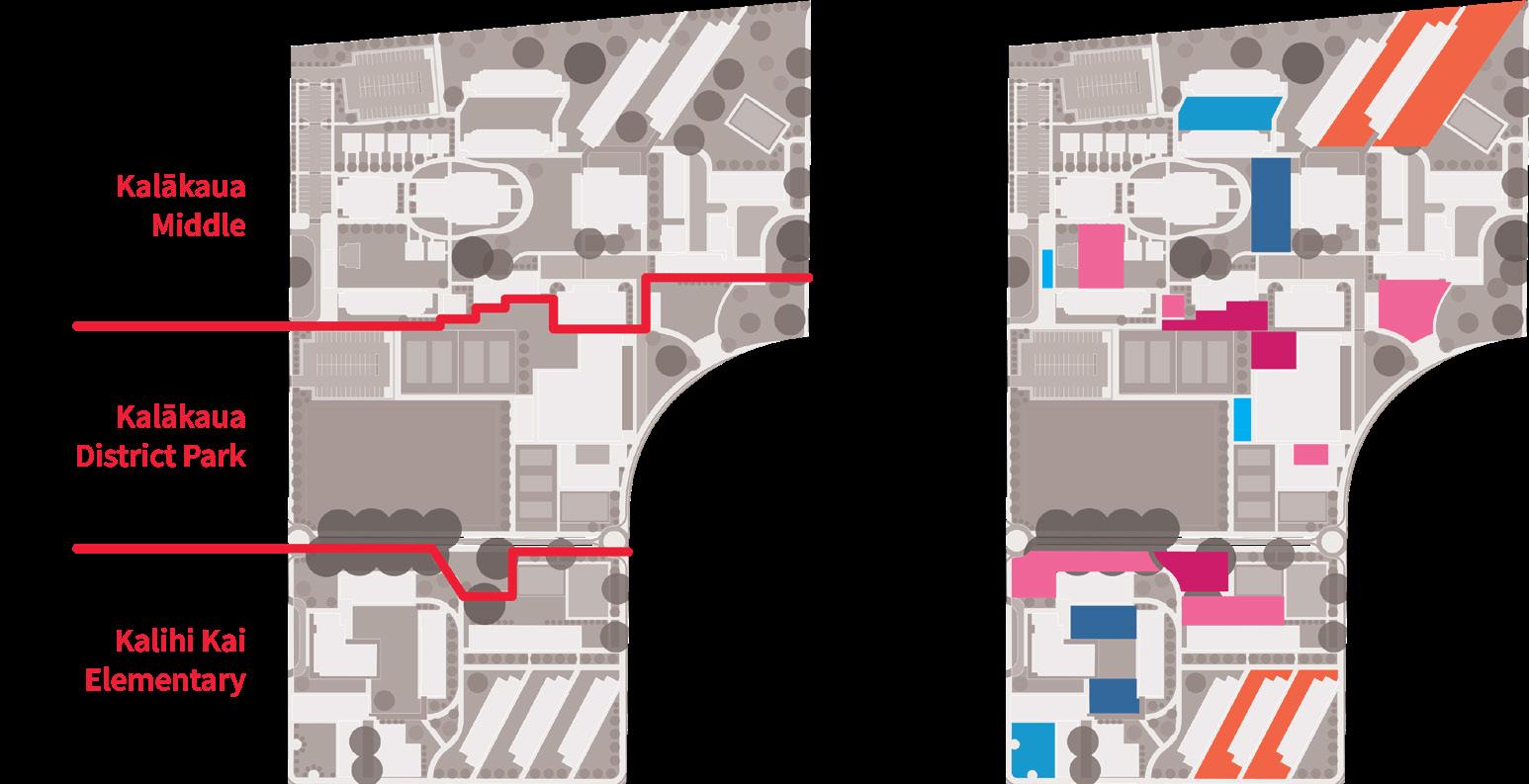
TOP LEFT: Mini-maps. Simplified maps show the new, redrawn boundaries of the schools and park, and a simplified diagram of play spaces for quick reference.
MIDDLE AND BOTTOM


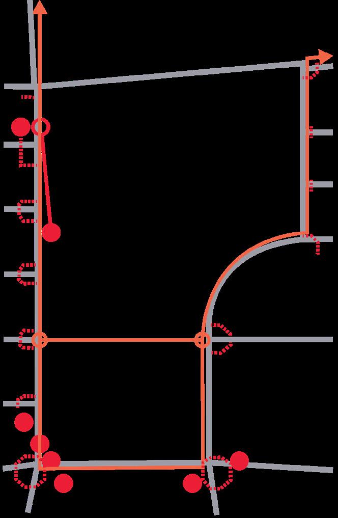
LEFT: Diagrams showing the process by which the final site plan was derived from schematics. The overall goal was to maximize the amount of contiguous open space for play while addressing pressing transit and circulation issues.
7 LEGEND
transit nodes Calm vehicular traffic
onto school campuses Centralize and reorganize pedestrian circulation
Identify
Squeeze park functions
Assign play types


8 plAYscApe tYpolo GY private semi-private semi-public
A unique approach to programming was developed for the site. Instead of designing individual spaces, the program is grouped by actions and intensities of play, leaving the final implementation flexible. The most desired play activities for children were researched, as well as the kinds of play equipment appropriate for different age groups. Based on this research, five different categories of playscapes were developed.
Each category has a degree of access associated with it, ranging from being only accessible by students, faculty, and other school personnel (except if a use request is approved), or freely by the public at all times. Some spaces are reserved for the school during school hours and open to the public outside of school hours.

These playscape types correspond to the color-coded areas marked on the site plan (see previous page spread).

9
public / semi-public public
Degree of Access
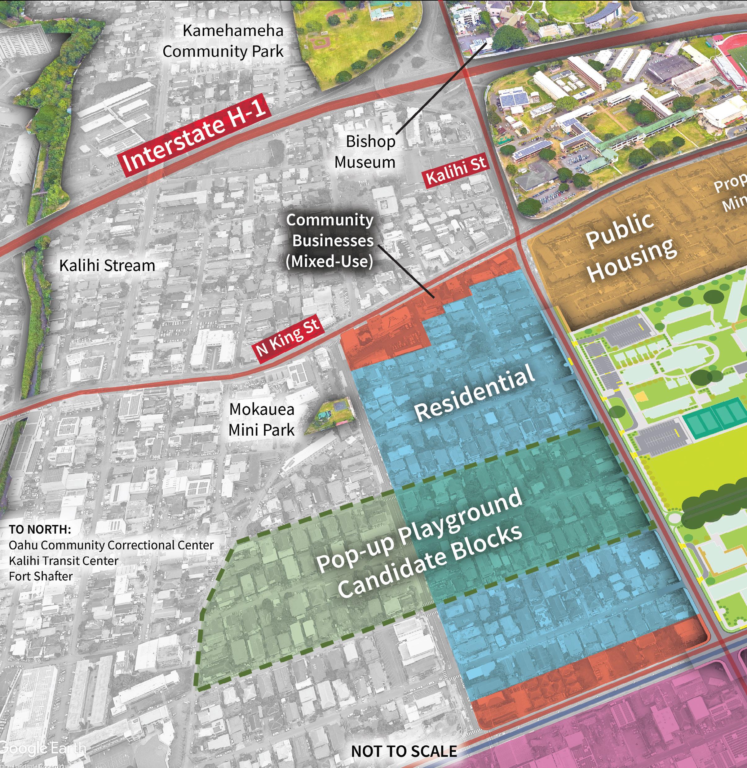
sIte context
10
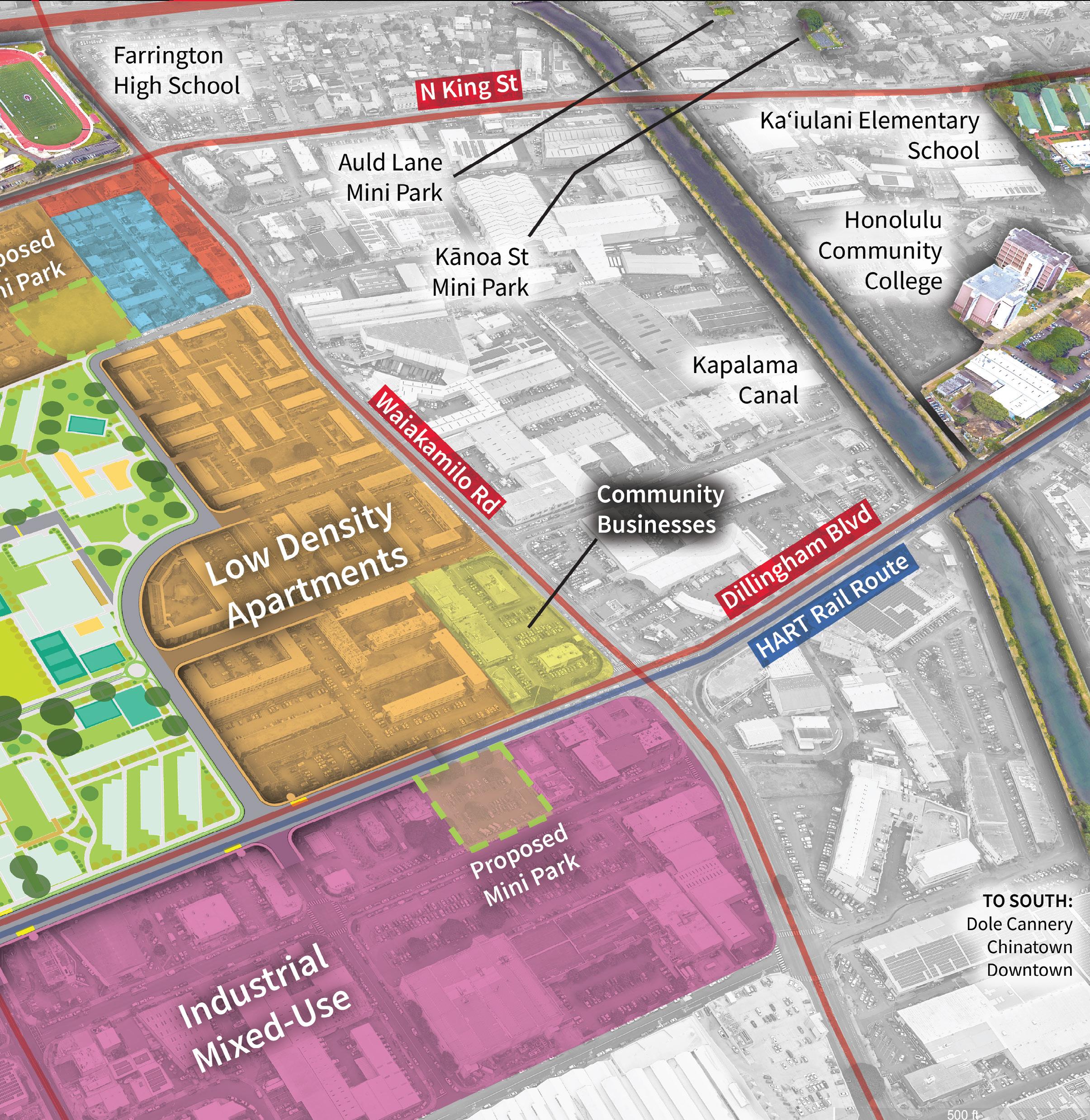
The project establishes a network of smaller play areas linked to each other: most on-site, and some off-site such as pocket parks in suburban blocks, play elements near transit stops, and temporary interventions like pop-up playgrounds. Proposed additional mini parks around the site were also incorporated from the current Kalihi Transit-Oriented Development Plan.
11
selected plAY elements
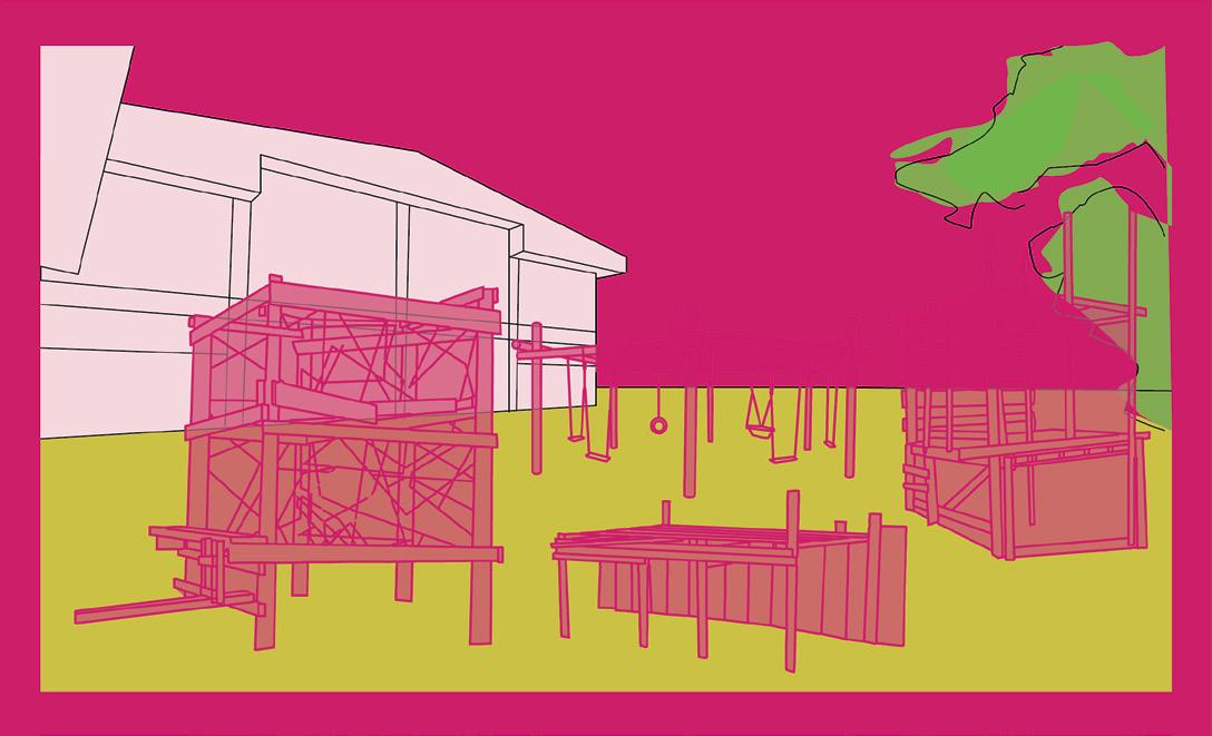
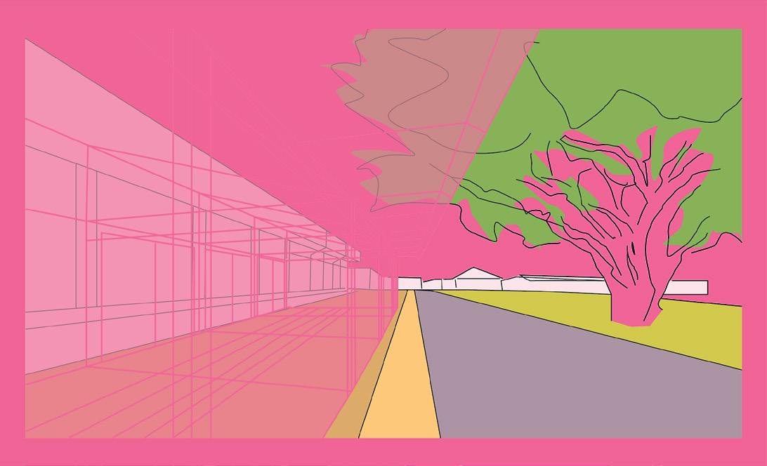
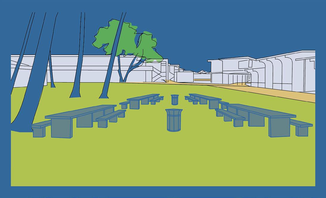
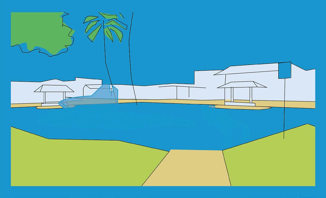
Implementing a plurality of play theories in the landscape, especially on a school campus, can unsettle the strictly regimented and standardized nature of public schooling. Play is a subversive tool, which can empower children to advocate for themselves against the authorities that control them. I drew heavily on ideas from Colin Ward, a so-called “anarchist planner” that believed in dissolving boundaries between the school and the wider community. In the end, perhaps what I am really doing with this project is not designing playgrounds, but reinventing the form and purpose of the school.

12
Impervious Surfaces
POP-UP PLAY SITE ANALYSIS
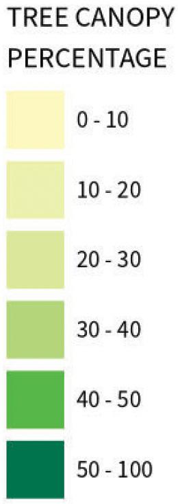
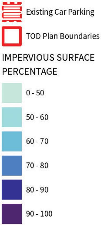
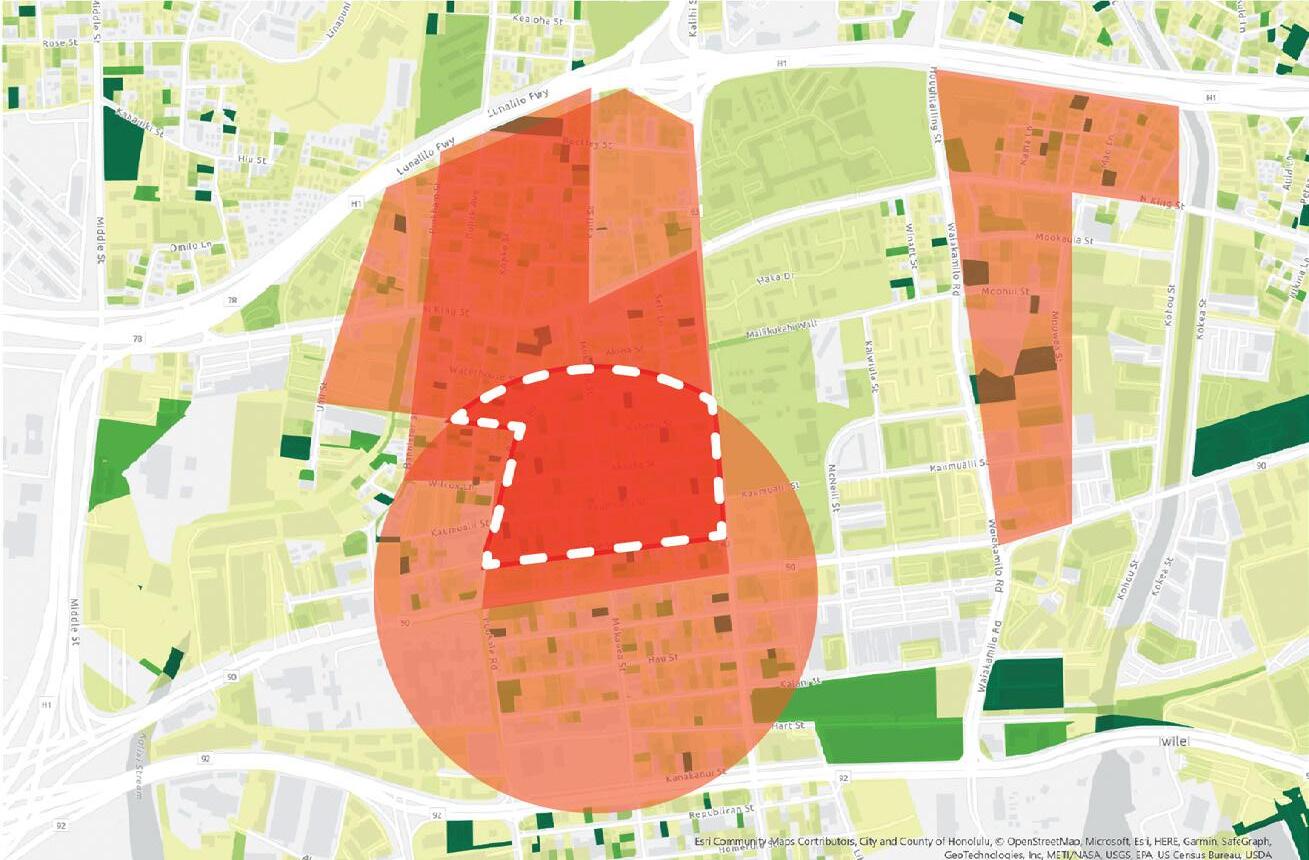
A detailed site analysis of the surrounding neighborhoods, including proximity to transit, canopy cover, and impervious surface analysis was performed to find the most suitable place to site a pop-up playground experience.
Pop-up playgrounds should be sited by transit stations or in areas that are a short walk to transit stations, and near areas where traffic is calm. The future development of rail stations should also be observed. They should not be located in areas with poor drainage/impervious surfacing and not in areas with many parking lots. There should be ample shade near the playground, either from shade structures or large trees, which may be found on individual properties.
TRANSIT: All data sourced from Oʻahu Bike Plan and Honolulu Open Geospatial Data.
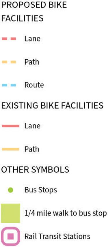
IMPERVIOUS SURFACES: Impervious surface percentages for tax parcels and TOD boundary sourced from Honolulu Open Geospatial Data. Parking lot data sourced from a Penn State Geodesign project by Daniel Call, Kirsten Eaton, and Graham Mills.
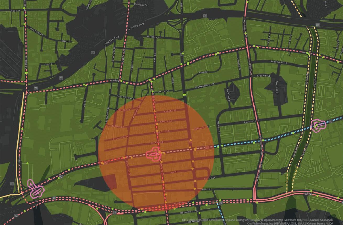
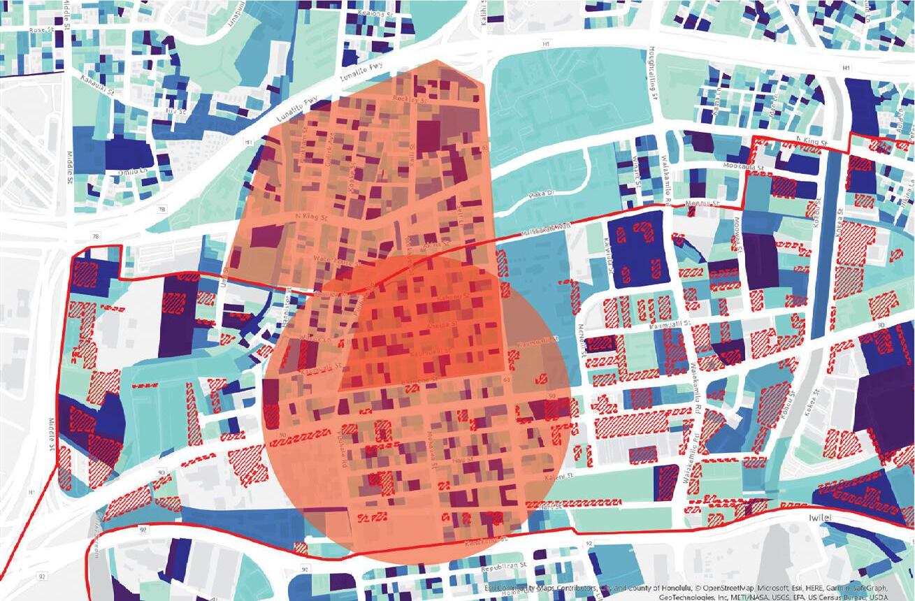
CANOPY COVER: All data sourced from Honolulu Open Geospatial Data.
13
Transit
Canopy Cover
juxtaposing the natural and artificial — the “old” and “new” oakland.
individual parts that work as an ensemble, like a jazz combo.
open, reconfigurable multi-use spaces - because improvisation is important.

14
NORTH
blueshift: remembering old oakland
oAklAnd, cA
ESTUARY PARK
lA 404 - wInter 2022 - 4tH YeAr culturAl envIronments studIo ellen burke
CULTURAL CORE SIGNAGE ELEMENTS
curtain pavilion / wetland signage / riverfront history walk
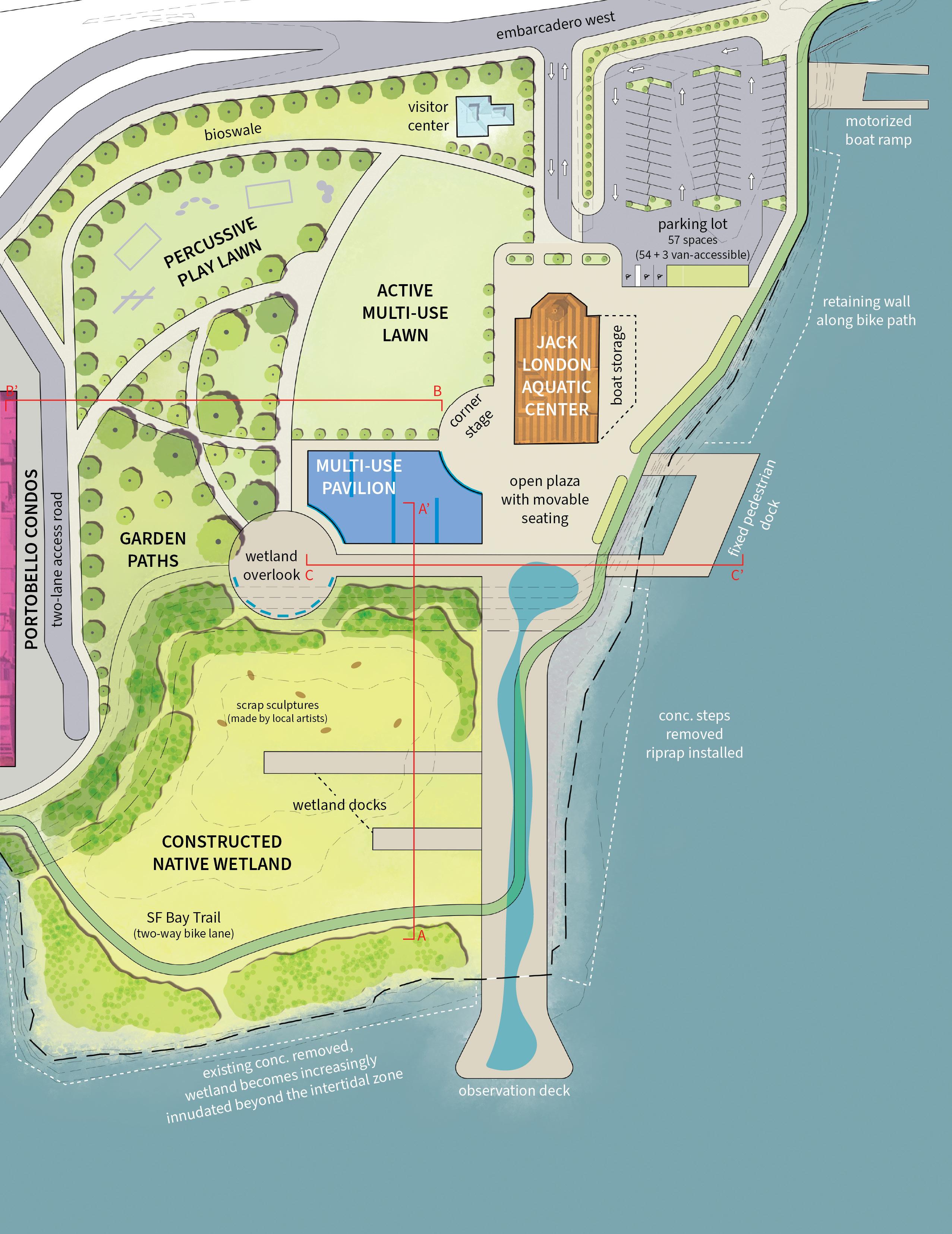
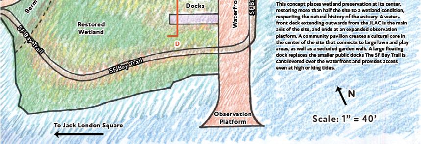
Estuary Park sits on reclaimed land in the Oakland Estuary, adjacent to the biggest new developments in Oakland’s recent history. Cut off from the the city by the freeway that bisected its old downtown, it seems like a site that would mostly be used only by nearby residents in Brooklyn Basin. How can it engage the wider city and culture? This design does so by embracing the history of “Old Oakland”, especially its heritage as a birthplace of West Coast jazz. Built up around a new multi-use pavilion and the existing Aquatic Center, it restores the wetland edge to the south end of the site. Cultural signage provides information on jazz and waterfront history. A long concrete deck serves as a main axis, and public docks are consolidated into one large dock that serves as a communal space.
ABOVE: Section-perspective showing locations of cultural signage.

FACING PAGE: Site plan, not to scale.

BOTTOM: Section of docks over wetland, overlook, and pavilion.
SECTION A - A'
15
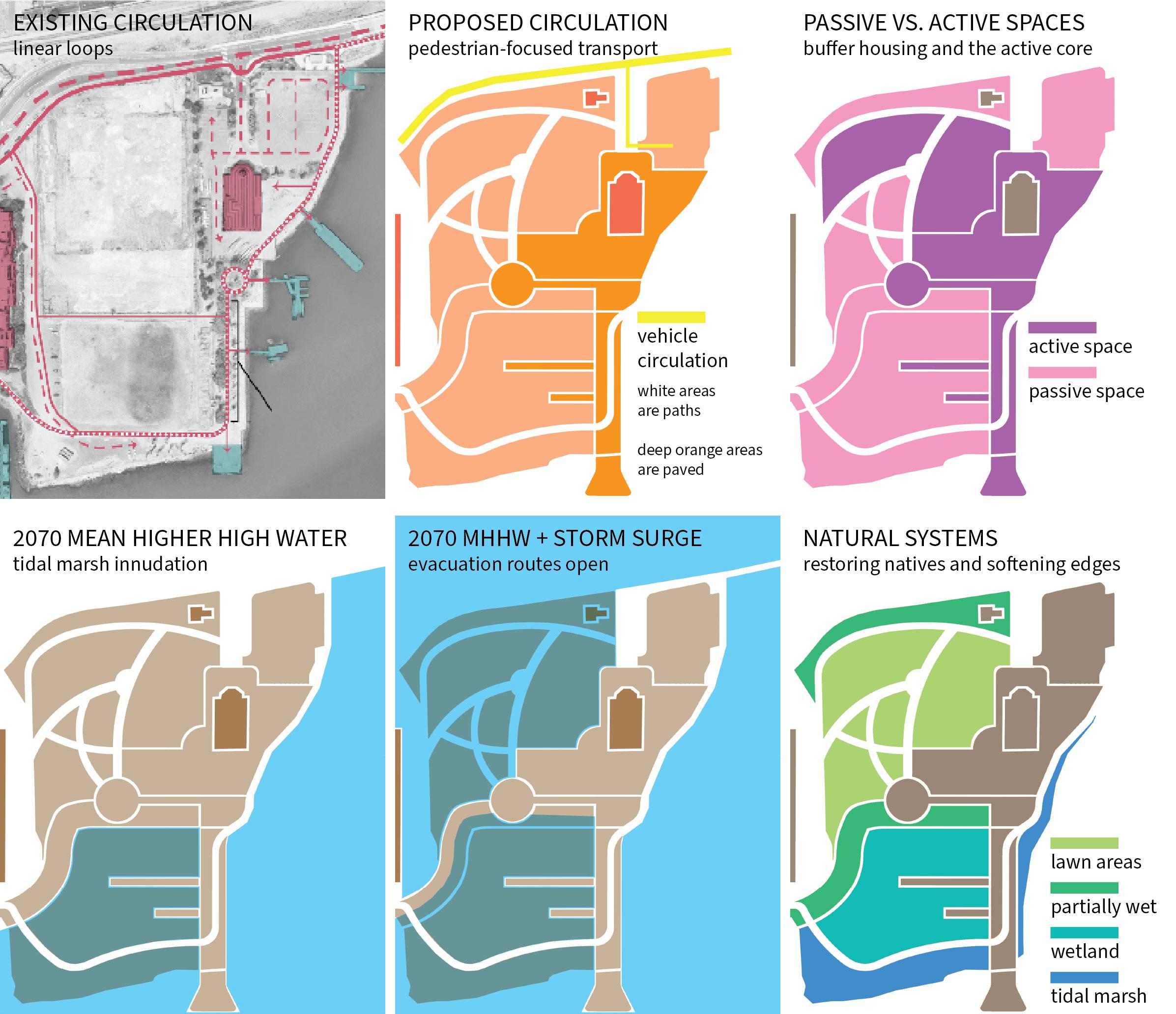
Gener AtIve dIAGr Ams

16
SECTION B - B' Section from condos to active multi-use lawn.
Estuary Park will be underwater in the future, so this design has long-term sustainability in mind. A berm raises the largest paved areas of the park above an estimated 2070 storm surge so that it can continue to be used as a public dock, even as lawn areas eventually succumb to saltwater intrusion. The SF Bay Trail is raised above grade and routed over the wetland, and can serve as an evacuation route in case of flooding.
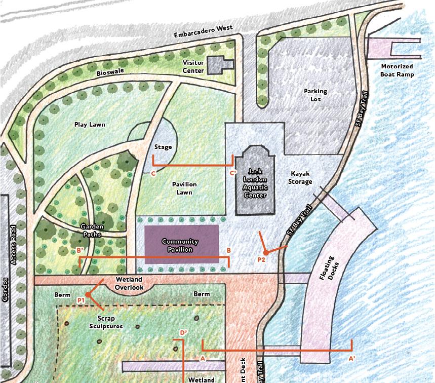
The southernmost end of the site is innudated year-round, whereas the tidal marsh will initially start off partially flooded and gradually transition to fully flooded over 50 years. Existing properties not built with sea level rise in mind will eventually need to be abandoned during managed retreat from the shoreline in the future.
PROCESS DRAWINGS
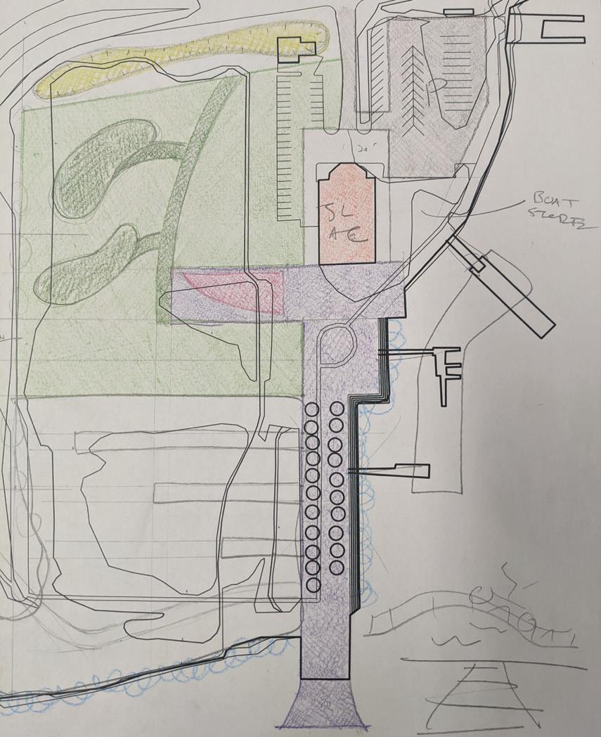
Left drawing shows an early sketch, with major areas of site identified. Right drawing shows schematic site plan.

curtAIn fAbrIcAtIon
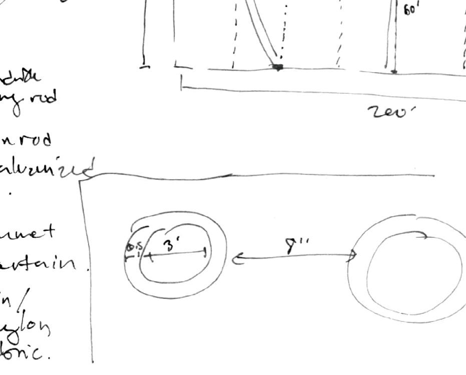
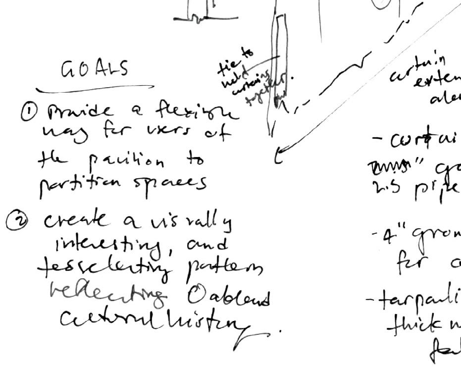
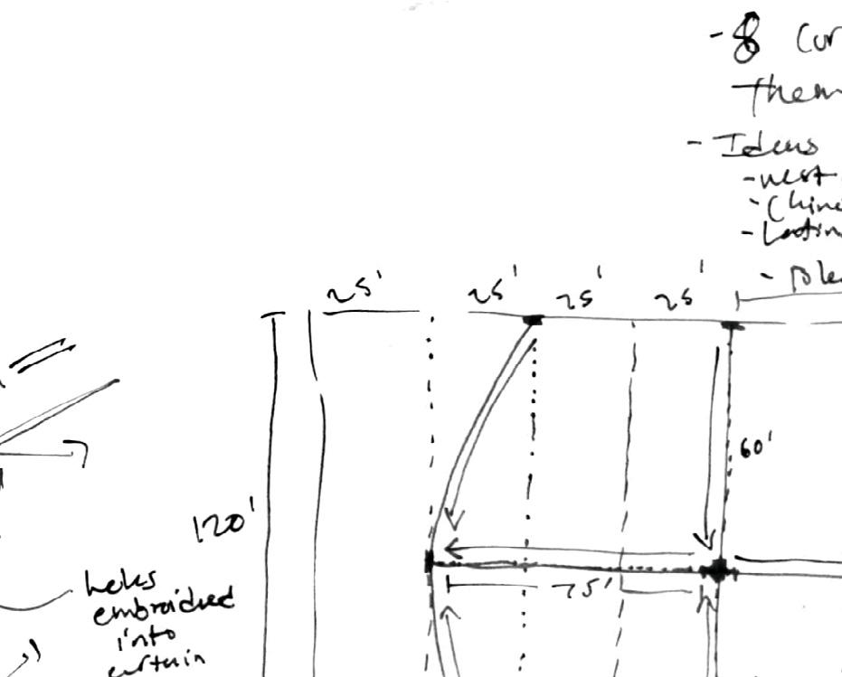
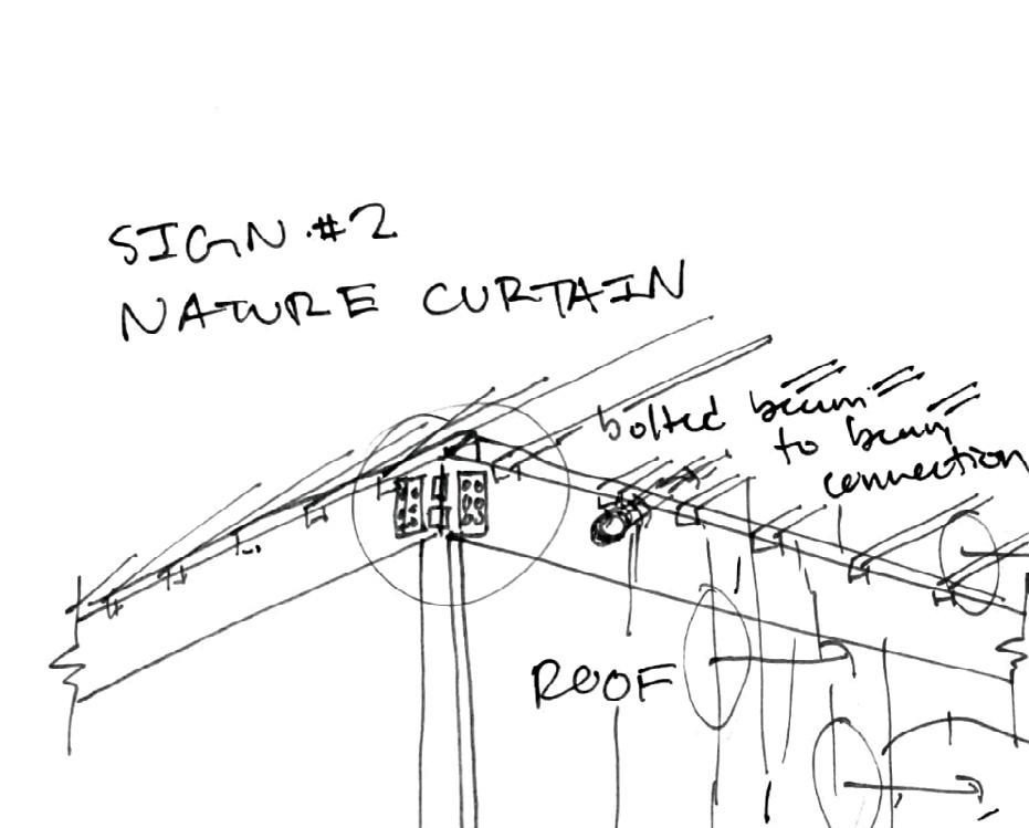
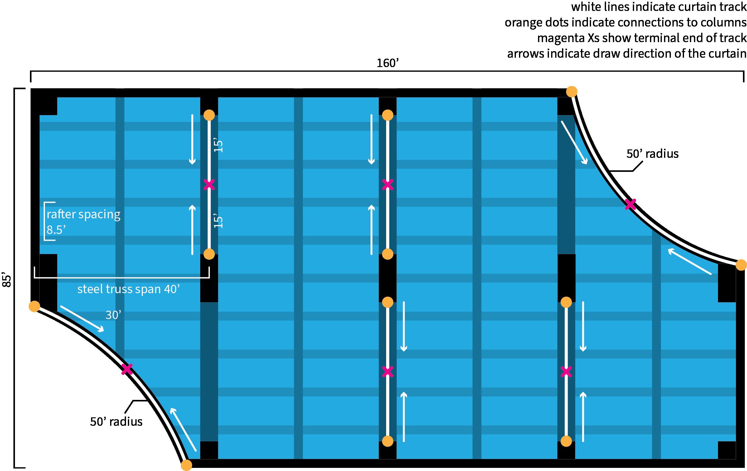
I designed a curtain installation for the multi-use pavilion to divide the space in a flexible and interactive way. The pavilion can be reconfigured for multiple uses by different groups occupying the space. In addition to designing the curtain layout, I created a spec sheet and conducted research into how the curtains would be constructed and installed. I had to figure out how the curtain would mount to the steel trusses, the type of track and length of track needed, the fabric and its yardage and weight, the pulley system, and the graphic design of the curtains themselves.


18
SECTION C - C' Section from pavilion to fixed pedestrian dock.
CURTAIN INSTALLATION PLAN AND ELEVATION


19
unreeling the past: harvey milk plaza

sAn fr AncIsco, cA
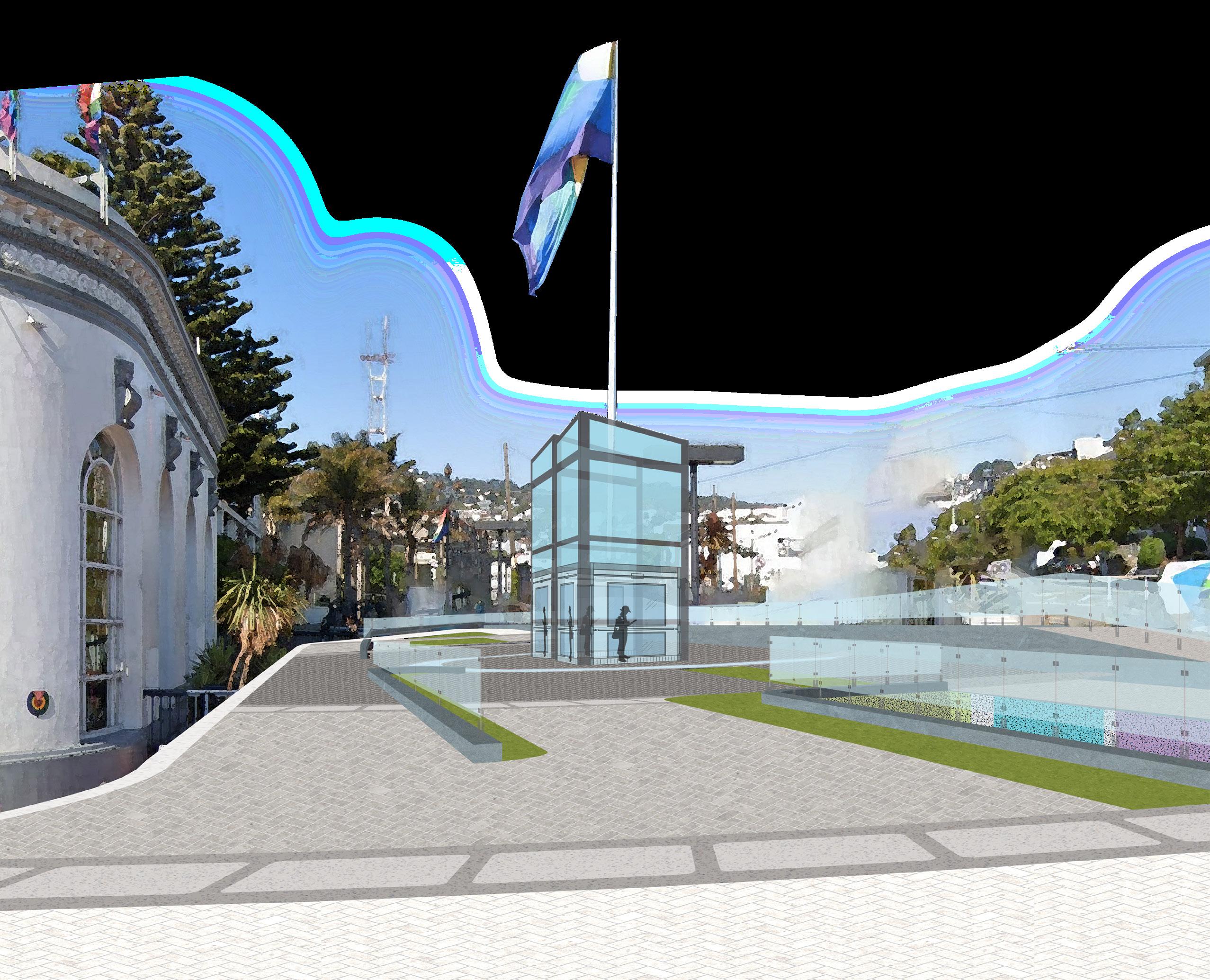
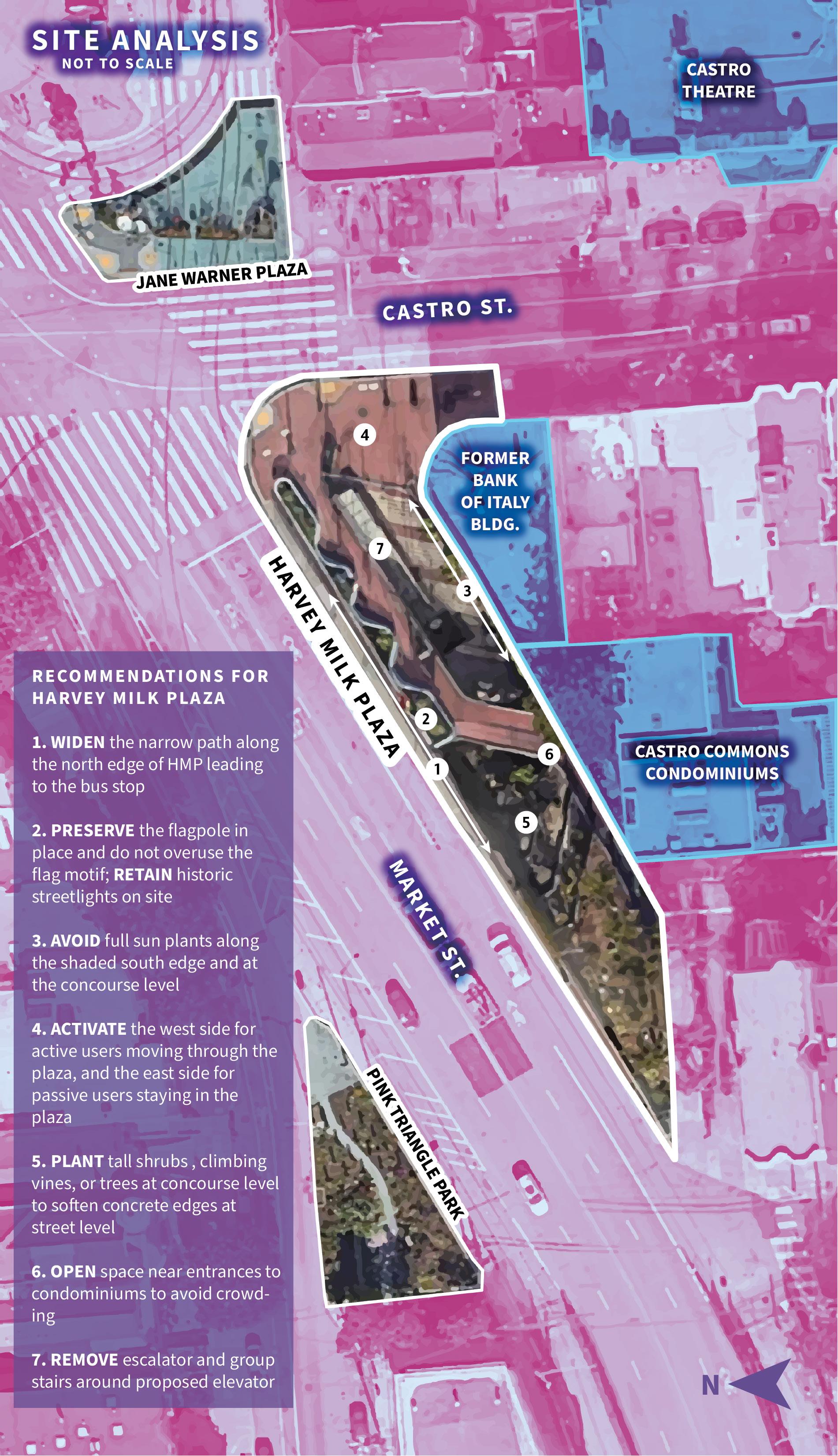
Harvey Milk’s premature death turned him into a political icon who fought fearlessly for LGBTQ+ rights, but also froze him in time as an image. Today, we remember him for what he stood for, but do we really know the person he is? My redesign of Harvey Milk Plaza in San Francisco's Castro District considers the question of what it means to embody Harvey’s life in a landscape design without resorting to images of him. Challenging the perception that a public monument should be unproblematically about visibility, this design speaks louder for what it does not show.
20
TOP LEFT: Harvey Milk. How can we honor him without cheapening his image? Photo courtest of the Bettmann Archive/Getty Images.
BOTTOM LEFT: Perspective rendering. Shows the central elevators and iconic flag.
RIGHT: Composite site analysis. Recommendations were based on four composite factors: light/wind/ slope, existing vegetation, existing utilities and cultural elements, and circulation.

reflection movement
sIte plAn street level
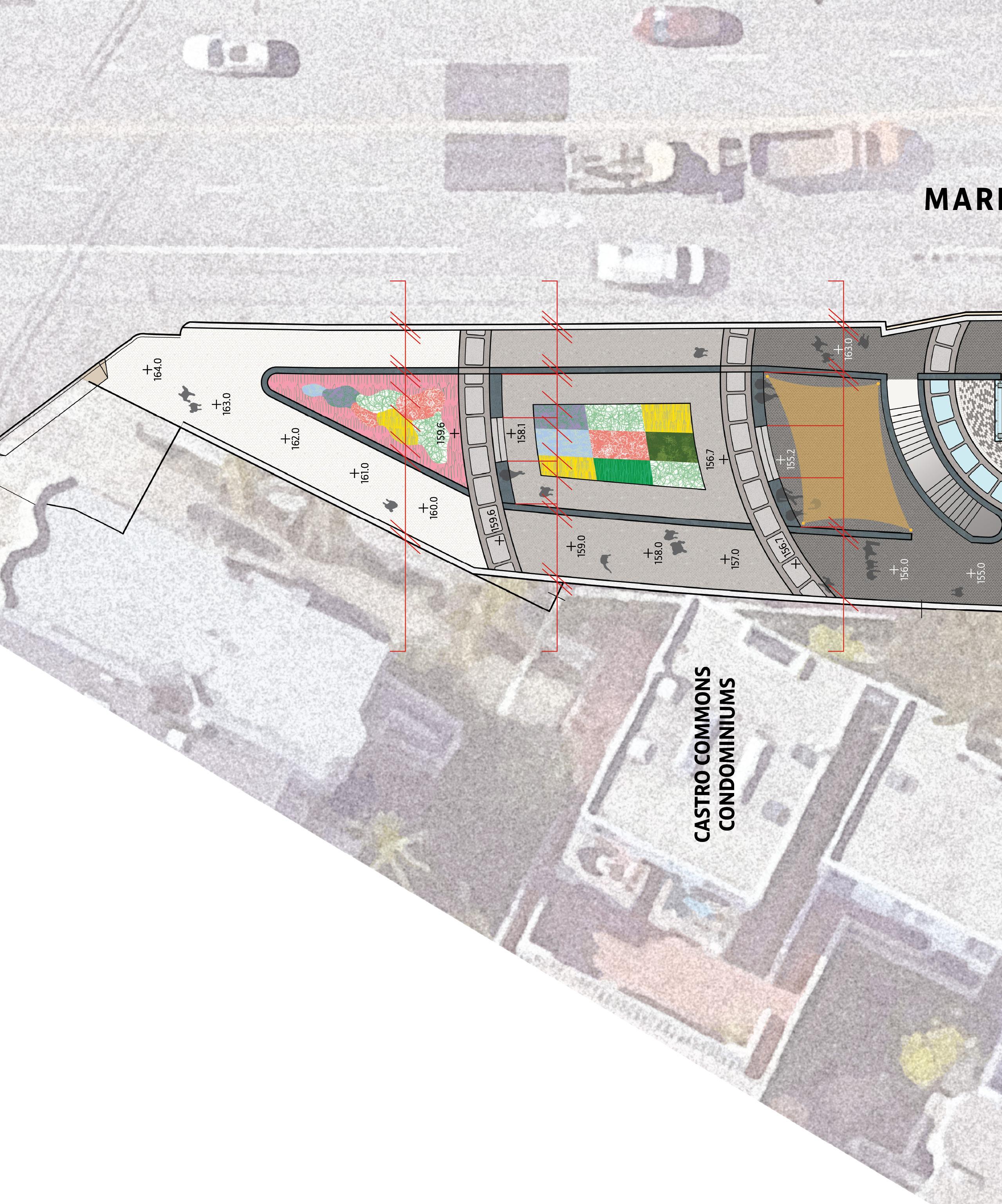
“Unreeling the Past” pays homage to Milk’s love of film photography and his former occupation as a camera shop owner. Concentric rings of concrete “film strip” pavers, etched with artwork representing Harvey’s life, ring the center of the plaza, which contains double glass elevators to all levels of the plaza. At the concourse level, the circular motif is repeated in rainbow-colored terrazzo paving. Sunken terraces with seat walls on the west end create outdoor rooms that represent the Castro’s gay culture and history.
As users move inwards, the plaza shifts from a more reflective space to a more active one, populated mainly by transit riders. At the far west end of the plaza is a satellite pink triangle garden, meant to complement the larger Pink Triangle plaza across Market Street. The middle terrace contains a rectangular planting bed reminiscent of AIDS quilts, to be used and maintained as a community garden space.
22
C’ C D’ D E’ E NORTH
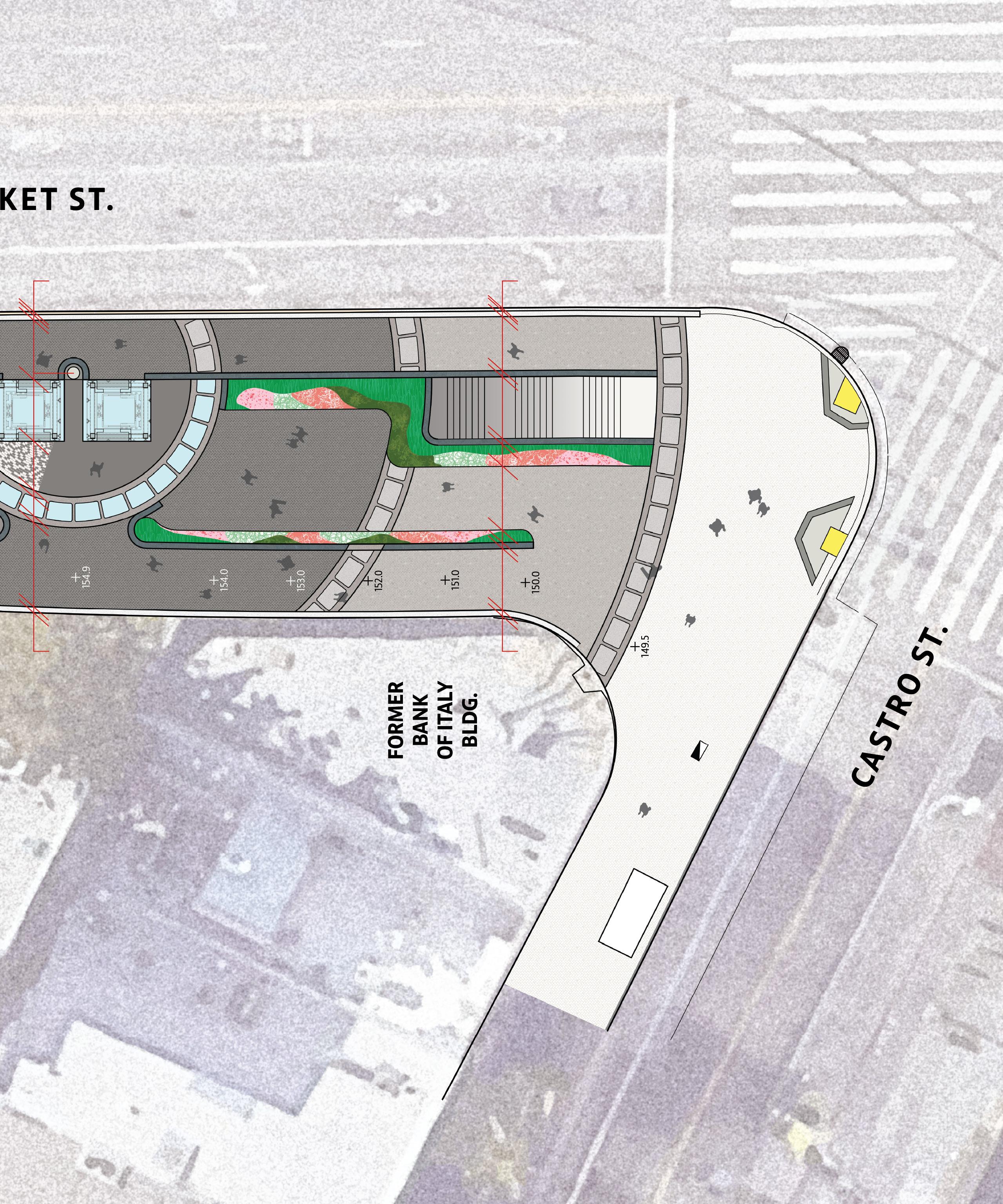
The lowest plaza is bordered by a tall wall which houses the spiral stairs from Market St. down to the concourse level, and can serve as a community theater or projection space for films. A removable shade sail can be unfurled when this space is being used for events. At the concourse level, a homeless help center is proposed that will contain a community fridge, medical supplies, and health checkup and harm reduction services at scheduled times.
The very center of the plaza is also bordered by a film strip paving pattern, but the images are etched in translucent glass that lets in light to the concourse level. The paving detail contains a speech by Harvey encoded in Morse code, a homage to his service in the navy, and a way of incorporating his speech into the site itself. As LGBTQ+ individuals still face oppression and remain closeted, this message hidden in plain sight serves as a subtle reminder of hope.
23 movement / active passive
A’ A B B’
sectIons

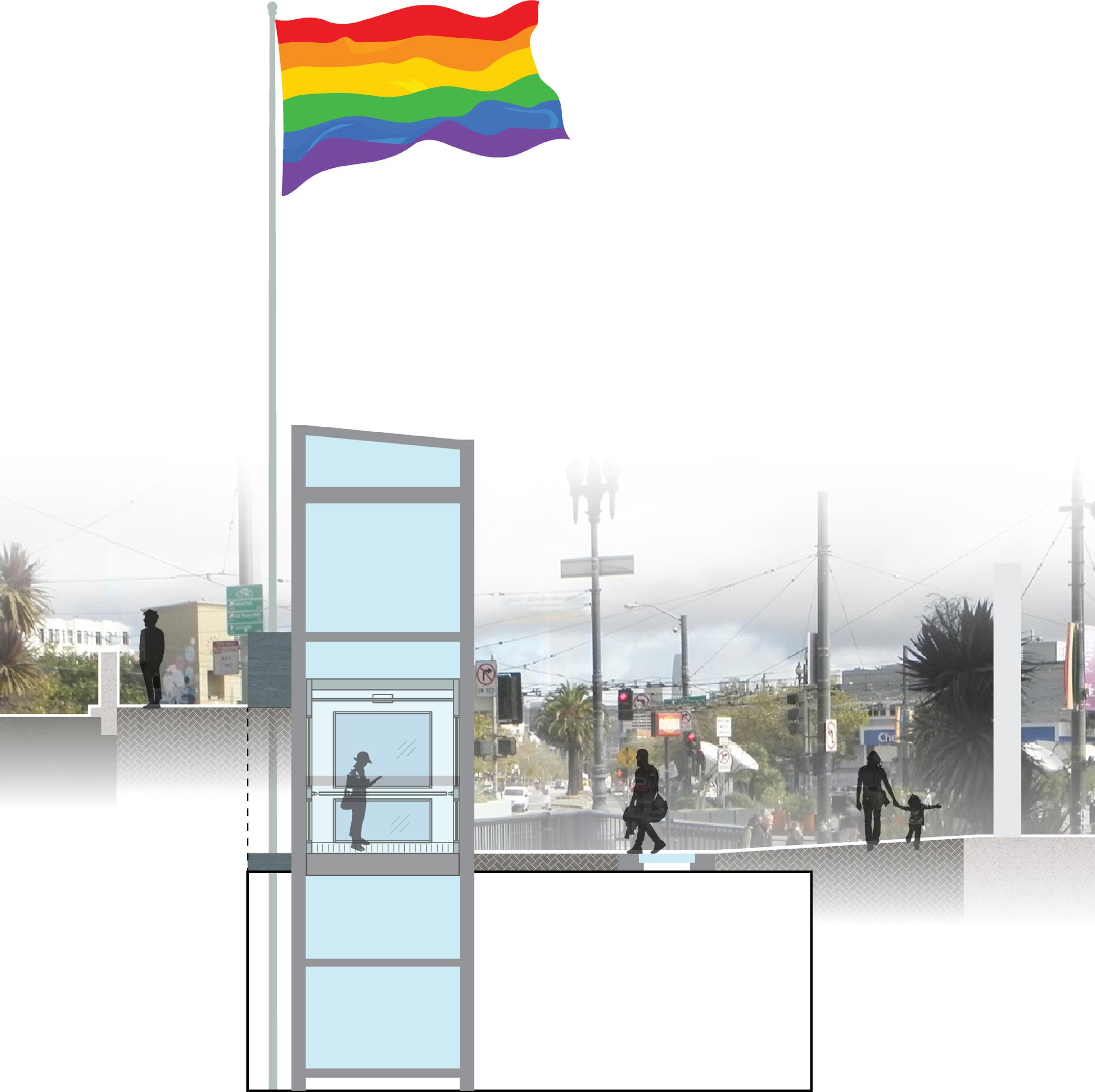
24 B
B’
Looking towards Jane Warner, showing elevator, central hub, and glass film strip detail
Looking towards Jane Warner, showing stairs from plaza to concourse
Looking towards Collingwood St, showing lowest sunken terrace and retractable shade sail


Looking towards Collingwood St, showing middle sunken terrace with green wall and AIDS quilt garden

Looking towards Collingwood St, showing top sunken terrace with Pink Triangle garden

25 A’ A
C
C’
D
D’
E
E’
signs of life along the merced
mArIposA countY, cA
The Merced River Trail runs from Yosemite National Park to destinations all over Mariposa County. As a Wild and Scenic River, the Merced should be a valuable asset for Mariposa County, but sees little use due to poor maintenance and a lack of creative placemaking to draw visitors and residents alike to the many trails and recreational exieriences it has to offer. Residents of Mariposa County want to see spaces that highlight the diversity of cultural programming in the county, from arts and crafts to historical exhibits to performances and festivals.
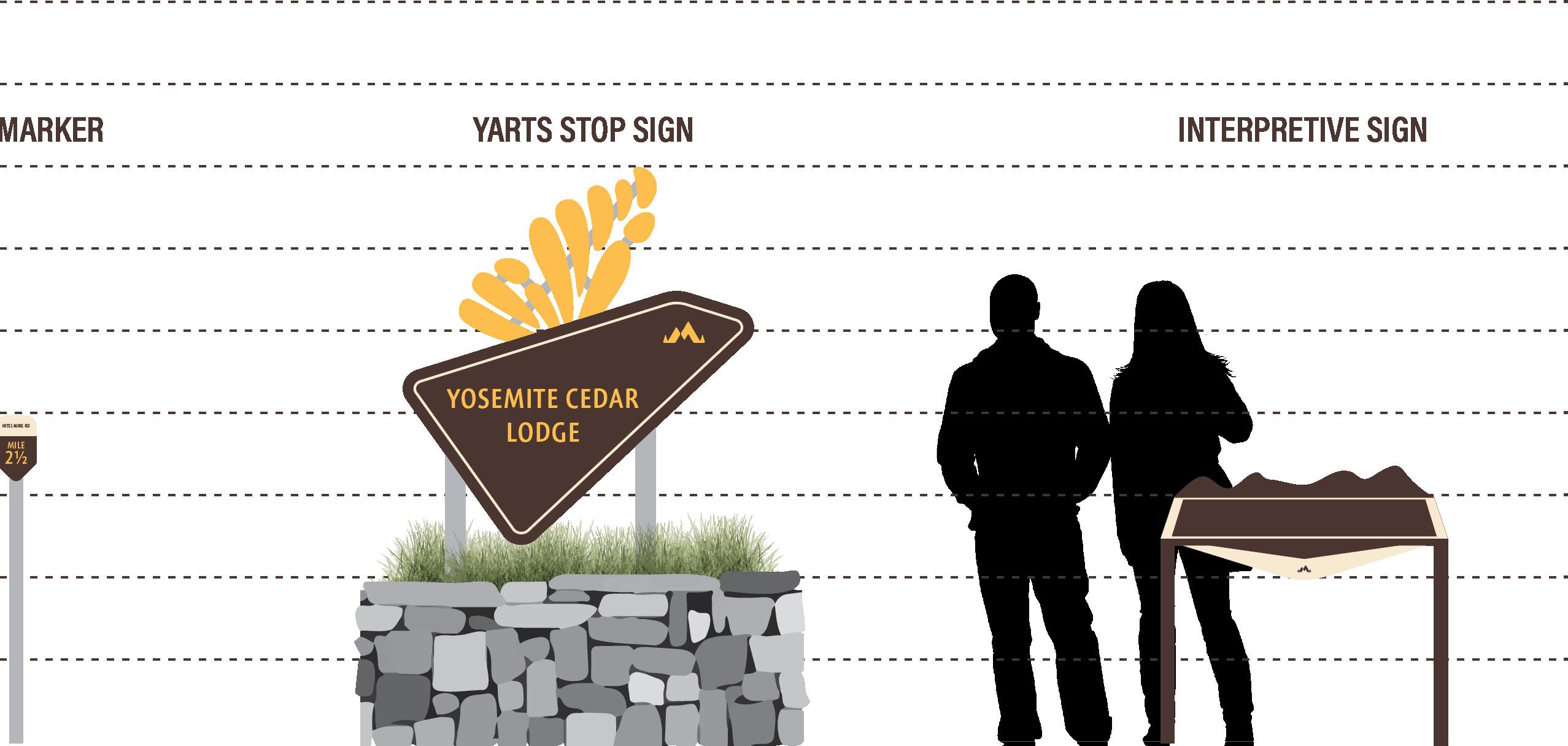
As part of a contribution to the Green New Deal Superstudio, I created a plan for a new trailhead at Hite Cove, and a system of signage to give the Merced River Trail a unique graphic identity. I worked with representatives from the Mariposa Arts Council and Planning Department to align the graphic design with their future outlook for the community. The new site plan integrates public and private space on the grounds of the Yosemite Cedar Lodge, and can serve as a case study for further signage implementations at other sites along the Trail.
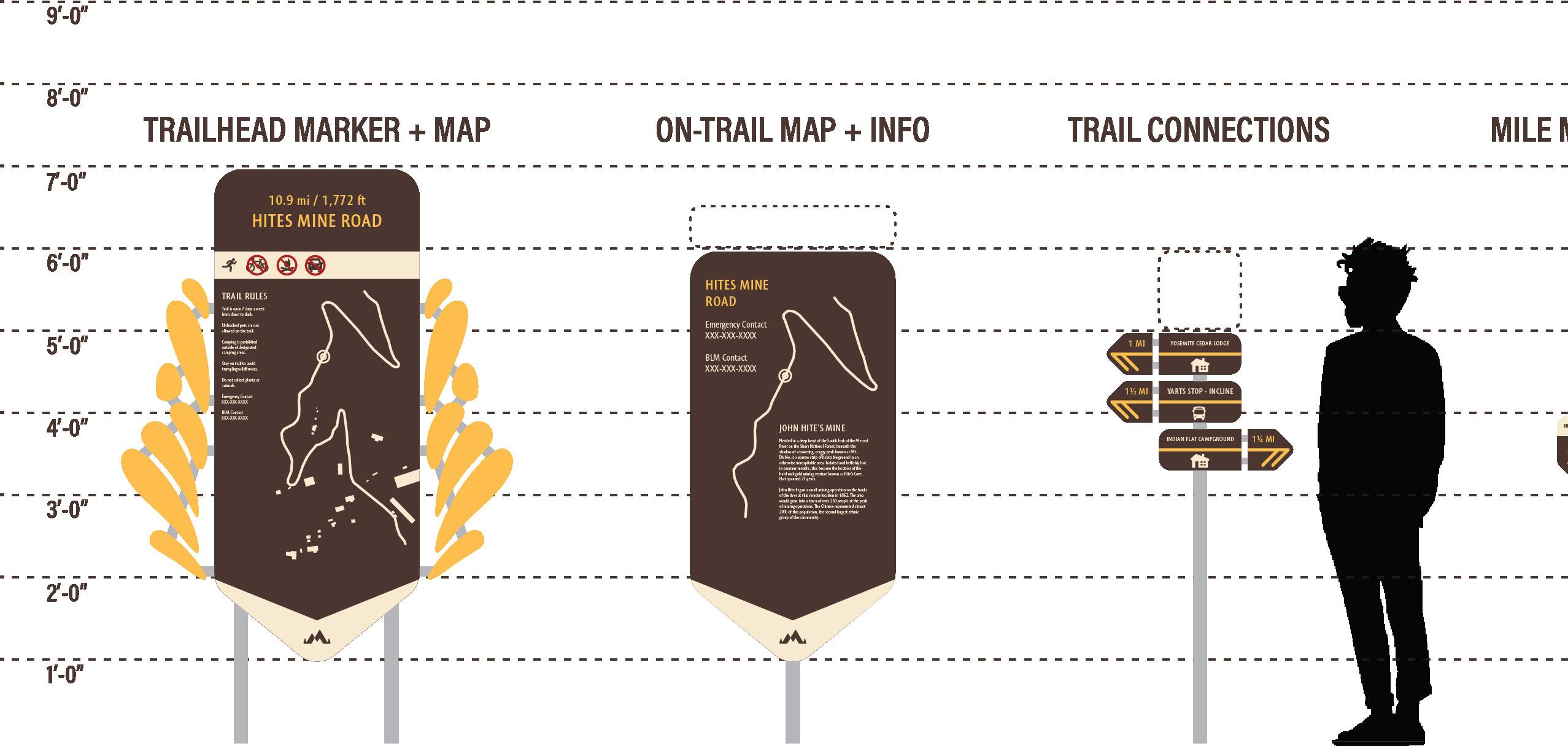
lA 403 - sprInG 2021 - 3rd YeAr nAturAl envIronments studIo mIrAn junG dAY
Recommendations for Site:
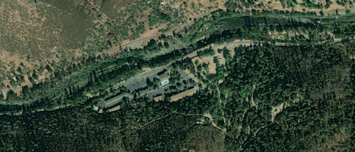
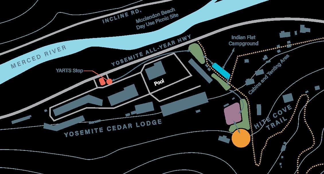
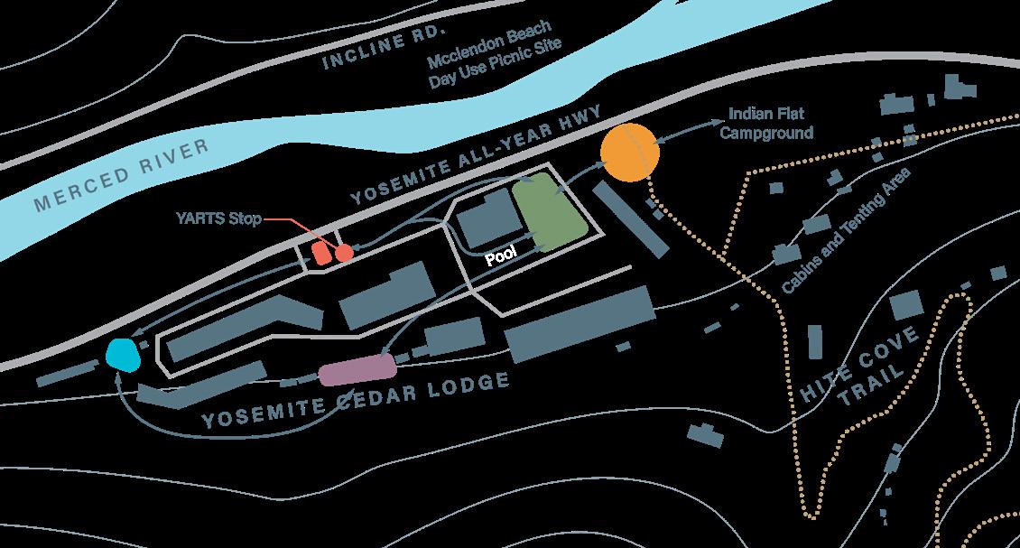
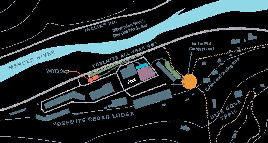
Connectivity between the lodge and the trail should be improved. Circulation should be added between the YARTS Stop and the trailhead which bypasses the lodge so that pedestrian and vehicle traffic are kept separate. Signs which orient visitors to various lodge amenities should be added in visible locations.
SITE INVENTORY
Yosemite
Cedar Lodge
Bus Parking
Free Parking
Outdoor Lounge
Outdoor Pool
YARTS Stop
Mcclendon Beach Day Use
This beach is not accessible from the other side of the river, and should be left alone as it is reserved for locals of El Portal.
Indian Flat Campground
25 RV Sites
25 Tent Sites
One tent cabin
Two wood cabins Pool (shared with YCL)
Hite Cove Trail
The trail terminates at Redbud Lodge near Briceburg. There are spectacular wildflower displays in spring. The meeting of the south and central forks of the river is visible from the trail. It is moderately strenuous. The total elevation gain is 100 feet and the trail is around 4 miles long for a round trip (if the entire length is hiked). It is single-track only and can be dangerous if crowded.
SITE ANALYSIS CONCEPT DIAGRAMS
SITE LOCATION
VIEWSHED
CONTOUR MAP
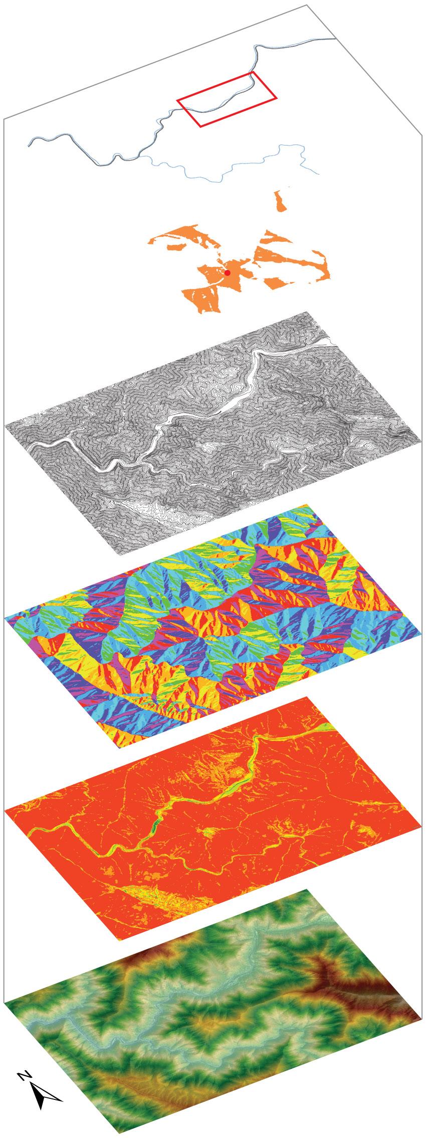
ASPECT
SLOPE
ELEVATION
LEGEND
Hite Cove Trailhead
Small Outdoor Stage
Arts and Crafts Pavilion
D
Wildflower Garden YARTS Stop Marker
28
FINAL CONCEPT PLAN
SIGN USAGE SUGGESTIONS
A: Trailhead Marker + Map, Interpretive Signs
B: Interpretive Signs
C: Trail Connections Sign
D: Trail Connections Sign
E: YARTS stop sign
F: Mile Marker, Interpretive Sign w/ Falling Rocks Warning Sign
G: Mile Marker, Trail Connections Sign
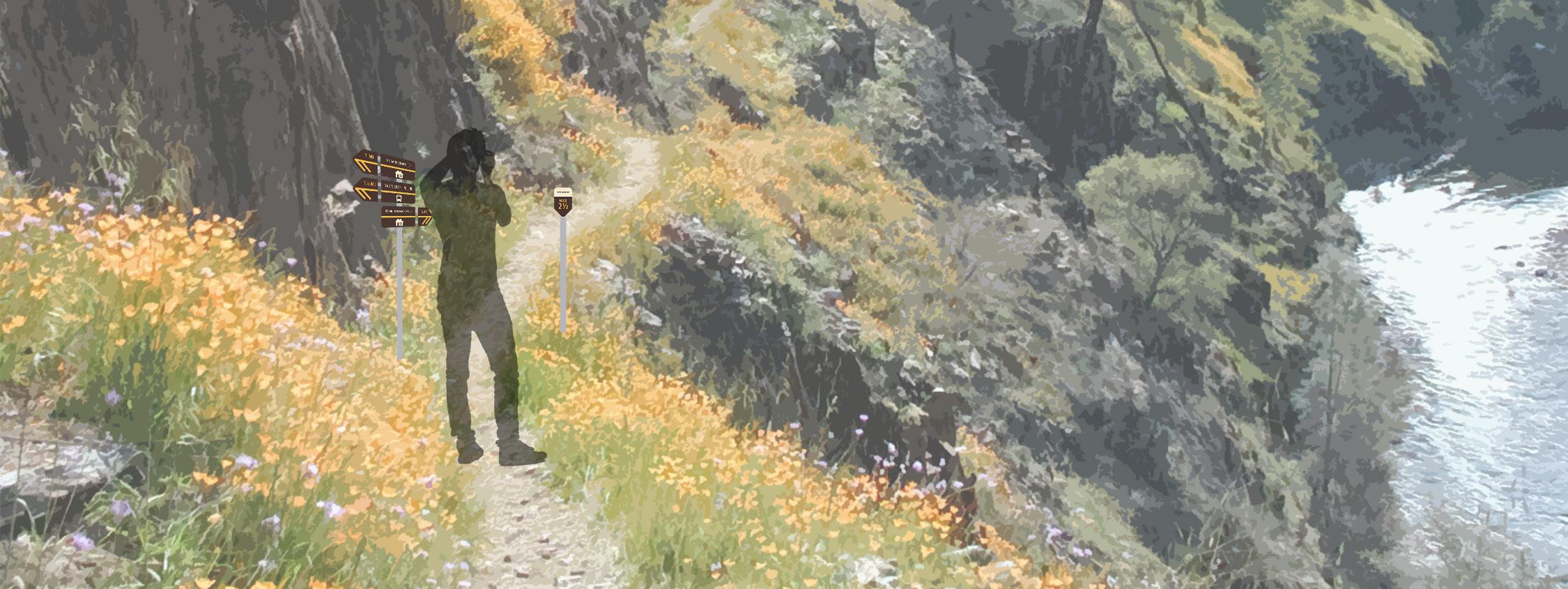
PERSPECTIVE
29
julia morgan by the beach
sAn sImeon, cA
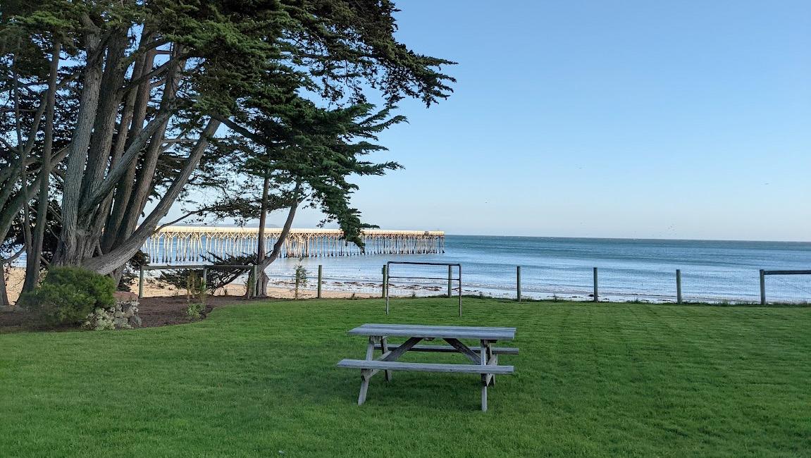
This historic Julia Morgan-designed house near Hearst Beach is current occupied by employees of Hearst Ranch. The employees and their families requested a redesign of the plantings in front of the house as well as the back lawn, which is not well-used due to being wet and waterlogged throughout the winter.
This redesign harmonizes with the existing Mission revival style architecture and uses plantings historically found on the Hearst Ranch properties. However, a contemporary touch is added through the use of modern landscape furnishings, a deck addition to the house, and a semi-wild planting design that breaks with the formalism of plantings at Hearst Castle. The resulting design is low water use, provides for erosion control on site, and creates areas for entertainment and play for a small family and pets. A full set of design documents was created in this class, including a planting plan, grading plan, layout plan, material spec sheet, and construction details.
lA 405 - wInter 2021 - 3rd YeAr project ImplementAtIon studIo cHrIstIne o'HArA
BOTTOM: View to Hearst Beach and the Pacific Ocean.
FACING PAGE: Site plan, not to scale. A pea gravel path resembling the shape of Julia Morgan's pool designs rings the main lawn. Large and lush plantings hug smaller areas for grilling, cooking, and relaxing. An edible planter is provided to grow herbs and small crops. A fenced dog run is created for the client's pets.
30
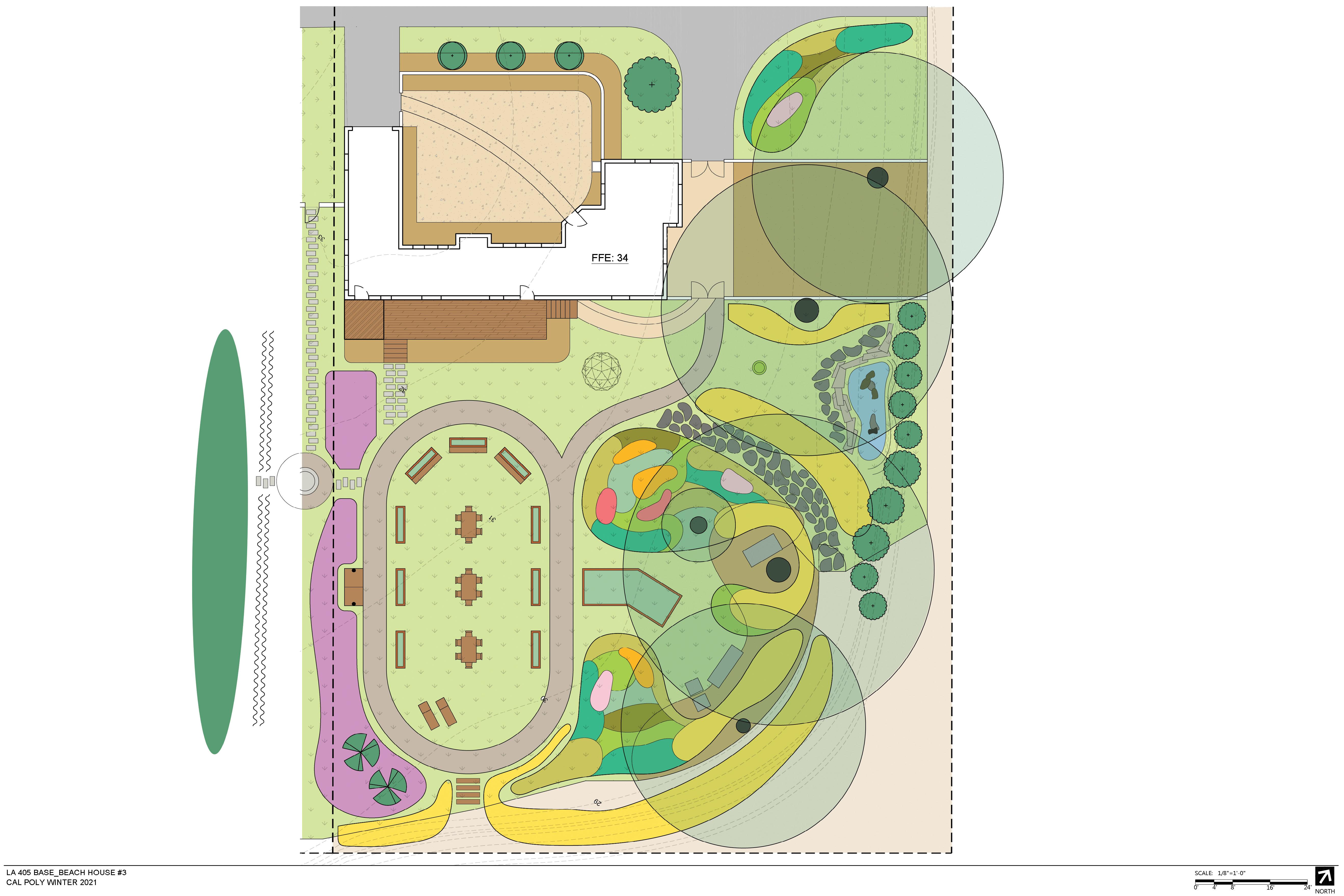

PEA GRAVEL PATH SIDE GATE DOG RUN DECK PLAY SPACE MAIN LAWN GRILL AREA
PLANTER COURTYARD DRIVEWAY W. R. H. MEMORIAL BEACH 31
EDIBLE

32 FFE: 34 DECK LAWN LAWN LAWN LAWN LAWN LAWN FLAGSTONEPATH WOODEN PLANTERS TAG ERE ESC CAL COL FUB SAL LAS UMB CAL WAS RO2 BOU GOL CIS SKA MIM GUT WOO FIM MYR COM NEP CA2 EXISTING PALM TREE NEP WLO POL SWE ROS DW2 SAL LEU SAL SPA TEU CHA ZAN AET ZAU CA9 EXISTING ROSES LON BOX CAR PAN OST FRU EDIBLE PLANTER
PLANTING NOTES
WOODEN LAWN PLANTERS: Wooden planters on lawn are to be filled with groundcover plants as specified.
EDIBLE PLANTER: Plants to be selected by client.
EXISTING PLANTS: Plants that exist on site and which shall be preserved in the planting plan are marked with a plus sign (+) in the center. Unless otherwise specified, symbols in the plant schedule also apply to existing plants.

PLANT SCHEDULE
Emerson Goo LA 439
Christine O'Hara Fall 2021
Dwarf Rosemary 4" 13
SAL LEU Salvia leucantha Mexican Bush Sage 1 gal. 8
SAL SPA Salvia spathacea Hummingbird Sage 4" 11
TEU CHA Teucrium chamaedrys Germander 1 gal. 17
WOO FIM Woodwardia fimbriata Giant Chain Fern 5 gal. 34
ZAN
ZAU
NORTH
33 Sheet Scale Project Date Beach House 3 12/02/21 1/8"=1'-0" PLANTING
Beach House 3San Simeon,
L1 TREES CODE BOTANICAL NAME COMMON NAME SIZE QTY REMARKS SAL LAS Salix lasiolepis Arroyo Willow 15 gal. 3 UMB CAL Umbellularia californica Bay Laurel 15 gal. 4 WAS RO2 Washingtonia robusta Mexican Fan Palm 15 gal. 3 SHRUBS CODE BOTANICAL NAME COMMON NAME SIZE QTY REMARKS BOU GOL Bougainvillea x `California Gold` California Gold Bougainvillea 5 gal. 5 train onto trellis CIS SKA Cistus x skanbergii Coral Rockrose 5 gal. 8 COL FUB Coleonema pulchellum `Sunset Gold` Sunset Gold Breath of Heaven 5 gal. 8 ESC CAL Eschscholzia californica California Poppy 4" 22 MIM GUT Mimulus guttatus Seep Monkeyflower 1 gal. 27 MYR COM Myrtus communis Common Myrtle 5 gal. 7 NEP CA2 Nepeta cataria Catnip 4" 9 NEP WLO Nepeta x `Walker`s Low` Walker`s Low Catmint 4" 5 POL SWE Polygala x dalmaisiana Sweet Pea Shrub 5 gal. 4 ROS DW2 Rosmarinus officinalis `Prostratus`
PLANBACK OF HOUSE
CA
TAG ERE Tagetes erecta Marigold 4" 41
AET Zantedeschia aethiopica Common Calla Lily 1 gal. 147
SHRUB AREAS CODE BOTANICAL NAME COMMON NAME SIZE SPACING QTY REMARKS LON BOX Lonicera nitida Box Leaf Honeysuckle 5 gal. 2" o.c. train onto trellis GROUND COVERS CODE BOTANICAL NAME COMMON NAME SIZE SPACING QTY REMARKS CAR PAN Carex pansa Sanddune Sedge 2" plug 12" o.c. OST FRU Osteospermum fruticosum African Daisy flat of 36 15" o.c. 8
CA9 Zauschneria californica California Fuchsia 5 gal. 8
hhf planners
Honolulu, HI
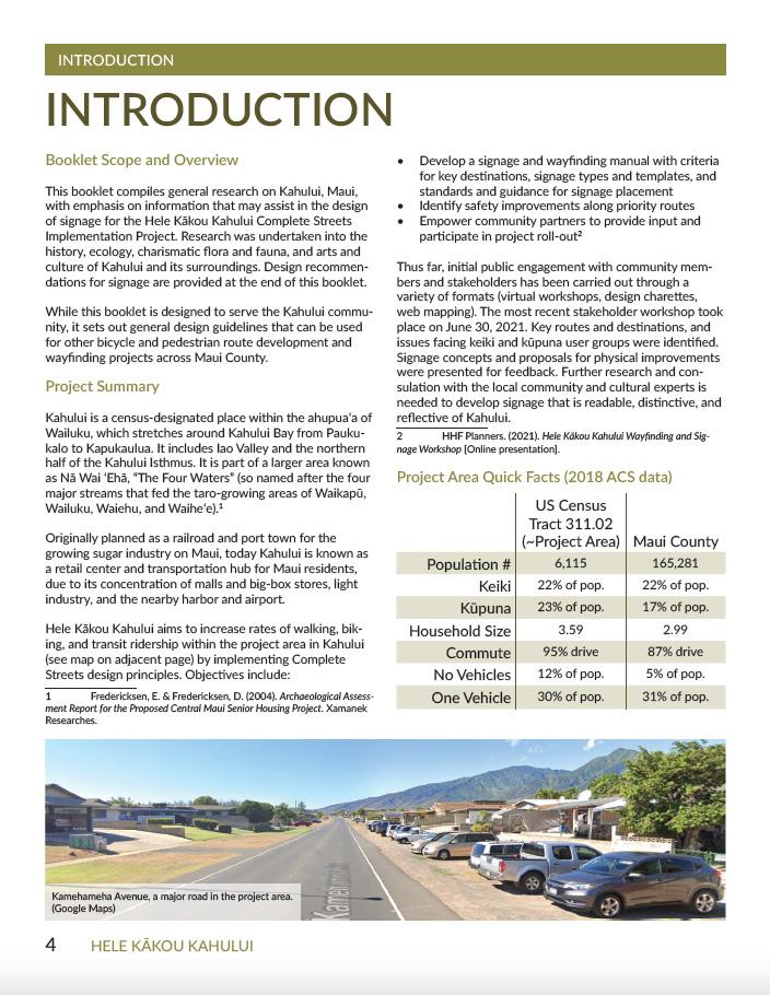
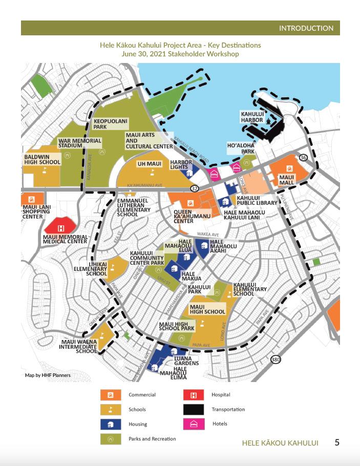
During my internship at HHF Planners, I prepared irrigation plans and construction documents, shadowed site visits, and also contributed research to a Complete Streets planning project in Kahului, Maui. Click to view a blog post on HHF's website that I wrote about my experience.
julY - AuG. 2021
supervIsors: tomoko nAkA, rIck quInn, joHn HAGIHArA
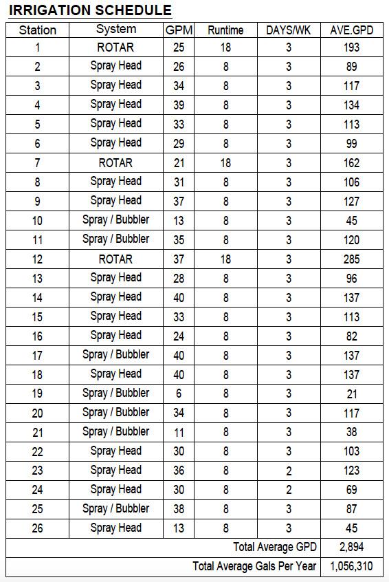
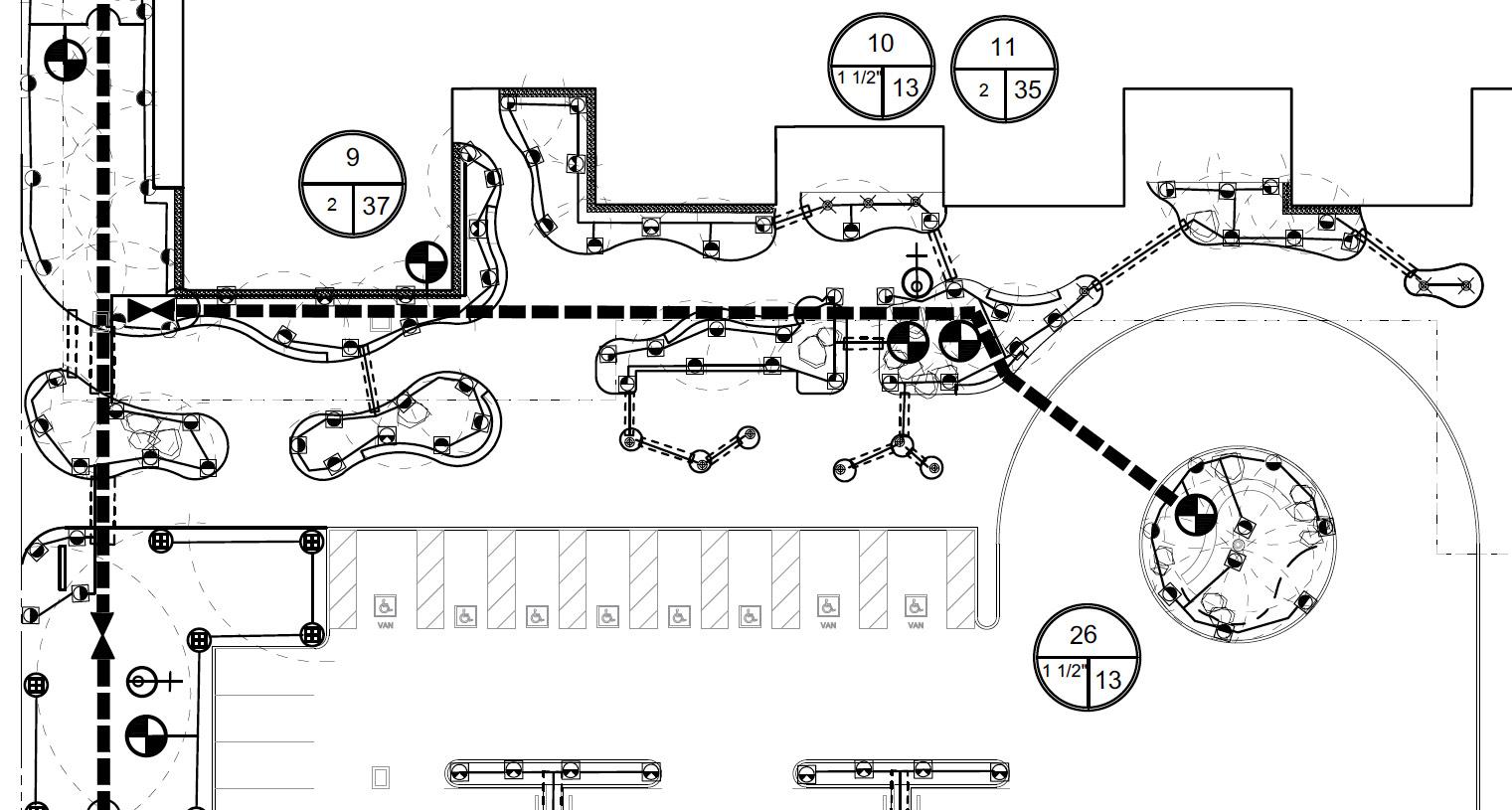
BOTTOM & RIGHT: Cropped portion of irrigation plan and schedule for a 89,000-square ft. veteran's clinic. I completed pipe layout and irrigation head selection under supervision and calculated and compiled the irrigation schedule.
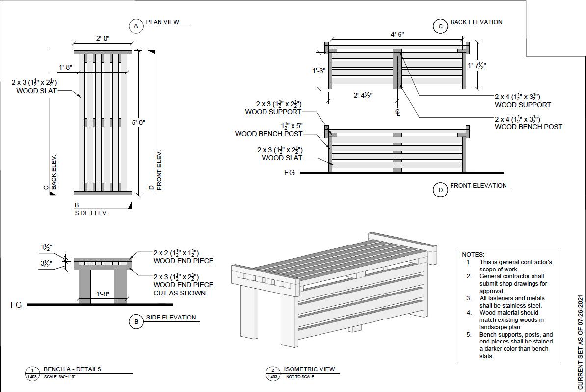
FACING PAGE TOP: Construction details for a custom bench. This was designed for a private residence.
FACING PAGE BOTTOM: Booklet design for a Complete Streets implementation project in Kahului, Maui.
34
35
After completing the veteran's clinic, I was able to work more independently on irrigation plans. I completed this smaller residential irrigation plan almost entirely on my own. Since irrigation design is not a subject that is covered in-depth in my curriculum, the experience of working on these two plans was invaluable and made me much more conscious of water use as a designer.
LANDSCAPE IS RESPONSIBLE COORDINATE INSTALL SLEEVES IRRIGATION MAIN LATERAL, TYP.
36 2 12 1" 3 10 1" 4 16 1" 6 8 1" 5 10 1" 7 5 1" 1 11 1"
IRRIGATION CONTROLLER
HOSE BIB OFF OF IRRIGATION MAIN
HOSE BIB OFF OF IRRIGATION MAIN
HOSE BIB OFF OF IRRIGATION MAIN
1 12" IRRIGATION MAIN, INSTALL BELOW LATERAL TYP.
1 12" IRRIGATION MAIN, INSTALL BELOW LATERAL TYP.
DRIP FOR POT OFF OF ADJACENT IRRIGATION LATERAL
L200 1 IRRIGATION
1/8"=1'-0" 0 8' 16'
PLAN SCALE
SCALE 1/8"=1'-0"
ELECTRIC VALVE WITH PRESSURE REGULATOR - 1"
RAINBIRD RAINBIRD PESB WITH PRS-DIAL
1 1/2" PVC BALL VALVE, NIBCO 4660-T OR EQUAL FOR SERVICING AT VAVLE
1 1/2" BRASS BALL VALVE - NIBCO T585-70 (THREADED WITH LEVER HANDLE)
WATER METER - EXISTING 1" METER NO. 02320913
IRRIGATION SUB-METER 1" BADGER M55 (BWS APPROVED MODEL)
REDUCED PRESSURE BACKFLOW PREVENTER WILKINS RP (975XL) 1'' OR EQUAL, PRESSURE REGULATOR, WILKINS MODEL 600 (VERIFY PRESSURE PRIOR TO INSTALLATION)
RAINBIRD CONTROLLER ESP-ME
IRRIGATION MAIN LINE, 1 1/2" SCH. 40 PVC
IRRIGATION LATERAL LINE SCH 40 PVC TYP.
IRRIGATION SLEEVE SCH 40 PVC, SIZE AS NOTED DRIP
FOR POTS
DRIP IRRIGATION FOR POTS: (2 EACH) .9 gph XERI-BUG EMITTER PER POT
NO.
IRRIGATION NOTES:
1. IRRIGATION SYSTEM IS DESIGNED BASED ON MAXIMUM PEAK FLOW OF 18 GPM
2. IRRIGATION PLAN IS SCHEMATIC. IRRIGATION CONTRACTOR IS RESPONSIBLE FOR ADJUSTING IRRIGATION NOZZLES AND HEAD POSITIONS TO INSURE FULL COVERAGE AND MINIMIZE OVER-SPRAY.
3. VERIFY LOCATION OF UNDERGROUND UTILITIES BEFORE BEGINNING WORK.
4. PROVIDE AS-BUILT DRAWINGS UPON COMPLETION OF THE FINAL INSPECTION.
5. PROVIDE 90 DAY MAINTENANCE AND ONE YEAR WARRANTY OF SYSTEM AT END OF MAINTENANCE PERIOD, INSPECT SYSTEM, ADJUST HEADS, SPRAY PATTERNS, RISER
37 WM IM 8 11 1"
AND LATERAL LINE BELOW H.S. TO BE SLEEVED WITH SCH 40 PVC RAINBIRD IRRIGATION CONTROLLER HOSE BIB OFF OF IRRIGATION MAIN DRIP FOR POT OFF OF ADJACENT IRRIGATION LATERAL CONTRACTOR RESPONSIBLE TO COORDINATE WITH GC TO SLEEVES FOR MAIN AND TYP. 3" 3" This observation. State Drawn TMK: 68-415 Design Revisions: Scale Drawing Date Project 68-415 Ho Replacement IRRIGATION LEGEND SYMBOL DESCRIPTION RADIUS NOZZLE PSI GPM 4" POP-UP HEAD QUARTER CIRCLE - RAINBIRD 1804-SAM-PRS 12 FT U-SERIES90DEG 30 PSI .7 GPM 4" POP-UP HEAD HALF CIRCLERAINBIRD 1804-SAM-PRS 12 FT U-SERIES180 DEG 30 PSI 1.3 GPM 4" POP-UP HEAD FULL CIRCLERAINBIRD 1804-SAM-PRS 12 FT U-SERIES360 DEG 30 PSI 2.6 GPM 12" POP-UP HEAD QUARTER CIRCLE - RAINBIRD 1812-SAM-PRS 8 FT U-SERIES90DEG 30 PSI 0.3 GPM 12" POP-UP HEAD HALF CIRCLERAINBIRD 1812-SAM-PRS 8 FT U-SERIES180 DEG 30 PSI 0.5 GPM 12" POP-UP HEAD END STRIPRAINBIRD 1812-SAM-PRS, 15 RCS OR 15LCS 4x15 FT 15RCS OR 15LCS 30 PSI 0.5 GPM 12" POP-UP HEAD SIDE STRIPRAINBIRD 1812-SAM-PRS, 15 SST 4x30 FT 15 SST 30 PSI 1.2 GPM 12" POP-UP HEAD STREAM BUBBLER-RAINBIRD 1812-SAM-PRS, MPR-5Q-B 5 FT MPR-5Q-B 30 PSI 0.5 GPM
POP-UP
BUBBLER-RAINBIRD 1812-SAM-PRS, MPR-5H-B 5 FT MPR-5H-B 30 PSI 0.5 GPM
MAIN
12"
HEAD STREAM
WM IM 3"
1 5 1" STATION
FLOW (G.P.M) ELECTRIC VALVE SIZE
other work
Gr AdInG And dr AInAGe plAn
A grading plan for LA 241, a technical site engineering studio. We were tasked with locating all buildings and the parking lot on site, and grading to minimize disruption, limit the number of trees killed, ensure positive drainage away from all buildings, and maintain required F.F.E.s.
38 F.F.E. 63.0 54 54 54 53 53 53 52 52 56 55 55 55 55 55 55 55 56 56 56 56 57 57 58 58 59 59 59 60 60 60 61 61 61 62 62 62 61.5 65 67 68 66 64 63 63 TOC 56.9 BOC 56.4 62.5 CB Top of Culvert: 61.0 Bottom of Culvert: 58.0


F.F.E. 66.0 F.F.E. 62.0 54 54 54 54 53 53 53 52 52 52 51 51 51 51 50 50 50 50 50 49 49 49 48 48 47 47 46 56 56 56 55 55 55 57 57 57 58 58 58 59 59 59 59 60 60 60 61 61 61 61 61 62 62 62 63 64 64.5 60.5 65 65 65 65 65 66 67 67 68 69 68 66 65 64 64 64 64 64 63 63 63 63 63 62 62 TOC 55.8 BOC 55.3 TOC 53.7 BOC 53.2 60.5 54.9 61.7 65.5 SEATING AREA SEATING AREA 62.3 64.5 Catch Basin Tree Site Boundary Proposed Contour Existing Contour Dead Tree CB CB CB CB Top of Culvert: 60.2 Bottom of Culvert: 57.5 Swale Centerline Road Centerline 62.17 63.25 65.0 58.83 57.75 56.0 39
desIGn-buIld projects
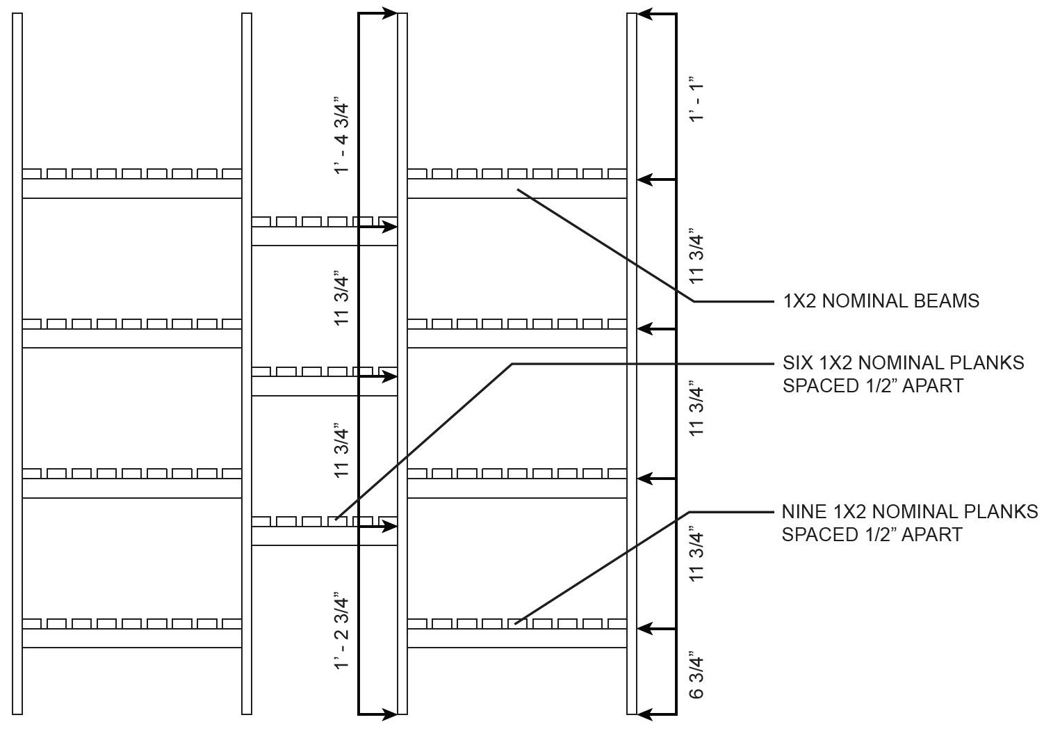
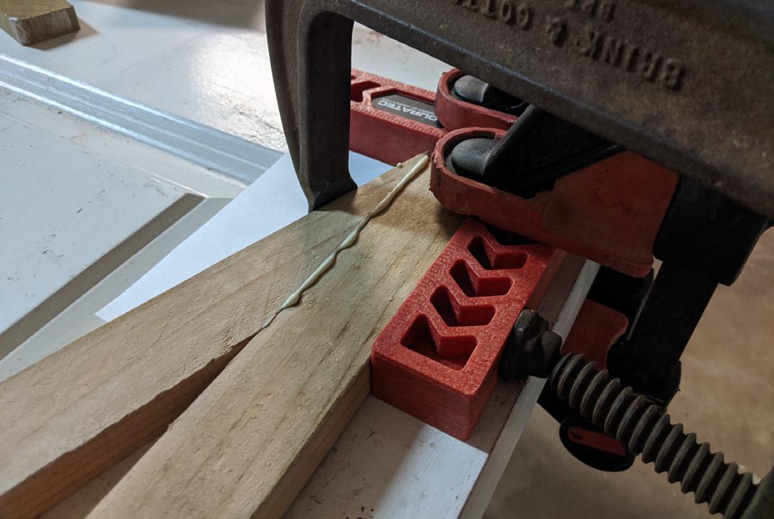
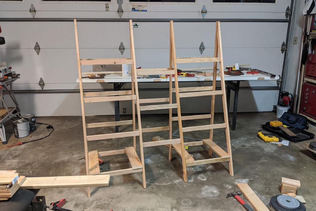
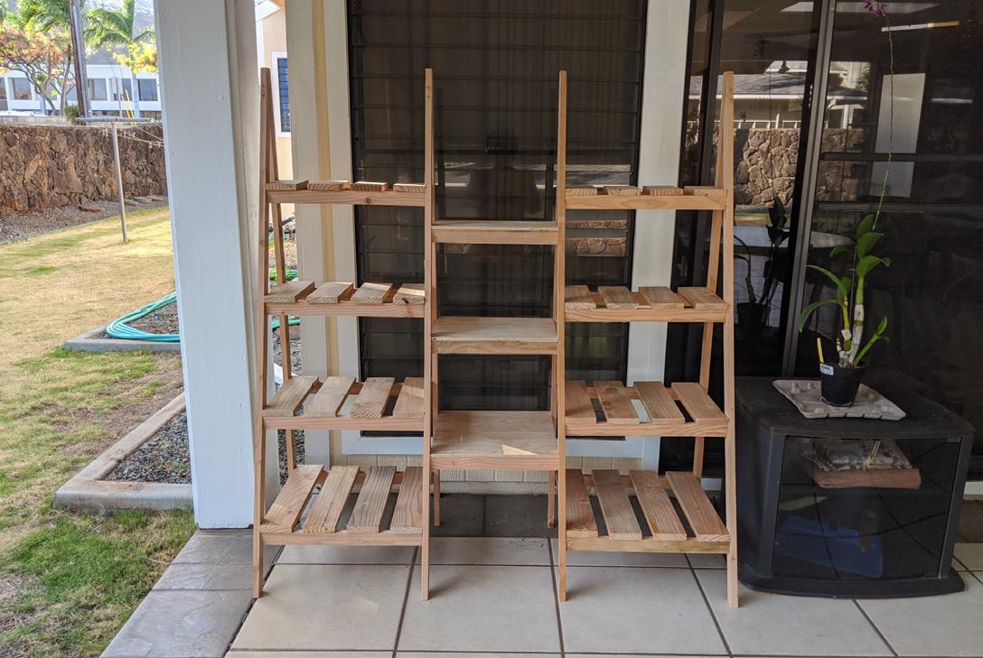
Plant Stand — LA 242
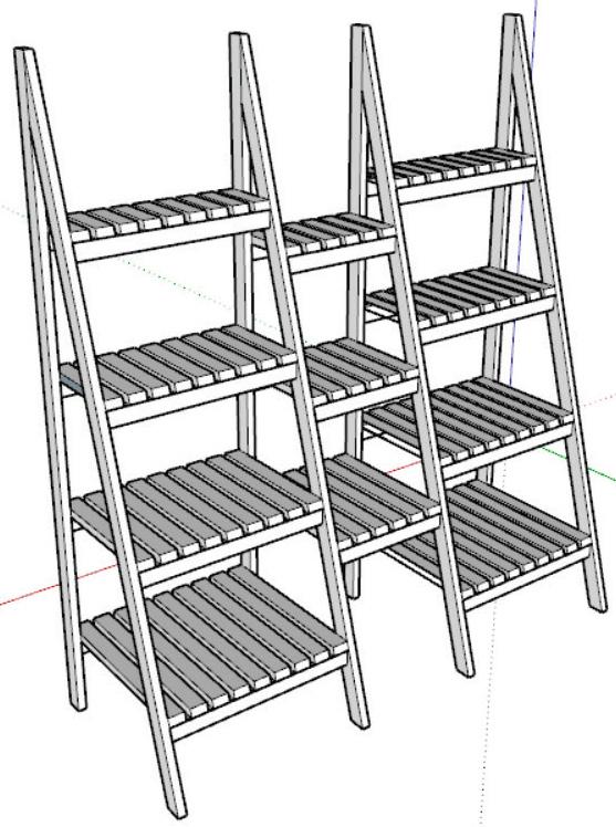
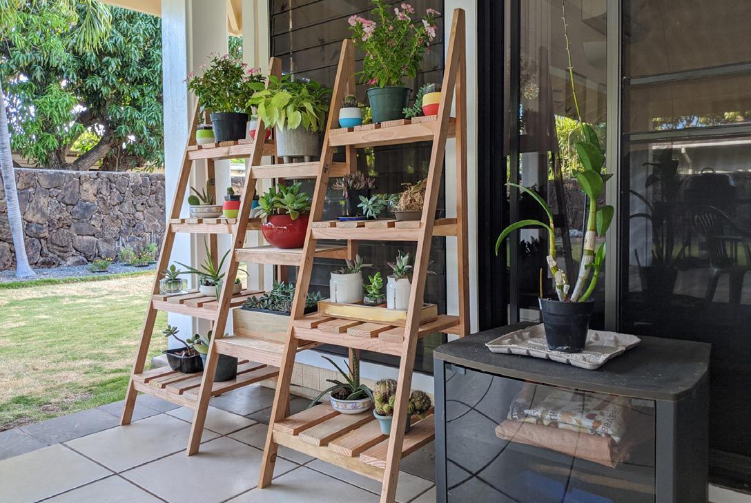
Made for my mom's succulents in an implementation strategies course. Modeled in SketchUp, built in my garage.
40
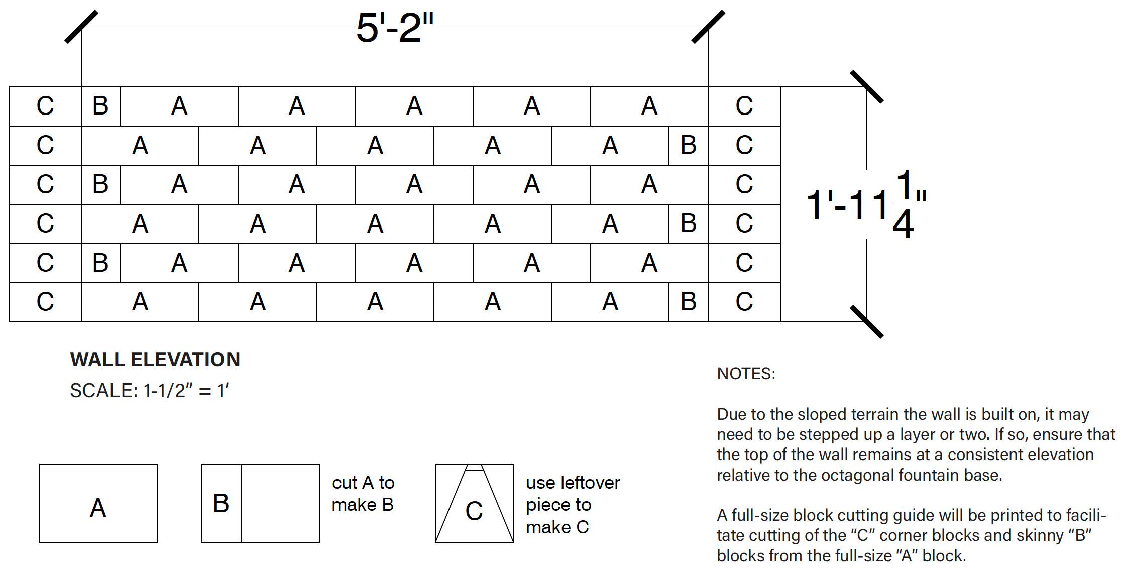
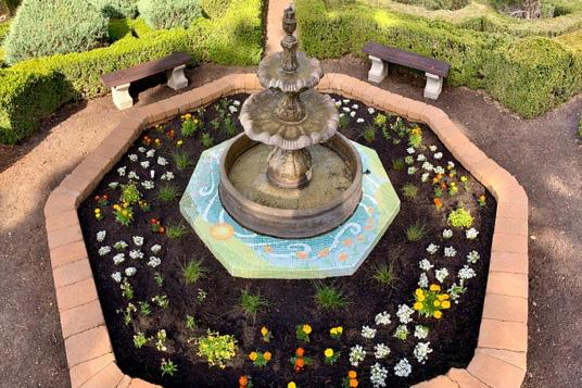
Cal Poly Arboretum Dry-Stack Wall — LA 350
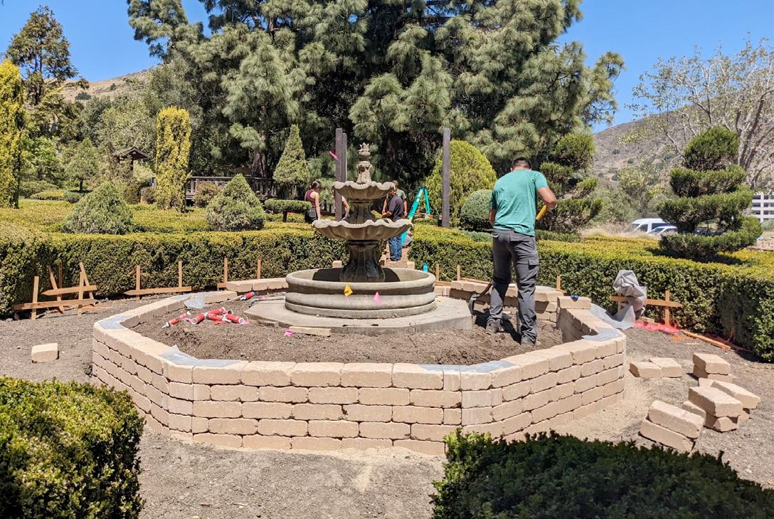
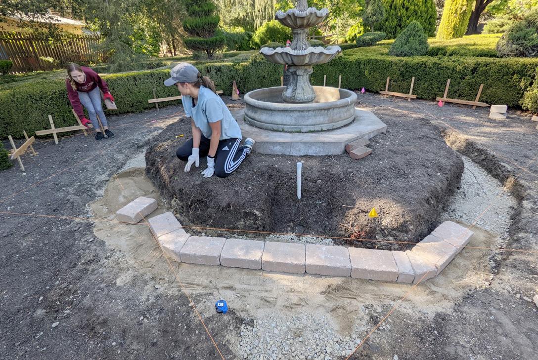
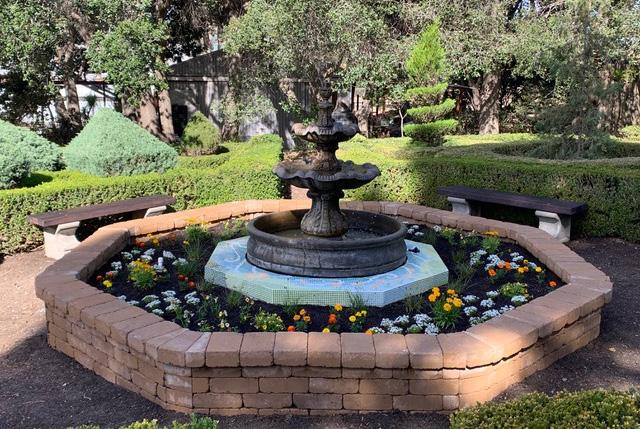
This project was a team effort to beautify the arboretum, of which the wall was only one part. Benches, an arbor, a mosaic, and a planting design were also created. I was responsible for drawing design documentation for the wall and participating in all stages of its construction. Click to see a video of the whole process by Cal Poly student John Ty.
41
Built for an advanced landscape construction course.
Botanical Garden
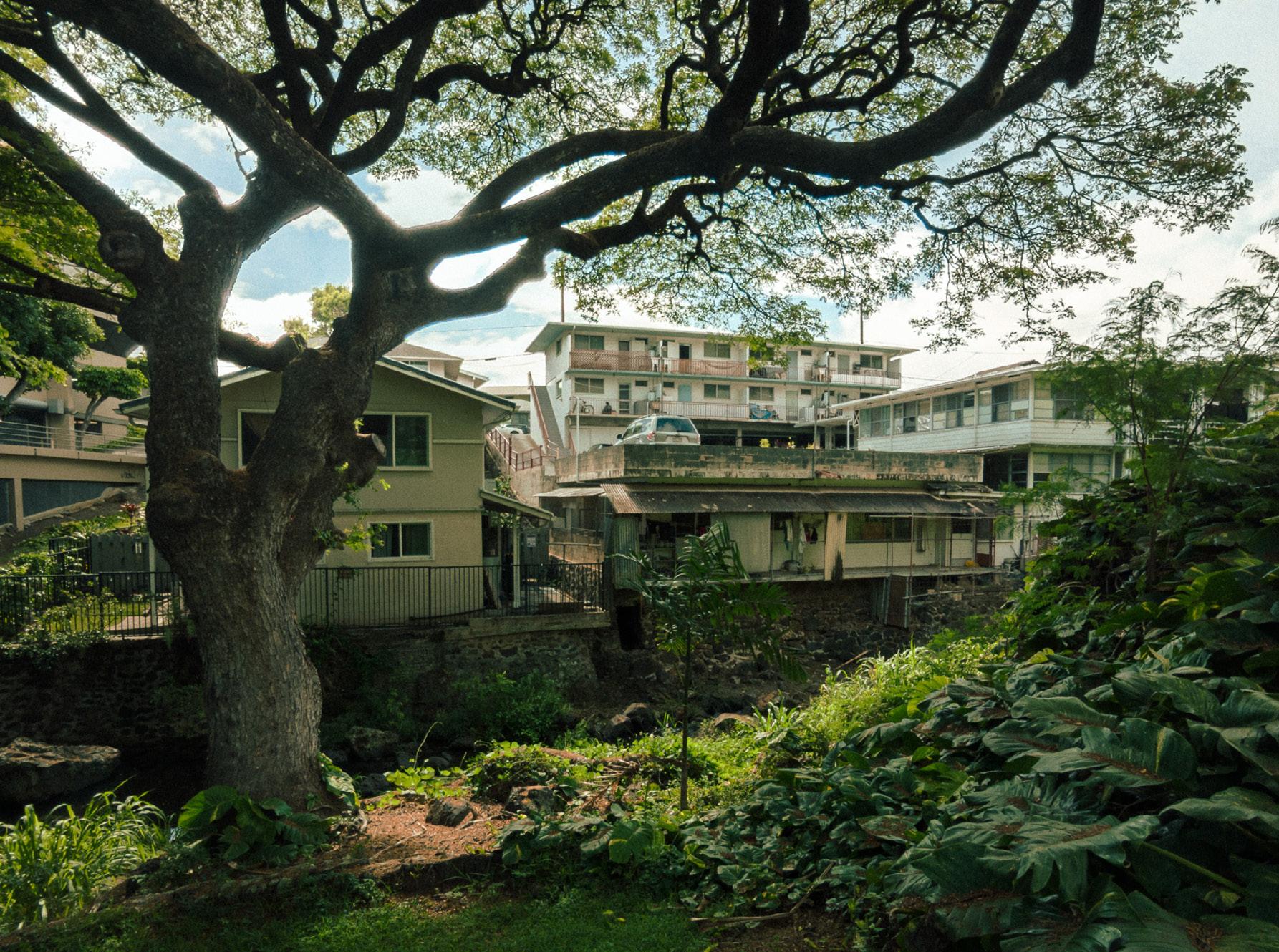
Honolulu, HI
Nature Preserve Los Osos, CA

42 pHoto Gr ApHY
Liliʻuokalani
Sweet Springs
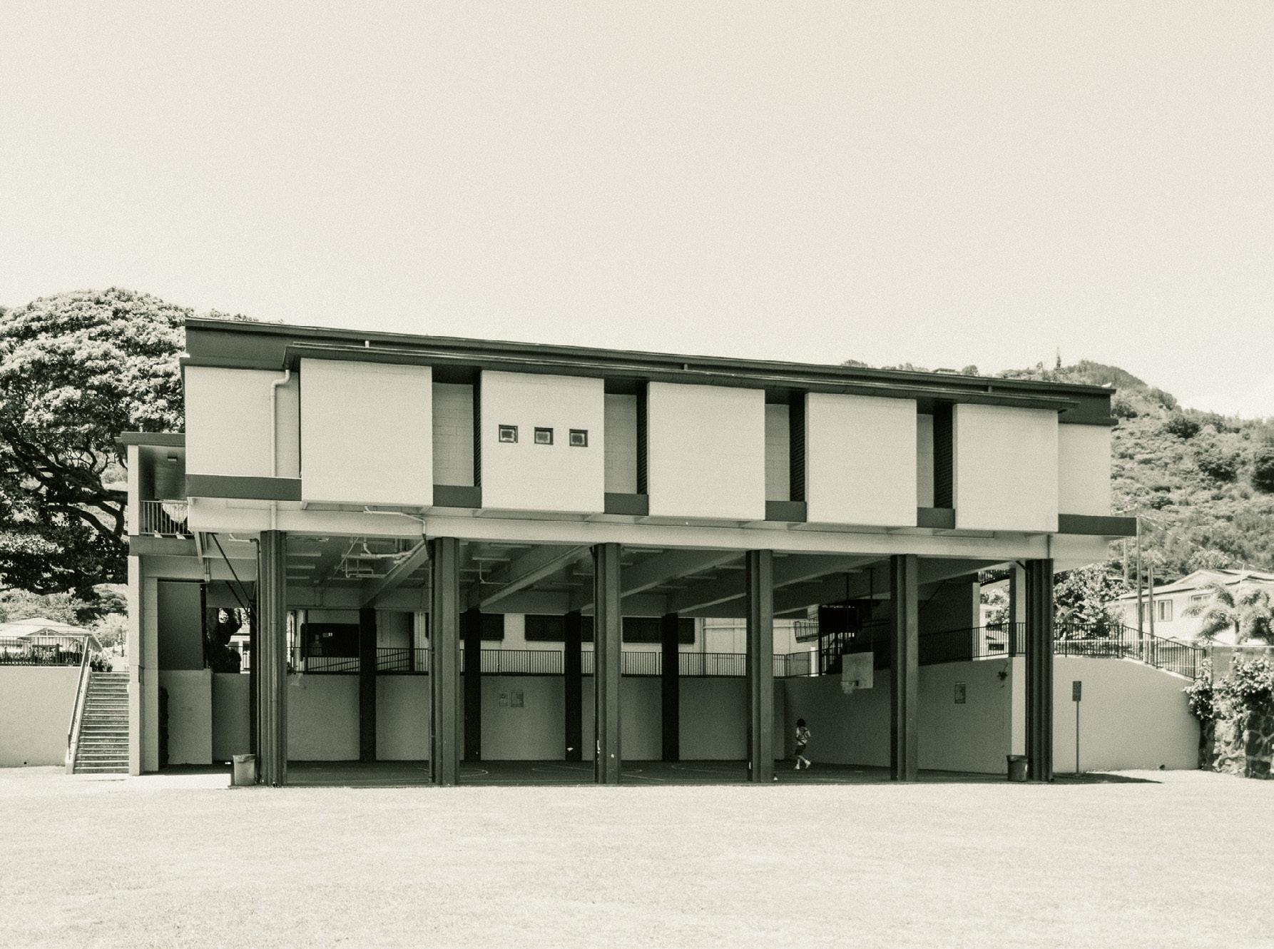
I am an avid photographer with experience in analog and digital mediums. I tend to gravitate towards landscape subjects.

43
Gasworks Park Seattle, WA
Puʻunui Community Park Honolulu, HI
My writing portfolio: https://emersongoo.blot.im/writing
I have 4+ years of experience as a freelance art, film, and design critic, with bylines in publications such as Film Comment, Cinema Scope, Design Museum Everywhere, and the New York Review of Architecture. I was a 2022 Documentary Magazine Editorial Fellow with the International Documentary Association. As a film programmer, I have organized events and screenings in Hawaiʻi and California, and moderated and participated in panels for the Honolulu Museum of Art and the Film Comment Podcast.

This essay won a national competition to be included in a print issue of Design Magazine.
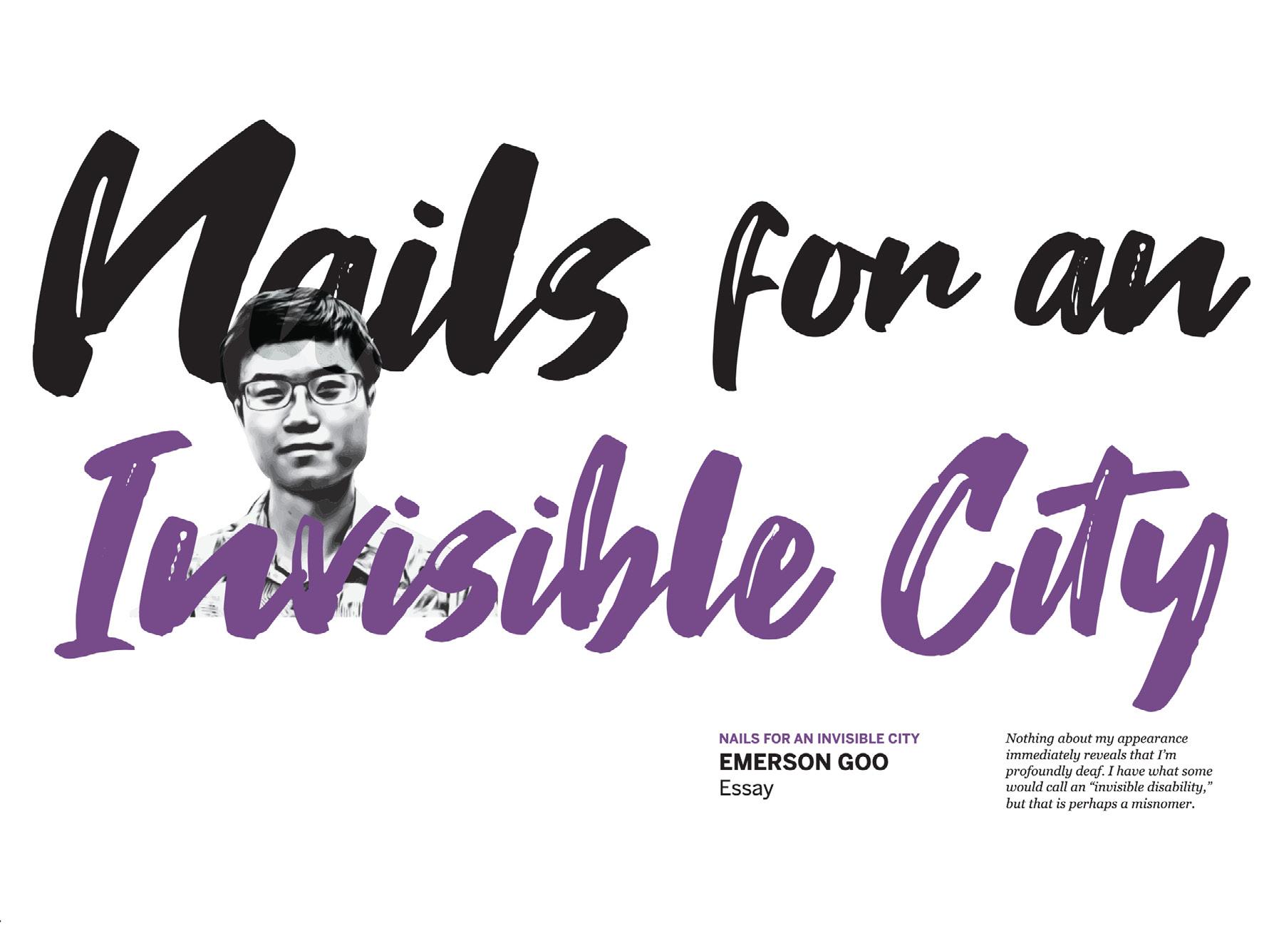
Click to read this essay.

44 wrItInG
speAkInG
And
At the HMoA Doris Duke Theatre with Anderson Le (Hawaiʻi Intl. Film Festival) and Vincent Bercasio (cinematographer/editor).
minimal (1978) it is only the simple sunlight on a fence post out of the snow. and I come to set it upright at the cost of a single blow. then I leave them to the sunlight. one straight post, trodden snow.
— G. F. Dutton
