ACKNOWLEDGEMENTS
I would like to express my special thanks of gratitude to my academic tutor, professor Paola Nella Branduini, for her multiple advices and constant supervision of my progresses during these months. I am deeply grateful for her help in completing this project.
I would also like to thank my beloved family, that keeps supporting me with their love and guidance, in order to purse my goals, and my friends and colleagues that offered great help during the project researching period: Qiongchun, Sofia, Eleonora, Yagmur, Laura, Rossella. Without all of you, many obstacles would have been impossible to overcome.
INTRODUCTION
PiacenzaBettola agriway project abstract, idea explanation
1 2
HISTORICAL AND LANDSCAPE ANALYSIS
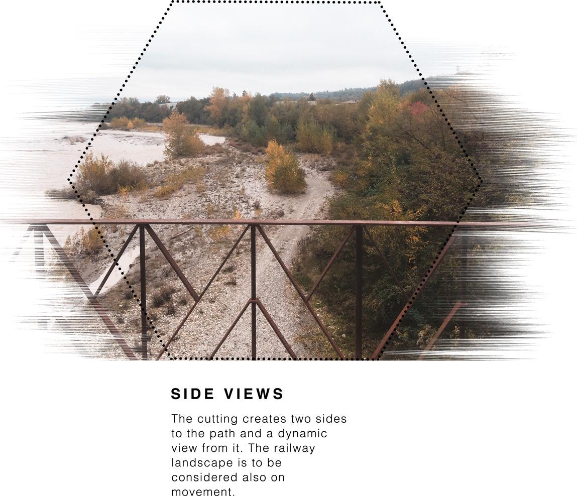
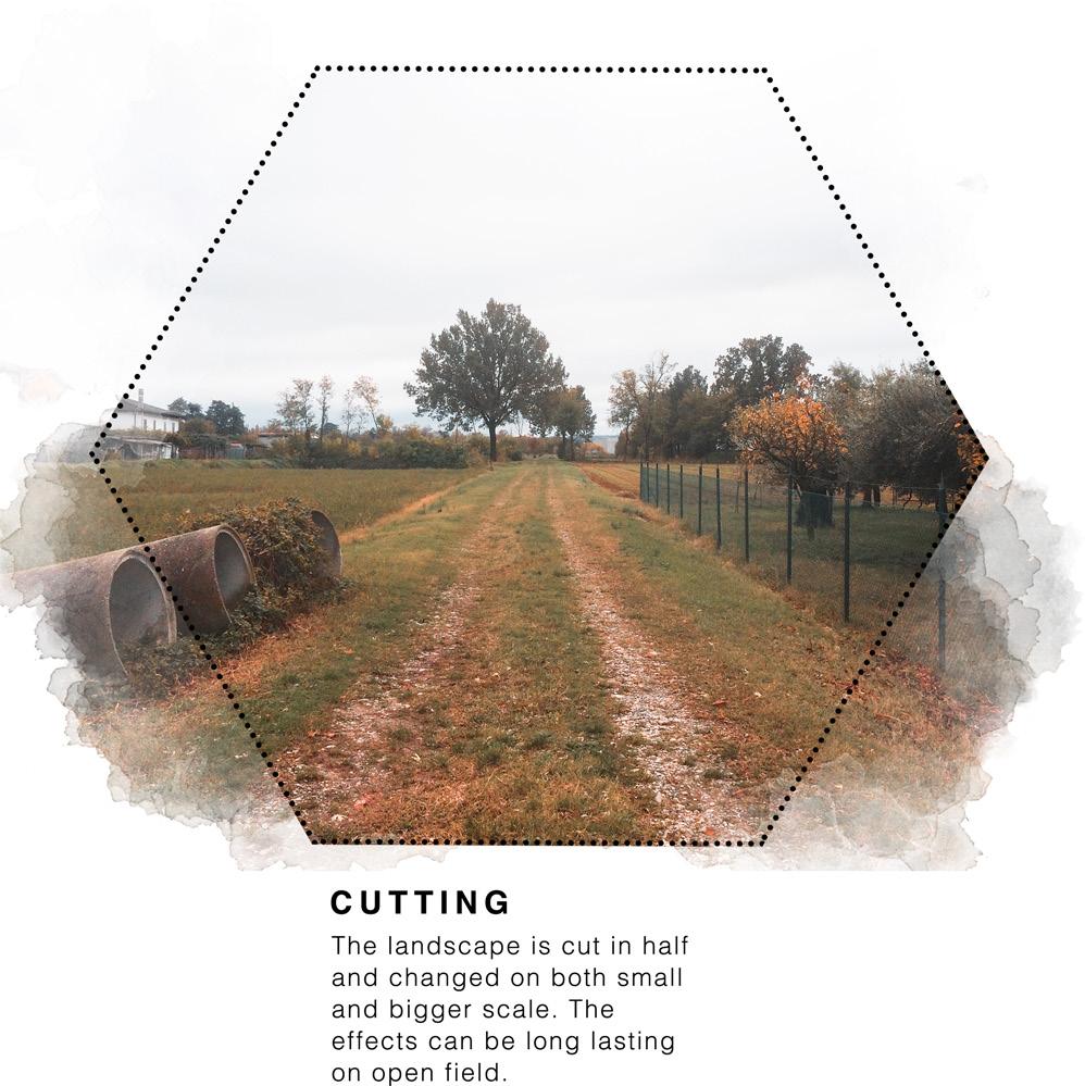
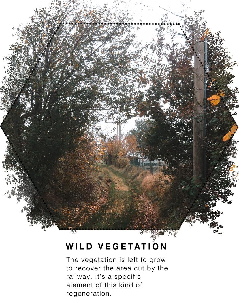
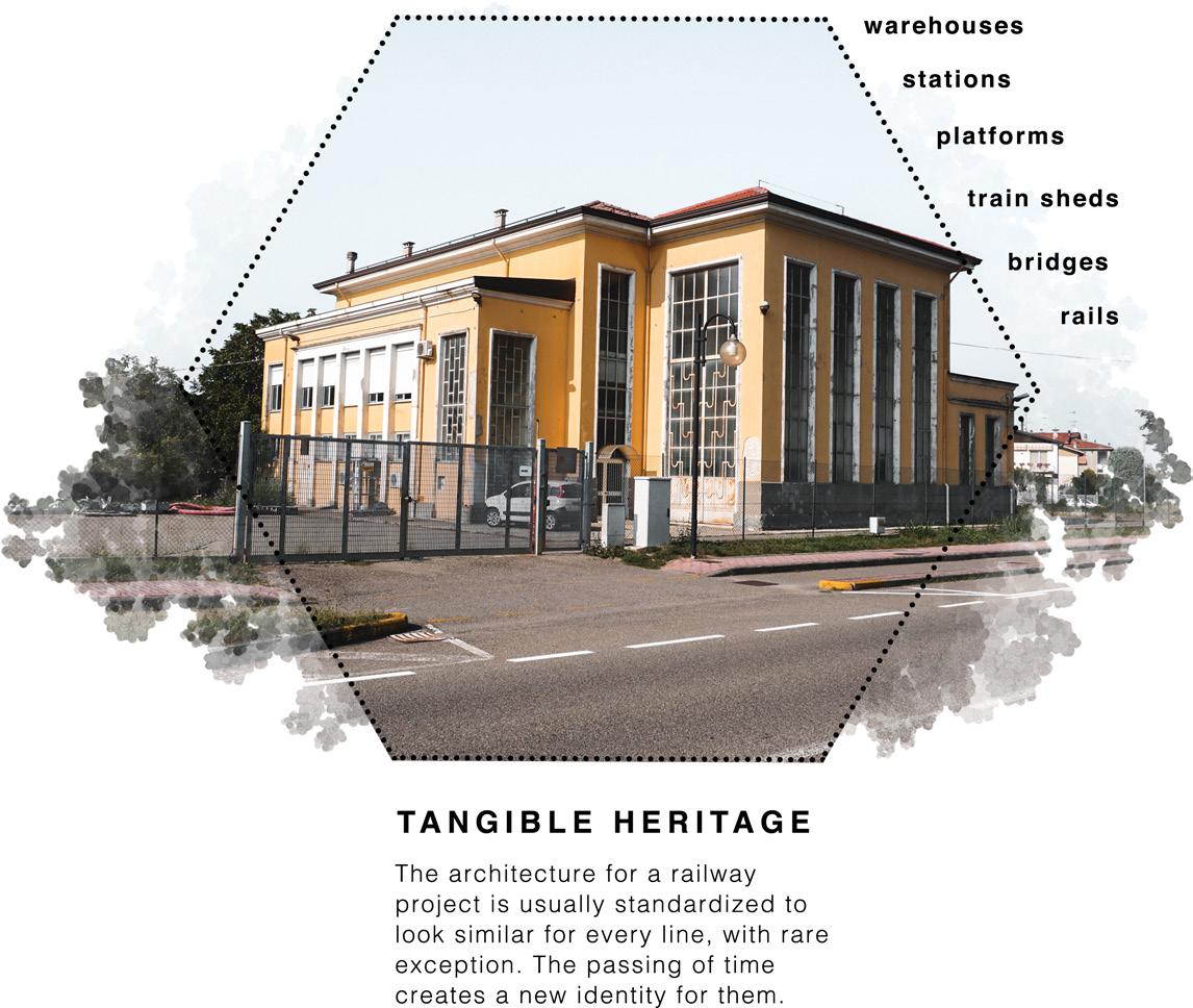
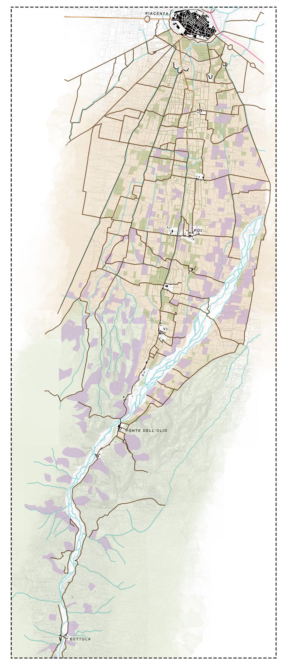
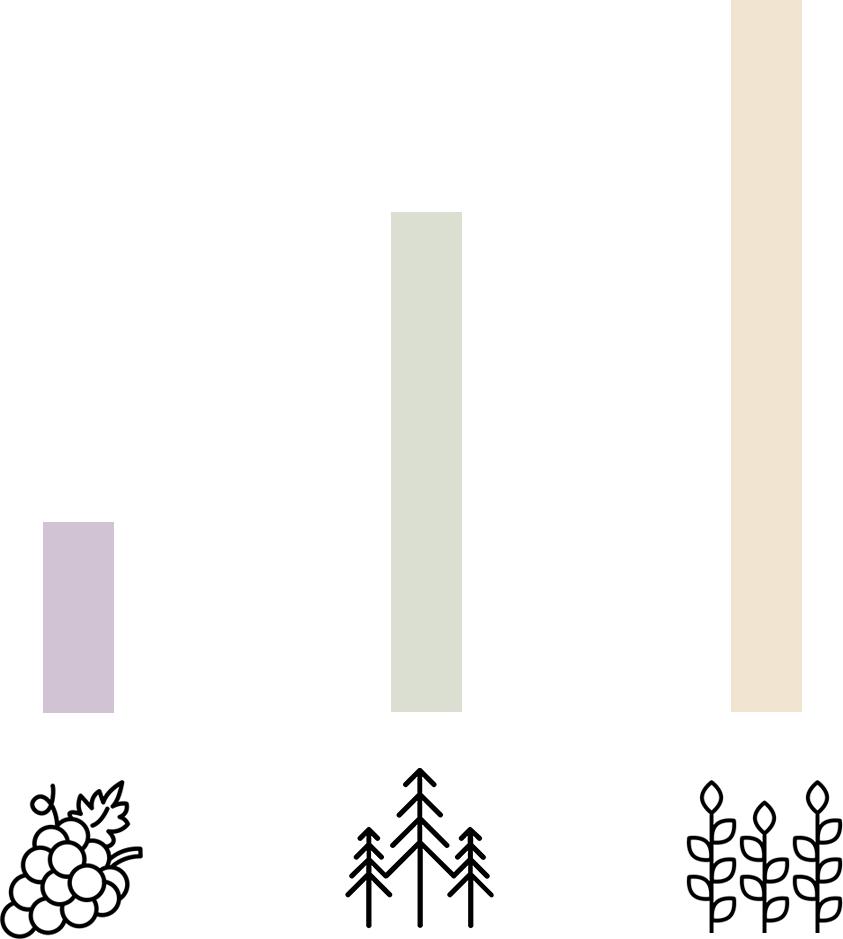
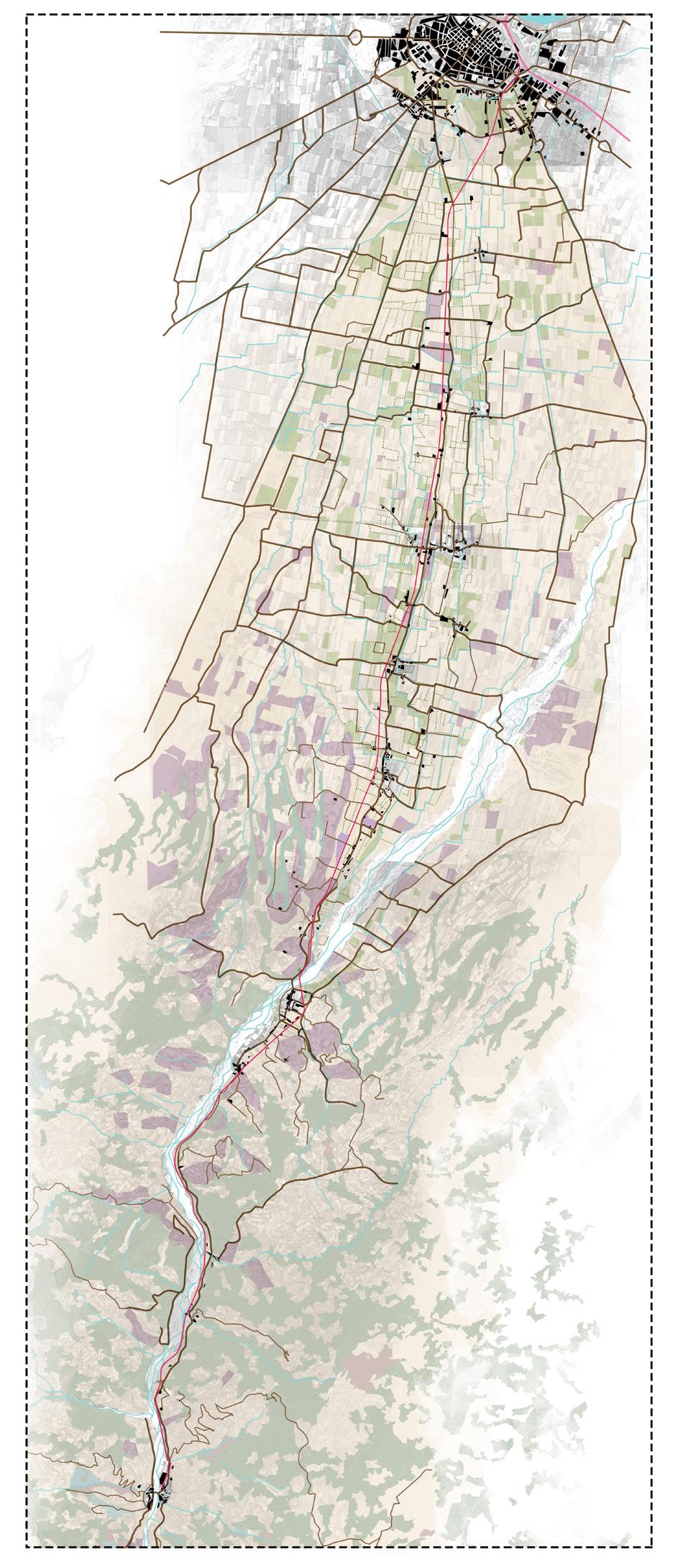
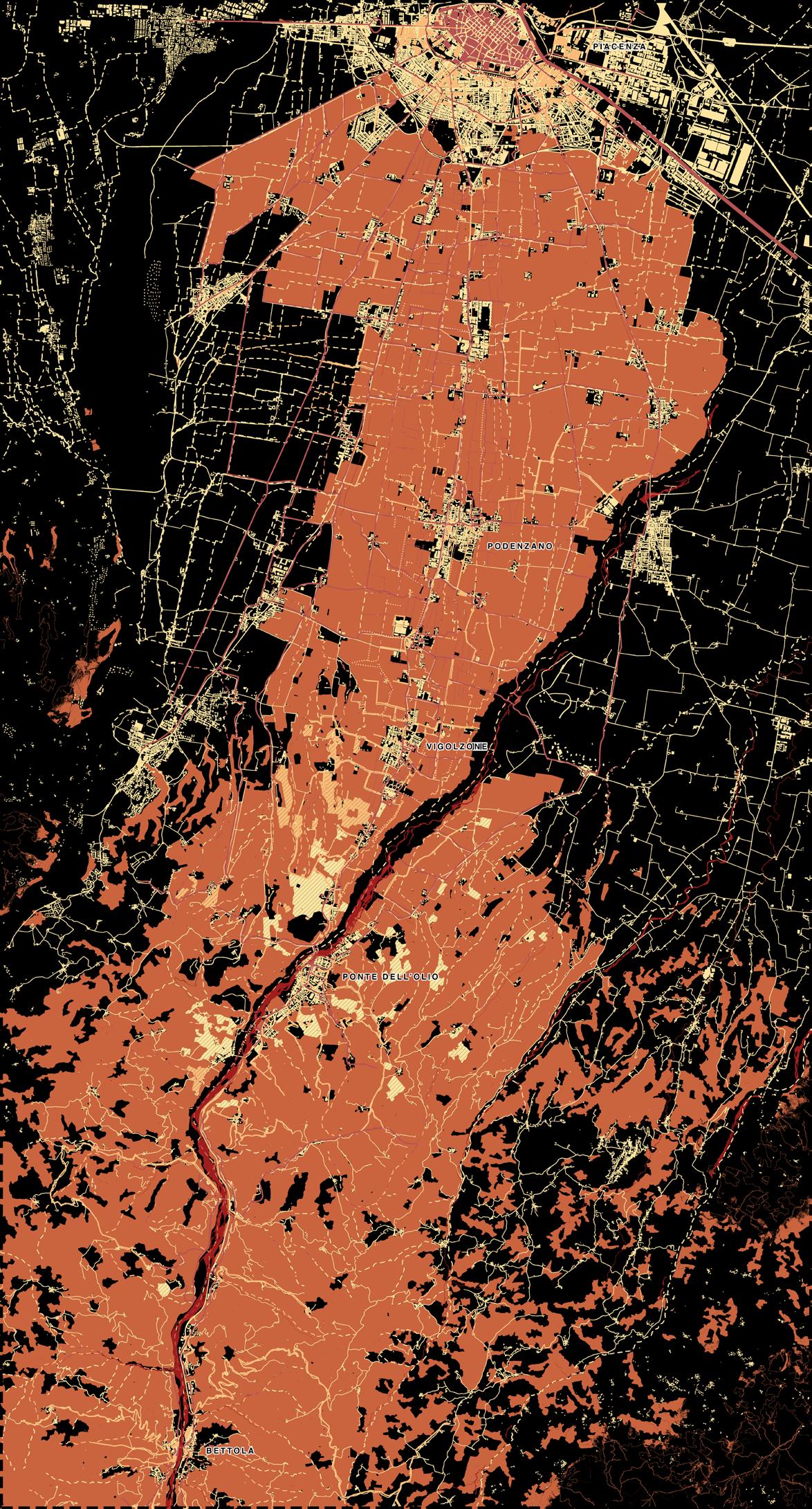
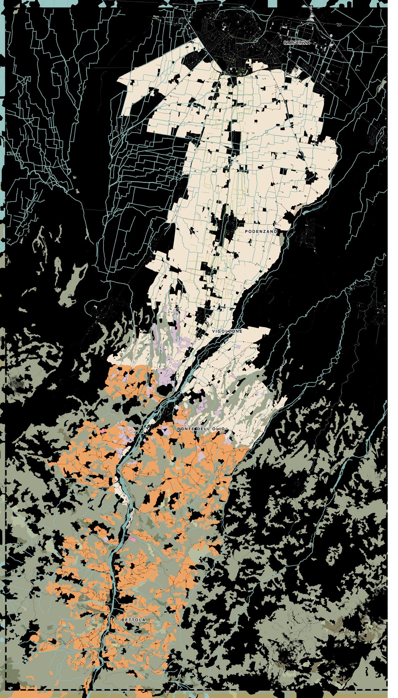
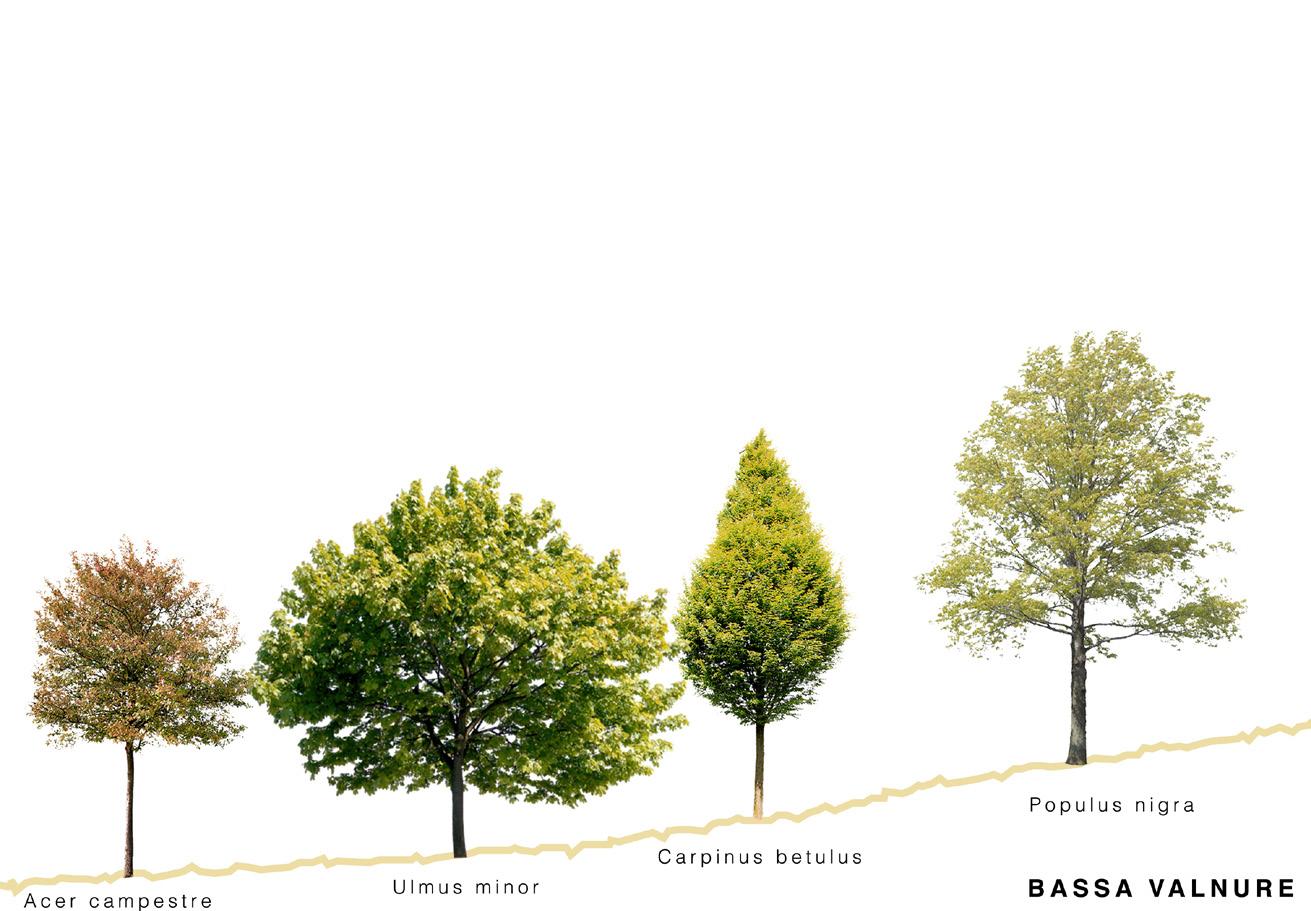
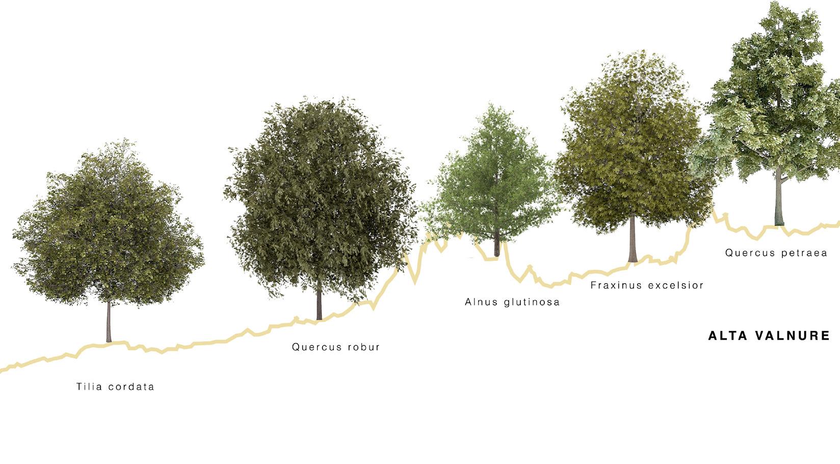
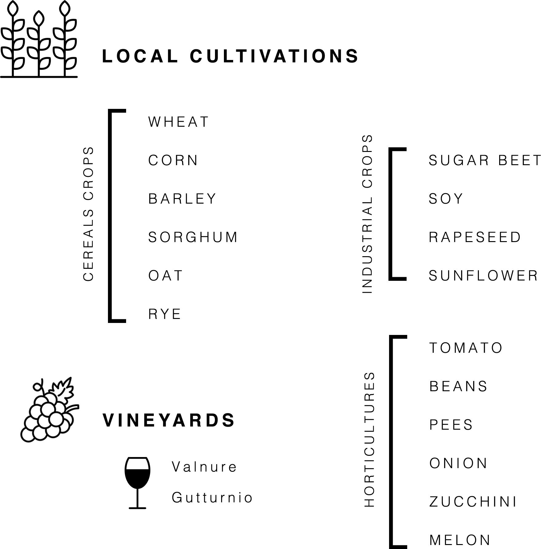
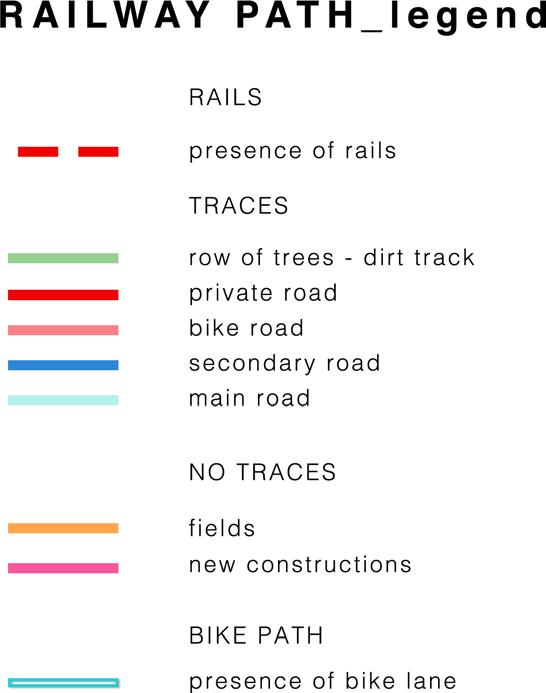
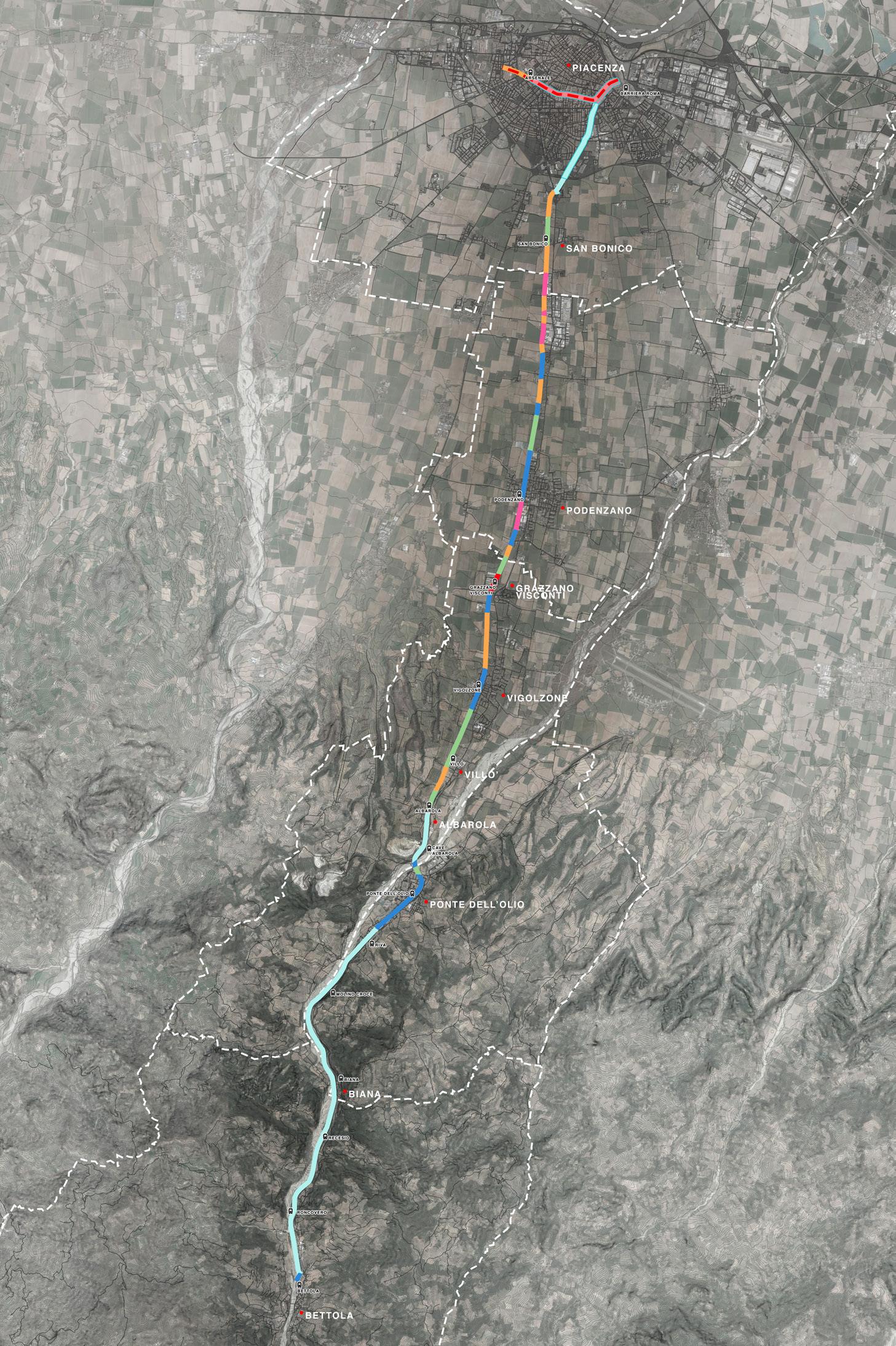
RAILWAY HISTORY from tramway to railway EFFECTS ON LANDSCAPE LANDSCAPE ANALYSIS diachronic maps, synchronic map, land use, trees and woods, cultivations
RAILWAY ANALYSIS
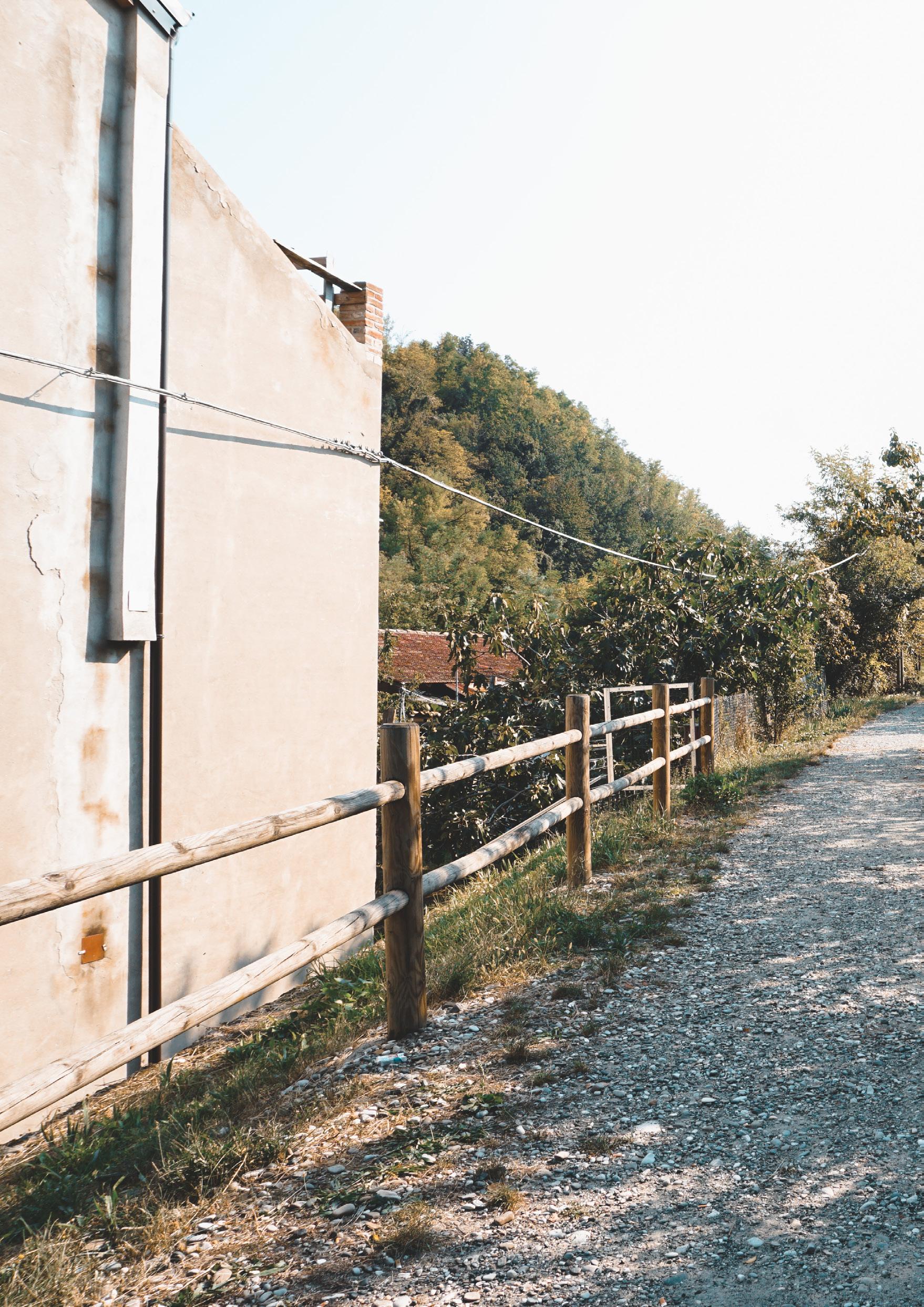
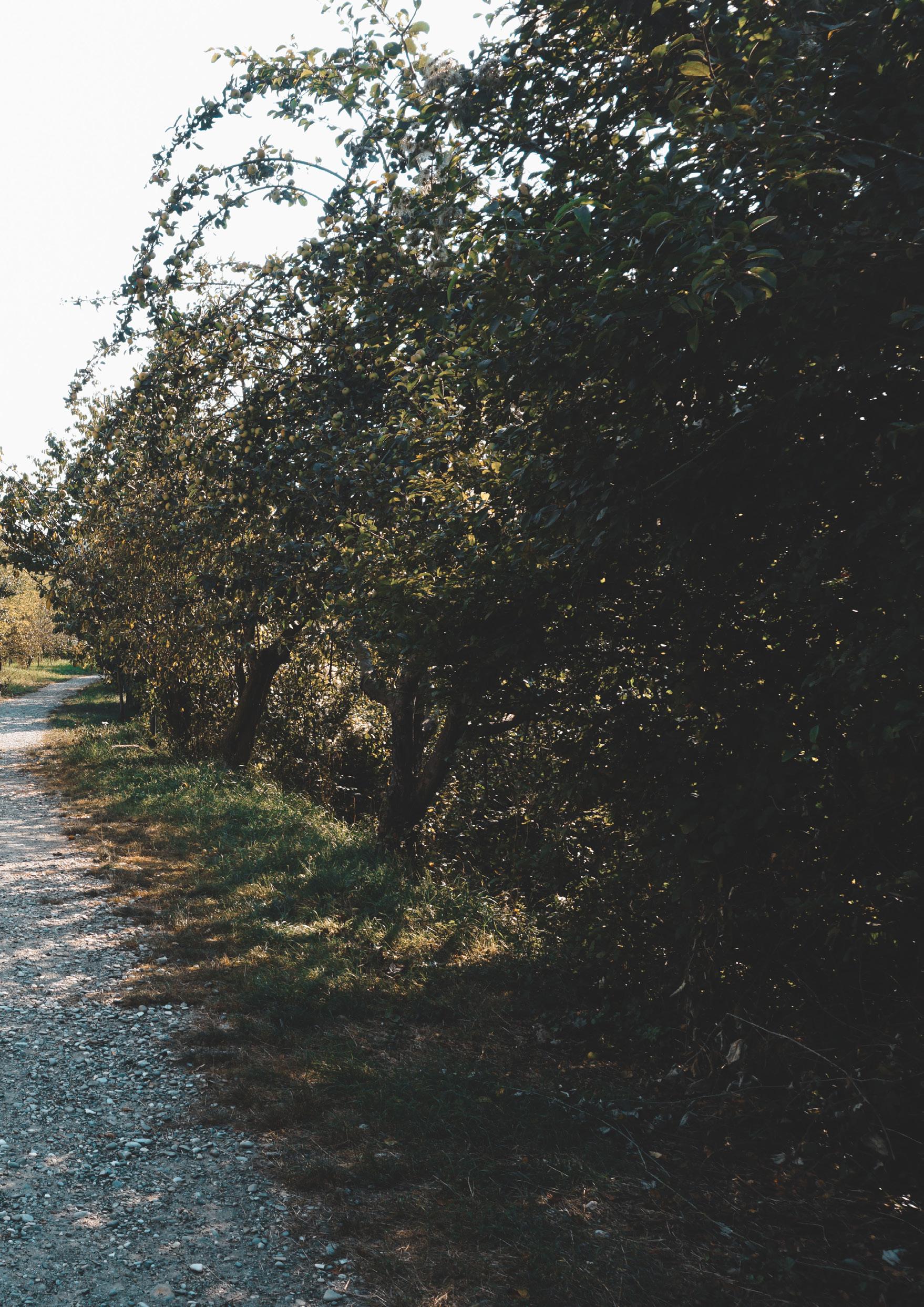
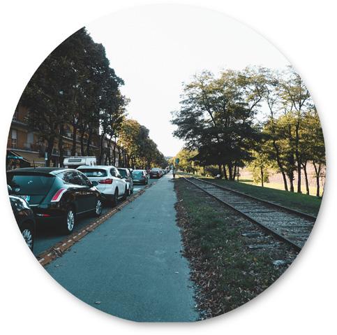
landscape changes, original path, recognizable train stations
3
SWOT AND STRATEGIES
SWOT ANALYSIS connection and sustainability STRATEGIES existing project Europe 2020 strategy DESIGN TIMELINE year 1, 5, 10 CASE STUDIES bicycle paths and urban gardens
PROJECT MASTERPLAN AND DESIGN GUIDELINES PROJECT MASTERPLAN 1:50000
DESIGN GUIDELINES
agriway signs from railway to agriway (original path)
from railway to agriway (new path) railway storytelling
contents
4
SOCIAL AGRICULTURE AND GREEN CORRIDOR AGRIWAY green corridor and green patches local vegetation_ preserving biodiversity community garden strategy + masterplan garden expansion alternative garden
5
BIKE LANE TYPES AND INTERVENTIONS
CYCLE WAY TYPES interventions_details
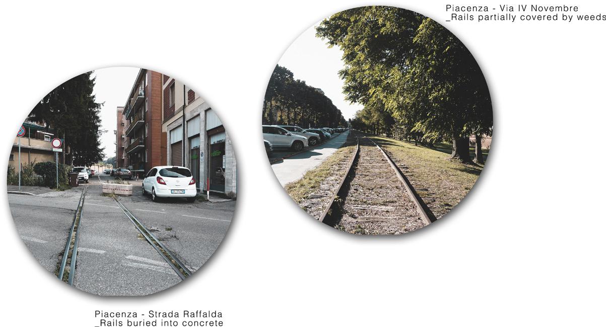
Piacenza
Podenzano
Vigolzone
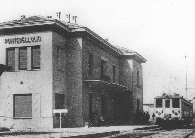
Ponte dell’Olio
Bettola
6
DETAIL SECTIONS AND ESTIMATED COSTS
DETAIL BIKE LANE sections and estimated costs
7
BIBLIOGRAPHY
PIACENZA - BETTOLA RAILWAY: HISTORICAL AND LANDSCAPE ANALYSIS
1
1.2 RAILWAY HISTORY from tramway to railway
1880 April 15
“The Piacenza-Bettola and Cremona Tramway Company Ltd” was created.
STEAM TRAMWAY
Piacenza-Bettola railway was born as a tramway at the end of XIX century and was a source of inspiration for the people of Val Nure valley. Its construction changed deeply the development of the areas it crossed, helping the growth of industrial activities and mostly ending those territories isolation, since they were far from the main national traffic points.
1881 May 16
The line was opened to the public. It was 22km long, from Piacenza to Grazzano Visconti, to Ponte dell’Olio.
The first projects for the construction of a great network of tramway lines in Cremona and Piacenza provinces started from the second half of XIX century. On April 15, 1880 the “The Piacenza-Bettola and Cremona Tramway Company Ltd” was created. This company born in London had the goal to build and manage two lines with steam traction: one from Piacenza to Bettola, another from Piacenza to Cremona.
1881 June 14
The line was finalized on June 14, 1886, with the opening of the Grazzano Visconti-Rivergaro ramification.
The project regarding the construction of a steam tramway, with a gauge of 1435mm, from Piacenza to Bettola, and ramification to Grazzano Visconti-Rivergaro, was immediately approved. After a first test, on May 16, 1881 the line was opened to the public. It was 22km long, from Piacenza to Grazzano Visconti, to Ponte dell’Olio.
In the beginning the line had only 3 trains available: the one-way ticket
price was 1,50 lire for first class, and 1,00 lire for second class. On October 30 the Minister of Labor decided with the company on a commission of 60 years to build the Grazzano Visconti-Rivergaro ramification, and to continue the Ponte dell’Olio-Bettola section, for further 21km.
The line was completed placing the rails on the existing road network, and the stations were placed close to the center of each city: it finally reached Bettola on July 8, 1882 and was finalized on June 14, 1886, with the opening of the Grazzano Visconti-Rivergaro ramification.
In the early 20s, the Società Italiana di Ferrovie e Tramvie (S.I.F.T.) bought the extensive network of steam tramway of Piacenza and Cremona provinces: it had 230km of railways, 37 tram locomotors, 65 passenger cars, and 264 goods convoys of various types. The problem of modernizing all of this material came fast. In 1923, after the first economic crisis caused by First World War, and because of the elevated costs of steam tramways, S.I.F.T. was forced to dismiss the line from Piacenza to Castell’Arquato. Further more it was not able to compete with the first automotive lines and the electric tramways: helped was asked to Piacenza province, which proposed a large reformation project.
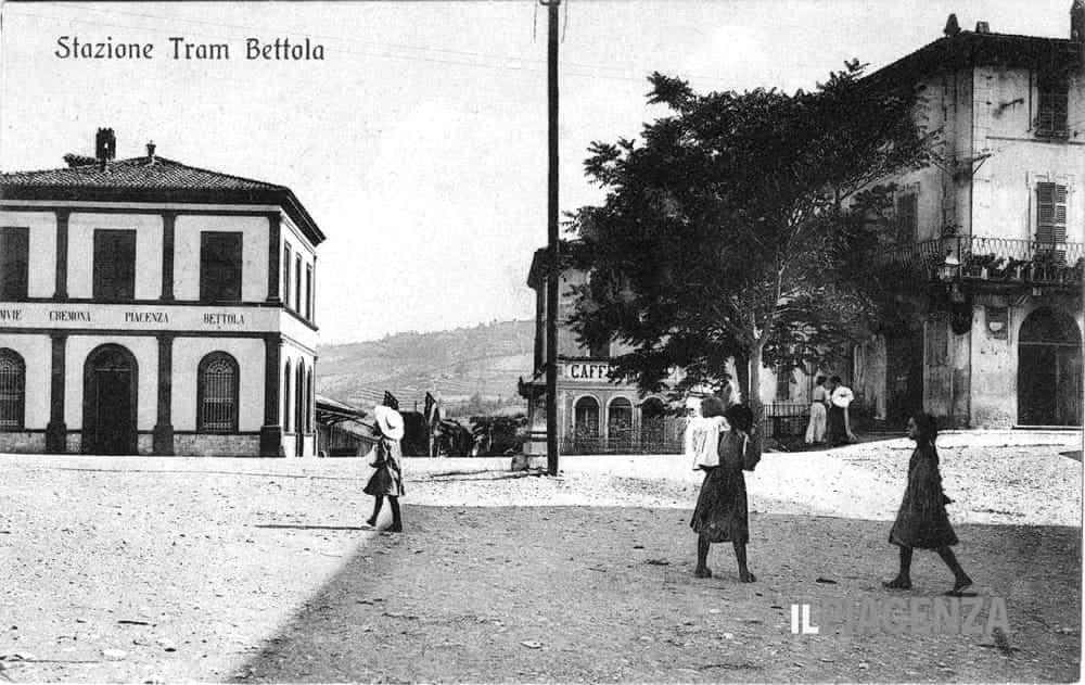
 Bettola tram station
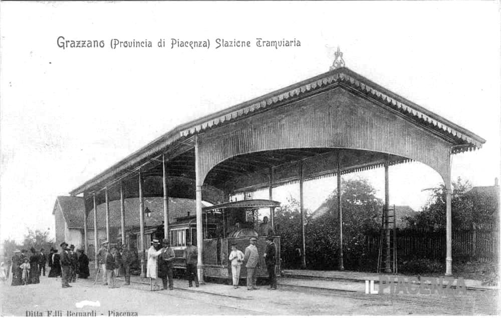
Grazzano Visconti tram station
Bettola tram station
Bettola tram station
Grazzano Visconti tram station
1927
The project for an electric railway was presented from Politecnico di Milano ing. Marco Semenza and Arturo Danusso to the Ministry of Public Works.
After a few years, the Province gave a large contribute to activate a program of modernization, which consisted of the construction of electric railway lines that would substitute the old tramways: they would work especially on Bettola, Carpaneto Piacentino and Nibbiano lines.
RENOVATION YEARS
1930 July 7
The construction of the electric railway starts, destroying the old tramways. It cost more than 30 millions of lire.
1933 June 27
The electric railway is active one year after the ceremony from Piacenza to Grazzano Visconti. After September the line is active all the way to Bettola.
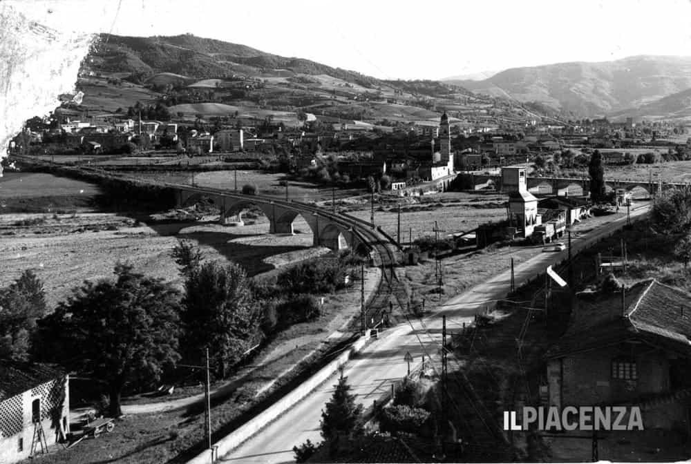
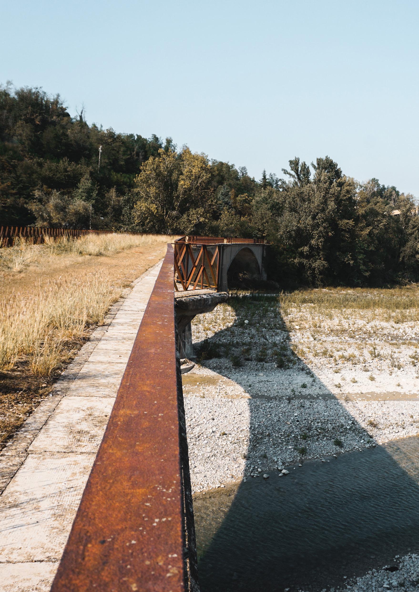
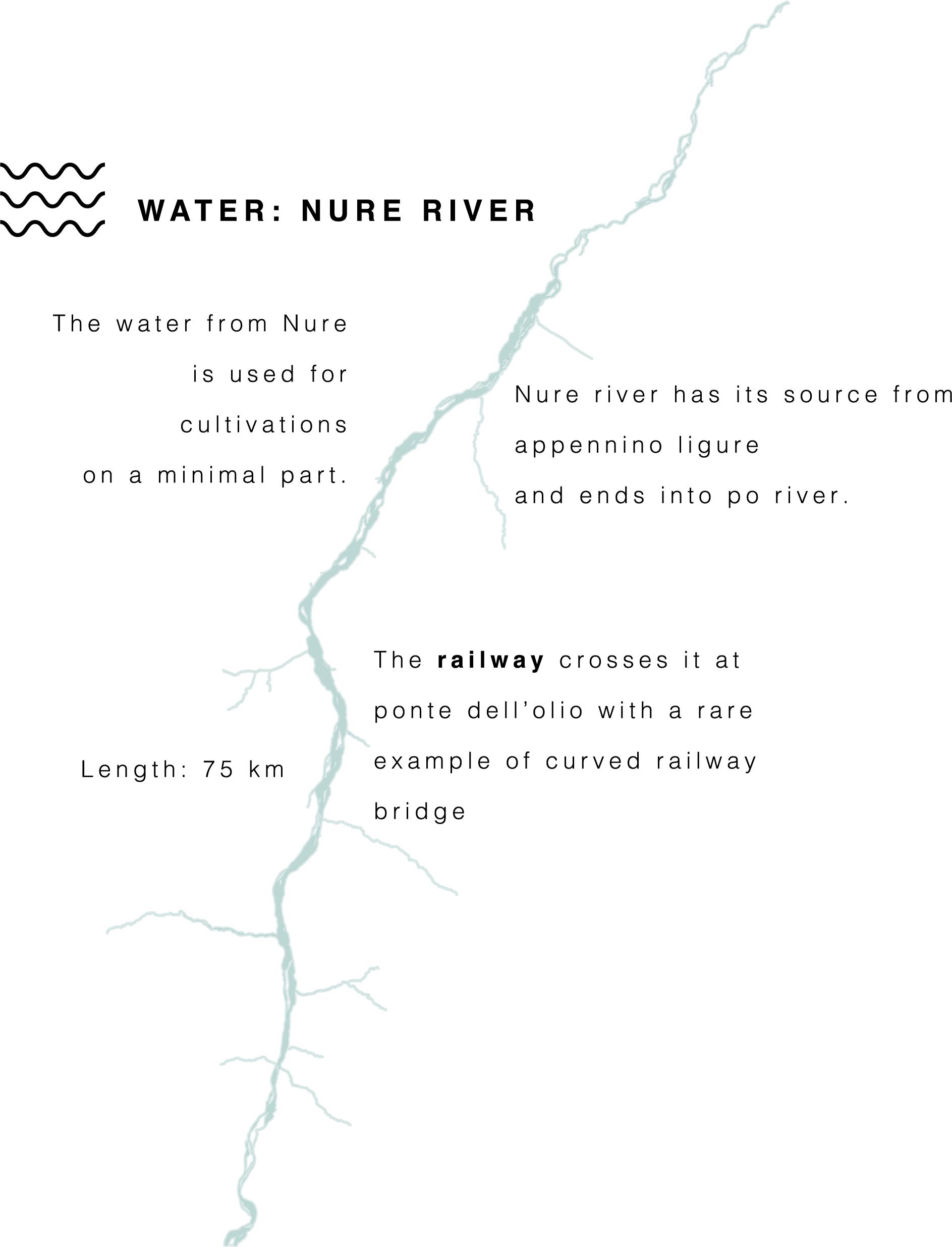
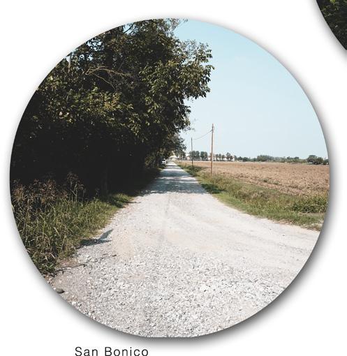
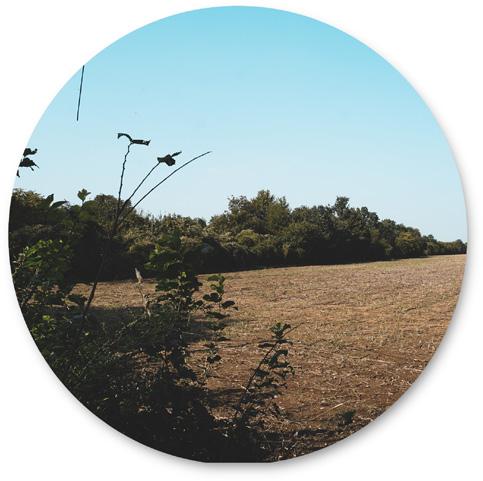
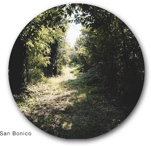
The construction works for the electric railway Piacenza-Bettola, whose project was presented in 1927 from ing. Marco Semenza and Arturo Danusso to the Minister of Public Works, started on July 1930. The more the construction was ongoing, the more the old tramways were destroyed. The new line cost more than 30 millions of lire: it started from Piacenza station in Piazzale G. Marconi, close to the FS station. Leaving Piacenza, the line would go south and cross San Bonico, staying parallel to the Bettola provincial road: after 22 km it would reach Ponte dell’Olio and Nure river, where a curved reinforced concrete bridge would cross it. It was one of the first bridges of this type built in Italy.
From Ponte dell’Olio, following Nure valley and the provincial road, the railway reached Bettola. The line was one rail only, except a small section near Piacenza, and was 31,700km on own rails, and 1,300
km on road but separated from the ordinary traffic. The contract, undersigned in 1930, was of 70 years for a 50 years service life, with 53.649 lire per km. Along the railway 63 rail crossings were built, mostly on private roads, 3 bridges, several canton houses, 4 stops and 11 stations, including Piacenza station where the repair shop, the deposit and the administration offices were collocated. The line was joined with 4 marl quarries in Val Nure, with a AGIP plant in Podenzano, and 6 different factories in Piacenza. The rails were 36 kg/m, and the profile had curves of not less than 300m as minimum radius: the inclination was never more than 20%, and the maximum speed was 60km/h.
The electric railway was powered by a 3000 V system in the Ponte dell’Olio substation. The price of a ticket from Piacenza to Bettola was 10,65 lire in first class, and 8,20 lire in third class.
The opening ceremony was on April 21, 1933, but the opening of the line to the public was postponed of a few months for economic issues. From July 27, 1933 the trains, which still had components from the old tramways, began their rides from Piacenza to Grazzano Visconti, where the station was out of the city center. The section from Grazzano Visconti to Bettola stopped working on September 2, 1933.
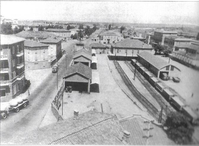
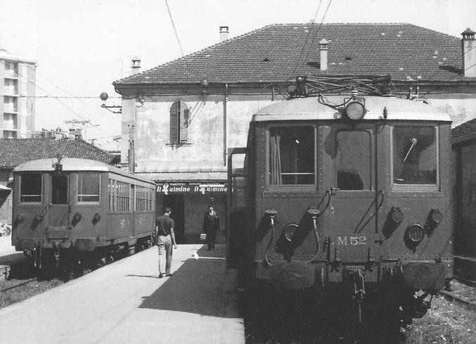
 Piacenza S.I.F.T. station
Farnesiana bridge
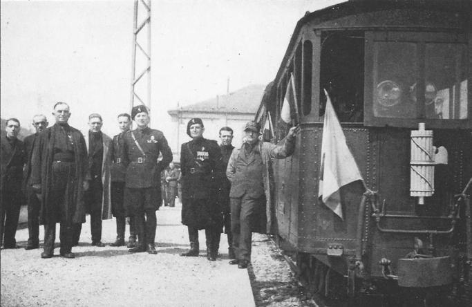
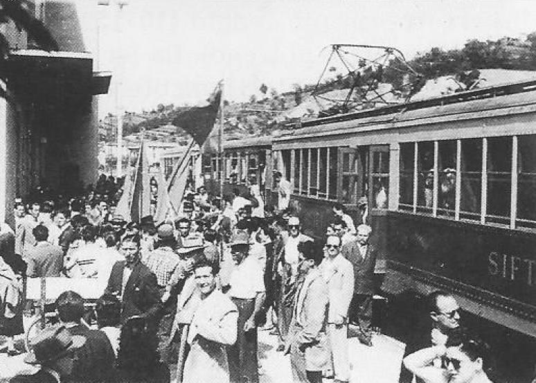
Official opening ceremony -1932
Piacenza S.I.F.T. station
Farnesiana bridge
Official opening ceremony -1932
1943 October
During WWII the service continued to let people leave Piacenza to the countryside. Ponte dell’Olio bridge was especially bombed and damaged.
1947 Summer
After 2 years from WWII end the line was completely restored, both for goods and people.
“PIACENTINE” TRAINS AND DWK AUTOMOTIVE
1955
2 more wagons were bought, and 2 diesel locomotors, used on the junction of Cementirossi in Piacenza.
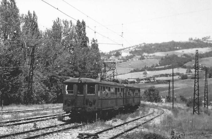
In the early 30s, to substitute the old passenger cars and tram locomotors SIFT ordered to Officine Meccaniche Italiane di Reggio Emilia several electromotives carriages and towed carriages with the proper characteristics for the expected traffic. After cutting down on the modernization program, the lines for Lugagnano, Agazzano and Nibbiano were substituted with S.E.A. buses (Società Emiliana Autoservizi): then S.I.F.T. bought 3 electromotives and 2 control cars. The electromotives weighted 54 tons and could reach the maximum speed of 120km/h. Mostly similar were the control cars, with a weight of 36 tons. For the goods transportation, Breda and CEMSA built 2 electromotive carriages, and their maximum speed was 60km/h, weighting 58 tons. The arrival of the new material really helped to shorten the travel times. From the fall of 1933, people could travel on more comfortable trains, with heating and a first class area. The new convoys took 45 minutes to complete the ride. In the late 30s, to cope with the increasing traffic, S.I.F.T. was forced to put in service some of the old convoys.
A FAST DECLINE
War consequences, with its intensive bombardments, didn’t wait to involve the railway service, causing several interruptions and disservices. Nonetheless, the activities on the railway continued, especially to leave Piacenza for the countryside, so much that on October 1943 10 couple of trains were still in service, reaching Bettola and Ponte dell’Olio. After restoring the line, with a solemn ceremony on summer of 1947, S.I.F.T. decided to act fast to increase the quantity of motors and cars. In 1955 2 more wagons were bought, and 2 diesel locomotors, used on the junction of Cementirossi in Piacenza.
In the late 50s, the traffic was on average of 1 millions of passengers each year, with a revenue of 100 millions of lire. The goods traffic though was hit by the recent technological developments in extraction systems and processing of marl quarries, and the transportation was more and more on road thanks to the flexibility of trucks. So a sensible drop in material was registered in the early 60s: from 416000 tons in 1960 to 218000 tons in 1964. Each day 1800 tons were transported on road, while only 300 tons on rails. Even some factories belonging to S.I.F.T. were using more trucks than trains to transport their materials.
 Ponte dell’Olio station
Opening ceremony after WWII
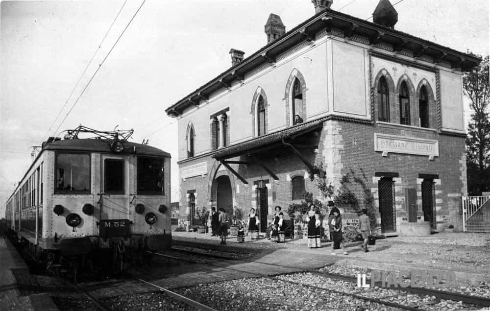
Grazzano Visconti station
Ponte dell’Olio station
Opening ceremony after WWII
Grazzano Visconti station
1965 April 22
The Minister of Transport decided on the suppression of the Piacenza-Bettola line.
Between 1958 and 1964 the costs to maintain the line went from 171 to 223 millions, while personnel costs went from 82 millions to 138. SIFT was then forced to cut on costs both on staff and services.
Until then the railway had been used by tourists, but also workers and students that every morning reached Piacenza. (within one hour the first 3 rides in the morning carried almost 1000 people to Piacenza)
1966 December 8
The “Comitato di difesa per la Piacenza-Bettola” declared a day of protests.
1967 April 30
The Piacenza-Bettola railway ceased to exist, to leave the place to the new bus services that departed from Piazza Cittadella.
On April 22, 1965 the news that the Minister of Transport decided on the suppression of the Piacenza-Bettola line, and its substitution with a bus service, arrived in Piacenza. The decision was then postponed because of the increasing protests from the Val Nure population. The Province Administration, with several MPs and mayors of the area, had been able to convince the Minister to keep the line in service. During a congress on June 1965, the vice secretary of Camera Conferedale del Lavoro in Piacenza denounced some events that questioned the management of the railway in the last years: the staff was used with questionable criteria, convoys often departed without the required personnel, and in some downhill areas between Bettola and Ponte dell’Olio the pantograph was lowered to save electricity. From March 23, 1966 S.I.F.T. was forced to reduce the speed of all convoys.
On September 29 the ministerial commission suggested again the suppression of the line. After the substitution of two rides with buses, and after the Minister of Transport announced the transformation of the railway into bus service, the “Comitato di difesa per la Piacenza-Bettola” declared December 8, 1966 a day of protests. From January 1967 the rides became four and during festive days the entire service was done by buses.
Following the constant stream of protests, S.I.F.T. was forced to substitute the bus services again with trains, because of the longer travel times (10-15 more minutes by bus). The Piacenza-Bettola railway was never considered obstructive to road traffic, compared to other lines. Until the very last days of service, the population favored the railway, with more and more protests: on February 8, 1967, near Biana, a crowd blocked the bus that had on board the ministerial commission, during a survey on the railway conditions. The last day of service, on February 28, 1967 was postponed a few more months. On April 30 1967 the Piacenza-Bettola railway ceased to exist, to leave the place to the new bus services that departed from Piazza Cittadella, in Piacenza. Part of the material was demolished, while some electromotives were sold.
 Trains in S.I.F.T. Piacenza deposit
Ponte dell’Olio curved bridge
Train in last days of service
Trains in S.I.F.T. Piacenza deposit
Ponte dell’Olio curved bridge
Train in last days of service


 Grazzano Visconti station
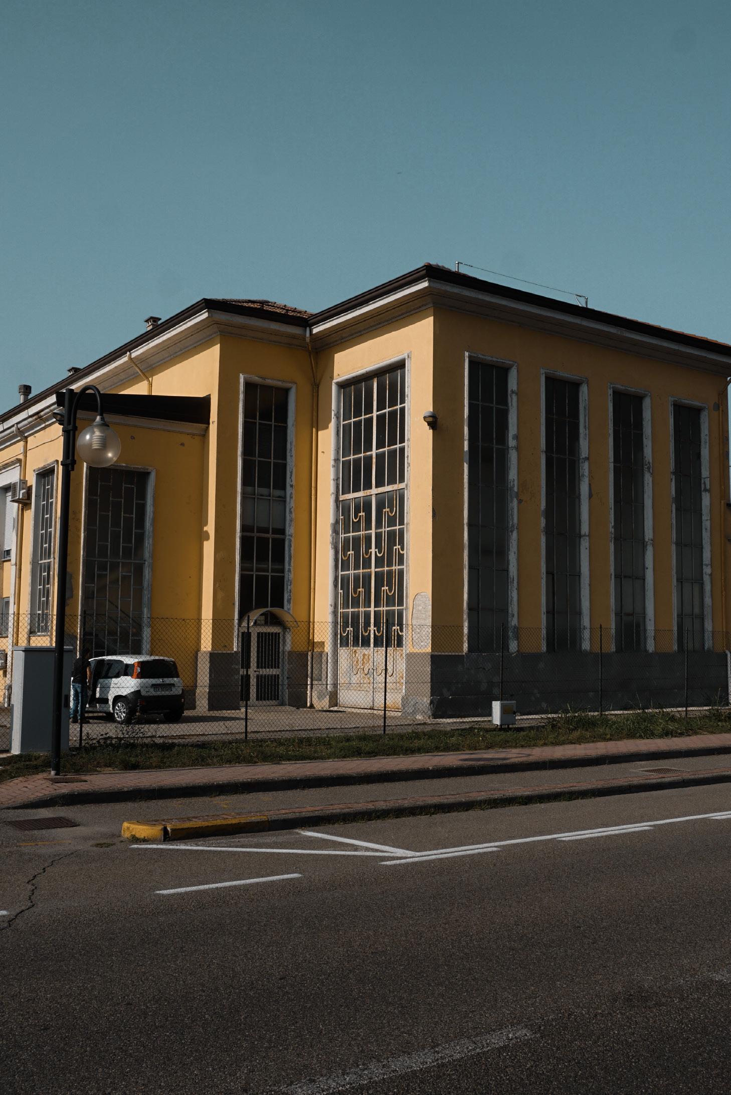 Ponte dell’Olio electric station
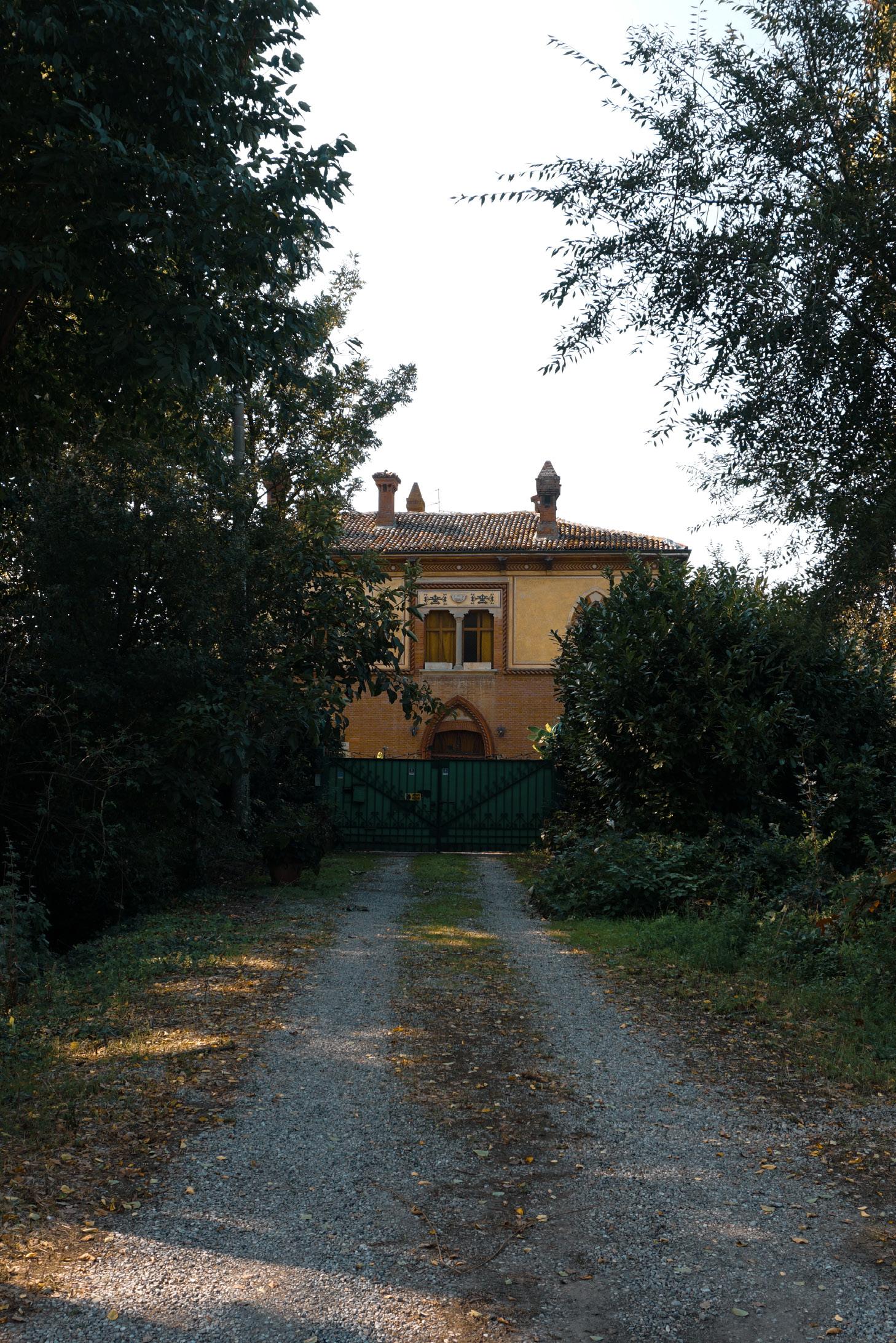
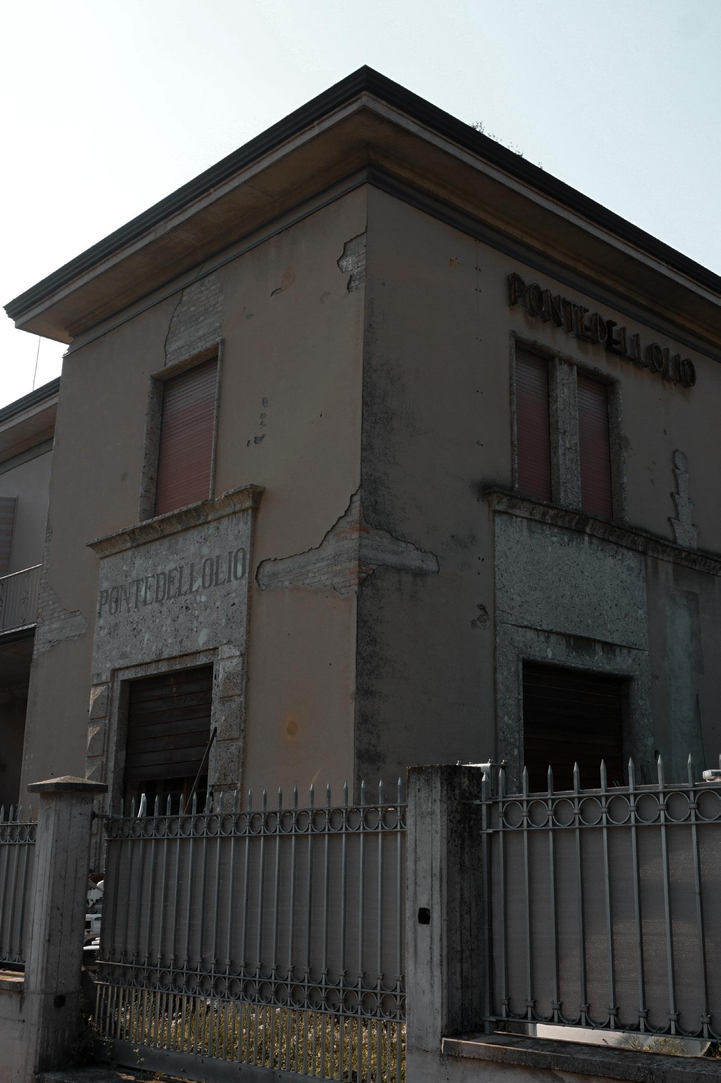 Ponte dell’Olio station
 Molino croce station
 Biana station
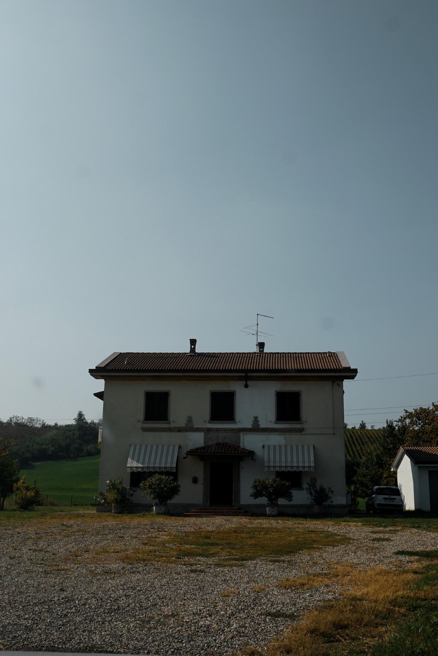
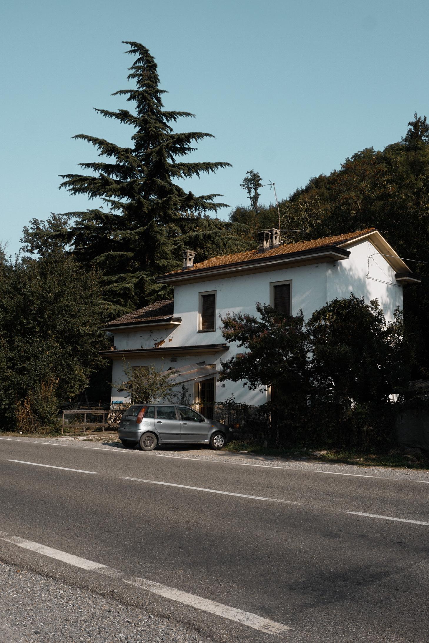
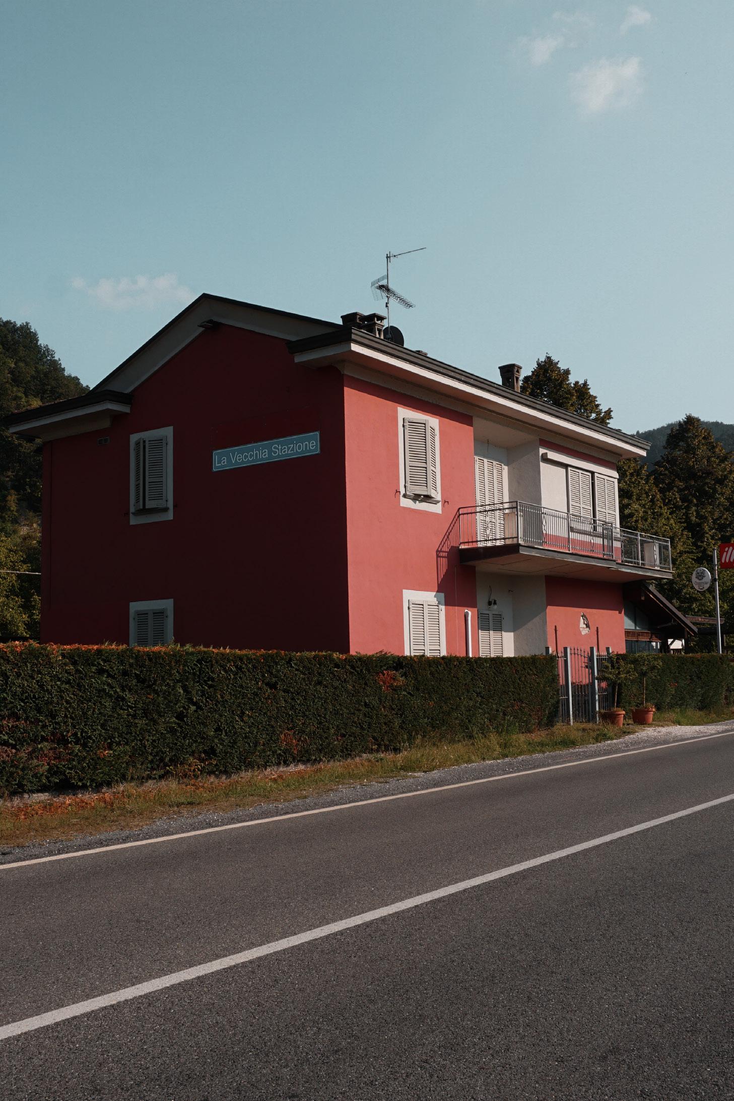
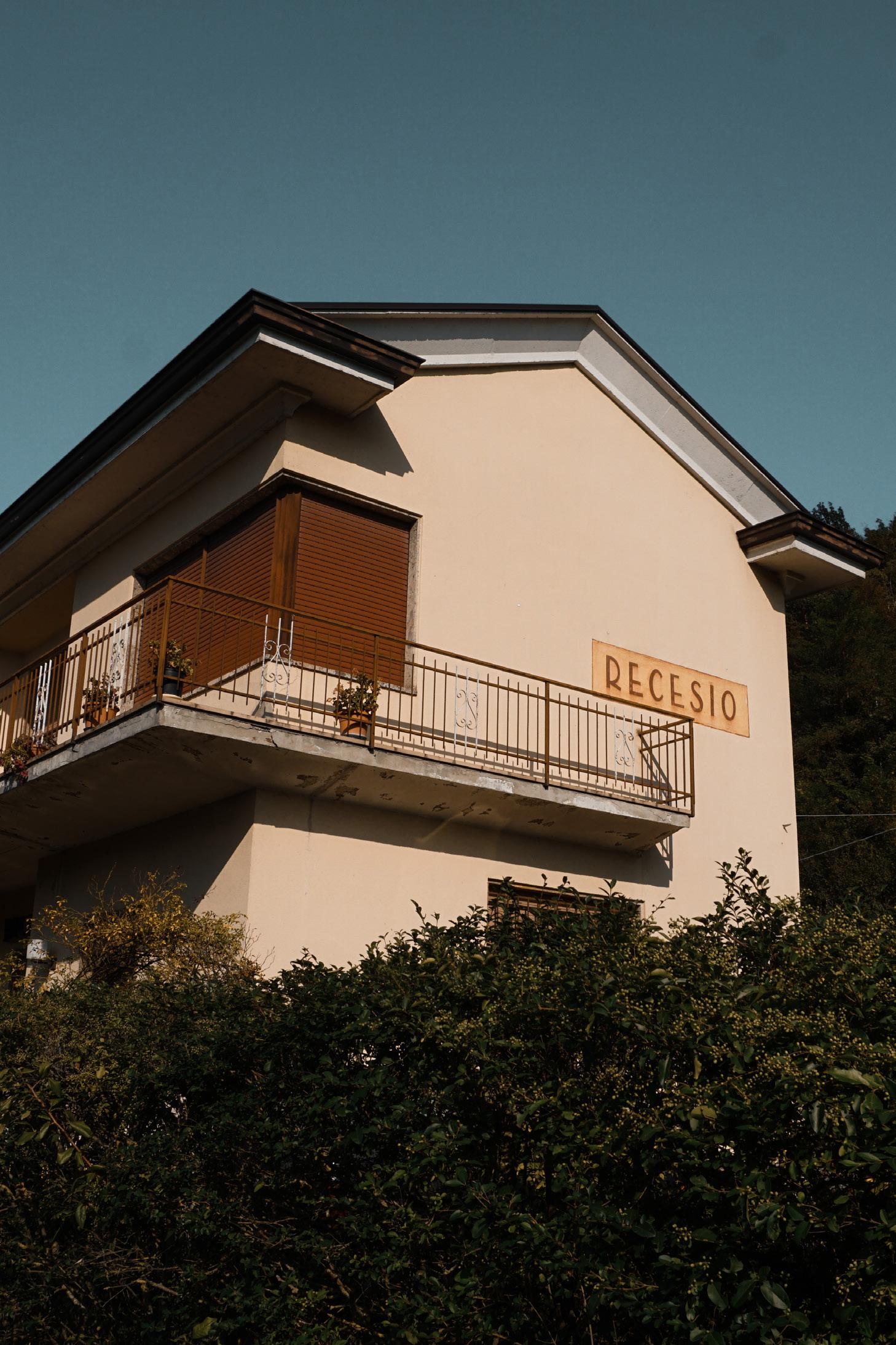 Recesio station
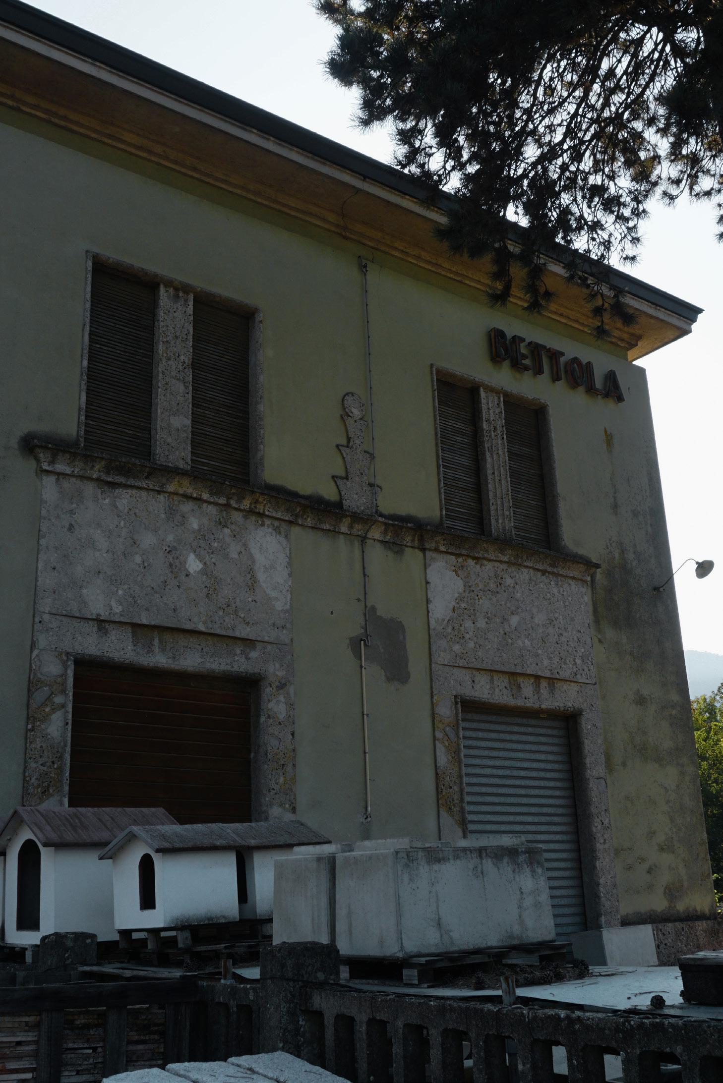 Bettola station