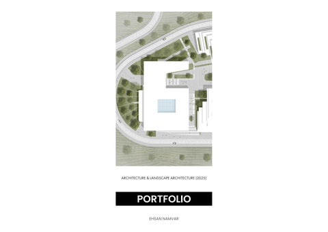
ARCHITECTURE & LANDSCAPE ARCHITECTURE (2025)
EHSAN NAMVAR
PROFESSIONAL
ACADEMIC


6. PARDISAN PARK 2050
3. SIRAF MASTER PLAN
2. KHATAM LIBRARY OUTDOOR SPACE
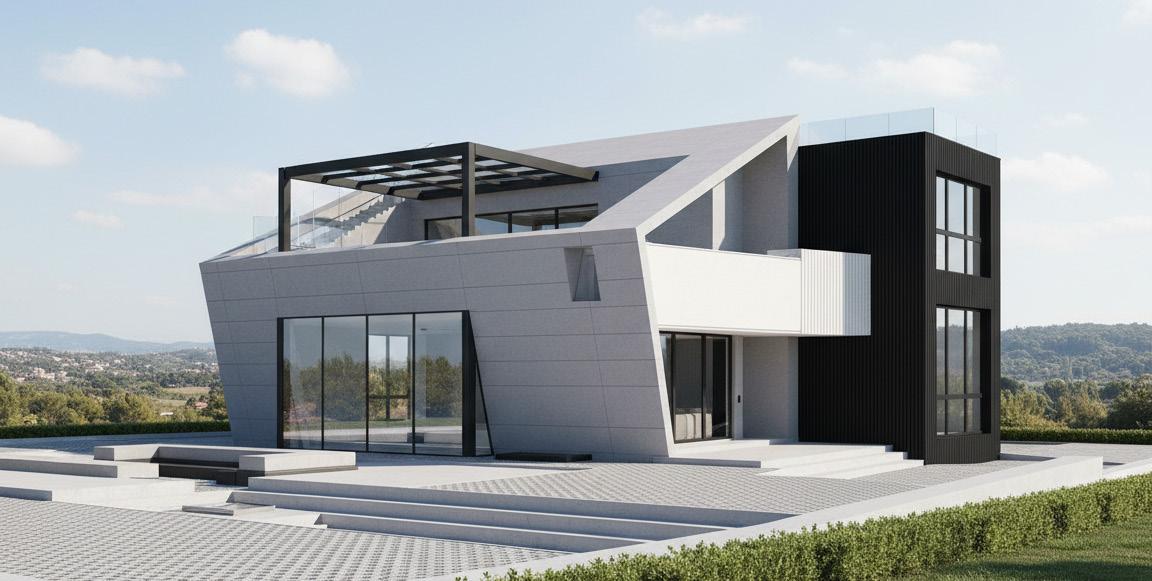
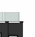
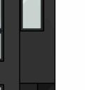
1. GOLCHIN VILLA
5. REIMAGINING CHATSWOOD
4. OTHER DESIGNED SPACE KHATAM UNIVERSITY
PROFESSIONAL
ACADEMIC
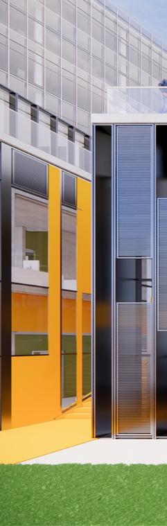
Residential | Sepid Group
Date / Status: September – October 2022 · Completed
Location: Damavand, Tehran, Iran
BIM Coordinator: Nooshin Abolhasani – abolhasaninooshin@gmail.com
Context: Professional project
Role: Developed BIM model and construction documentation under the supervision of the BIM coordinator.
Softwares: Revit
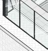
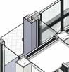
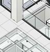
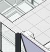
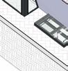
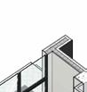
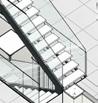
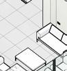
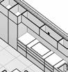
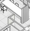
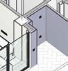
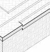
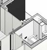
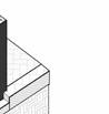
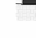
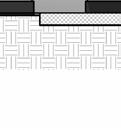
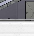
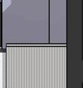
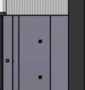
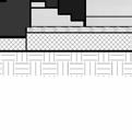
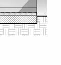
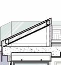
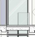
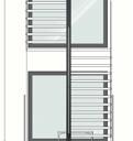
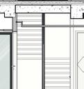
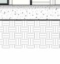
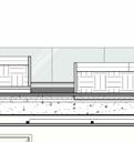
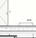
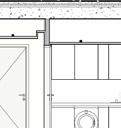
This project involved creating a complete, construction-ready BIM model for a three-storey villa under the supervision of a BIM coordinator. The work ensured precise documentation and full coordination to support an efficient and accurate building process.


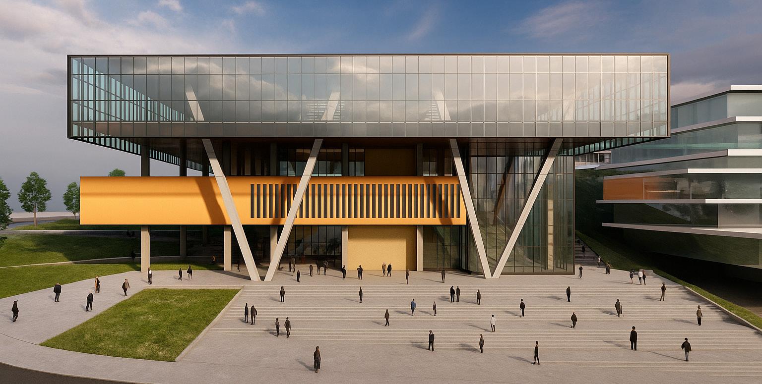
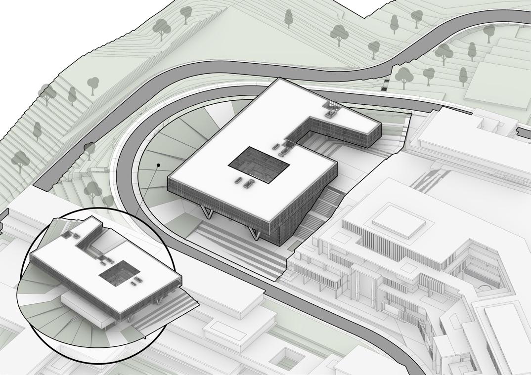
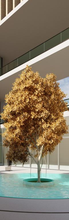
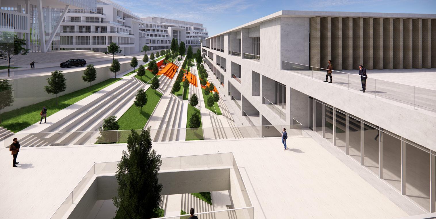
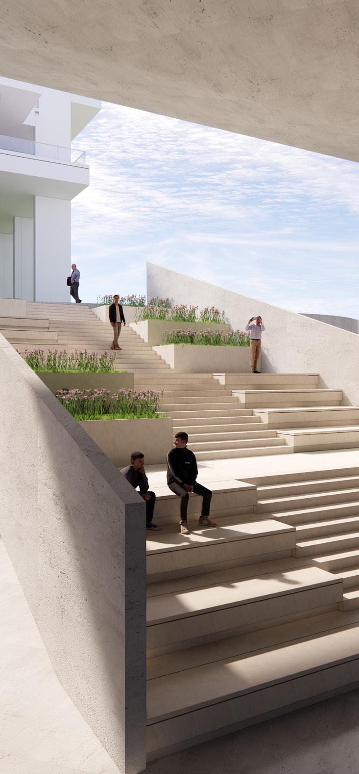
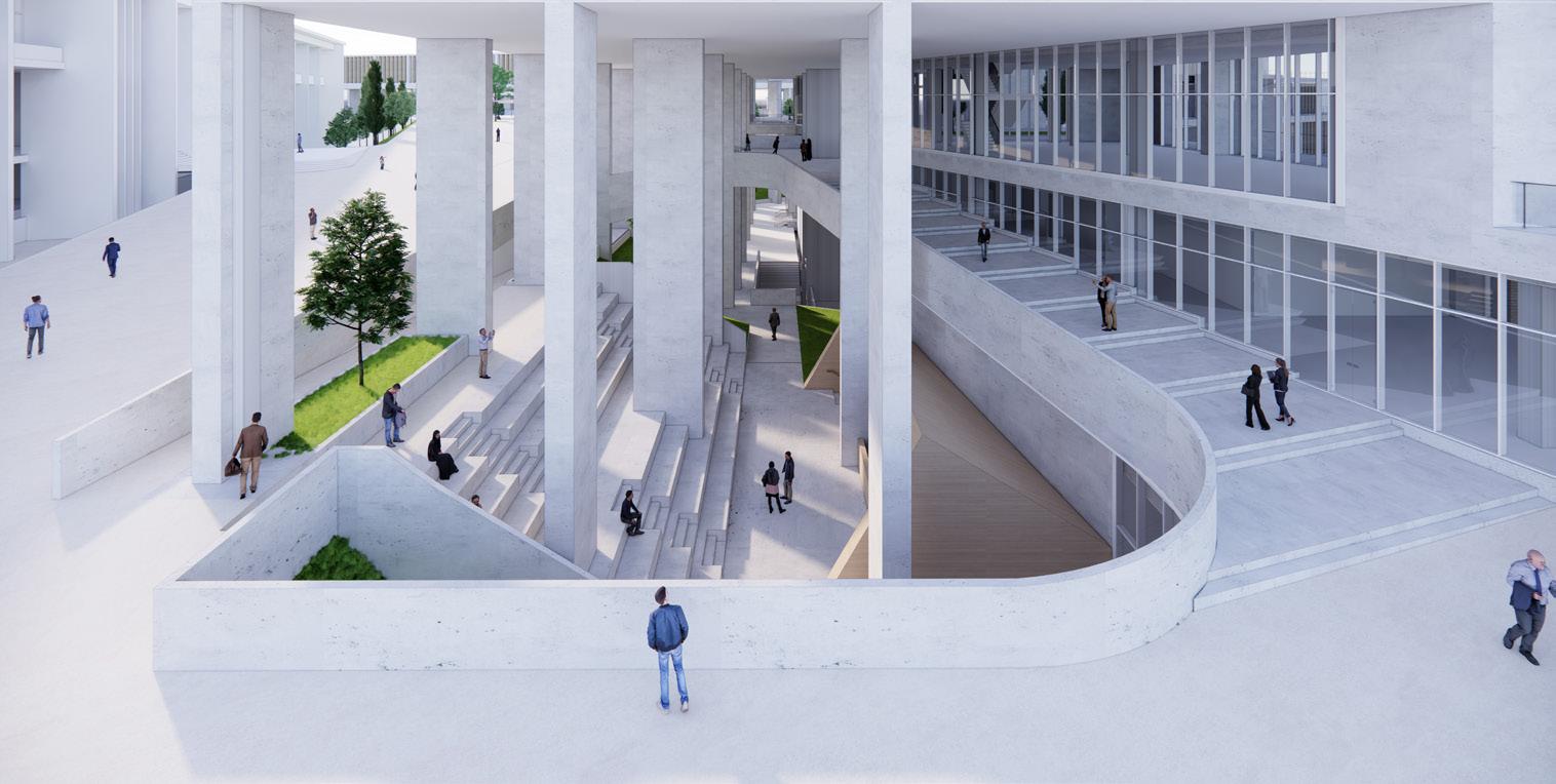
Educational Center | Hashtaak Consulting Engineers
Date / Status: March 2023 – September 2024 · Under construction
Location: Pardis, Tehran, Iran
Architect: Vahid Karamad – karamadvahid@gmail.com
Context: Professional project
Role: Landscape designer in a three-member team shaping plazas and landscapes for a 50-hectare university library site.
Softwares: Rhino, Lumion, AutoCAD, Photoshop, V-Ray
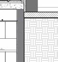
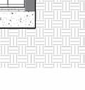
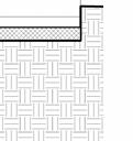
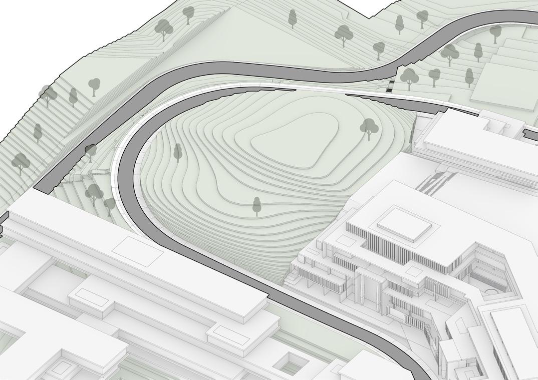
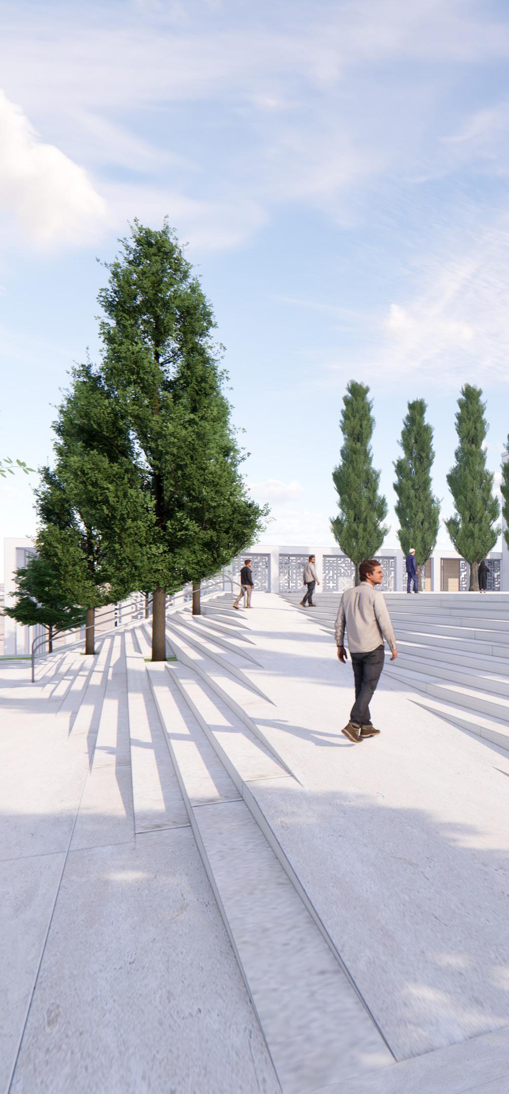
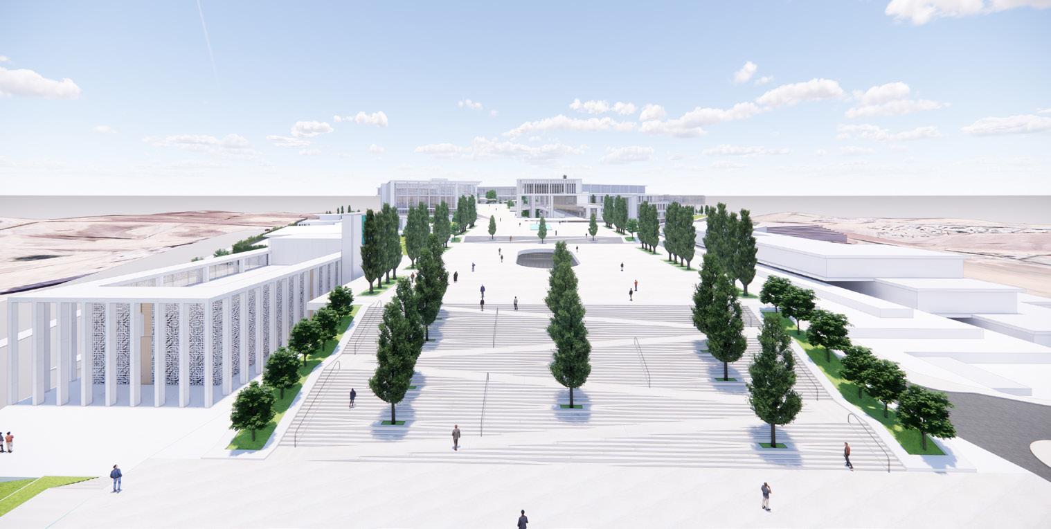
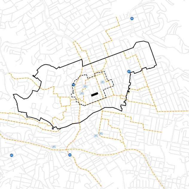
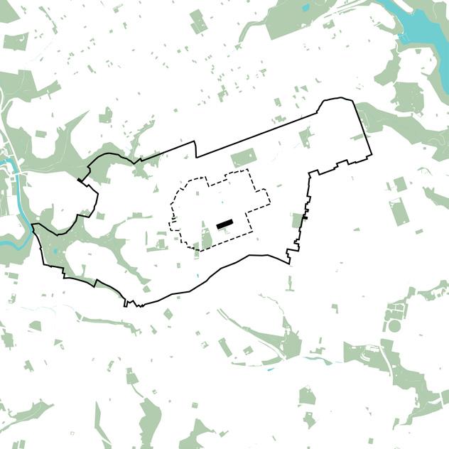
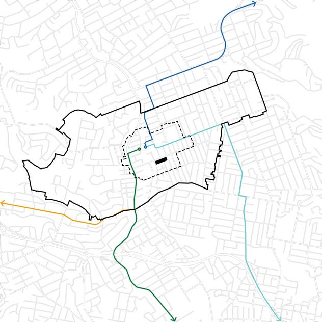
This project focuses on shaping the landscape around the main plaza of a 50-hectare university master plan in Pardis, Tehran. The library’s outdoor space was designed to connect buildings and roads in a way that feels both welcoming and practical. By working with the site’s natural slopes and topography, the design creates comfortable, accessible spaces that enhance daily life for students and visitors while blending seamlessly with the surrounding environment.
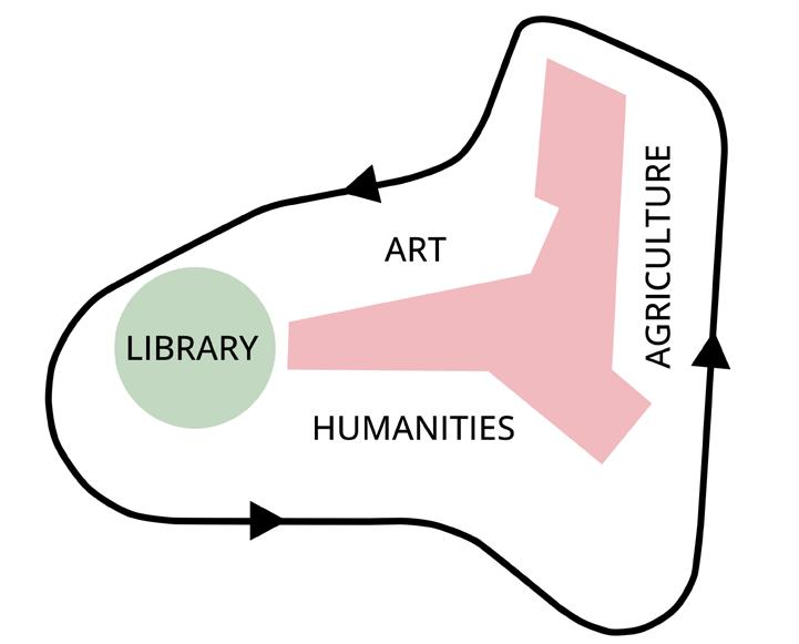

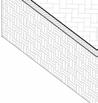
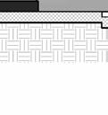
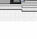
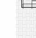
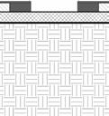
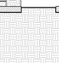
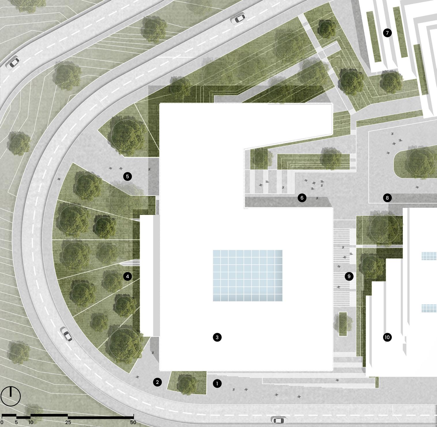
Library Landscape Design
Designed landscapes for all buildings; this section spotlights the transformative library surroundings in particular.

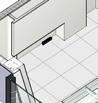
A User-Centric Landscape


Tailoring Landscape to Thrive in the Local Climate
Navigating Facilities with Ease Crafting Context-Responsive Design
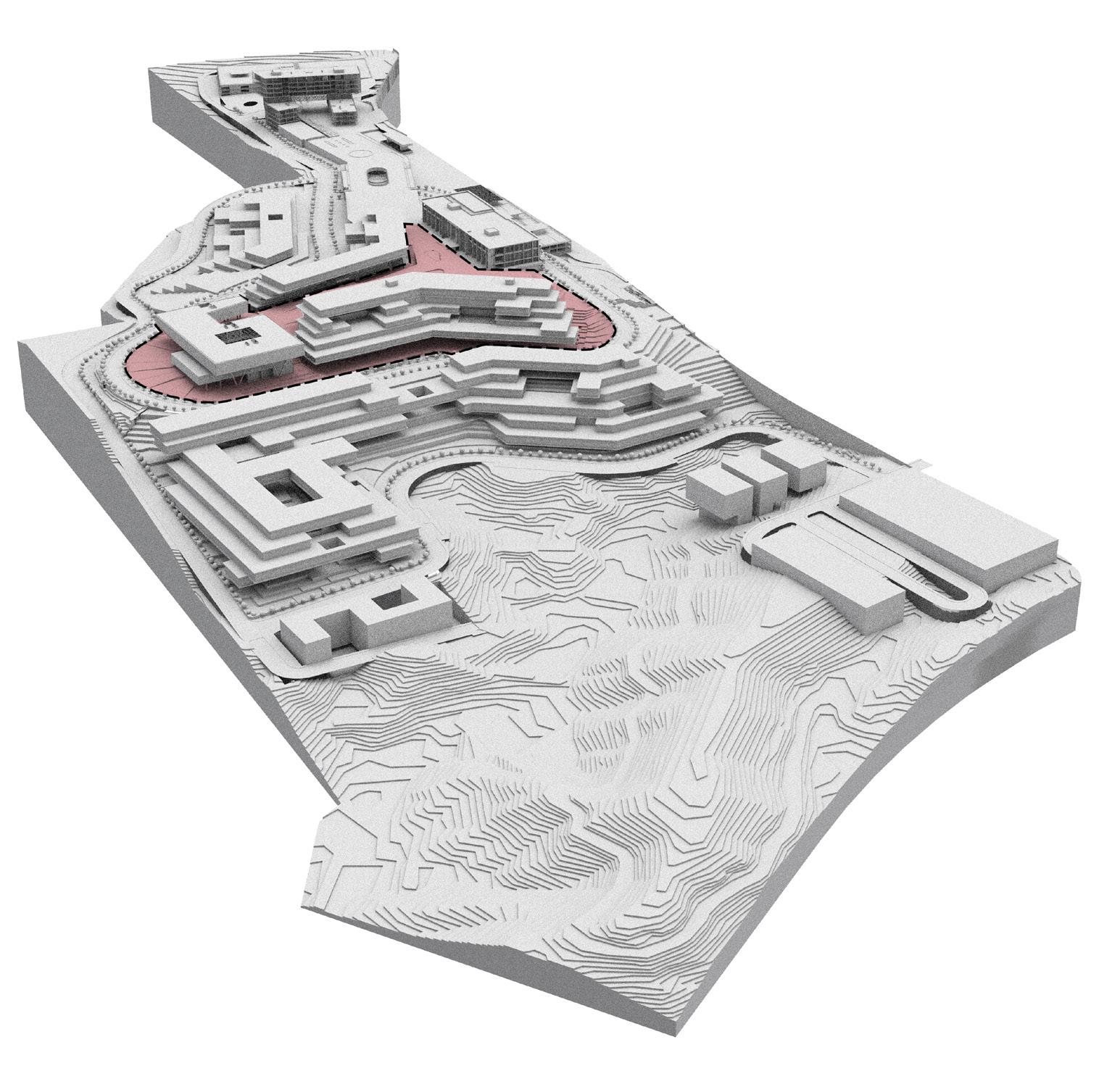
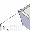
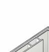
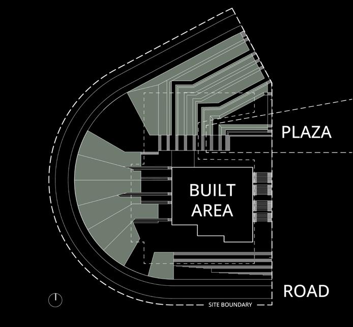
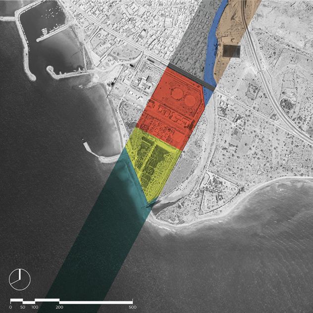
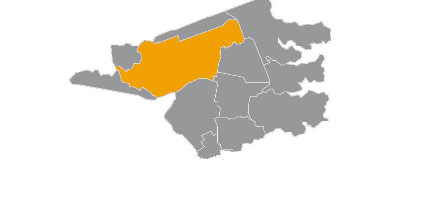
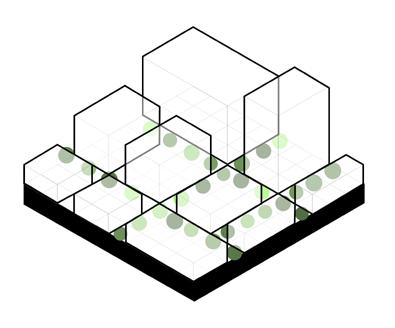
Highlighted Landscape Design Zone
Colored area signifies my role in crafting the distinctive and visionary landscape design.
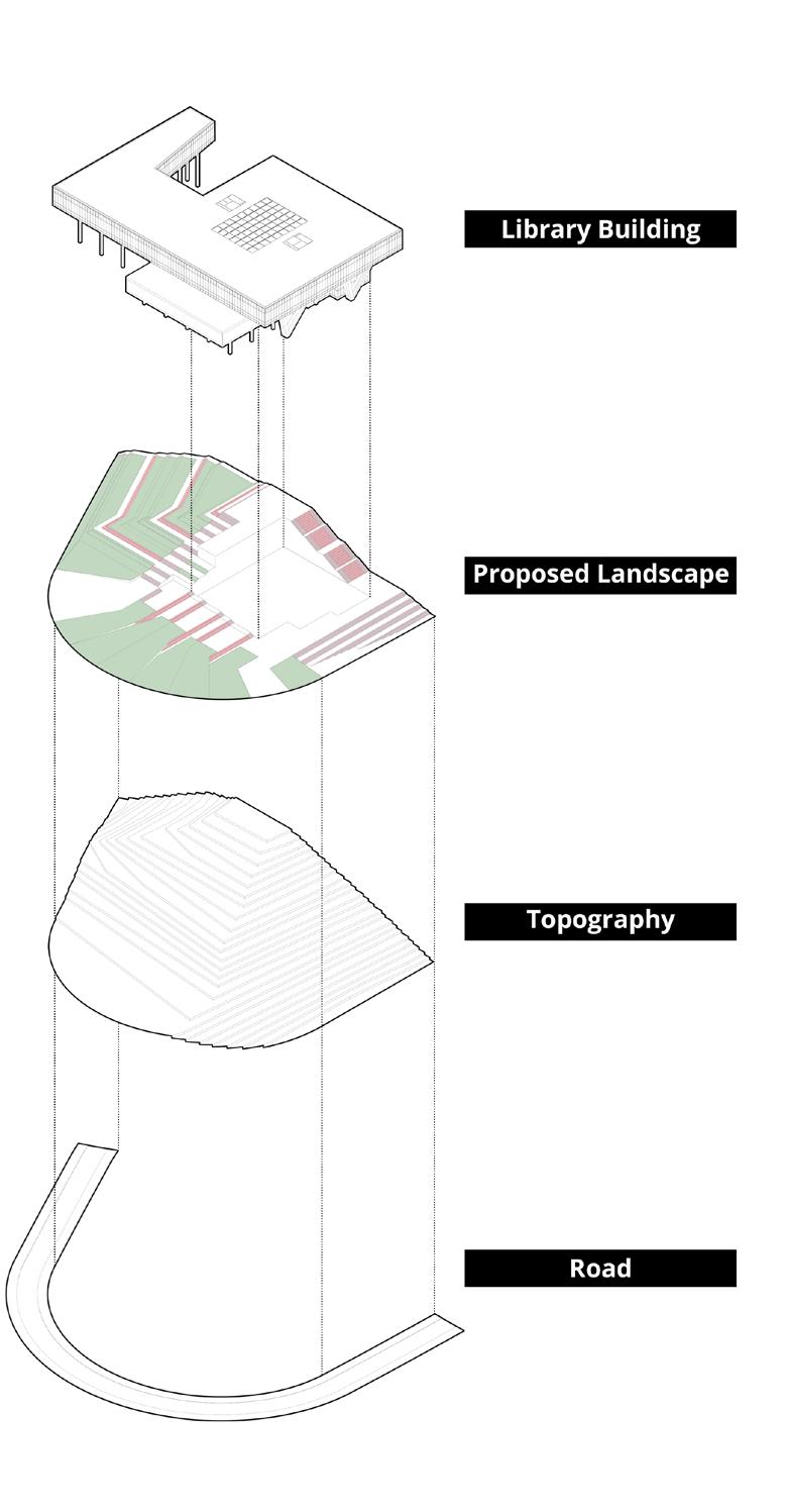
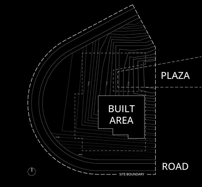
The diagram articulates topography contours, integrating the plaza and built area locations for a cohesive design synthesis.
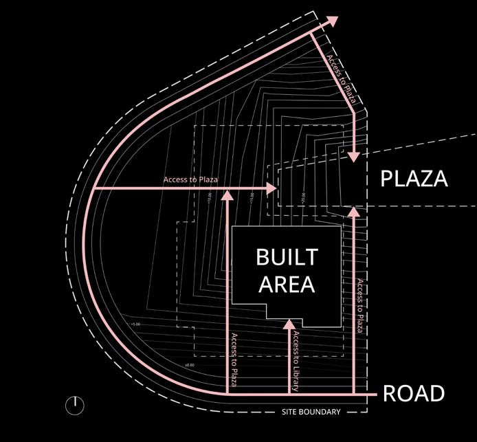
The diagram maps all site access points, informing the conceptual framework to enhance overall connectivity and accessibility.
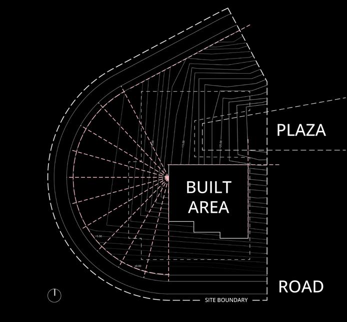
Shaping the landscape in alignment with axes emphasizes vegetation and resting places for a harmonious design.
Leveraging building and road axes as the main framework guides the comprehensive design process.
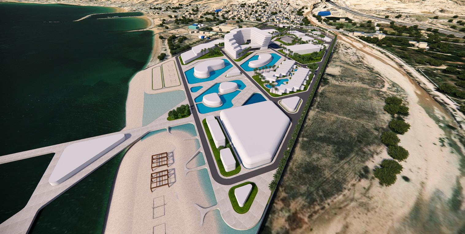
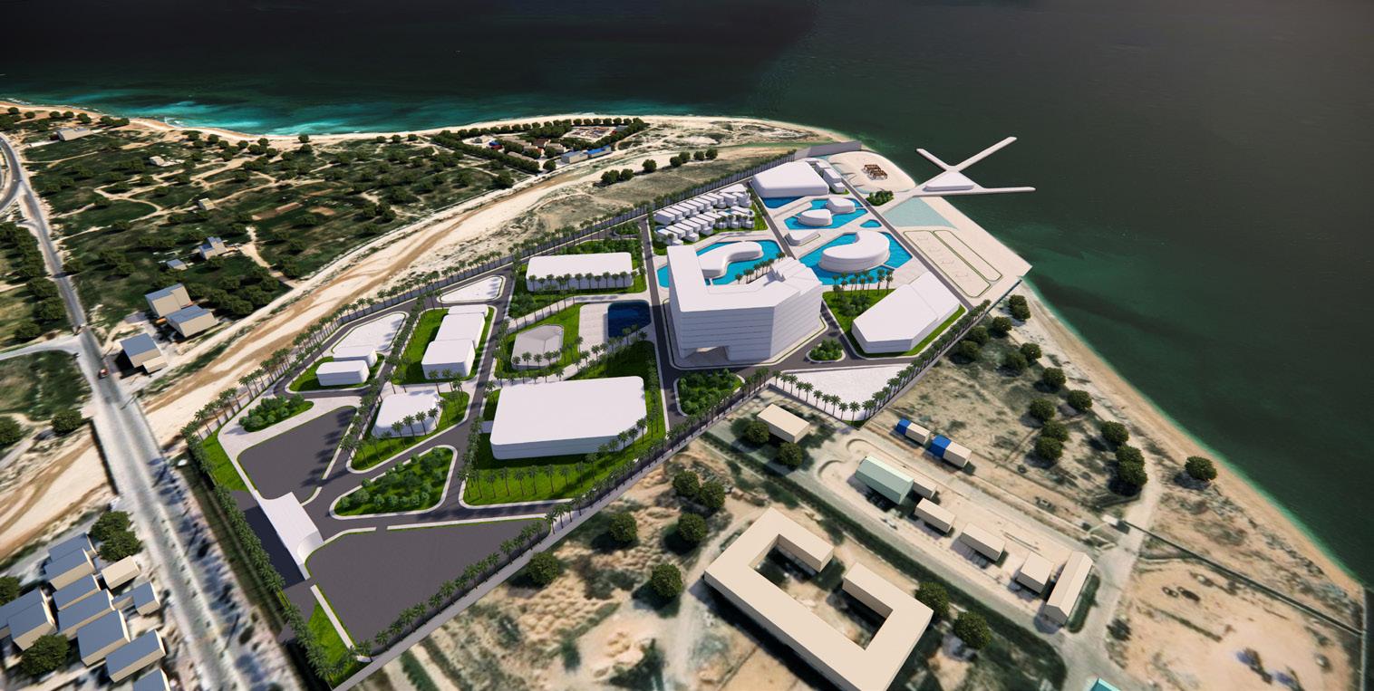
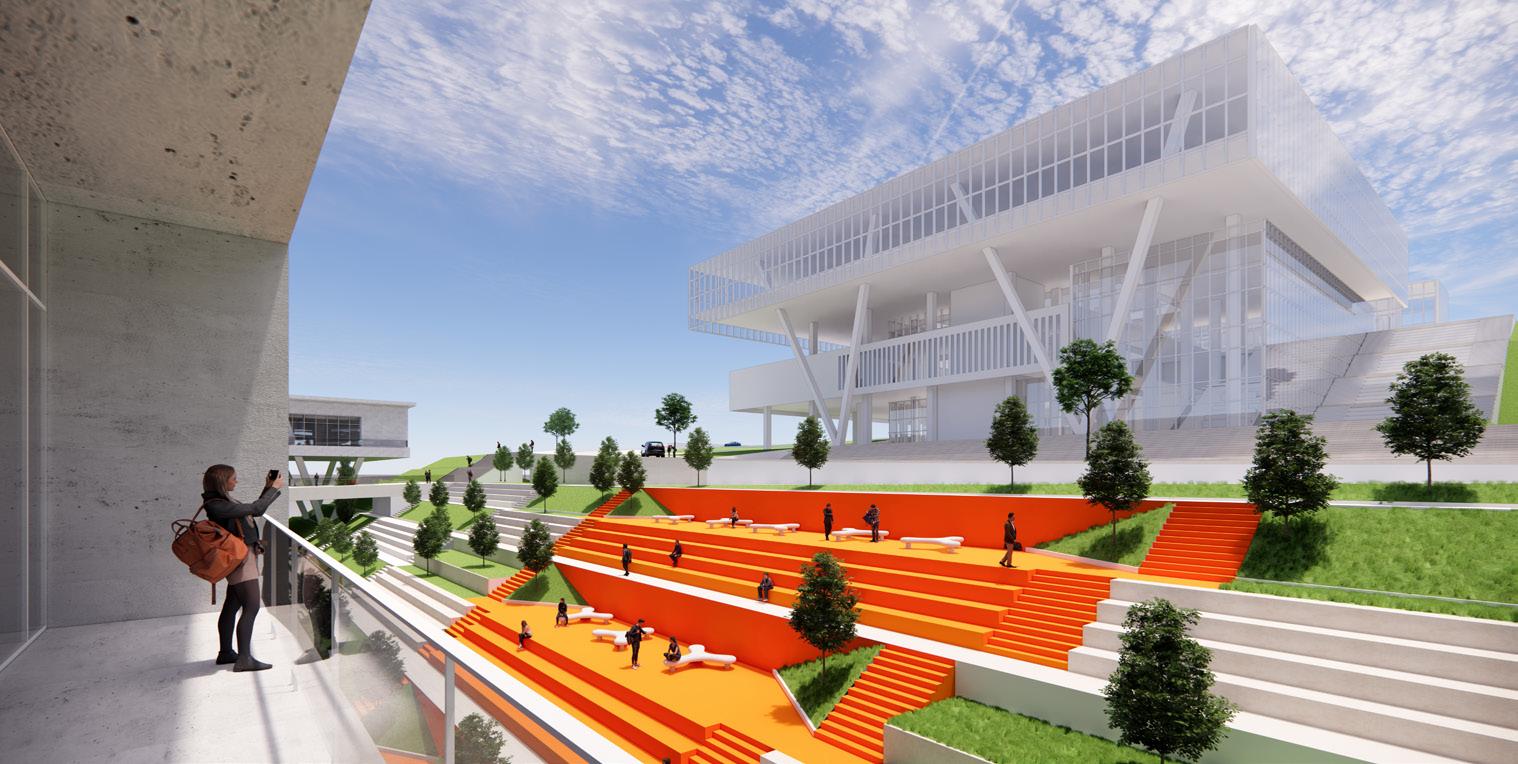
Recreational Center | Hashtaak Consulting Engineers
Date / Status: January – August 2023 · Conceptual
Location: Siraf, Bushehr Province, Iran
Architect: Vahid Karamad – karamadvahid@gmail.com
Context: Professional project
Role: Design assistant in a three-member team, contributing to conceptual development and on-site analyses.
Software: Rhino · Enscape · AutoCAD · Photoshop · Google Earth
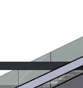
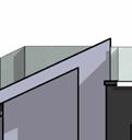
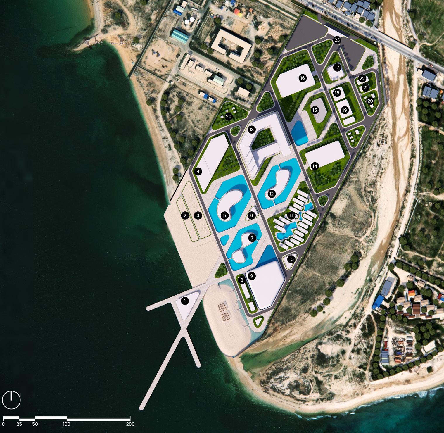
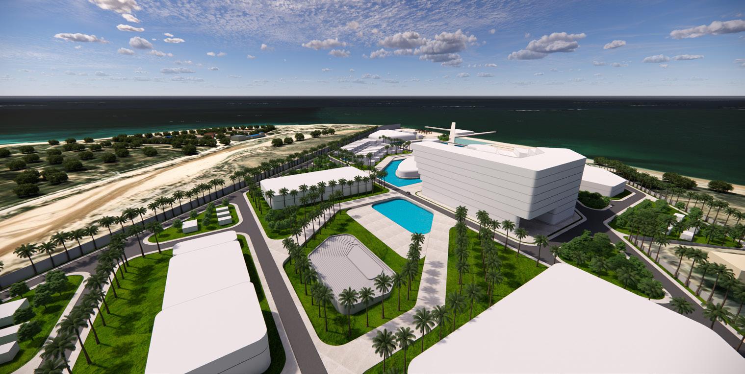
Located on the shores of Siraf in Bushehr Province, this master plan creates a welcoming coastal hub centered on a strong pedestrian axis. The design restores and enhances the natural beachfront while arranging buildings to follow the site’s flow, offering comfortable public spaces and memorable seaside experiences.Through thoughtful integration, Siraf Hub aspires to be more than a recreational center; it aims to be a coastal sanctuary, offering tranquility and revitalized leisure against the breathtaking backdrop of the Persian Gulf.
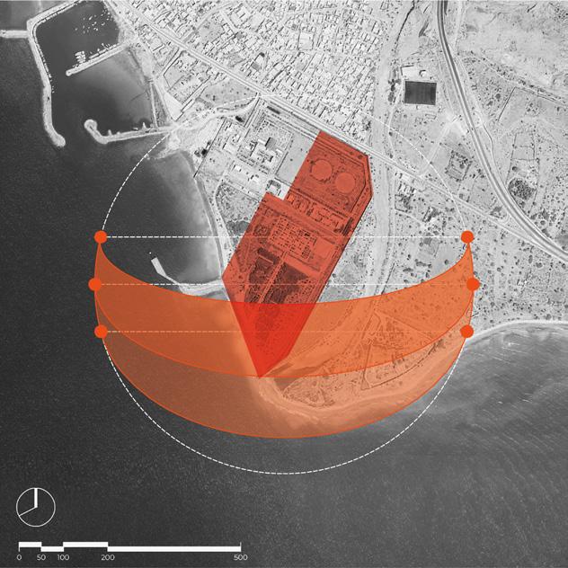
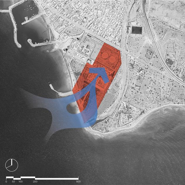
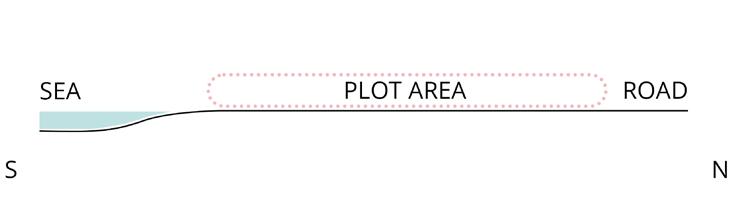
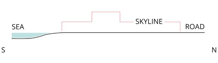
Plot Dynamics and Coastal Interface
The sectional view emphasizes plot dynamics, showcasing the relationship with the road and coastal interface at Siraf Hub.
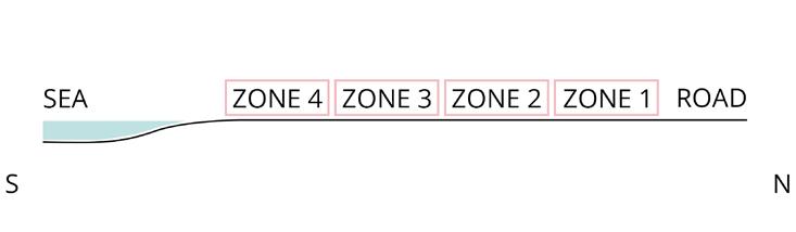
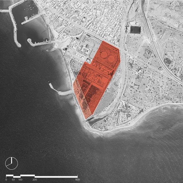
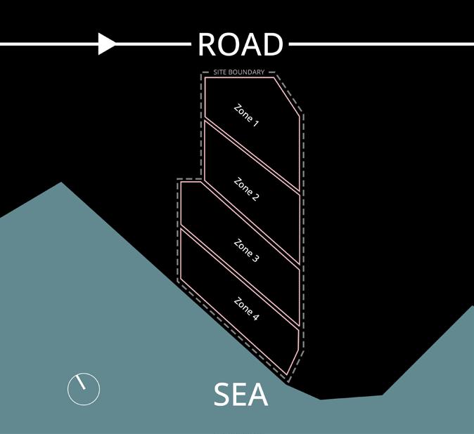
Plot Zoning Strategies
Zoning diagram delineates four strategic zones within the plot area for optimized design and functionality at Siraf Hub.
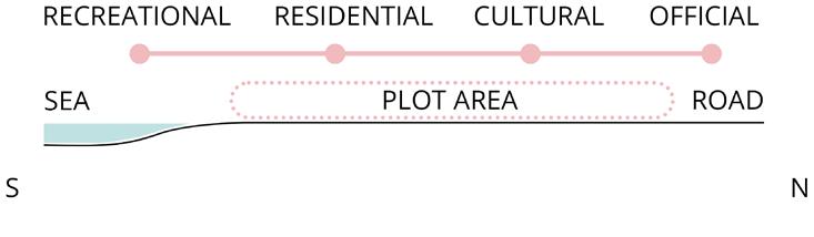
Program Hierarchy Planning
Crafting a program hierarchy enhances functionality, with official zones at the entrance and beachside residences and recreation
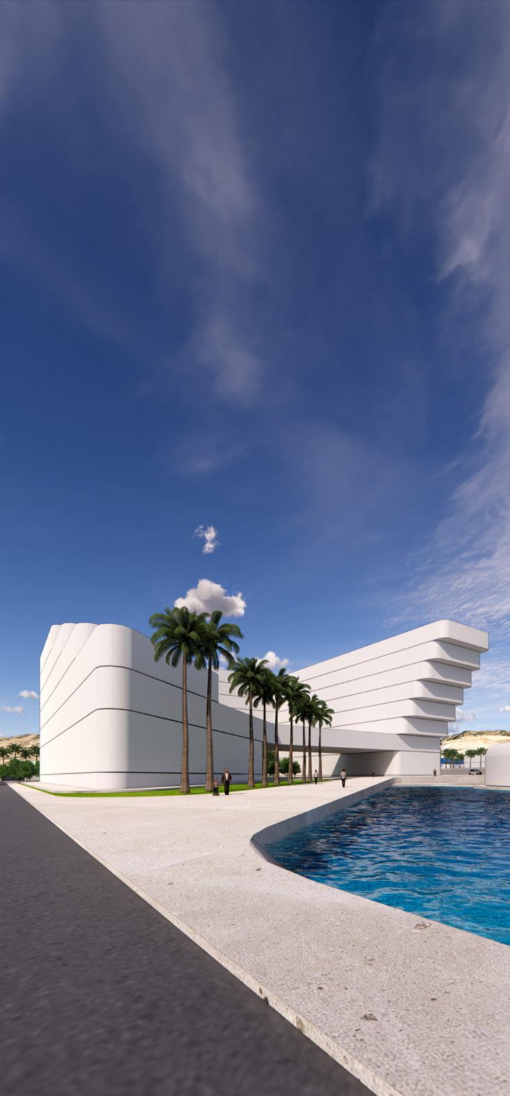
Sculpting the design shapes a skyline that proudly showcases the project’s distinctive aesthetic allure.
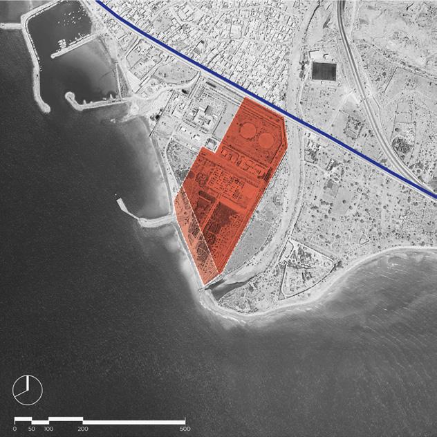
Current Site
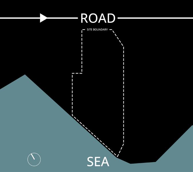
Seamlessly integrating road and sea, the site plan unfolds a coastal masterpiece, harmonizing nature and infrastructure.
Beachfront Zoning Blueprint
Zoning diagram showcases shoreline-compliant zones, harmonizing spaces along the coastal edge for design synergy.
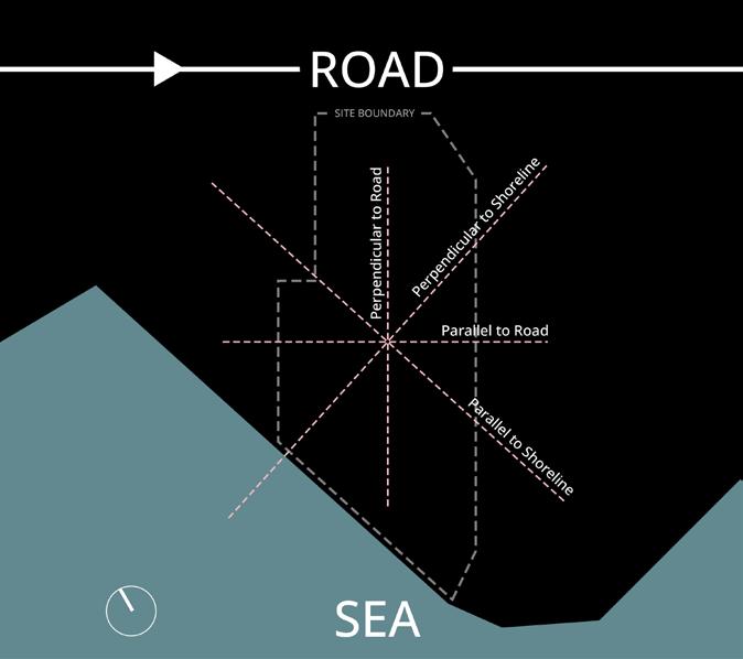
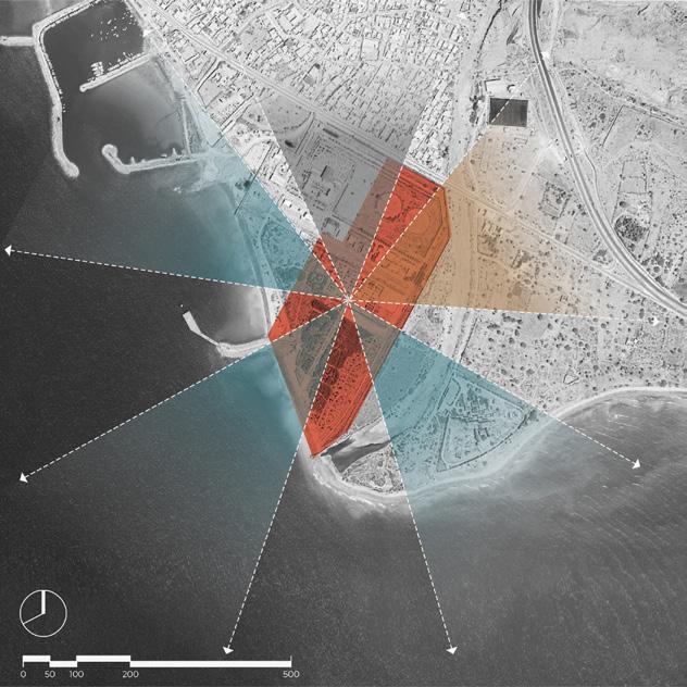
Axis Essence Design
Design is framed by defined axes, shaping a structured framework for a cohesive and purposeful environment.
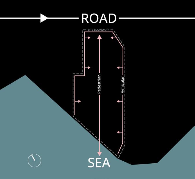
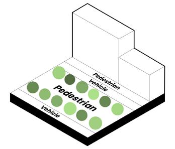
Pathflow Impact Scheme
Revealing the impact of pedestrian and vehicle paths, the diagram illustrates their dynamic influence on the site.
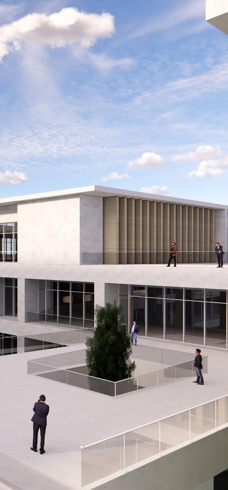
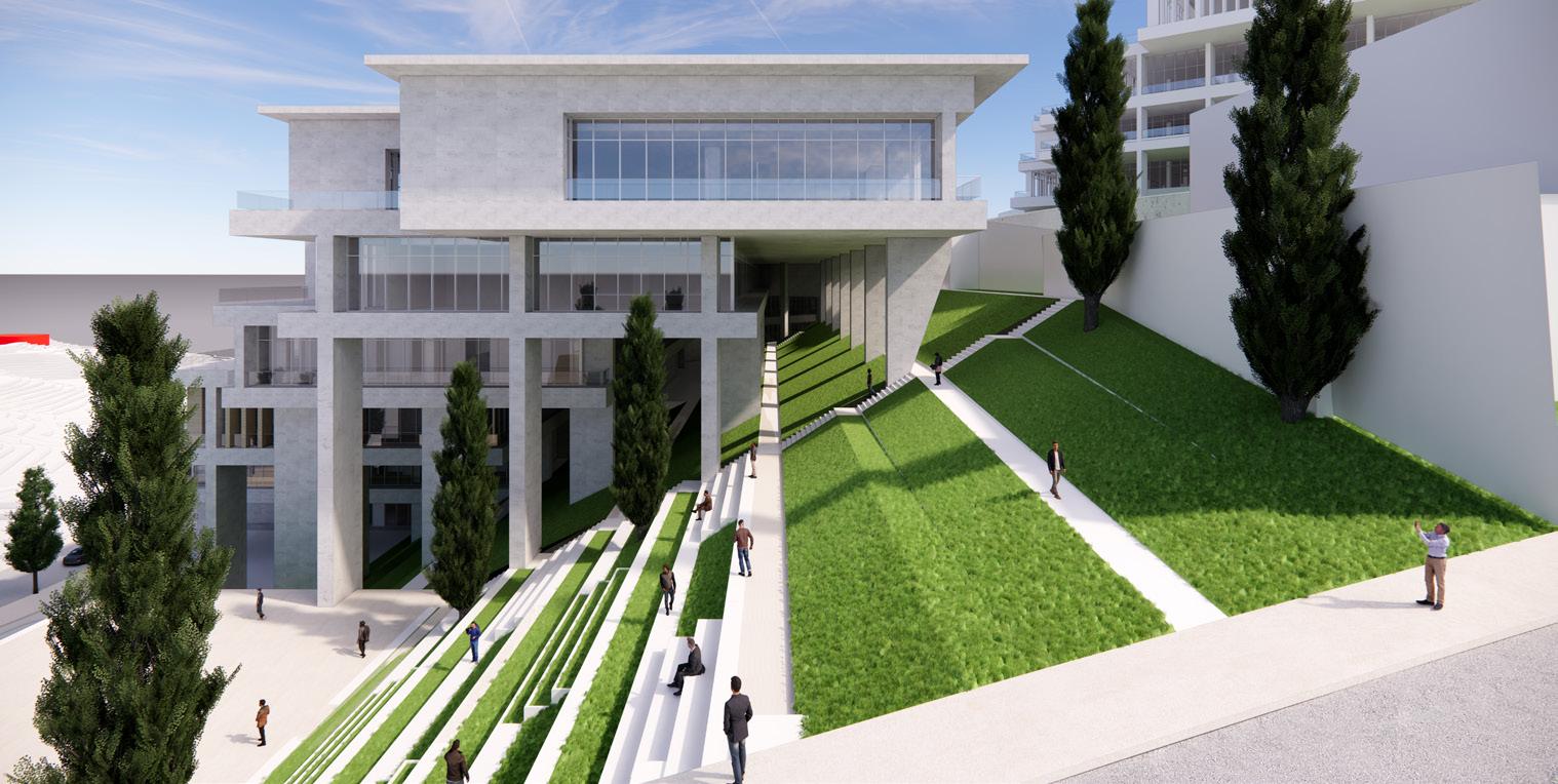
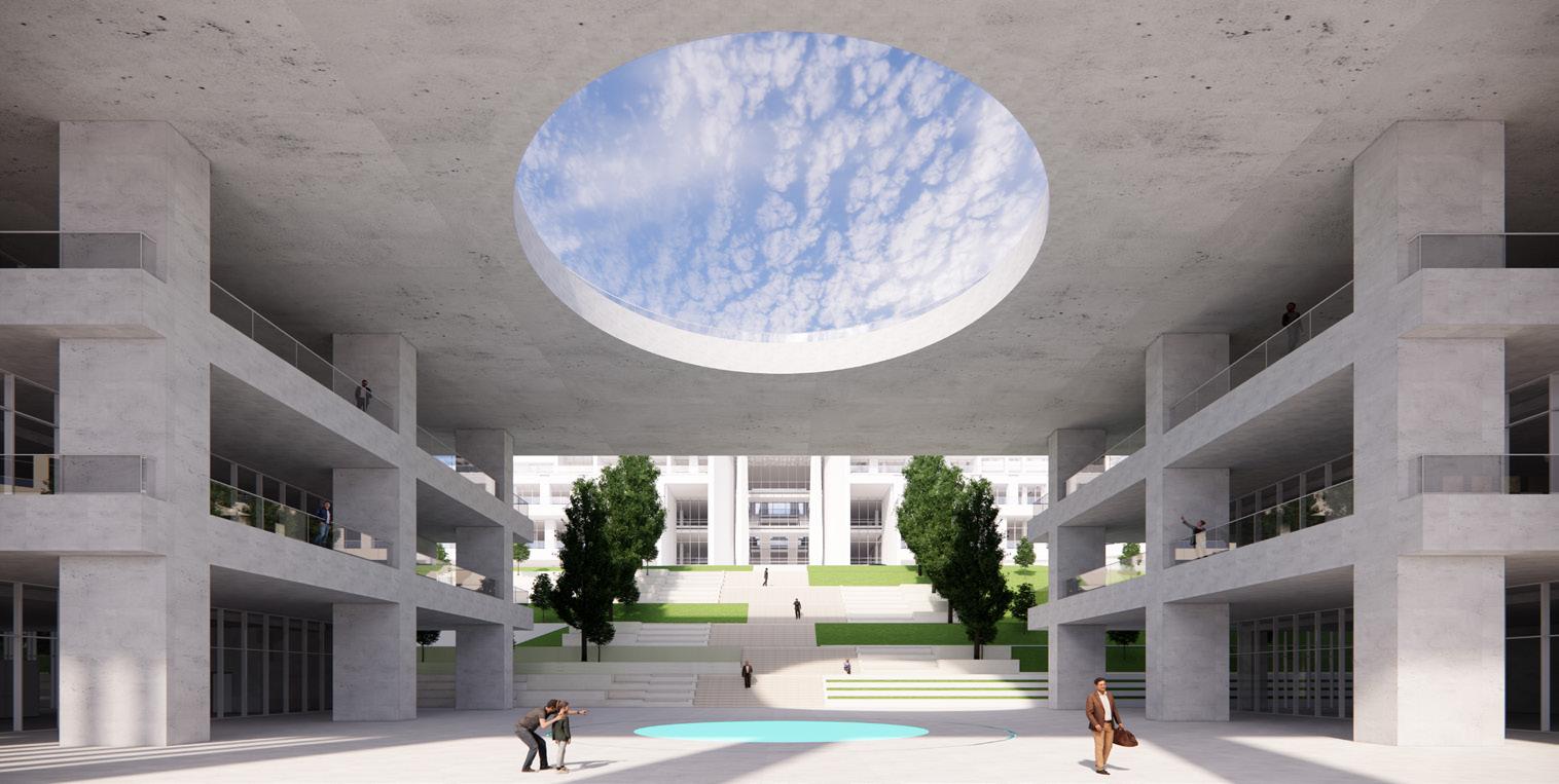
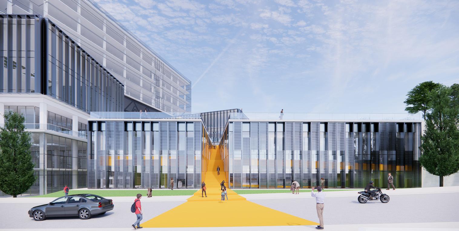
Educational Center | Hashtaak Consulting Engineers
Date / Status: March 2023 – September 2024 · Under construction
Location: Pardis, Tehran, Iran
Architect: Vahid Karamad – karamadvahid@gmail.com
Role: Landscape designer in a three-member team, shaping the surrounding landscapes of a 50-hectare university campus.
Software: Rhino · Enscape · AutoCAD · Photoshop · Blender
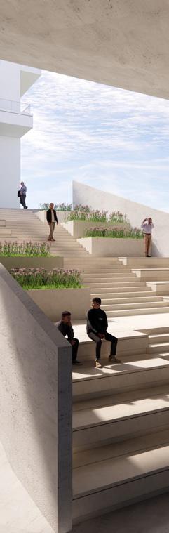
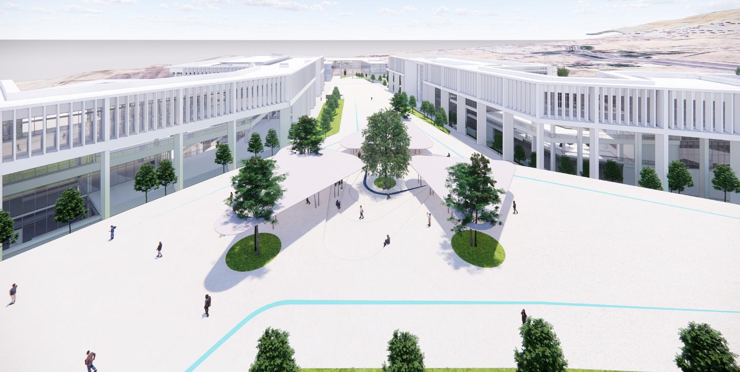
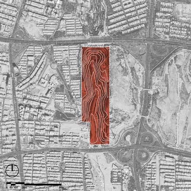
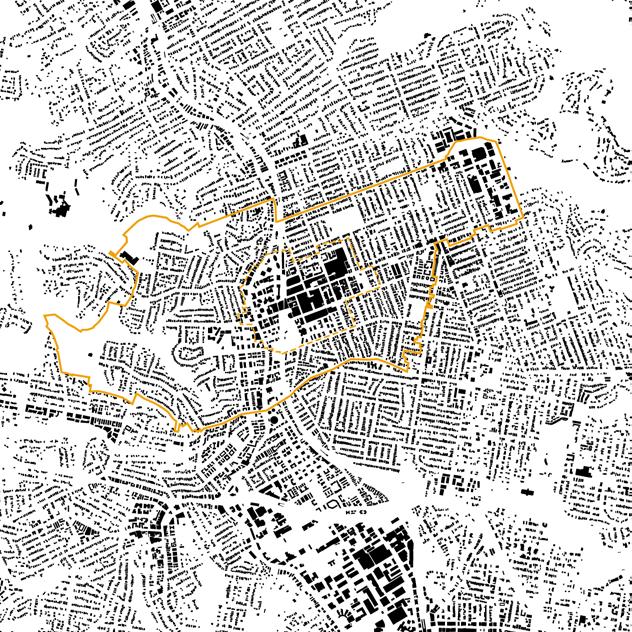
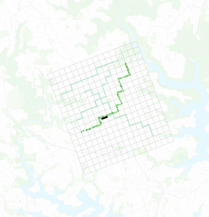
I was part of a three-member team responsible for the 50-hectare landscape design of Khatam University, a campus planned on steep terrain with several academic faculties. The site’s challenging topography made accessibility a central focus, shaping circulation routes and the relationship between buildings, plazas, and green spaces. Working closely with the senior architect, we developed and refined ideas through sketches and multiple design iterations to create a landscape that is both functional and visually appealing.

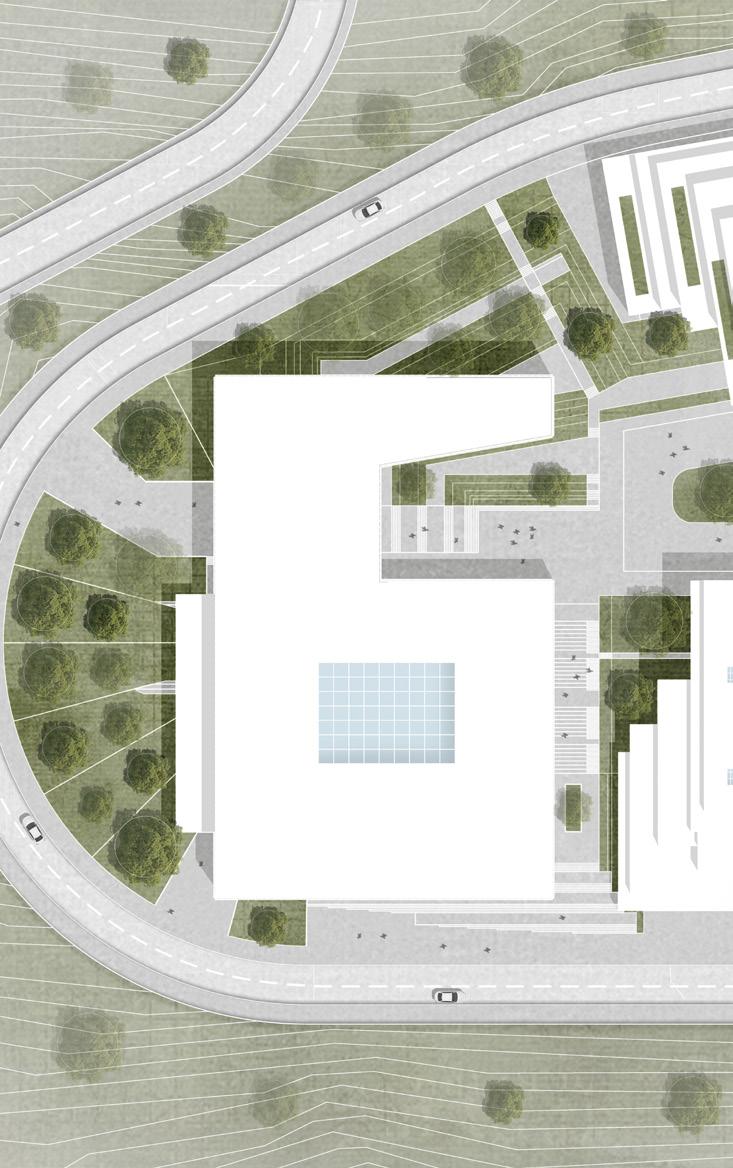
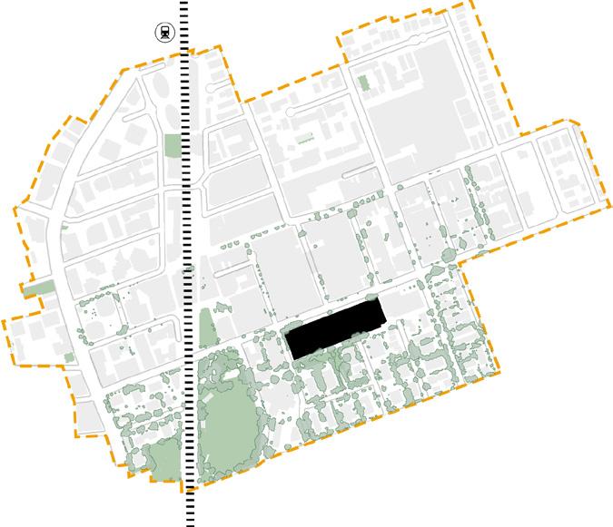
Public Plaza – Master Studio 4 Public Realm
Date: February – April 2025
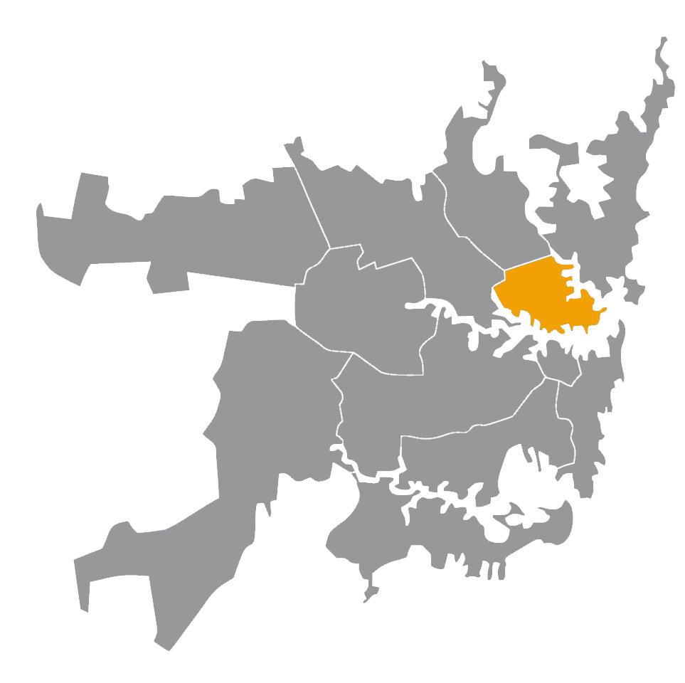
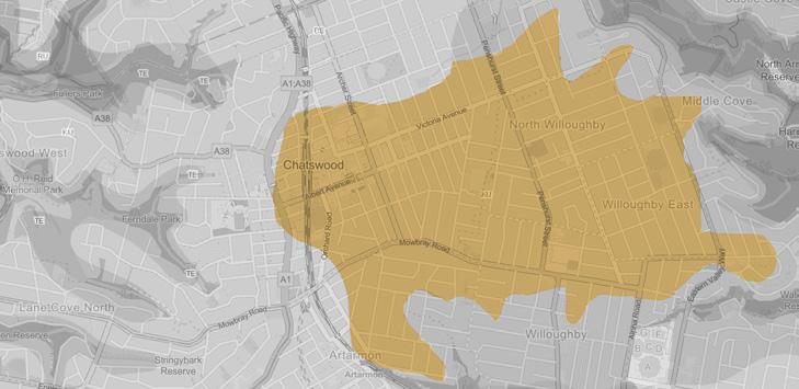
Location: Chatswood, Sydney, NSW
Instructors: Patrick Franklyn – p.franklyn@unsw.edu.au
Christina Silk – c.silk@unsw.edu.au
Context: Academic · Two-member team
Role: Developed large-scale public realm concepts, and led presentation and rendering tasks.
Software: Rhino · Enscape · Photoshop
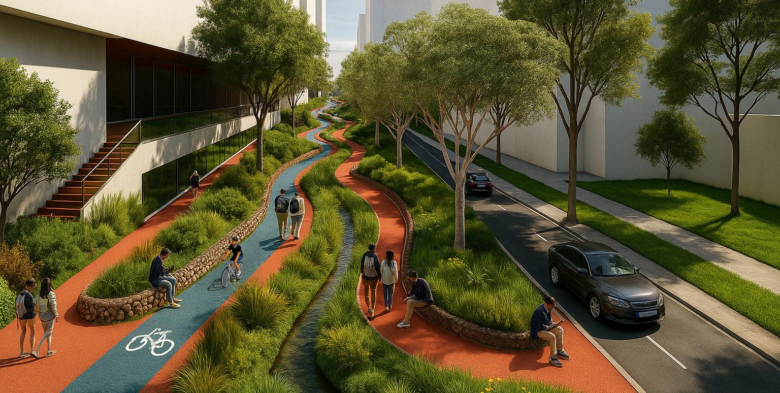
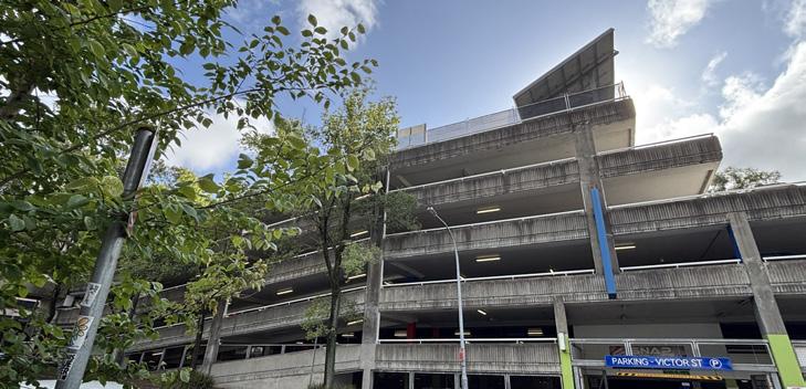
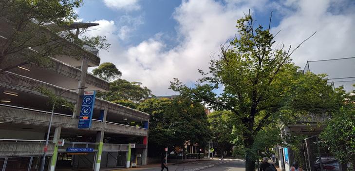
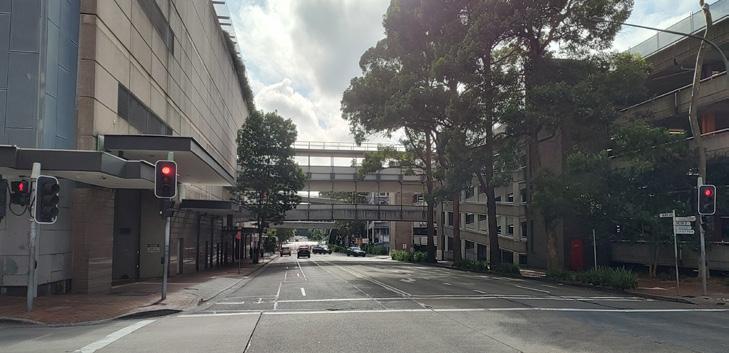
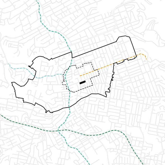
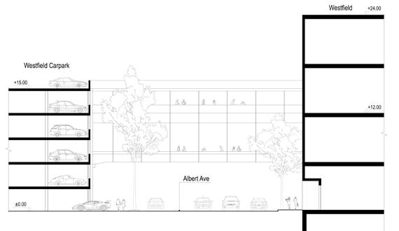
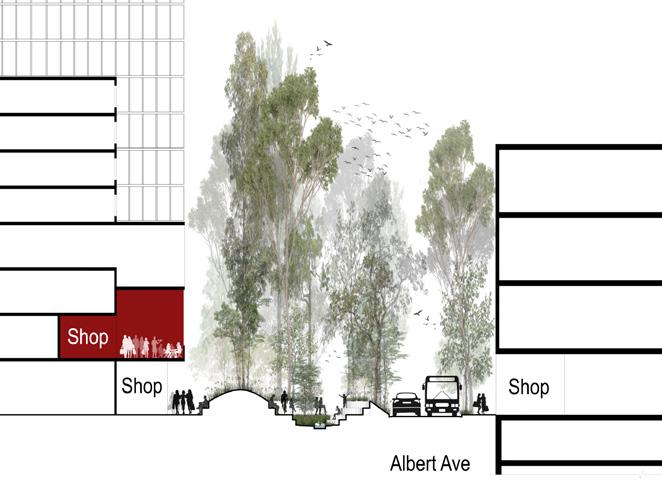
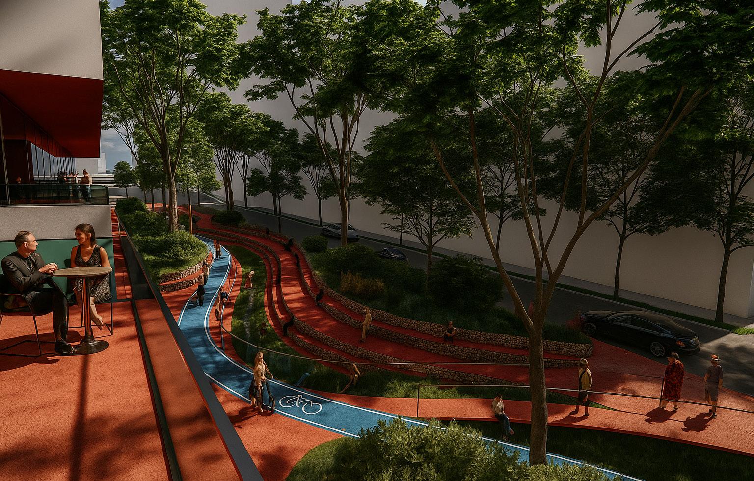
In a two-month master studio, our two-member team redeveloped a Willoughby Council site in Chatswood, now an aging Westfield carpark. The brief called for new residential towers and vibrant public space. Through site analysis, we proposed daylighting Scotts Creek to anchor a plaza and transform Albert Avenue into a lively, ecologically rich pedestrian realm.
Sydney
25,553
MEDIAN AGE (2021)
37
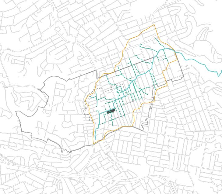
Metro/Train


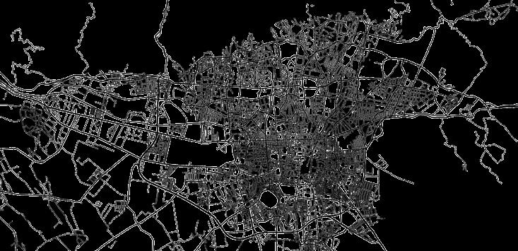
Figure/Ground
This diagram shows how the Chatswood CBD is denser, with larger-scale buildings compared to the surrounding.
Major Roads Bike Routes
This diagram illustrates key bus routes connecting Chatswood to the northern, western, and southern suburbs.
The diagram shows the distribution of green and blue infrastructure in Chatswood and its surrounding areas.
This diagram depicts the major road network within Chatswood and its relationship to the site.
Soil Clasification Map
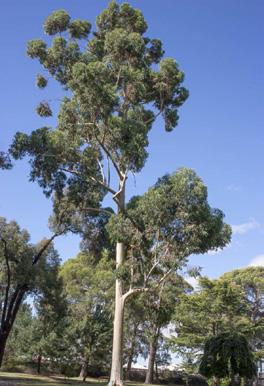
Existing Tree Canopy
Tree Canopy
Creek Water Catchment
Strategy
Utilizing Nature-Based Solution to bring the Creek into life
Principle
Biophilic Chatswood (Greening Chatswood CBD)
Strategy
Reconnecting western forest (Lane Cove) to easter forest ( Middle Harbour)
Principle
Daylighting Scotts Creek
Strategy
Enhancing urban spaces to support local biodiversity.
Principle
Human-Centric Chatswood
Strategy
Enhancing Pedestrian Experience and Walkability
Principle
More-than-Human-Centric Chatswood
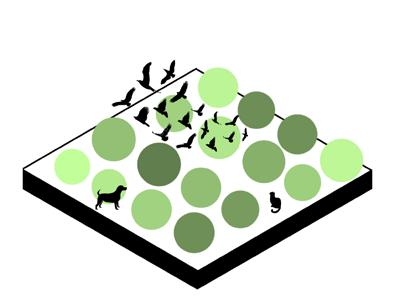
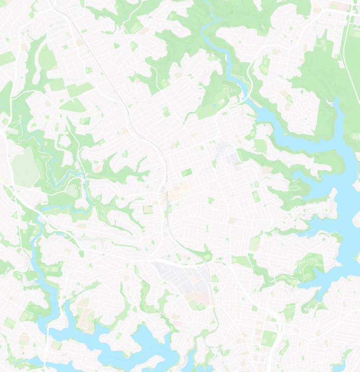
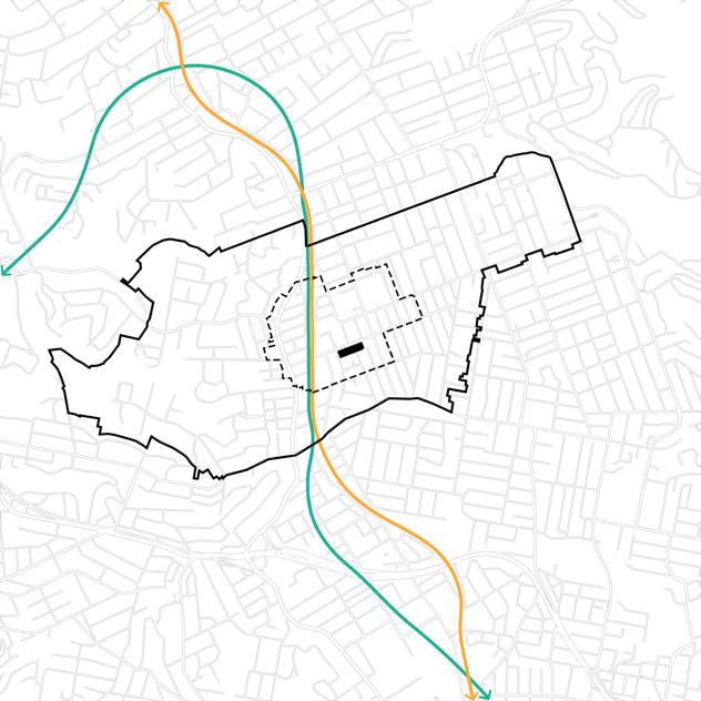
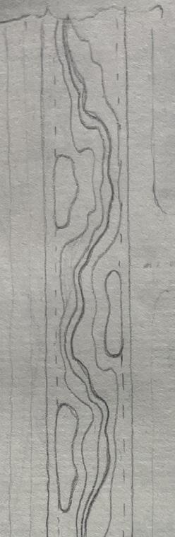
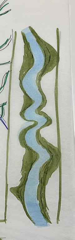
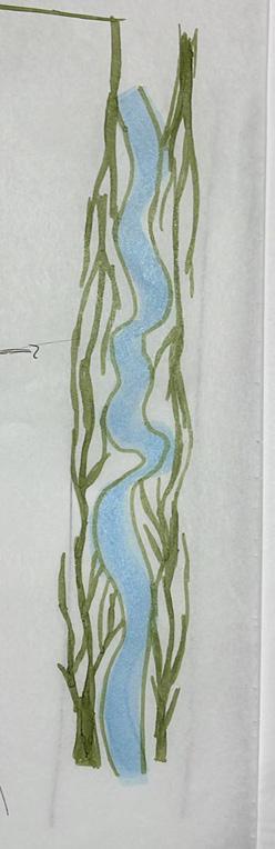
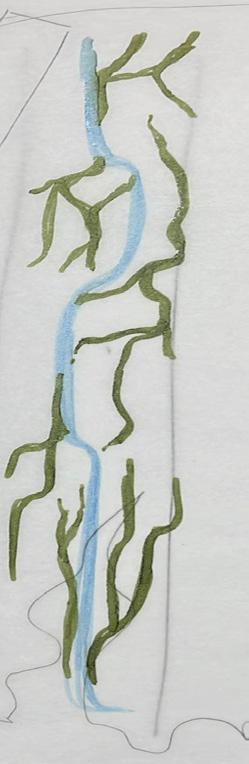
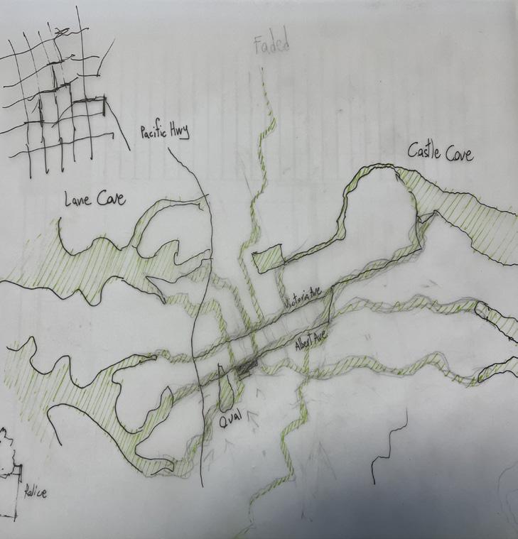
Our site is located in the Chatswood CBD, situated between two forests that were once connected but have since been separated due to urban development and land clearing.
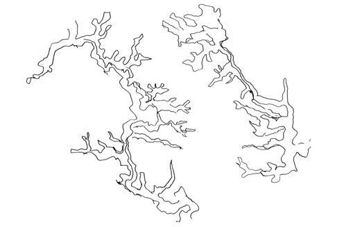
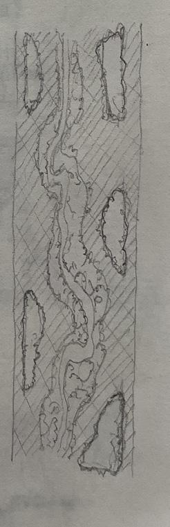
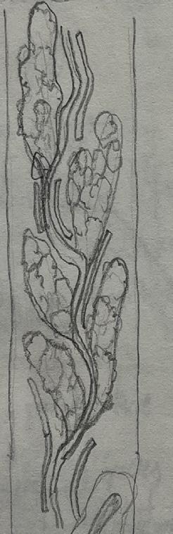
In order to bring nature back into Chatswood and reconnect the surrounding forests, we thoroughly studied their natural patterns. We identified a dendritic (branch-like) structure and chose to use the existing urban road grid as a framework for growing and extending this pattern throughout the city.
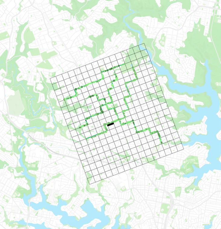
A variety of green corridors are proposed to help green the Chatswood CBD. This is our primary design principle, aligned with one of the council’s key goals for future development.

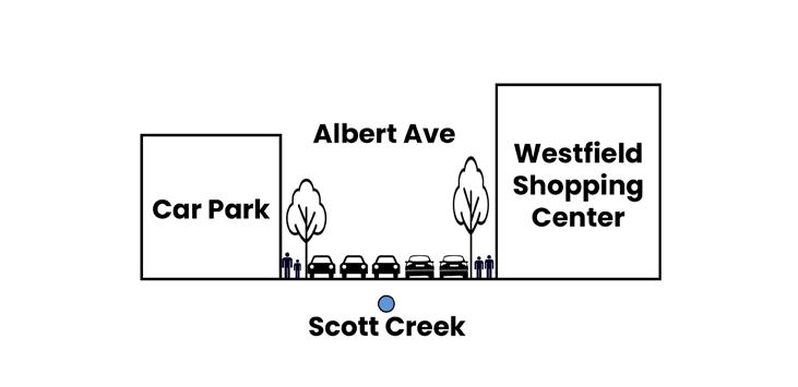
Our focus area lies within one of the proposed green corridors that passes through our site, encompassing Chatswood Oval, the Westfield car park, and Albert Avenue, beneath which flows the underground Scotts Creek.
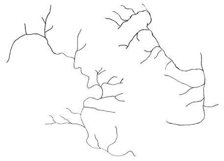

One of the fundamental assets of our site is Scotts Creek, which has been piped and runs adjacent to our car park. As our second principle, we propose daylighting the creek in a form similar to those found along the Lane Cove River and Middle Harbour.
The origin of the name ‘Chattie’s Wood’ serves as a metaphorical inspiration for our design, envisioning a space where people feel as though they are walking through a forest, much like Chattie once did.
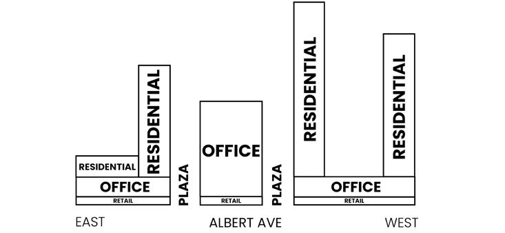
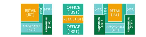

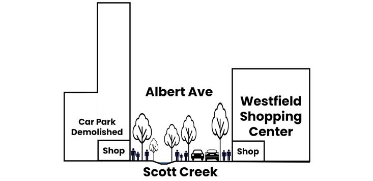
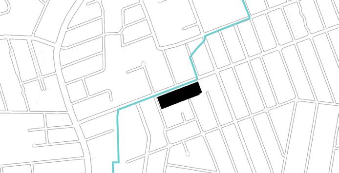
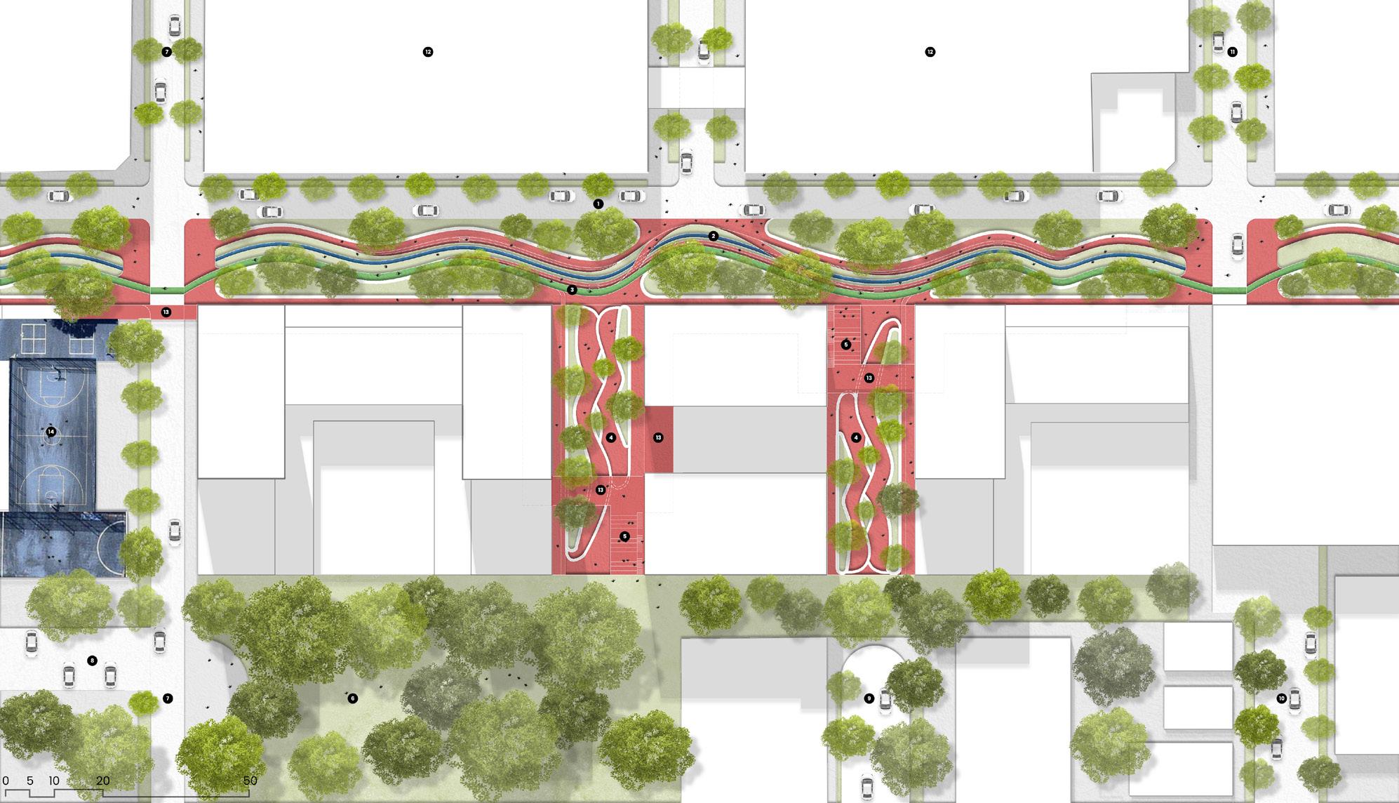
In line with our class categorization, the existing car park is demolished and replaced with a mixed-use development comprising retail, office spaces, and a residential tower.
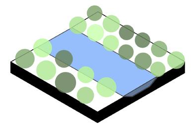
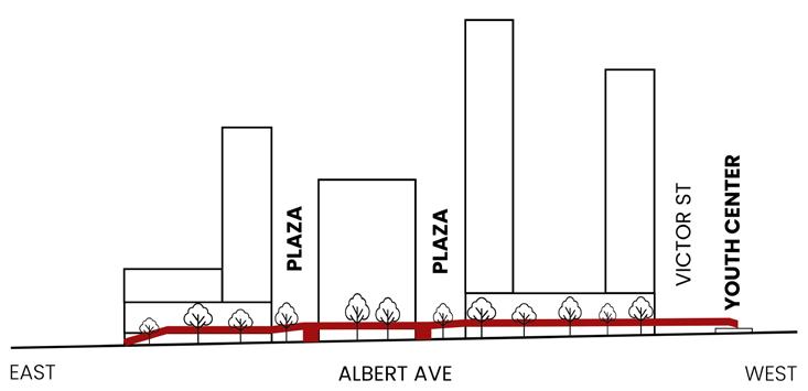
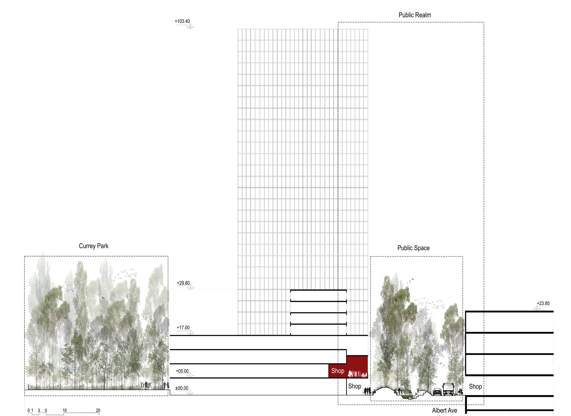
Albert Avenue, currently dominated by cars, is transformed into a pedestrian-friendly street by reducing five lanes to two, creating space for new public areas with Scotts Creek as a central feature. By bringing the creek from pipe to ground level, the design also enhances biodiversity.
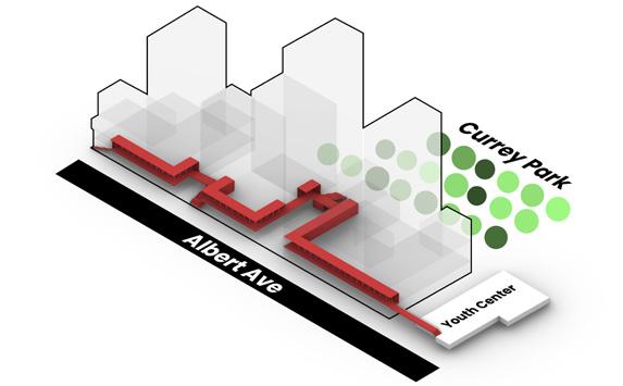
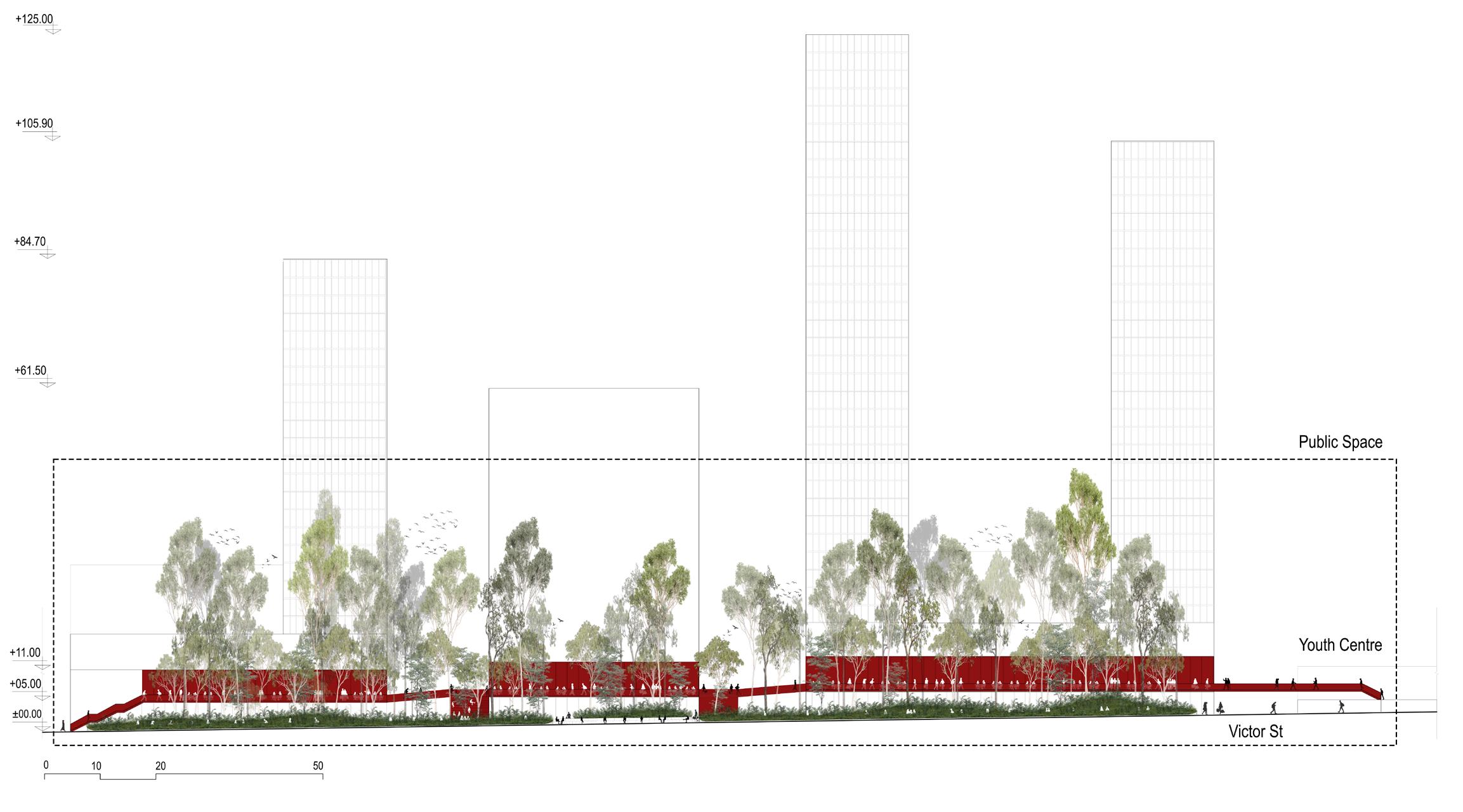
To blur the boundaries between private and public space and Achieve CPTED, we propose an elevated platform with cafés, restaurants, seating steps, and views over Currey Park and Scott Creek. This multifunctional space also creates a new access route from Albert Avenue to the Youth

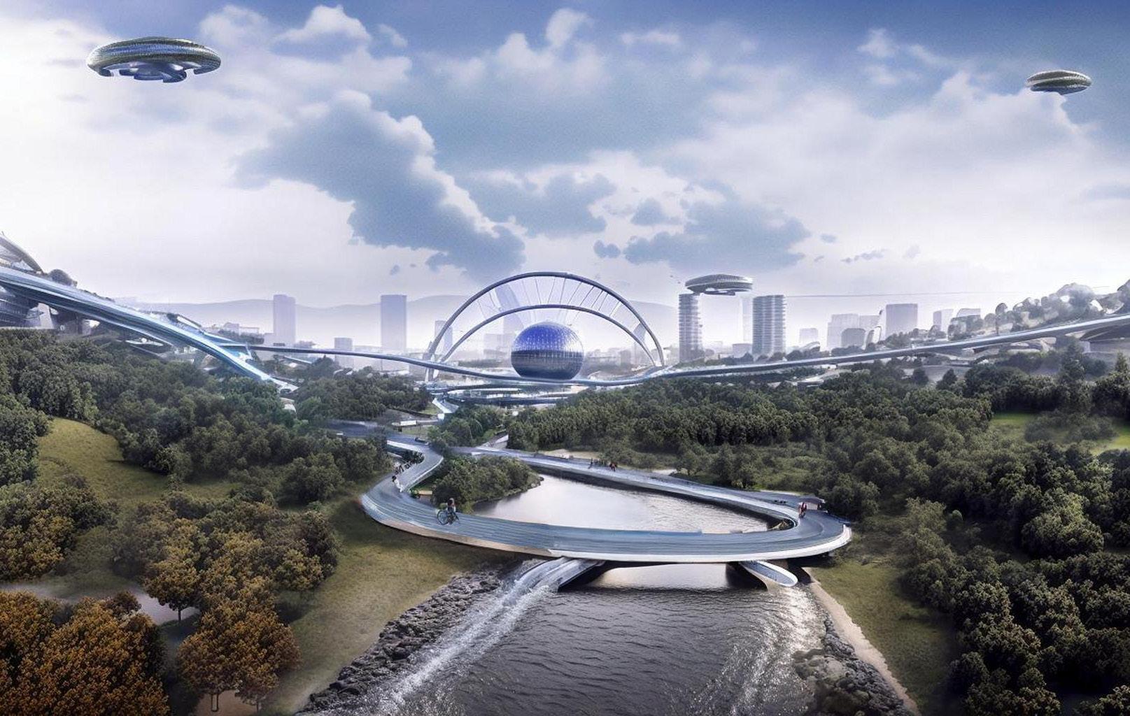
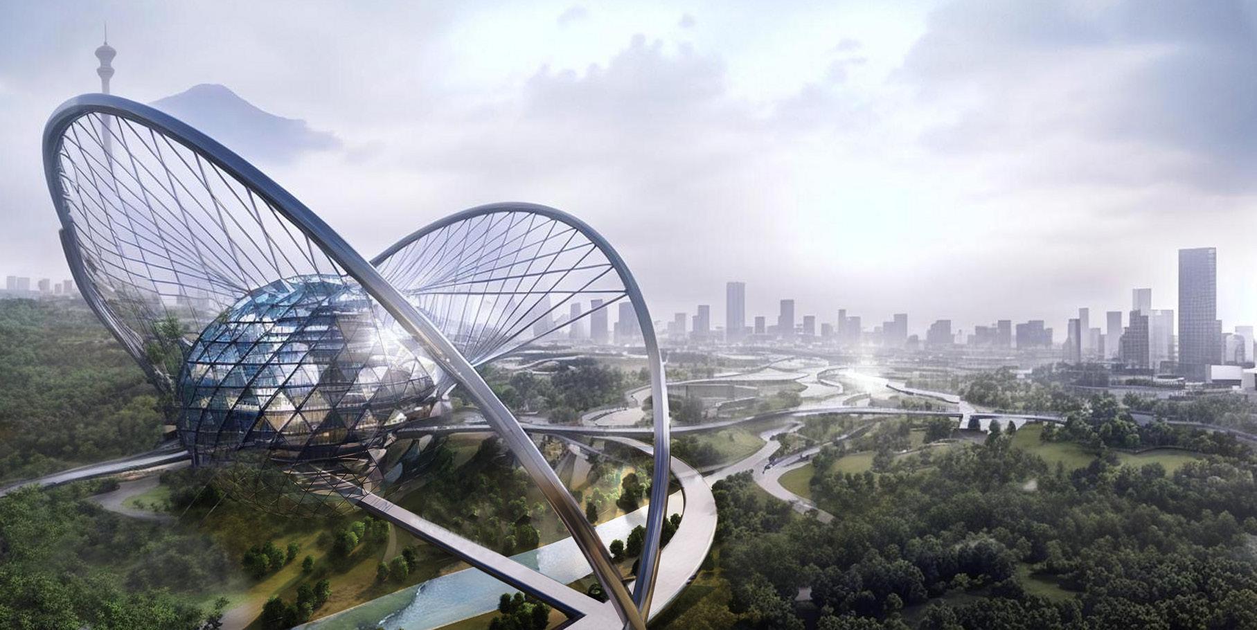
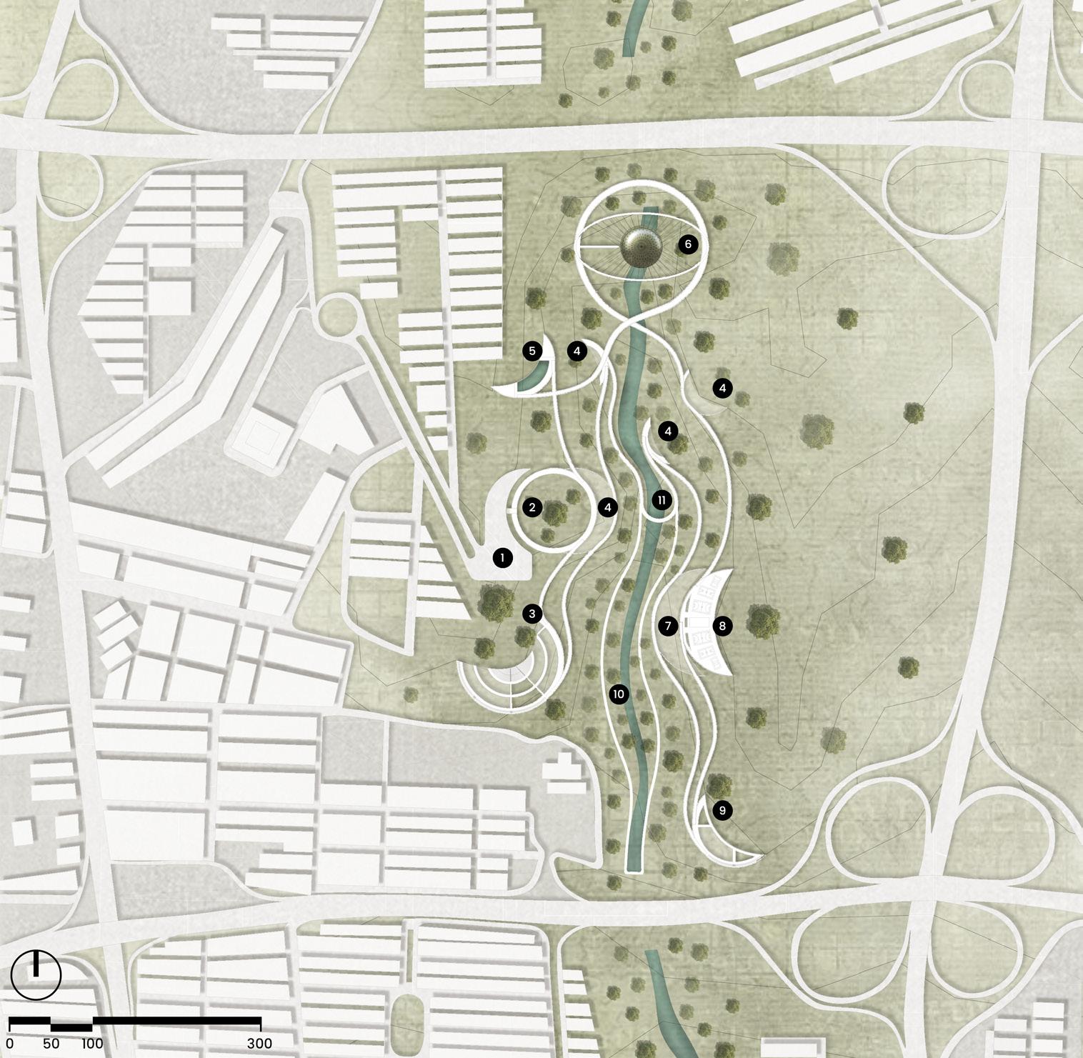
Futuristic Urban Park – Thesis Project
Date: March – October 2023
Location: Tehran, Iran
Professor: Dr. Faizi – mfaizi@iust.ac.ir
Context: Academic · Individual project
Software: Rhino + Grasshopper · Lumion · Photoshop
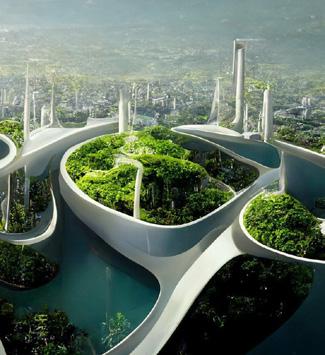
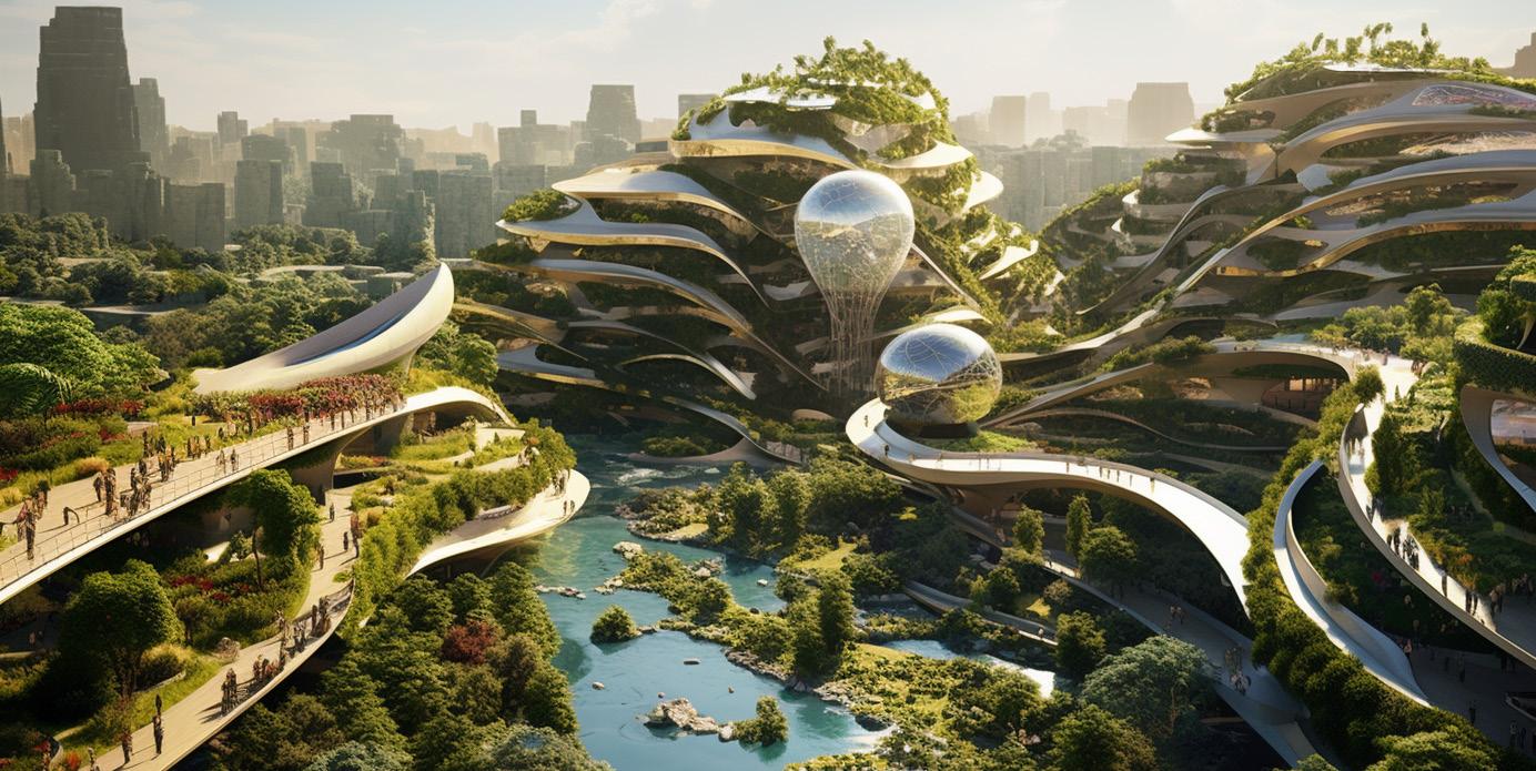
This thesis envisions a futuristic urban park in Tehran that merges advanced technology with sustainable design. Guided by global climate goals and UNESCO’s vision, the project explores how future cities can combine innovation, ecological resilience, and human well-being. AI was used as an exploratory tool to spark conceptual ideas, helping to imagine new relationships between nature, technology, and public life. The result is a forward-looking proposal that responds to climate change while offering vibrant, people-centered spaces for generations to come.


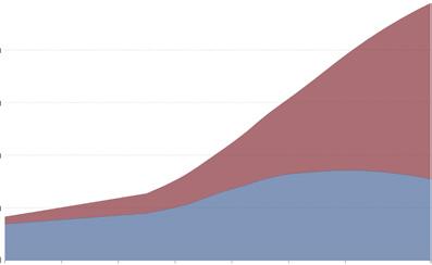
Urban and Rural Population, World, 1900 to 2050
Revitalizing Tehran`s River Valleys Global Warming
Source: OWID based on UN World Urbanization Prospects 2018


Average Temperature Anomaly, Global
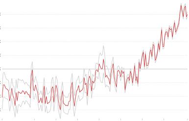
Source: Met Office Hadley Centre (HadCRUT5)

Transforming Tehran into A Biophilic City Implementing Cutting-edge Innovations
STRENGTHS
Natural Beauty and Biodiversity
Potential for Sustainable Development
Local Community Engagement
Mitigating Climate Change
OPPORTUNITIES
Eco-tourism and Recreation
Green and Sustainable Development
Education and Awareness
Urban Resilience
WEAKNESSES
Environmental Degradation
Regulatory and Administrative Hurdles
Funding and Resource Constraints
Potential Displacement
THREATS
Resistance from Local Stakeholders
Financial Risks
Natural Disasters
Air Pollution
AI-Inspired Urban Park: Bridging Nature and Technology in Tehran’s River Valleys
Crafting a futuristic urban park in Tehran’s river valleys demanded a visionary approach. Inspired by AI platforms like Midjourney and ChatGPT, I harnessed their predictive and generative capacities to anticipate and shape the park’s future design. Midjourney foresaw user dynamics, and ChatGPT fueled creative ideation, pushing the boundaries of conventional design. This project exemplifies the transformative influence of AI, seamlessly blending nature and technology to create
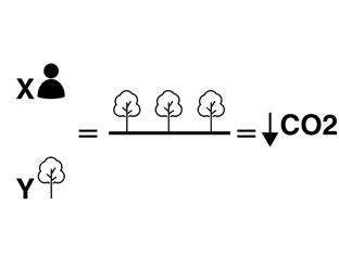
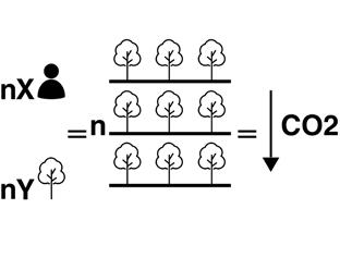
Multilevel design thrives—more green, CO2 absorption, and occupancy—defying linear park conventions.

Utilizing Midjourney’s prompts, I envisioned a futuristic urban park, blending sustainability keywords with traditional features.

How would a futuristic urban park look like?
“Futuristic elevated park, 5 storeys, hanging gardens, canyon in Tehran, river, inspired by Hanging Gardens of Babylon, vibrant undulating design, Iranian garden influence, urban farming, habitat for wild animals, outdoor amphitheater, gallery, ultrarealistic AR 16:9.”
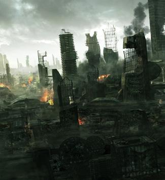
Pessimistic
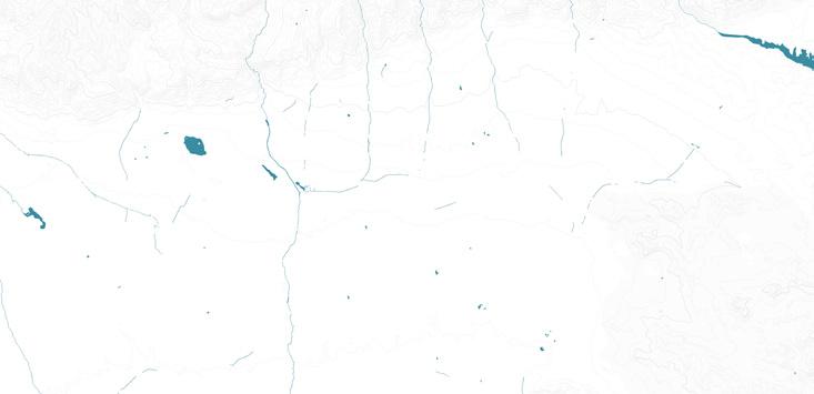
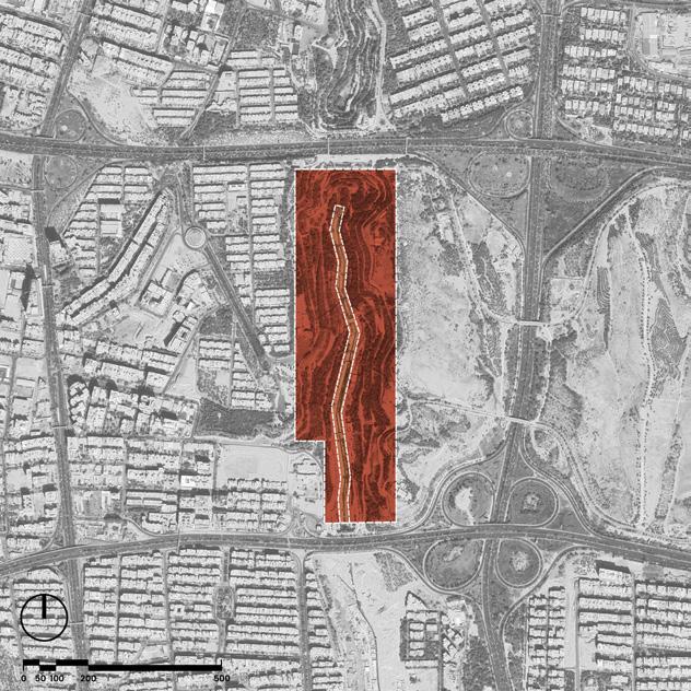
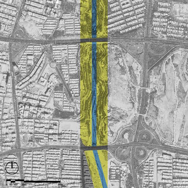
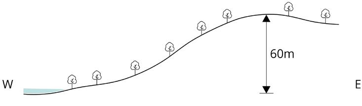
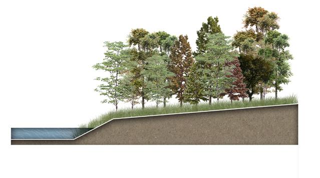
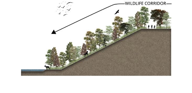
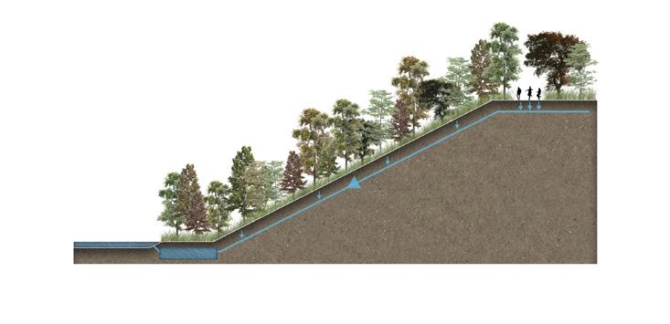
Valley Topography
Site nestled in a valley, contours every 10 meters—inspiring dynamic design for a futuristic urban park.
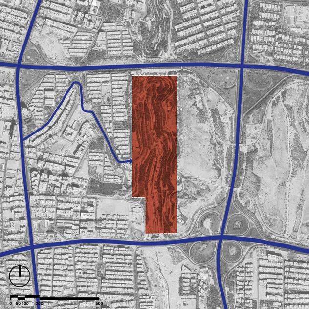
Riverfront Constraints
building restrictions on each side, informing design decisions for riverfront integration.
and a
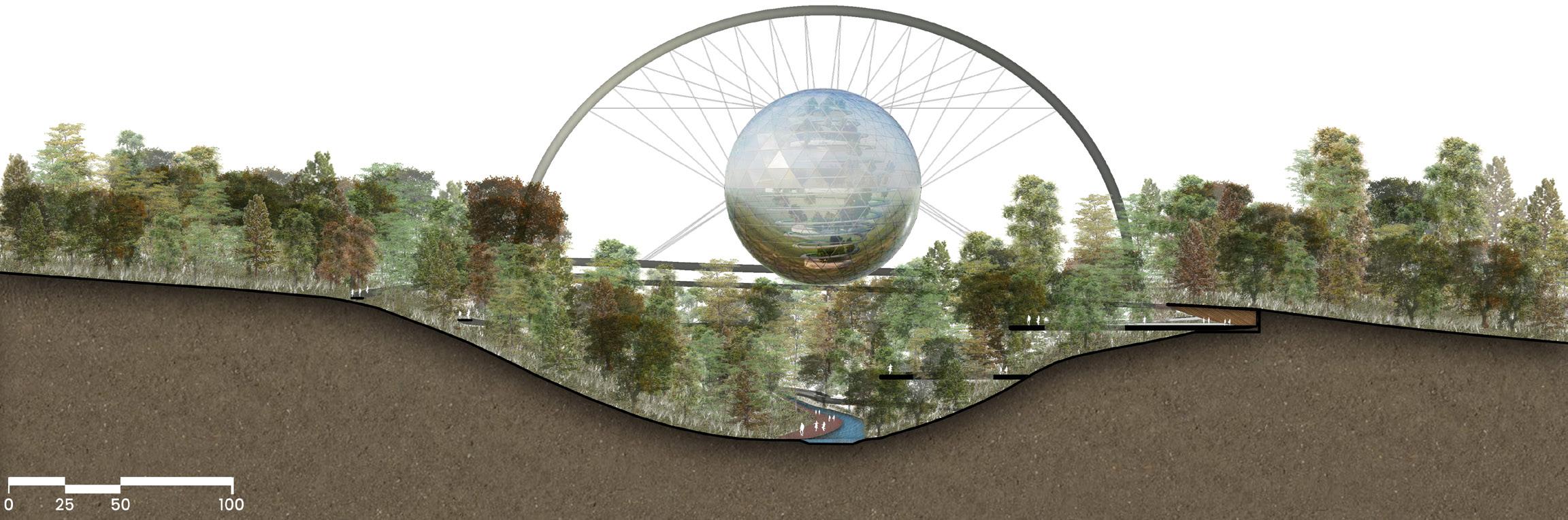
Integrated Elevation: A Futuristic Urban Park Seamlessly Woven into Valley Landscape
Exploring the site in planimetric, sectional, and elevational dimensions, my design harmoniously integrates with the valley’s topography
Futuristic in approach, emphasis on aesthetics and environmental preservation ensures a symbiotic connection with the context. Levels are strategically interwoven, preventing tree cutting and facilitating an uninterrupted green experience. The result is a thoughtfully crafted space where walking and cycling coexist seamlessly, enriching the
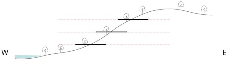
Dynamic Topography
Visualizing valley heights and slope guides the initial steps in our sectional design.
Stepped Landscape: Masuleh Inspiration
Drawing inspiration from Masuleh village, my design divides the topography along three axes for sectional brilliance.
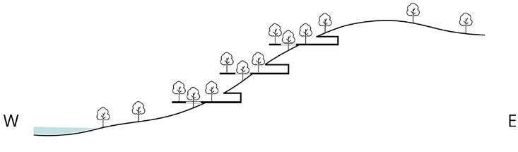
Integrating levels into the topography, the design creates a harmonious landscape with voids and lush tree plantings.
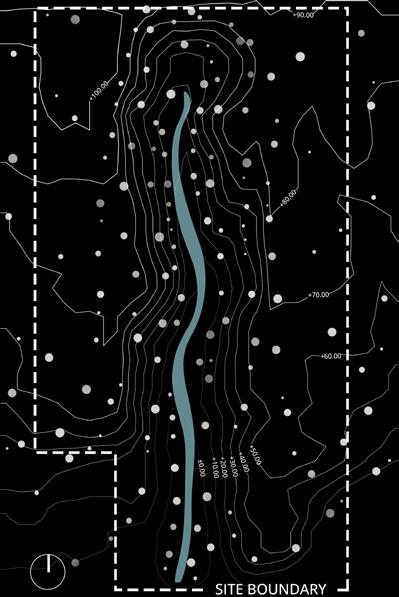
Current Site Contours
Detailing the current topography and natural features, this diagram sets the stage for our design exploration.
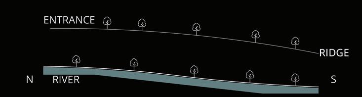
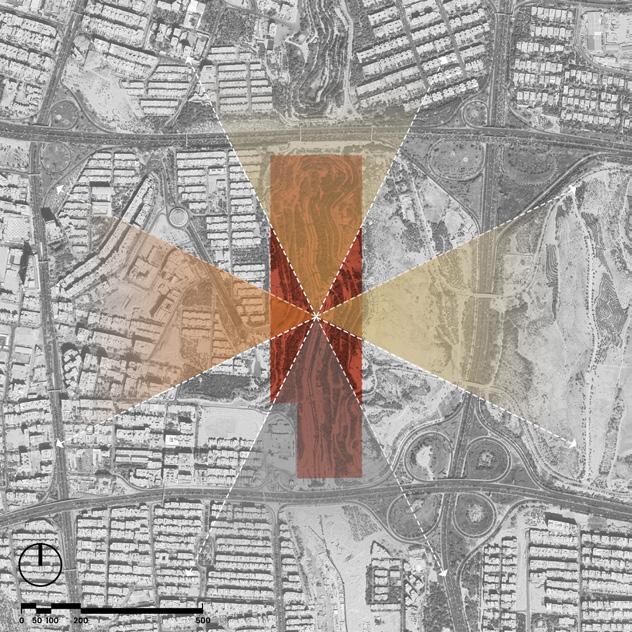
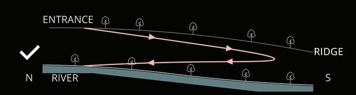
Ridge & Flow
Revealing the elevational dynamics, this diagram showcases the current river flow and the majestic ridge line.
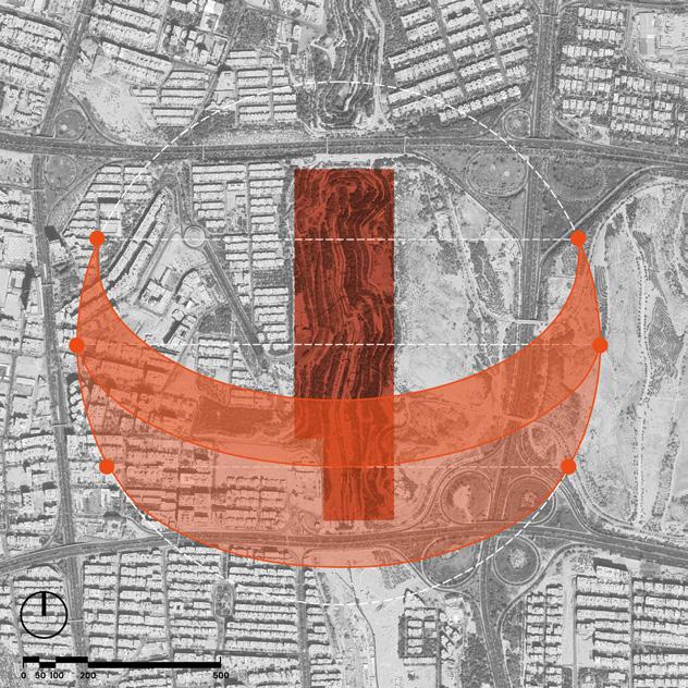
Looped Levels
Creating a connected loop alongside the park road, my design places levels for a seamless and dynamic experience.
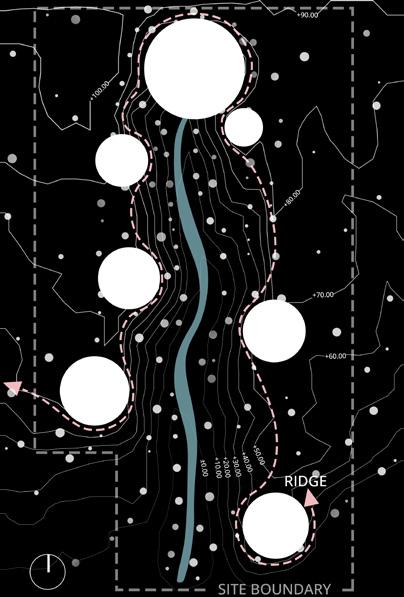
Ridge-Inspired Circles
By harnessing the valley’s ridge, the extracted circles shape a contextual vision, enriching our planimetric design concept.
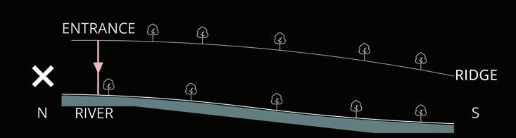
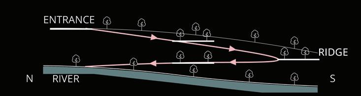
Slope Logic
Negotiating the valley’s slope, my design strategically guides access from entrance to river, ensuring intuitive pathways.
Slope Harmony
Ensuring a logical connection from entrance to river, my design extends the road with a gentle, walkable slope.
In envisioning the future, my park design is deeply rooted in sustainability, aligning with UNESCO goals. Beyond aesthetics, it aims to be a catalyst for climate change mitigation. My solution for Tehran involves transforming it into a biophilic city, and the urban park becomes a cornerstone in this transformation, playing a pivotal role in integrating nature with the city. Through strategic design, biodiversity preservation, and eco-conscious planning, my urban oasis emerges as a beacon of a green, resilient urban environment, shaping a future where nature and city coalesce harmoniously for the well-being of both.
PROPOSED SITE SECTION
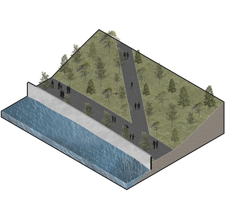
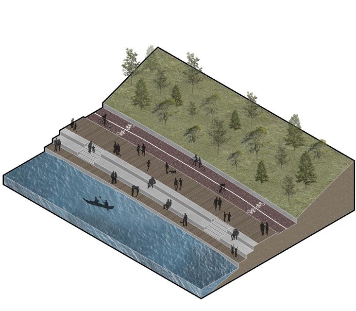
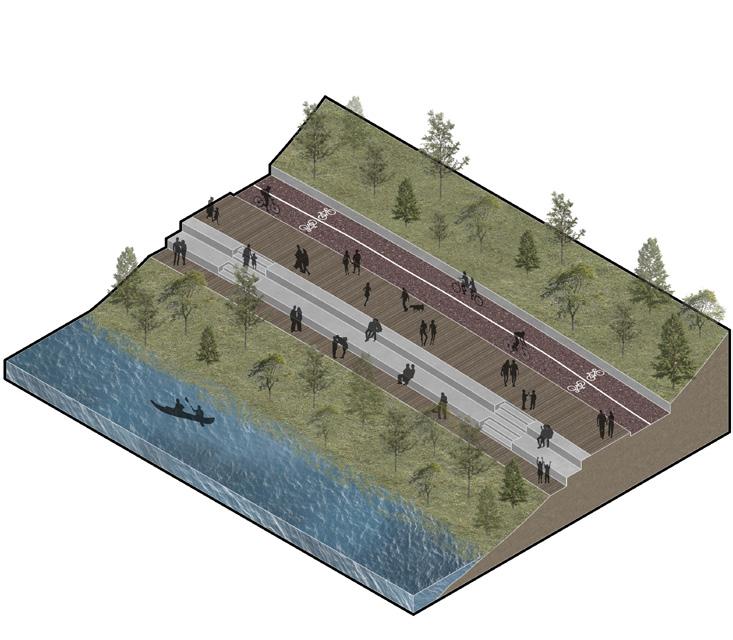
Inaccessible riverfront, hindered by steep slope roads, sparks a vision for an open, vibrant transformation.
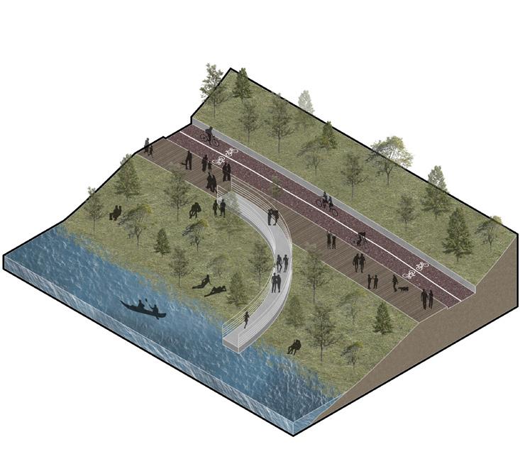
By adding a bridge, I provided people with a crossing, enhancing the view and river experience.
By removing the wall, I introduced a mild slope road for people and bicycles, creating riverside seating for a delightful experience.
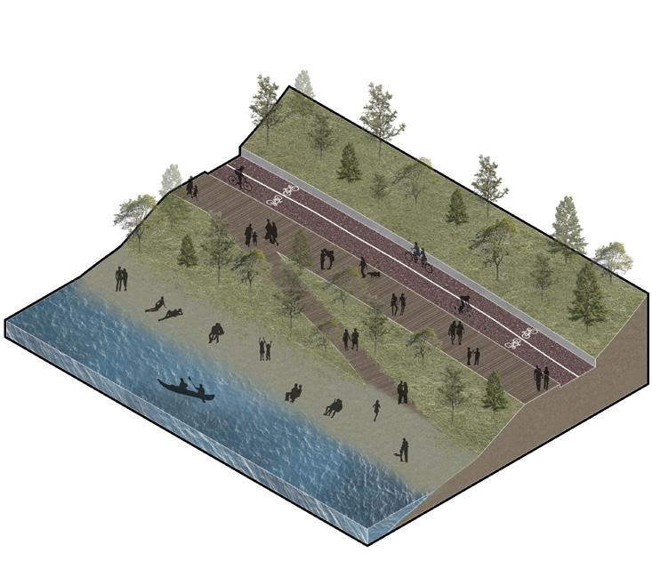
Introducing a riverfront beach allows direct interaction, inviting people to swim and enjoy the water.
Lush greenery along the mild slope road creates a pleasant experience for cycling and walking.
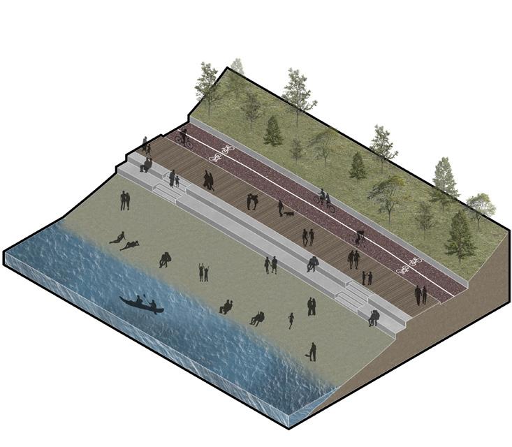
Creating a harmonious blend of road and beach offers diverse experiences for people along the river.
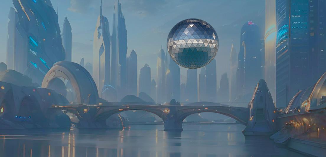
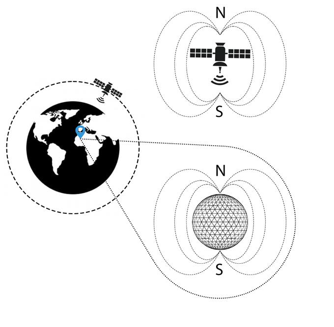
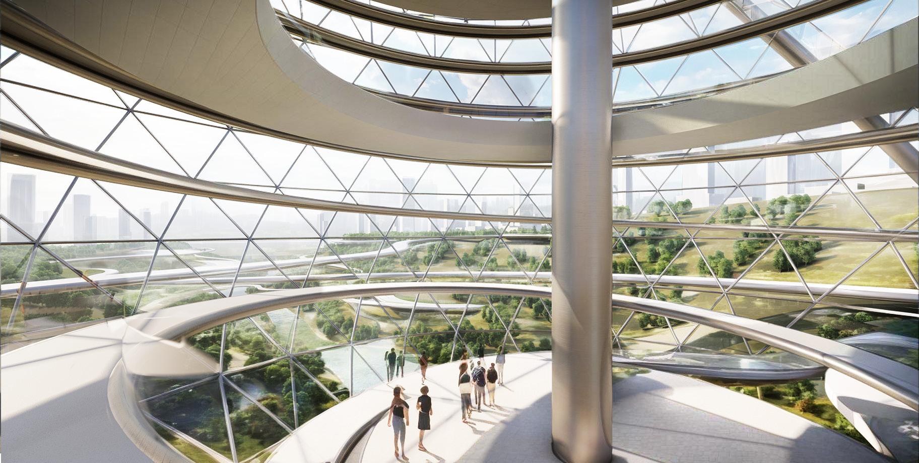
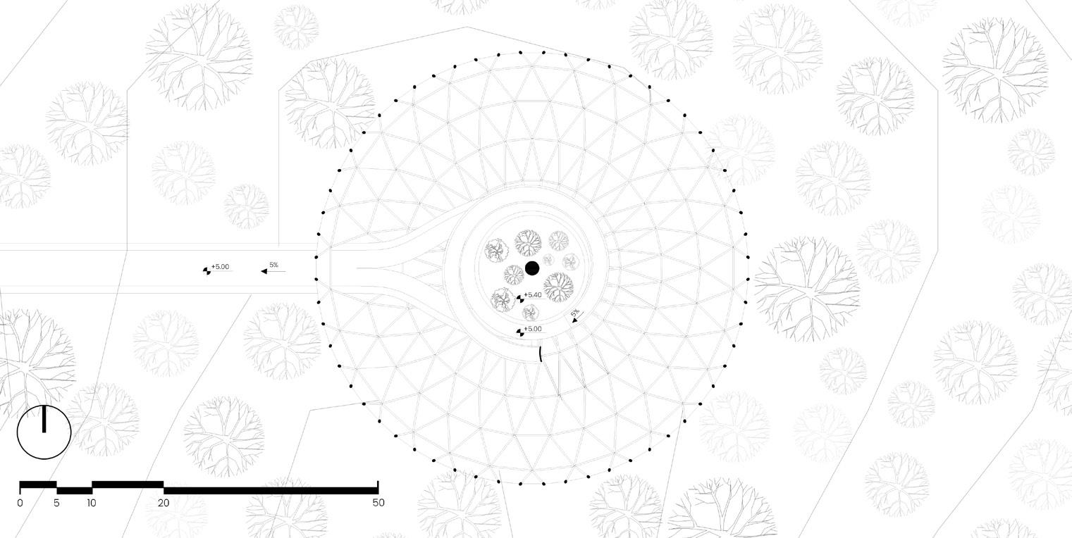
Introducing a futuristic prototype inspired by Babylon’s Hanging Gardens—a suspended green sphere leveraging magnetic control by satellites beyond Earth’s atmosphere. Disconnected from the ground except at the entrance, it ensures unparalleled resilience to earthquakes. This innovative design addresses high-density urban needs, integrating botanical gardens and holographic displays, blending nature and technology seamlessly. A visionary nod to the past, the hanging haven envisions a dynamic, sustainable oasis in urban landscapes. Paying