

Application User Guide
We are creating a place the world will watch with wonder, on London’s iconic site of human ingenuity. rough our masterplan, we will reimagine the very fabric of living, working and urban wellbeing for London and future spaces.
Attracting the world’s most inventive, imaginative and extraordinary minds. at place is Earls Court.
Our four place pillars underpin our vision and set the ambitions for the place we want to create.

Nature
A celebration of nature and its ability to connect and revive.

Innovation
A showcase for climate and clean innovation and skills.

Culture
A cultural ecosystem for the future of talent.

Neighbourhood
An inspiring neighbourhood designed for all stages of life.
Foreword
After four years of deep consideration and collaboration with stakeholders and local people, The Earls Court Development Company (ECDC) is delighted to present the ambitious future plans for this iconic Site.
We formed in 2021 during the lockdown imposed by the first global pandemic in a century, an era which was both disruptive and formative, demanding that we reflect and reassess how we will be living in the future. There could be no more engaging mission for a team specifically assembled to design a place fit for the 22nd century.
As a team, ECDC shares a passion for transformational inner-city projects, and collectively have wide-ranging experiences from diverse international projects. Together, we are driven to fulfil the opportunities of this complex strategic site for London and rightfully put Earls Court as a place back on the global map.
Our intent from the very beginning, was to take a different approach to community involvement in shaping design. Setting up as a local business and being right next to Site everyday, working closely with both local authorities, the Mayor's office, local businesses and our neighbours has been fundamental in shaping our plans for the Site, which we believe are more relevant and exciting for it.
We have listened and taken huge inspiration from Earls Court's heritage, as a place that dared to showcase, to entertain and celebrate the spectacular. A place that was so clearly cherished for being bold and brave, welcoming people from across the globe.
Our plans retain that innovative spirit that embraces future thinking an approach we believe has become more important now than ever before. An approach that continues to drive us to create a global exemplar of sustainability.
We understand our responsibility to deliver much needed homes and employment opportunities for London. Critical to achieving these aims is creating a place with personality, a place that once again becomes a destination with a broad cultural appeal and is fully inclusive to all that come to experience it.
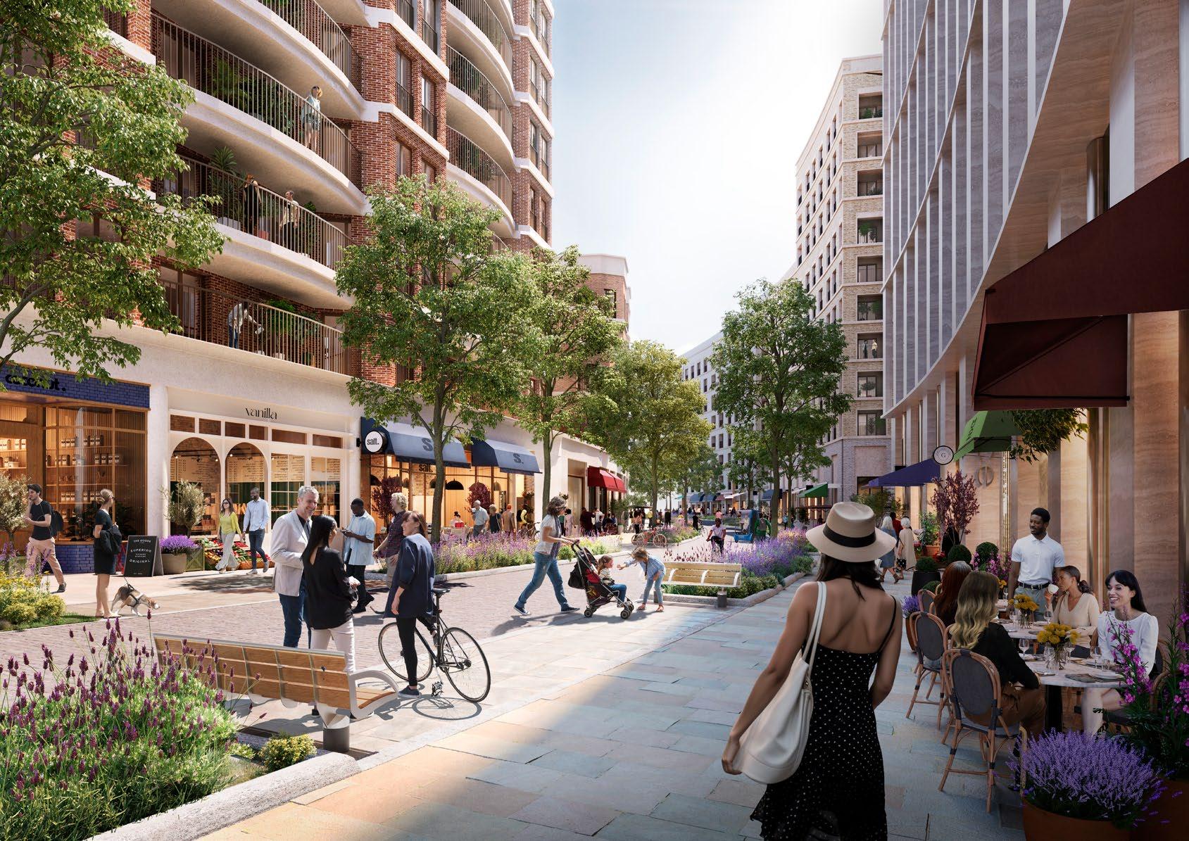
The masterplan has been created to prioritise urban wellbeing and includes a network of Exhibition Gardens that will be open and accessible for everyone to enjoy. We're creating a pedestrian-first environment alive with daytime and evening active uses. This generosity of open space is evident at key arrival points as well as the unique Table Park and Lillie Sidings.
Our commitment to create a better piece of city has been evidenced over the last three years as we have
welcomed over 500,000 people back onto Site to enjoy a programme of events that nod to the past and point to the future of Earls Court.
ECDC began with a mantra 'to make haste slowly' and ensure we took the time to both listen and appreciate the world of Earls Court, which helped to establish the early vision to bring the wonder back to Earls Court.
Now, after over four years of consideration, we are proud to present our hybrid planning submission to the authorities for determination a key milestone to enable the future of Earls Court as a place, once again, to discover wonder.
Rob Heasman CEO
The Earls Court Development Company

Key Information about the Hybrid Planning Applications
Two Hybrid Planning Applications have been submitted
One planning application to the Royal Borough of Kensington and Chelsea (RBKC) and one planning application to the London Borough of Hammersmith and Fulham (LBHF)
The applications will be referred to the Mayor of London
Given the scale of the Proposed Development, RBKC and LBHF will refer the Hybrid Planning Applications to the Mayor of London for comment
Anyone can comment on the applications
Comments should be submitted directly to LBHF and RBKC via their planning websites
The impacts and benefits of the Proposed Development have been assessed
A range of technical assessments have been undertaken to understand the impacts of the Proposed Development and mitigation measures are committed to where necessary.
A Hybrid Planning Application is part 'Detailed' and part 'Outline'
Planning permission is sought for part of the Site in Detail and part of the Site in Outline. The User Guide explains this further
The Proposed Development has been shaped by four years of conversations
The Applications have been informed by local people and stakeholders
The Hybrid Planning Applications allow for some flexibility
It is important that the Proposed Development has the ability to adapt over time. The User Guide explains this further
The applications include over 100 documents
These can be viewed on the RBKC and LBHF websites as well as the ECDC website
1.0 The Two Planning Applications

1.1 The Two Planning Applications Have Been Submitted

As the Site covers two boroughs, two Hybrid Planning Applications are being submitted. One planning application to the Royal Borough of Kensington and Chelsea (RBKC) and one planning application to the London Borough of Hammersmith and Fulham (LBHF).
The Site has been identified as an Opportunity Area by the Mayor of London which means it is a key location with potential for a significant number of new homes and jobs.

For more info on the Opportunity area, please see the Design and Access Statements
Earls Court Station
The Site covers an area of approximately 18 hectares, 8 hectares in RBKC and 10 hectares in LBHF.
1.2 Hybrid Planning Applications
1.3 Outline and Detail Components
HYBRID PLANNING APPLICATION
DETAIL OUTLINE
CONTROL DOCUMENTS
PARAMETER
The Outline Component is supported by three Control Documents which establish a robust framework for future development.
APPROVED DRAWINGS
The full, or D etailed Component is supported by detailed drawings and images so it is clear what will be built.
What is a Hybrid Planning Application?
A Hybrid Planning Application seeks full planning permission for part of a site and Outline planning permission for the remainder
This is a typical approach for a site of this size which will be delivered in multiple phases
This approach secures a long-term vision for the whole site but also early delivery
The masterplan covers the whole site ensuring coordination between the Outline and Detailed Components

Outline and Detail Components of the Hybrid Planning Applications
The majority of the Site is submitted in Outline which allows for some flexibility within the rules established in the Control Documents
Five Development Plots from the first phase are submitted in Detail
Once planning permission has been secured the detailed design of further plots and landscaping will be submitted as Reserved Matters Applications
These Reserved Matters Applications must align with the Control Documents which set out the 'rules' in terms of design principles and use
Earls Court Station
West Brompton Station
West Kensington Station
1.4 Outline Component
The Control Documents
For the Outline Component, the local boroughs will consider the development principles for approval rather than detailed drawings. These are defined by three documents collectively referred to as the Control Documents:
Example of How the Control Documents Shape a Development Plot
The Illustrative Masterplan represents one way the Control Documents could be applied
Parameter Plans
- The Parameter Plans define the size and height of a development plot as well as critical dimensions, land uses, routes and access
- These plans control the future layout of the Site, ensuring it aligns with the masterplan aspirations
Development Specification
- The Development Specification defines the amount of development floorspace
- This document describes the range of uses which can be included in buildings (e.g. number of homes, amount of office space, amount of retail and culture), and sets an overall maximum amount of floorspace
Design Code
- The Design Code sets out guiding principles for the Site ensuring a coherent approach to character, public realm and the design of buildings
- Design codes are effectively a rule book for future design work to follow. They typically include mandatory and non-mandatory principles, indicating whether the code must be followed or whether it is encouraged guidance or suggestions
The Design Code sets out the principles for the character of buildings and landscape
The Parameter Plans and Development Specification set out limits to the amount of development
The Parameter Plans and Design Code define the design principles for the landscaped spaces and streets
Detailed Approved Content


For the Detailed Component, the Boroughs will consider a set of drawings that show how buildings will look. This is the same as the normal requirements of a full planning application.
Detail Plots
The Hybrid Planning Applications include fully detailed applications for five of the Development Plots in Phase 1
These plots are in detail as they are the first buildings we have designed as part of Phase 1
This will ensure the earliest possible start on-site for a significant proportion of the first phase
The Detailed Components will be approved by the relevant Borough, dependant on where they are located, i.e. RBKC for EC05 and EC06, LBHF for WB03, WB04, and WB05
Earls Court Station
EC06: New homes with nursery on the Table
West Brompton Station
West Kensington Station
WB04: New homes with Ground and First Floor retail, cafes, restaurants and leisure
WB05: New homes with a new Community Hub at Ground Floor
EC05: New homes with Ground Floor retail, cafes and restaurants
WB03: New student homes with ground level retail, cafes and restaurants
1.6 Illustrative Masterplan
The Illustrative Masterplan represents one way in which the Control Documents could be interpreted and has been used to thoroughly test proposals in terms of environmental, social, economic and transport impacts. It shows indicative design proposals for the buildings and landscape.
Public consultation has informed the development of the Illustrative Masterplan, which in turn has become the basis of the Control Documents. The key topics and priorities raised during the four years of listening are reflected in these.

Illustrative Masterplan roof plan
1.7 Approval Process
RBKC and LBHF will determine the Hybrid Planning Applications in the context of relevant planning policy taking into account material planning considerations.
Consenting Process
The Detailed Component of the approved Hybrid Planning Application will be given consent as a fixed proposal for the buildings which can then begin on Site first.
The remainder of the Hybrid Applications will gain Outline Planning Permission which can be further developed in the future as a series of Reserved Matters Applications (RMAs).
These RMAs must comply with the Control Documents.
DETAIL COMPONENT
OUTLINE COMPONENT
Reserved Matters Applications
2.0 What Are We Applying For?

2.1 Amount of Development
Application Content Summary
The Hybrid Planning Application can deliver up to 710,519 sq m across a range of uses. The flexible nature of the Hybrid Planning Application means that the amount of each use can vary. The following sets out the uses that could be delivered and how much of each use could be delivered. The uses in the Detailed Component are fixed.
The way in which these different uses could be delivered within the maximum cap is covered overleaf.
Summary of Hybrid Applications Content
The Hybrid Planning Applications could deliver:
Total
development
A maximum cap of 710,519 sq m (245,002 sq m in RBKC and 465,517 sq m in LBHF)
Total Outline development
The Outline Component comprises 577,000 sq m (204,000 sq m in RBKC and 373,000 sq m in LBHF)
Total Detail development
The Detailed Component comprises 133,519 sq m
(41,002 sq m in RBKC and 92,517 sq m in LBHF)
Total homes
Up to 3,900 homes (1,400 in RBKC and 2,500 in LBHF)
Total office space
Up to 270,000 sq m of office floorspace (95,000 sq m in RBKC and 175,000 sq m in LBHF)
Other possible uses
Other uses allowed for include hotels, purpose built student accommodation, later living, health and education.
These uses will be complemented by a range of active uses including retail, restaurants, cafes, cultural venues, leisure and community.
All areas are Gross External Area (GEA) which is defined in the Glossary.
2.2 Flexibility
The flexibility in the Hybrid Planning Applications is limited to the following:

Overall Floorspace
The Hybrid Planning Applications comprise the following:
- An overall floorspace cap of 710,519 sq m
- The Detailed Component is 133,519 sq m
- The Outline Component is capped at 577,000 sq m
- Approximately 35% of floorspace in RBKC and 65% in LBHF
Hybrid Land Use Floorspace
- The Illustrative Masterplan is one way in which the Control Documents could be followed
- The diagram above shows the balance of uses within the Illustrative Masterplan
- The diagram also shows how the uses can 'flex' to deliver more homes or more office floorspace within the limits of the Control Documents

Degree of Flexibility
- Between the minimum and maximum scenarios for residential or office space, the Development Specification enables a degree of flexibility in land use
- This does not increase overall floorspace across the Site, but allows for alternatives to the Illustrative Masterplan to be considered by Reserved Matters Applications
- The diagram above shows possible ways in which the quantity of office and residential floorspace could be delivered with some flexibility in the provision of other uses (e.g. retail, leisure, culture, community, health, hotel, education, student, other residential types etc.)
3.0 Control Documents

3.1 Key Documents in the Applications
Key Documents Summary
The applications include over 100 documents which can be viewed on the RBKC and LBHF websites, as well as the ECDC website.
There are a few key documents in the application which the following pages describe in further detail.
Sitewide aspects of the submission applicable to both the Outline and Detailed Components are covered in the Design and Access Statement (DAS) Volume 1 for the Outline Component. This sets out the overall vision and framework for the Site
Information relevant to the Outline Component can be found in the approved Control Documents, the supporting DAS, the full suite of technical assessments and supporting documents
Information relevant to the Detailed Component can be found in the Approved Application Drawings, the additional volumes of the DAS, specific technical assessments and supporting documents for the detail plots
OUTLINE
DETAIL
3.2 Development Specification
Development Specification
The Development Specification defines the amount of development floorspace
This document describes the range of uses which are allowed in buildings (e.g. number of homes, amount of office space, retail and culture), and sets an overall maximum amount of floorspace
Existing buildings by borough are covered in tables 1 and 2
Total permitted floorspace by borough is covered in table 3
Development Zones
maximum area and permitted land uses for each Development Zone is covered in tables 4 and 5
Floor space and land use for each borough is covered in tables 6 and 7
Maximum number of homes
including the maximum rooms of residential, student, hotel, co-living or later-living accommodation are covered in table 8
Other topics
Play space, car parking, cycle parking, maximum building heights
3.3 Parameter Plans
Existing Condition
These plans describe the existing condition and the proposed demolition works.
P001
Site Location Plan P002
Demolition Plan P003
Existing Site Levels


The Site Location Plan defines the application extent.
The Demolition Plan defines the proposed demolition of existing buildings and structures.
The Existing Site Levels Plan defines the current ground levels across the Site.
The Parameter Plans define the size of a development plot as well as critical dimensions, land uses, routes and access.
These plans control the future layout of the Site, ensuring it aligns with the masterplan aspirations.
The Parameter Plans are split into five general groupings:
Development Extent
These plans describe the minimum area of public realm, where buildings can and cannot be located and how tall they could be.
P004
Development Zones, Maximum Building Lines and Public Realm P005 Proposed Plot Plan P006
Proposed Maximum Heights


The Development Zones plan defines the extents of development and minimum public realm.
The Proposed Plot Plan identifies indicative locations of buildings.
The Maximum Heights Plan defines the permitted building heights.
Movement and Levels
These plans describe the proposed access and the proposed levels.
P008
Proposed Access and Movement P009 Proposed Site Levels Above Ground Floor Plan P010 Proposed Site Levels Below Ground Floor Plan


The Proposed Access and Movement Plan defines access points to the perimeter of the Site and shows indicative locations of movement/ routes.
The Proposed Levels Plan define the proposed levels above and below ground.
Land Use
These plans describe the proposed land uses across the development.
P011
Proposed Land Use Ground Level P012
Proposed Land Use Upper Levels P013
Proposed Land Use Below Ground Floor


The plans identify the approved land uses per Development Zone.
These plans should be read alongside the floorspace obligations and more detailed land use description that is found in the Development Specification.
Urban Structure
These plans describe the urban structure of the proposals.
P007
Proposed Public Realm Typologies
P014 Urban Design Plan

The plans identify the different types of streets and spaces proposed, and combine the general landscape layout and built form proposals on one plan.
The content of these plans should be read alongside the detailed design guidance for both landscape and built form in the Design Code.
3.4 Design Codes
Design Code Content
The Design Code is the controlling design guidance of the Outline application.
This document defines concise illustrated design requirements to provide greater design certainty, ensure design quality and respond to key priorities for future development including Sitewide and Character Area principles.
Each code in this document is clearly identified with either a must, should or could status. This determines the approach that future applications must take in response to the guidance (definitions summarised in the adjacent diagram).
Design Code Summary
Introduction and Parameter Plan interpretation
The first section of the Design Code includes clarification on how the Parameter Plans are to be interpreted, with explanatory diagrams or elaboration on the use of the plans.
Principles that are approved requirements.
Principles that are strongly encouraged (but also allow for alternative scenarios to be proposed).
Site-wide codes
The next chapter of the Design Code sets out codes which are applicable to the whole Site, to establish a coherent and high quality place. They are organised in Landscape and Built form topic sections covering:
- Spatial typologies (routes and spaces) and movement strategy
- Spill-out and defensible space
- Boundary conditions
- Sustainability
- Green/blue infrastructure
- Biodiversity, habitats, planting strategy
- Landscape, planting, materials
- Street furniture, lighting, way-finding, play, public art
- Building typologies, layout and massing principles
- Heritage and townscape views
Principles that are suggestions or workable options (to be explored, considered and tested).
Character Area codes
The subsequent seven chapters contain codes that provide specific guidance in response to local/unique conditions in a particular area of the Site. They are also organised in Landscape and Built form topic sections in relation to:
- Aspects defining the character of each area and interfaces between areas
- Material treatment, planting, play, street furniture
- Specific typologies/layout/massing principles of buildings
- Detail considerations/building components/expression/facade strategy
4.0 Finding Relevant Information
4.1 Finding Relevant Information
Where can I find the information I need in the Hybrid Planning Applications?
The Hybrid Planning Applications include over 100 documents covering a wide range of topics.
To help find the relevant information, the following pages cover a few of the main themes of the planning application documents.
All of these documents are available to view on The Earls Court Development Company website. They are also available to view on RBKC and LBHF planning application websites.
4.2 Supporting Documents
Design and Access Statement
Site-wide aspects of the submission applicable to the whole Site are covered in the Design and Access Statement for the Outline Component. This presents the overall vision, framework and Illustrative Masterplan for the Site.
It evaluates the context of the Earls Court Development in terms of both its physical and policy environment and presents the associated opportunities and constraints.
It explains and justifies the design response, outlining how the design has developed and been consulted on, the consequent Strategic Framework and principles, and the integration of spatial and technical strategies (with a particular focus on Access).
It uses an Illustrative Masterplan as one possible scenario of development in accordance with the Control Documents.
Environmental Statement
The Environmental Statement (ES) is a document which assesses the likely environmental impacts of the Proposed Development. Where impacts are identified appropriate mitigation is set out. Topics assessed in the ES are:
Archaeology
Socio-Economics
Health
Transport and Accessibility
Air Quality
Noise and Vibration
Ecology
Ground Conditions
Water Resources
Daylight, Sunlight,
Overshadowing, Solar Glare and Light Spill
Wind
Climate
Built Heritage
The remaining documents which support the planning application are covered in the following pages.
4.2 Supporting Documents
What are the impacts on the transport network?
The Transport Assessment is a thorough assessment of the potential transport impacts of the development and identifies any potential mitigation measures to promote sustainable development.
What are the proposals for encouraging sustainable travel?
The Travel Plan identifies opportunities for the effective promotion and delivery of sustainable transport initiatives (e.g. walking, cycling, public transport etc.) to reduce the demand for travel by less sustainable modes with specific targets.
How is the development serviced?
What is the car parking strategy?
The Delivery and Servicing Plan and Parking Management Plan outline the respective strategic proposals, presenting the approach to Site-wide servicing and parking across the development.
Where are the sustainability assessments and commitments described?
Information regarding the sustainability considerations are introduced through the Environmental Statement and developed in detail through specific strategies (notably the Sustainability Strategy and Energy Strategy).
Where are the environmental policy obligations presented?
Key policy obligations and the developments response are found in the Urban Greening Factor Plan, Circular Economy Assessment, Biodiversity Net Gain Assessment and Whole Life Carbon Assessment.
Where are the landscape considerations outlined?
Specific technical information regarding trees is provided in the Arboricultural Impact Assessment.
More generally, the Landscape design is described fully in the Design and Access Statements.
Where is the justification/analysis to support the balance of proposed uses?
Technical analysis and evidence-based assessment of particular land uses is found in a series of supporting statements and strategies. These analyse local impacts and need to support the key development land use proposals (e.g. Housing Statement, Retail Strategy, Cultural Strategy).
How will the Site be maintained?
The Estate Management Strategy outlines the approach for the long-term stewardship of the development including maintenance.
4.2 Supporting Documents
Where are the environmental impacts assessed and considered in detail?
Environmental analysis of the impacts of the development across a variety of topics is found in another series of supporting statements and strategies. These analyse the consequent micro-climatic conditions (e.g. Air Quality, Flood Risk, Noise and Vibration etc.).
Where do I find information about Sunlight and Daylight?
The Daylight, Sunlight and Overshadowing Reports (both contextual and internal) assess the daylighting impacts on both the internal conditions of the proposed development as well as the public realm environment.
Where do I find the assessment of townscape views? Where are heritage impacts considered?
The Townscape and Built Heritage report is a thorough assessment of the effects of the proposed development on the existing townscape character and any particular heritage Sites and/ or conservation areas.
What are the views like of the proposals from conservation areas or the wider context?
The Townscape and Built Heritage report particularly focuses on key townscape views that have been identified during the evolution of the proposals as either potentially affected by the development or located in the most sensitive locations.
Where are the public benefits stated?
The Public Benefits Statement explores how the various elements of the Earls Court Development will deliver benefits for the public as a place to live, a place to work and a place to spend time.
Where is the public consultation process and findings described in detail?
The Statement of Community Involvement outlines the approach to community engagement and describes how the proposals have evolved through consultation with the local community, residents and other stakeholders.
4.2 Supporting Documents
Where are the practical requirements and obligations of construction and infrastructure described?
Assessment of specific practical construction considerations is found in a series of supporting statements and strategies regarding Site logistics (e.g. Construction Site Waste Management Plan, Operational Waste Management Plan).
Infrastructural implications regarding utility capacity and other specific technical documents regarding Site security, fire strategy and practical implications of basement provision also have their own assessments (e.g. Utilities And Services Infrastructure Strategy).
Where are the commitments to creating positive social impacts described?
The Social Value Statement describes how the proposal will create social value for those living in, working in and visiting the Earls Court Development.
Where can I find supporting information regarding measures to enhance social and economic inclusion?
The Economic Inclusion Statement sets out the commitments ECDC are making in the Hybrid Planning Application with regard to principles for future living where all people feel and are able to live, work and participate without experiencing social exclusion on the grounds of income or affluence.
The Equalities Statement presents the potential equality effects related to the Earls Court Development and information to support the local authority obligations to discharge the respective Public Sector Equality Duties.
Where is the financial appraisal Outlined?
The Financial Viability Assessment outlines the process of assessing whether a Site is financially viable, by looking at whether the value generated by a development is more than the cost of developing it.
5.0 What Happens Next?

5.1 Next Steps for Planning
Detail Consenting Process
Having submitted the two Hybrid Planning Applications, the project will now await determination from RBKC and LBHF.
Both boroughs undertake statutory consultation to get feedback from key stakeholders including:
The GLA
Historic England
Thames Water
Environment Agency
Metropolitan Police
London Fire Brigade
Royal Parks
Local residents
Local amenity groups
The boroughs will consider the applications as a whole and must then determine the planning applications in accordance with the Development Plan, unless material considerations indicate otherwise.
Planning officers will make a recommendation to their respective planning committees. The planning committee will then make a final decision.
A decision to approve will be subject to GLA sign off and completion of a S106 legal agreement. ECDC hopes to gain planning approval in 2025 which would allow a start on site in 2026.
The Reserved Matters Application Process is repeated as the detailed design of further buildings is ready. The design of the RMA must comply with the approved Control Documents.
5.2 Phasing Scenarios

Phasing Approach
The Proposed Development is currently anticipated to be delivered in multiple phases and over an estimated programme of approximately 19 years.
No significant delay is anticipated between the phases. However, the process to release the Lillie Bridge Depot (LBD) land for development is complex. An indicative programme has been agreed with London Underground Limited (LUL). This may change and could delay this part of the site coming forwards for development.
Due to the above, the Hybrid Applications consider and assess two different phasing scenarios.
1. Early Phases
The early phases (red, orange and yellow on the diagram) are completed, but the Depot remains operational and is delivered to a different programme.
2. All Phases
Comprising the entirety of the Proposed Development. This is currently anticipated for completion by 2043.

6.0 Glossary
1
A Acronym Definition
Above Ordinance Datum AOD
Acre
Aisgill Gardens
Applicant
Apron structure
Area Schedule
Ashfield House
Capital and Counties Capco
Vertical datum used to specify heights above mean sea levels when referring to buildings.
Building heights and parameter plan height limits are expressed in terms of AOD.
A unit of measuring land area, which is equal to 4,840 square yards (0.405 hectare)/4046.86 square metres
Character Area within the Earl's Court Development characterised by a community green.
Earl's Court Partnership Limited (ECPL).
If required:
ECPL is a joint venture between Delancey (on behalf of its client funds) and the Dutch pension fund manager, APG and Transport for London (TfL).
Earls Court Development Company (ECDC) is the Business Manager responsible for the delivery of the Earl's Court development on behalf of the shareholders.
Areas where tracks converge as they approach stations and are covered by large spanning bridging structures.
A schedule of unit areas applicable to residential/ commercial spaces
Existing 10 storey brutalist office building located to the north of the Site.
BNG is a way of creating and improving natural habitats. BNG makes sure development has a measurably positive impact (net gain) on biodiversity, compared to what was there before development. New development is required to deliver a BNG of 10%.
Existing building located on the northeastern part of the Site. Comprises of an approx. 4 storey office building which comprises of 3 storeys of residential flats. Associated paved roads and parking is located to the rear.
The former joint venture owners of the Site, who sold their interests in December 2019. Otherwise known as Capco.
B
9 Beaumont Avenue
2 storey existing building located in the far northwestern part of the Site. Contains a temporary use as an interactive theatre experience.
Biodiversity Net Gain
BNG
Bioline
The deck covering the southern extent of the West London Railway Line (WLL).
C
Cluny Mews
Carbon Carbon dioxide or other gaseous carbon compounds released into the atmosphere, associated with climate change.
Carbon Neutral
Carbon Positive
Character Area(s)
Community Hub
New Community Hub
Community Infrastructure Levy
CIL
Control Documents
A term used for projects that seek to make or result in no net release of carbon into the atmosphere.
A term used for projects that seek to go beyond net-zero and actively reduce carbon emissions.
Areas within the Site with their own distinct characteristics in terms of layout, appearance, landscape and public realm provision, built form and materiality, drawing on local context.
The proposed development is sub-divided into the following Character Areas:
West Brompton
Empress Place
The Table
Warwick Crescent
Aisgill Gardens
West Kensington
Lillie Sidings
In reference to existing Meanwhile Use Community Hub on Site off Aisgill Avenue.
The development will provide a new Community Hub in WB05, providing space for a range of activities with the potential to include a community café, homework space and a range of creative, education and sports activities.
A fee charged by the Local Planning Authorities (LPAs) and the Mayor of London to applicants/owners to help pay for facilities and services, such as: transport including roads, schools/ colleges, medical/ health services, sports and open spaces.
The Parameter Plans, the Development Specification and the Design Code’ please refer to the individual glossary terms for their descriptions.
Decision
Delancey
This refers to an outcome of a planning application (e.g. whether it is granted planning consent or refused).
The planning officers report will draw on the consultation and review the application based on the local policies (and the London Plan) to make their recommendation (for the approval or refusal of the planning application) at Planning Committee.
Planning Committee is made up of elected members who will make a vote on whether the planning application should be approved or refused (the decision).
A specialist real-estate investment, development, and advisory company whose specialities compass retail, residential, logistics and commercial real estate across London and the UK.
Density
Design and Access Statement DAS
A measure of the amount of residential accommodation on a development site. Density should be measured as follows:
1. Number of units per hectare
2. Number of habitable rooms per hectare
3. Number of bedrooms per hectare
4. Number of bedspaces per hectare
Otherwise known as a DAS. A report accompanying a planning application that provides a framework for applicants to explain how a proposed development is a suitable response to the site and its setting, and to demonstrate that it can be adequately accessed by prospective users.
Design Code
Design Review Panel DRP
Design Team
Detailed Component
Determination Period
Design Codes provide design rules and guidance that any Reserved Matters Applications would need to comply with (this includes each of the Development Plots, as defined in the Parameter Plans) if they are to be considered acceptable.
There is one Design Code which covers the whole site, with individual chapters for each Character Area.
A meeting of independent professionals with expertise across built environmental professional disciplines (such as architects, landscape architects, planners and sustainability specialists). They assess planning proposals for developments and provide advice and support to the applicant and to planning officers to help deliver high quality design.
Design Review Panels typically assess pre-application schemes, and occasionally post application schemes during their Determination Periods. Panels have an advisory role only and do not have any formal decision-making powers.
There are three design review panels relevant to the application as follows:
The GLA's London Review Panel (LRP)
The RBKC's Quality Review Panel (QRP)
The LBHF's Design Review Panel (DRP)
In reference to consultants outlines in the DAS chapters 1 and 2.
Part of the Hybrid Planning Application that includes a level of detail that would amount to a full planning application (e.g. for access, appearance, landscaping, layout and scale), and are therefore submitted with no matters reserved.
The RBKC Detailed Proposals comprise of EC05 and EC06
The LBHF Detailed Proposals comprise of WB03, WB04 and WB05
This is the period of time from the validation of a planning application after submission, until a decision has been made.
For a minor planning application this period should take 8 weeks, increasing to 13 weeks for major planning applications and 16 weeks in the case of applications requiring Environmental Impact Assessments.
Determination periods typically increase above the specified time limits.
The statutory consultation period takes place during the determination period.
Development Brief Sets out the parameters for a development in order to guide future planning applications.
Development Forum
Development Plot
Development Plan
Development Specification
Development Zone
RBKC's Development Forum is an event organised and chaired by the Council (RBKC/LBHF) that provides an opportunity for residents and other local stakeholders to comment on and discuss proposals.
A Development Plot identifies areas within Development Zones where buildings, communal areas and public realm will come forward. Also referred to as a Plot.
A Development Plan is a collection of planning documents which guides development decisions within a Local Authority Area.
For LBHF the development plan for the Site comprises:
The London Plan (2021); and
The London Borough of Hammersmith and Fulham Local Plan (2018).
For RBKC the development plan for the Site comprises:
The London Plan (2021); and
The Royal Borough of Kensington and Chelsea Local Plan (2019).
In time, Local Authorities are required to review the existing local plan/ create new local plans to ensure the information/policies contained within these documents are up to date. Prior to adoption, these documents are called emerging Local Plans, and are material considerations holding various weight in planning decisions depending on how close they are to adoption. Emerging Local Plan documents replace parts of the existing Local Plan (e.g. the replacement of planning policies)/an entire Local Plan document once adopted.
The RBKC are currently undergoing a Local Plan Review, with the following emerging policy likely to be adopted prior to submission/ determination of Earl's Court:
RBKC New Local Plan Review (NLPR) main modifications expected to be published early 2024.
In addition to the Development Plans, regard should be had to the following Material Considerations:
National Planning Policy Framework (NPPF), updated 2023
National Planning Practice Guidance (PPG), updated periodically
Relevant London-wide and Borough Supplementary Planning Guidance (SPG) documents
One of the Control Documents. It defines and describes the Earls Court Development and provides information in relation to:
The development for which Outline Planning Permission is sought, with applications for Reserved Matters Approval (RMA) to be applied for in the future.
The development for which detailed planning permission is sought.
The documents, drawings and plans submitted with the Hybrid Planning Applications, including those submitted for approval and those submitted for information to support their determination.
The development content including the quantum of floorspace, units and bedrooms for each land use, public realm and parking.
Development Zones are identified on Parameter Plans for the Outline Component of the proposals to show where land can be built on.
Earls Court
Earls Court 2
Earls Court Development
Earls Court Development Company ECDC
The neighbourhood in which the Proposed Development falls within.
Refers to the 1980s extension to the Exhibition Centre.
Project name
The Business Manager responsible for the delivery of the Earls Court Development on behalf of the shareholders.
Earls Court Partnership Ltd ECPL The Applicant.
Earls Court and West Kensington Opportunity Area
Earls Court Development Site
Empress Place
Empress Place Boulevard
Empress Place Passage
Empress State Building
Environmental Impact Assessment
EIA Scoping
(former) Exhibition Centres
EIA
Opportunity Area designated by the Greater London Authority (GLA), and falls within the RBKC and LBHF.
Within the GLA, the Opportunity Area is marked out as being London's principal opportunities for accommodating large scale development to provide substantial numbers of new employment and housing, with a mixed and intensive use of land and assisted by good public transport accessibility.
The Proposed Development falls within the Earl's Court and West Kensington Opportunity Area has been designated as being able to indicatively deliver 6,500 homes and 5,000 jobs.
The Proposed Development that this Hybrid Planning Application relates to. Located within the Earls Court Opportunity Area.
A Character Area characterised by innovation and creativity.
It forms a new commercial cluster with a diverse mix of creative and innovation spaces, leading to a landmark residential building and major cultural venue.
A vehicle-free landscaped route serving as the main pedestrian and cycle connection from Lillie Road.
A low-traffic route allowing for taxi drop-off and servicing, connecting to Empress Boulevard.
Existing office building located adjacent to the southwest boundary of the Site.
The EIA is a process consisting of the preparation of an environmental statement to assess the potential environmental effects of the Development.
The EIA Scoping report is formally submitted to the local authorities in advance of an application for planning permission to help define how to approach the EIA and what information may be needed to identify the likely significant effects from the development. A Scoping Opinion is then issued by the local authorities which sets out what they would expect to be included and excluded from the EIA.
Buildings within Earls Court with a large entertainment and cultural history which were demolished between 2015 and 2017.
Estates Refers to the Gibbs Green and West Kensington Estates.
Exhibition Gardens Includes Aisgill Gardens, The Cascades, the Table, the Bioline, Warwick Square, West Brompton Square and Lillie Sidings.
(former) Exhibition Grounds
Extant Permission(s)
Refers to the area of land that was used as exhibition space, showing advancements in technology, industry and culture within Earl's Court since the Victorian era.
Extant permission is an approved planning consent which is still valid.
There are two main existing planning permissions of relevance to the Site.
Within RBKC:
Outline Planning Permission (ref. PP/11/01937) dated 14th November 2013, as amended by various NMAs.
Reserved Matters for Earl's Court Village Area (ref. PP/13/07062) dated 3rd April 2014.
Reserved Matters for Development Zone WV03 (ref. PP/16/07386) dated 3rd May 2017.
Within LBHF:
Outline Planning Permission (ref. 2011/02001/OUT) dated 14th November 2013, as amended by various NMAs.
Reserved Matters for Earl's Court Village Area (ref. 2013/05200/RES) dated 10 th April 2014.
Several other planning permissions were also originally secured in association with the original masterplan e.g. West Brompton Square redevelopment.
Flexible Plots
Flower Amphitheatre
Greater London Authority GLA
Plots with potential for different typologies (i.e. residential or commercial) where the potential alternative scenarios are coded specifically within more flexible parameter envelopes than for other plots where proposed land uses would not result in materially different building sizes or configurations.
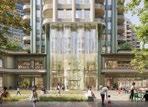
The arrival point at Warwick Square, creating a dramatic welcome from Earl's Court Station.
Gross External Area GEA
Gross Internal Area GIA
The Greater London Authority (GLA) is London's regional planning body. The Mayor of London leads the GLA. Together they produce the London Plan, a strategic planning document for London as a whole. Major planning applications, such as the Proposed Development are also referred to the Mayor of London who will decide these applications.
Broadly this is the area of the entire footprint of the building including the eternal envelope.
Broadly speaking the whole enclosed area of a building within the external walls taking each floor into account and excluding the thickness of the external walls. GIA will include: areas occupied by internal walls (whether structural or not) and partitions.
Habitable Room
Historic England
Hybrid Planning Application(s)
For planning purposes, a habitable room is usually defined as any room used or intended to be used for sleeping, cooking, living or eating purposes. Enclosed spaces such as bath or toilet facilities, service rooms, corridors, laundries, hallways, utility rooms or similar spaces are excluded from this definition. In some circumstances, a large kitchen or kitchen dining room may be counted as a habitable room (paragraph 1.3.19 Mayor's Housing SPG, 2016). For the purposes of density calculations, only kitchens of above 13sqm count as habitable rooms.
Historic England is a non-departmental public body. It is tasked with protecting the historic environment of England but preserving and listing historic buildings, scheduling ancient monuments, registering historic parks and gardens and by advising central and local government.
Historic England are a statutory consultee and will advise the local authorities in relation to the Proposed Development's potential to affect the setting of statutorily designated heritage assets in the surrounding area as a result of the change to their setting.
Two Hybrid Planning Applications with a red line drawn down the borough boundary and with duplicate Hybrid Planning Applications will be submitted to each borough.
The RBKC Hybrid Planning Application, will have plots submitted in detail referred to as the RBKC Detailed Component and the remainder of the Site to be submitted in outline and referred to as the RBKC Outline Component.
The LBHF Hybrid Planning Application, will have plots submitted in detail referred to as the LBHF Detailed Component and the remainder of the Site to be submitted in outline and referred to as the LBHF Outline Component.
IIllustrative Design Response
Illustrative Masterplan
Inclusive Design Review Panel IDRP
Indicative Development Programme
Demonstrates how architectural quality, character, articulation and appearance could come forward corresponding to the Design Code and other Control Documents.
Each Character Area, space and Plot is distilled into a series of key principles that build from the Strategic Framework to elaborate on the component's role within the proposals.
The Illustrative Masterplan has helped to inform the strategic framework development and pre-application design evolution/consultation that has established a clear vision and place-making ambition. It represents an informed interpretation of how the Control Documents and site-wide strategies could work together and what the Proposed Development could look like. It also forms the basis for some contextual assessments that are submitted with the Hybrid Planning Application to assess one way in which the Proposed Development could come forward within defined land use caps and scale parameters.
The LBHF contain an IDRP, who are a group of disables residents who look at planning applications within LBHF and provide advice to the Council to make schemes more accessible.
The Proposed Development works are anticipated to be undertaken over 13 years for the Early Phases (completion targeted for Q2 2037) and 19 years for the All Phases (completion Q2 2043). First residential occupation is likely to be in Q1, 2031.
LBHF Detailed Component
LBHF Hybrid Planning Application
LBHF Site
Lillie Bridge Depot
Lillie Sidings
Lillie Sidings Square
Local Plan
The LBHF Hybrid Planning Application is formed of detailed development proposals in respect of plots WB03, WB04 and WB05 for which no matters are reserved (LBHF Detailed Component).
The LBHF Hybrid Planning Application is formed of the LBHF Detailed Component and the remaining aspects of the Proposed Development within LBHF for which all matters are reserved.
LBHF Hybrid Planning Application Site address: Land bounded by North End Road, Beaumont Avenue, West Cromwell Road, West London Railway Line, Lillie Road, land comprising the Empress State Building, Aisgill Avenue, The Former Gibbs Green School and Properties Fronting Dieppe Close.
LBD The Lillie Bridge Depot comprises the Lillie Bridge Depot maintenance/marshalling yard and rail tracks which are located in the central and northern portion of the Site. Also referred to as the Depot.
The Depot is currently used as a maintenance facility by London Underground Ltd (LUL) and comprises a series of sheds and industrial buildings. Ashfield House, an office building of 9 storeys, can be found on the northern edge of the Site and is used as a Transport for London training facility.
Character Area within the Earls Court Proposed Development characterised by culture and heritage.
A destination square, celebrating industrial heritage and embedding flexibility for events.
The local planning authorities LBHF/RBKC) will have a set of policies and guidance that they have developed called their Local Plan, which form part of each of the Council's Development Plan. Planning applications are assessed against their compliance to Local Plan policies.
London Advisory Committee
LAC
Local Authority
London Borough
London Borough of Hammersmith and Fulham
London Plan
This is Historic England's panel which offers expert advice to staff on Historic England's functions under the National Heritage Act 1983, and other relevant legislation, relating to individual buildings, monuments, conservation areas, parks and gardens in London and in particular policy matters and casework where it is novel, contentious or sets a precedent. It acts in a similar function to a Design Review Panel.
The local government body that is empowered by law to exercise urban planning functions for a particular area.
The London boroughs are the 32 local authority districts that together with the City of London make up the administrative area of Greater London. Both the RBKC and the LBHF form part of the 32 London Boroughs.
LBHF The Local Planning Authority for the western part of the Site. Please refer to the red line boundary plan.
The London Plan is produced by the Greater London Authority (GLA) it covers all of London and local authorities need to develop their local plans so that they are in line with the GLA policies. This document forms part of the Development Plan.
London Underground Ltd LUL
London Review Panel
London Underground Limited (LUL), is a wholly owned subsidiary of Transport for London (TfL), the statutory corporation responsible for the transport network in London. Undertakes maintenance and renewal of the infrastructure and rolling stock for the London Underground.
The GLA's panel is made up of independent professionals with architectural and design expertise who provides independent expert advice on the design quality of Mayor funded projects or projects with particular significance for Londoners.
Masterplan
Material Considerations
Meanwhile Use(s)
Metropolitan Police Heritage Centre
Mayor's Office for Policing and Crime
See Illustrative Masterplan.
A material consideration is a matter that should be taken into account in deciding a planning application or an appeal against a planning decision. These matters can include previous planning decisions, proposals in the development plan, alongside many additional considerations.
Temporary uses to activate vacant parts of the Site.
A repository containing a wealth of historical documents as well as hosting a large database containing records of over 60,000 police officers dating back to 1829.
MOPAC sets the direction and budget for the Metropolitan Police Service on behalf of the Mayor. It is based next to the Earl's Court Site in the Empress State Building.
Maximum Envelope Reference to Maximum Parameters.
Neighbourhood Community Infrastructure Levy
Non Material Amendment
Net Internal Area
Neighbourhood plans are developed by local communities and are also part of the local planning policy and fall under the Development Plan documents. On 21 June 2021, the West Kensington and Gibbs Green Community Homes Forum published their Regulation 14, first draft version of their Neighbourhood Plan. This relates to land to the west of the Site.
NCIL money is given by the applicant to the local authority for community use or building work in the local area.
An application under S96A of the Town & Country Planning Act 1990 (as amended) to facilitate not material amendments to a planning permission.
Net usable area within a building measured to the internal face of the perimeter walls at each floor level. Broadly speaking, this measurement includes the GIA figures, removing the areas of the building that are not lettable/saleable e.g. corridors, columns, servicing areas, bin stores.
Neighbourhood Plans
Net Zero
National Planning Policy Framework
O
Opportunity Area(s)
Outline Component
NPPF
A target to completely negate the amount of greenhouse gasses produced by human activity, to be achieved by reducing emissions and implementing methods of absorbing carbon dioxide from the atmosphere.
This is produced by the government in the Department for Levelling Up, Housing and Communities (DLUHC). This level of policy is very high level, it requires local authorities to develop their own plans and also to engage local people when doing that.
London's key locations that have potential for large scale development, providing substantial new jobs and homes. Earls Court is an Opportunity Area.
The part of the Hybrid Planning Applications where full details have not been provided and matters are reserved for later determination (through future Reserved Matters Planning Applications).
The RBKC Outline Component comprises the identified Development Zones, plots and landscaping to be submitted in outline with matters reserved for future determination at a later date.
The LBHF Outline Component comprises the identified Development Zones, plots and landscaping to be submitted in outline with matters reserved for future determination at a later date.
Parameter Plans
Permitted Development Rights
Phase 1
Phasing
Place Pillar(s)
One of the development Control Documents. A series of plans defining the physical framework for the development, setting the principal spatial layout and arrangement for the Outline Component of the Proposed Development.
Rights granted by way of a statutory instrument, such as the Town & Country Planning (General Permitted Development) Order 2015, which allow certain forms of development to be carried out without the requirement of a separate planning permission as rights are granted under the legislation.
Refers to a defined area within the Earls Court Development to be delivered first (Phase 1). This area includes open space, public realm and additional plots to those submitted as part of the detailed components.
Phase 1 does not refer to the detailed components of the Hybrid Planning Application.
Refers to the planned delivery of the Proposed Development.
Four key pillar(s) which underpin ECDC's vision and create the identity of Earls Court:
Earls Court will be a celebration of nature and its ability to connect and revive
Earls Court will be a showcase for climate and clean innovation and skills
Earls Court will be a cultural ecosystem for the future of talent
Earls Court will be an inspiring neighbourhood designed for all stages of life
Planning Application
Planning Application Boundary
Planning Approval
Planning Committee
Planning Condition
Planning Obligations/Section 106 S106
A document or set of documents asking a local planning authority for official permission to build something new, or to make changes to an existing building.
Please refer to the red line boundary plan. The two Hybrid Planning Applications each have their own separate red line boundaries.
Refers to the approval needed for construction or expansion, and sometimes for demolition from a local planning authority to allow works to lawfully commence.
The planning committee is made up of local elected councillors. They are presented with a report from the planning officers which will recommend the planning application for approval or for rejection. Based on this report the planning committee will make their decision.
Planning conditions are additional measures attached to the granting of planning permission which must be satisfied for development to proceed lawfully.
These conditions might require additional approvals for specific aspects of the development (such as the colour of materials) or might restrict the use of the site (for example limiting operating hours).
Planning obligations (otherwise known as Section 106 Agreements) are an agreement between an application/owner and a local planning authority about measures that the developer must take to reduce their impact on the community. A Section 106 agreement is designed to make a development possible that would otherwise not be possible, by obtaining concessions and contributions from the developer. private agreements made between local authorities and developers and can be attached to a planning permission to make a development acceptable. These agreements are finalised during the determination period.
Planning Officer(s)
Planning Statement
Form part of a Local Authority's Development Management department. planning officers consider all aspects of a planning application and determine whether it meets their policies within the Local Plan.
A supporting document submitted with a planning application to identify the context and need for a proposed development and assess how a proposed development accords with relevant national, regional and local planning policies.
Plot See Development Plot.
Predominant use
Private Rented Sector
The land use that dominates a Development Zone, Development Plot or building by occupying the largest amount of floor area
The Private Rented Sector is a classification of housing in the UK owned by a landlord and leased to a tenant. The landlord could be an individual, a property company or an institutional investor.
Project Name Earls Court Development
Project Team
Proposed Development
PTAL rating (Public Transport Accessibility Levels)
The team working on the Earls Court Development.
The Outline and Detailed components within each borough.
A way of measuring the overall level of public transport access which places have, on a scale where 0 is worst and 6b is best.
Public Realm Inclusivity Panel
Purpose Built Student Accommodation
A group of local residents from RBKC and LBHF that meets regularly with ECDC's design and development team. They are a range of different ages, including teenagers and the panel members have a range of abilities and access needs. The group was set up by ECDC to allow people whose voice is not often heard in the planning and design process to input into and shape the spaces, public realm and Ground Floor spaces that will be within the future development.
Accommodation built with the specific intention of being occupied by students.
Detailed Component
RBKC Hybrid Planning Application
Reconciliation Statement
Reserved Matters
An independent and impartial panel of built environment experts who assess pre-application schemes with the aim of improving the quality of buildings and places for the benefit of the public. Panels are generally made up of professionals in the fields of architecture, urban design, landscape architecture, heritage, industrial development, sustainability and engineering.
(Application(s) for) Reserved Matters Approval
The RBKC Hybrid Planning Application is formed of a Detailed Component in respect of plots EC05 and EC06 for which no matters are reserved (RBKC Detailed Component).
The RBKC Hybrid Planning Application is formed of the RBKC Detailed Component and the remaining aspects of the Proposed Development within the RBKC for which all matters are reserved.
The purpose of this document is to assess Applications for Reserved Matters Approval (RMA) against the Control Documents to demonstrate compliance both as a stand-alone RMA and cumulatively with all other submitted and approved RMAs.
The Outline Component of the Hybrid Planning Application will reserve the following matters for future approval, but will include a minimum level of detail to be provided in accordance with the Town and Country Planning (Development Management Procedure) Order 2010:
Access where access is a reserved matter, the application for outline planning permission shall state the area or areas where access points to the development site proposed will be situated.
Appearance the Design Code and Illustrative Masterplan.
Landscaping the Design Code and illustrative landscaping strategy.
Layout where layout is a reserved matter, the application for outline planning permission shall state the approximate location of buildings, routes and open spaces included in the development proposed.
Scale where scale is a reserved matter, the application for outline planning permission shall state the upper and lower limit for height, width and length of each building included in the proposed development.
The Proposed Development comprised within the Outline Component will be subject to the submission of applications for RMA to either borough for approval of reserved matters which will be required to be in accordance with the Control Documents.
Quality Review Panel QRP
RBKC
Royal Borough of Kensington and Chelsea
Royal Institute of British Architects
Royal Institute of Chartered Surveyors
RBKC Site
RIBA Stages 1-7
Rights of Light
RBKC
RIBA
RICS
The Local Planning Authority for the eastern part of the Site. Please refer to the red line boundary plan.
The UK's national association for chartered architects. Also used to describe different stages of the architectural design process, e.g. RIBA Stage 1, in reference to the RIBA Plan of Works.
The UK's national association for Chartered Surveyors.
RBKC Hybrid Planning Application Site address: Land bounded by West Cromwell Road, Warwick Road, Philbeach Gardens, Eardley Crescent, Lillie Road, Old Brompton Road and the West London Railway Line; and 1 Cluny Mews.
The RIBA Stages 1 7 relates to a plan for how the architects approach the different stages of designing a building or space. This framework consists of several stages, each representing a specific phase in the design and construction process.
Stage 0 Strategic Definition;
Stage 1 Preparation and Briefing;
Stage 2 Concept Design;
Stage 3 Spatial Coordination;
Stage 4 Technical Design;
Stage 5 Manufacturing and Construction;
Stage 6 Handover;
Stage 7 Use.
A right to light is an easement that gives a landowner or resident the right to receive light through defined apertures/ windows in buildings on his or her land.
Site
Statement of Community Involvement
Statutory Bodies
SCI
The entirety of the Site within the two Hybrid Planning Application red line boundaries.
When not capitalised site refers to other aspects such as site edges, site allocation, site visit and site entrances.
Note Development Plot boundary to be uses instead of Site for Detailed Components.
A supporting planning document that details all consultation undertaken on the project during the application process.
All the work of ECDC's Public Realm Inclusivity Panel, work and engagement with other community groups and feedback from public exhibitions will be included in the SCI.
Organisations and bodies, defined by statute, who must be consulted on relevant planning applications.
S
Site of Importance for Nature Conservation
SINC
Designations used by Local Authorities for sites of importance for nature conservation.
Statutory Consultation Period
Statutory Consultees
Straddling Plots
Strategic Framework
Sustainable Development Charter SDC
This is the period of time in which Planning Authorities must consult the relevant statutory bodies for their opinions prior to making decisions on planning applications.
LBHF and RBKC will publicise the application on the councils website, display notices near the Site, and send letters to nearby residents.
A minimum period of 30 days is allowed for comments from residents, local groups and statutory consultees.
The planning officers report will draw on the comments made within the statutory consultation period and will review the application based on the local policies (and the London Plan), which will be submitted to Planning Committee for the final planning decision.
Organisations and bodies, defined by statute, which local planning authorities are legally required to consult before reaching a decision on relevant planning applications.
Refers to the three plots that straddle RBKC's and LBHF's borough boundary.
The basis of the Illustrative Masterplan and how future Development Plots and public realm will be delivered.
ECDC has developed the SDC which sets out its sustainability vision and framework for Earls Court and includes goals and objectives for social value, economic inclusion, and environmental wellbeing. The goals underpin the vision and key priorities for the Earls Court Development, but does not form part of the Hybrid Planning Application proposals.
Supplementary Planning Document(s)
Sustainable Drainage Systems SuDS
Document(s) that build upon and provide more detailed guidance about policies in the Local Plan. Legally, they do not form part of the Local Plan itself and they are not subject to independent examination, but they are material considerations in determining planning applications.
Drainage systems that are considered to be environmentally beneficial, causing minimal or no long-term detrimental damage. Sustainable drainage systems may consist of natural measures, such as green roofs, planters or green belts combined with artificial measures, such as underground infiltration, retention tanks and many other solutions.
Tall Building(s)
The Cascades
Table Park
The Table
(the) Table Structure
The LBHF and draft RBKC Local Plan specifically identify the Earls Court Site as a suitable location for tall buildings.
Building heights in the outline component are identified on the maximum building height parameter plan and for the detailed components are shown on the detailed elevation plans for the proposals.
Tall buildings are defined by the proposed maximum heights parameter plan.
A terraced landscape of cascading water, planting and play. The cascades celebrates a confluence of key routes (connecting the Table with Aisgill Gardens and Lillie Sidings), navigates a significant level change and creates space to pause and relax.
Table Park is an urban park within The Table Character Area.
A Character Area which is the heart of the Proposed Development.
A new public green space, larger than Trafalgar square, forms the centrepiece of the Earl's Court masterplan, from West Brompton station to Aisgill Gardens
In reference to the existing deck structure spanning the West London Railway Line, retained and incorporated into the new development
(the) Train Shed
Traffic Regulation Order TRO
Transport Assessment
Transport for London TfL
U
UK Power Networks
UKPN
Urban Greening Factor UGF
Urban Heat Island Effect
A retained building located next to Lillie Bridge Depot which will be repurposed as an immersive venue.
A legal document that helps manage traffic flow, speed limits and where you can park.
A document that considers the impacts of the Proposed Development on the transport network and to detail the process that has been undertaken to develop the proposals from a transport perspective.
The local government body responsible for the transport system in Greater London, owner of part of the LBHF side of the Site and part owner of ECPL.
Owns and maintains electricity cables and lines across London, the South East and East of England.
A measurement used to identify the appropriate amount of urban greening required in new developments.
The phenomenon of hard surfaces such as concrete warming up and slowly releasing heat during the night, keeping the temperature higher than in surrounding rural areas and restricting urban areas from cooling down at night.
V
Vehicle Sharing
W
West Brompton
West Kensington and Gibbs Green Estates
West London Railway Line WLL
Warwick Crescent
Warwick Road Apron
Car-sharing systems in which you don't own the vehicle and instead pay to use it.
A Character Area characterised by a lively West London crescent.
Connects Earl's Court station to West Brompton station via a tree lined street full of shops, cafés and restaurants.
The West Kensington and Gibbs Green Estates are housing Estates to the west of the Site.
This area formed part of the Site for the previous Extant Permissions. However, the Estates were handed back to Hammersmith and Fulham, by ECDC.
West Kensington forms a Character Area that is characterised by an innovation cluster.
The West London Railway Line (WLL) (part of the London Overground Network) runs through the Site, broadly on the alignment of the boundary between RBKC and LBHF.
A Character Area characterised as a quiet residential quarter centred around a landscaped crescent that draws on local character and prioritises pedestrians.
The area opposite Earl's Court Tube Station which has been used for art installations and meanwhile activities.
Warwick Square
West Brompton Crescent
West Brompton Square
West Kensington
West Kensington Boulevard
An inviting square opposite Earl's Court Station. Referencing the original Exhibition Centre and building into a sequence of open spaces that welcome people into the Site.
A recognisable West London street, lined with active frontage and a landscaped, pedestrian-first public realm framed by street trees
An inviting square opposite West Brompton Station. Leading to the vibrant landscaped Crescent and quieter lane. The square also provides a connection to the Bioline.
A Character Area characterised as a new innovation cluster. This gateway from West Kensington station will deliver a new business district providing space for climate and clean technologies and creative industries.
An extension of West Kensington Boulevard, connecting to Lillie Sidings Square.
Zero Carbon This means that no Carbon emissions are being produced from a product or service.