Urban Designer and Planner | Reg.Architect (COA, India)
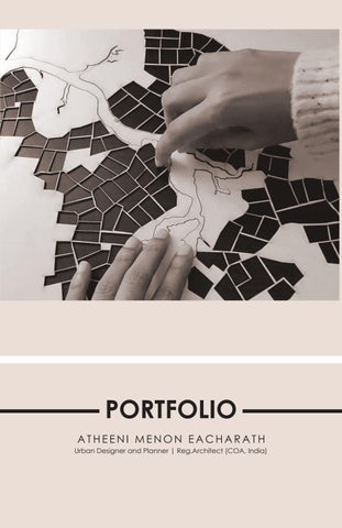
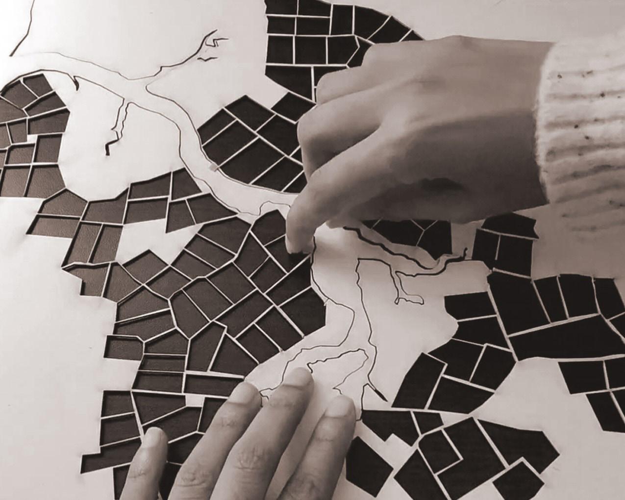
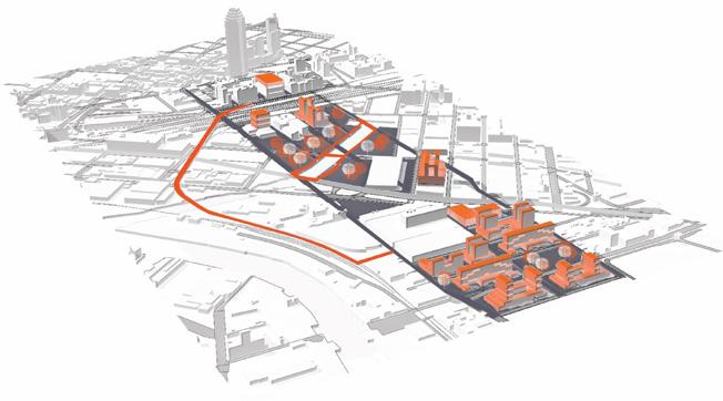
CIVIC POROSITY OF SPAIN
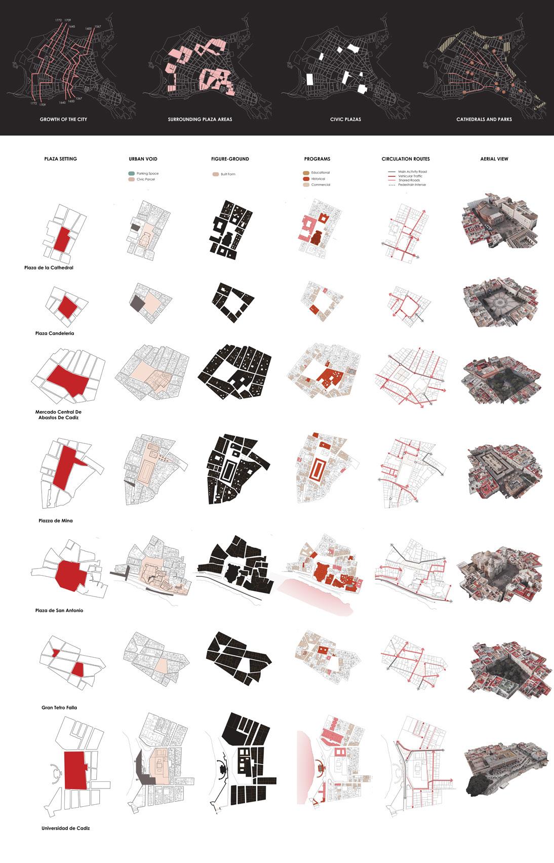
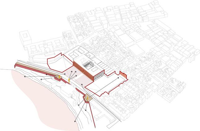
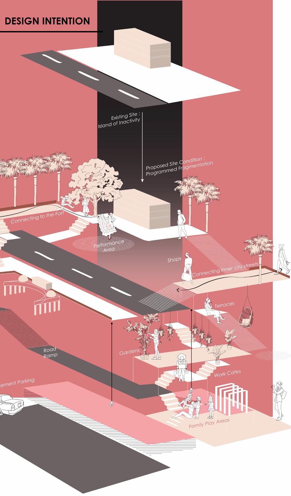
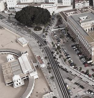
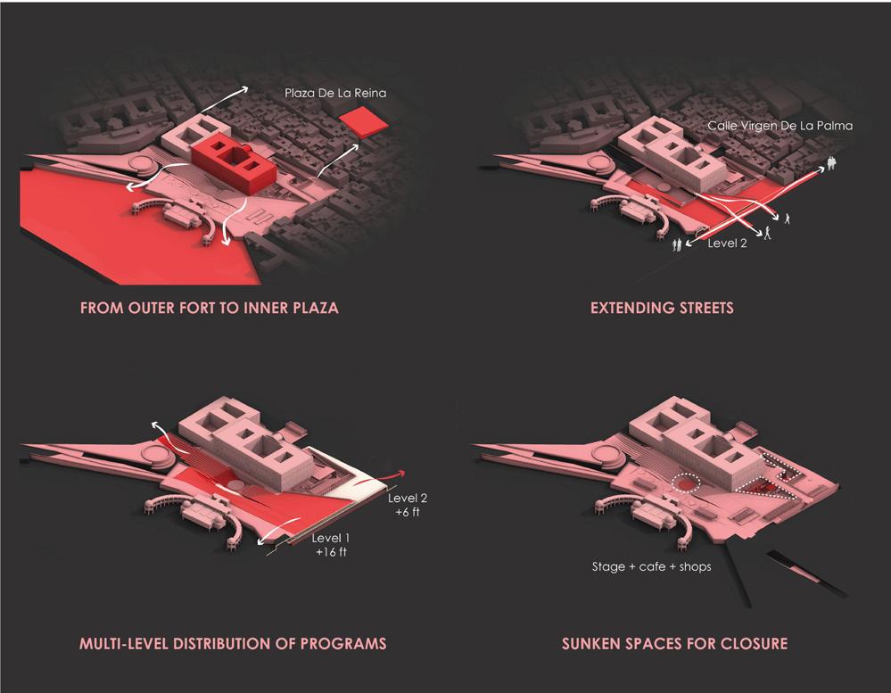
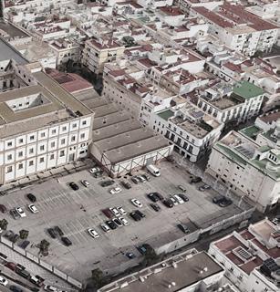
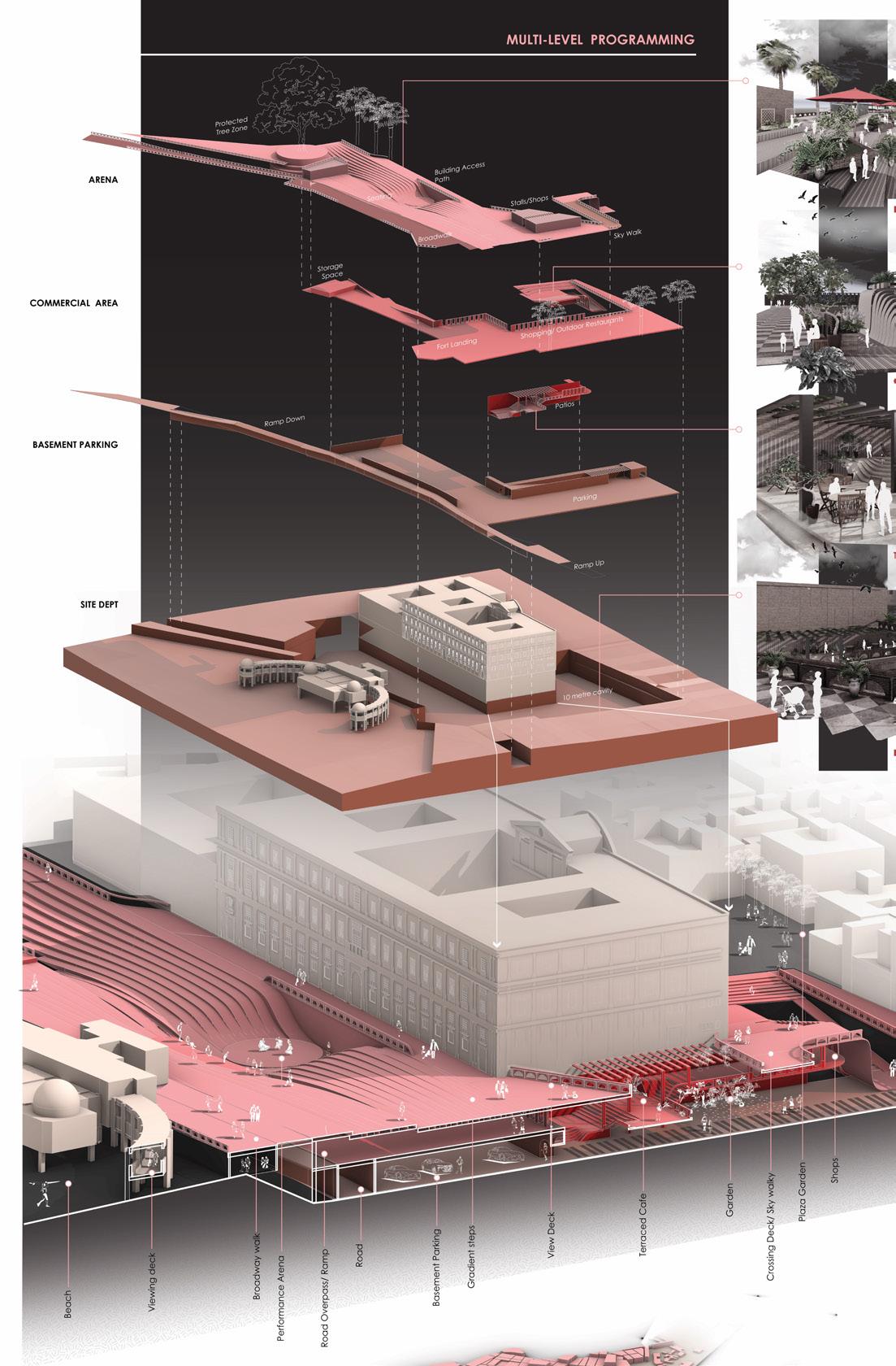
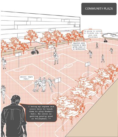
Civic Porosity aims to make spaces feel welcoming and integrated into the public realm, enhancing social connectivity and making public spaces truly part of community life. The figured voids of urban fabrics function as a public space . The site here is a part of the outer edge thats barren and inner edge thats dense. Thus ,the site parcel is fragmented into different program zones to create memorable nodes. Overlay and structuring of carefully calibrated planes as a viable alternative to the use of topo of existing fabrics, showing a rational relationship between building, parcel, street and grid.
Extending the site depth and surrounding frames
Connecting the inner core to outer edge
Rethinking the site parcels
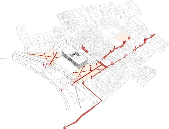
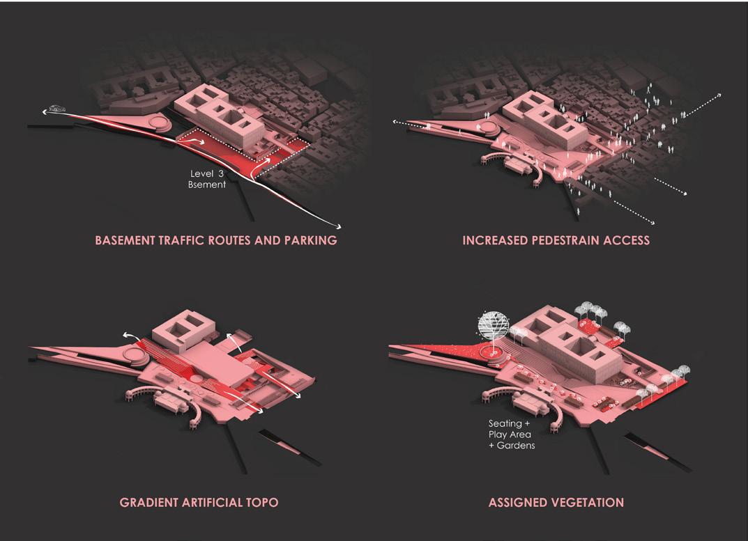
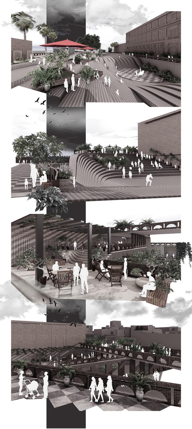
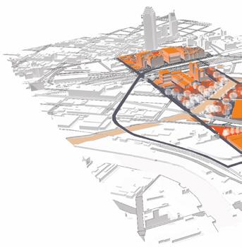
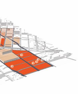
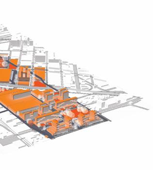
The plaza becomes the building in this design proposal. The floors dont inland city which lies 5 metres below in its natural terrain. The design proposal platforms which includes open stage, parking, shops, dining and work stations of the university building. An articial contour of plates is created that rise performance areas and extending to be a roof structure for shading.
dont rise up but go below the ground from the seafront area to connect with the proposal thus aims to link the two different heights with multiple smaller public stations - integrating with the existing functions around as well the programming rise up to form steps as well as falls down to form seating spaces while enclosing
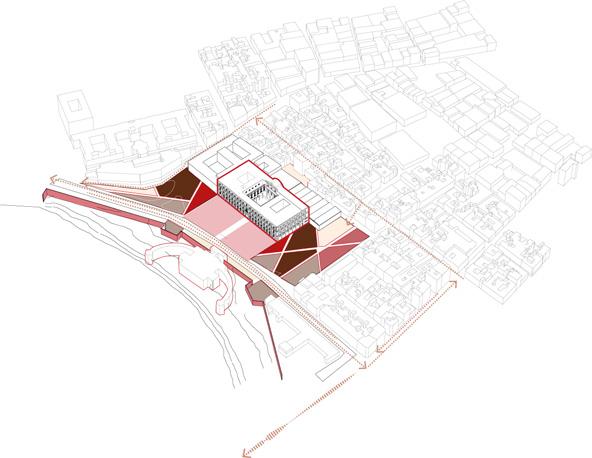
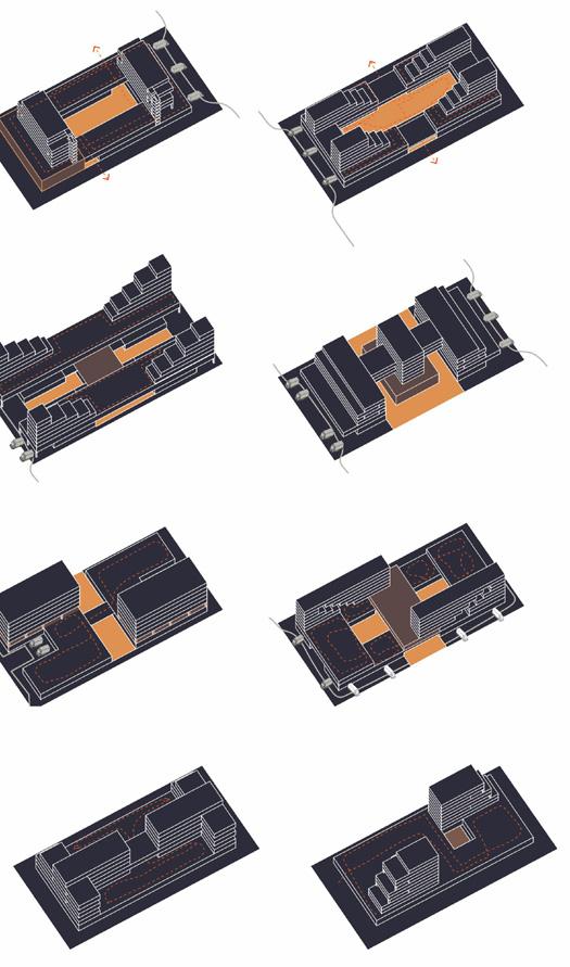
Design Intention Diagramming
Existing Site
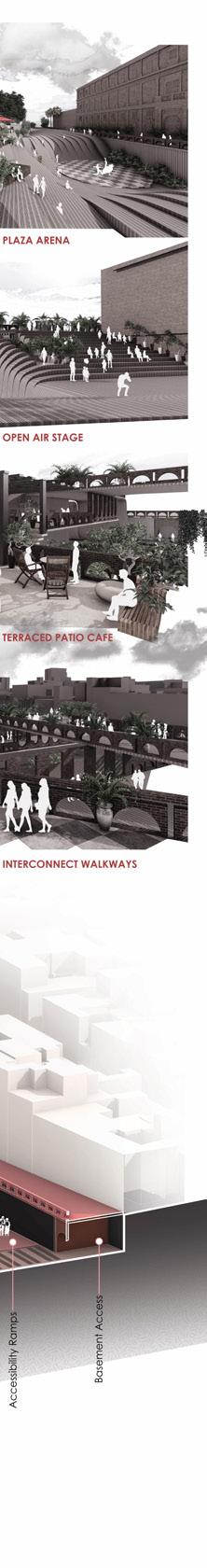
Artificially contoured plaza performance arena
Open amphitheatre with access to dining spaces
Multi-purpose intimate spaces
Sky walkways connecting various levels
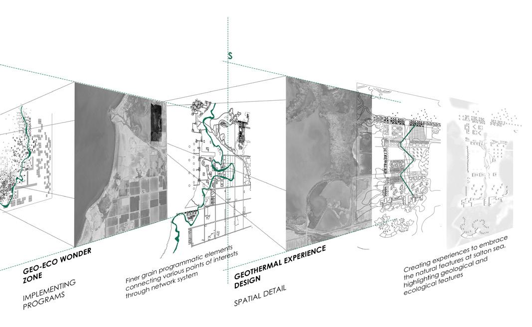
SALTON SEA NEXUS
Urban Design Studio|University of Virginia
Instructor : IProf. Ila Berman and Prof. Clayton Strange Group project with Xinyi Xao
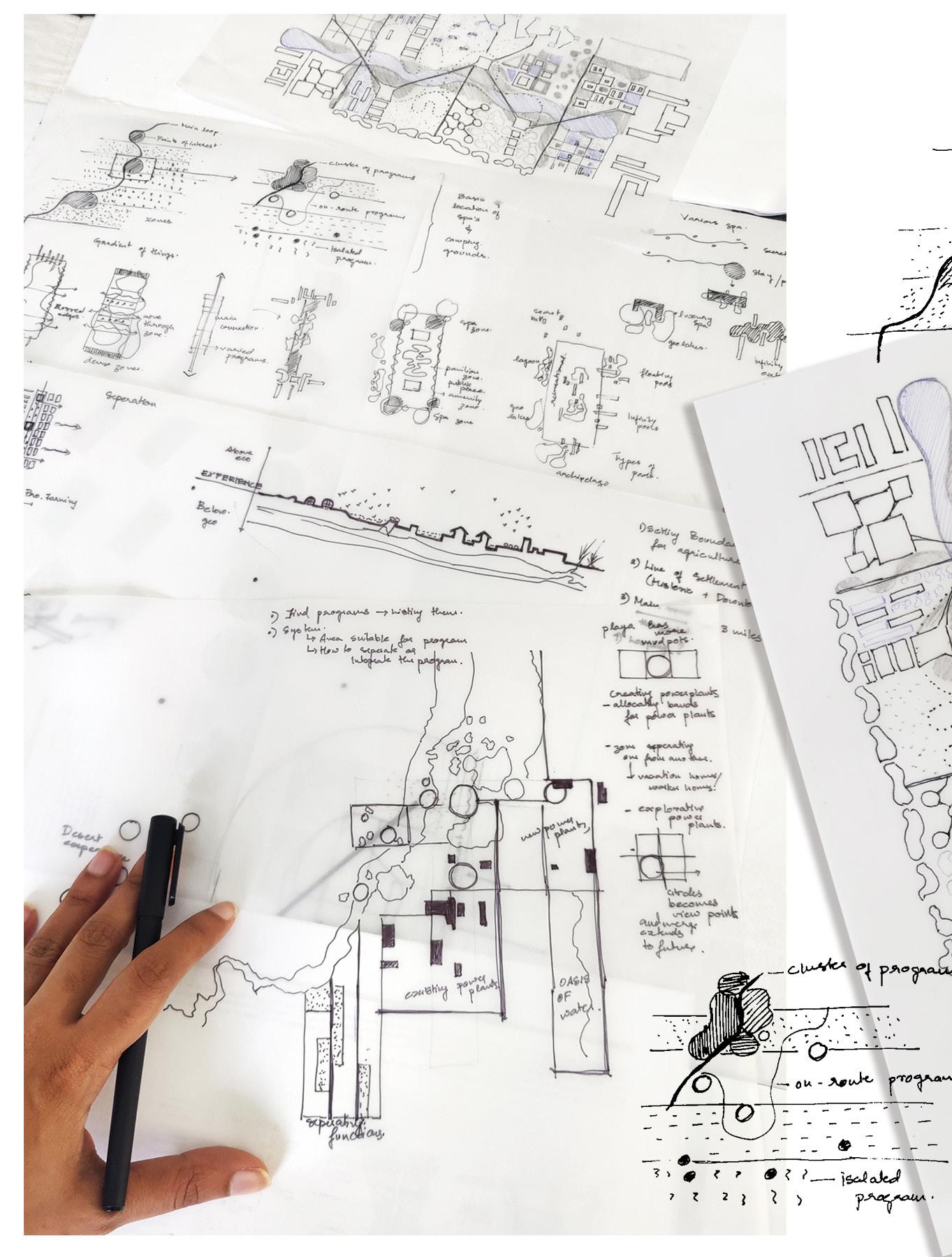
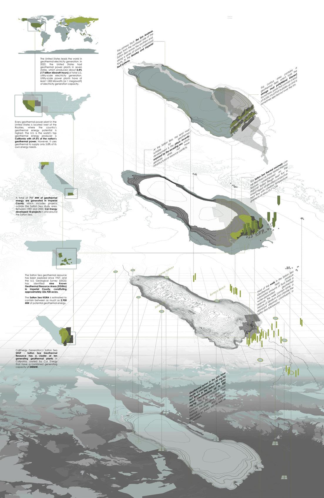
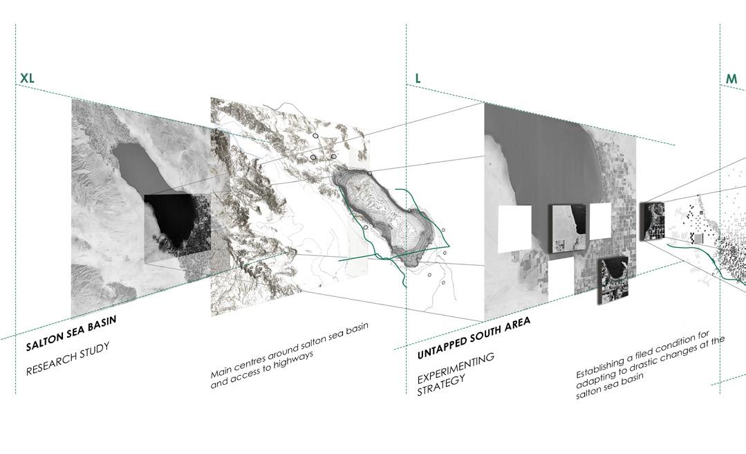
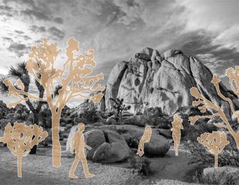
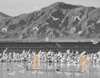
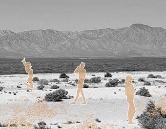
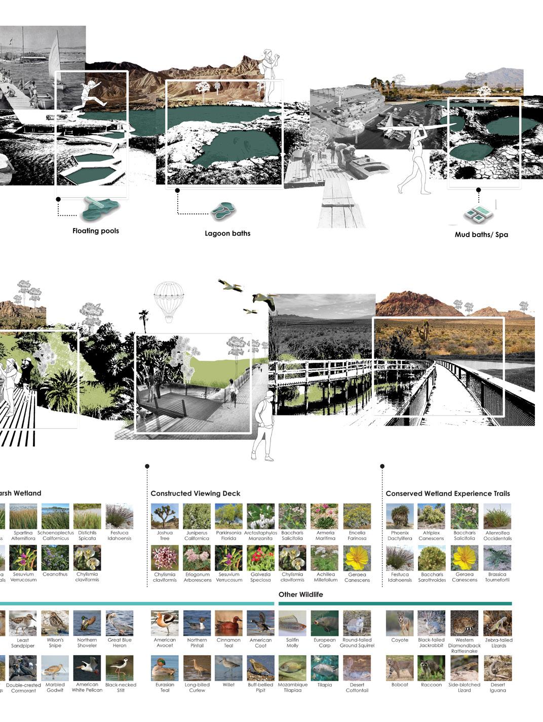
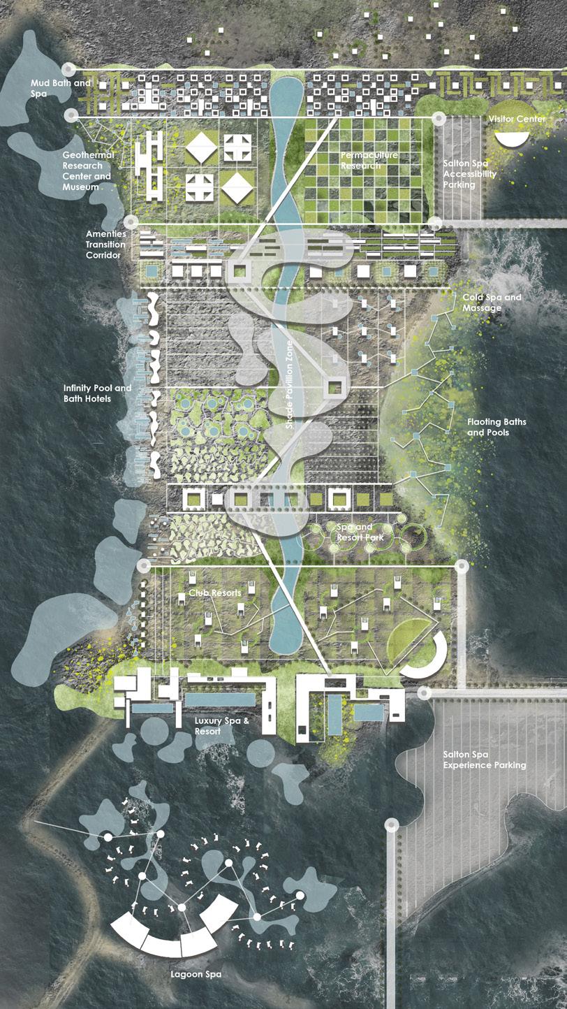
The site is Salton Sea Basin, currently one of the most controversial sites in California for its dessertification but also geothermal landscapes that contribute lithium. The aim of the studio was to rethink reviving Salton Sea in a ecological and economical perspective.
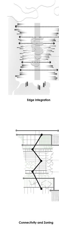
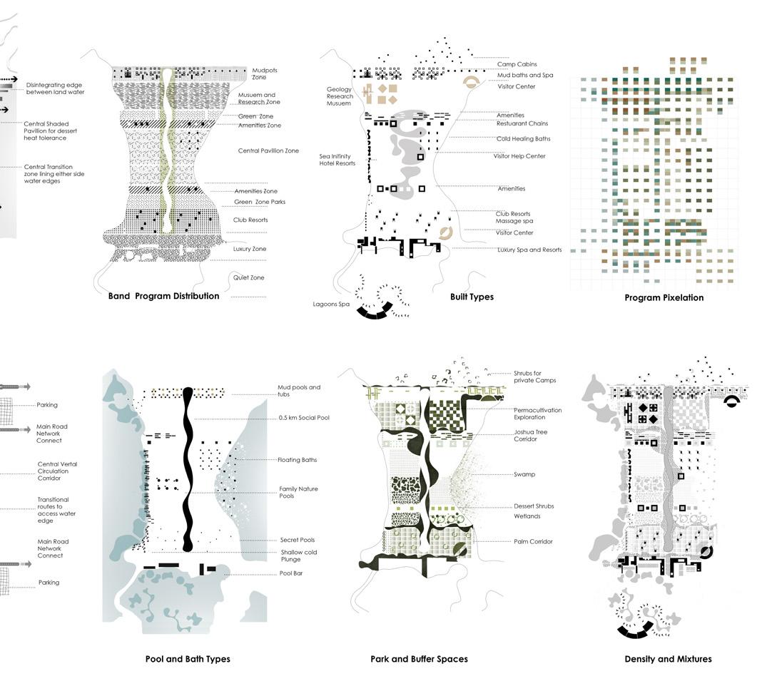
Though the plot division is strictly within the Jefferson Grid, the ecology has taken its dominance when the water started drying out exposing the playa of the Salton Sea Basin. Since the salton sea situation is unpredictable – the strategy is to employ ‘density and mixtures’ that allows for various conditions that respects the natural features but yet when a human intervention is possible.
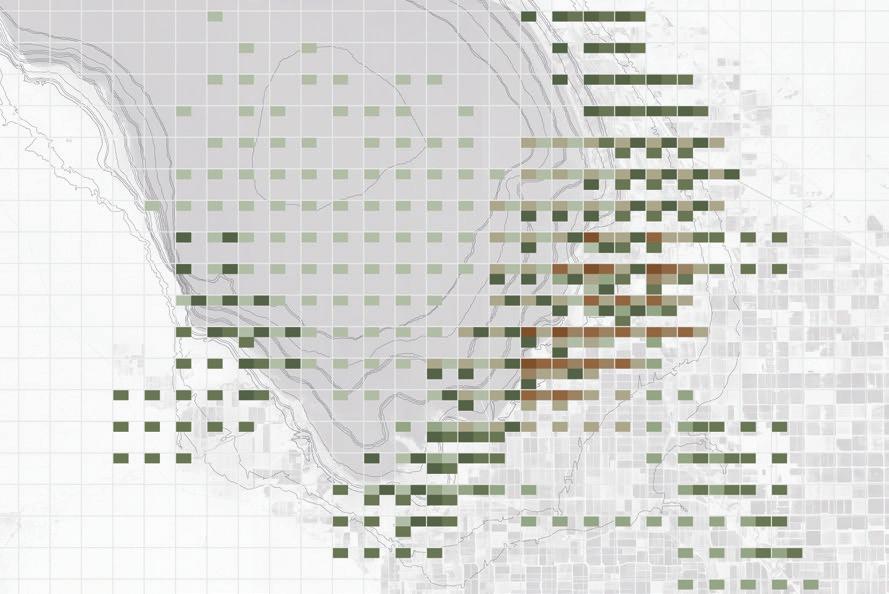
We pixelated the feature in the 1 mile grid to understand what is overlapping and what it the intensity of programs in the area.
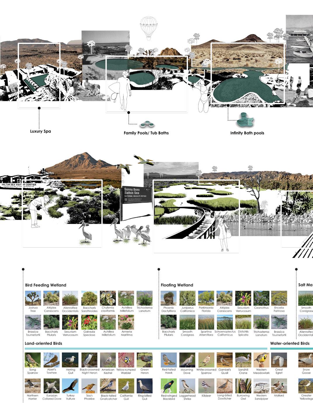
The geology has 4 layers as seen beside – mudpots, powerplants, geothermal wells, thermal anomaly.The ecology also has 4 layers namely wildlife habitat, shoreline birs, inflow rives and wetlands.The map is a overlap of all this and it clearly identifies the most intese as well as most dispersed zone. The final site is chosen on this intense zone.
THE SITE
Scaling the project with same complexity of elements
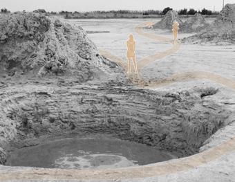
Design is developed based on the idea of field condition and complexity of elements while scaling through the project from the Salton Basin to a Mud volcano. The entire proposal revolves around creating experiences similar to Iceland Geothermal activities. Complexity of various natural features on a wide landscape created a challenge in this project.
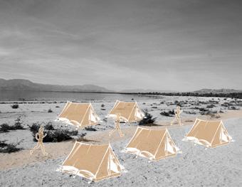
Mud baths & Spa
Glamping
Wetland zones
PROJECT SCALE
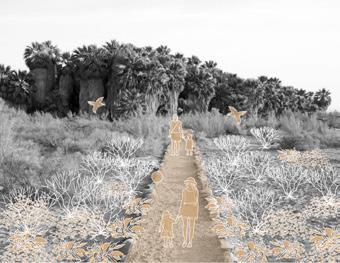
Dessert Tourism
Wildlife Preserves
Hiking & Trails
COLLAGE INTERPRETATION
GEOLOGY + SPA DESIGNED ZONES
ECOLOGY + WETLANDS PRIORITISED ZONES
PROPOSED
DENSITY AND MIXTURE
The design strategy denser zone. The pixelated follows these simple different types of bath and ultimately connectivity So far a program was
INTERVENTION PLAN
MIXTURE COMPONENTS FOR THE SITE THAT DEVELOPS THE EXPERIENCE
strategy – density and mixtures as well the program matrix is developed further as we zoom to one of those pixelated diagram shows the intensity and density of zones with various programs. The strategy simple techniques of weaving of multiple layers - various programs like Spa, built types to support them, bath and edge conditions that favour them, green spaces tht address birds, marshes and wetlands connectivity of these elements creating density and mixtures. was in a field, now the program itself begins with the field.
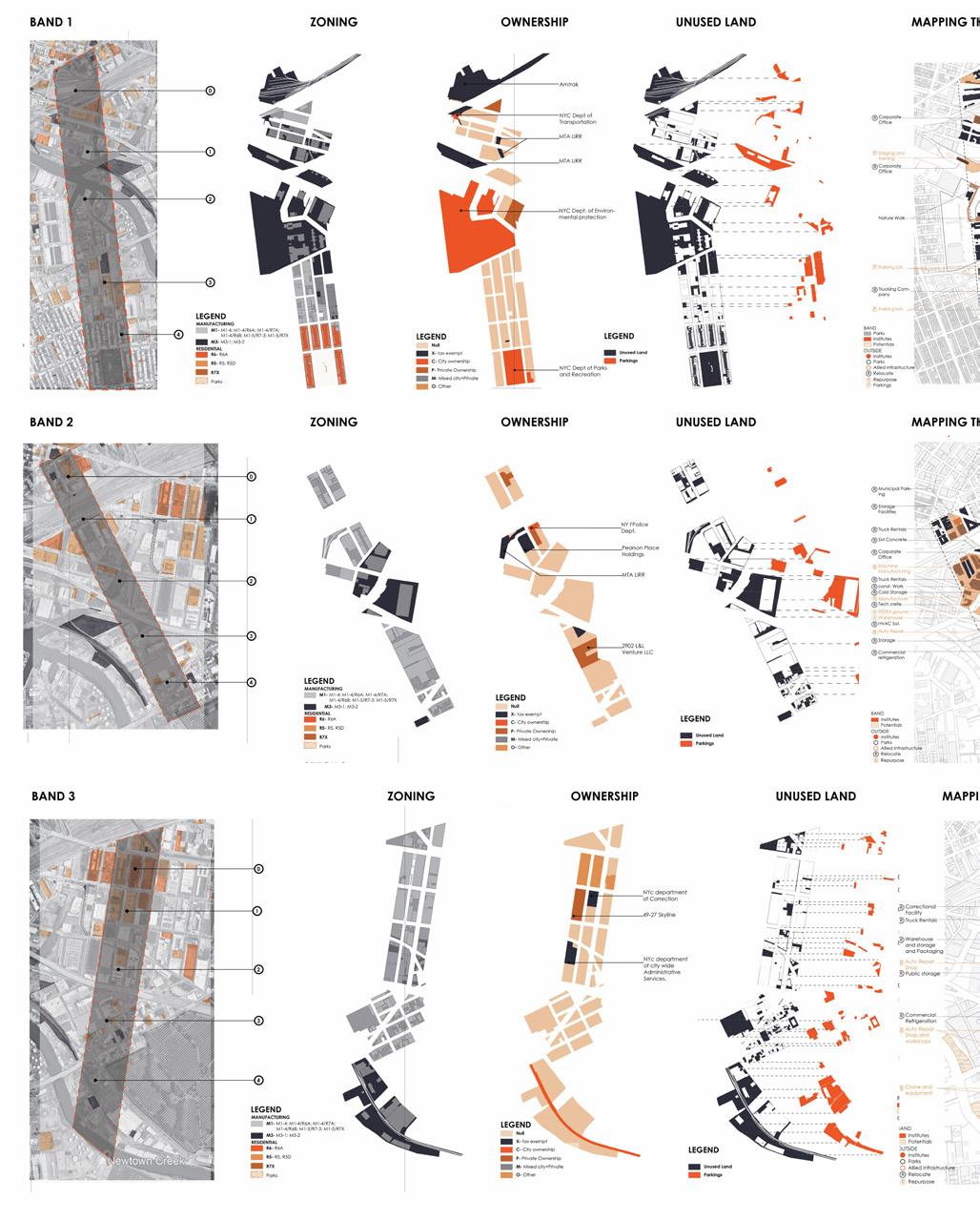
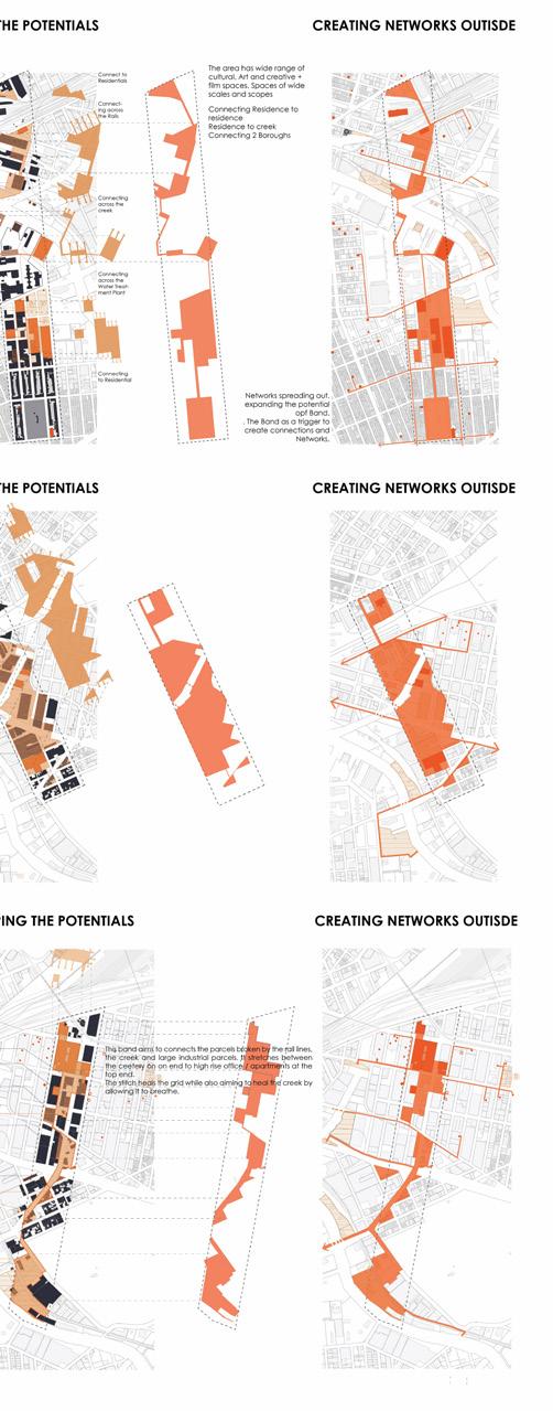
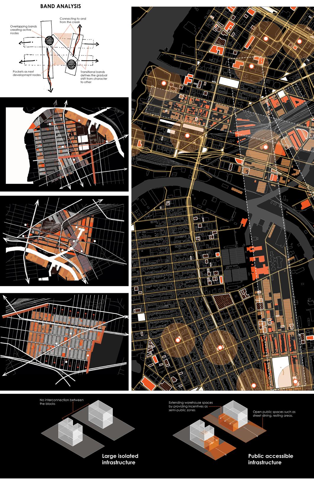
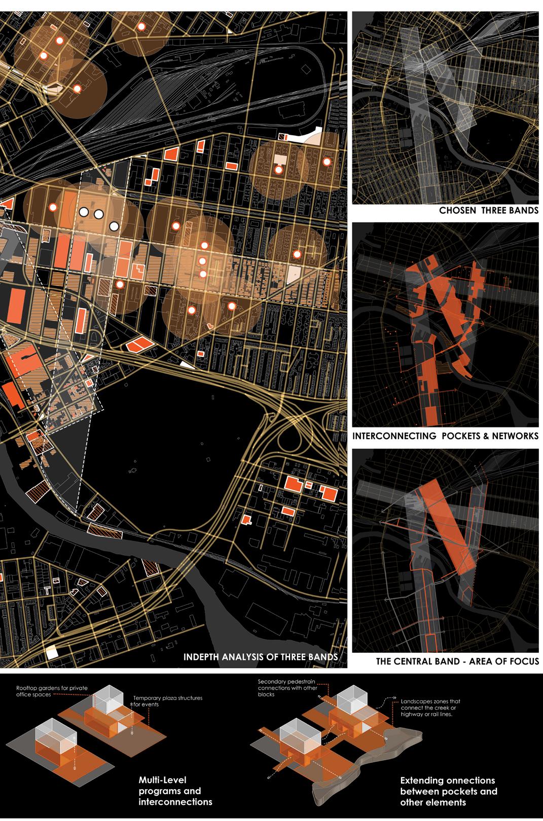
ANALYSIS OF THE IDENTIFIED THREE BANDS
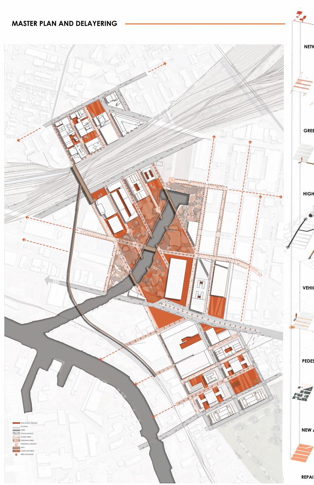
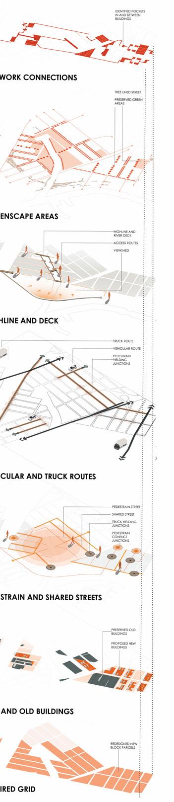
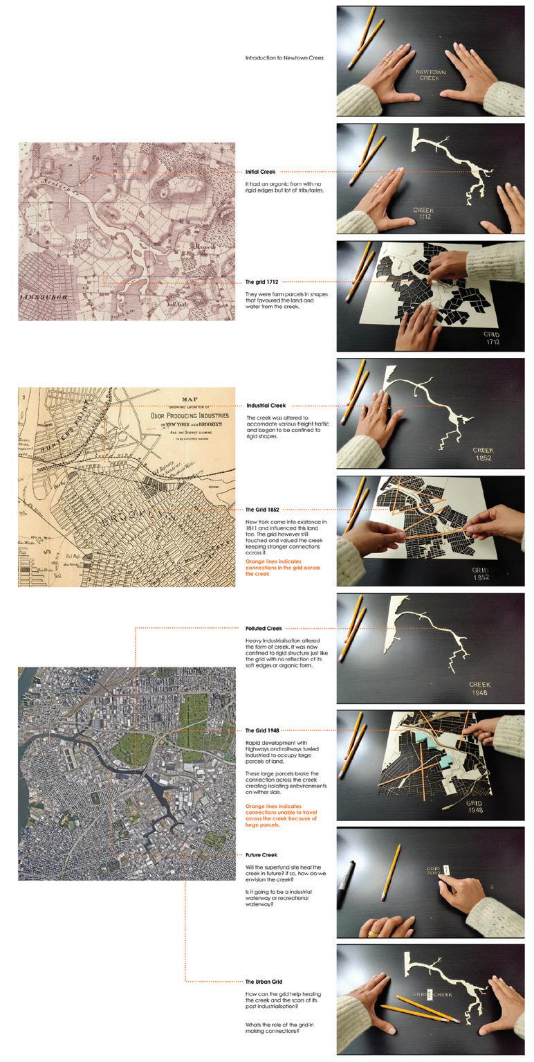
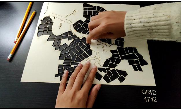
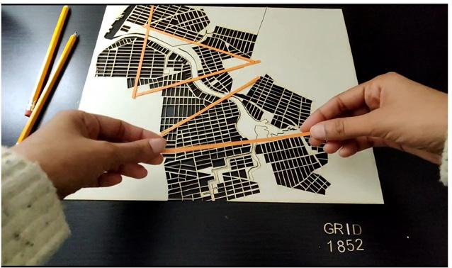
THE GRIDS OF NEW YORK
Urban Design Studio University of Virginia Instructor : Prof. Mona El Khafif & Clayton Strange Group project with Sanika Mate
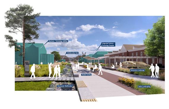
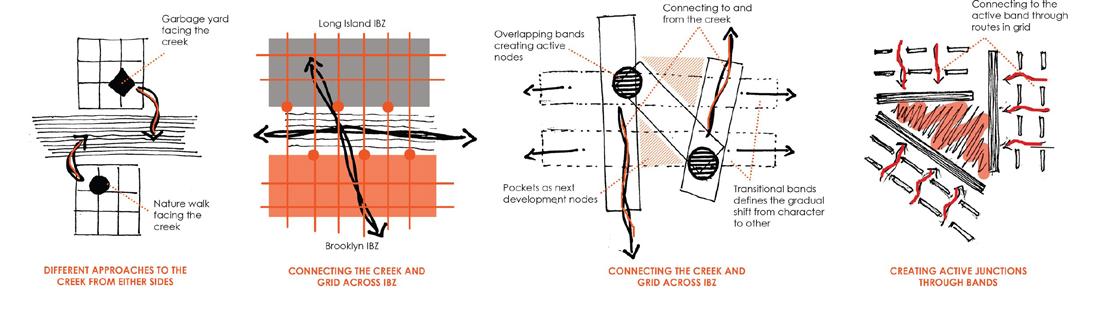
The Infra-Bio-Urban is a project focusing on Newtown Creek , a superfund site and heavily polluted industrial site in New York. This project takes the historical complexities of the New York grid and the aftermath of theindustrial revolution in a contadicting scenario.
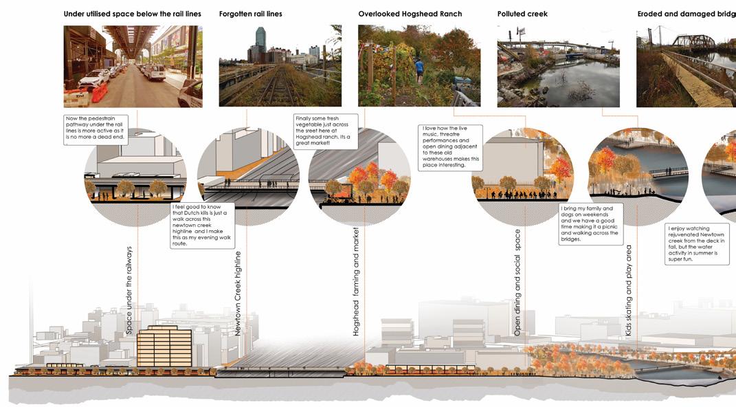
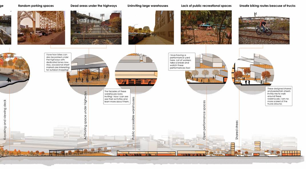
The central band shows all the character of Newtown Creek in its all essence. It has the railway at the top, the creek flowing in the middle and the highway cutting across it. Large parcel of Fedx and huge warehouse that pollute the creek
There is also, this friction where the residential from the Long Island in the northern end and graveyard at the southern end trying to connect and find a balance. Healing this band and proposing strategies is hoped to act as a trigger for other bands.
After indepth analysis of the band, historic buildings are preserved and buildings that no longer serve are reused or relocated.
Detailed traffic pattern with designated truck routes, keeping heavy vehicular traffic beyond the band. The band primarily encourages shared or pedestrian streets that serve the creek as a public place through bridges, decks and cycle paths.
Rejuvenation of creek is an important factor and thus landscape design becomes a crucial part where the polluted water is treated and ecological balance is restored.
Finally, the repaired grid extends to the creek and connects to the creek, for the creek and across the creek triggering development in the surrounding areas.
SECTION ACROSS THE BAND HIGHLIGHTING PROGRAMS
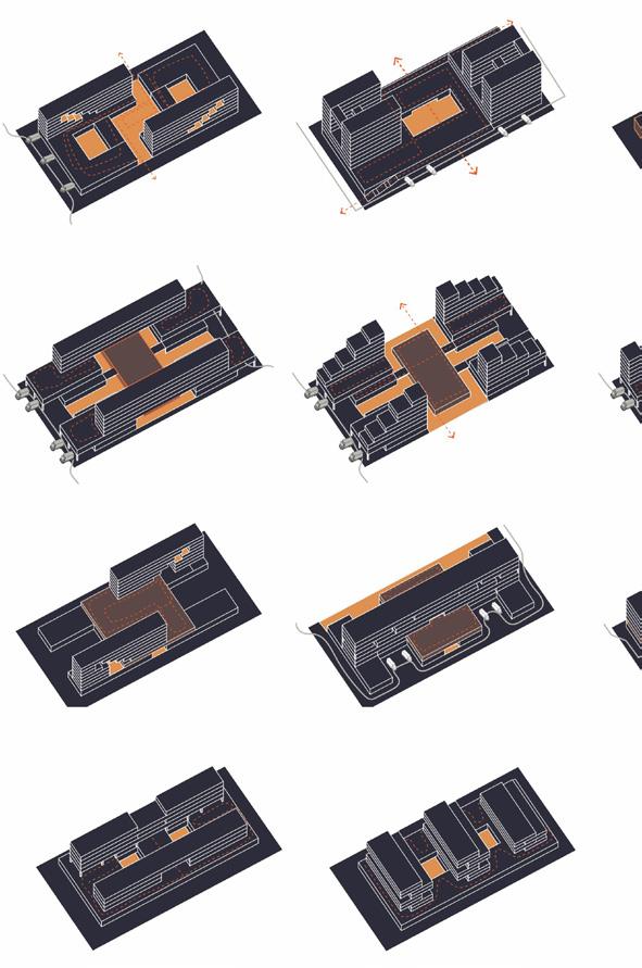
BUILT TYPOLOGY
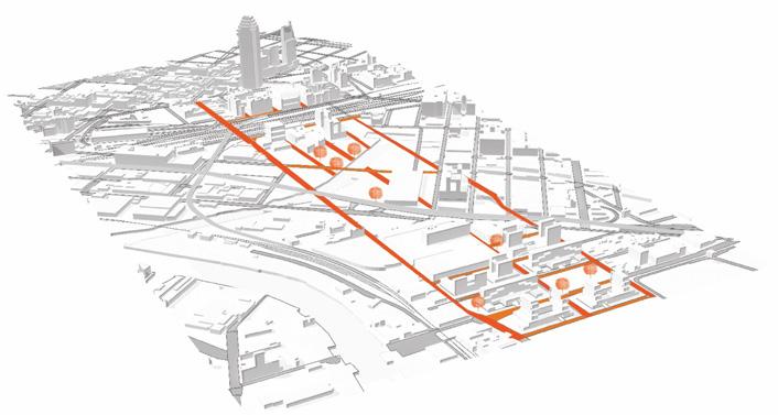
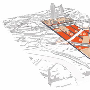
The new proposed built typologies are a hybrid combination of manufacturing, residential and commercial with a strong component of public access. The idea is to bring into reality the idea that manufacturing can co exist in the urban fabric i.e a place for live and work. The new blocks are designed with the aim to create secondary network of public spaces that integrate with the larger public infrastructure.
Establishing new network patterns as pedestraun, shared , vehicular and truck routes. Strategies to rejuvenate the creek slowly begin.
Repairing the grid by changing parcels to uniform parcels that the buildings that not longer serve
Construction of new buildings that serve the public, creek and the industried. Developing the Newtown Creek Highline and Newtown Creek River deck.
Developing secondary networks pockets and public accessible The creek is rejuvenated through
PHASE 2
PHASING AND DEVELOPMENT
the broken block fit the grid. Demolishing serve the creek or grid.
networks through the building accessible warehouse spaces. through landscape elements.
The band becomes a trigger for networks and development around it. The creek becomes a strong attraction point of Newtown Creek.
PHASE 3
PERSPECTIVE SECTION - A WALK THROUGH
MODEL ANIMATION
Combined Urban Urban Analysis Seminar University of Virginia Instructor : Tom knight Individual Project
Presents a narrative New York City’s a focus on the interplay development, and environmental of New York’s development linked to the evolution a key aspect of
To create an animated the transformation over time, using GIS and Animation. 2D GIS maps maps, representing organized into through a timeline, changes over animations, enhancing engagement in New York City grid. focus on its connection
ANIMATION
Urban Design Studio Project for Seminar
narrative of the transformation of grid network over time, with interplay between industrial infrastructure expansion, environmental changes. The timeline development is intrinsically evolution of its grid, making it our investigation.
animated video depicting transformation of the New York grid using a combination of Rhino, Animation. The project employs as physical model. These representing historical data, are layers and transitioned timeline, effectively visualizing time through smooth enhancing understanding and the historical context of the grid. The grid thus shown will connection to the creek.
Historical analysis of culturallandscapes
Urban Design Seminar
University of Virginia
Instructor : IProf. Mona El Khafif Group project with Shuai and Sean
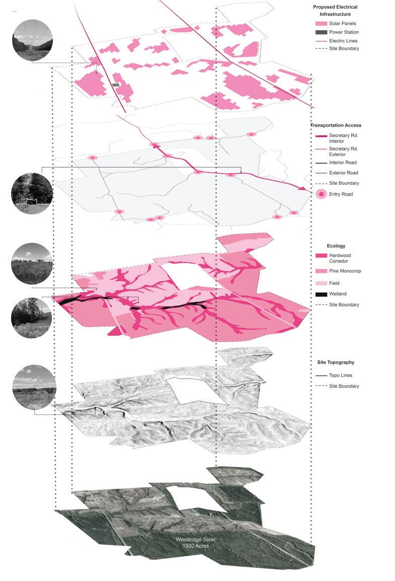
THE LANDLAB
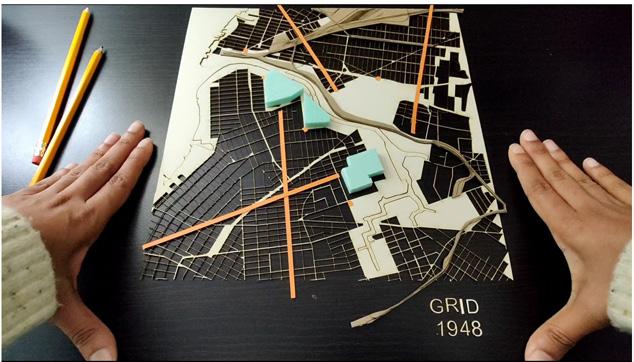
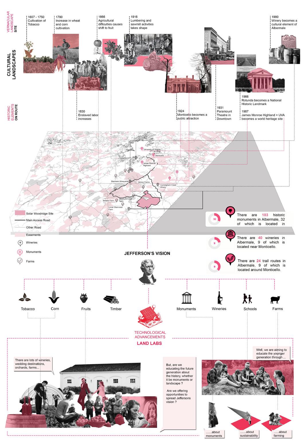
Charlottesville’s rich cultural history, seen in Monticello’s architecture and UVA’s academic prominence, connects the past to its present identity, emphasizing agriculture. En route to Woodridge Solar site, the landscape’s beauty and historical monuments set the stage for a journey through changing agricultural practices from tobacco to fruits, wineries, timbering, and hunting.
Inspired by Thomas Jefferson’s vision for holistic education, the site is visioned as Landlabs : ‘Solar Berry Farms’. This innovative blend of solar farms, agrovoltaics, and education embodies sustainability, historical preservation, and diversified agriculture, creating a model for a forward-thinking and communityengaged future.
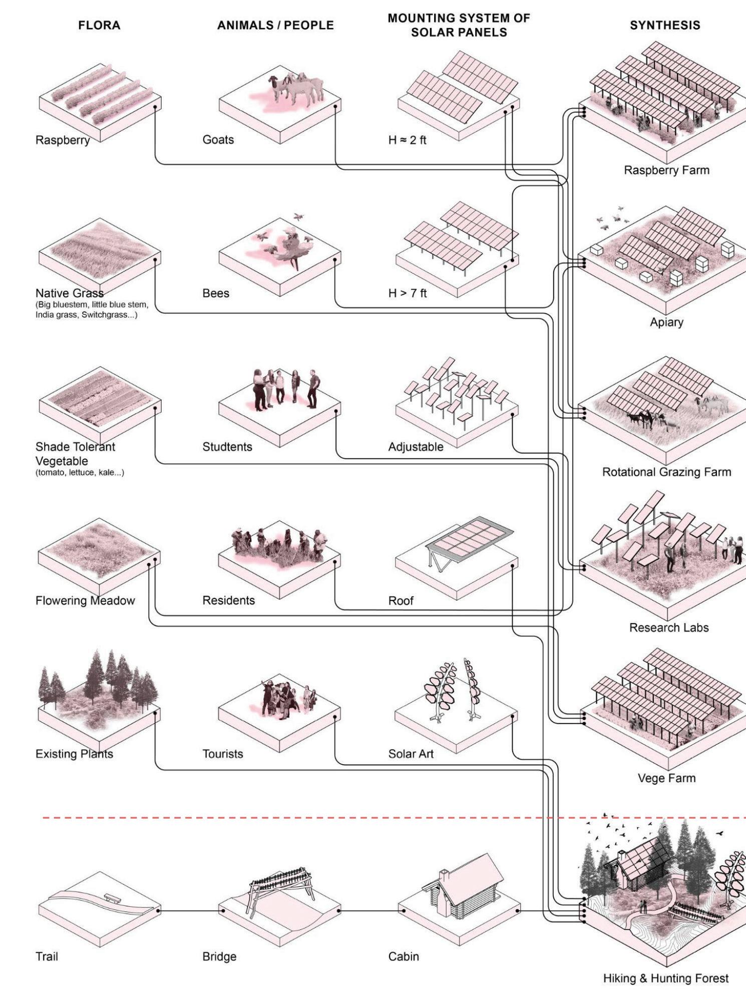
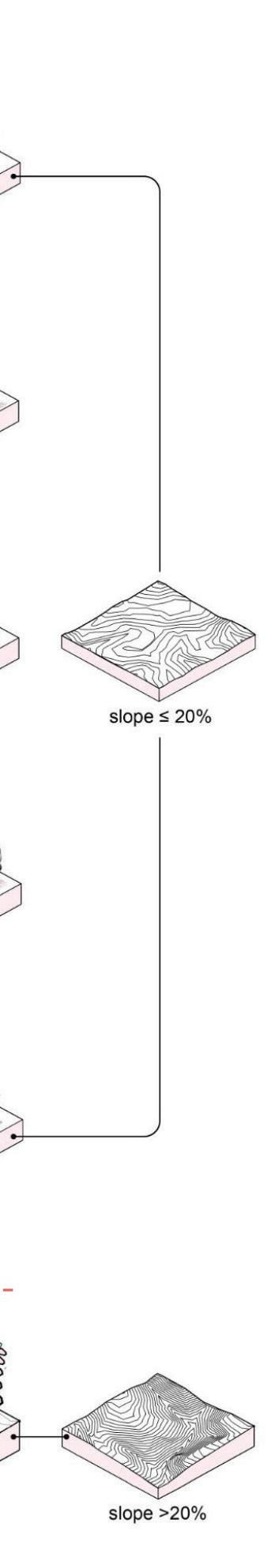
PROGRAM TYPOLOGY MATRIX
The green site of pine farming , sheep grazing and polinator garden is seen as a grey field as the green energy source - the solar fiels are proposed to site. Hence, the proposal aims to integrate solar farms with other activities in an effort to not to convert these lands solely for the purpose of solar fields.
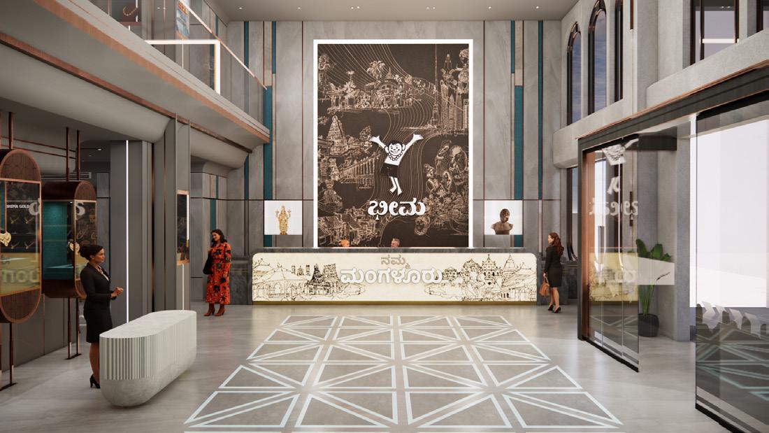
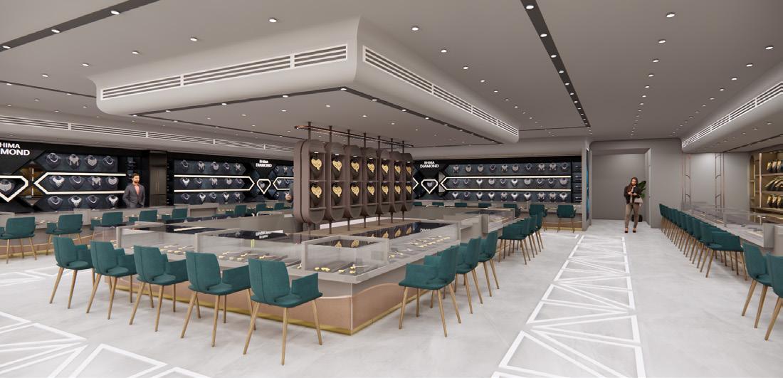
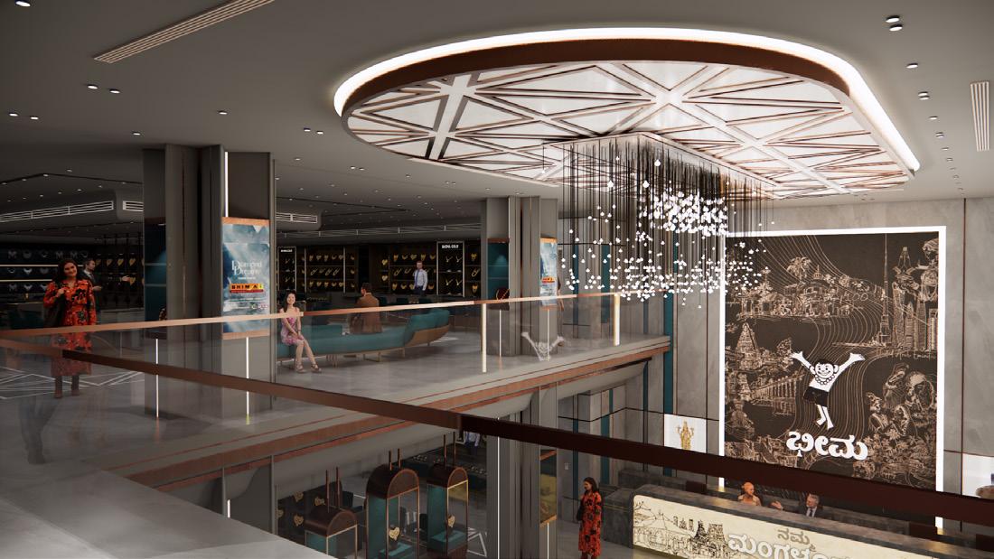
Worked on the drafting of the project ‘BHIMA’ a commercial Jwellery Showroom, ranging from ground plans, sections, material finishes and detailed construction drawings.
KAJARIA
TRIM (T
MS SQUARE TUBE/ ROSEGOLD FINISH -matching the
METAL PROFILE
TRIM (T ANGLE)/ ROSEGOLD FINISH -matching the shade Mapple Rosegold No.4 (20
METAL PROFILE
TRIM (T ANGLE)/ ROSEGOLD FINISH -matching the shade Mapple Rosegold No.4 (16 MM)
SS SKIRTING/ ROSEGOLD FINISH -matching the shade Mapple Rosegold No.4
Professional Work|Hanbury, Norfolk
Summer Scholar Design Project with Phillip Becker,
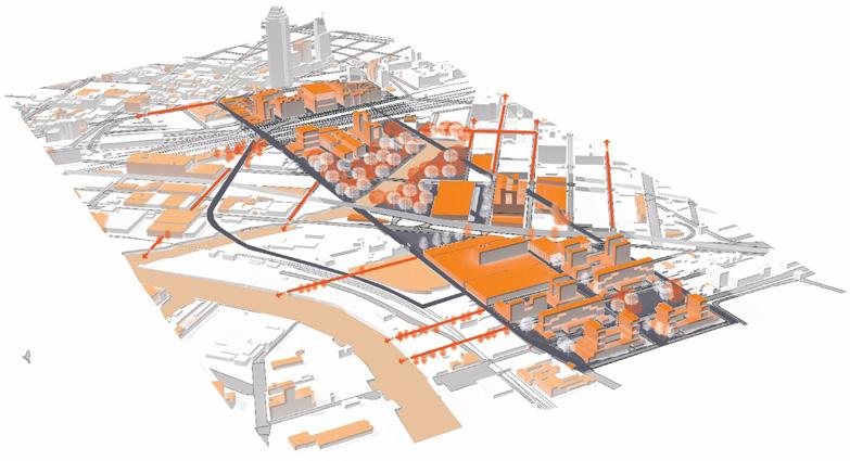
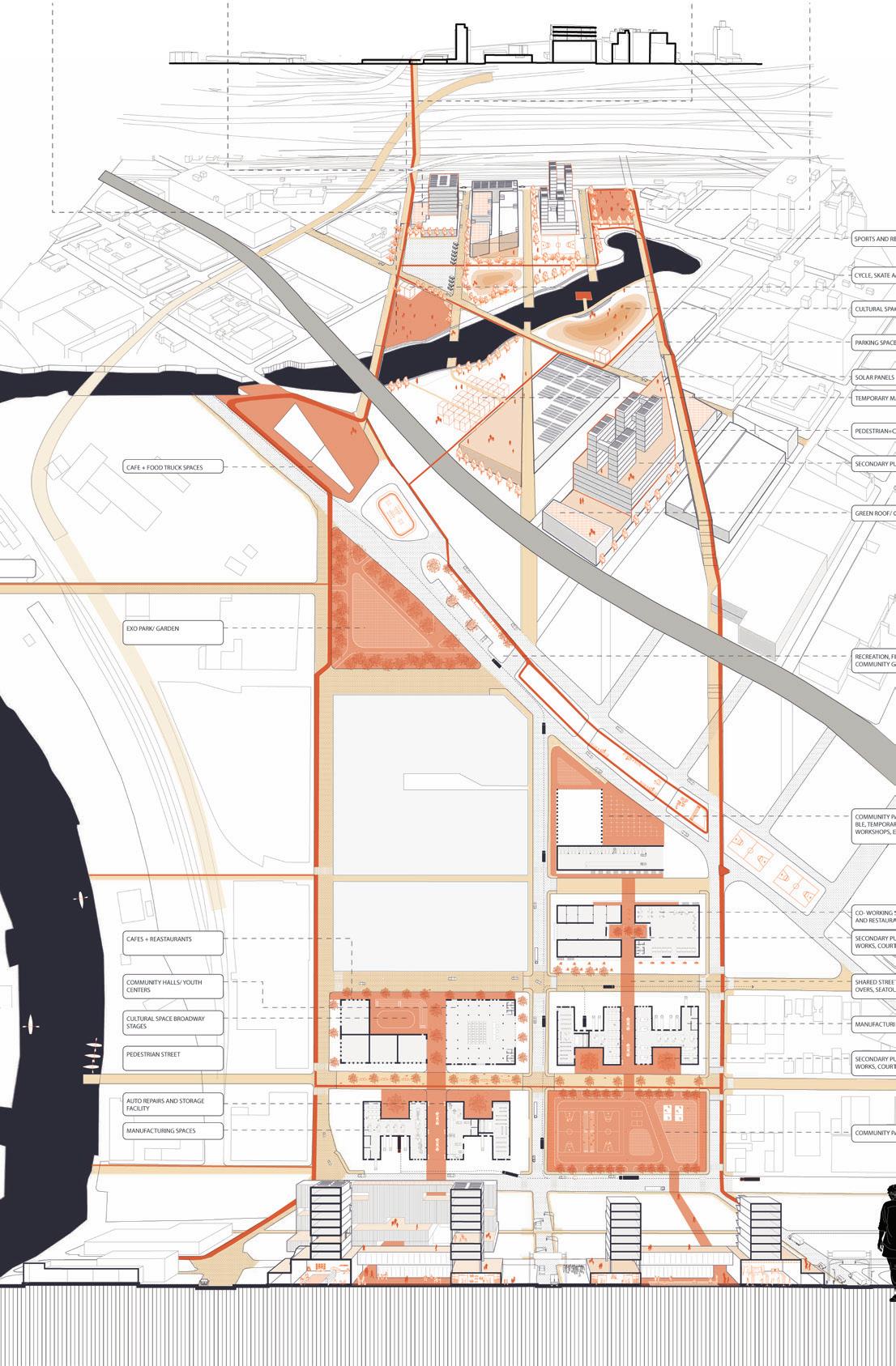
VIRGINIA BEACH INTERLACED
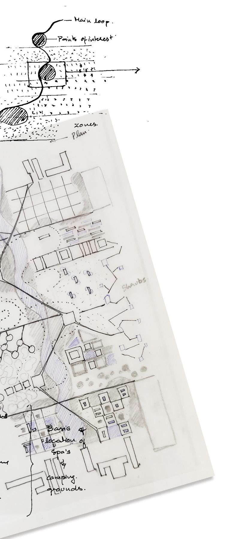
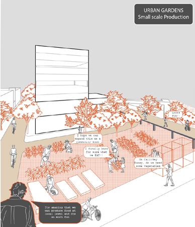
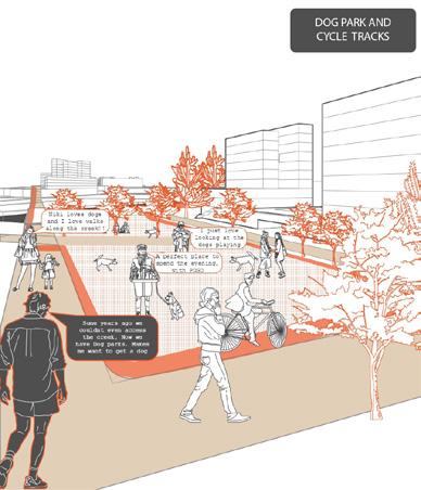
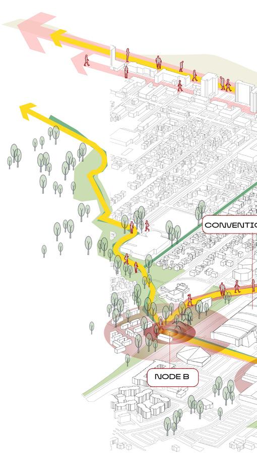
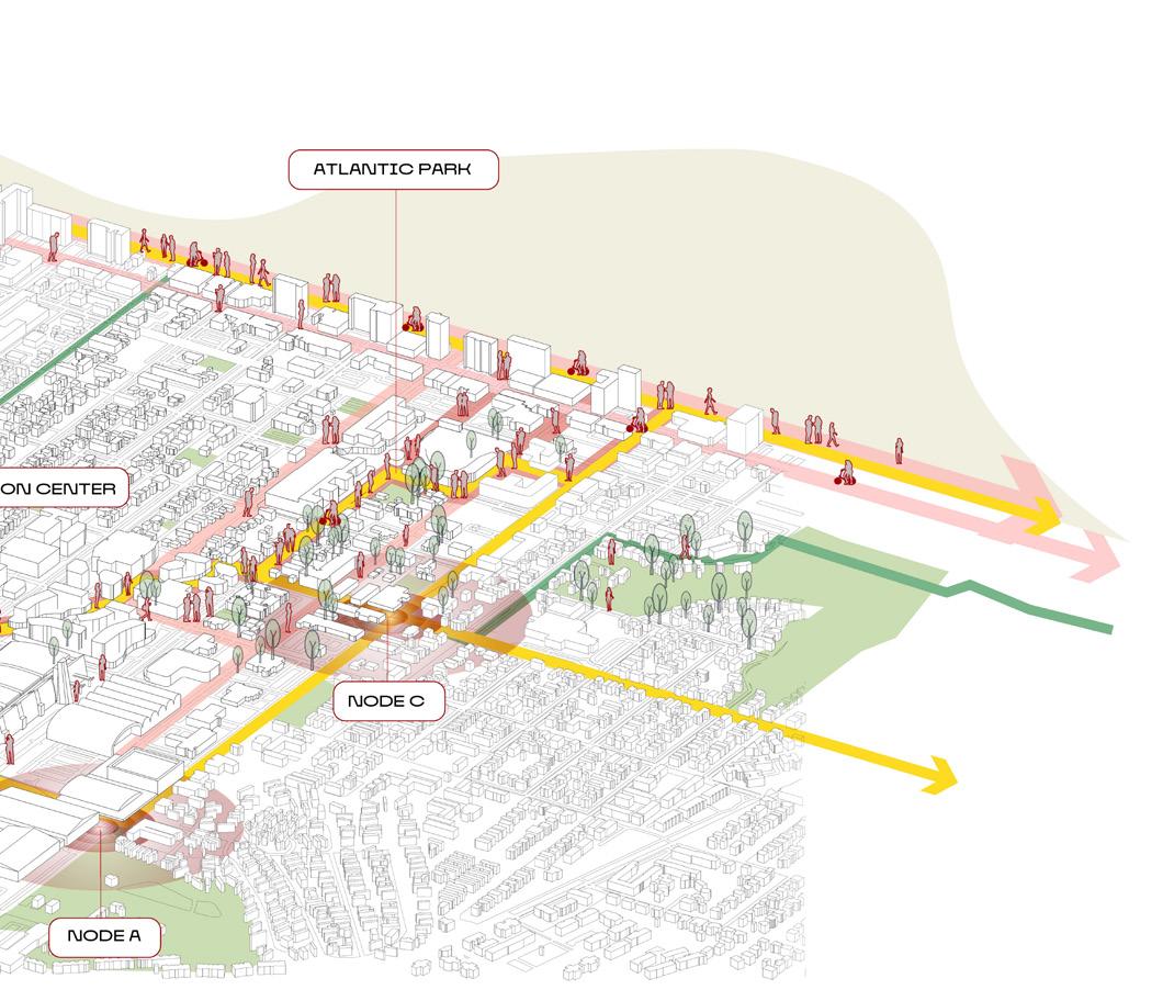
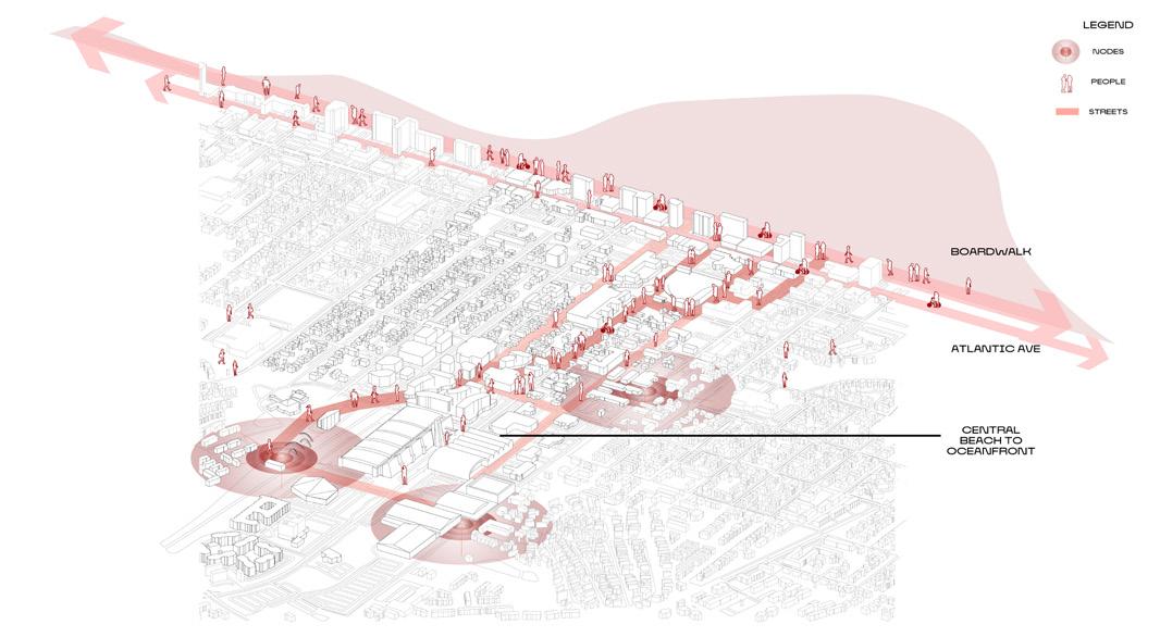
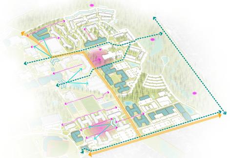
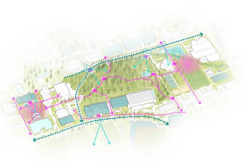
The concept envisions an interlaced web of programs that fosters continuous interaction with the environment, rather than segregating activities into isolated zones. This interweaving creates micro-ecosystems within various regions, each capable of sustaining itself even in challenging conditions. By establishing these interconnected micro and macro-scale activities, the design concept promotes a resilient and thriving community that leverages its natural and cultural assets to offer a holistic and enriching experience.
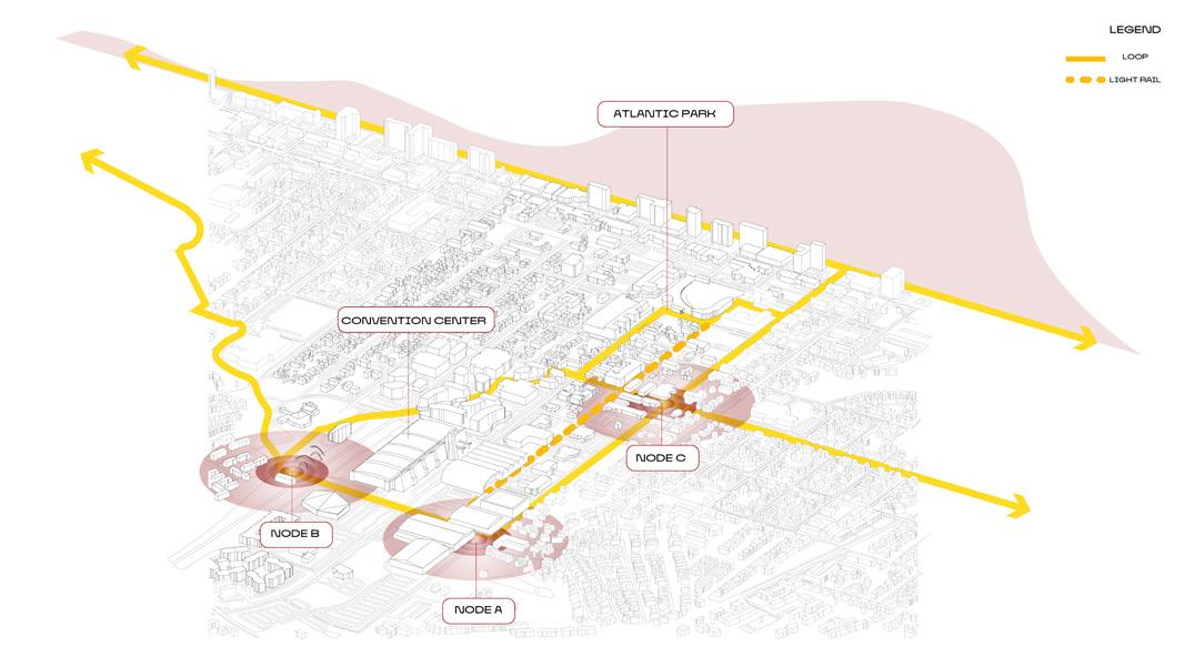
The overlapping parts of these functional paths form a Loop structure that connects the entire study area. Finally, by identifying the inntersections of the Loop with the boundaries of functional zones, we determine key nodes, providing a foundation for subsequent design.
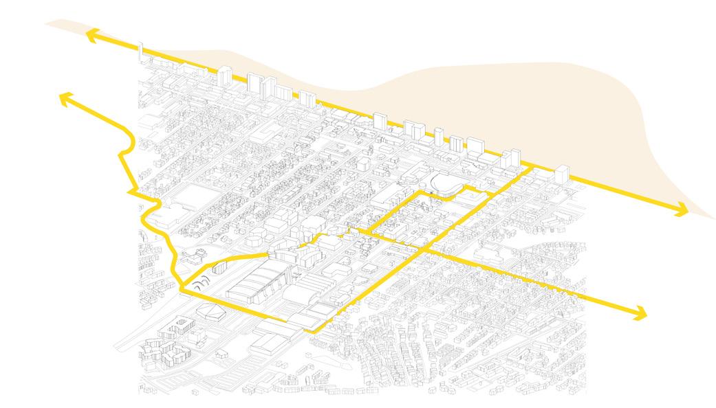
THE LOOP
Yongxiao Li,
Vivienne Shi
Li,
THE LOOP : FRAMEWORK FOR INTERLACED PROGRAMS
DESIGN DEVELOPMENT
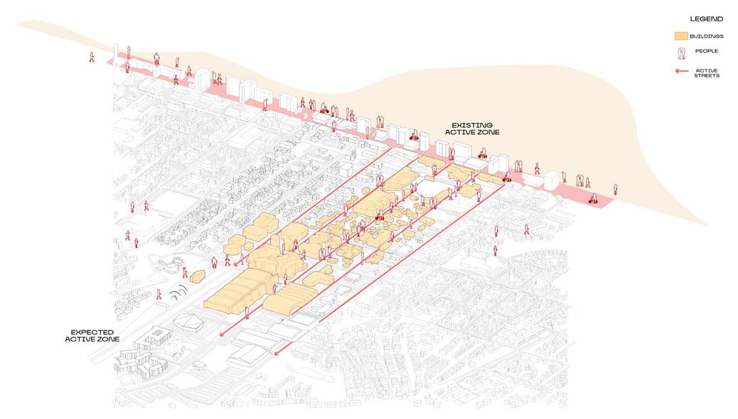
ACTIVATING PEDESTRANISATION AND STREET CHARACTER
2 MAIN NODES + 3 SITE INTERVENTIONS
DEVELOPMENT PROCESS
INCREASED BUILDING INTERACTION
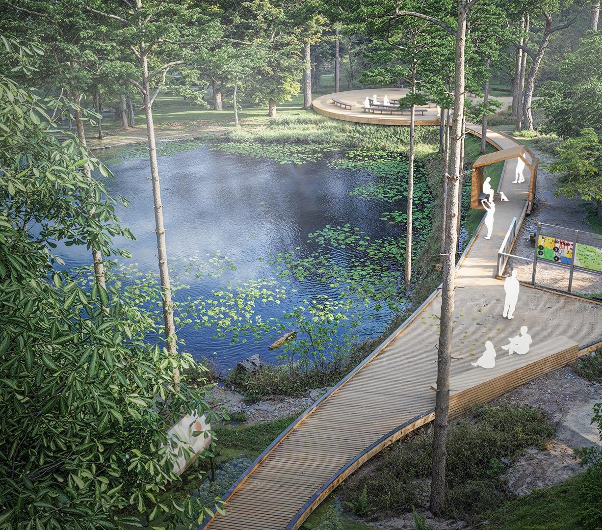
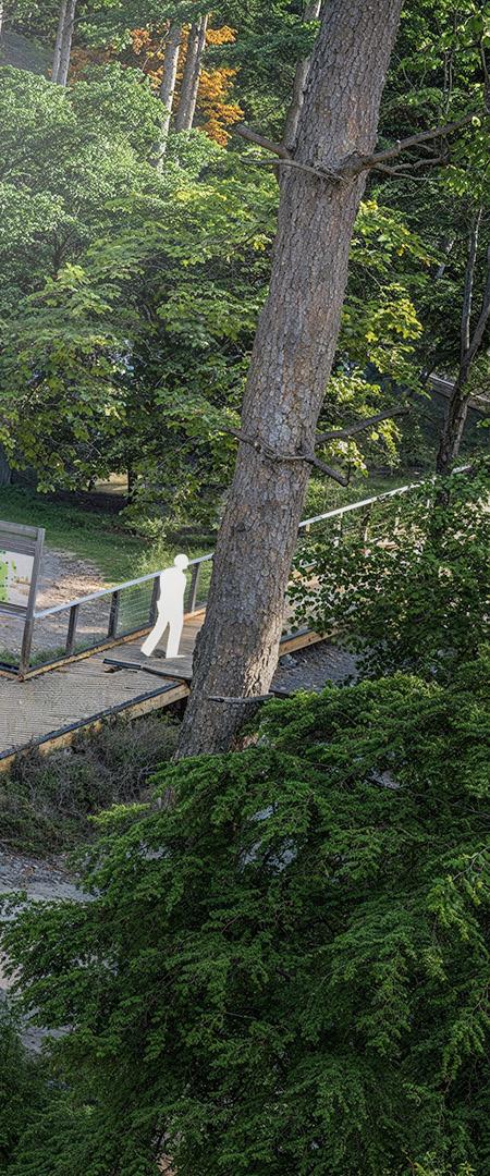
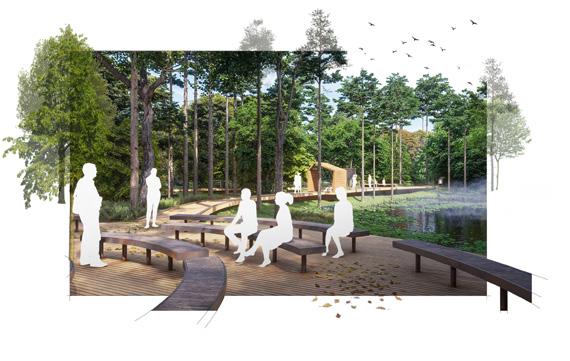
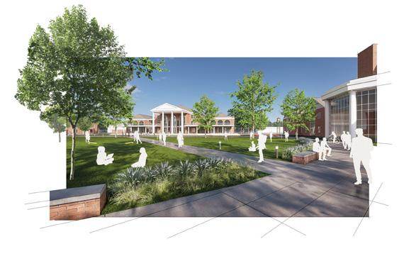
RENDERINGS - INTERNSHIP
Creating open class spaces for workshops and discussions The natural features are accentuated is in contrast to the more contemporary spaces next to the academic village.
accentuated for preservation and
Masterplan Report
Graphic Development
Outdoor Seating for open classes
Active academic lawn - redesigned
Central main path - addressing drainage
Archtecture should be rooted in the past, yet be part of our own time and forward looking.