2 minute read
Irving


By Tom Olsen tolsen@duluthnews.com
Situated along the St. Louis River, this western neighborhood is packed with history.
Irving developed in the late 1800s as the region flourished, with the village of West Duluth officially uniting with the city of Duluth in 1894. Its Raleigh Street served as a major business hub in those early days.
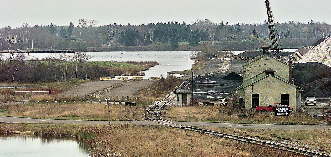
Owing to its location along the river, the neighborhood has long been known for industry, and it still retains those roots. The Verso paper mill, Loll Designs and Moline Machinery are just a few of the businesses that line South Central Avenue and Waseca Industrial Road.
Today, the once-active Raleigh Street business district is gone and that industrial hub is off the beaten path for most. But not so long ago Irving was a high-traffic center in West Duluth. The Arrowhead Bridge linked Duluth to Superior’s Billings Park neighborhood from 1927 to 1984, when it was replaced by the nearby Bong Bridge.
While the Superior side is home to a public boat ramp, little remains on the Duluth approach. The city later opened the Grassy Pointe Trail, a short path along the water-filled canal that once housed the bridge near Lesure Street, but it has since fallen into disrepair.
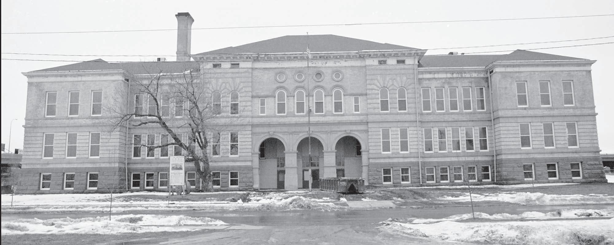
Closer to Interstate 35 is a residential section — which includes the neighborhood’s namesake Irving School Apartments. The Renaissance-Revivalstyle building served as an elementary school from 1895 until 1982, and a decade later it was repurposed as an apartment building.
Another significant landmark was lost more recently. The 75-year-old
Irving Recreation Center was razed in 2014, two years after it sustained significant damage in Duluth’s 2012 flood. With it went two hockey rinks. Today, the park remains, but with playground equipment, a sports court and a large field.
A few blocks away is the beginning (or end) of the Western Waterfront Trail, which offers hikers scenic views of the St. Louis River for more than three miles as it connects Irving with the Riverside neighborhood.

By John Lundy jlundy@duluthnews.com
The Cody neighborhood has a parochial school, tennis courts, commanding views of the St. Louis River Valley and residential neighborhoods characterized by traditional, older homes. It also includes the length of Cody Street. What it doesn’t have — what it never had — was the Cody Hotel.
That establishment — named for William Frederick “Buffalo Bill” Cody and run by his sister, Helen Cody Westmore — was located at 332 N. Central Ave., in Spirit Valley, according to Duluth News Tribune archives and Paul Lundgren’s “Area Women in History,” an article from the now-defunct The Area Woman magazine.
The Cody Liquor Store and the Cody Drug Store also were in Spirit Valley, on the hotel’s ground level.
For that matter, the home where Westmore lived is in the 2600 block of 77th Avenue West — the Bayview Heights neighborhood.
It’s not entirely clear why the Cody neighborhood carries the Cody name, but it does give the western Duluth neighborhood a sort of Wild West cachet.
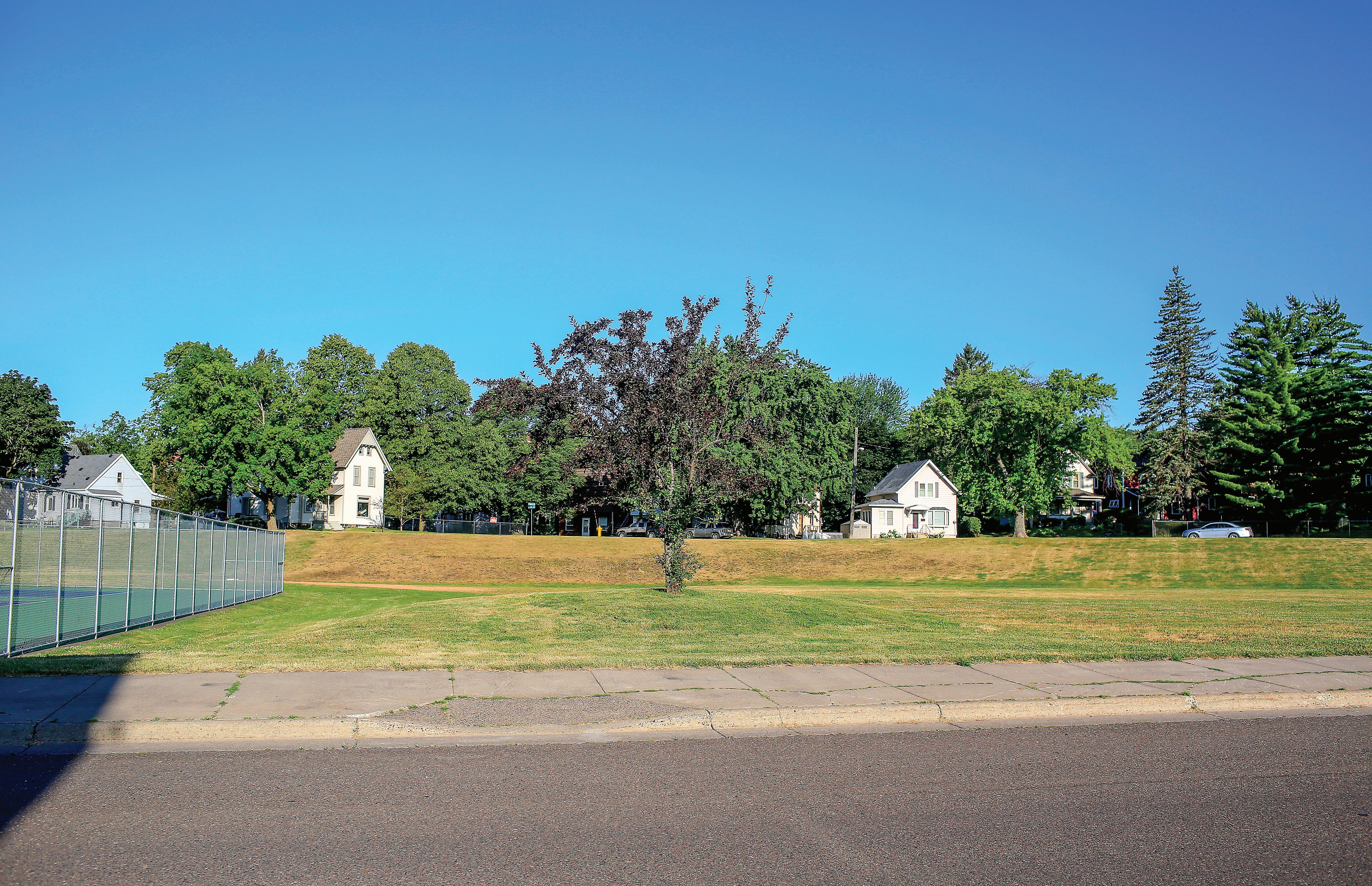
The Cody neighborhood was once the home of Denfeld High School, built on the west side of Central Avenue in 1915. When the current Denfeld opened 11 years later, the Central Avenue building became West Junior High School. Laura MacArthur Elementary School was built next door in 1957. West closed in 1983, allowing Laura MacArthur to spread through both buildings.
When the new Laura MacArthur opened across the street in 2011 (to the Denfeld neighborhood), the old building was demolished. That land, bordered by North Central Avenue, West Sixth Street, North 56th Avenue West and Elinor Street, now is mostly green space, with a corner set aside for school system tennis courts and another corner for field events during track meets. Informally, it’s a popular spot for people to play fetch with their dogs and for children to go sledding in the winter.


