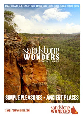
SIMPLE PLEASURES • ANCIENT PLACES

This Visitor Guide is published by Banana Shire Council. This publication is only possible due to the outstanding support of the local businesses who advertise within. No part of this publication may be printed, reproduced, stored in a retrieval system or transmitted in any form without written permission from Banana Shire Council. All care has been taken to ensure accuracy of information contained in the guide. However the guide is to encourage you to visit and explore Sandstone Wonders. HEMA Maps, guidebooks and local knowledge should be used for remote adventures. The publisher does not in any way accept liability for inaccuracies or for the loss of any kind arising out of editorial or advertising or otherwise.
Photo credits: Tourism & Events Queensland and participating Councils. For enquiries: call (07) 4992 9500 or email enquiries@banana.qld.gov.au
ACKNOWLEDGEMENT OF COUNTRY
We acknowledge the Traditional Owners, the Darumbal, the Gangulu, the Wadja, the Wulli Wulli, the Wakka Wakka and the Iman people in the Banana Shire region, and other First Nation people across Australia. We acknowledge the wisdom of Elders past, present and emerging and recognise the positive contribution of First Nations people to the health and wellbeing of our communities through cultural heritage, values and beliefs.

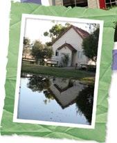
Biloela
Biloela
DISCOVER our world
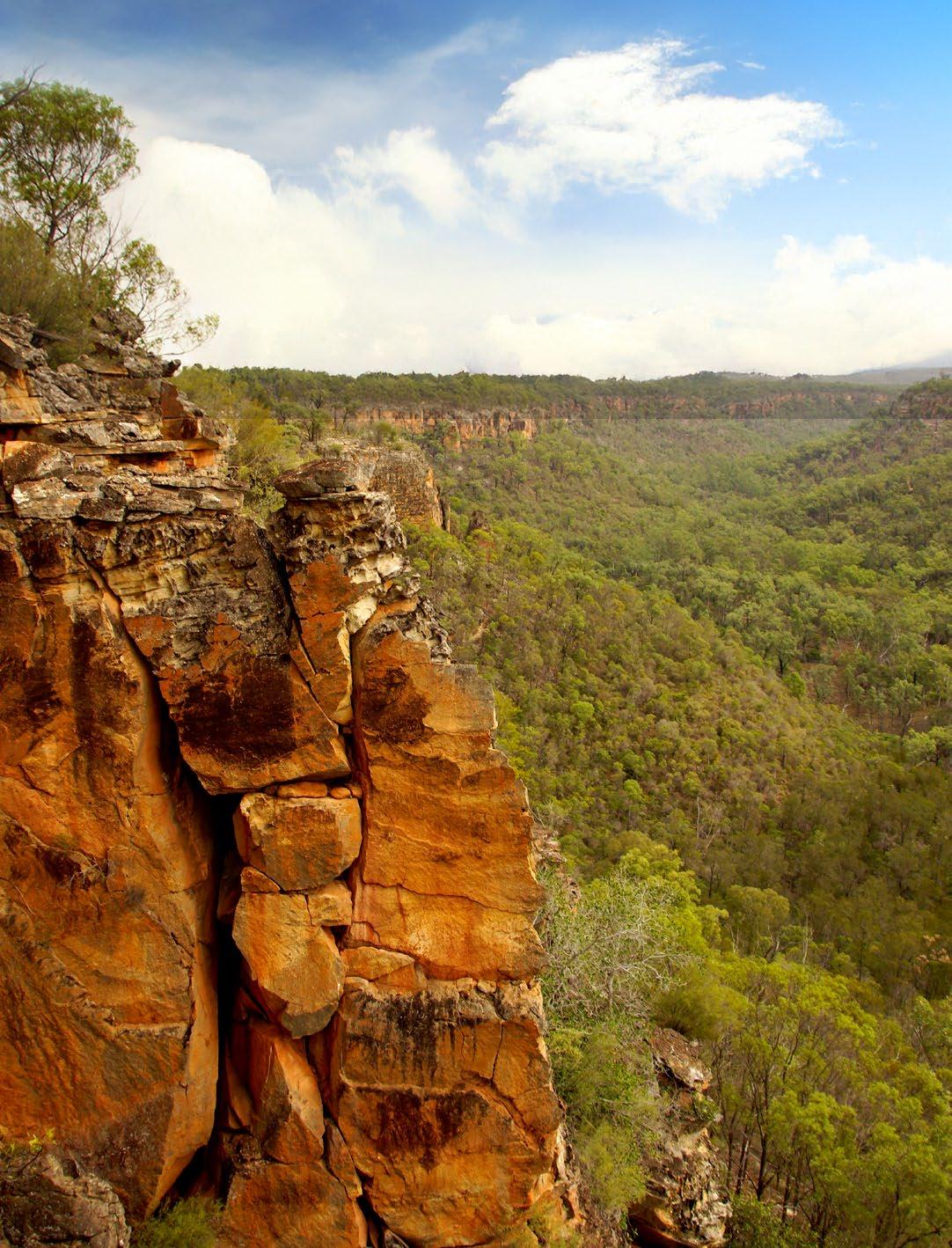
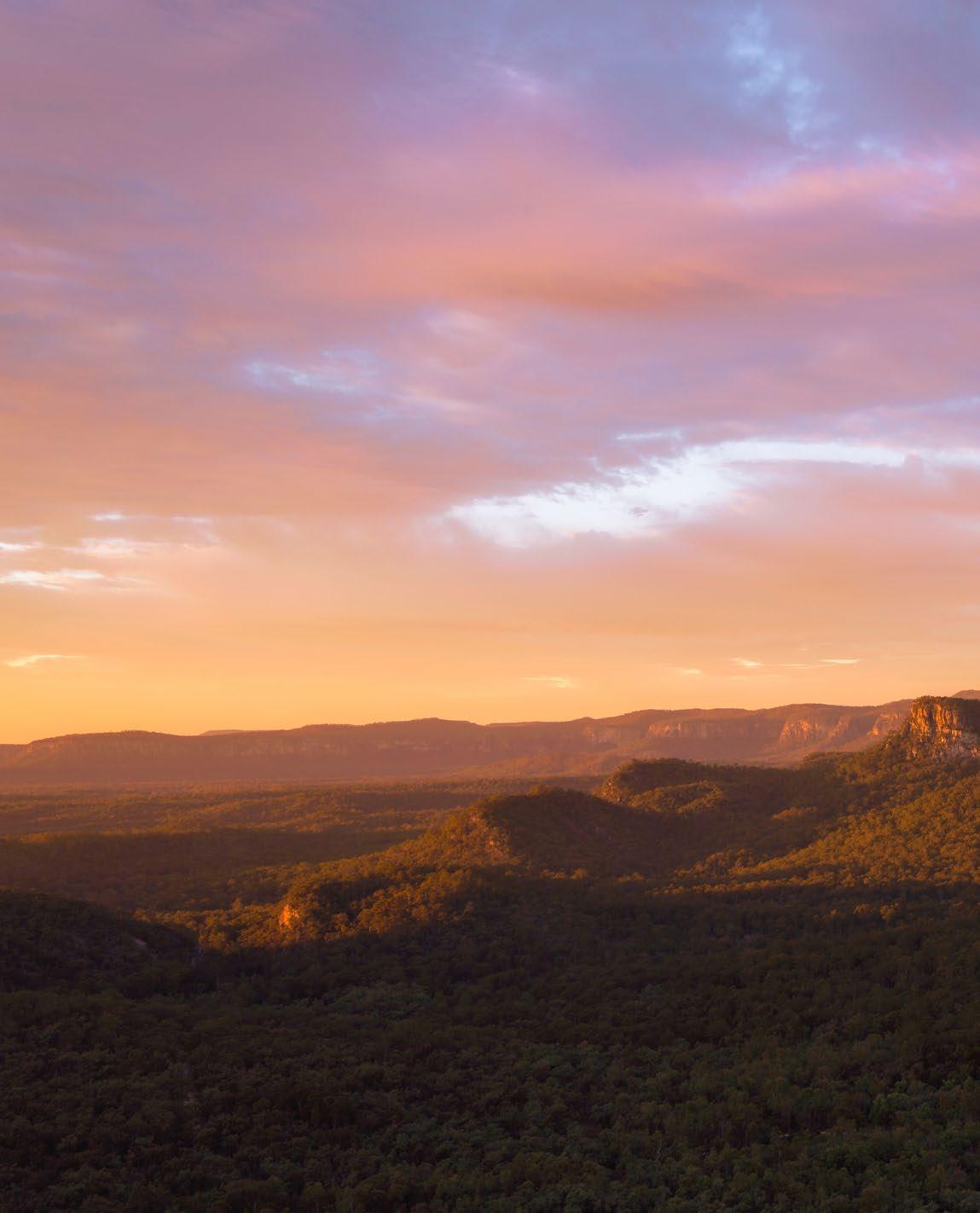
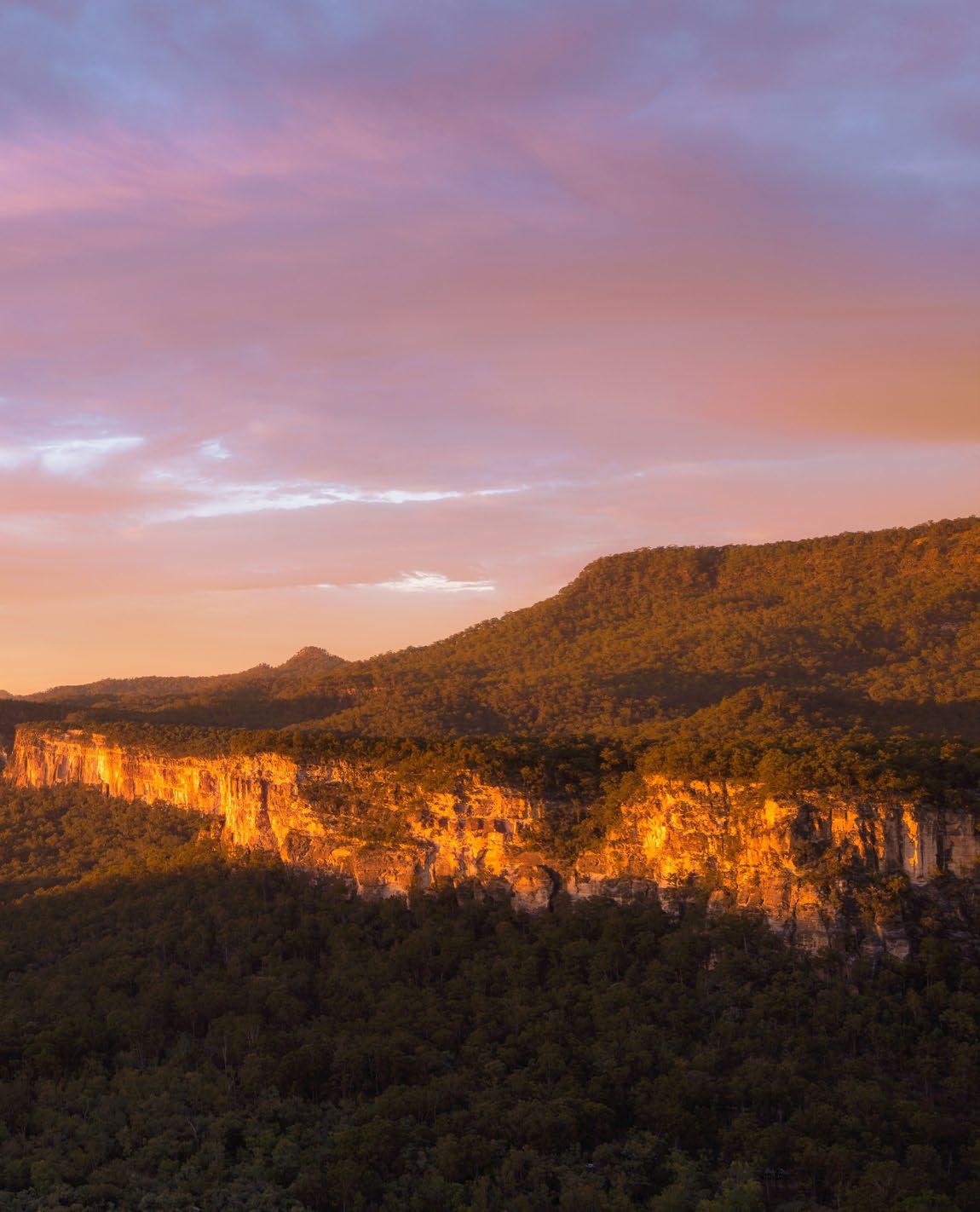
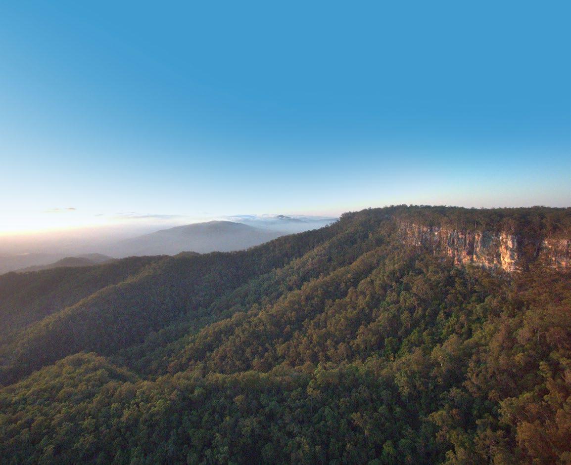
You’ll find yourself in the midst of an ancient world, where sandstone wonders stand like fortresses in the sun, lighting up the landscape below.
Rivers and lakes funnel their way over mountain tops and across the plains, their banks shaded by palms that have grown here for a million years and more. Follow them and you’ll find peaceful places, far away and hidden from the beaten track. Bastions of a world before time, more than 25 mountain ranges make up the area and for its sheer size and scale, it’s known as ‘the roof of Queensland’. Gaping valleys and plains rise up to towering cliff tops, interrupted here and there by deep gorges, rocky outcrops and flowing, freshwater streams. Several national parks are within easy distance of townships along the Dawson Highway and Leichhardt Way. Each park features its own unique landmarks. The diversity of flora and fauna is just
PLAN YOUR VISIT
as impressive as the topographical conditions which differ and change.
You’ll meet locals who’ll have you laughing with their cheeky humour and tell-it-how-it-is, no-nonsense approach, and you’ll never be short of a willing word from a friendly stranger on the best places to snag a fish, boil a billy, grab a good feed or camp for the night. Festivals, fishing competitions, country races and campdrafts are just a few ways to have fantastic family fun. Everyone gets to kick up some dust and join in the goings-on. Travel out of the townships and big adventures await. There’s always more to explore, more to discover, more you’ll want to remember. Time spent here is measured not by its passing, but by the many pleasures it brings.
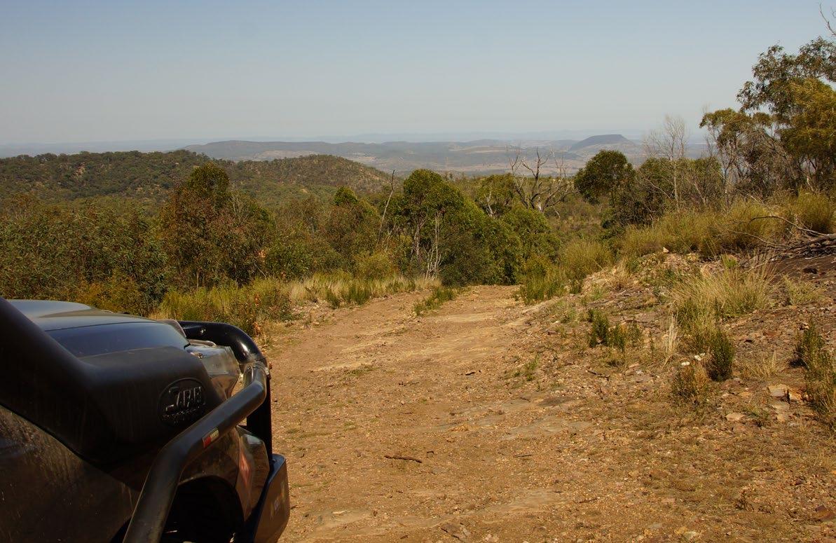
Being well-informed about where you’re heading is vital. Being prepared allows you to get the most out of each experience. Remember to bring everything you need for your style of trip, including extra food, fuel, emergency supplies and communications.
ACCOMMODATION
The accommodation options in our region vary greatly and include:
• Camping (see page 18)
• Farmstays
• Caravan Parks
• Motels
• Hotels
• Cabins
• Airbnb Rentals
FIND OUT MORE AT sandstonewonders.com/accommodation
VISITOR INFORMATION
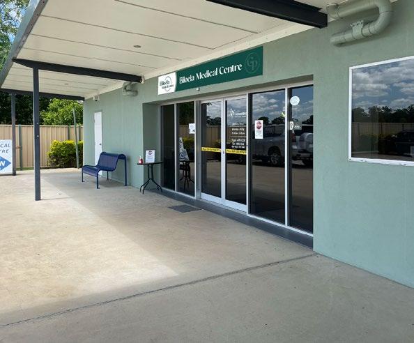
RURAL HINTERLAND VISITOR INFORMATION CENTRE
11 Exhibition Avenue, Biloela QLD 4715
Hours: 9.00am - 4.00pm, Mon-Sun
P: (07) 4992 2400
E: rhvic@bigpond.com
W: qldheritagepark.com.au
BILOELA TOURIST INFORMATION CENTRE
10A Callide Street, Biloela QLD 4715
P: (07) 4992 2405
E: biloelainfocentre@bigpond.com
MOURA MUSEUM AND LIBRARY
34 Gillespie Street, Moura QLD, 4718
Link Airways fly direct from Brisbane to Biloela (Thangool Aerodrome). Car hire is also available at the Aerodrome.
BY BUS greyhound.com.au
Greyhound Coaches travel through the region three times per week on the Miles-Rockhampton route with connections from Brisbane.
BY ROAD
Many roads lead to the region. Approximate travel times to Biloela from main centres are:
BRISBANE 6.5 hours | SUNSHINE COAST 5.5 hours
GLADSTONE 1.3 hours | ROCKHAMPTON 1.5 hours BY AIR linkairways.com
Hours: 8.30am - 5.00pm, Closed 12.00pm - 1.00pm, Mon-Fri. 9.30am - 12.30pm, Sat
P: (07) 4992 9500
E: enquiries@banana.qld.gov.au
TAROOM VISITOR INFORMATION CENTRE
10 Yaldwyn Street, Taroom QLD 4420
Hours: 9.00am – 3.00pm, Mon–Fri
P: (07) 4628 6113
E: hottaroom@hotmail.com
THEODORE VISITOR INFORMATION CENTRE
55A The Boulevard, Theodore QLD 4719
P: 0497 625 375
E: theodoreinfocentre@gmail.com
NATIONAL PARKS AND CAMPING
Whether you are staying in comfort at one of our caravan parks, camping in one of our low cost venues or getting back to nature in the National Parks, the Sandstone Wonders offer a range of fabulous caravan and camping places to spend your holidays.
PARK ALERTS: parks.desi.qld.gov.au/park-alerts
PARK CAMPING FEES: parks.desi.qld.gov.au/camping/bookings
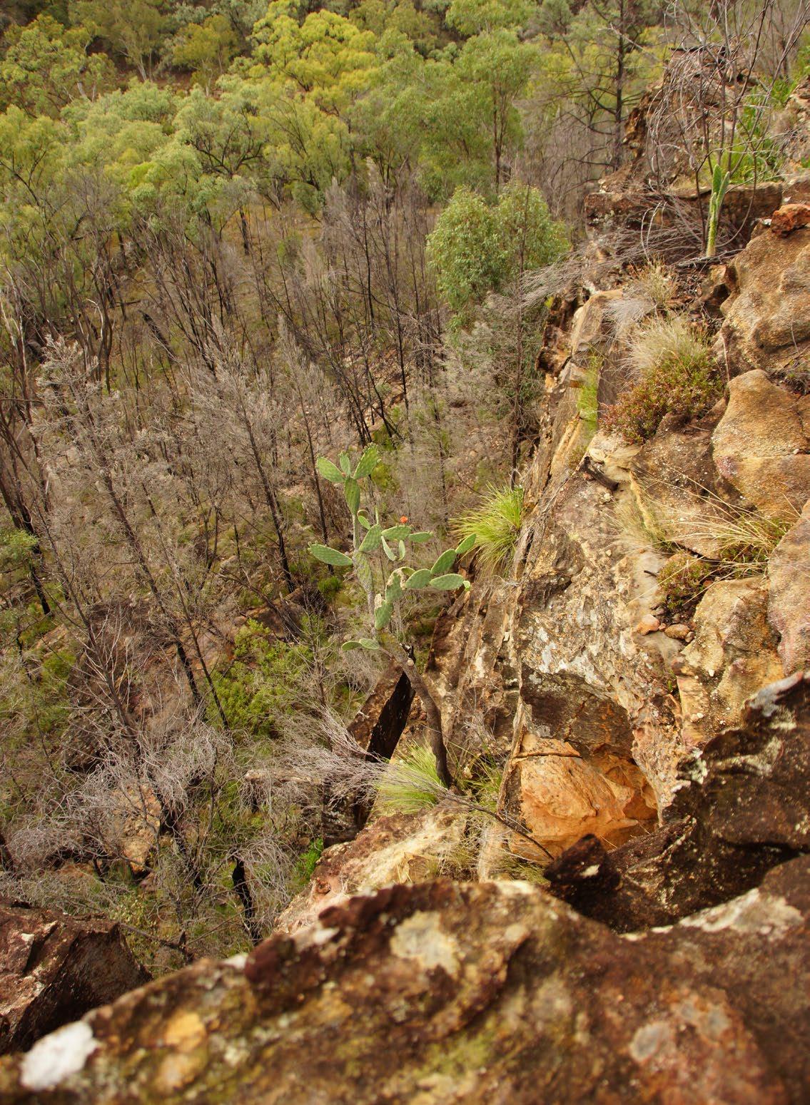
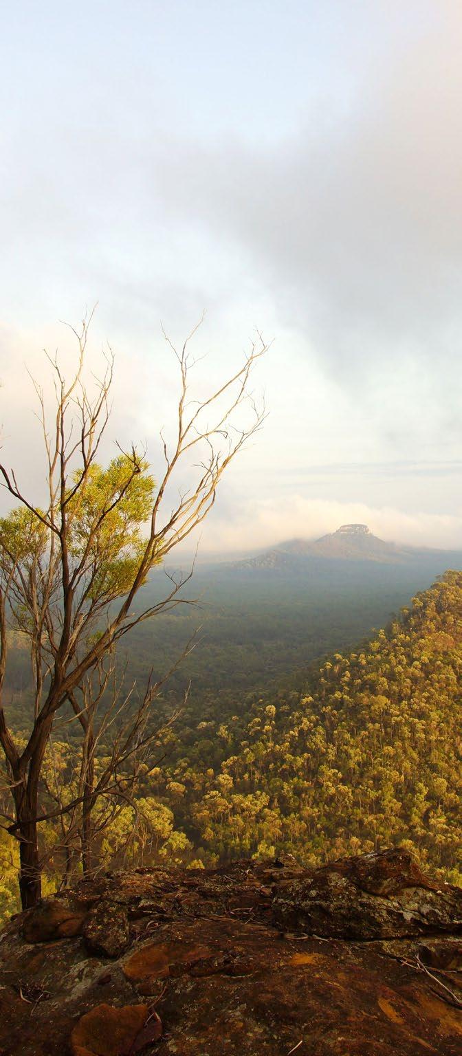
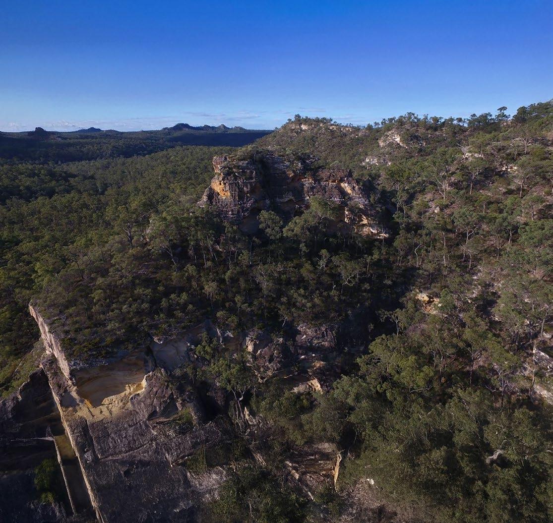
ISLA GORGE
Isla Gorge National Park is on Wulli Wulli country and is a complex maze of gorges and isolated sandstone monoliths.
Camping IN ISLA GORGE
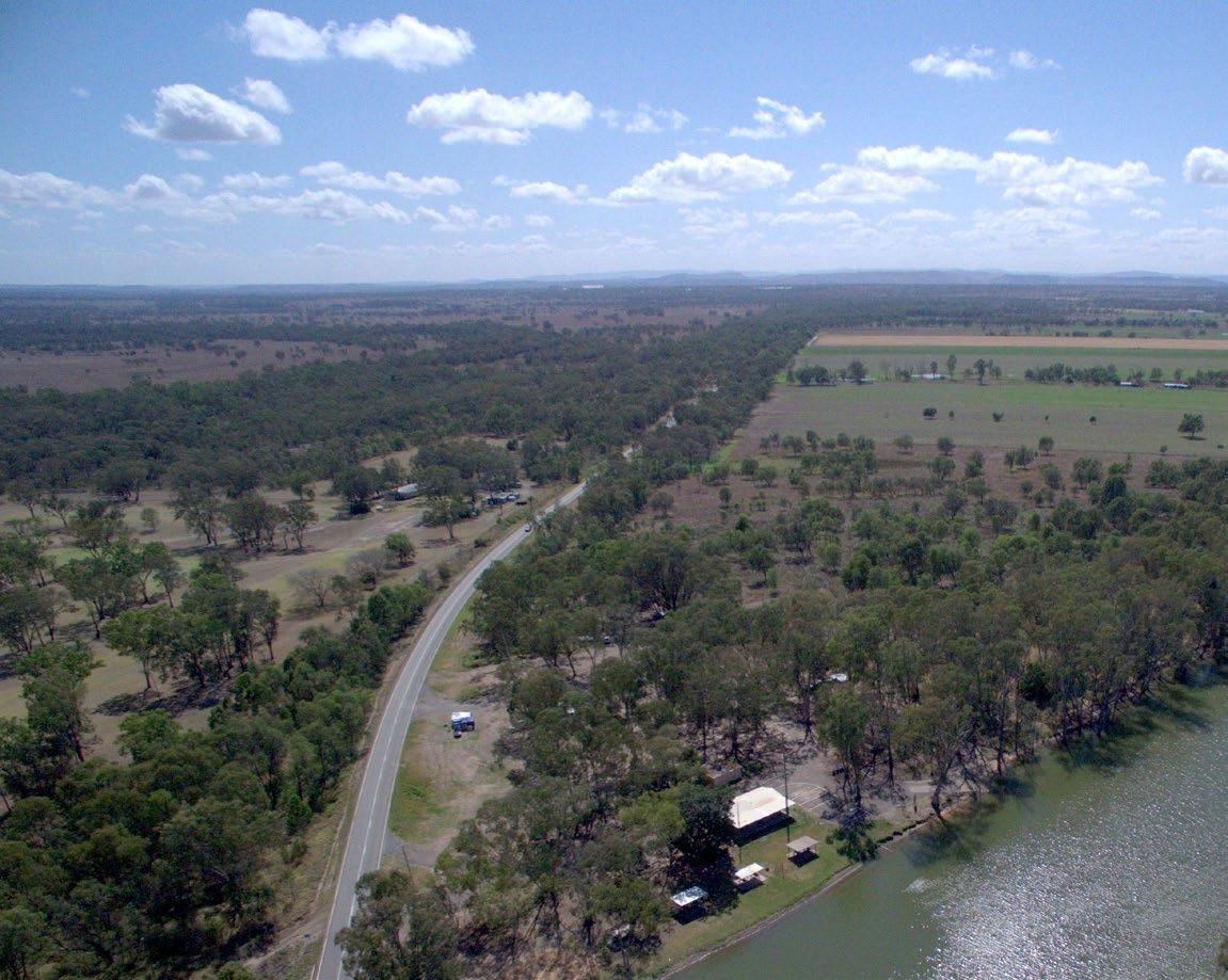
Isla Gorge is a great place for an inland stopover. The picnic and camping area overlooks the gorge and is just 1.3km off the highway. Camp overnight and watch the sun set over the orange-coloured cliffs of Isla Gorge. Parks in this region are remote and undeveloped. Visitors must be well prepared and self-sufficient.
Soft precipice sandstone has eroded into a breathtaking panorama of cliffs, peaks, overhangs, tunnels and arches. The rock changes from yellow to orange and pink with the angle of the sun.
Brilliant displays of flowering wattles appear from mid-winter and boronias, red grevilleas and grasstrees blossom in August and September.
At the picnic shelter, look north out over large areas of botanically-rich semi-evergreen vine thicket, to the distant rugged rock formations locally known as ‘Devils Nest’. Eucalyptus beaniana—an ironbark tree found near the carpark—is one of the 10 rare and threatened plants growing in the park.
Isla Gorge National Park was extended in 1990 to include the remains of a hand-paved road separately accessed at the northwestern tip of the park near
Flagstaff Hill. This historically significant road was constructed in the early 1860s by hand, using large rock slabs. It was built less than 15 years after white settlement of the area and was used to carry wool from Roma to the port of Rockhampton. Vehicle access is only via Glenmoral-Roundstone, Glenbar and Flagstaff Roads and turnoff into Flagstone Road at the end of the sealed section. At Flagstaff Hill you can walk to Glenmoral Lookout and view the remains of the historical paved road.
Many kinds of birds live in the park. Look for spiny-cheeked, brown, white-eared and bluefaced honeyeaters when the eucalypts, wattles, grevilleas and boronias are in flower from mid-winter to summer. Wedgetailed eagles soar high above the gorges and peregrine falcons leave their secluded roosts on cliff faces to hunt.
STAYING safe
Natural cliff lines are not far from the camping area. Take care and keep away from cliff edges—they can be deceptive and are often closer than you think. Sandstone is brittle and may crumble unexpectedly. Please supervise children at all times and take extra care when using binoculars or cameras at these sites.
GETTING HERE
Isla Gorge lies between the townships of Theodore in the north and Taroom in the south.
If you’re heading south from Theodore follow the Leichhardt Highway for 35km until you reach the signpost to Isla Gorge Lookout on your right, turn right and follow the road 1.3km west to the car park.
From Taroom, drive north along the Leichhardt Highway for 55km. Turn left at the Isla Gorge Lookout signpost and follow west for 1.3km to the car park.
Detour off onto the Fitzroy Developmental Road to visit Lake Murphy or turn off the Leichhardt Highway to visit Chain Lagoons. Both are close to the Leichhardt Highway and great spots to camp, bird watch, stretch the legs or cool off.
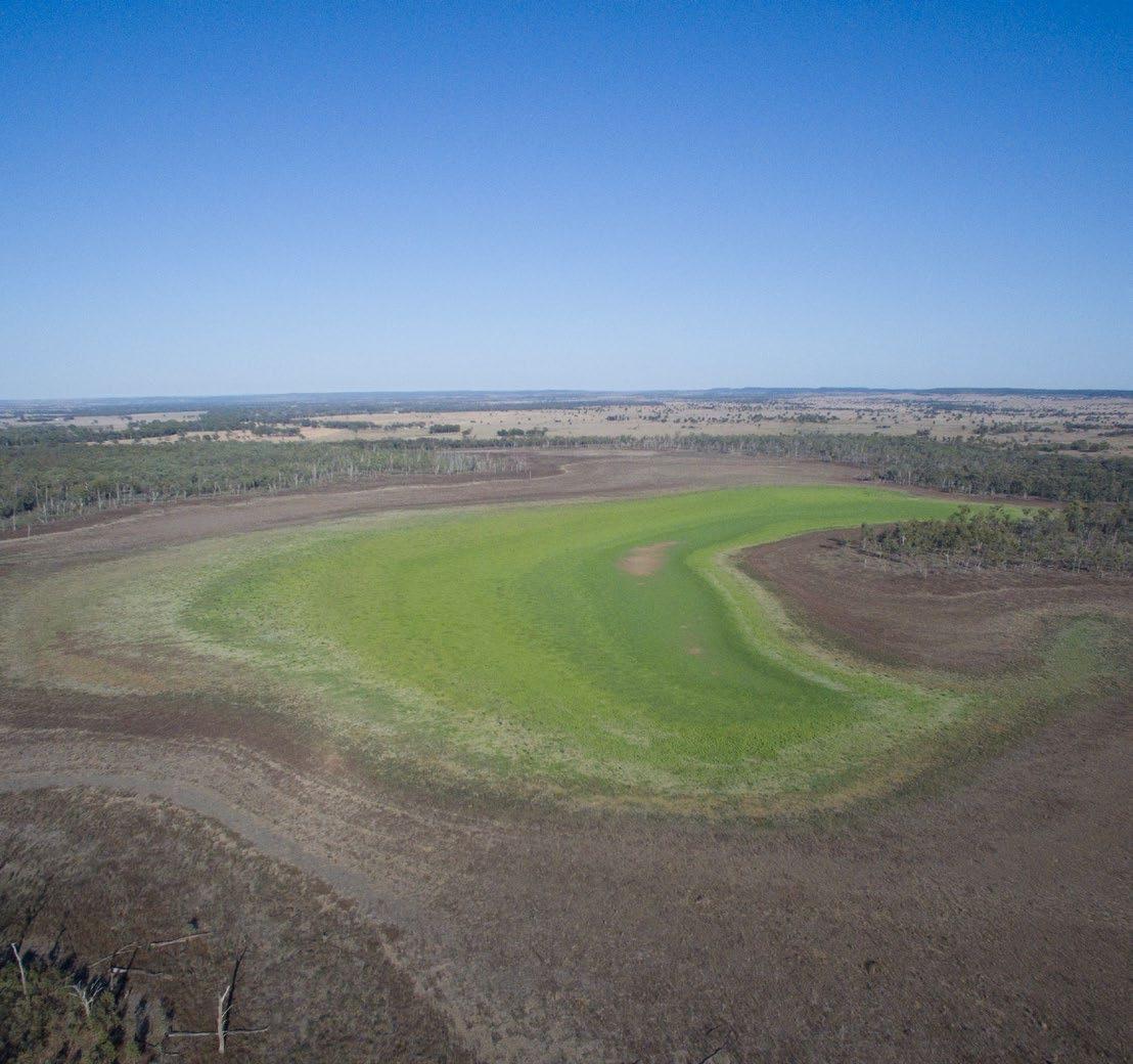
Lake Murphy Conservation Park
A patch of paradise, Lake Murphy Reserve is teeming with wildlife. The lake sits beneath Murphy Range and only fills with water when nearby Robinson Creek overflows.
Camping AT LAKE MURPHY
Camping permits are required and fees apply. A tag with your booking number must be displayed at your camp site.
Parks in this region are remote and undeveloped. Visitors must be self-sufficient. Bring at least seven litres of water per person per day for drinking, cooking and washing, as streams are seasonal and water quality cannot be relied upon. Bring a fuel stove and rubbish bags to take your rubbish away with you. Rubbish bins are not provided in the park. Please camp with minimum impact.
Lake Murphy Conservation Park remains largely unchanged from the days when Europeans first passed this way.
Lake Murphy provides a seasonal refuge for waterbirds. This perched lake fills only when nearby Robinson Creek overflows, and has been dry five times in the past two centuries. The shaded, grassy campsites near Lake Murphy are a great
place to spend the night and watch the sun set over the lake. Even when the lake is dry, this is a peaceful and beautiful spot.
A 300m easy track from the camping ground takes you to the lake where the walking circuit traces the southern end of the shore before meeting Robinson Creek and the red gum forest that leads back to camp.
STAYING safe
Snakes are present in this park. Detour around them. Wear protective footwear and ensure your first aid kit includes equipment for treating snake bites.
Bring your own drinking water.
If camping, make sure you are self-sufficient
GETTING HERE
In dry conditions the road to the lake is suitable for all vehicle types. Drive 18km north of Taroom along the Leichhardt Way then turn west into the Fitzroy Developmental Road. Travel 2km to the Glenhaughton Road turnoff. Turn left and drive 11km to the park.
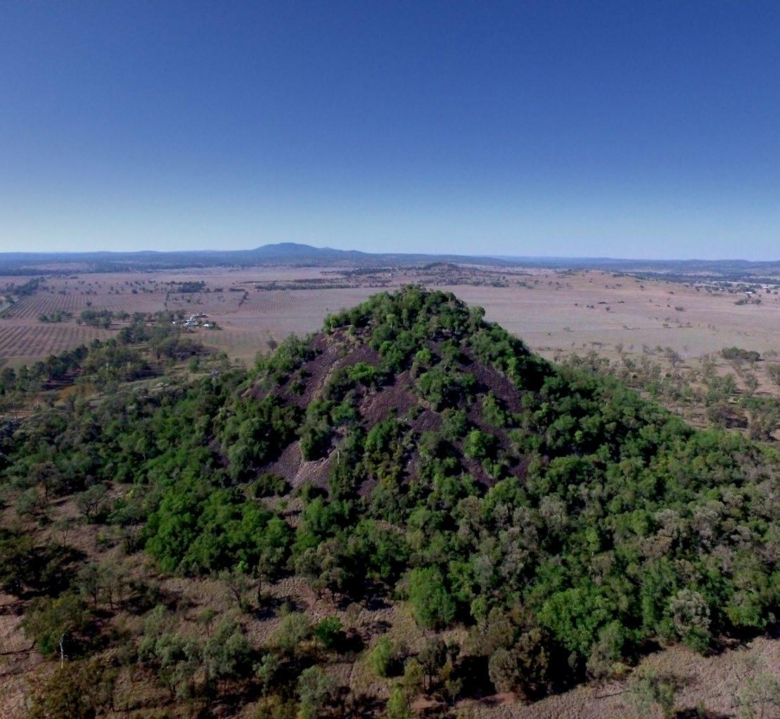
MOUNT SCORIA Conservation Park
Rising 150m above the cultivated plains, Mount Scoria is a striking local landmark protected in Mount Scoria Conservation Park.
Hiking AT MOUNT SCORIA
600m return hike around Mount Scoria
A Grade 2 trail perfect for beginners. Conveniently located just outside of Thangool, this unique trail features hexagonal volcanic columns akin to Ireland’s Giant’s Causeway.
Immerse yourself in the natural splendour, enjoying a leisurely 30-minute walk filled with remarkable views and geological wonders.
This dramatic pillar of rocks was formed by volcanic activity 20–26 million years ago. It is the remains of a volcanic plug that features mostly hexagonal basalt columns. Gangulu Nation People call the mountain Dangama Mungar—Talking Mountain.
This small conservation park in Queensland’s brigalow belt contains open woodlands with poplar box, Moreton Bay ash, forest red gums, silver-leaved ironbarks and small patches
of brigalow. An open semievergreen vine thicket growing on rocky slopes towards the summit and around the base of the mountain is a relic of much wetter times. This vegetation is now uncommon in Central East Queensland.
WHEELCHAIR ACCESSIBILITY
One picnic table at Mount Scoria Conservation Park is wheelchair accessible. The toilets are not wheelchair accessible.
STAYING safe
Stay on the walking track.
Unstable rocks and steep, loose surfaces makes climbing difficult and very dangerous.
Avoid bites, stings and scratches, especially bites from ticks. Wear protective clothing and insect repellent. Detour around snakes—never provoke them.
Be sun-smart. Wear a hat, shirt and sunscreen, even on overcast days, to avoid sunburn. Drink frequently to avoid dehydration.
GETTING HERE
20km south-east of Biloela. Mount Scoria Conservation Park is only a short distance from the Burnett Highway along a sealed road that is signposted at Thangool. As you enter Thangool travelling south from Biloela, take the first turn to the right at Winston Street and follow it past the aerodrome, school and racecourse to a T-junction. Turn left and follow a bitumen road for 5km to the park. Access roads are suitable for conventional vehicles.
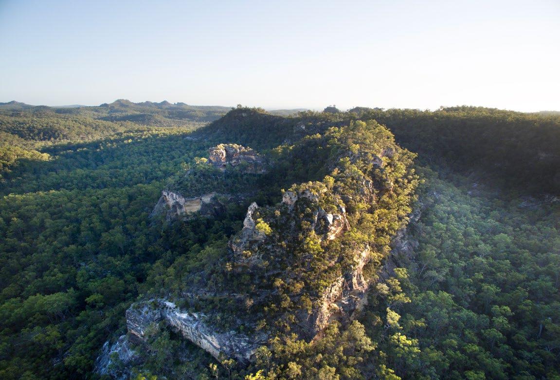
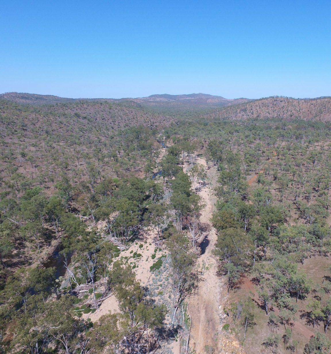
Expedition National Park
Expedition National Park is part of the Central Queensland Sandstone Belt.
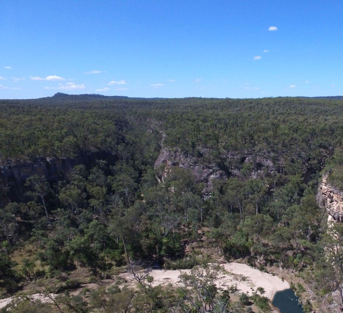
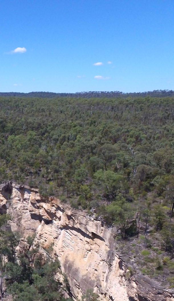
ROBINSON GORGE SECTION
Scenic Robinson Gorge is one of the main features of Expedition National Park, located on the Expedition Range between Taroom and Rolleston. The gorge winds 14km between sheer sandstone cliffs up to 100m high. It begins as a broad shallow basin in the north and narrows to a deep pool and narrow gorge towards its southern end. Lined with Dawson River palms (Livistona nitida) (a relic from the era of dinosaurs), bottlebrushes and wattles, this section of park is home to several rare plant species including Eucalyptus rubiginosa and Leucopogon grandiflorus.
LONESOME SECTION
A former grazing property, Lonesome was gazetted in 1972 to protect scientific and aesthetic values. It lies along the edge of Carnarvon range and offers spectacular, panoramic views to the southern end of Arcadia Valley, Dawson River, the Carnarvon ranges and mountain spurs. Brigalow, wilga, lancewood, bottlebrush, native bauhinia and riverine vegetation are prominent throughout Lonesome. One of the few remaining areas of brigalow growing in the red clay soils of the Arcadia Valley is protected within this park. ‘The Candlesticks’ form an impressive sandstone silhouette above the landscape of Lonesome.
Most of the park is covered by dry eucalypt forest, the mature spotted gum forest being the only intact forest of this type. Mount Cannondale in the Amphitheatre contains one of the largest intact softwood scrub remnants in the Central Highlands. Patches of dry rainforest scrub grow in narrow side gorges and wildflowers flourish along the cliff tops. For thousands of years, First Nations people lived in this area, leaving behind stencil art and other sacred sites. The explorer Ludwig Leichhardt passed through in 1844 during his journey to Port Essington near Darwin.
BEILBA SECTION
Beilba section, also on the Carnarvon range border, preserves an important corridor along Dawson River to the north and Baffle Creek to the south. It protects an intact example of escarpment country.
Wildflowers provide splashes of colour throughout the park in late winter and spring. Plants to look for include grevilleas, flannel flowers, acacias, and pea flowers. Gas companies drill for coal methane gas in the area. Please take care to avoid drilling sites.
GETTING HERE
ROBINSON GORGE SECTION
Robinson Gorge is 90km or two hours north-west of Taroom along a gravel road. The last 16km is suitable for 4WD vehicles only.
After rain when the creeks rise it is best to travel north from Taroom on the Leichhardt Highway for 18km and turn left onto the Fitzroy Developmental Road. Travel approximately 1.6km then turn left onto Glenhaughton Road heading towards Glenhaughton and Reedy Creek. Travel a further 86km on Glenhaughton Road until you reach the signposted entrance turnoff to Expedition National Park on your left. From here the park is accessible by 4WD vehicles only. Travel a further 4.7km and turn right at the T-intersection then follow this track a further 9.9km to Starkvale camping area.
Alternatively, if Robinson Creek is passable, access can be gained by heading north from Taroom on the Leichhardt Highway for 10km and turn left onto Broadmere Road. Continue for 24km and turn right onto Robinson Creek Road. Travel a further 1.5km and turn left at a T-intersection onto Glenhaughton Road. Follow Glenhaughton Road for approximately 40km then turn left at the signposted entrance to Expedition National Park. From here the park is accessible by 4WD vehicles only. Follow the track to a T-intersection, turn right and follow the road to Starkvale camping area.
From the north, turn off the Dawson Highway 1km east of Bauhinia Downs and follow the Fairfield/ Mapala/Glenhaughton Roads for 93km. Turn right at Oil Bore Road and continue 7km before turning left at the National Park access track and driving a further 16km along a 4WD sign-posted track.
Roads to the Robinson Gorge section are impassable in wet weather. Weather forecasts are available from the Bureau of Meteorology. When you are in the area, listen to ABC radio on AM747 for the weather forecast for the ‘Central Highlands and Coalfields’ district. If rain is forecast, leave the park before the rain starts or remain in the park after rain until the roads dry out. For your safety, it is strongly advised that you do not attempt to drive on park management roads during or following rain.
LONESOME SECTION
From Injune, travel north for 37km on the Carnarvon Highway and turn right onto the Arcadia Valley Road then drive 18km to Lonesome. Roads leading to this section are suitable for all vehicle types. During wet weather, take care on the roads, as they may become slippery.
STAYING safe
BEILBA SECTION
From Injune, travel north for 26km on the Carnarvon Highway. Turn right onto Fairview Road and then left onto Beilba Road to the park (30km gravel road).
4WD vehicles recommended. Travel only during dry weather.
Loose gravel surfaces and unfenced roads, require visitors to drive carefully. There is no access for larger vehicles such as caravans or buses.
Camping IN EXPEDITION
Expedition National Park offers a range of camping opportunities at Robinson Gorge on the east side of the park and at Beilba on the west side of the park. There are two camping areas in total and various bush camping locations elsewhere in the park. The Starkvale camping area is located in a forest setting, close to walking tracks approximately 2km south-east of Robinson Gorge lookout. The Beilba bush camping area features a shady open wooded bush camping area with views over a rocky gorge.
Expedition National Park is remote and undeveloped. Visitors must be well prepared and self-sufficient. Bring at least seven litres of water per person per day for drinking, cooking and washing as streams are seasonal and water quality cannot be relied upon. Bring a fuel stove and rubbish bags to take your rubbish away with you. Rubbish bins are not provided in the national park.
Camping permits are required and fees apply. A camping tag with your booking number must be displayed at your camp site.
Take care and keep away from cliff edges—they can be deceptive and are often closer than you think. Sandstone may crumble unexpectedly. Please supervise children at all times and take extra care when using binoculars or cameras at these sites.
Avoid gas drilling sites in the Beilba section.
Be prepared, even on short walks, and judge your ability and conditions carefully before setting out. Do not expect to be warned of every possible danger.
Choose walks that suit the capabilities of your entire group.
Stay together and keep to the walking tracks.
Carry adequate drinking water
Treat all water before consumption.
Protect yourself from the sun
Wear sunscreen, a hat, sunglasses and a long-sleeved shirt, even on cloudy days.
Wear insect repellent, clothing and sturdy footwear to protect you from stings, scratches and bites.
Take a first-aid kit.
Leave a copy of your bushwalking plans with a reliable person. This person has responsibility for contacting police if you are overdue. Your plan should include:
- your name, address, number of people in your party, ages and any medical conditions;
- vehicle registration, make, model, colour and parking location;
- the route you are taking, expected times of departure and return.
Remember that a search and rescue is costly, endangers people’s lives and can damage the environment.
Walk with one or more friends
At least one member of each party should be a competent map-reader and bushwalker.
Do not feed or leave food for animals.
Human food can harm wildlife and cause some animals to become aggressive. Keep your food packed away when your campsite is not attended.
Detour around snakes. Never provoke them.
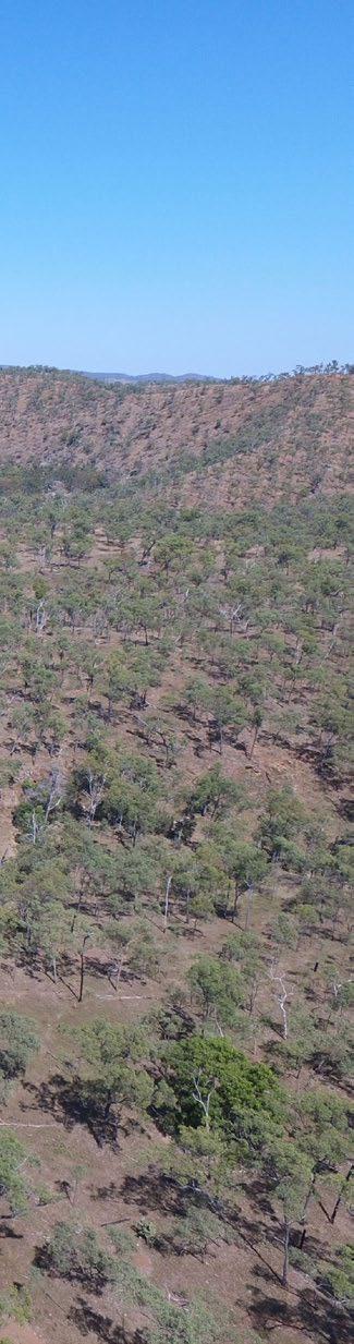
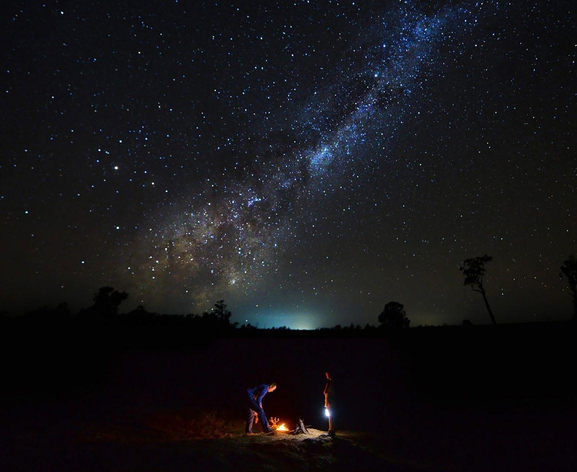
KROOMBIT TOPS NATIONAL Park
Kroombit Tops offers visitors the chance to get back to nature and camp without facilities, away from phones and technology, in small camping areas with fire-rings for a traditional bush cooking experience.
Take a bushwalk and explore forests on 4WD roads. Open forests dominated by Sydney blue gum, pink bloodwood and rough-barked apple trees flourish on the park’s eastern slopes. In the wetter south-eastern sandstone country, blackbutt forests dominate, and subtropical rainforests grow around some of the creeks.
WALKS AND Hikes
ESCARPMENT TRACK
Griffiths Creek picnic ground to The Barracks
11km or 3-4hrs each-way (arrange pick up at other end).
Grade 3 (some bushwalking experience recommended).
Hike this track along the eastern escarpment through open blackbutt forest with glimpses of the Boyne Valley to the north-east.
THE LOOKOUT WALK
Griffiths Creek
140m return (10mins).
Grade 2 (no bushwalking experience required).
Enjoy spectacular views from the eastern escarpment looking over the Boyne Valley.
Many birds and animals in Kroombit Tops National Park are at the northern or southern limit of their distribution and it is the only known home to the endangered Kroombit tinkerfrog.
See the remains of Beautiful Betsy, a WWII Liberator bomber that crashed at Kroombit Tops in 1945 and remained hidden in the forest until it was discovered nearly 50 years later.
RAINFOREST WALK
Munholme Creek
300m return (10mins).
Grade 3 (some bushwalking experience recommended).
Discover Kroombit Tops’ unusual tropical rainforest along this easy circuit track.
BEAUTIFUL BETSY
BOMBER CRASH SITE
Loop Road
700m return (30mins).
Grade 3 (some bushwalking experience recommended).
Visit the final resting place of a WWII Liberator bomber that crashed in 1945 and find out more about this tragic event.
GETTING TO KROOMBIT TOPS NATIONAL PARK
Major access routes are from Gladstone, Biloela, Monto or Ubobo. The type of vehicle you drive and the weather conditions will affect which access route you choose to get to Kroombit Tops.
Some access roads and vehicle tracks within the park require a high-clearance 4WD vehicle and are unsuitable for towing trailers, camper trailers and caravans. Carefully read access details below to choose a route that is suitable for your vehicle and driving experience. Always check weather forecasts and Park alerts before visiting this park.
• Flash flooding occurs in this area. Vehicles have been washed off causeways in the Tableland Road area.
• Avoid visiting this park during rain or if rain is forecast. Roads become extremely slippery and difficult to navigate.
CONVENTIONAL VEHICLE ACCESS
Conventional vehicle (2WD) access is only possible in dry conditions via the park’s northern entrance along Tableland Road. Be aware that isolated rain showers can make gravel roads slippery.
Clewleys Gap Road is not suitable for conventional vehicles—2WD vehicles must exit the park via the same northern entrance on Tableland Road.
TABLELAND ROAD IS NOT SUITABLE FOR:
• any vehicles during wet conditions
• motorhomes and buses
• any vehicles towing large caravans
• conventional vehicles (2WD) towing anything
A 4WD vehicle is recommended if you are towing a trailer, camper trailer or small caravan. Ensure you have driving and towing skills for negotiating steep and narrow sections with loose gravel, steep drop-offs and blind corners. Turnaround options are limited. Large caravans, motorhomes and buses are unsuitable along access roads.
From Gladstone (approximately 85km): travel southwest to Calliope, then follow the Dawson Highway south-west towards Biloela for 4km and turn left into Gladstone-Monto Road. Follow this road for 500m then turn right into Tableland Road. From here, it is a further 68km to the park boundary.
From Ubobo (approximately 70km): take the unsealed Cedarvale Road west for 20km to Clifton Road. Head north for 25km (via Clifton Road and Diglum Road) then turn left into Tableland Road. From here, it is a further 25km to the park boundary.
Tableland Road is a two-lane road until you enter the park. The road has steep sections with loose gravel and sheer drop-offs. As you climb the range within the park, the road narrows and has sharp, blind corners—there is a
single lane bitumen section for the steepest part of the range. There are no turnaround options.
Park facilities accessible along Tableland Road are Griffiths Creek camping area, Kroombit Tops lookout, Lookout walk, Escarpment track and Rainforest walk.
HIGH CLEARANCE 4WD ACCESS
In addition to the northern access from Gladstone and Ubobo described above, high-clearance 4WD access is possible in dry weather conditions only from Monto (along Clewleys Gap Road) and from Biloela (along Razorback track).
From Monto (approximately 66km): this route is suitable for high-clearance 4WDs with off-road trailers and off-road campervans in dry conditions only. Travel 12km north along the Burnett Highway. Turn right into Cania Road and pass through Moonford. Turn right into Wongalee Road and drive until you reach Clonmel Road. Follow Clonmel Road for about 20km and continue along Mahoon Creek Road for a further 20km before turning left and continuing to the park along Clewleys Gap Road and Tableland Road. There are steep sections with loose gravel, blind corners, sheer drop-offs and no turnaround options. Road surfaces are highly variable with loose rocky surfaces and eroded areas to navigate.
CLEWLEYS GAP ROAD IS NOT SUITABLE FOR:
• any vehicles during wet conditions
• vehicles towing caravans
• motorhomes and buses
• conventional vehicles (2WD)
From Biloela (approximately 40km): this high-clearance 4WD route is unsuitable for towing trailers, campervans and caravans. Turn left off the Dawson Highway at KFC into Callide Street, which becomes Valentine Plains Road. Follow this road for approximately 37km to the national park boundary and continue through the park for 27km on the Razorback Track—the park’s most isolated high-clearance 4WD track. This narrow track has blind spots, rocky creek crossings, extended steep ascents/descents, highly variable loose rocky surfaces and eroded areas to navigate. Caution is needed to avoid vehicle damage. Experience in driving in these conditions is essential. There are limited turnaround options. Drive in dry conditions only.
Razorback track is not suitable for towing. To access Razorback camping area with an off-road camper trailer, enter via Dawson Highway and Tableland Road park entrance. Bomber track and Ridge track are also unsuitable for towing.
The 4WD tracks are accessible only in dry weather conditions, a high-clearance 4WD vehicle is required and is unsuitable for towing.
BOMBER TRACK
Two-way traffic
20km each way; allow 1hr each way
• Most of the track is formed, undulating and hilly.
• Approaching The Wall day-use area, high-clearance is needed for short, steep descents with rough, rocky sections and loose surfaces.
• Driving conditions vary with weather and vehicle traffic impacts.
• In dry conditions, the road can become powdery with sections of bulldust.
• Some 4WD experience required.
RIDGE TRACK
One-way traffic
15km; allow 1hr (from The Wall dayuse area to Bomber track junction)
• Narrow, steep track with highly variable surface and eroded areas to navigate.
• Caution is needed to avoid vehicle damage.
• Driving conditions vary with weather and traffic impacts.
• In dry conditions, the road can become powdery with sections of bulldust.
• Experience driving in these conditions is essential.
WHEELCHAIR ACCESSIBILITY
The Kroombit Tops lookout toilets are wheelchair accessible (assistance may be required). The car park is a gravel surface. Access to the toilet facility is over a hard gravel surface that is relatively flat and slightly uneven.
STAYING safe
Watch for walkers, horse riders, wildlife and cattle on the roads.
Mobile phone reception is not available in many areas of the park so carry emergency communication devices such as a UHF radio or an emergency beacon device.
RAZORBACK TRACK
Two-way traffic
27km; allow 2hrs (between Valentine Plains Road park entry and Tableland Road)
• Narrow track with blind spots, rocky creek crossings, extended steep ascents/descents, highly variable loose rocky surfaces and eroded areas to navigate.
• Caution is needed to avoid vehicle damage.
• Driving conditions vary with weather and vehicle traffic impacts.
• In dry conditions, the road can become powdery with sections of bulldust.
• Experience in driving in these conditions is essential.
• This is the park’s most isolated high-clearance 4WD track.
DRIVE WITH CAUTION!
• Be alert for other vehicles, especially on narrow and winding track sections.
• Approach corners cautiously and stay on your side of the road. Avoid sudden slowing as the vehicle may slide.
• Drive slowly—allow time to react to unexpected situations and changed conditions. Watch out for horses, cattle and wildlife close to or on the road.
• The Bicentennial National Trail shares some roads within the park—look out for horse riders, mountain-bike riders and walkers sharing the roads.
• Many roads are unsealed and impassable when wet. See Queensland Traffic—traffic and travel information (phone 13 19 40) to enquire about local road conditions.
There are two camping areas in Kroombit Tops National Park, Razorback and Griffiths Creek.
RAZORBACK CAMPING AREA
Only accessible by high-clearance 4WDs and high-clearance camper trailers (4WD experience is essential).
TO ACCESS CAMPING AREAS SAFELY IN KROOMBIT TOPS NATIONAL PARK READ MORE AT: parks.desi.qld.gov.au/parks/kroombit-tops/visiting-safely#getting_there_and_getting_around
Camping permits are required and fees apply. You must book your camping permit before you arrive. Be aware that you cannot make a camping booking at the camping areas—phone reception is not available.
A tag with your booking number must be displayed at your camp site. Penalties apply for camping without a permit. Campers must be fully self-sufficient. Griffiths Creek camping area has fire-rings and tank water (not suitable
for drinking without treatment). There is a fire-ring at Razorback camping area.
Pack sufficient water, strong sealable containers or rubbish bags to store your food and your rubbish (to take it out of the park when you leave), a portable toilet, and clean milled firewood for your visit. Preferably bring a fuel stove.
Take all your rubbish away with you
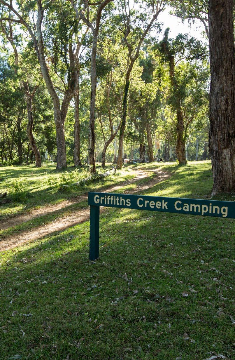
GRIFFITHS CREEK CAMPING AREA
Accessible by conventional vehicle in dry conditions only via the park’s northern entrance along Tableland Road. A 4WD vehicle is recommended if you are towing a trailer, camper trailer or small caravan. Ensure you have driving and towing skills for negotiating steep and narrow sections with loose gravel, steep drop-offs and blind corners. Turnaround options are limited. Clewleys Gap Road is not suitable for conventional vehicles (2WD) or for any vehicles towing caravans. Large caravans, motorhomes and buses are unsuitable along all access roads.
It is illegal to collect wood from the National Park. Campfires are permitted only in fire-rings provided. If there are fire bans you will need to pack a suitable fuel cooking stove—check Park alerts.
• Take all your rubbish away with you for appropriate disposal. Rubbish bins are not provided in the park.
• Bring a portable toilet to minimise pollution in this area—dispose of toilet waste at the Griffiths Creek camping area dump point facility (off Tableland Road). If toileting away from your portable toilet, bury all toilet waste (and paper) 15cm deep and at least 100m from waterways, tracks and camp sites.
CAMPING
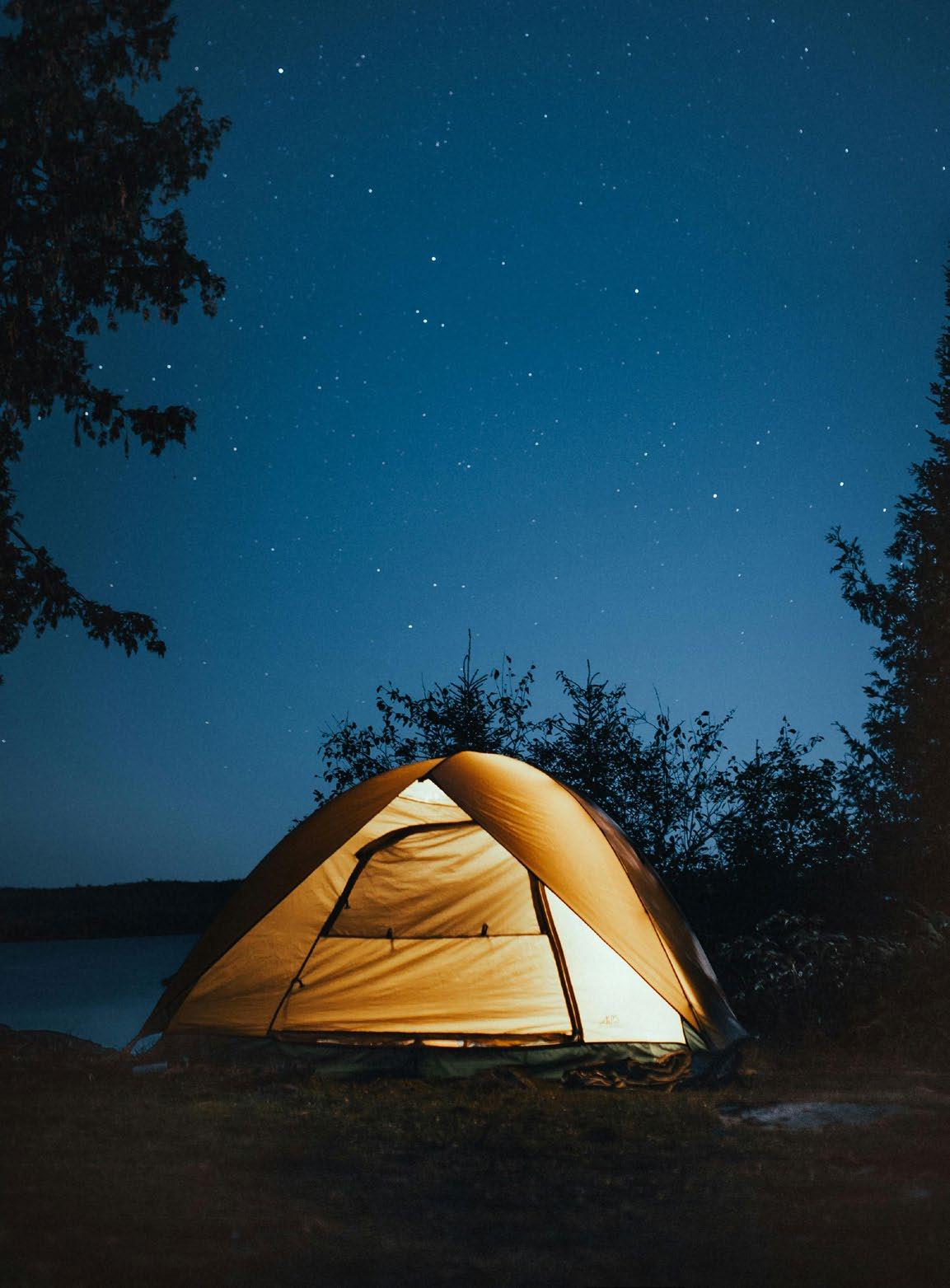
Touring the sandstone wonders region will take you to places of vast beauty the more time you take, the more hidden wonders you will discover.
With so many natural assets – sandstone wonders, gorges, rivers, creeks and lakes, bushland plains and forests, wildlife and wildflowers – there’s always the chance of something special and surprising popping up out of the blue. The closer you get to nature, the more likely those encounters will be. Camping grounds across the region put you right in the thick of our great outdoors and promise you fantastic travels, no matter where you go. Annual events are often held at local showgrounds and campers, if quick, can usually take advantage of free
camping or low-cost facilities at the site. For details, contact the relevant event coordinator or any of the regional visitor information centres. A range of alternative camping options are available. However, if you’re selfsufficient and carrying extra supplies, you can always find your own special spots off the beaten track.
More Online sandstonewonders.com/camping
CALL IN OR PHONE
Visitor Information Centres in the area. Refer to the listing on page 5 in this guide.
LEAVE THEM CLEAN
Please help to care for our precious places and leave them clean as you go.
NATIONAL PARKS
• To camp in national parks, you need to book your campsite and obtain a camping permit.
• Book online at www.qld.gov.au/camping
• Phone 13 Q GOV (13 7 468). Charges may apply, or some sites have a kiosk.
CARAVAN DUMP POINTS
Biloela - Queensland Heritage Park (Exhibition Avenue), Visitor Information Centre (Callide Street)
Baralaba - Wooroonah Road (near the showgrounds)
Moura - Bindaree Road (off the Dawson Highway)
Taroom - 4 Wolsey Street (near Council depot)
Theodore - Theodore Showgrounds
Dululu - Public Toilets, Bryant Street. (at the Recreation Grounds, accessible from the Boulevard, north of the swimming pool)
FREE OR LOW-COST
sites CLOSE TO TOWNS
CAMPSITE
Thangool Short-term Camping Area (adjacent to the Thangool Memorial Park)
There are commercially run Caravan Parks in Banana, Biloela, Moura, Taroom and Wowan.
*Office hours are 9.00am - 4.00pm daily. You must book-in prior to 4.00pm to camp. **This is a camping and water reserve on the national stock route; and part of a working cattle property. Parthenium Weed free area.
# No specific site numbers. A large, open area.
Pets permitted: Where permitted, please ensure you clean up after your pets. Showers: May be cold or hot and may require coins to operate. Water: May require treating before use. Barbecues: May be gas, electric or wood and may require coins to operate.
Campfires: Where permitted may have local requirements regarding location of fire, fire restrictions etc. Rubbish: Where refuse bins are not provided, please take your rubbish with you.
FRESHWATER FISHING
Get ready! The Banana Shire is arguably the best region for freshwater fishing anywhere in Australia. Take your pick of different styles of fishing, targeting a huge variety of species. You won’t be disappointed.
BEFORE FISHING MAKE SURE YOU PURCHASE A STOCKED IMPOUNDMENT PERMIT (SIPS). THESE ARE AVAILABLE ONLINE FROM QUEENSLAND GOVERNMENT ON THE FOLLOWING LINK: qld.gov.au/recreation/activities/boating-fishing/rec-fishing/dams/stocked-impoundment-permits/buy
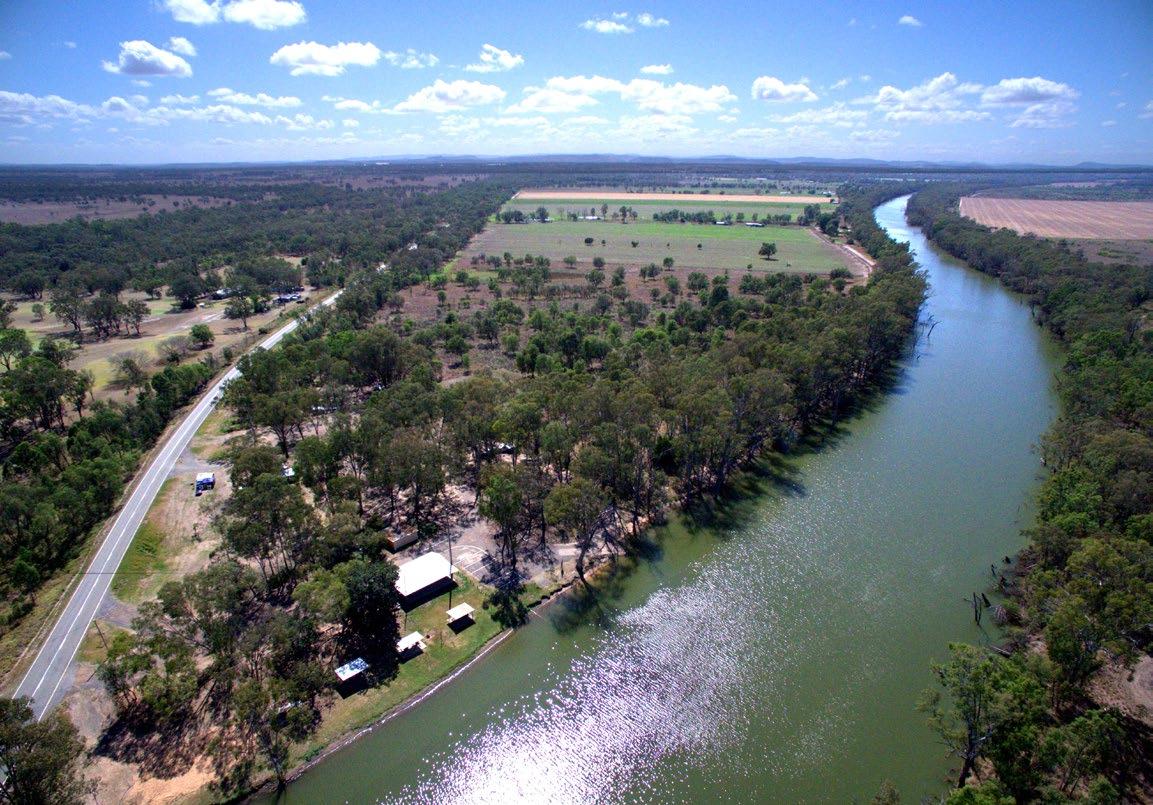
DAWSON RIVER HOT SPOTS
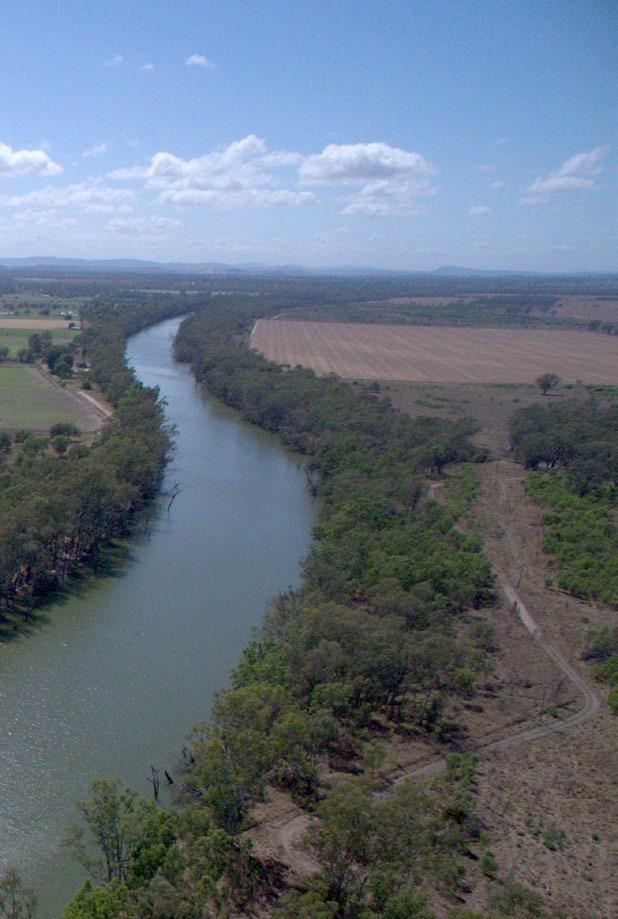
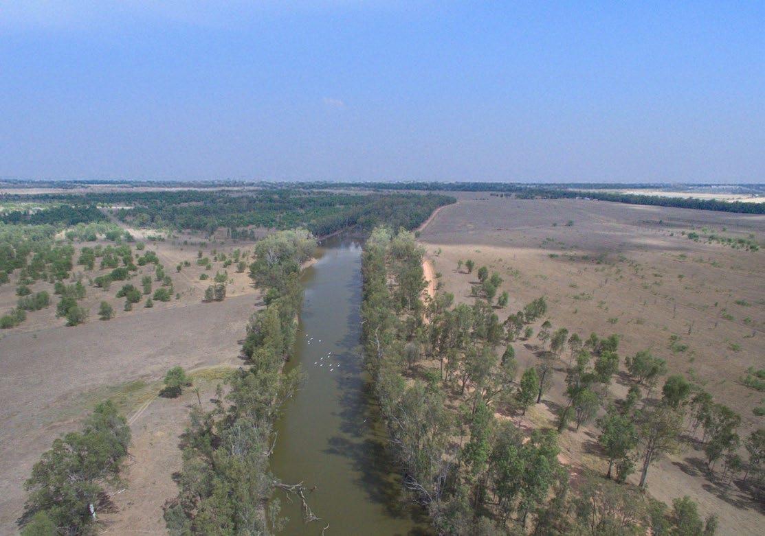
The mighty Dawson River runs wild through the Banana Shire from Expedition National Park in the south west to Baralaba in the north west. It offers enough wild freshwater fishing locations to fill a few hours or a few days.
Neville Hewitt Weir is about 30 minutes drive from Banana or 2.5 hours west of Gladstone. It offers easy access to Dawson River fishing from Baralaba Riverbank Park, behind the Baralaba hospital.
Set off from the boat ramp and expect anything from barramundi, saratoga, sleepy cod, yellow belly, grunter and spangled perch to be on the bite.
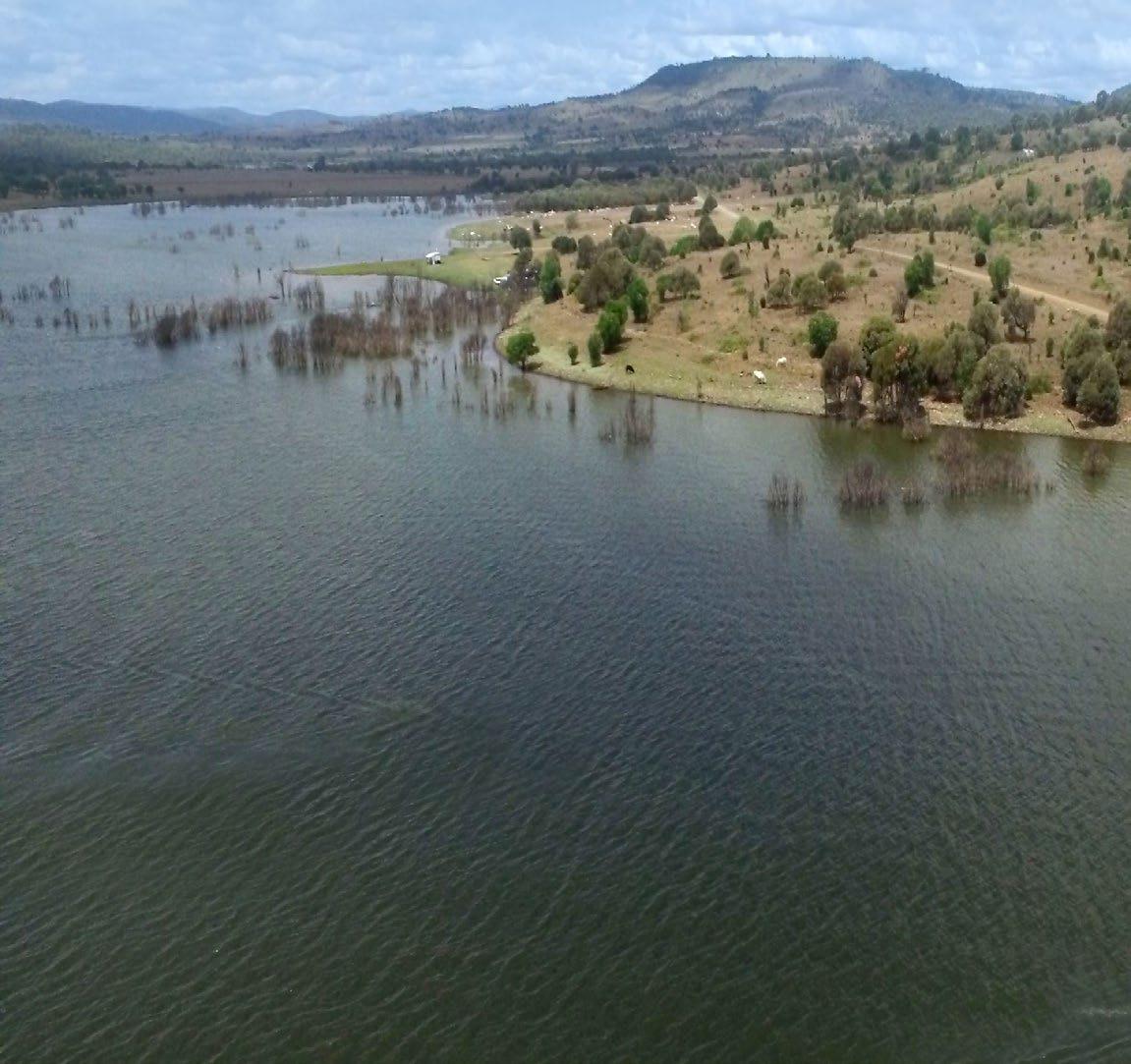
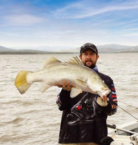
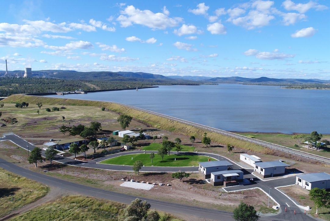
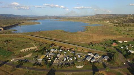
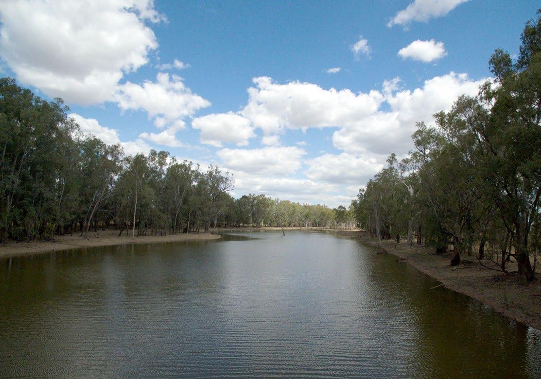
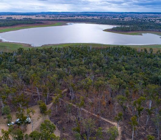
LAKE CALLIDE HOT SPOTS
Lake Callide, as pictured, was constructed in 1965 to supply water to the nearby power station, however today it definitely has a name for itself as a fishing hot spot and is ideal for beginners.
Lake Callide is an easy 1.5 hour drive from Gladstone and just 15 minutes from Biloela.
If you’re fishing from the banks, don’t be surprised if you’re sharing them with some local cattle, otherwise your tinnie will feel right at home on the dam.
Well executed fish stocking programs make the lake popular grounds for saratoga, barramundi, yellow belly, silver perch, eel-tailed catfish, sleepy cod, alligator gar and eels. It’s also home to redclaw, a type of crayfish that is considered a local delicacy.
DON RIVER HOT SPOTS
The Don River runs across the very north of Banana Shire. Gear up for wild river fishing on the Don River, chasing a battle with saratoga and yellow belly. To fish for catfish head to Dumpy Creek, 20km west of Goovigen along the Goovigen-Rannes Road, turn right onto the Leichhardt Highway and then left onto the gravel road less than 1km from the turn off.
GLEBE WEIR
Situated 54km from Taroom on Theodore Road (Leichhardt Way). Fish for saratoga, golden perch, silver perch, catfish, sleepy cod and spangled perch. There is no fishing from 100m upstream to 200m downstream of the weir. Bank access and boat ramp, toilets, drinking water and picnic tables. Caravan and camping sites are available.
WHAT REELY MATTERS
BEST TIME OF YEAR TO FISH:
Year-round FISHING GROUNDS:
Lakes, weirs, rivers and creeks
FACILITIES:
Vary from fully serviced caravan and camping sites to free self-sufficient bush camping
SPECIES:
Barramundi, golden perch (yellow belly), saratoga, silver perch, spangled perch, small mouth sooty grunter (black bream), banded grunter, eel-tailed catfish, fork-tailed catfish, sleepy cod, spangled perch, alligator gar, freshwater crayfish and redclaw
GET HOOKED
Lakes, weirs, rivers and creeks full of fat freshwater barramundi, yellow belly, sleepy cod and more. It’s easy to see why various fishing competitions dot the calendar.
Friendly locals and purpose-built fishing, camping and accommodation facilities, make it an easy destination to wet the line, get the blood pumping with some great fighting fish and keep you coming back year after year.
Head to Cracow Beach on the Dawson River to spot Water Monitor lizards cruising across the water fishing for a feed.
FRESHWATER FISHING
MOURA
Two hours’ drive south west of Rockhampton or Gladstone, the town of Moura is a great spot to access the river.
You’ll find picnic tables, barbecues, camping facilities and a boat ramp at Apex Park. Drop anchor near a bridge or fallen tree and go on the hunt for small schools of saratoga. A fantastic sports fish, they will readily take bait, lure and fly.
TAROOM
Sandy Creek Bridge, Juandah Creek About 5km south on the Roma-Taroom Road after crossing the Dawson River bridge (on entry to Taroom). Saratoga, golden perch (yellowbelly), eel-tailed catfish, fork-tailed catfish, spangled perch, eel and banded grunter.
Glebe Weir 54km from Taroom on Theodore Road (Leichhardt Highway). Bank access, boat ramp, toilets, hot showers, non-potable water, picnic tables and wood barbecues. Saratoga, golden perch, silver perch, catfish, sleepy cod and spangled perch. No fishing from 100m upstream to 200m downstream of the weir.
THEODORE
Thirty-eight minutes’ drive south of Moura, you’ll find a historic stopping point for wanderers and travellers. Theodore is shaped like a point between the Dawson River and Castle Creek
Cracow Beach is a Dawson River hot spot just over an hour’s drive from Apex Park. Easily one of the region’s best fishing spots, you’ll catch catfish, perch, cod, saratoga and eel.
The fork-tailed catfish is often overlooked, but great fun to catch. In these waters, they grow to well over a metre in length. But be ready for a battle. They’ll get your blood
The muddy waters of the Dawson River send anglers into a frenzy, while the unique communities and towns provide unexpected charm when it’s time to put the rods away.
pumping and have even been known to rip a few runners off your rod.
It’s a beautiful part of the river and a great spot for bush camping. Make sure you keep your eyes open for Water Monitors. The lizards can grow quite large in size and look almost prehistoric, cruising through the river.
Watch out for Theodore’s threadfin bream, known as ‘Pinkies’ to the locals. Fish for them on sloping, treelined banks.
Cracow Beach is also just 18km north of the historic ghost town of Cracow, which is definitely worth a look.
WHAT REELY MATTERS
BEST TIME OF YEAR TO FISH:
Year-round
FISHING GROUNDS:
Weirs, rivers and creeks
FACILITIES:
Caravan parks, camping grounds, picnic grounds and accommodation
SPECIES:
Yellow belly, barramundi, redclaw crayfish, saratoga, threadfin bream, silver perch, eel-tailed catfish, sleepy cod, alligator gar and spangled perch
GET HOOKED
In this region it is the Dawson River that is the hero, providing a snake of muddy water habitats for some of Central Queensland’s favourite species. Going fishing here is the start of big adventures. While you’re at it, you’ll discover the region and get to know all its parts. You’ll travel the length and breadth of the region. Stop into towns to buy bait and extra kit. Talk to the locals, pick up on the tips and traps.
HISTORY
The rich Dawson and Callide valleys straddle the Banana Shire, bringing together a deep history of life on the land. Opened up in the mid-1840s by explorer Dr Ludwig Leichhardt, dairy and cattle pastoral settlements took hold in the early 1850s.
In their wake, bloody skirmishes broke out between the pastoralists and local First Nations clans, the losses great on both sides. Gold fever came and went on quite a few occasions with the population fluctuating depending on the finds. Gold mining finally took hold at Cracow in the 1930s and is still operating today, along with coal holdings at Baralaba (since 1916), Moura (since 1960s) and Biloela / Callide (since 1944). The railway moved to Theodore and Biloela after 1920.
The mooted Dawson River Irrigation Scheme gathered steam beginning with the Theodore Weir and canal system. Water harvesting to support ever expanding farming and mining industries spawned several dam projects. The Callide Dam opened in 1965, Glebe Weir in 1971 and Neville Hewitt Weir in 1976.
Today Banana Shire, with an area of 28,610km2, has an estimated residential population of 15,053 (2024). The region continues to have a strong future built on the back of agricultural, mining, energy and supporting industries. Typical of country Queensland, the Shire has seen its fair share of floods and droughts. However, the community remains strong, prosperous and growing despite these setbacks and is writing the next chapter in the Shire’s history book.
BANANA
Nostalgically the region’s central point, Banana grew out of gold fever during the infamous boom and buster era of Rockhampton’s Canoona Rush.
OUR HISTORY
Lasting only 66 days from September to December 1858, on pure speculation, the Canoona rush saw some 2000 hopeful prospectors put digs down in what became the town.
Visitors are always a little baffled by the town’s unusual name, particularly as there isn’t a single banana tree in sight. A dun coloured bullock is responsible for that.
A favourite of local stockmen in the 1860s, Banana the bullock, so named for his yellowish colouring, would help herd wild cattle into holding yards. When Banana died, the gully was given the name in honour of his feats. A replica of Banana proudly stands in the town, a warm reminder of his legacy to those pioneering days.
TODAY
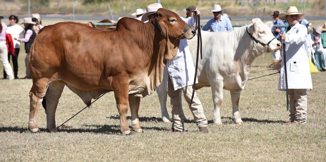
Banana is in the heart of the central valley’s farming area. Crops grown in the area include sorghum, wheat, cotton, mung beans and leukena. The area is also part of the cattle producing belt, with breeds such as Brahman, Santa Gertrudis, Braford, Hereford and Charolais being regularly bought and sold at the cattle sales.
The township of Banana itself is quite small but it services many more people on outlying properties. It stands at the crossroads leading to Rockhampton, Biloela, Theodore and Moura. Many travellers stop at the town’s Hotel/Motel or petrol stations to rest and refuel.
A historic cemetery stands on a hill behind the town, the tombstones bearing the names of the local pioneering families In 1880. The local government area Banana Division (later the Shire of Banana), was established with its headquarters in Banana, taking its name from the town. However, following two relocations, Biloela became Shire headquarters in 1946.
CAMPING
Adjacent to Sutherland Hall there is limited camping with toilets, coin operated showers and potable water. Pet friendly with 7 nights max stay.
SEE AND DO
• Banana is home to two Transport and Main Road Benchmarks; markers for level datum or height above sea level. One can be found outside the school and the other outside the hotel.
• A replica of Banana, the bullock, proudly stands in the town, a warm reminder of his legacy to those pioneering days.
• Banana Battle of the Bush - October (Banana Sports Committee Inc - check on Facebook for this year’s date).
‘Banana’ the bullock
BARALABA
SEE AND DO
• The Baralaba Newsagency is the best source of visitor information.
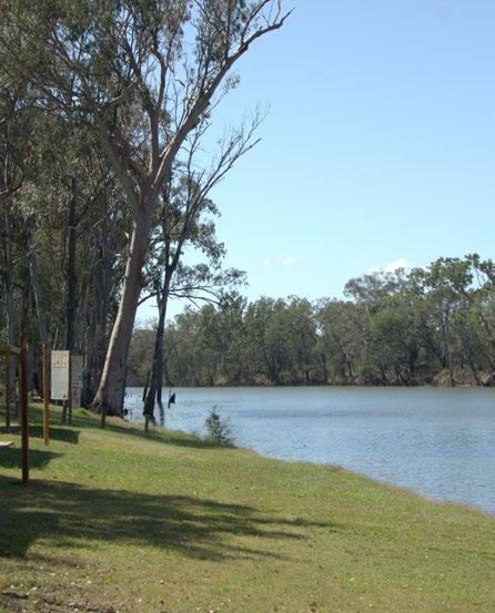
• Neville Hewitt Weir Picnic area is nestled against the Dawson River, you don’t have to go far for a good fish. Throw in a line, sit back and it won’t be long before you feel that tell-tale tug on the hook. On any day of the week, the Neville Hewitt Weir Picnic Area is a great low-cost spot for camping, boating, fishing, birdwatching or just spending the day with family. You’ll find it has everything you need with picnic tables, barbecues, cold showers and potable water.
• The Baralaba Historical Village opens by appointment so you’ll need to book ahead. Phone: 0427 981 235 Polly.
• The community are developing a ‘History Track’ around town so you can read about the history of the town as you are exploring it.
HISTORY
The town’s name is derived from an Aboriginal word meaning ‘high mountain’ referring to nearby Mount Ramsay. Coal mining first forged the way for other industries to move in, such as beef cattle and crop farming - sorghum, wheat and cotton in the main.
Local historians have spent three decades creating the Historical Village close to the edge of town. The heritage houses are filled with memorabilia, offering visitors an insightful passage back in time.
TODAY
The local economy revolves around beef production and coal mining. The people are proud of the past. It’s ever-present too, preserved in the shop front and building facades, giving the streets a charming yesteryear feel. Pop in for some supplies, morning coffee or treats.
FISHING
Neville Hewitt Weir, Dawson River
Situated: At the southern end of Baralaba, on Bedford Street, behind the hospital.
Facilities: Toilets, cold showers, picnic tables and shelter sheds. There is a concrete boat ramp.
Fish species: Barramundi, saratoga, sleepy cod, eel-tailed catfish, fork-tailed catfish, golden perch (yellowbelly), small mouth sooty grunter (black bream), eel, spangled perch and banded grunter.
No fishing from 100m upstream to 200m downstream of the weir.
Camping: Limited camping in a shady recreation area at the river’s edge, but not in the barricaded area around the shelter sheds.
MAJOR EVENTS
Baralaba Agricultural Show in May • Baralaba Campdraft in August • The Great Baralaba Saratoga Classic Family Fishing Competition in September
CAMPING
Neville Hewitt Weir Picnic Area is a great low-cost spot for camping.
Hewitt Weir Picnic Area
Welcome to Dululu’s finest
Experience Banana Shire’s most impressive establishment, the recently restored, historic Dululu Hotel. Enjoy lunch or dinner in the landscaped gardens, a game of pool on the rear deck or relax inside in air conditioned comfort and take in the striking refurbishment. Why not stay the night in one of the beautifully appointed rooms. Come see it for yourself!
Lunch: Noon - 2pm, Dinner: 6pm - 8pm 13 Main Street, Dululu Ph: 07 4867 2201 Visit our other venues


Lunch: Noon - 2pm
Dinner: 6pm - 8pm
Bottle shop: 10am - 9.30pm
Accommodation: from $80 per night
27-29 The Boulevard, Theodore Ph: 07 4867 2200
Lunch: Noon - 2pm, Dinner: 6pm - 8pm
Bottle shop: 10am - 9.30pm
Coffee shop: 5am – 8pm weekdays 6am – 8pm weekends
Accommodation: from $150 per night 12 Bowen St, Banana - Ph: 07 4867 3200

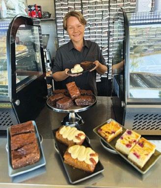
BILOELA
Everyone says ‘g’day’ with a smile and a nod as you walk down the wide streets of Biloela. It’s friendly, warm and welcoming.
The town was established on what is Gangulu tribal lands. The name Biloela is generally believed to come from an Aboriginal word for cockatoo
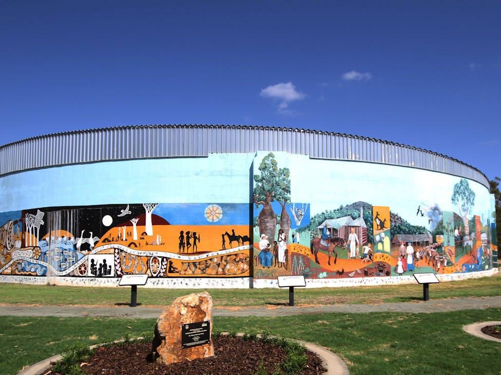
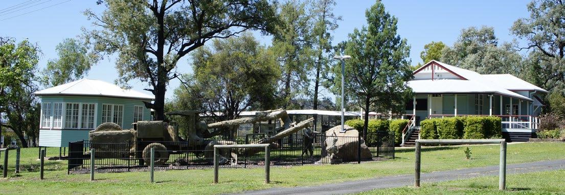
Buildings wear the tell-tale signs of progress through the decades. Eclipsing other towns as a regional centre, the township had some help along the way. Just a village in the early 1920s, the State Government set up a display farm close by, hoping the growing populous would develop the town. With the assistance of underground water, it did. However, the post WWII years were the kindest of all, with Biloela becoming home to an ever widening, multi-cultural community, servicing big business, and industry bodies, cooperatives and small business as well as the rural and mining sectors that surround it. The Queensland Heritage Park and Spirit of the Land Mural pay homage to the men, women and machinery that over
generations, from the First Australians and pioneers to today’s farmers and miners, have created a legacy of prosperity. Fashioned and built by the hands of those who forged their futures in a new land, rambling homesteads grace hillsides and streetscapes. The heritage listed Greycliffe Homestead is situated across from the Biloela State High School and is on the opposite side of the Highway to the Biloela Bowls Club. The wide verandah and quaint interior have changed little since they were first conceived. Further out, Kilburnie Homestead still operates as a working concern, with descendants of the Campbell family continuing to make their mark. In a typical show of country hospitality, Kilburnie celebrates its long unbroken history, by hosting open days filled with music and nostalgia.

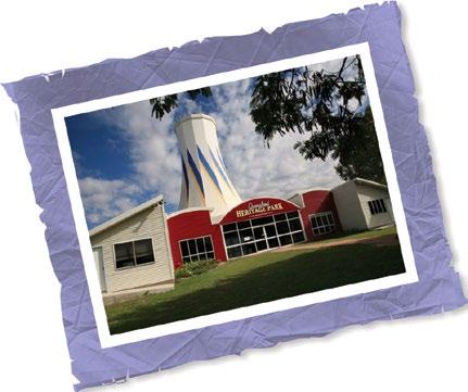

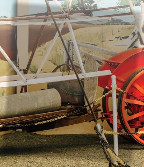
A celebration of our nation’s glorious past and the pioneering spirit of Australians proudly brought to you by the Callide Dawson Machinery Preservation Club Inc.
OPEN 7 DAYS | 9.00AM TO 4.00PM
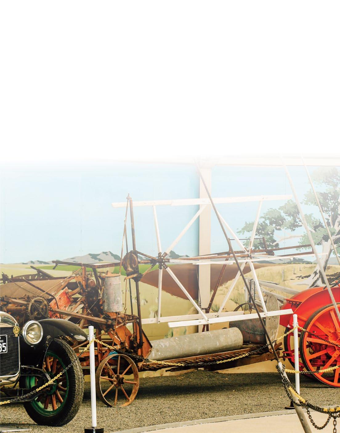
Explore, discover and relive the past as you browse through the large array of vintage machinery, collectables and memorabilia. These are displayed in the “Silo” (from Expo ‘88), the first church, Biloela’s original railway station, on the extensive grounds at the rear of the complex.
Sample baked treats served with expresso coffee or a pot of tea at the Post’n’Rail Cafe as you peruse tourist information at the accredited Rural Hinterland Visitor Information Centre and select a momento, or two, from the souvenir shop on site.
Visiting in July . . . Come Along to the Old Wheels In Motion Rally!!
The Annual Old Wheels in Motion Rally & Swap Meet is held on the third weekend of July each year This is Queensland’s premiere event for collectors, restorers and machinery enthusiasts. For more information visit: www.cdmpc.com.au or call us on (07) 4992 2400.


BILOELA TODAY
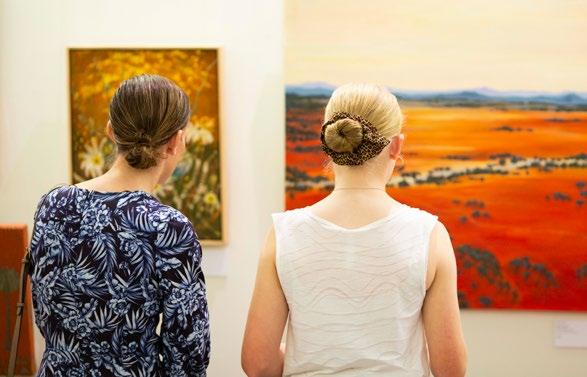
Today, Biloela is a busy commercial and tourist hub, though it still retains that relaxed, country feeling. Many festivals and events fill the annual calendar, along with frequent exhibitions staged at the Banana Shire Regional Art Gallery. The Shire has a lively arts fraternity and the gallery proudly features the works of local artisans as well as the offerings of others from much further afield.
Biloela and the Banana Shire, dubbed by the council as ‘The Shire of Opportunity’, has a diverse range of industries. There’s plenty of cafes and restaurants to feed the hungry traveller as well as places to stay and specialty stores showcasing a wide range of local arts and crafts.
The area has extensive grazing and various cereal and legume crops. The third largest abattoir in Queensland is situated in the town. The Callide Power Station lies north-east of the town. Coal was discovered on Callide Creek in 1891 and is now mined at the nearby Callide and Boundary Hill mines which supply the power station.
Biloela is a great base to explore the Banana Shire. Like a compass, all roads lead from Biloela, reaching into the countryside and out across the region, taking you to the places you want to be. Wherever you choose to venture, from the heart of Biloela you’ll find your way to the fun and the fantastic.


BILOELA MAJOR EVENTS


ADVENTURE NEAR BILOELA
For those with a hankering for the great outdoors, a short journey leads to a multitude of adventures at Kroombit Tops National Park. With some roads accessible to conventional vehicles and others built for 4WD excitement, there’s every reason to go exploring. Towering ridges, deep gorges and panoramic vistas spill out across a wide horizon, resplendent against the ravages of time.

SEE AND DO
• The Giant Director’s Chair - Lions Park
• Thangool Racecourse - 12km south on Australia’s Country Way (A3)
• Callide Dam - 10km from town, excellent for boating, fishing and swimming
• Callide Power Station - Located at Callide Dam
• Kroombit Tops National Park - 25km (20 mins) to the turn off on Valentine Plains Road
• CBD - Shopping, Supermarkets, Cafes, Restaurants, Hotels
• Greycliffe Homestead
• Kilburnie Homestead
• Spirit of the Land mural
• Queensland Heritage Park

FISHING NEAR BILOELA
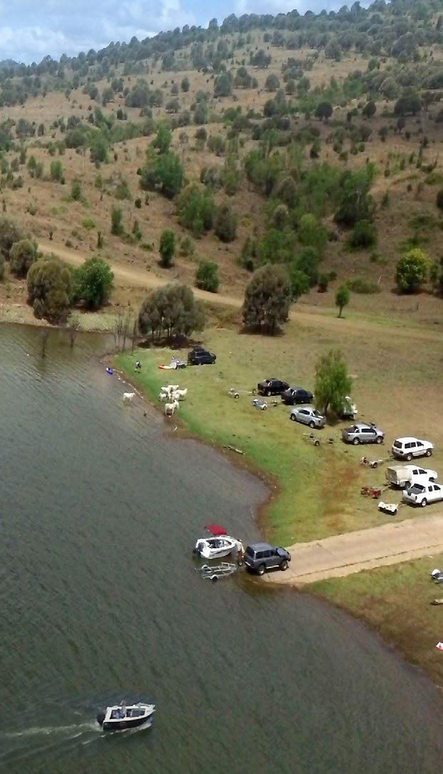
Sunny days were made for family camping, fishing and boating fun, whiling away the days on the banks of the Callide Dam. With all the amenities on hand, this is just the place to stay and play for as long as the fish are biting.
Situated: 10km east of Biloela.
Facilities: Boat ramp, toilet block, picnic tables, barbecues and drinking water in the recreation area.
Fish species: Barramundi, golden perch (yellowbelly), saratoga, silver perch, eel-tailed catfish, sleepy cod, spangled perch, alligator gar, freshwater crayfish and redclaw.
A Stocked Impoundment Permit (SIPS) is required to fish in this dam. More information available, see website link on page 20.
Lake Callide
Located 10km out of Biloela Qld next to Lake Callide. Callide Dam is stocked with barramundi (128cm so far), saratoga and yellowbelly. Seasonal redclaw are also prolific.
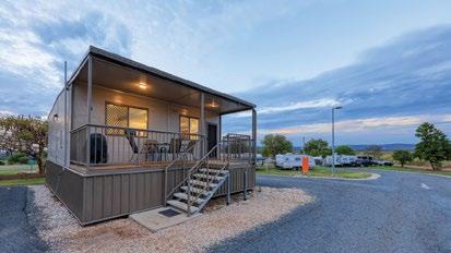
Cabins (1 & 2 Bedroom), powered sites, self-contained sites • Amenities, camp kitchen, laundry, dump point • Kiosk offers cold drinks, ice creams, fishing lures, swap-n-go gas bottles and gemstone treasure bags.
Recreational area with children's playground and bbq's overlooking the dam close by. Peaceful and friendly caravan park to stay near Biloela.
Camping: Lake Callide Retreat have powered and unpowered camping available. Secure your booking at

Cracow
HISTORY
The town of Cracow is set on the traditional lands of the Wulli Wulli people. There’s some dispute as to why pastoralist John Ross named the area Cracow back in 1851. Some say it was in reverence to the Polish who had fought valiantly for independence, while others say it was the sound of a cracking whip.
Gold was first discovered in Cracow in 1875 by itinerant fossickers and a further discovery of a nugget was made by a First Nations stockman, Johnny Nipps in 1916. In 1931, the Golden Plateau mine was established and it operated continuously until 1976. As of 1977, 19,910 kilograms (43,890 lb) of gold had been extracted from the mine.
At its gold mining peak, the town included five cafes, barber shop, billiard saloon, two butchers, a picture theatre and a soft drink factory. The closure of the mine led to Cracow becoming almost a ghost town with many deserted houses and shops.
SEE AND DO
• Cracow Beach is a beautiful spot on the Dawson River and Delusion Creek Junction, located 18km north-west of Cracow along IslaDelusion Road. It is surrounded by Livistona palms and native bush land and is the perfect stop over point to relax and enjoy the calm and serenity, or try a spot of fishing. This is a camping and water reserve on the national stock route; and part of a working cattle property. Parthenium Weed free area. This is a bush camp and all rubbish must be taken with you.
• Take the nature walk along Castle Creek for platypus and birdwatching.
TODAY
Following the commencement of gold mining in the 1930s, more than two million ounces of gold have been mined from the Cracow goldfields. The current mining operation commenced in 2005 with Aeris Resources (Cracow Gold Operations) acquiring the asset in 2020 from Evolution Mining.
Cracow Hotel is a genuine Aussie country pub, where the beers are cold and locals spin stories full of laughter. Not a pokie in site. They were ripped out and shot up when the hotel changed hands in 1999 –out of respect for the wives of the gold miners who might have been tempted to blow their dough before flying home. Looking more like a home than hotel, the entrance to the Cracow pub is somewhat deceiving. Once inside, you enter a time capsule where bric-a-brac and memorabilia stockpiled over decades, garnish the walls and ceilings. Visitors have been known to spot and even photograph the resident ghost among the
CAMPING
saddlery that hangs from the rafters. Clad in her nightgown, the woman resides in Room 1, often venturing out in the wee hours to wander the stairs and corridors. The adventure doesn’t stop there. The accommodation is inspired by the great countries of the world. Choose your room to your favourite theme, enjoy the hospitality, scrawl your name on the bar wall and you’re almost a local. Well, that’s what Nikki and Stuart might tell you! The Burkes bought the pub from Fred Brophy in 2021, and have quickly restored the building to its former glory while maintaining its colourful history.
Make sure you stop in at the Heritage Centre on Third Avenue and download the Storytowns app to hear more about Cracow’s history.
If you’ve never been to a ghost town, the Cracow historic walk along its abandoned streets and shopping strip is a fascinating insight into the life and times of yesteryear.
Cracow Beach - This is a camping spot only (not suitable for caravans). Rubbish must be taken away with you. Water levels will vary with the seasons and normally this is a fairly shallow section of the river. Be aware that the water level may rise quickly due to rainfall upstream, so camp on high ground. Camp at Cracow Town adjacent to the Cracow Heritage Centre. With limited powered sites, toilets, hot showers, barbecues and a fire pit. Pets are permitted and water is available. A donation box is located at the toilets and at the Cracow Heritage Centre (7 nights max stay). It is a quick walk from the iconic Cracow Pub.
FISHING
Cracow Beach, Dawson River (Cracow)
Situated: 18km north of Cracow or 31km south of Theodore on the EidsvoldTheodore Road, then right at the signposted Isla-Delusion Road for 2km. Track goes off to the left and down to the river/creek bed (check the track if recent rain). Facilities: No facilities. Must be self-sufficient. Take rubbish with you. Fish species: Saratoga, eel-tailed catfish, fork-tailed catfish, golden perch (yellowbelly), sleepy cod, eel, spangled perch and banded grunter. Keep your eyes peeled and you may catch a glimpse of Water Monitors fishing the streams.
Cracow Heritage Centre - courtesy Jess Tweed
There is no fuel station in Cracow. The nearest fuel is at Eidsvold or Theodore.
DULULU
SEE AND DO
Lake Pleasant is 33.9km (29 min) via Australia’s Country Way (A3)
• A prominent feature on the landscape is Red Hill. Dwindling evidence of an ancient volcano.
• The nearby township of Wowan is the local service centre, with roadhouse, hotel, caravan park, craft shop, post office, health centre, churches, police and ambulance station.
HISTORY
The town’s original name was Bunerba, but on 29 April 1915 Queensland Railways Department decided to name the new railway station Dululu to avoid confusion with Buneru, another town located near Wowan. The name derives from an Indigenous word meaning “soft”.
At the rest area in Dululu a plaque bearing the names of early settlers is mounted on a hexagonal shaped rock similar to those found at Mount Scoria near Thangool. Owners of vast areas of grazing land, these were folks who helped found the region’s cattle industry, including the Scot born Leith-Hays brothers who named the Dee and Don rivers.
CAMPING
TODAY
The northern most town in the Banana region, Dululu is a junction point that divides the two southern arterials, Australia’s Country Way (Burnett Highway A3) to the east and the Leichhardt Way (A5) to the west. Both highways reveal untold adventures and this rural village is the start of them all – a launching pad to the region and perfect place to stop, rest and make your touring plans.
The Dululu Hotel, which was moved to the Dululu site from Mount Morgan in 1935, was gutted by fire in 2015 and has been restored and reopens in 2025.
While you’re at it, you can take your pick of camping, fishing and swimming spots. The Dee River is at the doorstep - try the Dee at the Australia’s Country Way (A3) crossing for a close spot to throw a line - and the Don and Lake Victoria not far down the road.
FISHING
Lake Victoria, Smoky Creek (Dululu)
Situated: 26km north of Jambin along Australia’s Country Way (A3) and Dooneys Road. Or 24km south of Dululu along Australia’s Country Way (A3) and Dooneys Road. Not accessible in the wet. Black soil.
Facilities: No facilities. Must be self-sufficient. Take rubbish with you.
Fish Species: Yellowbelly, catfish, saratoga.
The Dululu Rest Area is next door to the tennis courts and serviced with toilets and new sheltered picnic facilities. For a small charge, campers can use the powered sites (7 nights max) at the rear of the courts, complete with hot showers for a donation.
GOOVIGEN
SEE AND DO
Goovigen is a small rural village in the region’s northern farming heartland. A short distance north-west of Jambin off Australia’s Country Way (A3), fewer than 300 people live in the town.
The streets of Goovigen are as neat as a pin and the heritage buildings have been either restored to their former glory or updated for present needs.
HISTORY
Goovigen was originally established as a supply depot for the railways and was named by the Queensland Railways Department on 27 April 1920. Goovigen is a local Aboriginal word for box tree, a species of Eucalyptus.
The corrugated iron Percy Schluter Historical School of Arts Hall is about as quaint as you can get and houses the local history and stories of its pioneers. Built in 1929, the building was under threat in 1992, until a group of dedicated history lovers took up the challenge to save the site, turning it into the heritage heart of the town and a significant attraction for visitors. Among interesting displays on the life and times of the pioneer families, you’ll find a fabulous collection of old glass bottles. Engel Homestead is also located at the site. For Bookings, phone Desiree on 0447 222 451 or Di on 0419 922 752
CAMPING
TODAY
Rich with fields of cotton, cattle and grain, the surrounding area is typically serene. Life beats to the seasonal patterns that bring the sunshine and rain. In fact, most of the talk around here is about the weather, what it’s doing and what to expect.
FISHING
Lake Pleasant
Situated: Lake Pleasant is 6.5km (11 min) via Lake Pleasant Road and Goovigen Connection Road.
Facilities: No facilities. Must be self-sufficient. Take rubbish with you.
Fish Species: Yellowbelly, catfish.
Camping: Free bush camping, limited space, small area, 7 nights max stay.
Don River, Dumpy Creek - Rannes
Situated: 20km west of Goovigen along the Goovigen-Rannes Road, turn right onto the Leichhardt Way and then left onto the gravel road less than 1km from the turn off.
Facilities: No facilities. Must be self-sufficient. Take rubbish with you.
Fish species: Yellowbelly, catfish.
Camping: Free bush camping. Limited space.
The Goovigen recreation reserve on Stone Crescent is pet friendly and offers great facilities, including powered and unpowered sites, toilets, hot showers and water available for 7 nights max stay. Barbecues and picnic tables available. Donation box is located on the right as you drive into the Goovigen recreation reserve. Limited bush camping with no facilities at Lake Pleasant and Don River - Rannes. Please take rubbish with you.
Stone Cres
Recreation Area
JAMBIN
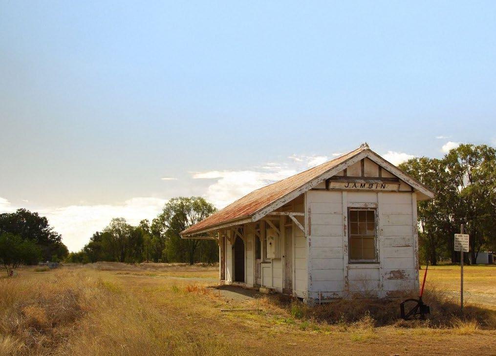
HISTORY
The town takes its name from the Jambin railway station, which in turn was named on 27 April 1923 by the Queensland Railway Department and is believed to be an Aboriginal word meaning echidna.
Jambin was originally established as a supply depot for the railway, which was established in 1924. This opened up the area for new settlers, many of them pursuing dairying. Cream was sent to the butter factory at Wowan.
A drive along the Argoon-Kilburnie Road will take you to the heritage listed Kilburnie Homestead. Built in 1884, this beautifully maintained pastoralist’s home has been in the Campbell family for four generations and was heritage listed with the Queensland Government in 1992.
CAMPING
TODAY
A rural hub with a pub to service weary travellers, Jambin is on Australia’s Country Way (A3) just south of Smoky Creek. Part of the Callide Valley, the town is wedged between the Callide Creek to the west and the highway to the east, making it a picturesque spot to stop. Callide Creek is a vital tributary of the Don River, supporting all kinds of farming, cultural and recreational activities.
FISHING
Lindleys Crossing, Dixalea
Situated: About 14km off Australia’s Country Way (A3) via Tomlins Road and Lindleys Road, travelling north.
Facilities: No facilities. Must be self-sufficient. Take rubbish with you.
Fish Species: Yellowbelly, catfish, barramundi, saratoga.
Camping: Bush camping adjacent to the crossing during low water only
MAJOR EVENTS
For a tiny village Jambin holds some big events.
• Jambin Hotel Woodchop and Chainsaw Competition in March/April
• Champagne Campdraft in September
Jambin Recreation Reserve on Australia’s Country Way (A3) has excellent camping facilities for a donation, which can be left in the honesty box under the hall. Jambin Hotel Motel on Australia’s Country Way (A3) offers caravan sites for overnight stays and budget accommodation. P: (07) 4996 5101 E: jambinhotelmotel@bigpond.com
MOURA

Lying in the heart of the Dawson Valley, 7km from the Dawson River, its parklands and public facilities, festivals and events, river fishing, water sports and bird watching attract thousands of visitors each year.
OUR HISTORY TODAY
In 1854 Charles Marshall named his leased pastoral selection Moura. There are two theories regarding the origin of the name. One is that it is named after Moura in Portugal where he served in the British Army during the Peninsular Wars. The other is that it is an Aboriginal word meaning native camp dog.
The Moura property was developed into a homestead in 1880 by Edward Homer. The town was first established in 1936 as a farming centre near the existing Moura Station.
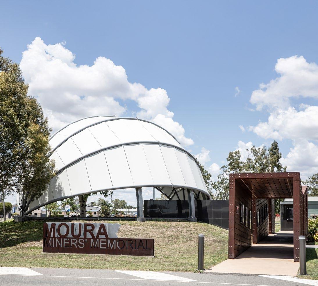
The Moura Museum and Library is located at 34 Gillespie Street. The museum presents Moura’s agricultural and industrial history. This facility is integrated with the Miners Memorial, honouring our mining heritage and the memory of those lost in tragic mining accidents. The Moura Museum and Library operates as an information centre to the community.
Lying in the heart of the Dawson Valley, 7km from the Dawson River, its parklands and public facilities, festivals and events, river fishing, water sports and bird watching attract thousands of visitors each year. The quality of life rings true here – hard working people who know how to have fun at the end of the week make the most of their surroundings.
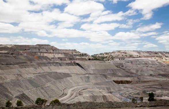
For almost six decades, coal mining has been pivotal to the town. There are no mine tours on offer, however the viewing platform is open every day, offering amazing views of the mine and surrounds.
MAJOR EVENTS
Moura Bronze Boots Campdraft, Moura Coal and Country Festival and Moura Muddy Water Family Fishing Classic.
BANANA 16KM
ROLLESTON 148KM
FISHING
Apex Park, Dawson River
Situated: 7km west of Moura on Dawson Highway.
Facilities: Boat ramp, toilet block, picnic tables, barbecue, river water on tap.
Fish species: Barramundi, golden perch (yellowbelly), saratoga, eel-tailed catfish, fork-tailed catfish, small mouth sooty grunter (black bream), sleepy cod, spangled perch, eel, banded grunter.
Camping: 7 nights max stay camping available. Coin operated hot showers. No power.
CAMPING
The APEX Park - 7km west of town, has free camping grounds with 7 nights max stay and facilities such as hot showers, a traditional wood barbecue, toilets and lawn for the afternoon picnic.
Rotary Park – as you enter Moura from Banana, on the Dawson Highway corner of Theodore Moura Road, unpowered sites, $5/night payable at Moura Mitre 10. Toilets, potable water, electric barbecues, picnic tables, campfires permitted in rings provided, pet friendly with 3 nights max stay.

SEE AND DO
The new state-of-the-art Moura Museum and Library is the pride of the Banana Shire. It brings together history, culture, education and Council services into a single facility. The museum is the star of this new facility, paying tribute to the town’s rich history and culture. Located next to the Moura Miners Memorial, the museum features a series of rooms each dedicated to an important piece of Moura’s past.
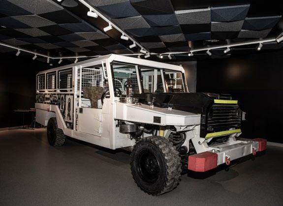
The Underground Man Transporter, a heavy-duty vehicle designed to safely transport miners underground, is a standout of the collection. This remarkable piece has been painstakingly restored by Moura Community Progress Inc., to preserve an important piece of local history.
The Moura Museum and Library is open Monday to Friday 8.30am to 5pm and Saturdays 9.30am to 12.30pm. Entry is by gold coin donation to the Moura Coal and Country Historical Society.
The 150th meridian east, located just outside Moura, is popular among tourists as well as local residents to have their picture taken in the exact path of the longitude line. Rocks with drill holes have been lined up to represent the exact angle and location of longitude line.
The APEX Park (river)
The APEX Park is situated next to the Dawson River and is located 7km west on the Dawson Highway. The APEX Park has free camping grounds with facilities such as hot showers, a traditional wood barbecue, toilets and lawn for the afternoon picnic. It also has a public boat ramp.
Dawson Mine Viewing Platform
A short drive from Moura provides travellers and locals with an incredible view of the Dawson mine, a large open-cut metallurgical, and export thermal mine. From Moura, head along the Dawson Highway towards the township of Banana, take a right at Three Chain Road, then follow the signs to the Viewing Platform.
The Moura Museum
TAROOM
HISTORY
Prussian explorer Ludwig Leichhardt passed through the district in 1844, carving his initials and date on a coolibah tree that now stands in the centre of town. Leichhardt’s carving is no longer visible following an alleged attempt to remove bark growing over the initials that removed the initials as well. Reporting the rich soils in the area, settlers began taking up land in 1845 and by 1850 a town had been established at a popular camping spot near the Dawson River.
Originally named Bonners Knob the town was renamed Taroom, possibly after the nearby Taroom cattle station, on completion of the first post office in 1856. The name Taroom is thought to derive from ‘tarum’, meaning pomegranate or native lime in the language of the local people.
Some fifty years ago, a 160kg grooved stone was taken from Iman Country, near Taroom, Queensland. The artefact, the
TODAY
Taroom is a major centre for the Queensland beef industry. Other industries include prime hard wheat and forestry. Taroom has a rare windmill of an unusual design located on the banks of the Dawson River. The windmill was produced by the Steel Wings Company, in North Sydney between 1907 and 1911, one of only six models ever erected. The windmills comprise a steel frame and fan which turns to the wind between a bearing at the bottom and a swivel at the top, all supported by guy-wires. The fully restored windmill is one of the only two known working examples in the world designed so their fan is contained and spins within the fully pivoting frame.
Star of Taroom, is a stone with six grooves that resemble a star along which members of the Iman people would sharpen their spear and axe blades over thousands of years. It is also believed to have marked the southern boundaries of the Iman people in the Taroom region of Queensland.
In 2021 the stone was returned from a Brisbane back yard by Iman Wardingarri people carrying the 160kg stone by hand cart. Banana Shire Council in conjunction with Taroom & District Historical Society built a purpose built shed to house The Star of Taroom which will be its official resting place on Country. The shed has been gifted to the Iman Wardingarri people and will house The Star of Taroom along with other Indigenous artefacts for people to enjoy now and in the future. The Star of Taroom is now on display at the Iman Wardingarri Keeping Place that is located at the Taroom Museum.
MAJOR EVENTS
• Taroom Agricultural Show in May
• Glebe Weir Fishing competition
• Annual Rodeo & Campdraft at the Showgrounds
• Arts Show in September
• Taroom Cup is a great opportunity to dress up in September
• Christmas Street Party in December
• Christmas Races between Christmas and New Year
ROMA 168KM
ADVENTURE
Isla Gorge National Park
To reach Isla Gorge lookout, turn off the Leichhardt Highway 55km north of Taroom, the lookout is 1.3km west of the highway. You can reach the Flagstaff Hill section from Taroom, drive north for 31km along the Leichhardt Highway. Turn left at the ‘Flagstaff via Waterton’ signpost and travel for 49km (9km past the turnoff to Flagstaff Station). Turn left again and drive another 2km.
Lake Murphy Conservation Park
In dry conditions the road to the lake is suitable for all vehicle types. Drive 18km north of Taroom along the Leichhardt Highway then turn west into the Fitzroy Developmental Road. Travel 2km to the Glenhaughton Road turnoff. Turn left and drive 11km to the park.
FISHING
Sandy Creek Bridge, Juandah Creek
Situated: About 5km south on the Roma-Taroom Road after crossing the Dawson River bridge on entry to Taroom.
Facilities: No facilities. Must be self-sufficient. Take rubbish with you.
Fish Species: Saratoga, golden perch (yellowbelly), eel-tailed catfish, fork-tailed catfish, spangled perch, eel and banded grunter.
Camping: Bush camping. Must be self-sufficient.
Glebe Weir
Situated: 54km from Taroom on Theodore Road (Leichhardt Highway).
Facilities: Bank access and boat ramp, toilets and hot showers, non-potable water and picnic tables, wood barbecues.
Fish species: Saratoga, golden perch, silver perch, catfish, sleepy cod and spangled perch.
No fishing from 100m upstream to 200m downstream of the weir.
Camping: Caravan and camping sites available for $17 per night subject to change, please contact Council on (07) 4992 9500 for the current fees. Honesty box system.
Dawson River at Taroom Township
Situated: Dawson River at Taroom Township and Widewater Reserve 2km north of town.
Fish Species: Saratoga, golden perch (yellowbelly), eel-tailed catfish and fork-tailed catfish, spangled perch, redclaw, sleepy cod, eel and banded grunter.
CAMPING
SEE AND DO
Taroom is a great base for exploring:
• 15km to the Chain Lagoons
• 55km to Isla Gorge National Park
• 82km to Flagstaff Hill and the historical paved stone road
• 31km to Lake Murphy Conservation Park
• 54km to Glebe Weir
• 120km to Expedition National Park
Top fishing spots are right at the doorstop with Dawson River on the edge of town and nearby Glebe Weir and Palm Tree Creek.
Palm Tree Creek is unique and world renowned for its petrified palms.
The Taroom Historical Society - Taroom Museum opens by appointment.
Site address: 17 Kelman Street, Taroom.
P: 0409 663 701 E: tdhs2014@hotmail.com
A pleasant walk up the hill takes you to Gilbert’s Lookout, named after Leichhardt’s companion who met a violent end here.
Across town in Yaldwyn Street, Leichhardt Park is the site of Leichhardt’s memorial. The park is dedicated to the region’s native flora with weeping bottle brush, flaxleaf paperbark, lemon scented gum, swamp mahogany and bloodwood found throughout the grounds. The only exception being a single Aleppo Pine, seeded from Lone Pine on the Gallipoli Peninsula.
Glebe Weir, 54km from Taroom on Theodore Road. Caravan and camping sites available for $17 per night. Honesty box system. Chain Lagoons, follow the Leichardt Highway North for 15km and turn right onto Chain Lagoons Road, the rest area is 1.1km on the right. There is no charge for the use of this facility, so if you are staying at this site we encourage you to help keep it clean and tidy. There are no facilities here.
Lake Murphy, in dry conditions the road to the lake is suitable for all vehicle types. Drive 18km north of Taroom along the Leichhardt Hwy then turn west into the Fitzroy Developmental Road. Travel 2km to the Glenhaughton Road turnoff. Turn left and drive 11km to the park. Camping permits are required and fees apply. A tag with your booking number must be displayed at your camp site. Parks in this region are remote and undeveloped. Visitors must be self-sufficient. Bring at least seven litres of water per person per day for drinking, cooking and washing, as streams are seasonal and water quality cannot be relied upon. Bring a fuel stove and rubbish bags to take your rubbish away with you. Rubbish bins are not provided in the park. Please camp with minimum impact.
Thangool
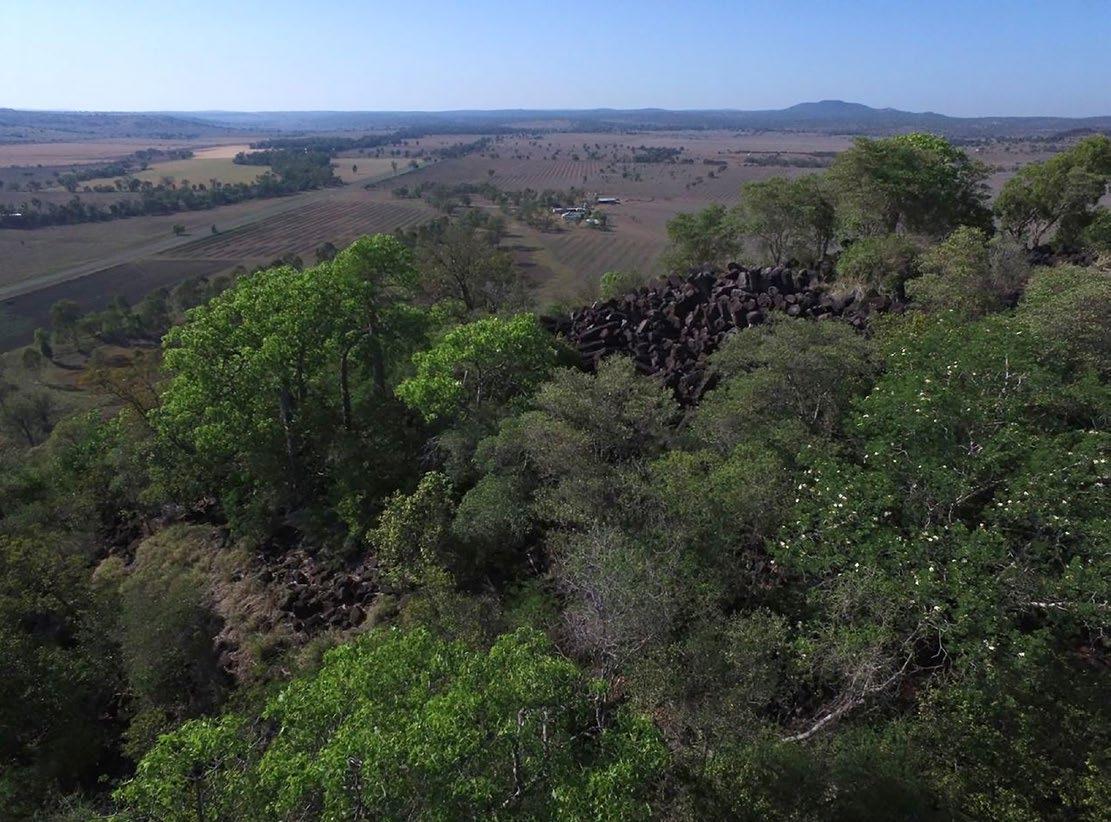
OUR HISTORY
The Thangool area was originally home to the Gangulu people. European settlement in the area began with the Archer brothers who, on advice from the explorer Ludwig Leichhardt, set out from Eidsvold Station on the Burnett River to explore the area to the north in 1853. Speculative ventures followed in the 1850s and 1860s, originally tentative attempts at sheep raising, but soon turning to cattle.
The town name Thangool comes from the Thangool Railway Station, which existed from 2 February 1924 until 1 August 1987. It is reportedly an Aboriginal word meaning possum. The neighbouring Mount Scoria takes its name from the Mount Scoria Railway Station, assigned by the Queensland Railways Department on 21 June 1926, which is named after the mountain of the same name. The town was surveyed in 1925 and shops were constructed from corrugated iron and logs soon after.
SEE AND DO
• The raised green lawns of the Forde Park Race Course come alive with colour for the running of the Thangool Cup. The track is the largest of the two courses in the region, the other at Taroom, and the Cup is a standout fixture during the Spring racing season in September.
• Mount Scoria Conservation Park
• Thangool Memorial Park on Burnett Highway is a great place for a rest stop. Facilities include: toilets, shade, playground equipment, fully fenced.
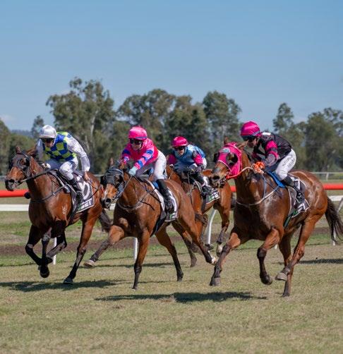
TODAY
Dry land farming in the area produces mainly sorghum and wheat but also some sunflower, mung beans and barley. Irrigated crops produced include cotton, lucerne, wheat and sorghum. A Thangool business supplies 60 per cent of the Australian market for squab.
Thangool is the site of the shire’s major airport where there are regular flights to and from Brisbane. Car hire is also available.
Thangool is a great place to fuel up on a hearty meal, have a drink and fill up the tank before pushing on to Callide Dam or spectacular natural features such as Kroombit Tops National Park and Mount Scoria – both found in the vicinity.
MAJOR EVENTS
• Thangool Cup in September
• Regular race days
• Dawes Hall Campdraft in May/June
• Thangool Country Music Round Up in April
ADVENTURE
Mount Scoria Conservation Park – 7.1km (8 min) via Aerodrome Road and Thangool Lookerbie Road.
Kroombit Tops National Park via Valentine Plains Road is an unsealed road and for 4WD vehicles only.
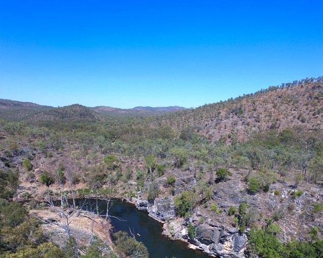
CAMPING
The Lawgi Hall Rest Area is 17.3km south of the township on Australia’s Country Way (A3). There are plenty of grass areas to park behind the hall and a donation left in the honesty box would be much appreciated. Biloela also has affordable camping ground options available.
Thangool Short-term Camping on the Burnett Hwy adjacent to Thangool Memorial Park. Toilets and water available at the Memorial Park. Pet friendly with 3 nights max stay. Dump points located in Biloela.
The Red Steer Thangool
| 4995 8176 Make Thangool one of your stops along Australia’s Country Way. Pop into The Red Steer for a chat with the locals over a cold beer, or barista coffee, and meal

Find out more, scan the QR code and follow us on Facebook
THEODORE
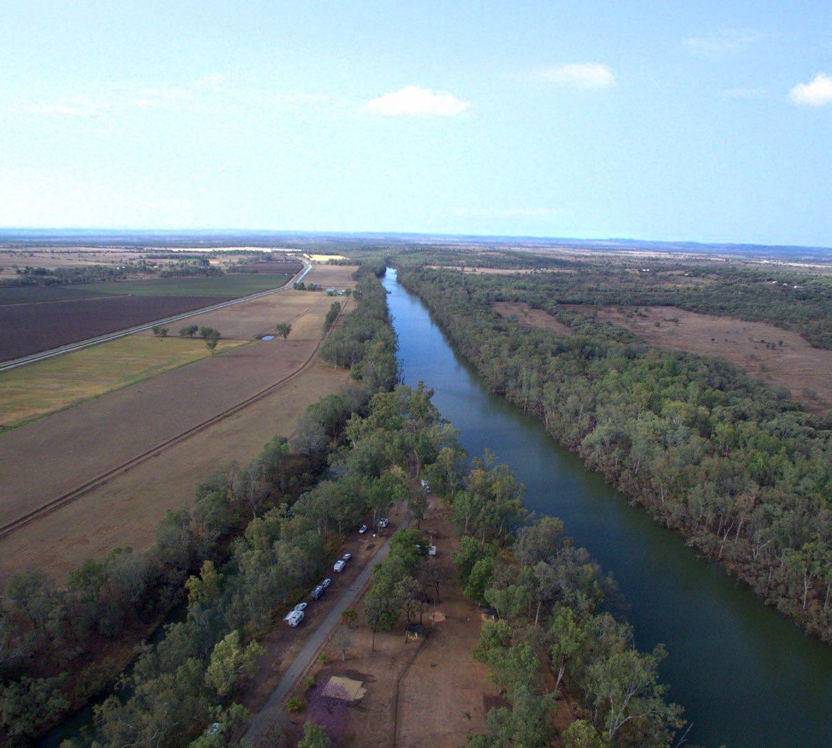

HISTORY
The Aboriginal inhabitants of the town area were the Wulli Wulli people.
The first European settler in the district was Joseph Thompson who amassed a number of pastoral leases from 1850 to his death in 1857, including Oxtrack Creek, Okangal, Coteeda, Delusion Creek, Macoom, Hope, Thalba and Woolthorpe. Thompson entered into a partnership with James Reid. Together they acquired the Boam run. Post Thompson’s death, Reid acquired Thompson’s runs and others in the area before he began to sell them off to new settlers. In 1864 a town called Woolthorpe was surveyed and town lots were offered for sale, however few were sold and no town developed at that time. In 1893, WIlliam Woolrych acquired 13,000 acres (53km2) of land alongside the Dawson River. He gradually built it up through further land acquisitions into the very large Woolthrope Station.
Theodore was established in the 1920s as part of the ambitious Dawson River Irrigation Scheme which failed to eventuate. The town was initially called Castle Creek after the local railway station, which in turn took its name from the creek which flowed into the Dawson River just south of the town. However, in November 1926, it was renamed in honour of Ted Theodore, who as Premier of Queensland had given so much support to the irrigation scheme. Standing on The Boulevard, the town’s main drag, Theodore Hotel’s white weatherboard exterior oozes old-time charm. But this pub, like the rest of the town has an interesting story to tell – it was owned by an entire community. The locals took it over in the 1940s, issuing each resident the equivalent of a 25 cent stake, when plans to build Nathan Dam and 5,000 new farming plots fell through.
SELF DRIVES
• Historical Flagstaff Road
• Defence Road Cracow Loop
• Isla Delusion
• Glenmoral Drive
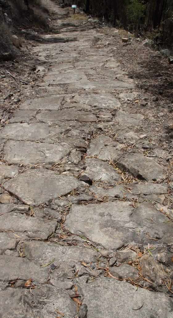
TODAY
From its earliest days, Theodore was a stopping point for travellers and the same is true today. A pretty place, Theodore is shaped like a point between the Dawson River and Castle Creek, its palm lined streets give a tropical feel to the place. Neville Hewitt Park surrounds the water tower and is a great spot for a picnic lunch or if you’d prefer a river view, Rotary Park in Fifth Avenue overlooks Castle Creek.
FISHING
Junction Park, Dawson River & Castle Creek Junction
Situated: At the southern end of The Boulevard (main street).
Facilities: Toilet block, hot showers, barbecues, shelter sheds, picnic tables and town water on tap. There is a dirt road to a boat ramp at the mouth of Castle Creek.
Fish species: Saratoga, golden perch (yellowbelly), eel-tailed catfish, fork-tailed catfish, spangled perch, eel and banded grunter.
SEE AND DO
Next to the Fire Station you’ll find Rose’s Garden
The creek flats turned garden paradise are the love and labour of local couple, Jeanette and Spencer Rose. While weeding might give Jeanette ‘the willies’, the couple’s efforts in creating such a masterpiece over the past 20 years were well worth it. Making the gardens the first stop in the town, people come year after year to check on how things have changed. The stroll takes you alongside Castle Creek up to Junction Park.
Housed in an old power house, the Dawson Folk Museum in Second Avenue is a treat for history devotees. If travelling between April and September you will likely find the Museum open between 10.00am to 1.00pm Tuesday to Friday. Outside of this, the Museum is open by appointment. Phone Loraine on 0429 931 264.
Located at Hewitt Park in the middle of Theodore, the water tower is a prominent landmark that can be seen from all corners of the town.
The Water Tower Mural, commissioned by the Theodore Chamber of Commerce, celebrates Theodore’s centenary and honours the pivotal role the Dawson River has played in its history. Painted by renowned mural artists, The Zookeeper and Drapl, it features the flora and fauna of the Dawson River and two young locals, Cooper and Yakani, fishing for the legendary saratoga and yellow belly.
The water tower is a star attraction in Theodore with locals and travellers alike stopping to admire the incredible artwork and to enjoy Hewitt Park’s facilities. Hewitt Park is the perfect spot for a picnic with shady trees, a playground and picnic tables.
MAJOR EVENTS
• Bull’s ‘N’ Barrels Bonanza
• Theodore Trail Ride
• Theodore Spindles & Spurs Campdraft
CAMPING
Theodore Showgrounds
Situated: Follow the signs for the Showgrounds as you enter town from the north, turning right off The Boulevard (main street). 7 nights max stay.
Facilities: Unpowered and 70+ powered sites. Contact Debbie on 0448 570 415 for bookings. Toilets, hot showers, card operated laundromat (1 washing machine and 1 dryer), electric barbecues, picnic tables, drinking water available, fire pits allowed. Pet friendly, horse stables available. No charge for horses or cattle. No tv reception unless you have a satellite dish or Vast box.
Junction Park
Situated: Suitable for caravans, 20 sites, beside the Dawson River for a donation, 7 nights max stay.
Facilities: Toilet block, barbecues, shelter sheds, picnic tables and town water on tap, coin operated hot showers. Campfires allowed in built fireplaces. Check local fire bans and rules.
WOWAN
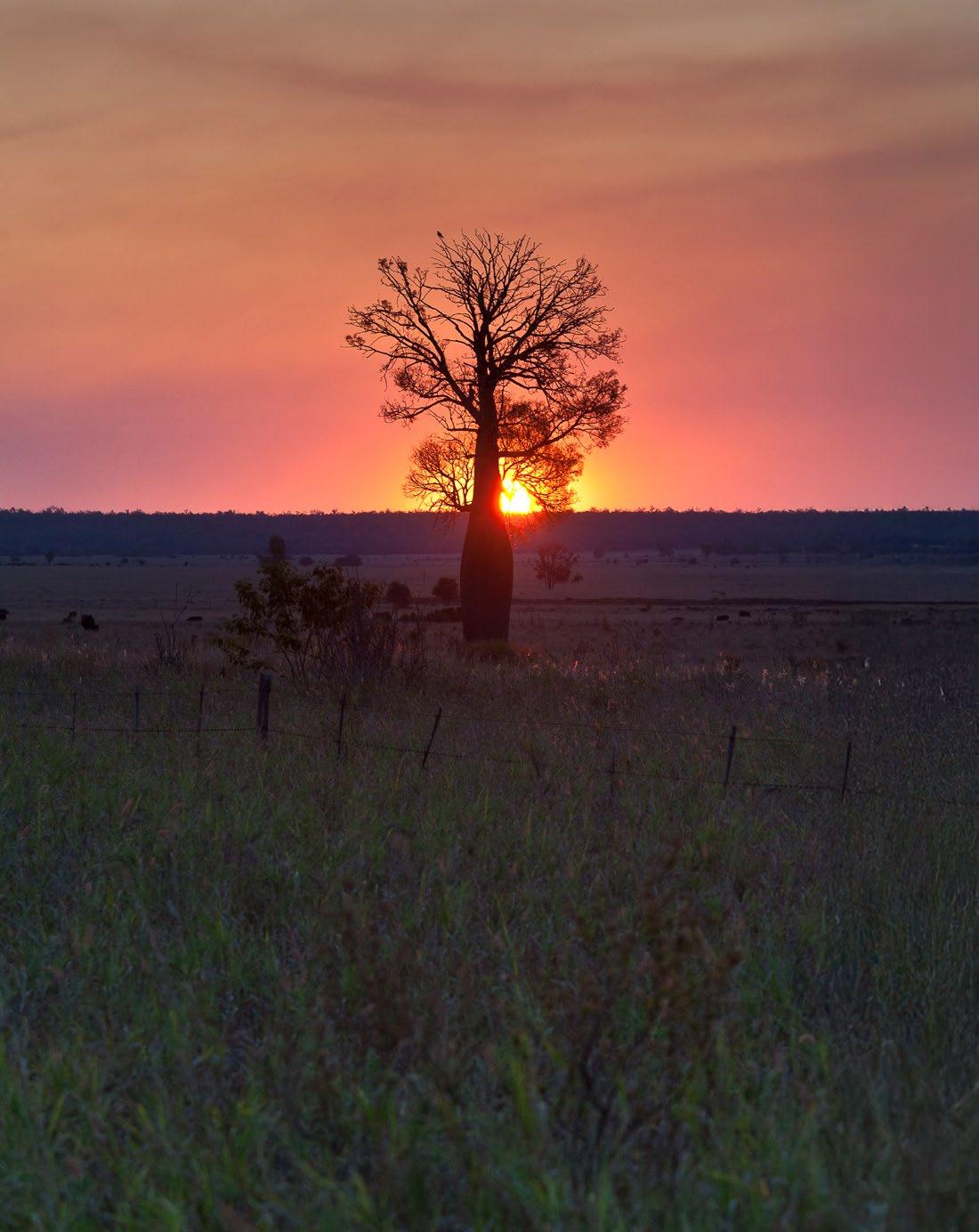
Wowan takes its name from the Wowan railway station, which in turn was named from the Aboriginal word for Australian brush-turkey.
HISTORY
Wowan was settled in 1912. The butter factory opened on 1 April 1919; it was operated by the Dawson Valley Co-operative Company. The Wowan Museum was originally established in the former butter factory after the site was transformed into a caravan park in the 1980s. After the museum outgrew the butter factory, it was relocated to the former railway station.
With more than 600 farmers on the job, the Dawson Valley Dairy Cooperative was topped up daily with fresh supplies of full cream milk, ready to ship off to towns and cities as far away as England. Wowan flourished as a result. The population grew and along with it came shops, churches, halls, a school, bowls club and even a golf course. Not bad for a place that started out as a rail camp! However, in the late 1960s the dairy industry soured. Other agricultural industries moved in, mostly beef cattle and grain, buying up the land and changing the face of commercial operations. The business centre shifted to Moura and Biloela and eventually, many of the locals did too.
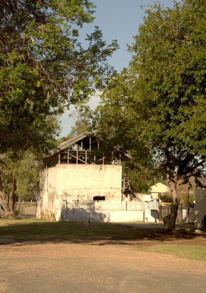
Farm produce from the area includes beef, hay, grain, pork and eggs. The Dululu Pub is only 10km or 7min down the road.
MAJOR EVENTS
Wowan holds its annual agricultural show in August.
FISHING TODAY
Don River, Dumpy Creek
Situated: 23km southwest of Wowan along the Leichhardt Highway turn left onto the gravel road for approximately 1km.
Facilities: No facilities. Must be self-sufficient. Take rubbish with you.
Fish species: Yellowbelly, catfish.
Camping: Free bush camping. Limited space.
Dee River, Wowan
Situated: 4.5km east of Wowan, via the Dee River Road. Access to the river via a steep descent on foot only.
Facilities: No facilities. Must be self-sufficient. Take rubbish with you.
Fish species: Yellowbelly, saratoga, catfish.
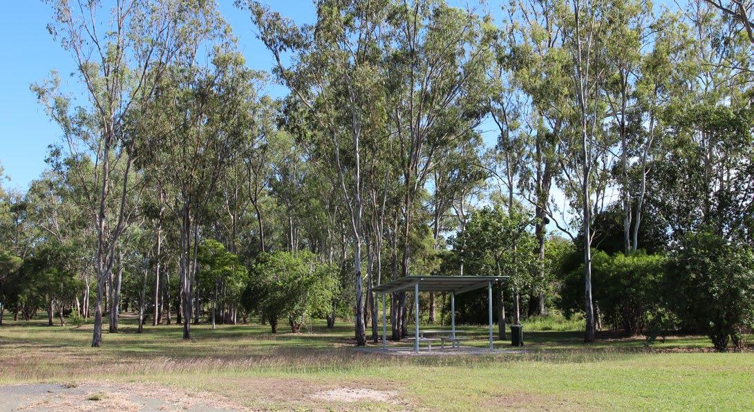
MARCH/APRIL
Jambin Hotel Woodchop & Chainsaw Competition
Community Arts House Easter Markets, Biloela
Moura Muddy Water Classic
Fishing Competition
Thangool Country Music Round-Up
Thangool Races
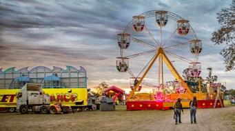
MAY
Taroom Show
Baralaba Show
Theodore Show
Callide Valley Show, Biloela
Dawes Hall Campdraft, Thangool
Taroom Golden Horseshoe Campdraft
JUNE
Glebe Weir Fishing Competition
Thangool Races
Community Arts House Creative Capers, Biloela
Theodore Trail Ride
Moura Bronze Boots Campdraft

JULY
Winterfest - Biloela
Biloela Hotel’s Street Party
Taroom Rodeo & Campdraft
St Joseph’s Family Raceday, Thangool
Theodore’s Bulls N Barrels Bonanza
Old Wheels in Motion Rally – QLD Heritage Park, Biloela
EVENTS
There’s plenty of action to experience in Banana Shire’s events which illustrate life in the shire. They showcase agriculture, mining, fishing, art, adventure, sport and country life.
*Events are subject to change
AUGUST
Theodore Spindles & Spurs Campdraft
Baralaba Bottle Tree Campdraft
Wowan Show
Moura Coal n Country Festival
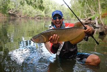
SEPTEMBER
Taroom Black Tie Ball - Diamonds in the Dust
Taroom Cup
Thangool Cup - Spring Carnival
The Great Baralaba Saratoga Clasic
Brigalow Arts Festiva, Biloela
Jambin Campagne Campdraft
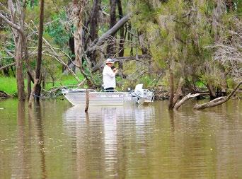
OCTOBER
Festival of Small Halls
Lake Callide Family Fishing Classic
Comp, Biloela
Biloela Rotary Annual Market Day
MEU Community Fair, Biloela
Banana Battle of the Bush

NOVEMBER
Biloela Rotary Christmas Festival
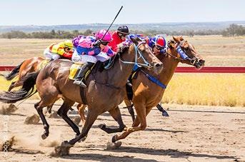
DECEMBER
Taroom Christmas Races
Taroom Christmas Street Party
See more online sandstonewonders.com/events
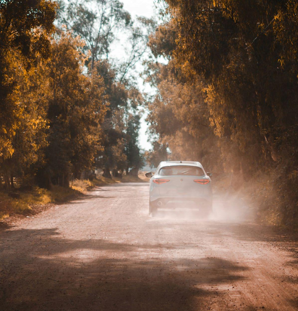

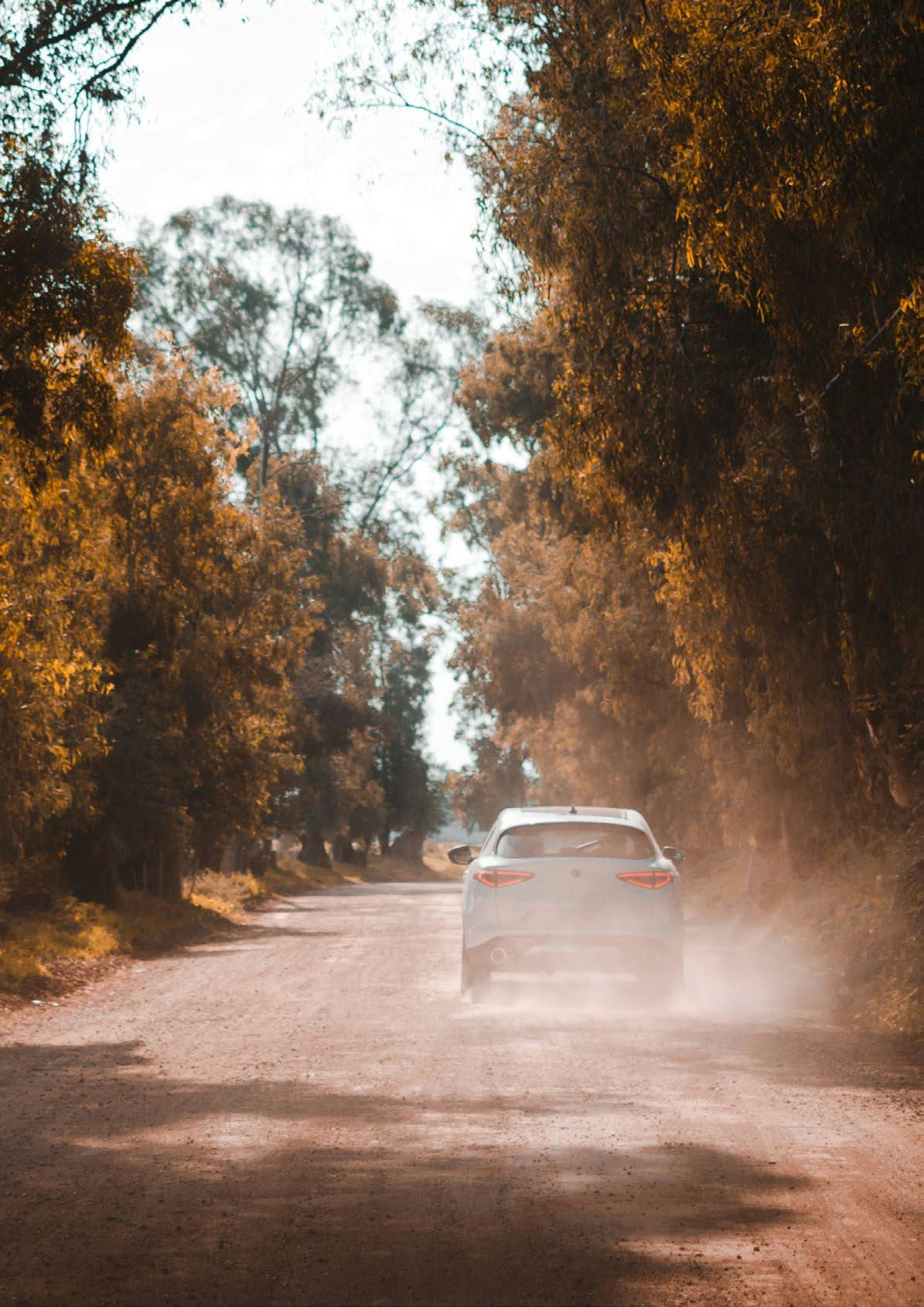


Baralaba History Loop
225km / 3 hours + stopping times
A great little trail taking in Baralaba and surrounds exploring the intriguing history of the region. Visit the Queensland Heritage Park for some heritage displays and historic buildings from Biloela or the Baralaba Historical Village to discover the beginnings of Baralaba; and if you like a museum or two, the Wowan Museum is a not to be missed experience! You won’t be disappointed.

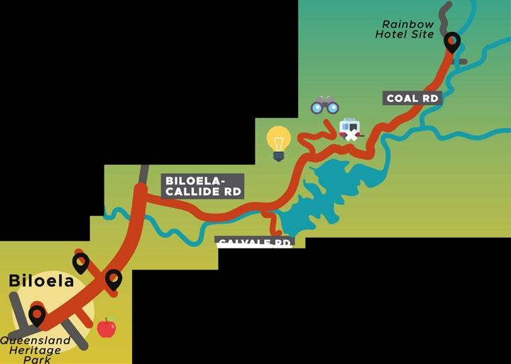


Biloela Beauties
75km / 1 hour + stopping times
This journey reveals the charm and heritage of Biloela, from historical sites to stunning natural landscapes. Immerse yourself in local history, admire breathtaking lookouts, and enjoy relaxing picnic spots as you explore the area’s hidden gems.

Callide Creek
'Spirit of the Land' Mural
Collide Mine'i;,
Collide Power Station
Lake Collide Recreation Area
Greycliffe Homestead
Defence Road Cracow Loop
147km / 2 hours + stopping times
The past lives large on this trail with wonderful markers and reminders along the way that capture the region’s history from the earliest years of settlement through to today. Both surprising and fun, you’ll travel near Banana Shire’s largest cattle station, see one of Queensland’s oldest race courses, visit ghost towns and cross bridges steeped in war history.

Glenmoral Drive
76km / 1 hour + stopping times
This drive takes you through the heart of Banana Shire’s cattle country, where wide-open plains, rugged ranges, and tranquil gorges create stunning vistas. From historic stations to breathtaking lookouts, Glenmoral Drive showcases the rich natural and cultural heritage of Queensland’s rural landscape.

Historic Flagstaff Road
150km / Approx. 3 hours + stopping time
The Historic Flagstaff Road Trail leads you to a site of epic proportions. The hand laid Flagstone Road was built in the early 1860s, using large rock slabs and only a small gang of men. Used to carry wool from Roma to the port of Rockhampton, the road helped to build Queensland and the nation. The drain systems still carry storm water and prevent erosion to this day.


ISLA DELUSION
81km
1 hour 15 minutes + stops
Discover the breathtaking beauty of the Sandstone Wonders and the tranquil charm of river country on the Isla Delusion trail. From towering plateaus and panoramic lookouts to hidden river beaches lined with ancient Livistona Palms, this journey offers a perfect mix of rugged landscapes and peaceful retreats.

From Theodore or Taroom
From Theodore From Taroom
MAGICAL MOUNTAINS (MOUNT SCORIA)
Thangool to Mount Scoria 6.5km/8 mins
Mount Scoria to Kroombit Tops NP 45km/ 40 mins
Central Queensland is a treasure trove of natural wonders, and this journey showcases some of its most unique features. From the musical basalt columns of Mount Scoria to the rugged beauty of Kroombit Tops National Park, this drive combines geology, history, and breathtaking scenery for an unforgettable experience.

Malakoff
Lookout Loop
25.35km / allow 1 to 2 hours + stops
This drive offers picturesque views and a glimpse into Theodore’s past, from the peaceful Lonesome Creek to the panoramic vistas at Malakoff Lookout.

Mt Ramsay & Baralaba Loop
130km loop approx. + 45km back to Banana or 62km back to Biloela
This scenic drive takes you from the town of Banana, through Baralaba’s rich history, to Mt Ramsay. Baralaba offers a unique glimpse into Queensland’s past, from the early European settlements to the discovery of coal, all set within the stunning backdrop of the Dawson River.

Rural Villages
163km / 2 hours 30 minutes + stops
It’s exciting to travel over creeks and river crossings and discover spots that look as if you were the first to find them.

75km / 1 hour + stops
Scenic Way Shire Historical
This scenic drive takes you through the heart of Callide Valley, where the power of the region’s coalfields meets the beauty of the surrounding landscapes. From stunning viewpoints of Rainbow Range and Kroombit Tops to the tranquil waters of Lake Callide, this journey showcases the blend of nature and industry in this picturesque area.

Trail
Wowan to Biloela 672km / 4 days
The Banana Shire is littered with historical features and experiences for you to enjoy. From museums and homesteads to historial villages and the Cracow Pub, you don’t want to miss a thing! Camping spots are available in all the overnight stay locations.

Sandstone Wonders Visitor Guide
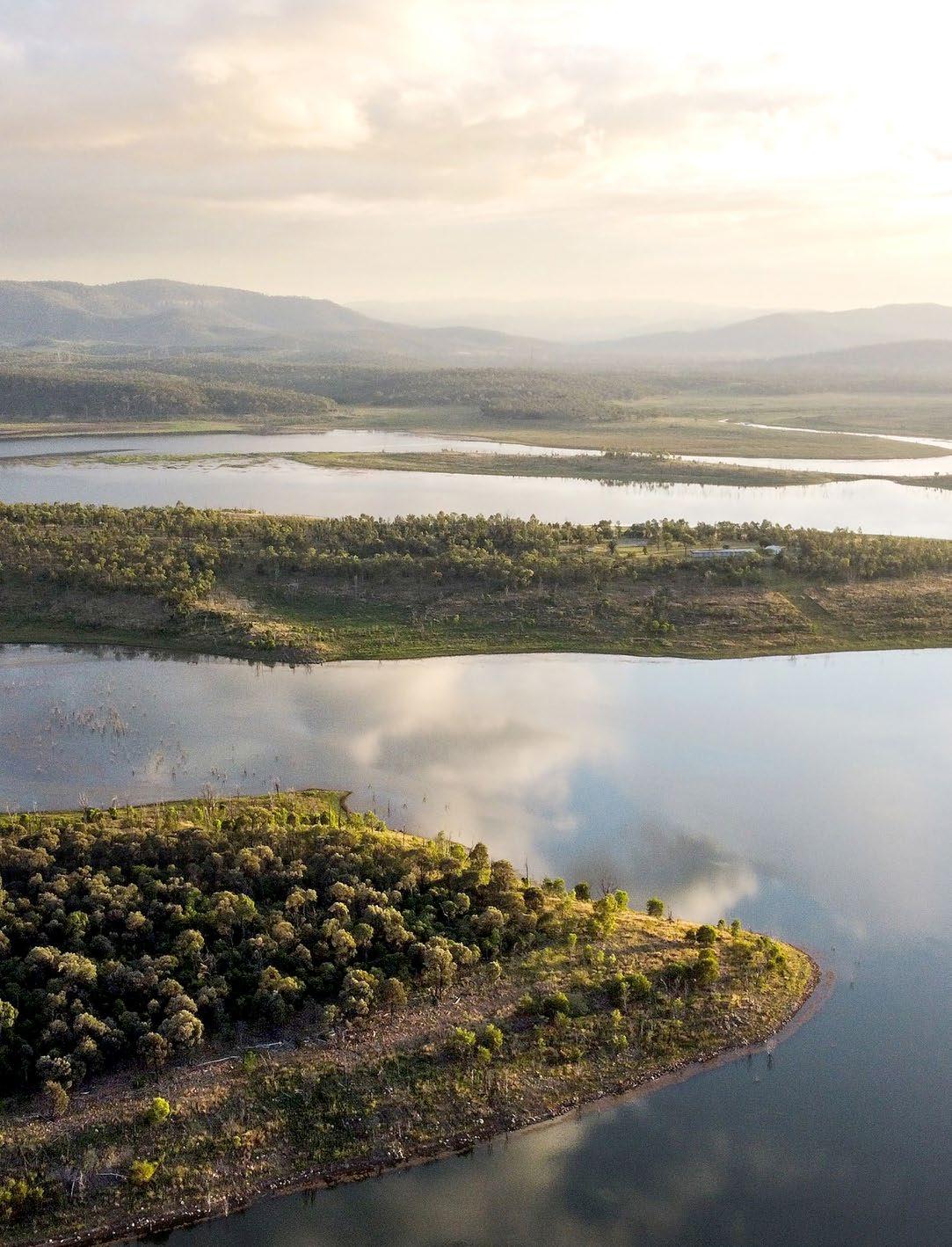

Sandstone Wonders, Queensland, Australia
SandstoneWonders