Disclaimer: All rights reserved. Unauthorized use and/or duplication of this material without prior written permission from the owner is strictly prohibited. For permission requests, write to Shoal Creek Conservancy, P.O. Box 11520 | Austin, TX 78751 or info@shoalcreekconservancy.org. i | Cypress & Shoal Public Space Strategy
CYPRESS & SHOAL CREEK
PUBLIC SPACE STRATEGY
DECEMBER 2021*
*Note:
Since releasing the Public Space Strategy in August 2021, we have presented the concepts to various stakeholders and relevant City of Austin boards and commissions.
The revisions to this document are responsive to feedback from those stakeholder groups.
For readers’ convenience each updated page is flagged. Text revisions are in noted green. An itemized list of all revisions is provided as an addendum at the end of this booklet.
EXECUTIVE SUMMARY ABOUT US
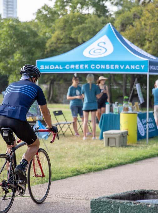
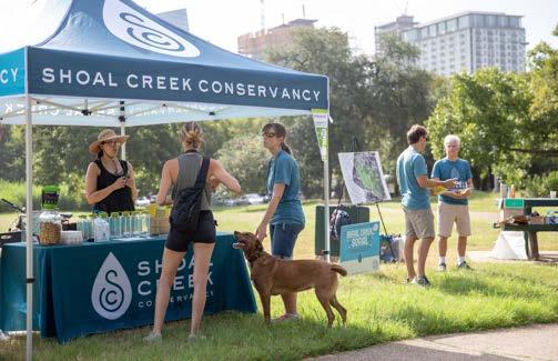
The Shoal Creek Conservancy (SCC) brings to life Austin’s 11-mile Shoal Creek corridor. We restore fishable, swimmable waters, empower the public to steward Shoal Creek, and spearhead on-theground improvements that make Shoal Creek and its Trail safer, more accessible and more inspiring places to be.
OUR MISSION
We champion the Shoal Creek watershed in order to create a healthy and vibrant community.
OUR VISION
We envision a continuous network of green spaces stretching throughout the watershed, connected by hike-and-bike trails in a healthy habitat. With more green space and a greener built environment, native plants and animals will flourish. The watershed will become a dynamic, safe, well-cared-for geographical area that improves the lives of residents and visitors alike.
OUR COMMITMENT
This is a big vision, and it will take time to achieve. We are dedicated to investing the necessary time over the long term.
ACKNOWLEDGMENTS
The development of the Public Space Strategy would not have been possible by extensive work of project and design team members as well as priceless input and insight provided by city official, area project owners, and members of the greater Austin community who championed this project.
TECHNICAL ADVISORY GROUP
» Lena Lund, Austin Energy
» Eben Kellogg, Austin Energy
» Officer Robert Padilla, Austin Police Department
» Officer Michelle Borton, Austin Police Department
» Neil Quarles, Austin Transportation Department
» Nathan Quarles, Austin Transportation Department
» Pamela Abee-Taulli, Development Services Department
» Margaret Shaw, Economic Development Department
» Janine Clark, Office of Mayor Steve Adler
» Ashley Richardson, Office of Council Member Kathie Tovo
» Caitlin Admire, Office of Sustainability
» D’Anne Williams, Parks and Recreation Department
» Kim McKnight, Parks and Recreation Department
» Katie Wettick, Public Works Department
» Atha Phillips, Watershed Protection Department
» John Clement, Watershed Protection Department
» John Middleton, Watershed Protection Department
» Eric Loucks, Watershed Protection Department
v | Cypress & Shoal Public Space Strategy
AREA PROPERTY OWNERS
» 360 Condominiums HOA
» 506 West Avenue - Manifold Real Estate & Riverside Resources
» Ballet Austin
» Block 185 - Trammell Crow
» The Bowie - L&B Realty, representing Florida State Board of Administration
» Downtown Austin Neighborhood Association
» The Gables West Ave & Gables Park Plaza
» The Independent Master Association
» Seaholm Commercial & Retail - Clarion Partners
» Seaholm Residences HOA
» Spring Condominiums HOA
» Third + Shoal - CBRE, representing Credit Suisse
PROJECT TEAM MEMBERS
» Ted Siff, Shoal Creek Conservancy
» Ivey Kaiser, Shoal Creek Conservancy
» Nina Rinaldi, Shoal Creek Conservancy
» Dewitt Peart, Downtown Austin Alliance
» Julie Fitch, Downtown Austin Alliance
» Bill Brice, Downtown Austin Alliance
» Melissa Barry, Downtown Austin Alliance
» Matt Macioge, Downtown Austin Alliance
» Emily Risinger, Downtown Austin Alliance
» Amalia Carmona, Downtown Austin Alliance
CONSULTANT DESIGN TEAM MEMBERS
» Christine Ten Eyck, Ten Eyck Landscape Architects
» Christine Skaglund, Ten Eyck Landscape Architects
» Structural Engineering - Sparks Engineering, Inc.
» Graphic Design & Wayfinding - fd2s
» Cost Estimation - Vermeulens
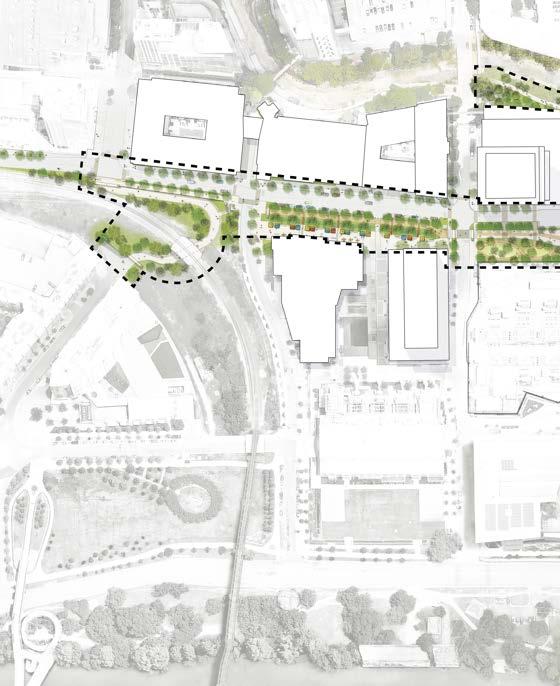
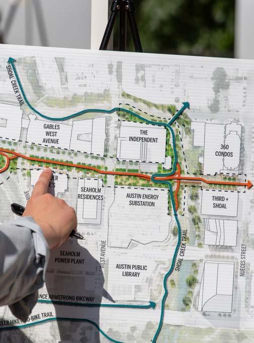
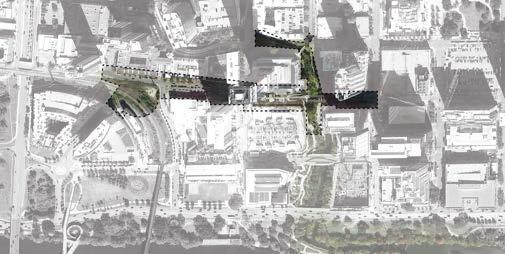
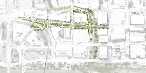
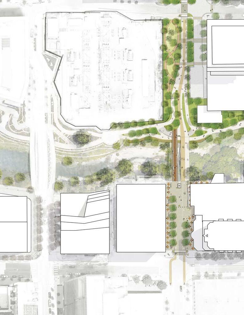
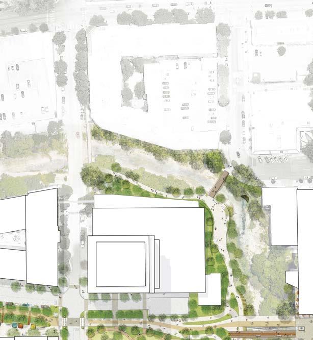
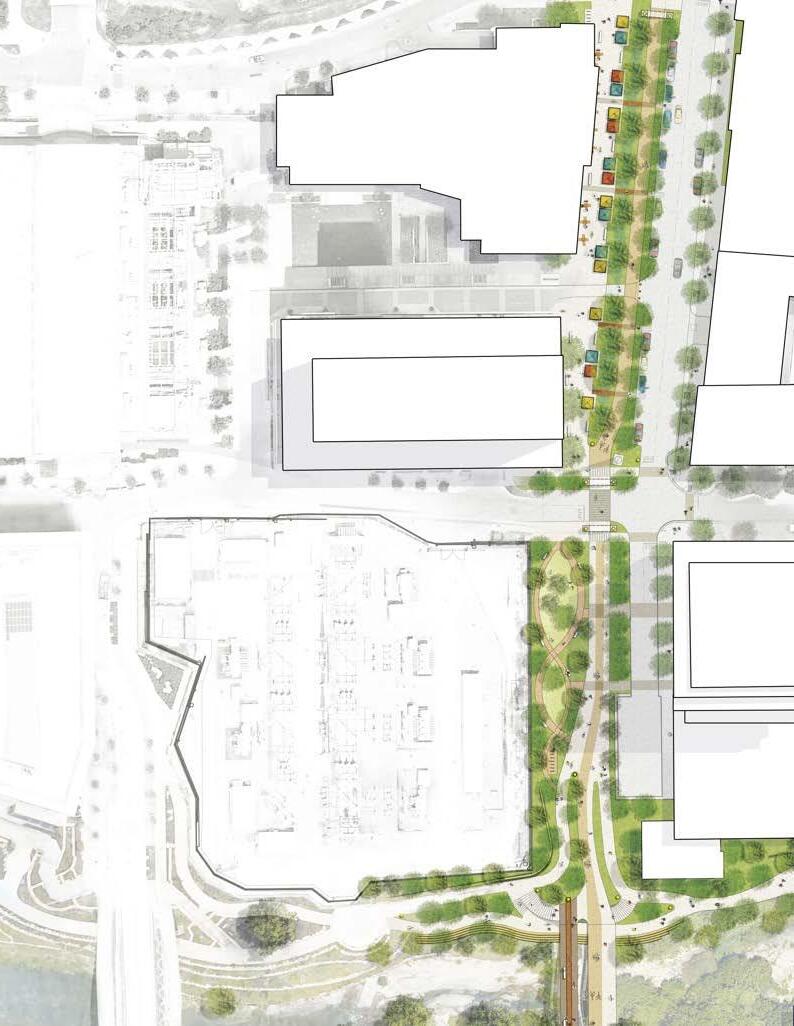
CONVERGENCE PLAZA
BOWIE STREET UNDERPASS
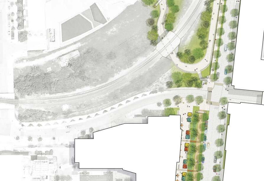
MARKET PLAZA
WEST AVE
WALTER SEAHOLM DR
SHOAL CREEK TRAIL AT RIO GRANDE
PUBLIC SPACE STRATEGY
MARGARET
MOSER PLAZA
THIRD STREET
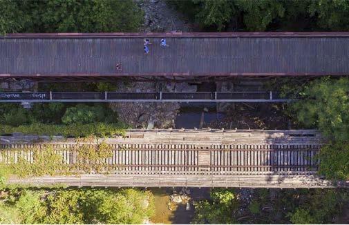
BIKE-PEDESTRIAN BRIDGE & TRESTLE
NEW SHOAL CREEK CONNECTION AT THIRD STREET
MARGARET MOSER PLAZA
Re-design as a living street and park-like plaza
NEW SHOAL CREEK TRAIL CONNECTION AT THIRD STREET
Extend a high-quality urban trail underneath the Third Street bridges
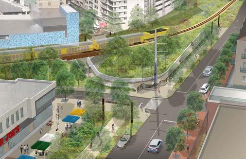
THIRD STREET BIKE-PEDESTRIAN BRIDGE & TRESTLE
Construct a new bike-pedestrian bridge and repurpose the Trestle as a public plaza
SHOAL CREEK TRAIL AT RIO GRANDE
Expand the trail with a new cantilevered boardwalk
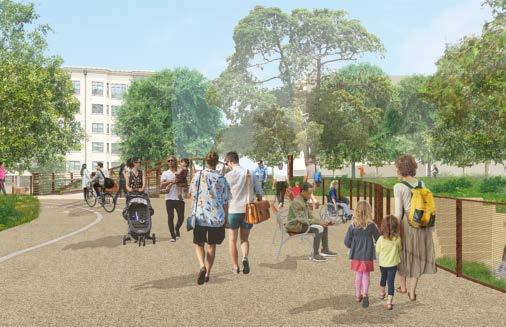
CONVERGENCE PLAZA
Upgrade pathways to allow more room for all trail users and make navigation easier
MARKET PLAZA
Create dedicated pathways for pedestrians, cyclists and drivers by taking advantage of the redundant double street
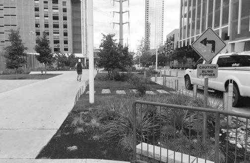
BOWIE STREET UNDERPASS
Complete the long-planned bike-pedestrian connection between the Pfluger Pedestrian Bridge and Lance Armstrong Bikeway through the underpass or an alternative route
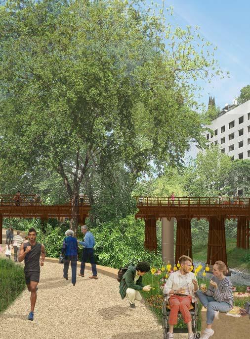
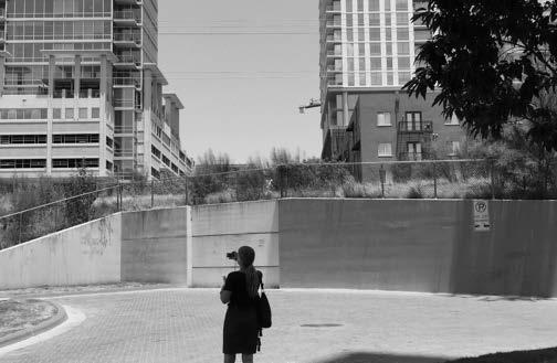
Through the Cypress & Shoal Public Space Strategy, it is possible to transform unappreciated urban pockets into beautiful usable public spaces.
PURPOSE & GOALS
This concept-level vision for the Cypress & Shoal Creek area builds on the public engagement findings established in the Shoal Creek Trail Plan, which reflect a broad desire for improvements to the trail at Third Street and Shoal Creek. In crafting the Public Space Strategy, Ten Eyck Landscape Architects delved into the area’s complex public spaces in greater detail, soliciting a more granular level of stakeholder input on existing conditions and proposed improvements.
IMPORTANCE OF THE AREA
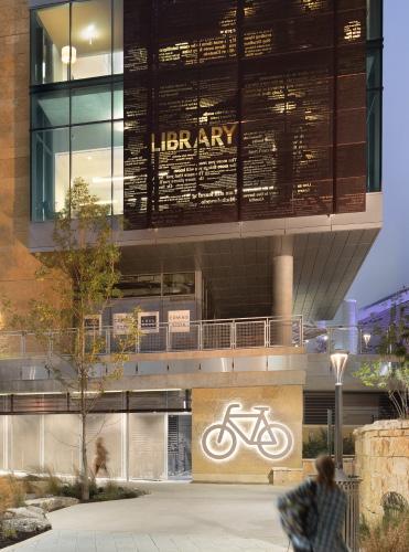
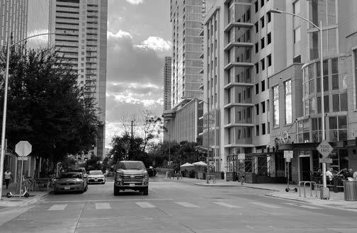
The Cypress & Shoal Creek Public Space Strategy illuminates a vision for improving the area around Third Street and Shoal Creek. The name is inspired by the historic name for Third Street, originally known as “Cypress Street.” This area is a gateway to critical community resources and major public investments such as the Central Library, Butler Hike-and-Bike Trail, and Seaholm Power Plant redevelopment. The City envisions these centrallylocated destinations as serving a citywide audience, yet the difficulty of navigating this area prevents that intention from becoming a reality.
This strategy presents a community-guided vision for making this area safer, more accessible, and better connected.
In addition to Austin’s popular destinations, there is momentum for breathing new life into leftover urban spaces emerged due to fast-paced growth and the building up of the city. It is a priority to carve out recreational open space for people among the bustling streets and soaring towers, and it is of equal importance to restore ecological functions in the midst of so much hardscape.
Creation of a series of public plazas along West Third Street
Ecological restoration
Trail & bikeway connectivity
Wayfinding & navigation
SHOAL CREEK TRAIL PLAN
Created through the facilitation of the Shoal Creek Conservancy and with the active engagement of 100+ community stakeholder groups, the plan calls for a seamless, connected network of hike and bike trails along the 11mile Shoal Creek corridor, and connections to other urban trails city-wide.
Upon its completion in 2018, the Trail Plan was accepted by the City of Austin Public Works Department as a guiding document for future improvements to the Shoal Creek Trail.
Improvements to the Cypress & Shoal Creek area are on the Trail Plan’s list of the top 5 stakeholder-identified priority improvements. These five priorities were flagged as the most urgently needed improvements poised to make the biggest impact on safety and accessibility throughout the trail.
The City of Austin’s Urban Trails Plan and Bicycle Plan position the Shoal Creek Trail to become a major segment in a 30-mile “Big Loop” of bikeways traversing the city.
Shoal Creek Trail is also poised to be the western link in the Downtown Urban Greenbelt, a 6.5 mile loop formed by the Shoal Creek Trail, the Capitol Mall, Waterloo Greenway, and the Butler Hike-and-Bike Trail.
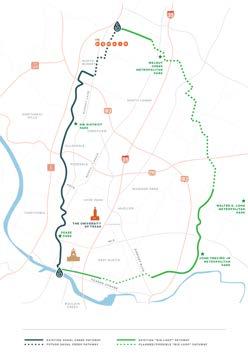
NEW CROSSTOWN PATHWAYS
EXISTING PATHWAYS
EXISTING
EXISTING PROPOSED PROPOSED OR ALTERNATE ALIGNEMNT
SEAHOLM
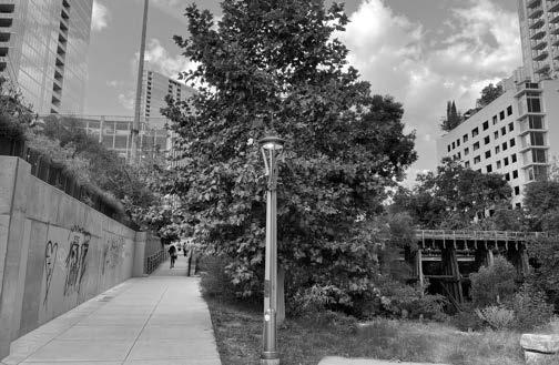
Located on the cusp of Shoal Creek’s confluence with the Colorado River, the Cypress & Shoal Creek area is home to two major crosstown pathways: Shoal Creek Trail which runs north-south, and the Lance Armstrong Bikeway which runs west-east.
HISTORY OF PUBLIC INVESTMENT
EARLY 2000S
In the early 2000s, the City of Austin invested in the 2nd Street District and Seaholm Development District These investments spurred the transformation of the Cypress & Shoal Creek area from an industrial center into a dense urban neighborhood that is home to vibrant destinations that attract people from all over the city.
2000S
Since 2000, these two districts and their adjacent city blocks have together added over 4,000 housing units and 2 million square feet of dining, retail, and office space. This growth includes 16 blocks of current or former city property that have been redeveloped. Redevelopment of the Seaholm District has been driven by City Council’s creation of a tax increment financing district (TIF) in 2008.
An award winning new central library opened in 2017 on the site of the south part of the substation between the Seaholm development and Shoal Creek. The building is integrated into the adjacent greenway and trail, which was completely reconstructed as a fitting connection between the building and Shoal Creek.
2008
The Seaholm TIF has facilitated the redevelopment of approximately 9 blocks of City-owned property with the re-purposed Seaholm Power Plant as the district’s centerpiece. Tax revenue generated through the TIF district has funded rehabilitation of the Seaholm Power Plant, creation of the interior public plaza at Seaholm, and street work.
The City of Austin is one of 10 leading North American cities participating in the launch of a national EcoDistricts pilot program. Austin is initially focusing on the Seaholm Development District.
PHOTO CREDIT: MICHAEL KNOX
2010
Since 2010, The City of Austin has been in negotiations with Union Pacific Railroad to secure the easement to construct the Underpass under an active rail line.
Additionally, regulatory conflicts around the area’s utility infrastructure presented a barrier to fully realizing the potential of its public spaces.
Austin Water Utility and Austin Energy restrict the development of certain amenities within their right-of-way.
The abundance of utility infrastructure therefore rendered some concepts untenable or made them too complex to negotiate. For example, overhead transmission lines that connect the Austin Energy Substation on West Avenue and run along Third Street to Lamar Boulevard prohibit many pedestrian uses underneath them.
However, in a densely populated urban neighborhood, space is at a premium and every square foot needs to fulfill multiple duties.
2021
Revisiting and resolving these challenges is a prerequisite to adding many of the features that will make the Cypress & Shoal Creek public realm a safe and inviting place to be.
The Bowie Street Underpass, the long-planned bicycle and pedestrian link between the Pfluger Pedestrian Bridge and the Lance Armstrong Bikeway is the Seaholm TIF’s only uncompleted project. But, as of 2021, it’s estimated cost of $6.8 million is reserved and held within the Seaholm TIF’s capital improvement account.
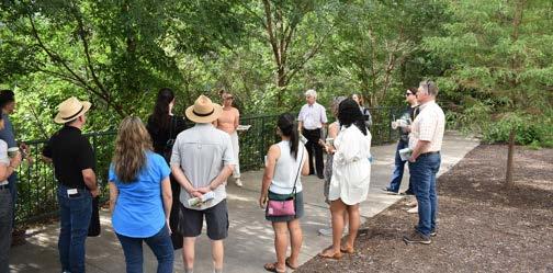
STAKEHOLDER ENGAGEMENT
The COVID-19 pandemic put a halt to in-person gatherings just as the community engagement period was set to begin. The project pivoted to an all-virtual engagement strategy through the online platform Social PinPoint, which offers rich interactive tools such as maps with the ability to make geotagged comments. Input opportunities were promoted in local media and through partnerships with multiple City of Austin departments and community organizations.
PROJECT PROCESS
On-the-ground site inventory and analysis
Community and stakeholder input
Two stages of widely promoted online feedback to first gather information about existing conditions and then collect feedback on the draft Public Space Strategy
Technical Advisory Group comprised of representatives from key City of Austin departments
Present the project and its desired outcomes to gauge feasibility and to collect embedded knowledge of the history in this area.
Review of draft Public Space Strategy with area property owners, many of whom are involved in maintaining the public right-of-way
Insight about current dayto-day usage and potential challenges with the proposed concept.
KEY INSIGHTS & OPPORTUNITIES FROM PROPERTY OWNERS
Since releasing the Public Space Strategy in August 2021, we have presented the concepts to various stakeholders. Key themes identified below reflect feedback collected during Summer 2020 - Fall 2021.
SAFETY
» Emphasis on the importance of truly safe intersections at Power Plant Drive & West Ave and Power Plant Drive & Seaholm Drive. Choosing the right intersection treatments will be critical.
» Critical for off-street (under bridge) trail passages to feel safe: this means well-lit, not used for camping.
» Lighting should be taken into consideration as an important safety feature.
» Fast-moving bicycles make trails less inviting for pedestrians: important to reduce conflicts.
» Bikeway should be wide enough to accommodate multiple speeds of cycling.
CIRCULATION
» In Margaret Moser Plaza, most deliveries to tenants on the south side of the street take place in the docks at the back of the building, but UPS deliveries as well as rideshare use the cul-de-sac to park briefly.
» 360 residents use the commercial zone in front of the main entrance to their building as ride-share pickup/drop off.
» In Market Plaza, concern about negative impact on retail if losing parking on Power Plant Drive.
» Sentiment that existing four lanes of parking (on Power Plant Drive and 3rd Street) is too much but some should remain on 3rd Street.
» Desire to eliminate parking on the south side of 3rd Street in service of better bike/ped dedicated space.
ECONOMIC VITALITY // HOMELESSNESS
» Restaurant tenants are benefiting from outdoor dining. Greening the street should make this even better, but ensure there is room for outdoor dining and similar street life. Don’t want sidewalk changes that would impact tenants’ currently permitted uses.
» Concerns that there will be camping on new benches installed for placemaking.
OPERATIONS & MAINTENANCE
» Emphasized that high quality, intensive maintenance will be critical. Important to identify sufficient funding for operations & maintenance. Republic Square was mentioned as an example of successfully maintained green space.
» O&M contracts need to include a specialized landscaping crew, not just trash collection.
BIKES TRAFFIC
BOWIE
TRAIL
BRIDGE
PUBLIC INPUT ROUND 1
Goals: Gather information about existing conditions. Learn about people’s experiences with the current site; challenges and barriers to visiting and navigating; and positive elements that people enjoy.
Pedestrian access Native plants and greenspace Shaded Areas Site maintenance Trail connectivity and access Cycling paths Farmers Market Recreation and exercise
PUBLIC INPUT ROUND 2
Goal: Gather reactions to draft Public Space Strategy to inform refinements to the design.
Tools: Graphics of proposed changes to each area with open ended survey questions & interactive map with ability to comment and to upvote/downvote comments
TOP-VOTED COMMENTS
MARKET PLAZA
Engagement Period: December 18, 2020 - February 14, 2021
Unique Stakeholders: 254
Map Comments: 358 Survey Responses: 69
“Love the removal of the slip street (which is the root of all the current problems in this area). Also love that the market/popup programming is separate from the bike path. The rendering shows more street trees, which is awesome [...] I would love to see more trees in this area! ”
(23) LIKES (0) DISLIKES
“This will be such an improvement to the unsafe existing condition of two side by side parallel streets...”
(17) LIKES (0) DISLIKES
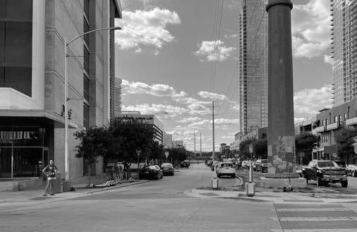
MARGARET MOSER PLAZA
I love the bridge concepts, but the plaza is lacking. Prior to the construction of the tower on this block, there was no parking on either side of the street for this block and painted bike lanes. The developer conveniently did not put the no parking signs back and this is now regularly used for parking. The bike lanes should be brought back here as protected bike lanes and the no parking signs should be reinstalled...
(15) LIKES (0) DISLIKES
EXISTING CONDITIONS
MARGARET MOSER PLAZA
TOP 3 PUBLIC INPUT THEMES & ACTIVITIES
Pedestrian access
Shaded Areas
Cycling paths
PUBLIC INPUT SYNTHESIS
Strong desire for explicit signage indicating Lance Armstrong Bikeway route. Strong support for physically separated bike path from pedestrians and cars. Strong community desire to close plaza to cars (not reflected in final concept design).
DESIGN SOLUTIONS
» Re-design as a living street and park-like plaza
» Redesign as a shared street for pedestrians, cyclists and drivers with enhanced safety for people on foot and on bike
» Clarify bike and pedestrian connections: clearly indicate continuation of Lance Armstrong Bikeway
» Install design features that discourage passing drivers from using the cul-de-sac as a turnaround spot and encourage slow motor vehicle speeds
» Partner to identify new rideshare/delivery hubs
» Implement street greening, resilient landscaping and shade
» Inspiring, welcoming environs around the Margaret Moser memorial statue
Note: Text revisions and new text are shown in white text in lieu of green text for legibility on blue-tone background.
ADDITIONAL RECOMMENDATIONS
INITIAL WORK:
Partner to identify ride-share/delivery hubs; clarify bicycle and pedestrian connections; pilot new plaza configuration
LONG-TERM / PROJECT WORK
Convert to park-like plaza and add design features to encourage safer, slower motor-vehicle speeds; maintain loading dock access
KEY PUBLIC & NON-PROFIT PARTNERS
Shoal Creek Conservancy, City of Austin Parks and Recreation Department, City of Austin Watershed Protection Department, City of Austin Transportation Department, Austin Water Utility, Downtown Austin Alliance, Bike Austin, historic preservation groups
POTENTIAL FUNDING SOURCES
Private entities, City of Austin Public Works Department, City of Austin Transportation Department, GO Bonds, Drainage Utility Fund, historic preservation grants
TOTAL COST (ESTIMATED, 2020)
$4.3M
EXISTING CONDITIONS
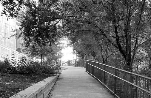
NEW SHOAL CREEK TRAIL CONNECTION AT THIRD STREET
TOP 3 PUBLIC INPUT THEMES & ACTIVITIES
Recreation and exercise
PUBLIC INPUT SYNTHESIS
Support for establishing a new trail link under bridges; one of the Shoal Creek Trail Plan’s top five stakeholderidentified priorities.
DESIGN SOLUTIONS
» Construct new Shoal Creek Trail connection under the Third Street bridges
» Construct two new staircases north and south of the bridges connecting the Trail to street level
» Streambank restoration and stabilization with a focus on native landscaping
Trail connectivity and access Native plants and greenspace
Note: Text revisions and new text are shown in white text in lieu of green text for legibility on blue-tone background.
ADDITIONAL RECOMMENDATIONS
INITIAL WORK
Construct new Shoal Creek Trail connection under bridges and two staircases to street-level; streambank stabilization and initial landscaping
LONG-TERM / PROJECT WORK
Ongoing landscaping and native habitat cultivation
KEY PUBLIC & NON-PROFIT PARTNERS
Shoal Creek Conservancy, City of Austin Parks and Recreation Department, City of Austin Watershed Protection Department, City of Austin Transportation Department, Austin Water Utility, Downtown Austin Alliance, Bike Austin
POTENTIAL FUNDING SOURCES
Private entities, City of Austin Public Works Department, City of Austin Transportation Department, GO Bonds, Drainage Utility Fund, historic preservation grants, Seaholm TIF
TOTAL COST (ESTIMATED, 2020)
$3.5M
EXISTING CONDITIONS
THIRD STREET BIKEPEDESTRIAN BRIDGE & TRESTLE
TOP 3 PUBLIC INPUT THEMES & ACTIVITIES
Pedestrian access Site maintenance Cycling paths
PUBLIC INPUT SYNTHESIS
Support for restoration of the trestle bridge at Third Street. Desire for improved, widened bike/pedestrian bridge.
DESIGN SOLUTIONS
» Replace existing bike-pedestrian bridge with a new, wider bridge (24’) with designated pathways for faster and slower travelers
» Transform Trestle into a public plaza with a scenic overlook to Shoal Creek
» Trestle to serve as interpretive centerpiece that sparks conversation about Austin’s history and culture
Note: Text revisions and new text are shown in white text in lieu of green text for legibility on blue-tone background.
ADDITIONAL RECOMMENDATIONS
INITIAL WORK
Construct new, wider bike and pedestrian bridge; continue to advance Trestle’s listing on National Register of Historic Places
LONG-TERM / PROJECT WORK
Rehabilitate Third Street trestle bridge and convert to public space
KEY PUBLIC & NON-PROFIT PARTNERS
Shoal Creek Conservancy, City of Austin Parks and Recreation Department, City of Austin Watershed Protection Department, City of Austin Transportation Department, Austin Water Utility, Downtown Austin Alliance, Bike Austin, historic preservation groups, Union Pacific Railroad
POTENTIAL FUNDING SOURCES
Historic preservation grants, Private entities, City of Austin Public Works Department, City of Austin Transportation Department, GO Bonds, Drainage Utility Fund, Seaholm TIF
TOTAL COST (ESTIMATED, 2020)
$9.0M
SHOAL CREEK TRAIL CONNECTION AT RIO GRANDE
TOP 3 PUBLIC INPUT THEMES & ACTIVITIES
Pedestrian access
PUBLIC INPUT SYNTHESIS
Desire for basic trail amenities, especially lighting; desire to widen trail
DESIGN SOLUTIONS
» Boardwalk allows for trail expansion atop narrow streambank
» Conduct streambank restoration and stabilization with a focus on native landscaping
» Add safety features and amenities like lighting and waste receptacles
Trail connectivity and access Native plants and greenspace
Note: Text revisions and new text are shown in white text in lieu of green text for legibility on blue-tone background.
ADDITIONAL RECOMMENDATIONS
INITIAL WORK
Construct cantilevered boardwalk and widened trail; add safety features and amenities such as lighting and waste receptacles
LONG-TERM / PROJECT WORK
Ongoing streambank restoration at boardwalk site
KEY PUBLIC & NON-PROFIT PARTNERS
Shoal Creek Conservancy, City of Austin Watershed Protection Department, City of Austin Parks and Recreation Department, City of Austin Public Works Department
POTENTIAL FUNDING SOURCES
Drainage Utility Fund, City of Austin Watershed Protection Department, GO bonds, Public Works Department, Seaholm TIF
TOTAL COST (ESTIMATED, 2020)
$4.4 M
EXISTING CONDITIONS
CONVERGENCE PLAZA
TOP 3 PUBLIC INPUT THEMES & ACTIVITIES
Pedestrian access
Site maintenance Native plants and greenspace
PUBLIC INPUT SYNTHESIS
Conflicts between trail users traveling at different speeds is a source of frustration. The current configuration exacerbates conflicts because northsouth travelers on the Shoal Creek trail are forced up to street level at 3rd Street which puts them in the path of east-west travelers crossing the bike/ped bridge. Support for maintaining pedestrian access to bridges via north and south staircases between the bridge and trail (reflected in final design).
DESIGN SOLUTIONS
» Widen pathways to allow trail users to safely and comfortably pass one another
» Designate pathways for faster and slower travelers
» Activate surrounding pockets of public space
» Add amenities like seating, shade and water fountains
Note: Text revisions and new text are shown in white text in lieu of green text for legibility on blue-tone background.
ADDITIONAL RECOMMENDATIONS
INITIAL WORK:
Activate surrounding pockets of public space with pop-up/temporary programming; add new trees and native plants to the space
LONG-TERM / PROJECT WORK
Widen pathways; designate pathways for faster and slower travelers; add amenities like seating, shade and water fountains.
KEY PUBLIC & NON-PROFIT PARTNERS
Shoal Creek Conservancy, Austin Energy, Austin Water Utility, Downtown Austin Alliance, City of Austin Transportation Department, City of Austin Public Works Department
POTENTIAL FUNDING SOURCES
Private entities, City of Austin Public Works Department, GO Bonds, Great Streets Development Fund, Seaholm TIF
TOTAL COST (ESTIMATED, 2020)
$7.7M
AUSTIN
CONCEPT IMAGERY
CONCEPT IMAGERY
EXISTING CONDITIONS
MARKET PLAZA
TOP 3 PUBLIC INPUT THEMES & ACTIVITIES
Pedestrian access
Farmers market Cycling paths
PUBLIC INPUT SYNTHESIS
Strong community interest in re-purposing Power Plant Drive; strong desire for safer intersections; strong support for dedicated bicycle and pedestrian paths. Property owners expressed concerns about negative impact on retail if losing parking on Power Plant Drive.
DESIGN SOLUTIONS
» Maintain Third Street as a typical street for vehicles, with two-way car traffic and on-street parking
» Re-design Power Plant Drive as a pedestrian-friendly plaza
» Provide a cycling pathway through the plaza
» Reconfigure vehicular access and parking
» Create safer crossings at Power Plant Drive & West Ave and Power Plant Drive & Walter Seaholm Drive
» Add rain gardens, resilient landscaping, shade trees
Note: Text revisions and new text are shown in white text in lieu of green text for legibility on blue-tone background.
ADDITIONAL RECOMMENDATIONS
INITIAL WORK
Parking inventory and study; pilot reconfiguration of Power Plant Drive, including intersection improvements and interim bike route
LONG-TERM / PROJECT WORK
Construct pedestrian plaza; construct dedicated/fully separated bike path; implement green stormwater management
KEY PUBLIC & NON-PROFIT PARTNERS
Shoal Creek Conservancy, City of Austin Transportation Department, Austin Energy, City of Austin Public Works Department, City of Austin Watershed Protection Department
POTENTIAL FUNDING SOURCES
Private entities, City of Austin Public Works Department, GO Bonds, Great Streets Development Fund, Seaholm TIF
TOTAL COST (ESTIMATED, 2020)
$5.5 M
TRADER JOE’S
GABLES WEST AVE
SEAHOLM RESIDENCES
BOWIE STREET UNDERPASS
TOP 3 PUBLIC INPUT THEMES & ACTIVITIES
PUBLIC INPUT SYNTHESIS
This is a long-awaited improvement and has an approved, permitted design; strong community support for connection here - either permitted or alternate solutions.
DESIGN SOLUTIONS
» Build out the permitted underpass design under the active Union Pacific Railroad line or identify alternate alignment
» Implement sound attenuation measures
» Install public art
Note: Text revisions and new text are shown in white text in lieu of green text for legibility on blue-tone background.
ADDITIONAL RECOMMENDATIONS
INITIAL WORK
Build out permitted underpass design (pictured) or identify alternate alignment. *
LONG-TERM / PROJECT WORK
Curate public art installations; implement sound attenuation measures
KEY PUBLIC & NON-PROFIT PARTNERS
Shoal Creek Conservancy, City of Austin Transportation Department, City of Austin Economic Development Department, Union Pacific Railroad, Austin Energy, Austin Water Utility, Public Works
POTENTIAL FUNDING SOURCES
City of Austin Public Works Department, GO Bonds, Seaholm TIF
TOTAL COST (ESTIMATED, 2020)
$8.6 M
*Note: As of Fall 2021, a stakeholder group will look at alternate solution to the underpass concept. This document will be updated at a later date to reflect alternative recommendations.
W 3RD ST.
WALTER SEAHOLM DR.
TRADER JOE’S
GABLES WEST AVE
NEXT STEPS
RESEARCH, PROGRAMMING, AND ENGAGEMENT
RECOMMENDED TIMELINES
ADDRESS KEY ISSUES/ REGULATORY CHALLENGES
TIMING: MUST BE RESOLVED BEFORE CONSTRUCTION ON CYPRESS & SHOAL CREEK IMPROVEMENTS MAY PROCEED.
1 Achieve compatibility with adjacent utility right-of-way
Market Plaza and Convergence Plaza improvements are contingent upon the ability to develop trail amenities within Austin Energy and Austin Water Utility right-of-way; right-of-way dimensions and types of permissible neighboring amenities vary depending on the type of utility infrastructure
Collaborate with utilities and relevant City departments to achieve a regulatory structure that allows for both safe maintenance of utility infrastructure and high quality public spaces
2 Resolve key issues between Union Pacific and the City of Austin
If the City of Austin selects original alignment for Bowie Street Underpass, secure Union Pacific easement to enable construction.
Acquisition of Third Street Trestle by City of Austin to enable construction of Third Street trail underpass and Trestle transformation
PROCUREMENT PHASE1
PLANNING PHASE2
DESIGN PHASE3
CONSTRUCTION PHASE4
Notes:
1. Procurement Phase - Refers to the process of securing a team or resources to conduct upcoming work. This phase can take place at multiple points within the project.
2. Planning Phase - This phase is a precursor to design and includes the development and application of strategies, policies, and community input to ensure the design can be realized.
3. Design Phase - This phase focuses on designing at a higher level of detail. Decisions are made and documented for the final construction phase.
4. Construction Phase - This phase is the physical process of building out the design intent, including but not limited to permitting, demolition, environmental restoration, etc.
Consider beginning implementation with lighter touch, cheaper capital improvements that make a big impact: for example, reconfiguring intersections and designating interim bikeways.
There will be cost efficiencies with respect to de-watering the creek and bringing in heavy equipment. Consider bundling together as much creek-adjacent construction as possible.
Monitor for opportunities to combine with other planned work on and adjacent to Shoal Creek, for example, reconstruction of the Little Shoal Creek outfall at Rio Grande Street.
ORDER OF MAGNITUDE COST ESTIMATES FOR EACH AREA INCLUDES COST OF CONSTRUCTION PLUS COST
CONTINGENCIES AND SOFT COSTS.
Moser Plaza
Shoal Creek Trail Connection at Third Street
Plaza
ADDENDUM
Since releasing the Public Space Strategy in August 2021, we have presented the concepts to various stakeholders and relevant City of Austin boards and commissions. Revisions to this document are responsive to feedback from those stakeholder groups.
STAKEHOLDER FEEDBACK FROM
» 360 Condominiums HOA
» Clarion Partners
» The Independent Master Association
BOARDS & COMMISSIONS
» Urban Transportation Commission
» Bicycle Advisory Council
» Pedestrian Advisory Council
» Library Commission
ITEMIZED LIST OF REVISIONS - OCTOBER 2021
pg i
• Added page number
• Added Shoal Creek Conservancy mailing address and email address.
pg ii
• Updated publish date
• Added note addressing document revisions
• Added page number
pg iii
• Added page and new image
pg iv
• Added page
• Added ‘About Us’ section with information on the Shoal Creek Conservancy
pg v/vi
• Added two page spread
• Added list of acknowledgments
pg vii / pg viii
• Added page and map of project area
• Added list of project areas and concepts within the Public Space Strategy
pg ix
• Added page number
• Revised image
pg x
• Reorganized content layout per document changes
• Added page number
pg xi
• Revised page number
• Replaced image
• Revised text; Through the Cypress & Shoal Public Space Strategy, it is possible to transform forgotten unappreciated urban pockets into a beautiful, usable, breathable public realm spaces.
• Relocated four key project elements to page, reduced text and added new, corresponding images
• Removed aerial map and site images
• Revised final sentence in first paragraph under ‘Importance of Area’; These centrally-located destinations were envisioned
pg 2 / pg 3 (removed from document)
• Removed page spread from document.
• Relocated a four key project elements to page 1 and reduced wording / eliminated bullet points.
pg 2 (previously pg 4)
• Added word ‘five’ in second paragraph
• Revised text ‘throughout the trail’ in second paragraph; in the area of downtown
pg 3 (previously pg 5)
• Added map legend
• Dashed proposed pathway at the Bowie Street Alignment; added note ‘Proposed or Alternative Alignment’
pg 4 (previously pg 6)
• Added text under ‘2008’ section
• Revised text below bottom, left image; removed ‘parkland’ revised to ‘greenway and trail’
pg 5 (previously pg 7)
• Removed last sentence from 2021 section.
• Revised text above image; ‘The Bowie Street Underpass, the long-planned bicycle and pedestrian link between the Seaholm Development District and the Pfluger Pedestrian Bridge, remains the major outstanding project in the Seaholm TIF’s intented funding scope.’
pg 6 (previously pg 8)
• Revised section title to ‘Stakeholder Engagement’; relocated previous section title ‘Project Process’ to subtitle.
• Added ‘Key Insights & Opportunities from Property Owners’ section, text, and bullet points.
pg 8 (previously pg 9)
• Removed Section Title; ‘Community Engagement’
• Relocated introduction text to pg 6
• Reorganized page layout
pg 9 (previously pg 10)
• Removed pie chart of comment category; to see graph, please refer to Executive Summary dated August 2021
• Removed quotes and replaced with ‘Top-Voted Comments’; “Love the market/pop-up programming area...and more street trees...” and “Excellent concept... this will be an incredible improvement in this area!”
• Added comment likes/dislikes from comment period
pg 11 (removed from document)
• Removed page and relocated project area text to new project area spreads (pp 10, 12, 14, 16, 18, 20, 22) .
pg 10 (new page)
• Added page and existing image of plaza
• Added ‘Top 3 Public Input Themes & Activities’ section and icons
• Relocated ‘What We Heard’ text (formerly on pg 11) to ‘Public Input Synthesis’ section; added new text to section
• Added ‘Design Solutions’ section and bullet point content.
pg 11 (previously pg 17)
• Reordered Margaret Moser Plaza as the first project area
• Removed Project Number
• Added ‘Additional Recommendations’ section title
• Revised Initial Work text; Reconfigure plaza entrance to discourage cares and welcome bikes/pedestrians
• Revised Long-Term/Project Work text; Convert Margaret Moser Plaza to woonerf and improve bike/pedestrian connections.
• Revised Key Public & Non-Profit Partners - Added ‘Shoal Creek’ before Conservancy
• Removed note on visual imagery; Note: For visual imagery of woonerf concepts, see page 19.
• Relocated ‘General Notes’ footnote from Bowie Street Underpass page
ITEMIZED LIST OF REVISIONS - OCTOBER 2021
pg 12 (new page)
• Added page and existing image of trail
• Added ‘Top 3 Public Input Themes & Activities’ section and icons
• Relocated ‘What We Heard’ text (formerly on pg 11) to ‘Public Input Synthesis’ section; re-worded second sentence ’Shoal Creek Trail Plan’s top five priorities identified by stakeholders’
• Added ‘Design Solution’ section and bullet point content.
pg 13 (previously pg 16)
• Reordered New Shoal Creek Trail Connection at Third Street as the second project area
• Removed Project Number
• Added ‘Additional Recommendations’ section title
• Added text to Initial Work
• Revised Long-Term/Project Work text; streambank restoration
• Removed text from Potential Funding Source; historic preservation grants
pg 14 (new page)
• Added page and existing image of bridges
• Added ‘Top 3 Public Input Themes & Activities’ section and icons
• Relocated ‘What We Heard’ text (formerly on pg 11) to ‘Public Input Synthesis’ section.
• Added ‘Design Solution’ section and bullet point content.
pg 15 (previously pg 18)
• Reordered Third Street Bike-Pedestrian Bridge & Trestle as the third project area
• Removed Project Number
• Revised Initial Work text; New bike/pedestrian bridge
• Added Union Pacific Railroad to Key Public & Non-Profit Partners
• Relocated ‘Historic Preservation Grants’ to first in list of Potential Funding Sources; added Seaholm TIF
• Added new text to Initial Work
pg 16 (new page)
• Added page and existing image of trail connection
• Added ‘Top 3 Public Input Themes & Activities’ section and icons
• Relocated ‘What We Heard’ text (formerly on pg 11) to ‘Public Input Synthesis’ section; reworded text ‘Provide basic amenities for Trail, especially lighting; desire to widen trail’
• Added ‘Design Solution’ section and bullet point content.
pg 17 (previously pg 18)
• Reordered Shoal Creek Trail Connection at Rio Grande as the fourth project area
• Removed Project Number
• Added ‘Additional Recommendations’ section title
• Added text to Initial Work
• Added ‘Seaholm TIF’ to ‘Potential Funding Sources
• Added ‘Ongoing’ to “Long-Term/Project Work’
• Removed footnote at bottom of page; ‘Note: For visual imagery of cantilevered boardwalk concept, see page 19’
pg 18 (new page)
• Added page and existing image of plaza
• Added ‘Top 3 Public Input Themes & Activities’ section and icons
• Relocated ‘What We Heard’ text (formerly on pg 11) to ‘Public Input Synthesis’ section; added new text; removed ‘&’ and replaced with ‘and’
• Added ‘Design Solution’ section and bullet point content.
pg 19 (previously pg 14)
• Reordered Convergence Plaza as the fifth project area
• Removed Project Number
• Added ‘Additional Recommendations’ section title
• Revised ‘Inital Work’ text; Activate public space
• Revised ‘Long-Term/Project Work’ text; This will be a key link/node after the Market Plaza and Third Street bridge work is complete; long-term intersection improvements; plaza work.
• Added ‘Concept Imagery’ text to images
• Removed ‘Seaholm District’ from Key Public & Non-profit partners
pg 20 (new page)
• Added page and existing image of double street
• Added ‘Top 3 Public Input Themes & Activities’ section and icons
• Relocated ‘What We Heard’ text (formerly on pg 11) to ‘Public Input Synthesis’ section; revised text ‘Prioritize.
ITEMIZED LIST OF REVISIONS - OCTOBER 2021
Re-purpose Power Plant Drive; remove vehicular access and parking; add greenery and bioswales. Improve safety of intersection
• Added ‘Design Solution’ section and bullet point content.
pg 21 (previously pg 13)
• Reordered Market Plaza as the sixth project area
• Removed Project Number
• Revised Initial Work text; Close Power Plant Drive; initial intersection improvements; designate interim bike route
• Reordered Long-Term/Project Work text; moved ‘implement green stormwater management’ to end of section
• Removed ‘Seaholm District’ from Key Public & Non-Profit Partners
pg 22 (new page)
• Added page and existing image of railroad crossing
• Added ‘Top 3 Public Input Themes & Activities’ section and icons
• Relocated ‘What We Heard’ text (formerly on pg 11) to ‘Public Input Synthesis’ section; Added new text to section
• Added ‘Design Solution’ section and bullet point content.
pg 23 (previously pg 12)
• Reordered Bowie Street Underpass as the seventh project area
• Removed Project Number
• Revised Initial Work text; Build the critical missing link of bicycle and pedestrian infrastructure
• Added ‘Public Works’ to Key Public & Non-Profit Partners
• Added footnote regarding Initial Work text
pg 19 (removed from document)
• Removed ‘Visual Dictionary of Inspiration Places’ page and content.
pg 24 / 25 (previously pg 20 / 21)
• Revised Section Title; previously ‘Programming, Activation and Stakeholder Engagement’
• Added text ‘Pre-Construction &’ to subtitle;
• Revised order of ‘Next Steps’; combined previous subitem #1 and previous sub-item #4 into a single item
• Added sub-item #3 and text
• Added sub-item #8 and text
• Relocated ‘Regulatory Changes’ to page 25; added ‘Next Steps:’ in front of section title
• Removed word ‘priority’ from Regulatory Changes subtitle
• Expanded ‘C&S’ text to ‘Cypress & Shoal Creek’
• Revised text under sub-item #2, Regulatory Changes; Secure an Union Pacific easement to enable construction of Bowie Street Underpass.
• Removed phasing diagram; replaced diagram with recommended timelines and descriptions. Note: For former version of phasing strategy diagram, please see the Public Space Strategy dated August 2021.
• Relocated ‘Cost Estimate’ to pg 26
pg 26 (new page)
• Added new section ‘Implementation Considerations’ and sub-items
• Relocated ‘Cost Estimate’ (formerly on pg 21)
• Reordered project areas as they appear in document
• Relocated cost estimate general notes as section subtitle
• Removed second general note; ‘Total cost for each area is estimated cost, 2020
pg 27 (new page)
• Added new page and image
pp 28-31
• Added Addendum pages
• Added context and reasoning for changes and the inclusion of the addendum