8/14/2024
Site Data:
This shows various property characteristics such as assessed/market values, parcel and building size, land use, and improvement type.
Ownership:
The most recent vesting deed can be found here. If a parcel is owned by a commercial entity, there may be additional information identifying the principal.
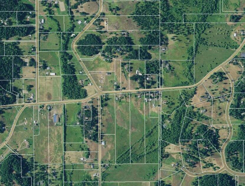
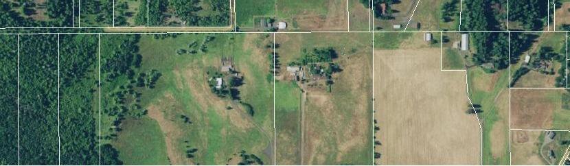
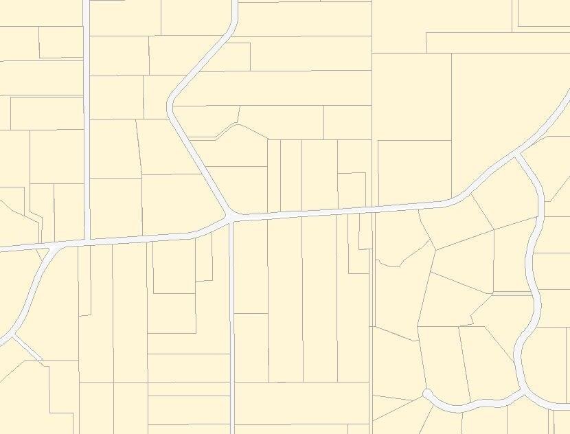
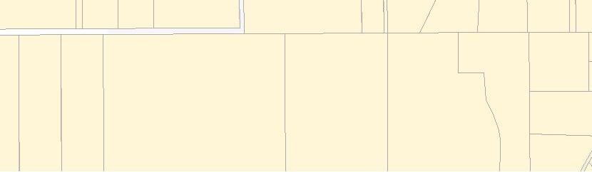
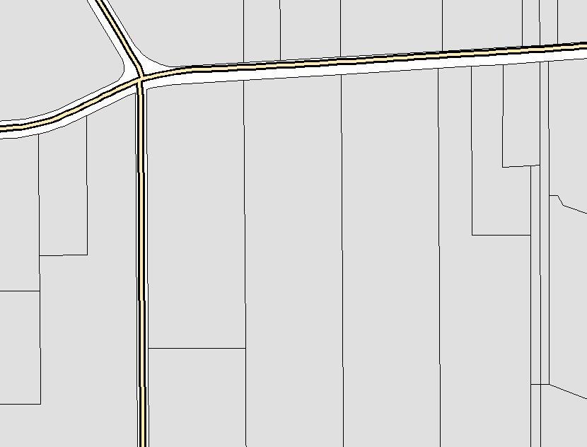
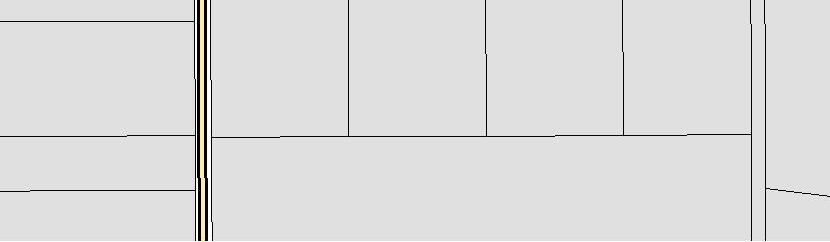
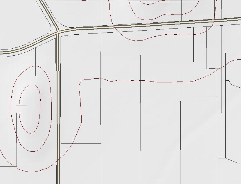
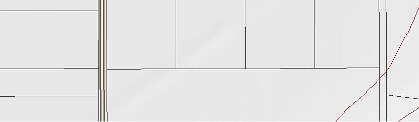
Maps:
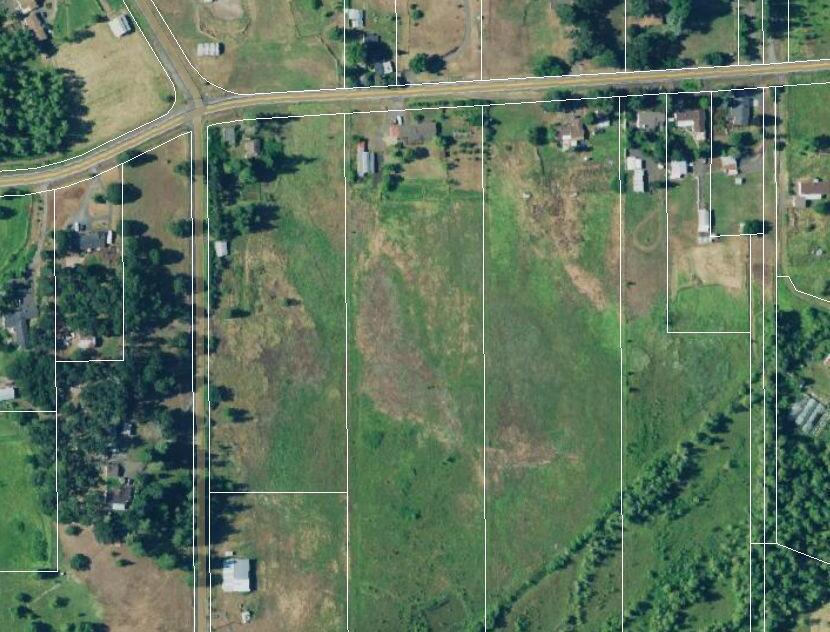
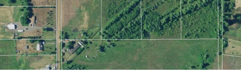
Aerial, Community, Assessor, Tax Lot, Zoning, Transit, Natural, Utilities*
Zoning Definition:
Full definition that will refer to the regulations describing how real property can be used within certain areas, and designating the type of operations allowed on a site.
Zonda*:
Up to date information and sales figures on new residential projects near your site.
Infographics
A brief visual overview based on Zip Code or Neighborhood. Includes demographic, lifestyle, and spending data.
*If available
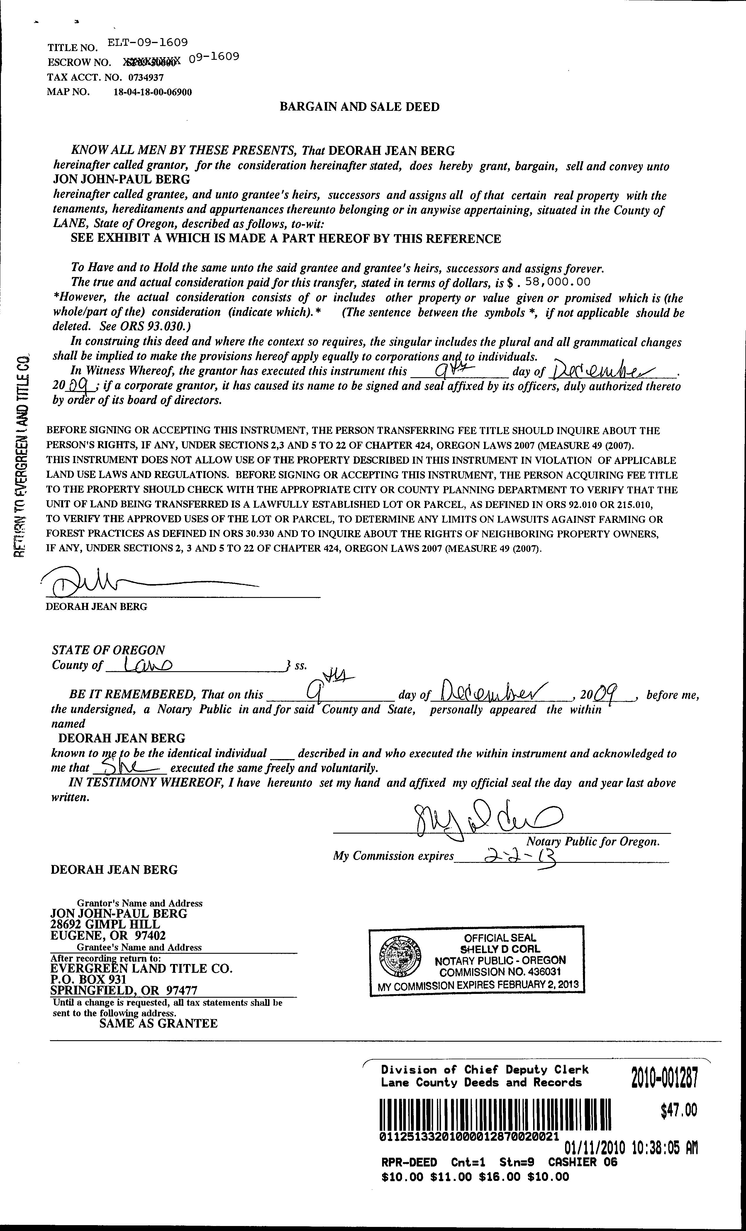
Legal Owner(s): Jon Berg
Site Address: No Site Address , OR
Mailing Address: 28692 Gimpl Hill Rd Eugene, OR 97402
Bedrooms: 3
Total Bathrooms: 2.00
Full Bathrooms: 2
Half Bathrooms:
Units: 0
Stories:
Fire Place: Y
Air Conditioning:
Heating Type: Baseboard
Land Use: RESIDENTIAL
Year Built: 1954
Building SqFt: 1,628
First Floor SqFt: 1,628
Basement SqFt: 0
Basement Type:
Improvement Type: Residential (General) (Single)
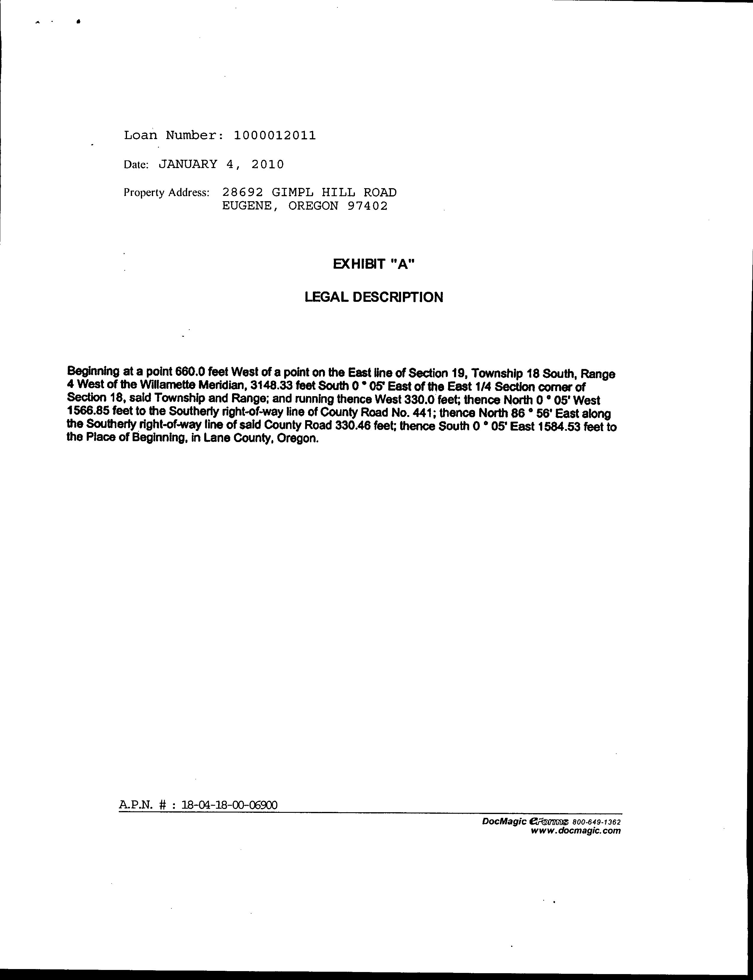
Legal Description: TL 06900
2022 Market Land: $234,513
2022 Market Structure: $
2022 Market Total: $234,513
2022 Assessed Total: $130,017
503.219.8746(TRIO) | cs.oregon@firstam.com
Report Created: 8/14/2024
Parcel #: 18-04-18-00-06900-000
APN: 1864329
County: Lane
Lot SqFt: 302,306
Lot Acres: 6.94
Roof Type: Composition Shingle
Roof Shape: GABLE
Porch Type:
Building Style:
Garage: Attached Garage
Garage SqFt: 624
Parking Spots: 2
Pool:
Zoning: RR10
School District: Eugene School District 4j
Neighborhood: Subdivision:
2022 Taxes: $1,572.38
% Improved: 0.00
Levy Code: Millage Rate:
Legal Owner(s): Jon Berg
Site Address: 28692 Gimpl Hill Rd Eugene, OR 97402
Mailing Address: 28692 Gimpl Hill Rd Eugene, OR 97402
Bedrooms: 3
Total Bathrooms: 2.00
Full Bathrooms: 2
Half Bathrooms:
Units: 0
Stories: 1.00
Fire Place: Y
Air Conditioning: Yes
Heating Type: Baseboard
Land Use: RESIDENTIAL
Improvement Type: Single Family Residential
Legal Description: TL 06900
2022 Market Land: $190,935
Year Built: 1954
Building SqFt: 1,628
First Floor SqFt: 1,628
Basement SqFt: 0
Basement Type: Improved Basement
503.219.8746(TRIO) | cs.oregon@firstam.com
Report Created: 8/14/2024
Parcel #: 18-04-18-00-06900-000 APN: 0734937
County: Lane
Lot SqFt: 217,800
Lot Acres: 5.00
Roof Type: Composition Shingle
Roof Shape: GABLE
Porch Type:
Building Style:
Garage: Attached Garage
Garage SqFt: 624
Parking Spots: 2
Pool:
Zoning: RR10
School District: Eugene School District 4j
Neighborhood: Subdivision:
Last Sale Date: 1/11/2010
#: 2010-001287
Sale Price: $58,000 Prior Sale Date: 8/4/2003
Doc #: 2003-072546

RECREATIONAL COMBINING DISTRICT (/R)
10.115-05 Purpose.
10.115-10 Permitted Buildings and Uses.
10.115-15 Conditional Uses.
10.115-36 Signs.
10.115-42 Area.
10.115-45 Redesignation of Farm and Recreation 5 District Zoned Land.
10.115-95 Telecommunication Towers.
INTERIM AGRICULTURE COMBINING DISTRICT (/IA)
10.120-05 Purpose.
10.120-10 Permitted Buildings and Uses.
10.120-15 Conditional Uses.
10.120-20 Site and Development Requirements.
INTERIM URBANIZING COMBINING DISTRICT (/U)
10.122-05 Purpose.
10.122-10 Permitted Buildings and Uses.
10.122-13 Special Uses Planning Director Review.
10.122-14 Special Uses Hearings Official's Approval.
10.122-15 Conditional Uses.
10.122-20 Site and Development Requirements.
10.122-25 Location.
10.122-30 Lot Area.
10.122-35 Location.
10.122-40 Lot Area.
10.122-45 Siting of Residential Uses.
10.122-50 Conceptual Plan Considerations.
PUBLIC RESERVE DISTRICT (PR)
10.125-10 Permitted Buildings and Uses.
10.125-15 Conditional Uses.
10.125-21 Height.
10.125-23 Setback Requirements.
10.125-28 Vision Clearance.
10.125-35 Off-Street Parking.
10.125-36 Signs.
10.125-42 Area.
RURAL RESIDENTIAL DISTRICT (RR)
10.130-05 Purpose.
10.130-10 Permitted Buildings and Uses.
10.130-15 Conditional Uses.
10.130-21 Height.
10.130-23 Setback Requirements.
10.130-28 Vision Clearance.
10.130-35 Off-Street Parking.
10.130-36 Signs.
10.130-42 Area.
10.130-95 Telecommunication Towers.
10.115-05 Purpose.
The Recreational Combining District is intended to provide for the development and protection of areas uniquely suitable for recreation. This district is intended to provide for areas offering entertainment, amusement and various leisure time activities.
The Recreational Combining District should be applied where it is desirable for recreational facilities and accommodations considered compatible with and appropriate to the natural features, recreational characteristics, and current predominant land use of the vicinity.
The Recreational Combining District may be applied to the following zones when it has been determined that the establishment of this district is consistent with the Lane County General Plan and not in conflict with the purpose of the parent district with which it is being combined. Farm-Forestry (F-F 20); General Rural (GR 10); Agriculture, Grazing, Timber Raising (AGT); Commercial (C-3), and Tourist Commercial (CT). (Revised by Ordinance No. 3-76, Effective 4.7.76)
10.115-10
In the Recreational Combining District, the following types of structures and uses are permitted as described in this section and subject to the general provisions and exceptions set forth in this chapter:
(1) All permitted buildings and uses allowed in the respective district with which the /R District is combined, excluding single-family and two-family dwellings and guest houses.
(2) The following, subject to a site review permit granted pursuant to the provisions of LC 10.335 providing for the granting of site review permits.
(a) Park and outdoor recreation facilities and uses such as: Nature exhibitions, provided that in no event shall such activity destroy, cause to destroy, or endanger the natural conditions being exhibited.
(b) Recreation park, including picnicking areas, day parks, campgrounds and overnight camping vehicle parks, youth camps.
(c) Outdoor stages and entertainment areas.
(d) Winter sports facilities.
(e) Tourist information centers.
(f) Golf courses, driving ranges.
(g) Riding and hiking trails.
(h) Rodeos, but not including horse racing.
(i) Stables, commercial riding.
(j) Marinas, boat launching and moorage facilities, boat charter or rental service.
(k) Accessory buildings and uses customarily provided in conjunction with any of the above uses.
(1) Public and semipublic buildings and structures rendering direct service to the public in local areas, such as fire stations, utility substations, pump stations and wells.
(m) Other uses similar to the above.
(n) One residence or one mobile home for the owner, manager or operator connected with the permitted activity. (Revised by Ordinance No. 3-76, Effective 4.7.76)
The following types of buildings and uses may be allowed, subject to the granting of a conditional use permit in accordance with the general provisions of this chapter regarding
such permits (LC 10.320), and subject to the general provisions and exceptions set forth in this chapter.
(1) Buildings and uses permitted conditionally in the respective district with which the /R District is combined.
(2) Planned Recreational development and related sales and services when constructed as a total multiple use facility incidental and essential to the recreational activity of the vicinity. (a) Uses.
(i) Lodges, resort motels, condominiums and hotels, dormitories, auditoriums, outdoor stages and entertainment areas, convention facilities, recreation parks.
(ii) Service facilities directly associated with the development such as. service station, grocery store, barber and beauty shop, gift shop, clothing shop.
(iii) Other facilities permitted when associated with the overall development; restaurant, dining facilities, dancing facilities, lounges, bars and taverns.
(iv) Other uses similar to above when approved by the Planning Commission.
(b) Standards.
(i) All road and driveway improvements and parking lots shall be covered with a dust retardant to the specifications of the Director of the Transportation Department.
(ii) All major roads leading from public roads to parking lots and areas near living quarters shall be paved.
(iii) All utility services, including electric and telephone, shall be installed in an underground location where physical conditions permit such location.
(iv) Front yard and any yard adjacent to a street shall not be less than 50 feet in depth which yard will not be used for off-street parking. (Revised by Ordinance No. 3-76, Effective 4.7.76)
10.115-36 Signs. As provided in LC 10.345. (Revised by Ordinance No. 3-76, Effective 4.7.76)
10.115-42 Area.
(Also see LC 10.300-20). The minimum area for the division of land shall be five acres, except:
(1) The division of agricultural land by lease or rental for any farm use purpose is permitted, provided however, that no structure or building may be erected appurtenant to such division of land except those permitted under LC 10.115-10(2)(k) above.
(2) The division of ownership may be permitted in accordance with a condominium apartment approved as a part of a multiple use recreational development conditional use.
(3) Division of land for less than five acres is permissible for uses permitted under LC 10.115-20(2)(1) above. (Revised by Ordinance No. 3-76, Effective 4.7.76)
10.115-45 Redesignation of Farm and Recreation 5 District Zoned Land. Land zoned previously Farm and Recreation 5 District is now zoned as AGT-5. (Revised by Ordinance No. 3-76, Effective 4.7.76)
10.115-95 Telecommunication Towers.
Notwithstanding the requirements in LC 10.115-05 through -45 above, telecommunication facilities are allowed subject to compliance with the requirements of LC 10.400 and with applicable requirements elsewhere in LC Chapter 10 including but not necessarily limited to: the Floodplain Combining Zone (LC 10.271); Greenway Development Permit (LC 10.322); the Coastal Resource Management Combining Zones (LC 10.240, 10.245, 10.250, 10.255, 10.260, 10.265, and 10.270); and Federal or State of Oregon inventories and regulations applicable to delineated wetlands and waters of the nation or state. (Revised by Ordinance No. 4-02, Effective 4.10.02)
10.120-05 Purpose.
The Interim Agriculture Combining District is intended to be used in conjunction with a primary agricultural district and is intended to be applied in those areas in which agriculture or timber production is presently the predominant land use, or in which the land is suitable for agricultural or timber production, but in which it is recognized in the adopted Comprehensive Plan for Lane County that such uses are an interim use, which will ultimately give way to the development of more intensive land uses, and it is desirable to protect the agricultural or timber production character of the land until such time as it is ready for intensive development of such land uses as provided in the Comprehensive Plan. The Interim Agriculture Combining District may be applied, where appropriate, in combination with Farm-Forestry 20, General Rural 10; Agriculture, Grazing, Timber Raising; i.e., F-F 20/IA, GR 10/IA or AGT/IA. (Revised by Ordinance No. 372, Effective 7.21.72; 3-76, 4.7.76)
10.120-10 Permitted Buildings and Uses.
All permitted buildings and uses allowed in the respective district with which the /IA District is combined. (Revised by Ordinance No. 3-72, Effective 7.21.72; 3-76, 4.7.76)
10.120-15 Conditional Uses.
All buildings and uses permitted conditionally in the respective district with which the /IA District is combined. (Revised by Ordinance No. 3-72, Effective 7.21.72; 3-76, 4.7.76)
10.120-20 Site and Development Requirements.
The requirements for yards and setbacks, area, vision clearance, and parking spaces shall be as provided in the respective district with which the /IA District is combined. (Revised by Ordinance No. 3-72, Effective 7.21.72; 3-76, 4.7.76)
10.122-05 Purpose.
The Interim Urbanizing Combining District (/U) is intended to be applied to those lands which are currently non-urban in nature, however, are:
(1) Within an area designated as an urban growth area by the Comprehensive Plan of Lane County, and
(2) Lands recognized by the Plan as suitable for conversion from urbanizable to urban uses at some future date. The /U Combining District must be used in conjunction with another primary district to establish land use standards. It may be used where appropriate in conjunction with any other district in accordance with the specific
Comprehensive Plan provisions relating to the respective city urban growth boundary. (Revised by Ordinance No. 15-79, Effective 12.1.79; 10-82, 7.9.82)
10.122-10 Permitted Buildings and Uses.
All buildings and uses permitted in the respective district with which the /U District is combined, except as herein specifically modified. (Revised by Ordinance No. 15-79, Effective 12.1.79; 7-08, 12.31.10)
10.122-13 Special Uses--Planning Director Review.
All buildings and uses subject to the approval of the Planning Director, pursuant to Type II procedures of LC Chapter 14, in the respective district with which the /U District is combined, except as herein specifically modified. (Revised by Ordinance No. 10-82, Effective 7.9.82; 16-83, 9.14.83; 7-08, 12.31.10; 20-05, 6.16.20)
10.122-14 Special Uses--Hearings Official's Approval.
All buildings and uses subject to the approval of the Hearings Official, pursuant to Type III procedures of LC Chapter 14, in the respective district with which the /U District is combined, except as herein specifically modified. (Revised by Ordinance No. 10-82, Effective 7.9.82; 16-83, 9.14.83; 7-08, 12.31.10; 20-05, 6.16.20)
10.122-15 Conditional Uses.
All buildings and uses permitted conditionally in the respective district with which the /U District is combined, except as herein specifically modified. (Revised by Ordinance No. 15-79, Effective 12.1.79; 7-08, 12.31.10)
10.122-20 Site and Development Requirements.
The requirements for yards, setbacks, coverage, vision clearance, height and parking shall be the same as provided in the respective district with which the /U District is combined, except as herein specifically modified. (Revised by Ordinance No. 15-79, Effective 12.1.79; 10-82, 7.9.82)
10.122-25 Location.
The /U Combining District is for the purpose of reviewing land within those areas that are considered transitional and/or marginal; conditions which could either restrict and/or limit urban and semi-urban uses. (Revised by Ordinance No. 10-82, Effective 7.9.82)
10.122-30 Lot Area.
(1) For land within the Florence UGB that is within the North Florence Dunal Aquifer boundary, as designated by the U.S. Environmental Protection Agency in September, 1987, no land divisions shall be allowed prior to annexation to the City. (Revised by Ordinance No. 10-82, Effective 7.9.82; 2-83, 4.1.83; 7-08, 12.31.10)
10.122-35 Location.
The /U Combining District is to be applied to urbanizable properties designated for residential use in the Eugene-Springfield Metropolitan Area General Plan which are undeveloped or which are wholly or partially underdeveloped. In situations where property is zoned /U on the periphery of the urban growth boundary and the growth boundary may bisect the property by generally following a physical feature, such as a
ridge line, the actual interpretation of the growth boundary location is necessary. For the purposes of this District it will be determined by application of the requirements of LC 10.122-40 below in the absence of interpretation by means of a refinement planning process for the property. Land zoned /U and which is thereafter interpreted as being outside the urban growth boundary shall not be considered as urbanizable and shall not be subject to the requirements of LC 10.122-40 and -45 below. (Revised by Ordinance No. 10-82, Effective 7.9.82)
10.122-40 Lot Area.
The minimum area for the division of land shall be as provided by the respective district with which the /U District is combined, except as may be further restricted by the following requirements:
(1) Any proposed new lot less than 10 acres, but not less than five acres, shall require the agreement of the adjacent city and Lane County that such lot size would be appropriate for the area, utilizing the following standards.
(a) The approval of a conceptual plan for ultimate development at urban densities in accord with the Metropolitan Area and applicable refinement plans and policies, where the property is redivisible into smaller parcels consistent with the Metropolitan Area Plan, the conceptual plan shall be accomplished by Lane County in accordance with the redivision plan procedures and requirements of LC 13.070(4).
(b) Proposed land uses and densities conform to the Metropolitan Area and applicable refinement plans and policies, and
(c) The owner of the property has signed an agreement with the adjacent city which provides:
(i) The owner and his or her successors in interest are obligated to support annexation proceedings should the city, at its option, initiate annexation.
(ii) The owner and his or her successors in interest agree not to challenge any annexation of the subject property.
(iii) The owner and his or her successors in interest will acquire city approval for any subsequent new use, change of use or substantial intensification of use of the property. The city will not withhold approval of the use arbitrarily if it is in compliance with applicable plans, policies and standards as interpreted by the city as well as the conceptual plan approved under LC 10.122-40(a) above.
(d) The agreement required in LC 10.122-40(c) above shall be recorded in the Lane County Deed Records.
(2) Any proposed new lot less than five acres shall also require, in addition to the requirements of LC 10.122-40(1), above:
(a) The property will be owned or operated by a governmental agency or public utility; or
(b) A majority of parcels located within 100 feet of the property are smaller than five acres. (Revised by Ordinance No. 15-79, Effective 12.1.79; 10-82, 7.9.82)
(1) The placement, expansion or relocation of a dwelling structure or mobile home shall be sited so as to allow future division and/or other future, more intensive use of the property consistent with the designation of use for the property in the EugeneSpringfield Metropolitan Area General Plan.
(2) The applicable onsite sewage disposal facility or building construction permit or mobile home placement shall be conditional and made a part of such permit as is necessary to achieve the requirements of LC 10.122-45(1) above, in the following manner:
(a) Approval of a conceptual plan for the property to achieve ultimate densities provided in the Metropolitan Area Plan, which may include a redivision plan in a manner described in LC 13.070(4).
(b) Special development restrictions in addition to those otherwise required by the provisions of this chapter, on the location of buildings and onsite sewage disposal facilities to reserve land for future development consistent with LC 10.12245(2)(a) above.
(3) The waiver or modification of the requirements of LC 10.122-45(2) above, as applied to construction permits and mobile home placement permits, may be granted only in the manner provided in LC 10.330, Variances. (Revised by Ordinance No. 10-82, Effective 7.9.82)
10.122-50 Conceptual Plan Considerations.
The determination of the proper conceptual plan for achieving ultimate densities provided in Metropolitan Area Plan, as required by LC 10.122-40(1)(a) and LC 10.122-45(2)(a), above, shall include consideration of the following:
(1) The ultimate density proposed for the property in the Eugene-Springfield Metropolitan Area Plan.
(2) The existing character of the property and its potential for more intensive development.
(3) The existing and potential future development of adjacent properties, as designated in the Metropolitan Area Plan, and any redivision plans for such properties approved in accordance with LC 13.070(4).
(4) Existing long-range plans to provide public facilities to the area.
(5) A basic standard of 6,000 square feet in area per dwelling unit for determination of ultimate densities in areas designated "Low Density Residential" in the Metropolitan Area Plan.
(6) Provision for achieving an average gross density of greater than 10 dwelling units per acre for areas designated "Medium Density Residential" in the Metropolitan Area Plan. (Revised by Ordinance No. 10-82, Effective 7.9.82)
10.125-10 Permitted Buildings and Uses.
In the PR District, the following types of buildings and uses are permitted as hereinafter specifically provided for by this section, subject to the general provisions and exceptions set forth in this chapter:
(1) A dwelling arranged, intended and designated exclusively for one family, and accessory buildings such as, garages, storerooms, wood sheds, laundries, greenhouses, animal shelters, or similar and related accessory uses; provided, however, that there shall not be more than three buildings allowed as accessory to any singlefamily dwelling.
(2) Hunting and fishing lodges, dude ranches, resort hotels.
(3) Public and semi-public buildings, such as:
(a) Schools.
(b) Libraries, art galleries and museums.
(c) Hospitals, sanitariums, hot baths and rest homes.
(d) Institutions for education, philanthropic or eleemosynary (charitable) uses.
(e) Private clubs, fraternities and lodges.
(f) Parks, playgrounds, winter sports, golf courses and recreational use.
(g) Governmental buildings and uses (federal, state, county, municipal or other governmental divisions).
(4) Kennel, provided the following conditions are satisfied:
(a) The maximum number of dogs over four (4) months of age shall be five (5).
(b) For more than three (3) dogs over four (4) months of age, there shall be at least five thousand (5,000) square feet of lot area for each dog on the lot.
(c) All kennel structures and fenced runs accommodating a total of more than three (3) dogs over four (4) months of age shall be maintained at least one hundred (100) feet from an adjoining property.
(d) All dogs shall be owned by the occupant of the premises, except those temporarily kept for purposes of breeding.
(5) Transportation facilities and uses as specified in LC 10.500-15(1) through (13). (Revised by Ordinance No. 13-72, Effective 7.21.72; 10-04, 6.4.04)
10.125-15 Conditional Uses.
The following conditional uses, subject to a conditional use permit granted pursuant to the provisions of this chapter providing for the granting of conditional use permits (LC 10.320).
(1) Any of the conditional uses set forth in the general Conditional Use Permit Section (LC 10.320-15).
(2) Kennels which do not satisfy the requirements for kennels allowed as a permitted use
(3) Transportation facilities and uses as specified in LC 10.500-15(14) through (17). (Revised by Ordinance No. 13-72, Effective 7.21.72; 10-04, 6.4.04)
10.125-21 Height.
(Also see LC 10.300-10). No building or structure, nor the enlargement of any building or structure, shall be hereafter erected to exceed two and one-half (2-1/2) stories or more than thirty-five (35) feet in height. (Revised by Ordinance No. 13-72, Effective 7.21.72)
10.125-23 Setback Requirements.
(Also see LC 10.300-15 and 15.065)
(1) Front yard setback shall be twenty-five (25) feet.
(2) Interior side yard setback shall be ten (10) feet for an interior side or rear yard. (Revised by Ordinance No. 13-72, Effective 7.21.72; 6-75, 3.26.75)
10.125-28 Vision Clearance.
(1) Vision clearance for corner lots shall be a minimum of fifteen feet.
(2) Vision clearance for alley-street intersections shall be a minimum of seven and one-half feet. (Revised by Ordinance No. 13-72, Effective 7.21.72)
10.125-35 Off-Street Parking.
(1) Residential use. At least one permanently reserved parking space or private garage shall be provided for each single-family dwelling.
(2) Lodges, dude ranches and resort hotels shall provide and maintain sufficient off-street parking to adequately care for the automobiles of owners, employees and patrons, with ingress and egress to the highway properly controlled to give reasonable protection to the automotive traffic.
(3) Public and semi public buildings shall provide and maintain a minimum of one off-street parking space for each one thousand square feet of building floor area. (Revised by Ordinance No. 13-72, Effective 7.21.72)
10.125-36 Signs.
Signs and nameplates may be installed as follows:
(1) One nameplate not exceeding six square feet in area for each dwelling unit, indicating the name of the homesite or the name of the occupant.
(2) One sign not exceeding thirty-five square feet in area for buildings other than dwellings; provided that such sign shall be attached to and parallel with the front wall of the building.
(3) One sign not exceeding six square feet in area, pertaining to the sale or rental of property. (Revised by Ordinance No. 13-72, Effective 7.21.72)
10.125-42 Area.
(Also see LC 10.300-20).
(1) Size of Lot.
(a) Residential lots and lots for governmental buildings shall have a minimum average width of eighty feet and a minimum area of eight thousand square feet, except that where a lot has an average width of less than eighty feet and an area of less than eight thousand square feet as of May 31, 1949, such lot may be occupied be a singlefamily residence.
(b) Lots for other uses as specified under LC 10.125-10(2) and (3) shall have a minimum width of two hundred feet and a minimum area of one acre.
(2) Percent of Coverage. The main building and accessory buildings located on any building site or lot shall not cover in excess of thirty percent of the lot area. (Revised by Ordinance No. 13-72, Effective 7.21.72)
10.130-05 Purpose.
The Rural Residential District is intended to provide opportunities for persons who desire to live in a rural neighborhood setting. This district may be applied to rural communities, rural service centers, minor or major development centers and other rural neighborhoods in the more isolated portions of Lane County, as more specifically provided in LC 10.130-42 below. (Revised by Ordinance No. 13-72, Effective 7.21.72; 3-76, 4.7.76)
10.130-10 Permitted Buildings and Uses.
In the RR District, the following types of buildings and uses are permitted as hereinafter specifically provided for by this section, subject to the general provisions and exceptions set forth in this chapter:
(1) One single-family dwelling or two-family dwelling per lot or one mobile home per lot.
(2) Guest house.
(3) General farming, including the growing and raising of trees, vines, shrubs, berries, vegetables, nursery stock, hay grains, and similar food and fibre products.
(4) The raising, tending or breeding of cattle, horses, sheep, goats, or bees, poultry, fur-bearing animals and swine for the purpose of personal domestic use; such animal husbandry shall not be a part of, nor be conducted in conjunction with, any livestock sales yard, slaughter house, or animal by-product business. Such use shall include, but not be limited to, the raising of animals for shows, competitions, or projects
sponsored or directed by a school club, or other social or educational organization provided that:
(a) Cows, horses, sheep, goats or swine cannot be kept on lots having an area of less than one acre. The minimum area for the keeping or raising of such animals (other than their young under the age of six months) on less than five acres shall be as follows:
Horse ............................
Cow ............................
One per acre, plus one additional for every 15,000 square feet.
One per acre, plus one additional for every 10,000 square feet.
Goat or sheep ................
Five per acre, plus one additional for every 2,000 square feet.
Swine ............................
One per acre.
(b) The number of chickens, fowl and/or rabbits (over the age of six months) shall not exceed one for each 500 square feet of property. The number of young chickens, fowl and/or rabbits (under the age of six months) allowed on the property at any one time shall not exceed three times the allowable number of chickens, fowl and/or rabbits over the age of six months.
(c) The number of colonies of bees allowed on a lot shall be limited to one colony for each 2,000 square feet of lot area.
(d) Animal runs, stables, barns, corrals of less than one-half acre, chicken or fowl pens, and colonies of bees shall be located on the rear half of the property, but not closer than 70 feet from the front property line nor closer than 40 feet from any residence or other property line.
(e) Animals, chickens, and/or fowl shall be properly caged or housed, and proper sanitation shall be maintained at all times. All animal and poultry food shall be stored so as to be rodent-proof.
When an RR District is reclassified to another district, all those animal uses in LC 10.130-10(4) above, shall be required to comply with the requirements of said district for such land uses with a period of six months from the date of reclassification.
(5) Home occupations (see LC 10.340 for Home Occupation provisions).
(6) Public and semipublic buildings and structures essential to the physical and economic welfare of an area, such as fire stations, substations, pump stations and wells, provided that interior yards for these uses shall be a minimum of 25 feet and no stockpiling or storage of materials shall be allowed.
(7) Accessory buildings and uses customarily provided in conjunction with a use permitted in this district.
(8) Kennel, provided the following conditions are satisfied:
(a) The maximum number of dogs over four months age shall be five.
(b) For more than three dogs over four months of age, there shall be at least 5,000 square feet of lot area for each dog on the lot.
(c) All kennel structures and fenced runs accommodating a total of more than three dogs over four months of age shall be maintained at least 100 feet from an adjoining property.
(d) All dogs shall be owned by the occupant of the premises, except those temporarily kept for purposes of breeding.
(9) Transportation facilities and uses as specified in LC 10.500-15(1) through (13). (Revised by Ordinance No. 13-72, Effective 7.21.72; 17-73, 1.16.74; 3-76, 4.7.76; 10-04, 6.4.04)
10.130-15 Conditional Uses.
The following conditional uses, subject to a conditional use permit granted pursuant to the general provisions of this chapter providing for the granting of conditional use permits (LC 10.320):
(1) Churches.
(2) Lodges and grange halls.
(3) Public and private schools.
(4) Parks, playgrounds or community centers.
(5) Electric transmission facilities transmitting electric current in excess of 75,000 volts on any single cable or line or group of cable or lines.
(6) Radio and TV transmission towers.
(7) Cemeteries.
(8) Golf courses.
(9) Stables, riding academies and commercial riding.
(10) Mobile home parks.
(11) Penal farms.
(12) Kennels which do not satisfy the requirements for kennels allowed as a permitted use.
(13) Sewage treatment facilities.
(14) Transportation facilities and uses as specified in LC 10.500-15(14) through (17).
(15) Other uses not specifically authorized any place in this chapter. (Revised by Ordinance No. 13-72, Effective 7.21.72; 3-76, 4.7.76; 11-78, 8.11.78; 10-04, 6.4.04)
10.130-21 Height.
(Also see LC 10.300-10.) No building or structure, nor the enlargement of any building or structure, shall be hereafter erected to exceed two and one-half stories or more than 35 feet in height, except hospitals, public schools or churches, which may be increased in height to three stories or 45 feet. (Revised by Ordinance No. 13-72, Effective 7.21.72)
10.130-23 Setback Requirements.
(Also see LC 10.300-15 and 15.065-.095.)
(1) Front yard setback shall be 20 feet.
(2) Side yard setback shall be as follows:
(a) Interior yard -- 15 feet.
(b) Street side yard 20 feet.
(3) Rear yard setback shall be 20 feet. (Revised by Ordinance No. 13-72, Effective 7.21.72; 6-75, 3.26.75; 3-76, 4.7.76)
10.130-28 Vision Clearance.
Vision clearance for corner lots shall be a minimum of 15 feet. (Revised by Ordinance No. 1372, Effective 7.21.72; 3-76, 4.7.76)
10.130-35 Off-Street Parking.
There shall be at least one permanently reserved parking space, or a private garage on the same lot or attached to or made a part of the main building. Such parking space shall be not less than eight feet wide and 18 feet long. The parking space or garage shall be provided at the time of the erection of the main building, and it shall have adequate provisions for ingress and egress by standardized automobiles. For parking space requirements for buildings other than dwellings, see the general Off-Street Parking Section (LC 10.300-05). (Revised by Ordinance No. 13-72, Effective 7.21.72)
10.130-36 Signs.
Signs and nameplates may be installed as follows:
(1) One nameplate not exceeding one and one-half square feet in area for each dwelling unit, indicating the name of the occupant or identifying the home occupation in the case of LC 10.130-10(5) above.
(2) One sign not exceeding 12 square feet in area for buildings other than dwellings.
(3) One sign not exceeding six square feet, pertaining to the sale or rental of property; provided that such sign shall be attached to and parallel with the front wall of the building.
(4) One sign not exceeding 18 square feet in area will be allowed on a tract of land advertising the sale of the property, subject to approval of the Planning Department.
(5) Subdivision and directional signs. (See LC 10.345 for permit provisions.)
(Revised by Ordinance No. 13-72, Effective 7.21.72)
10.130-42 Area.
(Also see LC 10.300-20.)
(1) The minimum area for the division of land zoned Rural Residential after April 7, 1976 shall be one, two or five acres and the zone shall be identified and designated as RR-1, RR-2 or RR-5 respectively.
(a) Parcel sizes must be a minimum of five acres for land within or adjacent to rural service centers, minor development centers or major development centers designated in the Comprehensive Plan for Lane County which are planned for urban level development.
(b) Parcel sizes must be a minimum of two acres for land within or adjacent to rural service centers, minor development centers or major development center where urban level development is not planned.
(c) Parcel sizes may be a minimum of one acre for land described in LC 10.130-42(1)(b) above, where the land is served with a community water supply acceptable to Lane County.
(d) Parcel sizes must be a minimum of five acres when the Rural Residential District is applied to rural residential areas isolated from services and development centers.
(2) The minimum area for the division of land zoned Rural Residential prior to April 7, 1976 shall be based upon the Lane County Soils Survey, as may be amended, conducted under supervision and/or correlation by the Soil Conservation Service, US Department of Agriculture. It is the further intent of this district that soils classifications not included in this subsection are generally considered not suitable for development and therefore not appropriate for this district. Minimum lot areas shall be as follows:
(a) One acre for the following soils classifications:
(b) Five acres for the following soils classifications, with reductions to no less than one acre permissible as approved by the Water Pollution Control Division,
after consultation with County soil science personnel, upon site inspection and soils analysis of the subject property:
MAP SYMBOL
4A 469C (2-12% slope)
10A 470S (0-15% slope)
30A 480B (3-12% slope)
72K (0-15% slope) 481C (12-15% slope)
80A 484D (3-15% slope) 150A
(0-15% slope)
(12-15% slope)
(0-15% slope)
270A 550B (2-12% slope) 330B 551C (12-15% slope) 407B 560S (0-15% slope) 420B 567S (0-15% slope)
421C (12-15% slope) 570S (0-15% slope)
436C (7-12% slope) 575C (2-15% slope)
460S (0-15% slope) 585S (0-15% slope)
461K (0-15% slope)
(c) Five acres for the following soils classifications:
MAP SYMBOL
166B
203A
206D (12-25% slope)
216D (12-25% slope)
232D (12-25% slope)
238F (20-25% slope)
256D (15-25% slope)
322A
330A
331C (8-16% slope)
237D (12-25% slope) 335B
351A
360B
405C (15-25% slope)
421C (15-20% slope)
422E (20-25% slope)
460S (15-25% slope)
461K (15-25% slope)
470S (15-25% slope)
474E (12-25% slope)
481C (15-25% slope)
482E (15-25% slope)
484D
486 (15-25% slope)
491C (15-20% slope)
510B (12-25% slope)
511C (12-25% slope)
512D (12-25% slope)
515S (12-25% slope)
551C (15-25% slope)
552E (15-25% slope)
570S (15-25% slope)
576K (15-25% slope)
585S (15-25% slope)
670S (15-25% slope)
The soils classifications in LC 10.130-42(2)(c) above shall assume the requirements of LC 10.130-42(2)(b) above upon the availability of a public or group sewage disposal system as approved by the Water Pollution Control Division.
Any proposed lot area with more than one soils classification covering the lot or soils series not classified above shall be reviewed by the Water Pollution Control Division after consultation with County soil science personnel, for determination of the appropriate area requirements. Considerations in determining appropriate lot sizes shall
include, but not necessarily be limited to, the severity of the slope, potential flood and other natural hazards, stability for foundations as well as suitability for subsurface sewage disposal.
(3) A special exception to the minimum area requirements of this section may be approved in accordance with LC 10.350, "Special Exceptions to Minimum Area Requirements." (Revised by Ordinance No. 13-72, Effective 7.21.72; 3-76, 4.7.76; 9-76, 8.22.76; 17-78, 9.27.78)
10.130-95 Telecommunication Towers.
Notwithstanding the requirements in LC 10.130- 05 through -42 above, telecommunication facilities are allowed subject to compliance with the requirements of LC 10.400 and with applicable requirements elsewhere in LC Chapter 10 including but not necessarily limited to: the Floodplain Combining Zone (LC 10.271); Greenway Development Permit (LC 10.322); the Coastal Resource Management Combining Zones (LC 10.240, 10.245, 10.250, 10.255, 10.260, 10.265, and 10.270); and Federal or State of Oregon inventories and regulations applicable to delineated wetlands and waters of the nation or state. (Revised by Ordinance No. 4-02, Effective 4.10.02)
PAGES 10-364 THROUGH 10-400 ARE RESERVED FOR FUTURE EXPANSION


Thelargestgroup: 2023MalesAge30-34
Thesmallestgroup: 2023MalesAge85+
Thelargestgroup:$50,000-$74,999(18.7%) The
(2.1%)
$50,000-$74,999