
GRANDVIEW 0302 Building Tomorrow’s Community


VISION STATEMENT By Grandview2030,willbecomearegionalleaderby encouraging diverse and safe neighborhoods, fostering local business innovation, increasing environmental awareness and sustainable practices, all the while maintaining fiscal responsibility.

Grandview is also a great place for fun! Citizens are in creasingly happy with City festivals and events, as well as Parks and Recreation programs and facilities. In fact, near ly 500 citizens gathered in September to give a wet wel come to the City’s newest addition at The View community center—a splash park! Our City is planning ahead. Grandview 2030 is based on the vision, values and expectations of the community. Through a thorough public input process, this plan was de veloped, creating a framework for making important deci sions while guiding Grandview's growth and development for the next 10 years. This is a living document that grows and changes with the community along with steps that are needed to make that vision reality.
Grandview’s tenacity and hard work are paying off as the City grows by leaps and bounds. We've seen a 35% increase in retailers since 2015, added more than 250 households since the beginning 2019 and raised citizen satisfaction across the board since we last surveyed in 2012. We’ve been able to accomplish all of this while remaining financially strong and maintaining a AA- credit rating with Standard & Poor's Global Ratings (S&P). Grandview has one of the lowest debt-per-capita ratios among all cities in the Kansas City Metro Area.
Grandview is welcoming with high quality infrastructure and public services, thriving neighborhoods, strong public safety and an engaged community. Grandview is a place we are all proud to call home and where we are always working on the job at hand. From your local elected offiEvery month, I walk from store to store along Main Street and at Tru man’s Marketplace. I do this for a couple of reasons. I like to stop and talk to the store managers and staff to learn more about them, their lives, and how business is going. cials in the Board of Aldermen to City Staff, Grandview is, and will remain committed to Building Tomorrow's Com munity. Thank you to our Planners, Billie Hufford and Dave McCumber for their hard work creating Grandview 2030.
1 LETTER FROM THE MAYOR
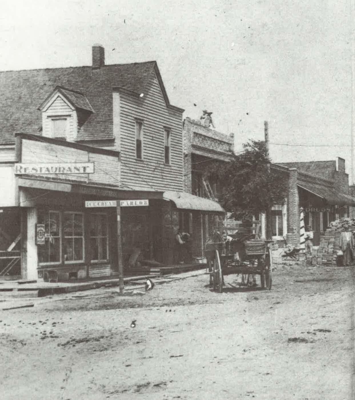
Figure 0.1 Topsy's Popcorn and Ice Cream
Leonard D. Jones, Jr. Mayor, City of Grandview
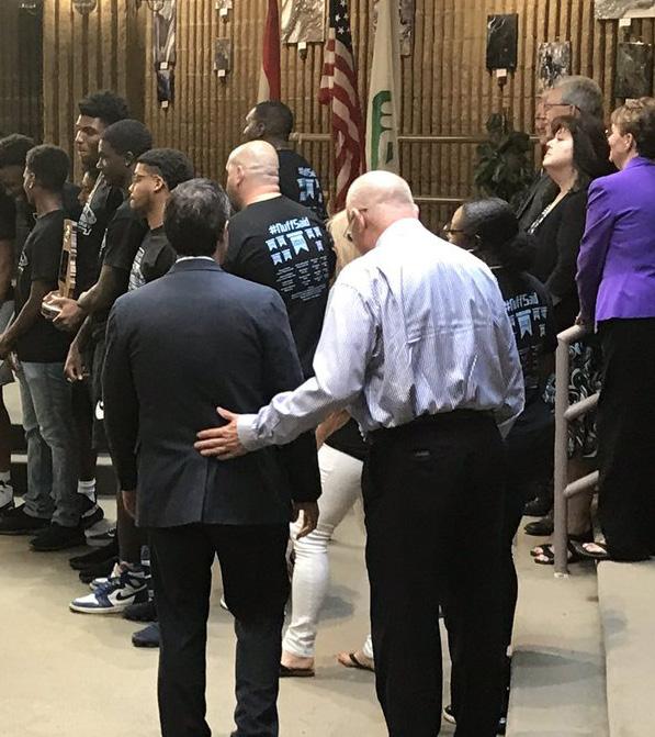
Figure 0.2 Ribbon Cutting in Truman's Marketplace
Secondly, and most importantly, the walk reminds me how blessed Grandview is to have such successful commercial districts with busy businesses and happy shoppers. The city of Grandview has come a long way in a short amount of time, and we’re not done yet.


2 Mayor and Board of Aldermen Mayor Leonard D. Jones, Jr. James N. Crain - Ward 3 Dan Hartman - Ward 2 Sandra Kessinger - Ward 1 John T. Maloney - Ward 3 Damon Randolph - Ward 1 Annette M. Turnbaugh - Ward 2 Jay Tarr - Chair Frank Bader and Brian Hackworth - Ward 1 Tom McBride - Ward 1 Shawn Nelson - Ward 2 Christian Parchman - Ward 2 Thomas Rousey - At Large Homer Thompson and Steve Stadler - Ward 3 John Maloney - Board of Aldermen Liaison Planning Commission Comprehensive Plan Committee Gloria LizShawnJosephLaRettaAlanAndrewDooleyFinkKinderMorganMortonNelsonOgle Phyllis MarthaStephenMorganRobertsTangenTerryThompson City Administrator - Cemal Umut Gungor Assistant City Administrator - Kirk Decker Community Development Director - Chris Chiodini Planner and Plan Writer - Dave McCumber Inspector/Planner and Plan Writer - Billie Hufford City Clerk and Editor- Becky Schimmel Communications Manager and Editor - Valarie Poindexter Chief of Police - Charles Iseman Parks and Recreation Director - Sue Yerkes Public Works Director - Dennis Randolph Grandview C-4 School District SuperintendentDr. Kenny Rodrequez City Engineer - Jacklyn White City Staff ACKNOWLEDGMENTS 321Wards Figure 0.3 Grandview Board of Alderman Figure 0.4 Grandview Ward Map Figure 0.5 Grandview Comprehensive Plan Committee Staff would like to recognize Sheila Shockey, Founder and President of Shockey Consulting Services, for her assistance in the initial stages and brainstorming process for this Comprehensive Plan update. Sheila was a big help in understanding how com prehensive plans are written and how community engagement is practiced today. She helped establish the framework in which this Plan is built on and we thank Sheila for her time and professional knowledge.


3 TABLE OF CONTENTS 1 EXECUTIVE SUMMARY 2 OUR STORY 3 COMMUNITY ENGAGEMENT 4 ECONOMIC DEVELOPMENT 5 ENVIRONMENT AND SUSTAINABILITY 6 HOUSING 7 INFRASTRUCTURE 8 PARKS AND RECREATION Communities for All Ages (CFAA) - The goals throughout where this icon appears meet CFAA recommen dations that were outlined during the City’s work to gaining its Silver status. The implementation of this Plan and its goals will contribute to Grandview receiving the Gold status through the CFAA program. Gold is only held by cities that prove they are willing to create Communities for All Ages. To learn more visit: https://www.marc.org/Commu nity/KC-Communities-for-All-Ages 9 CRIME AND SAFETY 10 EDUCATION 11 HISTORIC PRESERVATION 12 OUR VISION 13 FUTURE LAND USE 14 GLOSSARY 76727066636146423424161254 15 REFERENCES 81


SUMMARY
The City of Grandview, located in southern Jackson County, Missouri, has found itself at the beginning of a new chap ter of prosperity. This is not accidental, as strategic planning and leadership have been the driving cause. Much of the progress we have seen is thanks to the hard-work of those before us that dedicated their time and energy into the strategies set forth in the last Comprehensive Plan. These types of all-encompassing guiding documents begin with the community, for the community, to create the future Grandview citizens expect and deserve. Since Beyond 2000... A Vision for Grandview, Missouri, the City’s last Comprehensive Plan, many of the goals out lined have been accomplished, but some are still in prog ress. Nearly two decades later, it is now time to update that plan and establish the next set of expectations for the City to strive toward over the coming decade. Grandview 2030 builds off the successes that were accomplished since the turn of the millennium with the expectations to make Grandview not just a good place to live, but a great place to call home. The plan began with months of community outreach en gagement exercises. The community identified five priority areas on which the new plan would be built: Infrastructure, Parks and Recreation, Environment and Sustainability, Hous ing and Economic Development. Next, the Comprehensive Plan Committee was formed to help guide staff and provide recommendations and ideas for the unique challenges the community identified during the outreach process. This committee was key to ensuring that the plan accurately re flects the community's true needs, wants and desires. Over the course of many months, the Committee worked closely with staff to review each of the five topics and brainstorm creative solutions to address each one. This plan aims to take a proactive approach to reaching Grandview’s fullest potential through strategic planning with practical expectations. Grandview 2030 is here and the community is ready to take the next step toward creating a better environment for our families, friends, neighbors, visitors and all those who come after.
Figure 1.1 Regional Context Map 2017* 2010 2000 Population 25,226 24,475 24,881 Male 49% 48% 48% Female 51% 52% 52% Median Age 33 34 34 WhiteRace 44% 48% 60% Black AfricanorAmerican 39% 41% 33.5% Hispanic or Latino 8.5% 10% 4.3% Housing Units ****** 11,010 10,348 * = 2017, American Community Survey, 5 Year Estimate Community Demographics Source: census.gov Table 1.1 Community Demographics 1
EXECUTIVE4


Beginning in the middle of the 19th century, our community was first settled by farmers and those in the trades businesses. During this time period the “Town of Grandview,” outlined in green in figure 2.1, was estab lished just as new railroad companies be gan operating in the Kansas City area. Kan sas City Southern, the main rail service that bisects Grandview, played an integral part in the early development of the City. Early stages of growth occurred from 1889 to 1912 as the Post Office, commercial and residential buildings for railroad supplies and housing and Anderson’s General Store were constructed and opened. Quickly these new developments were followed by other commercial services for tradesmen and their families. In 1912, the “Town of Grandview” became an incorporated village known as the Vil lage of Grandview. This period brought large amounts of residential developments near the City’s downtown district and in 1929, the Village met the qualifications to become a fourth class city, known as Grand view, Missouri. Public services such as elec tricity, natural gas, public transportation, a fire department and many others, became available to residents. By 1940, the City had grown to a population of 596. Since World War II, Grandview’s geograph ic size, (see Annexation Map to the right), grew dramatically. Grandview Airport was established and later became Richards Gebaur Air Force Base, which led to large residential subdivisions being construct ed to house military personnel and their families. Many other subdivisions east of today's I-49 interstate highway were also completed. The Truman Corners Shopping Center was built after the War and still re mains as a vibrant shopping district today. In the more recent past, recessions have come and gone, technology has had profound impacts on the community and the local economy, and all the while the City has focused on practicing conservative financial princi pals, investing in its public infrastructure and facilities, and attracting new businesses and housing opportunities. The future of Grandview is current ly being planned, designed, funded and explored now as a partnership between the citizens, the elected officials and the City staff.
2
5 OUR STORY
Figure 2.1 Grandview Annexation Map

6 1844 1889Settlement The Federal Govern ment began selling public lands to pri vate citizens. Public to Private Ownership Kansas City Southern Railroad During the mid to late 1800s, the railroad had a significant impact on the growth and establishment of the City of Grandview. Grandview Cemetery Now known as the Blue Ridge Cemetery, it was established in 1853 at 12310 Grand view Road. The stone pillars were built by John Anderson Truman and Jesse David Clements. Anderson General Store John S. openedAndersonthefirst business in the new Town of Grandview in 1889/1890. Truman Farm Home Built in 1893, this was President Truman’s child hood farm. While he, his parents and siblings had moved to Independence MO, the family still used the land for farming. It was later established as a National Historic Site. THE BEGINNING Source: nreionline.com Figure 2.2 Source: Grandview Historical Society Figure 2.4 Source: Grandview Historical Society Figure 2.6 Source: Grandview Historical Society Figure 2.5 Source: Grandview Historical Society Figure 2.3 2OUR STORY


7 OUR STORY 1910New Growth Clements Hardware Seen in the picture above is Mr. Jesse Clements behind the counter selling to a customer. The hardware store first opened in 1905 at 709 Main Street. Plumber Blacksmith Shop The first blacksmith to open shop in Grandview was George E. Plummer in 1894. J.C. Jones Lumber Company Grandview’s first lumber com pany was under construction at 7th and Goode Avenue in 1905. Farmers Bank Originally located within the Clements Hardware Store, Farmers Bank found its first home at 8th and Main Street in 1907. It would later relocate to just west of the original building in 1947. Source: Grandview Historical Society Figure 2.8 Source: Grandview Historical Society Figure 2.10 Source: Grandview Historical Society Figure 2.9 Source: Grandview Historical Society Figure 2.7 2


OUR8 STORY The Village of Grandview On February 6th, 1912, the Jack son County Court ordered for the legal incorporation. 1912 Village of Grandview Grandview Acres I-49 13thStreet 15thStreet SpringStreet ParkerAvenue Arthur King platted over 300 acres of land in 1916, known as Grandview Acres, to build homes. The subdivision is lo cated south of Highgrove and two blocks on either side of I-49, south to 135th Street. Highgrove Road Missouri Public Service Company In 1917, Grandview turned on it’s first light bulb, but electricity was only available from 4pm-12pm until the following year. The City’s first street lights were turned on in Grandview1934.Fire Department The Department was formed in the mid 1920s and was mostly volun teer based until 1972. FROM VILLAGE TO CITY 1930 POPULATION707 Source: Grandview Historical Society Figure 2.11 Source: texashistory.unt.edu Figure 2.13 Source: Grandview Historical Society Figure 2.14 Figure 2.12 2


1950
1945 City of Grandview
The District was formed in the 1930s. Prior to that, Grandview’s main water source was two hand -dug wells.
GrandviewAirport
Source: wikipedia.org Figure 2.18
9 OUR STORY
Source: Grandview Historical Society Figure 2.16
2
POPULATION1940
The Village met qualifications to become a 4th class city in 1929. Edward Lee Young served as the City’s first Mayor. Along with the newly elected Mayor, George St. Clair served as the City Marshal. The first Munici pal Judge was O.W. Stewart. City of Grandview Public Water District No. 1
Opening in the mid 1940s, the air port served south Kansas City and was occasionally used by Presi dent Truman. The airport later be came Richards-Gebauer Air Force Base. Grandview Airport was conveyed to the Federal Government in 1952. This resulted in the formation of the air base in 1955 when the 442nd Troop Carrier Wing (Reserve) moved in and built several new facilities on site. The base employed thousands of military personnel and civilians, resulting in the building of Belvidere, originally military housing.
Source: Grandview Historical Society Figure 2.15
Source: Grandview Historical Society Figure 2.17
Richards-Gebauer Air Force Base POPULATION 1,551596


Truman Corners
Land once held by President Tru man’s Family Farm was sold to be come one of the regions largest premier retail centers. In 1957, a grand opening was held and drew an estimated 45,000 people. The shopping center still exists today under new ownership and named Truman’s Marketplace.
The storm destroyed over 400 businesses and homes in southern Jackson County, including Grand view. The people responded quick ly by volunteering to help police and other emergency responders. Sadly, Grandview lost three resi dents, two men and a baby to the tornado. The Community rebuilt, but never forgot the destruction it left behind.
Originally housed in Grandview High School, the library found its first home at the southwest corner of 12th and Main Street in 1961. It would later move and expand into a new building at 15th and Main in 1964. The branch remained there until 1988 when it moved to its current location at 12930 Booth Lane.
Source: weather.gov Figure
1955 The Tornado of 1957
Grandview Mid-Continent Public Library 1973
OUR10STORY
2
Les Hicks established the City’s parks department in 1973. The first planned parks were Grandview Ball Park and John Anderson Park. Today the Parks System offers 13 public parks, a community center, amphitheater, shooting range, and the Little Blue River Trail Head that leads into the Longview Lake Trail System in Kansas City, Missouri. Grandview Parks Department 2.21 2.22 2.20
Figure
POST-WAR EXPANSION POPULATION197017,456 1960 POPULATION 10,116 Source: i.pinimg.com Figure 2.19 Source: gapcares.org Figure


Source:
1990 POPULATION24,967 2000 POPULATION24,881 2010 POPULATION24,475 I-49 EastFrontageRoadWestFrontageRoad Figure
Figure
11 OUR STORY
Formerly the site of the City’s first community building and athletic fields, the land on the northside of Main Street between 11th and 13th became home to today’s City Hall. It was constructed in 1974 and still serves the community and its visitors, housing the Police Department, numerous city services, a Department of Motor Vehicle office and municipal court. Grandview City Hall
The 1990s and 2000s were full of eco nomic swings, including the Great Re cession of 2008. During this period, the City saw economic activity slow, like much of the Country. As a result, the City stayed lean by maintaining its fiscally conservative principals, while still investing in itself and attracting private businesses. - 2010s
Figure
2
-
POPULATION198024,561
1990s
In recent years, the City has seen the local economy rebound with the re turn of private sector investment. Thanks to the hardwork from the com munity, elected local officials and City Staff, the future of Grandview is cur rently being planned to carry us into the coming decades. Each year pres ents new challenges for cities world wide. Grandview looks to be a leader in the ever changing urban landscape, creating opportunity for residents, businesses andForwardvisitors. 2.23 archive.storycorps.org 2.25 Figure 2.26 2.24
In 1981, State traffic engineers decided to convert the frontage roads of I-49 from two-way to one-way, to increase flow. They were successful, but it came at the expense of businesses. Over the decades, the corridor experienced de cline, with anecdotal evidence pointing towards the lack of access for business es, caused by the one-way conversion. In 2021, the roads will be reconverted back to two-way, possibly unlocking economic opportunity in the corridor. Frontage Road Conversion Today1980


Grandview Police Department is under the control of the City, but initially we believed it was important to leave the future planning decisions to the Police. Like education, Staff shared the community's thoughts and concerns with leadership in the Police Department. Although Staff does not have direct influence over police policy and direction, there are other areas the City can address that will impact Crime and Safety.
-
COMMUNITY12
Figure 3.2 Community Surveys at Music on Main
Figure 3.1 Community Surveys Conducted at the Amphitheater
Figure 3.3 Community Surveys at Boo at The View
ENGAGEMENT
3
Community Engagement was an important part of the development of the Comprehensive Plan update. Grand view has a diverse community and it was important to have multiple events at various locations to help ensure the feedback received matched the diversity of our com munity. Staff went to 12 events and locations throughout Grandview, including Music on Main, the International Day of Peace event, Boo at The View, a 5k run, the Amphithe ater for movie and concert nights, the library, High School and The View. Comment boxes were also placed through out the community. At each event, participants chose the top four categories that were important to them and the future of Grandview. Each participant was given four different color dots and ranked their choices. Staff spent time talking with participants to understand what drove their choice and included a board where they could add comments. Initially, eight categories were created: Environment, His toric Preservation, Housing, Infrastructure, Mobility, New Business, Parks and Recreation, and Sustainability. During the first two events, the community asked why Education and Crime and Safety were not included. This led Staff to add both subjects as categories to be voted on. The School District is operated by the School Board, which does limit the influence the City can have over future ed ucation planning. It was important to listen and share the concerns of the community with the School District, so af ter the outreach events, City Staff met with the District’s Superintendent and his team to involve them in the cre ation of this Plan. The Education section covers the Dis trict's recent academic and athletic achievements plus a link to visit the District’s site for their most up to date Stra tegic Plan.


Community
13
-
Table
-
3 COMMUNITY ENGAGEMENT
Graph
A total of 643 participants left over 2500 dots during the outreach events. Every dot was counted and a number was assigned to each color based on the ranking order to determine what was most important to the community. Crime and Safety was chosen as the topic most important to the community followed by Education (Graph 3.1). It is interesting to note the change in significance once Educa tion and Crime and Safety were added as categories (Ta ble 3.1). The numbers also show a difference based on the event and the demographics of the participants.
Total
Figure 3.4 Community Surveys at Grandview High School 3.1 Community Response Ranking Importance Percentage 3.1 Response by Event Date Percent
by


3COMMUNITY ENGAGEMENT
Figure 3.5
14
Comprehensive Plan Committee
The information gathered from the Community Engage ment surveys and the Comprehensive Plan Committee meetings was reviewed in brain-storming sessions to create a vision statement for each of the five categories. Each category consisted of goals, measurements, action and implementation steps, tasks and responsible depart ments to help gauge each goal's success. The following section covers each of the top priority subject areas the City will strive to accomplish by 2030.
Graph 3.2 Online Survey Community Responses
During Community Engagement events, Staff shared appli cations for a Comprehensive Plan Committee (Figure 3.5). A total of eleven people joined the committee that met once a month from December, 2018 through May, 2019 and discussed one topic at each meeting. The conversations helped identify specifics of each topic that Staff should ad dress in the Comprehensive Plan. Employees from differ ent City departments met with the committee members. An overview of each department’s activities was presented and the committee had a chance to ask questions and dis cuss ideas. As a result of the citizen outreach, City Staff, working with the Board of Aldermen, narrowed the focus to "The Big Five" – Economic Development, Environment/Sustainabili ty, Housing Infrastructure, and Parks & Recreation. Because citizens felt so strongly about the importance of Crime and Safety, Education and Historic Preservation, Staff has in cluded these topics in the Plan and will work cooperatively with the Police and the School District outside of the Com prehensive Plan. Historic Preservation was also added to address the work that has been done in recent years to the City's Historic Downtown District.
In addition to face-to-face engagement, Staff created an on line survey of the same categories to be ranked by impor tance for the community. The online survey had 55 partic ipants, with results varying from the in-person community outreach exercises (Graph 3.2). As Staff moved through the Comprehensive Plan process, additional surveys were cre ated with questions specific to each topic. The information obtained from the surveys and face-to-face engagement was significant in developing the Plan.


15 The Big Five The following section outlines the vision, goals and steps for each of the following priorities identified by the community throughout the Plan's engagement process. Economic Development Environment and InfrastructureHousingSustainability Parks and Recreation

Figure 4.2 Truman’s MarketplaceFigure4.3
Dairy Queen at Grandview Village Shopping Center
Source: twitter.com Figure 4.1 SIKA Corporation
Source: clockwork-ad.com Figure 4.4 Grandview Gateway and Community America Credit Union
4
ECONOMIC16 DEVELOPMENT
Since adopting the last Comprehensive Plan in 2002, the City has worked tirelessly to reinvest in itself through both public and private strategies. Like most cities in the re gion and nationwide, Grandview has identified that economic incentives are an important tool to leverage when it comes to attracting new businesses. The incentives also help existing businesses expand to handle increased pro duction, diversify their product base, enter new markets, and attract new customers. Across the country, cities are in competition with one another to grow their own local economies to become competitive players. Throughout the past two decades, Grandview has increasingly become more engaged in the competitive market in targeted areas, such as industrial and commercial business attraction. Most notable is the revitalization of Truman’s Marketplace, formerly known as the Truman Cor ners Shopping Center. (Figure 4.2) The recent investment in Tuman’s Marketplace is not an anomaly for Grandview’s retail centers. Grandview Village located at Main Street and Booth Avenue has experienced new life from a Community Improvement District (CID) that was established in early 2019. Upgrades to the site, building, and a new Dairy Queen restaurant (Figure 4.3) have modernized the once outdated strip center. Further more, found at the corner of Blue Ridge and I-49, Grand view Gateway is also undergoing its own renaissance with similar improvements as Grandview Village. This center will be enhancing its atheistic by replacing its building facade and some site improvements. A new Community America Credit Union has also been added to the property. An example of strategic repurposing occurred when the Grandview Shopping Center was purchased. The center was rehabilitated and modernized to become the IHOPKC University. The underperforming retail center became a hub of activity for religious studies and remains fully occupied today. Through the use of economic incentives and public/private partnerships, the once blighted retail district has been revitalized as it again becomes the premier shopping center in the south Kansas City area.


4 ECONOMIC DEVELOPMENT
This TIF Plan was followed up with the establishment of the Southpointe Business Park and Incentive Plan in 2015 on the west side of Botts Road. Grandview has seen nu merous large employers locate in this area because of fed eral and local incentives, public investment in infrastruc ture, and access to the 150 Highway and I-49 corridors. The businesses found in this area range from thriving local building, transportation and distributing companies such as Kelly Construction, BWise Contracting, Dayton Freight, Winco Fireworks and the National Oceanic and Atmo spheric Administration’s Logistic Support Center. These businesses alone currently employ nearly 700 workers, bringing economic growth to Grandview in the form of jobs and increased property and sales taxes.
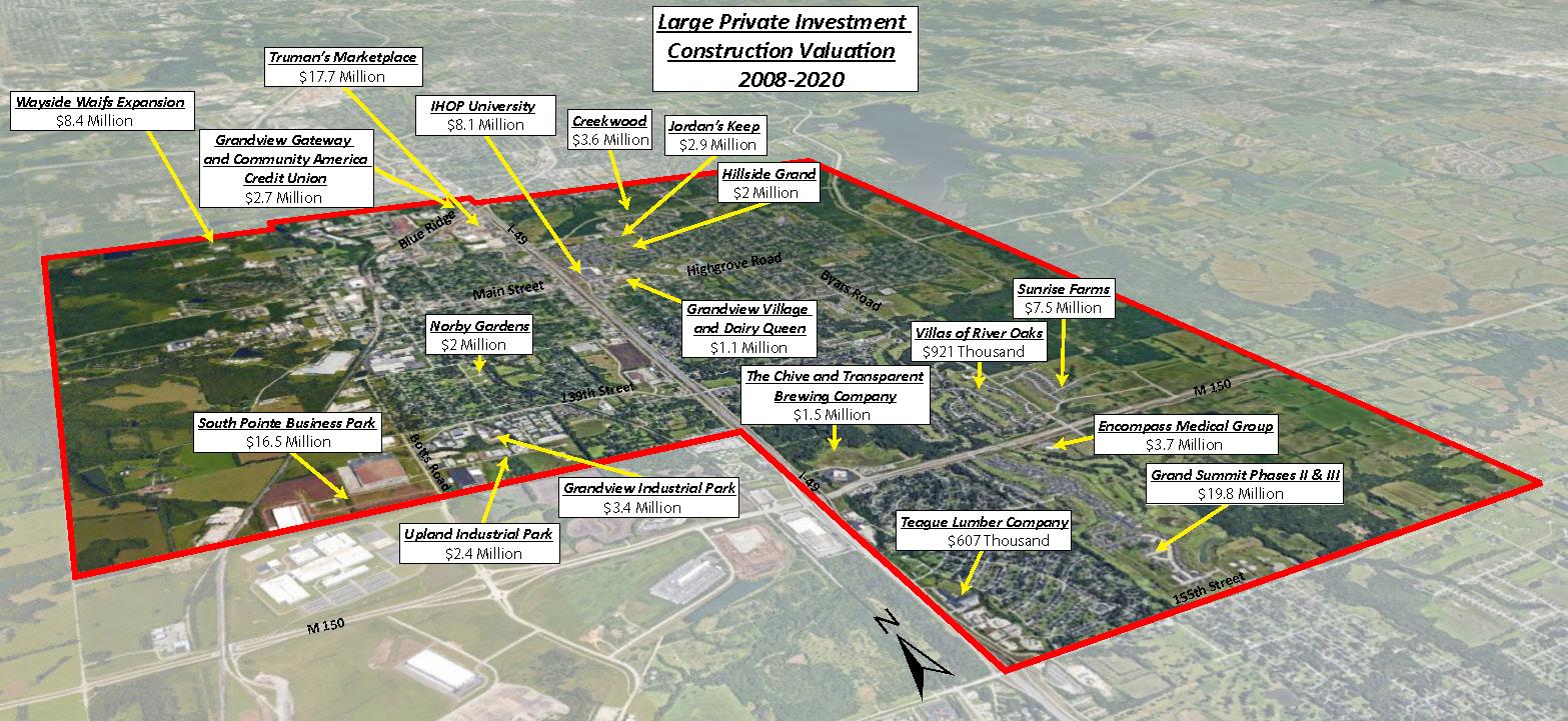
Figure 4.5 Citywide Private Construction Values 2008-2020
The City was aggressive on the retail attraction front, utiliz ing Tax Increment Financing (TIF) to encourage greenfield development, infill development, and strategic repurpos ing. This incentive tool was also utilized for the establish ment of the Botts Road Industrial District TIF Plan in 2004.
Grandview has made huge strides since adopting Beyond 2000 as the current Comprehensive Plan. We have seen significant growth in the industrial and commercial zones of the City. It is the full intent to continue on that path and begin engaging our local and entrepreneurial startups to create not just a strong economic presence in the regional market, but also a localized ecosystem that strengthens Grandview for decades to come. With the recent development successes, the City has built momentum towards achieving the goal of becoming an economic leader in the area. Grandview intends to con tinue that trajectory by focusing on its most important economic assets, local businesses. Year to year, over 100 home occupations are in operation across the City from tax services to clothing designers. These small business owners represent the most localized form of business and contribute to Grandview’s long-term success. It is a goal of the City to bring attention to the small business es and entrepreneurs working from home by supporting them in ways not previously attempted. First, partner with the Grandview Chamber of Commerce to establish relationships with small businesses that register through the Home Occupation Program. Second, identify which of the businesses aspire to move from their home to a brick and mortar location. This also includes understanding the obstacles that have kept them from doing so and creating strategies for them to reach their goals. The third is to help establish the City’s first small business incubator that pro vides resources to entrepreneurs. Finally, to be champions of the local businesses and help them celebrate their wins, small and large.
17

Measurement: Track commercial valuation assessment annually.
Measurement: Have ready-to-go incentive packets for businesses requiring immediate response.
18
Vision Statement
Measurement: Fully update Economic Incentive Policies to ensure competitiveness with area municipalities and provide agility when dealing with business prospects.
Figure 4.6 Kelly Construction (South Pointe Business Park) Figure 4.7 BWISE Contracting (South Pointe Business Park)
4ECONOMIC DEVELOPMENT
Action and Implementation Steps: Update Economic Incentive Policy to be adopted by the Board of Alderman by June, 2021.
Measurement: Analyze the diversity in commercial business types annually.
By 2030, Grandview will be a regional leader in economic development by becoming the City of choice for business retention, expansion, and attraction.
Responsible Departments: Economic Development, Community Development, Finance and Administration
Measurement: Provide web-based incentive calculator for prospective businesses; market calculator to interested parties.
Task: Staff prepares a resolution to be adopted by the Board of Alderman by July of 2021.
• GOAL: Update the City’s Economic Incentive Policy to refine and target investments in businesses that will add depth to the City’s business and job base, increase the City’s assessed valuation and further diversify Grandview’s economic growth.
Measurement: Provide tiered incentives based on preferred sectors or areas where Grandview desires a competitive advantage.
Measurement: Track number of net jobs annually.


19
Measurement: Annual count of existing commercial and home-based businesses that ceased operating in Grandview during the fiscal year.
Measurement: Annual count of existing business expansions including investment amount, number of employees added and average salary.
• GOAL: Work with the Chamber of Commerce to evaluate the existing Buisness Retention and Expansion Program with the intent to strengthen it.
Action and Implementation Steps: Create Chamber/City Recruiting and Retention Plan.
Task: Staff and Chamber collaborate to share ideas and data and begin the process of creating the Plan by December, 2020.
Measurement: Use MO Department of Economic Development local job reports to determine net employment in Grandview.
Measurement: Annual count of new businesses established in Grandview to include number of commercial and home-based businesses by type, employees and average salary.
Measurement: Create Chamber/City Recruiting and Retention Plan to synchronize business-related attraction and preservation of both entities.
4 ECONOMIC DEVELOPMENT
Responsible Departments: Economic Development, Administration, and in conjunction with the Chamber of Commerce Figure 4.8 Grandview Chamber of Commerce Figure 4.9 Grandview Chamber Collaboration Event


Measurement: Staff partners with Chamber of Commerce to create plan to graduate home-based businesses into brick and mortar establishments.
Measurement: Develop strategic plan establishing the goals, concepts and resources required to achieve strategic economic development and business objectives.
20
Measurement: Staff communicates with registered home-based businesses to recognize those striving to grow into brick and mortar locations locally.
Measurement: Staff explores the possibility of making development friendly fees and processes for local and small businesses looking to open or expand.
Figure 4.10 National Oceanic and Atmospheric Administration
Action and Implementation Steps: Complete the Economic Development Strategic Plan to be accepted by the Board of Alderman by November, 2021. Task: Staff prepares a resolution to be adopted by the Board of Alderman by December, 2021.
Responsible Departments: Administration, Economic Development and Community Development
Source: r1planning.org Figure 4.11 Economic Development
• GOAL: Develop programs to assist entrepreneurs with startups to foster local small business prosperity.
4ECONOMIC DEVELOPMENT
Source: credc.org Figure 4.12 Strategic Planning
• GOAL: Create an Economic Development Strategic Plan.


• GOAL: Create viable solutions to address Grandview’s food desert near Missouri 150 Highway.
4 ECONOMIC DEVELOPMENT
Measurement: Staff and Chamber of Commerce work together to celebrate and promote small businesses and their accomplishments.
Responsible Departments: Economic Development, Community Development and Administration
21
Measurement: Include financial and land use mechanisms for courting grocery store(s) in the economic development strategic plan.
Task: Staff carries out identified strategies until a solution is found.
= Meets Communities for All Ages Standards
Action and Implementation Steps: Staff and Chamber explore opportunities for growing small business by December, 2020.
Measurement: Establish targeted incentives, including enhanced or “stacked” enticements, for grocery stores along MO 150 corridor as part of updating economic development incentives.
Task: Staff and Chamber create a small business development support plan by December, 2021.
Action and Implementation Steps: Staff creates strategies to attract grocery businesses along the 150 corridor.
Figure 4.13 Graduating Home-Based Businesses Figure 4.14 Small Business Ribbon Cutting Home-Based to Brick and Mortar
Figure 4.15 Grandview Food Desert Figure 4.16 Price Chopper at Truman's Marketplace
Responsible Departments: Economic Development, Community Development and the Grandview Chamber of Commerce


Responsible Departments: Economic Development, Administration, Community Development and Public Works
Source: umkc.org Figure 4.17 North Kansas City Iron District
Measurement: Establish local summit with Kansas City area influential technology leaders to determine the mechanisms involved with establishing a technology-based cluster.
• GOAL: Investigate the feasibility of establishing a technology-based cluster in the areas of life sciences.
Measurement: Host elected officials forum to discuss regional economic development strategies and remedies.
Responsible Departments: Economic Development, Community Development, Administration and Finance
Action and Implementation Steps: Carry out measurements Task: Establish key relationships and contacts with State and Federal staff and officials.
• GOAL: Continue to develop relationships with elected officials and professional staff at the State and Federal levels on key issues of importance to Grandview.
Measurement: Establish business incubator program in select location(s) to target specific sectors and encourage innovation.
Source: eqstl.com Figure 4.19 Kansas City Start-Up Village Source: kcur.org Figure 4.18 Think Big Partners Incubator
Action and Implementation Steps: Carry out measurements Task: Staff determines if a technology-based cluster and business incubator is feasible.
22 4ECONOMIC DEVELOPMENT
Measurement: Use of outside grant dollars received from governmental and private organizations.


23 • GOAL: Continue to Market Grandview’s federally-designated Opportunity Zone. Measurement: Refine business recruitment approach, focusing on social media and personal outreach that markets the Opportunity Zone and other Grandview incentives and advantages. Measurement: Utilize various mediums (e.g. social media, print, mass mailing, web-based marketing, etc.) to inform businesses of opportunity zone. Action and Implementation Steps: Carry out measurements Task: Market Grandview’s federally-designated Opportunity Zone. Responsible Departments: Economic Development and Administration Figure 4.20 Opportunity Zone in Light Green Figure 4.21 Winco Fireworks Maintenance Facility (The City's First Opportunity Zone Project in 2019) 4 ECONOMIC DEVELOPMENT


5
ENVIRONMENT AND SUSTAINABILITY
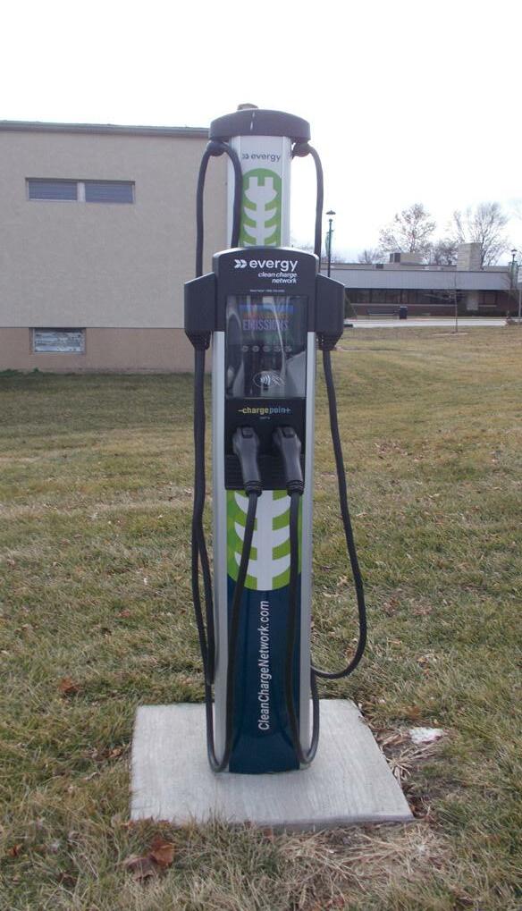
Figure 5.1 Electric Vehicle Charging Stations
24
In 2020, the Grandview Board of Alderman doubled the funds used to build and maintain city sidewalks.
Environmental policy and sustainable practices are vital to the future growth and welfare of communities. The weather.com Climate Disruption Index measured the impact climate change will have on U.S. cities, Kansas City ranking 5th highest on the list. Issues the area will face include urban heat islands, more incidents of drought, and increased flooding. Increases in average temperatures have changed the hardiness zones, impacting the growth of plants and trees. In 1990, Grandview was in zone 5, but more recently moved to zone 6 (arborday.org) (Figure 5.2). The 2014 National Climate Assessment projects Grandview to be in zone 7 within 30 years. This can impact the types of crops that can be planted and tree life leading to the loss of local food resources and eliminate the benefit trees provide to the community. A 2016 column by Public Works Director, Dennis Randolph, discussed the impact of Interstate I-49 dividing Grandview, the unsustainable activities by second and third ring communities that negatively affect Grandview, and Grandview being an environmental justice community. The column discusses how this “harms the people of the Grandview community; denied them good health” and “forced them to use what scarce funds they have, to pay for excessively high health costs” (Randolph). In recent years, Grandview has worked to reduce its carbon footprint by welcoming charging stations for electric cars. (Figure 5.1) Three stations can be found at City Hall and two at The View. The City’s streets are lined with nearly 1,250 street lights that have been upgraded with high efficiency LED bulbs. Additionally, Grandview welcomed an expanded 29 bus service line to the community through RideKC, the area's regional public transportation authority. The new service area provides more opportunities for riders and reduces the number of daily single-passenger vehicle trips, one of the largest contributers to environmental pollution. Grandview has multiple parks equaling over nine acres of green space. More details about our parks system can be found in Chapter 8. In addition to the parks system, the City has adopted a Livable Streets resolution that considers all modes of transportation, such as biking, walking, transit riders and automobiles.
In 2017 a three-mile trail was added to Grandview, Called The Harry Truman Presidential Trail. It starts at the Truman Farm Home and connects with the Longview Lake Greenway. The Meadowmere Park Trail is also connected to the Longview Lake Greenway and the Lumpkins Fork Trail, which leads to a network of trails in Raymore (MARC.org) .
Source: USDA.gov Figure 5.2 Plant Hardiness Zone Map for Missouri


25 Figure 5.3 Grandview Trail System 5 ENVIRONMENT AND SUSTAINABILITY


Action and Implementation Steps: Update the City’s Zoning Ordinance and Subdivision Regulation to include sustainable practices, policies, and guidelines by December 2021.
Task: Review best practices in sustainable regulation and policy.
Measurement: Life-cycle cost savings for reduction in impervious surface.
26
Measurement: Square footage of pervious pavements constructed (parking lots, driveways, etc.).
Measurement: Reduction in impervious surface (Figure 5.4) area (publicly-owned) that contributes directly into the storm drainage system.
Measurement: Lineal feet of pervious sidewalks constructed.
Responsible Department(s): Community Development, Public Works and Fire Department.
Measurement: Number of off-street parking spaces transitioned from impervious pavement to pervious pavement (Figure 5.4).
5ENVIRONMENT AND SUSTAINABILITY
Measurement: Reduction in the total number of impervious off-street parking spaces for public facilities.
•GOAL : Review and update development regulations and infrastructure guidelines.
Measurement: Reduction in storm water discharges (cfs) from reduction in impervious surfaces.
Source: detroitmi.gov Figure 5.4 Pervious vs Impervious
Measurement: Reduction in storm water discharge (cfs) from reduction of publicly-owned infrastructure.
Measurement: Reduction in the total number of impervious off-street parking spaces for private developments.
Source: Norfolk.gov Figure 5.5 Pervious Surface
Vision Statement By 2030, Grandview will be a regional leader in environmental policy and sustainable practices by welcoming innovative ideas for sustainable development and promoting sustainable practices.


Figure
Figure
Task: Develop partnerships with regional environmental and sustainability organizations to administer or assist in classes/workshops.
Responsible Department(s): Sustainability Manager and Communications Manager.
27
=
5 ENVIRONMENT AND SUSTAINABILITY
Responsible Department(s): Sustainability Manager and Communications Manager.
•GOAL: Develop a community sustainability education program.
for All
Source: sabot.org Figure 5.6 Source:
Source:
Measurement: Number of classes and citizen participation in programs.
Figure 5.10 Porous Sidewalk Example of a pervious surface. The sidewalk can be found in the Marlbor ough Neighborhood in Kansas City, MO and is part of the Target Green project. The goal is to reduce rain water runoff with various green infrastructure projects throughout the neighborhood. More examples of green infrastructure projects in The Marlborough neighborhood can be found on pages 28 and 29. metrodelivery.com 5.7 upcycledwonders.com 5.8 upcycled-wonders.com
Figure 5.9 Meets Communities Ages Standards
Action and Implementation Steps: Create monthly sustainability focus area to promote through social media and other means including sustainability challenges beginning January, 2022.
Source:
Task: Develop monthly sustainability goals. Task: Work with community to achieve goals.
Action and Implementation Steps: Hold quarterly classes/workshops to teach sustainable practices beginning January, 2021.


Figure 5.11 Bioswale 5.12 Bioswale
Figure
5ENVIRONMENT AND SUSTAINABILITY
•GOAL: Establish a Sustainability Committee.
Task: Implement green infrastructure in city and private projects by January, 2023.
Responsible Department(s): Community Development, Public Works, Parks and Recreation, Finance, Police Department and Administration.
• Develop process for review of new sustainable practices in development that do not conform to current zoning regulations.
Task: Identify environmental issues that can be resolved with green infrastructure by June of 2022. (Figure 5.11-5.16 Green Infrastructure)
• Pre-approved house plans that allow developers to go straight to obtaining permits for sustainable development.
Responsible Department(s): Community Development, Public Works, Parks and Recreation, Finance, Police Department and Administration.
28
Measurement: Quarterly report to management on committee actions and recommendations.
• Projects would include, but are not limited to: bioswales, flood retention parks, rain gardens, permeable pavement, green roofs, green parking, land conservation, redirection of downspout rainwater.
Action and Implementation Steps: Create Sustainability Committee of Grandview employees representing all departments by March, 2021.
Task: Offer incentives for sustainable development practices in zoning update.
• Research sustainable zoning best practices to include in Zoning Ordinance and Subdivision Regulation update.
• Reduce off-street parking requirements with addition of green infrastructure.
• Develop point system to rate projects allowing incentives for sustainable development.
Responsible Department(s): Community Development, Public Works, Parks and Recreation, Finance, Police Department and Administration.
Responsible Department(s): Community Development, Public Works, Parks and Recreation, Finance, Police Department and Administration.
Figure 5.13 Bioretention Garden = Meets Communities for All Ages Standards
Task: Implement environmental zoning policies in zoning update.


Action and Implementation Steps: Submit for recognition awards for sustainability plans, policies, and initiatives.
Responsible Department(s): Sustainability Manager
Action and Implementation Steps: Create Sustainability webpage highlighting Grandview’s sustainability projects.
Responsible Department(s): Sustainability Manager
Action and Implementation Steps: Request funding for a Sustainability Director in 2022 budget.
Task: Complete a Food System Sustainability Strategy by August of 2023.
•GOAL: Hire a Sustainability Manager.
Figure 5.14 Storm Water Retention Park Figure 5.15 Storm Water Retention Park Figure 5.16 Storm Water Retention Park Green Infrastructure Figure 5.11 and 5.12 Bioswales. Figure 5.13 Bioretention Garden Figure 5.14-5.16 Rain Water Retention Park (Arletta Park, Kansas City, MO.) 5 ENVIRONMENT AND SUSTAINABILITY
Task: Complete a Climate and Sustainability Master Plan by February of 2023.
29
Responsible Department(s): Administration
Task: Complete a Climate Vulnerability Assessment by February of 2022.
Measurement: Local, regional, national, and world-wide recognition as a leader in sustainability.


Task: Create inventory of all city infrastructure operated with electricity by January, 2023.
Responsible Department(s): Sustainability Manager, Finance and Administration.
Task: Conduct a cost analysis of converting city buildings and infrastructure to alternative energy sources by June, 2023.
30
Task: Conduct a cost analysis of converting city street lights and other electric using city devices to alternative energy sources by June, 2023.
Measurement: Number of city-owned street lights converted to solar power.
Responsible Department(s): Sustainability Manager, Finance and Administration.
Source: pngfly.com Figure 5.17 Examples of Alternative Energy
Measurement: Quarterly City energy cost analysis of all city facilities and vehicles.
Action and Implementation Steps: Convert City street lights and other electric by using devices to alternative energy sources by 2025 (Figure 5.18).
Source: istockphoto.com Figure 5.18 Examples of City Infrastructure with Alternative Energy
Measurement: Net reduction in kW hours of electricity usage for city-owned street lights. Measurement: Net cost reduction in electricity bills for city-owned street lights.
•GOAL: Reduce city energy costs.
Action and Implementation Steps: Create plan and schedule to convert all city buildings to alternative sustainable energy by 2025 (Figure 5.17).
Task: Conduct a cost analysis of converting city vehicles to alternative energy sources by June, 2023.
5ENVIRONMENT AND SUSTAINABILITY
Action and Implementation Steps: Create plan and schedule to convert all city vehicles to alternative sustainable energy by 2025.
Responsible Department(s): Sustainability Manager, Finance and Administration.


Responsible Department(s): Public Works, Community Development
• Work with surrounding communities and KCATA.
Figure 5.19 Blue Ridge Extension in Grandview = Meets Communities for All Ages Standards
Action and Implementation Steps: Create bicycle and pedestrian requirements for all street enhancements in zoning update.
Task: Work with Evergy and local businesses to add a minimum of five charging stations a year starting June, 2021.
5 ENVIRONMENT AND SUSTAINABILITY
Responsible Department(s): Sustainability Manager, Public Works, Community Development and Administration.
Task: Build 10-foot sidewalks that allow pedestrian and bicycle traffic on all major corridor projects if bike lanes are not constructed.
Responsible Department(s): Sustainability Manager, Public Works, Community Development and Administration.
Task: Review and update Complete Streets Resolution, pass as Policy.
Responsible Department(s): Public Works, Community Development
Task: Review existing regional bikeways and develop plan to connect into the regional bike system.
Action and Implementation Steps: Continue work with KCATA to expand current bus service hours and footprint (Figure 5.19).
31
Task: Explore implementing I-49 corridor express bus.
Measurement: Number of electric charging ports.
Task: Include bike infrastructure in all new roadway construction on major thoroughfares.
Responsible Department(s): Community Development, Public Works and Parks and Recreation
Action and Implementation Steps: In addition to current alternative transportation options, continual review of alternative transportation innovation and feasibility of implementation in Grandview.
Task: Review all street painting projects for opportunities to implement bike lanes.
Action and Implementation Steps: Expand electric charging stations throughout Grandview.
•GOAL: Increase alternative transportation options.
Measurement: Lineal feet of bike infrastructure constructed.
Measurement: Increase mass transit options.


32 •GOAL: Implement applicable strategies from Climate Action KC Playbook. Action and Implementation Steps: Have Grandview representation with Climate Action KC. Responsible Department(s): Sustainability Manager Action and Implementation Steps: Identify strategies applicable to Grandview from Climate Action KC Playbook by June, 2022. • Identify additional actions applicable to Grandview that are not in the playbook. Task: Create Climate Action Playbook specific to Grandview. Responsible Department(s): Sustainability Manager Source: madison.com Figure 5.20 Environment Gathering Source: mkccac.org Figure 5.21 Environment Gathering 5ENVIRONMENT AND SUSTAINABILITY


33

HOUSING34
6
Source: development-strategies.com Figure 6.3 Grandview Housing Study Figure 6.1 Pre-War Single-Family Home (Town of Grandview) Figure 6.2 Grand Summit Apartment Building
Grandview’s housing stock varies widely in age, form, and quality, from single-family detached homes to low density multi-family apartment buildings and complexes. The housing stock, considered dated, has a median year built of 1973 (2017, 5 Year ACS). The age of the structures has a significant impact on the overall median housing value in the City, which is approximately $114,000 (De velopment, 2018), considerably less than many of the surrounding communities. In recent years, Grandview has seen growth in new single and multi-family units, but new residential developments have only played a small part in driving Grandview’s growth.
Grandview has, according to the 2017 American Com munity Survey, 10,741 housing units (2017, 5 Year ACS). Current figures show Grandview’s non-owner occupied dwellings is nearly 50% of the total housing stock. Nearly 80% of non-owner occupied property owners do not live in the City, and almost 20% of those do not live in either Missouri or Kansas. The high number of non-owner occupied units owned by people who are not local presents challenges in terms of general property maintenance. Some of Grandview’s neighborhoods could improve aesthetically with simple property maintenance. These neighborhoods generally have higher numbers of rental units owned by out-of-town investors. This is not unique to Grandview’s neighborhoods and has become more regular across the Country. Since Beyond 2000, the City has taken great strides to wards reinvesting in our community. In the Spring of 2018, the City adopted the Grandview Housing Study (Figure 6.3) completed by Development Strategies, a real estate and economic development firm. One recommen dation was for the City to create a rental registration pro gram. That year, Grandview’s Board of Alderman revised an existing rental property registration ordinance, origi nally approved in 2009. A new ordinance was passed in early 2019, adopting a rental inspection program for all non-owner-occupied residential properties. The goal is to facilitate communication with property owners and to maintain the appearance and safety of non-owner occupied properties.


In addition to the rental registration program, a housing committee was formed in early 2019 to better understand what Grandview’s housing stock offers and what it lacks. The Committee consisted of City Staff and several local ex perts in banking, real estate investment and the develop ment and planning fields. During the meetings, the Com mittee invited guests to speak on the state of the local housing market, what Grandview could do to attract new construction, and how new housing subdivisions could be better planned to increase the physical characteristics of Grandview. It’s important to note that not all of Grandview’s neigh borhoods deal with such ailments. In recent years, newer subdivisions such as Creekwood, Norby Gardens, Sunrise Farms, Hillside Grand, Jordan’s Keep and phases two and three of the Grand Summit Apartments, have brought quality housing options to the City. Grandview would like to see this momentum continued, but at a more progres sive rate. A key element to consider as part of attracting new hous ing, is cost. Grandview’s median household income is $42,626, which is substantially lower than the Kansas City Metro Area of $59,344 (2017, 5 Year ACS). This data leads the City to believe that along with quality housing developments, affordability is also important to consid er for its residents. With this in mind, Grandview will ap proach housing in the coming years in a more creative and forward-thinking way to help address the gaps and deficiencies in the current stock. One way to achieve this goal is to focus on pre-war traditional land development and building patterns (Figure 6.1) in specific areas for infill projects. Typically, developments that are more walkable, require less lot area, less investment and maintenance in public infrastructure, and allow for a mix of housing types. Additionally, new subdivisions may also be built in similar ways, enhancing housing diversity, scale, and form. The City’s current Zoning Ordinance and Subdivision Regula tions make building in this pattern rather cumbersome. To encourage the traditional development patterns, the code will be closely examined and updated to allow neighbor hoods to be designed in ways that encourage attractive physical aesthetics, the preservation of land and afford ability.
Source: kronbergwall.com
Figure Sunrise Farms Monument Sign Entrance
6 HOUSING
6.4
35
6.5
Figure 6.6
Figure Lot Arrangement for Accessory Dwelling Units Post-War Single-Family Home (Jordan’s Keep)


Task: Staff prepares an ordinance to be accepted by the Board of Alderman by November, 2021.
Responsible Departments: Community Development, Public Works, Parks and Recreation, Communications and Legal Department
Source: southestventure.com Figure 6.7 Courtyard Homes
6HOUSING
• Develop a range of acceptable housing and site features that meet the goals of the Housing Study and Zoning Ordinance requirements.
• Increase density of dwelling units through the reduction of minimum lot area, setbacks and offstreet parking requirements.
• Allow mixed-use neighborhood commercial nodes near existing residential districts.
• GOAL: Update the City’s Zoning and Subdivision Regulations to allow more traditional neighborhood forms and productive uses of land. Items to be addressed in the updates include, but not limited to:
• Adopt conservation, low impact and green infrastructure design standards across the City for new developments.
By 2030, Grandview will make significant strides toward providing new single and multi-family homes at multiple price points by following the recommendations outlined in the Grandview Housing Study. In addition, the City will implement updated regulations to provide opportunities for more creative and economically productive building forms and patterns for infill, redevelopment and greenfield development opportunities.
Vision Statement
• Require electrical utilities in all development projects to be underground or located in alleyways.
Source: pinterest.com Figure 6.8 Neighborhood Commercial Source: portlandmaps.com Figure 6.9 Mixed Use Commercial
Action and Implementation Steps: Adopt the updated Zoning Ordinance and Subdivision Regulations by December, 2021.
36
Measurement: Complete the updates to the City’s Zoning and Subdivision Regulations.
• Create updated residential design standards for new residential developments.


Action and Implementation Steps: Adopt the updated Zoning Ordinance and Subdivision Regulations by December, 2021.
Source: livingvintageco.com Figure 6.10 Pocket Neighborhood Source: strongtowns.org Figure 6.11 Single-Family Attached Accessory Dwelling Unit Source: gourbansandiegoblog.com Figure 6.12 Accessory Dwelling Unit Layouts Source: paloaltoforward.com Figure 6.13 Accessory Dwelling Unit Above Garage = Meets Communities for All Ages Standards 6 HOUSING
Responsible Departments: Community Development, Public Works, Fire Department and Jackson County Water District
Action and Implementation Steps: Create a development procedures guide with requirements and timelines for the development process for builders to plan out their projects by December, 2020.
Task: Staff creates plan to make the building process more efficient for developers, which can encourage more affordability in new residential projects.
Action and Implementation Steps: Staff creates and reviews reports on a yearly basis to study local trends in home construction projects and how it’s affected by changes in City regulations and practices effective January, 2021.
37 • GOAL: Increase in affordable quality housing types (to include accessory dwelling units in targeted areas to be specified in the Zoning Ordinance Update). Measurement: Annually track the cost of home sale and rental prices. Measurement: Annually track permits issued by housing type. Measurement: Annually track permits issued under the Fee Discount Program.
Action and Implementation Steps: Investigate ways to make building more affordable for developers through reviewing our current policies and practices by December, 2020.


38
• GOAL: Revitalize and invest in existing neighborhoods.
Responsible Departments: Community Development, Public Works, Communications, Finance and Administration (Housing) Figure 6.15 UMKC’s Center for Neighborhoods Leadership Program
Action and Implementation Steps: Staff explores the feasibility of establishing a home investment fund that can be used for various home improvements by January, 2023.
6HOUSING
Figure 6.14 Comprehensive Plan Committee
Measurement: Staff engages the community to form neighborhood boundaries comprised of the existing residential subdivisions, identifies leaders to represent the newly formed neighborhood groups to work closely with City Staff to communicate neighborhood strengths, weaknesses, opportunities and threats.
• Staff recommends sending representatives through UMKC’s Center for Neighborhoods Leadership Program.
Action and Implementation Steps: Staff explores partnerships with other City Departments and outside partners to “tell the story” of Grandview’s housing renaissance by January, 2024.
Task: Staff determines if revitalization efforts are feasible based on partnerships, resources and finances.
Measurement: Staff sends a cohort of interested residents to the University of Missouri-Kansas City’s (UMKC) Center for Neighborhoods Leadership Program annually.
Task: Staff determines if residents are interested in forming neighborhood groups and a committee to work towards strengthening and celebrating the different areas.
Action and Implementation Steps: Staff and residents form neighborhood areas with representatives from different subdivisions and creates a neighborhood committee by June, 2021.
Action and Implementation Steps: Staff explores the feasibility of establishing an infrastructure revitalization fund to support existing neighborhood ecosystems (sidewalks, drainage systems, curb and gutters, tree maintenance and landscaping) by January, 2022.


6 HOUSING
Action and Implementation Steps: Staff updates the City’s regulatory development documents by December 2021.
• GOAL: Target specific areas for infill development opportunities.
Action and Implementation Steps: Staff creates marketing handouts to advertise publicly owned potential sites to include site specific information (lot size, setbacks, easements, zoning, etc.) by December, 2021.
Measurement: Update the City’s Zoning and Subdivision Regulations to optimize infill development opportunities.
Measurement: Identify the “low hanging fruit” opportunities in the City that are optimal for infill development.
Measurement: Annually track the number of infill projects identified as “low hanging fruit”.
Action and Implementation Steps: Staff identifies infill opportunities throughout the City and creates ward specific maps highlighting each of its “low hanging fruit” sites by December, 2021.
39
Task: Staff prepares an ordinance to be accepted by the Board of Alderman by November, 2021.
Task: Staff identifies and markets publicly owned land to potential developers looking for infill opportunities.
Responsible Departments: Community Development, Public Works, Communications and Administration Figure 6.16 “Low Hanging Fruit” Site Marketing

Responsible Departments: Public Works, Fire Department
40 • GOAL: Build new “Missing Middle Housing” - duplex, triplex, fourplex, cottage/pocket neighborhoods and accessory dwelling units as new subdivisions and infill projects. Measurement: Complete the updates to the City’s Zoning Ordinance and Subdivision Regulations. Measurement: Identify areas in the community that best fit the types of housing recommended. Measurement: Annually track permits issued by housing type.
Community Development,
and Parks and Recreation Source: missingmiddlehousing.com Figure 6.17 Courtyard Cottages Source: missingmiddlehousing.com Figure 6.18 Bungalow Court Source: missingmiddlehousing.com Figure 6.19 8-Plex Source: missingmiddlehousing.com Figure 6.20 Missing Middle Housing Examples = Meets Communities for All Ages Standards 6HOUSING
Action and Implementation Steps: Staff creates overlay districts that allow Missing Middle Housing as a permitted use in targeted areas of the City as part of the Zoning Ordinance update.
Task: Staff prepares an ordinance to be accepted by the Board of Alderman by November, 2021.
Action and Implementation Steps: Adopt the updated Zoning Ordinance and Subdivision Regulations by December, 2021.


Action and Implementation Steps: Staff applies for funding through the grant writing process within the first year of the Transportation Plan being adopted.
Measurement: Staff utilizes funds available through grant opportunities and the City’s annual budget to complete sidewalk repair and new construction projects.
41
Responsible Departments: Public Works, Community Development and Parks and Recreation
Measurement: Staff analyzes deficiencies in connectivity throughout sidewalk infrastructure system.
Task: Staff prepares a resolution to be adopted by the Board of Alderman by December, 2022.
Action and Implementation Steps: Staff carries out goals established in the new Transportation Plan to address the sidewalk system conditions and connectivity once the Plan is adopted in 2022.
• GOAL: Increase walkability in residential districts constructed prior to 1960. This goal to be included in the new Transportation and Trails Master Plan set forth in the Infrastructure and Parks and Recreation section of this document.
GrandviewRoad 15thStreet Duck Road 10thStreet 12thStreet 13thStreet8thStreet 7thStreet Skyline Skyline Zumwalt Jones Little Avenue Figure 6.21 Grandview Sidewalk System (Ward II) Legend Sidewalks ± = Meets Communities for All Ages Standards 6 HOUSING


Figure 7.1 155th Street Improvements Figure 7.2 155th Street Improvements Figure 7.3 Main Street Improvements Figure 7.4 15th Street Improvements 7
INFRASTRUCTURE42
The public infrastructure system is one of the most crucial elements of a successful community. It is the framework for interaction, connectivity, transportation and utility. The system ranges from public streets and plazas to the under ground storm and sanitary sewer networks. Over the past 20 years, Grandview’s infrastructure system has evolved throughout the City. Generally, the footprint has not expanded as much as the necessary upgrades and maintenance to the current system, albeit there have been some areas of growth. Residential subdivisions Norby Gar dens, Creekwood, Hillside Grand, Jordan’s Keep, Sunrise Farms and Grand Summit have all resulted in the growth of our public infrastructure system. Commercial and industrial growth has occurred along the Botts Road corridor with the extension of Norby Road and 142nd Street to the east and 143rd Street to the west of Botts. Also, 15th Street (Figure 7.4) became a publicly owned street when the Truman’s Marketplace project was underway in 2015. Besides new systems being added, many of our public roads have been upgraded since 2000. Botts Road and 139th Street were enhanced to handle ad ditional industrial traffic traveling westward from I-49 and south towards 150 Highway. Main Street (Figure 7.3) is likely the most recognized by Grandview residents and vis itors for its upgraded pedestrian facilities and the reduc tion of auto lanes that produce slower traffic and a more comfortable feel for the City’s Historic District. These up grades have helped downtown Grandview with a renewed sense of place compared to its auto-centric past. Anec dotal evidence has pointed to these upgrades as a major contributor for new businesses that choose to locate on the Main Street corridor. In 2019, Grandview began the process to convert its out er road system back to two-way. The new traffic pattern will increase the likelihood of more private sector growth along the I-49 corridor and provide multi-modal elements such as sidewalks and possibly bike lanes.


Harry Truman Presidential Trail
Two studies are currently underway analyzing the possi bility of an east to west service that would link the Martin City area of Kansas City to Longview Community College, servicing Grandview along Blue Ridge and an express service along the I-49 corridor from Belton to downtown Kansas City, Missouri. In addition to roads and underground utilities, sidewalks and trails are also a part of our infrastructure. Between the two, the City manages nearly 87 linear miles. This system serves our residents on foot, either for leisure or out of necessity. While most of the City’s trail network existed prior to Beyond 2000, there has been a new link built since. In 2017, the Harry Truman Presidential Trail (Figure 7.7) was completed from the Truman Farm Home eastward to the Longview Lake Trail System along Harry Truman Drive. This is the City’s first trail to cross the I-49 corridor, connecting neighborhoods on the west to the eastern half of the City and Longview Lake. The trail is approximately 2.5 miles in length and made of asphalt, concrete and crushed aggregate, and in certain segments it joins the City’s sidewalk system. While Grandview continues to develop, it is important to pay special attention to its infrastructure system. The quality of the network is just as important as any new expansions that may come as a result of private sector investments. Over the coming decade, the City will stra tegically aim to provide superior infrastructure to resi dents, businesses, and visitors through maintenance and building new modern facilities.
43
Besides the physical public infrastructure system, Grand view has expanded its partnership with the Kansas City Area Transit Authority, known as RideKC, to bring addi tional bus services to the community. In the Spring of 2019, the existing 29 bus line (Figure 7.6), which enters Grandview along Blue Ridge from the north, was ex tended south and east from its former route. Now bus services can be found during peak ridership times along Grandview Road, Main Street and 15th Street. This spe cific route was designed to connect people with public facilities such as City Hall, the United States Post Office, Jackson County Water Department, and the Mid-Con tinental Public Library. Additionally, the line also runs through some of Grandview’s densest residential areas where residents rely on public transit services the most.
Figure Ride KC 29 Service Extension Celebration
7 INFRASTRUCTURE
Figure
7.7
Figure 7.6 Ride KC Bus Heading Towards Grandview
7.5


Measurement: Grandview Board of Alderman to prioritize infrastructure projects.
Figure 7.8 Potential
Map Figure 7.9 Sewer Improvements = Meets Communities for All Ages Standards 7INFRASTRUCTURE
Measurement: Create and adopt a new transportation plan.
Action and Implementation Steps: Adopt transportation plan by December, 2022.
• GOAL: Create, adopt and implement the goals of a new transportation plan for Grandview to guide growth of the physical infrastructure system. Goals in the new plan include, but not limited to:
• Continue expanding KCATA transit services in all directions.
Responsible Departments: Public Works, Community Development and Parks and Recreation Future Public Transit Routes
• Continue to investigate light-rail opportunities in the I-49 corridor.
Task: Staff prepares a resolution to be accepted by the Board of Alderman by November, 2022.
Measurement: Implement goals outlined in the adopted transportation plan.
• Continue reinvestment into the existing infrastructure system.
• Partner with surrounding municipalities to connect into the regional trail systems.
• Continue to build on walkability throughout the City.
Measurement: Track value, type, and number of linear feet/miles of maintenance to existing infrastructure.
• Construct new roadway and underground infrastructure.
44 Vision Statement
By 2030, Grandview will provide its residents and businesses premier quality infrastructure that strengthens the fabric of the community through improved connectivity, quality and efficiencies.
Measurement: Track value, type, and number of linear feet/miles of new public infrastructure investments.


Action and Implementation Steps: Meet with surrounding municipalities to discuss development projects and the effect they have on downstream flooding.
7 INFRASTRUCTURE
Responsible Departments: Public Works and Community
DevelopmentSource:kshb.govFigure7.12FloodingattheLittleBlue River Figure 7.11 Flooding at Grandview Dog Park from the Little Blue River.
Measurement: Establish agreements and a plan for water run-off management with surrounding communities.
45 • GOAL: Collaborate with surrounding municipalities to discuss management of storm water run-off associated with developments outside of Grandview.
Action and Implementation Steps: Apply for and receive funding for United States Geological Survey modeling.
Task: Formulate a multi-municipal agreement that addresses downstream flooding due to increased development activity by December, 2022.


PARKS46 AND RECREATION
Figure 8.1 Basketball Court
8
Figure 8.4 Skate Park
Figure 8.2 Grandview City-Owned and Maintained Parks
Figure 8.3 Shalimar Park Ball Fields
The City of Grandview is home to 16 city-owned and maintained parks (Figure 8.2), as well as, The View: Grandview’s Community Center, the Grandview Amphitheater, and the Historic Blue Ridge Cemetery. Within the City limits is Longview Lake Park, managed by Jackson County, and Jerry Smith Park, managed by Kansas City, Missouri. The vast majority of Grandview citizens live within a half mile of a park, (Figure 8.5) seen on the next page, which includes a large variety of amenities such as: various playground equipment, sports fields (Figure 8.3), a dog park, tennis and basketball courts (Figure 8.1), a skate park (Figure 8.4), horseshoe pits, a ping pong table, and a checkers/ chess table.


47 Map 8.5 Grandview Area Parks with Quarter and Half Mile Buffer 8 PARKS AND RECREATION


8.6 The View Figure 8.7 The View Swimming Pool Figure 8.8 The View Basketball Courts and Indoor Track 8PARKS AND RECREATION
Both, Longview Lake and Grandview Trail systems connect, allowing users to start a journey from The View winding through wooded areas and along the Longview Lake (Figure In8.5).2008, Grandview citizens approved a no-tax increase bond. Money from the bond was used to add new playgrounds to 11 of the City’s Parks. Other improvements were made, including new bathrooms at multiple parks, shelters, a new spray ground at John Anderson Park, and an expansion of Valley Park, located in northwest Grandview. Voters approved another set of bonds in 2014 (Figure 8.9). A shooting range, new splash park, and an expansion at The View are a few things the bond has funded. The Grandview Shooting Range opened for Police Department use in September of 2019 and it is anticipated to open to the public in 2020. The new Splash Park at The View also opened in September, 2019 and is available for use to members or by purchasing a Day-Pass. The View expansion project began in early 2020 and will provide additional space for weight training exercise.
The View (Figure 8.1) opened in 2004. The state of the art facility includes a swimming pool, basketball courts, an indoor track, various exercise machines, and a large variety of fitness classes with more on the horizon (Figures 8.7 and Grandview8.8). has over nine miles of beautiful trails throughout the city parks ideal for recreation and exercise.
48
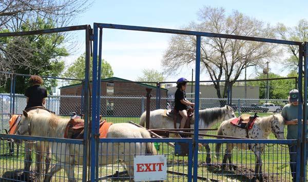
The City celebrated the grand opening of the Grandview Amphitheater in 2016. The Parks and Recreation Department has held many successful events each year (Figure 8.9) including movies in the park and summer concerts, both free events for the public. The amphitheater has also attracted nationally recognized artists and events. In 2018, the amphitheater was the site of an attempt to set the world record for the largest peace and love sign. In 2018, Shalimar Park Ball Fields reopened with significant improvements to the fields and concessions. The facility hosts Grandview’s youth baseball and softball leagues, as well as state and regional softball tournaments. The Parks and Recreation Department has many annual and monthly events, including Senior Potlucks and Field Trips, Harry’s- Hay Days, Harvest Fest, an annual Easter Egg Hunt, Figure


49 Figure 8.9: 2014 Bond Projects 8 PARKS AND RECREATION


Figure 8.13 Memorial Bench marking the original location of the First Baptist Church nps.gov Figure 8.12 Harry S. Truman Farm Home
8PARKS AND RECREATION
The Church moved to 1416 Main Street after donations and fund raising efforts by President Truman helped the congregation purchase the land that the church has called home since 1949.
Source: National Parks Service Figure 8.10 1931 Map of Solomon-Young Farmstead
50 a Father-Daughter Dance, and Howl-O-Ween. (Figure 8.148.19, Page 51) Currently, the City of Grandview is working on designating the Blue Ridge Cemetery (Figure 8.11) as a local historic landmark. The Cemetery is part of the original Solomon Young Farm (Figure 8.10). The Farmstead, developed in the 1860’s, was 600-acres, but much of the land was sold in the 1950’s for development. Surviving today is 10 acres known as the Harry S. Truman Farm Home (Figure 8.12) and the Blue Ridge Cemetery. President Truman lived and worked at the farm from 1906-1917. The Cemetery location was considered to be in the front yard of the farmhouse and Truman spent time digging graves while he lived and worked on the Farm. The Cemetery is also the home of the original First Baptist Church of Grandview (Figure 8.13).
The National Parks Service operates the Truman Farm Home located on Blue Ridge Boulevard in Grandview. The grounds are open to explore every day and the home opens for special events.
Figure 8.11 Blue Ridge Cemetery


51 Figure 8.14 Grandview Amphitheater Figure 8.15 Howl-O-Ween Costume Contest Figure 8.17 Howl-O-Ween Costume ContestFigure 8.16 Annual Easter Egg Hunt Figure 8.18 Harry’s Hay Days Float Entry Figure 8.19 Pony Rides at Harry’s Hay Days 8 PARKS AND RECREATION


8.21
Figure 8.20 and 8.22 Fun for All Ages 8PARKS AND RECREATION
Figure Happy E-Bike rider and a SUPER happy E-Bike rider.
52 Research for a bike-share program in Grandview occurred in 2018 and 2019. The City partnered with RideKC Bike to bring E-Bikes (electronic rechargeable bikes) to allow residents to test ride. Surveys were given to riders and the feedback was overwhelmingly positive and in support of a bike-share program with 97 out of 97 riders saying they enjoyed their ride. When asked if they wanted E-Bikes in Grandview, 95 participants said yes. Comments were left on 55 of the surveys. Many survey participants used exclamation marks and included the words fun or love when talking about their experience riding the E-Bikes. (Figure 8.20-8.23)
Figure Mayor Jones learning about E-Bikes
8.23


Action and Implementation Steps: Complete Parks Master Plan by December, 2021.
Responsible Department(s): Parks and Recreation, Community Development and Public Works.
Task: Use Community for all Ages lens in creation of plans.
Action and Implementation Steps: Request funding for Parks Master Plan for 2021 budget year.
Responsible Department(s): Parks and Recreation, Community Development and Public Works.
Action and Implementation Steps: Form a committee to create an action plan and budget estimate by June, 2021.
53
Action and Implementation Steps: Request funding for Bike Facilities and Trails Master Plan for 2022 budget year.
Vision Statement By 2030, Grandview will offer a balance of premier recreational programming that will be equitable, strengthen the community, and create fun with parks infrastructure that is inviting, well maintained, accessible, invokes pride, and enhances the overall quality of life.
Action and Implementation Steps: Conduct park specific surveys with users located within ½ mile of each city park to identify amenities desired by local users by June, 2021. Task: Create mailing list for each park. Task: Create amenities survey.
Responsible Department(s): Parks and Recreation and Community Development.
Measurement: Completed Trails, Comprehensive Bike Facilities, and Parks and Recreation Master Plans.
•GOAL: Complete Trails Master Plan, Comprehensive Bike Facilities Master Plan, and Parks and Recreation Master Plan to be adopted as part of the Grandview Comprehensive Plan.
Responsible Department(s): Parks and Recreation.
8 PARKS AND RECREATION
Responsible Department(s): Parks and Recreation = Meets Communities for All Ages Standards

8PARKS AND RECREATION
54
Task: Identify demographics missing or low in membership at The View to develop programming that is attractive to all citizens of Grandview.
•GOAL: Ensure equity in future programming Parks and Recreations by developing programming to reach all members of Grandview.
Measurement: Complete bi-annual updates of the demographic profile beginning January, 2020.
Action and Implementation Steps: Complete demographic profile of The View members by June, 2021.
Responsible Department(s): Parks and Recreation
Responsible Department(s): Parks and Recreation, Community Development and Public Works.
Responsible Department(s): Parks and Recreation Action and Implementation Steps: Complete community outreach surveys yearly beginning in May, 2021.
• Reach members of the community without The View memberships to help identify what may recruit residents as members.
Action and Implementation Steps: Create Comprehensive Bike Facilities and Trails Master Plans by June of 2023.
Source: schoolbusfleet.com Figure 8.24 Walking School Bus = Meets Communities for All Ages Standards
Task: Complete community outreach surveys at various community events.


Task: Create plan to implement program in all elementary schools.
Figure 8.25 National
Responsible Department(s): Parks and Recreation and Community Development (BikeWalkKC, Grandview C-4 School District).
Action and Implementation Steps: Partner with the Grandview School District and BikeWalkKC to implement bike education programs in all elementary schools beginning in the 2021-2021 school year.
Action and Implementation Steps: Participate in National Walk/Bike to School Days beginning the 2021/2022 school year (Images 8.25 and 8.26).
Source:
Measurement: Yearly education and awareness programs in all Grandview elementary schools.
Task: Identify schools currently participating in the BikeWalkKC program.
55
•GOAL: Partner with BikeWalkKC and the Grandview School District to bring education and awareness programs to students focusing on the value and advantages of biking and walking.
Source: bikewalkkc.org Figure 8.26 National Walk to School Day
= Meets Communities for All Ages Standards 8 PARKS AND RECREATION
Action and Implementation Steps: Develop a walk and bike “school bus” program for all elementary schools.
Responsible Department(s): Parks and Recreation and Community Development (BikeWalkKC, Grandview C-4 School District).
Responsible Department(s): Parks and Recreation and Community Development (BikeWalkKC, Grandview C-4 School District). bikewalkkc.org Bike to School Day


56 •GOAL: Develop and institute a comprehensive annual parks usage study. Measurement: Number of people visiting different parks annually, including the dog park, two splash parks, and the shooting range. Action and Implementation Steps: Develop methodology to study and analyze park usage. •Usage study should include various days, times, activities, types of users. Responsible Department(s): Parks and Recreation •GOAL: Increase The View membership totals by 5% per year to be measured at the end of the city fiscal year. Baseline measurement to be end of month September, 2019 membership total. Measurement: Number of visits to The View by type annually: • Fitness • Recreation programming (swim lessons, youth basketball, etc.) • Events (senior center and room rentals) • Membership numbers by type (resident/non-resident) • Revenues by type (resident/non-resident/other) • Net gain/loss in memberships by type Action and Implementation Steps: Create a baseline usage report for all parks by Spring of 2021. Action and Implementation Steps: Implement Action and Implementation Steps: Marketing and communications focus. Responsible Department(s): Parks and Recreation Figure 8.27 The View Basketball Leagues = Meets Communities for All Ages Standards 8PARKS AND RECREATION


Action and Implementation Steps: Test pilot new tournaments.
Action and Implementation Steps: Marketing and communications focus.
• Other Parks
Responsible Department(s): Parks and Recreation
Responsible Department(s): Administration and Parks and Recreation Figure 8.28 Tails and Trails Dog Park
•GOAL: Increase park usage by 5% each year starting in 2021 to be measured at the end of the city fiscal year.
Measurement: Number of people visiting different parks annually:
57
Action and Implementation Steps: Work with promoters to bring a quarterly festival to Grandview beginning in Fiscal Year 2023.
• Shooting Range
Action and Implementation Steps: Request funding for events coordinator in 2022 budget.
Action and Implementation Steps: Hold a minimum of two for-profit events at the amphitheater beginning in 2022.
8 PARKS AND RECREATION
•GOAL: Review revenue and budget to determine if hiring an Event Coordinator is feasible. The event coordinator would be responsible for expanding usage of the amphitheater and city festivals/events.
Measurement: Number of events planned and executed and attendance at each event.
Action and Implementation Steps: Hold a minimum of two sports tournaments a year starting in 2021.
Measurement: Number of people attending Amphitheater annually and by event.
• Dog Park, Splash parks (2)


Responsible Department(s): Parks and Recreation and Community Development (RideKC Bike, Grandview C-4 School District).
58
Figure 8.30 RideKCBike Rideshare
Action and Implementation Steps: Analyze police reports at parks to determine patterns and frequency.
Measurement: Police reports at park locations.
•GOAL: Implement bike-share program in Grandview.
Action and Implementation Steps: Develop plan for public private partnerships March, 2021.
Task: Look at alternative solutions to eliminate illegal activity.
•Partnership with Jackson County Parks.
= Meets Communities for All Ages Standards
Measurement: Number of bike-share options available in Grandview.
Responsible Department(s): Administration and Parks and Recreation
•Installing security devices at parks.
8PARKS AND RECREATION
Action and Implementation Steps: Create a partnership between Parks & Recreation and Community Development to seek funding sources for implementation of a bike share and rental program by March, 2021. Task: Implement bike share/rental program by March, 2023.
Task: Determine if increased patrol by existing police force would help eliminate illegal activity.
Figure 8.29 Bike Grandview Source: visitkc.com
•GOAL: Review revenue and budget to determine if hiring a Park Ranger is feasible. Park Ranger would be responsible for helping ensure parks are safe and eliminating illegal activity.


59 •GOAL: Create “Smart Parks” in Grandview. Action and Implementation Steps: Develop plan to add “Smart Park” technology throughout Grandview Parks. Task: Explore pricing for various technology items to add to parks. Task: Conduct community engagement to seek desire throughout community on locations and items. Task: Explore partnership with Grandview C-4 School District to create “STEM Park”. Task: Seek grant funding and private partnerships. Responsible Department(s): Parks and Recreation and Community Development, (Grandview C-4 School District). Source: meetingoftheminds.org Figure 8.31 Charging Bench Source: playgroundcentre.com Figure 8.33 Interactive Equipment Source: percussionplay.com Figure 8.32 FigureSource:Pianofitness-gaming.com8.34Interactive Equipment = Meets Communities for All Ages Standards 8 PARKS AND RECREATION


60 Other Key Topics The following section provides information into each topic to better inform the community of recent trends, practices and successes. Crime and Safety HistoricEducationPreservation

In the fall of 2018, during the community outreach phase of this project, we heard from many residents that crime and safety were top priorities. It is no surprise that the Commu nity, just like any other community, has the desire to feel safe and protected from those wishing to cause harm to others. It is the duty of the Grandview Police Department (PD) to serve and protect all residents and visitors. The De partment prides itself on its Guiding Principles: Honesty, Dependability and Integrity. That being said, we feel it is important to share what Grandview PD has done in the re cent years and plans to accomplish in the future within the community. The Grandview Police Department, led by Police Chief, Charles Iseman and his captains, has taken numeous steps and implemented many strategies in the past decade to en sure they can provide the most reliable and efficient service to the community. The Department now takes a proactive approach to its operations, focusing on community engage ment. This initiative is called, "Move Toward the Badge" and has become the conerstone of Grandview Police De partment's mission. Officers are encouraged to meet with citizens under positive circumstances to build trust.
What Grandview PD calls “Part I Serious Crimes” have gen erally been consistent since 2013, but there has been a no table decrease in burglaries over the past 5 years, as seen in Graph 9.1. Each year, especially around the holiday season, a few forms of crime continue to remain constant, auto thefts and larc-
CRIME AND SAFETY
Figure 9.2 Police Chief Charles Iseman
Crime Trends
9
61
Domestic Violence Detective In 2017, a Domestic Violence Detective position was funded by the Violence against Women Act Grant. This allowed for the department to have a full-time Detective on staff to in vestigate these crimes and explore ways to prevent them in the future. Currently, the department, Hope House, Jackson County Prosecutors Office and other agencies are working to compile a “Persistent Offenders” list as a way to better identify those with a history of domestic violence. Domestic violence reports account for over 200 cases each year since 2013. The department looks to curtail that trend with these partnerships and strategies in the coming years. In 2019, domestic assaults dropped by 21%.
Figure 9.1 Community Engagement
Figure 9.3 Domestic Violence Detective Heck


Graph 9.1 Crime Statistics Figure 9.4 Body
Figure 9.5 Police Drone 9CRIME AND SAFETY
62 eny. Chief Iseman mentions, “There are so many cases each winter that are able to be prevented if people would not leave their cars running and unlocked when they run into stores or are parked in their driveways.” These vehi cles are easy targets for criminals. During the holidays, the department sees more cases of theft because of someone leaving their vehicle unlocked and valuables are stolen. Grandview PD is implementing a new initiative in 2020 to educate the community about crime prevention, hoping these crimes of opportunity decrease. In 2018, the Police Department saw a 12% reduction in the overall crime rate from the previous year. This in part was due to the depart ment’s proactive switch to addressing crime through new tactics and strategies described below. Master Sergeant Greg Smith is actively engaged with the community, at tending numerous events throughout the year and helping Grandview residents understand what they can do to com bat crime in their neighborhood by helping to establish neighborhood watch programs and brainstorming other preventive strategies. Engaging Technology The use of technology has become a focal point for the department. Every officer is now equipped with body cameras that record audio and video. This is seen as a quality control measure that allows for more transparency with the department and the public. Drones are also being utilized to help police track criminals and investigate crimes without an officer being in close proximity. This will increase the safety of Grandview PD when situations are dangerous, such as searching for a suspect in a wooded area. Grandview PD has also partnered with the Ring "Neighbors" application. The application is popular among homeowners and tenants allowing them to post videos from their Ring doorbell and home security cameras. Ring also allows the Department to send notifications to residents if something is happening nearby. On the other hand, residents who participate with the Ring app can send video footage to Grandview PD if they capture information pertinent to a crime that was committed. This is all done if residents who download Ring choose to agree to the terms with the Grandview Police Department through the application. Some Grandview parks and public spaces are also monitored by the Police on an as-needed basis. The embrace of these technologies has allowed the department to better protect and operate more efficiently. Cameras
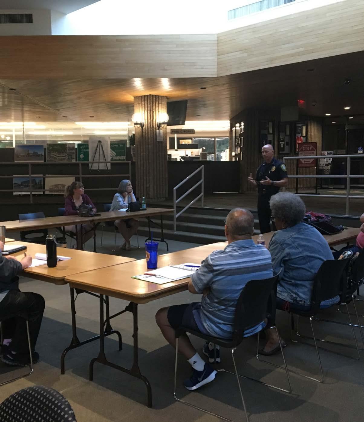


Enrollment
63
Missouri Assessment Program testing scores are improving. In 2018, students earned 90.2%-- the highest scores for the district since 2013 (Charts Ed2, Ed3, Ed4, Ed5). MAP testing analyzes proficiency in English Language Arts, Mathematics, Science and Social Studies. Competency
Forum
10 Figure 10.1 Cultural
The Grandview C-4 School District is made up of one early childhood school, five elementary schools, two middle schools, and one high school. The school district includes parts of west and south Kansas City, Missouri, including Martin City, and part of Lee’s Summit to the east. Northern parts of Grandview are in the Hickman Mills School District (Image Ed1).
Rates and Scores Since 2011, four-year graduation rates have increased nearly 20%, while the drop-out rate has decreased over 48% since 2000. After completing high school, 69% of the district’s students attend a two-year college or enter the workforce. Some of the District’s strongest gains have been in college and career ready assessments (ACT, ASVAB, WorkKeys) which rose by 12% in just two years, and in postsecondary, which improved by over 20% in two years.
EDUCATION
The school district has seen consistent enrollment numbers averaging over 4,000 students annually over the last 18 years (Chart Ed1). The school district's student demographics are 52% African-American, 20% Caucasian, 20% Hispanic, and 8% Asian, Indian or other minority backgrounds. The student body is one of the most diverse in the region, earning an A rating in diversity from niche. com. In 2016, the district's staff began a program around cultural competency (Figure 10.1) to better serve students from all ethnicities and build positive and meaningful relationships. Staff Grandview C-4 professional staff experience is greater than the state of Missouri average. District staff average 15.5 years with almost 70% having advanced degrees.


Strategic Plan In October of 2018 the Grandview C-4 School District began a six-month collaborative process to develop a fiveyear Strategic Plan. The Plan was approved by the School Board at the June, 2019 meeting. The Plan has five focus areas: Strategic Governance, Student Success, Workforce Excellence, Resource Stewardship and Organizational Efficiency and Family and Community Involvement. Five teams created goals, strategies and action steps. The Plan emphasizes student achievement, cultural competency and fully preparing students for post-secondary college and/or career success (Grandview C-4). The Plan is a roadmap to help continue building on district successes and to tackle areas of opportunities. The Plan can be found at: jsp?uREC_ID=1439632&type=d&pREC_ID=1602568https://www.grandviewc4.net/apps/pages/index.
64
•2017 Burns & McDonnell Battle of the Brains WinnerGrandview C-4’s FOCUS program celebrated the grand opening of its Amazing Brain exhibit at Union Station in March, 2018. The exhibit is Science City’s Largest Indoor Exhibit, Courtesy of the Burns & McDonnell Battle of the Brains Competition. (Image 10.2 Battle of the Brains Team)
10EDUCATION
• 2018 South Kansas City Alliance Award for Outstanding Education Achievement - The South Kansas City Alliance selected the Grandview C-4 School District as the recipient of the Outstanding Educational Achievement Program Award for Project Lead the Way. The nomination submitted detailed the work being done in the district to provide ALL students access to STEM (Science, Technology, Engineering, and Math) education.
Recent Awards and Accomplishments
•2018 Grandview Middle School (GMS) Earns PLTW Distinguished School Honor - GMS earned the PLTW Distinguished School honor for a second year in a row. The school was first recognized in 2017.
Grandview has recently celebrated many successes in recent years, both academic and athletic, creating a sense of pride among students, educators, administrative staff, and the community. Academic Awards: •2018 Project Lead the Way Distinguished DistrictGrandview C-4 School District has been recognized as a Project Lead the Way (PLTW) Distinguished District for providing interactive learning opportunities for students in science, technology, engineering and math through its PLTW programs. It is one of just 21 districts across the U.S. to receive this honor. PLTW is a nonprofit organization that serves millions of PreK-12 students and teachers in schools across the U.S.
• 2018-19 Prep KC Math Relays Champions - The Grandview C-4 School District earned the District Champion title at the 5th annual Prep KC Math Relays. Grandview Middle School and Meadowmere Elementary School took home the gold in their categories, while Butcher Greene, Martin City K-8, and Conn-West earned silver.
• Martin City K-8 teacher selected as 2019 Regional Teacher of the Year - Martin City K-8 Teacher Cindy Long was selected as one of six Kansas City Regional Teachers of the Year. She was recognized for her passion for teaching, her dedication to the profession, and her drive to ensure all students achieve success.
Figure 10.2 Battle of the Brains Team
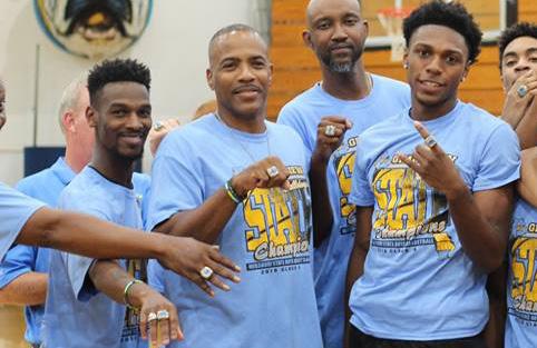

65 • Runner Up at the 2018-19 FIRST Robotics Regional Competition - The Grandview High School robotics team placed 2nd at the FIRST Regional Robotics Competition. • Grandview High School (GHS) student recognized nationally for technological achievements - Class of 2019 graduate Chayanne Sandoval-Williams was one of 40 National Winners recognized for Technological Achievements by the National Center for Women and Information Technology. She is one of two in the State of Missouri to make the list. Athletic Championships Grandview High School Boy’s Basketball Team become Back-to-Back State Champions. • 2018 MSHSAA Boys Basketball Champions Class 4 • 2019 MSHSAA Boys Basketball Champions Class 4 (Image 10.6 Bulldog Basketball Championship Team) • 2018 MaxPreps Top 50 Team Nationwide (Ranking 42nd in the nation) Figure 10.6 Bulldog Basketball championship Team 2019 10 EDUCATION The Grandview Boy’s Track and Field team won its seventh state title in May, 2019 at the Missouri Class 4 State Championship Track Meet. • 2019 MSHSAA Boys Track & Field Champions Class 4 • 2016 MSHSAA Boys Track & Field Champions Class 4 • 2015 MSHSAA Boys Track & Field Champions Class 4 • 2014 MSHSAA Boys Track & Field Champions Class 4 • 2013 MSHSAA Boys Track & Field Champions Class 4 • 2012 MSHSAA Boys Track & Field Champions Class 4 • 2011 MSHSAA Boys Track & Field Champions Class 4 Figure 10.3 #NUFFSAID Figure 10.5 Bulldog Logo Figure 10.4 Bulldog Banner


• Develop a historic resource baseline data – those structures that are 50 years of age or older (Cultural Resources Survey).
Within the topic of Historical Promotion, the following Recommended Strategies were adopted:
HISTORIC66 PRESERVATION
• Develop a Historical Preservation Plan – preserve and protect the resources identified in the Cultural Resources Survey.
• Develop a Historic Preservation Ordinance – enable the City to carry out the Historic Preservation Plan.
Direct link to the Original Town of Grandview Survey preservationcommunity-development/development-services/historic-https://www.grandview.org/work/city-government/
In July 2002, the City created the Historic Preservation Committee, and held its first meeting. The Committee was composed of members from the Historic Promotion Task Force. This Committee was responsible for working with City staff to develop a historic resource baseline and submit an application for Historic Preservation Fund grant funds. These grant funds would assist in hiring a consultant to perform the Cultural Resource Survey according to the National Park Service/Department of the Interior Standards. In October 2002, the City partnered with the Grandview Historical Society, Inc. on accepting a $300,000 Community Development Block Grant (CDBG) which was utilized to provide for additional public, off-street parking spaces in the downtown Grandview district. This project was consistent with and in furtherance of the City’s Comprehensive Plan 2000 (Ordinance No. 5536, 10/22/2002). In January 2003, the City hired Historic Preservation Services, LLC to conduct the Cultural Resource Survey for the City of Grandview, Missouri (Ordinance No. 5573, 1/28/2003).
In 2000, the Board of Aldermen made a decision to hire a consultant to conduct a community-based strategic planning process. The process commenced in November 2000 and developed the Top 9 strategic issues for further consideration, one of which was Historical Promotion.
Source: kmbc.com Figure 11.1 Grandview Cultural Resources Survey Figure 11.2 Grandview Cultural Resources Survey Map Figure 11.3 Architectural Typologies of Grandview Homes 11
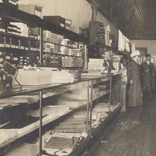


Figure Section 31-25A Historic Preservation of Grandview's Zon ing Ordinance Register Nomination
Figure 11.4 Grandview
Form 11 HISTORIC PRESERVATION
In November 2003, the Historic Preservation Committee held 2 separate workshops, Commercial Structures Rehabilitation and Residential Structures Rehabilitation, for property owners within the area of the Cultural Resource Survey boundary to learn more about methods to rehabilitate structures. In May 2004, the Board of Aldermen approved an amendment to the Zoning Ordinance by adopting Section 25A, to be titled Historic Preservation (Ordinance No. 5763, 5/11/2004). This section formalized the City’s efforts, at the local level, to preserve and protect its historic, archaeological and architectural resources. This ordinance also established the Historic Preservation Commission, its membership and composition, terms of office, etc. (Ordinance No. 5791, 6/22/2004). In November 2004, the City approved a contract with Historic Preservation Services, LLC to complete the Cultural Resources Survey in the Pre-1955 Grandview Town Site and Prepare a Nomination of Recommended District to the National Register of Historic Places (Ordinance No. 5831, 11/9/2004). In January 2005, the City approved the formal application to the State Historic Preservation Office (SHPO) to become part of the Certified Local Government (CLG) Program (Ordinance No. 5859, 1/25/2005). The City was formally certified on February 25, 2005. In October 2005, the official nomination to the National Register of Historic Places for the Grandview Residential Historic District was submitted to the National Park Service. On November 15, 2005, the Grandview Residential Historic District was officially listed on the National Register. Direct link to the City’s official submitted nomination to the National Register of Historic Places https://catalog.archives.gov/id/63819427 Cultural Resources Survey
11.5
67
Figure 11.6 National
In September 2003, the Cultural Resource Survey for the “Town of Grandview”, Missouri was completed and accepted by the Board of Aldermen (Resolution 2003-22, 11/25/2003). This Survey also included a Recommendations Section, thereby creating a framework for future priorities for historic preservation activities.
Recommendations
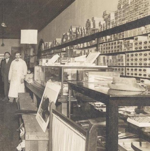


In March 2006, the City approved a grant agreement (costshare) for Historic Preservation Funds from the Missouri Department of Natural Resources to utilize a consultant to assist the City in developing Design Guidelines for the Grandview Residential Historic District and the Main Street Commercial Conservation District (Ordinance No. 5999, March 28, 2006).
11HISTORIC PRESERVATION
68
Searchable Map of Surveyed Cultural Resources in Grandview, Missouri html?appid=a3b0d896e73d4baa85febc5c6e4cebb2https://cityofgv.maps.arcgis.com/apps/View/index.
In June 2006, the City approved a contract with Sally Schwenk Associates, Inc. to prepare and implement a set of design guidelines for Grandview’s Residential Historic District and the Main Street Commercial Conservation District (Ordinance No. 6019, 6/13/2006).
In October 2007, the City adopted the designation of the Grandview Road – Highgrove Road Neighborhood Historic District as a local historic district, adopted its boundaries, adopted the Design Guidelines, and adopted the overlay zoning district (Ordinance No. 6138, 10/23/2007).
Figure 11.9 2018 Town of Grandview Re-Survey
In November 2008, the City adopted the designation of the Downtown Grandview Main Street Conservation District as a local conservation district, adopted its boundaries, adopted the Design Guidelines, and adopted the overlay zoning district (Ordinance No. 6243, 11/25/2008).
Figure 11.7 Request for Proposals for Historic District Design Guide lines Figure 11.8 Grandview Historic Districts
In November 2017, the City approved a grant agreement (cost-share) for Historic Preservation Funds from the Missouri Department of Natural Resources to utilize a consultant to assist the City in completing a Re-Survey of the “Town of Grandview” to update the original 2003 Architectural Survey (Ordinance No. 7036, November 11, In2017)February 2018, the City approved a contract with Rosin Preservation, LLC to complete the Re-Survey of the “Town of Grandview” to update the original 2003 Architectural Survey. The Re-Survey was completed in August 2018.


69 Page Intentionally Left Blank

Grandview has achieved many great things since the early 2000s. Several of those achievements were set forth in last Comprehensive Plan, something residents should be proud of. The City has experienced a robust influx of industrial and commercial development, new life has been brought back to Main Street, public transit was expanded to service a larger area and population, a rental inspection program was established to ensure residential units are safe and sanitary, the City's Parks were updated with new amenities, and The View, the City's community center, was built to help the community become healthier and provide activities for residents and visitors. With those successes behind us, it has become time to look at the next set of goals addressing todays concerns and desires. Grandview 2030 has laid the framework for the next decade with high expectations to raise the bar for the community to a new level. It is a promise to the community that City Staff and the Board of Alderman will do their best to make these goals a reality over the coarse of the next 10 years. The goals outlined in this Plan were a direct result of the community engagement process with the general public and the Comprehensive Plan Committee. We again want to thank each and every person involved with the process. If not for you, this would not have been possible. Grandview 2030 is a plan for the community, developed by the community.
• Increase alternative transportation options.
• Continue to develop relationships with elected officials and professional staff at the State and Federal levels on key issues of importance to Grandview.
Economic Development By 2030, Grandview will be a regional leader in economic development by becoming the City of choice for business retention, expansion, and attraction.
• Implement applicable strategies from Climate Action KC Playbook.
Environment and Sustainability By 2030, Grandview will be a regional leader in environmental policy and sustainable practices by welcoming innovative ideas for sustainable development and promoting sustainable practices.
• Hire a Sustainability Manager.
• Create viable solutions to address Grandview’s food desert near Missouri 150 Highway.
• Review and update development regulations and infrastructure guidelines.
• Investigate the feasibility of establishing a technology-based cluster in the areas of life sciences.
• Develop programs to assist entrepreneurs with startups to foster local small business prosperity.
• Establish a sustainability committee.
• Work with the Chamber of Commerce to evaluate the existing Business Retention and Expansion Program with the intent to strengthen it.
• Update the City’s Economic Incentive Policy to refine and target investments in businesses that will add depth to the City’s business and job base, increase the City’s assessed valuation and further diversify Grandview's economy.
• Reduce city energy costs.
OUR70VISION
• Continue to Market Grandview’s federally-designated Opportunity Zone.
12
• Create an economic development strategic plan.
• Develop a community sustainability education program.
Summary of Plan Goals

• Update the City’s Zoning and Subdivision Regulations to allow more traditional neighborhood forms and productive uses of land.
71
Housing By 2030, Grandview will make significant strides toward providing new single and multi-family homes at multiple price points by following the recommendations outlined in the Grandview Housing Study. In addition, the City will implement updated regulations to provide opportunities for more creative and economically productive building forms and patterns for infill, redevelopment and greenfield development opportunities.
12 OUR VISION
• Increase The View membership totals by 5% per year to be measured at the end of the city fiscal year. Baseline measurement to be end of month September, 2019 membership total.
• Complete Trails Master Plan, Comprehensive Bike Facilities Master Plan, and Parks and Recreation Master Plan to be adopted as part of the Grandview Comprehensive Plan.
• Develop and institute a comprehensive annual parks usage study.
• Revitalize and invest in existing neighborhoods.
• Target Specific areas for infill development opportunities.
• Build new “Missing Middle Housing” - duplex, triplex, fourplex, cottage/pocket neighborhoods and accessory dwelling units as new subdivisions and infill projects.
• Review revenue and budget to determine if hiring a Park Ranger is feasible. Park Ranger would be responsible for helping ensure parks are safe and eliminating illegal activity.
• Increase walkability in residential districts constructed prior to 1960. This goal to be included in the new Transportation and Trails Master Plan set forth in the Infrastructure and Parks and Recreation section of this document. Infrastructure By 2030, Grandview will provide its residents and businesses premier quality infrastructure that strengthens the fab ric of the community through improved connectivity, quality and efficiencies.
• Increase in affordable quality housing types (to include accessory dwelling units in targeted areas to be specified in the Zoning Ordinance Update).
• Ensure equity in future programming Parks and Recreations by developing programming to reach all members of Grandview to develop programming to reach all members of Grandview.
• Review revenue and budget to determine if hiring an Event Coordinator is feasible. The event coordinator would be responsible for expanding usage of the amphitheater and city festivals/events.
• Create “Smart Parks” in Grandview.
• Implement bike-share program in Grandview.
• Collaborate with surrounding municipalities to discuss management of storm water run-off associated with developments outside of Grandview. Parks and Recreation By 2030, Grandview will offer a balance of premier recreational programming that will be equitable, strengthen the community, and create fun with parks infrastructure that is inviting, well maintained, accessible, invokes pride, and enhances the overall quality of life.
• Create, adopt and implement the goals of a new transportation plan for Grandview to guide growth of the physical infrastructure system.
• Increase park usage by 5% each year starting in 2021 to be measured at the end of the city fiscal year.
• Partner with BikeWalkKC and the Grandview School District to bring education and awareness programs to students focusing on the value and advantages of biking and walking.

Residential Low: Development/redevelopment at densities of 5.0 to 6.0 dwelling units per acre; served by municipal services.
Town of Grandview Overlay (TOGO): Two primary goals listed in the Housing section focused on encouraging tradi tional neighborhood patterns, often refered to as pre-war development, and increasing affordable quality housing types by allowing accessory dwelling units (ADU) (Figures 6.11-6.13). City Staff has recognized that these goals, while appropriate in areas of Grandview constructed before WWII with a well connected street grid, ample sidewalks, and a human scaled commercial center (downtown Grandview), may not be as appropriate in other neighborhoods.
CommercialCommercial: Development/redevelopment of retail business uses, including shopping centers and isolated retail establishments and offices.
Zoning District: C-1, NB
The TOGO, an area primarily found on the west side of I-49, consists largly of the original subdivisions platted when Grandview was first becoming a community in the early part of the 1900s. It is these subdivisions that are best suited for achieving the previously mentioned goals by creating a strong sense of place and density through a reduction in lot size requirements, lot widths, setbacks, and allowing ADUs. The Overlay District only applies to R-1 Single Family zoned properties and is outlined in blue on the Future Land Use Map on page 74. In areas where the TOGO overlaps with another overlay district, the more stringent overlay and its rules apply. the following generic Future Land Use (FLU) designations (in bold) correspond with the existing zone districts.
Zoning District: R-4
Zoning Districts: R-1 Medium: Development/redevelopment at densities more than 6.0 units not to exceed 12.0 units per acre.
Grandview's Future Land Use Map is based on current zoning of land within the boundaries on the community and future land use of both developed and undeveloped areas.
LAND
Transitional Neighborhood: Development/redevelopment of neighborhood retail business that specifically serves the local community. The uses can exist within a residential dwelling either as an accessory use or primary use, such as a physicans office, tax preparer, barber, music or education tutor, etc. These areas also serve as a buffer for residential zoning districts from the more intense use such as downtown commercial.
Zoning Districts: C-1, C-2, CS
FUTURE72 USE
Zoning Districts: R-2, R-3 High: Development/redevelopment at densities more than 12.0 units not to exceed 18.0 units per acre.
13
Zoning Districts: R-1 Low (Town of Grandview Overlay): Development/redevelopment at densities of 6.0 to 12.0 dwelling units per acre; served by municipal services.
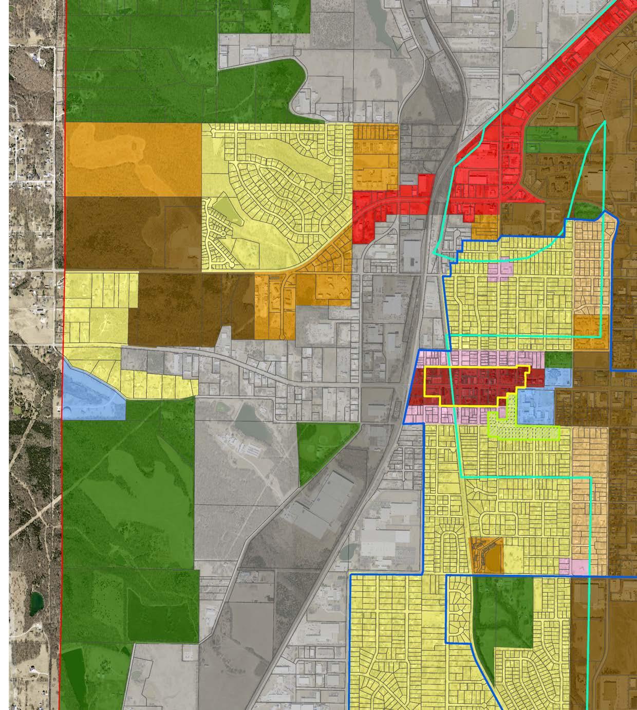
Zoning District: P-1
FUTURE LAND USE
Urban Center: Development/redevelopment of residential and retail business uses, including shopping, services, and offices. This commercial land use follows the development pattern of the pre-WWII era, characterized by dense walkable commercial centers that are built to human scale and cater to locals and beyond.
Preserve/Park: Development/redevelopment of park land and active recreation, agricultural use and conservation by public or private groups for both current and future parks, agricultural uses and land conservation as needed.
Zoning District: OS Industrial (1 and 2)Development/redevelopment of industrial assembly and warehousing, with limited manufacturing uses as defined in the zoning regulations. Intensive land uses for manufacture and assembly of goods associated with industrial activity, as defined in the zoning regulations, would be heavily buffered.
Zoning District: I-1, I-2
73 13
Zoning District: C-3 Mixed Use: Development/redevelopment of a tract of land or building with at least two or more permitted uses such as but not limited to residential, office, retail, entertainment, and institutional. This development type emphasizes human scaled features, walkability and is connected with public transit services. These developments prioritize people over accomodations for the automobile.
Zoning District: PD Institutional/Office/Service: Development/redevelopment of institutional uses including government offices, libraries and other office uses such as general offices and medical offices.

FUTURE74 LAND USE 13

75 Page Intentionally Left Blank 13 FUTURE LAND USE

Accessory Dwelling Unit - A residential dwelling unit located on the same lot as a single-family dwelling unit, either within the same building as the single-family dwelling unit or in a detached building. The unit contains a separate entrance, kitchen, sleeping area, and full bathroom facilities.
Alternative Energy - Usable power (such as heat or electricity) that comes from a renewable or green resource (Merriam Webster Dictionary)
Climate Disruption Index - Weather.com report listing which 25 cities across the United States will face the greatest challenges from climate change. Factors included a population greater than 200,000 people, sea-level rise, extreme precipitation and drought, urban heat islands, and changes to average temperature and precipitation (Weather.com)
Climate and Sustainability Master Plan - Comprehensive roadmaps that outline the specific activities that an agency will undertake to reduce greenhouse gas emissions (Institute for Local Government)
BikeWalkKC - BikeWalkKC is a member-supported 501(c)(3) nonprofit organization that works to make Greater Kansas City a safer and more accessible place to walk, bicycle, live, work, and play. (BikeWalkKC)
Climate Vulnerability Assessment - Used to ascertain the susceptibility of a natural or human system to sustaining damage (or benefiting) from climate change (USDA)
.
.
Carbon Footprint - The amount of greenhouse gases and specifically carbon dioxide emitted by something (such as a person's activities or a product's manufacture and transport) during a given period (Merriam Webster Dictionary)
Center for Neighborhoods Leadership Program (UMKC) - [a] one-stop location where neighborhood leaders and res idents can access the available resources and capacities of UMKC, Western Missouri Legal Aid, and other community resources (umkc.edu).
. GLOSSARY 14
Business Retention and Expansion Program - [a]n economic development strategy of proactively connecting with exist ing businesses to understand and respond to their needs (purdue.edu).
Business Incubator Program - A facility dedicated to the start-up and growth of small businesses, accomplished through management and facility support systems (Galesburg, Ill., A Planner's Dictionary).
76
Building Facade - That portion of any exterior elevation on the building extending from grade to top of parapet, wall, or eaves and the entire width of the building elevation (Peoria, Ill., A Planner's Dictionary).
Climate Action KC Playbook - A compact of elected officials and community leaders works throughout the Kansas City region to draw down greenhouse gases, improve climate resilience, invigorate the economy, promote public health, and improve the collective quality of life (MARC).
.
Bike Share - Bicycles for a daily, monthly, annual, or trip-based fee traditionally based at a self-serve station-based and recognized as an option for first and/or last mile transit connections. (PedBikeInfo.org)
.
Blighted - That portion of the city which the board shall determine, that by reason of age, obsolescence, inadequate or outmoded design, or physical deterioration, have become economic and social liabilities and that the conditions in such localities are conducive to ill health, transmission of disease, crime, or inability to pay reasonable taxes.
Complete Streets - ...designed and operated to enable safe access for all users, including pedestrians, bicyclists, motorists and transit riders of all ages and abilities (smartgrowthamerica.org).
Economic Development Strategic Plan - An economic roadmap to help diversify and strengthen the economy (MARC).
Home Investment Fund - Money set aside from a city's budget that is allowed to be applied for by residential property owners for repairs to the exterior of their property. Repairs could include roof repairs or replacement, new paint or siding, driveways repair or replacement, etc.
Greenfield Development - Development on undeveloped parcels not surrounded by existing development, or on large parcels surrounding partially developed areas or undeveloped areas (Concord, N.C., A Planner's Dictionary).
Green Infrastructure - The range of measures that use plant or soil systems, permeable pavement or other permeable surfaces or substrates, stormwater harvest and reuse, or landscaping to store, infiltrate, or evapotranspirate stormwater and reduce flows to sewer systems or to surface waters (EPA.gov).
14 GLOSSARY
Community Improvement District - A special purpose district in which property owners voluntarily tax themselves to fund a broad range of public improvements and/or services to support business activity and economic development within specified boundaries (grandview.org).
Comprehensive Bike Facilities Master Plan - A dynamic document intended to guide the City as it seeks to fully develop a network of bicycle infrastructure, programs, and policies (BikeWalkKC)
Economic Incentive Policy - A document that establishes standards and guidelines that will govern the granting of financial incentives to facilitate economic growth. These guidelines are predicated on the belief that the City has an in terest in taking positive action to maximize its long-term financial capacity while responding to the service demands of both new and existing development without placing a disproportionate tax burden on homeowners.
Home Occupations - An occupation carried on in a dwelling unit by the resident thereof; provided that the use is limited in extent and incidental and secondary to the use of the dwelling unit for residential purposes and does not change the character thereof (St. Paul, Minn., A Planner's Dictionary).
77
Food Desert - An area where little fresh produce is available for sale (Merriam-Webster Dictionary).
Food System Sustainability Strategy - A strategy aimed at achieving food and nutrition security and healthy diets while limiting negative environmental impacts and improving socio-economic welfare (Center for Tropical Agriculture).
Hardiness Zones - The standard by which gardeners and growers can determine which plants are most likely to thrive at a location (USDA).
Environmental Justice Community - The fair treatment and meaningful involvement of all people regardless of race, color, national origin, or income, with respect to the development, implementation, and enforcement of environmental laws, regulations, and policies (EPA.gov).
Economic Incentives - Tools used to attract development in varying forms. This could be to redevelop a shopping center or to building new industrial facilities.
14GLOSSARY
Life-Cycle Cost - In terms of public infrastructure, life-cycle cost would mean the cost to build, maintain, and rebuild the same piece of roadway or sewer system over the course of its expected life.
Livable Streets - Making streets, roadways and sidewalks accessible, safe, efficient and usable for all people (Missouri Livabale Streets).
Infrastructure Revitalization Fund - Money set aside from a city's budget that is allowed to be applied for by residen tial property owners for repairs to their driveways or sidewalks.
National Climate Assessment - Summary of the impacts of climate change on the United States, now and in the future (National Climate Assessment).
Net Employment - The amount of jobs a city has at the end of a designated time period that includes all new jobs created minus the amount of jobs lost.
Impervious Surface - Any hard-surfaced, man-made area that does not readily absorb or retain water, including but not limited to building roofs, parking and driveway areas, graveled areas, sidewalks, and paved recreation areas (Lake County, Ill., A Planner's Dictionary).
Mixed-Use - The development of a tract of land or building or structure with two or more different uses such as but not limited to residential, office, retail, public, or entertainment, in a compact urban form (Lake Elsinore, Calif., A Planner's Dictionary).
Low Hanging Fruit - In the context of infill development, low hanging fruit refers to places throughout the community that are already served by public infrastructure and services that will not require a lot of extra effort and public resources to develop. For example, an empty lot in an existing residential neighborhood.
Infill Development - Development or redevelopment of land that has been bypassed, remained vacant, and/or is underused as a result of the continuing urban development process (Topeka, Kans., A Planner's Dictionary).
78
Missing Middle Housing - is a range of multi-unit or clustered housing types—compatible in scale with detached singlefamily homes—that help meet the growing demand for walkable urban living (missingmiddlehousing.com).
Neighborhood Commercial Node - An area near residential neighborhoods that consists of small-scale commercial businesses tailored to serve the immediate community. The neighborhood commercial node is often in the form of pedestrian oriented mixed-use buildings, located near or at major roadway intersections, and is integrated into the surrounding neighborhoods.
Low Impact Design Standards - Guidelines for developing land that focus on reducing the impact on the natural environment. This also includes guidelines that promote development patterns that are less taxing on the City's infrastructure system and public services.
No-Tax Increase Bond - A bond issued that does not increase the tax levy, but it maintains a consistent debt obligation.
14 GLOSSARY
Smart Parks - A park that uses technology (environmental, digital, and materials) to achieve a series of values: equitable access, community fit, enhanced health, safety, resilience, water and energy efficiency, and effective operations and maintenance (Smart Parks Tool Kit).
79
Pedestrian Facilities - Typically found on public streets or grounds, pedestrian facilities are sidewalks, crosswalks, trash cans, benches, public spaces for gathering, parks, etc.
Public Infrastructure - Facilities and services needed to sustain industry, residential, commercial, and all other land-use activities, including water, sewer lines, and other utilities, streets and roads, communications, and public facilities such as fire stations, parks, schools, etc. (Redmond,Wash., A Planner's Dictionary).
Pervious Surface - A surface that presents an opportunity for precipitation to infiltrate into the ground (New Castle County, Del., A Planner's Dictionary).
Overlay Districts - An area where certain additional requirements are superimposed upon a base zoning district or un derlying district and where the requirements of the base or underlying district may or may not be altered (Milwaukee, Wisc., A Planner's Dictionary).
Peak Ridership - Times of the day, week, month or year that public transit sees the most riders over the course of a specific time frame.
Sense of Place - The constructed and natural landmarks and social and economic surroundings that cause someone to identify with a particular place or community (Wisconsin Department of Natural Resources, A Planner's Dictionary).
Public-Private Partnerships - An agreement between a government agency and a private sector company that can be used to finance, build and operate projects, such as public transportation networks, parks, and convention centers (in vestopedia.com).
Park Ranger - Educates the public, enforces the law, as well as implements and supports conservation efforts (ParkRangerEDU.org).
Residential Design Standards - Guidelines for developing land that focus on residential development and how it will take form from architectural design to building placement and arrangement.
Opportunity Zone - An opportunity zone is an economically-distressed community where new investments, under certain conditions, may be eligible for preferential tax treatment. Localities qualify as opportunity zones if they have been nominated for that designation by the state and that nomination has been certified by the Secretary of the U.S. Treasury via his delegation of authority to the Internal Revenue Service (irs.gov).
Parks and Recreation Master Plan - Comprehensive process that provides guidance and policy direction to local government decision makers to establish a foundation for understanding and responding to the parks and recreation needs of a community (University of Delaware).
Programming (Parks) - Programmed activities or activity generators attract and increase positive use in a park and can include: recreational offerings; tours; exhibits; community gardens; cultural festivals; or special events such as music, dance or theatre (Project for Public Spaces).
Trails Master Plan - Explores opportunities to enhance and expand multi-modal facilities, for both recreation and transportation purposes within a community by aiming to improve connectivity to local destinations, close gaps in the trail system, increase safety and accessibility for all trail users, support economic development, and enhance the quality of life for area residents (Alta Planning + Design).
Transportation Master Plan - A plan adopted by a city's board that organizes the transportation network and a vision for future needs for the community. These plans incorporate all modes of transit, from pedestrians and cyclists to private automobiles and public transportation.
Strategic Repurposing - The process of finding new uses for particular properties that have either been underutilized or abandoned due to various reasons.
United States Geological Survey - An agency that provides scientific data about the natural hazards that threaten lives and livelihoods; the water, energy, minerals, and other natural resources we rely on; the health of our ecosystems and environment; and the impacts of climate and land-use change (usgs.gov).
Tax Increment Financing - A tool used by cities and other development authorities to finance certain types of develop ment costs. The public purposes of TIF are the redevelopment of blighted areas, construction of low- and moderate in come housing, provision of employment opportunities, and improvement of the tax base. With TIF, a city “captures”the additional property taxes generated by the development that would have gone to other taxing jurisdictions and uses the “tax increments” to finance the development costs (Minnesota Office of the Legislative Auditor, A Planner's Dictionary).
Urban Heat Islands - A metropolitan area that's a lot warmer than the rural areas surrounding it (National Geographic).
Transportation Authority - In Kansas City, the KCATA is a bi-state agency charged with serving the transportation and development needs of the Kansas City Region (kcata.org).
80 Storm Water Runoff - Surplus surface water generated by rainfall that does not seep into the earth but flows over land to flowing or stagnant bodies of water (Larkspur, Calif., A Planner's Dictionary).
14GLOSSARY
Technology-Based Cluster - A geographic concentration of interconnected companies and institutions in a particular field (raineugene.org).
Zoning and Subdivision Regulations - Ordinances that are approved by a city board that regulate land uses and the built form of a community.
81 A Traditional Neighborhood Development. (n.d.). Retrieved January 3, 2020, from http://www.villageofcheshire. ADUs.com/a-traditional-neighborhood-development/(n.d.).Retrievedfromhttp://kronbergwall.com/a-market-solution-for-affordable-housing-adus/AleksOrel.(n.d.).Sunenergysidewalkvectorillustration.Urbanstreetlightwithsolar...RetrievedNovember 14, 2019, from https://www.istockphoto.com/vector/sun-energy-sidewalk-vector-illustration-gm833951500-135608979 Alternative Energy Systems Specialist, C.C.C. (n.d.). Retrieved November 11, 2019, from https://www.gulfcoast.edu/ ComprehensiveCoClCaBuBuBikeWalkKC.BikeArchitectureacademics/programs/alternative-energy-systems-certificate/index.htmlbrandingagency.(n.d.).RetrievedJanuary13,2020,fromhttps://www.clockwork-ad.com/Share.(n.d.).RetrievedOctober20,2019,fromhttp://www.pedbikeinfo.org/topics/bikeshare.cfm(2019,July22).AboutBikeWalkKC.RetrievedSeptember11,2019,fromhttps://bikewalkkc.org/about/ngalowCourt.(n.d.).RetrievedNovember19,2019,fromhttps://missingmiddlehousing.com/types/bungalow-court#prettyPhoto[portfolio]/9/rch,B.,Burchhttp,B.,Burch,Burch,B.,Burch,StartlandNews,&StartlandNews.(2016,December12).HowKansasCityStartupVillageGrewFromtheArrivalofGoogleFibertoThrivingInnovationDistrict.RetrievedJanuary14,2020,fromhttps://eqstl.com/kansas-city-startup-village-grew-arrival-google-fiber-thriving-innovation-district/pe,G.,O'Brien,K.,&Moser,S.(2018,February15).TheSmartCitiesToolkitforSMARTUrbanParks.RetrievedOctober13,2019,fromhttps://meetingoftheminds.org/smart-cities-toolkit-smart-urban-parks-25128imateActionPlan.(n.d.).RetrievedNovember29,2019,fromhttps://www.marc.org/Environment/Climate-Action/Climate-Action-Plan/Climate-Action-Plan-Partners.htmlmmunityImprovementDistricts.(n.d.).RetrievedDecember2,2019,fromhttps://www.grandview.org/home/showdocument?id=289EconomicDevelopmentStrategy.(n.d.).RetrievedJanuary16,2020,fromhttp://r1planning.org/cedsCourtyardApartments.(n.d.).RetrievedNovember19,2019,fromhttps://missingmiddlehousing.com/types/courtyard-apartmentsDaniel,R.(2017,July28).FloodingdamagesseveralGrandviewhomes.RetrievedDecember3,2019,fromhttps://www.kshb.com/news/local-news/parts-of-grandview-mo-hit-hard-by-floodingDescriptionofParksandRecreationMasterPlanning.(n.d.).RetrievedDecember17,2019,fromhttps://www.completecommunitiesde.org/planning/healthy-and-livable/intro-parks-rec-master-plan/DictionarybyMerriam-Webster:America'smost-trustedonlinedictionary.(n.d.).RetrievedSeptember29,2019,fromhttps://www.merriam-webster.com/ 15REFERENCES
Alumna Founds Unique Retail and Dining Destination. Retrieved December 15, 2019, from www.umkc.edu/news/posts/2019/november/alumnas-retail-and-dining-destination-in-shipping-containers.htmlhttps://
neighborhood living. (n.d.). Retrieved December 16, 2019, from https://missingmiddle DIhousing.com/YRainBarrelWorkshop. (n.d.). Retrieved December 22, 2019, from https://www.sabot.org/event/diy-rain-barrelDoworkshop/wns,S.(n.d.).
82
Discover A Smart Playground. (n.d.). Retrieved September 17, 2019, from https://www.playgroundcentre.com/categoDiries/smart-playgrounds/versechoicesforwalkable
Electric Bikes and Scooters are Kansas City's Latest and Most Convenient Way to Get Around. (2019, October 15). Re trieved January 4, 2020, from https://www.visitkc.com/sponsored/electric-bikes-and-scooters-in-kansas-city Environmental Justice. (2020, January 28). Retrieved February 3, 2020, from https://www.epa.gov/environmentaljus tice Fitness-gaming.com. (2017, August 27). Sensigom Delivers Versatile Range of Interactive Solutions for Indoor and Out door Play. Retrieved August 26, 2019, from KiKaInGuGrGitile-range-of-interactive-solutions-for-indoor-and-outdoor-play.htmlhttps://www.fitness-gaming.com/news/schools/sensigom-delivers-versarard,S.(2019,September21).Climatemarch:Morethan1,000demandactionfromgovernment,MG&E.RetrievedNovember18,2019,fromhttps://madison.com/ct/news/local/education/climate-march-more-than-demand-action-from-government-mg-e/article_81593878-359a-58b6-a8ba-559d4a797de3.htmlGrandviewAssistanceProgram.(n.d.).RetrievedOctober14,2019,fromhttps://www.gapcares.org/andviewC-4SchoolDistrict.(n.d.).RetrievedNovember24,2019,fromhttps://www.grandviewc4.net/apps/pages/index.jsp?uREC_ID=1439632&type=d&pREC_ID=1602568idingEffectiveDecisionsinRealEstate,Community,andEconomicDevelopment.(n.d.).RetrievedNovember23,2019,fromhttps://development-strategies.com/Home.(n.d.).RetrievedOctober8,2019,fromhttp://livablestreets.missouri.edu/whats-a-livable-street/ls-defined/terviewQuestions:GreatRecessionof2008.(n.d.).RetrievedAugust30,2019,fromhttps://archive.storycorps.org/interviews/interview-questions-great-recession-of-2008-3/teDowning|395scApril27,2015.(n.d.).ConsideringBuildingaSecondaryUnitinPaloAlto?RetrievedSeptember15,2019,fromhttps://www.paloaltoforward.com/considering_building_a_secondary_unit_in_palo_altom,Cher,Kim,Candice,&Diane.(2013,November17).Build,market,write,sell,andotherplansforthefuture.RetrievedSeptember13,2019,fromhttp://livingvintageco.com/2013/04/build-market-write-sell-and-other-plans-for-the-future/#jp-carousel-2022
15REFERENCES
15 REFERENCES
Pincheira, K. (2017, September 5). CREDC Adopts New Strategic Plan to Guide Economic Development Efforts. Re trieved January 8, 2020, from Plguide-economic-development-effortshttp://www.credc.org/newsroom/2017/9/5/credc-adopts-new-strategic-plan-to-ay,P.(n.d.).BabyFloorPiano.RetrievedSeptember22,2019,fromhttps://www.percussionplay.com/baby-floor-piano/
O'Connor, S. (2016, July 4). Reuse Old Books and Newspapers – 16 Surprising Craft Ideas. Retrieved December 17, 2019, from https://www.upcycled-wonders.com/reuse/reuse-old-books-newspapers-ideas
83 Kmbc. (2018, July 2). Man reportedly shot, killed by Grandview police after running at officers with swords. Retrieved October 11, 2019, from ing-off-of-148th-terrace/22012699https://www.kmbc.com/article/grandview-police-investigating-officer-involved-shoot Lozano, N. (2017, October 19). Example Trails Master Plans. Retrieved November 29, 2019, from https://altaplanning. MAcom/sample-trails-master-plan/,L.A.,&Cne.(2018,May21).San
Pervious Pavers. (n.d.). Retrieved December 16, 2019, from https://www.norfolk.gov/3573/Pervious-Pavers
Diego Makes Room for Accessory Dwelling Units. Retrieved July 15, 2019, from https://gourbansandiegoblog.com/2018/05/17/san-diego-makes-room-for-accessory-dwelling-units/ Mattson-Teig, B. (2019, December 6). Land Sales Maintain Steady Pace, But Remain Well Short of Pre-Recession Peak. Retrieved January 5, 2020, from main-well-short-pre-recession-peakhttps://www.nreionline.com/development/land-sales-maintain-steady-pace-reMcMahon, T. (2018, June 21). Walking School Bus Program Gets Moving in Central Oregon. Retrieved October 6, 2019, from https://www.schoolbusfleet.com/news/730156/walking-school-bus-program-gets-moving-in-central-oregon Menu. (n.d.). Retrieved December 14, 2019, from https://nca2014.globalchange.gov/report/appendices/climate-sci ence- supplement/graphics/shifts-plant-hardiness-zones#submenu-highlights-overview Metro Reuse Project: the Decommissioned License-Plate Birdhouse. (2012, May 15). Retrieved December 22, 2019, from http://www.metrodelivery.com/news/metro-reuse-project-the-decommissioned-license-plate-birdhouse/ Mid America Regional Council. (n.d.). Data and Economy. Retrieved January 6, 2020, from https://www.marc.org/Da Nationalta-Economy/Assets/ClimateAssessment. (n.d.). Retrieved November 9, 2019, from https://nca2014.globalchange.gov/ National Geographic Society. (2012, October 9). urban heat island. Retrieved November 13, 2019, from https://www. nationalgeographic.org/encyclopedia/urban-heat-island/ O'Connor, S. (2014, December 5). Christmas decorating ideas – 21 ways to reuse old light bulbs. Retrieved December 17, 2019, from https://www.upcycled-wonders.com/reuse/christmas-decorating-ideas-reuse-light-bulbs
84 Portland Bureau of Planning. (n.d.). Accessory Dwelling Units. Retrieved September 11, 2019, from https://www.portRelandmaps.com/bps/zoning/#/map/alEstateBackgroundTransparentPNG. (n.d.). Retrieved November 12, 2019, from https://www.pngfly.com/png34i019/ Richards-Gebaur Memorial Airport. (2019, March 10). Retrieved July 21, 2019, from https://en.wikipedia.org/wiki/ Richards-Gebaur_Memorial_Airport#/media/File:Rg-2005.jpg
Signature Programs. (n.d.). Retrieved February 6, 2020, from https://cdext.purdue.edu/signature-programs/economicPlbusiness-development/business-retention-expansion/ay,P.(n.d.).BabyFloorPiano.RetrievedSeptember22, 2019, from https://www.percussionplay.com/baby-floor-pia Sono/utheastventure. (2018, August 7). Walton Tennessee, LLC Purchases Traditional Neighborhood Development, Carothers Crossing. Retrieved September 18, 2019, from Transportation.Stepspurchases-traditional-neighborhood-development-carothers-crossing/https://southeastventure.com/2014/05/14/walton-tennessee-llc-toBecomingaParkRanger.(n.d.).RetrievedAugust24,2019,fromhttps://www.parkrangeredu.org/Strait,D.,&Kinney,A.(2019,July25).6RulesforUnlockingthePotentialofMid-SizeCities.RetrievedSeptember25,2019,fromhttps://www.strongtowns.org/journal/2019/7/25/6-rules-for-unlocking-the-potential-of-mid-size-citiesSustainableFoodSystems.(n.d.).RetrievedJanuary3,2020,fromhttps://ciat.cgiar.org/about/strategy/sustainable-food-systems/TexasHistoricalCommission.(2018,January31).[SeaholmPowerPlant,(MissouriPublicServiceCompany)].RetrievedSeptember16,2019,fromhttps://texashistory.unt.edu/ark:/67531/metapth958123/m1/1/TheLittleStore,NorthKansasCity,Missouri:NorthKansasCity,KansasCity,KansasCityMissouri.(n.d.).RetrievedFebruary17,2020,fromhttps://www.pinterest.com/pin/271693789992977257/?lp=trueTheMunicipal.(2016,September12).Placemaking,sustainabilityandenvironmentaljustice:Buildingacommunityforpeople.RetrievedNovember21,2019,fromhttp://www.themunicipal.com/2016/09/place-making-sustainability-and-environmental-justice-building-a-community-for-people/Theweather.comClimateDisruptionIndex.(2015,July2).RetrievedDecember12,2019,fromhttp://stories.weather.com/disruptionindexTheweather.comClimateDisruptionIndex.(2015,July2).RetrievedNovember26,2019,fromhttp://stories.weather.com/disruptionindex(n.d.).RetrievedNovember11,2019,fromhttps://www.marc.org/Transportation/Programs
15REFERENCES
85 Truman Corners. (n.d.). Retrieved December 11, 2019, from https://i.pinimg.com/originals/d6/41/ed/ Trd641ed7133d84e5f248f5525650ad3e2.jpgumanFamilyFarm.(n.d.).RetrievedDecember 8, 2019, from https://www.nps.gov/hstr/learn/historyculture/trumanU.farm-home-photo-tour.htmS.GeologicalSurvey–Coastal Partner Page. (n.d.). Retrieved January 11, 2020, from https://www.fema.gov/usUngeological-survey-coastal-partner-pageitedStatesDepartmentofAgriculture. (n.d.). Retrieved December 11, 2019, from https://planthardiness.ars.usda. gov/PHZMWeb/ US Department of Commerce, & Noaa. (2015, June 4). Ruskin Heights Tornado of May 20 1957. Retrieved August 23, 2019, from https://www.weather.gov/eax/RuskinHeights USA, S. (2016, April 12). Sika Global Automotive has completed a 40,000 s.f. expansion at its Grandview, MO manufacturing facility. #TeamSika pic.twitter.com/SmWmbafTSR. Retrieved December 10, 2019, from https://twitter.com/sika_usa/ status/719894850397544449 Vulnerability Assessment. (n.d.). Retrieved November 17, 2019, from https://www.climatehubs.usda.gov/actions-andre sources/vulnerability-assessment What is Green Infrastructure? (2019, December 4). Retrieved December 17, 2019, from https://www.epa.gov/greenWhinfrastructure/what-green-infrastructureatRoleCanProgrammingPlayinCreating Safer Parks? (n.d.). Retrieved January 1, 2020, from https://www.pps. Zoneorg/article/torontosafety5Changes.(n.d.).Retrieved December 22, 2019, from https://www.arborday.org/media/mapchanges.cfm 15 REFERENCES