Participatory Incremental Urban Planning
Toolbox to support local governments in developing countries to implement the New Urban Agenda and the Sustainable Development Goals
for fast growing small cities
A
Edition
Participatory Incremental Urban Planning. A Toolbox to support local governments in developing countries to implement the New Urban Agenda and the Sustainable Development Goals. - Edition for fast growing small cities
Disclaimer
The designations employed and the presentation of the material in this publication do not imply the expression of any opinion whatsoever on the part of the Secretariat of the United Nations concerning the legal status of any country, territory, city or area or of its authorities, or concerning the delimitation of its frontiers of boundaries. Views expressed in this publication do not necessarily reflect those of the United Nations Human Settlements Programme, the United Nations, or its Member States.
Excerpts may be reproduced without authorization, on condition that the source is indicated.
Project manager: Laura Petrella
Project supervisor: Javier Torner, Thomaz Ramalho
Principal Authors: Laure Garel, Thomaz Ramalho
Contributors: Chiara Martinuzzi, Myriam Azar, Marcella Guarneri, Jenna Helal
Edition: Jenna Helal
Design and Layout: Chiara Martinuzzi, Laure Garel
Ackowledgements: Claudio Acioly, Dyfed Aubrey, Carlos Betancourth, Steven Bland, Pinar Caglin, José Chong, Gianluca Crispi, Lennart Fleck, Salvatore Fundaro, Gabriela Aguinaga Gumuzio, Naomi Hoogervorst, Christelle Lahoud, Irfan Mahmun, Princesse Samba Makondele, Fernando Murillo, Herman Pienaar, Teferra Sileshi, Mathias Spaliviero, Antara Tandon, Claudio Torres.
All rights reserved
United Nations Human Settlements Programme (UN-Habitat) P. O. Box 30030, 00100 Nairobi GPO Kenya
Tel: 254-020-7623120 (Central Office)
www.unhabitat.org
Copyright © United Nations Human Settlements Programme 2020
Participatory Incremental Urban Planning
A Toolbox to support local governments in developing countries to implement the New Urban Agenda and the Sustainable Development Goals
Edition for fast growing small cities
Table of Contents
ASSESSMENT
A. CONTEXTUALISATION
B. PROJECT PREPARATION
C. PARTICIPATION SET-UP
D. ANALYSIS & DIAGNOSTIC
PLAN
E. STRATEGIC PLAN
development
& Evaluation
F. CONCEPTUAL PLAN
Urban Development
planning
urban management
hearings
G. STRUCTURE PLAN
system
infrastructure
green and
mixed-use
subdivision
cultural
strategy
What is it? User guide Transversal dimensions of the planning process International agendas
1. Physical, human and information resource review 2. Legal, financial, partnerships and stakeholders review 3. Self-assessment internal working session
4. Guiding document 5. Resource mobilisation 6. Project Office 7. Work Plan discussion between PO and champions
8. Participation strategy 9. Committee creation and mobilisation 10. Public launching with stakeholders
11. Desk research 12. Field research 13. Analysis 14. Analysis & Diagnostic workshop 15. Diagnostic
16. Strategic
scenarios 17. Visioning Workshop 18. Spatial Strategy 19. Monitoring
plan Cross-cutting issues checklist
20. Sustainable
principles 21. Conceptual
workshop 22. Conceptual
boundary 23. Conceptual structure 24. Conceptual mixed-use planning 25. Implementation Strategy 26. Public
Cross-cutting issues checklist
27. Sustainable urbban development standards workshop 28. Mobility
road network and standards 29. Integrated
network and standards 30. Urban
pubilc space network 31. Smart
and density planning 32. Land
standards 33. Heritage,
& social facilities 34. Environmental facilities 35. Housing policy 36. Implementation
H. NEIGHBOURHOOD PLANS
form
density
readjustment
urban blocks
Urban form and function
Urban form and
OPERATIONALISATION
I. ACTION PLAN
LAND MANAGEMENT
FINANCIAL MECHANISMS
L. INSTITUTIONAL ENABLERS
M. LEGAL ENABLERS
IMPLEMENTATION & EVALUATION
N. IMPLEMENTING MECHANISMS
ACCOUNTABILITY SYSTEM
37. Neighbourhood planning workshop 38.a Urban
and function (extension plan) 38.b Detailed
zoning (densification plan) 38.c Land
/ Slum upgrading / Rehabilitation planning (regeneration plan) 39.a Priority
design (extension plan) 39.b
(densification plan) 39.c
function (regeneration plan) 40. Urban street design 41. Integrated infrastructure design 42. Public space design 43. Strategic and catalytic design 44. Social housing typologies 45. Implementation strategy
46. City action planning workshop 47. Feasibility study 48. Capital investment plan 49. Communication and advocacy strategy J.
50. Land rights 51. Land administration and information K.
52. Land-based finance 53. Administrative charges and fees 54. External sources of revenues
55. Institutional arrangements 56. Participatory urban governance 57. Partnerships 58. Capacity building
59. National and sub-national urban legal framework 60. Complementary legislation 60. Plenary session for plan approval 61. Legal instruments
63. Final public presentation 64. Statuatory planning mechanisms 65. Annual budgeting 66. Project and infrastructure implementation O.
67. Monitoring and evaluation 68. Advocacy, feedback and learning mechanisms 69. Incremental improvements ANNEXES Definitions Acronyms References Project experiences
Introduction
What is the Participatory Incremental Urban Planning Toolbox?
The Participatory Incremental Urban Planning (PIUP) Toolbox is a step-by-step methodology to assess, design, operationalize and implement urban planning processes. This means that by following the proposed timeline of phases, blocks and activities, the toolbox helps the different urban stakeholders to better understand urban planning processes and to assess at which stage they need to participate to ensure that their voices are heard and their interests considered as part of the city’s vision, policies, strategies, plans and projects.
How does the toolbox help...?
CITY LEADERS
The toolbox is a resource for city leaders as it provides a comprehensive and strategic overview of the whole planning process. The toolbox includes a city leaders track, which clearly indicates which are the critical activities in which city leaders should be engaged and dedicate time to. But most importantly, it gives city leaders a clear understanding of which are the key deliverables (urban analysis, scenarios, concept plan,action plan, detailed plans, project feasibility studies…) how they should look like and what they should include. It also presents the critical activities to make sure that the plan is implemented and that positive impact is achieved for the residents.
CITY PLANNERS
The toolbox provides city planners and urban planning practitioners with a step-by-step guide on how to run, identify gaps and improve urban planning processes. The toolbox includes a city planning track, it provides a clear prioritization of activities, highlighting which activities are mandatory, recommended or optional, according to the level of detail that best matches the financial and human resources of the municipality. The toolbox also helps practitioners to understand the human and financial resources required to undertake different planning processes. It represents a compilation of tools, operationalization and implementation mechanisms to move the planning process from assessment to implementation.
CIVIL SOCIETY, INVESTORS AND PRIVATE SECTOR
The tool also provides a civil society, investors and private sector track. The tool is designed to help civil society and urban residents visualize in a simplified manner the complexity of urban planning processes. It also helps them identify the steps in the process critical to influence urban policies, plans and projects. It is also a toolbox to provide more transparency on urban priorities so that publicprivate investments can be better aligned.
6
A Toolbox to support local governments in developing countries to implement the New Urban Agenda and the Sustainable Development Goals.
The Participatory Incremental Urban Planning Toolbox is...
Process-based.
It recognises the importance in urban planning of defining a process framework rather than a design framework.
Fit-for-purpose.
It is a simplified roadmap for urban planning processes based on best practices for contexts with limited resources and capacities. It is based on extensive experiences in multiple cities with different social, economic and cultural contexts in a variety of countries, such as Guinea-Bissau, Haiti, Ethiopia, Angola, Sao Tome and Principe, Saudi Arabia, Comoros, Cabo Verde, etc.
Incremental and flexible.
It is a step-by-step methodology that guide city leaders and practitioners through the planning process. It is structured in phases, blocks and activities, supported by innovative tools to facilitate the smooth and gradual development plan. It enables to tailor the planning process, considering the available resources and capacities of the context.
Impact-oriented.
It promotes a planning process which is intervention-oriented through smart mechanisms and incentives, operationalisation tools, coherent policy implementation, linked to land management, city finance, urban governance and legislation. It stresses the importance of action planning to put projects on the ground.
Participatory and people-centred.
It places local authorities and citizens at the driver's seat of sustainable urban development. It stresses that the implementation of a plan depends upon multiple stakeholders, all critical planning steps should be understood and owned by stakeholders before further continuation.
Open source and modular.
It aims at creating a dynamic feedback and continuous improvement process between national and sub-national urban policies and urban planning practices at the local level. It is designed to be constantly improved and to absorb external contributions and new tools.
7
User guide
This toolbox describes a step-by-step process to guide local governments in the development and implementation of urban plans. It consists of four phases, 15 blocks and 69 activities. Each block focuses on a specific topic of the planning process and it is broken down into different activities to enhance the adoption of participatory, inclusive and sustainable practices. Moreover, the activities are supported by innovative tools and are linked with complementary materials produced by UN-Habitat, including publications, guidelines, manuals and tools linked to specific issues.
A roadmap is proposed to facilitate the understanding and the accomplishment of all the steps. However, urban planning processes are complex and dynamic, requiring a “back-and-forth” approach, to continuously review and validate the different stages of the process, since urban planning is a process framework. Various activities could be conducted independently or simultaneously with others, depending on the expertise of the technical team and the availability of time and resources.
The toolbox proposes an incremental approach for urban planning, based on best practices and tailored for different contexts. During the first phase (Block A), the technical team assesses the city’s capacities and resources and defines a tailored urban planning roadmap, including a set of activities and tools. Activities are classified in mandatory, recommended or optional - defining which are the crucial steps of the planning process in developing countries.
Participation is an essential component of sustainable urban development, promoted by the 203 Agenda and the New Urban Agenda. Various levels of participatory approaches are proposed (Block C) by the technical team to define a participation strategy which engages stakeholders and the community in the process. Each activity proposes a list of participants that should be involved, depending on the objective of the activity. For instance, workshops are developed together with a selection of key stakeholders to gather ideas and agree on specific issues, while public sessions consult the community to validate crucial steps of the planning process.
Activities are described in a clear structure, providing basic information, related tools, associated steps, specific requirements to run the activity and the final objective and results.
Toolbox Composition
phase phase
block block block tools activity
activity activity
phase
activity activity
activity
8
Objective, results and Outputs.
At the beginning of each step, the objective and the results of the activity are described. It hightlights when specific outcome or output, such as documents and reports, are expected to result from the activity.

Activity number.
Each activity has a number. Activities numeration continues through blocks and phases, to facilitate the use of Toolbox.
Desk research11
Description & Steps.
Each activity has a brief description and a list of simple and concrete steps to follow, in order to link specific tools and tips.
Tools.
Each activity is supported by different user-friendly tools, attached at the end of the publication. Not all the tools are mandatory and some tools support different activities, the technical team can select which are the most adequate tools to develop, considering the level of complexity and its capacities.
Level of priority.
Indicates the importance of the activity among the process. An activity could be mandatory, recommended or optional.
Time. Indicates the amount of time required to finalise the activity. This includes the time needed to prepare related materials, organise the session, inform target stakeholders and develop outputs.

Objective
Results
Discursive,
week Description
The desk research activity
and
analysis.
consist
current
of the city. The
collect
is first to
existing
This data will become the input
process
which the interpretation, analysis and solution is developed.
Collect secondary data T11.a:
Desk research.
Literature review (existing plans, strategies, policies, reports, census, etc).
Open sources (openstreetmap, etc). Complete the checklist (T11.b).


3.
Steps Tools
and verify with the steering committee and municipal relative departments.
T11.a T11.b Desk research guidelines Checklist Data & Base map
Tips
Tips.
The Toolbox draws upon several linkages, with complementary manuals, guidelines, tools, publications and case studies, developed by UN-Habitat. Hence, every user is free to deepen specific topics and challenges, following the lessons learned from the Agency.
9 42
a.
b.
c.
Select
1. 2.
ACTIVITY
Review and understand all existing plans, strategies and policies, and collect and compile all existing data (spatial, qualitative and quantitative) in order to have an initial baseline to kick-start the analysis.
non-spatial, and spatial information and understanding of the current context of the city in terms of economic, social political, cultural and environmental elements are reached.
will
of data collection of the
context
objective
review
understand all existing plans, strategies and policies, and second, to
and compile all
data (spatial, qualitative and quantitative) to systemize them in order to have an initial baseline to kick-start the
for the iterative design
through
mandatory 1
- GIS Handbook for municipalities ( https://bit.ly/384j8F6 )
ASSESSMENT OPERATIONALISATION project preparationcontextualisationA B participation set-upC structure planG neighbourhood plansH action planI land managementJ institutional enablersLnancial mechanismsK Committees creation and mobilisation Participatory strategy 8 9 Physical, human & information resources review 1 Legal, financial, partnerships & stakeholders review 2 Guiding document 4 Resource mobilisation 5 Project office 6 Heritage, cultural & facilities Environmental facilities 34 33 Housing policy Implementation strategy 36 a. Urban form and function b. Detailed density zoning c. Land readjustment / slum upgrading / rehabilitation planning Land-based finance External sources of revenues Administrative charges and fees 38 Urban street design 40 Public space design 42 Integrated infrastructure design 41 Strategic and catalytic projects design 43 Social housing typologies 44 Implementation strategy 45 35 a. Priority urban blocks design b. / c. Urban forms and function 39 Feasibility study47 Capital investment plan 48 Communication and advocacy strategy 49 52 54 53 Land rights Land administration & information 50 51 Institutional arrangements Partnerships Participatory urban governance 55 57 56 Capacity building 58 3 Self-assessment internal working session 7 Workshop discussion between PO and champions 10 Public launching stakeholders 46 City action planning workshop 37 Neighbourhood planning workshop
& Evaluation
Evaluation
mixed-use
density planning Heritage, social
density
infrastructure network
subdivision
green and public space network
green and public space
Mobility system
subnational urban
urban development principles
urban development principles
Urban management boundary
Urban management boundary
Conceptual structure
structure
mixed-use planning
strategy
mixed-use planning
learning
PLAN IMPLEMENTATION participation set-up analysis & diagnosticD strategic planE conceptual planF enablers legal enablersM implementing mechanismsN accountability systemO Analysis Committees creation and mobilisation Desk research Diagnostic Strategic development scenarios Spatial strategy 9 11 Field research 12 13 15 16 18 Monitoring &
plan 19 Sustainable
20
22 Conceptual
24 Conceptual
Implementation strategy 23 25 Mobility system road network and standards 28 Urban
network 30 Land subdivision standards 32 Integrated infrastructure network and standards 29 Smart mixed-use and
planning Heritage, cultural & social facilities 31 Environmental facilities 34 33 Partnerships urban 57 National and subnational urban legal framework Complementary legislation 59 60 Statuatory planning mechanisms Advocacy, feedback, &
mechanisms 64 Legal instruments 62 68 Capacity building 58 Project and infrastructure implementation 66 Monitoring & evaluation 67 Incremental improvements 67 Annual budgeting 65 10 Public launching with stakeholders 61 Plenary session for plan approval 63 Final public presentation 26 Public hearing 14 Analysis & diagnostic workshop 17 Visioning workshop 21 Conceptual planning workshop27 Sustainable urban development standards workshop PLAN IMPLEMENTATION set-up analysis & diagnosticD strategic planE conceptual planF legal enablersM implementing mechanismsN accountability systemO Analysis Desk research Diagnostic Strategic development scenarios Spatial strategy 11 Field research 12 13 15 16 18 Monitoring
plan 19 Sustainable
20
22 Conceptual
24
Implementation
23 25
road network and standards 28 Urban
30 Land
standards 32 Integrated
and standards 29 Smart
and
facilities 3133 National and
legal framework Complementary legislation 59 60 Statuatory planning mechanisms Advocacy, feedback, & learning mechanisms 64 Legal instruments 62 68 Capacity building 58 Project and infrastructure implementation 66 Monitoring & evaluation 67 Incremental improvements 67 Annual budgeting 65 launching with stakeholders 61 Plenary session for plan approval 63 Final public presentation 26 Public hearing 14 Analysis & diagnostic workshop 17 Visioning workshop 21 Conceptual planning workshop27 Sustainable urban development standards workshop
Before starting the planning process...
International agendas and guidelines
Before starting the planning process, it is important to take into consideration the global reference documents for sustainable urban development. They will guide planners and decision-makers to develop a plan which promotes compact, socially inclusive, safe, spatially integrated and connected cities and territories that foster sustainable urban development and resilience to climate change.
New Urban Agenda
Link: http://habitat3.org/the-new-urban-agenda/
In October 2016, the United Nations Conference on Housing and Sustainable Urban Development (Habitat III) was held in Quito, Equador. In this major event, it was adopted the New Urban Agenda (NUA): a shared vision for a better, more inclusive and sustainable urbanising world.
The NUA provides a global framework for achieving sustainable urban development and its objective is to enhance the cities as a solution to the challenges that our world is facing today, based on three transformative committments:
• Sustainable urban development for social inclusion and ending poverty
• Sustainable and inclusive urban prosperity and opportunities for all
• Environmentally sustainable and resilient urban development
The realisation of the transformative committments requires effective implementation mechnisms, that enable policy frameworks at the national, subnational and local levels, integrated by partcipatory planning and management of urban spatial development and effective means of implementation, complemented by international cooperation as well as efforts in capacity development, including the sharing of best practices, policies and programmes among Governments at all levels. Specifically, the NUA adresses three components for effective implementation:
• Building the urban governance structure: establishing a supportive framework
• Planning and managing urban spatial development
• Means of implementation
"We will promote planned urban extensions and infill, prioritizing renewal, regeneration and retrofitting of urban areas, as appropriate, including the upgrading of slums and informal settlements, providing highquality buildings and public spaces, promoting integrated and participatory approaches involving all relevant stakeholders ad inhabitatns and avoiding spatial and socio-economic segregation and gentrification, while preserving cultural heritage and preventing and containing urban sprawl."
The paragraphs contains principles such as integrated urban and territorial planning, equitable, efficient and sustainable use of land and natural resources, compactness, polycentrism, approciate density and connectivity, mixed social and economic uses in built-up areas, etc. The NUA make linkages with tools and methodologies that will be translated into operational tools trhoughout the PIUP approach.
12
The International Guidelines on Urban and Territorial Planning (IG-UTP)
Link: http://habitat3.org/the-new-urban-agenda/
The International Guidelines on Urban and Territorial Planning (IG-UTP) intend to constitute a global framework for improving policies, plans and designs for more compact, socially inclusive, better integrated and connected cities and territories that foster sustainable urban development and are resilient to climate change.
The main objective of IG-UTP is to promote the following key urban and territorial planning principles into the planning and design of cities and territories:
(1) UTP must address competing interests and be linked to a shared vision and an overall development strategy as well as national and local urban policies;
(2) UTP represents a core component of the renewed urban governance paradigm which aims at promoting local democracy, participation and inclusion, transparency and accountability with a view to ensuring better urbanization and spatial quality, environmental sustainability, social and cultural development and economic prosperity;
(3) UTP must primarily aim at improving the living and working conditions of all segments of present and future society and at promoting equitable distribution of the costs, opportunities and benefits of urban development, as well as social inclusion and cohesion;
(4) Respect and tolerance for cultural diversity are at the heart of urban development policy and planning and a pre-condition to better quality of life and successful globalization processes;
(5) UTP must support and facilitate sustained and inclusive economic growth through the provision of adequate infrastructure, the development of which should follow rather than precede the adoption of UT plans;
(6) UTP could be a powerful political mechanism to ensure that sustained economic growth and social development go hand in hand and to promote equitable and inclusive development at all territorial levels;
(7) UTP must provide a spatial framework for the protection and management of the natural and built environment and for integrated and sustainable urban and regional development;
(8) UTP must contribute to strengthening environmental and social resilience and to improving natural and environmental risk prevention and management;
(9) UTP must combine several spatial, institutional and financial dimensions over a variety of time horizons and spatial scales. It must be a continuous and iterative process grounded in well-defined and enforceable regulations;
(10) Spatial planning constitutes a practical subset of UTP aimed at facilitating and articulating political decisions based on different scenarios and broad consultations, and at translating them into actions that will transform the physical and social space and support the development of sustainable territories;
(11) A strengthened institutional framework is indispensable to the implementation of sustainable urban development agendas, policies, plans and programmes that intend to respond coherently and effectively to current and future challenges;
(12) Adequate implementation of plans in all their dimensions requires efficient urban management, improved coordination, consensus-building approaches, reduced duplication of efforts, continuous monitoring and periodic adjustments. It requires in particular an appropriate legal framework and sufficient capacities at all levels, as well as sustainable financial mechanisms and technologies.
13
2030 Agenda and the Sustainable Development Goals
Link: https://sustainabledevelopment.un.org/
The post-2015 development agenda was adopted by the General Assembly of the United Nations in September of 2015 in New York. The new Goals and targets came into effect on 1 January 2016 and sets the sustainable development roadmap until 2030. All the member states work on its implementation at the regional and global levels, taking into account different national realities, capacities and levels of development and respecting national policies and priorities.

The 2030 Agenda provides a global blueprint for dignity, peace and prosperity for people and the planet, now and in the future. At the centre of this agenda, we can find the Sustainable Development Goals (SGDs), which are an urgent call for action by all countries - developed and developing - in a global partnership. They recognize that ending poverty and other deprivations must go hand-in-hand with strategies that improve health and education, reduce inequality, make cities and communities sustainable and spur economic growth – all while tackling climate change and working to preserve our oceans and forests.
The Sustainable Development Goals are interconnected and based on the "Leave no one behind" principles. The 17 Sustainable Development Goals and 169 targets are integrated and indivisibles, demonstrating the scale and ambition of this new global Agenda that balances the social, economic and environmental dimensions of the sustainable development. Among them, SDG 11 is explicitly addressed to cities and human settlements.
SDG 11: cities and human settlements inclusive, safe, resilient and sustainable
11.1. By 2030, ensure access for all to adequate, safe and affordable housing and basic services and upgrade slums.
11.2. By 2030, provide access to safe, affordable, accessible and sustainable transport systems for all, improving road safety, notably by expanding public transport, with special attention to the needs of those in vulnerable situations, women, children, persons with disabilities and older persons.
11.3. By 2030, enhance inclusive and sustainable urbanization and capacity for participatory, integrated and sustainable human settlement planning and management in all countries.
11.4. Strengthen efforts to protect and safeguard the world’s cultural and natural heritage.
11.5. By 2030, significantly reduce the number of deaths and the number of people affected and substantially decrease the direct economic losses relative to global gross domestic product caused by disasters, including water-related disasters, with a focus on protecting the poor and people in vulnerable situations.
11.6. By 2030, reduce the adverse per capita environmental impact of cities, including by paying special attention to air quality and municipal and other waste management.
11.7. By 2030, provide universal access to safe, inclusive and accessible, green and public spaces, in particular for women and children, older persons and persons with disabilities.
14
11.a. Support positive economic, social and environmental links between urban, peri-urban and rural areas by strengthening national and regional development planning.
11.b. By 2020, substantially increase the number of cities and human settlements adopting and implementing integrated policies and plans towards inclusion, resource efficiency, mitigation and adaptation to climate change, resilience to disasters, and develop and implement, in line with the Sendai Framework for Disaster Risk Reduction 2015-2030, holistic disaster risk management at all levels.
11.c. Support least developed countries, including through financial and technical assistance, in building sustainable and resilient buildings utilizing local materials
In order to achieve these goals, leaders and other actors must find sustainable solutions to major urban issues of social and economic development, housing, infrastructure and services, and environmental management. However, leaders should note that addressing development challenges facing cities and human settlements will contribute towards achievement of the other goals and create new opportunities. Participatory urban planning is a decisive tool to guide cities towards achieving this goal, as clearly expressed in target 11.3, 11.a and 11.b. Local leaders are called to implement urban planning trhough innovative approaches. These will enable the systematic implementation, in towns and cities, of policies and projects which will drive social, economic and environmental sustainability.
All the SDGs are crucial for urban development, and their targets and indicators (when relevant for the local context) should be part of the monitoring and evaluation framework of urban plans.
Why are SDGs important for Local Governments?
• Provides a shared narrative of sustainable development and help guide the public’s understanding of complex challenges.
• Provides an integral framework for sustainable development at local level.
• Integrates local challenges in a global framework.
• Represents a commitment of Local Governments with the global agenda, promoting their recognition and legitimacy as key actors of the global sustainable development system.
• Recognises Local Governments as key actors for sustainable development, and enables them to claim for better politicy and development frameworks at national level.
• Mobilises domestic and international financial resources for local sustainable development.
• Mobilises capacity building initiatives focusing on the reinforcement of Local Governments’ operative and institutional capacities.
• Reinforces statistical institutions specialized in collecting data at local and regional level.
• Represents a roadmap for decentralised cooperation.
15
Before starting the planning process...
Cross-cutting dimensions of the planning process
In addition, to ensure local governments understand the current challenges of urbanization and to achieve UN-Habitat’s new vision of “a better quality of life for all in an urbanizing world”, it is important to integrate the cross-cutting issues of urban planning - social inclusion, resilience and safety - within the planning process.
Social inclusion
The social inclusion dimension encompasses human rights; gender equality, young people, children, youth, older persons, persons with disability.
1. Human rights:
Human rights are universal, inalienable, indivisible, interdependent and interrelated, and are thus inherent to all human beings, regardless of race, gender, nationality or migration status, ethnicity, religion or any other status.
The 2030 Agenda for Sustainable Development states that no one should be left behind, working towards a world in which everyone can benefit from the advantages of sustainable urbanization.
The planning process should ensure that:
• The most vulnerable groups are not engaged incidentally but are specifically targeted.
• Urbanization is human rights based, and living conditions are improved for all by making sure everyone’s human rights are comprehensively protected and promoted.
• It reaches those who are furthest behind first by placing power relationships in human settlements at the heart of its analysis and action, to address inequalities and discrimination.
• Everyone has the right to an adequate standard of living, including the right to adequate housing and the right to water and sanitation; and by doing so it facilitates the achievement of interrelated rights, such as the right to health care and education. Related principles, such as non-discrimination and equality, access to information, participation, accountability and the right to a remedy are also of key importance.
2. Gender:
Gender-based discrimination, which refers to discrimination against individuals because of their gender, gender identity or sexual orientation, can further intersect with, and compound, discrimination on other grounds, such as ethnicity, migration status and age, among others, thus exacerbating marginalization and curtailing their ability to fully participate in and benefit from sustainable urban development.
The planning process should ensure their effective participation as it is key to addressing different forms of gender discrimination, both in decision-making and in programme implementation.
3. Children, youth and older persons
It is important to consider the entire age spectrum, fully integrating children and older persons, who can be vulnerable to discrimination in the urban setting. Children, especially girls, older persons and people in situations of particular risk of marginalization, such as female-headed households, are often excluded from access to housing, urban basic services, public spaces and infrastructure, and the overall benefits of urbanization.
16
The planning process must integrate age- and gender-responsive housing policies and approaches.
4. Disability:
Disability, as is the case with gender and age, may be a compounding factor in the context of intersectional discrimination and exclusion, rendering a person who is already vulnerable to exclusion even further.
Sustainable urban development, respectively in the context of poverty reduction, can only be achieved if persons with disabilities are included meaningfully in decision-making and are able to access their rights.
The planning process should ensure that the rights of persons with disabilities, including accessibility and universal design, are promoted, respected and protected.
Resilience:
Urban resilience as the measurable ability of any urban system, with its inhabitants, to maintain continuity through shocks and stresses, whether natural, such as earthquakes, or humanmade, such as rapid population flows as a result of armed conflict, while adapting positively and transforming towards sustainability. Vulnerable groups and the poor are disproportionately affected by shocks and stresses, as they often live in precarious locations and situations, and do not have the resources or capacity to recover from them.
The planning process should focus on building the resilience of the city and of its people, communities, institutions, environments and infrastructure systems, as well as identifying additional action that can be undertaken to prepare for, react to and recover from hazards.
It must also focus on infrastructure to adapt to climate change, with a focus on ensuring the inclusion of marginalized and informal communities in adaptation to climate-related shocks, building on their organizational capacity and support mechanisms.
Safety:
The New Urban Agenda and the 2030 Agenda calls for a safe and secure environment in cities and human settlements, enabling all to live, work and participate in urban life without fear of violence and intimidation, taking into consideration that women and girls, children and youth, and persons in vulnerable situations are often particularly affected.
The planning process should ensure overall improved urban living conditions, social inclusion, reduction of inequality, and eliminating social and territorial exclusion patterns.
17
ASSESS-
MENT
Where are we now?
Its main objective is
prepare and understand the context and the current situation of the city. It starts with understanding the current internal and external conditions and identifying the resources available for the planning process.
Based on that, this process is contextualised and tailored for the city and the project preparation is initiated, focusing on the development of a guiding document and the establishment of a team to direct the planning process.
Furthermore, since participation is a central component of this approach, a block will be dedicated to the preparation and establishment of the participation mechanisms and strategies which are going to guide the planning process.
ASSESSMENT 01 ASSESSMENT BLOCK A _ CONTEXTUALISATION BLOCK B _ PROJECT PREPARATION BLOCK C _ PARTICIPATION SET-UP BLOCK D _ ANALYSIS & DIAGNOSIC
to
A
A. CONTEXTUALISATION


The Contextualisation block aims at developing a self-evaluation of current conditions and resources which will influence the complexity and comprehensivess of the planning process. Both internal and external elements will be reviewed, including physical, human, information and financial resources, as well as legal aspects, partnerships and key stakeholders. This exercise will provide critical information for the elaboration of the guiding document for the subsequent planning process.
1. Physical, human and information resource review recommended 3 tools 2 weeks 2. Legal, financial, partnerships and stakeholders review recommended 5 tools 2 weeks mandatory 1 tool 1 day 3. Self-assessment internal working session
Physical, human and information resource review
Objective

Having an overview of available internal resources for the planning activity and identifying sources and cost of information, data, cartography, human and physical resources to sustain the development of the plan, as well as identifying critical gaps and further possible sources.
Results
The available information and data related to spatial planning in the city are compiled in a database. The current available data and cartography are checked and updating needs are identified. Office space, equipment and consumables for the plan preparation, as well as current critical gaps, are identified. Resources for field work and participatory processes are identified.The current staff know which tasks are going to be executed and by whom.
This activity allows the local government to identify the availability of sources and potential costs related to acquiring key information, especially cartography and data relevant to the planning process. Moreover, it is an opportunity to assess the physical and human resources needed and available for the plan preparation and its development.
The team will be responsible for conducting the technical development of the plan. Constituting the team is a key step before starting the planning process.
If the resources are insufficient, they can be completed capacitating the team, asking for the support of higher level agencies, or engaging with the academic sector (universities, institutions), NGOs or interest groups that can provide knowledge or technical assistance (Activity 2).
Later, depending on the budget availability or the existing resources, to be identified during Activity 2, it will be possible to open a position to complete the team.
List potential sources of data and evaluate the current data in terms of availability, reliability, quality and up-to-date with the Data review checklist. (T1.a)
List potential sources of cartography and evaluate current maps in terms of availability, reliability, quality and up-to-date with the Base map review checklist. (T1.b)
List current available physical resources and identify critical gaps to be mobilised with the Physical resources checklist. (T1.c)

Identify municipality human resources (T1.d) and gaps.
Create a draft organigramme for the Project Team and fill positions with current resources. Assign tasks already identified to the current staff.
Prepare a short report to provide inputs for the ‘Guiding document’ activities.
T1.a
the

required

22
01 ACTIVITY
T1.b T1.c Information resources checklist Physical resources checklist List of
minimum
expertise 1. 2. 3. 4. 5. 6. 7. Steps recommended 2 weeks Description Tools
PHASE 1: ASSESSMENT BLOCK A: CONTEXTUALISATION 23
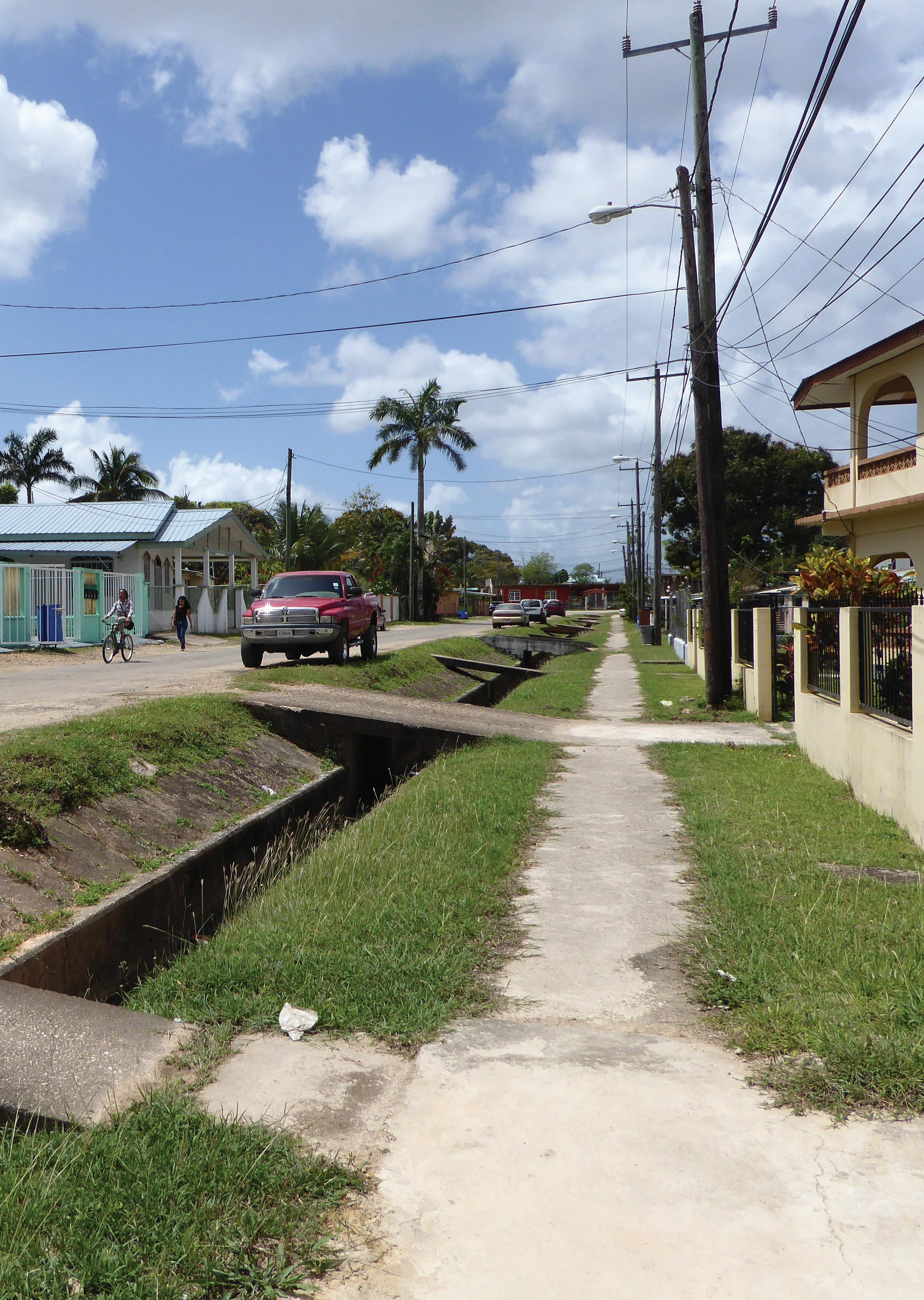
Belmopan (Belize) Belmopan Urban Development, Towards a sustainable garden city
Legal, financial, partnerships and stakeholders review
Objective
Understanding the legal framework of planning at national, sub-national and local level, and the legal steps and requirements to produce and approve the plan.

Having an overview of the availability of funds to finance the development and approval of the plan, and identifying the potential sources of extra funding if there is a gap between budget and available funds.
Identifying critical stakeholders and partnerships for the elaboration and implementation of the plan.
Results
The country's urban legal framework is understood and the gaps are identified. The existing legal enablers, such as national and regional plans, policies and mechanisms, are revised and key legal instruments and gaps are identified.

The regulations for planning approval to be developed are identified.
The existing plans and planning documents are compiled in a database.
The ideal budget for the planning process is determined.
Potential sources of funding are identified. Champions, blockers and defenders of the planning process are identified and a strategy for the engagement of each specific group is defined.
A list of key stakeholders to be involved during the planning process and participatory activities is elaborated.
This activity allows the local government to understand the urban legal framework and the institutional structure of the urban planning system in the country, and which are the existing planning documents, to ensure the alignment between national, regional and local decisions.
This activity also allows the local government to grapple with their financial health summary statistics, to understand how robust the budget is in terms of revenue and expenditures, access to loans or credit markets, financial management of funds, etc.
It is also the starting point of preparing the budget for the elaboration of the plan.
Furthermore, the identification of key urban stakeholders is important to ensure the plan is meeting the expectations of most of the population and can be implemented.
It allows to construct a graphic representation of the social structure considering which is the level of power and interest of a specific stakeholder. The term power refers to the decisional influence related to political or financial roles in the project. While, interest refers to governance or social interest related to territorial belonging, social engagement or secondary interest in the project.
This exercise proposes possible ways for engaging different kinds of stakeholders, considering their position in the chart, and different ways to include community opinions in the process.
24
02 ACTIVITY
recommended 2 weeks Description References SDGs 11.3 16.7 NUA Art. 15 Art. 16 Art. 31 Art.48
1. 2. 3. 4. 5. 6. 7. 8. 9. 10.
Steps Tools
Revise legal documents relevant for urban/spatial planning at national, sub-national and local level.
Gather all planning instruments existing at the national, regional and local scale.
Complete the Urban legislation assessment tool (T2.a).
Make a self-assessment using the planning Law Assessment Framework (T2.b).

Identify available funds and opportunities by filling the checklist (T2.c).
Determine the available budget for the planning process.
Make a list of the stakeholders and identify champions (T2.d).
Identify external actors that can provide assistance (T2.d) by their level of interest.
Conduct a social mapping session (T2.e).
Prepare a short report about the current conditions of the context and the main risks.
T2.a
T2.b
T2.c
T2.d T2.e
Tips
Urban legislation assessment
Planning Law Assessment Framework
Financial assessment checklist
Stakeholders’ matrix
Social mapping session
- Planning Law Assessment Framework ( https://bit.ly/36gNpQm )
- Mater Plan Assessment Tool
- International Guidelines on Urban and Territorial Planning ( https://bit.ly/2wH3Ere )
PHASE 1: ASSESSMENT BLOCK A: CONTEXTUALISATION 25
Self-assessment internal working session
Before the workshop
Block A must be completed.
Decide with the team the relevant participants and elaborate a list.
Fix a date and a place and send an invitation.
Objective
Tailoring a roadmap of steps for the planning process according to the availability of resources in a consultative process with key stakeholders and available experts.
Result
The planning objective and the number of steps activities to be conducted are defined. Suggestion
This activity is recommended to be part of a workshop comprised by a social mapping session and participatory self-assessment session.
Place

Any place freely accessible to everyone and large enough for all fournitures and participants to fit in. Participants
Senior and technical municipal staff from planning, budgeting and economy, legal and regulatory, public works and related departments + key stakeholders (private sector and NGOs), political body of the city.
Roles
The senior staff lead the session.
Documents:
Printed questionnaire.
Printed key findings from
Room & furniture:
per person.
1
set per group.
tables should be placed in order for everyone to see each other as the board.
Pin up board, white board or a blank paper board to be used as a support for writing.
Tools
template
mapping session
City profile document


26
03 WORKSHOP T3 T2.e Self-Assessment
Social
1 day mandatory
1.
2.
3.
Materials 1.
•
One
•
Activity
and 2. One
2.
• The
•
Outcome/output internal PHASE 1: ASSESSMENT BLOCK A: CONTEXTUALISATION


27 Agenda: An agenda of the session should be available for everyone to understand the development of the session. The times are adjustable to the cultural context and the availability of the participants. 08.00 Registration and breakfast 08.30 Opening by the Mayor or the project manager to introduce the planning process 09.00 Personal introductions and expectations of workshop 09.30 Fill the questionnaire collectively 10.30 Coffee break 10.45 Score available resources 12.30 Lunch break 13.30 Drafting the project roadmap 15.00 Discussion and validation 16.00 Closing remarks Details of activities: 1. Assemble key selected stakeholders and prospective team members. 2. Fill the questionnaire collectively. 3. Score available resources. 4. Revise the suggested roadmap with key stakeholders and team members. After the session, the technical team should take some days to prepare the Guiding document and make it available to the participants. PHASE 1: ASSESSMENT BLOCK A: CONTEXTUALISATION
B
B. PROJECT PREPARATION
Project Preparation
the planning process
process
project office
The
block encompasses all preparatory activities to kick-start
after the contextualization block. It starts by setting the goals and objectives of the planning
in a clear guiding document, which also contains the project timeline and budget. Based on the guiding document, resource mobilisation, including procurement and recruitment is completed. Finally, the
responsible for conducting the planning process is established.
4. Guiding document mandatory 3 tools 1 to 5 days 5. Resource mobilisation recommended 1 tool 1-2 weeks 6. Project Office mandatory 1 tool 1-2 days recommended 1 tool 1 day 7. Work Plan discussion between PO and champions
Guiding document04
Objective
Defining clearly the objective and the scope of the planning process, the responsibilities of the project team and partners, if any, the expected deliverables, the timeline, the budget and, optionally, the phases, activities, assumptions, risks and key performance indicators to monitor the planning process.
Results
A guiding document that summarises the framework for the elaboration of the plan is delivered.
Description
To define all the aspects of how the plan should be conducted, a guiding document must be developed. This document could take 3 different shapes: a Terms of Reference, a brief Concept Note or a full project document depending on the capacity available.
The document will gather all relevant information from previous activities developed in Block A It will define the main objective and scope of the project, the composition of the team and its responsibilities, the expected outputs, the timeline, the budget, the communication strategy, etc.
In short, this document will be a validated road map of the planning process. Furthermore, if there is no existing budget allocated, it will help to identify the needs to, later, negotiate the funds.
1. 2. 3. 4. 5. 6. 7. 8.
Steps Tools
Define the objective.
Define the project scope
Contextualise the project area.
Define the planning team. Define the final deliverables.
Define the timeline and phasing of the process. Define the budget.
Write the guiding document using one of the templates, considering the level of detail aimed to reach (T6.a, T6.b, T6.c).
T4.a
T4.b
T4.c
Concept note template
Terms of References (ToR) template
Full project document template
Outcome/output
The ToR document
30
ACTIVITY
mandatory 1-5 days
Resource mobilisation
ACTIVITY
Objective
Mobilising resources through fund-raising, recruitment, procurement and partnerships. Results
Information, physical, financial and human resources are mobilised for the planning process.
Description
recommended 1-2 weeks
Based on the guiding document, a list of available resources, priority and resource to be mobilised is defined, including information and data, human and financial resources.
During this activity, after gathering available resources through internal mobilitisation and partnerships, initiate the procurement and recruitment of equipment and human resources. A prioritisation of resources is strongly recommended and should meet the financial resources available for the planning process defined by the financial resources review in the block A
A fund-raising strategy can be put in place to guarantee the mobilisation of more resources for the plan. Partnership for resource mobilisation can focus not only in financial resources, but also in contributions and technical assistance. It may include different partners, such as regional and national authority, development partners, private sectors, academia and NGOs.
2. 4. 5. 6.
Steps Tools
Mobilise resources from regional and national level such as cartography, data, human resources, technical assistance, training, financial, etc.
Look for support (financial or technical assistance) from development partners, NGOs and private sectors. Contact and mobilise local available resources, experts, contractors, contributors, etc.
Start the procurement of missing critical equipment and physical resources. Start the recruitment to complete the project team based on the guiding document and financial resources.
T5 Terms of References (ToR) template
PHASE 1: ASSESSMENT BLOCK B: PROJECT PREPARATION 31
05
1.
Project Office
Objective
Establishing the Project Office composed by a team of experts and other supporting professionals for the development of the plan.
Results
The Project Office is established, including the selection of the team leader, the definition of an internal organigramme and the organisation of physical facilities.
Description
Once human, financial and physical resources are mobilized, a Project Office should be established. Different roles and sub-teams can be organised to divide tasks considering expertise areas.
The Project Leader and the sub-team focal points should be nominated considering leadership capacity, years of experience, expertise and communication skills.
Finally, the Project Office should be located in a place to ensure and facilitate capacity building and knowledge transfer, to strengthen communication and internal coordination.
1. 2. 3.
Steps Tools
Nominate the Project Leader. Organize the workplace for the development of the plan, using current resources. Develop an organigramme with clear functions of each project team.
T6 List of minimum required expertise.
32
06 ACTIVITY
mandatory 1-2 day
Work Plan discussion between PO and champions
Before the workshop
1. Block B must be completed.
recommended
2. Based on the stakeholders assessment, decide with the team the relevant participants to discuss the work plan.
3. Fix a date and a place and send invitations.
Objective
The objective of this session is to validate with relevant stakeholders and decision-makers a common work plan for the whole process of the project, after setting up the project team and defining relevant stakeholders and experts to be involved during the project process.
Result
The final work plan is revised and completed by champions and decision-makers.
Place
A space that can accommodate group and plenary sessions. Participants
Senior and technical municipal staff from planning, budgeting and economy, legal and regulatory, public works and related departments + key stakeholders (private sector and NGOs) + political body of the city.
Roles
The project team leader leads the session. Materials
1. Documents:
• Printed propositions/option for the work plan. One per person.
• Printed key findings from Activity 4, 5 and 6 One set per group.
2. Room & furniture:
The tables should be placed in order for everyone to see each other as the board.
Pin up board, white board or a blank paper board to be used as a support for writing.
Agenda:
An agenda of the session should be presented by the team leader and made available for all participants to understand the development of the session. The times are adjustable to the cultural context and the availability of the participants.
Steps:
1. Project Office, based on the Guiding document, prepare a work plan.
2. Assemble key selected stakeholders, decision-makers and a project team.
3. Discuss, revise and consolidate the work plan.
4. Submit the final work plan for approval.
After the session, the technical team should take some days to prepare the final work plan and make it available to the participants.
Tools
T4 Guiding document
Outcome/output
Revised work plan
PHASE 1: ASSESSMENT BLOCK B: PROJECT PREPARATION 33
07 WORKSHOP 1 day
closed
C
C. PARTICIPATION SET-UP
The Participation set-up block aims at setting-up a participatory governance structure to support the planning process.
Power, relationships, conflicts and interests are natural elements of planning and decision-making processes. Ensuring participation in the planning process brings awareness to the existing diversity of interests in the social fabric, ensuring balance and provides a platform to overpass such elements.
If a well-organized participatory process is put in place, the implementation of the plan will be enhanced, with a minimum possibility of hindrance of the plan. Moreover, if properly initiated, participation can facilitate public-private partnerships, or at least the clustering of activities and investments, in order to maximise impact with minimum resources. Furthermore, participation can also strengthen the assessment. Desk and field work performed by different government departments could conflict with the point of view of other actors in the city, therefore validation during the analysis and diagnostic activities are crucial. Moreover, the interests of civil society groups, the private sector, academia and other relevant sectors should be addressed in the various steps of the planning process.
Some suggestions to ensure the efficiency of participation in planning are:
• Listen to stakeholders.
• Strengthen the motivation of stakeholders and make them feel like “change agents”.
• Carefully prepare the participatory events and prefer the use of simple tools and terminology.
• Generate “appropriation” of the project by the community by emphasizing the concept of public space as a common good (very important in the case of reactivation of public spaces).
• Emphasize the pedagogical (always explaining the ongoing activity) aspects and therefore always explaining the common goal (very important in the case of urban planning processes).
• Involve women and youth in the process, in any geographical context and at any level of the project.
• Emphasize empathy and trust, as they are key factors for participatory planning.
8. Participation strategy recommended 1 tool 1 week 9. Committees creation and mobilisation mandatory 3 tools 2 days mandatory 2 tools 1 day 10. Public launching with stakeholders
Participation strategy
Objective
Understanding the concept of participation and the different modalities for stakeholders’ engagement during the planning process.
Defining the moments and levels of participation.
Results
The participation strategy is defined.
Description
Based on Activity 2 and the established list of stakeholders, this activity will support the Local Government and the Project Team to determine the recurrence and the levels of participation along the planning process. The spaces, modes and tools for participation will have to be defined. Such as the set-up of an advisory committee, in addition to the steering committee, or the establishment of a public forum, as a platform for decision-making and technical validation; for example.
There are three proposed models of participation; internal (Project Team, Local government and Steering Committee, with key stakeholders), closed (Project Team, Local government, Steering and Advisory Committees, with technical experts, academia, professional associations, and development partners) and open (citizens) and within these models many approaches and methodologies can be applied.
The tools for participation can be public forums, public hearings, workshops, plenary sessions, web platforms, etc.
1. 2. 3. 4. 5.
Steps Tools
Define and validate the moments of the process with open participation Define and validate the moments of the process with external participation Define and validate the moments of the process with closed participation Define and validate the moments of the process with internal participation Establish a road map and a calendar resuming the previous steps.
T8 Participation ladder template
36
08 ACTIVITY
recommended 1 week
Committee creation and mobilisation
Objective
Bringing the stakeholders on board to ensure political commitment. Results
The formation of the Steering and Advisory committees.
Description
mandatory 2 days
The Steering Committee (SC) will perform the role of supporting the project, validating propositions, assessing on other projects that can affect the plan and bring the interests together. While the Advisory Committee (AC) will participate mainly in the plenary sessions and workshops in order to be aware of the process and formulate comments and suggestions on the proposals.
1. 2. 3. 4. 5.
Steps Tools
Make a list of the integrants of the Steering Committee. Make a list of the integrants of the Advisory Committee. Send the NOP letters. Confirm the engagement of the stakeholders. Send the letters of nomination.
T9.a
T9.b
T9.c
Notice of Preparation (NOP) letter
MoU with parties
Letters of Nomination template
Outcome/output
Steering committee and Advisory Committee
PHASE 1: ASSESSMENT BLOCK C: PARTICIPATION SET-UP 37
09 ACTIVITY
Public launching with stakeholders
Description
open
The launching session is part of the communication strategy and aims to introduce the approach to broader public, including city officers, the civil society and the community. The team, the work plan and the expected results are presented to the public.
Before the session
1. Phase 1 must be completed.
2. Define the level of public engagement, decide with the team the relevant stakeholders and elaborate a list of participants.
3. Set a date and a location and send an invitation.
4. Invite the participants and draft an agenda.
5. Prepare the contents to be presented.
Objective
Communicating to the upper level of government and the community the objective of developing an urban plan. Introducing the first elements for the participation process and raising the interest of the community for the plan. Result
The municipal body, the civil society and the community are aware that an urban plan will be developed and how they can engage in that process.
Place
A space that can accommodate group and plenary sessions. Participants
Senior and technical municipal staff from planning, budgeting and economy, legal and regulatory, public works and related departments + steering committee + advisory committee + key stakeholders (private sector and NGOs) + political body of the city + citizens.
Roles
One moderator, one or two rapporteurs. The other members of the technical team support the process.
Materials
1. Documents:
• Printed Guiding Document. A few to be consulted by participants.
2. Room & furniture:
Chairs to allow everyone to sit in and face the board.
Pin up board, white board or a blank paper board to be used as a support for writing.
Agenda:
An agenda of the session should be presented by the team leader and made available for all participants to understand the development of the session. The times are adjustable to the cultural context and the availability of the participants.
Steps:
1. Introduction about the project and the objective of the planning process.
Presentation of the team
Agenda of activities and expected results
Discussion
38
10 SESSION T10.a T10.b Public announcement Presentation template Tools 1 day mandatory
2.
3.
4.
PHASE 1: ASSESSMENT BLOCK C: PARTICIPATION SET-UP
39 PHASE 1: ASSESSMENT BLOCK C: PARTICIPATION SET-UP
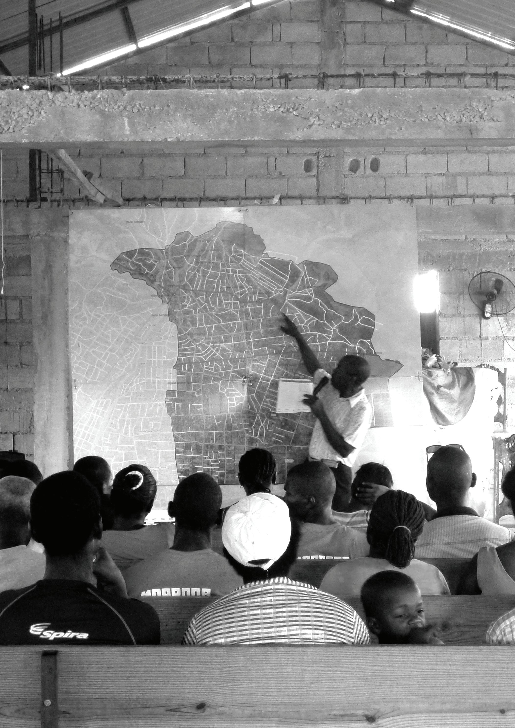
Stakeholder
engagement in Canaan (Haiti), 2016.
D
D. ANALYSIS & DIAGNOSTIC
Urban and territorial analysis and diagnosis is where key evidence is collected to set the foundation for the choices and decisions to be made by the stakeholders throughout the planning process. As planning is evidence-based, it is in the diagnostic phase of the cycle that an understanding of the context’s development, challenges and opportunities can be acquired. Also, urban and territorial diagnosis aims at developing a ‘spatial portrait’ through a shared understanding and recognition of the territorial challenges and opportunities in a given or chosen planning area, from transboundary to the neighbourhood level.
The analysis could be processed through different tools such as a field analysis of strengths, weaknesses, opportunities and challenges (SWOT), surveys, mapping and analysis of existing or new data - often aggregated in a Geographic Information System (GIS).
This block will also pay particular attention to the participation process, proposing various activities for the population to be included in the process. Mainly during the data gathering, as the communities have a great knowledge of their surroundings. Concluding with a workshop to identify the main issues the city is facing and its opportunities for future development.
11. Desk research mandatory 2 tools 1 week
12. Field research recommended 4 tools 1-2 weeks
13. Analysis mandatory 10 tools 3-6 weeks
& Diagnostic workshop
days
tool
weeks
tools
mandatory 1
1-4
14. Analysis
15. Diagnostic mandatory 3
1-2
Desk research
Objective
Review and understand all existing plans, strategies and policies, and collect and compile all existing data (spatial, qualitative and quantitative) in order to have an initial baseline to kick-start the analysis.
Results
Discursive, non-spatial, and spatial information and understanding of the current context of the city in terms of economic, social political, cultural and environmental elements are reached.
Description
The desk research activity will consist of data collection of the current context of the city. The objective is first to review and understand all existing plans, strategies and policies, and second, to collect and compile all existing data (spatial, qualitative and quantitative) to systemize them in order to have an initial baseline to kick-start the analysis.
This data will become the input for the iterative design process through which the interpretation, analysis and solution is developed.
Steps
1. 2. 3.
Collect secondary data T11.a:
a. Desk research.
b. Literature review (existing plans, strategies, policies, reports, census, etc).
c. Open sources (openstreetmap, etc).
Complete the checklist (T11.b).
Select and verify with the steering committee and municipal relative departments.
Tools
T11.a
T11.b Desk research guidelines Checklist Data & Base map
Tips
GIS Handbook
municipalities
42
11 ACTIVITY
mandatory 1 week
-
for
( https://bit.ly/384j8F6 )
ACTIVITY
Objective
Field research
recommended 1-2 weeks
Collecting and producing all the relevant data needed to complete the desk research. Compiling the collected data and spatializing the relevant one.
Results
Sets of data are completed and classified by types and scales. The information obtained during the fieldwork is understood and integrated in order to complete the critical investigation, design and planning strategy development, and to elaborate on a strategic approach planning (SAP).
Description
If resources and existing data are limited, a primary data gathering is suggested/ recommended through organizing community activities, surveys and site studies in order to complete and validate the data while the analysis is ongoing.
Based on Activity 5, the data collection should be oriented in coherence with the plan’s objective. For example, if the objective is to focus on a particular sector, the accent should be put on gathering and creating more detailed data on the specific topic. It must be relevant to develop surveys or conduct interviews to acquire updated and clear data. Furthermore, the collection should also take into account the city’s particular context as it can be the case of coastal areas, presence of informal settlements, predisposition for tourism, vulnerability to climate change, and thematic areas relevant to the specific context.
Furthermore, the approach will gradually investigate through defining and redefining, building and rebuilding an incremental understanding of the city.
1. Steps Tools
Complete the data with primary data: field visits, drone and satellite images, interviews, surveys, community data, etc. (T12.a, T12.b, T12.c and T12.d)
T12.a
T12.b
T12.c
T12.d
Tips
Reconnaissance survey
Matrix of Functions (MoF)
Data gathering list
Participatory Incremental Mapping tool (PIM tool)
- GIS Methodology
- GIS Handbook for municipalities ( https://bit.ly/384j8F6 )
- UN OCHA/KoBoToolbox ( https://bit.ly/2pwdfzg )
PHASE 1: ASSESSMENT BLOCK D: ANALYSIS & DIAGNOSIS 43
12
Analysis
Objective
Understanding how the current urban fabric is structured and identifying the relevant path and edges (administrative and natural) determining the urban morphology. Identifying the key nodes of the city which hosts the important landmarks and the different zones the existing city is divided into.
Understanding how the city relates with its rural surroundings and how the city is connected to other cities and human settlements. It helps in identifying how the city is positioned in the territory and the broader system of cities in terms of hierarchy, role and area of influence.
Results
An existing spatial structure of the city as a spatial diagram highlighting the key elements structuring the city (paths, edges, nodes, landmarks and zones), expressing a schematic, yet precise, configuration of the existing city.
The urban-rural and urban-urban linkages as a spatial diagram identifying the position of the city in the broader system of cities and the main cities and human settlements interacting with it. Also, identifying schematically the area of influence of the city (hinterland), based on socio-economic and environmental linkages.
Description
This activity comprises a comprehensive urban analysis of the different scales (national, regional, local and citywide), looking at the qualitative, quantitative and spatial data. The analysis of the first two scales (national and regional) aims to understand the larger context the city is positioned in. Then, at the local and city-wide scale the study will bring up the challenges of the urban area and the concerns and aspirations of the communities and ground check them with the result of the higher scale’s analysis and diagnostic. The analysis will be the base of the diagnostic and the set of recommendations.
As Activities 11 and 12, the analysis should be oriented in coherence with the plan’s objective and the city’s particular context. It should be deeply conducted on especial sectors the plan will address and on specific contexts judged as key during the contextualisation (Block A).
The spatial structure of the city informs the current pattern of urban growth of the city and how the urban fabric is currently structured.
The elements defining the urban spatial structure are: (i) paths: elements connecting the spatial structure; (ii) edges: elements interrupting the spatial structure; (iii) landmarks: a single element relevant to/in the spatial structure; (iv) nodes: areas hosting a concentration of functional landmarks and where paths are converging to; (v) zones: areas containing similar dynamics in the spatial structure
Urban-urban and urban-rural linkages are defined as the interdependency of “the reciprocal and repetitive flow of people, goods and financial and environmental services between specific rural, peri-urban and urban locations; they are the reality of socio-spatial arrangements, creating places with distinct yet interwoven, socially constructed identities”. (UN-HABITAT, 2019)
44
13 ACTIVITY
mandatory 3-6 weeks
References SDGs 11.2 11.3 11.7 11.a
Steps
1. 2. 3. 4. 5. 6. 7. 8. 9. 10. 11.
Prepare the spatial analysis.
Prepare the quantitative analysis.
Prepare the qualitative analysis.
Calculate the population projection.
Organize a participative mapping session.
Produce analysis related to key findings/topics sectors depending on the context (GIS analysis).

Identify the relevant paths and edges of the city.
Identify the key nodes and important landmarks in and around the city.

Identify the linkages between the city and its surrounding and the place of the city in the broader system of cities, at regional, national and crossboundary levels if relevant.
Write a first report bringing together the results of the analysis.
T13.a T13.b T13.c
T13.d T13.e T13.f T13.g T13.h
Tools Tips
Matrix of Functions (MoF)
GIS methodology
Calculation of existing uses Population projections
Participatory Incremental Mapping tool (PIM tool)

Watershed boundary mapping
Origin-destination survey
Socio-economic Linkages Assessment
- GIS Handbook for municipalities ( https://bit.ly/384j8F6 )
- GIS Methodology
Outcome/output
An report of the analysis
Don't forget to include the cross-cutting issues of urban planning (social inclusion, resilience and safety) and the guidelines of the New Urban Agendan and the Sustainable Development Goals.

PHASE 1: ASSESSMENT BLOCK D: ANALYSIS & DIAGNOSIS 45
Analysis & Diagnostic workshop
Before the workshop:
1. Activities 11, 12 and 13 must be completed.
2.Decide with the team the relevant participants and elaborate a list.
3. Fix a date and a place, send an invitation.
4. Prepare the contents to be presented (a presentation with the results of the analysis T14.a) Objective
The objective of this workshop is to identify the key challenges faced by the city with the participation of the concerned population and stakeholders identified during the assessment.
Results
• The analysis made by the technical team should be validated by the participants to certify that the data and its interpretation is correct.
• By acknowledging the analysis, the participants should be able to identify the main challenges the city is facing, and those to be addressed.
• Following a SWOT analysis the participants will be able to identify the Strenghts, Weaknesses, Opportunities and Threats of the city.
• Lastly, after a presentation of the recommendations of UN-Habitat for sustainable urban development, the participants will be able to make a recommendation for their own city.
Place A space that can accommodate group and plenary sessions.
Participants Technical team + steering committee + advisory committee + political body of the city Roles
One moderator, one or two rapporteurs. The other members of the technical team support the process.
Materials
1. Maps & documents:
• Printed base map(s) and aerial image(s) of the municipality at reasonable scale (suggested 1:5000) and size (suggested A1 or double tabloid). One set of maps and aerial images per group.
• Existing planning documents, upon availability. To be exposed for everyone to see them.
• Set of photos considered useful to illustrate the area of study. One set of photos per group.
2. Drawing & sketching tools
• Rolls of tracing paper of sufficient size to sketch on top of the maps (80cm roll for A1 or double tabloid). 2 rolls per group. Make sure the paper is actually transparent.
• Thick drawing pens for sketching in basic colours: black, light green, light blue, red, yellow, brown, orange. One set of colours per group.
• Black fine liners and pencils. 2-3 per group.
• A stack of white A3 or tabloid paper. To distribute upon needs.
• Coloured paper to pin up notes and ideas. For the technical team.
• Rulers of sufficient length (80cm) to measure distances.
• Some cardboard and scissors.
3. Other technical equipment
• A video projector of reasonable quality (minimum resolution 1024px, better higher), bright enough to
46 PHASE 1: ASSESSMENT BLOCK D: ANALYSIS & DIAGNOSIS 1-4 days mandatory closed
14 WORKSHOP
see also in non-darkened rooms. A sufficiently large white surface to project on. Upon availability in the municipality. It will be used to project the results of the analysis and the recommendation for sustainable urban development.
• Sufficient plugs and extension cords for the laptops. Upon availability in the municipality. It will be used to connect to the projector.
• The analysis printed on paper in a sufficient size to be seen by everyone. If there is no availability of projector/laptops. A light projector can also be used.
4. Room & furniture
• Tables of sufficient size to put the plans on them arranged as ‘islands’. One island per group, which is accessible from all four sides. No tablecloth.
• Pin up board, white board or a blank paper board to hang or draw the results of the work on the walls. Pins or adhesive tape for pinning up and markers for drawing.
Agenda: An agenda of the session should be presented by the team leader and made available for all participants to understand the development of the session. The times are adjustable to the cultural context and the availability of the participants.
Registration 08.45 Opening by the Mayor or the project manager followed by a presentation of each participant 09.00 Plenary session: Validation of the analysis 11.00 Coffee break 11.30 Discussion group: Identification of challenges 13.00 Lunch break 14.00 Presentation of the recommendations for sustainable urban development and questions
Validation of the structure of the city (PIM tool exercise)
The workshop will initiate with a mapping exercise
aims at understanding the dynamics and identifying the structure of the city. Experts from various
be divided into groups of 4-6 persons and will provide inputs and validation on the base maps (see PIM tool).
2. Validation of the analysis
Following the base maps validation, the moderator will present the status of the sectoral analysis done previously. Participants will therefore provide their comments and inputs to build upon the existing analysis. A validation session will take place afterwards to finalize the analysis report.
3. Identification of challenges (discussion group)
The technical team conducts a SWOT analysis and maps constraints, potentialities and challenges (CPC mapping tool). The participants are divided in heterogeneous groups, aggregating people with different background. Each group decides who is going to be the rapporteur.
technical team explains to each group what is expected from the activity.
47 PHASE 1: ASSESSMENT BLOCK D: ANALYSIS & DIAGNOSIS
08.30
15.00 Discussion group: Elaboration of the recommendations for the future plan 16.30 Closing remarks Details of activities: 1.
which
backgrounds will
The
The participants identify on a base map the constraints, the potentialities and the challenges and write them as strengths and weaknesses in the SWOT matrix.
At the end of the activity, each reporter exposes to the assembly the results of the group discussion. The rapporteur writes on the board, common and agreed elements what comes out of each table. Following this, all groups agree on common CPC faced by the city, and locate them spatially. Groups in a plenary session identify opportunities and threats and include them in the SWOT matrix. Note that, since these are external factors, sometimes they cannot be spatially mapped. However, this could be a good exercise.
4. Recommendations (discussion group)
The technical team presents the recommendations for sustainable urban development to all the participants. After understanding them, the participants are divided in heterogeneous groups, aggregating people with different background. Each group decided who is going to be the rapporteur.
The groups write down the recommendations they wish to make for the elaboration of the plan.
At the end of the activity, each rapporteur exposes to the plenary the results of the group discussion. The notetaker and the technical team lead the conversation and the recommendations are agreed between all before being compiled.
After the session, the technical team should take some days to prepare the final report and make it available to the participants.
48
T14.a T14.b T14.c Presentation template SWOT analysis Contraints Potentialities Challenges mapping tool (CPC) Tools
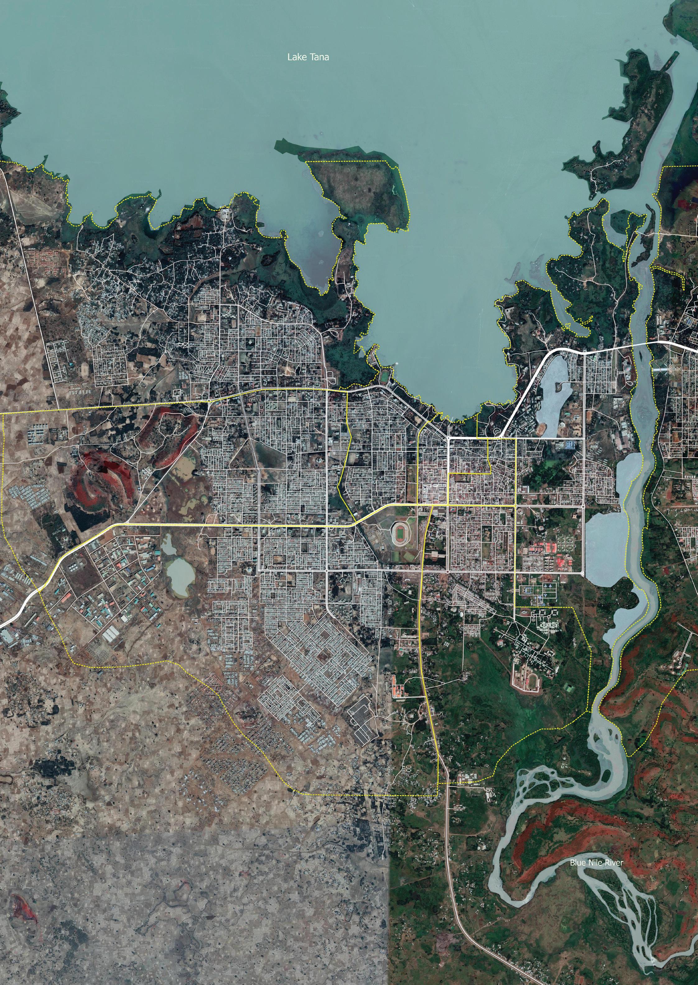
49 PHASE 1: ASSESSMENT BLOCK D: ANALYSIS & DIAGNOSIS
Satellite image of Bahir Dar (Ethiopia) Support of the Sustainable Structure Plan of Bahir Dar
Diagnostic
Objective
Identifying key constraints, potentialities and challenges of the city and in its spatial structure.
Results
A Constraint map and a Suitability map are elaborated. The constraints, opportunities and challenges are identified.
Based on the analysis previously done and the workshop session, a series of main issues and opportunities for the development of the city were identified through mapping exercise and SWOT analysis. Strengths and opportunities of the area are evaluated, and main challenges according to each sector are prioritized.
Finally, a diagnostic will be established to provide a schematic view for integrated assessment of the territory. A constraint map will aim at summarizing all the most critical features identified during the analysis and identification of challenges.
The constraint map will allow to spatially translate the main challenges faced by the city. Critical features from each sector analysis will be overlayed in order to understand the real dynamic of the city and where the challenges are of a high priority.
Prior to conducting any sort of planning assumptions and based on this constraints mapping, it is important to define the buildable and non-buildable areas.
This macro zoning plan sets out the basis of the future development of the area in terms of where development can happen and where it is limited.
The suitability map aims at identifying the zones that are going to be buildable or not buildable (constraint areas) and the ones that must be protected. Adding up the actual built area, it allows visualizing the delimitation of urban areas, extension areas and land not suitable for urbanization (protected and preserved areas, areas at risk, etc) and it will serve as a reference for the implementation of future public and private investments.
50
15 ACTIVITY
mandatory 1-2 weeks Description
1. 2. 3. 4. 5. 6. 7. 8. 9.
Further elaborate on identifying the challenges, issues and opportunities of the city - internally with the planning team.
Prepare the diagnostic - internally with the planning team.
Elaborate on the recommendations for the future plan - internally with the planning team.
Compile the results of the workshop and the internal findings and prepare the final diagnostic.
Map the constraint areas (slope, flooding, risk, etc.) From the constraints map identify constraints areas, such as non buildable land.
Map the areas to be preserved (natural spaces, agricultural land, forests, etc.).
Map the existing built up area.
Produce the suitability map.
Conduct a validation meeting with the steering committee.
T15.a T15.b
T15.c
T15.d
Steps Tools Tips
Contraints Potentialities Challanges mapping tool (CPC)
PESTLE analysis
Constraints map
Suitability map
- International Guidelines on Urban and Territorial Planning ( https://bit.ly/2wH3Ere )
- A new strategiy of sustainable neighbourhood planning: Five Principles ( https://bit.ly/2KDr8mQ )
Outcome/output
A report with the analysis and the diagnostic.
Don't forget to include the cross-cutting issues of urban planning (social inclusion, resilience and safety) and the guidelines of the New Urban Agendan and the Sustainable Development Goals.
PHASE 1: ASSESSMENT BLOCK D: ANALYSIS & DIAGNOSIS 51
PLAN
PLAN
NEIGHBOURHOOD PLANS
Where do we want to go?
The objective of the second phase is to develop the following plans; - First, a strategic plan will be formulated to give the further structure plan a strategic framework which highlights the vision of the city for its next urban planning period (15, 20 or 30 years, for example).
- Second, a spatialised framework, the conceptual plan, illustrating the conceptual layout and the main ideas advocated by the plan will be developed.
- Third, the structure plan will identify the main uses per zone and the location of the infrastructure.
The three planning processes will be supplemented with workshops to ensure the participation of the community in this process of decision-making.
02 PLAN BLOCK E _ STRATEGIC PLAN BLOCK F _ CONCEPTUAL PLAN BLOCK G _ STRUCTURE PLAN BLOCK H _
E
This block aims at defining a participatory vision, goals, targets and indicators for the Strategic plan of the city, which is the guiding document for the development of the conceptual plan and structure plan. The strategic plan should be developed following the methodology for the localization of the urban SDG targets at the municipal level. This methodology has been successfully applied in over 10 countries and 20 cities, to support the alignment of national priorities and plans with the local priorities, as well as the international agenda reflected by the SDG’s.
This block is developed through a participatory methodology, as part of a strategic planning workshop/ visioning exercise workshop during which, the vision, goals , targets and indicators for the city are set.
E. STRATEGIC PLAN 17.
16. Strategic development scenarios recommended 1 tool 2 days
18.
19. Monitoring & Evaluation plan
Spatial Strategy recommended 1 tool 1 week mandatory 3 tools 1-2 weeks
Visioning Workshop mandatory 1 tool 4-5 days
Strategic development scenarios
Objective
Identifying the tendencies of development and building strategic development scenarios for the City. Results
At least three strategic development scenarios are built. The developed scenarios emerge from the outcome of the TWOS matrix:
1. current tendencies scenario (without major impact from opportunities or threats - prognostic or realistic). 2. optimistic scenario ( developed based on maximizing opportunities and minimizing threats). 3. pessimistic scenario ( developed based on maximizing threats and minimizing opportunities).
Description
Building strategic development scenarios for the city helps in forecasting different possible futures for the city. Those scenarios will allow to identify strategic alternatives based on opportunities and threats which can affect the development of the city.
Based on the results from the analysis and the diagnostic (Activities 13, 14 and 15), various assumptions are established to develop optimistic, realistic and pessimistic scenarios. This activity should be developed together with selected stakeholders, through workshops, interviews or closed meetings.
Define and organise engagement modalities to develop potential scenarios.
2. 3. 4.
Identify a realistic scenario based on current tendencies and predictable opportunities and threats. Conduct a TWOS analysis with participants. Based on the results provide two different scenarios : a. focusing on the optimistic tendencies (SO + WO) b. focusing on the pessimistic alternatives (ST + WT).
56 TWOS strategic alternatives
16 ACTIVITY
1.
recommended 2 days
T19 Steps Tools
“A strategic vision shapes a preferred future for the city. Many of the issues affecting cities partially stem from the lack of comprehensive strategic planning before making spatial decisions. Spatial planning is enriched if it is linked with a vision for the future that is holistic and is legitimized if this vision is collectively held. A successful vision has a spatial dimension that reflects a city’s unique cultural and physical traits; it provides direction for the activities of all stakeholders, encourages them to work cohesively and ensures everyone is working towards the same goal.” - United Nations Human Settlements Programme (UN-Habitat) (2014) Urban Planning for City Leaders. 2nd Edition, Nairobi, Kenya.
PHASE 2: PLAN BLOCK E: STRATEGIC PLAN 57
Workshop Ankara (Turkey) Prosperity Fund Global Future Cities
Visioning Workshop
Description
The Vision is as a statement of the desired long-term (10 years or more) development aspiration of the city based on opportunities and comparative advantages related to its specific conditions. The purpose of setting a vision is to set a trigger which creates opportunities and methods by deconstructing obstacles at single points. These points act as permeable elements into developing transformation in the current context. The permeable elements focus and depend on socio-spatial interactions that take place in different areas on different scales. Therefore enabling social mobilization towards the attainment of the desired interest, and enabling spatial transformation in the foreseeable future.
The vision should be accompanied by goals and targets that aim to achieve it and by indicators to measure the progress of the strategies.
Before the workshop
1.Conduct an internal exercise with the team members to elaborate on some options for the vision.
2. Fix a date and a place.
3. Elaborate on the list of participants and send an invitation to the steering committee.
4. Prepare matrix of reference for global agendas and regional, national and subnational strategies.
5. FInalise the revision of national strategies and regulations.
6. Prepare a presentation with previous materials of analysis and diagnostic (base maps, challenges, etc.).
Objective
Setting a shared Vision which is supported by Goals and SMART Targets.
Results
• The plan possesses a shared vision which emerges from the participatory involvement and consultation of key stakeholders at various levels.
• The vision is accompanied by goals, strategies and indicators.
Place
A space that can accommodate group and plenary sessions.
Participants
Technical team + steering committee + key stakeholders + the political body of the city Roles
One moderator, one or two rapporteurs. The other members of the technical team support the process.
Materials
1. Maps & documents:
• Printed base map of the area of study, at reasonable scale (suggested 1:5000) and size (suggested A1 or double tabloid). One map per group.
• A short document with key elements from the international urban planning framework. One per person.
• A digital presentation of the international urban planning framework, to be presented at the beginning of the workshop.
• A document with the final SWOT/challenges map and the recommendations resulting from the first workshop.
2. Drawing & sketching tools
• Rolls of tracing paper of sufficient size to draw on top of the map (80cm roll for A1 or double tabloid).
2 rolls per group. Make sure the paper is actually transparent.
58 PHASE 2: PLAN BLOCK E: STRATEGIC PLAN 4-5 days mandatory closed
17 WORKSHOP
• Thick drawing pens for sketching in basic colours: black, light green, light blue, red, yellow, brown, orange. One set of colours per group.
• Black fine liners and pencils. 2-3 per group.
• A stack of white A3 or tabloid paper. To distribute upon needs.
• Coloured paper to pin up notes and ideas. For the technical team.
• Some cardboard and scissors.
3. Other technical equipment
• A video projector of reasonable quality (minimum resolution 1024px, better higher), bright enough to see also in non-darkened rooms. A sufficiently large white surface to project on. Upon availability in the municipality. It will be used to project the presentation and later, the vision.
• Sufficient plugs and extension cords for the laptops. Upon availability in the municipality. It will be used to connect to the projector.
• The proposals printed on paper in a sufficient size to be seen by everyone. If there is no availability of projector/laptops. A light projector can also be used.
4. Room & furniture
• Tables of sufficient size to put the maps on them arranged as ‘islands’. One island per group, which is accessible from all four sides. No tablecloth.
• Pinup board, whiteboard or a blank paper board to hang or draw the results of the work on the walls. Pins or adhesive tape for pinning up and markers for drawing.
Tips
- International Guidelines on Urban and Territorial Planning ( https://bit.ly/2wH3Ere )
- City Prosperity Initiative ( https://bit.ly/2ZcA62w )
- Sustainable Development Goals Acceleration toolkit ( https://bit.ly/2iVW5HF )
Outcome/output
A vision for the city. A report with the strategic plan.
Agenda:
agenda of the session should be available for
to understand the development of the session.
can be conducted during one whole day or split into two half days. The times are adjustable to the cultural context and the availability of
59 PHASE 2: PLAN BLOCK E: STRATEGIC PLAN
An
everyone
It
the participants. DAY 1: Define shared and consensual VISION and identify key issues for the City’s Plan 08.30 Registration 08.45 Opening by the Mayor or the project leader followed by presentation of each participant 09.00 Introduction on Strategic planning and internation framework of Sustainable urban development 10.30 Coffee break 10.50 Discussion groups: Sustainable Urban Development 6P’s. Which are the main issues? 11.45 Group presentations and open discussion 12.30 Lunch break 13.30 Plenary session: Which other issues should be also adressed? 15.00 Coffee break 15.00 Discussion groups: Which VISION for the City's Sustainable urban development? 15.45 Plenary session: forging a shared vision 17.00 Closing remarks
DAY 2: Establish VISION, enabling GOALS and linking them to national strategies and global agendas
08.45 Registration
09.00 Discussion groups: linking main issues and shared VISION 10.30 Coffee break
10.50 Plenary session: presentation of group activity and open discussion 11.30 Discussion groups: defining GOALS based on the VISION and the main issues 12.30 Lunch break 13.30 Plenary session: presentation of group activity and open discussion 14.15 Discussion groups: refining GOALS and setting a timeframes 15.10 Coffee break 15.30 Discussion groups: selecting relevant INDICATORS from national and global agendas
16.15 Plenary session: presentation of group activity and open discussion 17.00 Closing remarks
DAY 3: Setting a SMART TARGET, a MONITORING FRAMEWORK and identify the NEXT STEPS
08.45 Registration
09.00 Introduction on how to formulate a SMART TARGET
09.30 Discussion groups: How could your GOALS be divided into TARGETS?
10.30 Coffee break
10.50 Plenary session: presentation of group activity and open discussion 11.40 Discussion groups: refining the TARGETS and setting a timeframes 12.30 Lunch break 13.30 Discussion groups: setting BASELINE, FREQUENCY and MEANS of VERIFICATION 14.15 Plenary session: presentation of group activity and open discussion 15.10 Coffee break 15.30 Final presentation of workshop process and result 16.15 Plenary session: identifying gaps and next step, agreeing on a work plan 17.00 Closing remarks
Steps:
Conduct a short capacity Development
Create 6 groups following
peace and Planning.
the analysis
common core values
up a common vision,
the Goals.
the
up measuring baselines
means of verification
the session,
technical team
targets, etc).
Sustainable Urban Development, 6p’s: People, Planet, Partnerships,
on
framework
days
final report and make it available
60
1.
(SMART
2.
the
Prosperity,
3. Present
and diagnostic conducted previously. 4. Define
per group. 5. Set
based
legal
documents' matrix. 6. Identify
7. Link
indicators to the goals. 8. Aggregate indicators to set up targets. 9. Set
for the targets. 10. Identify
and frequency for indicators. After
the
should take some
to prepare the
to the participants. PHASE 2: PLAN BLOCK E: STRATEGIC PLAN
61 PHASE 2: PLAN BLOCK E: STRATEGIC PLAN
Visioning workshop for the Sustainable Urban Development Framework for Sao Tome Island 2035.
Spatial Strategy
Objective
Identifying strategic and catalytic projects linked to targets and spatialised them by goals.
Results
week
At least one map per goal identifying and locating all strategic and catalytic projects in the territory of the city.
Following the visioning workshop session (Activity 17) with relevant stakeholders, goals and targets are set to enable the accomplishment of the shared vision for the future of the city. The existing and future projects are also identified and prioritised according to a timeframe, linked to the timeline of global agendas and national strategies.
As a next step in the elaboration of the strategic plan and in order to spatially translate goals, a series of strategic and catalytic projects, aligned with the Sustainable Development Goals and New Urban Agenda, will be defined for each target and finally aggregated by goal.
The results of the visioning workshop should be translated into a series of maps including the strategies and linking the catalytic and strategic projects to the goals.
Description Steps
Identify existing and future strategic and catalytic projects. Classify projects according to established timeframe (short, medium and long term). Link projects to Goals.
Produce a map for each goal localizing the strategic and catalytic projects and main recommendations.
62
18 ACTIVITY
1. 2. 3. 4. recommended 1
Monitoring & Evaluation plan


Objective
Monitoring the goals and target set to evaluate the advancement of the strategic plan. Results
A monitoring and evaluation plan is finalised.
Description
mandatory 1-2 weeks
A monitoring and evaluation plan is an important tool to ensure the goals and targets are being achieved, leading the city towards a more sustainable future.
By setting indicators, the government will be able to evaluate the progress made thanks to the different policies and regulations established to reach the vision.
The targets and indicators should be ambitious but still reachable. Furthermore, based on the goals compliance, it will allow the government to undertake an actualization of the strategies to improve the plan’s implementation.
1. 2.
Steps Tools
Identify relevant the indicators based on the results of the previous activities of Block E Set means of verification, frequency and intermediate targets for evaluation, based on selected milestones.
T19.a
T19.b
T19.c
Matrix of Reference Key performance indicators
Baseline, frequency & means of verification worksheet template
Don't forget to include the cross-cutting issues of urban planning (social inclusion, resilience and safety) and the guidelines of the New Urban Agendan and the Sustainable Development Goals.
PHASE 2: PLAN BLOCK E: STRATEGIC PLAN
19 ACTIVITY
63
Cross cutting issues checklist
Social inclusion
Human rights:
Does the STRATEGIC PLAN ensure that:
The most vulnerable groups are not engaged incidentally but are specifically targeted. Urbanization is human rights based, and living conditions are improved for all by making sure everyone’s human rights are comprehensively protected and promoted.
It reaches those who are furthest behind first by placing power relationships in human settlements at the heart of its analysis and action, to address inequalities and discrimination.
Everyone has the right to an adequate standard of living, including the right to adequate housing and the right to water and sanitation; and by doing so it facilitates the achievement of interrelated rights, such as the right to health care and education. Related principles, such as non-discrimination and equality, access to information, participation, accountability and the right to a remedy are also of key importance.
Gender:
Does the STRATEGIC PLAN ensure that:
People have the right to an effective participation without discrimination against individuals because of their gender, gender identity or sexual orientation.
Children, youth and older persons:
Does the STRATEGIC PLAN ensure: Age- and gender-responsive access to housing, urban basic services, public spaces and infrastructure, and the overall benefits of urbanization.
Disability:
Does the STRATEGIC PLAN ensure that:
The rights of persons with disabilities, including accessibility and universal design, are promoted, respected and protected.
Resilience:
Does the STRATEGIC PLAN ensure that:
The city is able to maintain continuity through shocks and stresses, whether natural, such as earthquakes, or human-made, such as rapid population flows as a result of armed conflict, while adapting positively and transforming towards sustainability.
The focus is put on building the resilience of the city and of its people, communities, institutions, environments and infrastructure systems, as well as identifying additional action that can be undertaken to prepare for, react to and recover from hazards.
The focus is put on infrastructure to adapt to climate change, and on ensuring the inclusion of marginalized and informal communities in adaptation to climate-related shocks, building on their organizational capacity and support mechanisms.
Safety:
Does the STRATEGIC PLAN ensure:
Overall improved urban living conditions, social inclusion, reduction of inequality, and eliminating social and territorial exclusion patterns.
64
65
Plenary session in Conakry (Guinea), 2019.
F
F. CONCEPTUAL PLAN
The Conceptual Plan block builds up on the Analysis & Diagnostic and Strategic Plan blocks to develop a spatialized conceptual framework illustrating the conceptual layout and the main ideas advocated by the plan. The conceptual plan is schematic and focuses on communicating the principles affiliated with the plan to non-experts and the general public. It starts by selecting the key sustainable urban development principles which will guide the plan and focus on developing a conceptual boundary, a conceptual structure and conceptual mixed-use scheme. Even though the conceptual plan does not fully reply to all requests of the statutory planning, it can provide important information for the urban management of cities with lower technical capacity. The conceptual plan can be regulated as a basic plan for small cities by the urban perimeter regulation and the conceptual zoning regulation, with a specific implementation strategy which includes an action plan and selected operationalization tools, depending on the implementation capacity of the city administration. It is the foundation for the further development of a Structure Plan.
Sustainable Urban Development principles
days
tools
week
structure
Conceptual planning workshop
Conceptual urban management boundary mandatory
days
tools
hearings
mixed-use planning
Strategy optional
weeks
tools
20.
recommended 2
2-4
21.
mandatory 1 tool 5 days 22.
3
2-4
mandatory 1 tool 1
23. Conceptual
24. Conceptual
mandatory 1 tool 1 week 26. Public
mandatory 2 tools 1 day 25. Implementation
10
1-2
Sustainable Urban Development principles
Objective
recommended 2-4 days
Defining the key sustainable urban development principles which will guide the planning process. Results
Three spatial development scenarios and the definition of key principles for the planning process.
Description
As a first action to develop the conceptual plan, the planning team should define sustainable development principles which will ensure the optimistic spatial development scenario of the city, and to reach the vision defined earlier.
These principles must be linked to important guidelines for sustainable urban development, such as the NUA and the International Guidelines for Urban and Territorial planning. Also, UN-Habitat promotes a 5 principles approach for sustainable urban development of neighbourhood.
1. 2.
Review national / international urban standards. Define the standards that align with the vision and the strategies from Block E.
T20.a
T20.b
Steps Tools Tips
New Urban Agenda (NUA)
International Guidelines for Urban and Territorial Planning (IG-UTP)
- A new Strategy of Sustainable Neighbourhood Planning: Five Principles (https://bit.ly/2RVayT6)
68
20 ACTIVITY
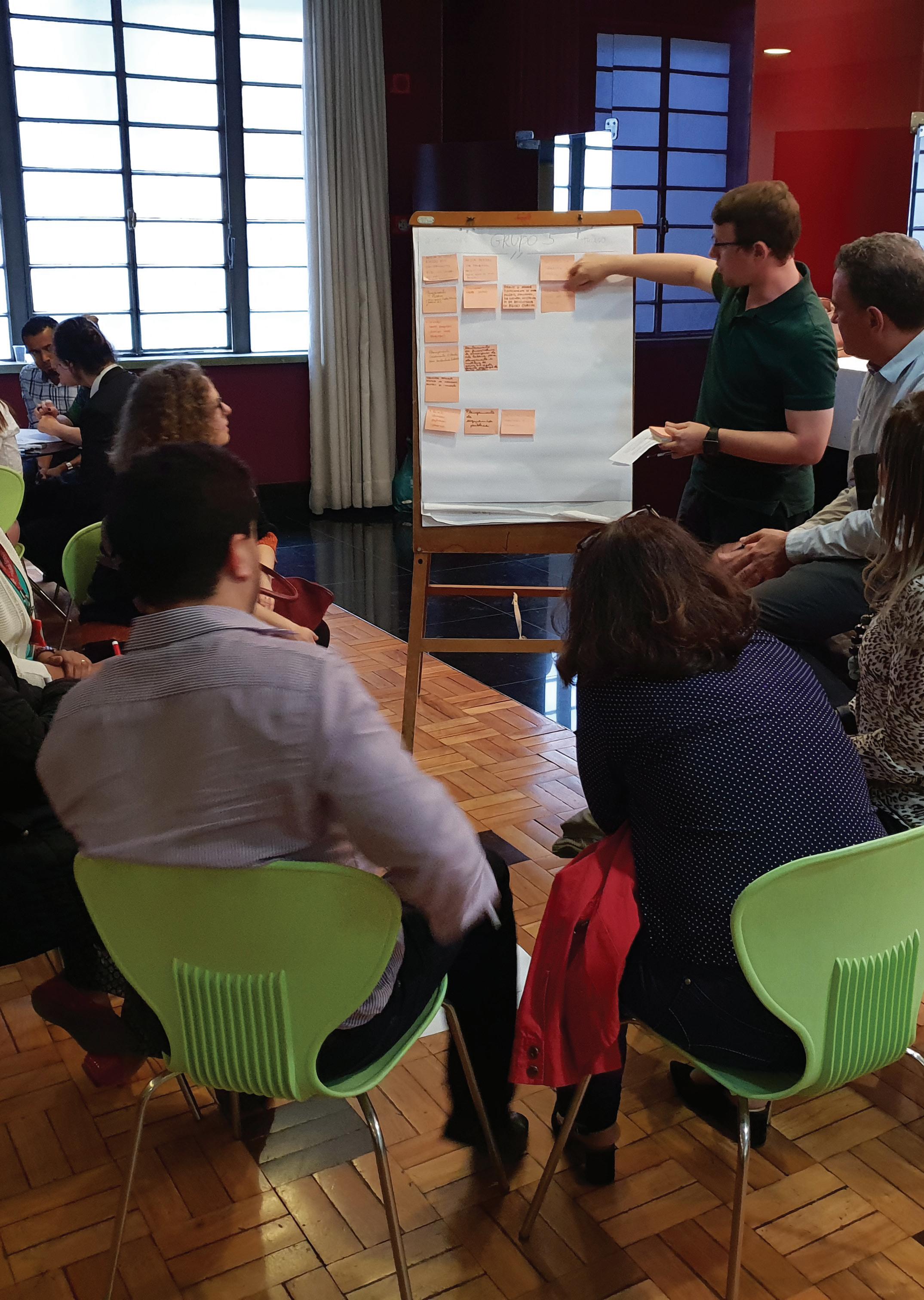
PHASE 2: PLAN BLOCK F: CONCEPTUAL PLAN 69
Workshop in Bello Horizonte (Brazil) Prosperity Fund Global Future Cities
WORKSHOP
Conceptual planning workshop
Before the workshop
1. List of agreed sustainable urban development principles defined previously in activity..
2. Prepare PPT with the spatial development scenarios previously developed and vision and goals defined during the previous workshop
Objective
Facilitating a participatory conceptual planning process which is intervention-oriented and facilitates policy implementation at local level. It proposes a simplified land classification process which can be tailored to local context and national statutory planning system.
Result
A conceptual smart mixed-use plan is defined based on an intervention-oriented land classification. Furthermore, based on assets and potentialities of the territory, special zones for policy implementation at local level are identified. Integrated density strategy is defined together with a specific incentive-oriented implementation strategy, based on selected operationalisation enablers.
Place
A space that can accommodate group and plenary sessions.
Participants
Technical team + steering committee + key stakeholders + the political body of the city Roles
One facilitator, one or two note takers. TThe other members of the technical team support the process. Materials
1. Maps & documents:
• Base maps with the current structure of the city
• Analysis developed previously, highlighting landmarks of the city
• List of Sustainable urban development principles
2. Drawing & sketching tools
• Rolls of tracing paper of sufficient size to draw on top of the map (80cm roll for A1 or double tabloid). 2 rolls per group. Make sure the paper is actually transparent.
• Thick drawing pens for sketching in basic colours: black, light green, light blue, red, yellow, brown, orange. One set of colours per group.
• Black fine liners and pencils. 2-3 per group.
• A stack of white A3 or tabloid paper. To distribute upon needs.
• Coloured paper to pin up notes and ideas. For the technical team.
• Some cardboard and scissors.
3. Other technical equipment
• A video projector of reasonable quality (minimum resolution 1024px, better higher), bright enough to see also in non-darkened rooms. A sufficiently large white surface to project on. Upon availability in the municipality. It will be used to project the presentation and later, the vision.
• Sufficient plugs and extension cords for the laptops. The proposals printed on paper in a sufficient size to be seen by everyone. If there is no availability of projector/laptops. A light projector can also be used.
70 PHASE 2: PLAN BLOCK F: CONCEPTUAL PLAN 5 days mandatory closed
21
4. Room & furniture
• Tables of sufficient size to put the maps on them arranged as ‘islands’. One island per group, which is accessible from all four sides. No tablecloth.
• Pinup board, whiteboard or a blank paper board to hang or draw the results of the work on the walls. Pins or adhesive tape for pinning up and markers for drawing.
Agenda:
An agenda of the session should be presented by the team leader and made available for all participants to understand the development of the session. The times are adjustable to the cultural context and the availability of the participants.
Steps:
1. Establishing the urban perimeter or the urban management boundary The urban management boundary, which can be approved as Urban Perimeter classifies the land in urban, urban expansion and rural. it aims at avoiding urban sprawl, influencing the land market, defining suitable areas for urban expansion and capturing value from the conversion from rural into urban land.
2. Establishing the conceptual structure for the expansion, consolidation, densification and regeneration of the City;
• Define the schematic structure of the city (green network, non-motorized, motorized, etc)
• Define the hierarchy to promote neighborhood building, service provision and walkability.
• Conceptualise the land subdivision standards, public space network and non-motorized transport systems.
3. Establishing the Conceptual Mixed-use planning to symplify statutory planning and make land use planning effective;
• Classification of land according to dynamics of territory (transformation areas and consolidation areas)
• Linking rural land to regional planning: functional land classification is adapted to local legal frameworks and regulations on land use and must take into consideration customary tenure.
• Integrate conceptual zoning with land use regulation
• Define densification per area
4. Promote incentives through Density Bonuses. Density bonus is provided for landowners and developers who follow the Land Use Plan (incentive land use) or promote Social Housing production or Social Mix and good urban urban practices. Instead of focusing on defining permitted land uses, the proposed approach is defining forbidden, tolerated and conditional uses varying according to proposed density zoning and typologies of conceptual zoning (social, strategic, environmental, cultural).
71 PHASE 2: PLAN BLOCK F: CONCEPTUAL PLAN
Conceptual urban management boundary
Objective
Defining the urban boundary based on population growth projections, adequate density and the suitability map, setting the limits of urbanisation
Results
The urban management boundary or the urban perimeter, usually encompasses the urban growth needs for the next 10 years, depending on local legislation, is defined.
Description
The urban management boundary also called urban edge, urban perimeter or planning boundary aims at providing land for the urban development of a city. The boundary classifies the land in urban, urban expansion and rural and sets a limit to the expansion of the city. The objective of the boundary is to control urban sprawl, influence the land market, define suitable areas for urban expansion and provide local authorities with a land value capture mechanism based on the conversion of rural into urban land.
With the results of the suitability map (step), the calculation of the surface needed for the future urban growth (step), and taking into account the international recommendations, it is possible to define the new limits of the city. The boundary could be set by using existing administrative limits or physical elements such as topography, waterbodies, major infrastructures natural landscape, etc.
The validation of the new urban perimeter is an important part of the participatory process, being discussed during the conceptual planning workshop and the public hearings. It must also consider regional plans, if existing, and bilateral meetings betweenlocalal, sub-national and national planning departments should be conducted.
Steps
Identify the existing administrative boundary and, if any, the existing urban perimeter of the city. Calculate the demand of land for 10 years based on demographic projections and selected adequate density.
Spatialise the demand of land based on the suitability map, and the selected spatial development scenario. Refine the spatial development scenarios. Ensure urban boundary includes preservation areas with water bodies for provision of safe water to the city. Based on urban boundary, classify land in urban, urban expansion and rural.
Tools
T22.a
T22.b
T22.c
Required land calculation Reconnaissance survey
Smart Mixed-use Planning tool
72
22 ACTIVITY
1. 2. 3. 4. 5. 6.
recommended 2-4 days
Conceptual structure
Objective
Defining the conceptual structure, including connectivity scheme (or conceptual road and infrastructure network) and the green and blue network of the city.
Results
The conceptual road and infrastructure network is defined, integrated with the existing and proposed green and blue network.
Description
The conceptual structure of the city comprises the enhancement of the current spatial structure of the city and the proposed scheme for the urban expansion, defining directions of urban growth and key infrastructure expansion to promote this growth.
It is complemented by the existing and proposed green and blue network of the city and can also be detailed out and include the conceptual non-motorised transport network and the schematic network of public spaces, green areas and parks proposed for the city.
Identify the current structure (paths, edges and nodes) of the city, based on the spatial analysis (activity 13). Define the key backbone (main direction of growth) of the proposed conceptual structure, based on the spatial development scenarios.
Design the connectivity scheme and define the hierarchy of the conceptual road and infrastructure network. Identify the natural green and blue network and design the schematic network of parks, green areas and public spaces. Design the conceptual non-motorised transport network. Propose the conceptual schematic grid for urban expansion, based on principles of walkability and transitoriented development.
Smart Mixed-use Planning tool
PHASE 2: PLAN BLOCK F: CONCEPTUAL PLAN
23 ACTIVITY
1. 2. 3. 4. 5. 6. T23 Steps Tools mandatory 1 week 73
Conceptual mixed-use planning
Objective
Defining areas suitable for urban transformation and priority expansion, as well as urban consolidation and nonpriority expansion areas, based on the dynamics of the territory. Identifying special zones based on the assets and potentialities of the territory.
Results
A schematic conceptual mixed-use and intervention-oriented plan is defined, based on the dynamics, assets and potentialities of the territory.
Key areas for neighbourhood plans are defined, as well as the typology of intervention: extension, densification or regeneration.
Special areas for the implementation of policies on housing, environmental conservation, heritage safeguard and local economic development are identified.
The conceptual mixed-use planning is an intervention and policy-oriented planning process. It recognizes the importance of land use planning, but promotes the New Urban Agenda principles of mixed-use, social mix, adequate density, compactness, polycentrism, ecological and social function of land and property and of planning integration.
It advocates that land use planning should be flexible and, rather than defined by planners, constantly scrutinised by citizens. It should promote win-win solutions for both developers and citizens and regulate by incentives rather than by sanctions.
Based on the dynamics of the territory, classify land on transformation and priority areas and consolidation and non-priority areas.
Among the transformation and priority areas, based on the relation between land occupation and infrastructure capacity, define urban extension, urban densification and urban regeneration areas.
Over this classification, identify special areas for development (strategic and social) and conservation (environmental and cultural).
Based on the conceptual structure, define the densification scheme of the city. Link densification to the classification of land uses as forbidden, tolerated and conditional, varying also with the land classification.
mitigation measures).
Smart Mixed-use Planning tool
74
24 ACTIVITY
Description mandatory 1 week
Drafting parameters for application of conditional uses (tools and
1. 2. 3. 4. 5. 6. T24 Steps Tools
Objective
Implementation Strategy
weeks
Developing a strategy for the implementation of the plan by selecting operationalization tools and by designing an action plan.
Results
The implementation strategy document is developed and illustrated for broader public consultation and participation.
Description
The Implementation Strategy is composed of an action plan for the immediate and steady implementation of the plan, including selected operationalization tools which should be tailored and adequate to the local context.
It must cover aspects such as land management, financial mechanisms, institutional arrangements and the provision of a regulatory framework, even though simplified and adequate for the local technical capacity.
2. 3.
5.
Steps Tips
Design the action plan. Identify quick-win projects. Conduct a feasibility study. Develop a capital investment plan. Develop a communication and advocacy strategy.
Select and tailor operationalisation tools related to land management which are adequate for the context and implementable within the local capacity.
Select and tailor operationalisation tools related to city finance which are adequate for the context and implementable within the local capacity.
Select and tailor operationalisation tools related to urban governance which are adequate for the context and implementable within the local capacity. Define the legal instrument to give efficacy to the plan and identify the supporting legal framework for the plan implementation.
City RAP tool ( http://dimsur.org/tools-2/ )
Don't forget to include the cross-cutting issues of urban planning (social inclusion, resilience and safety) and the guidelines of the New Urban Agendan and the Sustainable Development Goals.
PHASE 2: PLAN BLOCK F: CONCEPTUAL PLAN
25 ACTIVITY
1.
4.
6. 7. 8. 9.
optional 1-2
75
Cross cutting issues checklist
Social inclusion
Human rights:
Does the CONCEPTUAL PLAN ensure that:
The most vulnerable groups are not engaged incidentally but are specifically targeted. Urbanization is human rights based, and living conditions are improved for all by making sure everyone’s human rights are comprehensively protected and promoted.
It reaches those who are furthest behind first by placing power relationships in human settlements at the heart of its analysis and action, to address inequalities and discrimination.
Everyone has the right to an adequate standard of living, including the right to adequate housing and the right to water and sanitation; and by doing so it facilitates the achievement of interrelated rights, such as the right to health care and education. Related principles, such as non-discrimination and equality, access to information, participation, accountability and the right to a remedy are also of key importance.
Gender:
Does the CONCEPTUAL PLAN ensure that:
People have the right to an effective participation without discrimination against individuals because of their gender, gender identity or sexual orientation.
Children, youth and older persons:
Does the CONCEPTUAL PLAN ensure:
Age- and gender-responsive access to housing, urban basic services, public spaces and infrastructure, and the overall benefits of urbanization.
Disability:
Does the CONCEPTUAL PLAN ensure that:
The rights of persons with disabilities, including accessibility and universal design, are promoted, respected and protected.
Resilience:
Does the CONCEPTUAL PLAN ensure that:
The city is able to maintain continuity through shocks and stresses, whether natural, such as earthquakes, or human-made, such as rapid population flows as a result of armed conflict, while adapting positively and transforming towards sustainability.
The focus is put on building the resilience of the city and of its people, communities, institutions, environments and infrastructure systems, as well as identifying additional action that can be undertaken to prepare for, react to and recover from hazards.
The focus is put on infrastructure to adapt to climate change, and on ensuring the inclusion of marginalized and informal communities in adaptation to climate-related shocks, building on their organizational capacity and support mechanisms.
Safety:
Does the CONCEPTUAL PLAN ensure:
Overall improved urban living conditions, social inclusion, reduction of inequality, and eliminating social and territorial exclusion patterns.
76
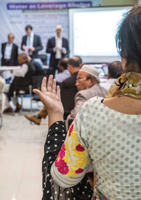
77
Public hearings
SESSION
Before the workshop
1. Block F must be completed.
Define the key thematic areas (mobility, housing, etc. - possibly related to goals) to be presented at citylevel public hearings.
Fix dates and a location of all public hearings and broadcast in different modality.
Prepare the contents to be presented.
Objective
Promote broad public participation in the planning process.
Result
Public can engage and participate in the process before the consolidation of ideas into statutory planning documents.
Place
Any place freely accessible for the participants and large enough for all fournitures and participants to fit in, usually public school at neighbourhood level and major convention centres at city levels.
Participants
Technical team + steering committee + key stakeholders + the political body of the city + citizens Roles
One facilitator, one or two note takers. TThe other members of the technical team support the process.
Materials
1. Maps & documents:
Printed Conceptual Plan proposal. One per group of person.
Room & furniture
• Chairs to allow everyone to sit in and face the board.
Pin up board, white board or a blank paper board to be used as a support for writing.
Agenda:
An agenda of the session should be presented by the team leader and made available for all participants to understand the development of the session. The times are adjustable to the cultural context and the availability of the participants.
Steps:
Preparation of a presentation with full contents, focusing on defined thematic issues (goals).
Presentation at city-level and neighbourhood level, open to the public.
Presentation of reports
Dissemination of reports
report of public hearing with key recommendations for the structure planning phase.
78 PHASE 2: PLAN BLOCK F: CONCEPTUAL PLAN 1 day mandatory
26
2.
3.
4.
•
2.
•
1.
2.
3.
4.
open Final
Outcome/output
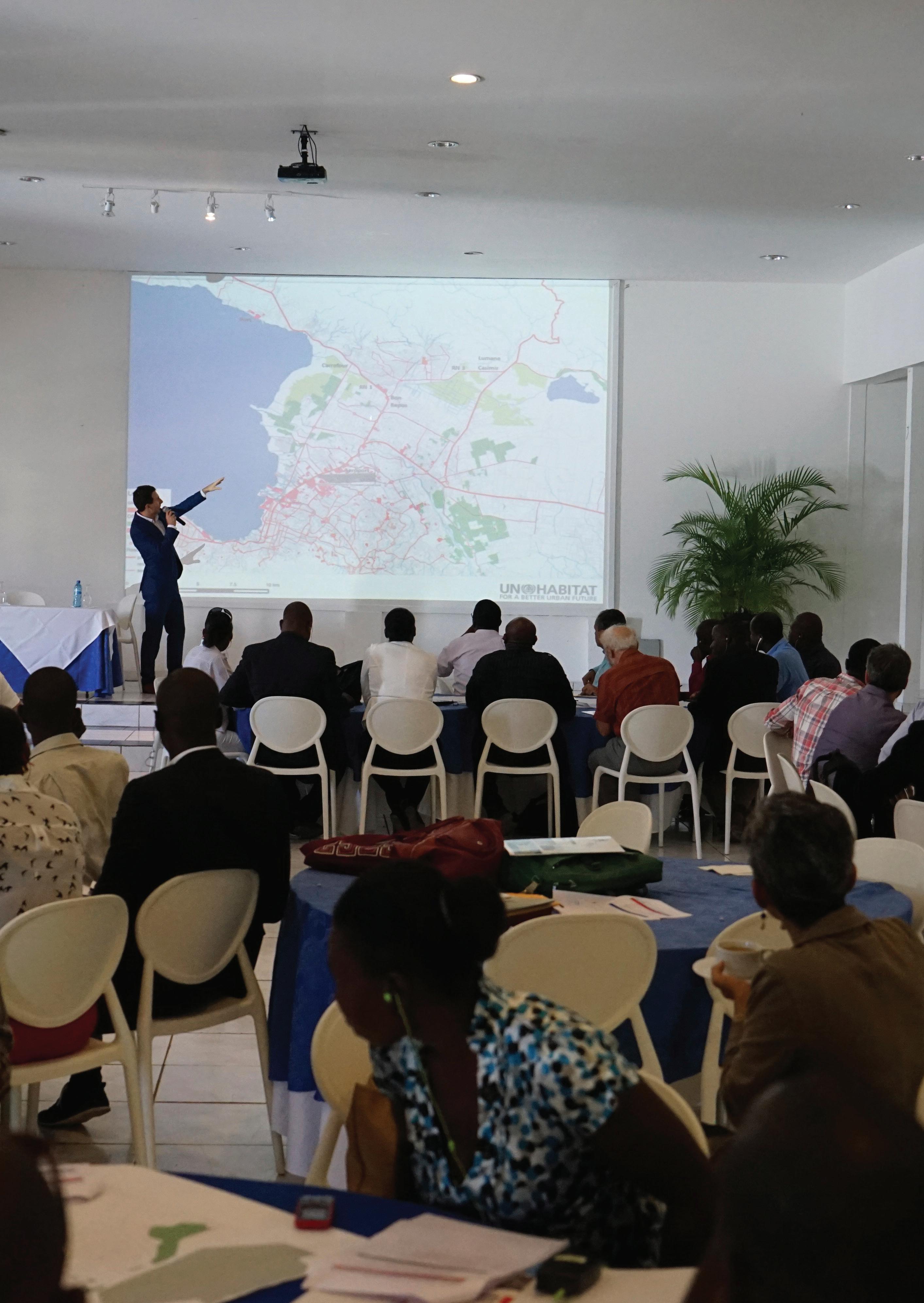
79 PHASE 2: PLAN BLOCK F: CONCEPTUAL PLAN
Workshop in Port-au-Prince (Haiti) Urban Development Initiative (UrDI) Canaan Area of Port-of-Prince
OPERA TIONAL ISATION
OPERATIONALISATION 03 OPERATIONALISATION BLOCK I _ ACTION PLAN BLOCK J _LAND MANAGEMENT BLOCK K _FINANCIAL MECHANISMS BLOCK L _INSTITUTIONAL ENABLERS BLOCK M _LEGAL ENABLERS How do we get there?
IMPLE MENTA TION
IMPLEMENTATION 04 IMPLEMENTATION BLOCK N _ IMPLEMENTING MECHANISMS BLOCK O _ ACCOUNTABILITY SYSTEM How will we implement and monitor out progresses?
ANNEXES
ANNEX05
ANNEXES DEFINITIONS ACRONYMS PROJECT EXPERIENCES REFERENCES
Definitions
GENERAL NOTIONS OF URBAN PLANNING
Accessibility:
Physical access to a space or a service in terms of availability and coverage.
Connectivity:
Street connectivity refers to the density of connections in a street network and the directness of links. A well-connected street network has many short links, numerous intersections, and minimal cul-de-sacs. As connectivity increases, travel distances decrease and route options and travel modes increase, allowing more direct travel between destinations, creating a more accessible and resilient system.
Densification:
A process of development that intensifies urban land use within the area.
Extension:
Consists of all newly developed (built-up) areas that are attached to the urban areas of an earlier period; (CPI: Module 3 – Land consumption)
Floor Area Ratio:
Floor area ratio (FAR), floor space ratio (FSR), floor space index (FSI), site ratio and plot ratio are all terms for the ratio of a building’s total floor area to the size of the parcel of land upon which it is built. The terms can also refer to limits imposed on such a ratio. As a formula: Floor area ratio = (Total covered area on all floors of all buildings on a certain plot) / (Area of the plot). Thus, FAR of 2.0 would indicate that the total floor area of a building is two times the gross area of the plot on which it is constructed, as would be found in a multiple story building. The floor area ratio can be used in zoning to limit the amount of construction in a certain area. For example, if the relevant zoning ordinance permits construction on a parcel, and if construction must adhere to a 0.10 FAR, then the total area of all floors in all buildings constructed on the parcel must be no more than one-tenth the area of the parcel itself. FAR as a planning standard should be used in conjunction with other traditional design standards (height, lot coverage and setbacks or build-to lines) to ensure the quality of the outcome. FAR alone is just a quantity of buildable space.
Geographic Information System (GIS):
A data system for storing, processing, and analyzing geospatial information, such as road networks and land elevation.
Inclusion:
Consists of all existing developments (built-up areas) that were outside the main urban area in an earlier period, but which get engulfed by the outward growth of settlements in a new period. (CPI: Module 3 – Land consumption)
Infill:
Consists of all additional developments (built-up areas) within to what was previously open spaces within the urban area in an earlier period; (CPI: Module 3 – Land consumption)
Informal settlements and slums:
The terms are frequently interchangeable. A slum is a settlement made up of households that lacks one or more of the following five conditions: access to potable water, access to hygienic sanitation facilities, sufficient living area per person (not more than three people sharing the same room), structural quality and durability of dwellings and security of tenure. The term “slum” originates from affordable housing schemes that were planned and built to specific standards but which, over time, have become physically deteriorated, overcrowded and inhabited by lowest income groups only.
There is no single definition of the term “informal settlement”. It generally refers to unplanned squatter areas that lack street grids and basic infrastructure, with precarious shacks erected on unsanctioned subdivisions of land or without the consent of the landowner. An informal settlement may be referred to as a shanty or squatter settlement. (UN-Habitat (2003). The Challenge of Slums. Global Report on Human Settlements. Nairobi: UN-Habitat.)
Open source:
A source that is freely available and can be used and modified by the user without requiring permissions.
Population Density:
The number of people in a given area, calculated as people per km2
86
Social Housing:
A rental or co-operative housing option for low to medium-income households which requires institutionalised management, and which is provided by accredited Social Housing Institutions or in accredited social housing projects in designated areas.
Sprawl:
A development pattern that disperses development versus focusing/concentrating it.
Urban and territorial planning
Urban and territorial planning can be defined as a decision-making process aimed at realizing economic, social, cultural and environmental goals through the development of spatial visions, strategies and plans and the application of a set of policy principles, tools, institutional and participatory mechanisms and regulatory procedures. (International guidelines on Urban and Territorial Planning)
Urban and territorial planning primarily aims to realize adequate standards of living and working conditions for all segments of current and future societies, ensure equitable distribution of the costs, opportunities and benefits of urban development, and particularly promote social inclusion and cohesion; (International guidelines on Urban and Territorial Planning)
PARTICIPATION: Steering committee:
A small or medium group of people with decisionmaking power in charge of validating every step of the planning process and moving forward to the project. Members of the steering committee usually are ministers, aldermen, mayors, private investors and social leaders with high capacities of resources and mobilisation of people.
Monitoring committee:
A group of selected representatives and different stakeholders that is actively involved throughout the planning process, to ensure that the plan is consistent with the community needs. Thus, members of the committee should be as heterogeneous as possible and have a common commitment (private sector, academia, NGOs, social enterprises, communitybased organizations, international organizations, donors, community leaders, associations, religious groups, local and national governments). It is essential
to ensure engagement with vulnerable sectors.
SCALES OF PLANNING
Supranational plans:
At supranational and transboundary levels, multinational regional strategies could help direct investment to address global issues such as climate change and energy efficiency, enable the integrated expansion of urban areas in cross-border regions, mitigate natural risks and improve the sustainable management of shared natural resources; City-Region and Metropolitan (Regional) plan*:
Plans that identify the general directions of urban land use for large urban regions concerning industrial zones, touristic poles, environmentally protected areas, and important communication infrastructures. It also shows priority action areas and regional pilot projects.
This scale is often defined by comprehensive (landuse) plans supported by sectoral plans, which detail higher-level plans and facilitate their implementation. This level is more important for countries that feature large urban agglomerations. Countries without large urban agglomerations tend to focus on the municipal scale. While plans get more exact on this level, their character and representation range depending on the purpose - from strategic to detailed comprehensive to sectoral elaborations of regional plans.
Municipal plan*:
Those plans are not just more accurate implementations of guiding frameworks discussed by authorities on higher levels, but they also communicate the visions of municipal authorities - touching the daily life of citizens. Larger cities may conflate this level with the city-region and metropolitan scale and feature additional plans on the neighbourhood scale. For smaller cities, the city and municipal level is unquestionably the main instrument guiding development. Plans can be strategic, comprehensive and sectoral.
Typical elements are land-use, large public spaces, building blocks as well as streets. Hierarchy is important for the latter: in large cities, small streets are not necessarily shown, while major roads are emphasized. Nevertheless, road widths are usually drawn to scale. Historical construction phases can be read through different urban patterns. Depending on the scale, plots or even buildings that may appear.
87
National urban policy/plan*:
Provides large-scale development strategies and indicators, development regions, priority action areas and national pilot projects.
National plans could take advantage of existing and planned economic poles and large infrastructure in order to support, structure and balance the system of towns and cities, including in urban corridors and river basins, to fully unleash their economic potential.
The plan generally shows basic elements besides administrative boundaries of countries and regions, as the main infrastructural corridors, the largest landscape structures and urban poles, development zones for further urbanization or key economic activities. Additional elements differ from country to country and can range from a focus on tourism (a major economic sector in Egypt) to water management (an all-defining sector in the Netherlands).
Spatial development framework*:
It is a city-wide spatial policy that identifies the main challenges and opportunities in the city, setting a spatial vision for the future city, and outlining a set of strategies that would lead to the realisation of that vision.
The SDF is not a static master plan; it is rather a dynamic model of strategic planning that will be cyclically reviewed, adjusting the focus and direction based on city transformation that takes place on the ground.
State/province plan*:
Provides the structure of the spatial organization, guidelines, measures and actions required, principles and specific criteria to the occupation and land use, in accordance with the strategies, standards and guidelines established at the national level.
Subnational regional plans could foster economic development by promoting regional economies of scale and agglomeration, increasing productivity and prosperity, strengthening urban-rural linkages and adaptation to climate change impacts, reducing disaster risks and intensity in the use of energy, addressing social and spatial disparities and promoting territorial cohesion and complementarities in both growing and declining areas.
Elements shown are similar to the national scale - urbanised areas, regionally-important transport
infrastructure, crude land-use classifications and administrative boundaries. Yet, more attention is given to desired developments and their relation to settlements and ecology of the region. This means new topics, which did not appear on the national scale, can be discussed, e.g. the interaction between harbours, cities and villages, ecological elements or newly proposed infrastructures.
Strategic plan*:
Identification of areas for urban and economic growth, the main infrastructures and natural preservation; no direct impact on land use, but its guidelines are mandatory for city-level plans; the main objective of the plan is to provide coherence to planning activities at the regional scale.
City development strategies and integrated development plans could prioritize investment decisions and encourage synergies and interactions between separate urban areas.
It can also be accompanied by a strategic vision statement and the definition of strategies and objectives at the same time territorialized on maps.
Structure plan*:
Determines the general use of land in different urban areas/agglomerations, infrastructure development, medium and long-term planning, and sets development guidelines. The most important document for spatial planning is mandatory for every municipality.
Regulates land use for the whole municipality boundary, defining residential growth, densities and buildability, infrastructures, public services, open spaces, agriculture and natural preservation through maps and regulations; it can also be redacted by two or more municipalities together in a unitary document. Land-use plans could contribute to the protection of environmentally sensitive areas and to the regulation of land markets.
88
Acronyms
PIUP Participatory Incremental Urban Planning
SDGs Sustainable Development Goals
NUA New Urban Agenda
SUD Sustainable Urban Development
NGO Non-governmental Organisation
GIS Geographic Information System
OSM Open Street Maps
SC Steering Committee
AC Advisory Committee
ToR Terms of References
MoU Memorandum of Understanding
NoP Notice of Preparation
PIM Participatory incremental mapping
SWOT Strengths Weaknesses Opportunities Threats (analysis)
PESTLE Political, Economic, Social, Technological, Legal, Environmental (factors)
SAP Strategic approach planning
MoF Matrix of Functions
SMUP Smart mixed-use planning
89
Project experiences
Name: Urban Development Initiative (UrDI) Canaan
Area of Port-of-Prince Country: Haiti
Name: Bissau 2030 Sustainable Spatial Development Plan Country: Guinea-Bissau
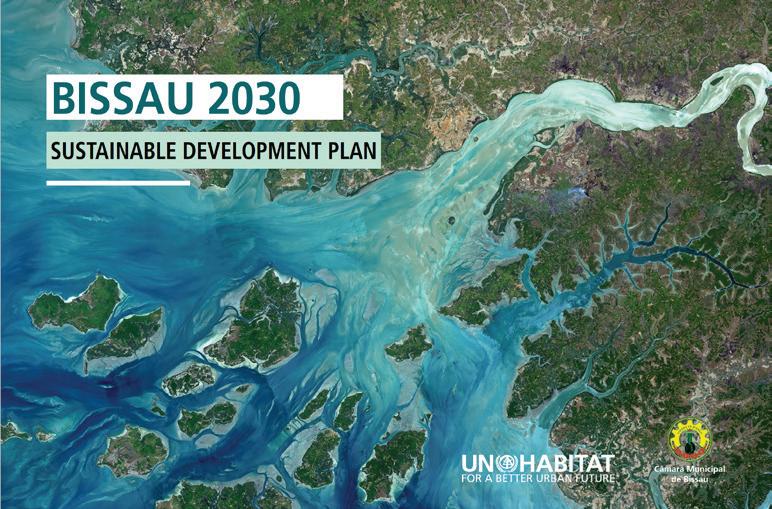
Name: Project of urban management of intermediate cities in the department of Grande Anse and the South of Haiti Country: Haiti
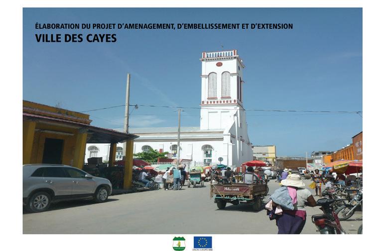
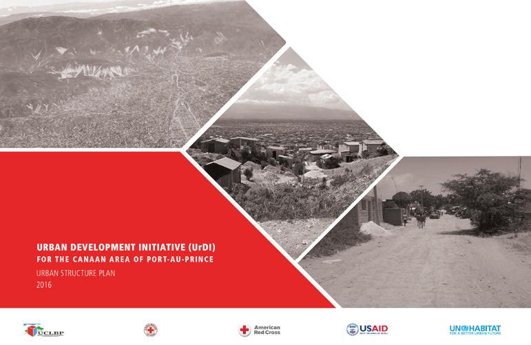
Name: Urban Development Towards a Sustainable Garden City, Belmopan Country: Belize
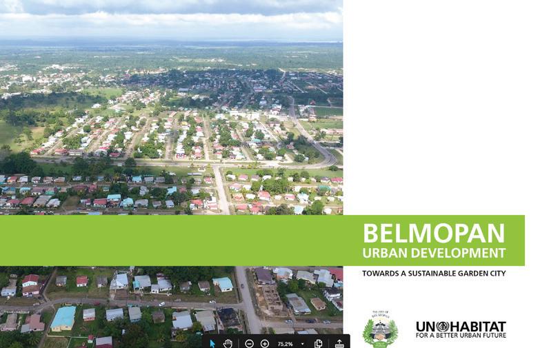
Name: Angola’s National Urban and Territorial Development Policy Country: Angola
Name: Spatial Development Framework 2040 City of Johannesburg Country: South Africa
Name: Kalobeyei integrated socioeconomic development programme Country: Kenya
90
Name: Hawassa City: spatial analysis and statistics Country: Ethiopia
Name: Hawassa City Strategic Plan Country: Ethiopia
Name: Future Saudi Cities Programme: City Profiles Series Country: Saudi Arabia
Name: Prosperity Fund Global Future Cities Countries: Brazil, Indonesia, Malaysia, Myanmar, Nigeria, Philippines, South Africa, Thailand, Turkey, Vietnam
Name: Bahir Dar Conceptual Plan Country: Ethiopia
91
References
Name Description Year Link
A new strategy of sustainable neighbourhood planning: Five Principles
In recent decades, the landscape of cities has changed significantly because of rapid urban population growth. A major feature of fast growing cities is urban sprawl, which drives the occupation of large areas of land and is usually accompanied by many serious problems including inefficient land use, high car dependency, low density and high segregation of uses. Coupled with land use speculation, current models of city growth result in fragmented and inefficient urban space where urban advantage and city concept are lost. Cities of the future should build a different type of urban structure and space, where city life thrives and the most common problems of current urbanization are addressed. UN-Habitat proposes an approach that summarizes and refines existing sustainable urban planning theories to help build a new and sustainable relationship between urban dwellers and urban space, and to increase the value of urban land. This approach is based on 5 principles that support the 3 key features of sustainable neighbourhoods and cities: compact, integrated, connected.
2014
https://new.unhabitat. org/sites/default/files/ documents/2019-05/ five_principles_ of_sustainable_ neighborhood_ planning.pdf
A Practical Guide to Designing, Planning, and Executing Citywide Slum Upgrading Programmes
While 220 million people have been lifted out of slum conditions over the past 10 years, the number of people living in slum conditions is likely to grow by six million every year, to reach a total of 889 million by 2020. It is necessary to equip cities and their practitioners with the tools and capacities to anticipate and control urban growth and city officials will require knowledge, skills and methodologies that will allow them not only to upgrade existing slums but also prevent the appearance of new ones. This Guide advocates for a citywide approach to slum upgrading, which represents a fundamental shift from piecemeal project interventions to a citywide programme approach. This Practical Guide is part of a trilogy on citywide slum upgrading that includes Streets as Tools for Urban Transformation in Slums: A Street-led Approach to Citywide Slum Upgrading and A Training Module for Designing and Implementing Citywide Slum Upgrading. With the other two partner publications, the Practical Guide provides an accessible tool for practitioners, leading them through UN-Habitat steps towards a successful citywide slum-upgrading program.
2015
https://unhabitat. org/sites/default/ files/downloadmanager-files/A%20
Practical%20
Guide%20low%20 res.pdf
City Prosperity Initiative
The Circle of Prosperity aims to assess how people understand and feel about the different dimensions of prosperity, providing qualitative feedback on the perceived city’s prosperity and sustainability. By responding to a qualitative survey, the Circle of Prosperity generates an assessment based on the perception of the sustainable development of the city and/or the urban region. This perception surveys provide an opportunity for local authorities to connect and interact with citizens and urban experts. Governments can receive systematic feedback on the level of prosperity of the city, promoting a more inclusive participation in decision-making and urban management process, valuing the fundamental role of stakeholders in the decision-making process.
2015 http://cpi.unhabitat. org/platformmeasure-urban-sdgs
Collection of Municipal Solid Waste in Developing Countries
This book is written for developing countries. Since it seeks to encourage the designing of waste collection systems based on local information, the approach is valid in any country. The main focus is on municipal solid waste, which is taken to include waste from households, businesses and institutions, construction and demolition waste in small quantities, general solid wastes from hospitals (excluding hazardous wastes), waste from smaller industries that is not classified as hazardous, and wastes from streets, public areas and open drains. It is not concerned with wastes from agriculture, larger industries or the mining industries which normally handle their own wastes.
2010 http://mirror. unhabitat.org/pmss/ getElectronicVersion. aspx?nr=3231&alt=1
92
Constructed Wetlands Manual
This manual has been prepared as a general guide to the design, construction, operation and maintenance of constructed wetlands for the treatment of domestic wastewater as well as introduction to the design of constructed wetland for sludge drying.
"GIS technology has emerged as a powerful set of tools for managing and analysing spatial data (data tied to a specific point or area on the ground).
2008 https://unhabitat.org/ books/constructedwetlands-manual/
GIS Handbook for municipalities
The various types of spatial data are at the core of many development efforts, and GIS is seen as a solution to a number of problems local governments face in their area of jurisdiction.
This handbook serves as an introductory guide to geographic information system (GIS) technology for local government and other interested stakeholders. It suggests some common opportunities for GIS application, the benefits a GIS provides to users, and what is required to set up a GIS and sustain it."
2016
https://unhabitat.org/ sites/default/files/ download-managerfiles/GIS%20 Handbook%20for%20 Municipalities.pdf
Global Public Space Toolkit:
From Global Principles to Local Policies and Practice
"Despite its importance in promoting sustainable urban development, public space has not been given the attention it deserves in literature and, more importantly, in the global policy arena. Yet there is a growing body of principles and sound policies for improving access to good public space in our cities, as well as a growing patrimony of good practices from different urban settings around the world.
This toolkit will be a practical reference for local governments to frame and implement principles, policy recommendations and development initiatives on public space and for central governments to aid their efforts with material support and enabling legislation. It will also serve the purpose of demonstrating the value of the involvement of the citizenry and civil society in securing, developing and managing public space in the city."
2015
https://unhabitat. org/wp-content/ uploads/2015/10/ Global%20Public%20 Space%20Toolkit.pdf
Guiding Principles for Climate City Planning Action
The Guiding Principles for City Climate Action Planning reviews typical steps in the city-level climate action planning process in light of a proposed set of globally applicable principles. These principles, shown below, developed through a robust and open multi-stakeholder process, support local officials, planners and stakeholders in climate action planning1. Such plans aim to help cities to reduce greenhouse gas emissions and adopt low emission development trajectories, as well as adapt to the impacts of climate change and build local climate resilience.
These Guiding Principles are intended to be applied flexibly, together with more detailed ‘how to’ manuals, to help cities more effectively play their role in reducing greenhouse gas emissions and building climate resilience.
UN-Habitat supports city, regional and national authorities to improve and adopt policies, plans and designs for more compact, socially inclusive, better integrated and connected cities that foster sustainable urban development and are resilient to climate change. As Myanmar is pushing for a sustainable approach to urbanization, it increasingly needs planning capacity. This document is intended to support such development of technical planning expertise.
2015
https://unhabitat.org/ sites/default/files/ download-managerfiles/English%20 Publication.pdf
Guidelines for urban planningprepared for the Republic of The Union of Myanmar
The document should be disseminated to those in charge of planning in their cities and townships, to act as a handbook for the initial research and design phases of planning. The Guidelines for Urban Planning are based on five principles for sustainable urban development that UN-Habitat promotes for the 21st century’s urban development. It also proposes a step-by step method for review and development of current and future plans that can be adopted by local planners.
This planning and review approach is illustrated by comments and analysis on the plans of Pyay and Kalay both in citywide and city extension scales. Finally, it provides a set of references for sections and blocks that can be implemented in new developments in Myanmar.
2016
http://unhabitat.org. mm/wp-content/ uploads/2016/07/ Guidelines-for-UrbanPlanning_Preparedfor-the-Republicof-the-Union-ofMyanmar.pdf
Habitat III Policy
Paper - Policy Paper 2: SocioCultural Urban Framework
This paper provides policy guidance on how attention to the social and cultural aspects of urban life can contribute to inclusion and resilience as well as cities that are more people-centered and simply more livable.
2016
http://www.unesco. org/new/fileadmin/ MULTIMEDIA/HQ/CLT/ pdf/Policy-Paper-EN.pdf
Name Description Year Link
93
International Guidelines on Urban and Territorial Planning (IG-UTP) Handbook
This handbook for the International Guidelines on Urban and Territorial Planning (IG-UTP) is part of a series of tools designed to improve planning practice. The guidelines themselves are not a blueprint for an imaginary ideal planning process. Instead, the principles and recommendations of the guidelines give advice on what is most important to successfully coordinate an integrated and participatory planning process for sustainable development. This handbook provides an overview of the scope of topics covered by the IG-UTP and puts special emphasis on planning processes, products and outcomes. In addition, it refers to additional tools, literature and resources for planners, civil society and policy makers at national and local levels.
2018 https://new.unhabitat. org/sites/default/files/ download-manager-
Kobo toolbox
KoBoToolbox is a suite of tools for field data collection for use in challenging environments. Our software is free and open source. Most of our users are people working in humanitarian crises, as well as aid professionals and researchers working in developing countries. Our teams of developers and researchers are based in Cambridge, MA and many other places around the world.
"The Analysis of Historical Examples of City Extensions takes a retrospective look at how various cities in the past have grown and evolved using the approach of planned city extensions.
Planned City Extensions Analysis of Historical Examples CoverThis retrospective reflection allows us to draw lessons that only the passage of time can allow; lessons which can be useful in guiding future urban growth so as to generate cities that are more sustainable, socially inclusive, and economically viable.
2009 https://www. kobotoolbox.org/
Planned City Extensions: Analysis of Historical Examples
The analysis examines the development of ten cities from different parts of the world: rich and poor cities; cities built in different time periods – from 17th to 21st century; and at different scale – from neighbourhood to city scale. Various aspects of each city related to physical configuration, process, phasing and regulation are examined.
The analysis results in the following conclusions: The grid as a basic organizational structure has proved valid and useful in the development of large and small cities all around the globe and through all periods of time; a General Plan with regulations rather than a Master Plan is proposed because it is more flexible and can evolve through time; an adequate urban density is essential in order to create civic life and economic activity in the city; and variations in the grid structure are important to remove monotony and create interesting cities."
2015
https://unhabitat. org/books/plannedcity-extensionsanalysis-of-historicalexamples/
Planning
Law Assessment
Framework
Diagnostic tools are useful in order to identify the strengths and weaknesses of legislation in a structured, objective and systematic way. The Planning Law Assessment Framework, developed by the Urban Legislation Unit of UNHabitat, is a quick self-assessment tool that aims to identify the strengths and weaknesses of an urban planning law. It looks at the laws, regulations and decrees that are applicable in a city, and enacted at different levels. It has been tested in Colombia (2012), Philippines (2013), Rwanda (2014), Mozambique (2014), Egypt (2015) and Saudi Arabia (2016).
2018
http://new.unhabitat. org/sites/default/files/ download-manager56wpdm_anning%20 Law%20sment%20 ramework.pdf
Planning for
Climate Change: A strategic, valuesbased approach for urban planners
"This guide was developed for city planners to better understand, assess and take action on climate change at the local level. Specifically targeted to the needs of planners and allied professionals in low and middle-income countries where the challenges of planning for climate change are particularly high.
The guide’s strategic, values based planning framework: promotes a participatory planning process that integrates local participation and good decision-making. provides practical tools for addressing climate change through different urban planning processes. supports the “mainstreaming” of climate change actions into other local government policy instruments."
2014
https://unhabitat. org/sites/default/ files/2019/11/ planning_for_climate_ change_-_toolkit.pdf
Name Description Year Link
94
Rapid Financial Feasibility Assessment for Planned City Extension (PCE)
"Rapid Financial Feasibility Assessment for Planned City Extension (PCE)August 2016
Rapid Financial Feasibility Assessment begins to develop an implementation strategy showing who will pay how much for what and when. It should have a sources and uses statement, matching the required investments with sources of funding. While this exercise only provides rough estimates of costs and funding availability, it can provide a check to plan feasibility and bring implementing agencies to the table to begin to discuss more detailed numbers. It can also provide information to revise the plan, including giving some decision makers a better sense of the high costs of poor design (ex: low density disconnected development)."
2016
https://unhabitat. org/sites/default/ files/downloadmanager-files/ DP_Financing%20 PCE_Pack_V4.pdf
Realising the human rights to water and sanitation: A Handbook by the UN Special Rapporteur Catarina de Albuquerque
Since 2010, when the United Nation General Assembly explicitly recognized the human right to safe drinking water and sanitation and the Human Rights Council reaffirmed this recognition, the United Nations Special Rapporteur on the human right to safe drinking water and sanitation has received repeated requests to provide guidance from States (both national and local), service providers, regulators and others, to clarify what this human right would imply for their work and activities. In fact this recognition has given an increased visibility to the water, sanitation and hygiene sector and many sector professionals see human rights as an opportunity to raise political support for these essential services.
The Special Rapporteur has been working closely with several organizations interested in understanding what the human rights to water and sanitation mean for their work, and how to translate these rights into practice.
The Special Rapporteur pursued a collaborative approach to the development of this handbook, firstly in the identification of the key barriers, challenges and opportunities that stakeholders encounter in realizing the human rights to water and sanitation, and then further in the testing and verification of the checklists and recommendations featured in the handbook. This collaborative approach will ensure that the Handbook is relevant and helpful beyond the mandate of the current Special Rapporteur.
2014 https://unhabitat. org/series/realizingthe-human-rights-towater-and-sanitation/
Street Led Slum Upgrading Training Module
This training was developed by UN-Habitat as trilogy, being part and parcel of a virtuous cycle of training and capacity building focusing on slum upgrading and the role of streets in the transformation of slums. The training program was offered in various occasions and for different audiences in Asia, Europe, Latin America and Africa from 2012 to 2017. It is a complete training package comprised of the strategy paper on Streets and Tools for Urban Transformation in Slums, the practical guide for planning, designing and implementing slum upgrading programmes and the training companion that includes all presentations, background and training materials. Participants attending this training have developed a full understanding of the phenomenon of informal urbanization and the appearance of slums and informal settlements. Course participants will develop practical knowledge and skills on planning and designing urban interventions using streets and the area-based plan for transforming and integrating slums into the city. The approach uses streets as the natural conduits that connect slums spatially and physically with the city and treats streets not only as a physical entity for mobility and accessibility — through which water and sewerage pipes, power lines, and drainage systems are laid – but also as the common good and the public domain where social, cultural and economic activities are articulated, reinforced and facilitated. Participants also develop knowledge on the design and management of citywide programmes that encompasses multiple slum upgrading projects.
2012 http://ca pacitybuildingunhabitat. org/street-led-citywideslum-upgrading/
Name Description Year Link
95
Streets as Public Spaces and Drivers of Urban Prosperity
The Publication "Streets as Public Spaces and Drivers of Urban Prosperity" was launched by the UN-Habitat's Executive Director, Dr. Joan Clos, on 12 November 2013 at the UN-Habitat Headquarters, Nairobi.
A key finding of this report is "the expansion of cities has been accompanied by changes in land use, both in terms of form as well as structure. Streets, as public spaces, have lost their importance in terms of their share of land, as well as their prominent role in shaping the culture and history of cities."
Another key finding of this report is "prosperous cities are those that recognize the relevance of public spaces (with proper layouts) and those which have allocated sufficient land to street development, including sufficient crossings along an appropriate lengthy network. Those cities that have failed to integrate the multi-functionality of streets tend to have lesser infrastructure development, lower productivity and a poorer quality of life".
2013 https://new.unhabitat. org/streets-as-publicspaces-and-driversof-urban-prosperity
Streets as tools for urban transformation in slums: a UNHABITAT approach to citywide slum upgrading. Working paper. Nairobi, UNHabitat
This publication (in the form of a Strategy Paper) highlights the global problem of slums and advocates for using streets as tools for urban transformation. A street-led approach to citywide slum upgrading is promoted which advocates for a shift from piecemeal project based to programme scale upgrading. This publication draws from many slum upgrading experiences worldwide and encourages a relatively easy to implement approach. It views slums as integral parts of a city system which are spatially segregated and disconnected due to an absence of streets and open spaces. Therefore, taking advantage of streets as the natural conduits that connect slums with the city, UN-Habitat suggests a fundamental shift towards the opening of streets as the driving force for citywide slum upgrading.
"In 2010 the worldwide building sector was responsible for 24% of the total GHG emissions deriving from fossil fuel combustion, second only to the industrial sector; but, if the embodied energy of construction materials is included, the share is far higher and the building sector becomes the prime CHG emitter. Thus,building design and construction have a significant effect on the chances of meeting the 2 °C target (keeping global temperature increase to 2 °C ).
2014
http://unhabitat. org/books/streetsas-tools-for-urbantransformation-inslums/
Sustainable Building Design for Tropical Climates
Developing countries are going to play a decisive role in the future world energy scenario, as a consequence of their economic development. Industrial energy consumption will grow, and a dramatic increase in energy consumption for transport can be expected, with the growth in the number of vehicles on the roads - if the currently accepted worldwide approach to mobility does not change. The increase in energy consumption in the building sector can be expected to be even more dramatic, not only because air conditioning will spread and the number of domestic electric and electronic appliances will grow, but also because of the increase in the number of buildings."
2015
https://unhabitat.org/ sites/default/files/ download-managerfiles/Sustainable%20
Building%20 Design%20for%20
Tropical%20
Climates_1.pdf
Sustainable Development
Goals Acceleration Toolkit
The Sustainable Development Goals Acceleration Toolkit is an online compendium of system-level diagnostics, models, methodologies and guidance for analyzing interconnections among the SDGs, assessing how to contribute to the pledge by Member States to ‘leave no one behind’, and doing risk-informed planning—to help governments, UN country teams, and expert stakeholders at all levels understand synergies and trade-offs and identify and unlock bottlenecks for strategizing, prioritizing and accelerating progress.
2017 https://undg. org/2030-agenda/ sdg-accelerationtoolkit/
Name Description Year Link
96
Sustainable Urban Energy Planning
A handbook for cities and towns in developing countries
The main purpose of this handbook is to assist people who are working in or with local government to develop sustainable energy and climate action plans and implementation programmes. There can be no single recipe for all cities ? so it is up to each local government to develop its own innovative and appropriate plans based on local resources and needs. We, at UN-Habitat and ICLEI, hope this handbook will go a long way to helping you to do this and allow you to take full advantage of the opportunities inherent in such planning. This handbook is for you if you are working in an urban context with or as part of a local government, and your primary areas of concern include: Delivery of services to citizens Economic development Strategic development planning Land use planning, zoning, building plans approval Housing and poverty issues Environmental management Management of local government resources and systems Fiscal responsibility and risk management Water resource and waste management Public health Transportation management
2009 https://www. uncclearn.org/sites/ default/files/inventory/ unhab35.pdf
Technical Guidebook For Financing Planned City Extension And Planned City Infill
UN-Habitat, the United Nations agency mandated by the General Assembly to promote socially and environmentally sustainable towns and cities, has designed dual methodologies for urban planning for growing cities and governments around the world. These approaches are called planned city extension (PCE) and planned city infill (PCI), and serve as an alternative to unplanned and chaotic urban expansion. UN-Habitat’s PCE and PCI methodologies take an integrated approach to the drafting and subsequent implementation of plans for cities and are based on three complementary pillars: urban planning and design, regulatory framework, and urban finance. They recognize that for urban planning to be implemented successfully, it is necessary to analyse the prevailing regulatory framework and to accurately assess the plans’ feasibility from the standpoint of both the private and public sectors
2016
https://unhabitat. org/books/technicalguidebook-forfinancing-plannedcity-extension-andplanned-city-infill/
The Challenge of Local Government Financing in Developing Countries
Cities are assets, solutions and drivers of economic and social development. Cities possess huge untapped economic potential that can and should be leveraged to create wealth and economic opportunities for all. This requires good urban planning that supports urban compactness, integration, and connectivity. However, even the best urban plans risk ending up unused if they are not accompanied by financial and regulatory strategies for implementation. Strategic public investments must go hand in hand with strategic funding mechanisms and supporting governance systems. The report also identifies successful governance mechanisms for efficient and equitable provision of public services in metropolitan areas of developing countries, and shares experiences and methods to making public service provision more viable in peri-urban areas of large cities and in smaller urban centres of these countries.
2015
https://unhabitat.org/ sites/default/files/ download-managerfiles/The%20
Challenge%20 of%20Local%20 Government%20
Financing%20in%20 Developing%20 Countries%20_3.pdf
UN-Habitat principles for sustainable neighbourhood planning
In recent decades, the landscape of cities has changed significantly because of rapid urban population growth. A major feature of fast growing cities is urban sprawl, which drives the occupation of large areas of land and is usually accompanied by many serious problems including inefficient land use, high car dependency, low density and high segregation of uses. Coupled with land use speculation, current models of city growth result in fragmented and inefficient urban space where urban advantage and city concept are lost. Cities of the future should build a different type of urban structure and space, where city life thrives and the most common problems of current urbanization are addressed. UN-Habitat proposes an approach that summarizes and refines existing sustainable urban planning theories to help build a new and sustainable relationship between urban dwellers and urban space, and to increase the value of urban land. This approach is based on 5 principles that support the 3 key features of sustainable neighbourhoods and cities: compact, integrated, connected.
https://unhabitat. org/wp-content/ uploads/2014/05/5Principles_web.pdf
Name Description Year Link
97
Urban Planning for City Leaders
"Urban Planning for City Leaders is a valuable source of information, inspiration and ideas on urban planning that is designed for city leaders and decision makers at a critical moment in human history. Predicted human population growth over the next 50 years will have immense consequencesfor all cities, in particular intermediate cities with populations of up to two million people.
Developed countries will need to double the amount of urban space they have by 2050 to accommodate the expected numbers of people, whereas developing countries will need to expand their urban space by more than 300 per cent."
2013
http://new.unhabitat. org/sites/default/ files/downloadmanager-files/UN%20 Habitat%20UPCL%20 14-02624%20-%20 Combine.pdf
Using Minecraft for Community Participation
UN-Habitat believes that ICT can be a catalyst to improve governance in towns and cities and help increase levels of participation, efficiency and accountability in public urban policies, provided that the tools are appropriately used, accessible, inclusive and affordable. Research shows that ICT use by youth can have a direct impact on increasing civic engagement, giving them new avenues through which to become informed, shape opinions, get organized, collaborate and take action. UN-Habitat’s experiences of using the video game Minecraft as a community participation tool for public space design confirms this view and shows that providing youth with ICT tools can promote improved civic engagement. Youth are at the center of the ICT revolution, both as drivers and consumers of technological innovation. They are almost twice as networked as the global population as a whole, with the ICT age gap more pronounced in least developed countries where young people are up to three times more likely to be online than the general population. The purpose of this paper is to outline UN-Habitat’s approach to using information and communication technology (ICT) as an enabler to encourage youth participation in urban design and governance.
2015
http://new.unhabitat. org/sites/default/files/ download-managerfiles/USING%20 MINECRAFT%20 FOR%20
COMMUNITY%20 PARTICIPATION%20 MANUAL.pdf
Name Description Year Link
98