A BIANNUAL JOURNAL ON CITIES PUBLISHED BY URBAN DESIGN COLLECTIVE NAVI MUMBAI: THE TWIN CITY CITY OF TOMORROWBO01, MALMÖ, SWEDEN MODERN ARCHITECTURAL HERITAGE IN TRIVANDRUMINSIDE CITY OBSERVER JUNE 2015 Volume 1 I s s eu 1ngiseDnabrU Clo l e c tive * *
CITY OBSERVER
Volume 01 | Issue 01 | June 2015
Free Publication City Observer is a biannual journal which aims to create a conversation on cities and to collaboratively interrogate our urban world.
City Observer is published by the Urban Design Collective.
Urban Design Collective (UDC) is a non-profit organization that works as a collaborative platform towards the creation of livable & sustainable cities through community engagement. info@urbandesigncollective.org
www.urbandesigncollective.org
EDITORIAL TEAM Ajeetha Ranganathan Shruti Shankar Vidhya Mohankumar
COVER ILLUSTRATION
Anandit Sachdev LAYOUT DESIGN Vidhya Mohankumar
Copyrights of images lie with the person/ party mentioned in the image caption.
This magazine cannot be republished or reproduced without the permission of the publisher.
To Cities and People
CONTENTS Navi Mumbai: The Twin City Neha Krishnan Emergence of Landscape Urbanism Shantesh Kelvekar Exploring Bangalore’s Hardware Market Adnan NakhodaFEATURE ARTICLES 10 44 64 EDITORIAL Ajeetha Ranganathan8 9 112FOUNDER’S NOTE Vidhya Mohankumar CLOSING SCENE Mahesh Radhakrishnan
LOCATION
TRAILS
AND THE CITY
MOTION CAPTURED

ART AND THE CITY
FROM CITIES
ENGAGEMENT
TEACHING URBAN DESIGN
ON
City of Tomorrow– BO01, Malmö, Sweden Shruti Shankar CITY
Modern Architectural Heritage: Trivandrum Thomas Oommen MOBILITY
Chennai Transforms into a People-centric City Shreya Gadepalli
Mathura: A Photo Essay Siddhartha Joshi
Waking up to Public Art in Chennai Anpu Varkey LEARNING
10 Urban Design Lessons from Turkey Vidhya Mohankumar COMMUNITY
People’s Puppet Project in Pondicherry Devangi Ramakrishnan
Redeveloping the Musi Riverfront in Hyderabad Karteek G COLUMNS 102 88 68 60 50 38 32 26

Malmö CITY OBSERVER

Mathura Istanbul Selçuk Bursa Mumbai Trivandrum Chennai Pondicherry Bangalore Hyderabad
The 21st century is indisputably the Century of the City. More people live in cities than ever before – for the first time, over half of us are now urban. And this number is only set to grow in the next few decades.
The rapidity of this urbanization means new cities are springing up, towns are becoming big cities and big cities, especially those in the global south, are growing at unimaginable rates. In the following decades, as the majority of humanity becomes urban, the manner in which our cities develop will largely determine the nature of the world we live in.
The rate of urban growth means that cities offer both exciting new potentials as well as new problems. In our urbanized world, cities can provide the environment for a new renaissance, or experience social inequality leading to unrest and revolution. They can be desirable places to live, or places of widespread environmental degradation and squalor.
Sometimes, the potentials and problems are not new, but the scale at which they occur is unprecedented. Some ways of experiencing the city remain unchanged, while new ways of experiencing them evolve. Sometimes, tried and tested urban solutions work. Sometimes, the changing nature of the city calls for fresh approaches and solutions. The only constant is multiplicities- of experiences, approaches, problems and solutions.
ABOUT CITY OBSERVER
Cities bring diverse people together, and have always been the place for social change, art and technological progress. In the same way that cities bring diverse people together, we wish to bring together diverse voices in this journal- people from many cities, of multiple backgrounds and sometimes diametrically opposing viewpoints and ideologies. We hope that both our audience and our contributors are drawn from all walks of society, and not restricted to architects and urban designers.
We welcome variety- in content, in opinion, in the cultural background of the authors- in order to
accentuate the diverse ways of viewing, experiencing and engaging with the city. We also hope to use these differences to generate a wider dialogue and discussion on our cities, together with our social media and blog.
Our agenda is the city, and everything associated with the city. This journal aims to
• Investigate and explore the urban world we live in
• Interrogate the forces shaping our cities- social, political, cultural, economic, technological and others
• Envision the kind of world we would LIKE to live in
• Learn from other cities and best practice projects
• Explore the intersection of academia and practice
• Constantly question- why, what, where, how and when? Where do we stand? Where are we going?
VOLUME 01 ISSUE 01
While we hope this journal evolves, grows and changes with time, the first issue in many ways sets a precedent for those following. We have made a good start in the first issue, and hope to continue and build upon our approach in forthcoming issues. Our contributors engage with the changing nature of urbanism with varied concerns, approaches and opinions. The urban explorations in this issue range from varied urban experiences to specific urban projects, from lessons learned through planning failures to rooting modern architectural heritage in its socio-political context, from exploring specific urban projects to possible approaches to urbanism, from engaging with urban governance to public art- the lenses reveal multiple aspects of the urban experience.
The diversity of topics, approaches and standpoints in this journal is its greatest asset. It helps us understand the complex, multi-layered nature of the city. As a reader, I hope your engagement with these multiple voices makes you look at the city through fresh eyes.
Ajeetha Ranganathan
On behalf of the Editorial Team
8 CITY OBSERVER | June 2015
EDITORIAL
Urban Design Collective (UDC) is proud to present the first volume of ‘City Observer’, our very own biannual journal on cities.
As we launch this first issue, I felt it important to clarify and highlight a couple of things on what this journal is and is not.
This journal is
• first and foremost, a celebration of cities and people. While this is common to all of our initiatives at UDC, it is especially embodied in ‘City Observer’ because it is an opportunity to engage with not one but several cities in a single issue. That said, we’re immensely thrilled with the line-up for our very first issue with stories from Chennai, Pondicherry, Mumbai, Bangalore, Trivandrum, Hyderabad, Mathura, Malmö, Istanbul, Selçuk and Bursa. Read on to travel and learn without moving!
• an array of lenses through which to read and interpret cities. This is also the rationale for our choice of name for the journal. ‘City Observer’ is comprised of a set of regular columns that embody the lenses and because there will always be more ways to read and interpret cities there is room for three feature articles as well.
• a testimony to collaborative effort across borders for the cause of livable cities. The editorial team for this issue worked across Chennai, Bangalore and Los Angeles. Contributors sent in their stories from Chennai, Pondicherry, Bangalore, Vijayawada, Pune and New Jersey. The idea is to keep this diversity growing so if you’d like to be a contributor or even part of the editorial team, do write to us.
This journal is not
• a printed publication. ‘City Observer’ is available online as a free copy to read.
• a paid project. While we hope that this will change eventually, the time and efforts of all the contributors as well as the editorial team is, at the moment, pro bono and UDC extends a big heartfelt thank you to everyone who made this possible purely out of passion.
As we step into our fourth year of operations at UDC, ‘City Observer’ is indeed a special marker that we hope will grow and evolve with critical rigour into a forum for new ideas on the city building process while also critiquing the status quo objectively.
Cheers!
Vidhya Mohankumar
Founder & Managing Trustee- Urban Design Collective
9June 2015 | CITY OBSERVER FOUNDER’S NOTE
NAVI MUMBAI: THE TWIN CITY
A parallel city planned to be the panacea to Bombay’s many ills in the 1960s - overcrowding, infrastructure failure, an uneasy co-existence of heavy industry and residential neighbourhoods. Conceptualized with much fanfare, Navi Mumbai was unoccupied and all but written off by the late 80’s. Was it inertia, or implementation failures that sabotaged this great feat of planning? And what has changed since?
by Neha Krishnan
10 CITY OBSERVER | June 2015 FEATURE ARTICLE
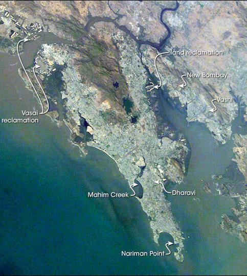
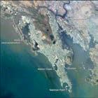
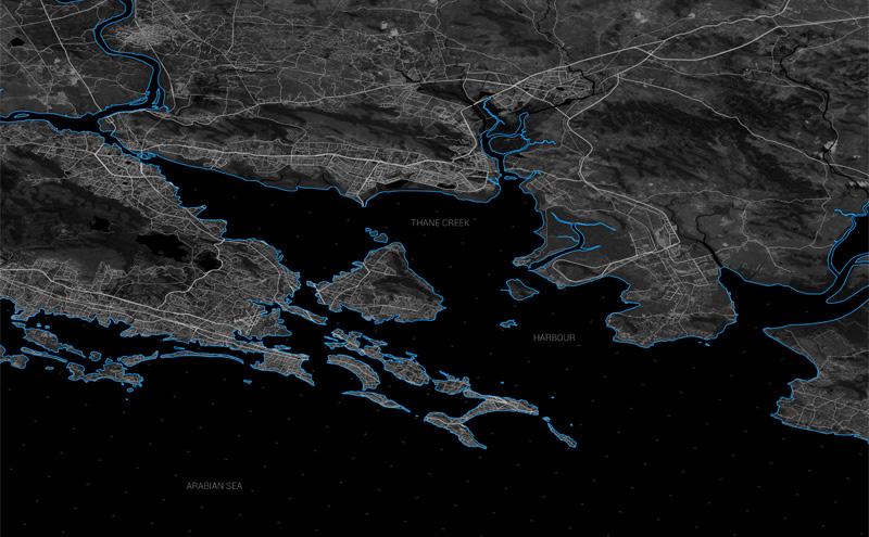
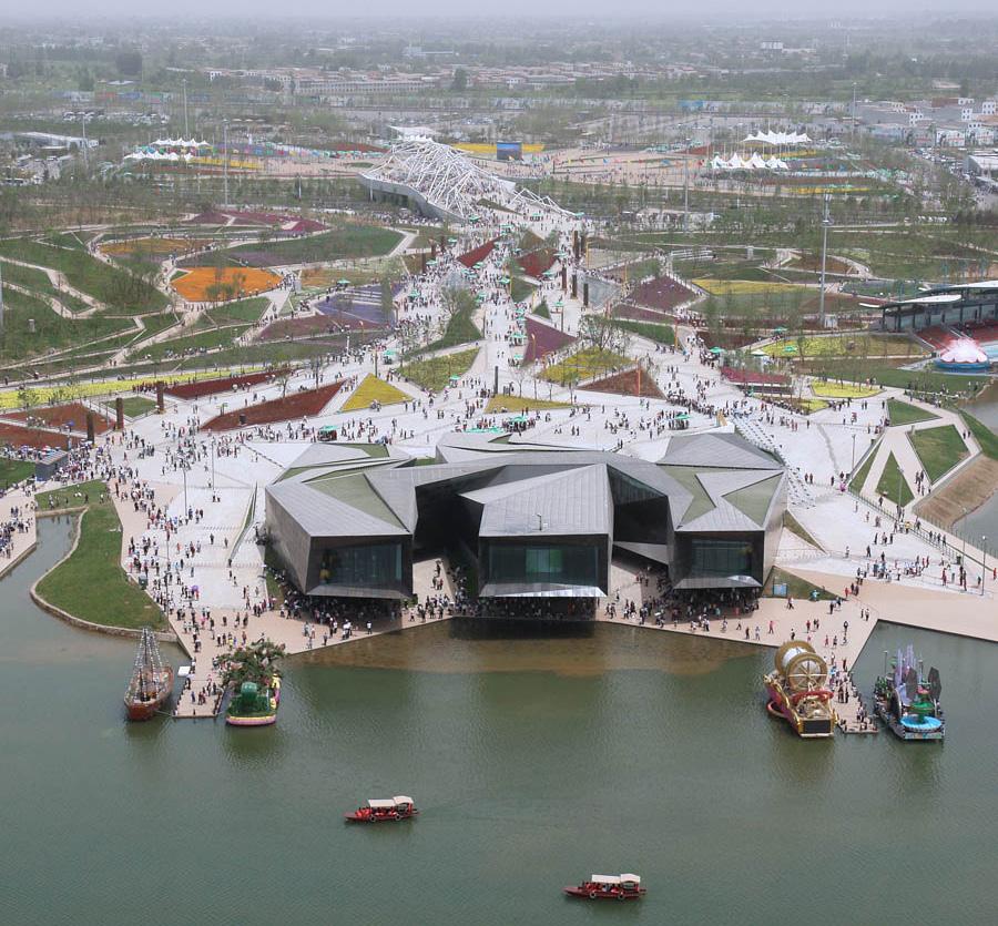
11June 2015 | CITY OBSERVER Satellite image of Mumbai and Navi Mumbai. Source: http://visibleearth.nasa.gov/view_rec.php?id=16805
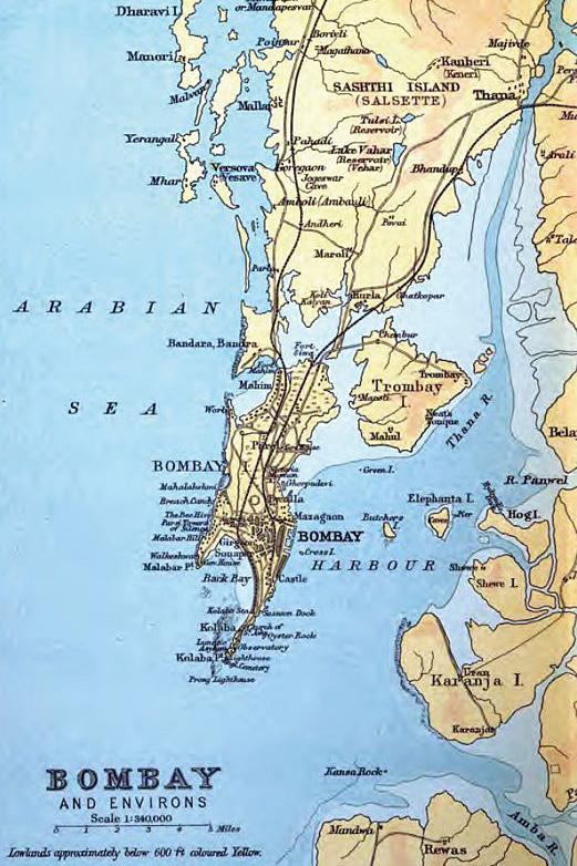
Mumbai can be called birthplace of jugaad – a word used to describe the resourceful if piecemeal solutions people find to respond to a life of scarcity and obstacles. It is not hugely surprising then, that in many ways the planning of this great city seems piecemeal as well. The journey from its beginnings as a swampy cluster of islands and marshes to its reality as one of the world’s largest metropolises has been as meandering as it was inexorable. Mumbai could never have been called a traditionally planned city –it came together organically, its form responding first to colonial planning, then to the growth of its industries and ports; and finally to communal and political forces. The planning responses to this scenario have been guided by forces beyond the seemingly egalitarian mottos of ruling parties as they struggled to walk the line between pleasing their vote bank, and allowing for policies that suited the construction and business elite of the city. It is in this struggle that the hotchpotch megacity gained an orderly if identity-confused sibling- Navi Mumbai.
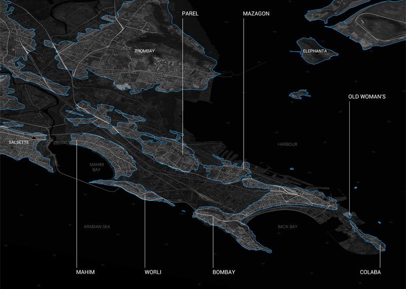
Islands of Bombay-1893. by J.G. Bartholomew, Archibald Constable and CompanyConstable’s Hand Atlas of India, 1893 edition. Licensed under Public Domain via Wikimedia Commons
12 CITY OBSERVER | June 2015 FEATURE ARTICLE
13June 2015 | CITY OBSERVER
The growth of Mumbai’s land mass. Copyright Noel Murphy
Navi Mumbai, or New Bombay as it was then called, was conceptualized in the mid-1960s when it became apparent that Bombay’s physical capacity would soon be pushed to breaking by population pressure. Bombay’s very existence had been cobbled together in 1845 from 7 distinct islands,created by filling in its natural swamplands and extensive reclamation. Always congested, rapid urban migration after independence hit the city hard, bounded as it was by the sea on 4 sides. Even as reclamation continued to squeeze landmass out of the ocean, the sheer numbers of migrants made it apparent that this would be a short-term solution to say the very least. Mumbai’s population density had gone up from 54 people per acre at the turn of the century to 164 by the 1961 census. It was continuing to grow at an unsustainable rate. The eminent planners of the day began proposing a ‘Twin City’ to ease the pressures on
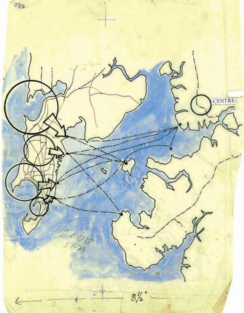
the island. New Bombay was the brainchild of Charles Correa, Pravina Mehta and Shirish Patel; who had in mind a decentralized, multi-nucleated urban area on the mainland across the water from the Bombay Harbour. Besides pre-empting the infrastructure issues faced by the unplanned city of Bombay, New Bombay was also expected to halt the north-south axis of growth in Bombay, and coax traffic eastwards. The settlement was designed as a series of ‘nodes’ or urban nuclei; well connected by road and rail transport, and extending on one end towards a corridor that supported heavy industries. To this end, the City and Industrial Development Corporation of Maharashtra (CIDCO)was formed in March 1971in order to convert some 344sq km of villages into planned development. Furthermore, the business district of the city and the houses of government were eventually expected to move into the mainland as well.
Left and Facing page: Development Plans from the Charles Correa archive.
Images copyright: Charles Correa Associates, Courtesy The British Architectural Library, RIBA
14 CITY OBSERVER | June 2015 FEATURE ARTICLE
15June 2015 | CITY OBSERVER
16 CITY OBSERVER | June 2015 FEATURE ARTICLE
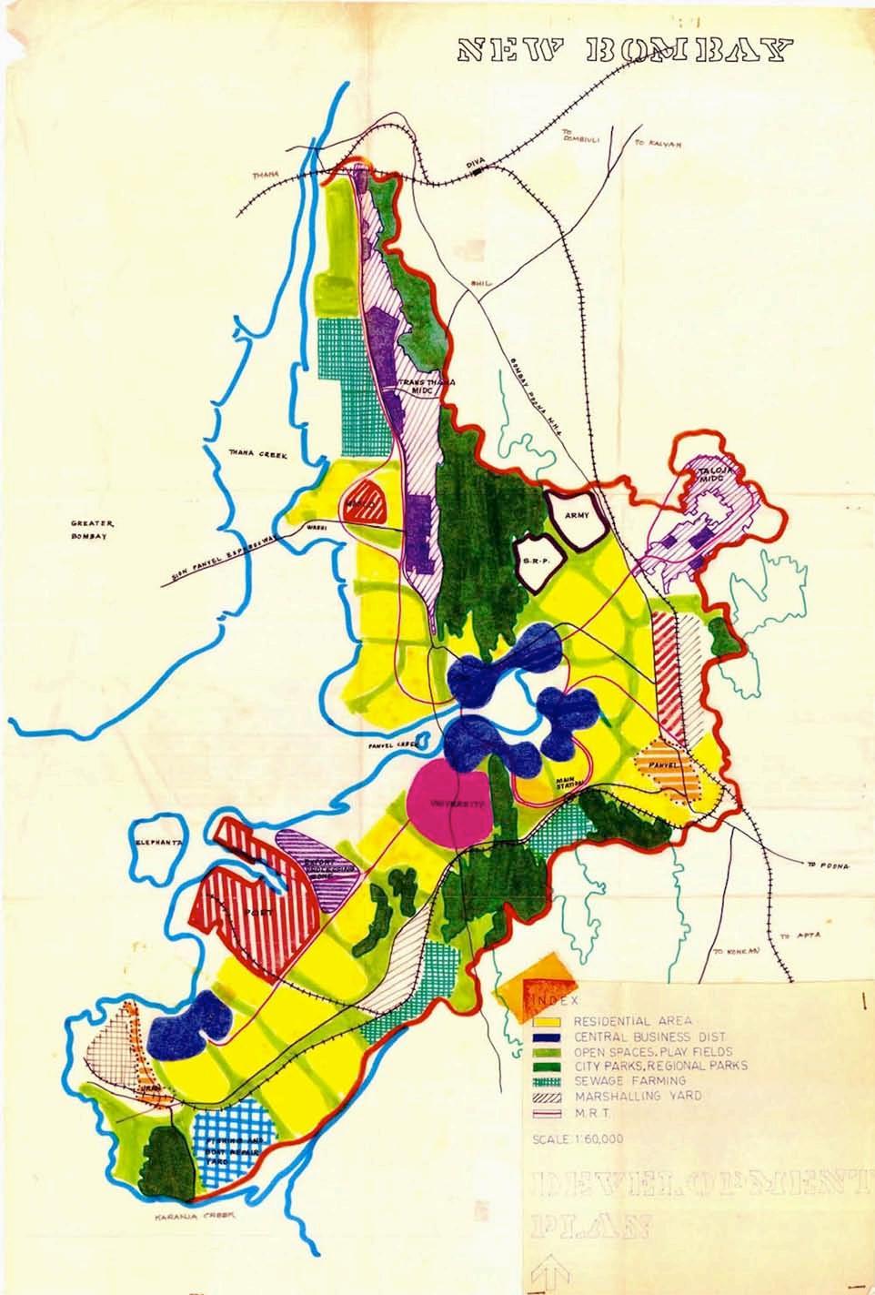
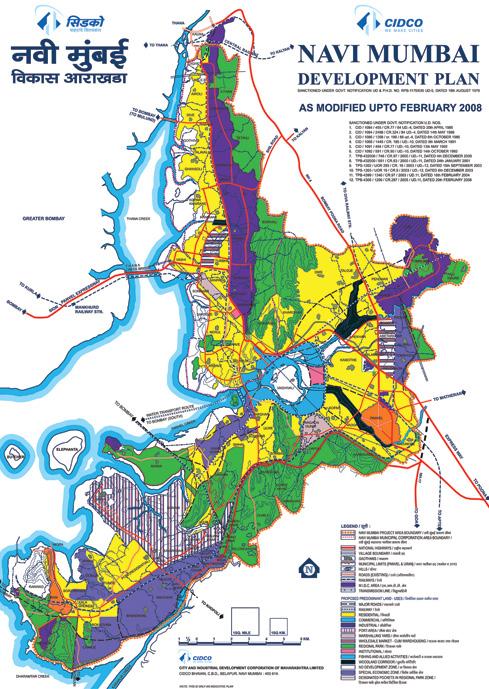
Development Plan for Navi Mumbai. Copyright City and Industrial Development Corporation (CIDCO)
17June 2015 | CITY OBSERVER
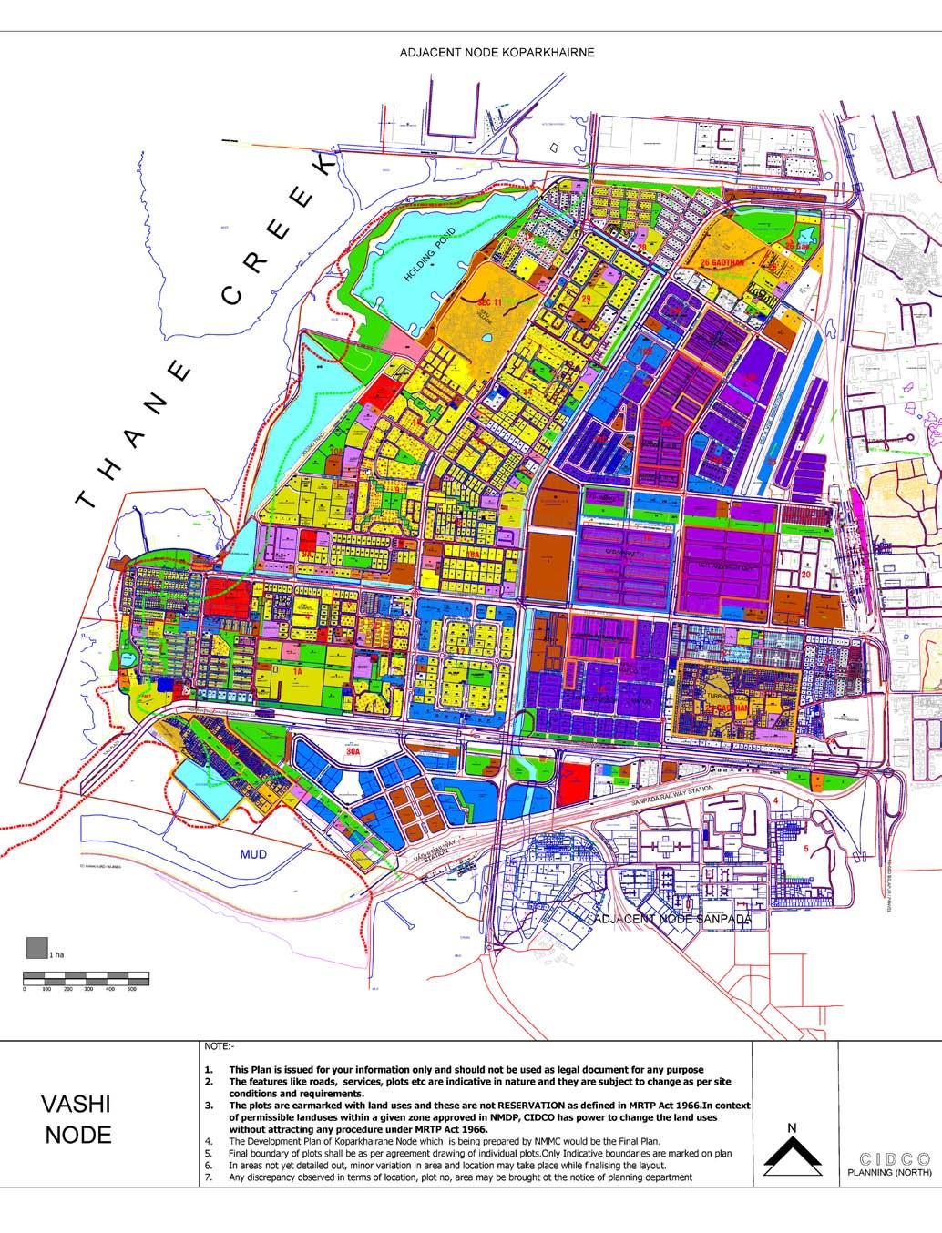
Nodal Plan for Vashi. Copyright City and Industrial Development Corporation (CIDCO)
New Bombay, in direct contrast to the Old City, was planned down to the last detail, showing incredible clarity of vision. The 13 nodes that constituted the area were supposed to be connected sequentially through a newly commissioned rail line; and connected on either side to Bombay and Thane. Policies were implemented to promote heavy industry in adjoining areas, and at the same time curtail the establishment of any heavy or medium-scale industries within the Greater Mumbai
Area. This was intended to create jobs; so as not create a ‘dormitory town’ of commuters that worked in Bombay. Belapur was designated as the Central Business District, and large office and commercial spaces were created there. Taking an egalitarian view on housing, the planning of the nodes was tinged with modernist utopianism, and guided by the pragmatic necessities of providing comfortable housing to the growing middle classes in Bombay.
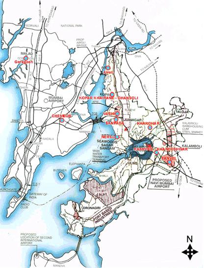
The Nodes of Navi Mumbai and Rail and Road Links.
Copyright Indian Institute of Geomagnetism
18 CITY OBSERVER | June 2015 FEATURE ARTICLE
New Bombay was rechristened Navi Mumbai and is currently home to 1.19 million of Mumbai’s 18 million people. The city saw a huge spike in growth between 1991 and 2001, growing 119%. It is a bustling hub of self-contained life, and is increasingly home to a young and mobile commuter population, for whom the easy travelling and lower rents are a huge attraction. It also helped absorb the influx of migrants into Mumbai, decelerating the growth rate of the metropolitan area and providing clean and affordable housing to the middle classes, as well as lower income groups.
For all its brilliance and meticulousness of thought however, New Bombay took off to a sluggish start and was all but written off by the late 80s. A dismissive tone is evident in all the studies and reviews of the development plan 20 years from its inception. The sheer force required to shift the nucleus of a behemoth like Mumbai, was hard to come by in the early days of the project. While plans were drawn up by socialist visionaries, the reality of the situation was controlled by pragmatists, whose priorities lay with re-election and finding favour amongst the wealthy.
Land-use Patterns in New Bombay.
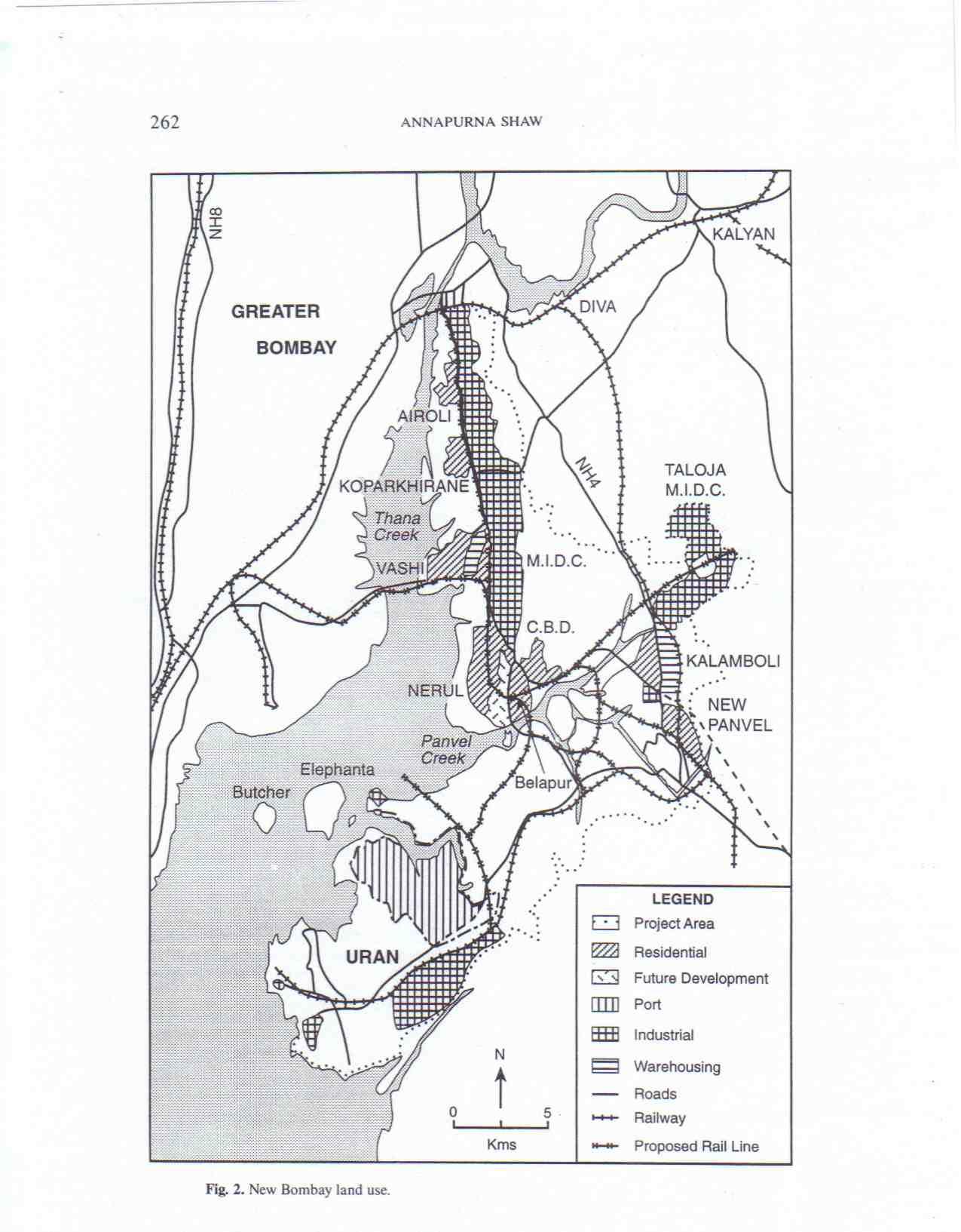 Copyright Annapurna Shaw
19June 2015 | CITY OBSERVER
The regional politics and the interests of the powerful sidelined many of the policies intended to accelerate and facilitate Navi Mumbai’s growth. It was only after the liberalization of India’s economy in 1991, that the city truly began to take off. Ideally, Mumbai planning policies should have restricted growth in the Greater Mumbai area and encouraged movement into the Mainland – however, the focus of planning remained on reclamation and redensification rather than relocation. The Back bay Reclamation project added large volumes to Mumbai’s landmass, lifting the exigency of housing pressure. The Bandra-Kurla complex was proposed in 1978, and the promise of office space on the island drew potential movers away from the Business District in Belapur. The business elite were unwilling to move their profitable industries and pay the related development taxes without a fight. Wholesale markets were supposed to be moved out of the Mumbai Metropolitan area into Navi Mumbai as early as 1970; this plan was only put into action in 1996. The State government abruptly pulled out of a plan to move the Mantralaya and other Government
Houses into Navi Mumbai. Till date, they stay in their original sites.
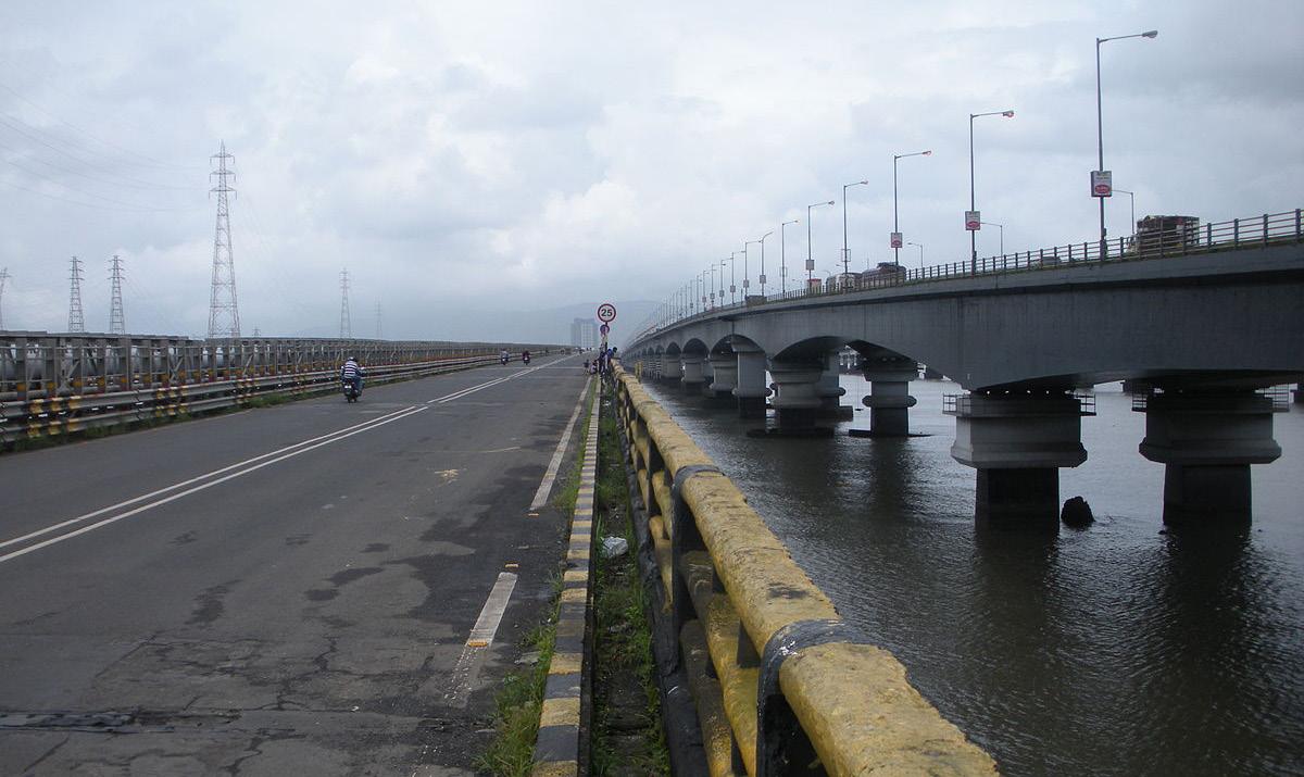
Furthermore, CIDCO faced stiff opposition as it went about trying to acquire land for development; as late as 1995; some 20% of the original land area requirement was yet to be acquired. Amendments to the Land Acquisition act in 1984 also complicated CIDCO’s quest. As of June 1991, only 7 of the 20 planned nodes had been completed. Until the early 90s, transportation facilities between Navi Mumbai and the City were poor, stifling commuter traffic. The Vashi Bridge, opened to connect Mumbai to the Mainland in 1973, was woefully inadequate, and plans to build a new bridge had to be put in action almost immediately to support traffic. The Mankhurd – Belapur- Panvel rail line was completed in 1992, finally putting Mumbai within commuting distance of Navi Mumbai.
How then, can this dichotomy between the early days of the project and today’s bustling hub be reconciled? Was it merely teething issues which when projected to the age of a city, was a few decades? Or was it
20 CITY OBSERVER | June 2015 FEATURE ARTICLE
Back Bay Reclamation. Copyright Aga Khan Visual Archives. (c) Shubhankar Sanyal 1983
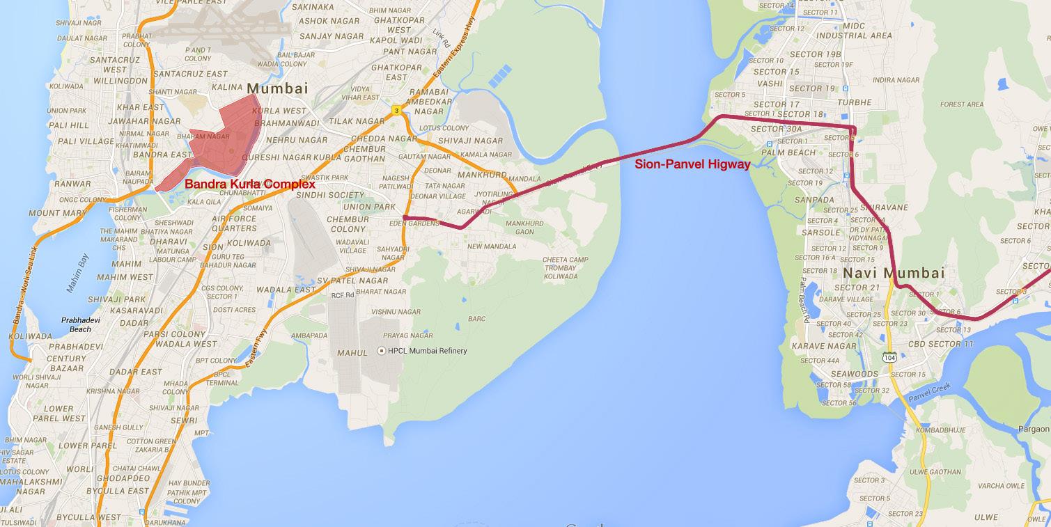
Map showing Bandra Kurla Complex & the Sion-Panvel Highway. Created by the Author using a Google Maps base really a project on the brink of failure, saved only by liberalization and the subsequent growth in economy? The people most suited to answer these questions are long term residents of Navi Mumbai –people who have lived here 25 years or more, and have grown up with the city. By all accounts, Navi Mumbai in the 80s
and 90s was a safe and quiet, if unglamorous place to work and raise a family. An equal mix of white and blue-collar jobs seems to have existed, along with educational and institutional facilities. In Mumbai’s shadow, the Twin City quietly carved its own niche.
21June 2015 | CITY OBSERVER
Vashi Bridge – Old & New. Photo Credit: Pradeep717 - Own work. Licensed under CC BY-SA 3.0 via Wikimedia Commons
Suraj Raghavan, a 29 year old businessman, has fond memories of growing up in Vashi.
Very partial, but I believe growing up in Vashi, was a boon versus the southern parts of Mumbai. Vashi used to be much lesser populated when we were growing up. Meaning you practically knew every second person around directly or through someone elsemeaning much more social interaction with people, as most were familiar faces. Growing up in Vashi meant much more open spaces and lesser traffic hassle.
On the downside being a city which was just developing, there were hardly any avenues for entertainment. Shoddy movie theatres, no good places to shop, select good restaurants. If we had to watch a movie as kids, we’d have to take a train (one hour ride) to Colaba/Fort, to watch a good movie. English movies were seldom played in the local theatres. Education I believe was good though. Schools, Junior Colleges, Post Graduate degree colleges were in abundance. Demographics, in the earlier days, were even with a mix of people across different faiths. People who had settled in Vashi, were primarily Middle Class/Upper Middle class. Those who could not really afford to purchase a “big” house, in the more Central parts of Mumbai, chose one of three options – Vashi, Goregaon or Kandivali, as a more viable place to move to.
The joys of growing up in a planned city with adequate infrastructure and space gets a recurring mention from another resident of almost 3 decades. Prashant Kumar, 29, a tech entrepreneur, remembers both the good and bad.
During the 90s all the way till 2002 good entertainment establishments were missing in Navi Mumbai, this is where Mumbai had the big advantage. On the other hand, we almost never had traffic scenes here, public and private transport was a breeze, rickshaws never rejected fares. Also since it was planned, a lot of the residential areas had the much required peace, as opposed to Mumbai there was just too much noise pollution and traffic everywhere. Though the entertainment and food and beverage industry is booming here now, it still lacks the finesse of establishments in Bombay.
Prashant also agrees with Suraj on the diversity and tolerance of people here.
‘
Navi Mumbai has never had issues related to community or religion, and things have been surprisingly peaceful here. This is primarily due to the fact that people are tolerant and have empathy. Education again is good and sought after by majority of the people, which probably is responsible for the tolerance and empathy.
‘
Suraj also speaks of the rapid change and growth after 2000.
‘
As the city started growing, property rates obviously started spiking up. People who owned multiple properties became sudden millionaires. Wealth accumulated. Now Vashi/Palm Beach Road, are primarily occupied by the more wealthier people in Navi Mumbai. Many have sold their properties for significant profits and moved to the quieter parts of Navi Mumbai.
‘
‘ ‘
There seems to be a general consensus between opinion and formal literature on one thing – special interest groups and political alliances control much more behind the scenes than is actually visible. While there seems to have been prosperity for all in general, the people who most benefited as always, were the ones with entrenched power. Says Prashant, Navi Mumbai has always had these two clear divisions- the Locals and the Other People. The locals are the natives and the landowners who are primarily into politics and construction related businesses (yes, politics is a business!). The other people are further divided into the people who have been living here since more than 20 years and the others who have migrated /settled here for their work. With the general financial boom that has been seen across India, and considering Mumbai and Navi Mumbai are the financial hub, the financial boom has been consistent and good. Politics, Trade, Police and Agricultural Produce are dominated by the locals (including from the state), some of whom have grown exponentially over the years.
Prashant goes on to speak of Navi Mumbai’s planning and strategies:
If I am not wrong, Navi Mumbai was one of the first planned city initiatives across India, and is quite well done. I believe in order to
22 CITY OBSERVER | June 2015 FEATURE ARTICLE
‘ ‘
‘
‘
‘
Palm Beach Road, Navi Mumbai.
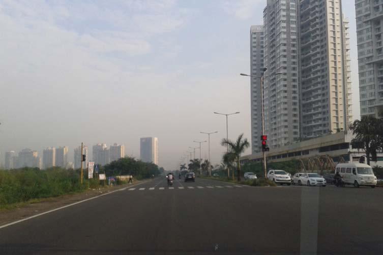
Photo Credit: Rohini LakshanéOwn work. Licensed under CC BY-SA 3.0 via Wikimedia Commons
Skyline of Navi Mumbai.
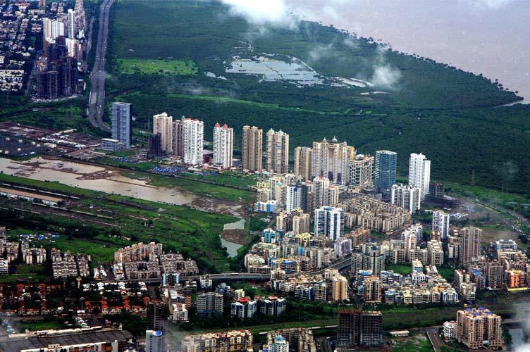
Photo Credit: Anurupa Chowdhury - Own work. Licensed under CC BY-SA 3.0 via Wikimedia Commons
make a good sales pitch and to offer people leverage, a lot of promises were made by the various local authorities, some which said that the Navi Mumbai would be the next Mumbai and things will gradually shift down from there (Nariman Point was to be shifted to CBD). Now, these were all tall claims and I don’t think such a major transition is possible, this was one of the major reasons Navi Mumbai was labelled“failed”. But as time passed and logic dawned upon people, that label washed off
and people saw all the good things the city has to offer. I think apart from politics which was obviously a key aspect, the fact that you can’t just shift everything when it is running at its peak performance and with it having a selfsustaining ecosystem of its own. Again I feel the hype was create so that the brand “Navi Mumbai” could be sold, which did and which built its own identity in the process, an identity which is peaceful, inviting and family friendly.
‘23June 2015 | CITY OBSERVER
Suraj has a slightly differing view on the development of the city. He says,
Regarding the business district moving into Navi Mumbai, this wasn’t a political stunt which did not work. It was rather a very wishful plan which failed horribly. Belapur was positioned as being the next Nariman Point. Early connectivity issues and infrastructure were amongst the biggest deterrents in this plan flopping. They tried to move (partially even), the business district to an area, with horrible infrastructure support (electricity, water, roads, public transport, etc.).
Development could have taken place much faster, if the city had its infrastructure planned properly. Even today, roads are being widened, public transportation is being strengthened. The infrastructure, the city has today, is not able to support what it has grown into. If all this had been planned at pivotal stages, I believe, the city would have definitely grown much faster.
When Navi Mumbai was started to be promoted, one of the primary parts of the axle behind its promotion was that the airport was to shift to Navi Mumbai. This was then probably a political gimmick played to pull the crowd across the bridge. The airport coming in Navi Mumbai is still in planning stages for many years, though now, it may actually end up into a reality soon.
Amit Ramakrishnan, a Vashi native who left the city in 2002, chimes in:
The plan to move Mantralaya to Navi Mumbai was a non-starter. Thus, when the town came to fruition, it was always a satellite township rather than a realignment of Mumbai’s axis.
So in the 80s and 90s, it was considered to be an exurb of Mumbai where the houses were less expensive. However the advantages were a planned layout and good infrastructure. Land was allotted to religious and cultural institutions at less than market rates. This led to the establishment of many temples/churches/ mosques which were suitably large and over time able to generate sizable trusts. Also, there was the founding of many Christian schools (Father Agnel’s, Sacred Heart, St Mary’s, etc.) which were of reputable quality. Since these
schools were founded in the 80s, the fledging Vashi community had access to multiple good schools, making it an interesting place to move to.
Thus, the bulk of the demographic that moved into Navi Mumbai either worked in the Industrial belt on the Thane-Belapur Maharashtra Industrial Development Corporation (MIDC) area or had access to private transportation into the city. This made Navi Mumbai a white collar satellite township.
His views are a little different as a visitor though, as he sees the city grow exponentially with each annual visit. Over the years, with the increase in public transportation and a greater influx of people into Navi Mumbai, the demographic has changed greatly. From being a quaint burb it has become an urban snarl akin to the “suburbs” of Mumbai. The increased demand in housing has led to the construction of less aesthetic and lower build quality apartments. The infrastructure now in Navi Mumbai cannot sustain the new population and all development occurs in real time thus leading to interminable push and pull of urban living.
He sees a change in the demographic as well. Since the early 2000s, there has been a greater influx of people from other parts of the county, a younger demographic 20-40s, for jobs in newer fields like Information Technology (IT), Biotech etc. In addition, the traditional industries like heavy chemicals,etc. have grown in the MIDC areas leading to people working in those fields settling in the area.
‘
Apart from the resident’s inner views of this bustling Satellite town, census data is starting to show just how much of Mumbai’s potential immigrant population has been absorbed by Navi Mumbai. The naysayers of the early 90’s have one common complaint – that the city didn’t see the extent of growth projected at the speed that was prophesied. What wasn’t taken into account then, which is being recognized more and more now, is that Navi Mumbai was perhaps never going to replace Mumbai as the centre of activity. Rather, when it was allowed time to grow organically at its own pace, it was an attractive alternative to the bustle of Mumbai,
24 CITY OBSERVER | June 2015 FEATURE ARTICLE
‘
‘ ‘ ‘
‘
‘ ‘
with the unique advantages of space, infrastructure and institutional support. It developed a culture and place of its own in the ecosystem of the greater Mumbai area. It is beginning to be recognized as the Twin City it truly is.
REFERENCES
1. Annapurna Shaw, Making of Navi Mumbai; Orient Black swan Publishing (January 1, 2004); ISBN-10: 8125026002
2. City and Industrial Development Corporation, Navi Mumbai, Project Paper No.9, Sustainable Urban Development: A case of New Bombay (Navi Mumbai), Institute for Housing and Urban Development Studies, Rotterdam, September 1997
3. Annapurna Shaw, “Satellite Town Development in Asia –The case of New Bombay, India “,Urban Geography, 16, (1995), pp. 254-271
4. Julian Jain, “Mainland Shift – Charles Correa and the making of Navi Mumbai “, Uncube Magazine No. 11Charles Correa, pp. 30-38
5. Kanika Arora , “Whose City is it anyway? Investigating Navi Mumbai’s City Fathers”, Graduate School of Design, Harvard University
About the Author
Neha Krishnan is an architect, writer and urbanist. Having spent several years practicing and teaching architecture in Chennai and Mumbai, she is now pursuing a degree in Urban Planning from Columbia University. Her areas of interest include informal settlements, urban history and education.
25June 2015 | CITY OBSERVER
Vashi Sector 17. Photo Credit: Sohan D’souza Belapur Urban Haat. Photo Credit: CIDCO Urban Haat
CITY OF TOMORROW–BO01, MALMÖ, SWEDEN
 by Shruti Shankar
26 CITY OBSERVER | June 2015
ON LOCATION
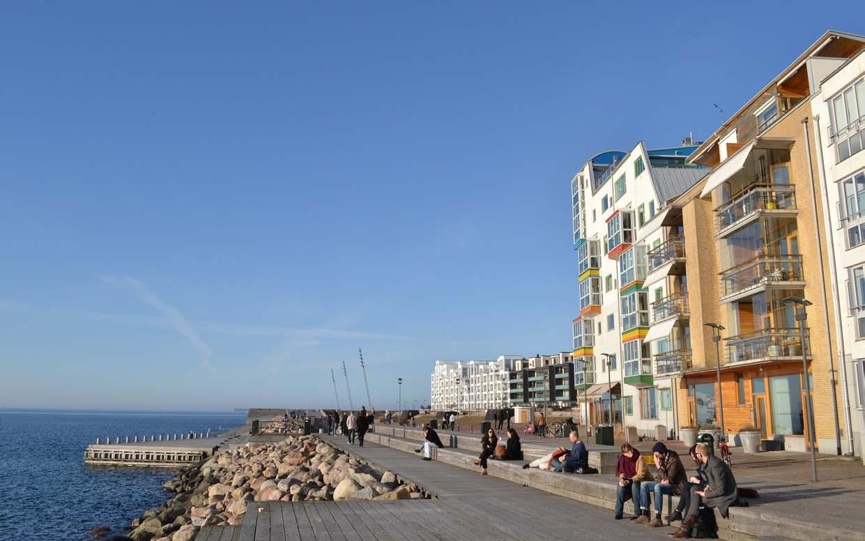
Facing page image: BO01 board-walk
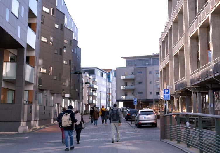
What would the ‘City of Tomorrow’ look like? The BO01 housing exhibition hosted in 2001 by the Swedish city of Malmö ventured to provide a vision and template for this city building experiment. The BO01 project, which was the first in a series of developments in the Västra Hamnen (Western Harbour) district of Malmö, was planned by the Swedish architect Klas Tham and envisaged by the city of Malmö as a mid-rise high-density development. Covering one quarter of a square kilometre, BO01 has over 1400 housing units, commercial establishments such as cafés and shops, public and private schools as well as new parks and public open spaces which serve the entire city of Malmö.
As one walks through the place, the BO01 area looks like a compendium of best practices in urban design. Rather than arrange them in a grid, the city blocks here seem to be placed in a sort of planned randomness that create winding paths through the neighbourhood revealing urban spaces that gradually unfold to the pedestrian. Cafés spill out onto paved streets which then lead to a variety of open spaces including public squares and private yards of different sizes. Every so often, the lanes emerge upon unexpected views of the open sea on the western edge of the site. The buildings are of a wide variety giving no room for monotony and creating the pleasant effect of a collaged street façade.
Clearly, people seem to be the priority in design here (even when wider roadways are provided for public transit buses and cars) by the use of wide paved footpaths, landscape buffers and well-designed signage. It is difficult to keep from pointing and exclaiming at every turn – from the thoughtful integration of functional elements like utilities to the abundance of planned green spaces and public activity areas, BO01 gets many details right.
Shared street in BO01.
27June 2015 | CITY OBSERVER
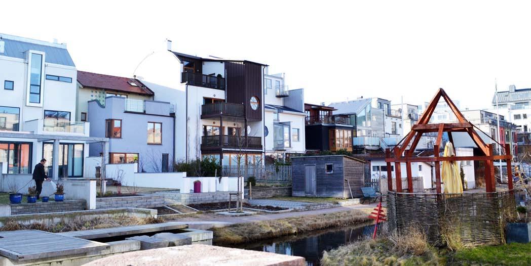
One of the most interesting places on the development is the BO01 board-walk on the western edge, abutting the Baltic Sea and lined by the taller buildings in the development that act as a wind buffer to the rest of the site. The openness, simplicity and versatility of this space have made it an immensely popular destination for visitors as well as residents from across Malmö city, making it a wonderful public promenade. Buildings within the interior are protected by the taller sea-facing structures and are of a finer grain, creating a more human scale of spaces.
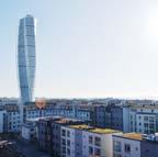
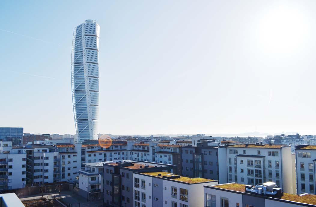
Crowned by the landmark 54-storey Turning Torso apartment building designed by Architect Santiago Calatrava, the few city blocks which encompass the BO01 project therefore feel more like the fabric of an old town updated and adapted to the present day with good design and common sense, and less like a techno-centric vision for the future of urbanism.
However, despite the lack of overt display of technology, there is quite a bit of it in use to achieve some of the targets of BO01’s agenda for ecological sustainability. For instance, the entire development aims to use 100% renewable energy sources. This includes a 2MW wind turbine located in the northern portion of the harbour, which in conjunction with 120m2 of photovoltaic panels on buildings provides the electricity for the homes. The district heating and
cooling system employs heat pumps which extract heat and ‘store’ cold in a natural underground aquifer, providing cooling for the office buildings in the area in summer and heating in winter. Similarly, water is treated in a natural manner with green roofs collecting storm-water and excess runoff channelled through well designed gutters to the sea or the central canal. In certain locations, the collected water is buffered through topographic elements such as waterfalls and ponds to create pleasing landscape elements along the way. All the homes have been wired to provide the residents with quick access to electricity and water consumption data in order to regulate usage.
Sustainability is also integrated into planning for transport. It was originally planned to have parking provided at a ratio of only 0.7 cars per apartment to reduce the dependency on private automobiles. To offset this, infrastructure for cycling, including abundant cycle lanes and parking facilities have been provided in conjunction with public transport connectivity to Malmö city. A mix of uses creates a vibrant neighbourhood with attention given to the design of the street frontage, promoting safe and pleasant pedestrian paths.
While the development has become well known for adopting such best practice design ideals, with people from all over the world visiting to study it, much of
28 CITY OBSERVER | June 2015
Human scale and shared green spaces within the development.
ON LOCATION
the innovation in BO01 has also been in the planning procedures. Architect Klas Tham who was awarded the task of coming up with the philosophical basis for the project, combined the vision for an environmentally sustainable city with the ideal to make spaces that are conducive to human as well as societal health, turning it into a holistic agenda.
The means to achieve this was twofold. Firstly, the goals and strategies to build this project were agreed upon by a process of ‘Creative Dialogue’ which included the designers, a host of selected developers as well as the officials of Malmö City. This process enabled the sharing and honing of the philosophical basis for the project and created an atmosphere of mutual learning for all the parties involved. Ultimately, the developers who would be responsible for building up the individual parcels within the neighbourhood were committed to certain standards of material, spatial and technological quality as well as environmental standards and energy consumption limits before any of the land parcels were sold. These are set out in a ‘Quality Document’ that emerged from
the dialogue and has become a part of the approval process.
Secondly, the master plan for the development was formulated to lay out a physical structure for the development that accommodated the goals from the ‘Creative Dialogue’ process. As a result of this, a high density neighbourhood could be designed without giving up a good quality of life for the residents. One of the strategies to moderate the aesthetic impacts of high density living (in a departure from anonymous tall housing towers) has been to place an emphasis on diversity - no two buildings look the same and there is a mix of unit types, sizes and designs to create the effect of a diverse city district. Therefore the participating developers and architects have been allowed the freedom to innovate and ‘plug-in’ to the development, thereby contributing to its diverse feel while upholding it’s philosophy and quality standards. This has been a great example of collaboration to integrate the diversity of multiple site- and userspecific design projects with the larger goals of a sustainable district.
29June 2015 | CITY OBSERVER
View of Turning Torso.
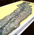
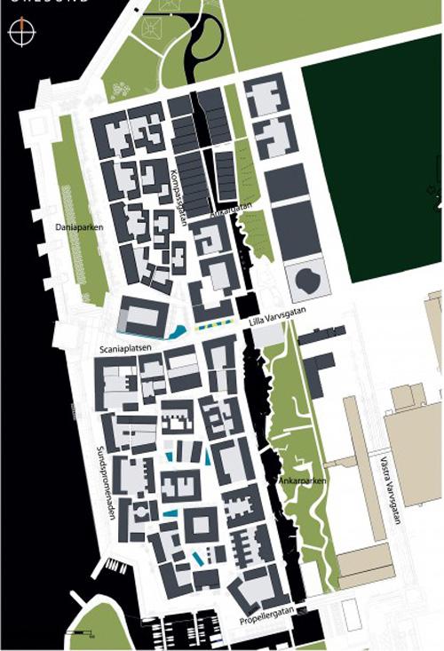
BO01 Master plan.
courtesy:
All this does not mean that there have not been problems with BO01. There are some significant gaps between the vision for the city and what was built. The planned diversity, for instance, while apparent in the built fabric is not achieved in the demography of people living in the area. While Malmö has a significant mix of locals and foreign born residents, most of BO01 is inhabited by affluent white families only. For people of a lower income block, homes in BO01 are no longer affordable. As a consequence of the affluence within
the area, there have also been other issues, namely high rates of energy consumption and a greater auto ownership (which makes the 0.7 per unit parking norm inadequate).
Such challenges, while negating some of the original aspirations for BO01 have nevertheless been regarded as an opportunity for feedback, evaluation and improvement in the future city planning processes at Västra Hamnen. Specific funds have been allocated by
30 CITY OBSERVER | June 2015
Image
www.urbangreenbluegrids.com
As one walks through the place, the BO01 area looks like a compendium of best practices in urban design.
‘ ‘
ON LOCATION
the city government in Malmö to assess the impacts of decisions in BO01 and provide suggestions for modifications in future systems.
On the strength of the BO01 experiment, further pockets of land in Västra Hamnen have been developed, to turn the erstwhile industrial brownfield site of the western harbour into Malmö’s sustainable ‘green’ district. The second phase of development at Flaghussen has incorporated a much larger mix of property rates for ownership as well as rental housing, thereby increasing the affordability and demographic diversity of the district. In Flaghussen as well as in the third phase at Fullriggaren, homes have been designed to employ passive heating and cooling techniques. Fullriggaren has also explored the idea of employing a carpool system with mandatory enrolment for residents, which has helped retain low parking spaceto-unit ratios. All of this is being done along with the extension of the original principle of the BO01 master plan - to create a high density of development which
About the Author
nevertheless has a mix of open spaces and green corridors that promote sustainable and healthy city living and a good quality of life for its residents.
In its bid to envision the ‘City of Tomorrow’, the BO01 project has hit many of the right notes in terms of urban planning and design. Västra Hamnen has been improving on these early strides to expand into a great example of sustainable city living. This undertaking to create a sustainable vision for the future of urbanism by the city of Malmö has set a sound example of how good design and great leadership can bring about an incremental yet holistic and sustainable process to build the city of the future.
All images by the author unless otherwise credited.
REFERENCES
1. Gary Austin, ‘Case study and sustainability assessment of BO01, Malmö, Sweden’, Journal of Green Building (Summer 2013), Vol. 8, No. 3, pp. 34-50.
2. Website of the Malmo city government- http://malmo.se
Shruti Shankar is an Urban Designer and Fulbright fellow, with professional experience in urban development and architectural design projects. Her portfolio includes master planning, strategy development, planning for sustainability, design for infrastructure, environmental and landscape systems in urban areas as well as data-driven design including public life surveying and formulation of metrics for feedback and evaluation. She enjoys writing and drawing about the making of cities. As a core team member of the UDC, she wears many hats (often literally). Shruti currently lives in California and is always up for a cup of chai, conversation and board games.
31June 2015 | CITY OBSERVER
Urban fabric of BO01.
MODERN ARCHITECTURAL HERITAGE IN TRIVANDRUM
 by Thomas Oommen
32 CITY OBSERVER | June 2015
An account of public engagement through heritage walks CITY TRAILS
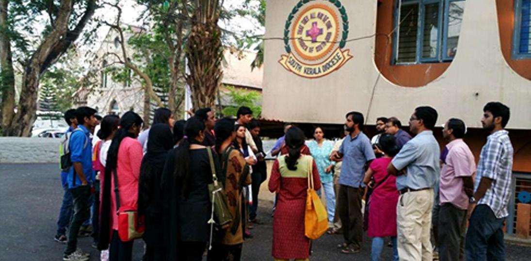
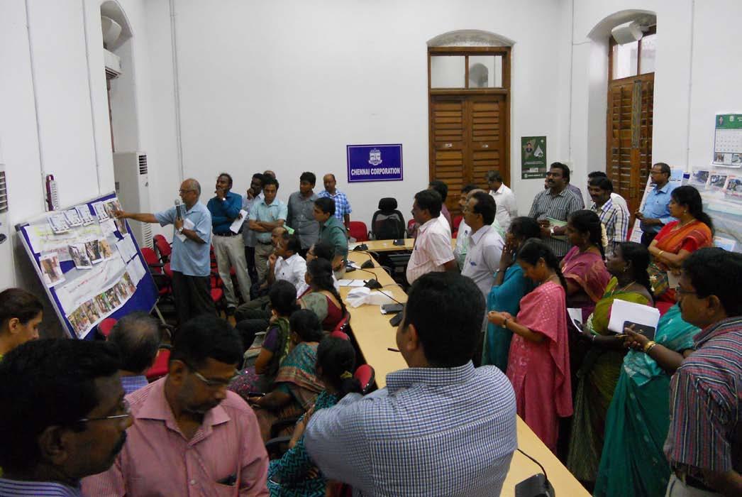
Heritage Walk, January 2015: Author explains a point about the Corporation building Photo Credit: Ar. Maya Gomez
The complex question of what architectural heritage is becomes even more so when one considers the inclusion of modern architecture in the category of heritage. And yet it is time in India, to consider this question seriously. The recent controversy over the changes proposed to Architect B.V. Doshi’s Centre for Environmental Planning and Technology (CEPT) university campus buildings has brought the problematic of conservation of early post independent modern architecture to the foreground, especially since they are very much living heritage, housing active institutions.
There are at least two challenges here. The first is the Archaeological Survey of India (ASI) which technically is the custodian of built heritage. Serious efforts have to be made to revive and renew the archaic institution that is the ASI so as to change its colonial attitude towards the protection and conservation of monuments, before it can as an institution even consider specific questions such as modern architecture as heritage. This renewal is a battle that has been afoot for a while. Organizations like the Indian National Trust for Arts and Cultural Heritage (INTACH) have attempted to create an Indian charter for conservation, and ways of tackling the uniquely Indian situation of ‘living heritage’, albeit for pre-modern architecture. The second challenge and the concern of this article is public involvement and awareness towards modern architecture and it’s recognition as cultural artefacts worthy of protection. My attempt here is to trace the experience of public awareness and engagement through heritage walks in the city of Trivandrum, Kerala.
BACKGROUND
Modern architectural education in Kerala marked its 50th year in 2014. It was in 1964 that a department of Architecture was created in the University of Kerala at the initiative of the architecture wing of the Kerala Public Works Department (PWD). The initiator of this program was the chief architect of the Kerala Public Works Department, Prof. J.C. Alexander who studied architectural engineering at Colorado and later worked for the New York firm of Harrison & Abramovitz on the United Nations Head Quarters (UN HQ) building. His junior architects at PWD such as Ar. Ramaswamy, Ar. Thomas Panicker etc. who were freshly minted architects from the Indian Institute of Technology (IIT),Kharagpur– one of India’s first post independent architecture schools, were also important coconspirators. As the celebration of this event was initiated by the Indian Institute of Architects (IIA) Trivandrum chapter, one of the programs that were envisioned was a public engagement with architecture. And it is through this vision that the idea of architect-led heritage walks in the city of Trivandrum came into the picture.
What was most interesting about the initial conception of heritage walks was the natural inclination of the architects themselves to organize this walk only in the historic fort area of Trivandrum– the precinct marked by the city’s major temple, royal palaces and the houses of the ruling families. Whether this was part of an implicit shame that modern architecture had not created cultural artifacts worthy of public interest or whether it was an instinctive calculation that public engagement/participation was easier if the walk dealt with the familiar ‘traditional’ architecture can only be speculated on.
33June 2015 | CITY OBSERVER
CITY
However, this was soon corrected and consequently it was decided to conduct a modern architecture heritage walk as well in the civic/institutional area of the city known as PMG-Palayam with this author as the walk leader. The author consequently lead a group of 20, every third Sunday, from October 2014 to March 2015 on a heritage walk that lasted about an hour. The theme of the walk was not just post independent
modern architecture but the architecture built by the Public Works Department (PWD) of Kerala, starting from its inception under the Maharaja of Travancore (and the British regent) in 1860 headed by British Chief Engineers to its transition after independence as a government organization under Indian architects and engineers.
34 CITY OBSERVER | June 2015
Trivandrum Corporation Building: The Aesthetic of the Brise Soleil. Built in the early 1960’s by architects from the Kerala Public Works Department and Prof. J.C. Alexander. Photo Credit: Ar. Maya Gomez
TRAILS
CHALLENGES AND RESPONSES
The first lesson for this author was the scepticism of the architects themselves about the ability of the public to appreciate period modern architecture. ‘Modernism’ was seen as a discourse internal to the discipline of architecture not understandable by a public, even one as literate as in Kerala. Modernism was seen as something disconnected from narratives of local culture and history – both of the city and the state. There was also a distinct sense that modernism was heavy on abstract concepts as opposed to the phenomenological and experiential nature of traditional architecture which was assumed to have a more immediate sensory appeal.
These were of course very real challenges. The challenge of modern architecture is that much of its appreciation requires a movement from the mind to the eye – that is one needs to grasp concepts in order to experientially understand the architecture. What was critical therefore was a narrative that could deploy these concepts.
The experience of this author over six months is that it is possible to create such a narrative about Indian modern architecture. This was done by associating it with the Nehruvian project of modernization, secularism and invoking the unbridled optimism of that era in science and technology. It was found that the characteristics of modernism in public buildings was remarkably clear when its abstract prismatic forms and rejection of traditional precedent was associated with the project of secularism, and it’s language of brise soleil, spatial ‘efficiency’ and reinforced cement concrete (RCC) was connected to the tools/ products of science and technology. This association was strengthened by associating the construction of new public buildings with the other major developmental projects of that era (Bhakra Nangal, Steel plants etc.) within the narrative of Nehruvian modernization.
Modernism could also be well explained within a narrative of local history. The primary narrative was the story of the Kerala PWD itself. Begun under the progressive Maharajahs of Travancore to modernize the state and directed by British engineers and draftsmen, the story of the city as well as its politics could be narrated through the buildings created by
the PWD to house the progressive institutions created under the Maharaja - the public library, the Victoria jubilee hall, the Travancore university buildings, the court and secretariat buildings and so on. Since many of the residents of Trivandrum are enthusiastic about this history and appreciative of the progressive agenda of the Travancore kings, critical questions like why Gothic or Greco-Roman style architecture was chosen for these civic institutions built by these rulers could be put forth. The other connection to local history were the architects themselves – whether it be the story of Prof. J.C. Alexander who travelled to the US to study or that of his team of young architects who were among the first to graduate from IIT Kharagpur – one of the first post independent technical universities. The other narrative/connection was to compare ideas/concepts of abstraction and rejection of traditional forms with parallel if not similar ideas in modern Malayalam literature – especially in Purogamanasahityam - the progressive literature movement and Uttara adhunikatha, i.e. postmodernism.
The narratives that seemed to have the most resonance however was the parallel drawn between power and architecture – that is the ruling ideology of an administration and the architectural style it chose to build in. For example; the difference in approach of a British administration that in the spirit of Lord Macaulay took ‘civilizing the natives’ as the aim of British rule in India versus the more ‘benevolent’/’sensitive’ attitude of later British administrative ideology that aimed at winning the affection/admiration of the natives, was argued to be reflected in the public architecture under these two ideologies. The Greco –Roman Classical architecture of the Trivandrum Public Library that attempted to reflect ‘European’ ideals was therefore contrasted with the Indo-Saracenic Napier Museum which combined a whole shopping list of ‘Indian’ elements. The hollowness of an ‘Indian’ architecture conceived by the British as a simple combination of ‘Hindu’, ‘Buddhist’ and ‘Islamic/Saracenic’ elements, could then easily be talked about as reflecting the naïve British conception of India that the nationalists vehemently opposed. In this context, the choice of modern architecture as the architecture for the new Indian republic was relatively easily explained and understood.
35June 2015 | CITY OBSERVER
THE WAY FORWARD
There is much confusion that exists among the public about the phrase ‘modern architecture’ itself since both early post independent architecture as well as contemporary steel, glass and aluminium panel buildings that are increasingly making up the Indian urban environment are both popularly called ‘modern’. Adding to this misconception is the absence of a popular historical narrative that helps explain Indian architectural modernism as uniquely rooted to the cultural and political aspirations of a pivotal generation that came of age in the 1950’s and early 1960’s. Though scholars and cultural commentators might decry the dissipation of Nehruvian ideals or values in the present era of politically conservative hyper capitalism, this narrative helps identify modernism as an integral part of what the city really is - a living historical record of generations past. Importantly, modernism must be presented as a system of aesthetic values that reflect and parallel the story of local actors and characters -whether they are architects, poets or bureaucrats as well as the story of national politics and leadership rather than an imported aesthetic preference. This is critical since the mistake often made even by architects is to confuse modernity and modernism as imported virtues without local roots. And this was the critical learning for me as an architect - the narratives about architecture which have the most resonance are those that help ‘read’ works of architecture as a reflection of who we are, what we value and what our aspirations are (or were) as individuals, institutions and as a society.
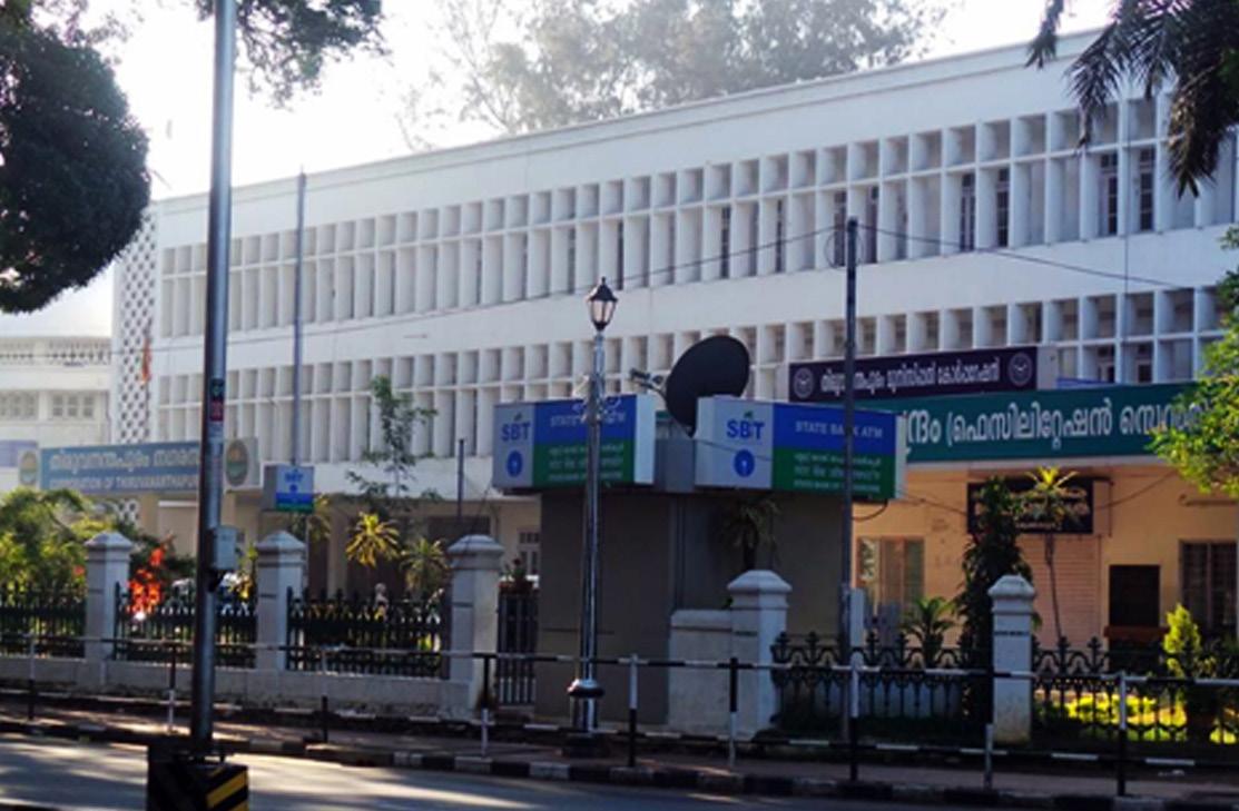
Chief Engineer’s office: Built to house the chief Engineer of the PWD of the Travancore princely state, it currently is the Post Master’s General Office
Architects: Travancore Public Works Department Built: 1898 Photo Credit: Ar. Maya Gomez
36 CITY OBSERVER | June 2015
...the narratives about architecture which have the most resonance are those that help ‘read’ works of architecture as a reflection of who we are, what we value and what our aspirations are (or were) as individuals, institutions and as a society.‘
‘
CITY TRAILS
Front Façade of Kerala University Students Centre showing concrete jaali wall.
Built: late 1960’s.
Architects: Kerala PWD, Thomas Panicker & Jayachandran.
Photo Credit: Author
About the Author
Thomas Oommen is an architect, urbanist and theorist. He holds dual masters’ degrees in architectural design and sustainable urbanism from the College of Architecture, Texas A&M University. Thomas is principal architect at his partnership firm, Collaborative Urbanism which is based in New Delhi and has worked as an Assistant Professor at Sushant School of Art and Architecture in Gurgaon and R.V. College of Architecture Bangalore from 2012 to 2015. He specializes in and teaches courses related to modern architectural theory, history and criticism, urban design and architectural design. His most recent publication is the “The Politics of Architecture” in Economics and Politics Weekly, April 2015.
37June 2015 | CITY OBSERVER
CHENNAI TRANSFORMS INTO A PEOPLECENTRIC CITY
 by Shreya Gadepalli
38 CITY OBSERVER | June 2015
MOBILITY AND THE CITY
In an age of vanishing footpaths and widening carriageways, the Corporation of Chennai is introducing a host of initiatives prioritising pedestrians and cyclists—giving these social heroes their due. From adopting a progressive policy that makes walking and cycling—or non-motorised transport (NMT)—its priority, to rigorously implementing the policy through its Chennai Street Design Project, the city is transforming itself from a car-centric to a people-friendly city. The Institute of Transportation and Development Policy (ITDP) has been working closely with the city since 2009 to help plan, design, and implement several sustainable transport initiatives.
Until recently, Chennai’s footpaths were only “footwide” paths—with trees, utility boxes, and bus stops obstructing movement and forcing pedestrians to walk on the carriageway. Despite poor pedestrian and cycling infrastructure, over six million trips are made on foot and cycle everyday in Chennai—a third of daily trips. Public transport journeys—another third of all trips—also start and end on foot (or cycle). As in other
cities of India, walking and cycling is an integral part of Chennai’s transport landscape.
With over 10,000 traffic crashes reported every year, Chennai has one of the highest rates of road deaths in the country. Four people are killed on the roads of Chennai every day. Pedestrians and cyclists are highly vulnerable, and the absence of safe walking and cycling facilities worsens the situation.
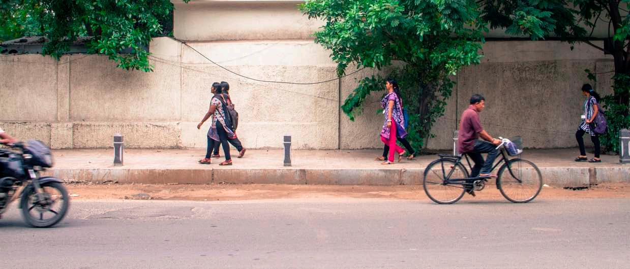
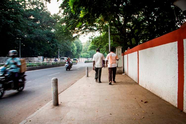
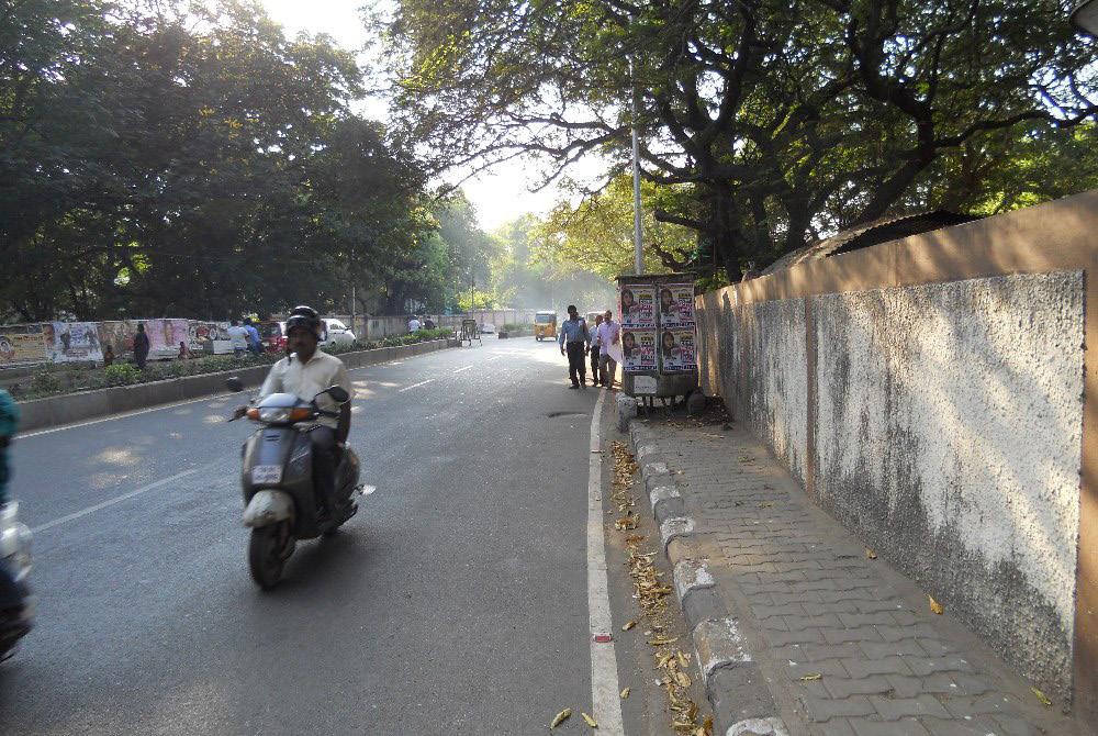
Recognising the urgent need to transform the scenario, the Corporation initiated the Street Design Project to build high quality footpaths on all 471 Bus Route Roads in the city in 2012.
For the first time, the Corporation has begun reimagining the city’s arterial roads as “complete streets,” taking into account the needs of all the street users. The new designs include continuous footpaths, separate cycle tracks (on selected streets), and organised on-street parking. The designs also integrate bus stops, street vending and all other street furniture, locating them carefully such that they do not hinder the walking experience of pedestrians.
39June 2015 | CITY OBSERVER
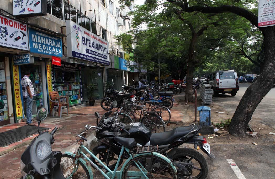
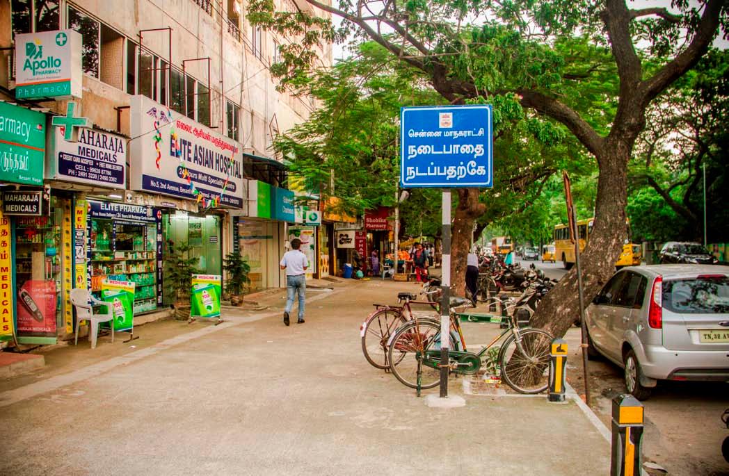
Above: A redesigned sidewalk in the Besant Nagar neighbourhood of Chennai Facing page: The footpath at Ethiraj Salai after intervention
MOBILITY AND THE CITY
The street design process involves carrying out detailed topographic surveys as well as surveys of pedestrian and motor vehicle use along each street. Architecture professionals are empanelled to prepare detailed designs for the streets, taking into account the site conditions.
The new footpaths are designed per the Indian Roads Congress’ revised Guidelines for Pedestrian Facilities (IRC 103:2012). The updated IRC guidelines stipulate that pedestrian facilities are to be designed to ensure continuous, unhindered walking spaces that reduce
conflicts between pedestrians and vehicles. While executing the project, the Corporation of Chennai leads an inclusive process involving multiple stakeholders, including the general public, utility service agencies, traffic police, and disability rights associations. In addition, the Corporation convenes regular meetings of the Non-Motorised Transport Subcommittee of the Chennai Unified Metropolitan Transport Authority (CUMTA) to review progress and encourage the exchange of information among stakeholders.
Before and after images of the footpath at Egmore, Chennai
40 CITY OBSERVER | June 2015
41June 2015 | CITY OBSERVER
Before and after images of the footpath at Besant Nagar 2nd Avenue
‘
After the first phase, 26 streets now have wide and continuous footpaths and work on the 60 streets has commenced as part of the second phase. Following the footpath improvements, Chennai’s citizens have voted with their feet. People who previously walked in the carriageway are now using the widened footpaths—clear evidence of the improved convenience for pedestrians.
The city’s commitment to safer access for pedestrians and cyclists was further reinforced when Chennai Corporation’s Council adopted a progressive NMT policy in 2014. The policy aims to arrest the current decline in walking and cycling in the city by creating safe and pleasant network of footpaths, cycle tracks, greenways and other NMT facilities.
The policy is not an empty rhetoric. Through the policy, the Corporation has set ambitious goals: by 2018, build safe and continuous footpaths on at least 80% of all streets, increase the share of walking and cycling trips to over 40%, and, most significantly, eliminate pedestrian and cyclist deaths. The city aims to achieve these goals by mandating various measures through this policy. These goals are also backed up with funds—the policy mandates that a minimum of 60 percent of the Corporation’s transport budget is allocated to construct and maintain NMT infrastructure.
Additionally, to ensure long-term sustained change, the Corporation has initiated a technical training programme for Corporation engineers. Organised
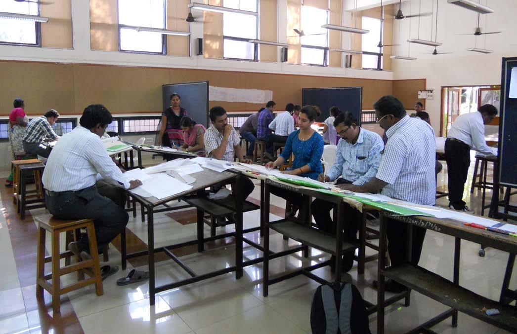
42 CITY OBSERVER | June 2015
Corporation engineers at class.
By rewriting the hierarchy—putting pedestrians, cyclists, and public transport users at the top, where they always should have been—Chennai is showing the way for other Indian cities.‘
MOBILITY AND THE CITY
in collaboration with Anna University and ITDP, the certification programme aims to build technical expertise on NMT user needs, design principles, planning, and implementation; improve management capacity and disseminate best practices. Three batches of approximately 20 engineers each have successfully graduated from this course.
By rewriting the hierarchy—putting pedestrians, cyclists, and public transport users at the top, where they always should have been—Chennai is showing the way for other Indian cities. The city has won several
accolades for its progressive initiatives including the Best NMT Project award at UMI conference Delhi, a special mention at the Volvo awards, and the India Today Best City Award 2014. With its bold move of adopting the NMT Policy and implementing pedestrian friendly streets, the city is leaping ahead in its vision to improve the quality of urban life for all its citizens, regardless of gender, class, and physical ability.
About the Author
Shreya Gadepalli is the India Regional Director for the Institute for Transportation and Development Policy (www.itdp.in). She has worked with ITDP for over fifteen years on various sustainable transport projects across the world. Ms Gadepalli has been key player in the development of Bus Rapid Transit (BRT) in India and is regarded as one of the foremost experts in BRT and non-motorized transit planning in the country.
43June 2015 | CITY OBSERVER
All photos by Santhosh Loganaathan
Corporation Engineers presenting their work to the Commissioner at the culmination of the course.
EMERGENCE OF LANDSCAPE URBANISM: A STRATEGY FOR FUTURE CITIES
by Shantesh Kelvekar
44 CITY OBSERVER | June 2015 FEATURE ARTICLE
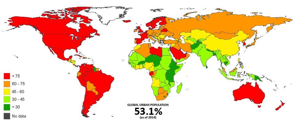
Global Urbanisation Trend - 2014. Statistics Source: Euromonitor International
Cities have constantly expanded since the dawn of the industrial revolution. According to the Global Health Observatory of the World Health Organisation in 2014, 54% of the global population has moved to urban centres. It is estimated that by 2017 even the developing nations would witness a majority of people living in urban areas.1
Due to this immense urban growth, the pressure is increasing tremendously on urban planning organisations.
The current urban transition is drastic and conventional planning methodologies seem to operate less efficiently. With neo-liberal policies, as the global economy starts growing exponentially, increased pressures on the built environment need quick solutions. Vertical massing is seen as this quick solution to cope spatially. Certainly the repercussions are not considered!
As Rem Koolhaas states (with respect to architecture though), there is a discrepancy or time-lag between the acceleration of culture and the continuing slowness in architecture, the case becomes intensely factual with respect to the current urban growth as well where the economic and social conditions are altering rapidly.2 With this condition becoming more and more real the challenges are increasing to the conventional planning practices.
1 Source: Global Health Observatory data on the website of World Health Organisation (www.who.int)
2 Rem Koolhaas, ‘Rem Koolhaas’ an interview to Marcus Fairs, Icon Eye (2004)
‘Design with Nature’ published in 1969 by the Scottish landscape architect, Ian McHarg provides a step-bystep prescriptive methodology to break the regional scale into smaller parcels and assign appropriate and diverse uses based on existing factors and logical reasoning rather than the much broader notion of zoning. He also provided an alternate outlook on regional planning through a lens of ecological consideration. The book instantly gained popularity, and was widely considered among the fraternity as it provided a holistic deliberation as opposed to the narcissistic modernist ideas, a style McHarg described as ‘Dominate and Destroy’.
Erik Swyngedouw states that the ultimate aim of design, planning and architecture is to change the given socio-environmental ordering in a certain manner. Like any intervention, this erases at least partly what is there in order to erect something new and different.3 As designers, we constantly strive to minimise this factor, and yet our conventional design methodologies seem to be less and less supportive with respect to larger developments. And, with increasing migration of rural to urban the pressure to deliver on planners is intense whilst our conventional planning methodologies are getting more and more obsolete.
However, in the early 1990s yet another ‘...ism’ was emerging as a result of wasteful land practices –Landscape Urbanism.
3 Erik Swyngedouw, ‘The Violence of Sustainable Urbanity’, Metro Politics (2014)
45June 2015 | CITY OBSERVER
Landscape Urbanism is an interdisciplinary discipline and a response seeking solution to the problems created by our built environments, and an attempt to provide a new and a holistic consideration towards the upcoming urban. K Bharadwaj says, ‘Landscape Urbanism is a theory of urbanism arguing that landscape, rather than architecture, is more capable of organising a city and enhancing the urban experience.’4
In the late 1990s, the phrase ‘Landscape Urbanism’ was used by landscape architects to refer to the re-organisation of declining post-industrial cities, such as Detroit. In the early 2000s, it was used to mean a highly flexible way of integrating large-scale infrastructure, housing and open space network. By late 2000s, the phrase became associated with highly commercialised, multi-phase urban parks, design of future cities, regional developments etc.
4 K Bharadwaj, Physical Geography, New Delhi, Discovery Publishing (2009),P4
However, what binds the phrase ‘Landscape Urbanism’ in the last two decades (and looks that it will continue to do so) is the evolution of this discipline – where ‘landscape’ is more understood in terms of conceiving and engaging with urban, and less in terms of scenographic art.
Landscape is used as an adaptive strategy, as it is capable to evolve through changing and altering scenarios, and fit itself into the context. The urban is diagrammed as a landscape; a complex and a process oriented ecology that can be connected to local, regional and even global scales, and understood in terms of its future orientation and performative potential – thereby making landscape capable to operate at diverse scales. Landscape – when used as a tool to engage with the urban – can be directed towards performance oriented design, and generate a measurable outcome as well. Finally, the landscape can amalgamate with multiple disciplines to comprehend, complement and enhance their performances.
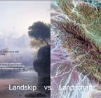
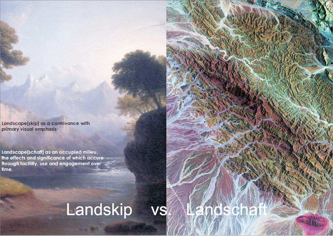
Landskip vs. Landschaft - the difference in meaning - while English Dictionary romanticises the meaning, the German Dictionary prefers to emphasise on the working of the territory.
46 CITY OBSERVER | June 2015 FEATURE ARTICLE
47June 2015 | CITY OBSERVER
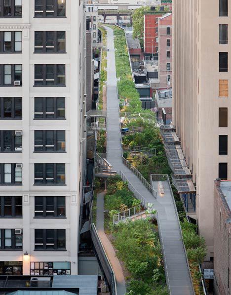
The Highline, New York City- A regeneration of defunct elevated rail tracks creates an active lung space for New Yorkers.
Photo Credit: Iwan Baan
Therefore, landscape as a tool to organise a city rather than built form seems promising and viable in opposition to conventional urban design or planning practices.
In his essay ‘Terra Fluxus’, James Corner states, ‘In the opening years of the twenty-first century that seemingly old-fashioned term landscape has curiously come back into vogue. The reappearance of landscape in the larger cultural imagination...impacts upon rural areas by massive urban growth’.5 ‘Landscape’ in the urban domain is not perceived as a stereotypical representation but as an integrated element of urban. The critic is expected to understand the value and meaning of ‘landscape’ as more in terms of ‘how it works’ and less in terms of ‘how it looks’.
James Corner further states that the union of landscape with urbanism promises new relational and systemic workings across territories of vast scale and scope, situating the parts in relation to the whole.6 At the same time the separateness of the term landscape from urbanism acknowledges a level of materiality, intimacy and difference, that always intends to complement one another – the term ‘landscape’ in this case holds dual level –one of performance oriented and the other of experiential.
It is, however, time that will prove the success or failure of the new emerging discipline of ‘Landscape Urbanism’. Landscape in its natural form is promising and will eventually adapt to changes, yet it takes time to cure and mature. The role landscape intends to play is vast, and methodology accommodates diverse fields and disciplines into consideration. With no set rule or method (as the discipline is still evolving), Landscape Urbanism provides diverse, opportunistic solutions. Although, it seems less likely that there will ever be a set methodology to approach a situation, even in future – and I believe that is how it should be.
For now the ‘Emergence of Landscape Urbanism’ seems to be coming to the rescue.
5 James Corner, Landscape Urbanism Reader (Compiled by Waldheim, Charles), New York, Princeton Architectural Press (2006), P23
6 James Corner, Landscape Urbanism Reader (Compiled by Waldheim, Charles), New York, Princeton Architectural Press (2006), P33
48 CITY OBSERVER | June 2015 FEATURE ARTICLE
Landscape – when used as a tool to engage with the urban – can be directed towards performance oriented design, and generate a measurable outcome as well.
‘ ‘
About the Author
Shantesh Kelvekar is a Landscape-Urbanist and theorist. He teaches history and design and runs an architectural practice in Bangalore. He believes that a multi disciplinary approach is the key for the future of design. As an architect, his perception is that we live two lives - one as an artist and the other as a designer - and his attempt is always to balance the two. His interests lie in designing spaces by analysing and operating them at diverse scales. Shantesh enjoys backpacking, nature photography and spotting aircrafts.
49June 2015 | CITY OBSERVER
Plasma Studio and GroundLab’s Flowing Gardens, Xi’an - A radical self-sustainable vision creates constant functionality using water, planting, circulation and architecture harmonized into one seamless system. Photo credits: Plasma Studio
MATHURA
by Siddhartha Joshi
This page: Bhang is legal in Mathura and forms an important part of the life of the city, especially for the priests in the temples where it is believed to have divine powers.
Facing page, top: One of the main victims of passing time are often the structures from the past. In case of Mathura, it’s the old temples which are slowing dying and getting washed away with time.
Facing page, bottom: Mathura is believed to be the city where Krishna grew up and so the cows, his companion across legends, has a special status in the city.
50 CITY OBSERVER | June 2015
MOTION CAPTURED
51June 2015 | CITY OBSERVER
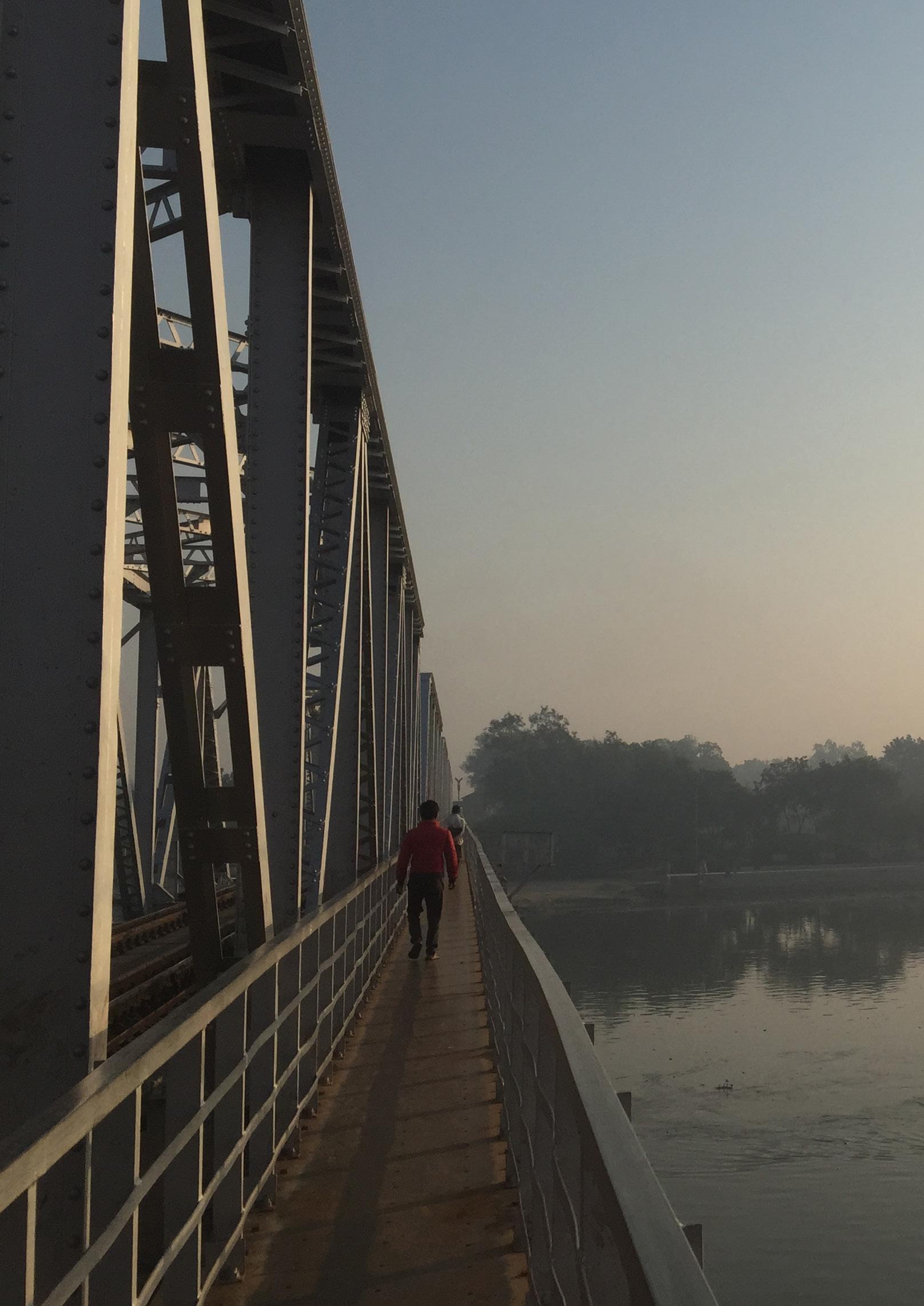
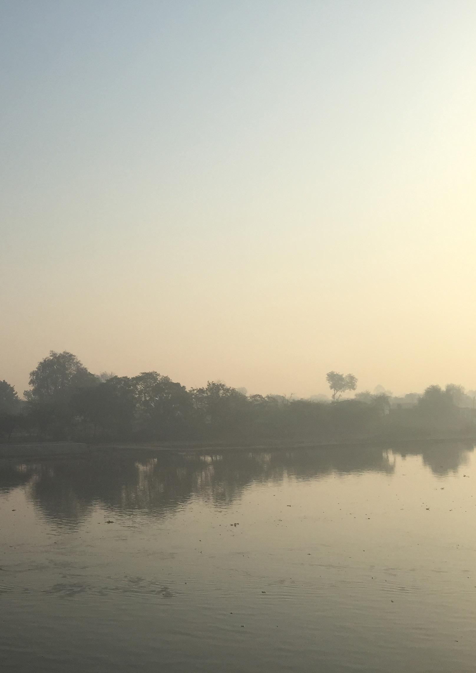
Mathura is on the banks of river Yamuna, and plays a significant part in the city lifespecifically on the ghats for all religious rituals.
MOTION
54 CITY OBSERVER | June 2015
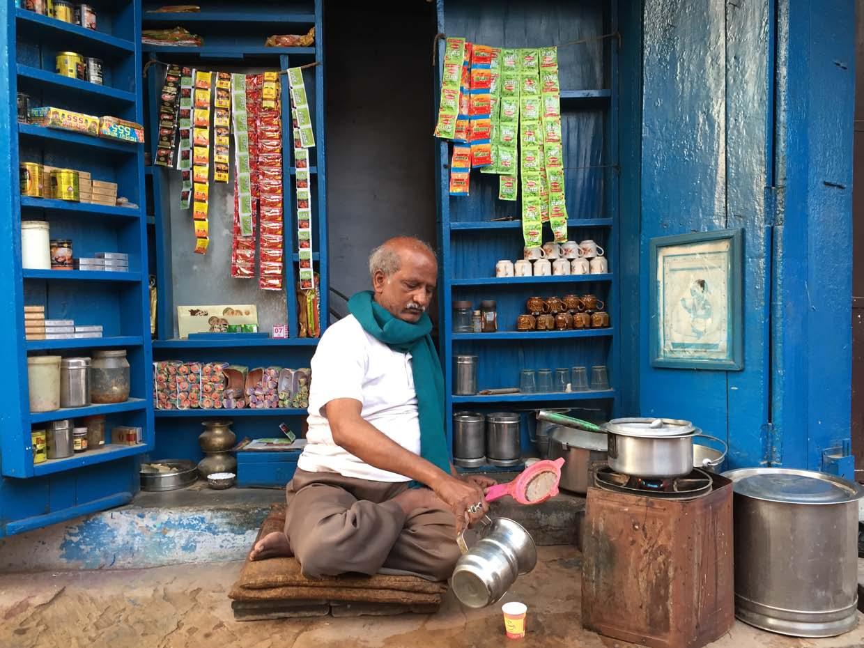
Many of the old shopkeepers struggle to make a living with their traditional businesses and have ensured that children get education and pick a career of their choice, like the tea-shop owner here.
CAPTURED
55June 2015 | CITY OBSERVER
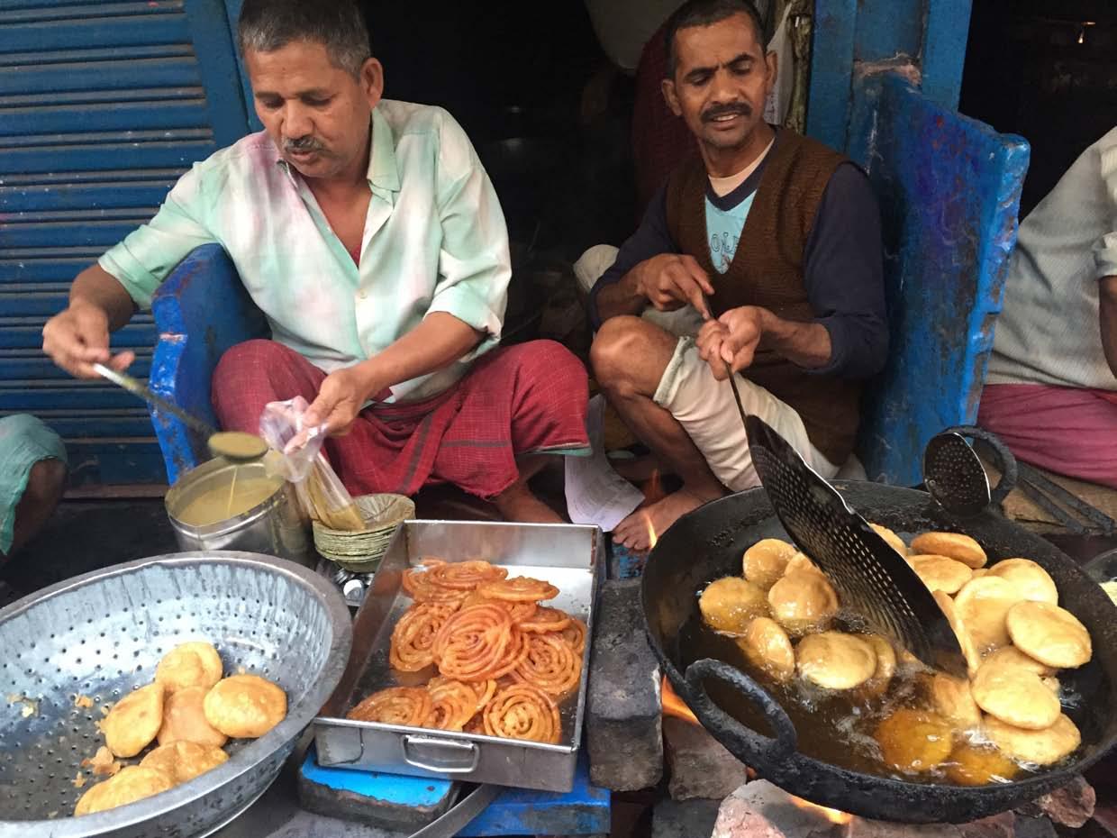
Food plays a significant role in the lives of the people and starts with Kachori-Jalebi combo early in the morning.
Mathura is the city of temples, and has many beautiful family temples tucked deep in the narrow alleys on the city.
MOTION
Religion is an important part of life in Mathura and these pandas take the pilgrims to all significant spots for a fee. They are also getting smaller in number with time.

58 CITY OBSERVER | June 2015
CAPTURED
Walking on the streets of the city near the ghats, I saw a significantly higher number of elderly men and women as many youngsters move out of the city for better career opportunities.
About the Photographer
Siddhartha Joshi is a designer, photographer, traveller but most of all an explorer. He loves going to new places and exploring the culture through local experiences, especially through conversations and following the local customs. He loves sharing his experiences through his blog as well as through his travel videos. His hope is to connect the world and bring people closer though travelling.
59June 2015 | CITY OBSERVER
WAKING UP TO PUBLIC ART IN CHENNAI
60 CITY OBSERVER | June 2015
An Interview with Anpu Varkey ART AND THE CITY
Earlier this year, at least 20 locations in Chennai’s public realm underwent a makeover with the ‘Conquer the Concrete’ Project- a street art festival conceived by Goethe Institute Chennai/ Max Mueller Bhavan in collaboration with Chennai City Connect. The project was rooted in the idea to make art accessible by showcasing it in the city’s public realm thereby transforming the locations into new meaningful social spaces and also as an opportunity to enable civic engagement towards the city’s public.
Around 25 artists were roped in from India and abroad for this Indo-German cultural cooperation project themed on art in public spaces. Some of the artists who participated in this festival are Anpu Varkey (Delhi), Amitabh Kumar(Bangalore), Artlab (Chennai), Axel Void (Miami), Base 23 (Berlin), Look (Berlin), M.P. Dakshna (Chennai), Okuda (Madrid), The Paintbox (Chennai), Ranjit Dahiya (Mumbai), SatOne (Munich), and Shilo Shiv Suleman / Fearless Collective (Bangalore). The festival was curated by Georg Zolchow (Berlin/Madrid).
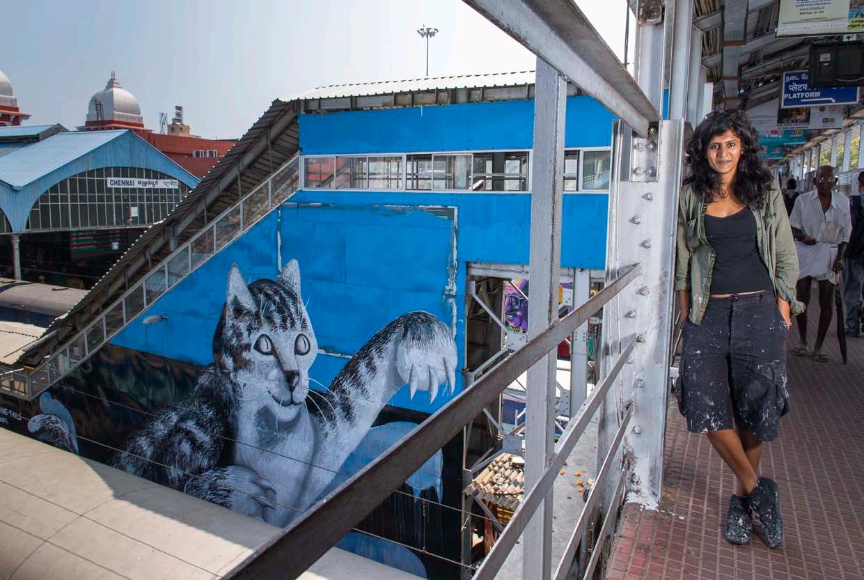
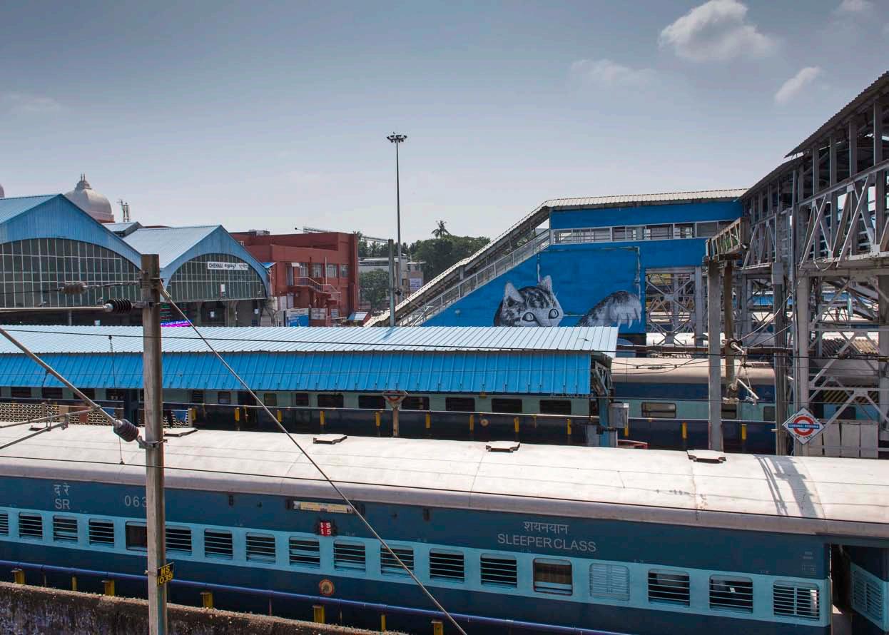
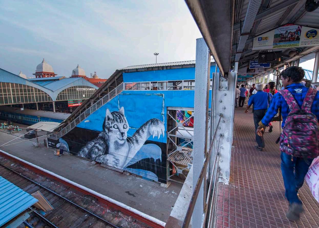
UDC founder Vidhya Mohankumar interviews Anpu Varkey, the artist from Delhi who painted a mural titled ‘Nine Tails: Action Cat’ at Chennai’s Egmore railway station as part of the festival.
Hi Anpu! Firstly, thank you so much for giving Chennai such a vibrant piece of artwork and also for agreeing to share your experience with us. To start with, could you give us a brief overview about the ‘Conquer the Concrete’ project and how you got involved?
‘Conquer the Concrete’ was a street art festival hosted between 20th January 2015 and 7th February 2015 in Chennai, India. The curator Georg Zolchow had invited me to participate in this project alongside 5 international artists, hoarding painters from Chennai as well as my peers from different regions in India.
What was the thought behind selecting the site where you worked on? Did you choose it or was it given to you?
I met Georg at the Egmore station where work had already commenced on three different train platforms which were being painted by German artists. There was a vacant facade along another platform and he asked me if I wanted to paint it. This is one of the busiest stations in Chennai and I was humbled to be given such a space to work on.
What were your thoughts and inspirations behind your art work at the Egmore station?
The view was captivating, especially from the foot-over-bridge. I wanted to address the viewer at the bridge, someone who has less than a minute to cross it, should pause.
In the past, I have made murals of my beast cat and his shenanigans on different walls; it’s a form that I’ve played with the most. Almost everyone identifies with the image of a cat, and I wanted the cat to seem like he was jumping towards the viewers at the bridge. This cat to human interaction, is rarely seen in public spaces, also the felines are an elusive bunch, which made it a bit more surreal to have a larger than life beast spring at you.
61June 2015 | CITY OBSERVER
All images by Jaya Kumar.
How long did it take from start to finish?
The execution time was 4 days.
What was the experience like while you were creating the art work?
People often stopped and spoke to me about Chennai, about what I’m doing and what I should be doing in the city, which train lines I should take, which stations to get off from. I was being tutored about the city while painting and that was enriching.
The title ‘Nine tails’ came by because of a conversation I had with a passer-by, he told me a tale about a cat with nine tails. I left that mark so maybe when he comes back to see it, he will remember the conversation we had; “no one believed the boy who saw a cat with nine tails”.
62 CITY OBSERVER | June 2015
Reclaiming public spaces through art and pushing certain dying art forms (like hoarding painters) re-energises the city and in the future there would be more demand for it.‘
‘
ART AND THE CITY
And finally, what are your thoughts on arts in the public realm of cities?
On the streets, the artworks you make are impermanent... they change as the city changes, and they survive within the lifetime of a wall or a building. Creating impermanent changes within cities through painting is a good way to implement a new visual dialogue within these spaces, as most often you are bombarded with posters and hoardings that often make you forget your place in this world. Reclaiming public spaces through art and pushing certain dying art forms (like hoarding painters) re-energises the city and in the future there would be more demand for it.
About the Artist
Anpu Varkey is a painter of surfaces, from canvases and paper to walls and pavements. She has been painting large scale for over a decade, and got into street art very inadvertently. The initial attempts were small scale stencils to wheat pasting which matured into large scale murals. The themes she works on are incongruent and situational but the cat remains an
form,
adulation
result
spent innumerable hours living with one.
63June 2015 | CITY OBSERVER
indispensable
this
is the
of having
To see more of her work, visit https://anpuvarkey.wordpress.com/
EXPLORING BANGALORE’S HARDWARE MARKET
 by Adnan Nakhoda
64 CITY OBSERVER | June 2015 FEATURE ARTICLE
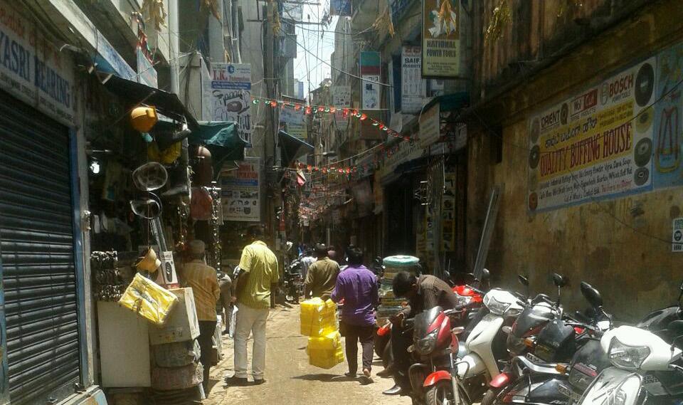
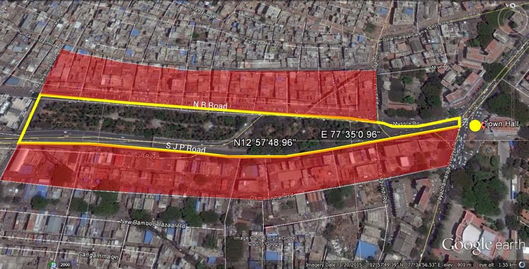
Markets and trading are central to any city. This article aims to transport you to the sights and sounds of one of Bangalore’s busiest trading areas- the hardware market belt between Town Hall and the KR Market complex. This market is roughly triangular, spreading out from the Town Hall along SJP Road and NR Road, extending into smaller internal roads.
Markets like these are not places for leisurely strolls or explorations. Whatever your reasons for visiting, the pace and the crowds force you to ‘roll up your sleeves’ and get down to the business of things.
GETTING AROUND
The first thing to watch out for is the traffic. Your radar needs to be on high alert to avoid the vehicles. After successfully avoiding the traffic, the footpaths are the next obstacle. These exist only on the main roads- SJP Road and NR Road. There are many people moving about with a high sense of urgency whom you could bump into if you don’t move fast enough. But please note that it is not enough to avoid people. A bigger fall could occur if you fell down on a damaged part of the footpath. There are many such damaged parts.
Sometimes, as you walk, you will also find a long plumbing pipe or steel channel coming out at you from the adjoining shops during loading processes.
The wider portions of the footpath provide premium commercial space where the hawkers congregate. Repeated visits make you realise that each hawker has a designated spot where they display their wares every day.
65June 2015 | CITY OBSERVER
Above: Map showing the hardware market area. Map source: Google Earth Facing page: Run-down buildings brought alive by signages. Image courtesy the author.
THE MARKET STREETS
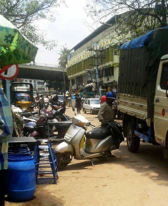
The two main roads are fairly wide, and the hardware shops seem relatively organised along them. All the ‘orderly chaos’ of a goods trading area is intriguingly appreciable in the internal areas. One actually wonders how businesses not just function, but flourish in these chock-a-block conditions. These internal lanes, as is the case in most old market areas, are narrow, being just 3-4m wide. They are flanked by wall-to-wall buildings, each several stories high. In these lanes, you feel the buildings towering over you. The average width of street fronts is approximately 3m, with a depth of 4m. In some cases, the shops have a 4m high ground floor to allow mezzanine storage.
Most store and shop fronts are at street level with upper floors generally holding material storage areas for the shop below, or sometimes different trading establishments from the one at street level. Some buildings are mixed use, and have residences at upper levels.
Locating a specific shop in the market can be quite challenging. The continuous nature of buildings and the narrowness of the street make it seem like one large shop, and discerning one shop from the next can be quite difficult. Huge hoardings and signboards are
everywhere, further obstructing views and individual identities. Display panel boards spill over into the narrow streets. The narrow lanes are sometimes blocked with the handling of hardware items during display and sales processes with customers, adding to the feeling of congestion.
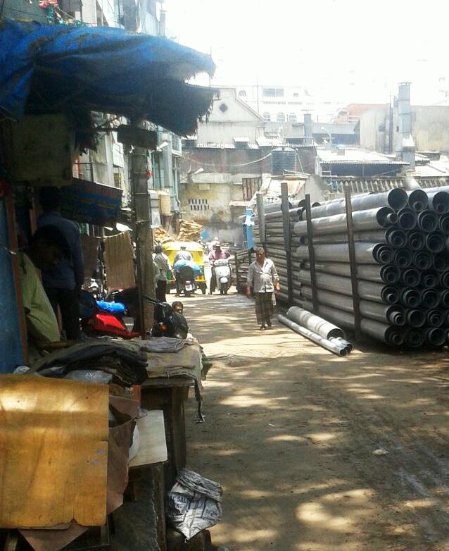
INSIDE THE SHOPS
The inside of the shops can be a strong contrast to the bustling street outside. Walk in to any one of these shops, and chances are that you will find a dapper looking interior and a small haven of peace within. If you are fortunate like I was, you might get offered some good, strong chai. While this market is primarily a hardware market, there are many eateries to cater to the people visiting and working in this area. It is interesting to note that in the midst of loading and unloading, bargaining and billing, are some tiny pockets offering food and drink in the form of small restaurants and cafés – ranging from pure vegetarian to hardly vegetarian, juice centres, a multitude of chai stalls, cut fruit pushcarts and the occasional street corner jalebi or samosa wala. These offer stimulating and refreshing breaks from the ordinary business of things.
66 CITY OBSERVER | June 2015 FEATURE ARTICLE
Loading Operations. Images courtesy the author.
Like many markets, this hardware market supports a curious ecosystem of people, goods and vehicles. However, while it is an economically thriving area, safety measures seem largely lacking. The city corporation needs to enforce these safety measures in the public interest, especially considering the density and number of people in the area - a no vehicle entry on narrow lanes, rehabilitation of run-down buildings, repairing the footpaths and mandatory fire safety measures for buildings. These measures would also improve the general outlook of the area, and make for a better experience for both visitor and trader, and who knows – better profits for business owners and a better walk and shop experience for the layman?
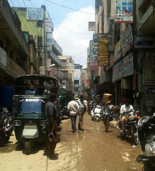
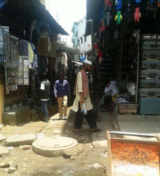
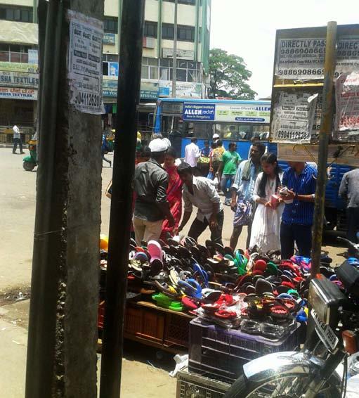
About the Author
Adnan Nakhoda is a practising architect in Bangalore. He looks at urban landscapes as ever-changing experiences. The dense urban fabric, he believes, can never be fully understood by looking at maps or photographs: one has to walk the streets to get a first-hand perspective. In his article about a section of the city market area of Bangalore, he does just that. He is a visiting faculty at the RV College of Architecture, Bangalore.
67June 2015 | CITY OBSERVER CONCLUSION
Hawkers, walkers and narrow lanes. Images courtesy the author.
10 URBAN DESIGN LESSONS FROM TURKEY
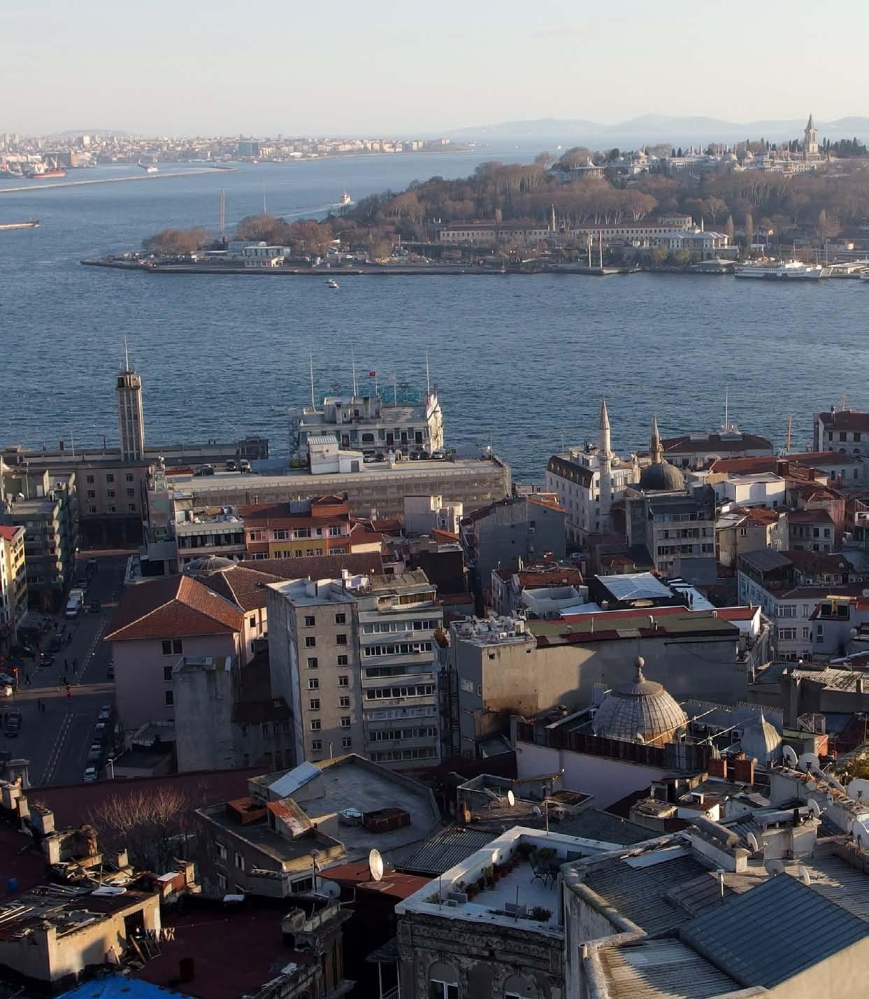
Extracted from mental notes and visual diaries from recent travels to Istanbul, Selçuk and Bursa in Turkey
by Vidhya Mohankumar
68 CITY OBSERVER | June 2015
LEARNING FROM CITIES
Photo Credit: Mark Ahsmann
Licensed under the Creative Commons Attribution
A recent trip to Turkey turned out to be superbly refreshing not just as a holiday but also from an urban design point of view. Each city demonstrated a variety of scales, landscapes and cityscapes, while also being so utterly unique and distinct from each other.
Istanbul, the economic, historical and cultural heart of Turkey, in particular is indeed true to the cliché of being ‘as western as the east can get and as eastern as the west can get’. Deriving its layers from a history so rich, it is an absolute melting-pot of multiple cultures and the manner in which this is manifest in the physical environment of the city is a complete delight to the senses.
Selçuk is a small city in the İzmir Province of Turkey, two kilometres northeast of the ancient city of Ephesus- an archaeological site for the Greco-Roman world with almost 150 years of excavation and still counting to recover and renovate the city’s structures.
Bursa, located in north-western Anatolia, is one of the most industrialized metropolitan centres in the country and is home to the automotive industry. Like Istanbul, Bursa’s urbanscape is dotted with mosques, museums and markets but is probably more popular for its multitude of thermal baths.
With some time for reflection, this article is a distilled version of the mental notes taken and visual diaries created during the trip. It must be noted however, that while this article highlights some of the positive urban design vibes prevalent in some quarters of Turkey’s cities, it is indeed a reality that all is not well with these cities as they face the same issues as other cities across the world- rapid urbanization, congestion and related mobility issues, car-centric sprawl, devouring of limited land resources for extensive private use, increasing migration and population growth rates, economies entirely reliant on the tourism industry and frequent phases of political unrest. What is important however is to understand that the solutions to many of the problems faced by these cities can be gleaned from these very same cities. These positives if replicated persistently as part of regeneration schemes or in newly developing areas can vastly alter the experience of the built environment to be more livable, vibrant and sustainable. That said, these lessons also have a universal applicability and thereby have potential to produce the same results if applied contextually and without disrespecting local cultures and traditions in other cities across the world.
The urban design lessons are presented in no particular order of importance-
69June 2015 | CITY OBSERVER
Facing page: View of Istanbul from Galata Tower
1
STREETS TO CREATE URBAN ROOMS
Enclosure is a useful tool to play around with while working on the public realm. Perhaps taking cues from Istanbul’s Grand Bazaar, one of the largest and oldest covered markets in the world, with 61 covered streets, over 3,000 shops and a daily footfall of 250,000 and 400,000 visitors, there are many instances of enclosing streets to create urban rooms and for uses not restricted to shopping. While Bursa’s covered market bears a more contemporary look with neat wooden roof framework, a street in Istanbul’s Beyoğlu district enclosed spillover restaurant/ cafe seating and harked back to classical architectural styles. This street also appeared to be a cross between a covered market and shopping mall atrium. But in both cases, it was evident that the streets lent themselves favourably to its users.
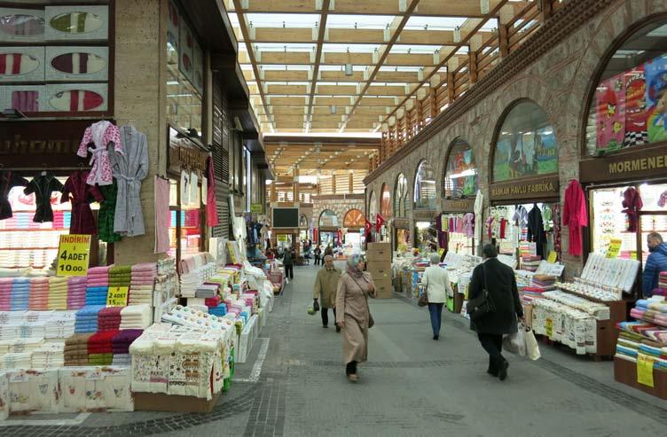
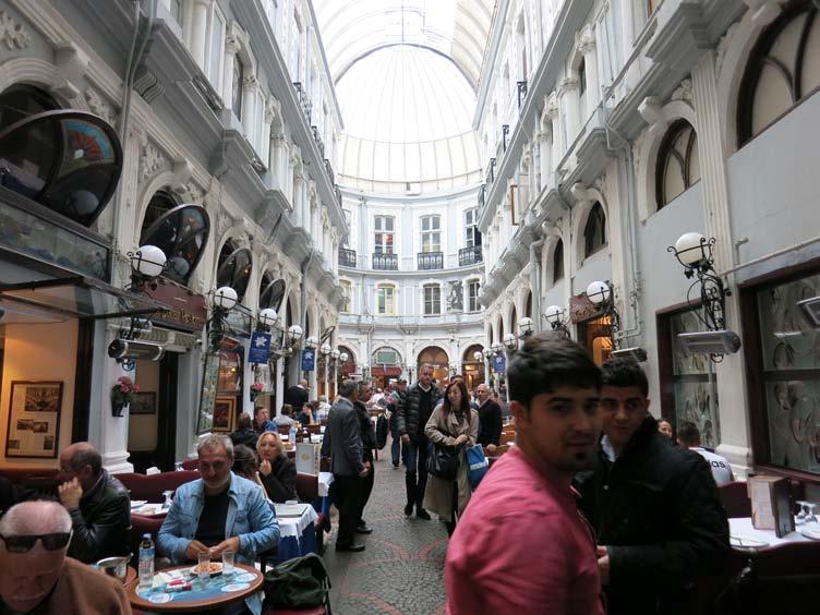
70 CITY OBSERVER | June 2015
The Covered Market or Kapali Carsi in Bursa, Turkey. Photo Credit: Mahesh Radhakrishnan
A covered street in Istanbul’s Beyoğlu district with restaurants and spillover dining.
ENCLOSE
LEARNING FROM CITIES
FOR RECREATION IN THE PUBLIC REALM
Jane Jacobs advocated for children in cities to have a variety of places in which to play and learn. Lively sidewalks and pedestrian-priority streets serve this purpose splendidly in Turkey’s cities. Istanbul’s Galata Bridge sidewalks allow fishing throughout the day with everyone’s catch of the day proudly on display beside the fishing rods thus proving that linking nature and outdoor recreational opportunities with the urban environment is a great way to enhance the urban experience for adults too. In the case of children on the streets of Selçuk’s town centre, the mixed-use character provides the added advantage of the presence of adults on the sidewalks and from the residences on the upper floors to watch over them as they play. Selçuk also took recreation in the public realm one step further by installing an outdoor gym along with jogging and cycling paths just outside the Temple of Artemis site (one of the seven ancient wonders of the world). It was interesting to see such a use of public space in juxtaposition with a heritage site.
Fishing is an all-day activity along the two sides of the Galata Bridge’s sidewalk in Istanbul.
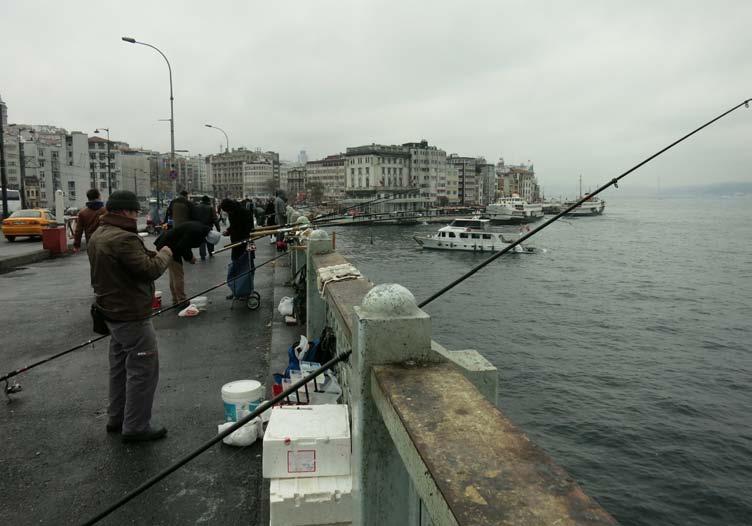
Outdoor gym equipment and cycle paths outside the Temple of Artemis site (one of the seven ancient wonders of the world) in Selçuk.
71June 2015 | CITY OBSERVER
2 PROVIDE
Children play on the pedestrianpriority streets in Selçuk’s mixeduse town centre.
One of the key principles of inclusive urban spaces is that the age group of 8 to 80 is able to independently navigate their way around them. And one of the key challenges to this in cities with steep terrains is dealing with levels in the city’s urban section. While Bursa has invested in stair elevators to help its elderly, Istanbul got a taste of tactical urbanism when a 64-year-old retired engineer by the name of Huseyin Cetinel painted 145 steps of the street stairs that link Findikli district to Cihangir in rainbow colours. Forty kilos of paint and four days was all it took to transform this overwhelming staircase into a tourist attraction.
A stair elevator in Bursa for the elderly and physically challenged to navigate the topography.
Photo Credit: Mahesh Radhakrishnan
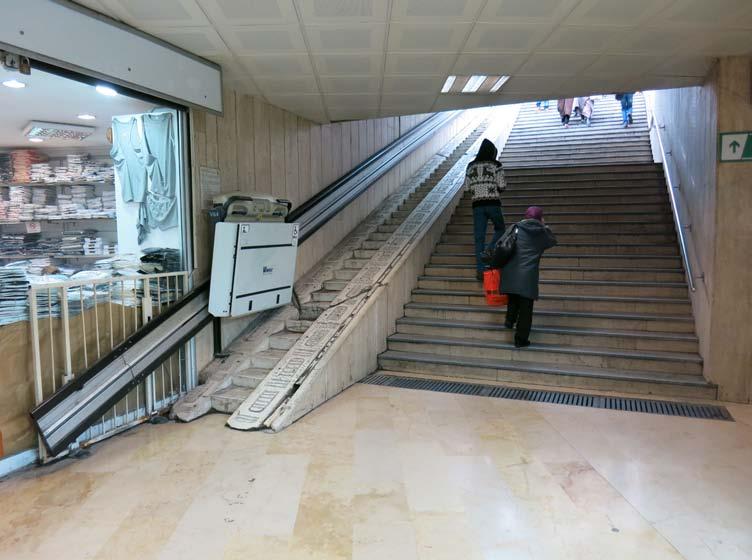
72 CITY OBSERVER | June 2015
DEAL WITH LEVELS IN THE URBAN SECTION IMAGINATIVELY3 LEARNING FROM CITIES
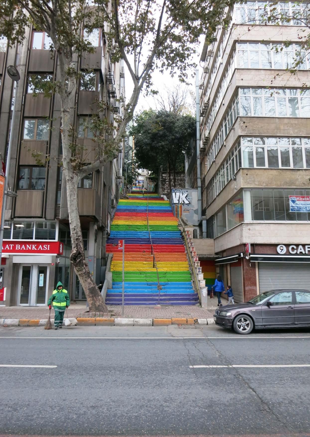 Painted steps in Istanbul to ease the climb. Photo Credit: Mahesh Radhakrishnan
4TRAM LINES DOUBLE UP AS A TRAFFIC CALMING STRATEGY AND ENSURE BETTER STREET DESIGN STANDARDS

Among other benefits of prioritizing on-ground public transport, Istanbul and Bursa with their tram lines revealed that they also double up as a traffic calming strategy. As bizarre as this may sound, indeed the streets with tram lines saw reduced speed levels of other vehicles plying through them. As an urban experience, the overall pace of the streets slows down to a level comfortable enough for all street users to pay attention to and soak in the urban environment they were passing through. Therefore, this must also warrant careful attention on the part of the public works department to the aesthetics of streetscape elements as well as the averting of visual clutter in order to ensure efficient use of the street rightof-way especially in older parts of cities where only limited space is available.
Tram line in Bursa.
Tram line in Istanbul.

74 CITY OBSERVER | June 2015
Photo Credit: Mahesh Radhakrishnan
LEARNING FROM CITIES
5 PROVIDE SEAMLESS AND HIGH QUALITY URBAN MOBILITY OPTIONS
The manner in which cities deal with the challenges of urban mobility can make or mar the urban experience. Chopping up a city with freeways and elevated expressways is mere band-aid to a bullet wound. Mobility is also complex in that it requires a multi-pronged approach to stay on the path of sustainable development.
Despite its own set of transport-related woes, Istanbul seemed to address this challenge at least in the fact that it provides multiple options for mobility coupled with seamless transfers from one mode to another made possible by high quality infrastructure, good design and an integrated smart card system. The city of 13 million inhabitants spread over an area of 5712 km² is served by a metro network, a light-rail network, a tram network, two underground funicular lines, suburban train lines, a Metrobus (BRT) network, a regular bus network, ferry boats and two aerial lift lines.
75June 2015 | CITY OBSERVER
A historic tram line on İstiklal Street, a pedestrianised street in Istanbul’s Beyoğlu district.
Tram station at Beyoğlu in Istanbul.
Additionally, sustainable mobility options exist for travel between Istanbul and other cities. For instance, intercity buses are not allowed within the central core of the city and passengers are collected from multiple points in small feeder buses and dropped off at the bus terminal located an hour away from the central districts. Maritime services also ferry not just people but also vehicles including buses thereby helping to reduce the number of vehicle-kilometres travelled.
Bike lanes are not so widespread yet in Istanbul but that doesn’t stop the city from providing safe bike parking.
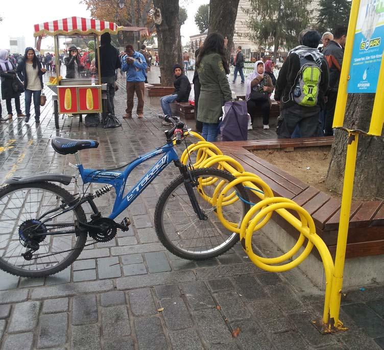
An inter-city bus terminal at Bursa.
Photo Credit: Mahesh Radhakrishnan
76 CITY OBSERVER | June 2015
LEARNING FROM CITIES
Cars, buses and trucks being ferried across the water.
Photo Credit: Mahesh Radhakrishnan
Interior of a ferry boat with comfortable seating and cafés.
Photo Credit: Mahesh Radhakrishnan
Children enjoy the experience on the deck of a ferry boat.
Photo Credit: Mahesh Radhakrishnan
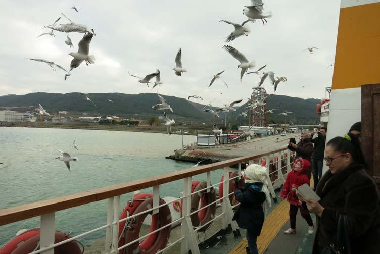
77June 2015 | CITY OBSERVER
CREATE CONTEXTUAL RESPONSES TO NEW URBAN TYPOLOGIES
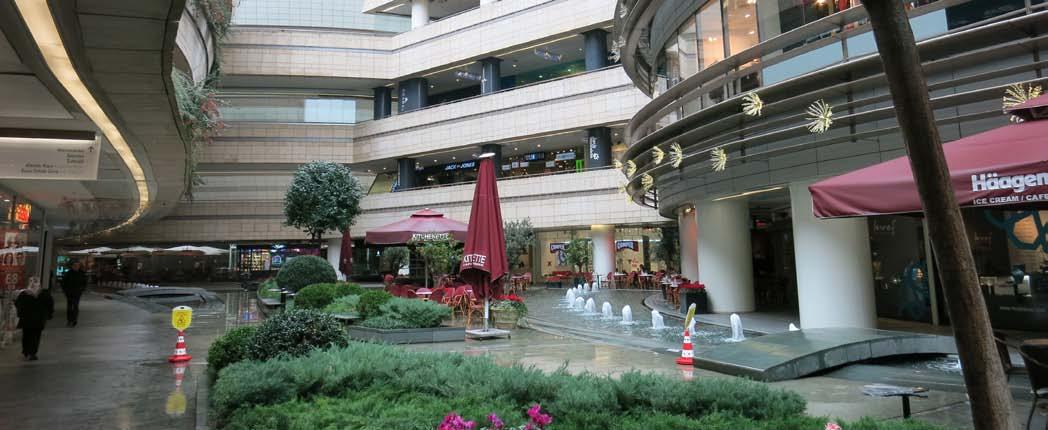
Creating context sensitive architecture is a non-negotiable especially in cities steeped with history. This is an added challenge when dealing with new urban typologies such as parking structures and shopping malls, that are mostly impermeable and tend to go against the fine grain of old city fabrics. In the case of a parking structure in Istanbul’s Beyoğlu district, its ground floor level was activated with a line-up of upscale restaurants and gourmet food stores. The choice of retail is interesting and seemed to have paid off as well. Perhaps it was imagined as a park-and-eat facility for affluent suburban dwellers. The facade of the parking structure too was sheathed with a bright white perforated sheet and provided relief to what could have been an ugly exterior. Another example from Istanbul that successfully demonstrated innovation in its response to the context was a shopping mall designed to replicate shopping streets with active frontages and spillover spaces while also contemporizing the traditional courtyard spaces as seen in the mosques of Turkey. By opening up an otherwise impermeable block through the use of a courtyard at the ground plane, the shopping mall was able to conform to the fine grain of the city’s fabric.
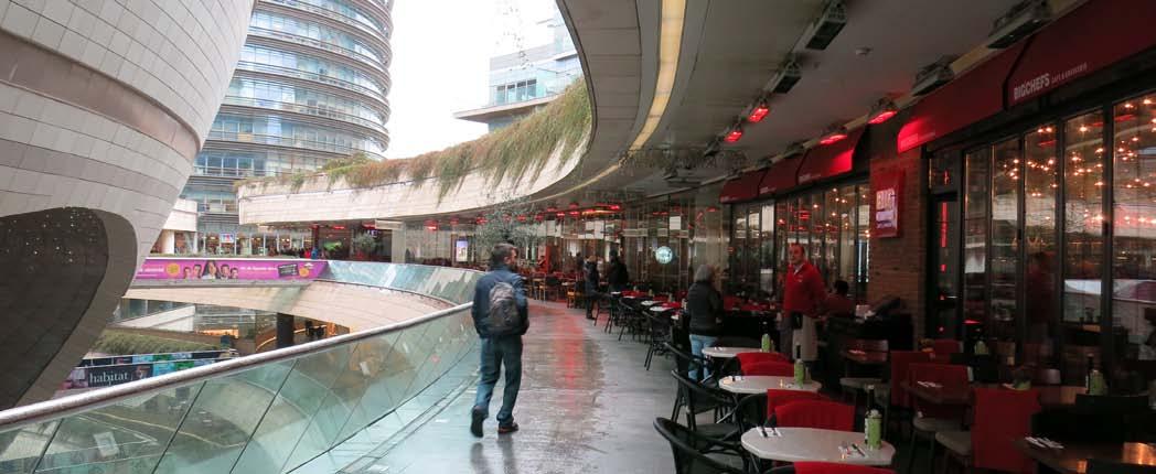
78 CITY OBSERVER | June 2015
A shopping mall in Istanbul attempts to replicate shopping streets with active frontages and spillover spaces while also contemporizing the traditional courtyard spaces as seen in the mosques of Turkey. Photo Credit: Mahesh Radhakrishnan
6
LEARNING FROM CITIES
A parking structure in Istanbul’s Beyoğlu district wraps a ribbon of upscale restaurants and gourmet food stores at the ground floor level.
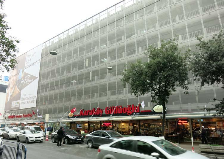
OPPORTUNITIES TO REVEL IN THE CITY’S HERITAGE
A city that cherishes its local heritage, both natural and built, has a fair chance of not going astray with the future. While there is tremendous pressure to exploit the real estate potential of lands adjacent to the heritage precincts in Istanbul, the city is still exemplar when it comes to providing opportunities to revel in the city’s heritage as seen from the many pause points adjacent to key monuments. Many view corridors and vistas too remain untouched. As long as the citizenry is able to appreciate the symbiotic relationship that is pivotal to the strength of a tourism economy, there is hope.
79June 2015 | CITY OBSERVER
7 PROVIDE
Restaurants along the Galata Bridge with seating that allows one to take in the splendour of the New mosque in Istanbul’s Eminönü quarter.
Outdoor seating at a vantage point to soak in the magnificent Blue Mosque in Istanbul’s Sultanahmet district.
80 CITY OBSERVER | June 2015
A vibrant square dotted by small restaurants and cafés serving quick eats marks the southern end of the Galata Bridge in Istanbul’s Eminönü quarter. The square is set so as to serve as a pause point prior to approaching the New Mosque while also using it as a backdrop.
LEARNING FROM CITIES
8 CREATIVELY ACTIVATE EDGES
A timeless piece of urban design advice to create vibrant cities is to activate the edges at the ground plane. Dead edges such as compound walls not only make the space less lively, but also less safe and prone to misuse. Turkey’s cities were a gold mine of ideas for creatively activating all kinds of edges.
The Galata Bridge in Istanbul spans the Golden Horn, is 490 metres long and carries a tram line, generous sidewalks on two sides and three lanes of traffic. The bridge links the oldest parts of Istanbul and the districts of Beyoğlu and Şişli. Despite being connectors, bridges may also be perceived as edges in the image of a city. The Galata Bridge however is a fascinatingly living bridge with restaurants that line the underside of the bridge on both sides. The brightly-lit restaurants not only serve to animate the walk across the bridge but also establish a directional visual link between the two land masses after dark. Needless to say, the presence of the restaurants also makes it safe to walk across the bridge at night.
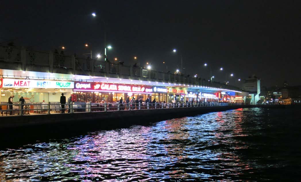
Food is a huge draw all across Turkey. The cuisine is phenomenally delectable with subtle variations across regions that reflect the myriad local cultures of the country. Equally fascinating is how food is used to activate edges in the city. Mounds of spices, saffron, lokum (Turkish delight), baklava and other local foods adorn shop fronts at very regular intervals. Some shops go one step further and use the shop window to showcase the food preparation process. Dining along street edges and in alleyways is also a fairly common practice. The fact that restaurants install warmers on the exterior in order for people to continue dining outdoors despite a drop in temperature during winter is an indicator of how quintessential this experience is to the culture of the city.
A stroll through the oldest parts of a city’s urban fabric is bound to throw up a few abandoned or dilapidated buildings. Activating the edges of such buildings is indeed a challenge, overcome in Istanbul mostly through graffiti art or by setting up an ‘urban notice board’ for other businesses in the neighbourhood to advertise their latest events.
81June 2015 | CITY OBSERVER
Restaurants line the underside of the Galata bridge that spans the Golden Horn in Istanbul.
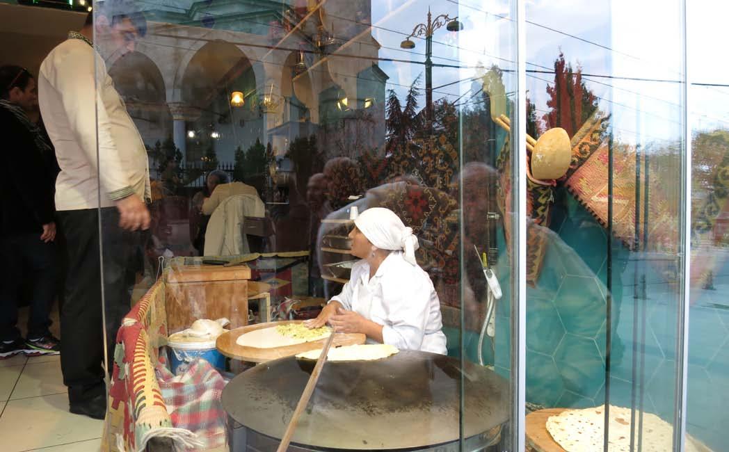
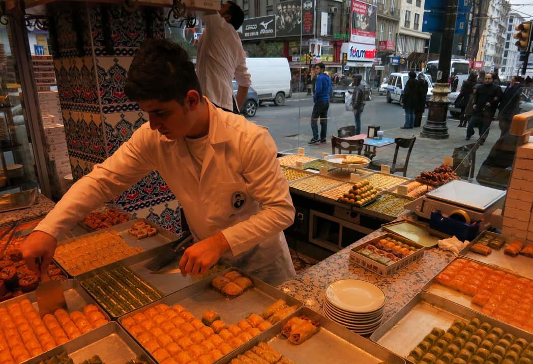
82 CITY OBSERVER | June 2015
The baker at work in the shop window in Istanbul’s Sultanahmet district.
Baklava, a local sweetmeat, prepared and displayed in the shop window in Istanbul.
LEARNING FROM CITIES
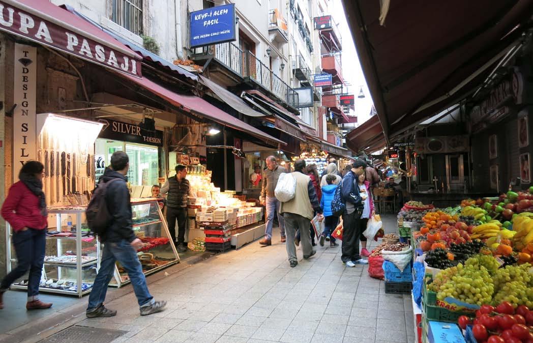
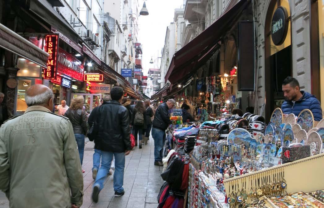
83June 2015 | CITY OBSERVER
Shop fronts and street edges animated with stalls selling a variety of goods from trinkets to edibles in Istanbul’s Beyoğlu district.
Outdoor dining made possible by warmers installed on the exterior in Istanbul.
An ‘urban notice board’ in Istanbul to announce the latest events in the neighbourhood.
9 COMBINE MIXED USES AND PEDESTRIAN PRIORITY ZONES
Turkey’s Asian influences ensure that mixing uses comes naturally. Various building typologies co-exist as do buildings of various ages and sizes, on the same street, block or neighbourhood. This guarantees a continuous stream of users in the public realm, which translates to an increase in the number of effective eyes on the street. Mixing uses vertically in the same building also induces the people in the buildings along the street to watch the streets in sufficient numbers as well as entertain themselves, off and on by watching street activity. But the real winner in these cities is the combination of mixed use and pedestrian priority zones which amplifies the benefits of this kind of a people-centric urbanism manifold.
84 CITY OBSERVER | June 2015
LEARNING FROM CITIES
İstiklâl Street in Istanbul’s Beyoğlu district is cultural and retail-oriented during the day but transforms into a night-life destination after dark. The variety of eccentric local hangouts in the alleyways leading onto İstiklâl Street reflect the gastronomical heart and soul of Istanbul in a way that is so unique that it warrants to be experienced at least once in a lifetime. The fact that the street is also completely pedestrianised makes it all the more attractive to people who want to see and be seen. All of these factors ensure a high level of vitality and viability of the street and its environs. Vitality is a reflection of how busy a place is at different times and in different parts. Viability is a measure of its capacity to attract investment for maintenance, improvement and adapting to changing needs.
The town centre of Selçuk has a pedestrian-priority core combined with retail on the ground floor and residential on the upper floors. The street right-of-way is clearly demarcated into a frontage zone on two sides and a shared space in the centre. The frontage zone lends itself to spillover of goods and activities from shops and restaurants thereby activating the edges. The shared space is the movement corridor albeit with an emphasis on slow speeds and limited vehicular access. This kind of urban design evidently strengthens the social bonds that keep a community truly safe.
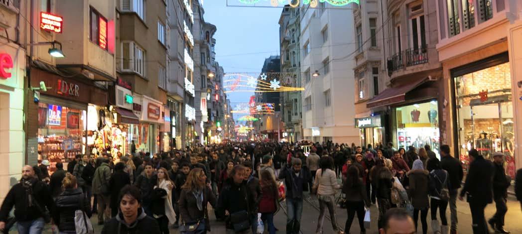
85June 2015 | CITY OBSERVER
İstiklâl Street in Istanbul’s Beyoğlu district is cultural and retail-oriented during the day but transforms into a night-life destination after dark. It is also a completely pedestrianised street. Photo Credit: Mahesh Radhakrishnan
The town centre of Selçuk with a pedestrian-priority core combined with retail on the ground floor and residential on the upper floors.
10 THE SMALL DETAILS ALWAYS MAKE A DIFFERENCE
Whether it is the subtle drop in the kerb height or the placement of a wayfinding sign at just the right location or benches and litter bins at regular intervals, the small details in the public realm can go a long way in making the urban experience better. It was indeed a delight to spot numerous such instances where attention was paid to the smaller details in these cities. The pathway to the St. Johns’ Basilica in Selçuk had a rampant lion repeated at regular intervals all along the sidewalk edge. Not to mention the lovely tree grills that complemented the lions. Seating that was not homeless-proof was generously provided all across the heritage quarter in Sultanahmet in Istanbul. Even boring manholes were brought alive with an inlay of exquisite, locally manufactured ceramic tiles. Indeed if god is in the details, he is worshipped well in the public realm of these cities.
Seating opportunities such as these abound in Istanbul, especially in the older parts.
86 CITY OBSERVER | June 2015
LEARNING FROM CITIES
A manhole with an inlay of local ceramic tiles.
Elegant bollards to demarcate and safeguard the pedestrian zone from vehicles.
All images by author unless otherwise credited.
About the Author
Vidhya Mohankumar is an architect and urban designer with over a decade of work experience in India, Ireland and the United States and a passion for creating livable and sustainable cities. She is the founder of Urban Design Collective (UDC), a non-profit organization that works as a collaborative platform to create better cities through community engagement. Additionally, Vidhya has been advocating sustainable development through training and capacity building programmes for staff from various government agencies and also within academia through her association with a number of universities as guest faculty. While she finds travel to be a constant source of exhilaration, over the years Vidhya’s interests have oscillated between photography, installation art, gardening and most recently cooking.
87June 2015 | CITY OBSERVER
Markers on the sidewalk along the path to a heritage monument in Selçuk.
PEOPLE’S PUPPET PROJECT PONDICHERRY
An international workshop to reconnect the local community with their town’s heritage
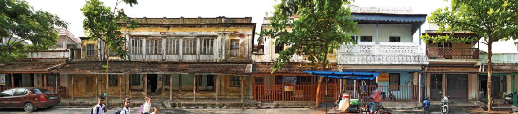 by Devangi Ramakrishnan
88 CITY OBSERVER | June 2015 COMMUNITY ENGAGEMENT
Urban Design Collective (UDC), INTACH Pondicherry, and Indianostrum Theatre, collaborated with Snuff Puppets, Australia, on a ‘People’s Puppet Project’ community workshop to raise awareness towards Pondicherry’s unique Franco-Tamil architectural and cultural heritage, through an innovative combination of puppetry and street theatre.
The workshop encouraged participation of local citizens with the aim to reconnect local community with their town’s heritage. It also provided an opportunity for participants to learn new artistic and technical skills, exposure to new creative art and performance mediums, and collaboration with international artists. The workshop demonstrated how different artistic elements come together to produce dynamic productions - themes and stories, dialogue, music and dance, to create a complete performance.
Professional artists from Snuff Puppets facilitated this hands-on puppet making and performance workshop.
Participants developed ideas for a street performance based on the theme of heritage conservation, creating storylines and puppet characters. Participants worked alongside Snuff Puppets to design, build, and perform their larger than life puppets.
The workshop culminated in a street parade and performances in Pondicherry on 27 December 2014.
PROJECT THEMES
The Thinnai and Thalvaaram
There are a few monumental buildings in Pondicherry but the architectural character of the town is the result of hundreds of traditional-style houses, both in the Tamil and French Quarters, which form the unique streetscapes of the town. The Tamil houses
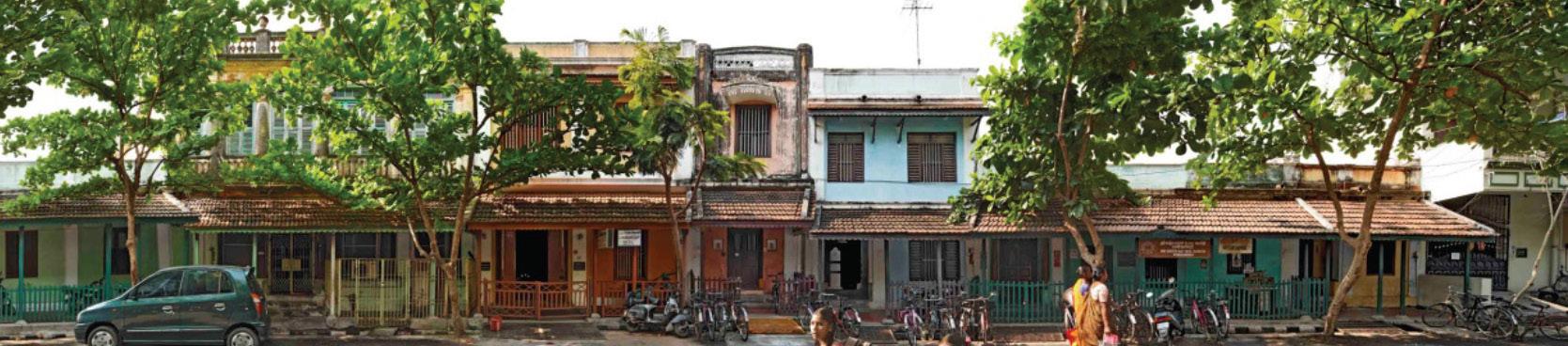
in particular are recognisable because of its building elements that have developed in response to a certain lifestyle – one that gave importance to participation in the local community. Today, as people’s lives become increasingly private, the street and the spaces bordering it are being usurped. There is a need to regain a sense of community to these spaces, and increase awareness of their importance to urban life. Continuous, shaded verandahs, known collectively as thinnai and thalvaaram, form the entrance of the traditional Tamil house, as well as the threshold between the private and public realms. They provide shelter from the harsh, tropical sun, and a space for socialising, hospitality, and minor business. The thinnai was a space for neighbours to meet, for informal community gatherings and discussions, to receive guests, and bargain with vendors. With an increasing number of homeowners choosing to demolish their traditional houses, the thinnai is losing importance and becoming rare – leading to the disappearance of an essential feature of Pondicherry’s public realm.
Our challenge is to make these semi-public spaces, along with the street, a space of activity again and while doing so also regain a sense of community that got eroded with the disappearance of these features.
Therukkoothu
Street performance and theatre is an integral part of traditional Indian performing arts. Therukkoothu or Tamil street theatre is a dynamic form of theatre with colourful elements ranging from makeup, costumes to singing, dancing and improvisations.
89June 2015 | CITY OBSERVER
Vysial Street in the Tamil Quarter of Pondicherry’s Boulevard Town. Photo Credit: INTACH Pondicherry
Contemporary street theatre on the other hand has been staged both in rural and urban areas in order to bring about awareness towards social causes. The idea of heritage conservation, preserving the intrinsic local character of Pondicherry from unregulated and insensitive development, can be shown using a combination of these two types of theatre.
In our particular case, the giant scale of the puppets were used in our favour given the relatively diminutive scale of the street. Mythological or fantastical characters intermingled with local histories to convey the importance of heritage conservation.
WORKSHOP METHODOLOGY
Snuff Puppets’ ‘People’s Puppet Project’ (PPP) workshop is a highly successful community workshop process that has been delivered all over the world. It offers a unique methodology in which diverse community groups work intensively with Snuff Puppets artists to design, build, and perform their own giant puppet spectacle.
The PPP workshop process allows an intense degree of input from participants inside a structure that professionally supports the ideas they generate. Thus, they are able to produce high quality performances, technically, narratively, and visually extraordinary, whilst at the same time making work that is genuinely meaningful to the community of people who have made it.
PPPs are also an ideal process to promote meaningful cultural exchange between both participants and audience. This exchange of creativity and cultural knowledge enriches understanding between communities, and foster a re-engagement with the local architectural heritage of Pondicherry.
PART 1: BUILDING IDEAS
PPP team works with a group of participants to imagine and design spectacular puppets over a period ranging from 3 days to 3 months. All participants feed into the narrative and image flow of the project and from this, puppet building begins based on collective ideas. Snuff Puppets’ artistic experience and creative expertise encourages participants to realise their ideas as puppets and through expressive performance.
PART 2: PERFORMANCE MAKING
With an appropriate level of facilitation the PPP team works with participants to devise a narrative and style for a performance and rehearses the piece. A musical director then steps in, working with the group to design an original soundtrack to accompany the piece.
PART 3: PERFORMANCE
All of the elements come together: puppets, narrative and music. They may be presented as a one-off event at a festival or a parade, or as a season of performances. By combining the elements of puppetry, live music, visual and physical theatre, what is created is an inclusive and collaborative performance mode that engages both the participants and the audience across all cultures and social groups.
The following photographs walk us through the People’s Puppet Project at Pondicherry starting from the workshop process all the way upto the final performance and parade that lit up the streets of Pondicherry on 27th December 2014-
90 CITY OBSERVER | June 2015
OBJECTIVES OF THE WORKSHOP 1. Develop awareness and sensitivity towards Pondicherry’s architectural heritage and the need for heritage conservation 2. Develop appreciation towards local art and performance forms 3. Exposure for local artists and lay citizens to international art and performance COMMUNITY ENGAGEMENT
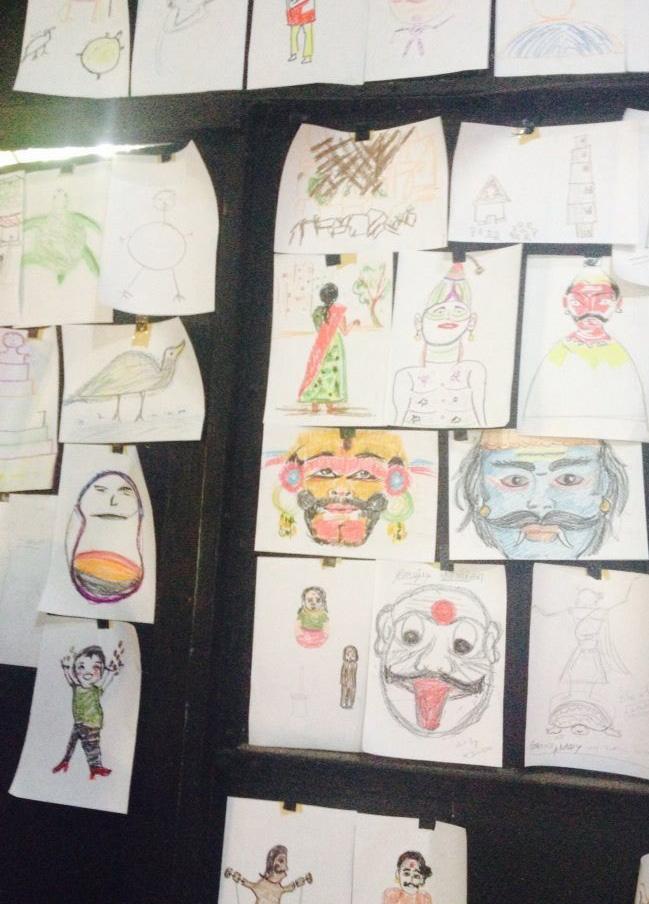
91June 2015 | CITY OBSERVER
Participants developing storylines & characters based on the workshop themes.
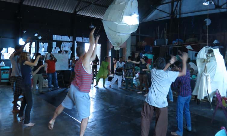
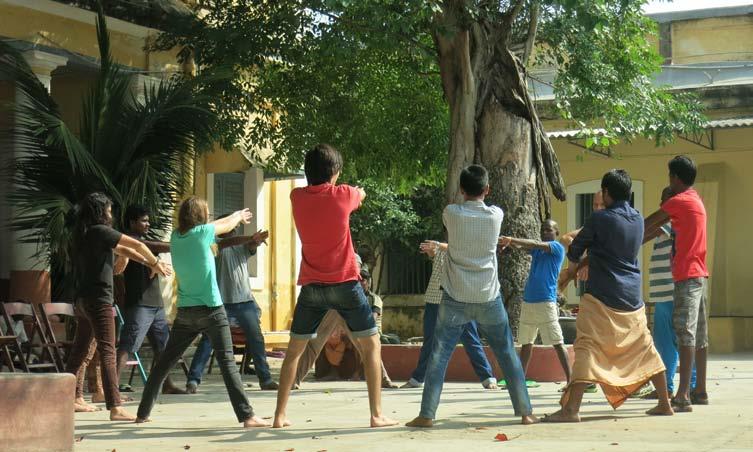
92 CITY OBSERVER | June 2015
Daily exercises improved strength & flexibility of participants when performing with puppets.
COMMUNITY ENGAGEMENT
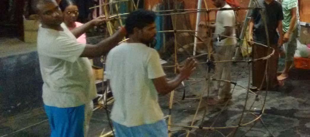
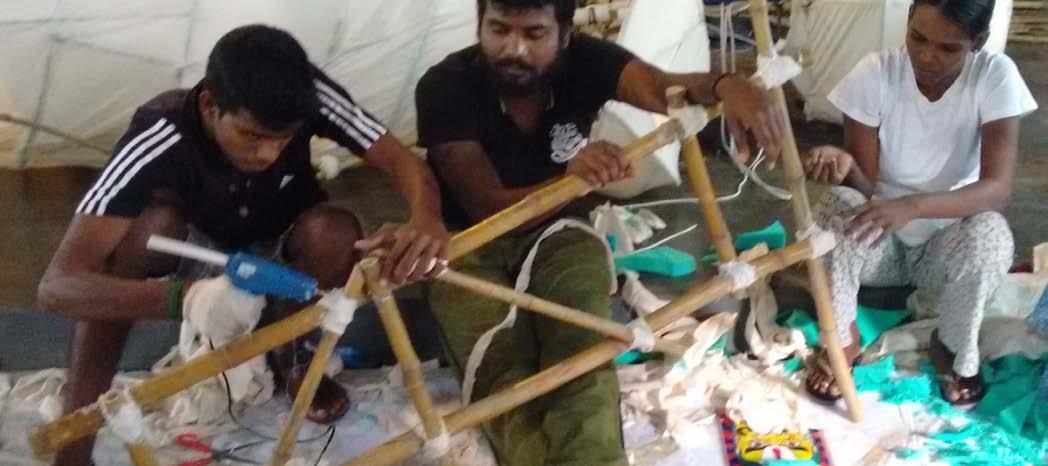
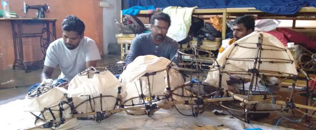
93June 2015 | CITY OBSERVER
Puppet skeletons were built from bamboo & cane, tied with rope & gaffer tape.
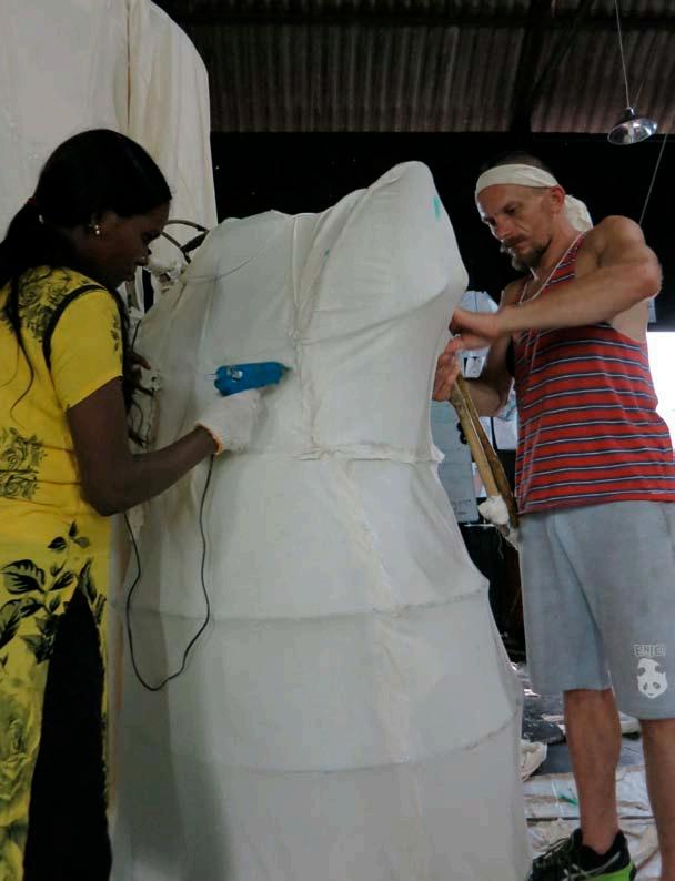
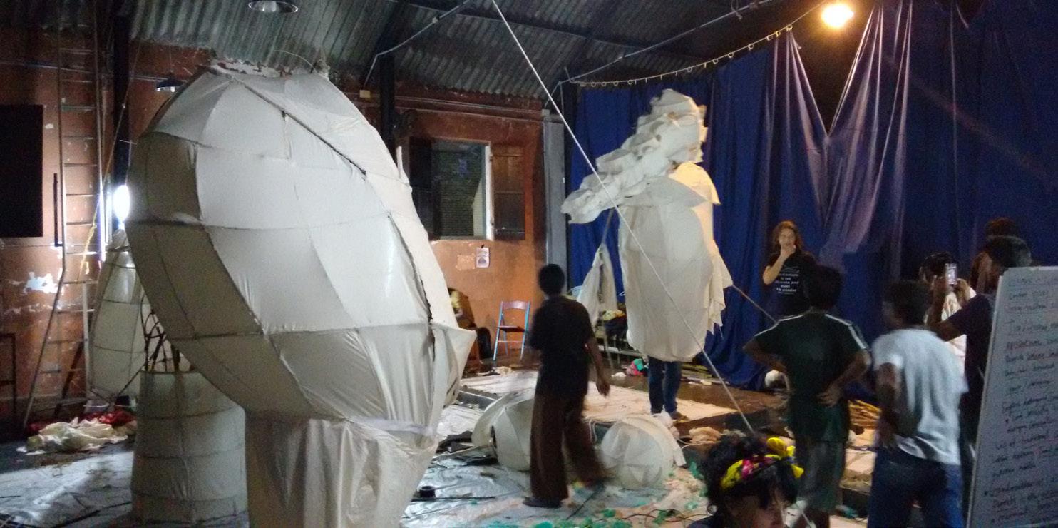
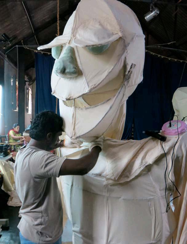
94 CITY OBSERVER | June 2015 COMMUNITY ENGAGEMENT
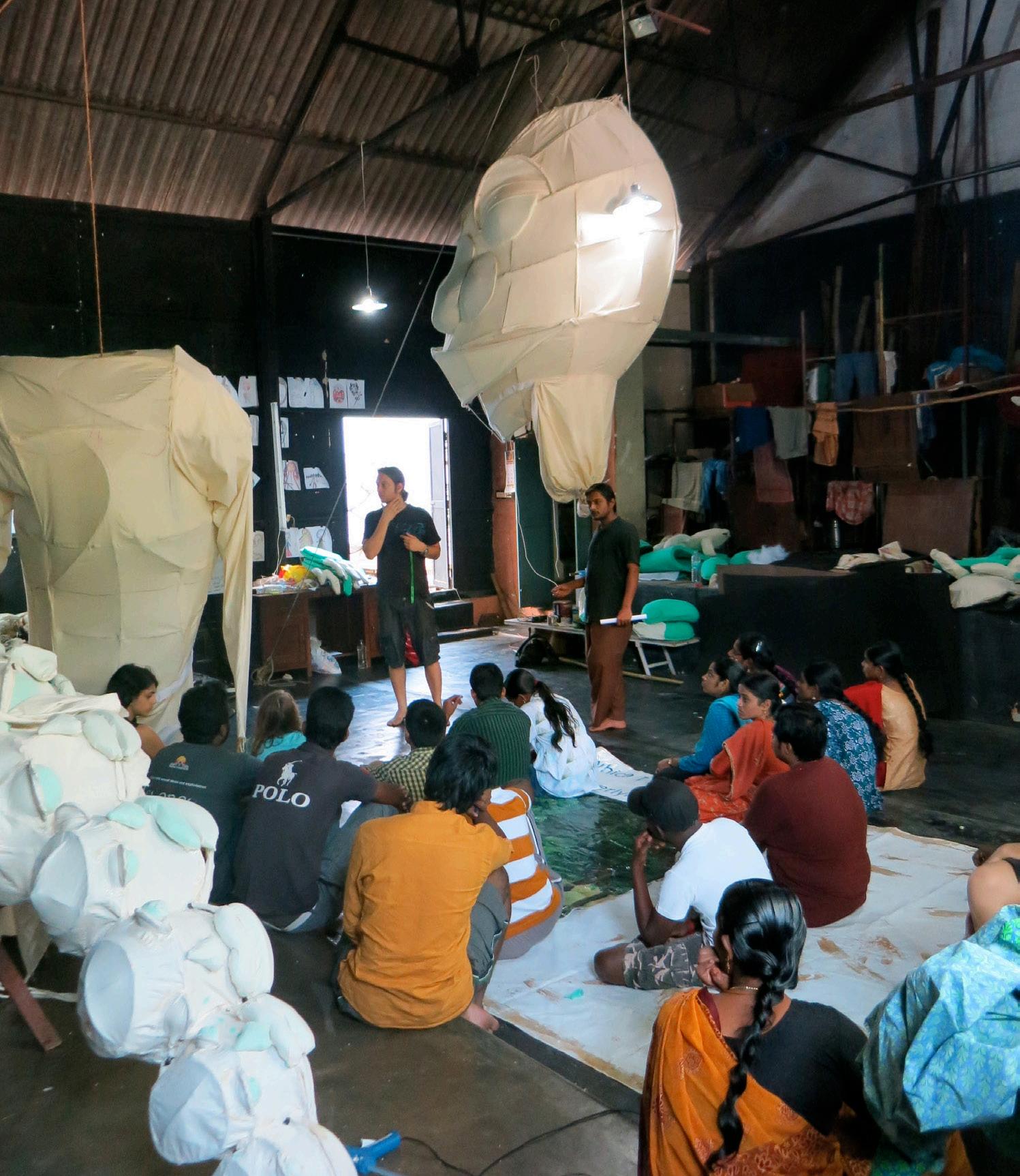
95June 2015 | CITY OBSERVER
Lightweight local ‘gada’ cloth provided the ‘skin’.
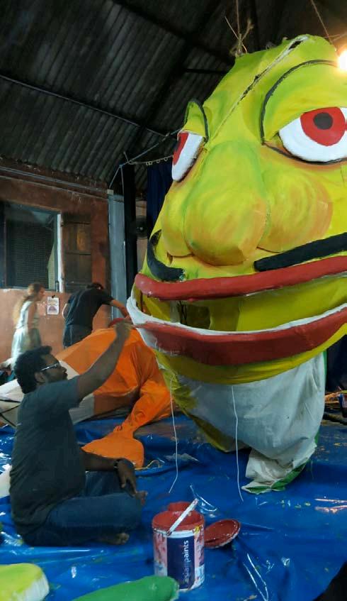
96 CITY OBSERVER | June 2015
Adding colour to the puppets.
COMMUNITY ENGAGEMENT
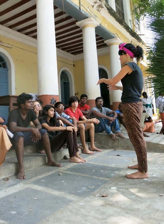
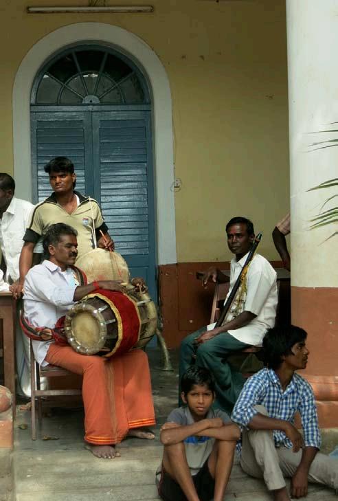

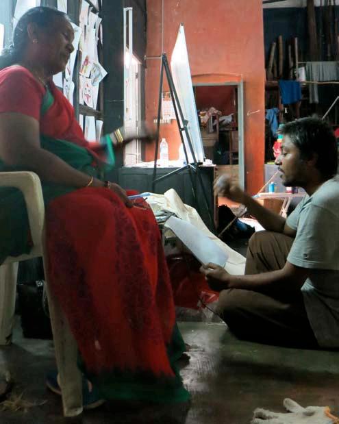
97June 2015 | CITY OBSERVER
Workshop participants included theatre artists, social workers, local craftsmen, construction workers, high school students, & architects.
Dress rehearsals were held on 26 March 2014, followed by a street parade through the Boulevard Town, & two performances of ‘Bomakka’ near the Beach Promenade.
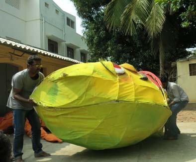
98 CITY OBSERVER | June 2015
COMMUNITY ENGAGEMENT
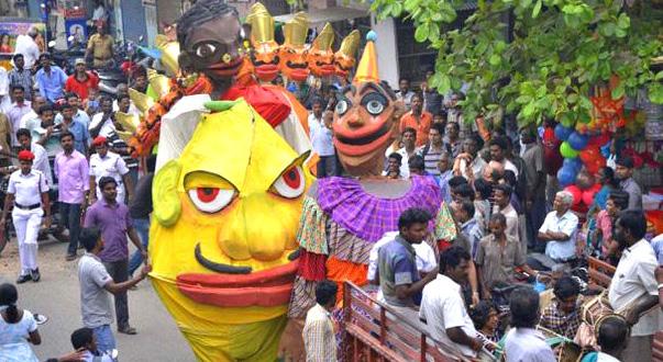
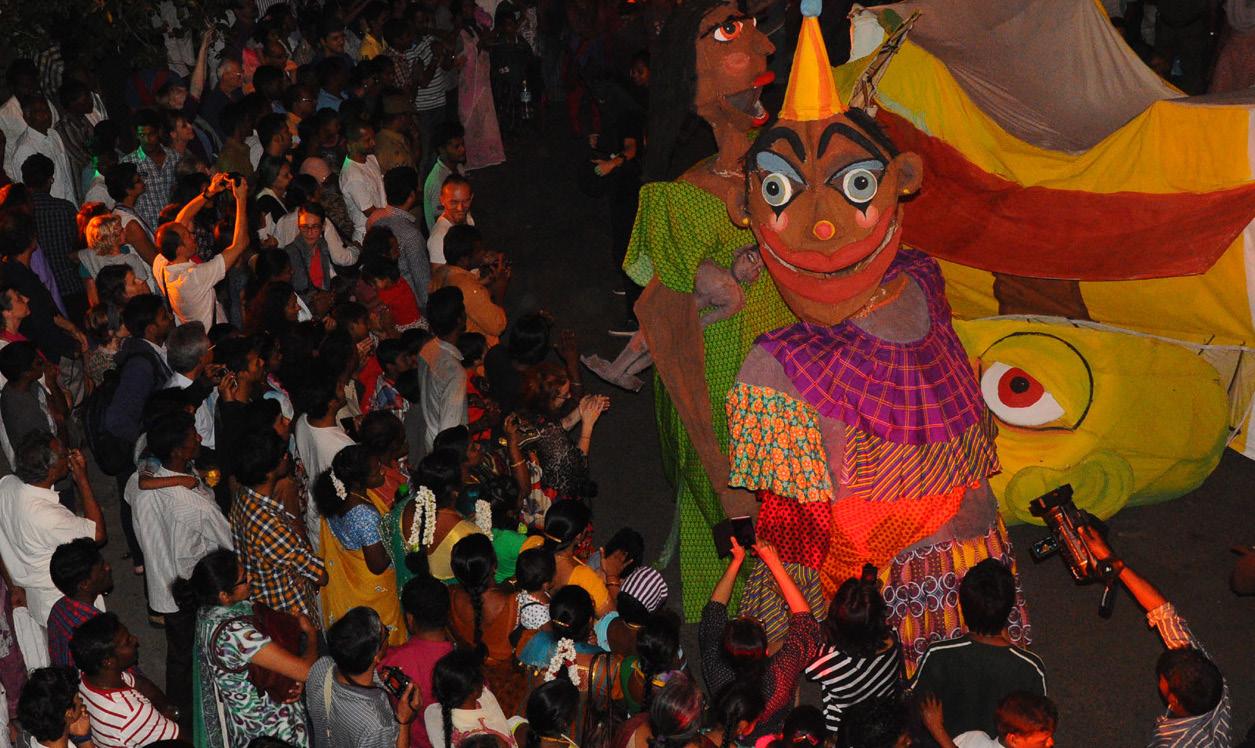
99June 2015 | CITY OBSERVER
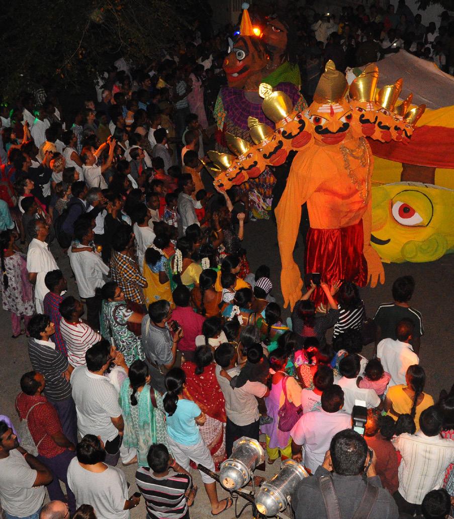
100 CITY OBSERVER | June 2015 COMMUNITY ENGAGEMENT
CAST AND CREW
Male Narrator/ Kattiyakaran- Dharani Dharan
Female Narrator / Bomakka, Dhanam- Mme. Gandhimary
Bomakka- Dinesh Mani
Kattiyakaran- P. Murugan
Dhanam- K. Sathish
Drishtipusani- Vijay Kumar Ravanan- Manuel Theremand
Traditional Tamil House- Anand, Karthikeyan, Navomie, Athmayazhini
Shadow Puppets- Ruthra, Gati Narvekar, Baptiste Vargas, Jade Cornellot, Yuvaas Guiry, Emma
TV Sets (autorickshaws)- Bhaskaran, Sivakumar, Venkatesan
Puppet Movement Support- Kumar, Sakthivel, Silambasvaran, Vasudevan, Suman, Sathish Kumar, Snuff Puppets team
Live Music- R. Rengarajan, S. Marimuthu, T. Krishnavel Appaswamy, K. Panneerselvam, M. Murugan, T. Senthil, A. Poovarasan, V. Mookkaiyan, R. Muruganantham
SNUFF PUPPETS AUSTRALIA
Workshop Director- Rebecca Rutter
Head Builder- Nick Wilson
Assistant Builders- Erin Hall, Stephane Hisler
LOCAL WORKSHOP SUPPORT
INTACH Pondicherry- Ashok Panda, Arul, Pratibha
Indianostrum Theatre- Koumarane Valavane
Urban Design Collective- Vidhya Mohankumar, Sarat Chandran, Dean Anthony
Additional Puppet Building Crew- B. Yogalakshmi, Anitha, Jayanthi, Suguna, Alex, Sumathi
Tools & Materials Procurement- Sathish Kumar
Light & Sound Production- M/S Soundgarden, M/S Dhandapani
Still photography- Sridhar Balasubramaniam, Sarat Chandran
Videography- Rathinam Stills, Pondicherry
Workshop Production Manager- Devangi Ramakrishnan
About the Author
Devangi Ramakrishnan, is an independent architecture and urban design consultant, and is based in Pondicherry, India since October 2012. Between 2008 and 2011, she worked at HCP Design & Project Management Pvt. Ltd., Ahmedabad, where she was part of the urban design team, involved in the Sabarmati Riverfront Development Project, and led and managed the Swarnim Park Development, and Sachivalaya Campus Revitalisation projects for the Government of Gujarat. Between 2012 and 2014, she was India project co-ordinator for Global Studio, an international action-research based education program of Centre of Sustainable Urban Development (CSUD), Columbia University. In this capacity, she assisted in the Global Studio International Workshop, Bhopal in January 2012, and conceptualised and exhibited the 12-country International Traveling Exhibition ‘People Building Better Cities’ in Mumbai, Delhi and Chennai through 2013. In her role as trustee at Urban Design Collective, she has led several collaborative community-based initiatives in Chennai and Pondicherry. She has consulted with INTACH Pondicherry on various heritage, urban revitalisation, and cultural projects, the most recent projects being, the ‘Development of Heritage Area’ project initiated by the Department of Tourism and the ‘People’s Puppet Project Pondicherry’, completed in December 2014. In addition, she is an active member of the Rajbhavan Neighbourhood Association, Pondicherry, and contributes to its activities on a regular basis.
101June 2015 | CITY OBSERVER
All photos in this article by Sridhar Balasubramaniam and Sarat Chandran
REDEVELOPING THE MUSI RIVERFRONT IN HYDERABAD
An urban design studio project by final year undergraduate students of architecture at School of Planning and Architecture-Vijayawada (SPAV)
by Karteek G
102 CITY OBSERVER | June 2015
TEACHING URBAN DESIGN
A river is an essential element in everyday life- as a resource, as a means of transport, as a corridor of endless movement and as a hub for recreation. It also captures several imaginations along its front, providing various diverse opportunities. Significant riverfronts in the past have contributed to the evolution of early civilizations and human settlements. According to Postel and Richter (2003), water in the city is needed for various key reasons – practical, aesthetic and spiritual. Unfortunately though, in the current scenario, most significant riverfronts have been abused and plagued by environmental issues, disturbed habitats and unstable landfills leading to contamination of soil and water. One of the primary reasons for this scenario is the continued and rapid pace of urban growth that adds to the demand for existing resources. Despite this prevalent condition, over the last two decades, there have been renewed and rigorous efforts to bring back the life along waterfronts both in India and the world over.
This design studio examines the case of the Musi riverfront in the city of Hyderabad, India by analysing the interface between the city and the river and its overall transformation over the years. The riverfronts form the edges to the old and new parts of the city on either side of the river and exhibit different characters as well as different phases of development. The studio exercise put forward new perspectives that can essentially revive the riverfront for recreational and economic benefits.
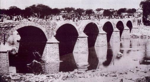
THE PROJECT
Taking up the case of our own cities, Hyderabad is one such example, which is going through several developmental issues particularly along the Musi river edge. Hyderabad is the capital of Andhra Pradesh and spreads across 650 square kilometres along the banks of the Musi river. As per the 2011 census, it has a population of 7.75 million making it India’s 4th most populous city and 6th most populous urban agglomeration. The city was historically known for being a diamond and pearl trading centre. The city was established by Muhammed Quli Qutb Shah on the southern side of the Musi River which forms the old city area. The northern side forms the newly urbanised city area. There are several bridges
103June 2015 | CITY OBSERVER
Purana pul, the oldest bridge on the Musi River. Photo from the collection of Mohd. Safiullah
across the river connecting the new and old city out of which Purana Pul is the oldest surviving bridge as well as a Grade-I historic structure. Many other bridges perished during the great Musi flood on September 28, 1908.
Musi River is a tributary of the Krishna River and therefore acts as an ecological edge between the old and new city while also creating a demand for several opportunities along it. The existing situation along the edges is summed up by unplanned development, pollution from the untreated sewage water coming from the city, incongruous to its surroundings, disturbed habitats, depletion of ecological resources, impermeable river edges and no clear policies with respect to conservation of historic buildings along the edges.
The urban design objective for the design studio was to essentially transform the historic edge into a vibrant and convivial urban space which would create great impact on the surrounding built fabric.
HERITAGE PRECINCT STUDY
The study phase for the design studio was centred on the heritage precinct stretching across four kilometres from Purana Pul to Chaderghat Bridge. This precinct is the same as the one demarcated in the Musi Heritage Precinct Revitalisation Project, under the Inclusive Heritage-based City Development Program (IHCDP), a pilot programme of the World Bank. As many as 35 structures of heritage relevance have
been identified near the river for restoration on the basis of this project. The study group was guided by faculty members Karteek G. and Kiranjith C. along with practicing architects and urban designers from Hyderabad- Venugopal P., Sanjay Torvi and Trivikram T.N.
The key aspects of the study of the selected precinct were figure ground analysis, morphological studies, movement networks, landmarks, heritage buildings, open spaces and activities and building uses and transformations. Another element was also the review of current proposals by various agencies for the same stretch. The figure ground suggests that the riverfront is a prey to various types of development over the years in different stages but not of a uniform grain. The study area had predominantly residential buildings (31%) followed by mixed-use (7%) and public/ semipublic buildings (6%). Organized commercial made up another 6%. For the most part, the riverfront was occupied by illegal cultivation, dhobi ghats, dump yards, cremation grounds, parking for heavy vehicles, high-tension lines and illegal or defunct buildings causing the death of public spaces along the public edge of the river. The open spaces along the riverfront provided very less it terms of good public spaces where people can meet, interact and experience various activities. Speaking to the public folk in the precinct revealed that many were unaware of the riverfront’s presence in some parts because the visual connections to the riverfronts were blocked by unintended development.
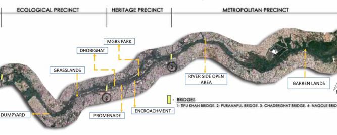
104 CITY OBSERVER | June 2015
City, along the Musi, is divided primarily into three zones under the save Musi campaign launched in 2006. Source: SPAV Urban Design Studio-2013 TEACHING URBAN DESIGN
The study revealed that the network of roads is very chaotic and most of the junctions are not signalized causing confusion to commuters. The pedestrian paths along the roads are full of obstructions and not continuous thereby forcing people to walk on the roads. The study also indicated that there were
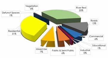
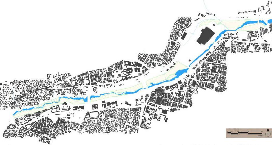
large public and semi-public buildings along the southern side i.e. old city riverfront like the Purana Pul (Grade-I historic structure), city police head quarters, Government maternity hospital, Government City College, high court complex, new shoe market, Salarjung Museum (Grade-I historic building) and Aza
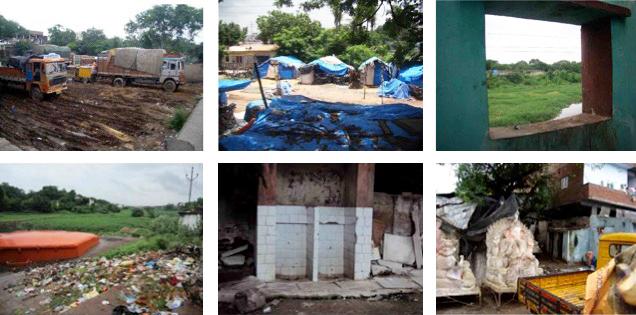
105June 2015 | CITY OBSERVER
Figure ground of the Heritage precinct and land use distribution pie-chart. Source: SPAV Urban Design Studio-2013
Snapshot of major unintended activities along the river. Source: SPAV Urban Design Studio-2013
kana Zehra. The northern part of the riverfront included the Osmania General hospital and City bus station, a more recent addition. Any new development too did not seem to focus on bringing the public closer to the water edge by creating public activities or buildings along the riverfronts.
WORKSHOP AND EXHIBITION
As an extension to the Studio project, an International Workshop on Urban Design was hosted by the college titled “City through its Riverfronts” on November 20, 2013. The workshop included sessions by various eminent professionals from across the globe who have been involved with addressing the issues and challenges at the interface between rivers and cities. The main objective of the workshop was to bring forth a diverse range of issues relating to development
and conservation along the urban riverfronts. The workshop served as a wider platform to disseminate knowledge on riverfront developments from around the world while addressing variables like conservation, ecology, and human interventions.
Parallel to the workshop, there was an exhibition of studio work on the two riverfronts by the final year undergraduate students- one being the Musi riverfront in Hyderabad and the other, the Krishna riverfront in Vijayawada by the peer section. Both were extraordinary showcases, expressing the character of two distinct and diverse riverfronts and bringing in directions for further interventions through four months of intensive studio discussions and deliberations.
Brochure for the International Workshop on Urban Design titled “City through its Riverfronts”. Source: SPAV Urban Design Studio-2013
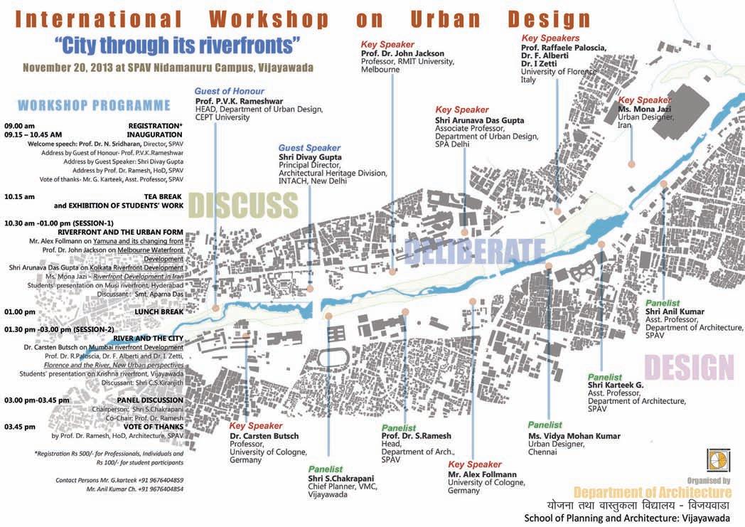
106 CITY OBSERVER | June 2015
TEACHING URBAN DESIGN
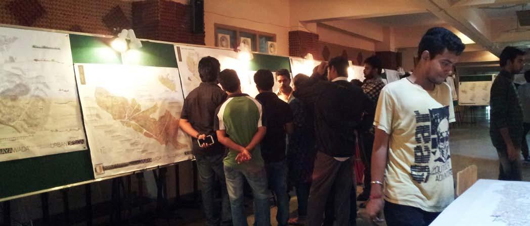
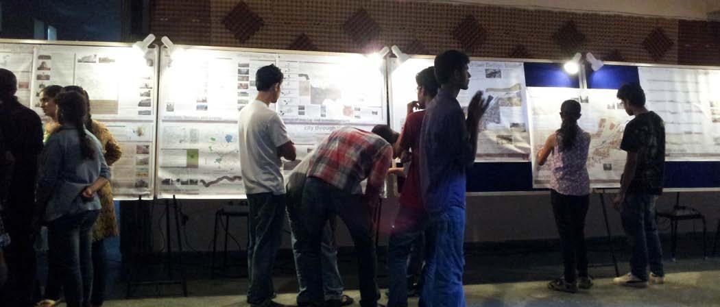
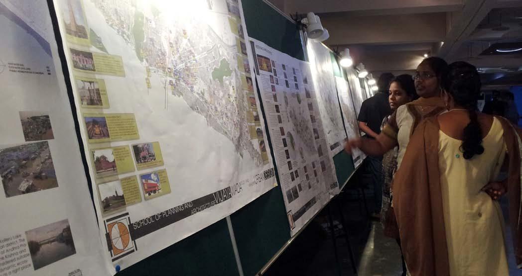
107June 2015 | CITY OBSERVER
During the international workshop and exhibition.
Photo Credit: Vidhya Mohankumar
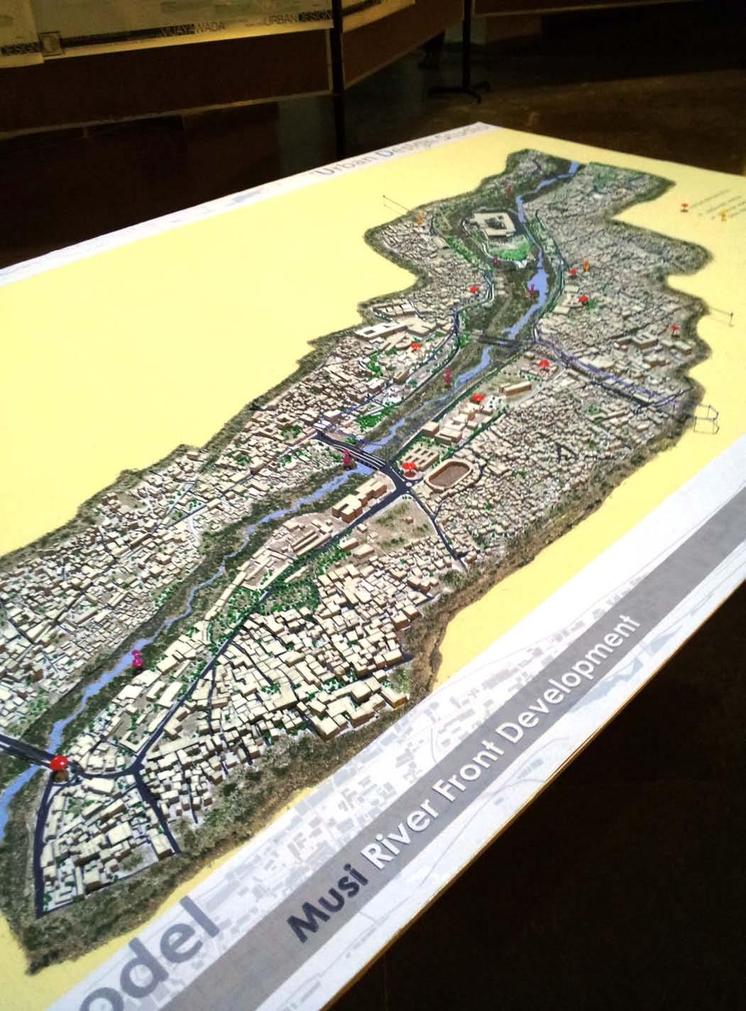
108 CITY OBSERVER | June 2015
Physical model of the study area on display during the exhibition.
Photo Credit: Vidhya Mohankumar
TEACHING URBAN DESIGN
URBAN DESIGN VISION AND PROPOSALS
In view of the existing issues and unintended activities along the riverfront, the first step of the studio project was to create a strong vision statement. The vision was to recreate the relation between river and the city and to transform the urban interface of the river with new identity by restoring ecology, heritage and culture. The objectives of the project were-
•
To strengthen the historic character by heritage specific interventions to revive the character of the riverfront,
•
To enhance physical connectivity and visual connections across the old and new city riverfronts
•
To create active public spaces to enhance human interactions
•
To improve the local economy by formalizing the informal sector into formal markets and seasonal allocation of activities
•
To uplift the standard of living of the residents of the area
The combined lineage of the Qutb Shahi period, the Asaf Jahi rulers and the British contributed a pleasant skyline to the riverfront with a strong heritage character. Charminar, being the most famous landmark and in close vicinity to the riverfront opened up several opportunities in the proposal. On the other side, a balanced demographic profile of Hindus and Muslims contributed to year-long festivities and provided many cues for activating the river edge. An ensemble of large civic and historic buildings also ensured continuous pedestrian movement in the precinct and also added to the public character of the precinct. The informal bazaars along the streets like Jumerat bazaar, Chudi bazaar, Begum bazaar, Chatta bazaar, Madina bazaar and Rikabganj created the scope for developing organized markets. While there were many such strengths and opportunities that were identified during the design studio, the most significant threat is that without proper intervention, the riverfront may become a permanent backyard and serve as a dumping ground for the city thereby destroy both the ecology as well as the picturesque quality of the riverfront.
Design Intervention Zones.
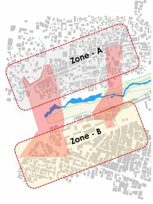
Source: SPAV Urban Design Studio-2013
3D view of the study area with heritage buildings shown in red.
Source: SPAV Urban Design Studio-2013
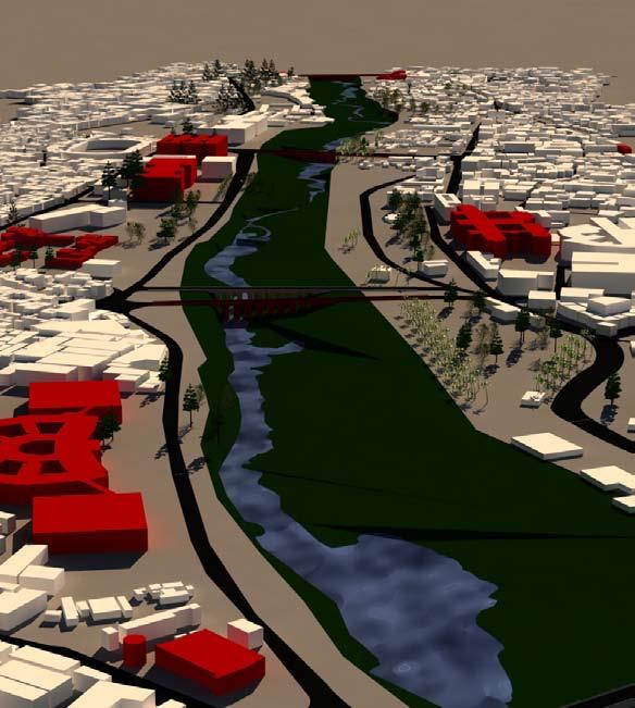
109June 2015 | CITY OBSERVER
Student proposals for formalization of the Jumerat Bazaar
Source: SPAV Urban Design Studio-2013
Student proposals for redevelopment of the main commercial spine- Hussaini Alam road and riverfront plazas. Source: SPAV Urban Design Studio-2013
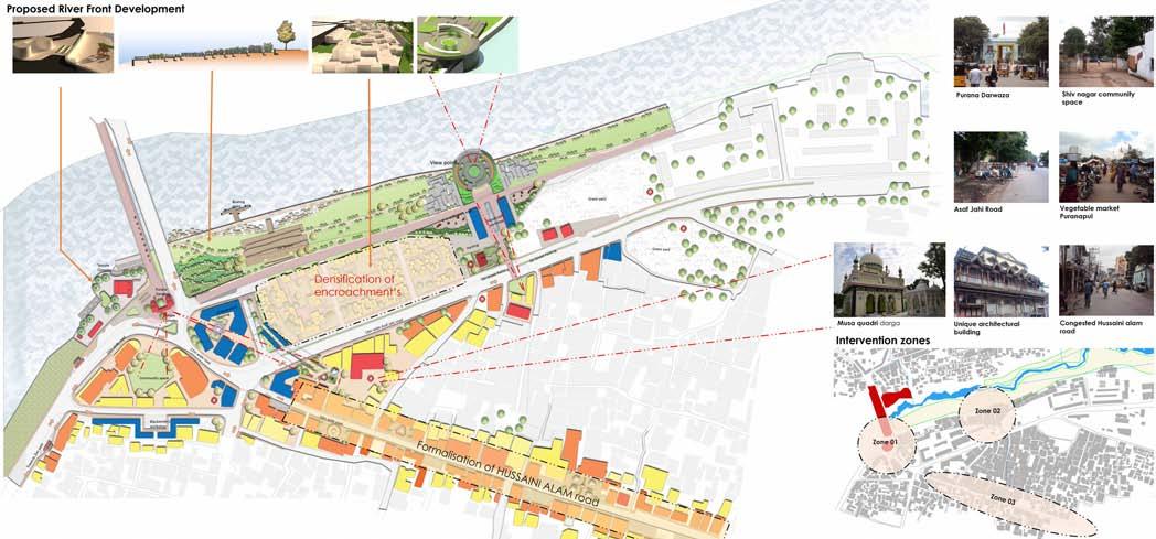
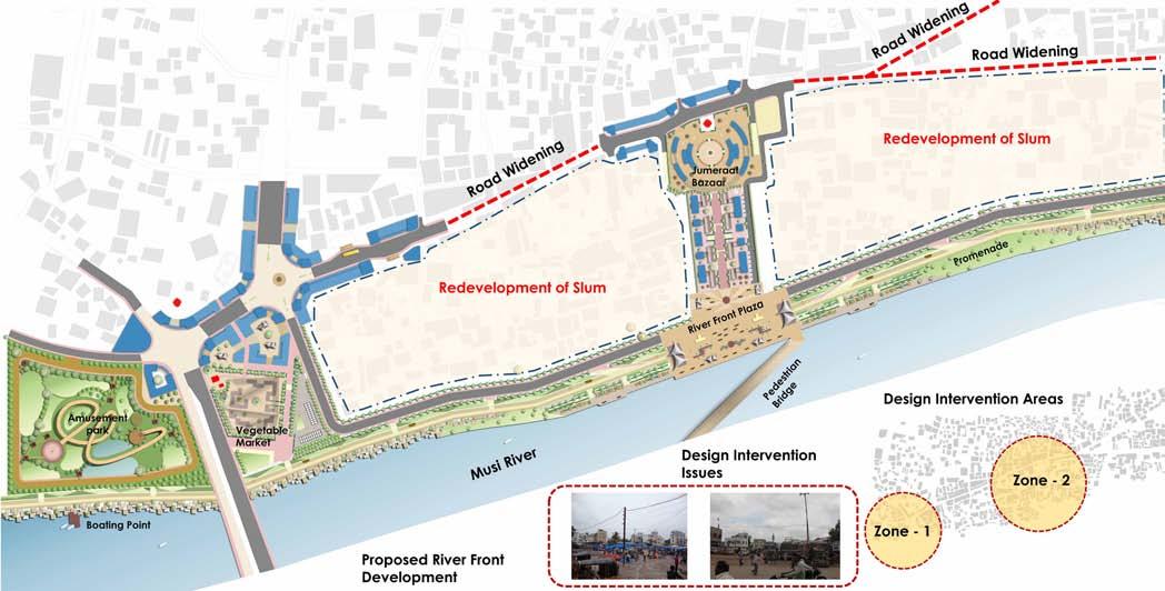
Section across the river.
Source: SPAV Urban Design Studio-2013
110 CITY OBSERVER | June 2015
TEACHING URBAN DESIGN
Following the findings of this stage, students and faculty ideated various scenarios to finalize the structure plan for the entire 4km stretch based on the possibilities offered by the various sites. Smaller intervention zones were then picked up by smaller groups of students to create demonstrative proposals with more architectural detail. The proposal for Zone A and B together focused on redevelopment and formalizing the Jumerat bazaar and redevelopment of the main commercial spine- Hussaini Alam road.
Specific proposed interventions within these two zones included a pedestrian bridge to link old and new riverfronts, a waterfront amusement park, an urban plaza as an extension of the Jumerat bazaar,a handicraft market, urban agriculture near the Purana Pul, adaptive re-use of the historic Purana Darwaja, active riverfront edges with promenades, boating points and cafeterias, improved temples precincts with cultural plazas, relocation of dhobi ghats and underground parking near the Jumerat bazaar.
OUTCOMES
Our past experience tells us that riverfronts were always in public use and the success of riverfronts was in the way public uses were incorporated along the river edge without damaging its ecology. The growth of cities have always altered its relation with the river and resulted in environmental and physical impact. The intense studio programme on the Musi riverfront served as a platform to generate various proposals demonstrating activity spaces that have the potential to bring back life to the city through its waterfronts... through proposals that seek to create a memorable public experience while paying tribute to local socio-cultural identities.
Students involved: Final year undergraduate students of architecture at School of Planning and ArchitectureVijayawada (SPAV)
SPAV faculty members involved: G. Karteek, C. Anil Kumar, C. Kiranjith
Urban design experts who guided the studio: Venugopal P., Sanjay Torvi and Trivikram T.N. , Vidhya Mohankumar
Duration of the studio: July to December 2013
About the Author
Karteek G is an Architect and Urban Designer from India presently working as an Assistant Professor in Department of Architecture, School of Planning and Architecture-Vijayawada. He has attained professional experience of high quality working for large multi-nationals in India including preparation and compilation of master plan reports and preparation of alternative urban design models. His research interests are in sustainable practices in global and technologically driven cities and studies about compact and ecological cities.
111June 2015 | CITY OBSERVER
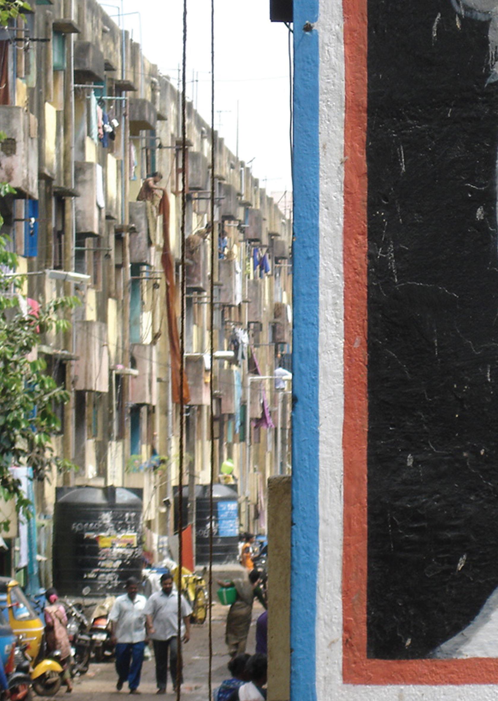
CLOSING SCENE
 Photo Credit: Mahesh Radhakrishnan
Published by
