


50 DRIVERS OF CHANGE 50 BENEFITS 40 ACTIONS 80 CASE STUDIES Towards a walking world
This report is the product of collaboration between Arup’s Foresight + Research + Innovation, Transport Consulting and Urban Design teams as well as other specialist planners, designers and engineers from across our global offices. We are also grateful for the expert contributions from a range of external commentators.
Contacts
Susan Claris
Associate Director Transport Consulting susan.claris@arup.com
Demetrio Scopelliti Architect Masterplanning and Urban Design demetrio.scopelliti@arup.com
Local Contact
Stefano Recalcati Associate Masterplanning and Urban Design stefano.recalcati@arup.com
Chris Luebkeman
Arup Fellow and Director Global Foresight + Research + Innovation chris.luebkeman@arup.com
Josef Hargrave Associate Foresight + Research + Innovation josef.hargrave@arup.com
13 Fitzroy Street London W1T 4BQ arup.com driversofchange.com
Arup 2016
©
#walkingworldReleased June 2016
5 Foreword 7 Executive summary 9 Introduction 14 Benefits 28 Envisioning walkable cities 98 Achieving walkable cities 110 Next steps 153 References 154 Acknowledgements 165 Contents
Foreword
Gregory Hodkinson | Chairman, Arup Group

I have had the great luxury of walking to work almost every workday when I have been at home over the past five years. For many years prior, I commuted by train and sometimes by car. The train journey involved a short walk across Manhattan, which was something, but the car journey did not. I say ‘luxury’ both because I live close enough to my work to be able to walk and this means I can spend more time working or at home than travelling, but also because walking is a great personal benefit. It is undoubtedly good for one’s health; it helps keep one fit and all that goes with that and I find it stimulates thinking, both in the morning when planning the day ahead and in the evening when reflecting and shifting focus to home and family.
Our aim at Arup is to shape a better world. Our focus is on planning, designing and delivering better cities and their component parts and systems. In this rapidly urbanising world this work is increasingly important for resource use, public health and economic efficiency. From 70 years of practice we know that a walkable city is a better city and that the more we walk the better the city in every respect. This report shows the benefits of walkable cities – economic, social, environmental and political – and sets out measures for improving walkability, illustrating these by case studies. The report challenges decision-makers to be more aware of the direct and indirect benefits of more walkable cities and provides guidance on how they might be realised.
7
Left: Towards a walking world, word cloud
| Health and Wellbeing | Promoting active lifestyles, Addressing the obesity crisis, Reduction of chronic disease, Improving mental health and people’s happiness | Safety | Improving traffic safety, Increasing passive surveillance, Reducing crimes | Placemaking | Promoting a vibrant urban experience, Enhancing sense of place, Encouraging art and supporting cultural initiatives, Increasing access to recreation facilities | Social Cohesion and Equality | Broadening universal accessibility, Developing intergenerational integration, Fostering social interaction, Strengthening community identity, Encouraging inclusiveness | Local Economy | Boosting prosperity, Supporting local businesses, Enhancing creative thinking and productivity
| City Attractiveness | Enhancing city branding and identity, Promoting tourism, Encouraging inward investments, Attracting the creative class | Urban Regeneration | Increasing land and property values, Activating street facades | Cost savings | Shrinking congestion costs, Construction and maintenance cost savings, Reducing healthcare costs | Virtuous Cycles | Decreasing dependency on non-renewable resources, Optimising land use | Ecosystem Services | Addressing air pollution, Reducing ambient noise, Improving urban microclimate, Increasing permeable surface for water drainage | Liveability | Beautification of street landscape and public space, Implementing ‘sittability’ and recreational facilities | Transport Efficiency | Reclaiming underused space from vehicles, Encouraging a modal shift from motor vehicle travel, Promoting flexible commuting schemes, Increasing permeability in the urban fabric, Bridging barriers | Leadership | Fostering competitiveness, Building public consensus | Urban Governance | Promoting citizen empowerment, Encouraging participation of multiple stakeholders, Enhancing civic responsibility | Sustainable Development | Promoting sustainable behaviours, Addressing city resilience | Planning opportunities | Supporting regeneration processes, Allowing flexible and micro-solutions, Promoting cultural heritage
Cities Alive: Towards a walking world
8
Executive summary
In our mission to shape a better world we must shape better cities. With nearly 70% of the world’s population set to live in urban areas by 2030, the quality of life experienced by this population will determine our global future. It is increasingly cities, more than national governments, that have the power to tackle climate change, fuel the global economy, deliver prosperity and alleviate poverty.1 With the advent of social media and the growth of the global middle class, urban citizens have greater power than ever to stop or start projects, choose where they live, work and invest and demand a better quality of life.
Intrinsic to the success of cities and the quality of life they offer is how people move around within them. In the twentieth century, planning for the city was about planning for the car. In this report we make the case for policies that encourage walking to be placed at the heart of all decisions about the built environment, as walkable cities are better cities for everyone.
We need to design physical activity back into our everyday lives by incentivising and facilitating walking as a regular daily mode of transport. In addition to the host of health benefits, there are many economic benefits for developers, employers and retailers when it comes to walking. It is the lowest carbon, least polluting, cheapest and most reliable form of transport, and is also a great social leveller. Having people walking through urban spaces makes the spaces safer for others and, best of all, it makes people happy.
world, benefits
walking
9
Left: Towards a walking
of
environmental
political Cities Alive
/ technological / economic
Towards a walking world framework the research framework consists of 50 drivers of change, 50 benefits, 40 actions and 80 global case studies
a walking world
a walking
& strategy / safe & efficient transportation system / liveable environment / sense of place & communities / smart & responsive city
Cities Alive: Towards
world10 50 drivers of change 40 actions
social
/
/
Towards
80 case studies vision
50 benefits
This report, Cities Alive: Towards a walking world, shines a light on walking, which is all too often taken for granted. It investigates the role walkability plays in developing more liveable, sustainable, healthy, safe and attractive cities.
To set the context, 50 drivers of change are firstly outlined, structured around the STEEP framework, covering social, technological, economic, environmental and political domains. These explore global trends that are shaping the future of our cities.
A list of 50 benefits of walking that should be achievable in most contexts and demonstrable by quantitative and qualitative measurements is then presented. Social benefits such as health and wellbeing, safety, social cohesion, social equality; economic benefits including the local economy, city attractiveness, urban regeneration and cost savings; environmental benefits to do with virtuous cycles, ecosystem services, liveability and transportation efficiency; and political benefits associated with leadership, urban governance, sustainable development and planning opportunities.
The various dimensions of walkable cities are explored through a set of interviews with leading thinkers in this field – experts from Gehl Architects, the University of Hong Kong, Arup, Project for Public Spaces and the City of Auckland.
Moving towards a walking world requires actions. These actions concern visions and strategies, safe and efficient transport systems, creating liveable environments, a sense of place and community and smart and responsive cities. The practicality of these actions is illustrated by a series of 80 case studies from across the world. These show what can be achieved and are designed to inspire us all towards a walking world.
50 drivers of change covering social, technological, economic, environmental and political domains.
50 benefits that should be achievable and demonstrable by quantitative and qualitative measurements.
40 actions
and policies to address the complexity of urban issues through 5 lenses.
80 case studies from across the world to inspire us all towards a walking world.
11
benefit framework areas of benefit
social economic environmental political
Safety
Placemaking
Social Cohesion and Equality
Health and Wellbeing
Local Economy Urban Regeneration City Attractiveness
Cost Saving
Ecosystem Services
Virtuous Cycles
Liveability
Transport Ef ciency Leadership Urban Governance
Sustainable Development
Planning Opportunity
benefits and actions the diagram summarises the interrelation between walkability’s benefits and suggested implementable actions.
Towards a walking world
Cities Alive:
12
areas of action single actions
Car-free initiatives
“Vision zero” policies
Pedestrian and health campaigns
Local champions
Pop-up and temporary initiatives
Economic incentives
Virtuous cycles
Density and mixed functions
Walkable connectivity
Pedestrian streets
vision and strategy
safe and ef cient transportation system
liveable environment
sense of place and communities
smart and responsive city
Road share
Integration with public transport Road diet
Safe crosswalks and intersections
Traf c calming measures
Improved signage Infrastructure re-use
Innovative public spaces
Greenways and blueways
Pocket parks
Parklets
Street design and furniture Microclimate measures
Active facades
Open street events
Public art DIY opportunities
Street fairs and markets
Heritage promotion
Redundant spaces reallocation
Urban nightscape
Inclusive design
Playful interactive environment
New modes of city exploration
Way nding systems
Accessibility and inclusivity
Sensing of people and environment
Mapping safety
City monitoring
Digital evaluation tools
13
Introduction
“In a city the street must be supreme. It is the first institution of the city. The street is a room by agreement, a community room, the walls of which belong to the donors, dedicated to the city for common use. Its ceiling is the sky. Today, streets are disinterested movements not at all belonging to the houses that front them. So you have no streets. You have roads, but you have no streets.”

–Louis Kahn, The Street

modal
Los
RiodeJaneiro
map
journeys on foot vs journeys by car the diagram shows the modal split by walk and by car for 34 global cities; the world map compares the data with the national rate of pedestrians killed in traffic crashes.
pedestrian deaths per 100k people
Cities Alive: Towards a walking world16 Ne w Y o r k Ci t y Sã o P a ul o Bo gotá Rio de Janei ro Guangzhou Sh a nghaiMexicoCit y BarcelonaIstanbulParisDelhiTokyoLimaMumbai Hong Kong Bangalore KolkataMiami LosAngelesAtlantaTorontoSydneyRomeBangkokChicagoBoston SanFranciscoLondonAmsterdamStockholmJohannesburgSingap o r e Be r l in M a dr i d Istanbul Paris Barcelona HSanFrancisco ongkong Los Angeles Miami Atlanta Guangzhou
Johannesburg MBerlinexicoCityLondon MadridStockholmMumbaiSão PauloLimaToky o Singa p o r e D e lhiAmsterdamB an gal o r e S yd ne y Boston Sh a nghai KolkataBogotáNewYorkCity RBangkok omeTChicago oronto
< 10 10-20 20-30 30-40 40-50 > 50 no data
split / journeys by walking % modal split / journeys by car %
/
Angeles 4% Istanbul 48% Kolkata 2% Miami 79%
Setting the context
Undoubtedly, the 20th century was the century of cars.
The introduction of the mass-produced car represented a revolution in mobility and convenience and a milestone in democratisation of movement. This strive for speed and individual freedom led to “the decisive triumph of the car” and thus the planning of the city to cater for it.2 Over the course of the century, cars colonised the space of everyday human life.
The legacies of the traffic-dominated planning era are still clearly visible in cities worldwide. We can see this in neighbourhoods without sidewalks, in public spaces made redundant by parked vehicles, and in the urban highways that segregate neighbourhoods in order to serve sprawling suburbs.

This is not only a matter of spatial quality. The negative effects of heavy automotive use on urban everyday life are significant. Motorisation is currently dependent on non-renewable fuels and motorised vehicles are a major contributor to air and noise pollution. Speed is the main cause of premature deaths and injuries in road accidents, and traffic congestion is a huge issue – and cost – for cities. The development of car-centric lifestyles heavily contributes to the decline of physical activity and the rise of obesity, while sprawl may lead to social isolation and disconnection of communities.
traffic speed and pedestrians
According to two studies from UK and US, it is reported that:
- 5% of pedestrians are killed when struck by a car traveling 20 mph;
- 37-45 % of pedestrians are killed when struck by a car traveling 30 mph;
- 83-85 % of pedestrians are killed when struck by a car traveling 40 mph.3
17
“If you plan cities for cars and traffic, you get cars and traffic. If you plan for people and places, you get people and places.”
—Fred Kent, Project for Public Spaces
Already in the 1960s, a critical movement led by thinkers like Lewis Mumford, Jane Jacobs, William H. Whyte and Jan Gehl began questioning car dominance, driven by the concern for the decline in the human-focused approach to urban projects. However, the rising awareness of the role of walking in the urban debate is a relatively recent phenomenon.
Only in recent years has mobility been recognised as a fundamental factor for achieving sustainable urban development. Accordingly, the desire to have liveable streets is now rising in many corners of the world. Several cities have already started to take action on this front: Hamburg, Helsinki and Madrid have contemplated going car-free; New York and Los Angeles have developed low-cost interventions for creating pedestrian-only streets; Buenos Aires rolled out over 140km of cycle-lanes in just a few years and mayors around the world are implementing ‘Vision Zero’ strategies to reduce traffic fatalities in their cities.
At a global scale, citizens are reclaiming their streets as public spaces again.
Although facing common issues, cities live different challenges in relation to their geographic contexts, particularly concerning two factors: economic development, directly proportional to the level of motorisation, and the pattern of urban (and street) density, which assume a different range of possible interventions.
The awareness around the existence of different scenarios to improve walkability implies a need to understand different urban contexts, in order to identify solutions to enhance a city’s liveability and prosperity in different parts of the world.
walkability
Walking is our first mean of transport: every trip begins and ends with walking. Consequently, walkability is an extremely fascinating, evocative and inclusive concept. It goes beyond the good design of sidewalks and streetcrossings which guarantee the ‘ability to walk’ for citizens. It expresses a multifaceted measure of how friendly an area is to walking, taking into consideration a complex and diversified set of features in its evaluation.

Cities Alive: Towards a walking world18
Hong Kong Istanbul
Delhi Guangzhou
Jakarta Johannesburg
Bangalore Bangkok Beijing Berlin
Barcelona
Madrid
Sao Paulo Shanghai
Kolkata Lima London Los Angeles
Manila Mexico City Miami
High
Buenos Aires
Cairo Chicago Curitiba
Tianjin Tokyo
density vs gdp two main factors can determine different scenarios for walkable cities: - the economic development is directly proportional to the level of motorisation; - the patterns of urban density assume a different range of possible interventions.
Mumbai New York
Bogotà Boston
Osaka Paris Randstad
Singapore Stockholm Sydney
Moscow
Rio de Janeiro Rome San Francisco
Atlanta
19
GDPLow GDP High density Low density Toronto 5 10 15 20 25 20 40 60 80 100 10 GDP per capita (PPP) $1,000 (Brookings, Global Metro Monitor 2014) 1,000 pp / sq km (LSE Cities) 1,000 pp / sq km (LSE Cities) Net density estimate Peak density estimate 20 30 40 50 60 70
Stakeh older en gage ment
Publ i c s pacePrivatisationMicro-soluPolicyintegration
tionsLeadership
Collective consciousness
Greenpolitics
Citycompetitiveness
Transport safety
Loss of biodiversity
Land use patterns
Urba n r esil i ence
Heat island Green infrastructure EnergyconsumptionDecarbonisationClimatechangeAirpollution Active transportation Urban regenerationUnemployment Tourism Sharing econ omy
political ivneemnor n t a l cimonoce
drivers of change to set the context, 50 drivers of change explore those global trends that are shaping the future of our cities and can lead us towards a walking world
inequalitySustainable behavioursPublic healthFortress citiesEmotiona l cityness Digital lifestylesDemog r aph ic p a tterns Car ownership Recession
Availability of sensors Autonomous vehiclesUrbanUrbanUrbanstressspontaneity
Big data
t e c onhgollaci
social Hea l th costs Glocalism Genius hub
social / technological / economic / environmental / political
Communication and sharing
Constant connectivity
Digital information
FreepublicWiFi
DigitaleconomyCongestioncostsQuantified-selfInteractivestreetfurniture Gamifiedincentives
Towards a walking world
Cities Alive:
20
Drivers of change
—Janette Sadik-Khan, Commissioner of the New York City Department of Transportation from 2007 to 2013
Car culture is on the decline, at least in the Western world. Studies indicate that in North America, Japan, Australia and European countries we may have reached ‘peak car’ – the apex at which car ownership, licence ownership and the distance driven per vehicle level off, and then turn down.4 We are facing a longterm cultural shift: among the millennial generation, a car does not define one’s social status.
The recession has made it difficult for people to afford cars: the costs associated with purchasing, running and maintaining a car quickly add up. At the same time, new research has demonstrated the harmful effects of sedentary lifestyles, and the growing ubiquity of the Internet has facilitated the development of more flexible commuting arrangements.5
As a response to the desire for sustainable urban development, planning efforts to reduce traffic in favour of active modes of transport have finally started showing positive results. The strive for ‘liveable’, ‘healthy’ or ‘complete’ streets ‘for all’ is dramatically increasing the centrality of walking in the urban discourse, particularly thanks to the association with physical activity and wellbeing, the value of walking as an agile mode of transport and its ability to emphasise the idea of a multisensory, interactive and social experience.
Cities around the world are beginning to realise that by getting more people on foot in tandem with reducing the number of cars, they will have healthier, happier citizens and thriving streets and public spaces. But what trends are behind this shift in urban lifestyles?
50 drivers of change
Cities Alive cards
Cities Alive workshop cards help stakeholders at a ll levels — citizens, planners and officials — to prioritise and explore issues shaping the future of their city. They facilitate conversations, enhance understanding, support decision making and help cities develop new ideas and solutions.6

21
“...I truly believe that if you can change the street, you can change the world.”
Social trends
Car ownership
Demographic patterns
Digital lifestyles
Emotional cityness
Fortress cities
Public health
Sustainable behaviours
Urban inequality
Urban spontaneity
Urban stress
New demographic patterns, such as ageing populations and shrinking families, are fundamentally and rapidly changing the way in which people want to live and interact in cities. This leads to an increasing need for social experience in order to avoid isolation and social exclusion, which may be exacerbated by the rise of inequalities and feelings of insecurity. The concentration of services, entertainment and social opportunities in cities, enables the exploration of local offerings and increases occasions for spontaneous encounters and informal activities.
The urbanisation trend, driven by an increasing desire to experience ‘cityness’ and density, is changing the way people live and move in cities. Owning a car is expensive and gridlock can make driving an inefficient and stressful commuting solution. Statistics show that personal happiness decreases with every mile of commute.7 Furthermore, the car is no longer a status symbol for young adults, while mobile devices are increasingly at the centre of our digital lifestyles. Thus, many are consciously choosing to shun cars in favour of walking, cycling and public transport, decisions that are also driven by health and sustainability objectives. Accordingly, active mobility is on the rise, perceived as a tool to avoid inactivity, reducing the risk of diseases and the social stress of living in growing megacities.

Cities Alive: Towards a walking world22
Technological trends
Autonomous vehicles
Availability of sensors
Big data
Communication and sharing
Constant connectivity
Digital information
Free public Wi-Fi
Gamified incentives
Interactive street furniture

Quantified-self
Ubiquitous digital technology now forms a layer of data, interaction and personalisation that is uniformly available –virtually – across all urban activities. Intelligent systems allow transport modes to communicate with each other and with the wider environment, paving the way for truly integrated transport solutions and experiences. Journey planners already facilitate multimodal journey selection, including walking and cycling options, while constant connectivity and a growing interest in personal health and quantified self are resulting in growing preferences for active mobility. However, personal health and wellbeing are not the sole motivators that get people moving; gamification is offering real incentives such as monetary reimbursement and discounts in return for activity data.
Thanks to new technologies, the physical city is changing as well. With sensors and cloud computing becoming cheaper and more widely available, streets are becoming smarter and more interactive. The city can now monitor and analyse activity levels, actively advocate walking and cycling routes, as well as create a layer of play, fun and games onto the streetscapes. Moreover, new forms of autonomous mobility are on the rise and in the near future may radically change the way we commute and decrease road infrastructure demand.
23
Economic trends
Congestion costs
Digital economy
Genius hub
Glocalism
Health costs
Recession
Sharing economy
Tourism Unemployment

Urban regeneration
As the global economy evolves, it impacts not only the way people make and spend money, but also the way they live. The principles of the digital economy see us travel widely and more freely, leading to increasing pressures on mobility to provide seamless and reliable experiences. Traditional models of ownership are changing and platform based, peer-to-peer services are disrupting traditional service industries in cities around the world. A rapid shift from product to service-based business models has seen several forms of transport evolve into urban on-demand systems, such as bike-hire and car-sharing schemes. These have collectively reduced reliance on privatelyowned vehicles and have thus increased the flexibility and availability of multi-modal transport, including walking.
While flexible mobility schemes are more affordable for users, active mobility has the potential to reduce healthcare and congestion costs for both end-users and governments. Hence, national and municipal governments are likely to support urban policies and regenerations that aim to increase active mobility solutions, while discouraging car-use, as tools to foster local economy and create job opportunities. Investing in public spaces can be a catalyst for regeneration; it can revitalise derelict urban areas and can rebuild a city’s economic base.
Cities Alive: Towards a walking world24
Environmental trends

Active transportation
Air pollution
Climate change
Decarbonisation
Energy consumption
Green infrastructure
Heat island
Land use patterns
Loss of biodiversity
Transport safety
Concern for the environment may be one of the earliest and most straightforward drivers for increased walking and active mobility. While individual users cannot control or directly affect several other wider factors impacting their environment, mobility presents a simple place to start. From climate change to air pollution, loss of biodiversity to green infrastructure, walking provides an active means for people to mitigate and address local and global environmental concerns. Many mitigation measures will need to be focused on urban areas. By shifting the focus from cars to people, urban and transport planning can mitigate impacts and foster sustainable economic development and environments. Instead of road efficiency, parking and pollution, cities now strive for activity, nature and vibrancy. Existing transport and underground infrastructure are prime examples of adaptive reuse, where cities create valuable public space without compromising further land areas. Several cities are already experiencing the wide range of benefits of creating places for walking and increasing green infrastructure, including water management, carbon storage and flood mitigation.
25
Political trends
City competitiveness
Collective consciousness
Green politics
Leadership
Micro-solutions
Policy integration
Privatisation
Public space
Stakeholder engagement
Urban resilience

Climate change, energy shocks, economic crises and political upheavals continue to foster public dissent and political activism. As cities face increasing threats, community-led solutions are becoming more common to build self-reliance and resilience in order to prepare for, respond to and recover from crises. Social media is opening up new possibilities for public engagement and participation. From crowdsourced initiatives to forms of self-determination and insurgency, people around the world are becoming more active in engaging with their cities and local decision-making, striving for more inclusive planning processes. Active mobility, liveability and public spaces top the list of priorities for many, subsequently also trickling to the top of cities’ priorities as well.
In an increasingly open global competitive stage, cities are driven to demonstrate their leadership, especially in terms of environmental policies and innovation. Strong city leadership provides visibility, legitimacy and decision-making power to city governance. Walking is increasingly a political agenda as cities fight to reduce cars, congestion and pollution while striving for a safer, healthier, more vibrant community of residents and visitors alike. A rising consciousness around the fundamental role of public space is leading cities to update out-dated regulations based around cars and parking in favour of a more holistic view of mobility and access. These and other policies are actively trying to get people back onto to the streets thanks to micro and temporary solutions.
Cities Alive: Towards a walking world26
emotional cityness
an urban context of social fragmentation, we experience an increasing need of deeper face-toface relationships in order to avoid isolation and social exclusion. Social interaction contributes to community cohesiveness.
big data
Global data will grow from 5 zb in 2014 to 40 zb in 2020. Only 0.5% of all data available has been analysed and used. (EMC2)

public space
should make up 30 to 35% of city’s land
“make! a city
climate change
in global surface temperature (°C).
7million
premature deaths annually linked to air pollution. (WHO, 2014)
1. 25 million
road traffic deaths registered globally. (WHO, 2013)
congestion costs

27 air pollution CO2 emissions from transport, % of total fuel combustion (World Bank, 2012) n.d. 0-10 10-20 20-30 30-40 40-50 >50
estimates of direct and indirect congestion costs per household, in millions of dollars. (INRIX, 2013) London Paris Stuttgart Los Angeles 8,5 11,7 3,2 23,2
streets
area in order to
“prosperous”. (UNHabitat, 2013) 37% 34% 29% 26% 25% 23% 22% 14% New York Hong Kong Paris Sydney Brussel Los Angeles Copenhagen Moscow
change
(Nasa) 1880 1910 1940 1970 2000
in
Benefits

“Walkability is a word that did not exist just 20 years ago. We made walking so unnatural that we had to invent a word to describe what we were missing.”
— Dan Burden, Director of Innovation and Inspiration at Blue Zones

safety local economy ecosystem services leadership
placemaking urban regeneration virtuous cycles urban governance
social cohesion and equality city attractiveness liveability sustainable development
health and wellbeing cost savings transport efficiency planning opportunities
benefit framework
16 areas of benefits provide a framework to guide decision makers to set visions, long-term plan and monitor results, around walking in cities
Towards a walking world
Cities Alive:
30
Reasons for a walking world
Evidence can be one of the best ways to influence decisionmakers. To achieve the shift from car-centric to human-scale cities, the development of an evidence-based methodology is a fundamental step to establish a shared global recognition that walkable environments can shape better cities.
A literature review and a series of multidisciplinary workshops held in different geographic areas by an Arup global specialised team led to the development of a list of 50 benefits of walking that should be achievable in most contexts and demonstrable by quantitative and qualitative measurements. This provides a framework to guide decision makers to set visions, long-term planning, and monitor results, from a multidisciplinary and integrated perspective.
In detail, the findings rely on the definition of 16 areas of benefits, and a series of secondary indicators, identified as follows:
Social benefits such as health and wellbeing, safety, placemaking, social cohesion and equality.
Economic benefits including city attractiveness, the local economy, urban regeneration, and cost savings.
Environmental benefits to do with virtuous cycles, ecosystem services, liveability and transport efficiency.
Political benefits associated with leadership, urban governance, sustainable development and planning opportunities.
50
areas of benefit social health and wellbeing safety placemaking social cohesion and equality economic local economy city attractiveness urban regeneration cost savings environmental virtuous cycles ecosystem services liveability transport efficiency political leadership urban governance sustainable development planning opportunities
31
“Get walkability right and so much of the rest will follow”
—Jeff Speck, “Walkable City”, 2012
benefits
social benefits
“As a fish needs to swim, a bird to fly, a deer to run, we need to walk, not in order to survive, but to be happy.”
—Enrique Peñalosa, Mayor of Bogotá, in J. Speck, “Walkable City”, 2012.
Cities Alive: Towards a walking world32
health and wellbeing safety placemaking social cohesion and equality
33

Health and Wellbeing
—Søren Kierkegaard, “Søren Kierkegaard’s Journals and Papers: Autobiographical, 1829-1848”, 1978
Promoting active lifestyles
A walkable environment – characterised by safe walking paths and equipped with appropriate facilities (e.g. benches, street lighting and drinking fountains) – can provide an enjoyable context which can encourage a widespread range of active and healthier lifestyles across all ages.
People who are physically active live longer: the World Health Organization (WHO) identified inactivity as the fourth leading risk factor for global mortality. Moreover, a recent study commissioned by Nike analysed that this trend is a global pandemic. Physical activity has dropped 32% in the last 44 years in the United States and 45% in only 18 years in China; rates which are predicted to grow.8 The decline of activity in the urban context relates to the rise of car ownership and ‘passive’ modes of transport. Poor walking infrastructure, lack of recreation facilities, high-density traffic and low air quality are both major causes and effects of this phenomenon.
Promoting walking amongst the youngest generations through dedicated programmes and campaigns may educate active citizens of the future, fostering a positive attitude towards walking among children from an early age.
-22%
early death risk
People aged 60 and over who do just 15 min of exercise a day reduce their risk of dying early by 22%.9
physical inactivity
According to WHO, “physical inactivity has been identified as the 4th leading risk factor for global mortality causing an estimated 3.2m deaths globally”.10
35
“Above all, do not lose your desire to walk. Everyday I walk myself into a state of well-being and walk away from every illness. I have walked myself into my best thoughts”
social benefits Left: The giant water slide from Saturday’s Summer Streets, an annual event in New York City, NY.
Addressing the obesity crisis
Walking is recognised to be the perfect exercise to make regular physical activity available, affordable and easily accessible to all.
Obesity reduces life expectancy by an average of three years.11 Conventionally considered an issue only for high-income countries, obesity is a public health problem on the rise over many parts of the world. In 2014, more than 1.9 billion adults – 39% of the global population aged 18 and over – were overweight and over 600 million of these (13%) were obese.12 The WHO identifies dietary choices and physical inactivity –caused by increasing urbanisation, sedentary jobs, and passive modes of transport – as the major causes of this problem.12
Studies demonstrate that, depending on weight, walking at an average speed (5 km/h) burns around four calories per minute, which translates to over 100 calories for a 30 minute commuting walk. Walking 3 km a day three times a week can help reduce weight by up to half a kilo every three weeks.13
Reduction of chronic disease
Investing in walkable environments can drastically improve a fit lifestyle, which increases people’s resilience to health risks and reduces the number of people affected by chronic diseases.
A study by Walk with a Doc collected a list of 100 findings that demonstrated walking-related health benefits. For instance, it may reduce the risk of coronary heart disease, stroke, colon cancer, and lower the level of cholesterol, blood pressure and body fat. Walking also helps to strengthen bones, reducing the risk of injuries from falls, and increases muscle flexibility and joint movement.14
As physical inactivity is a primary cause of most chronic diseases, walking is at the top of the list of all medical recommendations. Walking is now being prescribed by doctors like a medication, who suggest 30 minutes of physical activity every day, five days a week, as a tool for longevity.15
-4.8%
obesity probability
According to Transport for London, the likelihood for individual obesity decreases 4.8% every km of walk per day.16
-100 kcal
burned Studies demonstrated that a 30 min commuting walk at an average speed of 5 km/h can burn up to 100 kcal.
-20%
all-cause mortality
Regular walking decreases consistently the risk of type 2 diabetes, coronary heart disease, stroke and all-cause mortality.17
Cities Alive: Towards a walking world36
Piano Stairs at Armada Shopping Mall, TR, is a project by ImgeLab that aims to push positive behavioural changes.

Improving mental health and people’s happiness
Walking improves our mood. It reduces the risk of stress, anxiety and depression, positively affecting people’s mental health and happiness.
The longer we drive, the less happy we are. Car-dependency can bring isolation, and a social deficit is a major risk for mental health. According to economists from the University of Zurich, who analysed the effects of commuting on wellbeing, a person with a one-hour commute to work has to earn 40% more money to be as satisfied as someone who walks. At the same time, shifting from a long commute to a short walk would make a single person as happy as if he or she had found a new love.18
Beyond driving, the place where we live is key to our happiness. For instance, the intensification of urban life introduces additional stressors – noise, information overload, unpleasant smells and busy public spaces – that may significantly affect our mood. However, it has been shown that physical activity can bring positive mental health effects.
The benefits of walking include the production of endorphins to counteract stress and lower cortisol levels, the improvement of sleep, the reduction of symptoms of mild depression and the increase of self-confidence.
33%
mental health
A study found that those who walk for more than 8.6 min per day are 33% more likely to report better mental health.19
commuting paradox
According to the University of Zurich, people’s decisions to live at long commuting distances from their workplace is based on “wrongly predicted adaptation”.18
37


Safety
—New York City Department of Transportation, “The New York City Pedestrian Safety Study & Action Plan”, 2010
Improving traffic safety
Speed kills – but not just pedestrians. According to the WHO, more than 270,000 pedestrians lose their lives on the world’s roads each year, accounting for 22% of the total 1.24 million road traffic deaths.20 Putting walking first helps slow down traffic speeds without necessarily lowering its flow, dramatically reducing the risk of road accidents.
As ‘Vision Zero’ initiatives around the world are proving, safety improvements for pedestrians also improve the safety of motorists, providing a double-win solution bringing cities closer to a zero deaths target. Just a 5% cut in average speed can result in a 30% reduction in fatal crashes.21 A report produced by the Helsinki City Planning Department states that a speed of 50 km/h increases the risk of a pedestrian death almost eight-fold compared to 30 km/h.22
Besides speed, traffic safety can be achieved by design. The increasing demands for safer streets in cities raise the urgency to prioritise pedestrian safety measures and to increase walkability levels. For instance, shortening crosswalk distances by one metre can reduce pedestrian crashes by 6%.23 Despite the traditional idea that safety can be achieved only by separating car and pedestrian flows or increasing regulation, sharing the road space can also reduce the risk of crashes by fostering drivers’ responsible behaviours.
-67% pedestrian crashes
In New York City, a painted median and other traffic calming measures in the Bronx have lowered speed and pedestrian injuries.24
3/100 k traffic fatalities
In 1994, Sweden recorded 7 traffic fatalities per 100,000 people; ‘Vision Zero’ strategy lowered the number up to 3.2.25
vision zero
The ‘Vision Zero’ concept was conceived in Sweden in 1994 and it travelled fast. It aims at reducing road deaths and serious fatalities to zero through a set of preventive policies.26
City, NY.
39
“Road safety, like reduced crime rates, is a key factor in attracting and retaining residents to the city.”
Left: Intersection safety improvements in Saratoga Avenue in Brooklyn, New York
social benefits
Increasing passive surveillance
Redesigning the urban environment to encourage walkability brings back people in the streets and increases activities in public space, dramatically improving the perception of safety and individual confidence.

Safety is a characteristic that all neighbourhoods strive to achieve. In 2013, the British Security Industry Authority (BSIA) estimated that there are up to 5.9 million closed-circuit television cameras (CCTV) in Britain, one for every 11 people.27 While cities around the world invest in increasing security systems, walking attracts people in public spaces, resulting, as per Jane Jacobs’ theory, in natural “eyes on the street”, whereby citizens actively monitor the streetscape.
In recent years, Jacobs’ theories led to the development of the Crime Prevention Through Environmental Design (or CPTED) guidelines, a multi-disciplinary approach that aims to foster the development of an environment safe-by-design.
70% safety feeling
In Glasgow, people who felt safe to walk after dark were 70% more likely to walk at least five times per week.19
eyes on the street
In 1961, Jane Jacobs wrote that in order for a street to be safe, “there must be eyes upon the street, eyes belonging to those we might call the natural proprietors of the street.”28
Cities Alive: Towards a walking world40
World Class Streets: remarking public realm initiative by New York City Department of Transportation.
Reducing crimes
A walkable environment can naturally aid the prevention of crimes.

In 2012, the Rotterdam Police developed an experimental project titled The Neighbourhood Takes Charge. Asking residents to draw up a list of improvements needed to make their community safer, unexpectedly the community identified street cleaning and traffic speed as major issues, suggesting to improve the street environment and to make the neighbourhood more pedestrian-friendly. Led by the local police force, changes to improve the public realm, such as making streets cleaner, removing graffiti or speed gunning motorists, contributed to dramatic reductions in crimes over a period of two years: drug crime dropped by 30%, burglary by 22% and vandalism by 31%.29
As per the so-called ‘broken window theory’, the poor quality of the urban environment directly relates to the increase of anti-social behaviours, such as vandalism or other forms of crimes, leading to feelings of insecurity by citizens.
-74% crime
In Kansas City, crime in Kessler Park dropped by 74% the year that 2.6 miles around it were turned carfree on weekends.30
broken window theory
Since the 1980s, the theory suggests that a neglected urban environment may encourage vandalism and crimes’ escalation.31
41
Pedestrian “X” crossing between Sao Joao and Ipiranga roads in downtown Sao Paulo, Brazil.

Placemaking
Promoting a vibrant urban experience
Walkable streets have the potential to radically improve the urban experience, shaping the environment for a more active –and consequently more attractive – use of public realm.
Street life is enabled through urban design: typical qualities of a pedestrian environment, such as density of functions, active frontages and complexity of use, deal with the creation of a vibrant experience where people have opportunities to socialise, enjoying sidewalk cafes or shopping.
People are willing to walk more if they are compensated by a safe and entertaining experience. Steven Mouzon calls it “Pedestrian Propulsion”: a beneficial side effect that entices people to walk further than the typical average time or distance if they are enjoying their walk.32
Inspired by Bogotá’s pioneering Ciclovía, cities all over the world are planning successful placemaking interventions to make the city more enjoyable. For instance, ‘open streets’ events promote the temporary use of public space for people to play, shop, run or walk, enabling people to experience streets in a different way while building political support for further permanent improvements.
100 things to do
In Milan, during a 6-month pedestrian configuration of Piazza Castello, over 100 informal uses of the space have been taking place.33
open streets
As for Bogotà’s Ciclovìa, ‘open streets’ initiatives involve the temporary closure of streets to cars so that people may use them for healthy and fun activities.34
pedestrian propulsion
A beneficial side effect that entices people to walk further than the typical if they are enjoying their walk.
43
“We want to transform our sidewalks not only into places where you can walk, but where you can live.”
—Jeniffer Heeman, Curativos Urbanos
social benefits
Left: The Umbrella Sky Project is part of the famous annual Portuguese Ágitagueda Art Festival.
Enhancing sense of place
The ‘sense of place’ refers to the feeling and perception held by people when experiencing the urban environment. Walking provides a great opportunity for people to experience cities at the human scale and radically improve their sense of a place.
Conceiving streets as places for people – rather than functional links for cars – allows them to sense and shape those characteristics that make every place unique. For example, Superkilen is an urban park designed through an intense public participation process in Nørrebro, Copenhagen, one of the most ethnically diverse areas of Denmark. Mementos from 60 different nationalities are used as pieces of urban furniture to symbolise multiculturalism and to create a legible identity for the neighbourhood.35

Urban design can strengthen or weaken a place’s values and assets. Enhancing the sense of place can raise awareness around the local history, helping communities to build a collective memory and a cultural identity. Being familiar with the ‘genius loci’ can lead to a stronger awareness of spaces performances and needs, enabling communities to take care about the neighbourhoods they live in.
60 nationalities
Superkilen park, designed to revitalise the area and unify its inhabitants, is home to more than 60 nationalities.36
sense of place
According to Marc Augé, the notion of “place” “can be defined as relational, historical and concerned with identity.” Augé’s “place” is charged with emotion and memory.37
Cities Alive: Towards a walking world44
Superkilen is a multi-ethnic park located in one of the most diverse and challenged neighbourhoods of Copenhagen.
Encouraging art and supporting cultural initiatives
Walkability is a driver for creativity. A pedestrian environment enables the development of art and culture within the street life, strengthening the neighbourhood identity and facilitating its exposure through artistic representations and performances.
Public street art and open-air cultural events are likely to take place in vibrant and liveable public spaces. Since 2013, the City of Milan implemented Strad@perta, an experimental web platform for street artists to book pitches online. Artists can choose from 240 mainly pedestrian locations available for free, without paying any tax or submitting official documents. In two years, over 2,000 performers subscribed to the platform that can be also used by citizens to check the daily street art programme.38
Art attracts people to the streets, engaging them through a meaningful experience that enables them to transform places into destinations. In fact, the mix of architecture, performers and musicians or street art, provides an inspiring context for walking. At the same time, public art can be a powerful tool to reclaim walkable environments through forms of ‘tactical urbanism’.
2k performers
More than 2,000 performers subscribed to Milan’s platform
Strad@perta in the last two years. busking Street performance or busking is the act of performing in public places for gratuities.

45
A pedestrian environment enables street artists to performance, enriching culture within the street life.

Social Cohesion and Equality
Broadening universal accessibility
Everyone is a pedestrian. Even those who usually drive, ride a bike or commute by public transport, at some point of the day will change his or her mode and cross a street. Improving walkability and focusing the street design to less mobile citizens’ needs can unlock the city to everyone, increasing the street attractiveness and accessibility.
Walking is at the same time the oldest, the most accessible and the most democratic mode of transport. It is free and it promotes independence for those who do not wish to or who are unable to drive a car. Inhabitants with special mobility needs, such as wheelchairs or crutches, or those with mobility limitations like pregnant women and the elderly, are the ones who have higher demand for appropriate walking infrastructure and facilities.
Inclusion is provided by design. Wide, clearly defined and obstacle free pedestrian routes, crossings with dropped kerbs and tactile paving, adequate signals and wayfinding aids, are all solutions that may dramatically increase the perception of comfort and safety.
Furthermore, technology can be a tool to make cities more inclusive. The Cities Unlocked project tested a sound-based technology demonstrator to assist and enable people with sight loss on a route from Reading to London. After the first pilot, 62% of participants reported an increased feeling of safety, confidence and resilience.39
33% unable to drive
According to data from 2014, approximately 1/3 of all Americans are unable to drive a car.40
+62%
safety and confidence
After the first pilot of Cities Unlocked project, 62% of participants reported an increased feeling of safety, confidence and resilience.
47
“What attracts people most, it would appear, is other people.”
—William H. Whyte, “The Social Life of Small Urban Spaces”, 1980
social benefits Left: Cities Unlocked reported that in the UK 180,000 people with sight loss rarely leave home alone.
Fostering social interaction
Interaction between people is a fundamental feature of urban life. In a walkable environment, an intensified use of public space raises the frequency of informal interactions between citizens, building ties among neighbours.

Streets are the most valuable places for public life. In San Francisco, during the late 1960s, Donald Appleyard, a Professor of Urban Design at the University of California, conducted a comparison of three streets identical in every dimension except for levels of traffic (‘light’, ‘moderate’ and ‘heavy’), in order to show that the mere presence of cars can crush the quality of social life in neighbourhoods. Through his empirical research he demonstrated that residents of the street with light car traffic volumes had three times more friends and twice as many acquaintances than those living on the street with high car traffic.41
Public spaces are a stage for public life and a mirror of social organisations. They provide the main opportunity for social activities, people gathering and the exchange of values and experiences. As William H. Whyte pointed out, ‘peoplewatching’ is one of the primary activities shared by different classes of people in public spaces.42 Thus, the qualities of a walkable environment can dramatically boost opportunities for people meeting, sharing and mixing.
+3.1
friends per person
Residents of a street with 2,000 vehicles per day have three times as many friends as one with 16,000 vehicles.43 social interaction According to a study by the University of the West of England, walking contributes to increased social interaction and the development of social capital.19
Cities Alive: Towards a walking world48
Dance-O-Mat in Christchurch, New Zealand, is a coin operated dance floor reusing a vacant space.
Living Streets temporarily turned 22 of the busiest streets of Ghent, Belgium, into pedestrian community spaces.
Strengthening community identity
A walkable neighbourhood increases the potential for social interaction, which in turn can increase the sense of community, a fundamental tool to build a social network and bring social support to people living the neighbourhood.
There is a strong correlation between the built environment and the feeling of belonging to a community. An Irish study found that residents living in walkable neighbourhoods exhibit at least 80% greater levels of social capital than those living in cardependent ones.19 For instance, they are more likely to know –and to trust - other neighbours, they feel more connected to the community, and they are more politically involved.44
A higher sense of community may facilitate the establishment of forms of activism and bottom-up processes of self-design. Worldwide, community-led changes are on the rise, as demonstrated by the proliferation of ‘do-it-yourself’ initiatives and crowdfunding platforms to realise ‘light, quick and cheap’ interventions to increase liveability.
In 2013, a group of residents of Ghent, Belgium, suggested to the City the idea of building a network of car-free zones. The project obtained huge success and in the subsequent years has grown in popularity and size. In May 2015, 22 of Ghent’s busiest streets were closed to traffic and converted for 10 weeks into Living Streets, featuring pop-up parks and bars, in order to help locals to play, socialise and relax.45
+80%
social capital level
An Irish study demonstrates residents of walkable districts show 80% greater levels of social capital.
22
living streets
In May 2015, 22 of Ghent’s busiest streets were closed to traffic and converted for 10 weeks into pop-up Living Streets

49
Developing intergenerational integration
Walkability increases the accessibility of public space for people with different mobility levels and backgrounds, providing the chance to diversify and enrich street life and to create an attractive environment for people of all ages.
Despite their age difference, the elderly, millennials and children share a common desire to walk. A recent study by Arup demonstrates that European older adults (65+) replace driving (25% of the modal share) with walking (27%) and public transport (44%) to satisfy their mobility needs.46 Walking keeps them healthier, enhancing active lifestyles and a vibrant social life that may prevent the risk of chronic diseases and social isolation.

In the US, surveys demonstrate that millennials, those born after 1980, prefer walking to driving by 12%, a wider margin than any other generation. Most of them do not aspire to have a driver’s licence, but are seeking a shorter commute or are living within walking distance of shops and restaurants.47
Concerning children, walking to school is an exercise that brings them outside, fostering independence, preventing obesity, and even improving their academic performance in terms of attention and reasoning abilities.48
27%
older adults walking
A study by Arup shows that European older adults (65+) replace driving (25%) with walking (27%) and public transport (44%).
51% millennials
In the US, 51% of the millennials prefer living in houses where they can walk to shops and have a short commute.47
Cities Alive: Towards a walking world50
In Montreal, the collective Daily Tous Les Jours conceived 21 Balançoires: 21 swings able to sound when in motion.
Encouraging inclusiveness
Policies to improve the streetscape and promote walkability in car-centric neighbourhoods or suburban enclaves may help the most vulnerable communities to be less dependent on private transport, fostering social integration and mix.

Transport is generally conceived as an enabler of social connectivity, but it can be also the primary factor of social and class segregation at multiple levels. In many cities, minorities concentrate in outer areas due to affordable housing, where transportation is highly dependent on motor vehicle travel and car-dependency exacerbates inequality and lack of social mix. The investment in walkable, compact communities coupled with affordable housing creates less reliance on motor vehicle travel.
As per Jan Gehl’s studies in Life Between Buildings, urban design can “integrate or segregate”.49 Studies demonstrate that the presence of major roads may be a factor that changes people’s walking behaviour and social life.50 Traffic infrastructure can provoke physical and social segregation even within dense urban contexts, reducing the level of accessibility between neighbourhoods. Breaking down traffic speed, improving pedestrian connectivity and increasing the number of crossing facilities are all measures that can integrate and encourage the idea of inclusiveness.
8.2%
of those with less than $10k/yr commute by walk
US Census reports that low-income people bike and walk to work far more than wealthy Americans.51
spatial segregation Segregation can translate into social exclusion and incentivise the social disadvantage of specific groups of people.
51
A footbridge designed by O. Niemeyer connects Rocinha, the largest favela in Rio de Janeiro, to a new sport facility.
economic benefits
“The economic value of walking has been described as the walking economy. There is a direct link between the city’s economic prosperity and the safety and convenience of the pedestrian experience.”
—City of Melbourne, 2012
Cities Alive: Towards a walking world52
local economy city attractiveness urban regeneration cost savings
53

economic benefits
Local Economy
Boosting prosperity
Walkable environments are not just healthier but also wealthier: research has shown positive correlations between improved walkability, raised local retail spend, enhanced value of local services and goods and the creation of more job opportunities.
Recent research commissioned by Living Streets shows that making places better for walking can boost footfall and trading by up to 40%. Using sales tax receipts to compare retail activity before and after street redesigns, New York City’s Department of Transportation has recently proved that transforming an underused parking area in a pedestrian plaza in Brooklyn has led to a dramatic increase of 172% in retail sales.52
All over the world retailers overestimate how many people shop by car. For instance, a study in Bristol found that retailers on a local high street overestimated the proportion of shoppers arriving by car at 41% compared to the real 22% proportion.53 Indeed, there is evidence to show that pedestrians spend approximately 65% more than drivers: Transport for London’s Town Centre Study 2011 quantified it as an extra £147 spent per month.54
Investing in better streets and spaces for walking can provide a competitive return compared to other transport projects. Cycling and walking are estimated to provide up to $11.80 return of investment per $1 invested.55 Moreover, a US study estimated that for each $1m spent on pedestrian improvements, about ten jobs were created - two additional if compared to vehicular projects.56
+65%
retail spent
According to Transport for London analysis, pedestrians usually spend 65% more than drivers.
+300% employment
In Dublin, the redevelopment of Temple Bar District led to a 300% increase in employment.52
10 jobs created
Pedestrian-only projects are estimated to create about two additional jobs compared to vehicular projects.
Left: Local shops in Fountain Square, a Cultural District along the Indianapolis Cultural Trail.
55
“Walkable environments should be viewed as economic infrastructure that attract employment and should be invested in accordingly.”
—Paul Shaker, “Walkability and Economic Development”, in Plan Canada, Fall 2012
Supporting local businesses
Investing in public space is a strong catalyst for local, social and economic vitality. It fosters the economic success of local shops and determines the increase of local independent businesses.
According to the American Automobile Association, people spend on average $8,485 each year on their cars, but only 16% stays within the local economy - for licences, taxes, registrations, repairs and maintenance. A reduction of 15,000 vehicles in a city would translate into a $127 million increase of local budget.57 For instance, the economist Joe Cortright estimated that residents in Portland saved more than $1bn by driving 20% less than the rest of the country, a “green dividend” that results in more disposable income to flow into local businesses.58
Clustering and proximity are critical to the success of commercial districts. While car dependency determined the rise of suburban malls, with associated issues such as ‘food deserts’, a dense and walkable urban network may facilitate the spread of small local shops and street markets, able to increase variety of goods and services, independent retailing, local employment and start-up opportunities.
Estimates project that dozens to hundreds of US shopping centres will close in the next 20 years. On the other hand, street markets are particularly beneficial to communities since they attract additional footfall activity, encouraging 60% of visitors to buy at other neighbouring shops.59
+60%
shoppers
More than half of street markets’ visitors also buy at other neighbouring shops.

green dividend
Instead of maintaining cars, residents can spend money in other ways, such as restaurants and entertainment, keeping money circulating in the local economy.
Cities Alive: Towards a walking world56
Moore Street market in central Dublin, is the oldest food market in the Irish city.
Samsung America Headquarters, in San Jose, CA, has been designed focusing on walking layout.

Enhancing creative thinking and productivity
An increase in walking is correlated with higher levels of productivity and creative thinking.
According to studies, exercise improves the ability to make decisions and organise thoughts. People usually perform better after exercise on tests of memory and executive function, while physical inactivity can cost an individual up to one week of productivity per year.60
Walking boosts creative inspiration. According to research, a person’s creative output increases by an average of 60% when walking indoors or outdoors.60 Aerobic exercise doesn’t protect only long-term cognitive function, but may generate new ideas. Anecdotally, it is known that several great thinkers of the past used to walk when they needed to boost creativity. For instance, Friedrich Nietzsche once declared “All truly great thoughts are conceived while walking”.61 Steve Jobs, the late co-founder of Apple, made a habit of the walking meeting. President Barack Obama did the same. In Samsung’s new Silicon Valley headquarters, employees are never more than a floor away from stepping outside for a walk.
Besides improving creativity, walking breaks down formalities, relaxes inhibitions and fosters ties between colleagues. The Wellness & Prevention group of Johnson & Johnson tested the advantages after 90 days of walking meetings, discovering how people felt more energetic, focused and engaged.62
+60%
creative output
According to a Stanford study, a person’s creative output increases by an average of 60% when walking.
walking meeting Anecdotal evidence suggests that walking meetings lead to more honest exchanges with employees and are more productive than traditional sit-down meetings.63
57
City Attractiveness
—Smart Growth America, “Core Values. Why American Companies are Moving Downtown”, 2015
Enhancing city branding and identity
In order to ensure their competitiveness in a global arena, more and more cities are turning to branding and marketing. Investing in walking may highly contribute to this effort shaping a more attractive city through liveability.
A city’s identity is driven by how cultural and social interactions define a place. Cities like Barcelona combined the regeneration of public space for social and environmental benefits with a branded place-making process. Since the 1980s, the city has implemented a public space policy that involves tearing down former factories and warehouses and creating hundreds of new parks, squares and promenades, including the regeneration of the waterfront and reclamation of 4.5 km of beachfront. These policies dramatically transformed Barcelona’s international profile, boosting its annual visitor numbers from 1.7 to 7.4m in the last 20 years.64
An urban grain that features a dense and well-connected structure creates large opportunities to experience and enjoy the local amenities and culture. Recently, Barcelona has approved a new mobility plan with the aim to radically transform the famous gridded neighbourhood of Eixample, planned by engineer Ildefons Cerdà in the 19th century, to readapt 60% of streets currently used by cars into so-called “citizen spaces”.65
+335%
annual visitors
In the last 20 years, Barcelona’s public space policy boosted its annual visitor numbers from 1.7m to 7.4m.
city branding
The I Amsterdam city branding campaign led to increased tourism, a solidified economy and strenghtened position as a top European city.66
Cities Alive: Towards a walking world58
“Companies are choosing walkable downtowns because that’s where talented workers want to be. These places [...] support creativity among their employees, and help these companies live up to high standards of corporate responsibility.”
economic benefits
Public spaces’ regeneration in Barcelona, such as Plaça Lesseps, aimed to increase civic use and pedestrian connectivity.

Promoting tourism
For tourists, walking is the best way to experience a city since it increases the ‘imageability’ of a place – the quality that makes it recognisable and memorable.
Globalisation and increased mobility have made it easier to travel both in terms of time and costs. The number of international tourists worldwide is expected to increase by 43m every year.67 Tourism can notably contribute to increasing urban wellbeing, economic growth and quality of life and has become one of the leading economic sectors for several countries. In 2011, the overall income of inbound tourism exceeded $1.2tr, with an average of $3.4bn per day.68
Tourism is influenced by a city’s infrastructure: pedestrian inaccessibility can create hardship. Walkability creates public spaces that are a pleasure to pass by; moreover, implementing small and well-planned distances between destinations enhances the pleasure of strolling through the city and enjoying local services, shops and landmarks.
The pedestrianisation of the north side of Trafalgar Square brought a 300% increase in visitors.52 The same happened to Times Square after it went car-free – it is now crossed by 300,000 pedestrians each day, including many tourists, and is the most visited place globally.70
+300%
increase in visitors
The transformation of the pedestrian environment in London’s Trafalgar Square led to a dramatic increase in visitors.52
300 k
pedestrians strolling
Following pedestrianisation, Times Square in New York City is now crossed by 300,000 pedestrians each day.
imageability
According to K. Lynch, the more easily people recognise patterns and meanings of their environment, the more pleasure and utility they will extract from it.71
59
Encouraging inward investments
As cities continue to compete with each other to attract capital, walking may be a successful tool for the promotion of a city’s prosperity. Investing in walkable public spaces can be a catalyst for regeneration, making cities attractive to private investments and providing economic benefits to communities.
In the recent past, Frank Gehry’s Guggenheim Museum created the so-called “Bilbao effect”, demonstrating how a city could be able to attract investment and reinvent itself through iconic architecture. Now, the “High Line effect” has shown how an iconic pedestrian park, funded with only $115m of public investment, can generate over $2bn in private investment surrounding the park, attracting five million visitors a year, creating 12,000 new jobs and doubling the property value in the neighbourhood.64
According to research by Smart Growth America, private companies and investors are interested in investing in walkable downtowns as they see a competitive advantage to locating in accessible and vibrant neighbourhoods to reinforce companies’ brand aspirations.72
$2bn private investments
In New York, the High Line has generated over $2bn in private investment surrounding the park.

+72%
walkability score
The US walkability index, Walk Score, showed an increase in companies’ average walkability score of 72% in recent years.72
Cities Alive: Towards a walking world60
The High Line, in New York City, was an historic elevated freight rail line, today turned into a public park.
According to R. Florida, in leading cities the Creative Class makes up more than 60 to 75% of the worforce.
Attracting creative class
Dense neighbourhoods and pedestrian-friendly streets can highly influence the migration patterns of skilled professionals, leading to the revival of underdeveloped urban areas.
According to the study Foot traffic ahead. Ranking Walkable Urbanism in America’s Largest Metros by the George Washington University School of Business: “The most walkable urban metro areas have substantially higher GDPs per capita and percentages of college graduates over 25 years of age in the population”.73

Charles Landry – expert behind the concept of the “Creative City” – asserts that today, when deciding where to live, 64% of people choose the city before the company or the job.74 In this context, a city’s level of creativity raises its attractiveness for skilled workers and talented students. As Richard Florida also emphasises, this new “creative class” prefers “indigenous streetlevel culture: a teeming blend of cafes, sidewalk musicians, and small galleries and bistros, where it is hard to draw the line between performers and spectators”.75
64% people preferences
64% of people choose the city before the company or the job.
creative class
According to R. Florida, the “creative class” includes all people whose economic function is to create new ideas.76
61
Urban Regeneration
Increasing land and property values
Land and property values are indicators of the level of attractiveness and desirability of a neighbourhood. Due to higher levels of safety, accessibility and liveability, pedestrian areas significantly increase real estate values.
Pedestrianisation of a street can lead to an increase of $9 per square foot for annual office rents, $7 per square foot for retail rents, $82 per square foot for home values, and over $300 per month for apartment rents.77 In the US, academics have used Walk Score, an index based on the presence of amenities within walking distance, to show how a walkable urban public realm directly translates into an increase in home values of between $700 and $3,000 for each point on a score out of 100.52
Publicly funded schemes to improve walkability can add significant value to private property – as Transport for London’s Valuing Urban Realm (VUR) toolkit has demonstrated. It showed how in The Cut, a recent £3m investment in widening pavements, planting trees, improving lighting and creating space for outdoor dining increased local property prices by over £9.5m.64
Furthermore, since young generations prefer living in walkable urban cores, a city’s walkability is predicted to be one of the main factors driving real estate values for many years to come.
+328%
property values
Each point increase in Walk Score typically increases US house prices by $700–$3,000.52
£9.5 m
property prices
After investments in London’s VUR toolkit, along the street The Cut, local property prices increased by over £9.5m.
walk score
Walk Score is a large scale, public access walkability index that assigns a numerical walkability score to any address in the United States, Canada, and Australia.78
Cities Alive: Towards a walking world62
“Considerations for pedestrians in the cities are inseparable from considerations for city diversity, vitality and concentration of use.”
—Jane Jacobs, “The Death and Life of Great American Cities”, 1961
economic benefits
Activating street facades
Promoting walking contributes to the vibrancy of the streetscape. The creation of a walkable environment, therefore, is a fundamental incentive to reduce vacancies and to promote the creation of thriving active street frontages.

The presence, number and size of storefront businesses are fundamental indicators of neighbourhood economic health and vitality. To examine the relationship between shop density and walkability, City Observatory developed the Storefront Index, a tool to quantify and locate businesses in cities. Not surprisingly, overlapping Walk Score maps with storefront locations, they demonstrated that the highest concentrations of businesses correspond to the highest walkability index scores.79
Several case studies show that small changes may lead to big improvements. In New York City, the painted expansion of the pedestrian space in Union Square has reduced commercial vacancies by 49%.80 In Oxford Circus, a major retail hub in London, after the removal of street clutter, the turnover of a retailer occupying one of the corner spots increased by 25% in just one year following the intervention.81
-49%
vacancy rate
Expanding walking facilities in Manhattan’s Union Square North reduced commercial vacancies by up to 49%.
+40%
footfall & trading
Case study evidence suggests that making places better for walking can boost footfall and trading by up to 40%.52
storefront index
The Storefront Index is a geographic indicator of the presence and concentration of a wide range of consumer-serving businesses developed by City Observatory.79
63
Rue Sainte-Catherine, in Bordeaux, is a 1.2 km long pedestrian street and the main shopping city destination.

Cost Savings
Shrinking congestion costs
Walking is a free mode of transport. Creating more walkable environments, together with investment in public transport, can reduce congestion costs and provide long-term transport solutions.
In cities like Los Angeles and Paris – the most congested cities in their respective countries, according to the Centre for Economics and Business Research – congestion costs for households are set to increase dramatically from 2013 to 2030: 65% in LA and 60% in Paris.82 Those costs are related not only to fuel consumption, insurance or maintenance costs, but also to time lost. According to INRIX, US drivers wasted 8 billion extra hours stuck in traffic across the country in 2015. For instance, due to the time spent by employees stuck in traffic, congestion costs businesses in the San Francisco Bay Area over $2 billion a year.83
As shown by 2014 UK spending data, transport costs are rising and make up the biggest proportion of weekly household expenditure - £74.80 per week. An American study has shown how car-dependent households on low income spend 50% of their budget on transportation.84 In the US, the Housing and Transportation Affordability Index shows the true cost of living in an automobile-oriented community. For instance, in Minneapolis, combining the cost of housing with the cost of transportation, only the denser downtown core remains “in the realm of affordable”.85
50%
of the budget
A US study has shown how car dependent households on low incomes spend 50% of their budget on transportation.
-$7.1bn
inactive cities
Inactive cities will lose billions from traffic congestion: in US $4.5bn in Canada and $7.1bn in Australia.8
-$35k commuting costs
In a municipality such as Vancouver, households pay $35k a year in housing and transportation costs, $3840k in the suburbs.86
Mayor Anne Hidalgo.
65
“In a quality city, a person should be able to live their entire life without a car, and not feel deprived”
—Paul Bedford, City of Toronto Planning Director
economic benefits
Left: The first Paris car-free day was organised in September 2015 by
In the US, it is estimated that $3.6tr is required by 2020 for repairing and upgrading existing infrastructure.
Construction and maintenance cost savings
Walking requires little equipment, or high-tech infrastructure, and can therefore, bring about savings in maintenance costs. In addition, the decreased use of motorised transport can maximise the duration of urban infrastructure and reduce further negative collateral impacts of car traffic, such as pollution and building facade damage, that contribute to a rise in public expenditure for retrofits.
A road network is a system that needs to be constantly maintained for safety and efficiency. Motorised transport in many cities still remains the main form of mobility, and its routine maintenance is of large economic importance. In the US, for example, it is estimated that $3.6tr is required by 2020 for repairing and upgrading existing infrastructure.66 On the other hand, pedestrian improvements can require minimal additional funding, reducing infrastructure costs per user and, consequently, maintenance costs over the long term. In fact, walking (and cycling) facilities can move five to ten times more people than driving over the width of a single traffic lane.
Furthermore, investment in walking environments is likely to be more cost-effective than other transport projects for communities. According to the results of one survey, Londoners declared that in order to make improvements to pedestrian environments, they would pay extra council taxes, from £14.78 to £17.35 per year.52

13:1
benefits vs costs
Recent studies on the economic benefits of walking interventions show an average benefit-to-cost ratio of 13:1.87
+200%
investment returns Investments in sidewalks return health and air quality benefits valued at nearly twice the construction cost.88
Cities Alive: Towards a walking world66
Reducing healthcare costs
A growing body of research explains how walkable environments can increase the number of people engaged in active modes of transport and lifestyles, consequently reducing public health expense.
The healthcare cost linked to physical inactivity continues to rise globally. According to studies, it accounts for 1.5% – 3.0% of total direct healthcare costs in developed countries.89 Lack of exercise contributes to disease that costs Europe €80.4bn every year.90 In the UK, the cost of illnesses derived from physical inactivity has been estimated at €14.2bn per annum, 8.3% of national health spending, while the United States spends around $190 billion per year on treating obesity-related diseases.91,92 Researchers predicted that these costs could increase by $66 billion each year by 2030, if the rates continue to grow at their current pace.93

To facilitate evidence-based decision-making towards active transport, the WHO has developed the Health and Economic Assessment Tool (HEAT), an online tool to estimate the value of reduced mortality that results from regular walking or cycling. For instance, in 2011, Sustrans used HEAT to estimate the value of existing levels of walking and cycling across the UK’s National Cycle Network, calculating the health benefits of walking to be worth £156 million, due to the prevention of 144 deaths.94
£14.2bn
yearly inactivity cost
In the UK, the cost of illness derived from physical inactivity has been estimated at $14.2bn per annum.
€1.3k
yearly health benefit
Economic benefit for a driver who switches to cycling for a commute of 5 km (one way) 5 days/week or 46 weeks/yr.95
67
U.S. Centers for Disease Control and Prevention estimated $147bn/yr of medical costs for obesity treatments.
environmental benefits
Cities Alive: Towards a walking world68
“It is difficult to design a space that will not attract people. What is remarkable is how often this has been accomplished”
—William H. Whyte, “City: Rediscovering the Center”, 1988
virtuous cycles ecosystem services liveability transport efficiency
69
environmental benefits
Virtuous Cycles
Decreasing dependency on non-renewable resources
The dependency on non-renewable resources can be reduced with an increase in pedestrian mobility. Resource depletion is a major global issue; in 2011 fossil fuels contributed 83% of the world’s energy use, in 2014 consumption grew by 0.8% and leading experts estimate that the Earth only has 56 years left in its oil reserves.96 Gasoline powered vehicles with internal combustion engines are one of the worst consumers of energy, using just 15% of the fossil fuel deposited into the automotive engine, with the remaining 85% escaping as waste heat.97
Comparatively, as new technologies emerge, energy exerted by pedestrians can be harnessed as a supplemental resource for buildings and public spaces. Pavegen, a technology-enabled floor tile converts energy from footsteps into electricity for use in low-voltage applications such as lighting, displays and wayfinding. It can store power throughout the day and demonstrates how footfall could be leveraged as a valuable energy source in future cities.98
704
kW*h saved per week Moving to a walkable neighbourhood may save 704kW*h per week.99
-3.8 mt
greenhouse gas emissions
Amount reduced per year if mobility behaviours accommodated one fewer driving day per week.100
Cities Alive: Towards a walking world70
“The recovery of sprawl to vibrant places is literally our generation’s greatest challenge”
—Steve Mouzon, Architect and New Urbanist
Optimising land use
Walking infrastructure and pedestrian-oriented spaces are comparatively more compact than motor vehicle infrastructure, requiring fewer materials and reduced construction impacts to the environment.

Soil is not a renewable resource and is essential to nurture plants and animals. In addition, it is vulnerable to impacts of traffic, industry and construction. Impervious surfaces of concrete and asphalt occupy 50-94% of suburban and urban areas, disturbing soil beds and natural water systems.101 As an effect of high levels of motorisation, in the US, urban sprawl is claiming over 2m acres of undeveloped land a year.66 While low-density developments are characterised by large amounts of land paved for roads and parking, walkability improvements can help reduce the amount of land required for transport facilities, encouraging denser land use patterns.
The pressure to increase density without negatively impacting the quality of life has driven designers and policy makers to develop more efficient approaches to the built environment. Redundant transport infrastructure can be prime locations for adaptive reuse, where cities create valuable public space without compromising further land areas.
50 -94%
of cities areas
Impervious surfaces of concrete and asphalt occupy 50-94% of suburban and urban areas.
2m
acres claimed yearly
In the US, as an effect of high levels of motorisation, urban sprawl is claiming over 2m acres per year of underdeveloped land.
71
Pavegen’s energy-converting tiles harvest energy from pedestrian footfall and transform it into electrical power.
Ecosystem Services
Addressing air pollution
Encouraging motorists to transport alternatives, such as walking, would result in a decrease of vehicle emissions and the improvement of air quality.
Due to a lack of vegetation and increased traffic concentration, urban areas have difficulty absorbing air pollutants. About 50% of the global urban population experiences air pollution 2.5 times higher than World Health Organization recommendations.102 More than 1bn people are subjected to urban air pollution every year, which is estimated to cost about 2% of GDP in developed countries and about 5% of GDP in developing countries, where over 90% of air pollution in cities is caused by vehicle emissions.103 Pedestrian-only streets have long-term beneficial effects on air quality. Since 2010, Embarq has monitored the level of pollutants after the pedestrianisation of 295 streets in Istanbul’s Historic Peninsula, registering a 32% reduction of NO2 over a four year period.104 Even a single day without traffic can bring huge benefits. In September 2015, Paris’ Journée Sans Voiture cut levels of nitrogen dioxide by 40% in parts of the city.105
When walkable environments incorporate more trees and vegetation they will inherently clean the air - 17 trees can absorb enough CO2 annually to offset 26,000 miles of driving.106 There are many ways vegetation and trees can be incorporated into traffic-congested locations such as landscaped medians, roadside tree beds and planted road narrowings.
-40%
levels of NO2
In September 2015, Paris Journée Sans Voiture cut levels of nitrogen dioxide by 40% in parts of the city.
26 k
miles of driving absorbed
17 trees can absorb enough CO2 annually to offset 26,000 miles of driving.
Cities Alive: Towards a walking world72
“Preserving natural habitat by creating better human habitat.”
—Smart Growth America, nationwide coalition promoting a better way to growth
environmental benefits
Reducing ambient noise
Promoting walking and designing desirable walking environments with tree coverage and landscaping has numerous co-benefits such as mitigating ambient noise levels in cities.

Noise pollution is the constant stream of sound generated by motor vehicles, freight trucks, transit and service vehicles and it can be detrimental to nature, wildlife and discourage human activities. On average, car traffic produces 79 decibels of sound, whereas human conversation is 65 decibels (an increase of 10 decibels results in a noise level that is twice as loud).
Plant leaves have been shown to temper noise by reflecting, diverting and absorbing acoustic energy, as well, foliage operates proportional to the number of leaves present. Increasing the magnitude of vegetation will create more desirable walking places; it will minimise and improve noise-quality in streets, plazas, parks and all pedestrian areas. Furthermore, since plant noise abatement operates proportionate to quantity, the benefits of green walkable environments are exponentially great.
-3dB
noise levels
During the first Paris car-free day, Bruitparif measured an average drop of 3 dB(A) on main roads.108
-50% noise pollution
Planting trees and shrubs can reduce noise to the human ear by approximately 50%.109
73
Tree coverage and landscaping has numerous co-benefits such as ambient noise mitigation.
Improving urban microclimate

The use of sustainable landscape design techniques in pedestrian-designed public realm can dramatically improve the urban microclimate.
The Urban Heat Island (UHI) effect, where denser urban areas are significantly warmer than surrounding rural areas, is a major issue facing cities today. In a city of 1m people or more, temperatures are on average, 1-3°C warmer, and in the evening the variance may be up to 12°C higher.110
Motorised vehicular traffic has been recognised as one of the factors that may increase the UHI effect. Asphalt paved roads have thermal and radiative properties that promote a high heat release.
Street orientation and geometry, the use of different materials and the presence of landscape features are all factors that heavily contribute to determine comfort. Walking environments designed to accommodate robust vegetation and shaded canopies can reduce surface temperatures in the range of 9°F to 35°F and abate urban microclimate issues such as UHI. If greener sidewalks, roadways and public spaces were implemented on a citywide scale, the possibilities for reduced temperatures would grow exponentially.111
9/35°F
surface temperatures
A walking environment designed to include vegetation and shaded areas may reduce surface temperatures by 9/35°F.
urban heat island
UHI effect is an area in the city which is warmer than the surrounding rural areas.
Cities Alive: Towards a walking world74
In Portland, US, nonprofit organisation Depave promotes the removal of unnecessary concrete pavement.
Increasing permeable surface for water drainage
Investment in walkable environments with water management and green infrastructure strategies will provide multiple benefits beyond an enjoyable travel experience.
Stormwater runoff management is a chronic concern for cities. Excess levels during periodic cycles can overflow drainage systems, flood roadways and sidewalks, and cause significant infrastructure damage. Increasing the area of permeable surface and implementing green infrastructure such as bioswales – a landscape element that directs runoff to a vegetated drainage system – keeps water out of sewer systems and removes stormwater runoff from the roads.
Reallocating investment from motor vehicle infrastructure into parks and pedestrian environments improves the overall health of city ecosystems. In Portland, Oregon, USA, the Depave project has rehabilitated 12,500 sq m of unnecessary asphalt from parking lots, resulting in 50 new green spaces for the city and the additional benefit of diverting the impact of over 14 million litres of stormwater from urban areas.112 The Cultural Trail, an eight mile greenway within the city of Indianapolis, provides important pedestrian and bike connections to the downtown, with over 2,300 sq m of planting to mitigate stormwater runoff. This planting has the important function of diverting over 18 million litres of stormwater runoff per year, saving the city funds and resources.113
-12k
sq m of asphalt
In Portland, the Depave project has removed 12,500 sq m of asphalt since 2008, generating more porous surface.
18 m
litres of runoff
The city of Indianapolis implemented the Cultural Trail, a eight mile greenway, that diverts over 18m litres of runoff per year.

75
Indianapolis Cultural Trail is an eight mile urban pedestrian and bike path in downtown Indianapolis.
Liveability
Beautification of street landscape and public space
Walkable environments perform as high-quality public spaces in spatially constrained urban environments, often with multiple benefits such as increased safety, cleanliness and overall aesthetic pleasure.
As cities accommodate increased densities, developed urban patterns may struggle to supply the growing need of quality public and civic spaces. In these urbanised locations, the streets become an important extension of the public realm, typically representing the largest area of public space in a community. For instance, in cities like Barcelona and Hong Kong, streets and sidewalks represent over one-third of the city’s land area, while in Chicago they account for over 70% of city-owned open space.114
City designers are tasked to make the streets a robust, attractive experience capable of diverse uses such as outdoor dining, seating and gathering areas. Additionally, beautification through landscaping, public art and wayfinding becomes an important feature.
The City of New York has produced the Active Design: Shaping the Sidewalk Experience publication, which provides considerations, tools and references aimed at creating guidelines that improve the user experience, and mechanisms for transforming auto-oriented spaces into pedestrian-friendly places.115
70%
of city-owned open space
In Chicago, streets and sidewalks are over the 70% of the city-owned open space. active design The NYC government has produced a guide providing a set of tools and references in order to improve pedestrians’ experience.
Cities Alive: Towards a walking world76
environmental benefits
“The pedestrian is an extremely fragile species, the canary in the coal mine of urban livability.”
—Jeff Speck, “Walkable City”, 2012
In Brighton, New Road’s successful shared space redesign by Gehl Architects brought a 600% increase in seating.
Implementing sittability and recreational facilities

Improving walkability leads to an increase in the active use of public space and the facilities it contains, such as benches, playgrounds, water bubblers, public gyms and skate areas, and thus increases the demand for these facilities.
Accessible, comfortable and well maintained seating facilities where people can gather, rest and converse are fundamental tools to catalyse social activities in public space. According to William H. Whyte’s Street Life Project, a direct observation experiment on people’s patterns of use of public space “you can calculate that where pedestrian flows bisect a sittable place, that is where people will most likely sit. [...] Circulation and sitting, in sum, are not antithetical but complementary”.42
Pedestrian improvements can provide people with more pleasant spaces to stay. For instance, the number of people taking part in outdoor stationary activities in Copenhagen has increased by more than three times in less than 30 years thanks to improvements that doubled pedestrian movements. In Brighton, the design of a successful shared space by Gehl Architects, has corresponded to a 600% increase in seating besides a 62% rise of pedestrian flows.19 Not only are walkable places likely to be the most sittable ones, but also vice-versa: sittability is a fundamental factor that contributes to increasing walking behaviours. Benches, space for street vendors or outdoor dining, attract people and activities, providing safe, comfortable spaces for conversation and contemplation.
600 outdoor cafes
In 1990, there were fewer than 50 cafes in Melbourne. After pedestrian traffic increased by 40%, there were over 600.19
sittability
According to W.H. Whyte “circulation and sitting, in sum, are not antithetical but complementary”.
77

Transport Efficiency
Reclaiming underused space from vehicles
In constrained urban environments, streets can be redesigned to balance spatial distribution and relative travel mode demand. Promoting the increase of walking behaviours through the reallocation of motor vehicle lanes to other uses can provide additional public space with associated benefits.
Spaces located alongside vehicular infrastructure are often underutilised for purposes such as car storage or maintenance – an afterthought due to their odd geometries and constrained building conditions. Under the Elevated, a recent study by the Design Trust of Public Spaces in New York, identified over 700 miles of potential public space that could be reclaimed in the city.117 In 2011, Streetsblog Founder Aaron Naparstek noticed that after a snowfall, cars drive in a very narrow area compared to the width of the roadway, and coined a new term.118 A “sneckdown” is a temporary kerb extension, where tyre-markings in the snow show the space used by cars, and reveal where a street can potentially be altered to improve walkability.
Parking lanes and poor performing travel lanes can be repurposed for protected bike lanes, transit facilities, sidewalk extensions, landscaped medians and other alternative transport amenities, provided that they are not needed for peak volumes. The extension of New York’s active mobility network followed a similar approach, reallocating over 130 miles of roadway from motor vehicles to bikes and 8,550 sq m as pedestrian space.119
700 miles of potential public space
Under the Elevated is a recent study that identified over 700 miles of potential public space to reclaim.
130 miles of reallocated New York City reallocated over 130 miles of roadways creating bike lanes and 8,550 sq m of pedestrian space.
sneckdown
It is a temporary kerb extension where snow shows where a street can potentially be narrowed to improve walkability.
79
“Adding lanes to solve traffic congestion is like loosening your belt to solve obesity”
—Glen Hiemstra, CEO and Founder of of Futurist.com
environmental benefits
Left: The redesign and upgrade of Lonsdale Street, in of Central Dandenong, AU, by BKK Architects.
Encouraging a modal shift from motor vehicle travel
Purposeful investment in walking and active transportation networks encourages increased pedestrian and cycling activity, and thereby influences a significant modal shift from motorised transport options.
According to the latest National Travel Survey in England, 18% of all trips made in 2013 were less than one mile in length. Thus, a 20-minute walk could easily replace a car journey and reduce congestion by increasing the travel capacity of spatially constrained urban transport corridors.120
Related benefits can be seen through exemplary initiatives in the city of Copenhagen. Since the 1960s, Copenhagen has deliberately implemented street design interventions to restructure the street network to better serve pedestrians and cyclists, often repurposing space reclaimed from vehicle travel lanes and on-street parking to accommodate cycle and pedestrian infrastructure. Government investment and strategic intervention resulted in the creation of a robust active network that prompted a significant shift toward alternative forms of transportation. One such initiative was the pedestrianisation of Copenhagen’s main street, Strøget, which effectively increased pedestrian use by 35% in the first year alone.121 Other active network interventions saw cycling traffic double (between 1995 and 2005), and become a primary mode of transportation by 2008, with 37% of personal trips to work and education destinations made by bike.122
+35%
pedestrian use
The pedestrianisation of Copenhagen’s main street Strøget increased pedestrian use by 35% in the first year alone.

37% of work trips
In Copenhagen, by 2008 cycling has become a primary mode of transport with the 37% of journey to work.
Cities Alive: Towards a walking world80
Strøget, in Copenhagen’s downtown, is 3.2 km long and is the world’s longest pedestrian street.
Today, more than 600 cities worldwide have a bike-sharing programme.

Promoting flexible commuting schemes
Walkability promotes higher density levels and flexible commuting schemes that can foster the trend of declining car ownership and increased occupancy of motor vehicles through a wider range of on-demand travel options. In a virtuous cycle, the space allocated for car storage on roads, or elsewhere, could be reapportioned to pedestrians and the public realm.
In recent years, transport trends have been greatly influenced by technological innovation shifts toward the shared economy, and the reduction of car ownership among millennials. In a high density environment, bike share schemes and on-demand car share technologies such as Uber and Lyft help to effectively match vehicle occupants, adding varied transportation options that can supplement and support fixed public transit and provide economic options in a convenient manner. As per public transit schemes, bike and car share trips start and end on foot. Thus, walkability is a key factor for solving the first/last mile problem of commuting.
Transportation Demand Management (TDM) strategies could further incentivise active transport alternatives and dissuade auto-dependent behaviours.123 Strategies such as parking space cash-out, congestion and parking pricing, subsidising transit passes and providing bike share amenities could have a positive effect and balance road space with travel demand.
45.5 m
bike sharing hires
The London’s bicycle hire scheme, launched in 2010, has since seen a total of 45.5m hires, with an average usage time of 20 min.124
$26 bn peer to peer rental market
The consumer peer to peer rental market is now worth US $26bn.125
81
Increasing permeability in the urban fabric

Investing in walking and cycling infrastructure can create a secondary fine-grained network, which can improve overall accessibility to destinations, alleviate vehicular traffic and increase economic vitality.
Connectivity is built into the fabric of urban environments and held in policy frameworks that direct land development. Grid patterns, block length, and intersection spacing are important factors that create walkable environments. Determined by standard practices and local land development codes, maximum block length requirements usually fall within a range of 300600 ft (90 – 180 metres), resulting in a permeable street network interwoven within the built form.126 This is further enhanced through form-based codes that encourage pedestrian friendly environments, such as street wall height which directs view corridors and massing studies which permit direct solar access to the street.
Further to building codes, adequate streetscape design can influence pedestrian utilisation. Walking infrastructure such as adequate sidewalk widths and ample pedestrian crossings equipped with good signalling should be provided from initial design. However, in retrofitted environments, streets can be reapportioned from motorised traffic through road diets and the repurposing of vehicular travel lanes.
$ 400 m growth yearly
According to a study, enhancing pedestrian connectivity in King Street could boost Melbourne’s economy.127
max block lenghts
Standard practices and local land development codes set for the creation of a permeable network a max block lenghts that usually falls within a range of 90-180 mtr.
Cities Alive: Towards a walking world82
In Sydney, The Goods Line renewal project turned a disused rail corridor into a pedestrian and cycle network.
Bridging barriers
Barriers, formed from natural topography and hydrology, or man-made blocks such as motor vehicle infrastructure, can divide neighbourhoods and stifle local economic vitality. By investing in pedestrian infrastructure, barriers can be penetrated or bridged to create robust, well-connected pedestrian networks.
Footbridges can improve connectivity and create high social value. In Rotterdam, the Luchtsingel is a crowd funded bright yellow wooden footbridge that creates an uninterrupted pedestrian pathway to regenerate a derelict and detached area, linking up a series of individual public realm projects including the train station, a rooftop vegetable garden and a new park.128
In cities all over the world, elevated highways and railways offer opportunities to be transformed into functional public spaces that re-purpose underutilised spaces and connect communities through safe and pleasurable walking environments. Projects like Chicago’s Bloomingdale Trail and Sydney’s Goods Line, have successfully transformed unused infrastructures into green pedestrian corridors.129
8,000 supporters
Luchtsingel is the first crowdfunded bridge.

Over 8,000 people signed supporting financially the campaign.128
+11 new footbridges
Madrid Río park line redirected M-30 highway underground, knitting together neighbourhoods previously segregated.130
83
The Luchtsingel footbridge, in Rotterdam, is a crowdfunded project connecting the city’s disconnected areas.
Cities Alive: Towards a walking world84
“What defines character of a city is its public space”
—Joan Clos, Executive Director of UN-Habitat
political benefits
leadership urban governance sustainable development planning opportunity
85
“A city’s ability to compete depends on an active population. The research is clear on this. Integrating physical activity into the places we work, live, learn, travel and play is the only way to ensure we move enough to thrive.”
—Nike, “Designed to move active cities”, 2015
Fostering competitiveness
Investing in walkability raises cities’ competitiveness and their importance in the global cities network. Today, urban competitiveness is more than ever a central issue for local public policies due to globalisation and the integration of markets.
During the 1980s, Melbourne was nicknamed “a doughnut”, because of the lack of amenities in the city centre. In 1994, the city decided to plan a substantial upgrade of public spaces to revitalise it into a vibrant 24-hour destination. In a decade, pavements and street furniture were renovated, and narrow back alleyways (known as laneways in Australia) were turned into a walkable network, complete with cafes and restaurants.131 According to Gehl, the central area has seen an 830% increase in residents and a 275% increase in cafés after the improvements, resulting in what is known as “the Melbourne Miracle”.132 In 2015, Melbourne was recognised by the Economist as the “World’s most liveable city” for the fifth consecutive time.133
Competition among cities often induces the creation of ranking systems that measure cities’ performance and proclaim winners and losers. In order to get a high position and maintain it, the politicians have to demonstrate a good management capacity able to guarantee a stable and efficient political and decisional framework.
x5
most liveable city
In 2015, substantial pedestrian improvements have led Melbourne to its 5th recognition as the world’s most liveable city.
+830%
residents
According to Gehl, after pedestrian improvements the central area of Melbourne has seen 830% increase in residents.
Cities Alive: Towards a walking world86 Leadership
political benefits
Milan’s #nevicata14 has been a temporary pedestrian configuration of Piazza Castello’s layout during Expo 2015.
Building public consensus
As Jeff Speck asserts: “Get walkability right and so much of the rest will follow.”134 Since a pedestrian-friendly environment diffuses wellbeing, investing in walking is a strategic tool in order to enhance public consensus in favour of the promoting political establishment.
In the Spanish city of Pontevedra, mayor Miguel Anxo Fernandez Lores decided in 1999 to pedestrianise the whole city to increase liveability for its 83,000 inhabitants, and to this day, the outcomes have been outstanding. The mayor is now in his fifth term, and the city received an international award for urban excellence by New York’s Centre for Active Design in 2015.135
Brave decisions may generate strong short-term resistance but build long-term consensus. With Expo 2015 approaching, the Municipality of Milan decided on the temporary adaptation of Piazza Castello - one of the most iconic squares and one of the widest traffic nodes within the city centre - into a pedestrian area. In a passionate public debate, many residents opposed the proposal, and to manage the reaction, the City established a public co-design consultation and asked residents to vote their favourite project online.

After a six-month experiment, named #nevicata14, a survey registered that 81% of citizens were in favour of the permanent pedestrianisation of the square - which is currently underway.136
5th mayor re-election
The mayor’s decision to pedestrianise the whole city of Pontevedra earned him his 5th electoral win.
81% consensus
In Milan, after a successful 6-month experimentation, 81% of citizens agreed with the pedestrianisation of Piazza Castello.
87

benefits
Urban Governance
“Compared to their counterparts in auto-centric neighbourhoods, they are more likely to vote or be otherwise politically engaged, and more likely to get involved in community groups; all of which leads to higher levels of community resilience.”
—880 cities, “The Doable City Reader”, 2014
Promoting citizen empowerment
Walking can enliven public spaces and promote increased feelings of attachment between citizens and their habitual places. This could push people to have a voice in a city’s changes and actively contribute to making policy decisions and developing actions better fitting their needs and aspirations.
For instance, the transformation of a derelict structure under threat of demolition into one of the most famous pedestrian parks worldwide is due to the work of a non-profit organisation. Established in 1999 to advocate for the High Line’s preservation and reuse as public open space, the Friends of the High Line in New York City have raised more than $200 million in public and private funds to construct the three sections in the past 16 years.137
Empowerment is the process that enhances the individual and collective capacity to make choices and to transform them into concrete actions. Cities may empower their citizens’ responsibility promoting collaborative economic models. Paris has put in place the largest and most ambitious citywide participatory budget in history in order to fund public space improvements. Furthermore, to empower citizens to attract the attention and resources needed to make projects happen, crowdfunding platforms are on the rise. An example is Spacehive, a UK-based civic crowdfunding website for public space and the built environment, that has already hosted 145 successful projects for a £4.2 million value.138
145 crowdfunding projects
Spacehive is a UK-based civic crowdfunding website that has already hosted 145 successful projects for a £4.2m value.
right to the city
According to D. Harvey, the right to the city: “it is a right to change ourselves by changing the city more after our heart’s desire. [...] a collective than an individual right [...]”.139
Left: Pink Balls installation after Montreal’s Sainte-Catherine Street East pedestrianisation.
89
political
LA People St provides DIY Urban Design Kits to transform car-dominated public spaces in pedestrian plaza.

Encouraging participation of multiple stakeholders
The complexity of modern society, along with the new environmental and economic challenges, highlights the necessity for public management to involve multiple stakeholders in the decision-making processes. This approach is necessary in order to discover innovative solutions and to tailor developments to the needs of communities. In a walkable environment, this is more likely to happen, and there is a strong correlation between community involvement and walkability.
In Singapore, the project My Ideas for Public Spaces Competition was an initiative launched in 2013 by the Urban Redevelopment Authority that invited citizens to submit their creative ideas for the renovation of the city’s selected public spaces.140 Many participated and their ideas have been an important inspiration and catalyst for future projects.
Another example is Los Angeles, where commuters waste 64 hours each year stuck in traffic.141 The city is now making it easier for people to walk and cycle with its People St initiative. The programme allows local communities to nominate redundant and underused roadways for transformation into pedestrian public spaces, using a kit of pre-selected designs for chairs, tables, planters and other furniture. With this ‘do-ityourself’ initiative, people contribute to the maintenance and operation of these spaces, providing on-going neighbourhood outreach.
-10%
community involvement
Every 10 minutes of commuting cuts community involvement by 10%.142
150 proposals submission
Singapore’s My ideas for Public space 2015 gathered 150 citizens’ ideas aiming to enliven underused public spaces.
Cities Alive: Towards a walking world90
In Mexico City, a masked superhero, Peatonito, intervenes defending pedestrians’ rights.

Enhancing civic responsibility
According to numerous studies, where people’s proximity to one another is higher, as in a walkable environment, there is more likely to be a stronger sense of community. This is called civic responsibility, and it is essential to ensure not only the respect of the quality of public assets, but also the prosperity of social capital over time.
In 1993 Bogotà had the highest level of crime and chaos. It was estimated that there were 80 homicides per 100,000 inhabitants.
Antanas Mockus, former mayor of Bogotà (1995-1997; 20012003) promoted a series of innovative policies in order to improve city’s well-being. In particular, he reduced traffic fatalities by replacing corrupt traffic police officers with mime artists. This controversial choice activated a surprising change. Traffic fatalities dropped from an average of 1,300 per year in 1993 to roughly 600 in 2003.143
Since 2012, Mexico City has been experiencing a symbolic example of an inspiring civic responsibility. Peatonito, the city’s self-appointed masked ‘superhero’, intervenes on the city’s streets in order to defend pedestrian rights, while educating drivers. His behaviour – with the help of a group of local activists – managed to increase public awareness and boosted the introduction of a first road traffic regulation plan, and the implementation of a ‘Vision Zero’ strategy.144
50 km/h speed limits
After Peatonito’s actions Mexico City’s government reduced speed limits on primary routes from 70 to 50km/h.144
peatonito
Peatonito is a masked superhero who intervenes in the streets of Mexico City in order to defend pedestrians’ rights and educate drivers.
91
political benefits
Sustainable Development
“An active city is a city with a chance. It’s a city with a future. It’s a place that’s designed for people to move throughout their day-to-day lives.”
—Nike, “Designed to move active cities”, 2015
Promoting sustainable behaviours
Walking is an efficient, fun and sustainable mode of transport that can trigger a cultural change and push the public attitude towards more responsible behaviours.
Cities are the main contributors to climate change, responsible for 75% of global CO2 emissions;145 they are vulnerable systems and their future wellbeing is strictly related to their ability to change negative transport habits, and turn towards a more sustainable future. For instance, in Canada, 3.8 m tonnes of greenhouse gas emissions could be reduced per year, if mobility behaviours accommodated one less driving day per week. This would have an impact the equivalent of removing 800,000 vehicles from the road network. 146
According to a review of soft measures, promoting active transportation would have extremely positive effects. For instance, it was found that taking part in walking initiatives could save between 5 to 13kg of carbon, commuting to work by walking could save 17 to 57kg, and a further 183kg could be spared through personalised travel plans.147
17-57
kg of carbon dioxide
Commuting to work by walking could save 17 to 57kg, and a further 183kg through personalised travel plans.
energy saving
Moving to a walkable neighbourhood saves as much energy as switching every light bulb in one’s house to an energy efficient bulb would save in a year.134
Cities Alive: Towards a walking world92
Addressing city resilience

Walking is an independent and reliable transport mode, in the sense that it needs little facilitation by infrastructure and is always available. Therefore, increasing the walkability of a city provides an opportunity to improve its resilience in different settings.
Resilience is a crucial characteristic for all cities fighting to keep up with the rapid transformation that they are undergoing. According to the definition provided by the Rockefeller Foundation, responsible for the 100 Resilient Cities project, resilience is: “the capacity of individuals, communities and systems to survive, adapt and grow in the face of stress and shocks, and even transform when conditions require it”.148
Walking decreases the dependency on external transport facilities making a city less vulnerable to breakdowns in transport systems; it contributes to the promotion of sustainable behaviours by reducing the dependency on non-renewable resources; and it plays an important role in enhancing cities’ wellbeing through increasing citizens’ health, communitycohesion, and by creating a vibrant and attractive environment.
city resilience
”The capacity of individuals, communities and system to survive, adapt and grow in the face of stress and shocks, and even transform when conditions require it”.
network redundancy
According to Dan Hill, key elements of any walkable city, such as having multiple services within a short distance, make cities more resilient.149
93
Invasión Verde in Lima’s historic downtown was a pop-up installation realised using recycled materials.

political benefits
Planning Opportunities
—Janette Sadik-Khan, Commissioner of the New York City Department of Transportation from 2007 to 2013
Supporting regeneration processes
Urban regeneration prevents urban decline and sparks positive economic, social and environmental impacts. The creation of walking environments is often considered as a powerful tool for urban regeneration.
A prime example is Madrid Río, a linear park of 120 ha designed in order to reclaim the banks of the Manzanares River. The decision to inter the long highway, parallel to the river and seriously compromising the connection between the two river sides, gave the chance to rethink the surroundings and the relation with the city centre. New sports and play areas, plazas, cafes, a restaurant, 30 km of cycling paths and 11 new footbridges were created. The project had high resonance and a positive cultural, social, environmental and economic impact. It brought to the restoration of historic landmarks and the reclamation of areas such as the contemporary art centre Matadero Madrid.150
Shaping a more walkable city involves redesigning the space in order to reduce car dominance and marks the pedestrian re-appropriation of the street. The addition of free and flexible pedestrian space created by the removal of cars fosters new opportunities for unprecedented urban transformation.
1.2m
sq m of regeneration
The Madrid Río project developed a new linear park, providing the city with a continuous environmental infrastructure.150
+45%
available green area
After Madrid Río project, 600,000 citizens have more than 45% of available green area under 1km away from their homes.150
95
“There’s a lot you can do for a street with just a little imagination and a lot of paint.”
Left: Melbourne’s pedestrian narrow laneways constituting the inner grid of the city.
Paris Plage is a temporary beach located along the Georges Pompidou Expressway on the Seine’s bank.

Allowing flexible and micro-solutions
Improving walkability can be easy, 'light, quick and cheap'.
Nowadays, ‘temporary’ and ‘flexible’ are buzzwords. Designing spaces with these characteristics allows the development of smart city’s transformations through the implementation of solutions which are feasible and adaptable to the multiple and dynamic citizens’ needs.
Some studies have shown a strong correlation between walkable environments and the development of creative and innovative ideas and solutions.151 This may be a result of the specific characteristics of a walkable space. A car-less street, or one where cars have less prominence, is less regulated and more flexible, offering more opportunities for the development of pop-up interventions, temporary solutions and bottom-up initiatives.
Many examples show how the use of public space can be shifted from cars to people quickly, easily and inexpensively – and in ways that pedestrians will appreciate – a notable example is Times Square in New York. Once an icon of traffic congestion, the square was turned into a plaza over a weekend in 2009 using temporary street paint, chairs and tables – a transformation that has now been made permanent.152
+975
parks in 162 cities
During the global event
PARK(ing) Day 2011, artists and citizens transformed parking lots into new parks in cities worldwide.153
light, quick, cheap
Micro-solutions are smallscale interventions that aim at improving people’s lives tackling large-scale problems through a gradual relief approach.154
Cities Alive: Towards a walking world96
Beijing’s historic Hutongs’ pedestrianisation was promoted in order to increase footfall and accessability .
Promoting cultural heritage
When pedestrianisation happens in close proximity to a cultural landmark, it can considerably enhance its attractiveness and therefore foster its preservation.
As processes of globalisation transform places, cities try to grasp onto their own unique characters. A city’s heritage helps to define the identity of a place, and it is a fundamental feature that enhances social cohesiveness, economic prosperity and competitiveness. Therefore, since walkability creates more pleasant and attractive environments, it has been used as a strategic tool for the promotion of historic buildings and monuments.
In Beijing, during a period of rapid urbanisation that brought wide roads and buildings to the city, several ancient narrow streets known as Hutongs were demolished. In order to preserve these alleys, the municipality decided to develop a pedestrianisation programme, which – in combination with restoration initiatives – improved footfall and made this area one of the most visited locations in the city.156
+76%
visitor increase
In order to protect Istanbul’s Historic Peninsula, the municipality pedestrianised 250 streets between 2010 and 2012.155
3rd 10 things to do
According to TIME, a walk through one of the remaining Hutong alleys is in the top 3 of the 10 things to do in Beijing.156

97
Envisioning Walkable Cities

“I would have people walk when they are depressed, walk when they are overwhelmed with problems, when they are anxious, when they are sad. I’d have them walk when they are happy, just so they can infect the world with their precious mood”
—Ben Okri, “My reign will be a walk in the park”


The walkable future of public space
David Sim, Creative Director at Gehl Architects

Trends may change the way we live and design our cities. How do you think walkability may affect cities’ futures?
Walkability is much more than a trend. For thousands of years, creating cities has been about proximity. Even with all of the leaps within transportation and technology, I believe that this remains true. The best places to live in the world have everything within walking distance. It is still the most important form of transportation because every trip begins and ends with walking. We made a big mistake when we thought cars were the future, and started designing cities for them. The future of cities should be about simply prioritising the street for walking because it is something we all do.
What social benefits do you look for when designing ‘cities for people’? How do the challenges vary with geographic context?
The greatest social benefits of a city arise out of different people meeting each other. The street and other public spaces create a forum for neighbourhoods to grow. A key aspect is that people meet at eye-level on the street, at a pavement café, on the bus or walking to school. These everyday situations bring a diverse group of people together as neighbours.
There are places where the traditional public realm is privatised like shopping malls or gated communities, or simply where everyone drives. These places do not promote diversity and present the biggest challenges.
What are the key strategies cities should implement to foster walking to create a sense of place and achieve more cohesive communities? What actions would you recommend and what are your favourite case studies or examples?
The key strategy is about getting people to actually spend time out on the street. They become a part of the space, familiar with their neighbours, and are in tune with city life. Being active on the block is what builds communities far beyond anything that the actual buildings are able to achieve.
In Copenhagen, you see pavements that continue across side streets. This very small adaptation completely changes the dynamic of the street and allows a diverse group of people more access and ease when walking about because they do not have to cross the street as frequently. Fostering walking can be as simple as crossing the street.
101
social interview Left: Herald Square before, Herald Square after.
Walking makes the city smart
Dan Hill, Associate Director at Arup Digital

Trends may change the way we live and design our cities. How do you think walkability may affect cities’ futures?
Walkability, as with cycling, is one of those fundamentally powerful circular benefits for cities. Designing a cityscape around walking has so many positive outcomes it is now, thankfully, difficult to ignore. Designing around walkability leads to broad and meaningful outcomes, from general fitness levels to better air quality – which are perhaps the most obvious positive benefits. Yet, the impact in terms of an active streetscape is articulated at an intrinsically human scale, mode and pace. This means greater social interactions, increased safety through peoples’ ‘eyes on the street’, better economic performance through richer retail offerings and increased serendipity, a greater sense of a civic sensibility through the shared spaces that pedestrians can inhabit and adopt, and even a lively improvised performative aspect, captured in Jane Jacobs’ poetic vision of dancers and ensembles ascribing “the ballet of the good sidewalk”, that is the walkable street. Designing walkable cities, then, enables us to start with the street – the essence of the city – but in doing so, it leads to systemic changes that scale up to all the outcomes we might desire of a city, such as an engaged and open civic life, a diversity of social interactions, a thriving local economy, a clean, green low-carbon environment, and so on. So in a way, walkability becomes one of the keys to the good city’s future.
How can digital technologies facilitate achieving and monitoring a more walkable environment?
Digital technologies – in their progression from IT to everyday culture – also enable us to focus on people first of all. The most obvious form of smart city that surrounds us is that of the pedestrian walking down the street, using his or her cellphone for digital services –whether Facebook, Uber, Airbnb, Citymapper or equivalent. Thanks to the smartphone (and more broadly, a supporting digital infrastructure increasingly characterised as ‘Internet of Things’) digital technology has become an intrinsically human-centred offering, and is directly affecting the way that people use, adopt, adapt walkable environments. Mapping services now enable us to walk and bike as easily as drive in fact, they’re a big step forward compared to in-car GPS – and despite naysayers, they can augment the chance explorations that characterise the best urban walking. In short, they enable us to get lost as much as to be found. More broadly, millions of people are now carrying pedometers, embedded in their phones, which could positively encourage walking, if sensitively designed and deployed. More broadly again, sensors – including cellphone mapping – enable us to understand pedestrian movement in ways that William H. Whyte and Jan Gehl could only dream of. Digital services like Walk Score indicate some of the broader benefits of walkable environments, just as alternate maps and models enable us to correlate walking with some of the benefits outlined above, each capable of being understood in new (and old) ways through digital technologies.
Cities Alive: Towards a walking world102
technological interview
What are the key strategies that decision-makers should implement to achieve responsive cities that put pedestrians at the core? What actions would you recommend and what are your favourite case studies or examples?
We need to rethink the patterns and processes of urban design and development in order to put people first. Most of our industry’s instincts are still attuned to the so-called hard stuff – buildings, infrastructure and heavy vehicles – and this goes for municipalities too. We could learn a lot from the digital industry’s approach to human-centred design processes, from in-depth design research to agile iterative development and prototyping, and ultimately synthesise this with the longer-term rhythms of planning, architecture and engineering. Out of this synthesis would come a sharper approach on people, and thus people-centred services, spaces and places that are likely to be inherently attuned to walkable (and bikeable) environments. We need to use upcoming urban developments to devise, test and build these new processes and new cultures, enabled by digital technologies but not exclusively driven by them, to achieve a newly responsive city. In terms of case studies, there are few – but we can draw inspiration from the radical citizen participation movements across Latin American cities over the last decade or so, which have brokered new approaches focused on people, as well as the new experiments like those of Alphabet’s Sidewalk Labs. And indeed conversely, the older existing cases of Turin’s network of colonnades or Berlin’s Schöneberg for example, each attuned to walkability almost effortlessly. Each of these offers clues as to the next steps.

103
Walkers along typical Turin’s colonnades
Walkability as an (under)valued resource
Joanna Rowelle, Director at Arup

Trends may change the way we live and design our cities. How do you see walkability may affect cities’ future?
If we want cities to be more walkable, the way we design cities has to change. Walkable places are more compact, dense with mixed uses. Streets have to be well connected with more shade from sun and rain, green spaces, trees and public spaces. And, we must pay more attention to the quality of public spaces, not just providing quantity of walkable space.
Walkability through better urban design will likely change the way people live in and use urban spaces. By walking, people become an active part of the urban environment by understanding the city on a personal level. And this creates a stronger connection between people and cities – their neighbours, communities and businesses – which improves the sense of belonging, quality of life and the local economy.
More walkable cities may also be more open to the “sharing economy”. For example, there will be more car clubs or use of taxis because of lower rates of car ownership. And people will be more likely to use public space as their shared back garden, because it is more walkable and convenient in a denser area.
What are the most significant economic benefits of investing in walkability that decisionmakers should consider for urban regeneration? Do the benefits outweigh the costs?
Walkability is often undervalued by city governments and developers because the benefits are widespread and long-term. However, there is a wide range of evidence to support that more walkable places can bring economic and financial returns to a wide range of stakeholders. Businesses and property owners can benefit from more walkable places. Increased footfall has been linked to higher dwell times in city centres and increased retail revenue. Together, these can have an impact on property value, especially when linked with transport hubs or nodes where massive footfall is created. Based on a research in Texas, US, a 1% increase in walkability yielded a $1,329 (£915) increase in property values; a 1% increase in sidewalk density generated a $785 increase in property values.
Increasing walking also has wide-ranging benefits for the public. It creates a safer and more convenient urban environment, with less car traffic, congestion and potentially fewer accidents. It can also improve air quality (through less driving) and improve health through more active lifestyles; together, these improve public health and reduce health costs. Walking can also save money, as walking infrastructure is the most inexpensive among various transport systems, and the external cost (such as pollution, noise, congestion etc.) for walking is significantly lower than motor transport.
Cities Alive: Towards a walking world104
economic interview
What key strategies should cities implement to boost the local economy and improve a cities’ attractiveness through walkability? What actions would you recommend and what are your favourite case studies or examples?
To make the most of a more walkable place, cities should develop city-wide planning and policy that guides the plan for public roads, size of land blocks and roads through private developments. Walking policy should be considered throughout housing and commercial development, and the benefits should be linked with other city strategies, like health, schools and multi-modal transport.

Walkability should also be outward looking. We need human-centric design for sidewalks that are the right size and provide accessibility for people of all ages and ability, attractive spaces and clear signage. Walkability should be for everyone.
Lastly, cities need a walking strategy that targets specific areas with the natural inclination to be more walkable, then radiate outward. By targeting areas, cities can make the most of their catalytic investments that will increase the attractiveness of places for walking and increase the propensity of citizens to walk elsewhere by creating the habit of walking. At Arup, colleagues have developed an idea (Active Transport Accessibility Levels), which targets walking and cycling infrastructure at large developers to increase the density of development and encourage active transport. This can then create a ripple effect to neighbouring communities to make our cities much more walkable and liveable.
105
London’s Millenium Bridge links two major city’s attractions: St Paul’s Cathedral and the Tate Modern.

environmental interview
A holistic approach to walkability
Prof. Becky P.Y. Loo, University of Hong Kong

Trends may change the way we live and design our cities. How do you think walkability may affect cities’ futures?
I think the ways we live and design our cities will be affected by a number of interrelated trends associated with a people-centred and place-based mentality. Walkability is definitely one that demands “returning” roads to pedestrians and changing the purpose of building roads to cater for the highest volume, the most efficient, and the smoothest flow of vehicular traffic. Promoting walkability goes beyond enhancing the pedestrian system but requires integrated planning of all other transport modes (to ensure good integration with pedestrian walkways, for example) and beyond (including general land use zoning and specific facility locations).
How can walkability improve the ecosystem services and create a more liveable environment? How do challenges vary with geographic context?
The concept of ecosystem services in cities is interesting. This is in line with the place-based approach I mentioned above. Cities located in environmentally sensitive areas need to plan for resilience against natural hazards. The geographic context is important. Yet, the world regions (like Europe and Asia) are not very helpful in guiding policy and planning. Environmentally sensitive policies should be devised at an appropriate scale of the environment resource and/or hazard in question. For instance, many cities along the coastal region are busy planning for resilience towards sea-level rise. Yet, cities near mountainous areas may promote ecotourism that supports the local economy without degrading the ecosystem. Within cities, walkability always needs to be sensitive to the relevant climate, topography and ecosystem, making walking enjoyable and attractive.
What key strategies should cities implement to shape a more efficient transportation system through pedestrian improvements? What actions would you recommend and what are your favourite case studies or examples?
No single measure, whether electronic road pricing, transit-oriented development (TOD) or walkability, will be successful in achieving sustainable mobility in cities. The transport system needs to be considered holistically. The local context, including population size, major economic activities and income level, is extremely important. A sustainable mobility strategy for mega cities will not be suitable for low-density cities with substantial suburban sprawl. The key ideas are to ensure synergy of walkability with other transport policies, allow local participation and ensure a system of good governance. While Hong Kong is well known for its high-density development, my favourite example is Discovery Bay. It is a car-free community with a population size of over 12,000 people. This example shows that cities will remain “melting pots” for different innovative sustainable transport ideas to coexist.
Left: Women dancing at a Sunday open street event in Central, Hong Kong.
107


Re-visioning distances in cities
Penny Hulse, Deputy Mayor of Auckland City

Trends may change the way we live and design our cities. How do you see walkability may affect cities’ future?
It will change how we think about distance. We have allowed shopping “mega centres” that you can only get to by motor vehicle, mainly cars. These are so spread out, with car parks and roads in between large format retailers, that the only means of transport within them is also by car. These are now increasingly seen as failures of foresight, planning and regulation.
Walking is better for the planet, better for your mind and better for your body. As it becomes more prevalent, we are forced to design public space and corridors to be pleasant and safe at a human scale. It demands thoughtful and pleasing investments in the public realm.
How can setting a vision around walkability foster cities’ leadership and create a virtuous urban governance?
Visions need to be understood and believed in by those affected by them. To achieve this, affected communities must be an intimate part of the whole visioning process. If broad support for walking infrastructure and walking friendly environments can be achieved across the community, political support will naturally follow.
Which are the relevant stakeholders to include in the decision-making process? What actions would you recommend and what are your favourite case studies or examples?
Support needs to be broad to survive political change and to change politics. Neighbourhoods are directly affected and will bring local concerns and wisdom to a project. Because of the very localised nature of walking infrastructure and environments, the most localised tier of elected governance needs to have primary decision making roles delegated to it. In Auckland, decision-making would sit with Local Board. Support should also be sought from local representatives on regional governance bodies (in our case the local ward based Auckland councillor(s)). Local members of Parliament can also be useful. So there should be a bottom up hierarchy of citizens from the affected neighbourhood(s), locally elected people, regionally elected people and possibly even locally elected central government representatives.
New Zealand is founded on a treaty between Maori (indigenous New Zealanders) and the colonising British Crown. That treaty now has legal status and as a general principle, local Maori should be given early opportunities to influence the nature and outcome of any project.
Local business should also be consulted, as they may be able to respond to opportunities offered by greater foot traffic through an area, or a new clientele attracted by a walkway.
109
political interview Left: Benefits of two streets’ improvement in Auckland: Elliot Street and Jean Batten Place
Achieving walkable cities
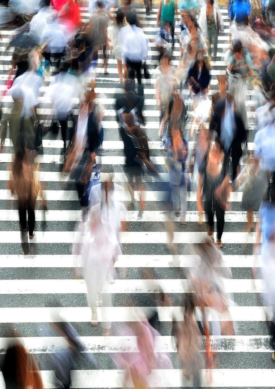
“Essentially walkability is allowing people to do what the human body was designed to do in the first place: to go places without having to get into some mechanical instrument.”
—Dan
Burden, Walkability Expert, the Doable City Forum


interview
How to start?
David Leyzerovsky | Project Associate at PPS

What qualities shape a ‘great public space’? How does walkability contribute to creating a successful place?
While great public spaces may be formal or informal, grandiose in scale or subdued and relaxed, they all share similar qualities that give people a reason to linger, and return. Great public spaces are comfortable, accessible, and are conduits of sociability. A great public space should have ample available seating, should be clean, and should feel safe to all users. Successful public spaces should encourage sociability, and on their best days, should inspire spontaneous conversation with strangers and create lasting memories for people who use them. Lastly, a great public space should be accessible for all and have great linkages to nearby destinations. Measuring accessibility should include socio-economic factors, transportation, and the inclusion of the city’s most vulnerable population. Successful public spaces should be open to people who are rich and poor, who rely on mass transit, walking, or choose to drive their car, and most of all, a great public space should not limit access to people with disabilities. Accessibility lends itself perfectly to walkability – if people are unable to reach a public space by foot – is it really accessible?
What are the first steps to shape walkable cities? How do challenges vary with geographic context?
Right-sizing our streets, retrofitting our suburban enclaves to limit sprawling developments, institutionalising congestion pricing to curtail auto-dependence are good starting points. The high cost of gas, and an emphasis on building healthy communities is helping bring walking back to the forefront of city building. However, to truly encourage walkability there must be cultural shift where we view walking as liberating as driving our car 10 miles to the nearest park. Cultural variance is greatly determined by geography. A great example is a nation like China that for years embraced cycling and walking as a reliable mode of transportation. However, with its economic boom, it embraced sprawling auto-centric developments as a status symbol of its newfound wealth.
What are the fundamental tools of a placemaker?
There is no one fundamental tool to placemaking as it is a bottom-up community-driven participatory planning process. However, what is absolutely essential is listening to people and shaping their values into the places they love or want to love more. On a practical level, this means encouraging a phenomenological approach toward community engagement. Great places are embedded in our memories and are experiential. The community planning process should reflect that experience. Effective community engagement should not feel stifling or design driven, rather, we should listen to the community and relate simple questions like “describe a memory you had in this space,” or “how often do you laugh and smile here”; those questions can help inform us what a place is all about, but also what it may become.
Piazza del Campo, Siena, Italy, is one of the most renowned and revered open spaces in Europe.
113
Sensingofpeopleandenvi
WayAccessibilityandinclusivity
PlayfulNewmodesofcityexploration
interactiveenvironment
Inclusive design Urban nightscape
Redundant spaces reallocation
Heritagepromotion
Streetfairsandmarkets
DIYopportunitiesPublicart
ivne
sense of place
strian and health campaigns
Localchampions
Economic incentivesPop-up andtemporaryinitiatives
Virtuouscycles
social
OpenstreeteventsActivefacades
Microclimate measures Street desig
areas of actions
liveable
cient
DensityWalkableconnectivityandmixedfunctions
Pedestrian streets
Road share
Integration with public transport
Road diet
Safecrosswalksandintersections
Innovati
enways
ImprovedsignageTrafccalmingmeasures
blueways
public spaces Re-usinginfrastructures
Et quuntisit aut et qui nonse re doles que simoditisqui doles mod que ellabore, sinverehenet aut alit, cuptatur sunt debitis
areas of action
5 areas of actions have been identified in order to provide a comprehensive framework for the 40 actions suggested
Towards a walking world
Cities Alive:
114
political
emnor n t a l cimonoce t e c onhgollaci
vision and strategy safe and ef
transportation system
environment
and communities smart and responsive city 40 actions Towards a walking world Parklets Pock e t p a r k s Gr e
a nd
ve
Pede
“V ision zer o” pol icies Car-free initiatives Di gita l eval uation tools City mon i tori n gMappingsafet y
ronment
ndingsystems
n an d furn i tu r e
Actions 40 actions
—Tracy D. Writes, “Pedestrians’ Quality Needs”, European Cooperation in Science and Technology
Moving towards a walking world requires actions. Giving consistency to the large spectrum of benefits identified would need the definition of a holistic walkable strategy. Ergo, how to start?
The Walkable City is a city that puts people first and shapes itself in accordance to its citizens’ needs and desires. Therefore, to address the complexity of the urban issues, a kaleidoscopic set of actions and policies is required, diversified both by nature and dimension. These actions concern:
visions and strategies: series of urban policies, involving city plan policies and innovative interventions, promoting a diffused walkable approach to the city;
safe and efficient transportation systems: interventions that operate on a city’s infrastructure providing an improved street network;
creating liveable environments: set of actions that affects the urban quality, re-designing public space on the basis of pedestrians’ priorities;
sense of place and community: strategies and proposals to encourage the active and emotional participation of citizen in everyday urban life; smart and responsive cities: technological tools and innovative approaches contributing to a city’s monitoring and evaluation.
areas of action vision and strategy safe and efficient transportation system livable environment sense of place and communities smart and responsive city
115
“Artists, philosophers, urban planners and architects have been dreaming, writing about and drawing ‘ideal cities’ for hundreds of years...In most of these visions the pedestrian is the measure of ideal urban spaces.”
The Walkable City the Walkable City shown in the illustration gives a lively overview of the actions proposed and the way they could considerably change our cities
Alive: Towards a walking world

Cities
116

117
Car free initiatives

Temporarily removing cars from a city can transform roads into public spaces, while raising awareness around car dependency and also immediately reduce air pollution. But more importantly, it reveals the potential opportunities created by having more –and safer – spaces for people. Car-free days have been trialled across the globe – from Bogota to Bangalore. In Paris, an event was so successful that mayor Anne Hidalgo vowed to implement a permanent downtown ban on diesel cars by 2020.
'Vision Zero' policies
'Vision Zero' is an international movement that began in Sweden, which aims to eliminate road-traffic fatalities through speed-reduction and safety measures. As pedestrians are the most vulnerable users of space, adopting this type of vision could dramatically improve safety for users.


Pedestrian and health campaigns

Governments, schools and businesses may initiate programmes aimed at improving health through walking, with initiatives like Walk To Work Week. Governmental roles include evaluating health impacts, setting out goals, monitoring progress and gaining support from local organisations. Private organisations and smartphone apps like Charity Miles or Nexercise may offer rewards to those who walk to work or school.
Local champions
Celebrities, local heroes and champions can be powerful advocates of healthy living, and campaigners for pedestrians’ right. With their money, power and image, they are able to get the wheels turning, and set examples for others to follow, promoting walking as an attractive option.
Cities Alive: Towards a walking world118
vision & strategy actions
Pop-up and temporary initiatives


Temporary initiatives reveal how spaces usually deemed unattractive hold the potential to become destinations, and are a cheap and powerful way to get people walking. Their temporary nature allows for more imaginative and creative input, resulting in community-oriented spaces best experienced on foot. Many cities are trialling pop-up parklets in on-street parking spots, adding seating, tables and greenery to promote active streets and to support local businesses.
Economic incentives
Financial incentives and disincentives, including subsidies and taxes like congestion charges, can be used to encourage behaviour change. Businesses can play a major role in incentivising walking by providing economic incentives to encourage healthy choices. Using modern technology, pedestrians can be rewarded for their active lifestyle with points or actual money, which can be redeemed for goods or services.
Virtuous cycles
Technical innovations allow for the conversion of ordinary walks into resources, such as energy or data. They raise awareness for resource scarcities and invite people to walk, but at the same time they have the potential to provide sustainable energy to power lampposts, signage and public charging locations.


Density and mixed functions
Location of homes, places of work and facilities are the most structural determinants of transport demands and transport mode choice. The compactness of a city – especially whether or not different land-uses are within walking distance of each other – is the most decisive attribute that gets people walking, or choosing alternative modes of transport.
119
transportation system actions
Walkable connectivity

Crossings of pedestrian networks with other transport networks and natural barriers such as rivers are often the biggest barriers to overcome on foot. Preferably, these are crossed with minimal disruption to the most direct walking route, to maintain the fastest, most understandable path, while still maintaining a safe connection.
Pedestrian streets
Removing private vehicles from streets is a radical but increasingly popular measure to create pedestrian friendly city centres. By going car free, streets can be fully designed for pedestrians, usually resulting in safe, vibrant and highly activated public spaces.
Road share
Shared-space, where there is little segregation between pedestrians, cyclists and drivers, is a holistic approach towards traffic calming and space activation. In shared spaces, the uncertainty or a lack of traffic rules encourages drivers to slow down, creating a pedestrian-oriented environment where people are aware of fellow road users. This is a common approach in Danish and Dutch traffic design, which can also be observed in places like Leonard Circus in London.

Integration with public transport

Integrating public transport into a pedestrian network contributes to developing a more sustainable, efficient and healthy city. Improving factors such as the distance between transit stations and walking routes, or improving the legibility of the network, fosters a pedestrian-friendly environment, and reduces the general need for cars.

Cities Alive: Towards a walking world120
safe & efficient
Road diet
Road diet, or the reallocation of lanes from highways for new and different functions such as vegetation, cycling or walking paths may help achieving systemic improvements and balance the use of the street environment. Thus, a road diet is a great way for cities to reclaim redundant street space dedicated to cars, expanding mobility to other modes, while also preserving traffic flows and improving safety.
Safe crosswalks and intersections


Implementing audio or visual aids to crossings and intersections can reduce the boundaries posed by roads on pedestrian mobility. They are able to increase the safety and ease of travel for those on foot, while also raising the awareness of drivers. They also make it possible for people with mobility issues or impairments to manoeuvre junctions independently.

Traffic calming measures
Measures including speed bumps, restrictions or methods of filtered permeability (restricting vehicular access in favour of people on foot) directly slows traffic and improves safety on the street, while also redefining space for alternative use. In 2015, UK-based sustainable transport charity Sustrans trialled a number of “street kits” – street furniture able to bend and adapt to any road – that temporarily transforms space, while acting as a traffic-calming method that also enhances the liveability of a neighbourhood.

Improved signage
Because pedestrians travel relatively slowly, they have greater travel navigation needs to avoid lengthy detours. Increased and improved pedestrian information street signs can reduce dependency on additional devices such as mobile phones and hugely help pedestrians understand the network, increasing ease of navigation and permeability in public space. Furthermore, luminous signage can also affect traffic safety and street security.
121
Infrastructure re-use
Unused infrastructure offers major opportunities for facilitating safe and attractive pedestrian routes and activity spaces. Elevated railways, viaducts or derelict places of gathering often held a connecting role in a neighbourhood and can offer new potential as places of recreational or social value. For example, New York City’s High Line – an elevated railway line converted into a green park – attracts nearly 5m visitors annually, linking 1.5 miles of the city’s West Side using a pedestrian-only route.
Innovative public spaces

Walking is a great way to discover new spaces or areas, and inventing new public spaces in previously inaccessible areas, such as underground or on water, is an attractive way to get people exploring on foot.
Street design and furniture
Citizens moving around at street-level will experience space most intensively. Therefore, creating attractive and accommodating spaces through thoughtful street design will result in improved functionality and often stimulate individuals to walk more.

Pocket parks
Urban regeneration creates the opportunity to redevelop small pieces of land (often single building lots or irregular land pieces) into pocket parks or public spaces with a green character. Although they may be of a temporary nature, pocket parks offer little havens of respite for pedestrians, while also providing permeable surfaces that will alleviate flood risk.
Cities Alive: Towards a walking world122
liveable environment actions
Parklets
The abundance of parking spots in a city offers an opportunity to re-imagine and reclaim public space. By temporarily – or permanently – redesigning car bays as pedestrian havens, social interaction and safer streets may be an organic outcome.. In Atlanta, staff, students and alumni of the Savannah College of Art and Design created a number of micro-apartments in bays of a multi-storey car park, to highlight the masses of under-used space in the city.
Greenways and blueways

Rivers and waterways can be transformed from major barriers into linear walking and cycling routes by creating green and accommodating waterfronts. The length of a space presents opportunities for longer trips on foot, catering to dog-walkers, runners and recreational walkers.
Microclimate measures
People commonly consider weather when choosing a transport mode. Measures to improve local microclimates have huge potential to stimulate walking. Creating an environment that protects pedestrians and cyclists from heat, rain, wind or bright sunlight can do this.
Active facades

To boost retail spending, shops and businesses can team up to create retain destinations, often resulting in better spaces for pedestrians. Their intention is to make real-life shopping as attractive as possible, by opening shops close together, holding events and by creating attractive and protected environments with awnings, on-street cafes and resting places.


123
sense of place and communities actions
Open street events
Public events that take place on temporarily closed streets allow local residents and organisations to enjoy a larger pedestrian space. They reinvigorate the opportunity to use public space, reactivating areas and instilling a sense of confidence in the community around the future potential of their local streets for pedestrian use.
Public art
Public art can help foster an environment where pedestrians have priority. Art that can best be enjoyed while on foot brings a local feel to an area, increasing the cultural vibrancy of the street life and the attractiveness for pedestrians.

DIY opportunities
Enabling residents and local users of public spaces to improve the local functioning of a neighbourhood is an innovative way of unveiling local problems, by engaging the community. Locally developed ideas generate a sense of ownership of public space and are focussed on creating a more locally oriented public realm.

Street fairs & markets
Street fairs and markets have traditionally been pedestrian hotspots, as face-to-face communication and the direct experience of the available goods and services are invaluable to market shopping. Launching market-like events is a sound method of attracting people, acquainting them with the local area that can be explored on foot.

Cities Alive: Towards a walking world124
Heritage promotion
By nurturing cultural heritage, local history and identity of an area, the environment develops a strong and local feel. Often this heritage is best enjoyed on foot, which creates an environment where drivers adapt their behaviour accordingly.
Redundant spaces reallocation
Whereas many transport modes need a certain infrastructure to work, pedestrians need very little to access or pass through a space. Therefore, underused and redundant spaces have the opportunity to be transformed relatively easily into pedestrian ones. Their seemingly inaccessible and possibly uncomfortable looks will reward its explorers with a feeling of victory.

Improved urban nightscape

As trading hours and economic activity extend into the night hours, cities are increasingly experienced in the dark. To overcome issues faced by pedestrians in hours of darkness –such as safety, navigation and visibility – light installations can effectively be used to welcome people in dark public spaces.

Inclusive design
Design can remove barriers between physical space and communities. The elderly, people with a disability and those with mobility issues often need more help than others to conquer physical barriers in cities. By providing public services such as public elevators or wayfinding aids, barriers can be overcome for people with different needs, allowing or assisting with walking and personal mobility.

125
Playful interactive environment

With digital technology, public facilities and street furniture like stairs, garbage bins, parks and lighting can be made interactive to enhance the experience of users and promote activity in the public realm. Sound, light and augmented reality can be used to invite pedestrians to engage with their surroundings and have fun along their route. These applications can also provide access to information services and communication layers using mobile phones or sound.

New modes of city exploration
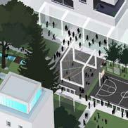
While transportation and wayfinding apps help us travel efficiently and reliably, exploration apps like Likeways – which suggests an indirect route to a destination that guides users through places of interest – can provide exciting and interactive ways to learn about and even get lost in cities. Hyper-local storytelling, location-based prompts and challenges and superimposed layers of digital communication provide entertaining ways for people to discover familiar and unfamiliar places.
Wayfinding systems


Smarter wayfinding systems are able to actively promote and encourage walking by providing access to real-time data and making walking more engaging, efficient and informed. GPS enabled apps can more accurately inform users of their route possibilities and present walking as a viable mode choice. Travel-planning apps like Citymapper now enable users to calculate the fastest route from A to B, using multiple modes of transport, including walking.
Accessibility and inclusivity
Digital technology has the potential to make cities more inclusive and accessible, especially through access to accurate, real-time data and planning. Crowdsourcing can be used to map wheelchair accessible routes and places; apps can provide tailored guidance and help to visually impaired users; and providers of public services can publish accessible route information. The result is a city in which it is easier for everyone to explore, roam and move.
Cities Alive: Towards a walking world126
smart and responsive city actions
Sensing of people and the environment
As sensors become increasingly more affordable and ubiquitous, they can help make cities more walkable and accessible through real-time environmental data, and an improved understanding of how places are being used.
Mapping safety
Safety is a concern for many people considering walking, especially at night or when alone. New digital systems, services and technologies can ease these fears by mapping crowdsourced or public data in real-time, providing improved lighting conditions and even enabling tracking or check-in features. In addition, safer public spaces can be enabled through data-driven urban design, maintenance and policing.
City monitoring


The public realm and outdoors are more accessible and appealing to the public through digital platforms that make it easier for them to understand their state and plan. Real-time data allows users to assess features such as noise or crowds of a place, while smarter booking platforms make booking and planning activities easier.

Digital evaluation tools
Mobile phone applications and computer algorithms analysing vast quantities of data are now able to evaluate abstract yet important metrics like walkability. These provide a useful resource for urban planners, transport planners, architects and decision makers in designing spaces and routes that suit the needs of pedestrians, by also considering the 'softer' or more psychological aspects of route and mode choice.
127


Cities Alive: Towards a
walking
world128
Case studies 80 case studies
A wide collection of emerging ideas and case studies is a fundamental tool to capture the state of the art of walkable cities.
In order to demonstrate the practicality of the actions previously highlighted, a wide database of examples has been gathered by a global team of Arup experts and summarised in a series of 80 case studies from across the world.
For each action, these show a couple of emerging ideas or concepts, recent projects or realisations, with the aim to inspire designers, planners, and decision makers to provide outstanding solutions towards a walking world.
Arup Inspire

A tool for strategic thinking, Inspire is a collection of emerging case studies from around the globe, highlighting change across specific themes and markets.
Inspire captures the stateof-the-art, the possible, and the surprising.157
129
“We are realising that if you have people walk and bicycle more, you have a more lively, more liveable, more attractive, more safe, more sustainable and more healthy city. And what are you waiting for?”
—Jan Gehl, Architect, Founding Partner of Gehl Architects
Cities Alive: Towards a walking world130 case studies map MILAN safe and ef cient transportation system sense of place and communities liveable environment vision and strategy smart and responsive city LONDON PARIS CHICAGO ZURICH DALLAS BUENOS AIRES MADRID BRIGHTON NEW YORK GHENT LOS ANGELES AGUEDASAN FRANCISCO BOGOTA PORTLAND HAMILTON ROTTERDAM COPENHAGEN RIO DE JANEIRO SANTA MONICA PONTEVEDRA OKLAHOMA MEXICO CITY STOCKHOLM MONTREAL SEATTLE MANCHESTER BOBLINGEN WINDSOR WASHINGTON AUSTIN RALEIGH HAMBURG
131 ADDIS ABABA SHANGHAI WIEN BEIJING CAPE TOWN SINGAPORE CHRISTCHURCH DUBAI COPENHAGEN MELBOURNE SEOUL PERTH SUWON DELHI STOCKHOLM SYDNEY BOBLINGEN HAMBURG JERUSALEM
'vision zero' policies
Pontevedra, a city without cars Pontevedra, Spain. Mayor of Pontevedra for public use.

In 1999, mayor Miguel Anxo Fernandez Lores decided to pedestrianise the 90% of the city to increase liveability. As part of pedestrian mobility initiatives across the city, on-street maps called “Metrominuto” illustrate urban walking routes, times and distances in the style of a metro map, encouraging travel on foot rather than by car.158
health campaigns
Global Road Traffic Safety Initiative

Worldwide. National & city governments for public benefit.
Started in Sweden in 1997 and increasingly adopted around the world, the Vision Zero initiative aims to systematically address the causes of traffic accidents and fatalities through improved road design, legislation and increased cooperation at government, industry and community level.159

local champions
“ Million Pound” Weight Loss Initiative
Oklahoma City, OK. Mayor of Oklahoma City for public use.

A city-wide “million pound” weight loss initiative has been followed by an integrated pedestrian infrastructure improvement plan seeking to encourage healthier leisure and transport choices.160
“Peatonito” Street Hero and Pedestrian Rights Campaigner
Mexico City, Mexico. Jorge Cáñez for public use.
Since 2012, pedestrian rights activist “Peatonito” or “Pedestrian Man”, has fought for the rights of the city’s walkers, raising awareness of safety issues and encouraging alternative transport choices.
Cities Alive: Towards a walking world132 vision and strategy case studies
161
'vision zero' policies
“ Ecomobility Neighbourhood” Car Free Experiment

Suwon, South Korea. EcoMobility World Festival for public use.
As part of the “EcoMobility” World Festival, an area of Swon City, South Korea, was converted into an ‘ecomobile neighbourhood’ with aim of providing residents with a taste of car-free urban living.
health campaigns
Encouraging Active Transport to School Programme USA/Canada. National & local governments for public use.

The Safe Routes to School initiative helps parents, communities and governments reduce barriers that prevent children from walking or cycling to school, improving health and wellbeing as well as local infrastructure and community engagement.163
local champions
London Transport Health Action Plan London, UK. TfL for public use.
Transport for London is investing £4bn over 10 years to make the city’s streets and roads safer, greener and more inviting for pedestrians and cyclists, encouraging Londoners to become more physically active.164

“Let’s Move” Anti-Childhood Obesity Initiative

Washington, D.C. First Lady Michelle Obama for public use.
This national initiative aims to tackle the problem of childhood obesity through tactics including better information on healthy eating, encouraging exercise, and improving food in schools.165
133
162
density and mixed functions
Paris Annual Urban Beach Project Paris, France. Office of the Mayor of Paris for public use.
The “Paris Plages” project temporarily transforms the right bank of the Seine into an urban beach, reducing congestion and encouraging people to exercise as part of a healthy lifestyle.

“Bitwalking” Walking Reward Crypto-Currency App Japan/UK/Malawi et al. Bitwalking Ltd for public use.
This free smartphone app rewards walking by converting users’ footsteps into Bitwalking dollars, a digital crypto-currency that can be transferred, traded or spent with participating companies.167

Central Paris Car-Free Sunday Paris, France. Paris Sans Voiture for public use.
With vehicles banned from 30% of city streets, 27th September 2015 saw Paris’s first “journée sans voiture”, allowing Parisians to reclaim their city on foot and by bicycle, and leading to a 40% drop in noise and air pollution.168

Twenty Minute Neighbourhood Local Connectivity Plan Melbourne, Australia. Victorian State Government for government use.
This local area initiative aims to encourage access to a wide range of social, leisure and retail facilities and services within 20 minutes of the home, achieved through investment in improved walking and cycling links, ultimately improving safety and inclusiveness.169

Cities Alive: Towards a walking world134 vision and strategy case studies virtuous
cycles
economic
incentives
166 pop-up
temporary initiatives
pop-up temporary initiatives
Milan “#nevicata14” Multi-use Pedestrianisation Initiative Milan, Italy. Guidarini & Salvadeo, Interstellar Racoons, for public use.
This donation-funded, multilayered temporary pedestrian configuration of a city square featured free wi-fi, smart lighting, public seating, and 12 areas for flexible use which residents could reserve for events, performances, classes or socialising.170


economic incentives
“ Freewheeler” Commuter Choice Reward App Perth, Australia. Freewheeler for commercial use
This mobile app promotes healthy living and sustainable transport by awarding those who commute via walking, cycling or public transport with points redeemable at participating local businesses.171
virtuous cycles
Energy harvesting floor tiles London, UK. Pavegen for commercial use.

These waterproof, kinetic energy converting tiles harvest and store up to 7W of power per pedestrian footstep, enough to drive street lighting, signage and speakers.172
density and mixed functions
“Active Transport” Housing Accessibility Concept
London, UK. The ATAL Team for New London Architecture. This local area-level concept to tackle the housing shortage in central London aims to unlock new housing supply by investing in high-quality walking and cycling infrastructure.173

135
safe
efficient transportation system case studies
walkable connectivity
Freeway-Covering Urban Public Park
Dallas, TX. Woodall Rodgers Park Foundation for public use.
Built over a recessed section of freeway, “Klyde Warren Park” is a privately managed park that offers year-round activities, connects two previously separate districts, and increases foot traffic and quality of life.174

pedestrian streets

share
public transport integration
Madrid’s Car Free Urban Core Initiative
Madrid, Spain. City Council of Madrid for public use.
Cars not belonging to residents have been banned from Madrid’s four central districts since 2015, helping to tackle traffic problems, reduce accidents and pollution, and increase quality of life.175
New Road Shared Space Project
Brighton, UK. Gehl / Landscape Projects for Brighton & Hove City Council.

This redevelopment project transformed a run-down city centre street into a vibrant, pedestrian- and cyclist-friendly shared space, dramatically boosting the local economy.176
Combined Mass Transit and Walking Infrastructure
Addis Ababa, Ethiopia. Arup et al. for Ethiopian Railway Corp.
This urban planning and design initiative recognised the need for walking infrastructure to sit alongside a new urban rail network, helping to improve safety, access and choice.177

Cities Alive: Towards a walking world136
and
road
road share
public transport integration
Favela Pedestrian Footbridge Connectivity Scheme
Rio de Janeiro, Brazil. Brazilian Federal Government for public use.
Part of an ambitious programme of infrastructure improvements to the city’s favelas before the 2016 Olympics, the Oscar Niemeyerdesigned concrete footbridge connects Rocinha, Rio’s largest favela, with a controversial new sports centre, providing a new entrance to the district and better integrating it with the city.178
100 City Blocks Pedestrianisation and Improvement Scheme

Buenos Aires, Argentina. City of Buenos Aires for public use. By diverting buses away from side streets, city officials could partly or fully pedestrianize and landscape up to 100 city blocks, leading to increases in footfall and night-time activity.

Pedestrian-Friendly Shopping Street Redevelopment
Vienna, Austria. Bureau B+B / orso.pitro for City of Vienna. Mariahilfer Strasse was redeveloped into a pedestrian-friendly shared space with a central ‘car free’ zone, specificallydesigned paved surfaces, street side furniture and trees.180

Transport-Considerate Public Square Redevelopment
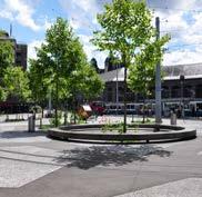
Zurich, Switzerland. Kuhn Truninger for the City of Zurich.
The redevelopment of Tessiner Platz integrated the strategic rerouting of the existing tram tracks in the overall redesign, achieving a clearer and more user-centred spatial configuration and a more flexible and efficient transport infrastructure.
137
179
pedestrian streets
walkable connectivity
181
road diet
“World Class Streets” Enhanced Public and Pedestrian Space

New York, NY. Dept. of Transport for public use.
Based on analysis by Jan Gehl, the 2008 World Class Streets report set out a new planning approach for New York, encouraging pedestrian activity and the creation of active, welldesigned public spaces.
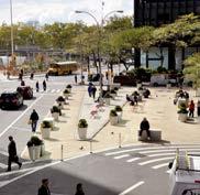
safe intersections City-Wide Speed Reduction Zones
Oxford Circus Pedestrian Crossing Redesign

London, UK. Atkins for Westminster City Council.
Opened in 2009 and inspired by crossings in Tokyo, the innovative ‘x crossing’ at the intersection of Regent and Oxford Streets allows pedestrians to cross diagonally as well as straight ahead, radically increasing footway space and reducing pedestrian congestion.
calming measures
Paris, France. Mayor of Paris for public use.
By establishing numerous ‘eco-quartiers’ across Paris, where speeds are restricted to 30km/h, city authorities are reducing both accidents and carbon emissions, and creating a pedestrian-friendly city.
signage
Community-Led Wayfinding System

Raleigh, NC. Walk Your City Inc. for commercial use.
Aiming to encourage urban walking as a transport choice, “Walk [Your City]” is a set of online tools that gives communities the ability to create, deploy and monitor people-friendly street signs.
Cities Alive: Towards a walking world138 safe and efficient transportation system case studies
185 improved
183
184 traffic
182
road diet
safe intersections
Shanghai Waterfront Public Space Improvement Scheme
Shanghai, China. Shanghai Government for public use
By halving the number of traffic lanes and building a road tunnel, city planners reduced vehicle traffic by 70%, improved pedestrian access and reconnected the historic Bund with the Huangpu River.186

traffic calming measures
Paris Squares Semi-Pedestrianisation and Redesign Initiative
Paris, France. Mayor of Paris for public use.
Under ambitious plans to improve the city’s public spaces, Paris will see seven of its famous squares semi-pedestrianised by 2020, with at least half of each square given over to pedestrians, cyclists and green space, largely to the detriment of road vehicles.187

improved signage
Chicago Pedestrian Safety & Street Improvement Plan
Chicago, IL. City of Chicago for government use.
The 2012 Chicago Pedestrian Plan outlines 250 recommendations to improve pedestrian safety, including signage, bike lanes and road layout changes, as well as temporary road closure initiatives, with a stated aim of reducing pedestrian fatalities to zero by 2022.188

Talking Street Sign Navigation Concept Copenhagen, Denmark. What the Phonics for public use.
Particularly beneficial to blind and partially-sighted people, these interactive street signs provide an audio recording of street names along with illumination of the component sounds, helping pedestrians to pronounce complex Danish place names.189

139
infrastructure re-use
High Line Aerial Greenway Redevelopment Project

New York City, NY. NYC DPR for public use
This 1.5 mile long stretch of disused elevated railroad track on New York City’s West Side was redeveloped into an extremely popular urban park, revitalising neighborhoods and providing greenspace.190
innovative public spaces
“Kalvebod Waves” Active Public Waterfront Redevelopment
Copenhagen, Denmark. JDS for Copenhagen Municipality. Conceived as an opportunity for the inner city to reconnect to the harbour, Kalvebod Waves’ boardwalks, plazas and recreation areas bring active public space to a previously sterile district.191
greenways and blueways
Hamburg “Green Power 2030” Strategic Plan


Hamburg, Germany. ORLP for City of Hamburg.
This plan aims to achieve 40% green space throughout the city by 2030, creating a network of regenerated, walkable habitats, mitigating temperature rise, improving air quality and reaping health benefits.192
pocket parks
“Paley Park” Small-scale Urban Public Space
New York, NY. Zion and Breene Associates for the William S. Paley Foundation.
Completed in 1967, Paley Park is a 400 sq m privately-funded pocket park widely recognised as one of New York’s most successful public spaces. Despite being at street level and in frequent use, tables and chairs and a waterfall contribute to a feeling of sanctuary and intimacy in the middle of the city.193

Cities Alive: Towards a walking world140 liveable environment case studies
innovative public spaces
“The Goods Line” Green Urban Corridor Project

Sydney, Australia. ASPECT Studios for Sydney Harbour Foreshore Authority.
By repurposing a disused rail corridor, this landscaped pedestrian and cycle route connects existing cultural, educational and entertainment areas via 500m of new public space.194
High Density Living Elevated Walkways Concept
Stockholm, Sweden. Anders Berensson for the Stockholm Centre Party.
Providing both dense housing and public space, this central Stockholm scheme envisages a mixed-use development of narrow towers linked by rooftop courtyards and elevated skywalks.195 greenways and blueways
Cheonggyecheon Stream Restoration Project

Seoul, South Korea. SeoAhn Total Landscape for Seoul Metropolitan Government.
The restoration of the Cheonggyechon River in Seoul provided not only a number of environmental benefits to the city but also social and economic dividends as well.196
pocket parks
London “Pocket Parks” Small Green Space Programme


London, UK. Mayor of London for public use.
Aiming to create a greener, friendlier city, the Mayor of London allocated £2m to create over 100 pocket parks in 26 boroughs across the city, converting overlooked areas of land in public green space.197
141
infrastructure
re-use
parklets
street design and furniture
Annual “PARK(ing) Day” Temporary Public Space Initiative

Worldwide. REBAR for public use.
Critiquing a lack of urban public space, this international, open source initiative encourages participants to occupy metered parking spaces for a day, converting them into temporary parks or other public amenities.198
“Green Your Laneways” Side Street Conversion and Greening Project

Melbourne, Australia. City of Melbourne for public use.
This pilot project aims to convert four of the city’s two hundred laneways into green public space, through planting trees, green walls, planter boxes or by creating small car-free parks.199 microclimate measures
Blooming Flowers Public Shelter and Street Light Installation
Jerusalem, Israel. HQ Architects for Jerusalem Municipality.
In order to improve a dilapidated public square, HQ Architects installed four 9m x 9m sculptural flowers that ‘bloom’ in response to pedestrian movement, providing public lighting at night and shade during the day.200

active facades
Santa Monica Third Street Promenade Pedestrianisation
Santa Monica, USA. Downtown Santa Monica Inc. for public use
This pedestrianised retail district close to the Santa Monica Pier offers a mixed retail, dining and street entertainment in atmospheric surroundings, attracting 6.3m visitors annually.201

Cities Alive: Towards a walking world142 liveable environment case studies
parklets

“ Pavement to Parks” Regeneration Programme San Francisco, CA. SF Planning Dept. for public use
This urban renewal programme reclaims underutilised patches of land as small as one parking space and quickly converts them into into public parklets, complete with seating and landscaping.202
microclimate measures
“ Useful Billboards” Pedestrian-friendly Advertising Initiative

Paris, France, IBM for public use.
By incorporating seating, shelter and ramp elements, this advertising and pedestrian-engagement initiative transformed everyday billboards into useful street furniture while encouraging creative urban ideas.203
active facades
Dubai Ventilated Walkway Concept

Dubai, UAE. Arup for Dubai Roads & Transport Authority. Microclimate experts used thermal modelling to help design ‘low energy’ pedestrian walkways, protecting users from both busy traffic and intense heat while navigating through the city.204
Boxpark Shipping Container Pop-up Retail

London, UK. Boxpark for commercial use.
This pop-up mall in Shoreditch is constructed from repurposed shipping containers, offering retailers low-rent, low-risk space for a four-year period.205
143
street design and furniture
“PubliCity” City Regeneration Programme Singapore. URA for public use.

This public space rejuvenation initiative draws on community expertise and creativity to identify and improve underused spaces throughout the city, creating places and events to help make communities more livable.206
“Umbrella Sky” Temporary Street Festival Canopy Águeda, Portugal. Sextafeira for public use.

Every year as part of the Ágitagueda Art Festival, several city streets are covered by a temporary canopy of colourful umbrellas, providing shade for pedestrians and space for a programme of outdoor events.207

fairs and markets
LA “People St” Do it Yourself Street Regeneration Initiative
Los Angeles, USA. LADOT for public use.
This city-wide initiative rapidly simplifies public-realm improvement projects by providing a pre-defined kit to community groups, transforming underused streets and encouraging pedestrian activity.208
Alberta Arts District Monthly Road Closure Initiative Portland, Oregon. Friends of Last Thursday for public use
A monthly ‘Last Thursday’ pedestrianisation project has helped a small Portland neighbourhood establish itself as a popular arts, restaurant and shopping district.209

Cities Alive: Towards a walking world144 sense of place and communities case studies
open street events public art diy opportunities
street
open street events
“100 en 1 dia” Mass Participation Urban Realm Improvement Initiative
Bogota, Colombia. 100en1dia for public use.

Using the combined power of 100 people, this social movement encourages rapid urban change in the form of citizen-led interventions, from bike lanes to street art, across the city in a 24-hour period.
art
diy opportunities
“Strad@perta” Online Street Art Listings
Milan, Italy. Comune di Milano for public use.
Launched in 2013, this online map and calendar allows Milan’s street artists and musicians to promote their work, while helping residents and visitors discover free public performances across the city.
street fairs and markets
Leefstraat “Living Streets” Summer Road Closure Project
Ghent, Belgium. City of Ghent for public use.
This 10-week road closure experiment saw 22 of Ghent’s busiest streets closed to traffic and converted into ‘living streets’, featuring pop-up parks and bars helping locals to play, socialise and relax.

“Supercrawl” Community-Led Music and Culture Street Festival

Hamilton, FL. Supercrawl Productions for public use.
Growing from one to now 16 city blocks, this annual community-organised street festival combines live music with art, fashion, performance, food and drink, attracting more than 165,000 people.

145
211
212 public
213
210
sense of place and communities case studies
heritage promotion
Hutong Preservation and Pedestrianisation Programme
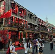
Beijing, China. Beijing Municipality for public use.
A result of growing tourist popularity and interest in heritage preservation, this government initiative is leading to the restoration and pedestrianisation of many of Beijing’s remaining Hutongs.214
redundant spaces
“Dance-O-Mat” Coin-Operated Temporary Public Dancefloor

Christchurch, New Zealand. Gap Filler for public use.
urban nightscape
Responding to a lack of space for dancing after the 2011 earthquake, this project installed a huge public dancefloor on empty sites across the city, encouraging people to come together and dance.215 Singapore Orchard Road Pedestrian Night Initative Singapore. ORBA & STB for public benefit.
Once a month, this busy shopping street is closed to motor vehicles, allowing locals to mingle, shop and eat at an eveninglong street party featuring live music and entertainment activities.216

inclusive design
“Cities Unlocked” Sight Impaired Urban Navigation Initiative

London, UK. Future Cities Catapult et al. for public use.
By identifying opportunities and applying new technology, for example a 3D soundscape, “Cities Unlocked” helps those with sigh loss overcome mobility challenges and navigate cities more easily.217
Cities Alive: Towards a walking world146
promotion
Free Evening Urban Art Walks
Cape Town, South Africa. Gareth Pearson for public use.
Every month, the ‘First Thursdays’ evening art walk brings people onto the streets to explore galleries across Cape Town’s lesser-known areas, helping encourage both walking and art appreciation.

spaces
Elevated Acre” High-rise Park Project
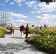
New York, NY. Rogers Marvel for 55Water.
This full acre of greenspace is located between two high-rises in Manhattan’s financial district. In addition to providing a for local workers, the park features concerts, venue rentals and film screenings.
nightscape
“Nightseeing” Urban Lighting Exploration Programme Worldwide. Leni Schwendinger for public use.

This programme of walks, talks and maps provides activities based on a city’s lighting networks, bringing public and design professionals together to raise awareness of urban night-time environments.
design
Digitally Responsive Street Furniture Concept
London, UK. Ross Atkin Associates / Marshalls for commercial use.
Using the latest digital connectivity technology, this set of responsive street furniture aims to make cities safer for those with mobility problems by adapting according to individual need and proximity, for example providing brighter street lighting or audio on street signs.

147
221
220
218 urban
redundant
heritage
“
219 inclusive
smart and responsive city case studies
environment
Low-Energy Interactive Public Light Sculpture
Rotterdam, Netherlands. Studio Roosegaarde for CBK Rotterdam et al.

Composed of hundreds of fibres and evolving over several locations since 2007, DUNE is an interactive light and sound installation that responds to the motion of people, encouraging public interaction and the exploration of urban space.222
exploration
“Asunder” Place-based Narrative Exploration App Austin, TX. Asunder for public use.
This mobile app uses NFC beacon technology to guide users through place-based narrative experiences, superimposing augmented reality graphics and audio stories over a walk through the city.223

wayfinding systems
Seamless On-street and Online City Mapping

Brighton, UK. Applied Wayfinding for Brighton & Hove City Council.
WalkBrighton combines on-street wayfinding with an iPhone app containing 3D illustrations and searchable content, providing pedestrians with a consistent visual language to help navigate the city.224
accessibility and inclusivity
Crowdsourced City Accessibility Maps
Boblingen, Germany. Sozialhelden for public use.
Wheelmap is a smartphone app and website that enables users to share information on wheelchair accessibility in cities around the world, helping to improve urban inclusivity and inform city governments.225

Cities Alive: Towards a walking world148
city
interactive
environment
Montreal “21 Swings” Collaborative Engagement Project
Montreal, Canada. Daily Tous les Jours for public use.
This set of public swings play individual notes; users must collaborate to make music. The installation revitalised a disused area in the city centre, encouraging play and community interaction.

exploration
Randomised City Exploration Smartphone App

Ontario, Canada. Justin A. Langlois with the Ontario Arts Council for public use.
This iOS app aims to get people to explore and rediscover their city by guiding the user through a set of randomised instructions while encouraging them to reveal and document unexpected, hidden or unnoticed things along the way.
wayfinding systems
“ CityMapper” Human-Centered Transit App London, UK. Citymapper Ltd for web, iOS & Android. Citymapper’s transit app aims to provide users with responsive, reliable human-centered navigational assistance. Available for over 30 cities worldwide, the app has been widely praised for its city-specific focus and “human touch”, offering travel costs, calorie counts and local points of interest alongside standard navigational data.
and inclusivity
Self-Voicing Visually Impaired City Guide App Worldwide. BlindSquare for commercial use.

Developed to help visually impaired people navigate cities more easily, the BlindSquare app combines GPS with publiclyavailable data to provide an audio description of points of interest and road crossings to users in real time.

149 city
227
229
228
226 interactive
accessibility
sensing environment

“ Placemeter” Urban Movement Intelligence Platform
New York, NY. Placemeter for commercial use.
This urban intelligence platform analyses and quantifies the human and vehicular movement of modern cities at scale, and can predict activity depending on weather, time, date and planned events.

mapping safety
NYC Pedestrian Safety Heat Map Initiative
New York, NY. New York City Council for public use
This online tool uses open data on traffic volume and road traffic incidents to create interactive heat maps identifying incident hotspots, helping improve the safety of pedestrians and cyclists.

monitoring
Personal Air-Quality Monitoring Smartphone App and Sensor
London, UK. Drayson Technologies for commercial use. Powered by harvesting energy from wireless networks, the “CleanSpace” air-quality monitoring device provides users with local pollution data via a smartphone app, as well as rewards for environmentally-friendly behaviour.232

evaluation tools
“State of Place” Quantifed Urban Data Analytics Platform
New York, NY. Mariela Alfonzo for NYU-Poly. This amenity-indexing algorithm attempts to quantify the “pedestrian appeal” of given locations, using hard-data tools to present an economic case for prioritizing walkability in new development.
Cities Alive: Towards a walking world150 smart and responsive city case studies
233
230
city
digital
231
sensing environment
“CityVerve” Internet of Things City Demonstrator Project

Manchester, UK. Greater Manchester LEP et al. for research use.
CityVerve was chosen as the UK’s Internet of Things City Demonstrator, with the aim of testing how smart sensors and data analytics can benefit public services and improve quality of life.234
mapping safety
Crowdsourced Sexual Harassment and Urban Safety Map
Delhi, India. Safecity for public use.
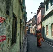
This website aims to make Indian cities safer and more accessible by aggregating anonymised reports of sexual harassment in public spaces as hot spots on a map, helping to inform citizens, communities and decision-makers.235
city monitoring
Crowdsourced Quiet Space City Exploration App Worldwide. Jason Sweeney et al. for public use.
An international project to crowdsource quiet urban locations, the Stereopublic map and iOS app encourages users to capture sounds, images and locations of quiet spaces and to explore their cities via audio tours.236

digital evaluation tools
“ Walk Score” Neighbourhood Accessibility Assessment Tool

Seattle, WA. Walk Score / Redfin for commercial use
This web and app-based neighbourhood assessment tool allows users to view any location’s “walkability score”, based on average distance to a user-defined set of amenities.237
151

Next steps
This report has shone a light on walking, which has been all too often taken for granted. It has investigated the role walkability plays in developing more liveable, sustainable, healthy, safe and attractive cities.
We hope that it will inspire politicians and designers, planners, engineers, consultants and technical specialists working in the built environment to start talking about walking and to take the next steps towards a walking world.
This will require taking actions to see transformative change in the towns and cities we already have, many of which suffer from a legacy of being designed around the car; and it will require placing walkability at the heart of our future urban areas.
The starting point for many will be to create a vision and strategy for walking, recognising it as a transport mode in its own right, as well as an important part of almost all trips, whether by car, bus, train or bicycle. More walking champions are needed to help make that change. Creating safe and efficient transportation systems, liveable environments, a sense of place and community, and smart and responsive cities will all help to make walking a normal part of everyday life and the natural choice for shorter journeys.
Mobility is intrinsic to the quality of life experienced in cities. We now have the opportunity for human-centred design, to place people back at the heart of our cities. A walkable city is a better city and putting walking first will keep our Cities Alive.
153
References
1. 2014 Revision of the World Urbanization Prospects, by United Nations. 2014. Available from: http://esa.un.org/unpd/wup/Publications/Files/WUP2014-Report.pdf.
2. From Fast Cars to Fast Cities. Tracing a Transition in Mobilities, by Farzaneh Bahrami and Elena Cogato Lanza. 2015. Available from: http://www.teknik-og-kultur.dk/wp-content/uploads/papers/bahrami_farzaneh_fromfastcarstofastcities.pdf.
3. Road Safety Information, by ROSPA. 2016. Available from: http://www.rospa.com/road-safety/.
4. Are we reaching ”peak travel”? Trends in passenger transport in industrialized countries, by Adam Millard-Ball and Lee Schipper. 2010. Available from: http://www.tandfonline.com/doi/abs/10.1080/01441647.2010.518291.
5. Transport, Physical Activity and Health: Present knowledge and the way ahead, by Roger L. Mackett and Belinda Brown. 2011. Available from: https://www.ucl.ac.uk/news/pdf/transportactivityhealth.pdf.
6. Cities Alive. 100 issues shaping future cities, by Arup. 2015. Available from: http://www.driversofchange.com/projects/cities-alive-cards/.
7. Commuting and Personal Well-being, by Office for National Statistics. 2014. Available from: http://webarchive.nationalarchives.gov.uk/20160105160709/http://www.ons.gov.uk/ons/dcp171766_351954.pdf.
8. Designed to move: a physical activity action agenda, by Nike. 2012. Available from: http://e13c7a4144957cea5013-f2f5ab26d5e83af3ea377013dd602911.r77.cf5.rackcdn.com/resources/pdf/en/full-report.pdf.
9. A 15-minute daily walk ‘will help you live longer’ says study, by National Health Service. 2015. Available from: http://www.nhs.uk/news/2015/08August/Pages/15-minute-daily-walk-will-help-you-live-longer-says-study.aspx.
10. Physical Activity, by World Health Organization. 2015. Available from: http://www.who.int/topics/physical_activity/en/.
11. Briefing Note: Obesity and life expectancy, by National Obesity Observatory. 2010. Available from: http://www.noo.org.uk/uploads/doc/vid_7199_Obesity_and_life_expectancy.pdf.
12. Obesity and overweight, by World Health Organization. Available from: http://www.who.int/mediacentre/factsheets/fs311/en/.
13. Benefits of Walking, by coolwalking. 2013. Available from: http://coolwalking.com/benefits.html.
14. Health benefits of physical activity: the evidence, by Darren E.R. Warburton, Crystal Whitney Nicol and Shannon S.D. Bredin. 2006. CMAJ. Available from: http://www.ncbi.nlm.nih.gov/pmc/articles/PMC1402378/.
15. Just 15 Minutes of Exercise a Day May Add Years to Your Life, by Meredith Melnick. 2011. TIME. Available from: http://healthland.time.com/2011/08/16/just-15-minutes-of-exercise-a-day-may-add-years-to-your-life/.
16. Improving the health of Londoners: transport action plan, by Transport for London. 2014. Available from: http://content.tfl.gov.uk/improving-the-health-of-londoners-transport-action-plan.pdf.
17. Who, when, and how much? Epidemiology of walking in a middle-income country, by Pedro C. Hallal, Mario R. Azevedo, Felipe F. Reichert, Fernando V. Siqueira, Cora L. Araújo and Cesar G. Victora. 2005. AJPM. Available from: http://www.ncbi.nlm.nih.gov/pubmed/15710270.
18. The Economics of Happiness, by Bruno S. Frey and Alois Stutzer. 2002. World Economics, vol. 3, no. 1. Available from: https://www.bsfrey.ch/articles/365_02.pdf.
19. Making the case for investment in the walking environment: A review of the evidence, by Danielle Sinnett, Katie Williams, Kiron Chatterjee and Nick Cavill. 2011. UWE. Available from: http://eprints.uwe.ac.uk/15502/.
20. Make walking safe: brief overview of pedestrian safety around the world, by World Health Organization, 2013. Available from: http://www.who.int/violence_injury_prevention/publications/road_traffic/make_walking_safe/en/.
21. The Global status report on road safety 2015, by World Health Organization. 2015. Available from: http://www.who.int/violence_injury_prevention/road_safety_status/2015/en/.
22. Driving speeds and pedestrian safety in the city of Helsinki, by Eero Pasanen and Hannu Salmivaara. 1993. Traffic Engineering & Control, vol. 34, no. 6, pp. 308-310. Available from: https://trid.trb.org/view.aspx?id=383689.
23. Cities Safer by Design. Guidance and Examples to Promote Traffic Safety through Urban and Street Design, by Ben Welle, Wei Li, Claudia Adriazola, Robin King, Maria Obelheiro, Claudio Sarmiento and Qingnan Liu. 2015. World Resource Institute. Available from: http://www.wri.org/publication/cities-safer-design.
24. Sustainable Streets Index 2011. East 180th Street, by New York City Department of Transportation, 2011. Available from: http://www.nyc.gov/html/dot/downloads/pdf/sustainable_streets_index_11.pdf.
Towards a walking
Cities Alive:
world154
25. Sweden’s Vision of Safety, By Road Traffic Technology. 2008. Available from: http://www.roadtraffic-technology.com/features/feature1952/.
26. Vision Zero. Traffic safety by Sweden, by Vision Zero Initiative. 2015. Available from: http://www.visionzeroinitiative.com/.
27. BSIA attempts to clarify question of how many CCTV cameras there are in the UK, by Tom Reeve. 2013. Security News Desk. Available from: http://www.securitynewsdesk.com/bsia-attempts-to-clarify-question-of-how-many-cctv-cameras-in-the-uk/.
28. How Walkable Streets can Reduce Crime, by Thisbigcity. 2012. Available from: http://thisbigcity.net/how-walkable-streets-can-reduce-crime/.
29. A New Way of Understanding “Eye on the Street”, by Citylab. 2013. Available from: http://www.citylab.com/crime/2013/07/new-way-understanding-eyes-street/6276/.
30. From Fitness Zones to the Medical Mile: How Urban Park Systems Can Best Promote Health and Wellness, by Peter Harnik and Ben Welle. 2011. The Trust for Public Land. Available from: http://cloud.tpl.org/pubs/ccpehealth-promoting-parks-rpt.pdf.
31. Summer Streets, by The City of New York. 2015. Available from: http://www.nyc.gov/html/dot/summerstreets/html/home/home.shtml.
32. Pedestrian Propulsion, by Steve Mouzon. 2009. Original Green. Available from: http://www.originalgreen.org/blog/pedestrian-propulsion.html.
33. How to co-design the future of public space? A case from Milan, by Aandrea Pollio. 2015. Future Cape Town. Available from: http://futurecapetown.com/2015/08/future-cape-town-how-to-co-design-the-future-of-public-space-a-case-from-milan/.
34. Tactical Urbanism: Short-term Action for Long-term Change, by Mike Lydon, Anthony Garcia and Andreas Duany. 2015. Island Press. Available from: http://islandpress.org/book/tactical-urbanism.
35. Superkilen, by Superflex. Available from: http://superflex.net/tools/superkilen.
36. Superkilen Celebrates Diversity in Copenhagen, by The Official website of Denmark. Available from: http://denmark.dk/en/lifestyle/architecture/superkilen-celebrates-diversity-in-copenhagen.
37. The concept of place, as defined by Marc Augé and Kazys Varnelis & Anne Friedberg, by Overblog. 2010. Available from: http://eurozone.over-blog.org/pages/The_concept_of_place_as_defined_ by_Marc_Auge_and_Kazys_Varnelis_Anne_Friedberg-828541.html.
38. Open Street Performing Arts International Showcase sulle strade dell’EXPO 2015, by Eventinews24. 2014. Available from: http://www.eventinews24.com/2014/08/open-street-performing-arts.html.
39. Unlocking cities through sound, by Guide Dogs. 2014. Available from: https://www.guidedogs.org.uk/news/2014/november/unlocking-cities-through-sound#.VzhMWvl95D8.
40. U.S. resident population and number of people with a driver’s license from 1990 to 2014 (in 1,000s), by Statista. 2016. Available from: http://www.statista.com/statistics/191805/us-licensed-drivers-versus-general-population-since-1988/.
41. Revisiting Donald Appleyard’s Livable Streets, by StreetFilms. 2010. Available from: https://vimeo.com/16399180.
42. “The Social Life of Small Urban Spaces”, by William H. Whyte. 1988. The Conservation Foundation. Available from: https://archive.org/details/SmallUrbanSpaces
43. Livable Streets, by Donald Appleyard, M. Sue Gerson, Mark Lintell. 1981. University of California Press. Available from: https://books.google.co.uk/books?id=pfreUQKD_4QC&redir_esc=y.
44. Social Capital and the Built Environment: The Importance of Walkable Neighborhoods, by Kevin M. Leyden. 2003. AJPH, vol. 93, no. 9, pp. 1546-1551. Available from: http://www.jtc.sala.ubc.ca/reports/leyden.pdf.
Belgian Streets Got Rid Of Cars And Turned Into Beautiful Parks This Summer, by A. Peters. 2015. Co.Exist. Available from: http://www.fastcoexist.com/3050299/belgian-streets-got-rid-of-cars-and-turned-into-beautiful-parks-this-summer.
Shaping Ageing Cities, by Arup. 2015. Available from: http://publications.arup.com/publications/s/shaping_ageing_cities.
Millennials’ Transportation and Housing Choices Will Shape the Nation, by Joan Mooney. 2015. Realtor. Available from: http://www.realtor.org/articles/millennials-transportation-and-housing-choices-will-shape-the-nation
Why walking to school is better than driving for your kids, by Valerie Iancovich. 2015. University of Toronto. Available from: https://www.utoronto.ca/news/why-walking-school-better-driving-your-kids
“Life Between Buildings: Using public space”, by Jan Gehl. 2011. Island Press
155
45.
46.
47.
48.
49.
Available from: http://islandpress.org/book/life-between-buildings.
50. Factors influencing pedestrian safety: a literature review, by Anthony Martin. 2006. TRL Limited. Available from: http://content.tfl.gov.uk/factors-influencing-pedestrian-safety-literature-review.pdf.
51. Low-Income Americans Walk and Bike to Work the Most, by Tanya Snyder. 2014. Streetsblog. Available from: http://usa.streetsblog.org/2014/05/08/low-income-americans-walk-and-bike-to-work-the-most/.
52. The pedestrian pound. The business case for better streets and places, by Living Streets. 2014. Available from: http://www.livingstreets.org.uk/media/1391/pedestrianpound_fullreport_web.pdf.
53. Shoppers and how they travel, by Sustrans. 2006. Available from: http://www.tut.fi/verne/wp-content/uploads/Shoppers-and-how-they-travel.pdf.
54. Annual Report 2014/15, by Transport for London. 2014. Available from: http://content.tfl.gov.uk/annual-report-2013-14.pdf.
55. Economic benefits of public space investment, by Future of Places. Available from: http://futureofplaces.com/wp-content/uploads/2015/04/FoP_Economic-benefits-of-public-space-investment.pdf.
56. Pedestrian and bicycle infrastructure: a national study of employment impacts, by Heidi Garrett-Peltier. 2011. PERI. Available from: http://www.peri.umass.edu/fileadmin/pdf/published_study/PERI_ABikes_June2011.pdf.
57. Annual Cost to Own and Operate a Vehicle Falls to $8,698, Finds AAA, by Erin Stepp. 2014. NewsRoom. Available from: http://newsroom.aaa.com/2015/04/annual-cost-operate-vehicle-falls-8698-finds-aaa-archive/.
58. Portland’s Green Dividend, by J. Cortright. 2007. CEOs for Cities. Available from: http://blog.oregonlive.com/commuting/2009/09/pdxgreendividend.pdf.
59. Five Reasons Demand for Walkability is Growing Across America, by Opticos. 2015. Available from: http://opticosdesign.com/five-reasons-demand-for-walkability-is-growing-across-america/.
60. Give Your Ideas Some Legs: The Positive Effect of Walking on Creative Thinking, by Marily Oppezzo and Daniel L. Schwartz. 2014. Journal of Experimental Psychology: Learning, Memory, and Cognition, vol. 40, no. 4, pp. 1142-1152. Available from: https://www.apa.org/pubs/journals/releases/xlm-a0036577.pdf.
61. Twilight of the Idols, by Friedrich Nietzsche, 1889.
62. 7 Powerful Reasons to Take Your Next Meeting for a Walk , by Peter Economy. 2015. Inc. Available from: http://www.inc.com/peter-economy/7-powerful-reasons-to-take-your-next-meeting-for-a-walk.html.
63. How to Do Walking Meetings Right, by Russel Clayton, Chris Thomas, and Jack Smothers. 2015. Harvard Business Review. Available from: https://hbr.org/2015/08/how-to-do-walking-meetings-right.
64. Walkonomics: the High Line effect, by Demetrio Scopelliti. 2015. Available from: http://thoughts.arup.com/post/details/429/walkonomics-the-high-line-effect.
65. Superblocks to the rescue: Barcelona’s plan to give streets back to residents, by Marta Bausells. 2016. The Guardian. Available from: http://www.theguardian.com/cities/2016/ may/17/superblocks-rescue-barcelona-spain-plan-give-streets-back-residents.
66. Cities Alive. 100 issues shaping future cities, by Arup. 2015 . Available from: http://www.driversofchange.com/projects/cities-alive-cards/.
67. Tourism towards 2030: Global overview, by World Tourist Organization. 2011. Available from: http://cf.cdn.unwto.org/sites/all/files/pdf/unwto_2030_ga_2011_korea_1.pdf.
68. UNWTO Tourism Highlights 2012 Edition, by UN World Tourism Organisation. 2012. Available from: http://mkt.unwto.org/sites/all/files/docpdf/unwtohighlights12enhr.pdf.
69. The pedestrian pound: the business case for better streets and places, by Eilís Lawlor, Just Economics. 2013. Living Streets. Available from: https://www.livingstreets.org.uk/media/1391/pedestrianpound_fullreport_web.pdf.
70. Pedestrian Counts, by Times Square Official Site. 2014. Avalable from: http://www.timessquarenyc.org/do-business-here/market-facts/pedestrian-counts/index.aspx#.V0h4aPmLTDc.
71. “The Image of the City”, by Kevin A. Lynch. 1960. MIT Press. Available from: https://mitpress.mit.edu/books/image-city
72. Core Values: Why american companies are moving downtown, by Smart Growth America. 2015. Available from: http://www.smartgrowthamerica.org/documents/core-values.pdf
73. Foot Traffic ahead, by Smart Growth America. 2014. Available from: http://www.smartgrowthamerica.org/documents/foot-traffic-ahead.pdf
74. Charles Landry Knows What Makes Cities Great: Distinction, Variety, and Flow, by S. Helgesen. 2010. Available from: http://www.strategy-business.com/article/10306?gko=232cd
75. The Rise of the Creative Class, by Richard Florida. 2002. Available from: http://www.washingtonmonthly. com/features/2001/0205.florida.html
Alive: Towards a walking world
Cities
156
76. Richard Florida’s Creative Class: Why creativity is the new economy and what it means for YOUR community, by J. Umpherson. 2015. Available from: http://economicdevelopment.org/2015/10/richardfloridas-creative-class-why-creativity-is-the-new-economy-and-what-it-means-for-your-community/
77. Walkability, Real Estate, and Public Health Data, by Walkscore. Available from: https://www.walkscore.com/professional/research.php
78. Stanford study finds walking improves creativity, by Stanford. 2014. Available from: https://news.stanford.edu/2014/04/24/walking-vs-sitting-042414/
79. The Storefront Index, by city Observatory. 2016. Available from: http://cityobservatory.org/wp-content/uploads/2016/04/Storefront_Index_April_2016.pdf
80. Economic Value of Walkability, by T. A. Litman. 2014. Available from: http://www.vtpi.org/walkability.pdf
81. London’s Oxford Street is too busy - we need to pedestrianise it, by S.Williams. 2015. Available from: http://www.ibtimes.co.uk/londons-oxford-street-too-busy-we-need-pedestrianise-it-1532412
82. The future economic and environmental costs of gridlock in 2030, by CEBR. 2014. Available from: https://timedotcom.files.wordpress.com/2015/05/inrix_costs-of-congestion_cebr-report_v5_final.pdf
83. Complete Streets Stimulate the Local Economy, by Smart Growth America. Available from: http://www.smartgrowthamerica.org/documents/cs/factsheets/cs-economic.pdf
84. Combined Transportation and Housing Decisions Save Money and Build Wealth, by U.S. Department of Transportation Federal Highway Administration. 2015. Available from: http://www.fhwa.dot.gov/livability/fact_sheets/transandhousing.cfm
85. The Affordability Index Toolbox: A New Tool For Measuring The True Affordability Of Housing Choices, And Other Tools
To Promote Affordability, by CTOD. 2008. Available from: http://www.reconnectingamerica.org/assets/Uploads/htai_toolbox_plus_case_studies.pdf
86. Why commuting costs can make the ’burbs more expensive than living downtown, by S. White for the Globe and the Mail. 2016 . Available from: http://www.theglobeandmail.com/globe-investor/whycommutingfrom-the-burbs-can-be-more-costly-than-living-downtown/article29642363/
87. Value for Money: Economic Assessment of Investment in Walking and Cycling, by Dr. Adrian Davis for the Department of Health. 2010 . Available from: http://www.apho.org.uk/resource/item.aspx?RID=91553
88. An economic evaluation of health-promotive built environment changes, by JY Guo, S. Gandavarapu. 2010. Available from: http://www.ncbi.nlm.nih.gov/pubmed/19840817
89. Economic costs of physical inactivity, by BHF National Centre. 2013. Available from: http://www.bhfactive.org.uk/userfiles/Documents/eonomiccosts.pdf
90. Delivering climate-friendly transport by shifting to cycling, by European Cyclists’ Federation. 2016. Available from: https://ecf.com/sites/ecf.com/files/Communication%20on%20Decarbonisation%20 of%20Transport_ECF%20position%20paper%20160413_final.pdf
91. Physical inactivity costs UK over £10bn per year, report suggests, by S. Clarke. 2015. Available from: http://www. cyclingweekly.co.uk/news/latest-news/physical-inactivity-costs-uk-over-10bn-per-year-report-suggests-177548
92. Obesity Now Costs Americans More In HealthCare Spending Than Smoking, by R. Ungar. 2012. Available from: http://www.forbes.com/sites/rickungar/2012/04/30/obesity-now-costsamericans-more-in-healthcare-costs-than-smoking/#5ae320f518c5
93. Obesity Management in Primary Care, An Issue of Primary Care: Clinics in Office Practice, by M. B. Stephens. 2016. Available from: http://www.elsevier.ca/ISBN/9780323416597/ObesityManagement-in-Primary-Care-An-Issue-of-Primary-Care-Clinics-in-Office-Practice.
94.
95.
Examples of applications of the health economic assessment tool (HEAT) for cycling, by World Health Organization. 2013. Available from: http://www.euro.who.int/en/health-topics/environment-and-health/Transport-and-health/activities/ guidance-and-tools/health-economic-assessment-tool-heat-for-cycling-and-walking/examples-of-applications-of-heat.
Benefits of shift from car to active transport, by Ari Rabl and Audrey de Nazelle. 2012. Transport Policy 19, pp. 121-131. Available from: http://www.locchiodiromolo.it/blog/wp-content/uploads/2012/02/science.pdf.
96. BP Energy Outlook 2030, by BP. 2011. Available from: http://www.bp.com/content/dam/ bp/pdf/energy-economics/energy-outlook-2016/bp-energy-outlook-2011.pdf.
97. Energy Losses in a Vehicle, by California’s Consumer Energy Center. Available from: http://www.consumerenergycenter.org/transportation/consumer_tips/vehicle_energy_losses.html.
98. The future of flooring, by Pavagen. 2016. Available from: http://www.pavegen.com/philosophy/.
157
99. Quantifying Jeff Speck , by Counting pantographs. 2014. Available from: http://countingpantographs.org/category/landuse/.
100. Effects of Travel Reduction and Efficient Driving on Transportation: Energy Use and Greenhouse Gas Emissions, by U.S. Department of Energy - Office of Energy Efficiency and Renewable Energy. 2013. Available from: http://www.nrel.gov/docs/fy13osti/55635.pdf.
101. No More Pavement! The Problem of Impervious Surfaces, by Lakis Polycarpou. 2010. Earth Institute, Columbia University. Available from: http://blogs.ei.columbia.edu/2010/07/13/no-more-pavement-the-problem-of-impervious-surfaces/.
102. Air quality deteriorating in many of the world’s cities, by World Health Organization. 2014. Available from: http://bit.ly/1nnM5Pb.
103. Urban Air Pollution, by United Nations Environment Programme (N/A). Available from: http://bit.ly/1QcGQz3.
104. Assessment of the Air Quality Effects of Pedestrianization on Istanbul’s Historic Peninsula, by Embarq Turkey. 2015. Available from: http://www.wrirosscities.org/research/publication/assessment-airquality-effects-pedestrianization-istanbuls-historic-peninsula.
105. Paris car ban cut harmful exhaust emissions by up to 40 per cent, by Caroline Mortimer. 2015. The Indipendent. Available from: http://www.independent.co.uk/environment/paris-cuts-harmful-no2-exhaustemissions-byup-to-40-per-cent-after-banning-cars-for-a-day-a6679686.html.
106. Americans are planting . . . Trees of strength, by NC State University. Available from: https://www.ncsu.edu/project/treesofstrength/benefits.htm.
107. How Loud Is It? A survey of what makes the city so noisy, by Clive Thompson. 2004. New York Magazine. Available from: http://nymag.com/nymetro/urban/features/noise/9456/.
108. Journée sans voiture à Paris, by Noiseineu. 2015. Available from: http://www.noiseineu.eu/en/16550-journee_sans_voiture_a_paris/ficheactiondetails.
109. Noise abatement, by Forest Research. 2006. Available from: http://www.forestry.gov.uk/fr/infd-8aefl5.
110. The Urban Heat Island (UHI) Effect, by Urban Heat Islands. 2015. Available from: http://www.urbanheatislands.com/.
111. Air temperature regulation by urban trees and green infrastructure, by Kieron Doick and Tony Hutchings. 2013. Forestry Commision. Available from: http://www.forestry.gov.uk/pdf/FCRN012.pdf/$FILE/FCRN012.pdf.
112. Greenspace projects, by Depave. Available from: http://depave.org/.
113. Indianapolis Cultural Trail, by U.S. Department of Transportation. Available from: http://contextsensitivesolutions.org/content/case_studies/indianapolis_cultural_trail/.
114. How Much Public Space Does a City Need?, by Greg Scruggs. 2015. Next City. Available from: https://nextcity.org/daily/entry/how-much-public-space-does-a-city-need-UN-Habitat-joan-clos-50-percent.
115. Active Design Guidelines, by Center for Active Design. 2013. Available from: http://centerforactivedesign.org/guidelines/.
116. Just How Powerful Are Pedestrianised Streets?, by Taylor Stapleton. 2007. Landscape Architects Network. Available from: http://landarchs.com/just-how-powerful-are-pedestrianised-streets/.
117. Under the elevated: Reclaiming Space, Connecting Communities, by Design Trust for Public Space. 2015. Available from: http://www.designtrust.org/publications/under-elevated/.
118. The Complete Origin of the #Sneckdown, by Clarence Eckerson Jr. 2014. Streetfilms. Available from: http://www.streetfilms.org/the-complete-origin-of-the-sneckdown/.
119. Sustainable Streets: 2013 and Beyond, by New York City Department of Transportation. 2013. Available from: http://www.nyc.gov/html/dot/downloads/pdf/2013-dot-sustainable-streets-lowres.pdf.
120. National Travel Survey: England 2013, by Department for Transport. 2013. Available from: https://www.gov.uk/government/uploads/system/uploads/attachment_data/file/342160/nts2013-01.pdf.
121. Reclaiming city streets for people Chaos or quality of life?, by European Commission - Directorate-General for the Environment. Available from: http://ec.europa.eu/environment/pubs/pdf/streets_people.pdf.
122. Bicycle culture, by Denmark Official Site. Available from: http://denmark.dk/en/green-living/bicycle-culture/.
123. Strategies for Sustainable Cities: Demystifying Transport Demand Management, by Juan Miguel Velásquez. 2015. World Resources Institute. Available from: http://www.wri.org/blog/2015/03/ strategies-sustainable-cities-demystifying-transport-demand-management.
124. Number of Bicycle Hires, by London Datastore. 2016. Available from: http://data.london.gov.uk/dataset/number-bicycle-hires.
125. The rise of the sharing economy, by The Economist. 2013. Available from: http://www.economist.com/news/leaders/21573104-internet-everything-hire-rise-sharing-economy.
Towards a walking
Cities Alive:
world158
126. Measuring Network Connectivity for Bicycling and Walking, by Jennifer Dill. 2004. Available from: http://reconnectingamerica.org/assets/Uploads/TRB2004-001550.pdf.
127. Valuing City of Melbourne’s Walking Economy, by SGS Economics & Planning. 2014. Available from: https://www.sgsep.com.au/publications/valuing-city-melbournes-walking-economy.
128. Crowdfunded Luchtsingel pedestrian bridge opens in Rotterdam, by Dezeen. 2015. Available from: http://www.dezeen.com/2015/07/16/luchtsingel-elevated-pathways-bridges-rotterdam-cityscape-zus-architects/.
129. The 606: Converted Chicago railway line becomes park in the sky, by Stu Robarts. 2015. Gizmag. Available from: http://www.gizmag.com/the-606-park-trail-chicago/37810/.
130. Madrid Río Wins Harvard Graduate School of Design’s 2015 Veronica Rudge Green Prize in Urban Design, by Harvard University Graduate School of Design. 2015. Available from: http://www.gsd.harvard.edu/#/news/madrid-r-o-wins-2015-veronica-rudge-green-prize-in-urban-design.html.
131. Under-Development: Reclaiming 700 Miles of Public Space, by Urban Omnibus. 2015. Available from: http://urbanomnibus.net/2015/08/under-development-reclaiming-700-miles-of-public-space/.
132. “Places for people”, by Jan Gehl. 2004. City of Melbourne. Available from: https://issuu.com/alabarga/docs/jan-gehl---places-for-people.
133. Melbourne named world’s most liveable city for fifth consecutive year, by Andrew Jefferson. 2015. Herald Sun. Available from: http://www.heraldsun.com.au/news/melbourne-named-worlds-most-liveablecity-for-fifth-consecutive-year/news-story/ef1f8af4620f2a29115e8228235772e4.
134. “Walkable City: How Downtown Can Save America, One Step At A Time”, by Jeff Speck. 2013. North Point press. Available from: https://issuu.com/mrkextreme/docs/walkable_city.
135. Pontevedra, come si vive in una città senza auto (e senza smog)?, by Michele Cocchiarella. 2016. WIRED. Available from: http://www.wired.it/attualita/ambiente/2016/01/18/pontevedra-smog-linquinamento-banditi-15-anni-rischiomisure-immediate/?utm_source=facebook.com&utm_medium=marketing&utm_campaign=wired.
136. Nevicata 14, by Comune di Milano. 2015. Available from: http://www.comune.milano.it/dseserver/nevicata14/index.html.
137. Private Funding of Public Parks Assessing the Role of Philanthropy, by Margaret Walls. 2014. Resources for the future. Available from: http://www.rff.org/files/sharepoint/WorkImages/Download/RFF-IB-14-01.pdf.
138. Spacehive. About us, by Spacehive. 2016. Available from: https://www.spacehive.com/Home/AboutUs.
139. “The Right to the City”, by David Harvey. 2003. Available from: http://davidharvey.org/media/righttothecity.pdf.
140. My Ideas for Public Spaces: Forgotten Spaces, by Singapore Urban Redevelopment Authority. 2016. Available from: https://www.ura.gov.sg/MS/OurFavePlace/events/call-for-ideas/winning-ideas.aspx.
141. Bay Area Commuters Waste 78 Hours a Year Stuck in Traffic: Study, by Associated Press. 2015. Available from: http:// www.nbcbayarea.com/news/local/Bay-Area-Commuters-Waste-78-Hours-a-Year-Stuck-in-Traffic-Study-322982141.html.
142. “Bowling Alone: The Collapse and Revival of American Community”, by Robert D. Putnam. 2000. Simon & Schuster. Available from: http://bowlingalone.com/.
143. Academic turns city into a social experiment, by Maria C. Caballero. 2004. Harvard University Gazette. Available from: http://news.harvard.edu/gazette/2004/03.11/01-mockus.html.
144. Mexico’s masked hero making streets safe - for pedestrians, by AFP. 2015 Available from: http://tribune.com.pk/story/926286/mexicos-masked-hero-making-streets-safe-for-pedestrians/.
145. Cities and Climate Change, by United Nations Environment Programme. Available from: http://www.unep.org/resourceefficiency/Policy/ResourceEfficientCities/FocusAreas/CitiesandClimateChange/tabid/101665/.
146. What are the environmental benefits of walking and cycling?, by Settlement.org. 2015. Available from: http://settlement. org/ontario/housing/living-in-ontario/green-living/what-are-the-environmental-benefits-of-walking-and-cycling/.
147. Road to Health: Improving Walking and Cycling in Toronto, by Toronto Public Health. 2012. Available. from: http://www.toronto.ca/legdocs/mmis/2012/hl/bgrd/backgroundfile-46520.pdf
148. Resilience, by Rockfeller Foundation. 2016. Available from: https://www.rockefellerfoundation.org/our-work/topics/resilience/.
149. Where You Can Walk Could Save Your Life, by Jay Geneske. 2013. 100 Resilient Cities. Available from: http://www.100resilientcities.org/blog/entry/where-you-can-walk-could-save-your-life#/-_/show/13538794-walkable-city.
150. Madrid Río, by Metropolis. 2014. Available from: http://www.metropolis.org/content/madrid-rio#info.
151. The sources of innovation and creativity, by Karlyn Adams. 2005. National Center on Education and the Economy. Available from: http://www.fpspi.org/pdf/innovcreativity.pdf.
152. Curtains for Broadway: No-car zone in key areas, by Richard Vanderford and Samuel Goldsmith. 2009. Daily News.
159
Available from: http://www.nydailynews.com/new-york/walk-bike-sit-car-free-times-square-herald-square-article-1.374694.
153. About PARK(ing) Day, by PARK(ing) Day. 2012. Available from: http://parkingday.org/about-parking-day/.
154. 100 Urban Trends: A Glossary of Ideas from the BMW Guggenheim Lab, by BMW Guggenheim Lab. 2013. Available from: http://www.bmwguggenheimlab.org/100urbantrends/#!/mumbai/55.
155. The Pedestrianization of Istanbul’s Historic Peninsula, by EMBARQ. 2013. Available from: http://www.eltis.org/sites/eltis/files/casestudies/documents/the_pedestrianization_of_ istanbuls_historic_peninsula_perspectives_from_local_businesses.pdf.
156. Beijing: 10 Things to Do, by Simon Elegant, by TIME. 2007. Available from: http://content.time.com/time/travel/cityguide/article/0,31489,1850076_1850078_1849777,00.html.
157. Arup Inspire, by Arup. 2016. Available from: http://inspire.driversofchange.com/
158. Available from: http://www.pontevedra.gal/publicacions/Pontevedra-a-worldapart/files/assets/common/downloads/publication.pdf.
159. Available from: http://www.visionzeroinitiative.com/.
160. Available from: http://www.thiscityisgoingonadiet.com/.
161. Available from: http://www.bbc.co.uk/news/world-latin-america-22369377.
162. Available from: http://www.ecomobilityfestival.org/.
163. Available from: http://www.saferoutesinfo.org/.
164. Available from: http://content.tfl.gov.uk/improving-the-health-of-londoners-transportaction-plan.pdf.
165. Available from: http://www.letsmove.gov/.
166. Available from: http://www.pps.org/places/streets/paris-plages/.
167. Available from: http://www.bitwalking.com/.
168. Available from: http://parissansvoiture.fr/en/.
169. Available from: http://www.planmelbourne.vic.gov.au/Plan-Melbourne.
170. Available from: http://www.comune.milano.it/dseserver/nevicata14/index.html.
171. Available from: http://freewheeler.com/.
172. Available from: http://www.pavegen.com/home.
173. Available from: http://www.citylab.com/cityfixer/2015/11/london-affordable-housingdesign/417459/.
174. Available from: https://www.klydewarrenpark.org/.
175. Available from: https://www.theguardian.com/cities/2014/sep/26/madrid-plans-citycentre-car-ban-masdar-brussels-athens.
176. Available from: http://gehlarchitects.com/cases/new-road-brighton-uk/.
177. Available from: http://thecityfix.com/blog/friday-fun-addis-ababa-ethiopialight-rail-urban-africa-public-transport-beryl-oranga/.
178. Available from: http://www.rioonwatch.org/?p=1705.
179. Available from: http://www.citylab.com/commute/2014/03/how-buenos-aires-uncl ogged-its-most-iconic-street/8549/.
180. Available from: http://www.mariahilferstrasse.at/.
181. Available from: http://www.kuhn-la.ch/.
182. Available from: http://www.nyc.gov/html/dot/html/pr2008/pr08_049.shtml.
183. Available from: http://news.bbc.co.uk/1/hi/8337341.stm.
184. Available from: https://worldstreets.wordpress.com/2014/05/21/paris-to-limit-speeds-to-30-kmhr-over-entire-city/.
185. Available from: https://walkyourcity.org/.
186. Available from: http://www.pps.org/blog/road-diet-parks-planned-for-the-bund-inshanghai/.
187. Available from: http://www.citylab.com/cityfixer/2016/04/paris-public-square-plan/476463/.
188. Available from: http://www.cityofchicago.org/city/en/depts/cdot/provdrs/ped/svcs/.
189. Available from: http://www.citiesunlocked.org.uk/research/what-the-phonics-talkingstreet-signs-copenhagen.
190. Available from: http://www.thehighline.org/.
191. Available from: http://jdsa.eu/kal/.
192. Available from: http://www.wiwo.de/technologie/green/living/metropolen-hamburgwill-hauptstadt-der-radler-und-fussgaenger-werden/13547672.html.
193. Available from: http://placemaking.pps.org/great_public_spaces/one?public_place_id=69.
Alive: Towards a walking world
Cities
160
194. Available from: http://aspect.net.au/?p=384.
195. Available from: http://andersberenssonarchitects.com/.
196. Available from: http://landscapeperformance.org/case-study-briefs/cheonggyecheon-stream-restoration.
197. Available from: https://www.london.gov.uk/what-we-do/environment/parksgreen-spaces-and-biodiversity/pocket-parks-project.
198. Available from: http://parkingday.org/.
199. Available from: http://participate.melbourne.vic.gov.au/greenlaneways.
200. Available from: http://www.citylab.com/weather/2015/10/jerusalems-flowerlike-streetlights-bloom-when-you-approach/412570/.
201. Available from: http://www.downtownsm.com/.
202. Available from: http://pavementtoparks.org/.
203. Available from: http://www.altterrain.com/bicycle-billboard-mobile-bike-outdoor-advertising-green-eco-friendly-ads-html/.
204. Available from: http://www.arup.com/Projects/Dubai_Pedways_Development_Strategy.aspx.
205. Available from: http://www.boxpark.co.uk/.
206. Available from: http://www.straitstimes.com/singapore/ura-seeks-ideas-to-revive-forgotten-public-spaces-in-singapore.
207. Available from: http://www.pps.org/places/lqc/umbrella-sky-project/.
208. Available from: http://www.fastcodesign.com/3025927/la-offers-diy-urban-design-kits.
209. Available from: https://www.travelportland.com/collection/alberta-arts-district/.
210. Available from: http://100en1dia.cl/.
211. Available from: http://www.stradaperta.it/.
212. Available from: http://www.leefstraat.be/en/.
213. Available from: http://supercrawl.ca/
214. Available from: http://www.nytimes.com/2008/07/27/arts/design/27ouro.html?_r=0.
215. Available from: http://www.gapfiller.org.nz/dance-o-mat/.
216. Available from: http://www.orchardroad.org/orba-events/pedestrian-night-on-orchardroad/.
Available from: http://www.citiesunlocked.org.uk/.
Available from: http://www.first-thursdays.co.za/.
219. Available from: http://www.rogersmarvel.com/projects/Elevated-Acre/.
220. Available from: http://www.nightseeing.net/.
221. Available from: http://www.rossatkin.com/wp/?portfolio=responsive-street-furniture.
Available from: https://www.studioroosegaarde.net/project/dune/info/.
Available from: http://www.asunder.org/.
Available from: http://appliedwayfinding.com/walk-brighton/.
Available from: http://www.citymetric.com/horizons/making-smart-cities-workpeopleno-5-b-blingen-s-crowdsourced-accessibility-maps-1519.
226. Available from: http://www.dailytouslesjours.com/project/21-balancoires/.
Available from: http://www.brokencitylab.org/drift/.
Available from: https://citymapper.com/london/.
Available from: http://blindsquare.com/.
Available from: https://www.placemeter.com/.
Available from: http://rocklandroadrunners.org/2015/05/unveiling-of-the-2015-womens-distance-festival-race-shirt/.
Available from: https://our.clean.space/.
Available from: http://www.urbanimprint.com/state-of-place/.
Available from: https://www.gov.uk/government/news/manchester-wins-10mprize-to-become-world-leader-in-smart-city-technology.
235. Available from: http://safecity.in/.
Available from: http://www.stereopublic.net/.
Available from: https://www.walkscore.com/.
161
217.
218.
222.
223.
224.
225.
227.
228.
229.
230.
231.
232.
233.
234.
236.
237.
Credits Image credits
Key to license definitions:
• CC0: Creative Commons - No Rights Reserved
• CC-BY: Creative Commons - Attribution
• CC-BY-SA: Creative Commons - Attribution - Share Alike
• CC-BY-ND: Creative Commons – Attribution – No Derivatives
• CC-BY-NC: Creative Commons - Attribution - Non-Commercial
• CC-BY-NC-SA: Creative Commons - Attribution - Non-Commercial - Share Alike
• CC-BY-NC-ND: Creative Commons – Attribution - Non-Commercial - No Derivatives
The references below indicate:
number: (image link) by creator (creator’s link) license
Cover: Photo by Cristian Orefice
2: © Arup
© Arup
© Arup
© Arup
© Arup
© Robert Hofer, Lang/Baumann
: © Arup
Photo by Thaddaeus Lim, CC0
: Photo by Stephanie Overton, CC-BY-ND
© Arup
© Arup
© Arup
Photo by Samuele Schirò, CC0
Photo by Tim Gouw, CC0
Photo by David Marcu , CC0
Photo by Jamie Taylor, CC0
Photo by Thomas Brault, CC0
© Arup
Photo by Jan Vašek , CC0
Photo by Stephanie Overton, CC-BY-ND
© Arup
: © Arup
: Photo by New York City Department of Transportation, CC-BY-NC-ND
: © ImgeLab
(top): Photo by New York City Department of Transportation, CC-BY-NC-ND
(bottom): Photo by New York City Department of Transportation, CC-BY-NC-ND
: Photo by New York City Department of Transportation, CC-BY-NC-ND
: © Cesar Ogata / SECOM
: © Patrícia Almeida
: Photo by Forgemind ArchiMedia , CC-BY
: Photo by Festival Fringe Society, CC-BY-SA
: Photo by New York City Department of Transportation, CC-BY-NC-ND
: © 2016 Pop Up Now
: © Lab van Troje
: © Oliver Blouin
: © Luiz De Aquino
: © Arup
: © Indianapolis Convention and Visitors Association
: Photo by Marek Ślusarczyk , CC-BY
: © Tim Griffith & NBBJ
: © Ajuntament de Barcelona
: Photo by Shinya Suzuki, CC-BY-ND
: Photo by LADOT People St, CC-BY-ND
Photo by Marc Ryckaert, CC-BY
: Photo by Sophie Bib, CC BY-NC-SA
: Photo by Ryan McGuire, CC0
: Photo by Lorrie Graham/AusAID, CC-BY
: © Arup
© Pavegen
: Photo by kazuend , CC0
© Lindsey Mathys at Depave
: © VisitIndy.com
: © Gehl Architects
: © John Gollings
: Photo by missbossy, CC-BY
: Photo by New York City Department of Transportation, CC-BY-NC-ND
: © ASPECT Studios with CHROFI / Photography: Florian Groehn
: © Ossip van Duivenbode / ZUS
: © Arup
: © Filippo Romano, Nevicata 14
: © Marc Cramer; Pink Balls by Claude Cormier et Associés
: Photo by LADOT People St, CC BY-ND
: © Peatóntio Peatón
: © APU IMAGENES | Rodrigo Apolaya
: Photo by Heather Aitken, CC-BY
: Photo by Sharat Ganapati, CC-BY
: Photo by Jorge Láscar, CC-BY 98-99: Photo by Vladimir Kudinov, CC0
(top): Photo by New York City Department of Transportation, CC BY-NC-ND 100 (bottom): Photo by New York City Department of Transportation, CC BY-NC-ND
: © Gehl Architects
: Photo by Viaggiolibera , CC0
: Photo by Yulia Chinato, CC0
Photo by Demetrio Scopelliti, 108: © Auckland Council 110-111: Photo by B_Me, CC0
Photo by Alessandro Bonvini, CC-BY
© Project for Public Spaces
© Arup 116-117: Illustration by Andrea Pozzi © Arup 129: © Arup 130-131: © Arup
(from the top)
Photo by Luis Miguel Bugallo Sanchez , CC-BY-SA Photo by Dmitry Gudkov, CC BY-NC-ND Photo by Jim Bowen, CC-BY © Peatóntio Peatón
Cities Alive: Towards a walking world162
Page
6:
7:
10:
12-13:
14-15:
16
17:
18
19:
20:
21:
22:
23:
24:
25:
26:
27:
27:
28-29:
30:
33
34
37
38
38
40
41
42
44
45
46
48
49
50
51
53
54
56
57
59
60
61
63:
64
66
67
69
71:
73
74:
75
77
78
80
81
82
83
85
87
88
90
91
93
94
96
97
100
101
103
105
106:
112:
113:
114:
132:
133: (from the top)
Photo © ICLEI e.V, 2013
Photo by Michigan Municipal League, CC-BY-ND
Photo by Garry Knight, CC-BY
Photo by U.S. Department of Agriculture, CC-BY-ND 134: (from the top)
Photo by Sharat Ganapati, CC-BY Photo by Susanne Nilsson, CC-BY-SA
Photo by Ulamm, CC-BY-SA
Photo by Wang-Hsin Pei, CC-BY 135: (from the top)
© Filippo Romano, Nevicata14
Photo by eGuide Travel, CC-BY © Pavagen
© Brendan Cuddihy and Rupesh Varsani 136: (from the top)
Photo by Drew Tarvin, CC-BY
Photo by Jim Anzalone, CC-BY-SA
© Gehl Architects © Arup 137: (from the top)
© Luiz De Aquino
Photo by Dan DeLuca , CC-BY
Photo by Gugerell, CC0
Photo by Roland zh, CC-BY-SA 138: (from the top)
Photo by New York City Department of Transportation, CC-BY-NC-ND
Photo by Mike Beales, CC-BY
Photo by garycycles7, CC-BY
© Walk [Your City] 139: (from the top)
Photo by Georgio, CC BY-SA
Photo by André P. Meyer-Vitali, CC-BY
Photo by Andrew Seaman, CC-BY-ND
Photo by Rich Kenington, CC-BY-SA 140: (from the top)
Photo by David Shankbone, CC-BY
Photo by News Øresund , CC-BY
© BSU
Photo by Jim.henderson, CC0 141: (from the top)
© ASPECT Studios
© Anders Berensson Architects
Photo by François Rejeté, CC-BY
© The Edible Bus Stop® 142: (from the top)
Photo by Andrew Mager, CC-BY-SA
Photo by profernity, CC-BY
© HQ Architects Ltd/Dor Kedmi
Image by Charles Nadeau, CC-BY 143: (from the top)
Photo by LADOT People St, CC-BY-ND
Photo by Hal Trazo, CC0
© Arup
Photo by Des Blenkinsopp, CC-BY-SA 144: (from the top)
Photo by Niall Sohan, CC0
© Patrícia Almeida
Photo by LADOT People St, CC-BY-ND
Photo by Benjamin Chan,CC-BY-SA 145: (from the top)
Photo by Pedro Szekely, CC-BY-SA
Photo by Festival Fringe Society, CC-BY-SA
© Lab Van Troje
Photo by Chris Tyler, CC-BY-SA 146: (from the top)
Photo by Clay Gilliland , CC-BY-SA © 2016 Pop Up Now Photo by YL Tan, CC-BY-ND Photo by Kaique Rocha , CC0 147: (from the top)
Photo by Diriye Amey, CC-BY © Nathan Sayers for Rogers Partners © Leni Schwendinger © Ross Atkins Associates 148: (from the top)
Photo by Studio Roosegaarde, CC-BY
© Asunder
Photo by Tom Page, CC-BY-SA Photo by DavalB, CC0 149: (from the top)
© Oliver Blouin
Photo by Tim Gouw, CC0
© CityMapper © Wayfindr 150: (from the top)
© Placemeter
© Rockland Road Runners
Photo by David Holt, CC-BY
Photo by Rob Deutscher, CC-BY 151: (from the top)
Photo by Dometorres, CC-BY-SA
Photo by Abhijit Kar Gupta , CC-BY
Photo by Roman Boed , CC-BY
Photo by Matt Quinn, CC0
163
Cities Alive: Rethinking green infrastructure explores the drivers of change that are shaping the future of landscape architecture and our relationship to nature in cities. The report looks to build nature into our urban systems at all scales via new development or retrofitting. It shows how the creation of a linked ‘city ecosystem’ that encompasses green corridors, city street, squares, plazas and parkland can help create a healthier, safer and more prosperous city.
Cities Alive: Rethinking the Shades of Night looks at the role of light in creating human-centred urban night-time environments. The report emphasises a more context-sensitive design approach and a holistic inte gration of lighting infrastructure into the urban fabric. It explores the fu ture of cities at night, analysing existing research and future trends. The report focuses on the human factor and ways to enhance the experience and use of public space during the hours of darkness.
Cities Alive: Towards a walking world


164
Publications
Acknowledgements
Authors
Susan Claris
Demetrio Scopelliti Research
Chiara Fraticelli Ikumi Nakanishi Joey Schaasberg Carola Cocci
Case Studies Research
Felicitas zu Dohna Raphael Iruzun Martins Mariia Kapitonova
Arup Contributors
James Francisco Dan Hill Anna Poyry Joanna Rowelle Jonelle Simunich
Project Manager and Graphic Designer Demetrio Scopelliti
External Experts
Penny Hulse, Deputy Mayor, Auckland City
David Leyzerovsky Project Associate at Project for Public Spaces, New York City
Prof. Becky P.Y. Loo, University of Hong Kong
David Sim Creative Director at Gehl Architects, Copenhagen
Supportive Team
Francesca Baldessari
Carlotta Bosisio Nicholas Gibbons
Serena Girani
Josef Hargrave
Elisa Magnini
Cristian Orefice Alessandra Osorio Stefano Recalcati Salvatore Settecasi
Huda Shaka Laurens Tait Ray Tang LiYu Tseng Georgia Vitale
Copy Editor
Athlyn Cathcart-Keays
Illustration Andrea Pozzi
Cover Image Cristian Orefice
165
The built environment needs to encourage healthier choices and we need to design physical activity back in to our everyday lives by incentivising and facilitating walking as daily mode of transport. In addition to the host of health benefits, there are many economic benefits for developers, employers and retailers when it comes to walking. It’s the lowest carbon, least polluting, cheapest and most reliable form of transport. It’s a great social leveller and having people walking through urban spaces makes them safer for others and, best of all, it makes people happy.
This report, Cities Alive: Towards a walking world, shines a light on walking, which is all too often taken for granted. It investigates the role walkability plays in developing more liveable, sustainable, healthy, safe and attractive cities.
13 Fitzroy Street London W1T 4BQ arup.com driversofchange.com
© Arup 2016

