

Midlands Trail Network Toolkit
August 2023
Prepared by on behalf of Fáilte Ireland
The Tourism Opportunity
The transformation of Bord na Móna’s land use strategy follows the cessation of industrial peat extraction and the unprecedented transformation of the organisation as a renewable energy and climate solutions company. This provides a once-in-a-generation opportunity to transform access to open green, brown and blue spaces and to enhance the slow tourism and recreation offering in the Midlands.
DISCLAIMER: Every effort has been taken to ensure accuracy in the completion of this document. Fáilte Ireland cannot however, accept responsibility for errors or omissions but where such are brought to our attention, future editions will be amended accordingly.

01 About This Document 2 02 The Opportunity 6 2.1 The Landscape in Transition 6 2.2 The Vision 7 2.3 A Just Transition for Midlands’ Communities 9 03 Design Principles of The Midlands Trail Network 10 3.1 Designing for The Visitor 10 3.2 Network Overview 11 3.3 Environmental Considerations 14 3.4 Hubs 15 3.5 Gateways 18 3.6 Trails 23 3.6.1 Challenges and Opportunities for Trail Building in the Midlands Raised Bog Landscape 23 3.6.2 Trail Standards: Core Trails 24 3.6.3 Trail Standards: Feature Trails 27 3.6.4 Trail Standards: Bridges 28 3.7 Points 30 3.8 Iconic Features 31 3.9 Navigating the Network 40 Appendix Ground Condition Considerations for all Trails 42 Contents 1
About This Document 01
This toolkit has been developed by Fáilte Ireland in conjunction with Bord Na Móna and relevant stakeholders to inform the long term planning and development, up to and including 2030, of a sustainable recreation trail network for tourism in the Midlands of Ireland.
The aim will be to introduce trails where possible to enhance the visitor experience within the Midlands region, respect the landscape while ensuring location of trails provides easy access to services and infrastructure, and design them so they are part of the landscape and encouraging sustainability.
This toolkit is setting out best practice exemplars of these trails and also highlights in which context they may be best suited.
Inclusivity
For people with limited mobility, getting access to the outdoors can be challenging. The Midlands Trail Network should take an inclusive approach, and be mindful of their needs and challenges, consider how people with different abilities can enjoy active time on the Midlands Trail Network.
Providing access for people who have a disability is generally recognised as requiring a Universal Design approach. Universal Design, as defined by the Irish Disability Act 2005 [3], is “an inclusive approach to design and construction aimed at making the built environment and its facilities accessible and usable for everyone.” Universal Design focuses on 7 Principles that guide the design of environments, products and communications, page 14 – 15 Great Outdoors – A guide for accessibility.
Branding
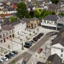
A key aspect of improving the visitor experience is to reinforce a consistent brand, making it clear that’s it’s the Midlands Trail Network. Consistency in the use of interpretation and wayfinding across the Midlands Trail Network will maximise visibility and make it easier for potential users to find the trail heads and routes. This will also apply to online channels (before they visit the area) and in the destination (after they arrive). It will also help raise awareness internationally of the entire offering in Ireland and support the achievement of objectives set out within the Ireland’s Hidden Heartlands and Ireland’s Ancient East Regional Strategies.
The user journey does not start on the trail, it starts before the user has arrived at the Midlands Trail Network. It’s therefore significant to the user experience that the signage extends beyond the site boundaries to direct people to the Midlands Trail Network from key hubs and junctions.

2

An Opportunity in the Landscape
The peatlands landscape is set to evolve over time as rehabilitation and restoration works continue, and ecosystems return and mature. With support from Fáilte Ireland, the specific opportunities for tourism and recreation development are currently being considered by Bord Na Móna and all stakeholders within the region.
The Toolkit should be used to inform visitor-focused requirements for network development, including:
l Where trail connections should be prioritised
l What network features are required to achieve the vision
l Minimum requirements for build specification
All visuals shown within this report are Indicative only. They are intended to demonstrate a standard of quality expected to achieve the Midlands Trail Network vision and should not be assumed as part of any detailed design
The term ‘Iconic’ has been used throughout this report. This use of terminology does not necessarily align with the use of this word within any existing or future Strategy or Policy but is used with the ambition to emphasise a feature’s significant visitor impact within the Midlands Trail Network landscape. In the context of this document, the term ‘iconic’ can be interchanged with any similar such use of terminology as appropriate in carrying the Network development forward.
3
Strategic Objective of Midlands Trail Network Toolkit
The overall vision for Ireland’s midlands is to be one of one of Europe’s leading regenerative tourism destinations. To develop a network of visitor facing greenways, tracks, trails and routes to help the visitor navigate the region, connecting the landscape, hubs and attractors and supporting the development of sustainable tourism. A place where tourism works to create flourishing places and thriving communities, where the region has become well known as a sustainable and inclusive destination and where communities and visitors can reconnect with nature while taking time out with friends and family.
The Midlands Trail Network Toolkit will enable both Fáilte Ireland and our strategic partners to expand the overall active in nature offering within Ireland’s midlands by providing a lattice of walking and cycling trail development up to and including 2030. The proposed network will connect rural settlements to open spaces, traversing peatlands, waterways and other habitats and provide linkages to heritage sites and visitor attractions. The development of trails within Ireland’s midlands will assist in expanding the tourism offering within the region and will provide a greater regional spread across the country.
The network infrastructure will form the basis of a holistic place-making experience, with smart engineering and design working together to elevate the experience to create an outstanding tourism product.
The Midlands Trail Network is a long term strategic goal for trail development, which will deliver a best in class tourism offering while regenerating the landscape in a sustainable and inclusive way. It’s development will enhance the overall quality of visitor experience, underpin the Ireland’s Hidden Heartland and Ireland’s Ancient East brands and leverage the natural assets of the region.
4

Last Mile Connectivity
The entire proposed network of trail development will connect rural settlements, visitor attraction hubs and peatlands bog areas with already established National Greenways and proposed Greenways. In conjunction with external stakeholders “last mile” sections have been identified which will provide the final link from newly developed peatland trails off road to hubs, gateways, towns or visitor attractions. The last mile section identified should be off road and meet the criteria set out within the Midlands Trail Network toolkit and will be developed by stakeholders through planned consultation over the coming years. RURAL
ATTRACTION
SETTLEMENTS VISITOR
HUBS
5
PEATLANDS BOG AREAS NATIONAL GREENWAYS
The Opportunity 02
2.1 The Landscape in Transition
Following the cessation of industrial peat extraction, Bord Na Móna is currently undertaking enhanced peatland decommissioning, rehabilitation, and enhanced restoration measures, with the support of Government funding.
The Peatlands Climate Action Scheme (PCAS) will help to reduce carbon emissions (from drained peatlands), improve carbon storage, create space for nature including many threatened species and habitats and can help to provide other ecosystem services such as water regulation.
As Bord na Móna transitions the focus of its activity to green energy and climate solutions, it opens up a once-in-a-generation opportunity to transform access to open green, brown and blue spaces in the Midlands. This access will support the realisation of Ireland’s Hidden Heartlands slow and regenerative tourism proposition as well as supporting the development of the recreation offer more broadly in the region.
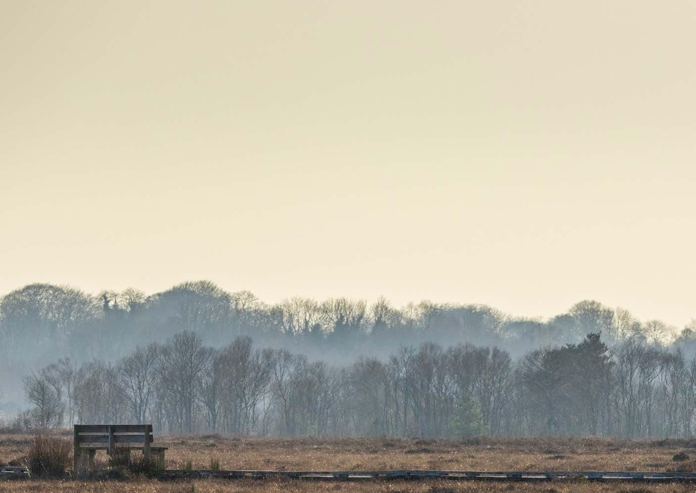
A key opportunity lies in repurposing the extensive narrow gauge railway network which connects large tracts of Bord na Móna’s landholding. This network was constructed to facilitate the transportation of peat and is in the process of becoming obsolete. Trail construction in a peatland environment can be challenging and costly due to the variable, wet, and ecologically sensitive nature of peatland environments. Utilising existing railway beds and former bog headlands provides an opportunity to reduce the scale of the challenge presented by the variable ground conditions.

6
2.2 The Vision
A vision for a Midlands Trail Network, outlined within the Review of the Opportunity for the Midlands Trail Network report ( 2022 ), is summarised as follows:

Moving slowly through the landscape on land and water


Discovering natural, cultural and industrial heritage on the journey… Active in the environment…

Experiencing authentic, intimate encounters with thriving communities

Contributing to a sustainable destination, staying in alternative eco accommodation and travelling carbon neutral
The Midlands Trail Network will consist of a serviced network of inclusive off-road trails that enables local people and visitors to explore the Midlands region by bike, e-bike and on foot. The network will connect rural settlements to open spaces, traversing peatlands, waterways and other habitats and linking to heritage sites and visitor attractions.
The network infrastructure will form the basis of a holistic place-making exercise, through a co-ordinated effort by multiple statutory and regional partners, local communities and individuals, with smart engineering and design working together to elevate the experience to create an outstanding tourism product. Midlands communities will play an essential role in developing and delivering the tourism offer, by extending an authentic welcome and providing accommodation and other essential services such as bike hire and catering.
 FIGURE 1:
7

…this fund will act as a catalyst to kickstart the development of regenerative tourism in the region…
Lough Boora Discovery Park, Co. Offaly 8
2.3 A Just Transition for Midlands’ Communities
The Climate Action and Low Carbon Development (Amendment) Act 2021 sets out national targets for the reduction of carbon emissions, namely 51% reduction of carbon emissions by 2030, paving the way for Ireland to achieve ‘net-zero’ emissions by 2050. The cessation of peat extraction and use for energy generation and the rehabilitation and restoration of peatlands play a significant part of the solution to achieving these targets.
The principle of a ‘just transition’ expresses the need for governments to help communities in regions severely impacted by the challenge of decarbonisation, through fair treatment and support for people whose livelihoods were traditionally dependent on extractive industries that are required to cease.
To counteract the impact of the cessation of peat extraction in the Midlands region, €68 million has been allocated to Fáilte Ireland through the European Union Just Transition Fund. This fund will be used to implement a Regenerative Tourism & Placemaking Scheme for Ireland’s Midlands. A significant proportion of the fund is earmarked specifically for Trail Development, with other strands delivering on other aspects of the holistic tourism experience including Visitor Amenities; Alternative Low Carbon Accommodation; and Smart Specialisation, which involves digital transformation.
This fund will act as catalyst to kickstart the development of regenerative tourism in the region, by delivering short to medium term projects that will facilitate the continued growth and development of the Midlands Trail Network and other aspects of the long-term vision for sustainable and regenerative tourism and outdoor recreation in the Midlands.
9
Design Principles of The Midlands Trail Network 03
3.1 Designing for The Visitor
The vision for a successful visitor experience for the Midlands Trail Network requires a Network that facilitates people walking, wheeling, and cycling.

To achieve this, the Network must have:
l smooth, well-maintained surfaces
l gentle gradients
l journey end-to-end continuous step-free and barrier-free access
l trails that are wide enough to accommodate all users

10
3.2 Network Overview
The Midlands Trail Network must comprise a combination of the right features in the right places to ensure success in the context of tourism. Trails alone are just one component of a well-designed network.
Midlands Trail Network features (including trails) should be developed at a higher resolution than what can be fulfilled by National or Regional Greenways, offering a unique visitor offering that unlocks the Midlands like never before, giving local people doorstep recreational opportunities while providing a highly marketable product for tourism generation in between the arterial Greenway corridors.
Figure 2 illustrates most of the key components of a Midlands Trail Network. These are:
l Hubs
l Core Trails
l Feature Trails
l Gateways
l Iconic Trail features
l Points (detail provided in Section 3.7)
Figure 2 also shows the proposed interaction between National Greenways and the Midlands Trail Network, and demonstrates allowable ‘last mile’ connectivity at Primary Hubs.
Network development is expected to be targeted at corridors associated with former Bord na Móna narrow gauge railways as these are considered the lowest risk opportunities on which to develop the highest quality trails. ‘Off-track’ construction of trails should be considered only where a critical connecting link is required to add value to the function of the network, or where a sound rationale to enhance the visitor experience can be demonstrated.
11

12
FIGURE 2: MIDLANDS TRAIL NETWORK SUMMARY DIAGRAM
To achieve a satisfactory short-term (to 2026) visitor experience, a Midlands Trail Network must:
1. As a minimum, achieve Core Trail connectivity between two secondary Hubs. Any required prioritisation of networks can be based on expected impact as follows:

OPTIMUM IMPACT
CORE TRAIL CONNECTIVITY
BETWEEN AT LEAST ONE PRIMARY HUB TO TWO OR MORE SECONDARY HUBS
CORE TRAIL CONNECTIVITY
BETWEEN AT LEAST ONE PRIMARY HUB AND ONE SECONDARY HUB
CORE TRAIL CONNECTIVITY
BETWEEN THREE OR MORE SECONDARY HUBS ARRANGED IN A LOOP OR STACKED LOOP FORMATION
CORE TRAIL CONNECTIVITY
BETWEEN THREE OR MORE SECONDARY HUBS ARRANGED IN A LINEAR FORMATION
CORE TRAIL CONNECTIVITY
BETWEEN TWO SECONDARY HUBS
2. Demonstrate itself as a catalyst for future Network expansion aligned with the emerging availability of access to Bord na Móna lands across the next decade, within a wider phased Midlands Network Development Plan.
To fully realise the vision (to 2030 and beyond), a Midlands Trail Network must:
1. Have Core Trail connectivity between multiple Primary and Secondary Hubs
2. Exhibit the full range of visitor experience features as set out within this Toolkit, including Hubs, Gateways, Feature Trails, Rest Points, Discovery points, and Iconic Features.
MINIMAL IMPACT
13
3.3 Environmental Considerations
In line with Ireland’s National Outdoor Recreation Strategy, ‘Embracing Ireland’s Outdoors’, respect for the environment should be at the centre of designing a Midlands Trail Network, with an ambition to protect the landscape, habitats, and built heritage through sustainable development and good management practices.
Rural trail development must comply with relevant statutory planning and environmental legislation at both European and National level. This may include the requirement to consider various types of environmental assessments. These processes should align with Bord na Móna’s ambition for rehabilitation or change of land use across the Midlands region, and there may be project efficiencies in doing so.
In the context of ‘The Visitor to the Midlands Trail Network’, it is relevant to apply the environmental considerations associated with Transport Infrastructure Ireland’s ‘Rural Cycleway Design (Offline and Greenway) DN-GEO-03047 Standards. It follows that the development of a Midlands Trail Network must include the preparation of a Construction Environmental operating Plan. This will consider measures required to construct the project (including construction compounds, drainage measures required during construction, e.g. silt control, dust, or noise control, etc) and outline design mitigation measures identified during project development. It should be noted that detail on the spacing of Hubs, including Tertiary Hubs as described in Section 3.4, has been considered in the context of construction operational need as well as ongoing management and emergency access logistics.
Rural offline cycleways, including the Midlands Trail Network (walking & cycling), are subject to the Code of Practice for Archaeology agreed between the Minister for Arts, Heritage, Regional, Rural and Gaeltacht Affairs and Transport Infrastructure Ireland. Should routes be designed in proximity to historic buildings or archaeological sites and monuments, then these will need to be addressed in the development approval process (whether ‘Part 8’, ‘Section 177AE’ or Environmental Impact Assessment), and care will be required to ensure that all necessary notifications are made to both the planning authority and the Department of Housing, Local Government and Heritage. Should the Trail network be in proximity to a national monument, then Ministerial Consents (Section 14) will be required, while Section 12 notifications will be required is in proximity to any sites published on the RMP/SMR.
14
3.4 Hubs
A Hub is a base, a destination, or a transitional space for visitors. Hubs are the critical nodes of a Midlands Trail Network and are the bedrock of the Network’s success, optimising the connectivity of people to existing or new experiences across Ireland’s Midlands.
Hubs follow a three-tier hierarchy of Primary, Secondary, and Tertiary, reflecting their role within the Midlands Trail Network. This hierarchy describes the range and scale of key components needed to achieve success. It includes existing hubs and the creation of hubs, where necessary. This hierarchy is illustrated in Figure 3 and detailed in Table 1.

ARY PRI ARY SEC ----TERTIARY TERTIARY T E RTIARY TERTIARY TERTIARY
15
FIGURE 3: THE MIDLANDS TRAIL NETWORK IS A NETWORK OF INTER CONNECTED HUBS
TABLE 1: HUBS

Primary Hubs
These are population nodes throughout the Midlands Trail Network of high tourism interest, including medium-large sized towns that may have national public transit options and overnight experiences. These Hubs may be destination experiences in their own right, in which the Midlands Trail Network may be just one of a number of visitor experiences on offer.
Key Components – Primary Hubs must:
l Have public toilet facilities including Changing Places
l Directly connect OR have ‘last-mile’ traffic-free connectivity with Type 1 Gateways (see page 17)
l Have continuous step-free and barrier-free access between all components
l Have bike hire, including e-bike, children’s bikes, and trailers
l Have national public transport options
l Have appropriately scaled car parking including disabled parking provision, with e charging.
l Have cycle-friendly accommodation
l Have well-presented townscapes with cycling integrated into the public realm
Minimum Frequency
Maximum recommended spacing = 20km as one of the following combinations:
l Primary – Primary
l Primary – Secondary
l Secondary – Secondary
16
Secondary Hubs
These are nodes throughout the Midlands Trail Network that provide amenity and experience reflective of day-tripping and of visitors passing through. These maybe small to medium sized towns and villages with medium towns with local public transit options, or existing/proposed visitor attractions. There may be some limited overnight accommodation across surrounding areas.
Key Components –Secondary Hubs must:
l Have public toilet facilities including Changing Places
l Directly connect with Type 2 Gateways
l Have continuous step-free and barrier-free access between all components
l Have appropriately scaled car parking and disabled provision, with e-charging
l Have bike hire (including e-bike, children’s bikes, and trailers)

Minimum Frequency
Maximum recommended spacing = 20km as one of the following combinations:
l Primary – Primary
l Primary – Secondary
l Secondary
– Secondary
Tertiary Hubs
These are local access points onto the network, often coinciding with points where a trail crosses a road. They provide a basic access facility with limited services and are intended to improve local connectivity for local people onto the network, while also serving as regular points for access and egress for emergency and maintenance purposes.
Key Components –Tertiary Hubs must:
l Have direct connectivity with Type 3 Gateways
l Consider location-specific car parking, with capacity dependent on assessed local/community need and local road conditions.
l Not be promoted as tourism nodes for access to the Midlands trail network
Minimum Frequency
Maximum recommended spacing = 5km, spaced between Primary and Secondary Hubs. Allowances for increase in distance may be made based on the incidence of road crossing points provided appropriate protocols for maintenance and emergency access are detailed.
17
3.5 Gateways
Gateways deliver a high-quality threshold experience that announces arrival and transition onto the Midlands Trail Network. They must be visually reflective of the wider trail network, providing a high quality visitor space that promotes the network and the Midlands landscape as one to explore slowly. They must be inviting and welcoming and generate positive first and last impressions of the network, delivering a visual brand identity in a consistent way.
A key feature of a Gateway is the suggested use of contrasting threshold surface material to generate a transition experience. This surface material should stand out from more widespread trail surfaces, using high quality and/ or innovative paving techniques such as coloured resin-bound surfacing, coloured stone as part of a sealed surface, premium quality boardwalk, cut stone paving, etc, reflective of the high-quality ‘public realm’ experience that a Gateway should achieve.
Gateways play a key role in visitor orientation and navigation on the Midlands Trail Network. A visitor should not be able to enter or exit the Midlands Trail Network without passing through a Gateway acting as a key identifier of the impending experience.
Gateways can act as rest points on a Midlands Trail Network journey, in line with the target experience for Rest Points set out in Section 3.7.
Gateways must:
l Deliver consistent visual brand identity
l Be fully accessible, and enforce this strongly with a default step-free and barrier-free access principle
l Be inviting and welcoming, and generate positive first/last impressions of the Midlands Trail Network
18
Gateways follow a hierarchy of three types reflecting their role within the Midlands Trail Network, described in Table 2.
TABLE 2: GATEWAYS
Gateway Type 1
Where: To mark an entrance to the Midlands Trail Network from key strategic locations associated with Primary Hubs, that is visually iconic of the wider trail Network, and provides high quality visitor space that promotes the Network and the Midlands landscape as one to explore slowly.
Gateway Type 2
Where: To mark an entrance to the Midlands Trail Network from Secondary Hubs or from intersections from other strategic traffic-free routes e.g. national Greenways, that is visually consistent with the wider trail Network and provides high quality visitor space that promotes the Network and the Midlands landscape as one to explore slowly.
Gateway Type 3
Where: To mark an entrance to the Midlands Trail Network from Tertiary Hubs and from road crossing points in a way that is visually consistent with the wider Midlands Trail Network and that provides a practical function associated with road crossings in line with TII Standards.

Where:
Must connect directly to a Primary Hub
OR
Must have ‘last mile’ traffic-free connectivity to key components of a Primary Hub.
Where:
Must connect directly to a Secondary Hub
OR
Must connect directly from other strategic traffic-free routes e.g. National Greenways
Where:
Must connect directly to a Tertiary Hub
OR
At road crossing points – in both directions
This hierarchy represents the range and scale of key components of each Gateway required to achieve the Network vision. This hierarchy is described in figures Figure 4 to Figure 6 alongside indicative illustrative visuals that provide examples of Gateway application. These are intended to demonstrate a standard of quality expected to achieve the Midlands Trail Network vision and should not be assumed as part of any detailed design. Further work is required to conclude materiality and consistent application of landscape design.
19
Gateway Type 1 Primary Function
To mark an entrance to the trail network from key strategic locations associated with Primary Hubs that is visually iconic of the wider trail network, and provides a high quality visitor space, that promotes the network and the Midlands landscape as one to explore slowly.


A Gateway Type 1 must:
• Deliver a threshold experience that announces arrival and transition onto the network
• Connect to or have ‘last mile’ traffic-free connectivity to key elements of a Primary Hub.
• Be inviting and welcoming, and generate positive first/last impressions of the network
• Deliver visual brand identity consistently, and at the top level
• Be highly accessible and enforce this strongly with default barrier-free, step-free access principle.
• Deliver visitor and advisory information on the wider trail network
• Deliver navigation and route planning information for the network
• Provide significant space to dwell and congregate, and function as a base point
• Consider the principles of Universal Design Key elements:
• Significant scale iconic gateway feature to signal the start/end point of a Midlands Trail journey
• Threshold surface material treatment to generate transition experience
• Shelter
• Seating
• Wayfinding and visitor information signage
• Interpretive signage
• Cycle facing signage
• Frame supporting cycle parking
FOR ILLUSTRATION PURPOSES ONLY 20 15 Figure
4 - Gateway Type 1
Figure 4 - Gateway Type 1
Gateway Type 2 Primary Function
To mark an entrance to the trail network from Secondary Hubs or intersections from other strategic traffic-free routes e.g. National Greenways, that is visually consistent with the wider trail network and provides a high quality visitor space that promotes the network and the Midlands landscape as one to explore slowly.


A Gateway Type 2 must:
• Deliver a threshold experience that announces arrival and transition onto the network either from a Secondary Hub or another strategic route e.g. a National Greenway
• Connect directly to key elements of a Secondary Hub OR from other strategic traffic free routes e.g. National Greenways
• Be inviting and welcoming, and generate positive first/last impressions of the network.
• Deliver visual brand identity consistently
• Be highly accessible, enforce this strongly with a default barrier-free, step-free access principle.
• Deliver visitor and advisory information on the wider trail network
• Deliver accessible navigation and route planning information for the network
• Provide space to dwell and congregate, and function as a base point
• Consider the principles of Universal Design
Key elements:
• Large scale iconic gateway feature to signal a start/end point of a Midlands Trail journey
• Threshold surface material treatment to generate transition experience
• Shelter
• Seating
• Wayfinding and visitor information signage
• Interpretive signage (local)
• Cycle facing signage
• Frame supporting cycle parking
FOR ILLUSTRATION PURPOSES ONLY 21 16
Figure 5 - Gateway Type 2
Figure 5 - Gateway Type 2
Gateway Type 3 Primary Function
To mark an entrance to the trail network from Tertiary Hubs in a way that is visually consistent with the wider trail network and that provides a practical function associated with road crossings in line with TII Rural Cycleway Design Standards.
A Gateway Type 3 must:


• Deliver a threshold experience that announces arrival and transition onto the network
• Connect Directly to key elements of a Tertiary Hub
• Be inviting and welcoming, and generate positive first/last impressions of the network
• Deliver brand identity consistently
• Be highly accessible, and enforce this strongly with a default barrier-free and step-free access principle
• Deliver accessible visitor and advisory information on the wider trail network
• Provide space for people to congregate, in small groups on bicycles
• Consider the principles of Universal Design Key elements:
• Small scale staggered approach barrier consistent with brand identity and providing function in line with approaches to road crossings outlined within TII Rural Cycleway Design Standards (Offline and Greenway) DN-GEO-03047 August 2022
• Threshold surface material treatment to generate transition experience
• Seating sufficient for a small group
• Wayfinding and visitor information signage
• Interpretive signage (local)
• Cycle facing signage
• Frame supporting cycle parking
FOR ILLUSTRATION PURPOSES ONLY 22 17 Figure 6 -
Type 3
Gateway
Figure 6 - Gateway Type 3
3.6 Trails
3.6.1 Challenges and Opportunities for Trail Building in the Midlands Raised Bog Landscape
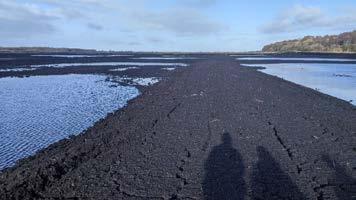
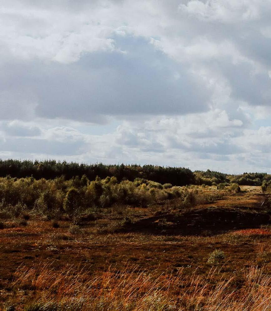
Building sustainable and accessible trails in any peatland landscape is a challenge. Peat’s natural variability, compressibility, and rebounding potential can result in differential settlement, leading to damage of trail surfaces and structures where solutions are not appropriately considered. This can increase construction costs and network monitoring and maintenance obligations. Fluctuations in water levels can also de-stabilise peat and increase the risk of trail damage.
Given peatlands’ environmental value as a nature ecosystem and as a carbon sink, trail route selection should consider the corridor’s existing environmental value and future environmental potential, seeking to as a minimum to mitigate against any environmental harm but ideally forming part of wider environmental enhancements or restoration efforts across Ireland’s Midlands.
With ever-increasing frequency and extremes in rainfall and drought events associated with climate change, trail routes within a peatland environment must be carefully selected, planned, and the appropriate solutions implemented to ensure product sustainability, environmental compatibility, and user safety.
The extraction of peat in Ireland’s Midlands across many decades has led to a general reduction in peat depths, and the consolidation (compression) of peat beneath established linear swathes of land used for narrow gauge rail haulage and tracking of machinery, with some reinforcement of peat using ballast and geotextiles. These linear swathes associated with peat extraction activities across many of Bord na Móna’s lands have the potential to become high quality trails, which can act as the foundation for a quality visitor experience if they are supported by other services and facilities. Development should be prioritised on these corridors as they are likely to be the greatest opportunity on which to develop trails.
‘Off-track’ construction of trails should be considered only where a critical connecting link is required to add value to the function of the network, or where a sound rationale reflecting visitor experience can be demonstrated.
A summary of ground condition considerations for trail development is provided in Appendix D: Ground Condition Considerations for all Trails.
23
The vision for a successful visitor experience for the Midlands Trail Network requires a trail design that facilitates multi-use. That includes people walking, wheeling, and cycling. Therefore, all trails require smooth, well-maintained surfaces with gentle gradients and end-to-end continuous step-free and barrier-free access.
3.6.2 Trail Standards: Core Trails
Core Trails are the backbone of the Midlands Trail Network. They provide the connectivity and ‘logic’ of the network, connecting people and communities to each other and to key visitor experiences.
Core trails must connect Hub to Hub.
All Gateways into the Midlands Trail Network should connect directly onto Core Trails. This is to ensure a consistent and reliable experience for users. The Core Trail’s functional quality in effect becomes part of the Midlands Trail Network ‘brand’.
Gentle gradients in the Midlands means that there is an opportunity for Core Trails to be accessible to all. Core trails must achieve a highly rollable (smooth) surface, and continuous, step-free and barrier-free access that facilitates use by people walking, cycling, wheeling, and using adapted cycles up to 1m wide travelling in two directions.
All Core trails developed within the Midlands Trail Network should follow design standards set out within Transport Infrastructure Ireland’s ‘Rural Cycleway Design (Offline and Greenway) DN-GEO-03047’ August 2022. These standards align well with the target visitor experience for a Midlands Trail Network. They include design guidance on trail pavement types, material selection, and trail widths.
The vision for the Midlands Trail Network is to offer a unique visitor experience and unlock the tourism potential of the Midlands. It is expected that the trails on the Midlands Trail Network are developed at a higher-resolution, where possible, than those on the National or Regional Greenways. This will enable the development a highly marketable, tourism network linking between and within the arterial greenway corridors.
24

3.6.2.1 Pavement Type: Core Trails
The TII Standards describe three pavement types, developed with a user focus that aligns well with that of the Midlands Trail Network vision.
l Type A – Bituminous material base/binder and surface course
l Type B – Unbound granular base with surface dressing
l Type C – Unbound granular base, un-sealed*
The selection of the most suitable/desirable pavement type is at the discretion of the Designer based on the particular requirements and conditions at the location of the trail.
It is encouraged that Type A surface course includes coloured or innovative aggregates where feasible. Innovative surfacing is encouraged to reinforce the Midlands Trail Network to set it apart from other routes for walking and cycling.
There may be scenarios across the Midlands Trail Network where the use of boardwalk or other forms of surface course will be required for technical reasons or is desirable to enhance the visitor experience (for example at Gateways where a threshold surface material treatment is recommended). Should this be the case, the principles of smooth, well-maintained surfaces with gentle gradients and end-to-end continuous step-free and barrier-free access should still be applied, with additional anti-slip considerations to ensure user safety.
A key feature of a Gateway is the suggested use of contrasting threshold surface material on the trail to generate a transition experience. This surface material should stand out from more widespread trail surfaces, using high quality and/or innovative paving techniques such as coloured resin-bound surfacing, coloured stone as part of a sealed surface, premium quality boardwalk, cut stone paving, etc, reflective of the high-quality ‘public realm’ experience that a Gateway should achieve.
* Type C must only be used where project risk is demonstrably high, in situations including:
1. Where there is a demonstrated unacceptable level of risk of damage to a sealed surface (cracking or displacement) because of underlying ground conditions.
2. Where a period of trail performance (due to ground conditions) monitoring is required to test the future viability of the installation of a sealed surface.
3. As a short-term activator trail in the absence of enough funding to create a sealed surface.
A Type C surfaced trail must still achieve the objectives of the Visitor Experience for the Midlands Trail Network though being specified and installed with well-graded compacted gravel, with no loose stone after compaction, to a high standard of ‘rollability’ for people walking, wheeling, and cycling.
25
3.6.2.2 Trail Width: Core Trails
The TII Standards outline trail width requirements based on a variety of user scenarios. Applying the Typical Midlands Visitor Experience vision to these scenarios, Core Trails in the Midlands Trail network should have a surface no less than 3m wide*.
The 3m width takes account of design speeds, lateral clearance considerations for people travelling in two directions on bicycles, expected relative volume of users across the Midlands Trail Network and consideration for emergency access protocols. For areas with higher volumes of users, for example at Gateways and other locations where visitors are less dispersed across the Network, widths of 5m and more may be required in line with TII Standards.
* Where a trail will form all or part of an essential/valuable link between Hubs and no other route option is viable, but where the trail cannot feasibly achieve the minimum 3m width due to existing conditions unique to the Midlands peat environment (for example: re-use of existing ballast on a disused railway that is less than 3m wide, therefore widening may not be possible due to the risk of differential settlement and longitudinal cracking of a trail surface due to underlying peat), allowances can be made to permit trail width of no less than 2m if local conditions and anticipated user volumes can be safely accommodated. This deviates from TII Standards somewhat but adequately reflects the ‘slow travel’ element for the Midlands Trail Network and provides the mechanism to respond to some realities of existing conditions across Bord na Móna lands. However, this is considered an exceptional circumstance and should be used only when all other options to achieve 3m width have been demonstrably ruled out. Where trails are less than 3m wide, passing places must be installed at 100m visible intervals to allow the safe and convenient negotiation and passage between users.
26

3.6.3 Trail Standards: Feature Trails
Feature Trails can be developed in a bespoke manner, with their own vision and localised set of objectives. They should be developed as a complement to the Core Trail Network, providing a more refined level of visitor experience for a specific local purpose or in response to a specific set of constraints.
Feature Trails must not be used to connect Hub to Hub. Feature Trails need not necessarily conform to TII Standards. However, they must be designed to continue an inclusive and accessible experience that complements and enhances the Core Trails experience and allows all people the opportunity to enjoy a Midlands Trail Network journey.
A Feature Trail can be single-use (e.g. walking and wheelchairs/powerchairs only). In this instance, accommodations must be made at the trailhead for the accessible temporary storage of bicycles (with frame-locking options) so that visitors can seamlessly enjoy a multi-modal trail experience. Feature Trails that do not facilitate cycling must always return visitors back to their entry trailhead to facilitate the collection of bicycles.
Feature trails should have a clear interpretative theme or purpose.
Example scenarios for the basis of Feature Trail development may include:
l To fulfil a local community need for regular outdoor recreation (e.g. provision of a looped Community Trail, with the trailhead close to a Gateway)
l To sustainably engage people with an area of natural heritage and beauty
l To sustainably engage people with local built or cultural heritage
27
3.6.4 Trail Standards: Bridges
Bord na Móna’s extensive network of narrow-gauge railways once facilitated the movement of peat haulage locomotives to reach power stations and peat-related manufacturing plants. Complex natural and artificial drainage mechanisms across this boggy landscape, hydrologically liked with the River Shannon, means that existing bridge structures are regular throughout the railway network. These include:
l Large multi-span bridges across the River Shannon.
l Bridges across tributaries of the River Shannon.
l Innovative but now mechanically obsolete lifting and swing bridges over navigable waterways including the Grand Canal.
l Regularly spaced bridging solutions over artificial drainage channels.
All bridges, whether refurbished or new, should have a consistent application of design as part of a ‘family of structures’, turning their practical application into something that also elevates the landscape to match the vision for the visitor experience. Bridge structures provide an opportunity for visually consistent brand and product identity, much like Gateways.
The level of intervention at existing or proposed bridge locations will be dependent on existing structural and width/edge safety conditions, available budgets, and level of ambition and opportunity to use bridges to enhance the visitor experience.
Bridges should have an effective width of no less than 3m wide. Edge constraints on the approach to and along bridges will require lateral clearance considerations in line with trail width guidance provided in section 3.6.2.2.
28
Bridge interventions are categorised by the following matrix that aims to inform the relative level of investment required to achieve an appropriate solution:
TABLE 3: RELATIVE INVESTMENT CONSIDERATIONS FOR BRIDGES
Approximate bridge span
Bridge refurbishment: Superstructure conversion (e.g. sculptural handrails)
Basic functional
New bridge: special
feature (Iconic Trail Feature)
All bridges proposed for refurbishment for use within the Midlands Trail Network must be assessed for existing structural integrity, ensuring a remaining design life in line with that of the Midlands Trail Network.
Opportunities for bridge refurbishment may include the conversion of the superstructure to something functionally and visually robust, for example the installation of sculptural edge protection, making use of bridges as a Rest Stop, Discovery Point, or should a significant level of investment be warranted, an Iconic experience in its own right.
5m 10m 20m 30m 50m
Very Low Low Moderate High Very High
solution Low Moderate High Very High Strategic Investment
architectural
N/A N/A Very High Strategic Investment Strategic Investment
New bridge:
29
3.7 Points
Point features throughout the Midlands Trail Network are essential for animating a Midlands Trail Journey in line with the vision and for making a journey both a practical and enjoyable ‘slow travel’ experience.
Points are broken down into the following:
l Minor Rest Points
l Major Rest Points
l Discovery Points (should also be a rest point)
l Industrial Heritage Discovery Point – “To be seen” (should also be a rest point)
l Industrial Heritage Discovery Point – “To be explored” (should also be a rest point)
The minimum allowable spacing for Rest Points is 2km for Minor Rest Points and 15km for Major Rest Points, where respective seating requirements are not already achieved at this frequency through provision associated with Gateways, Discovery points, Major Discovery Points, or Iconic Experiences. It may be appropriate to reduce this distance when near Gateways in anticipation of projected visitor density and behaviours.
Indicative illustrative visuals for Points are provided Figure 7 to Figure 11. These are intended to demonstrate a standard of quality expected to achieve the Midlands Trail Network vision and should not be assumed as part of any detailed design. Further work is required to conclude materiality and consistent application of landscape design.
30
3.8 Iconic Features
The Midlands Trail Network will be greatly enhanced through the installation or development of iconic features that can promote Ireland’s Midlands on a global scale. These features may be new interventions or could form part of the essential infrastructure of the trail network, for example through a significant upgrade or replacement of bridges or buildings to create a unique visitor experience that epitomises the Midlands Trail Network brand.

Iconic features, whatever their form, should tie in with family of structures across the network in terms of materiality and visual brand. They must be sympathetic to the surrounding environment, with an aim to provide an experience that can expose visitors to the unique landscapes of the Midlands in three suggested ways:
l Iconic Above Ground Experiences
l Iconic Ground Level Experiences
l Iconic Below Ground Experiences
Indicative illustrative visuals for these three types of Iconic Experiences are provided in Figure 12 to Figure 14. These are intended to demonstrate a standard of quality expected to achieve the Midlands Trail Network vision and should not be assumed as part of any detailed design. Further feasibility studies are required to conclude locations, location-specific objectives, materiality and consistent application of landscape and engineering design.
Lough Boora Discovery Park, Co. Offaly31
Minor Rest Point Primary Function
Intermittent locations on the route that are visually consistent with the wider trail network, that positively contribute to visitor experience by delivering a short rest opportunity.

A Minor Rest Point must:
• Provide seating and rest opportunities for at least two people and their bicycles
• Target 1 rest point every 2km in line with minimum seating requirements outlined within TII Rural Cycleway Design Standards (Offline and Greenway) DN-GEO-03047 August 2022, where seating requirements are not already achieved at this frequency through provision of seating associated with Gateways, Discovery Points, Major Rest Points, or Iconic Experiences.
• Deliver visual brand identity consistently
• Be universally accessible, and enforce this with a default step-free, barrier-free access principle.
• Deliver wayfinding information
• Consider the principles of universal design
Key elements:
• Seating
• Frame supporting cycle parking

FOR ILLUSTRATION PURPOSES ONLY 32 28
Figure 7 - Minor Rest Point
Figure 7 - Minor Rest Point
Major Rest Point Primary Function
High quality locations that are visually iconic of the wider trail network, that positively contribute to visitor experience by delivering shelter and space within which to regroup and replenish.
A Major Rest Point must:

• Provide space for rest and shelter, and the ability to regroup, make tea, have lunch
• Target 1 rest point every 15km
• Provide shelter from the elements.
• Provide a point from which to potentially explore

• Deliver brand identity consistently
• Be universally accessible, and enforce this with a default step-free, barrier-free access principle
• Consider the principles of universal design
Key elements:
• Large shelter feature of a character that is consistent with brand identity, visible but separated from core trail so as to promote stopping and exploration
• Threshold surface material treatment to generate transition experience
• Seating
• Interpretive signage (local)
• Cycle facing signage
• Frame supporting cycle parking
FOR ILLUSTRATION PURPOSES ONLY 33 29
Figure 8 - Major Rest Point
Figure 8 - Major Rest Point
Precedent imagery
Discovery Point Primary Function
Intermittent locations on the route that signal a point or view of interest, and incentivise slow exploration
A Discovery Point must:
• Signal a point or view of interest
• Promote looking at the landscape differently
• To help understand the landscape more holistically
• Provide the opportunity to rest
• Deliver brand identity consistently

• Be universally accessible, and enforce this with a default step-free, barrier-free access principle
• Consider the principles of universal design
Key elements:
• Interpretation panel and integrated interpretive content
• Seating
• On-trail threshold surface material treatment to generate transition experience
• Frame supporting cycle parking
34 30 Figure 9 - Discovery Point 30 Figure 9 - Discovery Point
Precedent imagery
A Discovery Point must:


• Signal a point or feature of industrial interest
• Promote looking at the landscape differently
• Educate about the cultural importance of the landscape and its history
• Educate about how the landscape is changing culturally and the work being done
• To help understand the landscape more holistically
• Deliver brand identity
• Be universally accessible, and enforce this with a default step-free, barrier-free access principle
• Provide the opportunity to rest
• Consider the principles of universal design
Key elements:
• Industrial feature, visible but separated from core trail so as to promote stopping and exploration
• Feature mounted/raised, with accompanying vegetation management, to allow it to be visible from the trail
• Optional accessible pathway to the feature from a point on the trail
• Seating in line with requirements of a Minor Rest Point as a minimum
• Interpretation panel located at an appropriate viewing location adjacent to the trail.
• On-trail threshold surface material treatment to generate transition experience.
• Frame supporting cycle parking
35 31
Figure 10 - Industrial Heritage Discovery Point 'To Be Seen'
Figure 10 - Industrial Heritage Discovery Point 'To Be Seen'
Discovery Point Primary Function
Intermittent locations on the route that signal a feature or location of industrial heritage interest.


A Discovery Point must:
• Signal a point or feature of industrial interest
• Promote looking at the landscape differently
• Educate about the cultural importance of the landscape and its history
• Educate about how the landscape is changing culturally and the work being done
• To help understand the landscape more holistically
• Deliver brand identity
• Be universally accessible, and enforce this with a default step-free, barrier-free access principle
• Provide the opportunity to rest
• Consider the principles of universal design
Key elements:
• Industrial feature, visible but separated from core trail so as to promote stopping and exploration
• Feature mounted/raised, with accompanying vegetation management, to allow it to be visible from the trail
• Optional accessible pathway to the feature from a point on the trail
• Seating in line with requirements of a Minor Rest Point as a minimum
• Interpretation panel located at an appropriate viewing location adjacent to the trail
• On-trail threshold surface material treatment to generate transition experience
• Frame supporting cycle parking
36 32
Figure 11 - Industrial Heritage Discover Point 'To Be Explored'
Figure 11 - Industrial Heritage Discover Point 'To Be Explored'
Iconic Experience Primary Function
An inspirational installation that globally promotes the Midlands Trail proposition through an ‘above ground’ experience that interprets the large scale of the Midlands’ landscape.

Precedent imagery

An Iconic Above Ground Experience must:
• Be a visually iconic installation that will advertise the wider trail network
• Provoke an emotional connection with the Midlands landscape
• Be appealing and memorable
• Be universally accessible, and enforce this with a default step-free, barrier-free access principle
• Have a sculptural circular form that relates to brand identity
• Elevates to a height that allows it to be seen from the trail network at distance
• Have a height that facilitates long ranging views and generates a sense of exposure and an above ground experience
• Create a view of the landscape that is revealed at the most elevated point
• Consider the principles of universal design
Key elements:
• Iconic installation installed off the trail, with a universally accessible connection
• On-trail threshold surface material treatment to generate transition experience
• Seating
• Wayfinding and visitor information signage
• Cycle facing signage
• Frame supporting cycle parking
37 Figure 12 - Iconic Above Ground Experience Figure 12 - Iconic Above Ground Experience
Iconic Experience Primary Function
An inspirational installation that globally promotes the Midlands Trail proposition through a ‘ground level’ experience that interprets the richness and complexity of the Midlands’ landscape at its surface.

Precedent imagery

An Iconic Above Ground Experience must:
• Be a visually iconic installation that will advertise the wider trail network
• Provoke an emotional connection with the Midlands landscape
• Be appealing and memorable
• Be universally accessible, and enforce this with a default step-free, barrier-free access principle
• Have a sculptural circular form that relates to brand identity
• Deliver brand identity consistently, and at the top level
• Provide views or an experience of the surface ‘living layer’ of the landscape and micro-scale flora and fauna
• Have a sculptural circular quality
• Consider the principles of universal design
Key elements:
• Iconic installation installed across the trail
• Access to the feature marshalled at two points on the trail where it intersects
• On-trail threshold surface material treatment to generate transition experience at the nodal points
• Seating
• Wayfinding and visitor information signage
• Cycle facing signage
• Frame supporting cycle parking
38 35 Figure 13 - Iconic Ground Level Experience Figure 13 - Iconic Ground Level Experience
Iconic Experience Primary Function
An inspirational installation that globally promotes the Midlands Trail proposition through a ‘below ground’ experience that interprets the importance of the Midlands’ subterranean landscape.
Precedent imagery


An Iconic Below Ground Experience must:
• Be a visually iconic installation that will advertise the wider trail network
• Provoke an emotional connection with the Midlands landscape
• Be appealing and memorable
• Be universally accessible, and enforce this with a default step-free, barrier-free access principle
• Deliver brand identity consistently, and at the top level.
• Provide an experience of the ‘hidden’ layers of the landscape
• Create a sense of shelter and enclosure with the experience of ‘time slowing’
• Consider the principles of universal design
Key elements:
• Iconic installation incorporated along the trail
• On-trail threshold surface material treatment to generate transition experience through the installation.
• Seating
• Wayfinding and visitor information signage
• Cycle facing signage
• Frame supporting cycle parking
39 36 Figure 14 - Iconic Below Ground Experience Figure 14 - Iconic Below Ground Experience
3.9 Navigating the Network
There are a several key principles of wayfinding and navigation applicable to the Midlands Trail Network, some of which are captured inherently through Network design.
These include:
1) Creating an identity: Gateways play a key role in establishing an identity for visitor orientation and navigation on the Midlands Trail Network. A visitor should not be able to enter or exit the Midlands Trail Network without passing through a Gateway, acting as a key identifier of the imminent experience. The visual impact alone of a Gateway will help the visitor to orientate their journey. They will also hold key wayfinding information at a scale appropriate to the Gateway type.
2) Use of landmarks as orientation cues: Landmarks are an incredibly useful navigation tool, offering destination goals and reassurances of being ‘on the right track’ and the user progressing on their journey throughout the network.
3) The creation of a well-structured network of paths and limiting overload of navigational choices: the breakdown of the Midlands Trail Network into Core Trails and Feature Trails aims to provide a ‘logic’ to the Network in such as way as to provide a reassuring and easy to navigate experience for the Visitor.
Wayfinding information should be provided, as a minimum, as:
l Pre-visit information to enable journey planning
l At Primary Hub Centres and at Key Primary Hub components e.g. car parks
l At all Gateways
l At all nodes (decision points) on the Network
l At 1km intervals along routes as ‘confirmation markers’ to reassure visitors they are on the right track
l Online – live mapping and/or downloadable information such as static PDFs and GPX files
Greenway Design and Brand Guidelines are available for National and Regional Greenways in Ireland, with their use mandated by Transport Infrastructure Ireland. However, these are NOT applicable to trails across the Midlands Trail Network, which will require its own holistic Wayfinding Strategy in line with the development of a set of bespoke design and brand guidelines as a visual rulebook for the Midlands Trail Network brand.
40

…Landmarks are an incredibly useful navigation tool, offering destination goals and reassurances of being ‘on the right track’…
41

Upgrade of existing well-performing trail


Ground
42
Appendix:
Condition Considerations for all Trails
Typology 2
Typology 2 describes peatland areas that have experienced loading from temporary rail or the tracking of machinery, leading to an element of consolidation and stabilisation of underlying peat.
There are ground settlement risks associated with peat depths, hydrological processes, and the unloading of peat that make this typology less favourable than Typology 1 for trail building. However, with the adequate construction solutions in place a sustainable trail surface is considered achievable.
Minimum trail specification expected: Pavement Type C for short-term use only) 3m wide
Examples:

 Temporary railway bed
43
Headland
Typology 3
Typology 3 describes peatland environments that remain in a relatively natural and unworked state. These environments should be avoided due to their relative instability and relative environmental sensitivity. Should access to this typology be essential or desired for network logic or for interpretive reasons, a piled solution such as boardwalk is likely to be required.
Examples:
Typology 4
Typology 4 describes areas of peatland/bog that have become, or risk becoming established as wetlands. Should access to this typology be essential or desired for network logic or for interpretive reasons, a piled solution such as boardwalk is likely to be required and appropriate environmental mitigations be considered.
Examples:
environment
 Minimum trail specification expected: Piled boardwalk
Deep peat/unconsolidated peat
Minimum trail specification expected: Piled boardwalk
Minimum trail specification expected: Piled boardwalk
Deep peat/unconsolidated peat
Minimum trail specification expected: Piled boardwalk
44
Wetland
…A key opportunity lies in repurposing the extensive narrow gauge railway network which connects large tracts of Bord na Móna’s landholding…
88-95 Amiens Street Dublin 1 D 01 WR86 Tel: +353 (0)1 574 1990 www.failteireland.ie/JustTransition FI-162923-ACT-0523