

School of Architecture Urban Planning
Construction Engineering
MASTER OF SCIENCE IN SUSTAINABLE ARCHITECTURE AND LANDSCAPE DESIGN
Academic Year : 2021/2022

Supervisor: Prof. Matteo Motti
Author: Diandra Zahra Karima 9509999
Contents
Acknowledgement
Abstract
Introduction
Geographical Location
Jakarta as a Delta City
Jakarta’s History and Urban Development
Land Subsidience
Flood Events
Jakarta’s Blue Infrastructure Development
Jakarta’s Canals
What Makes East Flood Canal Different?
Analysis
6 contents
Analaysis
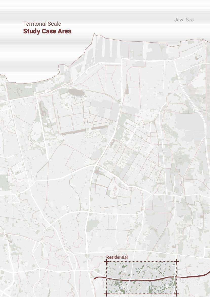
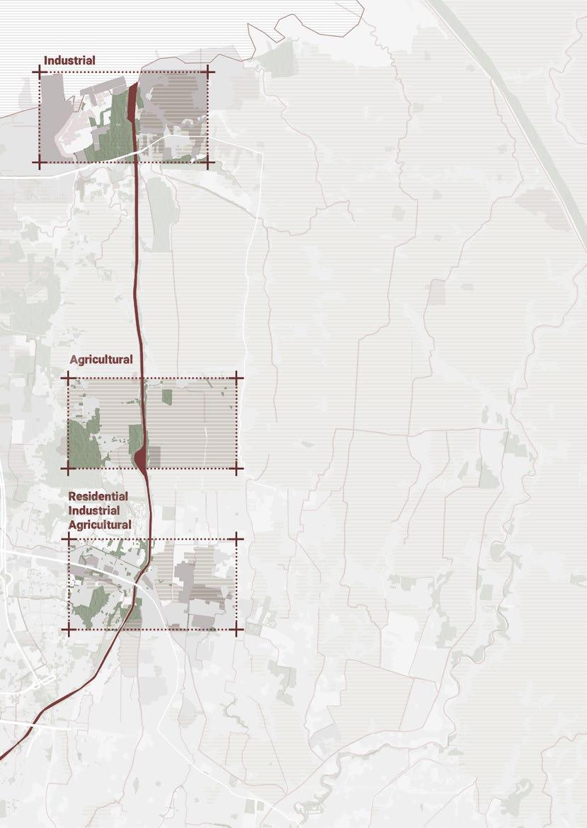
Case Analysis Residential Area Mixed Area Agriculure Area Industrial / Delta Area Summary of Analysis 6 9 11 14 20 22 24 26 28 30 36 44 66 70 82 94 104 116
Territorial Scale
Srudy
Territorial Scale Design Strategy
Territorial Scale Masterplan
Study Case Design Strategy and Masterplan
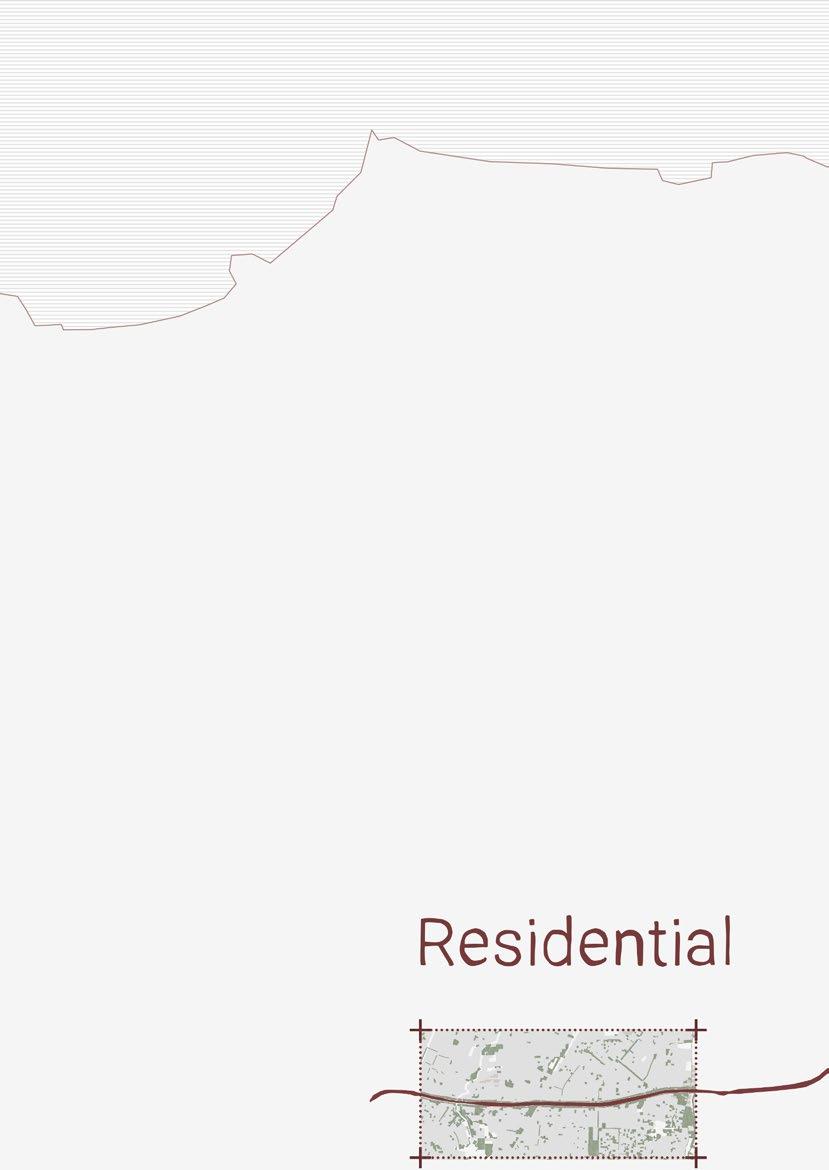
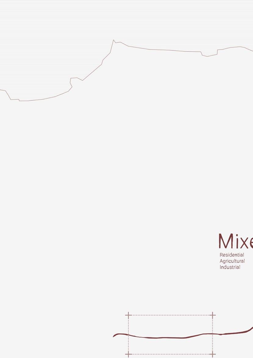
Residential Area
Mixed Area Agriculture Area
Industrial / Delta Area
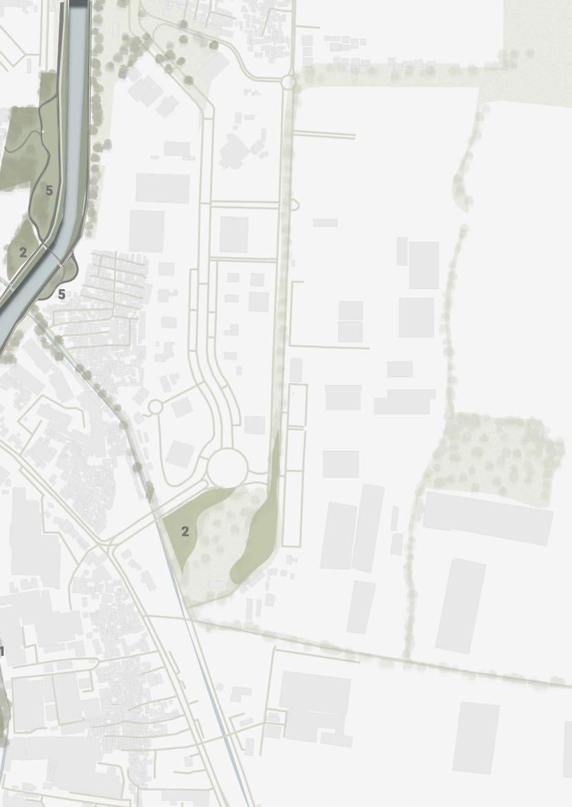
Masterplan : Summary
The Journey
Economical Cycle
Conclusion
Bibliography
7 119 130 132 134 140 148 158 176 178 180 182
acknowledgements
This project is one wonderful adventure I truly enjoyed with help and support from others. I am in debt to many of whom I can mention only a few here:
To the God of Universe, without His help, this thesis couldn’t be done.
To my parents, (beloved) Yudhi Syabandi Ismayadi and Dina Fitriningsih, for their endless love and support. Terimakasih sudah selalu percaya sama Kean.
To my sister, Audinisa Fadhila, for her motivation and daily short call. You are an amazing sister.
To my thesis supervisor, Professor Matteo Motti, for his guidance, references, and an understanding, insightful feedbacks. Thank you, Matteo.
To all family and friends that always support me through this journey.
I am truly grateful.
abstract
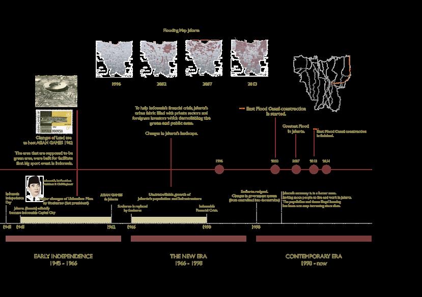
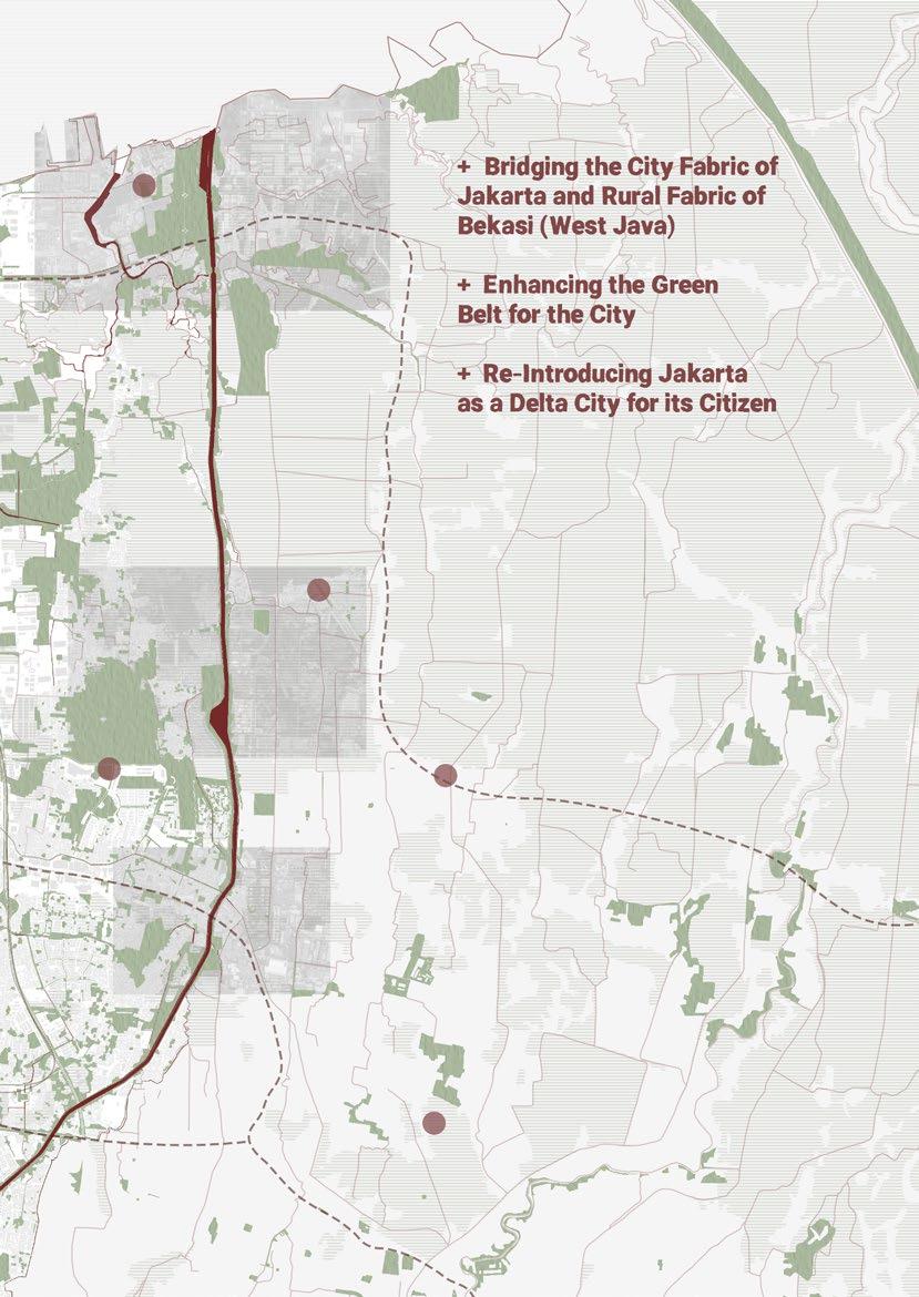
Jakarta is the capital city of Indonesia that was founded and built above soil from 13 rivers delta back then. Developed since the 15th century, Jakarta never stopped being the center of economy, government, and industry. As a result, this city is continually growing and expanding. This development invites people to work and resides. However, its downside is that the annual flooding, heavy rainfall, rising sea level, and land subsidence make Jakarta sinks way faster than the other coastal megacities. One of the working flooding solutions from the government is the East Flood Canal. It is built from 2003 - 2010. This canal mitigates the water flow from 6 natural rivers and brings it to the Java Sea gulf.
Over time, East Flood Canal developed other events that activated the surrounding neighborhood. From the sport and biking track, the lively night market every day, additional agricultural activities alongside the canal, and fishing - aquaculture ponds. It provokes possibilities to enhance the canal’s condition with existing activities that have already appeared in urban and ecological contexts.
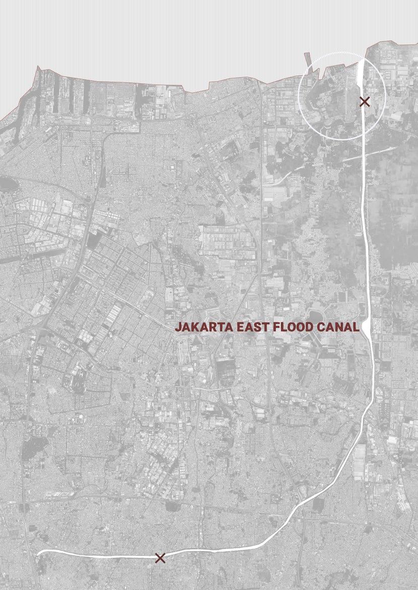
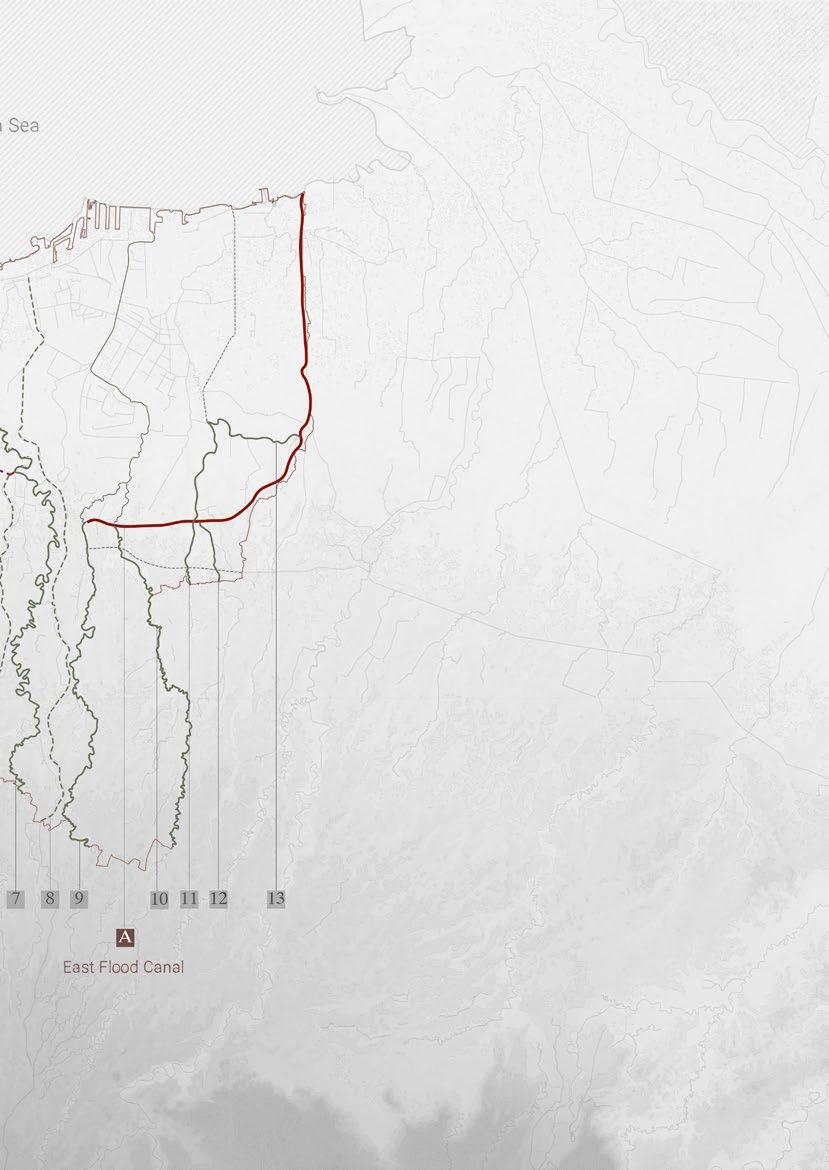
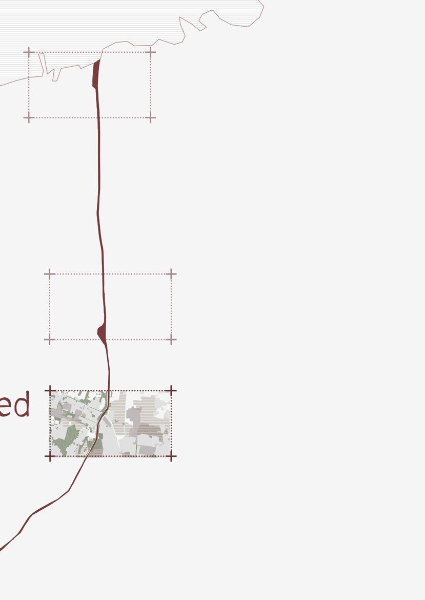
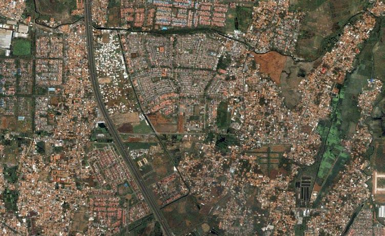
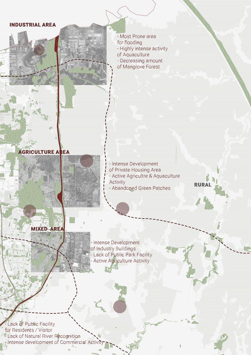
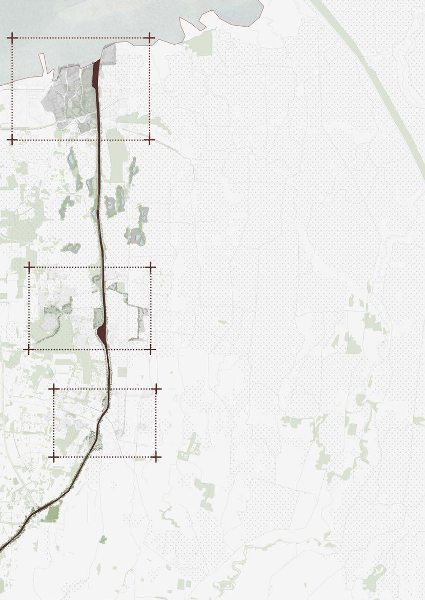
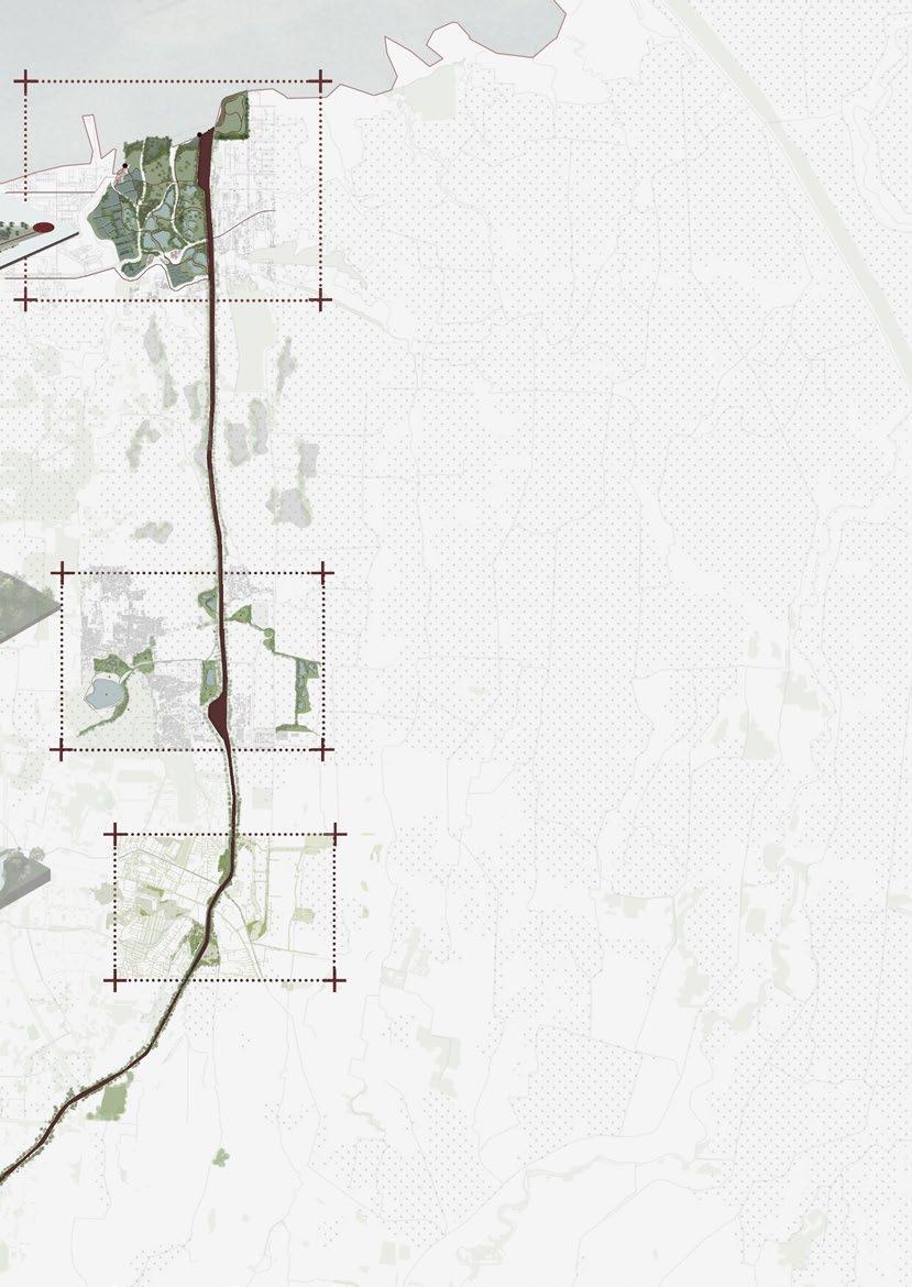
East Flood Canal stretched for 23.5 km from East Jakarta until North Jakarta, through 13 different neighborhoods and particular types of urban fabrics. Four different urban fabrics will be deeply analyzed throughout this thesis to support the whole strategy for the canal. Each of these eras reflects the many factors that shaped the urban landscape. The first fabric is the Residential area surrounded by different housing types and active commercial facilities. The second combines residential, industrial, and agricultural fields, called Mixed Area. Fields and water retention basins surround this third fabric, which will be called Agriculture Area. The last one is Industrial Area. This area is occupied by enormous square buildings and factories, a shipment harbor, aquaculture ponds, and fisherman villages.
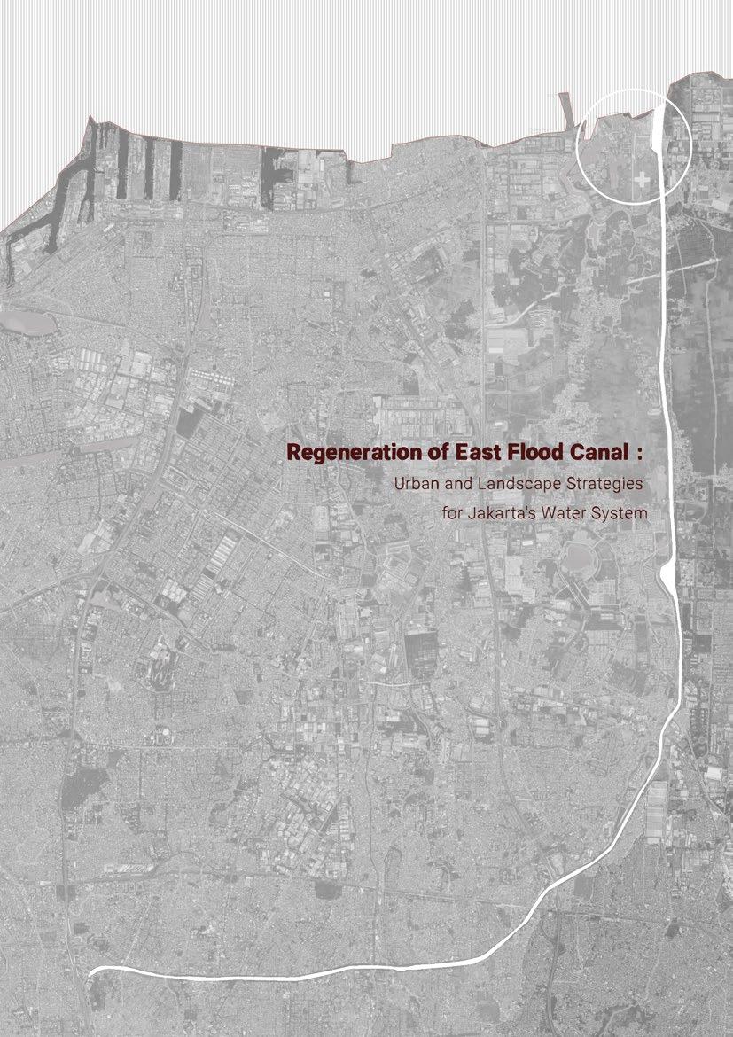
The Regeneration of East Flood Canal: Urban and Landscape Strategies for Jakarta’s Water System explores possibilities through each fabric to support the primary strategy; enhancing and improving the condition of the East Flood Canal. This project opens up to other possible solutions to overcome this canal’s complex situation. It highlighted the role of urban and ecological strategies that mediate between three essential city aspects; environment, economy, and social.
11
Introduction
Geographical Location
Jakarta as a Delta City
Jakarta’s History and Urban Development
Land Subsidience
Flood Events
Jakarta’s Blue Infrastructure Development
Jakarta’s Canals
What Makes East Flood Canal Different?
13
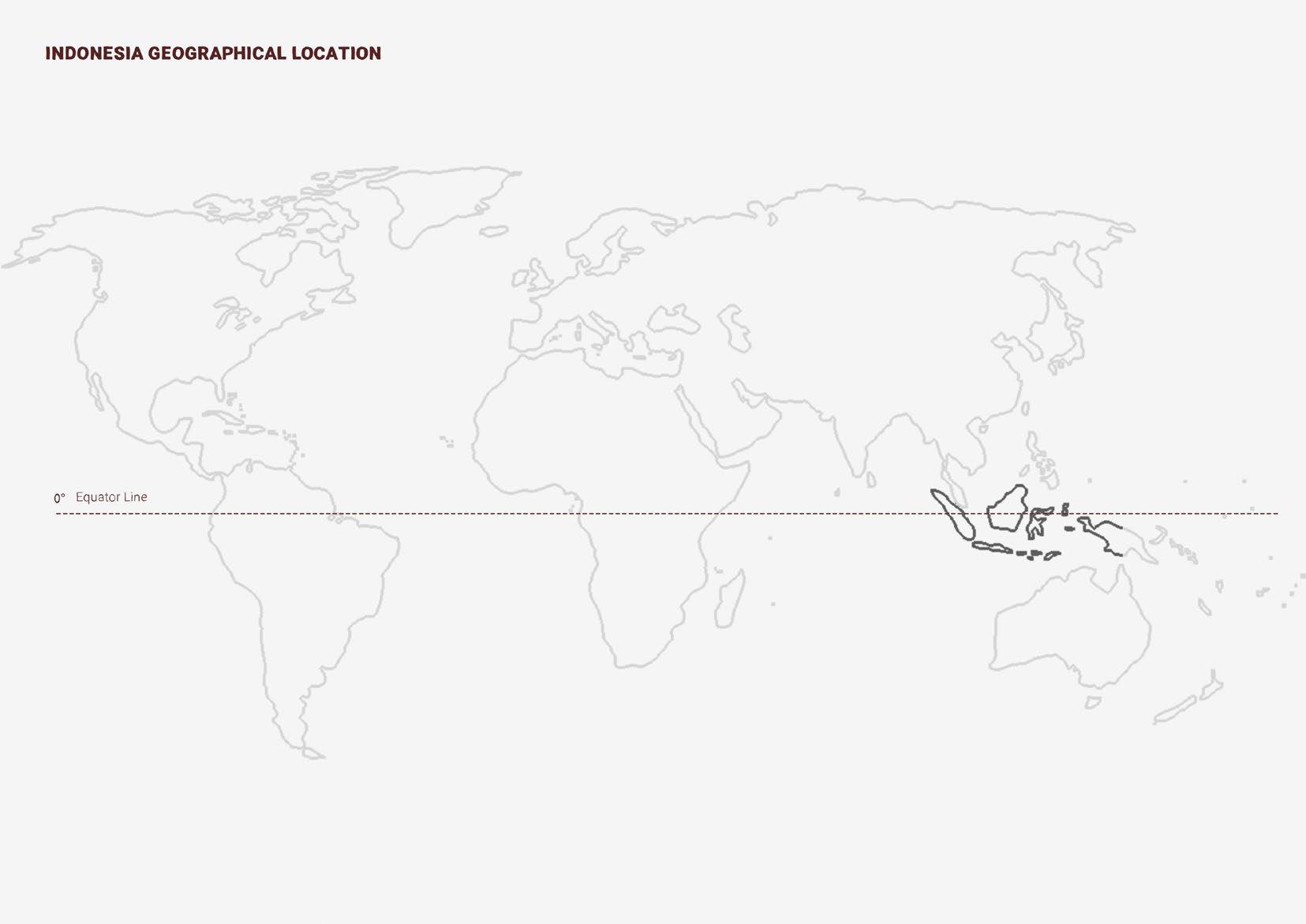
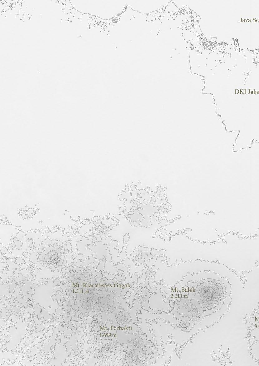
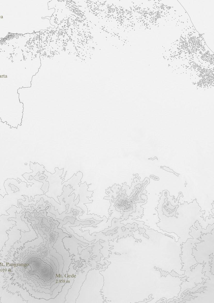
Indonesia Location
Southeastern Asia, archipelago between the Indian Ocean and the Pacific Ocean
Area
total: 1,904,569 sq km
land: 1,811,569 sq km water: 93,000 sq km
Border Countries (3): Malaysia 1,881 km; Papua New Guinea 824 km; Timor-Leste 253 km
With five major islands and about 30 smaller groups, Indonesia is the largest archipelago in the world. There are a total number of 17,508 islands, of which about 6000 are inhabited.
With an area of 1,904,569 km², Indonesia is the largest country consisting only of islands. The combined area tof the archipelago is slightly smaller than Mexico or larger than five times the size of Germany.
The multi-ethnic country has more than 279,3 million people (in June 2022). It is by far the most populous island nation in the world. There are more than 1,300 recognized ethnic groups in Indonesia. The six most prominent ethnic groups are Javanese (40%), Sundanese (16%), Batak (4%), Sulawesi (3%), Madurese (3%), and Betawi (3%).
16
17
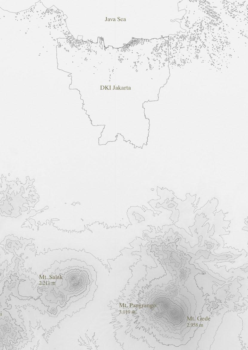
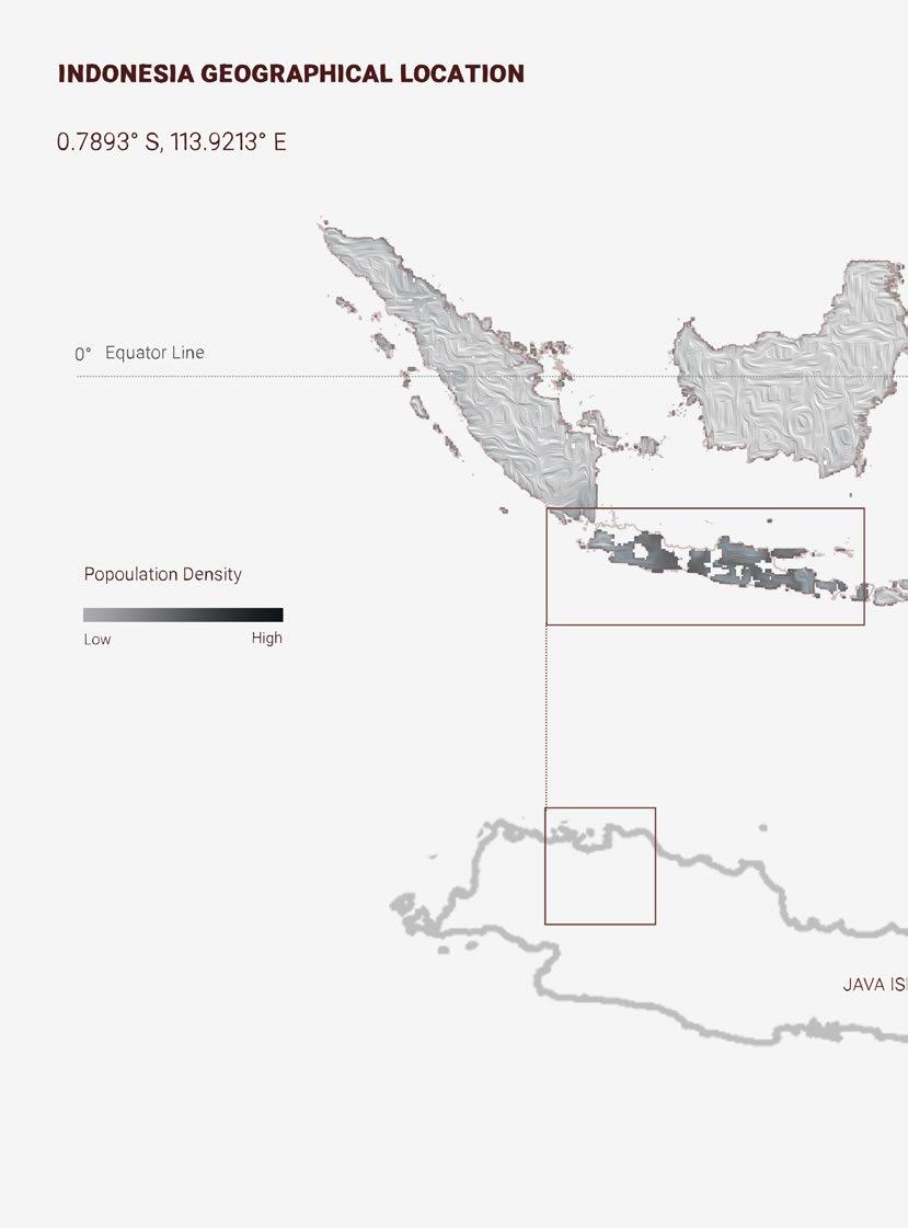
Jakarta is the capital city of Indonesia. Lying on the northwest coast of Java island, Jakarta makes this island the world’s most populous island.
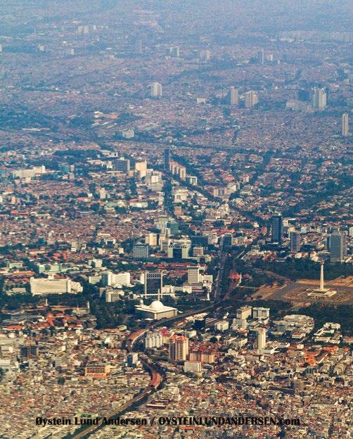
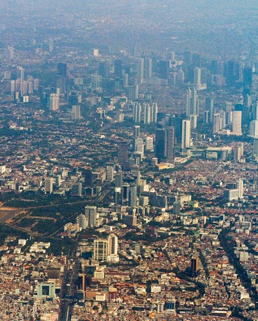
Jakarta also serves as ASEAN’s diplomatic capital since it is the largest capital in the Southeast Asia region. The city of Jakarta covers more than 650 square km and has a population of over 11 million people (as of June 2022). Besides facilatating as a government headquarters, Jakarta is the center of Indonesian business and industry. This city is dtistinctive from other cities in Indonesia because it has the status of a province (gained in 1966) and its government is administered by a governor rather than a mayor.
19
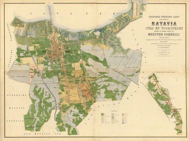
Batavia (now Jakarta) Map 1876
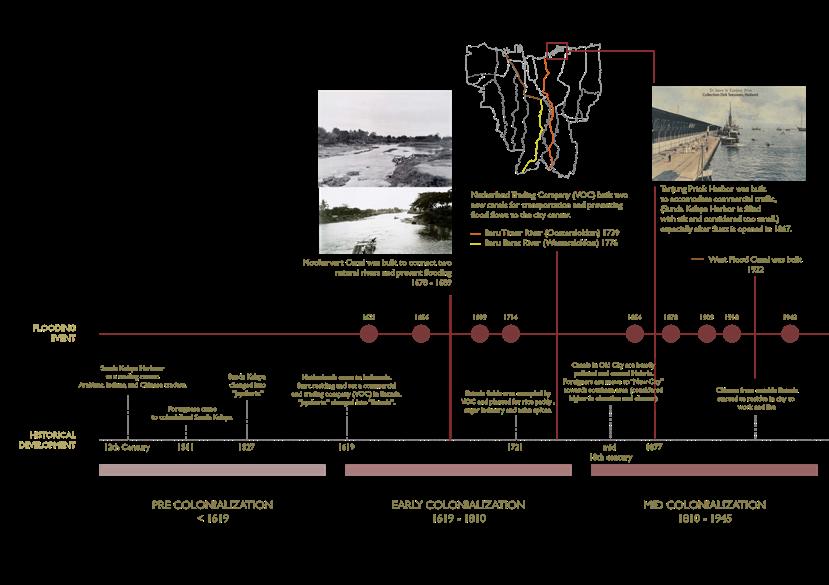
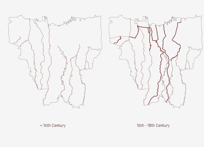
Thousands of years ago, Jakarta was built on mud sediment from 13 natural rivers crossing this area and heading to the gulf of Java sea. These rivers come from neighboring cities on the southern side of Jakarta. The sedimentation is hardened and forms a stable land or a delta. This used to be mud area evolved into a busy business center in the 14th and 15th centuries, called “Sunda Kelapa” harbor.
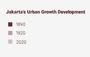
22 Jakarta’s Historical Timeline
23
Jakarta’s Land Subsidence
Since thirteen rivers run through Jakarta, it is a typical case that flooding is frequent in Jakarta. According to experts, it is getting worse. It is not only about the flooding event; the city will disappear into the ground.
Jakarta is sinking by an average of 1 - 1.5 cm a year. As a result, almost half of the city is now sitting below sea level.

It is happening right now. North Jakarta has sunk into 2,5 meters in 10 years and continues to decrease as much as 25 cm per year in some areas, which is more than twice the global average for coastal megacities.
The rest of the area in Jakarta is also sinking but at a slower rate. In the west part of Jakarta, the ground is sinking by 15 cm per year, by 10 cm in East Jakarta, 2 cm in Central Jakarta, and 1 cm in the south.
The vast rate at which Jakarta is sinking is mainly down to the excessive extraction of groundwater for everyday purposes by city dwellers. Piped water cannot reach and is not available in most areas. Therefore people have no choice but to extract the water from the aquifers deep underground.When the groundwater is pumped out, the land above it sinks since nothing can hold the pressure above the ground. This phenomenon leads to land subsidence.
24
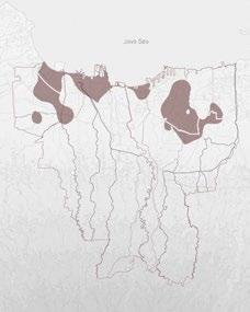
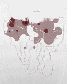
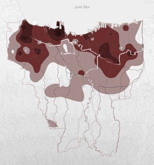
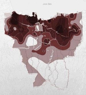
2007 1997 2017
Source: Dr. Heri Andreas, Faculty of Earth Sciences and Technology, Bandung Institute of Technology.
Note: 2025 and 2050 predictions are based on research by Dr. Heri Andreas.
“There is not sufficient water delivery, so people are pumping out too much groundwater, and because of the rapid urbanisation over the last 30 years, the amount of permeable surface in the city has decreased to a point where you don’t have enough recharge in the groundwater,” says Kian Goh, assistant professor of urban planning at the University of California, Los Angeles, who has studied Jakarta in depth.
25 2025 2050
26 Jakarta’s Flooding Event 2017 2002 2007 2013
With the tropic geographic location, Jakarta had storm surges and heavy rain from annual cyclones. Along with global temperatures rising and ice sheets melting, many coastal cities face a growing risk of flooding due to sea-level rise. Few places, however, face challenges like those in front of the Jakarta metropolitan area.
Since Jakarta was founded in the early days, flooding has been an issue in Jakarta because its location is in low-lying rivers that swell during the monsoon season. Recently, the flooding issue has grown excessively because of the land subsidence as well.
With mean and average global sea levels rising by 3.3 milimeters per year and rainstorms getting more intense as the temperature heats up, damaging floods have become common in Jakarta. Since 1990, major floods have happened every year in Jakarta, with ten thousand people displaced. The heavy rain and monsoon in 2007 severely damaged the city, with more than 70 percent of the city submerged in the water.
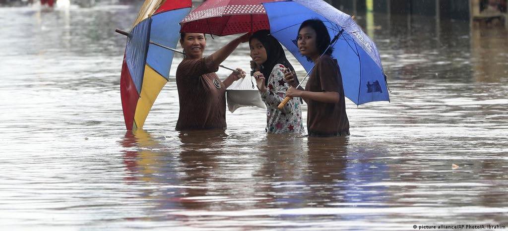
pic credit: https://www.dw.com/en/indonesia-jakarta-hit-with-deadly-floods/a-51851607
27
28 Jakarta’s Blue Infrastructure
Development & Flooding Event Timeline
29
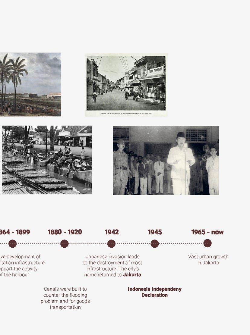
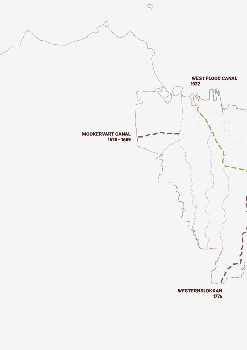
Pre Colonialization
Jakarta still acts as a Trading Harbour called “Sunda Kelapa” Harbour
Colonialized by Portuguese & the Netherlands
Netherlands made canals as a solution for flooding issues in Jakarta, and as an access for goods transportation.
30 Jakarta’s Blue Infrastructure Development
Colonialized by the Netherlands & Japanese
The Netherlands made West Flood Canal to handle the water debit and help the flooding.
Indonesia’s Independency
Jakarta become a capital city. Indonesia made their own locally made Flooding Canal in the East (East Flood Canal)
31
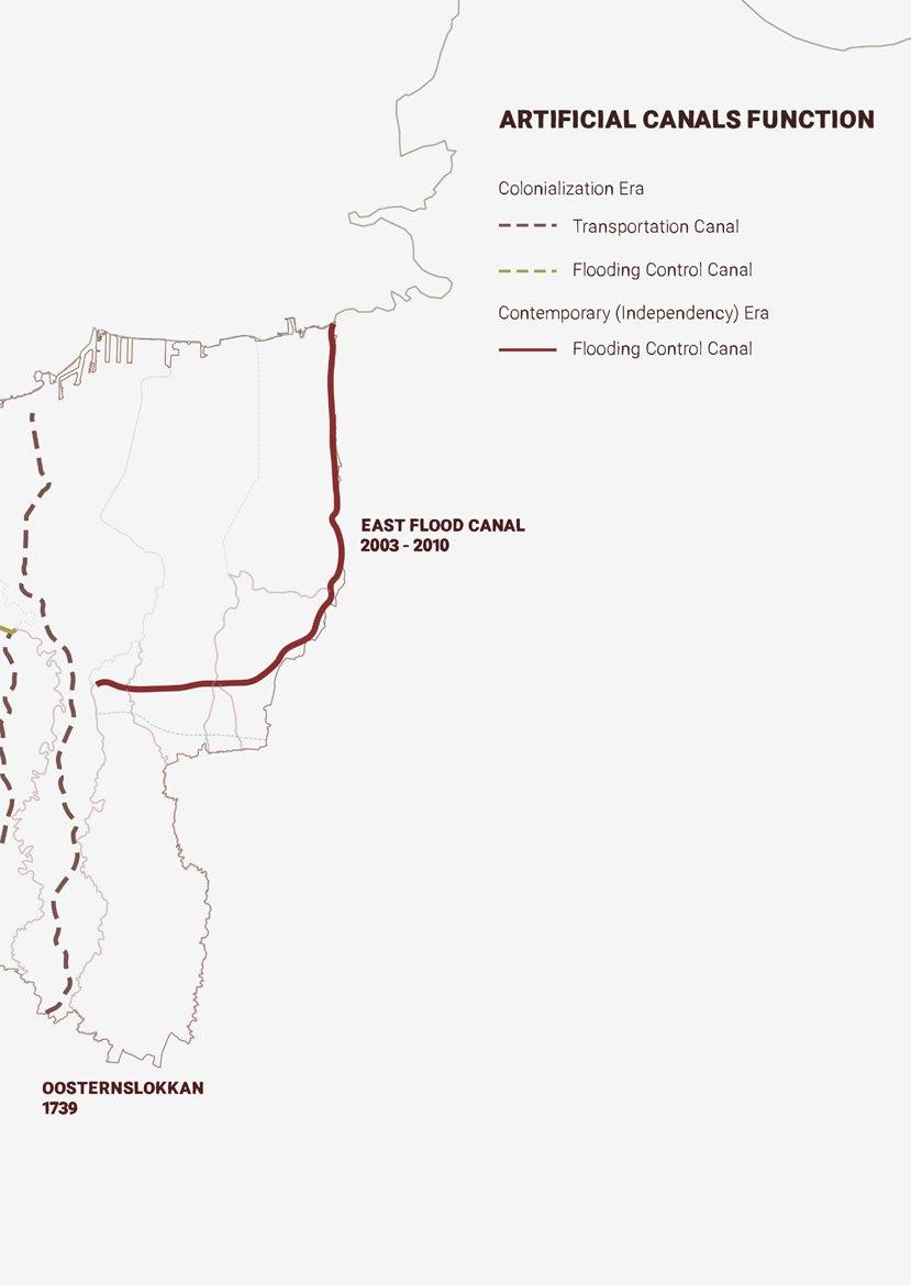
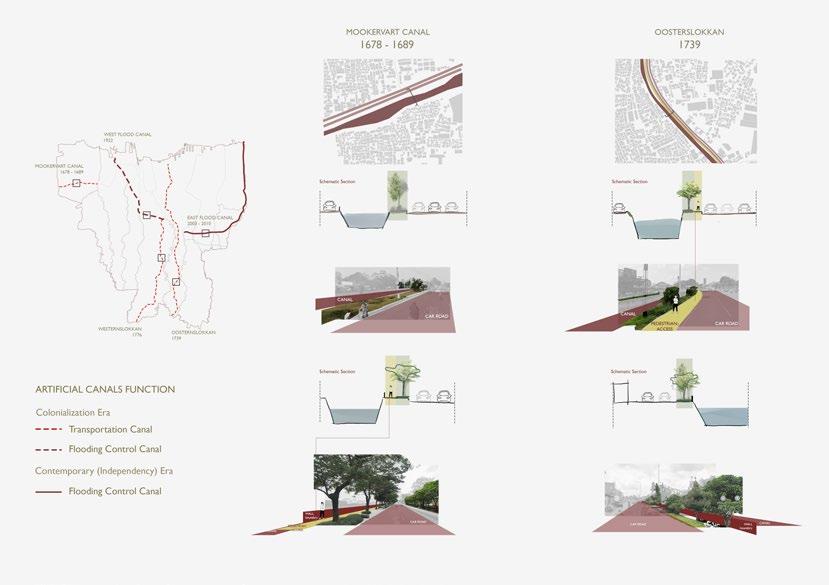
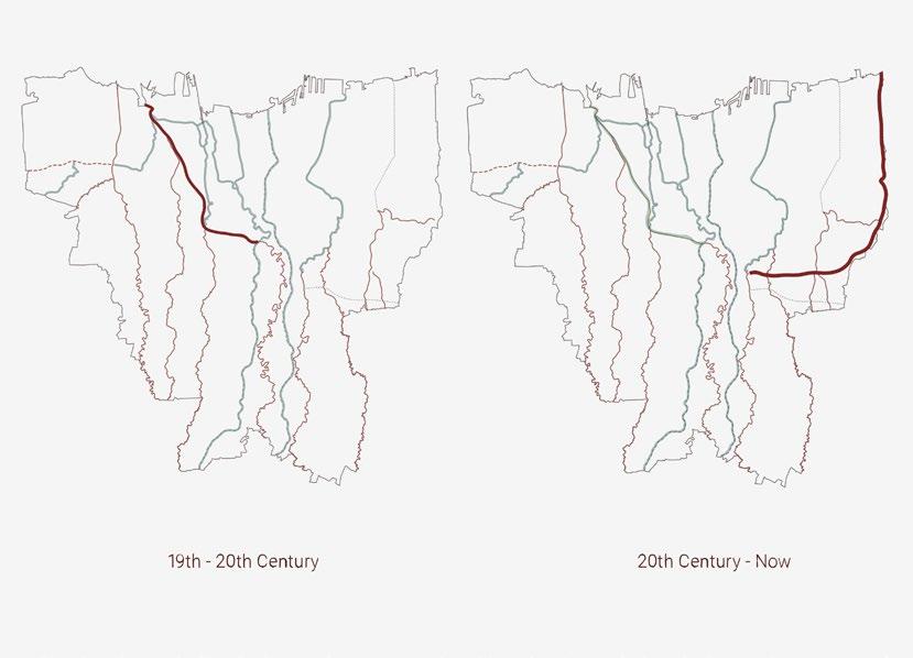
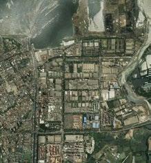
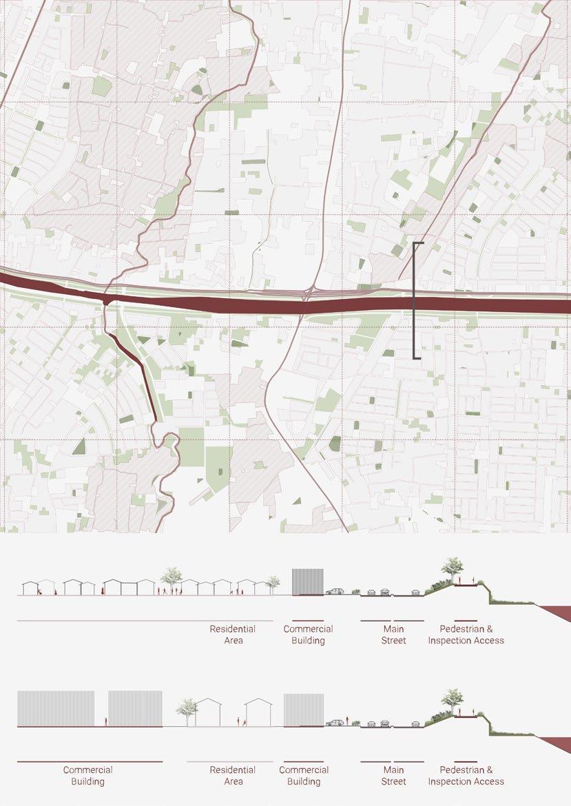
34 Jakarta’s Artificial Canal Analysis
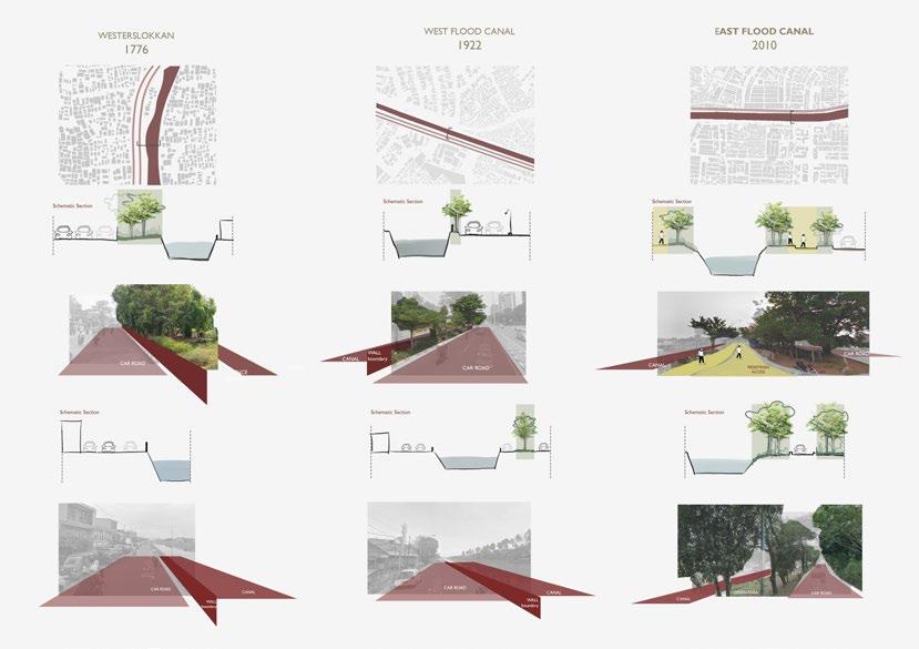
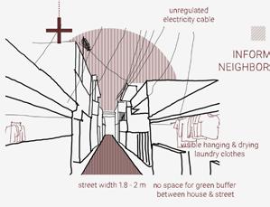
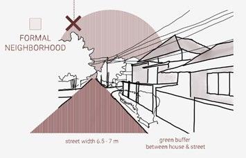
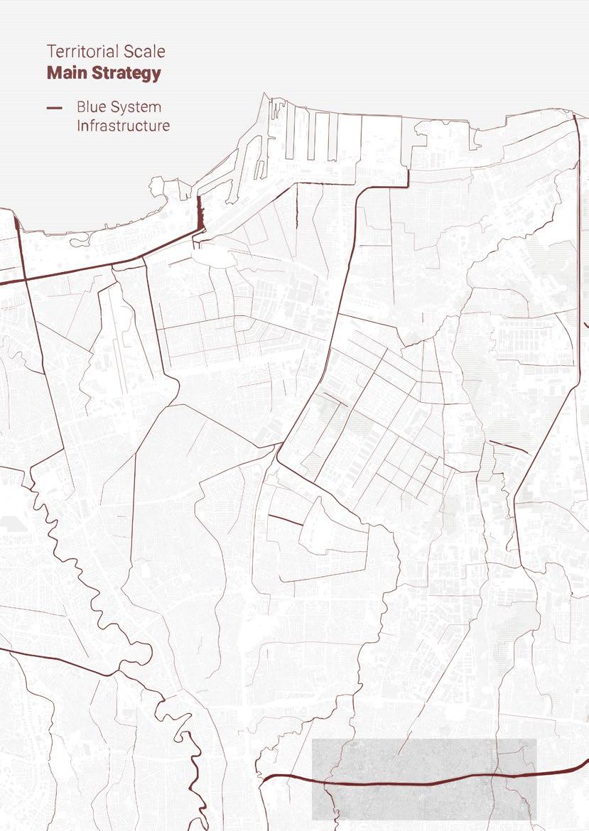
After analyzing the condition of Canals in Jakarta, East Flood Canal has distinctive features that are different from other canals in Jakarta. The other four canals were built when the Netherlands colonized Indonesia and resided in Jakarta. These canals were the main ones for the city.
As time evolved, these canals developed as the main axis for Jakarta’s transportation infrastructure and as guidelines for the main road. These four canals always have wide car roads on their side, and as a result, they have a small space of green buffer, and only a few of them have pedestrian access.
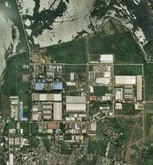
On the other hand, East Flood Canal was made when Indonesia already had independence. East Flood Canals was entirely made by locals, from the planning until the construction. It adapted the lesson learned from the previous canals. East Flood Canal is designed to have a green buffer and, most importantly, access for pedestrian and bike paths.
35
What makes East Flood Canal Different than others?
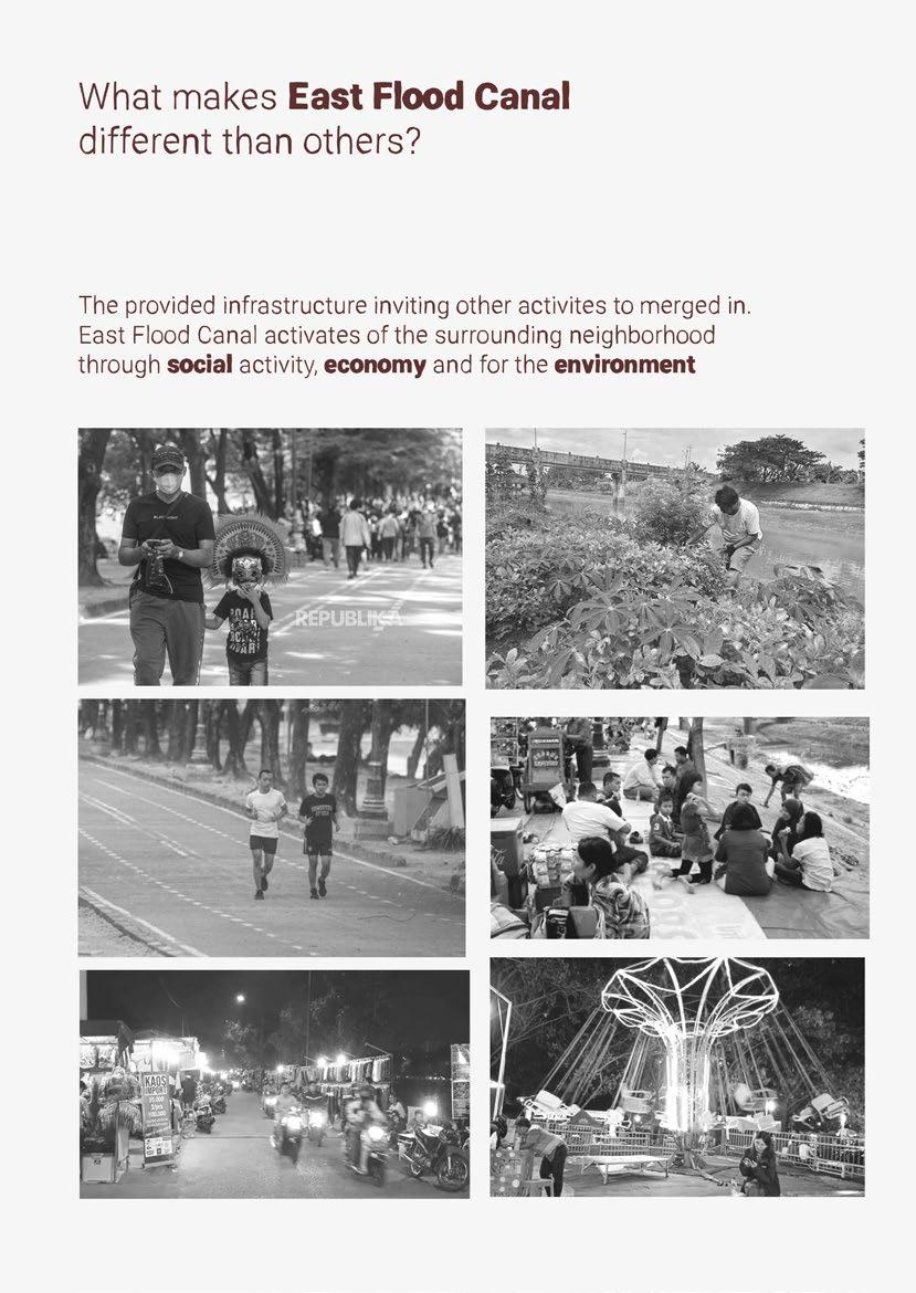
The provided infrastructure inviting other activities to merged in. East Flood Canal activates the surrounding neighborhood through social activity, economy and for the environment
44
45
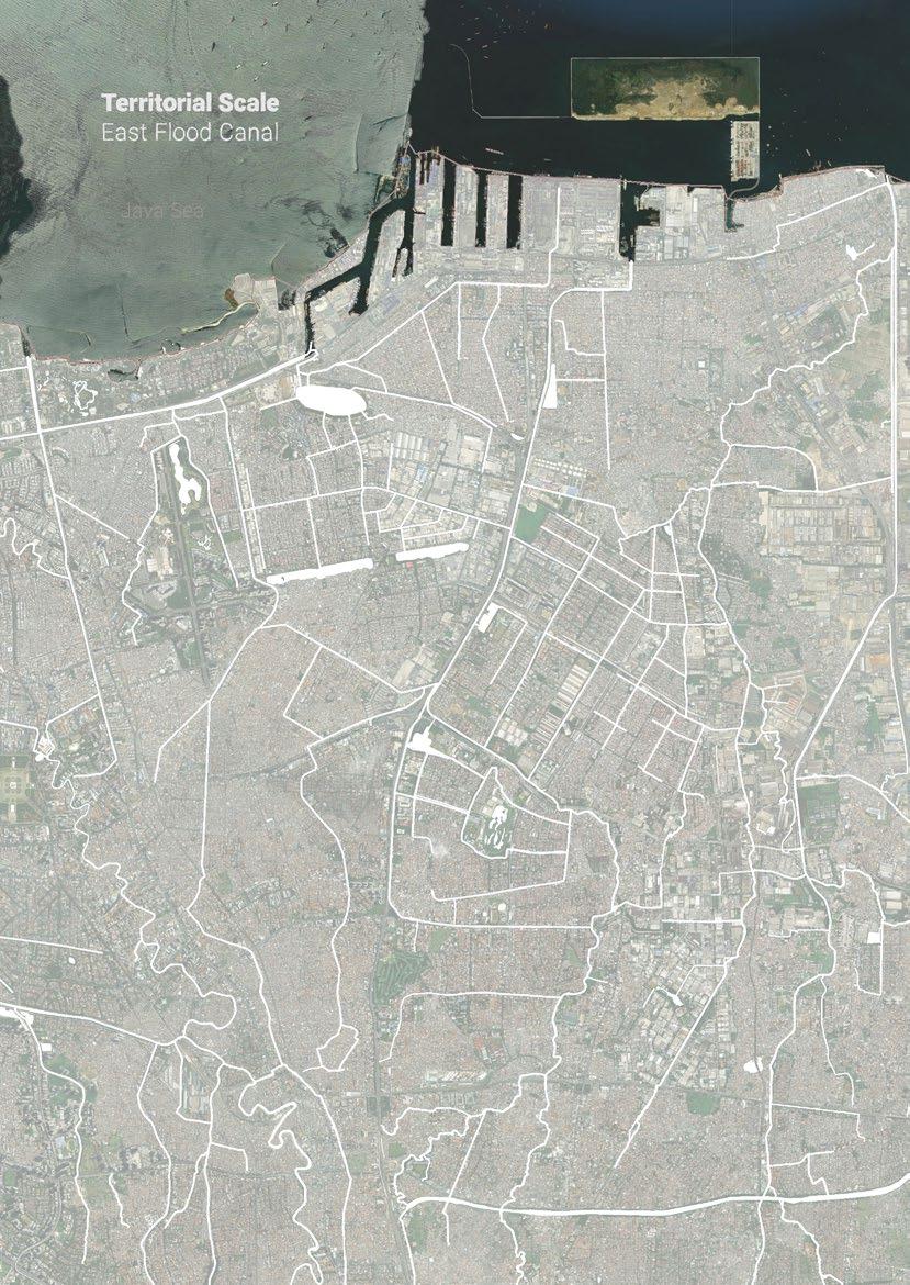
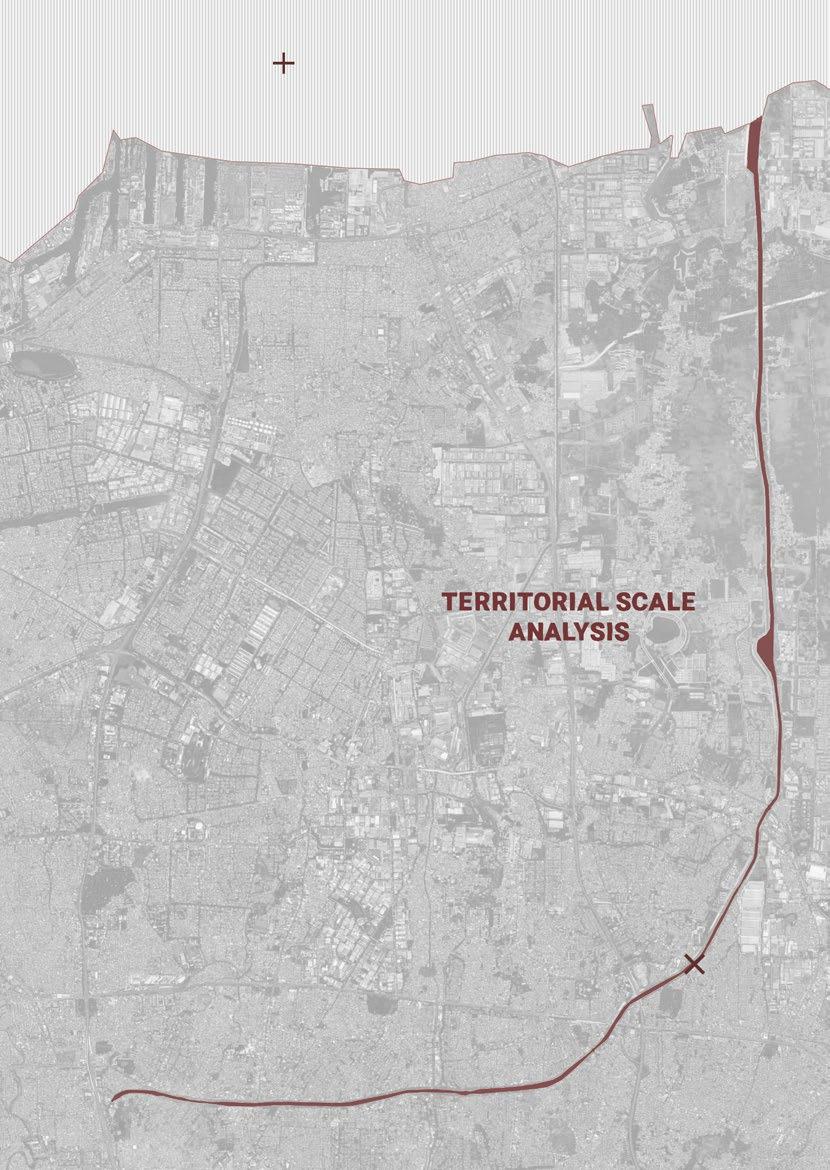
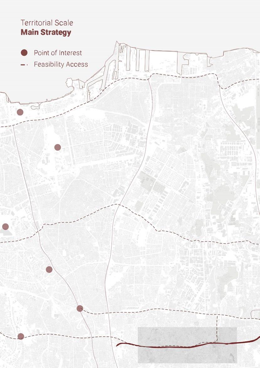
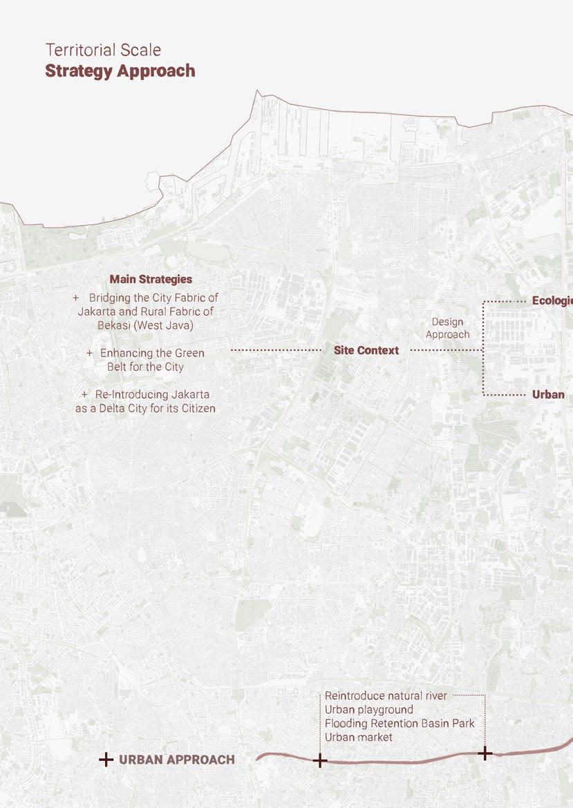
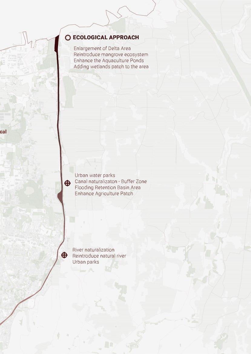
Territorial Scale
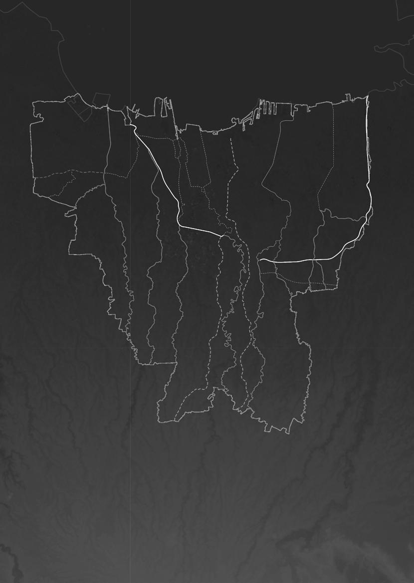
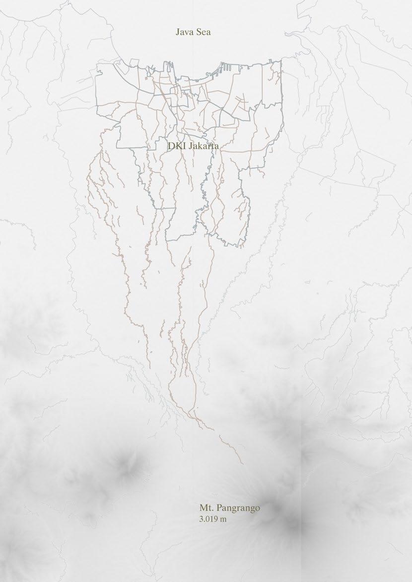
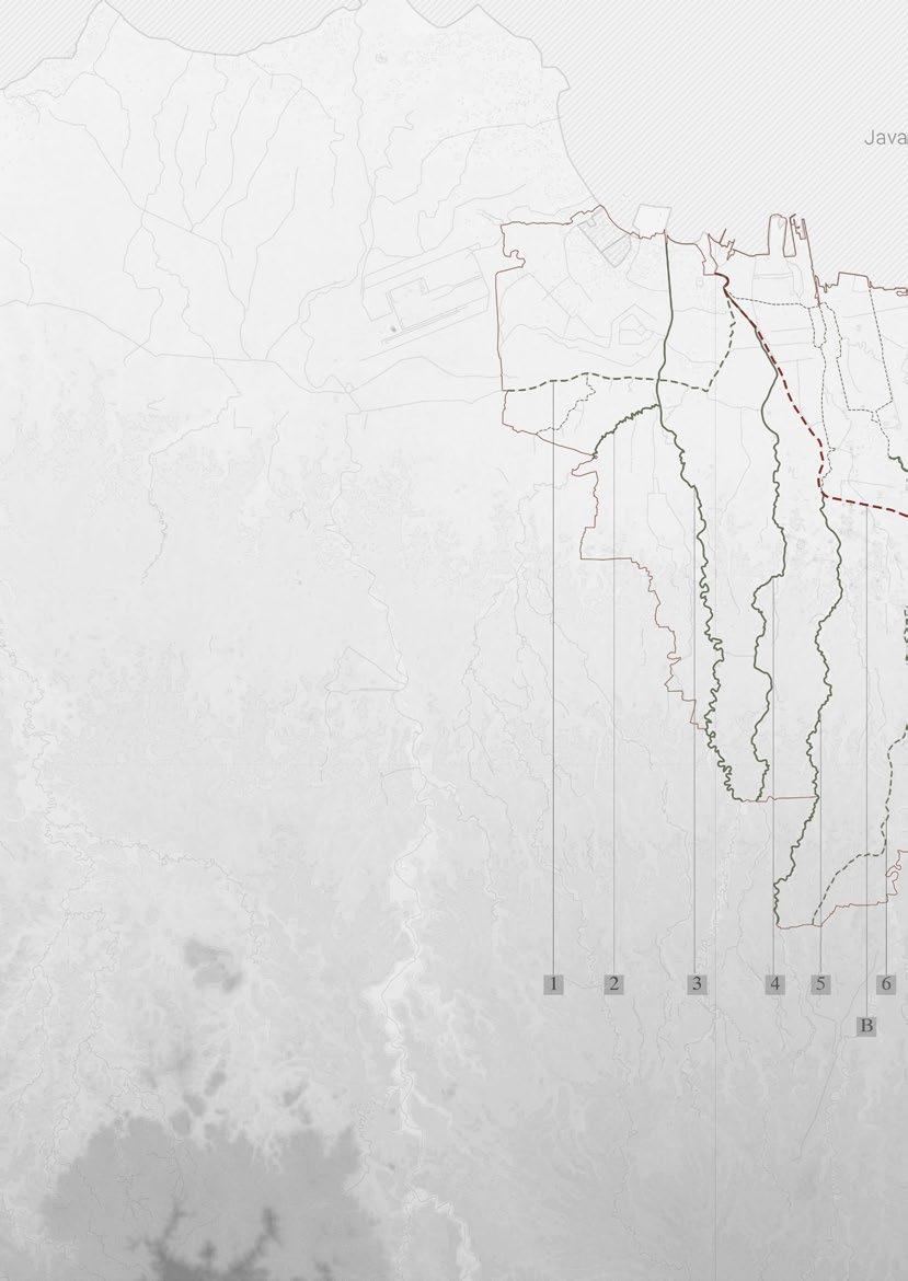
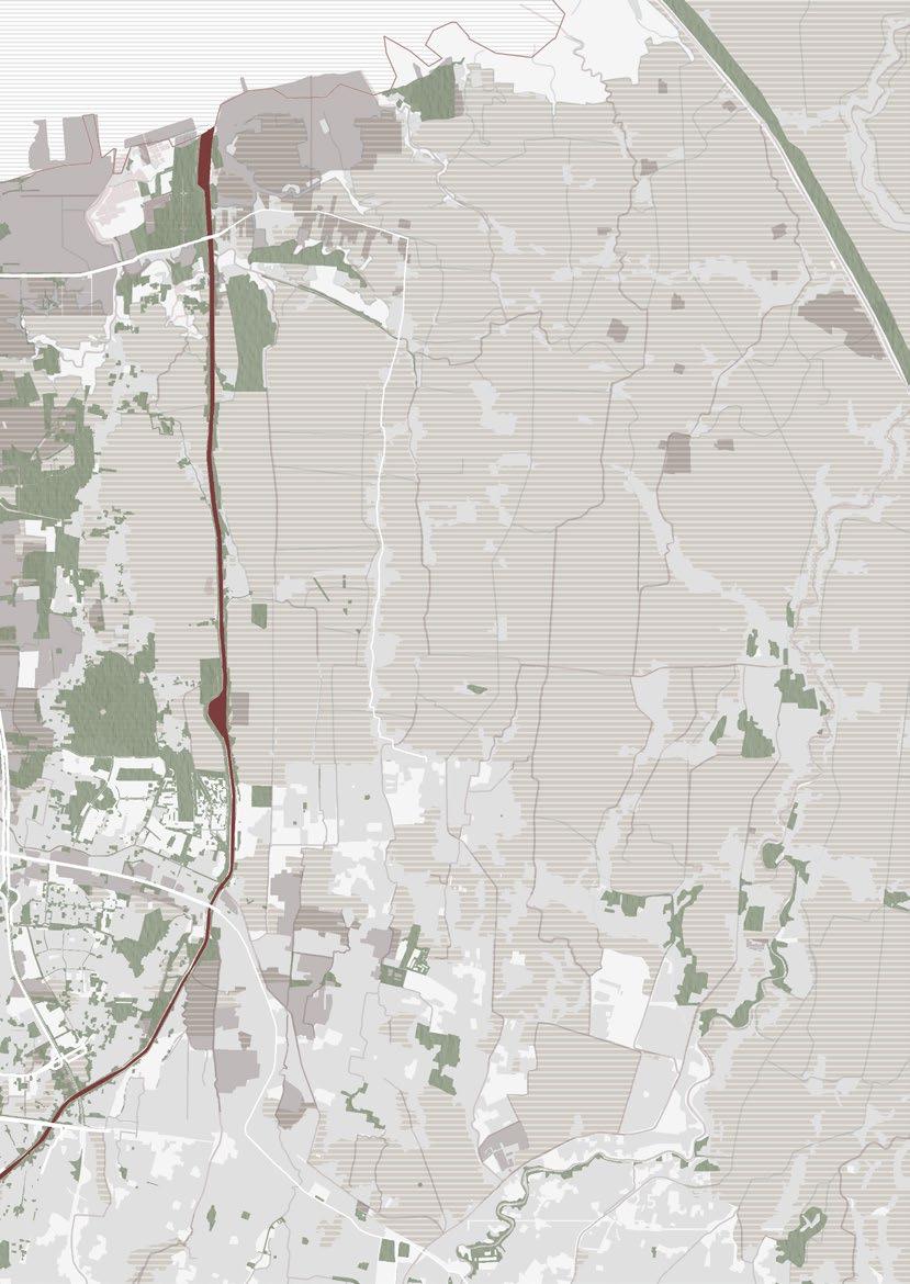
Rivers in East Flood Canal
Cipinang River
Sunter River
Buaran River
Jati Kramat River
Cakung River
Blencong River
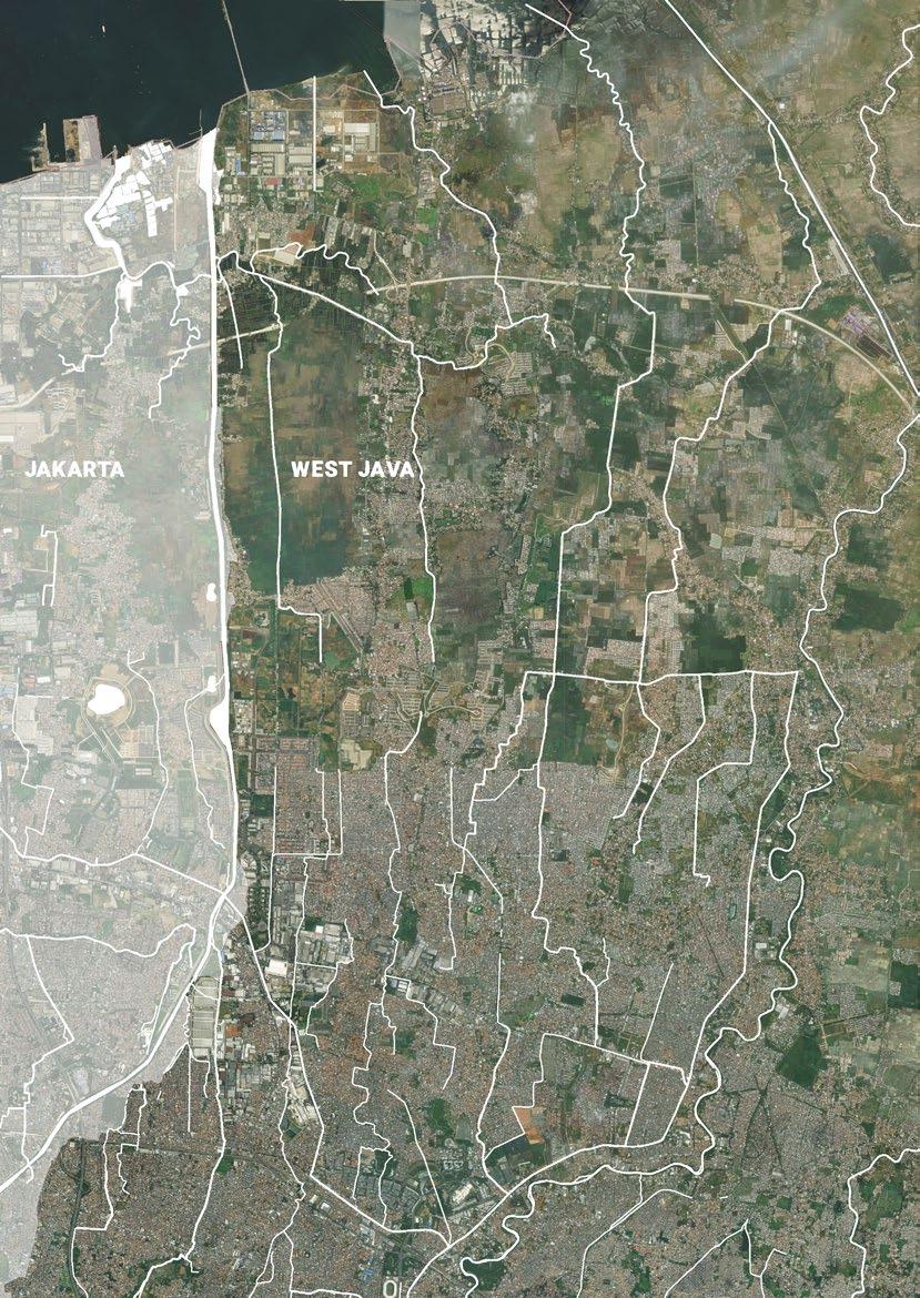
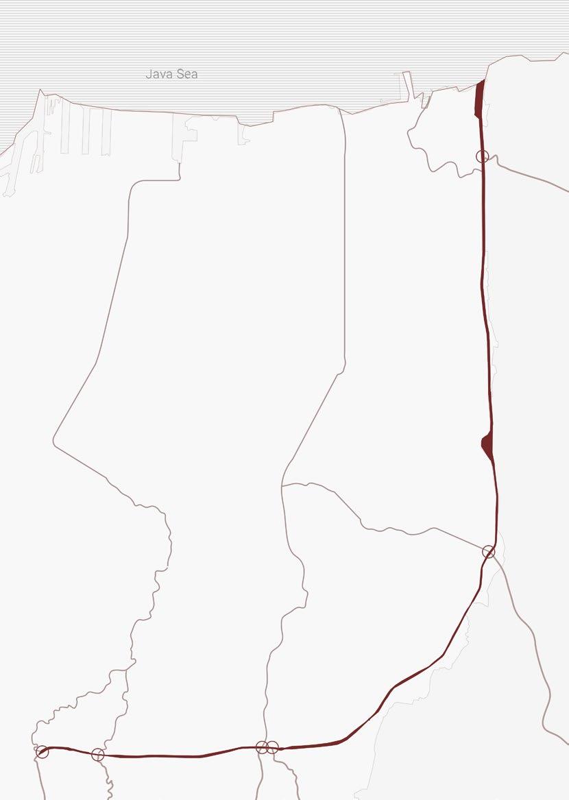
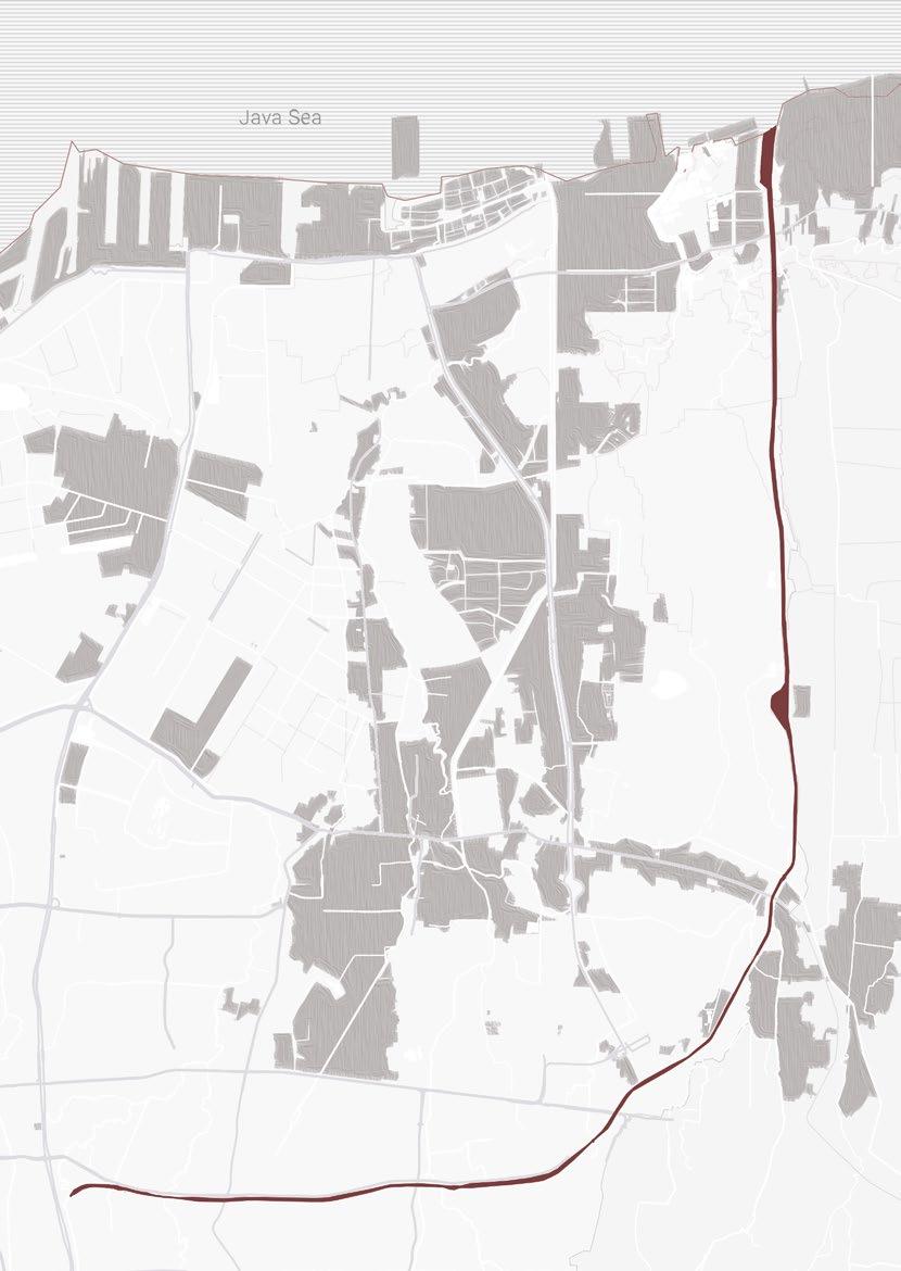
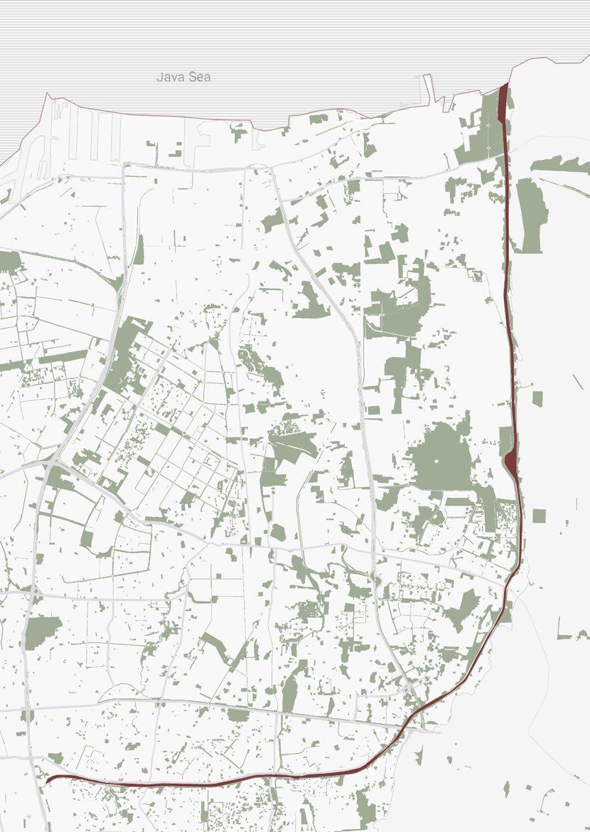
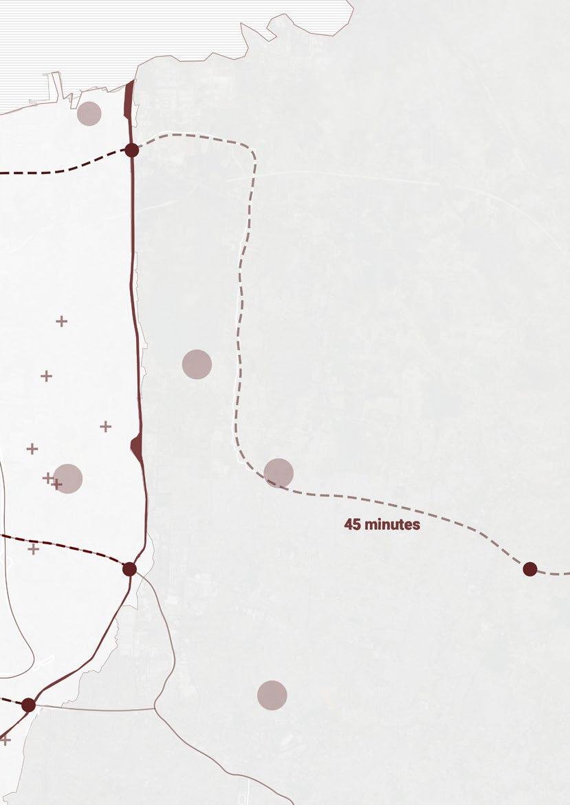
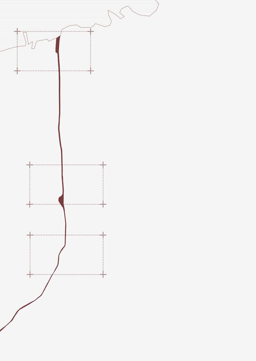
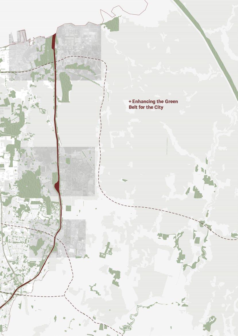
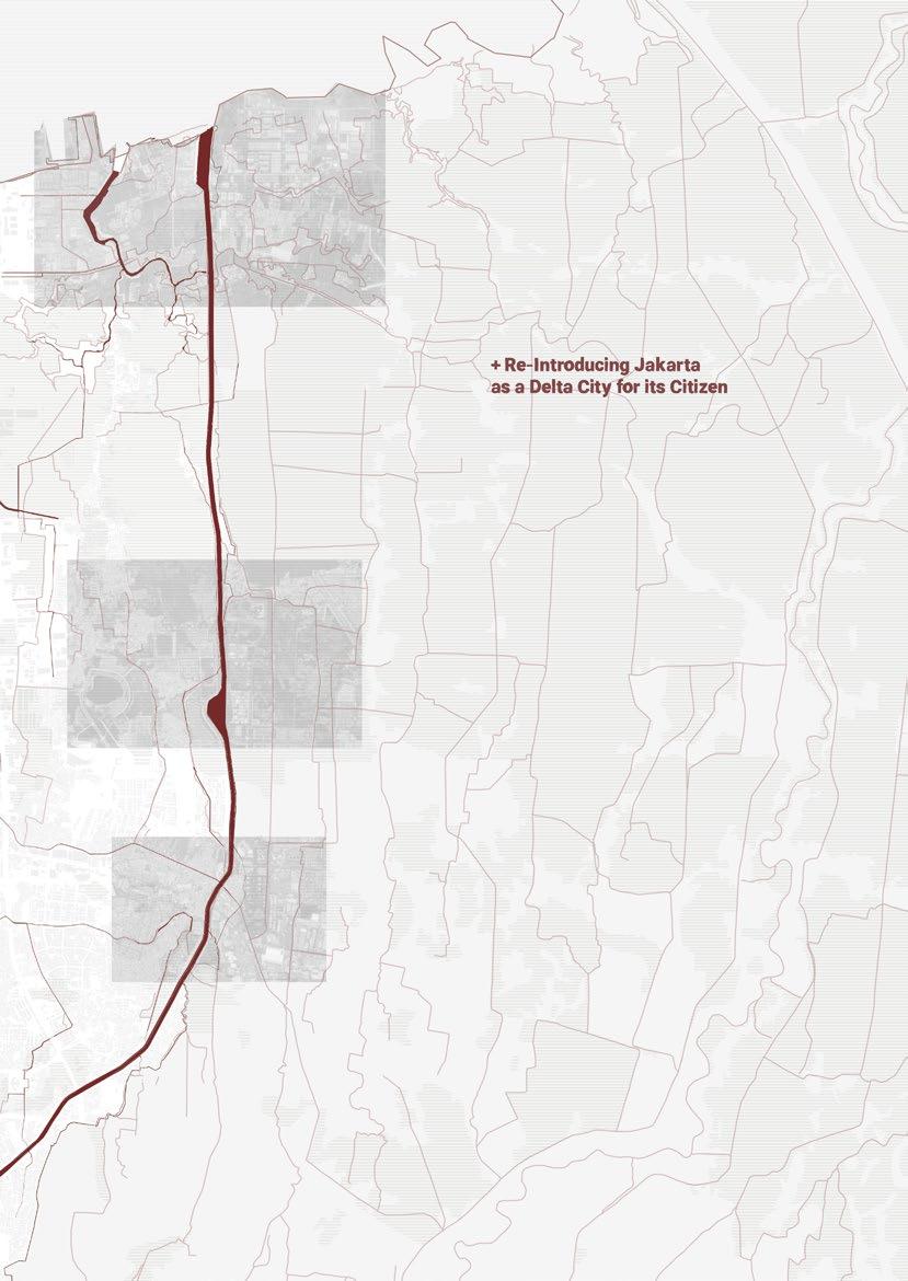
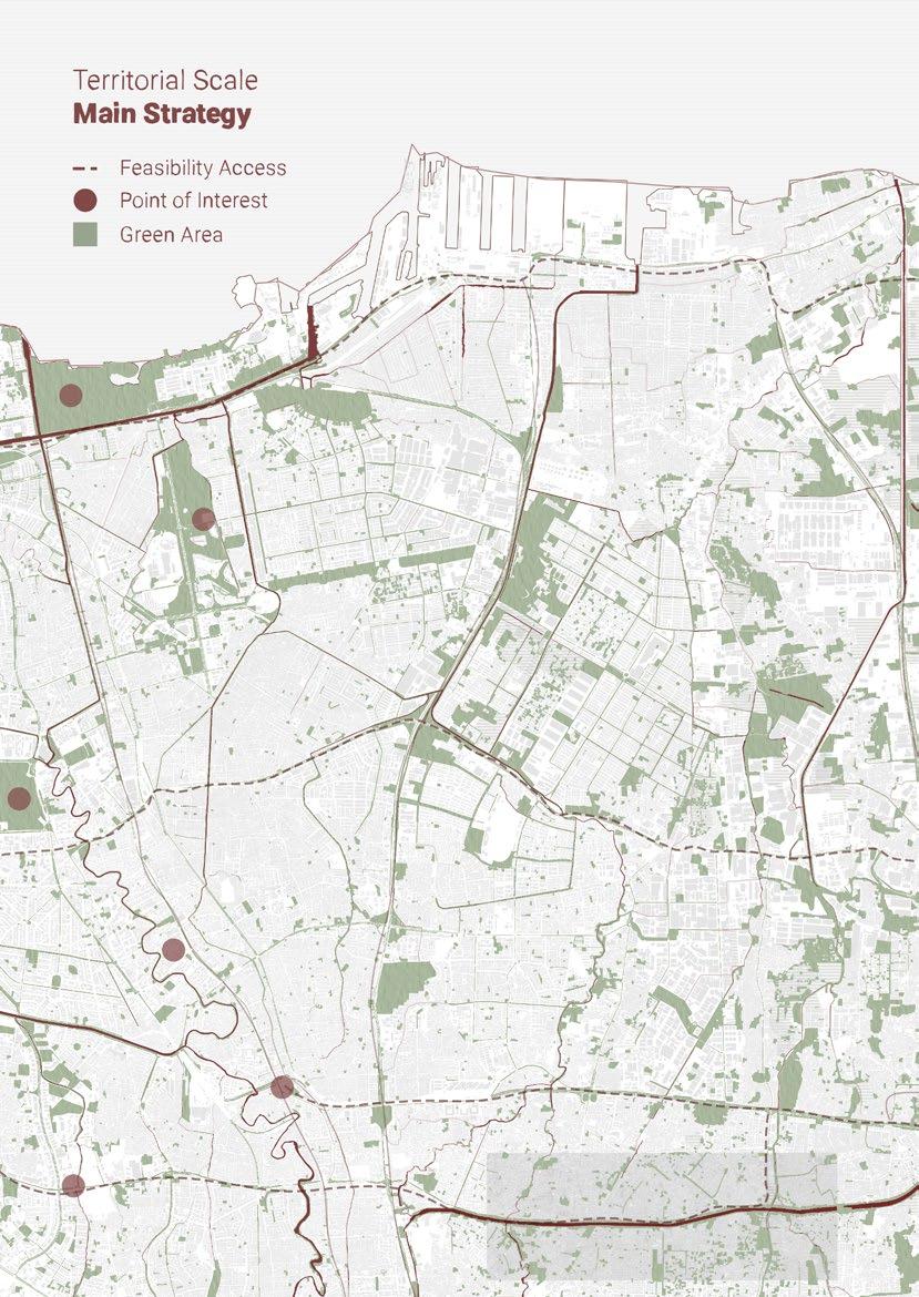
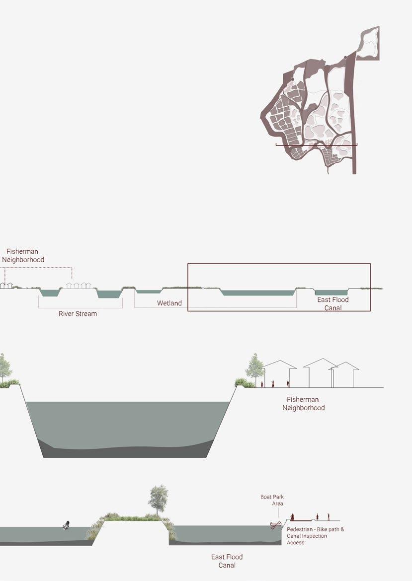
East Flood Canal is located between two provinces, DKI Jakarta and West Java. This canal was essentially made to hold the debit of the water that flowed from 6 rivers and distributed to the gulf of Java Sea. It can hold the water for 390 m³/second.
Mr. Mustajab, the coordinator and controller of East Flood Canal construction, mentioned the function of the East Flood Canal in his interview with Zahranum Ramadhyanti, which are:
1. Flood Control
2. Water Conservation
3. Water Transportation Facilities and Improve the Green Open Space for the Public
4. Driving force of Growth in the East and North sides of area in Jakarta
The government and other stakeholders handling East Flood Canals keep maintaining and improving the condition of East Flood Canals and using these four main functions as a guideline.
49
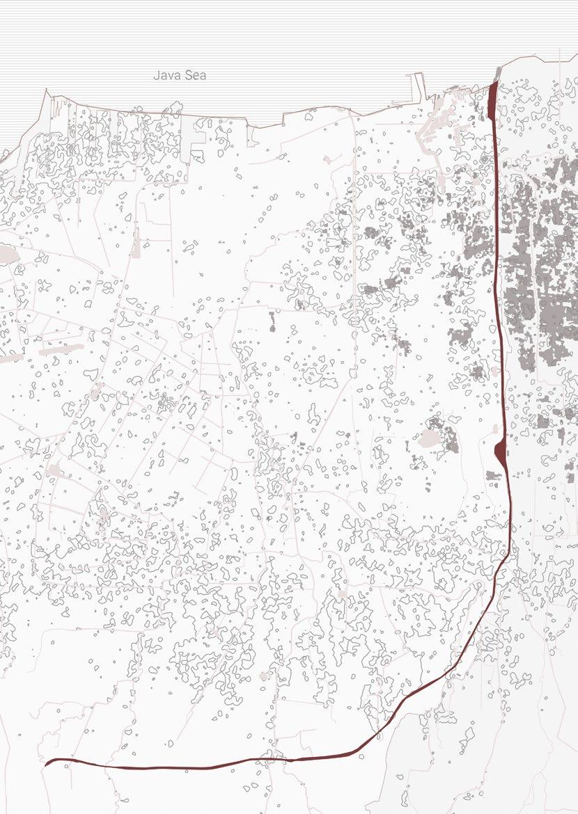
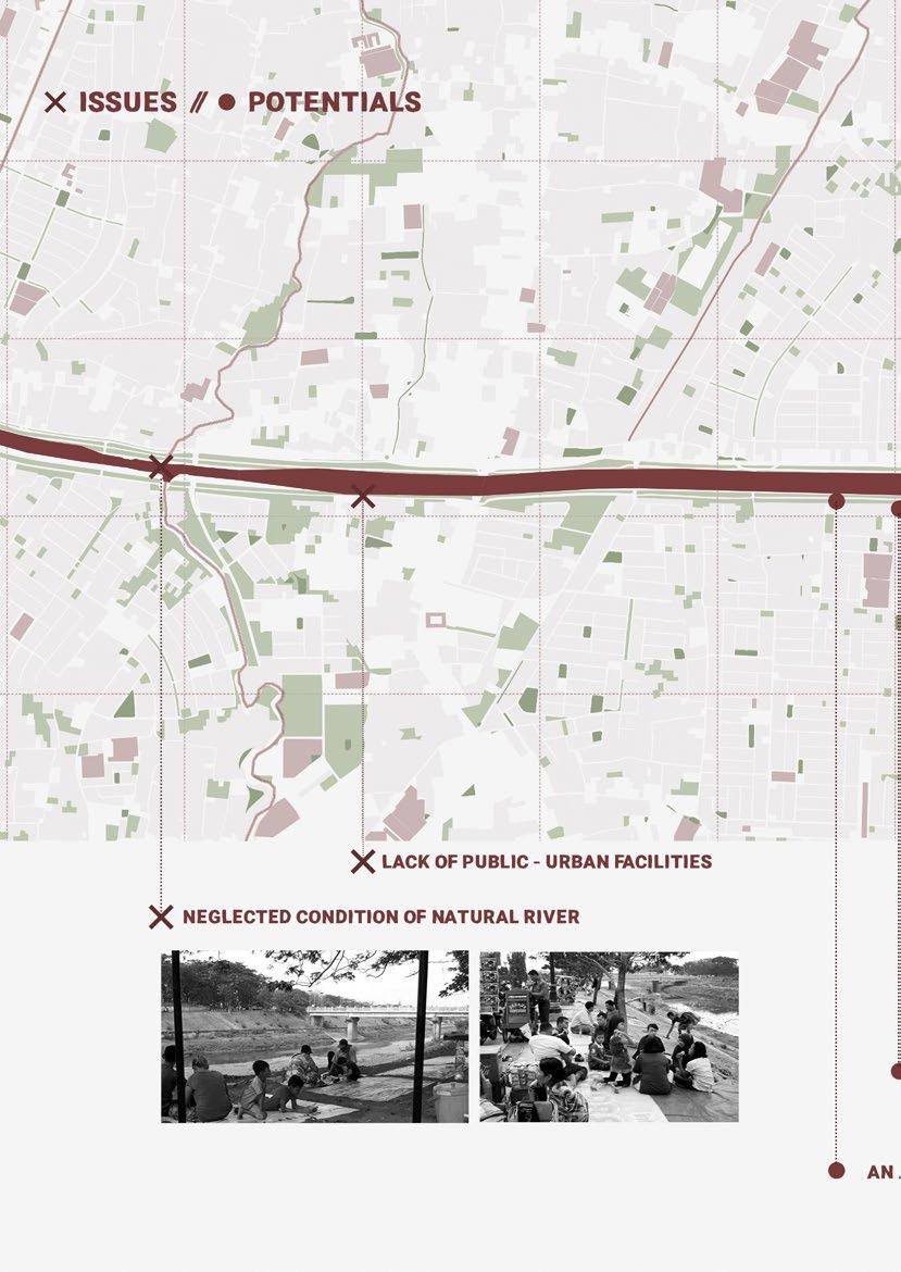
Contour Lines and Flooding Prone Area
The flooding-prone areas indicate areas that would sink in the rainy season. The lands in these areas are the lowest in Jakarta. Therefore, when the rainy season comes, the east flood canal water level would be higher than the land and flooding into the land.
Furthermore, the flood damages agricultural fields and wetlands, which serve as water retention. Hence, the flood gets worse in these flooding-prone areas.
50
Territorial Scale
Contour Lines
Flood Prone Area
East Flood Canal
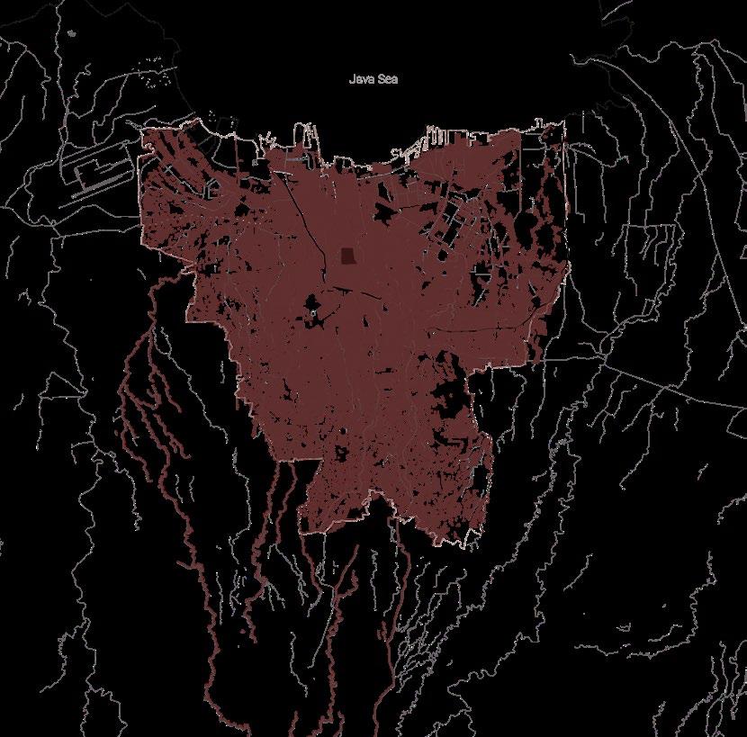
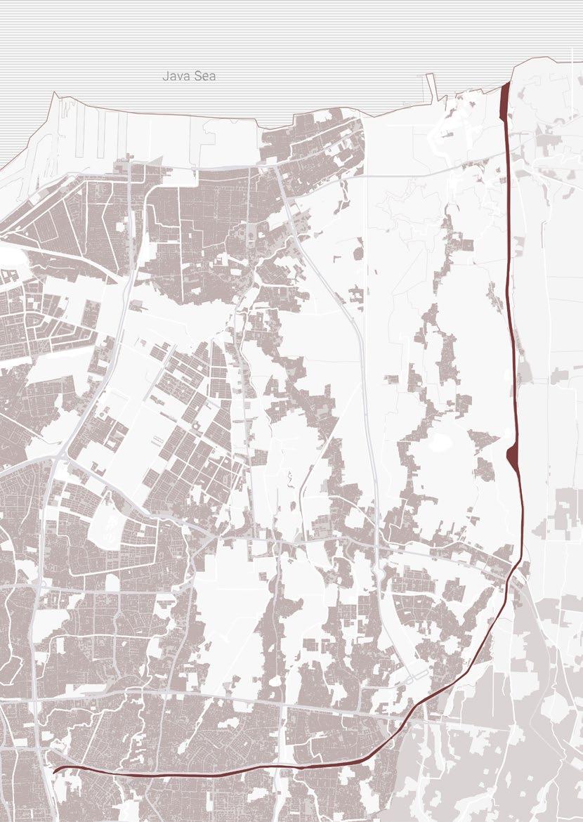
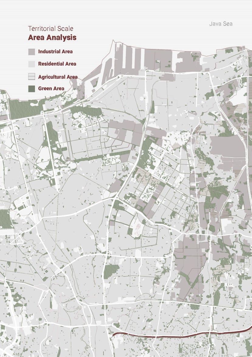
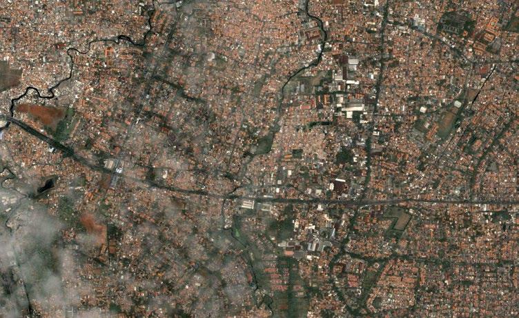
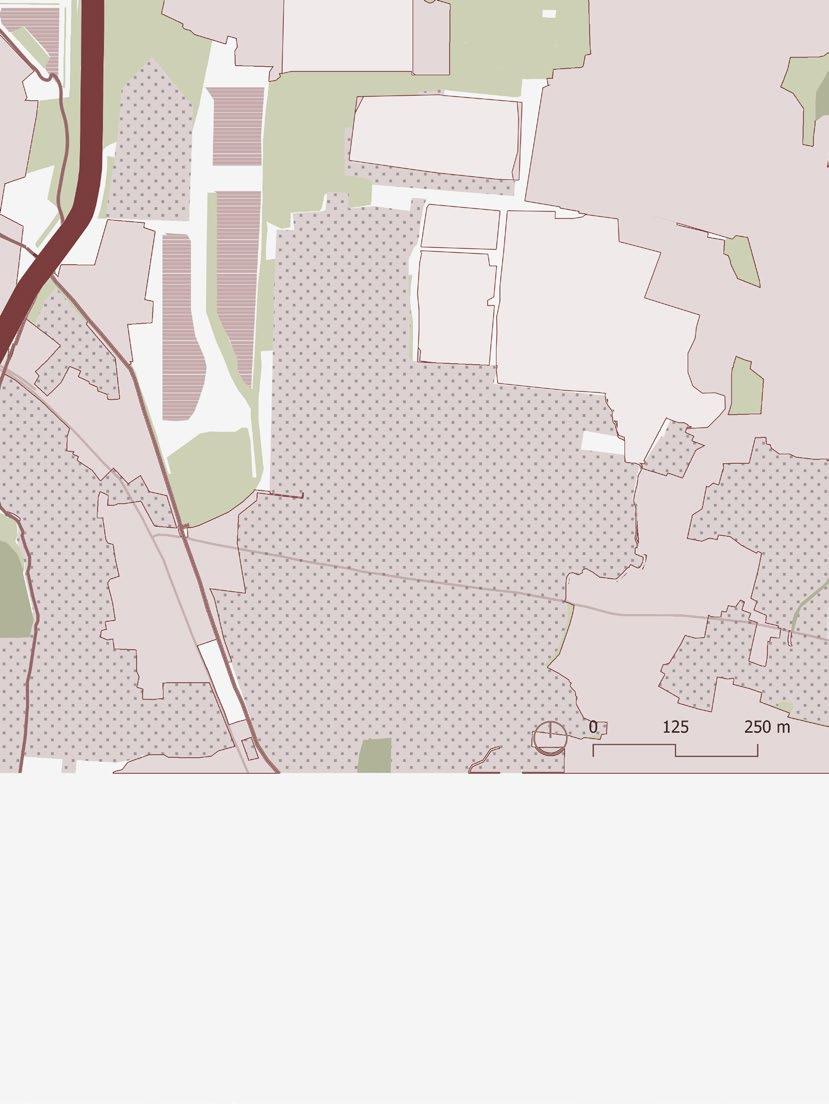
Jakarta is the most populated city and has the highest urban growth in Indonesia. The urbanization started when Jakarta was still called Batavia and controlled by the Netherland. What used to be a wetland later became the center of economy and governmental activities.
Many locals from other cities and foreigners migrated to Jakarta to conduct business, and some were looking for jobs. Since then, the housing development in Jakarta has expanded fast until it reached the point that Jakarta does not have the space anymore, and the housing price is high.
Bappenas (Indonesia National Development Planning Agency) noted that the land use for housing reached 456,626 km2 (45,662.6 Ha) or 69.86% of the total area of built land use which was equivalent to 65.27% from its total area.
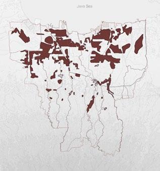
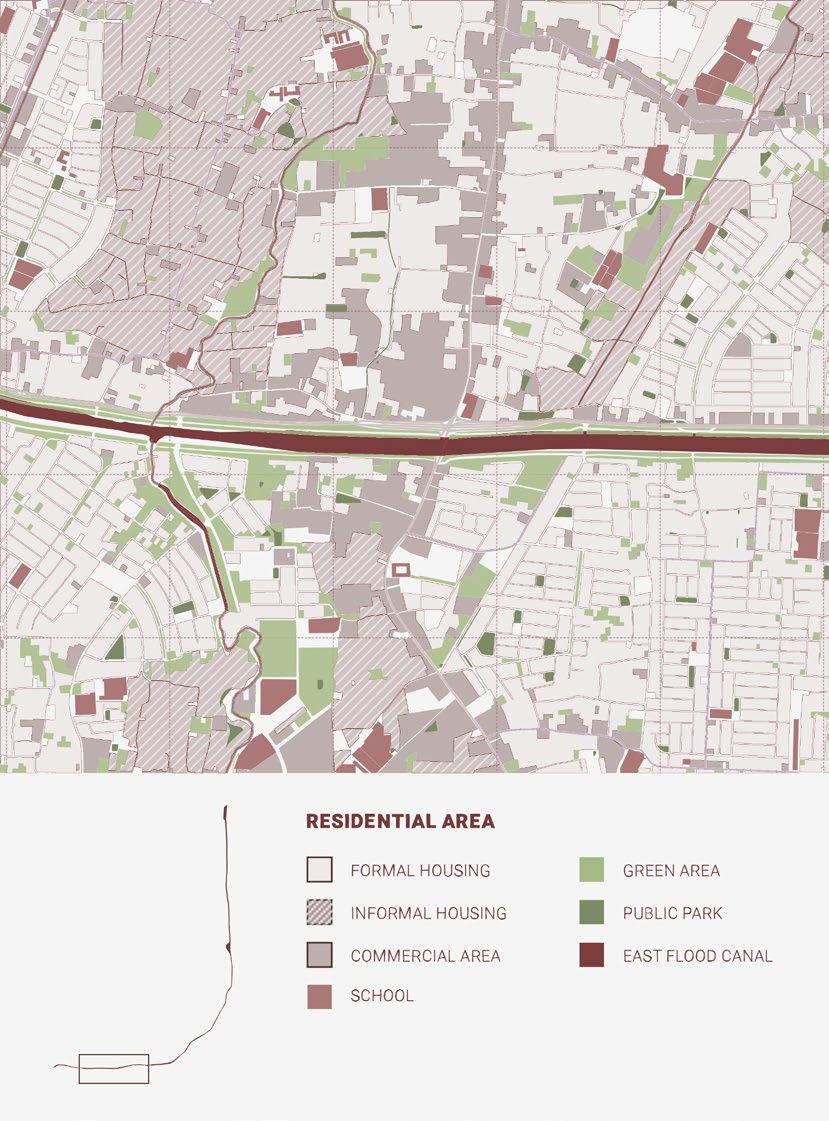
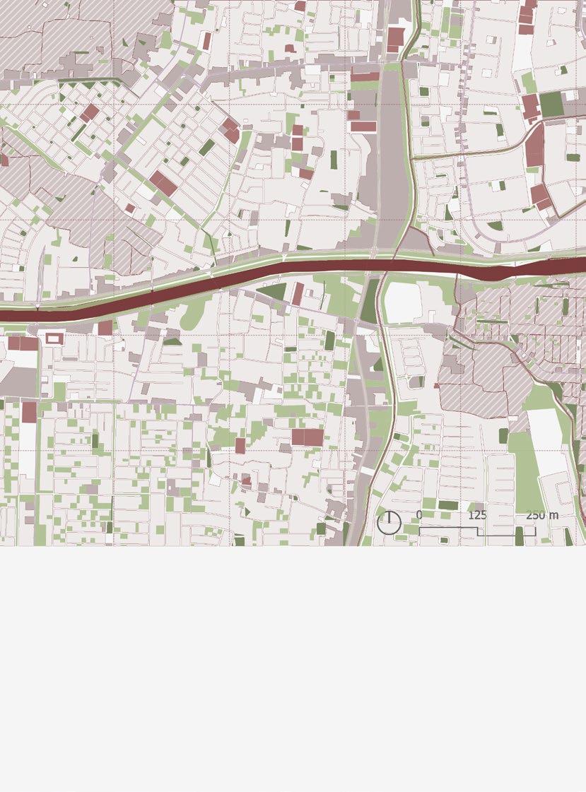
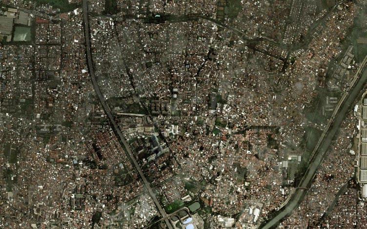
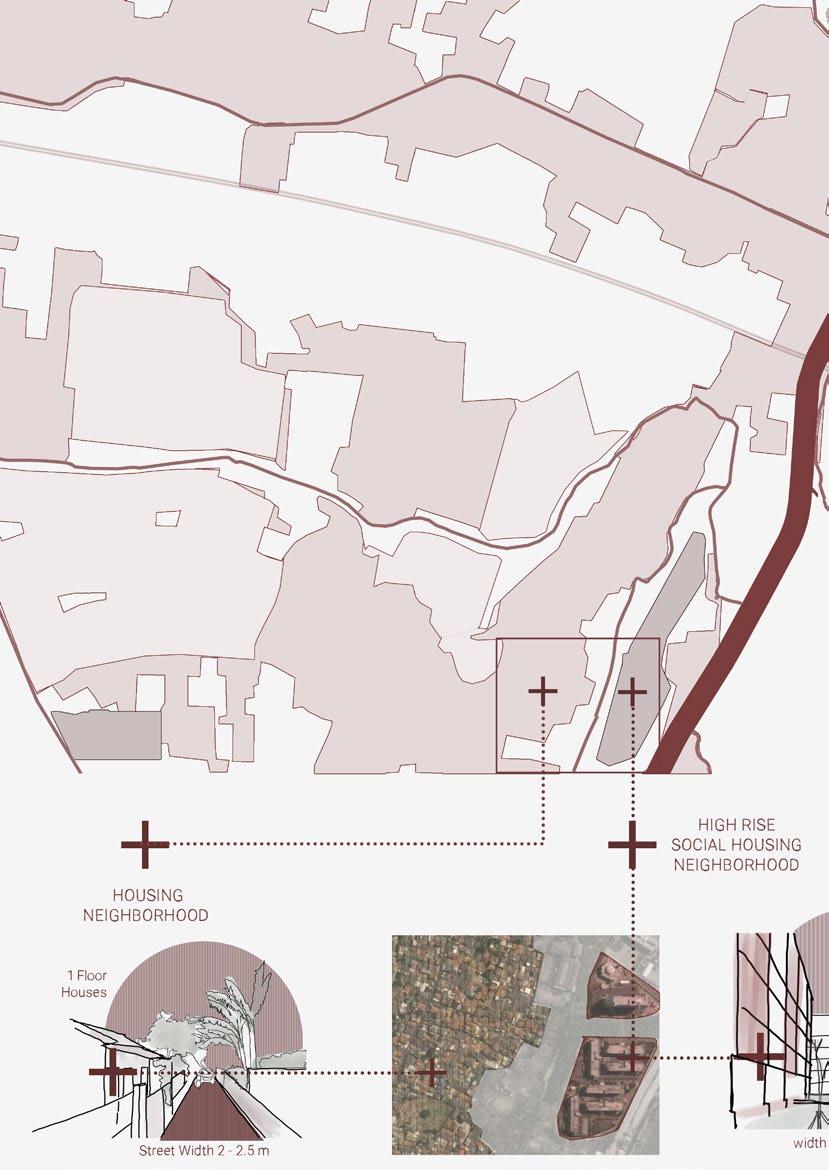
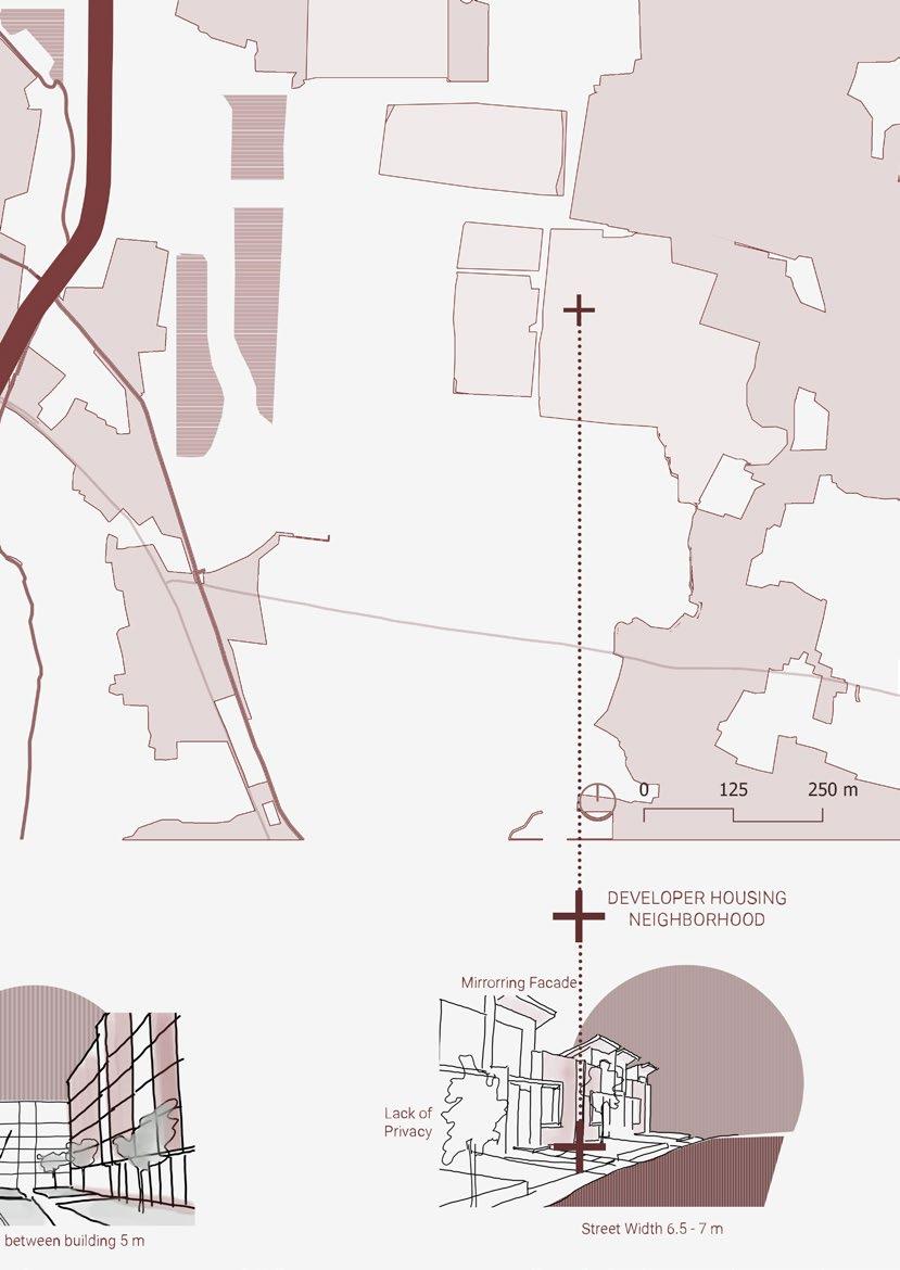
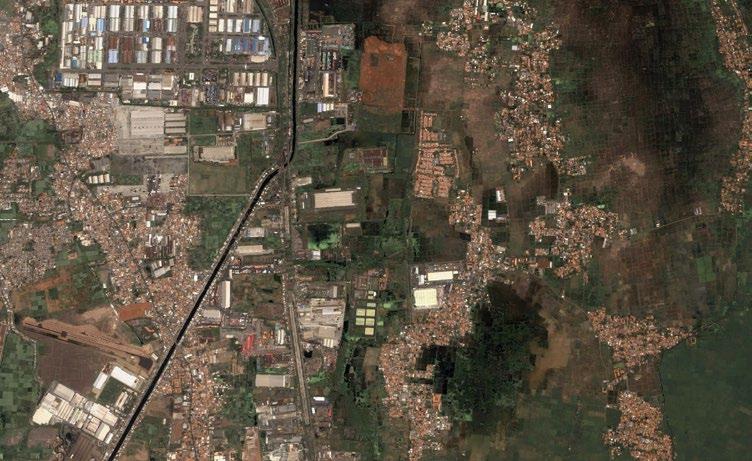
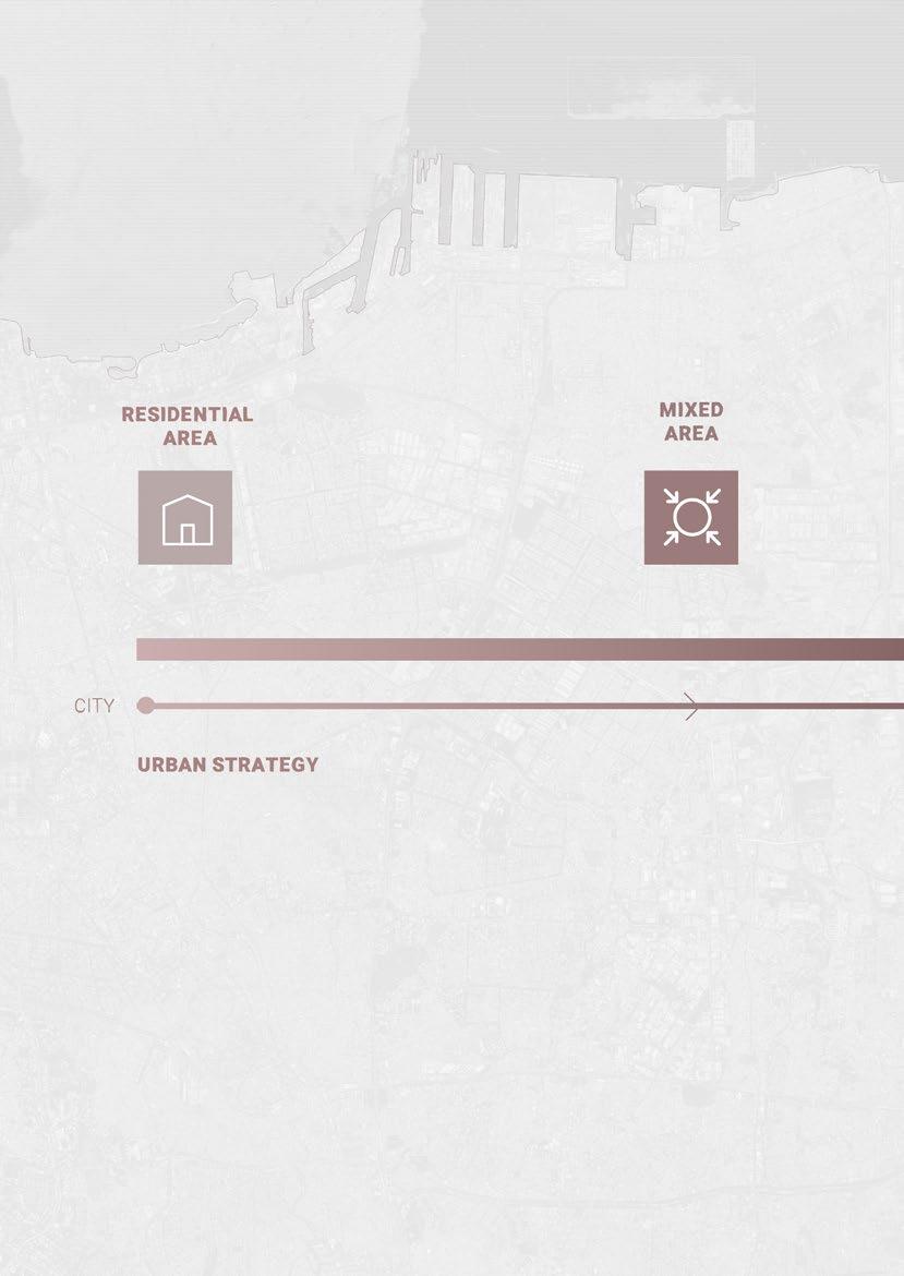
52 Territorial Scale Residential
Area
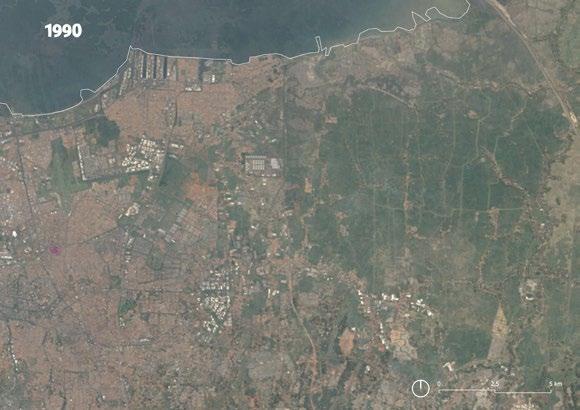
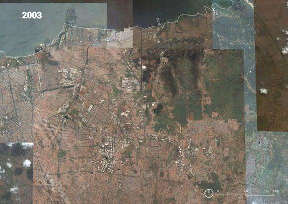
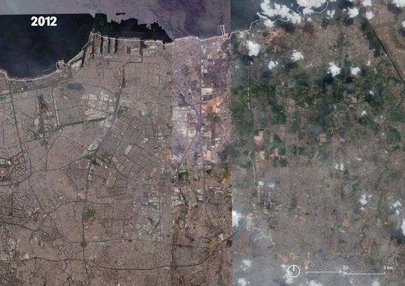
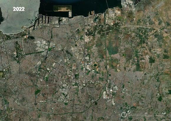
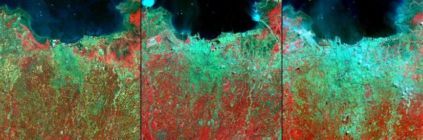
1976 population 6 million 1989 population 9 million 2004 population 13 million
Vegetation appears red, and urban areas appear light green. Image satellite from NASA.
Residential Area
East Flood Canal
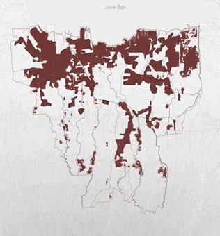
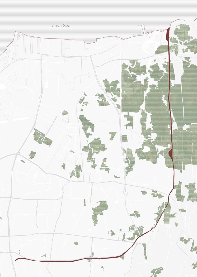
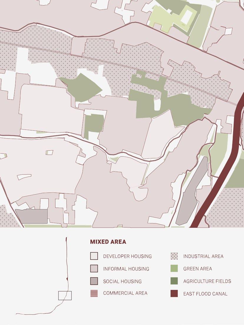
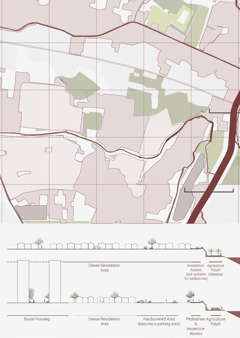
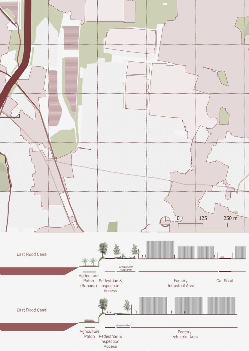
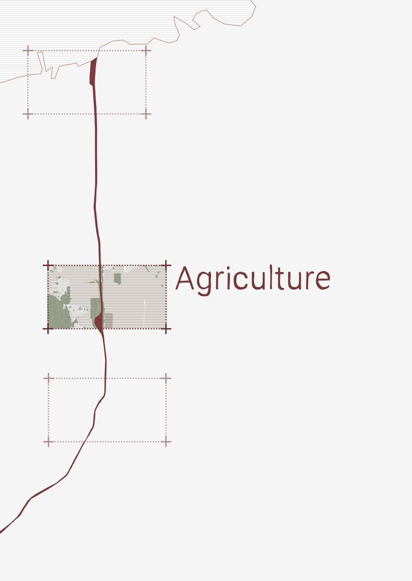
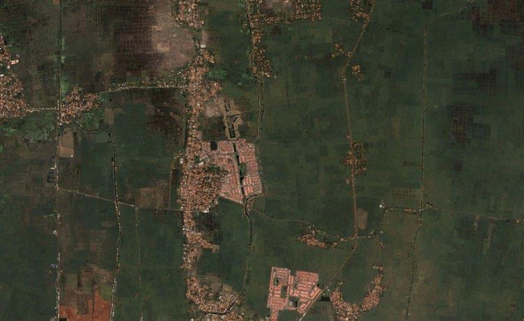
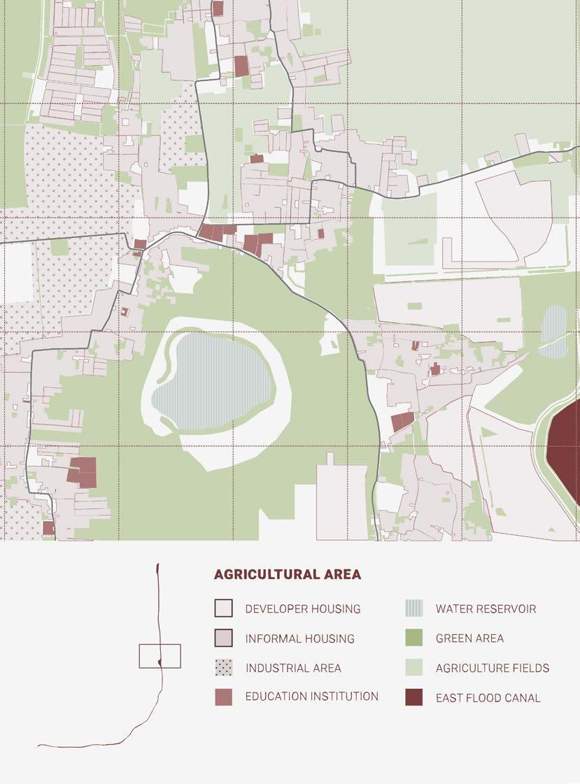
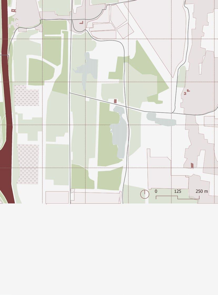
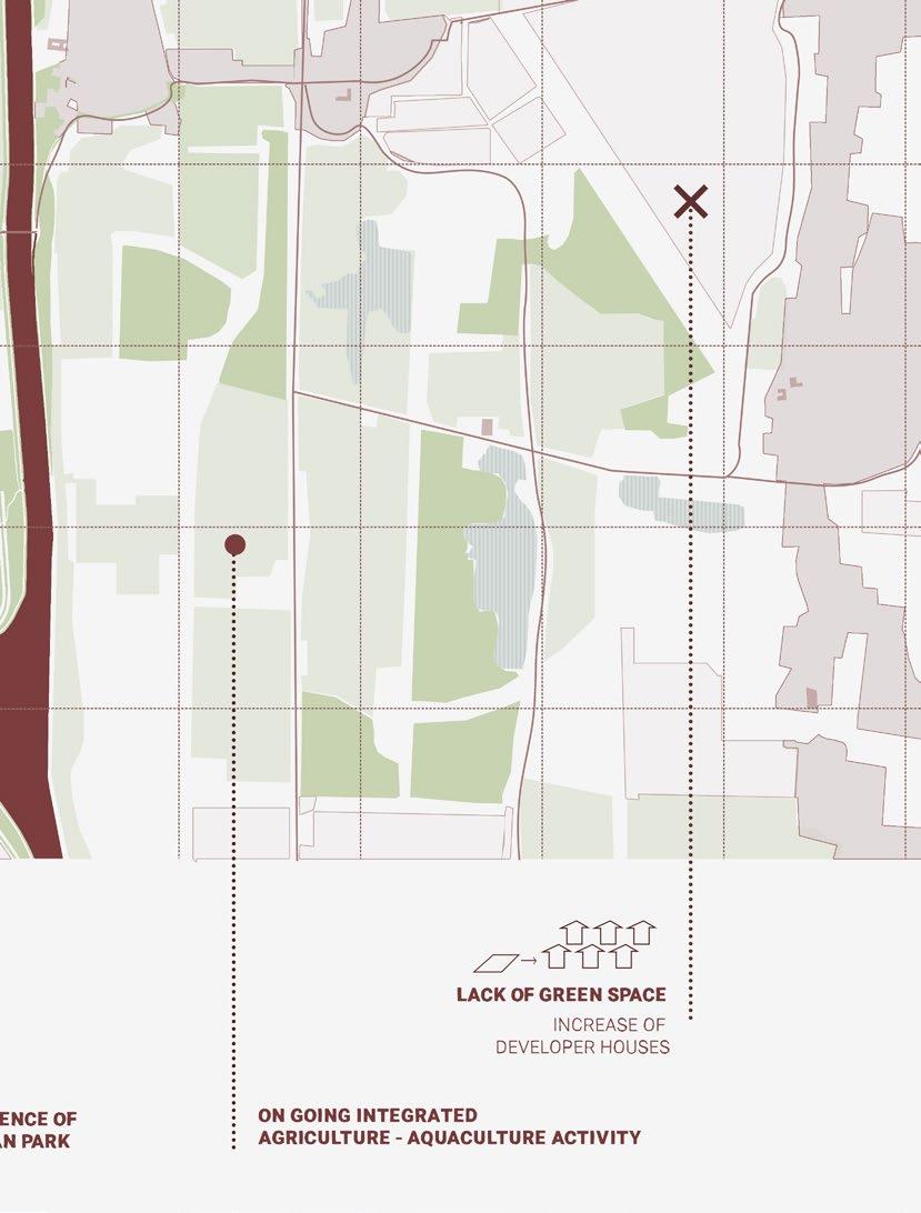
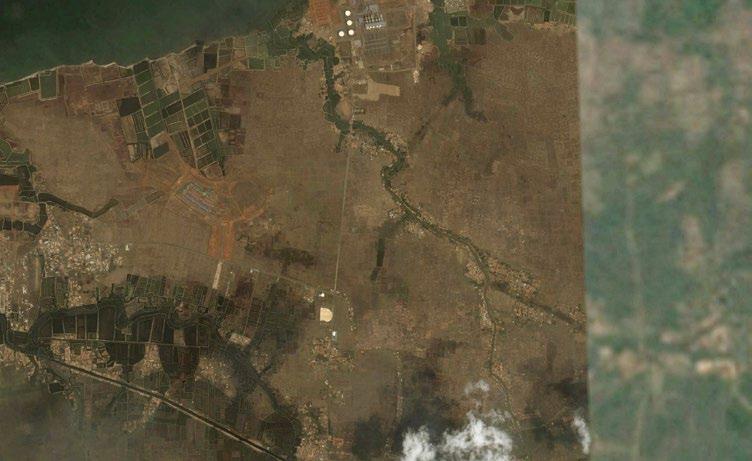
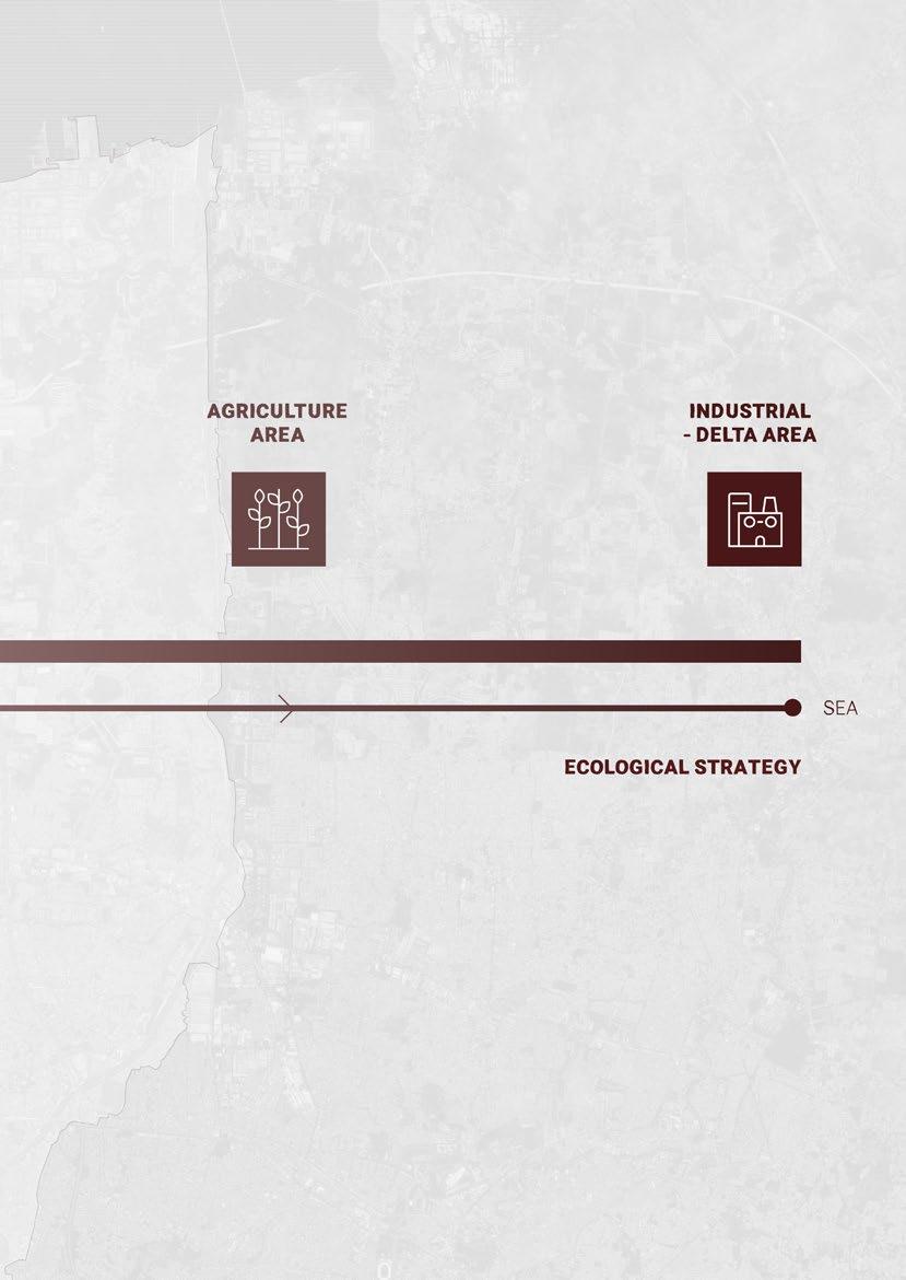
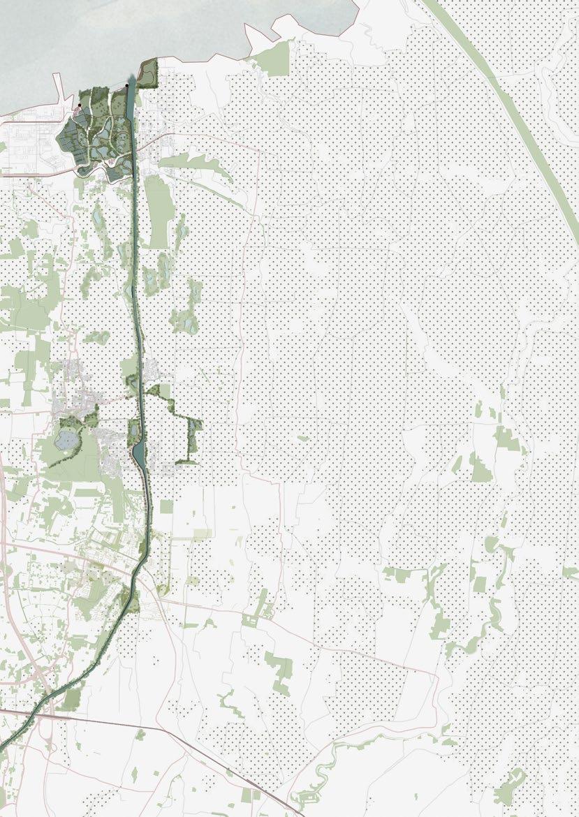
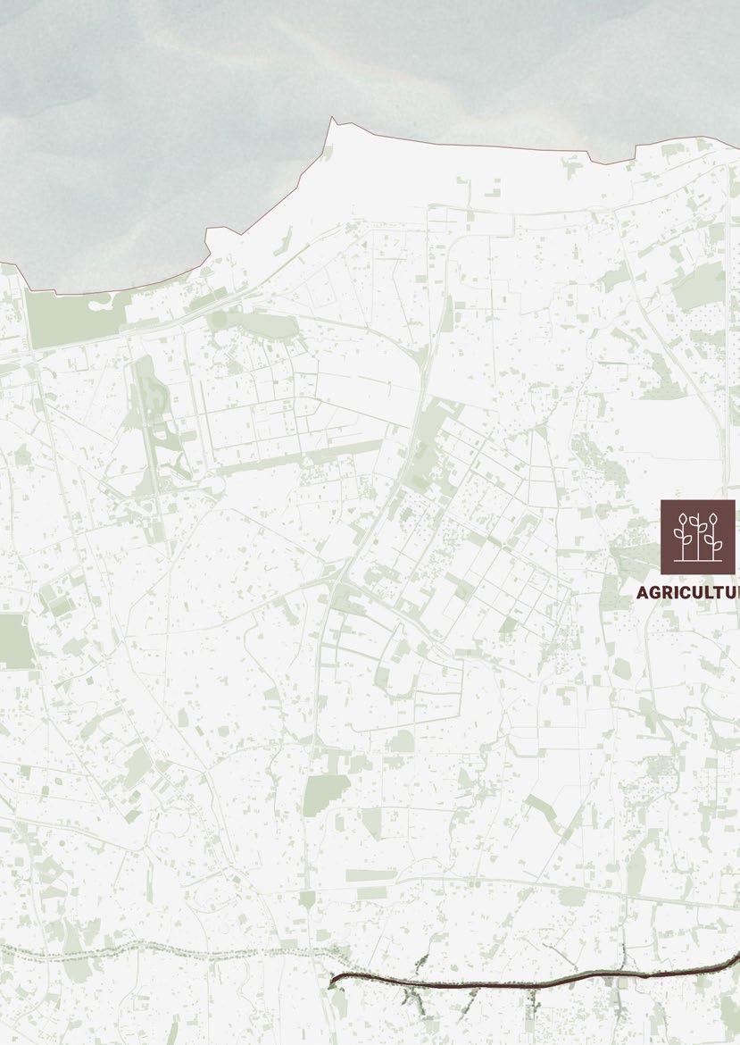
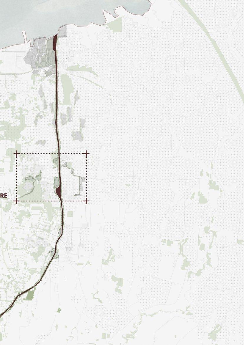
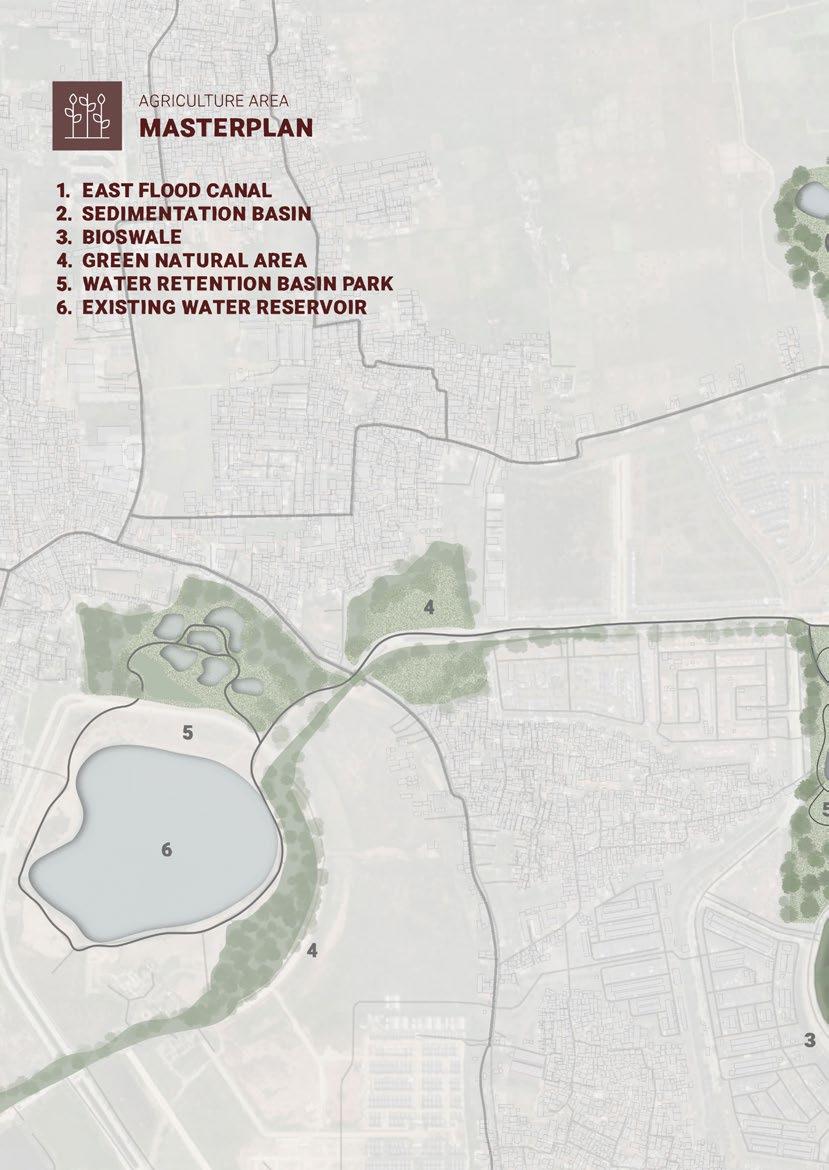
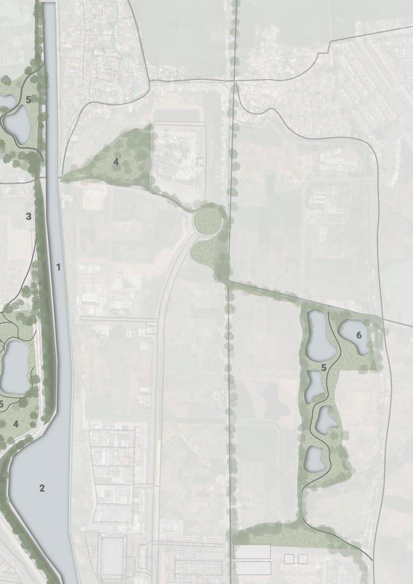
Agriculture and civilization are two things that cannot be separated. Jakarta is one of the cities that evolves around agriculture. The agriculture patch in Jakarta is decreasing from time to time because of land used for development. We can find more agricultural fields in the north and west-east of East Flood Canal.
Bappenas (Indonesia National Development Planning Agency) noted that green open spaces, such as agricultural land, parks, and urban forests, covered only 42.94 km2 (4,294.5 hectares) or 6.57% of Jakarta’s area. the products
54 Territorial Scale
Agriculture Field
Agriculture Area
East Flood Canal
Area
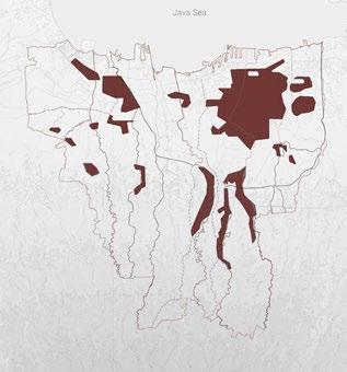
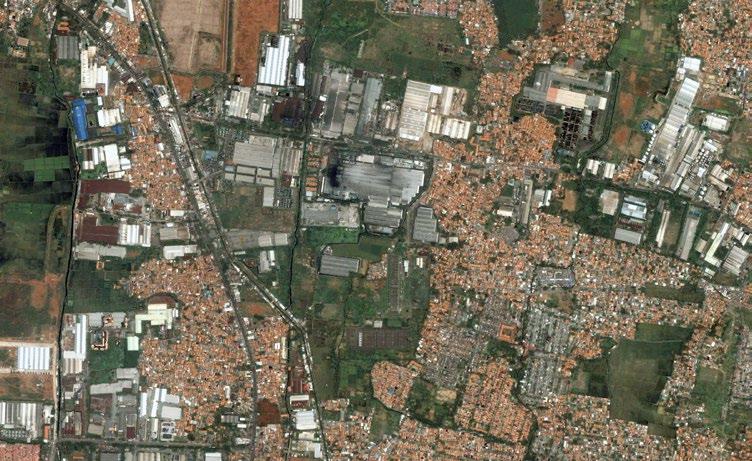
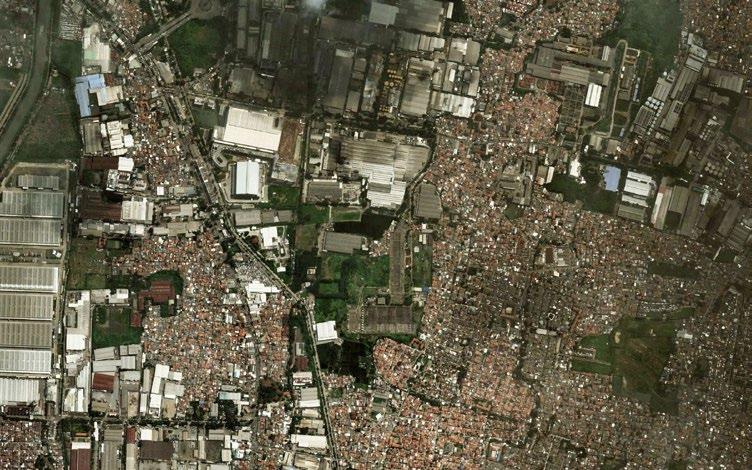
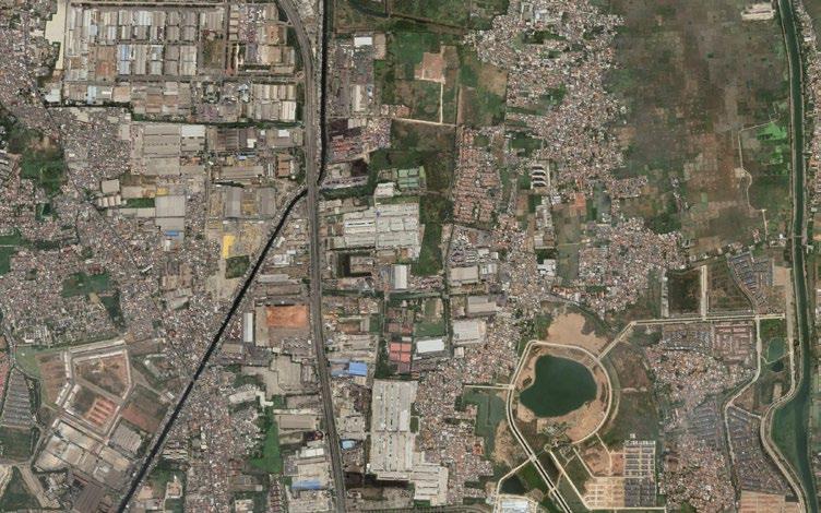
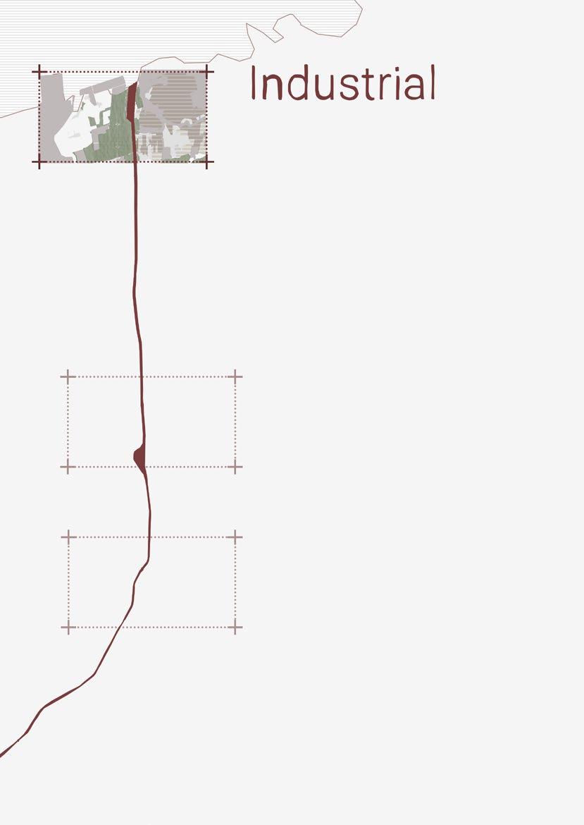
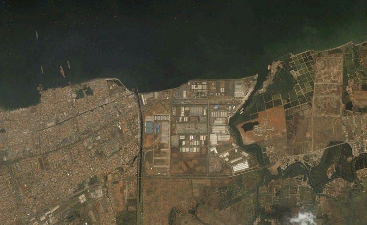
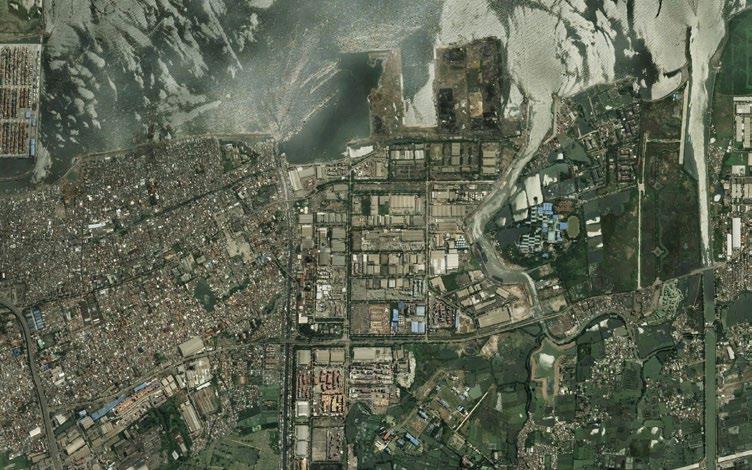
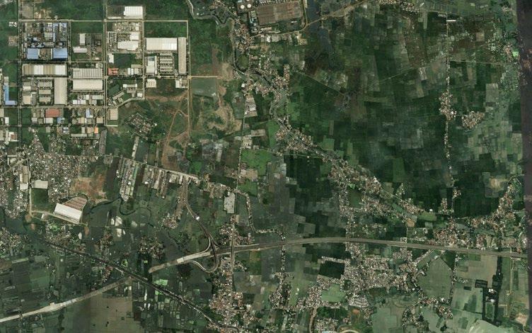
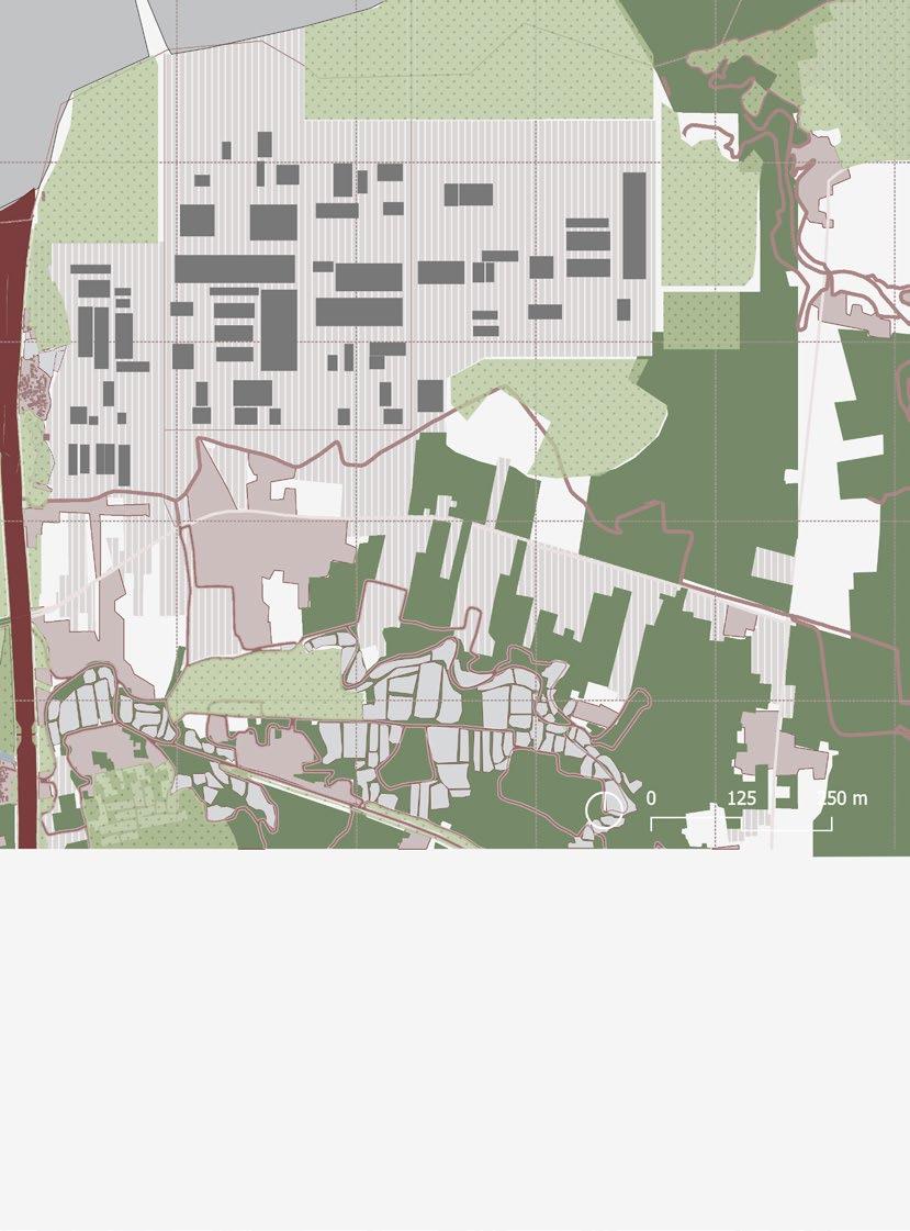
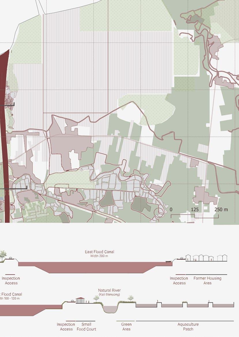
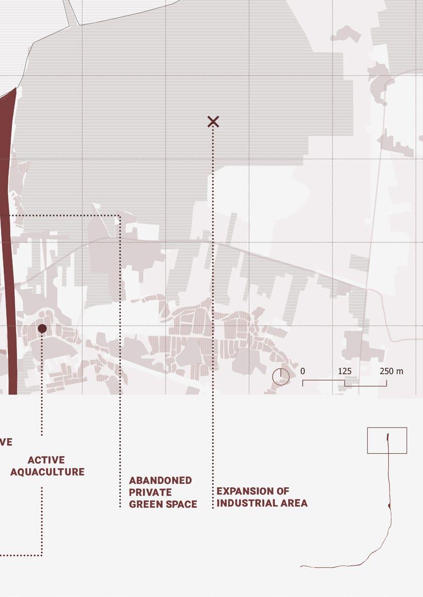
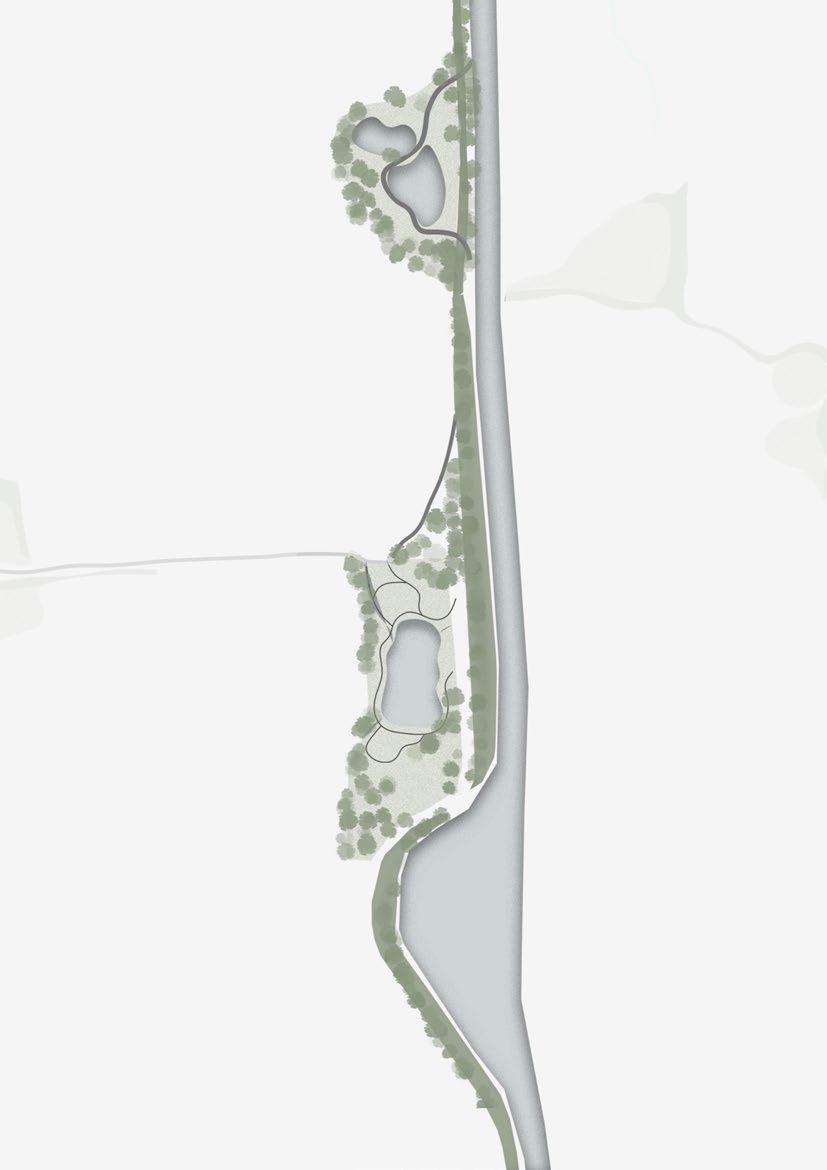
Located in a strategic location makes Jakarta the biggest industrial city in Indonesia. It provides all types of supporting infrastructures, such as toll roads for land transportation, well-developed seaports for conducting business through the ocean, and airports. The north part of Jakarta is the center of industrial activities. Factories, warehouses, and seaports are located there. The industrial area started expanding as time passed, and due to limited spaces, it expanded to neighboring cities. From only the north part of Jakarta, the industrial area first expanded to the east side, Bekasi, and later kept expanding to surrounding cities.
This rapid industrial expansion led to high urban growth. With non-strict control of land-changes uses from local governments, this expansion raised an issue. Many essential agriculture fields, mostly rice fields, transformed into houses and industrial estates, causing a declination of rice stocks in Java.
56 Territorial Scale Industrial
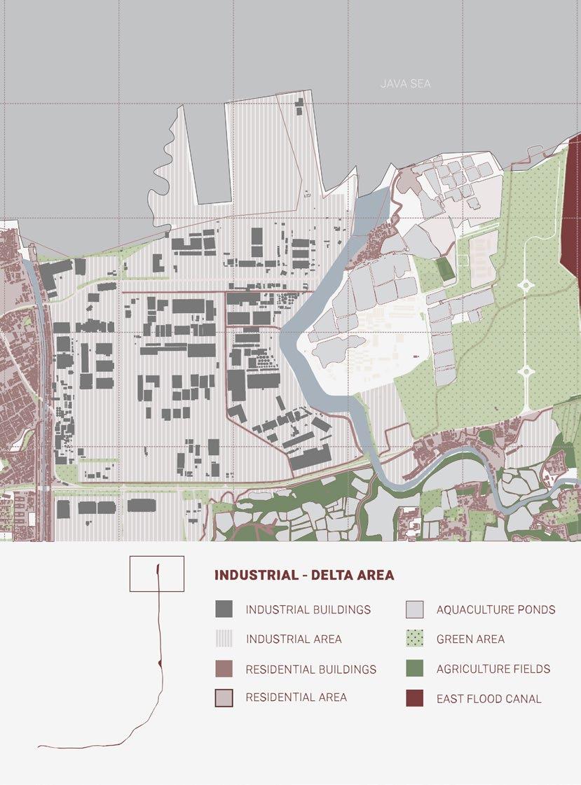
Industrial estate development in the delta area of East Flood Canal (2022)
Industrial Area
East Flood Canal
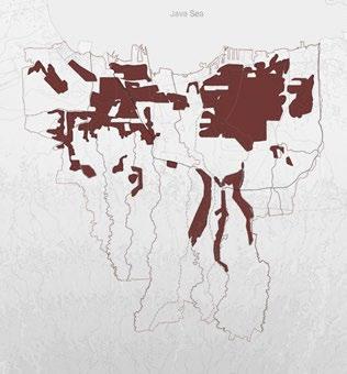
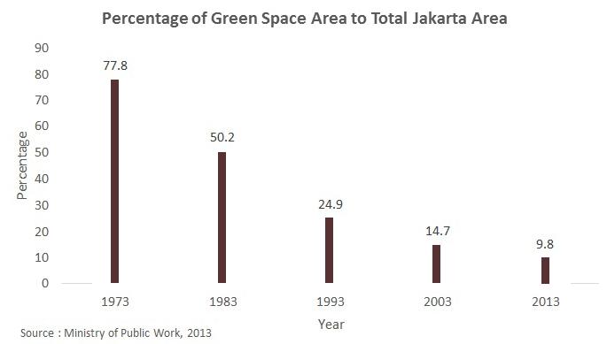
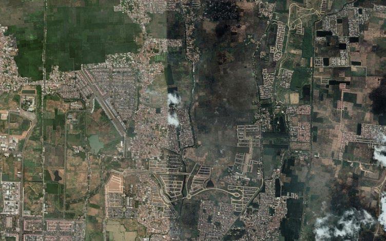
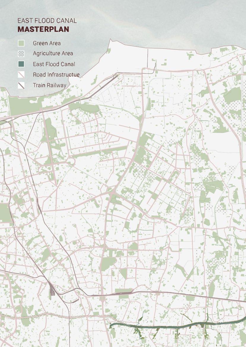
The existence of green areas in Jakarta is facing a high-risk issue because of the constant change in land utilization for more profitable activities. Green spaces in Jakarta are one essential element to give balance to the city. There are green natural parks that are provided by the government for the people. East Flood Canal development is one of the ways to increase the number of green belt areas throughout the city.
58 Territorial Scale Green
Area
Green Area
East Flood Canal
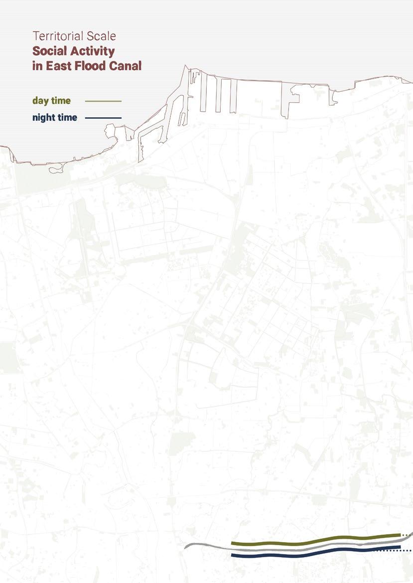
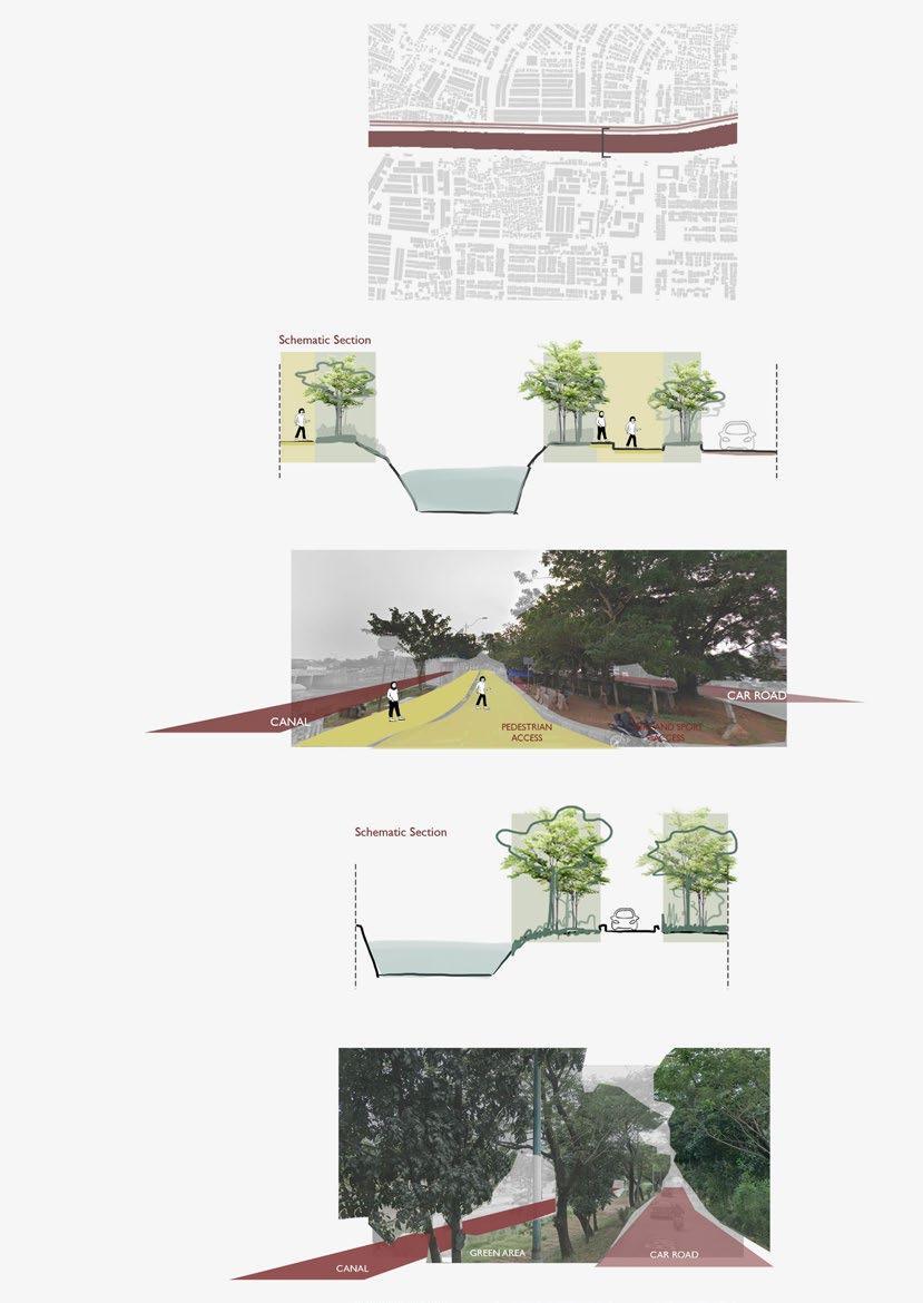
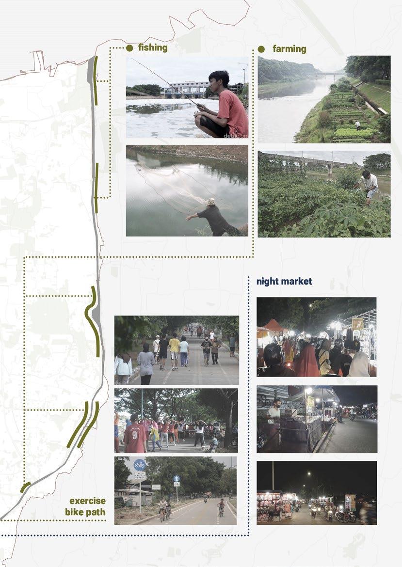
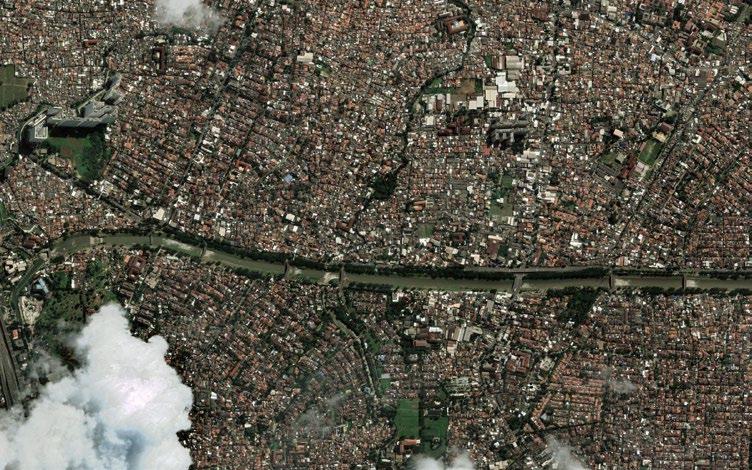
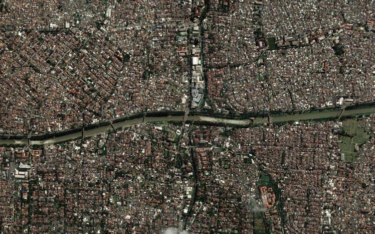
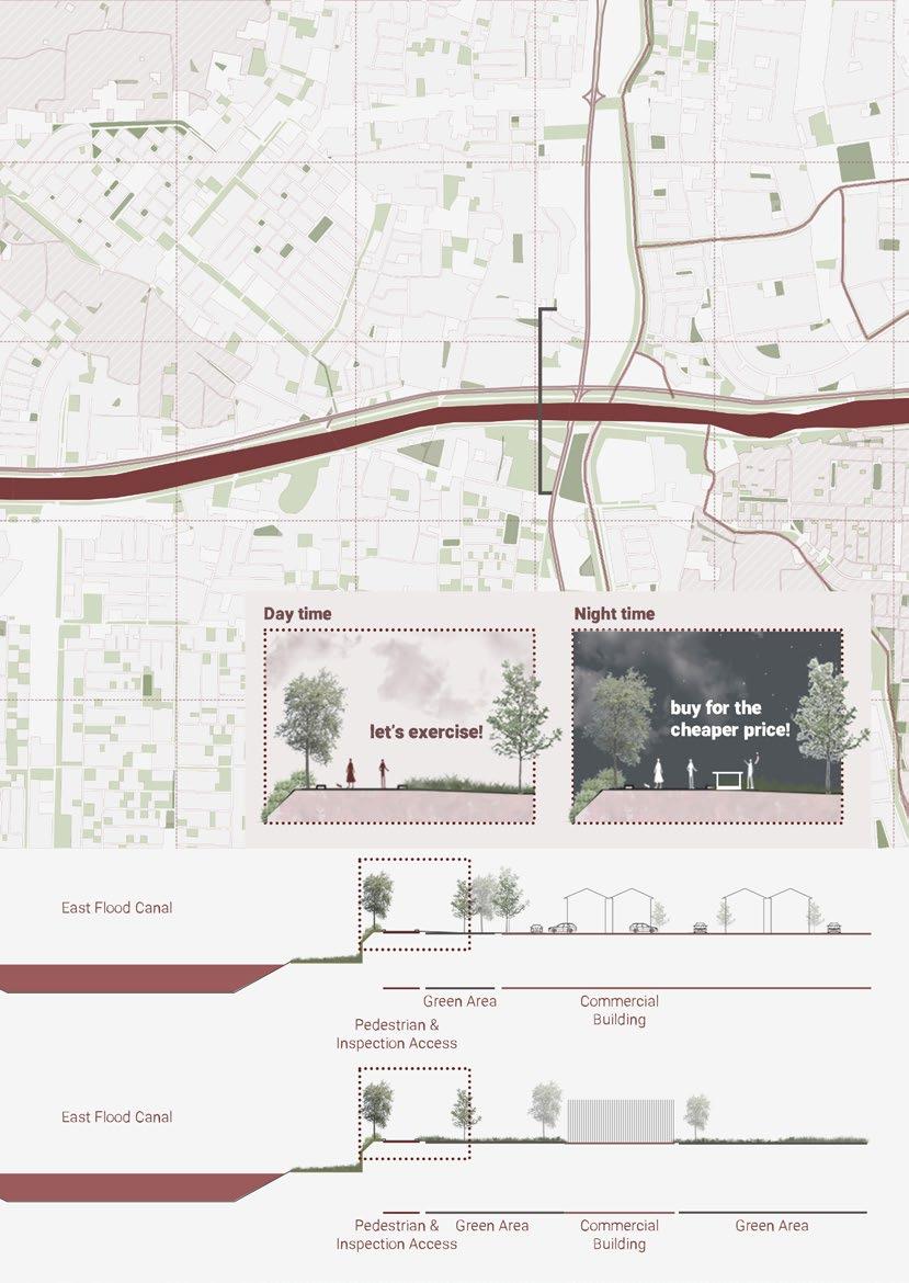
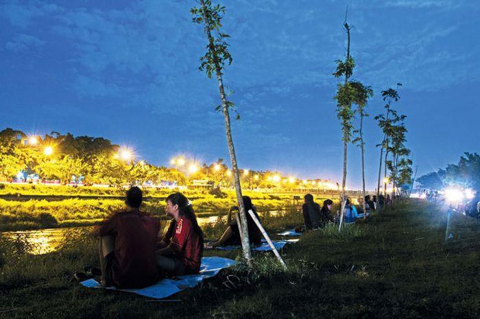
Many activities are happening every day at East Flood Canal. The activities can be divided into two timelines, in the daytime and in the evening.
In the daytime, during weekdays, Most people are there to work alongside the canal. Most of them are fishing and farming. Only a few people use the infrastructure to do exercise and biking. On weekends, they have a market during the day. People go there to visit the market, exercise together, paint, and have a recreational and relaxing time with family and friends.
In the nighttime, Both on weekdays and weekends, the night market is always bright and full of people. Other than the street food and goods, people go there also to sit and relax by the canal while enjoying their evening.
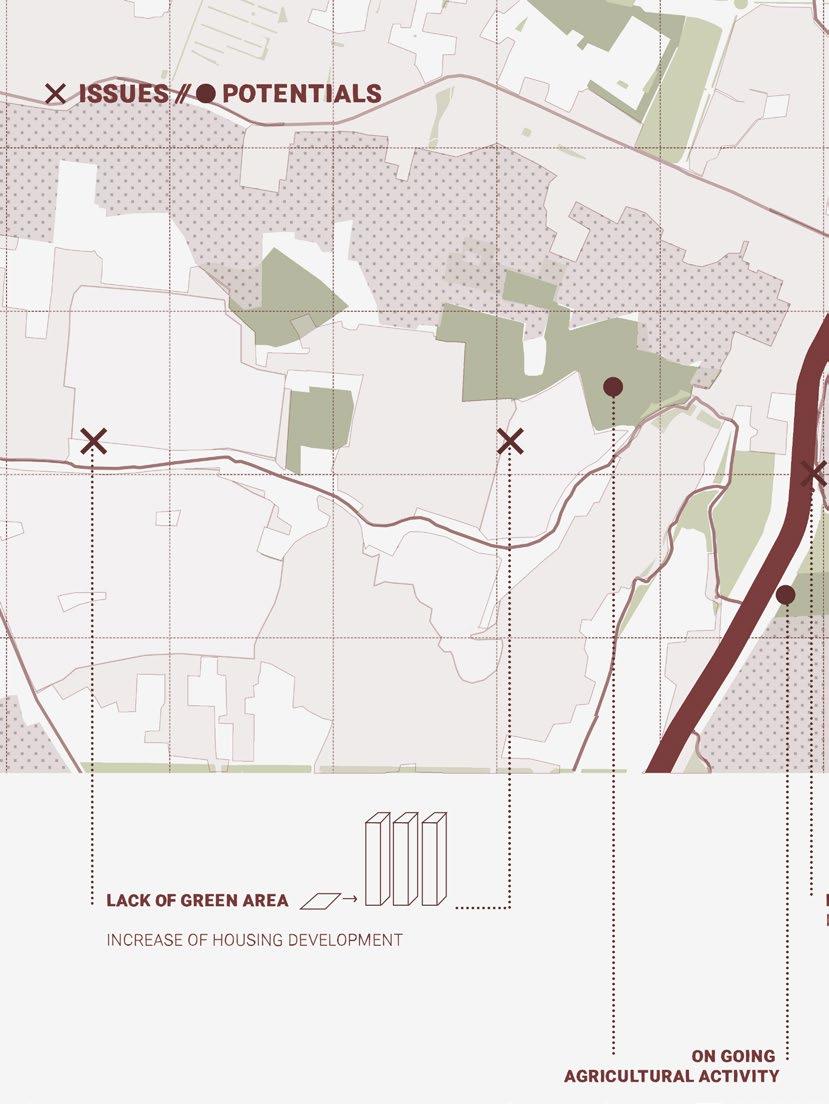
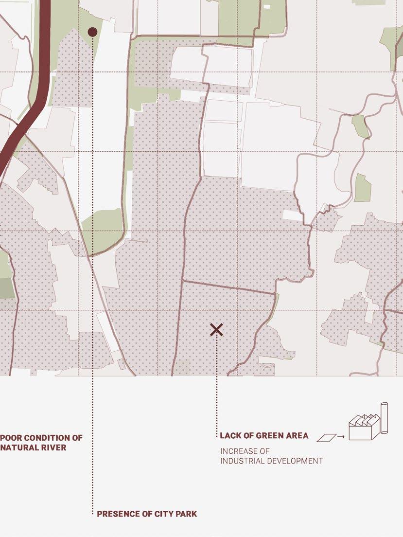
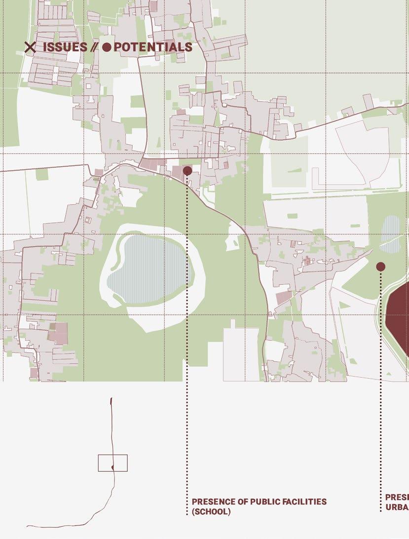
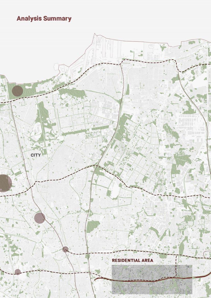
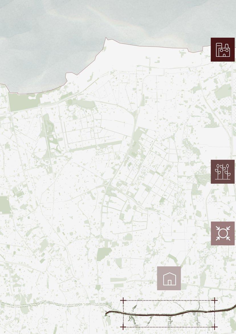
These areas, alongside East Flood Canals, are focused due to the types of the city’s fabric. Each fabric has its own identity, issues, and potential that will be analysed deeper in order to put an effective solution.
2003 2022

74
75

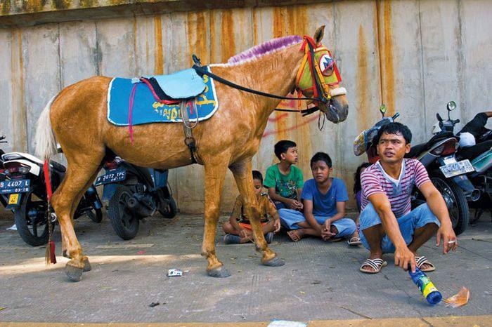 Darmo, 26, waiting for visitors to ride his horse for a trip in East Flood Canal
photo by Ilham Anas in nationalgeographic.grid.id
Darmo, 26, waiting for visitors to ride his horse for a trip in East Flood Canal
photo by Ilham Anas in nationalgeographic.grid.id
Every
nationalgeographic.grid.id
Saturday night, the street alongside the canal from Cipinang Besar until Malakasari got brighten up by the night live.
photo by Ilham Anas in
2003 2022
86
87
92
93

2003 2022
98
99
100
101
102
103

2000 2022
108
109
 picture by: TEDY OCTARIAWAN KROEN (rm.id)
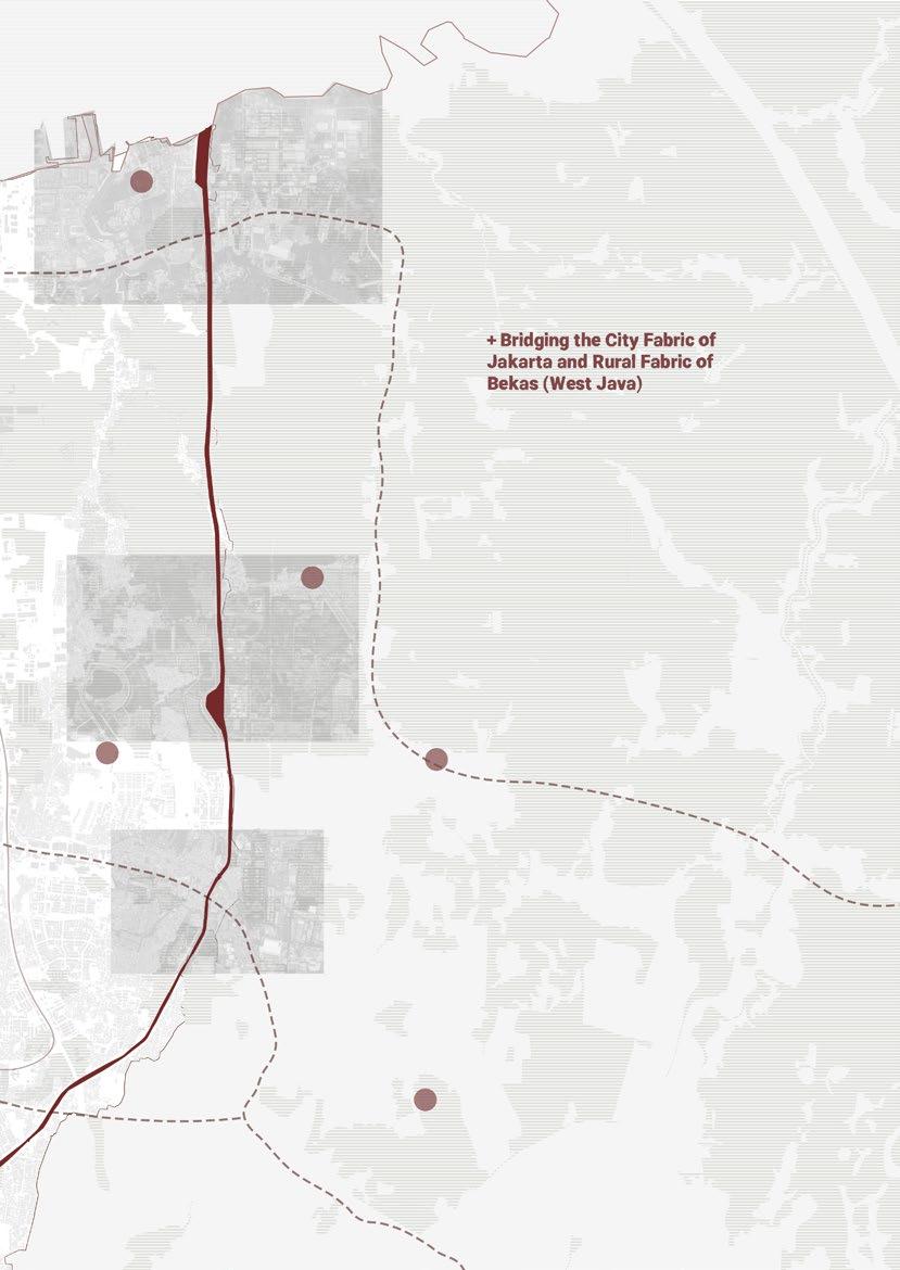
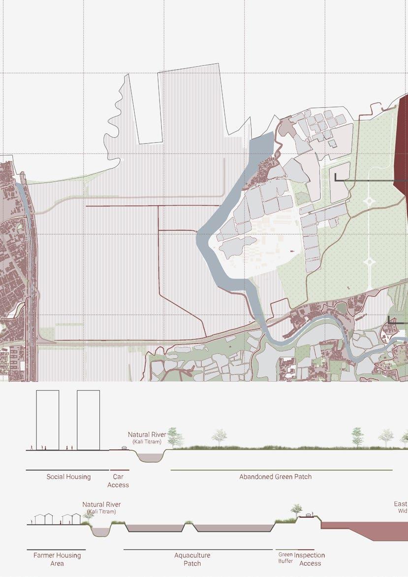
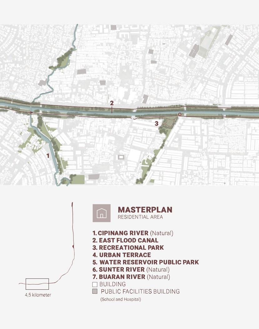
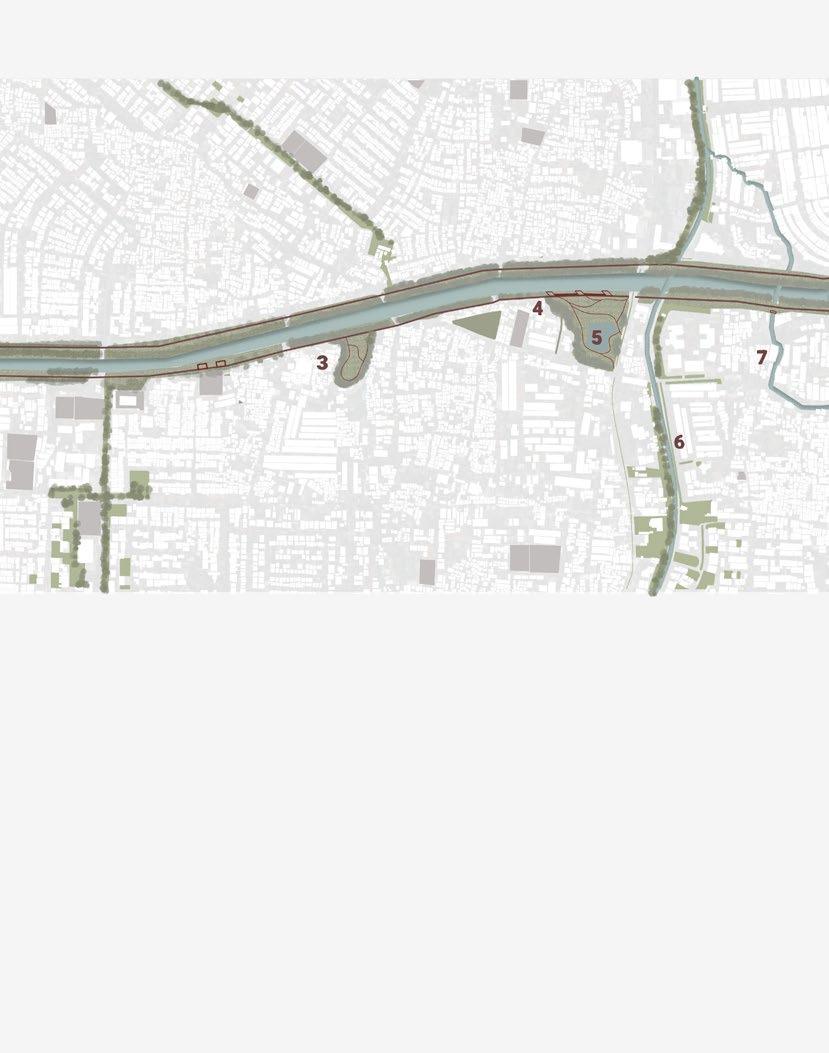
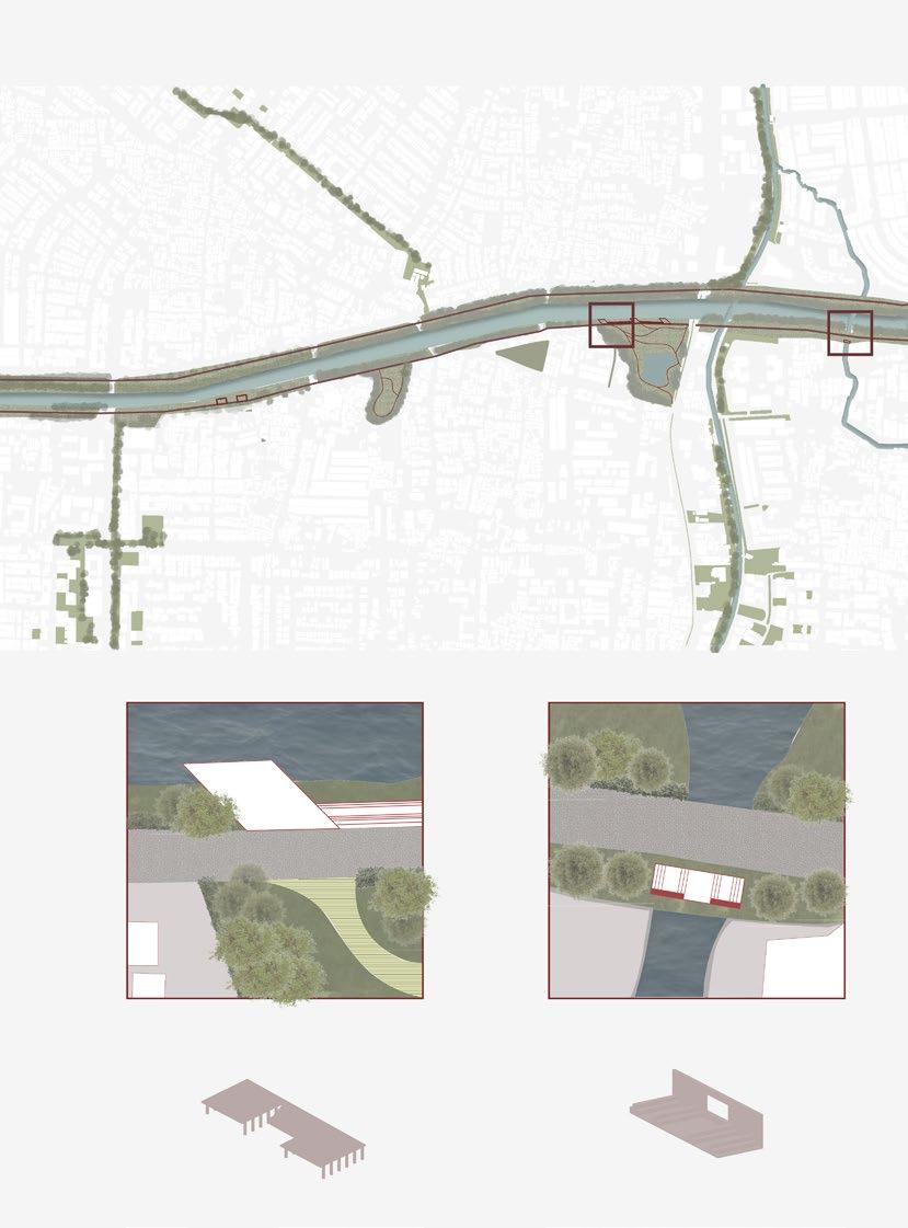
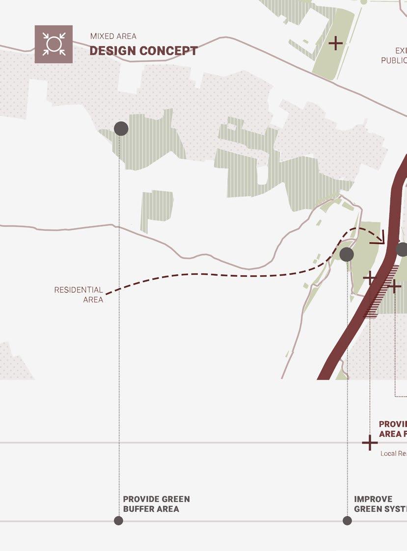
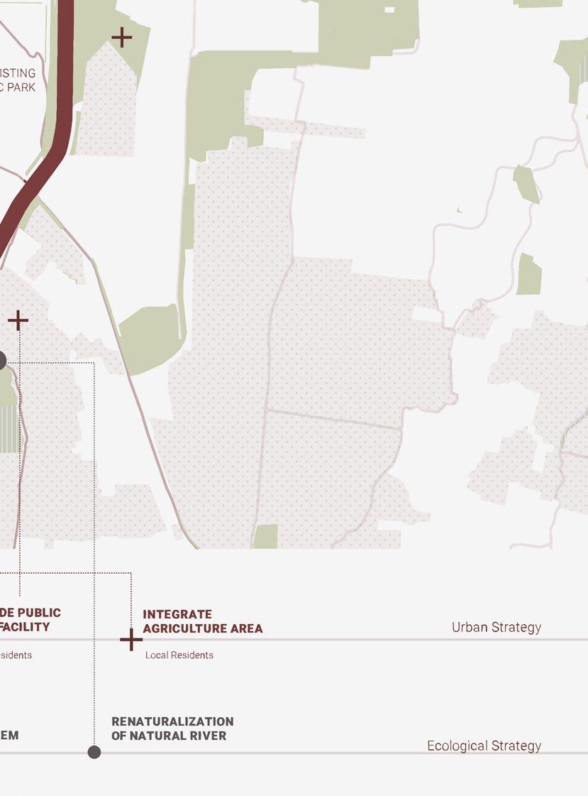
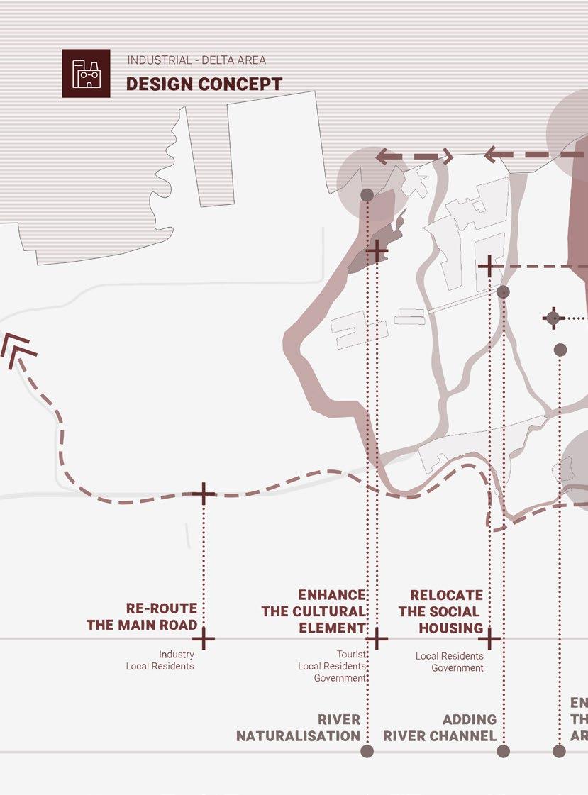
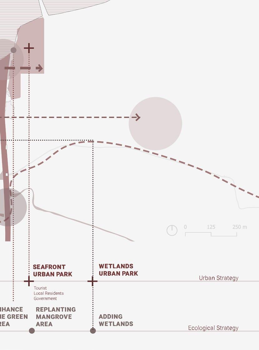
Demolish the idea of East Flood Canal as a physical boundary between city and rural fabric through public facilities and green areas.
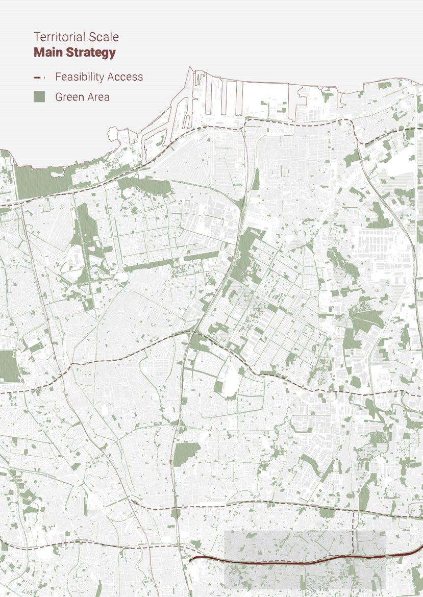
Connecting and increasing the amount of green area in Jakarta and West Java. Also facilitate a green public space for the visitors.
Improve the condition of water infrastructure in East Flood Canal and introduce the natural rivers to the citizen to increase the sense of belonging.
134
135
136
137
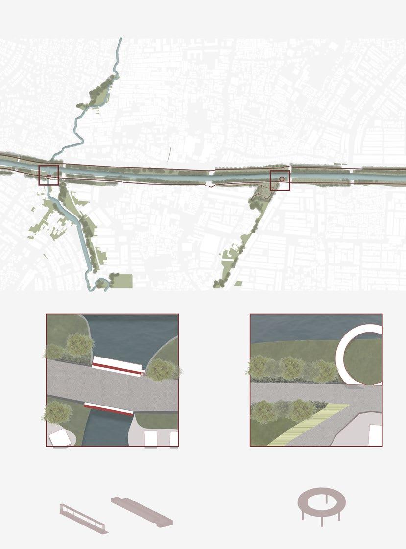
The pier provides a new way of experiencing space in East Flood Canal.
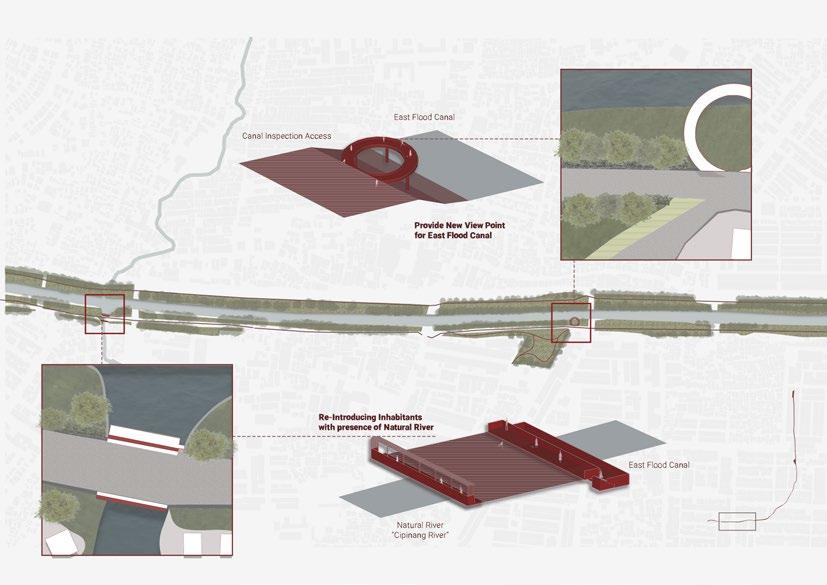
The infrastructure framed the natural river and provide a river “terrace” for the visitors.
138
The infrastructure alongside the canal provide a new seating space for the visitors that wants to enjoy the scenery of East Flood Canal.
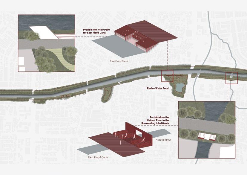
The urban furniture acts as a frame to direct people to enjoy and see the natural river that flows into East Flood Canal.
139

142
143
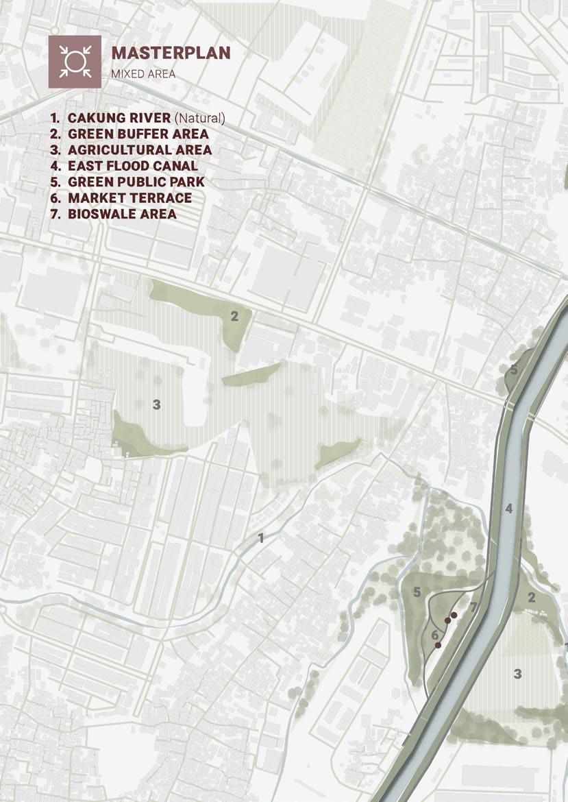
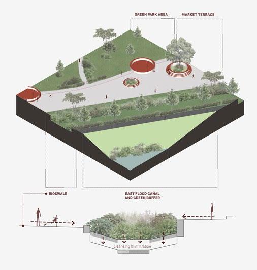
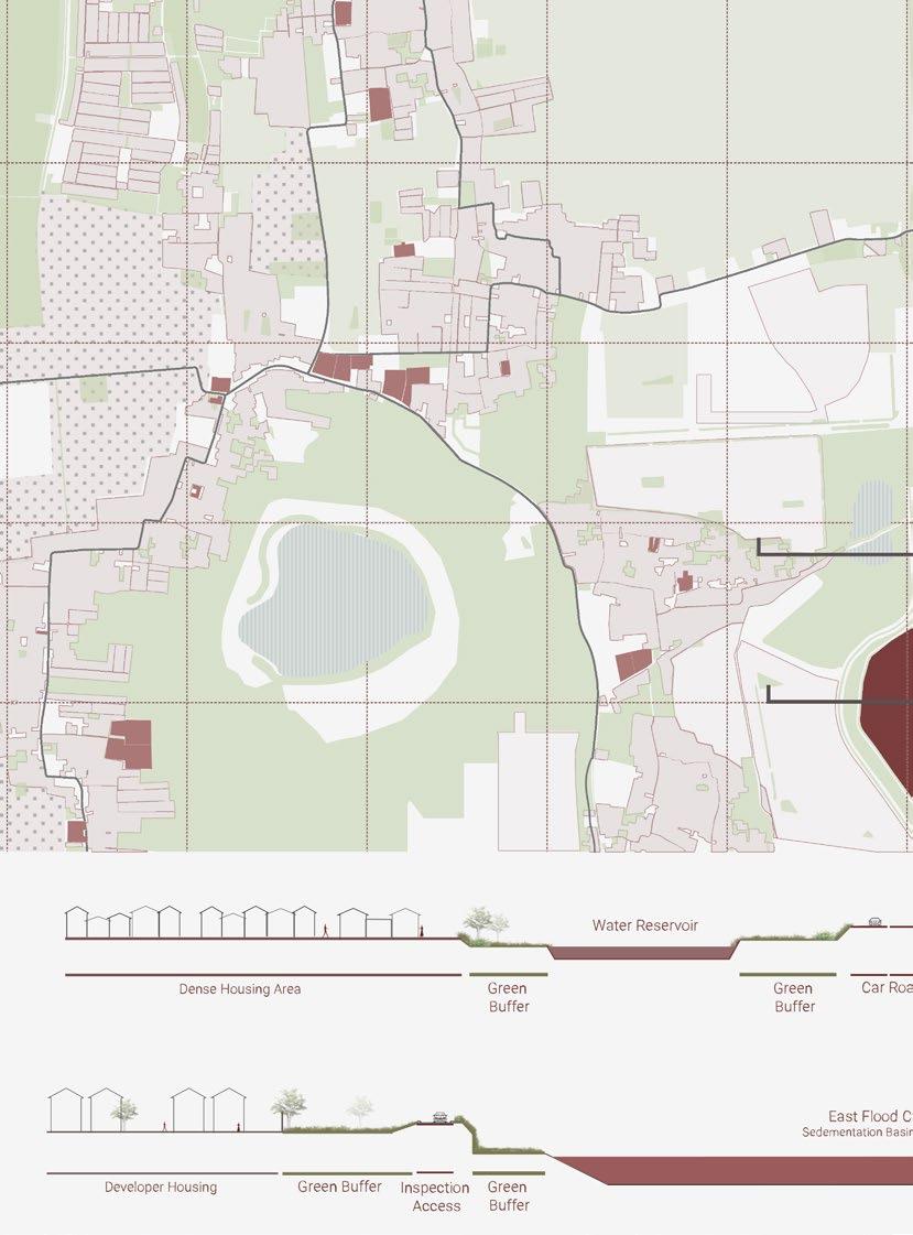
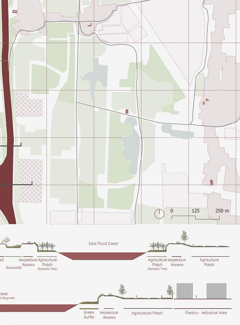
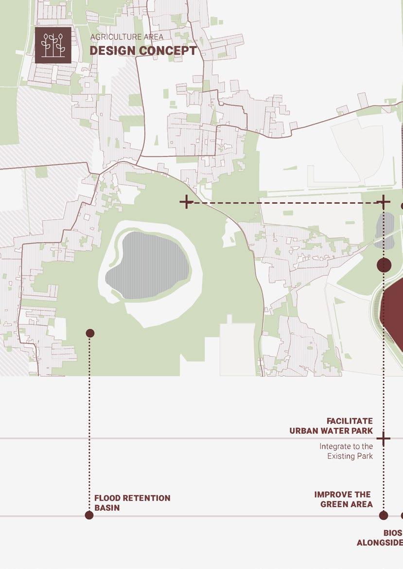
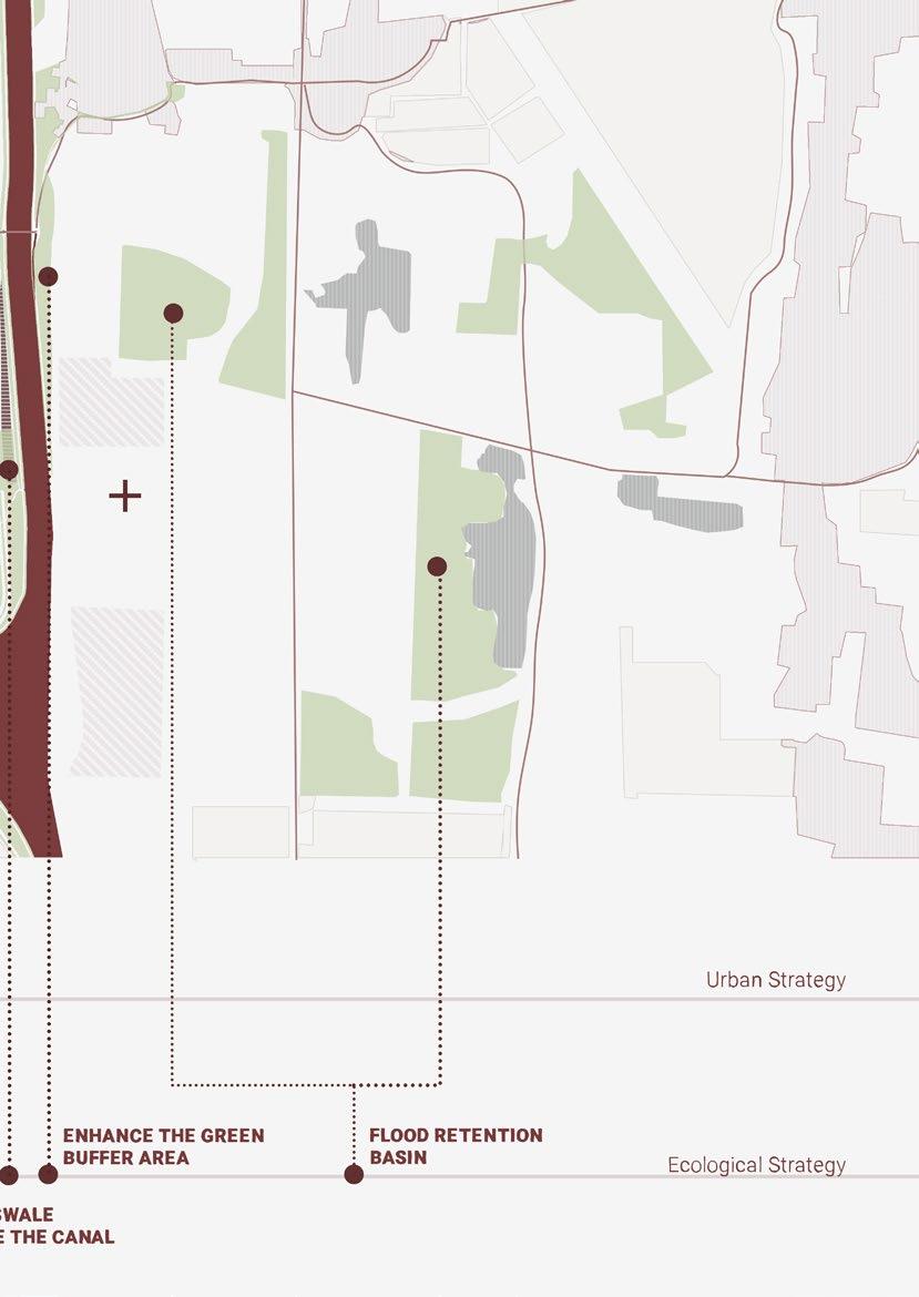
The Market Terrace provide a space for people to sell or buy their agriculture or other local products. As a buffer area between East Flood Canal and Green Market Terrace, there will be a bioswale that will hold the water and filter it before going to East Flood Canal. Bioswales will also increase the biodiversity in the area.
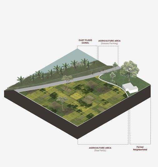
Increase the agriculture area alongside the canal by using a green buffer area in the canal as an extra agriculture patch. This proposal can increase the products for the farmers to sell.

146
1
2
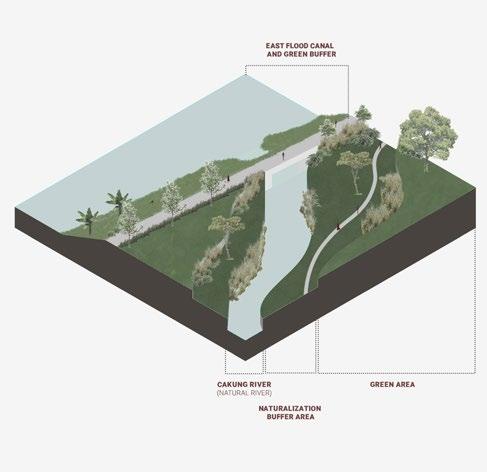
Naturalisation will increase the green buffer area between the natural river and the surrounding. This proposal will also increase the number of biodiversity. In a long term, it’ll be an opportunity to introduce to visitors about the native plants and animals.
1 2 3
3
154
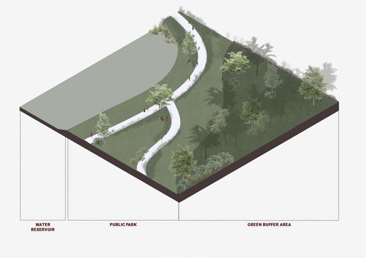
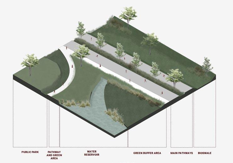
This water retention pond designed to store water and supporting aquatic and emergent vegetation. Beside increasing biodiversity in this area, the water retention pond also helps the decreasing the flooding issue.
Alongside the canal, there are bioswales to catch and filter the water before it runs to the East Flood Canal. Besides that, the existing car road will be functional as a public space for people to enjoy before going to the water reservoir urban park.
1 2
158
159

162
163
170
171
172
173
source
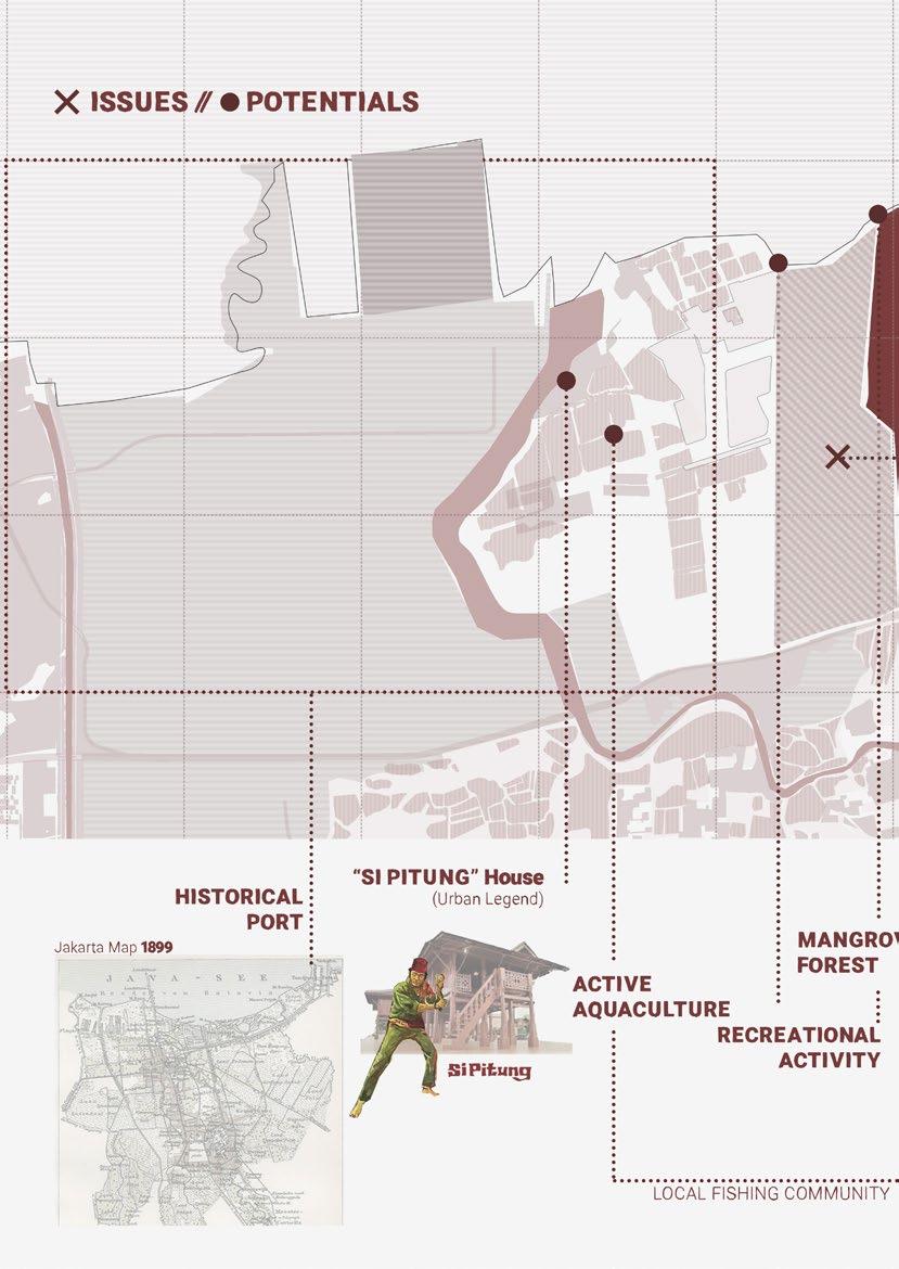
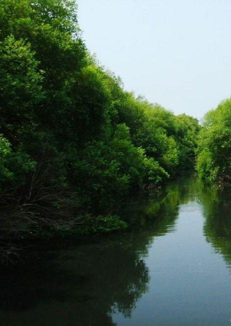
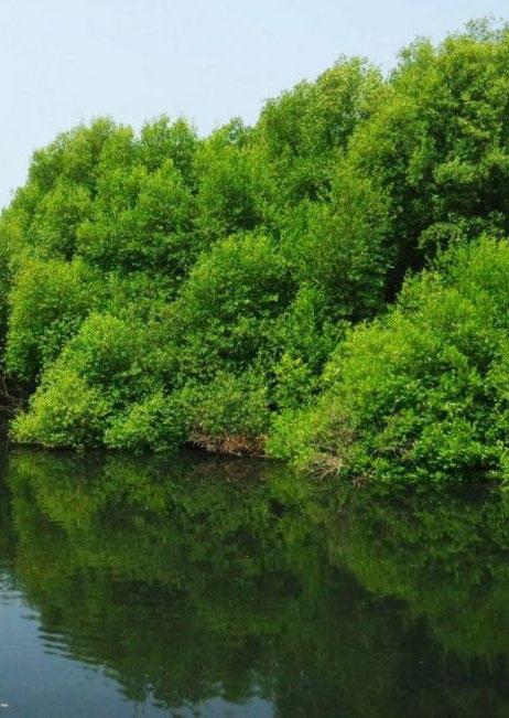
Jakarta Mangrove Forest
: indahfajarwatii.blogspot.com
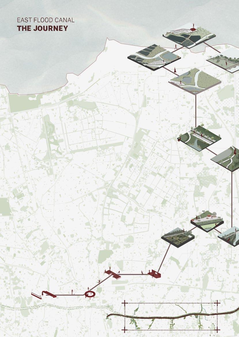
Starting from the southern area, the residential area, you will find urban furniture that allows us to sit, gather, and socialise with our neighbours. From food stalls, clothes until electronic shops can be found here.
As you go to the east, you will find more agricultural patches integrated with the green natural parks. In this area, you can see the Cakung river. The purpose of the intervention in this area is to increase people’s sense of belonging to the natural river. Moreover, it also preserves the cultural value of the river.
Next, you will get to the third area. This is the starting point where the flooding issue appears more due to the area’s topography. Hence, water basins are designed to hold and distribute rain runoff, which could help the flooding problem.
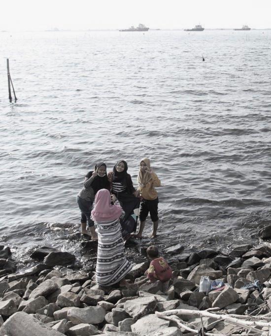
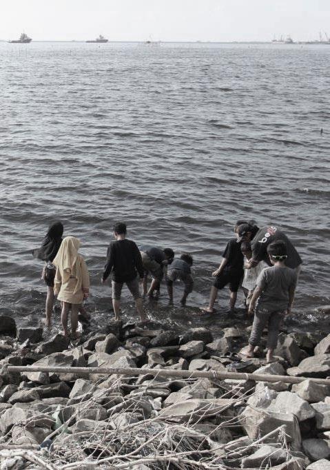
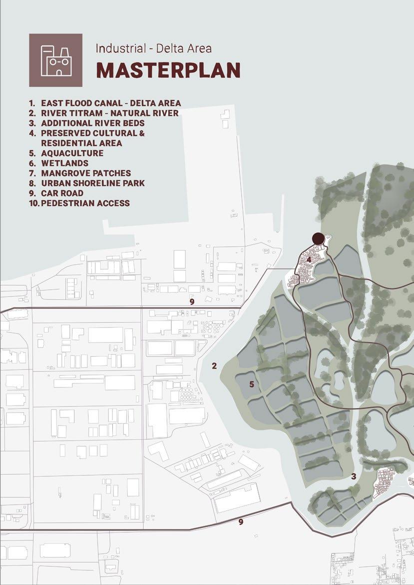
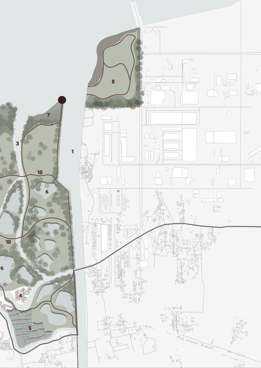
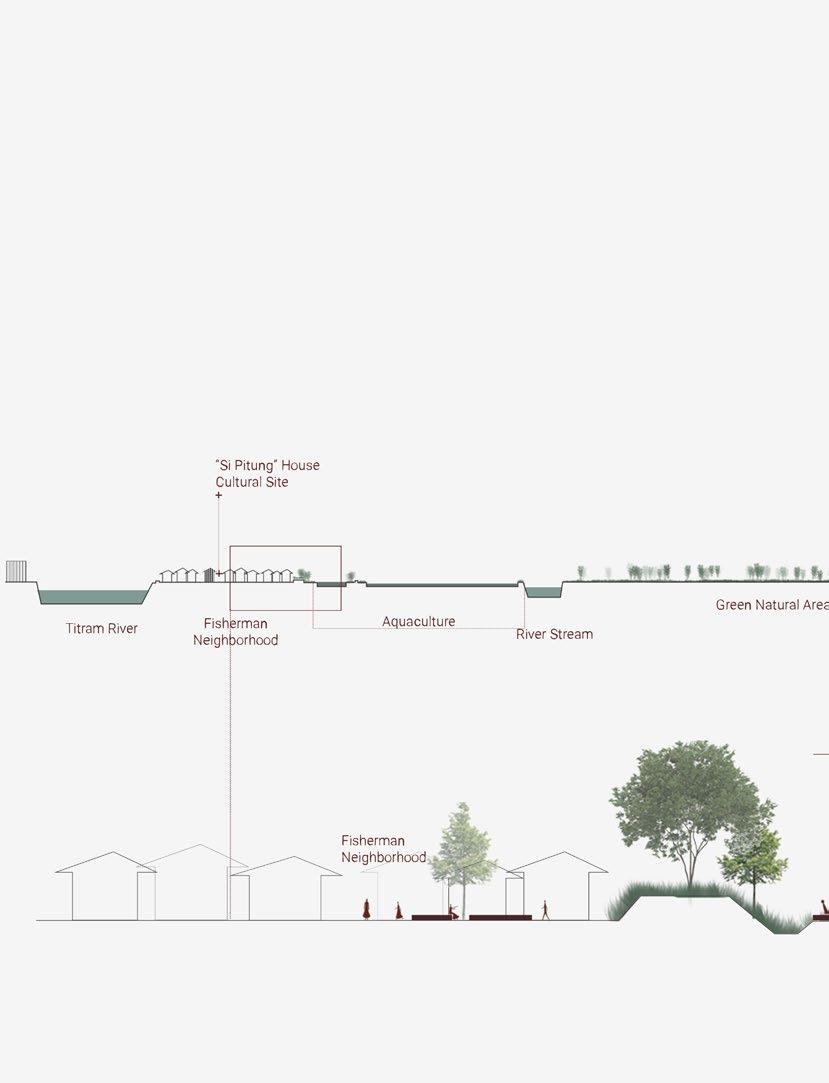
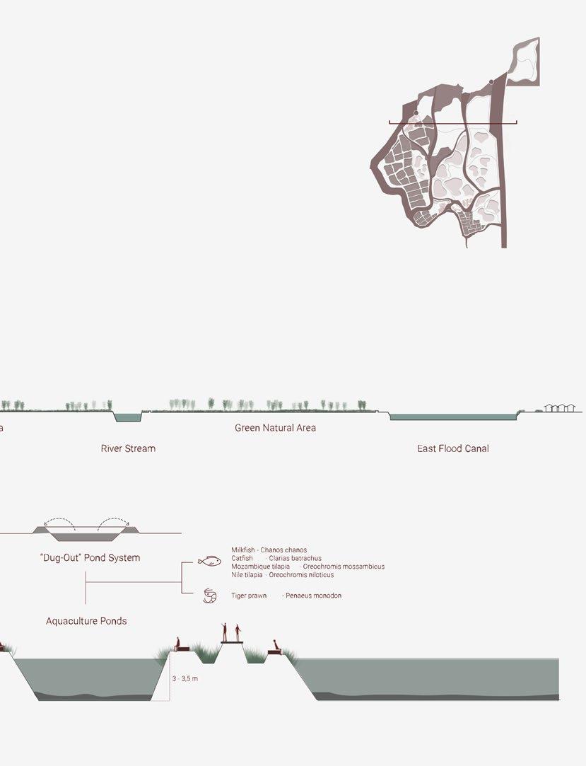
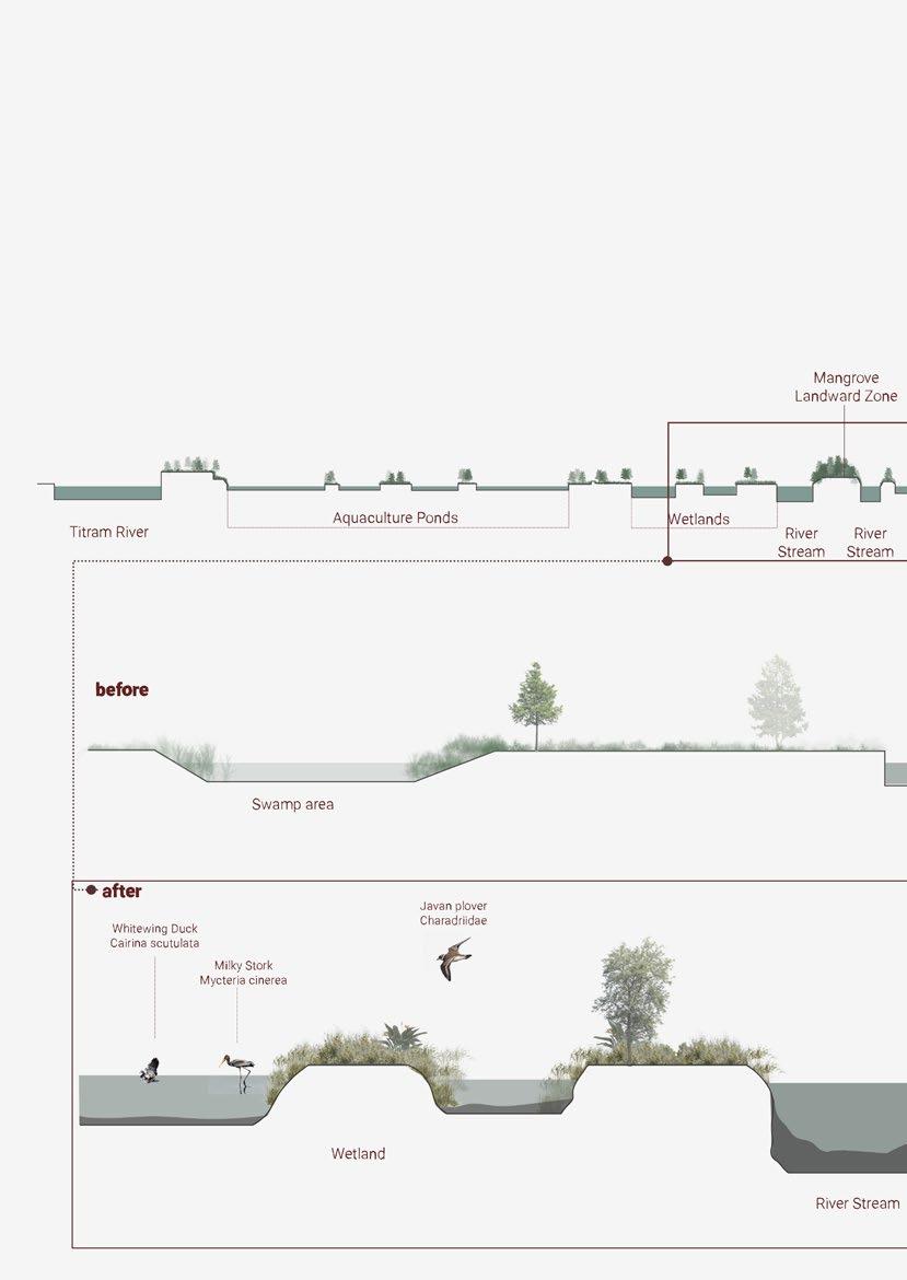
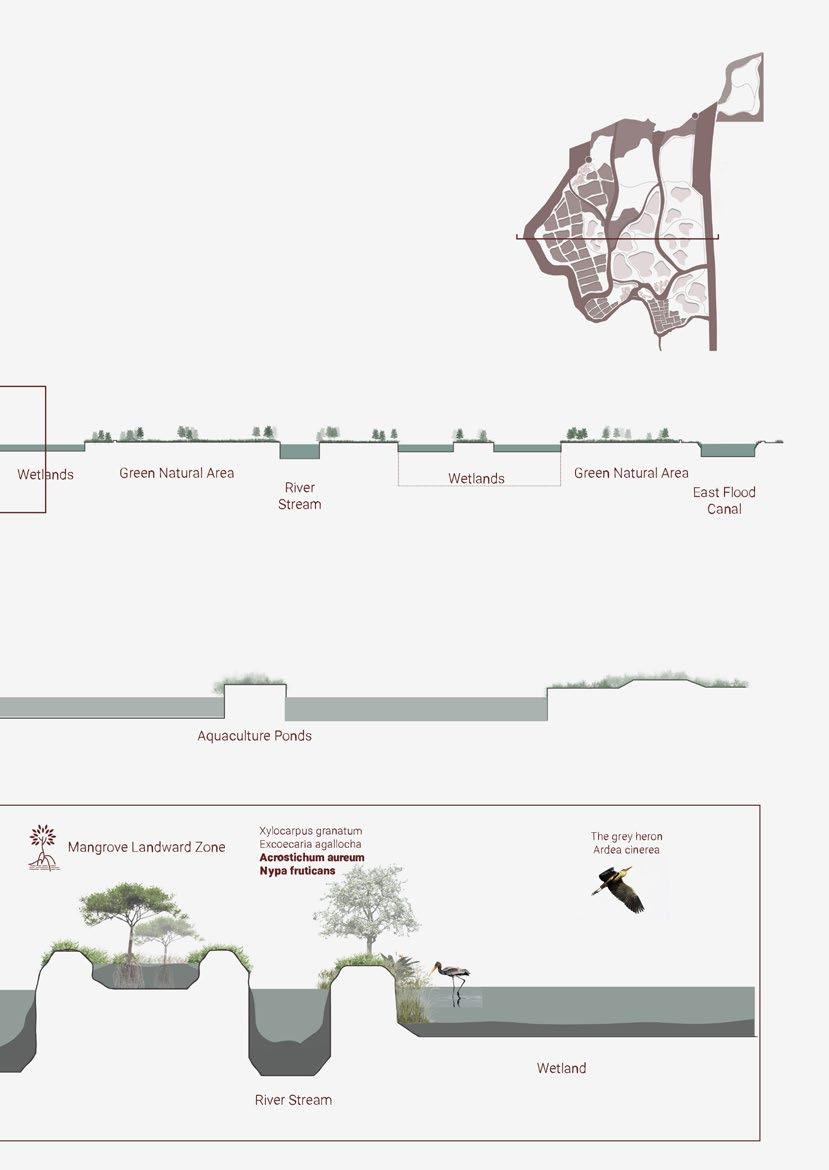
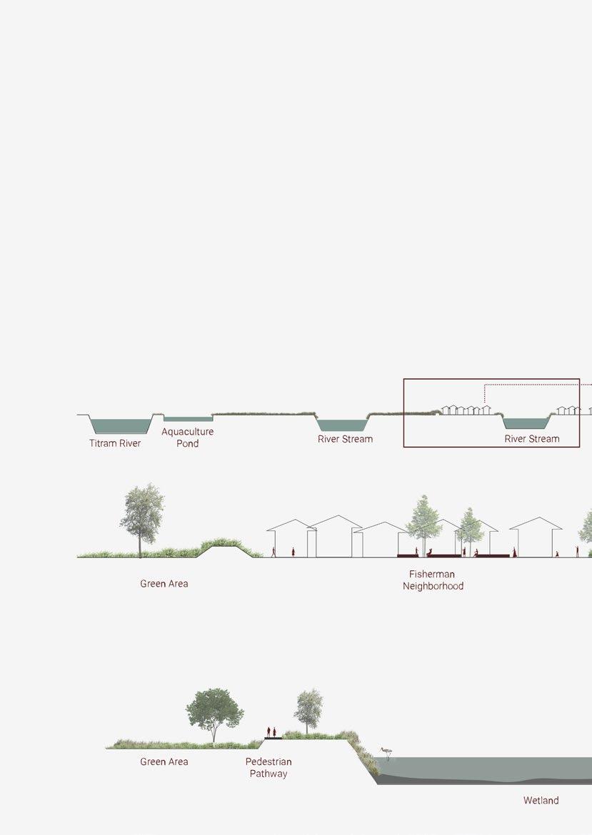
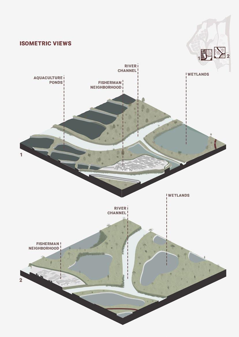
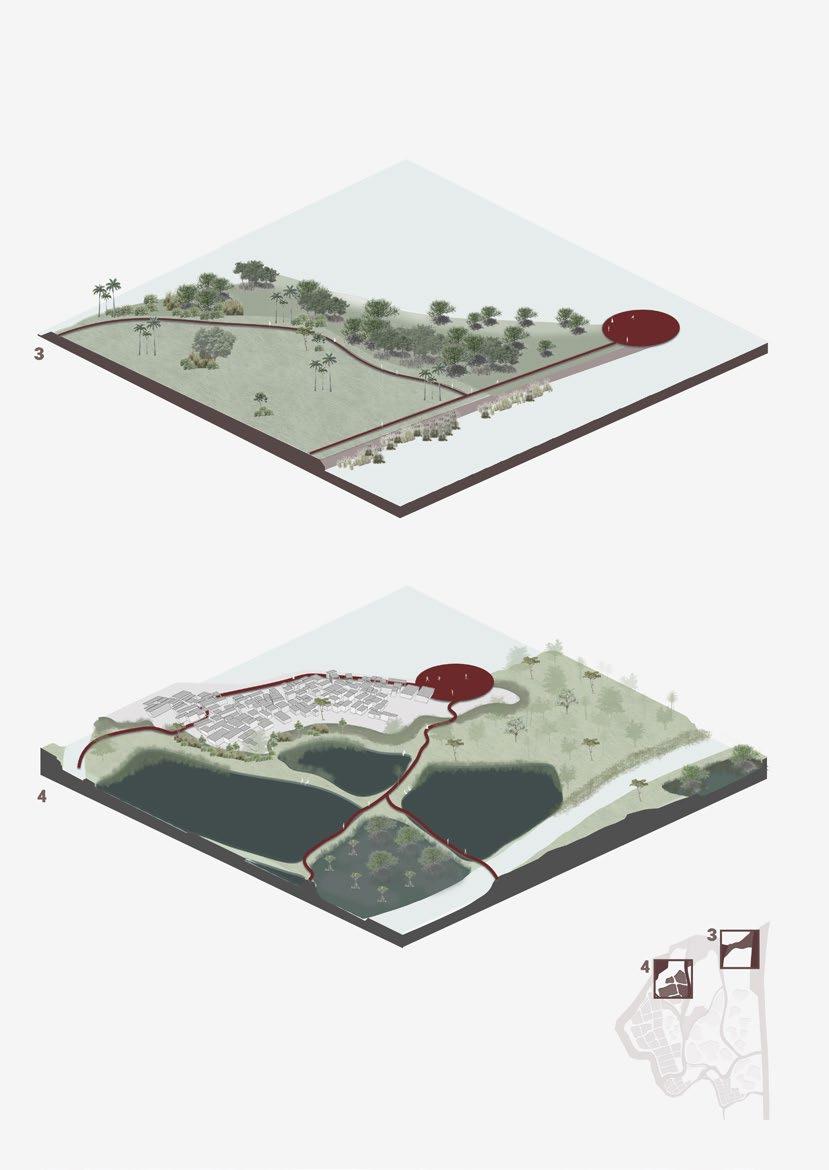
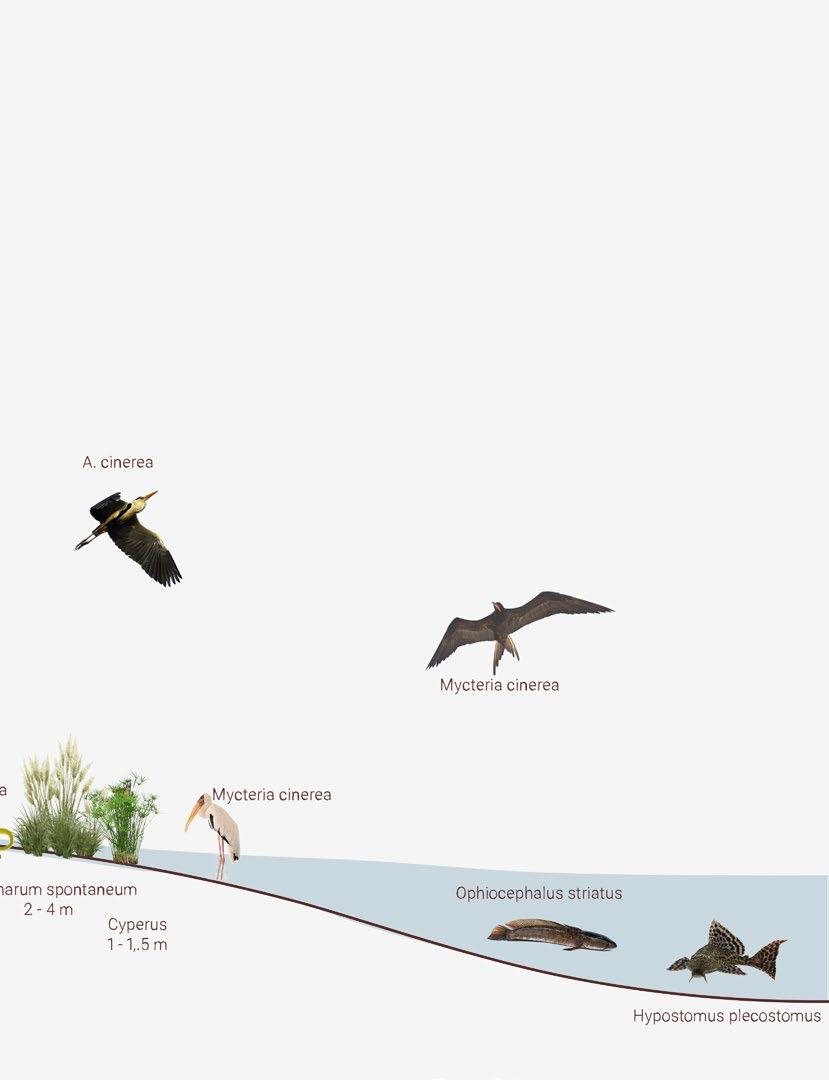
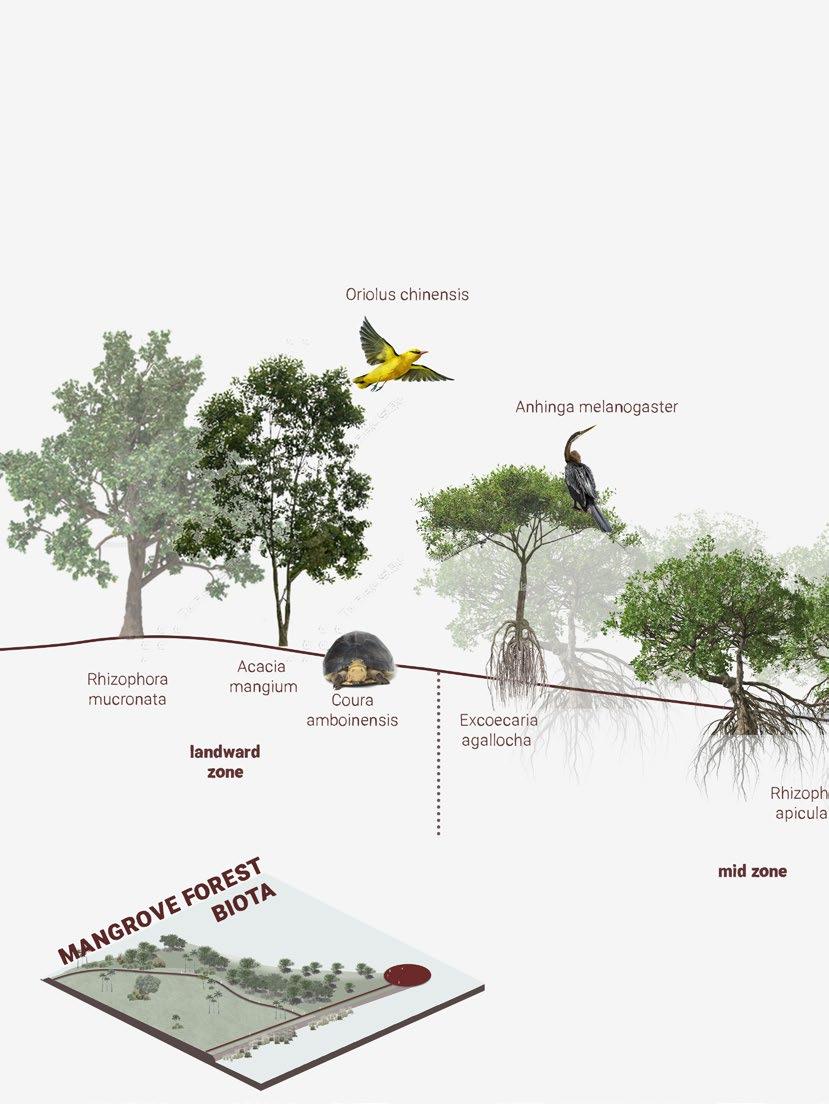
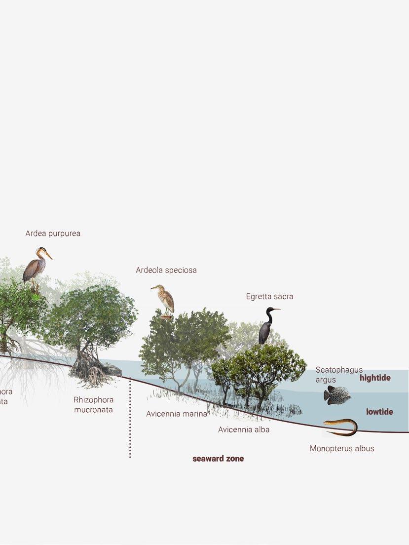
At the end of the journey, you will get to the delta area. In this area, you can see fisherman neighbourhoods and fishing boats. Few interventions were made for this area. Adding wetlands to reduce the risk of flood is the first intervention. Secondly, to have more aquaculture ponds alongside the agriculture fields. These aqwuaculture ponds can provide more income for people who live in the area, of which the majority is a fishermen. Thirdly, to have more river channels. By adding more river channels, the water can be distributed in more ways. This will reduce the chance of flooding. The last intervention is to expand the mangrove forest. Larger mangrove forests provide more protection to the land and people from erosion and storms.
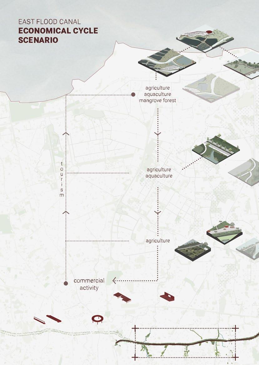
East Flood Canal features agricultural fields, aquaculture ponds, and a mangrove forest. These areas could produce daily needs for the residents. Since there is an active commercial and recreational activity in the residential area, people who produce agriculture, aquaculture, and mangrove forest can sell it in the commercial area. Besides that, the agriculture, aquaculture, and mangrove activity will be heard by people as they are selling food products and will invite potential visitors.
conclusion
This thesis aims to implement urban and ecological strategies to regenerate East Flood Canal in Jakarta and how each fabric could activate and initiate development throughout the canal. Moreover, improving the canal will bring a domino effect for other aspects on the bigger scale (the city), from an environmental aspect, social - cultural, and economic.
This project opens possibilities for possible solutions to overcome this canal’s complex intertwining fabrics and issues. Through the observation of the city’s fabric typologies, green space networks, the public spaces, the accessibility, and the water system condition, this project proposal can bridge the gap between the existing situation, Jakarta’s annual issues, and its future scenarios.
Furthermore, this thesis project can still be improved by future academic researchers, community organization developments, and stakeholders with similar backgrounds. Hopefully, the Regeneration of East Flood Canal inspires others to improve and look deeper into a city’s flood mitigation canals.
180
181
ADB. (2006). Urbanization and Sustainability in Asia: Case Studies of Good Practice. ADB.
Adhi, R. (2010). Banjir Kanal Timur, Karya Anak Bangsa. Jakarta: Grasindo Jakarta.
Amri, M. R. (2016). RISIKO BENCANA INDONESIA. Jakarta: BNPB.
A Rahadian et al 2019 IOP Conf. Ser.: Earth Environ. Sci. 399 012008
Budiyono, Y., Aerts, J. C. J. H., Tollenaar, D., and Ward, P. J.: River flood risk in Jakarta under scenarios of future change, Nat. Hazards Earth Syst. Sci., 16, 757–774, https://doi. org/10.5194/nhess-16-757-2016, 2016.
Caljouw, M., Nas, P., & Pratiwo. (2005). Flooding in Jakarta Towards a blue city with improved. Koninklijk Instituut voor Taal-, Land- en Volkenkunde.
Gustomy, A. (2014). ANJIR KANAL TIMUR (BKT): Konsep ‘Blue and Green Component’ di Jakarta. 4.
JAPAN INTERNATIONAL COOPERATION AGENCY YACHIYO ENGINEERING CO., L. (2006). RECONNAISSANCE STUDY OF THE INSTITUTIONAL REVITALIZATION PROJECT FOR MANAGEMENT OF FLOOD, EROSION AND INNER WATER CONTROL IN JABOTABEK WATERSHED .
L Rumondang et al 2022 IOP Conf. Ser.: Earth Environ. Sci. 950 012016
Napier, J. (2021). Living with Water: Infrastructure and Urbanism in Jakarta. Ecocycles, 7(1), 52–72. https://doi.org/10.19040/ecocycles.v7i1.191
N I Fawzi and V N Husna 2021 IOP Conf. Ser.: Earth Environ. Sci. 750 012002
Osmar Shalih, Khaerunnisa, M., & Safrizal , A. (n.d.). ANALISIS FUNGSI BANJIR KANAL TIMUR. 12.
Sedyawati, E., Rahardjo, S., Johan, I. M., & Ohorella, G. (1986). Sejarah Kota Jakarta 19501980.
Shannon, K. (n.d.). Beyond Tropical Regionalism: The Architecture of Southeast. In A CRITICAL HISTORY OF CONTEMPORARY ARCHITECTURE (pp. 365 - 383).
Shannon, K., & De Meulder, B. (2013). Water Urbanisms East. Park Books.
Stephen Buckman (2016) Canal oriented development as waterfront place-making: an analysis of the built form, Journal of Urban Design, 21:6, 785-801, DOI: 10.1080/13574809.2016.1234332
Q Uniaty 2018 IOP Conf. Ser.: Earth Environ. Sci. 106 012044
182
bibliography
183
