RIVERWALK CONTINUITY
City of Jacksonville
DOWNTOWN INVESTMENT AUTHORITY


2024

Riverwalk Continuity 2
Downtown Investment Authority 3 TABLE OF CONTENTS Introduction 04 Riverwalk Standards 06 A. Waterfront Easements & Setbacks 07 B. Paved Shared-Use Path, Location of Amenities and Utility Services 07 C. Northbank General Standards 07 D. Southbank General Standards 07 E. Color Palettes 08 F. Hardscape 10 G. Lighting 13 H. Furnishings 14 I. Landscape 18 J. Signage 22 Riverfront Nodes (Parks) 24 Riverfront Resilience 28 Source Materials 30
INTRODUCTION
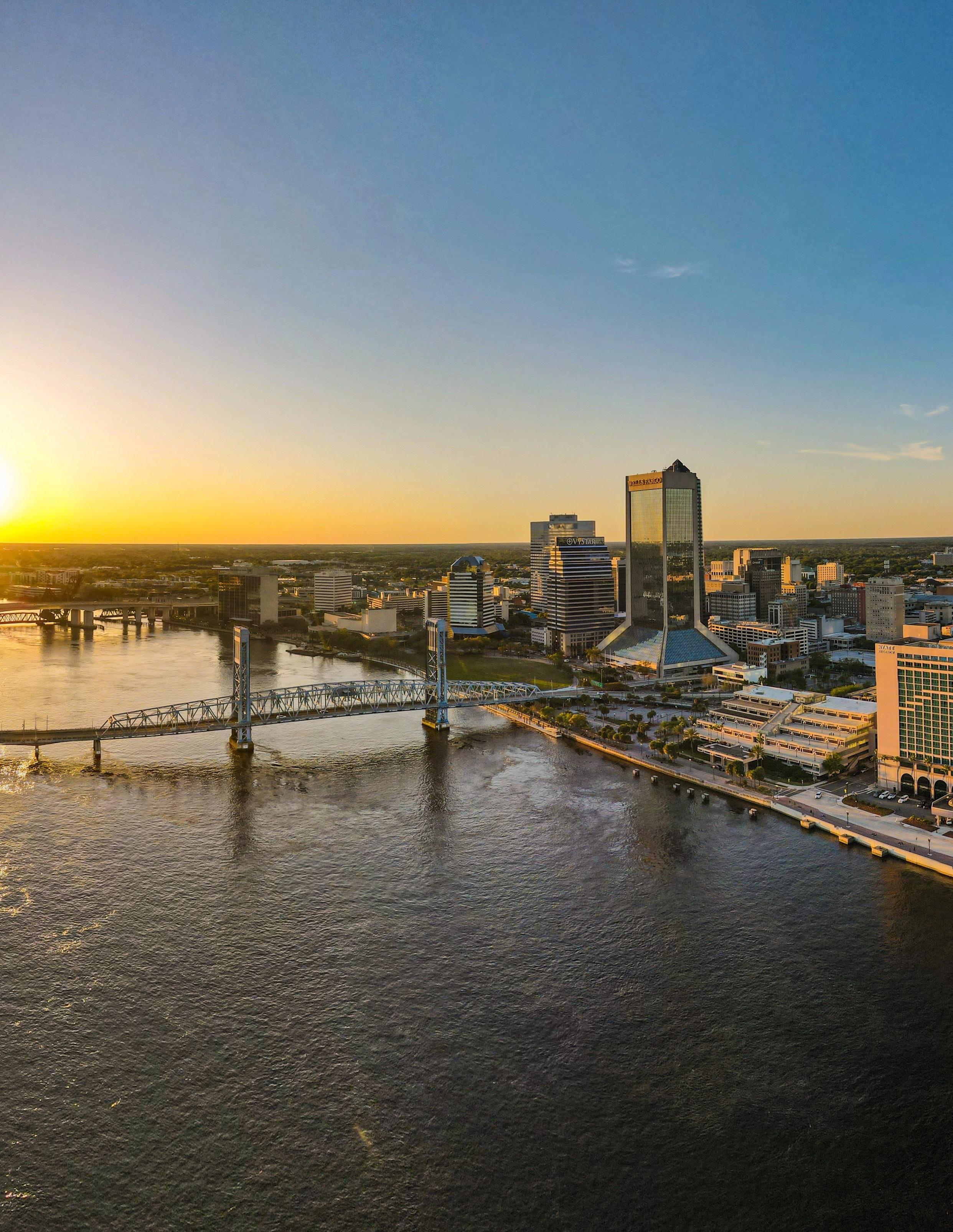
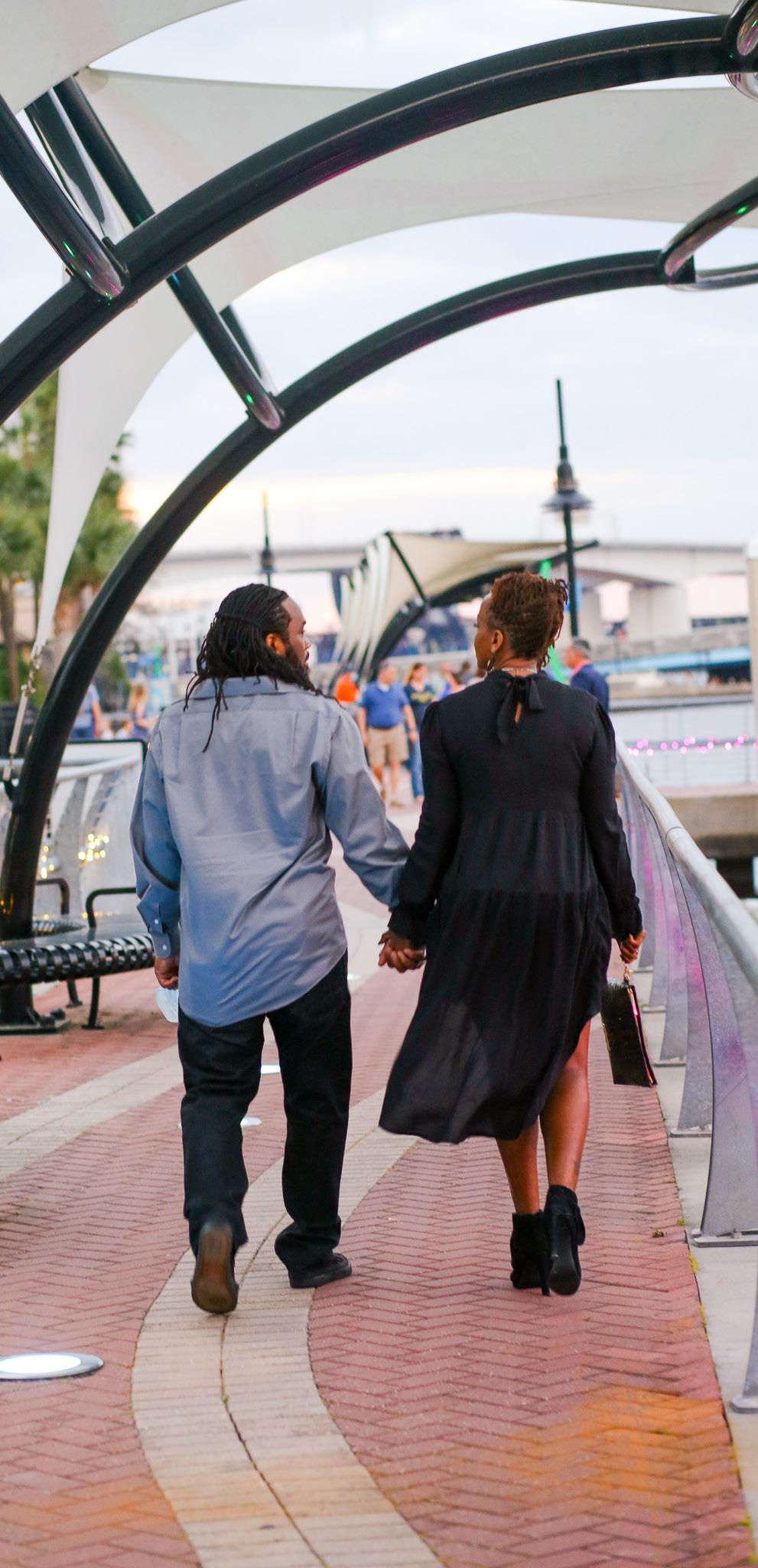
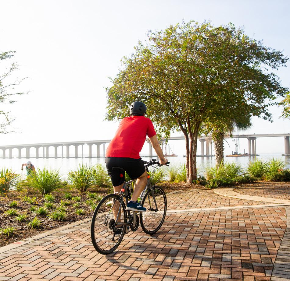
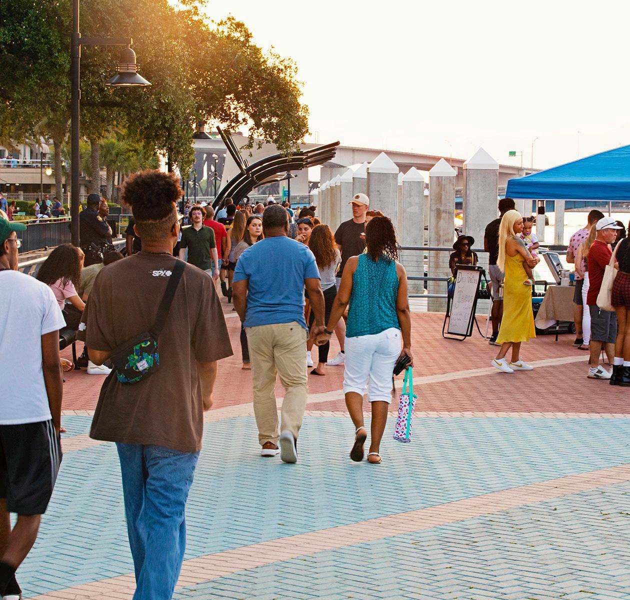
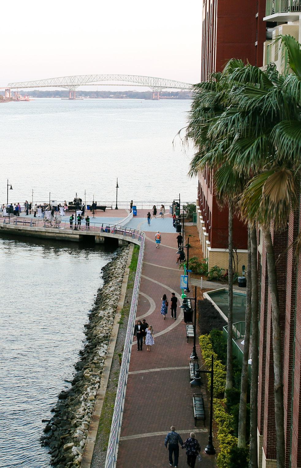
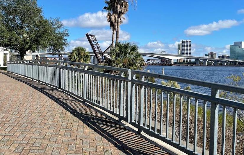
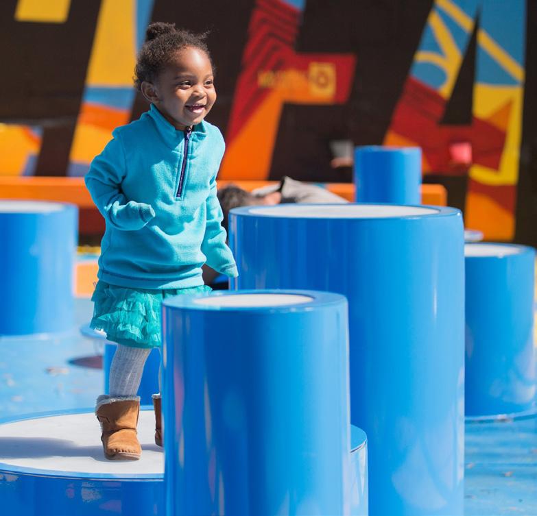
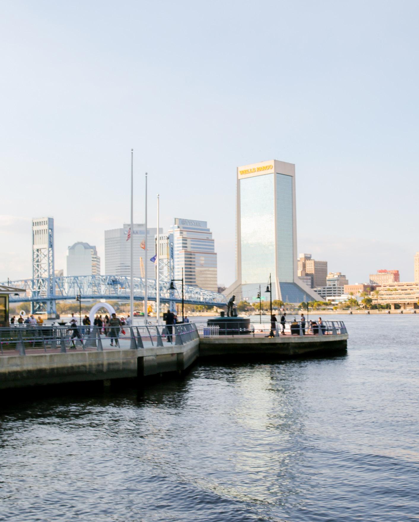
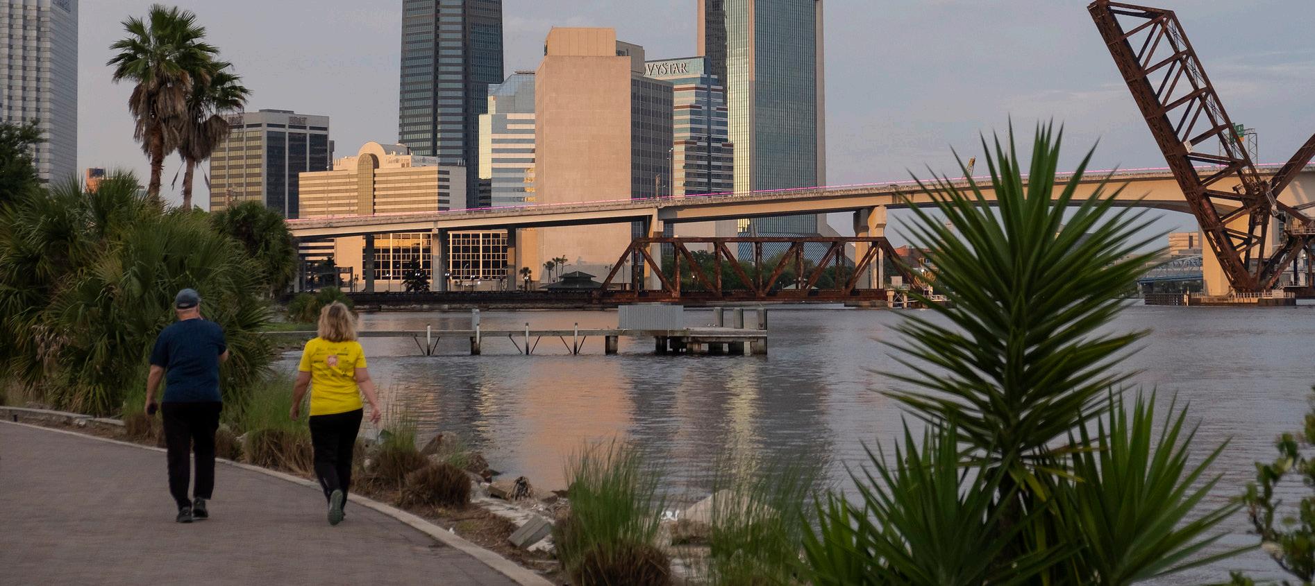
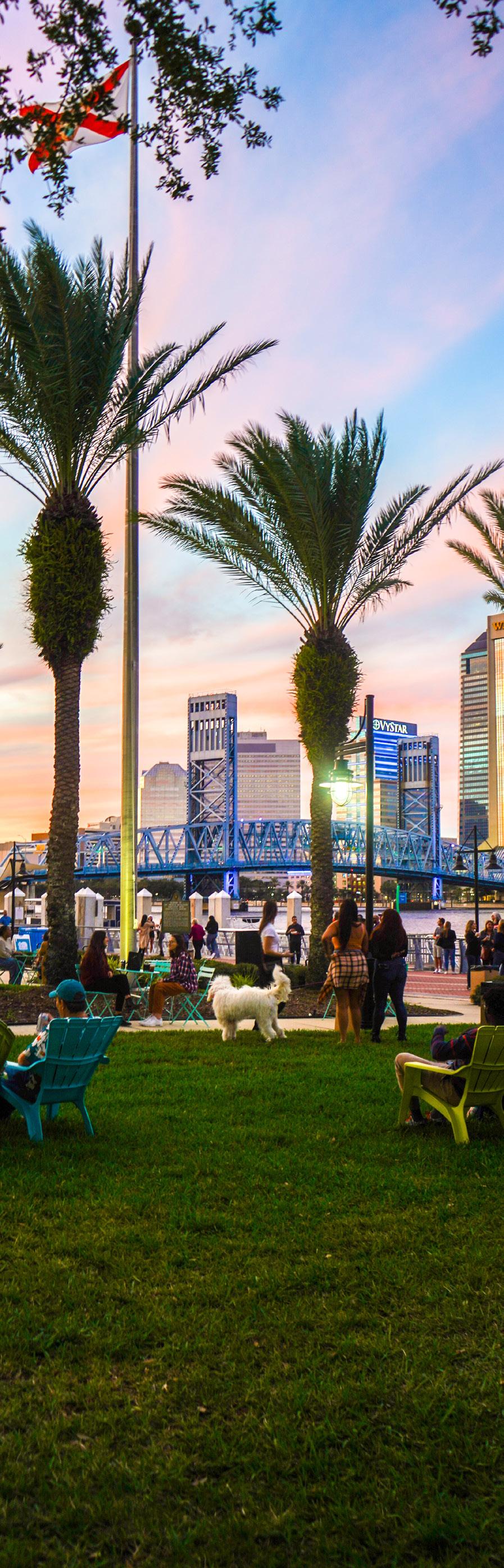
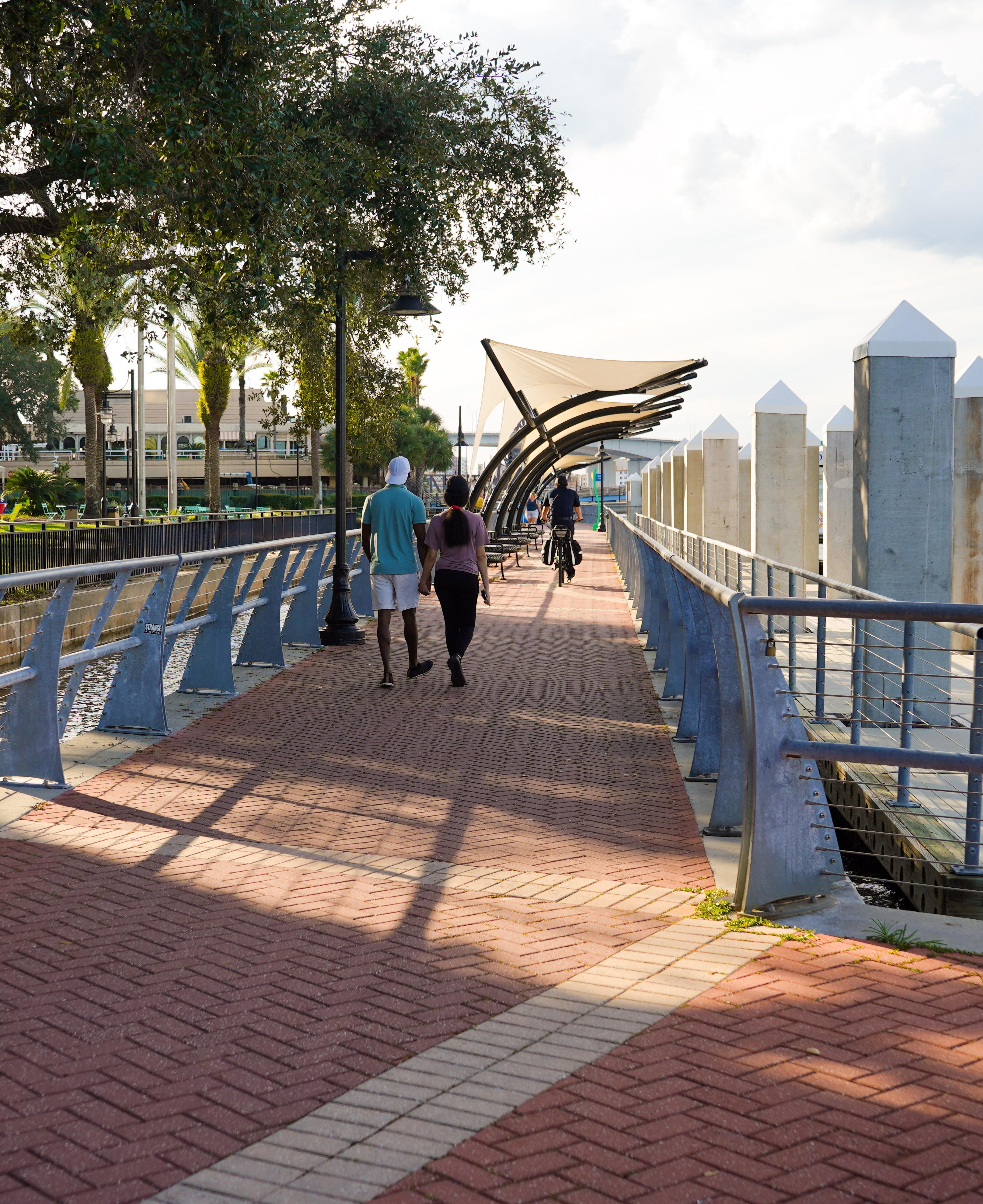
Stretching for more than three miles along both the North and South banks of the St. Johns River, the Jacksonville Riverwalk Park is a center-stage attraction for residents and visitors alike in the heart of Downtown Jax.
Recognizing the incalculable value of this community asset, the Downtown Investment Authority (DIA) in collaboration with the City’s Department of Parks, Recreation and Community Services (Parks Dept.) has prepared this document to consolidate in one place the multiple aesthetic and functional criteria that enhance the Riverwalk’s attractiveness, optimize its accessibility to all users and bolster its resiliency.
The Riverwalk Continuity document is a compilation of the interwoven design guidelines and development standards aimed at ensuring a cohesive, secure and engaging experience for those who come to the waterfront for recreation, special events, dining, entertainment or to simply enjoy the scenic beauty of the riverfront environment.
Riverwalk Continuity 4
The document does this by assembling in one place the uniform dimensions, shade, color schemes, materials, markings, signage, furniture, landscaping and more for the Riverwalk, giving it a consistent look and feel that assures users they are in a connected and well-curated public space along the entire walkway.
Also included in the document are a series of themed activity nodes that spotlight various historical and cultural highlights as well as the economic pillars of the community, providing further connection points for users.
The Riverwalk was built over several decades in various sections with differing designs, and it continues to be shaped by significant private and public development. By tying together what currently exists and shaping what is to come, the assembled plans form a rubric for a fully connected, aesthetically pleasing and well-functioning Riverwalk.
LEARN MORE ABOUT RIVERWALK CRITERIA
This summary is drawn from the following source materials:
RIVERWALK PARK DESIGN CRITERIA
City of Jacksonville Ordinance 2019-196-E
TREE PRESERVATION AND LANDSCAPE STANDARDS
City of Jacksonville Ordinance 2019-196-E
DOWNTOWN ZONING OVERLAY
- SUBPART H OF CHAPTER 656
City of Jacksonville
JACKSONVILLE WATERFRONT WAYFINDING DOCUMENTS
City of Jacksonville Ordinance 2019-196-E
RIVERFRONT DESIGN GUIDELINES AND ACTIVITY NODES PLAN SWA Group for the DIA
For copies of these documents, contact the DIA at 904-255-5302 or search online at dia.coj.net/reports
Downtown Investment Authority 5
RIVERWALK STANDARDS
The Northbank and Southbank Riverwalks are distinct from each other in several of their design elements and materials (details to follow in Sections 6 and 7), yet they’re also similar in fundamental ways and, together, form a public park that stretches along both sides of the river. This section focuses on the standards that apply to both the Northbank and Southbank, as well as the individualized criteria that are specified for either the Northbank or the Southbank.
Riverwalk Continuity 6
A. WATERFRONT EASEMENTS AND SETBACKS (Northbank and Southbank)
Consistent with the adopted Community Redevelopment Area Plans for the Downtown Northbank and Southbank, a 50-foot minimum setback from the St. Johns River’s water edge is required, except for water’s edge restaurants, as defined within the Downtown Zoning Overlay. The setback may be achieved by providing an average building or vertical structure setback of 50 feet from the bulkhead or Mean High Water Line (MHWL), with a minimum setback of 40 feet in all locations.
To provide a continuous Riverwalk system, the Riverwalk must be located within the 25-foot span closest to the bulkhead or MHWL, whichever is farther upland. Public amenities, streetlights, gazebos, shade structures, and similar public features are acceptable within this span. Signage or interactive storytelling features shall be allowed within the 25 feet closest to the water. Public amenities are to be consistent with the Riverwalk Park Design Criteria (RPDC), and shall be approved by the Parks Dept. Director prior to installation.
The Downtown Zoning Overlay provides additional details on waterfront requirements, including conventions for measuring the setback distances.
B. PAVED SHARED-USE PATH, LOCATION OF AMENITIES AND UTILITY SERVICE AREAS (Northbank and
Southbank)
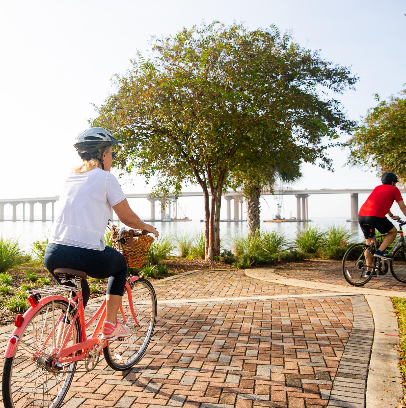
The Riverwalk is an urban, shared-use path designed to accommodate pedestrians and bicyclists of various abilities. Design must be ADA compliant, and amenities such as lighting, signage, furnishings, etc., cannot be placed within the clear zone of the path. Clear path width must be at least 15 feet unless the path is constrained by site restrictions, but the effective width cannot be reduced to less than 12 feet.
Utility service areas – i.e. stormwater infrastructure, electrical and mechanical equipment – must be visually unobtrusive and integrated with surroundings.
C. NORTHBANK GENERAL STANDARDS
The criteria reflect the Northbank’s earthy colors, straight-line designs, and angular and square paving patterns. The standards also accentuate the history of Downtown and the waterfront’s heritage as the shipyard and industrial hub that drove Jacksonville’s economy.
D. SOUTHBANK GENERAL STANDARDS
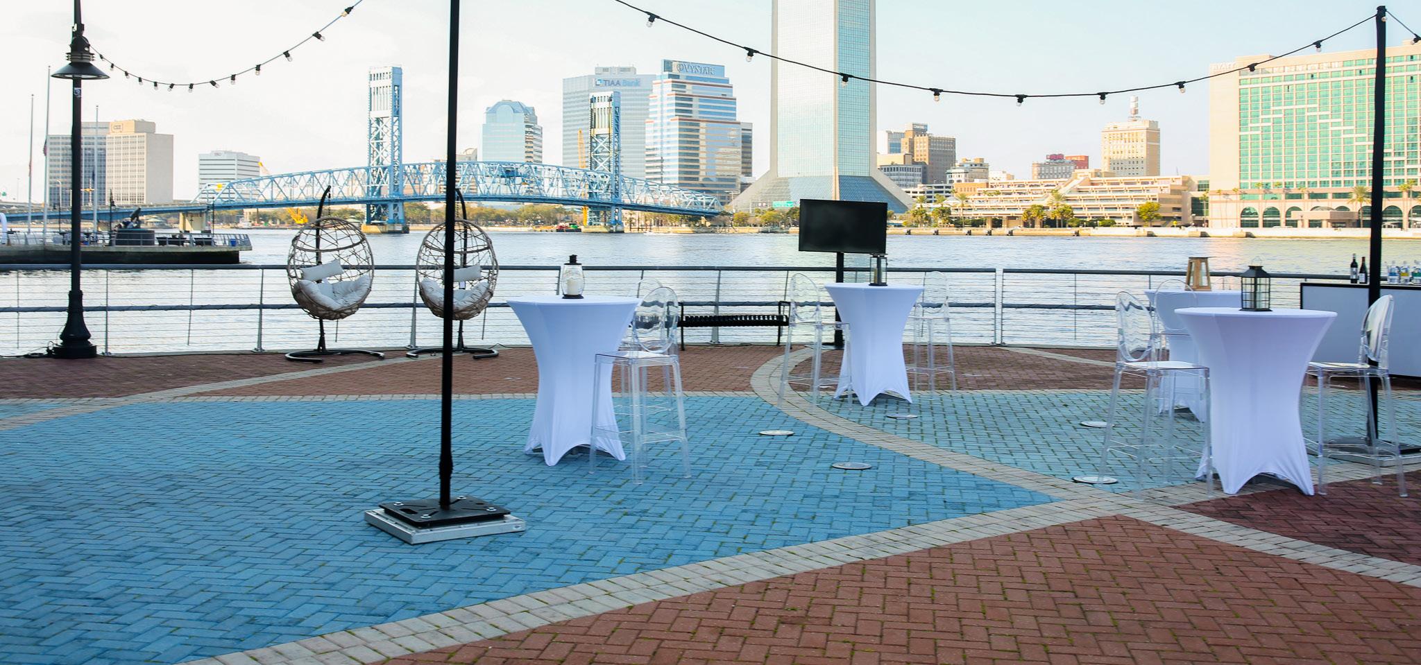
The criteria defines the current 1 ¼-mile southern portion of the Riverwalk, which is characterized by bright colors and curvilinear lines.
Downtown Investment Authority 7
E. COLOR PALETTES
To maintain continuity along the Northbank Riverwalk, a minimum of two colors from the approved color palette must be incorporated within the hardscape design.
The rhythmic paving bands must be in the color range identified in color 2.
NORTHBANK COLOR PALETTE


Color 1
Primary: Pantone 7578 C
Range: Pantone 7576 C – 7582 C
Color 2
Primary: Pantone 2309 C
Range: Pantone 2309 C – 2315 C
Color 3
Primary: Pantone 730 C
Range: Pantone 726 C – 732 C
Color 4
Primary: Pantone 424 C
Range: Pantone 422 C – 426 C
Color 5
Primary: Pantone 427 C
Range: Pantone 427 C – 429 C
Riverwalk Continuity 8
To maintain continuity along the Southbank Riverwalk, a minimum of two colors from the approved color palette must be incorporated within the hardscape design. One of the two colors must be in the color range identified in color 3.
The rhythmic paving bands must be in the color range identified in color 4.
SOUTHBANK COLOR PALETTE


Color 1
Primary: Pantone 174 C
Range: Pantone 169 C – 175 C
Color 2
Primary: Pantone 1797 C
Range: Pantone 1787 C – 1817 C
Color 3
Primary: Pantone 7452 C
Range: Pantone 7450 C – 7456 C
Color 4
Primary: Pantone 7499 C
Range: Pantone 7499 C – 7502 C
Color 5
Primary: Pantone 7416 C
Range: Pantone 7415 C – 7419 C
Downtown Investment Authority 9
F. HARDSCAPE
NORTHBANK HARDSCAPE
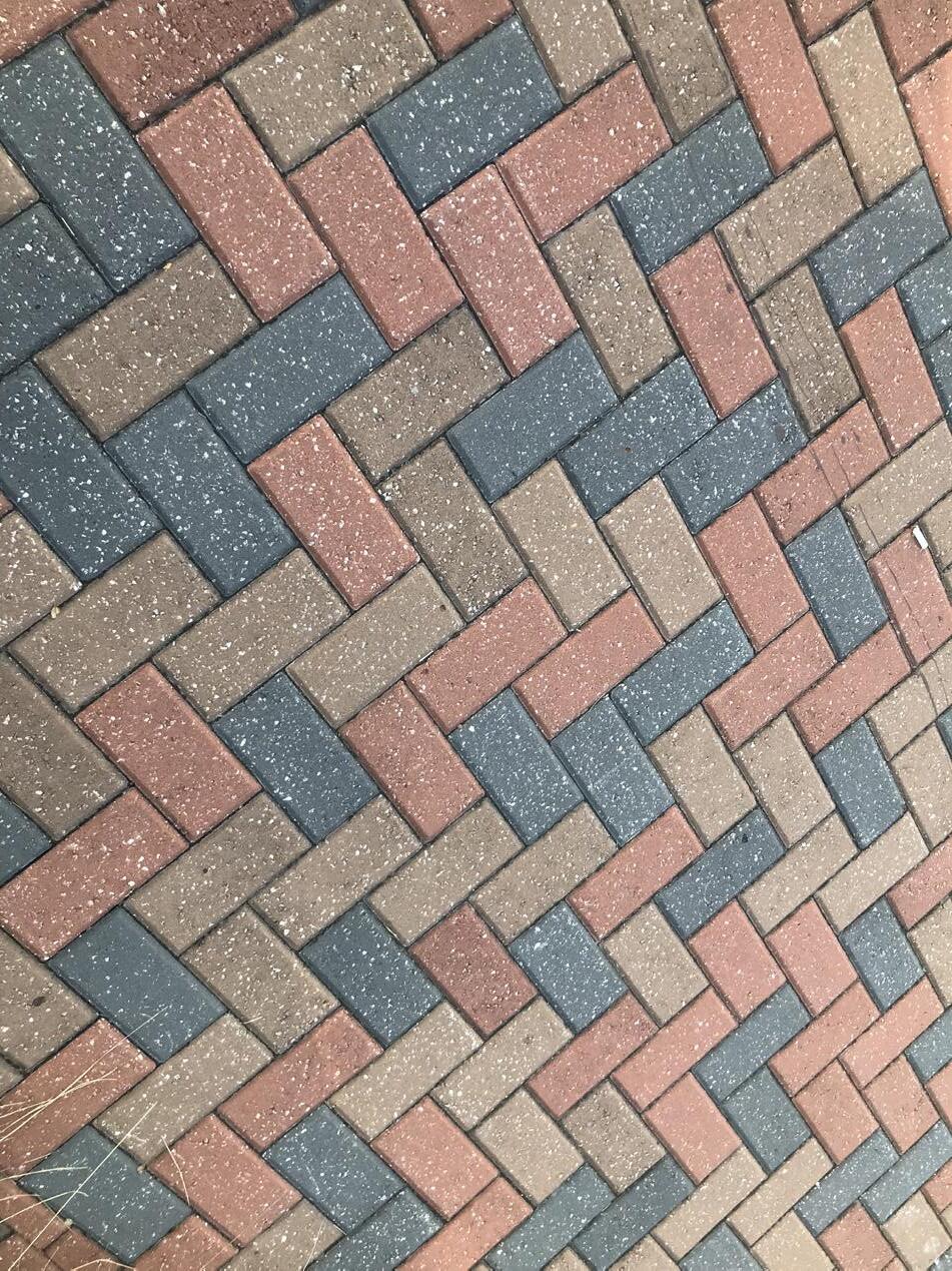
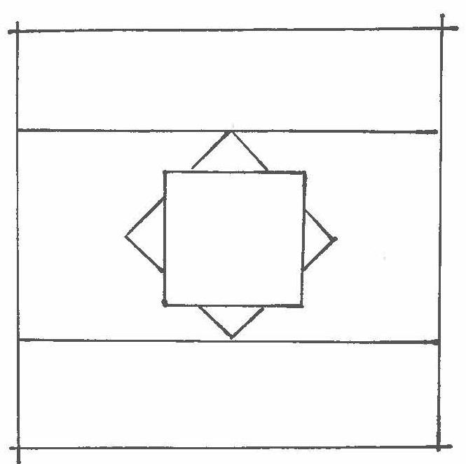
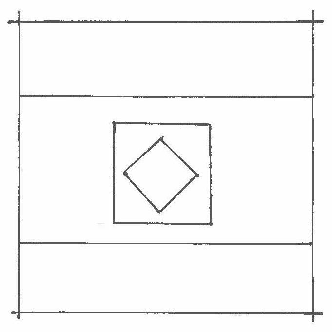
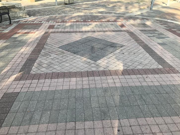
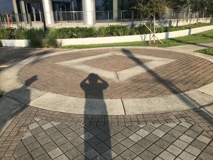
The standards call for straight, rectilinear designs and square patterns that are interspersed with circular designs such that the unifying patterns are nested geometries of circles, squares and diamond shapes. Both concrete and pavers are allowed, with such requirements as thickness and finish of concrete, and size and type of pavers.
Concrete pathways must include frequent expansion joints to prevent cracking, while pavers can be installed in any pattern other than a stacked bond (with offset stacked bond permitted).
Hardscape designs and patterns shall include:
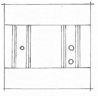
• Rhythmic paving bands of consistent coloring: A paving element (specifications provided in this section) that provides cohesion along the length of the Riverwalk, used when different paving patterns meet, a specialized paving area meets an existing or new paving pattern, or a significant change in material or texture occurs. These bands are the designated location for inpavement medallions, which are used to identify trails, distances, and similar.
• Specialized paving areas: Paved areas (specifications provided in this section) used to divide a paving design at nodes/intersections, moments of interest, or large curves/turns, in the center of the Riverwalk walkway.
Riverwalk Continuity 10
Specialized Paving Area Diagram
Specialized Paving Area Diagram
Rhythmic Paving Bands Diagram with in-pavement medallions
NORTHBANK DESIGN/PATTERN
• The designated material for the primary pathway is concrete, with frequent expansion joints to prevent cracking.
• Pavers may be used as accent material. Any pattern other than a stacked bond may be used, but an offset stacked bond is acceptable.
• Specialized paving areas: One of the following diagrams, or some variation thereof (simple, nested geometric shapes), shall be used to emphasize areas of interest. These areas are appropriately located in the center of the Riverwalk walkway and sized to encompass the full width of the Riverwalk pathway. A combination of concrete and pavers may be used for these paving designs so long as the colors are consistent with the Northbank color palette. A minimum of three (3) colors from the Northbank color palette must be used.
• Rhythmic paving bands: A single or double row of tan-colored brick or concrete pavers at 4” x 8” x 2-3/8” shall be installed on either side of a 12” concrete band. If approved by the Parks Director, in-pavement medallions can be placed within the concrete band. Rhythmic paving bands are to be located in between specialized paving areas (not to interfere with the specialized paving areas) at approximately every 1/8th of a mile (660 feet). Specific locations must be approved by the Parks Department.


Downtown Investment Authority 11
SOUTHBANK HARDSCAPE
Specific to the Southbank, pavers are to be installed in curvilinear patterns reflective of existing radii. The standards are the same as those for the Northbank except the following:
• Colored concrete makes up the primary pathway, with frequent expansion joints to prevent cracking. Concrete should have a salt finish; alternative finish options subject to approval by the Parks Director.
• A double row of tan-colored (Pantone 467C) brick or concrete pavers at 4” x 8” x 2-3/8”, in a stacked bond configuration, is prescribed to differentiate between color changes.
• Rhythmic bands: A concrete, curvilinear band shall be installed across the Riverwalk to complement the paving pattern on the Southbank. If approved by the Parks Director, in-pavement medallions can be placed within the concrete band. Rhythmic bands are to be located in between any specialized paving areas (not to interfere with the specialized paving areas) at regular intervals, as approved by the Parks Department.
Riverwalk Continuity 12
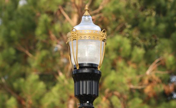
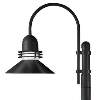
G. LIGHTING
The lighting criteria for the Riverwalk are designed to create a unique and safe visitor experience, reinforce and define activity areas, provide visual interest at night, and facilitate safe and convenient mobility for pedestrians and bicyclists. Standards are in place for styles and finishes of fixtures, brightness and colors/warmth of lights, and placement of light sources. The standard for average ambient light level is between one (1) and three (3) footcandles with a minimum of half (0.5) and a maximum of six (6) footcandles at any point as measured on the ground plane. Accent lighting or recreational lighting may exceed these levels by a multiple of 2.5.
NORTHBANK LIGHTING
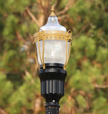
Overhead promenade lighting shall be State Street, Acorn Style Luminaire, powder-coated black, with banner arms, and placed on the opposite side of the Riverwalk from the river whenever possible*. Accent lighting is encouraged near fountains, art, planting areas, etc., subject to approval by the Parks Director.
SOUTHBANK LIGHTING
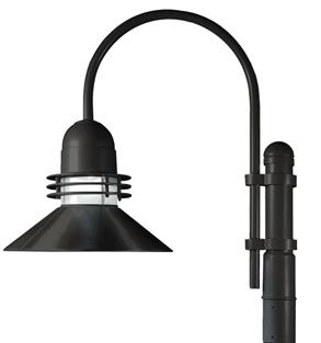
The style of overhead promenade lighting is designated as the Maritime Light Pole and Fixture in black (from Architectural Area Lighting’s Universe Collection), with illuminated solid rings and straight hoods in black with a flat glass lens. Banner arms shall be incorporated. As with the Northbank, accent lighting is also recommended near sculptures, art, etc.
*Deviations shall be approved by the Parks Director.
Downtown Investment Authority 13
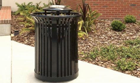
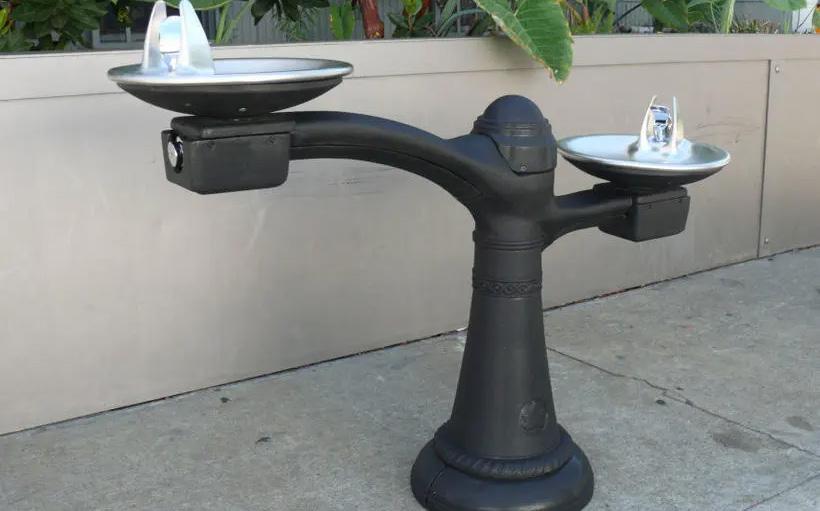
H. FURNISHINGS
NORTHBANK FURNISHINGS*
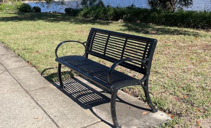
ITEM
Bench/Seating (historic character, all steel)
MANUFACTURER MODEL
Victor Stanley
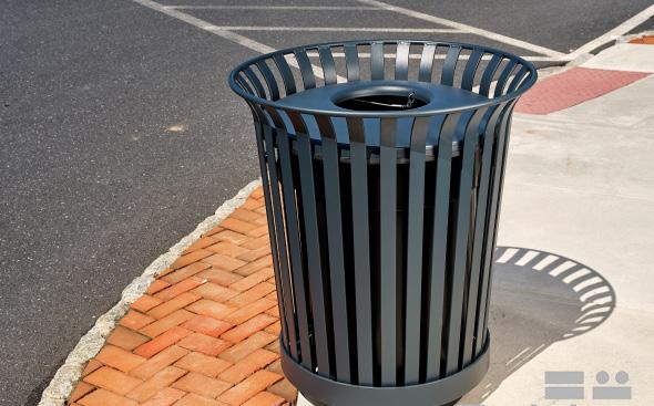
Trash Receptacles (all steel, open top)
FMS-324 with intermediate armrest (backless model can be used where appropriate)
COLOR/ ADDITIONAL INFORMATION
Black, powder-coated; To include intermediate armrest
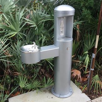
Victor Stanley (or Lexington 36 gal with rain hood lid) ES-342 Black, powder-coated
Drinking Fountain Canterbury Designs New York Fountain
General Path Lighting State Street Acorn Style Luminaire
Railing (only used in areas where necessary according to safety code)
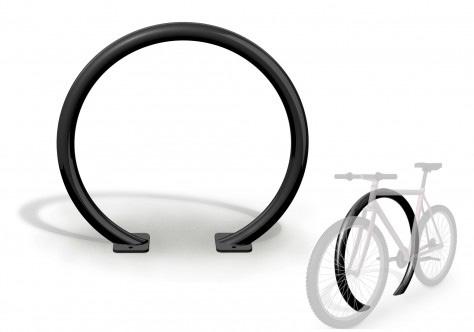
Bike racks
Upright and accent patterns shall be rectilinear
With full decorative cover
Powder-coated black or hot dipped galvanized steel placed upright and with rectilinear accent patterns
Victor Stanley BRHS-101 Black, powder-coated
*Alternative site furnishings may be approved by the City of Jacksonville Parks Director.
Riverwalk Continuity 14
SOUTHBANK FURNISHINGS*

ITEM
MANUFACTURER MODEL
Bench/Seating DuMor
COLOR/ ADDITIONAL INFORMATION
Steel Bench 95 with center armrest Black; to include intermediate armrest
Trash Receptacles DuMor Steel Model 84-32-DM Black
Drinking Fountain Willoughby CWBF-3 Stainless Steel
General Path Lighting Architectural Area Lighting Universe, medium or pedestrian scale
Railing (only used in areas where necessary according to safety code)
Steel wire with galvanized posts and thicker top rail
Illuminated solid rings, straight hoods, black with a flat glass lens.
12’ pole with fluted decorative base and a SLA 17 arm.
If walkway over water, railing shall be arced into walkway to match the area between Friendship Fountain and the Duval County School Board property
Walkway on land –railing shall be upright
*Alternative site furnishings may be approved by the City of Jacksonville Parks Director.
Downtown Investment Authority 15
SCULPTURAL AND ARTISTIC BENCHES AND FURNISHINGS
While key hardscape elements tie Riverwalk segments together, alternative and artistic furnishing opportunities may be used, as approved by the Parks Director. A signature piece or unique furnishing may be placed outside of the paved walkway and should provide a “pop” of color, consistent with the colors shown here.


Northbank “Pop”
Pantone 2387 C
Southbank “Pop”
Pantone 2423 U

Riverwalk Continuity 16
Downtown Investment Authority 17
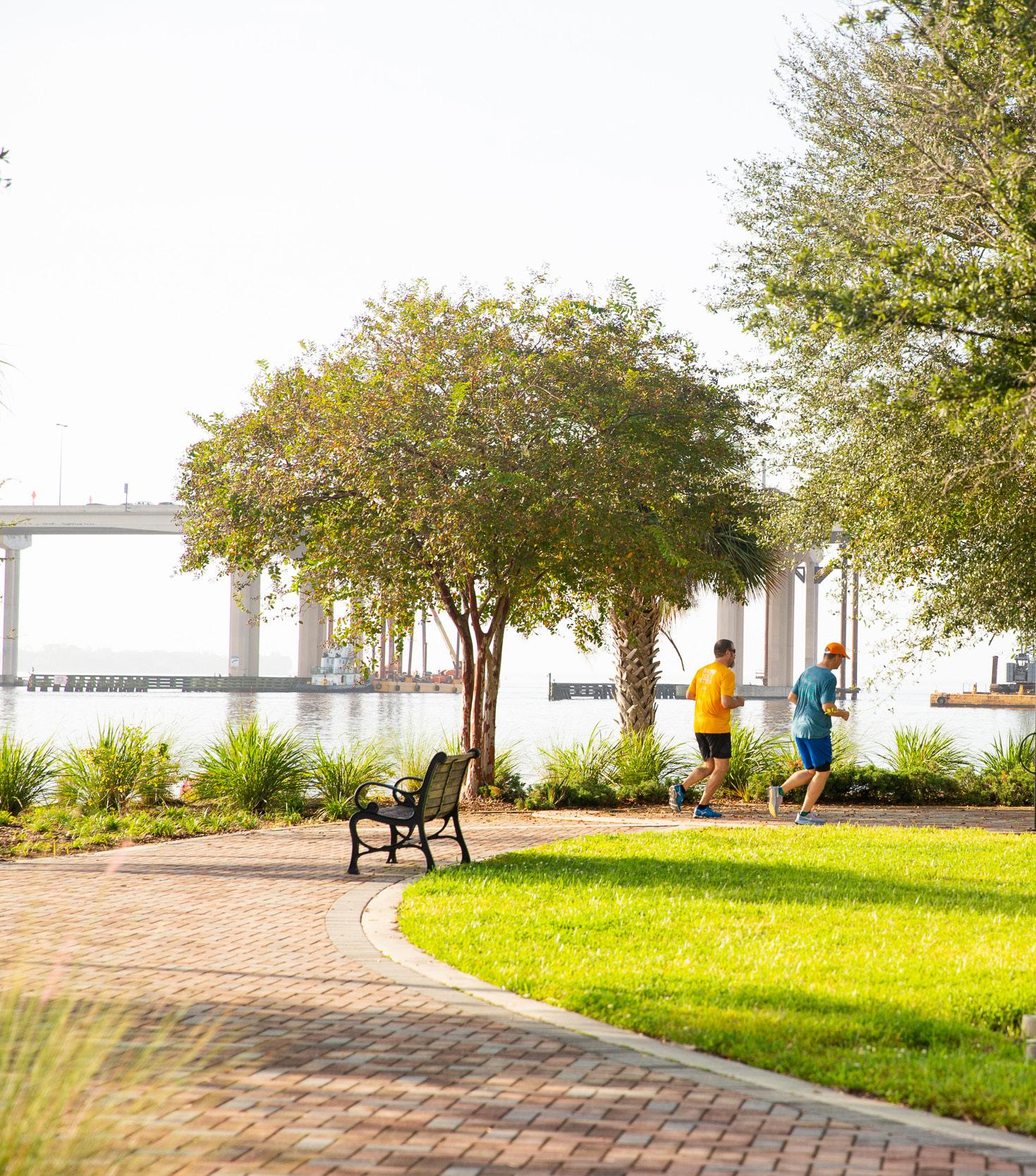
I. LANDSCAPE - NORTHBANK AND SOUTHBANK
Plant types and locations are crucial elements of the standards, as they add to the natural beauty of the riverfront and enhance its resiliency while accentuating the Riverwalk’s features.
The standards call for all landscape design, installation and maintenance to comply with the Riverwalk Park Design Criteria (RPDC) and with the Tree Preservation and Landscape Standards in the City of Jacksonville Ordinance Code, with the more stringent standard prevailing.
PLANT SPECIFICATIONS
Design compatibility is gained by repetition in detailing and design elements, such as landscape features and textures.
• The planting area requirements for a large tree, as identified by the City’s uniform Tree Planting List, are set at a minimum of 15’ x 15’. If less space is available for planting, however, a structural soil, custom support system or suspended pavements are options to accommodate the root system.
• Small and medium trees as identified by the Tree Planting List are appropriate for planters, with groundcover plantings beneath them as feasible.
THREAD PLANTS
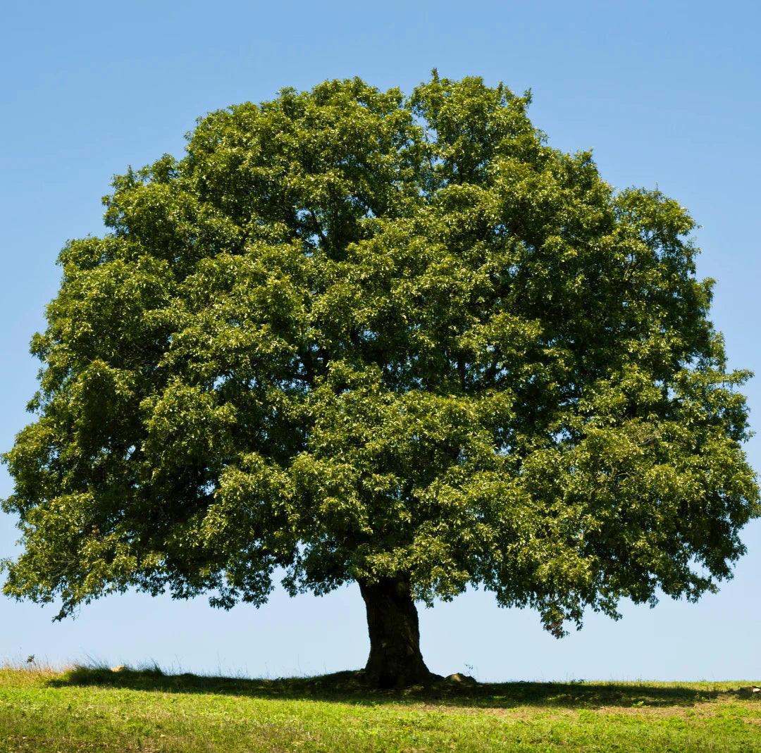
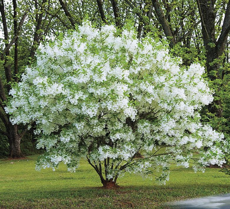
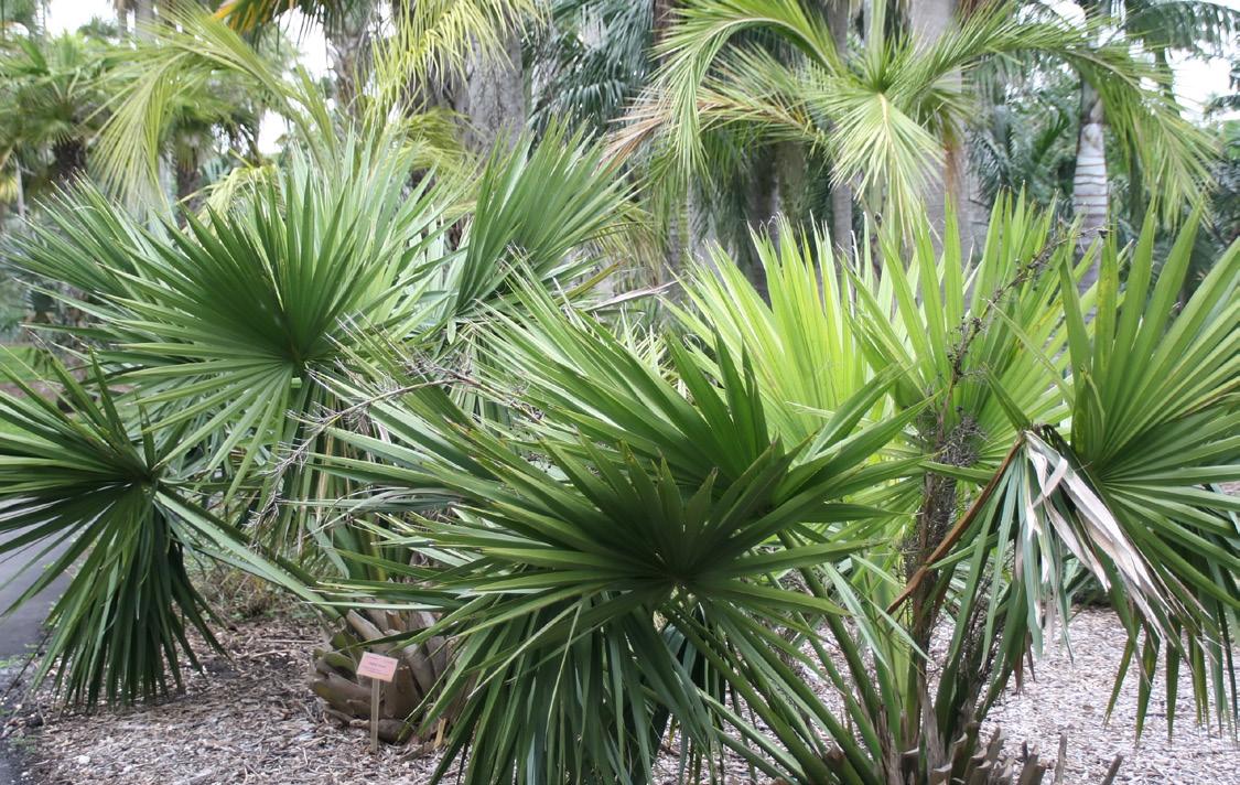
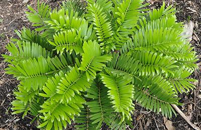
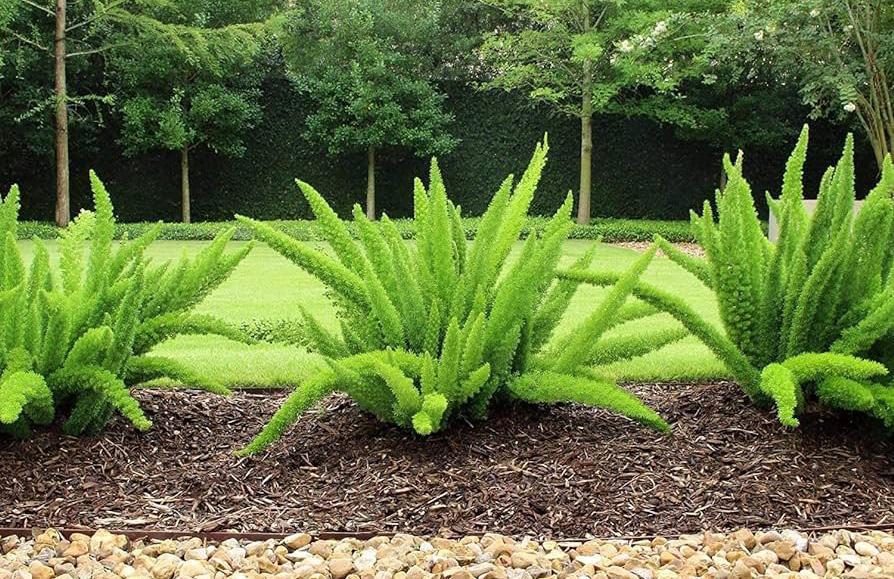
An assortment of thread plants help create cohesion amid the Riverwalk’s various sections — or “stitch” those sections together. The plants were carefully selected not only for their beauty but for their compatibility with the Northeast Florida climate and, in the case of shade trees, their beneficial effect on public health. Samples of these plants are shown on the following page, and the detailed plant palette list is outlined in Appendix B of the RPDC.
Riverwalk Continuity 18
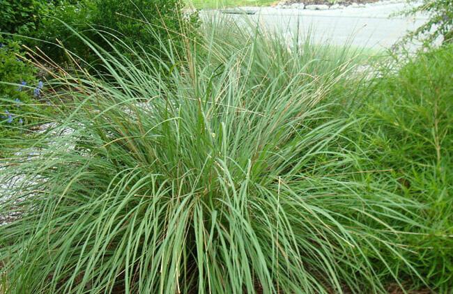
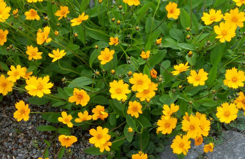
CATEGORY BOTANICAL NAME COMMON NAME 1 Large/Shade Tree Quercus Virginiana Live Oak 2 Small/Specimen Tree Chionanthus Virginicus Fringe Tree 3 Shrubs Serenoa Repens Sawtooth Palmetto 4 Shrubs Zamia Floridiana Coontie 5 Groundcovers Asparagus Aethiopicus ‘Myers” Foxtail Fern 6 Grasses Tripacum Dactyloides Fakahatchee 7 Perennials Coreopsis Auriculata Lobed Tickseed
Downtown Investment Authority 19 01
02
04
03
05
06
07
PLANTING ZONES
Six planting zones are specified in the RPDC. In general, planting zones closest to the river may have a less manicured appearance, as plants in those areas are subject to tidal changes and flooding, while more formal designs are appropriate for areas closer to the Riverwalk. The criteria call for plants in nodes/intersections to be highly designed and carefully maintained.
1. Rivershore: Rivershore areas are adjacent to the river, with slopes not to exceed 4:1. These areas often contain rip-rap, and plantings in these areas should create floristic diversity and stabilize the banks.
2. Riverwalk: Plantings that are formal in nature and tie into adjacent plantings are appropriate for the main Riverwalk walkway. This zone features abundant use of thread/key plants, which provide at least 60% of the plant materials along the walkway under the standards.
3. Adjacent to Corporate Campus: For areas that are already maintained by corporate partners, no design changes are in place.
4. Pops of Color: This zone incorporates more formal planting designs and may include planters and hanging baskets. Use of native plants is encouraged. The pops of color or interest in these areas are defined as being smaller in scale than those in the nodes.
5. Nodes/Hubs: The theme of the node informs the plant designs in this zone, and as such there can be less prevalence of plants in the planting list — as little as 20%. To maintain consistency, however, thread/key plantings are part of the criteria.
6. Floating Wetland Mats (Southbank Only): The area between the bulkhead and the Southbank Riverwalk is designated for these mats, which are constructed of framework that supports planting media to grow grasses/bushes. Plants offering changing floristic interest are included in the standards, which call for mats to be replanted yearly as the plant material will become too large for the mat structure.
Riverwalk Continuity 20
LANDSCAPE DESIGN FRAMEWORK
Landscape design guidelines vary among different characteristics and locations of planting areas: sunny, shady, etc. For example, landscaping for formal areas is characterized as defined and cultivated, with attention paid to plant textures and with varieties that are seasonally dormant being paired with plants offering interest during the dormant season. Criteria for fencing, walls and hedges also are in place. In all areas of the Riverwalk, Crime Prevention through Environment Design Guidelines (CPTED) apply to all landscaping. See the RPDC for more details.
SHADE REQUIREMENT
The RPDC requires that 70% of the Riverwalk to be shaded either by trees or shade structures, with canopy size measured as outlined in the Jacksonville Tree Commission’s Approved Tree Planting List or by the shadow cast by a shade sail at noon. Further, shade structures shall be provided in areas that cannot support tree plantings, with any fabric shading devices of these structures being designed for easy removal and having an affordable replacement. Structures with a minimum vertical clearance height of 12 feet are the standard, and all must be approved by the Parks Director.
Downtown Investment Authority 21
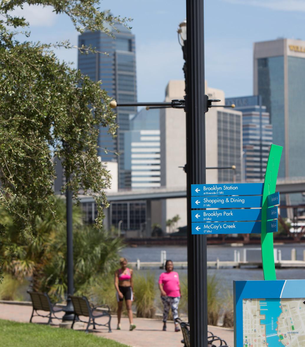
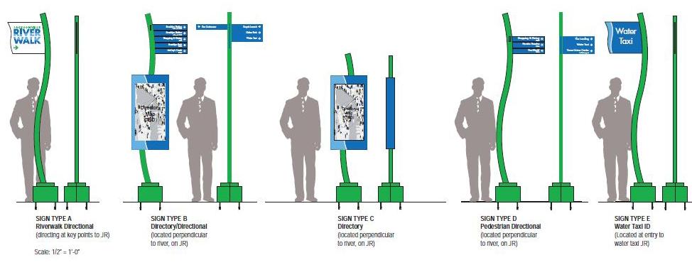
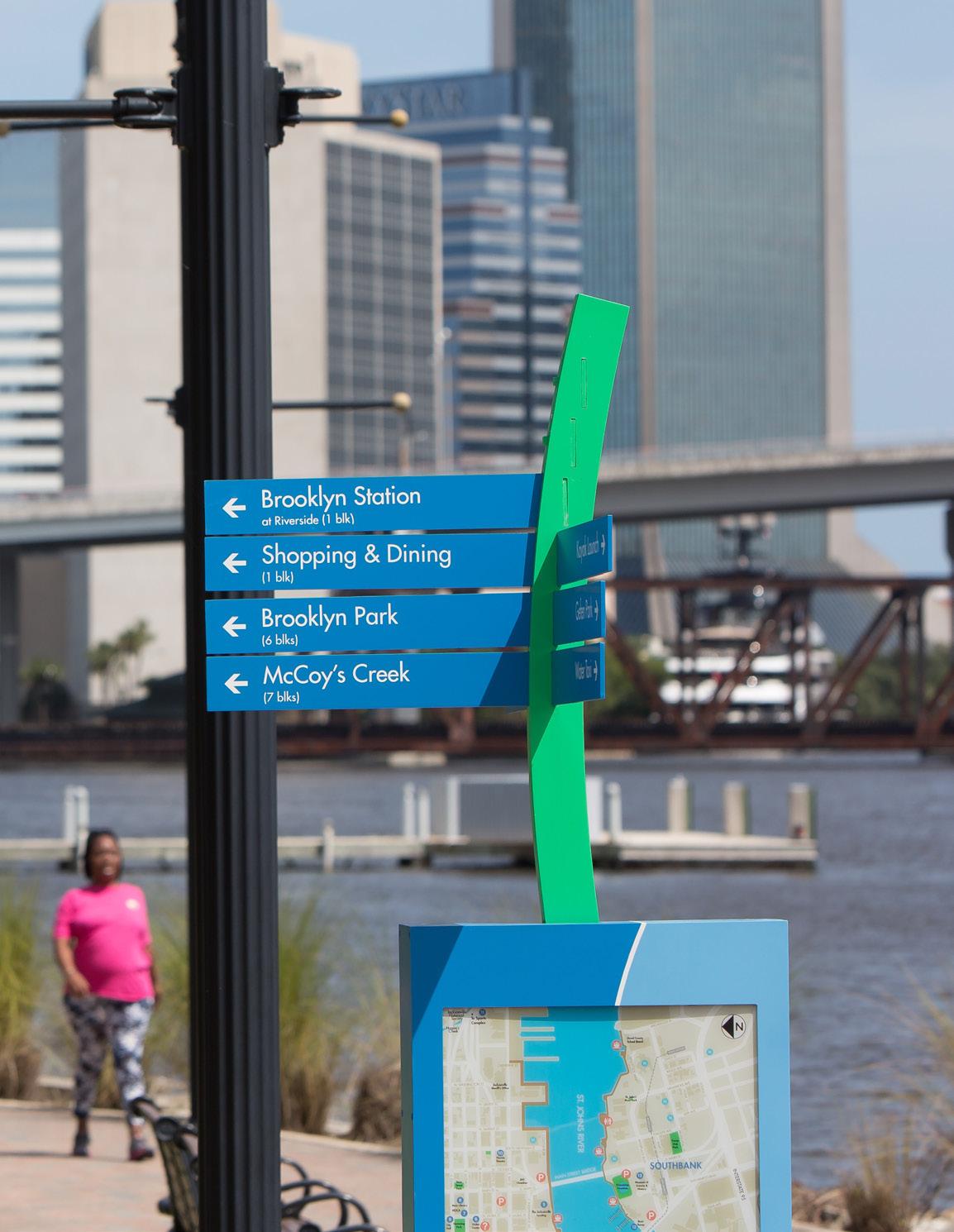
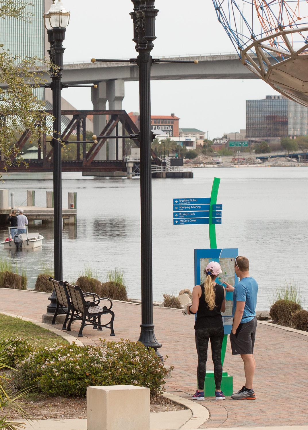
J. SIGNAGE - NORTHBANK AND SOUTHBANK
Signage for wayfinding to the Riverwalk, parking and along the Riverwalk is critical to a positive user/visitor experience. Cohesion in this signage is achieved through use of color and typography, use of clear information/iconography, strategic placement at key navigational/historical/interpretive nodes and the consistent use of the Jacksonville Riverwalk logo as shown on your left.
• The Jacksonville Riverwalk logo, as designed, is a necessary element in all signage.
• Signage along the Riverwalk includes directory/directional signs and directional signs. The directory/directional signs are located at public access points. Directional signage above the directory sign identifies features along the Riverwalk or easily accessible from the Riverwalk. Directional signs are placed at public access points where a directory sign is clearly visible. River taxi signs are also noted along the Riverwalk.
• All signage and locations are contingent on approval by the Parks Director, whose express approval is necessary for commemorative markers or storyboards on the Riverwalk. In no case shall signs reduce the effective width of the Riverwalk to less than 12 feet.
• Additional details can be found in Jacksonville Riverwalk Wayfinding documents, dated August 2019.


TYPOGRAPHY STANDARDS
• Font Style: Futura Std – Medium
• Characters and backgrounds must contrast, either light on dark or dark on light.
• Directional typography must adhere to ADA standards for legibility.
Riverwalk Continuity 22
SIGNAGE COLOR PALETTE
COLOR 1
PMS 2387C
COLOR 2
PMS 292C
COLOR 3
PMS 2423U
COLOR 4
WHITE
SIGNAGE FAMILY
Downtown Investment Authority 23
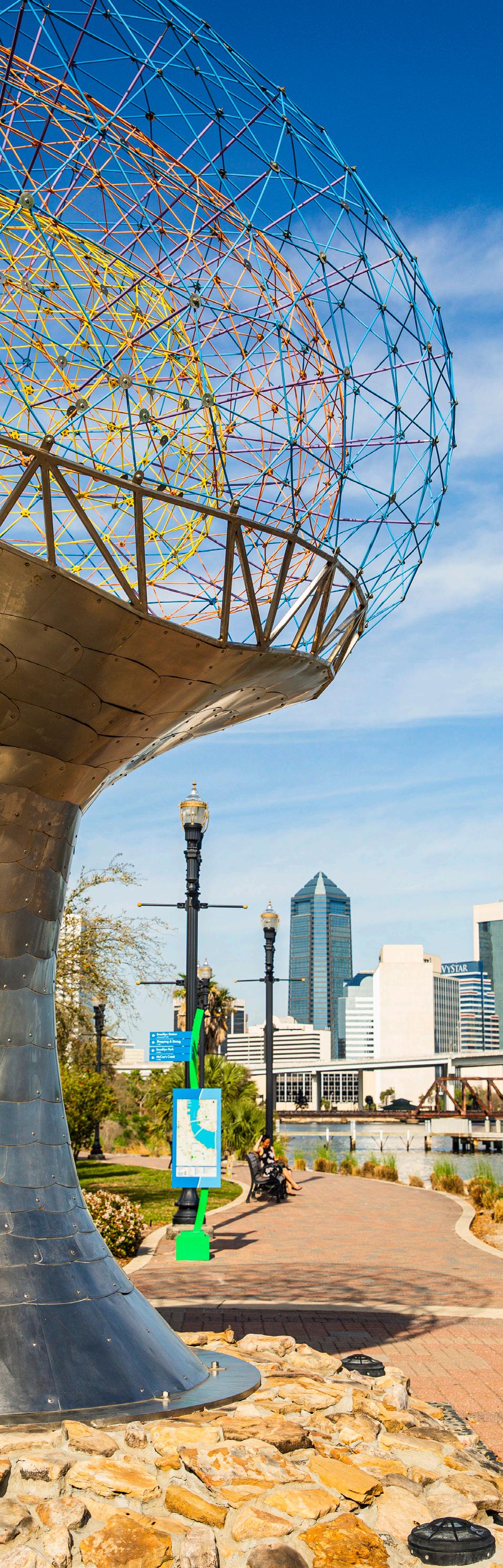
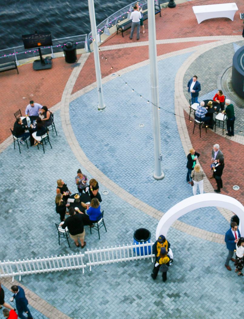
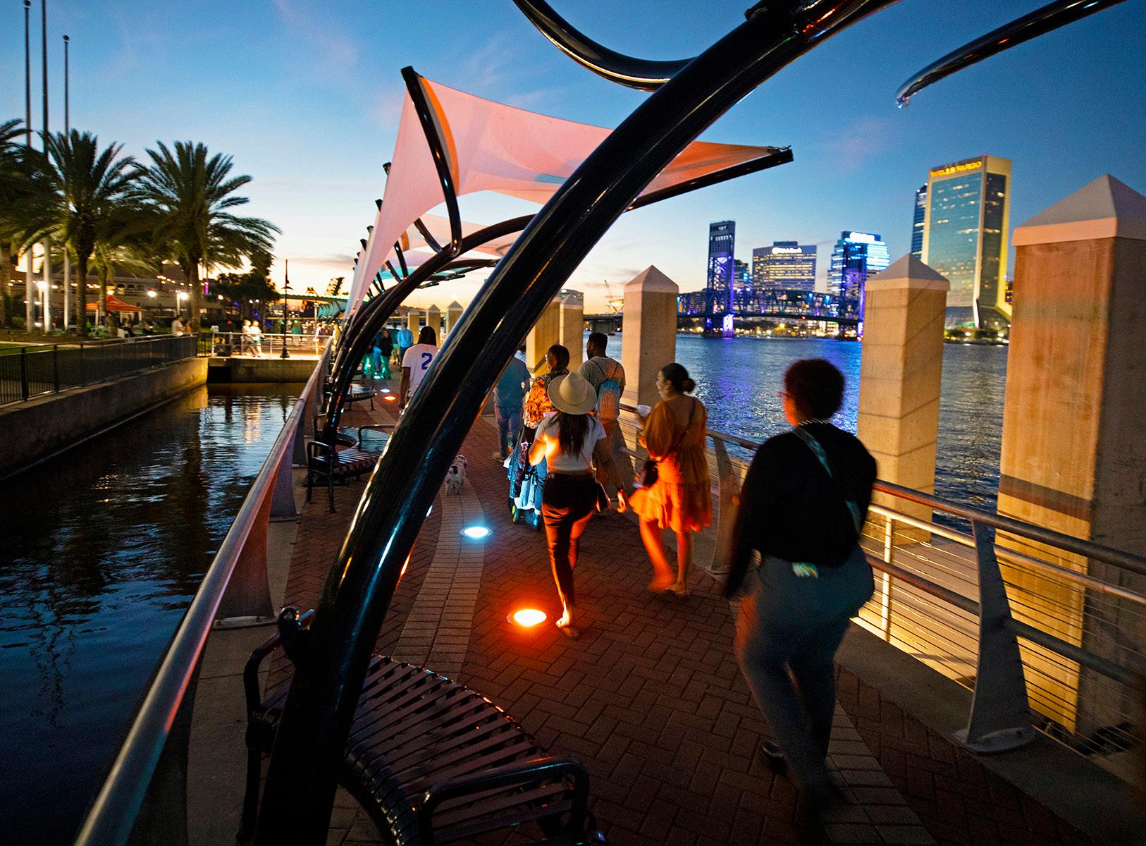
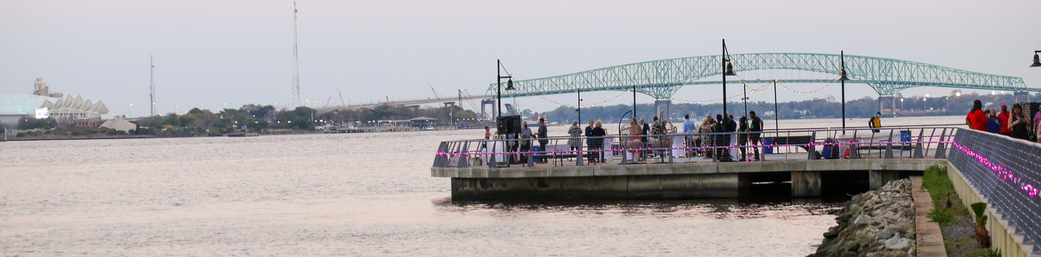
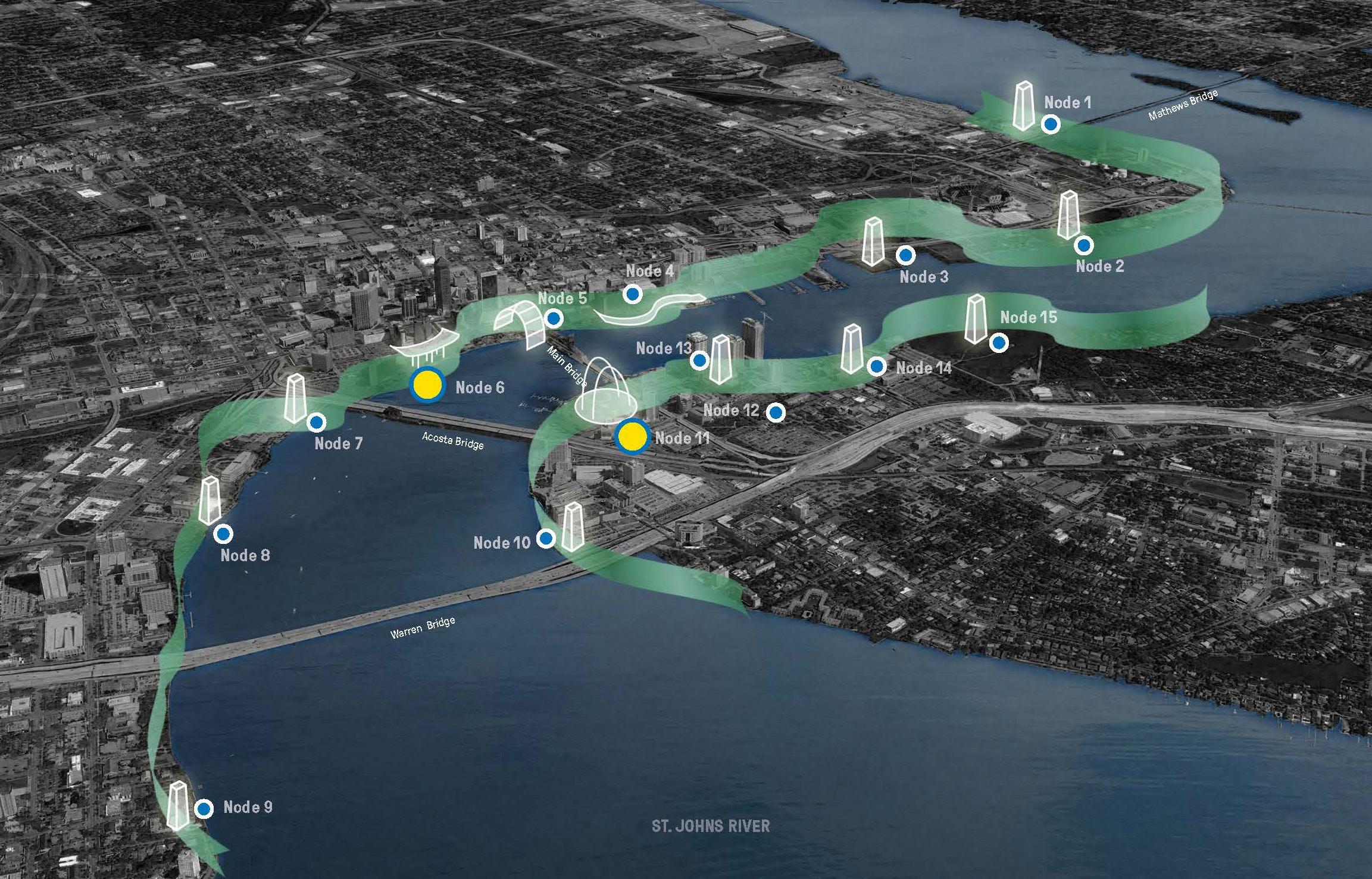
RIVERWALK NODES (PARKS)
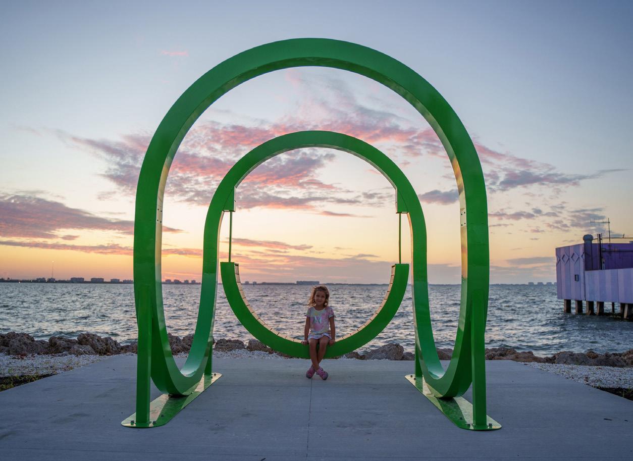
The Riverwalk experience is punctuated and complemented by a series of contiguous expanded park spaces ranging from small to expansive in size. The plans call for these “nodes” to also share certain common physical characteristics and for each to incorporate an important Jacksonville storyline in the park’s theme.
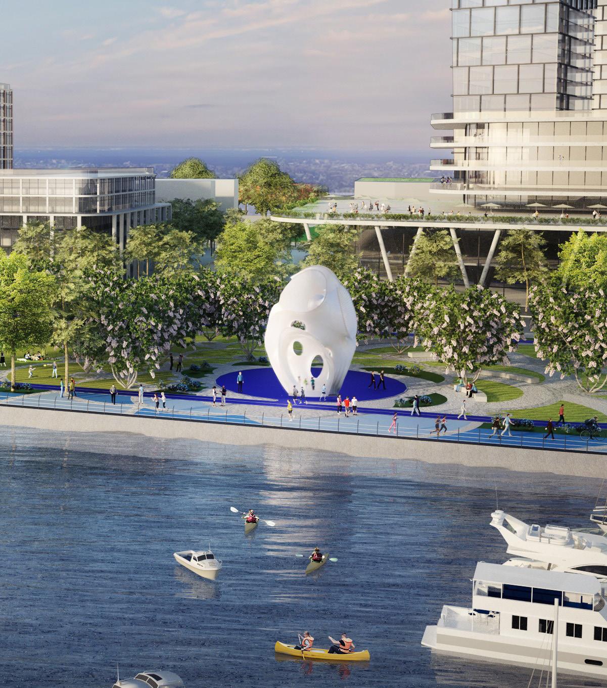
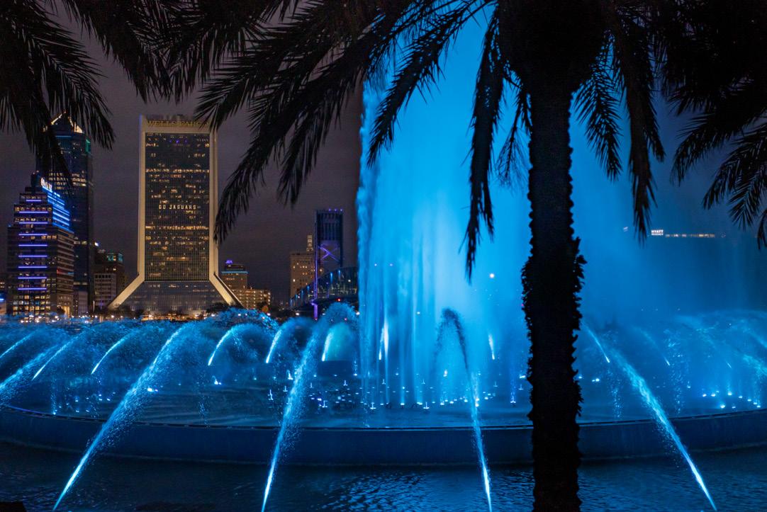
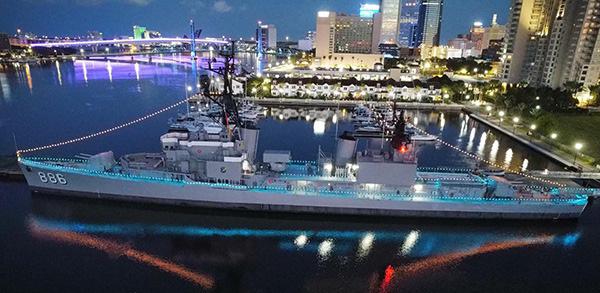
Common required elements include a tall sculpture or park element, capable of being lit at night, to serve as a park marker from other locations on the Riverwalks and draw the user to explore the next node. The marker can be a sculpture — as is contemplated at RiversEdge or Friendship Fountain or the superstructure of the USS Orleck — but each identifies the site as another node or park space. The vertical marker may complement the adjacent development but is expected to reach approximately 40 feet in height and be located such that it is visible from across and along the riverfront.
The nodes will also each incorporate a major garden or landscape element; unique and potentially interactive lighting and art elements; a narrative theme about Jacksonville’s history, culture or economic pillars; and a spatial design or landscape relating to the nodes narrative theme. The node parks make up a system of approximately 15 waypoints for exploration and enjoyment on the waterfront. As stated in the SWA Riverfront Design Guidelines and Activity Nodes Plan, the nodes are designed to “create lasting, memorable experiences throughout the Riverwalk” by providing “immersive and interactive landscapes describing unique features of Jacksonville and the St. Johns River.”
In contrast, the programmatic uses and activities found in each park are purposely designed to vary. This provides the visitor with a diverse array of experiences and opportunities for passive and active enjoyment, recreation, education and exercise along the riverfront.
The node narrative themes or storylines were selected with public and stakeholder input to highlight Jacksonville’s economic pillars, unique historical and cultural events, people and themes with ties to specific locations on the riverfront. While some narratives are flexible in precise location and others may evolve over time, each adds context and intrigue to the user experience and communicates an important story through features incorporated into the design of each space rather than a proliferation of storyboards attached to the Riverwalk railings.
Riverwalk Continuity 24
Downtown Investment Authority 25
Future RiversEdge Sculpture (Node 15)
USS Orleck (Node 3)
Friendship Fountain (Node 11)
NORTHBANK NARRATIVE NODE THEMES
01 SPORTS & ENTERTAINMENT
• Theme: Past and present sports teams and famous athletes and Olympians
• Site Significance: Near the stadium and baseball grounds
02 HOGANS CREEK
• Theme: STEM achievements, inventors, resilience and environment
• Site Significance: Museum of Science and History (MOSH)
03 SHIPYARDS WEST
• Theme: The importance of the military to Jacksonville and naval ship building history
• Site Significance: USS Orleck floating Naval museum; looks across river at WWI shipbuilding yards
04 COWFORD GREAT FIRE
• Theme: Commemoration of Jacksonville’s sorrow, strength and resilience in the face of the most destructive event in the City’s history and the City’s architectural rebirth
• Site Significance: Near the terminus of Market Street where residents fled the fire by jumping into the river
05 MAIN STREET
• Theme: Our bold and adventurous history (gunrunning days during the SpanishAmerican War), historic filibustering efforts to Cuba (particularly attempts to undermine Spanish rule at the turn of the 18th century); the romantic lure of steamboats
• Site Significance: Located at the Steamboat Landing; possible replica paddlewheeler or steamboat
06 PERFORMING ARTS CENTER
• Theme: Jacksonville’s musical heritage (great composers, lyricists, vocalists, musicians and bands as well as their songs)
• Site Significance: Adjacent to the Jacksonville Center for the Performing Arts
07 MCCOYS CREEK
• Theme: The significance of railroads to Jacksonville, its growth and demographics
• Site Significance: Near Union Terminal, once the largest railroad station in the South and at the railroad bridge crossing the river
08 BROOKLYN
• Theme: Jacksonville’s place in the Civil War (Honors the Buffalo Soldiers and one-time Jax residents such as author Harriet Beecher Stowe and Chloe Merrick Reed, who were proponents of public education for all children); also shares the story of the Maple Leaf.
Alternate Theme: Fintech sector
• Site Significance: Possibly Gefen Park; Brooklyn was home to a Civil War encampment and settled by Buffalo Soldiers and today is home to Fortune 500 Fintech campuses
09 CUMMER GARDENS
• Theme: Jacksonville’s culture of gardening (first Garden Club) and philanthropy
• Site Significance: Located between the popular Cummer Museum of Art and Gardens and the Garden Club of Jacksonville
Riverwalk Continuity 26
10 HENDRICKS POINT
• Theme: Jacksonville’s importance as a regional logistics hub
• Site Significance: Location at I-95, view of railroad bridge, river as means of transport and trade
11 ST. JOHNS RIVER PARK/FRIENDSHIP FOUNTAIN
• Theme: Exploring the St. Johns River –explorers of the river from native peoples to Ribault to Bartram to exploring the Timucaun Preserve and river today
• Site Significance: The fountain is symbolic of the river springs
12 RIVERPLACE TOWER/TREATY OAK PARK
• Theme: Amusement and tourism –Jacksonville as a film capital and tourism mecca (1888 Subtropical Exposition, a predecessor to the World’s Fair)
• Site Significance: site of the early-1900s Dixieland Park (the original Florida amusement park)
13 LONE SAILOR LOOKOUT ON RIVERWALK
• Theme: The life and sacrifice of military service members
• Site Significance: Node’s centerpiece element is the unmarked sailor statue looking out onto the St. Johns River from the Riverwalk
14 RIVERSEDGE: Life on the St. Johns
• Theme: Jacksonville’s importance as a medical hub; medical innovation and research; healthy lifestyles
• Site Significance: Home to the RiversEdge development, which will include focus on healthy living
Downtown Investment Authority 27
SOUTHBANK NARRATIVE NODE THEMES
RIVERFRONT RESILIENCE
The Riverwalk varies in its spatial relationship to the river and its various shoreline conditions. Part of the Riverwalk is built over the water, atop a bulkhead or separated from the waterfront with a reinforced rip-rap bank, and part of the Riverwalk is built on land. Because the St. Johns River is tidal and prone to storm surges, the stream banks, waterfront parks and walkways occasionally flood. Washed-out walkways, landscaping, infrastructure, and fountains are rebuilt after each storm, and compromised bulkheads are reinforced. For these reasons, a resilient Riverwalk is paramount.
Hybrid solutions, which include a combination of hardened shoreline techniques and nature-based solutions, allow floodwater to slowly recede over rocks and planted landscape to preserve Riverwalk infrastructure and create a naturally shaded, visually appealing walkway.
General guidance to establish a more resilient Riverwalk can be found below, as supported in Resilient Jacksonville (October 2023).
• If no bulkhead currently exists, one should not be constructed. Where they currently exist, bulkheads should be constructed at a minimum of seven (7) feet above the mean high water line, but in no case should the Northbank Riverwalk exceed the elevation of Bay Street.
• Where possible, consider elevating the Riverwalk, particularly as segments are replaced or reconstructed over time. Alternatively, where feasible, consider establishing a greenway or landscape strip between the bulkhead and the Riverwalk pathway (setting the Riverwalk back from the water’s edge).
• Consider installing wave attenuation materials between the river and the bulkhead, where possible.
• Establish shade along the Riverwalk. Criteria for shade trees and shade structures found earlier in this document.
Protection of the Riverwalk during storm events is very important. However, it should be noted that during a major hurricane or similar storm event, the Riverwalk itself may serve as a barrier to flooding or as a wave attenuation element, protecting assets further inland. Additionally, any site furnishings along the Riverwalk may also serve to reduce wave energy.
In all cases, adaptation features for the Riverwalk itself and adjacencies should be considered and employed, subject to City review. New bulkheads should be designed to be capped if necessary. Assets between Bay Street and the Northbank Riverwalk should be constructed of materials that can withstand occasional inundation.
Riverwalk Continuity 28
Downtown Investment Authority 29
Reinforced Rip-Rap Bank (Brooklyn)
Bulkhead (City Center)
Built on Top of Water (Southbank)
SOURCE MATERIALS
Riverwalk Park Design Criteria
Tree Preservation and Landscape Standards
Jacksonville Waterfront Wayfinding Documents
City of Jacksonville, Ordinance 2019-196-E
Three documents combine to provide the standards for a cohesive Riverwalk Park. The documents include the goals of the Riverwalk as well as standards for the following: infrastructure, hardscape, landscape, lighting, plant palette and signage. The standards guide improvements to the existing Riverwalk segments and construction of future Riverwalk segments to be implemented by the City of Jacksonville and, when applicable, private developers.
Downtown Zoning Overlay, Subpart H of Chapter 656
City of Jacksonville
The zoning code for the Downtown Overlay Zone promotes and encourages revitalization and growth of Downtown as a desirable high density mixed-use area. Relating specifically to Riverwalk continuity, the zoning overlay provides guidelines for waterfront setbacks, promotes shade and walkability by public realm design criteria and promotes access to and focus on the St. Johns River and its tributaries.
Riverfront Design Guidelines and Activity Nodes Plan SWA Group for the DIA
This document provides design guidance to the DIA, the City of Jacksonville, City officials and developers on ways of looking at Jacksonville’s Waterfront as a large expansive opportunity site that is prime and ready for change. The document presents a kit-of-parts which can be implemented to upgrade the physical conditions making up the built environment (wayfinding, outdoor lighting, and a palette of hardscape materials, planting and landscape) as well as a series of themed activity nodes that spotlight various historical and cultural highlights as well as the economic pillars of the community, providing further connection points for users.
To obtain these documents, contact the DIA at 904-255-5302 or search online at dia.coj.net/reports.
Riverwalk Continuity 30
Downtown Investment Authority 31