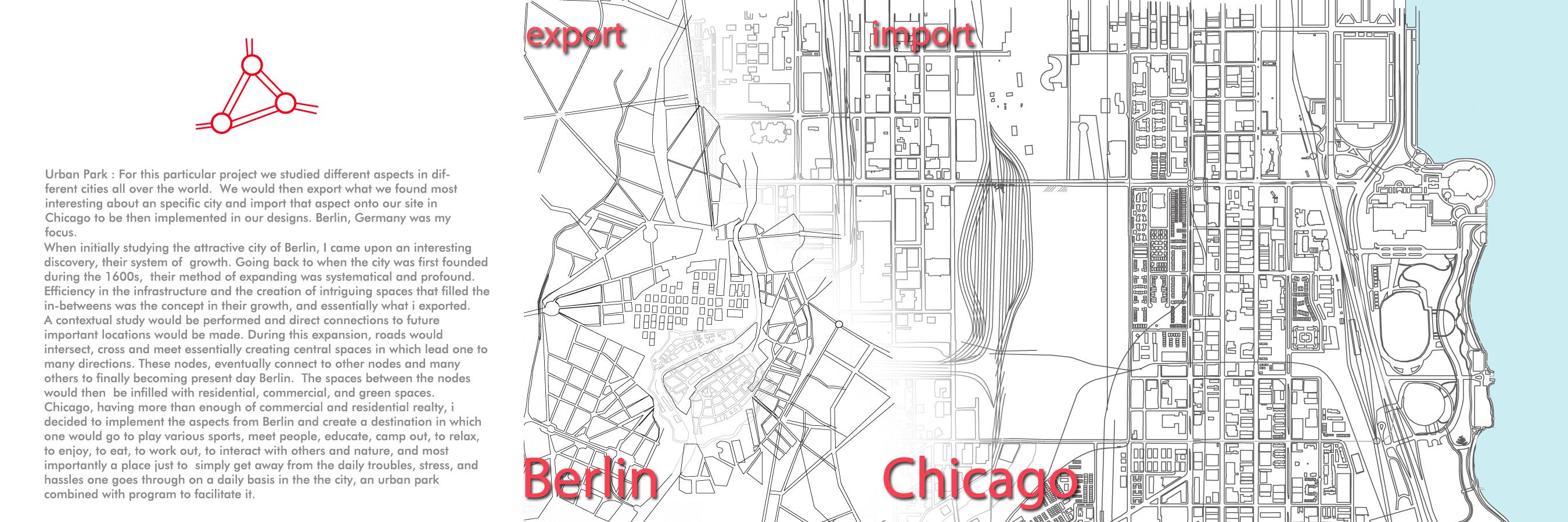
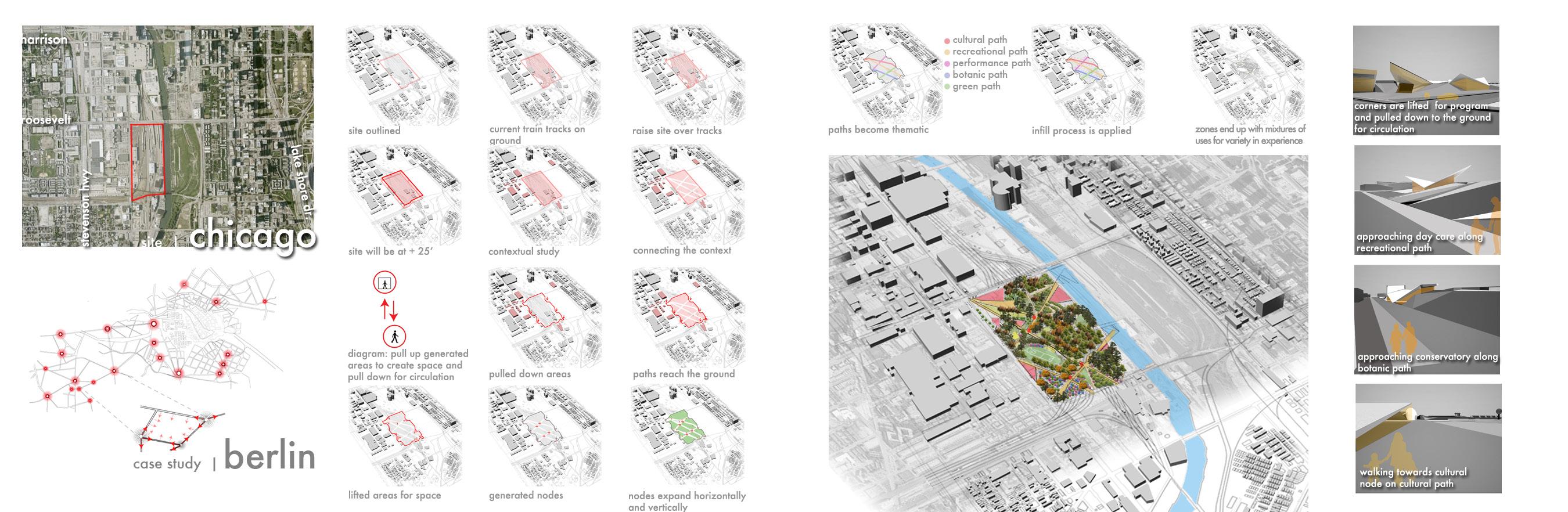
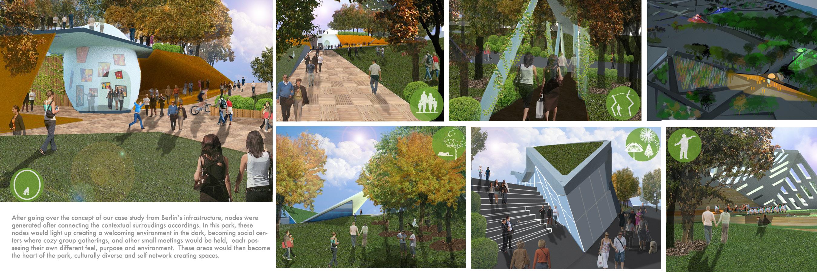
la parada dorada - colombian hinterlands, los llanos, academic - adp/thesis project
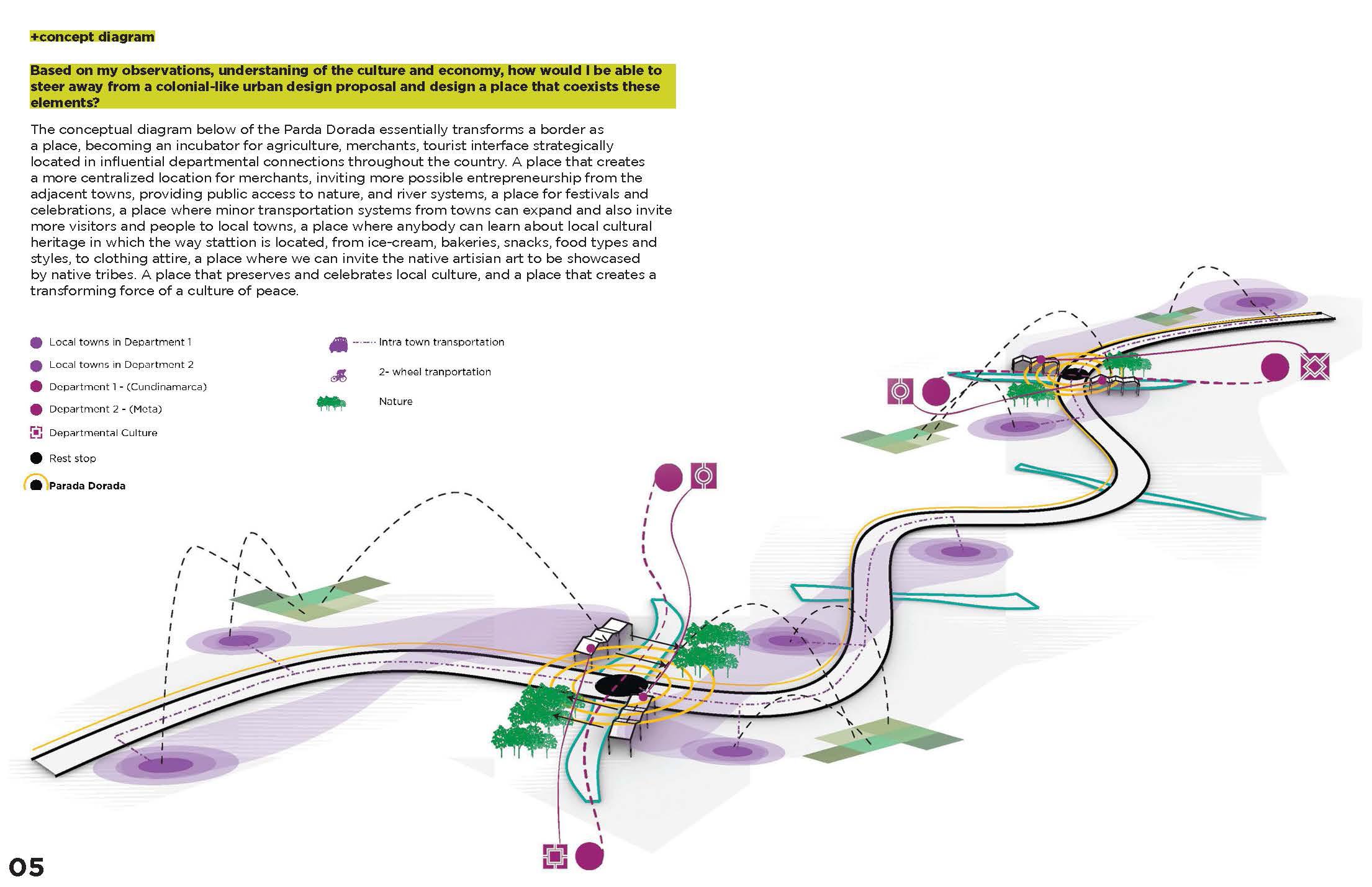
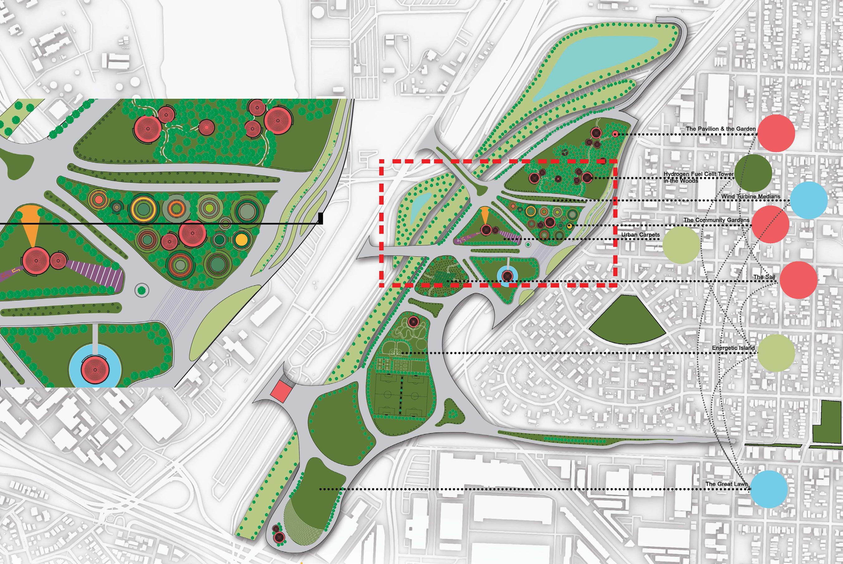
Parada Dorada is a new waystation program for Colombia generating places of crossing, culture, and exchange. The goal of this proposal is to use urban design as a way to lessen spatial and economic inequalities by translating the concept of a rest-stop into a waystation program that fosters the different cultures that exist in the Colombian tapestry, creates a territorial autonomy, and encourages regenerative and restorative narratives.
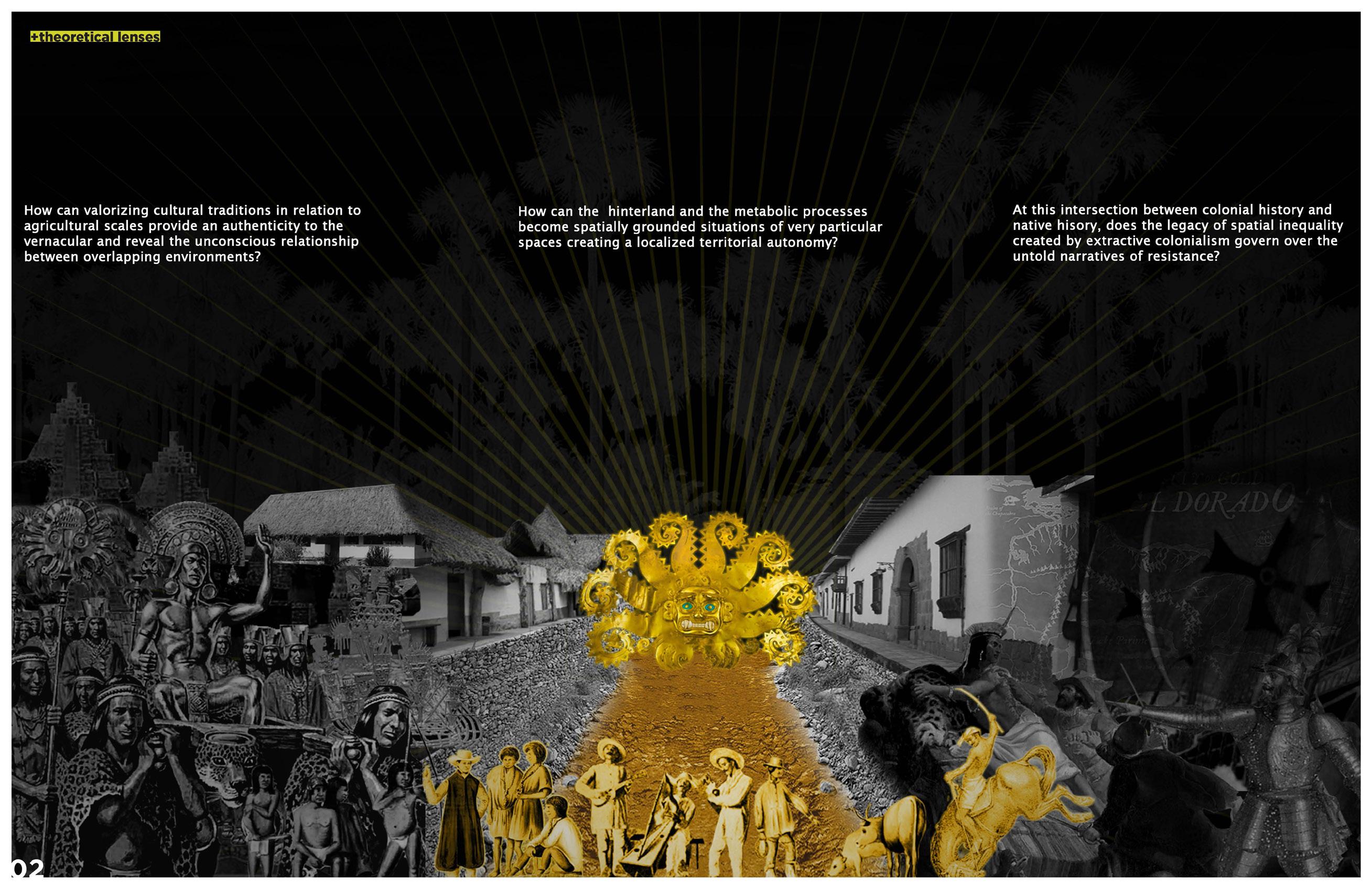
This project aims to redefine. From negative conditions of occupations, extraction dating back to stories about El Dorado, and decades of national conflict. Expanding into a post-war, post-extractive conceptions, green infrastructure, and an autonomous architecture. Amplyfying the focus on urban design toward the rural environment, addressing key socio ecological challenges they continue to face on day to day basis.
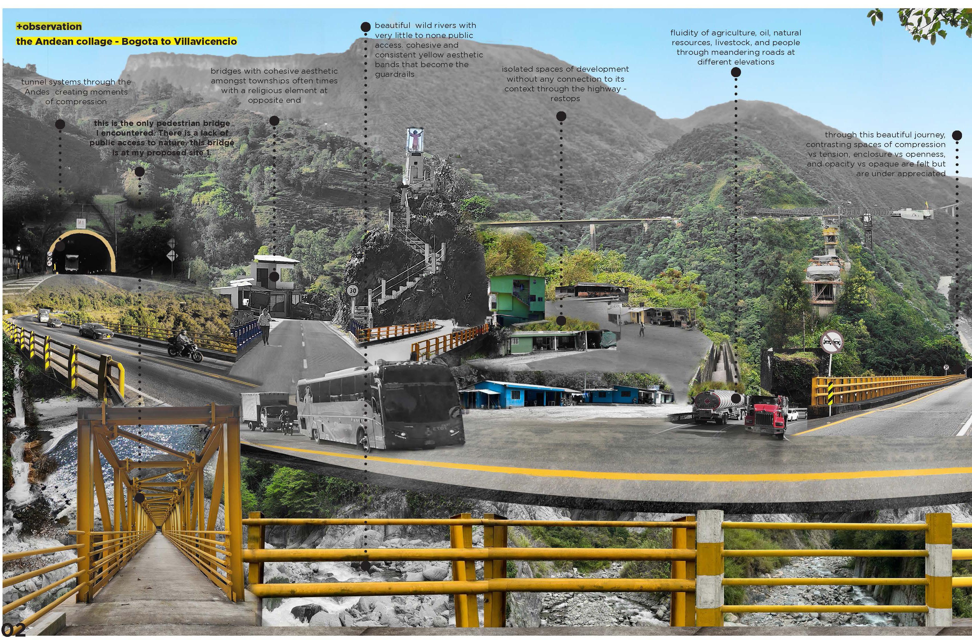
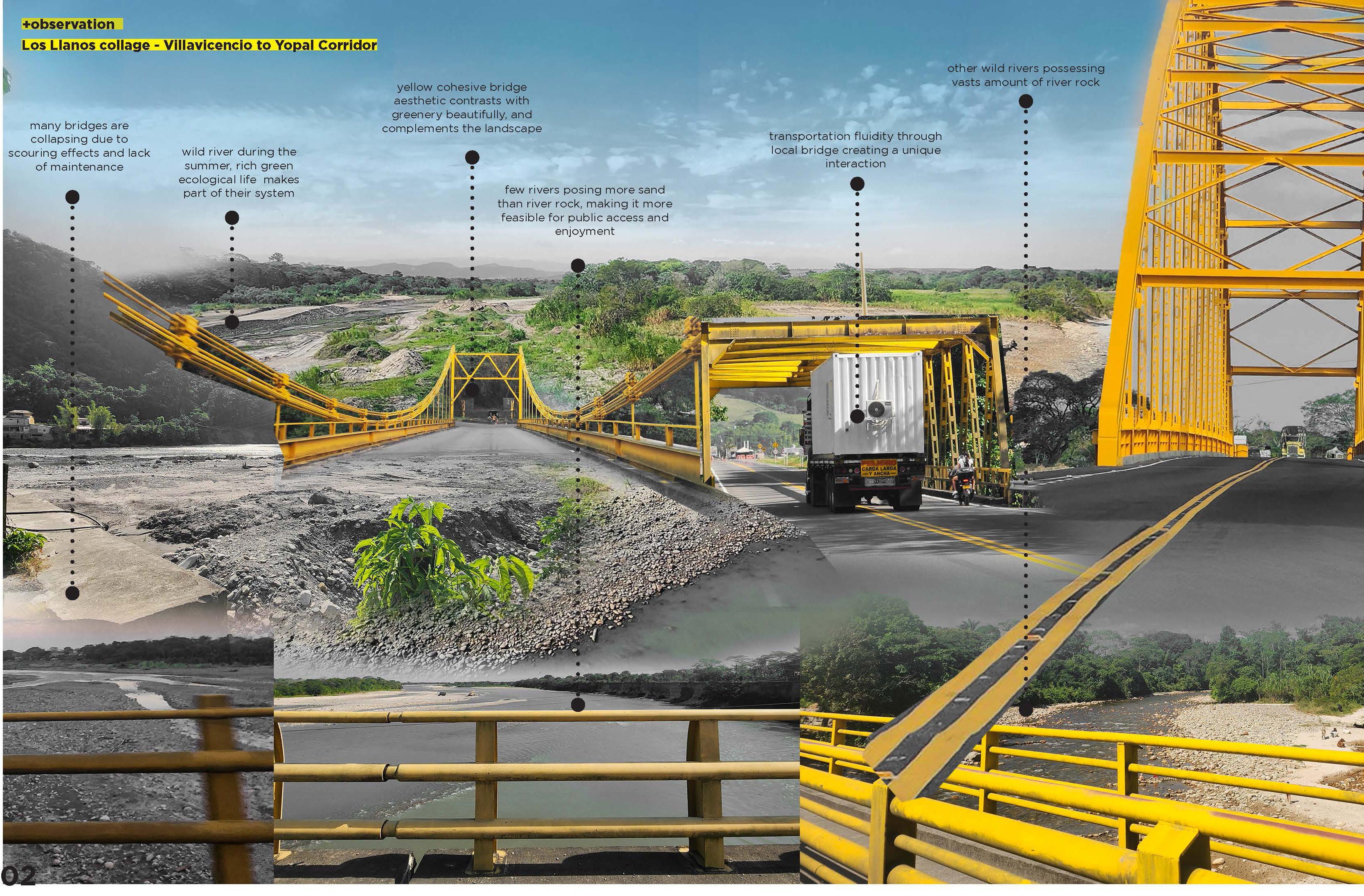
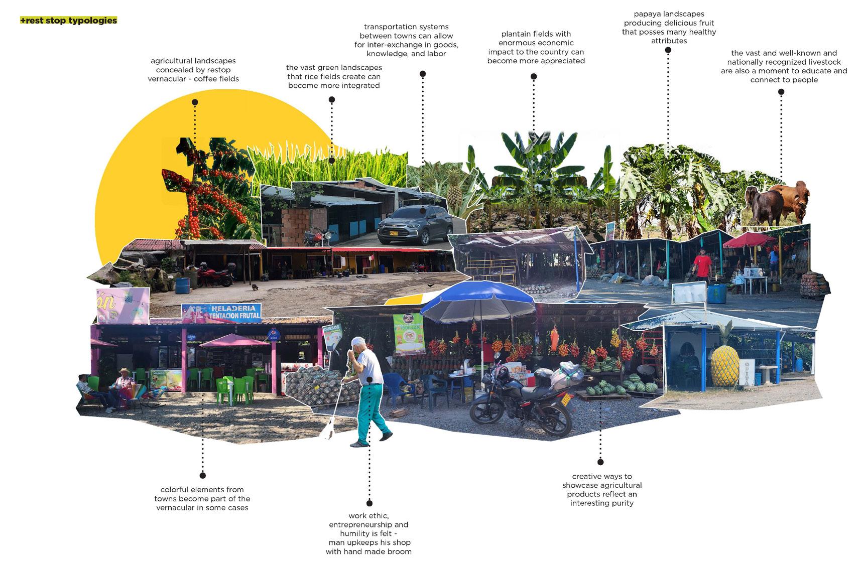
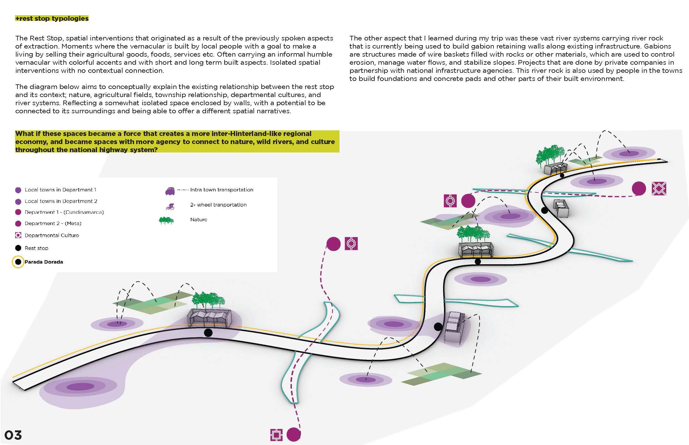
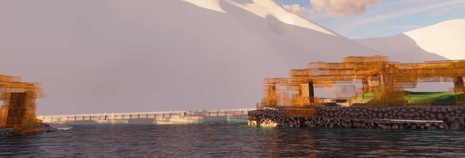
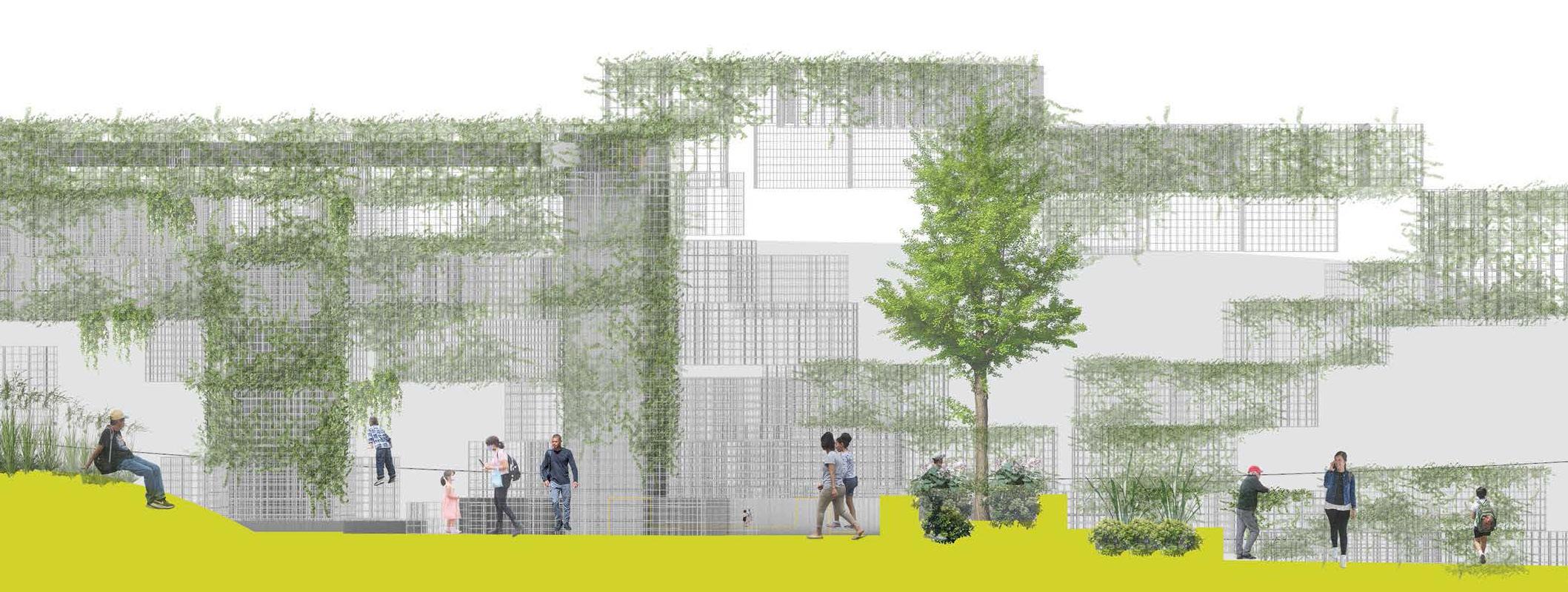
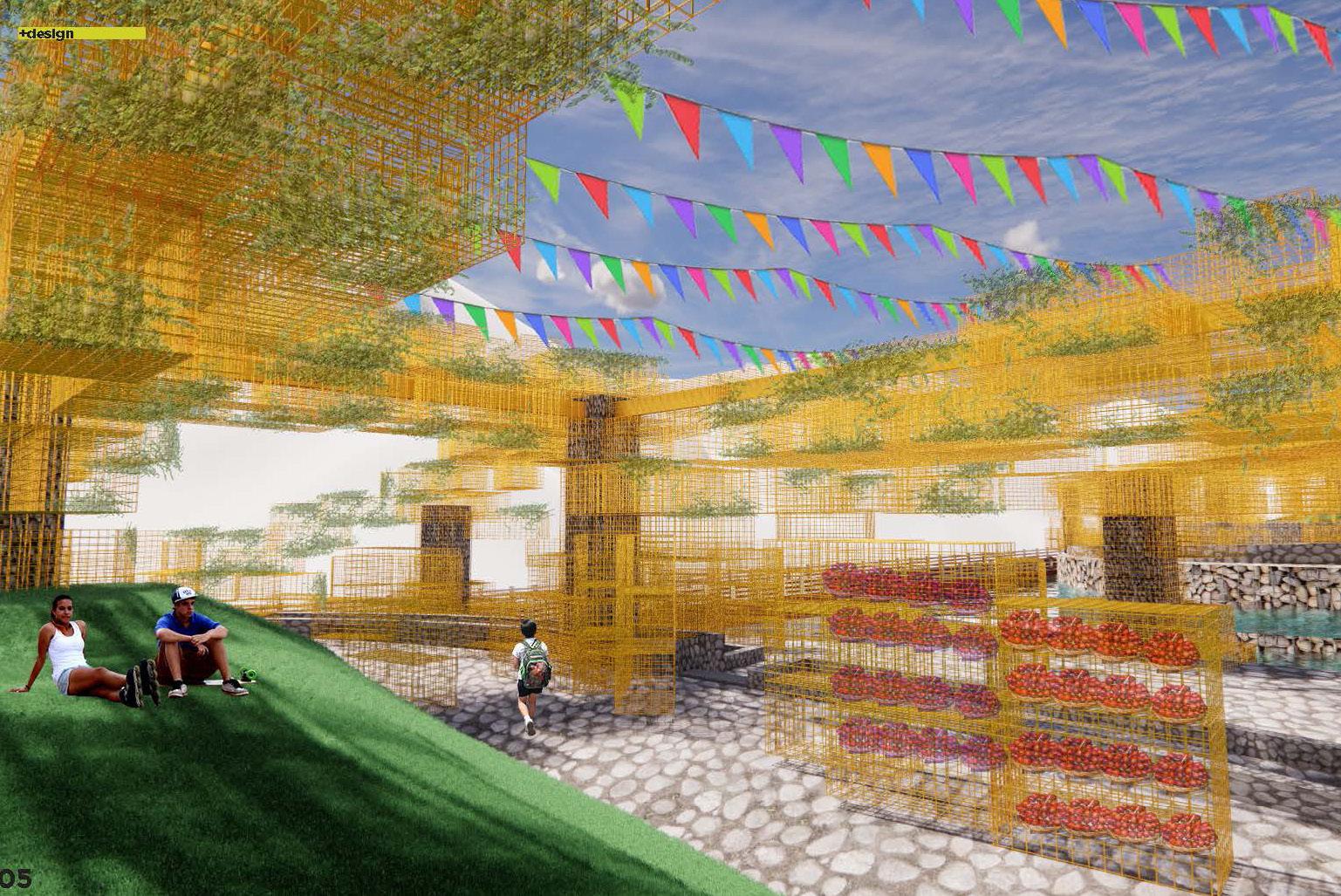
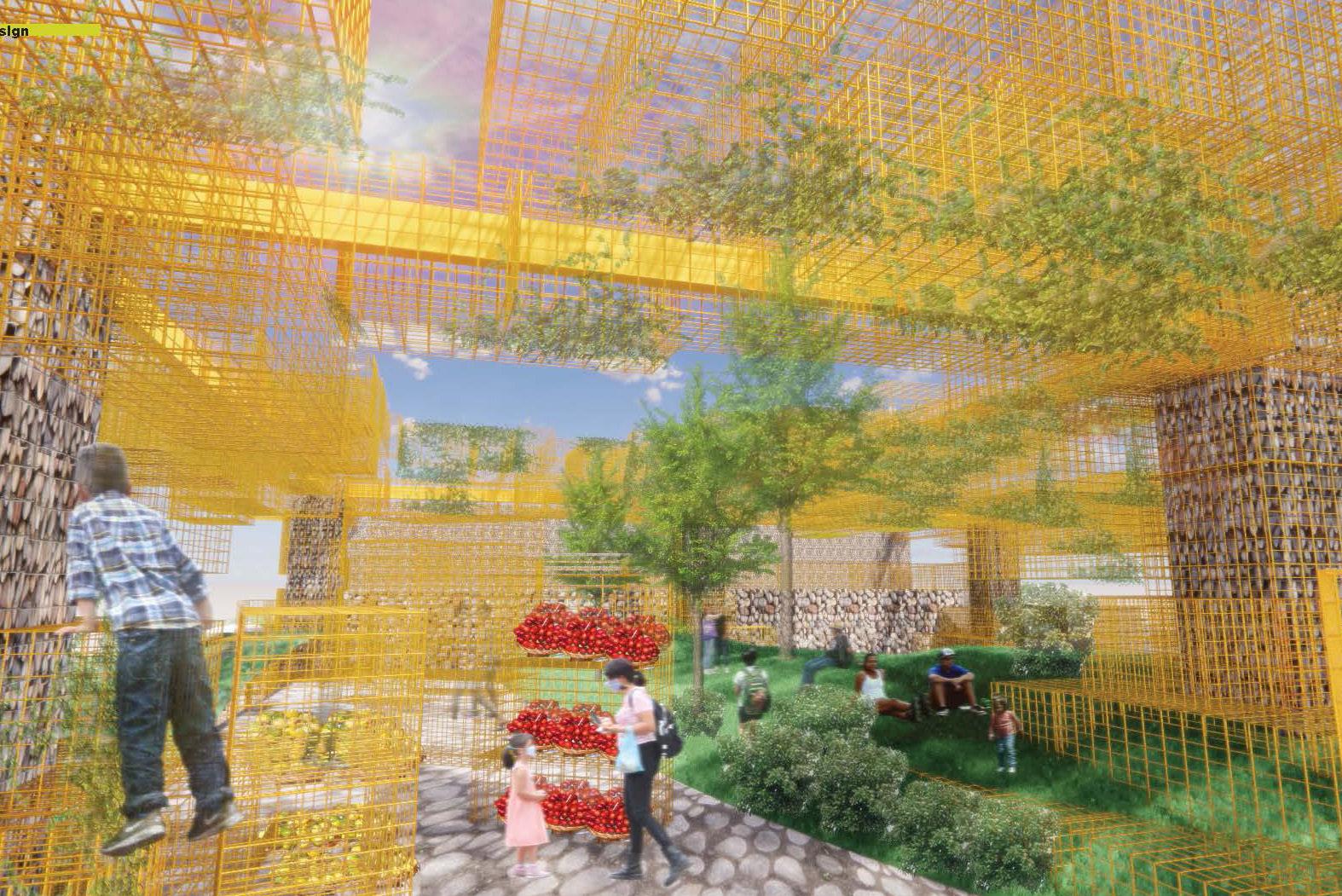
The rest stop, a spatial intervention originated as a result of different aspects of extraction. Moments where the vernacular is built by local people with a goal to make a living by selling their agricultural goods, foods, services etc. Often carrying an informal humble vernacular with colorful accents and with short and long term built aspects. Isolated spatial interventions with no contextual connection.
What if these spaces became a force that creates a more inter-Hinterland-like regional economy, and became spaces with more agency to connect to nature, wild rivers, and culture throughout the national highway system?

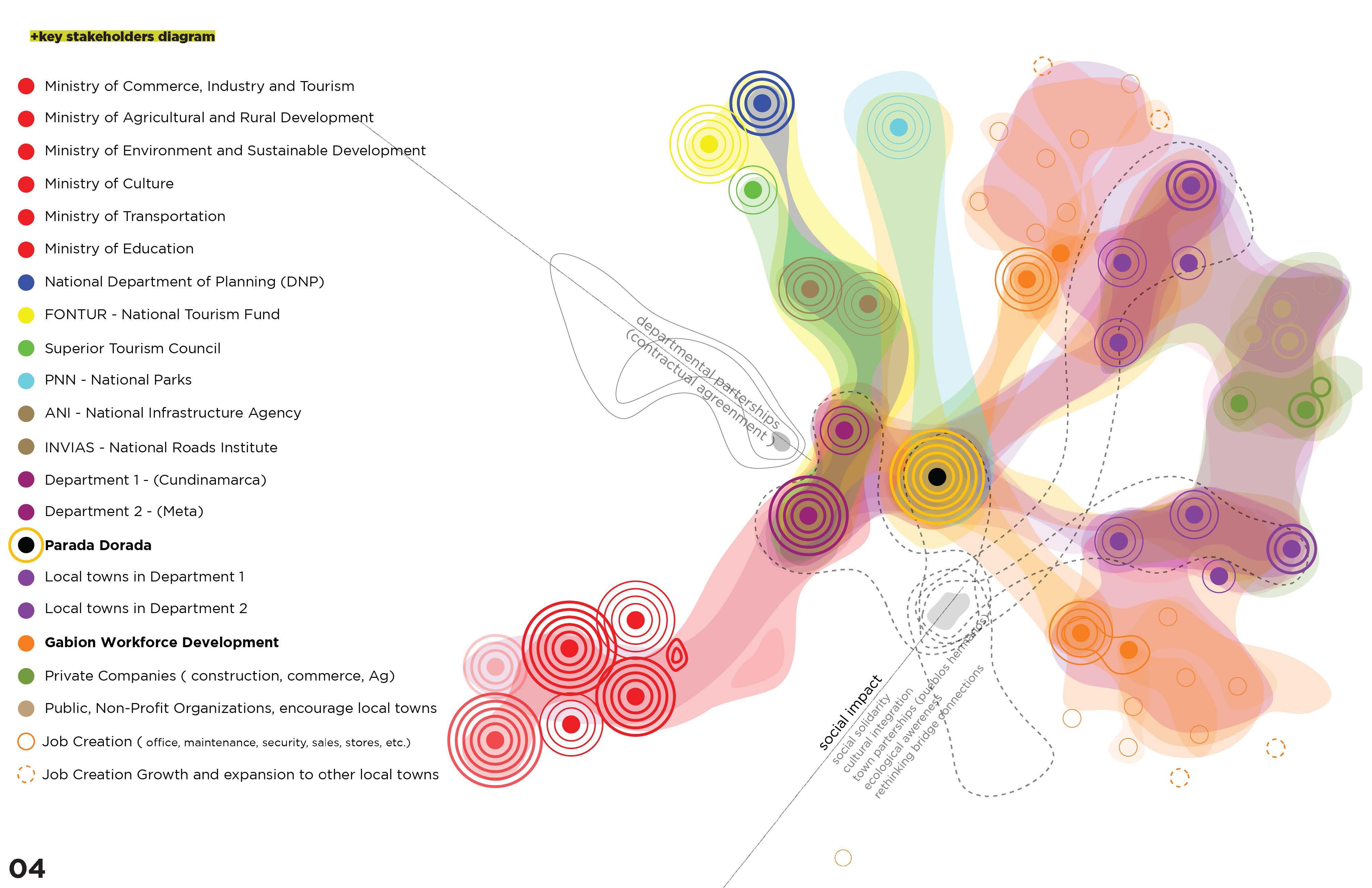
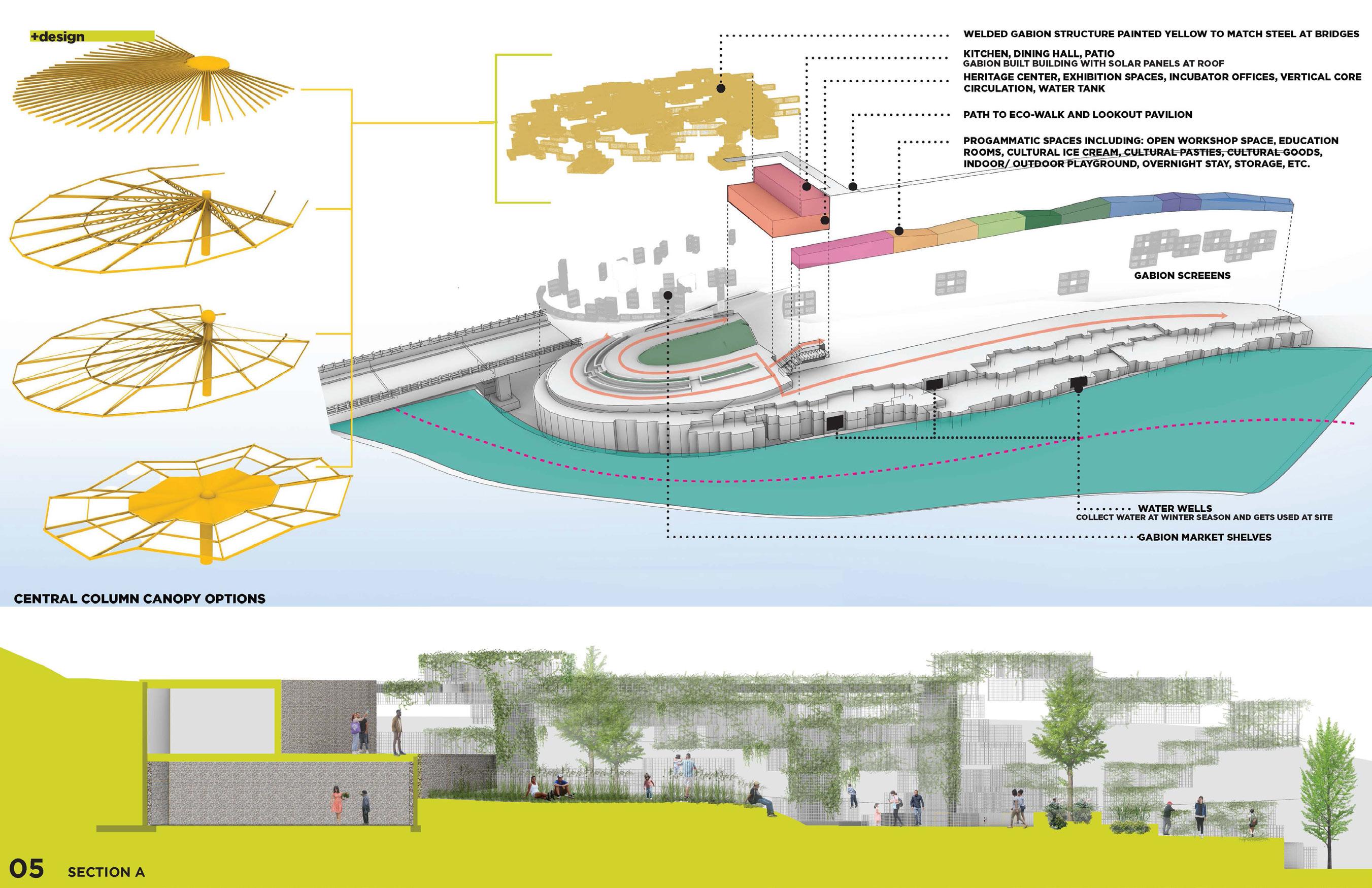
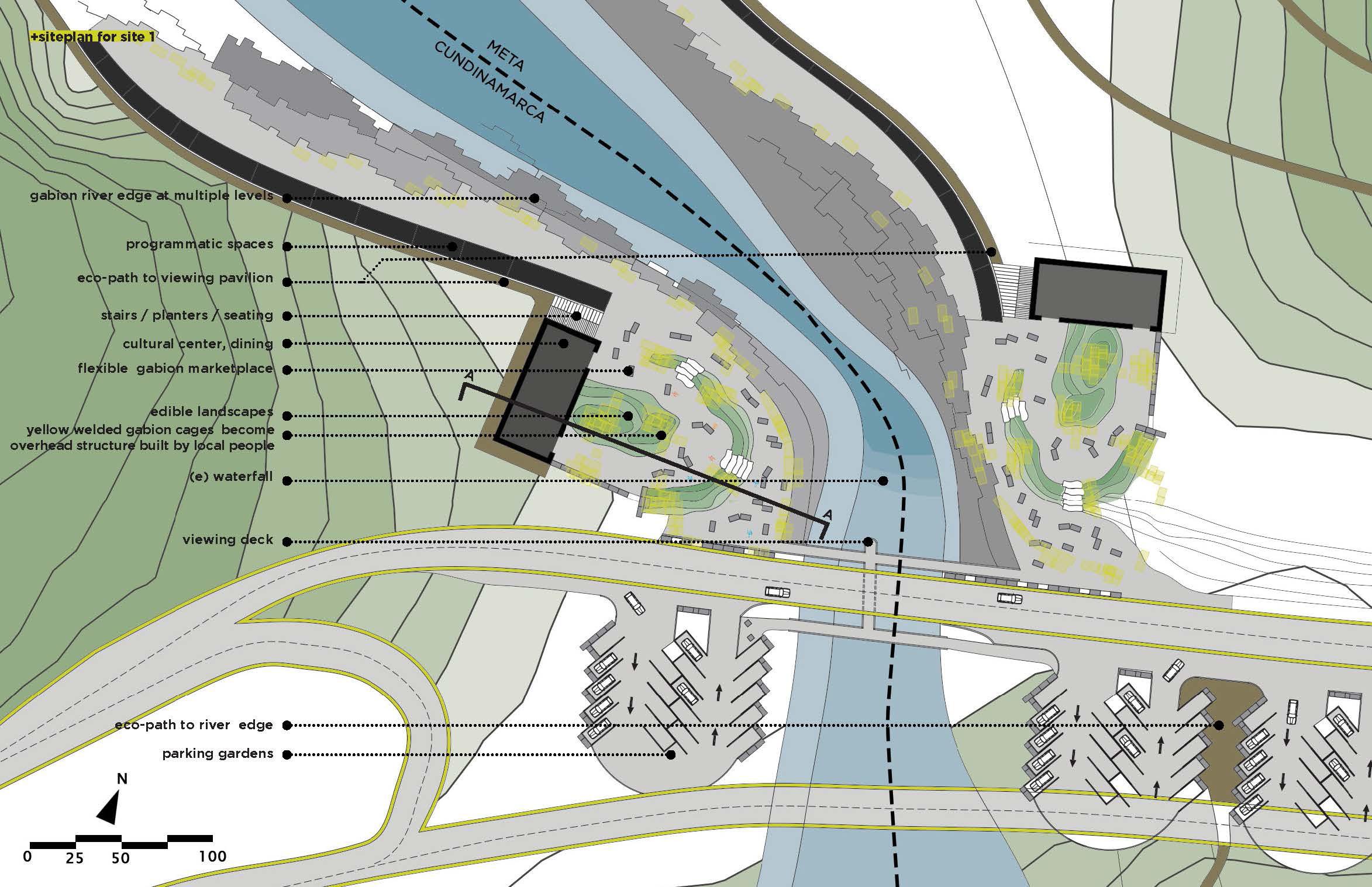
What if we took account of the 75% of the population with informal jobs, 49% low educational achievement in the Llanos Orientales, and proposed a regional workforce development of gabion building that could be expanded throughout the country and beyond? The Parada Dorada becomes the spatial intervention where we would see what is possible to build with these gabions. Possessing the regenerative and restorative narratives and creating the territorial autonomy that would unify hinterlands and create more much needed positive social impacts.
In conclusion, La Parada Dorada responds to the legacy of spatial inequality created by extractive colonialism. This project Introduces an economic development model acting as a regional based economy of hinterlands between departments, and fosters local entrepreneurship and culture solidarity by bridging regenerative and restorative narratives into a series of territorial bridging typologies or way systems that transcend into gateways.
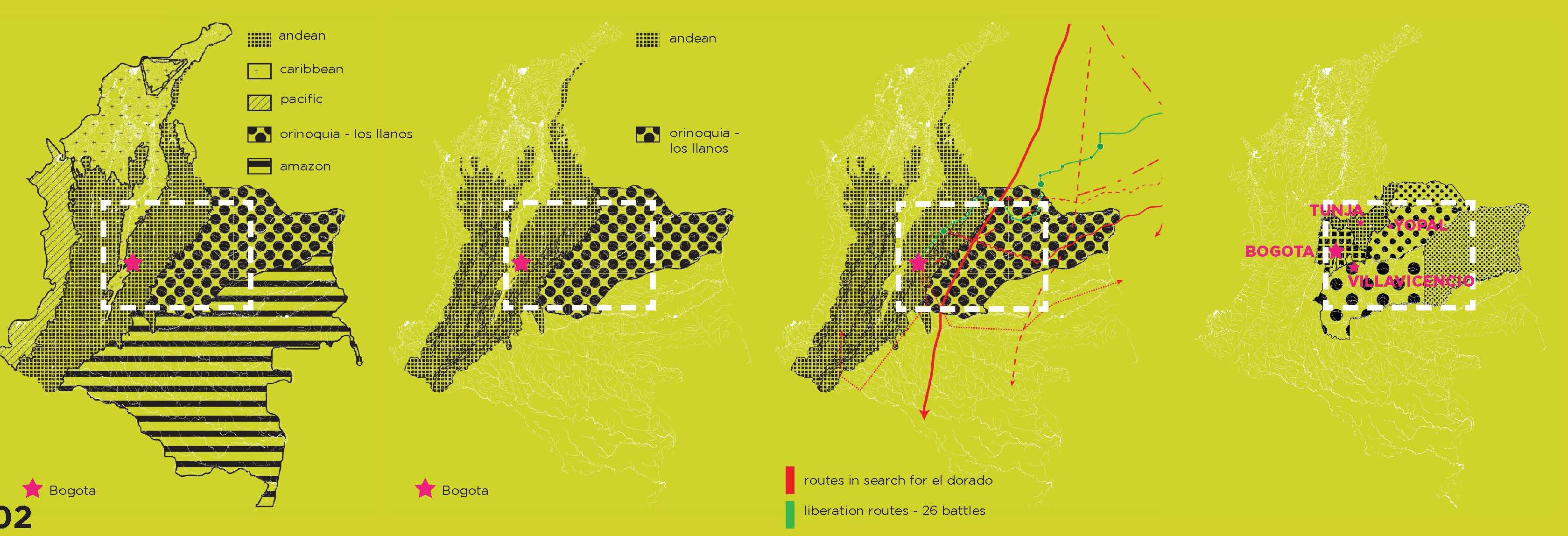
During this project, I traveled to Colombia for 2 weeks, visiting 4 major cities, over 20+ townships, engaging engineers from municipalities, land owners, NGOs, tourists, local colombian cowboys known as “llaneros”, and ministries.
1.0
+PARADA DORADA
+city & hinterlands
+territorial autonomy
+regional economy
A new waystation program for Colombia generating places of crossing, culture, and exchange
2023
major cities
1.1
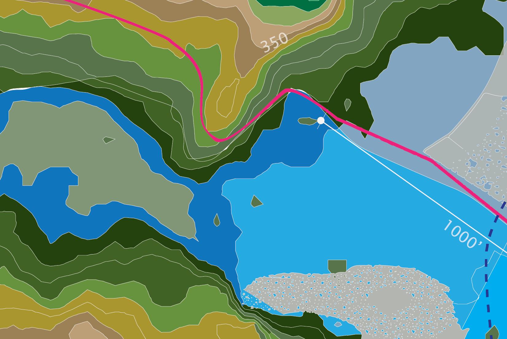
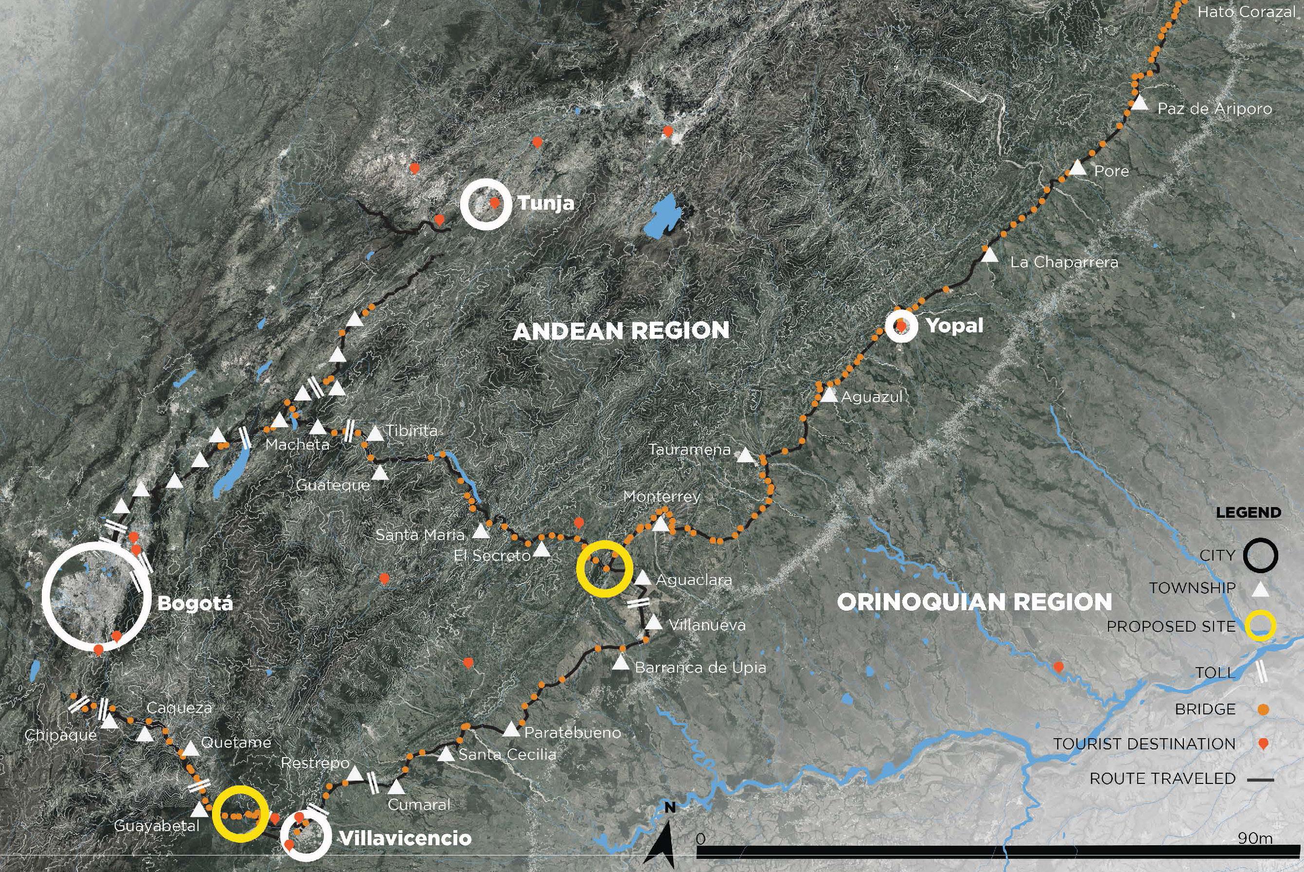
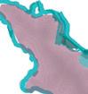
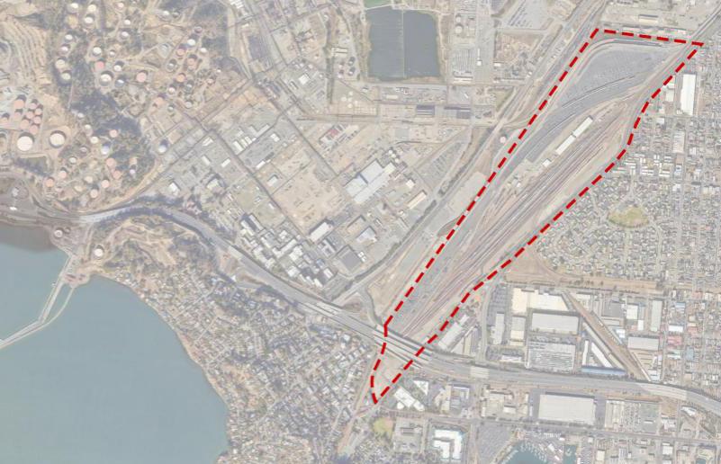
Los LLanos Orientales
Focus Regions
1.2
1.3
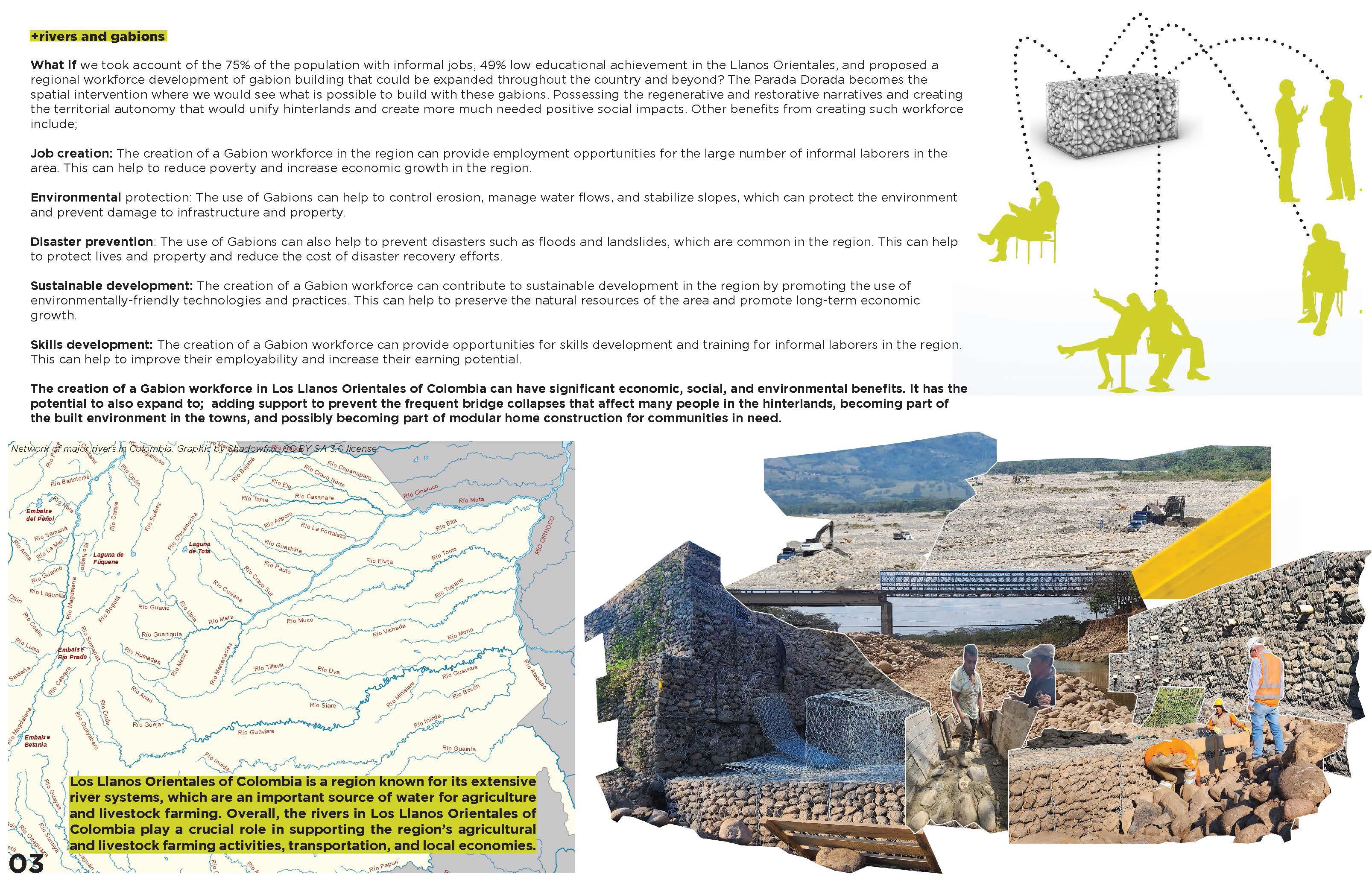
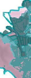
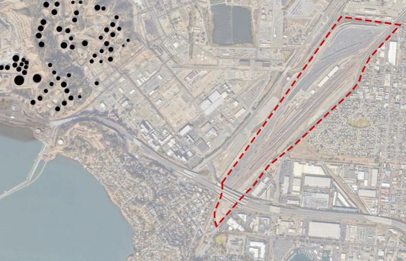
existing gabion eco-system
1.4
1.5
1.6
1.7
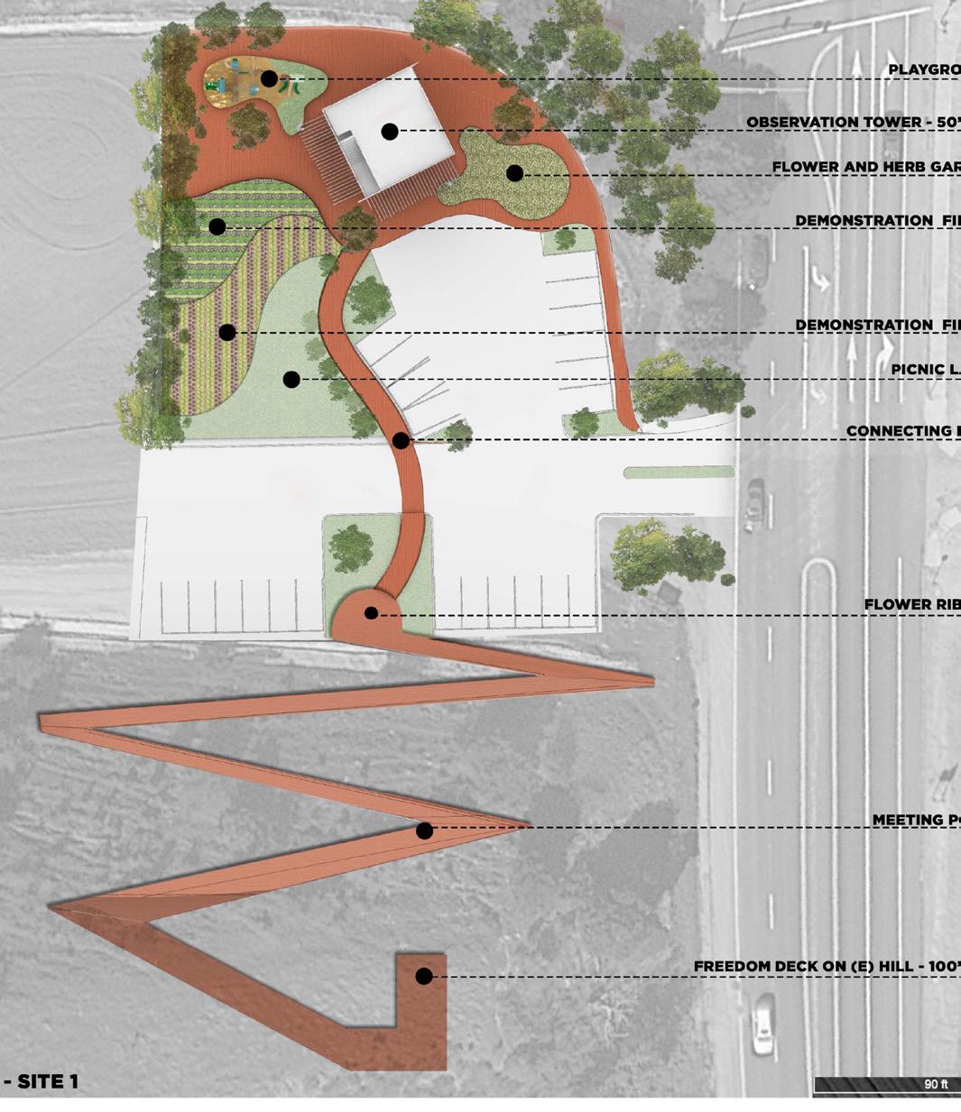
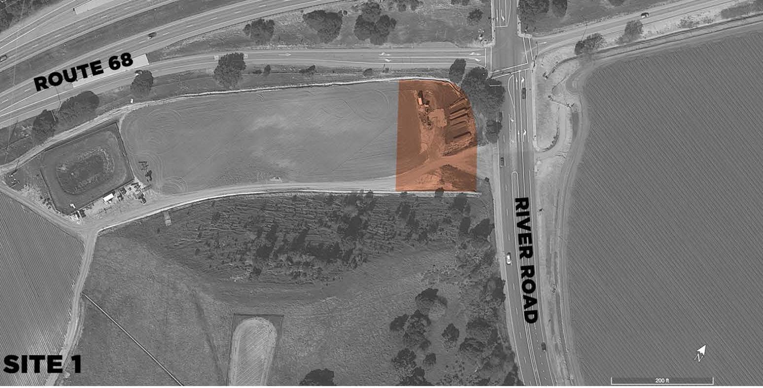
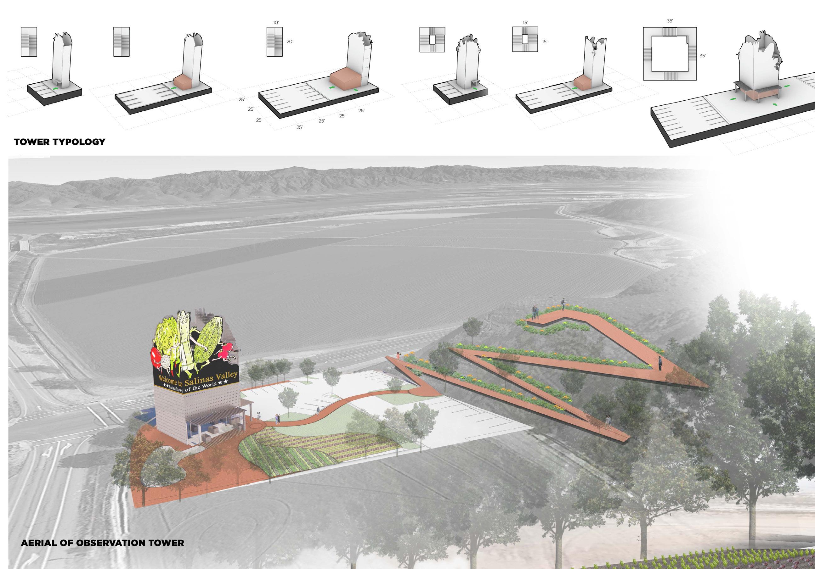
images of the bowl - salinas valley, california - academic
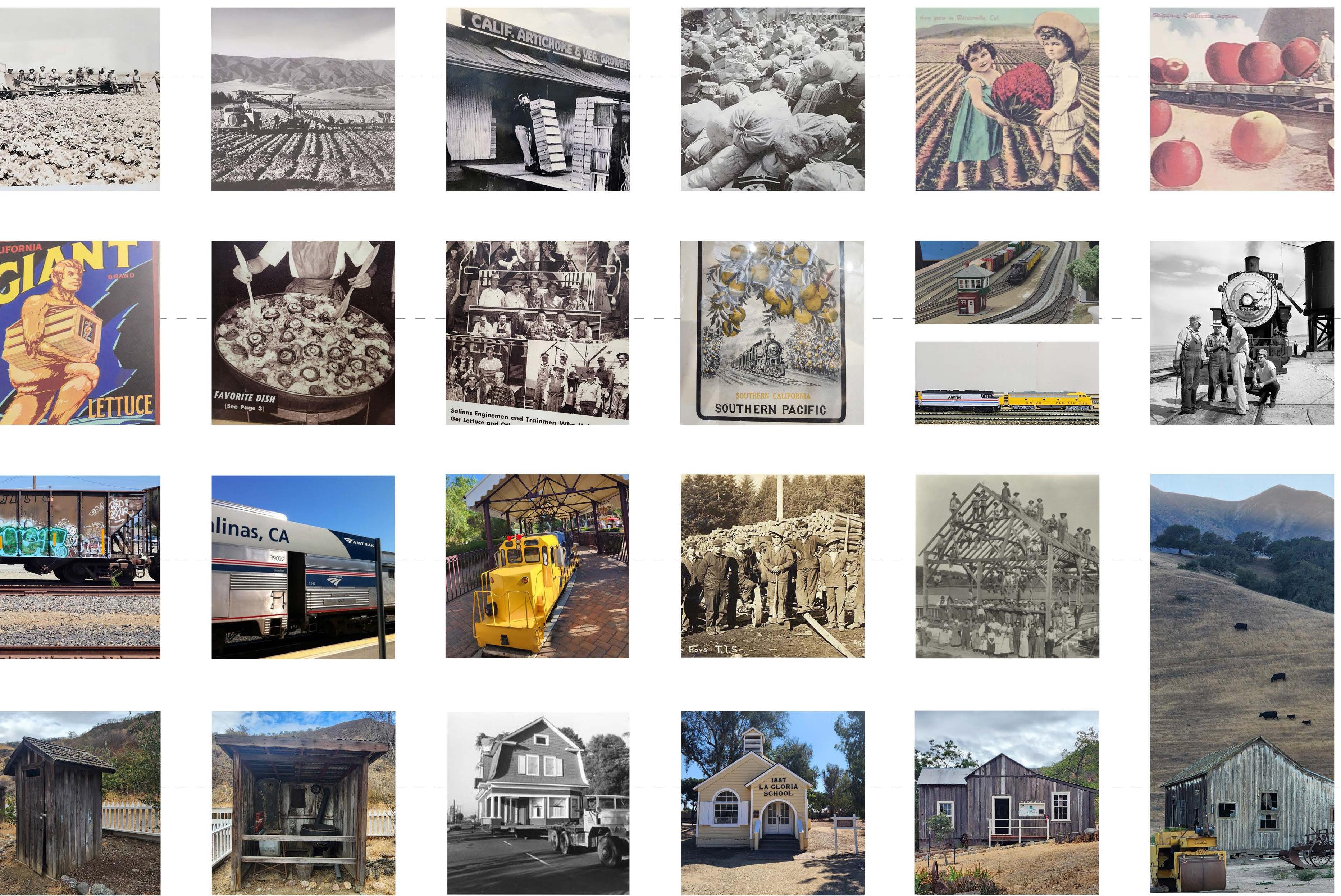
From Napa to San Joaquin, the concept and module of “the Valley” in California has emerged as a specific type of hinterland urbanism, in which localized land and food economies interact with planetary circuits of agriculture and tourism logistics. During this site immersive studio, we exchanged with relevant actors, landowners, growers, NGOs, workers, to define our site challenge and to understand the regional and transnational systems in place.
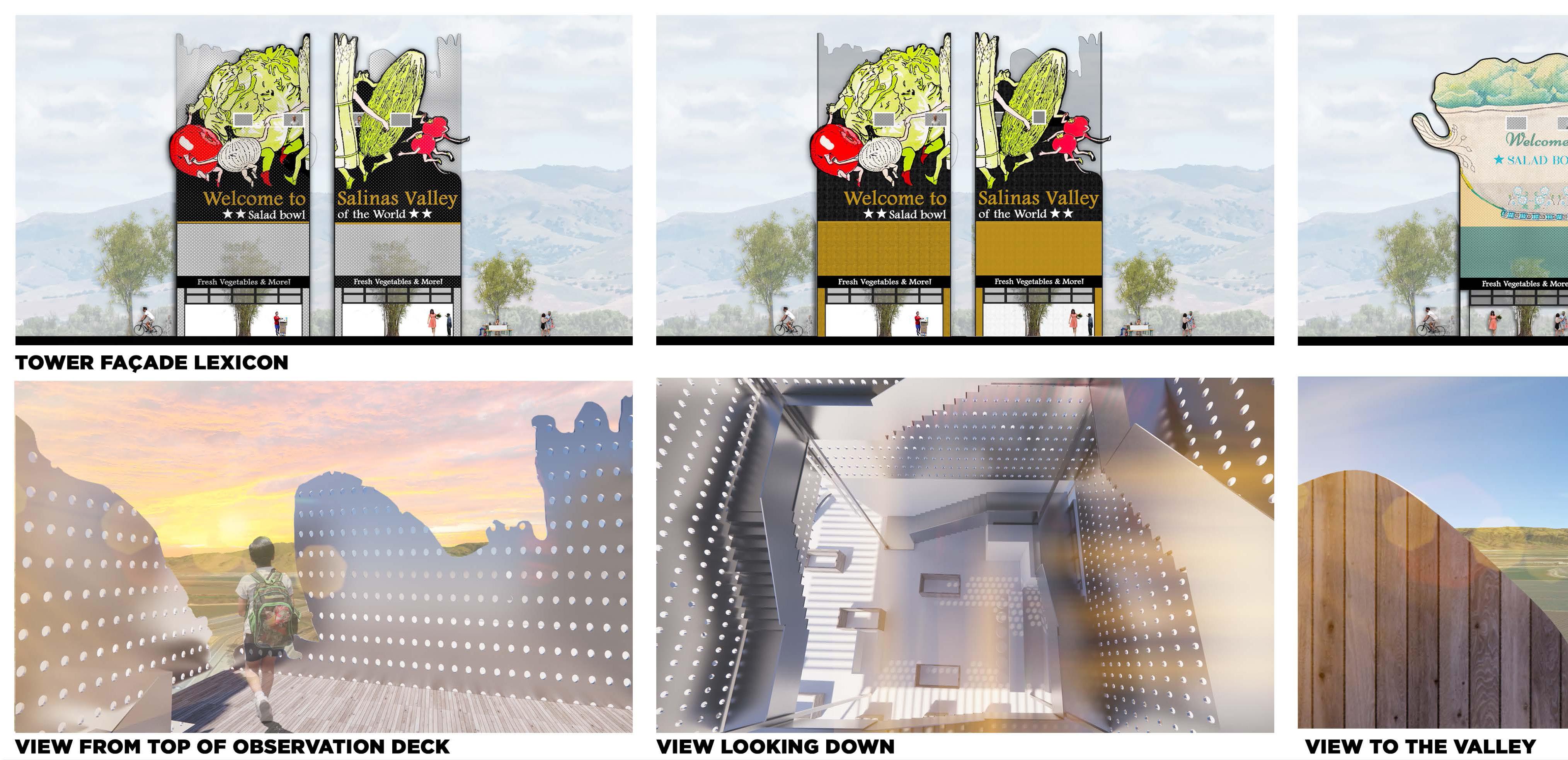
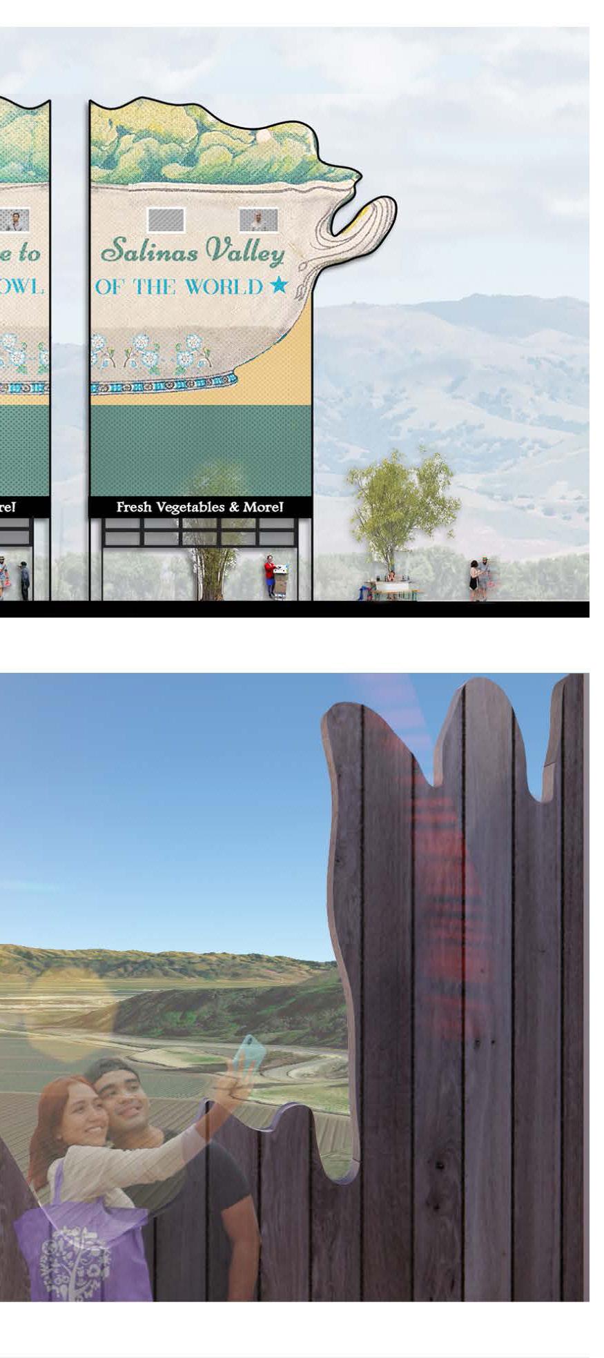
Images of the bowl is a collected series of public images and personal photographs that represent the history, agriculture, and building vernacular that completely transform the perception of the valley. Taking on the challenge of the territorial branding.
Images naturally speak to their historical context and also tend to resonate with the present.
In a book called “Philosophy of photography” by the philosopher Vilem Flusser “ Images are mediations between the world and human beings. [...] Images are needed to make it comprehensible.
With this precedence; how can visual culture make structural relations to the territorial branding design challenge across the salinas valley? And can this transcend into a tangible and memorable experience?
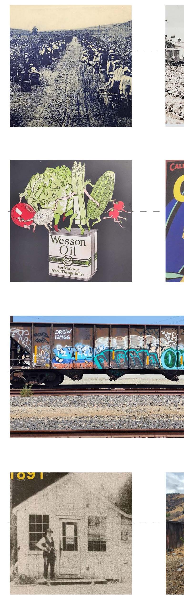
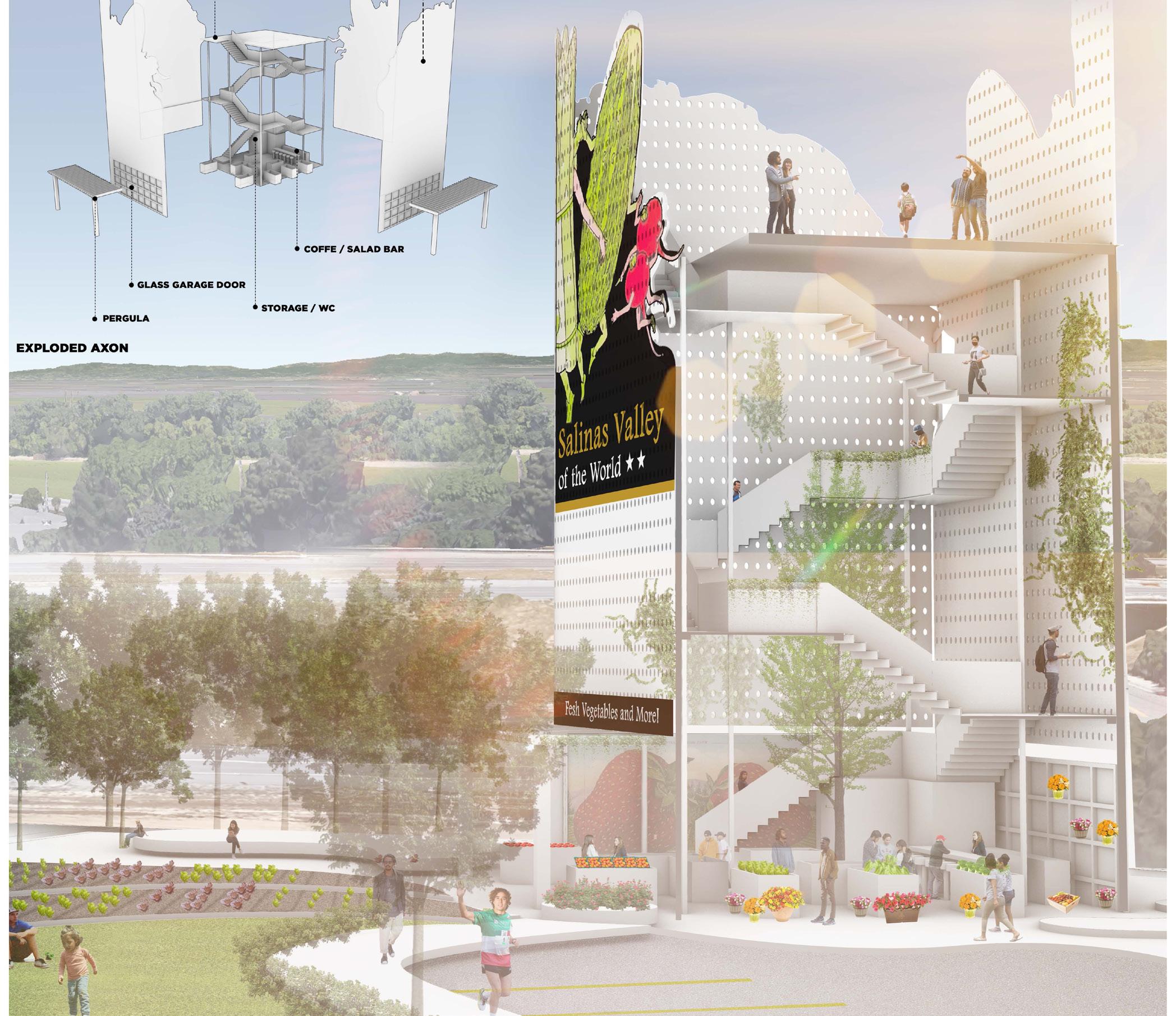
A visual novel started to unfold, becoming a series of murals, billboards, observation towers, fruit stands, and different scaled interventions to gateways. The Salad Bowl of the World has the potential to make a visual novel with a philosophy to build trust, public-private partnerships to blossom, and increase brand exposure to millions of visitors interacting with the territory.
Due to difficulties with land acquisition and immense repetitive financial impact with billboards as gateways, I wanted to create an emotional experiential connection to the Salad Bowl of the World. A typology that takes in this culture vernacular and transforms it into a billboard, fruit stand, observation tower, which offers a moment of visual connection to the vast valley, and a moment in time where people can connect. Transforming it to something I would like to refer to as agro-roadside architecture.
2.0
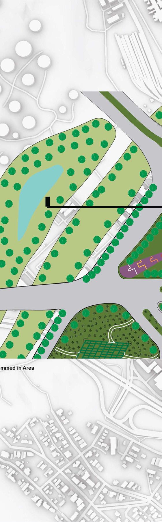
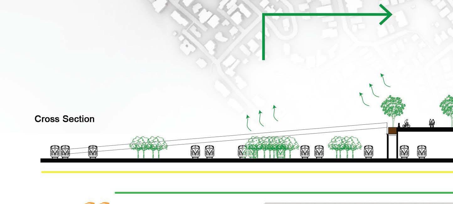
HISTORY SAN BENITO COUNTY | PRUNEDALE | SAN JUAN BAUTISTA CASTROVILLE MONTEREY BAY MONTEREY BAY SALINAS VALLEY SALINAS GONZALES SOLEDAD GREENFIELD KING CITY INTERVENTION LOCATION CITY GATEWAY | OBSERVATION TOWER VISUAL NETWORK RAILROAD /TECHNOLOGY VERNACULAR LANDSCAPE PEOPLE 2.1
site construction
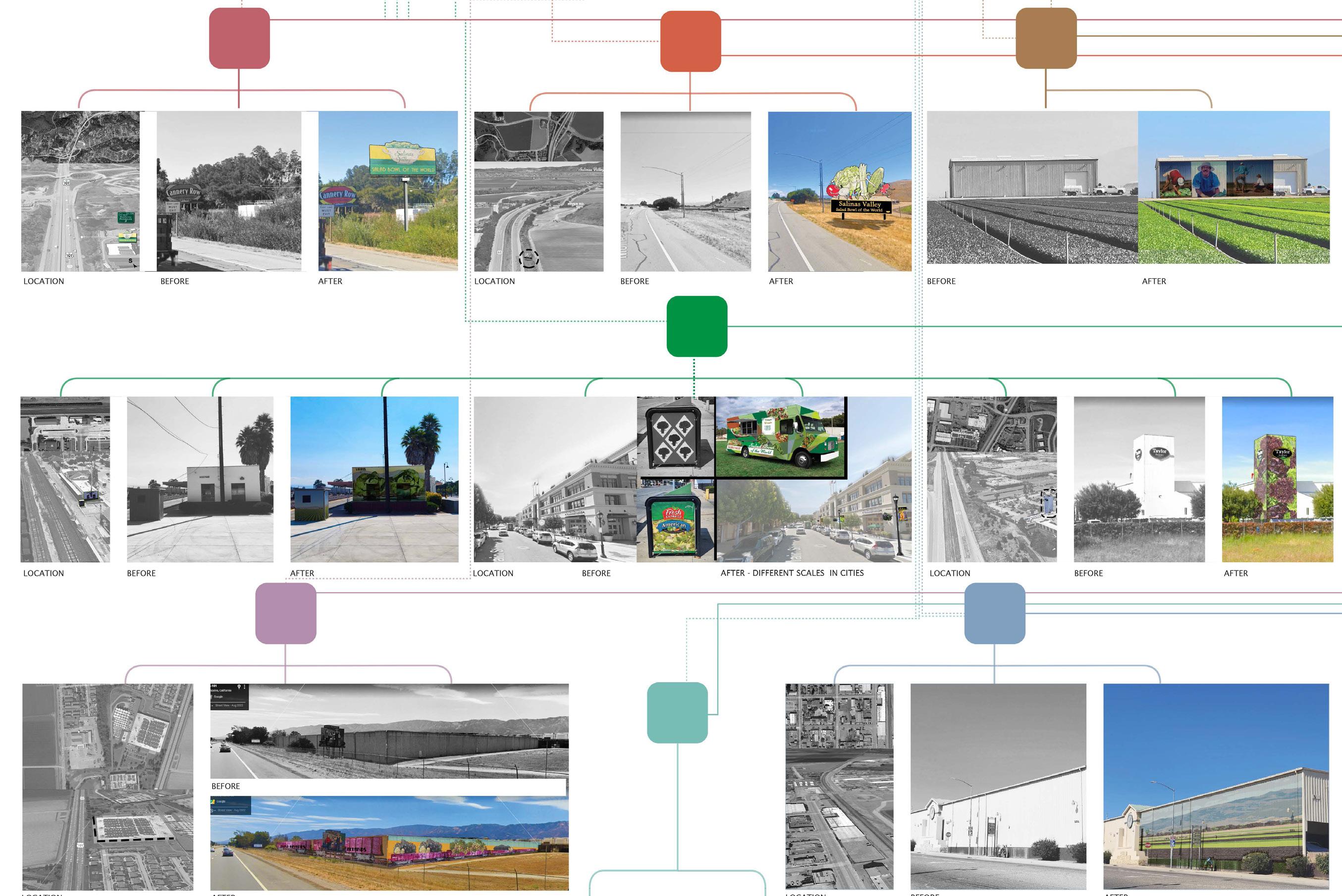
interventions
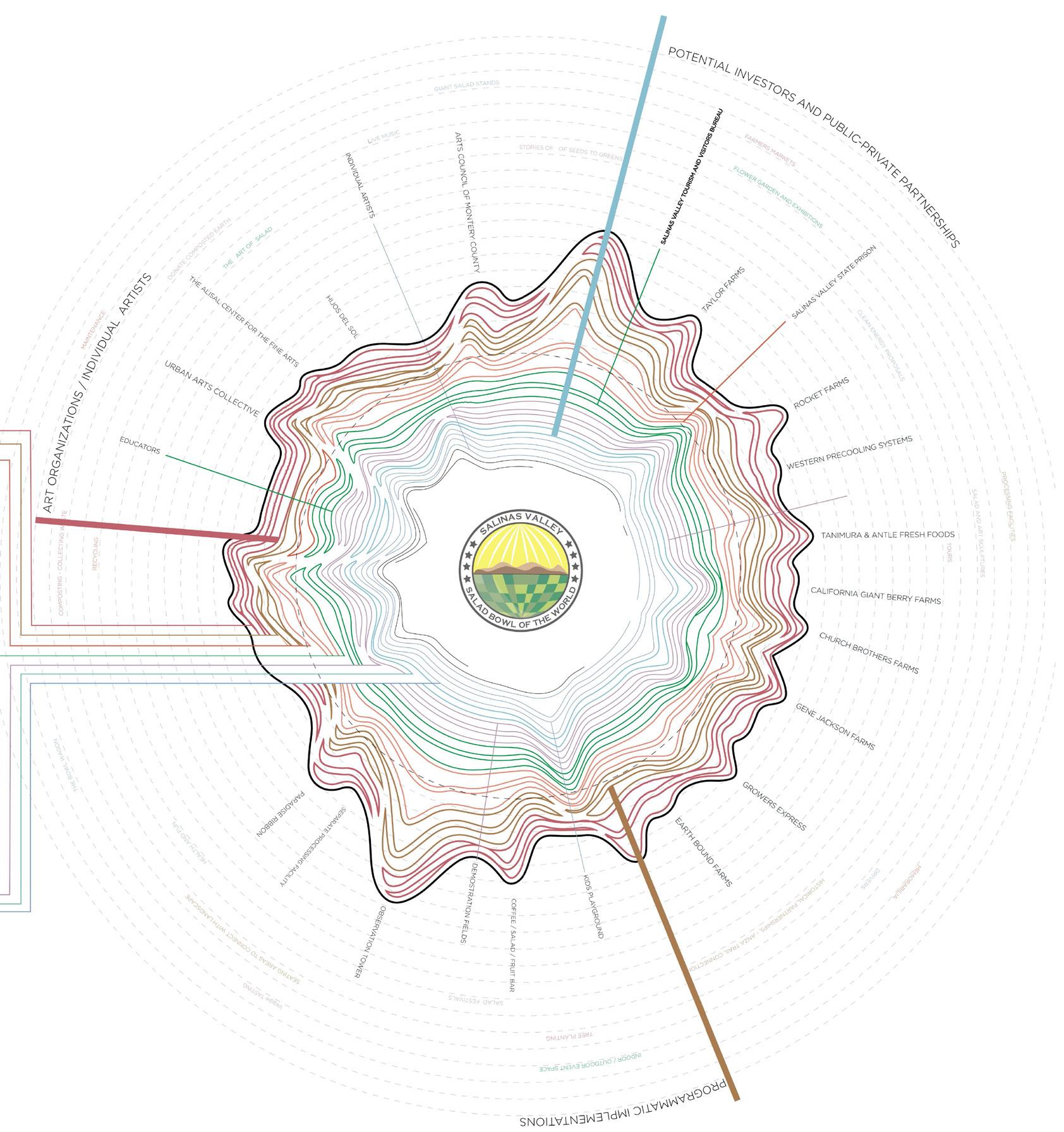
stakeholders 2.2
2.3
the new richmond handshake - richmond, ca - academic
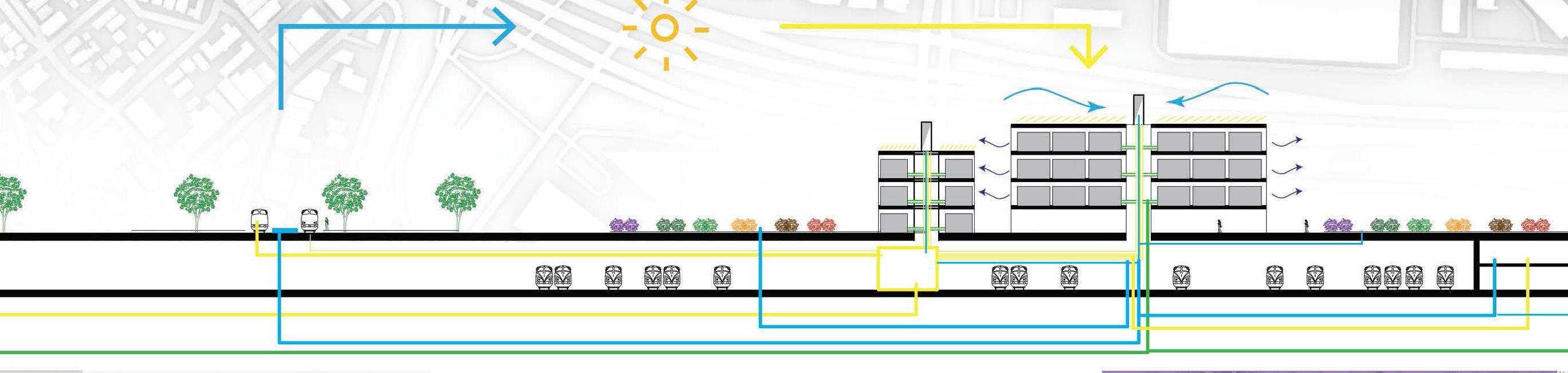
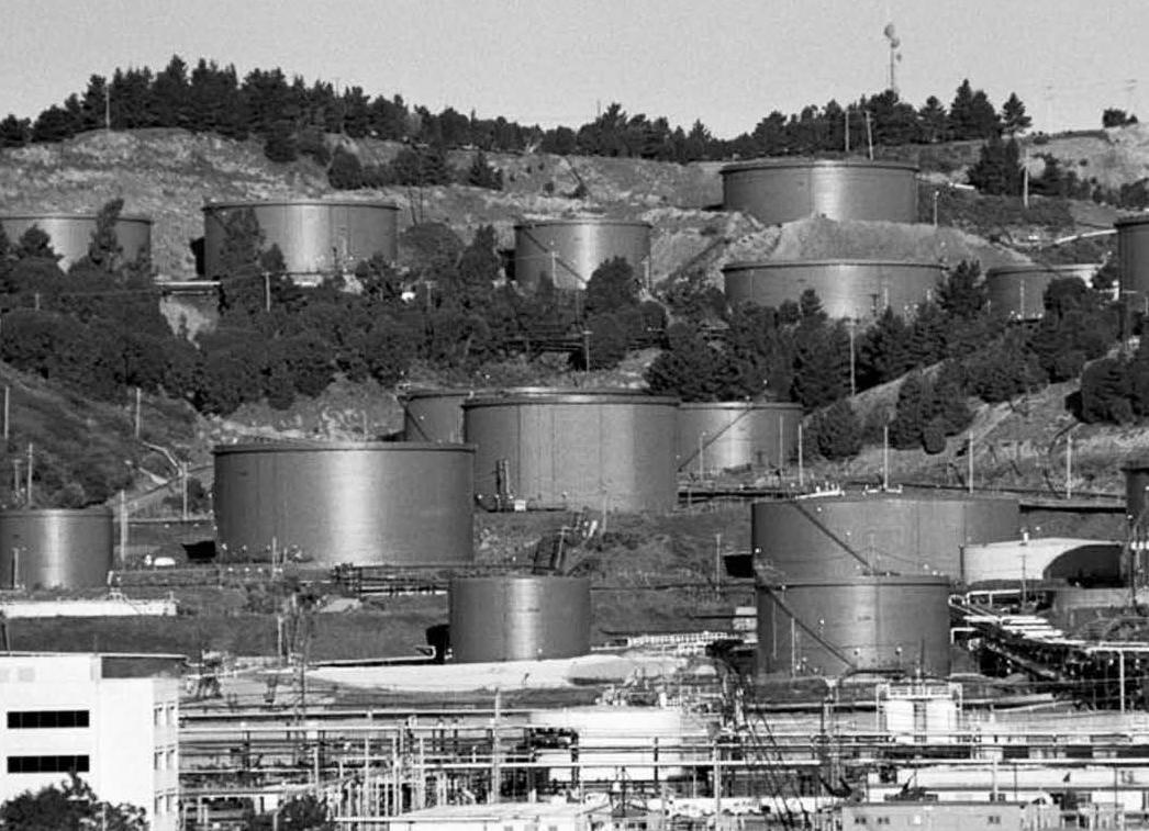
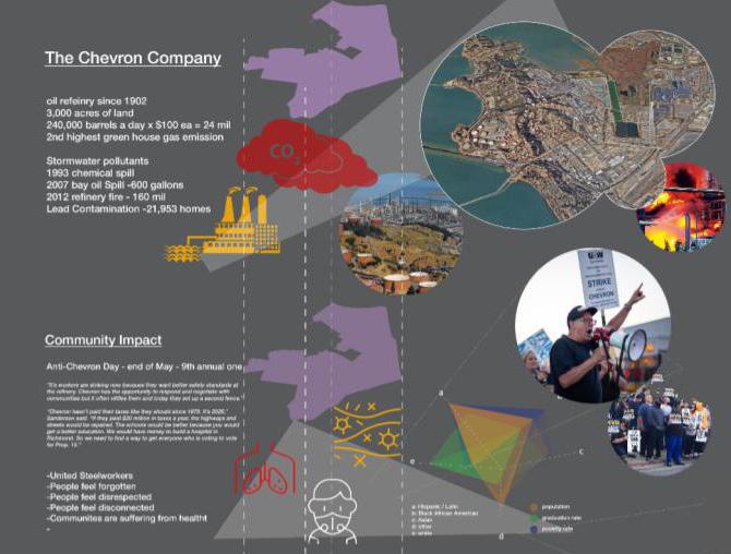
Richmond’s complex rich history alludes to industrial growth, innovation, inspiration, multicultural growth, followed by tragic outcomes, inequitable situations of ecosystems and communities, geographic chaos, and uncontrolled urban adjacencies separated by multiple types of barriers, a disconnected urban fabric, and an environmentally broken community.
The Chevron Oil refinery, sitting in a 3,000 acre land, the largest oil refinery in the state of California, producing approximately 240,000 barrels a day at $100 ea, is the 2nd largest greenhouse emitter in the state. The focus on mass oil production, having land as a source of profit and wealth accumulation and ignoring the environmental impact, has destroyed livelihoods and the relationship amongst communities, creating a snowball effect of disconnected urban fabric creating a lack of resources to its people.
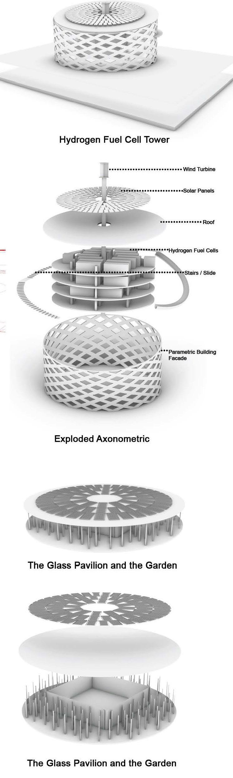
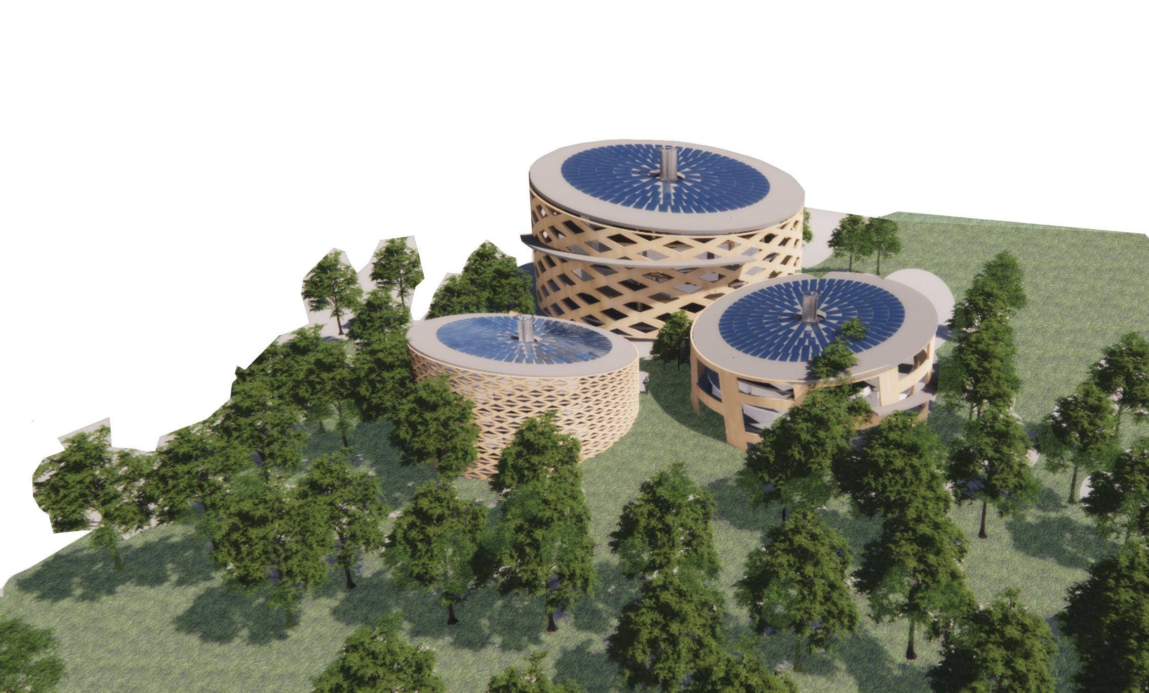
How can we phase out oil production with a clean energy solution by creating a “remediative landscape”? The US government has increased the hydrogen fuel cell energy budget by almost $100 million dollars according to the US Department of Energy for the year 2023. The rise of clean fuel cell energy allows the opportunity to generate clean energy without any pollutants. Being able to provide energy to power plants, transportation systems such as railroads, ships, trucks, buses, and even cars. This has become a route that many other Oil Refinery have been embracing at very small scales. Richmond will have the probability to once again become the example of innovation, inspiration and growth. Can history, landscape, people and energy coexist?
Designing solutions that are examples of environmentally restorative justice, transformative urban fabrics, and connectivity with its natural resources will reactivate a much needed Richmond.
3.0
6’
1’


3’


8’
3.1 bart station & amtrak train station public transportation system sea level rise in 2050 = 1.9’ - 2.7’ sea level rise in 2080 = 4.4’ - 6.6’ sea level rise in 2110 = 6.9’ - 10.2’
deep water table
deep water table
water table
deep
water table
dangerous to most dangerous Wetland Park Green Space Green Space Port Terminal Shoreline Waterfront Industrial Shoreline Entertainment Shoreline Urban Residential Shoreline Protection shoreline $88.3k+ $70.7k - $88.2k $56.5k - $70.6k $42.9k - $56.5k $28.8k - $42.8k Median Household Income White Hispanic African American Asian IRON TRIANGLE BELDING WOODS CORONADO MARINA BAY PULLMAN PARK PLAZA PARKVIEW SOUTHWEST ANNEX POINT RICHMOND SANTA FE RICHMOND HEIGHTS FAIRMEDE HILLTOP HILLTOP DISTRICT MAYVALLEY EL SOBRANTE HILLS GREENBRAIR NORTH&EAST IRON TRIANGLE BELDING WOODS CORONADO MARINA BAY PULLMAN PARK PLAZA PARKVIEW SOUTHWEST ANNEX POINT RICHMOND SANTA FE RICHMOND HEIGHTS FAIRMEDE HILLTOP HILLTOP DISTRICT NORTH&EAST IRON TRIANGLE BELDING WOODS CORONADO MARINA BAY PULLMAN PARK PLAZA PARKVIEW SOUTHWEST ANNEX POINT RICHMOND SANTA FE RICHMOND HEIGHTS FAIRMEDE HILLTOP HILLTOP DISTRICT NORTH&EAST industry social
deep
least
proposed section
chevron in Richmond, CA
concept section diagram
3.2
san antonio
park master plan recommendations - oakland, california - self
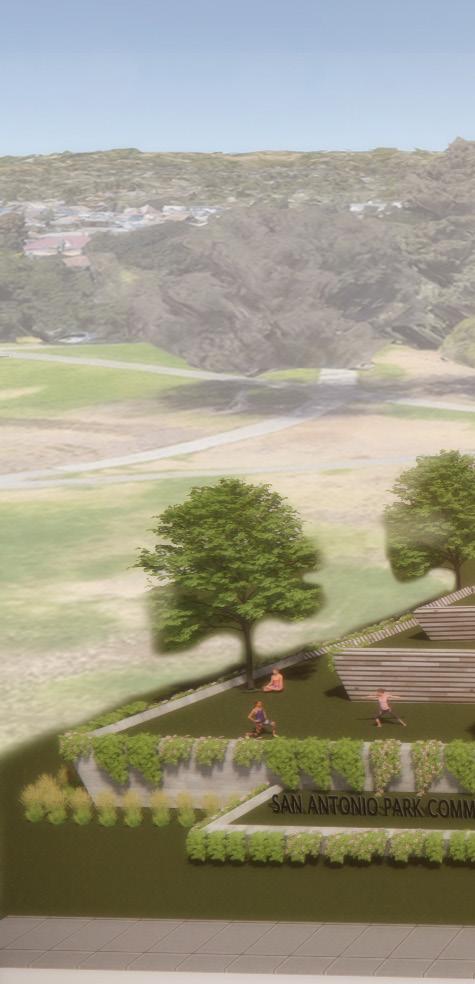
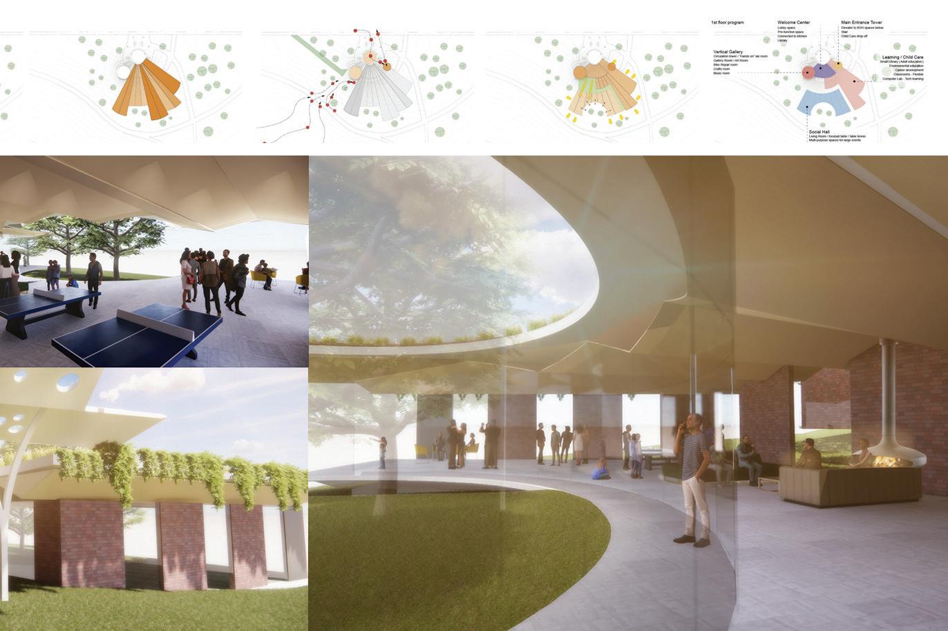
San Antonio park is a hidden gem amongst our resilient East Oakland, currently in the process of getting truly discovered, it is one of the 7 parks “squares” originally founded by the city of Oakland. Located a few blocks away from my residence, along a beautiful hillside on Foothill blvd offering views of the Estuary, Alameda, and San Francisco. Brushed with copious humbling sunset colors in the early evening, during safe hours you can find neighbors enjoying amenities ranging from playing soccer, basketball, reading, dog walking, children in the playground, boxing, and running dancing, laughing, working, and now praying.
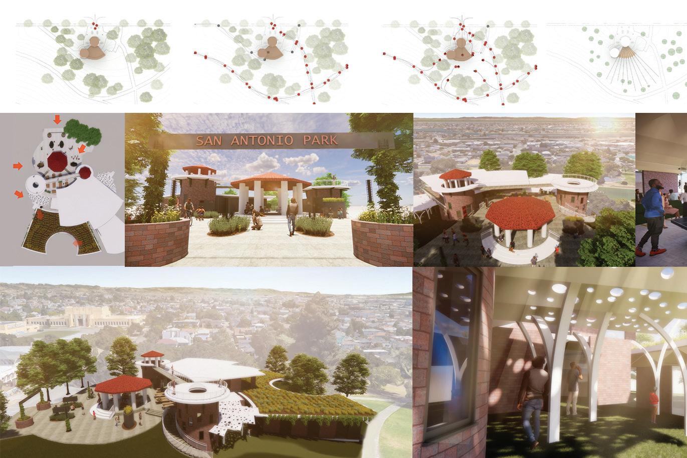
In 2020, the City of Oakland undertook a Master Planning process for San Antonio Park. The impetus for this Master Planning process arose from a need by Oakland Fire Department for a new location for Fire Station 4. The San Antonio Park Community saw in the Master Planning process an opportunity for an in depth Community Visioning Process for the park. Several long-standing community-based-organizations in the San Antonio community teamed up to form Friends of San Antonio Park (FOSAP). The community based organizations anchoring FOSAP have formal relationships and historical partnerships with city agencies and foundations, such as the Department of Violence Prevention, Human Services Department, Oakland Fund for Children and Youth, and the Oakland Parks and Recreation Foundation.
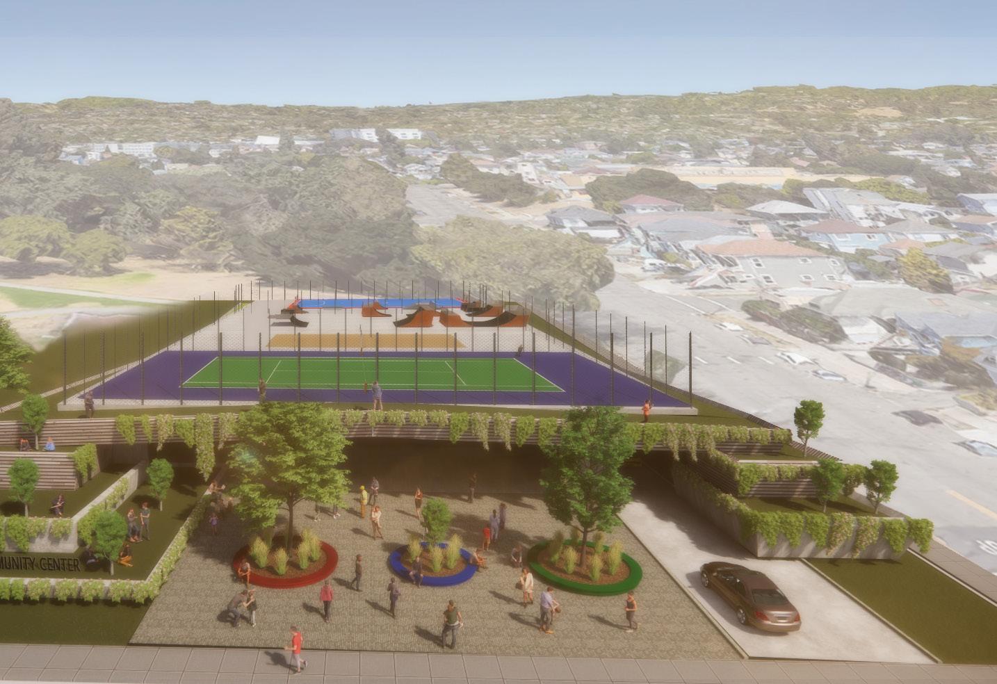
I was heavily involved in advocating during this process, became a founding member of FOSAP, worked with Trybe, EBAYC, and neighbors to inspire the community through visual storytelling and experiential design, I surveyed and evaluated the current community center for expansion possibilities, and proposed ideas for the gateway of the park, as well proposed the idea of transforming the existing tennis court area to an all inclusive and sustainable community hub that could become the link between, nature and the vibrant multi-cultural neighborhood around it, with a multi-sport roof deck. Through the well-executed community outreach by us, FOSAP, comments were synthesized and rough conceptual designs were proposed in a very fast manner.
Today, thanks to the collaboration between all the organizations, help from district council president Nikki Bas’s office, support from Oakland Public Works, the Resilient Officer Joe Devris, and to the Friends of San Antonio Park (FOSAP) coalition, the City of Oakland has granted Trybe and other sub-consultants almost half a 1 million dollars to continue activating the park and has included language to include about 4 million dollars towards the feasibility study for a library and resilient center, and a playground. Talk about a win!
4.0
proposed main entrance to existing rec center / pavilion / Park circulation study circulation arteries to embrace rec center ceiling structure design expanded
 2: side of of proposed main entrance and rec center expansion
1: proposed park main entrance main entrance view of rec center expansion
2: side of of proposed main entrance and rec center expansion
1: proposed park main entrance main entrance view of rec center expansion
1 2 3 4 5 4.1
3: main entrance from park
expanded radial growth progammatic rays main entrances from street and from park light study and green belt proposed program
 4: view into proposed social hall
5: view into proposed social hall indoor / outdoor 0.2
4: view into proposed social hall
5: view into proposed social hall indoor / outdoor 0.2
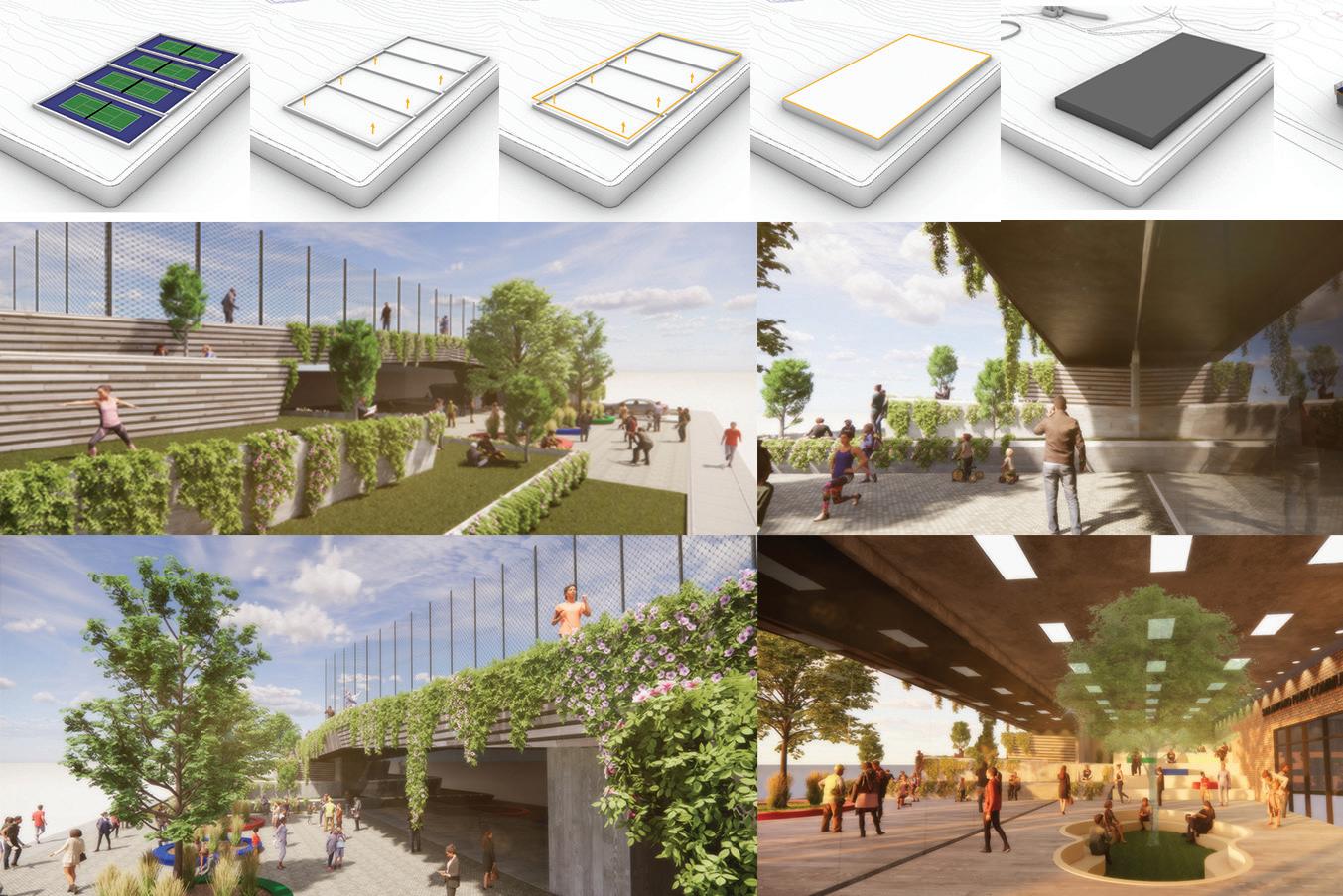 (e) tennis courts lift planes create a platform establish a “sports” level create a box of program underneath
side view of proposed community center from green terrace
view of plaza, terraces in front of glazing wall
(e) tennis courts lift planes create a platform establish a “sports” level create a box of program underneath
side view of proposed community center from green terrace
view of plaza, terraces in front of glazing wall
4.2
proposed view of interior lobby lounge of community center front `side view of proposed community center and jogging trail
create community sports deck
sports open to grade from park and to community center from park and sports come together jogging / viewing trail around sports deck
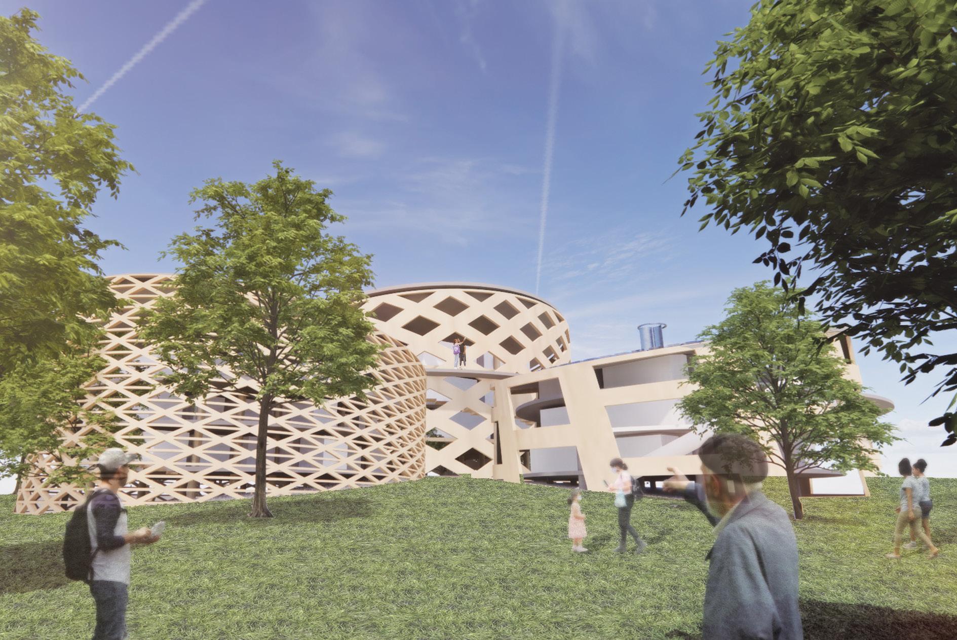
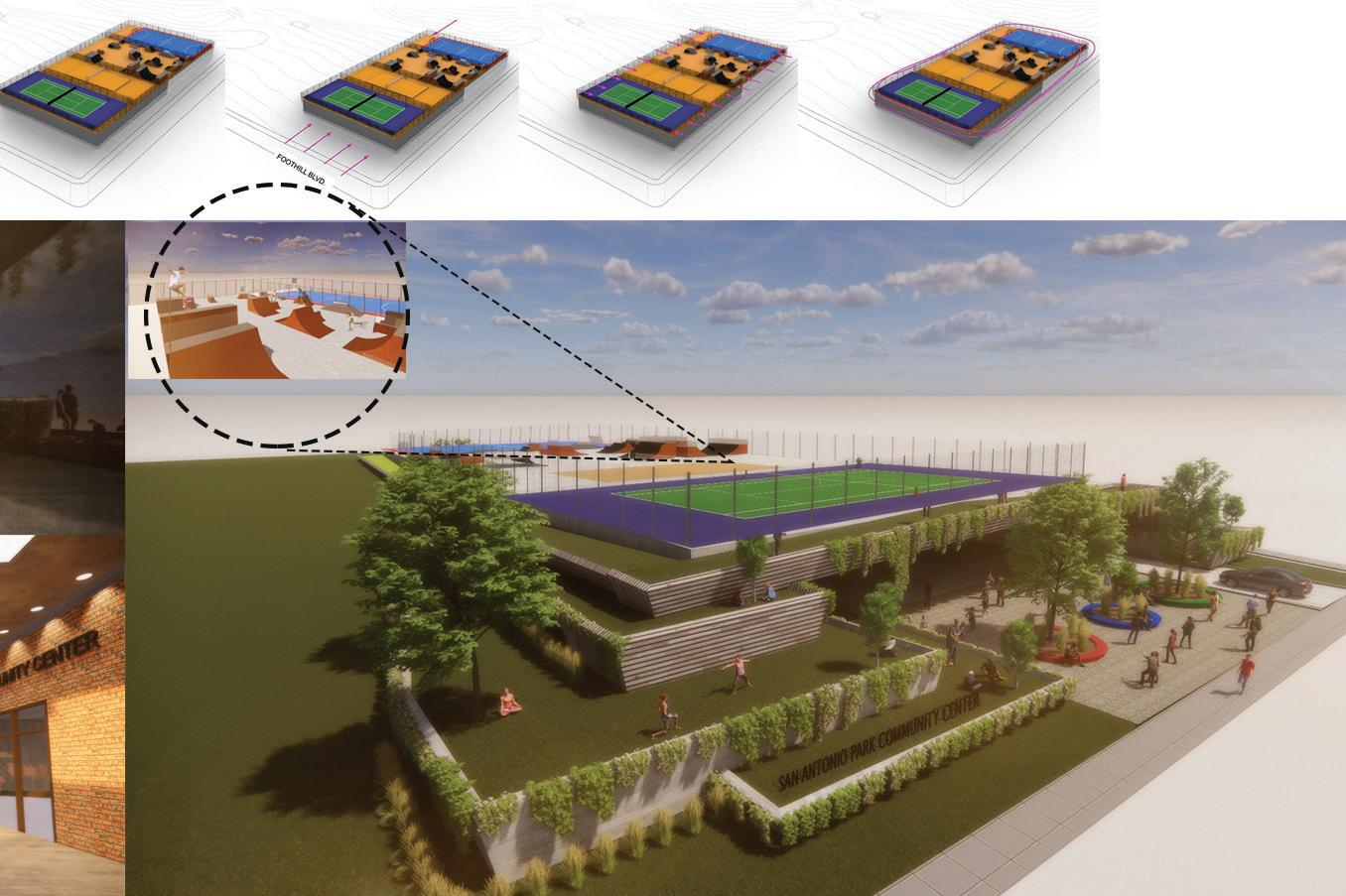 proposed front side aerial of multi-purpose eco-friendly facility composing of a neighborhood library, community center, headstart space, cafe, and multi-sports deck nestled into the hillside 0.3
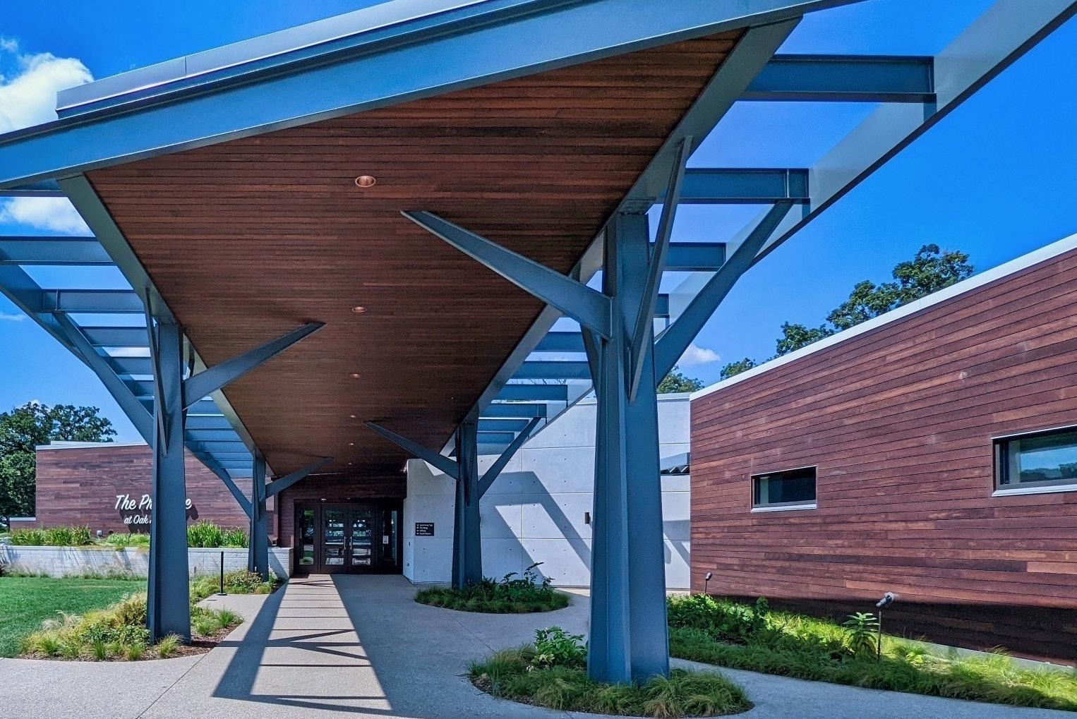
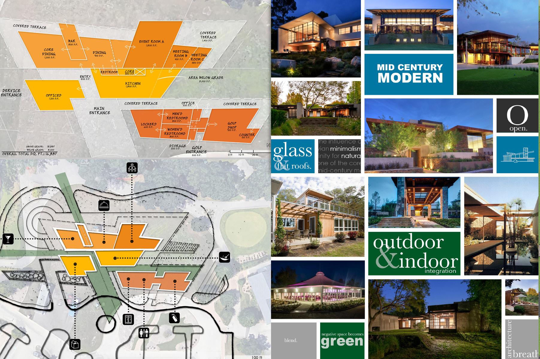
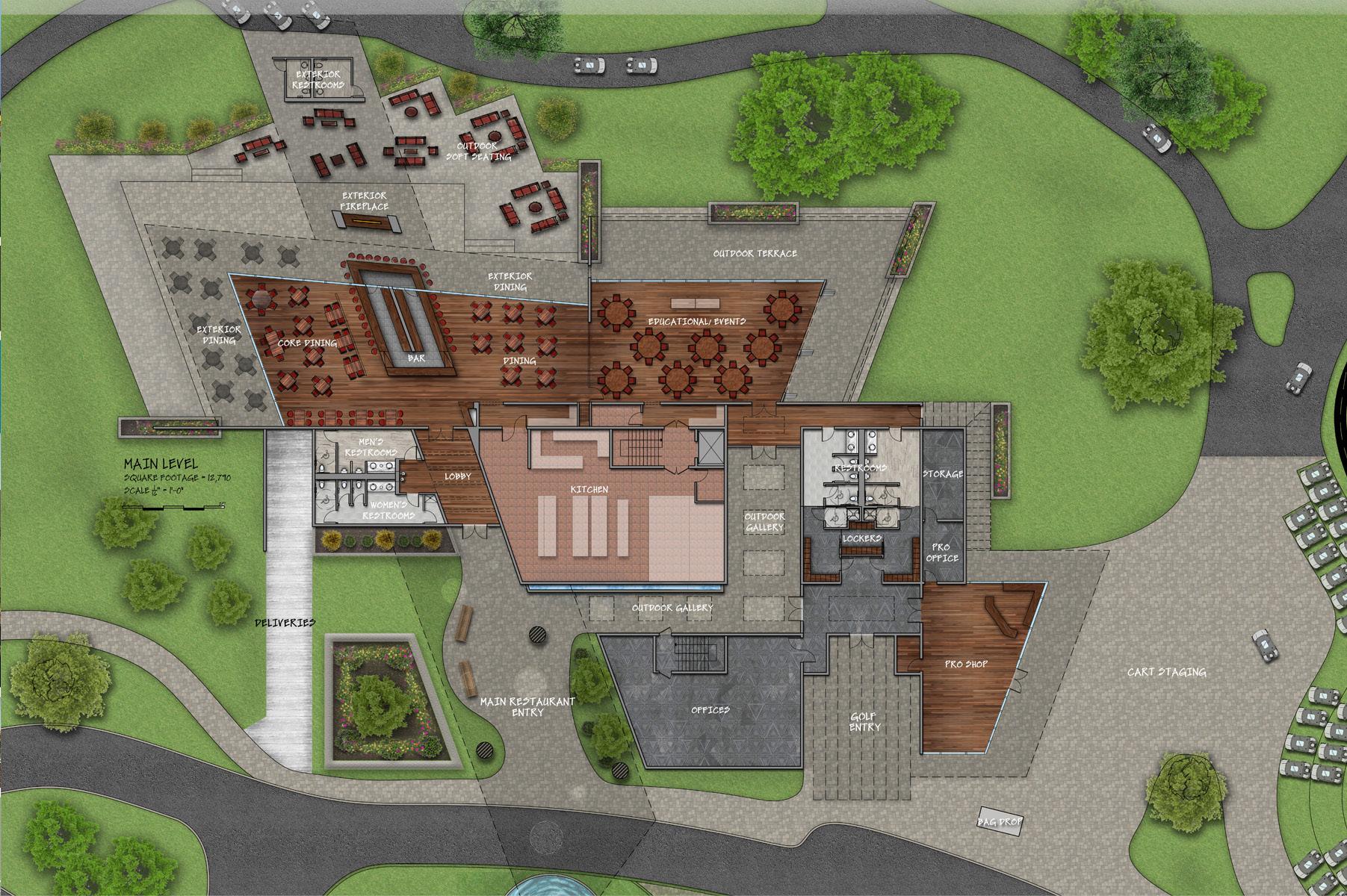
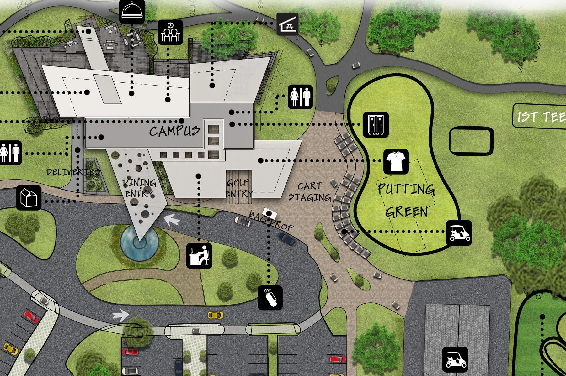
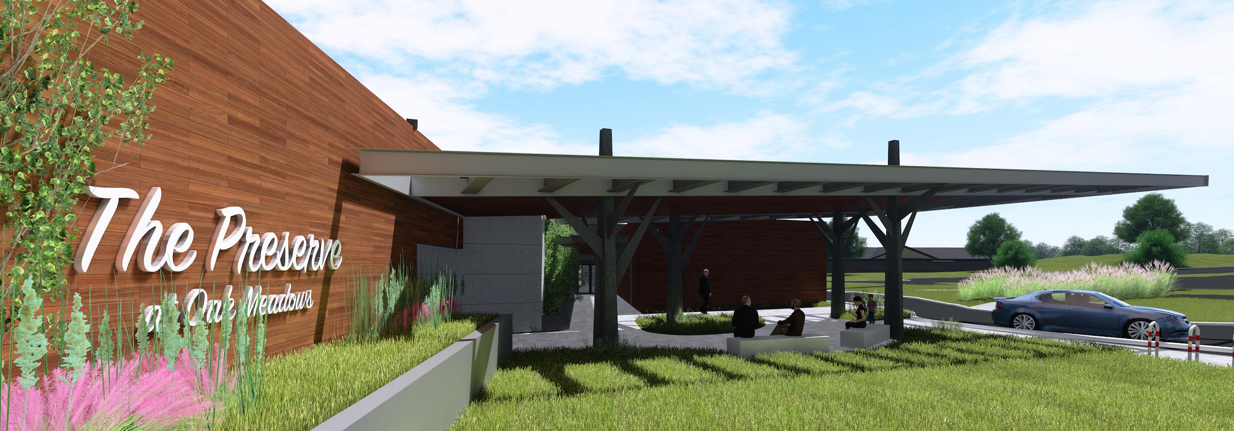
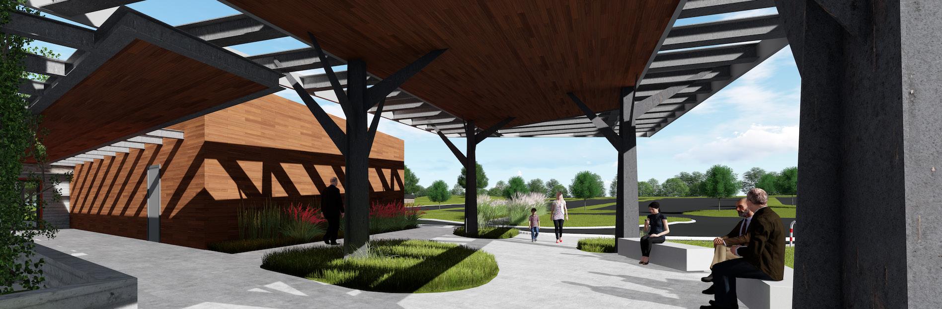
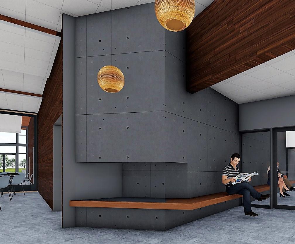
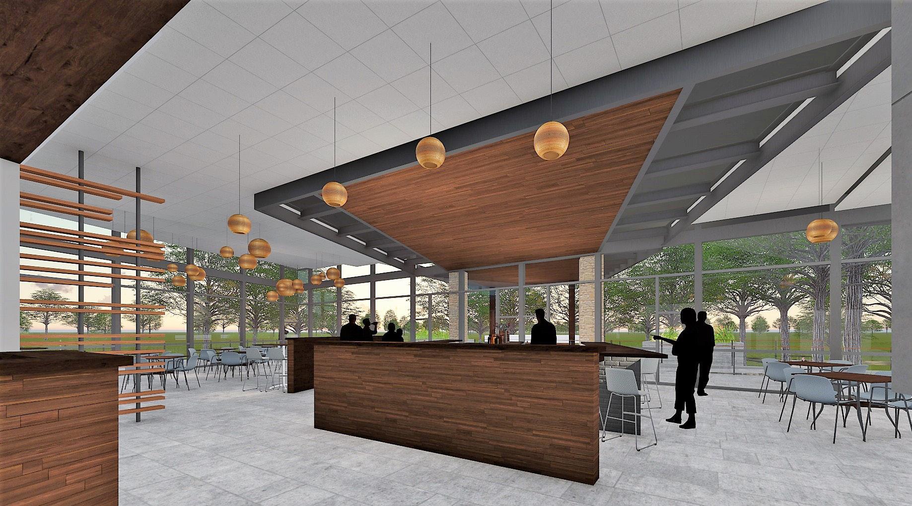
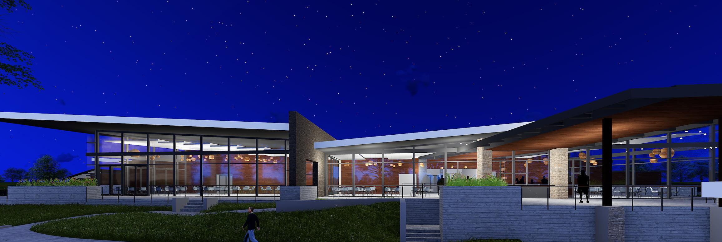
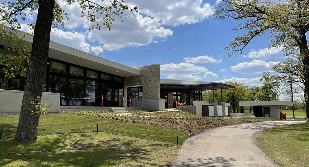
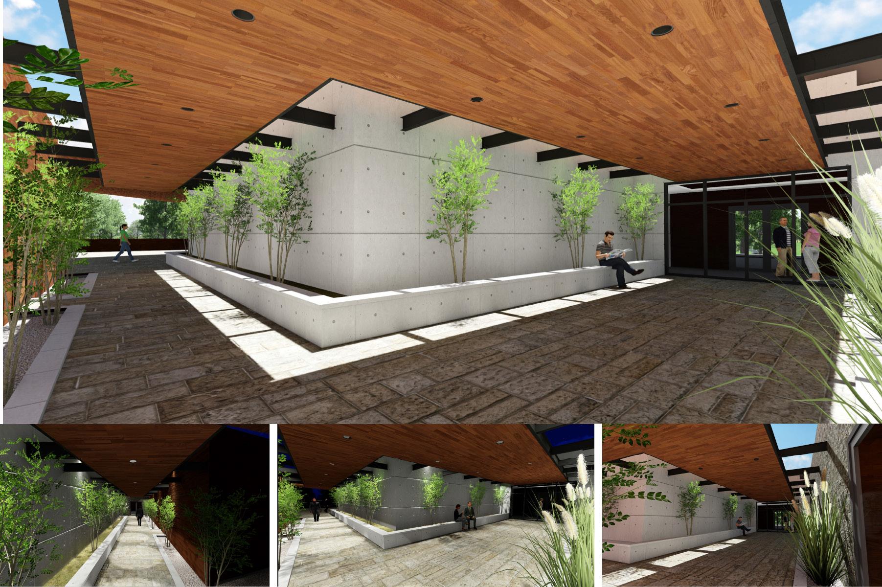
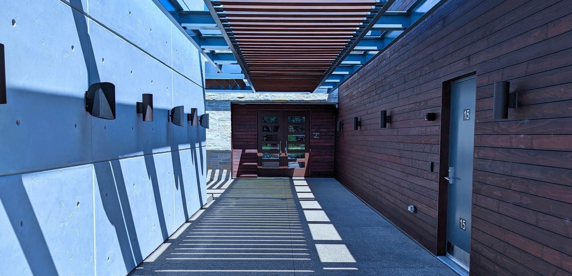
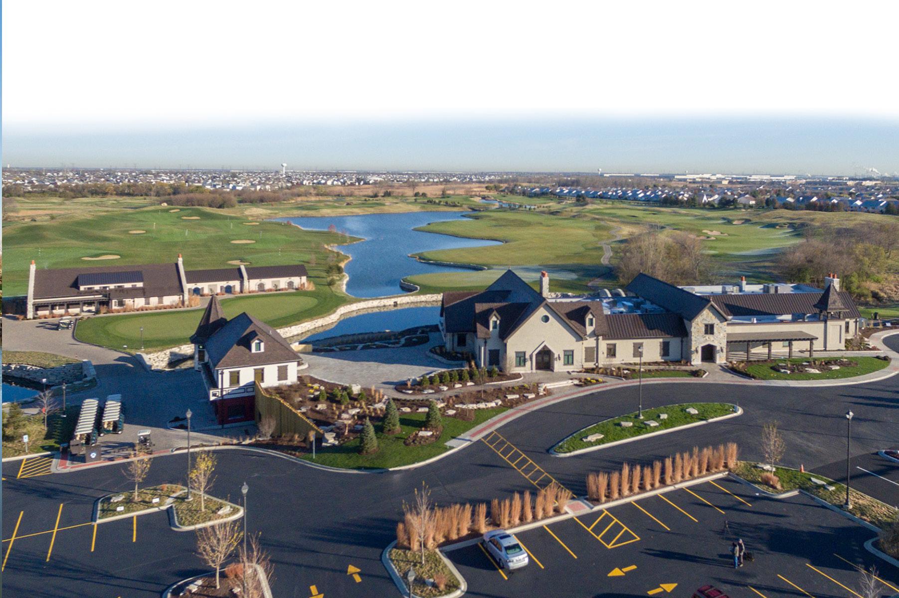
the preserve at oak meadows - addison, illinois | 18k sf
formerly known as oak meadows, located in addison illlinois, a golf course known for its flooding conditions whose 50k square foot clubhouse was a victim of a fire, change was imperative. visit link to see complete construction : https://youtu.be/eJ3tQ6hw53c
the forest preserve district of dupage county selected daniel wohlfeil design from highly competitive rfq submittals to re-brand their entire to re-brand and design the a potential new clubhouse.
client’s requests:
1. build a new clubhouse to sized to a more contemporary golf style
2. if re-branded, what could we become?
challenge:
• how does a forest preserve allow a golf course to co-exist with in the same landscape?
• how to translate a building its through native ecosystems?
• instead a clubhouse, how can it be a campus?
• how can this campus emerge from its context
• will this form reflect natural materials bonded together by living bricks and mortar?
-lead overall project design and development. created diagrams, programmatic layout, architectural style mood boards, rendered floor plans, site plan w/ icons, building material composition
-heavily involved in all phases SD, DD, CD.
-coordinated with MEP, S, landscape architect, Civil, kitchen & bar consultant, golf shop consultant, water feature consultant, and more.
-maintained and coordinated schedule, agenda, and minutes throughout SD, DD, CD.
-worked with Pepper Construction for design alternatives based on budget driven items
-worked with team to develop the interior design package, coordinated with manufacturers, representatives, and owner
-produced material mood boards see pictures
-produced construction documents, from story boarding to details
• **hand sketches by the sketch artist in the office.
• **photo realisitc renders not done by me.
5.0
e. establishing contextual connection
h. 4 quadrant - ecosystem
lines of influence
a. contextual relation - golf holes
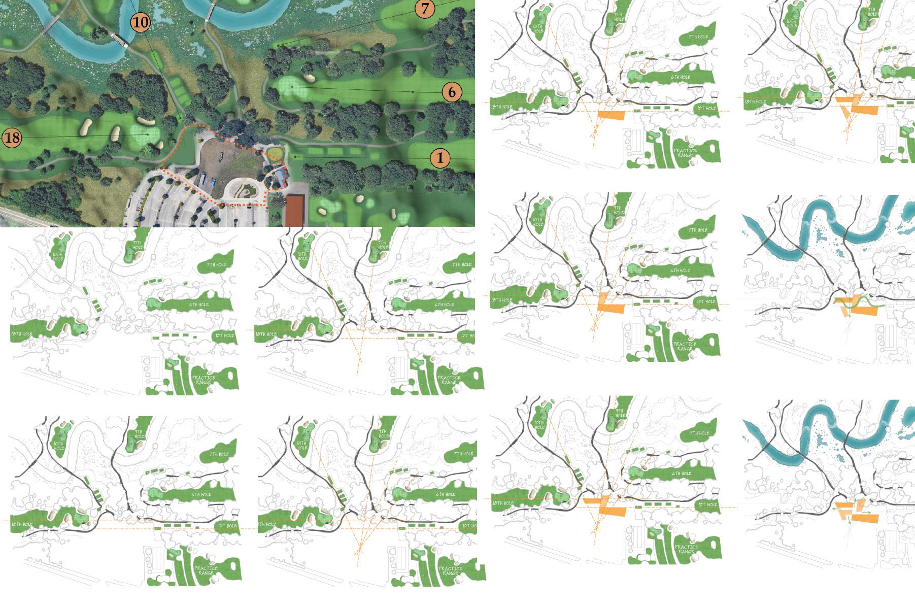
c. intersection
f. 2 quadrant
i. salt creek - green belt
b. penetration
d. junction
g. 3 quadrant
j.green circulation
5.1
k. programmatic extrusion
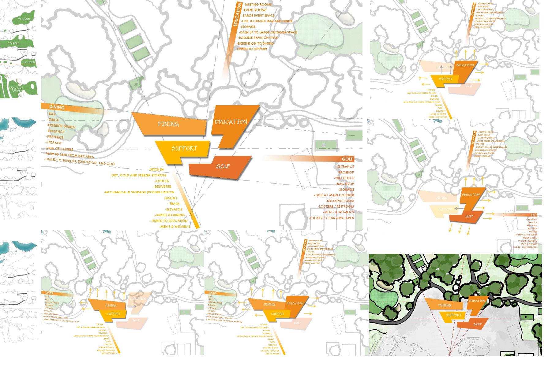
ecosystem
flexibility interlock merge overlap schematic site plan 1.1
inspirational architecture program adjencies
 schematic plan
5.2
 1.2 final schematic plan
view towards golf shop offices and porte chochere
gallery concept
outdoor bar concept
view towards dining
schematic site plan
5.3
1.3
5.4
1.4
night view of west elevation
view into bar - continous barhat
view into 2 sided fireplace
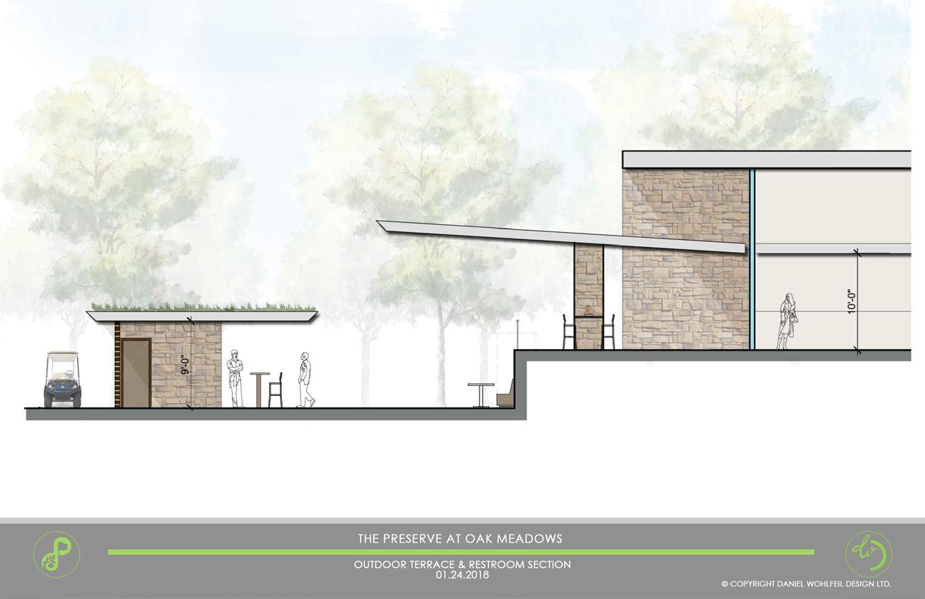


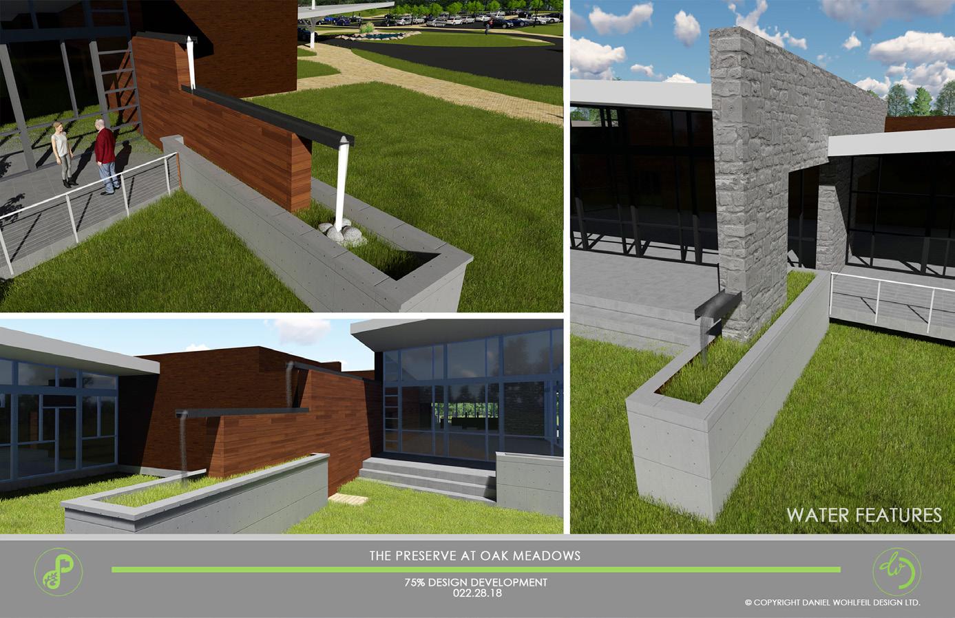 picture outdoor bar area and main dining space - terraced wall reflecting roof drainage system through runnel modification to outdoor area
runnel water feature at south wall
picture outdoor bar area and main dining space - terraced wall reflecting roof drainage system through runnel modification to outdoor area
runnel water feature at south wall
5.5
runnel at west wall
1.5
looking north - night view from golf shop south and west of gallery view west into multi purpose space
picture of proposed outdoor gallery - green belt
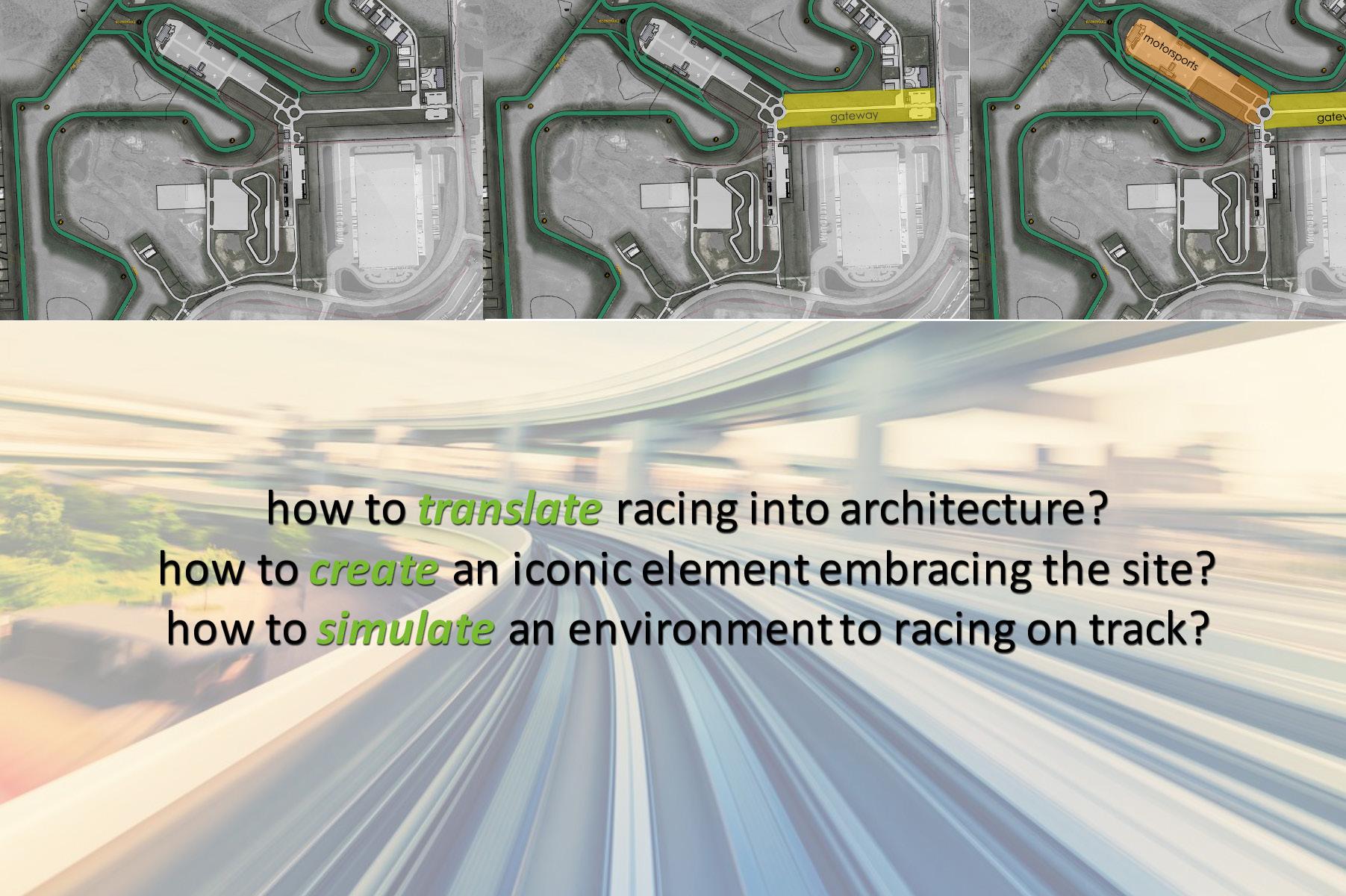
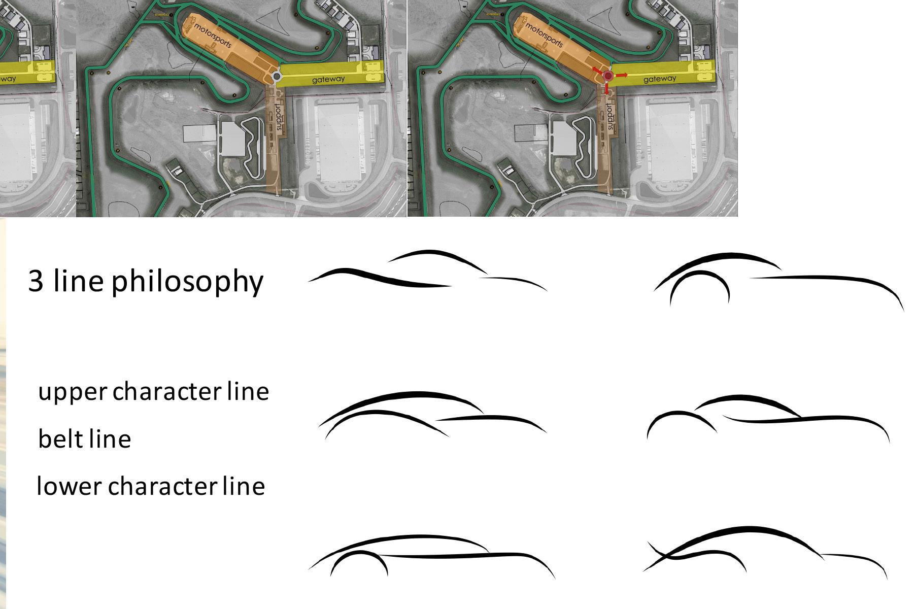
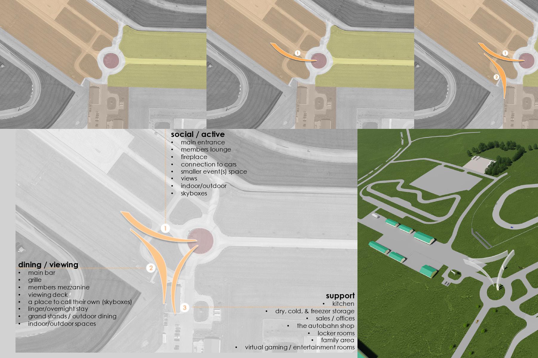
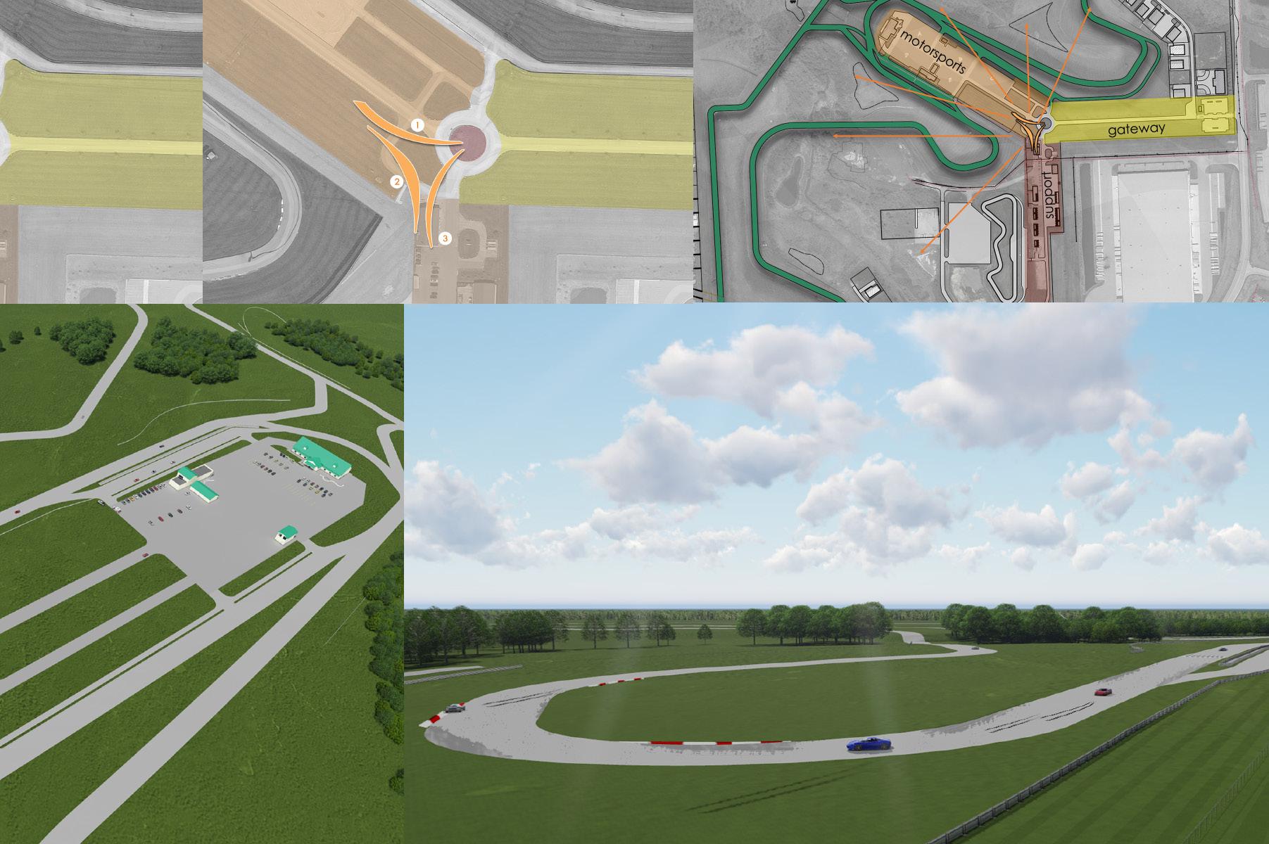
autobahn country club - aurora illinois, concept
the autobahn country club, located in joliet illlinois, is racing club on a 350 acre land that started in 2004 with a road course racetrack of composed of two circuits forming a 3.56 mile long course with 22 turns. accompanying this, is a go kart track, skidpad, rallycross course, and offroad trail to accommodate any automotive goal. their goal is to operate a profitable high quality motorsports venue in a club-like setting.
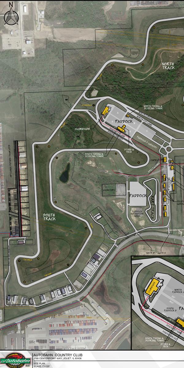
client’s requests:
1. re-valuate their exiting clubhouse to renovate
2. build a new clubhouse to encompass more complex scenarios, growing membership, and family like integrated program
challenge:
• how to create a more zoned clean layout to facilitate circulation efficiency
• how to translate racing into architecture
• how to create an iconic element that embraces the site
• how to simulate an environment to racing on a track
-developed site analysis, research surveys, anylize member wnats and needs
-developed building design philosophy, diagrams, and programmatic layout
-assisted in renovation of existing pavilion.
•
•
**hand sketches by the sketch artist in the office.
**photo realisitc renders not done by me.
main site plan
6.0
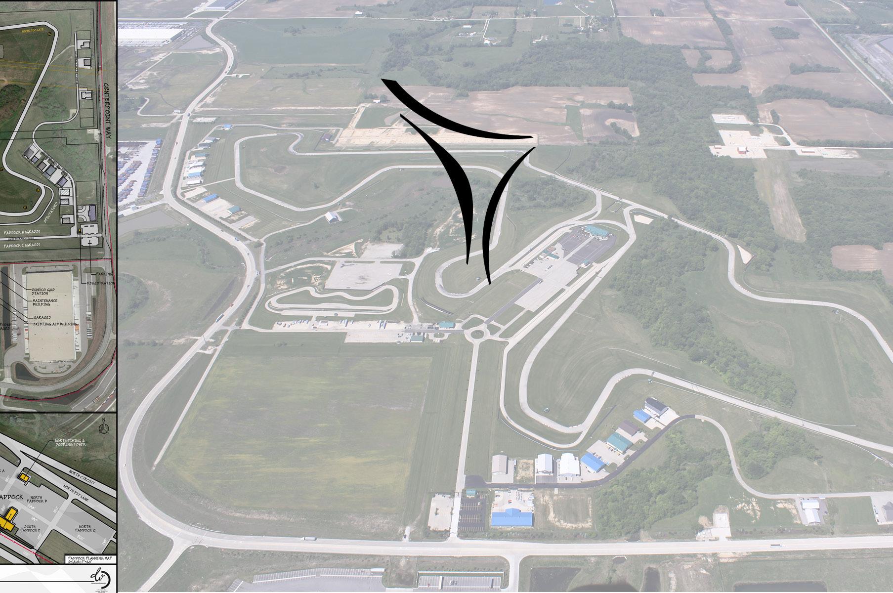
2.0 aerial of site
6.1
clean slate - track is highlighted zone one - gateway zone two - motorsports
can a car be drawn with 3 lines? car design philosophy
2.2
zone three - support point of intersection
zoomed site plan at point of connecting gateway and motorsposrts connecting motorsposrts and a building designed by 3 lines - progam proposed location on site
6.2
2.3 and
connecting gateway & support proposed new clubhouse location
proposed view from dining / viewing program
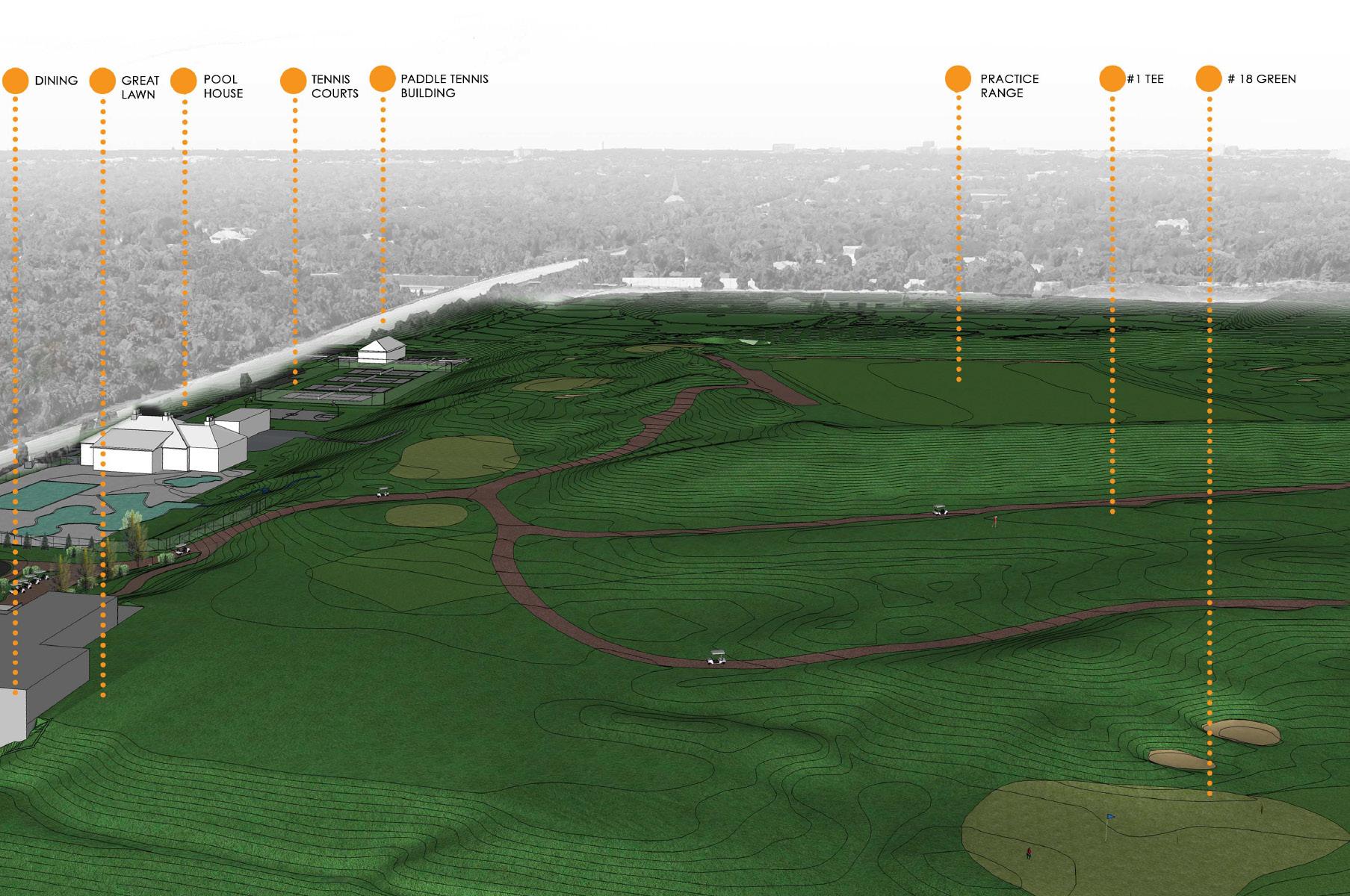
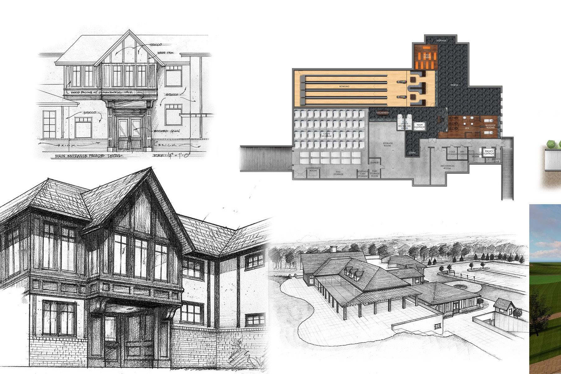
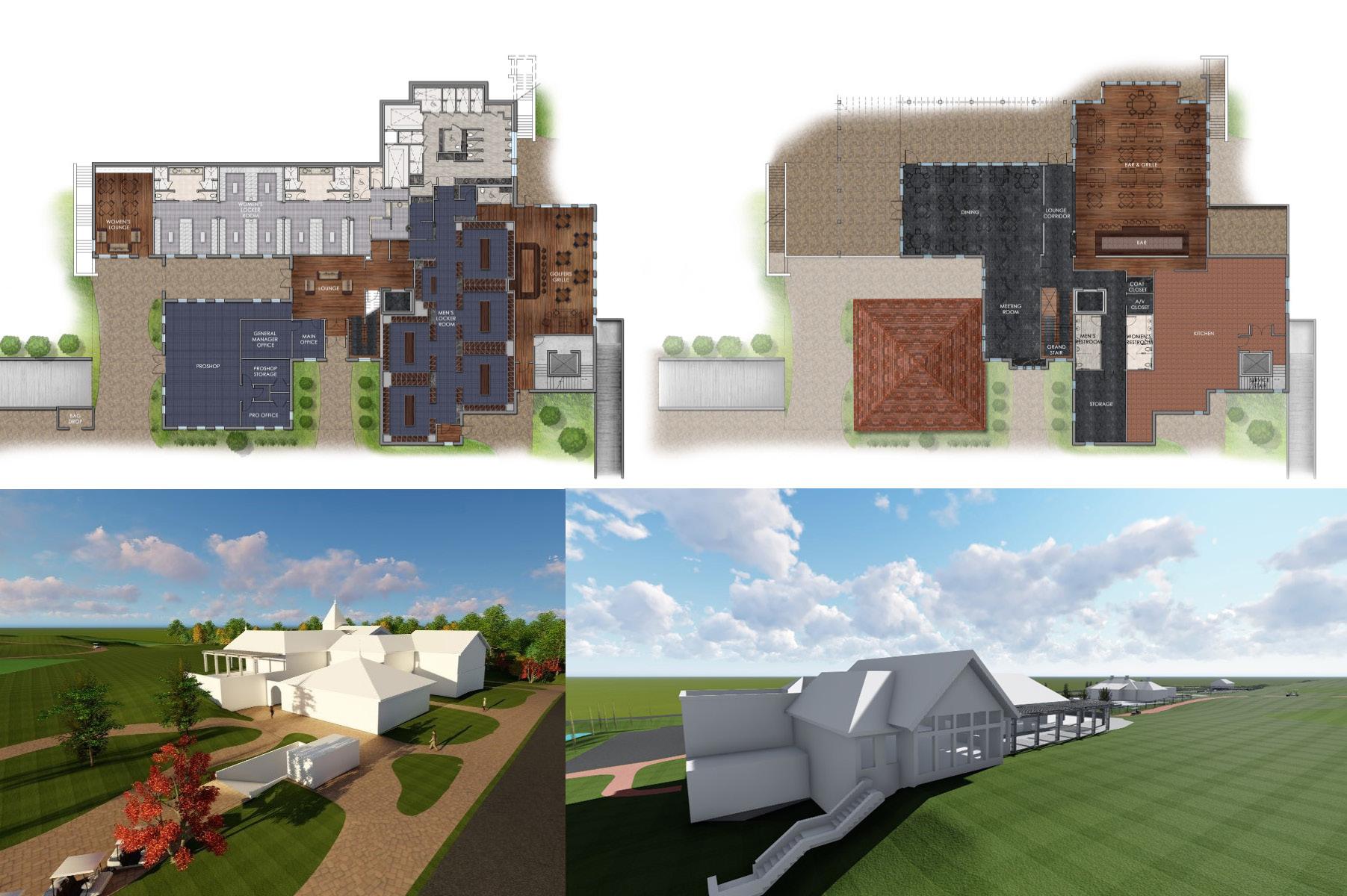
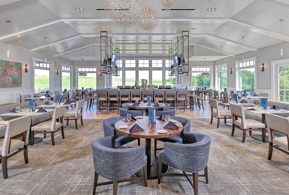
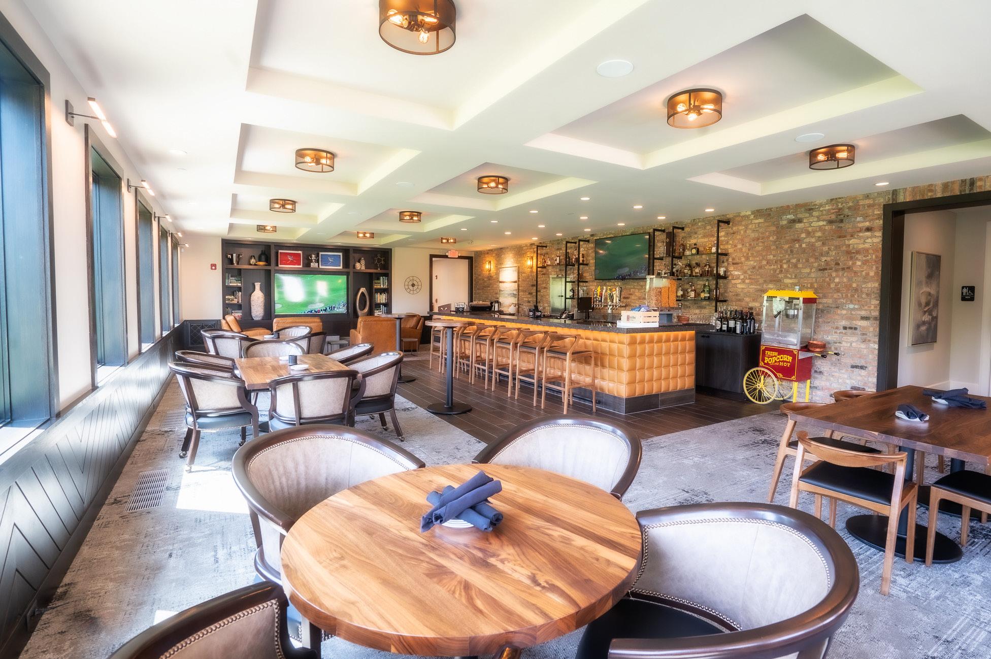
chicago highlands golf club - weschester, illinois | 35k s.f.
chicago highlands club, located in westchester, illinois is among the finest private family clubs in chicagoland. an arthur hills designed golf course built over an existing landfill designed with a dynamic and alternating topography where a view into the chicago skyline can be seen.
client’s requests:
1. build an efficient new clubhouse at the south east corner of their site
2. maintain architectural language of existing buildings on site challenge:
• how do would we blend the course and the building?
• how do we site the building to brace the most important golf holes?
• how to design an efficient 32k square foot building with program desired
• how does can building act as a retaining wall?
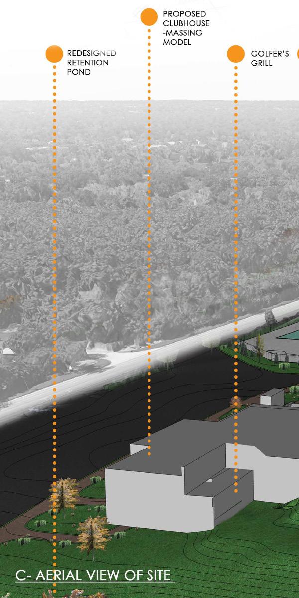
• how do we create view into 1st and 18th holes?
-developed site analysis, and contextual diagrams
-developed building design philosophy, diagrams, programmatic layout, rendered floor plans, site plan,
-lead designer and heavily involved in all phases SD, DD, CD.
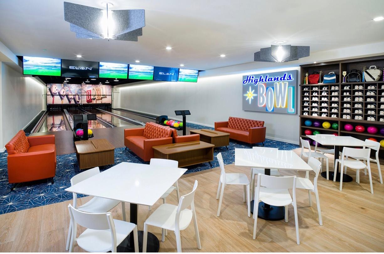
-coordinated with MEP, S, landscape architect, Civil, kitchen & bar consultant, golf shop consultant, bowling (brunswick), fitness (life fitness), spa manufacturer, and more.
-maintained and coordinated schedule, agenda, and minutes throuout SD, DD, CD.
-coordinated RFI’s, SK’s, shopdrawings, and submittals
-developed building details
-interior design mood boards
• **hand sketches by the sketch artist in the office.
• **photo realistic renders not done by me.
7.0
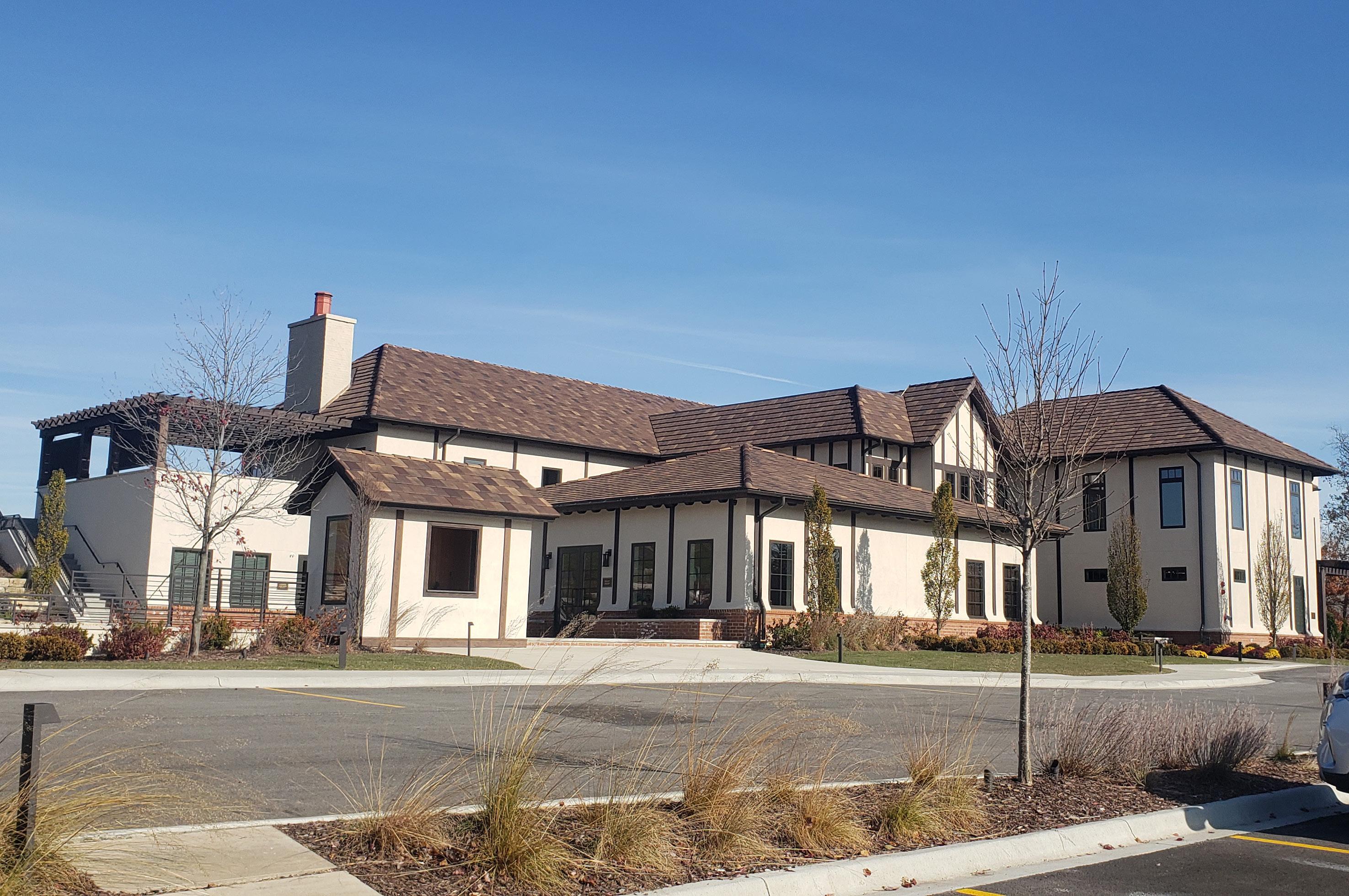
overall aerial of site and proposed massing model with the course
3.0
proposed location for clubhouse - existing site plan and grade elevation
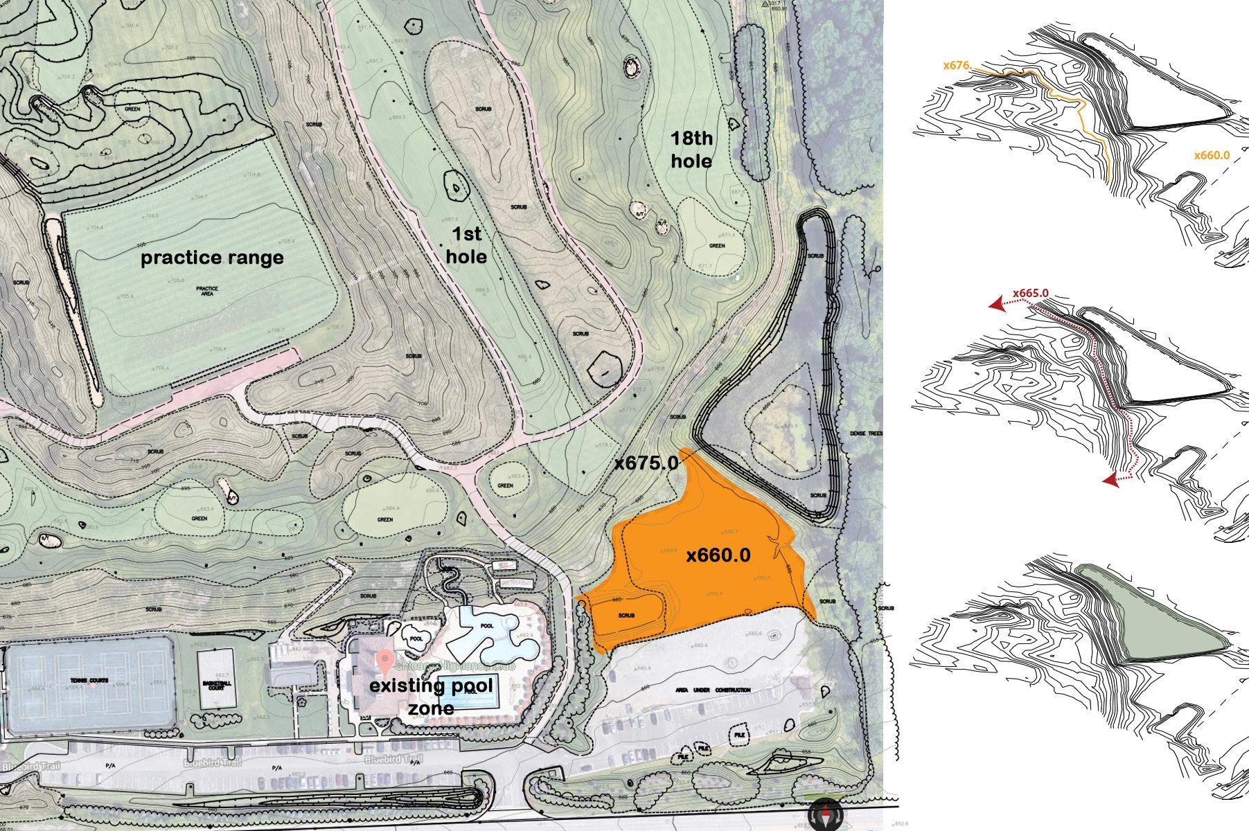
ideal floor height - 676 grade
do-not-build line
existing retention pond
7.1
can building be connected to golf course building becomes retaining wall
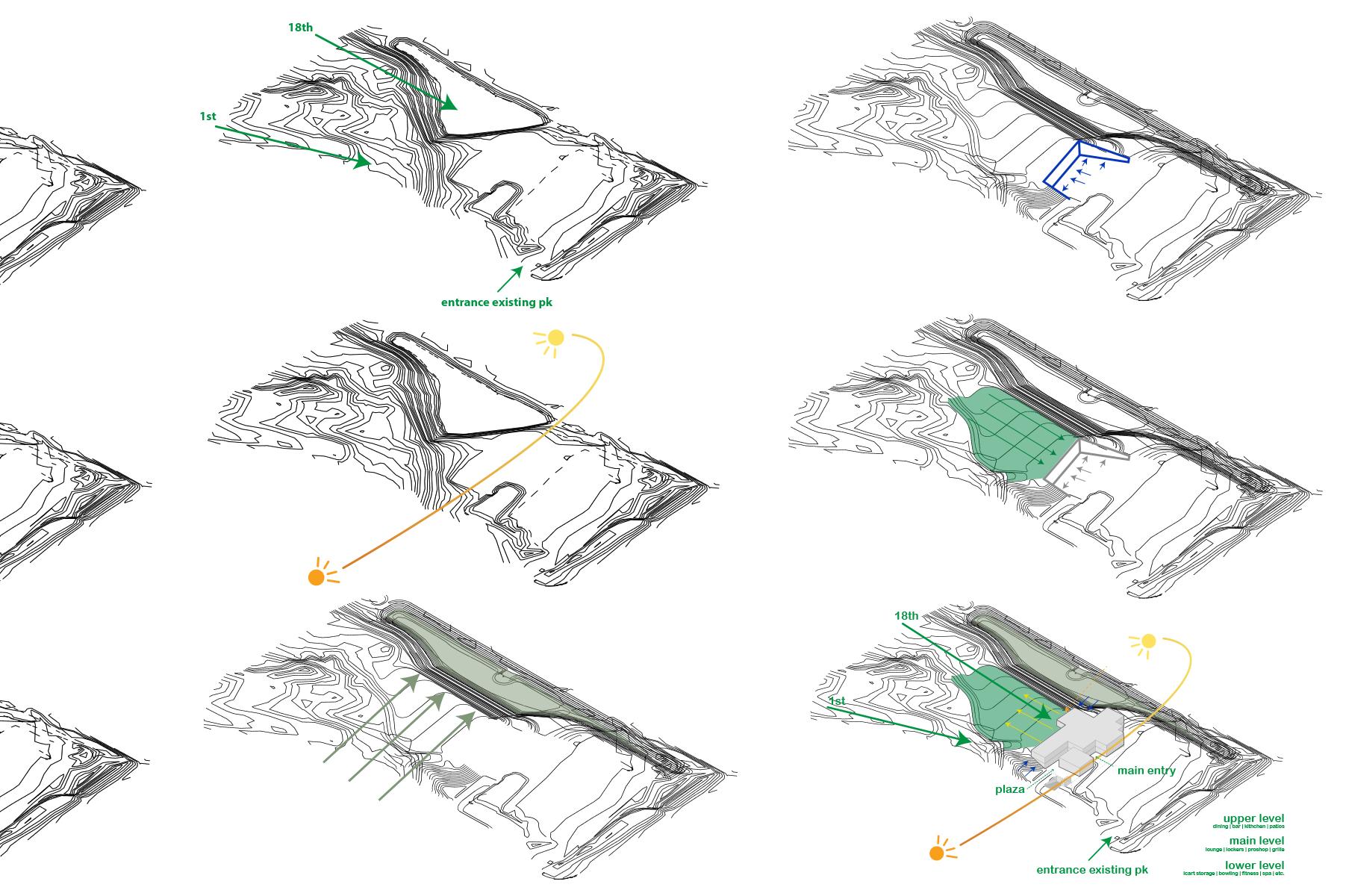
east - west golf course flows into building
redesign pond building on site
3.1
front elevation
final lower level
 front perspective
rear aerial
front perspective
rear aerial
7.2
 3.4
front rendered aerial
rear aerial of dining and great lawn
3.4
front rendered aerial
rear aerial of dining and great lawn
final main level final upper level
Bar and Dining Dining
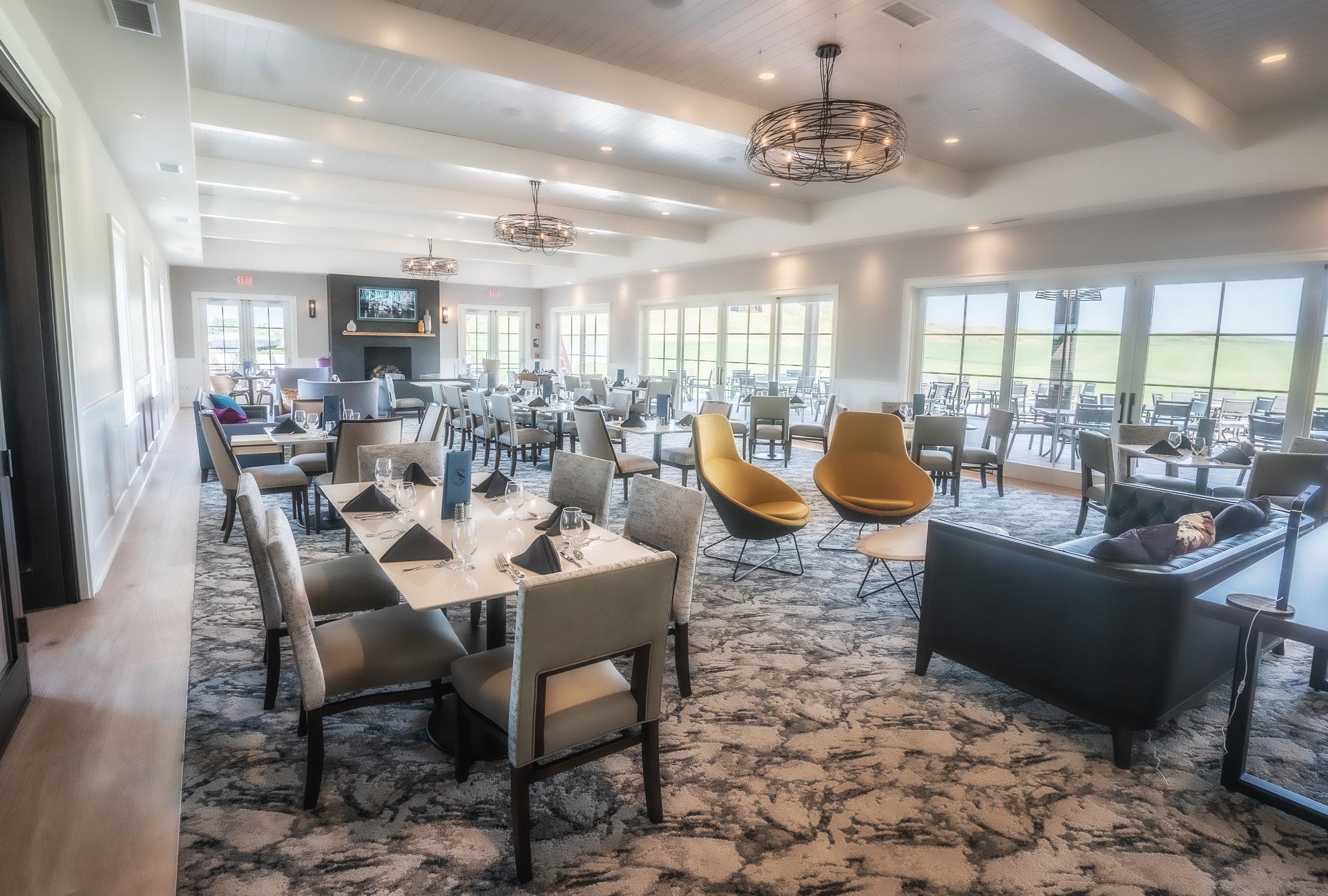
Grill Bowling 7.3
Main
Men’s
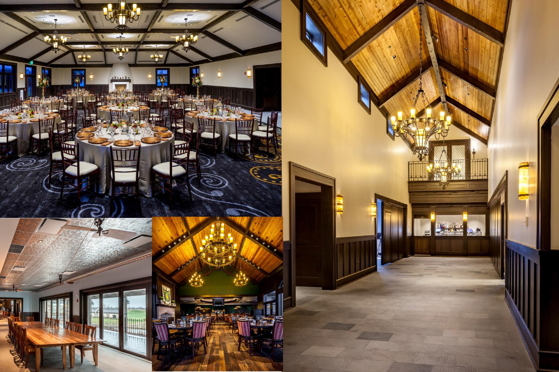
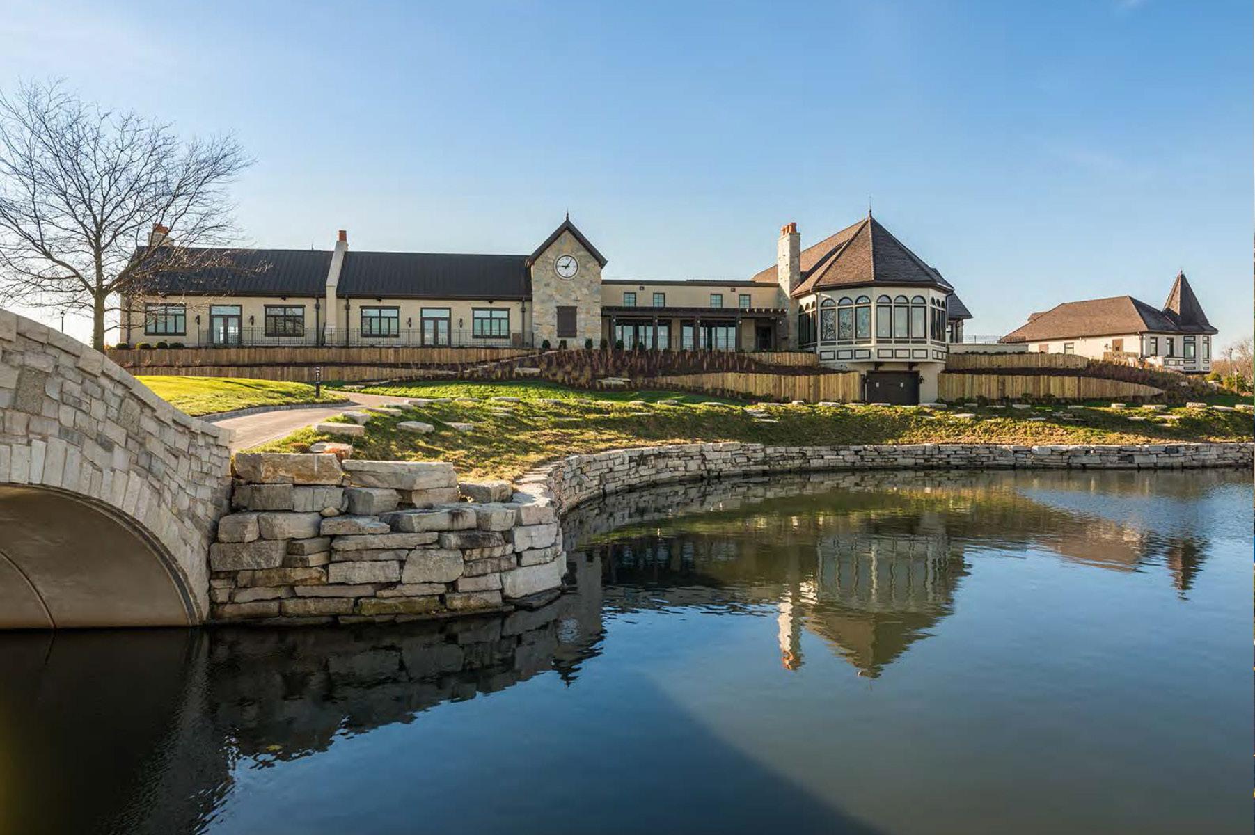
mistwood golf club
30,000 s.f. 2015
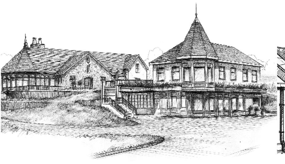
mistwood golf club, located in romeoville illinois, a course that was completely redesigned and in doing so became one of most extensive public course renovation projects in the country. the course renovations have transformed mistwood into a top flight golf course. to complete the master plan, mistwood hired daniel wohlfeil design to design a 30k square foot clubhouse to become part of the club’s heritage.
client’s requests:
1. demolish existing clubhouse
2. design the new clubhouse reminiscent to club’s heritage
3. design a clubhouse whose physical size does take over the site
challenge:
• how does the building become part of the club’s heritage?
• how do we design such large building without taking over the site?
• how do we separate golf, dining, and event functions?
• the scottish village concept was born
my personal contribution to this project amongst the firm of 3 at this point, was to work with the principal’s vision and help graphically diagram it from its pre-design phases to final built product. working with the principal and sketch artist, i assisted with the design of the building architecturally through interior design, and construction administration phases. involved in 3d building analyzes, schematic section analysis, and elevation studies. coordinated with mep engineers, consultants and construction management company. construction completed in 2015, and won; golf digest: america’s 100 best clubfitters -
may 2015 | golf inc.: top 3 best renovations of the year in the world | golf range: awarded top 50 public facilities | merit award winner of chicago building congress 2016 for distinctive & functional design.
8.0
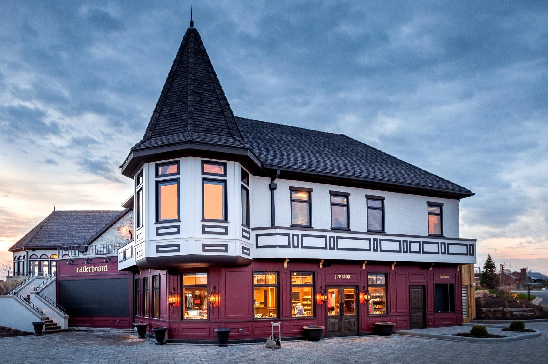
4.0 view of offices and proshop - completed in 201
6 different separate restrooms - 6 scottish cities | wallpaper
custom designed bathroom 8.1
wallpaper from scottish library
 view into a restroom
 4.5
ballroom - custom carpet design
garden room dining room the great hall
4.5
ballroom - custom carpet design
garden room dining room the great hall
8.3
view towards rear of clubhouse
4.5
aerial view - finished product
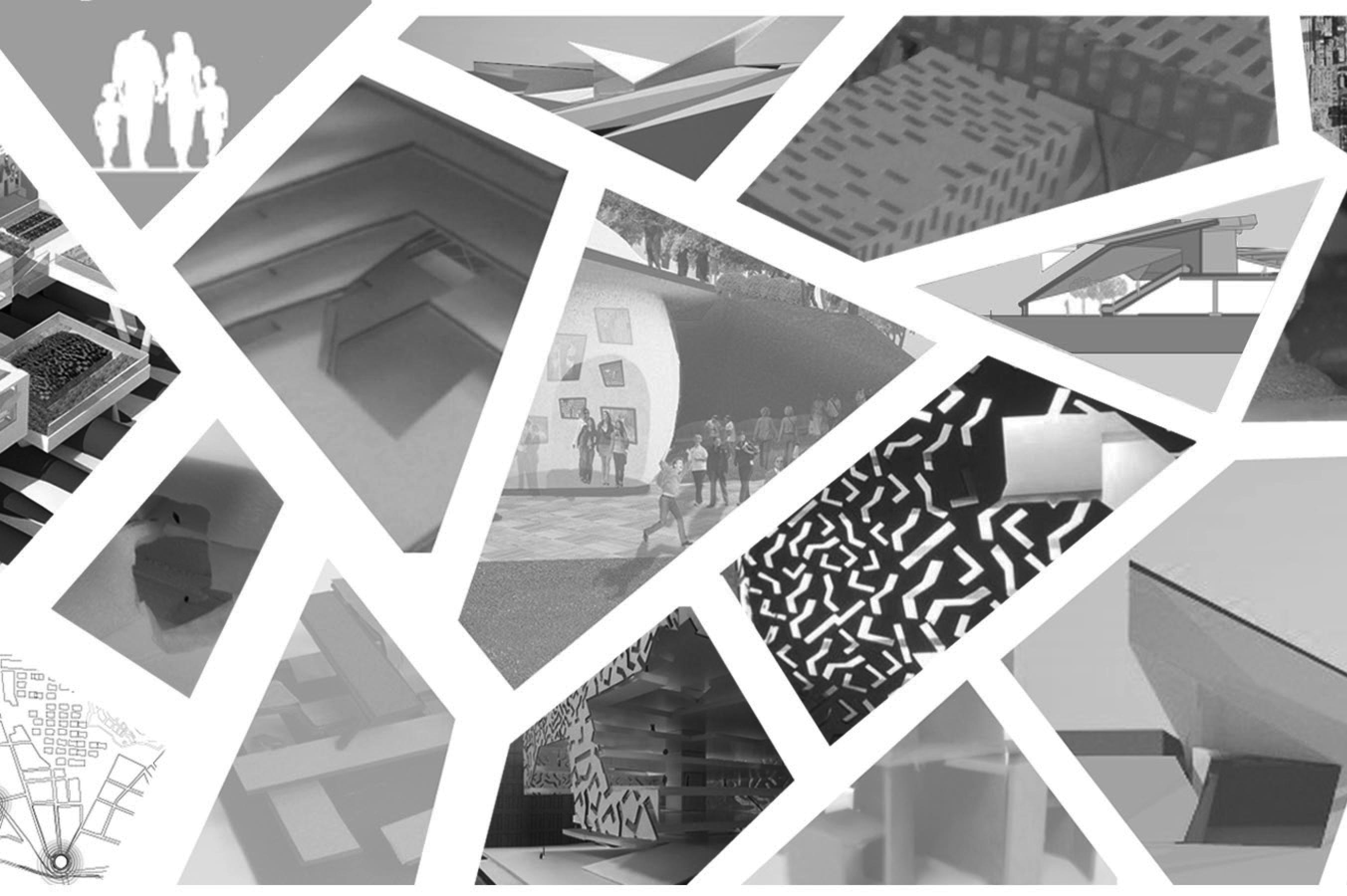
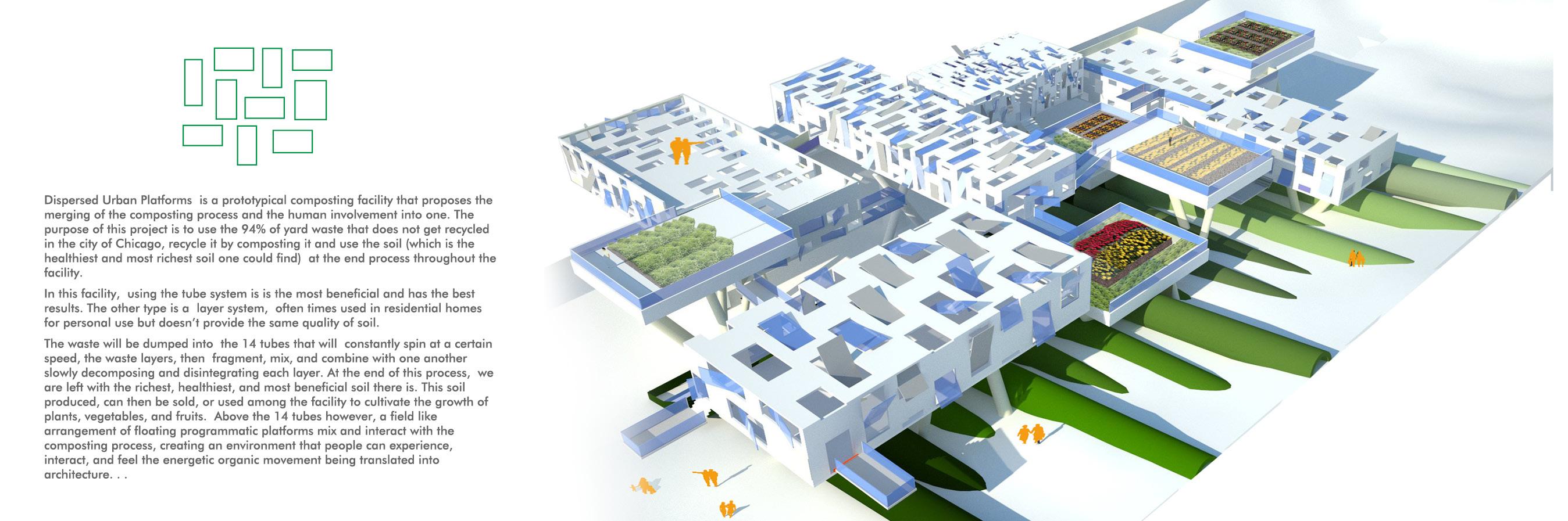
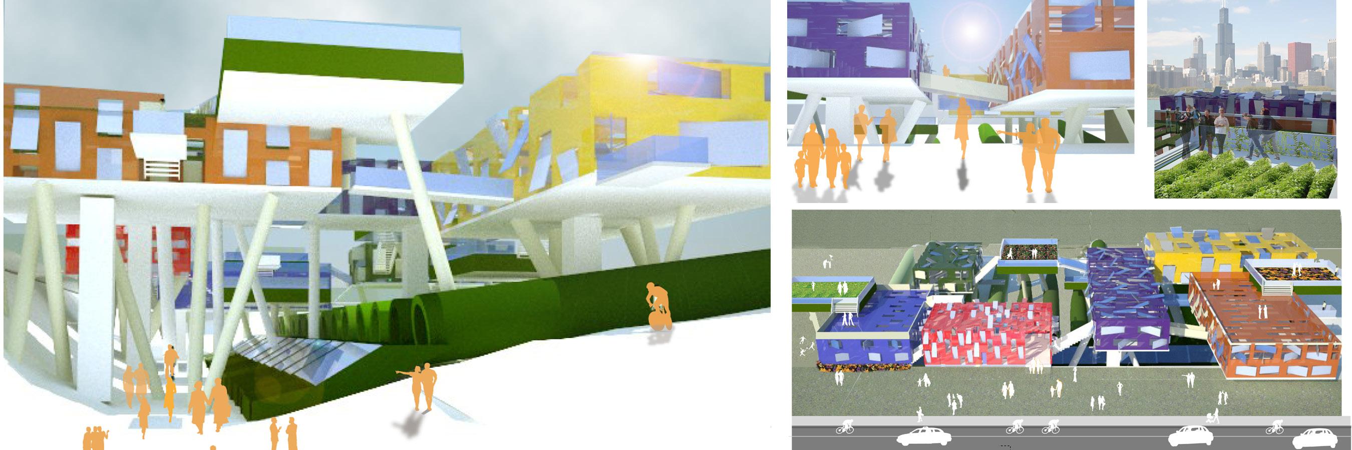
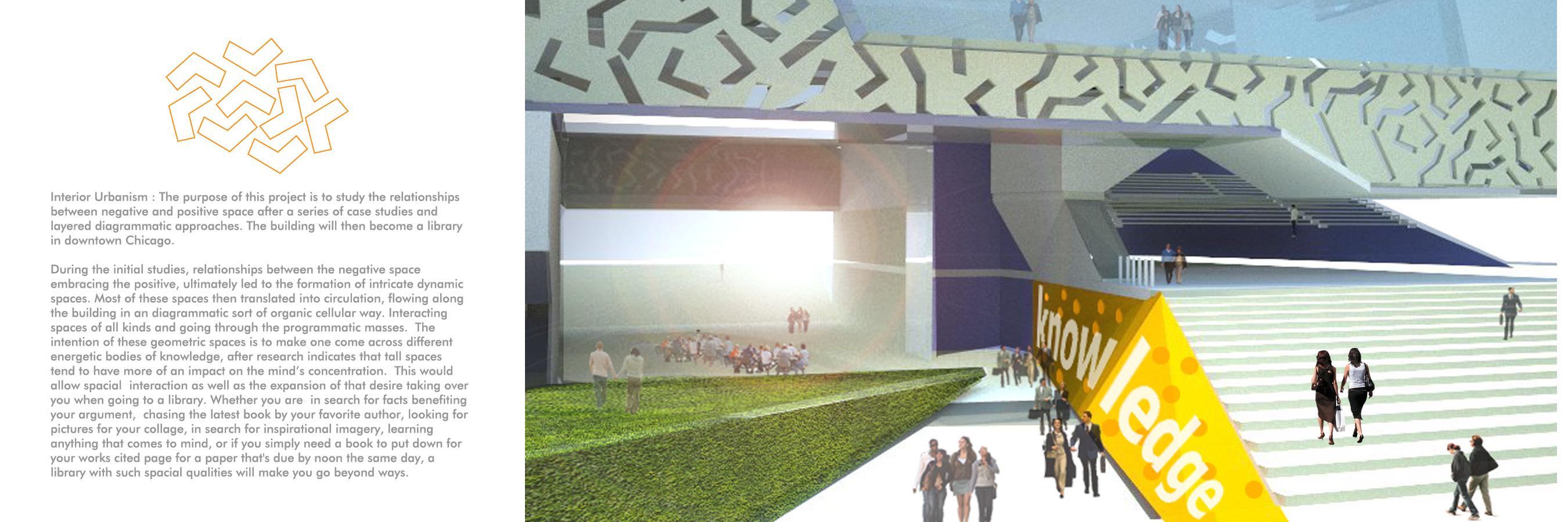
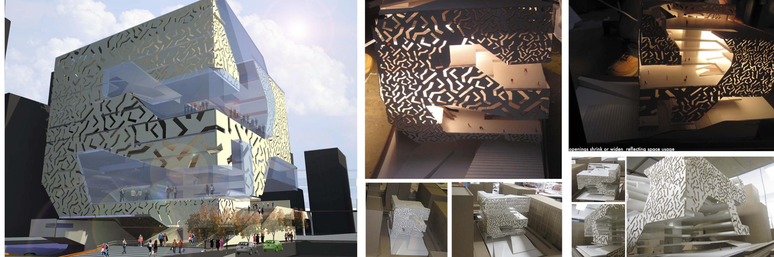
undergrad work 9.0
0.1 5.0
9.1
5.1
9.2
5.3
10.0
6.0
10.1
6.3
11.0
7.0
11.0
7.3
thank you!