RE-BOOTING MUMBAI
UPDATING EVERYDAY URBANISM OF DADAR
Thesis sutbmitted in Partial Fulfilment for the Award of the Degree of Bachelor of Architecture
By
Devdatt Devendrabhai soni Tenth Semester of Fifth Year 2015
Thesis guide: Prof. Jyoti Gill ARVINDBHAI
PATEL INSTITUTE OF ENVIRONMENTAL DESIGN DEPARTMENT D.C. PATEL SCHOOL OF ARCHITECTURE
- Ph. No. (02692) 237586 / 235179 JULY 2020
Vallabh-Vidyanagar-388120
ABSTRACT
The pace of urbanization has increased tremendously in a few decades, and cities are snowballing population and size. About 54% of the World’s population lives in urban areas. United Nations forecasts more than 68 % of the world’s population living in cities by 2050. In today’s date, cities are struggling to adapt to this urban explosion in terms of the functioning of ‘everyday’ urbanism. Excessive adaptive use of urban space has led to improper operation of early urban design proposals and created clogging at urban nodes.
For this Thesis, i am focusing on Mumbai, Mumbai city and the suburban district are at 440km2, just over half the size of New York City, but it is home to 13 million people. With a rich two-millennia history, Mumbai has been a continually evolving, and globally engaged city over the past 150 years. In the last 25 years, it has made a rapid economic transition from trade to services. However, despite its prominence of railways, this megacity is deteriorating and crumbling at a tremendous rate, as the transit stations and its surroundings areas in Mumbai are not designed or equipped to cater to the large crowds ascending and descending there through the day. Numerous reality checks over time proved unsuccessful as the city failed to take drastic measures to improve the transit experience and the areas surrounding the transit stations to accommodate the growing passenger demands.
Two or more railway lines converge at certain strategic destinations in the city resulting in those railway stations to become major transit interchange hubs in the city. One such massive interchange takes place at Dadar, where the western and eastern rail lines converge.
According to the survey plan, Dadar was designed for housing 60,000 people. Following the population explosion, the density of commercial hubs in Dadar increased and invited further transmigration. While initially planned, it was intended to be a residential zone. However, it had transformed extensively, into a commercial hub within central Mumbai. Currently, the population in the Dadar region has gone up to 5,82,000 and receives about 5lakhs floating population through Dadar station daily. For such reasons, urban amenities have reached a saturation point for functioning efficiently
This thesis proposes re-densification of the precinct and re-development of the existing infrastructure by understanding the everyday urbanism of the Dadar.
i
DEDICATTION
i dedicate this thesis to my Family, Friends, teachers and mentors, i would also like to dedicate this thesis to everyday commuters of dadar station and all the vendors and hawkers.
ii
iv TABLE OF CONTENTS Abstract - i Dedication - ii Acknowledgement - iii chapter 1: Everyday Urbanism 1.1 What do we mean by everyday urbanism 1 1.2 Urbanism 2 1.3 Burning Issue 3 1.4 Mumbai in the prospect 4 1.5 Dadar, Heart of Mumbai 7 1.6 Defining Study area 8 1.7 Vision 9 1.8 Aim 9 Chapter 2: Everyday of Dadar 2.1 Site location and demogaphics 10 2.2 Location Advantage, Context 11 2.3 Road Network 12 2.4 Major Entry exits 13 2.5 Suburban Railway Statistics 14 2.6 Stakeholders 15 2.7 On site study 16 Chapter 3: Casestudy 3.1 Salt Lake city,Kollkata 25 3.2 Crowfard Market 26 3.3 By-laws 27 Chapter 4: Re-Bootinng Dadar 4.1 Objectives 28 4.2 Design Solutions 29 4.3 Master plan 30 4.4 Floor plans 31 4.5 Sections 37 4.6 views 39 Refrances 44
Chapter 1 EVERYDAY URBANISM
1.1 What do we mean by everyday urbanism?
As Margaret Crawford precisely describes in the introduction chapter of his book ‘everyday urbanism.’
“ These two words-- one ordinary, the other obscure together identify a new position in understanding and approaching the city. Rather than urban design, urban planning, urban studies, urban theory, or other specialized terms, urbanism identify is a broad discursive arena that combines all of these disciplines as well as other into multidimensional consideration of the city.”
“Everyday” speaks to this element of ordinary human experience, and itself conveys many complicated meanings. At a common-sense level, everyday describes the lived experience shared by urban residents, the dull and ordinary routines we know all too well-commuting, working, relaxing, moving through city streets and sidewalks, shopping, buying, and eating food, running errands. (Chase, Crawford & Kaliski,1999)
1
Figure 1:Sidewalks of bombay by mario miranda
1.2 Urbanization
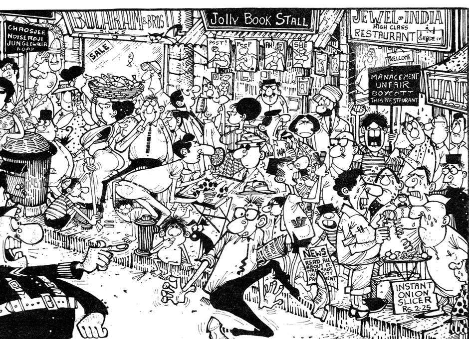
The pace of urbanization has increased tremendously in a few decades, and cities are growing very fast in terms of population and size. About 54% of the World’s population lives in urban areas. United Nations forecasts more than 68 % of the world’s population living in cities by 2050. (UN-DESA,2018)
The country’s size in the above map represents the size of the population and the Urbanization pattern is seen everywhere throughout the world yet is predominant in Asia. India is followed by china in terms of the second-highest population density in the world. Urbanization has aggravated the economic opportunities in metro cities like Delhi, Kolkata, Bangalore, and mumbai.
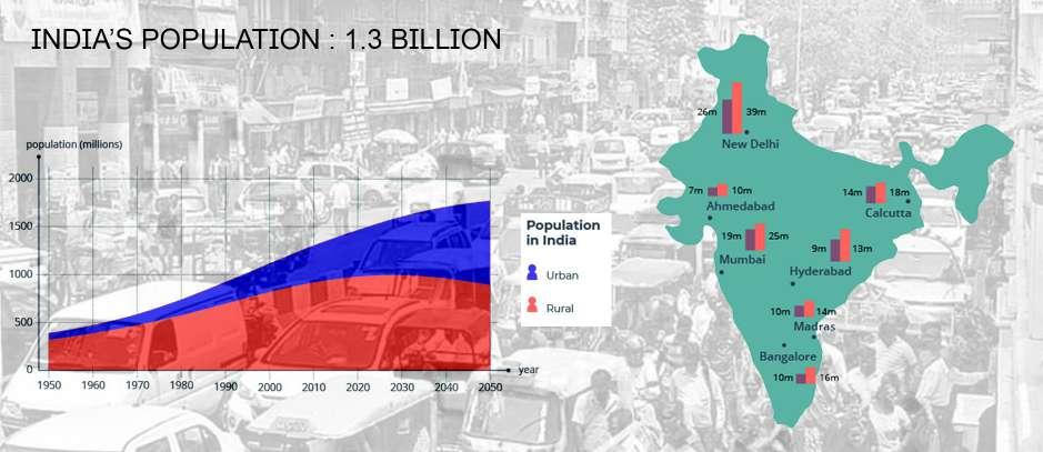
Mumbai and Kolkata have much longer histories as large cities than the other Indian cases. Both reached a million population by 1910 and have developed at a similar time as New York, London, and Berlin.
2
Figure 2:world population map (source: )
Figure 3:Urbanization in India (source: )
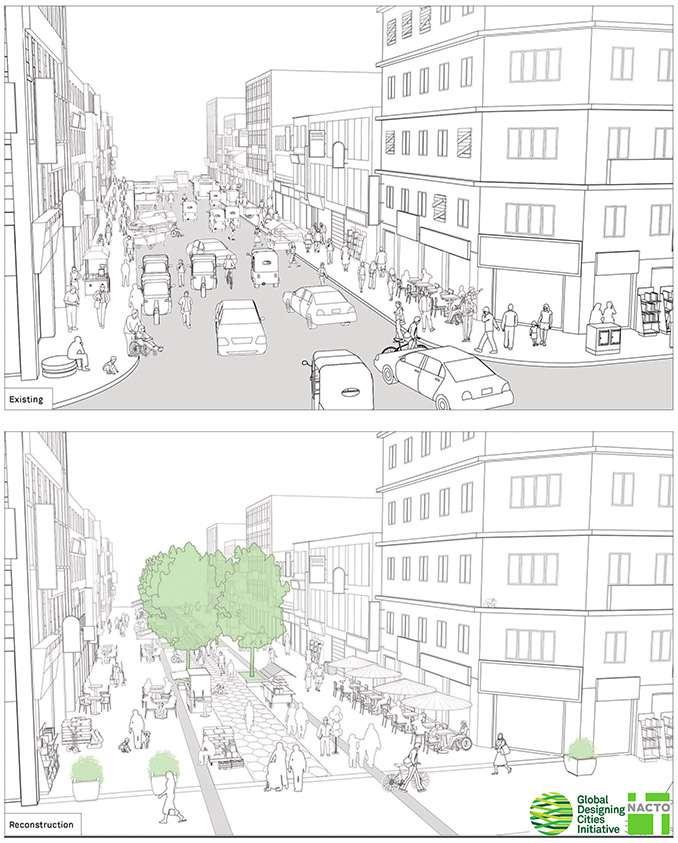
1.3 Burning Issue
In today’s date, cities are struggling to adapt to this urban explosion in terms of the functioning of ‘everyday’ urbanism. Excessive adaptive use of urban space has led to improper operation of early urban design proposals and created clogging at urban nodes. With the increase of such urban concentrations, such cities face a significant concern for rebooting urban fabric from existing city fabric.
3
NACTO )
Figure 4:Rebooting streets
(source:
1.4 Mumbai in the prospect
instagram )
Mumbai city and the suburban district are at 440km2 area, just over half the size of New York City, but it is home to 13 million people. With a rich two-millennia history, Mumbai has been a continually evolving, and globally engaged city over the past 150 years. In the last 25 years, it has made a rapid economic transition from trade to services. It has expanded its national and cross-border roles., including in the design, fashion, tourism, and jewelry sectors, where more informal networks of entrepreneurs have continually strengthened Mumbai’s brand overseas. The city is a center of creativity and consumption, with high average income and tax generation by regional standards. (Clark & Moonen,2014)
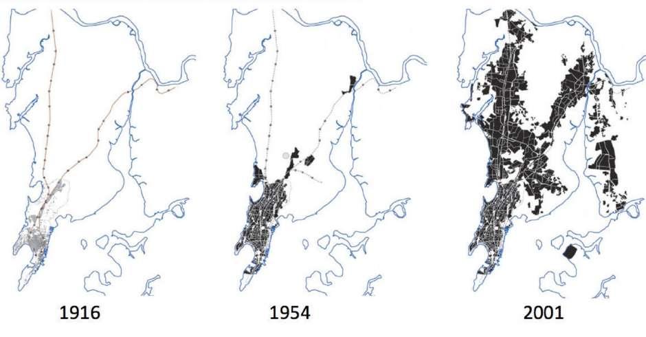
Mumbai’s spatial structure is a by-product of three conditions – Land Reclamation, Railways, and Water Works. Mumbai was initially made of seven islands, starting from the south, Colaba, Old Women’s Island, Bombay, Mazagaon, Parel, Worli, and Mahim. As population growth began to hit two million a decade for the first time, the initial administrative effort was made to integrate Mumbai’s periphery into a functional metropolitan region. The city limits were extended in 1950 and 1957, but by 1959, the Study Group on Greater Bombay observed the emergence of “congestion of traffic, deficiency in open spaces, play-fields for schools, over-crowding in trains, overcrowding in houses, creation of slums.”
4
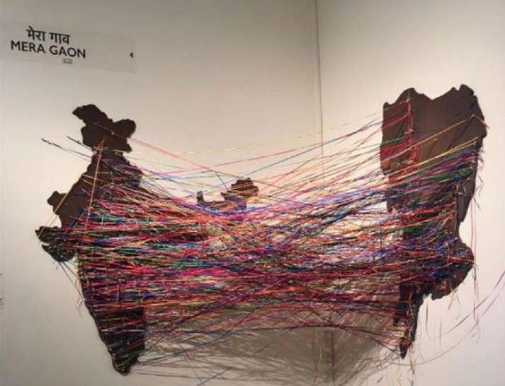
Figure 6:‘Mera gaon’
In July 2017 Urbz Mumbai held an exhibition in the Bhauji Lad Museum, called the Mumbai return exhibition, As a part of the exhibition, all visitors pinned threads connecting their area of residence in Mumbai to their native Wires in India (source:
The 1964 Development Plan for Greater Bombay, and the 1973 Regional Plan, both proposed the idea of a ‘mother city’ with satellite towns to encourage growth not just along the North-South axis but across the whole region through decentralization, which resulted in Mumbai’s spatial structure today. (Clark & Moonen,2014)
At the city level, Mumbai is adopting a comprehensive Transit-Oriented Development (TOD) strategy (MCGM 2013). “Transit-Oriented Development (TOD) refers to residential and Commercial Centers designed to maximize access by transit and non-motorized transportation, with other features to encourage transit ridership. A typical TOD has a rail or bus station at its center, surrounded by relatively high-density development, with progressively lower-density spreading one-quarter outwards to one-half mile, which represents pedestrian scale distances” (VTPI 2014).
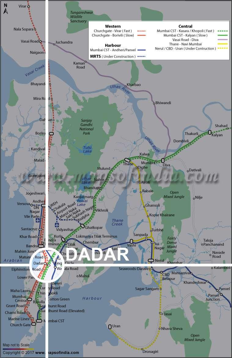
Currently, three major railway lines are running along with the city, The western, central, and harbor lines. These railways divide the following area into two parts on either side of the railway, the east and west. Then the city on the two sides of the railways is connected via bridges and underpasses. Two or more railway lines converge at specific strategic destinations in the city resulting in those railway stations to become major transit interchange hubs in the city. One such massive interchange takes place at Dadar, where the western and eastern rail lines converge. Dadar is a major transit junction because many outstation trains also have their final destination here.
5
Figure 7:Greater Mumbai’s spatial development over the past century (source: )
6
Figure 8: Transit Map of Mumbai showing existing MRT systems (source: )
1.5 Dadar, Heart of Mumbai
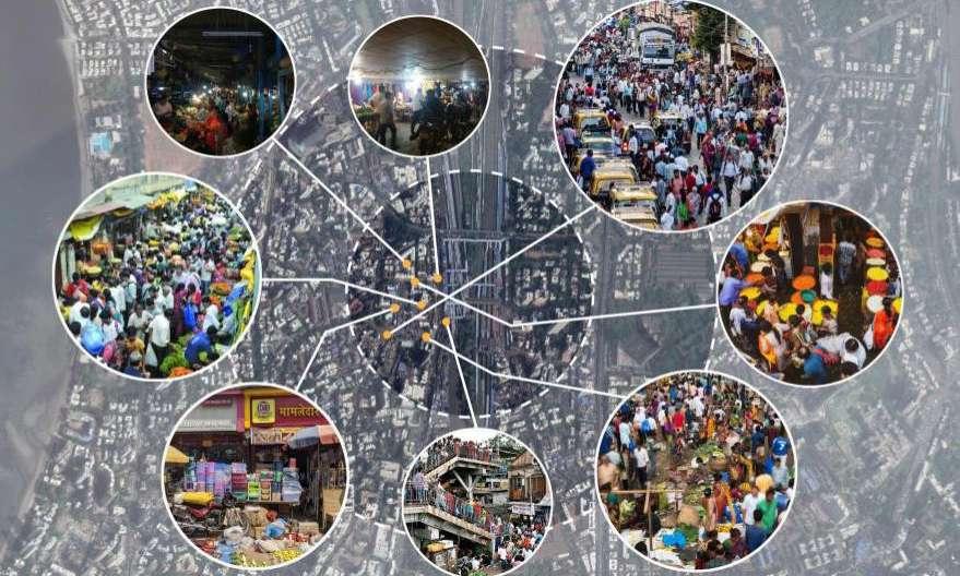
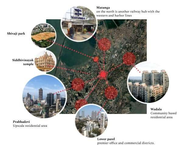
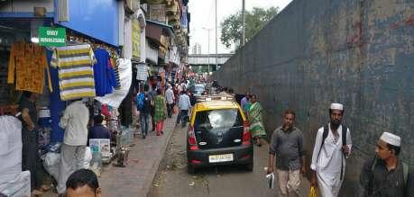
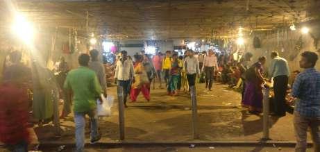
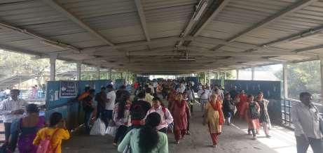
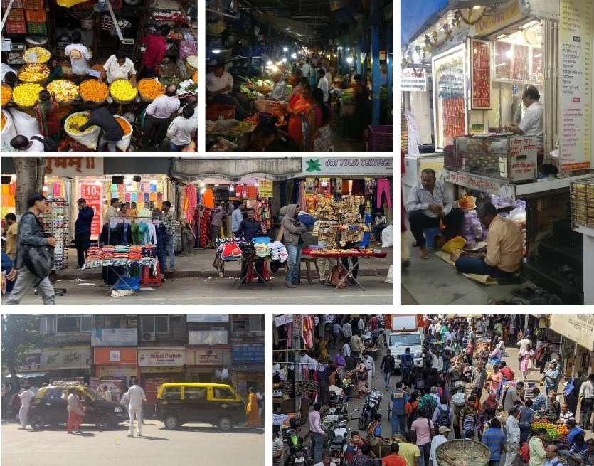
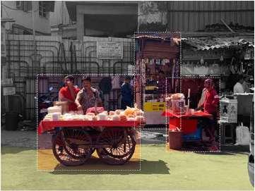
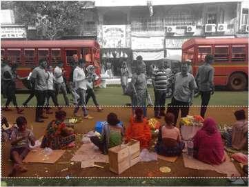
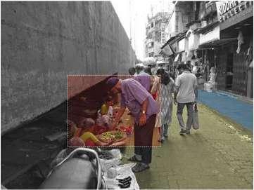
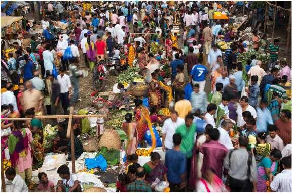
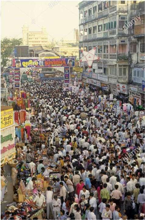
From early on, Dadar has been a hot spot for development because firstly, it’s the converging station for the western and central railway lines. Secondly, all the possible destinations that open up in proximity to the Dadar station, making those locations easily accessible and well connected. Thirdly, Dadar houses the city’s largest wholesale and retail markets, especially vegetable and flower markets. Everyone in the city looks up to these markets for their purchases. Thus, from early in the morning, people are coming to the area using public transit systems. Lastly, it has a strong influence on the Marathi culture and history because of the presence of Marathi cinemas and community halls, especially for the Maharashtrian crowd. Dadar has the most significant recreational ground in the city, Shivaji Park, and The famous Siddhivinayak Ganesh temple is within a 10-minute walking distance from the station.
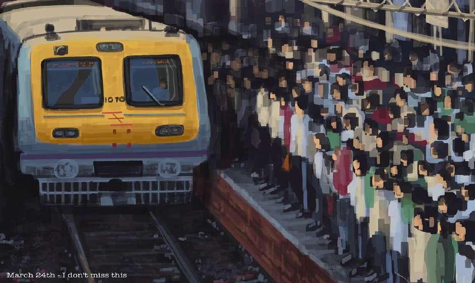
Because of Dadar’s nature of everyday urbanism, the neighborhood is lively throughout the day and late at night. The current urban fabric of the town is overloaded to accommodate commuters from all over the city daily for one purpose or the other.
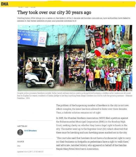
According to the survey plan, Dadar was designed for housing 60,000 people. Following the population explosion, the density of commercial hubs in Dadar increased and invited further transmigration. While initially planned, it was intended to be a residential zone. However, it had transformed extensively, into a commercial hub within central Mumbai. Currently, the population in the Dadar region has gone up to 5,82,000 and receives about 5lakhs floating population through Dadar station daily.(MRVC)For such reasons urban amenities have reached a saturation point for functioning efficiently
7
Figure 9:Issues of dadar (source:author)
1.6 Defining study area
Dadar was one of the first areas selected for development during the post-colonial expansion in the city. The Bombay Improvement Trust was formed to look over the planning of this expansion to decongest the population from its center. Several schemes for the same had been launched with Dadar belonging to the scheme 5 under the Dadar-Sion-Wadala scheme of 1899-1900. These schemes undertook the development of the services, roads, open spaces, and the demand for housing for the upper-middle-class people.
The implementation of the Dadar West’s scheme was not possible because the design proposals for this part of the area blatantly disregarded the property lines and existing land-uses. The proposed 5 perpendicular streets leading from the station to the beach on the western edge of Mumbai was cutting across their properties.
8
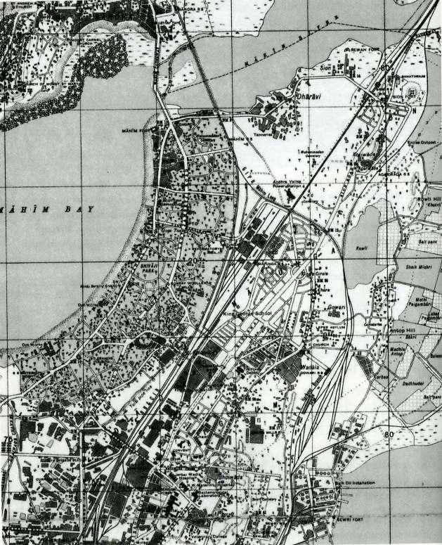
Figure 10:The 1933 map of Dadar West (source: )
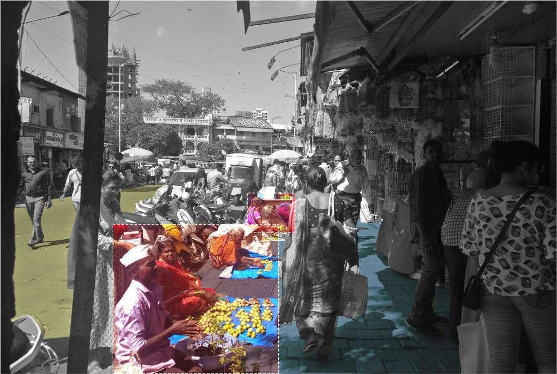
This is one of the primary reasons why the Dadar west area has a very organic urban form with arbitrary streets and junctions. In contrast, the Dadar east area has properly planned street layouts with designated land uses and open spaces.
(source: )
The organic urban form of the west area has complex layers of functions overlapping, creating chaos for the everyday actors. All these layers are interdependent with each other, creating a standstill situation for development in the area. Thus, Dadar west area needs re-densification of the precinct and adaptive reuse of the existing infrastructure to cater to the current and future needs.
1.7 Vision
Redensification of urban nodes.
1.8 Aim
To improve on the go experiential quality of Dadar re-forming functionality around Dadar station.
9
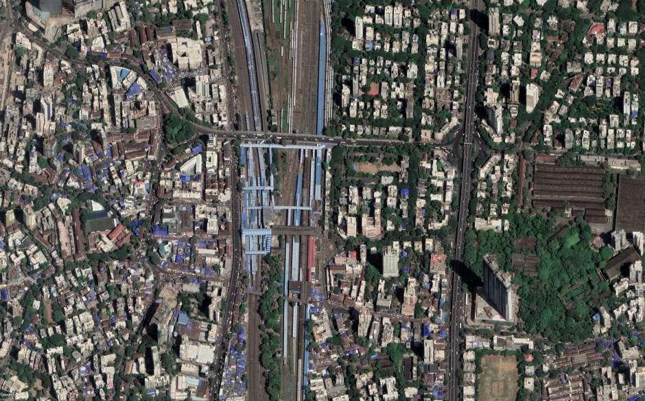
Figure 11:Dadar setelite map
Chpater 2
EVERYDAY OF DADAR
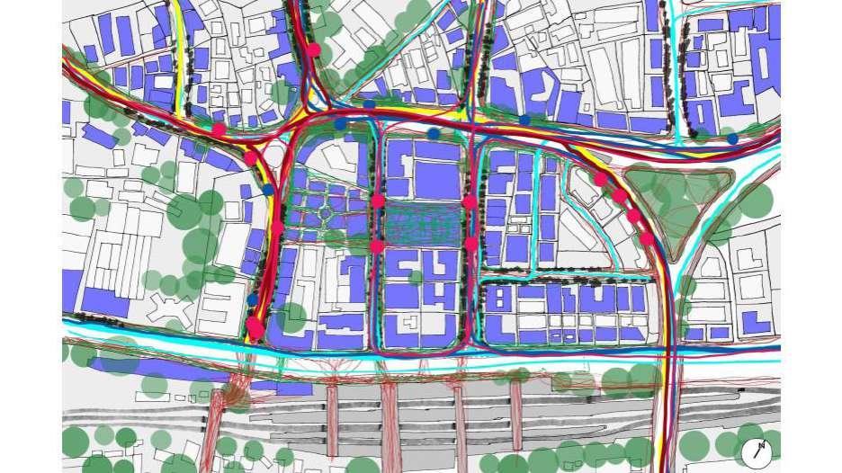
This chapter will unfold the urban layers and activity patterns of the Dadar west area through sketches, cartography, and photographs in terms of site analysis.
2.1 Site location and demographics
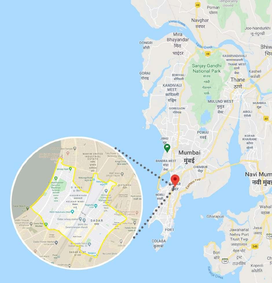
Dadar is located in island city of mumbai. With the population of 582000 as per cencus 2011. Figure 12:
(source:google maps)
10
Location map of dadar
2.2 Locational Advantage, context.
(Source: Author)
Though Dadar has its own identity determined by the formal and informal markets, institutions, and cultural history, Dadar is envisioned as a catalyst of network and connections for people to reach their destinations, which are emerging due to its proximity to Dadar station.
11
Figure 13:major context
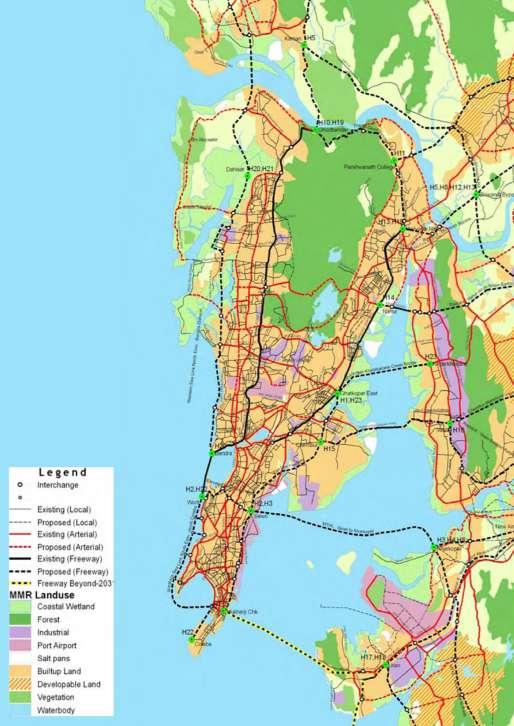
2.3 Road Network
12
Figure 15: Mumbai road network (source: UDRI )
Figure 16: Dadar road network
(source: author, google earth)
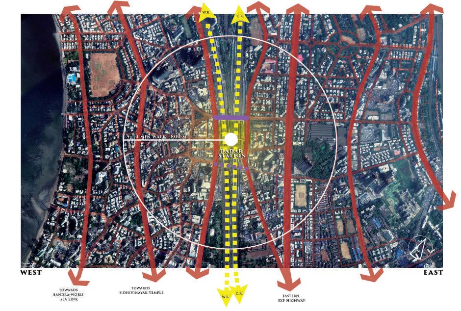
2.4 Major entry-exit points
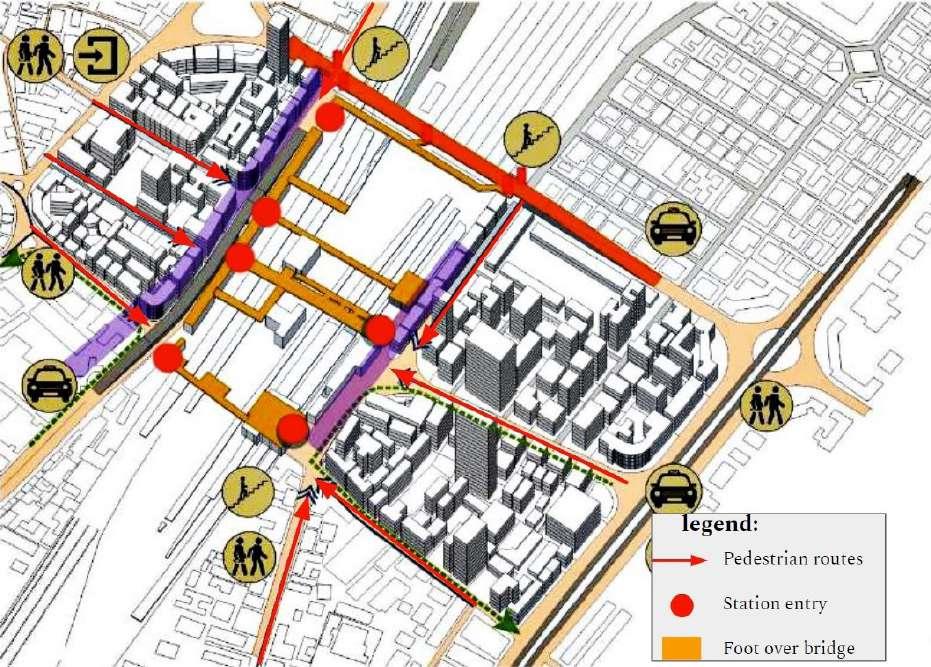
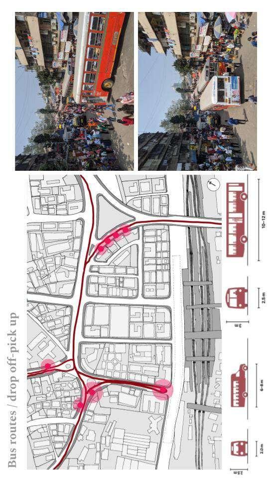
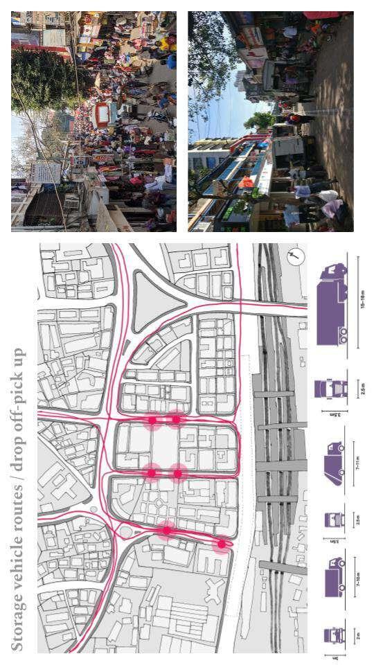
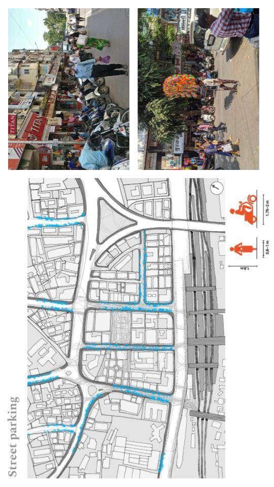
Due to the station’s linearity and compact setting, there are many entries and exits from the station, making it challenging to maneuver in the station area because they are not marked or aligned with the streets leading to the entries. The east-west connections via bridges are also very weak. The bridge connections are not complete. They are connected or merged to other bridges making it a maze for travel. These connections end into the most unlikely places where it cannot take in the extra ascending or descending crowd.
13
Figure 18:Major enry exit points of dadar
Figure 19: major entry exit points
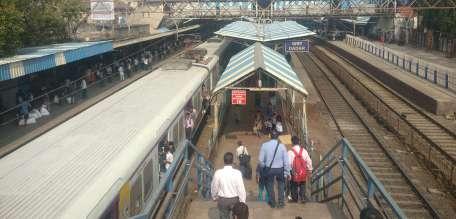
2.5 Suburban Railway statistics
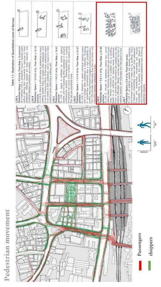
Collectively dadar has 14 platforms in for western, central and outstation trains dadar recives 1000 suburban trains daily from morning 4 to 2 at night.
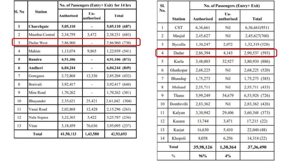
Total number of passngers daily : 5,77,497
14
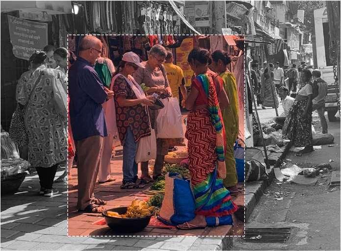
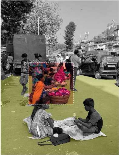
2.3 Stakeholders
Suburban railway passengers
Students - Office workers - Tourists
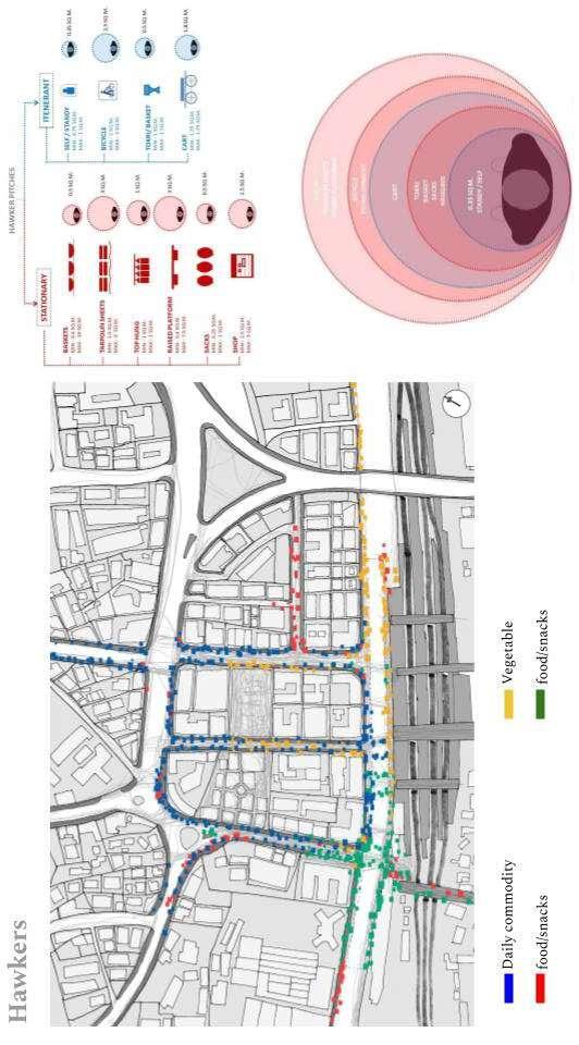
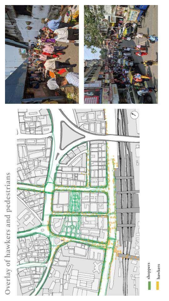
Hawkers - shoppers
Shopkeepers
Vegetable market vendors
Daily wage workers
Flower market vendors - shoppers
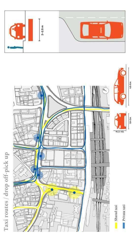
Taxi - bus drivers
15
Figure 20:Stake holders
16
17
18
19
20
21
22
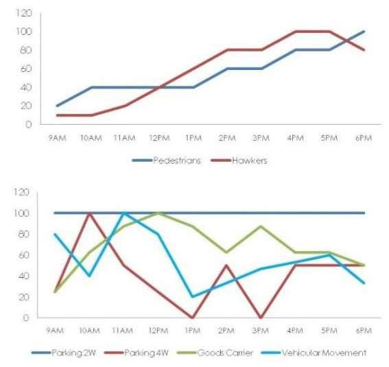
2.12
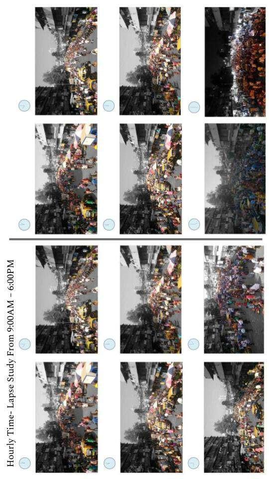
Activity throughout the day
23
2.11 overlap of layers, CHAOS
24
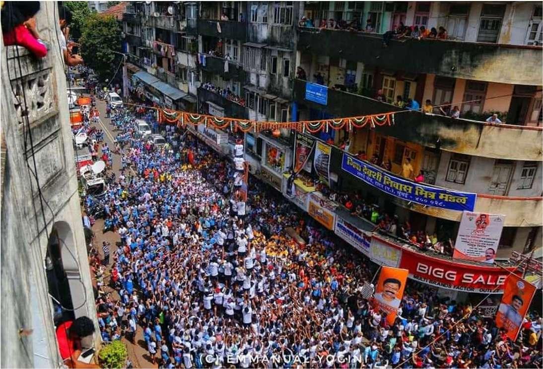
Festivities
diwali
Ganeshchaturthi
Janmashtami
chapter 3 CASE STUDY
3.1 Salt lake city, kollkata.
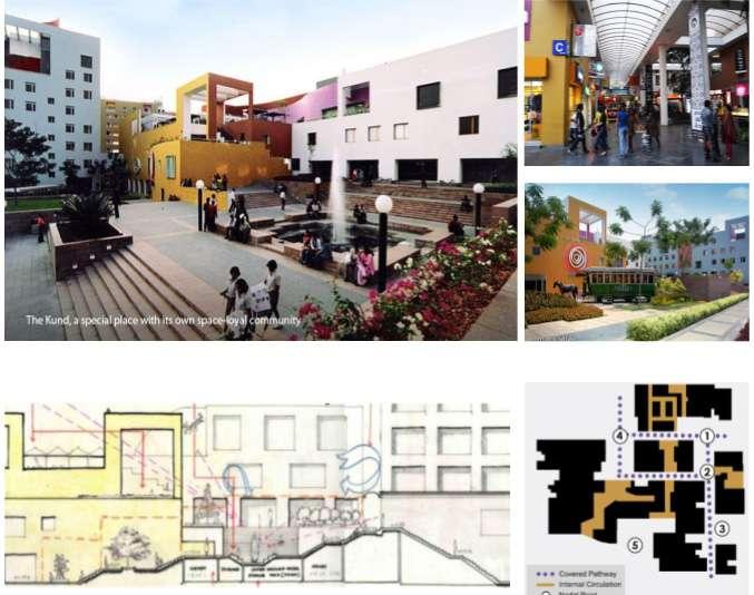
City center designed by Charles Correa as combination of mall design mix with the convenience of street system same as Indian Bazaar. Including wide range and nature of spaces ranging from a small ‘dukkan’ to large air conditioned boutiques,from broad colonnaded public arcade to narrow street ‘galis’.
Distinct nodal points are created across the site possess distinct identity offering incentive to various user groups.
Court “KUND” on the outer edge acts as the common ground for urban realm for social and cultural engagements like holding informal bazaar. Fusion between organized and unorganized retails.
Easily accessible spaces inside and porous edge condition of the built form and orientation allows shades and shadows.t
25
3.2 Crowford Market
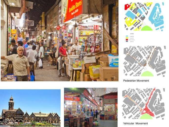
Crawford Market is a great bazaar with diverse people, variety of goods, plurality in activities and the heart of the city of Mumbai. It has a history and a great story of transformation and has evolved over a period of time. All other structural repairs and roof work were completed, internal renovations fully restored of this fine period buildings.
Bazaars, haats are authentic Indian concepts which become integrated public spaces in the city of Mumbai.
The buildings, their heights were all planned and constructed keeping in mind the sun path which increased the comfort zone not only of the pedestrians but also the hawkers sitting, standing, and yelling along the by lanes of the street.
Important feature of the market is that there is order in chaos.
26
3.3 By-laws
Reconstruction or redevelopment of Cluster(s) of Buildings under Urban Renewal Scheme(s):
For reconstruction or redevelopment of Cluster(s) of buildings under Urban Renewal Scheme(s) in the Island City of Mumbai undertaken by (a) the MHADA or the MCGM either departmentally or through any suitable agency or (b) MHADA/MCGM, jointly with land owners and/or Co-op. Housing Societies of tenants/occupiers of buildings and/or Co-op. Housing Society of hutment dwellers therein, or (c) land owners and/ or Co-op. Housing Society of tenants/occupiers of buildings and/or Co-op Housing Society of hutment dwellers, independently or through a Promoter /Developer,
Total Permissible FSI for URS:
The total permissible FSI for an URS shall be 4.00 on gross plot area, but excluding the reservations/designations, road set back, area under existing Municipal Roads but including the BUA under reservation/designation, road set back or sum total of the Rehabilitation FSI + Incentive FSI, whichever is more.
Land pooling for the URS:
The Promoter of URS shall try to pool lands belonging to various categories of land holders including Public lands by obtaining their consent for including their lands in the proposed URS, by resorting to any of the following methods of land pooling:
1) Purchase of lands, including buildings,
2) Exchange of such land with a suitable land of at least equivalent value as per ASR land rates.
3) Procurement of DRs over such land, by way of registered document by the Promoter, provided that the area over which the Promoter holds DRs shall be regarded as one plot for all the purposes of the DCR; or
4) Transfer of all lands included in the URS to a legal entity (e.g: Registered Society or Company, Co-operative Housing Society, Charitable Trust, etc.) to be created by the Promoter for implementing the URS where different landholders have stakes proportionate to their share in the total land under URS; or
5) Acquisition of lands, provided the Promoter has purchased or procured DRs over at least 70% land comprised in the URC and there are dangerous buildings, declared
27
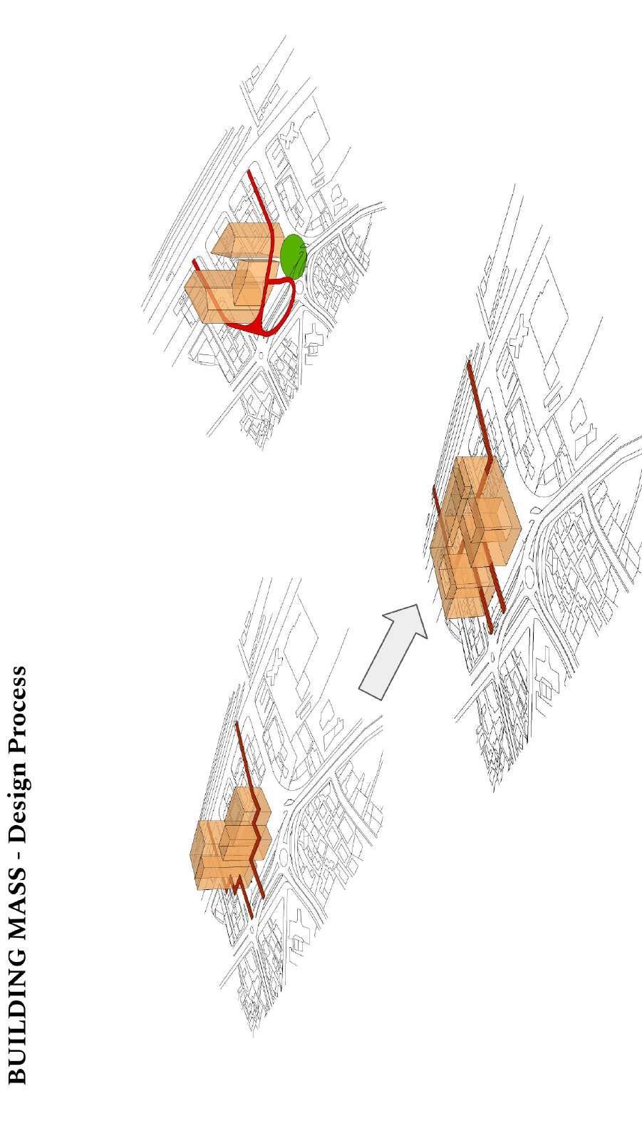
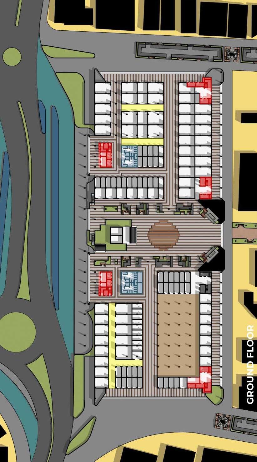
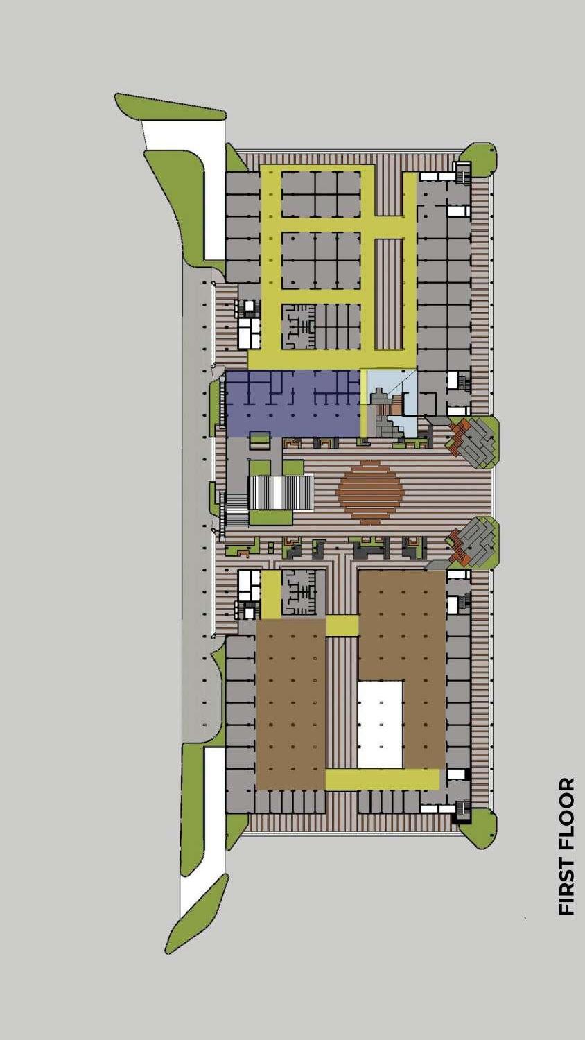
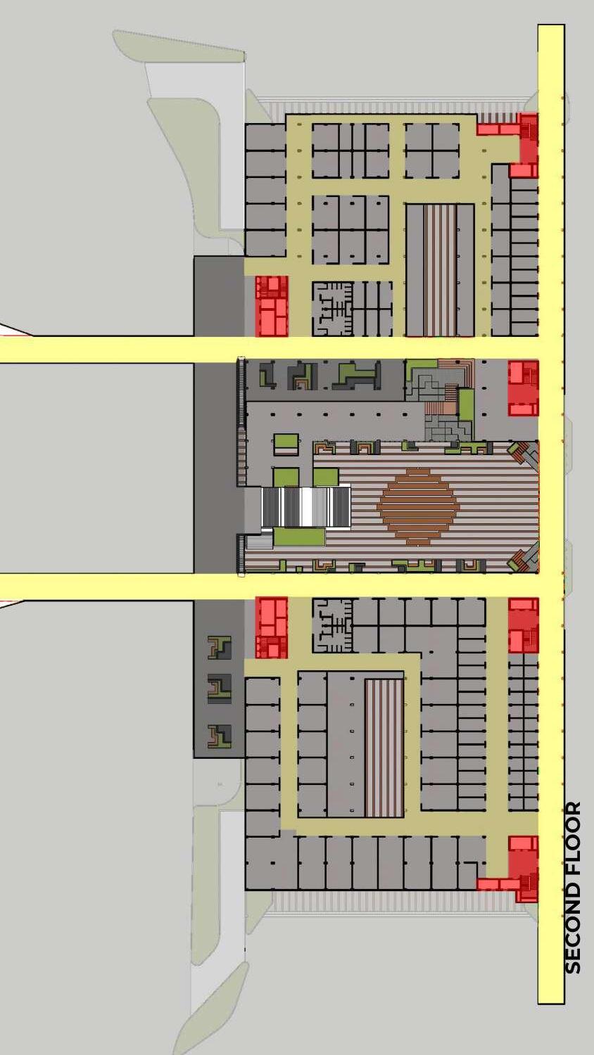
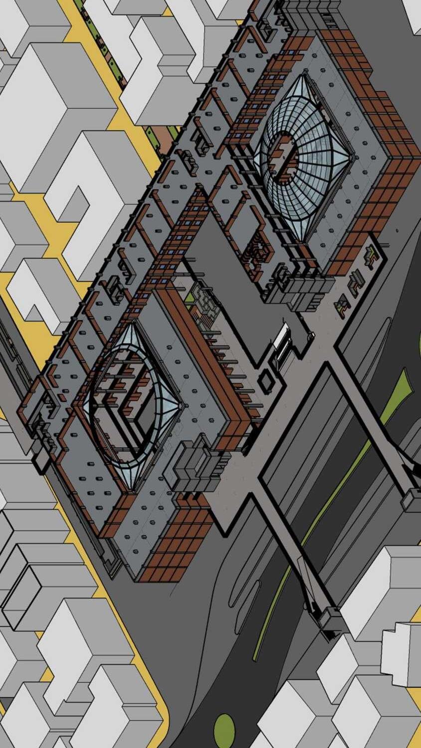
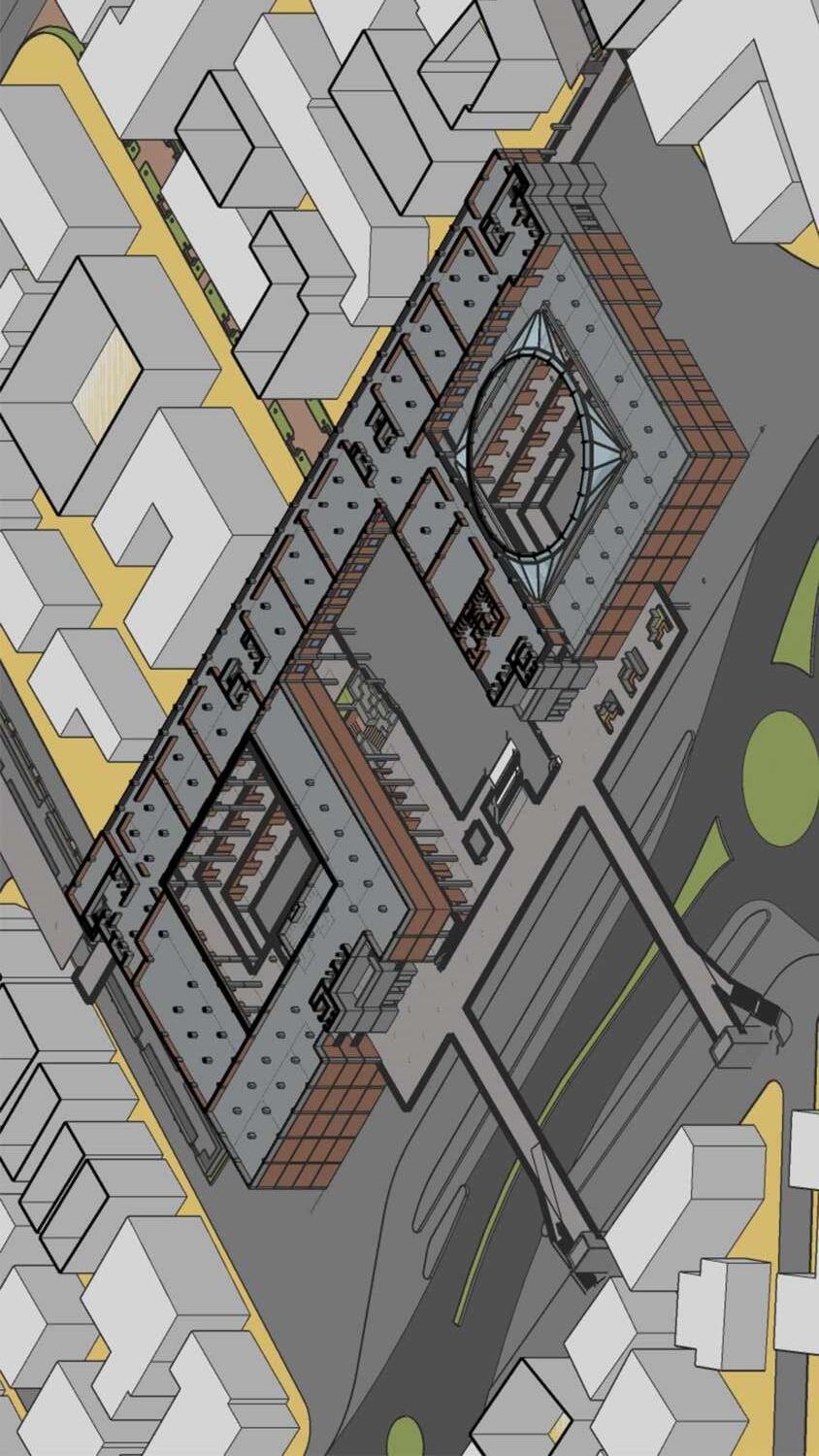
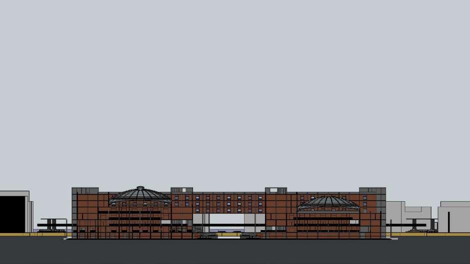
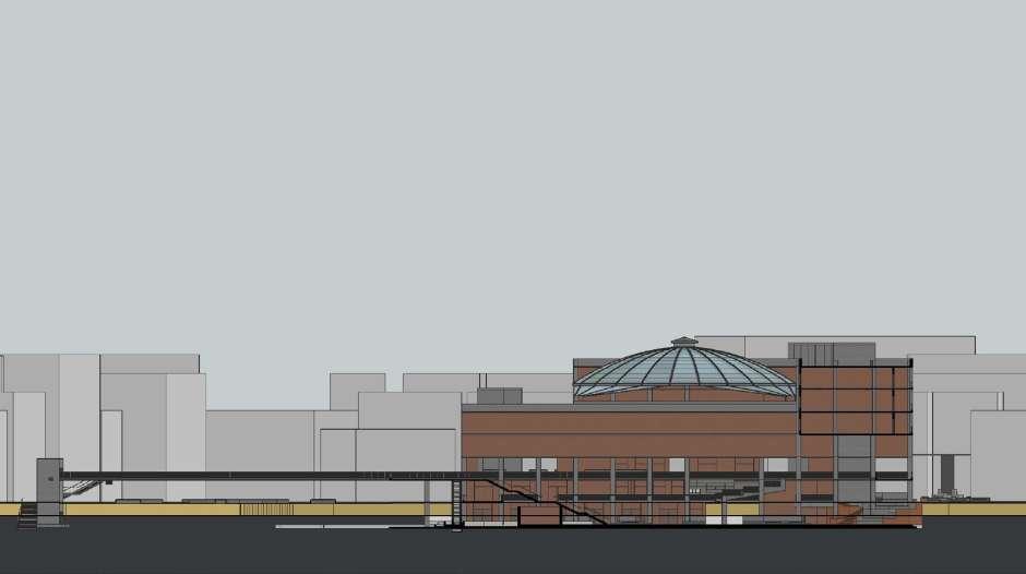
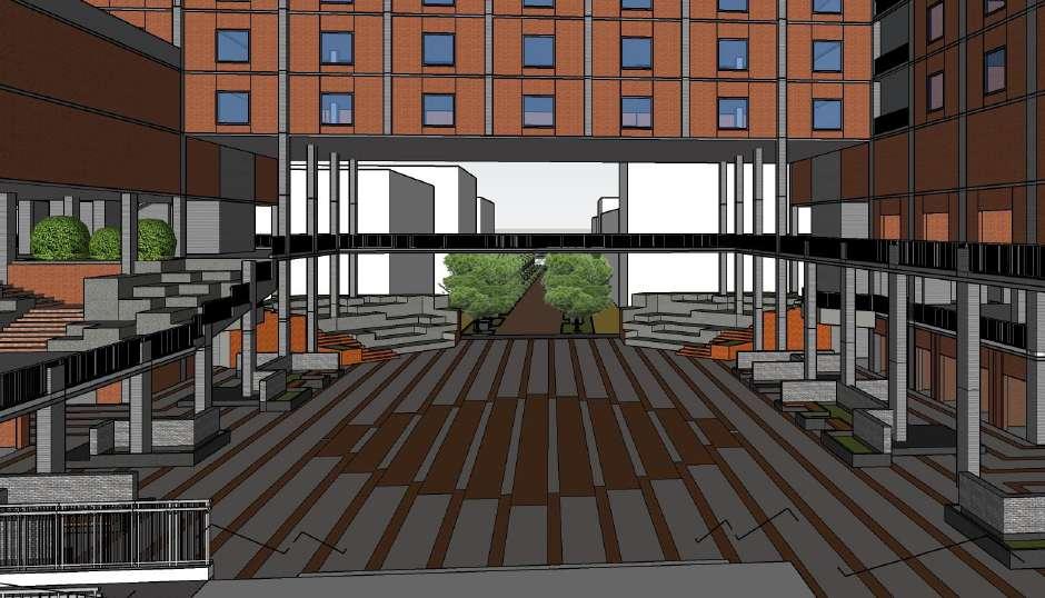
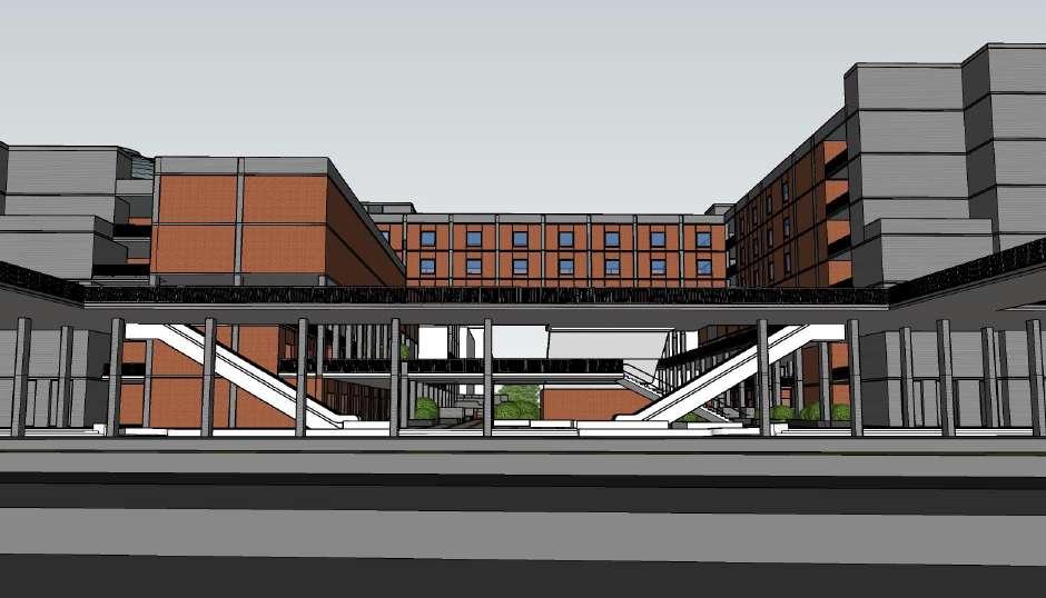
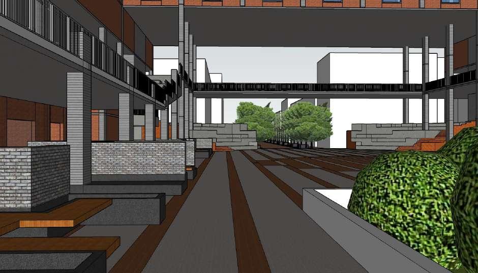
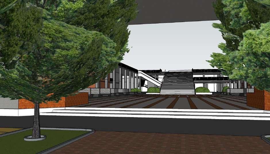
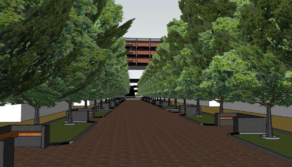
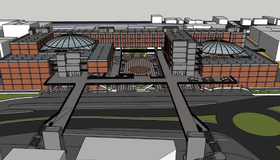
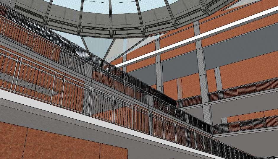
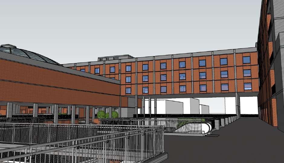
Chapter 4 RE-BOOTING DADAR
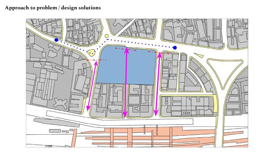
objectives
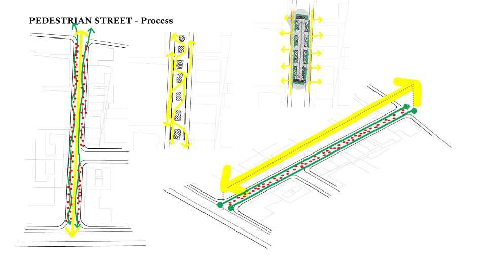
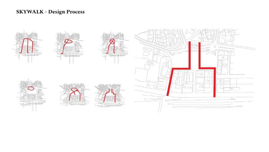
Pedestrianisation of ranade, dr. silva, and m c jawale road and skywalk
Redevelopment of flyover
Specified hawking zones and facilities
Adaptable design for festivities
Road widening of N c kalekar road
Fast pedestrian lane for transit commuters
New receiving foyer for dadar station(W)
Parking facilities
Goods vehicle drop off foyer
Redevelopment of swa. Veer savarkar market and retail market
9954.25 sqm
Road: (dr. silva marg)
1490.80 sqm
28
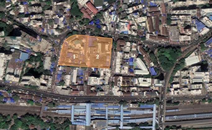
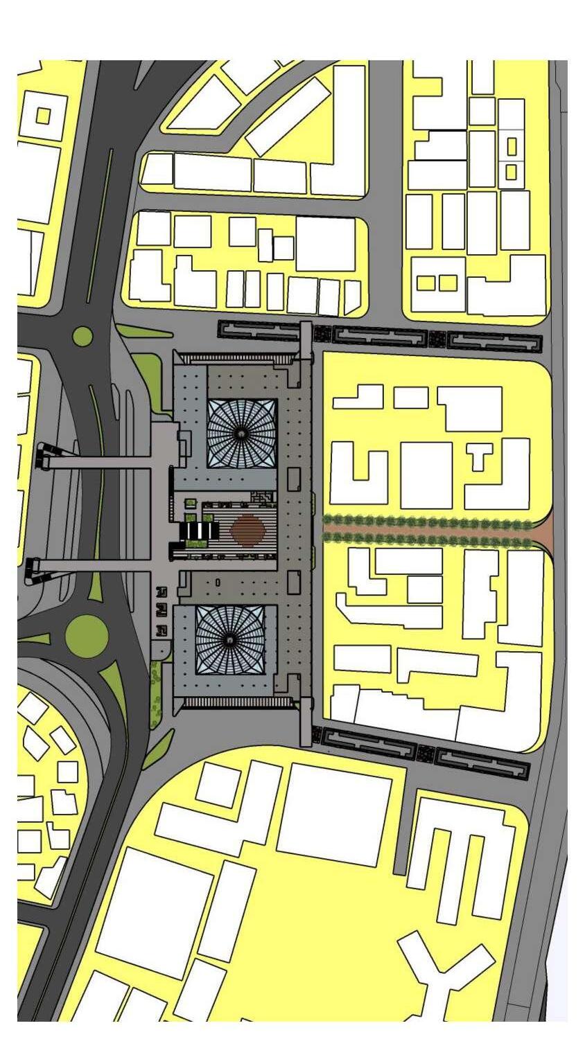
3.2 site
Plot 1: (47,48)
10346.70 sqm
Plot 2: (49,50/A,50/B,50/C)
29
30
31
32
33
34
35
36
37
39
40
41
42
REFRANCES
68% of the world population projected to live in urban areas by 2050, says UN | UN DESA | United Nations Department of Economic and Social Affairs. (2018, May 16). UN DESA | United Nations Department of Economic and Social Affairs. https:// www.un.org/development/desa/en/news/population/2018-revision-of-world-urbanization-prospects.html
Greg Clark, T. M. (n.d.). Mumbai:India’s global city.
Jain, P. (2017). invisible infrastructure [Masters in urbanism and strategic planning ].
Karkare, A. (2017, February 20). Is Dadar, Mumbai’s first planned suburb, becoming hipster cool? (And at what cost?). Scroll.in; Scroll.in. https://scroll.in/magazine/823802/is-dadar-mumbais-first-planned-suburb-becoming-hipster-cool-and-atwhat-cost
Mumbai Railway Vikas Corporation Ltd. (n.d.). ExecutiveSummarywilber FINAL.pdf.
Municipal Corporation of Greater Mumbai. (2013). Mumbai Development Plan: Preparatory Studies Report., 2013.
Petkar, A. S., Sneha, S., & Hamand. (2013). A Study of Transit Oriented Development in Indian Context. https://www.researchgate.net/publication/265865137_A_ Study_of_Transit_Oriented_Development_in_Indian_Context
Siddaiah, K. H. (2018). RAPID URBANIZATION AND ENVIRONMENTAL CHALLENGES IN METROPOLITAN CITIES IN INDIA. http://dx.doi.org/
Victoria Transport Public Institute. (n.d.). Victoria Transport Institute - Online TDM Encyclopedia. Retrieved July 30, 2020, from https://www.vtpi.org/tdm/
44