
Adventure Meadow River Outdoor Recreation Master Plan

Page 1


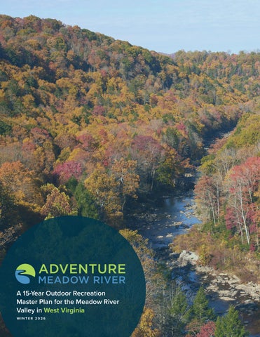
A 15-Year Outdoor Recreation

Master Plan for the Meadow River

Valley in West Virginia

WINTER 2026

Acknowledgments

MEADOW RIVER VALLEY PROJECT COMMITTEE

• Matthew Ford

Meadow River Valley Association

• Dave Bassage

New River Conservancy

• Jenna Breeckner Greenbrier Environmental

• Matthew Carpenter

New River Alliance of Climbers

• Andrew Davis

New River Gorge Regional Development Authority

• Gene Kistler Fayette Trail Coalition

• Corey Lilly

Smith Outdoor Economic Development Collaborative

• Vicky Neal Greenbrier Historical Society

• Jacob Ott Otters Guide Service

• Audrey Sampson Greenbrier Environmental

• Aaron Schneider, MD Community Member

• John Taylor Midland Trail Outdoor Adventures

• Tammy Tincher Meadow River Valley Association

• Amy Truesdale Greenbrier Valley Economic Development Corporation

VIDEO INTERVIEWS

• Dave Bassage

New River Conservancy, New River Gorge Program Coordinator

• Hillary Burns Greenbrier West, Principal

• Matt Ford

Meadow River Valley Association, President

• Peyton Ford Marshall University, Current Student; Greenbrier West, Former Student

• Julie Sellers

Community Member and Former Whitewater Guide

FOCUS GROUP CONTRIBUTORS

• OUTDOOR RECREATION

• Beth Gill

• Karen Giroud

• Kevin O’Malley

• Jedediah Smith

• COMMUNITY DEVELOPMENT

• Matt Ford

• Peyton Ford

• Lisa Podlecki

• Eric Pories

• Tammy Tincher

• ENVIRONMENTAL SUSTAINABILITY

• Dave Bassage

• Jenna Breeckner

• Matt Ford

• Jennifer Liddle

• Sarah Simonton

2.1

CHAPTER

• Photo on front cover is the Meadow River by Aaron Schneider

Map 01: Regional Context..................... 19

Map 02: Outdoor Recreation Assets... 29

Map 03: Natural Resource Assets ...... 33

Map 04: Mountain Communities ......... 37

Map 05: Headwaters Focus Area ........ 57

Map 06: Town of Rupert Focus Area .. 61

Map 07: Town of Rainelle Focus Area . 67

Map 08: Town of Quinwood Focus Area .............................. 73

Map 09: Meadow River Rail Trail Focus Area .............................. 75

Map 10: Meadow River Water Trail Focus Area .............................. 83

Map 11: Confluence Focus Area .......... 93

Exhibit 01: Gauley National Recreation Area ................. 30

Exhibit 02: New River Gorge National Park and Preserve ..............31

Exhibit 03: Meadow River..................... 34

Exhibit 04: Town of Rupert –Proposed Trails and Greenway System ...... 62

Exhibit 05: Adventure Meadow River Welcome Center ...... 68

Exhibit 06: Russellville Trailhead and River Access ............... 78

Exhibit 07: Snake Island Recreation Area ................. 80

Exhibit 08: Burdette’s Creek River Access and Trailhead ........ 84

Exhibit 09: Nallen Hub Illustrative Master Plan ......................... 88

Exhibit 10: Meadow River Destination Village and Hub ................. 96

Exhibit 11: Adventure Meadow River Emerging Themes... 101

Exhibit 12: New River Gorge (NRG) Towns Regional Branding . 102

Exhibit 13: Public Access on Private Lands .................... 103

US 19 crossing the Meadow River

BACKGROUND & PURPOSE

The Adventure Meadow River Outdoor Recreation Plan provides a strategic framework to guide the Meadow River Valley Association and its partners in enhancing outdoor recreation, connectivity, and sustainability throughout the Meadow River watershed (Meadow River Valley). This chapter outlines the foundation and intent of the plan, summarizing its purpose, goals, process, and overall structure to provide context for the work that follows.

IN THIS CHAPTER:

1.1 PROJECT BACKGROUND

1.2 PROJECT GOALS

1.3 PLANNING PROCESS

1.4 PLAN ORGANIZATION

Project Background 1.1

The Meadow River begins in the mountains of western Greenbrier County and flows northwest approximately 53 miles to its confluence with the Gauley River. Its waters flow through extensive wetlands and meadows before entering a landscape of forested ridges, rolling hills, and small towns and communities that once thrived from the timber and coal industries, before descending into a gorge lined with cliffs and scattered with large boulders.

As the river descends through this diverse geography, it offers a variety of calm flatwater and challenging whitewater paddling experiences along its length. A former railroad corridor parallels and crosses the river twice from its terminus in Rainelle to the river’s confluence and offers a gently graded path that can support hiking, biking, and horseback riding. Cliffs and boulders on the lower Meadow River provide additional outdoor recreation opportunities for rock climbers. Anglers, hunters, and off-highway vehicle enthusiasts also utilize lands in the valley.

The Meadow River Valley encompasses parts of Greenbrier, Fayette, and Nicholas counties and is surrounded by nationally recognized outdoor destinations, including New River Gorge National Park and Preserve, Gauley River National Recreation Area, Babcock State Park, Summersville Lake State Park, and the Monongahela National Forest. Together, these regional assets position the Meadow River Valley as a gateway and hub for adventure tourism and outdoor recreation in southern West Virginia.

Led by the Meadow River Valley Association, Inc. (MRVA) and supported by funding from the New River Gorge Regional Development Authority’s New River Gorge Working Group and Partner Community Capitals Recreation Economies Initiative, the Adventure Meadow River Outdoor Recreation Plan builds on the momentum of previous planning initiatives and community successes.

Specifically, the Meadow River Valley Strategic Plan (2020) provided a vision for sustainable growth and outlined redevelopment of the former Rupert Elementary School campus into

the Meadow River Valley Community Center which was completed in 2025. MRVA has also continued to advance the Meadow River Rail Trail, a key asset in the region’s outdoor recreation network. The Adventure Meadow River planning effort aims to build on this progress by strategically expanding recreational opportunities, increasing accessibility, and engaging private landowners.

The Adventure Meadow River Outdoor Recreation Plan, developed over 12 months through intensive collaboration, reflects the shared vision of local leaders and community stakeholders. This 15-year roadmap aims to improve quality of life for residents, boost the local economy, enhance the visitor experience, and strengthen local resources to support lasting growth and long-term environmental sustainability.

Meadow River Rail Trail - Russellville Bridge

Project Goals 1.2

ASSETS

Assess and inventory the existing outdoor recreation assets in the Meadow River Valley, evaluating their current condition and capacity to offer a high-quality outdoor experience for all users.

PARTNERS

Collaborate with government entities, nonprofit organizations, community leaders, and the public to identify ongoing and planned projects aimed at enhancing the quality of life for both residents and visitors.

GAPS

Identify new, compelling tourism infrastructure projects to enhance the quality of life, promote the outdoor economy, and drive private investment.

UNITY

Identify projects that also help achieve broader community goals, such as young adult and workforce retention, small business growth, environmental quality, and active living.

VISUAL

Develop a plan that captures community interest and inspires a shared vision by incorporating compelling renderings, site master plans, 3D illustrations, and other visual elements to clearly convey recommendations and ideas.

STRATEGY

Provide the steering committee and their partners with clear strategies and a prioritization schedule for implementing the plan recommendations.

Meadow River

Planning Process 1.3

Adventure Meadow River represents the culmination of several months of analysis, planning, conceptual design development, and numerous meetings and site visits. The planning process involved five major phases.

DIRECTION SETTING & PROJECT LAUNCH

APRIL – JUNE 2025

Created a unique plan identity and promotional video for Adventure Meadow River that built excitement with government leaders, community partners, and the public. Hosted a project website that informed about project goals, opportunities for engagement, and progress. Facilitated a Direction Setting meeting with the Project Committee.

RESEARCH & PRELIMINARY ANALYSIS

APRIL – JUNE 2025

Conducted site visits, field analysis, and demographic research to develop an inventory of existing assets and understand key opportunities and constraints. Reviewed previous planning efforts that may have implications for Adventure Meadow River.

COMMUNITY ENGAGEMENT

MAY – JULY 2025

Conducted interviews and focus groups with government officials, business leaders, and community members to explore key themes including community and economic development, outdoor recreation, and environmental sustainability. Gathered additional public input on priorities through an online community survey.

VISION & PLAN FRAMEWORK

JUNE – NOVEMBER 2025

Created the plan framework that featured preliminary recommendations for improving and expanding outdoor recreation assets. Hosted a public meeting to share recommendations with community members for feedback.

FINAL PLAN DEVELOPMENT

OCTOBER 2025- FEBRUARY 2026

Developed an outdoor recreation plan that included recommendations determined during the planning process, prioritization, and an outline of grant funding sources.

Plan Organization 1.4

The Adventure Meadow River Outdoor Recreation Plan is organized into five major chapters as outlined below.

CHAPTER 1: BACKGROUND & PURPOSE

The current chapter, which outlines the plan’s purpose, goals, process, and organization.

CHAPTER

2: DISCOVERY & ANALYSIS

A snapshot of the regional setting, demographic trends, and previous planning efforts are presented here. The chapter also includes an inventory and analysis of the current assets within the Meadow River Valley.

CHAPTER 3: PUBLIC ENGAGEMENT & EMERGING THEMES

This chapter discusses tools used for public engagement, highlights stakeholders and organizations involved in the planning process, and presents key results from an online community survey. The chapter culminates with the emerging themes that guide plan recommendations

CHAPTER 4: PLAN RECOMMENDATIONS

This chapter is organized according to seven Focus Areas as identified during the planning process: 1) Headwaters, 2) Town of Rupert, 3) Town of Rainelle, 4) Town of Quinwood, 5) Meadow River Rail Trail, 6) Meadow River Water Trail, and 7) Confluence. Each Focus Area contains specific project areas. This chapter is supported by extensive custom illustrations and conceptual designs.

CHAPTER 5: PLAN IMPLEMENTATION

This chapter provides a comprehensive matrix of all infrastructure recommendations, prioritization, implementation strategies, and an outline of grant funding sources.

Meadow River

DISCOVERY & ANALYSIS

This chapter examines the regional context, demographic trends, and relevant past planning efforts within the Meadow River Valley. It also provides a high-level overview of key assets in and around the region.

IN THIS CHAPTER:

2.1 REGIONAL CONTEXT

2.2 REGIONAL DEMOGRAPHICS

2.3 PREVIOUS PLANNING EFFORTS

2.4 KEY ASSETS

Regional Context 2.1

This section examines the Meadow River Valley region in relation to its geography, transportation corridors, natural resources, and managed lands.

GEOGRAPHY

The Meadow River Valley is located in the Allegheny Mountains of southern West Virginia and is defined by its rugged topography and rich hydrologic network. The region spans portions of Nicholas, Fayette, and Greenbrier counties and includes the small towns of Rupert, Rainelle, and Quinwood. Covering approximately 365 square miles, the watershed features elevations ranging from about 4,380 to 1,748 feet above sea level, contributing to diverse terrain and ecological conditions.

The defining geographical feature of the region is the Meadow River itself, which originates northwest of Alderson on the border of Greenbrier and Summers Counties. From there, the river flows roughly 53 miles northwest toward the Gauley River. The upper watershed contains broad wetlands and open meadows, while farther downstream the valley narrows into a dramatic landscape of steep forested slopes, rocky outcrops, and occasional cliffs and gorges. Extensive forest cover creates

a predominantly undeveloped and scenic environment with rural communities situated throughout the valley.

The Meadow River Valley is centrally located among several significant natural resources and tourism destinations. To the west, it is bordered by the New River Gorge National Park and Preserve, Babcock State Park, and the nearby communities of Fayetteville and Beckley. The Gauley River National Recreation Area, Summersville Lake State Park, and the community of Summersville lie to the north. The Monongahela National Forest and the Greenbrier River are located to the northeast and east, while the community of Lewisburg lies to the southeast. With Charleston, West Virginia; Morgantown, West Virginia; WinstonSalem, North Carolina; and Roanoke, Virginia all within a three-hour drive, the region is highly accessible, making it a convenient and attractive destination for nature-based tourism and outdoor recreation.

TRANSPORTATION CORRIDORS

Interstate 64 runs east–west through the southern portion of the Meadow River Valley region, providing key regional connectivity. To the east it connects travelers to Lewisburg and onward to Lexington, VA, where it intersects with Interstate 81. It links to Beckley and Interstate 77 before continuing to Charleston, WV to the west.

In the northwest portion of the region, U.S. 19 serves as a major north–south corridor. It connects southward to Beckley, and to the north it links with Interstate 79, providing access to Morgantown, WV, and Pittsburgh, PA.

U.S. 60, also known as the Midland Trail, is a National Scenic Byway that spans West Virginia from border to border, highlighting the state’s natural beauty. Within the Meadow River Valley region, the Midland Trail runs east–west from U.S. 19, passing through the Towns of Rupert and Rainelle before connecting to I-64. It serves as an important transportation and tourism corridor, linking communities and destinations throughout the region.

NATURAL RESOURCES

The Meadow River Valley region is shaped by the river itself, expansive forested landscapes, and a strong rural character. Historically, coal was extracted within the valley, and timber harvesting continues on the surrounding slopes. Along its course, the river flows past wetlands, meadows, rolling hills, agricultural lands, and small rural communities before descending into a rugged gorge characterized by cliffs and scattered boulders, where it ultimately joins the Gauley River. This varied topography and rich ecological setting contribute to the region’s scenic beauty, support high-quality wildlife habitat, and reinforce the valley’s distinct natural identity.

MANAGED LANDS

The Meadow River Valley region contains a diverse network of managed lands that support conservation and outdoor recreation. In the southeastern portion of the region, extensive Wildlife Management Areas (WMAs) are overseen by the West Virginia Division of Natural Resources, providing important habitat protection and public access for hunting, fishing, and wildlife viewing. To the north and west, the New River National Park and Preserve and Gauley River National Recreation Area, managed by the National Park Service,

protects significant river corridor resources and recreation opportunities. Fayette and Greenbrier Counties own a 22.9-mile portion of former railroad corridor that is being developed into the Meadow River Rail Trail, creating a major north–south recreation spine through the valley. Additionally, local governments maintain community parks, trails, and green spaces that expand access to outdoor recreation across the region.

of the Meadow River

Regional Demographics 2.2

This section presents population, income, and employment data for residents of the Meadow River Valley region, which encompasses portions of Nicholas, Fayette, and Greenbrier counties, as reported by the U.S. Census Bureau and the Bureau of Labor Statistics.

REGIONAL POPULATION

According to the 2021 American Community Survey (ACS) data from the U.S. Census Bureau, West Virginia is home to 1,773,813 residents, with 10,286 residing in the Meadow River Valley region, representing a population decline of 1.08% since the previous decennial census. The region contains 4,334 households, with an average household size of 2.35 people. Approximately 15.5% of these households include one or more members with a disability. Within the region, 21% of households fall below the poverty line, compared to 17% statewide.

The median age in the Meadow River Valley region is 46.9, compared to 43.4 for West Virginia and 39.0 for the United States. Of the region’s total population, 20.6% are under 18, 54.2% are between 18 and 64, and 25.1% are 65 or older.

Of the total population, 94.8% identify as White, 3.8% as two or more races, and less than 1% as Black, American Indian, Asian, or another race. Additionally, 1.2% of the population identifies as Hispanic or Latino.

Total Population:

46.9 Age

Median age

Figure in West Virginia: 43.4

Figure in the United States: 39

$26,710 Income Per capita income

Figure in West Virgnia: $33,336

Figure in the United States: $40,363

$43,042

Median household income

Figure in West Virgnia: $56,394

Figure in the United States: $69,021

REGIONAL INCOME AND EMPLOYMENT

The per capita income for the Meadow River Valley region is $26,710 – 20% percent lower than the state average of $33,336 and 34% lower than the national average of $40,363. The median household income is $43,042 –approximately 24% lower than the state average of $56,394 and 38% lower than the national average of $69,021.

Within the region, 80.2% of households own their home, while 19.8% rent. The median home value within the region is between $118,000 and $133,000.

Fifty-four percent of the Meadow River Valley region population is considered working age, or between the ages of 18-64. There are 227 total businesses in the region and 2,041 total employees. The unemployment rate for the region is 4.3%, relatively equal to the state unemployment rate of 4.5%.

Within the Meadow River Valley region, 14% hold a bachelor’s, graduate, or professional degree, 21.7% have some college or an associate’s degree, 44.4% hold a high school diploma, and 12.8% do not have a high school diploma.

Based on a range of economic indicators, the Appalachian Regional Commission (ARC) classifies Nicholas and Fayette counties as “distressed” and Greenbrier County as “atrisk”. The ARC designates “distressed” areas as census tracts within at-risk or transitional counties where median family income is no greater than 67% of the U.S. average and the poverty rate is at least 150% of the national average. “At-risk” areas are those in danger of becoming economically distressed, ranking between the lowest 10% and 25% of all U.S. counties.

Previous Planning Efforts 2.3

This section provides a brief summary of previous planning efforts that inform the Adventure Meadow River Outdoor Recreation Plan. These studies address aspects of outdoor recreation, economic development, and conservation, and are organized by their date of completion, ranging from 2021 to 2002.

ACTION PLAN FOR THE MEADOW RIVER WETLANDS CONSERVATION FOCUS AREA (2021)

This plan identifies priority species, climate stressors, and conservation actions for each major terrestrial and aquatic habitat type in the Meadow River Wetlands CFA. Priority habitats identified by this plan for conservation action include exemplary wetlands, small stream riparian and river floodplain habitats, intact forest patches, early-successional forest habitat, and areas of natural and woody vegetation within and around agricultural lands. Conservation actions that encourage climate resilience involve engaging partner organizations, public land managers, and private landowners.

MEADOW RIVER VALLEY STRATEGIC PLAN 2020-2025 (2020)

The Meadow River Valley Strategic Plan, led by the Meadow River Valley Association (MRVA), addresses a region of neighborhoods and communities in eastern Fayette and western Greenbrier counties in West Virginia. The vision of the plan is to repurpose the former Rupert Elementary School campus into the Meadow River Valley Community Center, providing a space for residents to live, learn, and grow through education, healthy nutrition, physical activity, and medical care. The plan outlines a series of objectives and action steps necessary to realize this vision.

GAULEY RIVER NATIONAL RECREATION AREA FOUNDATION DOCUMENT (2016)

The Gauley River National Recreation Area, which protects 25 miles of the Gauley River and six miles of the Meadow River, was established to provide the public with outdoor recreational opportunities, such as whitewater boating, picnicking, camping, hiking, fishing, hunting, and sightseeing while protecting the natural area. Values of the recreation area include biological diversity; undeveloped, rugged geologic landscape; opportunities for world-class recreation; water quality; and the cultural history of the Gauley River Gorge. Specific concerns for the Meadow River portion of the park include illegal ATV use, fish consumption guidelines due to mercury contamination, climate change and associated flooding, and improved public access for rock climbing.

UPPER MEADOW RIVER WATERSHED BASED PLAN (2014)

This plan focuses on 13 streams in the upper Meadow River watershed that have been identified as impaired by the U.S. Environmental Protection Agency (EPA, 2006). The polluted environments are mostly located in the Sewell Creek and Little Clear Creek drainages, and primary pollutants include fecal coliform, aluminum, iron, and PH. For each pollutant, the WBP provides the source and both passive and active treatment measures.

CONNECTING THE PARKS WITH THEIR GATEWAY COMMUNITIESCONCEPT PLAN (2012)

This plan proposes a network of trails that would connect West Virginia’s three units of the National Parks System - Bluestone National Scenic River, New River Gorge National River, and the Gauley River National Recreation Area (NRA) - with their gateway communities, neighboring state parks, and other public lands. This regional trail network would enable visitors to get to the parks, travel within the parks, and go from park to park via hiking and biking trails. Within the Meadow River Valley region, three trail segments are proposed establishing a connection between the Gauley River NRA via Babcock State Park and the New River Gorge National Park and Preserve.

NATIONAL COAL HERITAGE AREA, WEST VIRGINIA: TRAIL PLAN FOR GREENWAYS AND BLUEWAYS (2008)

This study serves as a trail assessment and planning document for the 13-county National Coal Heritage Area of West Virginia, evaluating the current inventory of both motorized and nonmotorized trails, as well as potential trail sites and linkages within the region. The plan’s goals include generating new enthusiasm for hiking and biking, expanding tourism opportunities, and enhancing residents’ quality of life. Although the Meadow River Valley is not part of the National Coal Heritage Area, 42 adjacent trails, including those connected to the Gauley River National Recreation Area and Babcock State Park in Fayette County, were identified as candidates for promotion and development.

PATHWAYS TO THE FUTURE: THE WEST VIRGINIA STATEWIDE TRAIL PLAN 2002-2010 (2002)

This statewide trail plan provides a framework for improving access to West Virginia’s natural landscapes while preserving the state’s natural, historical, and cultural integrity. In addition to establishing a West Virginia State Trails Program, the plan’s goals emphasize partnerships, connectivity, trail infrastructure, collaboration with private landowners, accessibility, and new trail development. Each of the 13 objectives includes specific action items, lead and supporting agencies, and an anticipated project completion timeframe.

2.4 Key Assets

This section provides an overview of tourism and outdoor recreation assets found throughout the Meadow River Valley region and organizes them into three (3) major asset types including: 1) Outdoor Recreation and Managed Areas; 2) Natural Resources; and 3) Mountain Communities. Each asset is located on an inventory map, and a description and summary list of specific assets is provided for each major asset type. Exhibits highlight key tourism and outdoor recreation assets within the region.

MEADOW RIVER VALLEY REGION BY THE NUMBERS

Total Land Area: 365 Square Miles (233,600 acres)

Conserved Land: 3,295 Acres

Elevation Range: 1,748 Ft - 4380 Ft

Meadow River: 53 Miles

Outdoor Recreation and Managed Areas

The Meadow River Valley region offers managed areas that provide parks, trail systems, greenways, and river access points on conserved lands. These outdoor recreation facilities provide direct access to the natural resources found throughout the region.

• Elliot Park

• Friendship Park

• Gauley River National Recreation Area

• Meadow River Community Park

• Meadow River Rail Trail

• Mundy Park

• New River Gorge National Park and Preserve

• Quinwood Community Park

• Rupert City Park

• Veterans Memorial Park

EXHIBIT 01: GAULEY RIVER NATIONAL RECREATION AREA

The Gauley River National Recreation Area protects 25 miles of the Gauley River and 6 miles of the Meadow River in Nicholas and Fayette counties. Featuring class 3-5+ rapids, the recreation area's stretch of whitewater features more than 100 rapids, renowned as steep, technical, and challenging and drawing visitors world-wide. A high energy system, the Gauley River supports many rare and threatened plant and animal species. The recreation area provides backcountry camping and primitive river campsites free of charge.

on the Gauley River

New River Gorge National Park and Preserve, America's newest National Park as of 2021, features over 70,000 acres of land along the New River, one the oldest rivers in the world. The park boasts whitewater rafting, fishing, swimming, rock climbing, hiking, primitive camping, mountain biking, and an annual BASE jumping event. In addition to outdoor recreation, the New River Gorge bridge, the secondhighest bridge in the US, spanning over 3,000 feet and sitting at nearly 900 feet above the river, offers views of the gorge to park visitors.

EXHIBIT 02: NEW RIVER GORGE NATIONAL PARK AND PRESERVE

New River Gorge National Park and Preserve

Natural Resources

A variety of natural resources, anchored by the Meadow River and its network of creeks, are located in the Meadow River Valley region. With strategic planning, targeted infrastructure improvements, and well-managed public access, these natural assets offer strong potential for expanded outdoor recreation and can better serve residents and attract more visitors.

NATURAL RESOURCES

• Anglins Creek

• Big Clear Creek

• Dawson Lake

• Dogwood Creek

• Gauley River

• Glade Creek

• Hendricks Creek

• Little Clear Creek

• Little Sewell Creek

• Meadow River

EXHIBIT 03: MEADOW RIVER

The Meadow River, a tributary of the Gauley River, flows approximately 53 miles through Greenbrier, Fayette, and Nicholas counties, eventually joining the Gauley River near Summersville Lake. The Meadow River is well-known among whitewater enthusiasts, featuring technical class 3 to 5+ rapids. Historically used for timber and coal industry, the surrounding area is also popular with hikers, anglers, climbers, and nature lovers.

Meadow River
Town of Rupert

Mountain Communities

The Meadow River Valley is home to the historic small towns of Rupert, Rainelle, and Quinwood, communities shaped by West Virginia’s timber and coal heritage and defined by a resilient, close-knit Appalachian culture.

MOUNTAIN COMMUNITIES

• Town of Rainelle

• Town of Rupert

• Town of Quinwood

Overlooking the Meadow River

PUBLIC ENGAGEMENT & EMERGING THEMES

This chapter outlines the tools used to engage the public, identifies the stakeholders and organizations involved in the planning process, and summarizes key findings from the online survey that gathered community input on the outdoor recreation economy and future development priorities for the Meadow River Valley region. It concludes with the emerging themes that form the foundation for the plan’s recommendations.

IN THIS CHAPTER:

3.1 TOOLS OF ENGAGEMENT

3.2 COMMUNITY SURVEY

3.3 COMMUNITY PARTNERS

3.4 LANDOWNER ENGAGEMENT

3.5 EMERGING THEMES

Tools of Engagement

The Adventure Meadow River Outdoor Recreation Plan launched with a promotional video featuring key community leaders, highlighting the project’s goals and inviting residents to get involved. The video directed viewers to the project website and encouraged participation in the online community survey. In addition, a concise project Fact Sheet was developed to summarize the plan’s purpose and key elements for easy sharing throughout the region.

Adventure Meadow River Community Forum

3.2

The Adventure Meadow River Outdoor Recreation Plan

Community Survey

Community Survey was conducted to gather input on which regional outdoor recreation and tourism assets residents and visitors feel are most important and how future outdoor recreation projects should be prioritized.

The survey received a total of 353 responses between May and July 2025. The online survey was promoted by the Meadow River Valley Association and local stakeholders via the project website, email, and social media platforms. This section presents key survey findings.

When compared with the regional demographic data presented on pages 22–23, survey respondents differed in several ways. Respondents tended to be younger and reported higher total household incomes

than the broader population of the Meadow River Valley. A majority of respondents listed zip codes in Fayette, Raleigh, or Kanawha Counties, while participation from Greenbrier and Nicholas Counties was relatively low, despite Greenbrier County containing the primary population centers and towns within the Meadow River Valley.

Rock climbing and river activities and access were identified as the most popular activities and the highest outdoor facility priorities among respondents. These results could indicate that many survey respondents may live and recreate primarily in the New River Gorge National Park and Preserve, Gauley National Recreation Area, and the western portion of the Meadow River Valley.

Prefer

TOTAL HOUSEHOLD INCOME

353 TOTAL RESPONSES

ARTS AND CULTURE

Community Partners 3.3

The Adventure Meadow River planning process engaged a diverse range of stakeholders, including local government representatives, quasi-governmental organizations, nonprofit partners, and private businesses. The consultant team conducted interviews, focus group meetings, and site visits to gather input on a wide range of topics that informed and shaped the plan’s recommendations.

GOVERNMENT & QUASI-GOVERNMENT AGENCIES

Greenbrier County

Greenbrier Valley Economic Development Corporation

Greenbrier West High School

National Park Service

New River Gorge Regional Development Authority

West Virginia Department of Environmental Protection

WVU Brad and Alys Smith Outdoor Economic Development Collaborative

NONPROFIT ORGANIZATIONS & BUSINESSES

Access Fund

American Whitewater

Backroads of Appalachia

Experience Greenbrier Valley

Fayette Trail Coalition

Friends of the New River Gorge

Greenbrier Environmental Group

Greenbrier Historical Society

Greenbrier River Watershed Association

Greenbrier Valley Community Foundation

Meadow River Valley Association

New River Alliance of Climbers (NRAC)

New River Conservancy

New River Gorge Trail Alliance

North of the Bridge Group

Nutall LLC

The Nature Conservancy

West Virginia Land Trust

Weyerhaeuser

MEADOW RIVER RECREATION CORRIDOR COLLABORATIVE

Prior to the Adventure Meadow River Outdoor Recreation planning effort, the Meadow River Recreation Corridor Collaborative established important foundational work for outdoor recreation planning in the region. In July and August 2024, the Collaborative hosted two public engagement events that attracted a total of 108 community members.

Discussions focused on recreation opportunities along the Meadow River, from its headwaters to its confluence with the Gauley River, and included targeted focus groups representing walkers, bicyclists, kayakers, and rock climbers. Participants also completed a survey questionnaire that identified opportunities to expand outdoor recreation infrastructure, support business development, improve communication about local assets, and attract additional residents and visitors to the region. Information gathered through this collaborative effort directly informed subsequent focus group discussions and interviews conducted as part of the Adventure Meadow River planning process.

FOCUS GROUP MEETINGS

Focus group meetings were held with community leaders to discuss regional priorities, identify underutilized assets, and gather insights on improvements that could strengthen the outdoor economy in the Meadow River Valley region.

OUTDOOR RECREATION FOCUS GROUP –MAY 27, 2025

Included community members with interest and expertise in hiking, biking, off-roading, rock climbing, and fishing.

COMMUNITY DEVELOPMENT FOCUS

GROUP – MAY 29, 2025

Brought together community members, elected officials, and youth representatives who share a professional and personal commitment to community development.

ENVIRONMENTAL FOCUS GROUP – MAY 30, 2025

Included natural resource experts, conservation organizations, and land management stakeholders to discuss ecological conditions and identify environmental challenges.

COMMUNITY FORUM

On November 13, 2025, the project team hosted a public community forum at the Rainelle Medical Center to present the plan’s recommendations and design concepts, answer questions, and gather community feedback.

3.4

Landowner Engagement

During the research and preliminary analysis phase of the planning process, the project team identified access to key tourism and outdoor recreation assets as a significant challenge to outdoor recreation development due to privately owned lands. Public land is limited within the Meadow River Valley, and large tracts are owned by private landowners and corporations. As part of the Adventure Meadow River planning effort, the consultant team initiated landowner engagement through targeted phone interviews and onsite meetings with select private landowners. This work represents the beginning of a longer-term landowner engagement process that will require sustained relationshipbuilding and leadership by local stakeholders.

WHAT WE HEARD

Via focus groups, interviews, and an online community survey, the consultant team gathered input from community members to learn about challenges and identify opportunities for the Meadow River Valley region. These answers provided insights and helped inform the plan recommendations.

“A complete greenway with full access along the Meadow River would be awesome.”

“Better parking and access to the rock climbing area.”

“Public outdoor venues, appropriate signage and trail map information.”

“Expand the Meadow River Wilderness Management Area and build mountain bike trails there!”

“Parking, camping, bathrooms, boat launches, good roads for shuttle / accessing the river.”

“Purpose built mountain biking trails intermediate to advanced.”

“The rock climbing in the Meadow River Valley is worldclass, and access to it should be a priority.”

“The region has so much potential for development to help build the local economy, and raise its profile as a desirable destination and place to live.”

“World class opportunity for rock climbing, biking, hiking, boating and more that is hindered by lack of public parking and access.”

“Effort should be spent building up infrastructure to increase opportunities and access for hikers, mountain bikers, road cyclists, and climbers.”

“Would love to see a good takeout road and parking lot near the confluence of the Meadow and Gauley plus roads and parking improved around the upper and middle Meadow.”

“Climbing and biking bring so many people to this region, infrastructure for these activities should be a priority! People need places to stay, places to park, and places to work.”

“Climbing access should be prioritized. Access does not need to be easy, just secured and maintained in a way that prevents resource degradation (erosion, etc.).”

“The Meadow River is an absolute gem. The rock climbing is world class. The river is absolutely incredible. This area needs to be preserved and protected for future generations.”

Emerging Themes 3.5

Building on extensive research, community engagement, and listening, the emerging themes establish the region’s aspirations and vision for its outdoor economy. These themes form the foundation for the recommendations presented in Chapter 4. Together, they create a strategic roadmap that will guide local leaders and decision-makers in expanding access to unique outdoor recreation resources, enhancing quality of life, strengthening connections to nature, and promoting both community vitality and economic development.

The five (5) emerging themes include: 1) Access; 2) Sustainable Outdoor Recreation; 3) Connection & Awareness; 4) Health & Wellness; and 5) Economic Development.

ACCESS

Expand access to outdoor recreation for people of all ages and abilities by creating inclusive facilities and environments that support safe, welcoming, and equitable use. Collaborate with willing landowners and partners to identify opportunities for access to recreation assets while respecting property rights and community values.

SUSTAINABLE OUTDOOR RECREATION

Conserve and maintain natural resources, rural landscapes, blueways, and greenways through well-conceived trail corridors, public river accesses, and conservation lands that support sustainable outdoor recreation.

CONNECTION & AWARENESS

Develop connectivity between outdoor recreation assets, mountain communities, and cultural destinations while increasing public awareness of the region’s natural resources and recreation opportunities.

HEALTH & WELLNESS

Promote health and wellness by expanding opportunities for active living, improving access to outdoor recreation, and supporting environments that encourage physical activity, community connection, and overall well-being.

ECONOMIC DEVELOPMENT

Strengthen regional economic development by leveraging unique outdoor recreation assets for community revitalization, supporting local businesses, and creating destinations that attract visitors.

Headwaters of the Meadow River

PLAN RECOMMENDATIONS

This chapter serves as the core of the Adventure Meadow River Outdoor Recreation Plan translating the community’s vision, values, and priorities into a clear set of actionable strategies. The recommendations are organized around seven (7) primary Focus Areas identified through the planning process: 1) Headwaters, 2) Town of Rupert, 3) Town of Rainelle, 4) Town of Quinwood, 5) Meadow River Rail Trail, 6) Meadow River Water Trail, and 7) Confluence.

Each Focus Area includes specific projects and action steps that collectively provide a roadmap for advancing outdoor recreation, economic development, and community vitality across the Meadow River Valley region.

IN THIS CHAPTER:

FOCUS AREA 1: HEADWATERS

FOCUS AREA 2: TOWN OF RUPERT

FOCUS AREA 3: TOWN OF RAINELLE

FOCUS AREA 4: TOWN OF QUINWOOD

FOCUS AREA 5: MEADOW RIVER RAIL TRAIL

FOCUS AREA 6: MEADOW RIVER WATER TRAIL

FOCUS AREA 7: CONFLUENCE

Focus Area 1: Headwaters

The Headwaters Focus Area is located in Greenbrier County just to the north and south of US 64, with access from the Dawson and Sam Black Church exits and short drives to Beckley and Lewisburg. Serving as the southeastern gateway to the Meadow River Valley, this area is near the river’s headwaters which originate northwest of Alderson on the border of Greenbrier and Summers Counties. This southeastern end of the watershed features wetlands, bottomlands, and gentle slopes, which are conserved by the Meadow River Wildlife Management Areas and offer hunting and fishing opportunities and significant potential for purpose-built trails and additional outdoor recreation amenities. The following recommendations support developing assets accessible from US 64 that promote economic development and increase awareness of the Meadow River Valley (See Map 05: Headwaters Focus Area, page right).

PROJECT AREA 1.1 EASTERN GATEWAY

The intersection of US 60 and I-64 at the Sam Black Church exit offers a prime opportunity to welcome visitors arriving from the south and east. Wayfinding, directional signage, and public art can help establish this location as a distinctive gateway to the Meadow River Valley’s historic towns and outdoor recreation assets.

Specific Adventure Meadow River action items in support of the Eastern Gateway are as follows:

• 1.1.1. Public Art. Work with local students to explore opportunities for a mural or banner that promotes the Meadow River Valley on the northwest corner of the intersection of US 60 and I-64.

MAP 05: HEADWATERS FOCUS AREA

PROJECT AREA 1.2 MEADOW

RIVER WILDLIFE MANAGEMENT AREA (WMA) TRAIL DEVELOPMENT

Within the Headwaters Focus Area, two Wildlife Management Areas (WMAs) managed by the West Virginia Division of Natural Resources offer opportunities to expand outdoor recreation. The Meadow River WMA near Dawson, accessible from Lawn and Dawson Roads, and the Meadow River WMA near Meadow Bluff, accessible from the James River and Kanawha Turnpike, provide significant potential for purposebuilt trails and nature-based experiences.

Specific Adventure Meadow River action items in support of the Meadow River Wildlife Management Area (WMA) trail development are as follows:

• 1.2.1 Dawson. Explore improved access and purpose-built trail concepts within the 118-acre Meadow River Wildlife Management Area near Dawson, located south and east of I-64 on Lawn Road.

• 1.2.2 Meadow Bluff. Explore improved access and purposebuilt trail concepts within the 700-acre Meadow River Wildlife Management Area near Meadow Bluff that is accessible from James River and Kanawha Turnpike.

Wildlife Management Area - Meadow Bluff

Focus Area 2: Town of Rupert

The Town of Rupert is located in Greenbrier County, with the Meadow River running along its southwestern border. Once a coal and timber community, the town is now home to nearly 900 residents and maintains a welcoming rural atmosphere. Local parks such as Rupert City Park, along with nearby natural assets like Little Clear Creek and Big Clear Creek, provide accessible outdoor recreation opportunities for residents and visitors to Rupert (See Map 06: Town of Rupert Focus Area, page right). The following recommendations aim to strengthen community assets in Rupert focused on community health, connectivity, and environmental education

PROJECT AREA 2.1 RUPERT TRAILS AND GREENWAY SYSTEM

The Town of Rupert has the opportunity to strengthen community connectivity and outdoor recreation by investing in an integrated network of trails, greenways, and pedestrian-friendly streets. By enhancing sidewalks, bike routes, and ADA-accessible streetscapes, the town can create safer, more inviting connections between parks, schools, downtown, and the Meadow River. New amenities such as a riverfront boardwalk and natural surface trails at Rupert Recreation Area and Western Greenbrier Middle School could further expand recreation options for residents and visitors.

Specific Adventure Meadow River action items in support of the Rupert Trails and Greenway System are as follows:

• 2.1.1 Greenway Planning. Develop a comprehensive trail and greenway plan that connects key community assets, such as parks and schools, within the town while also making linkages to nearby regional assets including the Meadow River Wildlife Management Area (See Exhibit 04: Town of Rupert – Proposed Trails and Greenway System, page 62).

• 2.1.2 Streetscape Improvements. Design and implement ADA-accessible streetscape improvements to include wide sidewalks, lighting, furnishings, street trees, landscaping, and curb extensions to reduce the length of crosswalks within town limits along US 60/ Midland Trail.

• 2.1.3 Bike and Pedestrian Improvements. Explore sidewalk connectivity and enhancements, bike lanes, and intersection improvements on all roads within the town limits.

• 2.1.4 Meadow River Bottom Boardwalk. Develop a boardwalk system with educational waysides along the Meadow River that is accessible from US 60 and downtown Rupert.

• 2.1.5 Rupert Natural Surface Trail System. Develop a purpose-built trail system that expands recreational opportunities at Rupert Recreation Area on Martin Road and at Western Greenbrier Middle School.

MAP 06: TOWN OF RUPERT FOCUS AREA

EXHIBIT 04: TOWN OF RUPERT – PROPOSED TRAILS AND GREENWAY SYSTEM

PROJECT AREA 2.2 FISHING OPPORTUNITIES

Little Clear Creek and Big Clear Creek, both located in close proximity to the Town of Rupert, offer convenient fishing opportunities for residents and visitors and are regularly stocked by the West Virginia Division of Natural Resources (WVDNR). Continuing to maintain and expand these stocking efforts will support local fishing and enhance outdoor recreation in the area.

Specific Adventure Meadow River action items in support of Fishing Opportunities are as follows:

• 2.2.1 Little Clear Creek. Support current general regulation trout stocking efforts, which occur once or twice per month from February through May.

• 2.2.2 Big Clear Creek. Support current general regulation trout stocking efforts, which occur once or twice per month from February through May and in October. Additionally, advocate for the extension of WVDNR stocking efforts in Big Clear Creek between Kessler Road and US 60.

PROJECT AREA 2.3 PUBLIC ART AND MURALS

Public art and murals enrich communities by fostering a sense of identity, unity, and cultural expression. Through an established public art committee, ordinary spaces can be transformed into vibrant environments that revitalize neglected spaces, attract tourism, and support local artists and culture.

Specific Adventure Meadow River action items in support of Public Art and Murals are as follows:

• 2.3.1 Public Art. In collaboration with the Greenbrier Historical Society, develop a public art committee for the Town of Rupert to identify locations and installations for public art and murals that celebrate the town's history, culture, and natural landscapes.

• 2.3.2 Storytelling Spaces. With support from the Greenbrier Historical Society, develop and install plaques, murals, or interactive exhibits throughout the Town of Rupert that share stories of notable local figures and the community’s history, including its railroad, timber, and coal industries.

• 2.3.3 Local Artisans and Crafts. Promote local artists and craftspeople by featuring their art in storefronts, galleries, or markets.

PROJECT AREA 2.4 BUSINESS DEVELOPMENT

Throughout the planning process, community members emphasized the need for new businesses, including outdoor recreation retailers and outfitters and tourism support services. Supporting the work of the Greenbrier Valley Economic Development Corporation and similar agencies will help foster entrepreneurship and strengthen business development in and near the Town of Rupert.

Specific Adventure Meadow River action items in support of Business Development are as follows:

• 2.4.1 Retail Opportunities. Seek entrepreneurs to explore outdoor recreation retail opportunities focused on hiking, fishing, and rail biking.

• 2.4.2 Support Service Opportunities. Promote business development opportunities for tourism support services including dining and lodging.

Town of Rupert

Focus Area 3: Town of Rainelle

The Town of Rainelle, located south of the Meadow River along US 60 / Midland Trail, originated as an early-1900s lumber community centered on the Meadow River Lumber Company, which once had the world’s largest hardwood sawmill. Since the mill’s closure in 1976, Rainelle has transitioned into a small rural community of roughly 1,150 residents. Today, Rainelle is well positioned for outdoor recreation and downtown revitalization initiatives, supported by the Meadow River Rail Trail, with its southern terminus in Rainelle and a new trail segment and trailhead currently under construction. This investment will strengthen local connectivity, elevate the community experience, enhance public spaces, and help activate the downtown core. The following recommendations support creating a community hub in the Meadow River Valley that promotes health, wellness, and community and economic development (See Map 07: Town of Rainelle Focus Area, page right).

PROJECT AREA 3.1 ADVENTURE MEADOW RIVER WELCOME CENTER

The proposed Adventure Meadow River Welcome Center at the intersection of Kanawha Avenue and S. Sewell Street in Rainelle was identified as an important opportunity to strengthen regional connections and support economic development throughout the Greenbrier Valley. As envisioned, the center would serve as an information hub, directing visitors to outdoor recreation opportunities across Greenbrier, Fayette, and Nicholas counties, as well as to local businesses and nearby destinations. Welcome centers also help orient travelers, provide maps and trip-planning resources, promote local events, and showcase regional history and culture—further encouraging extended visits and increased spending within the community.

Specific Adventure Meadow River action items in support of the Adventure Meadow River Welcome Center are as follows:

• 3.1.1 Building Rehabilitation Plan

Implementation. Support current plans to make interior and exterior building improvements (See Exhibit 05: Adventure Meadow River Welcome Center, page 68).

• 3.1.2 Business Development. Support initiatives to establish and promote an integrated outdoor recreation concierge, shuttle, and equipment rental service, complemented by a merchandise shop and convenience store.

MAP 07: TOWN OF RAINELLE FOCUS AREA

EXHIBIT 05: ADVENTURE MEADOW RIVER WELCOME CENTER

The Adventure Meadow River Welcome Center will serve as an information hub and provide an integrated outdoor recreation concierge, shuttle, and equipment rental service, complemented by a merchandise shop and convenience store. Conceptual Design provided by Meadow River Valley Association.

EXISTING CONDITIONS

PROJECT AREA 3.2 RAINELLE TRAILS AND GREENWAY SYSTEM

Rainelle can strengthen community connectivity and outdoor recreation by developing an integrated trails and greenway system. By implementing multi-use paths and downtown streetscape improvements along US 60/Midland Trail, such as expanded sidewalks and bike lanes, the town can create safe, accessible, and inviting pedestrian and bicycle connections to key destinations, including schools, parks, and the Adventure Meadow River Welcome Center

Specific Adventure Meadow River action items in support of Rainelle Trails and Greenway System are as follows:

• 3.2.1 Planning. Develop a comprehensive trail and greenway plan that connects key community assets, such as parks and schools within the town while also making linkages to the Adventure Meadow River Welcome Center, US 60, and the Meadow River Rail Trail.

• 3.2.2 Bike and Pedestrian Improvements. Explore sidewalk connectivity and enhancements, bike lanes, and intersection improvements within the town limits along US60/Midland Trail.

PROJECT AREA 3.3 PUBLIC ART & MURALS

Public art helps define a community’s identity by bringing people together and showcasing local culture and history. A structured public art committee can guide the transformation of everyday spaces into engaging places that support artists, attract visitors, and enhance the overall community experience.

Specific Adventure Meadow River action items in support of Public Art & Murals are as follows:

• 3.3.1 Public Art. In collaboration with Greenbrier Historical Society, develop a public art committee for the Town of Rainelle to identify locations and installations for public art and murals that celebrate the town's history and culture.

• 3.3.2 Storytelling Spaces. With support from the Greenbrier Historical Society, develop and install plaques, murals, or interactive exhibits that share stories of the area's history and notable figures.

• 3.3.3 Local Artisans and Crafts. Promote local artists and craftspeople by featuring their art in storefronts, galleries, or markets.

Meadow River Guides and Gear is one potential business development opportunity.

PROJECT AREA 3.4 BUSINESS DEVELOPMENT

Community input underscored the need for new business offerings, especially outdoor recreation retailers, outfitters, and tourism-related services. Working with the Greenbrier Valley Economic Development Corporation and similar partners can help advance entrepreneurship and support broader business growth in the Rainelle area.

Specific Adventure Meadow River action items in support of Business Development are as follows:

• 3.4.1 Retail Opportunities. Seek entrepreneurs to explore outdoor recreation retail opportunities focused on hiking, biking, and paddling.

• 3.4.2 Support Service Opportunities. Promote business development opportunities for tourism support services like dining and lodging.

Adventure Meadow River Welcome CenterTown of Rainelle

Focus Area 4: Town of Quinwood

Quinwood originated in 1919 as a coal encampment within the Greenbrier Coal Field and was incorporated in 1947 with the expansion of mining activity. Subsequent changes in ownership and regional economic shifts resulted in the closure of mining operations and a corresponding decline in population. The community, now home to approximately 200 residents, preserves its coal heritage through the Coal Miners Memorial & Heritage Park at the former company store site. The Quinwood McKenzie Memorial Park serves as the trailhead for the town’s walking trail, providing a key recreational asset for residents and visitors. The following recommendations support developing a recreation asset focused on community health and a connection to nature (See Map 08: Town of Quinwood Focus Area, page right).

PROJECT AREA 4.1 COMMUNITY PARK & TRAIL SYSTEM

Quinwood can strengthen its recreation opportunities and improve quality of life for residents by creating a multi-use public space at McKenzie Memorial Park through facility upgrades and redevelopment. Expanding the walking trail system north of and adjacent to the park will further increase access to outdoor recreation and enhance community connectivity.

Specific Adventure Meadow River action items in support of Quinwood McKenzie Memorial Park & Trail System are as follows:

• 4.1.1 Existing Facilities. Support government and nonprofit partners to redevelop, enhance, and maintain recreational facilities at the park.

• 4.1.1 Trail System Expansion. Explore expansion of the existing hiking trail system on town property (~25 acres) north of and adjacent to the park.

MAP 08: TOWN OF QUINWOOD FOCUS AREA

Focus Area 5: Meadow River Rail Trail

The Meadow River Valley has a long history of timber harvesting, with the Meadow River Lumber Company relying on both the river and the Nicholas, Fayette & Greenbrier Railway (NF&G) to transport lumber. After the timber industry declined, the rail line was eventually abandoned. In 2008 the Fayette and Greenbrier County Commissions acquired 16.7 miles of the former rail corridor, later adding an additional 6.2 miles for a total of 22.9 miles, with the vision of developing a rail trail.

Development of the Meadow River Rail Trail began in 2014, though progress was slowed by the 2016 flood, which washed out sections of the trail and a key bridge. Despite these setbacks, the first two phases, totaling nine miles from the Meadow River Bridge near Burdette’s Creek to the Nallen trailhead, opened in October 2023. Construction is currently underway on the third phase, which will add 9.7 miles from the southern terminus in the Town of Rainelle to the Meadow River Bridge, with completion expected in early 2026.

Future phases will extend the trail northwest beyond Nallen, ultimately connecting to the Gauley River National Recreation Area. As each segment is completed, the Meadow River Rail Trail will continue to evolve into a premier recreation and tourism destination, linking communities, parks, and natural landscapes throughout the region. The following recommendations support development, enhancement, and management of this existing asset to create a regional recreation and tourism destination that links multiple opportunities in the Meadow River Valley (See Map 09: Meadow River Rail Trail Focus Area, page right).

The Meadow River Valley Association and its partners are developing the Meadow River Rail Trail in six phases to fully connect the corridor through the Meadow River Valley:

• PHASES I & II –

Completed and opened October 2023

Burdette’s Creek to Nallen – 9 miles

• PHASE III –

Under construction; anticipated opening in late 2026

Rainelle (southern terminus) to Burdette’s Creek – 9.7 miles

• PHASE IV –

Planned / currently closed

Nallen to Glade Creek – 4 miles

• PHASE V –

Planned / currently closed

Glade Creek to Dogwood Creek – 4 miles

• PHASE VI –

Planned / currently closed

Dogwood Creek to Gauley River – 2 miles

MAP 09: MEADOW RIVER RAIL TRAIL FOCUS AREA

PROJECT AREA 5.1 TRAIL AND TRAILHEAD DEVELOPMENT, MAINTENANCE, AND ENHANCEMENT

To fully realize the Meadow River Rail Trail’s potential as a regional recreation and tourism asset, targeted actions are needed to support ongoing development, maintenance, safety, and community access.

Specific Adventure Meadow River action items in support of the Meadow River Rail Trail are as follows:

• 5.1.1 Trail Maintenance and Development. Establish a coordinated, long-term management structure to support ongoing development, operations, and maintenance of the trail. This should include creating a regional volunteer coalition that works closely with land managers and nonprofit trail organizations to assist in planning, stewardship, and implementation.

• 5.1.2. Trailhead Maintenance and Enhancement. Support government and nonprofit partners with maintenance and enhancement of existing trailheads (See Exhibit 06: Russellville Trailhead and River Access, page 78).

• 5.1.3 Road Crossings. Develop a standard set of road crossing enhancements that includes elements that enhance safety for trail users and increase awareness of the trail for drivers.

• 5.1.4 Landowner Engagement. Engage landowners next to the trail to determine interest in trailhead, trail, and additional outdoor recreation development.

PROJECT AREA 5.2 SNAKE ISLAND RECREATION AREA

Located off Snake Island Road along the Meadow River Rail Trail and approximately 1.5 miles northwest of the Rainelle Trailhead, the Snake Island Recreation Area is envisioned as a new amenity for both the community and visitors.

Current plans for the site include a small campground, trailhead, and river access, along with additional recreational features such as a play structure, horseshoe pits, hammocks, and a picnic shelter (See Exhibit 07: Snake Island Recreation Area, pgs. 80-81). This development will enhance access to the trail and provide a welcoming destination for families, trail users, and outdoor enthusiasts.

• 5.2.1 Development and Maintenance. Support local plans and efforts for the implementation of the Snake Island Recreation Area master plan.

• 5.2.2 Access. Engage the adjacent landowner to determine interest in partnering with a government or nonprofit partner for access road development.

PROJECT AREA 5.3 MEADOW RIVER RAIL TRAIL EXTENSION

The former railroad corridor spans approximately 28.7 miles, running from the southern terminus in the Town of Rainelle to the northern terminus at the confluence of the Meadow and Gauley Rivers. Of this, the Fayette and Greenbrier County Commissions currently own 22.9 miles, extending from Rainelle to Glade Creek. The northernmost 2 miles lie within the Gauley River National Recreation Area and are owned and managed by the National Park Service. A remaining segment needed to complete the continuous connection between the two termini is still under private ownership.

Specific Adventure Meadow River action items in support of the Meadow River Rail Trail Extension are as follows:

• 5.3.1 Trailhead Development. Explore trailhead development at the current terminus of the Fayette and Greenbrier County Commission owned rail corridor near Glade Creek.

• 5.3.2 Landowner Engagement. Engage landowners that own segments of the former railroad corridor and determine interest in partnering with a government or nonprofit partner for trailhead access and trail development.

• 5.3.3 Gauley River National Recreation Area Connectivity. Support current plans to extend the trail from Nallen into the Gauley River National Recreation Area in collaboration with the National Park Service.

Meadow River Rail Trail

- meadow River Bridge

EXHIBIT 06: RUSSELLVILLE TRAILHEAD AND RIVER ACCESS

Notes

are proposed, for a total of 15

1. Thirteen (13) spur RV campsites and two (2) eyebrow RV campsites outdoor living space.

2. The proposed location for the bathhouse is located within walking

3. The boat/kayak launch facility boasts fifteen (15) parking spaces, two (2) ADA accessible parking spaces, and ten (10) truck/trailer parking spaces. It is located between the Meadow River Rail Trail and the proposed boat and

campsites proposed on the property. Each RV site to include 12' x 20' distance of all the campsites, the sediment deposits.

5. The kayak/canoe launch will include a slide to transport the kayak/canoes from the parking lot to the River, along side the concrete steps.

6. Proposed playgrounds for campers and trail users are located on both ends of the site.

4. The concrete boat ramp shall point downstream to reduce

kayak launch. traffic to the campground.

7. A new gate will be placed on Snake Island Road to direct public rail-trail and the boat/kayak launches.

Existing Rail Trail
New Park Lights
Eyebrow Campsite
Existing Treeline
Horseshoe Pits

Notes

1. Thirteen (13) spur RV campsites and two (2) eyebrow RV campsites

outdoor living space.

2. The proposed location for the bathhouse is located within walking

7. A new gate will be placed on Snake Island Road to direct public rail-trail and the boat/kayak launches. traffic to the campground.

4. The concrete boat ramp shall point downstream to reduce are proposed, for a total of 15 campsites proposed on the property. Each RV site to include 12' x 20' distance of all the campsites, the sediment deposits.

R.V.Campground

Focus Area 6: Meadow River Water Trail

Planning and development of the Meadow River Water Trail should be driven by a targeted user experience, with specific attention to the river’s environmental setting and character, appropriate difficulty classifications, and the functionality and quality of access-area infrastructure.

Through coordinated efforts with governmental and nonprofit partners to protect, enhance, manage, and promote this water trail, the Meadow River can be positioned as a significant regional outdoor recreation resource. These actions will strengthen its value for both paddling and fishing, while supporting long-term stewardship and public access. The following recommendations support development, management, and promotion of this natural asset to create a significant regional outdoor recreation destination in the Meadow River Valley (See Map 10: Meadow River Water Trail Focus Area, page right).

PROJECT AREA 6.1 RIVER ACCESS DEVELOPMENT, MAINTENANCE, AND ENHANCEMENT

A well-managed water trail relies on access areas that are safe, sustainable, and appropriately spaced along the corridor. As recreational use increases, it becomes essential to evaluate the condition and functionality of existing sites and to identify opportunities to broaden access. Coordinated efforts, including collaboration with nearby landowners, will help guide strategic improvements that enhance the overall quality and connectivity of the Meadow River Water Trail.

Specific Adventure Meadow River action items in support of River Access Development, Maintenance, and Enhancement are as follows:

• 6.1.1 River Access Area Maintenance and Enhancement. Support government and nonprofit partners with maintenance and enhancement of existing accesses.

• 6.1.2 River Access Area Development. Explore additional access area opportunities along the entire river corridor from Rupert to the Gauley River (See Exhibit 08: Burdette’s Creek River Access and Trailhead, page 84).

• 6.1.3 Landowner Engagement. Identify potential sites and engage landowners to determine interest in access area development.

MAP 10: MEADOW RIVER WATER TRAIL FOCUS

AREA

EXHIBIT 08: BURDETTE'S CREEK RIVER ACCESS AND TRAILHEAD

The proposed Burdette’s Creek River Access and Trailhead along Hurricane Ridge Road establishes a defined entry to the Meadow River and Meadow River Rail Trail. The concept includes a 15-space gravel pull-in parking area, an informational kiosk, a single-stall restroom, and bollards at the steep access road to the trail. Near the pedestrian bridge, proposed improvements include a concrete river access ramp framed by stone edging, along with a small plaza featuring a 20' × 20' shelter and picnic tables.

PROJECT AREA 6.2 ADVENTURE MEADOW RIVER - NALLEN HUB

The proposed Nallen Hub development encompasses the existing public Nallen Meadow River Rail Trail trailhead and the properties managed by the Meadow River Valley Association across the river along Pillsbury Creek Drive. As a riverfront community node, the hub provides critical access to the Meadow River and opportunities for fishing, recreation, and gathering, while the planned rail trail extension downstream will strengthen connectivity. Strategic enhancements to site amenities, facilities, and user services will position the Nallen Hub as a community-oriented destination within the Meadow River Valley and corridor (See Exhibit 09: Nallen Hub Illustrative Master Plan, pages 88-89).

Specific Adventure Meadow River action items in support of the Adventure Meadow River - Nallen Hub are as follows:

• 6.2.1 Plan Implementation. Support local plans and efforts for the implementation of the Nallen Hub master plan.

• 6.2.2 Building Renovation. Develop renovation plans that address the needs and desires for future on-site activities for the Meadow River Valley Association.

• 6.2.3 Public Art. Seek local artists to explore opportunities for murals that celebrate the natural environment on the Wilderness Highway bridge over the Meadow River.

• 6.2.4 Business Development. Support initiatives to establish and promote shuttle and equipment rental services for rail trail users, paddlers, anglers, and rock climbers.

Wilderness Highway bridge in Nallen

EXHIBIT 09: NALLEN HUB ILLUSTRATIVE MASTER PLAN

The existing Nallen trailhead is an informal gravel pull-off with one informational kiosk. Proposed upgrades include a one-way loop parking lot with 10 typical spaces, a small plaza with bollards, a two-stall restroom, guardrail to protect the trailhead, entrance and exit signage, and a sidewalk connection with a signalized crosswalk to safely cross Wilderness Highway to the planned rail trail extension. An easement will be required to expand the sidewalk in front of the post office.

A new pedestrian bridge over the Meadow River will connect the trailhead to the main Nallen Hub which features include 9 typical parking spaces directly off Pillsbury Creek Drive, repurposing the existing shed as a boat barn to store rental equipment, beach access with stairs and an accessible ramp, a shelter, picnic tables, a two-stall restroom, and a 6-foot wide natural-surface trail.

PROJECT AREA 6.3 FISHING OPPORTUNITIES

Enhancing fishing opportunities along the Meadow River requires a clear understanding of existing aquatic conditions, species distributions, and habitat limitations. Establishing a baseline for river health is essential for identifying areas where targeted improvements can yield the greatest ecological and recreational benefit. A coordinated, science-driven approach will ensure that future investments in habitat enhancement and fisheries management are strategically prioritized and aligned with broader watershed goals.

Specific Adventure Meadow River action items in support of Fishing Opportunities are as follows:

• 6.3.1 Stream Health and Fishing Assessment. Coordinate with the WV Department of Environmental Protection’s (DEP) Watershed Assessment Branch (WAB) and WV Division of Natural Resources (DNR) to conduct a comprehensive assessment of Meadow River water quality, habitat conditions, and fish populations to better understand current stream health and recreational fishing potential. Use findings to guide restoration priorities, identify access and stocking opportunities, and inform longterm management strategies that support a healthy river ecosystem and sustainable outdoor recreation.`

PROJECT AREA 6.4 SIGNAGE & WAYFINDING

A consistent brand identity for the Meadow River Water Trail, supported by clear signage and wayfinding, helps guide river users and make access areas easier to find. When signage is well designed and unified under one identity, it strengthens the sense of place, helps people navigate, improves safety, and supports a recreation-based economy.

Specific Adventure Meadow River action items in support of Signage & Wayfinding are as follows:

• 6.4.1 Branding. Create a comprehensive branding package that complements the Meadow River Valley Association, Adventure Meadow River, and Meadow River Rail Trail.

• 6.4.2 Signage Package Development. Design and implement a unified signage package that includes vehicular, access area, and information signs.

Current Nallen Trailhead looking east along the Meadow River Rail Trail

Focus Area 7: Confluence

The Confluence is a dynamic outdoor recreation hub providing public access to a wide range of experiences for all ages and abilities. Integrating parks, trails, water-based activities, and other amenities will create an inclusive destination that encourages active lifestyles and community engagement. The hub also presents opportunities for commercial development to serve recreation users, supporting the local economy while enhancing the Meadow River Valley as a vibrant regional destination for tourism, leisure, and outdoor adventure (See Map 11: Confluence Focus Area, page right). development opportunities to support outdoor recreation users.

PROJECT AREA 7.1 LOWER MEADOW RIVER PARKING AREA

Located in Nicholas County on private land, the Lower Meadow River Parking Area provides critical access for rock climbers, paddlers, and other outdoor recreation enthusiasts. Enhancements include fencing, signage, and an informational kiosk to improve safety, wayfinding, and the visitor experience. Assessing and improving the access trail system will ensure safe, efficient connections to climbing sites and the Meadow River.

Specific Adventure Meadow River action items in support of the Lower Meadow River Parking Area are as follows:

• 7.1.1 Parking Area Maintenance and Enhancement. Support government and nonprofit partners with maintenance and enhancement of the existing parking area to include fencing, signage, and kiosk.

• 7.1.2 Landowner Engagement. Engage nearby landowners to determine interest in trail and additional outdoor recreation development.

• 7.1.3 Access Trail System. Assess the existing access trail system for improvements.

MAP 11: CONFLUENCE FOCUS AREA

PROJECT AREA 7.2 EMERGENCY SERVICES ACCESS

Emergency access routes are essential for public safety and recreation management within the Confluence focus area. Recommendations include creating a detailed access map and engaging private landowners to secure agreements for emergency access across properties. These measures will facilitate timely rescues at parks, trailheads, river access points, and other recreation hubs, improve coordination with local authorities, and strengthen visitor confidence in the area.

Specific Adventure Meadow River action items in support of Emergency Services Access are as follows:

• 7.2.1 Landowner Engagement. Engage landowners to inform and gain agreement for emergency access across private property to facilitate rescues.

• 7.2.2 Access Map Development. Work with private landowners to identify access points and trails and create detailed maps for emergency response.

• 7.2.3 Emergency Response Training. Identify stakeholders and groups from government and nonprofit organizations and create an annual meeting and training session to assist with coordinating emergency response for future emergency events.

PROJECT AREA 7.3 MEADOW RIVER DESTINATION VILLAGE AND HUB

Located along US 19 in Fayette County, the Meadow River Destination Village and Hub serves as a mixed-use center connecting residents and visitors to regional outdoor recreation assets. The hub will feature a visitor information center, recreational access points, lodging, dining, and retail opportunities, creating a central gathering place for outdoor enthusiasts (See Exhibit 10: Meadow River Destination Village and Hub, pages 96-97).

Specific Adventure Meadow River action items in support of the Meadow River Destination Village and Hub are as follows:

• 7.3.1 Landowner Engagement. Identify and engage landowners that own large undeveloped parcels on the west end of the Meadow River Watershed along US 19 to determine interest in developing a mixed-use hub that attracts outdoor recreation enthusiasts and provides recreational access to the proposed Meadow River Rail Trail extension and Water Trail.

• 7.3.2 Visitor Center. Develop the Meadow River Visitor Center to serve as the western gateway into the Meadow River Valley.

• 7.3.3 Destination Village. Develop a detailed master plan for a mixed-use hub that offers lodging, dining, and retail opportunities and identify potential development partners.

Climbing on the Lower Meadow
Photo by Aaron Schneider

EXHIBIT 10: MEADOW RIVER DESTINATION

VILLAGE AND HUB

The Meadow River Destination Village and Hub serves visitors and residents with a visitor information center, recreational access points, lodging, dining, and retail opportunities.

Meadow River Trail - Meadow River Bridge

PLAN IMPLEMENTATION

This chapter presents additional general recommendations for implementing the Adventure Meadow River Outdoor Recreation Plan, highlights a summary matrix of all action items presented throughout the plan, and provides key grant funding organizations.

IN THIS CHAPTER:

5.1 GENERAL RECOMMENDATIONS

5.2 IMPLEMENTATION MATRIX

5.3 KEY GRANT FUNDING OPPORTUNITIES

General Recommendations

The Adventure Meadow River Outdoor Action Plan provides a community-led vision and 15year roadmap to create and enhance outdoor infrastructure development that benefits both residents and visitors and establishes the region as an outdoor recreation destination. The pursuit of any action or project must be underpinned by one or more of the five emerging themes discovered during the planning process, including: 1) Access; 2) Sustainable Outdoor Recreation; 3) Connection & Awareness; 4) Health & Wellness; and 5) Economic Development.

The Meadow River Valley Association and its partners should consider four general recommendations as they work to implement the Adventure Meadow River Outdoor Recreation Plan, which include the following:

1. REGIONAL BRANDING AND WAYFINDING

Participate in the New River Gorge (NRG) Towns initiative to align the Meadow River Valley region with a cohesive regional brand. Incorporating shared branding and consistent wayfinding across gateway signage, trailheads, maps, and digital platforms will reinforce the region’s connection to the greater New River Gorge experience while allowing each community to maintain its distinct identity (See Exhibit 12: NRG Towns Regional Branding, page 102).

2. LANDOWNER OUTREACH

Partner with an accredited land trust and actively engage private landowners to support trail connections, river access, and conservation efforts through Access and Recreation Use Agreements such as easements or leases. Work with property owners in key community hubs to identify redevelopment opportunities and pursue public-private partnerships and incentives that encourage stewardship, entrepreneurship, and economic growth.

3. ENVIRONMENTAL EDUCATION

Provide educational opportunities that connect people to the Meadow River Valley’s natural and cultural resources through interpretive waysides, guided programming, and outdoor learning. Partner with local schools to integrate the trail and river into curriculum and create experiences that foster environmental awareness and stewardship among students and visitors.

4. TOURISM PRODUCT PROMOTION

Collaborate with local and regional tourism authorities to promote tourism products that strategically market outdoor recreation opportunities, destinations, and services for the Meadow River Valley region. Tourism product promotion will include marketing, partnerships, and compelling content that increases awareness, enhances visibility, and highlights unique experiences.

EXHIBIT 11: ADVENTURE MEADOW RIVER EMERGING THEMES

All plan recommendations support one or more of the Adventure Meadow River Emerging Themes.:

EXHIBIT 12: NEW RIVER GORGE (NRG) TOWNS REGIONAL BRANDING

A Flexible Identity System

Trying to fit the same mark simultaneously on a billboard and on a keychain is a challenge. Our identity system is designed for flexibility, consistency, and brand recognition.

We have provided different logo lockups that should cover every space imaginable. Instead of trying to fit a logo into a space that is too small or crowded, simply use a different version for maximum

EXHIBIT 13: PUBLIC ACCESS ON PRIVATE LANDS

Liability often represents the primary issue that must be addressed to enable public access on private lands. Specifically, landowners need clarity regarding the measures required to mitigate risks associated with allowing public use on their property. To ensure adequate liability protection, private landowners may seek arrangements that prevent them from bearing sole responsibility in the event of an accident. Many landowners may prefer an agreement in which an organization or public agency serves as the leaseholder or easement holder.

Also, some state statutes purport to limit liability for recreational activities on private property in West Virginia. See Appendix A1: Memorandum from Katherine Garvey, Director, Land Use and Sustainable Development Law Clinic, WVU College of Law to Amanda Pitzer, Executive Director, Friends of the Cheat dated July 19, 2021, Re: Statutes Limiting Liability for Recreational Activity on Private Property. Recreation user groups should work with the state legislature to strengthen protections for landowners leasing their land for recreation while providing the same legal protections currently afforded to landowners who don't lease their property while allowing recreation.

In order to secure long-term and dependable public access, the most sustainable approach is fee-simple property acquisition or the acquisition of permanent easements. These easements should be held by a local, state, or federal agency. Nonprofit organizations could support implementation and stewardship through a Memorandum of Agreement (MOA) or Memorandum of Understanding (MOU) with the easement holder. Easement terms may assign responsibility to the easement holder for maintenance and improvements that support landowner operational needs, such as bridges constructed to specified load standards for land management equipment. Where appropriate, easements should also allow for public vehicular access to support recreation use and ongoing maintenance.

Meadow River Rail Trail - Russellville

Implementation Matrix 5.2

FOCUS AREA 1: HEADWATERS

1.1 EASTERN GATEWAY

1.1.1 Public Art. Work with local students to explore opportunities for a mural or banner that promotes the Meadow River Watershed on the northwest corner of the intersection of US 60 and I-64.

Greenbrier County

1.2 MEADOW RIVER WILDLIFE MANAGEMENT AREA (WMA) TRAIL DEVELOPMENT

1.2.1 Dawson. Explore improved access and purpose-built trail concepts on WMA parcels (approx. 118 acres) south/east of I-64 (Lawn Road - Dawson).

1.2.2 Meadow Bluff. Explore improved access and purpose-built trail concepts on WMA parcels (approx. 700 acres) accessible from James River and Kanawha Turnpike.

FOCUS AREA 2: TOWN OF RUPERT

2.1 RUPERT TRAILS AND GREENWAY SYSTEM

2.1.1 Planning. Develop a comprehensive trail and greenway plan that connects key community assets, such as parks and schools, within the town while also making linkages to nearby regional assets including the Meadow River Wildlife Management Area.

Greenbrier County

Greenbrier County

Greenbrier County

Near-Term

Town of Rupert, Greenbrier County

FOCUS AREA 2: TOWN OF RUPERT (CONT’D)

2.1 RUPERT TRAILS AND GREENWAY SYSTEM (CONT’D)

2.1.2 Streetscape Improvements. Design and implement ADAaccessible streetscape improvements to include wide sidewalks, lighting, furnishings, street trees, landscaping, and curb extensions to reduce the length of crosswalks within the town limits along US60/Midland Trail.

2.1.3 Bike and Pedestrian Improvements. Explore sidewalk connectivity and enhancements, bike lanes, and intersection improvements on all road with town limits.

2.1.4 Meadow River Bottom Boardwalk. Develop a boardwalk system with educational waysides along the Meadow River that is accessible from US 60 and downtown Rupert.

2.1.5 Rupert Natural Surface Trail System. Develop a purposebuilt trail system that expands recreational opportunities at Rupert Recreation Area on Martin Road and at Western Greenbrier Middle School.

2.2 FISHING OPPORTUNITIES

2.2.1 Little Clear Creek. Support current general regulation trout stocking efforts.

2.2.2 Big Clear Creek. Support current general regulation trout stocking efforts and advocate for the extension of stocking efforts by West Virginia Department of Natural Resources between Kessler Road and US 60.

2.3 PUBLIC ART & MURALS

2.3.1 Public Art. Develop a public art committee for the town to identify locations and installations for public art and murals that celebrate the town’s history and culture.

2.3.2 Storytelling Spaces. Develop and install plaques, murals, or interactive exhibits, that share stories of the area’s history and notable figures.

2.3.3 Local Artisans and Crafts. Promote local artists and craftspeople by featuring their art in storefronts, galleries, or markets.

Greenbrier County

Greenbrier County

Greenbrier County

Greenbrier County

Town of Rupert, Greenbrier County, WV DOT

Town of Rupert, Greenbrier County, WV DOT

Town of Rupert, Greenbrier County Schools

Greenbrier County

Greenbrier County

WV DNR

Greenbrier County

Greenbrier County

WV DNR

Town of Rupert, Greenbrier Historical Society

Town of Rupert, Greenbrier Historical Society

Greenbrier County

Town of Rupert

FOCUS AREA 2: TOWN OF RUPERT (CONT’D)

2.4 BUSINESS DEVELOPMENT

2.4.1 Retail Opportunities. Seek entrepreneurs to explore outdoor recreation retail opportunities focused on hiking, fishing, and rail biking.

2.4.2 Support Service Opportunities. Promote business development opportunities for tourism support services like dining and lodging.

FOCUS AREA 3: TOWN OF RAINELLE

3.1.1 Building Rehabilitation Plan Implementation. Support current plans to make interior and exterior building improvements.

3.1.2 Business Development. Support initiatives to establish and promote an integrated outdoor recreation concierge, shuttle, and equipment rental service, complemented by a merchandise shop and convenience store.

3.2 RAINELLE TRAILS AND GREENWAY SYSTEM

3.2.1 Planning. Develop a comprehensive trail and greenway plan that connects key community assets, such as parks and schools within the town while also making linkages to the Adventure Meadow River Welcome Center, US 60, and the Meadow River Rail Trail.

3.2.2 Bike and Pedestrian Improvements. Explore sidewalk connectivity and enhancements, bike lanes, and intersection improvements within the town limits along US60/Midland Trail.

3.3 PUBLIC ART & MURALS

3.3.1 Public Art. Develop a public art committee for the town to identify locations and installations for public art and murals that celebrate the town’s history and culture.

3.3.2 Storytelling Spaces. Develop and install plaques, murals, or interactive exhibits, that share stories of the area’s history and notable figures.

Greenbrier County

Greenbrier County

Near-Term Near-Term

Town of Rupert, Greenbrier Valley Economic Development Corp.

Town of Rupert, Greenbrier Valley Economic Development Corp.

Greenbrier County

Greenbrier County

Near-Term

Town of Rainelle

Greenbrier County

Greenbrier County

Greenbrier County

Greenbrier County

Mid-Term

Town of Rainelle, Greenbrier Valley Economic Development Corp.

Town of Rainelle

Long-Term

Near-Term Ongoing

Town of Rainelle, Greenbrier County, WVDOT

Mid-Term

Town of Rainelle, Greenbrier

Historical Society

Town of Rainelle, Greenbrier Historical Society

FOCUS AREA 3: TOWN OF RAINELLE (CONT’D)

3.3 PUBLIC ART & MURALS (CONT’D)

3.3.3 Local Artisans and Crafts. Promote local artists and craftspeople by featuring their art in storefronts, galleries, or markets.

3.4 BUSINESS DEVELOPMENT

3.4.1 Retail Opportunities. Seek entrepreneurs to explore outdoor recreation retail opportunities focused on hiking, fishing, and paddling.

3.4.2 Support Service Opportunities. Promote business development opportunities for tourism support services like dining and lodging.

FOCUS AREA 4: TOWN OF

FOCUS AREA 5: MEADOW RIVER RAIL TRAIL 4.1 COMMUNITY PARK AND TRAIL SYSTEM

4.1.1 Existing Facilities. Support government and non-profit partners to redevelop, enhance, and maintain recreational facilities at the park.

4.1.2 Trail System Expansion. Explore expansion of the existing hiking trail system on town property (~25 acres) north of and adjacent to the park.

Greenbrier County

Greenbrier County Greenbrier County

Near-Term

Town of Rainelle

Town of Rainelle, Greenbrier Valley Economic Development Corp.

Town of Rainelle, Greenbrier Valley Economic Development Corp.

Greenbrier County

Greenbrier County

5.1 TRAIL AND TRAILHEAD DEVELOPMENT, MAINTENANCE, AND ENHANCEMENT

5.1.1 Trail Maintenance. Establish a coordinated, long-term management structure to support ongoing development, operations, and maintenance of the trail.

5.1.2 Trailhead Maintenance and Enhancement. Support government and non-profit partners with maintenance and enhancement of existing trailheads.

5.1.3 Road Crossings. Develop a standard set of road crossing enhancements that includes elements that enhance safety for trail users and increase awareness of the trail for drivers.

5.1.4 Landowner Engagement. Engage landowners next to the trail to determine interest in trailhead, trail, and additional outdoor recreation development.

Greenbrier and Fayette Counties

Greenbrier and Fayette Counties

Greenbrier and Fayette Counties

Greenbrier and Fayette Counties

Town of Quinwood, Greenbrier County

Town of Quinwood, Greenbrier County

Greenbrier and Fayette Counties

Greenbrier and Fayette Counties

WVDOT

Landowners

FOCUS AREA 5: MEADOW RIVER RAIL TRAIL (CONT’D)

5.2

5.2.1 Development and Maintenance. Support local plans and efforts for the implementation of the Snake Island Road River Access master plan.

5.2.2 Access. Engage the adjacent landowner to determine interest in partnering with a government or nonprofit partner for access road development.

Fayette County Greenbrier and Fayette Counties

5.3.1 Trailhead Development. Explore trailhead development at the current terminus of the Fayette and Greenbrier County Commission owned rail corridor near Glade Creek.

5.3.2 Landowner Engagement. Engage landowners that own segments of the former railroad corridor and determine interest in partnering with a government or nonprofit partner for trail development.

5.3.3 Gauley River National Recreation Area Connectivity. Support current plans to extend the trail from Nallen into the Gauley River National Recreation Area.

6.1.1 River Access Area Maintenance and Enhancement. Support government and non-profit partners with maintenance and enhancement of existing accesses.

6.1.2 River Access Area Development. Explore additional access area opportunities along the entire river corridor from Rupert to the Gauley River.

6.1.3 Landowner Engagement. Identify potential sites and engage landowners to determine interest in access area development.

6.2.1 Plan Implementation. Support local plans and efforts for the implementation of the Nallen Hub master plan.

FOCUS AREA 6: MEADOW RIVER WATER TRAIL (CONT’D)

6.2 ADVENTURE MEADOW RIVER - NALLEN HUB (CONT’D)

6.2.2 Building Renovation. Develop renovation plans that address the needs and desires for future on-site activities for the Meadow River Valley Association.

6.2.3 Public Art. Seek local artists to explore opportunities for murals that celebrate the natural environment on the Wilderness Highway bridge over the Meadow River.

6.2.4 Business Development. Support initiatives to establish and promote shuttle and equipment rental services for rail trail users, paddlers, anglers, and rock climbers.

Fayette and Nicholas Counties Nicholas County

Fayette and Nicholas Counties

Ongoing Mid-Term

Ongoing Local Artists Nicholas County Greenbrier Valley Economic Development Corp.

6.3.1 Stream Health and Fishing Assessment. Coordinate with the WV Department of Environmental Protection (DEP)’s Watershed Assessment Branch (WAB) and WV Division of Natural Resources (DNR) to conduct a stream health assessment with a focus on prioritizing future habitat enhancement and fisheries management.

6.4.1 Branding. Create a comprehensive branding package that complements the Meadow River Valley Association, Adventure Meadow River, and Meadow River Rail Trail.

6.4.2 Signage Package Development. Design and implement a unified signage package that includes vehicular, access area, and information signs.

7.1 MEADOW RIVER CLIMBERS ACCESS

7.1.1 Parking Area Maintenance and Enhancement. Support government and non-profit partners with maintenance and enhancement of the existing parking area to include fencing, signage, and kiosk.

7.1.2 Landowner Engagement. Engage landowners to determine interest in trail and additional outdoor recreation development.

7.1.3 Climbing Trail System. Assess the existing climbing access trail system for improvements.

FOCUS AREA 7: CONFLUENCE (CONT’D)

7.2 EMERGENCY SERVICES ACCESS

7.2.1 Landowner Engagement. Engage landowners to inform and gain agreement for emergency access across private property to facilitate rescues.

7.2.2 Access Map Development. Work with private landowners to identify access points and trails and create detailed maps for emergency response.

7.2.3 Emergency Response Training. Identify stakeholders and groups from government and non-profit organizations and create an annual meeting and training session to assist with coordinating emergency response for future emergency events.

7.3 MEADOW RIVER DESTINATION VILLAGE AND HUB

7.3.1 Landowner Engagement. Identify and engage landowners that own large undeveloped parcels on the west end of the Meadow River Watershed along US 19 to determine interest in developing a mixed-use hub.

Fayette County

7.3.2 Visitor Center. Develop the Meadow River Visitor Center to serve as the western gateway into the Meadow River Valley.

Fayette County

Fayette County

Fayette and Nicholas Counties

Fayette and Nicholas Counties

Fayette and Nicholas Counties and Landowners

7.3.3 Destination Village. Develop a detailed master plan for a mixed-use hub that offers lodging, dining, and retail opportunities and identify potential development partners.

Fayette and Nicholas Counties

5.3

Key Grant Funding Opportunities

PARTNERSHIP FUNDING AGENCY

AARP Community Challenge Grant

Appalachian Regional Commission (ARC)

Be Active WV Grant Program

National Coal Heritage Area (NCHA) Grant

AMOUNT MATCHING FUNDS REQUIRED DEADLINES

Projects that improve livability, public spaces, walkability, safety, and community health Varies None

Appalachian economic development: infrastructure, workforce, tourism, and business growth

$250,000 - Nonconstruction

$1 millionConstruction Based on Local Criteria

AnnuallyApplication Period Opens in Jan and Ends in Mar

AnnuallyApplication Period Opens in Jan and Ends in Mar

Small-scale active living projects: trails, walking loops, bike/ped amenities, community health Up to $5,000 None Annually

Coal heritage preservation, interpretation, tourism development, historic conservation

Mini Grants: Up to $5K Major Grants: Up to $30K

Dollar-ForDollar Match

4 periods for mini-grants and 1 period for major grants

PARTNERSHIP FUNDING AGENCY

People For Bikes Community Grant

Recreational Trails Program (RTP)

West Virginia

Abandoned Mine Lands Economic Revitalization (AMLER)

West Virginia DEP Stream Partners Program (SPP)

West Virginia Land And Water Conservation Fund (LWCF)

West Virginia Outdoor Heritage Conservation Fund (OHCF)

West Virginia Tourism Development Act Tax Credit (TDA)

West Virginia Transportation Alternatives Program (TAP)

Bicycle infrastructure, pump tracks, bike parks, protected bike lanes

$5,000$10,000 1:1 Strongly Encouraged Annually

Trail construction, rehabilitation, trailheads, signage, accessibility improvements Varies 80% Federal Funds / 20% Local Funds Match Annually / Periodic Cycles

Redevelopment of abandoned mine lands for economic development, recreation, tourism Varies None Annually July

Stream/watershed restoration, habitat improvements, environmental education

$5,000 20% Annually September

Park acquisition and development, outdoor recreation facilities, trails Varies 50/50 reimbursable matching grants Annually

Protects wildlife habitats, working farms/forests, recreation lands, natural resources through conservation easements and land acquisition Varies Among Small and Large Grants 25% Committed Match for Large Grants Annually

Large-scale tourism projects: attractions, lodging, recreation facilities

25-35% Tax Credit on Eligible Costs None Rolling

Pedestrian/bicycle infrastructure, safety improvements, streetscapes, trails Varies

80% Federal Funds / 20% Local Funds Match Annually

AARP COMMUNITY CHALLENGE GRANT

Small grant to fund quick-action projects that can help communities become more livable for people of all ages.

APPALACHIAN REGIONAL COMMISSION (ARC)

The Appalachian Regional Commission (ARC) is a federal economic development agency focusing on the Appalachian region that partners with states and local communities to make grants supporting a broad range of economic development categories. Investment priorities include projects related to community infrastructure, regional culture and tourism, and building businesses and workforce ecosystems.

BE ACTIVE WV GRANT PROGRAM

A community-based project that aims to improve the health of West Virginians by supporting projects that increase access to physical activity. Funding is focused on improving the health of communities and can be utilized to improve pedestrian and bike infrastructure.

NATIONAL COAL HERITAGE AREA (NCHA) GRANT

NCHA grants support community efforts to preserve, interpret and promote the coal mining heritage of southern West Virginia. The National Coal Heritage Area management plan identifies interpretive themes for the area, which include: business of coal mining; working in coal; the company town; mining technology; and crisis and renewal.

PEOPLE FOR BIKES COMMUNITY GRANT

Community grant that supports bicycle infrastructure projects and targeted initiatives that make it easier and safer for people of all ages and abilities to bike.

RECREATIONAL TRAILS PROGRAM (RTP)

The Recreational Trails Program is a federal grant program designed to help states develop recreational trails. The West Virginia Department of Transportation administers the program and provides funds to support trail-related projects in local communities including land acquisition, trail construction, trail maintenance, and safety and education programs.

WEST VIRGINIA ABANDONED MINE LANDS ECONOMIC REVITALIZATION (AMLER)

The WVDEP's Office of Abandoned Mine Lands and Reclamation (AML) administers federal funding for economic development projects on abandoned mine lands through its AMLER Program. This program helps projects located on or adjacent to mine sites that ceased operations prior to the signing of the Surface Mine Control and Reclamation Act (SMCRA) on August 3, 1977.

WEST VIRGINIA DEP STREAM PARTNERS

Managed by the WV Department of Environmental Protection Division of Water and Waste Management/Office of Water Resources, this project supports stream and wetland mitigation projects that require land acquisition, establishment of a conservation easement, assessment, design, development of a final mitigation plan, construction and monitoring over a minimum of a 10-year period.

WEST VIRGINIA LAND AND WATER CONSERVATION FUND (LWCF)

Managed by the West Virginia Department of Economic Development, Community Advancement and Development, LWCF provides matching grants to assist in the planning, acquisition, and development of state and local parks.

WEST VIRGINIA OUTDOOR HERITAGE CONSERVATION FUND (OHCF)

Administered by the West Virginia Department of Commerce, the Outdoor Heritage Conservation Fund (OHCF) provides financial support for land acquisitions and conservation easements that preserve significant natural, scenic, agricultural, forested, and recreational resources throughout the state. These projects advance long-term conservation goals while enhancing public access and promoting responsible ecological stewardship.

WEST VIRGINIA TOURISM DEVELOPMENT ACT TAX CREDIT (TDA)

Administered by the WV Department of Economic Development, the TDA tax credit program allows increases in property tax based on the improvement associated with qualified economic development and public improvement projects to assist with their longterm financing.

WEST VIRGINIA TRANSPORTATION ALTERNATIVES PROGRAM (TAP)

Managed by the WV Division of Highways, TAP is a reimbursable program for nontraditional transportation projects and includes funding for competitively selected projects including design and construction of on-road and off-road trail facilities for pedestrians, bicyclists, and users of other non-motorized forms of transportation.

WEST VIRGINIA DEPARTMENT OF TOURISM FUNDING AND RESOURCE GUIDE

This online guide offers a variety of funding opportunities and assistance resources. From grants, to loans, tax credits, technical assistance and training, it presents programs to fit your community within the areas of community and tourism project development, outdoor recreation, land and water, arts, education, humanities, and historic preservation.

APPENDIX

IN THIS CHAPTER:

A1: STATUTES LIMITING LIABILITY FOR RECREATIONAL ACTIVITY ON PRIVATE PROPERTY MEMORANDUM

A1: Statutes Limiting Liability for Recreational Activity on Private Property Memorandum

MEMORANDUM

To: Amanda Pitzer, Executive Director, Friends of the Cheat

From: Katherine Garvey, Director, Land Use and Sustainable Development Law Clinic, WVU College of Law

Date: July 19, 2021

Re: Statutes Limiting Liability for Recreational Activity on Private Property

INTRODUCTION

This memorandum identifies statutes purporting to limit liability for recreational activities on private property in West Virginia specifically as they pertain to the Mountaineer Trail Network.

According to the Outdoor Industry Association, the outdoor recreation economy in West Virginia generates 23,000 direct jobs, $1,500,000 in total outdoor recreation value added, $700,000 in wages and salaries, and $660,000,000 in state and local tax revenue.1 With these impressive numbers in mind, it is no surprise that the West Virginia Legislature has overhauled the state’s premises liability law over the past few years to make West Virginia a more enticing locale for outdoor recreation industries. These statutes have helped to make West Virginia’s premises liability law more defendant-friendly, but they have also created nuances in the law for many of the different industries that fall underneath the outdoor recreation umbrella. This memo begins by discussing the common law of premises liability in West Virginia and then addresses the statutes relating to premises liability and outdoor recreation. These statutes are: (1) the Mountaineer Trail Network Recreation Authority and the Multicounty Trail Network Authorities; (2) the Equestrian Activities Responsibility Act; (3) the Nonprofit Adventure and Recreational Activity Responsibility Act; (4) the Skiing Responsibility Act; (5) the Whitewater Responsibility Act; (6) the ATV, UTV, and Motorcycle Responsibility Act; (7) the Zipline and Canopy Tour Responsibility Act; (8) the Agritourism Responsibility Act; (9) the Recreational Use Statute; and (10) the Volunteer for Nonprofit Youth Organizations Act.

COMMON LAW PREMISES LIABILITY

In order to understand the premises liability created by the plethora of recreational use statutes passed by the West Virginia Legislature, it is important to first explore common law premises liability Like West Virginia’s statutory law, the common law of premises liability has recently evolved.

1 West Virginia, OUTDOOR INDUSTRY ASSOCIATION (last visited July 11, 2021), https://outdoorindustry.org/state/west-virginia/.

The first major development in the common law came in 1979 with the Bradley v. Appalachian Power Co. decision where the West Virginia Supreme Court of Appeals replaced contributory negligence with.2 This switch was significant because comparative fault allows the trier of fact to consider the responsibility of all parties, including the plaintiff ’s own responsibility for his or her injuries, and apportion fault accordingly.3 West Virginia’s flavor of comparative fault allows a plaintiff to recover as long as his or her level of fault is not greater than or equal to the combined negligence of the other parties.4 The State Legislature reinforced the Court’s decision in 2015 by codifying comparative fault in the West Virginia Code.5 The Legislature also clarified that the trier of fact may account for any responsible party, not just parties to the agreement.6

In Bradley, the Court emphasized that its adoption of comparative fault did not change its stance on joint and several liability.7 The Legislature took this decision away from the Court, however, by transitioning the state from joint and several liability to several liability via statute in 2015.8 Rather than each party potentially being liable for the entire damage award under joint and several liability, several liability typically provides that each party will only be responsible for its proportion of the damage award.9 If—after making a good faith effort—a plaintiff is unable to collect from one of the responsible parties, the plaintiff may go to the court and request that the unobtainable share be reallocated to the remaining liable parties according to each party’s percentage of fault (unless a defendant is equally or less at fault than the plaintiff).10

When it comes to premises liability specifically, the leading case in West Virginia is Mallet v Pickens, which was decided by the Supreme Court of Appeals in 1999.11 In that case, the Court erased the distinction between licensees and invitees in West Virginia.12 In other words, there are now only two categories of entrants in West Virginia: non-trespassing entrants and trespassing entrants. Any non-trespassing entrant is now owed a reasonable duty of care under the circumstances by a landowner or possessor 13 A trespasser, defined as “one who goes upon the property or premises of another without invitation, express or implied, and does so out of curiosity, or for his own purpose or convenience, and not in the performance of any duty to the

2 Silverman, 30; Bradley v Appalachian Power Co , 256 S E 2d 879, 883-84 (W Va 1979)

3 Silverman, 30; Bradley v Appalachian Power Co , 256 S E 2d 879, 885 (W Va 1979)

4 Silverman, 30-31; Bradley v Appalachian Power Co , 256 S E 2d 879, 885 (W Va 1979)

5 Silverman, 30; W. Va. Code § 55-7-13c.

6 Silverman, 32; W Va Code § 55-7-13d(1)

7 Silverman, 31; Bradley, 886.

8 Silverman, 30; W Va Code § 55-7-13c(a), (b)

9 Silverman, 31; W. Va. Code § 55-7-13c(a), (b).

10 Silverman, 31-32; W Va Code § 55-7-13c(d)

11 Mallet v. Pickens, 522 S.E.2d 436 (W. Va. 1999).

12 Mallet, Syllabus Point 4; 438; 446; 448; (Prior to Mallet, West Virginia common law recognized three categories of entrants to land licensee, invitee, and trespasser distinguished by level of invitation extended and the duty of care owed accordingly In Mallet, the Court simplified the spectrum of entrants on land and duty of care owed into two categories trespassing entrants and non-trespassing entrants with a duty of reasonable care owed the latter and no duty of care owed the former )

13 Mallet, Syllabus Point 4; 446.

owner,” is owed no duty of care.14 Landowners or possessors must merely refrain from willfully or wantonly injuring trespassers.15

In Mallet, the Court adopted a five-factor test for determining whether a defendant in a premises liability case has met the burden of reasonable care due to a non-trespassing entrant.16 Under this test, the trier of fact considers: (1) the foreseeability than an injury might occur; (2) the severity of the injury; (3) the time, manner, and circumstances under which the injured party entered the premises; (4) the normal or expected use made of the premises; and (5) the magnitude of the burden placed on the defendant to guard against injury 17 For the first prong, foreseeability, the test is whether an “ordinary man in the defendant’s position, knowing what he knew or should have known, [would have] anticipate[d] that harm of the general nature of that suffered was likely to result.”18 The Court reaffirmed these principles in Stevens v. West Virginia Institute of Technology and also clarified that the duty of reasonable care does not require that the landowner be an insurer of the safety of the person on the property 19 Further, if there is no actionable negligence, willful or wanton misconduct, or nuisance, the landowner is not liable for any injuries.20

STATUTORY PREMISES LIABILITY

While the common law provides the basis for premises liability in West Virginia, the State Legislature has modified the common law through the enactment of ten different recreational use statutes. The statutes dealing with premises liability as it pertains to outdoor recreation can be categorized into three groups: (1) statutes covering business entities, (2) statutes covering non-profits, and (3) statutes covering landowners generally. Each of these categories and the corresponding statutes are discussed in turn.

I. Statutes Covering Business Entities

Of the statutes that the Legislature has passed to alter premises liability, many of them are directed at outdoor recreation businesses that operate within the state. These statutes are (1) the Equestrian Activities Responsibility Act; (2) the Skiing Responsibility Act; (3) the Whitewater Responsibility Act; (4) the ATV, UTV, and Motorcycle Responsibility Act; (5) the Zipline and

14 Mallet, Syllabus Point 7.

15 Mallet, Syllabus Point 4; 446

16 Mallet, Syllabus Point 6; 447.

17 Mallet, Syllabus Point 6; 447

18 Mallet, Syllabus Point 5; 446.

19 Stevens v W Va Inst of Tech , 532 S E 2d 639, 643 (W Va 1999)

20 Stevens, 643.

Canopy Tour Responsibility Act; and (6) the Agritourism Responsibility Act. As the titles suggest, each statute is tailored to a specific outdoor recreation industry Each is discussed individually below

A. Equestrian Activities Responsibility Act

The Equestrian Activities Responsibility Act regulates liability for recreational equestrian activities in West Virginia. The statute specifically applies to a “horseman” or “operator of a horseman’s business,” which includes any individual or entity that provides equestrian activities or facilities for such activities with or without compensation.21 Horsemen owe a duty of care to any “participant,” which is defined as any person who uses the services or facilities in order to be directly involved in an equestrian activity.22

In general, a horseman’s liability under the statute is limited, but there are still certain express duties that a horseman must follow to avoid liability. A horseman must: (1) determine the ability of the participant to safely engage in the equestrian activity, the horse’s ability to act safely, and the participant’s ability to handle the horse; (2) inform the participant of any dangers associated with the horse; (3) provide the participant with written warning of any dangerous land or facilities conditions; (4) make reasonable and prudent efforts to inspect equipment; and (5) provide a statement to the participant that clearly and concisely explains liability limitations.23 If a horseman abides by these duties of care, the horseman’s liability is significantly curtailed. 24 A horseman is only liable for injury, loss, or damage resulting from a failure to follow the express duties of care listed in the statute, acts or omissions amounting to gross negligence or willful and wanton conduct, or intentional injuries.25 A horseman is also shielded from liability for any injury caused by someone who is not an agent or employee of the horseman.26

A participant also has duties of care and “expressly assumes the risk of and legal responsibility for any injury, loss or damage to person or property” while partaking in an equestrian activity 27 The participant is responsible for knowing his or her own abilities and limits and acting accordingly.28 A participant will be liable for any injury, loss, or damage caused by his or her neglect of the duties of care listed in the statute.29

As for notice, a horseman is not required to post any type of notice. A horseman may, however, post conspicuous warning signs around the premises to warn participants of any dangerous land

21 W. Va. Code § 20-4-2(2).

22 W Va Code § 20-4-2(4)

23 W. Va. Code § 20-4-3.

24 Id

25 W. Va. Code § 20-4-5(a)-(c).

26 W Va Code § 20-4-5(a)

27 W. Va. Code § 20-4-4.

28 Id

29 W. Va. Code § 20-4-6.

or facilities conditions in lieu of providing each participant with a written warning.30 A horseman is required to carry public liability insurance.31 It is also important to note that the Equestrian Activities Responsibility Act does not apply to the horse racing industry 32

B. Skiing Responsibility Act

The Skiing Responsibility Act applies to recreational skiing operations in West Virginia. The statute covers “ski area operators,” which includes any individual or entity that “has operational responsibility for any ski area or aerial passenger tramway.” A “ski area,” in turn, is a leased or owned property under the control of a ski area operator 33 An “aerial passenger tramway” is a single or double reversible tramway, chair lift or gondola lift, T-bar lift, J-bar lift, platter lift, conveyor lift, fiber rope tow, or a similar device that a ski area operator uses to transport passengers.34 Ski area operators owe duties of care to three types of individuals: “passengers,” “skiers,” and “competitors.” A “passenger” is any individual who lawfully uses an aerial passenger tramway 35 A “skier” is anyone (besides a passenger) who engages in the sport of skiing in locations designated as ski slopes and trails in a skiing area under the control of a ski area operator.36 Finally, a “competitor” is a skier participating in or training or practicing for a competition or special event in the area made available by the ski area operator.37 The Skiing Responsibility Act treats each category of participants differently in terms of duty of care owed.

As a baseline, every ski area operator has nine express duties that must be met in order to limit liability These duties are that the ski operator must: (1) mark all trail maintenance vehicles and equip them with flashing or rotating lights that can be turned on when the vehicle is being operated in the skiing area; (2) mark any hydrants or similar equipment located on ski slopes and trails; (3) mark conspicuously the top or entrance to each slope, trail, or area with a designation of whether its open or closed and its relative degree of difficulty; (4) maintain at least one trail board at prominent locations within each ski area displaying the network of trails and slopes and the relative degree of difficulty of each; (5) designate by trail board which trails or slopes are open or closed; (6) place a conspicuous notice at the top of a trail or slope whenever maintenance is being done; (7) post notice about ski retention device requirements at prominent locations; (8) maintain ski areas in a reasonably safe condition; and (9) have a certified emergency medical technician on duty if there is no certified ambulance service available in the vicinity 38 Outside of these general requirements, a ski area operator is specifically required to give a competitor the

30 W. Va. Code § 20-4-3(3).

31 W Va Code § 20-4-5(d)

32 W. Va. Code § 20-4-7.

33 W Va Code § 20-3A-2(e)

34 W. Va. Code § 20-3A-2(a).

35 W Va Code § 20-3A-2(d)

36 W. Va. Code § 20-3A-2(h).

37 W Va Code § 20-3A-2(b)

38 W. Va. Code § 20-3A-3.

opportunity to visually inspect the ski slopes, trails, or freestyle terrain to be used in the competition.39

While the list of duties is quite extensive, it does behoove ski operators to perform them. A ski area operator is only liable for any injury, loss, or damage caused by the ski area operator ’s failure to follow the duties listed in the statute.40 Ski area operators are specifically shielded from any liability for injury, loss, or damage caused by (1) the negligence of anyone who is not an agent or employee or (2) any object dropped, thrown, or expelled by a passenger from an aerial passenger tramway 41 Liability largely rests with the various participants.

Passengers and skiers each have duties imposed by the statute. Passengers have six explicit responsibilities: they must not: (1) embark or disembark from an aerial passenger tramway outside of designated areas; (2) drop, throw, or expel objects from an aerial passenger tramway; (3) interfere with the running or operation of an aerial passenger tramway; (4) use an aerial passenger tramway without permission and instruction from the ski area operator unless the passenger knows how to use it safely without instruction; (5) engage in any harmful conduct or any willful or negligent conduct that contributes or causes harm to someone; or (6) embark an aerial passenger tramway without permission from the ski area operator.42 A passenger is liable for any injury, loss, or damage that results from violating any of these duties.43

A skier, meanwhile, “expressly assumes the risk of and legal responsibility for any injury, loss or damage to person or property which results from participation in the sport of skiing.”44 Skiers are responsible for assessing their own skills and abilities and acting accordingly, maintaining reasonable control and speed while skiing, heeding posted warnings, skiing only in permitted areas, and avoiding behavior that could contribute to injury.45 Further, a skier must not: (1) place an object in the skiing area or in the path of an aerial passenger tramway; (2) cross an aerial passenger tramway path except at designated locations; (3) depart a ski area after an accident without leaving personal identification with an employee or the ski area operator, notifying authorities, or obtaining assistance for a person who needs medical or other assistance; (4) ski or snowboard without using a strap or other device keeping the device attached to the skier; (5) lose control of speed or course; (6) ski on a slope or trail marked “closed;” (7) ski while impaired by alcohol or another substance; (8) fail to heed posted warnings; or (9) fail to avoid moving skiers already on a slope or trail when entering from the side.46 If a skier violates any of these duties, he or she is liable for any resulting injury, loss, or damage.47

39 W. Va. Code § 20-3A-9.

40 W Va Code § 20-3A-6

41 Id.

42 W Va Code § 20-3A-4

43 W. Va. Code § 20-3A-7.

44 W Va Code § 20-3A-5(a)

45 Id.

46 W Va Code § 20-3A-5

47 W. Va. Code § 20-3A-8.

Competitors, unlike passengers and skiers, are not given express duties. A competitor, however, assumes the risk of all slope, trail, or freestyle terrain conditions.48 Further, the Act specifically provides that a ski area operator will not be liable for a competitor ’s injury or death “caused by course, venue, or area conditions that a visual inspection should have revealed or by collisions with other competitors.”49 The “visual inspection” element is why ski area operators are required to give competitors the opportunity to visually inspect the competition terrain.50

As previously discussed, ski area operators are required to provide notice by marking certain objects and providing information on trail boards.51 Ski area operators are also required to carry public liability insurance.52

C. Whitewater Responsibility Act

Recognizing the recreational value of whitewater activities in West Virginia as well as the impossibility of eliminating all risks associated with such activities, the State Legislature wanted to clearly define the limits on commercial whitewater liability 53 The Whitewater Responsibility Act covers “commercial whitewater outfitters” and “commercial whitewater guides” and incorporates definitions from the wildlife management portion of the West Virginia Code.54 A “commercial whitewater outfitter” is any individual or entity that provides whitewater expeditions or rents whitewater equipment—for profit—on any rivers or waters within West Virginia.55 A “commercial whitewater guide” is an owner, agent, or employee of a commercial whitewater outfitter who is qualified and authorized to provide services for whitewater expeditions within West Virginia.56 A person who uses the services of a commercial whitewater outfitter or commercial whitewater guide is a “participant.”57

Commercial whitewater outfitters and guides possess certain duties of care. They must provide facilities as advertised and ensure that the facilities meet applicable safety standards.58 Commercial whitewater guides must also ensure that they provide services that meet the standard of care expected of members of their profession.59 Aside from these responsibilities, commercial

48 W Va Code § 20-3A-9(b)

49 Id.

50 W Va Code § 20-3A-9

51 W. Va. Code § 20-3A-3.

52 W Va Code § 20-3A-6

53 W. Va. Code § 20-3B-1.

54 W Va Code § 20-3B-2(a)-(b)

55 W. Va. Code § 20-2-23(c).

56 Id

57 W. Va. Code § 20-3B-2(c).

58 W Va Code § 20-3B-3(a)

59 W. Va. Code § 20-3B-3(b).

whitewater outfitters and guides must also comply with the duties created by West Virginia Code § 20-2-1 et seq. and the Commercial Whitewater Advisory Board.60 If commercial whitewater outfitters and guides meets these duties of care and are acting in the course of their employment, they are not liable to a participant for damages or injuries.61

Participants also have duties of care. As a baseline, a participant must act like a reasonably prudent person while engaging in the whitewater activities.62 Further, a participant must not: (1) whitewater raft while intoxicated; (2) fail to disclose a health issue and related prescribed medication to a guide; (3) engage in harmful conduct or willfully or negligently engage in anything that injures a person or property; (4) interfere with the safe running or operation of an expedition; or (5) fail to inform a guide of any personal injury or illness experienced during the activity.63

It is also important to emphasize that the protections afforded by the Whitewater Responsibility Act apply only to commercial whitewater outfitters that are properly licensed.64 Commercial whitewater guides also must be agents or employees of properly licensed commercial whitewater outfitters in order to be protected.65 The protections are also only available while the commercial whitewater outfitter or guide is acting within the course of employment.66

D. ATV Responsibility Act

Similarly, recognizing the economic boon that the Hatfield-McCoy Trails provide to attached locales and businesses, the State Legislature enacted legislation to limit liability claims against entities who provide services on the Trails.67 The ATV Responsibility Act covers authorized outfitters licensed by the Hatfield-McCoy Regional Recreation Authority.68 “Authorized outfitter,” as well as the term “licensee,” is defined as any commercial outfitter, including a person, partnership, LLC, corporation, or other organization, operating from a temporary or permanent camp, private or public lodge, or even private home, who provides guided tours or rents all-terrain vehicles, utility-terrain vehicles, or motorcycles for profit.69 A “participant” is anyone who uses the land, trails, and facilities of the Hatfield-McCoy Recreation Authority.70

60 W. Va. Code § 20-3B-4(b).

61 W Va Code § 20-3B-5(a)

62 W. Va. Code § 20-3B-4(a).

63 W Va Code § 20-3B-4(b)

64 W. Va. Code § 20-3B-5(b).

65 Id

66 Id.

67 W Va Code § 20-15-1

68 Id.

69 W Va Code § 20-15-2

70 Id.

The Act only applies to participants on the Hatfield-McCoy Trails, under the Hatfield-McCoy Regional Recreation Authority, and authorized outfitters or licensees. 71

Authorized outfitters and licensees possess several duties of care. They must mark and maintain the condition of all vehicles and equipment used in the course of their business.72 Further, authorized outfitters and licensees must provide facilities, equipment, and services that conform to standards promulgated by the Hatfield-McCoy Regional Recreation Authority.73 Authorized outfitters must abide by, and ensure that their employees abide by, various safety standards, including providing adequate safety training to participants and ensuring that the equipment and vehicles provided are appropriate for each participant.74 Authorized outfitters must also provide each participant with a written document establishing the participant’s duties under the Act, which must be signed before the participant can use the authorized outfitter ’s vehicle.75 An authorized outfitter is similarly not allowed to rent a vehicle to any individual younger than sixteen or to anyone who does not have a valid driver ’s license.76

Authorized outfitters are shielded from liability if they abide by the duties listed in the Act.77 They are similarly not liable for negligent actions by individuals who are not their employees or for any damages resulting from a participant’s violation of their own duties.78 Nor will a participant causing damage because of their failure to negotiate terrain on a rented vehicle result in liability 79 Like horsemen and ski area operators, authorized outfitters must carry public liability insurance.80

The Act establishes various duties for participants as well. Participants must abide by West Virginia law generally, as well as the laws established for use of the Hatfield-McCoy Area.81 Participants also assume the risk (and legal responsibility) of a significant amount of their activities, including assuming fault for any damages resulting from collisions.82 Participants must “know thyself,” accepting that they know their personal limitations as well as the limitations/warnings posted in the area they are operating within.83 They are also not permitted to tamper with or alter the vehicles they are operating if such tampering would impact their ability to continually safely operate the vehicle.84

71 W Va Code § 20-15-3

72 W Va Code § 20-15-4(a)(1)-(2)

73 W. Va. Code § 20-15-4(a)(3).

74 W Va Code § 20-15-4(a)(5)-(10) See also W Va Code § 20-15-4(b)(1)-(2) (requiring authorized outfitters to provide vehicles to participants under the age of eighteen that are deemed appropriately sized by the manufacturer).

75 W Va Code § 20-15-4(d)

76 W. Va. Code § 20-15-4(c).

77 W Va Code § 20-15-6(1)

78 W. Va. Code § 20-15-6(b)-(c).

79 W Va Code § 20-15-6(d)

80 W. Va. Code § 20-15-8 (requiring insurance that provides coverage of not less than $300,000 per occurrence).

81 W Va Code § 20-15-5(a)(1)-(2)

82 W. Va. Code § 20-15-5(a)(3).

83 W Va Code § 20-15-5(b)

84 W. Va. Code § 20-15-5(g).

Participants will be liable for collisions they cause, barring tortious conduct by another entity.85 They also may not leave the site of a collision without providing proper identification, notifying the proper authorities, and ensuring that individuals harmed by a collision receive medical assistance.86 Participants under the age of sixteen must be under their guardian’s supervision at all times.87 Participants are not allowed to distract vehicle operators if they are a passenger.88

E. Zipline and Canopy Tour Responsibility Act

The Zipline and Canopy Tour Responsibility Act is another instance of the West Virginia Legislature working to boost its recreational and tourist industry Ziplining and canopy tours are recognized by the Act both as sources of income and as activities that involve inherent risks.89 Accordingly, the Act protects zipline and canopy operators, defining “operators” as any person, partnership, corporation or other commercial entity, as well as their agents, officers, employees or representatives, who has operational responsibility for any zipline or canopy tour.90 “Employee” is defined to include any individual who is authorized to act within the scope of his or her employment with a zipline operator.91 “Zipline” is defined as an activity where participants traverse from one point to another via cable for entertainment.92 “Canopy Tours” are any area outside of an amusement park or carnival where a series of cables, beams, bridges, etc. are attached to poles, trees, structures, or buildings.93 A “participant” is any individual who engages in zipline or canopy tours while supervised by an operator 94

The Act also specifies that such ziplines and canopy tours must be inspected annually 95 Such inspections must be done by “special inspectors,” defined as a professional inspector certified by the division who meets the qualifications outlined in either the Association for Challenge Course Technology (ACCT) or substantially equivalent standards.96 The applicable regulations are promulgated by the ACCT,97 and the “division” is defined as the West Virginia Division of Labor (WVDOL).98 The applicable regulations are defined under “challenge course standards,” which

85 W Va Code § 20-15-5(c)

86 W. Va. Code § 20-15-5(d).

87 W Va Code § 20-15-5(f)

88 W. Va. Code § 20-15-5(e).

89 W Va Code § 21-15-1

90 W. Va. Code § 21-15-2(6).

91 W Va Code § 21-15-2(5)

92 W. Va. Code § 21-15-2(9).

93 W Va Code § 21-15-2(2)

94 W. Va. Code § 21-15-2(7).

95 W Va Code § 21-15-3(2)

96 W. Va. Code § 21-15-2(8).

97 W Va Code § 21-15-2(1)

98 W. Va. Code § 21-15-2(4).

are Challenge Course Standards: Association for Challenge Course Technology, Seventh Edition (2008) (or substantially equivalent standards).99

As for the duties of care that an operator possesses under the Act, there are several. Operators must construct their courses according to the ACCT’s challenge course standards and allow for either special inspectors or the WVDOL to inspect their courses at least annually.100 Their employees must be trained to a level matching national professional standards.101 Regarding insurance, operators must procure insurance affording protection against claims for personal injury or death of no less than $1 million and no more than $2 million102 as well as property damage insurance not less than $50 thousand.103 They must also maintain records, for at least three years, of: (1) proof of insurance; (2) inspection reports; (3) maintenance records; and (4) participant acknowledgment of risks and duties.104

Participants have their own duties as well. They must participate as instructed by the operator,105 and are not permitted to use the zipline or canopy without the operator ’s authority and supervision.106 Throwing, dropping, or expelling any object during their recreation is not allowed, unless authorized by the operator.107 Participants may not interfere with the operation of the zipline or canopy tour or engage in harmful activities.108 They are also not allowed to act in any way that willfully or negligently causes someone to get hurt.109

Liability is relatively straightforward for operators: they will be liable for any injury, loss, or damage resulting from their failure to carry out their duties, with that failure resulting in some sort of loss,110 and they are not liable for any negligent act by any person who is not an employee.111

There are special provisions in the Act that grant the West Virginia Division of Labor various power regarding ziplines and canopy tours. The Division has been given the power by the Legislature to promulgate rules in line with the ACCT Challenge Course Standards.112 The Act also grants the Division authority to require permit fees.113 The Division must waive such fees for nonprofit organizations as well as for operators whose facilities were inspected by a special

99 W. Va. Code § 21-15-2(3).

100 W Va Code § 21-15-3(1)-(2)

101 Id

102 W. Va. Code § 21-15-3(4).

103 Id.

104 W Va Code § 21-15-3(5)

105 W. Va. Code § 21-15-4(a).

106 W Va Code § 21-15-4(c)(1)

107 W. Va. Code § 21-15-4(c)(2).

108 W Va Code § 21-15-4(c)(3)

109 W. Va. Code § 21-15-4(c)(4).

110 W Va Code § 21-15-5(1)

111 W. Va. Code § 21-15-5(2).

112 W Va Code § 21-15-6

113 W. Va. Code § 21-15-7.

inspector within the last year.114 Public agencies are fully exempt from having to pay fees.115 The Act also imbues the Division with the authority to hire and certify inspectors to inspect zipline and/or canopy tours.116 Such inspectors are permitted by the Act to inspect ziplines and canopy tours at any reasonable time without prior notice.117

No operator is permitted to operate their zipline or canopy tour without a permit from the Division.118 They must also apply for a permit every year, at least fifteen days prior to their beginning of operations.119 After such inspection, which will occur within ten days of the application for an inspection and the first time the zipline or canopy tour will be made available to the public120, a permit will be granted if the zipline or canopy tour is in compliance with the rules.121 Such permit must be readily available for public access.122 If, in the alternative, it is determined that the canopy tour or zipline is unsafe, the Division may order the temporary cessation of operation, with operation halted until whatever safety concern is dealt with.123

Operators must also notify the Division of any fatality or accident occurring during the operation of the zipline or canopy tour 124 The Division is required to investigate all such incidents.125 Operators must maintain records of such incidents at all times, readily available to the public.126

The Act also establishes that cities and counties may still promulgate their own installation, repair, maintenance, use, operation and inspection regulations without fear of pre-emption.127

F. Agritourism Responsibility Act

Throughout West Virginia, there are numerous agritourism venues that are enjoyed by the state’s residents and nonresidents alike. Noting that the tourist trade is of vital importance to the State, the Legislature recognized that agritourism events involve inherent risks.128 As a result, it enacted the Agritourism Responsibility Act to determine the scope of liability for agritourism

114 W Va Code § 21-15-7(a)(3)

115 W Va Code § 21-15-7(d)

116 W. Va. Code §21-15-8.

117 W Va Code §21-15-9(e)

118 W. Va. Code §21-15-9(a).

119 W Va Code §21-15-9(b)

120 W. Va. Code §21-15-9(c).

121 W Va Code §21-15-10

122 Id.

123 W Va Code §21-15-13

124 W. Va. Code §21-15-11.

125 Id

126 Id.

127 W Va Code §21-15-14

128 W. Va. Code § 19-36-1.

businesses.129 An “agritourism business” is any person, fiduciary, firm, association, partnership, LLC, corporation, unit of government, or any other group engaged in the business of providing some form of agritourism activity, regardless of whether it is for compensation.130 “Agritourism” more generally is defined as any lawful activity on a farm or ranch that allows the public, for recreational, entertainment, or educational purposes, to view or enjoy rural activities.131 A “farm” or “ranch” is any land used for production, cultivation, growing, harvesting, or processing of agricultural products.132 A “participant” is any person who engages in agritourism activities who is not an agritourism professional.133 An agritourism professional is anyone working for or under the operator of an agritourism business.134

The Act defines “inherent risks of agritourism activity” as any dangers or conditions that are part of an agritourism activity, including certain hazards, natural conditions of land and terrain, vegetation, and waters, the behavior of wild or domestic animals, and ordinary dangers of structures or equipment ordinarily used in farming and ranching operations.135 Included among the “inherent risks of agritourism activity” is any negligent activity by a participant that may contribute to the injury of others, such as by failing to heed the instructions of an agritourism professional or failing to exercise reasonable caution.136

Agritourism businesses are shielded from liability for the injury or death of a participant that results from the inherent risks of agritourism activities so long as said businesses posted notice on their premises.137 Such sign(s) must be placed in a clearly visible area.138 Additionally, any contracts entered into between agritourism businesses and agritourism professionals for the purpose of providing professional services, instruction, or equipment rental must include the language written on the required signs.139 Failure to adhere to the requirements of the sign’s formatting will defeat the immunity granted by the Act.140

Additionally, the Act also establishes that agritourism on a property will not destroy the property’s status as agricultural.141 It also exempts certain facilities of agritourism businesses that are used to house agritourism activities from generally applicable building codes, so long as the facilities are “deemed structurally sound and otherwise safe for the intended use.”142

129 Id

130 W Va Code § 19-36-2

131 Id

132 W Va Code § 19-36-2

133 Id.

134 Id

135 Id.

136 Id

137 W. Va. Code §19-36-3(a). See also W. Va. Code §19-36-4(b) (detailing the specific language that the signs must have to constitute proper notice)

138 W. Va. Code §19-36-4(a).

139 Id

140 W. Va. Code §19-36-4(c).

141 W Va Code §19-36-5(a)

142 W. Va. Code §19-36-5(b).

II. Statutes Covering Non-Profits

The West Virginia Legislature crafted a duo of statutes designed to ease premises liability for nonprofit organizations doing work within the state. These statutes are (1) the Nonprofit Adventure and Recreational Activity Responsibility Act and (2) the Volunteer for Nonprofit Youth Organizations Act. Each of these statutes is discussed in turn.

A. Nonprofit Adventure and Recreational Activity Responsibility Act

The Nonprofit Adventure and Recreational Activity Responsibility Act is a law the State Legislature passed to protect West Virginia nonprofits dealing in outdoor recreation. The Act covers “providers,” which are individuals or entities that organize, promote, present, provide, or assist in providing an adventure or recreational activity sponsored by a nonprofit youth organization.143 A “nonprofit youth organization” is any nonprofit organization or related entity that has been chartered by the United States Congress to train young people to be self-sufficient.144 The organization must have at least 6,000 contiguous acres within West Virginia that provides adventure or recreational activities for young people and others.145 “Participants” are the people who participate in the adventures or recreational activities.146

A nonprofit youth organization possesses a handful of duties of care of which it must be cognizant. A nonprofit youth organization must: (1) make reasonable and prudent efforts to determine the ability of a participant to participate safely; (2) make participants aware of any dangers associated with an activity; (3) notify participants in writing of any dangerous land or facilities conditions; (4) assure that each participant has or is given the necessary equipment and take reasonable and prudent steps to make sure it is safe; (5) prepare and present a statement for participants to sign that clearly and concisely explains liability limitations; and (6) make reasonable efforts to supervise participants.147 A nonprofit youth organization’s liability is greatly reduced if it adheres to these responsibilities. An organization or provider is only liable for injury, loss, or damage caused by violating these duties, acts or omissions constituting gross negligence or willful and wanton conduct, or intentional injuries.148 Plus, a nonprofit youth organization or provider is never liable for injury, loss, or damage caused by the negligence of someone who is not an agent or employee.149

143 W. Va. Code § 20-16-3(5).

144 W Va Code § 20-16-3(3)

145 Id.

146 W Va Code § 20-16-3(4)

147 W. Va. Code § 20-16-4.

148 W Va Code § 20-16-6(a)-(c)

149 W. Va. Code § 20-16-6(a).

Participants also have duties of care, but these duties vary according to the age of the participant. In general, a participant “expressly assumes the risk of and legal responsibility for any injury, loss or damage to person or property which results from participation in an activity.”150 Participants are responsible for assessing their own skills and abilities and acting accordingly,151 and must heed all posted warnings, follow the instructions of employees, only engage in activities in designated areas, and refrain from acting in a way that may result in injury to someone.152 If there is an accident, participants may not depart without leaving personal identification, notifying proper authorities, or getting proper assistance if someone needs it.153

Participants are liable for any injury, loss, or damage that results from the violation of one of these duties.154 For participants under the age of fourteen, however, there is a rebuttable presumption that the participant is incapable of comparative negligence or assumption of the risk.155 The presumption becomes irrebuttable for participants under the age of seven.156

A nonprofit youth organization or provider is not required to post notice, but it can choose to post conspicuous signs around the premises to warn participants of any dangerous land or facilities conditions in lieu of giving each participant written warning.157 Every nonprofit youth organization and any provider is required to carry public liability insurance.158 Notably, the Act explicitly states that failure to have this insurance prevents a non-profit or provider from using the provisions of the Nonprofit Adventure and Recreational Activity Responsibility Act if a civil action is brought by a participant.159 It also provides that the Act is to be construed in pari materia with the Skiing Responsibility Act; the Whitewater Responsibility Act; the Equestrian Activities Responsibility Act; and the ATV, UTV, and Motorcycle Responsibility Act (described above).160 This means that the Nonprofit Adventure and Recreational Activity Responsibility Act must be interpreted in light of the other listed statutes since they have a common purpose so any inconsistency in one statute may be resolved by looking to the others.161

In West Virginia, there are various non-profit groups that primarily focus on training and inspiring youth from throughout the United States and the world. Volunteers comprise the staff of

150 W Va Code § 20-16-5

151 Id.

152 Id

153 W. Va. Code § 20-16-5.

154 W Va Code § 20-16-7

155 W. Va. Code § 20-16-5.

156 Id

157 W. Va. Code § 20-16-4(3).

158 W Va Code § 20-16-6(d)

159 Id.

160 W Va Code § 20-16-8

161 In pari materia, Black’s Law Dictionary (11th ed. 2019).

B. Volunteer for Nonprofit Youth Organizations Act

many of these non-profit groups. As a result, the West Virginia Legislature passed the Volunteer for Nonprofit Youth Organizations Act, which streamlines the process through which volunteers obtain the proper permits to practice in West Virginia during the periods of time when they are engaged in volunteer work.162 To that end, the Act attempts to establish the specifics of who should enjoy easier permitting. “Applicant” is defined as any emergency medical service applicant, law enforcement applicant, or medical services applicant who is registered as a volunteer with a nonprofit organization and is applying for a nonprofit volunteer permit.163 “Emergency medical service applicant,” “Law-enforcement applicant,” and “Medical services applicant” are all similarly defined in that each definition discusses residential and non-residential individuals with training as EMS, law enforcement, or medical services personnel.164 Law enforcement applicants are required to go through additional training by relevant in-state political subdivisions prior to being permitted to work in the state.165

Upon admission, a nonprofit youth organization may grant an applicant a “nonprofit volunteer permit” (or “permit”).166 Upon receiving a nonprofit volunteer permit, the applicants become designated instead as a “nonprofit volunteer permittee” (or “permittee”),167 and are permitted to provide services within the limits of his or her authorization to practice without having to obtain authorization to practice from the appropriate state licensing agency.168 They then become able to work for the “nonprofit youth organization” (or “organization”), which is any organization chartered by the United States Congress to help train young individuals and that provides an area of at least 6,000 contiguous acres in which youth can enjoy various activities.169 The individual who serves as the medical director for an event or program run by a nonprofit youth organization is defined as a “Nonprofit volunteer organization medical director.”170

As it stands, nonprofit youth organizations are allowed to grant permits to medical services applicants, so long as the applying volunteer is in good standing with valid authorizations.171 They also cannot have prescriptive authority, cannot dispense Schedule II or III controlled substances, and will always be under the direct supervision of the nonprofit volunteer organization medical director.172 Emergency medical services applicants have the same limitations under the Act.173 Law enforcement applicants must have valid authorizations and be deputized by the Superintendent of the West Virginia Police.174 Additionally, law enforcement applicants operate at the discretion and direction of the Superintendent and are granted authority

162 W. Va. Code § 29-29-2.

163 W Va Code § 29-29-3(a)

164 See W. Va. Code § 29-29-(3)(c); (d); (e).

165 See W Va Code § 29-29-(3)(d)

166 W. Va. Code § 29-29-3(f).

167 W Va Code § 29-29-3(g)

168 W. Va. Code § 29-29-4(a).

169 W Va Code § 29-29-3(h)

170 W. Va. Code § 29-29-3(i).

171 W Va Code § 29-29-4(b)(1)

172 Id.

173 W Va Code § 29-29-4(b)(3)

174 W. Va. Code § 29-29-4(b)(2).

only within areas in which the nonprofit youth organization operates.175 Such permits also have a sunset provision: they last only for ninety days in a calendar year 176

Regarding the duties of the nonprofit youth organization, it is necessary for them to first gather information, including the applicant’s name, address, position, and phone number 177 They must obtain all of the applicant’s relevant authorizations from every jurisdiction in which the applicant practices.178 The nonprofit youth organization must also determine that the applicant is in good standing within one hundred twenty days of their volunteer work.179 Applicants must undergo two hours of instruction prior to doing volunteer work180 and sign an acknowledgement that they received and reviewed the nonprofit youth organization’s rules, regulations, and procedures.181 Additionally, the nonprofit youth organization must itself be licensed to operate an emergency medical services agency.182

Nonprofit youth permits can be revoked at any time by the nonprofit youth organization.183 However, there are only a few instances in which the Act requires that a volunteer ’s permit be revoked.184 If the permittee engages in professional misconduct, professional incompetence, or criminal activity, then his or her permit must be revoked.185 The revocation must also be reported to the appropriate licensing agency for each jurisdiction in which the volunteer has an authorization.186

In any instance where a claim arises out of the services provided by a permittee (or the nonprofit youth organization), for all intents and purposes such claim shall be determined as though the permittee was authorized to practice in West Virginia.187 Nonprofit youth organizations are required to carry liability insurance of no less than $1 million per person, and $3 million per occurrence and $50,000 for property damage.188 Such liability insurance extends to permittees working for the nonprofit youth organization.189 To that end, a permittee’s liability is limited to the amount of the liability insurance provided by the nonprofit youth organization, unless they engage in willful misconduct, which liability is opened to greater damages.190 The Act fully indemnifies the West Virginia agency that provided authorization to the permittee to practice in the state.191

175 Id

176 W Va Code § 29-29-4(d)

177 W Va Code § 29-29-5

178 Id

179 W. Va. Code § 29-29-5(a)(3).

180 W Va Code § 29-29-5(b)(2)

181 W. Va. Code § 29-29-5(b)(4)

182 W Va Code § 29-29-5(c)

183 W. Va. Code § 29-29-6(a).

184 W Va Code § 29-29-6(b)

185 Id.

186 Id

187 W. Va. Code § 29-29-7(a).

188 W Va Code § 29-29-7(b)

189 Id.

190 W Va Code § 29-29-7(b)

191 W. Va. Code § 29-29-7(d).

III. Statutes Covering Landowners Generally

Finally, there are two statutes that apply to landowners generally if they open their lands (or a portion of their lands) to outdoor recreational activities. These statutes are the Multicounty Trail Network Authorities (which was expanded by the Mountaineer Trail Network Recreation Authority) and the Recreational Use Statute. Each statute is discussed in detail below.

A. Mountaineer Trail Network Recreation Authority and Multicounty Trail Network Authorities

The West Virginia Legislature created Multicounty Trail Network Authorities to spur the creation of trail systems in West Virginia by providing landowners with a liability shield if they contributed lands for trail development.192 The Multicounty Trail Network Authority morphed into the Mountaineer Trail Network Recreation Authority in 2019, but the new act explicitly incorporated the protections for private landowners found in the old act.193 Therefore, the protections described below from the Multicounty Trail Network Authorities are the same for the Mountaineer Trail Network Recreation Authority.

The Multicounty Trail Network Authorities provide protections for “owners” or “owners of land,” which are people vested with title to real estate and the ability to exercise control over real estate.194 Examples include tenants, lessees, licensees, holders of a dominant estate, and other lawful occupants.195 The individuals who use a recreational area of a trail network for recreational purposes are dubbed “participants.”196 The term “person” includes a person or individual or group of persons or individuals, but it also encapsulates corporations, institutions, associations, societies, firms, organizations, companies, the State of West Virginia, state governmental agencies, political subdivisions of the state or its counties and municipalities, sanitary districts, public service districts, drainage districts, conservation districts, watershed improvements districts, partnerships, trusts, estates, and any other legal entity.197 An “authority” is simply one of the multicounty trail network authorities.198 Authorities are empowered to enter into contracts with owners to hold the owners harmless for any tort claim that emerges from

192 W. Va. Code § 20-17-1.

193 W Va Code § 20-17A-5

194 W. Va. Code § 20-17-2(7).

195 Id

196 W. Va. Code § 20-17-2(8).

197 W Va Code § 20-17-2(9)

198 W. Va. Code § 20-17-2(2).

recreational uses of the land (except for a claim arising from the willful or malicious conduct of the owner or his or her agents or employees).199 The landowner must first enter into a contract with an authority and grant a lease, easement, or license of land to the authority Once the contractual relationship between the landowner and the authority is formed, the statutory protections flow to the landowner.

Note that under the Multicounty Trail Network Authorities, “land” or “property” is defined to include “water [and] watercourses . . . when attached to the realty.”200 The definition of “recreational purposes” also includes noncommercial recreational activities—like fishing, swimming, boating, kayaking, and water skiing—that can only be performed on some type of waterway.201 The Mountaineer Trail Network Recreation Authority has its own slightly different definition of “recreational purposes,” but it still includes fishing, swimming, and boating (and clearly states that the list of activities is not comprehensive). W. Va. Code § 20-17A-3.

Owners that enter into agreements with authorities are provided significant protection by the statute. For both permitted entrants and trespassers, an owner of land being used by an authority owes no duty of care to keep his or her lands safe for others who enter the land for recreational purposes.202 An owner is only liable for the deliberate, willful, or malicious infliction of injury to persons or property.203 Unless otherwise agreed to in writing, an owner does not (1) extend any assurance to any person using the land that it is safe for any purpose; (2) confer upon any person using the land the legal status of a party to whom a duty is owed, or (3) incur liability for any injury or death caused by an act or omission of a person using the land.204 A person using the land for recreational purposes, meanwhile, does have a duty of care.205 An entrant has an obligation “to exercise due care in his or her use of the land and in his or her activities thereon, so as to prevent the creation of hazards or the commission of waste by himself or herself.”206

As far as notice is concerned, owners have no duty to warn of dangerous or hazardous conditions, uses, structures, activities, or wild animals on the land.207 Bicyclists, however, must obey any signs posted by an authority within a recreational area.208

B. Recreational Use Statute

199 W Va Code § 20-17-6(25)

200 W Va Code § 20-17-2(6)

201 W. Va. Code § 20-17-2(12)(A).

202 W. Va. Code § 20-17-8(a).

203 W Va Code § 20-17-8(c)

204 W. Va. Code § 20-17-8(b).

205 W Va Code § 20-17-8(c)

206 Id.

207 W Va Code § 20-17-8(a)

208 W. Va. Code § 20-17-7(b).

Desiring to encourage landowners to make their land and water areas available to the public for military, law-enforcement, homeland-defense training, recreational, agricultural, or wildlife propagation purposes, the West Virginia Legislature enacted the Recreational Use Statute.209 The statute defines “owners” as anyone who is in control of the property.210 “Recreational purposes” is very broadly defined, with an open-ended statement that it is inclusive, but not limited to just the provided list of activities.211 “Wildlife propagation purposes” is defined by the statute to include any environmental location that serves as a vital and necessary area for the growth and propagation of a wildlife species.212 “Military, law-enforcement, or homeland-defense training” is a similarly inclusive definition, generally involving any activity which includes military personnel, law enforcement, or civilian contractors supporting the military training.213 “Charge” is defined as any amount of money asked in return for entrance onto the property for recreational or wildlife propagation purposes.214

Generally, landowners in the Act do not have any duty of care to keep their premises safe for entry of individuals who enter onto the premises or who enter for recreational or wildlife propagation purposes.215 Landowners need not provide any warning to persons entering for recreational or wildlife propagation purposes of dangerous or hazardous conditions, uses, structures, or activities on their property.216 Individuals invited onto the property free of charge are granted no assurances by the owner as to the premises safety, do not gain invitee or licensee status, and do not assume responsibility for any injury to any person as a result of their actions or omissions.217 Similarly, owners who grant leases to governmental entities do not have any duty of care to keep their premises safe for entry, nor is invitee or licensee status conferred onto them.218 Military personnel, law enforcement, and homeland security are treated the same: owners need not provide them with any notice as to the conditions of the premises, no assurances are granted regarding the premises safety, they do not enter as invitees or licensees, and the owner assumes no liability for their actions or omissions.219

The Act clarifies that liability still exists for deliberate, willful, or malicious infliction of injury to persons or property.220 An owner will also be liable for injury to persons on his or her property if he or she charges individuals to enter onto his or her property, so long as said individual is not

209 W Va Code § 19-25-1

210 W. Va. Code § 19-25-5(B).

211 Id (Under the Act, “recreational purposes” is broadly defined to be flexible and follow new trends in outdoor activities, so noncommercial recreational activities that fall under the umbrella include but are not limited to any one or combination of hunting, fishing, picnicking, bicycling, nature study, and so on )

212 Id.

213 Id

214 W. Va. Code § 19-25-5.

215 W Va Code § 19-25-2

216 Id.

217 W Va Code § 19-25-2

218 W. Va. Code § 19-25-3.

219 W Va Code § 19-25-6

220 W. Va. Code § 19-25-4.

a governmental entity on the property.221 People entering onto the property for recreation or wildlife propagation purposes still have a duty to exercise due care in their use of the land.222

CONCLUSION

The common law provides the foundation for premises liability in West Virginia, but the West Virginia Legislature has substantially built upon the common law, specifically as it pertains to outdoor recreation, through the passage of several statutes. Many of those statutes are designed to protect businesses within the state, a few are meant to shield nonprofits, and a couple are available to landowners generally It is important for individuals and entities involved in outdoor recreation to understand these statutes and the subtleties they create in premises liability law in West Virginia, especially as the outdoor industry continues to grow.

Turn static files into dynamic content formats.

Create a flipbook