
Flinders Ports
Flinders Ports is South Australia’s leading private port operator. Established in 2001, following the privatisation of seven South Australian ports, Flinders Ports owns and operates Port Adelaide, Port Lincoln, Port Pirie, Thevenard, Port Giles, Wallaroo and Klein Point. In addition to port operations Flinders Ports also has a hydrographic survey division, HydroSurvey Australia.
Focus on safety
Flinders Ports understands that port precincts are potentially high-risk environments, and has made safety the keystone of the business.
Safety solutions are continually reviewed and Flinders Ports aims to completely eliminate risks wherever possible. Legal requirements for work health and safety are the minimum standard for Flinders Ports, rather than the ultimate goal.
Clients and employees can rely on Flinders Ports, because it complies with internationally recognised certification standards: OHSAS 18001:2007 Occupational Health and Safety Systems and ISO 9001:2015 Quality Management Systems. The business also maintains mandatory rail accreditation at state level, and is continuously seeking to improve safety and environmental outcomes.

Environment
Flinders Ports views itself as an environmental custodian of the state’s coastal waterways. When you are shipping products, it is essential to know that with Flinders Ports you have a port operator that takes its environmental responsibilities seriously.
Flinders Ports is proud to hold ISO 14001:2015 Environmental Management Systems certification, and its goal is to constantly refine and improve environmental management standards to benefit clients and our stakeholders.
To read more on our Sustainability Plan and ESG targets please visit: flindersportholdings.com.au
Investment
Flinders Ports is committed to ongoing investment in port infrastructure and equipment. Reinvestment and targeted capital expenditure in the business is considered the key to sustainability. This commitment to investment maximises the benefit for valued clients over the long term.
Intermodal connections
All of the ports have excellent transport links. Port Adelaide and Port Pirie are connected to the national rail network and all seven ports benefit from excellent road connections.
Security Across our Ports
Flinders Ports is committed to maintaining a secure border at each of its seven port locations in South Australia.
In and around Flinders Ports’ Berths there are waterside and landside restricted zones that have been developed as part of the company’s Mandatory Federal Maritime Security Plans. No unauthorised access is allowed to these secure prohibited areas. Under the Waterside Restricted Zones, all vessels are required to keep 50 metres off the wharf face and 25 metres forward and aft of the ship at the Berth. Landside restricted zones vary from berth to berth depending on the cargo being handled and the infrastructure in and around the berth facility.
If you or your agent require to enter one of the landside restricted zones you will need to have a current Flinders Ports Access Card and a Maritime Security Identification Card (MSIC).
For further information about any of the landside restricted zones, please call on: T: +61 (0)8 8447 0600.
Services
At all seven ports, Flinders Ports offers clients pilotage, marine control, mooring and launch services, shipping infrastructure management, ship surveys and coordination of ship services.
Leasing Opportunities
Across various sites we have leasing and land development opportunities. We can work with you on your specific needs to maximise your business requirements.
To enquire about possible leasing or development opportunities, please phone us +61 (08) 8447 0679 or submit your enquiry via email to fpholdings@flindersports.com.au
Adelaide Vessel Traffic Service
Flinders Ports is an accredited Vessel Traffic Service (VTS) Authority for Adelaide and seven regional areas throughout South Australia in accordance with the provisions of Marine Order 64 VTS 2022 (MO64).
The VTS centre is located in the Passenger Terminal, Oliver Rodgers Road, Outer Harbor. Call Sign –‘Adelaide VTS’.
Flinders Ports VTS, is authorised to render VTS services as defined in the guidelines for VTS mentioned in IMO resolutions A.857 (20).
Our VTS Objectives:
• VTS to provide navigational safety by interacting with shipping, delivering information on potential traffic conflicts and other navigational safety information in a timely manner.
• To be effective and efficient, whilst compliant with relevant statutory and regulatory requirements.
• All VTS personnel to be appropriately trained and qualified for their VTS duties.
• VTS operators to be attentive and uphold the Company’s Quality Management Systems.

Marine Services
The scope of marine services includes pilotage, marine control, mooring and launch services, shipping infrastructure management, ship surveys and coordination of ship services, for example power, waste, water and tugs. Flinders Ports also provides pilotage for shipping at Port Bonython, Ardrossan and at the Port of Whyalla.
Operating hours
All port facilities operated by Flinders Ports function 24/7, 365 days of year. Flinders Ports has a dedicated marine operations division operated by marine operations specialists, who offer a full range of services from arrival through to departure.
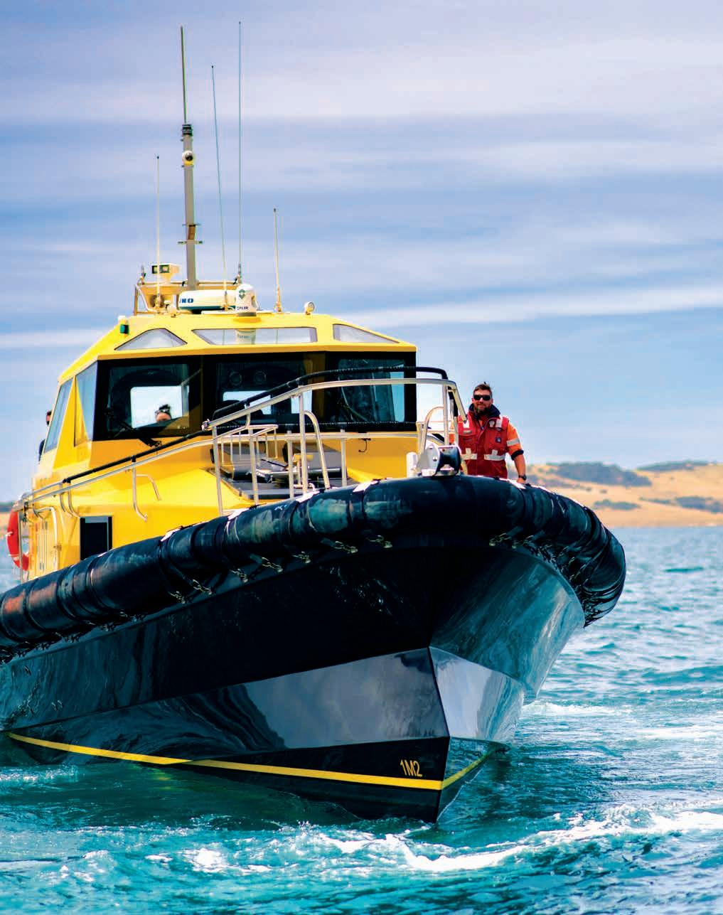
Pilotage
Flinders Ports has a pilotage team available 24 hours each day all year round to assist vessels to safely navigate the channel and berths once they enter port waters.
Flinders Ports pilotage procedures and routes are all International Standard for Maritime Pilot Organisation (ISPO) compliant. We are one of only 352 pilot organisations in the world to hold this accreditation.
The marine pilots’ skill and local port knowledge assists ships arriving in port, to enter and depart port waters safely. All marine pilots are required to hold a Master Class 1 Certificate of Competency. All pilots receive ongoing training and are subject to strict quality standards and monitoring. Pilots undergo training in Bridge Resource Management and Advanced Bridge Resource Management.
Pilots must also complete ‘scaled ship model’ training, where emergency scenarios are practised using a ‘to scale’ vessel on water.
Emergency drills and other training exercises are also regularly conducted on maritime simulators.
Mooring
Once a vessel arrives alongside the berth, Flinders Ports deploys a highly skilled mooring team to ensure that the vessel is safely secured to the designated wharf or jetty in the port.
Whenever a ship is scheduled to sail, the mooring team makes sure that the mooring lines are removed from the wharf and retrieved by the ship.
Vessel surveying
Flinders Ports’ ship surveying services team is based at the Port of Whyalla in Upper Spencer Gulf.
The expert team conducts inspections and surveys of marine vessels of any size including draft surveys, trim surveys, on/off hire conditional surveys, liquid cargo quantity surveys and hold cleanliness surveys. Provision of surveys in all regional ports is available on request.
Transhipment
Flinders Ports has expertise in certain aspects of the transhipment operations of iron-ore in Upper Spencer Gulf. Through Flinders Ports’ operations in Whyalla, we offer a management role that provides the loadmasters and surveying, load planning and vessel correspondence services for the iron-ore loading process. A floating offshore transfer barge (FOTB), two self-unloading barges (SUBs) and a transhipment shuttle vessel (CSL Whyalla) are used to tranship iron-ore onto capesize vessels anchored around 8 nautical miles out in Spencer Gulf. The business also provides labour services within the transhipment operation.
Berths at Port Adelaide
The Port of Adelaide has two distinct harbour precincts, Outer Harbor and Inner Harbour with several berths at these locations.
As the owner and operator of the Port of Adelaide, Flinders Ports is responsible for maintaining these channels and berths to meet the needs of valued shipping clients.

Port Adelaide
Outer Harbor
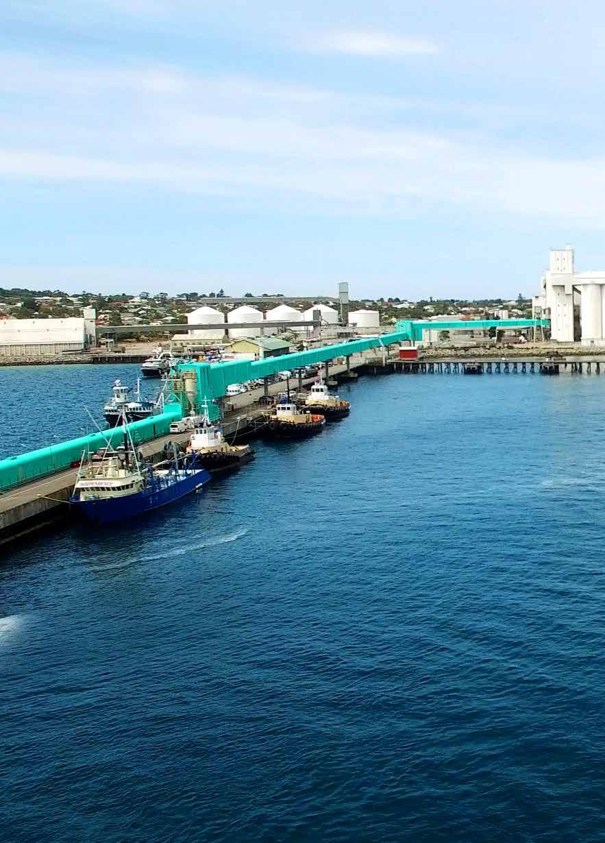
Port Adelaide is a seaport suburb of South Australia’s state capital and is located 14 kilometres north-west of Adelaide. Port Adelaide is Flinders Ports’ busiest port, with Outer Harbor facilitating seven berths with state-ofthe-art facilities. The port accommodates a variety of imports and exports including grain, containers, cars and petroleum products.
Shipping
Port Adelaide is a tidal port with the geographic coordinates:
• Latitude 34 degrees - 51 minutes south
• Longitude 138 degrees - 30 minutes east
Communications for Port Adelaide shipping on VHF radio telephonic channels, 12 and 16, are with the call sign “Adelaide VTS”. The additional local working channels are 6, 8 and 67.
Flinders Ports’ Port Adelaide Port Rules apply to all shipping in port waters.
For more information visit the Flinders Ports website.
Outer Harbor
The ship limitations for vessels calling at Port Adelaide’s Outer Harbor Berths OH 1 to OH 8 are:
• Maximum length overall – 350 metres
• Maximum beam – 49 metres
• Maximum depth, below lowest astronomical tide – 14.2 metres
• Mean high spring tides – 2.4 metres
• Mean high neap tides – 1.3 metres
Outer Harbor 4 Fuel Berth
Capable of handling both medium range (MR) and long range (LR) fuel tankers, the Outer Harbor 4 facilities are fully compliant with Australian Standards and International Safety Guide for Oil Tankers and Terminals (ISGOTT).
Ship limitations for vessels calling at the Outer Harbor 4 Fuel Berth:
• Maximum length overall – 300 metres
• Maximum beam – 36 metres
• Maximum vessel displacement 85,500 tonnes
Port Adelaide – Outer Harbor Cont.
Outer Harbor Berths 1 - 4
Berths 1 - 4 accommodate the import and storage of motor vehicles. These Berths also accommodate the arrival of all cruise liners into South Australia.
Outer Harbor Berths 6 - 7
Flinders Adelaide Container Terminal located at Outer Harbor Berths 6 and 7, is South Australia’s only container terminal facility and has a total quay length of 660 metres.
Linked to the national rail network, the facility has three post-panamax cranes, one panamax crane, 25 straddle carriers and a selection of forklifts and reachstackers.
The Berths are capable of accepting 350 x 4.9m container vessels.
Outer Harbor Berth 8
Outer Harbor Berth 8 is a dedicated grain loading wharf operated by Viterra. It is capable of handling Panamax size dry bulk vessels.
For more information on our Berth locations see the map on page 11.
Swing basins
Outer Harbor has two swing basins:
• Opposite the OH 2 Passenger Terminal – a diameter of 400 metres
• Opposite OH 6 – a diameter of 560 metres
* Allowable depths are a minimum of 0.3 metres less than the declared depth.
Please check notices to mariners for temporary limitations.
All port tidal heights refer to Port Datum (appropriate LAT)
Port Adelaide
Inner Harbour
Port Adelaide’s Inner Harbour sees around 1,000 ship calls every year. The key cargoes handled through Inner Harbour are grains, seeds, agriproducts, mineral bulk, break-bulk, petroleum products, general cargoes.
Shipping
Port Adelaide is a tidal port with the geographic coordinates:
• Latitude 35 degrees - 51 minutes south
• Longitude 138 degrees - 30 minutes east
Communications for Port Adelaide shipping on VHF radio telephonic channels, 12 and 16, are with the call sign “Adelaide VTS”. The additional local working channels are 6, 8 and 67.
Flinders Ports’ Port Adelaide Port Rules apply to all shipping in port waters.
For more information visit the Flinders Ports website.
Inner Harbour and Osborne 1 - 4
The ship limitations for vessels calling at Port Adelaide’s Inner Harbour Berths 18-29, H, K, M, N and Osborne Berths are:
• Maximum length overall – 206 metres
• Maximum beam – 32.2 metres
• Maximum depth, below lowest astronomical tide – 9.3 metres
• Mean high spring tides – 2.4 metres
• Mean high neap tides – 1.3 metres
Swing basin
A swing basin is situated just south of Inner Harbour Berth 27 which has a diameter of 330 metres.
For more information on our Berth locations see the map on page 11.
Inner Harbour Options
Berth 18-20 are common user berths and there is approximately
• 84,000 square meters of land area, approx. 65,000 hard stand and 15,000 unsealed land available for storage
• There is a further approx. 27,000 square meters of sealed storage area to the rear of Berth 20.
Berths 25 and 29 are common user berths, these berths allow for the receipt of cargo which is taken out under hook. Berth 29 has additional connectivity to rail spur.
If you require further development information or a general enquiry please call + 61 (0)8 8447 0611 or head to our website.
Port Adelaide – Inner Harbour Cont.
*Allowable depths are a minimum of 0.3 metres less than the declared depth. Please check notices to mariners for temporary limitations.
All port tidal heights refer to Port Datum (appropriate LAT)

Outer Harbor
Flinders
Port Lincoln
Situated on the south-east coast of the Eyre Peninsula, 682 kilometres by road from Adelaide, Port Lincoln is a natural deepwater harbour. With around 80 ships calling at Port Lincoln every year, the main cargoes handled are grains and seeds, fertiliser and petroleum products.
Shipping
Port Lincoln is a tidal port with the geographic coordinates:
• Latitude 34 degrees - 43 minutes south
• Longitude 135 degrees - 52 minutes east
Port Lincoln has mean high spring tides of 1.34 metres and mean high neap tides of 0.87 metres.
Communications on VHF radio telephonic channels, 6, 8, 12, 16, 67 are with the call sign “Adelaide VTS”. Flinders Ports’ Port Lincoln Port Rules apply to all shipping in port waters.
Berth facilities
The South Channel which is 8.5 metres deep. The Kirton Point Jetty which handles imports of petroleum products is located to the east of the main Jetty.
Storage and development land
Port facilities at Port Lincoln on the Eyre Peninsula have designated areas of hardstand for receiving project cargo.
*Allowable depths are a minimum of 0.3 metres less than the declared depth.
Please check notices to mariners for temporary limitations.
All port tidal heights refer to Port Datum (appropriate LAT)

Port Pirie
Port Pirie is located 223 kilometres north of Adelaide at the top of Upper Spencer Gulf and has a population of 17,000 people. With around 80 vessels calling there each year, key cargoes handled through Port Pirie are mineral concentrates and mineral by-products, and general cargo.
Shipping
Port Pirie is a tidal port with the geographic coordinates:
• Latitude 33 degrees-10 minutes south
• Longitude 138 degrees-01 minutes east Communications on VHF radio telephonic channels, 6, 8, 12, 16, 67 are with the call sign “Adelaide VTS” and Flinders Ports’ Port Pirie Port Rules apply to all shipping in port waters.
Berth facilities
The shipping restrictions for vessels calling at Port Pirie are:
• Channel restrictions for the 9 nautical mile long channel into Port Pirie Harbour are a maximum depth of 6.5 metres and a maximum width of 90 metres.
• The swing basin in Port Pirie is off Berth 6 and has a diameter of 325 metres.
*Allowable depths are a minimum of 0.3 metres less than the declared depth. Please check notices to mariners for temporary limitations.
All port tidal heights refer to Port Datum (appropriate LAT)
Port Giles
Port Giles is located on the eastern side of Yorke Peninsula, 217 kilometres by road from Adelaide. Established in 1970 to export grain and seeds from the lower section of the Yorke Peninsula, the port handles around 25 ship calls each year and retains its focus on exports of agricultural products.
Shipping
Port Giles is a tidal port with the geographic coordinates:
• Latitude 35 degrees - 02 minutes south
• Longitude 137 degrees - 46 minutes east
Port Giles has mean high spring tides of 2 metres and mean high neap tides of 1.2 metres.
Communications on VHF radio telephonic channels, 6, 8, 12, 16, 67 are with the call sign “Adelaide VTS”. Flinders Ports’ Port Giles Port Rules apply to all shipping in port waters.
Sailing is permitted day or night.
Berth facilities
The jetty is 340 metres in length and there are some restrictions on shipping at Port Giles:
• Berthing is only permitted during daylight hours
• Maximum depth in channel – 13.5 metres
• Maximum depth at jetty 14.7 metres (under keel clearance is 10 percent of vessel’s draft)
- Grains and seeds
*Allowable depths are a minimum of 0.3 metres less than the declared depth. Please check notices to mariners for temporary limitations.
All port tidal heights refer to Port Datum (appropriate LAT)


Thevenard
The Port of Thevenard is 793 kilometres west of Adelaide and 3 kilometres from the centre of Ceduna, a town with a population of over 3,500 people. Around 110 vessel calls are handled at Thevenard every year and the main cargoes are gypsum, grains and seeds, salt and mineral sands.
Shipping
Thevenard is a tidal port with the geographic coordinates:
• Latitude 32 degrees - 09 minutes south
• Longitude 133 degrees - 39 minutes east
Thevenard has mean high spring tides of 1.67 metres and mean high neap tides of 1.08 metres. Communications on VHF radio telephonic channels, 6, 8, 12, 16, 67 are with the call sign “Adelaide VTS”. Flinders Ports’ Thevenard Port Rules apply to all shipping in port waters.
Sailing is permitted day or night.
Berth facilities
The berth jetty at Thevenard is 198 metres in length. Shipping at Thevenard has the following restrictions:
• Berthing is restricted to daylight only for ships not equipped with bow thrusters
• Yatala Channel depth in approaches – 8.2 metres
*Allowable depths are a minimum of 0.3 metres less than the declared depth. Please check notices to mariners for temporary limitations. All port tidal heights refer to Port Datum (appropriate LAT)
Klein Point
Klein Point is a single purpose port on the south eastern coast of Yorke Peninsula, which was established to handle shipments of limestone. Klein Point remains a single commodity port and has around 170 vessel calls every year.
Shipping
Klein Point is a tidal port with the geographic coordinates:
• Latitude 34 degrees - 57 minutes
30 seconds south east
• Longitude 137 degrees - 46 minutes
30 seconds east
Communications are on VHF radio telephone. Flinders Ports’ Klein Point Rules apply to all shipping in port waters. Please ensure you and your ship’s Captain and crew are familiar with these rules before arriving or setting off from Klein Point.
Berth facilities
The bulk handling facilities and equipment are privately owned. Klein Point has a maximum channel depth of 6.5 metres in the entrance channel harbour.
*Allowable depths are a minimum of 0.3 metres less than the declared depth. Please check notices to mariners for temporary limitations.
All port tidal heights refer to Port Datum (appropriate LAT)
Wallaroo
Wallaroo is located on the eastern side of Spencer Gulf, 158 kilometres north-west of Adelaide and has a population of around 4,000 people. With around 20 vessel calls each year, the main cargoes handled at Wallaroo are grains and seeds.
Shipping
Wallaroo is a tidal port with the geographic coordinates:
• Latitude 33 degrees - 56 minutes south
• Longitude 137 degrees - 397 minutes east
Wallaroo has mean high spring tides of 1.21 metres and mean high tides of 0.88 metres.
Communications on VHF radio telephonic channels, 6, 8, 12, 16, 67 are with call sign “Adelaide VTS”
Flinders Ports’ Wallaroo Port Rules apply to all shipping in port waters
Berth facilities
The Jetty at Wallaroo has one common user Berth.
Wallaroo has some limitations on shipping
• Maximum vessel length overall – 230 metres
• Maximum vessel beam – 32 metres
• Maximum depth in channel and approaches –8.4.
*Allowable depths are a minimum of 0.3 metres less than the declared depth.
Please check notices to mariners for temporary limitations.
All port tidal heights refer to Port Datum (appropriate LAT)
HydroSurvey Australia
HydroSurvey Australia (HSA) is the hydrographic survey division of Flinders Ports and provides hydrographic surveys, tide services and project management services.
With the highest standards of project management, clients are the focus at HSA. As part of Flinders Ports, it adheres to internationally recognised standards for management systems.
HSA provides expert hydrographic and bathymetric surveys of the seabed, navigation channels, berths and inland waterways. We also check and calibrate tide gauges and manage tide data reporting for the state of South Australia.
Client focussed service
HSA provides detailed, high-accuracy hydrographic survey services to private and public sector clients, with mid to large-scale projects, in South Australia and interstate.
Our client base is diverse and includes port operators, public regulators, mining, petroleum and defense sector organisations as well as a range of private sector consultants. Hydrographic expertise includes: ocean, coastal and inland waterway surveys.
This work can include the positioning and placement of navigation aids, i.e. beacons, buoys, sector lights and leads. With the capability to work on special bathymetric projects we have also been engaged by interstate clients.
To maintain reporting accuracy for clients, we always use our own vessels, rather than a ‘vessel of opportunity’. We employ hydrographic surveyors accredited by the Surveying and Spatial Sciences Institute Accreditation Panel.
Tide services
HSA manages the tide data for the whole of South Australia and represents Flinders Ports and the Department for Infrastructure and Transport on the national Tides and Sea Level Working Group.
We operate 16 tide gauges around the state on behalf of Flinders Ports and other marine or port authorities. Tidal data information is collected, quality assured and managed solely by us.
These tide gauges are run as part of the national network and data is sent in real time to the National Tidal Unit of the Bureau of Meteorology for analysis and the computation of tidal predictions for future years.
Data is also made available to other authorities (some in real time) for operational and scientific purposes and for analysis of sea level rise as part of climate change monitoring.
Equipment
Our core business is surveying navigation channels as part of a regular program of port coverage. HSA is committed to continually improving practices through investment in leading edge technology.
HSA has access to state-of-the-art data acquisition systems, which have been enhanced with the purchase of an R2Sonic 2022 Multi-Beam Echo Sounder (MBES), primarily for use on the larger survey vessel Pathfinder and Kongsberg EM2040p MBES which is used on the smaller vessel, Felix.
Where required we can also deploy a rugged and reliable GeoAcoustics GeoSwath plus interferometric wide swath sounding system for use in extremely shallow water surveys where total bottom coverage is a requirement.
Use of quality MBES systems allows HSA to provide data that meets the requirements for ‘Special Order’ surveys in accordance with International Hydrographic Organisation Publication S-44.
We also run several Single Beam Echosounding Systems (SBES) as stand alone or in conjunction with MBES systems.
Positioning equipment
We have a range of positioning equipment available to support survey work:
• Applanix Position and Orientation System for Marine Vessels (POSMV) provides positioning and incorporates Inertial Motion Sensor technology to correct for the effects of vessel motion during survey operations.
• Stand-alone RTK and Trimble Sensor VRSNow corrections are used wherever possible to provide centimetre height and position accuracy for both topographic and hydrographic surveys.
• Fugro Marinestar GNSS corrections can be accessed for surveys in remote areas.
Depth measuring equipment
HSA gather depth information using a combination of sophisticated equipment:
• R2Sonic 2022 wideband high-resolution MBES
• Kongsberg EM2040p wideband high-resolution MBES
• GeoAcoustics GeoSwath Plus interferometric wide swath sounding system
• CEE Hydrosystems CeePulse and CeeScope single beam high frequency echo sounders
• Valeport SWiFT sound velocity profilers (SVP) measure velocity of sound in water
Tide measuring equipment
A tide measuring site at a standard port is made up of a datalogger and various water level, wind and barometric sensors, sending data via the internet to a central data management platform called Hydrotel. We deploy portable Iris/Vegapuls radar tide gauges and submersible sensors as required for hydrographic survey or other scientific purposes outside of the standard tide gauge areas.
An Acoustic Doppler Current Profiler (ADCP) is used to measure water current and direction throughout the water column. It also records wave heights.
HydroSurvey Australia Cont.
Survey Fleet
Pathfinder
The Pathfinder is an 11-metre twin hulled NoosaCat built to Uniform Shipping Law code 2B certification.
Key features:
• R2Sonic 2022 wideband high-resolution MBES
• Applanix POSMV
• Qinsy data acquisition software
• Dedicated survey data acquisition computer
• Moonpool rapid MBES deployment system
• High capacity built in diesel genset
• 240v Uninterruptible Power Supply
• Simrad chart plotter / radar unit for navigational safety
• Survey quality autopilot to reduce fatigue on large surveys
• Twin VHS radio and Iridium 9505 satellite phone for safety at sea
Felix
The Felix is a trailerable, customised 5 metre NoosaCat with Uniform Shipping Law code 2C certification.
Key features:
• Kongsberg EM2040p wideband high-resolution MBES
• Applanix POSMV
• Qinsy and HydroPro acquisition software
• Ruggedised Notebook computer
• Hydraulic tilt trim rapid MBES deployment system mounted between the engines
• Outlets for 12 and 240 volts (low noise and emissions genset) are available for various equipment
• Twin engines for maneuverability
• Garmin chart plotter for navigational safety
• Manual autopilot to assist in running long sounding lines
• VHS radio for safety at sea
Jet ski
The Jet Ski is a fully customised hydrographic survey vessel, designed to operate in extremely shallow areas using SBES and GNSS RTK position and heights.
Key features:
• CeeScope single beam echosounder
• GPS/RTK positioning equipment
• Hypack acquisition and processing software
• Ruggedised Toughbook computer
• Specialist extreme shallow water operations
Data analysis software
HydroSurvey processing and data analysis software is used to create sounding plans, cross section plots, contour plans, calculate volumes and 3D visualisations.
Key features:
• Qinsy, Qimera and Fledermaus suite of processing software
• GS4 Geoswath processing software
• Trimble Business Centre and Terramodel software
• Autodesk Civil 3D
• POS Pac – post processing POSMV software
• Hyp ack – acquisition and analysis software
• ArcGIS


Safety and Quality


Backed by an extremely strong safety and environmental record, Flinders Ports has an innovative and sustainable approach to achieve a safe, efficient and cost-effective supply chain.
We recognise the value of collaboration and are continuously seeking to improve our safety, environmental and sustainability outcomes.
The Flinders Port Holdings Group
Flinders Port Holdings owns and operates Flinders Adelaide Container Terminal as well as the port of Port Adelaide and the six key regional ports of Port Giles, Port Lincoln, Wallaroo, Port Pirie, Klein Point and Thevenard.
We also provide integrated supply chain solutions through Flinders Warehousing and Distribution. Beyond ports and warehousing, we deliver hydrographic survey services through HydroSurvey Australia.
Flinders Port Holdings is ranked as one of South Australia’s top 10 companies, with an annual turnover of more than $300 million. We employ over 750 people and indirectly support 6000 jobs in South Australia.
Through our operations, we facilitate more than $25 billion dollars in international trade annually and are the key platform for South Australian twoway trade in goods.
We are proud of our role in the economic development of the state and the wellbeing of its port communities.