PORTFOLIODESIGNPORTFOLIODESIGN
DANIEL LOPEZ LANDSCAPE ARCHITECTURE
Work Experience
2015-2018- Bishop Montgomery High School
2018-2020- El Camino College
2020-Current- TANQ Athletic, Los Angeles CAGeneral Manager
2018-2020- El Camino College, Torrance CAWork Studyintroduction
Name
(424) 299-7735
Minor in Urban & Regional Planning
2020-2024- California State Polytechnic University, Pomona
2021-Current- Los Angeles County Parks and Recreation Department, LA County- Recreation Services Leader
Education
Associate of Arts in General Studies: Arts & Humanities
1410 E O St Wilmington, CA 90744
Phone
Current Address
Bachelor of Science in Landscape Architecture
daniellopez3@cpp.edu
High School Diploma
Daniel Lopez
2021-Current Tinkercraft: Design & Advocacy Group, Los Angeles CA- Design Intern
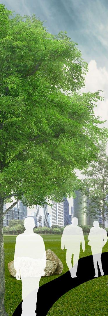
OFTABLECONTENTS WOODCRAFT1 RANGERS Pg. 1-6 DRAFTING8 + SKETCHES + COLLAGES Pg. 19-22 WHITEMAN2 AIRPORT MASTER PLAN Pg. 7-8 LONG3 BEACH CIVIC CENTER Pg. 9-10 AVALON4 BLVD. PLACEMAKING Pg. 11-12 RECASTING5 TORRANCE PARK Pg. 13-14 GIS6 MAPPING + AUTOCAD Pg. 15-18
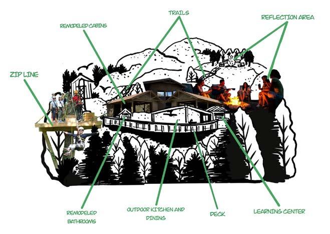
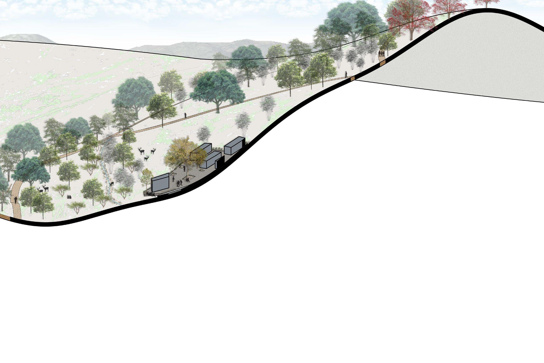
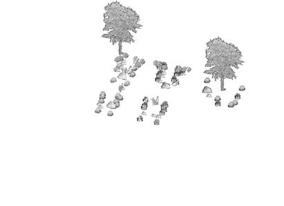
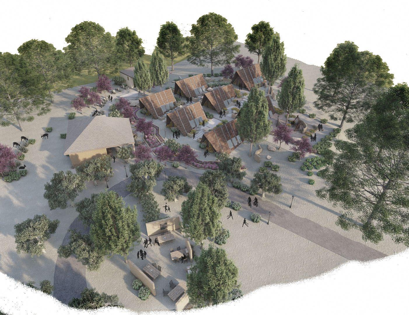
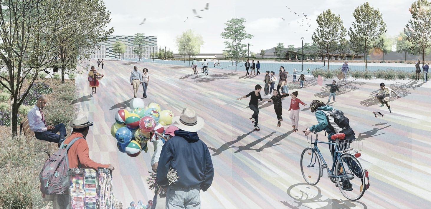
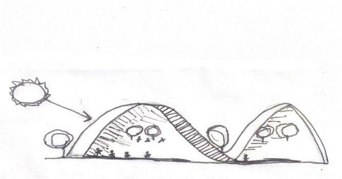
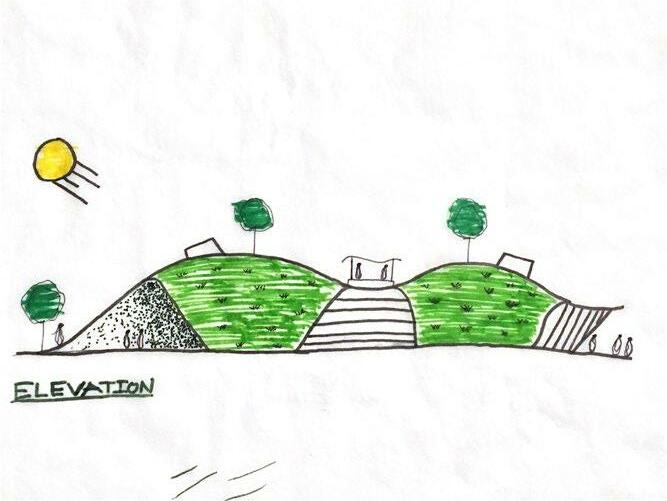
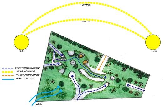
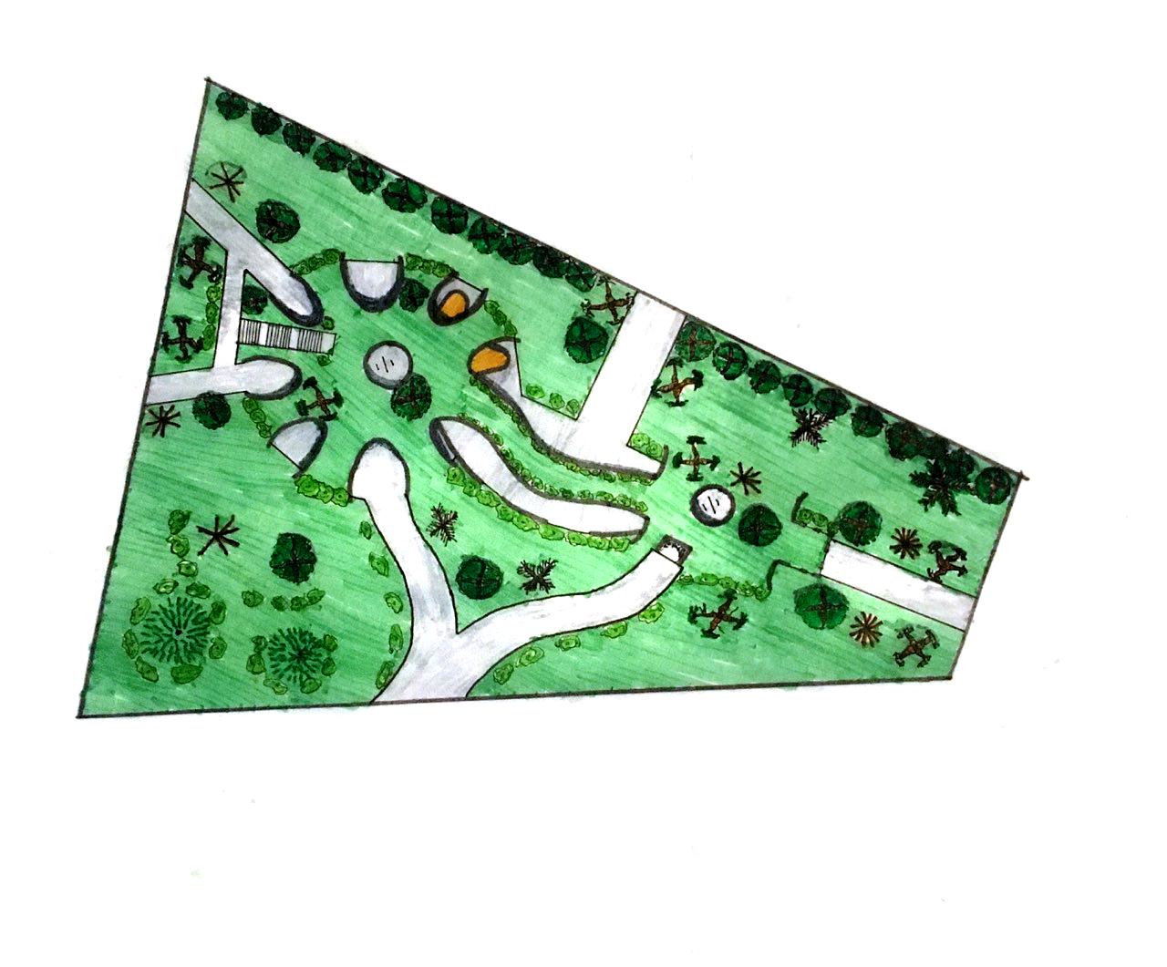
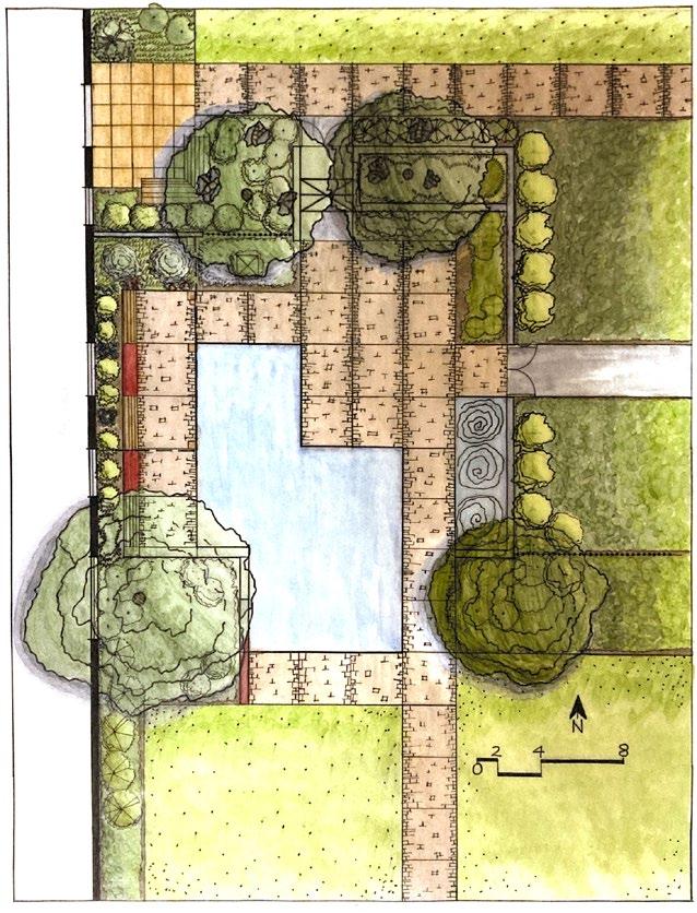
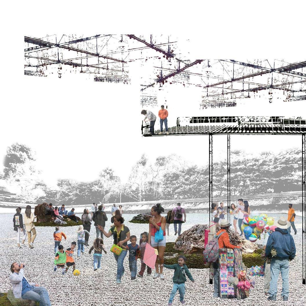
new camp, Terrace, trail, reflection area, and a zip line. Throughout all the main spots of our site, a trail will follow through and guide the visitors to each zone. Within the middle of our site we are adding a wildlife area where there
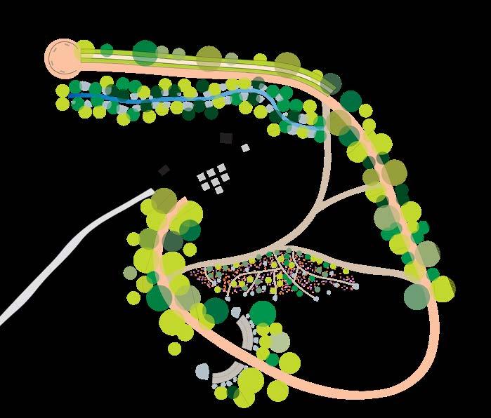
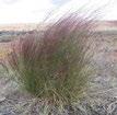
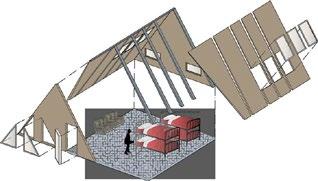
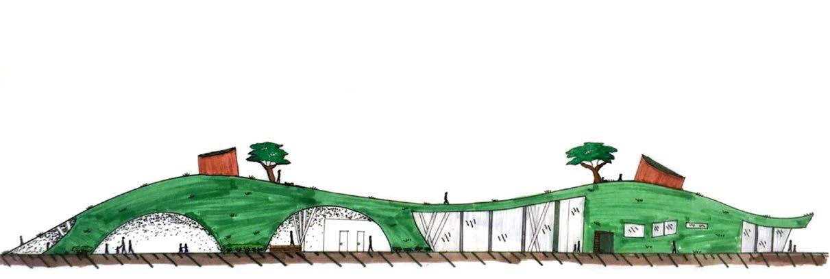
woodcraft rangers LA 2121L: ECOLOGICAL DESIGN LAB | WILCOX + CLARKE APPLIED SITE DESIGN DANIEL LOPEZ + JOCELYN AGUIRRE 1 6 7 32 4 5 8 A A BB50’0 100’ 200’ KITCHEN CLASSROOMEXISTINGROAD CABINSRESTROOM ZIP-LINE 2 6 3 7 4 8 1 5CAMP GROUNDS ZIPLINE OUTPOST LOG BIOSWALEVIEWSEATING/PLAYPOSTFLOWERTRAILS REFLECTIONBEDSZONE SITE PLAN LEGEND SITE PLAN CAMP VIEWS/PLAYGROUNDSHABITATREFLECTIONZIP-LINETRAIL 1
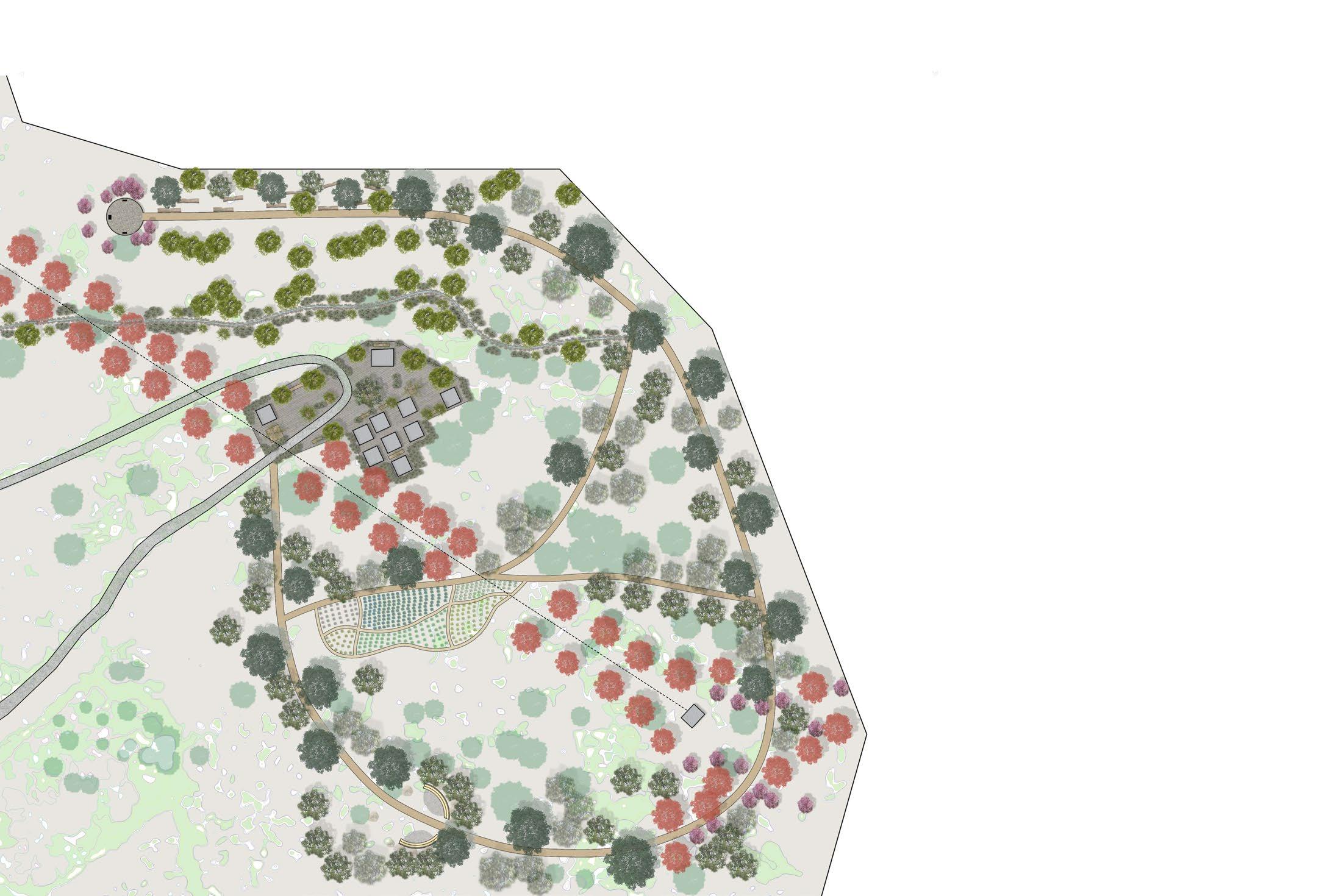
The purpose of our project is to redefine an area of the camp that everyone forgot once existed. We want to give this site of the camp a good purpose by showing that it is different from any other part of the camp. We plan to add a


1 50’0 100’ 200’COLLAGE
together and talk about what they’ve done throughout their days at the camp. On the trail there will be trees on each side to guide visitors through the site. The trail will end at the Terrace where there will be small telescopes to look at the other higher points and lower points
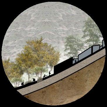
of the campsite. Although our site feels very far away the zip line is able to connected to the entrance of the camp making it a part of the entire campsite. We hope that the users of this area will be excited to come here and experience something new.
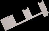
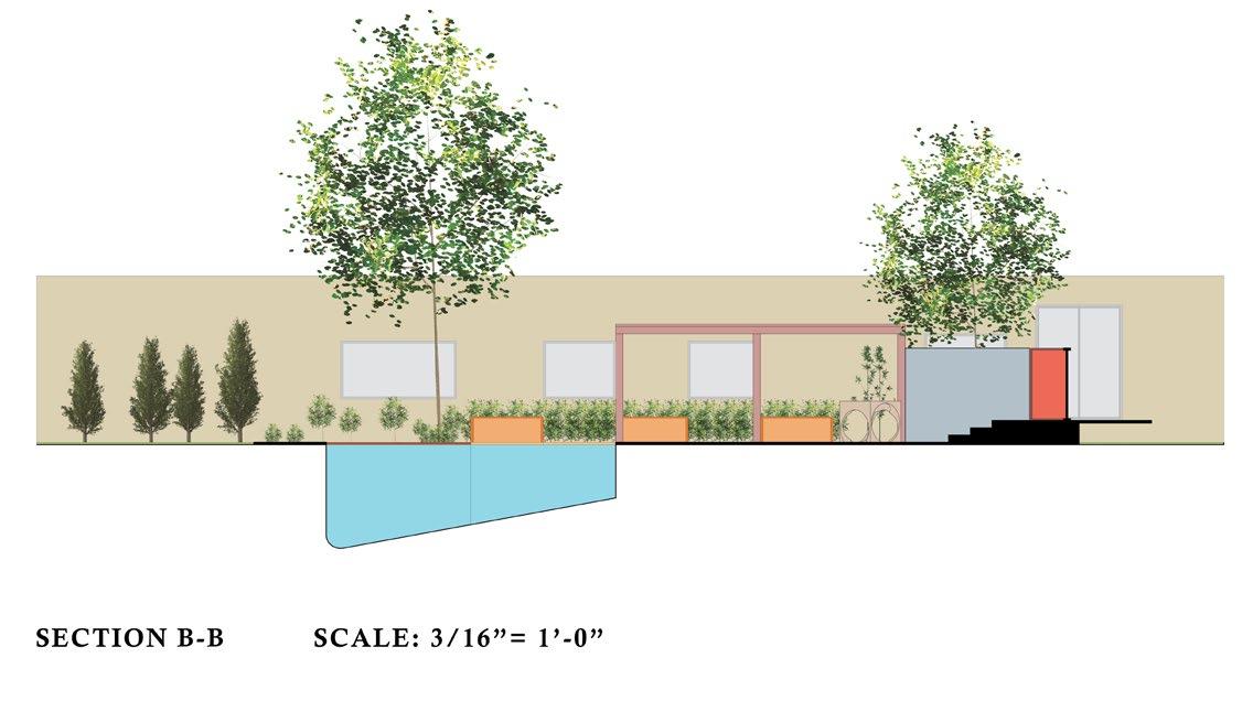
SECTION B-B 2

are undefined trails for visitors to explore. We plan to make the campsite livable by reconstructing the cabins, restroom, and kitchen. The zip line that we’re adding will end at the entrance of the entire camp. The reflection area will be a small amphitheater for students to come
AXONOMETRIC SECTION
PERSPECTIVE
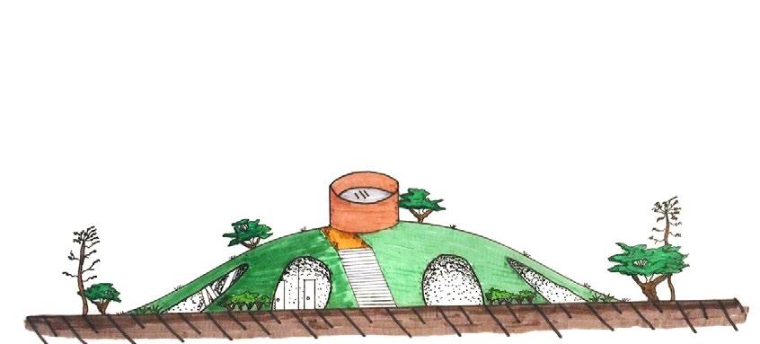
legend viewsmovementvehicularmovementpedestrian WALLRETAININGTREESEXISTING MULCHHARDSCAPE FLAGSTONEHARDSCAPE CABINSCAMP KITCHEN/DINING ROADPROPOSED OVERHANGROOF MULCHHARDSCAPE PLANPLANTING NORTH 0SCALE: feet 8 16 24 1'-0"=1/8" PLANTINGSLOPE1ZONEHILL DIAGRAMHYDROZONE NORTH n WOODCRAFTCAMPRANGERSOUTPOST LA 2121L: ECOLOGICAL DESIGN LAB + ANDREW WILCOX
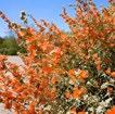
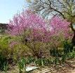
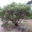
5800 5430 BOULDERS TO SUPPORT SLOPE AND INCREASE PATHALONGBUCKWHEATCOLUMNALONGGLOBE-MALLOWSCALESECONDPLANTINGEDGE/SEALINWHITE COLUMNALONGSAGEFIRST DRAINAGE A A SITE KEY MAP SITE CIRCULATIONAXONDIAGRAM A-FRAME EXPLODED BUCKWHEATCALIFORNIA BUCKEYECALIFORNIA BUSHCREOSOTE MANZANITABIG-BERRY WHITE BRUSHSAGE GRASSTHREE-AWN GRASSBLUE-EYED GLOBEMALLOWDESERT GARDENPERMEABLE CLASSROOMOUTDOOR SPACEREST/SEATINGKITCHENCOMMUNITY RESTROOMS CABINSRANGERSLOPESCANYON REDWESTERNCEDAR VALLEY OAK TREE REDBUDWESTERN
DANIEL
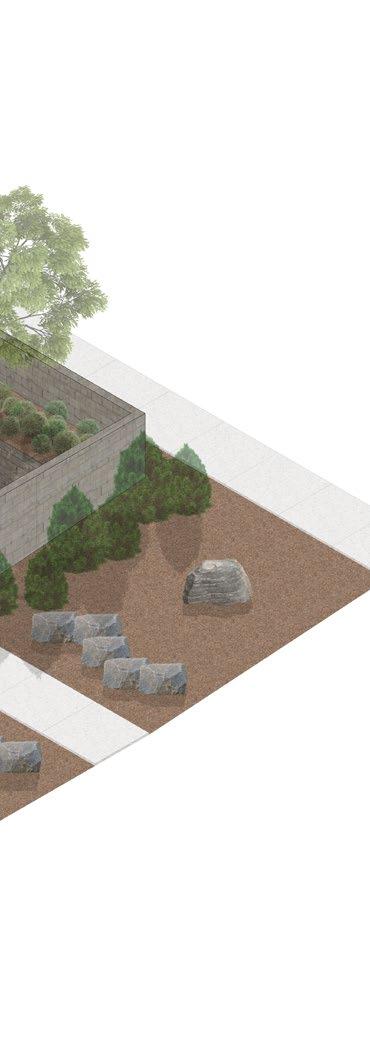
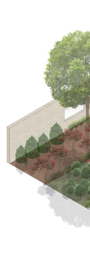
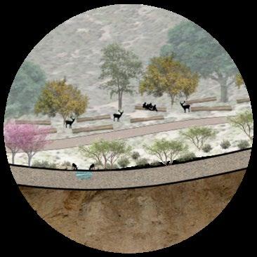
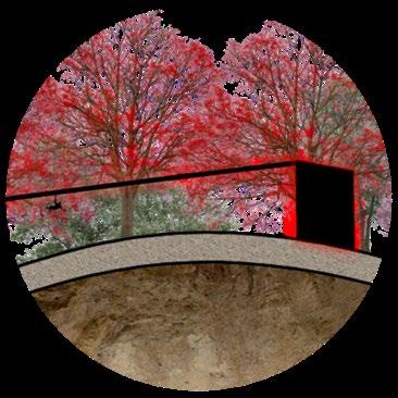
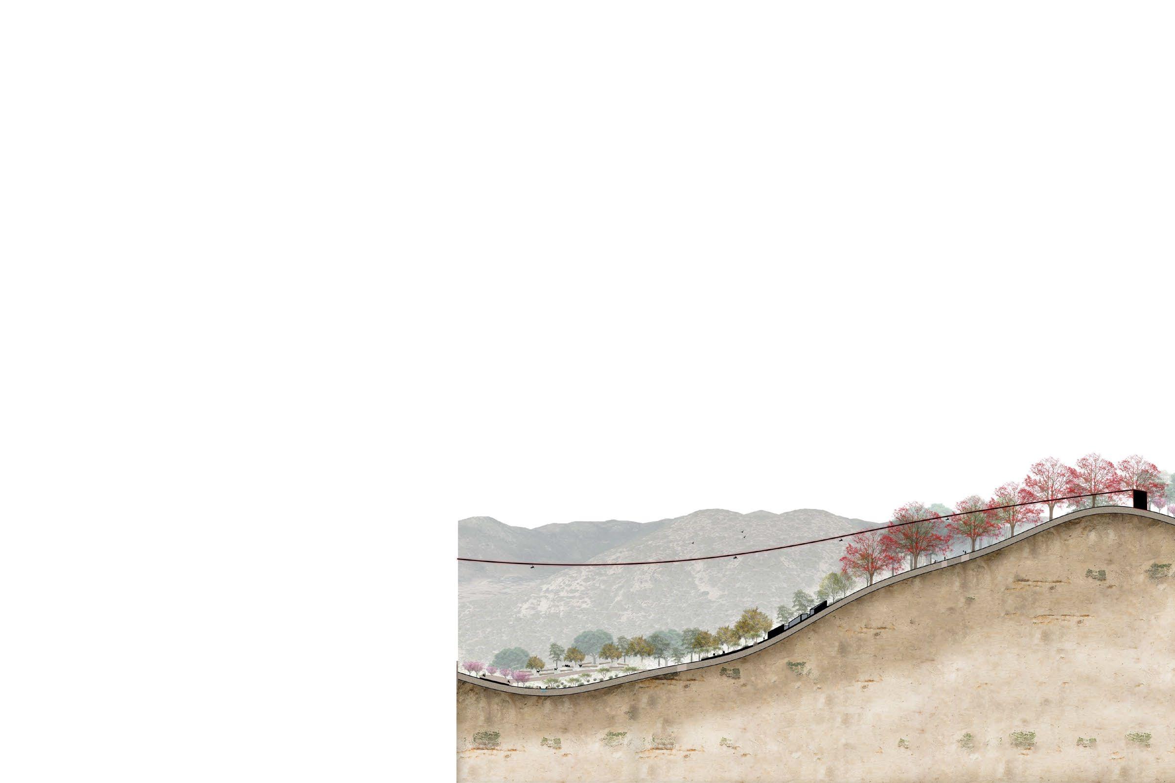
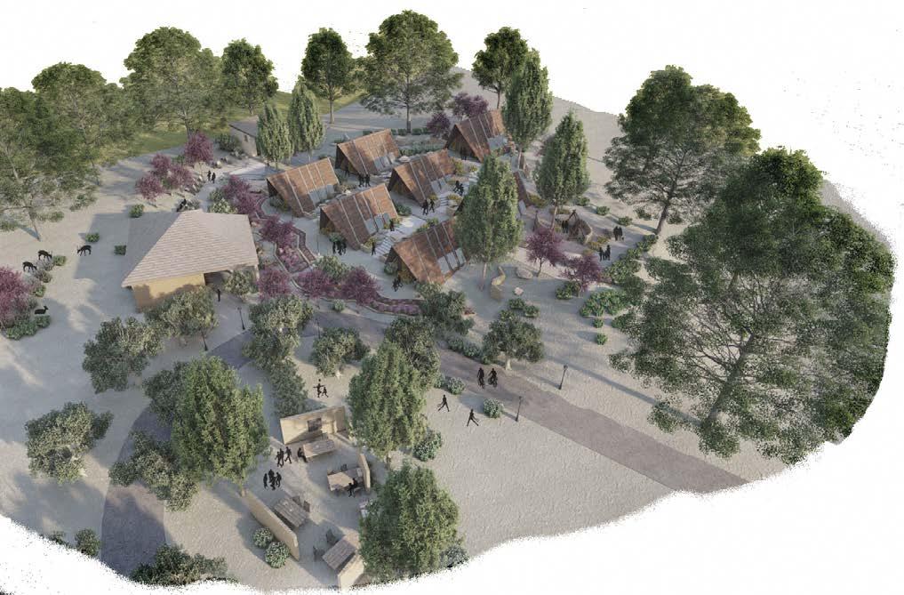
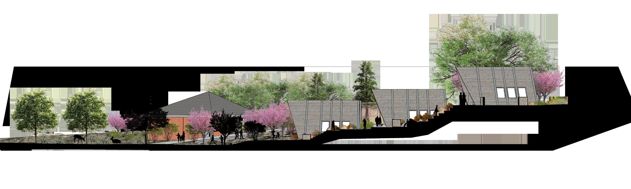
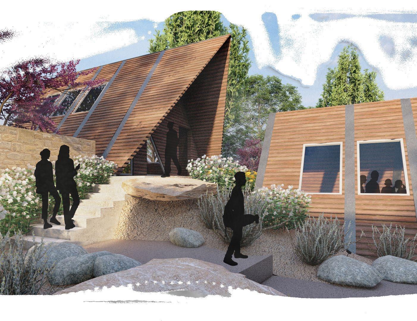
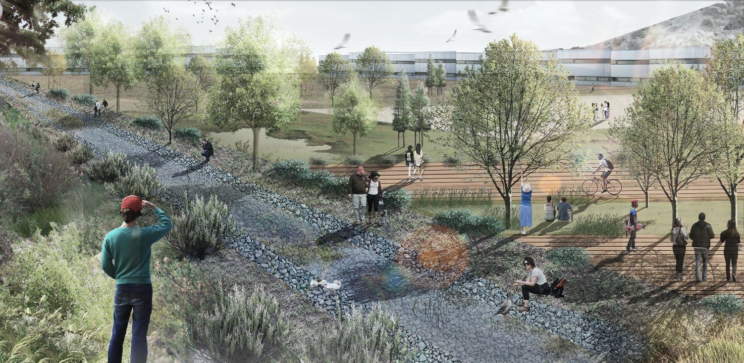
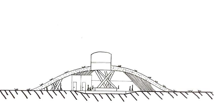
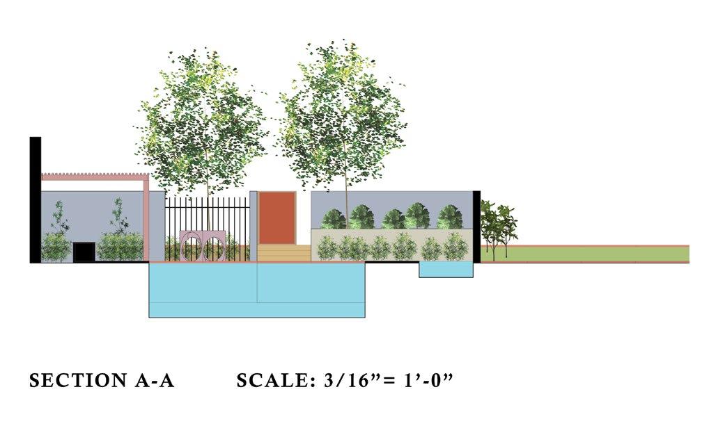
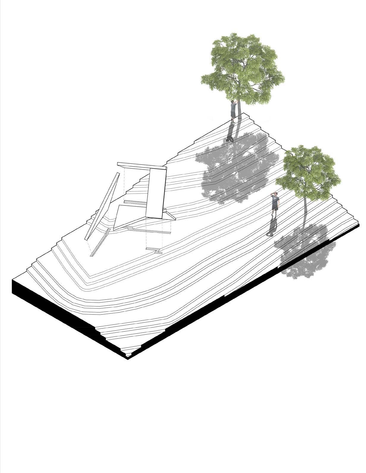
between the cabins and retaining walls. Boulders and retaining walls were used to stabilize the terrain. The plants used on the site were mostly low water use to keep the site from requiring extra water usage and resources. The restrooms were redesigned to provide
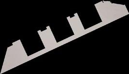
In between the cabins was a different journey and experience that resembled a canyon hike. This connected the site through the ramps as well as the space left
water use to keep the site from requiring extra water usage and resources. The restrooms were redesigned to provide safer and closer access to the site overall. The experience of the camp outpost was to create a space where a child can interact, develop, and obtain the characteristics of the outdoors and wilderness.
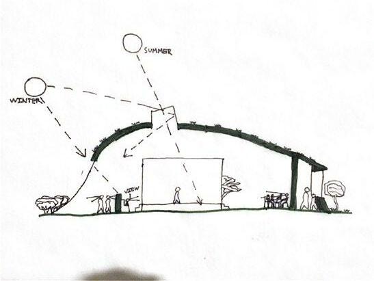
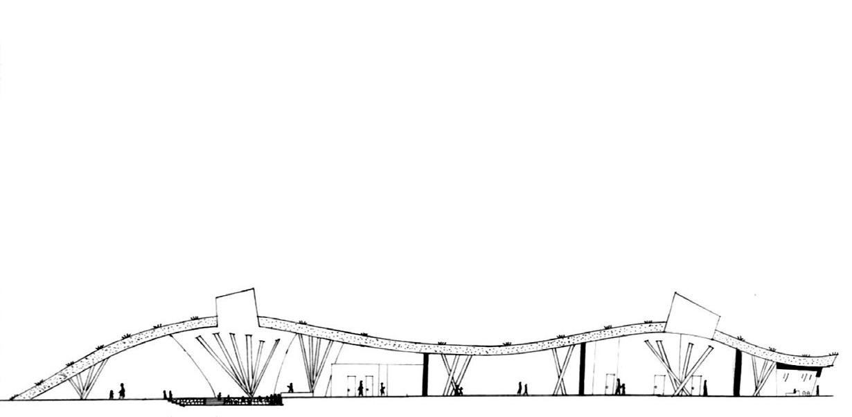
Woodcraft Rangers Outpost’s purpose is to revive the rundown camp and bring programming to the site, expanding it to make it functional, resourceful, and inclusive. The section focused on within the master plan was the cabins/camp area. To address the issue of steep slopes and high elevations, a ramp was proposed to maneuver through the cabins and existing kitchen. In between the cabins was a different journey and experience that resembled a canyon hike. This connected the site through the ramps as well as the space left between the cabins and retaining walls. Boulders and retaining walls were used to stabilize the terrain. The plants used on the site were mostly low
Woodcraft Rangers Outpost’s purpose is to revive the rundown camp and bring programming to the site, expanding it to make it functional, resourceful, and inclusive. The section focused on within the master plan was the cabins/camp area. To address the issue of
The design is incorporated to welcome wildlife as well. Deer friendly plants, open spaces, and minimal disturbance to the habitats that already exist were considered and addressed. Overall, it is a space that includes all while bringing back excitement to a neglected camp.


CANYON
SECTION A-A
LOPEZ + SPRING 2022 3
DIAGRAM B B
steep slopes and high elevations, a ramp was proposed to maneuver through the cabins and existing kitchen.
WOODCRAFTCAMPRANGERSOUTPOST LA 2121L: ECOLOGICAL DESIGN LAB + ANDREW WILCOX DANIEL LOPEZ + SPRING 2022 EXISTING TREES RETAINING WALL HARDSCAPEMULCH HARDSCAPEFLAGSTONE CAMP CABINS KITCHEN/DINING RESTROOMS PROPOSED ROAD ROOF OVERHANG ROOF OVERHANG PLANTING PLAN NORTH 0SCALE: feet8 16 24 1/8" 1'-0" HILLZONESLOPE PLANTING ZONE VALLEY5 PLANTING ZONE BUCKEYE4 LANE ZONE CANYON2 PLANTINGZONE3TERRACE/DINING HYDROZONE DIAGRAM WATER EFFICIENT LANDSCAPE WORKSHEET NON-Residential Landscape Projects Reference ETo for the area ETo= 49.7 Estimated Total Water Use (ETWU): ETWU calculation: (Eto) (.62) (ETAF) (LA) HydrozoneDescriptionPlanting Regular Landscape Areas HZ1 Hill Slope Planting HZ2 Canyon Planting HZ3 Terrace/Dining HZ4 Buckeye Lane HZ5 Valley Planting Special Landscape Areas HZ5 Edible HZ7 Water Feature FactorPlant(PF)0.200.200.200.300.20 IrrigationMethod EfficiencyIrrigation(IE) (PF/IE)ETAF Landscape Area (sq. ft.) LandscapeETAFArea SpraySpraySpraySprayDrip 0.750.750.750.810.75 1.001.000.270.400.270.250.27TotalsTotals MAWA calculation: (Eto) (.62) [(ETAFxLA) + ((1-ETAF) SLA)] ETAF Calculations: Regular LandscapeTotalAreasETAF Area Total Area Average ETAF All Landscape AreasTotal ETAF Area Total Landscape Area (LA) Sitewide ETAF 12,89512,89541,0340.3141,034 Average ETAF for Regular Landscape Areas must be 0.31 0.55 or below for residential areas.8,2963,6642,07815,18911,80741,034 12,8953,1496,0762,212905554 Estimated Total Water Use in gallons per year, ETWU Total Max. Annual Water Allowance in gallons per year, MAWA Total MAWA ETWU= Acre Feet per year 695,432397,353 298,078Estimated100 Total Water gallons/yr(ETWU)Use68,16927,87717,075187,21497,019TREESNORTH CODEBOTANICAL COMMON NAME SIZECONTAINER QTY AES CAL Aesculus californica California Buckeye 36"Box 26 CER WES Cercis occidentalis Western Redbud Multi-trunk 24" Box 50 QUE LOB Quercus lobata Valley Oak 60"Box 12 THU PLI Thuja plicata Western Red Cedar 60"Box 16 SHRUBS CODE BOTANICAL COMMON NAME SIZECONTAINER QTY ARC GLA Arctostaphylos glauca Bigberry Manzanita25 gal. Pot 72 ENC CAL Encelia californica California Encelia 5 gal. Pot 30 ERI FAS Eriogonum fasciculatum / California Buckwheat5 gal. Pot 184 LAR TRI Larrea tridentata Creosote Bush 5 gal. Pot 150 SAL API Salvia apiana White Sage 5 gal. Pot 210 PERENNIALSCODE BOTANICAL COMMON NAME SIZECONTAINER QTY SPH AM2 Sphaeralcea ambigua Desert Globemallow5 gal. Pot 218 GROUND COVERSCODE BOTANICAL COMMON NAME SIZECONTAINERSPACING QTY ARI PUR Aristida purpurea Purple Threeawn 5 gal. Pot 24" o.c.676 sf SIS BEL Sisyrinchium bellum Blue-eyed Grass 5 gal. Pot 24" o.c.301 sf


PLANT SCHEDULE
KEY MAP SITE 4
safer and closer access to the site overall. The experience of the camp outpost was to create a space where a child can interact, develop, and obtain the characteristics of the outdoors and wilderness.
SITE AXON 5
The 3D model was created in Rhino 7 then rendered in Lumion. Photo edits and touch ups were done in photoshop.
6
PERSPECTIVE
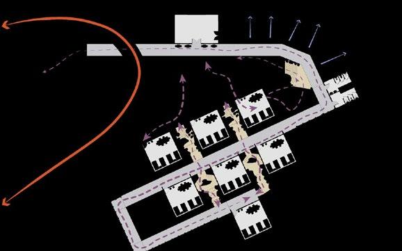
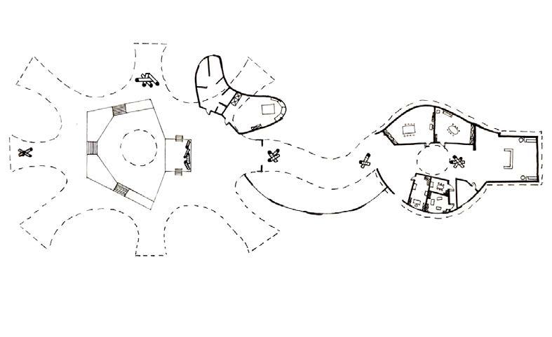
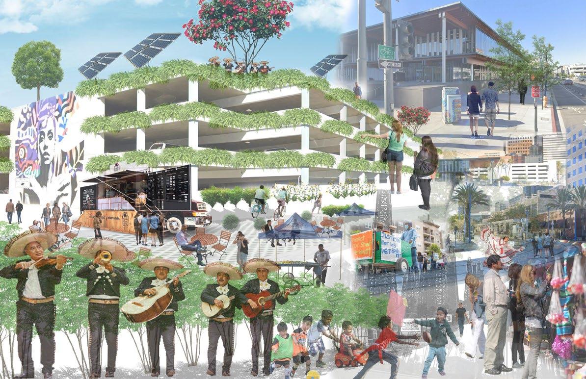
The Whiteman Airpor t Master Plan project was a design proposal created by Tinkercraft for the Pacoima Beautiful organization. The project is ongoing but its purpose is to redevelop the Whiteman Airport by including community input and ideas. The plan proposes re-using hangars and structures for market, education,
7
WHITEMAN AIRPORT MASTER PLAN
TINKERCRAFT: ADVOCACY DESIGN GROUP | PACOIMA BEAUTIFUL MASTER PLAN PROPOSAL + RENDERINGS DANIEL LOPEZ + NICOLE LAMBROU
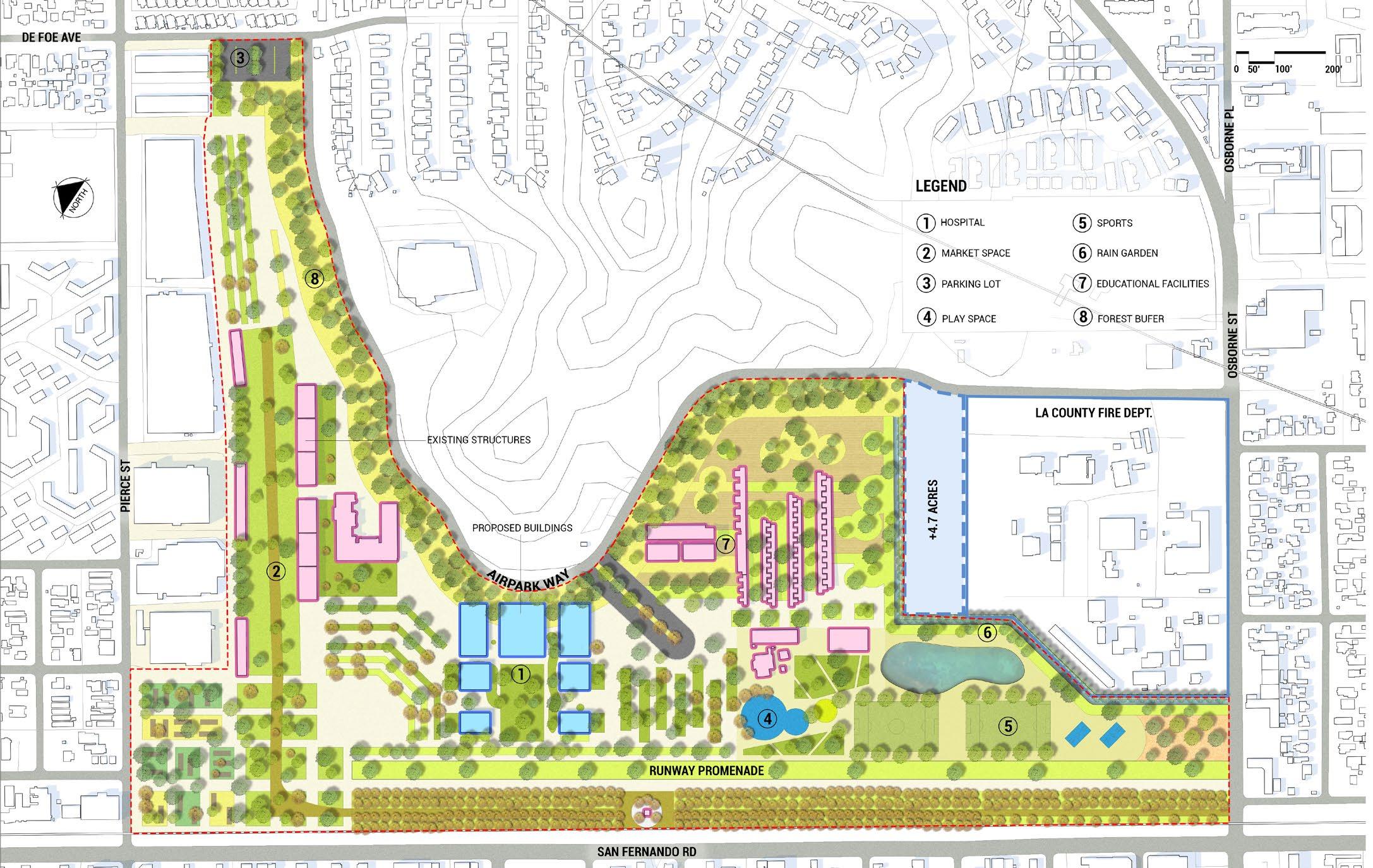
2 and social gathering spaces. The idea was to bring sustainability to the site and provide more landscapes. The programs consisted of a hospital, market space, rain garden, educational facilties, and a forest buffer. The idea of the buffer was to extend the LAFD so helicopter pads can be moved further from the residents on Osborne St. while also creating a buffer of trees to prevent noise pollution. Overall, the plan proposes a basis for the city to incorporate ideas of sustainability and design together. 8
SITE PLAN A ABB


0 25’ 50’ 100’ 9

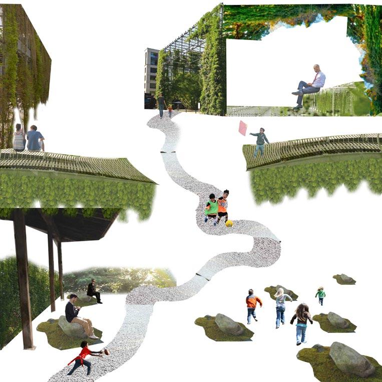
Long Beach Civic Center is a project which introduced concept designs to the site. The final product introduced multiple programs and flexible space to the site. The focus of the design was to reuse the empty space between the four exisiting buildings and park.
MOVEMENT DIAGRAM


The journey presented is one of activity, ecology, and gathering. It brings the community together to interact with one another and spread cultures, traditions, and ideas. It is an inviting space which connects the transport hub, Lincoln park, mixed-use buildings, and City
DANIEL LOPEZ + CUAUHTEMOC HERNANDEZ
LONG BEACH CIVIC CENTER
LA 2111L: SPATIAL DESIGN LAB | SENES CONCEPT DESIGN
SECTION A-A SECTION A-A CLIMATE DIAGRAM STRATEGIES DIAGRAM PERSPECTIVE 0 25’ 50’ 100’ 0 25’ 50’ 100’ CITY HALL MIXED-USE MARKET LINCOLN PARK TRANSPORT HUB 10 3
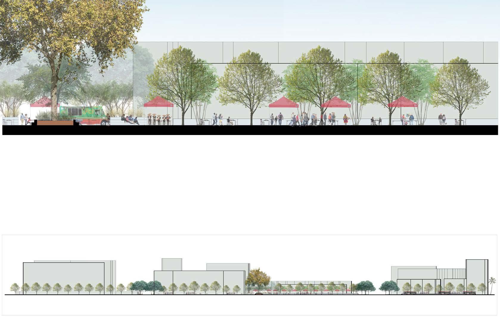
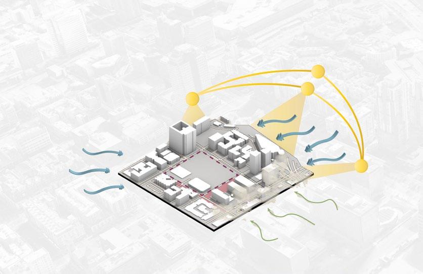


Hall. This connection can be seen through 1st street through the use of ecology. Social value is increased through this space by providing flexible areas which cater to the needs of the community. These spaces can contain programs such as vendor areas, market squares, festivals, and concerts.
GREEN EDGEPERMEABLE FENCE PERMEABLEINTERACTIVEHARDSCAPEEDGE
- VACANT LAND
USE
- RUDERAL
- FENCED AREA PARKING
ECOLOGY
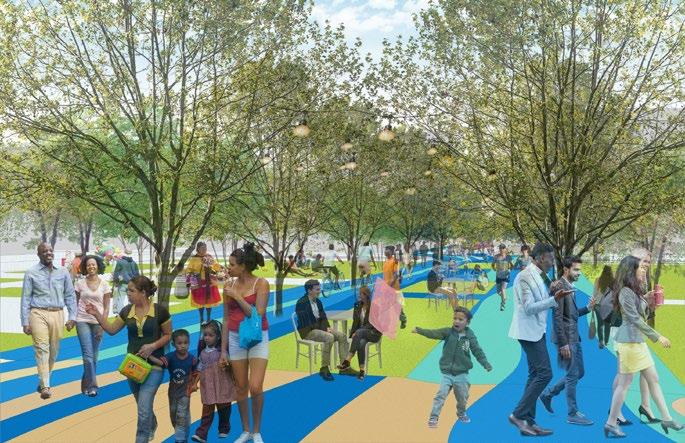
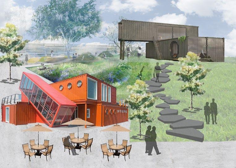
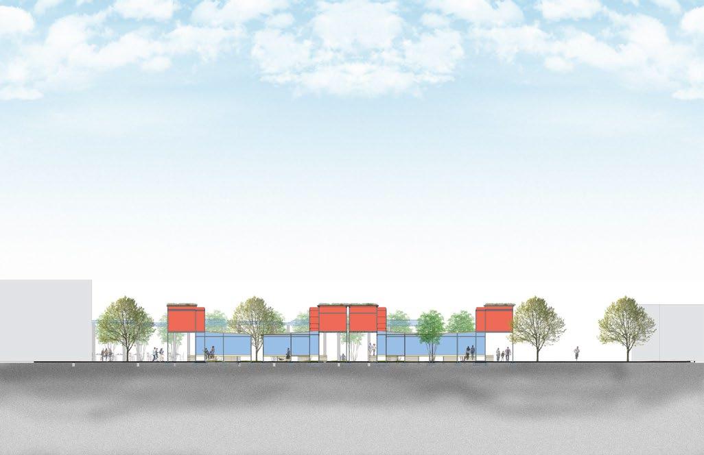
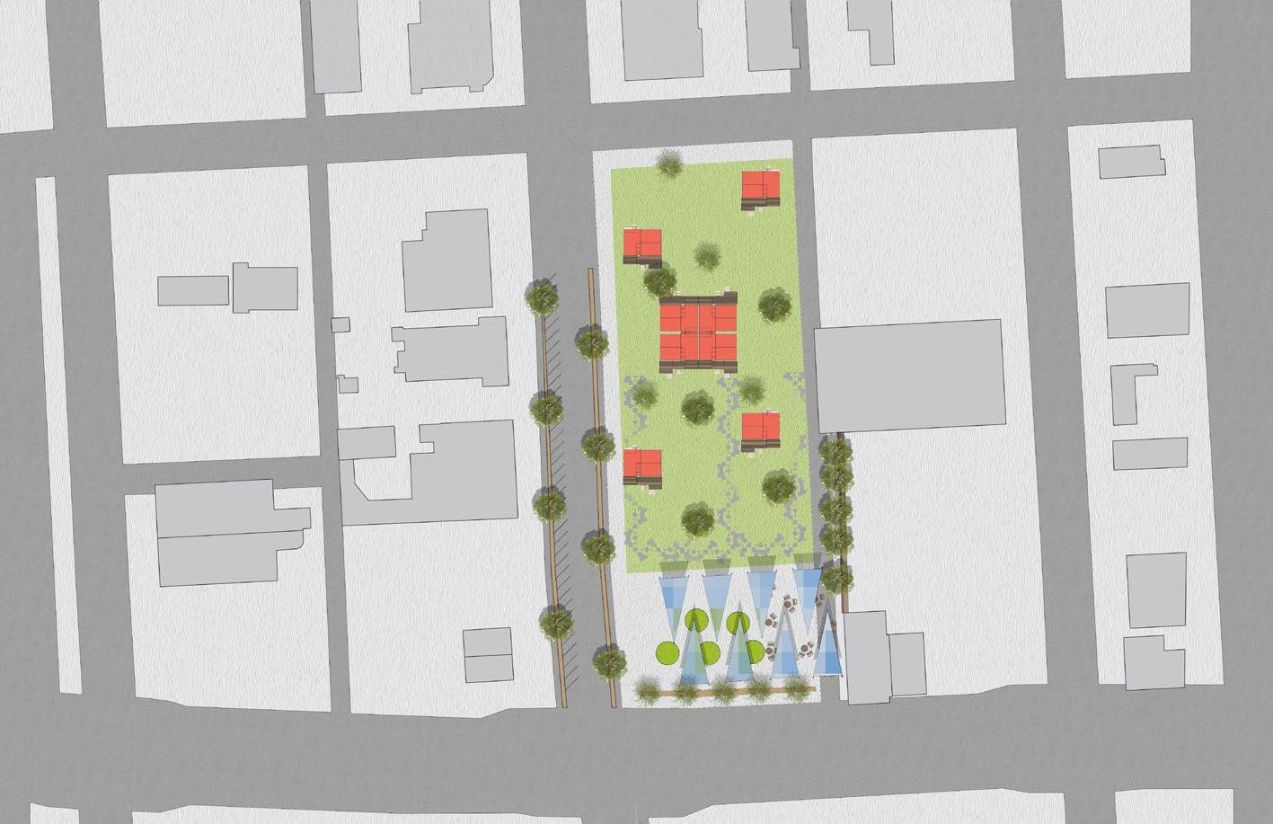
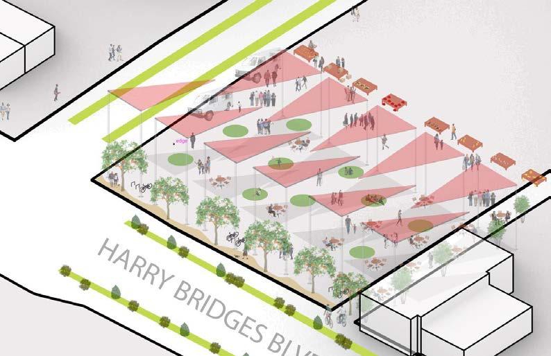
Our design was inspired by the idea of recycling shipping containers from the port to use as structures throughout our site. We connected two vacant lots from the site and made it into a communal gathering space. This design morphed Avalon Blvd. into a one way street to slow the flow of traffic and promote pedestrian movement. The design also had a space for vendors to set up and sell, which was a very important value of the city.
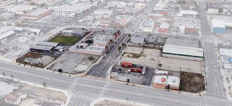
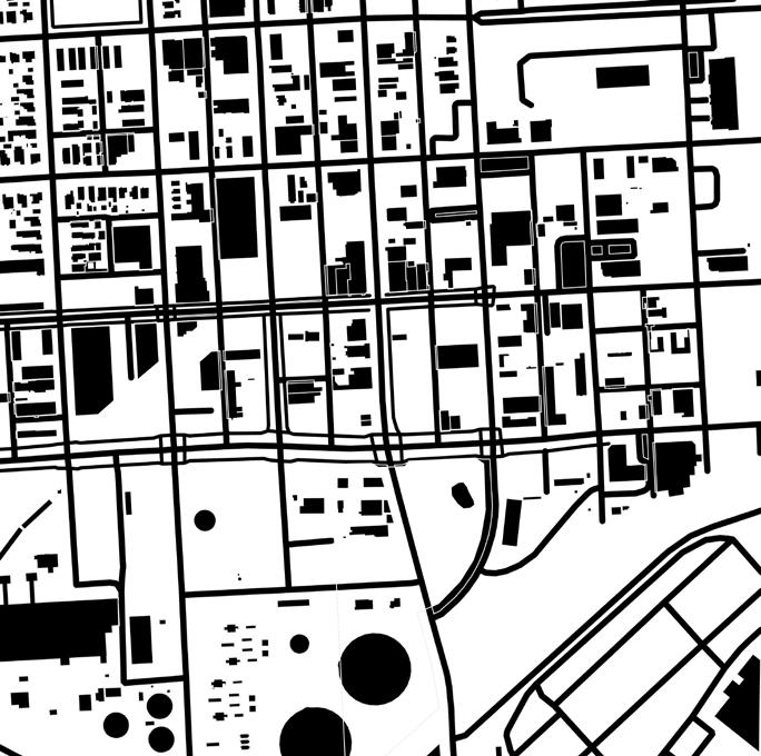
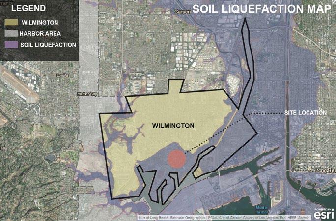
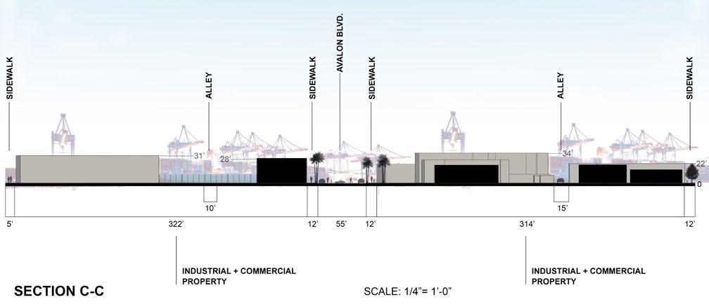
Placemaking Avalon Blvd. Is my semester long project in Wilmington, CA. My group was required to select two blocks on Avalon Blvd. and propose a placemaking design. A spatial analysis was required to further understand the site. Maps, diagrams, and sections were drawn to show the existing site conditions. There is a land use/ movement map to show circulation and building morphology. The sections display measurements of roads, sidewalks, and building heights.
POINTS OF INTEREST
11
-
MOVEMENT / LAND USE DIAGRAM
LOTS
AVALON BOULEVARD PLACEMAKING URP 4040: PLACEMAKING: THEORIES, METHODS, AND PRACTICE | DANIELPLACEMAKINGLAMBROUDESIGNLOPEZ+JOSEVALENZUELA + JACQUELINE ANGGRIANI + NICHOLAS CONTI + BRIAN ESPINOZA LEGENDVEHICULARCIRCULATIONBICYCLELANEPEDESTRIANMOVEMENTEMPTYLOT AVALON BLVD. - HIGH ALLOWED-INDUSTRIAL-TRAFFICDENSITYHEAVILYNOTRAILERS W HARRY BRIDGES BLVD. - HIGH DENSITY TRAFFIC - CONNECTS TRUCKERS TO PORT - LEADS TO 110 FREEWAY https://earth.google.com/web/@33.77184168,-118.2611905,3.42517902a,124.09807034d,35y,-6.23672395h,66.26720202t,0r
SECTION A-A
4 SITE PLAN VISION
AA 12


DANIEL
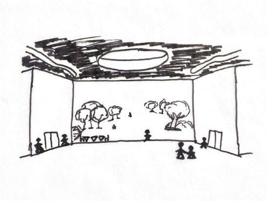
The two oculus were used to provide natural lighting and reduce energy used on artifical lighting. Overall, the design was intended to revive the park and attract users to engage with the space.
RECASTING TORRANCE SCHEMATIC DESIGN LOPEZ
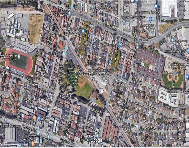
CONCERT VENUE ADMINISTRATION OFFICES FLEX SPACE RESTROOMLOBBY STORAGE KITCHEN FIELDSOFTBALL/BASEBALLTORRANCE PARK NATIONAL CHEVRONJACKGUARDIN THE BOX 7/11 ZAMPERINISCHOOLTORRANCESTADIUMELEMETARY JEHOVAH WITNESS CHURCH SCHOOLSUPERMOTO BNSFRR City Torrance, LARIAC SANTA FE AVE ARLINGTONAVE CABRILLOAVE LINCOLN AVE MMUNIT EVELOPMENT DEPARTMENT FFERY GIBSON MMUNIT EVELOPMENT DIR OR T ORR AN CE TPARK ORR PARK 0020 100 Feet ¯ CIRCULAR PATHWAYS BASEBALL FIELD PAVILION/PICNIC BANDSHELL PARKING LOT PLAYGROUND HORSESHOE COURT BASKETBALL COURT RESTROOM NATIONAL GUARD RESTROOM PARKING LOT TORRANCE PARK ZAMPERINI STADIUM TORRANCE ELEMETARY SCHOOL WILSON PARK
CONCEPT SKETCHES AMENITIES DIAGRAM CONTEXT DIAGRAM VEHICULAR MOVEMENT 13
INSPIRATION
PARK ARCH 199: ARCHITECTURAL DESIGN STUDIO | YEBER ANALYSIS + PROCESSS +

conserve the environment the concept of a complete green roof was used that is accessible to the public. The flex space inbetween the two structures is provided to give a transition from the pavilion to the administration offices as well as to provide more space for bigger events.
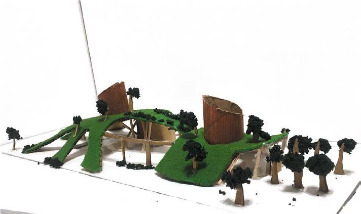
The Torrance Park Project included an analysis, schematic drawings, precedents, inspirations, and a study model. An effort to recast Torrance Park, my design was to include a multifunctional pavilion which included a stage, restrooms, offices, and a lobby. To try and
BUBBLE DIAGRAM
SECTION A-A B-B
STUDY WESTMODELELEVATIONFLOOR PLAN ---CONSTRAINTS:30’HEIGHTMAX18-24,000SQFEETRAILWAYRUNNING DIAGNOL ALONG THE NORTH SIDE 14
SECTION
-OPPOTUNITIES:MOVEBASEBALL FIELD - USE SUNLIGHT FROM THE SOUTH - ADD MORE PATHWAYS TO CONNECT 5 SITE PLAN SITE MOVEMENT SOUTH ELEVATION
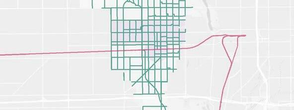
LA 2121L: ECOLOGICAL DESIGN LAB | WILCOX RIALTO SITE ANALYSIS DANIEL
Esri, HERE, Garmin, (c) OpenStreetMap contributors, and the GIS user community, Sources: Esri, USGS, NOAA
Esri, HERE, Garmin, (c) OpenStreetMap contributors, and the GIS user community, Sources: Esri, USGS, NOAA
6
Hub &
GIS MAPPING + ANALYSIS LOPEZ JOCELYN
High Quality half efficiency.
+ CUAUHTEMOC HERNANDEZ +
15
AGUIRRE
mile of a transit corridor with high
LA 2121L
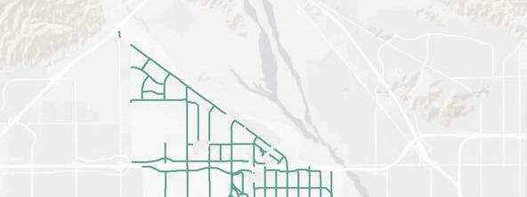
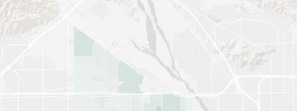
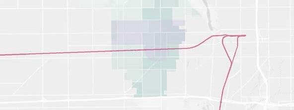
Legend Rialto City Boundary ¬ Å Metro Train Links High Quality Transportation Areas Rialto Roads Type HwyFwy Bus Stop Access Every Quarter Mile 20.01%20% - 40% 40.01% - 60% 60.01% - 80% 80.01% - 100% Legend ¬ ( Å Metro Train Links Bike HighRialtoLanesCityBoundaryQualityTransportation Areas Rialto Roads Type HwyFwy Legend Schools in Rialto Rialto City Boundary Rialto Roads Type HwyFwy Rialto Land Use Categories Single Family Residential High Density Residential Medium Density Residential Low Density Residential Multi-Family Residential Trailer Parks and Mobile Homes Commercial and Services General Office Use Public UnknownUndevelopedVacantVacantAgricultureUrbanOpenImprovedWaterSolidElectricalUtilityRailroadsAirportsHeavyManufacturing,LightJuniorElementaryEducationalFacilitiesInstitutionsSchoolsorIntermediateSchoolsIndustrialAssemblyIndustrialFacilitiesPowerFacilitiesWasteDisposalFacilitiesStorageFacilitiesFloodWaterSpaceandRecreationVacantUndifferentiatedorProtected 01230.5Miles 0 1 2 30.5 Miles 01230.5Miles 1 Mi 2 Mi 3 Mi SITE 1 Mi 2 Mi 3 Mi SITE 1 Mi 2 Mi 3 Mi SITE LAND USE MAP MAPSTOPBUSMAPTRANSPORTATION

GIS Hub
Transportation Areas can be identified as areas within one


Data Source: SCAG GIS Rialto Prepared by: Team Prepared for:


Esri, HERE, Garmin, (c) OpenStreetMap contributors, and the GIS user community, Sources: Esri, USGS, NOAA
Date Prepared: 3/2/22
GEO 4400L: ADVANCED GIS LAB | DIAZ Spatial Analysis Project
16
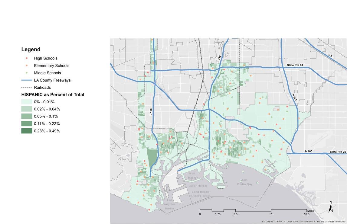
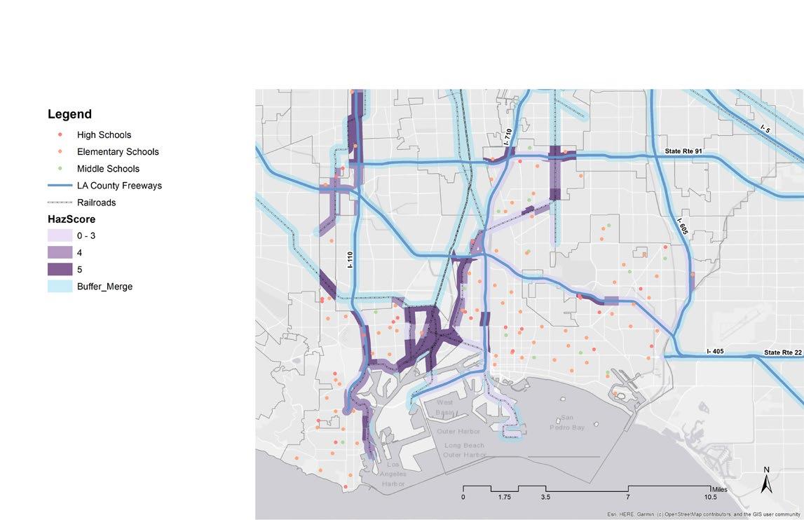
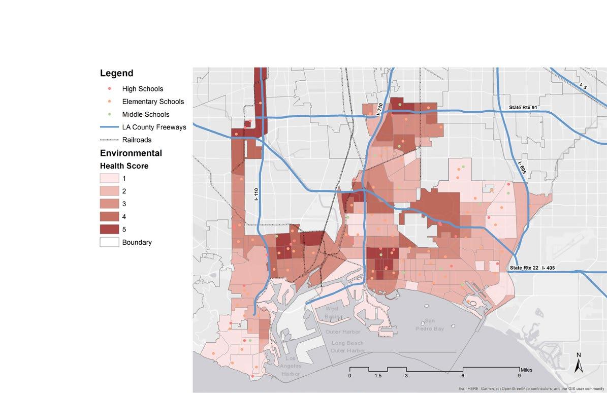
The Spatial Analysis Project included a deep dive into a selected topic involving GIS. The topic my team selected was mapping the impacts of the Los Angeles and Long Beach Ports. We used buffers, health scores, and school proximities to help evaluate and establish affected areas by the ports.
6
DANIEL LOPEZ + Emilie Fernandez + Tari Pena
MEETING RM 108 LOBBY196OFFICE107UTILITY RM RESTROOM106104 OFFICEOPEN103 OFFICEOPEN102 RECEPTION101 CORRIDOR105 MEETING RM 108 LOBBY196OFFICE107UTILITY RM RESTROOM106104 OFFICEOPEN103 OFFICEOPEN102 RECEPTION101 CORRIDOR105 CONSTRUCTIONREFLECTEDA1.0CEILING&PLANS 1 CONSTRUCTION PLAN 2 REFLECTED CEILING PLAN BANK OF AMERICA PRODUCED BY AN AUTODESK STUDENT VERSION VERSIONSTUDENTAUTODESKANBYPRODUCED PRODUCEDBYANAUTODESKSTUDENTVERSION VERSIONSTUDENTAUTODESKANBYPRODUCED

ARCH
AUTOCAD + CONSTRUCTION DOCUMENTS
119: COMPUTER AIDED ARCHITECTURAL DRAFTING | JACOBS CONSTRUCTION DOCUMENTS DANIEL LOPEZ 17

CORRIDOR105
OFFICEOPEN102 RECEPTION101
FINISHELECTRICALA2.0&PLAN 3 ELECTRICAL PLAN 4 FINISH PLAN BANK OF AMERICA F I

S C H E D U L E PRODUCED BY AN AUTODESK STUDENT VERSION VERSIONSTUDENTAUTODESKANBYPRODUCED PRODUCEDBYANAUTODESKSTUDENTVERSION VERSIONSTUDENTAUTODESKANBYPRODUCED 18
OFFICEOPEN103
MEETING RM 108 LOBBY196OFFICE107UTILITY RM RESTROOM106104 OFFICEOPEN103 OFFICEOPEN102 RECEPTION101
CORRIDOR105 N I S H
MEETING RM 108 LOBBY196OFFICE107UTILITY RM RESTROOM106104
19
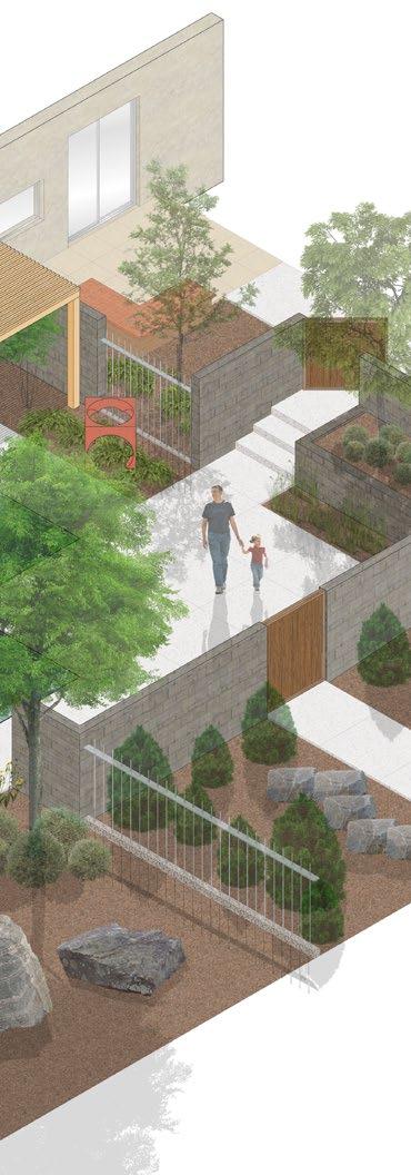
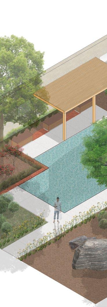
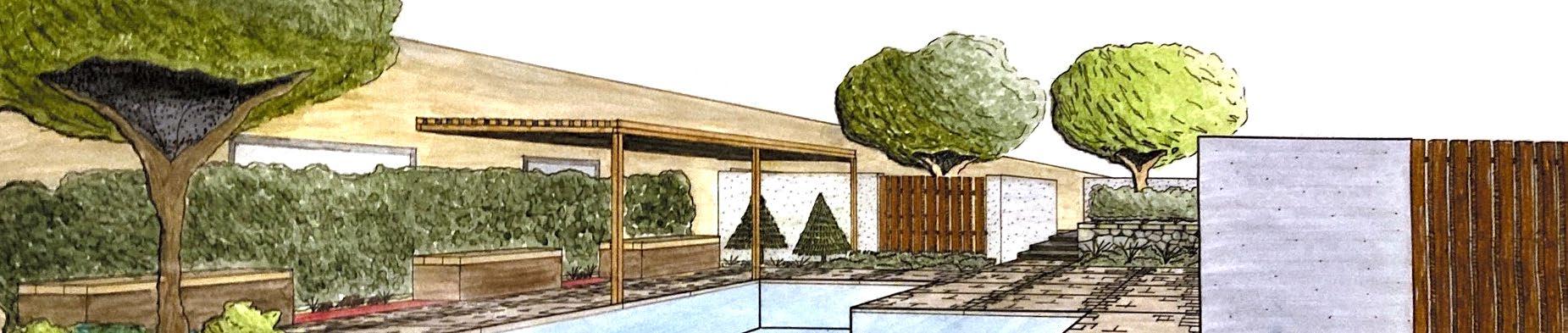
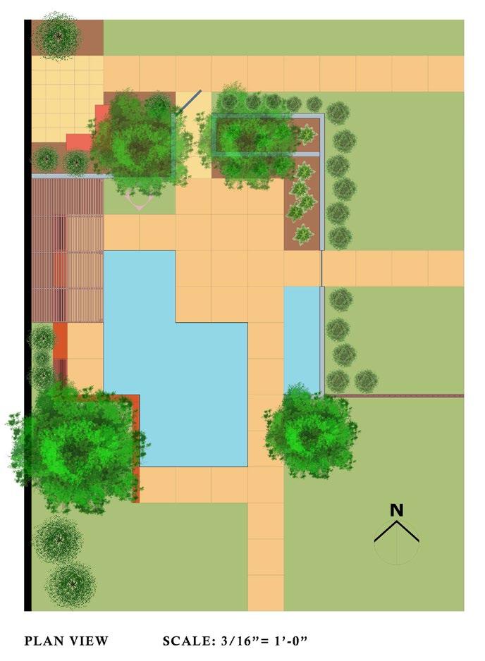
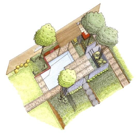
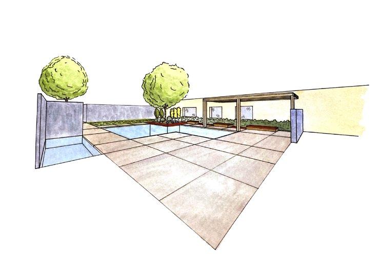
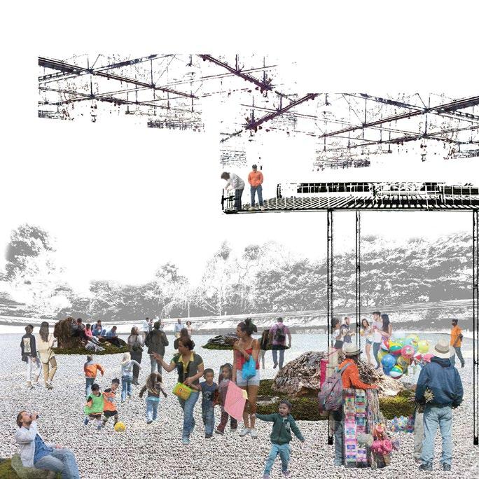
BACKYARD PLAN
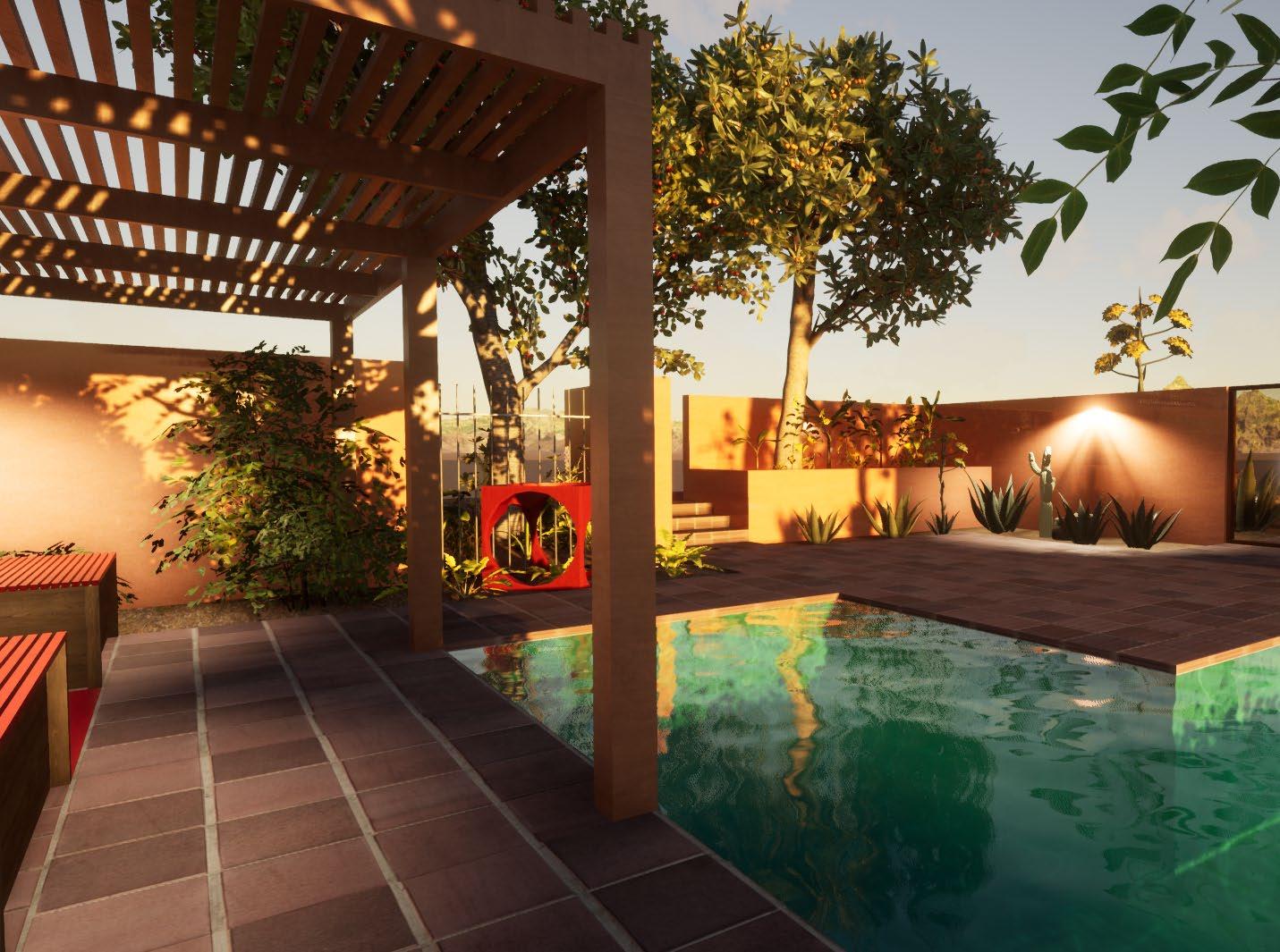
The Backyard Plan was a project which introduced drawings plans, elevations, sections, perspectives, and axon drawings. These drawings varied in style from illustrator to photoshop and rendering applications. An outdoor space which included various amenities such as benches, planters, a trellis, etc An introduction to 3D modeling and rendering. Rhino 7 was used to create the 3D model of the site. After completion of the 3D model in rhino, it was transferred into twinmotion where textures and softscapes were applied to the surfaces. Multiple perspectives of the site were generated to reflect a fully rendered and complete space.
7 20
OPEN SPACE TO CREATE GATHERING ROCKS TO INTERACTIONPROMOTE TOOVERHANG/PLATFORMPROMOTEDISCOVERY STRUCTURE TO CREATEGREENENCLOSUREWALLSTO HABITAT/PRIVACYREINFORCE ROCKS USED AS PLAY ELEMENTS OR FOR REST GREEN OVERHANG TO SOFTEN SENSE OF ENCLOSURE PATH PLAYENCOURAGESTHATcollages+Sketches 21
photography 22
TOOVERHANG/PLATFORMPROMOTEDISCOVERY
OPEN SPACE TO CREATE GATHERING
ROCKS TO INTERACTIONPROMOTE