III. LAYerS BeneAth
47
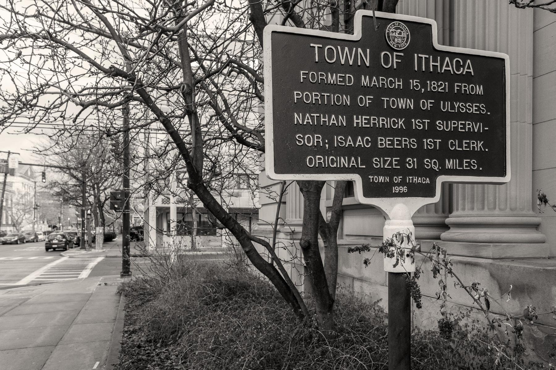
IthAcA
Tompkins County
Fingerlakes Region
New York State
Population: 32,108
Size: 6.07 sqm
Elevation: 404 ft

48
IthAcA
And who has never been to Ithaca?
Who is not familiar with her rugged environment, the sea ring that oppresses her, the austere intimacy she imposes on us, che silence in adding she draws for us?
Ithaca summarizes us as a book, she goes with us to our very selves, she discovers for us the sound of waiting. Because waiting has a ring: it preserves the echo of departed voices.
Ithaca reveals to us life’s heartbeat, she makes us the accomplices of distance, blind sentinels of a path that is taking shape without us, that we will be unable to forget because ignorance does not know oblivion. It is painful to wake up one day and gaze at the sea that enfolds us, that annoints us with salt and baptizes us like new children. We remember the days of shared wine, the words, not the echo; the hands, not the diluted gesture. I see the sea that surrounds me, the misty azure in which you became lost, I check the horizon with exhausted eagerness, I allow my eyes a moment to perform their beautiful function; then, I turn my back and direct my footsteps toward Ithaca.
The poet Francisca Aguirre wrote about Ithaca as a place that “preserves the echo of departed voices.” Which is the perfect site to braid the past in the present.
49
III. Layers Beneath
: Ithaca Poems by Francisca Aguirre, Translated by Ana Valverde Osan, 2004
50 Today 1850 1800 1720 Before
What happened on the ground of Ithaca is shown in a series of layered maps beginning in 1720.
51 III. Layers Beneath
Tiohero Ganiataragechiat

52 Mohawk .5 km 1 km 1.5 km 2 km 2.5 km 4 km 3.5 km 4 km 3.5 km 2.5 km 2 km 1.5 km 1 km .5 km 0 3 km 0 3 km
Milstein
Ithaca Commons
Negauena
Teegastoweas
Nauguen
Kayeghtalagealat
Onochsoe
Cascadilla
Ithaca On eid a
Coreorgonel Seneca
Onond a ga C a yuga Tuscarora
1720's MAP
Indigenous
Village Site
Site
Occupation Area of Cultivation Swamp .5 km 1 km 1.5 km 2 km 2.5 km
km 2 km 1.5 km 1 km .5 km 0 3 km 0 3 km Milstein
1600 - Five Iroquois Nations - Mohawk, Oneida, Onondaga, Cayuga, Seneca, and later joined by Tuscaroras as the League of Six Nations. Today they are known as the Haudenosaunee Confederacy.
Trails
Burial
Traces of
2.5
Ithaca Commons Negauena
Nauguen
Teegastoweas
Kayeghtalagealat
Cascadilla
Coreorgonel
Ithaca
Village
1600 - Five Iroquois Nations - Mohawk, Oneida, Onondaga, Cayuga, Seneca, and later joined by Tuscaroras as the League of Six Nations. Today they are known as the Haudenosaunee Confederacy.
Indigenous Trails
Site Burial Site
Area of
Swamp Mohawk 2 km 2.5 km 3.5 km 4 km 3 km Milstein
Traces of Occupation
Cultivation
Teegastoweas Nauguen Seneca Ithaca On eid a Onond a ga C a yuga Tuscarora
Ithaca Commons
precoLonIAL - henhAwk - the AnnuAL FISh dAnce
“The dance welcomed the fish back and gave them thanks. It would shake the ground, to remind the fish where to go. The movements in the dance represent how the fish move through the water. It was a celebration, too.”
1750 - BrItISh And morAvIAn AmBASSAdorS
“We went in the plain through the high grass, and crossed a creek. There I saw a beech tree, more than six feet in diameter and eighty feet high. It was growing late, we determined to remain and put up a hut... The Gajuka brought us turtle’s eggs and dried eels.”
By this time, Ithaca was occupied by Cayuga or Gayogohó:no native populations. The terrain was mostly swamp in the lowlands and dense forest surrounding. The name Cayuga translates to, “People of the Great Swamp.” There was indigenous cultivated ground where the Ithaca Commons, in downtown, is located today. Traces of indigenous occupation are where the circles are located on the map and burial grounds are where the “U” shape is located. As you can see, both of these occur also occur around the Ithaca Commons. The red dashed lines shows the trails the indigenous people created through the landscape following Ithaca’s contours and creeks. Excerpts from narratives of this time paint a picture of the landscape. A Gayogohó:no narrative of the annual fish dance at what is today called Taughannock Falls describes how they would shake the ground to remind the fish where to go. The second excerpt is from 1750 from a Moravian ambassador who was led through Ithaca by indigenous people describing high grass, creeks, and 80 foot tall trees.
53
III. Layers Beneath
: Old Indian Trails in Tompkins County by W. Glenn Norris, 1969 : The Gayogohó:no Poeple in the Cayuga Lake Region: A Brief History by Kurt A. Jordan, 2022
54 Today 1850
1800 1720 Before
The next layer shows Ithaca by the 1800’s.
55 III. Layers Beneath
-
- Five
are
Indigenous Trails
the
Village Site
Burial Site
Traces of Occupation
Area of Cultivation Swamp
Tiohero Ganiataragechiat


1779 - Major General John Sullivan sends troops through the county, who destroy the Native American settlements, including a large village called Coreorgonal "where we keep the pipe of peace." The village had twenty-five long houses of bark, set in a semicircle inside a stockade.
1779 - Major General John Sullivan sends troops through the county, who destroy the Native American settlements, including a large village called Coreorgonal "where we keep the pipe of peace." The village had twenty-five long houses of bark, set in a semicircle inside a stockade.
1779 - Major General John Sullivan sends troops through the county, who destroy the Native American settlements, including a large village called Coreorgonal "where we keep the pipe of peace." The village had twenty-five long houses of bark, set in a semicircle inside a stockade.
1788 - First white settlers come to Tompkins County and build cabins on site of the present DeWitt Park. Pioneers continue to establish settlements throughout the county.
1789 - George Washington is inaugurated as first President of the U.S. Cayuga native populations surrender their lands to the
1788 - First white settlers come to Tompkins County and build cabins on site of the present DeWitt Park. Pioneers continue to establish settlements throughout the county.
1788 - First white settlers come to Tompkins County and build cabins on site of the present DeWitt Park. Pioneers continue to establish settlements throughout the county.
1791 - The first road is built in the county. ~1800 - Abram Markle house - Ithaca's first frame house.
1789 - George Washington is inaugurated as first President of the U.S. Cayuga native populations surrender their lands to the state.
1789 - George Washington is inaugurated as first President of the U.S. Cayuga native populations surrender their lands to the state.
1791 - The first road is built in the county.
1791 - The first road is built in the county.
~1800 - Abram Markle house - Ithaca's first frame house.
~1800 - Abram Markle house - Ithaca's first frame house.
56 0 3 km 3.5 km 4 km 3.5 km 2.5 km 2 km 1.5 km .5 km 0 4 km .5 km 1 km 1.5 km 2 km 2.5 km 1 km 3 km
Kayeghtalagealat
Cascadilla
Negauena
Teegastoweas
Onochsoe
Nauguen
Commons Milstein First Built Road
Mar inus Z e s 1 400 Ac passed to S on DeW tt n 1789 1800's MAP Hinepaugh 1789 Abram Markle House 1800 First Waterpower Mill 1789 Woodworth McDowell 1788 Yaple Dumond 1789
Ithaca
Coreorgonel
state.
Indigenous Trails Village Site Burial Site Traces of Occupation Area of Cultivation Swamp 0 3 km 2.5 km 2 km 1.5 km .5 km 0 .5 km 1 km 1.5 km 2 km 2.5 km 1 km 3 km Kayeghtalagealat
1600 - Five Iroquois Nations - Mohawk, Oneida, Onondaga, Cayuga, Seneca, and later joined by Tuscaroras as the League of Six Nations. Today they are known as the Haudenosaunee Confederacy.
Cascadilla
Negauena
Teegastoweas
Nauguen
Milstein First Built Road
Ithaca Commons
Coreorgonel
Martinus Ziele s 1 400 Acres passed to Simeon DeWitt in 1789
Hinepaugh 1789
Abram Markle House 1800
First Waterpower Mill 1789
Woodworth McDowell 1788
Yaple Dumond 1789
Burial
Traces
Area
Cultivation Swamp 0 3 km 2.5 km 2 km 1.5 km .5 km 0 .5 km 1 km 1.5 km 2 km 2.5 km 1 km 3 km Kayeghtalagealat
1600
Five Iroquois Nations - Mohawk, Oneida, Onondaga, Cayuga, Seneca, and later joined by Tuscaroras as the League of Six Nations. Today they are known as the Haudenosaunee Confederacy.
Indigenous Trails Village Site
Site
of Occupation
of
Cascadilla
Negauena
Teegastoweas
Nauguen
Ithaca Commons First Built Road
Coreorgonel Martinus Ziele s 1 400 Acres passed to Simeon DeWitt in 1789
Hinepaugh 1789
Abram Markle House 1800
First Waterpower Mill 1789
Woodworth McDowell 1788
Yaple Dumond 1789
1600
Iroquois Nations - Mohawk, Oneida, Onondaga, Cayuga, Seneca, and later joined by Tuscaroras as the League of Six Nations. Today they
known as
Haudenosaunee Confederacy.
1803 - JeremIAh BLAckmAn
“They passed through an area described as ‘the roughest road you ever see, and the wheels would go down in the mud up to the hubs, then up on a log.’
The entire trip was a process of lifting the wagon and then pushing it over logs and around the thick brush.”
The first white settlers arrived in 1788, the black squares indicate where they constructed their cabins along the trails and on the already cleared cultivated ground. The first watermill was built along the water that is shown by the black circle. By 1789, George Washington mandated that the Cayuga native populations surrender their lands to the state. By 1791 the first road was built, which was an expansion of the previous indigenous trail going North. The narrative excerpt is from 1805 of an enslaved man, Jeremiah Blackman, who was brought to this area. Describing the roughest road you ever see, with muddy roads and thick brush, making it hard for travel.
57 III. Layers Beneath
: A Short History of Tompkins County by Jane
1986 : Black Voices in Tompkins County: The 19th Century by
2023
Marsh Dieckmann,
Carol Kammen,
58 Today
1850 1800 1720 Before
The next layer shows Ithaca by the 1850’s.
59 III. Layers Beneath
Ganiataragechiat
- Five
Nations - Mohawk, Oneida, Onondaga, Cayuga, Seneca, and later joined by Tuscaroras as the League of Six Nations. Today they are known as the Haudenosaunee Confederacy.
Cayuga Inlet
RailroadCanal
Ithaca&OwegoRailroad
1805 - Simeon DeWitt published a map of Ithaca with 49 surveyed lots.


1600 - Iroquois - Mohawk, Oneida, Cayuga, Seneca, and later joined by Tuscaroras the League of Six Nations. Today they are known as the Haudenosaunee Confederacy.
1600 - Five Iroquois Nations - Mohawk, Oneida, Onondaga, Cayuga, Seneca, and later joined by Tuscaroras as the League of Six Nations. Today they are known as the Haudenosaunee Confederacy.
are known as the Haudenosaunee Confederacy.
Indigenous Trails
Indigenous Trails
Indigenous Trails
Village Site
Village Site
Burial Site
Burial Site
1779 - Major General John Sullivan sends troops through the county, who destroy the Native American settlements, including a large village called Coreorgonal "where we keep the pipe of peace." The village had twenty-five long houses of bark, set in a semicircle inside a stockade.
1779 - Major General John Sullivan sends troops through the county, who destroy the Native American settlements, including a village called Coreorgonal "where we keep the pipe of peace." The village twenty-five long houses of bark, set in a semicircle inside a stockade.
1779 - Major General John Sullivan sends troops through the county, who destroy the Native American settlements, including a large village called Coreorgonal "where we keep the pipe of peace." The village had twenty-five long houses of bark, set in a semicircle inside a stockade.
1788 - First white settlers come to Tompkins County and build cabins on site of the present DeWitt Park. Pioneers continue to establish settlements throughout the county.
1789 - George Washington is inaugurated as first President of the U.S. Cayuga native populations surrender their lands to the state.
1791
1805 - Simeon DeWitt published a map of with 49 surveyed lots.
1805 - Simeon DeWitt published a map of
1805 - Simeon DeWitt published a map of Ithaca with 49 surveyed lots.
with 49 surveyed lots.
1810 - By this time the town had developed a three-story hotel, five two-story houses, and thirty frame dwellings of one story, as well as a schoolhouse and buildings for various commercial establishments.
1788 - First come to Tompkins County build cabins on site of the present DeWitt Park. Pioneers continue to establish throughout the county.
1788 - First white settlers come to Tompkins County and build cabins on site of the present DeWitt Park. Pioneers continue to establish settlements throughout the county.
1788 - First white settlers come to Tompkins County and build cabins on site of the present DeWitt Park. Pioneers continue to establish settlements throughout the county.
1817 - Tompkins County is created by an act of legislature. Named after Daniel E. Tompkins who was governor of NYS from 1807-1817. A County Courthouse was constructed to solidify its position.
1810 - By this time the town had developed a three-story hotel, five two-story houses, and thirty frame dwellings of one story, as well as a schoolhouse and buildings for various commercial establishments.
1810 - By this time the town had developed a hotel, five two-story houses, thirty frame dwellings of one story, as well as a and commercial establishments.
1810 - By this time the town had developed a three-story hotel, five two-story houses, and thirty frame dwellings of one story, as well as a schoolhouse and buildings for various commercial establishments.
1821 - Ithaca is incorporated as a
Traces of Occupation Area of Cultivation
Traces of Occupation
Area of Cultivation
Burial Site of Occupation of Swamp
Swamp
1789 - Washington is inaugurated as first President of the U.S. Cayuga native populations surrender their lands state.
1789 - George Washington is inaugurated as first President of the U.S. Cayuga native populations surrender their lands to the state.
1789 - George Washington is inaugurated as first President of the U.S. Cayuga native populations surrender their lands to the state.
1828 - Ezra Cornell arrives in Ithaca in search of work.
1817 - County is created by an act of legislature. Named after Daniel E. Tompkins who was governor of NYS from A County was constructed to solidify its position.
1817 - Tompkins County is created by an act of legislature. Named after Daniel E. Tompkins who was governor of NYS from 1807-1817. A County Courthouse was constructed to solidify its position.
1817 - Tompkins County is created by an act of legislature. Named after Daniel E. Tompkins who was governor of NYS from 1807-1817. A County Courthouse was constructed to solidify its position.
1821 - Ithaca is incorporated as a village.
1821 - is incorporated as a
1821 - Ithaca is incorporated as a village.
1791 - The first is built in the county.
1791 - The first road is built in the county.
~1800 - Abram Markle house - Ithaca's first frame house.
~1800 - Abram Markle house - Ithaca's first frame house.
1791 - The first road is built in the county. ~1800 - Abram Markle house - Ithaca's first frame house.
1828 - Ezra Cornell arrives in Ithaca in search of work.
1828 - Ezra Cornell arrives in in of
1828 - Ezra Cornell arrives in Ithaca in search of work.
60 2 km 1.5 km .5 km 0 4 km .5 km 1 km 1.5 km 2 km 2.5 km 3 km 3.5 km 4 km 3.5 km 3 km 2.5 km 0 1 km
Negauena Teegastoweas
Kayeghtalagealat
First Built Road
Onochsoe
Tiohero
Nauguen
Cascadilla
Commons
Ithaca
Cayuga Inlet Six Mile Creek Fall Creek Tioga St Aurora St Buff lo S Owego St S neca S Linn Street Cayuga Lake Ithaca&OwegoRailroad
Milstein
RailroadCanal
M r inus Z e e s 1 400 Acres pa d to S meon D W tt n 1789 1850's
St. James AME Zion Church 1836 First County Courthouse 1817 First Postmaster City Hall 1843 Ithaca Hotel 1809 Clinton House 1828
Cascadilla Creek
Coreorgonel
MAP
village.
Indigenous Trails Village Site Burial Site Traces
Area
Cultivation Swamp
1600
Iroquois
of Occupation
of
county, who destroy the Native American settlements, including a large village called Coreorgonal "where we keep the pipe of peace." The village had twenty-five long houses of bark, set in a semicircle inside a stockade.
1779 - Major General John Sullivan sends troops through the
~1800
house
first frame house. 2 km 1.5 km .5 km 0 .5 km 1 km 1.5 km 2 km 2.5 km 3 km 3 km 2.5 km 0 1 km
- The first road is built in the county.
- Abram Markle
- Ithaca's
Kayeghtalagealat
Teegastoweas First Built Road Nauguen
Negauena
Ithaca Commons Milstein Cayuga
Six Mile Creek Fall
Tioga St Aurora St Buffalo St Owego St Seneca St Linn Street
Cascadilla
Inlet
Creek
Cascadilla Creek
Martinus
s 1 400 Acres passed to Simeon DeWitt
1789 St. James AME Zion Church 1836 First County Courthouse 1817 First Postmaster City Hall 1843 Ithaca Hotel 1809 Clinton House 1828
Coreorgonel
Ziele
in
1600 - Five Iroquois Nations - Mohawk, Oneida, Onondaga, Cayuga, Seneca, and later joined by Tuscaroras as the League of Six Nations. Today they
Swamp
2 km 1.5 km .5 km 0 .5 km 1 km 1.5 km 2 km 2.5 km 3 km 3 km 2.5 km 0 1 km
Kayeghtalagealat
Negauena
First Built Road Nauguen
Teegastoweas
Ithaca
Milstein
Six Mile Creek Fall
Tioga St Aurora St Buffalo St Owego St Seneca St Linn Street
Cascadilla
Commons
Cayuga Inlet
Creek
Ithaca&OwegoRailroad
Cascadilla Creek
RailroadCanal
Coreorgonel
St. James AME Zion Church 1836 First County Courthouse 1817 First Postmaster City Hall 1843 Ithaca Hotel 1809 Clinton House 1828
Martinus Ziele's 1,400 Acres passed to Simeon DeWitt in 1789
Ithaca
2 km 1.5 km .5 km 0 .5 km 1 km 1.5 km 2 km 2.5 km 3 km 3 km 2.5 km 0 1 km
Kayeghtalagealat
Negauena
Cascadilla
Milstein
Six Mile Creek Fall Tioga St Buffalo Owego St Seneca Linn Street
Creek
Ithaca Commons
Ithaca&OwegoRailroad
RailroadCanal
Coreorgonel
St. James AME Zion 1836 First County Courthouse 1817 First Postmaster City Hall Ithaca Hotel House 1828
Martinus Ziele's 1,400 Acres passed to Simeon DeWitt in 1789
1862 - SArAh pArLmer
“On September 3, 1862 she left Ithaca. “It was one of those mornings, peculiar to that beautiful month. Deliciously cool, with soft breezes whispering in the tree tops, then sweeping low to shake from the grass-blades a million diamond drops...The deep hush of everything but soft-sighing winds seemed to rush over me with overwhelming sadness, till for a moment, as I thought of the two little girls whom I was leaving motherless.”
1891 - henrY St. John
“Vitrified bricks were laid on a two-inch bed of sand atop six inches of concrete for 700 feet of East State Street. That brick surface cost $40,000 in 1892... He also served on the Creek, Drainage and Park Commission working to eliminate the problem of flooding which plagued Ithaca each year.”
By 1817, Tompkins County was created, named after the New York State governor at the time. And by 1821, Ithaca was recognized by the state and incorporated as a village. Roads and railroads were developed, based off of the indigenous trails, you can especially see this along Linn street, some others follow the general direction. Water was diverted, and new names were given to the landscape. The top excerpt is from 1862 where a woman named Sarah Parlmer went off to be a nurse in the Civil War, an uncommon task for woman at the time. Upon leaving Ithaca for the war, there was a deep-hush of everything but soft-sighing winds that overwhelmed her with sadness. The bottom excerpt is from 1891 of Henry St. John who was on the Paving Commision in Ithaca where he laid 700 feet of brick roads, and worked to eliminate flooding, a still present issue in Ithaca today.
A Short History of Tompkins County by Jane Marsh Dieckmann, 1986
Lives Passed: Biographical Sketches from Central New York by Carol Kammen, 1984
61 III. Layers Beneath
:
:
62 Today 1850
1800 1720 Before
Lastly, the next layer shows Ithaca today.
63 III. Layers Beneath
1600 - Five Iroquois
-
Ganiataragechiat
- Simeon DeWitt published a map of Ithaca with 49 surveyed lots.
and later
as the League of Six Nations. Today they are known as the Haudenosaunee Confederacy.
Oneida,
by
- Major General John Sullivan sends troops through the county, who destroy the Native American settlements, including a large village called Coreorgonal "where we keep the pipe of peace." The village had twenty-five long houses of bark, set in a semicircle inside a stockade.
- Five Iroquois Nations - Mohawk, Oneida, Onondaga, Cayuga, Seneca, and later joined by Tuscaroras as the League of Six Nations. Today they are known as the Haudenosaunee Confederacy.
1600 - Five Iroquois Nations - Mohawk, Oneida, Onondaga, Cayuga, Seneca, and later joined by Tuscaroras as the League of Six Nations. Today they are known as the Haudenosaunee Confederacy.
as the League of Six Nations. Today they are known as the Haudenosaunee Confederacy.
Indigenous Trails
Indigenous Trails
Indigenous Trails
Village Site
Village Site
Village Site
Burial Site
Burial Site
Burial Site
Traces of Occupation
Traces of Occupation
Area of Cultivation
Area of Cultivation
Traces of Occupation Area of Cultivation
Swamp
Swamp
- Major General John Sullivan sends troops through the county, who destroy the Native American settlements, including a large village called Coreorgonal "where we keep the pipe of peace." The village had twenty-five long houses of bark, set in a semicircle inside a stockade.
1779 - Major General John Sullivan sends troops through the county, who destroy the Native American settlements, including a large village called Coreorgonal "where we keep the pipe of peace." The village had twenty-five long houses of bark, set in a semicircle inside a stockade.
1779 - Major General John Sullivan sends troops through the county, who destroy the Native American settlements, including a large village called Coreorgonal "where we keep the pipe of peace." The village had twenty-five long houses of bark, set in a semicircle inside a stockade.
- First white settlers come to Tompkins County and build cabins on site of the present DeWitt Park. Pioneers continue to establish settlements throughout the county.
- George Washington is inaugurated as first President of the U.S. Cayuga native populations surrender their lands to the state.
- Simeon DeWitt published a map of Ithaca with 49 surveyed lots.
1805 - Simeon DeWitt published a map of Ithaca with 49 surveyed lots.
1805 - Simeon DeWitt published a map of Ithaca with 49 surveyed lots.
- By this time the town had developed a three-story hotel, five two-story houses, and thirty frame dwellings of one story, as well as a schoolhouse and buildings for various commercial establishments.
- First white settlers come to Tompkins County and build cabins on site of the present DeWitt Park. Pioneers continue to establish settlements throughout the county.
1788 - First white settlers come to Tompkins County and build cabins on site of the present DeWitt Park. Pioneers continue to establish settlements throughout the county.
1788 - First white settlers come to Tompkins County and build cabins on site of the present DeWitt Park. Pioneers continue to establish settlements throughout the county.
- Tompkins County is created by an act of legislature. Named after Daniel E. Tompkins who was governor of NYS from 1807-1817. A County Courthouse was constructed to solidify its position.
- Ithaca is incorporated as a village.
- The first road is built in the county.
- Abram Markle house - Ithaca's first frame house.
- George Washington is inaugurated as first President of the U.S. Cayuga native populations surrender their lands to the state.
1789 - George Washington is inaugurated as first President of the U.S. Cayuga native populations surrender their lands to the state.
1789 - George Washington is inaugurated as first President of the U.S. Cayuga native populations surrender their lands to the state.
1810 - By this time the town had developed a three-story hotel, five two-story houses, and thirty frame dwellings of one story, as well as a schoolhouse and buildings for various commercial establishments.
- By this time the town had developed a three-story hotel, five two-story houses, and thirty frame dwellings of one story, as well as a schoolhouse and buildings for various commercial establishments.
1810 - By this time the town had developed a three-story hotel, five two-story houses, and thirty frame dwellings of one story, as well as a schoolhouse and buildings for various commercial establishments.
- Ezra Cornell arrives in Ithaca in search of work.
1817 - Tompkins County is created by an act of legislature. Named after Daniel E. Tompkins who was governor of NYS from 1807-1817. A County Courthouse was constructed to solidify its position.
- Tompkins County is created by an act of legislature. Named after Daniel E. Tompkins who was governor of NYS from 1807-1817. A County Courthouse was constructed to solidify its position.
1817 - Tompkins County is created by an act of legislature. Named after Daniel E. Tompkins who was governor of NYS from 1807-1817. A County Courthouse was constructed to solidify its position.
1821 - Ithaca is incorporated as a village.
1821 - Ithaca is incorporated as a village.
- Ithaca is incorporated as a village.
1791 - The first road is built in the county.
1791 - The first road is built in the county.
- The first road is built in the county.
~1800 - Abram Markle house - Ithaca's first frame house.
~1800 - Abram Markle house - Ithaca's first frame house.
- Abram Markle house - Ithaca's first frame house.
1828 - Ezra Cornell arrives in Ithaca in search of work.
- Ezra Cornell arrives in Ithaca in search of work.
1828 - Ezra Cornell arrives in Ithaca in search of work.
64 4 km .5 km 1 km 1.5 km 2 km 2.5 km 3 km 3.5 km 4 km 3.5 km 3 km 2.5 km 1.5 km 1 km .5 km 0 0 2 km
Commons
Ithaca
Owego St Ithaca&OwegoRailroadRailroadCanal StateSt St t S
Milstein
Cayuga Lake Cayuga
Six Mile Creek
Tioga St Aurora St Buff lo S Seneca S Linn Street Tiohero
First Built Road
Cascadilla Creek
Inlet
Fall Creek
Nauguen
Cascadilla Kayeghtalagealat
Negauena
Teegastoweas
Onochsoe
Mar inus Z e e 1 400 Acres p ed to S meon DeW tt n 1789 TODAY MAP
Coreorgonel
Indigenous Trails Village Site Burial Site Traces of Occupation Area of Cultivation Swamp 2 km 1.5 km .5 km 0 .5 km 1 km 1.5 km 2 km 2.5 km 3 km 3 km 2.5 km 0 1 km
Teegastoweas First Built Road Nauguen
- Five Iroquois Nations - Mohawk, Oneida, Onondaga, Cayuga, Seneca, and later joined by Tuscaroras
Kayeghtalagealat Negauena
Milstein
Six Mile
Fall
Tioga St Aurora St Buffalo St Owego St Seneca St Linn Street
Cascadilla
Ithaca Commons
Cayuga Inlet
Creek
Creek
Ithaca&OwegoRailroad
Cascadilla
Creek RailroadCanal
Coreorgonel
St. James AME Zion Church 1836 First County Courthouse 1817 First Postmaster City Hall 1843 Ithaca Hotel 1809 Clinton House 1828
Martinus Ziele's 1,400 Acres passed to Simeon DeWitt in 1789
Nations
Mohawk,
Onondaga, Cayuga, Seneca,
joined
Tuscaroras
Swamp
2 km 1.5 km .5 km 0 .5 km 1 km 1.5 km 2 km 2.5 km 3 km 3 km 2.5 km 0 1 km
Kayeghtalagealat
Negauena
First Built Road
Teegastoweas
Nauguen
Milstein
Six Mile
Tioga St Aurora St Buffalo St Owego St Seneca St Linn Street
Cascadilla
Ithaca Commons
Cayuga Inlet
Creek Fall Creek
Ithaca&OwegoRailroad
Cascadilla Creek
RailroadCanal
Coreorgonel
St. James AME Zion Church 1836 First County Courthouse 1817 First Postmaster City Hall 1843 Ithaca Hotel 1809 Clinton House 1828
Martinus Ziele's 1,400 Acres passed to Simeon DeWitt in 1789
.5 km 1 km 1.5 km 2 km 2.5 km 3 km 3 km 2.5 km 1.5 km 1 km .5 km 0 0 2 km
Milstein Owego St Ithaca&OwegoRailroadRailroadCanal StateSt State St
Ithaca Commons
Six
Tioga St Aurora St Buffalo St Seneca St Linn Street First Built Road
Cascadilla Creek
Cayuga
Inlet
Mile Creek Fall
Creek
Nauguen
Cascadilla
Kayeghtalagealat
Negauena
Teegastoweas
Coreorgonel
Martinus Ziele s 1,400 Acres passed to Simeon DeWitt in 1789
1930’s Anita Reed
“On Saturday mornings in the 1930s I took my weekly 12-block walk to my piano lesson on South Cayuga Street with my music book tucked under my arm and the 50 cents to pay for my hour long lesson clutched in my hand. My piano teacher, Miss Jessie Johnson, who was quite advanced in years at that time, claimed to have been the first black graduate from Ithaca High School.”
The grid is mostly the same as the 1850’s, with the major changes occurring in the bottom left, where large stores like Wegmans required a different urban grid, and the development of Cornell and Ithaca College. The narrative above is from 1930’s of a girl, Anita Reed who walks 12 blocks to her piano lesson to pay 50 cents for her hour long session. Her teacher was the first black graduate from Ithaca High School.
65 III. Layers Beneath
:
: Lives
Sketches from Central New
A
Short History of Tompkins County by Jane Marsh Dieckmann, 1986
Passed: Biographical
York
by Carol Kammen, 1984
66
v. Interwoven
91
SITE MAP

92 I III IV 0 II INITIAL STUDY DRIVE PARK WALK/ENTER INSIDE TIMELINE OF SITES
I III IV 0 II
Building off of these studies, the translation of the braid at a specific sites is explored, located at a points in Ithaca of overlapping histories. The sites are along the indigenous trail, the oldest pathway in Ithaca to pierce through as many layers as possible.
93
V. Interwoven : Site map

313 N Aurora St Ithaca
1890
94
AddreSS
YeAr BuILt
The initial site of exploration is along N Aurora St. Prior to the buildings construction, this was where an indigenous trail cut across a creek. It was built as a residence in 1890 by William Henry Miller, who coincidentally went to architecture school at Cornell. The building is now operating as a medical office.
95 : Site 0
V. Interwoven
96 I III IV 0 II
At Site 0 on the map you can see where the trail and the creek cut through the house.
97
V. Interwoven : Site Model


98
The idea is to slice through the house where the trail cuts across it and infill it with a weaving of history.
99 : Site model
V. Interwoven
100 1850 1800 1720 Today Water
2nd Floor Basement 1st Floor Ground Mud Tall Grass 5 ft 15 ft 35 ft 25 ft 45 ft 55 ft 0. InItIAL StudY
Beech Tree
Attic
The diagram shows the heights, or layers, of each history along the cut. For instance the current floor plates of the house as well as the level of the historic creek, mud, and trees which would have been on the site during the 1720’s. While this diagram expounds on the physical layers of history it also alludes to the emotional layers.
101 V. Interwoven : Section
Diagram


102 1 2 3 4 5 6 7 8 9
These are a series of study models to try to braid these heights together. By carving out windows at these heights in study model 6.
103 V. Interwoven : Section study models
104 1 2 3 4 5 6 7 8 9
The braid is also tested by reorganizing the floor plates to include historic heights in studies 2-5. These studies inspired the next series to follow.
105 V. Interwoven
:
Section study models
SITE MAP
106 I III IV 0 II INITIAL STUDY DRIVE PARK WALK/ENTER INSIDE TIMELINE OF SITES
I III IV 0 II
The next series of four sites are located also along the indigenous trail, creating a series of interventions to embed history into the everyday life.
107 V. Interwoven : Site Map

108 I III IV 0 II
As mentioned previously, monuments and memorials are tucked away from everyday life and allow one to separate themselves from history rather than engage with it. Therefore, these sites are located at places that most of us engage with on a daily basis.
The first site engages with driving.
The second engages with parking.
The third is walking to enter a space.
The fourth site is inside of a building.
This model shows the sites piercing through the layers of history.
109 V. Interwoven
: Site Model

110
AddreSS
300 Block of N Tioga St
I. drIve
The first site is located on the 300 block of N Tioga St. This site is located on indigenous cultivated ground which is interpreted as potentially having been used to grow the ‘three sisters’ – maize, beans, and squash. In the 1800’s, this site would have been used by carriages. In the 1850’s, it became a train track, which today is used for driving vehicles.
111 V. Interwoven : Site I history

112
AddreSS Behind 308 N Tioga St
II. pArk
The second site is the parking lot behind 308 N Tioga St. It is also located on indigenous cultivated ground. In the 1800’s, the site was divided by the border of a military tract owned by Simeon DeWitt. Military tracts are lands given to compensate soldiers for fighting in the Revolutionary War. This land was given out after the removal of indigenous people.
113 V. Interwoven
: Site II history

114
AddreSS Entrance to DeWitt Park on Buffalo St
YeAr BuILt 1815
III. wALk/enter
The third site is located at the entrance of DeWitt park. This site is also on indigenous cultivated ground. The park is where the first two families settled in Ithaca in 1788. There also used to be a bandstand on the site in the 1900’s, which hosted Federick Douglass to speak after being refused by many other locations.
115 V. Interwoven
: Site III history

116
AddreSS Green Star . 215 N Tioga St
YeAr BuILt
1914
Iv. InSIde
Finally, the fourth site is in the grocery store, Green Star, previously located on indigenous cultivated ground. Beginning in 1803 this land was set aside for a school and remained that way till the 1970’s. Green Star was founded in 1971.
117
V. Interwoven : Site IV history
118 1850 1800 1720 Today Ground Mound Squash Corn Pavement Car 1 ft 5 ft 10 ft Train Tracks Car Train Horse and Carriage Corn Squash Mound Ground Today 1720 1800 1850 1 ft 5 ft 10 ft 1850 1800 1720 Today Ground Mound Chair Desk Squash Refrigerator Chalk Board Refrigerator Corn 1 ft 5 ft 10 ft 1850 1800 1720 Today Sidewalk Squash Ground Mound Cabin Floor Bandstand Floor Bush Cabin Roof Bandstand Roof Corn 1 ft 5 ft 10 ft
I. drIve
II. pArk
III. wALk/enter
Iv. InSIde
The heights of these histories resulted in diagrams recording the layers of each time period.
119 V. Interwoven :
History Diagrams

120
Each site is then taken through a series of design studies. Using the diagrammed heights as a template in which to test the techniques of adding, removal, reorganization, and reappropriation.
Each intervention doesn’t disrupt the current programming of the site, but alters the perception of that activity by modifying how and the pace at which that action takes place.
121 V. Interwoven : Matrix of study models
122
For instance, the addition on the road, is a speed bump to slow the cars down.
123 V. Interwoven :
of study
Matrix
models
124
To reorganize the site, is to add more sidewalk, causing a pinch point to slow the cars down.
125 V. Interwoven : Matrix of study models
126
To re-appropriate the site is to add a series of windowed walls, in which to pass through and view reality through an overlayment of history. The windows are constructed at each historic height. The walls angled position forces the viewer to slow down while passing through them.
127 V. Interwoven : Matrix of study models
128
For the parking lot, the studies test raising or embedding a parking spot.
129 V. Interwoven :
of study
Matrix
models
130
This study adds a walled parking spot, allowing the driver to linger and look out through the windows.
131 V. Interwoven : Matrix of study models
132
At the entrance to the park, the hedges are allowed to grow taller in the model on top creating an enclosed space. The hedges are trimmed in the model on the bottom for views into the park.
133 V. Interwoven : Matrix of study models
134
This study depresses the sidewalk, allowing rain water and snow to gather at the bottom.
135 V. Interwoven : Matrix of study models
136
In this study, windowed walls are added to form an entrance to the park, while framing views of everyday life.
137 V. Interwoven : Matrix of study models
138
Lastly, the studies in Green Star test raising the roof and depressing the floor, to call attention to the indigenous trail.
139 V. Interwoven : Matrix of study models
140
The final tests extend the grocery shelving to create compressed areas in the aisles. They also test adding windowed walls to frame views in which to reappropriate your understanding of a grocery store.
141 V. Interwoven : Matrix of study models
142
I. drIve
The final renders are a combination of these tactics. First, bringing you back to the collage of history of the first site.
143 : Site I history
V. Interwoven

144
I. drIve
To the final intervention, which employs a speed bump to ensure cars will move slower. In addition, angled walls are added to create a forced perspective when driving with windows to history.
145 : Site I intervention
V. Interwoven
146
II. pArk
At the second site...
147 V. Interwoven
: Site II history

148
II. pArk
The final intervention is an additional parking space along the line of the military tract. The space is depressed into the ground, with windowed walls on either side.
149 V. Interwoven
: Site II intervention
150
III. wALk/enter
At the third site...
151 V. Interwoven : Site III history

152
III. wALk/enter
The final intervention raises the sidewalk, to slow the approach to the entrance of the intervention. Windowed walls look out through history.
153 V. Interwoven
: Site III intervention
154
Iv. InSIde
At the fourth site...
155 V. Interwoven : Site IV history

156
Iv. InSIde
Where the trail intersects with the floor, it is depressed with ramps on either side. The windowed walls reach up to 12 feet making an impression and raising the ceiling. Additionally, the windowed walls hold historic foods like maize, beans, and squash, with windows overlaying their history.
157
V. Interwoven : Site IV intervention

158
The final site model is of this corner of Green Star.
159 V. Interwoven
: Site model location in Green Star

160
From this angle, you can see the sloping floor and raised ceiling conditions.
161 V. Interwoven : Final model of Green Star

162
In this view, you can see the windows which frame the historical produce behind them.
163 V. Interwoven : Detail of final model of Green Star

164
These tactics suggest a tool guide for further installations along the indigenous trail in Ithaca. As well as, these studies provide a canvas for continual additions as time and space more forward.
In addition, these studies, while expansive, begin a larger search for what it means to look deeper into the surface of our everyday experience and connect to the layers beneath.
165
: Detail of final model of Green Star V. Interwoven
166
thIS theSIS revALueS the LAYerS In the ground And BrIngS mAterIALItY And SpAtIALItY to the BrAId oF hIStorY And humAnItY. thIS theSIS weAveS the pASt In the preSent For the Future occupAntS underStAndIng oF theIr pLAce In IthAcA.
167 V. Interwoven
: Thesis statement

168
Final Presentation
12.07.2023
Milstein Dome 10:00am
169
:
Photo of final presentation

170
“The Empire State, as you love to call it, was once laced by our trails...trails that we had trod for centuries - trails worn so deep by the feet of the Iroquouis that they became your roads of travel, as your possessions eat into those of my people. Your roads still traverse those same lines of communications which bound one part of the Long House to the other.”
On May 4, 1847, Cayuga Chief Waowawanaonk, also known as Peter Wilson, delivered this speech before the New York Historical Society. “Waowawanaonk” means “They hear his voice.”
171
AFterword
: Old Indian Trails in Tompkins County by W. Glenn Norris, 1969
172
BIBLIogrAphY
Aguirre, Francisca. Translated by Ana Valverde Osan. Ithaca. Rochester, NY: BOA Editions, Ltd., 2004.
Benjamin, Walter. The Storyteller Essays. New York, NY: New York Review of Books, 2019.
Clardy, Andrea Fleck. Ithaca, A Book of Photographs. Trumansburg, NY: The Crossing Press, 1981.
Dieckmann, Jane Marsh. A Short History of Tompkins County. Ithaca, NY: DeWitt Historical Society of Tompkins County, 1986.
DeWitt Historic Society. The Ithaca Journal. Images of Ithaca & Tompkins County: The Early Years - 1850 - 1939. Canada: Pediment Publishing, 2001.
Hesch, Merrill. Richard Pieper. Revised and updated by Harry Littell. Ithaca Then & Now. Ithaca, NY: McBooks Press, 2000.
Ingold, Timothy. Preston H. Thomas Memorial Symposium: Breaking Ground(s): Does Architecture Stack? Rethinking the Ground, Generation, and Education. Cornell Architecture Department. Ithaca, NY. March 8, 2022.
Jordan, A Kurt. The Gayogohó:no Poeple in the Cayuga Lake Region: A Brief History. Ithaca, NY: Tompkins County Historical Commision New York, 2022.
Kammen, Carol. Black Voices in Tompkins County: The 19th Century. Ithaca, NY: Tompkins County Historical Commision New York, 2023.
Kammen, Carol. Lives Passed: Biographical Sketches from Central New York. Interlaken, NY: Heart of Lake Publishing, 1984.
Kammen, Carol. The Peopling of Tompkins County: A Social History. Interlaken, NY: Heart of Lake Publishing, 1985.
Municipal Historians of Tompkins County and the Tompkins County Historian. Tompkins County New York: Images of Work and Play. Charleston, SC: The History Press, 2009.
Norberg-Shulz, Christian. Genius Loci: Towards a Phenomenology of Architecture. Rizzoli International Publications, Inc. 1980.
Norris, W. Glenn. Old Indian Trails in Tompkins County. Ithaca, NY: Arnold Printing Corporation, 1978.
Ruskin, John. The Seven Lamps of Architecture. Mineola, NY: Dover Publications, 1849.
173