Welcome to Country
by Darug Elder Aunty Edna“Jumna ya wogal wal ya pemel jumna mingan jumna tamu.
Ngalaringi wyanga pemal.
Ngalaringi babuna wal gnia ya pemal da lo-loley dice wara
Mooting jumna banga nolla ya.
Pemal jumna wal gnia koi mund wal tati pemal jumna
annagar dice.
Eorah wal mullana wal mingan jumna gai gnia bou gu-nu-gal
Nglaringi go-roong dyaralang.
Nglaringi go-roong dyaralang.
Ngalaringi bou ngalaringi jam ya tiati nglaringi bubuna jumna.
Mittigar gurrung burruk gneene da daruga pemal.
Didjeree Goor.”
“We were the first carers of the land, we took only what we needed from our Mother Earth. Our ancestors knew how to take care of the land, so as to continue their survival.
We do not own the land, but we are charged with the care of it. As custodians of this land we ask that all people join us and preserve what we have left for future generations.
We must protect the few sites we have to ensure our culture continues.
In the language of our ancestors we welcome you to Darug lands.
Thank you.”
CONTENTS
1. Introduction
1.1 Purpose
Cumberland City Council have prepared the Toongabbie Town Centre Public Domain Plan (The Plan) to guide the delivery of consistently high-quality public realm to promote the revitalisation of Toongabbie town centre.
This document sets out a town centre wide palette of streetscape treatments, including material palettes for surface treatments, street furniture, landscaping, and finishes. It also provides guidelines and relevant information to assist developers and Council in undertaking public domain works within Toongabbie town centre.
1.2 What is the Public Domain?
Within the context of this document, the public domain represents all urban and natural elements, structures, and spaces that exist within the publicly owned areas of Toongabbie town centre and the relationship between them. The public domain also includes privately-owned arcades, plazas, building forecourts, internal walkways, and other semi-public spaces as they also influence the overall character of the public domain.
2. Planning Context
2.1 Strategies, Plan and Legislation
This plan builds on the community feedback and the identified planning approach from a range of legislation, strategies and plans. These include the following:
Cumberland 2030: Our Local Strategic Planning Statement, Cumberland Local Housing Strategy 2020,
Cumberland Local Environmental Plan 2021,
Cumberland Development Control Plan 2021, with reference to site specific controls for the Toongabbie Town Centre.
Cumberland 2030: Our Local Strategic Planning Statement identifies Toongabbie as a Local Centre that provides land use opportunities for housing and local employment, as well as services and facilities to meet the needs of the local community.
The Central City District Plan recognises the importance of our Local Centres as a focal point of neighbourhoods. Easily accessible Local Centres provide opportunities for social connections that assist in fostering healthy, creative, and culturally rich communities. Creating and renewing local centres and respecting the local heritage contributes to making a diversity of great places within our City.
The Toongabbie town centre supports the Department of Planning, Housing, and Infrastructure vision as a 30-minute city with access to jobs and services with good public transport access to Parramatta CBD.


3.1 Site Context
Toongabbie town centre is located on the northwestern boundary of Cumberland Local Government Area. Immediately to the east lies City of Parramatta and to the west Blacktown City Council Local Government Areas. Major road corridors that surround Toongabbie include Prospect Highway to the north, Cumberland Highway to the south and Great Western Highway to the west.
The Toongabbie town centre has evolved the from the train station located east of the town centre. The town centre is composed of mixed-use development and high-density residential development. South of the town centre is land zoned General Industry for the Girraween Industrial Estate.
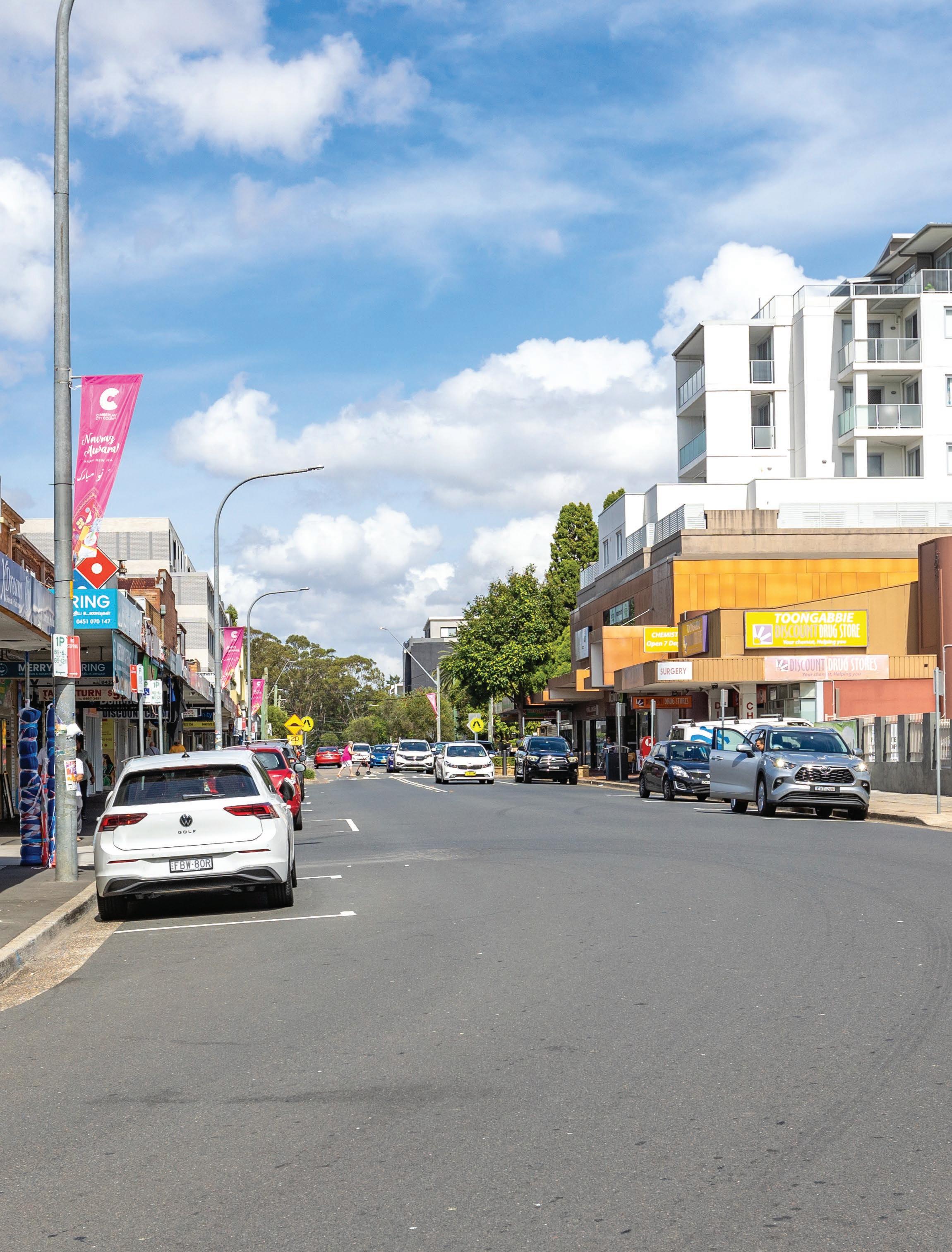
The town centre is centred on Aurelia Street. Other streets within the town centre include Portico Parade, The Portico, Toongabbie Road, Junia Avenue, Cornelia Road, Octavia Street and Targo Road. Wentworth Avenue provides vehicular access over the railway line and connects directly into the town centre.
Toongabbie town centre is supported by public and active transport connections, a vibrant main street as well as social infrastructure including community halls, education institutions and a town centre park.
Two district parks surround the centre including Girraween Park, to the west, that provides for cricket, soccer and football, and CV Kelly Park, to the south, that provide for football, soccer, senior and little athletics.
Greystanes Creek is situated on the western side of the town centre and is a major tributary of Toongabbie Creek, which is, in turn, is one of two major arms of the Upper Parramatta River catchment. This creek corridor contributes to Sydney’s blue and green grid.
4.1 Vision
Toongabbie is a vibrant town centre that will build on the local character to create an attractive, walkable, and socially inclusive open space network with high quality public realm at its centre.
4.2 Design Principles
Celebration of place
Celebrate the history of Toongabbie and build on the local character to create a distinct and attractive neighbourhood.
Create active and vibrant streetscapes that supports innovative economic activities throughout the day and evenings, which attract residents, workers and welcomes visitors to the local area.

Well connected
Promote healthy living with good walking and cycling permeability throughout the local centre.
Upgrade pedestrian crossings to improve safety and comfort for pedestrians.

Provide clear and effective wayfinding signage to enable access to services and facilities within the local centre.
Promote opportunities to socialise and participate in local life with a high-quality public realm that will enhance the health and well-being of the local community.
Clean and Green
Create a continuous green tree cover throughout the centre to assist in mitigating urban heat and stormwater runoff.
Improve walkability to reduce reliance on cars that will assist in positive environmental outcomes including improved air quality.

Enhance well-being and a sense of community identity by delivering an attractive and well-maintained public realm.
Maintain areas of open space and introduce measures to capture stormwater runoff thereby improving the water quality entering Greystanes Creek.
Use smart technologies and evidence-based decision making to prioritise footpath and cycling improvements.
Equitable
To assist in the creation of liveable neighbourhoods and a cohesive community, streetscape design shall be inclusive for all abilities and ages with a continuous accessible path of travel.

Provide opportunities for social connections through the design of safe and comfortable places for people to stop and rest and engage with street life within the local centre.
Celebrate the diversity of the community by implementing public art initiatives including street banners that assist in creating culturally rich and socially connected communities.
5.1 Built Form and Active Street Frontages
Land use planning within Toongabbie town centre is based on a range of mixed use and high-density areas. The built form needs to consider the future local character of our public domain.
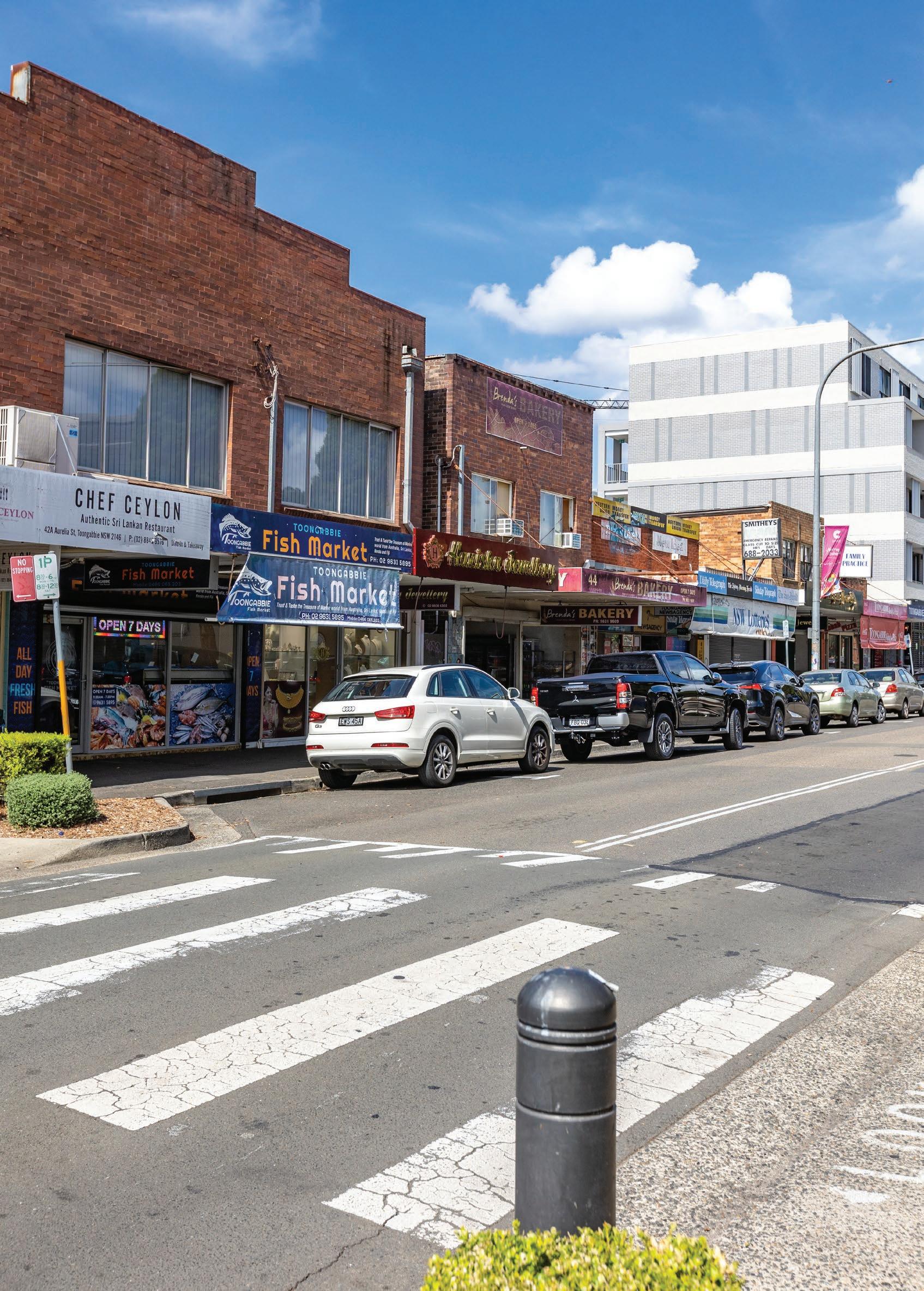
The town centre is centred on its high street – Aurelia Street – with its fine grain texture at street level and opportunities for outdoor dining that will contribute to the vibrancy and liveability of Toongabbie. Portico Parade that fronts the Train Station will provide an attractive and welcoming entry to Toongabbie. Other streets, including Junia Avenue, Cornelia Road and Toongabbie Road, will have active frontages that supports dynamic economic life and contributes to the vibrancy of the centre.
The public domain associated with active street frontages will provide inviting seating areas, planting and lighting that promote both daytime and night-time activation. Public art elements including banner poles and decorative paving will provide a platform for creative and cultural expression that reflect the local character of Toongabbie and assist in enriching the local identity of the neighbourhood.
Footpaths will be accessible for all ages and abilities that will enhance walkability to and within the town centre and provide opportunities for socialisation and contribute to the health and well-being of our community.
5.2 Heritage and Open Space
Toongabbie sits within Darug Country. Toongabbie was named in 1792 after Governor Arthur Phillip asked the local Aboriginal people their name for this place. Toongabbie is an Aboriginal word thought to have meant the junction of two creeks, or meeting of the waters or near the water. Part of the present-day suburb of Toongabbie lies in the municipality of the Cumberland Council. This area was part of the second-settlement of Toongabbie in 1792, which occurred further up Toongabbie Creek and began on land that was granted to individuals such as John Silverton, William Eggleton and John Martin. The establishment of the Railway Station built in 1880 led to the subdivision of original land grants and subsequent development of the local area. There was a gradual relocation of public utilities towards the town that grew up beside the station, mainly on the south side. Heritage buildings contribute to the unique character and form of Toongabbie and are an exemplar of how community and social infrastructure developed to sustain the local community. The heritage item St Edna’s Church Hall (inter-war hall, circa 1929), located on Aurelia Street, has been historically associated with the Catholic Church since 1929.
Toongabbie Railway Station was expanded in 1946 and is an exemplar of midcentury railway construction. Portico Park c1920 is of local heritage significance as it was part of the original Portico Estate subdivision by Arthur Rickard and Co. Though the park itself has been altered over time with the inclusion of new plantings and amenities, it retains its original layout and use. The park contains two memorial plaques placed on low lying stones located on the northwest corner with dedications to Karl Hofer (Australian Police Medal), and Wendy Tunks, acknowledging their invaluable contribution to the Cumberland Community. Other parks within the town centre include Toongabbie Reserve that houses a local playground and seating, Jirramba Reserve along Greystanes Creek foreshore that includes a local playground, barbeque facilities and areas of natural bushland, and Keene Park, a local park located on a former railway track that provides a play area and seating. Just outside the town centre are two district level parks, including Girraween Park for playing of cricket, football and soccer with an amenities building and playground, and CV Kelly Park for soccer, senior and little athletics with a club room and playground.
5.3 Environmental Sustainability
To improve our resilience as a community and protect ourselves against future shocks and stresses we need to be environmentally sustainable.
Trees and green cover are an effective way in which to reduce the build up of heat in our urban environment. Trees provide many benefits including in assisting in mitigating urban heat island effect, improving air quality through extraction of air particles, assisting in filtering stormwater, slowing down traffic as well as positive health and well-being benefits for our community.
There is a mix of urban and native tree planting throughout the town centre to cool the local environment. There is less than 10% tree coverage within the town centre. Just north of the town centre there is tree coverage of 41% within Jirramba Reserve, 31% within Toongabbie Reserve and Keene Park, and 21% in the western area within Girraween Park. Urban heat maps indicate that the town centre can experience up to 8-degree warmer temperatures and is more vulnerable to heat than the surrounding natural areas. Build-up of urban heat can be attributed not only to tree coverage, but also percentage of impermeable surfaces. Toongabbie town centre has a high percentage of impermeable surfaces (greater than 75%), with the exception of Portico Park, Toongabbie Reserve and Keene Park which are cooled by its large tract of green surfaces. The opportunities to cool the urban environment within the town centre are limited and other green infrastructure including new parklets, green roofs, green walls, planter beds and Water Sensitive Urban Design (WSUD) projects need to be considered to assist in cooling our urban environment. Green infrastructure will also assist in minimising the impacts of storm water runoff.
An area of remnant River Flat Eucalyptus Forest ecological community is present within Jirramba Reserve, west of Cornelia Road, and will be managed in accordance with Cumberland’s Biodiversity Strategy. Greystanes Creek located north-west of the town centre provides opportunities to contribute to the green and blue grid network for the Central City District through management and enhancement of its environmental attributes.
5.4 Movement Corridors
5.4.1 Active and Public Transport
To encourage healthy lifestyles, active transport solutions including walking, cycling, and catching public transport can assist in keeping the town centre vibrant and socially connected as well as many positive environmental benefits.
The Toongabbie Train Station is located on the T1 North Shore and Western Line and the T5 Cumberland Line. Two bus route operates from Toongabbie Train Station, one travelling between Parramatta to Blacktown via Pendle Hill and the other between Northmead and Parramatta. These transport options support the 30-minute city with access to services and jobs in our strategic centres including Parramatta CBD and Blacktown CBD.
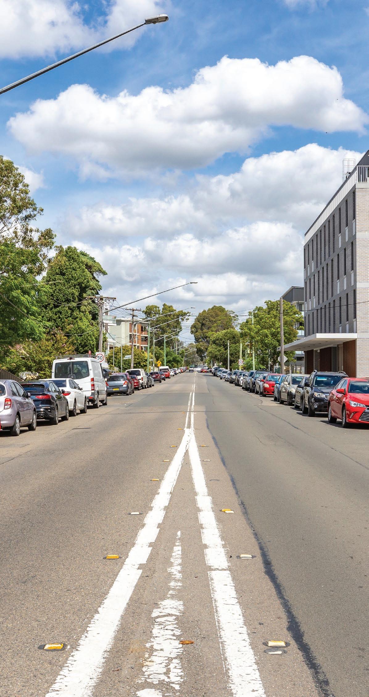
Toongabbie is relatively flat with less than 1:30 slope and easily accessible. The town centre is very permeable with 3.6-metre-wide footpaths along the vibrant streets including Aurelia Street and Portico Parade. Kerb extensions are proposed on Portico Parade to shorten the length of travel across roads for pedestrians, thereby improving safety. Pedestrian crossing throughout the centre will be upgraded and raised where possible to slow down vehicle traffic.
To ensure streets remain vibrant and liveable, footpath widths will need to accommodate an increasing population in the centre, as well as street furniture, signage and opportunities for outdoor dining. Transport for NSW Walking Space Guide provides recommended widths for footpaths. Smart technology will enable Council to monitor pedestrian movement patterns on footpaths to ensure they remain safe and comfortable.
Currently, all cycling is on-road within the Centre. Opportunities may be considered for supporting cycling infrastructure, including dedicated bike lanes (where feasible), signage and bike parking stations.
There are three regional cycleway routes that traverse the centre Toongabbie to Prospect Creek (via Pemulwuy); Toongabbie to Parramatta (via Westmead and Girraween Creek) and Toongabbie to Parramatta (via Pendle Hill, Wentworthville, and Westmead).
5.4 Movement Corridors


5.4 Movement Corridors
5.4.2 Cars and Freight
Local traffic movement is along Aurelia Street, Portico Parade and Junia Avenue. The major vehicular movement corridors are located on the periphery roads surrounding the town centre and include Targo Road, Toongabbie Road, Portico Parade, Cornelia Road and Octavia Street.
All traffic areas within the centre speed limit are 50km/hr.
Freight access traverses the periphery of the town centre along the regional roads of Wentworth Avenue and Cornelia Road.
The town centre is well serviced by car parking options.
78 unrestricted time limit carparking carparks on Junia Avenue
On street parking is available throughout the centre with designated on street disabled parking on Aurelia Street (4 spaces).
There are low occurrences of traffic incidents within the town centre.
Opportunities for improvements to pedestrian crossing points, sightlines and legibility of the road network will improve safety and comfort for all road users.
6 Urban Design Elements
6.1 Street Layout and Typology
Streets are a critical component and building block of the urban environment that serves a key role in the public domain. Street design must be in accordance with the Australian Standards for pedestrian access on footpaths, as defined in AS/NZS 1428.4.1:2009 and it must follow these principles:
Reinforce the street hierarchy, its use and character
Create a pedestrian-friendly environment and the safe crossing and movement of carriageways for all people
Ensure streets and public spaces are inclusive and liveable for all with consideration to Cumberland City Council’s Disability Inclusion Action Plan 2022-2026.
Allow references to the site’s geographical and cultural history
Be sufficiently robust and durable to withstand heavy use, and be easily maintained
Maximise permeability for water infiltration
6.2 Street Furniture and Lighting
Street furniture contributes to the delivery of placemaking objectives and vibrant streetscapes for the public to enjoy. Lighting is an essential element that can influence the level of activity and use of the public domain. The installation of suitable lighting, passive surveillance and security will improve the safety of the community. Lighting also plays a role in reinforcing legibility and promoting street activation that supports the night economy.
There is opportunity to improve current street lighting to support sustainability and urban design objectives, as well as to also explore ideas for lighting activation in coordination with public art installations, particularly in shared zones and civic areas. A thoughtfully curated palette of outdoor dining furniture such as parklets, standing bars, seats and tables will activate the street space, encourage social interaction, and support local businesses along the main street.
The Disability Discrimination Act 1992 (DDA) ensures public areas are accessible to all ages and abilities. Street furniture within the public realm to be DDA compliant.
Street lighting must be in accordance with the Australian Standards for lighting in pedestrian areas, as defined in AS/NZS 1158.3.1:2020 and AS/NZS 60598.2.3:2015.
Street furniture and lighting elements should:
Be robust and durable in material
Define a sense of place and respond to the local history and cultural values of the site
Activate the public domain that attracts and engages people
Provide comfort and amenity
Complement the placement of street trees and landscaping elements
6.3 Street Trees and Landscaping
Street tree planting and landscaping throughout the centre and will assist in providing shade, mitigating urban heat island effects, improving air quality and stormwater drainage. The increase in urban tree canopy cover will also assist in and delivery of Green Grid connections across Greater Sydney.
Tree lined streets can also be an effective traffic calming device to encourage driving at lower speeds resulting in pedestrian friendly streets.
It is proposed that existing established trees particularly on the Centre’s periphery roads shall be retained and protected. New tree species have been selected to complement the existing street tree palette to integrate future development into the existing neighbourhood fabric. Nominated tree species were selected for their hardiness and will grow within highly urbanised environments.
The selection of street trees and landscaping should be in accordance with Cumberland Urban Tree Strategy 2020 and follows these principles:
Create an aspirational and high-quality urban landscape by selecting species that will grow in existing conditions and respond well to future development.
Ensure street trees and planting contribute to enhance local identity and context
In outdoor seating areas, to consider thermal comfort and provide deciduous shade-bearing trees in summer months that will allow solar access in winter months.
Promote Water Sensitive Urban Design (WSUD) through selection of the tree species that require few inputs, such as irrigation.
Provide consistent spacing and visual continuity along the street.
Facilitate passive surveillance and not pose a hazard.
Incorporate WSUD including rain gardens, tree pits and other design measures to enhance flood protection and stormwater management.
The species selected will respond to the scale and visual prominence of streets, lot layout, street lighting, services and drainage layout and required to provide visual amenity, shade, and temperature control.
SHRUB PLANTING

Anigozanthos ‘Big Red’

Liriope muscari ‘amethyst’
STREET TREES

Angophora floribunda

Tristaniopsis laurina ‘Luscious’

Anigozanthos ‘Bush Pearl’

Lomandra longifolia ‘Nyalla’

Eucalyptus ampifolia

Zelkova serrata ‘Green Vase’

Xerochrysum viscosum

Brachyscome

Lagerstroemia indica ‘Sioux’

Santolina chamaecyparissus

Grevillea ‘Winter


Melaleuca decora

Lophostemon confertus Where the opportunity exists, incorporate planter boxes and hanging baskets to provide colour and visual interest throughout the local centre.
Pyrus calleryana ‘Cleveland Select’
Tristaniopsis
Zelkova
6.4 Paving
To provide a quality pedestrian surface treatment throughout the centre, the following elements need to be considered:
Visual and tactile qualities of the paving should accessibility communicate the function characteristics of the street.
Use pavers that are flexible, easy to remove and relay. Use sustainable locally sourced and readily available paving materials.
Integrate pebblecrete pavers with new pebblecrete pavers so that paving reads as a continuous legible palette.
Where the opportunity exists, work with Council to design and install decorative paving that reflects the interests of the community. Integrate decorative paving within upgraded streetscapes, park areas and seating areas, subject to approval by Council.


6.5 Signage
A coordinated approach for the delivery of signage will provide clear and easy access to destinations and assist in the navigation around the town centre. Signage and banners should be in accordance with Council’s branding guideline and enhance legibility and a sense of place. This includes:
Provide continuity in the design approach (placement, material, and look).
Avoid visual clutter in design and form.
Complies with sight line requirements as per traffic engineering specifications.
Contributes to street activation and urban amenity.
Opportunities for heritage signage in the Toongabbie town centre and surrounds will also be considered.
6.6 Smart Infrastructure
To inform agile placemaking and facilitate data-driven planning for the future, Council will incorporate smart technologies and infrastructure within its town centres.
Incorporating smart technology and infrastructure in our public domain is a useful tool to enhance the public amenity by providing real-time data that measure impacts on local microclimates, monitor car parking demand, as well as improve public safety and security.
There is an opportunity to further explore and deliver integrated digital design solutions and utilities that will contribute to the resilience and innovation objectives for the town centre.

SMART CITIES
7.1 Toongabbie Town Centre Precincts
There are three identified precincts within Toongabbie Town Centre, each with a distinctive character. The following section outlines the character, public domain attributes and public domain elements for each precinct.
Portico Precinct
Portico Precinct is centred on Aurelia Street, a vibrant main street supporting retail and business. Other streets within this precinct include The Portico, Portico Parade, Wentworth Avenue, Toongabbie Road and Junia Street.
Jirramba Precinct
Jirramba Precinct is centred on Junia Avenue to the north-west, and includes top shop housing, Greystanes Creek, recreation, and bushland areas. Other streets within this precinct include Octavia Street and Portico Parade.
Toongabbie Road Precinct
Toongabbie Road Precinct is the gateway to the town centre from the south and is centred on Toongabbie Road and Targo Road.
7.2 Toongabbie Town Centre
Public Domain
Footpaths within precinct and surrounds:

New pebblecrete pavers along Aurelia Street and Portico Parade
Street Furniture:


Decorative paving with artwork proposed along Aurelia Street and Portico Parade

Concrete for all other paved areas (Natural Grey with no added oxide)


Street Functional Decor:

Lighting and Banners
- Mounted light poles (MFP) with banner arms
- LED luminaires in natural white
(refer to AS/NZS 1158.3.1:2020
Pedestrian Area Lighting
- Luminaires for road and street lighting
(AS/NZS 60598.2.3:2015)
- Council to supply banners
Equitable Access - Improve legibility for all accessibility:

Tactile Ground Surface Indicators (TGSI)
- Warning tactile, directional tactile
Grade 316 stainless steel
Slip resistances AS/NZ 4586-2013
Appendix A class 5 (very low)
Installation shall comply with AS 1428.1-2009
Clean and green WSUD

Best practice Water Sensitive Urban Design (WSUD) measures will be incorporated into design. This will assist with reducing potential flooding and maximising opportunities for healthier tree root growth and canopy cover where applicable.
7.3 Portico Precinct

7.3 Portico Precinct
Public Domain

Main Street Retail
Aurelia Street will be reinforced as a vibrant retail strip with improved pedestrian pavement, street furniture, greenery, and public art. This approach can support existing businesses, provide opportunities for new businesses, which can facilitate a greater choice of services for the local community.


Celebrating our Community Portico Park will be upgraded with opportunities for families to gather, children to play and the community to celebrate that will improve liveability within the centre and provide positive health and wellbeing benefits.
Pedestrian Access
Permeability within the town centre will be improved with upgraded pedestrian crossings and kerb build outs at intersections.
7.4 Jirramba Precinct Public Domain

7.4 Jirramba Precinct
Public Domain

Jirramba Reserve
Jirramba Reserve will be revitalised offering a shaded green space for residents to stop and rest, and the opportunity for informal social interaction.


Connections to Nature
The natural environment within Jirramba Reserve will be protected and enhanced to increase our resilience against urban heat and improve air quality as well as mitigate impacts of flooding.
Public Art
Work with first nations and the community to implement public art within Jirramba Reserve and throughout the town centre to ensure that Toongabbie remains distinctive and attractive for both residents and visitors alike.
7.5 Toongabbie Road Precinct Public
7.5 Toongabbie Road Precinct
Public Domain

Urban Cooling
Increasing green coverage throughout the Precinct will assist in mitigating urban heat build up to provide cooler places to be enjoyed by the community.

Open Space
Enhance Keene Park to provide places to play, opportunities for families to gather and a space for workers to have lunch breaks.

Public Art
Opportunities for public art that reflect the community spirit and contributes to making Toongabbie town centre a distinctive place.
The works outlined in the Public Domain Plan will be delivered by Council as part of its Capital Works Program, or by the private sector through areas of future development activity.
The Public Domain Plan for the Toongabbie town centre will be progressively implemented in stages. The timing of works will be determined by development activity, available funding for Council to use, or the delivery of works in accordance with local infrastructure contributions or planning agreements.
The initial stages of works will be funded through local infrastructure contributions already collected, with a focus on improvements to Aurelia Street, Portico Park and Girraween Park.
The areas where the Public Domain Plan are implemented by a developer, the following guidelines shall apply:
The Developer will be responsible for the upgrade works that interface with the street frontage to the standard and in accordance with this Public Domain Plan.
Public domain works to be in accordance with the Works Schedule prepared by Council.
Construction works for the public domain to be approved by Council’s representative prior to final sign off.