Cumberland City Council acknowledges the traditional custodians of the land on which Cumberland stands, the Darug People, and pays respects to elders past, present and emerging.
We acknowledge the Aboriginal and Torres Strait Islander Peoples as the First Peoples of Australia.
Cumberland City Council also acknowledges the Aboriginal and Torres Strait Islander Peoples living in the Cumberland Local Government Area and reaffirms the important work with all Aboriginal and Torres Strait Islander Communities to advance reconciliation.
Introduction
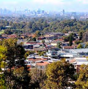
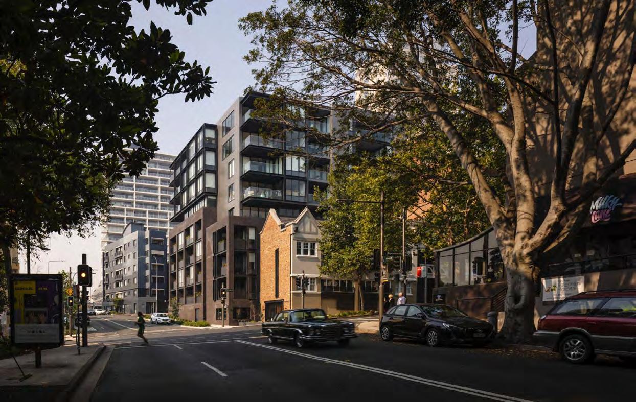
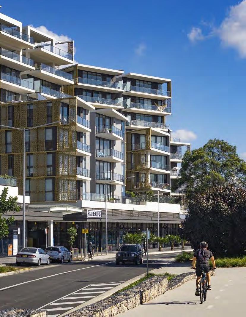
Woodville Road Corridor lies at the heart of Cumberland and serves as an important link for the proud and diverse communities who live, work and play there.
Woodville Road faces challenges in implementing appropriate land uses, transport links and built form that can co-exist with the heavy vehicular traffic along the corridor.
As Cumberland’s population continues to grow, it is important to ensure that the Woodville Road Corridor continues to serve and provide for the communities who live by and use the corridor.
The strategy aims to outline the vision for the corridor and guide future development to ensure that vision is realised.
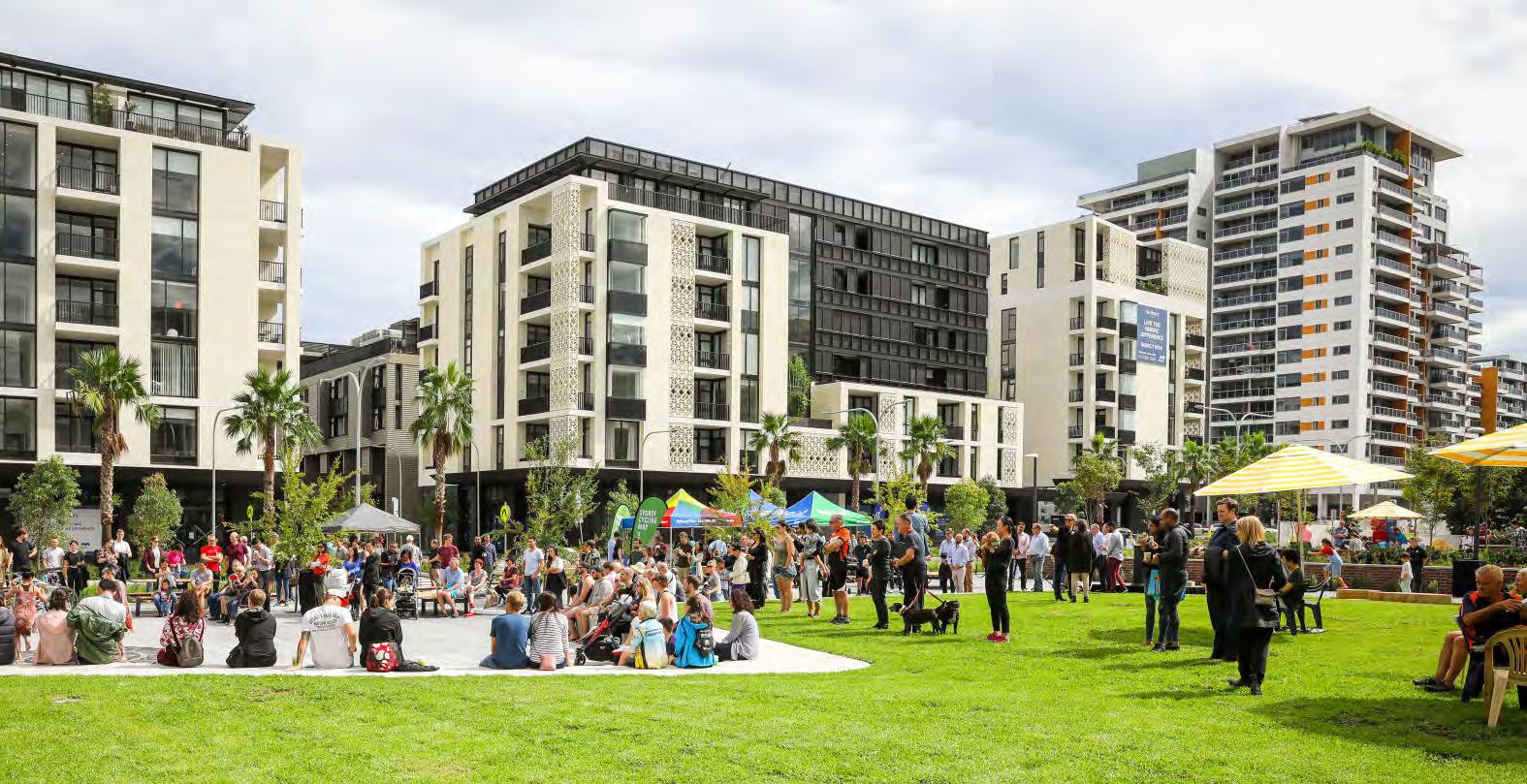
Figure 1: Granville Park, CM+ 2023
4 D raft Woodville Road Corridor Strategy 2025 – Cumberland City Council
How to Use this Document
The Woodville Road Corridor Strategy is a local land use policy that sets out Council’s vision and priorities for future development along the Corridor.
It is intended to guide future Planning Proposals and Development Applications for sites in the Corridor in understanding the context, priorities and built form to design to and achieve.
This document should be referenced as a local strategy and matter for consideration in accordance with the diagram below.
State Enviromental Planning Policies
Regional Plan
Vision and Directions - Objectives - Strategies and Actions
District Plan Planning Priorities and Actions
Local Strategic Planning Statements (housing, economic etc)
Planning Proposals
Land Use and Infrastructure Plans
Strategy
Planned Precincts and Growth Areas (SEPP or s9.1 direction)
Local Environmental Plans Zones - FSR - Height
Development Applications
Woodville Road Corridor Vision and
Who We Are
The Woodville Road Corridor is home to a diverse population with 49.7% of residents living in the Corridor born overseas. The Corridor’s population is ageing and generally has poorer health outcomes compared to the rest of the Cumberland population.
49.7%
12,578
41,844
236,996
Merrylands East
• Over 50% are couples with children households
• 30% people are under 18 years old
• High average household size at 3.7
Granville
• 33.5% high density
• 25% low income households
• 56.3% born overseas
• 16.5% no cars
• High average household size at 3.6
Guildford East
• 18.5% no internet access (2016)
• 8.1% need for assistance core activities
• 52.9% no educational qualifications
• 19% youth disengagement
• 14.3% social housing
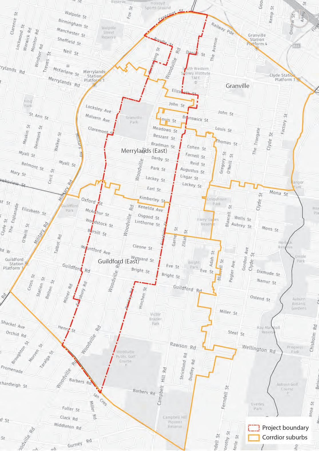
Project Boundary
Corridor Suburbs
Figure 2: Suburbs that traverse Woodville Road, Cred Consulting, 2022
What We Heard
Early engagement on the Woodville Road Corridor planning framework was undertaken from November to December 2020. Common themes expressed amongst the community were:
Woodville road is congested and noisy
There is a lack of variety in shopping and eating options
There is a lack of open space especially in the south of the corridor for families to visit, walk their pets and for exercise
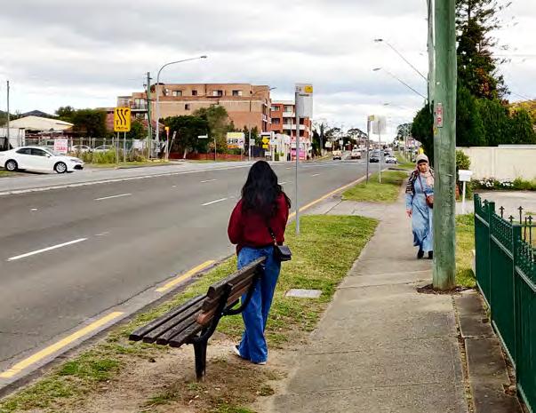
Poor footpaths do not make for a pleasant walking experience
There are limited community facilities along the corridor
There are limited facilities for the culturally diverse community
A lack of east-west connections causing delays from cars trying to exit Woodville Road at limited intersections
There is a lack of trees and shading which makes it very hot in summer
There are poor bus services with only one bus every 30 min in peak times
Woodville Road is too busy to cross at times especially for families with small children and prams
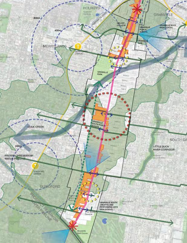
Corridor Constraints
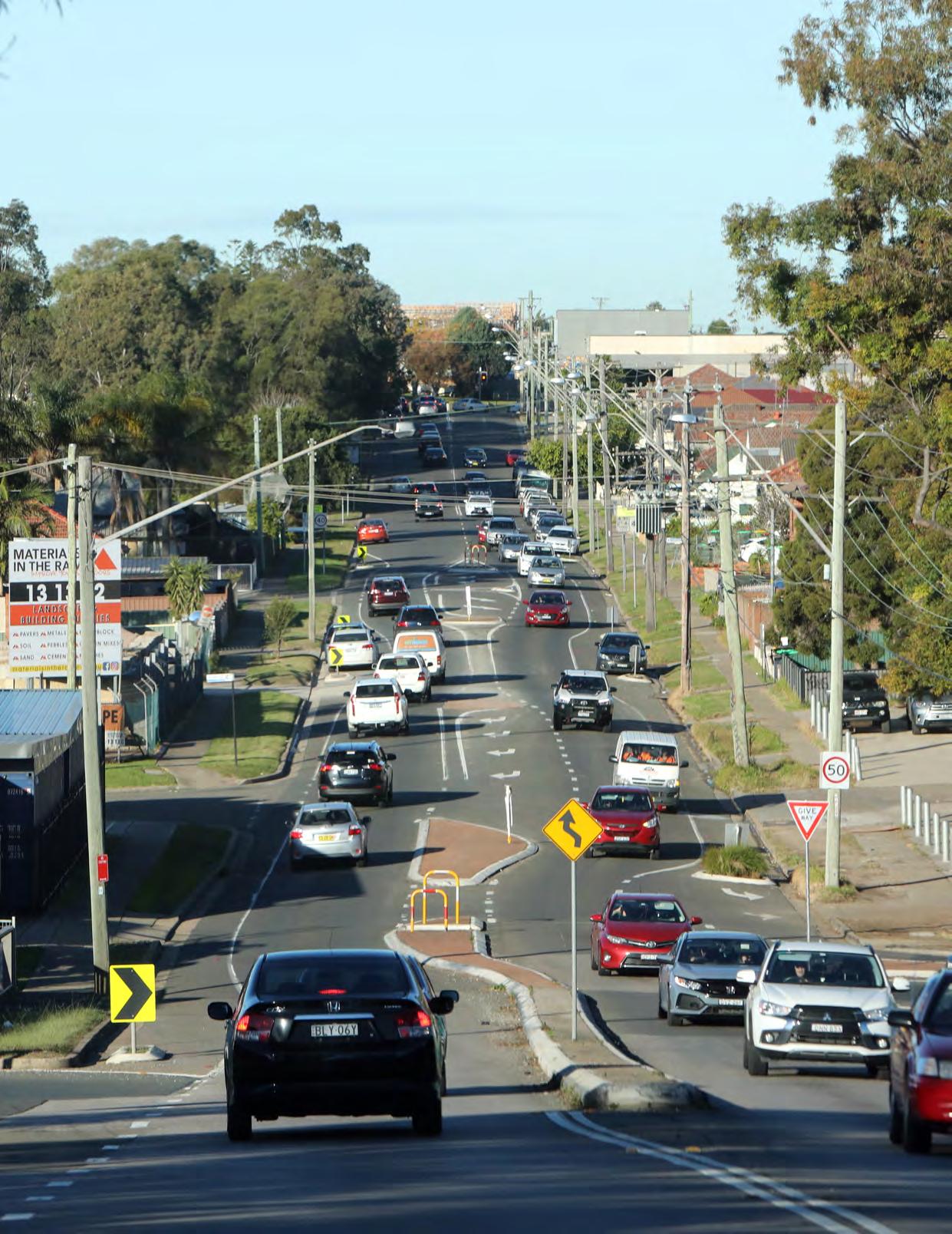
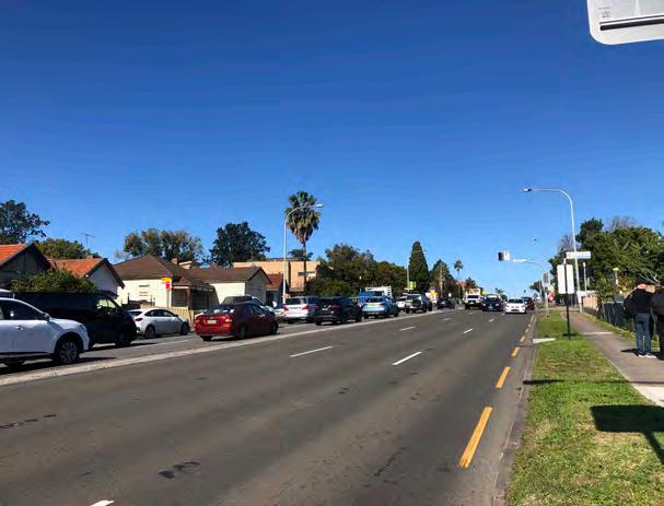
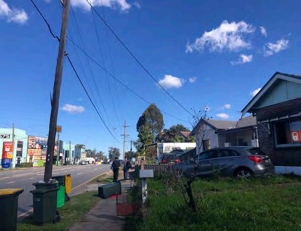
There are many challenges that Woodville Road Corridor faces which prohibits it from functioning as an important link and vital artery for the community.
Some of these challenges include:
• Acts as a barrier, disconnecting communities and limiting interaction.
• Lack of east-west signalised crossings reduces pedestrian activity and connectedness.
• High traffic volume, noise, and air quality issues hinder recreational and social opportunities.
• Lack of identity and a sense of place, reducing community pride and investment.
• Long blocks and limited walkability increase car dependency and decrease physical activity.
• A shortage of affordable housing.
• A shortage of public and active transport.
• Insufficient green spaces and community facilities.
Figure 3: Woodville Road, CM+ 2023
Figure 4: Woodville Road, Cred Consulting, 2023
Figure 5: Woodville Road, CM+ 2023
10 D raft Woodville Road Corridor Strategy 2025 – Cumberland City Council
Figure 6: Challenges Map CM+ 2024
Corridor Opportunities
Whilst there are challenges, the corridor presents a number of opportunities to improve and build on existing amenities and features.
The opportunities in the corridor include:
• Create unique precincts with new places for people to live, work and play.
• Include more community facilities for recreation, education and cultural activity.
• Create a green network with more publicly accessible open space, tree planting and green links.
• Transform the corridor into a safer pedestrian and cycle friendly place with better active transportation options.
• Advocate for improvements in the delivery of public transport.
• More street level pedestrian activity by improving east-west and north-south connections.
• Ensure development matches and respects important places like heritage sites, schools, and parks in size and design.
• Promote building and public space design that is good for the environment
• Advocate for a variety of housing options that are affordable.
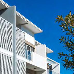
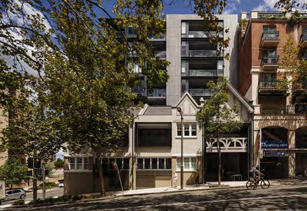
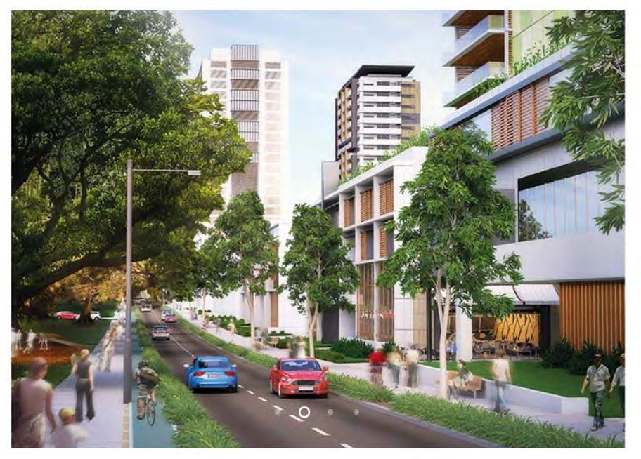
Figure 7: Example of Built Form Source - Payne
Figure 8: Corridor Opportunities, CM+ 2024
Strategic Corridors
Strategic Context
The following strategies and policies help to shape the vision for the corridor
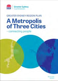
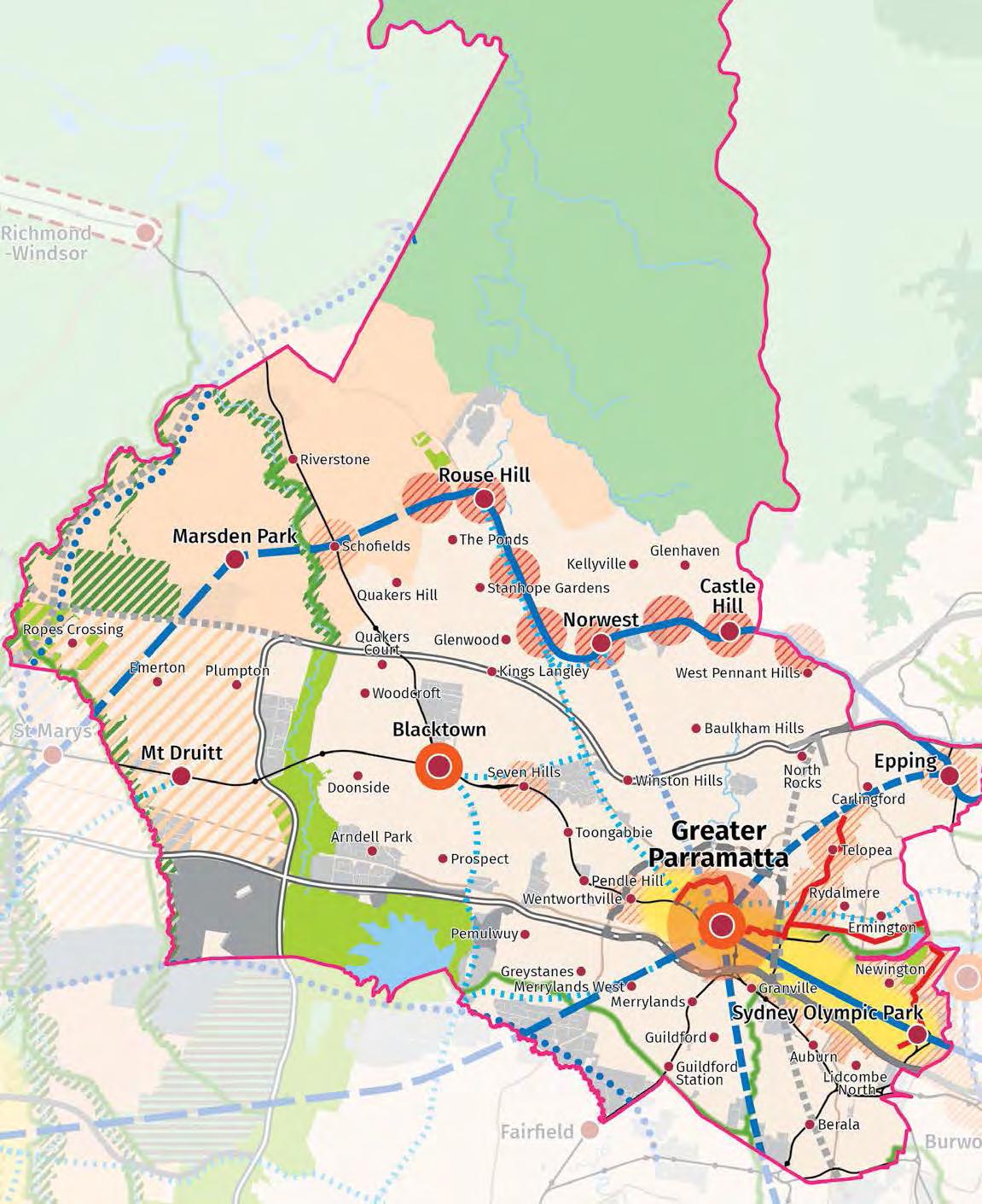
The Greater Sydney Regional Plan: A Metropolis of Three Cities
This Plan by the Greater Cities Commission envisions a 30-minute city, where residents live within 30 minutes travel of their jobs, education and health facilities, services and great places. Reimaging the Woodville Road Corridor presents an opportunity to transform the area into vibrant and livable neighbourhoods that fulfill this 30-minute city vision.
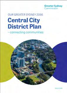
The Central City District Plan
This Plan prioritises transport infrastructure to support population and jobs growth. It focuses on sustainability, diverse housing, and easy access to public transport, schools, hospitals, and community facilities. Woodville Road’s location on the door step of Parramatta will allow for transformative change as the plan aims to enhance connectivity within and between districts, promoting active transport like walking and cycling for better livability.
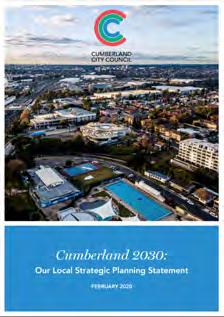
Cumberland 2030: Our Local Strategic Planning Statement
The Woodville Road Corridor is identified as a strategic corridor and key north-south connection within the LGA. The Local Strategic Planning Statement emphasises the importance of the Woodville Road Corridor to facilitate jobs and housing growth.
The Cumberland Local Housing Strategy (LHS)
This Strategy plans for the housing needs of Cumberland for the next 20 years.
By 2036, the population in Cumberland is expected to grow by 30%, to over 300,000 residents. To accommodate this growth, over 28,000 more homes are needed with most of the new housing located in strategic centres and local centres like Merrylands East and the areas around them.
The Cumberland Affordable Housing Strategy
This Strategy outlines priorities for affordable housing over the next 20 years. It is estimated that by 2036, around 10,700 new affordable housing dwellings are needed. With 6,000 to 7,000 already in development, this leaves a gap of 3,700 to 4,700 units.
The Cumberland Affordable Housing Policy sets targets to dedicate additional residential floor space to very-low, low-, and moderateincome households in strategic urban renewal areas. With careful planning, the development of Woodville Road Corridor presents an opportunity to deliver much needed affordable housing for the community.
The Cumberland Employment and Innovation Lands Strategy
This Strategy is a 10-year framework for managing employment and innovation lands in Cumberland. It aims to help new and creative businesses grow by using fresh ways of planning and policies. It also ensures that the rules for how land is used support innovation and specific industries. Woodville Road will provide new retail, business and employment opportunities along the corridor aligning with the objectives of the Strategy.
Cumberland Community Wellbeing Report
This report highlights the strengths, opportunities and needs of the growing community, including the importance of improving active transport, the need for more bus services connecting residents to neighbouring centres, and the need to provide open space and recreation facilities to promote physical activity and community well being.
These initiatives will support Woodville Road’s revisioning and ensure the corridor provides benefits for the community into the future.
Cumberland City Council Open Space and Recreation Strategy
This Strategy identifies the open space gaps present in the LGA and sets the benchmark of high density development to be within 200m of a park at least 0.1ha in area.
The revitilisation of Woodville Road will ensure Cumberland can achieve the goals set out in the strategy, with a strong focus on providing new open spaces and pocket parks for the community.
Cumberland Community Facilities Strategy
This Strategy directs Council’s provision of facilities by prioritising key areas. It ensures that Cumberland’s community facilities evolve to meet changing needs thorough assessment and community engagement. Woodville Road will require renewed focus and investment in community facilities to ensure the Corridor’s growth is catered for in line with the Strategy.
The Corridor Vision
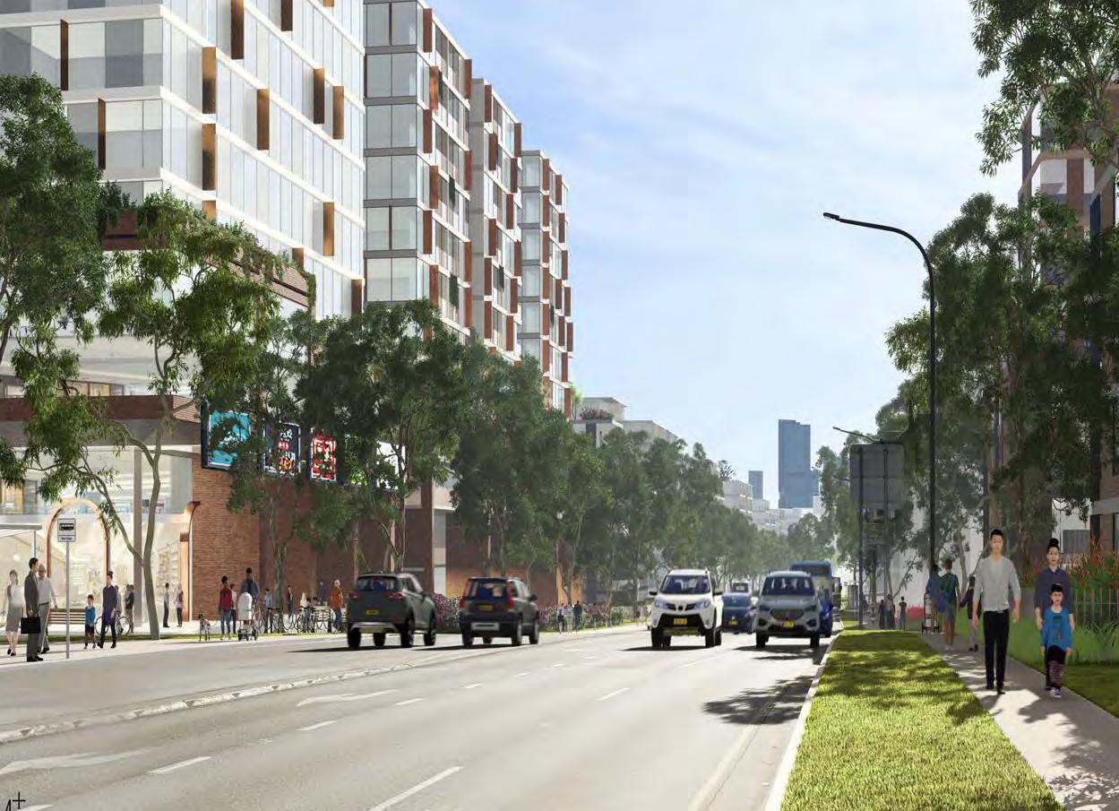
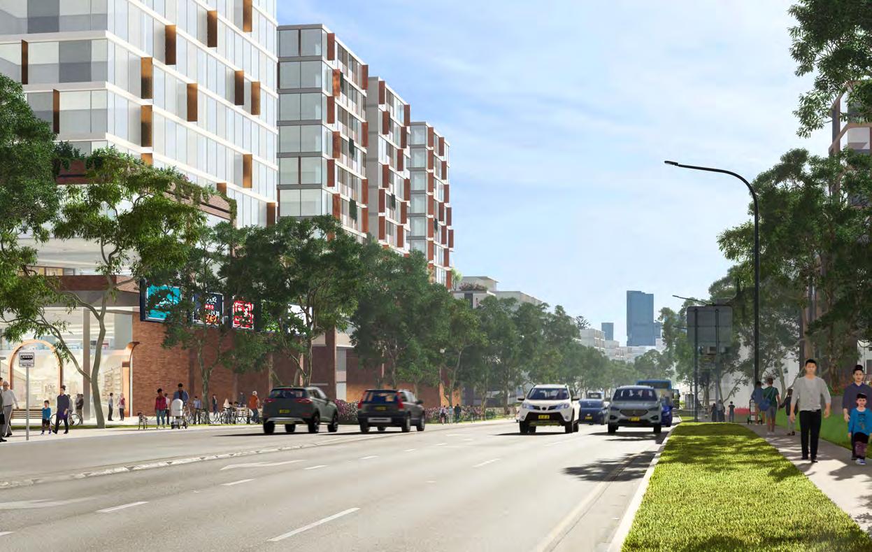
Woodville Road Corridor is to be transformed into a thriving tree lined-boulevard, supporting housing diversity and affordability, jobs and economic growth.
Active transport options including improved walking and cycling links will create opportunities to reduce car dependency, while street planting and the creation of new publicly accessible open space will revitalise the corridor, creating vibrant, safe and livable spaces for residents and visitors alike.
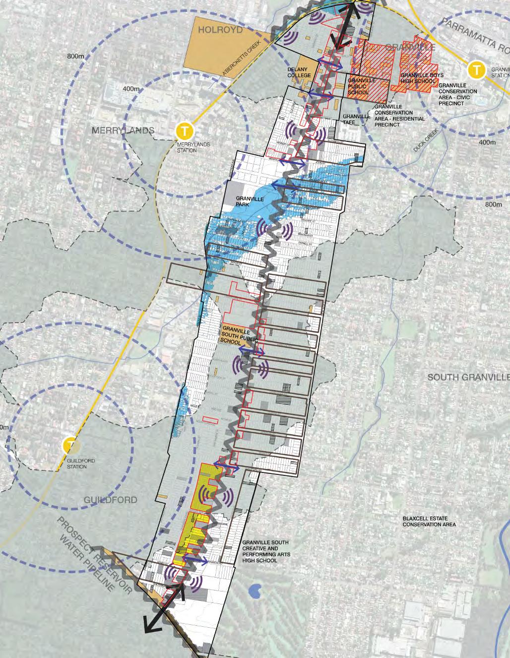
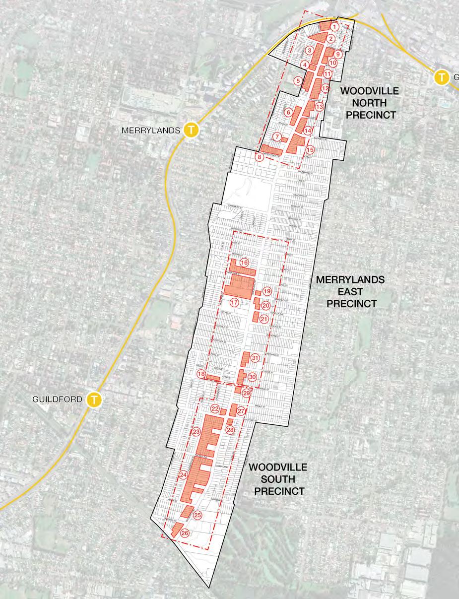
The corridor’s transformation will be focused around the growth of three precincts along
the corridor, being Woodville North, Merrylands East and Woodville South, each with their unique identity, creating new destination hubs for jobs, housing, recreation, retail, dining, culture and community events.
By enhancing accessibility and connectivity, better active and public transport options and increased greenery, we aim to improve activity and overall mobility along the corridor fostering a healthier and more sustainable lifestyle for residents and visitors.
Diverse and affordable housing along with new community facilities and public spaces will ensure that the area remains dynamic and inclusive, catering to the needs of its diverse population.
Figure 10: Connect Built Form Elements through Design, CM+ 2023
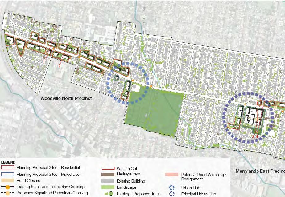
Structure Plan
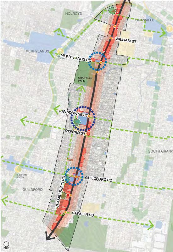
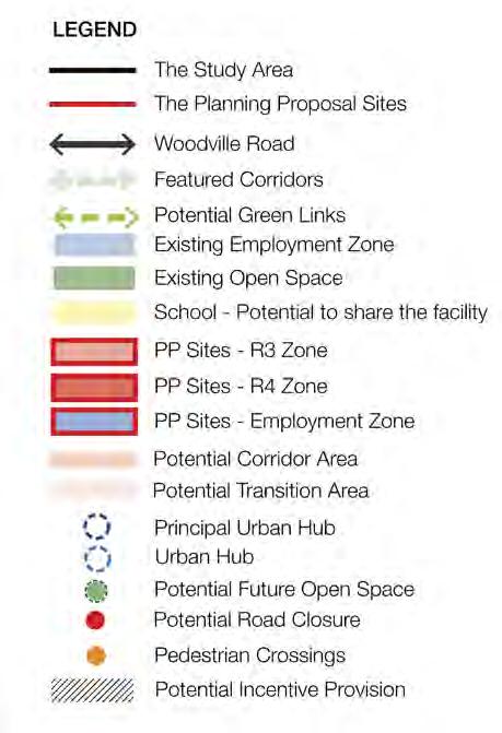
Figure 11: Structure Plan, CM+ 2024
Master Plan
The Woodville Road Corridor Master Plan demonstrates the desired outcome when the Strategy vision and priorities are considered and implemented.
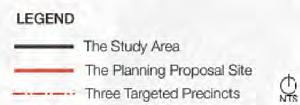
The Master Plan shows the initial 31 Planning Proposal sites that implement the vision and priorities of the strategy and act as catalysts for the renewal of the corridor. Any future Planning Proposals and Development Applications should seek to be consistent with the 31 sites shown in the Master Plan.
Figure 12: Connect Built Form Elements through Design, CM+ 2024
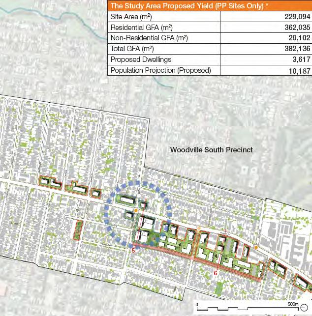
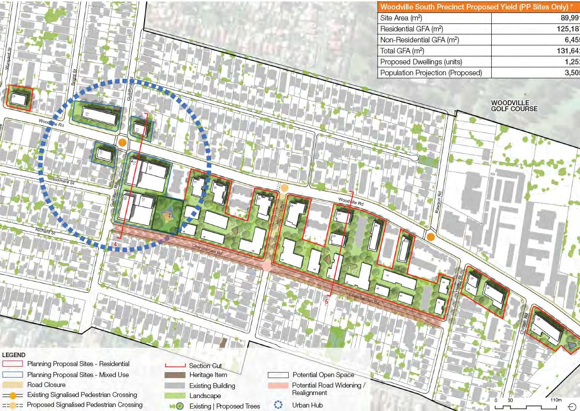
The study area proposed yield (PP sites only)
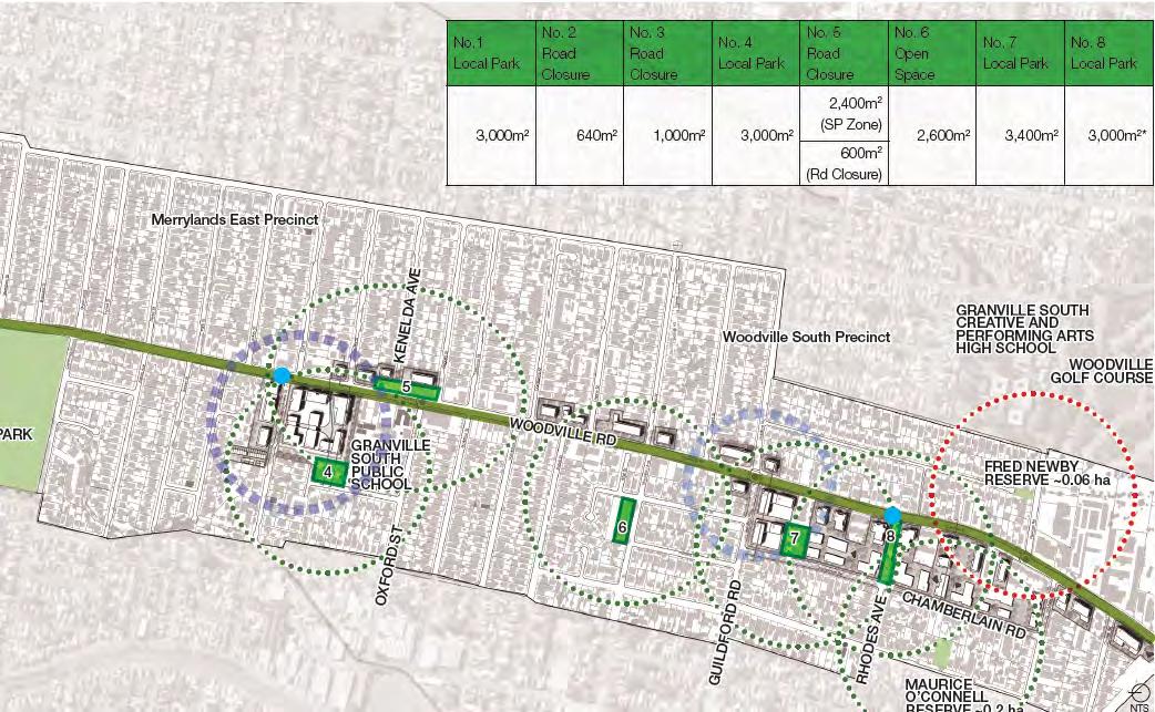
The Precincts
Woodville North Precinct
Woodville North will be transformed into a diverse and vibrant neighbourhood providing urban living on the doorstep of Parramatta CBD, with a mix of uses. The new affordable housing offerings will be further strengthened by the density uplift. Precinct amenity will be improved by the creation of a new publicly accessible park and complementing existing regional open spaces, local parks and providing easy access to public transport and the Parramatta CBD. Existing heritage items will be respected and complemented.
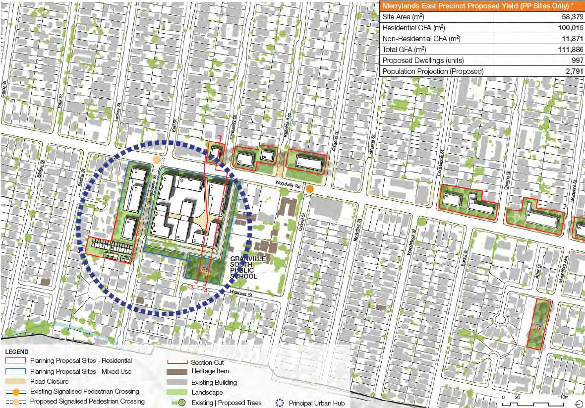
Merrylands East Precinct
Merrylands East will be transformed into a new neighbourhood catalysed by the redevelopment of the John Cootes site, which will include affordable housing and a new publicly accessible park. The precinct will provide a variety of housing types integrated with local open spaces and green and pedestrian friendly streets. It will provide a mix of retail, social and business activities that will define its social life, and support community wellbeing.
Woodville South Precinct
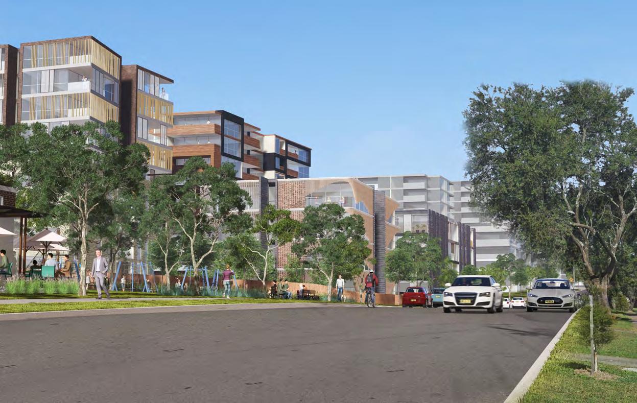
Woodville South Precinct will be an area offering living and working opportunities that leverage its close proximity to the general industrial area. A mix of ground floor uses will improve the area’s activities. New publicly accessible parks will improve the precinct’s living amenity.
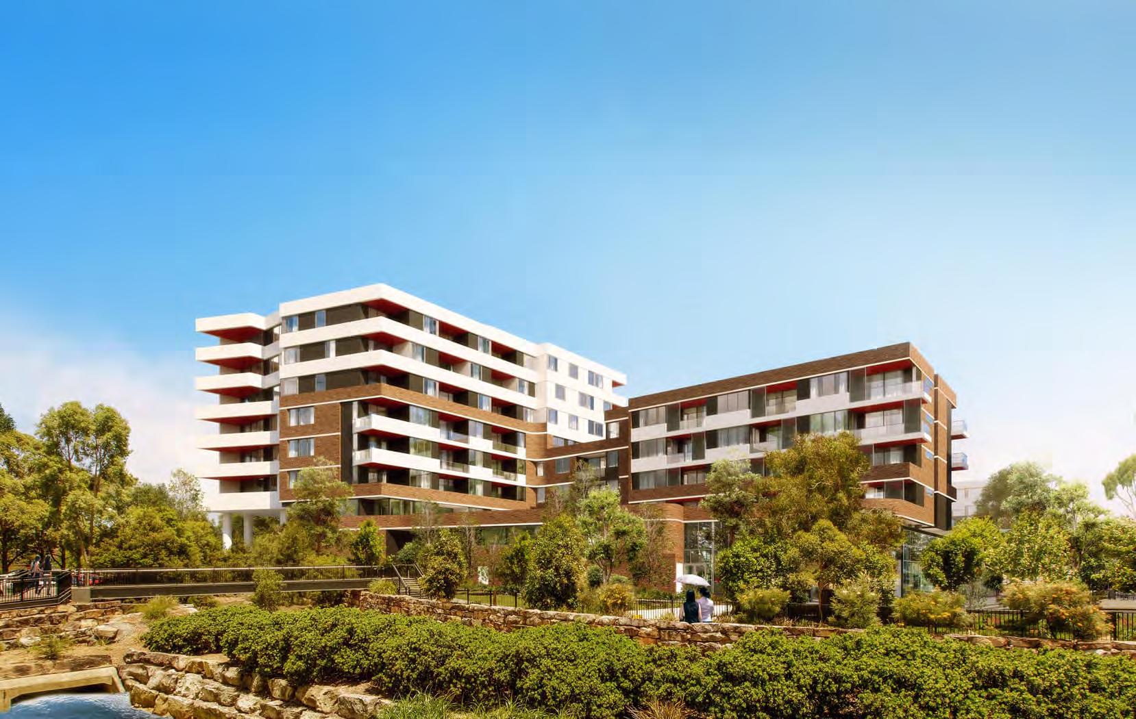
Figure 13: Heritage Item interface with new buildings, example built form for Woodville North, Woods Bagot
Figure 14: Existing Approved Landscape Plans for DA2020/0493 on Site 17
Figure 15: Residential facade to the street, example built form for Woodville South, Binah
The Woodville North Precinct will be a gateway to Parramatta with easy access to the Parramatta CBD via frequent bus services or active transport along the Corridor’s tree lined pedestrian and cyclist paths.
Residents will live closer to places of work and education with affordable housing options provided for residents needs.
Mixed use zoning around Granville Park will create a vibrant and exciting centre providing dining and retail option closer to home, and new community facilities will provide places for residents and visitors to come together for learning and cultural activities.
Residents and visitors will be able to enjoy new public parks and playgrounds within walking distance of home.
More active transport options including pedestrian and cycle paths will allow for easier movement along the corridor, getting people where they need to go quickly and safely. New crossings will allow for easier and safer access across Woodville Road.
Increased tree canopy along the corridor will provide greening and shade for a better walking and cycling experience.
High frequency bus services will better connect the Woodville Road Corridor for easy travel between hubs along the corridor and between Parramatta and Bankstown.
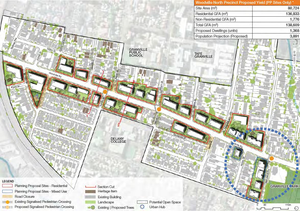
Figure 17: Illustrative Master Plan –Woodville North Precinct, CM+ 2024
Figure 18: Artist impression of Woodville North Community Park, CM+ 2023
Figure 19: Example of streetscape in Woodville North, Woods Bagot
Merrylands East
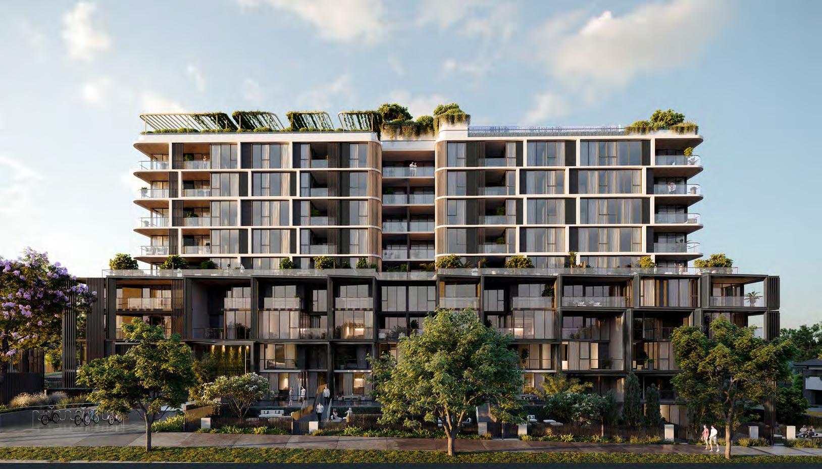
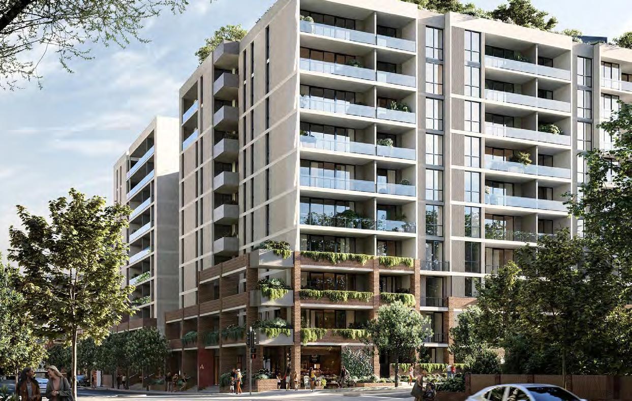
The Merrylands East Precinct will be the new central community hub of Woodville Road and a new local centre in Cumberland City offering an exciting urban lifestyle with retail, dining and thoughtfully designed living and community spaces on the residents doorstep. High density apartment living will be centred around an urban plaza creating a ‘village’ for residents and visitors to shop, dine, and use the centre’s open spaces for recreation.
Mixed use zoning along Woodville Road and Lansdowne Street will provide opportunities for retail and businesses offering a range of services to residents and visitors creating employment opportunities closer to home.
Residents and visitors will be able to enjoy new open space areas as part of the John Cootes redevelopment, creating a new sense of place and identity bringing the community together.
More active transport options including pedestrian and cycle paths will allow for easier movement along the corridor and increased tree canopy will provide greening and shade for a better walking and cycling experience.
High frequency bus services will better connect the precinct to Parramatta and Bankstown.
Figure 20: Illustrative Master Plan –Merrylands East Precinct, CM+ 2024 Merrylands East Precinct
Figure 21: Artist impression of Merrylands East, CM+ 2023
Figure 22: Example of street facade in Merrylands East, PTW
Woodville South
The Woodville South Precinct will undergo a transformative change with higher density urban living providing increased housing options.
Mixed use zoning on the four corners of the intersection of Guildford Road and Woodville Road will provide opportunities for retail and businesses offering a range of services to residents and visitors, in turn creating more employment opportunities closer to home.
Residents and visitors will be able to enjoy new open space areas with the addition of a new public park and playgrounds within walking distance of home.
More active transport options, including pedestrian and cycle paths, will allow for easier movement along the corridor and to Guildford Station. Increased tree canopy will provide greening and shade for a better walking and cycling experience.
High frequency bus services will better connect this precinct to other hubs along the corridor and to Parramatta and Bankstown.
The potential widening of Chamberlain Road will be investigated to balance urban design outcocmes and efficient traffic movements.
Figure 23: Illustrative Master Plan –
Woodville South Precinct, CM+ 2024
Woodville
Figure 24: Artist impression of Woodville South Community Park, CM+ 2023
Figure 25: Example of street facade in Woodville South, Binah
The Corridor Priorities
Affordable and diverse housing
Accessible living in the Woodville North and Merrylands East Precincts with a range of housing options close to schools, shops and work will be provided.
Strategy Action
Deliver housing diversity and affordable housing to suit changing needs
Affordable and diverse housing options will be provided in the Woodville North and Merrylands East Precincts providing much needed housing solutions for singles and families, which contribute to achieving the objectives of Cumberland’s Local Housing Strategy and Affordable Housing Strategy.
Timeframe 0-2 years 3-7 years 7+ years
Implement Affordable Housing Incentive Provisions in Cumberland Local Environmental Plan 2021 to improve the likelihood of provision of affordable housing in the corridor •
Implement an affordable housing contribution scheme which will be applicable to selected sites in the corridor
Provide a range of high and medium density housing options with diverse built forms which demonstrate design excellence
Ongoing
Ongoing
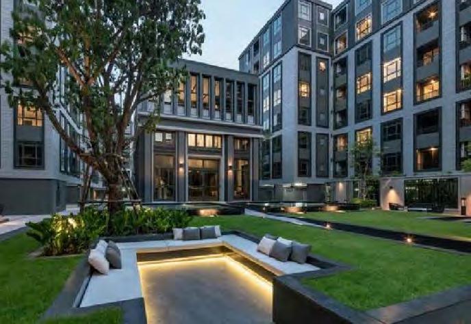
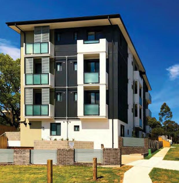
Figure 26: Tetris Village Guildford, Evolve Housing, Timothy Hartridge
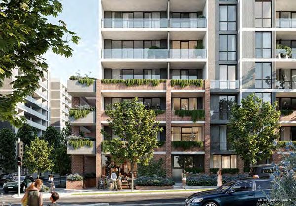
Figure 27: Example of diverse built form, Domain
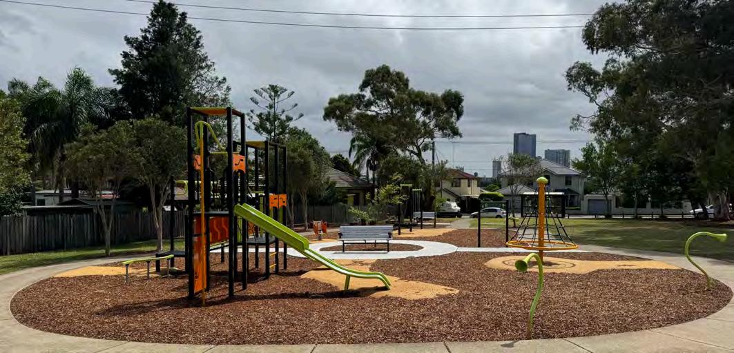
Open space and recreation
Urban living will intertwine with nature through expansive parks, intimate green spaces, and thoughtfully designed high-density developments, providing residents a vibrant, healthy lifestyle with community connections, improved wellbeing, and ample recreational opportunities.
Woodville Road will enjoy access to a new publicly accessible Key Local Park in each precinct through dedication to Council as part of future development, as well as access to future potential supporting pocket parks. These may be provided through repurposing small sections of local roads, which will be subject to future community consultation and investigation by Council. All high density development will have access to parks which aligns with Cumberland’s Open Space and Recreation Strategy.
The open spaces will provide green linkages for residents and visitors to enjoy and connect and will lead to better health outcomes for the
growing community.
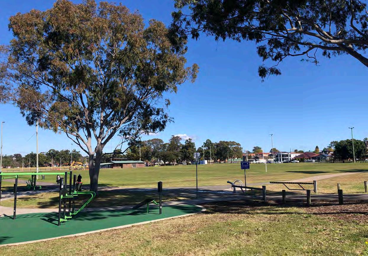
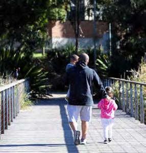
The community along the corridor will also benefit from exciting open space and recreational areas, such as Granville Park.
Figure 28: Bennalong Park, Granville
Potential Future Supporting Pocket Parks will be subject to future community consultation, investigation and council deliberation.
D raft Woodville Road Corridor Strategy
Cumberland City Council
Deliver new open space and new recreation facilities that meet the needs of the Community
Increase the quality and capacity of existing open space and recreation facilities
Implement Public Open Space Incentive Provisions in the Cumberland Local Environmental Plan to improve the likelihood of new public parks in the corridor
Progress the investigation of potential supporting pocket parks
Implement new and enhanced recreational facilities to meet the needs of a growing community
Dedication to Council through redevelopment and embellishment of a new larger sized publicly accessible park in each precinct to meet the needs of a growing community.
Work with local schools to explore shared community use of open space
Progress the acquisition of the Mountford Avenue properties that are currently identified in the Cumberland Local Infrastructure Contributions Plan for the provision of a new local park
Community facilities
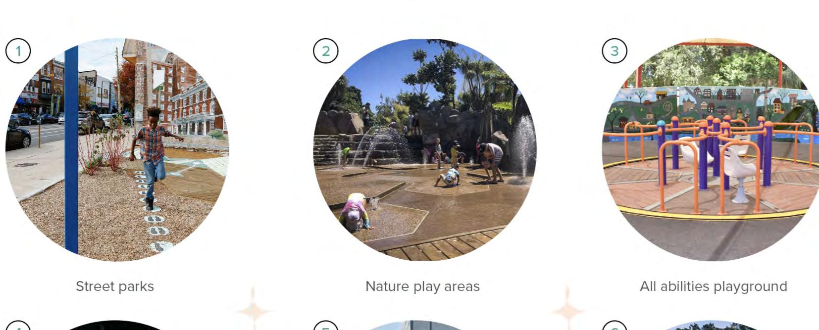
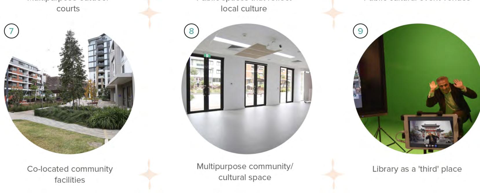
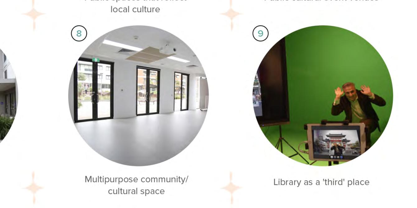
New and enhanced community facilities within the Woodville Road Corridor area will foster social connections and providing spaces where families and individuals can play, learn, and create lasting memories.
Woodville Road will enjoy proximity to new and/ or updated community facilities as the corridor grows. Community facilities will offer library access, computer access, meeting rooms, art, multi-purpose and cultural spaces.
These spaces play a crucial role in fostering a sense of community in the corridor, encouraging interaction among people of different ages and diverse backgrounds.
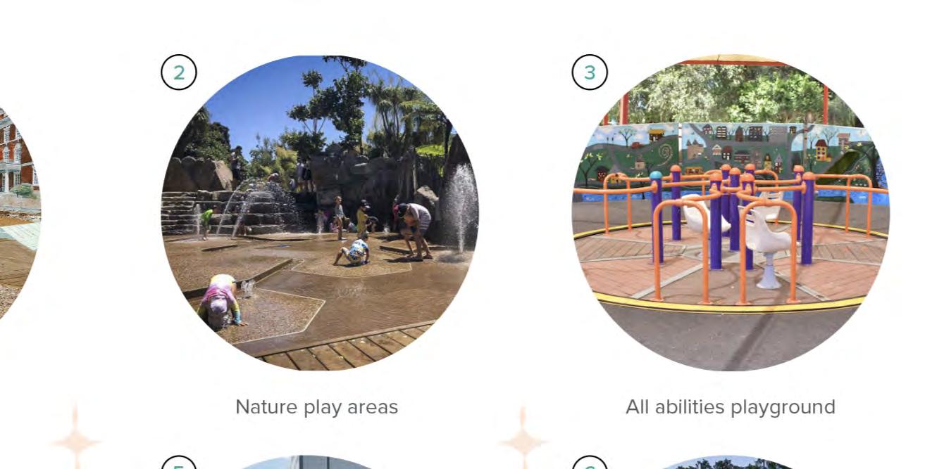
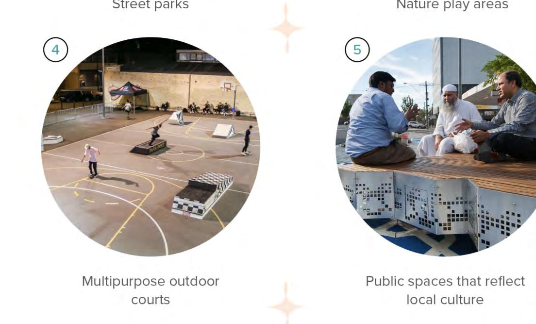
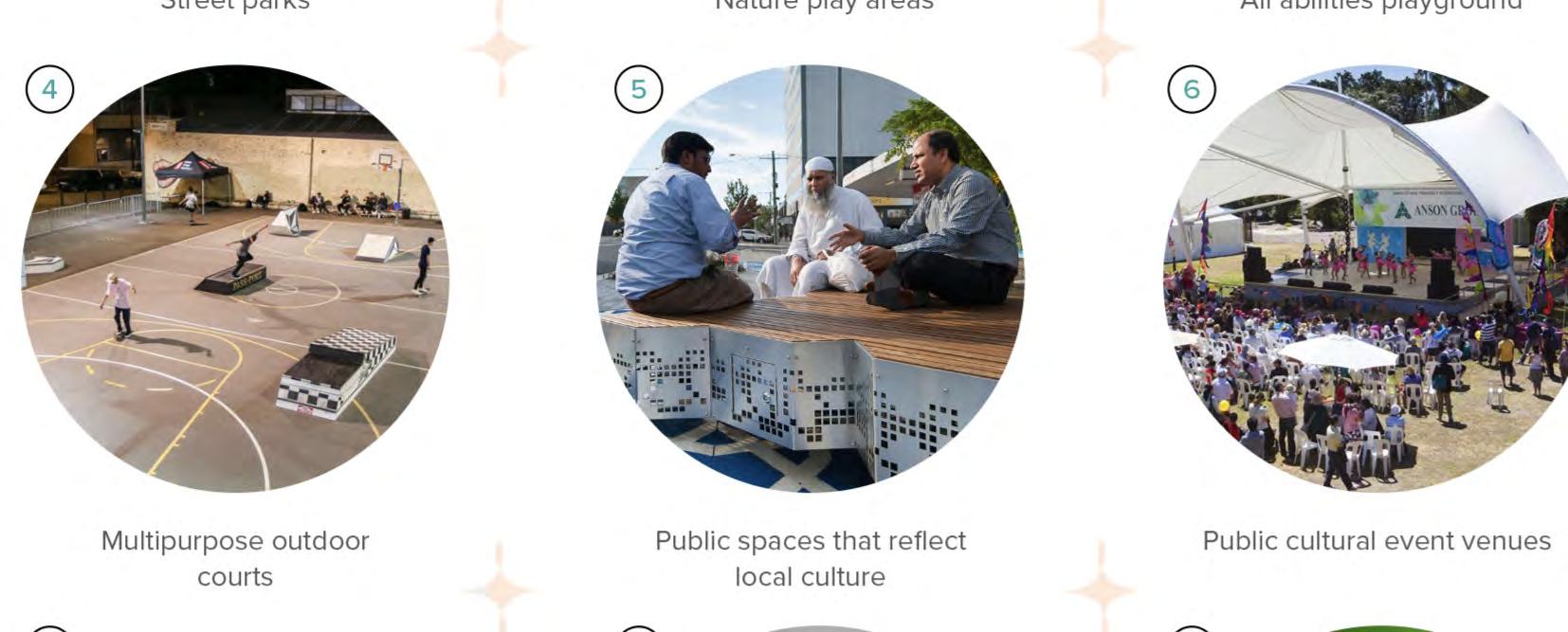
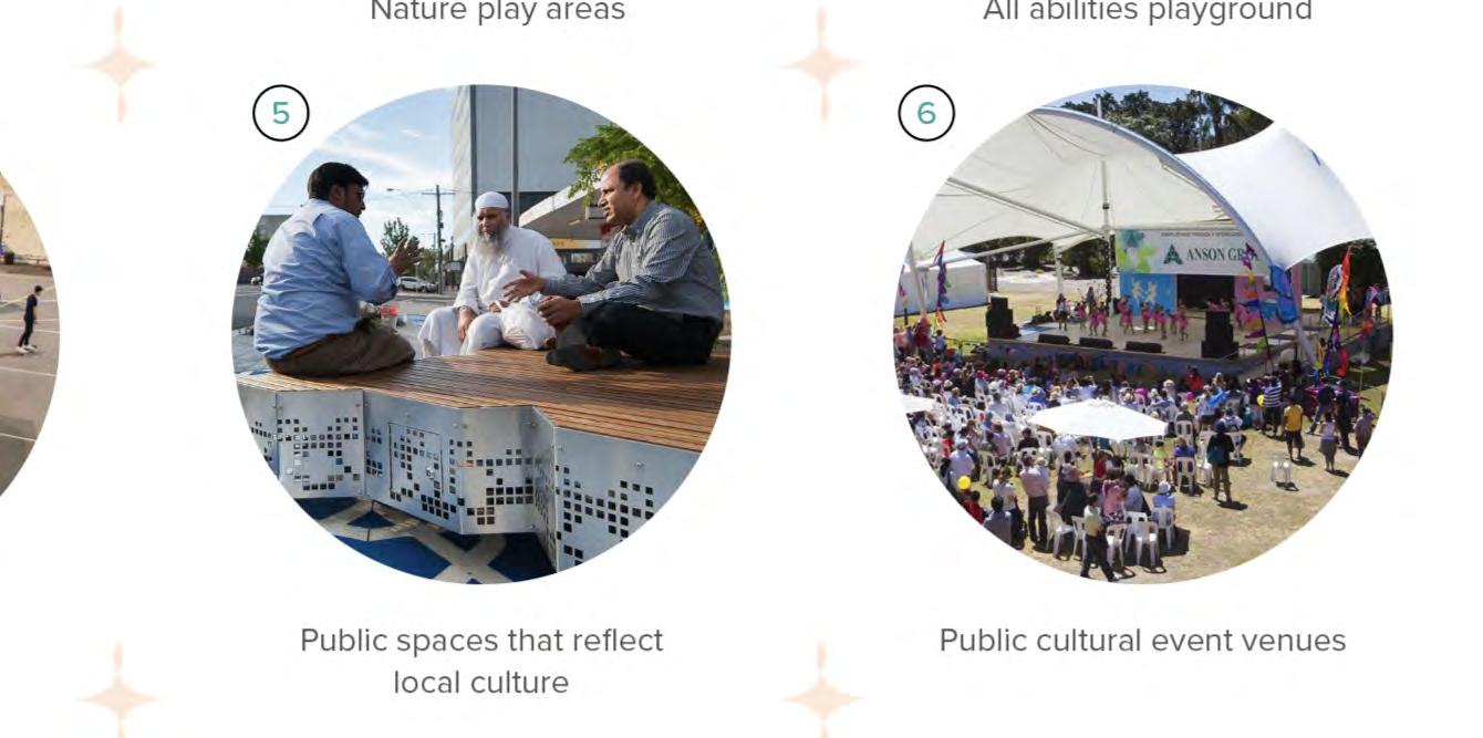
Street parks
Multipurpose outdoor courts
Nature play areas
Public spaces that reflect local culture
All abilities playground
Public-cultural event venues
Strategy Action
Investigate opportunities for the provision of new community hubs in the corridor
Investigate opportunities for expansion and repurposing of existing community facilities within the corridor or in close proximity to the corridor
Timeframe 0-2 years 3-7 years 7+ years
Investigate the provision of a new community venue for hire with multipurpose, flexible rooms and indoor/ outdoor areas •
Investigate the upgrade of the existing Guildford Library into a multi purpose library and meeting space to meet demand •
Co-located community facilities
Multipurpose community/ cultural space
Cool streets
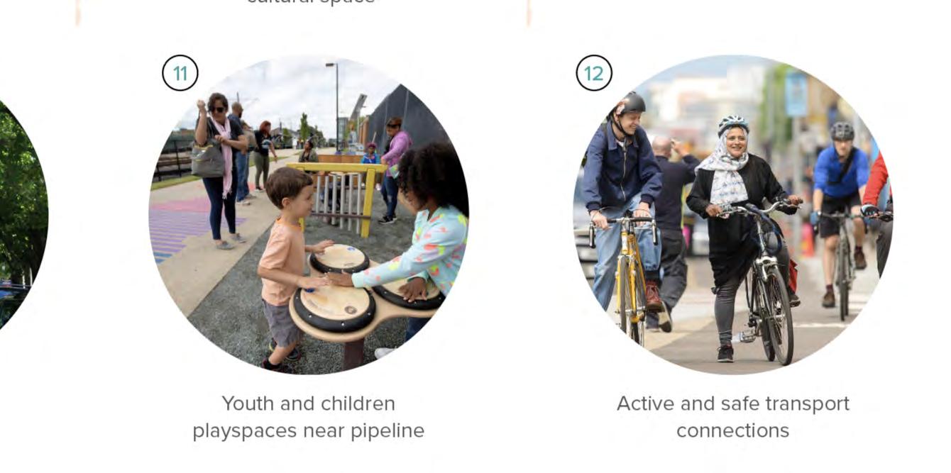
Youth and children playspaces near pipeline
Library as a ‘third’ place
Active and safe transport connections
Greening of the corridor
New tree planting will create a refreshing canopy along the corridor.
Woodville Road will be enhanced into a tree lined boulevard providing shade and greenery along the corridor.
A 10m setback will be introduced for most of the corridor to allow for increased landscaping and
Strategy Action
Develop and create opportunities and initiatives for tree planting on public and private land to help mitigate the heat island effect and promote resilient livable environments
Maintain, protect and increase tree canopy cover
street tree planting which will create screening and softening of the busy corridor from traffic.
The increased greening will create a pleasant and attractive environment encouraging pedestrian activity along the corridor, and attracting customers to businesses, which will create more lively places.
Increased shading and tree canopy will contribute to a reduction in urban heat island effects, which is an important area of attention for Cumberland.
Implement via developer works or Council works and maintain a 10m setback along most of the corridor for planting and tree canopy opportunities
Implement DCP and LEP controls related to urban heat mitigation and advocate for increases to tree canopy, planting, open space and green walls along the Corridor
Protect existing tree canopy through strong DCP controls and strategy priorities
Timeframe 0-2 years 3-7 years 7+ years
Ongoing
Improve connectivity of green corridors Prioritise connections to the Green Grid including Duck River and Prospect Creek Pipeline •
Figure 30: Increased Greenery, PRCUTS 2016
D raft Woodville Road Corridor Strategy
Cumberland City Council
Active transport
An active lifestyle will be encouraged through seamless connectivity, family-friendly walking and cycling paths, and vibrant green links, all with enhanced safety and convenience.
Strategy Action
Improve walking and cycling facilities for safe and comfortable use to support increased participation
Woodville Road will be turned into a safe and efficient active transport corridor with improved walking paths and dedicated cycling paths improving access for residents and families. Walking and cycling between the precincts will be quick and easy to access work, shops, schools and parks.
Green links will be utilised across the corridor with access to Duck River and Granville Park providing enjoyable riding and walking experiences.
Improved east-west signalised crossings along Woodville Road will create safer movements.
Increase pedestrian and cycling crossing facilities at signalised intersections and provide new crossings
Ongoing
Provide footpath and public domain improvements along with cycling infrastructure along most of the corridor Ongoing
Provide new signage and wayfinding for cycling and walking •
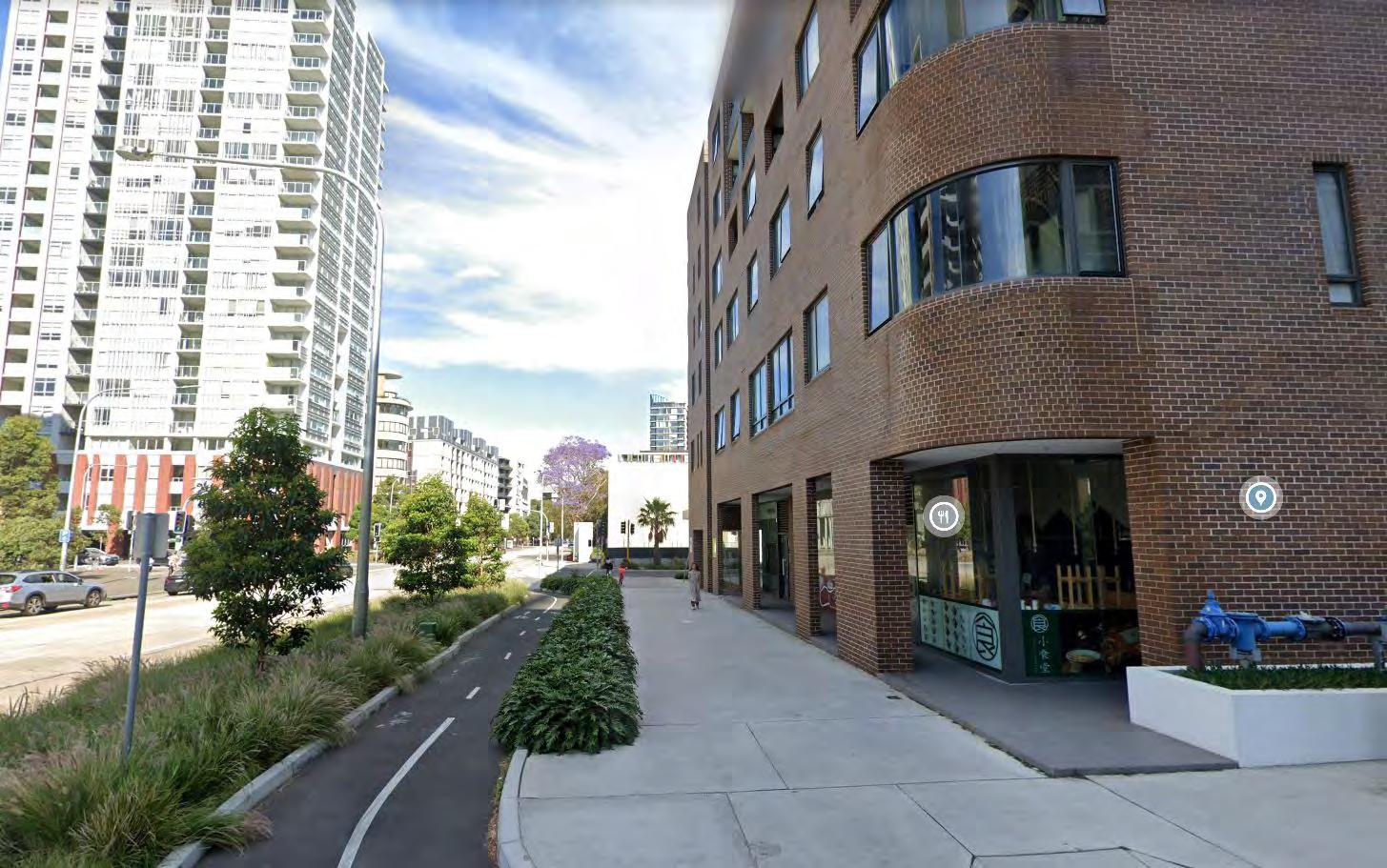
Figure 31: Cycleway, CM+ 2023
Public transport
Improved bus services effortlessly connecting Parramatta to Bankstown, linking communities to work, shops, schools, and recreation will be provided.
Woodville Road will benefit from increased frequency bus services throughout the day, providing service between Parramatta and
Strategy Action
Advocate for a range of transport options that connect Woodville Road Corridor to Cumberland’s Centres and employment hubs both locally and beyond to greater Sydney
Deliver better public transport infrastructure
Bankstown and servicing the community hubs and precincts along the way.
Better bus services will increase community connection with quick and easy access to places of work, shops, schools and places of recreation.
The Central City District Plan and Cumberland 2030: Our Local Strategic Planning Statement identifies a long term opportunity for a Parramatta-Bankstown-Hurstville/Kogarah Transit Corridor, with the potential for access at Woodville Road to provide more transport options and promoting the 30 minute city.
Explore new east-west bus route options to support travel facilites along the corridor
Increase peak hour, off-peak and weekend bus service frequencies along the corridor to reduce wait times
Advocate for a mass transit link ParramattaBankstown-Hurstville-Kogarah with connection to Woodville Road Corridor
Improve traffic performance at key intersections, to decrease bus travel times
Ensure that bus stops are accessible and support easy access for the community
Facilitate delivery of a 10m setback along most of the corridor to allow for the development of active and public transport infrastructure
Ongoing
Figure 32: District Plan Greater Cities Commission 2018
Achieving the Vision
Evaluation and monitoring of the identified actions
To achieve the vision and properly shape Woodville Road Corridor for the future, the right strategy and actions need to be created, implemented, and reviewed for applicability.
The Strategy will be reviewed every 5 years to ensure objectives are being met, the actions are being implemented and the changing needs of the Corridor’s community are being addressed.
Deliver housing diversity and affordable housing to suit changing needs
Affordable and diverse housing
Implement Affordable Housing Incentive Provisions in Cumberland Local Environmental Plan 2021 to improve the likelihood of provision of affordable housing in the corridor
Implement an affordable housing contribution scheme which will be applicable to selected sites in the corridor Ongoing
Provide a range of high and medium density housing options with diverse built forms which demonstrate design excellence Ongoing
Open space and recreation
Deliver new open space and new recreation facilities that meet the needs of the Community
Increase the quality and capacity of existing open space and recreation facilities
Implement Public Open Space Incentive Provisions in the Cumberland Local Environmental Plan to improve the likelihood of new public parks in the corridor
Progress work for pocket parks in future development and/ or targeted road closures
Implement new and enhanced recreational facilities to meet the needs of a growing community
Dedicate to Council through redevelopment, and embellishment of a new publicly accessible local park in each precinct to meet the needs of a growing community.
Work with local schools to explore shared community use of open space
Enact the acquisition of the Mountford Avenue properties that are currently identified in the Cumberland Local Environmental Plan for the provision of a new local park
Investigate opportunities for the provision of new community hubs in the corridor
Investigate opportunities for expansion and repurposing of existing community facilities within the corridor or in close proximity to the corridor
Develop and create opportunities and initiatives for tree planting on public and private land to help mitigate the heat island effect and promote resilient livable environments
Maintain, protect and increase tree canopy cover
Community facilities
Investigate the provision of a new community venue for hire with multi-purpose, flexible rooms and indoor/ outdoor areas
Investigate the upgrade of the existing Guildford Library into a multi purpose library and meeting space to meet demand
Greening of the corridor
Implement via developer works or Council works and maintain a 10m setback along most of the corridor for planting and tree canopy opportunities
Implement DCP and LEP controls related to urban heat mitigation and advocate for increases to tree canopy, planting, open space and green walls along the Corridor
Protect existing tree canopy through strong DCP controls and strategy priorities Ongoing
Improve connectivity of green corridors Prioritise connections to the Green Grid including Duck River and Prospect Creek Pipeline
Active transport
Improve walking and cycling facilities for safe and comfortable use to support increased participation
Advocate for a range of transport options that connect Woodville Road Corridor to Cumberland’s Centres and employment hubs both locally and beyond to greater Sydney
Deliver better public transport infrastructure
Increase pedestrian and cycling crossing facilities at signalised intersections and provide new crossings Ongoing
Provide footpath and public domain improvements along with cycling infrastructure along most of the corridor Ongoing
Provide new signage and wayfinding for cycling and walking
Public transport
Explore new east-west bus route options to support travel facilites along the corridor
Increase peak hour, off-peak and weekend bus service frequencies along the corridor to reduce wait times
Advocate for a mass transit link Parramatta-BankstownHurstville-Kogarah with connection to Woodville Road Corridor Ongoing
Improve traffic performance at key intersections, to decrease bus travel times
Ensure that bus stops are accessible and support easy access for the community
Facilitate delivery of a 10m setback along most of the corridor to allow for the development of active and public transport infrastructure