Walking and Cycling Strategy
CITY COUNCIL CUMBERLAND
2024
Cumberland City Council

Acknowledgement of Country
Cumberland City Council acknowledges the traditional custodians of the land on which Cumberland stands, the Darug People, and pays respects to elders past, present and emerging. We acknowledge the Aboriginal and Torres Strait Islander Peoples as the First Peoples of Australia.
Cumberland City Council also acknowledges the Aboriginal and Torres Strait Islander Peoples living in the Cumberland Local Government Area and reaffirms the important work with all Aboriginal and Torres Strait Islander Communities to advance reconciliation.
2 Walking and Cycling Strategy – Cumberland City Council

Introduction 4 What We Heard 6 Strategic Context 8 Considerations for Walking and Cycling 12 Strategic Directions and Action Plan 24 Cumberland Active Transport Corridors 28 Monitoring the Strategy 35
Walking and Cycling Strategy – Cumberland City Council 3
Contents
Introduction
The Cumberland Walking and Cycling Strategy provides a strategic framework to support walking and cycling (also known as active transport) as part of an integrated transport network. It also supports a place-based approach in making it easier to access public spaces, community facilities and local centres.
Vision
This vision is that Cumberland has a high quality, well-connected walking and cycling network that will enable and encourage residents and visitors to choose walking and cycling to access jobs, services and recreation.
Objectives
The objectives of the Walking and Cycling Strategy are to:
• Understand the walking and cycling needs of the diverse, multicultural community in Cumberland City through meaningful engagement.
• Promote an active community to provide positive health and well being outcomes.
• Ensure walking and cycling infrastructure is equitable and caters to the needs of all genders, ages, and abilities.
• Connect existing attractors in Cumberland with existing and new walking and cycling infrastructure.
• Connect existing and proposed walking and cycling corridors within Cumberland and with surrounding areas.
• Embrace emerging technology and incorporate innovation.
Development of the Strategy
Council undertook extensive activities in developing the Walking and Cycling Strategy, including:
• Undertaking a desktop review of relevant State Government and Council policies and strategies to understand requirements, priorities and objectives associated with the provision of walking and cycling infrastructure.
• Community engagement in the form of surveys, an interactive map for residents and visitors to provide comments on, workshops with State Government agencies, adjoining Local Government Areas and members of the public, to inform the draft Strategy.
• Audit and saddle surveys of existing and proposed walking and cycling corridors.
• Presentation and feedback sessions with internal Council stakeholders.

4 Walking and Cycling Strategy – Cumberland City Council

Walking and Cycling Strategy – Cumberland City Council 5
What We Heard
Cumberland City Council undertook early engagement and consultation on the draft strategy to inform the development of the Walking and Cycling Strategy, where we heard from our community about their concerns and ideas for walking and cycling.
Key findings from our engagement and consultation are:
• There is a lack of interesting walking and cycling options in the Cumberland area.
• Many streets don’t have footpaths or the paths that are there are unkept or broken. These are not suitable for those with prams or who are less mobile.
• Local streets are not a pleasant walking environment due to traffic, noise, fumes and poor paths.
• Safe and secure, free or low cost parking for bicycles at shops, parks and public transport hubs
should be provided.
• More maps for the public indicating current paths available in the community should be provided.
• There is a lack of tree cover / shade.
• There is a lack of pedestrian / cycle connectivity.
• There are lots of new apartments being built but no walking and cycling facilities to go along with them. Children can’t cycle safely on the road or in a park.
• The major concerns that impact the decision of a parent or guardian to allow children to engage with walking and cycling are an absence of street crossings and unsafe paths and roads.
• Parents and guardians would like to encourage children to walk and cycle by asking their child’s school to take part in Walk Safely to School Day and Ride2School Day and by having safer conditions for children.
• Ensure the proposed walking and cycling network integrates with the walking and cycling networks of adjoining local government areas.
• End of trip facilities and connection with public transport should be provided.
• Public bike storage and bike repair stations should be provided.
6 Walking and Cycling Strategy – Cumberland City Council
For what reasons do you walk? (Select all that apply)
To walk pets
To walk pets
Walk to work
Visit family/friends
Walk to work
To walk pets
Visit family/friends
Walk to major shopping centres
Walk to work
Walk to major shopping centres
Visit local shops, cafes, restaurants, bars or entertainment
Visit family/friends
Visit local shops, cafes, restaurants, bars or entertainment
To access public transport (train stations/bus stops)
Walk to major shopping centres
To access public transport (train stations/bus stops)
To access schools/education
Visit local shops, cafes, restaurants, bars or entertainment
To access schools/education
To access public transport (train stations/bus stops)
For exercise / recreation To access parks or sport facilities
To access schools/education For exercise / recreation To access parks or sport facilities
Why do you ride a bike? (Select all that apply)
% of responses
Walk to major shopping centres
Walk to major shopping centres
To access public transport (train stations/bus stops)
To access local shops, cafes, restaurants, bars or entertainment
To access schools/education
Exercise/recreation
To access local shops, cafes, restaurants, bars or entertainment
To access parks or sports facilities
Exercise/recreation
To access parks or sports facilities
% of responses
What could Cumberland City Council do to encourage you to walk and/or cycle more? Please select your top 3 answers.
Promote
I walk enough
I walk enough
Promote health benefits
I walk enough
Better amenities (toilets, bubblers)
Promote health benefits
Better
Street cleanliness
Better amenities (toilets, bubblers)
Better public transport links
Street cleanliness
Green spaces
Better public transport links
Shade/seating
More information
Green spaces
More information
Better traffic/cycling control
Shade/seating
Better traffic/cycling control
Night time/safety concerns
More information
Night time/safety concerns
Better/more cycleways
Better traffic/cycling control
Better/more cycleways
Better/more walkways
Night time/safety concerns
Better/more walkways
More tourist destinations
Better/more cycleways
More attractive streets
More tourist destinations
Better/more walkways
More pet friendly areas
More attractive streets
More tourist destinations
Cafes, bars, restaurants, etc
More pet friendly areas
More attractive streets
Beautification
Cafes, bars, restaurants, etc
More pet friendly areas
Beautification
Cafes, bars, restaurants, etc
Beautification
Accessibility for people with disabilities Accessibility
Accessibility for people with disabilities
Accessibility for older adults
% of responses
% of responses
% of responses
0 20 40 60 80 100
exercise / recreation To access parks or sport facilities 0 10 20 30 40 50 60 70 80
For
health benefits
amenities (toilets,
cleanliness
Better
bubblers) Street
public transport
links Green spaces Shade/seating
for
Accessibility for older adults 0 20 40 60 80 100
to major shopping
To access public transport (train stations/bus stops) To access schools/education To access local shops, cafes, restaurants, bars or entertainment
access parks or sports facilities % of responses
Accessibility
people with disabilities
Walk
centres
Exercise/recreation To
% of responses
0 20 40 60 80 100
0 10 20 30 40 50 60 70 80
0 20 40 60 80 100
To access public transport (train stations/bus
To access schools/education
for older adults
stops)
of
%
responses % of responses
0 20 40 60 80 100
0 10 20 30 40 50 60 70 80
0 20 40 60 80 100
Walking and Cycling Strategy – Cumberland City Council 7
Strategic Context
There are a range of regional, district and local strategies and plans to support walking and cycling in Cumberland and across Greater Sydney, which are outlined below.
State
Greater Sydney Region Plan
This Plan is built on a vision where most residents live within 30 minutes of their jobs, education and health facilities, services and great places. It sets a 40-year vision (to 2056) and establishes a 20-year plan to manage growth and change for Greater Sydney in the context of social, economic and environmental matters. It also informs district and local plans.
The plan identifies directions, objectives and strategies that encourage the development of walking and cycling infrastructure including prioritising opportunities for people to walk, cycle and use public transport, and providing walking and cycling links for transport as well as leisure and recreational trips.
Central City District Plan
This is a 20-year plan to manage growth in the context of economic, social and environmental matters to achieve the 40-year vision of Greater Sydney. The District Plan informs local strategic planning statements and local environmental plans, the assessment of planning proposals, as well as community strategic plans and policies.
The plan identifies the Central City Green Grid Priorities which include the Duck River Open Space Corridor, Prospect Pipeline Corridor and Parramatta Road Corridor within Cumberland.
Future Transport Strategy
Future Transport Strategy sets out key actions to connect communities and encourage more people to choose active transport. Actions include delivering continuous and connected cycling networks, improving the safety and comfort of people walking and riding bikes by providing fitfor-purpose active transport infrastructure and appropriate road speeds, facilitating children’s and young people’s independent mobility by improving safe walking and bike riding options for travel to and from school, supporting multimodal journeys by integrating active and public transport, encouraging a shift to walking and cycling trips by delivering walking and cycling infrastructure to support mode shift, and supporting emerging technology choices such as e-bikes and other micro-mobility devices.
Active Transport Strategy
This Strategy sets out focus areas, ambitions, priorities and actions for active transport in NSW.
These include improving cycling access to centres, stations, key precincts, and major parks and gardens, providing safe and connected cycleways for people of all ages and abilities that can be used by all current and future forms of micromobility devices, and partnering with councils to improve consistent wayfinding information for walking and cycling across NSW.
8 Walking and Cycling Strategy – Cumberland City Council

Cumberland 2030: Our Local Strategic Planning Statement
The Local Strategic Planning Statement plans for the Cumberland area’s economic, social and environmental land use needs over the next 10 years and is aligned to the 20 year vision for Cumberland. It sets clear planning priorities and actions about what will be needed, such as jobs, homes, services and parks. These include advocating for improved transport options for Cumberland, supporting greater walking and cycling in the Cumberland area, including targeted investments to support access to centres, corridors and public transport services, connections of parks and cycle ways within the District and adjoining local government areas, advocating for improved transport options for Cumberland’s vibrant centres to support walking, cycling and public transport access, and promoting and encourage walkability through a connected pedestrian network which includes safe and improved crossings, wayfinding signage, shade and seating.
Cumberland Community Strategic Plan (CSP)
This Plan sets out the community’s vision for the future, the strategies in place to achieve it, and how progress towards or away from the vision will be measured. It helps set the broad strategic direction for Council’s operations which are aligned directly to the community vision through strategic goals and supporting activities contained in the plan. Relevant goals include supporting community health, safety and wellbeing, enhancing the natural and built environment, and delivering sustainable infrastructure and services.
Cumberland Open Space and Recreation Strategy
This Strategy provides Council with a ten year direction for open space, sport and recreation services and facilities and includes Strategic Directions and Actions. These include delivering new open space and new recreation facilities that meet the needs of our growing population, increasing the quality and capacity of existing open space and recreation facilities, and investigate opportunities to increase access to open space.
Local
Walking and Cycling Strategy – Cumberland City Council 9


Local Plans 10 Walking and Cycling Strategy – Cumberland City Council
Regional and District Plans

Walking and Cycling Strategy – Cumberland City Council 11
Considerations for Walking and Cycling
There are a number of considerations for walking and cycling in Cumberland. These include the Cumberland community profile, walking and cycling profile, existing walking and cycling network, planning and design tools, and walking and cycling initiatives.
Community Profile
The community profile provides insight into the unique characteristics of the Cumberland Community which can impact the provision and take up of walking and cycling. These include:
• The current Cumberland population is over 236,000 and is forecast to increase to over 300,000 in 2036.
• There is a higher proportion of children and a young workforce when compared to Greater Sydney.
• Over a quarter of the local workforce live and work within Cumberland.
• Car Ownership levels are similar to those in Greater Sydney.
• Long term health conditions are better in Cumberland when compared to Greater Sydney.
Age
Service Age Group Number % Greater Sydney % Babies and pre-schoolers (0 to 4) 16,450 7.0 6.0 Primary schoolers (5 to 11) 22,232 9.4 8.8 Secondary schoolers (12 to 17) 15,792 6.7 7.1 Tertiary education and independence (18 to 24) 23,720 10.1 8.8 Young workforce (25 to 34) 43,631 18.5 15.5 Parents and homebuilders (35 to 49) 49,369 21.0 21.5 Older workers and pre-retirees (50 to 59) 25,018 10.6 12.0 Empty nesters and retirees (60 to 69) 19,740 8.4 9.8 Seniors (70 to 84) 16,048 6.8 8.7 Elderly aged (85 and over) 3,442 1.5 2.0 Total 235,442 100.0 100.0 12 Walking and Cycling Strategy – Cumberland City Council
Walking and Cycling Profile
Employment location of resident workers, 2021
There are a range of factors that influence current behaviour and future considerations for walking and cycling in Cumberland including:
• Walking and cycling make up a small proportion of the mode of travel for journey to work.
• The average walking trip distance is 700m in Cumberland, which is similar to the average walking trip distance in Greater Sydney of 800m.
• Walking comprises 16% of all trips in Cumberland, which is slightly higher than the Greater Sydney rate of 15%.
• There is a higher propensity for cycling in areas within 2km of a train station.
Health
Long Term Health Conditions – Summary
Summary Number % Greater Sydney % Population with at least one long-term health condition 51,296 21.8 27.5 No long-term health conditions 161,519 68.6 65.1 Not Stated 22,616 9.6 7.4 Total Persons 235,431 100.0 100.0 % of households
Not stated 3 or more motor vehicles 2 motor vehicles 1 motor vehicle No motor vehicles No fixed place of work – 3.6% Live in the area, but work outside – 72.5% Live and work in the area – 23.9% Cumberland City Residential location of local workers, 2021 Work in the area, but live outside – 72.26% Live and work in the area – 27.74% Cumberland City
Walking and Cycling Strategy – Cumberland City Council 13
Car Ownership Cycling Propensity
The areas shown with darker colours are more likely to ride bicycles.

% of households Number of cars Employment location of resident workers, 2021 0 5 10 15 20 25 30 35 40 Not stated 3 or more motor vehicles 2 motor vehicles 1 motor vehicle No motor vehicles Greater Sydney Cumberland City No fixed place of work – 3.6% Live in the area, but work outside – 72.5% Live and work in the area – 23.9% Cumberland City Residential location of local workers, 2021 Work in the area, but live outside – 72.26% Live and work in the area – 27.74% Cumberland City 14 Walking and Cycling Strategy – Cumberland City Council
Existing Walking and Cycling Network
Cumberland Council has an existing network of walking and cycling infrastructure in our area for use by residents and visitors alike. Existing infrastructure includes pedestrian footpaths, bicycle stands and storage lockers, shared walking and cycling paths, and on-street dedicated cycling lanes.
Examples of existing popular shared walking and cycling paths include the Parramatta to Glenfield Rail Trail, the Lower Prospect Canal and Duck River path. Examples of existing on-street dedicated cycling lanes include Gelibolu Parade in Auburn, Guildford Road in Guildford and East Street in Lidcombe.
Existing Cycling Routes
Council recognises that there is more work to do to create a better supported and interconnected network of walking and cycling paths, but that there are a number of existing walking and cycling paths for residents and visitor to enjoy.
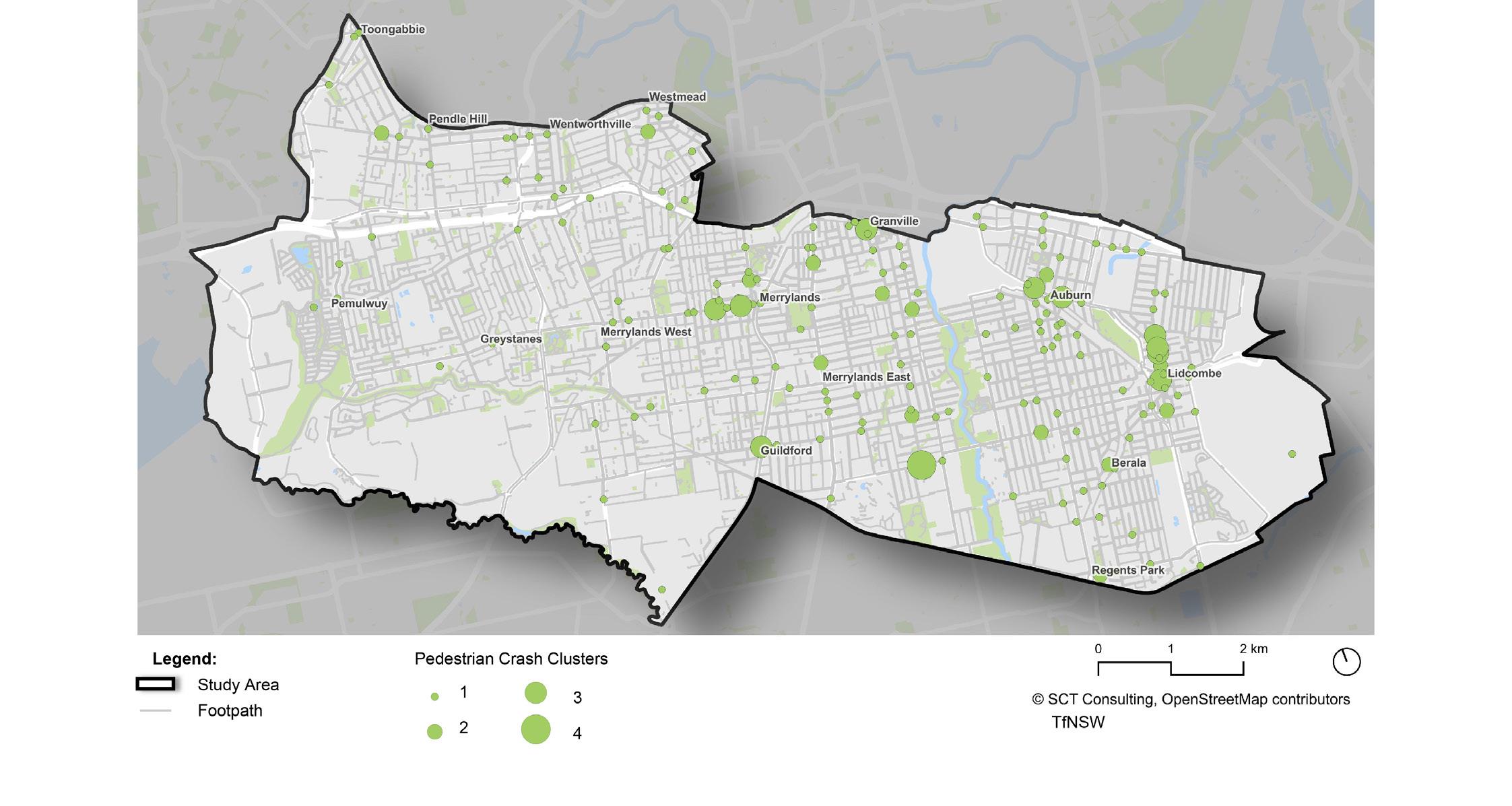
Information has also been collated on a range of elements for the existing network, including footpath widths, footpath quality and pedestrian crash data.

Walking and Cycling Strategy – Cumberland City Council 15
Footpath widths through Cumberland

Footpath quality throughout Cumberland

16 Walking and Cycling Strategy – Cumberland City Council
Pedestrian crash clusters within Cumberland
Pedestrian crash severity within Cumberland

Walking and Cycling Strategy – Cumberland City Council 17
Planning and Design Tools
There are a range of State Government tools to guide the planning and design of walking and cycling infrastructure, including:
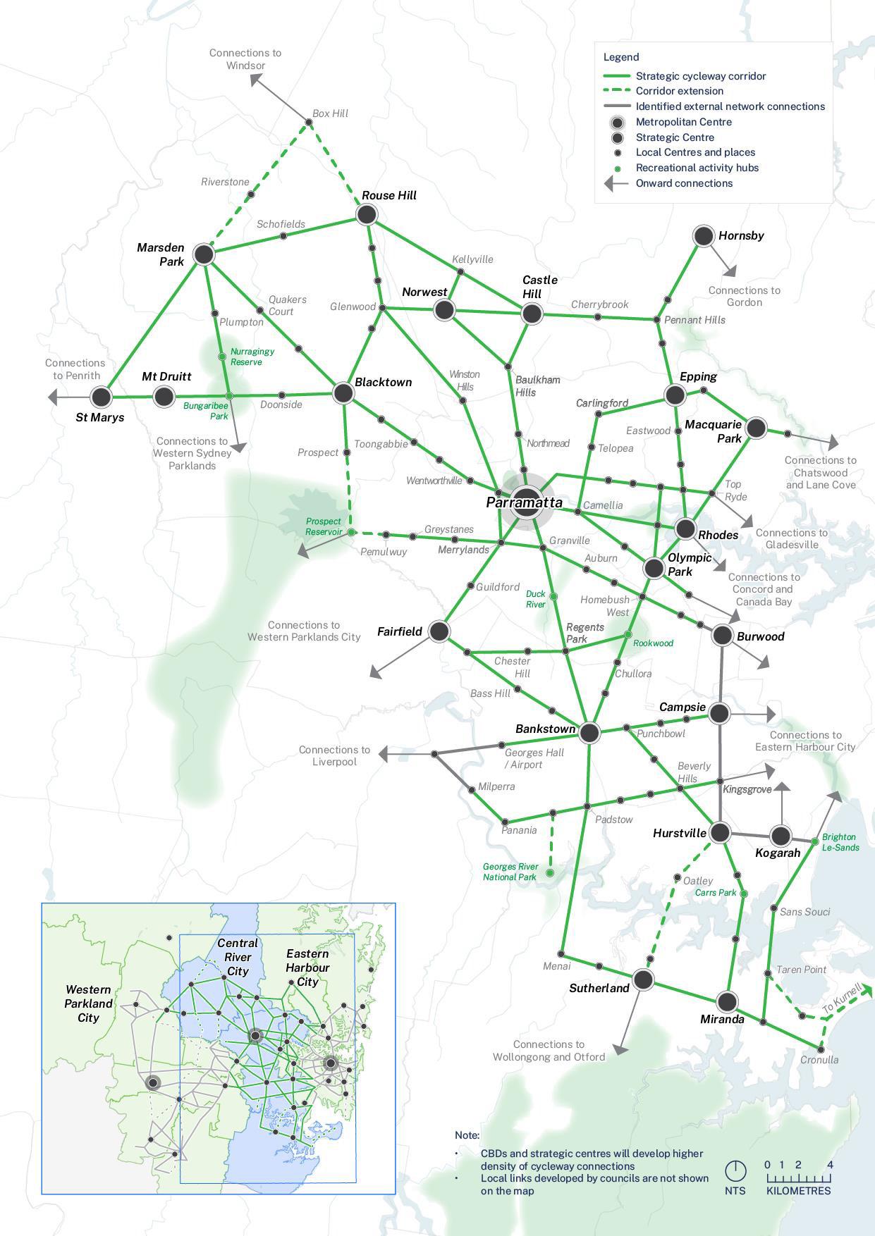
• Transport for NSW (TfNSW) Strategic Cycleway Corridor Program which identifies strategic corridors that link Cumberland with Greater Sydney. It is anticipated that the Strategic Cycleways will enable more people to cycle by connecting key centres and places across Council boundaries. The design of each corridor will be guided by the Cycleway Design Toolbox.
• TfNSW Walking Space Guide which provides a set of standards and tools to ensure that sufficient space is provided to achieve comfortable environments which encourage people to walk.
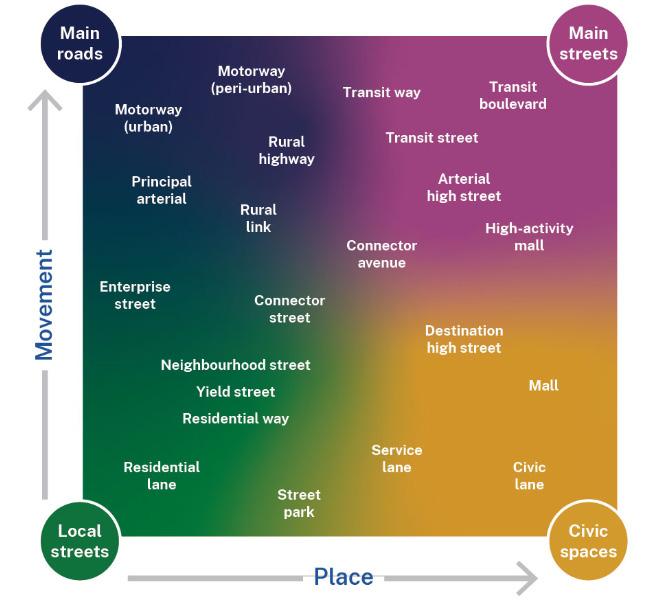
• TfNSW Movement and Place Framework, which aims to balance the movement of people and goods with the amenity and quality of places. It contains guidance on classifying street environments, understanding place and movement, and the design of roads and streets.
• TfNSW Cycleway Design Toolbox, which contains road and intersection configurations for a range of cycleway types and establishes design principles for cycleways in specific contexts.
• Sydney Green Grid, which outlines District level corridors for walking and cycling, supporting local initiatives to improve access across Parklands and Prospect Pipeline Corridor;
• Green Travel Maps, which provide information on using walking, cycling and public transport to access workplaces, schools and community facilities.
Walking and Cycling Initiatives Currently Underway
Council is currently progressing a number of initiatives and projects to support walking and cycling in Cumberland, including:
• Upgrades to town centres, including better paths, bicycle lanes and supporting infrastructure.
• Public Domain Plans which provide guidance on infrastricture and design in local centres and key corridors.
• Progressing strategic masterplans for the Duck River Parklands and Prospect Pipeline Corridor, which include walking and cycling connections.
• Planning and design work for the Pippita Rail Trail, supporting improved walking and cycling access between Lidcombe and Sydney Olympic Park.
• A Pedestrian Access and Mobility Plan, which provides a framework to improve infrastructure for pedestrians in Cumberland.
• A bus stop audit, which identifies targeted improvements to infrastructure to support better access to public transport.
18 Walking and Cycling Strategy – Cumberland City Council
Central River City Strategic Cycleway Corridors
Walking and Cycling Strategy – Cumberland City Council 19
Space Guide – Footpath Types
Typology for Walking Spaces
Walking Space Guide – Footpath Types Type 1
Type 2
Local footpath –Medium activity
Type 3 Main street footpath –Medium activity / Local footpath –High activity
Low activity local footpaths are appropriate where people walking are unlikely to pass people coming the other way.
Low activity local footpaths support two people together and are appropriate where people walking are unlikely to pass people coming the other way.
Low activity local footpaths are appropriate where people walking are unlikely to pass people coming the other way.
activity local footpaths are appropriate where people walking are more than likely to pass people coming the other way.
Low activity local footpaths are appropriate where people walking are unlikely to pass people coming the way.
Medium activity local footpaths are appropriate where people walking are more than likely to pass people coming the other way.
Medium activity local footpaths support 2 people walking together passing another person using the Passing Zone.
Medium activity local footpaths are appropriate where people walking are more than likely to pass people coming the other way.
activity main street footpaths are appropriate where people walking are virtually certain to pass people coming the other way.
Medium activity main street footpaths are appropriate where people walking are virtually certain to pass people coming the other way.
Medium activity main street footpaths support 2 people walking together and passing another person without having to walk in single file.
These footpaths support 2 friends walking together and passing if they walking in single file.
These footpaths support 2 friends walking together and passing if they walking in single file.
These footpaths support 2 people passing abreast or 2 friends walking together passing another person using the Passing Zone.
These footpaths support 2 friends walking together and passing if they walking in single file.
These footpaths support 2 people passing abreast or 2 friends walking together passing another person using the Passing Zone.
These footpaths support 2 friends walking together and passing another person without having to walk in single file.
These footpaths support 2 people passing abreast or 2 friends walking together passing another person using the Passing Zone.
These footpaths support 2 friends walking together and passing another person without having to walk in single file.
These footpaths support 2 friends walking together and passing another person without having to walk in single file. Walking Space Guide 10
High activity main street footpaths are appropriate where people walking are virtually certain to meet multiple groups of people coming the other way.
activity main street footpaths are appropriate where people walking are virtually certain to meet multiple groups of people coming the other way.
High activity main street footpaths are appropriate where people walking are virtually certain to meet multiple groups of people coming the other way
These footpaths provide enough space for large numbers of people to walk comfortably. Type 4
These footpaths support 2 friends passing 2 friends coming the other way without either group having to walk in single file.
These footpaths support 2 friends passing 2 friends coming the other way without either group having to walk in single file.
Very high activity main street footpaths are appropriate where it is very busy most of the time.
Very high activity main street footpaths are appropriate where it is very busy most of the time.
Very high activity main street footpaths are appropriate where it is very busy most of the time. These footpaths provide enough space for large numbers of people to walk comfortably.
These footpaths provide enough space for large numbers of people to walk comfortably.
Type 1 Main Street footpath – High activity Type 2 Local footpath – Medium activity Type 4 Main Street footpath – High activity Type 3 Main street footpath – Medium activity Local footpath – High activity Type 5 Main Street footpath – Very high activity
Type 1 Local footpath –Low activity 2.0 1.3 3.3
Walking
Type
Local footpath –Medium activity 2.3 0.8 3.6 Medium
2
Type 3 Main street footpath –Medium activity / Local footpath –High activity 3.2 1.3 4.5 Medium activity main
street footpaths are appropriate where people walking are virtually certain to pass people coming the other way.
Walking Space Guide 10 Walking Space Guide – Footpath Types Type 1 Local footpath –Low activity 2.0 1.3 3.3
Type 2 Local
–
activity 2.3 0.8 3.6
footpath
Medium
Type 3 Main street footpath –Medium activity / Local footpath –High
3.2 1.3 4.5 Medium
activity
Walking Space Guide 10 Type 4 Type 5 Main street footpath – Main street footpath –High activity Very high activity 3.9 1.5 4.5 1.5 5.4 6.0 High
Type 5 Main street footpath – Main street footpath –High activity Very high activity 3.9 1.5 4.5 1.5 5.4 6.0
Local
Low activity 2.0 1.3 3.3
footpath –
2.3 0.8 3.6
1.3 4.5
3.2
Movement and Place Framework
Walking and Cycling Strategy – Cumberland City Council 21
Typology of Cycleway Design
Cycleway

Typical cross section - optimal configuration (unconstrained)


Typical cross section - optimal configuration (12.8m carriageway)
Cycleway Design– Bicycle path (two-way)
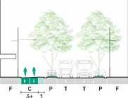
Typical cross section - optimal configuration (unconstrained)


Typical cross section - optimal configuration (12.8m carriageway)
Typical plan - optimal configuration (unconstrained)
Typical plan - optimal configuration (unconstrained)
Design– Bicycle path (one-way)
22 Walking and Cycling Strategy – Cumberland City Council
Cycleway Design– Shared path
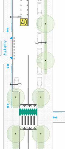
Typical plan - constrained conditions
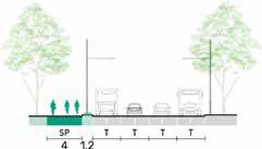
Typical cross section - optimal conditions

Typical cross section - constrained conditions
Cycleway Design– Quietway

Typical plan - optimal configuration

Typical cross section - optimal configuration

Typical cross section - alternate configuration
Walking and Cycling Strategy –
23
Cumberland City Council
Strategic Directions and Action Plan
Based on the considerations outlined in the strategy and the outcomes of engagement with the community, a range of strategic directions and actions are identified to deliver on the vision for walking and cycling in Cumberland.
DIRECTION
01

DIRECTION
02
A city supported by infrastructure and an integrated network
A city that is inclusive and encourages healthy behaviour
DIRECTION
03
A city that supports emerging trends and business
24 Walking and Cycling Strategy – Cumberland City Council
A city supported by infrastructure and an integrated network
Action

1.1 Finalise a Pedestrian Access and Mobility Plan to address the needs of pedestrians.
1.2 Implement recommendations of the Pedestrian Access and Mobility Plan, where appropriate and possible, to further address the needs of pedestrians.
1.3 Develop, implement, monitor and maintain existing and proposed regional, district and local walking and cycling networks to provide connectivity across Cumberland, using relevant guidance, policies and standards.
1.4 Implement and maintain supporting infrastructure of walking and cycling networks.
1.5 Develop and implement information and wayfinding to support walking and cycling across Cumberland.
1.6 Undertake a review of all footpaths within 200m of primary and high schools and pick up/drop off areas to identify where improvements in infrastructure are required.
Timeframe 0-2 years 3-5 years 6-10 years
•
• • •
• • •
• • •
• • •
• •
Walking and Cycling Strategy – Cumberland City Council 25
DIRECTION 01
A city that is inclusive and encourages healthy active behaviour

2.1 Provide information on walking and cycling in Cumberland on Council’s website.
2.2 Integrate walking and cycling considerations into masterplans, contributions plans, voluntary planning agreements, planning proposals, development control plans, Council operational budgets, Council policies, and place strategies.
2.3 Work with schools to encourage walking and cycling, including opportunities for integration with government initiatives.
2.4 Progress trials and pop-up interventions to test and refine walking and cycling opportunities.
2.5 Progress programs and initiatives to support walking and cycling for the community and within the Council workplace
2.6 Identify opportunities to provide youth specific cycling infrastructure in Cumberland, such as learn to ride tracks.
2.7 Facilitate technical considerations of walking and cycling at the Local Traffic Committee and Council advisory committees.
Timeframe 0-2 years 3-5 years 6-10 years
Action
•
• • •
• • •
• • •
• • •
• • •
• • •
26 Walking and Cycling Strategy – Cumberland City Council
DIRECTION 02
A city that supports emerging trends and business

3.1 Identify and pursue different streams of funding including grants, infrastructure contributions and planning agreements to aid in the design and implementation of walking and cycling networks.
3.2 Collaborate with other Councils and Greater Sydney Parklands to improve connections in walking and cycling routes across boundaries.
3.3 Advocate for improvements to walking and cycling infrastructure in Cumberland, including connections between walking and cycling corridors, by other levels of government.
3.4 Explore and implement opportunities and requirements for new technologies and initiatives that support walking and cycling in the Cumberland LGA.
3.5 Progress Green Travel Plans with eligible businesses, workplaces, schools and community facilities.
Timeframe 0-2 years 3-5 years 6-10 years
Action
• • •
• • •
• • •
• • •
• • •
Walking and Cycling Strategy – Cumberland City Council 27
DIRECTION 03
Cumberland Active Transport Corridors

28 Walking and Cycling Strategy – Cumberland City Council
Cumberland Active Transport Corridors
CORRIDOR
CORRIDOR
CORRIDOR
CORRIDOR
CORRIDOR
CORRIDOR
CORRIDOR
CORRIDOR
CORRIDOR
CORRIDOR
CORRIDOR
CORRIDOR
CORRIDOR
CORRIDOR
CORRIDOR
CORRIDOR
CORRIDOR
– Pemulwuy to Merrylands (via Central Gardens)
– Clyde to Prospect Pipeline Corridor (via Duck River)
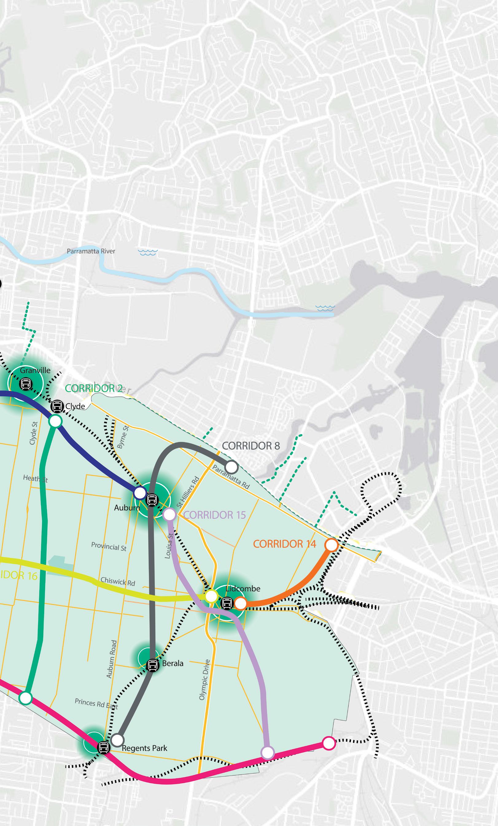
– Merrylands to Auburn (via Granville)
1
2
3
4
– Westmead to Merrylands (via M4 Cycleway)
5
Toongabbie to Westmead
Trail)
–
(Rail
6
Parramatta to
(Rail Trail)
–
Fairfield
7
Prospect Pipeline Corridor
–
8 – Prospect Pipeline Corridor to Olympic Park (via Berala)
9 – Wentworthville to Smithfield (via Cumberland Highway)
10
Wentworthville to Fairfield (via Finlayson’s Creek)
–
11
Toongabbie to Prospect Creek (via Pemulwuy)
–
12 – Parramatta to Toongabbie (via Mays Hill and Girraween Creek)
13 – Pemulwuy to Parramatta (via Mays Hill)
CORRIDOR
14 – Lidcombe to Olympic Park (Pippita Rail Trail)
15 – Auburn to Cooks River (via Rookwood)
16 – Lidcombe to Guildford (via Duck River)
17 – Pendle Hill to Greystanes (Prospect Pipeline Corridor)
18 – Prospect Creek – Existing Cycle way Walking and Cycling Strategy – Cumberland City Council 29
After extensive research and consultation, Active Transport Corridors are identified in the Strategy. These corridors aim to reflect existing infrastructure, fill in missing links in the existing walking and cycling network, as well as to create new routes to connect centres, open space, public transport and education facilities where possible.
Corridor Framework
The Active Transport Corridors provide Regional and District connections for walking and cycling within Cumberland and links to surrounding areas. These will be supported by local networks that provide connections within each suburb to the corridors.
While some corridors are partially or fully in place, others require further design and construction. This will be undertaken in a staged manner, informed by a prioritisation framework, alignment with strategic plans and funding availability.

30 Walking and Cycling Strategy – Cumberland City Council
CORRIDOR 1
Pemulwuy to Merrylands (via Central Gardens)
This is identified as a Strategic Corridor and is therefore considered a Regional Corridor for the purposes of the Strategy. It provides an east-west connection between the Western Sydney Parklands to the strategic centre of Merrylands, while aiming to facilitate connections between open space, public transport and shopping centres in the western part of Cumberland.
CORRIDOR 2
Clyde to Prospect Pipeline Corridor (via Duck River)
This is identified as a Strategic Corridor and is therefore considered a Regional Corridor for the purposes of the Strategy. It provides a north-south connection between the boundary with Canterbury Bankstown City Council and Clyde, via Duck River, while aiming to facilitate connections between local government areas, open space and public transport in the eastern part of Cumberland.
CORRIDOR 3
Merrylands to Auburn (via Granville)
This is identified as a Strategic Corridor and is therefore considered a Regional Corridor for the purposes of the Strategy. It provides an eastwest connection between the strategic centre of Merrylands and Granville and Auburn, while aiming to facilitate connections between centres, open space and public transport in the central and eastern part of Cumberland.
CORRIDOR 4
Westmead to Merrylands (via M4 Cycleway)
This is identified as a Strategic Corridor and is therefore considered a Regional Corridor for the purposes of the Strategy. It provides a northsouth connection between the strategic centre of Merrylands and the Innovation District of Westmead, while aiming to facilitate connections between centres, open space and public transport in the central part of Cumberland.
CORRIDOR 5
Toongabbie to Westmead (Rail Trail)
This route is identified as a Strategic Corridor and is therefore considered a Regional Corridor for the purpose of the Strategy. It provides connection between the train stations of Toongabbie, Pendle Hill, Wentworthville and Westmead and therefore connects local centres and public transport. It is noted that most of the Corridor is anticipated to be delivered within the City of Parramatta.
CORRIDOR 6
Parramatta to Fairfield (Rail Trail)
This is identified as a Strategic Corridor and is therefore considered a Regional Corridor for the purposes of the Strategy. It provides a north-south connection between the northern and southern boundaries of Cumberland, while aiming to facilitate connections between centres, open space and public transport in the central part of Cumberland.
CORRIDOR 7
Prospect Pipeline Corridor
The Prospect Pipeline Corridor is a regionally significant open space corridor and is therefore considered a Regional Corridor for the purposes of this Strategy. It provides significant recreation opportunities for visitors and residents of Cumberland.
CORRIDOR 8
Prospect Pipeline Corridor to Olympic Park (via Berala)
This is considered a Regional Corridor for the purposes of the Strategy as the route connects two regionally significant open space areas. It provides a north-south connection between the northern and southern boundaries of Cumberland, while aiming to facilitate connections between centres, open space and public transport in the eastern part of Cumberland.
Regional Corridors
Walking and Cycling Strategy – Cumberland City Council 31
District Corridors
CORRIDOR 9
Wentworthville to Smithfield (via Cumberland Highway)
This is a District Corridor providing a northsouth connection between Wentworthville and Prospect Creek Cycleway, while aiming to facilitate connections to open space in the western part of Cumberland.
CORRIDOR 10
Wentworthville to Fairfield (via Finlayson’s Creek)
This is a District Corridor providing a north-south connection between Wentworthville and the Prospect Creek Cycleway, while aiming to facilitate connections between local shops, open space and education facilities in the western part of Cumberland.
CORRIDOR 11
Toongabbie to Prospect Creek (via Pemulwuy)
This is a District Corridor providing a northsouth connection between Toongabbie and Prospect Creek Cycleway while aiming to facilitate connections to open space in the western part of Cumberland.
CORRIDOR 12
Parramatta to Toongabbie (via Girraween Creek and Mays Hill)
This is a District Corridor providing an eastwest connection between Toongabbie and the Cumberland boundary with the City of Parramatta in Mays Hill. This route aims to facilitate connections between open space and education facilities in the northern part of Cumberland.
CORRIDOR 13
Pemulwuy to Parramatta (via Mays Hill)
This is a District Corridor providing an east-west connection between the Western Sydney Parklands and the Cumberland boundary with the City of Parramatta in Mays Hill. It aims to
facilitate connections between open space and education facilities in the western and central part of Cumberland.
CORRIDOR 14
Lidcombe to Olympic Park (Pippita Rail Trail)
This is a District Corridor providing a key connection between Lidcombe and Sydney Olympic Park via the proposed Pippita Rail Trail.
CORRIDOR 15
Auburn to Cooks River (via Rookwood)
This is a District Corridor providing a north-south connection between Auburn and the Cooks River while aiming to facilitate connections between local centres, education facilities and open space in the eastern part of Cumberland.
ROUTE 16
Lidcombe to Guildford (via Duck River)
This is a District Corridor providing an east-west connection between Lidcombe and Guildford. It aims to facilitate connections between local centres and open space in the central and eastern part of Cumberland.
CORRIDOR 17
Pendle Hill to Greystanes (Prospect Pipeline Corridor)
This is a District Corridor providing a northsouth connection between Pendle Hill and the Prospect Pipeline Corridor while aiming to facilitate connections between local shops, open space and education facilities in the western part of Cumberland.
CORRIDOR 18
Prospect Creek
The Prospect Creek Cycleway is a District Corridor that provides significant recreation opportunities for visitors and residents of Cumberland.
32 Walking and Cycling Strategy – Cumberland City Council
Prioritisation and Evaluation
A route prioritisation and evaluation tool is needed to provide guidance to prioritise and evaluate the investigation, design and construction of the Active Transport Corridors identified in this Strategy. This tool can also be used to prioritise and evaluate future walking and cycling routes and can be applied to the whole corridor or route, or a segment within a corridor or route.
The criteria to inform prioritisation are based on demand potential, network effect, strategic alignment, existing users, cost of delivery, funding source and environmental impacts. A table that summarises the elements of the tool is outlined on the next page.
Walking and Cycling Strategy – Cumberland City Council 33
Active Transport Prioritisation and Evaluation Tool
Adjoins low density residential and/or local streets
Adjoins high density residential, or mixed-use development
Adjoins commercial or business uses or a main collector road
Adjoins industrial land or a major road or highway
1. Specified facility means an education facility, major medical facility, public transport node, community facility, recreational area or facility, major shopping centre, or town centre or key employment areas / key precincts.
2. Based on land uses which have a probability of higher numbers of people. i.e. high density, town centres, parks.
3. Aligns to the Greener Places Design Guide released by the Government Architect NSW and the Greater Sydney Region Plan.
Criteria Rating 5 Rating 4 Rating 3 Rating 2 Rating 1 Demand Potential Within 200m of a Specified Facility1 Within 400m of a Specified Facility1 Within 600m of a Specified Facility1 Within 1km of a Specified Facility1 Within 2km of a Specified Facility1 Network Effect Connects 2 or more existing infrastructure points Connects to 1 existing infrastructure point Does not connect to any existing infrastructure Unused Existing Infrastructure Activates
not activate
unused
such as bridges, canals and railways. Strategic Alignment Identified in State Government Policies, Strategies or Plans Identified in a Cumberland Council Policy, Strategy or Plan Is not identified in a State Government or Cumberland Council Policy, Strategy or Plan Existing UsersSafety 4 or less pedestrian / cyclist crashes within 10m of a route More than 4 and less than 7 pedestrian / cycling crashes within 10m of a route
or more pedestrian / cyclist crashes within 10m of a routed
or uses existing abandoned or unused infrastructure such as bridges, canals and railways. Does
or use existing abandoned or
infrastructure
7
Existing Users –Pollution Impacts
Adjoins or is within public open space
Other Benefits Greater than
2
than
2
or
through preferred
2
capacity
is
(Identified
The route is not a strategic route N/A Environmental Impacts –
and tree planting Less than 15 % removal required 15% to 40% removal required Greater than 40% removal required Environmental Impacts – Existing shade Greater than 40% has tree canopy cover3 15% to 40% has tree canopy cover3
than 15% has tree canopy cover3
40% runs through preferred land uses
More
20% but less than 40% runs through preferred land uses
20%
less runs
land uses
Funding
The route
a strategic route
in State Government Policies, Strategies or Plans)
Vegetation Removal
Less
34 Walking and Cycling Strategy – Cumberland City Council
Monitoring the Strategy
Monitoring of the Strategy will be undertaken through the following mechanisms to ensure the actions of the strategy are implemented and the Strategy remains relevant in guiding walking and cycling in Cumberland.
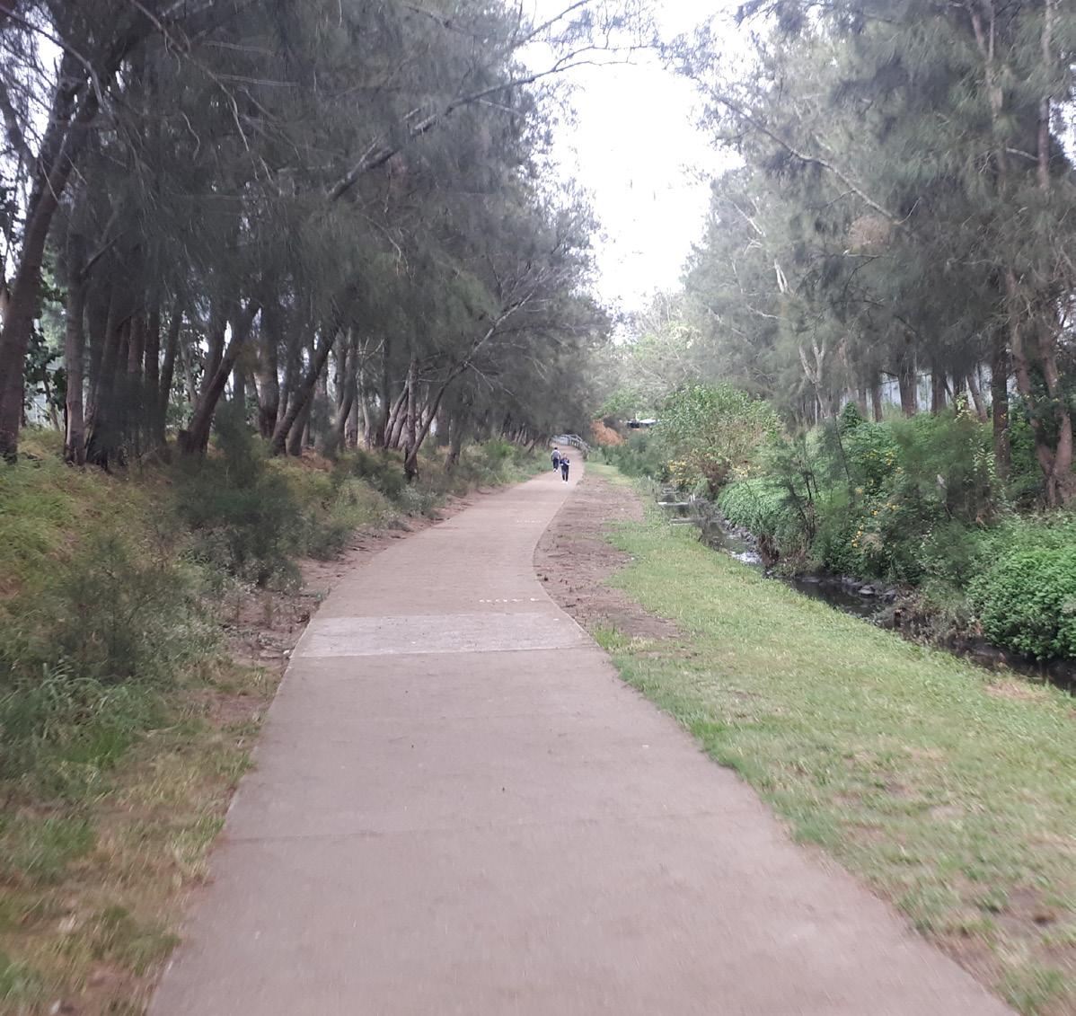
A range of measures and anticipated outcomes are shown in the table below.
Monitor Measurements and Benchmarks Outcome
Changes made to Council strategies, policies and plans to reflect walking and cycling considerations.
Community initiatives and programs related to walking and cycling.
Walking and cycling infrastructure projects.
Grant funding opportunities and applications.
Pedestrian and cyclist activity.
Resident, worker and visitor satisfaction.
Pedestrian and bicycle related crashes are reduced by at least 20% on existing levels over the 5 year period after endorsement of the strategy.
Pedestrian and bicycle use is up 10% on existing levels over the 5 year period after the endorsement of the Strategy
A community survey is undertaken 5 to 7 years after the endorsement of the Strategy to determine any changes in walking and cycling habits
A staff travel survey is undertaken 5 to 7 years after the endorsement of the Strategy to determine any changes in walking and cycling habits.
At least 1 Active Transport Project is in Progress per calendar year.
A more pleasant experience for pedestrians and cyclists.
Reduced pedestrian and cyclist involved crashes.
Perceptions of safety are improved.
A connected walking and cycling network.
People from all backgrounds feel included and able to access needs without a car.
The community are more knowledgeable about the benefits of walking and cycling.
Walking and Cycling Strategy – Cumberland City Council 35
Cumberland City Council 16 Memorial Avenue, PO Box 42, Merrylands NSW 2160 T 8757 9000 F 9840 9734 E council@cumberland.nsw.gov.au W cumberland.nsw.gov.au cumberlandcitycouncilsydney CITY COUNCIL CUMBERLAND


