Local Shops Study

CUMBERLAND
ACKNOWLEDGMENT OF TRADITIONAL CUSTODIANS
Cumberland City acknowledges Darug Nation and People as Traditional Custodians of the land on which the Cumberland Local Government Area (LGA) is situated and pays respect to Aboriginal Elders past, present and future.
We acknowledge Aboriginal and Torres Strait Islander Peoples as the First Peoples of Australia.
Cumberland Council also acknowledges other Aboriginal and Torres Strait Islander Peoples living in the Cumberland Local Government Area and reaffirms that we will work closely with all Aboriginal and Torres Strait Islander communities to advance reconciliation within the area.

Report title Cumberland Local Shops Study
Document number 2522125
Prepared for Cumberland City Council
Revision number 05
Revision issue date 04/09/2023
Approved TD
Disclaimer: This report has been prepared in accordance with the scope of services described in the contract or agreement between Place Design Group Pty Ltd ACN 082 370063 and the Client. The report relies upon data, surveys, measurements and results taken at or under the particular times and conditions specified herein. Any findings, conclusions or recommendations only apply to the aforementioned circumstances and no greater reliance should be assumed or drawn by the Client. Furthermore, the report has been prepared solely for use by the Client and Place Design Group accepts no responsibility for its use by other parties.


SECTION 1 INTRODUCTION Introduction Study Purpose and Objectives What are Local Shops? Local Shops Network Community Snapshot Study Approach Strategic Framework SECTION 2 URBAN DESIGN AND PLACE ANALYSIS Introduction Local Shops Analysis Urban Design Performance Summary
3 LOCAL SHOPS URBAN DESIGN PRINCIPLES History and Lessons Role, Urban Context and Economic Vitality Access and Connectivity Activity and Street Activation Public Domain Function and Quality Built Form and Character SECTION 4 LOCAL SHOPS TYPOLOGIES Introduction Destination Local Shops Retail Destination Local Shops High Street Shops Convenience Based Shops Secondary Commercial Centre SECTION 5 LOCAL SHOPS OPPORTUNITIES FOR NEW PLANNING CONTROLS Introduction Local Shops 1 - Burnett St, Merrylands Local Shops 3 - 6 Louis St, Granville CONTENTS
SECTION
Introduction

Introduction
Study Purpose and Objectives
What are Local Shops? Local Shops Network Community Snapshot Study Approach Strategic Framework
SECTION 1

The role of Cumberland’s local shops
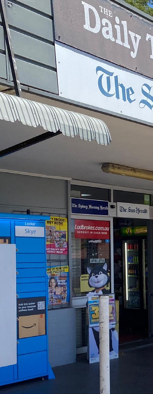
Local shops play a key role in our community. They nurture social wellbeing and connection, deliver convenient local goods and services and add a rich layer of character and local identity to our neighbourhoods.
Cumberland’s local shops are diverse and varied, ranging from one or two shops in quiet residential areas to larger groupings of shops along busy roads. And while they may vary in scale, what is common is what they bring to the community. Local shops are places where people can connect and access convenient local goods and services which, in turn, contributes to the local identity of our neighbourhoods.
Council’s goal for local shops across Cumberland is to protect and grow them in a way which still meets the local community’s needs, while nurturing their individual character and identity. We want to make sure they positively contribute to community life within Cumberland, while continuing to provide day-to-day goods and services, and diverse business opportunities which directly support their immediate neighbourhoods.
This document is intended to demonstrate the key role local shops play in Cumberland, the challenges they face and their opportunities for improvement and/or enhancement.
1.0 INTRODUCTION 6 Cumberland Local Shops Study
Introduction
STUDY PURPOSE AND OBJECTIVES
The purpose of this study is to provide a comprehensive and up-to-date analysis for twenty-five (25) local shops across the Cumberland Local Government Area.
The objectives of this study are to:
• Understand how to better support local shops in Cumberland.
• Establish the purpose and function of the 25 local shops included in the study.
• Establish the types of businesses operating at the 25 local shops included in the study.
• Establish and analyse the retail catchments for each of the local shops.
• Assess the place attractiveness and social connection of the local shops.
• Recommend the mechanisms to encourage convenience services for local residents within walking distances.
• Categorise the 25 local shops into ‘local shop typologies’ and establish a vision for each typology.
• Establish the challenges and opportunities for each local shop.
• Consider areas around a select group of local shops which may be appropriate to accommodate residential growth where it contributes to a vibrant, diverse and active hub.
• Recommendations which identify the planning controls, public domain improvements and place making opportunities, where appropriate.
Cumberland City Council 7

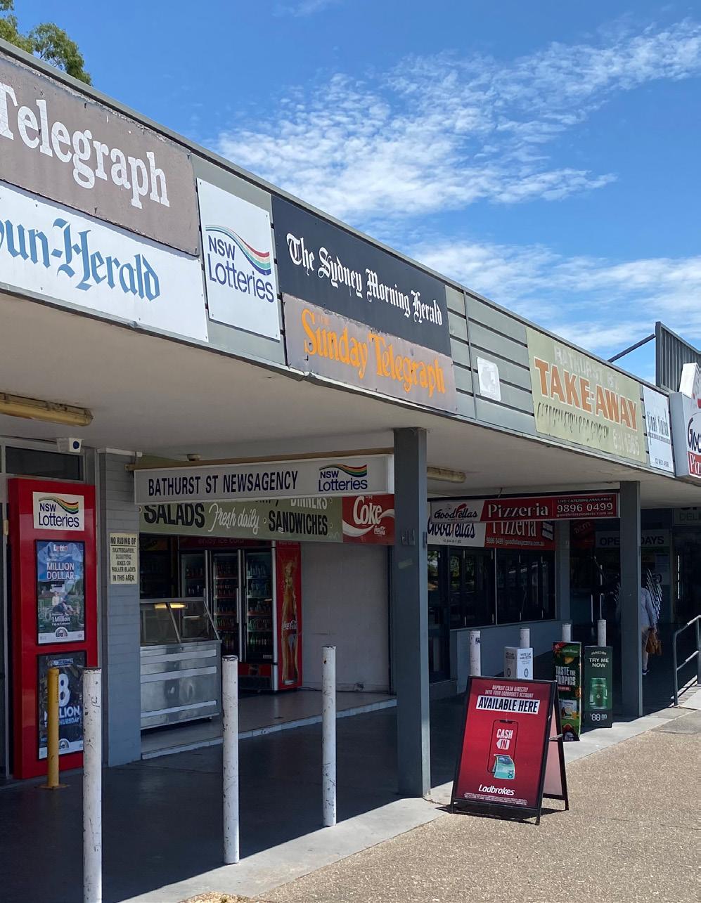
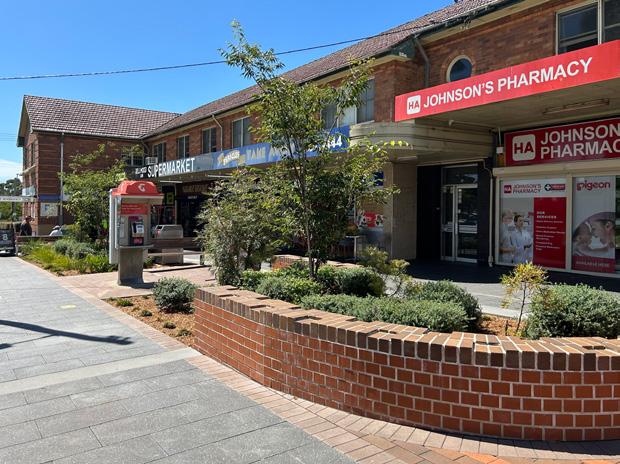
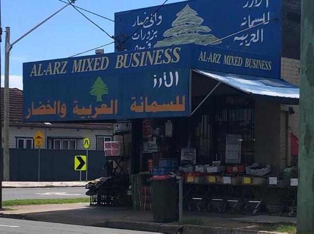
local shops? They provide a mix of small retail shops and local businesses catering to our daily needs BATHURST ST SHOPS, GREYSTANES They are places of local culture that support social interaction CLYDE ST SHOPS, SOUTH GRANVILLE 02 1.0 INTRODUCTION 8 Cumberland Local Shops Study 01
What are
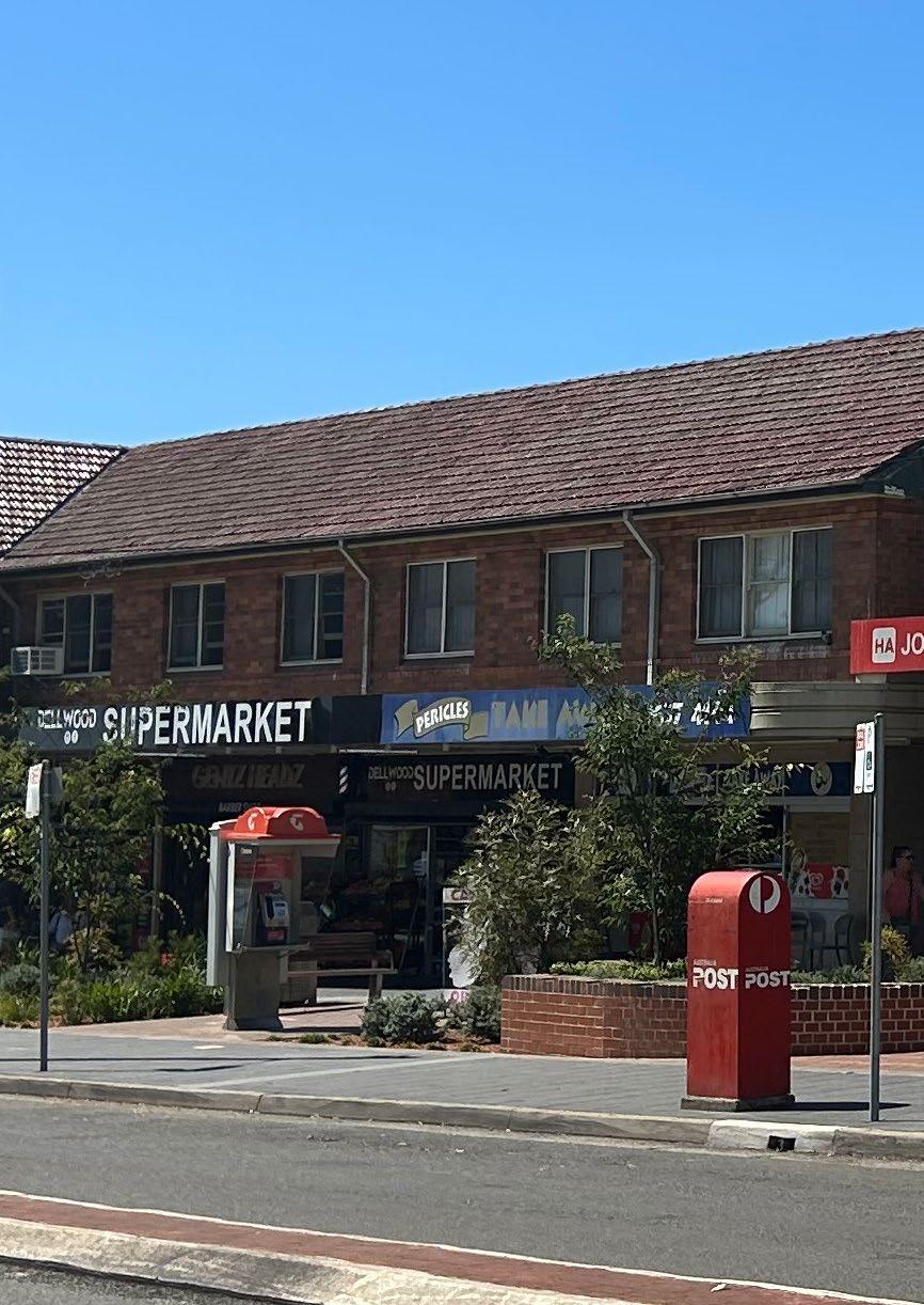
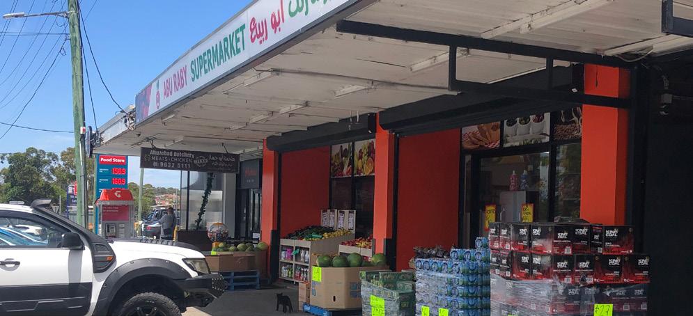
They are places that support local identity and character DELLWOOD ST SHOPS They reflect who we are as a community LOUIS ST, GRANVILLE 04 03 Cumberland City Council 9
The Local Shop Network
The Cumberland Local Government Area is strategically located in the Central City District, the geographic heart of Sydney, less than 5km south of Parramatta CBD and approximately 20km west of Sydney CBD.

The Cumberland Local Government Area is approximately 72 square kms and is strategically situated in the Greater Sydney Region with easy access to:
• Parramatta CBD
• Sydney CBD
• Western Sydney and the Blue Mountains
• Sydney Olympic Park
Around 240,000 people call Cumberland home. It is one of the most culturally diverse areas in NSW with a unique and vibrant identity. The things which make Cumberland unique include:
• Cultural diversity
• Network of town centres
• Proximity to Parramatta CBD
• Proximity to Western Sydney and the Blue Mountains
• Young population
• Changing economic outlook
• Access to major infrastructure
• Access to Sydney Olympic Park
• Amount of green space
In addition to the network of town centres, there is also network of local shops dispersed throughout our neighbourhoods across Cumberland of which 25 are the subject of this study.
Cumberland Local Shops (subject of this study)
1. Burnett St Shops
381 Merrylands Rd, Merrylands
3 Hilltop Rd, Merrylands
5. 33-39 Irrigation Rd, South Wentworthville
6. 121-123 Fairfield Rd, Guildford West
7. 176 and 223-505 Fowler Rd, Guildford West
8. 21-39 Dell St, Smithfield
(Woodpark Shopping Centre)
9. 51 Coleman St, Merrylands
10. 49 Old Prospect Rd, South Wentworthville
11. 342, 344 and 348 Blaxcell Street and 1 Guildford Road, South Granville
12. 165 Clyde Street, South Granville
13. 52-56 Excelsior Street, Merrylands
14. Clyde Street / Rawson Road
‘Service Centre’ Cluster: 48-62 Wellington Road and 359-365 Clyde St, South Granville in addition to the nearby E1 zoned land at 2-24 Rawson Rd, Guildford
15. 38-42 Rawson Rd, Guildford
16. 234-238 Cumberland Rd, Auburn
2. Hilltop Rd Shops
3. Louis Street, Granville
4. Dellwood Street, South Granville
1.0 INTRODUCTION 10 Cumberland Local Shops Study INTRODUCTION
17. Bathurst St Shops 41-51 Bathurst St, Greystanes
18. Damien Ave Shops, 7 Lucinda St, Greystanes
19. Maple St Shops: 41-49 Maple St, Greystanes
20. Carnation Street: 20-32 Carnation St, Greystanes
21. 126-130 Hawksview St, Guildford
22. 291-295 Clyde Street, South Granville
23. 174-178 Excelsior Street, Guildford
24. 271-277 Excelsior St, Guildford
25. 17 Brooks Circuit, Lidcombe
Other Local shops
A. 30 Watkin Tench Parade, Pemulwuy
B. 19 Jonathan Street, Greystanes
C. 81-83 Hibiscus Street, Greystanes
D. 2-4 and 6-10 Kippax Street, Greystanes
E. 1-7 and 9-11 Elvina Street, Greystanes
F. 17 Beresford Road, Greystanes
G. 65 Kenyons Road, Merrylands West
H. 74 Hawkesbury Road and Surrounds, Westmead
I. 35 Grimwood Street, Granville
J. 161 William Street, Granville
K. 11 Lowe Street, Merrylands
L. 141 The Avenue, Auburn
LEGEND
Cumberland LGA Boundary
Waterway
Open Space
Local Shops (subject to this study)
Local Shops (not subject to this study)
Local Centre
Principal Local Centre
Proposed Strategic Centre
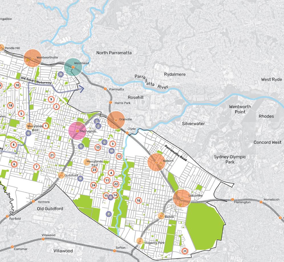
Strategic Precinct
T Railway Station
Railway Line
Liverpool-Parramatta Transitway
M. 142 Blaxcell Street, Granville
N. 188 Guildford Road, Guildford
O. 2-24 Rawson Road, Guildford
P. 38 Everley Road, Chester Hill
Cumberland
0 2km 1
City Council 11
Community Snapshot
Growing number of families with dependent children
38%
Higher proportion of people in younger age group (0-17 years)
Lower proportion of people aged 60 years and over
snapshot
Cumberland
236,996 TOTAL POPULATION 34 CUMBERLAND 37 GREATER SYDNEY Median age 23% CUMBERLAND 22% GREATER SYDNEY
A
of the
community is shown below.
17% CUMBERLAND
GREATER SYDNEY
20%
CUMBERLAND
GREATER SYDNEY
34%
1.0 INTRODUCTION 12 Cumberland Local Shops Study
WE ARE
WHO
83,189
TOTAL NUMBER OF HOUSEHOLDS (DWELLINGS)
Those living in medium or high-density dwellings
12% ARE OF LEBANESE ANCESTRY
Overseas born
13% ARE OF CHINESE ANCESTRY
Those living in detached house
50% CUMBERLAND 53% GREATER SYDNEY
Language at home other than English
53% CUMBERLAND
39%
GREATER SYDNEY
65% CUMBERLAND
37% GREATER SYDNEY
49% CUMBERLAND 46% GREATER SYDNEY
Cumberland City Council 13
HOW WE LIVE
Study Approach
An overview of this study’s approach is represented in the following diagram.
URBAN DESIGN, PLACE & PUBLIC DOMAIN ANALYSIS
An analysis of the existing urban design, place and public domain of the 25 local shops, strategic framework, best practice and urban design principles.
Preliminary Urban Design, Place & Public Domain Analysis
• Local context
Access and connectivity
• Existing activity and active frontages
• Public realm quality
• Built form and building character
Community Intelligence Insights
Data based insights into the behaviour and lifestyle characteristics of the neighbourhood around the local shops
Strategic Framework
• Establish the overall strategic framework which guides and influences the study’s approach from a range of legislation, strategies, and plans.
Best Practice & Urban Design Principles
• Establish the best practice and urban design principles from a variety of literature sources.
MARKET, ECONOMIC AND RETAIL ANALYSIS
An analysis of the market and economic and retail analysis of the 25 local shops.
Market Analysis
• Floorspace supply and composition
• Resident trade area
• Local demographic profile
Potential sources of expenditure
• Categorisation of local shops into local shop typologies
+
Economic and Retail Analysis
• Current demand and supply influences
• Retail and commercial projections
• Floorspace demand modelling to 2041
Future capacity
• SWOT analysis
• Identification of local shops for feasibility testing
+ + +
1.0 INTRODUCTION 14 Cumberland Local Shops Study
LOCAL SHOP TYPOLOGIES PRIORITY LOCAL SHOPS
Detailed analysis of local shop typologies, including vision, urban design performance, existing place quality and strategic opportunities.
Local Shop Typologies
• Destination local shops
• High street shops
• Retail destination
Convenience based shops
• Secondary commercial centre
Local Shop Place Vision
• Vision for each local shop typology
Urban Design Performance
• Summary of the performance for each local shop
Place Quality and Strategic Opportunities
• Assessment of the existing place qualities and strategic opportunities for each local shop
Urban design frameworks for 2 key local shops selected by Council.
Urban Design Frameworks
• Key opportunities
• Vision statement
• Urban design responses
URBAN DESIGN AND PLACE RECOMMENDATIONS
Recommendations for changes to the 25 local shops to support their desired function and character.
Urban Design and Place Recommendations
• Public domain elements
Ideas for place-making activation
• High level built form planning control recommendations
+
+
+ Cumberland City Council 15
Strategic Framework
Critical to undertaking this study is to understand the overall strategic framework which guides and influences the study’s approach from a range of legislation, strategies, and plans.
These include:
• Greater Sydney Region Plan – A Metropolis of Three Cities
• Central City District Plan
• Cumberland 2030: Our Local Strategic Planning Statement
• Cumberland Community Strategic Plan 2017-2027
• Cumberland Local Environmental Plan

• Cumberland Development Control Plan
• Cumberland Employment and Innovation Lands Strategy 2019
A summary of these documents is provided including their relationship to the study.
Greater Sydney Region Plan – A Metropolis of Three Cities
NEW SOUTH WALES GOVERNMENT
The Greater Sydney Region Plan (region plan) is the regional land use plan for Greater Sydney Region, which:
• Sets a 40-year vision (to 2056) for the region.
• Establishes a 20-year plan to manage growth and change for the region in the context of social, economic, and environmental matters.
• Informs the district and local plans and the assessment of planning proposals.
• Assists infrastructure agencies to plan and deliver growth and change.
• Informs the community of the growth management and infrastructure investment intentions of government.
RELATIONSHIP TO STUDY:
The region plan includes strategies which relate to local shops such as: Providing walkable places at a human scale with active street life.
• Prioritising a people friendly public realm and open spaces as a central organising design principle.
• Recognising and balancing the dual function of streets as places for people and movement.
Providing fine grain urban form, diverse land use mix, high amenity, and walkability in and within a 10-minute walk of centres.
• Recognising and celebrating the character of a place and its people.
Greater Sydney Region Plan – A Metropolis of Three Cities
Central City District Plan
NEW SOUTH WALES GOVERNMENT
The Central City District Plan (district plan) is the district land use plan for the Central City District (district) which covers the Blacktown, Cumberland, Parramatta, and The Hills local government areas. The district plan:

• Is a 20-year plan to manage growth for the district in the context of social, economic, and environmental matters. Is a guide for implementing the Greater Sydney Region Plan and is a bridge between regional and local planning.
• Informs local strategic planning statements and local environmental plans, assessment of planning proposals and community strategic plans and policies.
• Identifies the planning priorities to achieve a liveable, productive, and sustainable future for the district.
RELATIONSHIP TO STUDY:
The district plan includes strategies which relate to local shops such as: Providing services and social infrastructure to meet people’s changing needs.
• Fostering health, creative, culturally rich, and socially connected communities.
• Creating and renewing great places and local centres and respecting the District’s heritage.
GREATER SYDNEY REGION PLAN A Metropolis of Three Cities –connecting people March 2018 Updated
OUR GREATER SYDNEY 2056
1.0 INTRODUCTION 16 Cumberland Local Shops Study
Central City District Plan – connecting communities
Cumberland Employment and Innovation Lands Strategy 2019
CUMBERLAND CITY COUNCIL
The Cumberland Employment and Innovation Lands Strategy (EILS) is the Cumberland community’s framework for managing employment and innovation lands over a ten-year period which:
• Presents information on the current employment structure and demographic profile of Cumberland.
• Identifies strategic considerations for employment and innovation lands within Cumberland.
• Provides a strategic land use framework to support the transition of Cumberland’s employment and innovation lands to meet the future needs of residents and workers.
• Provides focus areas and actions to support the implementation of the strategy.
RELATIONSHIP TO STUDY:
The EILS includes focus areas and actions which relate to local shops such as:
Key Focus Area 1 – Planning: Review and update planning controls for employment and innovation lands.
Cumberland 2030: Our Local Strategic Planning Statement
CUMBERLAND CITY COUNCIL
The Cumberland City Council (Council) Local Strategic Planning Statement is Council’s Local Strategic Planning Statement (LSPS) which:
• Plans for the area’s economic, social, and environmental land use needs over 10 years (to 2030). Sets planning priorities about what is needed, such as jobs, homes, services, and parks.
• Sets out actions to deliver priorities for the community’s future vision.
• Guides the content of Council’s Local Environmental Plan and Development Control Plan.
RELATIONSHIP TO STUDY:
The LSPS provides commentary about a framework of centres being identified to support the land use vision for Cumberland. Specifically, commentary which relates to local shops is:
• A range of neighbourhood centres across the Cumberland area providing targeted services and facilities.
Cumberland Local Environmental Plan 2021
CUMBERLAND CITY COUNCIL
The Cumberland Local Environmental Plan (LEP) is Cumberland’s guide for planning decisions which:
• Provides the legislative framework for land use and development in Cumberland through land use zones and planning controls.
RELATIONSHIP TO STUDY:
The LEP includes zoning and planning controls which relate to local shops such as:
E1 Local Centre zoning.
• What the objectives are for development. What development may be carried out with or without development consent, or is prohibited.
• Relevant development standards / provisions.
Cumberland Community Strategic Plan 2017-2027
CUMBERLAND CITY COUNCIL
The Cumberland City Council (Council) Community Strategic Plan (CSP) is the Cumberland community’s highest-level plan which:
• Sets out the main aspirations and priorities for the future.
• Provides the community’s long-term vision for Cumberland City.
RELATIONSHIP TO STUDY:
The CSP includes objectives and strategies which relate to local shops such as: Places and spaces that are vibrant and connect us.
• Activate and support our centres, local areas, and local businesses to be vibrant places that connect people.
Cumberland Development Control Plan 2021
CUMBERLAND CITY COUNCIL
The Cumberland Development Control Plans (DCP) is Cumberland’s guide for design and operation of development within the local government area which:
• Seeks to achieve the aims and objectives of the LEP.
RELATIONSHIP TO STUDY:
The DCPs include the specific planning controls which relate to local shops such as those contained in:
• Development in Business Zones DCP.
• Miscellaneous development controls DCP e.g. traffic, parking, transport, and access.
Cumberland 2030: Our Local Strategic Planning Statement FEBRUARY 2020 CITY COUNCIL CUMBERLAND
17 2017-2027 Community Strategic Plan
Cumberland City Council
Cumberland Employment and Innovation Lands Strategy 2019
Urban Design & Place Analysis
Introduction
Local Shops Analysis

Urban Design Performance Summary
SECTION 2
Introduction
The preparation of a Local Shops Study for Cumberland involves understanding and establishing the current urban design, place and public domain qualities of existing local shops.
This study has involved undertaking a preliminary urban design, place and public domain analysis, combined with data based insights from the Neighbourlytics platform to understand the ‘current state’ of 25 local shops included in this study.
It has also taken into consideration its relationship to other State, Regional, District and Local strategies and plans which influence these local shops.
This has then led to a review of various literature to establish best practice and urban design principles to inform more detailed urban design analysis based on local shop typologies, and targeted urban design frameworks for 2 key local shops (selected by Council).
The ‘current state’ analysis for each of the 25 local shops is contained in the Preliminary Urban Design, Place & Public Domain Analysis.
Local Shops Analysis
Analysis of the local shops involved grouping the characteristics of local shops under a broad range of categories.
A ‘traffic light’ system has been used to assess these categories to inform the more detailed analysis of the local shop typologies, urban design frameworks for 2 priority local shops and recommendations.
The categories use are outlined below, including the assessment criteria, where relevant.
SCALE AND CATCHMENT
• Area of E1 zoning
• Local Shop Type
• Ownership Pattern
• Community and Employment Activity within Catchment
MARKET ANALYSIS
• Critical Mass
• Additional Source of Expenditure
• Key Anchors / Local Shop Offer
• Competition
• Demographics
• Current Performance
ACCESSIBILITY
• Walking Catchment
• Street Pattern
• Public Transport
• Active Transport Infrastructure
• Car Parking
PUBLIC REALM
• Streetscape Quality
• Pedestrian Prioritisation and Safety
BUILT FORM
• Building Typology
• Residential / Mixed Use
• Quality and Character
• Street Activation
CULTURE AND PLACE
• Place Qualities
• Local Culture
2.0 URBAN DESIGN AND PLACE ANALYSIS 20 Cumberland Local Shops Study
Assessment Criteria
Category Analysis
Scale and Catchment
Area of E1 zoning - - -
Local Shop Type - - -
High level of consolidated ownership
Community and Employment Activity within Catchment
Market analysis
Critical Mass (number of shops and gross floor area)
Additional Source of Expenditure
Key Anchors / Local Shops Offer
Competition
High level of consolidated ownership
Good mix of parks, education facilities, community facilities and places of worships in vicinity of local shops
Benefits from critical mass
High potential for additional sources of expenditure
High level of local shop offering / mix
Limited competition with other centres
Some level of consolidated ownership
Adequate mix of parks, education facilities, community facilities and places of worships in vicinity of local shops
Adequate critical mass
Some potential for additional sources of expenditure
Good level of local shop offering / mix
Some competition with other centres in vicinity
Fragmented ownership pattern
Low mix of parks, education facilities, community facilities and places of worships in vicinity of local shops
Lacks critical mass
Limited potential for additional sources of expenditure
Small level of local shop offering / mix
High level of competition with other centres in immediate vicinity
Demographics - - -
Current performance
Accessibility
Walking catchment (400m and 800m)
Street pattern
Public transport
Active transport infrastructure
Car parking
Public Realm
Streetscape quality
Pedestrian prioritisation and safety
Built form
Building typology
Residential / Mixed Use
Trades well
High number of residents in walking catchment
Grid pattern
Good access to public transport
Good access by footpath
Car parking located in front of shops and/or provision of offstreet parking
Landscaping and greenery present and/or good quality built form
Trades adequately
Medium number of residents in walking catchment
Combination of grid, loop and/ or cul-de-sac pattern
Adequate level of access to public transport
Adequate level of access by footpath
Some car parking located in front of shops and/or provision of off-street parking
Requires increased greenery and landscaping and/or built form is in reasonable condition
Low speed limit (50km/hr or less) Speed limit 60km/hr
New neighbourhood mixed-use development
Is residential / mixed use
Generally traditional low scale retail format; shop top housing
Not applicable
Trades at a lower level
Low number of residents in walking catchment
Loop pattern
Limited access to public transport
Low level of access by footpath
Limited / no car parking in front of shops
Limited greenery and landscaping and unmodernised built form
High speed traffic; narrow footpaths; steep topography
Industrial; vacant land; standalone building
Not residential / mixed use
Quality and character Condition of buildings are good Condition of buildings are fair Condition of buildings is poor
Street activation
Culture and Place
The local shops contribute to activation of the street
There is some activation of the street
Streets aren’t activated by the existing local shops
Place qualities - - -
Local culture - - -
Cumberland City Council 21
Urban Design Performance
The following diagram is an overall summary of the urban design performance of each of the 25 local shops.
LS1 Burnett Street Shops (381 Merrylands Road, Merrylands and surrounds)
Destination local shops
LS2 Hilltop Road Shops (3 Hilltop Road, Merrylands) High street shops
LS3 Louis Street, Granville (and surrounds)
Retail destination
LS4 Dellwood Street, South Granville (and surrounds) Convenience based shops
LS5 33-39 Irrigation Road, South Wentworthville Convenience based shops
LS6 121 - 123 Fairfield Road, Guildford West
LS7 176 and 223-505 Fowler Road, Guildford West
LS8 21 - 39 Dell Street, Smithfield (Woodpark Shopping Centre)
Convenience based shops
Destination local shops
Convenience based shops
LS9 51 Coleman Street, Merrylands Convenience based shops
LS10 49 Old Prospect Road, South Wentworth Secondary commercial centre
LS11 342, 344 and 348 Blaxcell Street & 1 Guildford Road, South Granville
Convenience based shops
LS12 165 Clyde Street, South Granville (and surrounds) Convenience based shops
LS13 165 Clyde Street, South Granville (and surrounds)
Convenience based shops
LS14 Clyde Street & Rawson Road Service Centre Cluster Secondary commercial centre
LS15 38-42 Rawson Road, Guildford
LS16 234-238 Cumberland Road, Auburn
LS17 Bathurst Street Shops
LS18 Damien Ave Shops
LS19 Maple Street Shops
LS20 Carnation Street
LS21 126-130 Hawksview Street, Guildford
Convenience based shops
Convenience based shops
Destination local shops
Convenience based shops
Destination local shops
Convenience based shops
Convenience based shops
LS22 126-130 Hawksview Street, Guildford Convenience based shops
LS23 174 - 178 Excelsior Street, Guildford
LS24 271-277 Excelsior Street, Guildford
LS25 17 Brooks Circuit, Lidcombe
Convenience based shops
Convenience based shops
Convenience based shops
2.0 URBAN DESIGN AND PLACE ANALYSIS 22 Cumberland Local Shops Study SCALE & CATCHMENT MARKET ANALYSIS LOCAL SHOP TYPOLOGY OWNERSHIP PATTERN COMMUNITY AND EMPLOYMENT ACTIVITY WITHIN CATCHMENT CRITICAL MASS ADDITIONAL SOURCE OF EXPENDITURE KEY ANCHORS CENTRE OFFER COMPETITION
Summary
Cumberland City Council 23 ACCESSIBILITY PUBLIC REALM BUILT FORM CURRENT PERFORMANCE
Unable to be established Unable to be established
WALKING CATCHMENT STREET PATTERN PUBLIC TRANSPORT ACTIVE TRANSPORT INFRASTRUCTURE CAR PARKING STREETSCAPE QUALITY PEDESTRIAN PRIORITISATION AND SAFETY BUILDING TYPOLOGY RESIDENTIAL / MIXED USE QUALITY AND CHARACTER STREET ACTIVATION
Local Shops Urban Design Principles
History and Lessons
Role, Urban Context and Economic Vitality
Access and Connectivity
Activity and Street Activation
Public Domain Function and Quality
Built Form and Character
Strategic Framework
SECTION 3
History and Lessons
High streets have been the centre of neighbourhood life for hundreds of years, in cities all over the world.
High streets have been the centre of neighbourhood life for hundreds of years, in cities all over the world. The essential role of providing daily necessities to people on foot meant high streets existed in virtually every town and every neighbourhood. At least that’s how cities developed until the 1950s, when the inexorable rise of the automobile began to transform settlement patterns, and new suburbs were built for the first time that did not have local shopping streets for people to walk to. Sydney is lucky to have retained many of its high streets, in every LGA east to west and north to south, an inheritance from the past that continues to make life convenient for everyone lucky enough to live close by.
High streets are a source of great pride and identity for the local community, and that pride is reinforced when your high street attracts visitors from other places and becomes famous.
What are the challenges facing our local shops?
REFERENCE AND LITERATURE REVIEW
The following research and planning policies have been use to identify contemporary challenges for local shops and inform overarching urban design principles to guide change:
NSW
• City of Ryde –Local Planning Study – Small Centres c.20092010
• Waverley Council - Our Liveable Places Centres
Strategy 2020 –2036
QLD
• Moreton Bay Regional Council – Planning Scheme Policy
– Centre and Neighbourhood Hub Design –2016
• Mackay Regional Council – Draft Centres Strategy
– 2013
VIC
• City of Casey Activity Centres Strategy – 2020
• Bayside Small Activity Centres Strategy – 2014
ROLE AND URBAN CONTEXT
Competition from higher order centres
Absence of distinctive local character elevating the visitor experience
Poor transitions and interfaces between shops and houses
Poor neighbourhood walkability and connection
Fractured ownership
Zoning limitations
26 Cumberland Local Shops Study
3.0 LOCAL SHOPS URBAN DESIGN PRINCIPLES
ECONOMIC VITALITY
Macro-economic influences on spending
Competition between local shops
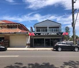
Low density housing catchments
Lack of critical mass of shop activity to support commercial viability and local vitality
Absence of anchor tenant or passby trade
Limited hours of operation
BUILT FORM AND CHARACTER
Buildings detract from the street
Vacant lots and tenancies
Poor ground level activation of the footpath
Aging and poorly maintained buildings
COMMUNITY AND CULTURE
Absence of distinctive local character
Lack of gathering and meeting spaces
Loss of heritage or cultural qualities
Community buy-in supporting urban renewal
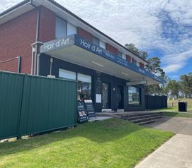
ACCESS AND CONNECTIVITY
Lack of convenient car parking and conflicts with pedestrians
Visual dominance of car parking
Service access conflicts and visibility
Low quality, unshaded walking paths
Absence of dedicated bicycle connections
Poor quality public transport infrastructure
ACTIVITY AND STREET ACTIVATION
Lack of housing diversity and apartments around and integrated with shops
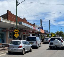

Low variety of shops and services
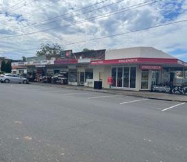
Poor passive surveillance of streets and public spaces
PUBLIC DOMAIN FUNCTION AND QUALITY
Car dominant public realm
Narrow footpaths
Traffic is too fast and too congested
Lack of comfortable, shaded seating
Visual quality of streets and visitor experience
Lack of shade
Lack of footpath activation by food and beverage businesses

Cumberland City Council 27
Role, Urban Context and Economic Vitality
URBAN DESIGN PRINCIPLES
The primary role of local shops as small mixed use centres catering for the day to day convenience needs and amenity of people within their neighbourhoods, and as key contributors to neighbourhood character, should be protected and enhanced
Flexible and highly place-responsive planning and design controls are required that address:
• High levels of community and local business in decision making that shapes local shop areas
• The scale and mix of activities local shops offer varies widely due to a broad range of demographic, locational and market influences
• With limited and often overlapping trade catchments, the economic vitality and health of local shop clusters varies widely and can be influenced by neighbourhood structure, the presence of anchor tenants, exposure to pass-by trade or proximity to large employment precincts
• The character and cultural qualities of local shops varies widely and is influenced by a broad range of demographic, locational and urban context factors
Adaptive re-use of existing buildings and new development should contribute to the overall economic performance of shops clusters, respond to local character and integrate within their neighbourhood context in a manner that:
• Is appropriate for its location and does not negatively impact on the amenity of the local area or adjoining residents
• Does not isolate or negatively impact on the development potential of adjoining sites
• Is tailored to the location of the site considering its intensity of activity, range of uses and proximity to public transport services, community facilities and other infrastructure
• Presents coordinated and integrated building design that contributes to a high quality public domain and supports improvements to active transport networks and public transport services
For new development, mixed used use buildings should be encouraged that:
• Maintain or expand retail, commercial or service activities aligned with forecast floorspace demand
• Provide higher density living opportunities within neighbourhoods to suit a range of household types and affordability levels
28 Cumberland Local Shops Study
Within the structure of Cumberland’s commercial and service centres, local shops provide convenient access to day-to-day goods and services and diverse business opportunities that directly support their local communities. They vary widely in scale, activity mix and character and are key contributors to the amenity and sense of place of the neighbourhoods within which they are set.
3.0 LOCAL SHOPS URBAN DESIGN PRINCIPLES
01
Cumberland City Council 29
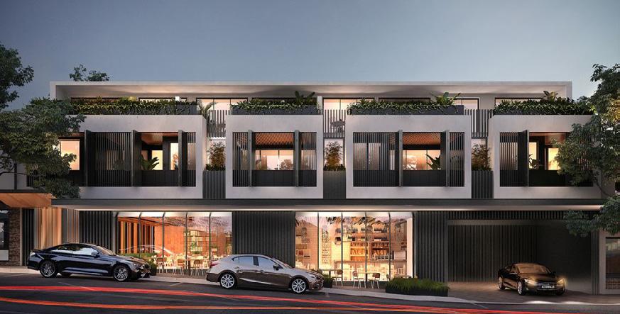
Figure 1 New mixed use development can offer a range of different lifestyle options compatible with the neighbourhood setting
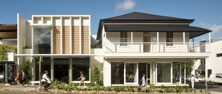
Figure 2 Adaptive re-use of heritage buildings maintain local character (James Street, Brisbane)
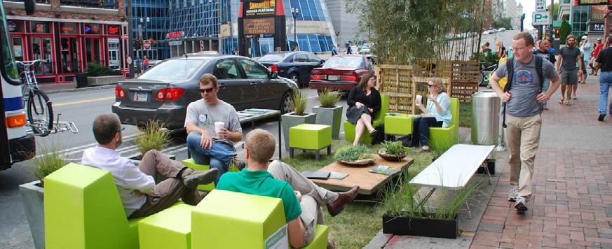
Figure 3 Engaging community groups and local traders to shape the use and character of their local area
Access and Connectivity
Local shops primarily service neighbourhood catchments so there is elevated importance of pedestrian prioritisation and active transport connectivity to maximise convenience and safety around local shop environments.
As the focus of activity within walkable catchments they also provide an important opportunity to support efficient, high quality public transport services and infrastructure that encourage greater ridership.
URBAN DESIGN PRINCIPLES
Local shop connections should be prioritised in city-wide active transport strategies, reinforcing and supporting their role as activity centres servicing walkable catchments
Local shop areas should prioritise pedestrians with consideration given to:
• Safe, convenient walking connections to the wider neighbourhood
• Safe or dedicated space for cyclists
• Ample street crossings that minimise conflict with traffic and slow traffic speeds
• Wide footpaths on activated street frontages to minimise conflict between shoppers/diners and commuters
• Landscape and shade planting that support comfortable and enjoyable walking and visitor experiences
Direct connections to employment precincts, parks, schools and other community facilities within the shops’ walking catchments should be established to support local shops
For shops serviced by local streets, opportunities to create shared zones in front of shops’ active frontage should be investigated to elevate pedestrian priority and support an enjoyable visitor experience
For local shops serviced by regional or collector roads, consideration should be given to:
• Minimising traffic speeds in balance with the role and function of the street
• Minimising left-turn slip lanes
• Providing safe separation of pedestrians from busy regional or collector road traffic
Local shops should provide physical and visual connections to high-transport nodes and provide high quality, comfortable transport infrastructure at stops
On-street car parking should be formalised and time-limited in the immediate local shop area and conflicts with the functions and amenity of residential streets minimised
New development should provide car parking which is legible and clearly distinct for the different user groups of a mixed use development such as customers and staff, residents and visitors. New development should provide private car parking and service access to the rear of the building, visually buffer these areas from the public domain and minimise driveway cross-overs of the footpath
30 Cumberland Local Shops Study
3.0 LOCAL SHOPS URBAN DESIGN PRINCIPLES
02

Cumberland City Council 31
Figure 4 High quality active transport infrastructure (Waterloo Sydney)
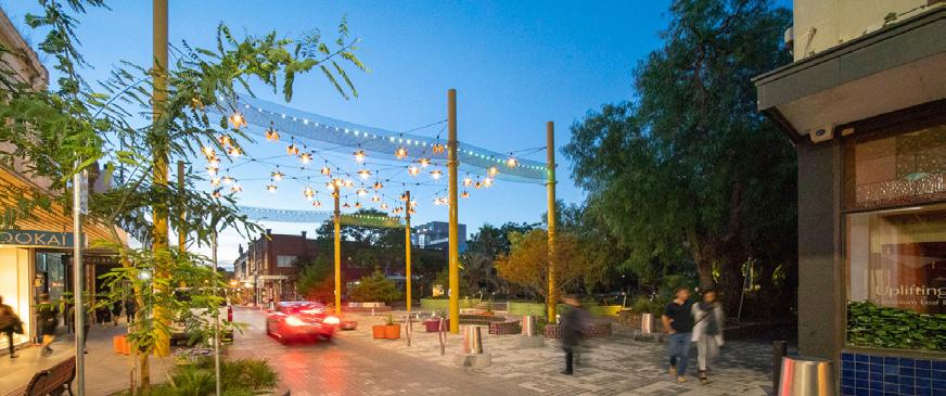
Figure 5 Shared streets that prioritise pedestrians (Greville Street Prahran Melbourne)
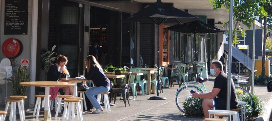
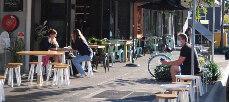
Figure 6 Wide footpaths allow business to activate the public domain and maintain pedestrian function of the footpath
Activity and Street Activation
Local shops should be busy, peopleprioritised places. They should comprise a range of convenience retail, commercial business and local services and offer distinctive visitor experiences that celebrate the unique social and cultural character of the community they serve.
URBAN DESIGN PRINCIPLES
Local shops should provide for a range of local commercial, service and recreational activities appropriate to the location, demand for floorspace and catchment size, and include:
• Retail facilities, such as neighbourhood stores and newsagents
• Food and beverage outlets (not including drive through facilities)
• Cultural uses, medical and community facilities
• Small-scale entertainment and licensed premises and service stations
• Local services such as post offices. Where floorspace demand is forecast, encourage expansion of local shops to achieve a critical mass of activity that contributes to economic vitality of the whole precinct
In contrast to larger centres, local shops comprise a higher proportion of small businesses and owner-occupier business, so consideration should be given to:
• Protecting locally distinctive and eclectic place characteristics that offer an experiential difference to large centres
• Encouraging local traders and residents to be engaged in decision-making, community engagement and programming of social events activities centred on the local shops
Public domain and streetscape design should:
• Prioritise people over cars
• Be safe and accessible for people of all ages and abilities
• Provide ample space for visitors to gather, meet and comfortably dwell
• Support highly active footpaths and include wherever possible footpath dining
• Provide seating, shade and amenities that elevate the visitor experience
• Provide ample lighting to maximise personal safety
Building design should:
• Activate ground level frontages through high levels of visual engagement with the street, high proportions of windows and glazing, expressed entries and footpath awnings
• Maximise passive surveillance of the street and adjacent spaces in upper floors of mixed use development
Establish strong connections and functional relationships with nearby parks so that they contribute to the local shop viability and support a high quality visitor experience
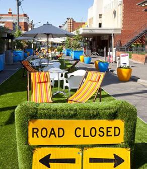
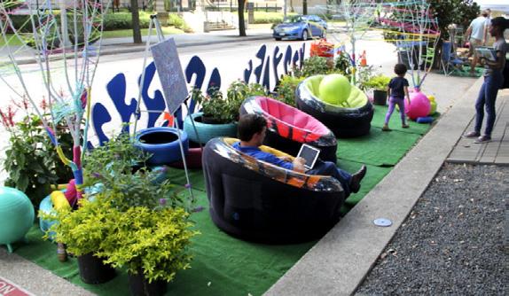
Provide the governance structure to allow traders or community groups to undertake interventions such as temporary street closures and car park take-over days that encourage community engagement with local shops and provide a venue for local events and gatherings
32 Cumberland Local Shops Study
3.0 LOCAL SHOPS URBAN DESIGN PRINCIPLES
03
Cumberland City Council 33
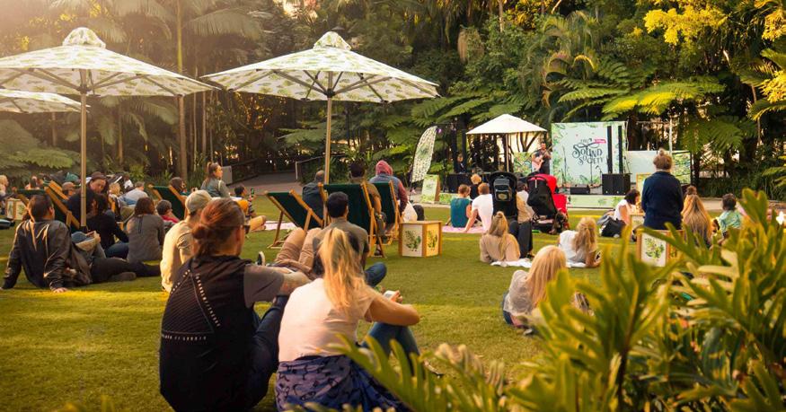
Figure 7 Encouraging community events in local parks adjacent local shops will support business and public domain vibrancy
Figure 9 Temporary interventions such as street closures and car park take-overs
Figure 8 Wide footpaths allow business to activate the public domain
Public Domain Function and Quality
The public domain of local shops is a stage for active street life and community interaction. It should be enjoyable, safe and welcoming for people of all ages and abilities and support the economic vitality of the shops.
URBAN DESIGN PRINCIPLES
The public domain of local shops are people-focused places where:
• Safe, convenient walking, cycling and public transport use is prioritised over cars
• They are accessible for people of all ages and abilities
The streetscapes and urban open spaces are designed as high quality public space tailored to the location of the shops, considering:
• The scale of the built environment and intensity of activity
• The type and mix of uses
• High levels of shade provided by new tree planting and building design
• Proximity to public transport services, community facilities and other infrastructure
• Local character elements and historic or cultural influences
On activated building frontages, the footpaths should:
• Provide ample space for visitors to gather, meet and comfortably dwell
• Support highly active footpaths and include wherever possible footpath dining
• Provide seating, shade and amenities that elevate the visitor experience
• Provide ample lighting to maximise personal safety
• Avoid ‘engineered‘ solutions such as fencing and guard rails to achieve pedestrian-traffic separation and rely on landscape and integrated streetscape elements
Ample public parking should be provided by both on-street and private car parks in a manner and location that does not detract from the pedestrian experience or the visual qualities of the area
New development provides an active frontage and integrated streetscape interface that creates a pedestrian-scaled, comfortable, attractive, sheltered and safe public realm, and supports pedestrian activity
New development provides high-quality on-site landscaping that reduces urban heat island effects and contributes to the character and microclimate of the locality and site with deepplanting areas for the protection of significant vegetation and establishment of large shade trees
34 Cumberland Local Shops Study
04 3.0 LOCAL SHOPS URBAN DESIGN PRINCIPLES

Cumberland City Council 35
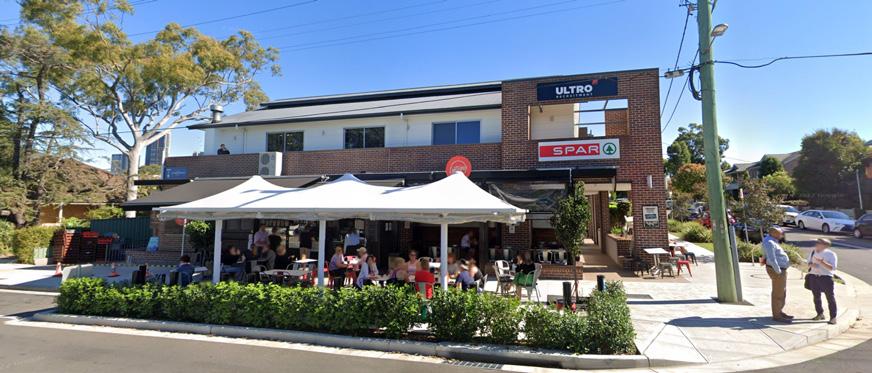
Figure 10 Wide, shaded footpaths provide the setting for active street life
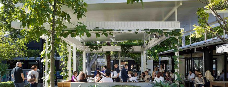
Figure 11 Use streetscape elements and landscape to create high quality people-prioritised places
Figure 12 Good building design can breakdown the barrier between indoor and outdoor spaces and activate the street (Harvey’s, James Street Brisbane)
Built Form and Character
URBAN DESIGN PRINCIPLES
New commercial and mixed use buildings should:
• Be of a development intensity, bulk, scale and form consistent with the intended function, spatial arrangement and character of the local shop area
• Maintain a compatible form and scale that support logical transitions and interfaces to nearby development and existing houses and minimise overshadowing
• Be designed to address all of their street frontages and contribute positively to the surrounding public domain’s functional performance and visual appeal
• On the ground floor, addresses and activates the street, providing adaptable and flexible space, particularly on the lower levels of a building, to support use and activity changes over time
• Setback from road frontages to complement the streetscape character and allow for activation of the footpath
• Setback from side and/or rear boundaries to protect the amenity of adjoining properties
• Of a site coverage to maximise the use of the land while providing adequate space for facilities and landscaping;
• Strongly defined building edges and an attractive, safe and pedestrian-focused environment
• Not dominated by blank walls, supermarkets or bulky and large built form
• Comprise building colours, lighting and materials that contribute to the sense of vibrancy of the public domain
• Respond to local cultural values and heritage assets
On active frontages, the ground level is designed to be:
• Highly functionally engaged with the footpath with retails shops and commercial or service businesses contributing to public domain vibrancy
• Highly visually engaged with the streetscape with expressed building and shop entries and high proportions of windows on facades
Development, particularly on landmark sites, retains and supports site features, such as views, heritage, significant vegetation and significant corner sites, and provides character and design elements to strengthen local identity and city distinctiveness.
36 Cumberland Local Shops Study
Buildings play a key role in defining the character of a local shop cluster and supporting their economic performance and social vitality.
05 3.0 LOCAL SHOPS URBAN DESIGN PRINCIPLES

Cumberland City Council 37
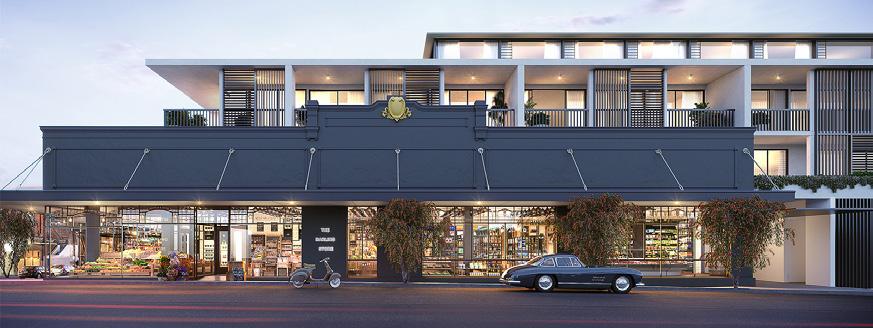
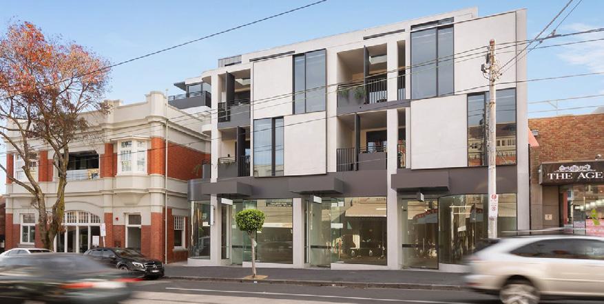
Figure 13 - High levels of visual connection between shops and streets (Mosman High street, source Structure Engineering.com.au)
Figure 14 - Mixed use development offering new living options (Darling and Cambridge, Rozelle, 4 storeys)
Figure 15 - Design sensitive to the urban setting and scale, High Street Armadale, Bruce Henderson Architects
Local Shops Typologies
Introduction Destination Local Shops
Retail Destination Local Shops
High Street Shops
Convenience Based Shops

Secondary Commercial Centre
SECTION 4
Introduction
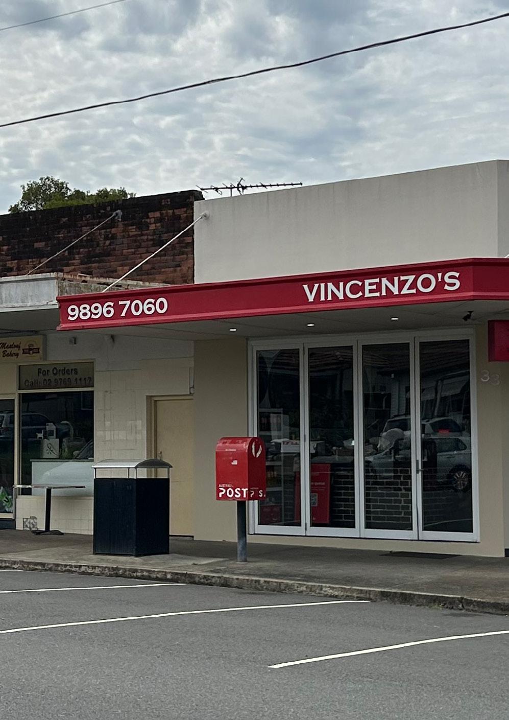
The Cumberland local shop typologies have been developed to categorise the 25 local shops into groups which share common attributes.
These attributes have been primarily based on the Market Analysis and existing built form and public realm conditions for each of the 25 local shops as follows:
ATTRIBUTES
Number of residents in both a 400m and 800m walking catchment (2021 and 2041)
Additional sources of expenditure
Critical mass (gross floor area and number of stores)
Accessibility
Key anchors / local shop offering (land use activity)
Competition with other centres in proximity
Demographics
Current performance
Streetscape quality
Pedestrian prioritisation and safety
Building typology
If the building is residential / mixed use
The quality and character of the built form Street activation
In consideration of these attributes and in collaboration with Council, five local shop typologies have been developed. They are:
• Typology 1: Destination Local Shops
• Typology 2: Retail Destination Local Shops
• Typology 3: High Street Shops
• Typology 4: Convenience Based Shops
• Typology 5: Secondary Commercial Centre
Under these five typologies the following matters are provided:
• A vision statement
• Detailed description of the typology
• Summary of the urban design performance for each local shop
• Existing place quality and strategic opportunities for each local shop
Overall, using these typologies provides the means to identify, organise and systematically describe common attributes to assist with a deeper analysis and identification of the challenges and opportunities for each of the 25 local shops.
40 Cumberland Local Shops Study
4.0 LOCAL SHOPS TYPOLOGIES
TYPOLOGY 2
Destination Local Shops
Destination local shops are those places which attract people because of their unique products, services, or experiences. They are typically located in urban or suburban areas with easy access by car or public transport.
The local shops included in this typology are:
• LS1 – Burnett Street
• LS7 – Fowler Road
• LS17 – Bathurst Street
• LS19 – Maple Street
• LS25 – Brooks Circuit
Retail Destination Local Shops
Retail destination local shops are those places which attract people because of their retail offering such as a full line supermarket and speciality support retailing. They are generally located in urban areas with easy access by car or public transport.
The local shops included in this typology are:
• LS3 – Louis Street
TYPOLOGY 3
High Street Shops
High street shops are generally situated along the main street of an area and serve as a hub for shopping, dining, and entertainment. They are commonly frequented by both locals and tourists and contribute significantly to the local economy.
The local shops included in this typology are:
• LS2 – Hilltop Road
TYPOLOGY 4
Convenience Based Shops

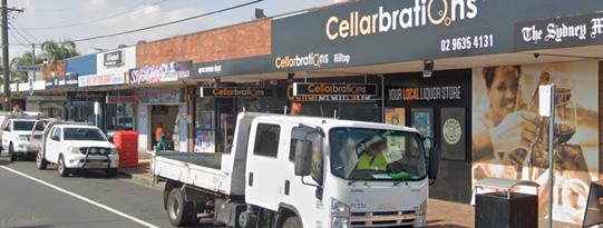
Convenience based shops are those places offering quick and convenient access to everyday goods and services, as well as eating out options. They are typically located in easily accessible locations and often offer extend hours of operation.
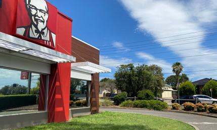

The local shops included in this typology are:
• LS4 – Dellwood Street
• LS5 – Irrigation Road
• LS6 – Fairfield Road
• LS8 – Dell Street
• LS9 – Coleman Street
• LS11 – Blaxcell Street
• LS12 – Clyde Street
• LS13 – Excelsior Street
• LS15 – Rawson Street
• LS16 – Cumberland Road
• LS18 – Damien Ave
• LS21 – Hawksview Street
• LS22 – Clyde Street
• LS23 – Excelsior Street (2)
• LS24 – Excelsior Street (3)
TYPOLOGY 5
Secondary Commercial Centre
Secondary commercial centres are those places designed to provide affordable office space to small and growing business who may not be able to afford more traditional commercial office space in prime locations. They are often located in areas easily accessed by public transport and offer ample parking for tenants and visitors.
The local shops included in this typology are:
• LS10 – Old Prospect Road
• LS14 – Clyde Street and Rawson Road
Cumberland City Council 41
TYPOLOGY 1
(1)
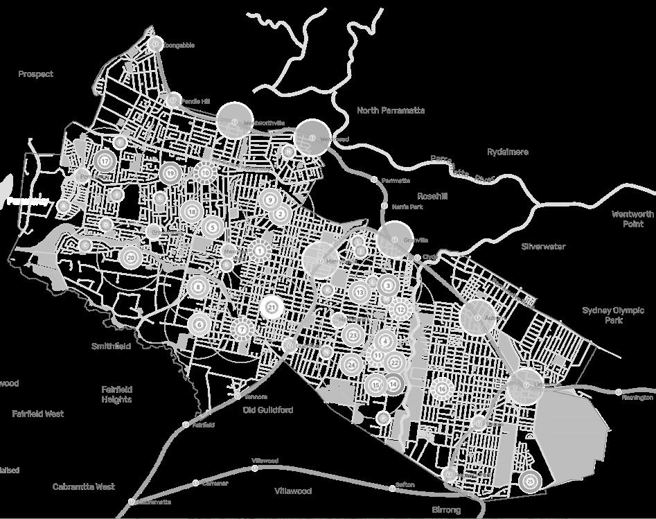
Spatial Distribution of Local Shop Typologies
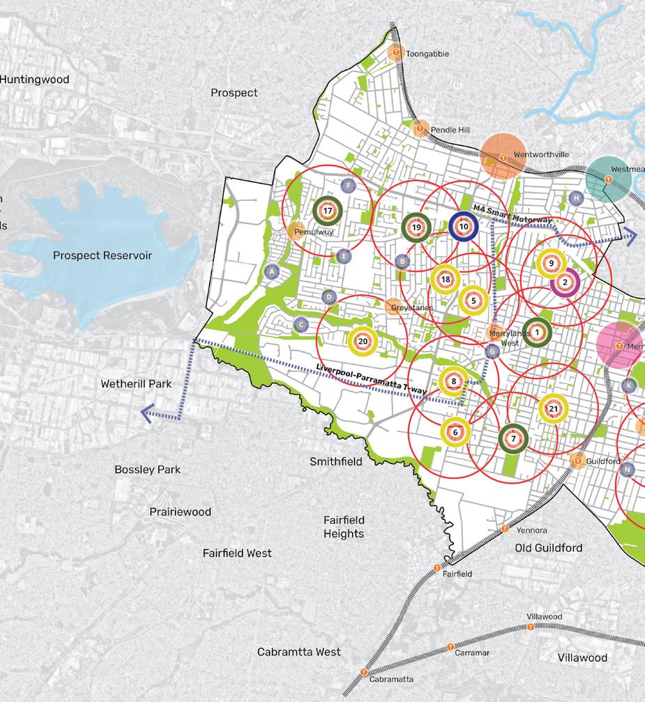
CUMBERLAND LOCAL SHOPS (SUBJECT OF THIS STUDY)
1. Burnett St Shops (381 Merrylands Rd, Merrylands and surrounds)
2. Hilltop Rd Shops (3 Hilltop Rd, Merrylands)
3. Louis Street, Granville (and surrounds)
4. Dellwood Street, South Granville (and surrounds)
5. 33-39 Irrigation Rd, South Wentworthville
6. 121-123 Fairfield Rd, Guildford West
7. 176 and 223-505 Fowler Rd, Guildford West
8. 21-39 Dell St, Smithfield (Woodpark Shopping Centre)
9. 51 Coleman St, Merrylands
10. 49 Old Prospect Rd, South Wentworthville
11. 342, 344 and 348 Blaxcell Street and 1 Guildford Road, South Granville
12. 165 Clyde Street, South Granville (and surrounds)
13. 52-56 Excelsior Street, Merrylands
14. Clyde Street / Rawson Road ‘Service Centre’ Cluster:
48-62 Wellington Road and 359-365 Clyde St, South Granville in addition to the nearby E1 zoned land at 2-24 Rawson Rd, Guildford
15. 38-42 Rawson Rd, Guildford
16. 234-238 Cumberland Rd, Auburn
17. Bathurst St Shops: 41-51
Bathurst St, Greystanes and Surrounds
18. Damien Ave Shops: 7
Lucinda St, Greystanes
19. Maple St Shops: 41-49 Maple St, Greystanes
20. Carnation Street: 20-32
Carnation St, Greystanes
21. 126-130 Hawksview St, Guildford
22. 291-295 Clyde Street, South Granville
23. 174-178 Excelsior Street, Guildford
24. 271-277 Excelsior St, Guildford
25. 17 Brooks Circuit, Lidcombe
42 Cumberland Local Shops Study
OTHER CENTRES
A. 30 Watkin Tench Parade, Pemulwuy and surrounds
B. 19 Jonathan Street, Greystanes
C. 81-83 Hibiscus Street, Greystanes
D. 2-4 and 6-10 Kippax Street, Greystanes
E. 1-7 and 9-11 Elvina Street, Greystanes
F. 17 Beresford Road, Greystanes
G. 65 Kenyons Road, Merrylands West
H. 74 Hawkesbury Road and Surrounds, Westmead
I. 35 Grimwood Street, Granville
J. 161 William Street, Granville
K. 11 Lowe Street, Merrylands
L. 141 The Avenue, Auburn
M. 142 Blaxcell Street, Granville
N. 188 Guildford Road, Guildford
O. 2-24 Rawson Road, Guildford
P. 38 Everley Road, Chester Hill
LEGEND
Cumberland LGA Boundary
Waterway
Open Space
Local Shops (subject to this study)
Local Shops (not subject to this study)
Local Centre
Principal Local Centre
Proposed Strategic Centre
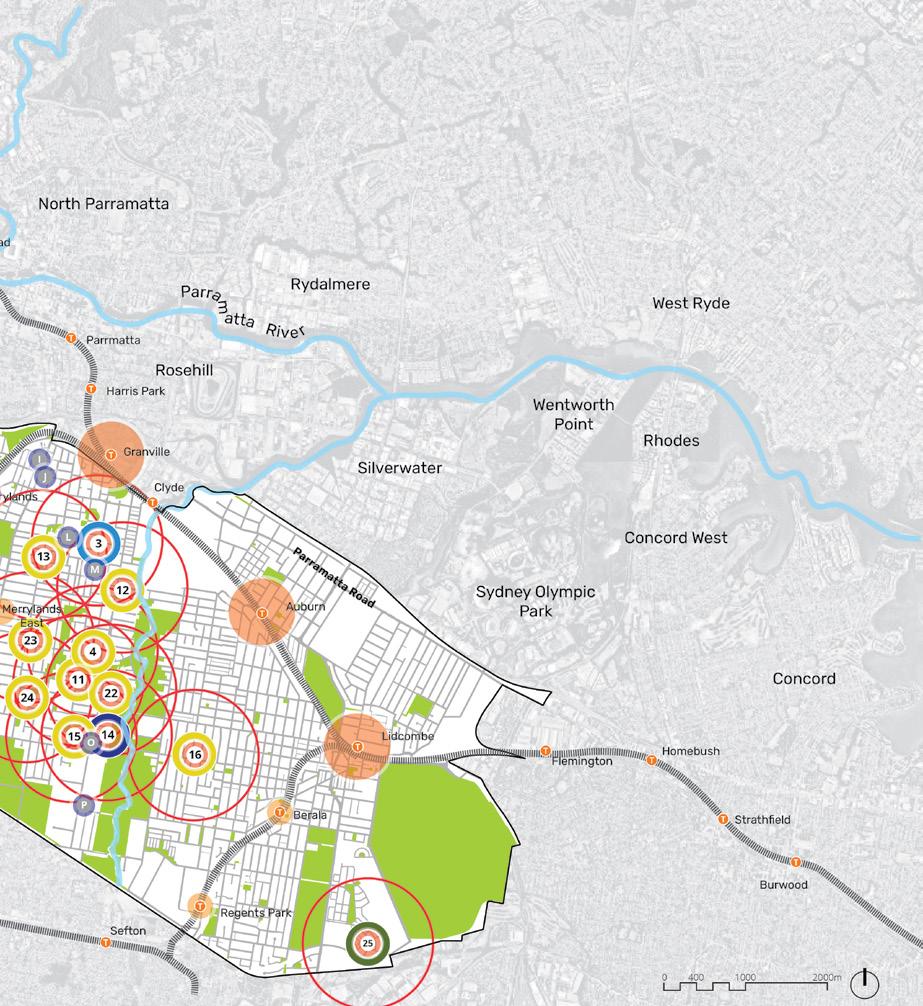
Strategic Precinct
T Railway Station
Railway Line
Liverpool-Parramatta Transitway
Local Shops Typologies
Destination Local Shops
Retail Destination Local Shops
High Street Shops
Convenience Based Shops
Secondary Commercial Centre
Cumberland City Council 43
Destination Local Shops
Destination local shops refer to retail establishments that attract customers due to their unique products, services, or experiences.
These shops often offer specialty items or services that are not widely available elsewhere and provide a distinct shopping experience that can also draw customers from beyond the immediate community.
Examples of destination shops include high-end fashion boutiques and artisanal food shops.
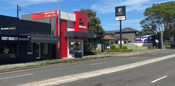
Destination local shops can also differentiate themselves experience from competitors and increase customer base through integrating shops with or leveraging from nearby recreational or community uses to create a unique shopping experience or targeted experience for visitors of the recreational or community uses.
For example, a sporting goods store located adjacent to a sporting oval may attract users of the sporting oval looking to purchase gear and apparel.
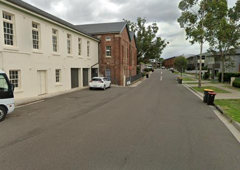

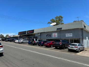
Destination shops are typically located in urban or suburban areas with easy access by car or public transportation, and they play an important role in driving tourism and economic development in the surrounding area.
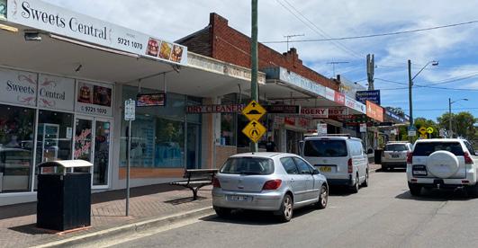 LS1 - Burnett Street Shops
LS7 - Fowler Road Shops
LS17 - Bathurst Street Shops
LS19 - Maple Street Shops
PLACE VISION STATEMENT TYPOLOGY 1 LS25 - Brooks Circuit
Destination Local Shops are unique places that offer distinctive shopping or recreational experiences

1 19 17 7 25 Cumberland City Council 45
Burnett Street Shops
381 Merrylands Rd, Merrylands
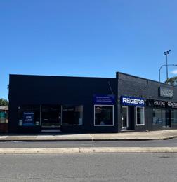


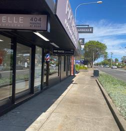
The Burnett Street Local Shops comprises three sites clustered around the busy intersection of Burnett Street and Merrylands Road. The local shop area comprises traditional retail/ commercial buildings, a service station, detached houses and vacant sites. Existing commercial uses trade well but overall the local shop area presents an incohesive and underutilised grouping of commercial activities in a visually low quality streetscape setting.
As regional roads, Burnett Street and Merrylands Road both offer the potential for this location to benefit from pass-by trade. Within its catchment of primarily low density housing is the regional attractor Merrylands Park and a wide range of local community and service uses. The community is characterised by younger, slightly below State average household income earners, and a high proportion of people from non-English speaking backgrounds.
VISUAL ANALYSIS
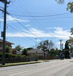 Figure 16 Shops fronting Fowler Road are traditional 1-2 storey high street format built form with tenants
Figure 17 Existing activity and frontages - looking west from Merrylands Road
Figure 18 Narrow footpaths with verge along Fowler Road - looking south
Figure 19 An absence of streetscape enhancements
Figure 20 Low density residential along Merrylands Road - looking east from Merrylands Road
LS1 4.0 LOCAL SHOPS TYPOLOGIES TYPOLOGY 1: DESTINATION LOCAL SHOPS
46 Cumberland Local Shops Study
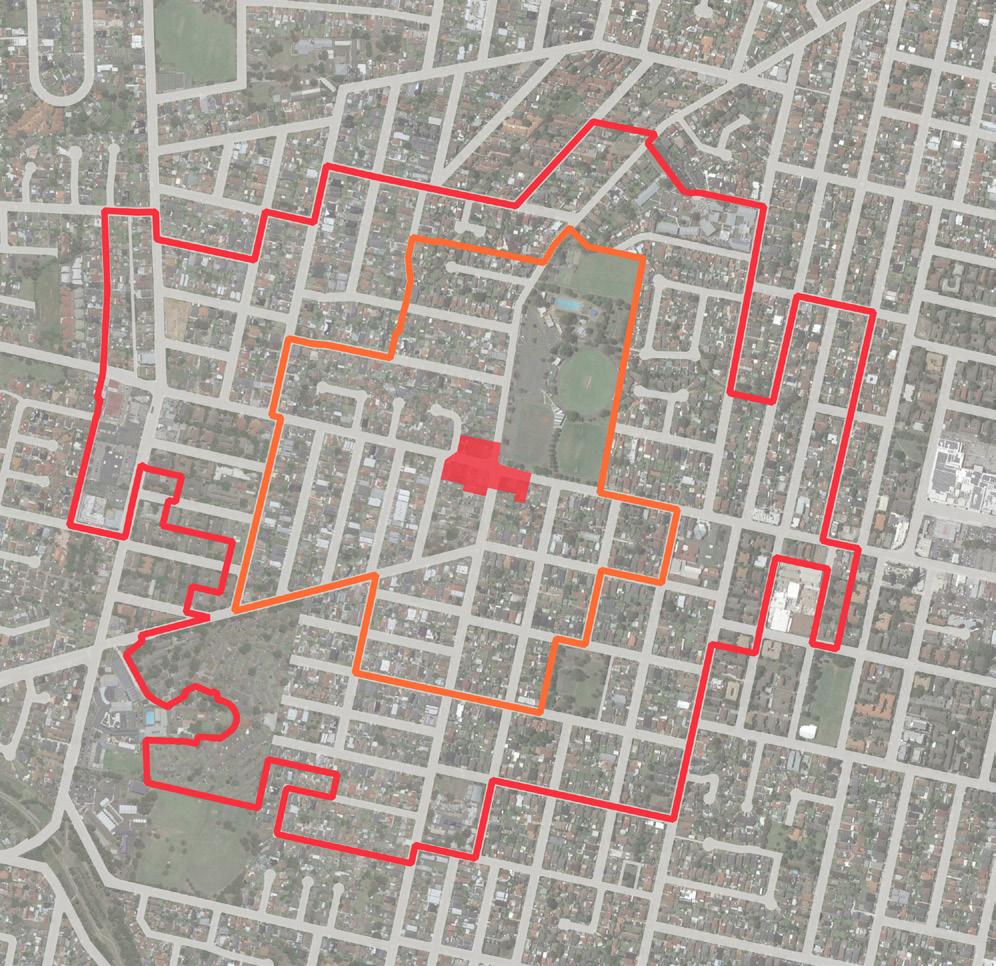
Cumberland City Council 47 LEGEND Existing E1 Zone 400m Walking Catchment 800m Walking Catchment Public Open Space Education 1 Quality Medical Practice 2 Merrylands Park Tennis Courts 3 Merrylands Swimming Centre 4 Merrylands Soccer Football Club 5 St Margaret Mary’s Church 6 St Margaret Mary’s Primary School 7 Fire and Rescue NSW Merrylands Fire Station 8 Platinum Hardware 9 Advanced Early Learning Child Care Centre 10 Whitey’s Workshop
2 Local Shops Extent and Context Map Merrylands Road Merrylands Road Fowler Road 3 4 5 6 7 9 8 11 12 13 10 1 2 KenyonsRoad Chelsea Street Merrylands Park Lawson Square Park Ruth Street Park King Park 500m 0 250 100 11 3rd Merrylands Scout Hall 12 Merrylands Bowling Club 13 Cerdon College CUMBERLAND CITY COUNCIL 3
Figure
Local
and Context Map
Figure 21
Shops Extent
Urban Design Performance
EXISTING PLACE QUALITY AND STRATEGIC OPPORTUNITIES
Urban Design Element Challenges
Local context
• General low-density residential context and busy roads require well-considered development integration and public realm improvements if growth as a mixed use precinct is anticipated
Economic vitality
• Strong competition from Merrylands West Centre (800m)
• Incohesive commercial environment with vacant land and detached housing reducing the critical mass of commercial activity
• Demand and supply generally at equilibrium
Access and connectivity
• Role of Burnett Street and Merrylands Road as regional roads limits significant reprioritisation of road space for on-street parking or pedestrian space
• An absence of high quality active transport infrastructure such as bike lanes or wider footpaths
Existing activity and street activation
• E1 zoned properties are separated by the road network into three disconnected sites
• There is limited activation of the street with retail or food/beverage businesses
Public realm quality
• Regional roads present a poor environment and safety issues for pedestrians and vibrant street life
• Narrow footpaths limit the levels of footpath activation and prevents significant streetscape enhancements and increased planting
Building form and character
• Incohesive built environment with a range of building conditions, vacant lots and detached houses
4.0 LOCAL SHOPS TYPOLOGIES TYPOLOGY 1: DESTINATION LOCAL SHOPS
48 Cumberland Local Shops Study
SCALE & CATCHMENT MARKET ANALYSIS LOCAL SHOP TYPOLOGY OWNERSHIP PATTERN COMMUNITY AND EMPLOYMENT ACTIVITY WITHIN CATCHMENT CRITICAL MASS ADDITIONAL SOURCE OF EXPENDITURE KEY ANCHORS CENTRE OFFER COMPETITION
LS1 Burnett Street Shops (381 Merrylands Road, Merrylands and surrounds)
Destination local shops
Future Opportunities
• Leverage relationships and physical connection to Merrylands Park and local community activities to support greater local shop viability and activity
• Introduce integrated urban living options through mixed use redevelopment to offer broader local housing choices to suit a range of household types
• Attract and capture the pass-by movement economy offered by Burnett Street and Merrylands Road
• Encourage mixed use redevelopment and maximise floorspace to increase commercial viability of urban renewal
• Reduce traffic speeds and deliver streetscape improvements that increase pedestrian comfort and safety
• Leverage good existing public transport connectivity with improved bus stop infrastructure
• Investigate dedicated bike lanes on Burnett Street and Merrylands Road
• Encourage redevelopment as a mixed use destination that will increase activity and support significant investment in improved streetscape function and quality
• Setback new buildings from the front property boundaries to increase footpath space
• Improve the functional and visual quality of the streetscape as a coordinated outcome with new mixed use development
• Deliver future streetscape enhancements to visually unify the wider local shopping area
• Increase shade with additional street planting and awnings on all active street frontage
• Encourage amalgamation of lots to deliver a scale and quality of mixed use development that can contribute to better quality buildings and public realm character
• Address and express the intersection corners of buildings so together they visually emphasise the precinct as a destination
Cumberland City Council 49
ACCESSIBILITY PUBLIC REALM BUILT FORM CURRENT PERFORMANCE WALKING CATCHMENT STREET PATTERN PUBLIC TRANSPORT ACTIVE TRANSPORT INFRASTRUCTURE CAR PARKING STREETSCAPE QUALITY PEDESTRIAN PRIORITISATION AND SAFETY BUILDING TYPOLOGY RESIDENTIAL / MIXED USE QUALITY AND CHARACTER STREET ACTIVATION
Fowler Road Shops
176 and 223-505 Fowler Rd, Guildford West

The Fowler Road Local Shops comprises sixteen businesses including specialised food stores, grocery stores, restaurants and fast food, personal services and a service station. With good critical mass, these shops appear to trade adequately, servicing a predominantly low density residential catchment and the Yennora Industrial Precinct to the south.
These shops benefit from strong vehicular accessibility, exposure to passing traffic and good public transport accessibility.

The built form of the shops reflects a low scale high street format with high levels of footpath engagement and a continuous awning along the street frontage. The buildings are generally aged stock and in moderate condition.
The Guildford Road- Fowler Road intersection is a car dominated environment with no public domain or active transport enhancements. The community is characterised by younger, below State average household income earners, and a high proportion of people from nonEnglish speaking backgrounds.
VISUAL ANALYSIS
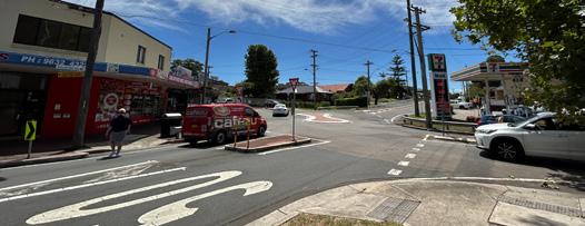 Figure 22 Traditional 1-2 storey high street format built form delivers a good local shopping experience
Figure 23 The Guildford Road- Fowler Road roundabout intersection is a car dominated environment with poor pedestrian functionality
Figure 24 Narrow footpaths with no outdoor dining/ seating or streetscape embellishments
LS7 4.0 LOCAL SHOPS TYPOLOGIES TYPOLOGY 1: DESTINATION LOCAL SHOPS
50 Cumberland Local Shops Study
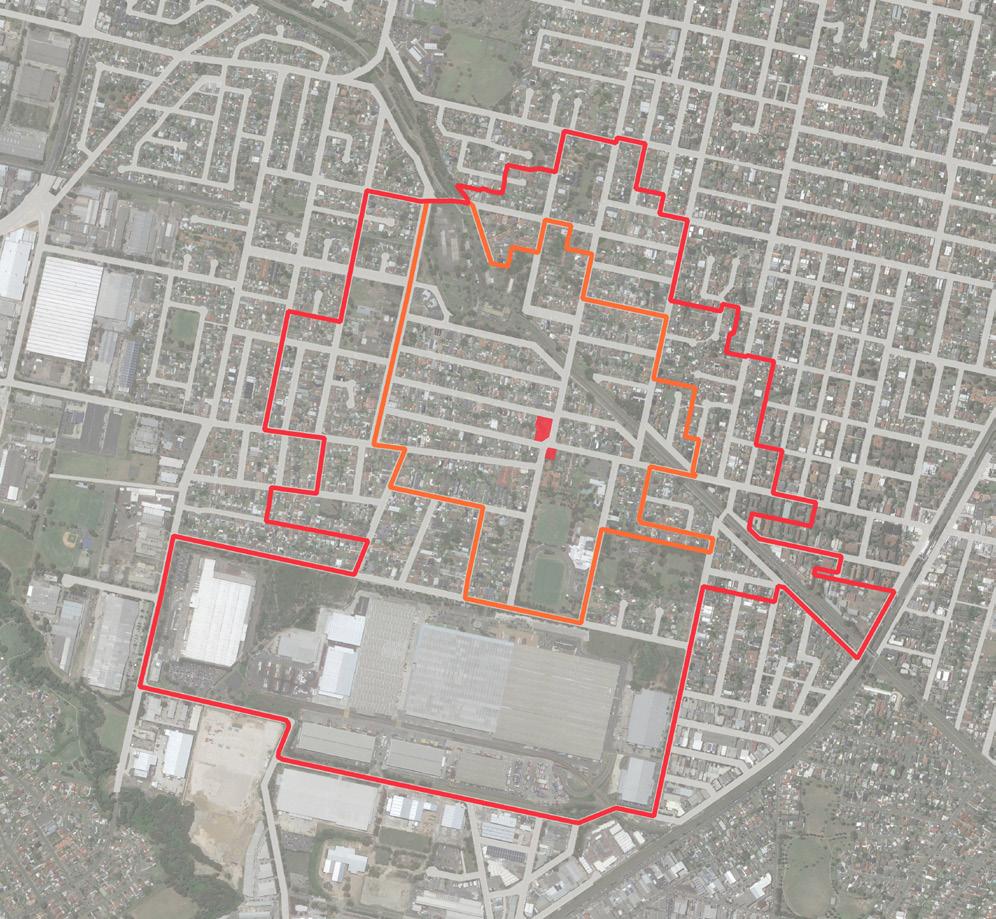
Cumberland City Council 51 LEGEND Existing E1 Zone 400m Walking Catchment 800m Walking Catchment Public Open Space Education 1 Guildford Swimming Centre 2 Holroyd Uniting Church 3 St Patrick’s Primary School 4 Guildford West Chirldren’s Centre 5 Linnwood House 6 Yennora Distribution Centre 7 Guildford West Public School 8 Kids World Kindy Guildford 9 Guildford Leagues Club 10 Holroyd Private Hospital Guildford Road Dennistoun Avenue Fowler Road PIPELINE PIPELINE Byron Road Palmer Street Harris Street Fowler Road Guildford Road McCredie Road McCredie Park Guildford Road Park Maley Park Helena St Reserve Princes Street Park Albert Street Park Cusack Street Park Fowler Road Reserve Leigh St Park Gloucester Park ArnettPark Gum Tree Reserve Wainwright Street Park George Street Park Chamberlain Park Os Young Park 1 3 4 8 5 2 6 7 9 10 10 500m 250m 0 100 Figure 123 Local Shops Extent and Context Map CUMBERLAND CITY COUNCIL 51 Figure 25 Local Shops Extent and Context Map
Urban Design Performance
EXISTING PLACE QUALITY AND STRATEGIC OPPORTUNITIES
EXISTING PLACE QUALITY AND STRATEGIC OPPORTUNITIES
Urban Design Element Challenges
Local context
• Guildford Road and Fowler Road are higher order streets that will continue to carry district and regional traffic through the area
• Requires logical transitions to surrounding low density residential housing if significant redevelopment is proposed
Economic vitality
• Redevelopment may not be feasible without a residential component which may risk the loss of commercial floorspace and impact the existing neighbourhood shop experience
Access and connectivity
• Role of Guildford Road and Fowler Road as regional and collector roads limits significant re-prioritisation of road space for on-street parking or pedestrian space
• The roundabout prioritises car movements and there is an absence of formalised pedestrian crossings
• Limited parking availability around the local shop area
• An absence of high quality active transport infrastructure such as bike lanes or wider shaded footpaths
Existing activity and street activation
Public realm quality
• While the shops present good active frontage to footpaths, there is limited footpath space to provide outdoor cafe/dining
• Busy intersection with a car dominated environment impacting the visual and function quality of the streetscape
• Narrow footpaths limit the levels of footpath activation and prevents significant streetscape enhancements such as increased planting
Building form and character
• While the shops function well and engage with the street, the building stock is aged and moderately maintained
4.0 LOCAL SHOPS TYPOLOGIES TYPOLOGY 1: DESTINATION LOCAL SHOPS
52 Cumberland Local Shops Study SCALE & CATCHMENT MARKET ANALYSIS LOCAL SHOP TYPOLOGY OWNERSHIP PATTERN COMMUNITY AND EMPLOYMENT ACTIVITY WITHIN CATCHMENT CRITICAL MASS ADDITIONAL SOURCE OF EXPENDITURE KEY ANCHORS CENTRE OFFER COMPETITION
LS7 176 and 223-505 Fowler Road, Guildford West Destination local shops
Future Opportunities
• Improve connection to regional employment and recreation destinations including the Yennora Industrial Precinct, swimming centre and leagues club
• Introduce integrated urban living options through mixed use redevelopment to offer broader local housing choices to suit a range of household types
• Demand for floorspace is slightly above supply, suggesting there is market appetite for additional floorspace
• Improving the food and beverage offer and providing more convenience based retailing
• Provide additional safe pedestrian crossings of Guildford Road and Fowler Road
• Reduce traffic speeds and deliver streetscape improvements that increase pedestrian prioritisation
• Formalise and time limit on-street car parking
• Leverage good existing public transport connectivity with improved bus stop infrastructure
• Investigate the potential for dedicated bike lanes
• Protect the existing high street format and function and investigate opportunities to achieve additional footpath space in potential redevelopment
• Deliver future streetscape enhancements to visually unify the wider local shopping area
• Increase shade with additional street planting on all active street frontages
• Investigate the opportunity to remove the roundabout and replace with traffic lights to improve pedestrian safety
• Encourage amalgamation of lots to deliver a scale and quality of mixed use redevelopment that can deliver additional retail floorspace and contribute to better quality buildings and public realm character
Cumberland City Council 53 ACCESSIBILITY PUBLIC REALM BUILT FORM CURRENT PERFORMANCE WALKING CATCHMENT STREET PATTERN PUBLIC TRANSPORT ACTIVE TRANSPORT INFRASTRUCTURE CAR PARKING STREETSCAPE QUALITY PEDESTRIAN PRIORITISATION AND SAFETY BUILDING TYPOLOGY RESIDENTIAL / MIXED USE QUALITY AND CHARACTER STREET ACTIVATION
Bathurst Street Shops
41-51 Bathurst St, Greystanes
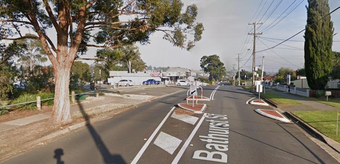
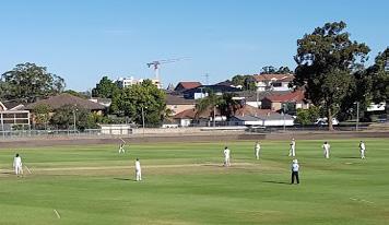
Bathurst Street Shops offers a good range of retailing and food and beverage options. The eight businesses appear to trade adequately and are well placed to service visitors of Bathurst St Park and Paul’s Tennis Academy. The location benefits from strong vehicular accessibility, exposure to passing traffic and good public transport accessibility.
The built form is a single storey offering an active retail frontage to the street. There is minimal shading of the footpath with awning. The building has no significant character qualities and a range of front setback conditions present an inconsistent street frontage. The property slopes down east to west creating a split level frontage and rear undercroft parking at the western end. There are high levels of parking afforded by on-street parking along the shop facade and an off-street car park shared with the sports facilities. The community is characterised by older, more affluent households and a higher proportion of Australian born residents.


LS17
Figure 26 The Bathurst Street facade
Figure 27 A wide, unshaded footpath is created by setbacks from the front property boundary
Image capture: Apr 2021 © 2023 Google Greystanes,
Google Street View Apr 2021 See more dates 28 Bathurst St
New South Wales
4.0 LOCAL SHOPS TYPOLOGIES TYPOLOGY 1: DESTINATION LOCAL SHOPS
54 Cumberland Local Shops Study
VISUAL ANALYSIS
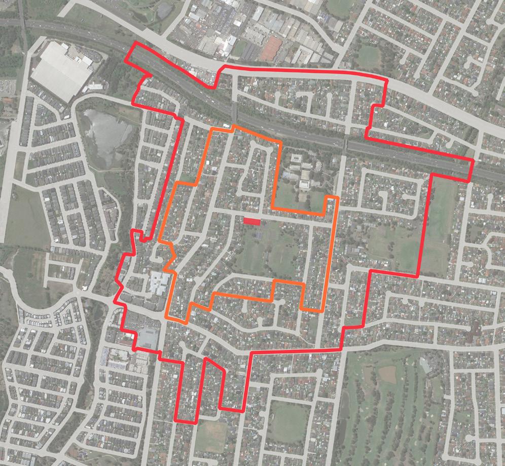
500m 0 250 100 LEGEND Existing E1 Zone 400m Walking Catchment 800m Walking Catchment Public Open Space Education 1 Ascent Childcare Centre 2 Greystanes High School 3 Australia’s Youth Self Defence Karate 4 Beresford Road Public School 5 Greystanes Family Medical Practice 6 Munchkin Manor Early Learning Centre 7 First Steps Academy 8 Pemulwuy Aged Care WesternMotorwayM4 1 ButuWargunDriveway Old Prospect Road Great Western Highway Bathurst Street Beresford Road Darling Street Grafton Street Greystanes Road Kiama Street NijongDriveway Nijong Driveway 2 3 4 5 6 Greystanes Road Bathurst Street Park Darling Street Park Driftway Reserve Shadid Reserve Nelson Square Naying Drive Park Pendle Hill Park Haywood Pl Reserve Bogan Street Reserve Roberta Street Park 7 Brighton Street Gozo Road 8 9 10 Figure 308 Local Shops Extent and Context Map 9 Pemulwuy Marketplace 10 Allied Business Relocations Sydney CUMBERLAND CITY COUNCIL 135 Cumberland City Council 55 30 Local Shops Extent and Context Map
Urban Design Performance
EXISTING PLACE QUALITY AND STRATEGIC OPPORTUNITIES
EXISTING PLACE QUALITY AND STRATEGIC OPPORTUNITIES
Urban Design Element Challenges
Local context
Economic vitality
• Requires logical transitions to surrounding low density residential housing if significant redevelopment is proposed
• Strong competition from Pemulwuy Marketplace (800m)
• Adequate existing critical mass (992sqm and 8 stores) but limited opportunity to expand commercial uses based on current zoning
Access and connectivity
• Pedestrian movement across Bathurst Street is poor with one existing pedestrian crossing remote from the shops
• Speed control devices suggest vehicle speeds on Bathurst Street may be an issue
• An absence of high quality active transport infrastructure such as bike lanes or shaded footpaths
• An absence of comfortable bus infrastructure such as seating and shade
Existing activity and street activation
Public realm quality
• No activation of the footpath with outdoor dining or retail display
• No functional relationship with the sports facilities
• An absence of shade and public domain qualities to support the visitor experience
• Low levels of pedestrian comfort and safety
Building form and character
• The built form and quality does not contribute materially to a unique or high quality place character
• Inconsistent facade setback and presentation to the street
• No passive surveillance of the public realm and potentially poor Crime Prevention Through Environmental Design (CPTED) outcomes to the rear of the building
SCALE & CATCHMENT MARKET ANALYSIS LOCAL SHOP TYPOLOGY OWNERSHIP PATTERN COMMUNITY AND EMPLOYMENT ACTIVITY WITHIN CATCHMENT CRITICAL MASS ADDITIONAL SOURCE OF EXPENDITURE KEY ANCHORS CENTRE OFFER COMPETITION
LS17 Bathurst Street Shops
4.0 LOCAL SHOPS TYPOLOGIES TYPOLOGY 1: DESTINATION LOCAL SHOPS
Destination local shops
56 Cumberland Local Shops Study
Future Opportunities
• Single property ownership and access to open space offer high potential for mixed use redevelopment that maintains local shop activity and introduces urban living options
• Potential to better capture trade from visitors to Bathurst Street Park and Greystanes High School with improved connectivity
• Opportunities to target convenience store or speciality food retailer which is missing from the existing retail mix
• Deliver streetscape improvements that slow traffic speeds around the shops, generally increase pedestrian prioritisation and include additional safe pedestrian crossings
• Leverage good existing public transport to the shops and sports facilities connectivity with improved bus stop infrastructure
• Investigate dedicated bike lanes on Bathurst Street to service the school and sports facilities
• Encourage street dining and activation of the wide footpath
• Provide shaded seating and landscaping on the wide footpath of the shops
• Deliver public realm outcomes that directly address the visual qualities of the street and building
• Encourage redevelopment of the property as a high quality mixed use building
ACCESSIBILITY PUBLIC REALM BUILT FORM CURRENT PERFORMANCE WALKING CATCHMENT STREET PATTERN PUBLIC TRANSPORT ACTIVE TRANSPORT INFRASTRUCTURE CAR PARKING STREETSCAPE QUALITY PEDESTRIAN PRIORITISATION AND SAFETY BUILDING TYPOLOGY RESIDENTIAL / MIXED USE QUALITY AND CHARACTER STREET ACTIVATION Cumberland City Council 57
Maple Street Shops
41-49 Maple St, Greystanes
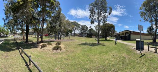
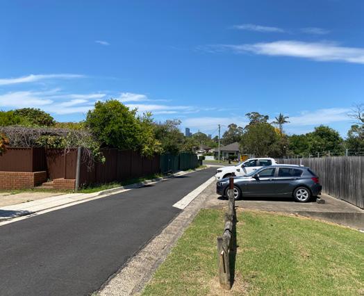
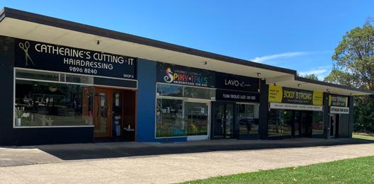
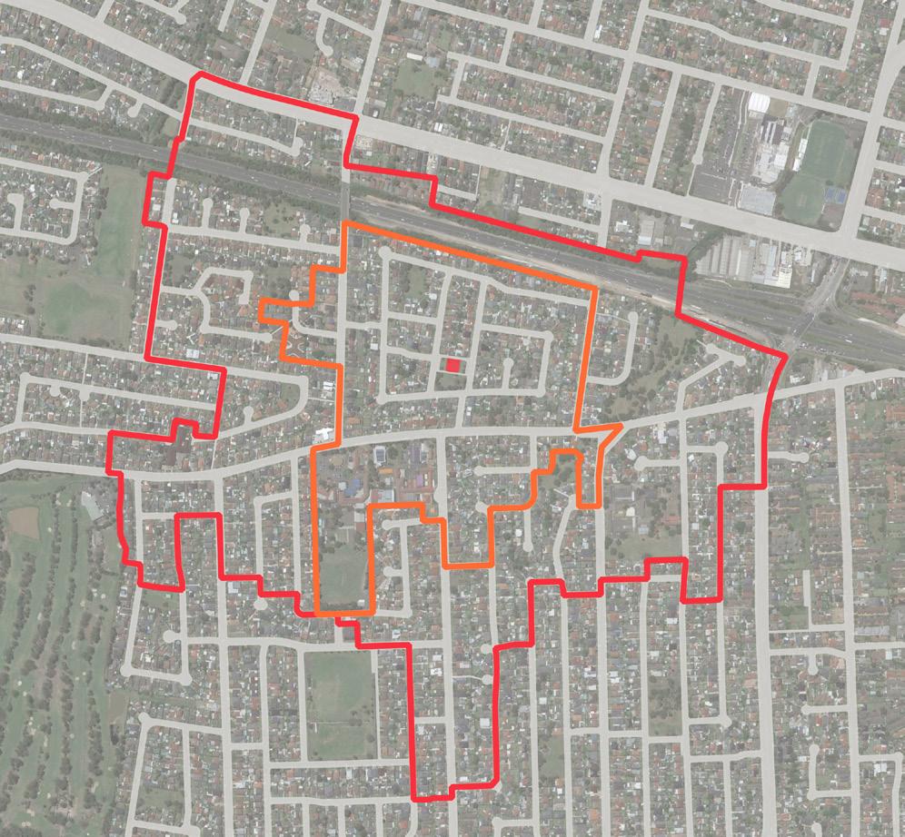
Maple Street shops is a small rear-accessed park front building with four commercial tenancies. It comprises personal services and a fitness related business as a result of its unique park setting and an absence of significant pass-by trade. It services a low density residential catchment where the active transport connectivity is impacted by the loop road structure of the wider neighbourhood. The nearest public transport stops are 200m away on Old Prospect Road as a result.
The building is a single storey, rear-accessed structure with direct frontage to Maple Street Park. There is no activation of this frontage given the nature of the current businesses. The building is well-maintained and is separated from its street frontages by open space. The community is characterised by younger, more affluent above State average household income earners, and a high proportion of proportion of Australian born residents.
VISUAL ANALYSIS
LS19
Figure 31 The frontage to Maple Street Park
Figure 32 The low scale shops and park setting characterise the location
Figure 33 Rear lane way parking
4.0 LOCAL SHOPS TYPOLOGIES TYPOLOGY 1: DESTINATION LOCAL SHOPS
58 Cumberland Local Shops Study
Cumberland City Council 59 500m 0 250 100 LEGEND Existing E1 Zone 400m Walking Catchment 800m Walking Catchment Public Open Space Education 1 St Paul’s Catholic College 2 Our Lady Queen of Peace Preschool 3 Our Lady Queen of Peace 4 First Academy Preschool Childcare Centre 5 Ringrose Public School 6 Wenty Childrens Centre 7 L Driving School 8 Smartied Preschool and Long Day Care Centre 9 KWC Krav Maga 10 Pendle Hill Public School 11 Achievers Early Learning Centre 12 Reema Family Day Care 1 2 3 4 5 6 7 8 9 10 11 12 Gregory Street Reserve Murray Reserve White Gum Reserve Forest Gum Park Daniel Street Park Lance Cres Park Ringrose Park Carolyn Street Park Kookaburra Street Park Darling Street Park Great Western Highway A44 WesternMotorway Maple Street Old Prospect Road Willow Street Wattle Street Gregory Street Brawside Road Ringrose Avenue Cumberland Highway A28 Ettalong Road Pendle Way Jones Street Cumberland Road
CUMBERLAND CITY COUNCIL 147
Figure 343 Local Shops Extent and Context Map
Figure
34 Local Shops Extent and Context Map
Urban Design Performance
EXISTING PLACE QUALITY AND STRATEGIC OPPORTUNITIES
EXISTING PLACE QUALITY AND STRATEGIC OPPORTUNITIES
Urban Design Element Challenges
Local context
Economic vitality
• The loop road structure of the wider neighbourhood impacts on the walking and cycling connectivity
• No pass-by trade and limited potential to grow convenience retail activities
Access and connectivity
• Low vehicular connectivity and visibility from main road network
• Poor public transport with the nearest bus stops 200m away
• Poor walking and cycling connectivity due to the road network
Existing activity and street activation
• Limited to personal service business activities
• No potential for activation of surrounding streets
Public realm quality
• While the park setting presents unique opportunities to attract a range of uses there is significant separation from the street frontages
Building form and character
• The extent of zoned commercial land and scale of the building does not support a critical mass of commercial activities
SCALE & CATCHMENT MARKET ANALYSIS LOCAL SHOP TYPOLOGY OWNERSHIP PATTERN COMMUNITY AND EMPLOYMENT ACTIVITY WITHIN CATCHMENT CRITICAL MASS ADDITIONAL SOURCE OF EXPENDITURE KEY ANCHORS CENTRE OFFER COMPETITION
4.0 LOCAL SHOPS TYPOLOGIES TYPOLOGY 1: DESTINATION LOCAL SHOPS
LS19 Maple Street Shops Destination local shops
60 Cumberland Local Shops Study
Future Opportunities
• Investigate community uses, such as a community/scout hall, or specific recreation attractors in the park that can create multi-purpose trips and activate the area
• Attract destination food and beverage tenancies that draw direct benefits from the high amenity location but do not rely on pass-by trade
• Encourage redevelopment of the single-ownership property as a high quality mixed use building maintaining local shops and including residential apartments
• Improve active connections and wayfinding between the shops and the bus stops on Old Prospect Road
• Improve footpaths to the shops from the wider neighbourhood and major road network
• Investigate park enhancements such as fitness equipment or jogging circuits that support a specialised fitness theme for the shops
• Encourage redevelopment of the property as a high quality mixed use building to increase activity that would support a greater variety of local shops
• Maintain the active frontage to the park and ensure future park embellishments support high levels of interaction
• Express the connections between the streets and shopfronts with landscape and wayfinding elements
• Ensure redevelopment of the property appropriately responds to the low density and low traffic environment of the location
• Investigate expansion of the zoned land to front Wattle Street and Willow Street to increase the critical mass of local shop activity
ACCESSIBILITY PUBLIC REALM BUILT FORM CURRENT PERFORMANCE WALKING CATCHMENT STREET PATTERN PUBLIC TRANSPORT ACTIVE TRANSPORT INFRASTRUCTURE CAR PARKING STREETSCAPE QUALITY PEDESTRIAN PRIORITISATION AND SAFETY BUILDING TYPOLOGY RESIDENTIAL / MIXED USE QUALITY AND CHARACTER STREET ACTIVATION Cumberland City Council 61
Brooks Circuit Lidcombe
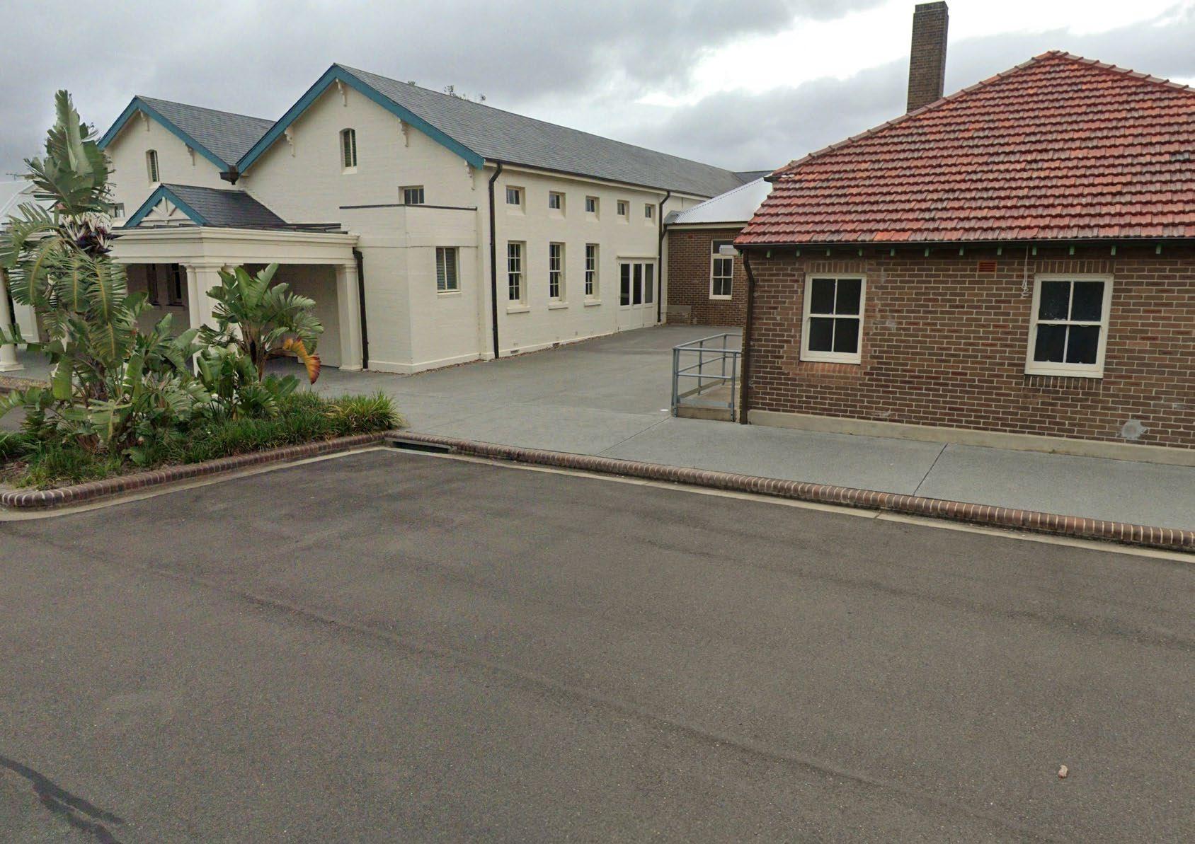
The Brooks Circuit shops are remnant heritage buildings integrated within a master planned residential precinct. The tenancies are currently vacant however plans to include supermarket/grocer, childcare centre and supporting specialty. The setting has a high quality, pedestrian friendly public domain as a recently completed residential infill development. These shops benefit from strong active transport accessibility in a low speed traffic environment however there is no exposure to external streets supporting pass-by trade. There is potential to attract trade from workers of the Forensic Medicine and Coroner’s Court, Lidcombe TAFE and Mary Wade Correctional Centre as well as students from the TAFE.
The community is characterised by younger, significantly more affluent, and slightly higher rates of people from nonEnglish speaking backgrounds compared to State averages.
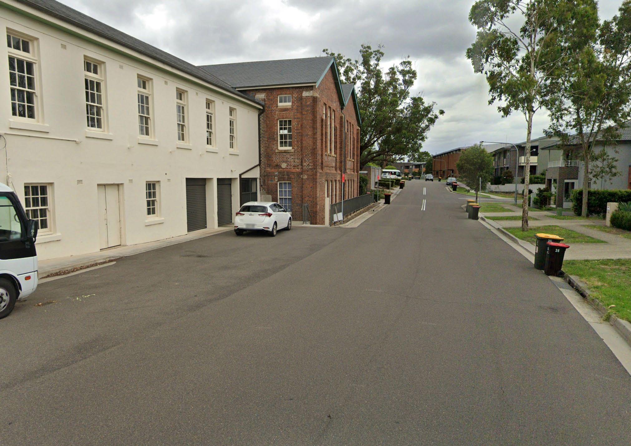
VISUAL ANALYSIS
© 2023 Google © 2023 Goog e © 2023 Goog e © 2023 Goog e © 2023 Goog e © 2023 Goog e
LS25 4.0 LOCAL SHOPS TYPOLOGIES TYPOLOGY 1: DESTINATION LOCAL SHOPS
62 Cumberland Local Shops Study
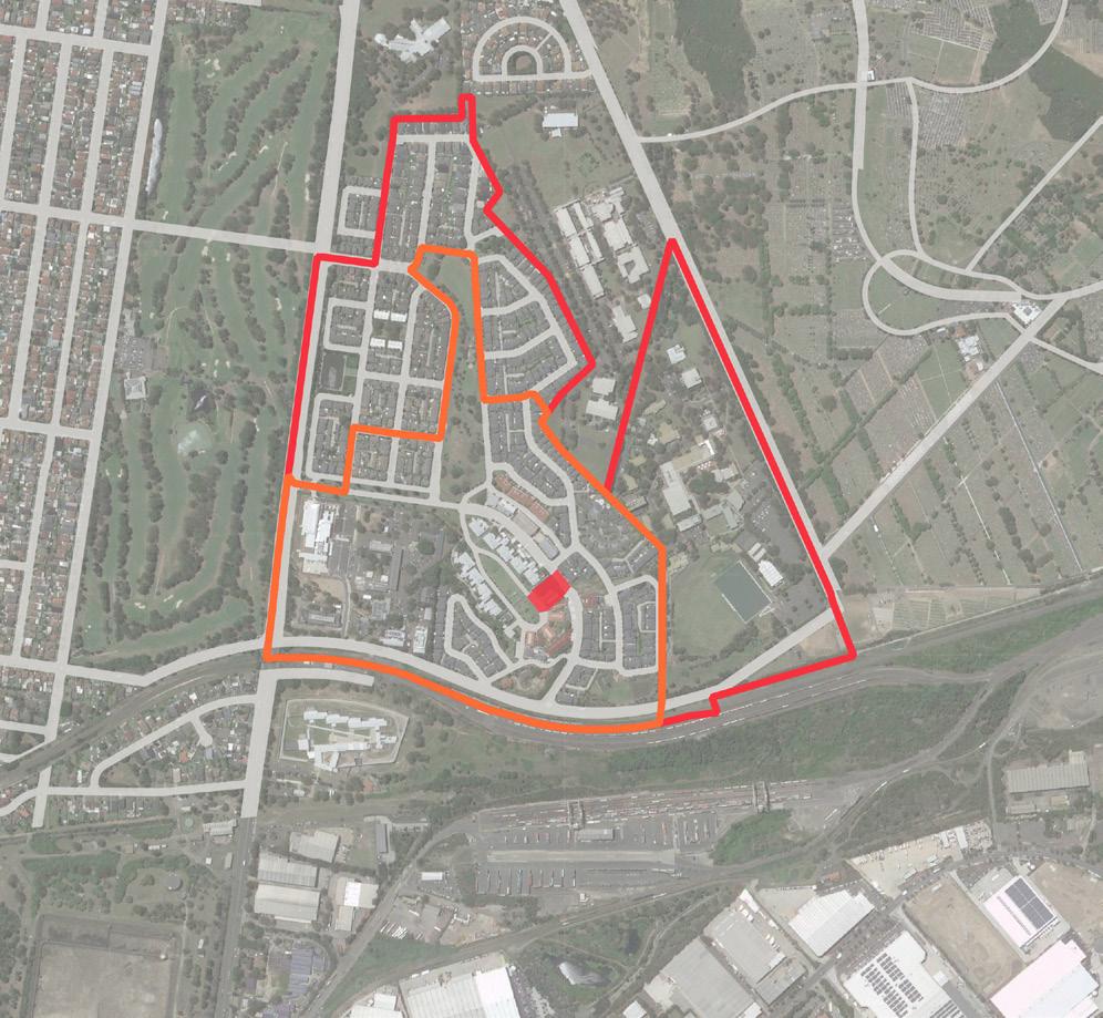
Cumberland City Council 63 500m 0 250 100 LEGEND Existing E1 Zone 400m Walking Catchment 800m Walking Catchment Public Open Space Education 1 Sydney Onnuri Church 2 Scibbles & Giggles Child Care Centre 3 Sydney University Cumberland Campus 4 Forensic Medicine and Coroners Court Complex 5 SDN Ngallia, Lidcombe Children’s Education and Care Centre 6 TAFE NSW - Lidcombe 7 Mary Wade Correctional Centre 8 Pacific National 9 Australia Post - Sydney Parcels Bulk Lodgment 10 Sydney University Hockey Club 11 Rookwood Cemetery 12 NSW State Coroners Court Central Park Water Park Peden Park 1 Brooks Circuit Park Farm Road Park Turpentine Park 2 3 4 5 6 7 8 9 10 11 12 Cutcliffe Reserve Carnavon Golf Club Weeroona Road Freight Railway Joseph Street A6 Amy Street Main Avenue Main Avenue East Street Dasea Street Rookwood Road A6
Figure 451 Local Shops Extent and Context Map CUMBERLAND CITY COUNCIL 195 37 Local Shops Extent and Context Map
CooksRiver
Urban Design Performance
EXISTING PLACE QUALITY AND STRATEGIC OPPORTUNITIES
EXISTING PLACE QUALITY AND STRATEGIC OPPORTUNITIES
Urban Design Element Challenges
Local context
• Limited residential catchment
Economic vitality
• Heritage buildings limit potential business operators
• Increased costs associated with redeveloping heritage assets
• Risk of over-supplying the local market with supply significantly higher than demand
Access and connectivity
• Poor vehicular accessibility from external street network and limited bus services in the vicinity of the centre
• Limited parking availability and high potential for conflict with local residential traffic
Existing activity and street activation
• Shops are currently vacant
Public realm quality
• As a recent master planned precinct, the public domain character and function is established
Building form and character
• Limited opportunity to modify the built form to attract a wide range of commercial operators
SCALE & CATCHMENT MARKET ANALYSIS LOCAL SHOP TYPOLOGY OWNERSHIP PATTERN COMMUNITY AND EMPLOYMENT ACTIVITY WITHIN CATCHMENT CRITICAL MASS ADDITIONAL SOURCE OF EXPENDITURE KEY ANCHORS CENTRE OFFER COMPETITION
LS25 17 Brooks Circuit, Lidcombe
4.0 LOCAL SHOPS TYPOLOGIES TYPOLOGY 1: DESTINATION LOCAL SHOPS
Convenience based shops
64 Cumberland Local Shops Study
Unable to be established
Future Opportunities
• Opportunities to attract trade from workers of the Forensic Medicine and Coroner’s Court, Lidcombe TAFE and Mary Wade Correctional Centre as well as students from the TAFE
• Affluent catchment with higher propensity to spend and heritage qualities may support unique destinational activities that benefit a wider catchment
• Improve active connections and wayfinding to surrounding employment and education uses
• Potential for some outdoor activation of the park with low scale community or market activities on a limited basis
• As a recent master planned precinct, the public domain character and function is established
• Opportunity for adaptive reuse of heritage assets
• Opportunity to incorporate some community uses to create multi-purpose trips
ACCESSIBILITY PUBLIC REALM BUILT FORM CURRENT PERFORMANCE WALKING CATCHMENT STREET PATTERN PUBLIC TRANSPORT ACTIVE TRANSPORT INFRASTRUCTURE CAR PARKING STREETSCAPE QUALITY PEDESTRIAN PRIORITISATION AND SAFETY BUILDING TYPOLOGY RESIDENTIAL / MIXED USE QUALITY AND CHARACTER STREET ACTIVATION
Cumberland City Council 65
Retail Destination Local Shops
Retail destination local shops refer to a retail hub located within a residential neighbourhood or community that serves as a convenient shopping destination for residents. It typically includes a mix of retail establishments, such as grocery stores, pharmacies, and small shops offering everyday essentials. Retail Destinations may also include community amenities such as public parks, libraries, or community centres, providing a space for social interaction and community events. These places are designed to serve the immediate surrounding area, providing convenient access to goods and services without the need for extensive travel. They play an important role in creating a sense of community and supporting local businesses, contributing to the overall well-being of the neighbourhood.
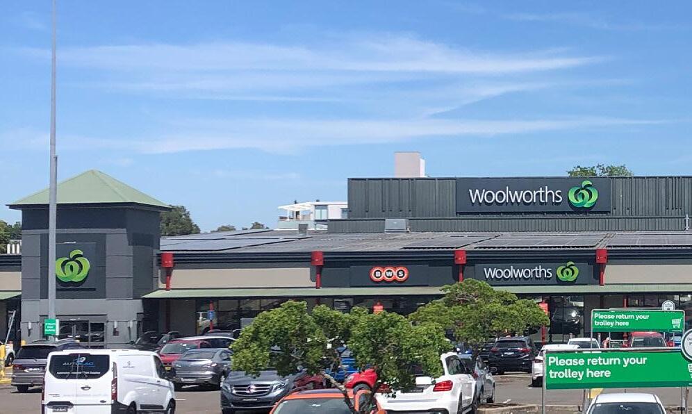
PLACE VISION STATEMENT 4.0 LOCAL SHOPS TYPOLOGIES TYPOLOGY 2: RETAIL DESTINATION LOCAL SHOPS
Retail Destination Local Shops are hubs of retail activity offering convenient local shopping options
66 Cumberland Local Shops Study
TYPOLOGY 2
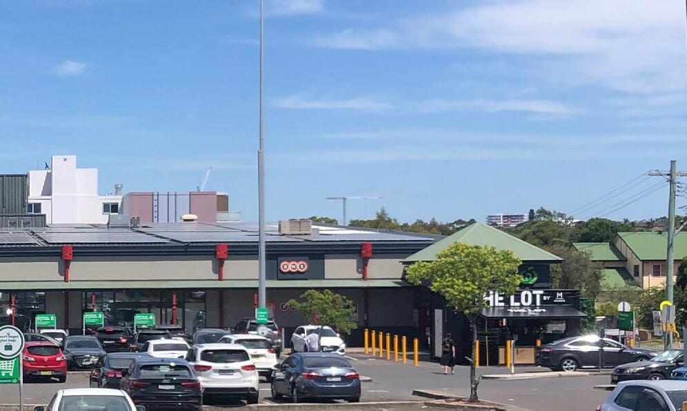

3
Cumberland City Council 67
LS3: Louis Street Shops
Louis Street Shops
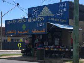
Louis Street and Blaxcell Street, Granville


These shops include an established full-line supermarket which serves a catchment significantly wider than its 400800m walkable catchment. As a result the area is more car-focused than typical local shop destinations and could complement this function to provide retail and services that meet the day-to-day convenience needs of the wider catchment (i.e. 8,000-12,000 people).
The location has a substantial walking catchment and continued population growth is forecast within this area. As a result of the strong convenience offer and critical mass of the supermarket, service station and small retailers, there are opportunities for the centre to expand despite competition from other centres.
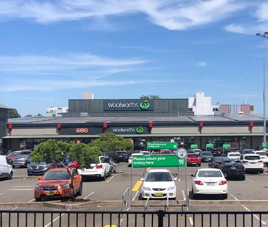
Louis Street and Blaxcell Street, both collector roads, provide a strong movement economy for business and good public transport access. The speed and volumes of traffic impact on the pedestrian experience and safety. The location benefits from good public transport access with Clyde Train Station and Granville Train Station being within the vicinity. Some of the E1 zoned land to the west of the supermarket has been developed for residential apartments and prevents further expansion of retail activities along Louis Street.
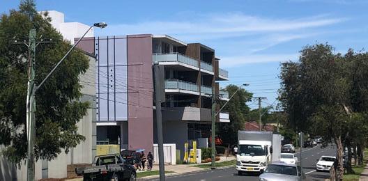
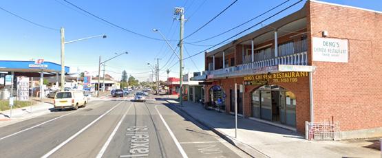
There are no significant public domain enhancements or active transport improvements in the wider local shop area.
The community is characterised by younger, below State average household incomes, and a high proportion of people from nonEnglish speaking backgrounds.

LS3
Image capture: Apr 2021 © 2023 Google Granville, New South Wales Google Street View Apr 2021 See more dates 98 Blaxcell St
Figure 38 Woolworths is a typical large format supermarket with highly visible car parking fronting a significant portion of its street frontage
Figure 39 Blaxcell Street shop top housing
Figure 40 Vegetable shop at the Corner of Thomas Street and Blaxcell Street
Figure 41 E1 zoned land west of the supermarket and fronting Louis Street has been developed as four storey apartments
4.0 LOCAL SHOPS TYPOLOGIES TYPOLOGY 2: RETAIL DESTINATION LOCAL SHOPS 68 Cumberland Local Shops Study
VISUAL ANALYSIS

Cumberland City Council 69 500m 0 250 100 Charles Street Cella Street Clyde Train Station Granville Train Station Louis Street Thomas Street Blaxcell Street RailwayLine Blaxcell Street Duck River New Glasgow Park Fifth Street Reserve Scout Memorial Park Granville Memorial Park Elizabeth Street Reserve Illoura Reserve Coronation Park Colquhoun Park Duck River Reserve Bangor Park Dave Tribolet Oval Horlyck Reserve LEGEND Existing E1 Zone 400m Walking Catchment 800m Walking Catchment Public Open Space Education Train Station 1 William St Medical Centre 2 New Granville Medical & Dental Centre 3 Byrnes Street Tennis Courts 4 Granville Swimming Centre 5 St Athanasius Ukrainian Orthodox Church 6 Granville Community Baptist 7 Gracepoint Presbyterian Church Granville 8 Granville Fijian Seventh-day Adventist Church 9 Korean Church of Christ 10 One Family Church 11 Holy Family Church 12 Tokaikolo Christian Church 13 Merrylands East Presbyterian Church 14 Holy Family Primary School 15 Granville East Public School 16 Granville Public School 17 MAX POS Hardware Store 18 Speedy Auto Centre Car Repair 19 1st Granville Scout Group 20 Australian Blouza Association 21 The Granville Centre 4 5 10 11 12 13 14 20 15 16 17 18 19 6 8 9 3 7 1 2 21 T T T
CUMBERLAND CITY COUNCIL 19
Figure 39 Local Shops Extent and
Context
Map
Figure 42 Local Shops Extent and Context Map
Urban Design Performance
EXISTING PLACE QUALITY AND STRATEGIC OPPORTUNITIES
EXISTING PLACE QUALITY AND STRATEGIC OPPORTUNITIES
Urban Design Element Challenges
Local context
• Requires logical transitions to surrounding low density residential housing if significant redevelopment is proposed
Economic vitality
• While these shops trade well, shops fronting Blaxcell Street and Louis Street trade at a lower level.
Access and connectivity
• Existing service station contributes to traffic congestion
• High speed and volumes of traffic impacts pedestrianisation
Existing activity and street activation
• Limited activation of street due to inactive frontages, blank walls and large car parking areas
Public realm quality
• An absence of shade and public domain qualities to support pedestrian experience
• Blank wall along Louis Street is visually unpleasant and limits pedestrian interaction
Building form and character
• While Woolworths Supermarket is trading well, it does not engage with the street due to the location of the car park
• Smaller scale shops are aged and moderately maintained
SCALE & CATCHMENT MARKET ANALYSIS LOCAL SHOP TYPOLOGY OWNERSHIP PATTERN COMMUNITY AND EMPLOYMENT ACTIVITY WITHIN CATCHMENT CRITICAL MASS ADDITIONAL SOURCE OF EXPENDITURE KEY ANCHORS CENTRE OFFER COMPETITION
Retail destination 4.0 LOCAL SHOPS TYPOLOGIES TYPOLOGY 2: RETAIL DESTINATION LOCAL SHOPS
LS3 Louis Street, Granville (and surrounds)
70 Cumberland Local Shops Study
Future Opportunities
• Introduce integrated urban living options through mixed use redevelopment to offer broader local housing choices to suit a range of household types
• Opportunities to target personal services and commercial services
• Investigate the opportunities for dedicated bicycle lanes in higher order roads providing improved district connectivity to the area
• Investigate opportunities to encourage more pedestrian activity and improve pedestrian safety
• Encourage mixed use redevelopment that will increase activity and support significant investment in improved streetscape function and quality
• Deliver a coordinated streetscape and public domain plan incorporating additional street trees and planting, street furniture, lighting and consistent, high quality paving treatments
• Consider public art opportunities on blank walls
• Visually screen Woolworths car parking area from the public domain
• Encourage the redevelopment of the supermarket as a high quality mixed use precinct protecting the supermarket function and highly integrating with its surrounds
• Encourage amalgamation of lots to deliver a scale and quality of mixed use redevelopment that can contribute to better quality buildings and public realm character
ACCESSIBILITY PUBLIC REALM BUILT FORM CURRENT PERFORMANCE WALKING CATCHMENT STREET PATTERN PUBLIC TRANSPORT ACTIVE TRANSPORT INFRASTRUCTURE CAR PARKING STREETSCAPE QUALITY PEDESTRIAN PRIORITISATION AND SAFETY BUILDING TYPOLOGY RESIDENTIAL / MIXED USE QUALITY AND CHARACTER STREET ACTIVATION Cumberland City Council 71
High Street Shops
High street shops are often situated along the main street or “high street” of the area, and they serve as a hub for shopping, dining, and entertainment.
High street shops typically offer a mix of products and services, ranging from fashion and beauty to cafés and home goods. They are commonly frequented by both locals and tourists and contribute significantly to the local economy.
High street shops are an integral part of urban and suburban communities, providing employment opportunities, supporting local businesses, and serving as a gathering place for residents and visitors alike.
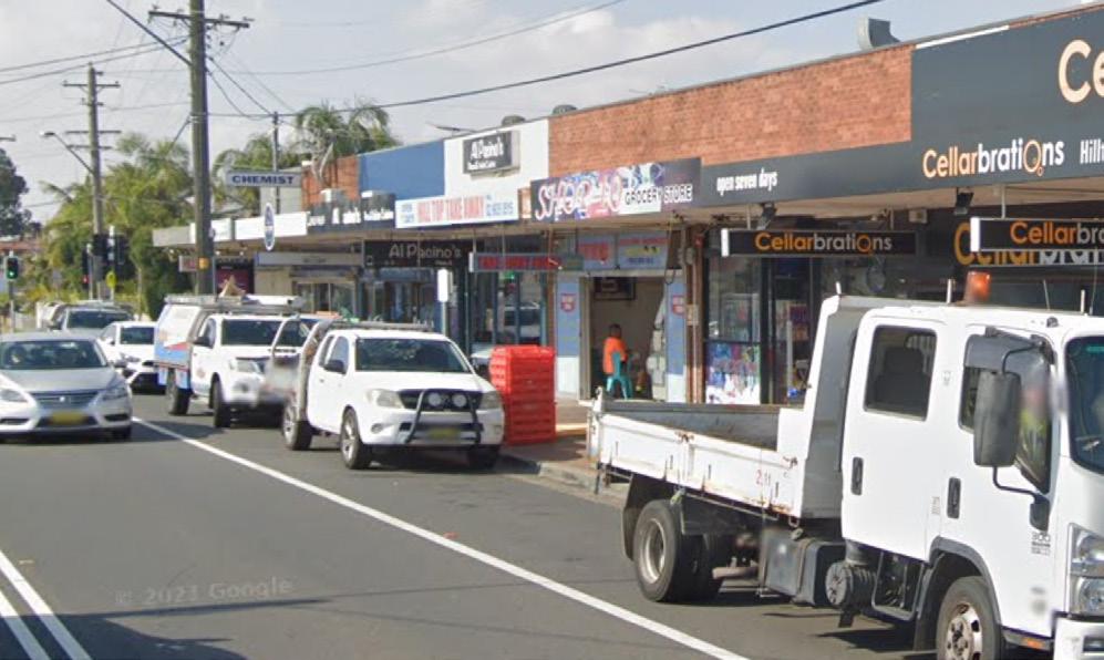
High Street Shops are hubs for shopping, dining and entertainment
PLACE VISION STATEMENT
3 72 Cumberland
TYPOLOGY
Local Shops Study


2
Cumberland City Council 73
LS2: Hilltop Road Shops
Hilltop Road Shops

3 Hilltop Rd, Merrylands
These shops are a strip of 18 businesses generally fronting Hilltop Road and clustered around the busy Burnett Street intersection. The main retail section is characterised by traditional low scale high street buildings with highly activated street frontages and full awning to the footpath.
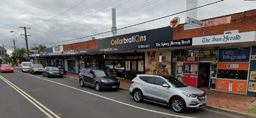
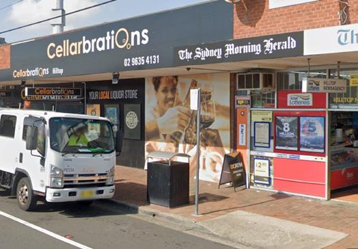
The shops offer a good critical mass of commercial activity with opportunities for expansion (e.g. residential properties and car wash site within E1 zone).
While there is a forecast oversupply of shopfront floorspace in this location, the shops service a substantial walking catchment with a growing population, enjoy pass-by trade and have good public transport access. Minimal vacancies and generally well-maintained stores suggest these shops are sustainable and meeting the needs of the community.
Limited parking is available around the shopping area due to the higher order function of the road network and high volume intersection.
No significant public domain or active transport enhancements have been undertaken and the walkability and visual qualities of area are impacted by the dominance of traffic.
The community is characterised by younger, in line with State average household incomes and a high proportion of people from non-English speaking backgrounds.
VISUAL ANALYSIS
LS2
Figure 43 Traditional high street buildings fronting Hilltop Road
Figure 44 The busy Hilltop Road and Burnett Street intersection which separates the zoned properties
Figure 45 Narrow footpath of the retail strip limits footpath activation
4.0 LOCAL SHOPS TYPOLOGIES TYPOLOGY 3: RETAIL DESTINATION LOCAL SHOPS 74 Cumberland Local Shops Study
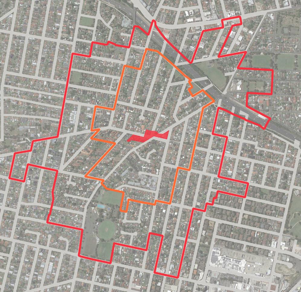
Cumberland City Council 75 LEGEND Existing E1 Zone 400m Walking Catchment 800m Walking Catchment Public Open Space Education 1 Unisoles Podiatrist 2 Merrylands Park Tennis Courts 3 Merrylands Swimming Centre 4 NSW Ambulance Parramatta Branch 5 St. Mary’s Nativity Orthodox Church 6 Hilltop Oven 7 Holroyd School 8 Sydney Murugan Temple 9 Hilltop Child Care Centre 10 Westmead Rehabilitation Hospital 11 Allie Hunter Fishing Charter 12 Hilltop Road Public School 13 Parramatta West Public School 14 Hostia Child Care Centre 15 Jones Park Hall 16 Heritage Building 500m 0 250 100 BurnettStreet Great Western Highway BurnettStreet Chester Street Hilltop Road WesternMotorway Coleman Street Clarence Street 3 4 8 5 6 7 9 1 10 11 14 15 16 12 13 2 Walpole Street Leawarra Reserve Maru Reserve Freame Park Freame Park Hiller Street Reserve Jones Park Alderson Park Pitt Park Merrylands Park Young Park Burra Reserve Munal Reserve Nullawilli Reserve Manchester St Reserve
CUMBERLAND CITY COUNCIL 11
Figure 21 Local Shops Extent and Context Map
Figure 46 Local Shops Extent and Context Map
Urban Design Performance
EXISTING PLACE QUALITY AND STRATEGIC OPPORTUNITIES
EXISTING PLACE QUALITY AND STRATEGIC OPPORTUNITIES
Urban Design Element Challenges
Local context
• Commercially zoned properties are segregated by the high order roads of Hilltop Road and Burnett Street
• Numerous irregular shaped properties
Economic vitality
• Competition from higher order centre Stockland Merrylands (1.5km) and other local shops
• Oversupply of shopfront floorspace
Access and connectivity
• Hilltop Road and Burnett Street as regional and collector roads limits significant reprioritisation of road space for on-street parking or pedestrian space
• Limited parking availability around the local shop area
• An absence of high quality active transport infrastructure such as bike lanes or wider shaded footpaths
Existing activity and street activation
• While the Hilltop Road shops present good active frontage to footpaths, there is limited footpath space to provide outdoor cafe/dining
• Segregated commercial zoned land impacts on the functional relationships between properties and critical mass of shop activity
Public realm quality
• Busy intersection with a car dominated environment impacting the visual and function quality of the streetscape
• Narrow footpaths limit the levels of footpath activation and prevents significant streetscape enhancements such as increased planting
Building form and character
• While the Hilltop Road shops function well and engage with the street, the building stock is aged and moderately maintained
• As separate sites with disparate building forms and activities, the shops do not present a cohesive activity centre with strong place character
SCALE & CATCHMENT MARKET ANALYSIS LOCAL SHOP TYPOLOGY OWNERSHIP PATTERN COMMUNITY AND EMPLOYMENT ACTIVITY WITHIN CATCHMENT CRITICAL MASS ADDITIONAL SOURCE OF EXPENDITURE KEY ANCHORS CENTRE OFFER COMPETITION
LS2 Hilltop Road Shops (3 Hilltop Road, Merrylands) High street shops
4.0 LOCAL SHOPS TYPOLOGIES TYPOLOGY 3: RETAIL DESTINATION LOCAL SHOPS
76 Cumberland Local Shops Study
Future Opportunities
• Encourage development of the isolated commercial lots with destination uses that complement the precinct but do not compete with the Hilltop Road retail shops
• Encourage the redevelopment of the car-wash site for mixed use development to drive local demand
• Opportunities to target apparel and non-food retailers to support its function as a high street (this can be supported by high quality shop fit-outs)
• Reduce traffic speeds on Hilltop Road and Burnett Street and deliver streetscape improvements that increase pedestrian prioritisation and safety
• Formalise and time limit on-street car parking
• Leverage good existing public transport connectivity with improved bus stop infrastructure
• Investigate the potential for dedicated bike lanes
• Protect the existing high street format and function and investigate opportunities to achieve additional footpath space in potential redevelopment
• Deliver streetscaping which incorporates additional street trees and planting, street furniture, lighting and consistent, high quality paving treatments
• On separated sites, improve the functional and visual quality of the streetscape as a coordinated outcome with new mixed use development
• Encourage amalgamation of lots to deliver a scale and quality of mixed use redevelopment that can contribute to better quality buildings and a consistent and cohesive urban character
ACCESSIBILITY PUBLIC REALM BUILT FORM CURRENT PERFORMANCE WALKING CATCHMENT STREET PATTERN PUBLIC TRANSPORT ACTIVE TRANSPORT INFRASTRUCTURE CAR PARKING STREETSCAPE QUALITY PEDESTRIAN PRIORITISATION AND SAFETY BUILDING TYPOLOGY RESIDENTIAL / MIXED USE QUALITY AND CHARACTER STREET ACTIVATION Cumberland City Council 77
Convenience Based Shops
Convenience-based shops refer to retail establishments that offer quick and convenient access to everyday goods and services, as well as providing eating out options.
These shops typically carry a limited range of products, with a focus on items that are commonly needed for daily living, such as groceries, toiletries, and household items, whilst the café and restaurants provide opportunities for the local community to gather and enjoy a shared eating experience.
Convenience-based shops are typically located in easily accessible locations and often offer extended hours of operation, allowing customers to make purchases or eat out at any time of day.

PLACE VISION STATEMENT 78 Cumberland Local Shops Study TYPOLOGY 4
Convenience Based Shops are essential elements of the neighbourhood offering quick and convenient access to everyday goods and services


16 15 13 8 21 20 18 5 9 12 23 24 22 4 11 6 Cumberland City Council 79
Convenience Based Shops
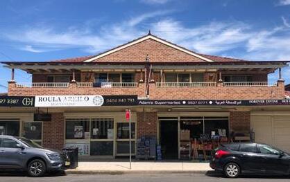
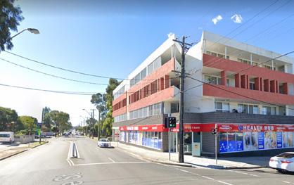


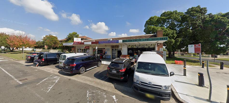

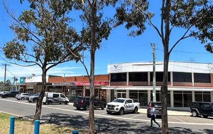
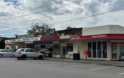 LS4: Burnett Street
LS5: Irrigation Road
Street View - Apr 2021 Merrylands, New South Wales
58
LS8: Dell Street
Google
Coleman St
LS9: Coleman Street
LS11: Blaxcell Street & Guildford Road
LS6: Fairfield Road
LS12: Clyde Street
LS13: Excelsior Street
80 Cumberland Local Shops Study
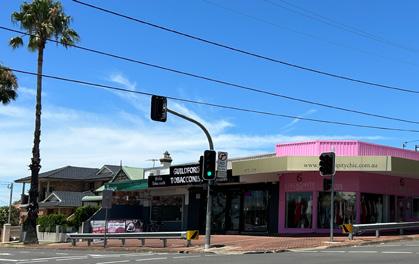

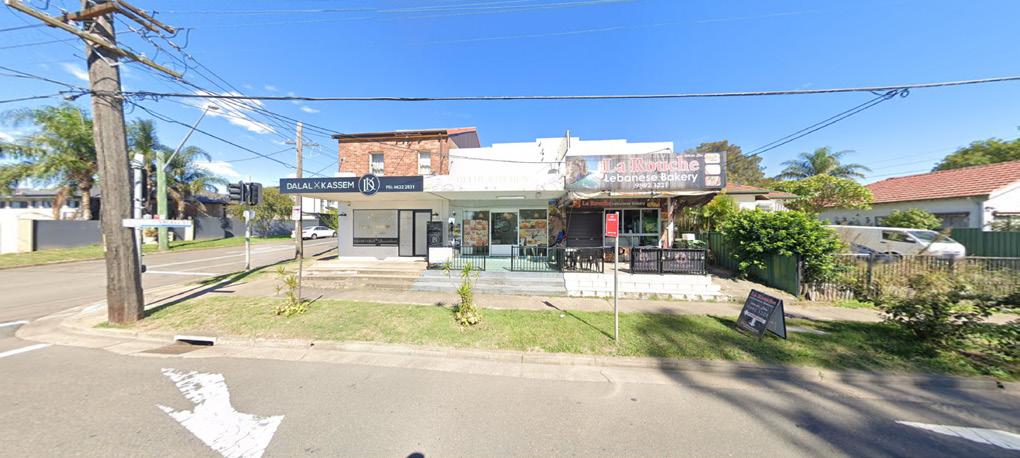
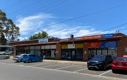
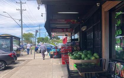
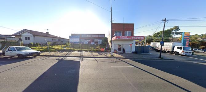
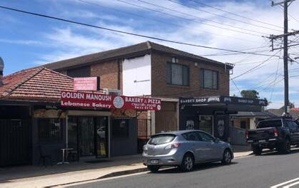
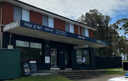
Rd
Image capture: Apr 2021 © 2023 Google
LS20: Carnation Street
LS21: Hawksview Street
LS15: Rawson Road
© 2023 Google
Rd
LS22: Clyde Street
Cumberland
LS23: Excelsior Street_1
LS16: Cumberland Road
LS24: Excelsior Street_2
Cumberland City Council 81
LS18: Damien Avenue
Dellwood Street Shops
Dellwood Street, South Granville
Dellwood Street Local Shops as a popular destination includes a butchery and deli, a post office, a bakery, a grocery store, a restaurant, Dellwood supermarket, a bottle shop, a news agency and a medical centre


Servicing a predominantly low density residential catchment, these shops are trading well. Retail shops are located on the ground level of the heritage listed two-storey building along Dellwood Street.
Shops have a distinctive place character established by the heritage listed building and its relationship with William Lamb Park.
Shops are benefiting from their location between two higher order streets (Clyde Street being a regional road and Blaxcell Street being a Collector Road), which provides good access for them. Being along a local road at the same time provides opportunities for reprioritisation of Dellwood Street for pedestrians.
These shops also benefit from good public amenity noting their location opposite William Lamb Park, smart public toilet and wellmaintained furniture within the footpaths.
The community is characterised by younger, significantly below State average household income earners and a high proportion of people from non-English speaking backgrounds.
VISUAL ANALYSIS
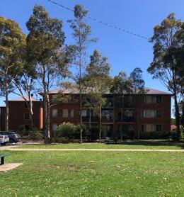 Figure 47 Local shops view from the south on Dellwood Street
Figure 48 Generous footpaths, landscaping and public facilities
Figure 49 Medium density apartments apposite Dellwood Street
LS4
Figure 50 Pedestrian crossing on Blaxcell Street
4.0 LOCAL SHOPS TYPOLOGIES TYPOLOGY 4: CONVENIENCE BASED SHOPS 82 Cumberland Local Shops Study
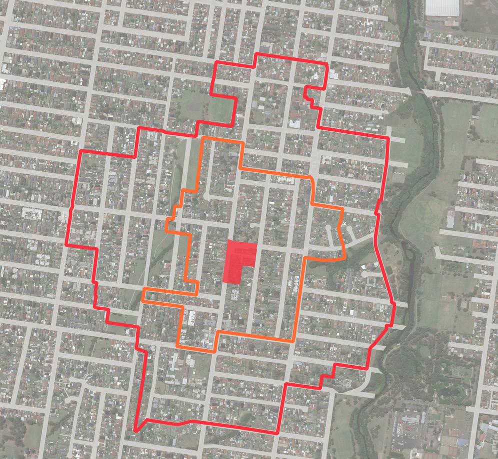
Cumberland City Council 83 500m 0 250 100 12 3 2 4 8 9 12 5 6 7 13 1 2 Baraba Reserve William
Duck River Auburn Botanic Gardens
Chiswick Park Hope Park Bright
Victor
Little Duck
Harry
Colquhoun Park Excelsior Reserve Wolseley Street Reserve Urimbirra Park Horlyck Reserve Dellwood Street Oakleigh Avenue Guildford Road Adam Street Lavinia Street Eva Street Blaxcell Street Robertson Street Blaxcell Street Excelsior Road Pegler Avenue LEGEND Existing E1 Zone 400m Walking Catchment 800m Walking Catchment Public Open Space Education 1 Clyde Street Medical Centre 2 Tokaikolo Christian Church In Australia 3 Holy Cross Church 4 Holy Family Primary School 5 Speedway South Granville 6 1st Granville Scout Group 7 Granville East Public School 8 Scribbles & Giggles Child Care Centre 9 Little School for Little Children Pre-School 10 Memo’s Pizza, Pasta & Kebab 10 11
59 Local Shops Extent and Context Map 11 Everland Family Day Care 12 Burmese Christian Church Sydney 13 Blaxcell Street Public School CUMBERLAND CITY COUNCIL 27 Figure 51 Local Shops Extent and Context Map
Lamb Park
Ray Marshall Reserve
Park
Brazier Park
Creek Off Leash Area
Gapes Reserve
Figure
Urban Design Performance
LS4 Dellwood Street, South Granville (and surrounds) Convenience based shops
EXISTING PLACE QUALITY AND STRATEGIC OPPORTUNITIES
EXISTING PLACE QUALITY AND STRATEGIC OPPORTUNITIES
Urban Design Element Challenges
Local context
• Requires logical transitions to surrounding low density residential housing if significant redevelopment is proposed
Economic vitality
• Competition from a number of other local shops within 1.5km
• Risk of retail redundancy and continued oversupply given proximity of other local shops
• Supply of floorspace is above demand
Access and connectivity
• An absence of high quality active transport infrastructure such as bike lanes and shared footpaths
• There is an absence of pedestrian crossing on Dellwood Street
Existing activity and street activation
• There is an absence of strong relationship between park and current buildings
Public realm quality
• Landscaping and planting are limited
• There is an absence of a strong relationship between the current shops and William Lamb park
• Parking and laneway are visually unpleasant
Building form and character
• Heritage building along Dellwood Street limits interventions
SCALE & CATCHMENT MARKET ANALYSIS LOCAL SHOP TYPOLOGY OWNERSHIP PATTERN COMMUNITY AND EMPLOYMENT ACTIVITY WITHIN CATCHMENT CRITICAL MASS ADDITIONAL SOURCE OF EXPENDITURE KEY ANCHORS CENTRE OFFER COMPETITION
4.0 LOCAL SHOPS TYPOLOGIES TYPOLOGY 4: CONVENIENCE BASED SHOPS
84 Cumberland Local Shops Study
Future Opportunities
• Protect and enhance the valuable place qualities and shopping function while introducing urban living options in potential future redevelopment
• Expand and improve the food and beverage and personal service offer
• Investigate the opportunities for dedicated bicycle lanes in higher order roads providing improved district connectivity to the area
• Consider adding pedestrian crossing to improve pedestrian movement and safety if redesigning of Dellwood Street is not practical
• Consider opportunities to include land facing William Lamb Park to deliver an integrated urban design outcome for the area with an enhanced relationship between the park and the buildings
• Deliver a coordinated streetscape and public domain plan incorporating additional street trees and planting, street furniture, lighting and consistent, high quality paving treatments which responds sympathetically to heritage listing
• Consider redesigning Dellwood Street to be a pedestrian prioritised street maximising function connection between the park and shop
• Visually screen all private car parking and service areas in the lane from the public domain
• Consider opportunities for redevelopment of the properties excluding the heritage building as a high quality mixed use building that contribute to a high quality public domain
ACCESSIBILITY PUBLIC REALM BUILT FORM CURRENT PERFORMANCE WALKING CATCHMENT STREET PATTERN PUBLIC TRANSPORT ACTIVE TRANSPORT INFRASTRUCTURE CAR PARKING STREETSCAPE QUALITY PEDESTRIAN PRIORITISATION AND SAFETY BUILDING TYPOLOGY RESIDENTIAL / MIXED USE QUALITY AND CHARACTER STREET ACTIVATION Cumberland City Council 85
Irrigation Road Shops
33-39 Irrigation Rd, South Wentworthville
Irrigation Road Local Shops includes an Italian restaurant, a bakery, a grocery shop and a fruit market. It is located within a short distance from Bright Stars Montessori Preschool.
Servicing a low density residential catchment, these shops appear to trade at a lower level. Shops are single storey in height and have a traditional retail character.
Shops are within a residential context and along local roads with no significant public domain enhancements or active transport, with outdoor dining furniture provided for customers of the Italian restaurant promoting night time activity.
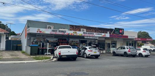
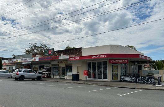
Designated parking space in front of the shops provides convenience for customers.
The community is characterised by younger, below State average household incomes and a high proportion of people from nonEnglish speaking backgrounds.
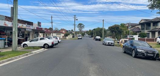
LS5
Figure 52 Designated parking spaces for customers in front of the shops
Figure 53 Single storey older style local shops
4.0 LOCAL SHOPS TYPOLOGIES TYPOLOGY 4: CONVENIENCE BASED SHOPS 86 Cumberland Local Shops Study
Figure 54 Residential context of the area and an absence of improved public domain
VISUAL ANALYSIS
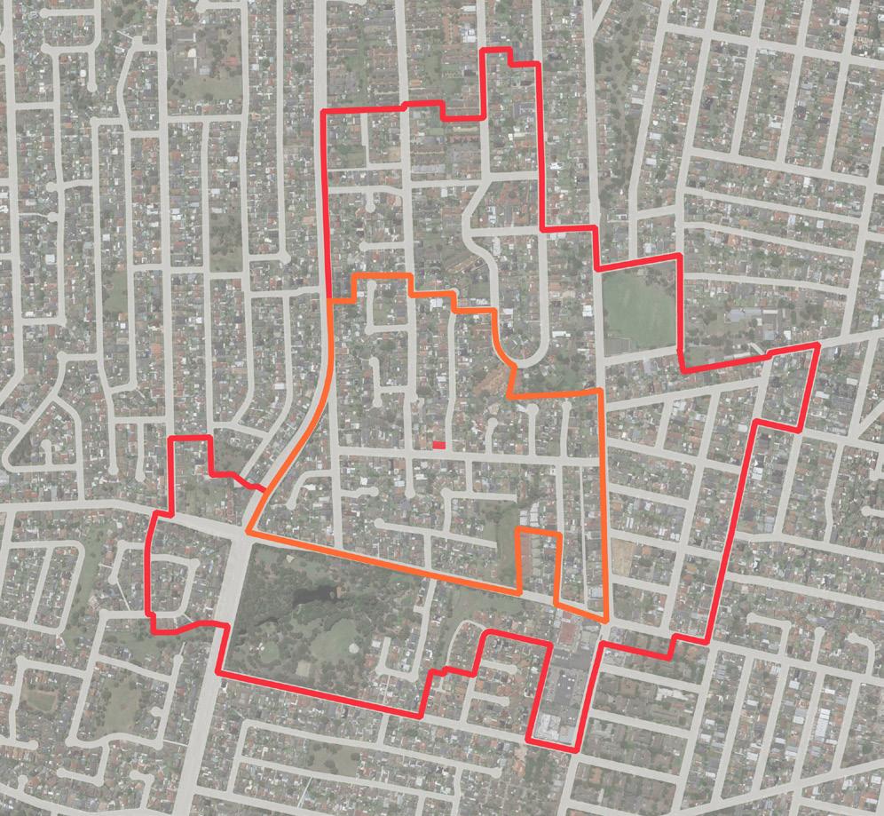
Cumberland City Council 87 LEGEND Existing E1 Zone 400m Walking Catchment 800m Walking Catchment Public Open Space Education Irrigation Road Northcott Street Douglas Street Paton Street Merrylands Road Centenary Road Centenary Road Sherwood Road 1 Merrylands Denture Clinic 2 Bright Stars Montessori Preschool 3 1st Greystanes Scout Hall 4 R&R SUPA IGA Merrylands West 5 Coolibah Hotel 6 McDonald’s Merrylands 7 Plus Fitness 24/7 Merrylands 8 Heart Centre Merrylands 9 Hilltop Child Care Centre - Paton Street 10 Greystanes Family Dental 11 Hilltop Road Public School 12 Merrylands West Anglican Church 13 Genuine Greek Orthodox Parish Of Holy Protection Jersey Road / Cumberland Highway Jersey Road / Cumberland Highway Ted Burge Sport Ground Paul Crescent Reserve Todd Street Park Arcadia Street Park Hanbury Street Park Beechwood Avenue Park Hewitt Ave Reserve Apex Park Gallard Reserve Adler Pde Reserve Whyman Park Central Gardens Nature Reserve Leeton Street Park Biscayne Avenue Park Ted Cullen Reserve 500m 0 250 100 Serpentine St. Park Central Gardens Park Estate Wirralee Street Park Monterey Street Park John Knowles Park 5 6 7 9 10 11 12 13 4 3 2 1
82 Local Shops Extent and Context Map CUMBERLAND CITY COUNCIL 35 Figure 55 Local Shops Extent and Context Map
Figure
Urban Design Performance
LS5 33-39 Irrigation Road, South Wentworthville Convenience based shops
EXISTING PLACE QUALITY AND STRATEGIC OPPORTUNITIES
EXISTING PLACE QUALITY AND STRATEGIC OPPORTUNITIES
Urban Design Element Challenges
Local context
• Requires logical transitions to surrounding low density residential housing if significant redevelopment is proposed
Economic vitality
• Strong competition from LS2 (600m)
Access and connectivity
• Shops are located within a residential area with less visibility from the wider context to attract more visitors
• An absence of high quality active transport infrastructure such a bike lanes or shared footpaths
• An absence of a pedestrian crossing
Existing activity and street activation
• While shops present active frontage to footpaths, there is limited footpath space to provide outdoor cafe/dining along Irrigation Road
Public realm quality
• Footpaths along Irrigation Road are narrow, occur in patches and require maintenance.
Building form and character
• Built form is generally aged and moderately maintained
• The extent of zoned commercial land and scale of the building does not support a critical mass of commercial activities
SCALE & CATCHMENT MARKET ANALYSIS LOCAL SHOP TYPOLOGY OWNERSHIP PATTERN COMMUNITY AND EMPLOYMENT ACTIVITY WITHIN CATCHMENT CRITICAL MASS ADDITIONAL SOURCE OF EXPENDITURE KEY ANCHORS CENTRE OFFER COMPETITION
4.0 LOCAL SHOPS TYPOLOGIES TYPOLOGY 4: CONVENIENCE BASED SHOPS
88 Cumberland Local Shops Study
Future Opportunities
• Investigate community uses, such as a community/scout hall in future potential redevelopment that can activate the area
• Improve public domain to attract more visitors
• Improve wayfinding between shops, parks and wider road network
• Improve bus stop infrastructure
• Consider new pedestrian crossings on Irrigation Road and Northcott Street to improve pedestrian comfort and safety
• Encouraging and expand the current night-life at Italian restaurant through to other shops
• Investigate opportunities to achieve additional footpath space in potential redevelopment
• Improve the quality of public domain through consistent, high quality paving treatments
• Ensure redevelopment of the property as a high quality mixed use building appropriately responds the low density and low traffic environment of the location
• Investigate expansion of the zoned land to the north of current E1zone and opposite along Northcott Street to increase the critical mass of local shop activity in future potential redevelopment
ACCESSIBILITY PUBLIC REALM BUILT FORM CURRENT PERFORMANCE WALKING CATCHMENT STREET PATTERN PUBLIC TRANSPORT ACTIVE TRANSPORT INFRASTRUCTURE CAR PARKING STREETSCAPE QUALITY PEDESTRIAN PRIORITISATION AND SAFETY BUILDING TYPOLOGY RESIDENTIAL / MIXED USE QUALITY AND CHARACTER STREET ACTIVATION Cumberland City Council 89
Fairfield Road Shops
121-123 Fairfield Rd, Guildford West


The Fairfield Road Local Shops comprises nine businesses including a cheesecake shop, a barber, a dentist clinic, two grocery shops, a vet hospital (shop), a cafe/ restaurant, a dry cleaning and a butchery.
With a good mixture of shops, appears to trade at a lower level, servicing a predominantly low density residential catchment. The veterinary hospital is likely to draw a much wider area.


These shops benefit from good vehicular accessibility and good public transport accessibility. Dedicated car parking space in front of shops provide some convenience for customers.
The built form of the shops reflects low scale shop top housing with an awning along the street frontage. Fairfield Road and McCredie Road are regional roads with no public domain or active transport enhancements.
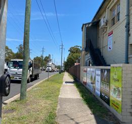

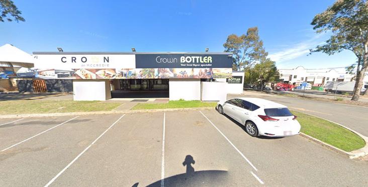
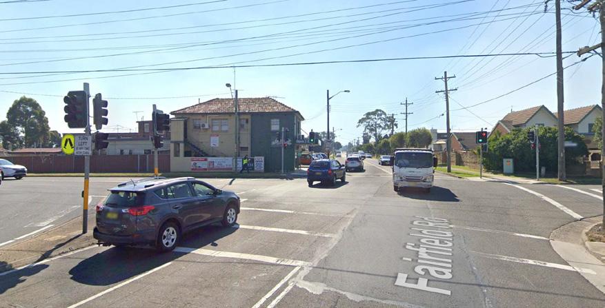
The community is characterised by younger, significantly below State average household income earners, and a high proportion of people from non-English speaking backgrounds.
VISUAL ANALYSIS
 Figure 56 Cheesecake shop at the Corner of McCredie Road and Fairfield
Figure 58 An absence of public domain enhancements
Figure 59 Narrow footpaths along Fairfield Road
LS6
4.0 LOCAL SHOPS TYPOLOGIES TYPOLOGY 4: CONVENIENCE BASED SHOPS 90 Cumberland Local Shops Study

Cumberland City Council 91 LEGEND Existing E1 Zone 400m Walking Catchment 800m Walking Catchment Public Open Space Education 1 Crown on McCredie 2 Guildford Tennis Centre 3 Gas to Connect 4 Bunnings Smithfield 5 Guildford West Children’s Centre 6 XL Express 7 Guildford West Public School 8 Scott Safety & 3M 9 Gateway@Smithfield 10 Woolworths Distribution Centre 11 The Iconic - Fulfillment Centre 12 Little Lucy’s Family Daycare 13 Sara Lee Factory Outlet Woodpark 14 Yennora Distribution CentreStockland McCredie Road McCredie Road Dennistoun Avenue Edward Street CumberlandHighway Palmer Street Fairfield Road Fairfield Road Tom Uren Park Guildford West Sports ground Bernadette Park Hemingway Reserve Helena St Reserve Prince Street Park Albert Street Park Sandra Street Park 3 4 4 12 5 6 7 1 2 8 9 10 14 11
Local
Extent and Context
500m 250m 0 100 CUMBERLAND CITY COUNCIL 43
Figure 102
Shops
Map
Local
Context
Figure 60
Shops Extent and
Map
Urban Design Performance
LS6 121 - 123 Fairfield Road, Guildford West Convenience based shops
EXISTING PLACE QUALITY
AND STRATEGIC OPPORTUNITIES
EXISTING PLACE QUALITY AND STRATEGIC OPPORTUNITIES
Urban Design Element Challenges
Local context
• Residential catchment is limited and industrial development within the vicinity attracts more workers than residents
• Requires logical transitions to surrounding low density residential housing if significant redevelopment is proposed
Economic vitality
• Risk that food and beverage offer on site may find it difficult to compete with surrounding centres, Crown On McCredie, or food and beverage outlets at the Industrial Precinct
Access and connectivity
• Role of McCredie Road and Fairfield Road as regional roads, limits significant reprioritisation for pedestrian space
• An absence of comfortable bus infrastructure such as seating and shade
Existing activity and street activation
• While the shops present good active frontage to footpaths along Fairfield Road, there is limited footpath space for outdoor dining opportunities
• Blank walls and narrow footpaths along McCredie Road provide less opportunity for pedestrian activity
Public realm quality
• An absence of landscaping and public domain qualities to support the visitor experience
Building form and character
• The built form and quality do not contribute materially to a unique or high quality place character
• Inconsistent facade setback and presentation to the street. Cheesecake shop at the corner limits drivers view to the local shops
SCALE & CATCHMENT MARKET ANALYSIS LOCAL SHOP TYPOLOGY OWNERSHIP PATTERN COMMUNITY AND EMPLOYMENT ACTIVITY WITHIN CATCHMENT CRITICAL MASS ADDITIONAL SOURCE OF EXPENDITURE KEY ANCHORS CENTRE OFFER COMPETITION
4.0 LOCAL SHOPS TYPOLOGIES TYPOLOGY 4: CONVENIENCE BASED SHOPS
92 Cumberland Local Shops Study
Future Opportunities
• Improve connection to regional employment and recreation destinations including the Industrial Precinct and Guildford West Sports ground
• Any potential redevelopment requires a balanced service to offer both residents and workers
• Introduce integrated urban living options through mixed use redevelopment to offer broader local housing choices to suit a range of household types in future potential redevelopment
• Attract and capture the pass-by movement economy offered by Fairfield Road and McCredie Road
• Target food and beverage tenants to cater to worker catchment and visitors of vet shop - offer will have to differ from that currently provided in the surrounding area
• Target retailers / commercial tenants that complement the vet hospital
• Reduce traffic speeds and deliver streetscape improvements that increase pedestrian comfort and safety
• Leverage good existing public transport connectivity with improved bus stop infrastructure
• Protect current shop format and consider improvement of built form quality
• Improve the quality of public domain through street tree planting, enhancing landscape, widening footpaths and providing street furniture
• Consider public art opportunities on blank walls
• Deliver a coordinated streetscape and public domain plan incorporating additional street trees and planting, street furniture, lighting and consistent, high quality paving treatments
• Encourage amalgamation of lots to deliver a scale and quality of mixed use development that can contribute to better quality buildings and public realm character
• Encourage redevelopment of the property as a high quality mixed use building
ACCESSIBILITY PUBLIC REALM BUILT FORM CURRENT PERFORMANCE WALKING CATCHMENT STREET PATTERN PUBLIC TRANSPORT ACTIVE TRANSPORT INFRASTRUCTURE CAR PARKING STREETSCAPE QUALITY PEDESTRIAN PRIORITISATION AND SAFETY BUILDING TYPOLOGY RESIDENTIAL / MIXED USE QUALITY AND CHARACTER STREET ACTIVATION Cumberland City Council 93
Dell Street Shops
21-39 Dell St, Smithfield (Woodpark Shopping Centre)
The Dell Street Local Shops is comprised of retail and commercial businesses including a fast food restaurant, an opportunity shop, an Italian bakery, a party shop, a takeaway restaurant , a boutique, a gift shop, a construction and development company, and a Rail and Civil Works Services company
The shops are ideally located opposite Woodpark Reserve.
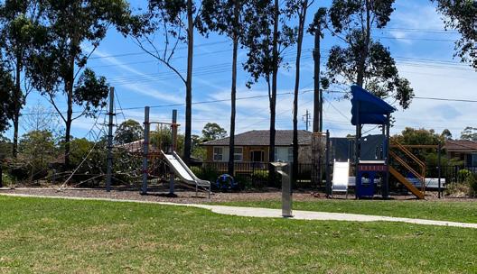
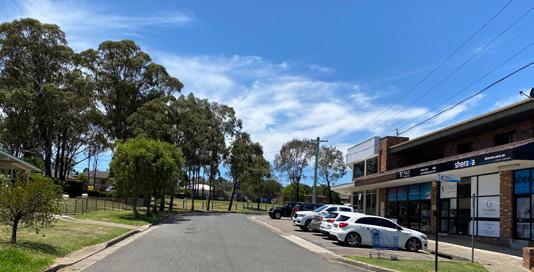

Existing businesses trade well, servicing a predominantly low density residential catchment with possibly some business generated from the significant employment areas to the west and south.
The location benefits from access to Parramatta-Liverpool Transitway.
The community is characterised by younger, above State average household income earners, and slightly high proportion of people from non-English speaking backgrounds.
VISUAL ANALYSIS
LS8
Figure 61 Commercial building at the corner
Figure 62 Lack of shading at the local shops
Figure 63 Woodpark Reserve opposite the local shops
4.0 LOCAL SHOPS TYPOLOGIES TYPOLOGY 4: CONVENIENCE BASED SHOPS 94 Cumberland Local Shops Study
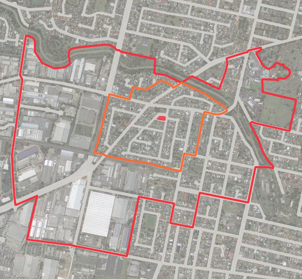
Cumberland City Council 95 500m 0 250 100 LEGEND Existing E1 Zone 400m Walking Catchment 800m Walking Catchment Public Open Space Education 1 Speedway Woodpark 2 Sherwood Grange Public School 3 The Brick Pit 4 MODE Homes 5 Aircon Rentals 6 Peter Warren Smithfield Service Centre 7 RS Components 8 Voltex Electrical Accessories 9 XL Express 10 Guildford West Chirldren’s Centre 11 Guildford West Public School 12 Marylands High School 13 Cerdon College 14 Bunnings Smithfield Woodpark Road Liverpool-Parramatta Transitway Cumberland Highway DellStreet Duffy Street WarrenRoad Fiona Street Sandra Street Martin Crescent Park G E Briscoe Park Devlin Park Vale Street Park Tom Uren Park Canal Road Park Josephine St Park Josephine St Park Hewitt Ave Reserve Woodpark Reserve 1 Princes Street Park Albert Street Park 10 11 3 4 5 6 7 9 8 12 2 13 14 Sandra Street Park
CUMBERLAND CITY COUNCIL 59
Figure 144
Local
Shops Extent and Context Map
Figure 64 Local Shops Extent and Context Map
Urban Design Performance
EXISTING PLACE QUALITY AND STRATEGIC OPPORTUNITIES
EXISTING PLACE QUALITY AND STRATEGIC OPPORTUNITIES
Urban Design Element Challenges
Local context
• General low-density residential context requires well-considered development integration and public realm improvements if growth as a mixed use precinct is anticipated
Economic vitality
• Redevelopment may not be feasible without a residential component which may risk the loss of commercial floorspace and impact the existing neighbourhood shop experience
Access and connectivity
• Low visibility from main road network
• An absence of high quality active transport infrastructure such as bike lanes or shared paths
Existing activity and street activation
• There is limited footpath space for outdoor dining opportunities
• Narrow footpaths along Dell Street provides less opportunity for pedestrian activity
Public realm quality
• Narrow footpaths limit the levels of activation and prevents significant streetscape enhancement
Building form and character
• The built form and quality do not contribute to a unique and high quality place character
SCALE & CATCHMENT MARKET ANALYSIS LOCAL SHOP TYPOLOGY OWNERSHIP PATTERN COMMUNITY AND EMPLOYMENT ACTIVITY WITHIN CATCHMENT CRITICAL MASS ADDITIONAL SOURCE OF EXPENDITURE KEY ANCHORS CENTRE OFFER COMPETITION
LS8 21 - 39 Dell Street, Smithfield (Woodpark Shopping Centre) Convenience based shops
4.0 LOCAL SHOPS TYPOLOGIES TYPOLOGY 4: CONVENIENCE BASED SHOPS
96 Cumberland Local Shops Study
Future Opportunities
• Investigate opportunities to enhance connection and relationship between Woodpark Reserve and the local shops
• Target speciality food and grocery and personal services to improve the convenience based offer
• Opportunities to deliver a mixed use development, this in turn could drive demand
• Improve connections and wayfinding between the shops and the bus stops on Woodpark Road
• Improve the quality of public domain through enhancing landscape, widening footpaths and providing street furniture
• Enhance the public domain through targeted and well considered interventions which respects the low density residential character of the immediate surrounding area
• Enhance the immediate public domain area to maximise the functional connections between the shops and park
• Widen the footpath to offer outdoor dining through potential future redevelopment
• Maintain the traditional ‘high street’ character of the shops at ground level
• Deliver public realm outcomes that directly address the visual qualities of the street and building
• Consider opportunities for redevelopment of the property as a high quality mixed use building
ACCESSIBILITY PUBLIC REALM BUILT FORM CURRENT PERFORMANCE WALKING CATCHMENT STREET PATTERN PUBLIC TRANSPORT ACTIVE TRANSPORT INFRASTRUCTURE CAR PARKING STREETSCAPE QUALITY PEDESTRIAN PRIORITISATION AND SAFETY BUILDING TYPOLOGY RESIDENTIAL / MIXED USE QUALITY AND CHARACTER STREET ACTIVATION Cumberland City Council 97
LS9
Coleman Street Shops
51 Coleman St, Merrylands


Existing businesses trade well with the bakery and butcher being popular draw cards while providing an informal meeting place for locals and servicing a predominantly low scale residential catchment.

Shops are adjacent to LAHC housing and is located along Coleman Road, a busy collector road benefiting from good vehicular access.
4.0 LOCAL SHOPS TYPOLOGIES TYPOLOGY 4: CONVENIENCE BASED SHOPS 98 Cumberland Local Shops Study
Figure 65 Lack of critical commercial mass (Source: Google Maps) See ore
Merrylands, New South Wales Google Street View Apr 2021
dates 59 Coleman St
Figure 66 LAHC housing adjacent to the local shops (Source: Google Maps)
Figure 67 2-Poor condition of the building along the rear-laneway (Source: Google Maps)
The Coleman Street Local Shops comprises four businesses including a vegetable shop, a Lebanese Pizza shop and a butchery.
The community is characterised by older, slightly below State average household income earners, and a high proportion of people from non-English speaking backgrounds.
VISUAL ANALYSIS
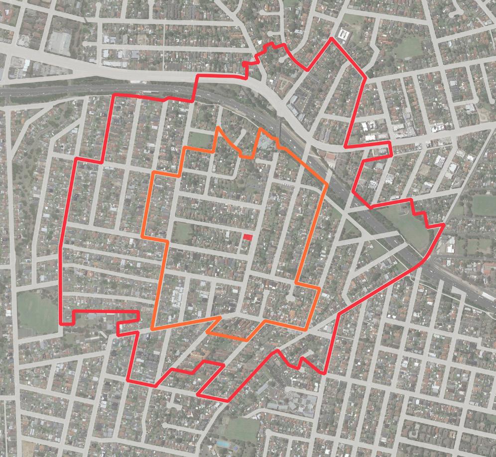
Cumberland City Council 99 500m 0 250 100 Alderson Park Pitt Park Freame Park Leawarra Reserve LEGEND Existing E1 Zone 400m Walking Catchment 800m Walking Catchment Public Open Space Education 1 Westmead Rehabilitation Hospital 2 Sydney Murugan Temple 3 Plus Fitness 27/7 Westmead 4 Raise Early Learning Childcare Centre 5 Everest Early Learning Childcare Centre 6 Hilltop Public School 7 Early Elements Education Childcare Centre 8 Hilltops Child Care Centre 9 Sonyla’s Beauty Spot 10 La Mono Merrylands 11 Cellarbrations 12 Holroyd School Hillier Street Reserve 12 6 7 1 5 4 2 3 11 8 9 10 Coleman Street Friend Street Hilltop Road BurnettStreet Frances Street M4WesternMotorway Great Western Highway Figure 162 Local Shops Extent and Context Map CUMBERLAND CITY COUNCIL 67 68 Local Shops Extent and Context Map
Urban Design Performance
EXISTING PLACE QUALITY AND STRATEGIC OPPORTUNITIES
EXISTING PLACE QUALITY AND STRATEGIC OPPORTUNITIES
Urban Design Element Challenges
Local context
• Generally low-density residential context requires well-considered development integration and public realm improvements if growth as a mixed use precinct is anticipated
Economic vitality
• Strong competition from LS2 (600m)
• Lack of critical mass with a limited retail and commercial offer
• Limited E1 zone cluster in terms of lot size
Access and connectivity
• An absence of high quality active transport infrastructure such as bike lanes or shared paths
• Limited parking availability
• An absence of pedestrian crossing
Existing activity and street activation
• There is limited footpath space to provide outdoor cafe/dining
Public realm quality
• There is no distinctive public domain character due to a lack of landscaping, street furniture and pedestrian ease of access and corner bollards which detract from the streetscape
• Rear laneway is neglected
Building form and character
• The current extent of E1zoned land and scale of building does not support a critical mass of commercial activities
SCALE & CATCHMENT MARKET ANALYSIS LOCAL SHOP TYPOLOGY OWNERSHIP PATTERN COMMUNITY AND EMPLOYMENT ACTIVITY WITHIN CATCHMENT CRITICAL MASS ADDITIONAL SOURCE OF EXPENDITURE KEY ANCHORS CENTRE OFFER COMPETITION
LS9 51 Coleman Street, Merrylands Convenience based shops
4.0 LOCAL SHOPS TYPOLOGIES TYPOLOGY 4: CONVENIENCE BASED SHOPS
100 Cumberland Local Shops Study
Future Opportunities
• Deliver a high quality mixed use development of a scale that maximises the value of its Coleman Street frontage and establishes a local community focal point
• Demand for floorspace is above supply, suggesting there is market appetite for additional floorspace
• Lots currently underutilised, with opportunities to expand existing footprint and potentially E1 zone cluster
• Investigate the opportunity for a dedicated bicycle lane along Coleman Street to strengthen district connectivity to the area
• Formalise and time-limit all on-street parking within the local shop area boundary
• Consider adding pedestrian crossing to improve pedestrian movement and safety
• Investigate opportunities to achieve additional footpath space in potential redevelopment
• Deliver a coordinated streetscape and public domain plan incorporating additional street trees and planting, street furniture, lighting and consistent, high quality paving treatments
• Visually screen all private car parking and service areas in the lane from the public domain
• Investigate expansion of E1zoned land to Dorothy Street to increase the critical mass of local shop activity in future potential redevelopment
ACCESSIBILITY PUBLIC REALM BUILT FORM CURRENT PERFORMANCE WALKING CATCHMENT STREET PATTERN PUBLIC TRANSPORT ACTIVE TRANSPORT INFRASTRUCTURE CAR PARKING STREETSCAPE QUALITY PEDESTRIAN PRIORITISATION AND SAFETY BUILDING TYPOLOGY RESIDENTIAL / MIXED USE QUALITY AND CHARACTER STREET ACTIVATION Cumberland City Council 101
Blaxcell Street Shops
342, 344 and 348 Blaxcell Street and 1 Guildford Road, South Granville
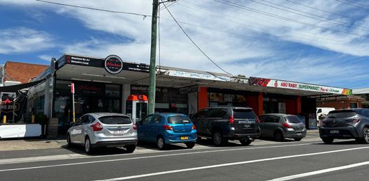
The Blaxcell Street Local Shops comprises five businesses including a service station, a cafe, a supermarket, a butchery and an Arabic restaurant.
Existing businesses trade well servicing a low scale residential catchment. Shops are within close proximity of Blaxcell Street Public School.
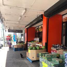
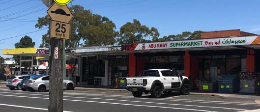
Shops are located at the intersection of Guildford Road and Blaxcell Street collector roads. They benefit from exposure to passing traffic and good public transport access.
The community is characterised by younger, significantly below State average income earners and a high proportion of people from non-English speaking background.
VISUAL ANALYSIS
Figure 69 An absence of outdoor dining opportunities
Figure 70 A view of the Blaxcell Street local shops
Figure 71 Awnings at the local shops
Figure 72 Petrol station at the intersection
LS11
4.0 LOCAL SHOPS TYPOLOGIES TYPOLOGY 4: CONVENIENCE BASED SHOPS 102 Cumberland Local Shops Study
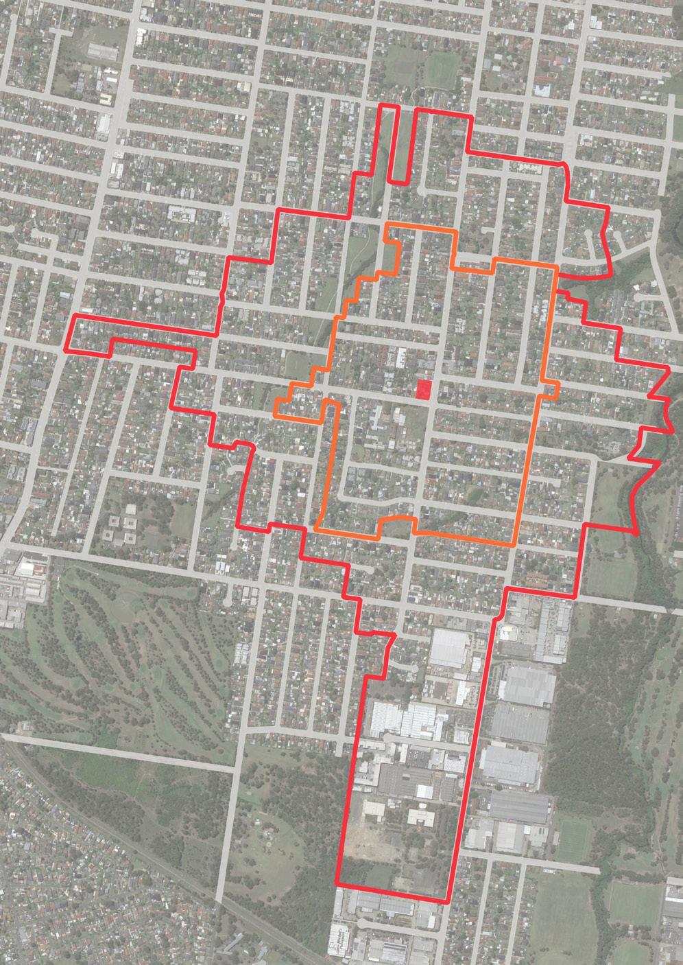
Hope Park Wolseley Street Reserve Harry Grapes Reserve Barba Reserve Ray Marshall Reserve Wategora Reserve Victor Brazier Park Woodville Golf Course Chiswick Park 6 3 4 8 1 2 Urimbirra Park Kirk Ave Reserve 5 9 Montgomery Avenue 10 11 7 Blaxcell Street Excelsior Street Clyde Street Guildford Road Guildford Road 500m 0 250 100 LEGEND Existing E1 Zone 400m Walking Catchment 800m Walking Catchment Public Open Space Education 1 Dellwood Medical Centre 2 1st Granville Scout Group Market Street Hall 3 Scribbles & Giggles Child Care Centre 4 Little School for Little Children 5 Burmese Christian Church Sydney 6 Blaxcell Street Public School 7 Granville Youth Association 8 Granville El-Rawda Bakery and Care 9 Dream Family Day Care 10 Rawson Road Long Day Preschool 11 Dellwood News agency Figure 208 Local Shops Extent and Context Map CUMBERLAND CITY COUNCIL 83 Figure 73 Local Shops Extent and Context Map
Urban Design Performance
EXISTING PLACE QUALITY AND STRATEGIC OPPORTUNITIES
EXISTING PLACE QUALITY AND STRATEGIC OPPORTUNITIES
Urban Design Element Challenges
Local context
• Requires logical transitions to surrounding low and medium density residential housing if significant redevelopment is proposed
Economic vitality
• In the vicinity of other local shops
• Oversupply of shopfront floorspace
Access and connectivity
Existing activity and street activation
• An absence of comfortable bus infrastructure such as seating and shade
• While the Blaxcell Street shops present active frontage to footpaths, there is limited footpath space to provide outdoor cafe/dining
Public realm quality
• Narrow footpaths limit the levels of footpath activation and prevents significant streetscape enhancements such as increased planting
• Car dominant environment
Building form and character
• While the Blaxcell Street shops function well and its retail section (excluding service station) engage with the street, the buildings are aged and moderately maintained
• As separate sites with disparate building forms and activities, the shops do not present a cohesive activity centre with strong place character
SCALE & CATCHMENT MARKET ANALYSIS LOCAL SHOP TYPOLOGY OWNERSHIP PATTERN COMMUNITY AND EMPLOYMENT ACTIVITY WITHIN CATCHMENT CRITICAL MASS ADDITIONAL SOURCE OF EXPENDITURE KEY ANCHORS CENTRE OFFER COMPETITION
LS11 342, 344 and 348 Blaxcell Street & 1 Guildford Road, South Granville Convenience based shops
4.0 LOCAL SHOPS TYPOLOGIES TYPOLOGY 4: CONVENIENCE BASED SHOPS
104 Cumberland Local Shops Study
Future Opportunities
• Improve pedestrian linkage along Blaxcell Street to connect to the public school to the south
• Opportunities to target personal services
• Leverage good existing public transport connectivity with improved bus stop infrastructure
• Investigate opportunities to achieve additional footpath space in potential redevelopment
• Deliver significant streetscape enhancements that unify the wider local shop area
• Improve the functional and visual quality of the streetscape as a coordinated outcome with potential future mixed use development
• Deliver a coordinated streetscape and public domain plan incorporating additional street trees and planting, street furniture, lighting and consistent, high quality paving treatments
• Encourage amalgamation of lots to deliver a scale and quality of mixed use redevelopment that can contribute to better quality buildings and a consistent and cohesive urban character
ACCESSIBILITY PUBLIC REALM BUILT FORM CURRENT PERFORMANCE WALKING CATCHMENT STREET PATTERN PUBLIC TRANSPORT ACTIVE TRANSPORT INFRASTRUCTURE CAR PARKING STREETSCAPE QUALITY PEDESTRIAN PRIORITISATION AND SAFETY BUILDING TYPOLOGY RESIDENTIAL / MIXED USE QUALITY AND CHARACTER STREET ACTIVATION Cumberland City Council 105
Clyde Street Shops
165 Clyde Street, South Granville


The Clyde Street Local Shops comprises three sites around intersection of Mona Street and Clyde Street. It includes a four-storey mixed use building, a petrol station, a car service centre, a butchery, a bakery and three detached residential housing products.


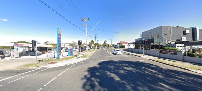

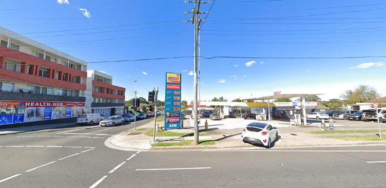
Existing businesses trade adequately servicing a low scale residential catchment. Local shops, south of Mona Street, represent an in cohesive grouping of commercial activities in a visually low quality streetscape. These shops are located at a busy car dominant intersection. As regional roads, Mona Street and Clyde Street offer the potential for this location to benefit from pass-by trade. The community is characterised by younger, significantly below State average income earners and a high proportion of people from non-English speaking background.
VISUAL ANALYSIS

Street View - Apr 2021 South Granville, New South Wales Google 168 Clyde St © 2023 Google Street View - Apr 2021 South Granville, New South Wales Google 170 Clyde St © 2023 Google South Granville, New South Wales Google Street View Apr 2021 See more dates 172 Mona St
Figure 76 Car dominant environment (Source: Google Maps)
Figure 77 Footpaths exposed to traffic and lack of shading
LS12
4.0 LOCAL SHOPS TYPOLOGIES TYPOLOGY 4: CONVENIENCE BASED SHOPS 106 Cumberland Local Shops Study
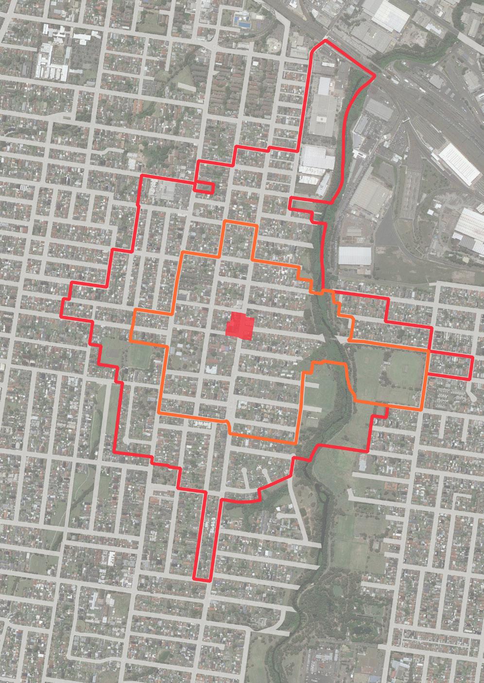
7 Clyde Street Mona Street Banksia Street Hudson Street Redfern Street Heath Street Blaxcell Street Lavinia Street Louis Street 1 9 2 Colquhoun Park Harry Gapes Reserve Mona Park Roy Godfrey Reserve Oriole Park Horlyck Park Bangor Park New Glasgow Park Fifth Street Reserve Duck River Reserve Harold Moon Reserve Baraba Reserve Little Duck Creek Leash Area 3 8 Adam Street Clyde Street Blaxcell Street Chisholm Road 4 6 11 10 Duck River Duck River 500m 0 250 100 LEGEND Existing E1 Zone 400m Walking Catchment 800m Walking Catchment Public Open Space Education 1 Holy Family Primary School 2 Everland Family Day Care 3 Granville East Public School 4 Holy Family Church 5 Tokaikolo Christian Church In Australia- Api Ko Fetu’upongipongi 6 Just For Kids Preschool Child Care Centre 7 Clovel Child Care 8 St Paul & St Anthony Child Care Centre 9 Just For Kids Preschool Child Care Centre 10 One Family Church 11 Memo’s Pizza, Pasta & Kebab Figure 228 Local Shops Extent and Context Map CUMBERLAND CITY COUNCIL 91 Figure 78 Local Shops Extent and Context Map
Urban Design Performance
EXISTING PLACE QUALITY AND STRATEGIC OPPORTUNITIES
EXISTING PLACE QUALITY AND STRATEGIC OPPORTUNITIES
Urban Design Element Challenges
Local context
• Requires logical transitions to surrounding low density residential housing if significant redevelopment is proposed
Economic vitality
• Redevelopment may not be feasible without a residential component which may risk the loss of commercial floorspace and impact the existing neighbourhood shop experience
• There is an oversupply of floorspace.
Access and connectivity
• Role of Clyde Street and Mona Street as regional roads limits significant reprioritisation of road space for on-street parking or pedestrian space
• An absence of comfortable bus infrastructure such as seating and shade
Existing activity and street activation
• E1 zoned properties are separated by the road network into three disconnected sites
• There is limited activation of the street with retail or food/beverage businesses
Public realm quality
• Regional roads present a poor environment and safety issues for pedestrians and vibrant street life
• Narrow footpaths exposed to traffic limit the levels of footpath activation and prevents significant streetscape enhancements and increased planting
Building form and character
• Incohesive built environment with a range of building conditions and detached houses
SCALE & CATCHMENT MARKET ANALYSIS LOCAL SHOP TYPOLOGY OWNERSHIP PATTERN COMMUNITY AND EMPLOYMENT ACTIVITY WITHIN CATCHMENT CRITICAL MASS ADDITIONAL SOURCE OF EXPENDITURE KEY ANCHORS CENTRE OFFER COMPETITION
LS12 165 Clyde Street, South Granville (and surrounds) Convenience based shops
4.0 LOCAL SHOPS TYPOLOGIES TYPOLOGY 4: CONVENIENCE BASED SHOPS
108 Cumberland Local Shops Study
Future Opportunities
• Leverage relationships and physical connection to Roy Godfrey Reserve and local community activities to support greater local shop viability and activity
• Attract and capture the pass-by movement economy offered by Mona Street and Clyde Street
• Opportunities for further mixed use development, this in turn could drive demand
• Reduce traffic speeds and deliver streetscape improvements that increase pedestrian comfort and safety
• Leverage good existing public transport connectivity with improved bus stop infrastructure
• Encourage redevelopment as a mixed use destination that will increase activity and investigate opportunities to achieve additional footpath space in potential redevelopment
• Deliver future streetscape enhancements to visually unify the wider local shopping area
• Increase shade with additional street planting and awnings on all active street frontages
• Deliver a coordinated streetscape and public domain plan incorporating additional street trees and planting, street furniture, lighting and consistent, high quality paving treatments
• Encourage amalgamation of lots to deliver a scale and quality of mixed use development that can contribute to better quality buildings and public realm character
ACCESSIBILITY PUBLIC REALM BUILT FORM CURRENT PERFORMANCE WALKING CATCHMENT STREET PATTERN PUBLIC TRANSPORT ACTIVE TRANSPORT INFRASTRUCTURE CAR PARKING STREETSCAPE QUALITY PEDESTRIAN PRIORITISATION AND SAFETY BUILDING TYPOLOGY RESIDENTIAL / MIXED USE QUALITY AND CHARACTER STREET ACTIVATION Cumberland City Council 109
Apr
Excelsior Street Shops (1)
52-56
Excelsior Street, Merrylands
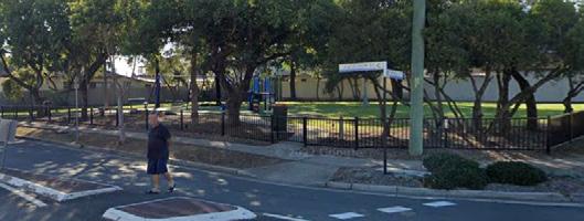
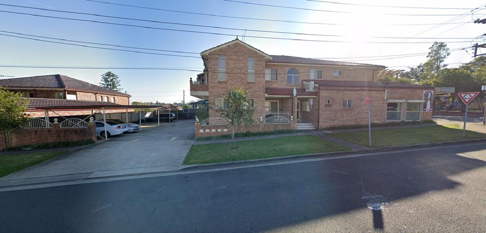
The Excelsior Street Local Shops (1) comprises four businesses including a hairdresser, a beauty clinic, a supermarket, and a chocolate shop.
Existing businesses appear to trade at a lower level, servicing a low scale residential catchment.
These shops are located opposite Coronation Park benefiting from good public amenity and views. Enhancement to public domain can potentially attract more visitors.


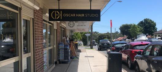
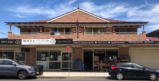
Buildings are shop top housing two storeys in height. Shops are accessible by car via Excelsior Street.
The community is characterised by younger, below State average income earners and a high proportion of people from nonEnglish speaking background.

VISUAL ANALYSIS

e: Apr 2021 © 2023 Merrylands, New South Wales Google Street View
Figure 79 Excelsior Street shop top housing
2021 See more dates 60 Farnell St
Figure 81 Residential character of the shop top housing along Farnell Street
Figure 82 Security grills along Coronation Park detract from streetscape opposite local shops
LS13
4.0 LOCAL SHOPS TYPOLOGIES TYPOLOGY 4: CONVENIENCE BASED SHOPS 110 Cumberland Local Shops Study
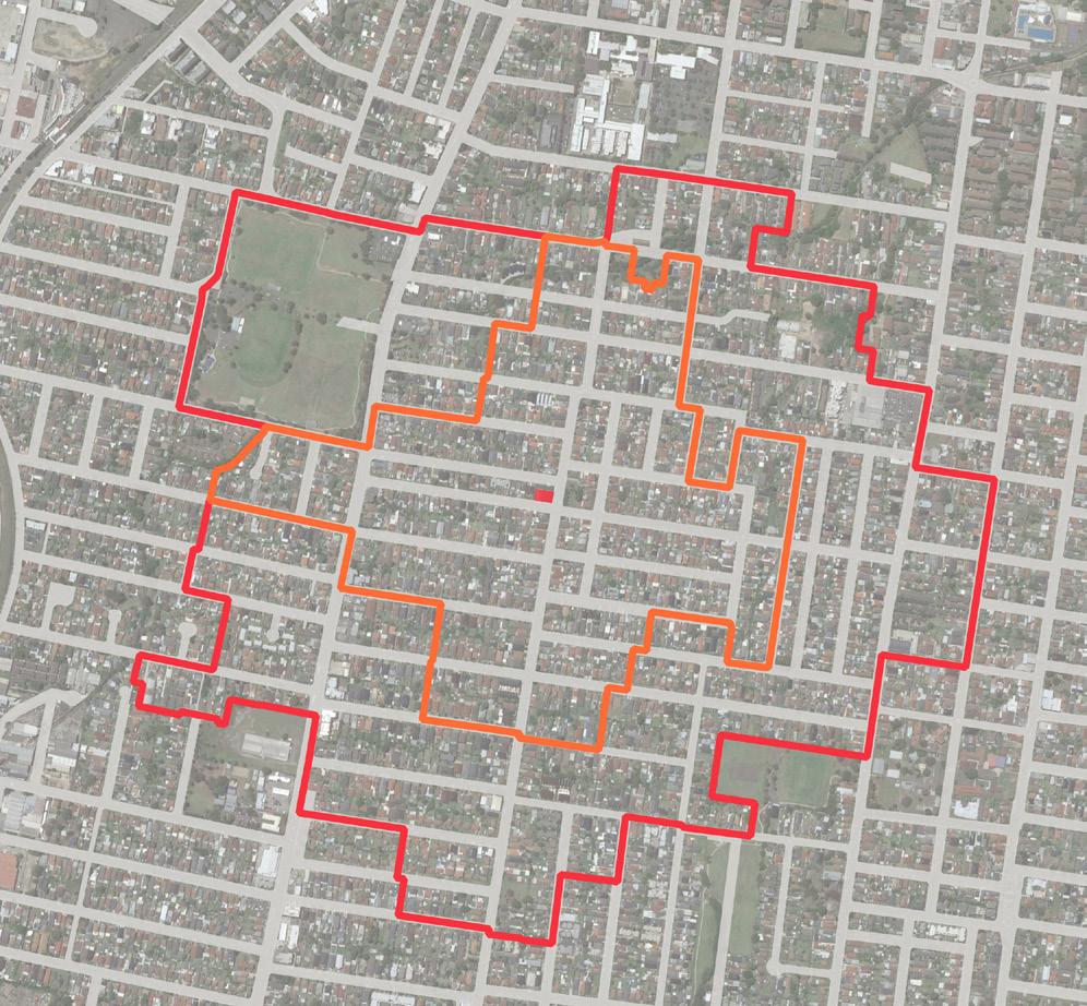
500m 0 250 100 LEGEND Existing E1 Zone 400m Walking Catchment 800m Walking Catchment Public Open Space Education 1 St Thomas Preschool 2 Clovel Child Care 3 St Paul & St Anthony Child Care Centre 4 Holy Family Church 5 Woodville Road Medical and Dental Centre 6 Granville South Public School Excelsior Street Farnell Street Farnell Street Bradman Street Elizabeth Street Louis Street 2 3 4 5 6 7 Coronation Park Harry Gapes Reserve Colquhoun Park Granville Park Illoura Reserve Scout Memorial Park Elizabeth Street Reserve Laurie Ferguson Water Playground 8 9 Cohen Street Woodville Road Blaxcell Street Merrylands Road 1
246 Local Shops Extent and Context Map 7 Montessori Merrylands 8 TAFE NSW Granville 9 Just For Kids Preschool Child Care Centre CUMBERLAND CITY COUNCIL 103 Cumberland City Council 111
83 Local
Context
Figure
Figure
Shops Extent and
Map
Urban Design Performance
Convenience based shops
EXISTING PLACE QUALITY AND STRATEGIC OPPORTUNITIES
EXISTING PLACE QUALITY AND STRATEGIC OPPORTUNITIES
Urban Design Element Challenges
Local context
• General low-density residential context and busy roads require well-considered development integration and public realm improvements if
Economic vitality
• Risk of land banking if shop top housing was permitted further north
• Competition from some other local shops in the vicinity
Access and connectivity
• An absence of comfortable bus infrastructure such as seating and shade
• An absence of high quality active transport infrastructure such as bike lanes and shared footpaths
• There is an absence of a safe pedestrian crossing
Existing activity and street activation
• Shops have a small active frontage to Excelsior Road with southern site boundary having a more residential interface with the street.
Public realm quality
• Security grills along Coronation Park detract from streetscape
• Narrow footpaths limit the level of street activation and prevents significant streetscape enhancement such as increased planting
Building form and character
• Shop top housing with a residential interface along Farnell Street
SCALE & CATCHMENT MARKET ANALYSIS LOCAL SHOP TYPOLOGY OWNERSHIP PATTERN COMMUNITY AND EMPLOYMENT ACTIVITY WITHIN CATCHMENT CRITICAL MASS ADDITIONAL SOURCE OF EXPENDITURE KEY ANCHORS CENTRE OFFER COMPETITION
LS13 52-56 Excelsior Street, Merrylands
4.0 LOCAL SHOPS TYPOLOGIES TYPOLOGY 4: CONVENIENCE BASED SHOPS
112 Cumberland Local Shops Study
Future Opportunities
• Single property ownership and access to open spaces offer high potential for mixed use redevelopment that maintains local shop activity and introduces urban living options
• Demand for floorspace is above supply, suggesting there is market appetite for additional floorspace
• Improve bus stop infrastructure
• Investigate the opportunity for a dedicated bicycle lane along Excelsior Street to improve district connectivity to the area
• Consider adding pedestrian crossing on Excelsior Street to improve pedestrian movement and safety
• Protect the existing shop top housing format and function and investigate opportunities to achieve additional footpath space in potential redevelopment
• Enhance the immediate public domain area to maximise the functional connections between the shops and nearby park
• Provide consistent, high quality paving treatments to improve pedestrian experience and enhance streetscape
• Encourage redevelopment of the property as a high quality mixed use building that contributes to a high quality public domain and delivers additional floorspace
ACCESSIBILITY PUBLIC REALM BUILT FORM CURRENT PERFORMANCE WALKING CATCHMENT STREET PATTERN PUBLIC TRANSPORT ACTIVE TRANSPORT INFRASTRUCTURE CAR PARKING STREETSCAPE QUALITY PEDESTRIAN PRIORITISATION AND SAFETY BUILDING TYPOLOGY RESIDENTIAL / MIXED USE QUALITY AND CHARACTER STREET ACTIVATION Cumberland City Council 113
Rawson Road Shops
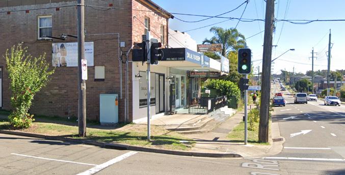
38-42 Rawson Rd, Guildford
The Rawson Road Local Shops comprises three businesses including a hairdresser, an Indian restaurant and a Lebanese bakery.
Existing commercial uses, especially La Rouche Lebanese Bakery, trades well and services a low scale residential catchment as well as the industrial precinct to the east.
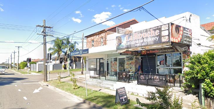
These shops benefit from good vehicular accessibility via Rawson Road and are serviced by bus.
Public domain is neglected and shops are aged and in poor condition.
The community is characterised by younger, significantly below State average income earners and a high proportion of people from non-English speaking background
South Granville, New South Wales Google Street View Apr 2021 See more dates 39 Rawson Rd Image capture: Apr 2021 © 2023 Google South Granville, New South Wales Google Street View Apr 2021 See more dates 36 Rawson Rd
Figure 85 Car dominant environment along Rawson Road (Source: Google Maps)
4.0 LOCAL SHOPS TYPOLOGIES TYPOLOGY 4: CONVENIENCE BASED SHOPS 114 Cumberland Local Shops Study LS15
VISUAL ANALYSIS

500m 0 250 100 Campbell Hill Pioneer Reserve Hope Park Victor Brazier Park Urimbirra Park Ray Marshall Reserve Wategora Reserve Rawson Road Wellington Road Clyde Street Ferndell Street Campbell Hill Road Blaxcell Street Dudley Road Steel Street Guildford Road Excelsior Street 1 2 3 4 5 6 Chriswick Park 7 8 9 LEGEND Existing E1 Zone 400m Walking Catchment 800m Walking Catchment Public Open Space Education 1 Rawson DMC 2 Garderie Early Learning Centre 3 Scribbles & Giggles Child Care Centre 4 Little School for Little Children 5 Burmese Christian Church Sydney 6 Granville Youth Association - Clyde Centre 7 Only About Children Granville 8 Bioceram Dental Lab Pty 10 Melita Stadium 11 Woodville Golf Course Figure 280 Local Shops Extent and Context Map 9 Blaxcell Street Public School 10 NBC South Granville 11 Transdev NSW South Granville Bus Depot CUMBERLAND CITY COUNCIL 119 Cumberland City Council 115
86 Local Shops Extent and Context Map
Figure
Urban Design Performance
Convenience based shops
EXISTING PLACE QUALITY AND STRATEGIC OPPORTUNITIES
EXISTING PLACE QUALITY AND STRATEGIC OPPORTUNITIES
Urban Design Element Challenges
Local context
• Residential catchment is limited to the east with more industrial uses near the local shops
Economic vitality
• Redevelopment may not be feasible without a residential component which may risk the loss of commercial floorspace and impact the existing neighbourhood shop experience
• Competition from LS14, LS11, LS22 and LS24
Access and connectivity
• An absence of comfortable bus infrastructure such as seating and shade
• An absence of parking space at local shops area
• An absence of high quality active transport infrastructure such as bike lanes
Existing activity and street activation
• Shops have an active frontage with outdoor dining opportunities to Rawson Road
Public realm quality
• Public domain is generally neglected given car dominant environment along Rawson Road
Building form and character
• While shops function well, buildings are aged and in poor condition
SCALE & CATCHMENT MARKET ANALYSIS LOCAL SHOP TYPOLOGY OWNERSHIP PATTERN COMMUNITY AND EMPLOYMENT ACTIVITY WITHIN CATCHMENT CRITICAL MASS ADDITIONAL SOURCE OF EXPENDITURE KEY ANCHORS CENTRE OFFER COMPETITION
LS15 38-42 Rawson Road, Guildford
4.0 LOCAL SHOPS TYPOLOGIES TYPOLOGY 4: CONVENIENCE BASED SHOPS
116 Cumberland Local Shops Study
Future Opportunities
• Encourage amalgamation of lots, particularly a scenario that supports a single coordinated development outcome which supports both residential and industrial area
• Opportunity to grow cluster through encouraging mixed-use development or shop top housing, which may drive demand
• Improve bus stop infrastructure
• Formalise and time-limit all on-street parking within the local shop area boundary
• Investigate the opportunity for a dedicated bicycle lane along Rawson Road to strengthen district connectivity to the area
• Encourage mixed use redevelopment to contribute to street activity and support investment to improved streetscape function and quality
• Improve the functional and visual character of the streetscape as a coordinated outcome with potential future mixed use development
• Encourage redevelopment of the property as a high quality mixed use building that contributes to a high quality public domain and delivers additional floorspace
ACCESSIBILITY PUBLIC REALM BUILT FORM CURRENT PERFORMANCE WALKING CATCHMENT STREET PATTERN PUBLIC TRANSPORT ACTIVE TRANSPORT INFRASTRUCTURE CAR PARKING STREETSCAPE QUALITY PEDESTRIAN PRIORITISATION AND SAFETY BUILDING TYPOLOGY RESIDENTIAL / MIXED USE QUALITY AND CHARACTER STREET ACTIVATION Cumberland City Council 117
Cumberland Road Shops
234-238 Cumberland Rd, Auburn
253 Cumberland Rd
Street View - Sept 2020
The Cumberland Local Shops comprises a vacant commercial building in poor condition, a single shop-top premise and a service station.
Auburn, New South Wales Google
Existing commercial uses appear to trade at a lower level, servicing a predominantly low scale residential catchment. There is a variety of community facilities and open space within the vicinity of the businesses.
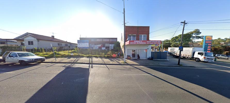
Auburn, New South Wales
VISUAL ANALYSIS
53 Wellington Rd
Google Street View


Oct 2020 See more dates
This shops benefit from good vehicular accessibility via Wellington Road which functions as a regional road. Shops are well serviced by bus.
The built form of the shops is completely different in character from other local shops, and is mostly aged and not in a good condition.
The Guildford Road- Fowler Road intersection is a car dominated environment with no public domain enhancements.
The community is characterised by younger, low-average income earners and a high proportion of people from non-English speaking background
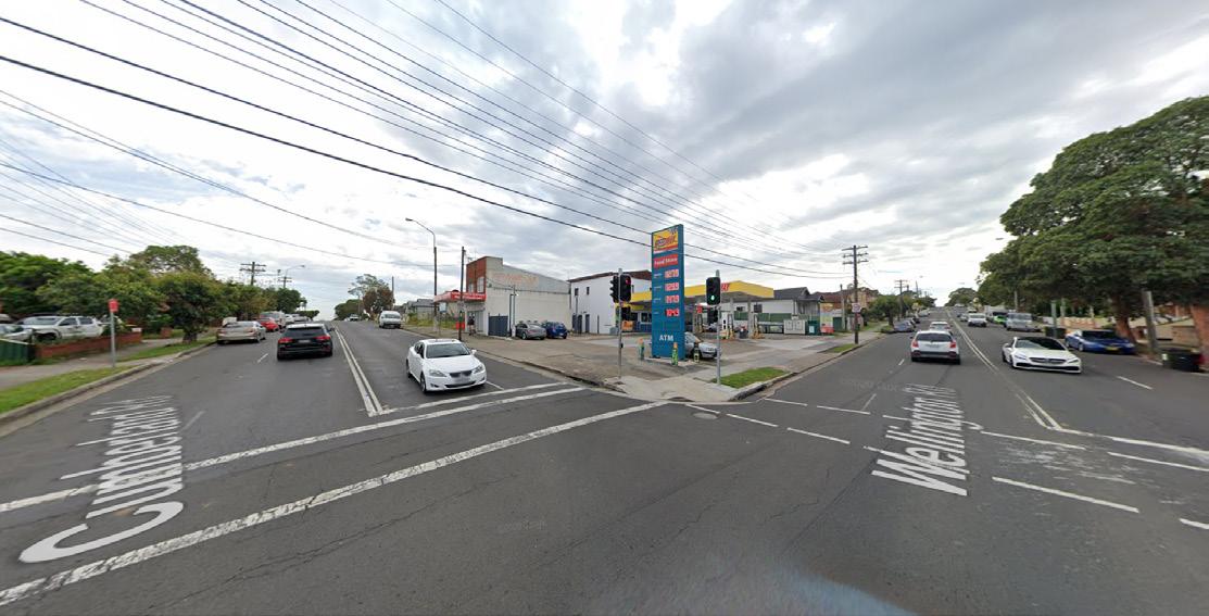 Figure 88 Car dominant environment (Source: Google Maps)
LS16
4.0 LOCAL SHOPS TYPOLOGIES TYPOLOGY 4: CONVENIENCE BASED SHOPS 118 Cumberland Local Shops Study

500m 0 250 100 LEGEND Existing E1 Zone 400m Walking Catchment 800m Walking Catchment Public Open Space Education 1 St Raymond’s Parish 2 Harmony Kids Family Day CareFamily Day Care Auburn 3 Auburn Montessori Academy Child Care Centre 4 Berala Public School 5 St James Anglican Church 6 Berala Jack & Jill Preschool 7 Foci Education 8 Oz Education Childcare & Preschool 9 Auburn West Montessori Academy Child Care 10 Auburn West Public School 11 Al-Sajjad Islamic Centre 12 NSW SES Auburn Unit Progress Park Fraser Park Norman Park Pine Park Civic Park Auburn Botanic Gardens Auburn Fauna Reserve 1 Angus Park 2 3 5 6 7 8 9 10 11 12 Wellington Road Cumberland Road Cumberland Road Wellington Road Albert Road Chiswick Road Chiswick Road Clarke Street Chisholm Road Chisholm Road Rosnay Golf Course 4
CUMBERLAND CITY COUNCIL 127 Cumberland City Council 119
Figure 296 Local Shops Extent and Context Map
Figure 89 Local Shops Extent and Context Map
Urban Design Performance
LS16 234-238 Cumberland Road, Auburn
EXISTING PLACE QUALITY AND STRATEGIC OPPORTUNITIES
EXISTING PLACE QUALITY AND STRATEGIC OPPORTUNITIES
Urban Design Element Challenges
Local context
• Requires consideration of low scale residential context if redevelopment is proposed
Economic vitality
• Redevelopment may not be feasible without a residential component which may risk the loss of commercial floorspace and impact the existing neighbourhood shop experience
Access and connectivity
• An absence of comfortable bus infrastructure such as seating and shade
• An absence of sufficient parking space at local shops area
Existing activity and street activation
• There is an absence of street activity given current businesses in operation do not attract visitors or encourage pedestrian activity
Public realm quality
• The intersection currently presents a car dominant environment which does not encourage pedestrian activity
• There is an absence of tree planting and landscaping
Building form and character
• Incohesive built environment with a range of buildings mostly in poor condition
• The two-storey commercial building is abandoned , setback and in poor condition
SCALE & CATCHMENT MARKET ANALYSIS LOCAL SHOP TYPOLOGY OWNERSHIP PATTERN COMMUNITY AND EMPLOYMENT ACTIVITY WITHIN CATCHMENT CRITICAL MASS ADDITIONAL SOURCE OF EXPENDITURE KEY ANCHORS CENTRE OFFER COMPETITION
Convenience based shops
4.0 LOCAL SHOPS TYPOLOGIES TYPOLOGY 4: CONVENIENCE BASED SHOPS
120 Cumberland Local Shops Study
Future Opportunities
• Encourage amalgamation of lots, particularly in a scenario that supports a single coordinated development outcome
• Demand for floorspace is above supply, suggesting there is market appetite for additional floorspace
• Improve bus stop infrastructure
• Formalise and time-limit all on-street parking within the local shop area boundary
• Investigate the opportunity for a dedicated bicycle lane along Wellington Road to strengthen district connectivity to the area
• Encourage mixed use redevelopment to contribute to street activity and support investment to improved streetscape function and quality
• Improve the functional and visual character of the streetscape as a coordinated outcome with potential future mixed use development
• Deliver a coordinated streetscape and public domain plan incorporating additional street trees and planting, street furniture, lighting and consistent, high quality paving treatments
• Investigate replacing overhead wires with underground power supply to improve the streetscape, enhance pedestrian experience and visual appearance
• Encourage amalgamation of lots, particularly a scenario that supports a single coordinated development outcome that can contribute to a high quality public domain and deliver additional floorspace
ACCESSIBILITY PUBLIC REALM BUILT FORM CURRENT PERFORMANCE WALKING CATCHMENT STREET PATTERN PUBLIC TRANSPORT ACTIVE TRANSPORT INFRASTRUCTURE CAR PARKING STREETSCAPE QUALITY PEDESTRIAN PRIORITISATION AND SAFETY BUILDING TYPOLOGY RESIDENTIAL / MIXED USE QUALITY AND CHARACTER STREET ACTIVATION Cumberland City Council 121
Damien Avenue Shops
Damien Ave Shops, 7 Lucinda St, Greystanes

The Damien Avenue Local Shops comprises two businesses including a hairdresser and real estate agency.

Shops appear to trade at a lower level, servicing a low density residential catchment. These shops are located opposite Gallard Reserve to the north and 200m from Jersey Road.
Given the current use, the shops do not contribute to street activity.
The built form of the shops represent a low scale shop top housing with some landscaping in front.
The community is characterised by more affluent population and a higher portion of Australian born residents.
VISUAL ANALYSIS
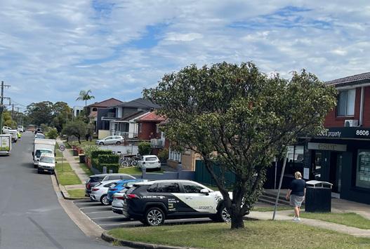 Figure 90 Absence of street activity given current businesses in operation
Figure 91 Absence of outdoor dining opportunities
Figure 92 An absence of an active frontage to the park
LS18
4.0 LOCAL SHOPS TYPOLOGIES TYPOLOGY 4: CONVENIENCE BASED SHOPS 122 Cumberland Local Shops Study
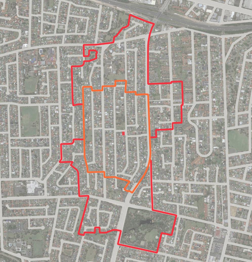
500m 0 250 100 LEGEND Existing E1 Zone 400m Walking Catchment 800m Walking Catchment Public Open Space Education 1 Bright Stars Montessori Preschool 2 Merrylands Denture Clinic 3 Little Angels Family Day Care 4 L Driving School 5 Our Lady Queen of Peace 6 Our Lady Queen of Peace Preschool 7 St Paul’s Catholic College 8 First Academy Preschool Childcare Centre 9 Ringrose Public School 10 Wenty Children’s Centre 11 St Mary Kindergarten Long Day Care Centre 12 Little Friends Early Learning South Wentworthville 13 Soccajoeys Greystanes Soccer Field Jersey Road / Cumberland Highway 1 Merrylands Road 2 3 4 5 6 7 Central Gardens Nature Reserve Biscayne Avenue Park Gallard Reserve Leeton Street Park Whyman Park Paul Crescent Reserve Adler Pde Reserve Apex Park Hanbury Street Park Daniel Street Park Wirralee Street Park Hampden Road Reserve Mujar Reserve Beechwood Avenue Park Lance Cres Park 8 9 10 13 12 11 Lucinda Road Irrigation Road Northcott Street Hampden Road Ringrose Avenue Damien Avenue
CUMBERLAND CITY COUNCIL 143 Cumberland City Council 123
Figure 326 Local Shops Extent and Context Map
Figure 93 Local Shops Extent and Context Map
Urban Design Performance
EXISTING PLACE QUALITY AND STRATEGIC OPPORTUNITIES
EXISTING PLACE QUALITY AND STRATEGIC OPPORTUNITIES
Urban Design Element Challenges
Local context
• Gallard Reserve to the north of local shops is a large open space with less picnic areas and facilities to attract additional potential visitors to the area
Economic vitality
• Competition from LS5, LS10 and LS19 within 1 to 1.4km distance
Access and connectivity
• An absence of high quality active transport infrastructure such a bike lanes or shaded footpaths
• An absence of good public transport access
• Lack of pedestrian crossing
Existing activity and street activation
• Street frontages are not highly active due to businesses in operation
• There is a lack of active frontage and sufficient openings to the north fronting Gallard Reserve
Public realm quality
• An absence of public domain qualities and outdoor dining to support pedestrian experience and activity.
Building form and character
• Built form is moderately maintained
SCALE & CATCHMENT MARKET ANALYSIS LOCAL SHOP TYPOLOGY OWNERSHIP PATTERN COMMUNITY AND EMPLOYMENT ACTIVITY WITHIN CATCHMENT CRITICAL MASS ADDITIONAL SOURCE OF EXPENDITURE KEY ANCHORS CENTRE OFFER COMPETITION
LS18 Damien Ave Shops Convenience based shops
4.0 LOCAL SHOPS TYPOLOGIES TYPOLOGY 4: CONVENIENCE BASED SHOPS
124 Cumberland Local Shops Study
Future Opportunities
• Consider future enhancement of the park which may attract future potential visitors, and activate the area
• Investigate the potential to hold community activities, provide other recreational uses and cafés that cater for future users of the area
• Demand for floorspace is slightly above supply, suggesting there is market appetite for additional floorspace
• Improve wayfinding between shops and parks, and wider road network
• Consider providing outdoor dining opportunities to improve pedestrian interaction and enhance pedestrian experience
• Protect current shop format and consider improvement of built form quality
• Improve the quality of public domain through enhancing landscape, widening footpaths and providing street furniture
• To meet current demand potentially extend E1 zoned land further to the west and encourage redevelopment through appropriate planning controls
• Encourage redevelopment of the property as a high quality mixed use building that respects the low density and low traffic environment of the location.
ACCESSIBILITY PUBLIC REALM BUILT FORM CURRENT PERFORMANCE WALKING CATCHMENT STREET PATTERN PUBLIC TRANSPORT ACTIVE TRANSPORT INFRASTRUCTURE CAR PARKING STREETSCAPE QUALITY PEDESTRIAN PRIORITISATION AND SAFETY BUILDING TYPOLOGY RESIDENTIAL / MIXED USE QUALITY AND CHARACTER STREET ACTIVATION Cumberland City Council 125
Carnation Street Shops
Carnation Street: 20-32 Carnation St, Greystanes


The Carnation Street Local Shops comprises five businesses including a gym, an electronic store, a vet clinic, a hair dresser and a dog wash. There are two open space north and south of the shops which are within E1 zoned land and are owned by council. The Local Shops trade adequately, are single storey and located within a predominantly low density residential context and in proximity to Nemesia Street Park.
The community is characterised by younger, significantly below State average household income earners, and a high portion of Australian born residents.
VISUAL ANALYSIS
Figure 94 Semi-active frontages without outdoor dining opportunities
Figure 95 Lack of building openings to the park
LS20
4.0 LOCAL SHOPS TYPOLOGIES TYPOLOGY 4: CONVENIENCE BASED SHOPS 126 Cumberland Local Shops Study
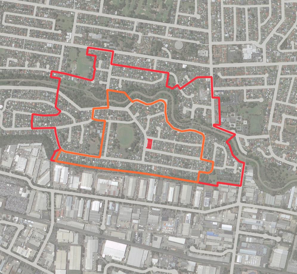
Cumberland City Council 127 500m 0 250 100 LEGEND Existing E1 Zone 400m Walking Catchment 800m Walking Catchment Public Open Space Education 1 Educate Me Montessori 2 Widemere Public School 3 Ultimate Driving School 4 Fresenius Medical Care Australia 5 FHV Driver Training 6 Holroyd High School 7 Greystanes Uniting Church 8 Greystanes Uniting Church Child Care Centre Nemesia Street Park Gardenia Pde Park Percival Road Dog Park Greystanes Sports ground Hopman Street Park Lower Prospect Canal Reserve Widemere Reserve 1 2 3 4 5 6 7 8 9 10 11 12 Woodpark Road Gardenia Parade Tulip Street Camellia Street Carnation Street Macquarie Road Merrylands Road Cumberland Road Percival Road Cooper Street Liverpool-ParramattaTransitway 9 Greystanes Preschool 10 Greysmed Surgery 11 Total Care Early Learning Centre 12 Greystanes Public School Figure 360 Local Shops Extent and Context Map CUMBERLAND CITY COUNCIL 155 96 Local Shops Extent and Context Map
Urban Design Performance
EXISTING PLACE QUALITY AND STRATEGIC OPPORTUNITIES
EXISTING PLACE QUALITY AND STRATEGIC OPPORTUNITIES
Urban Design Element Challenges
Local context
• Limited residential catchment with industrial uses to the south
• Shops are isolated with limited access from major roads to attract more visitors
Economic vitality
• There is a potential lack of financial incentives to upgrade shops
Access and connectivity
• Lower vehicular accessibility due to the location of shops within local roads
• An absence of high quality active transport infrastructure such a bike lanes or shaded footpaths
• An absence of comfortable bus infrastructure such as seating and shade
• Lack of pedestrian crossing
Existing activity and street activation
• There is an absence of street activity due to businesses in operation which do not encourage pedestrian activity and interaction
Public realm quality
• Narrow footpaths limit the levels of footpaths activations and prevents significant streetscape enhancement such as tree planting, providing street furniture and outdoor dining
Building form and character
• Built form is moderately maintained with inconsistent awning at front
• Limited views to the adjoining open space north and south of the local shops
SCALE & CATCHMENT MARKET ANALYSIS LOCAL SHOP TYPOLOGY OWNERSHIP PATTERN COMMUNITY AND EMPLOYMENT ACTIVITY WITHIN CATCHMENT CRITICAL MASS ADDITIONAL SOURCE OF EXPENDITURE KEY ANCHORS CENTRE OFFER COMPETITION
LS20 Carnation Street Convenience based shops
4.0 LOCAL SHOPS TYPOLOGIES TYPOLOGY 4: CONVENIENCE BASED SHOPS
128 Cumberland Local Shops Study
Future Opportunities
• Investigate the potential to hold community activities, provide other recreational uses and cafés that cater for future users of the area
• Target convenience based retailers to support the needs of the local community as well as attracting food and beverages tenancies
• Improve wayfinding between shops and Nemesia Park and wider road network
• Improve bus stop infrastructure
• Consider new pedestrian crossings on Carnation Street to improve pedestrian comfort and safety
• Consider providing outdoor dining opportunities to improve pedestrian interaction and enhance pedestrian experience
• Protect current shop format and consider improvement of built form quality
• Improve the quality of public domain through street tree planting, enhancing landscape, widening footpaths and providing street furniture
• Consider public art opportunities on blank walls
• Encourage redevelopment of the property as a high quality mixed use building that respects the low density and low traffic environment of the location
• Consider providing opening to the open space north and south of the park in future potential redevelopment of shops
ACCESSIBILITY PUBLIC REALM BUILT FORM CURRENT PERFORMANCE WALKING CATCHMENT STREET PATTERN PUBLIC TRANSPORT ACTIVE TRANSPORT INFRASTRUCTURE CAR PARKING STREETSCAPE QUALITY PEDESTRIAN PRIORITISATION AND SAFETY BUILDING TYPOLOGY RESIDENTIAL / MIXED USE QUALITY AND CHARACTER STREET ACTIVATION Cumberland City Council 129
Hawksview Street Shops
126-130 Hawksview St, Guildford
The Hawksview Street Local Shops includes a pizza shop, a tobacco shop, a cafe and a clothes shop.
These local shops appear to be trading adequately and benefits strong vehicular accessibility, exposure to passing traffic and public transport accessibility. Shops are single storey in height and located within a predominantly low to medium density residential context with substantial walking catchment population and population growth. Shops are opposite Holroyd Private Hospital. The community is characterised by younger, below State average household income earners, with half of the population being of people from non-English speaking backgrounds and half Australian born residents.
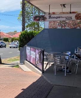
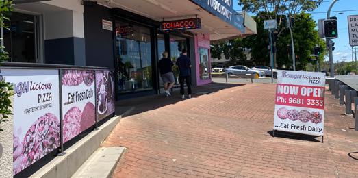
VISUAL ANALYSIS
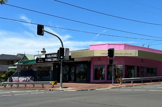 Figure 97 Safety guardrails at the corner detract from streetscape
Figure 98 Lack of Landscaping along wide Footpaths
Figure 99 Some outdoor dining facilities
Figure 100 Holroyd Private Hospital located opposite the local shops (Source: Google Maps)
LS21
4.0 LOCAL SHOPS TYPOLOGIES TYPOLOGY 4: CONVENIENCE BASED SHOPS 130 Cumberland Local Shops Study

Cumberland City Council 131 500m 0 250 100 LEGEND Existing E1 Zone 400m Walking Catchment 800m Walking Catchment Public Open Space Education T Train Station 1 Holroyd Private Hospital 2 Al Omari Medical Centre 3 Cheryl’s Family Day CareGreat Western FDC 4 Merrylands Public School 5 Grace 4 Kids Early Learning Centre 6 Merrylands Anglican Church 7 Advanced Early LearningWalker Street 8 John’s Bathroom Renovations Wainwright Street Park Gloucester Park Leigh St Park Maunder Reserve Murdock Street Park The Esplanade Reserve Surrey Street Reserve Elizabeth Street Park George Street Park Gum Tree Reserve Arnett Park Fowler Road Reserve Cusack Street Park Moore Park Morris Street Park Warren Try Reserve 1 2 4 3 Harris Street Park Belmont Street Park Warnock Park 5 6 7 Hawksview Street Chetwynd Road Chetwynd Road Hawksview Street Military Road RailwayLine Guildford Road Fowler Road Fowler Road King Park 8 9 10
Local
Extent and Context Map Guildford Train Station T 9 RnM Tyre Centre 10 Early Academics Early Learning Centre CUMBERLAND CITY COUNCIL 163
Figure 377
Shops
Local
Extent
Context
Figure 101
Shops
and
Map
Urban Design Performance
EXISTING PLACE QUALITY AND STRATEGIC OPPORTUNITIES
EXISTING PLACE QUALITY AND STRATEGIC OPPORTUNITIES
Urban Design Element Challenges
Local context
• Hawksview Street and Chetwynd Road are higher order streets that will continue to carry district traffic through the area
• Shops are located in close proximity to Holroyd Private Hospital
Economic vitality
• Redevelopment may not be feasible without a residential component which may risk the loss of commercial floorspace and impact the existing neighbourhood shop experience
Access and connectivity
• The role of Hawksview Street as regional road limits significant re-prioritisation of pedestrian space along this street
• An absence of high quality active transport infrastructure such as bike lanes
• Limited parking along Chetwynd Road
• Lack of comfortable bus infrastructure to encourage pedestrian use
Existing activity and street activation
• While shops have an active frontage to footpaths, there is limited footpath space and planting buffer to traffic to provide convenient outdoor dining opportunities
Public realm quality
• Safety guardrails at the corner detract from streetscape and the overall pedestrian experience
Building form and character
• The built form does not contribute materially to a high quality place character
SCALE & CATCHMENT MARKET ANALYSIS LOCAL SHOP TYPOLOGY OWNERSHIP PATTERN COMMUNITY AND EMPLOYMENT ACTIVITY WITHIN CATCHMENT CRITICAL MASS ADDITIONAL SOURCE OF EXPENDITURE KEY ANCHORS CENTRE OFFER COMPETITION
LS21 126-130 Hawksview Street, Guildford Convenience based shops
4.0 LOCAL SHOPS TYPOLOGIES TYPOLOGY 4: CONVENIENCE BASED SHOPS
132 Cumberland Local Shops Study
Future Opportunities
• Leverage relationships and connection to Holroyd Hospital and local community activities to support greater local shops viability and activity
• Considering proximity to the hospital, there is an opportunity to provide ancillary services to support the hospital
• Reduce traffic speeds and deliver streetscape improvements that increase pedestrian comfort and safety
• Improve footpaths to the shops from the wider neighbourhood
• Leverage good existing public transport to the shops with improved bus stop infrastructure
• Improve footpaths quality to encourage more street activity
• Replace guardrail with a more visually pleasant option and introduce planting along footpaths to improve the pedestrian experience
• Deliver a coordinated streetscape and public domain plan incorporating additional street trees and planting, street furniture, lighting and consistent, high quality paving treatments
• Consider replacing overhead wires with underground power supply
• Investigate opportunities to deliver high quality buildings and public realm character through potential renovation or redevelopment
ACCESSIBILITY PUBLIC REALM BUILT FORM CURRENT PERFORMANCE WALKING CATCHMENT STREET PATTERN PUBLIC TRANSPORT ACTIVE TRANSPORT INFRASTRUCTURE CAR PARKING STREETSCAPE QUALITY PEDESTRIAN PRIORITISATION AND SAFETY BUILDING TYPOLOGY RESIDENTIAL / MIXED USE QUALITY AND CHARACTER STREET ACTIVATION Cumberland City Council 133
Clyde Street Shops

291-295 Clyde Street, South Granville
The Clyde Street Local Shops comprises a combined butchery and restaurant, a combined groceries and vegetable shop, a pizza shop and Northern Cyprus Turkish Association of NSW. The combined groceries and vegetable shop appears to be trading well, servicing a low to medium density residential catchment.
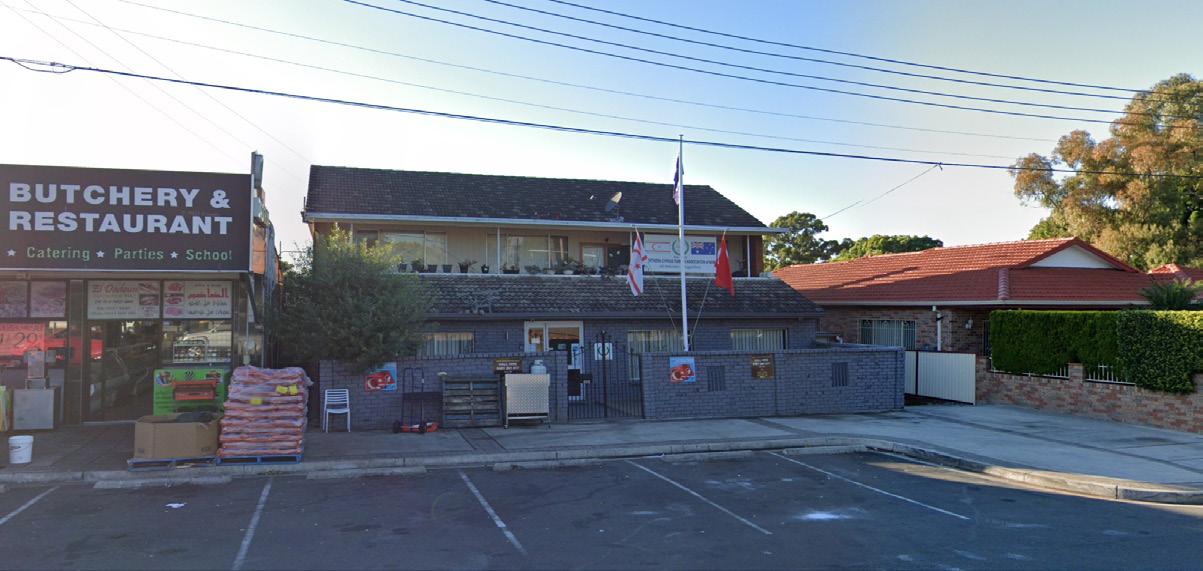
These shops benefit from exposure to passing traffic and public transport accessibility. The community is characterised by younger, significantly below State average household income earners, and a high proportion of people from non-English speaking backgrounds.


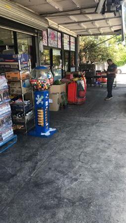
 Figure 103
295 Clyde St
South Granville, New South Wales Google Street View
Apr 2021 See more dates
293 Clyde St
Figure 105 Northern Cyprus Turkish Association of NSW (Source: Google Maps)
LS22
4.0 LOCAL SHOPS TYPOLOGIES TYPOLOGY 4: CONVENIENCE BASED SHOPS 134 Cumberland Local Shops Study
VISUAL ANALYSIS
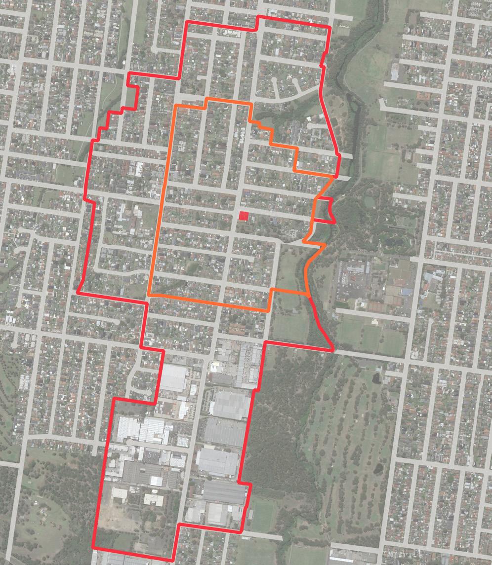
Cumberland City Council 135 Auburn Fauna Reserve Auburn Botanic Gardens Progress Park Ray Marshall Reserve Baraba Reserve Oriole Park Hope Park Wategora Reserve Urimbirra Park 1 500m 0 250 100 LEGEND Existing E1 Zone 400m Walking Catchment 800m Walking Catchment Public Open Space Education 1 Granville Youth AssociationClyde Centre 2 Burmese Christian Church Sydney 3 Only About Children Granville 4 Scribbles & Giggles Child Care Centre 5 Little School for Little Children 6 Dellwood Medical Centre 7 Blaxcell Street Public School Chiswick Park 2 3 4 5 6 7 8 9 Ostend Street Clyde Street Montgomery Avenue Clyde Street Wellington Road Rawson Road Duck River Guildford Road Adam Street Blaxcell Street Blaxcell Street 10 11 8 Masjid Al Noor 9 Bioceram Dental Lab Pty 10 Granville Men’s Shed 11 Northern Cyprus Turkish Association
NSW
of
CUMBERLAND CITY COUNCIL 171
Figure 396 Local Shops Extent and Context Map
Figure 106 Local Shops Extent and Context Map
Urban Design Performance
EXISTING PLACE QUALITY AND STRATEGIC OPPORTUNITIES
EXISTING PLACE QUALITY AND STRATEGIC OPPORTUNITIES
Urban Design Element Challenges
Local context
• Clyde Street is a higher order street that will continue to carry district traffic through the area
Economic vitality
• Shops are within the vicinity of other local shops. 450m of LS4, 750m of LS17, 1 km of LS15, and 1.2 km of LS12 and LS1.
• Current provision of floorspace is generally in equilibrium with demand
Access and connectivity
• The role of Clyde Street as a regional road limits opportunities for re-prioritisation of road space for pedestrian space
• Lack of pedestrian crossing
Existing activity and street activation
• While shops have an active frontage to the footpath, they are limited in number and offering. Hence, limiting the ability to service a large number of users at the same time
Public realm quality
• Regional road presents a poor environment and safety issues for pedestrians and vibrant street life
• An absence of public domain qualities to support pedestrian experience
Building form and character
• Built form is a combination of refurbished and unmodernised buildings.
SCALE & CATCHMENT MARKET ANALYSIS LOCAL SHOP TYPOLOGY OWNERSHIP PATTERN COMMUNITY AND EMPLOYMENT ACTIVITY WITHIN CATCHMENT CRITICAL MASS ADDITIONAL SOURCE OF EXPENDITURE KEY ANCHORS CENTRE OFFER COMPETITION
LS22 126-130 Hawksview Street, Guildford Convenience based shops
4.0 LOCAL SHOPS TYPOLOGIES TYPOLOGY 4: CONVENIENCE BASED SHOPS
136 Cumberland Local Shops Study
Future Opportunities
• Consider improving connection to industrial employment destination to the south
• Leverage relationships and physical connection to open space within the vicinity
• Consider providing services that benefits industrial employment to the south and visitors of parks and open space with the walking catchment
• Improve food and beverage offer
• Provide pedestrian crossing for pedestrian access and safety
• Extend bike lanes to the local shops
• Provide more outdoor dining opportunities
• Consider lower road speed along Clyde Street to improve pedestrian safety
• Provide enhanced landscaping and consistent, high quality paving treatments to improve pedestrian experience
• Encourage amalgamation of lots and redevelopment for a high quality built form
ACCESSIBILITY PUBLIC REALM BUILT FORM CURRENT PERFORMANCE WALKING CATCHMENT STREET PATTERN PUBLIC TRANSPORT ACTIVE TRANSPORT INFRASTRUCTURE CAR PARKING STREETSCAPE QUALITY PEDESTRIAN PRIORITISATION AND SAFETY BUILDING TYPOLOGY RESIDENTIAL / MIXED USE QUALITY AND CHARACTER STREET ACTIVATION Cumberland City Council 137
Excelsior Street Shops (2)
174-178 Excelsior Street, Guildford
The Excelsior Street Local Shops (2) comprises six businesses including a butchery, a grocery store, a bakery, a Lebanese restaurant, a supermarket and a pharmacy. With a good mix of shops, it appears to trade well, servicing a predominantly low density residential catchment.
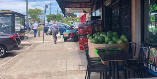
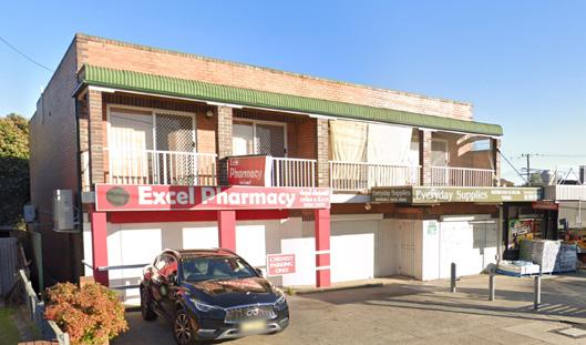
These shops benefit exposure to passing traffic and good public transport accessibility.
The built form of the shops reflects a low scale traditional retail and shop top housing format with wide footpaths. The buildings are generally aged and in moderate condition.
Excelsior Street is a collector road with a level of public domain enhancement and some intervention to improve pedestrian safety.
The community is characterised by younger, significantly below State average household income earners, and a high proportion of people from non-English speaking backgrounds.
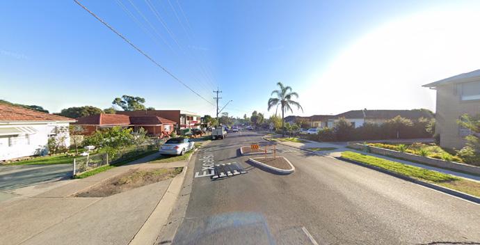
VISUAL ANALYSIS
Image capture: Guildford, New South Wales Google Street View Apr 2021 See more dates 187 Excelsior St
Figure 107 Aged built form (Source: Google Maps)
Figure 108 Wide footpaths in front of the shops with an absence of enhanced landscaping and quality furniture
Figure 109 Pedestrian refuge and speed bump - An absence of pedestrian crossing (Source: Google Maps)
LS23
4.0 LOCAL SHOPS TYPOLOGIES TYPOLOGY 4: CONVENIENCE BASED SHOPS 138 Cumberland Local Shops Study

Cumberland City Council 139 500m 0 250 100 Hope Park Harry Gapes Reserve Colquhoun Park 1 Constance Street Adam Street Eve Street Guildford Road Cleone Street Excelsior Street Excelsior Street Woodville Road Woodville Road Blaxcell Street LEGEND Existing E1 Zone 400m Walking Catchment 800m Walking Catchment Public Open Space Education 1 Garderie Early Learning Centre 2 Blaxcell Public School 3 Scibbles & Giggles Child Care Centre 4 Little School for Little Children 5 Dellwood Medical Centre 6 Merrylands East Presbyterian Church 7 St Paul & St Anthony Child Care Centre 8 Woodville Road Medical and Dental Centre 2 3 4 5 6 7 8 9 12 10 11 9 Granville South Public School 10 Ultrafade by Rich 11 Excelsior Family Medical Centre 12 Aldi Supermarket
Context
CUMBERLAND CITY COUNCIL 179
Figure 413 Local Shops Extent and
Map
Local
Extent and Context
Figure 110
Shops
Map
Urban Design Performance
Convenience based shops
EXISTING PLACE QUALITY AND STRATEGIC OPPORTUNITIES
EXISTING PLACE QUALITY AND STRATEGIC OPPORTUNITIES
Urban Design Element Challenges
Local context
• Low level of parks, educational and community facilities limits potential visitors
Economic vitality
• Shops are within the vicinity of some other Local Shops. 400m of LS24, 650m of Woodville Road Local Centre, 900m of LS4, 1 km of LS13 and 1.1 km of LS11
• Current provision of floorspace is generally in equilibrium with demand
Access and connectivity
• An absence of high quality active transport infrastructure such as bike lanes
• An absence of pedestrian crossing
Existing activity and street activation
• Shops do not have an active frontage.
Public realm quality
• An absence of enhanced landscaping and quality outdoor dining furniture
Building form and character
• Built form is aged, moderately maintained and does not contribute materially to a unique or high quality place character
• Inconsistent facade setback and presentation to the street
SCALE & CATCHMENT MARKET ANALYSIS LOCAL SHOP TYPOLOGY OWNERSHIP PATTERN COMMUNITY AND EMPLOYMENT ACTIVITY WITHIN CATCHMENT CRITICAL MASS ADDITIONAL SOURCE OF EXPENDITURE KEY ANCHORS CENTRE OFFER COMPETITION
LS23 174 - 178 Excelsior Street, Guildford
4.0 LOCAL SHOPS TYPOLOGIES TYPOLOGY 4: CONVENIENCE BASED SHOPS
140 Cumberland Local Shops Study
Future Opportunities
• Improve visibility of the shops and their character as an inviting place by architecturally expressing the corner at intersection
• Consider introducing services that are not provided by competitors
• Consider targeting personal service tenancies such as hairdresser
• Improve footpaths to the shops from the wider neighbourhood and major road network
• Add pedestrian crossing on Excelsior Street to improve pedestrian access to the shops
• Improve public transport infrastructure to support the local shops
• Investigate opportunities to facilitate renovation of shops, and replace current street furniture with wellmaintained options
• Single land ownership (6 lots out of 7) offer potential for mixed use redevelopment that maintains local shop activity
• Improve the quality of the public domain through street tree planting, enhancing landscaping as an integrated outcome within the potential of a mixed-use redevelopment
• Encourage amalgamation of lots and redevelopment for a quality mixed use redevelopment that contributes to better quality buildings and public realm character
ACCESSIBILITY PUBLIC REALM BUILT FORM CURRENT PERFORMANCE WALKING CATCHMENT STREET PATTERN PUBLIC TRANSPORT ACTIVE TRANSPORT INFRASTRUCTURE CAR PARKING STREETSCAPE QUALITY PEDESTRIAN PRIORITISATION AND SAFETY BUILDING TYPOLOGY RESIDENTIAL / MIXED USE QUALITY AND CHARACTER STREET ACTIVATION Cumberland City Council 141
Excelsior Street Shops (3)
271-277 Excelsior St, Guildford
The Excelsior Street Local Shops (3) comprises three businesses including a hairdresser, a pizza and manoush shop, and a grocery store.
With three shops in operation, it appears to trade at a lower level, servicing a predominantly low density residential catchment. These shops benefit from strong vehicular accessibility, exposure to passing traffic and good public transport accessibility.

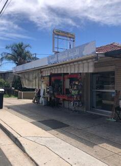
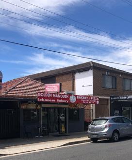
The built form of the shops reflects a low scale shop front and shop top housing format with low levels of footpath engagement and a partial awning along the street frontage. The buildings are generally aged and in moderate condition.
Excelsior Street is a collector road with no public domain or active transport enhancements. The community is characterised by younger, significantly below State average household income earners, and a high proportion of people from non-English speaking backgrounds.
Current provision for floorspace is in equilibrium with demand and redeveloping may not be feasible without residential component.
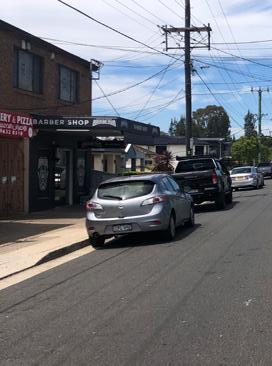
VISUAL ANALYSIS
Figure 111 Built form is aged and moderately maintained
Figure 112 Shops do not present highly active frontages
Figure 113 Poor condition of footpaths
LS24
4.0 LOCAL SHOPS TYPOLOGIES TYPOLOGY 4: CONVENIENCE BASED SHOPS 142 Cumberland Local Shops Study

Cumberland City Council 143 500m 0 250 100 LEGEND Existing E1 Zone 400m Walking Catchment 800m Walking Catchment Public Open Space Education 1 Garderie Early Learning Centre 2 Granville South Creative and Performing Arts High School 3 Rawson DMC Medical Centre 4 Blaxcell Street Public School 5 Scibbles & Giggles Child Care Centre 6 Little School for Little Children 7 Dellwood Medical Centre 8 M&E Equipment traders Urimbirra Park Hope Park Rawson Road Excelsior Street Rawson Road Excelsior Street Willoughby Street Caroline Street Guildford Road Guildford Road Woodville Road Woodville Road Fred Newby Reserve Victor Brazier Park Bright Park 1 2 3 4 5 6 7 8 9 Woodville Golf Course 10 11
and Context
9 Transdev NSW South Granville Bus
Dan
Kennards Self
CUMBERLAND CITY COUNCIL 187
Figure
436 Local Shops Extent
Map
Depot 10
Murphy’s Guildford 11
Storage Guildford
Figure 114 Local Shops Extent and Context Map
Urban Design Performance
EXISTING PLACE QUALITY AND STRATEGIC OPPORTUNITIES
EXISTING PLACE QUALITY AND STRATEGIC OPPORTUNITIES
Urban Design Element Challenges
Local context
• Shops are located within a residential environment and proximity to Granville South Creative and Performing Arts High School
Economic vitality
• Shops are within the vicinity of other local shops. 400m of LS23, 800m from LS11, 900m of the small scale neighbourhood centre along Chamberlin Rd and 1km of LS15
• Current provision of floorspace is generally in equilibrium with demand
Access and connectivity
• An absence of high quality active transport infrastructure such as bike lanes or wider shaded footpaths
Existing activity and street activation
• Shops do not have an active frontage
Public realm quality
• Narrow footpaths limit the level of footpath activation and prevents significant streetscape enhancements such as increased planting and street furniture
Building form and character
• Built form is aged and moderately maintained
SCALE & CATCHMENT MARKET ANALYSIS LOCAL SHOP TYPOLOGY OWNERSHIP PATTERN COMMUNITY AND EMPLOYMENT ACTIVITY WITHIN CATCHMENT CRITICAL MASS ADDITIONAL SOURCE OF EXPENDITURE KEY ANCHORS CENTRE OFFER COMPETITION
LS24 271-277 Excelsior Street, Guildford
Convenience based shops
4.0 LOCAL SHOPS TYPOLOGIES TYPOLOGY 4: CONVENIENCE BASED SHOPS
144 Cumberland Local Shops Study
Future Opportunities
• Improve the visibility of the shops and introduce urban design interventions and add wayfinding signage to attract more visitors
• Consider services offered by surrounding local shops to reduce risk of losing the market
• Any redevelopment should include residential components
• Improve footpaths along Excelsior Street to the shops from the wider neighbourhood and major road network
• Add a pedestrian crossing to improve pedestrian access and safety
• Reduce speed limit to encourage more pedestrian activity and improve pedestrian safety
• Improve public transport infrastructure to support the local shops
• Encourage an active frontage
• Investigate opportunities to achieve additional footpath space through footpath upgrades and redevelopment
• Improve visual quality through upgrade of built form and adding street furniture
• Investigate opportunities to deliver better quality buildings and public realm character through potential redevelopment
ACCESSIBILITY PUBLIC REALM BUILT FORM CURRENT PERFORMANCE WALKING CATCHMENT STREET PATTERN PUBLIC TRANSPORT ACTIVE TRANSPORT INFRASTRUCTURE CAR PARKING STREETSCAPE QUALITY PEDESTRIAN PRIORITISATION AND SAFETY BUILDING TYPOLOGY RESIDENTIAL / MIXED USE QUALITY AND CHARACTER STREET ACTIVATION Cumberland City Council 145
Secondary Commercial Centre
Secondary commercial centres are designed to provide affordable office space to small and growing businesses that may not be able to afford traditional commercial office space in prime locations.
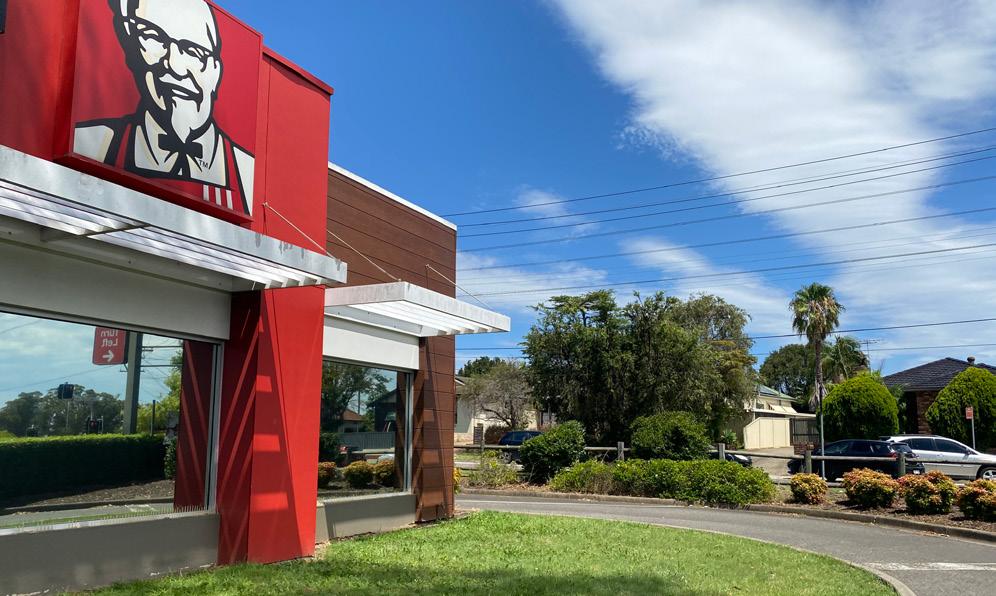
They are often located in areas that are easily accessible by public transportation and offer ample parking for tenants and visitors. In addition to providing office space, these centres may also offer other services such as administrative support, IT services, and mail handling.
Commercial centres for secondary office space provide an important opportunity for small and growing businesses to establish a professional presence and grow their operations. They also offer flexibility in terms of lease terms and space options, allowing businesses to adjust their office space as their needs change over time.
PLACE VISION STATEMENT
Secondary Commercial Centres are places designed for affordable office space for new and growing businesses
TYPOLOGY 5 146 Cumberland Local Shops Study
LS10: Prospect Road


© 14 10 Cumberland City Council 147
LS14: Clyde Street / Rawson Road
Prospect Road Shops
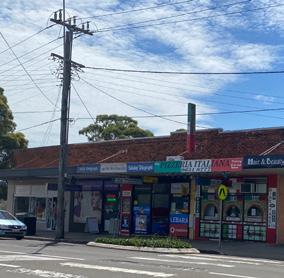
49 Old Prospect Rd, South Wentworthville
The Prospect Road Local Shops comprises more than ten businesses including a Chinese takeaway restaurant, a hairdresser, an Italian pizza shop, a news agency, a beauty and massage salon, a boutique, KFC, a food market, a medical centre, a hair salon and a physiotherapy clinic.
Being surrounded by major roads, the centre appears to trade adequately for most tenants and well for KFC.
These shops benefit from good vehicular accessibility and public transport accessibility.
The built form of the shops reflects a low scale retail along Old Prospect Road and modernised KFC franchised restaurant.
Western Motorway and Cumberland Road are high speed limit state roads challenging pedestrian safety. Old Prospect Road is a collector road with no public domain or active transport enhancements. The community is characterised by younger, below State average household income earners, and a high proportion of people from non-English speaking backgrounds.
VISUAL ANALYSIS
 Figure 115 Different architectural character of the built form (traditional retail vs KFC)
LS10
Figure 116 Challenging road environment and pedestrian safety issue along State Roads to the north and west of the local shops
4.0 LOCAL SHOPS TYPOLOGIES TYPOLOGY 5: SECONDARY COMMERCIAL CENTRE 148 Cumberland Local Shops Study
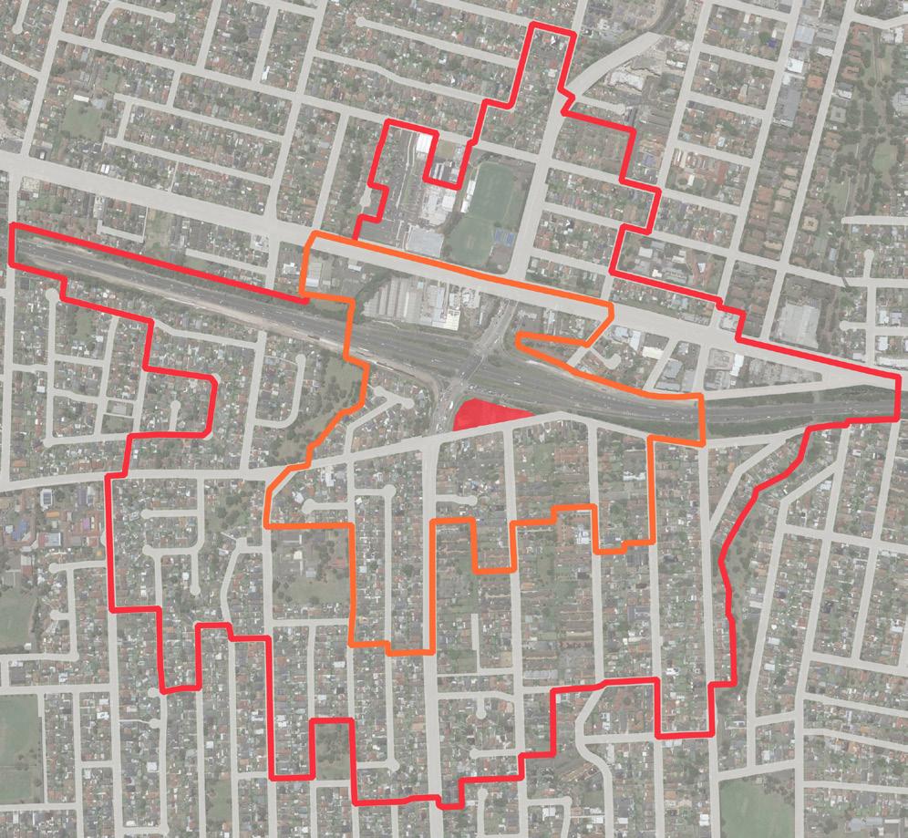
Cumberland City Council 149 500m 0 250 100 LEGEND Existing E1 Zone 400m Walking Catchment 800m Walking Catchment Public Open Space Education 1 Garfield Preschool & Oosh 2 Our Lady of Mount Carmel Catholic Church 3 Garfield Childcare Centre 4 McDonald’s Greystanes 5 Wenty Leagues 6 Monash Preschool 7 Wentworth Public School 8 Oporta Greystanes 9 Ibis Budget Hotel Wentworthville 10 Hungry Jack’s Burgers Wentworthville 11 Aldi 12 First Academy Preschool Childcare Centre 13 St Mary Kindergarten Long Day Care Centre 14 Ringrose Public School 15 Little Friends Early Learning South Wentworthville 16 Oasis Christian Community Centre M4WesternMotorway Great Western Highway Jersey RoadCumberland Highway Old Prospect Road Smith Street Centenary Road Ringrose Park Monty Bennett Oval Carolyn Street Park Hampden Road Reserve Monterey Street Park Mujar Reserve Lane Crescent Park 9 10 11 7 6 4 8 5 12 14 15 16 13 Wirralee Street Park 2 1 3
CUMBERLAND CITY COUNCIL 75
Figure 184 Local Shops Extent and Context Map
Figure 117 Local Shops Extent and Context Map
Urban Design Performance
EXISTING PLACE QUALITY AND STRATEGIC OPPORTUNITIES
EXISTING PLACE QUALITY AND STRATEGIC OPPORTUNITIES
Urban Design Element Challenges
Local context
• Busy and noisy roads require well-considered public realm improvements if growth as a mixed use precinct is anticipated
• Lack of residential context to the north, east and west limits potential pedestrian visitors, mainly relying on passing drivers.
Economic vitality
• Strong competition from other Local Shops (750m of Local Shops 5, 950m of Local Shops 19 and 1.1km of Local Shops 18 and 1.4km of Local Shops 5).
• There is an oversupply of floorspace provision
• Risk associated with securing commercial tenant in this location
Access and connectivity
• Role of M4 Western Motorway and Cumberland Highway as state roads, limits access and significant re-prioritisation for pedestrian space north of the Local Shops
• Lack of good pedestrian access between the two business formats (retail shops and KFC)
Existing activity and street activation
• E1 zoned properties are bounded by state roads on the north and west, limiting pedestrian access and activity along these boundaries
• No activation of the footpath with outdoor dining
Public realm quality
• State roads present a poor environment and safety issues for pedestrians and vibrant street life particularly north of the shops.
• Narrow footpaths along Old Prospect Road limit significant landscaping enhancement
Building form and character
• Incohesive built environment with different architectural characters (i.e. fast food shop, traditional retail format and shop top housing)
SCALE & CATCHMENT MARKET ANALYSIS LOCAL SHOP TYPOLOGY OWNERSHIP PATTERN COMMUNITY AND EMPLOYMENT ACTIVITY WITHIN CATCHMENT CRITICAL MASS ADDITIONAL SOURCE OF EXPENDITURE KEY ANCHORS CENTRE OFFER COMPETITION
LS10 49 Old Prospect Road, South Wentworth Secondary commercial centre
4.0 LOCAL SHOPS TYPOLOGIES TYPOLOGY 5: SECONDARY COMMERCIAL CENTRE
150 Cumberland Local Shops Study
Future Opportunities
• Any potential redevelopment requires a balanced service offering for both residents and passing drivers (e.g. fast food restaurants, pharmacy, etc.)
• Attract and capture the pass-by movement economy offered by State Roads
• Potential to target commercial based tenants and uses given its location and accessibility
• Improve connections to the shops from the wider neighbourhood
• Investigate opportunities to reduce speed limit to encourage more pedestrian activity and improve pedestrian safety and comfort at local shops
• Investigate opportunities to achieve additional footpath space and potential redevelopment for outdoor dining
• Improve the functional and visual quality of the streetscape as a coordinated outcome with future potential redevelopment
• Design the future streetscape to visually unify the wider local shopping area
• Deliver a coordinated streetscape and public domain plan incorporating additional street trees and planting, street furniture, lighting and consistent, high quality paving treatments
• Upgrade current built form to improve character and visual quality of the environment.
• Consider noise and visual barrier to Highway for future potential redevelopment
• Encourage amalgamation of lots to deliver a quality mixed use development that can contribute to better quality buildings and public realm character
ACCESSIBILITY PUBLIC REALM BUILT FORM CURRENT PERFORMANCE WALKING CATCHMENT STREET PATTERN PUBLIC TRANSPORT ACTIVE TRANSPORT INFRASTRUCTURE CAR PARKING STREETSCAPE QUALITY PEDESTRIAN PRIORITISATION AND SAFETY BUILDING TYPOLOGY RESIDENTIAL / MIXED USE QUALITY AND CHARACTER STREET ACTIVATION Cumberland City Council 151
Clyde Street / Rawson Road

359-365 Clyde St, South Granville
The Clyde Street Local Shops is comprised of an air conditioning repair service, an auto body shop, a car repair shop, an electronics store, a petrol station and its cafe, a bakery that seems to be closed, a window supplier, a kitchen remodelling factory, a fruit and vegetable wholesaler, and a tyre shop. It services an industrial catchment to the south and low density residential catchment to the north. These shops benefit from exposure to passing traffic.
The built form of the shops reflects large industrial buildings which are generally aged and not in a good condition.
Rawson Road - Clyde Street intersection is a car dominant environment with no public domain or active transport enhancement. The community is characterised by younger, significantly below State average household income earners, and a high proportion of people from non-English speaking backgrounds

Redevelopment may not be financially feasible for these shops.

Street View - Apr 2021 South Granville, New South Wales Google 21 Rawson Rd Granville, New South Wales Google Street View 2021 See more dates 35 Wellington Rd
Figure 119 Mixed use buildings east of the centre which can meet future demand for retail (Source: Google Maps)
LS14 152 Cumberland Local Shops Study 152 Cumberland Local Shops Study
4.0 LOCAL SHOPS TYPOLOGIES TYPOLOGY 5: SECONDARY COMMERCIAL CENTRE
VISUAL ANALYSIS
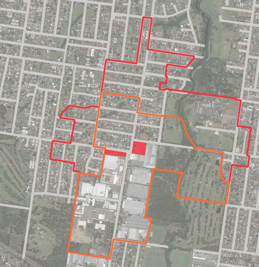
500m 0 250 100 LEGEND Existing E1 Zone 400m Walking Catchment 800m Walking Catchment Public Open Space Education
1
Masjid
Al Noor (Mosque)
2
Rawson Road Long Day Preschool 3
St
Paul & St Anthony Child Care Centre
4 Bioceram Dental Lab Pty
Wategora
5 Granville Youth Association - Clyde Centre 6 Blaxcell Street Public School 7
Rawson DMC 8 TAFE NSW Granville
Reserve
Progress
Auburn
Urimbirra Park Hope Park Campbell
Melita Stadium Rawson Road Wellington Road Clyde Street Ferndell Street Davidson Road Campbell Hill Road Guildford Road Duck River Blaxcell Street Duddley Road 1 2 4 5 5 6 7 11
263
and Context
9 Just
Preschool Child Care Centre 10 Transdev NSW - South
CUMBERLAND CITY COUNCIL 111 Cumberland City Council 153 120
and Context
Ray Marshall Reserve
Park Auburn Botanic Gardens
Fauna Reserve
Hill Pioneer Reserve
Figure
Local Shops Extent
Map
For Kids
Granville Bus Depot
Local Shops Extent
Map
Urban Design Performance
EXISTING PLACE QUALITY AND STRATEGIC OPPORTUNITIES
EXISTING PLACE QUALITY AND STRATEGIC OPPORTUNITIES
Urban Design Element Challenges
Local context
• Industrial development fronts detached residential housing and busy roads and requires well-considered development integration and public realm improvements if growth as a mixed use precinct is anticipated
Economic vitality
• Proposed uses within the mixed use development adjacent to existing site will largely meet future demand for retail
• There is a risk that redevelopment will not be financially feasible
Access and connectivity
• The role of Rawson Road and Clyde Street as regional roads limits significant reprioritisation of road space for on-street parking or pedestrian space
• An absence of high quality active transport infrastructure such as bike lanes or shared footpaths
Existing activity and street activation
• E1 zoned properties are separated by the road network
• There is a lack of street activation due to the industrial character of current buildings
Public realm quality
• Regional roads present a poor environment and safety issues for pedestrians and vibrant street life
• Narrow footpaths limit the levels of footpath activation and prevents significant streetscape enhancements and increased planting
Building form and character
• Light industrial built environment is generally in poor condition with some vacant lots within E1 zoned land
SCALE & CATCHMENT MARKET ANALYSIS LOCAL SHOP TYPOLOGY OWNERSHIP PATTERN COMMUNITY AND EMPLOYMENT ACTIVITY WITHIN CATCHMENT CRITICAL MASS ADDITIONAL SOURCE OF EXPENDITURE KEY ANCHORS CENTRE OFFER COMPETITION
LS14 Clyde Street & Rawson Road Service Centre Cluster Secondary commercial centre
4.0 LOCAL SHOPS TYPOLOGIES TYPOLOGY 5: SECONDARY COMMERCIAL CENTRE
154 Cumberland Local Shops Study
Future Opportunities
• Improve connection to regional employment and recreation destinations including Granville Industrial Estate, mosque (Masjid Al Noor), Ray Marshall Reserve, Wategora Reserve and Rosnay Golf Club
• Any potential redevelopment requires a balanced service offering to both residents and workers
• Potential to target commercial tenants and leverage from existing Business Park
• Attract and capture the pass-by movement economy offered by Rawson Road and Clyde Street
• Reduce traffic speeds and deliver streetscape improvements that increase pedestrian comfort and safety
• Leverage existing public transport connectivity with improved bus stop infrastructure
• Investigate dedicated bike lanes on Wellington Road
• Encourage redevelopment as a mixed use destination that will increase activity and support significant investment in improved streetscape function and quality
• Improve the functional and visual quality of the streetscape as a coordinated outcome with future potential mixed use development
• Design the future streetscape to visually unify the wider local shopping area
• Increase shade with additional street planting and awnings on all active street frontage
• Encourage amalgamation of lots to deliver a scale and quality of mixed use development that can contribute to better quality buildings and public realm character
ACCESSIBILITY PUBLIC REALM BUILT FORM CURRENT PERFORMANCE WALKING CATCHMENT STREET PATTERN PUBLIC TRANSPORT ACTIVE TRANSPORT INFRASTRUCTURE CAR PARKING STREETSCAPE QUALITY PEDESTRIAN PRIORITISATION AND SAFETY BUILDING TYPOLOGY RESIDENTIAL / MIXED USE QUALITY AND CHARACTER STREET ACTIVATION Unable to be established Cumberland City Council 155
Local Shops Opportunities for New Planning Controls
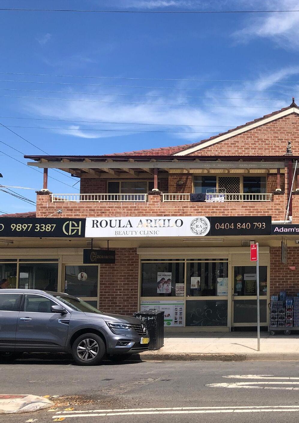
Introduction
Local Shops 1 - Burnett St, Merrylands
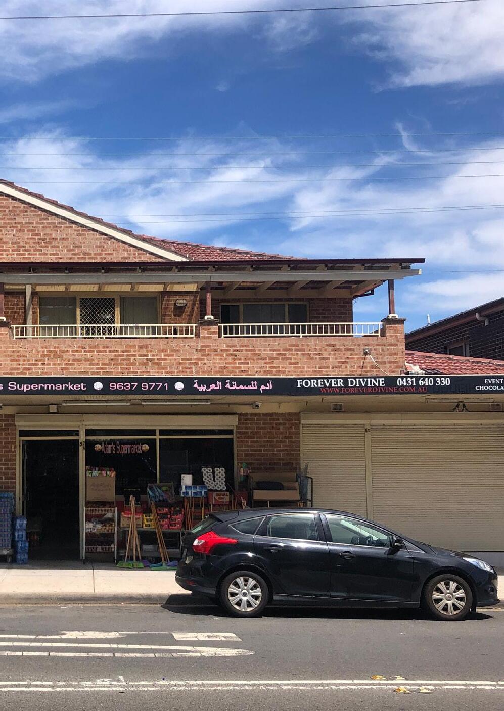
Local Shops 3 - 6 Louis St, Granville
SECTION 5
Introduction
Council has identified two local shops to undertake more detailed strategic planning to guide the potential future use and development of these places.
These priority local shops are:
• Local Shops 1 - Burnett Street, Merrylands
• Local Shops 3 - 6 Louis Street, Granville
These local shops have been selected as they align with previous Council resolutions and future strategic planning works in Merrylands and Granville. Three other local shops have also been identified as having potential for future detailed strategic planning, to be undertaken at a later stage. They are:
• Local Shops 4 - 12 Dellwood Street South Granville
• Local Shops 9 - 51 Coleman Street, Merrylands
• Local Shops 16 - 234-238 Cumberland Road, Auburn
The following pages provide an urban design framework for Burnett Street, Merrylands and 6 Louis Street, Granville, which identify:
• Key opportunities
• Vision statement
• Urban design responses
The urban design frameworks are an integral part of setting the direction for the future use and development of these local shops. They are principle based and provide sufficient detail to guide future development outcomes, without being unnecessarily prescriptive.

5.0 PRIORITY LOCAL SHOPS 158 Cumberland Local Shops Study
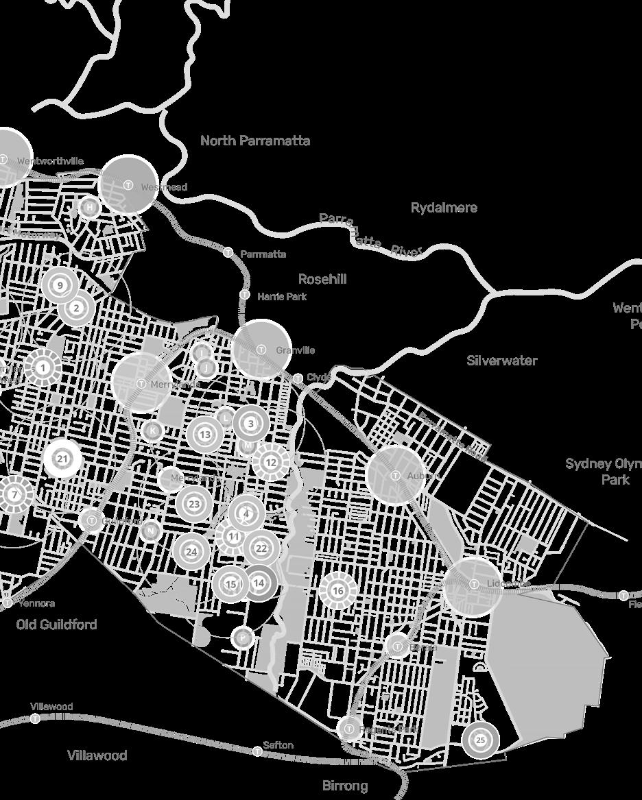
Cumberland City Council 159 1 3
Burnett St, Merrylands
The Burnett Street Local Shops are three sites clustered around the busy intersection of Burnett Street and Merrylands Road, both regional roads. The shop area comprises traditional retail/ commercial buildings, a service station, detached houses and vacant sites which together present an incohesive grouping of commercial activities in a visually low quality, car dominated streetscape. The community is characterised by younger, slightly below State average household income earners, and a high proportion of people from non-English speaking backgrounds. Its catchment is primarily low density housing with the regional attractor Merrylands Park directly adjacent and a wide range of local community and service uses nearby.
Key Opportunities
These local shops can play a much greater role in providing services and new housing options. Key opportunities include:
• Draw on the area’s high levels of accessibility and relationship with Merrylands Park to enhance the function and place quality of these shops
• Provide higher density living options through high quality mixed use buildings
• Elevate the pedestrian performance of the public domain and improve the streetscape’s visual qualities
• Improve active transport connectivity across the wider local shop catchment
• Deliver high levels of passive surveillance to the public domain through new mixed use development.
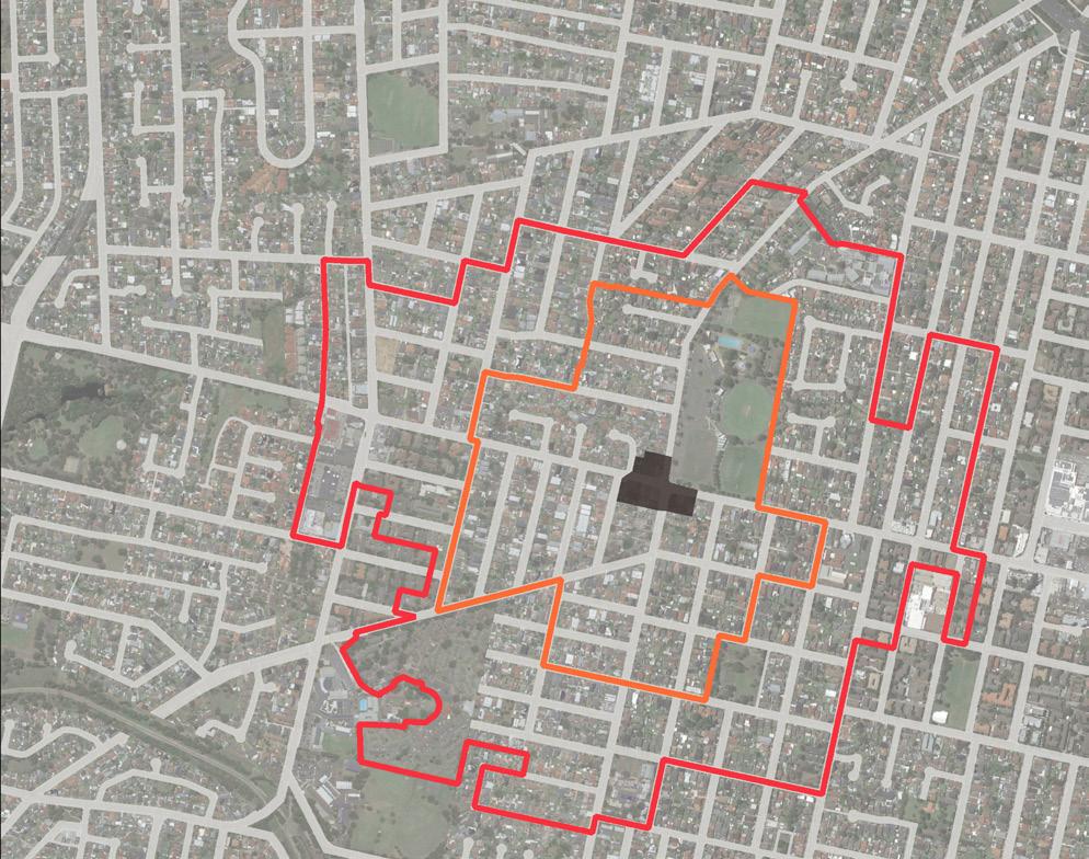
160 Cumberland Local Shops Study Merrylands Road Merrylands Road Burnett Street Fowler Road 3 4 5 6 7 9 8 11 12 10 1 2 Kenyons Road MERRYLANDS PARK LAWSON SQUARE PARK RUTH STREET PARK KING PARK 13 LEGEND Study Area 400m Walking Catchment 800m Walking Catchment Public Open Space Education 1 Quality Medical Practice 2 Merrylands Park Tennis Courts 3 Merrylands Swimming Centre 4 Merrylands Soccer Football Club 5 St Margaret Mary’s Church 6 St Margaret Mary’s Primary School 7 Fire and Rescue NSW Merrylands Fire Station 8 Platinum Hardware 9 Advanced Early Learning Child Care Centre 10 Whitey’s Workshop 11 3rd Merrylands Scout Hall 12 Merrylands Bowling Club 13 Cerdon College 500m 0 250 100
Figure 121 Burnett St Local Shops Extent and Context
LS1
SITE 1A
Merrylands Road
Merrylands Park
LEGEND
Local Shops Area Boundary
Existing E1 Zone
Existing R2 Zone
Existing R3 Zone
Existing Open Space
Building Envelope Area
Parking and Services
Potential Private Vehicle Access
Active Frontage
Landscaped Buffer to adjoining Properties
Streetscape Quality and Public Domain Enhancement
Expressed Architectural Corner
Existing Street Tree Bus Stop
SITE 1B
Signalised Intersection
Merrylands Road
Pedestrian Crossing (Existing)
SITE 1C
Pedestrian Crossing (Proposed)
URBAN DESIGN FRAMEWORK PLAN
Urban Design Responses
Urban Context and Role
• Encourage mixed use development that leverages the area’s high levels of recreation amenity and access to public transport
Encourage amalgamation of lots to deliver a greater building scale that supports more integrated and consistent design outcomes
Built Form
Deliver a maximum 5-storey mixed use building on Site 1A and Site 1B, and a maximum 4-storey mixed use building on Site 1C with highly activated retail-commercial street frontages and apartments on upper floors to ensure they are of a scale which appropriately transitions and complements surrounding residential areas
• Apply a minimum ground floor front setback to all streets of 2m to increase footpath space
Apply a minimum above ground floor front setback to all streets of 2m to reduce the impact of increased scale on the streetscape
Apply a minimum 9m rear setback to low
density residential to ensure solar access is maintained
• Provide a minimum 2m landscaped buffer area within the required separation area to adjoining existing low density residential housing
Locate car parking in a basement to maximise residential and commercial floorspace
Provide high quality, interesting architectural form and details that visually express street corners and access to upper floors, including splay corners
Provide a continuous awning along active street frontages
Provide a highly articulated facade to all streets with a maximum wall length of 40m along any plane
Public Domain
• Enhance the pedestrian comfort and safety through significant streetscape improvements including shade trees and ground level planting and, where appropriate, consistent footpath surface treatments
Visually screen all private car parking and service areas from the public domain
Ensure buildings overlook the streets and improve public domain lighting and surveillance
Movement and Access
• Prioritise pedestrian movements of streets in the vicinity of the local shops to support greater pedestrian and cyclist safety
Explore the opportunity to formalise and time-limit all on-street parking within the local shop area boundary
Improve the quality and safety of public transport infrastructure
Coordinate with Council’s Walking and Cycling Strategy to deliver dedicated cycleway access, where appropriate
Minimise vehicular access to Merrylands and Fowler Roads
• Explore through links between Fowler Road and Ruth Street
Community and Culture
Leverage the colocation of these shops with Merrylands Park by providing a variety of retail and commercial activities that directly support a range of sports and recreation visitors to the area
Co-location with a regional sports destination, good public transport access and potential for pass-by trade all support the Burnett Street local shops evolving as a vibrant place, providing a mix of retail, dining, community activities and urban living. New mixed use buildings will elevate the area’s overall urban quality and public domain performance as well as the visitor experience. Significant public domain interventions, focussing on greater prioritisation of people and an enhanced streetscape character, are a priority to unlock the broad urban renewal potential of these shops.
Cumberland City Council 161
Ruth Street Kiev Street
Burnett Street Fowler Road
50m 0 25 10
PLACE VISION STATEMENT
Louis Street
The Louis Street shops cluster comprises a Woolworths, BWS, a service station and strip retail facilities. This location has a good access to public transport, with sheltered bus stops, and is in proximity to Granville and Clyde Train Stations. It has a mix of community, education and recreation uses within its wider walking catchment such as churches, parks, and schools.
The community is characterised by younger, significantly below State average household income earners and a high proportion of people from non-English speaking backgrounds.
Key Opportunities
A key long term goal for Louis Street shops is to better integrate the full-line supermarket function into its local context. This will require redevelopment of the existing supermarket environment and integrated higher density residential uses to make an intervention of this scale commercially viable. Similarly, significant public domain enhancements will be needed to support the increased activity and access required.
Key opportunities include:
• Reimagine the supermarket as a coordinated mixed use precinct that improves integration with surrounding low density housing
Deliver new housing options as an integrated urban renewal outcome
• Re-imagine Blaxcell Street as an activated, pedestrianised environment
Improve active transport connectivity in the wider local shop area
• Deliver high levels of passive surveillance to the public domain through new development.
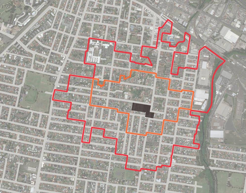
162 Cumberland Local Shops Study Charles Street Cella Street Clyde Train Station Louis Street Thomas Street Blaxcell Street RailwayLine Blaxcell Street DUCK RIVER NEW GLASGOW PARK FIFTH STREET RESERVE SCOUT MEMORIAL PARK GRANVILLE MEMORIAL PARK ELIZABETH STREET RESERVE ILLOURA RESERVE CORONATION PARK COLQUHOUN PARK DUCK RIVER RESERVE BANGOR PARK DAVE TRIBOLET OVAL HORLYCK RESERVE 4 5 10 11 12 14 20 15 16 17 18 19 6 8 9 7 1 2 3 T T 13 LEGEND Study Area 400m Walking Catchment 800m Walking Catchment Public Open Space Education T Train Station 1 William St Medical Centre 2 New Granville Medical & Dental Centre 3 The Granville Centre 4 Granville Swimming Centre 5 St Athanasius Ukrainian Orthodox Church 6 Granville Community Baptist 7 Gracepoint Presbyterian Church Granville 8 Granville Fijian Seventh-day Adventist Church 9 Korean Church of Christ 10 One Family Church 11 Holy Family Church 12 Tokaikolo Christian Church 13 Merrylands East Presbyterian Church 14 Holy Family Primary School 15 Granville East Public School 16 Granville Public School 17 MAX POS Hardware Store 18 Speedy Auto Centre Car Repair 19 1st Granville Scout Group 20 Australian Blouza Association 500m 0 250 100
Figure 122 Louis Street Local Shops Extent and Context
LS3
Granville Train Station
Landscaped Buffer to adjoining Properties
Streetscape
URBAN DESIGN FRAMEWORK PLAN
Urban Design Responses
Urban Context and Role
Encourage the redevelopment of the supermarket as a high quality mixed use precinct protecting the supermarket function and highly integrating with its surrounds
• Encourage amalgamation of lots within nominated redevelopment sites
Built Form
• Deliver a maximum 4-storey mixed use and residential buildings along the Blaxcell Street frontage.
• Deliver a maximum 7-storey mixed use and residential buildings along Louis Street.
• Deliver active frontages to Blaxcell Street and Louis Street.
Locate car parking in a basement to maximise residential and retail/commercial floorspace
High quality, visually interesting architectural forms and details are required that visually express intersection corners and access to upper floors
• Provide a highly articulated facade to all streets with a maximum wall length of 40m along any plane
• Provide a minimum 2m landscaped buffer area within the required separation area to adjoining existing low density residential housing
• Apply a minimum above ground floor front setback to all streets of 2m to reduce the impact of increased scale on the streetscape Apply a minimum 9m rear setback to low density residential to ensure solar access is maintained
Public Domain
• Within the local shop area, deliver a coordinated streetscape and public domain plan incorporating additional street trees and planting, street furniture, lighting and consistent, high quality paving treatments
• Visually screen all private car parking and service areas in the lane from the public domain
Explore the potential of providing a future civic space located in co-ordination with the functional layout of the supermarket and mixed use development.
Movement and Access
• Prioritise pedestrian movements of streets in the vicinity of the local shops to support greater pedestrian and cyclist safety
• Explore the opportunity to formalise and timelimit all on-street parking within the local shop area boundary
PLACE VISION STATEMENT
Louis Street local shops will redevelop as a mixed use precinct that sensitively integrates the higher-order retail functions into a local shop context. New high density living will sleeve the supermarket and engage with the surrounding streets and neighbouring houses.
A new urban plaza will express the supermarket entry, and together with significant enhancements to the public domain along Blaxcell Street. This area will be transformed as a vibrant and people-focussed destination.
Cumberland City Council 163 Charles Street Fifth Street Celia Street Louis Street Thomas Street Blaxcell Street The Trongate O’Neil Street Gregory Street 100m 0 50 20 carBasementparking access carBasementparking access
LEGEND Local Shops Area Boundary
Existing E1 Zone
Existing R2 Zone
Existing R3 Zone
Existing Open Space
Existing Building Building Envelope Area
Parking and Services
Potential Private Vehicle Access Council Nominated Bike Lane
Potential Dedicated Bike Lane Active Frontage
Quality and Public Domain Enhancement
Expressed Architectural Corner
Existing Street Tree Bus Stop
Pedestrian Crossing (Existing) Pedestrian Crossing (Proposed)


 LS1 - Burnett Street Shops
LS7 - Fowler Road Shops
LS17 - Bathurst Street Shops
LS19 - Maple Street Shops


 Figure 16 Shops fronting Fowler Road are traditional 1-2 storey high street format built form with tenants
Figure 17 Existing activity and frontages - looking west from Merrylands Road
Figure 18 Narrow footpaths with verge along Fowler Road - looking south
Figure 19 An absence of streetscape enhancements
Figure 20 Low density residential along Merrylands Road - looking east from Merrylands Road


 Figure 22 Traditional 1-2 storey high street format built form delivers a good local shopping experience
Figure 23 The Guildford Road- Fowler Road roundabout intersection is a car dominated environment with poor pedestrian functionality
Figure 24 Narrow footpaths with no outdoor dining/ seating or streetscape embellishments


 LS4: Burnett Street
LS5: Irrigation Road


 Figure 47 Local shops view from the south on Dellwood Street
Figure 48 Generous footpaths, landscaping and public facilities
Figure 49 Medium density apartments apposite Dellwood Street


 Figure 88 Car dominant environment (Source: Google Maps)


 Figure 90 Absence of street activity given current businesses in operation
Figure 91 Absence of outdoor dining opportunities
Figure 92 An absence of an active frontage to the park


 Figure 97 Safety guardrails at the corner detract from streetscape
Figure 98 Lack of Landscaping along wide Footpaths
Figure 99 Some outdoor dining facilities
Figure 100 Holroyd Private Hospital located opposite the local shops (Source: Google Maps)


 Figure 103
295 Clyde St
South Granville, New South Wales Google Street View
Apr 2021 See more dates
293 Clyde St
Figure 105 Northern Cyprus Turkish Association of NSW (Source: Google Maps)


 Figure 115 Different architectural character of the built form (traditional retail vs KFC)


