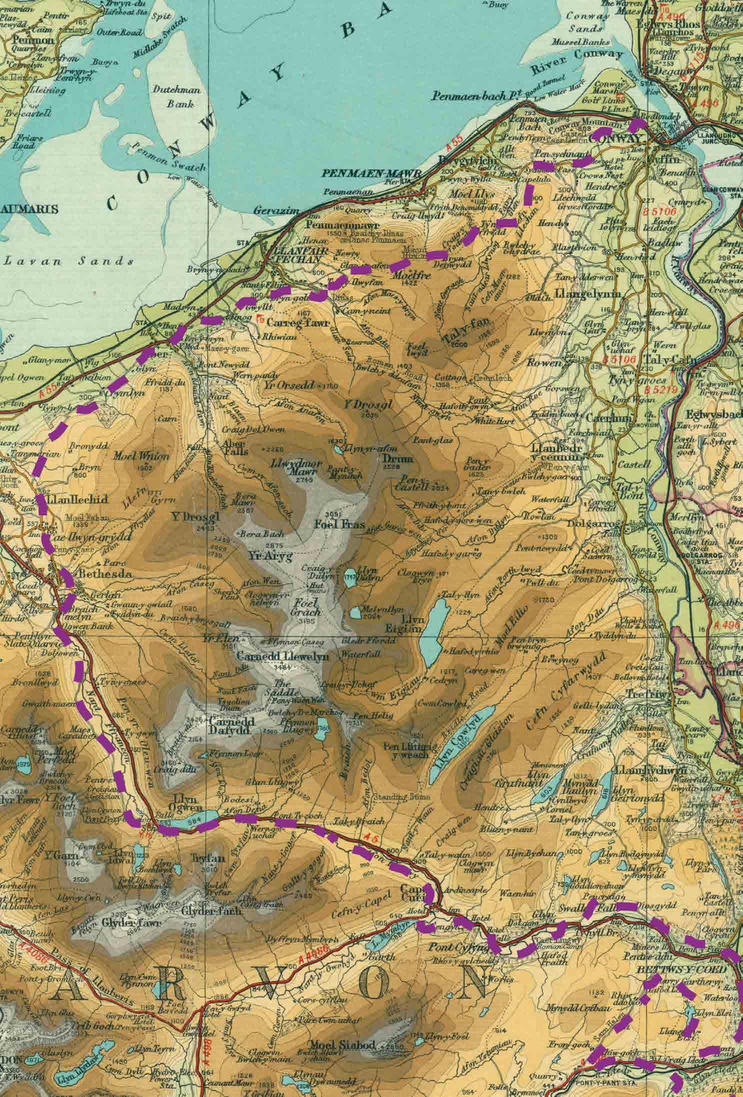
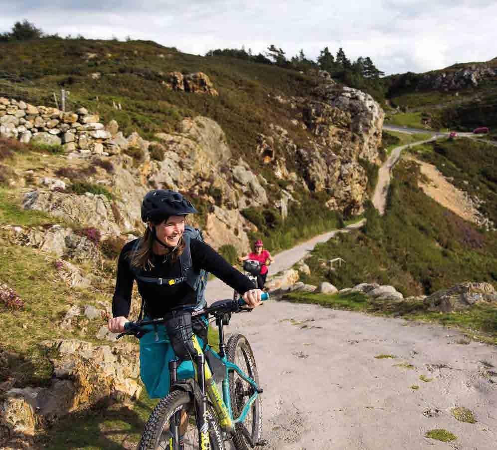
Traws Eryri
A 200km off-road adventure across the stunning landscapes of North Wales
 Guy Kesteven
First published in the United Kingdom in 2023 by Cycling UK, Parklands, Railton Rd, Guildford GU2 9JX
Traws Eryri: A 200km off-road adventure across the stunning landscapes of North Wales © 2023 Cycling UK
Text © 2023 Cycling UK
Photographs for full list of copyright see p.73
Route researched and designed by Kieran Foster and Andy Braund
Route guide written by Guy Kesteven
Edited by Sophie Gordon and Rob Kingston
Design by Roger Morgan www.morgan-creative.co.uk
Maps produced by Kieran Foster and Sophie Gordon
Map data by Ordnance Survey © Crown copyright 2022 OS 100045061
The Traws Eryri route has been developed by Cycling UK thanks to funding from Natural Resources Wales
With thanks to:
Andy Braund and the team at National Resources Wales for collaboration and advice for the route
Connaire Cann and Shaun Denny for assistance with contacting landowners
The Woodland Trust, National Trust and individual landowners for collaboration with permissive access sections
A word from Guy Kesteven
This guidebook is dedicated to my recently departed mum Margaret Kesteven. An indomitable cyclist who was fiercely proud of her Welsh ancestry and spent her youth riding round the tracks and peaks of North and Mid Wales when metalled roads were still few and far between and whose stories inspired me to do what I do now.
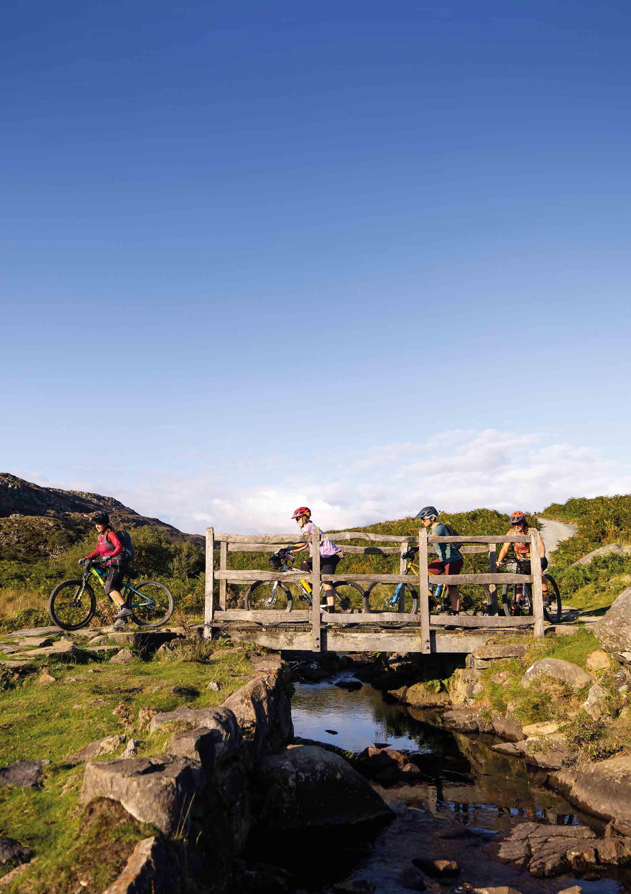
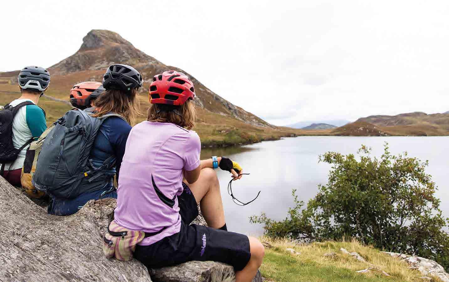
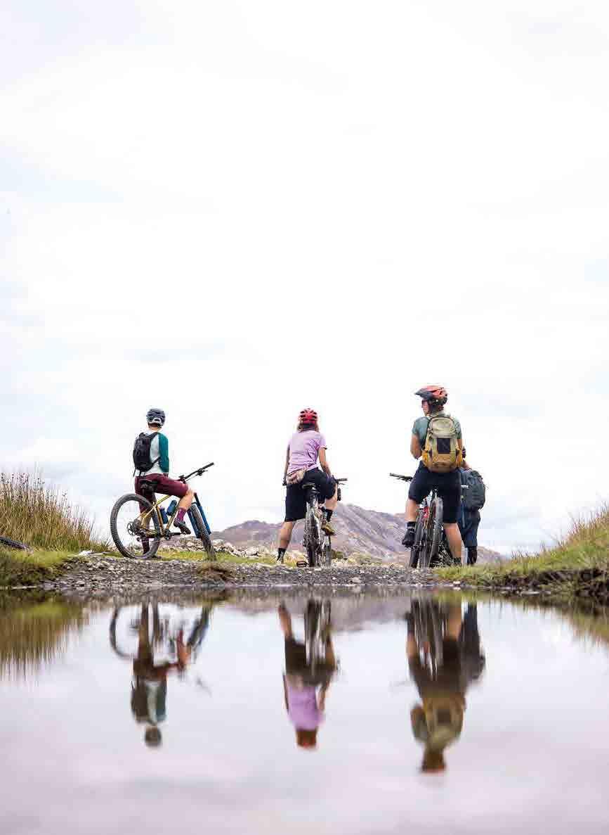
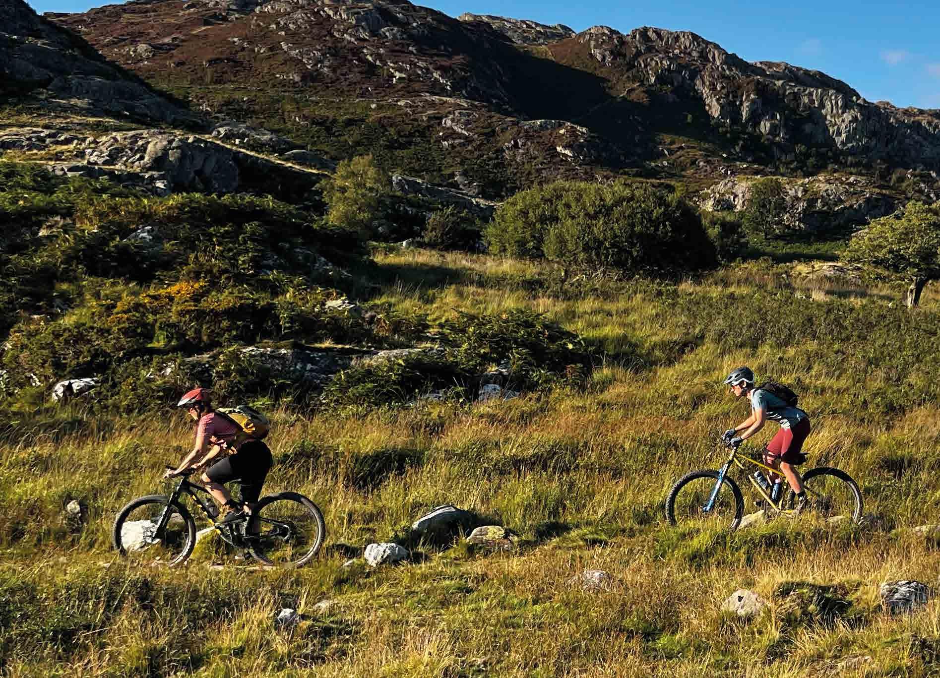
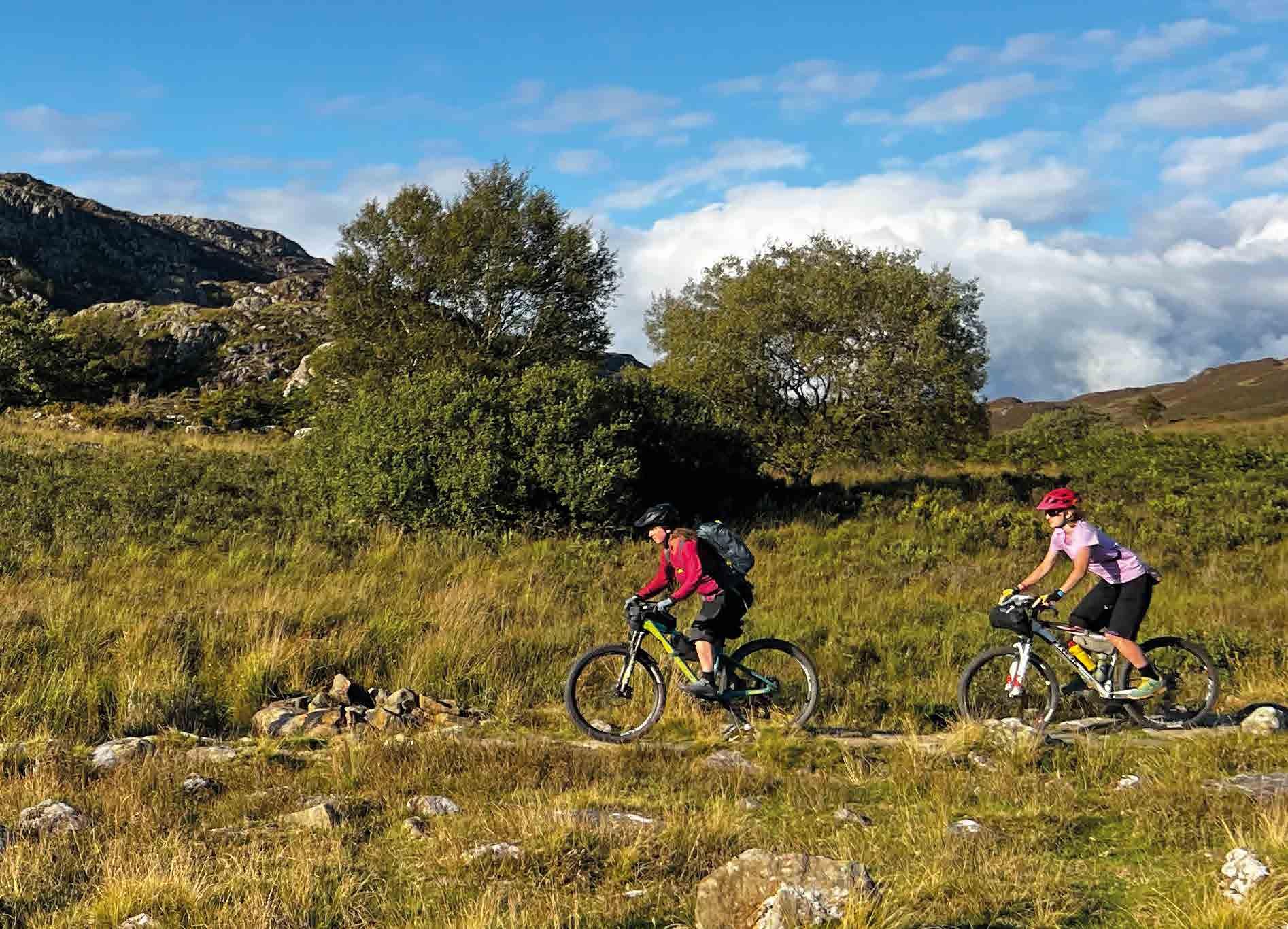
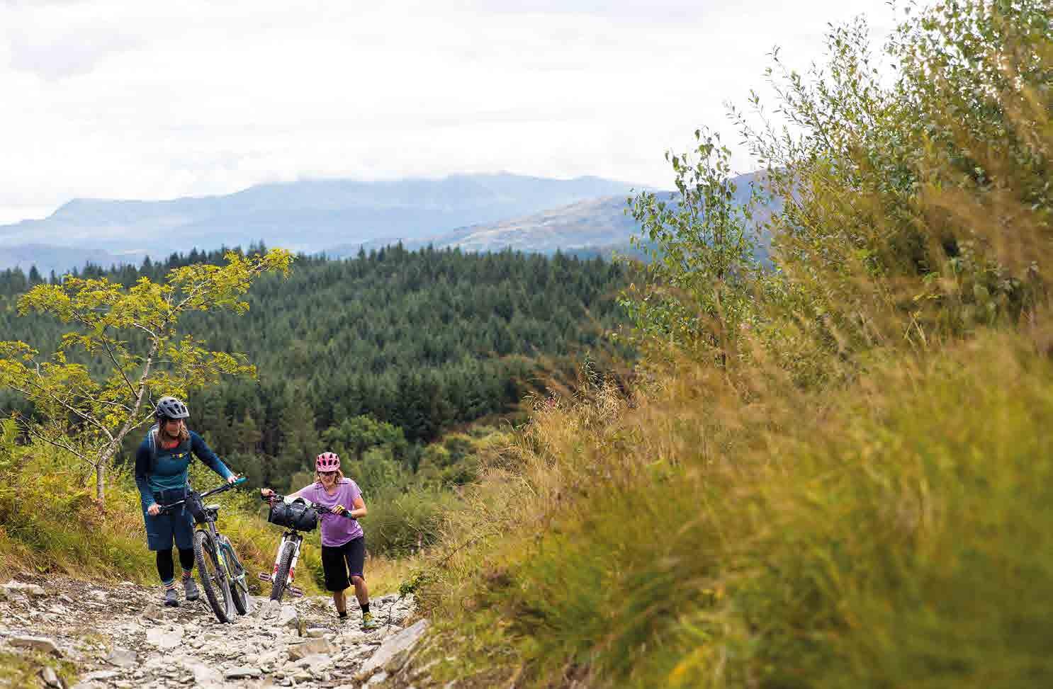
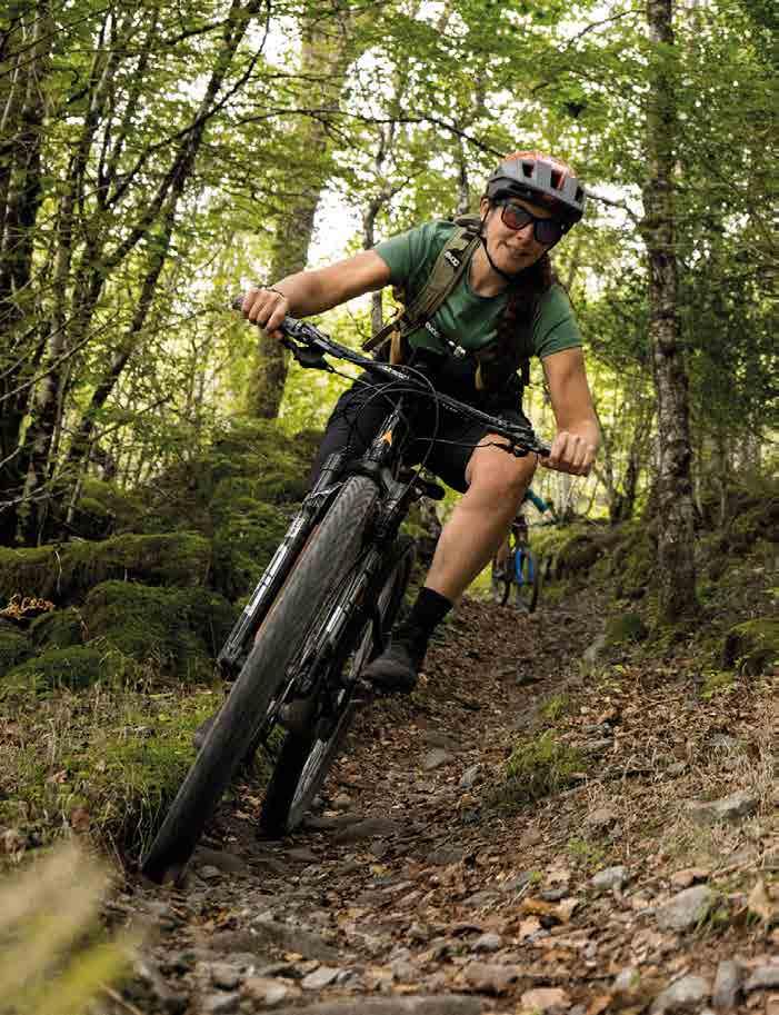
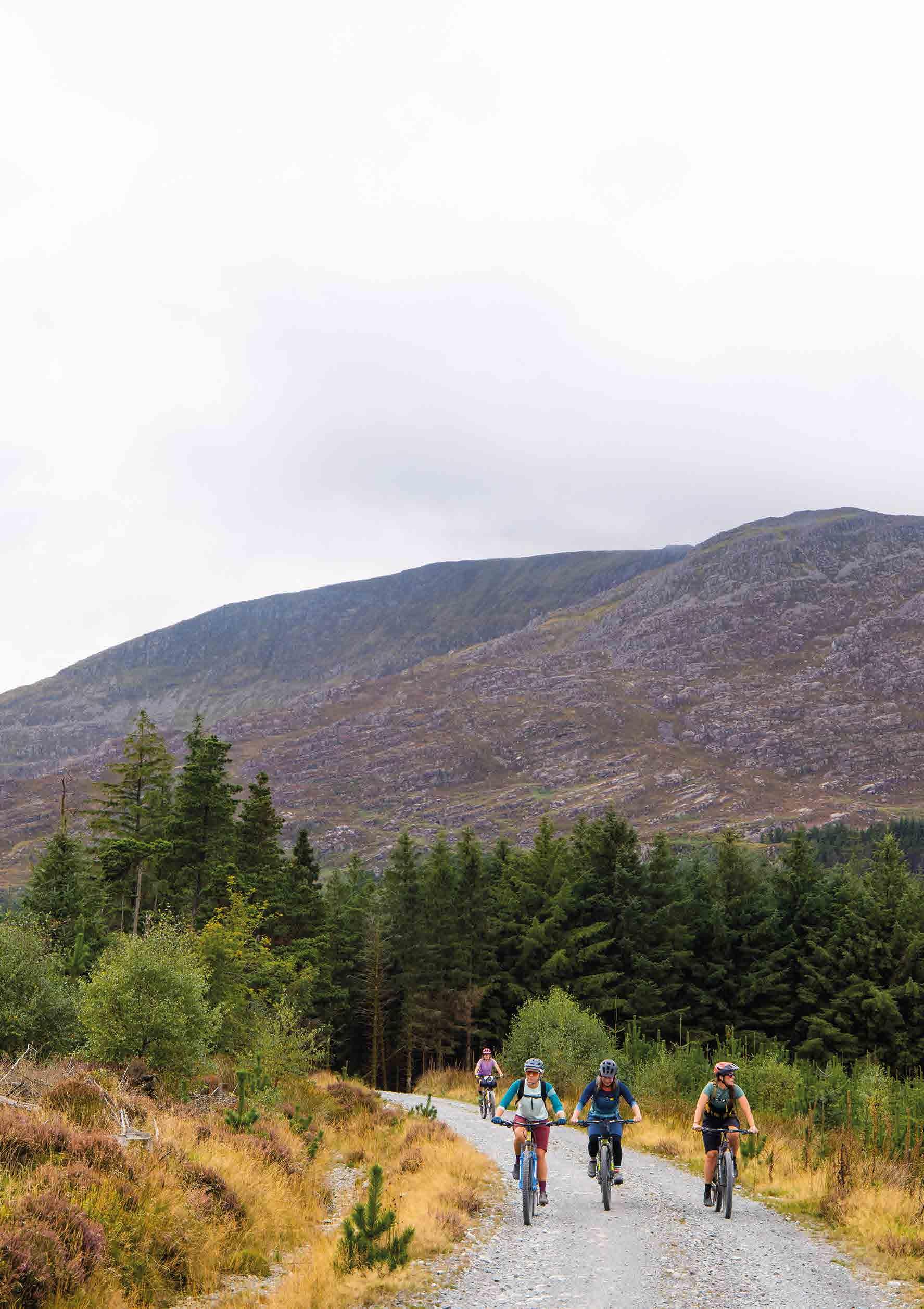
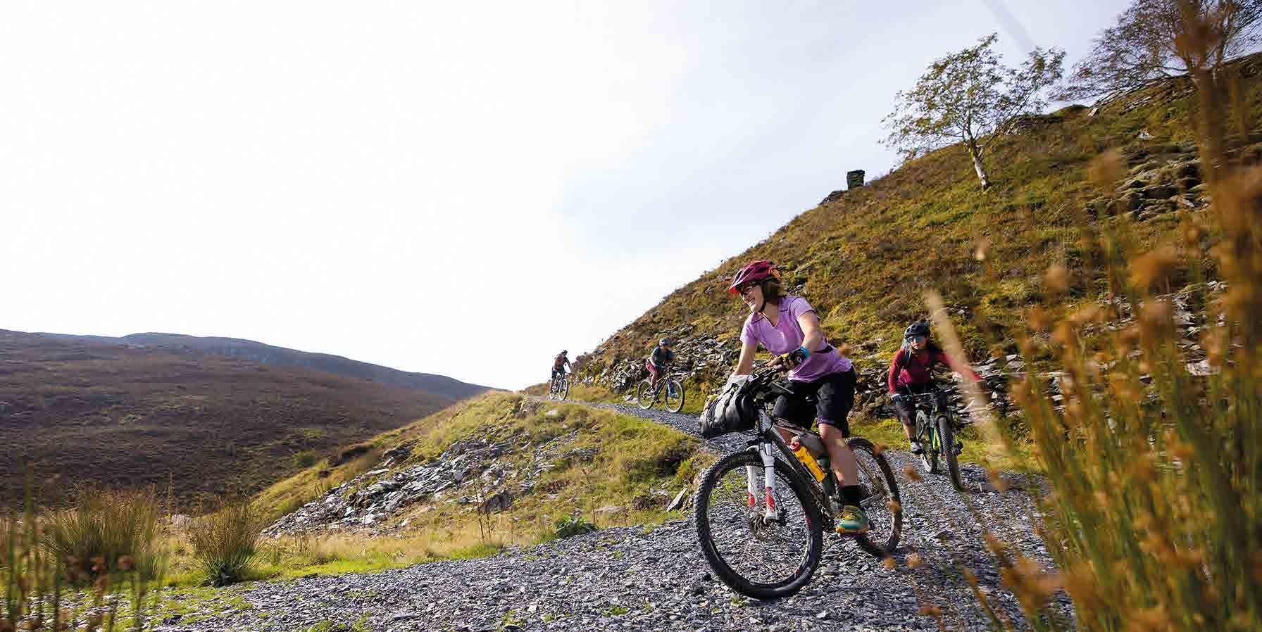
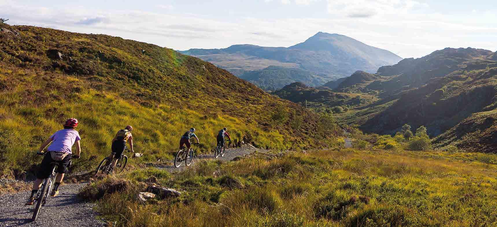
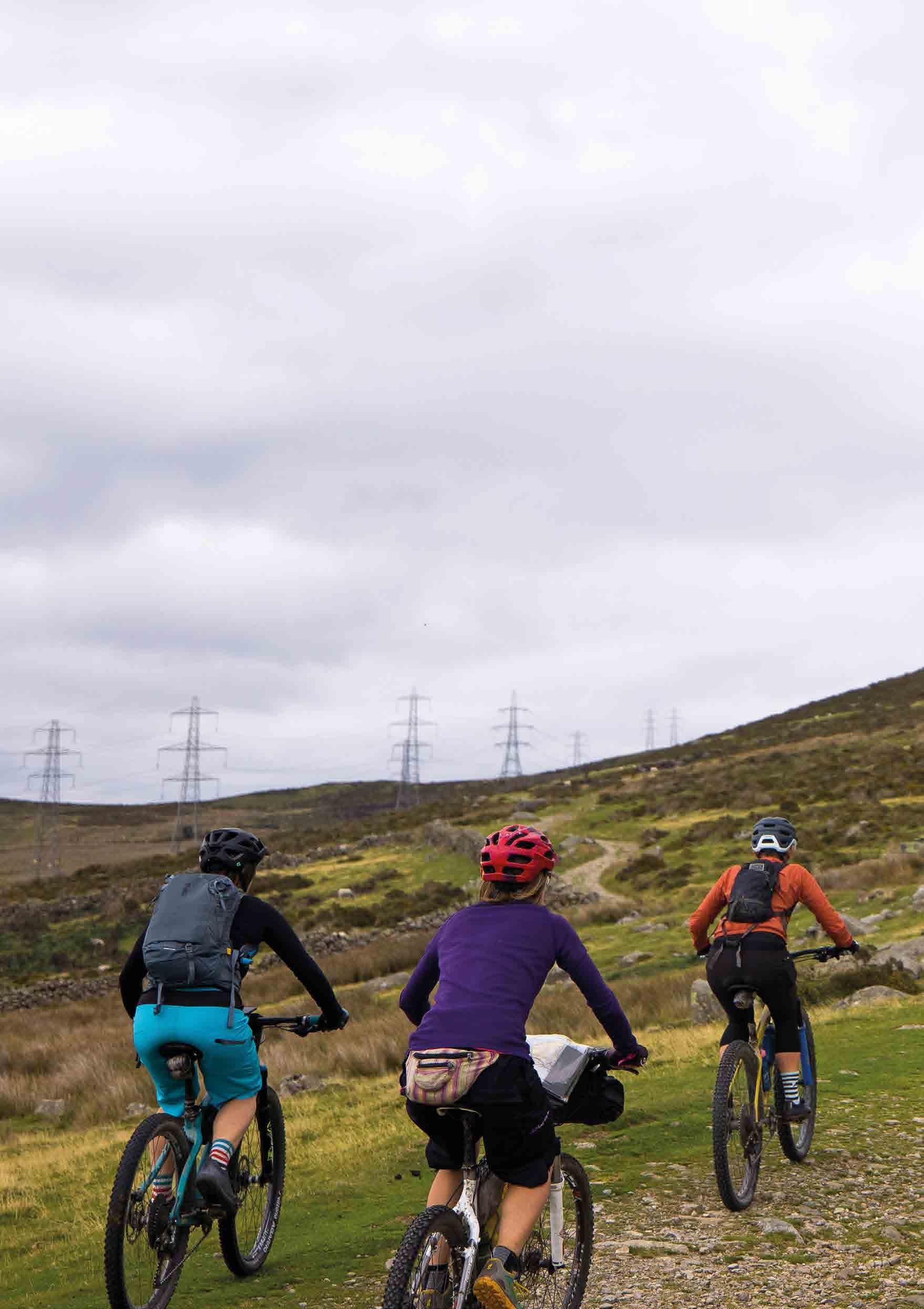
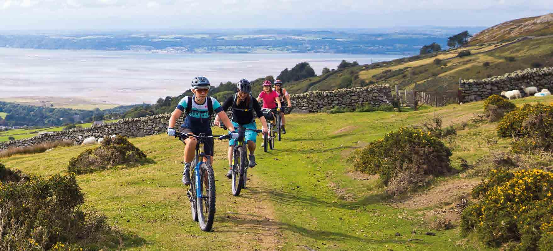
From enticing lost lanes meandering through valleys to forest tracks or moorland trails climbing up to misty mountains, the fantastic landscapes of North Wales are just begging to be explored by bike.
Cycling UK has worked with Natural Resources Wales to create an off-road adventure route which links up some of the best riding in Eryri. Beyond the busy summit of Yr Wyddfa (Snowdon), you’ll find miles of tracks and trails delving deep into forests and winding around dramatic mountain tops.
With over 4,000m of climbing, this route is not for the faint-hearted – but if you’re willing to take on the challenge, the rewards are immense. You’ll be treated to thrilling descents with views stretching for miles, and a sense of isolation only interrupted by the warm hospitality of the villages you pass through.
Riding off-road is good for the soul, and it’s good news for rural businesses too: pedalling visitors bring in £520m a year across the UK.
Cycling UK has long been at the forefront of increasing off-road access for cycling – from gaining the right to cycle on bridleways in 1968 to successfully campaigning for a right of responsible access in Scotland in 2003. Alongside this, we’ve been developing long-distance off-road routes in England and Scotland to inspire more people to explore the outdoors. We are excited to bring you our first route in Wales.
By buying this guidebook or joining Cycling UK you help us to continue this work. We hope you enjoy exploring the Traws Eryri route.
Sarah Mitchell Chief executive of Cycling UK

3
Welcome
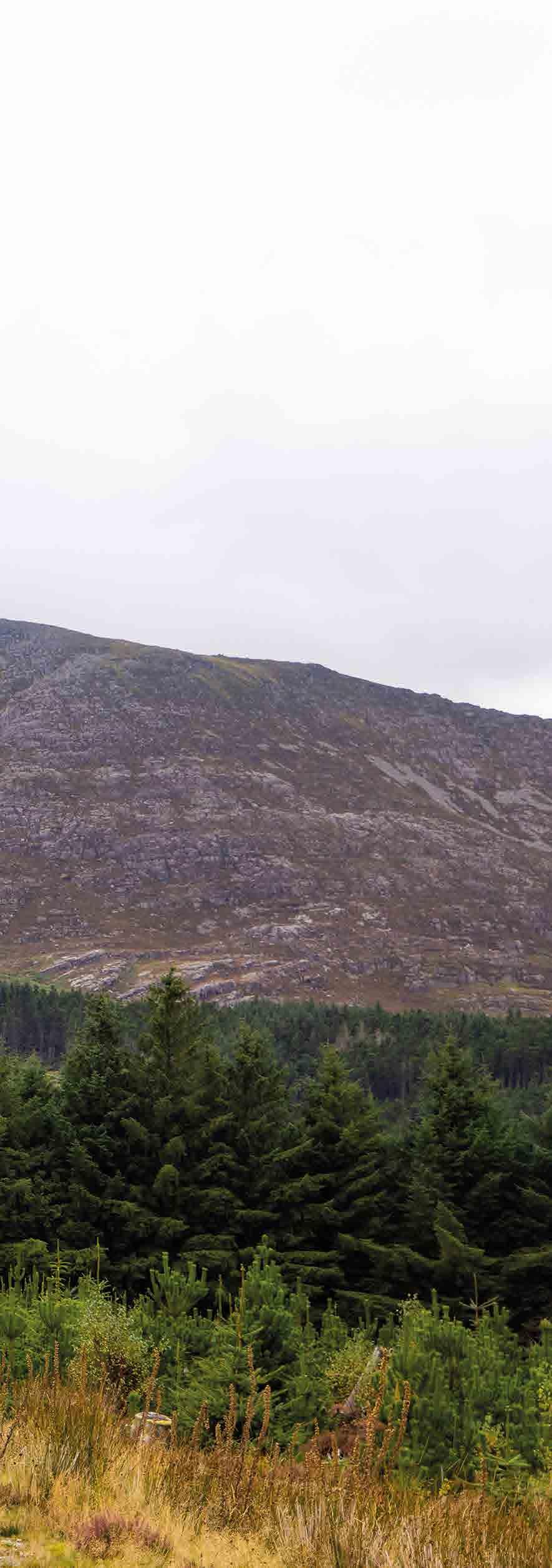
Eryri became the third UK National Park in 1951 and covers more than 2,000 square km. The dramatic landscape is glacially carved, forming broad estuary valleys leading to the coast, flanked by ranks of steep, rocky hills and mountains.
4 Cycling UK
5 Contents How your support helps ..................................................... 6 Route overview.......................................................................... 8 Introduction ................................................................................ 10 Part 1: Machynlleth to Penmaenpool ..................... .. 18 Part 2: Penmaenpool to Trawsfynydd ....................... 28 Part 3: Trawsfynydd to Betws-y-Coed ....................... 36 Part 4: Betws-y-Coed to Conwy ..................................... 44 Places and facilities ........................................................... 58 Suggested itineraries ....................................................... 60 Image credits ......................................................................... 61 Afterword ...................................................................................... 62 About the author ...................................................................... 63
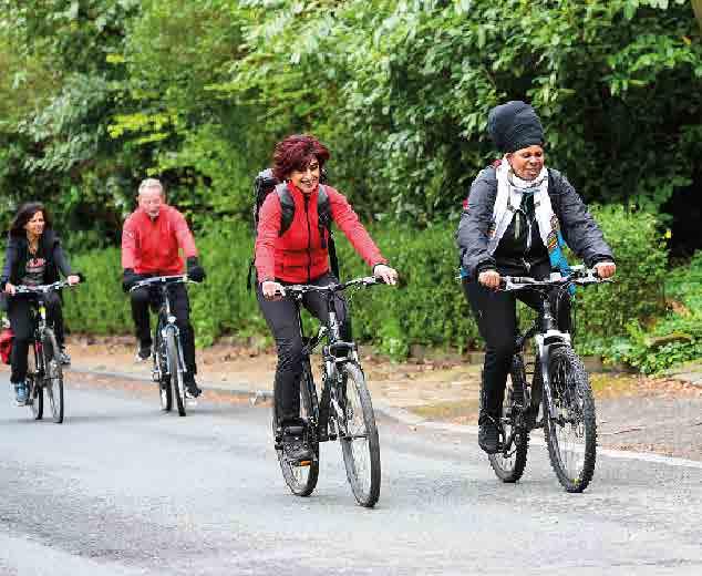
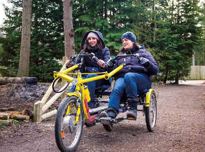
Your support enables us to open up more traffic-free trails

Imagine being able to cycle the length and breadth of the country on connected off-road trails, through fascinating places and amazing landscapes.
Recent years have seen many of us discover the simple joy of exploring the countryside by bike, and the sense of escape that can be found within the confines of our islands. Our vision is to make this adventure and connection to nature accessible to all.
As the UK’s cycling charity, Cycling UK is working to make this a reality by campaigning for wider off-road access for cycling and developing new longdistance trails to link existing routes. But this work is only made possible by our members and donors.
If you want to support wider access to the outdoors and the creation of more long-distance trails, join Cycling UK today and help more people discover the joy of off-road riding.
By joining Cycling UK, you will enable us to bring about real change, while benefiting from our fantastic membership package, including insurance, retailer discounts and much more.
cyclinguk.org/join
Cycling UK 6
Help us open up the countryside by joining our 70,000 strong membership today, and together, we’ll make a better world by bike.
We are the UK’s cycling charity
Cycling is amazing, which is why we want everyone to enjoy the thrill of the ride. We’re making positive changes for cycling across the UK, from the corridors of power to the wildest upland moors. We’re making our streets safer, opening up new traffic-free routes and inspiring more people to get on their bikes. Free
Becoming a member is just one way you can help us achieve our vision, plus you’ll receive:
Free subscription to Cycle magazine every two months for inspiring routes, advice, news and reviews
cyclinguk.org/join
If membership isn’t for you, please consider a donation to help Cycling UK to continue our work in opening up more rural access for cycling and campaigning for improving conditions for those who cycle all over the UK.
cyclinguk.org/donate
7 How your support helps
third-party liability insurance and legal assistance on and off-road
cycle insurance
Discount on
(includes mountain bikes and e-bikes) with Yellow Jersey
Retailer discounts and benefits
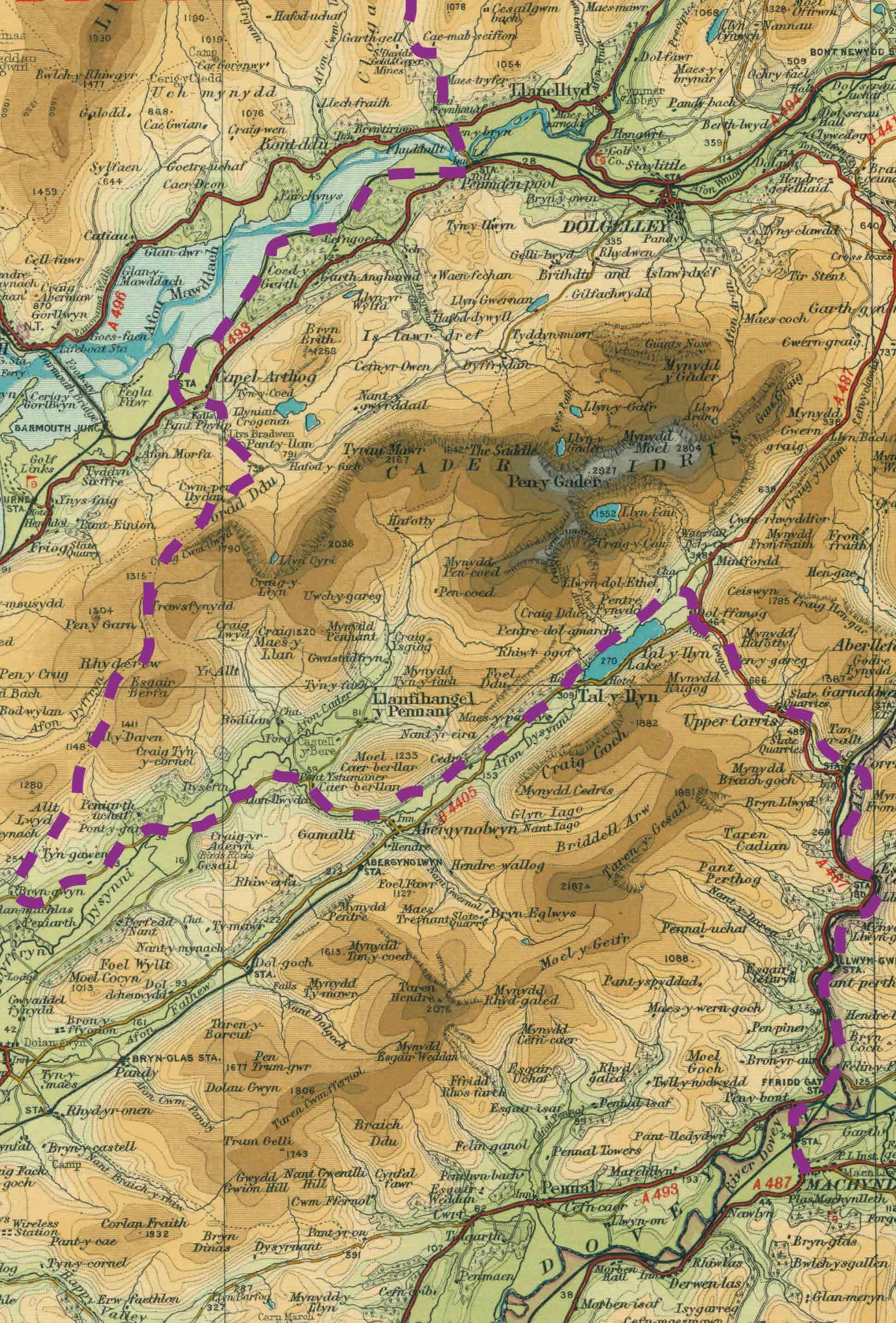
Route overview
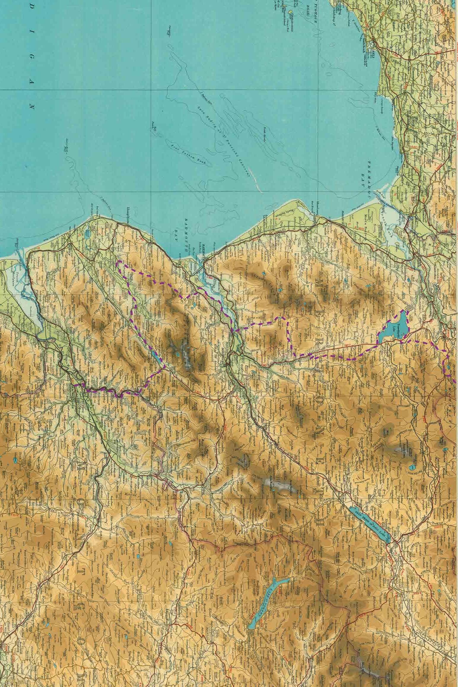
8 Machynlleth Penmaenpool Trawsfynydd
Betws-y-Coed
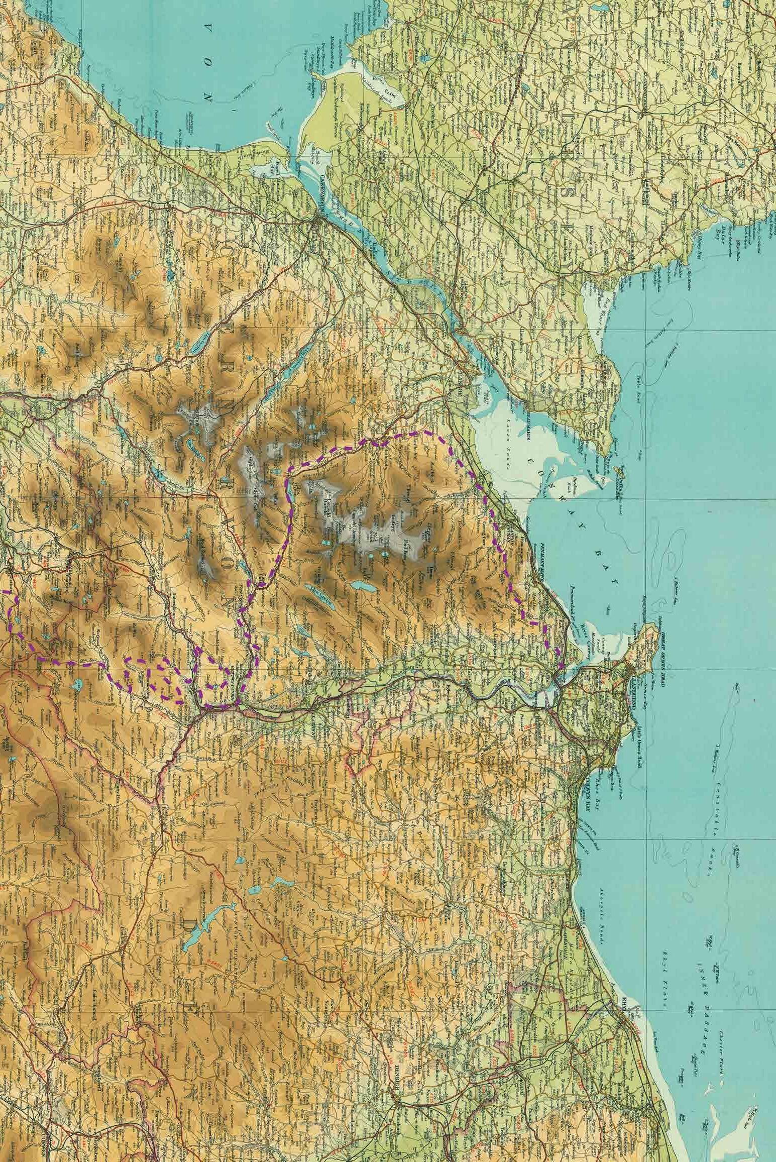
9 Conwy
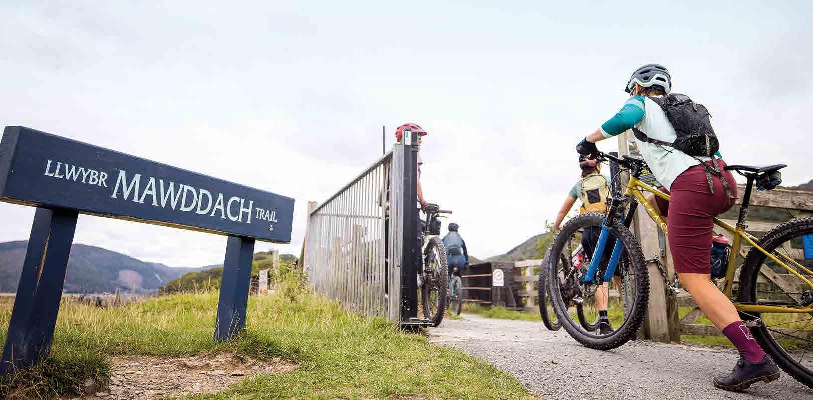
Traws Eryri
Explore the enthralling history, wild mystery and stunning mountain landscapes of Eryri on this challenging 200km adventure across North Wales.
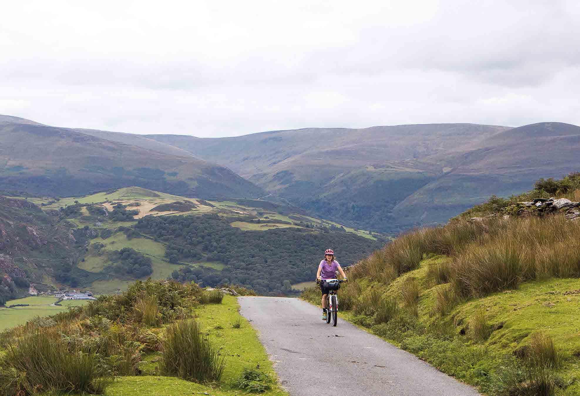
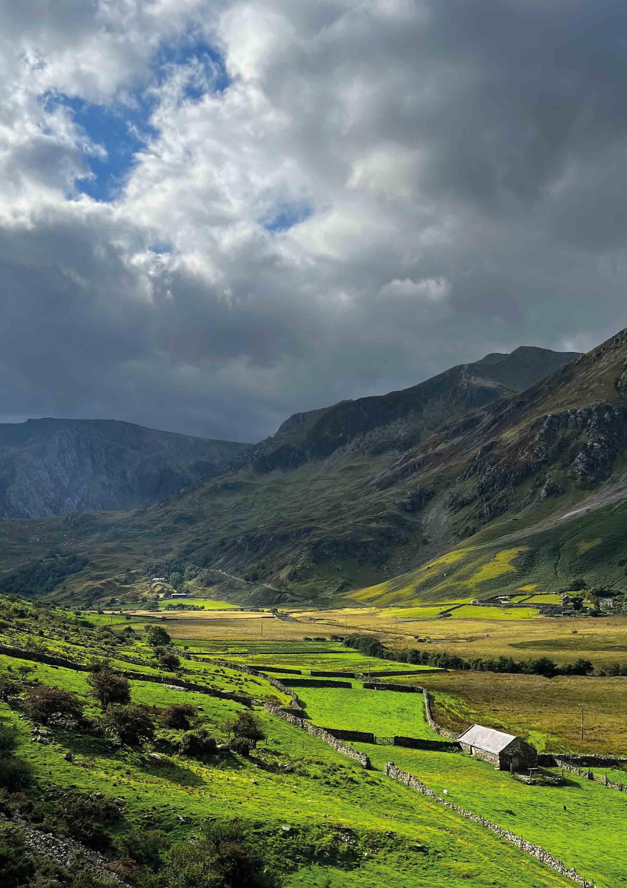
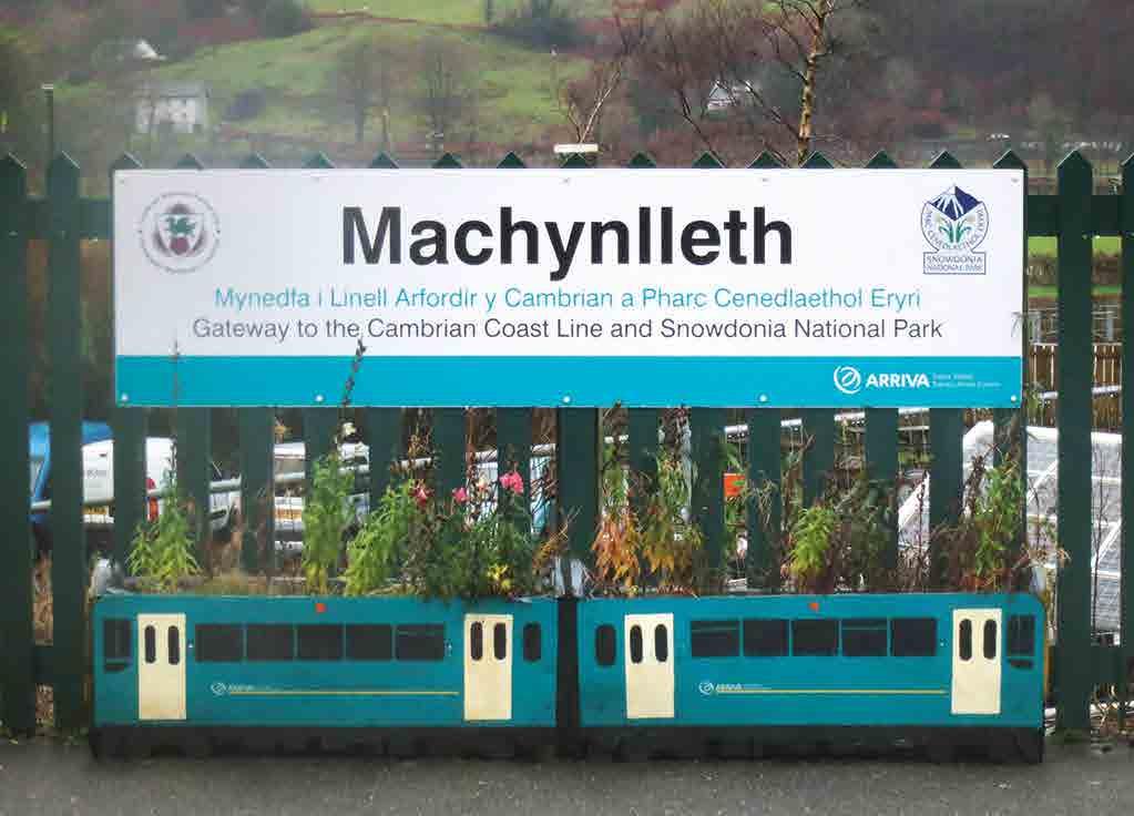
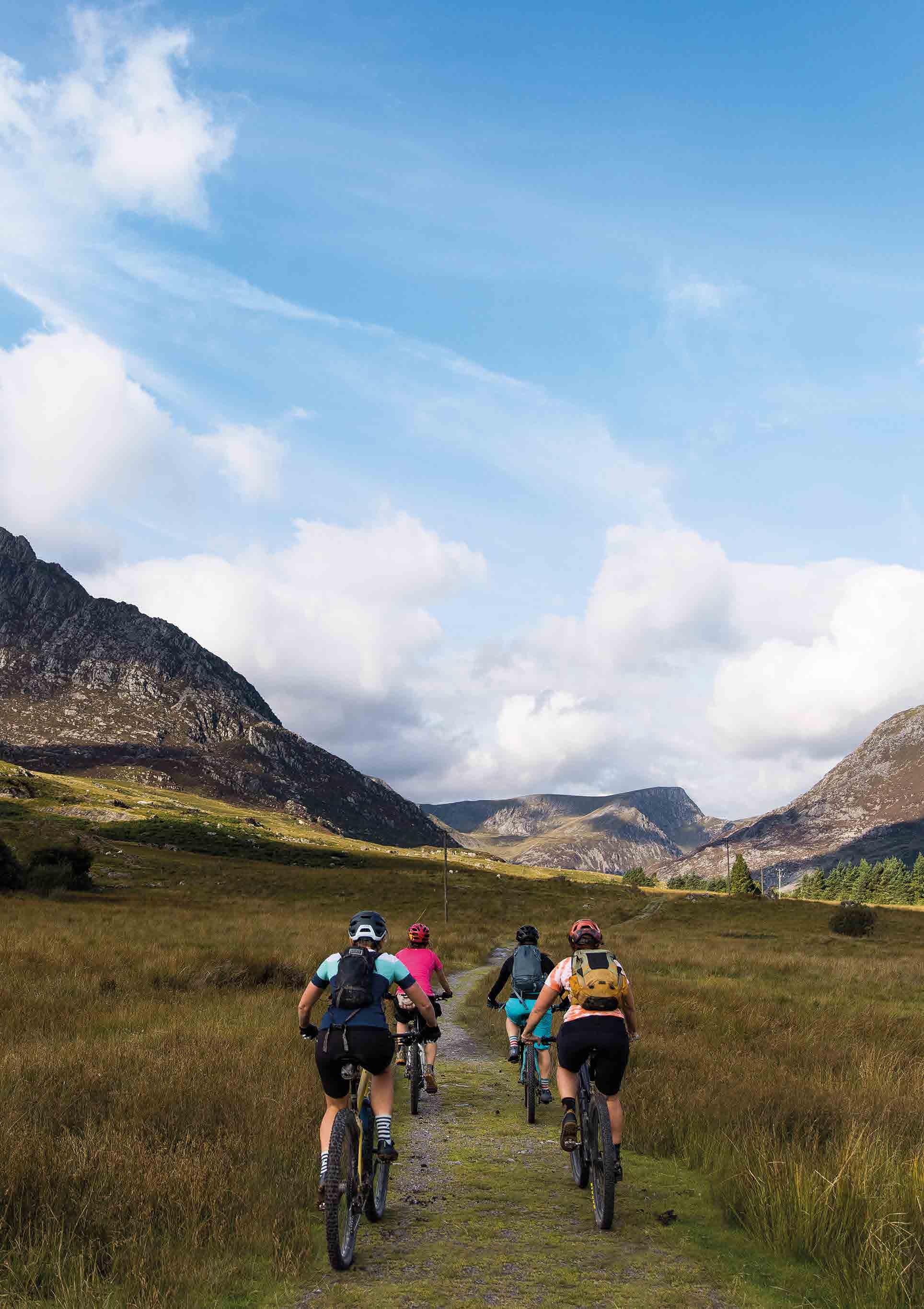
The Traws Eryri trail starts in the historic mid-Wales town of Machynlleth. From here it enchants, fascinates and challenges you across Eryri National Park to the medieval castle stronghold of Conwy. Our expertly curated route links wild forests, incredible mountain scenery and fascinating history using ancient tracks, Roman roads and deserted lanes through the lush valleys and rugged peaks of this truly epic landscape.
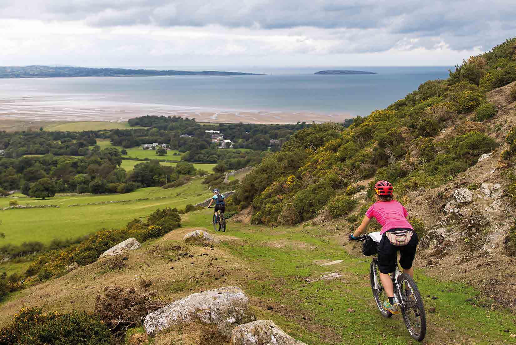
The linear route starts on the beautiful Dyfi estuary at the southern edge of the National Park, and wastes no time in climbing away into the wild hills and forests. It then curves up and around Cadair Idris through thousands of years of history and iconic views before dropping down beside the wide wildlife-rich waters of the Mawddach estuary with Dolgellau at its head.
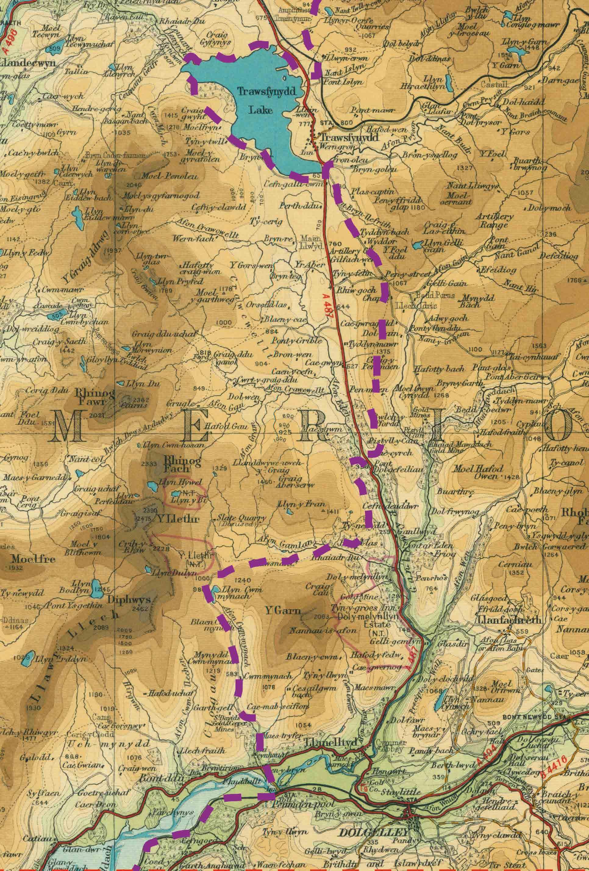
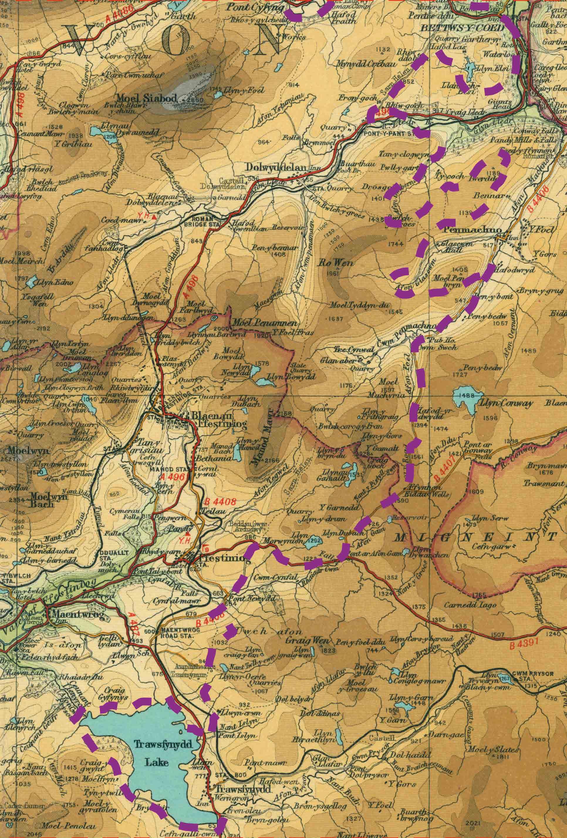
More forest tracks take you over to the mountain bike gold mine of Coed y Brenin, where you’ll join the rocky remains of the Sarn Helen Roman road. A lap of the serene Trawsfynydd Lake takes you back to Sarn Helen and Roman forts, and then to the spectacular peaks and slate-mining relics of the Ffestiniogs. You wind your way through the hills and into pastoral Penmachno, where a figure of eight through the forests offers you more Welsh history or extra MTB trail options.
The mountain centre of Betws-y-Coed is a busy change from the remote wilderness but a great chance to rest and refuel before heading into the depths of Gwydir Forest. You head towards Yr Wyddfa (Snowdon) past Capel Curig and along the breathtaking Slate Trail to the towering slate pyramids of Bethesda. Here the route shows a totally different side as you wind though deserted country roads with mountains on your right and panoramic
10 Cycling UK
views over the Menai Straits and the island of Ynys Môn (Anglesey) to your left. Dropping almost to the coast you then climb back into the mountains and prehistory on rocky tracks that still echo with Roman sandal steps. Wild ponies, sheep and soaring raptors are likely to be your only company past ancient burial mounds, stone circles and hill forts before the final descent to the wide waters and narrow streets of richly storied Conwy.
The Traws Eryri route can be broken down into three or four day splits and also combined with the Trans Cambrian route from Knighton to Machynlleth for a full week of Welsh adventure. If you don’t have time to do the full route in one go you can also break the route into sections using the rail stations at Machynlleth, Barmouth, Betws-y-Coed and Conwy. However long you take, we hope you enjoy riding this route as much as we have and that this guide enriches your experience.
Format of this guide
We’ve split the guide into four sections based on the geography and natural flow of the route. Each chapter will give you a feel for the landscape and trails you’re riding on, highlights of the scenery and history you’re passing through, alternative route/diversion options and any navigation or technical challenges.
We’ve also suggested potential itineraries in the back of the guidebook with cumulative distances to key points and locations of useful facilities. The back of the printed route guide also has detailed mapping of key sections as well as alternative routes, and you can download a full GPX file from the Cycling UK website at cyclinguk.org/traws-eryri
11 Introduction
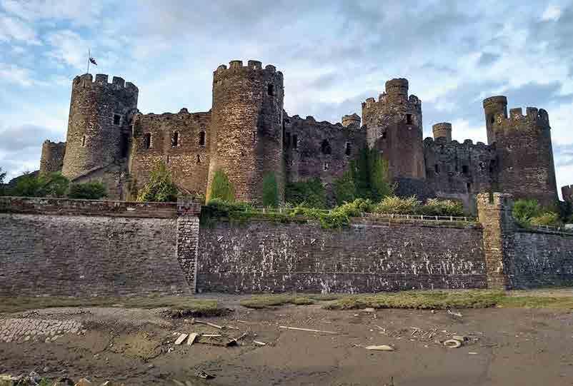
Conwy Castle
Terrain
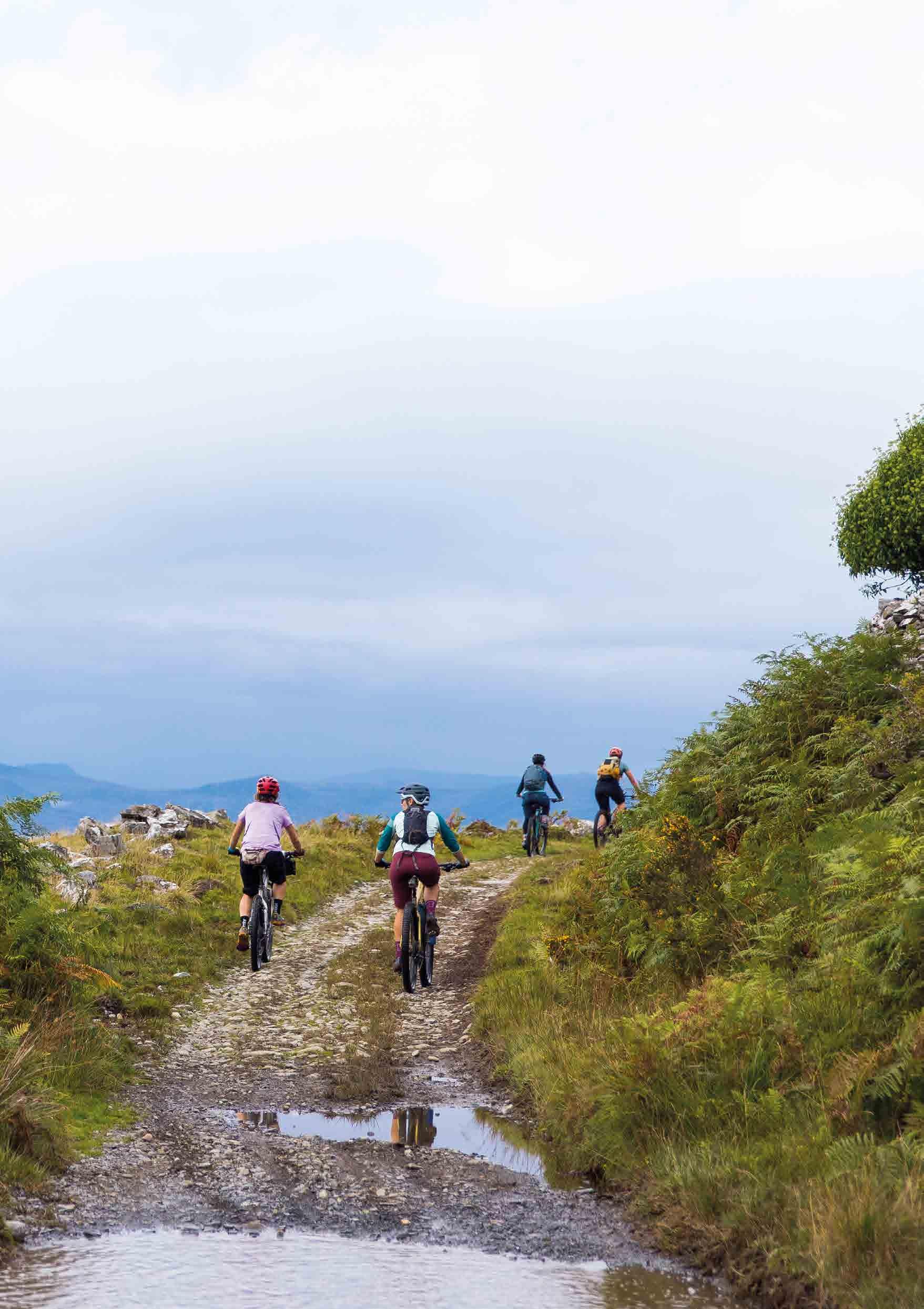
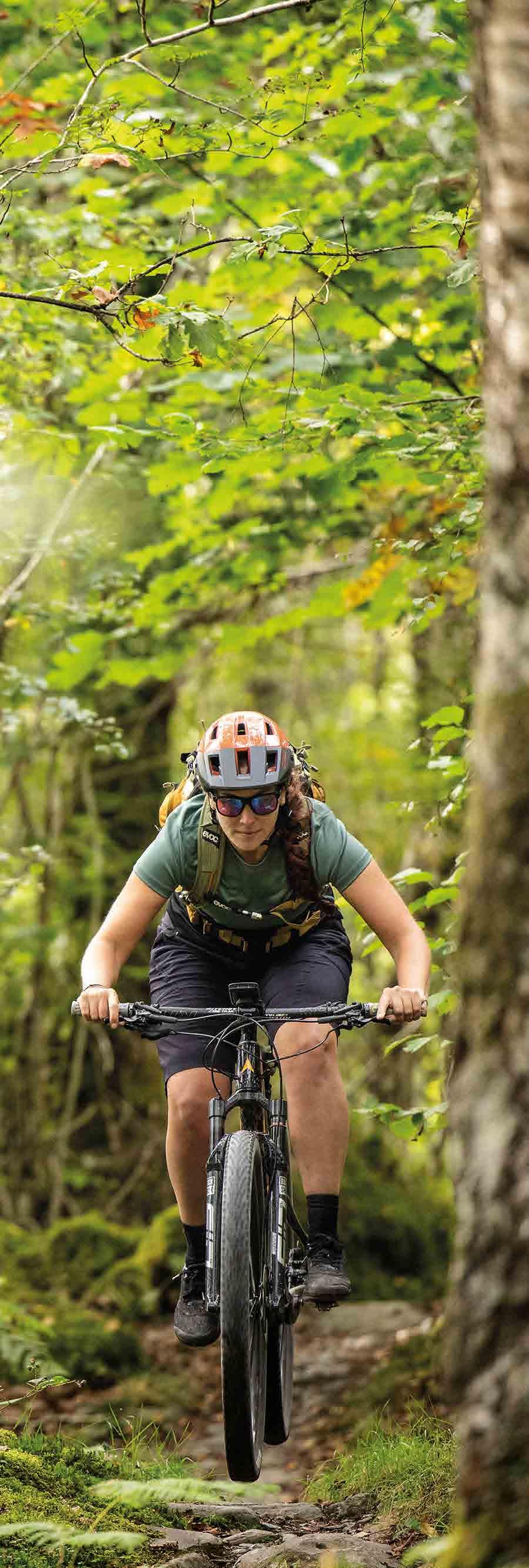
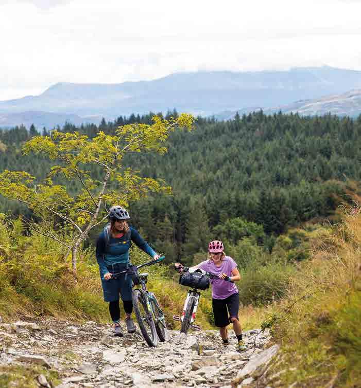
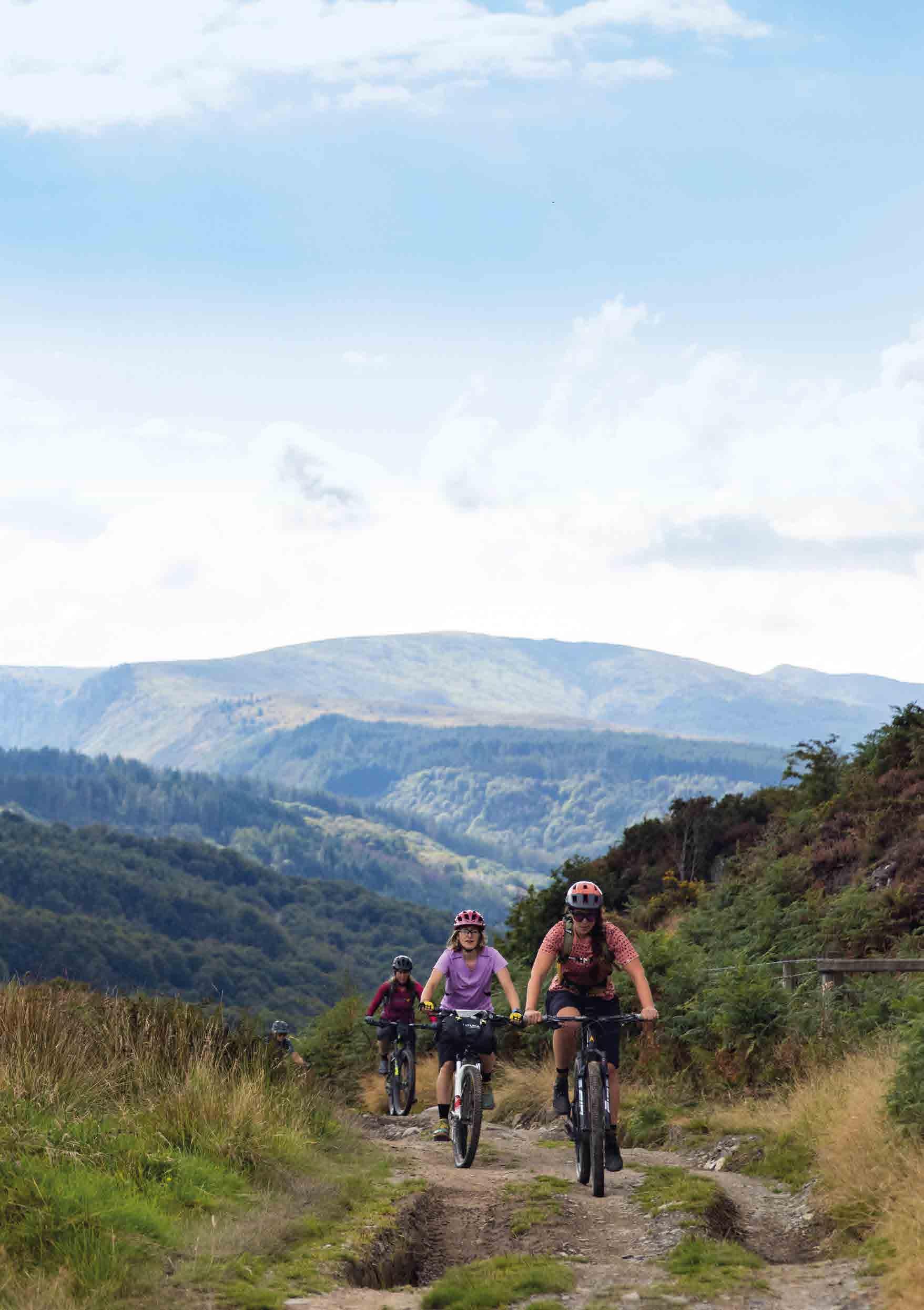
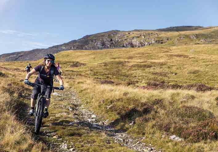
Traws Eryri is shorter than most of Cycling UK’s other multi-day routes in terms of distance, but don’t underestimate it. The sheer amount of extended, steep climbing and exhilarating off-road descending makes this route a properly challenging adventure. It will take you on a wonderful wilderness experience into remote, rarely visited areas, which is well worth the extra effort.
The linear nature of the route adds an extra level of commitment, but the wiggly shape means there are shortcut options at most stages of the route if taking in the sights and scenery slows you down more than expected. We’d recommend including the wiggles if you can though: if the route appears to take a detour, there’s usually an enjoyable reason for it.
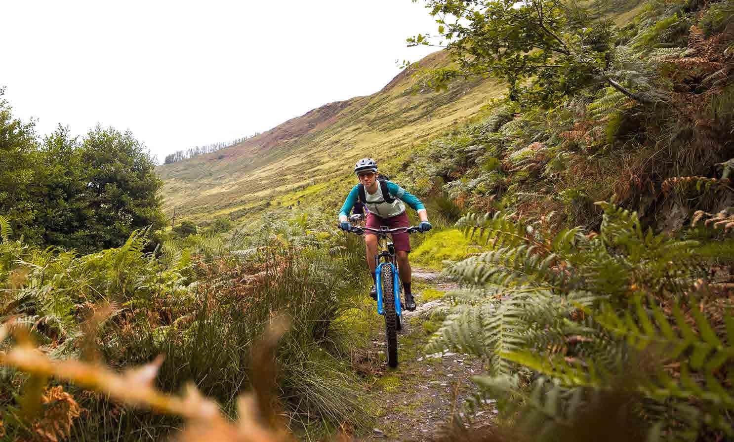
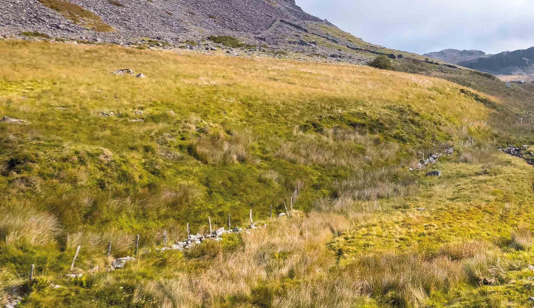
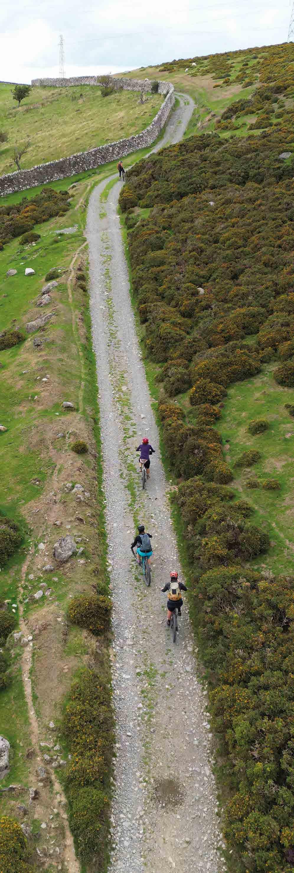
Most of the trails we use have a stony base, so you won’t get bogged down whatever the weather. Some sections are quite rough and rocky, which adds a level of technical difficulty to a few of the
descents, particularly in wet conditions. Make sure you have a bike and gear that you feel confident with, and there is always the option to get off and push if you don’t feel comfortable.
Due to the steep gradients and high proportion of off-road riding, this route is best suited to experienced riders.
Bike and kit
The Traws Eryri route has been designed with mountain bikes in mind, and the steep gradients and loose rock surfaces will certainly be enjoyed most with low gears and big tyres. Using a mountain bike also opens up the chance to take in some of the purpose-built mountain bike trails at Dyfi Forest, Coed y Brenin, Penmachno and Gwydir Forest. For those who like a challenge, it could also be tackled on a gravel bike with low gearing and wide tyres if you don’t mind some pushing up and walking down in places. It's not
Cycling UK 12
Due to the steep gradients and high proportion of off-road riding, this route is best suited to experienced riders.
recommended for road, touring or hybrid bikes with limited gearing and/or narrow tyres. An electric bike will make the climbs easier, but plan ahead for recharging points as Eryri will drain your battery faster than most landscapes.
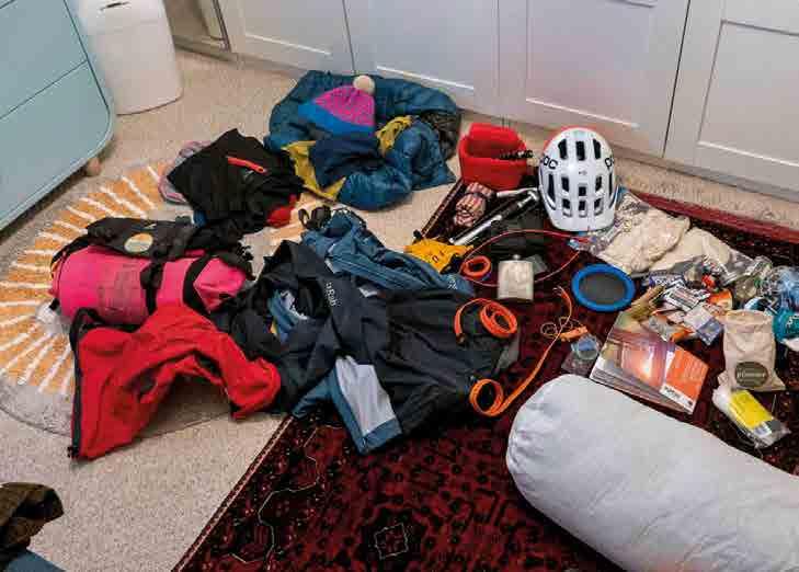
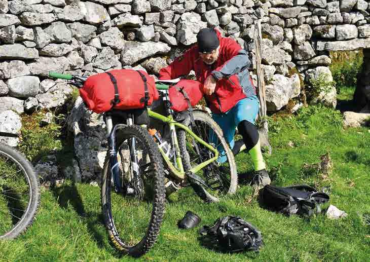
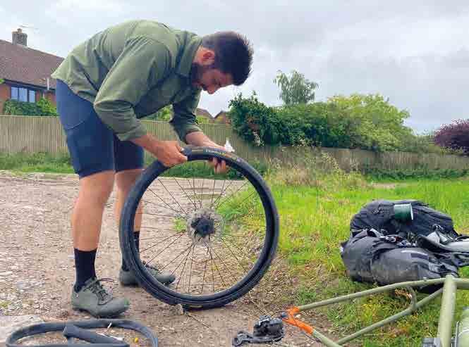
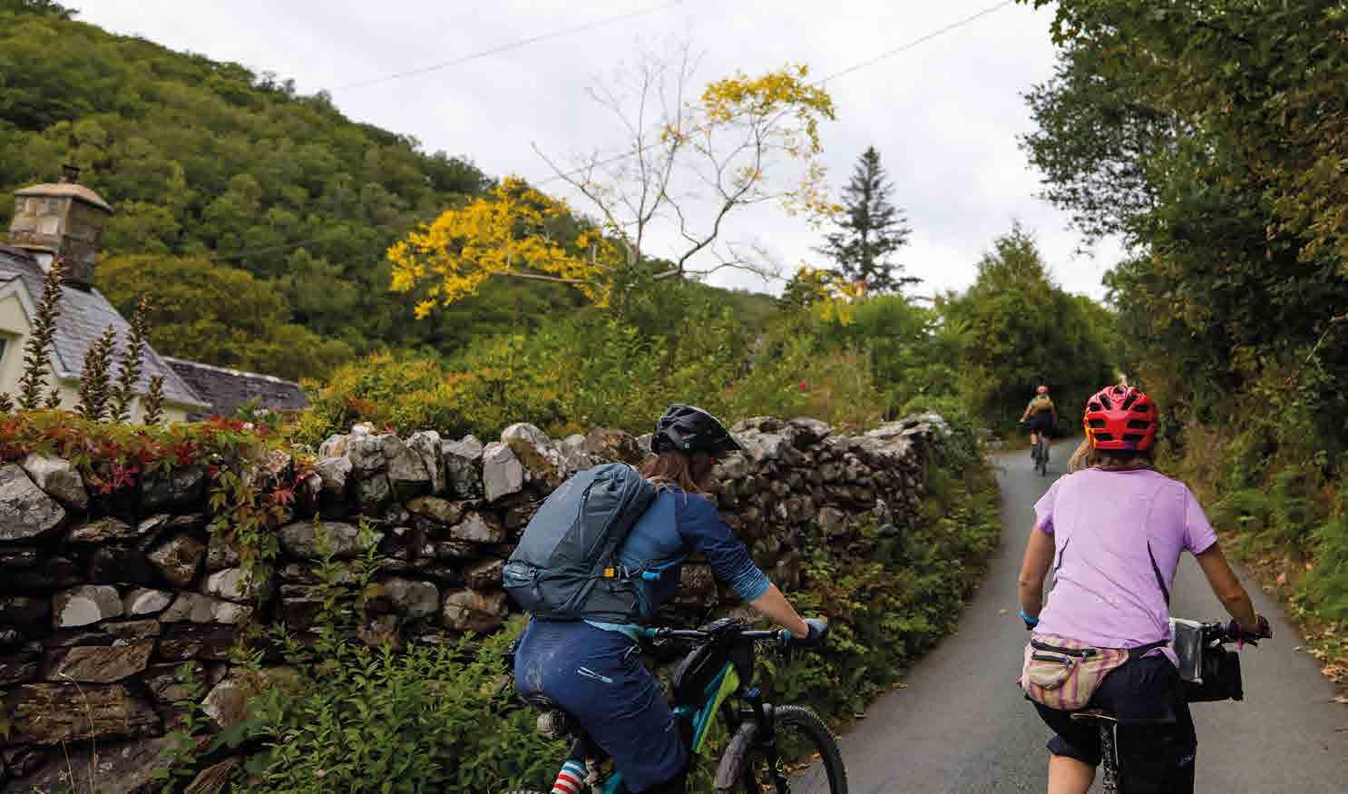
There are several bike shops en route, but make sure your bike is in good order before you set off for Machynlleth. Try out anything new – including bags and clothing – in advance so you know everything works. Take tools and spares to deal with any likely on-trail issues, and pack a first aid kit too, as you will be remote from assistance at some points and phone coverage is very variable. If the weather is likely to be wet, a bottle of chain lubricant and spare brake pads are a wise precaution too. Obviously how minimally or luxuriously you want to pack depends on you, your schedule and where you’ll be sleeping. There are several shops along the route for restocking, and specialist outdoor shops in Machynlleth, Dolgellau, Betws-y-Coed and Capel Curig. The off-road nature of the riding favours strap-on bikepacking bags and/or a backpack rather than racks and panniers that can rattle loose. Finally, while most of the route is very remote, some sections of path –particularly the shared-use trail alongside the Mawddach estuary – can be busy, so a bell can go a long way to ensuring polite progress. They seem to work well with sheep too, which will be a more frequent issue.
Navigation
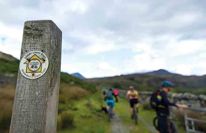
The Traws Eryri route itself isn’t waymarked, and while in places it follows routes on the National Cycle Network or others such as the Llwybr Llechi Eryri (Snowdonia Slate Trail), it's generally only for short sections and often detours off them. The easiest way to navigate is by loading the GPX file for the route onto a reliable GPS computer or smartphone that you can see as you ride. Don’t rely on live position updates on a mapping app though, as signal is patchy. Always back up electronic navigation with a ‘real’ map in case you have a battery issue.
While the navigation is mostly straightforward, there are several points where the route diverts from the obvious path. We’ve listed these in the guidebook but we’d always advise checking where each section goes before riding it and keeping your head up to enjoy the views and spot turns rather than charging along with your head down.
Introduction 13
Safety
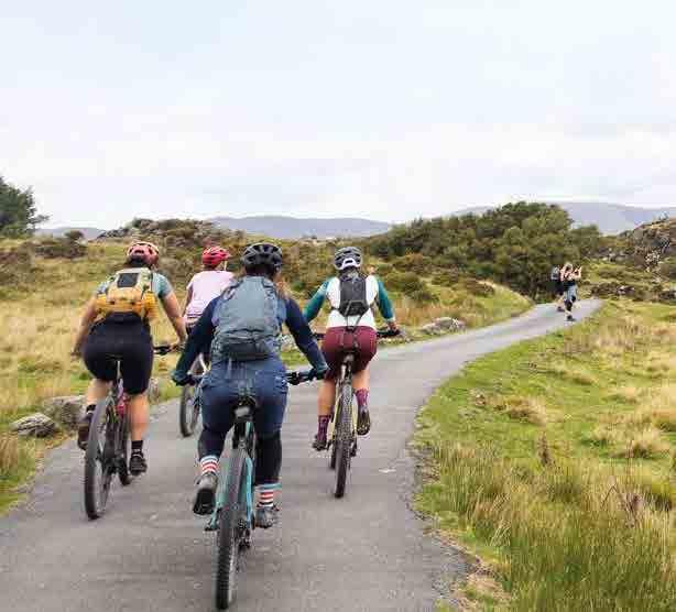
Eryri is a true mountain landscape, and locals will always tell you to be prepared for several seasons in a day. There are large sections of the route with no shelter from whatever is coming at you out of the sky, so things can quickly become serious if bad weather is combined with an enforced stop for a mechanical issue. A spare thermal layer, a good waterproof and an emergency survival bag should be considered a minimum even in summer. All that climbing means you’ll be burning through calories quickly, too, so take more food and eat regularly to keep your energy and concentration levels up. You’ll always be safer riding in a group, but whether you’re in a bunch or going solo, using a ‘beacon’ device or app so someone else is aware of your location and schedule can be a potential lifesaver.
In terms of the route our planners have kept main road crossings and busy road sections to a minimum. To help keep you safe we’ve also highlighted any busy roads
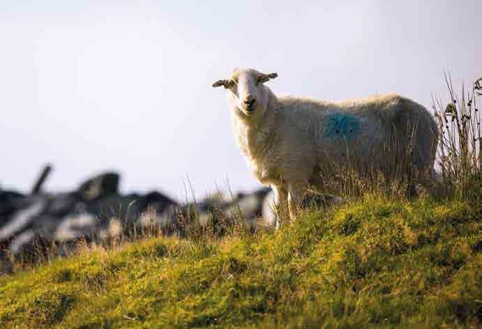
or other higher risk points in the ‘Be aware’ listing at the start of each chapter. You may sometimes have to share narrow lanes and forest roads with farm, forestry or quarry traffic so be prepared to pull over and give them plenty of room. Whether it's sheep diving into your path, rocky sections or loose gravel, off-road riding can always throw up surprises, so stay within the limits of your skill and equipment at all times.
Finally, but very importantly, always be aware of the safety and concerns of others. The route crosses many areas with grazing livestock, so make sure you keep gates shut and slow down or stop if needed rather than spooking sheep. Always slow down, say hello and give way to other trail users, farmers or forestry workers. Trails through forestry will sometimes need to be closed or diverted for maintenance work or forest operations, so make sure you follow any instructions on signs. Follow the Countryside Code, pick up any litter you find en route and generally be the best ambassador for cycling that you can. That way riders like us will be seen as a positive boost to the area, which will help to ensure Cycling UK can continue to develop more routes in wonderful places for you to enjoy

Cycling UK 14
Top tips for a great ride
Ride responsibly: Show respect for all other users and take care of the environment.
Leave a positive trace: Practise low-impact cycling. Follow existing paths, ride through puddles rather than widening tracks, avoid muddy trails where possible and avoid skidding. Never leave litter and go one better by picking up any rubbish you see on the trail.
Control your bike: Stay focused, check your speed and think about other people.
Avoid disturbing animals: Livestock, pets and wild animals can all be startled by sudden noise. Always be considerate, give them a wide berth and leave gates as you find them.
Plan ahead: Know your bike, your equipment and your ability, and be aware of the terrain you’re riding on. Be prepared for severe weather and potential mechanical issues.
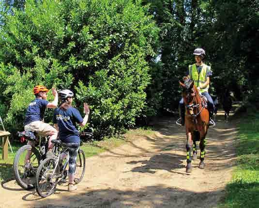
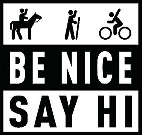
Always give way: Let people know you’re coming with a bell, whistle or cheery ‘bore da!’ (good morning). Pass wide and slow, particularly with horse riders. Approach blind corners and descents carefully. Be Nice, Say Hi!
Introduction 15
The world of Eryri
Eryri became the third UK National Park in 1951 and covers more than 2,000 square km. The dramatic landscape is glacially carved, forming broad estuary valleys leading to the coast, flanked by ranks of steep, rocky hills and mountains. Its many lakes are topped up by the wettest climate in the UK, which also supports a very diverse wildlife population including many rare species that flourish in numerous nature reserves and areas of special scientific interest.
The area has been inhabited since at least the Neolithic period (4000 BC)
with a turbulent history of rebellion and legendary Welsh princes throughout the Roman and medieval periods. This has left a rich archaeological and fortified landscape that forms the background of mythical tales such as the Mabinogion. Its ancient agricultural economy was boosted with mining and quarrying for slate in the 19th century, when the area was the centre of the global industry. The decline of mining means that outdoor tourism and forestry are vital to the area, with mountain biking in particular playing an increasingly important part.
16 Cycling UK
Eryri is a true mountain landscape, and locals will always tell you to be prepared for several seasons in a day. There are large sections of the route with no shelter from whatever is coming at you out of the sky, so things can quickly become serious if bad weather is combined with an enforced stop for a mechanical issue.
Learning the language
Welsh is spoken widely in Eryri and this ancient Celtic tongue can be both beautiful and intimidating for English speakers to look at and learn. You won’t become fluent in a few days’ riding, but here are some key letter combinations that can help with pronouncing place names.
• Ch is soft like Scottish ‘loch’
• Ll is pronounced like a soft ‘chl’ – place your tongue behind your front teeth and blow gently
• Dd is pronounced ‘th’ like in ‘that’
• A single f is pronounced ‘v’ while a double ff is pronounced like an English ‘f’
• Aw is pronounced ‘ow’ like in ‘house’
• Eu is pronounced ‘ay’
• Ywy is pronounced ‘ui’
So for example:
• Machynlleth – ‘mah-chun-chleth’ with a soft ‘ch’
• Dolgellau – ‘dol-gechl-eye’
• Trawsfynydd – ‘tra-oos-vun-ith’
• Betws-y-Coed – ‘bet-us-uh-koyd’
And if you’re wondering how Traws Eryri is pronounced: ‘Traws’ rhymes with ‘mouse’; Eryri is ‘eh-ruh-ree’.
17 Introduction
Machynlleth to Penmaenpool
PART ONE
Cycling UK 20 START FINISH
Part 1
Machynlleth to Penmaenpool
Distance: 52km (33 miles)
Ascent: 966m
Navigation
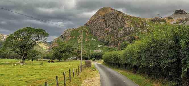
The route starts on a cycle path out of Machynlleth and then a quiet road up to Corris, where it follows a short section of the A487 before heading onto an old lane behind Talyllyn lake. After Abergynolwn navigation is relatively easy all the way to the Mawddach estuary.
Highlights
• Mountain forests and forgotten valleys
• Deep landscape history
• Cadair Idris and Cregennen Lakes
• Panoramic coastal and estuary views
• Deserted back roads and remote trails
• Tiny villages and huge views
• Rare wildlife
• Bird Rock, Craig Yr Aderyn, an impressive geological feature where seabirds nest inland
Be aware
• Be careful on the very short section of the A487 main road up from Corris before you turn off the road
• The lower parts of the descent to Cregennan Lakes also have some chunky rock and rut sections from water erosion
• The road descent from Cregennen Lakes is very steep and twisty at the start and can be slippery when wet
21
Part 1: Machynlleth to Penmaenpool
400m 200m 0m 0km 10km 40km 20km 50km 30km
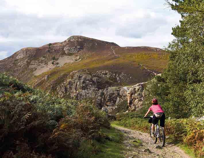
Near Cadair Idris
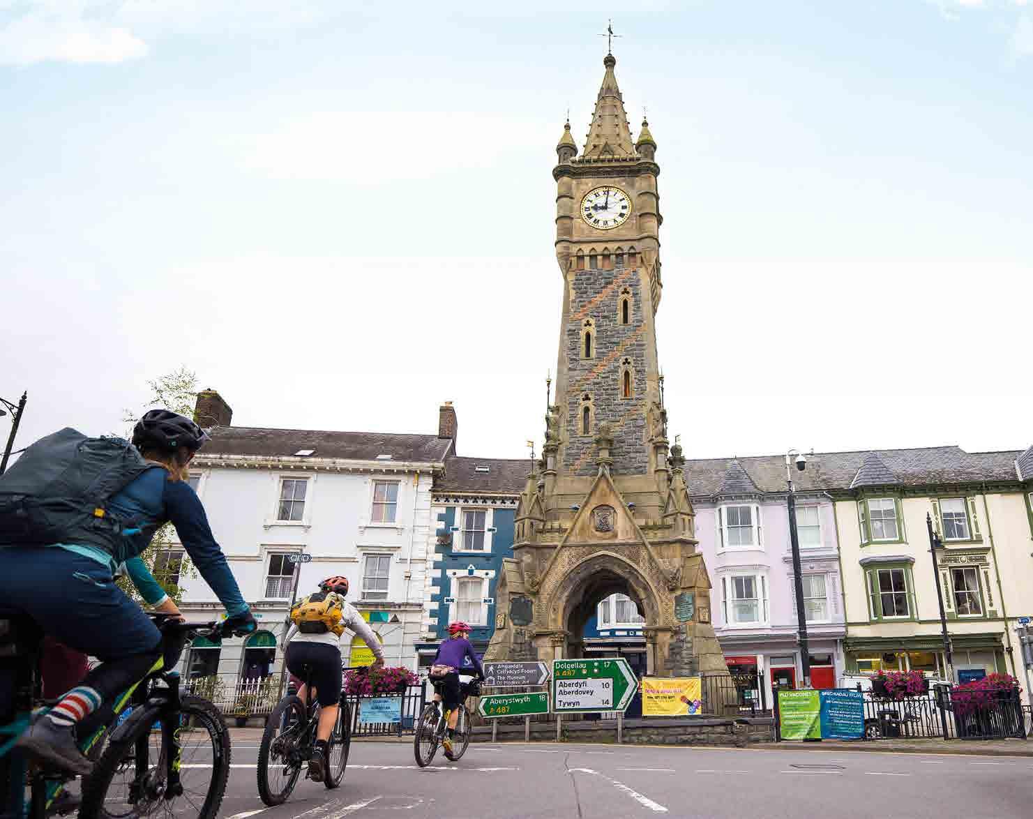
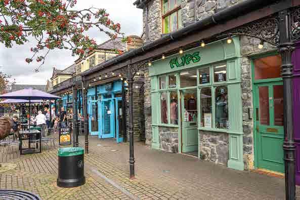
Modern Machynlleth is a busy local centre and tourist town with a focus on alternative and craft produce, potteries and book shops.
Machynlleth to Abergynolwyn
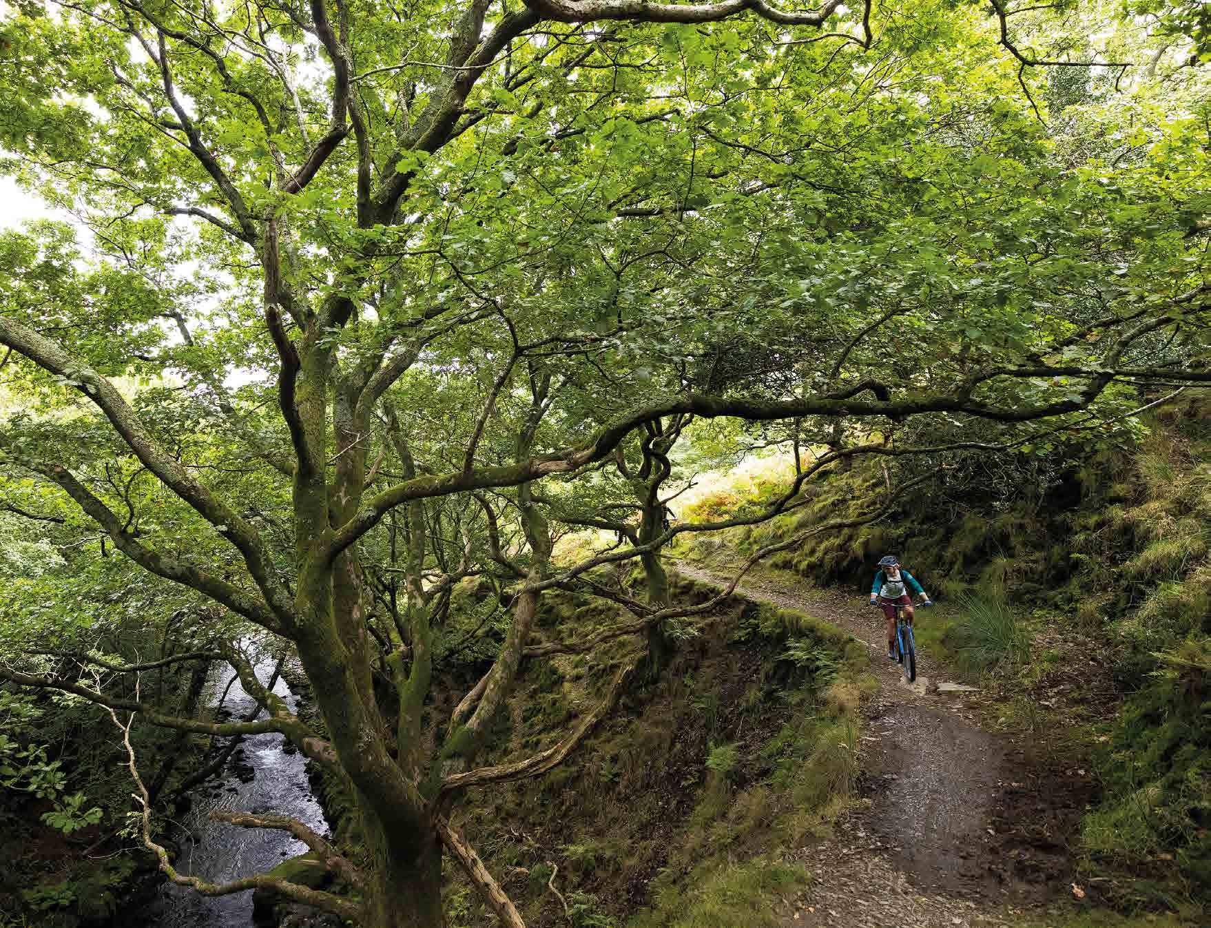
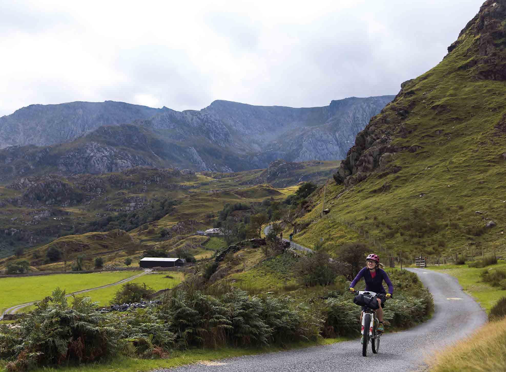
Your journey towards the far side of Eryri starts at the iconic clock tower of Machynlleth, heading north out of town past the new bridge construction and up the cycle path alongside the Dyfi River, crossing over the sculptural Millennium suspension bridge. A singletrack road takes you on a scenic rollercoaster ride north up the valley, with the steep slopes of Dyfi Forest to the right and the fast-flowing Dulas River to the left.
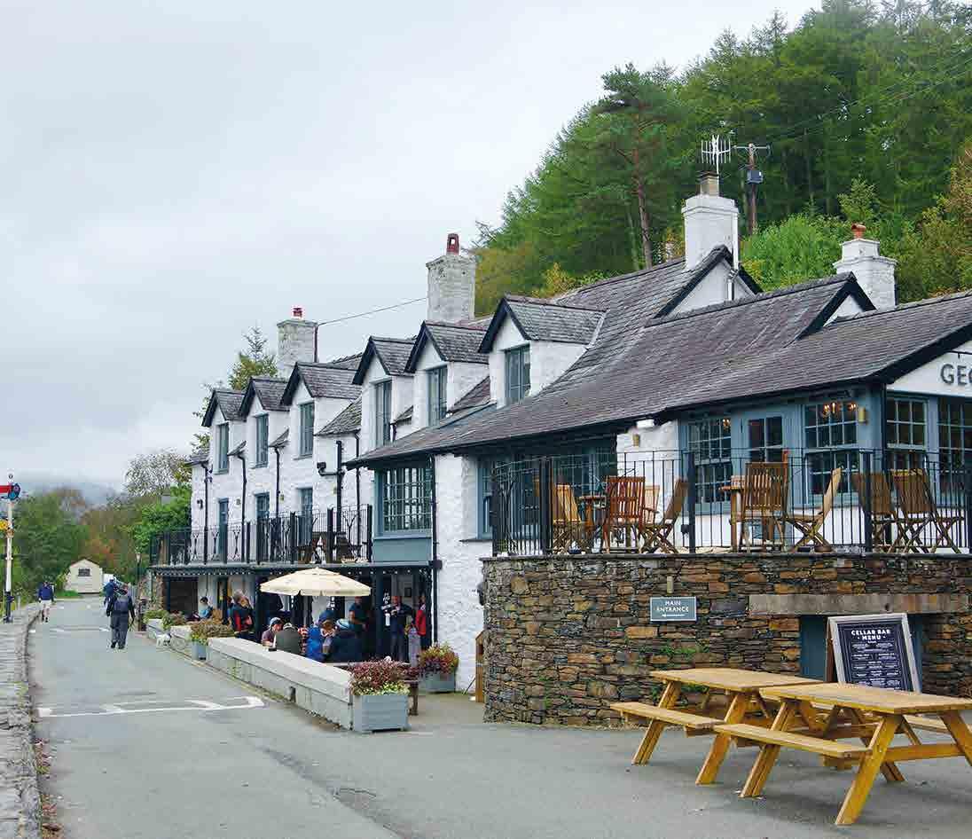
Climbing across the river to Corris gives you your first chance of a café and cake stop before you briefly join the A487 and then loop around the far side of Talyllyn lake and along to Abergynolwyn village. A local shop, café and toilets as well as the Wheelism bike repair and guiding company make it a very useful stop-off point.
Dyfi Bike Park
Dyfi Bike Park is run by Dan, Rachel and Gee Atherton – the most successful family ever in downhill and MTB slalom racing with multiple World Championships and World Cup race wins to their name. They also host the infamous, invitation-only Red Bull Hardline race on a hillside east of Mach and they recently opened their own state-of-the-art mountain bike factory in the town.
Cycling UK 22
Machynlleth
Machynlleth has always been a very important place in Mid Wales as it sits on a key crossing/control point of the Dyfi River at the intersection between the mining areas of Eryri and flatter agricultural land to the east.
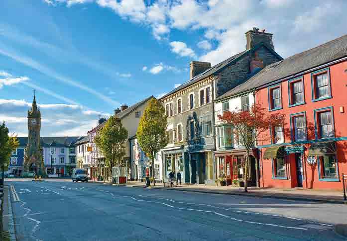
Local human history starts with early Bronze Age copper mining nearly 3,000 years ago, while the Romans established a fort at Maglona four miles to the west. A thriving Wednesday market was granted by Edward I in 1291 and is still an important part of town life. Legendary Welsh rebel Owain Glyndwr was crowned Prince of Wales here in 1404 with an audience of dignitaries from Scotland, France and Spain. The Parliament House, from where he ruled, is one of three medieval houses still surviving in the town and its where Charles I stayed when visiting Wales.
Modern Machynlleth is a busy local centre and tourist town with a focus on alternative and craft produce, potteries and book shops. It’s also a centre for all types of cycling, including the Mach 1, 2 and 3 trails that head out into the surrounding hills, with Dyfi Forest trails and Dyfi Bike Park to the north.
Abergynolwyn
Overlooked by an Iron Age hillfort and meaning ‘Mouth of the river with a Whirlpool’, Abergynolwyn entered Welsh history when Mary Jones, a 15-year-old schoolgirl, walked 26 miles barefoot across the countryside to buy a Welsh Bible. This inspired the formation of the British and Foreign Bible Society, which has since distributed hundreds of millions of Bibles worldwide.
CAT – Centre for Alternative Technology
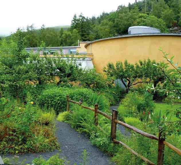
Opened in 1973 to develop then-radical ideas and innovations such as low energy houses, recycling and solar, hydro and wind power technologies, CAT now covers all sorts of sustainable living research. It’s also a centre for education, with day and residential courses plus an eco shop and restaurant that are well worth a visit.
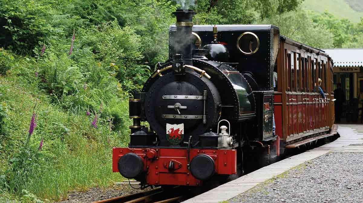
The village is also home to the award-winning Talyllyn steam railway, originally built in the 1850s to connect the local slate quarry to the coast at Tywyn. A century later it became the first volunteer-run heritage line in the UK and is now part of the Slate Landscape of North West Wales World Heritage Site.
Part 1: Machynlleth to Penmaenpool 23
Talyllyn steam railway
Abergynolwyn to Mawddach estuary
There are two potential routes out of the village here. The interim route follows the steep road climb out of Abergynolwyn and takes the rise-and-fall road along the north side of the valley.
The alternative takes a little more skill to follow, as it runs down the side of the stream rather than the road. After crossing a footbridge, you’ll then need to push your bike along a short section of footpath. Once you’re past the farm a legally rideable bridleway gives you a lovely run alongside the south of the valley.
The Traws Eryri route doesn’t actually go through Caerberllan, but there are two excellent rocky reasons to take a short detour. The first is a prehistoric standing stone – or menhir – which used to stand
proud in the centre of a field. The local farmer is clearly more pragmatic than pagan, though, as they’ve moved it and fitted a couple of hooks to make it into a gate post. While this isn’t easy to spot, there’s no missing the dramatic rocky outcrop site of Castell y Bere a few hundred metres to the north-east.
Continuing along the broad, pastoral valley in the shadow of mighty Cadair Idris you also pass the dramatic, towering outcrop of Craig yr Aderyn, or Birds’ Rock. Here you’ll pick up signs for National Cycle Network (NCN) route 82 which you follow towards the coast over ancient stone bridges before doubling back to climb up the western foot of Cadair Idris itself on a breathtaking Alpine style singletrack road.
Craig yr Aderyn
Craig yr Aderyn, or Birds’ Rock, is an even more striking site, with stark rock walls bursting out of the relatively flat valley floor. This commanding position made it a perfect place for an Iron Age hill fort, which continued to be used during the Roman period. Now its fairly inaccessible cliffs are a perfect breeding spot for rare birds, with choughs and peregrine falcons among those raising feathered families at this protected site.
Cycling UK
24
Forest near Abergynolwyn
Castell y Bere
The first stone castle built by Llywelyn the Great – in 1221 on top of a tall, narrow natural rock outcrop – was a Welsh rebel base for several decades. It became an English royal centre after a siege in 1283 by Edward I who also established a small town. However the Welsh recaptured both town and castle in 1294, burning everything to the ground, and the site was abandoned forever. It was only recently cleared of undergrowth and partially excavated.
This part of the route is also where the prehistoric ancestors start to really leave their marks on the landscape with stone cairns (possibly the remains of eroded burial mounds), ancient enclosures and Bronze Age hut circles covering the hillside to the north. From Cadair Idris, panoramic views of your journey so far swing round to the sparkling sea behind you at Tywyn and as you crest the pass the wide Mawddach estuary, Barmouth Bay and the imposing mountains of mid Eryri burst into view.
From this expansive vista you’re potentially following in the footsteps of the earliest settlers in this part of Wales as you take the rocky Ffordd Ddu trackway north-east. Cairns and standing stones alongside this
alignment point to a Neolithic (6,000 years ago) origin, and the route was definitely in use by the Bronze Age (4,000 years ago). It was a very important droveway for cattle until recently, too, so there are the voices of all sorts of tales (and tails) echoing round the surrounding hills here.
25
Part 1: Machynlleth to Penmaenpool
Ffordd Ddu View over Mawddach estuary
There’s evidence of more recent history as you pass a plaque in the wall commemorating the site where a US Air Force B17 ‘Flying Fortress’ bomber crashed on its way back to the US. Cruelly, 10 crew and 10 passengers who had somehow survived the horrific casualty rates of World War II raids over Germany were killed.
After an increasingly rocky and exciting descent, a gated road takes you through the National Trust estate that surrounds the iconic islanded mountain lakes at Cregennen. Then you’ll drop steeply down to the estuary on a crooked road, past equally crooked trees, and the faux fortifications of Arthog Hall with its beautiful waterfalls behind.
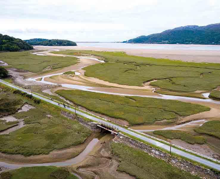
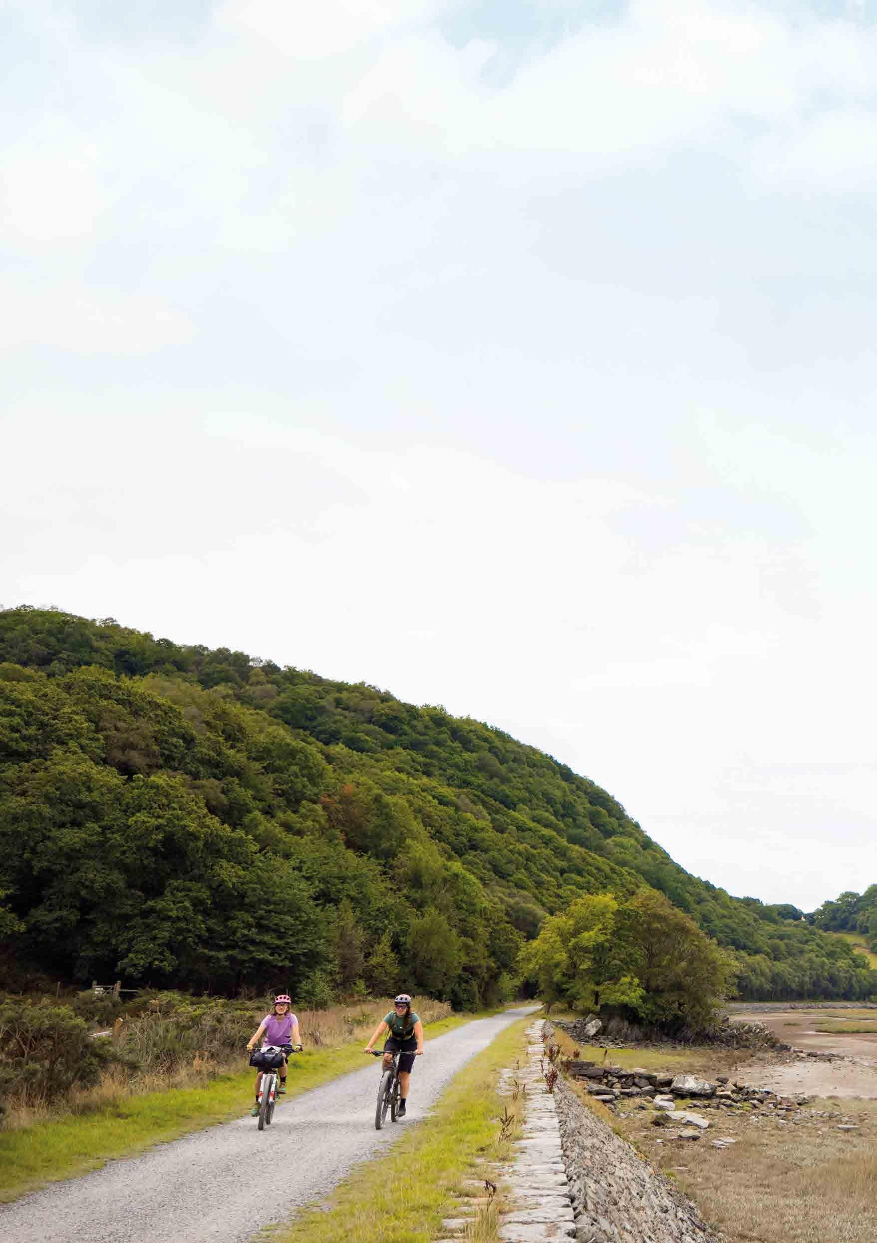
Dropping down to the estuary you turn right and join the combined Cross Britain Way and Mawddach Trail, following NCN route 8 where the flat, broad surface of the shared use railway trail is a relaxing change from the ride so far. It also leaves you free to
The route curves up and around Cadair Idris through thousands of years of history and iconic views before dropping down beside the wide wildlife-rich waters of the Mawddach Estuary with Dolgellau at its head.
Cycling UK 26
Road towards Cregennen Lakes
take in the wonderful views of the wide open salt marsh landscape and constantly changing population of wildfowl. Be careful of other users here, as this scenic, traffic-free route between Dolgellau and the coast is understandably very popular with walkers, runners and beginner cyclists.
The tiny hamlet of Penmaenpool has a 17th-century pub and public toilets and it’s also where this first section ends, at the toll bridge. Here there’s an option to continue along the cycle path for 4km to Dolgellau for overnight accommodation and then along the quiet roads of NCN route 82 all the way up to the visitor centre at Coed y Brenin. Alternatively, the full Traws Eryri route takes you north over the river and up into the mountains, which is where we start Part 2.
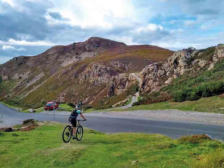
Cadair Idris
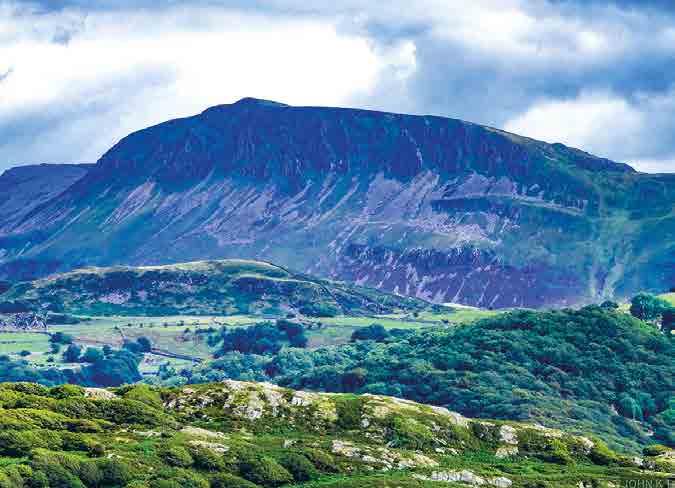
Cadair Idris is the biggest mountain in southern Eryri. Depending which legend you believe, it’s either named after Idris the Giant, who left a dent that’s now a lake when he sat here, or after a 7th-century Welsh prince who won a battle against the Irish nearby. The Pony Path is the only legally rideable route to the 893m summit, but wild campers be warned: anyone who sleeps on its slopes will apparently wake up a madman or a poet.
Sustrans National Cycle Network route 82
The Traws Eryri route shares several sections with the currently incomplete NCN 82 route from Bangor to Fishguard. Full plans eventually include a link from Aberystwyth to Machynlleth, which once finished would make it possible to extend Traws Eryri into a railway-linked coast-to-coast route.
Penmaenpool 27
Part 1: Machynlleth to
Penmaenpool
Penmaenpool to Trawsfynydd
PART TWO
Cycling UK 30 START
FINISH
Part 2 Penmaenpool to Trawsfynydd
Distance: 37km (23 miles)
Highlights
• Grade II listed toll bridge
• Streamside climbs to wide open wilderness
• Stunning waterfalls
• Coed y Brenin trails and visitor centre
• Rugged Roman roads
• Dramatic nuclear architecture
Navigation
Ascent: 915m
Be aware
• Be careful crossing the A496 at Taicynhaeaf and the A470 at Trawsfynydd, as they can be busy in summer
• The climb and descent sections of the Sarn Helen Roman road after Coed y Brenin are rocky in places
• There’s a steep gravel climb and descent on the Trawsfynydd Lake path
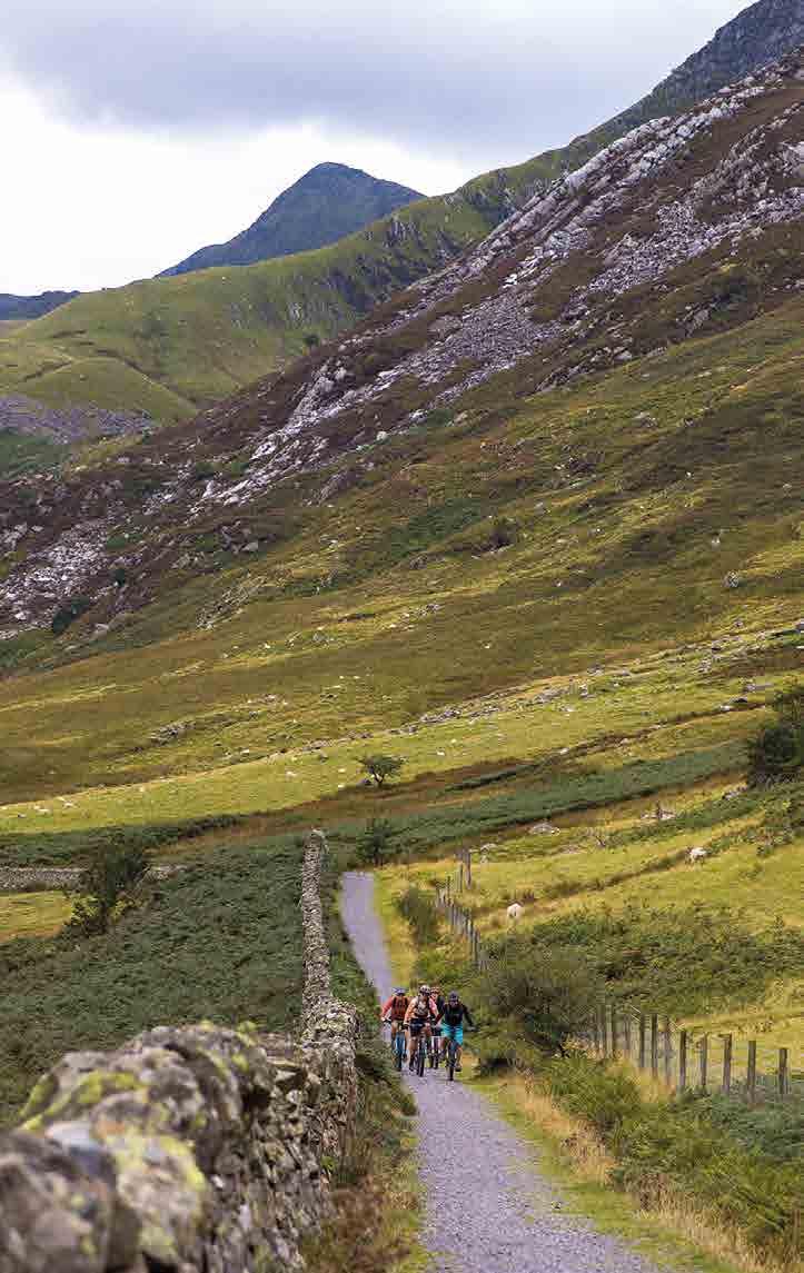
This section of the route is one of the simplest as long as you take the correct junctions at the top of the Mynach Valley. Watch out for a surprise turn on the far side of the Trawsfynydd Lake path too. Here the road you’ve been following leads straight on over a cattle grid and then downhill, but the cycle path turns steeply uphill through a wooden gate. Keep to the lake edge past the power station to stay on the cycle path.
31 Part 2: Penmaenpool to Trawsfynydd
300m 200m 100m 0m 0km 40km 10km 30km 20km
Climb up Cwm Mynach
Penmaenpool to Coed y Brenin
After rumbling across the wooden toll bridge over the River Mawddach, along the singletrack road, and carefully crossing the A496, you’re straight into a stinker of a climb past the pretty cottages of Taicynhaeaf. Whether it’s from the heat created by people huffing and puffing up the hill or natural causes, the lower Mynach Valley seems to have its own subtropical microclimate, with rhododendrons flowering in late February on our recce ride. (Cwm Mynach means valley of the monks, as the area was once owned and worked by the monks of nearby Cymer Abbey.)
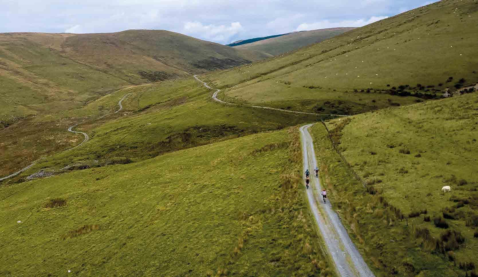
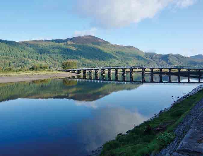
The climb eases off slightly, rolling alongside the beautiful tumbling waters of a mountain stream as you head upwards over ancient bridges and through scattered farms. Then it’s out into the wilder, forested and then open moorlands on well-surfaced tracks with access generously provided by the Woodland Trust and a local farmer.
Penmaenpool Bridge
This splendid wooden bridge was built in 1879 and is now Grade II listed. Have some loose change on you for the toll as the minimum digital charge is £1, but to be honest I didn’t really mind contributing extra to the upkeep of such an excellent structure.
32 Cycling UK
Coed y Brenin
These take you right out into the wilderness of the Rhinog National Nature Reserve. You’ll then swing east and start dropping down past the Rhaeadr Du or the Black Waterfalls, so look out for the path off to the right if you want to sightsee. There’s also the opportunity to join the lower parts of the Tarw Du, the first UK purpose-built singletrack MTB trail. Be careful if you do, as the bouldery construction is deliberately challenging – it was originally given a red grade but is now considered closer to a black grade. You’ll join the final furlong of the trails anyway as you go under the road tunnel and up to the fantastic eco-friendly rotunda of the Coed y Brenin visitor centre.
The excellent Beics Brenin bike shop and NRW café are open seven days a week (hours vary) and there are toilets and showers at the visitor centre.
Coed y Brenin
Coed y Brenin means the King’s Forest and it was a centre of Welsh gold mining for millennia before it became a gold mine for mountain bikers. The first purpose-built MTB trails of Coed y Brenin were created by then recreation ranger Dafydd Davis and a couple of friends in the mid 1990s. Fantastic to ride in all weathers and remarkably natural in feel, the twisting, rollercoaster trails rapidly became a magnet for UK riders and a template for the growth of similar centres across the UK.
Now Coed y Brenin has nine MTB trails catering for all levels of rider, as well as running, hiking and all-access routes through the forest. The excellent Beics Brenin bike shop and NRW café are open seven days a week (hours vary) and there are toilets and showers at the visitor centre.
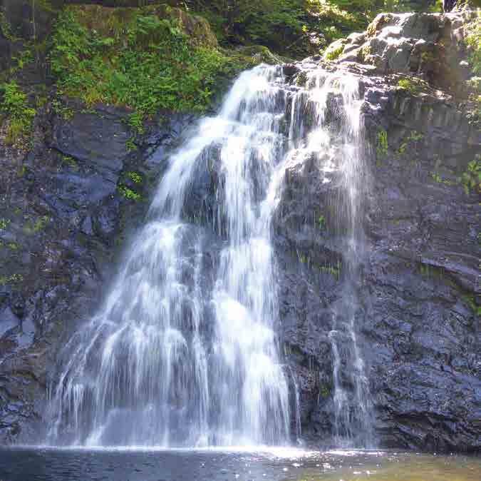
Rhaeadr Du
Rhaeadr Du, or the Black Waterfalls, are a 200-metre walk from the Traws Eryri route but well worth the visit. The multiple falls are up to 18 metres (60 feet) high and situated in the ancient mossy woodland of the Coed Ganllwyd nature reserve. There are stone steps down to a viewing area too but be careful as the moss can be slippery.
33 Part 2: Penmaenpool to Trawsfynydd
Coed y Brenin to Trawsfynydd
From the visitor centre you head up through the car park and then an extended fire-road climb that eventually joins our old friend the Sarn Helen Roman road. Things get steep and rocky as you head onto open moorland, so don’t be surprised if you have to push the final section. The views across to the Rhinog Mountains really underline the wildness of this area, though, and the descent is a fun mix of loose rocky Roman remnants and then singletrack road to Trawsfynydd.
You can shortcut the route here and head straight into Trawsfynydd itself on the cycle path, but the scenic bonus is to take
a lap of the reservoir. Don’t assume it’s all flat, though: there’s a short, steep gravel climb on the far side which leads into a sweet swerving descent. Then it’s over the concrete dam and past the forbidding twin blocks of Trawsfynydd’s decommissioned nuclear power station. These are majestic in a brutalist sort of way but definitely look odd in this otherwise unspoilt area of wide open skies and raw peaks. A short section of cycle path takes you back to the A470, where you can cross and start Part 3 of the route or backtrack a kilometre down the cycle path to Trawsfynydd.
Cycling UK 34
Trawsfynydd
The village of Trawsfynydd started as scattered groups of circular prehistoric huts (an Iron Age tankard was also found locally) to become an early Celtic Christian epicentre. Now it’s a busy community with a surprising amount of shops and facilities including a pub/bike hostel, other accommodation options, a village shop and pharmacy.
You can shortcut the route here and head straight into Trawsfynydd itself on the cycle path, but the scenic bonus is to take a lap of the reservoir.
Trawsfynydd Reservoir and power stations
Trawsfynydd Reservoir was first formed to power the Maentwrog hydroelectric generators, but from 1965 it also became the cooling source for a nuclear power station. This was decommissioned after only 26 years in 1991 but it will take more than 90 years to completely clear the site. Ironically, changing attitudes to nuclear power mean they’re now planning to build a smaller reactor right next to it.

35
Part 2: Penmaenpool to Trawsfynydd
Rocky climb up to the Sarn Helen Roman road
Trawsfynydd to Betws-y-Coed
PART THREE
Cycling UK 38 START FINISH
Part 3
Trawsfynydd to Betws-y-Coed
Distance: 51km (31 miles)
Ascent: 1279m
Highlights
• Roman forts and Norman castles
• Alpine climbs and villages
• Dramatic mountain landscapes
• Industrial and biblical archaeology
• Exhilarating descents and MTB trail options

• Tranquil forests
Be aware
• The fields at the start are slippery when wet so don’t be surprised if you end up walking
• The B-roads after Llan Ffestiniog have several bends and can sometimes be quite busy, so take care
• The route joins the A470 for around 1.5km before Betws-y-Coed too
Navigation
The navigation on this section of the route is mostly simple apart from the start. That’s because the field tracks up to the Roman fort are vague in places, so make sure you follow the purple Roman helmet signs and keep on the right side of the fence and wall as it heads steeply uphill towards the fort itself.
Past there, it’s all very obvious and easy to follow as long as you keep track of where you are in the landscape.
39
Trawsfynydd to Betws-y-Coed
Part 3:
Sunset above Llan Ffestiniog
400m 200m 0m 0km 10km 40km 20km 50km 30km
Our expertly curated route links wild forests, incredible mountain scenery and fascinating history using ancient tracks, Roman roads and deserted lanes through the lush valleys and rugged peaks of this truly epic landscape.
Trawsfynydd to Llan Ffestiniog
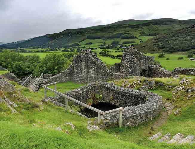
Crossing the main road, it’s not long before you start climbing up grassy farm tracks towards the Norman castle mound that sits at the centre of the extensive Roman remains of Castell Tomen y Mur.
The road section beyond the site is on the old Roman alignment too, passing medieval rabbit-warren mounds silhouetted against the massive northern peaks.
Castell Tomen y Mur
Castell Tomen y Mur (Mound in Walls) is a Roman fort built to protect the Sarn Helen road; the extensive complex includes an amphitheatre, parade ground and bathhouse. The defensive earthworks were reused for a Norman castle and there’s also a medieval hall built by Welsh princes on the site.
40 Cycling UK
Road climb out of Llan Ffestiniog
Llan Ffestiniog to Betws-y-Coed
We turn away from Llan Ffestiniog to the east, for a gradual road climb which rewards you with spectacular views of the surrounding hills. Take a moment for a breather at the viewpoint to spot the Rhaeadr y Cwm waterfall carving its way dramatically through the gully.
The left turn towards Penmachno continues the climb until you point your wheels onto a winding ribbon of a lane which skirts the hillsides, sending you gliding smoothly down to Cwm Penmachno. Then it’s back to work as you climb up into the forests above the village for

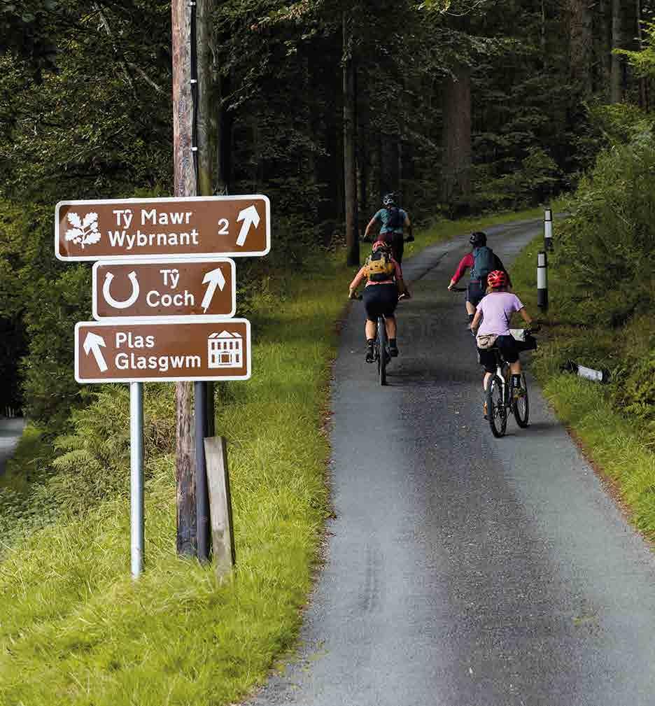
a scenic double loop of almost glowing greens and crystal-clear streams. You pass the important National Trust site at Tŷ Mawr Wybrnant on a twisting double-track road before crossing the river and briefly joining the A470 for around 1.5km. Then you’ll disappear into the hills and forest on the Sarn Helen Roman road again. Pass the beauty spot and monument of Llyn Elsi reservoir before dropping down through the forest onto the back road into Betws-y-Coed, the busy Alpine-style village that marks the end of Part 3.
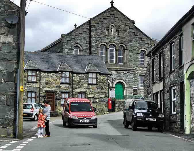
Llan Ffestiniog and Blaenau Ffestiniog
The Ffestiniog villages date back to at least the medieval period and were the epicentre of the slate mining industry through the 19th and early 20th centuries. While they’re slightly off the route, there are plenty of shops and accommodation options that make them a useful resupply or stopover point too.
41 Part 3: Trawsfynydd to Betws-y-Coed
Penmachno trails
The volunteer-maintained trails in Penmachno are split into two loops with a combined length of 30km of red grade riding, and they are a challenging but fun addition to the Traws Eryri route. Don’t forget to donate to the Menter Bro Machno community group if you enjoy them.
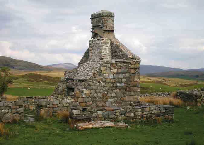
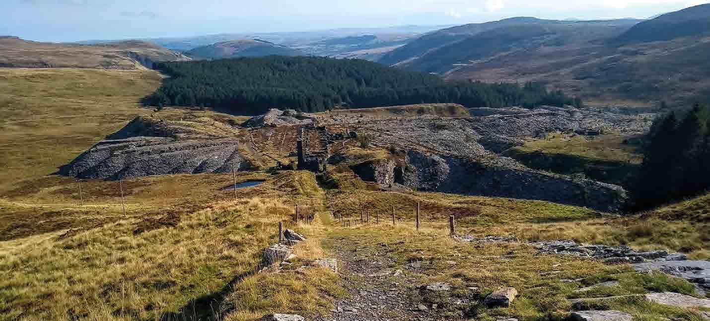
Manod Quarry
The now-deserted slate quarries to the east of Blaenau Ffestiniog were started by two men in 1812 using picks, pack horses and the old cattle drove road. By 1858 the quarry was sold for the equivalent of nearly £11m and had a state-of-the-art steam engine operating multiple winches for the inclines. Production peaked at 8,000 tons of finished slates in 1869, but the mine was shut by 1952.
During WW2, the underground chambers of these quarries acted as a repository for the National Gallery, with priceless artworks evacuated from London and hidden deep in
the mines, safe from German bombs, a secret arrangement that continued into the Cold War.
The Snowdonia Slate Trail walking route passes through the quarry remains, and Cycling UK is working to secure landowner permissions for the Traws Eryri trail to follow the same line. Riding through here would be an incredibly atmospheric way to appreciate the impact that slate mining heritage has had on the landscape of this area, and we hope to be able to include it on the route. For now, though, we skirt around the quarry on the road to reach Penmachno.
Cycling UK 42
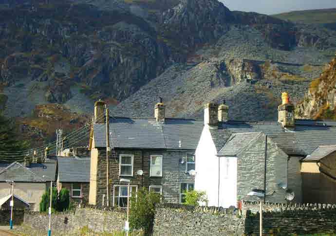
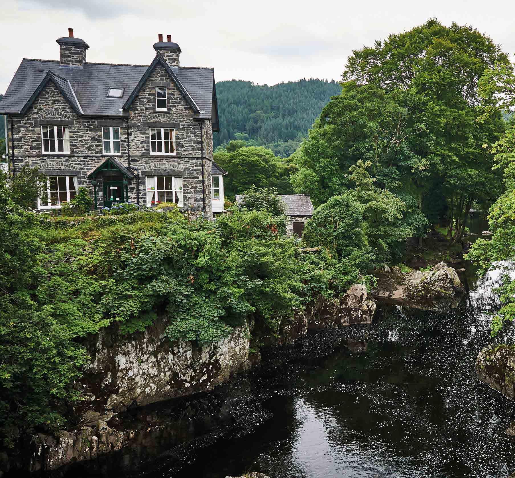
Betws-y-Coed

Betws-y-Coed (Prayer House in the Wood) began as a small village at the junction of the Llugwy, Lledr and the Conwy rivers. This position has made it a key crossing point since the prehistoric period and a Celtic Christian community founded a monastery here in the late 6th century. Lead mining became its focus during the
Ty Mawr Wybrnant
This picture-perfect medieval farmhouse is the birthplace of Bishop William Morgan, who first translated the Bible into Welsh in the 1580s. At a time when the Bible played an important part in peoples lives, this proved to be a crucial development in the preservation of the language after the union with England. There are public toilets there too.
medieval period, while the Waterloo Bridge, built by Thomas Telford was opened in 1815 to carry the Irish Mail road from London to Holyhead across the River Conwy.
Now it’s a big outdoor and tourist centre with loads of outdoor shops, cafés and accommodation options which make it ideal for a break in your Traws Eryri adventure.
43 Part 3: Trawsfynydd to Betws-y-Coed
Betws-y-Coed to Conwy
PART FOUR
Cycling UK 46 START FINISH
Part 4
Betws-y-Coed to Conwy
Distance: 51km (31 miles)
Ascent: 1279m
Highlights
• Optional MTB trail additions
• Mountains for miles
• Towering slate pyramids
• Europe’s fastest, longest zip line
• Awesome views of Ynys Môn (Anglesey)
• Ancient lanes and pastoral landscapes
• Prehistoric forts, stone circles and burial mounds
• Roman roads, medieval castle, amazing engineering
Be aware
• There’s a short section of the A5 main road alongside Llyn Ogwen. There is a marked cycle path but if you’d rather get off and push there’s a raised pavement too
• The Snowdonia Slate Trail to Bethesda can be busy with walkers, and the loose surface, steep slopes and blind bends mean caution is essential
• The roads near Bangor are very narrow so be prepared to pull in for traffic
• The big climb at the end will feel extra arduous with 200km in the legs already, but it’s totally worth the work
• The final descent into Conwy is popular with visitors and locals, so be sensible with your speed and remember the ‘Be nice, say hi’ mantra
Navigation
At the beginning of this section the navigation is super easy. Just make sure you hop onto the Snowdonia Slate Trail behind the outdoor shop in Capel Curig, and don’t miss where it restarts lower down in the valley.
After Bethesda it gets a bit more complicated, as the maze of tiny lanes and hamlets across the ancient farmland requires constant attention to keep on track. The same vigilance is needed to navigate to stay on course through the multiple pony paths across the moorland interior.
47 Part 4: Betws-y-Coed to Conwy
400m 200m 0m 0km 40km 50km 10km 30km 20km
Betws-y-Coed to Capel Curig
When you’re ready to move on from the buzz of Betws-y-Coed, head up the high street and dog-leg over the narrow, high arch bridge where you’ll start climbing on a singletrack road. It’s steep to start with, especially if you over-indulged in the cafés before setting off. If you’re feeling really intrepid, you can take the track to the right which climbs into the forest, and mix in some of the original MTB routes too. Otherwise, the road contours along the hillside parallel to the river, until you turn onto a track past the lovely Rhaeadr Ewynnol – which translates literally as ‘the foaming waterfall’, known in English as Swallow Falls.
Take care as you plummet down the steep lane and cross the busy A5 road. You’ll soon be spirited away from modern motor
Gwydir Forest MTB trails
The Gwydir Forest trails were some of the first in Wales and built by the same team that created the original Coed y Brenin trails. There are now two official trails of 25km and 8.7km, both rated red grade and notable for their steep climbs, stunning mountain views and thrilling descents.
traffic as you reach the 2,000-year-old Roman fort of Caer Llugwy. It’s also known as Bryn y Gefeiliau, which translates as ‘Hill of the Metalsmiths’, suggesting that the fort may have been established to control lead mining in the region. There’s not a huge amount of it left now though, so you’ll have to peer quite hard to spot the remains of the outer banks.
Crossing the bridge, we unfortunately have to join the main road briefly to get to Capel Curig (another section which Cycling UK is hoping to improve in the future).
Cycling UK 48
Capel Curig
The site of a Roman marching fort, Capel Curig gets its name from the ancient Celtic church and graveyard by the river bridge. Now it’s a thriving centre for those who come to worship outdoor adventure and its home to the National Outdoor Centre at Plas y Brenin, an army training camp, a campsite, several cafés, hotels and gear shops.
Part 4: Betws-y-Coed to Conwy
Capel Curig to Llyn Ogwen
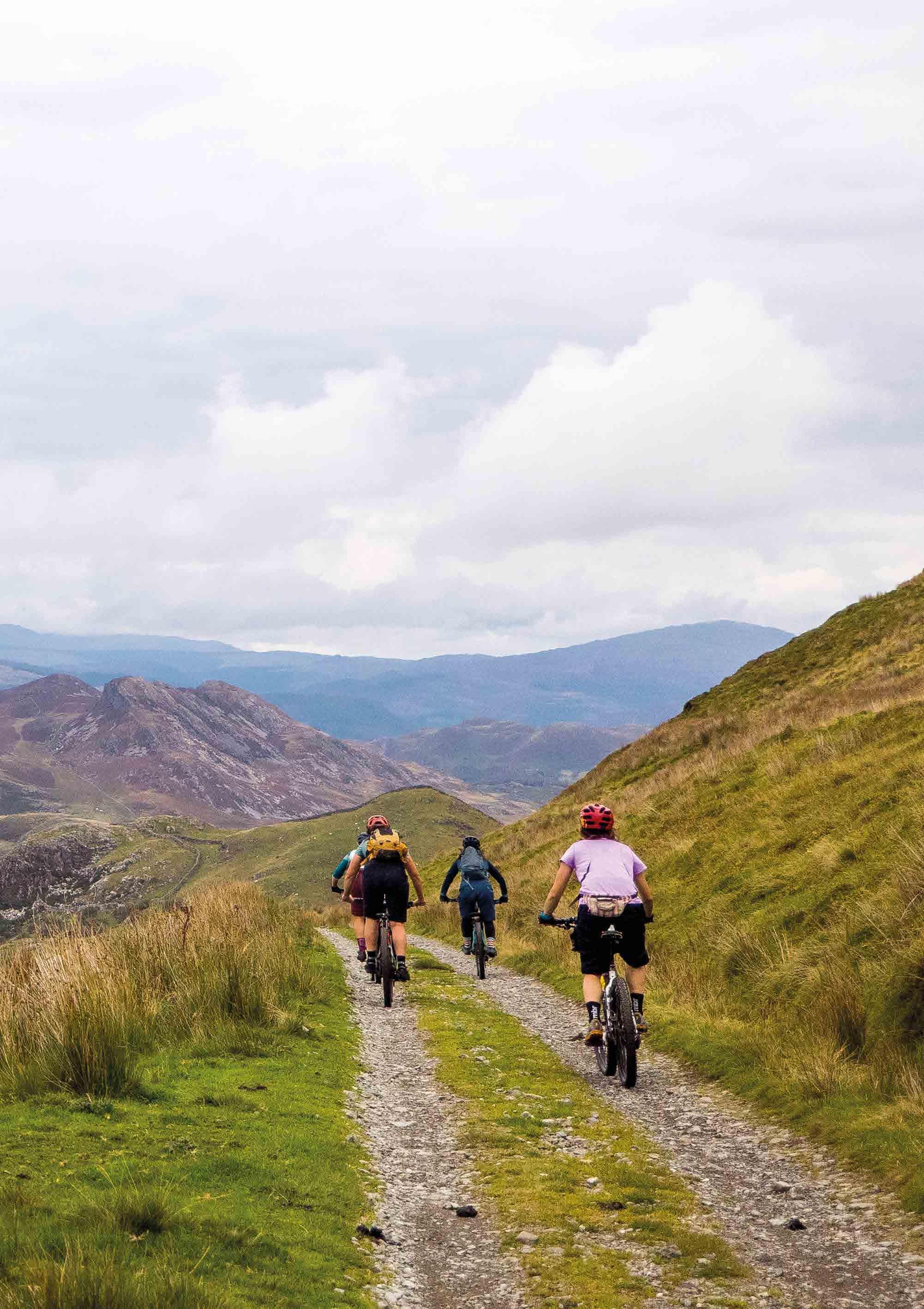
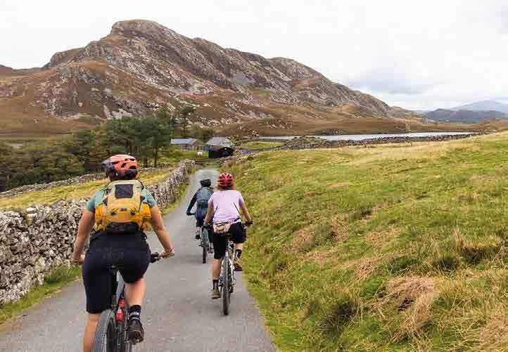
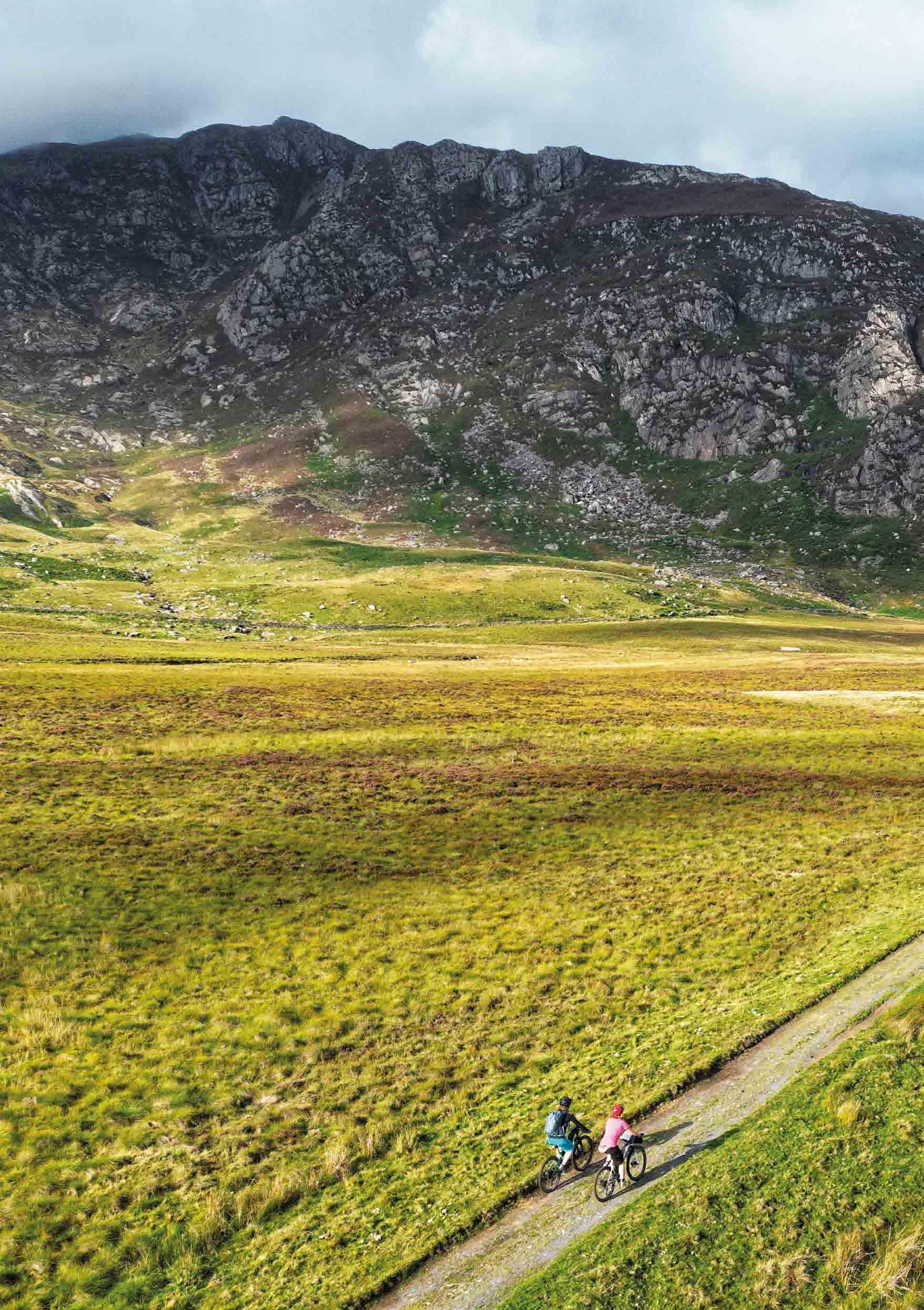
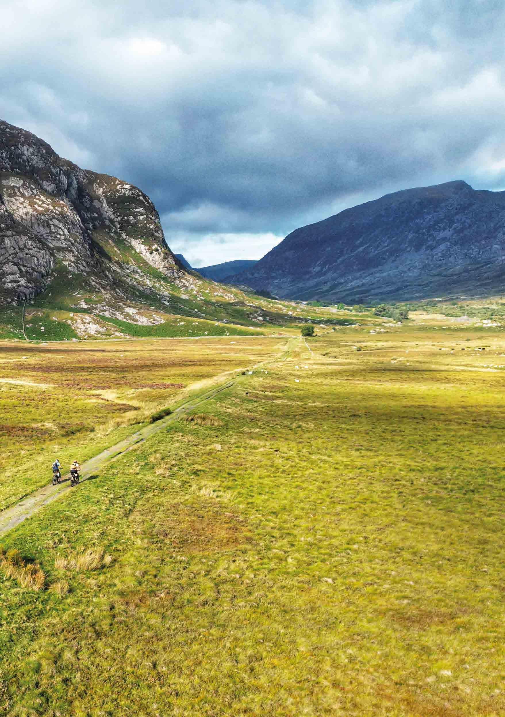
Pedalling up the historic rocky doubletrack of the Snowdonia Slate Trail you’re passing between the imposing peaks of two of Wales’s 1,000m mountains: Glyder Fawr and Carnedd Llewelyn. With Yr Wyddfa (Snowdon) itself just around the corner, that can create a funnel for bad weather and headwinds, so be ready with your extra layers and some extra resolve.
Be careful as you join the short section of the A5 alongside Llyn Ogwen, and don’t miss the chance to visit the beautiful Rhaeadr Ogwen waterfalls. There’s a handily placed snack bar and public toilets here too, plus a hostel with camping.
49
Snowdonia Slate Trail
The truly incredible scenery around you means you won’t be short of inspiration or memories by the time you crest the pass though.
Llyn Ogwen to Bethesda
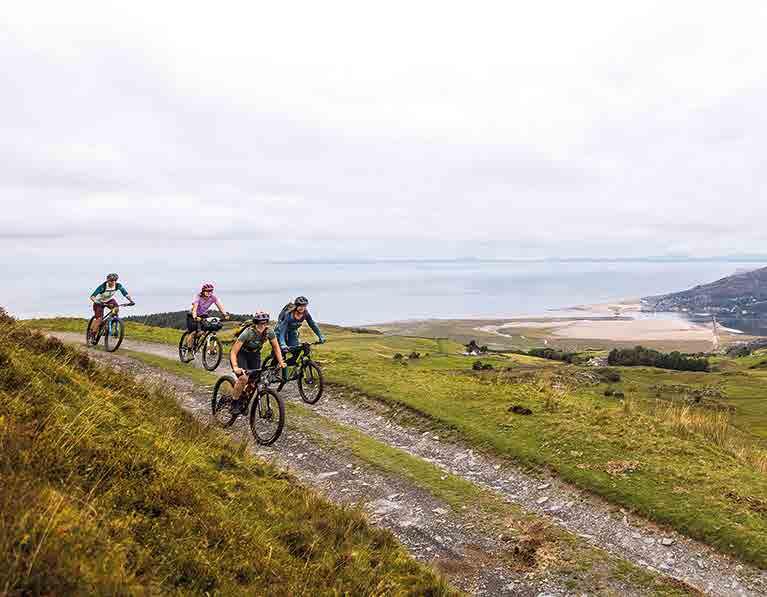
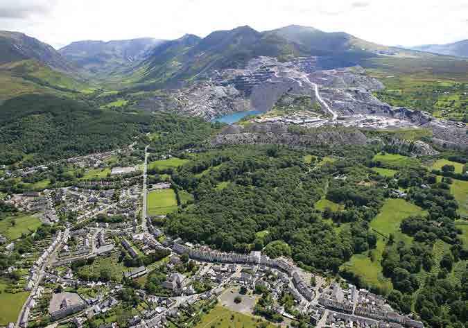
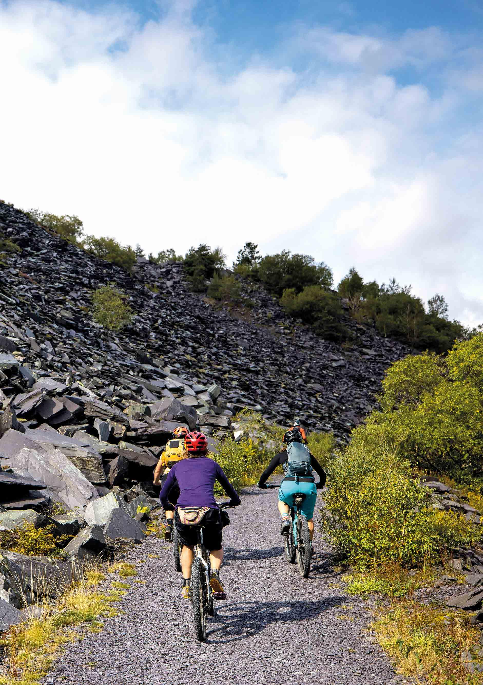
From here it’s a plummet into the spectacular glacial valley of Nant Ffrancon, where you’ll rise and fall along to the Lôn Las Ogwen cycle path which continues the Snowdonia Slate Trail. The striking surroundings of the huge slate pyramids and old workings make this path popular with visitors, so take your time and go carefully down the snaking descents and blind corners that bring you round to the Penrhyn slate quarries.
The old narrow-gauge railway track from the quarries forms your traffic-free route into Bethesda, where you’ll see the old railway lines still embedded in the concrete of the old mining/industrial estate. Bethesda has enough facilities and nearby accommodation to make it a possible stopping point, and bigger, busier Bangor is only 10km away if you want more options.
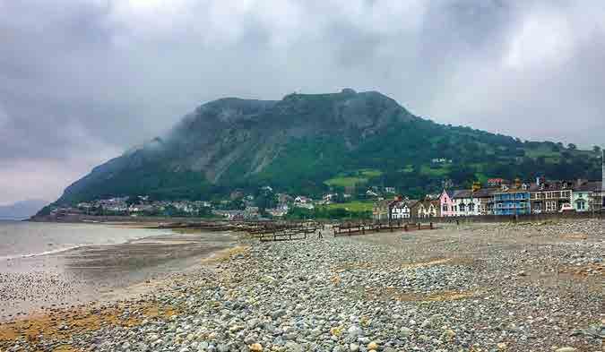
Bethesda
The ancient town of Bethesda grew to its current size on the back of the local slate-mining boom and is still very much wedded to that industry. It’s a proudly Welsh town, with 80% of the locals speaking Welsh and a very strong Welsh-language music scene. A couple of small supermarkets, cafés and pubs make it a potentially useful diversion if you need to resupply.
Cycling UK 50
Lôn Las Ogwen path
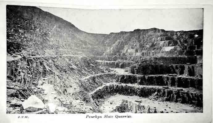
Penrhyn slate quarries
The Penrhyn slate quarries used to be the largest in the world at the end of the 19th century, with 3,000 workers, and were also the site of a three-year strike led by the North Wales Quarrymen's Union between 1900 and 1903. The strike was so bitter that Tregarth (the village the quarry owners built to house strike-breakers from Bethesda) is still known as Traitor's Row or Tail Terrace.
The quarries are still working today, and they’re also home to Zip World with its
1.5km long, 100mph Velocity 2 adrenaline highlight. There’s a café, too, if you’d rather snack than spectate.
51
Part 4: Betws-y-Coed to Conwy
Ynys Môn (Anglesey)
The mystical island of Ynys Môn was known as the home of the druids during Roman times, and is covered in prehistoric sites and later history, including the imposing castle at Beaumaris. Just crossing to the island over the Menai Straits alongside Thomas Telford’s suspension bridge is a breathtaking experience, and the island is ringed with beautiful beaches all the way round to the Irish ferry port of Holyhead on the far side. The surrounding islands and waters are teeming with seabirds, seals and porpoises too, making a wildlife boat trip a great addition to a more leisurely Traws Eryri. It’s close enough to the route for a convenient overnight too.
52
Climb to the North Wales Path
Abergwyngregyn
Its position at the mouth of a stream on the coast, the prehistoric remnants inland and the Iron Age hill fort of Maes y Baer overlooking it almost guarantee a very early start to this Scrabble-winning settlement. It was first recorded as a ceremonial centre in the 5th or 6th century and then again in 1090 when the Earl of Chester built a motte and bailey castle. This site was later used as the royal residence of Welsh prince Llywelyn Fawr, and it’s still a busier place than you’d expect with a couple of cafés and a shop.
Bethesda to Abergwyngregyn
The landscape after Bethesda is dramatically different from that on previous days, but no less fascinating or breathtaking. Monolithic dry-stone walls that border tiny roads twisting between fields are a classic sign of this area’s ancient links with other western Celtic coastal cultures in Brittany, Cornwall, Ireland and Atlantic Scotland. Keen archaeological eyes will also be able to pick out some of the many prehistoric settlement remains and cairns on the rising slopes of Moel Wnion inland.
Stunning views of the Menai Straits and mystic island of Ynys Môn unfurling to the north provide a panoramic background to any pauses for navigation, snacks or just to breathe in the beauty. The descending lanes bring easy miles as you drop towards the coast and the village of Abergwyngregyn.
53 Part 4: Betws-y-Coed to Conwy
Llanfairfechan
Much quieter now than in its late 19th- and early 20th-century seaside holiday resort heyday, Llanfairfechan still has enough shopping and eating options to make it a useful stop before the final hilly hurdle. It has been on the map since at least the 2nd century, when Roman engineers erected a large milestone here which is now preserved in the British Museum.
Abergwyngregyn to Conwy
Surprisingly, the well-surfaced vehicular track leading over the moors from Abergwyngregyn to Rowen, although almost certainly an old Roman road, isn’t recorded as a right of way. Cycling UK is hoping to negotiate access for this section in future, as it gives you even more incredible views out over Ynys Môn and the Irish Sea.
In the meantime, the route follows the cycle path parallel to the main coast road. After a couple of days in the wilds, it’s jarring to be confronted by the rush of traffic passing alongside this stretch of cycle path, but you’re soon back out on quiet lanes weaving back inland, and uphill. Our route skirts the edge of Llanfairfechan, but a glance at the hill you still have to get over may tempt you to explore the village’s seaside attractions and stock up on snacks before the final furlong of your epic Traws Eryri adventure.
It’s not an easy ending, and for once you might be glad of the regular gate stops as you switch from road to ancient tracks. While your legs may be grumbling, the views inland and back out over the sea again are stunning, especially as this remote and forgotten area makes them a rarely enjoyed sight. The natural mystery and contemplative solitude
54
Heading towards Conwy Mountain
Climb up from Llanfairfechan
of the whole area is heightened by the carpet of ceremonial stone rings, burial mounds, hut circles and other remains dating back 6,000 years.
The riding across the top is a very enjoyable rollercoaster romp along criss-crossing trails grazed by sheep and ponies under the watchful eye of Eryri’s ever-present raptors. However, don’t get so distracted on the descent that you miss the point where the route turns through the wall onto moorland.
Where the path crosses the stream at Ty’n-y-ffrith, there is unfortunately a short stretch of ‘hike-a-bike’ on a restricted byway which is quite boggy and difficult to follow. Future route improvements will hopefully allow use of the better-surfaced footpath and bridge slightly to the south, but that would currently involve lifting your bike over a stile.
Watch out for sniper rocks on the singletrack as you drop down to the beauty spot of Sychnant Pass, with its visually spectacular and acoustically entertaining ‘Echo Rock’ volcanic outcrop. You glide down the road and then join a track which hugs the edge of the imposing Conwy Mountain, under the watchful eyes of not one but two ancient hill forts.
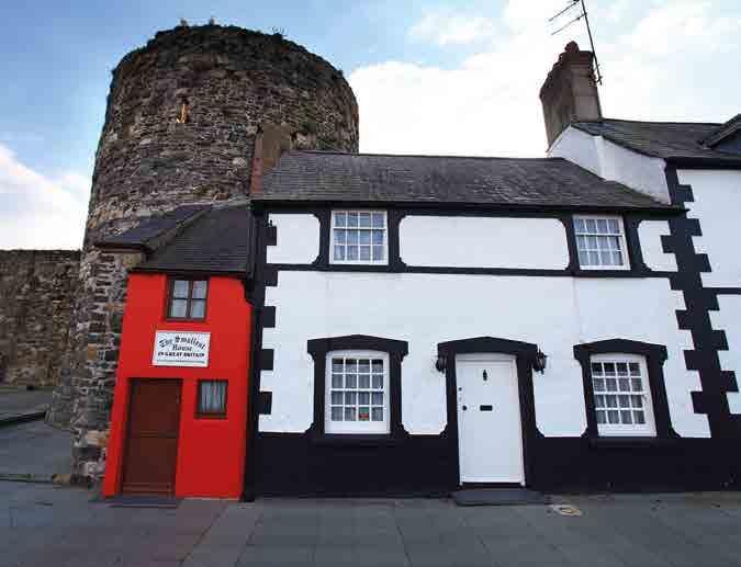
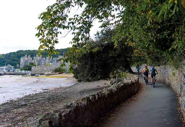
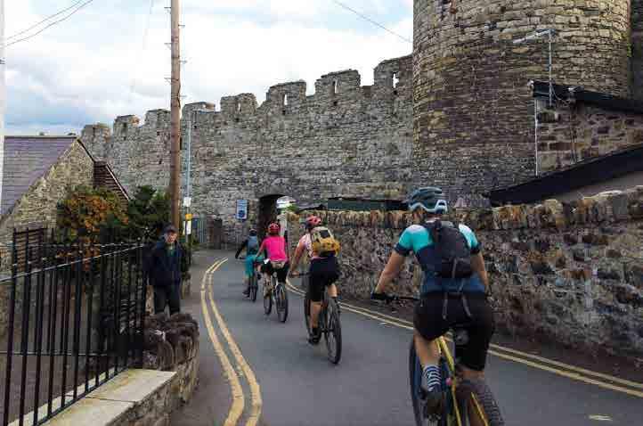
There is a richly deserved reward of a rocky descent past Neolithic hut circles on a timeless rocky drove road, with ancient stone walls and a broad tree canopy. The surface is loose and the track can be busy with walkers and other users, so keep the pace of your entry into the royal town of Conwy stately rather than rebellious. Then it’s time to let what you’ve achieved and experienced start to sink in as you cruise through the back streets of Conwy, until a final bend reveals the majesty of the massive castle and its bridges. Roll under the medieval town walls, past the smallest house in Britain and onto the old quayside, where you can let your pedals rest and start to reflect on the personal Eryri stories you’ve created.
55
Sychnant Pass
Hill forts of Conwy Mountain
When we say there are two Iron Age hill forts on Conwy Mountain, that’s actually a combination of ‘half a fort’ and a ‘fort and a half’. The first fort atop the towering peak of Allt Wen is very small but its location and 3m-high, stone-faced wall must have made it a formidable fortress.
The much larger 6th century BC Castell Caer Seion to the east is noteworthy not
only because of obvious permanent occupation with over 50 hut foundations, but also because a smaller inner fort was added in the 4th century BC. The ditch and rampart defences clearly weren’t just for show either, as one of the huts inside the entrance contained more than 600 sling stones ready to be rained onto any attackers.
Conwy
Positioned on a river estuary that forms a natural sheltered harbour and with access along the coast and inland to the south, Conwy has been perfectly positioned to be important throughout the ages. This importance was confirmed when Edward I built his imposing castle here, and Aberconwy Abbey was also the largest in North Wales.
While prehistoric and Roman remains are only visible in the surrounding countryside, the narrow streets inside the superbly preserved town walls are still bursting with history. This includes the National Trustowned, 14th-century Aberconwy House and Plas Mawr, the Elizabethan home of the Wynn family, now restored to its 16th-century glory by Cadw and open to the public.
It’s a busy town with lots of eating and accommodation options, making it ideal for refuelling and resting before your train journey or drive home.
Cycling UK 56
The smallest house in Britain
Track on Conwy Mountain
Crossing the estuary
The Conwy suspension bridge was one of the first suspended bridges in the world, designed by legendary engineer Thomas Telford. Equally famous engineer and steam-train pioneer Robert Stephenson built his radical tubular and box-section railway bridge alongside it later. The innovation you can’t see is Britain’s first sunken tube tunnel, which takes the A55 coast road under the River Conwy to bypass the historic town.
Conwy Castle
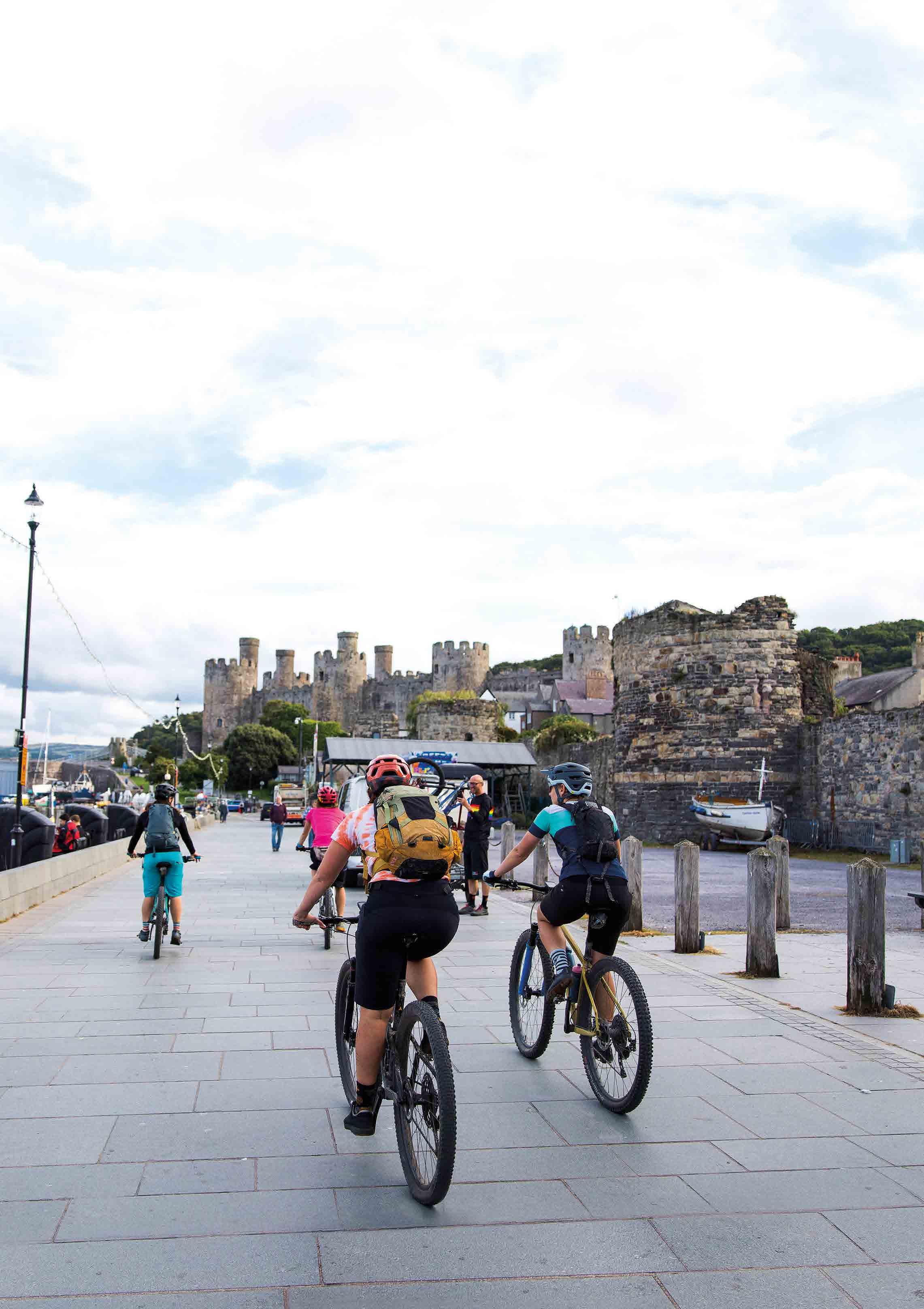
Conwy Castle is one of the most impressive and best-preserved castles in the UK. Its high walls and eight tall towers have been looming over the town since 1287, when Edward I of England built his series of strongholds all around the coast of North Wales. The internal rooms and spiral staircases are
still extremely well preserved too making this site an essential part of a Conwy visit. In fact, it’s such a signature part of the town that people born within Conwy’s walls are still nicknamed ‘jackdaws’, after the birds which live on the fortifications.
57
Part 4: Betws-y-Coed to Conwy
57
Roll under the medieval town walls, past the smallest house in Britain and onto the old quayside, where you can let your pedals rest and start to reflect on the personal Eryri stories you’ve created.
Places and facilities
For places which are a slight detour from the route, the distance and ascent shown relate to the closest point on the route.
Cycling UK 58
Distance from start (km) Distance between (km) Total ascent (m) Ascent between (m) Machynlleth 0 0 0 0 Corris 9 9 184 184 Abergynolwyn 21 12 380 196 Arthog 44 23 952 572 Barmouth (4km off route) 49 0 952 0 Penmaenpool 52 8 966 14 Dolgellau (4km off route) 52 0 966 0 Coed y Brenin Visitor Centre 68 16 1404 438 Bronaber (2km off route) 75 7 1695 291 Trawsfynydd (before lake loop) 78 3 1695 0 Trawsfynydd (after lake loop) 89 11 1881 186 Llan Ffestiniog 96 7 2117 236 Blaenau Ffestiniog (4km off route) 96 0 2117 0 Penmachno (1km off route) 109 13 2350 233 Betws-y-Coed 140 31 3160 810 Capel Curig 150 10 3488 328 Llyn Ogwen Visitor Centre 158 8 3654 166 Bethesda (1km off route) 166 8 3757 103 Bangor (8km off route) 168 2 3769 12 Abergwyngregyn 176 8 3901 132 Llanfairfechan 181 5 4050 149 Conwy 194 13 4424 374
Blaenau Ffestiniog
59 Places and facilities Conwy
B&B/hotel Hostel Campsite Pub/ restaurant Café Shop Bike shop Train station
Suggested Itineraries
We’ve split the guidebook into four sections based on geography and obvious stop points but the route can also be split up in other ways. Bear in mind the terrain and steep gradients can make progress slower than expected, so plan your daily distance accordingly.
Dolgellau is a slight detour from the main route – distances shown here include diversions into and out of town using National Cycle Network route 8.
Map Key
options
Scale 1:50,000
The Traws Eryri route is updated over time, and maps may not show the latest version. Download the up-to-date route file at cyclinguk.org/traws-eryri
Cycling UK 60
3 nights – 50km per day Distance (km) Ascent (m) Machynlleth to Dolgellau 61 1199 Dolgellau to Trawsfynydd (after lake loop) 41 915 Trawsfynydd to Betws-y-Coed 51 1279 Betws-y-Coed to Conwy 54 1264 2 nights – 70km per day Distance (km) Ascent (m) Machynlleth to Dolgellau 61 1199 Dolgellau to Betws-y-Coed 92 2194 Betws-y-Coed to Conwy 54 1264
B&B/hotel Hostel Campsite Pub/restaurant Café Shop Bike shop Train station Main route Alternative
Traws Eryri – Image credits
All images by Samantha Saskia Dugon except:
Foreword
Image by Rob Spanring/Cycling UK.
How your support helps
P.7, top left by Joolze Dymond/Cycling UK, bottom left by Julie Skelton/Cycling UK.
Introduction
P.11 by Sophie Gordon/Cycling UK; p.13, top right by Sam Jones/Cycling UK, bottom left by Joolze Dymond/Cycling UK; p.14, bottom left by Sam Jones/Cycling UK, top right by Phill Stasiw/MTB Cymru; p.15, bottom right by Denise Furlonger/Surrey Hills AONB; p.16 by Phill Stasiw/MTB Cymru; p.17 Machynlleth by Ruth Hartnup (CC BY 2.0).
Part 1
P.22, Dyfi Bike Park by Dyfi Bike Park; p.23, Centre for Alternative Technology by Jonathan Billinger (CC BY-SA 2.0), Talyllyn steam railway by Peter Trimming (CC BY 2.0); p.24, Craig yr Aderyn by Mike Finn (CC BY 2.0); p.25, Castell y Bere by Tanya Dedyukhina (CC BY 3.0); p.27, Penmaenpool by David Merrett (CC BY 2.0), Cadair Idris by John K Thorne (CC0 1.0).
Part 2
P.32, Penmaenpool bridge by David Merrett (CC BY 2.0), p.33, Rhaeadr Du by Andrew Bowden (CC BY-SA 2.0); p.35, Trawsfynydd by Tanya Dedyukhina (CC BY 3.0), Trawsfynydd reservoir by Jim Killock (CC BY-SA 2.0).
Part 3
P.39 by Phill Stasiw/MTB Cymru; p.40, Castell Tomen y Mur by Davina Ware (CC BY-SA 2.0); p.41, Blaenau Ffestiniog by artq55 (CC BY-SA
2.0); p.42, Manod Quarry by Sophie Gordon/ Cycling UK; p.43, Betws-y-Coed main image by Visit Wales and inset by CK Travels/ Shutterstock.
Part 4
P.48, middle right by Phill Stasiw/MTB Cymru; p.50, Bethesda by Visit Wales; p.51, Penrhyn slate quarries by Hefin Owen (CC BY-SA 2.0); p.52, Ynys Môn by Barry (CC BY 2.0); p.53, Abergwyngregyn by hagger71; p.54, Llanfairfechan by cattan2011 (CC BY 2.0).
Places and facilities
P.58, campsite by Steve Way (CC BY 2.0); Blaenau Ffestiniog by Hefin Owen (CC BY-SA
2.0); p.59, hostel by Phill Stasiw/MTB Cymru.
About the author
Image by Guy Kesteven.
61
Afterword
Imagine being able to cycle the length and breadth of the country on connected off-road trails, through fascinating places and amazing landscapes.
As the UK’s cycling charity, Cycling UK is working to make this a reality by campaigning for wider off-road access for cycling and developing new long-distance trails to link existing routes.
We started with the North Downs Way riders’ route, and have since created several more long-distance trails in England and Scotland including King Alfred’s Way and the Great North Trail. Traws Eryri is our first route in Wales.
cyclinguk.org/offroadcampaigns
Exploring our forests, moors and valleys by bike is inspiring and spirit-lifting. It’s the best way to discover new places, and a great boost for rural tourism. We believe everyone should have the opportunity to ride from their door on connected traffic-free trails.
If you share our vision, do something incredible and join Cycling UK today. Because together, we can make a better world by bike.
cyclinguk.org/join
Become a member of Cycling UK
Join over 70,000 members and receive:
We are the UK’s cycling charity
Cycling is amazing, which is why we want everyone to enjoy the thrill of the ride by making our streets safer, opening up new traffic-free routes and inspiring more people to get on their bikes.
We have more than 140 years’ experience of supporting cyclists and campaigning for their rights.
We believe everyone has the right to ride a bike, have access to safe routes and to be given the skills to cycle with confidence.
But we need can’t bring about change alone. Our community of passionate members and supporters give us a louder voice to lobby government and inspire millions more people to cycle.
• Free third-party liability insurance and legal assistance.
• Discount on cycle insurance (includes mountain bikes and e-bikes) with Yellow Jersey.
• Retailer discounts and benefits
• Cycle magazine every two months for inspiring routes, advice, news and reviews.
• Your membership directly supports the work we do to make a better world by bike.
cyclinguk.org/join
If membership isn’t for you, please consider a donation to help Cycling UK to continue our work in opening up more rural access for cycling and campaigning for improving conditions for cyclists all over the UK.
cyclinguk.org/donate
Cycling UK 62
About the author
Guy Kesteven has been exploring historic England by bike ever since his mum used to stick him in his child seat along with the groceries for trips into York. A qualified and time-served archaeologist, he’s stayed amongst mud on a daily basis as a professional bike tester for leading global websites and magazines. He also has his own YouTube channel GuyKesTV where you can find video guides to many of Cycling UK’s routes.
63
“The Traws Eryri route is a beautiful collection of singletrack, gravel trails and quiet lanes that link up some of the best-known MTB areas and beauty spots in North Wales. Riding your bike through the National Park brings you close to nature. You’ll discover hidden snippets of ancient woodland, wide open mountain vistas and fascinating glimpses into the area’s industrial history before the final stretch that skirts around the north coast with views out to the Irish Sea and rugged coastline.
It’s a more challenging route than some of Cycling UK’s other offerings, so bring your climbing legs and come prepared for
T: 01483 238301

Cycling UK is a trading name of Cyclists’ Touring Club (CTC) a company limited by guarantee, registered in England no: 25185. Registered as a charity in England and Wales charity no: 1147607 and in Scotland charity no: sco42541. Registered office: Parklands, Railton Road, Guildford, Surrey GU2 9JX.
Cycling UK, Parklands, Railton Road,
cyclinguk.org
Guildford, Surrey GU2 9JX
adventure.”
Claire Frecknall, Mason Cycles/HUNT Beyond
