ISSUE TWO Q4 2024 THE MAGAZINE OF CTBUH
TOUR BOSTON UNIVERSITY’S AWARD-WINNING VERTICAL CAMPUS
CITY ADVOCACY: EIGHT CITYMAKERS, FROM PARIS TO ISTANBUL, ON DENSITY
PATRIK SCHUMACHER PRAISES THE LATE JOHN PORTMAN’S PIONEERING TOWERS
ISSUE TWO Q4 2024 THE MAGAZINE OF CTBUH
TOUR BOSTON UNIVERSITY’S AWARD-WINNING VERTICAL CAMPUS
CITY ADVOCACY: EIGHT CITYMAKERS, FROM PARIS TO ISTANBUL, ON DENSITY
PATRIK SCHUMACHER PRAISES THE LATE JOHN PORTMAN’S PIONEERING TOWERS
The Tempo Tower complex has been designed to harmonize with the existing urban landscape and structural matrix, reflecting the city's dynamic character. The heights of each tower are strategically defined to contribute to a cohesive and functional cityscape that resonates with the rhythm of modern urban life. At the heart of the complex is a four-level multifunctional podium, serving as a vibrant hub for commercial, business, cultural, educational, and recreational activities. This dynamic space seamlessly connects with the surrounding urban fabric, enhancing the community experience. Rising above the podium, the residential towers offer a diverse range of living options tailored to the needs and lifestyles of contemporary urban residents.
The architectural design integrates urban and natural elements through a carefully curated facade system that includes curtain walls, brise soleil, and nature-inspired architectural features. Green terraces, landscaped roofs, and thoughtfully designed ground-level spaces not only elevate the aesthetic appeal but also promote sustainability, creating private green oases for relaxation.
The Tempo Tower complex exemplifies a holistic approach to urban living, combining architectural elegance, sustainability, and a high-quality living environment to enrich the cityscape and enhance the lives of its residents.
BUREAU CUBE PARTNERS is an architectural studio based in Belgrade, Serbia, with over 15 years of expertise blending theoretical and practical knowledge. The studio specializes in the creation, development, production, coordination, and implementation of all phases of the design process across architectural design and urban planning disciplines.
Publisher Vertical Urbanism is published by the Council on Tall Buildings and Urban Habitat (CTBUH).
ISSN: 2997-9463 (Printed)
ISSN: 2997-9471 (Digital)
Editorial
Editor-in-Chief:
Daniel Safarik dsafarik@ctbuh.org
Executive Editor: Will Hunter will@will-hunter.com
Managing Editor: Martina Dolejsova
Associate Editor: Javier Quintana de Uña
Advertising: Jen Hall
jhall@ctbuh.org
Production: Tansri Muliani
Editorial
Advisory Board
Isabel Allen Reed Kroloff
Editorial policy
As a platform for interdisciplinary discourse on the sustainable densification of cities, Vertical Urbanism solicits articles from diverse fields of expertise. Contributors are independent from CTBUH, unless explicitly stated otherwise. The opinions expressed by contributors are their own and do not represent CTBUH’s official stance nor carry its endorsement.
Submissions
We welcome content ideas from our readers. Please email submissions to dsafarik@ctbuh.org.
Cover
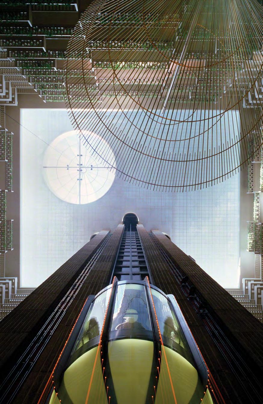
John Portman’s Hyatt Regency Atlanta, looking upwards in the hotel lobby, 1989 (see page 104). © 1989 Michael Portman. All rights reserved. Courtesy The Portman Archives

FOR THE COVER OF
, we are always on the hunt for an image that offers a fresh perspective on the concept. This issue’s cover is a pivotal “blast from the past”—John Portman’s Hyatt Regency Atlanta Hotel (1967). The soaring interior atrium, with its glass elevators, provided a powerful new way to think about the tall building’s relationship with the city, in answer to two prevalent anti-urban trends at the time: suburban sprawl and cold, flat plazas surrounding insular high-rises. His designs, including that of the New York Marriott Marquis Hotel (1985), broke the rigid Miesian mold, giving birth to “vertical boulevards”—dynamic environments that blended architecture and urbanism. As Zaha Hadid Architects principal Patrik Schumacher notes (p. 104), Portman’s atriums became vibrant public places, inspiring generations of architects to think beyond the exterior appearance and floor-plate efficiency of the high-rise.
A contemporary take on vertical urbanism, using both interior drama and inviting exterior transparency, is found at the Duan Family Center for Computing & Data Sciences (p. 34). Rising boldly over the Charles River, its cantilevered forms and interconnected neighborhoods reimagine the modern campus as a vertical, collaborative environment. The building integrates education, sustainability, and urban life, proving that Portman’s vision of interactionrich vertical spaces is not only relevant but vital in addressing today’s challenges.
Potential for interaction is also key to our Tech feature, the future-focused “Regenerative Tree” prototype (p. 76), combined with adaptability and the latest advances in technology. By blending timber construction, biomimicry, and adaptable design, the project calculates a 40% reduction in carbon emissions across its lifecycle. Shared spaces spiral through the tower, ensuring that sustainability and sociability go hand in hand.
Throughout this issue, our contributors approach vital questions of density—what is the right scale of buildings in relation to streets and open spaces (p. 9)? How can the office buildings of the previous century become the vertical villages of the future (p. 20)? In our double edition of City Advocacy Forum (CAF), eight city-makers from metropolises as diverse as Tirana, Istanbul, and New York City search for common ground on how to manage density in a rapidly changing world (p. 46).
If there is a resounding theme that emerges from all of these diverse contributions, it might be that change is the one constant, adaptability is essential, and the best experiences of density are shot through with dynamism.
Daniel Safarik, Editor-in-Chief
6 BULLETIN
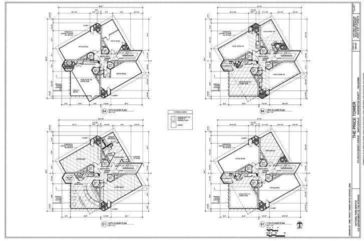
Frank Lloyd Wright’s Price Tower, Bartlesville, OK, (below); CTBUH launches its bold new Vertical Urbanism Index.
9 OPINION
Coby Lefkowitz compares the density dynamics of Paris and New York City.
10 DISPATCH
Oleksandra Azarkhina highlights resilience and rebuilding in Kiev.
12 ESSAY
Jason Barr examines the economic and spatial implications of skyscrapers on cities—from Dubai to Shanghai.
16 REPORT
Washington Fajardo discusses the office-toresidential revolution in Rio de Janeiro.
20 ESSAY
Adam Rolston reimagines the Empire State Building as a vertical village.
26 LEGACY
Paul Goldberger profiles Dan Doctoroff, the urbanist who transformed New York.
34 DESIGN
The Center for Computing and Data Sciences, a collaboration between KPMB and Boston University’s sustainability team.
46 CITIES
Supported by KPF, the second and third City Advocacy Forums in Istanbul and London, feature 10 speakers from eight cities: Istanbul, London, New York City, Oslo, Paris, Singapore, Tirana, and Toronto.
76 TECH
Nikken Sekkei’s carbon-reduction high-rise prototype sets a standard for sustainable skyscrapers (below).
84 PAPER
Nathaniel Staniak evaluates adaptive reuse and podium strategies shaping high-rise functionality and integration (below).
94 PAPER
Bloomberg Associates presents London’s Climate Risk Maps to address social inequities and environmental hazards.
102 DIGEST
A summary of the most germane findings from recent peer-reviewed urban and design research papers.
104 INSPIRATION
Patrik Schumacher reflects on the visionary towers of John Portman.
106 ARCHIVE
Andrea Fernandez Salazar delves into the story behind Kahn’s unrealized high-rise design (below).
112 REVIEWS
Write-ups on High-Tech Heritage; Housing the Nation; High-Rises; The Architecture of Urbanity; Sustainable Housing in a Circular Economy; The Computable City; and Green Facades
120 LETTER FROM Melike Altinișik sends a missive on the urban evolution of Istanbul.


Submit your project in categories such as Best Tall Building, Innovation, Urban Habitat, and Equity, Diversity & Inclusion and vie for the opportunity to present at the CTBUH 2025 International Conference, 6–9 October, in Toronto. Deadline: 14 February, 2025
To learn more and submit, please contact awards@ctbuh.org

OLEKSANDRA
AZARKHINA, filing from Kiev (p. 10), is the co-founder of the We Build Ukraine Foundation and the former deputy minister for communities, territories and infrastructure development of Ukraine.
JASON M. BARR, who argues that skyscrapers shape the economic and cultural vibrancy of cities (p. 12), is a professor of economics at Rutgers University and author of Cities in the Sky: The Quest to Build the World’s Tallest Skyscrapers (2024).

WASHINGTON FAJARDO, who reports on Rio’s office-to-residential transformation (p. 16), is an architect and urbanist who was formerly president of the Rio World Heritage Institute and Rio’s city planning commissioner.
PAUL GOLDBERGER, who reflects on Dan Doctoroff’s legacy (p. 26), is a Pulitzer Prize-winning architecture critic, previously at The New Yorker (1997–2011). He is the Joseph Urban chair in design and architecture at New York’s New School.
COBY LEFKOWITZ, this issue’s Opinion columnist (p. 9), is co-founder of Backyard, a real-estate development firm, and author of Building Optimism: Why Our World Looks the Way it Does, and How to Make it Better (2024).
ADAM ROLSTON, who reimagines the Empire State Building as vertical village (p. 20), is senior founding partner of INC Architecture & Design, where he explores design innovation and urban integration.
STEVE WATTS, who celebrates Antony Wood’s legacy at CTBUH (p. 8), was the Council’s longestserving global chairman from 2017–2023.
ISAAC WORK, who launches the Vertical Urbanism Index in Bulletin (p. 7), is building data coordinator at CTBUH, where he focuses on tall building trends and metrics.

DOMINIQUE ALBA, who represents Paris in the CTBUH City Advocacy Forum (CAF) (p. 46), is CEO of Ateliers Jean Nouvel and a former general manager of Atelier Parisien d’Urbanisme.
SERHAT BAŞDOĞAN, who represents Istanbul in the CAF (p. 46), is general manager of Türkiye Design Council, an NGO promoting human-centered design rooted in culture and the arts.
ARIANE DIENSTAG, who chairs both CAFs (p. 46), is a Paris-based architect, CTBUH French Chapter secretary, and a lecturer at École d’Architecture de Versailles.

MANSOOR HUSSAIN, who joins CAF in Istanbul (p. 46), is a Norwegian politician, urbanist and advisor at Storm Samfunn, and has led Oslo Urban Week.
NOBUTAKA KASHIMOTO, who writes the Tech feature (p. 76), is engineering director of Nikken Sekkei’s structural design division.
ANISA MANCE, who represents Tirana in the City Advocacy Forum, (p. 46) is the urban planning and development director at the Municipality of Tirana.

KATSUNARI MISUGI, who coauthors the Tech feature (p. 76), is associate architect of Nikken Sekkei’s achitectural design group.
PETER MURRAY, who takes part in the City Advocacy Forum (p. 46), is the cofounder of New London Architecture and a Mayor of London’s design advisor.
JAMES PARAKH, who takes part in the City Advocacy Forum (p. 46), is the urban design manager for the City of Toronto and chair of CTBUH’s Urban Habitat/Urban Design Committee.
KOUJI SUGIHARA, who writes the Tech feature (p. 76), is engineering director of Nikken Sekkei’s building services design group.
SHINGO TANABE, who writes on Nikken Sekkei’s high-rise carbon-reduction prototype (p. 76), is general manager of the digital solution section at Nikken Sekkei, specializing in smart buildings and carbon assessments.

THOMAS WRIGHT, who takes part in the City Advocacy Forum (p. 46), is president of Regional Plan Association, leading research and advocacy for the New York-New Jersey-Connecticut tri-state region.
LAY BEE YAP, who takes part in the City Advocacy Forum (p. 46), leads architecture and urban design at the Urban Redevelopment Authority (URA) in Singapore.
ÖZGÜR BORA YAPRAK, who participates in the City Advocacy Forum (p. 46), is general director of Bimtas Inc. in Istanbul.
TOM BENSON, who co-edits the Research Digest (p. 102), is the lead project manager for LabX in Dar, where he is developing a data-driven urban lab.

CATE HEINE, who co-edits the Research Digest (p. 102), is a post-doctoral researcher at the Centre for Advanced Spatial Analysis within University College London, where she studies equity and segregation in transportation systems.

ANDREA PARTENIO, who coauthors a paper on mapping climate risk (p. 94), is a consultant at Bloomberg Associates, with expertise in geospatial analysis and urban sustainability.

LAUREN RACUSIN, who coauthors a paper on mapping climate risk (p. 94), works at Bloomberg Associates. She is a member of the Urban Land Institute’s Urban Development and Mixed-Use National Product Council and the WX New York Women Executives in Real Estate.

NATHANIEL STANIAK, who authors the paper on the scale and integration of highrises into cities (p. 84), is a graduate of the CTBUH-affiliated M.TBVU program at the Illinois Institute of Technology, and a designer at Adrian Smith + Gordon Gill Architecture.

MELIKE ALTINIŞIK who posts a Letter from Istanbul (p. 120), leads Melike Altinișik Architects, designers of the 369-m Çamlıca Radio & TV Tower.
ROBERTO BOTTAZI, who reviews The Computable City (p. 116), is director of the Master in Urban Design at The Bartlett, UCL and author of Digital Architecture beyond Computers (2018).

CATHERINE CROFT, who reviews High-Tech Heritage (p. 115), is the director of the Twentieth Century Society, advocating for the preservation of modern architecture.
LOUISE DORIGNON, who reviews Sustainable Housing in a Circular Economy (p. 118), is a research fellow at RMIT University’s Centre for Urban Research, focusing on building practices toward more sustainable and affordable homes.
ANDREA FERNANDEZ SALAZAR, who writes the Archive feature (p. 106), is a PhD candidate at the Universidade Autónoma de Lisboa, focusing on Louis Kahn’s urban thinking through architecture.

CHRIS HERBERT, who reviews Housing the Nation (p. 113), is managing director of the Harvard Joint Center for Housing Studies and a lecturer at Harvard’s Graduate School of Design.
VENETA NOVAKOVA, who reviews Green Facades (p. 112), is a façade engineer consultant and founder of a Master of Façade Engineering degree at the University in Sofia.

PATRIK SCHUMACHER, who writes on the late John Portman’s legacy (p. 104), is Principal at Zaha Hadid Architects and an advocate for parametricism in architecture.
BARTLESVILLE, OK, USA
The Editors
The auction of Frank Lloyd Wright’s Price Tower, originally planned for November 2024, has been postponed to early 2025 amid ongoing litigation and mounting preservation challenges. The 19-story Bartlesville, Oklahoma landmark was listed on the auction platform Ten-X with a starting bid of US$600,000. The delay comes as legal disputes cloud its future.
The current owner, Green Copper Holdings, led by Cynthia Blanchard, acquired the building in 2023 with plans to transform it into a tech hub. Blanchard’s group had promised to
resolve the building’s US$600,000 debt and invest US$10 million in renovations. However, those commitments remain unfulfilled, leaving the property shuttered and tenants displaced. Meanwhile, McFarlin Building LLC, a Tulsa-based developer with a reputation for restoring historic landmarks, claims a legal agreement obligates Blanchard to sell the tower to them for US$1.4 million. Blanchard denies such a contract exists, as reported by CoStar News.
The controversy extends beyond the sale itself. A preservation easement, established in 2011 by the Frank Lloyd Wright Building Conservancy, protects architectural elements and furnishings designed by Wright. This includes copper tables, stools, and a directory board, which the Conservancy alleges were sold in violation of the easement. The Conservancy has taken legal action
to enforce these protections and ensure the building’s historical integrity, stating its “strong objections to the baseless claims” made by the ownership group. Price Tower, completed in 1956 and originally conceived as a residential skyscraper for Manhattan, is Wright’s only realized high-rise. Often described as a “tree that escaped the forest,” its innovative design and copper cladding reflect Wright’s organic architectural philosophy. The tower’s financial struggles have repeatedly forced it into the spotlight, with ownership changing
hands multiple times in recent decades. The latest developments only deepen the uncertainty surrounding its future.
The auction’s delay could create an opportunity to secure a buyer committed to preserving the landmark. McFarlin has expressed willingness to invest up to US$10 million in its restoration. The Conservancy, which has been negotiating with potential purchasers, remains hopeful, saying it is “ready to work with any new owner as partners in the building’s preservation.”
As litigation proceeds in Oklahoma district court, the tower’s fate hangs in the balance. For preservationists, the building is more than a piece of real estate; it’s a legacy of Wright’s vision of sustainable urbanism. Whether a new owner can honor that vision while addressing the the financial challenges remains to be seen.
The Council on Tall Buildings and Urban Habitat (CTBUH) is uniquely positioned to study how vertical growth influences these patterns of urban evolution—both positively and
negatively—and to advance a vision for sustainable vertical urbanism. This vision inspired the creation of the Vertical Urbanism Index (VUI), which launched at the CTBUH 2024 International Conference in London in September.
The VUI, an initiative of the City Advocacy Forum (see pages 46–75), is an innovative analytical framework that evaluates how cities’ tall building growth intersects with key performance metrics, adding substance to otherwise superficial tall building statistics confined to administrative boundaries. As we search for the optimal nexus of “smart” density, high-rise development, land-use diversity, and livability, the VUI invites public engagement, with its roots in open data sources. What sets the VUI apart is its integration of satellite-derived aggregate building data with CTBUH’s proprietary Tall Building Database, which catalogues nearly 45,000 detailed building profiles. Paired with construction milestones, this database enables longitudinal analysis of the impact of tall building development— showing whether it densifies urban a reas or exacerbates sprawl.
While rapid population growth can sometimes outpace construction, the VUI pairs density and livability metrics to uncover if developments deliver net-positive outcomes compared to peer cities. The VUI approaches density with
clarity, calculating a simple ratio of inhabitants to land, and analyzing global urban areas at the granular level of square-kilometer cells. Drawing from the Global Human Settlement Layer (GHSL), the Index tracks density trends over time, as well as greenfield (undeveloped) land consumption —a critical indicator of urban sprawl. Livability, the most debated aspect of the index, was built on a foundation of measurable, objective metrics. Inspired by the Economist Intelligence Unit’s groundbreaking Livability Index, the VUI evaluates cities across three pillars of sustainability—social, economic, and environmental— avoiding the pitfalls of subjectivity that often plague these analyses. Beyond its analytical value, the VUI addresses a systemic issue in urban planning: the fragmented availability of comparable global datasets. Data inconsistencies—conflicting formats, outdated timelines, and incomplete coverage—pose perennial challenges

for researchers and policymakers alike. Some cities and countries, regrettably, fail to publish any usable data. To counter this, the VUI leverages cuttingedge tools, such as machine-learning analysis of satellite imagery and the translation of incompatible datasets, to create standardized, universal databases. To date, the VUI has comprehensive data on 36 cities.
Our intent is for the VUI to serve as a living resource, continuously updated as new cities are added and new metrics fed into the scoring system. Instead of ranking cities by “quality,” the VUI offers level comparisons that inform and empower city-shapers to address local challenges within a global context.
However, the true potential of the VUI is to envision how the its components—density, livability, and tall buildings—can address the unique needs of cities. In a crowded field of analytical tools, we hope the VUI becomes more than a dataset. By 2025, when plan to we launch more robust tools to interact with the VUI data, it aims to be an instrument for action instead of a conversation piece.
The future of urbanism is being built today, shaped by the policy choices we make on a grand scale and the emerging data analysis technologies that fuel an increasing appetite for worldwide urban change. Let’s build cities that honor the human experience, objectively consider the successes and failures of our global neighbors, and remain firmly grounded in sustainability together. It’s an ambitious mandate, but we look forward to collaborating with our members and the public to leverage the VUI in pursuit of these goals. Please visit the Vertical Urbanism Index at: caf.ctbuh.org/index

There was incredible growth at the Council during Antony Wood’s two-decade tenure.
CTBUH
Steve Watts
Antony Wood’s relationship with CTBUH transcended mere contribution—it was his life’s work. Under his leadership between 2004 and 2024 as Executive Director, CEO, and finally President, it grew from a two-person office to a global authority on tall buildings and urban development, establishing international height measurement standards and hosting landmark conferences across the globe.
I first met Antony in 2004, before he assumed his role. Recognizing complementary personalities united by strong work ethics, Alastair Collins, CEO of Davis Langdon and Seah Global Board, introduced us. Over a Chinese meal in London, we discovered shared passions for professional excellence and tall buildings.
I regularly say that Antony is the most driven person I have ever met, and I’ve
worked with some pretty driven people. He enhances that drive with a real passion for his subject, a sharp intellect, a quick mind, an incredible attention to detail and an unwavering ability to say what he is thinking. It makes him a great researcher and strategist as well as a keen editor and reviewer. His presentation style—sometimes provocative, always engaging—stems from comprehensive knowledge and natural salesmanship.
His achievements were remarkable: establishing the Research Division that produced over 40 technical reports, launching the Academic program that connected 26 universities worldwide, and creating the CTBUH Journal—now Vertical Urbanism. He pioneered the Awards Program recognizing excellence in tall buildings and developed the Council’s database, which became the global authority on tall building data.
He established conferences as major international initiative, expanding CTBUH’s footprint from Abu Dhabi and Costa Rica to Sydney and Shenzhen. Our members now make active contributions in many cities and in every continent.
His early recognition of the urban habitat’s importance has materialized in initiatives like the City Advocacy Forum. Looking ahead, CTBUH’s expanding advocacy for sustainable vertical urbanism across professional communities, governments, and public spheres will stand as testament to Antony’s enduring legacy.
COBY LEFKOWITZ
Density, when invoked among certain groups, inspires a level of fear usually reserved for the macabre. Visions of monoliths lording over their neighbors or sunlight existing only as a memory are conjured by those anxious about “the d-word.” Any increase in density is seen as an existential threat to be swiftly defeated. This presents a challenge for those of us who want to bring about more concentrated development patterns. The advantages of the biggest (often densest) cities are many, such as first-rate live entertainment, food by top chefs, and micro-retail offerings. The densest cities are also the most sustainable. Christopher Jones and Daniel Kammen’s landmark 2013 study on the spatial distribution of US carbon footprints found that exurban households produce upwards of three times as much emissions per capita as those in urban cores due to private vehicles and the high relative consumption of land and municipal services.
If we care about making our cities more sustainable, one of the most impactful actions we can take is to make them denser. By this metric, Manhattan is one of America’s most sustainable places, with its robust public transportation, efficient usage of municipal services, and minimal relative consumption of land by more than a million and a half people. But try telling people they must become more like New York City, with its soaring skyscrapers and reputation as a concrete jungle, in order to achieve greater sustainability. Life and limb would surely be threatened.
So how do we achieve our goals while maintaining the support essential for their realization? Instead of high-rise
Manhattan, we should look to mid-rise Paris. This may seem to be the uninformed longing of an aesthete, yet a close reading of the urban data backs it up. In 2023 Census estimate, Manhattan had a population of just under 1.6 million, for a density of 27,000/km2. Paris (within the Périphérique) has 2.1 million residents and a density of 20,000/km2, lower than Manhattan but higher than New York City as a whole (10,600/km2). Some of Paris’ most charming neighborhoods compare even more favorably. The 5th Arrondissement (Panthéon) has 22,378/ km2, while Montmartre (the 18th) has 31,355/km2. New York’s Upper East Side, that paragon of high-rise living, has 41,583/km2, while Chelsea/Hell’s Kitchen has roughly half that density. By comparison, Phoenix—typical of postwar American sprawl—is home to around 1,200/km2: 17 times less dense than Paris. The takeaway is clear: It’s possible to achieve very high population density without defaulting to towers.
How has Paris managed to achieve this? The city has extraordinarily high lot coverage ratios, where many buildings take up more than 90% of a lot’s surface area. Most of its streets are narrow, at around 20 feet (6 m) from building face to building face, roughly one-third the width of New York’s standard 60-ft (18-m) blocks, providing more space for buildings.

Even Paris’ sweeping boulevards, like St. Germain, are comparable in width to New York’s avenues, which aren’t regarded as particularly wide at 100 feet (30.4 m). Apartments in the French capital are roughly 600 ft2 (55.7 m2), smaller than the 700 ft2 (65 m2) one expects in Manhattan. Being closer together and living in smaller spaces doesn’t seem to come at the expense of quality of life, nor does it deter people from living there. Indeed, Paris is so desirable that it’s one of the world’s most expensive cities. Its museums and cultural offerings are legendary, lush trees line the streets, and it is widely regarded as humanity’s most beautiful urban creation. Parisians enjoy just about as much green space per capita as Manhattanites, and a higher proportion of people use sustainable modes of transportation in Paris than in Manhattan. Biking is far more common at 11% of all trips, compared to around 2–3% in Manhattan.
Is the solution to all of our problems as simple as upzoning swathes of cities to accommodate seven-story buildings, then? Unfortunately, not. Much work beyond merely enabling a mid-rise city with high lot coverage ratios and narrow streets is required. New York City could learn from Paris’ economical construction costs, to take one example, or else the expense of building such a city will prove prohibitive. I do not count myself among those who fear the peaks of Manhattan’s skyline. I have lived among them, and have much affection for them. The most sustainable city may well exist somewhere between New York and Paris, bridging the best of the two ways of city building and inspiring many generations to come.
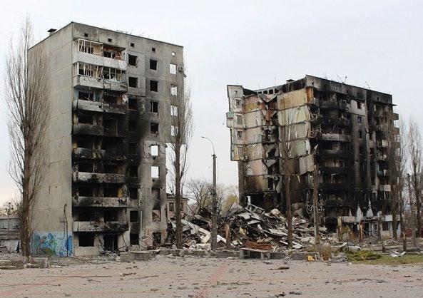
The war-torn country pioneers new approaches to urban recovery, blending citizen participation, digital innovation, and sustainable solutions for stronger, safer cities, reports Oleksandra Azarkhina.
The Russian invasion has expedited the process of rethinking urban planning and development. It has forced us to reimagine what makes a city truly sustainable. The lessons learned here will be invaluable for cities around the world.
Nearly three years of conflict have inflicted over US$152 billion in direct damages. Officially, 237,000 damaged and destroyed real estate objects have been verified. Cities like Bakhmut, Sievierodonetsk, and Chasiv Yar, once thriving industrial hubs, have been reduced to rubble. War erases the faces of cities, so the architecture of Eastern Ukraine is increasingly similar to that of war-torn Syria or anywhere else, where destruction takes over creation.
Yet, even in the face of such devastation, Ukrainian cities are demonstrating extraordinary resilience. Cities like Kyiv, Lviv, and Odesa, while far from the frontlines, have endured constant threats and infrastructure challenges. Despite these hardships, there is an unwavering commitment to rebuilding.
I’m a former deputy minister (2022–2024) with a focus on municipal development and recovery. During the first two years of the full-scale war, I’ve witnessed firsthand the extraordinary efforts of government, local authorities, and communities to rebuild.
The reconstruction of de-occupied territories began within days of liberation, showcasing an unprecedented speed and scale of response. With the continuation of the war, it becomes more and more difficult to rebuild, primarily due to a lack of funds.
At the same time, a pressing question Ukraine faces is: how can we rebuild our cities to be better, stronger, and safer? Safety has become the top priority, with citizens seeking housing primarily based on the accessibility of shelters, rather than factors like proximity to good schools; schools themselves need to have good shelter to be viable.
The urban landscape has been transformed; trees now serve as components for defensive structures. However, safety extends beyond civil
defense. The first practical lesson from Ukraine is that the resilience of cities during conflict is fundamentally the same as that required to address climate change and other global challenges. We are developing solutions to create independent and efficient supply chains for essential goods, particularly food, to ensure the basic needs of our cities are met.
Additionally, we are focusing on decentralized energy, water, and heat systems to ensure critical infrastructure remains accessible, even when central networks are compromised.
Before the war, climate change was a major concern for me. However, the invasion has shifted our priorities, albeit
in an unexpected way. As Russian missiles destroy both urban areas and natural environments, the need for sustainable and resilient infrastructure has become even more urgent. The damaged energy infrastructure has accelerated our efforts to develop alternative energy sources and microgrids.
The second lesson, “Go local!” should become the new motto for healthy communities worldwide. Cities should be strong, self-sufficient, flexible, united, and their members should be proactive. During this war, we began to trust each other more, as evidenced by research. Before the full-scale war, the level of trust in residents of their city was 35%; after the beginning of the invasion, it had risen to 62%.
At the same time, our society is very traumatized. Military personnel, residents of frontline communities and rearguard cities, internally displaced persons, and refugees abroad—all these people have very different experiences of war, and it’s already obvious that this will complicate post-war reintegration.
I believe that joint work on the restoration, transformation, and modernization of our cities should become therapy or medicine for damaged social cohesion. This means involving citizens in decision-making processes, promoting direct democracy, and addressing the needs of vulnerable groups. These principles are not only relevant for post-war societies, but also for any community facing challenges such as social isolation, migration crises, or losing the motivation of young people to create, develop, and feel part of the community.
The final lesson from our experience is the transformative power of digital tools. Ukraine has rapidly developed a suite of digital solutions. I had the honor of being involved in the launch of a comprehensive geographic information system, a verified registry of damaged property and an online platform for housing restoration applications.
One of the most innovative solutions is DREAM, a digital platform that empowers communities to raise funds, manage projects, and engage citizens in
the rebuilding process. This unique platform has no global equivalent. By leveraging digital technologies, we can improve transparency, reduce bureaucracy, and foster social cohesion. Digital tools can also help us create more resilient and sustainable cities by providing new opportunities for citizens, and enabling more effective urban planning. We aim to create a digital infrastructure through which everyone can contribute to the reconstruction and development of their hometown.
After all, the heart of urbanism is not streets or houses, but community; a community of people united by a common experience of using space. Digital tools add a new views and uses to physical space, and can help sustain communities even when they have lost their physical integrity.
Despite the challenges of war, many Ukrainians are full of optimism for a better future. In the end, we have the tools to restore our communities and cities, rendering them more resilient, sustainable, and united than ever before.
Skyscrapers underpin urban economic and cultural vibrancy, creating dense hubs for human activity, argues Jason M. Barr.
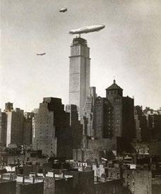
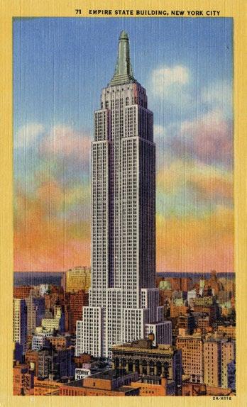
The observation deck was an afterthought. The initial plans for the Empire State Building, produced in 1929, called for a workaday, but tall, 1,000-foot (305-m), 80-story office building to house Gotham’s energetic business community. A couple of months later, the developers added five extra floors to rise taller than Walter Chrysler’s building at 1,046 feet (319 meters), under construction ten blocks to the north.
Not content to just beat Chrysler by a hair, however, the developers then decided to go the extra mile, so to speak, by adding a 200-foot (61-m) mooring mast for zeppelins, which, prior to the Hindenburg tragedy in 1937, was a fashionable means of international travel. History does not record if they believed the structure would be a functional airship gate. But any illusions evaporated at the first test run, as the ship encountered fierce winds near the mast. Nonetheless, what became an over-engineered decorative tower sitting on an office building roof morphed into opportunity—an observation deck 1,050 feet (320 m) in the air.
Nowadays, not only does that deck draw millions of tourists each year, but was also the serendipitious choice that helped the owners from losing their building during the Great Depression. In hindsight, the Empire State Building is a more elegant structure, not despite the height competition, but because of it. Just as importantly, the Empire State
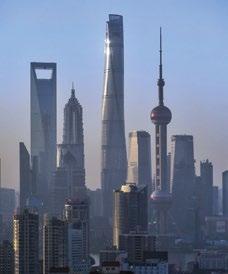
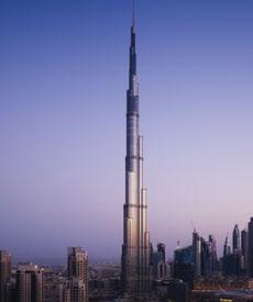
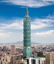
Building has become a global beacon for American entrepreneurial and engineering prowess. Other cities seek to imitate its magic by having their own version, be it the Shanghai Tower, the Burj Khalifa, or the TAIPEI 101. Nothing says “we have arrived on the global scene” more than having the world’s tallest building.
And, from time to time, when I go up to the observation deck and look around, I can see the mysticism of the human-created city, whose whole is so much greater than the sum of its parts. This fascination with the mighty metropolis drove me to spend much of my professional career as an economist trying to understand the causes and consequences of the world’s tall buildings. And, I have come to conclude, skyscrapers and cities need each other.
When we look around the world, we see that skyscrapers are steadily sprouting upward. In 2018, for example, 308 buildings of 492 feet (150 m) or taller were built worldwide. Laid end to end, they would run nearly 40 miles (64 km) long. In 2000, the number of completions was a mere 78, meaning a quadrupling in less than two decades. In fact, nearly seven times more 150-m+ buildings were erected in the first two decades of the new millennium than during the entire 20th century.
Looking at the world’s tallest 100 structures tells an equally impressive story. Earning a spot in this club requires
at least 54 stories. But to make it into the top 20 requires at least 81 stories and a minimum of 1,476 feet (450 m). In other words, the Empire State Building, at 1,250 feet (381 m) tall, is decidedly second-class, and I’m sorry to say, an old man. Nine of the 10 tallest buildings in the world are in Asia, with five in mainland China. The world’s tallest building has 163 stories.
What is driving this global quest for skyscrapers and skylines? The answer boils down to one simple answer: We want and need them. And yes, that includes you and me. We create the skylines of the world. You may not directly ask for them, but we are all part of the larger system of networks and nodes of trade and urbanization that gives rise to tall buildings.
The changing nature of work, living, and playing is, in fact, making the tall building more important than ever. The vast webs of interconnected computerbased technologies—the internet, social media, email, and Zoom—were “supposed” to make cities obsolete. But computers have, ironically, made cities more important. They have created new, more socialized kinds of jobs. They have given us vast wealth, much of which we spend on things in big cities. And, as a collective whole, skylines help forge our identities and give us pride of place.
In 1960, global per capita gross domestic product (GDP) was US$3,600. Today it’s over US$11,000. Intimately tied
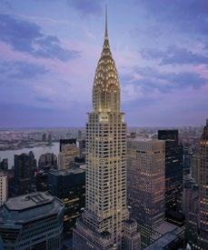
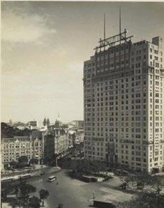
Above right— The Chrysler Building, New York City, exemplified the fierce height race that defined the skyline.
Left and far left— The Empire State Building, New York City, transformed an afterthought observation deck into a vital economic lifeline during the Great Depression.
to this economic growth is the corresponding rise in urbanization. In 1960, the world population was three billion, with two out of three people living in rural areas. Today, the world population is eight billion, and nearly 60% of us live in urban areas. In other words, six decades ago, the world’s cities housed one billion people. Today, they hold nearly five times that amount. Urbanized living is our future.
And why do these cities exist? Because they are our economic, social, and cultural engines. Manhattan alone—a mere 23 square miles (59.5 km2)—generates 3.3% of the United States Gross Domestic Product (GDP). Shanghai accounts for 3.7% of China’s GDP, while London generates a whopping 20% of the UK’s GDP.
People move to the cities for jobs, but stay for socializing, education, and consumption. In this way, vibrant cities generate positive feedback loops. Companies set up shop and hire workers, who then spend their income on food, clothing, shelter, and fun. Their money circulates locally, creating more jobs, and so on. Vibrant economies attract more people and companies, and the economic growth continues. Density also creates a positive spillovers—people learn from each other and become more productive, and cities can offer a wider variety of goods and services than otherwise.
But what is a city? It’s fundamentally an ecosystem—a place where people live and
work, along with the institutions that support them: buildings, transportation, access to goods and services, social networks, governmental services, and so on. If we want to understand why so many skyscrapers are rising, we must see them as one component of the urban ecosystem.
Since cities are dense clusters of humans who frequently want to be at the same place at the same time because of a location’s convenience to other people or amenities, the only way to accommodate this demand in more central locations is to go upward. To take an example, a quarteracre (1,012 m2) lot can reasonably shelter 25 people. But if the location is in high demand, then stacking those shelters by creating 20 “lots” (i.e., floors) on top of each other can hold 500 souls. The skyscraper pinches geography by producing land in the sky.
In the process, tall buildings contribute to another, perhaps unintended, consequence. They move us that much closer to what can be termed Terranism—one global human society. The skyscraper is the lingua franca of urban real estate. It is arguably the one building form that brings us together, literally because so many people can be inside at the same time, and because of what each represents—the triumph of our universal aspirations. Skyscraper chroniclers Earle Shultz and Walter Simmons summarized this idea in 1959 when they wrote, “The character and
quality of any city can be told from a great distance by its skyline, but these buildings do more than advertise a city. They show the faith of many in its destiny, and they create a like faith in others.”
Are There Too Many Skyscrapers?
But if tall buildings provide such benefits, then why is the idea of stacking people— the creation of high-rises—controversial? One claim—particularly in the West—is that they seem to generate gentrification and residential displacement. There is some truth to this, but the real story is more complex and nuanced.
After a decades-long process of de-industrialization, many larger, older cities saw renewed growth because of the rise of high-skilled, high-tech industries. Thus, higher-educated people returned to the city in the 21st century to take these new jobs. However, just before de-industrialization, cities, through zoning and restrictive building regulations, placed virtual domes on their building stocks and limited stacking, for fear of density.
Few cared or noted these domes because people were leaving. Then when cities became hip and vibrant, buildings couldn’t rise past the imposed ceilings. Residents now see their real-estate markets more like a game of musical chairs, where one person wins at the expense of another.
But taking a broader perspective, tall buildings are not causing the affordability problem. Using New York as an example,
the city has 3.6 million housing units, and 77% are in buildings that are 10 stories or less, and 2.7% of units are in buildings 40 stories or taller. Taking a global view, in the developed world, 86% of its structures are 25 m (eight stories) or fewer, 94% are fewer than 15 stories, and 99% are fewer than 100 meters (25 stories). The supertall part of the spectrum represents only a tiny fraction of the world’s buildings.
The real metric is not the number of luxury buildings being erected, but what’s happening citywide. A city must add total net units to compensate for loss of older buildings, rising incomes, and higher populations. The answer is to make up the difference in volume—more stacking everywhere. Today New York’s housing vacancy rate is 1.4%. If the citywide housing vacancy were between 7–10%, residents would have many options, landlords would have less pricing power, and gentrification complaints would diminish.
Just as importantly, 92% of residential structures within 1 km of a subway stop outside of Manhattan is three stories or fewer. If each building were redeveloped by adding double the current stories (and units)—that is, from two to four, or three to six, the affordable housing crisis would be over.
If more housing is built in the suburbs and land values fall in the center, we might get fewer tall buildings there. And that’s
perfectly good. While new supply everywhere helps, it’s more critical to build affordable housing where it’s most needed, while still allowing the center to grow.
There’s also a valid argument that cities are getting too many skyscrapers because of greenhouse gas (GHG) emissions. Skyscrapers produce a lot of CO2. No one disputes that. But this fact does not mean they should be banned from existence, as critics frequently claim. Banning something that makes cities function properly is a bad idea. Density is what powers cities, and density should be encouraged, rather than discouraged.
More broadly, there’s an extensive literature in economics demonstrating one simple fact: If you put draconian restrictions on what a city can build, the outcome is more sprawl and traffic congestion, and higher housing prices. Similarly for GHG emissions, Manhattan has far lower carbon footprints per household than its suburbs.
Using a data set with estimated average household carbon footprints for every ZIP code in the US, we can conduct a thought experiment. Imagine we “Manhattanized” the two suburban counties adjacent to New York City— Nassau and Westchester—by having all their residents live at the same density. Those two counties would see a reduction in residential carbon footprints by 41%.
CO2 is what economists call an externality, an unintended by-product of our actions that generates a negative effect on society. GHGs are the mother of all externalities and should be treated as such. Since no one is willing to give up their comfortable lifestyles, that means we must rely on carrots and sticks to generate technological improvements that replace our current products and energy production with carbonneutral alternatives.
As I teach my students in Economics 101, the key to solving the externalities problem is for producers to “internalize” them, so they pay for the costs that they would otherwise impose on others. The most effective ways to do this are to tax carbon emissions or create a cap-andtrade scheme. Cities around the world, like New York with its Local Law 97 and London with its carbon taxes, are generating penalties for GHG-heavy building owners.
However, New York’s law does not go far enough. All households—not just those in large buildings—should face a carbon tax. If cities charged all household “over-producers” and gave credits to “under-producers” based on their emissions, it would not only be fair—the rich would pay more—but would also benefit those living in efficient buildings.
Household and gasoline carbon taxes would also encourage denser, less-carbased lifestyles, which would lower GHG
footprints that much more. Similar schemes at the national level must be set up for taxing embodied carbon and subsidizing low-carbon methods for construction.
And if taxing carbon reduces the tall building numbers, then that’s also good for society. However, going forward, as sea levels rise, urban footprints shrink, and land values rise, there will likely be more tall buildings as a result.
The right number of tall buildings is the one that best accommodates business and population growth but minimizes the negative externalities. Finding that right balance is always tricky, but going too far to one side or the other harms cities. When real-estate decisions are based on what people want and they vote with their feet, a more affordable and dynamic city will result.
Over the long run, however, as technology has progressed, we can erect buildings that are not only taller, but are also more functional— and for lower cost. The improved supply conditions, combined with the rising tide of urbanization, means that evertaller buildings will continue to be built in the world’s greatest cities. Jason M. Barr’s book Cities in the Sky: The Quest to Build the World’s Tallest Skyscrapers was published by Scribner in May 2024.
Rio’s downtown renaissance blends adaptive reuse, streamlined regulations, and vibrant public spaces to attract residents and reinvigorate the city center, writes Washington Fajardo.
Brazilian cities, tied to the coastline, have always looked outward through their ports. Eager for modernity, they absorbed foreign ideas without hesitation. “Le Corbusier is visiting Buenos Aires? Bring him here!” Figures like Alfred Agache, Josep Lluís Sert, Constantinos Doxiadis, and Marcello Piacentini were enthusiastically embraced. This cultural anthropophagy is a cornerstone of modern Brazilian identity, particularly during the industrial expansion of the 1930–40s. Foreign influences were wholly assimilated and, through intellectual, spiritual, and even physical consumption, transformed into something authentically Brazilian. Brazil’s cultural “cannibalism” was so compelling that international creators found unique satisfaction in being “devoured,” an experience far rarer in Europe or North America. They willingly joined this feast of innovation.
Brazil’s growing manufacturing capacity demanded new formal codes, aesthetics,
materials, and territorial structures to break decisively from its agrarian and slaveholding past. Rio de Janeiro, the capital and showcase of the young Republic, became the testing ground for a surge of urban planning initiatives.
In 1929, Agache drafted a monumental plan for Rio, while Le Corbusier proposed ribbon-like city buildings stretching for kilometers, futuristic ministerial palaces, and sun-drenched architectural habitats designed for the hybrid-modern Brazilian citizen. Corbusier’s ideas quickly gained institutional traction and became pedagogical foundations. For a society striving to escape the scars of its history, pilotis-supported buildings that floated above land symbolized liberation from the vast monocultural estates built on the blood of enslaved peoples.
Rio’s transformation was swift. Hills were leveled, colonial houses and churches were demolished, and gardens—initially in style—evolved into the sweeping land art
of Flamengo Park. Here, expressways are sliced through coastal landscapes designed by Roberto Burle Marx, dotted with landmarks like Alfredo Reidy and Carmen Portinho’s Museum of Modern Art and Marcos Konder Netto’s Tomb of the Unknown Soldier. The formidable Lota Macedo Soares, a landscape architect, orchestrated these monumental projects.
The city’s next evolution aimed to establish Rio’s downtown as a central business district (CBD), supporting post-war finance capitalism’s intellectual and administrative functions. Iconic office buildings like Henrique Mindlin’s Edificio Avenida Central—Brazil’s first steel-framed building—and Joseph Gire’s Edifício À Noite, Latin America’s first reinforced concrete skyscraper, reshaped the skyline.
However, in 1960, modernity betrayed the city that had nurtured it. The federal government relocated to Brasília, the meticulously planned capital designed by Lúcio Costa and adorned with Oscar Niemeyer’s visionary architecture. Simultaneously, new residential developments in Rio’s business district— interwoven with eclectic townhouses and neoclassical mansions—were prohibited. The once-vibrant downtown, defined by its dynamic coexistence of architectural eras, began to lose its residents, transforming into a hub exclusively for business, shopping, and public services. Existing housing deteriorated, public squares became rigid and lifeless, and living in downtown Rio was seen as economically incompatible with its aspirations for global relevance.
During Brazil’s military dictatorship, critical debates on the impacts of modernist urbanism were shrouded by a nationalist narrative that glorified territorial expansion as a patriotic triumph. Advancing, conquering, and occupying the Amazon were heralded in official propaganda found in weekly magazines, presenting a vision of Brazil as destined for greatness —a tropical Manifest Destiny. This ideology fueled the creation of cities for hydroelectric projects, mining
operations, and soybean cultivation in the country’s interior. Functionalist and car-centric planning principles also shaped new capitals, such as Palmas, constructed in the late 1980s.
Meanwhile, in major metropolitan areas, rapid urbanization led to favelas and sprawling conurbations, which emerged as ad-hoc responses to housing crises. As peripheral neighborhoods expanded, central areas emptied out. Inspired by international models, cultural centers were introduced as tools for urban revitalization, but they largely failed to foster integration or vibrancy.
Despite academia’s ideological advocacy for social housing in downtown areas, the few projects implemented created isolation rather than inclusion. Urban centers became liminal spaces— anchored by memory and nostalgia, but lacking the ability to inspire future visions. These areas housed the past but could no longer serve as catalysts for the future.
The COVID-19 lockdown starkly revealed the vulnerability of Brazil’s depopulated downtowns. Across the country, deserted business districts and shuttered offices dominated the news.
In Rio de Janeiro, over 500 businesses closed. The lack of foot traffic decimated a fragile economic ecosystem reliant on business monoculture. Federal agency clusters further complicated local policymaking, as remote work policies were dictated from Brasília, over a thousand kilometers away.
The billions invested in transforming Rio’s downtown for the 2016 Olympics seemed wasted. The removal of a 5-km elevated expressway and the creation of pedestrian-focused public spaces, sustainable light rail, and new museums—like Santiago Calatrava’s Museum of Tomorrow and the Rio Art Museum by architects Thiago Bernardes and Paulo Jacobsen—now served a vanishing audience.
The Reviver Centro Program
Conceived as a response to the acute urban crisis caused by the pandemic,
while also seizing the opportunity to deepen the transformations initiated during the Olympics, the Reviver Centro program sought to boldly confront the dysfunctions of functionalist zoning and excessive regulations that had rendered building renovations in Rio unfeasible. In radically adverse conditions, radically innovative solutions became necessary.
The program’s public policy approach recognized that the typical urban sprawl of Brazilian cities fragmented property values at urban edges, misaligning them with infrastructure provision and capitalizing on cheap land consumption. To counter this, the program sought to translate the latent value of existing structures into a driver for local real estate activity.
A territorial value-indexing mechanism was introduced to bridge the gap between current market disinterest and a more organically functioning real estate sector. However, decades of technical culture rooted in continual urban expansion had cultivated ignorance and resistance to recycling buildings.
This was compounded by overly preservationist construction regulations, designed to maximize cultural value in landscapes of underused buildings resulting from sprawl.
Another obstacle was perception: seen through a nostalgic lens, Rio’s downtown no longer appeared viable for living. Over-institutionalized and underused public spaces, coupled with fears around nighttime safety, compounded this challenge. Therefore, the solution had to be holistic, addressing economic incentives, enhancing the area’s appeal, and avoiding the governance failures that plagued previous urban projects.
The strategy was built around a special urban regulatory framework, legally established and tied to measurable objectives, monitored by a public management council. Improvements to public spaces were implemented via targeted interventions designed to visibly enhance micro-urban landscapes within a short time frame. All measures were supported by data gathered by the municipality and transparently shared with stakeholders.
The program’s core incentive was a cross-subsidy mechanism. Developers converting vacant commercial properties into housing earned transferable development rights, which could be utilized or sold for residential construction in other neighborhoods with transit accessibility. This system ensured densification did not burden distant, sprawl-prone areas. In higher-value neighborhoods, morphological and density quality standards guided these transfers, creating a balanced distribution of development opportunities. Despite unfamiliar technical and administrative processes, this mechanism attracted developers to downtown renovations by offering significant gains from redistributed densification rights.
To further encourage building renovations, construction rules were overhauled, eliminating regulatory barriers that treated renovations as if they were new constructions. Existing buildings were recognized as consolidated legal entities, and their redevelopment was framed as constructive updates rather than complex, high-impact new builds. This granted developers more freedom, conditioned on design quality, to repurpose office spaces for housing or mixed uses.
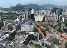
Top—
Rio’s hybrid urban typologies: historic district blended with office buildings and corporate towers create a vibrant core.
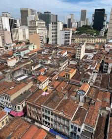
Above—
Castelo sector: Rio’s downtown is a tour de force over nature. Castelo Hill was removed to open space for government buildings. Landfilled areas created expressways and Flamengo’s Park.
In parallel, a task force focused on rapid, high-impact improvements to public spaces, subdividing the downtown area into manageable zones for monthly interventions. This approach transformed the urban micro-landscape, enhancing user perceptions. Regular evaluations ensured ongoing progress and adaptability.
Lastly, a digital twin of Rio’s downtown was developed, providing a public platform for monitoring and tracking the progress of building conversions. This offers transparency and fosters engagement from citizens and stakeholders alike.
The program’s success was recognized as a finalist in the C40-Bloomberg Philanthropies Awards for Innovative Climate Solutions, emphasizing its
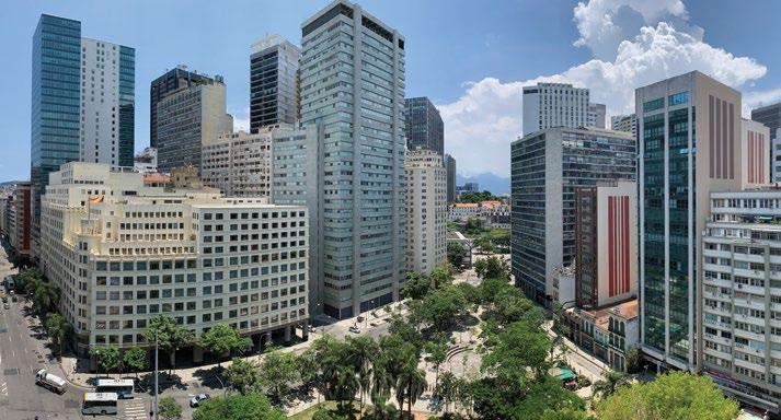
Below—
Mario Lago Square: Rio’s CBD is highly dense and offers few open spaces. These are mostly related to the ghost presence of hills or connected to historical buildings like the Saint Anthony’s monastery in the background.
alignment with global goals such as the “15-minute city” philosophy. This concept integrates housing, green infrastructure, and community amenities to reduce transport emissions by an estimated 35.4% over the next decade and stationary energy emissions by 34.1%.
Reviver Centro also earned a Special Mention in the Lee Kuan Yew World City Prize, highlighting its achievements in affordable housing through legislative changes. These changes reduced barriers to transforming commercial suites into residential units and enabled the allocation of vacant government lots in the central district for social housing.
By 2015, downtown Rio had produced its highest residential output in two decades, with 456 units. Within two years of the new regulations, this number exceeded 2,000, surpassing 3,000 today— an estimated 25% population increase in a district of 40,000 residents.
The program’s early success relied on a few keen investors who saw opportunities in the initial retrofits. This was followed by strong market interest in new apartments from public servants and local workers. This
cascading effect drew more developers into the downtown renovation market.
Reviver Cultural—subsidizing the rental and renovation of closed storefronts for cultural activities— amplified this momentum. However, challenges remain, particularly in public space governance. Rio’s modernist technical culture struggles to manage the detailed care required for historical urban furniture and intricate spaces.
Reviver Centro stands as Brazil’s most successful urban rehabilitation plan, focusing obsessively on creating a new housing stock. While urban sprawl persists, subsidized federally, local governments in nine other capitals now look to Rio’s example, initiating their own projects to repopulate downtowns—urban rebellions against the rigid planning dogmas epitomized by Brasília. These lessons resonate beyond Brazil, offering global cities a blueprint for reinvigorating central business districts and challenging outdated planning paradigms. For more information, including an interactive map, visit revivercentro-pcrj.hub.arcgis.com.
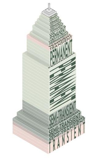
Presenting a blueprint of vertical villages to revitalize downtowns, a recent commission to adaptively reuse Pittsburgh’s “Empire State Building” led Adam Rolston to conjure a bold reimagining of New York City’s original.
In the face of adversity, New Yorkers have always preferred the bold over the banal. The following is a thought experiment for transforming our aging building stock, such as the Empire State Building, and towers like it, into sustainable vertical villages for a more equitable and connected future.
Our studio, INC Architecture & Design, is realizing this dream in a more modest manner with a host of large-scale adaptive reuse projects in the United States. The goal is to put this work in into a broader, mission-driven context that would point toward a future of more vital and sustainable vertical urbanism.
The Midtown (or center city) office vacancy crisis is not just an isolated economic issue, but a reflection of the changing dynamics of work, society, and urban life. The value of the office and cooperative corporate structures that support culture, common values, shared ambitions, and knowledge transfer remains clear. The pleasures of the new playground city where work and recreation intermingle are here to stay. As the new, highly amenitized and thoughtfully programmed Class-A
office buildings flourish, the question arises: what should be done with the languishing older structures of our central business districts (CBDs)?
The remote work of the pandemic reshaped our perception of the value of the modern office functionally, physically, and emotionally. The return to the workplace has not favored buildings in our CBDs for a reason. Their privatized, disconnected marketdriven commercial amenities, or lack thereof, were designed and programmed around a lower standard of convenience that was rendered obsolete by the more fluid, flexible, and efficient format of our work lives during the pandemic. This expectation shift has led to an exodus of companies from CBDs. As a result, countless older Class-B office towers have stood empty, and the collapse of the supporting retail market has left an opportunity void in CBDs across the US.
Why the Empire State Building? Because it represents the era of building stock that’s hardest to envision as anything beyond office space. Reimagining the Empire State Building as a self-sustaining,
integrated community might seem like a daunting response to the challenges facing our aging building stock, but it is a relatable one for our purposes. By transforming this iconic structure into a sustainable, vertical village embodying New York City’s spirit, it could serve as a model for 21st-century urban living—eliminating the daily commute that makes up nearly 98% of the average urban worker’s carbon footprint.
The building stands at the heart of Manhattan as a symbol of the city’s grit and perseverance. Designed by Shreve, Lamb & Harmon as the office building of the future and the tallest building in the world at the time, it was built in a mere 13.5 months. Completed in 1931, the 102-story structure was the technological wonder of its day. It has been hailed as “the most famous building in the world” and the number-one tourist attraction in the US.
The tower has a reported postpandemic occupancy of 90%, which reflects the “halo effect” of its historical prestige. Not so of its little sibling, the Mutual of New York Building (MONY) at 1740 Broadway, 32 blocks north, also designed by Shreve, Lamb & Harmon. The New York Post reported, “Yellowstone
INC
Real Estate forked over a mere [US] $185 million—a massive [US] $420 million haircut from how much the famed Mutual of New York tower fetched a decade ago.”1 While it has now changed hands, the MONY building epitomizes the CBD office market collapse, and has remained empty since the pandemic’s beginning.
The Potential of Hyper-Mixed-Use Imagine walking into the Empire State Building and finding yourself in a microcosm of New York City, bustling with life and diversity. Schools would provide world-class education; medical clinics would offer top-notch healthcare. Office space would provide commute-less hybrid work. Entertainment venues, hotels, restaurants, galleries, gyms, and community services would cater to the vertical villagers and the local community. The inherent waste of empty and underutilized, marketing-driven amenities so standard in the for-sale condo context would be a thing of the past with the thoughtful and data-driven understanding of the needs of the vertical villagers and surrounding community, balancing private and public programming. A micro-economy, established through the intelligent
curation of community services for the “built-in” residential and neighborhood consumers, would ensure the success of the vertical village. A new class or discipline of program engineers and vertical urban planners would turn conventional commercial programming on its head, with short-term thinking replaced by long-term planning, redefining mixed-use development as hyper-mixed-use development.
The success and safety of any city or town hinges on fostering inclusivity and social cohesion. Urbanist Jane Jacobs estimated the ideal population at 2,500 to balance the perfect levels of anonymity and attachment to facilitate cultural coherence.
With a little over half of the building dedicated to residential functions and a little under half to public and private amenities, the Empire State Building would be right-sized as the ideal urban community. By carefully integrating low-income, middle-income, and luxury residences, it would purposefully reflect the city’s demographics.
Tourists would continue to enjoy the grandeur of the building, the views from the observation deck, and commingle with the vertical villagers.
The vertical village would be a model of sustainable best practices—most importantly, adaptive reuse. Stateof-the-art technologies would modernize the interior and render the building carbon-neutral. Academic research and private-sector specialists would flip the script, as reflected in the World Bank’s recent circular economy report regarding the state of the EU’s decoupling of growth from raw material consumption through legislative and incentive initiatives.2
A new understanding of New York City’s older building stock as a “natural” resource to be “mined” by the private sector for value will foster a broader pivot toward a circular building industry. The vertical material bank of the Empire State Building will be leveraged and “recycled” as value-added investment capital in a wealth-producing circular economic proposition.3
The Empire State Building would create a new precedent for environmentally responsible urban planning and landmark revitalization within a world-renowned historic structure. Rooftop gardens, geothermal technology, solar panels at the podium, modern waste management systems,
and water conservation practices would harness the power of nature and visibly promote sustainability, inspiring other developments to follow suit.
One benefit of this project would be its potential to revitalize the neighborhood. Empty office buildings contribute to the so-called “urban doom loop,” including lower tax revenues and the stifling of local service businesses.
Transforming the Empire State Building into a thriving community hub would breathe new life into the area. Restaurants and shops would flourish, creating a vibrant and dynamic urban landscape. It would be a model of the microeconomic boon-loop of hypermixed-use development with an outsized urban impact.
Of course, such an ambitious endeavor comes with challenges. Overcoming regulatory hurdles and securing funding are formidable tasks. Collaborative efforts between private developers, community stakeholders, tax incentive leadership, the Landmarks Preservation Commission, and other government agencies are imperative to realize this dream.

The NYC 521-a tax incentive supporting low-income residential development, and the J-51 tax incentive, supporting the renovation of existing residential buildings were good historical examples of the type of successful legislation that would be needed.
City of Yes for Housing Opportunity is a zoning reform proposal to address the current housing crisis and support much of the hyper-mixed use and adaptive reuse goals articulated here.4
In December 2024, New York City Council voted to pass the reform package.
The symptom that betrays one of the biggest hurdles to a village-based development approach is the consistently adversarial relationship between private sector development and communitybased organizations. Current bankdependent development financing models and the private equity demands of three- to five-year returns on investment horizons foster pump -and-dump strategies. One need only look at the collapse of China’s development market to see how the extension of a lax regulatory environment fosters magical thinking around the value of short-term profit without long-term planning.
Developer pro formas must go beyond saleable square feet; they must be driven by financeable economic value attached to the development of value-generating sustainable community-based programming models, based on researched data, supported by tax incentives.
The strategies mobilized in transforming the Empire State Building into a sustainable hyper-mixed-use vertical village could solve the Midtown office crisis and be proof of concept for the future of frictionless urban living. By reflecting all the demographics and services of New York City, this ambitious project takes the idea of “It takes a village” to new heights—quite literally.
As we reimagine and reshape our cities for a sustainable future, embracing visionary big ideas is essential to ensure New York City and our CBDs thrive as vibrant and inclusive metropolises for future generations.
The pandemic’s disruption of the office market has left vacancies stabilized at about 18%, with older buildings bearing the greatest impact. Advances in communication technologies have

RESIDENTIAL
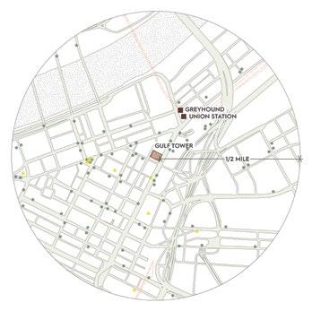
Far left— Pittsburgh’s CBD, with the peach buildings indicating office conversions, completed or in progress.
Left—
Guided by Transport-Oriented Development principles (circles are bus stops; triangles are light rail stops).
Below left—
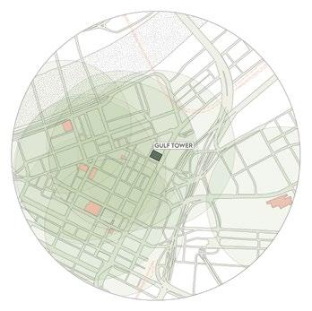
Once housing 3,000 workers when an office building, Gulf Tower will be reborn as a mixeduse vertical village.
fundamentally changed our work patterns. The pre-pandemic office-centric model has evolved into an even split between office and remote work, including but not limited to home-based work. This stable new norm has transformed workforce needs and expectations, driving demand for new housing forms and office typologies. Consequently, office conversion projects are expected to increase substantially in the next development cycle. CBRE reports that major US cities expect completion of 117 office-conversion projects in 2025, compared to the historical annual average of 41 projects. Office-to-multifamily conversions comprise 48% of current or planned projects, estimated to create 21,000 new residential units.5
In our era of untethered work and postpandemic social structures, INC is using these strategies in real projects. Our studio is developing two properties—in Pittsburgh and Phoenix—for Left Lane
Development, both embracing radical adaptive reuse to revitalize aging assets.
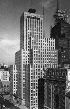
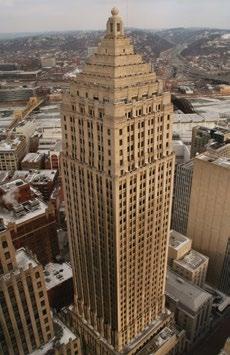
Known as Pittsburgh’s “Empire State Building,” the Gulf Tower is a 44-story Art Deco landmark skyscraper, which was headquarters for Gulf Oil Corporation and Alcoa. It was Pittsburgh’s tallest building between 1932–70. Once housing 3,100 employees, it will become a vertical village offering a diverse, self-contained ecosystem of population, activity, and services. Reborn as the Bardo Hotel and Residences, it will blend hotel guests, social club members, and health club users with residential tenants to create a layered community life.
The project will engage with Pittsburgh’s CBD workforce through an integrated mix of hotel rooms, short-term residences, retail, work and event spaces, and diverse food and beverage venues. The development’s comprehensive programming could generate 350 new employment opportunities, helping replace service jobs lost in the office market decline. The project includes a 150-room hotel, 100-flex-stay rental units, a 120-seat restaurant, health club, spa, and grocery store. The concentration of new 24/7 activity from essential, local, and transient populations could also
Left— Known as Pittsburgh’s “Empire State Building”: the Gulf Tower, photographed in 2007.
revitalize surrounding street-level businesses. The conversion will bring approximately 1,000 full-time residents back to the CBD.
Transforming iconic buildings like the Empire State Building into vertical villages offers a solution to some of the most pressing challenges of modern urban life. These vertical villages redefine living and working in a city by addressing office vacancies, creating inclusive communities, and embracing sustainable practices. The hyper-mixed-use model enhances residents’ convenience and functionality and revitalizes surrounding neighborhoods, breathing new life into city cores.
1 Cuozzo, S. (2024). “Famed MONY Tower that Inspired Hit Song Sells for A Lot Less Cash than It Fetched A Decade Ago in Troubling Sign for NYC Market.” The New York Post, 25 April 2024.
2 The World Bank. (2022). “Squaring the Circle: Policies from Europe’s Circular Economy Transition.”
3 The BAMB Project. (2024). “About BAMB.”
4 NYC Planning (2024). “City of Yes for Housing Opportunity.”
5 CBRE (2023). “Rise in Office Conversions May Help to Reinvigorate Cities.”
Dan Doctoroff advanced a humanist vision of urbanism that enlivened New York City’s neglected corners, masterminding the most profound changes to the city’s physical landscape in decades, says Paul Goldberger
Daniel Doctoroff (1958–) grew up near Detroit, which may seem an unlikely place for the opening chapter of a life that would do as much to transform New York City as any other over the last two centuries. Then again, Frederick Law Olmsted was born in Hartford; John Roebling in Prussia; DeWitt Clinton in upstate Little Britain, New York; Andrew Haswell Green in Worcester, Massachusetts; John D. Rockefeller in rural Richford, New York; Robert Moses in New Haven, and Jane Jacobs in Scranton. There’s something to be said for the idea that New York has been shaped most by those for whom it has been an acquired taste, not a birthright. In time, Doctoroff’s accomplishments as a force for change in New York would lead to comparisons with Robert Moses. But he experienced New York first in a way that calls to mind a man famously opposed to Moses: the critic, historian and public intellectual Lewis Mumford, whose career focused heavily on the purpose and meaning of the city, and who felt, with an almost religious conviction, that urban life offered the possibility of civilization developed to its highest potential. Mumford believed, as Doctoroff would come to believe, that whatever
problems the city had could be solved through clear, rational thinking.
Mumford could also be high-handed, arrogant, sexist, and humorless, and that, along with his extreme discomfort with high levels of density and his deep fondness for the concept of the garden city as an alternative to crowded cities, surely makes him an inappropriate symbol of the urbanism that the 21st century aspires to achieve. His urban vision was not the same as Dan Doctoroff’s, not by a long shot. Still, Mumford’s sincere and heartfelt belief in the city as an idea and the enthusiasm with which he acted as a kind of urban evangelist very much foreshadowed what Doctoroff would become. Mumford was the urban prophet of his time; so, to a very different time, would Doctoroff be.
It is one of the great historical ironies that Doctoroff’s career as a public figure began with a project that by the most obvious measure would be considered a failure: his campaign to bring the Olympic Games to New York City. It began in 1994, when, excited by the spectacle of seeing the World Cup being played at Giants
Stadium in the New Jersey Meadowlands, Doctoroff came up with the idea that New York City should host the 2008 Olympics. He did not simply pass the notion along to a few well- connected friends who might be able to do something about it. He set out to educate himself about international sports, he learned about what was required for a city to bid for the Games, and he discovered—and this would be key—that hosting the Olympics could be a catalyst for cities to complete major planning and infrastructure efforts.
Planning for the Olympics, Doctoroff concluded, would not just be a way to build some sporting venues; it would be a way for New York to make much broader plans for its future, plans that would have a firm and unmovable deadline and thus would have an urgency that large-scale development in New York hadn’t possessed for decades.
And so Doctoroff built an entire Olympics planning organization, on his own, and initially funded it himself. A colleague suggested he read a new book by the planner Alexander Garvin, The American City: What Works, What Doesn’t, which led to a meeting with Garvin, a Yale professor who was also a member of the
The Olympic X plan organized the Games along two intersecting axes, with the Olympic Village at the center. The north-south axis followed the East River and envisioned transporting athletes and spectators using a new network of ferries. The east-west axis traveled along the route of the No. 7 train and commuter rail lines from Flushing, Queens to Manhattan’s Far West Side. The plan for the Manhattan Olympic cluster, in a new neighborhood it called Hudson Yards, included a new subway stop, parkland, and an Olympic Stadium on undeveloped rail yards overlooking the Hudson River.
New York City Planning Commission, and his invitation to Garvin to join the team as the head planner for the Olympics. Garvin, who knew next to nothing about sports but next to everything about New York City, shared Doctoroff’s enthusiasm and earnestness, and the two bonded quickly. Their close working relationship would continue for more than 20 years, Garvin, who died in 2021, viewed cities with a mix of idealism and pragmatism much like Doctoroff’s, and he would help shape Doctoroff’s view of cities, functioning not only as the Olympic planner but also as Doctoroff’s tutor in urban planning.
Garvin’s counterpart was Jay Kriegel, who became Doctoroff’s adviser on political and fundraising matters. Kriegel, the former aide to Mayor John Lindsay who was celebrated for his connections with almost every political, business, and
cultural leader of New York, would come to manage the Olympic plan, which had shifted to a bid for the 2012 Olympics owing to the United States Olympic Committee’s decision not to put forth an American candidate city for 2008.
The Olympic bid showcased the extraordinary scope of Garvin’s innovative planning and the effectiveness of Kriegel and Doctoroff’s campaign to rally support from New York’s most influential leaders. But it is important to mention that the effort would have as much effect on Doctoroff himself as it would ultimately have on New York, since it forced him to understand the entire city in a finegrained way. He came to know obscure locations in all five boroughs, and his sense of New York both broadened and deepened.
The plan that he and Garvin devised, which became known as the “Olympic X” due to its two intersecting transportation axes—one via ferry extending out from the proposed Olympic Village site on the Queens waterfront, the other the New York subway—reflected their determination that the Olympic athletes would have a deep engagement with the city, not be kept apart from it. That alone
When the International Olympic Committee (IOC) awarded the 2012 Olympics to London, many observers thought it loss for New York City. Nothing could farther from the truth.
Planning for New York City’s bid to the 2012 Olympic Games provided strategic agenda for the city, including many projects that had been under discussion for years, if not decades.
Left— Doctoroff’s unrealized Olympic X plan laid the foundation for citywide improvements in infrastructure and waterfront development.
Doctoroff’s remarkable strength lay building a coherent, compelling case how the city could benefit from moving them all forward together and on an accelerated timetable.
His expertise in finance was key to plans for financing extension of the train and construction of the High Line.
Doctoroff understood how the skills resources of the private sector could harnessed to help achieve major public objectives — at Hudson Yards, in the development of Hunter’s Point South, launching the East River Ferry Service minimal cost to the city, and on many other projects.
Doctoroff also repeatedly showcased flexibility that is critical to success business and government. When it clear that some element of the NYC2012 plan was not going to work out, he dwell on it, but instead moved quickly line up an alternative.
marked it as enlightened in a way that few Olympic plans, before or since, have been. And it led directly to Doctoroff’s belief that the waterfront held opportunities for growth and development that had barely begun to be understood—along with his recognition that the entire city would benefit from the sense of urgency that an Olympic deadline would bring. Even though the bid did not ultimately succeed—the 2012 Olympics went to London—Doctoroff’s original notion, that a plan to host the Olympic Games could be a catalyst that could mobilize infrastructure and other developments around the city, succeeded beyond expectations. Large-scale housing development on the Queens waterfront and the site of Hudson Yards in Manhattan; the extension of the No. 7 subway, which was not only an achievement of public works but also of creative financing; the Barclays Center in Brooklyn; the Greenpoint-Williamsburg waterfront development; and replacement stadiums for both the Yankees and the Mets—all of these things can be traced, at least in part, to the Olympic plan. So, too, with the renovation of the 369th Regiment Armory in Harlem as a community

athletic facility, the replacement of the Bronx Terminal Market with retail and a public park, the construction of a new public pool and ice rink in Flushing Meadows Corona Park, and the conversion of the Fresh Kills landfill on Staten Island into a public park. It would take years, but despite the failure of the city’s bid for the Olympics, all these things would happen or are in the process of happening.
They happened, of course, because early on, the extraordinary energy and commitment that Doctoroff brought to the Olympic effort attracted the attention of Michael Bloomberg, who after his election as the city’s 108th mayor in 2001, just weeks after the traumatic events of 9/11, offered Doctoroff the job of Deputy Mayor for Economic Development—or, as the position was titled in the aftermath of September 11th, Deputy Mayor for Economic Development and Rebuilding. When Doctoroff took the job, after a negotiation that permitted him to remain involved in the Olympic bid, he found himself in charge of all the city’s planning efforts, including the rebuilding of a
devastated Lower Manhattan after the destruction of the World Trade Center.
That was somewhat problematic, since the City technically had no power over the World Trade Center site: the destroyed twin towers had been built by a bi-state agency, the Port Authority of New York and New Jersey, which controlled the land, meaning that the governor of New York, George Pataki, had more control over its future than New York City’s mayor or his deputy mayor for rebuilding. Doctoroff, true to form, was not intimidated by the fact that neither he nor his boss had authority over the process; he stepped in anyway, and through sheer force of personality made his views felt. Not the least of them, and one of the ways in which he showed that he was thinking more creatively than anyone else involved in the rebuilding process, was his suggestion that the City and the Port Authority swap the land underneath the two New York City airports, which the City owned and leased to the Port Authority, for the 16-acre (0.4-hectare) World Trade Center site, which would allow the City to control the future of the site on its own.
The land swap never happened —it was a bridge too far for the two
Left—
Mayor Michael Bloomberg (left) appointed Dan Doctoroff (right) as Deputy Mayor, sparking a transformative partnership that reshaped New York’s future.
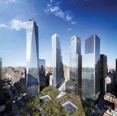

bureaucracies to negotiate—but Doctoroff, undaunted, developed a Vision for Lower Manhattan beyond the World Trade Center site. It incorporated much of Alex Garvin’s thinking, and it made clear that while the State may have had the power, the City, in the person of Doctoroff, had most of the ideas. The “vision” that Mayor Bloomberg articulated in a speech announcing the plan was classic Doctoroff: earnest, determined, idealistic and at the same time not the slightest bit naïve. It envisioned Lower Manhattan as a “vibrant global hub of culture and commerce, a live-and-workand-visit community for the world.” Doctoroff understood that the World Trade Center had been conceived in the misguided belief that it would strengthen Lower Manhattan’s traditional role as the city’s financial district, but the opposite had happened: The area had weakened as a commercial center but had become something much healthier, a genuinely mixed-use neighborhood containing housing, public space, and cultural activities, an evolution that Doctoroff wanted to see continued with more of all of these things. By contrast, the State’s plan for the former World Trade Center site simply replaced the office space of the original World Trade Center with the same amount of office space spread across several medium-sized towers instead of two huge ones, and envisioned no housing at all.
Like the Olympic vision that would ultimately come together without the Olympics, Bloomberg’s and Doctoroff’s Lower Manhattan vision, too, would be largely realized, thanks to the fact that while the State may have controlled what would happen in the area that had become known as Ground Zero, the City could influence what happened elsewhere in the neighborhood. And Doctoroff made certain that it did. Today the urban energy that Doctoroff celebrated enlivens a Lower Manhattan that has been reconceived to be less dependent on the financial services industry than ever, with a wide mixture of commercial activities, a substantial residential component, and significant investments in public space and culture.
The revival of Lower Manhattan after 9/11, and the extent to which Doctoroff’s vision came into being even without the ability to control the rebuilding of the World Trade Center site, was Doctoroff’s first challenge as Bloomberg’s deputy mayor, but it was only a preview of what was to come. Along with Amanda Burden, who Bloomberg had named as Chair of the City Planning Commission, Doctoroff oversaw a rezoning of much of the city to encourage further development, especially on the Brooklyn and Queens waterfronts. He was a strong and early advocate of congestion pricing as a means of limiting the use of private automobiles in Manhattan below 60th Street— an idea that is finally on the cusp of being approved—and he encouraged more sustainable design.
He advocated for the notion, somewhat radical at first, that city planning has a direct connection to public health, since the more people walked, the healthier they would be, and he wanted the City to do more to make walking and bicycle riding attractive options. He was closely involved in the development and expansion of Citi Bike, New York City’s bike-share program. And he played a critical role in the explosion of new and significant investments in public space, including the High Line—perhaps the most acclaimed new public park in New York in generations. The notion of converting an abandoned elevated freight line into a public park was proposed before Bloomberg became mayor, but it was too unorthodox a notion for the previous city administration. Bloomberg and Doctoroff, however, had the sophistication and imagination to be excited about the idea, and Doctoroff set about to make it happen. He played a similar role with Brooklyn Bridge Park and Governors Island and the Hudson River Park and the East River Park, all projects that would depend on his involvement and benefit from it. Not the least of Doctoroff’s gifts was his willingness to champion projects that he had not originated himself, as he had with the Olympic bid; if he thought an
Below—
Brooklyn Bridge Park, a former industrial site, was transformed into a dynamic public waterfront destination.
Right—
The High Line exemplifies Doctoroff’s commitment to innovative public space projects.

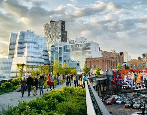
idea had value, he would focus his energy on making it happen.
He was both a public advocate and a private negotiator, steering projects through the bureaucracy, which in many cases meant not only dealing with City government but also with his counterparts in State and federal governments, and with public agencies like the Port Authority and the Metropolitan Transportation Authority, as well as with private nonprofit groups set up to build and oversee these new parts of the public realm. It was a complex chess game, and he took pride in understanding all the moves.
He was an unusual public official, not so much a part of the bureaucracy as a force determined to rise above it. He worked intensely and expected his staff
to do the same, but he also listened to their ideas, and was willing to entertain proposals from any source. If an idea was new and untried, it became all the more alluring to him, another chance to show that things were being done differently by this administration.
But perhaps what most distinguished Doctoroff’s tenure as a public official was not the ease, or the apparent ease, with which he navigated the turbulent waters of the politics of producing public works, but the way in which he was determined to connect the physical form of the city with policy. He did not believe that economic development was a matter of responding to the needs of businesses, or of shaping tax policy, though he was as interested in these things as anyone else who had held his job. It was clear that he wanted “Rebuilding” as part of his portfolio, not only because of the challenges facing the city after 9/11, but because he was convinced that construction, infrastructure, housing, and planning went hand-in-hand with economic development, and that all of it needed to be seen as a totality.
Doctoroff demonstrated his holistic view best, perhaps, in PlaNYC, a comprehensive report issued in 2007 that
envisioned the expansion of the city’s population by another million residents over the coming two decades; called for significant increases in infrastructure maintenance, repair, and replacement; and set the goal of cutting the city’s carbon emissions by 30%. PlaNYC, which included the call for congestion pricing among its recommendations for fighting the effects of climate change, did what reports issued by public officials almost never do, which was to look ahead, far beyond the terms, and in some cases even the lifetimes, of the people in the administration writing the report. PlaNYC, in other words, was not a list of projects that the Bloomberg administration hoped could be accomplished immediately in the hope of earning political points. It was a prescription for the coming decades, a report issued with Doctoroff’s full knowledge that he was planning for the
long term. If politicians usually look no farther than the next election, Doctoroff looked to the next generation.
Doctoroff remained engaged with building and planning after he left City government to become the president and eventually chief executive of Bloomberg LP—a position he held until the end of Bloomberg’s mayoralty, at which point Michael Bloomberg decided he again wanted to run his company himself. Not the least of Doctoroff’s accomplishments at Bloomberg was to hire Foster + Partners to design the new European headquarters for Bloomberg in London, a building that would become one of the most acclaimed commercial structures of its era. He was also active on the civic front and became the founding chairman of the board of The Shed, the experimental cultural center that he envisioned as a key part of the public realm of Hudson Yards, the immense real estate development on the
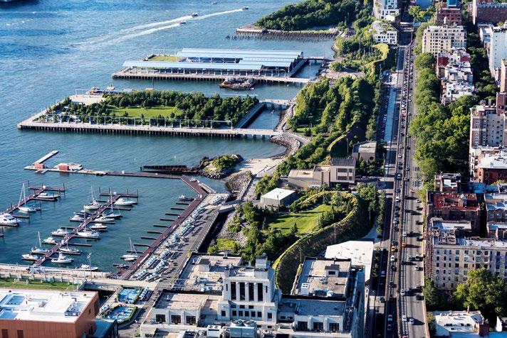
Far West Side, which, as deputy mayor, Doctoroff had helped bring into being.
Doctoroff then went on to start an entirely new chapter in his professional life, founding Sidewalk Labs in 2015 in partnership with Google. They conceived the company as a way to develop the “smart city,” by using data technology to improve urban planning and infrastructure. Sidewalk Labs, its very name underscoring Doctoroff’s fascination with, and commitment to a traditional idea of urbanism, was best known for its plans to develop Quayside, a 12-acre (4.9-ha) neighborhood in Toronto. The ambitious project was intended as a prototype for this new kind of city, but was ultimately abandoned in 2020 owing largely to complications of the COVID-19 pandemic.
Quayside was not without controversy. Critics accused Sidewalk Labs of overreach in Toronto, and of giving the
project the potential to violate privacy by using technology to track residents’ comings and goings, not to mention their utility use, their purchases, and their leisure activities. But it was mostly using data that existed elsewhere; Sidewalk’s goal was to aggregate it and to use it to guide the process of managing city services and planning for urban growth.
It is a prospect that, in other hands, might well be troubling: The city that tracks you through data could also be the city that restricts you. In Doctoroff’s case, it is hard to believe the plan was motivated by anything other than enthusiasm, a belief that the more information a wired city possessed, the more services it could deliver to more people, more quickly. To Doctoroff, this was all a form of connection, and as urbanity is itself a matter of connections, connecting people through information was not so different from connecting them in physical space.
And there was no reason, he believed, that connecting people through data should not support the larger goal of connecting them in real life.
Doctoroff, in the end, is not much of a technocrat; he is more interested in the material reality of urbanism, in the physical form of the real city, than he is in data, which to him is merely a means to an end. In this sense, paradoxically, he is far less of a technocrat than Robert Moses, who did not have the digital technology of the 21st century at his disposal, but who far more than Doctoroff viewed the city as a system that needed to be made more efficient. For Doctoroff, efficiency has never been an end, but only a tool toward the sense of community to which he has always aspired, and which has always excited and moved him.
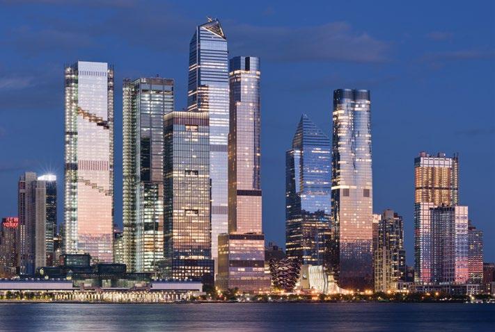
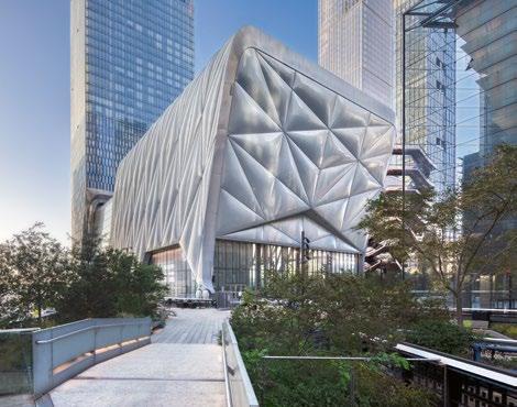
Doctoroff, at bottom, is a humanist. He is moved by traditional urbanism, by the pleasures of the street, by the activity and diversity of the city, by the surprise that it engenders. He and Moses are surely comparable in the impact they had on New York: They shared an ability to think in broad terms, and to make big things happen to a degree that their contemporaries could only dream of. But they could not have been more different in almost every other way. Moses’ arrogance was legion. He planned by fiat, and was famously rigid in his views about every aspect of design and planning.
He had the gift of seeing the entire New York region as a vast entity, a canvas on which he could paint a system of physical connections. But it often seems as if that system was almost devoid of people. Moses connected the city’s parts but seemed, particularly in the later parts of his career, to be indifferent to the people he was ostensibly connecting, and to have minimal interest in neighborhoods. Doctoroff acted less as the emperor of planning than as its eager student, sophisticated, earnest, capable of learning and excited by the new. Many of his greatest achievements—The Shed, the
cultural center at Hudson Yards where he served as chairman for more than a decade; the program to plant one million trees in New York City; the rezoning of so much of the city, the High Line and the other new parks—were frankly experimental, even radical. If Moses became more conservative as his career went on, Doctoroff seemed to grow ever more enthusiastic about doing things that had never been done before.
To Dan Doctoroff, who began his urban awakening by paying more attention to the people he saw on the subway and to the patterns of life in his Upper West Side neighborhood, the vision of the city began at the grass roots, in the essence of the urban fabric.
The point was the people, and the places in which they lived. The question Doctoroff asked was not what system city planners could impose on them, but what city planners could do to make their lives better, and to make the city more uplifting, more nurturing, and more fulfilling for the 21st century. This essay is an extract from Paul Goldberger’s introduction to The Urbanist: Dan Doctoroff and the Rise of New York, published in 2024 by Monacelli Press.
Boston University’s Duan Family Center for Computing and Data Sciences makes its mark on the skyline, a jagged, Jenga-like composition of shifted volumes wrapped in angled louvers. But its sustainable and social attributes might be its most striking, writes Daniel Safarik Photography by Nic Lehoux

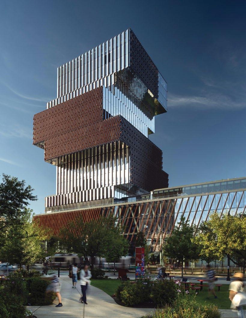
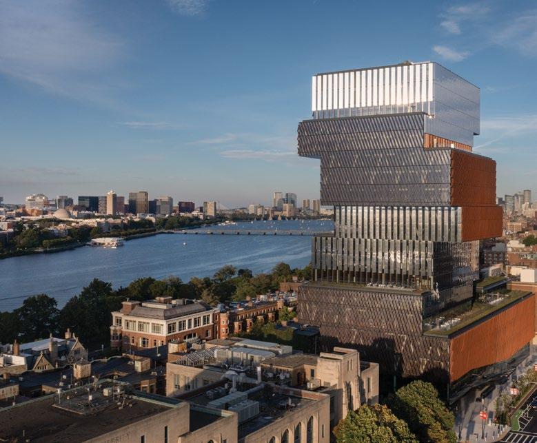
For many people who attended university in the past five decades, the description “university computing center” probably calls to mind a stark, cold, concrete bunker with few windows, the hum of fluorescent lights and ventilation fans, and students blankly staring into screens, their faces tinged a sickly green. Boston University’s Duan Family Center for Computing & Data Sciences is a complete inversion of the usual, introverted approach. Instead, glass-clad and jauntily rising from a central location with distinctive cantilevered forms and zig-zag exterior louvers, the building exudes transparency, and has quickly become the social hub of campus life, above and beyond the 3,000 students, faculty and staff who are domiciled there.
The 18-story, 359,967 sq ft (33,442 m2) building makes the most of a compact urban site on a linear campus wedged between the Charles River and Commonwealth Avenue.
“We needed to really create a collaborative environment, to bring together students and faculty from schools and colleges across the university, to use computing and data sciences to support a better understanding of their research endeavors, because data really drives research,” says Dennis Carlberg, Chief Sustainability Officer at Boston University. “We have a long, narrow campus, so we wanted to have a location that would assure a short walk for students and faculty from all these different schools and colleges around
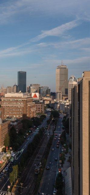
Previous page—
The Duan Family Center for Computing & Data Sciences. The Commonwealth Avenue entrance is supplemented by an adjacent parkette.
Left—
The building is set 3 feet (0.9 m) above the elevation of the Charles River dam, where critical building systems and equipment need to be located to avoid anticipated flooding.
the campus to come to the center to have opportunities to collaboratively work with the faculty of computing and data sciences.”
Each of the cantilevered volumes of the building forms a “neighborhood” with a different thematic emphasis, rotating around a central core. Rising from an open, porous podium that animates the street level, the bottom floors are devoted to math and statistics, middle floors to computer science, and top floors to interdisciplinary work and public space.
In the central atrium, an interconnected staircase weaves through eight floors, linking the various disciplines and nurturing serendipitous collisions. The zig-zag design allows for eight outdoor green terraces to be placed where a volume is recessed along the roofline of the one below.
The design was an entry in a competition, in which some 60 respondents were culled down to six from late 2012 through spring 2013, meeting at one-third intervals with faculty and university officials for intensive consultation sessions. Toronto-based KPMB eventually won the commission. Then began a year-long process to get the project into schematic design, which had just culminated when the directive came to design and construct another building on campus first.
What might have been a critical delay proved fortuitous for the design once the Computing Center project resumed: during the four years the project was on hold, the University’s Board of Trustees
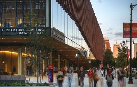
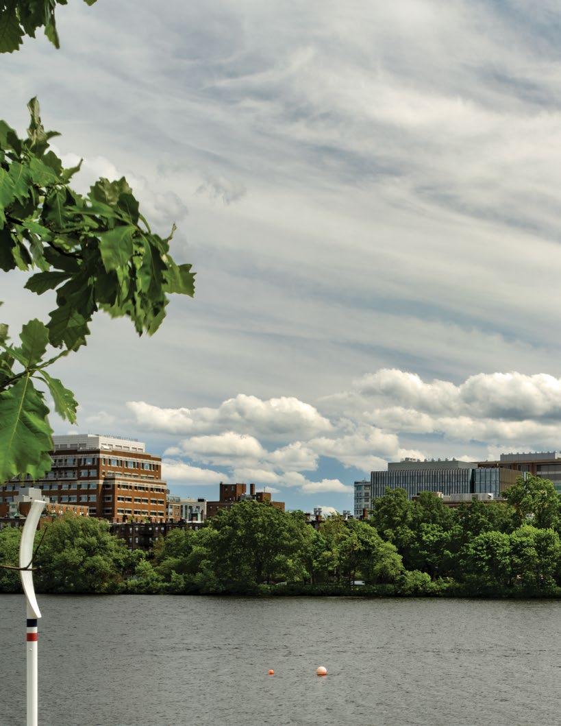
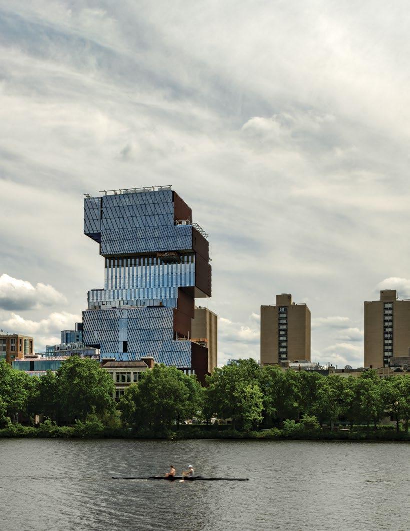
Boston University’s main campus sits on the southern shore of the Charles River, directly across from MIT and downstream from Harvard University.
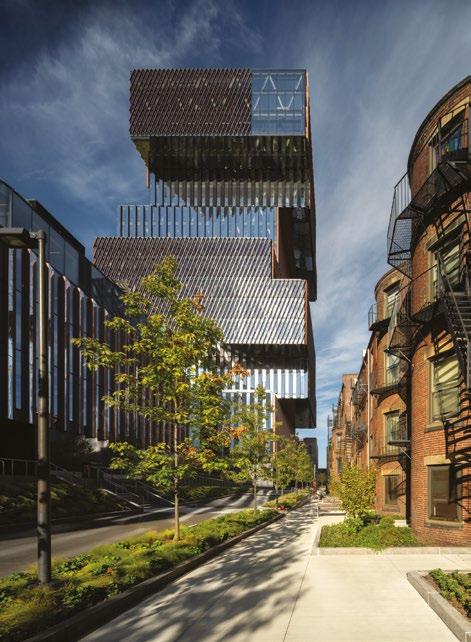
assembled a climate action plan, setting the goal of carbon neutrality by 2040. By the time the team returned to work, “Our senior leadership said, ‘We want a fossil-fuel-free, carbon-neutral building,’ which blew my mind,” Carlberg recalls. “Fortunately, we had the team in place that had the capacity to do just that.”
One of the outcomes of that mandate involved drilling 31 geothermal bore holes up to 1,500 feet (457 m) into the earth below. Three different drilling techniques were tried before selecting the final team, which executed the bores while the project was still going through the permitting process and the construction documents were being finished. The geothermal closed-loop system provides 90% of the building’s
thermal capacity, with electric boilers and chillers covering peak periods.
Even with such tight performance requirements, the project actually grew in size during the process alongside the university’s computing and research requirements, inverting the typical story of a project first being delayed, then value-engineered into a shadow of its original self. “We were so happy building this,” says Paulo Rocha, Design Lead and Partner at KPMB. “Everything about the building got better. BU was so visionary, they pushed us the whole way, and they were advocates the whole way.”
Another main component that boosted the building to LEED Platinum rating was the triple-glazed envelope and sun-shading louvers, which reduce energy
Left—
The site was extended beyond the property lines to reimagine what was once a back vehicular alley into a pedestrianized laneway.
consumption by 30% against the local baseline. The outdoor terraces double as green roofs, reducing the urban heat island effect and retaining rainwater, and carbon-neutral carpet was selected for the portions of the floor not surfaced in finished concrete. The project employed concrete with up to 70% Portland cement replacement rates, the highest ever used in Boston for this application.
As with any developer of such an ambitious project, always front of mind was the trade-off between increased cost resulting from more expensive design choices or systems, and the benefits of operational energy efficiency. Rather than consider the return on investment for individual features, the team instead focused on the summary effect of
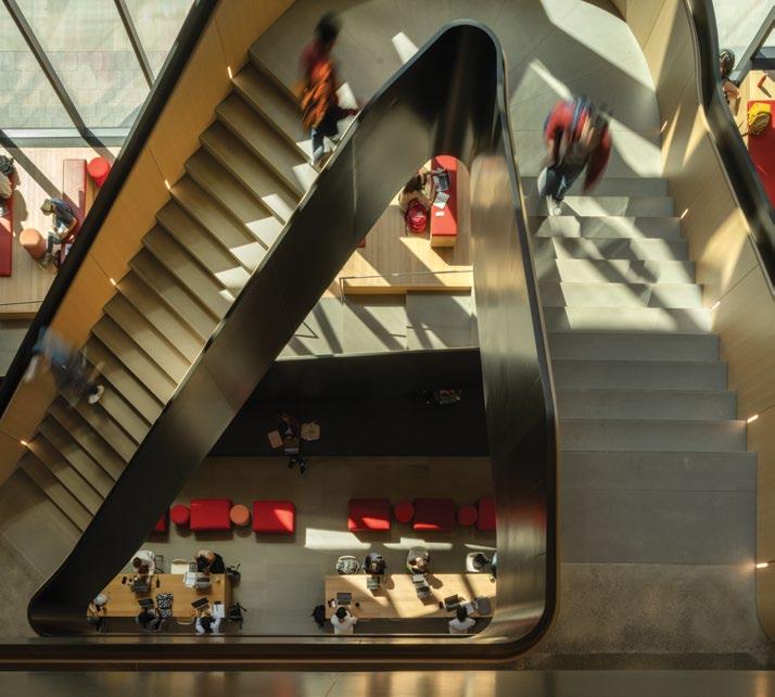
spaces with the classrooms along Commonwealth Avenue
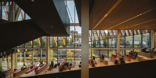
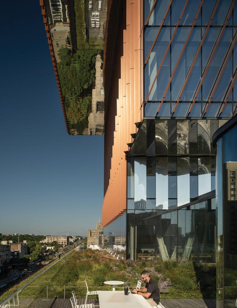
all design choices and systems on the overall project. The energy-efficiency systems were determined to comprise less than a 1% increase in construction cost, according to Carlberg. The combination of these choices reduced the need for conventional air handling and mechanical systems to such a degree that an entire floor that would have been taken up by the plant could be returned to program: including office space and the building’s signature 17th-story assembly room, which commands sweeping views up and down the Charles River.
Besides its “Jenga”-like form, one of the more prominent design features of the building is its “irresistible” nonegress stairs, formed of black steel trimmed in warm wood, which in the lowest five floors appear to leap across the atrium. The stairs’ neutral tones are meant to offset the vibrant colors used to give each neighborhood its own identity. Corners with coveted panoramic views are left as open collaboration spaces rather than as private offices, each with its own dedicated color and material palette. Arriving on each floor, occupants are always met with a view through layers of glass to the outside, orienting people to their place in both building and city. Elevator cores are painted red, the University’s color, to provide continuity. By design, however, most people use the stairs to move within and between “neighborhoods.”
“You can walk this building from the lowest level, from one level below grade to the 17th floor,” Rocha says. “And that’s
kind of unheard of in a lot of academic and office buildings. It was really about connectivity, and creating synergies between departments that had been separated, which now are together.”
The collaborative spirit of the design is on view through the ground-level façade, the main point of interface with the city, where a café and “on-display” classrooms beckon the public inside. The stepped common area known as the “collaboration terrace,” rising gradually from the ground to second-floor public spaces, is one of the most popular places for students to sit and study, particularly when the south-facing window is hit with sunlight on a cold winter day.
The architect and the client alike concur that the human-centric design is essential to the building’s success.
Recalling an early interview with Azer Bestavros, BU’s Associate Provost for Computing and Data Sciences, “He said to us, ‘Computers don’t drive innovation. People drive innovation,’” Rocha says. “So this building can’t be about computers. It has to be about people, because people are the ones that are driving innovation and creating.”
“There’s so much life in that building,” Carlberg says. “We talk about all the technical stuff and the design and the sustainability features, but it’s really about the students, and it’s a celebration of life.”
The Duan Family Center for Computing & Data Sciences received the Best Tall Building Americas Winner Award, and an Award of Excellence for Best Tall Building under 100 meters in the 2024 CTBUH Awards program.
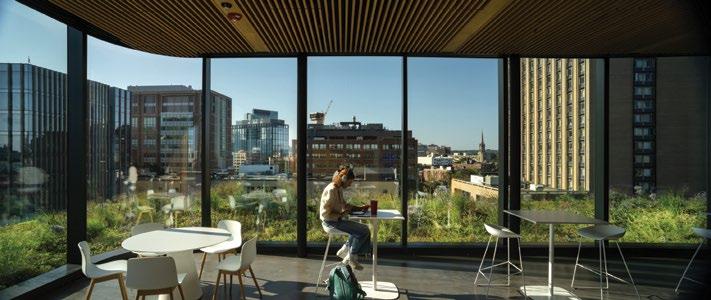
Right—
A triple-story exterior terrace on the 17th floor provides expansive views of Boston, including the Charles River and Fenway Park.
Left—
Key section showing the intent to establish a “vertical campus.” Rotating around the central core, the cantilevered volumes are conceived as neighborhoods that offer each department its own dedicated outdoor space.
Left—
Ground floor plan: with the tower anchoring the corner site, the ground floor is primarily given up to the public realm, offering areas for collaboration and study, and a café.
Right—
Typical floor plan: the design provides access to natural light and views and creates multiple collaboration spaces.
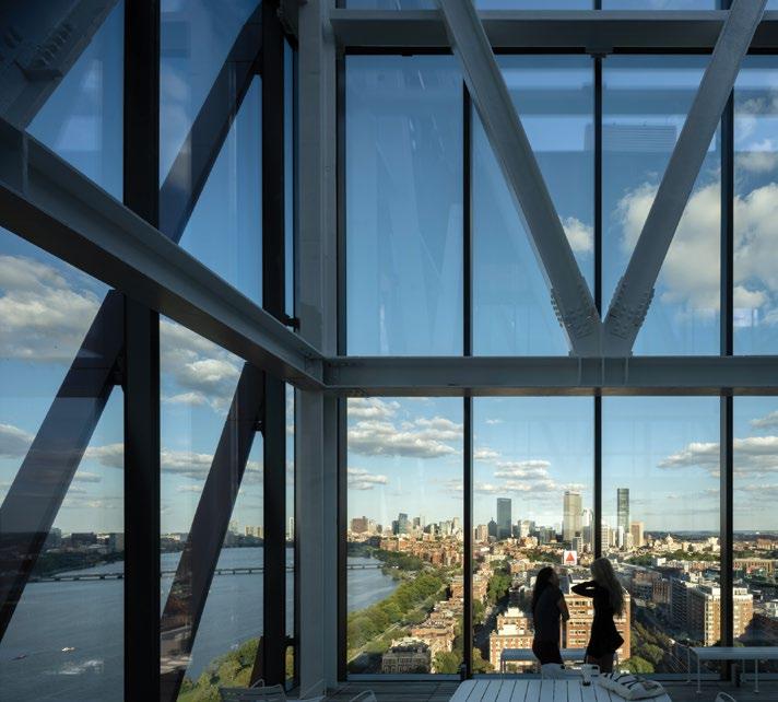
Credits
Owner/Developer: Boston University Architect: KPMB Architects Structural Engineers: Entuitive; LeMessurier MEP Engineer: BR+A Consulting Engineers
Project Managers: Brian Ballantyne Specifications; Compass Project Management Group
Contractors: Suffolk Construction Company, Inc. (main contractor); Prime Steel Erecting, Inc. (steel)
Other Consultants: Acentech (acoustics); Nitsch Engineering (civil); Transsolar Energietechnik GmbH (environmental); Entuitive (façade); Jensen Hughes (fire, life safety); Ricca Design Studios (food service); Skillings & Sons, Inc. (foundation); Haley & Aldrich (geotechnical); Robbie McCabe Consulting, LLC (interiors); Richard Burck Associates (landscape); The Green Engineer (LEED); Rubin and Rudman LLP (legal); Dot Dash (lighting); Fort Point Associates, Inc. (planning); AECOM (traffic); Soberman Engineering Inc. (vertical transportation); Entro Communications Inc. (way finding); RWDI (wind) Material Suppliers: Ferguson Neudorf Glass (cladding); Canatal (steel)
The City Advocacy Forum is a pioneering new initiative from the Council on Tall Buildings and Urban Habitat to explore and champion best practices in densification from cities around the world. Each session invites leading urban change-makers from across the globe to a CTBUH conference to share their key strategies and lessons learned. Supported by Kohn Pedersen Fox, the second and third sessions—featuring 10 speakers from eight cities—took place in Istanbul and London, in April and September 2024 respectively.
FORUM CHAIR
ARIANE DIENSTAG
is an architect and business development expert based in Paris. A former director at Ateliers Jean Nouvel, she founded her built environment consultancy in 2018. She is CTBUH French Chapter Secretary and lectures, mostly on urban planning, at École d’Architecture de Versailles.
TIRANA
ANISA MANCE
is Urban Planning and Development Director at the Municipality of Tirana. She leads Tirana’s General Local Plan and sustainable development strategies, including postearthquake reconstruction plans and smart urban growth.
OSLO
MANSOOR HUSSAIN
is a Norwegian urbanist and former political advisor to Oslo’s governing mayor. Now at Storm Samfunn, he advises leading developers and architects. He served on Oslo City Council and helps organize Oslo Urban Week festival.
LONDON
PETER MURRAY
is Co-Founder of New London Architecture, which publishes an annual report on tall buildings in planning and under construction in London. He was a Mayor of London’s design advisor and founder/ director of the London Festival of Architecture.
ISTANBUL ÖZGÜR BORA YAPRAK
is General Director of Bimtas Inc. in Istanbul. A city planner from Istanbul Technical University, he managed major healthcare infrastructure projects through public-private partnerships and served as chairman of the Public Private Partnership Association.
ISTANBUL SERHAT BAŞDOĞAN
is General Manager of Türkiye Design Council, an NGO promoting human-centered design rooted in culture and arts. He leads initiatives to enhance design awareness, protect designers’ rights, and bridge quality design with public and private sectors.
NEW YORK CITY
THOMAS WRIGHT
is President and CEO of Regional Plan Association, leading research and advocacy for the New York-New JerseyConnecticut region. He spearheaded the Fourth Regional Plan and chairs the New Jersey State Planning Commission. He teaches at Columbia University.
PARIS
DOMINIQUE ALBA
is CEO of Ateliers Jean Nouvel, where she began her career in 1982. An architect and urban planner, she served Paris for 20 years, including as general manager of Atelier Parisien d’Urbanisme and Pavillon de l’Arsenal.
SINGAPORE
LAY BEE YAP
is Group Director of Architecture and Urban Design at the Urban Redevelopment Authority of Singapore. She is prize secretary of the Lee Kuan Yew World City Prize and is co-commissioner for the Singapore Pavilion at the 17th to 19th Venice Biennales.
TORONTO JAMES PARAKH
is Manager of Urban Design Development for the City of Toronto Planning Department. He leads the development in Downtown and surrounding urban areas. He is the chair of the CTBUH Urban Habitat/ Urban Design Committee and has written extensively on tall building urbanism.
EDITORIAL NOTE
The two discussions have been edited for concision and clarity. For ease of reading, panelists and audience members are mostly denoted by their city, rather than their name.
FIND OUT MORE
To find out more about the City Advocacy Forums, including video content of speakers and the freshly launched Vertical Urbanism Index (see page 7), please visit the website: caf.ctbuh.org

From Left—
Mansoor Hussain (Oslo), Özgür Bora Yaprak (Istanbul), Anisa Mance (Tirana), Shonn Mills (Chair CTBUH), Peter Murray (London), Ariane Dienstag (Chair), Serhat Başdoğan (Istanbul). Photographed at the Türkiye Design Council on 17 April 2024.
Chair I’m very pleased to be here for the second City Advocacy Forum. For myself, coming from France, this sort of discussion around height and density is especially interesting. We have four buildings above 200 m high—among those the Eiffel Tower— yet Paris has the highest density in Europe. We have five speakers from different sized cities—from around half a million inhabitants to some 15 million—to see how they approach the topic of the city, making a comparison of their policies, solutions, and strategies. We’ll have five-minute presentations of the cities and then we’ll go for Q&A.
Tirana Tirana is a relatively young city, having been established nearly 100 years ago. Compared to other cities, it is still developing, but I am pleased to share some of our recent advancements. In 2019, Tirana underwent a significant territorial reform, expanding its area 25-fold by incorporating surrounding communities. This reform brought a tenfold increase in population, posing the challenge of serving and accommodating the needs of many more people.
In 2016, with the support of local architects, we enhanced our general local plan for Tirana. Our city is known for its social cohesion, cultural diversity, and religious inclusivity. This diversity has shaped Tirana’s vision for sustainable and controlled development, which we aim to achieve through firm commitment to innovative projects.
One of our major initiatives is the Orbital Forest. Unlike traditional forests, this project involves private developers who are permitted to build on no more than 30% of their land. The remaining area must be used for planting vegetation that aligns with the local environment. This ambitious and time-intensive project, involving both public and private properties, is expected to be completed by 2030.
We are also working on the Outer Ring Road to prioritize public transportation over private vehicles. Two terminals, located on the east and west sides of the city, have been constructed to encourage public transit for commuters traveling to Tirana from other cities. With nearly half of Albania’s population visiting Tirana regularly, these measures aim to reduce congestion and improve connectivity.
Tirana has faced challenges transitioning from its communist past to a modern urban model. A key focus has been promoting controlled and sustainable development through polycentric planning. For example, we are transforming former industrial areas, such as the northside along the Tirana River, into vibrant, mixed-use neighborhoods.
One such project, currently under construction, will provide housing for those displaced by the 2019 earthquake while offering a 15-minute walkable community with legal services, commercial spaces, and high-tech infrastructure.
Other projects include preserving heritage while introducing modern development. For instance, we are extending the main boulevard to create new public squares and a central park, which integrates private property development to fund the project.
Developers are encouraged to build taller, denser structures with minimal footprints, leaving most of the land available for public use. This approach has allowed us to create a central park while maintaining accessibility and expanding road networks.
These efforts demonstrate Tirana’s commitment to sustainable growth, innovative planning, and creating a more inclusive and livable city.
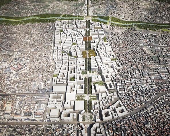
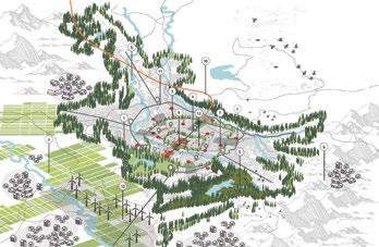
to construct buildings on no more than 30% of their land; the rest must
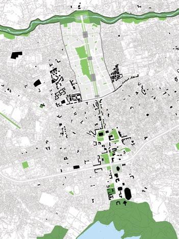
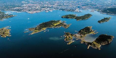
Left— Oslo, situated between protected forests and a fjord, is known as “the city between the green and the blue.” Below—
The area around Oslo’s main train station and inner harbor has been extensively, but carefully redeveloped.
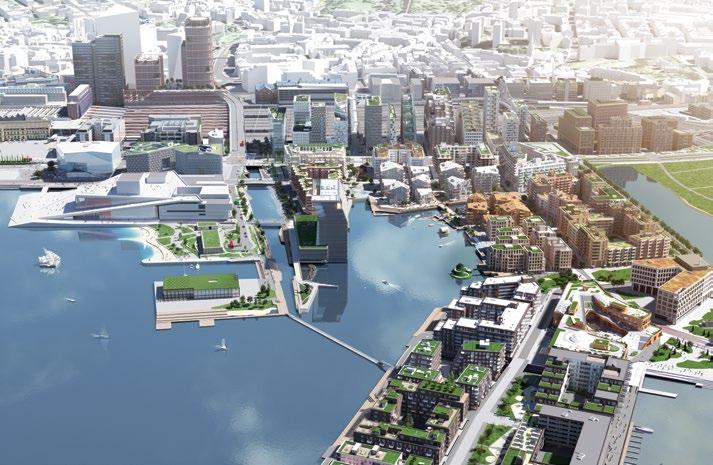
A-lab, MVRDV and Dark Arkitekter collaborated on the Barcode master plan, which completed in 2017.
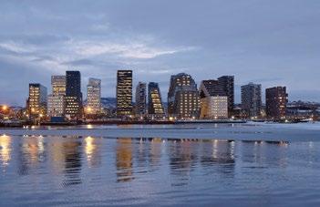
Oslo Welcome to Oslo. Compared to Istanbul, Oslo is a much smaller city. Oslo is often called “the city between the green and the blue,” nestled between forests, lakes, and the fjord. It has a population of around 700,000–800,000 people, and the greater metropolitan area reaches up to 1.2–1.3 million. In 2015, when the government I was part of came into power, Oslo was Europe’s fastest-growing city, at least for the first two months. It was a nice title to hold.
Oslo is not particularly dense, and we take pride in being a green city with plenty of parks and trees. This love for nature is deeply ingrained in our identity. Many Oslo residents dream of living on a farm, even though they live in the city. They want their own private space, a large terrace, and a tree nearby—but not one that blocks the sun, which is important this far north.
Historically, many areas of Oslo’s suburbs reflect 1970s design, with terraces, green spaces, and cars for commuting. This suburban ideal remains appealing, and many people accidentally find themselves living in the city when they would rather have unobstructed views of nature. This presents a challenge for urban development: how to grow sustainably while preserving the greenery and space that Oslo residents cherish.
One major issue we face is what we call “green NIMBYism.” Oslo’s landscape is defined by legally protected forests and fjords, leaving limited room for expansion. Residents worry that urban development will erode the city’s green character.
This tension is visible in new residential projects, where planning sometimes struggles to keep up with developers. In one example, a newly built neighborhood lacked public infrastructure because government planning fell behind. Despite these challenges, we’ve reclaimed urban spaces for residents, turning former carways into green areas with seating and play spaces for children.
High-rises are another contentious issue. Many people fear they will disrupt Oslo’s character. Some imagine the city becoming a high-rise jungle like other global metropolises, which clashes with our vision of a “green city.” To address this, we created a detailed high-rise plan. High-rises are restricted to areas near transit hubs—metro, bus, tram, or train stations— where density already exists.
In Oslo, a high-rise is anything taller than 42 m. Only around Oslo Central Station, the densest and most connected area in Norway, are buildings up to 125 m allowed. This approach ensures that height is introduced thoughtfully, supporting transit and reducing pressure on green spaces.
Cultural heritage preservation is another challenge. Oslo’s Cultural Heritage Department is strict, but funding constraints have left many historic sites in disrepair. For example, some old libraries and civic buildings have fallen into neglect because the city lacks the resources to restore them.
However, creative projects have emerged to repurpose these spaces. One example is a former public utility office, now transformed into a mixed-use development with residential units, a luxury hotel, and a café. The old office where residents used to pay their electricity bills is now one of Oslo’s most popular bars. This project highlights how adaptive reuse can preserve history while revitalizing urban spaces.
Perhaps the most ambitious transformation in Oslo is the redevelopment of its harbor. Once dominated by industrial uses and major roads, the area has been reclaimed for public use. The harbor now features landmarks like the Opera House and the
Munch Museum, as well as residential buildings and public parks. A defining principle of this redevelopment is that all waterfront spaces remain public and accessible, with no privatization allowed. Parks, beaches, and recreational spaces are integrated into the design, ensuring the harbor is open to all.
Oslo’s urban development strategy combines intelligent use of height and density with a commitment to sustainability, public access, and cultural preservation. The balance is not always easy to strike, but our projects demonstrate how cities can grow while maintaining their unique character and quality of life.
London I’ll compare some of London’s experiences with what you have here in Istanbul. It’s fascinating to hear about Tirana’s plans and to reflect on what has happened in London over the same period, starting from the 1900s.
There’s a Greenbelt around London. Similar to Tirana, in the 1930s London experienced major development, low-rise housing, and suburban sprawl. This history explains why London’s overall density is much lower than Paris’. While central London has densities comparable to Paris, once you move into the suburban areas, the density drops significantly. On this map, you can see the central core of London in black, the Greater London boundary marked in pink, and the surrounding Greenbelt. Initially planned as just a few kilometers wide, the Greenbelt now extends as far as 30 km from the city in some areas. Development within the Greenbelt is heavily restricted, with only a few public buildings permitted.
This means all new development in London must occur within the Greater London boundary. With a steadily growing population, densification has become essential. London’s population grew from about 4 million at the end of the 19th century to 8.6 million in 1939, just before World War II. It dipped after the war but has since risen to over 9 million and is projected to reach 10.1 million by 2030, growing by around 100,000 people per year. Constrained by the Greenbelt, London has had to focus on densifying its urban areas.
A key framework for this approach is the London Plan, developed with input from architect Lord Richard Rogers, who also authored Cities for a Small Planet. His vision focused on making city centers more livable and attractive, reversing the post-war trend of suburbanization. The London Plan encourages a polycentric city structure, with strong development around the central core and in designated zones. These “red spots” on the map highlight areas suitable for higher density, transitioning into lower-density residential zones. This framework has guided London’s development for the past 20 years.
One significant strategy has been creating clusters of tall buildings. The densest cluster is within the City of London, the financial center. Concentrating office spaces there fosters economic synergy, as the proximity of businesses enhances collaboration and efficiency. However, London’s tall buildings are tightly regulated to protect historic views of landmarks like St. Paul’s Cathedral and the Houses of Parliament. Clusters are therefore limited to areas where views are not obstructed.
Currently, 12 new buildings are under construction in this financial cluster, driven by what property agents call a “flight to quality.” Major tenants are seeking buildings designed for well-being, sustainability, and modern work patterns. This shift leaves a growing supply of older office spaces that will require significant investment to meet modern standards.
Right—
Nine Elms, a tall building cluster on the south bank of the River Thames, features mixed -use towers with significant allocations for affordable housing. Two towers in the foreground are by Zaha Hadid Architects.
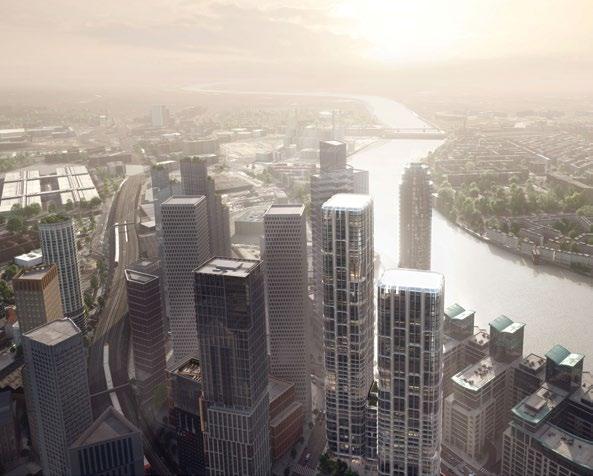
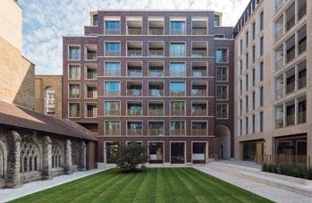
Left—
In the London Plan “gentle density” of 6–10 stories is seen as an alternative to high-rise living in suburban areas. This collaboration between Sheppard Robson Architects, Maccreanor Lavington and Piercy and Co, Bart’s Square is a mixed-use quarter in East London.
Below—
The HOK-designed Bollo Lane Mixed Use Development includes a series of buildings ranging from 4 to 25 stories, creating a sustainable livework community.
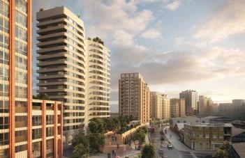
The debate over height extends to residential buildings. While tall buildings are often seen as a necessity, there’s resistance from politicians mindful of NIMBYism, especially with an election approaching. This has led to policies promoting “gentle density,” typically eight to 10 stories. Definitions of tall buildings vary widely; in some areas of London, a six-story building can be considered tall if it contrasts sharply with its surroundings. Traditionally, a tall building in London was defined as 20 stories—a standard some still prefer.
Recent policies also require taller buildings to include two staircases for fire safety, a response to the Grenfell tragedy. This increases construction costs, prompting developers to push for greater height to maintain viability. Despite political resistance, economic and spatial pressures mean that building tall is often the only viable way to meet London’s housing needs. The city requires 60,000 new homes annually, and achieving this without increasing height is unrealistic.
One example of this strategy is Nine Elms, a cluster just outside central London. It features mixed-use developments, including residential towers with significant allocations for affordable housing. On average, private developments deliver about 35% affordable homes, though some achieve as much as 50%. While debates persist about whether these homes are truly accessible—particularly concerns about overseas buyers leaving properties empty—they do contribute to addressing the city’s housing crisis.
The broader challenges remain the same: balancing density with livability, managing NIMBYism, and navigating political pressures. London, like many cities, must grapple with the realities of growth while striving to protect its character and meet the needs of its residents.
Istanbul (OBY) Welcome to Istanbul. I am a city planner with 27 years of experience, currently serving as the General Manager of Bimtas, the municipal project company of Istanbul. Bimtas has around 400 employees and operates in various fields, including architecture, design, city planning, 3D mapping, cultural heritage, and smart cities. Bimtas works on a wide range of projects for the municipality of Istanbul. Before diving into the details, I’d like to share a brief historical overview of Istanbul.
Istanbul is a fascinating city at the crossroads of Asia and Europe, with a unique place in world history. It has a rich heritage dating back to ancient times, with the first settlements known to date back to the 7th century BC. Over centuries, Istanbul served as the capital of several civilizations and remains a meeting point for different cultures and civilizations today.
Istanbul is not only one of the most important cities in Türkiye, but also a city of global significance. It spans approximately 5,400 km2 within its legal boundaries. Its historical and cultural significance has made it a central attraction for tourists, ranking among the most visited cities in the world. In 2023, around 18 million foreign tourists visited Istanbul. Additionally, as a result of migration driven by wars near Türkiye and unfavorable global conditions, approximately 1.5 million immigrants now reside in the city. In total, Istanbul is home to nearly 20 million people.
Istanbul’s numbers highlight its economic importance, both nationally and globally. For instance, US$49 out of every US$100 of foreign trade in Türkiye is conducted by companies in Istanbul. Half of all airline passengers in Türkiye travel through
Istanbul’s airports. Additionally, 21 out of every 100 companies in Türkiye are established in Istanbul, and 25% of all tourists in the country choose Istanbul as their destination.
At Bimtas, our projects are shaped by a participatory planning approach, designed to address the city’s needs and challenges. Our work includes engaging stakeholders to identify problems, define visions, and prioritize projects. This is achieved through activities like workshops, focus groups, forums, information-sharing meetings, documentary screenings, online meetings, public festivals, and surveys. So far, we have organized 268 engagement events with around 8,000 participants to guide various projects.
Our work spans critical topics such as urban mobility, resilience, climate change adaptation, and resource management. Examples include the Istanbul Green Infrastructure Master Plan, the Tourism Action Plan, the Istanbul Pedestrian Master Plan, and projects for maritime transportation and park-and-ride systems. One notable project is “Istanbul in Europe,” an initiative focused on urban regeneration and earthquake resilience.
Istanbul faces significant earthquake risks, and the “Istanbul in Europe” platform addresses this challenge. It is an online information and support platform that helps transform at-risk housing into earthquake-resistant, environmentally friendly structures. The platform connects residents and contractors with municipal subsidiaries like Kiptas and Mahallesi, enabling a streamlined process for housing transformation. The criteria for applying include private ownership of the parcel and structures built before 1999.
The platform offers three application types: one for contractors and two for residents seeking to renovate or rebuild their homes. It also features dashboards visible to Bimtas and the municipality, enabling dynamic monitoring of applications, agreements, and construction progress. Istanbul has approximately 1.6 million housing units classified as “at-risk,” and the municipality is working to transform these units. Since the program launched three years ago, around 200,000 applications have been received.
This is a significant and ongoing initiative. The platform not only facilitates the application process but also provides financial support for eligible projects. It is a massive undertaking aimed at improving safety and quality of life for Istanbul’s residents.
Istanbul (SB) It’s not easy to explain Istanbul—we have thousands of challenges. Today, I want to focus on tall buildings. Istanbul is a huge city. The traditional city center is only a small part, while the geographical center is located elsewhere.
This presents a significant problem, as every public transportation system needs to connect across different parts of the city. While the sea is one of Istanbul’s most valuable features, it also creates logistical challenges for transportation and accessibility. Istanbul is undeniably a beautiful city. Its skyline is one of the most stunning in the world. However, alongside this iconic skyline, we also have modern towers. As an architect and academic, I value towers for their effective use of urban land, especially in a growing and globalized city like Istanbul. Since the 1950s, Istanbul has expanded upwards, reflecting globalization and urbanization trends. However, I want to address a more specific issue today: gated towers. While towers themselves are not inherently a problem, gated towers present unique challenges for Istanbul.
The development of gated towers in Istanbul has largely been unplanned. For instance, the city’s first central business district (CBD) developed between the two main bridges connecting the European and Asian sides. This location wasn’t chosen for public transportation or strategic urban planning; it was driven by car accessibility. Similarly, the second CBD also emerged near major highways, again based on car access rather than thoughtful planning. These developments have created significant issues.
Gated towers are particularly problematic because they create social segregation, reduce accessibility, and increase costs. They limit public services, foster a false sense of security, and have negative environmental impacts. Additionally, they disconnect communities, encourage homogeneity by clustering similar groups of people in the same types of buildings, and strain traffic and infrastructure, while increasing property value pressure.
To illustrate this, let me show you a specific example. In one part of Istanbul, we have a low-rise, high-density region adjacent to a high-rise, high-density area. This highlights the issue of rapid and unplanned urban expansion, which strains infrastructure and reduces quality of life. The consequences include traffic congestion, pressure on public services, and environmental degradation.
Efforts are underway to address these challenges. Municipalities, government agencies, and academics are working together to develop incentives for sustainable development, improve earthquake resilience, and enhance public transportation. However, I want to pose a question for us to consider: Can we design towers to be multi-functional, mixeduse spaces without rigid zoning?
If we rethink tower design, we can create spaces that operate effectively 24 hours a day. These towers could include facilities accessible to lower-income residents, fostering social integration and enabling different parts of the city to share resources. This is not just an architectural challenge—it is a design challenge for future generations in Istanbul.
London Could you describe what gated towers are?
Istanbul (SB) For example, an office building that is closed after six o’clock, leaving it inactive, or a residential tower for high-income residents that serves only a single group. Can we make these spaces more functional? Instead of focusing only on horizontal strategies for mixed-use and mixed-income developments, we should apply these ideas vertically to towers. This approach has been discussed for over 20 years, but it remains a pressing issue in Istanbul today.
Chair What defines a mixed city, and how can you incorporate tall buildings with mixed-use? Is this something feasible in your cities? For instance, in France, strict fire regulations make it extremely difficult to combine uses like offices and housing in the same building. It’s a logistical challenge and significantly increases costs. What is the approach, for instance, in Tirana? How do you work with the city to address these challenges?
Tirana We face a similar problem in Tirana with horizontal gated communities. These developments are socially homogenous, excluding other social classes. To address this, in 2019, we introduced a law requiring developers to donate 3% of every 2,000 m2 built to the municipality for social housing.
This ensures that people in need are integrated into the same communities, creating a mix of social classes. This requirement now also applies to gated communities in vertical developments, such as towers. It’s one way we are working to address this issue.
Oslo With the new high-rise plan in Oslo, building tall is highly restricted, and developers must meet stringent requirements to gain approval. As a result, private developers are incorporating mixed uses into their projects to make them more acceptable to politicians. For example, some high-rise plans include a publicly accessible park on the 10th floor. Other projects dedicate the first five floors to libraries, spaces for NGOs, and open areas that nearby schools can use, with the upper floors designated as office spaces.
There are also efforts to mix offices and housing within towers, though this is challenging due to various regulations. However, such projects help keep the area active for longer periods and create more inclusive environments. The key is to include functions that don’t require payment to access—simply adding a restaurant doesn’t create true mixed-use.
These strict regulations have spurred creativity among planners and developers, pushing them to design projects that meet the city’s demands while offering innovative solutions.
Chair So it’s the question of making the tower desirable for the community, because they have access to it. You see that in many cities. How does London address it?
London When it comes to mixed-use, I’d like to talk about Canary Wharf in London, a tall development that was initially built almost exclusively for offices, similar to La Défense in Paris. The first phase consisted of office towers with retail spaces at the base to serve office workers. The second phase, now nearing completion, introduced a more mixed-use approach by incorporating residential developments. Interestingly, residential spaces have proven more profitable than offices, with developers charging premium prices for the top flats.
This second phase also targeted tech companies, which prefer campus-style environments over traditional towers. However, the post-COVID city presents new challenges. Many large corporations are downsizing their office requirements. The first towers at Canary Wharf were designed to meet the demand for large floor plates, primarily from American banks operating in London. These banks no longer need such expansive spaces, requiring a rethink of how these towers can be adapted
Repurposing these towers is complex. Converting them to residential use, for instance, requires extensive reglazing and structural changes. Their large façade-to-core distances leave interiors dark, necessitating modifications like cutting concrete to create light wells. These adjustments are expensive and difficult, making the economic viability of such conversions a major issue.
This is not just a problem at Canary Wharf; cities around the world face similar challenges with towers built during specific real-estate booms. These buildings represent significant investments but are now struggling to meet modern needs. In London, this is a critical part of the ongoing debate, particularly as major developers like Brookfield, which owns a substantial portion of Canary Wharf, also face similar issues in Sydney, New York City, and San Francisco. It’s a global challenge.
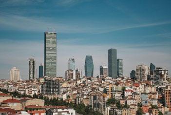
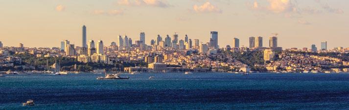
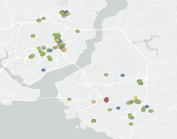
Istanbul (SB) Making adaptive reuse financially feasible could be an alternative solution. After COVID, we saw thousands of square meters of vacant space in Istanbul, while at the same time, there’s a significant need for housing. Flexible design and open spaces could help address this. However, building codes in Istanbul are extremely strict, as they are in many places in Europe, making this a big challenge. For the future, more flexible, open, and adaptive spaces could be a valuable alternative for cities.
London It’s definitely a challenge, particularly for organizations like CTBUH, because reusing these buildings and towers is essential. However, the costs are staggering. Recladding alone can cost, let’s say, £100 million (US$127 million). Adding measures like cutting concrete for light wells further increases expenses, making viability a serious issue. While adaptive reuse retains the embedded carbon in these buildings, the economic feasibility remains a major hurdle.
Chair So, we’ve moved from discussing mixed-use cities to flexibility and the regulations surrounding them. For new buildings in Paris, there’s now a requirement to consider alternative future uses as part of the building permit process. This was introduced for projects like those for the Olympic Games. Do your cities have similar policies to foresee alternative uses for buildings coming onto the market? Or are there examples from other cities or countries with such regulations?
Madrid We’d like to highlight an issue we’re facing: embodied carbon. Over the next two or three decades, this will become a critical factor. One argument we have for our buildings is their longevity—they’re designed to last longer than others. To achieve this, buildings must be more flexible, not just in layout but also in façade design, public spaces, and uses. Flexibility should become a new standard, like fire codes. If a building cannot accommodate future uses, such as converting offices into hospitality or residences, it should not be approved for construction.
This is the challenge we face for the future. In the past, buildings were not designed with flexibility in mind. Many structures from the last 40 years are now nearly impossible to refurbish and can only be demolished. For example, in New York City, the cost of demolishing one building exceeded US$100 million. This lack of foresight is a significant mistake that we must avoid moving forward.
Oslo I agree that making buildings more flexible, as well as adjusting zoning plans and regulations to allow for flexibility, is essential. However, achieving this requires trust between the city government and private developers. In Oslo, this trust is lacking. The city government doesn’t trust developers to stick to agreements, and developers don’t trust the city to fairly support their projects. This creates a cycle of tension, with both sides locked in long disputes.
By the time a project reaches the politicians, they’re forced to make a yes-or-no decision on something shaped by years of conflict. If a politician suggests making plans more flexible, city officials often argue that it undermines years of work to regulate developers. Without mutual trust, the goal of creating a more flexible city becomes difficult. We must address how to foster trust between all parties, including those financing the buildings.
London I think this is both a design and a trust issue. Back in 1973, during the energy crisis—not a climate crisis but an energy crisis—the president of the Royal Institute of British Architects proposed a philosophy: all buildings should be designed for “long life, loose fit, low energy.” This idea remains highly relevant today. We can see examples in cities worldwide: warehouses converted into lofts, lofts turned into offices, and terraced houses built for single families in the 18th century later repurposed for multi-occupancy, offices, or family homes again, depending on economic needs. Trust is important, but good design allows buildings to adapt to changing circumstances. If we design for flexibility, society can respond to shifts in the economy and demand over time.
Oslo Time is essential to make those changes. A significant part of the challenge lies in the public mindset. In many European cities, living in a loft is considered hip and cool—it’s aspirational. But is it equally appealing to live in a repurposed 2005 office building? Probably not.
We have to work on shaping public perception to gain support for these transformations. This is where we encounter dissonance, particularly with NIMBY protests. If 10 years after building something, financial pressures make its original use unviable, and we propose repurposing it, many might feel
justified in saying, “I was right back in 2005—this should never have been built.” Transformations are necessary, but convincing the public to embrace them is a difficult task.
London You’re absolutely right. Another key part of the trust issue is viability during construction. For example, if a housing developer builds with floor-to-ceiling heights that are too low for future office use, that building becomes inflexible. Regulations could require minimum ceiling heights suitable for multiple uses, but how do we convince developers to comply when it might reduce their current profits? This highlights the importance of thoughtful regulation in creating adaptable buildings.
Venice I’m always skeptical when I hear about adaptability and flexibility in buildings. If we compare this concept to another industry, we know what a highly adaptable and flexible vehicle is—it’s an SUV—it can handle grocery runs, off-road adventures, and highways, but they’re over-designed and not sustainable.
Similarly, if we design a building today as an office, but with the ability to become a hotel or residential building later, we’re over-designing. It requires more concrete, steel, and timber, which undermines the sustainability we aim for. Instead, cities themselves need to be adaptable, while buildings should be designed well enough to remain functional over time.
Look at Venice: our buildings were constructed 500 years ago, not to be flexible, but to serve specific purposes. Yet they’ve transitioned over centuries—from residential buildings to social housing, hotels, and now universities. It’s the value of the building itself that allows it to adapt. Over-designing buildings for hypothetical future uses is not the sustainable solution.
Shonn Mills, CTBUH Chairman I’d like to ask everyone here: what do you think the role of government and policy is in creating flexibility? Venice is a great example, but part of its adaptability comes from regulations that prevent changes. If Canary Wharf had been built in Venice 30 years ago, you’d have a Canary Wharf in Venice now. But you didn’t allow it. So to everyone here—what is the role of government and policy in creating opportunities for flexibility? Beyond community engagement, how do we convince developers of the need for flexibility?
Chicago I completely agree with Dario from Venice. I’m Scott Duncan from SOM, and as a CTBUH Board Member, I have a vested interest in tall buildings and want the typology to survive.
Dario’s point about height is valid—taller buildings use more materials and air conditioning, which parallels the SUV argument. We’ve analyzed this closely. The idea of industrial lofts being repurposed into other uses is romanticized, but the reality is that such transformations only occur after a period of decline. Entire neighborhoods often languish for decades before being revitalized into boutique hotels or office spaces.
Canary Wharf is a good example. We planned it long a go—before I was even in high school—and can’t afford to let it decline. We need solutions to keep it viable. Articles in The Atlantic, The New York Times, or the Guardian often claim it’s simple to transform office buildings into residential spaces, but those writers don’t understand real estate. Just imagine aligning leases floor by floor or phasing the rehabilitation—it’s incredibly complex.
I do agree with Shonn’s (Singapore) point: government must lead the way to make these transformations financially feasible. Developers need support, even if it’s something policymakers might hesitate to do. It’s the only way to address the problem of outdated office buildings with large floor plates. Transforming them into residential spaces requires not just technical changes but also policy incentives, as was done in lower Manhattan in the 1990s and early 2000s. While residential conversions won’t yield the same income as office use, policy and regulation are essential to bridge that gap.
Oslo In Norway, we’re fortunate to have political collaboration between major parties. For example, in Oslo, the Labour Party and the Conservative Party have worked together to create a long-term plan for tall buildings. Both parties agreed on designated zones for high-rises and committed to supporting these plans, regardless of which party is in power. This type of bipartisan agreement provides the stability needed for long-term planning and zoning, which can take years to implement. Without such collaboration, achieving a consistent, long-term vision for urban development is much harder.
Chair This raises another question. In your countries, when are citizens involved in urban planning and building permit decisions? At what stage do they have a say?
Tirana In Tirana, we involve the public at every step, starting from the general local plan. We hold presentations and debates in smaller municipalities with representatives, stakeholders, and the public to identify key concerns. When we move to detailed neighborhood plans, the law requires that all documentation be made available online for at least 30 days for public consultation.
If there are no objections, the Mayor can approve the plan. If there is debate, we address the concerns raised and consult stakeholders to reach an agreement. Once this process is complete, issuing development permits becomes easier, since the broader concerns have already been addressed. Tirana is still a relatively small city, so this level of engagement is manageable.
London Almost all the information for public involvement is readily available—it’s on websites and in documents. However, people generally only get involved when something directly impacts their backyard. Getting the general public engaged in a strategic plan is nearly impossible. Developers are often nervous about putting too much information out early, but those who communicate well and highlight the positive effects of their projects get a much better response than those who try to surprise the public when submitting a plan.
One interesting example comes from a housing scheme in London, where the Mayor required that densification plans for existing housing estates be put to a ballot among the current residents. There was extensive consultation between architects, designers, the local authority, and the residents. Initially, there were fears that residents would reject the plans outright, but with better communication, nearly all schemes put to a vote were approved with high percentages of support.
When you engage people properly and communicate clearly, the results are very positive. However, on the question of who sets policies, I believe governments are the worst entities to do this. Policies should be set by mayors. For example, in London,

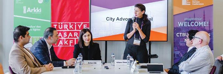
we’ve integrated a strong focus on the circular economy into our planning framework. While it’s not easy to implement, it’s leading to changes, like swapping steel between sites and recycling building materials. It’s not perfect yet, but it’s improving.
Istanbul (SB) In Istanbul, representing such a large population—18 million people—is very challenging. For example, the municipality employs around 80,000 people, so the scale is enormous. However, we do have democratic representation, with different parties having a presence within the municipality. Over the last 10 years, social media has become incredibly important for public expression.
We see two main groups organizing effectively: NIMBYs (Not in My Backyard”) and YIMBYs (“Yes in My Backyard”). These groups leverage social media to express their views and mobilize quickly. In large metropolitan areas like Istanbul, this dynamic has become a significant advantage for the future of civic engagement.
Oslo In Oslo, we have a similar process to what Anisa described in Tirana. At different stages of the planning and zoning process, developers must notify everyone living near the proposed site and allow time for feedback. For example, after notifying residents, there’s typically a month-long waiting period before moving to the next step.
We’ve observed that developers who start early, show examples of their previous work, and engage with the neighborhood to address local needs are the most successful. Some developers have such strong reputations that they can get almost anything approved, while others, with poor track records, face protests the moment they announce a project.
In Oslo and across Norway, every zoning plan must be approved by the City Council. Politicians play a crucial role— they ultimately decide whether a plan is acceptable. The mayor can recommend approval or rejection to the City Council, but it’s up to the council to make the final decision. This political stage often attracts protests, so developers need to secure political support early in the process to improve their chances of success.
Madrid I have a question for Peter. Do you think new technologies like AI (artificial intelligence) will enhance the elegant design of cities, or could they potentially lower the quality of architecture?
London Theoretically, AI should improve quality because it can answer many questions more quickly. I’m not sure I can fully answer that, but in terms of what we’ve been discussing, there are now far more tools for communicating effectively with people. For example, using virtual reality events for local communities allows them to better understand the potential impact of developments.
It’s hard to say if AI will directly improve quality, but it can process more data and provide more options regarding land use and other considerations, which could lead to better outcomes. I hope that positive trend continues.
Chair I’d like to ask each of you to summarize your city in one word for what’s working well and one word for what isn’t.
Tirana If you will permit me two words, the bad is “traffic congestion”; the good, “increased density.”
Istanbul (OBY) The bad side of Istanbul is accommodation— it’s very crowded. The good side is the culture.
Istanbul (SB) For Istanbul, I’d say public transportation is the worst aspect. But I agree with Özgür—the multicultural nature of the city is the best part.
London One positive is resilience and flexibility. London adapts well and responds quickly to changes. For example, in the post-COVID environment, we’ve seen radical changes in certain areas, which are having a positive impact. The bad side is NIMBYism. It affects other areas, like the Mayor’s recent decision to expand the low-emission zone across the entire city. The negative backlash is disheartening.
Oslo The best thing happening is that we’re growing as a city while staying climate-friendly. We’re removing cars, creating emission-free zones, and taking bold steps to reduce emissions. These measures are often unpopular, but they’re necessary. The worst part is the lack of collaboration with the national government. Norway’s government doesn’t fully understand the unique challenges of a big city like Oslo, which is the only city in the country large enough to face these problems. We don’t get the infrastructure support we need, and that’s a major issue. For more content from this City Advocacy Forum, including panelist interviews, please visit the website caf.ctbuh.org
Forth Bagley This session stemmed from conversations among CTBUH board leaders and members. We felt we were at the apex of city growth, yet simultaneously witnessing a new generation of cities under siege—economically, politically, socially, and environmentally. While global organizations exist to share best practices and ideas between cities, there wasn’t a platform for city-building experts—architects, engineers, and planners—to learn from one another and advocate for better cities, density, and livability.
I’m pleased to see how this initiative has grown. KPF is proud of the work that Shonn and his team have done to develop these conversations and equip us to be better advocates. With that, I’ll hand it over to Shonn to introduce today’s session and other initiatives.
Shonn Mills Thank you, Forth, and welcome, everyone. I think Forth is being a little modest because this idea really began with a conversation we had over drinks in Singapore last year. So, let’s give credit to Forth and KPF for planting the seed. This initiative has been a long time in the making.
The theme [of the CTBUH 2024 International Conference]—“New or Renew”—is particularly timely for cities. It also aligns well with where we are as a Council. This year has been one of deep reflection on our role and the needs of the world. Over the past 50 years, the men and women of the Council have reshaped our cities, transforming skylines around the globe. Yet, the needs of our cities have evolved, becoming more complex.
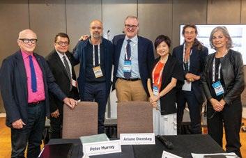
From left—
Peter Murray (London), James Parakh (Toronto), Forth Bagley (KPF), Thomas Wright (New York City), Lay Bee Yap (Singapore), Ariane Dienstag (Chair), Dominique Alba (Paris).
Photographed at The Barbican, London, on 23 September 2024.
We are uniquely positioned to address these challenges through our members and extended network. I’m thrilled by how the City Advocacy Forum has taken hold. We’ve already hosted two events this year. The first was in Miami, where Lay Bee and Peter contributed significantly to its success. The second was in Istanbul, where Ariane stepped in at the last minute to chair the event, delivering another fascinating conversation.
What we’re finding is that, despite the diversity and differences in how cities develop and the challenges they face, there are many commonalities. Issues like affordable housing, social equity, and resilience are universal challenges. This forum brings together the world’s best policymakers to share not only the challenges they face, but also real case studies of what has worked—and, just as importantly, what hasn’t. There’s much to learn from our mistakes.
The outcomes of these proceedings will be compiled into a set of visual data and a playbook. This resource will be designed to help cities, particularly emerging ones, leapfrog the challenges and pitfalls faced by more mature cities and build lasting solutions for the future. Another key outcome is the creation of a network—these participants will get to know one another, fostering ongoing collaboration and exchange of ideas.
Chair The theme of today’s workshop is “Planning for Density,” with a focus on the added angle of “New or Renew” in the context of high density. The concept of tall buildings varies greatly across countries, and it means different things to different places.
In 2018, at my first CTBUH conference in Dubai, Antony Wood presented a series of slides illustrating the planet’s stressors, categorized into five layers: tornadoes, sea level rise, wind, dryness, and earthquakes. The projections extended to the year 2100, representing our lifetime or that of our children.
Below left— Forma, Toronto, designed by Gehry Partners, is estimated to complete in 2029. The taller west tower is 308 m.
Below right— Designed by Foster + Partners and Ontario-based Core Architects, The One is set to be Canada’s tallest inhabitable building, rising to over 300 m.
Bottom right— Designed by Studio Gang, One Delisle has leaning, eight-story modules that spiral up the building to protect residents from sun and wind, and rain.
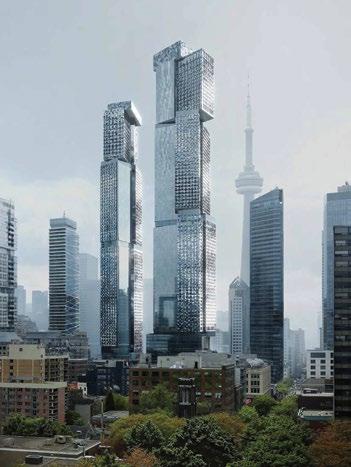
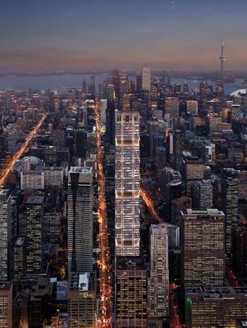
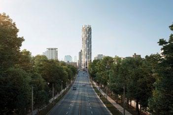
One particularly striking slide showed 16 small dots placed on bands across a global map, highlighting regions that would be sustainable to live in. From this, three conclusions stood out. First, we must act quickly to reduce the impact of these threats to the planet—climate change being a primary concern, and progress is already underway.
Second, we must adapt to living under new and changing conditions. For example, at France’s building fair Batimat next week, there will be a truck equipped to handle 50°C temperatures, designed to help people endure such conditions for short periods.
Third, we need to reduce the space where we build by densifying our cities. According to the United Nations, the global population is projected to reach 10 billion by 2050, with approximately 75% of people living in cities. The question is: how do we plan for this urban future?
The panelists here today are exceptional, representing a diverse range of perspectives from around the world. We also have participants from about 25 different cities in this room, which is fantastic for sharing practices. The format will involve five-minute presentations from each panelist. While this is a challenging exercise, I’m confident they’ll rise to the occasion.
Toronto Looking at Toronto’s skyline today and comparing it with 15 years ago, you can see the drastic change. The challenge lies in balancing growth while maintaining a high quality of life.
Livability is a key focus for us. We think carefully about aspects like the separation of towers and how towers interact with the street. Another important element is how tower developments contribute to new open spaces through initiatives like our Privately Owned Publicly Accessible Spaces (POPS). These new developments help create and frame parks and open areas, balancing growth with community facilities.
Our official plan map from 2006 is evolving. Previously low-density areas, such as those marked in lighter colors for single-family housing, are being rethought to accommodate higher density and multiple units.
Where we’ve been lagging, however, is in transit. Toronto has struggled with transit infrastructure for years. Finally, we now have two new transit lines under construction, including one that is expected to open this year. Transit renewal is also tied to land development. For example, significant flood protection efforts have involved CA$1.3 billion (US$920 million) in investment from three levels of government. This has created Villiers Island, opening up previously flood-prone southern port lands for development. Projects like East Harbour by Cadillac Fairview exemplify how this infrastructure supports new growth while addressing climate change challenges.
In terms of renewal strategies, Toronto differs from cities like London, as we don’t have the same critical mass of pre-war buildings. That said, we work to preserve as much heritage fabric as possible through planning and urban design mechanisms. This includes maintaining portions of heritage buildings to retain the street wall and character of our cityscape.
One example is University Avenue, a ceremonial boulevard leading to our provincial legislature. Here, we’ve employed strategies like recladding older buildings. For instance, a project I worked on 20 years ago involved upgrading an occupied building with a new curtain wall, glazing, and architectural features to create a fresh, dynamic skyline presence.
Another example is a project recognized by the Council on Tall Buildings and Urban Habitat, where an existing office building was overbuilt to add a 35-story residential tower. This innovative approach helps address Toronto’s housing demand while retaining the original office function.
Lastly, right next door to that project, another 1960s office building is being partially preserved. While some portions are being demolished, a high-rise residential tower will replace it.
These examples illustrate some of the strategies we’re using to balance renewal and new growth in Toronto.
London Today, I’ll talk about the Greenbelt and the emerging concept of the Gray Belt. Recently, we’ve had a change in government, and this new government takes a very different view of the Greenbelt compared to its predecessor, which largely consisted of NIMBYs. Under that government, housing development slowed significantly due to conservative voters’ resistance to new projects. In contrast, the current Labour government recognizes that some areas labeled as “green” on maps are not truly green and could be redeveloped.
To understand the changes happening in London over the past 20 years, we must place them in the context of what occurred after 1945. Post-World-War-II planning aimed to de-densify London. New towns were developed around the city, and populations were moved out of the urban core into these areas. This strategy contributed to a 40-year period of economic decline for London. Eventually, it became clear that density is vital for a city like London, which drives the UK economy.
It wasn’t until the 1990s that we embraced the importance of density and urban development. Lord Richard Rogers led this shift with his book Cities for a Small Planet, which proposed more sustainable cities through urban planning. One of his drawings became part of the London Plan, developed in 2004 under London’s first elected mayor, Ken Livingstone. London’s historically polycentric nature—its network of older towns that merged into one metropolis—was leveraged to create a plan emphasizing densification in key areas with strong public transport connections.
The current London Plan builds on this vision, aiming for 80% of all journeys to be made via active travel (walking, cycling, or public transport), up from the current 60%.
Why is densification necessary? For one, London’s Greenbelt, established in the 1930s, has expanded far beyond its original scope. Initially envisioned as a narrow band of around 10 km, it now stretches up to 35 km from the city. This forces development beyond the Greenbelt, leading to commuting distances of 100 km for many workers. To promote economic growth, reduce commuting times, and foster an active city, we must build more homes within London itself.
Recently, the idea of the Gray Belt has emerged. Gray Belt areas are previously developed, underutilized, and often scruffy lands that aren’t green but could be redeveloped. This approach aligns with government targets to build 1.5 million homes over the next five years—approximately 300,000 homes annually. Currently, we are achieving only half that target.
Lord Rogers’ vision of densification remains central to these efforts, but London faces challenges. For instance, the City of London’s Eastern Cluster is one of the densest collections of towers globally, with buildings often just meters apart. There are currently 12 new towers under construction or approved there.
Right— KPF’s illustrations demonstrate how the London View Management Framework has shaped tall building clusters.
Below— London’s distributed clusters, illustrated in a sketch by KPF, create a polycentric city.
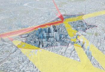
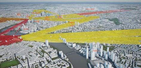
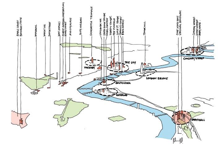
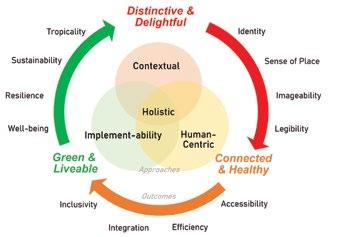
Left— Singapore’s urban design framework emphasizes contextual design, human-centric outcomes and implementability to ensure holistic solutions.
Below—
An overview of urban design strategies that shape imageability and legibility outcomes in the urban fabric of Singapore, from the macro to micro scales of islandwide connectivity, district urban form and street-level public realm.
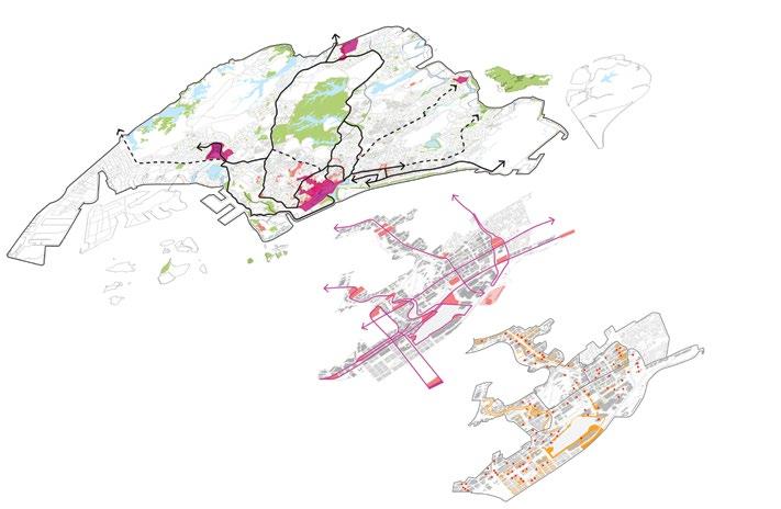
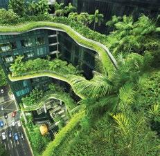
Left—
The Landscaping for Urban Spaces and High-rises policy (LUSH) established in 2009, mandates replacing greenery in development as a ratio of the site area, resulting in the creation of lushly planted roof gardens and sky terraces in new developments, such as WOHA’s PARKROYAL COLLECTION Pickering.
However, the rise of hybrid work means the main working week is now Tuesday through Thursday, creating challenges for hospitality businesses that rely on foot traffic.
As for tall buildings, London’s historic nature necessitates careful planning. The city uses a view corridor management system to protect sightlines to landmarks like the Houses of Parliament and St. Paul’s Cathedral, even from as far as Richmond, 19 km away. These restrictions explain why towers cluster in areas like the Eastern Cluster, which avoids protected views and is outside conservation zones.
Finally, London must also densify its outer areas. With a current population of 9 million, projections estimate 10 million by 2030 and 11 million by 2050. Meeting this growth requires significant housing development, achieved through denser construction while protecting the Greenbelt.
Singapore I work with a team of planners, architects, and urban designers to plan our city. To give some context, we often joke that you can literally run across Singapore in a marathon— it’s just 42 km across. Despite our small size, we house a population of 6.4 million, with residential homes occupying just 15% of our land. This makes Singapore one of the densest cities in the world.
Given this density, we must optimize how we use our land. As architects and urban designers, we aim to think beyond individual buildings, focusing on how they come together as part of a cohesive whole. Being centrally planned, Singapore has the advantage of coordinated strategies operating across different scales.
At a citywide scale, we develop multi-nodal growth areas outside the central city to decentralize density and distribute it more evenly. At the precinct level, we encourage rejuvenation through adaptive reuse, redevelopment incentives, and clear guidelines. Of course, a critical question is: how do we do this sustainably? That’s why I’m here—to learn best practices from other cities.
At the street and individual building level, our policies focus on how buildings contribute to the public realm. We aim to manage density with good design strategies such as minimizing wall-like outcomes, creating human-scale public spaces, improving micro-climate like windflow, and so on, to create high-quality, attractive environments.
To promote sustainability, we collaborate with other agencies to require and incentivize green building practices. For example, the Green Mark certification scheme guides buildings to be redeveloped in environmentally friendly ways, with many of these projects striving for super-low energy usage.
One of our key strategies is greening. Singapore has evolved from being known as a “Garden City” to a “City in Nature.” Policies encourage connectivity within the green network and require buildings to replace their site footprint with sky terraces and rooftop gardens. This creates multi-level open spaces accessible to both the public and building occupants. With skilled architects, these requirements often result in innovative and inspiring spaces that enhance our cityscape.
We also use digital tools to plan and analyze livability factors such as connectivity, access to amentities, walkability and micro-climate performance. These tools help us optimize the planning of the built form and the distribution of amenities to ensure better quality of livability factors for citizens.
Interestingly, the URA doesn’t just plan; we also oversee government land sales. This allows us to embed design guidelines into the conditions of sale and engage private developers in a dialogue to refine their proposals. Every project approved by the URA must meet our standards, ensuring contributions to a more attractive and sustainable urban environment.
New York City It’s tough to follow Singapore, but it’s great to be here. I’ll share a bit about the context of New York City and the broader tri-state region. Much of Peter’s history of London could apply to New York as well.
When we talk about the New York region, it’s not just the five boroughs, home to 8.5 million people. It also includes parts of three states, 31 counties, and 782 towns and cities—one of which is New York City, while the other 781 are not. In the United States, most land use decisions regarding zoning and permitting are made at the local level, creating a great cacophony of policies. From World War II to around 2000, there was a strong anti-density, anti-urban bias across the US.
One key message I’d like to highlight is how this anti-density bias, especially in residential development, has hurt us significantly. In New York, housing production has fallen dramatically since the first half of the 20th century.
To illustrate this, from 1975 to 2000, for every 10 jobs created in the region, only one was in New York City, while the other nine were in the surrounding suburbs. During that period, the region developed as a suburban economy. However, over the last 20 years, the trend has reversed: nine of every 10 jobs are now created within New York City, with only one in the surrounding areas. We are experiencing extraordinary densification and re-urbanization, but our policies have not kept up.
To give a sense of the housing crisis: New York’s rental vacancy rate recently hit a record low of 1.4%, the lowest in two generations. Much of this stems from outdated policies, like the 1961 New York State law that capped residential development in dense areas at a floor area ratio (FAR) of 12. At the time, there were already over 1,000 buildings exceeding this limit, including many iconic residential buildings. For decades, this cap has restricted residential density while allowing commercial development to exceed these limits, creating a massive imbalance.
The pandemic exacerbated this issue, leaving us with too much Class B commercial space and far too little residential development. To address this, I served on the “‘New’ New York” panel two years ago, which proposed a series of recommendations now being implemented through the citywide zoning initiative “City of Yes.”
The first two components—City of Yes for Carbon Neutrality and City of Yes for Economic Opportunity—have already been approved. The third and most controversial, City of Yes for Housing Opportunity, is currently under review by the City Planning Commission and expected to go before the City Council later this year.
This initiative proposes several sensible ideas: increasing density allowances if 20% of a project is designated affordable housing, eliminating parking requirements in transit-rich areas, and allowing for smaller apartments. These changes aim to address our residential shortage and support urban density.
In terms of “renew,” we’re also making massive investments in transit. About 5 million jobs in New York City rely on a regional workforce, with 1 million commuters traveling into the city daily. While many drive or take buses, a significant portion depends on commuter railroads, such as Amtrak, New Jersey Transit, Metro-North, and the Long Island Rail Road. These systems, largely formed from failing private railroads, saw little expansion for two generations.
Over the last decade, however, we’ve entered a new era of transit investment. Projects like the No. 7 subway extension to Hudson Yards, the first phase of the Second Avenue Subway, the Moynihan Train Hall, and East Side Access—connecting the Long Island Rail Road to Grand Central—have all been completed within 10 years. Any one of these would have been the largest transit project of the mid-20th century, yet we’ve completed them all in a remarkably short time.
Looking forward, major projects are still on the table. The Gateway Program, the nation’s largest infrastructure project, will double rail capacity under the Hudson River with a new tunnel. We’re also planning a redesign of Penn Station, a new bus terminal led by Foster + Partners, and the Penn Access project, which will connect Metro-North to Penn Station. The Interborough Express, inspired by London’s Overground, will provide a new transit link outside Manhattan. Finally, congestion pricing remains a crucial piece to tie all these efforts together.
When these projects are completed, we’ll dramatically increase transit capacity, reducing commutes and doubling the population within an hour of New York City. This diverse and talented workforce is essential for Midtown Manhattan’s continued growth and success.
Paris I am an architect. I started my career with Jean Nouvel 40 years ago and worked independently for 15 years, focusing on sustainable refurbishing. I later entered politics, and for the last 20 years, I worked on urban renewal, policy development, and architecture for Paris. Two years ago, I decided to step back from this work, and Jean Nouvel invited me to rejoin his practice. Now, I am beginning a new chapter in my career.
What I find amusing is that the tools we use in Paris are very similar to those used elsewhere, but the city itself is different. Paris is incredibly dense. Paris represents just 1% of Île-deFrance’s territory, but it houses 18% of the population.
However, 20% of the apartments in Paris are underused or empty. This problem extends beyond the city, with a vacancy rate of 7% in the suburbs. The challenge is not just about building new housing, but also making better use of the spaces we already have.
Cities need compelling stories—visions that transcend their current realities. For Paris, one such story is the Grand Paris project, which includes building a new metro network. The concept was first proposed in the 1990s, and the first station was open in time for the Olympic Games. This 200-km metro network brings two key opportunities: a shift toward a cycling and pedestrian-friendly metropolis, and the need for public spaces.
Public space is essential for density. Developers often focus solely on maximizing floor space, but urban planners must prioritize streets and public areas. Without public space, true density cannot be achieved. This is one of the greatest challenges we face in Paris.
The Grand Paris project also fosters polycentricity, creating new centralities across the metropolitan region. Currently, there are over 500 active urban projects, totaling more than 22 million m2 of development. While urban planners work locally to create streets and centralities, developers focus on large-scale construction. A common thread in both approaches is the demand for nature, which is reflected in a new landmark plan for Grand Paris emphasizing green spaces.
Sustainability is another critical focus. Many of our strategies involve refurbishing existing buildings, changing shapes, and adding new functions—similar to the approaches showcased in Toronto. Over the next 20 years, this will be central to urban development in Paris.
Paris, as you know, is small—much smaller than Singapore. Fifty years ago, urban policy centered on architecture and urban form. In the 2001, the focus shifted to politics and sociology, emphasizing mixed-use development. Today, the focus is on optimizing space use. For example, new regulations restrict construction to specific areas, such as gardens, railway stations, and museums, and prioritize reuse over new construction. One key metric for policymakers is whether new buildings can be used 24 hours a day and adapted quickly to changing needs.
The value of architecture in Paris is increasingly tied to its functionality rather than its design. Refurbishing existing buildings and integrating green spaces are now fundamental strategies. For instance, a project near Place de la République demonstrates how we can add buildings, green spaces, and refurbishments to create more dynamic neighborhoods.
Paris also has a complex relationship with tall buildings. In 1974, building towers in the city was effectively banned. Over the past decade, limited exceptions allowed for towers in certain areas, resulting in notable projects such as Renzo Piano’s public tower and Jean Nouvel’s private tower.
However, these permissions have once again been revoked. Jean Nouvel’s perspective, much like Peter’s for London, is that tall buildings must be carefully placed to respect view corridors and historical context.
One of the panel’s questions is about the future skyline of cities. For Paris, the future will involve maximizing the use of existing buildings, preserving history, and carefully integrating new elements. Over the next 20 to 40 years, this approach will shape Paris’ skyline into one that respects its heritage while embracing modern needs.
Chair I’ll start with a question for James about the drivers and major factors behind planning for density in Toronto. Should sustainability be the focus? Housing seems to be a critical issue. In Toronto, where the next CTBUH International Conference will be held, you have a vast country with lots of land and currently the highest number of tall buildings under construction in the world. What is driving this push toward height and density?
Toronto There are several drivers, but first and foremost is immigration. Canada is a welcoming country, with a population of 38 million. In 2021 alone, we welcomed 500,000 immigrants. A large proportion of them settle in the Greater Toronto Area, Canada’s largest city. This influx creates an urgent need for housing, which has become a well-recognized crisis.
For the first time in recent memory, all three levels of government—federal, provincial, and local—are aligned in
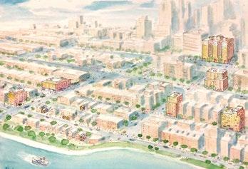
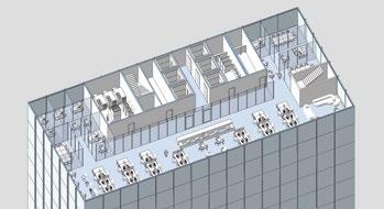
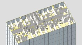
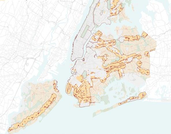
Top— Overview image of the transformation being unlocked by the recently approved City Of Yes for Housing Opportunity.
Above— The recently passed City Of Yes for Housing Opportunity seeks to make it easier to convert buildings like empty offices (left) into much-needed housing (right).
Left— Regional Plan Association analysis based on New York City’s Department of City Planning zoning features. The red lines bound Transit-oriented development areas (half-a-mile from stations) with TOD areas for commercial and low-density residential shown in red and orange respectively.
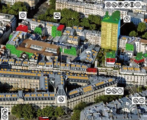
Left—
Illustration of Paris 2050 with mixed-use buildings and sustainable sufficiency, by Atelier parisien d’urbanisme. There are 22 pictograms which symbolize an action to adapt the existing city.
Below— Map of Paris illustrating the potential for developing renewable energies: optimizing the existing urban heating network (shown in yellow), using geothermal energy, installing solar power plants, and identifying resource buildings that produce energy (shown in orange).
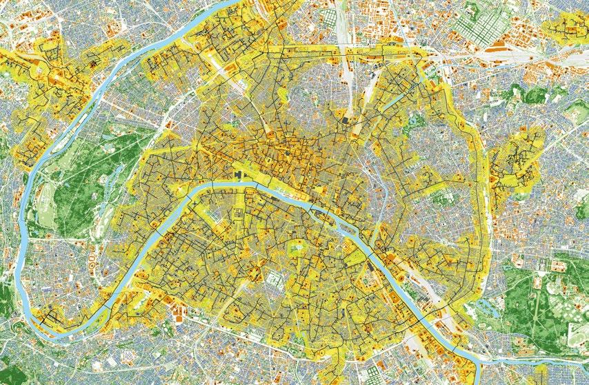
addressing this housing crisis. One key strategy is to increase density, not only in downtown Toronto and polycentric centers, but also in Major Transit Station Areas (MTSAs). These transit nodes are becoming focal points for densification, reshaping the city’s structure.
The 2006 official plan I referenced earlier protected much of the city for single-family homes. This is now starting to change. We’re seeing greater acceptance of developments such as four-story walk-ups next to single-family homes. This will fundamentally alter the perception of large parts of Toronto as a low-rise city.
We’re also targeting mid-rise corridors, aiming for buildings of six to 12 or more stories along major thoroughfares. Combining these approaches—redeveloping transit areas, increasing mid-rise density, and rethinking single-family zones—will define the path forward for Toronto in conjunction with the already established Tall Building areas.
Chair Peter, turning to you, you mentioned that density in London is an economic necessity, as the core of London becoming empty would be disastrous for the economy. This seems to be a very different perspective, but it’s also framed by the presence of the Greenbelt.
London Yes, London’s role as the economic driver of the United Kingdom makes it essential to sustain growth. However, the push for housing density is not purely economic. As I mentioned, London’s population is growing significantly, from 9 million to a projected 11 million. We also face peculiar challenges, such as a high number of empty homes in central areas.
Post-COVID trends have further complicated this picture. Some families are moving out of central London, leading to school closures in those areas. At the same time, there’s a lack of family-sized housing, with too much development focused on studios and apartments for singles or couples. Striking the right balance in such a rapidly changing urban environment is extremely challenging.
At NLA, we host regular roundtables to discuss these issues. Ten years ago, the concern was a shortage of schools in central London; now, we have too many, and schools are closing. These shifts are difficult to fully understand but fascinating to observe.
What strikes me is the universality of these challenges. Despite different political systems and planning regimes, cities like Toronto and London face similar issues, such as building fewer houses today compared to previous decades and struggling to meet housing targets. Only Lay Bee (Singapore) seems to have managed it well.
There’s much we can learn from one another, but it’s also worth exploring the underlying factors that lead to these similar outcomes across very different contexts.
Chair Let’s turn to Dominique. Paris is losing residents— around 50,000 over the last four years. The city is constrained by existing buildings, historical heritage, and other limitations. How do you approach density in this context? Where can you find opportunities to create more housing?
Paris Yes, Paris experienced population growth from 2000 to 2010, but has since begun to lose residents. Interestingly, while the number of residential units has increased, more space is
being used per person, especially by families. However, the city remains very attractive, and high property prices are driving people away. The issue isn’t a lack of square meters, but rather affordability.
Another factor is tourism and Airbnb. When Paris experienced a rise in residents, it wasn’t due to creating new housing but because existing housing was being used more effectively. This underscores the political nature of the issue —it’s not just about building more, but about making better use of what already exists, which is a much more challenging problem to solve.
Paris is also highly attractive for workers, but while the number of jobs has grown, the amount of office space has not. Cities with older infrastructure, like Paris, face unique challenges. Much of the urban fabric is inherited and must be reconsidered to meet current needs. This shifts urban policy toward optimizing the use of existing spaces rather than simply building new ones.
Regarding schools, families often move to areas with better educational opportunities. While Paris has many schools, there is a noticeable increase in private institutions taking up more space than public ones, which complicates urban planning. Public authorities can plan for public schools, but private schools operate outside these frameworks.
Chair You touched on adaptability and the reuse of existing buildings. How do you organize flexibility in Paris, particularly with long-term designations like zoning? Are there specific policies for high-rises?
Paris In Paris, adaptability isn’t just about architecture. While architects can design buildings that accommodate changes in use, the legal and regulatory framework plays a significant role. We work with lawyers, insurers, and other stakeholders to navigate permissions, ownership, and safety regulations, such as fire codes.
New urban policies in Paris now require buildings to meet indicators in three key areas to obtain a permit. First is sustainability, ensuring energy efficiency and environmental considerations. Second is mixed-use, encouraging 24-hour functionality and a blend of residential, commercial, and public uses. Third is integrating nature into the urban environment. These indicators guide long-term planning and ensure flexibility for future needs.
Chair Lay Bee, in Singapore, we’ve seen examples like CapitaLand projects, where a tower integrates a multi-floor garden. How do your policies encourage designers and developers to pursue such innovations?
Singapore We often refer to it as a “carrot-and-stick” approach. Many mixed-use developments are required to include greenery, such as sky terraces and public spaces. To incentivize this, we grant developers floor area exemptions for incorporating sky terraces and public spaces, provided they remain communal and publicly accessible. This creates a balance where the public benefits from better spaces, and compliance benefits developers.
CapitaSpring, for example, showcases this approach. The project integrates public space, a hawker center offering
affordable food, and co-located uses that go beyond monofunctionality. This includes turning roads into pedestrian zones and creating vibrant public areas that benefit both occupants and the city.
We also use the government land sales program and other schemes to encourage developers to engage in meaningful dialogue about intensification. These schemes often allow developers to exceed allowable gross plot ratio (GPR) or floor area ratio (FAR), provided they contribute to the city in tangible ways—be it public spaces, underground transit connections, libraries, art galleries or childcare facilities. Such conversations ensure that developments align with the broader goals of urban sustainability and livability.
Chair In France, we’ve had a similar system allowing additional floors for projects that include social housing or height designations for specific cases. Onto another question: let’s explore the mixed-use aspect of tall buildings and high density. How can we mix programs inside buildings to make tall buildings a viable solution for planning density? What justifications exist, especially given how sensitive this topic can be?
New York City From New York’s perspective, it’s still a tough proposition. We haven’t reached the level of innovation seen in Singapore, with its incredible open spaces and sky parks integrated into tall buildings. In New York, we’re seeing a new generation of very tall commercial buildings like One Vanderbilt Avenue, which has been enormously successful. However, older commercial buildings without modern amenities are struggling, and adapting these spaces remains a significant challenge.
The “City of Yes” initiative aims to address this, revisiting outdated zoning laws such as the 12 FAR limit and promoting flexibility. Yet, the progress so far is minimal compared to what’s needed to address both surplus office space and the housing shortage.
Vacancy is another critical issue. In New York, many second homes, or “pied-à-terre” apartments, are underused. Analyses suggest that if second-home vacancy rates returned to levels from 15 years ago, our housing shortage would essentially disappear. Airbnb and post-COVID shifts, such as wealthier families maintaining second homes in the city while living elsewhere, exacerbate the problem. These smaller apartments could have housed young families or workers but are now effectively off the market.
Toronto To echo Peter’s (London) point, Toronto also faces challenges in matching approvals with actual construction. Last year, we approved around 30,000 residential units, but only 16,000 were built. As the market cools after two decades of rapid growth, we expect these numbers to drop further.
One difference in Toronto is the rezoning process, which allows for significant community input on major new developments. This can be beneficial for encouraging mixed-use projects and repurposing older office buildings for residential use. Previously, our planning policies required one-to-one replacement of office space, meaning every square meter of office demolished had to be replaced. Post-COVID, we’re reevaluating this requirement, exploring whether reducing office space can be balanced with greater affordable housing components.
Paris In France, regulations change significantly when a building exceeds 50 m. High-rise housing becomes very expensive due to stricter compliance requirements. Maintenance costs for residents in tall buildings are often higher than the cost of renting or owning the unit itself, creating a significant barrier.
Mixed-use tall buildings can help address this issue by sharing costs among offices, hotels, and residential units, improving both financial and environmental sustainability. However, historically, housing in Paris has been capped at 50 m, with taller structures mainly used for offices due to fire safety rules.
To ensure people continue to live in Paris, the city has mandated that 40% of housing be public housing. This is not limited to social housing, but includes city-owned apartments, ensuring long-term affordability. For comparison, Vienna has more than 60% public housing, which helps maintain a stable residential population.
Finally, I want to highlight a growing demographic need: housing for older adults. Cities are aging, and active older residents require different housing options. This is an emerging opportunity for tall buildings, which could provide new types of housing tailored to their needs, offering convenience and accessibility within dense urban areas.
Chair Does anyone want to add thoughts on what could make tall buildings attractive and viable solutions for density? We’ve seen examples of integrating public spaces, as in Singapore, but it’s much harder to achieve in France.
Singapore Yes, connectivity is fundamental to how we plan density in Singapore, especially with an aging population—by 2030, one in four Singaporeans will be over 65. Anchoring density around transportation nodes ensures compactness and reduces urban sprawl. It’s not just about optimizing infrastructure, but also about enabling residents to access amenities easily, whether by public transport or pedestrianfriendly routes. Concentrating amenities around dense nodes strengthens the community and ensures accessibility, making it a great starting point for locating density.
Toronto We often look with envy at Singapore’s green plot ratio, where greenery is replaced on-site. In Toronto, one of my points of pride is our POPS program of privately owned, publicly accessible spaces. Similar to New York, this program uses rezoning to negotiate open spaces in exchange for height and density. Over time, these spaces have contributed significantly to our open space network. While they’re not a replacement for parks, they complement them effectively.
Another unique feature in Toronto is our PATH network, which connects buildings underground at the concourse level. Especially useful in February when it’s -20oC, this network creates a generous, safe public realm lined with shops. It’s a practical way to connect buildings and improve pedestrian access.
London London benefits from being nearly 50% green when considering the entire city, but we’ve also incorporated urban greening into our planning policies. For example, the London Plan includes an urban greening factor that requires new developments to add green features to their sites. However,
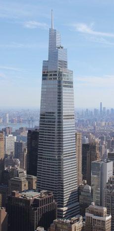
despite having a green roof policy for nearly 20 years, the results have been underwhelming—when you look down from tall buildings, you still see few green roofs.
The changing use of buildings, as Tom (New York City) mentioned, is particularly relevant here in the City of London, a central business district. There’s resistance to adding too much housing, as it’s perceived to interfere with commercial activities. However, legislation is being introduced that will make it impossible to lease office buildings that don’t meet stringent sustainability criteria. This will likely leave many second-hand office buildings as stranded assets, with conversion to residential being their most viable option. I suspect the City of London will have to revise its policies to allow more residential development within the Square Mile.
New York City On the carbon side, New York is implementing Local Law 97, which sets increasingly aggressive carbon reduction targets for all buildings. Noncompliance results in fines, and even some of our most advanced buildings, like the LEED Platinum-certified Bank of America Tower, fail to meet these requirements. This law is driving change across the city.
In terms of transit and density, we’ve consciously worked to link the two over the past 20 years. For example, the Hudson Yards development helped fund the No. 7 subway extension, and One Vanderbilt received expedited permitting due to its integration with Grand Central Terminal’s transit network. JPMorgan Chase is even rebuilding part of the commuter train infrastructure beneath its new headquarters as part of its foundation work.
However, these efforts remain highly contentious. A major test case is the Penn Station district. With US$30 billion in public funding planned for Northeast Corridor improvements and Penn Station upgrades, it seems logical to upzone the area to help finance the infrastructure. The state proposed an overlay district with tax abatements to capture the increased property value for funding, but it has faced intense local opposition.
Just last week, I co-chaired a new Public Advisory Committee for the project, and frankly, I’m not optimistic. The plan has become enormously controversial, with pushback on nearly every aspect. It underscores how difficult these discussions are, even when the need for change is clear.
Chair The challenge of partnering between public and private sectors, with their often differing interests, is very real. I’d now like to open the floor to the audience.
Tel Aviv I think we face similar challenges across cities worldwide. I have a question that hasn’t been addressed yet, but perhaps it’s part of your work. In many cities, 30–40% of the space is occupied by roads. As we move toward a future with autonomous vehicles and reduced parking needs, do you see this as an opportunity? Could this resource be used to lower density or reduce the height of buildings?
Singapore Even though we’re urban designers, we don’t always advocate for tall buildings. We focus on shaping bulk and density to contribute positively to the streetscape. We use tools like connectivity analysis and carefully consider building massing, especially near heritage zones, to ensure tall buildings don’t overpower or create unfriendly pedestrian environments.
For example, when planning near future transport nodes, we design with public spaces in mind. Towers above stations are carefully integrated with the public realm to avoid undesirable impacts. Every detail matters, from platform levels and walkways to how buildings meet the street. While this level of detail requires more work from architects, it’s crucial for creating dense yet livable and pedestrian-friendly cities. These tools help us balance growth without adverse impacts from tall projects.
New York City We’ve studied the potential impact of autonomous vehicles in New York, but it still feels like a distant future. Right now, congestion pricing is our primary strategy for addressing road use. The idea is to charge vehicles entering Manhattan, reduce traffic, and repurpose road space for pedestrians, bike lanes, and other uses.
One of the fastest-growing industries in New York today is delivery—Amazon, UPS, and similar companies. They’re striving for zero-carbon operations and are exploring cargo bikes for urban deliveries. While we’ve built an impressive network of bike lanes and a robust bike-share system, we haven’t yet addressed the infrastructure needed for delivery systems. There’s a huge opportunity to rethink our streets in this regard.
Tel Aviv What about drones?
New York City I’m not entirely sold. We’ll see where it goes.
Toronto Similar to New York City, Toronto has been reallocating road space for bike lanes, which is controversial but important. We’re also incorporating electric vehicle (EV) infrastructure into new developments. Under our Toronto Green Standards, which are similar to LEED, residential buildings earn credits for providing EV parking. We recently saw our first residential building open with 100% EV parking, a significant step forward.
London I think most people are aware that London’s streets are quite narrow, so we don’t have a lot of spare space to reallocate. In the city center, we’ve been moving away from private vehicles. However, our ultra-low emission zone expansion into the suburbs has been contentious, as many suburban residents depend on cars and struggle with the cost of replacing them with more efficient models.
Here in the City of London, there’s been progress toward pedestrian- and cycle-friendly streets. For example, Bank Junction, a key area near here, was restricted to buses, cyclists, and pedestrians. However, taxi drivers pushed back heavily and have now secured a trial period allowing vehicles back into the area. This backlash is impacting what was a progressive policy aimed at reducing vehicle traffic in the city.
Paris Paris is roughly one-third built space, one-third free space, and one-third public space. This balance is key to its density and creates a wonderful “light cage” effect, which is an important aspect of our urban planning.
Another interesting development involves the changing use of streets and spaces. Cities must evolve and adapt to survive. Urban planners need to create systems that enable flexibility— using existing spaces in new ways. For example, underground

Above— City Advocacy Forum participant Lay Bee Yap (Singapore) takes a question from the audience at the Barbican, London.
Below— Audience members ask questions of the City Advocacy Forum panelists.
car parks can be repurposed for urban agriculture, and unused offices can be converted into student housing. This adaptability is essential for the sustainability and vitality of cities.
We’ve seen waves of change in urban planning throughout our history. In the 1930s, cities underwent significant transformations, only to stagnate later. In recent years, we’re seeing a resurgence of change, driven in large part by COVID-19 and other challenges.
Twenty years ago, adding a building atop another building seemed unthinkable due to cost and complexity. Today, such ideas are becoming part of our toolkit for urban planning, allowing cities to remain dynamic and responsive.
France’s post-war reconstruction created vast, rigid urban zones that eventually failed to adapt, leading to stagnation. In contrast, today’s urban efficiency and sustainability challenges are prompting us to think differently, incorporating citizens more directly into the planning process.
In Paris, building permits are decided at the local level, often by small-scale mayors. This decentralized system means that many towers are built just outside the city’s periphery rather than within Paris itself. It’s a curious dynamic that reflects the living nature of cities.
London In London, boroughs make planning decisions, but the mayor can take a strategic view. Additionally, neighboring boroughs can object to developments, which complicates the process. It’s a system designed for consultation, but can create conflicts over boundary issues.
Paris It sounds even more complicated than our system!
Chair It’s already very tricky for us.
Paris Yes, but it’s fascinating because it allows for a wide variety of developments and keeps cities vibrant.
Forth Bagley In the Miami session, there was significant discussion about climate and resiliency, but those topics haven’t come up much here. Are housing, transportation, and political issues overshadowing climate concerns? In closing, could each panelist share their city’s biggest challenge and a key project addressing it?
London Resilience is always a topic, and London has been relatively fortunate. A major flood in the late 1950s led to the creation of the Thames Barrier, located about 24 km downriver. These massive caissons rise when the river reaches a certain level, protecting London from flooding. It was initially expected to be effective until 2075, but with rising sea levels, that date has moved closer to 2060. Eventually, we’ll need to rebuild it.
In the meantime, sustainability remains a critical focus. Managing embodied carbon, improving building performance, and ensuring sustainable development are essential considerations for every project.
New York City Superstorm Sandy was a wake-up call for New York City and the region. The Obama administration launched “Rebuild by Design,” which led to projects like the Big U, a comprehensive resiliency effort. The U.S. Army Corps of Engineers is currently tasked with protecting New York from
future storms, but their narrow focus on storm protection explicitly excludes sea-level rise, which is a glaring omission.
Some advocate for a large-scale barrier similar to London’s, though ours would need to stretch 24 km around the inner harbor. Alternatively, others propose community-level interventions, such as allowing water to flow into certain areas while managing its retreat. The Lower East Side, for instance, may see entirely new districts built to accommodate rising water levels. Unfortunately, there’s little consensus on the best approach, and it may take another catastrophic storm to force decisive action.
Singapore Singapore, as an island nation, constantly grapples with these concerns. Over the past 60 years, we’ve expanded our landmass by 25% through reclamation. Our current project is the Long Island initiative, a plan to reclaim 800 hectares along the East Coast. This land will not only address rising sea levels but also function as a reservoir to manage inland water.
This reclamation also allows us to plan for mixed-use precincts and extend our transportation networks. Additionally, as Singapore evolves as a port city, the relocation of port facilities will free up hundreds of hectares of land for development. Our southern coastline, which spans 120 km, is central to these long-term, multi-generational projects.
Toronto Although Toronto sits 80 m above sea level, flooding remains a challenge. Major storms often overwhelm our infrastructure. For instance, in July, my building’s management advised residents to move cars from the lower parking levels due to flooding risk.
To address this, we’re constructing a major storm sewer and implementing flood protection measures along the city’s rivers. The Toronto Green Standard, which includes a successful green roof bylaw, is another strategy to enhance resilience. While progress is being made, there’s still much work to do.
Paris In Paris, addressing climate starts with reclaiming space from cars. Removing vehicles creates more room for nature, children’s play areas, and pedestrian-friendly streets. For example, streets near schools are being redesigned to prioritize safety and greenery. The River Seine has been central to our resiliency efforts. Large-scale infrastructure protects against flooding, while agricultural initiatives and shared spaces contribute to sustainability. For the Olympic Games, we’ve worked to clean the Seine so that it’s safe for swimming. Next year, three swimming pools will open in the heart of Paris, a milestone for the city. Finally, Paris embodies the “15-minute city” concept, emphasizing proximity and local commerce. The city has tools to protect small businesses from being overshadowed by larger chains, preserving vibrant neighborhoods. Sustainability must be paired with pleasure— policies need to resonate with people to gain their support. The fourth City Advocacy Forum took place in Bangkok at the CTBUH 2024 Asia Conference on 3 December 2024. The panel featured Niramon Serisakul, director, Urban Design and Development Center (Bangkok), Micah Weinberg, nonresident scholar, Carnegie Endowment for International Peace (Los Angeles & San Francisco), and Clarice Yu, director of buildings, HKSAR Government (Hong Kong). The next issue of Vertical Urbanism will feature their discussion.
Strategies
Participatory Planning: Stakeholder workshops guide urban mobility and resilience initiatives.
Earthquake Resilience: Launched an online platform to make at-risk housing safer.
Tackling Gated Towers: Proposing mixed-use and multifunctional towers to combat segregation.
Sustainability Initiatives: Developed plans for green infrastructure and enhanced public transit systems.
Lessons Learned
Participatory planning fosters community trust and tailored solutions.
Addressing gated developments prevents social and spatial isolation.
Integrating transportation and resilience planning creates more cohesive urban systems.
Strategies
London Plan: Polycentric development framework emphasizing densification in targeted zones.
Tall Building Clusters: Regulated to protect historic views and focus on high-value areas like Canary Wharf.
Affordable Housing Policies: Incentives in residential towers promote inclusion.
Post-COVID Adaptation: Encouraging flexible building designs to accommodate changing needs, e.g., converting office spaces.
Gray Belt Concept: Redevelop underused land to meet housing needs.
Urban Greening: Require green roofs and other green features in new developments.
Lessons Learned
Clear zoning and landmark preservation policies ensure balanced urban growth.
Mixed-use is vital for resilience amid changing economic conditions.
Community engagement (e.g., public ballots for housing plans) improves acceptance.
Incorporating green infrastructure enhances urban sustainability.
Strategies
City of Yes Initiative: Revise zoning to allow higher density and mixed-use developments.
Transit Investment: Major projects like East Side Access and the Gateway Program aim to enhance regional connectivity.
Post-Pandemic Adaptation: Encourage residential reuse of underutilized offices.
Lessons Learned
Zoning flexibility is key to addressing housing and office space challenges.
Strategic transit investments underpin densification and economic growth.
Public opposition remains a significant barrier to ambitious redevelopment plans.
OSLO
Strategies
High-Rise Plan: Limits tall buildings to transit hubs
and prioritizes mixed-use developments.
Adaptive Reuse of Historic Buildings: Transforming old structures for modern use, like converting a public utility office into mixeduse space.
Harbor Redevelopment: Opened industrial areas to public use, integrating parks, cultural landmarks, and residential areas.
Emphasis on Sustainability: Policies favor emission-free zones and reclamation of carways for green spaces.
Lessons Learned
Restricting high-rise development fosters creative solutions for urban planning.
Adaptive reuse revitalizes areas and preserves heritage. Public access to waterfront spaces enhances urban livability.
Strategies
15-Minute City Concept: Prioritize pedestrianfriendly local commerce.
Grand Paris Express: Expand metro networks and foster polycentricity.
Reuse and Refurbishment: Emphasize adaptive reuse of existing buildings and green space integration.
Social Housing Policies: Mandate 40% public housing to maintain affordability.
Lessons Learned
Enhancing public spaces is integral to achieving true urban density.
Balancing preservation with modern needs ensures long-term functionality. Citizen engagement and adaptable urban policies foster community support.
Strategies
Multi-Nodal Growth: Decentralize density by creating hubs outside the central area.
Greening Policies: Replace land footprints with rooftop gardens and sky terraces.
Sustainability Incentives: Use government land sales to promote environmentally friendly developments.
Greenmark:
Mandating sustainable practices in construction and building energy use to reduce carbon footprints.
Lessons Learned
Coordinated planning across scales ensures cohesive urban development.
Combining incentives with mandates drives innovative green building practices.
Decentralized density strengthens community ties and livability.
Strategies
Territorial Reform (2019): Expanded the city’s area 25-fold to manage population growth.
Orbital Forest Initiative: Involves developers using only 30% of land for construction, with the rest dedicated to planting vegetation, targeting completion by 2030.
Outer Ring Road: Prioritized public transportation by adding terminals to reduce congestion.
Polycentric Planning: Redeveloped former industrial areas into mixed-use neighborhoods.
Inclusion via Development: Introduced a law requiring developers to contribute 3% of every 2,000 m2 to social housing.
Lessons Learned
Integrated planning and public-private collaboration can drive sustainability.
Policies ensuring social inclusivity (e.g., mixedincome housing) help mitigate segregation.
Strategic investment in public transport infrastructure reduces congestion effectively.
Strategies
Tall Building Guidelines: Focus on tower separation and streetlevel interaction.
Privately Owned Publicly Accessible Spaces (POPS): Encourage engagement and open spaces within developments.
Transit and Flood Protection: Two new transit lines and flood protection investments (e.g., Villiers Island) integrate infrastructure with urban growth.
Heritage Preservation and Mixed-Use Renewal: Projects adapt existing buildings for housing or commercial use (e.g., adding residential towers to office buildings).
Lessons Learned
Mixed-use developments can help balance growth and heritage preservation.
Transit-oriented development reduces urban sprawl and improves livability.
Adapting planning policies to support midrise, denser housing in lowdensity areas is essential.
To find out more about the City Advocacy Forums, including video content of speakers and the freshly launched Vertical Urbanism Index (see page 7), please visit the website: caf.ctbuh.org
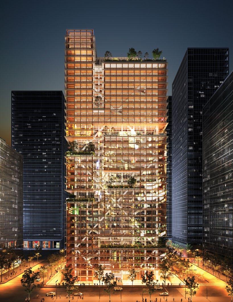
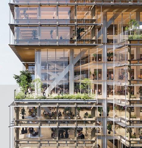
Regenerative Tree, a skyscraper prototype by Japanese firm Nikken Sekkei, blends timber engineering, biomimicry, and adaptability to reduce carbon emissions by 40 percent.
With the average global temperature expected to rise by 1.5 degrees by the early 2030s, 1 efforts to significantly reduce greenhouse gases are underway in countries around the world. Under Japan’s “2050 Carbon Neutral Declaration,” the Japanese government has been tightening regulations, including raising energyefficiency standards for large nonresidential buildings in April 2024.
The industry is currently focused on CO2 emissions associated with building operation—known as operational carbon—but the importance of reducing CO2 emitted during the construction, refurbishment, and demolition phases— called embodied carbon—is garnering attention worldwide Some countries have already enacted regulations regarding embodied carbon.
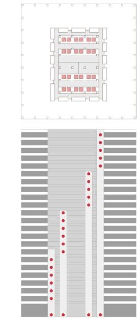
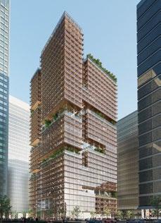
Previous page and left—
The Regenerative Tree is a prototype skyscraper designed for flexibility and adaptability, making use of low-carbon building materials.
Left—
Section diagram and floor plan of a standard building, with separate banks of local and express elevators.
Right—
Section diagram and floor plan of the Regenerative Tree prototype, which substitutes escalators for local elevators at key locations, reducing power, material, and floor-space consumption.
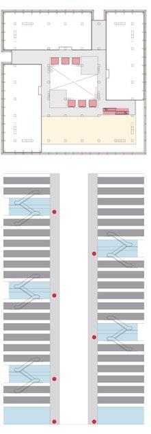
The building’s environmental plan is inspired by phyllotaxis, the arrangement of leaves on a plant stem, promoting natural ventilation and light penetration.
Furthermore, there is a growing need for offices that offer employees the freedom to choose the location and environment in which they perform work, that encourage communication with others, and that promote wellness by connecting with nature, as well as offer flexible plans that enable refurbishments and changes in building use.
Our prototype of a next-generation skyscraper is 160 m high, with a total floor area of 100,000 m2 and a projected life span of 100 years. It incorporates various strategies to reduce CO2 emitted over the building life cycle, i.e., wholelife carbon. Reductions up to 40% over the building’s lifespan can be achieved by designing for diverse work styles, future conversions, and high environmental performance.
To substantiate the 40% carbon reduction figure, we established a baseline case, calculating material quantities for the structural frame and exterior of a simplified building of the same size (floor area) offering standard environmental performance. For the interior, actual values of similar-sized buildings were used. For mechanical equipment, standard values issued by the Architectural Institute of Japan (average values from past properties) were used.
The expected embodied carbon of the proposed building is 1,778 kgCO2/m2, compared to 2,677 kgCO2/m2 for a standard building.
To minimize the CO2 footprint of this new prototype, we reconsidered various common practices for large-scale offices, identified the truly essential functions,
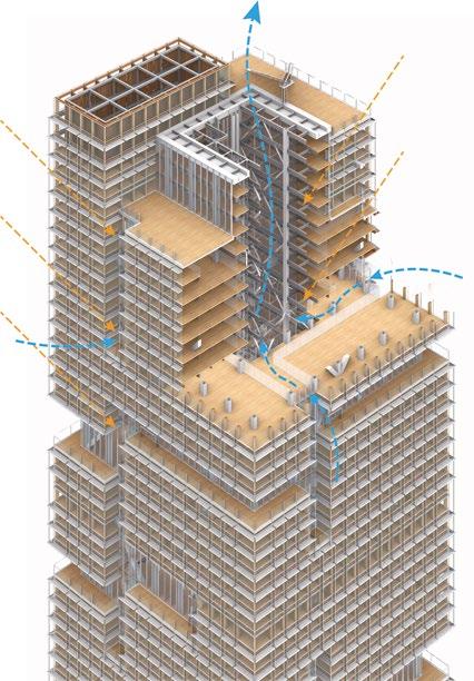
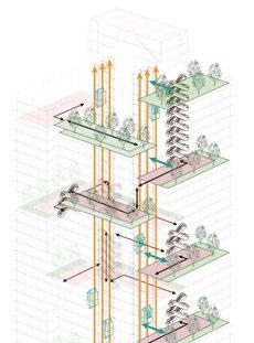
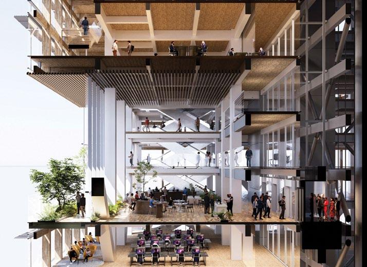
Above and top— The provision of shared spaces, connected by escalators, affords occupants more choices about where and how they work.
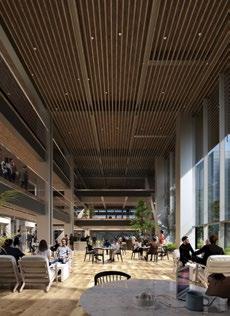
and thoroughly rationalized its structural and mechanical design. Specifically, the following elements contribute to the decarbonization of the scheme:
Conventional offices with wide, columnfree spaces require large amounts of steel, due to long-span structures and the concentration of earthquakeresisting members around the core. In this prototype, columns and other elements are placed in structurally rational positions and the perimeter is made of timber. This reduces the use of steel, better accommodates changes in building use, and significantly cuts CO2 emissions during construction.
The floor plan features “stepped floors,” workspaces segmented by slits and connected with the upper and lower floors by atriums and stairs. Compared to vast, single-floor spaces of conventional offices, this design incorporates natural elements and brings employees closer together, promoting communication.
By using wood flooring consisting of cross-laminated timber (CLT), the placement of atriums and stairs within rentable areas can be facilitated, and the overall building weight is reduced, leading to less steel and concrete usage and lower CO2 emissions during construction. This also helps CO2 reduction during the building’s operation phase by making refurbishments easier.
It is estimated that, by following this design, steel usage can be reduced by approximately 20% compared to
Right— Timber perimeter: Surrounded by wood, the texturerich window areas create a new workplace that enjoys natural light and wind.
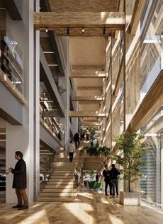
skyscrapers of a similar height in Japan. The timber elements are structural members that are meant to last the building’s entire life span (100 years, assuming routine maintenance). Since they are located within the building envelope, degradation due to external factors is not expected.
The CLT floor is 210 mm thick and directly joined to the steel beams. The plan is to use bolted joints, embedding lag screws into the timber elements, but this can change if a better method emerges. The main frame has been designed so that large-scale steel bracing on the inner side of the timber perimeter, combined with bracing in the core, bears most of the lateral force. Since the timber perimeter does not bear seismic forces, it can flexibly accommodate openings for stairs and atriums.
The stepped floor design is characterized by slits to let in natural light and wind, and openings such as stairs and atriums to connect the upper and lower floors. Since these components are installed in the timber perimeter, which sits outside the main frame, it does not affect the distribution of lateral forces.
As an approach to mechanical design, we have applied biomimicry, drawing inspiration from the mechanisms of living organisms. One example is the “Wonder Net,” a heat recovery system mimicking the human body, in which interwoven arteries and veins exchange heat to prevent drops in body temperature. The
system will be implemented as a threepipe heat pump system capable of heat recovery for cooling and heating. When the cooling load and heating load are approximately equal, the operating efficiency will be doubled.
Another approach is to combine a high sensible heat operation and water spray system for air conditioners, similar to the process of perspiration for body temperature regulation. When a heat pump’s outdoor unit dissipates heat using only convection and radiation, without using water spray, it is called “high sensible heat operation”—similar to how humans regulate temperature through the body’s surface.
Water spray operation is a method of improving cooling efficiency by spraying water on the outdoor unit and dissipating heat through evaporation. This is similar to how the human body controls temperature by sweating, combining heat dissipation through latent heat. The control parameters are the refrigerant pressure of the outdoor unit (load state) and the outside air temperature.
With these energy efficiency measures a Building Energy Index (BEI)2 value of 0.23 was achieved. Furthermore, inspired by the arrangement of leaves on a plant stem (phyllotaxis), slits on all sides and a central void were created to allow light and air to permeate the space. To manage stack effect in the vertical void, windows are installed along the exterior wall and central void, which can be opened and closed to balance between indoor and outdoor environments.
A large atrium at the center of the building brings light and ventilation to interior floor plates and carries utility lines.
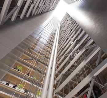
Conventional skyscrapers typically contain a balance of express elevators and local elevators, the latter of which stops at every floor, to transport workers during peak times. However, as workplace movement patterns change, peak time optimization becomes less critical. Therefore, we have fundamentally re-evaluated this transportation system, replacing the local elevators with a combination of express elevators and escalators. Express elevators, suitable for long-distance transport, stop every four floors, and the escalators, ideal for mass transport, connect floors above and below, thus maintaining transportation capacity while significantly reducing power consumption (from 5,650 kWh/day to 1,750 kWh/day).3
To calculate expected circulation use, we assumed an 80% office attendance rate and a five-minute handling capacity of 10% during peak hours, six express elevators and 44 escalators are calculated to achieve the same performance as 24 local elevators. By removing the local elevators, a large void (atrium) is created in the center of the building. This void can contain the main utility lines, improving
office space efficiency and serving as a natural ventilation path. It also makes maintenance, equipment replacements, and refurbishments easier, thereby reducing CO2 emissions during operation and contributing to sustaining the building’s value and longevity according to contemporary requirements.
Shared spaces, connected by escalators, are placed throughout the building in a spiral pattern to the rooftop. These spaces can serve as express elevator lobbies, can be combined with terraces and used as common refreshment areas, and include a variety of office support functions such as meeting rooms, cafes, bookstores, and coworking spaces. Building users can choose their preferred work environment among a diverse array of workspaces.
How does this new circulation system impact on net-to-gross floor area ratio? As the shaft area can be excluded from the FAR calculation, the net-to-gross floor area ratio can become higher than usual.
For maintenance, the central void can be used to install the main equipment lines, improving maintainability compared to the conventional core shafts. Equipment renewal work can also be carried out easily by using the void.
To allow for future adaptability, when in need of renovation work or changes in use type, the central void can serve as a transport route, so that work can be carried out while the building is in use. Technology infrastructure can be freely branched and connected to each floor plate from the main equipment line
in the central void. In addition, extra space for outdoor units is secured outside the shared spaces.
Primary elevators and escalators are not used during evacuation. As with a standard building, emergency elevators and evacuation stairs are installed.
Many elements of this prototype can be applied not only to the construction of new large-scale buildings, but also to the renovation of small- and mediumsized buildings, which make up the majority of existing stock.
Some elements, however, fall outside the scope of current evaluation systems or involve technologies still under development. Moving forward, we aim to implement the components of this prototype in individual projects through co-creation with our clients. We also intend to utilize this prototype to advocate for regulatory improvements and to continuously update its contents in response to technological advancements. It is anticipated the construction sequence will not differ greatly from the conventional procedure. The construction cost is estimated to be about 10% higher.
In 2021, Nikken Sekkei committed to realize a carbon-neutral society by 2050. This prototype is part of a plan to propose models to achieve carbon neutrality in terms of work styles and architectural design, and simultaneously share them with our clients and society to encourage all to join these efforts.
Product/Construction
Interior columns
Brace layout optimization
CLT
Timber perimeter
Seismic isolation
Access floor removal
Exposed ceiling
Facade rationalization
Green materials
Mechanical system capacity optimization
1 Based on the March 2023 report by the United Nations Intergovernmental Panel on Climate Change (IPCC).
2 Abbreviation for Building Energy Index. Calculated as the ratio of primary energy consumption of the designed building to the reference building, it is an indicator of the building’s energy efficiency. A BEI value of 1.0 or less complies with current standards, with lower values indicating higher energy performance.
3 Comparison of daily power consumption between 24 local elevators and six shuttle elevators combined with 44 escalators.
Maintenance/Refurbishment
Refrigerant pipe reduction
Timely equipment replacement
Mechanical system capacity optimization
Void utilization
Operational Energy
Wonder net
Perspiration
Respiratory circulatory response
Ventilation drive
Phyllotaxis
Ant colony
Other (general technologies)
High-rise buildings routinely face criticism over their scale in an urban context and the means of their insertion into historic cities. The purpose of this paper is to investigate how the combination of strategies at the base levels of high-rise buildings add to or change the functionality, integration, and context of the architecture. The paper analyzes whether implementing adaptive reuse aspects and podium strategies benefits or detracts from the base condition. A number of case studies that have combined these aspects include Hearst Tower, Brooklyn Tower, and One Madison Avenue (New York City); De Karel Doorman, Rotterdam; and The Selby, Toronto. These buildings are evaluated using a points matrix, formed by architectural and urban critiques as well as cited benefits of tower podia and adaptive-reuse strategies.
Author: Nathaniel Staniak
Keywords: Adaptive Reuse
The high-rise has long been an icon of the city as much as it has been a point of controversy among planners, architects, and the public. Historic cities have especially struggled with the high-rise as a solution to density. How do these new buildings integrate with the historic styles and scales of lowand mid-rise buildings? How do they interact with the streetscape? Is the modern city now prescribed a remedy of total verticality at the expense of human scale? The base is a primary condition where high-rise buildings can address issues of scale and urban integration.
Architects and developers have been utilizing adaptive reuse, when an existing building is utilized and often refurbished for a new purpose, for its combination of cost-effectiveness and embodied carbon savings. It can also be a successful strategy for integrating new forms of architecture into their context by modifying existing buildings to suit new needs. Although successful, this strategy alone is not yet common in high-rise buildings and does not address the issues of scale directly. A general strategy for high-rise architects to consider the scale and function of the tower at the base is through the use of a podium. The podium is a formally distinct lower portion of a highrise, wider than the tower above, typically with a program that differs from the rest of the tower. This might be in the form of a lobby and commercial space, restaurants, or residential amenities like a gym or swimming pool. A combination of these two strategies at the base can allow the high-rise tower to integrate with its context and history, culminating in the adaptive-reuse base condition.
The high-rise is a challenging building to integrate with its surroundings. In a city, the difference in scale between the human and buildings which surround them can be overwhelming. Because of the monumentality of high-rise buildings, they can be hard to relate to or comprehend as a pedestrian. At the base, being able to identify what
Figure 1— The Seagram Building, New York City, features a glazed lobby adjacent to the plaza, which mediates between the building’s monumental scale and the streetscape.
Figure 2— Aqua at Lakeshore East, Chicago, incorporates a podium with retail and amenities that bridges the scale between the street and the tower.
is public allows a level of interaction with an otherwise monolithic entity. At the Seagram Building in New York City (see Figure 1), a colonnade and glazed lobby space sit next to the plaza. This signifies what is accessible to the public, but the building remains architecturally monolithic; the plaza is the main instrument of mediation between the scale of the building and the streetscape. Placed next to a low-rise building, the two would be in contention. By including a podium, the high-rise can become less imposing, as we relate to the scale of the mass at the base. It is the bridge between the street and tower, and a mediator between public and private. The podium can allow for programs other than the typical lobby space and creates a gradient from the outside to the private spaces in the tower above. Aqua at Lakeshore East in Chicago (see Figure 2) integrates a podium with retail, restaurant space, hotel ballrooms, and amenity space on the roof, in addition to the lobby. While this mass creates a successful mediation between the street and the tower, it is important to consider scale and not to enshrine the podium as a universal solution.
At Jiefangbei Book City in Chongqing, China (see Figure 3) the podium is a public retail space, but the scale can still be overwhelming, especially when paired with a tower above. Although the scale of the podium is massive in this case, it does relate to the height of the adjacent building. For a podium to relate to its context, it must be conscious of neighboring buildings. By incorporating a podium, the high-rise can respond to its context by maintaining datums and a human scale.
While style in architecture is a subjective argument, many inside and outside of the architectural sphere have raised concern over the demolition of old buildings. Whether it is due to historic or aesthetic value, it seems that the standard of demolishing the old for the new slowly removes the character of cities and should be reconsidered. In a survey by YouGov, 1,042 people were asked which of the four images
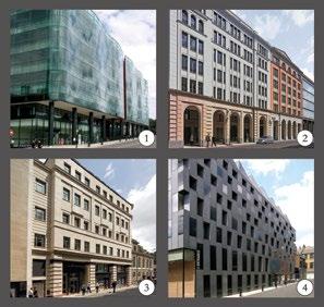
a large retail podium below the tower, aligning with neighboring buildings but still overwhelming in scale.
Survey comparing public preference for classical versus contemporary building styles, showing the enduring appeal of historic architecture.
Figure 5—
Typologies of adaptive reuse bases, illustrating the Insert, Above, and Append strategies for integrating new structures with historic buildings.
they preferred (see Figure 4). Over 77% chose the “older”-looking, classically-styled options 2 and 3; with 23% choosing contemporary building options 1 or 4.1 This data may not represent a full picture of opinions about architecture, but does suggest that the perceived age or style of a building has an impact on how positively it is received. Adaptive reuse raises the question of how we deal with changing conditions. As we densify and change uses, how can we avoid erasing the past? It is not a universal practice to inspect what is functional in an existing building and determine what is worth saving. Must we replace everything as time goes on? In addition to aspects of preservation, the adaptive reuse of an old building can also reduce waste and energy associated with demolishing and rebuilding. “Far and away the best way to reduce carbon is to re-use existing buildings. By recycling structure, we can save up to 40% of emissions. These targets are achievable now.”2 With these benefits of adaptive reuse and high-rise podiums, existing examples can be analyzed for characteristics that enhance or stimulate the resulting project.
Three main typologies have been identified for the adaptive reuse base (see Figure 5):
Insert: New in old
Above: New on old
Append: New grafted to old
We can take into consideration the benefits and drawbacks of each typology, through several dimensions:
Circulation: How do users traverse the old to reach the new?
Structure: How does the new building stand in relation to the old?
Function: How does the old building become utilized in relation to the new?
In order to evaluate the success of individual case studies, a number of criteria must be applied. When analyzing issues of scale, integration, design, and public interaction, each building has a number of aspects that either contribute to or resolve these problems. Scale can be broken up into two parts: the proportion of the base mass to its low-rise and mid-rise neighbors, and the tower to the rest of the buildings surrounding it. The difference of the base mass height and the surrounding buildings shows the integration with the general streetscape height datum of the area. The difference in height of buildings overall shows how the tower fits within the context of its taller neighbors. These two numbers are then compared to reveal an “outlier factor,” which analyzes how much the new building stands out in scale compared to its neighbors of varying heights. “Influence” is the analysis of the impact of the base mass on the function and design of the tower as a whole. This includes several aspects:
Did the new tower pick up on material cues from the old?
Is the old mass integral to the function of the new building?
Did the old building continue to function in a similar way after the new addition?
Is the old building used for more than just a lobby space?
Does the base include functional public space?
Did the old building influence the conceptual design of the new?
Each case study will earn points based on the scale and influence criteria.
Figure 6 (Opposite)— Hearst Tower, New York City, exemplifies the Insert typology, where a diagrid tower penetrates a historic façade, creating a striking contrast but limiting interior flexibility.
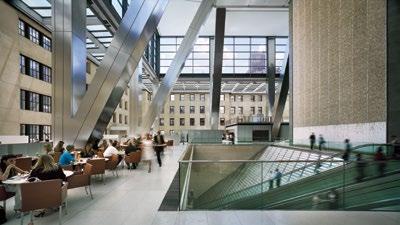
Figure 7 (above)— Interior view of Hearst Tower’s atrium, showing how structural columns and diagonals disrupt the historic space.
8 (below)— Hearst Tower floor plan showing how the structural members can limit the area for program.
Completed in 2006 by Foster + Partners, Hearst Tower in New York City is an example of the Insert typology (see Figure 6). The new structure of the tower penetrates the historic building, which serves as the lobby and atrium (see Figure 7). As the Hearst media company needed to expand its office space, the 1928 Hearst Building was “carved out,” leaving only the historic façade to create room for the new tower. The architects were conscious about the contrast between the masonry of the historic building and glass-and-steel tower, as it shows a clear difference in age and building technique. While the aesthetics of this contrast can be argued, the new building did not directly integrate material cues from the old into the new. The circulation through the old building is also affected by the new, as the structural columns and diagonals of the new tower land inside of the old one. This limits the program area, as the floor is disrupted by these structural members, which can be a major disadvantage of the Insert typology (see Figure 8). The structural system of the new tower was influenced by the original building, as the openings in the old building created a distinctive “front” and “rear.” The rear side abuts a neighboring building, with little light or view.
The architects decided to place the core for the new tower towards the rear, and because it was now offset, it could no longer be used as the structural spine, as is commonplace. The decision to use a triangular “diagrid” structural system was made, which is a “highly efficient solution that uses 20% less steel than a conventionally framed structure.”3 While the Hearst Tower was successful in many aspects, the original use of the historic building was reserved for the tower. Only the old façade remains intact.
The Insert typology can create challenges in this respect, as bringing the new tower physically into the old building means some if not all of the old interior must be removed. In this case, it could be questioned whether the historic façade became more of a novelty than an integral part of the building.
Figure 9 (right)— One Madison Avenue, New York City, demonstrates the Insert typology.
Figure 10 (below)— Designed by Ibelings van Tilburg architecten, De Karel
Doorman in Rotterdam was built above an existing shopping center.
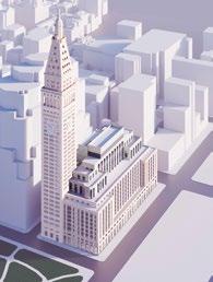
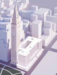
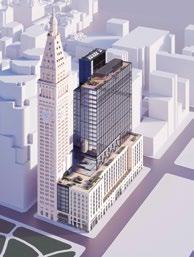
One Madison Avenue in New York City, designed by Kohn Pedersen Fox, is another example of the Insert typology, but retains much of the original building (see Figure 9).4 A new office is perched above the original building, with the office function continuing through both new and old. The structure for the addition replaces what is directly below, but not what is around. The material of the new addition contrasts with the old, but the old building is not completely gutted, as was the case with Hearst Tower. It is a more complex evolution of the typology, as it maintains the original functionality, and about 67% of the structure of the existing building. This allows for a unique connection between the old and new structures, as they serve the same purpose, but in two different forms. The base also becomes more than just a lobby, incorporating a commercial floor and market, similar to what is typically seen from other tried-and-true podium schemes.
De Karel Doorman, Rotterdam by Ibelings van Tilburg Architects was constructed above an existing shopping center (see Figure 10). In this case, the new structure physically rests on the old columns and foundations. The steel and timber structure of the new building had to be light enough to bear on the existing members, but as it only sits atop, the program of the podium remains the same. The shopping center functions as it had prior to the addition. The material of the new building has some commonality due to the extensive use of glass, but still contrasts with the base. This may actually speak to the way the tower functions as an entirely different building, aside from its position above the existing. The retail base is of a scale more familiar to the pedestrian than a high-rise, with a program that is more public and active than the typical tower lobby. This case study for the Above typology shows that structurally and formally resting a new building atop an existing building is one of the most challenging,
but also rewarding ways of incorporating an adaptive reuse podium. A benefit to this typology comes when the existing building can function in a way that is almost completely undisturbed by the new addition, and thus maintains its historical and functional significance. Building above an existing building is a complex and involved strategy, as the existing structural system must be accounted for.
The Brooklyn Tower in New York City is an example of the Append typology. Designed by SHoP Architects, the new tower is a concrete residential high-rise that constructed behind an historic bank building (see Figure 11). The landmark boundary of the old building takes up most of the site, and the new tower removes part of the old, grafting the new tower onto the building. The materiality and shape of the old heavily inspires the new, as the architects have carried over datums, rhythm, formal inspiration, and material choices, which create a new interpretation and response to what was used before. This creates a tower that looks and feels integrated with its base. The landmarked bank interior will serve as a flagship retail space,
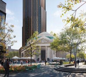
The Brooklyn Tower, New York City, employs the Append typology, with a high-rise grafted onto a historic bank building, its design inspired by the original structure.
Physical integration of both buildings
Old building as threshold
Freedom of program interaction
Structurally straightforward
Least imposing to streetscape
Older building typically retains function
Structure penetrates space below
Base level programs challenging to separate
Base level not fully integrated
Tower face may be directly abutting street
Complex structural considerations
Highest separation of programs
12—
plan of Brooklyn Tower, reflecting the triangulated form of the historic bank and enhancing integration between old and new.
with the upper floors and roof becoming amenity spaces for the residents in the tower. The structure of the tower is not influenced by the old in terms of the systems used, but its overall shape is an extrusion of the bank-adjacent building site. The hexagonal plan echoes the triangulated arrangement of the bank (see Figure 12). The combination of the formal, material, and programmatic choices makes The Brooklyn Tower uniquely architecturally integrated. In this case, the Append typology allows the historic building to serve as a welcoming public space and lobby, as well as an amenity space for the new tower. Nevertheless, the degree of separation created in this typology is greater than some other schemes. This is because the old and new can be seen as separate entities, due to their multiple entrances and programmatic differences.
The Selby in Toronto, designed by bKL Architecture, also preserves the historic building by appending. This final case study moves away from the typical podium, instead utilizing an existing building that is adjacent and connected to the new tower. This involves the historic building at the base, but the programs in the old and new do not have a direct relation to each other. The former Selby Hotel was moved away during construction, and then brought back into position, sharing a rear
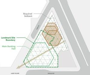
wall with the tower. It now functions as a restaurant, while the circulation to the tower lobby is separate from the historic building. This separation allows for the retention of the old use, but can also create a separation of identity for the two buildings. In this case, the old building is not necessary for the new building to function. Both buildings employ similar materials, as seen by the use of red brick in the tower, which echoes that of the original.
While not formally a podium, this tower still exemplifies some of the benefits that come from the adaptive reuse of a historic building when constructing a new tower. It connects with the urban streetscape much like the podium does, due to the scale at the base and setback of the tower. The programmatic use of the small building brings a welcoming and inviting atmosphere to the streetscape, as opposed to a typical lobby space.
Each of these building typologies and case studies have dealt with materiality, function, structure, and circulation in different ways (see Table 1). The success of the adaptive-reuse base can be due to the combination of these aspects, but it also has innate benefits. The reuse of an existing building, given it was built at a scale or in a style that was conscious of its neighbors, should automatically be integrated with the streetscape. It also preserves a physical piece of history, rather than destroying it. The scale of The Brooklyn Tower, and most of the high-rises shown, would otherwise be jarring additions to the local morphology. With the integration of the base below, we can begin to understand a tower’s entry and auxiliary programs on a more human scale. The impact on the design of the adaptive-reuse base is a major contributing factor to the scheme's overall benefits. As seen in The Brooklyn Tower and The Selby, the material of the historic building can spur a design language that steps away from the standard “glass box” seen in every city. The historicpreservation aspect of adaptive reuse is a positive factor shared by all the buildings cited here.
Total cases meeting criteria
Comparative table of each case study building, across urban performance and influence criteria.
All height measurements are in meters.
A. Height: Existing
B. Height: Tower
C. Height: Surroundings
D. Base Alignment
E. Without Base
F. Scale
Improvement
G. Material
H. Integral
I. Retain Use
J. Lobby
K. Public
L. Design
M. Total
Each case study was evaluated using a points system, and analyzed for its scale and influence (see Table 2). The aspects of scale at the base can be evaluated and compared with the height data of neighboring buildings. The median of surrounding buildings’ heights is taken and compared to the case studies’ base and tower heights.
Each building can then be examined for how closely it meets the surrounding heights at their base. The same calculation is made for the height of the tower portion. A scale improvement is shown by comparing those figures, as the base relates much more to the surrounding datum height than if the tower were constructed without one.
The points system has also taken the design aspect of adaptive reuse and base conditions into account, analyzing how the old and new parts of the construction have affected each other. Objective aspects like functionality and program are weighted more heavily than the subjective design aspects, which include the influence of the old building and synthesis of material.
These influence sections rate how the project has responded to and incorporated the base condition. By maintaining a connection to historic buildings, our cities retain their architectural heritage even when accommodations must change.
This is seen to varying degrees in the case studies and typologies, but it is important to consider the difference between these buildings and the standard assumption of demolishing an old building for a new one.
It is a reminder to value what is functional, and avoid throwing everything away as time goes on. This combination of scale and heritage may establish a standard for high-rise buildings that is more integrated with their streetscape and surroundings. As Jan Gehl states in Cities for People, “From the street, we can only experience with difficulty events that take place higher up in buildings. The higher up, the more difficult it is to see. The connection between street plane and tall buildings is effectively lost after the fifth floor; they no longer belong to the city.”5
1 ADAM Architecture. (2019). “YouGov Survey Results Show That People Prefer Traditional Rather Than Contemporary Buildings.” Accessed 3 May 2023. https:// adamarchitecture.com/publication/yougovsurvey-2009/.
2 Napell, G. and Bretaña, A. (2021). “The Adaptive Reuse Revolution.” Gensler. Accessed 28 April 2023. https://www. gensler.com/climate-action-2021-the-adaptive-reuserevolution.
3 Foster + Partners. (n.d.). “Hearst Headquarters.” Accessed 3 May 2023. https://www.fosterandpartners. com/projects/hearst-headquarters.
4 Kohn Pedersen Fox. (2022). “One Madison Avenue.” KPF. Accessed 3 May 2023. https://www.kpf.com/project/ one-madison-avenue.
5 Gehl, J. (2010). Cities for People. Washington, DC: Island Press.
The escalating impacts of climate change demand innovative urban planning solutions that address both environmental hazards and social inequities. In response, the Greater London Authority (GLA) and Bloomberg Associates (BA) developed Climate Risk Maps for London, integrating data on flood and heat risks with social vulnerability metrics. These maps offer a comprehensive visualization of risk, enabling targeted interventions in the city’s most at-risk areas. This initiative not only informs public policy and resource allocation while empowering residents to understand and mitigate their vulnerabilities. The success of the Climate Risk Maps shows the critical role of data-driven tools in fostering resilient, equitable cities worldwide.
Authors: Lauren Racusin Andrea Partenio
Keywords: Climate Risk Mapping
Data-Driven Planning
Environmental Equity
Flood Risk Heat Risk London Climate
Adaptation
Vulnerability

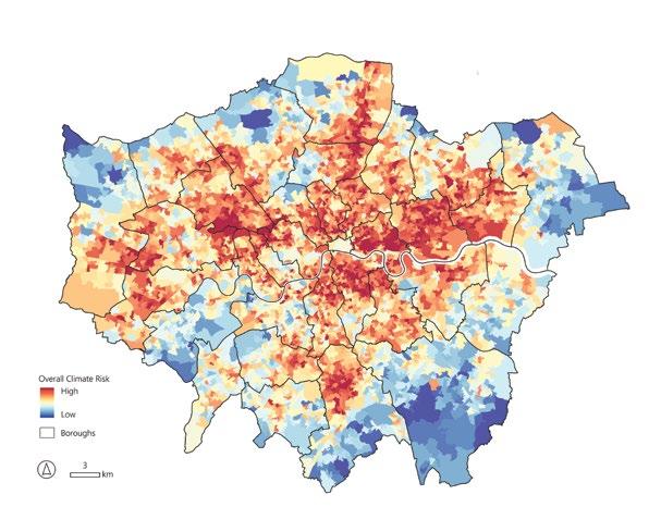
Drastic, more frequent weather events are shaping how we live and experience the cities that we call home, whether through more frequent wildfires, droughts, flooding, and/or heat waves. Heat is the leading cause of weather-related deaths in the United States. Heat-related deaths increased 439% between 2004 and 2021, and extreme heat events tend to kill more people annually than hurricanes, floods, and tornadoes combined in the United States.1
Data show that climate impacts are inherently inequitable, disproportionately affecting poor and minority communities. The most vulnerable bear the brunt of extreme climate events; worse, these communities have a harder time responding to them. Half of the world’s population has a high chance of experiencing an extreme climate event in their lifetime, and about half of those are living within high levels of poverty, surviving on less than US$6.85 per day.2
Climate change is not the only culprit to blame for inequitable climate impacts: historic urban planning practices have exacerbated its effects. In the United States, more than half of those living within 2 miles (3.2 km) of a toxic waste facility belong to a minority group.3 The last century of urban planning turned cities into ovens, in which heat is literally trapped within them, and planned city development increasingly is in vulnerable urban locations. Some 1.81 billion people worldwide, 23% of the global population, are in areas with increased flooding risk.4 Yet, between 1985 and 2015,
development in flood-prone areas within cities and towns increased by 122%.5
Moreover, urban growth paired with widespread car usage has led to more dark, impermeable surfaces such as parking lots, asphalt streets, and highways cutting through neighborhoods, intensifying the urban heat island effect and the impacts of flooding. Compounding these negative effects, each year, the world’s annual tree loss is the area of a forest the size of the United Kingdom. The US loses about 36 million trees per year.6
This makes it essential for governments to start designing cities differently. Smarter, more strategic urban planning is integral to mitigating the impacts of climate change and adapting to it for a more resilient future. A targeted data approach is required to better plan cities, which means it is imperative for cities to understand their climate risk landscape, and central to this is determining which cities are most at risk.7
London is no exception to increasingly more severe climate events. In July 2022, the UK reported its hottest

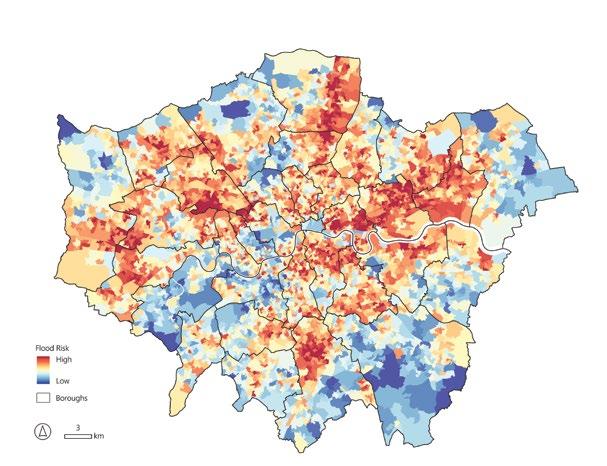
recorded temperature at 40oC/104oF, causing the highest number of recorded fatalities at an estimated 4,500 deaths across the country.8 In 2021, parts of London received a month’s average of rain in the span of just a day, causing severe flooding and damage.9 About 17% of the city is at medium to high risk of flooding, with more than one million Londoners living in the flood plain.10
Recognizing that such climate events were more likely to become the norm, the Greater London Authority (GLA) identified heat and flooding as primary climate hazards across the city. The GLA tasked Bloomberg Associates (BA), Michael Bloomberg’s pro-bono consultancy that advises city governments internationally, with helping them understand the nuances of climate risk across London, namely how climate change impacts people and communities differently.
Key to this exercise was defining social vulnerability as a component of risk. Who is particularly vulnerable to climate hazards, and who has a harder time responding to them? BA determined that visualizing the distribution of risk to flooding and heat events across different neighborhoods would highlight where London was most vulnerable, both socially and environmentally, which was the genesis of the Climate Risk Maps, which track climate risk and social vulnerability across the city.11
Over about 18 months, BA worked with a wide range of stakeholders and subject matter experts to
assess how social vulnerability is defined and represented within London. BA engaged the GLA Resilience and Environment teams, the UK Environment Agency, Thames Water, the National Health Service (NHS), local public health officials, multiple local authorities, and experts in flood and heat risk management to debate which demographic and environmental metrics should be used to create Climate Risk Maps for the city (see figures 1–8). Many factors influenced the final selection of datasets, including data availability, existing bias within the data, and geographic consistency of data across London. In a scan of existing social vulnerability indexes, BA decided that most were either not comprehensive enough or contained too many metrics to accurately analyze their correlation. After much deliberation, the team decided to use six social vulnerability metrics: BAME (Black, Asian, and Minority Ethnic), English Proficiency, Social Renters, Income Deprivation, Population under 5, and Population over 75 data. Using GIS software,
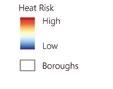
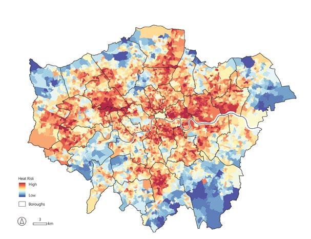
these datasets were combined with six environmental datasets, which were used to create three Climate Risk Maps for London: Overall Climate Risk, Flood Risk, and Heat Risk. A detailed methodology report can be accessed from the London Datastore.12
The original Climate Risk Maps were static data visualizations available to the public to serve as points of reference for what risk looks like across London. Based on feedback from users, stakeholders wanted an interactive tool in which they could use different features and isolate different areas. BA built a live web platform to hold the second iteration of maps, which was posted on the Datastore in 2022.
This newest, dynamic version allows users to compare one of the three Climate Risk Maps against individual metrics within any given Lower Super Output Area (LSOA) or borough boundary, and to search individual addresses to understand climate risk at those locations. The dynamic nature of the maps provides people with information for understanding their own risk from climate hazards, allowing communities to prepare and respond more effectively.
The Climate Risk Maps revealed important information about the vulnerability of London and its essential infrastructure. One fifth of London’s schools, one quarter of its tube stations, and half of its hospitals are highly susceptible to flooding. The analysis helps to prioritize strategic programming and support by the GLA and its public agency
partners so that they can better prepare for extreme weather events.
The maps were developed to inform decisionmaking with a more data-driven approach, so integral to the success of the maps is their widespread adoption. While the maps were posted on the London Datastore for public consumption, BA sought to further socialize the maps and ensure that people knew how to use them. BA trained approximately 1,000 people through workshops, seminars, and meetings. These sessions included discussions about localized climate risk throughout the city. The trainings involved an intentionally broad set of stakeholders with representatives from the GLA, other city agencies, boroughs, non-profits, businesses, and residents.
The mapping tool helps inform people about their risk, which is the first step to meaningfully reducing it. In some of the first meetings with residents in different boroughs, it was sobering to realize that many people were unaware that they were living in high climate-risk areas. The maps allow people to see where they live and work, and what level of climate risk they face in those areas.
The Climate Risk Maps have changed the way that the GLA does business. Given the finite resources of the GLA, the Climate Risk Maps help the agency most effectively target resources to communities and stakeholders that are most vulnerable. Additionally, the maps
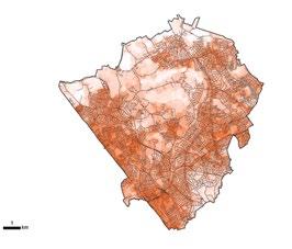

support the GLA to design programs that best address local needs and challenges. For example, the GLA developed a dedicated fund to create and enhance green spaces to increase climate resilience and used the Climate Risk Maps to prioritize applications. In 2021, £1.4 million (US$1.8 million) was awarded to 45 community projects, with 90% of them in areas of high climate risk (as deemed by the Climate Risk Maps). In 2022, £22 million (US$27.8 million) was awarded to 56 projects, with 80% of them in high climate-risk areas. One such funded project was the Agnes Riley Rain Garden in Lambeth, which created new wetlands, helped sustainably manage rainwater, and improved climate resilience. Another was one that made low-traffic neighborhood improvements permanent in Newham. The improvements included creating green public spaces with sustainable urban drainage systems and interventions to increase pedestrian safety.
The Climate Risk Maps were used in the development of the GLA’s Cool Spaces program (see Figure 9), which provides highly vulnerable populations with cool places during hot weather. The maps informed the outreach and prioritization for the program. In 2022, the Cool Spaces had nearly 105,000 visitors.
BA is currently embarking on the next phase of this work, which is supporting boroughs to use the Climate Risk Maps to inform the design and development of their policy and programs to most effectively target neighborhood-level climate risk. Boroughs have begun to use the maps in different ways, based on their internal resources, priorities, challenges, and community landscape.
It is becoming increasingly apparent to boroughs that climate change can impact their residents’ health and well-being, as extreme weather events become more frequent and more intense. Certain populations are more at risk than others to the detrimental health impacts of climate hazards, including elderly people, young children, and non-English speaking populations, who may have trouble interpreting or accessing official warnings or resources. Recognizing this, the borough of Haringey has been actively integrating the use of the Climate Risk Maps into its public health work. The borough’s public health team began using the maps soon after the interactive Climate Risk Map tool was made available online, using the data to overlay care home and school locations and other vulnerable infrastructure to understand risk at those locations. This will help the borough to ultimately target their resources and
Map of the London Borough of Barnet’s At-Risk Care Homes by Bloomberg Associates, 2024.
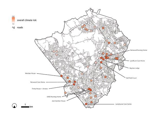
Map of the London Borough of Barnet’s At-Risk Schools by Bloomberg Associates, 2024.
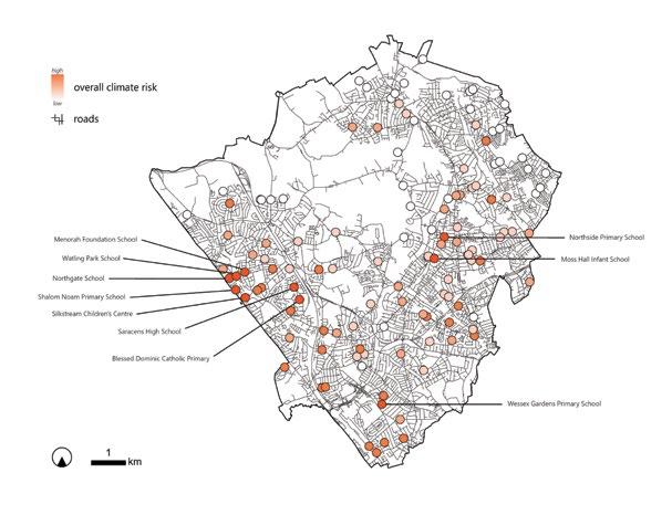
Watling Park School
Northgate School
Shalom Noam Primary School
Silkstream Children’s School
Saracens High School
Blessed Dominic Catholic School
programming more effectively. BA is continuing to work with the borough to produce more nuanced maps for use by Haringey internally to guide their policy conversations and decision-making, including maps that assess walking distance from existing Cool Spaces and highlight areas in need of new ones. Haringey also is deeply engaged in spreading awareness about climate risk to its residents. BA worked with the borough to organize community workshops to familiarize residents and businesses with the concept of climate risk, and to discuss what actions can be taken at the borough and community levels to mitigate risk. Interactive presentations sparked valuable conversation around what resources are available to community members in the face of heat waves and flooding events. Residents shared feedback to the borough on how the maps could be improved or customized. BA will continue to work with the borough to plan additional community workshops to build on learnings and share new findings from borough-level analyses.
Modifying and adapting land development patterns long-term is key to meaningfully addressing climate change. The Borough of Barnet, with an ambitious plan to bring architects and developers to the table to work with them to make development more responsive to climate risk and social vulnerability. BA and Barnet had a workshop with architects and developers to show them the Climate
Risk Maps and get their feedback about how they can support their work. BA and Barnet’s Environment team also presented the Climate Risk Maps as a tool to consider using during the planning approval process to the borough’s Councilors on the Planning Committee. Using the Climate Risk Maps, they hope to work with developers to modify building plans to more effectively address the nuance of their climate challenges. For an example, the Climate Risk Maps could identify a proposed development to be in an area with high heat risk, high numbers of people over 75, and with poor air quality. The borough could work with the developer to modify the proposed development to include more shaded seating areas, surrounded by greenery to help offset the specific vulnerabilities at the potential development site. Likewise, the Planning and Development team could suggest building modifications for a development in an area with high flood risk to have more permeable surfaces and drainage systems. Barnet also wants to have data lead their decision-making processes. The Environment team at Barnet is looking to incorporate the Climate Risk Maps into their Net Zero decisionmaking tool, which helps them evaluate the environmental implications of a project and consider how to mitigate them. Similarly, Barnet wants to be more intentional around its communication about extreme climate events and how it does outreach with residents around the borough. To start as a pilot,
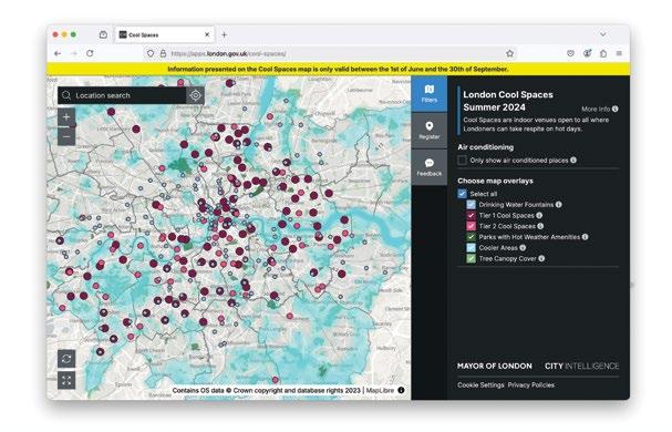
Barnet and BA are developing Climate Risk Maps that are overlaying care homes to analyze which are most vulnerable, and how to better support them and their residents during climate emergencies.
This work is just the beginning. These maps can be made anywhere. The metrics can be tailored to reflect specific environmental challenges within a city and its nuanced social vulnerability makeup. The maps help city governments with limited resources best maximize them by leveraging them to target those most in need. Our cities are increasingly in danger of climate events, so the Climate Risk Maps help cities to better analyze who will be most impacted and to be in a better position to support them.
Data is empowering. The Climate Risk Maps make data on climate and social vulnerabilities accessible to communities internationally and allows them to make more informed decisions about how they design, plan, and build cities. Importantly, decision-making around resource allocation can be made highly transparent. People and community members need to know their risk. Maps help people see where they live and work and understand how it is situated within the spectrum of risks. It is a very powerful visual to personalize climate vulnerabilities and make them accessible. An informed public can better advocate for themselves and work with officials to make cities more resilient.
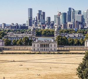
1 https://usafacts.org/articles/how-many-people-diefrom-extreme-heat-in-the-us/.
https://www.scientificamerican.com/article/extremeheat-is-deadlier-than-hurricanes-floods-andtornadoes-combined/.
2 https://www.worldbank.org/en/topic/poverty/ publication/people-exposed-to-vulnerable-to-and-athigh-risk-from-weather-shocks.
3 https://www.gsam.com/content/gsam/global/en/ market-insights/gsam-connect/2022/how-climatechange-affects-socially-vulnerable-communities.html.
4 https://blogs.worldbank.org/en/climatechange/ flood-risk-already-affects-181-billion-people-climatechange-and-unplanned.
5 https://grist.org/buildings/cities-worldwide-keepbuilding-in-flood-zones-despite-mounting-risks/.
6 https://www.cnn.com/2019/07/20/health/iyw-citieslosing-36-million-trees-how-to-help-trnd/index.html https://www.theguardian.com/environment/2019/sep/12/ deforestation-world-losing-area-forest-size-of-uk-eachyear-report-finds#:~:text=4%20years%20old-,World%20 losing%20area%20of%20forest%20the%20size,UK%20 each%20year%2C%20report%20finds&text=An%20 area%20of%20forest%20the,the%20climate%20 emergency%20and%20wildlife.
7 In the confines of this paper, “Climate risk” refines to the physical risks and impacts related to climate change, using the United States Environmental Protection Agency definition. https://www.epa.gov/climateleadership/ climate-risks-and-opportunities-defined.
8 https://www.bloomberg.com/news/ articles/2023-07-08/extreme-climate-is-bad-news-foruk-s-historical-homes-built-on-sinking-clay. https://www.theguardian.com/world/2023/sep/22/ heat-related-deaths-2022-hit-highest-level-recordengland.
9 https://www.bbc.com/news/uk-englandlondon-57816647.
10 https://www.cnn.com/2021/07/26/europe/londonflooding-infrastructure-climate-intl-cmd/index.html.
11 https://data.london.gov.uk/dataset/climate-riskmapping.
12 The original iteration of the Climate Risk Maps was produced in April 2022. All data was aggregated to the Transport for London (TfL) hexagon geography, a standardized hexagonal geography created for transportation mapping and the preferred GLA geography for internal use. GLA partners felt that patterns of risk would be easier to identify if using a consistent and standardized geography across the city’s municipal boundary. Nearly all metrics needed to be reaggregated from their original boundaries to the hexagon grid. However, upon launching the maps and gaining feedback from relevant partners using them, it was determined that most external users preferred to see data aggregated to the Lower Super Output Area (LSOA) , a geographical area used for census statistics in the United Kingdom. The maps were adjusted accordingly.
Vertical Urbanism’s round-up of recent academic research findings relevant to the design of dense and tall cities, edited by Tom Benson and Cate Heine.
Global Streetscapes—A Comprehensive Dataset of 10 Million Street-Level Images Across 688 Cities for Urban Science and Analytics, Journal of Photogrammetry and Remote Sensing, Volume 215, September 2024
The Global Streetscapes dataset introduces an unprecedented resource for understanding urban morphology, streetscape design, and public amenities across 688 cities. With over 300 attributes, including weather conditions, lighting, and visual quality, the dataset provides insights into how the design of streetscapes influences accessibility and urban vibrancy.
Leveraging deep learning, this dataset enables cross-city comparisons and longitudinal studies, offering urban planners a reproducible framework to assess the built form’s contribution to urban life. It sets the stage for cities to optimize density, greenery, and infrastructure for more sustainable urban environments.
Urban Biodiversity is Affected by HumanDesigned Features of Public Squares, Nature Cities, October 2024
This study highlights how urban biodiversity depends on the thoughtful design of public spaces. Analyzing public squares in Munich, researchers found that greener designs—such as denser trees,
shrubs, and lawns—enhance species richness while fostering human-nature interaction. The findings underscore the dual role of public spaces: supporting biodiversity while serving as vibrant, multifunctional areas for city residents. Integrating ecological goals into public square designs can elevate both environmental and social dimensions of urban life.
Cities and the Sea Level, Journal of Urban Economics, Volume 143, September 2024
Coastal construction is expanding into flood-prone areas, posing risks to both infrastructure and urban populations. This study examines housing patterns along the US Atlantic and Gulf coasts, revealing that new developments often prioritize proximity to urban amenities over climate risks.
The findings call for policies that balance the benefits of urban density with the need for resilient, sustainable coastal designs. This is crucial for safeguarding both built environments and public safety in an era of rising sea levels.
Building Footprint Data for Countries in Africa: To What Extent Are Existing Data Products Comparable? Computers, Environment and Urban Systems, Volume 110, June 2024
This study compares building footprint datasets from Google, Microsoft, OpenStreetMap, and Ecopia across African countries, uncovering substantial inconsistencies in coverage and accuracy. These discrepancies challenge efforts to use these datasets
interchangeably for urban planning, particularly in data-scarce regions. Reliable data is essential for mapping density, infrastructure, and amenities, making this research a call to improve geospatial resources for effective urban development.
The Spatial Impacts of a Massive Rail Disinvestment Program: The Beeching Axe Journal of Urban Economics Volume 143, September 2024,
The Beeching cuts in mid20th-century Britain removed significant portions of the rail network, leaving lasting effects on population density and regional resilience. Areas that lost rail access experienced economic stagnation and declining local populations compared to regions that retained connectivity. This study emphasizes the importance of robust transport infrastructure in supporting urban density and regional prosperity.
Big Mobility Data Reveals Hyperlocal Air Pollution Exposure Disparities in the Bronx, New York, Nature Cities, August 2024
This study reveals stark disparities in air pollution exposure in New York’s Bronx, where mobility patterns exacerbate inequalities. Hispanic-majority neighborhoods experience disproportionately high exposure to particulate matter (PM2.5), with socioeconomic factors playing a major role. These findings call for targeted mitigation strategies that consider mobility and access to public spaces, ensuring cleaner, healthier urban environments for vulnerable populations.
Urban heat islands (UHIs) pose a growing threat to city livability, but this study identifies rural land cover adjacent to cities as a key cooling resource. Analyzing data from 30 Chinese cities, researchers found that connectivity and uniformity in rural patches reduced UHI effects by up to 0.5°C. These insights highlight the importance of integrating urban and rural land use strategies to optimize density and mitigate extreme heat.
Nature Communications, May 2024
Traditional mobility models often overlook spatial directionality, a critical factor influencing congestion and suburban sprawl. This study introduces an anisotropycentripetality metric to analyze travel patterns in 60 Chinese cities. Findings show that polycentric cities maintain consistent commuting distances, while monocentric cities face worsening congestion as they expand. These insights can guide transport and housing policies to balance density and improve urban mobility.
and the Distributional Effects of Urban Spatial Sorting, The Review of Economic Studies, Volume 91, Issue 2, March 2024
As affluent households seek high-quality amenities in city centers, rising income inequality drives gentrification
and displaces low-income residents. This study quantifies how demand for downtown amenities reshapes neighborhood dynamics and exacerbates welfare inequality. Addressing these socioeconomic shifts requires policies that balance urban prosperity with housing affordability and inclusivity.
Compact City and Urban Planning: Correlation Between Density and Local Amenities, Environment and Planning B: Urban Analytics and City Science, 6 May 2024
This study explores the relationship between urban density, measured by Gross Floor Area (GFA), and the growth of local amenities in compact urban forms. Analyzing the correlation at varying geographical scales, the research found that while GFA aligns with amenity growth at larger scales, this relationship weakens at walkable, neighborhood-level resolutions. This indicates that amenities often cluster in different locations than high-density developments. The findings suggest that urban planners should focus on broader urban patterns rather than overly emphasizing GFA in localized plans, to ensure that density contributes to vibrant, amenity-rich communities.
and Threshold Effects of the Built Environment, Road Vehicles, and Air Pollution on Urban Vitality Landscape and Urban Planning, Volume 253, January 2025
Using Manhattan as a case study, this research examines how the built environment,
road vehicles, and air quality interact to shape urban vitality, represented by pedestrian activity. Machine learning models revealed that the built environment accounts for 77.5% of vitality variance, while road vehicles and ozone pollution contribute 15.18% and 1.46%, respectively. Ozone levels exhibit a negative threshold effect, significantly reducing vitality beyond 27.5 ppb. These findings highlight the non-linear interplay between built environments and urban vitality, emphasizing the need for integrated urban design and air quality policies.
Activity in Cities With Urban Network Analysis, Environment and Planning B: Urban Analytics and City Science, 12 June 2024
The Urban Network Analysis (UNA) tool provides a framework to evaluate how built environments influence pedestrian activity, addressing gaps in traditional carcentered travel demand models. The tool analyzes pedestrian accessibility, identifies critical walking routes, and estimates foot traffic on street segments. Applied in Somerville, MA, UNA demonstrated how development changes impact pedestrian behavior and infrastructure usage. This tool empowers planners to prioritize projects that enhance walkability, sustainable mobility, and pedestriancentric urban designs, offering actionable insights for improving non-motorized transport networks.
Using Multi-Source Data: Case Study in Munich, Remote Sensing, 2024
This study leverages multisource data, including night-time light and housing prices to investigate urban vibrancy in Munich. Findings reveal an uneven spatial distribution of vibrancy, with higher levels concentrated near commercial and educational centers along major roads and metro lines. Built environment factors such as POI density, building density, and road intersections significantly enhance vibrancy, while mixed land use shows minimal impact. The research underscores the importance of synergistic interactions between density and infrastructure in optimizing urban vibrancy.
Impact of Urban Configuration Types on Urban Heat Islands, Air Pollution, CO2 Emissions, and Mortality in Europe: A Data Science Approach, The Lancet, Volume 8, Issue 7
Exploring the Relationship Between Urban Vibrancy and Built Environment
Analyzing 919 European cities, this study categorizes urban configurations into four types—compact high density, open low-rise medium density, open low-rise low density, and green low density—and assesses their environmental and health impacts. Compact high-density cities exhibit lower per capita CO2 emissions but face higher NO2 exposure and urban heat island effects. Conversely, green low-density cities offer lower mortality rates and better air quality but at the cost of higher CO2 emissions. The research highlights the trade-offs between densitydriven sustainability and environmental health, providing nuanced insights for urban planning strategies.
John Portman’s novel atrium towers revolutionized skyscraper design, creating vertical cities within buildings, writes Patrik Schumacher
This tower by John Portman (1924–2017) on Times Square has been a huge inspiration for me, and indeed for Zaha Hadid, who I was able to infect with my enthusiasm. We have together visited, explored, and enjoyed this spectacular building several times. We also looked at some other buildings of this type by Portman, Atlanta’s Marriott Marquis Hotel and the Westin Bonaventure Hotel in Los Angeles. These projects indeed represent a thrilling and potent new type of building.
My infatuation with Portman’s work was well known in architectural and academic circles. The happy fall-out was that I was the first to be appointed to the newly endowed John Portman Chair (visiting professorship) at Harvard University’s Graduate School of Design in 2013. This honor included the pleasure for me and my students to receive the late John Portman with his son and others from the design leadership of the firm for a private review of my studio’s work.
John Portman deserves to be remembered and celebrated for advancing architecture and the built environment with the rarest of creative feats: the invention and successful realization of a novel and impactful building type, the
atrium tower. Ever since the skyscraper was invented in the early 20th century, before Portman, tall buildings were just stacks of separate floors, visually cut off from each other, with blind elevator cubicles as the only connection, i.e., without orientation and communication spaces. This created the paradox of mega-buildings without any significant interior spaces.
Portman opened-up the tower on the inside creating a spectacular internal space that compares well with the most magnificent spaces we find in grand cathedrals and mosques. Moreover, Portman’s megaatriums are not only exciting and uplifting but are highly productive in terms of the purpose of large buildings with many interaction offerings in the city: the internal voids visually unfold and connect these offerings and thereby empower visitors to make the most of their visits. Moreover, Portman released the elevators from their closed concrete shafts and let them fly as glass-bubbles up and down the atrium. Elevators were thus reinvented as panoramic elevators. All this meant that transport through a tower was transformed from a subway-like non-experience into a visually
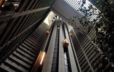
Type: Hotel
Location: 1535 Broadway, , New York City, United States Completed: 1985
Owner: Host Hotels & Resorts Height: 175 m (574 ft)
Architect: John Portman & Associates
Structural Engineer: Weidlinger Associates
Elevators: Collavino Brothers
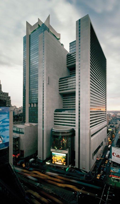
stimulating and informative experience facilitating the browsing, navigation and exploration of the tower. The atrium functions like a vertical boulevard. A large, single building can aspire to become a vertical city-district. The building generates urbanity within and interior design becomes interior urbanism. The New York Mariott is an especially exciting specimen of this new type, because the vertical street has a wonderful complexity. The path up moves through several multi-story spaces before emerging in the great mega-atrium. This big space in turn is changeful, becoming larger via steps, sponsoring interior plazas, and significantly, also opens up to the outside skyline. Finally, the elevators pierce the top floor, to arrive at the top-oftower, rotating 360-degree restaurant. All this makes perfect sense in dense urban contexts.
Portman’s atrium tower inspired, among other projects, our Morpheus tower in Macao (2013–2018), and our Leeza SOHO tower in Beijing (2015–2019). My enthusiasm and inspired commitment to the exploration of Portman’s invention continues unabated.
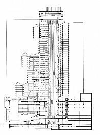
Louis Kahn’s Altgar Tower redefines skyscrapers as civic spaces fostering urban connection, writes Andrea Salazar-Veloz
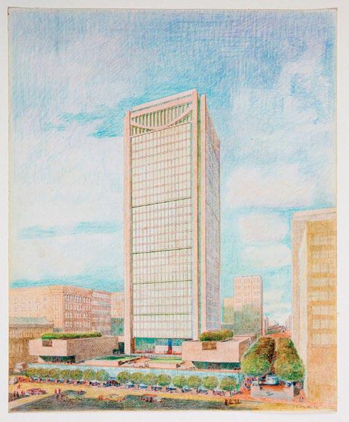
Louis Kahn (1901–1974) is regarded as one of the most influential architects of the 20th century, having redefined modern architecture by combining monumental tradition with a contemporary approach. Although his practice is primarily associated with institutional, cultural, and residential buildings, he also designed private tall buildings during his career, an aspect less discussed by critics. The Altgar Tower stands out as one of his first commissions in this field;
its paradigmatic resolution would significantly contribute to both the discipline and Kansas City (see Figure 1).
The project, which originated in 1966 at the request of entrepreneurs Richard Altman and Arnold Garfinkel, aimed to become an emblematic symbol of the city. Although Kahn was not used to the pragmatic and speculative demands of real estate developers, he decided to assume the project, stimulated by the opportunity to reflect on the
ideological essence of tall buildings and to contribute to the urban and social fabric of Kansas City.
Based on his philosophy that the architect’s primary mission is to recognize the intrinsic essence of the project before addressing its specific design, Kahn began by establishing general architectural principles for tall buildings and reflecting on their evolution within the North American context. He observed that many were erected solely to maximize height and profitability, becoming mere real estate elements.
In contrast, he argued that a tall building should possess a symbolism that transcended mere verticality; he idealized towers as civic spaces endowed with identity, recognizing them as cultural, historical, and social values capable of becoming places of nobility and inspiring meetings.
From this perspective, Kahn aspired to revitalize the city, promoting a humanistic approach that sought to restore social benefits to the city by integrating the tower into the urban fabric. To achieve this, he conceptualized the skyscraper as a classical column structured in base, shaft, and capital (see Figure 2). Recognizing the uniqueness of the base and the capital as transition elements, he designed these spaces as public access places intended to foster social interaction and to serve as the stage that upholds the social nature of humanity. The building’s shaft would be destined for private activities and would be resolved with the “server space-served space” paradigm used by Kahn in other projects (see Figure 3).
This archetypal vision was transferred to Altgar Tower’s design, conceived as an urbanarchitectural enclave that, through its ground floor and upper levels, aimed to establish a new physical and social order in Kansas City.
Figure 2— Façade from Baltimore Avenue, 1973. Conceptual division of the tower into three parts.
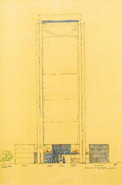
plan.
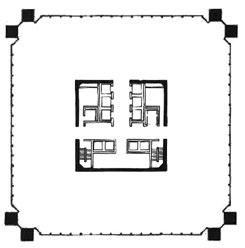
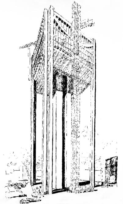

The project was initially to be located on a corner plot near downtown. However, the limited dimensions of the site, which prevented crane installation, inspired Louis Kahn and his engineer, August Komendant, to devise an innovative construction method. Their approach was to erect the tower from the top down, leveraging gravity. The process would begin by constructing four monumental columns at the tower’s corners and the central core, using concrete poured into slipforms. Subsequently, four catenary trusses would be placed to connect the upper corners, anchoring the steel cables that would support the hanging floors (see figures 4 and 5). This strategy not only addressed the technical challenges of the site, but also endowed the first floor and crown with a symbolic identity consistent with the conceptual design principles outlined by Kahn.
Following the project’s presentation to the Kansas City Planning Department, the authorities determined that such an avant-garde design deserved a more prominent location. In 1970, they requested to relocate the project to the downtown area, occupying the block bounded by Baltimore and Main avenues and 11th and 12th streets.
This area was part of Kansas City’s Urban Renewal Plan, designed to modernize its urban fabric and enhance connectivity through a freeway system. In this context, Kahn saw an opportunity to question the dominance of the automobile in public space, using the Altgar Tower as the means for such a critique. Although the project emerged with a speculative focus, Kahn envisioned it as a significant space for civic engagement. He argued that center city should be thought of “as a place to go to—not through,”1 which led him to design a project integrated into the structure and life of the city.
One of the first actions was to expand the program, which was limited to an office tower with a heliport. The vagueness of these
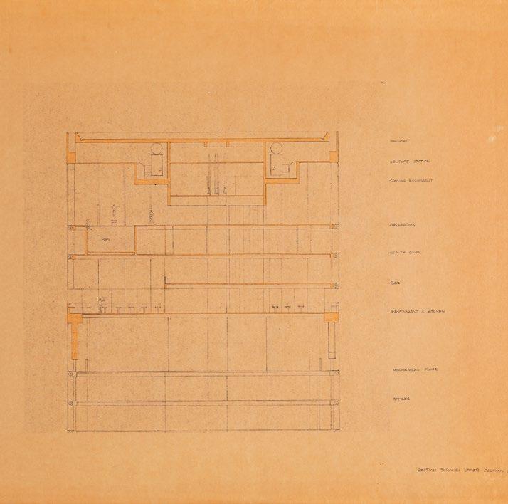
guidelines allowed Kahn to conceive of new uses on the ground and upper levels, aligning with his vision of the tower as a civic enclave. Capitalizing on the requirement for the heliport, conceived as an “aerial street,” Kahn transformed the upper levels into public access spaces. This area of the building, framed by beams and trusses, would house restaurants, bars, sports venues and a club, democratizing the use of these privileged environments (see Figure 6).
After defining the shaft and crown of the building, Kahn focused on how his design would establish a connection with the ground, based on creating a humanistic space. For him, this dialectical relationship encompassed more than just the ground floor; he maintained that private buildings should yield their first floors to benefit their urban vocation. Thus, the ground floor of the Altgar Tower was configured on four levels. Kahn explained that “below the tower is another
‘building,’ which relates the tower to the street, to shopping, and to people. This inspires the sense of meeting, which is central to the sense of the city.”2 This spatial complexity was achieved by addressing the 20-foot (6-m) difference between Baltimore and Main streets, transcending the traditional arrangement of an elevator, a lobby, and a door with a name.
The diversity of activities on the first ground floor, which included a double-height lobby connected to a plaza and a twolevel commercial promenade, ensured a constant use of the spaces, transforming it into a plural and dynamic environment. Kahn noted Kansas City lacked public plazas (see Figure 7), which led him to propose a generous plaza that would occupy a significant area of the block, providing urbanity to his architecture.
This new urban space would be configured with the 32-story tower aligned towards Baltimore Street and two solid volumes facing 11th and 12th Streets, which would house two theaters. The design would include green areas, water surfaces, and urban furniture, all integrated into the terrain modeling. Kahn sought to encourage new uses in the city, contrasting with several modern American plazas that, according to his critique, were empty platforms (see Figure 8).
The plaza at Altgar Tower would be connected with two
shopping levels, reflecting Kahn’s conviction of its potential to revitalize the built environment, encouraging the influx of people and fostering gatherings. The architect believed it was essential for the stores to maintain a close relationship with the adjacent streets, avoiding urban isolation in self-contained areas focused solely on consumption.
In the Altgar Tower, the shops would be oriented towards Main Street and 11th Street, aiming to restore their community character. From his perspective, they should be conceived as extensions of the surrounding buildings, imbuing them with identity and reinforcing their role in the urban dynamic (see Figure 9).
Reflecting on the streets of Kansas City, Kahn stated in a local newspaper in 1972: “Once the streets of this city, before the advent of the automobile, were like open community places. Now, the automobile divides the street from the buildings that flank it. The street character is now more that of a road. The community aspect of the street is hard to find.”3
To restore the role of the street as a community space, Kahn did not limit his work to the plot; he extended his design into the public sphere, giving each street a specific order, function, and design. On Baltimore Street, he planned the main entrance to the tower, highlighting its hierarchy with an urban sculpture, while the tower’s glass façade would offer direct views of the plaza. On 11th Street,
Kahn envisioned pedestrian-only mobility, designing it as a large, elongated plaza. In contrast, on 12th Street, vehicular and pedestrian flow would coexist, accommodating access to the three parking levels.
On Main Street, he anticipated an 8-foot (2.4-m) setback of the building’s podium at ground level, creating an in-between space that would relate the city sidewalk and the project. This place would be complemented by the design of urban furniture that would combine trees and seating, intended to provide a resting atmosphere (see Figure 10).
The Kansas City Planning Department adopted this new street order, establishing a paradigm of mobility and urban livability through a differentiated system of flows and uses. This approach, along with the creation of collective places on the ground and upper levels, transcended the architectural project, becoming a model for new buildings in Kansas City, which were required to incorporate public access spaces.
In the Altgar Tower, Kahn demonstrated that a single building can significantly alter the course of a city, even if it was never built. This tall building was intended to appear tall in a human sense, and not in a financial sense.
His project illustrates that it is possible to construct a humancentered city through architecture, an approach that remains fundamental in addressing contemporary urban challenges.
1 Kahn, L. I. (1991). Louis I. Kahn: Writings, Lectures, Interviews. New York: Rizzoli International Publications, p. 73.
2 Ronner, H., & Jhaveri, S. (1987). Louis I. Kahn: Complete Work, 19351974 (2nd rev. and enl. ed.). Zurich: Birkhäuser Verlag, p. 320.
3 Roberts, J. (1972). “Big Downtown Tower Project Proposed.” Kansas City Star, 19 March 1972, sec. D.
BOOK Green Façades
Nicole Pfoser, Detail, 2024
In the evolving landscape of urban architecture, the integration of green façades has emerged as a pivotal element in the quest for sustainability. Green Façades delves into the multifaceted benefits of incorporating greenery into building envelopes, emphasizing its significance not only in aesthetic enhancement but also in ecological, economic, and social realms. As cities grapple with the challenges of climate change, urban heat islands, and diminishing green spaces, the insights presented in this book are both timely and essential for architects, urban planners, and policymakers.
Nicole Pfoser and contributors argue convincingly that green façades are no longer optional, but rather a necessary component of modern architectural design. They highlight how these living walls contribute to minimizing total energy demand through innovative energy-saving methods. With the alarming increase in average temperatures—projected to rise by 10 to 20 additional hot days by 2060—green façades offer a natural solution to combat heat. By providing shade, enhancing evaporative cooling, and creating fresh air corridors, these structures not only protect the building envelope but also improve the overall urban climate.
One of the standout features of Green Façades is its comprehensive examination of the architectural contributions of façade greening. The book outlines how these green elements enhance the urban image, promote biodiversity, and serve as natural filters for air pollution. The authors provide
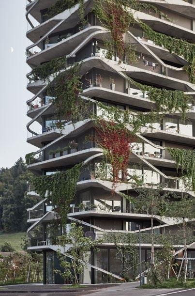
compelling evidence that welldesigned green façades can significantly reduce noise pollution through sound reflection and absorption, creating a more serene urban environment. Additionally, the psychological benefits of green spaces are underscored, with studies indicating that exposure to greenery can enhance subjective well-being among city dwellers.
The book also addresses the practical aspects of implementing green façades, including the selection of suitable plants, soil
conditions, and maintenance requirements. It emphasizes the importance of coordination between greening methods and building design, ensuring that the chosen plants thrive in their specific environments. The authors provide detailed guidance on construction criteria, including fire safety standards, which are crucial for ensuring that green façades do not contribute to the spread of fire. They explore the concept of “blue-green architecture,” which integrates water management
strategies with green building practices. This approach not only addresses heavy rainfall and water retention, but also promotes the use of alternative water resources, such as gray water.
The integration of green façades signifies a sophisticated interplay between architecture and façade engineering. This approach demands a multidisciplinary team—including architects, engineers, landscape designers, and environmental specialists— engaged from the outset of the design process. Such collaboration ensures that the incorporation of greenery transcends mere aesthetic considerations, becoming an integral component of the building’s functionality and sustainability.
The authors also present inspiring examples of residential and commercial buildings that have successfully implemented these principles.
Green Façades is a vital resource and comprehensive guide for anyone involved in the fields of architecture and urban design. The book challenges conventional notions of building envelopes and encourages a rethinking of how we interact with our urban environments. By advocating for the integration of greenery into
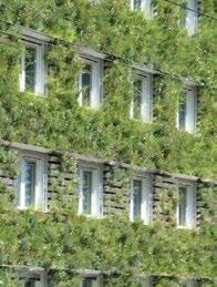
Right— In 2004, Rural Studio started its 20K research in western Alabama, with the goal to design marketrate model homes that could be built by a contractor for US$20,000. This example is from 2008.
architectural design, it not only highlights the aesthetic and ecological benefits, but also emphasizes the social responsibility of architects and urban planners in creating healthier, more sustainable cities.
The authors call for a paradigm shift in how buildings are conceived and constructed, urging professionals to embrace the potential of green façades as a means to enhance urban resilience and to inspire them to action.
BOOK Housing the Nation: Social Equity, Architecture, and the Future of Affordable Housing, Alexander Gorlin & Victoria Newhouse, eds., Rizzoli, 2024
Chris Herbert
Left— Façade-based greening with planting troughs on an administrative building in Vienna, 2010.
Housing affordability is a classic “wicked problem”—one produced by a complex system, deeply intertwined with multiple social issues and defying simple solutions. Crafting responses to wicked problems requires equally complex solutions that call upon new ways of thinking about the issue. Unfortunately, approaches to addressing housing affordability often fall into the trap of being too unidimensional, drawing on
narrow views of the problem informed by a single perspective, at best leaving the problem little changed and at worst, creating new challenges. (For an example, look no further than the history of public housing and how the approach adopted in the US helped to concentrate poverty and racial segregation.)
Housing the Nation: Social Equity, Architecture and the Future of Housing Affordability, edited by Alexander Gorlin and Victoria Newhouse, takes on the ambitious goal of “providing a comprehensive and accessible guide to affordable housing, equipping policymakers, community leaders, developers and local residents with the knowledge and tools they need to address this critical problem.”
The main thrust of the book is a collection of short essays from a refreshingly diverse set of perspectives: economists, urbanists, community organizers, housing advocates, lawyers, developers, and a dose of architects and planners. Collectively, these essays illuminate the complexity of the problem, the multiple factors that contribute to it, and the challenge of crafting solutions.
As befitting a wicked problem, the essays highlight how housing affordability is enmeshed with
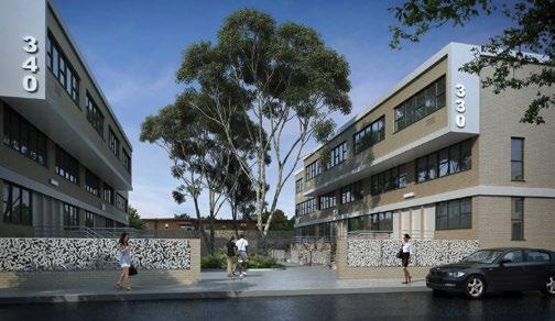
several other societal challenges. The book pays particular attention to how racial injustice is a key driver of the nation’s affordability woes, with a series of essays in Part 2 of the book by J. Phillip Thompson, Margery Perlmutter, David Dante Troutt, and Justin Steil documenting the long history of explicit policies to deny Black Americans access to good quality and affordable homes and communities, making the strong case that an explicit focus on racial equity will be necessary to address the problem.
While not highlighted in the editors’ introduction, another recurring theme in essays by Troutt, Steil, Alan Organschi, Andrew Ruff, and Elizabeth Gray, is the importance of addressing climate change as part of any housing strategy, both because low-income households are more vulnerable to these climate risks, and because making homes sustainable will also contribute to improved affordability in the long term. Dean Baker and Richard Florida highlight the foundational role of growing income inequality in making housing unaffordable, which raises the question of whether the problem can be addressed without dealing with larger structural drivers.
Housing the Nation also centers the role of design in meeting the nation’s need for good quality affordable housing—a dimension
Above—
Marcus Garvey Apartments in Brownsville, Brooklyn, New York, renovated by Global Design Strategies NY in 2016.
that is often either overlooked by policy-makers or wrongly assumed to be cost-prohibitive. This theme emerges notably in essays by Christopher Hawthorne, which touches on a design competition to create prototypes for infill housing to densify Los Angeles; by Kenneth Frampton and Mark Ginsburg, about lessons learned in designing (and now redesigning) the low-rise, high-density Marcus Garvey Village in New York; by Andrés Duany and Fernando Pagés Ruiz on redesigning manufactured homes and communities to retain their cost advantage while enhancing their aesthetic appeal; and by Jessica Holmes and Rusty Smith on the work of the Rural Studio in Alabama, to share the design of very low-cost and efficient homes with community groups across the Southeast.
extent of the problem. But that would be a tall task for any single book, and together the essays do chart a course for approaches that may lead to significant progress in truly meeting the nation’s need for affordable housing.
Put most directly in the essay by Robert Kuttner but echoed by Hawthorne, Thompson, and David Burney, a strong case is made for public development of housing that is permanently affordable and informed by the active engagement of residents, attuned to the housing needs of a broader swath of incomes, and designed to promote healthy, thriving neighborhoods. While this vision of a robust social housing sector is by no means new—it underlaid the movement that led to the creation of public housing in the 1930s—it is again gaining significant momentum across the country.
The insights and lessons offered in Housing the Nation are well-timed to contribute to this important debate, crafting an approach that is informed by the issue’s complexity, and has the potential to make a meaningful dent in the wicked problem of housing affordability.
MULTIMEDIA Highrises: Art Deco: 100 Spectacular Skyscrapers from the Roaring ’20s to the Great Depression, 18 July 2024, Chicago Architecture Center
One of the editors’ key goals with the book is to document that affordable housing can be “beautiful, dignified, and welldesigned” without costing more to build. Toward this end, the final section of the book presents a portfolio of affordable housing built over the last 20 years. These are indeed gorgeous, while often housing many of society’s most vulnerable individuals and making strong connections to their surrounding communities.
Where the book falls a bit short is in presenting solutions that are commensurate with the nature and
Chris Hytha and Mark Houser are collaborators on Highrises: Art Deco: 100 Spectacular Skyscrapers from the Roaring ’20s to the Great Depression, a multimedia series chronicling the great skyscraper edifices of the Roaring ‘20s. Photographed by drones and meticulously measured and researched, the series—consisting of a book, prints, website, mobile phone wallpaper and exhibition— reveals fascinating details and stories of these distinctly American icons. The two Pennsylvanians— Hytha from Philadelphia, Houser
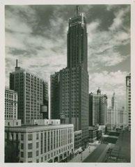
from Pittsburgh—were onstage at the Chicago Architecture Center to promote the book and introduce a photography exhibition, which ran through 26 August.
The project is in some ways the synthesis of Hytha’s previous work, Rowhouses, a photography series exploring 100 derelict row homes in Philadelphia; and Houser’s romp through history, MultiStories: 55 Antique Skyscrapers and the Business Tycoons Who Built Them. Hytha had always been fascinated with pre-war skyscrapers, yet frustrated that few ever had the opportunity to appreciate the intensive detailing at their crowns from close-up. The solution: fly drones at crown level adjacent to some 100 skyscrapers, take detailed photographs, stitch them together into a single image, and then touch them up for some extra drama and color treatment. The missing ingredient was a narrative to tell the stories of both world-famous (The Chrysler Building, New York) and obscure (Public Market, Tulsa) spires.
“I found Mark just by Googling skyscraper books and gave him a call,” Hytha said. “I thought, to have an opportunity to write the stories of the buildings accompanied by really unbelievable art was an opportunity I couldn’t pass up,” echoed Houser. “And it’s wonderful to share that knowledge and show people the great buildings that are in cities like Philadelphia or Pittsburgh or anywhere else that isn’t the first word out of your
Left Carbide & Carbon Building, Michigan Avenue, Chicago, 1940s.
mouth when you ask, ‘where are the amazing skyscrapers?’”
The process for selecting buildings to explore essentially consisted of spending hours in Google Earth exploring 3D city models and zooming in on clearly crenelated pinnacles, Hytha said. Part of the appeal is not only the fascinating backstory and relative obscurity of smaller-city spires, but also the opportunity to see them as they are: Some, like the Carbide & Carbon Building in Chicago, converted into a high-end hotel, shine like the day they opened; others, like the Sterick Building in Memphis, are more than a little worse for the wear.
BOOK High-Tech Heritage: (Im)permanence of Innovation,
Matthias Brenner, Silke Langenberg, Kirsten Angermann, and Hans-Rudolf Meier, eds., Birkhauser,
Catherine Croft
Below— The Sterick Building, Memphis, Tennessee, photographed in 2006.
The standard approach taken to depicting each of the towers is almost like human portraiture— equal parts Old Masters and Sears Portrait Studio—of building façades, at face value, and at face level in an anthropomorphic sense. The effect is both matter-of-fact and emotive – these are clearly buildings with stories to tell.
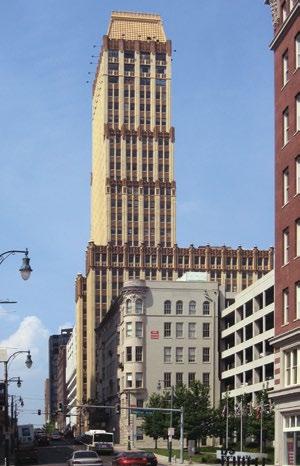
2024
What exactly is High-Tech Architecture, and what are the unique issues around preserving the best examples of this style?
This publication sets out to answer both questions. It comes out of a conference held in September 2023 at ETH Zurich (organized in cooperation with the Bauhaus University, Weimar), which looked at both conceptual challenges and practical ones. It considers the debates about how to treat buildings whose actual, or perceived use of the latest cuttingedge technology available at the time of their conception, was fundamental to their essence. How do we now treat these buildings when we have reached a point where that technology is long-since superseded, and parts once mass-produced are no longer available? What are the specific materials and construction techniques unique to High-Tech buildings, or first developed as part of their evolution, and what do we do about buildings where (for instance) the use of glass adhesives as part of structural glazing systems no longer meet current structural requirements or performance standards? Conference speakers, whose papers have now been published, included academics and architects with practical and research expertise, from Switzerland, Germany, Czechia, the US, the UK, France, Portugal, Italy, Spain, the Netherlands, Hungary, and Greece.
Sensibly, the starting point for both the conference and the book is an assessment of the emergence of High-Tech, and its varied development in various countries. Irina Davidovici makes the point that “in the UK and France, High-Tech was widely adopted
as the airy, shiny, transparent style of neoliberalism. It was often seen in contrast to the massive, opaque, concrete-heavy Brutalism widely associated with the welfare state,” while in Switzerland (and in many other countries) these associative values were not current.
In the run-up to the conference, the organizers drew up a list of High-Tech characteristics, based on the writings of Reyner Banham, Colin Davies, Peter Buchanan, and Angus Macdonald. They took into consideration the “profound influence” of the Case Study program, especially that of the Eames House, with its light metal structure constructed from H-beams, open-web steel joists, and Ferrobord steel roof decking— and its use of distinctive bright colors—something which was to become a key High-Tech signifier.
Archigram’s sketches and collages, including Ron Herron’s Walking City on the Ocean (1966) and Peter Cook’s Instant City Airships (1970) are acknowledged as key precursors, along with 19th-century iron structures. It is noted that the majority of prominent High-Tech buildings from the 1970s and 1980s can be placed in one of two categories: those like the Centre Pompidou, where structure and services are prominently expressed outside the main external building structure; others are exemplified by the Sainsbury Centre for Visual Arts, at the University of East Anglia, where a “sophisticated sleek envelope” encases much of the story from the exterior. Interviews with practitioners including architect Patty Hopkins helpfully round out the historical narrative. While the idea that digital printing of some individual components might be a potential way to extend the life of some buildings is raised, there is sadly little evidence here for the feasibility of retaining and upgrading the extant but now under-performing original fabric of many High-Tech buildings. Thomas Pearson describes how, at James Stirling’s Leicester

Engineering Building, it was decided that the best course of action was to replace “the entire skin of glass and aluminum with substantially upgraded elements.” He notes that this “took a huge effort to match the slenderness of the original construction, with an increase of just 4 mm on the width of new glazing bars,” and explains the decision was reached “using the argument that conserving the spirit and formal logic of this incredible building was more important than preserving its failing historic fabric.”
this book at least demonstrates that these buildings are both not intrinsically impermanent, and well worth making the effort to understand more, and to care for.
BOOK The Computable City: Histories, Technologies, Stories, Predictions, Michael Batty, MIT Press, 2024
Below
Section through the Lloyd’s Building, by Richard Rogers, completed in 1986.
C20 Society (the UK preservation group for post-1914 buildings, of which I am Director) backed this strategy, and has been impressed by the outcome, but not without regret for the loss incurred. While hopefully future High-Tech conservation projects will manage to retain more of the actual physical evidence of what made this architecture so exciting,
In 1934 Karl Popper published The Logic of Scientific Discovery, in which he posited that science’s main objective was not to make predictions about the future, but rather to ever falsify them. Theories about the future could never be proven, on the other hand, future events might cause ideas that were previously considered valid to become obsolescent. Popper called for an open approach that considered the future through the lenses of the past and the present.
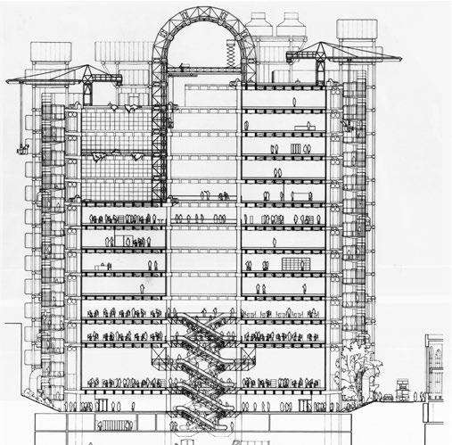
Confronted with the task of charting the penetration of computational technologies in urban environments, Michael Batty’ latest book The Computable City also adopts a similar perspective and refrains from making quick predictions about the future of cities. On the one hand, Batty finds it more useful to dissect each of the digital technologies that have come to shape urban life by analyzing their long history.
On the other, the image conjured up by surveying the deep history of digital technologies suggests that successes and failures depend on myriads of factors that will combine in ever-unpredictable fashion. This observation structures the whole argumentation of the book, as the majority of chapters focus on tracing the emergence of key urban computational technologies such as sensors, planning models, modeling software or augmented reality. The book presents four sections, each unpacking the main layers of the computable city: the development of hardware technologies (titled “Computers and Information”), the transformation of physical space (“Cities and Urbanization,” which spans from von Thünen’s Standard Model to cyberspace), the rise of software (“Models and Computation”), and the integration of information in urbanism (“Planning and Organization”).
The arguments advanced are not only rigorous and convincing, they also include numerous figures and initiatives whose contribution to the computable city have been substantial, yet rarely acknowledged. John Tukey’s early work on data analytics, Stewart Brand’s protosocial media WELL (Whole Earth ‘Lectronic Link), and Cyberia, the first internet café, are some of the many key examples that help the reader appreciate the innovative thinking and sustained level of research that have foretold the current integration of technology in our cities.
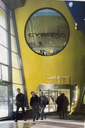
The aim of such a deep survey is not only to describe how separate technological innovations have first emerged, and eventually converged, to affect how cities are planned and experienced, but also to provide a counter-narrative to the popular notion of the “smart city.” In preferring the adjective “computable” to “smart,” Batty proposes a much richer and more valuable frame of reference through which to understand the relation between technologies and cities. The smart city, in fact, has often been associated with new cities built from a top-down perspective, the pervasive presence of private companies, and a discontinuity with past urban models. The combination of these factors has often resulted in a shallow urbanism, lacking the layered and diverse qualities of successful urban environments. On the other hand, the project of computation offers a much richer discourse that has deep connections to philosophy and mathematics, and even an aesthetic dimension, based on
the possibility to abstract any input into binary code. The abstraction of binary code is not only responsible for the universality of computation, but also, more pragmatically, it provides the robust infrastructure through which different media connect to compute a wide range of phenomena. Add to this the massive acceleration in communication speed and the consequent “death of distance,” and all the ingredients for the emergence of the computable city are there.
Above
An early example of integrating computational technologies in cities, Cyberia was the world’s first internet café, started in London and shown here in Rotterdam.
Though Batty acknowledges that the penetration of digital technologies poses risks to social equality and privacy, the narration appears to steer clear from the more problematic aspects of the computable city. Scandals such as the ones that involved Volkswagen or Cambridge Analytica are not discussed, and yet they seem integral to the history the book is tracing. Not only would their inclusion have produced a more complete account of the topic, but it would have also shown the full extents of the power that data and algorithms have to document urban activities and model behaviors. Besides the legal ramifications of the cases mentioned, which are of marginal interest to urbanists, both examples indicate the depth of the revolution that the computable city represents in the history of urbanism.

As the pace of technological innovation does not show signs of fatigue, Batty’s careful analysis of the main components of the computable city reminds us that easy predictions should not be the focus of urbanists and data scientists. Rather, maintaining a long-term perspective aware of the complex, layered history of computational technologies offers more useful instruments to critically progress. As predictions on the impact of big data, artificial intelligence, and machine learning are churned off daily, Popper’s lessons remind us of the value of openness and careful examination.
Naomi Keena and Avi Friedman, Routledge, 2024
Fragmented, limited, vague and impractical. There has been abundant criticism of the circular economy, a sustainability-adjacent paradigm that has seduced many for its promises of a better, yet still economically productive, future. Putting circular economy and housing together adds up to an enticing value proposition given the issues in the quality, availability and affordability of homes that most countries are faced with today. Naomi Keena and Avi Friedman resolutely set out to reconcile the notion of circular economy with evidence-based research, while confronting one of the prickliest questions of circularity: its measure and metrics for delivering tangible sustainability outcomes.
Each chapter of Sustainable housing in a circular economy begins with identifying key challenges and obstacles in the pursuit of affordable and sustainable housing for all. These include the climate crisis, lack of efficiency in design, use of resources and construction techniques, and increased complexity in urban systems.
The authors explore how circular economy principles can alleviate some of these issues in a detailed and methodical way, with the support of 17 case studies sprinkled through the book, including in China, Niger, Belgium, Switzerland and Mexico. The geographical and temporal spread of these case studies feels refreshing, offering a broad perspective on how the circular economy has been put into practice. The reader should particularly enjoy learning about applications as varied as the 2006 Benny Farm housing renovation in Montréal, Canada and the AD 312 Arch of Constantine in Rome, Italy. Each case is analyzed through an ingenious visual framework. Circular economy practices, such as recovery, sharing platforms or virtualization, are evaluated through life cycle phases, from the work of the geobiosphere through to end-of-use, using a “layers + lifespan” metric. This makes the book a somewhat technical read, but a highly actionable one.
The book covers all the approaches and methods that are usually gathered under the concept of circular economy. Focusing on design for disassembly, digitalization and data-related decision-making, material reduction and re-use strategies as the key pillars of a circular economy, however, reveals
the authors’ commitment to address circularity holistically. What appears to be missing from this analysis is the paramount role of values, collective or individual, and of cultural norms in shaping both the homebuilding industries and everyday housing practices. While a book on housing, the notion of “home” with all its affective and socio-material dimensions, makes only a few timid appearances.
The role of “home” in shaping circular economy principles comes up in the introductory commentary on social sustainability and in a section on aging in place. More interestingly, it is conjured up through the description of the Japanese experimental house Meme, whereby the design and climate-resilience aspect of the house took inspiration from traditional conceptions of homemaking.
The last empirical chapter, which focuses on industry and institutional capacity, offers some cardinal insights into the agencies responsible for delivering housing, and into the supply and demand processes shaping a building life cyle. The tendency of the construction industry to rely on “transient workers” is briefly mentioned in an underplayed, yet highly perceptive development on a well-needed shift towards an integrated building process. As the authors write, “skilled labor should be valued by other stakeholders, and their knowledge should be appreciated and transferred to other stakeholders at different stages of the building cycle.”
To the reader who always wanted to ask about BIM and prefabrication, or about the differences between end-of-use and end-of-life, but did not know where to start, this book will satisfy their curiosity. It will also offer a reliable source of knowledge on theories and applications of circular, low-carbon and sustainable housing. To the CTBUH community, the book will offer a few insights into the
of modular construction and of bio-based materials, such as mass timber, to tall structures. While circular economy principles do not easily lend themselves to the production of new high-rise housing, the authors demonstrate with Quay Quarter Tower in Sydney, Australia, just how productive design-for-disassembly methodologies can be to renovate high-rise buildings using their existing structure.
, Vishaan Chakrabarti / Justin Davidson, Arts Club of Chicago, 7 August 2024
The elegant Arts Club of Chicago played host to a conversation between Vishaan Chakrabarti, Founder and Creative Director of Practice for Architecture and Urbanism (PAU), and Justin Davidson, architecture critic for New York magazine. Chakrabarti was on tour promoting the release of The Architecture of Urbanity, a kind of soft manifesto with a tough message: “architects, do something relevant for humanity, or expect to be sidelined further.”
Chakrabarti, previously a principal at SHoP Architects and Skidmore, Owings & Merrill, as well as Director of the Manhattan Office of the New York Department of City Planning. His current projects of include the expansion of the I.M. Pei-designed Rock and Roll Hall of Fame in Cleveland, the planning and redevelopment strategy for 25 parcels in downtown Niagara Falls, and the conversion of the historic Domino Sugar Factory on Brooklyn’s waterfront into a contemporary office building.
In both the book and conversations with interlocutors, Chakrabarti takes pains to identify “urbanity” as being the opposite of the elitism that some might associate with similar words. Instead, urbanity is a condition
in which people from different cultures and classes “collide in space.” In a deeply divided era, getting real space right has never been more critical. “Social friction is the most important thing,” Chakrabarti says. “Difference is the most important thing in life. You need to intersect in real space.”
Many of the debates that preoccupy urbanists, such as the role of the autonomous vehicle, are missing the bigger point, he argues. “It doesn’t matter what the drivetrain or energy source of a car is; whether it’s autonomous or not, it’s still a separation machine,” he said. The degree to which suburbanization and car-centric design have been subsidized, particularly in the United States, through legislation such as the Interstate Highway Act and the mortgage interest deduction, has reinforced divisions and decimated urban vitality. Chakrabarti’s design work and writing aims to highlight and hopefully begin to correct this.
There is a scene in the band U2’s Rattle and Hum documentary (1988), in which the interviewer asks if music and politics should be kept separate, to which the idealistic Irish rockers reply, “that’s bullshit.” Chakrabarti takes a similar position—the idea that somehow, an architect who is educated in, cares about, and advocates for policy, is somehow overstepping the velvet ropes around their profession, is nonsense. “Designing policy is a form of design,” he says.
Architects’ power to visualize change is a powerful antidote to the obtuse language officials use when describing policy (and the obtuse language architects use when describing their work), Chakrabarti argues. The temptations of academic acclaim and neoliberal megaprojects have contributed to the disconnect that must be repaired.
“Because they’ve been told their definition of excellence is to design spaceships for sheiks, to be built by slaves in the sand, that’s what architects are off doing,”
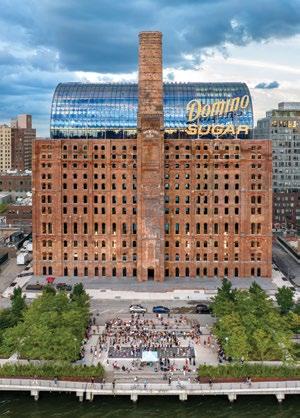
Above
The Domino Sugar Factory, Brooklyn was converted into a contemporary office building by PAU, completed 2023.
Below
Concept sketch of adaptive reuse of the existing structure at the Domino Sugar Factory.
Chakrabarti says. “And so of course they’re not at the adult table influencing policy. We can’t relegate ourselves to the kiddie table by talking about irrelevant things and then complaining about the chicken nuggets. I think we are at a moment where it is really important for people who understand the physical world to sit down and be able to speak the language of government.”
Much like the musicians he clearly admires (the book is chock-full of references to David Bowie, the Talking Heads, and the like), Chakrabarti is keen to communicate that he is not an elitist, that he will break bread with the people, that he wants to create real connections where desire lines meet—while still being slightly fabulous in the process. Towing an Airstream trailer around the country behind a hybrid SUV, his message is one that means to acknowledge complexity and contradiction, while turning design into a unitary force. Whether or not he is entirely successful, it must be said that this book is coming out at a particularly opportune moment.
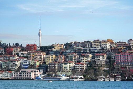
The evolution of cities reflects cycles of transformation, etched into their silhouettes. Istanbul’s skyline is a vivid narrative shaped by centuries of history, culture, and innovation. From ancient landmarks to modern skyscrapers, it tells a story of resilience, adaptation, and reinvention.
Le Corbusier’s 1911 sketches of Istanbul captured the silhouette of the historic peninsula, where architecture harmonized with the undulating topography and surrounding seas. Iconic towers such as the Galata Tower, Beyazıt Tower, and Maiden’s Tower were essential communication points in their time. The Galata Tower, for example, was a fire watchtower before evolving into an observation platform, demonstrating Istanbul’s ability to repurpose architecture to meet shifting needs. These landmarks continue to define the city’s visual and cultural identity.
By the mid-20th century, Istanbul began expanding vertically to accommodate new demands. Television broadcasting in Türkiye emerged during the 1960s, with antenna towers erected in major cities. Istanbul’s first TRT tower was built in 1976 on Çamlıca Hill, providing television signals across the region. However, the rapid pace of technological change soon transformed the hill into a forest of
antenna towers, creating a chaotic visual landscape. To address this, the government consolidated the towers into a single structure: the Çamlıca Radio & TV Tower Standing 369 m tall, the tower is both a telecommunications hub and an architectural icon, symbolizing Istanbul’s forward momentum. Its innovative design responds to local topography and wind patterns, creating a dynamic structure that shifts in appearance depending on the viewer’s perspective. Beyond its functional role, the tower offers breathtaking views of the city’s unique geography, where Europe and Asia converge. The tower reflects Istanbul’s capacity to integrate history with innovation.
Today, Istanbul continues to grow as Türkiye’s tallest city, with over 270 high-rises concentrated in districts like Gayrettepe-Maslak and Atasehir. These new structures accommodate a rapidly expanding population of 16 million—20% of Türkiye’s total—and affirm the city’s status as an economic powerhouse. The Istanbul Finance Center, nearing completion, promises to further reshape the skyline, but this rapid urbanization also presents critical challenges.
Managing density while maintaining quality of life has become a central issue for Istanbul.
Above— A photograph from 2021 looking over the sea coast of Istanbul to the Çamlıca Tower, designed by the author’s architectural practice.
Its self-organizing systems, born out of necessity, highlight the ingenuity of its residents in overcoming infrastructure gaps. However, grassroots solutions alone cannot address the complexities of modern urban growth. Proactive urban planning, guided by sustainability and inclusivity, is essential to ensure Istanbul’s transformation benefits all its residents.
The city’s skyline tells the story of its journey through time. Historic towers stand alongside futuristic high-rises. This interplay of old and new is central to Istanbul’s identity as a city where tradition and innovation coexist, shaping a vibrant and dynamic urban environment. Istanbul’s skyline, shaped by centuries of ingenuity and adaptation, offers lessons to other cities in balancing history with progress, growth with sustainability, and density with livability.
Settled: 7th century BCE Area: 2,576.85 km2
Population: 15,655,924
Urban density: 5,939/km2
In Istanbul, architecture is more than just a backdrop—it is an active participant in the city’s story. Each structure, from the Galata Tower to the Çamlıca Tower, is a testament to the resilience and creativity that define this metropolis. As Istanbul continues to evolve, its skyline will undoubtedly remain a powerful symbol of its enduring spirit and limitless potential.


6-9 October, 2025
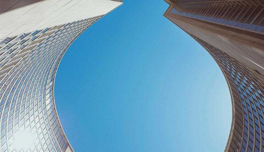

Join us in Toronto for the CTBUH 2025 International Conference, From the Ground Up: Tall Buildings and City-Making , and investigate and address the diverse strategies required to shape and transform the cities of tomorrow. With a focus on harmonious urban development, this energizing event will explore the improvement of tall buildings, efficient transportation systems, and the social and cultural networks that connect people, businesses, and communities—defining a city’s character for today and into the future. Learn more at: 2025.ctbuhconference.com .
Abstract submission deadline: 21 February, 2025
To sponsor or exhibit at the event, please contact CTBUH Business Development Director Jen Hall: jhall@ctbuh.org

PLATINUM
ABB
AECOM
AGC Glass Europe
Aliaxis
Arup
Buro Happold
GOLD +
CTBUH is extremely grateful for the generous support of its membership FULL MEMBERSHIP
China State Construction Engineering Corporation
DeSimone Consulting Engineering
Dow
HOK, Inc.
Illinois Institute of Technology
IUAV University of Venice
Jeddah Economic Company
Kohn Pedersen Fox Associates
KONE Corporation
Langan
Moshe Zur Architects and Town Planners
Multiplex Construction Europe Ltd
NEOM
Otis Elevator Company
PERI
Qingdao Conson Hai
Tian Center of China
RFR Asia Limited
RWDI
Samsung C&T Corporation
Schindler
Shanghai SIIC North Bund New Landmark
Construction and Development Co., Ltd
Shanghai Tower
Construction & Development
Shenzhen Parkland Real Estate Development Co., Ltd
SHoP Architects
Siderise
Skidmore, Owings & Merrill
Sun Hung Kai Properties Limited
Taipei Financial Center Corporation
Thornton Tomasetti, Inc.
TK Elevator GmbH
Tongji University
Turner & Townsend alinea
Turner International LLC
WSP
—Dar
—Gensler
—KLCC (Holdings)
Sdn Bhd
—Pelli Clarke & Partners
—Tishman Speyer
GOLD
Adrian Smith + Gordon
Gill Architecture
Aedas
Aqualand
Arcadis/IBI Group
Aspect Studios
Aurecon Pty Ltd
Beca
Brandston Partnership, Inc.
chapmanbdsp
CityGroup Design
Collective CO., LTD
Corgan
DCI Engineers
Drees und Sommer SE
E.Rogovin Ltd.
East China Architectural
Design & Research Institute (ECADI)
Emaar Properties, PJSC
Fujitec FXCollaborative
Architects
gad GCL Builds
Giarratana, LLC
Goettsch Partners
GVA Lighting
Hongkong Land
IMEG Corp
Leviat GmbH
Magnusson Klemencic
Associates
McNamara ? Salvia
Motioneering, Inc.
Mott MacDonald
NORR Group
Consultants International Limited
Nucor Corporation
PDW Architects
Perkins & Will
Permasteelisa Group
Pickard Chilton
Architects, Inc.
Ping An Real Estate Co Ltd
PNB Merdeka Ventures
Sdn. Berhad (PMVSB)
Quan Dat Trading & Production Co., Ltd
Ramboll
Rider Levett Bucknall
Rise Global LLC
S+B Gruppe AG
Severud Associates
Consulting Engineers, PC
Shanghai Institute of Architectural Design & Research (Co., Ltd.)
Simpson Strong-Tie
Think Wood
Tide Construction
Tongji Architectural
Design (Group) Co., Ltd.
Windtech Consultants
Zaha Hadid Architects
There are an additional 570 members of the Council at the Silver and Non-Profit/Governmental levels. Please see online for the full member list: members.CTBUH.org.