This thesis aims to address the ongoing issues impacting vulnerable communities, specifically in Sylhet, Bangladesh as a result of the global climate crisis.
Bangladesh’s extreme vulnerability to climate change are due to its lowlying topography, and funnelshaped coast, exposing the land to cyclones and tidal surges, resulting in seasonal floods.
These factors, alongside the large population base, widespread poverty and lack of strong institutional development make the country particularly vulnerable to climate variability.
The proposal seeks to present a viable prototype that can be adapted and applied across diverse settings experiencing comparable environmental challenges brought about by the ongoing climate crisis. The intent is to offer a scalable solution that
supports climate resilience and informed evidence-based planning.
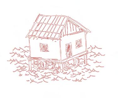
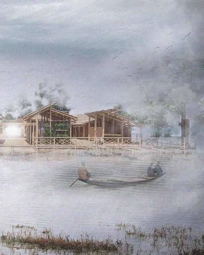
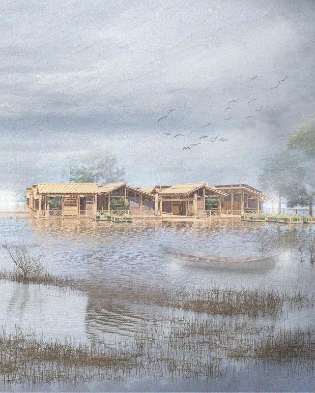
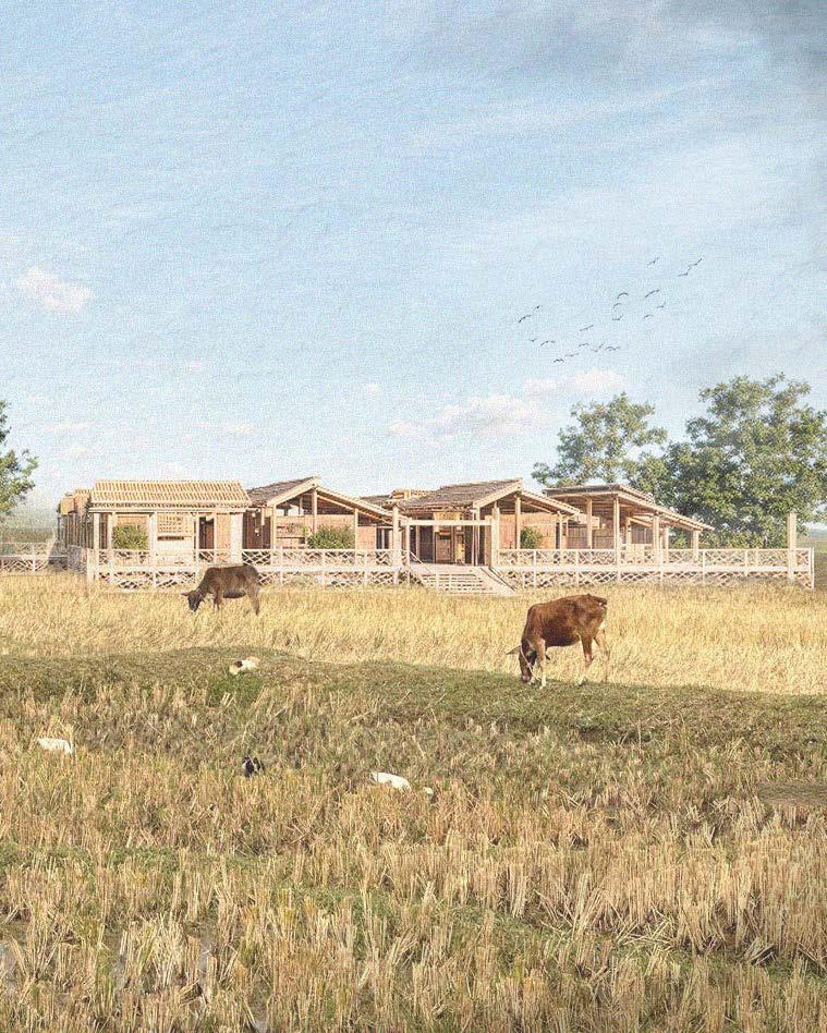
The amphibious housing prototype is strategically located in Sylhet, Bangladesh, a city that has been devastated by extreme weather conditions for decades. As such, the design process thoughtfully incorporates local culture as well as economic and social considerations.
This thesis aims to propose a contextually grounded solution based in Sylhet, Bangladesh. With the intention of demonstrating that, with appropriate adaptations to design and managerial strategies as well as material considerations that may be better suited, the amphibious housing system holds the potential for broader application in supporting climate-vulnerable communities worldwide.
Preface
My Sincerest Gratitude
The following pages contain the results of my graduation research as a part of the Global Housing Studio.
As I take this moment to look back on this year, I reflect on this incredible journey, filled with experiences, lessons and most importantly personal development both as a person and a designer.
As I begin to wrap up my last project of my educational career, I would like to
extend my sincerest gratitude to my family, friends and mentors for their continued guidance and support.
To Nelson Mota, Ludovica Cassina, Marina Tabassum and Antonio Paoletti, thank you for continuing to support, guide and challenge me throughout this experience.
To the professors and students of SUST university, thank you for sharing a part of your country with us.
“Recognizing the need is the primary condition for design” - Charles Eames
Table of Contents
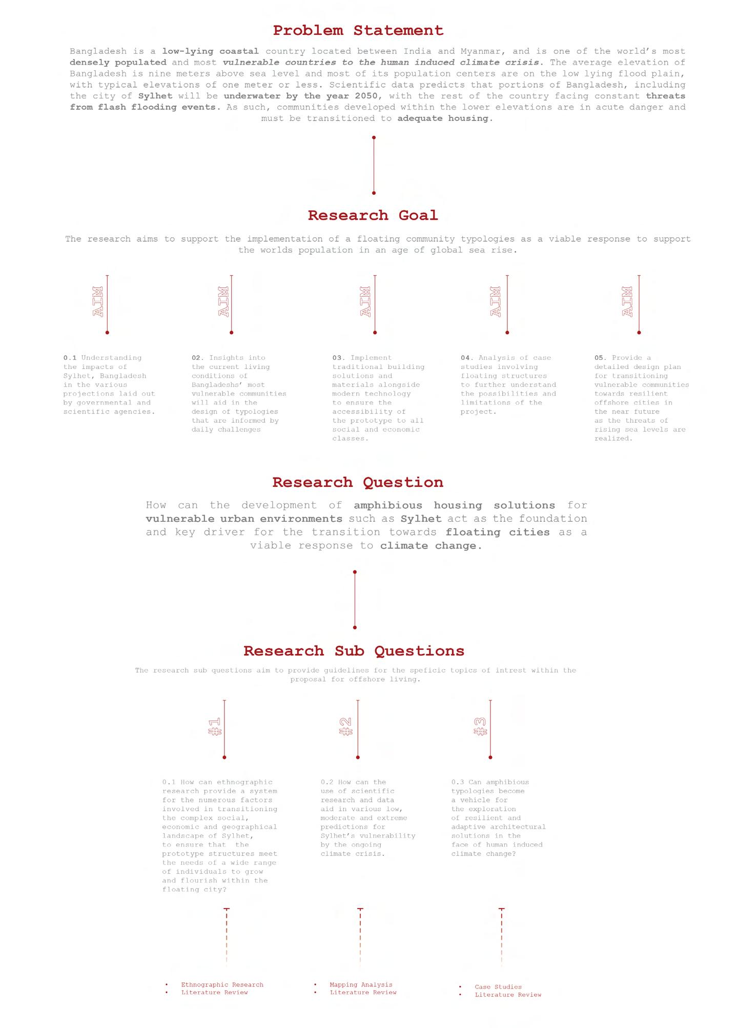
01 Research Plan
a. Introduction
b. Problem Statement
c. Research Questions
d. Methedology and Methods
02 Research
a. Comparative Analysis
b. Contextual Analysis
c. Ethnographic Research
03 Design Proposal
a. Design Approach and Context
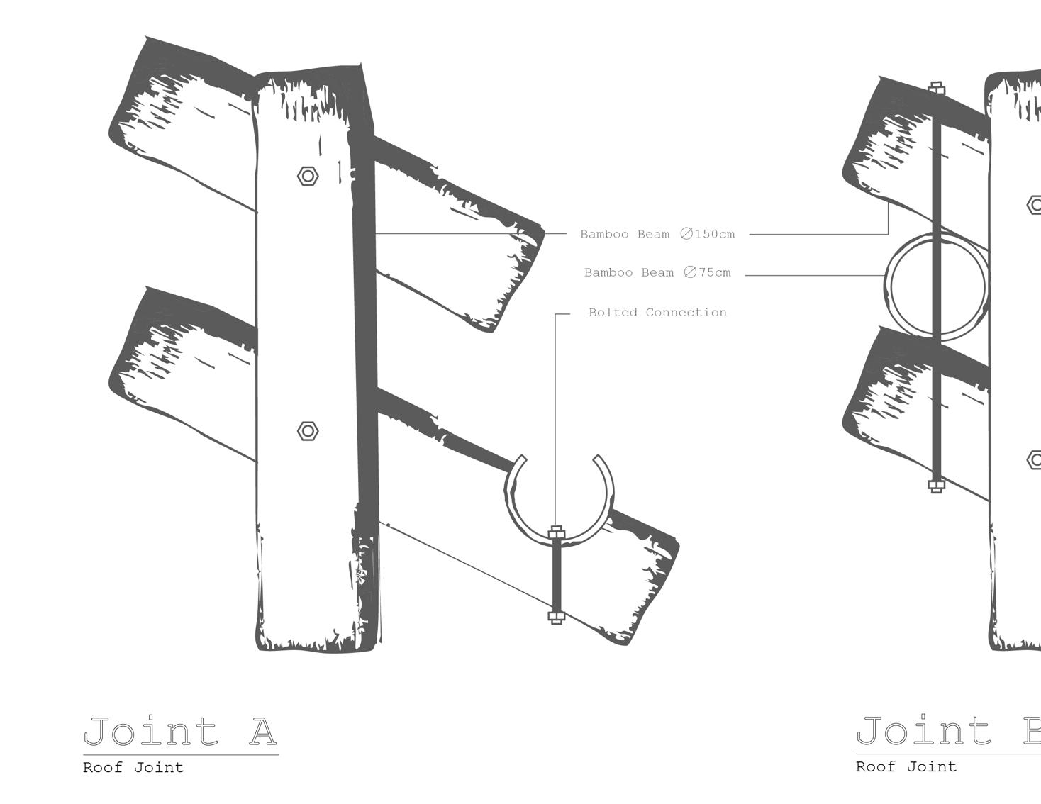
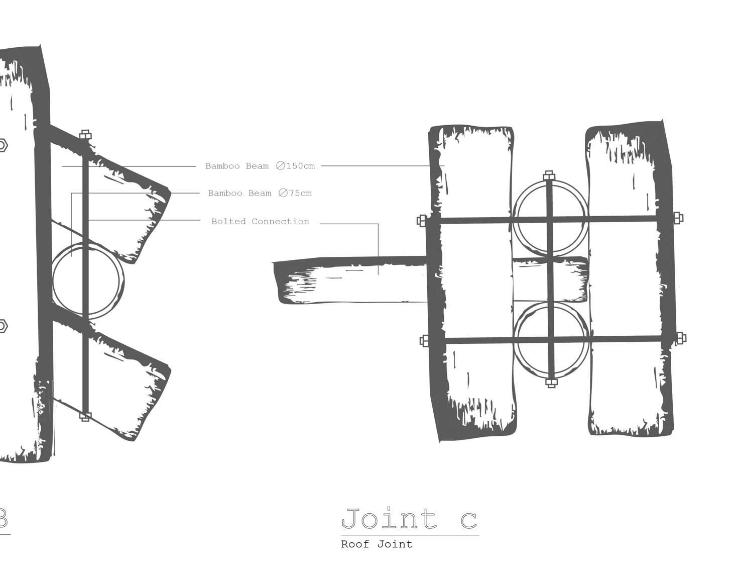
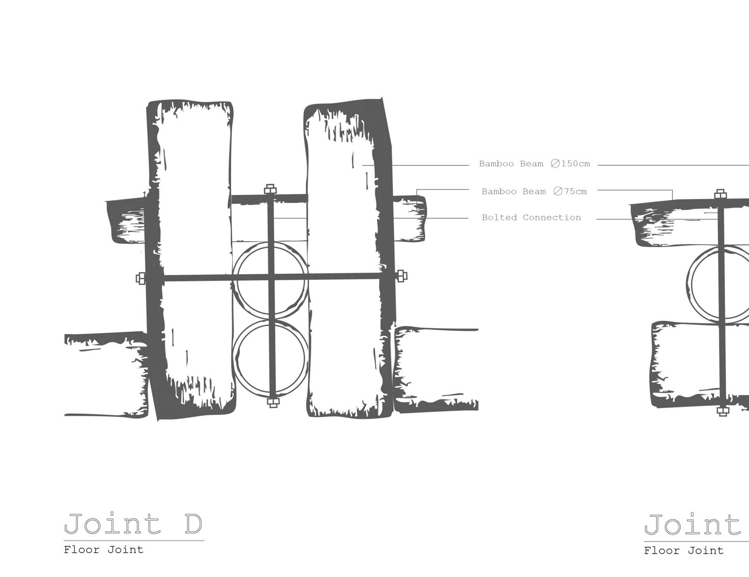
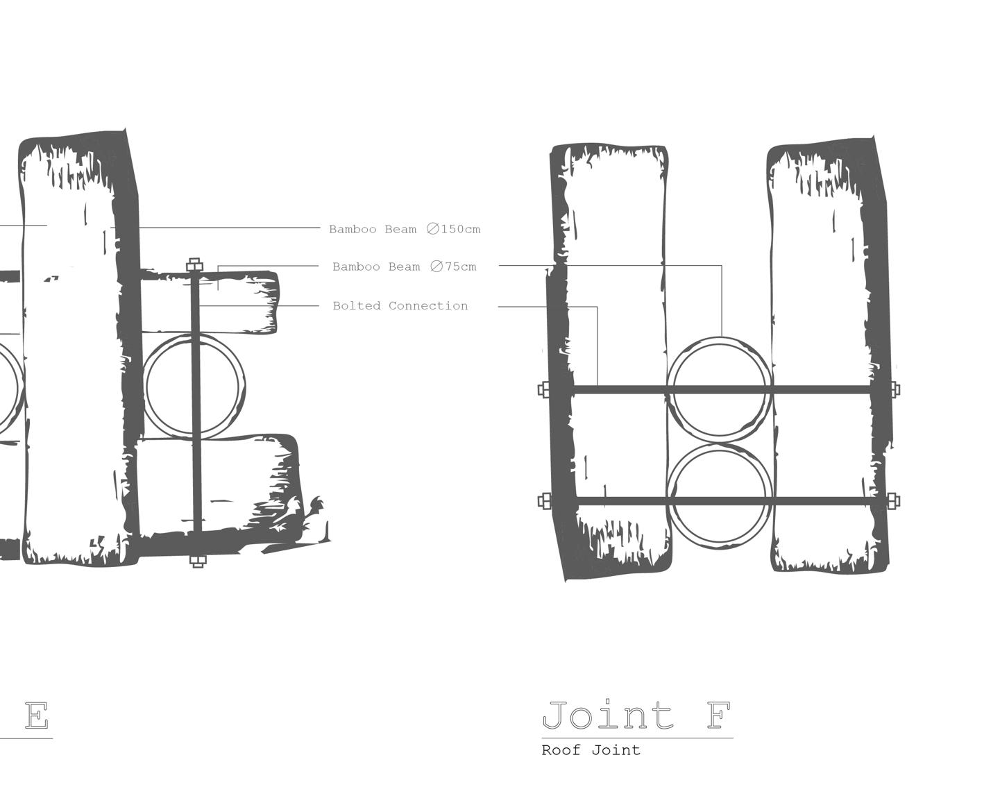
b. Architecture
1. Raft Level 2. Dwelling Level
3. Site Level 4. Small Interventions 04 Project Feasability
a. Managerial Framework
Stakeholders 2. Development 3. Land Acquisition 4. Materiality
Cost Analysis
Physical Model
Reflection
Bibliography
How can the development solutions for vulnerable such as Sylhet act as driver for the transition cities cities as a viable response
of
amphibious
housing
vulnerable urban environments as the foundation and key transition towards floating response to climate change
01 Research Plan
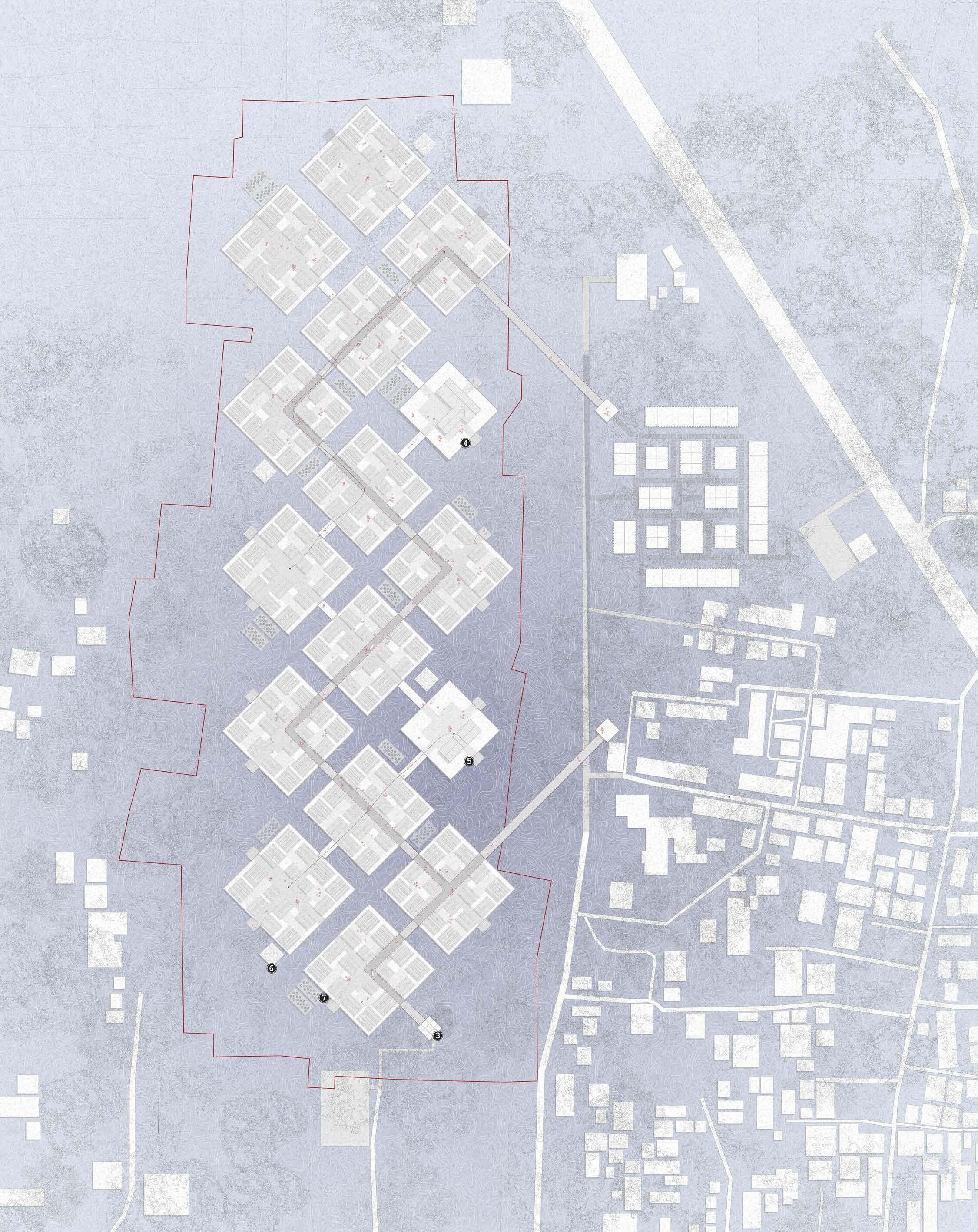
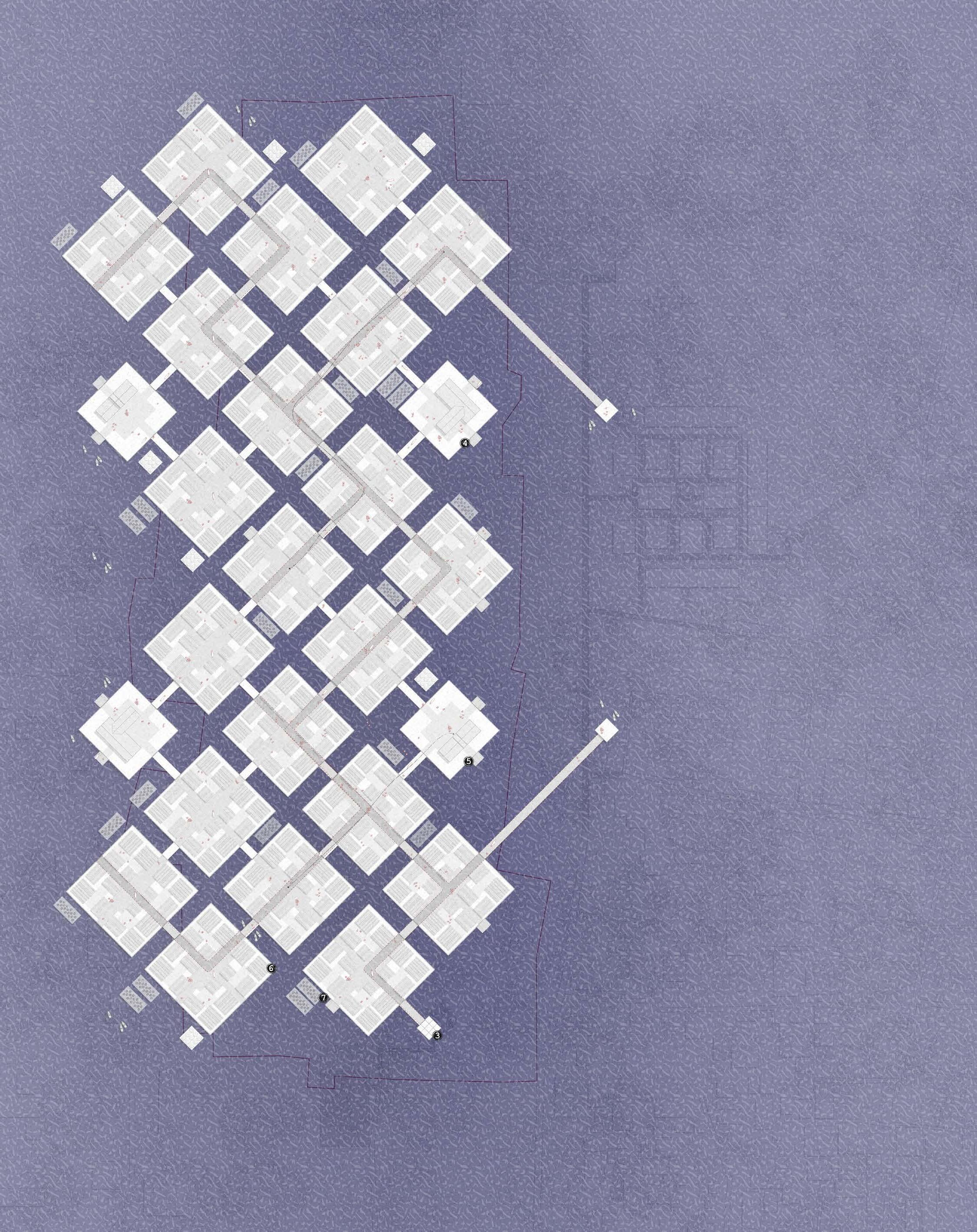
Basis for Design Development
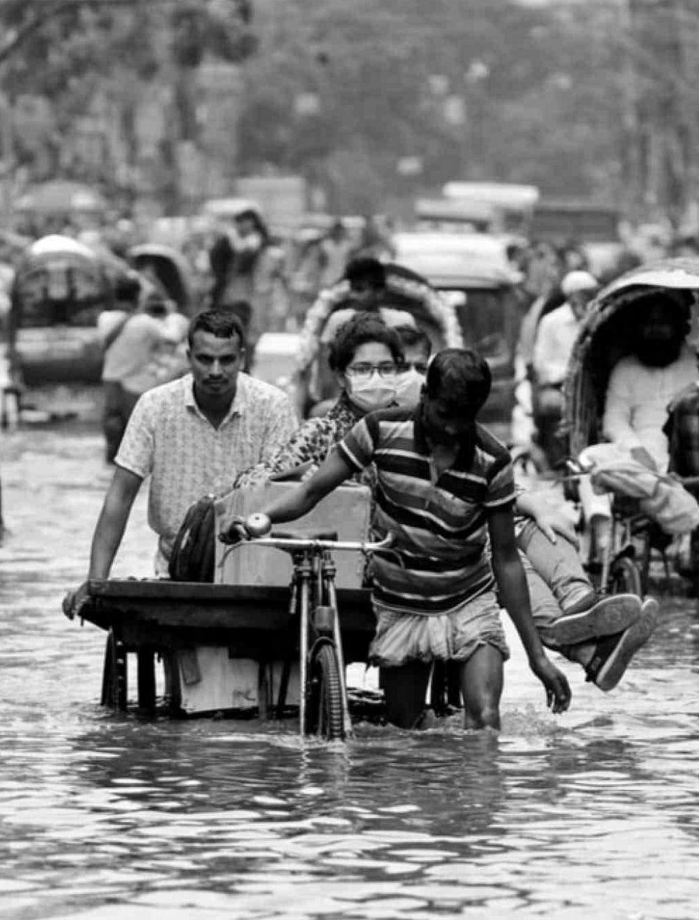
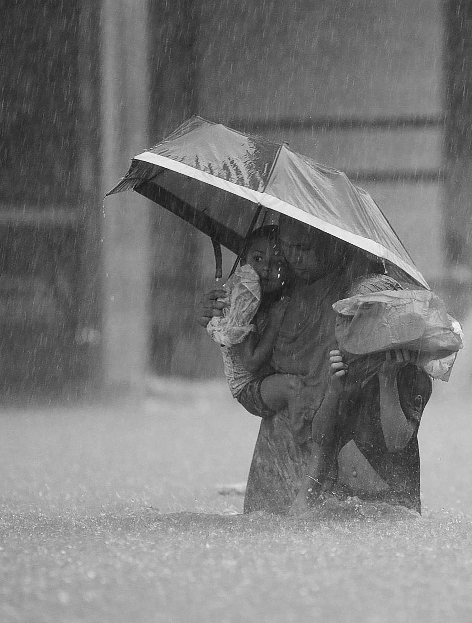
The plan presented below seeks to illustrate the core intent of the proposal and its relevance for vulnerable communities across Bangladesh. The accompanying research focuses on the historical, current, and projected threats facing the country as a result of the ongoing climate crisis
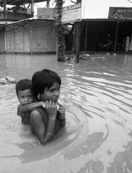
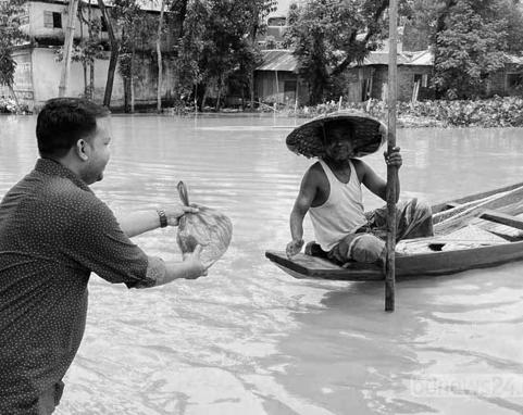
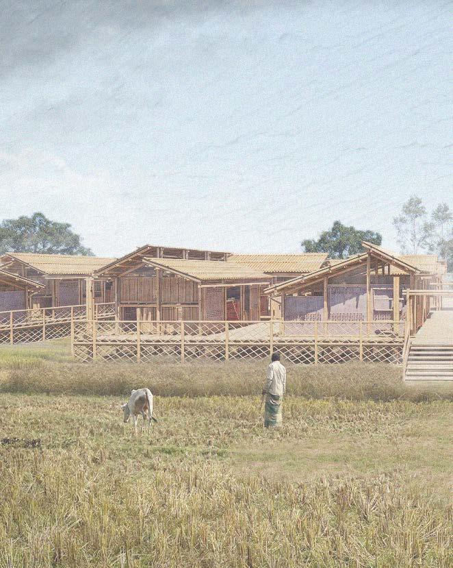
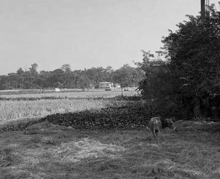
Fig. 1 - Aftermath of Flash Floods in Bangladesh
General Problem
The implications of rising tides
The term climate change refers to a long-term shift in global or regional climate patterns, and is now usually specifically associated with the rise in global temperatures from the mid-20th century to present, due in large part to the massive increase in human industrial activity over that time. (For further information regarding the global impact of human induced climate change, refer to the appendix section of the research document.)
Our planet continues to warm up rapidly, resulting in historic droughts, deadly floods, landscape-altering wildfires and unusual weather events around the globe. It is inherently also causing steady sea level rise, which scientists believe is rapidly approaching a tipping point, meaning that the sea levels will continue to rise, even if we were to immediately decrease greenhouse gas emissions.
Bangladesh, China, India and the Netherlands were the four countries singled out as being at high risk due to rising sea levels by the United Nations, however this is a global issue, with nearly 900 million people, one in every ten people on earth, living in low-lying coastal areas and in acute danger. Major cities on every continent are at risk, including Bangkok, Lagos, London, Mumbai, New York and Shanghai.1
Bangladesh is at the epicenter of the global climate crisis, with 80% of the country being a floodplain, constantly affected by floods, storms, riverbank erosions, cyclones and droughts. Although the Bangladeshi population is no stranger to flooding, as it ordinarily takes place every year during monsoon seasons, the current rainfall patterns are becoming erratic, with rainfall fluctuating across the year. The country has become susceptible to flash floods occurring more frequently and ferociously
1 (Masterson et al.)
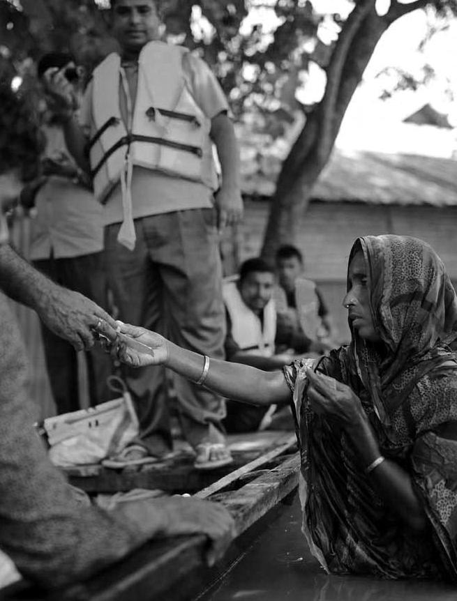
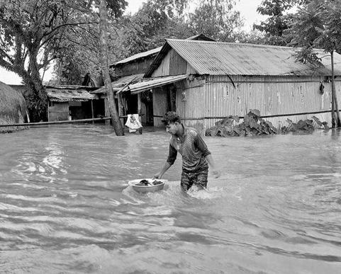
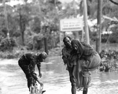
than ever in recorded history. Figure 1, depicts a young girl and boy attempting to navigate through the high water after the flash floods in the region o Bangladesh.2
Bangladesh is a low-lying coastal country located between India and Myanmar, and is one of the world’s most densely populated countries. The average elevation of Bangladesh is nine meters above sea level and most of its population centers are on the low lying flood plain, with typical elevations of one meter or less. The population of Bangladesh has grown to approximately 170 million people with the low-lying, flat and fertile land of Bangladeshi’s coastline creating the ideal environment for urban development and the agricultural base to support the population. As such, newer communities continue to develop at these lower elevations, placing millions at risk.
The country of Bangladesh is defined by its rivers, having an elaborate network made up of 230 rivers and a land area that at certain points barely rises above sea level. Its people live on the rivers and waterways, relying on them for the agricultural and industrial sectors, as well as for domestic use.
However, what was once the lifeline of the Bangladeshi people may lead to the country’s ultimate demise as severe flooding and the rising sea levels will overwhelm the country. With the low elevations of a majority of the country, the WorldBank Institute estimates that 3.5 million Bangladeshis will be displaced each year due to flooding and the UN estimates that by 2050 about 20% of Bangladesh will be underwater due to rising sea levels, with a loss of 30% of the country’s agricultural land and 19.9 million Bangladeshi’s being permanently displaced.3
Specific Problem
6,000 marooned in Sylhet as new areas go under water
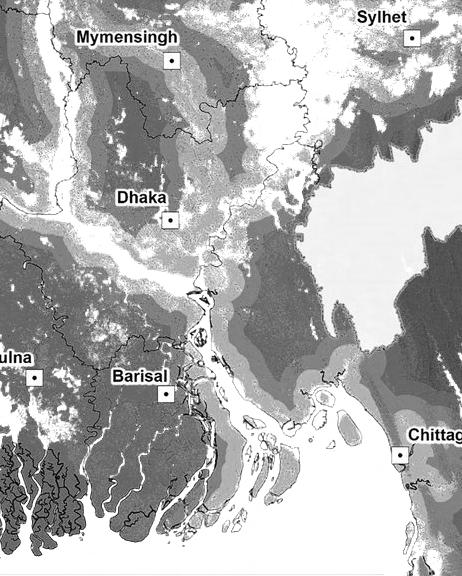
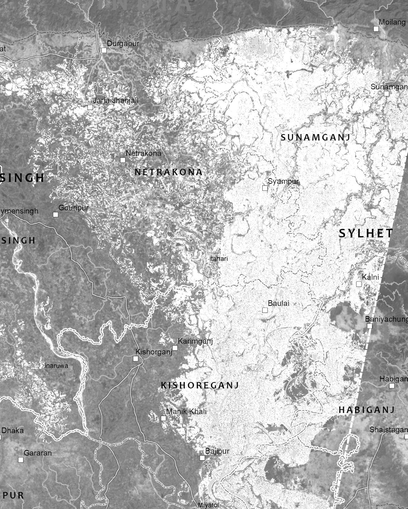
In the north-eastern part of the country, the city of Sylhet was established in 1867 and is known to many as the spiritual capital of the country of Bangladesh. The city is located near the Haor Basin, a large saucer-shaped floodplain with an area of around 113km2 undergoing persistent subsidence as the rivers erode the fertile soil. The city has sunk in some areas by 12m over the past 200 years, and continues to sink today. The city today is a large, metropolitan environment with a population of almost one million people. The population continues to increase at a rate of 3.64% per year, resulting in large groups of people in sub-standard housing and in acute danger during the monsoon floods due to their settlement in low-lying areas of the city.4
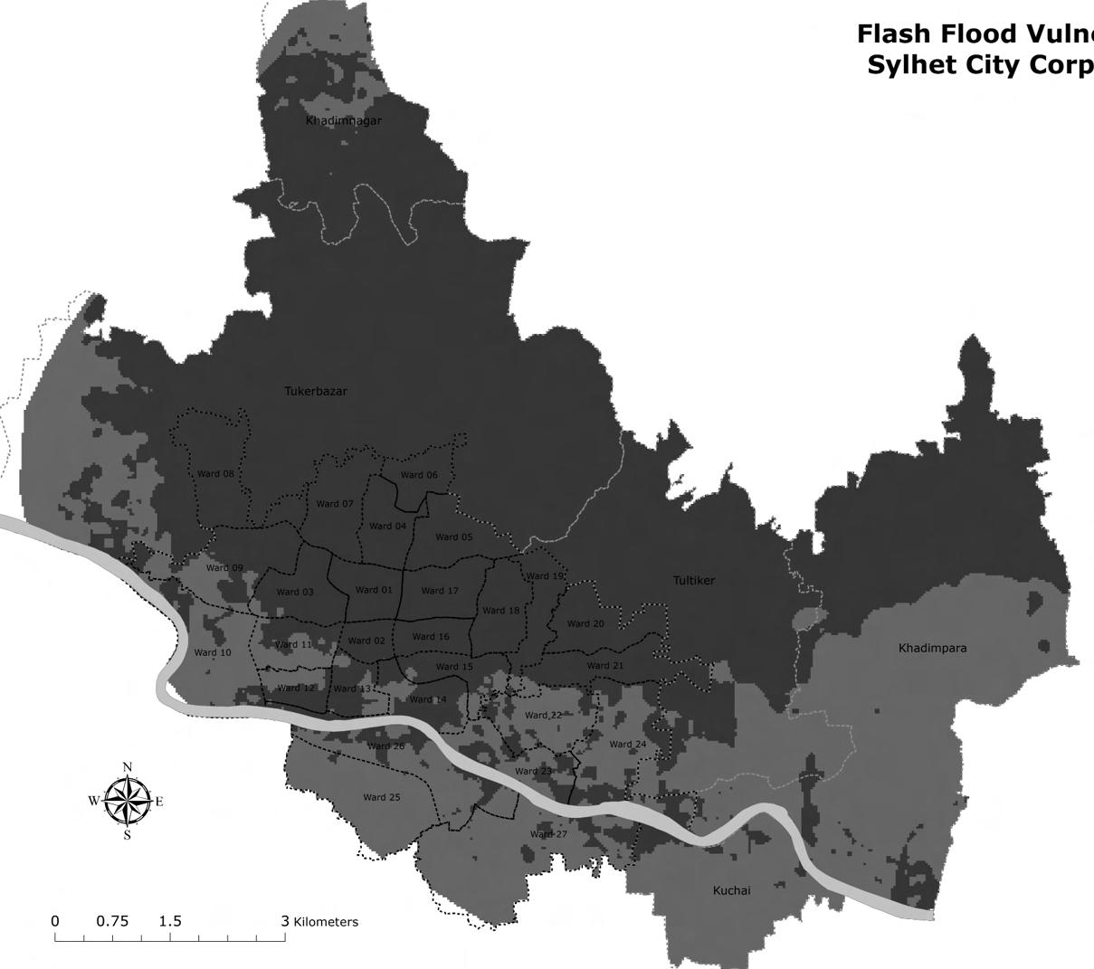
Like many cities within Bangladesh, the city of Sylhet stands out as a climate change hot spot due to its unique geography, high population density as well as its limited capacity for adaptation. Sylhet is no stranger to monsoons, with its four month long annual season providing ample rain to naturally irrigate crop fields and replenish its ground water supply. In more recent years, the effects of climate change have been felt in the disruption of this natural pattern, with severe droughts followed by frequent extreme events of rain and flash floods, destroying property and crops in
4 (Akter,
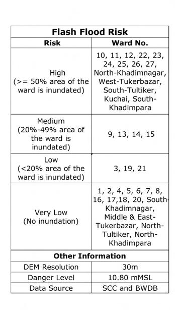
its wake (Figure 2 depicts the elevation of Sylhets varied regions depicting the specified areas risk of flash flooding. The risk assesment examines each wards risk based on the percentage of the ward area that will be inundated during heavy flooding).
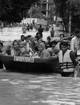
In 2020, Sylhet faced flash flooding that directly affected thousands, with thousands more still recovering from the longer term impacts.The unforgiving disaster swept away homes, belongings and livelihoods, with over a quarter of the country flooded during that monsoon season. According to the Flood Forecasting and Warning center, approximately 84% of Sylhet districts were submerged during the floods, forcing the population to flee their homes in search of dry land. The flash floods left 482,000 people displaced and 83,394 acres of cropland damaged and 135,770 homes destroyed in the region of Sylhet. 5
As of 2024, several efforts to mitigate the flooding in Sylhet have been discussed by the Ministry of Water Resources. This includes improving early flood warning systems as well as constructing a 15 km dike along both sides of the Surma river. As Sylhet continues to tackle the tragedies associated with flash floods, resources must be allocated to the continuing research of innovative and resilient solutions.6
Fig. 2 - Assessment of flood vulnerability in Sylhet.
1. Cultural, traditional and societal landscape of Sylhet, Bangladesh
2. Understanding the possibilities and limitations of floating architecture
How can the development of amphibious housing solutions for vulnerable urban environments such as Sylhet act as the foundation and key driver for the transition towards floating cities as a viable response to climate change.
3. What are the implications of climate change on the region of Bangladesh
Research Question
A shift towards floating cities
With the number of people displaced as a result of climate change climbing to 40.5 million by 2050, the United Nations predicts 19 million will originate from Bangladesh due to the extreme low elevation of the major population centers in the country. The threat posed to vulnerable populations requires innovative solutions, otherwise mass migration from low lying areas could overwhelm the infrastructure of higher altitude areas. The concept of amphibious living could provide such a solution.
How can the development of amphibious housing solutions for vulnerable urban environments such as Sylhet act as the foundation and key driver for the transition towards floating cities as a viable response to climate change.
The research question can be broken up into three main sub questions.
0.1 How can ethnographic research provide a system for the numerous factors involved in transitioning the complex social, economic and geographical landscape of Sylhet, to ensure that the prototype structures meet the needs of a wide range of individuals to grow and flourish within the floating city?
The research hopes to provide a basis for the design of amphibious floating typologies that directly serve the needs of Sylhet’s most vulnerable communities. As such, the research will explore the cultural and societal systems of Bangladesh to ensure the appropriate programmatic elements exist within the project. The process also aims for a sense of intersectionality to be realized during the development of the floating prototype. The aim of the research is to ensure accessibility to and inclusion of all of the diverse communities, through the use of community involvement throughout the building process. Subsequently, learning about the traditional building methodologies of Bangladesh, will respect the cultural and societal beliefs and ideals of the communities, while also reducing costs and ensuring the skill base to construct the prototypes is locally available. This will be augmented with modern technological advances to ensure the viability and resilience of the housing structures and that
they can be seamlessly incorporated into any future floating city.
0.2 How can the use of scientific research and data aid in various low, moderate and extreme predictions for Sylhet’s vulnerability by the ongoing climate crisis?
Three main subgroups of climate change will be analyzed, with the overarching research looking into the predictions associated with the rise in sea levels, as well as the disruption of weather patterns and flooding as points of interest. The analysis will map three specific situations for the given site - mild, moderate and extreme climate change threats. The aim of the research is to further understand which communities are at higher risk of the implications associated with climate change, as well as what properties the dwellings will require to manage the progressive challenges and threats that the scenarios present.
0.3 Can amphibious typologies become a vehicle for the exploration of resilient and adaptive architectural solutions in the face of human induced climate change?
The core aim of the project is to identify housing solutions that are able to respond to the current need for resilient housing for vulnerable communities while also preparing them for the future of climate change. The amphibious housing solution will host properties that enable it to provide shelter and immediate support during flooding as well as provide resources for the home to be self sufficient in case of emergencies when response and support are unable to reach them. The aim is that this housing design can be seamlessly transitioned towards a permanently floating condition, with the appropriate programmatic elements needed for the shift, as our society will most likely not be able to reduce the warming of the Earth’s surface, meaning that a plan to address a 5-10m rise in sea levels becomes a necessary component of any planned solution.
Hypothesis
Floating Typologies
Is the implimentation of a floating community typology a viable response to support the worlds population in an age of global sea rise ?
The chapter will discuss the hypotheses derived from the overarching question,which was in turn developed in regards to the viability of floating communities in mitigating climate change.
0.1 Floating cities will provide a viable response in the mitigation of several current and future environmental issues.
The floating typology will provide the vulnerable communities of Sylhet with infrastructure to withstand the current flash floods caused by irregular weather patterns, providing climate resilient refuge. The prototype will ensure its ability to withstand flash floods while providing water/energy/ sewage storage to allow the occupants to self sustain themselves during scarcity and unreliability of city resources. The prototype will in turn be designed to continuously adapt, with its ability to permanently float and sustain itself once the threats of rising sea levels cause coastal land to begin disappearing.
02. Floating cities will provide adequate space for farming, to provide solutions for the threatened agricultural sector.
The floating structure will provide adequate space for farming as a formal program, in order for the occupants to have the opportunity to sustain themselves without relying on the threatened resources of the urban community.
Goals/Aim
Combating rising sea levels
03. Floating cities will ensure their accessibility to all economic, cultural and social classes.
A series of steps will be followed through out the research, design and execution of the project to ensure its viability within all vulnerable urban environments with differing social and economic classes.
04. Offshore cities will provide opportunities for renewable resources.
The use of renewable resources is essential in the final metamorphosis stage of the prototype approaching 2050, as the resources provided by the urban city will be threatened by rising sea levels.
05. Offshore cities will ensure their reliance and viability for self sustenance during flooding when resources are scarce and unavailable. As well as aid in the preparation towards threats posed by rising sea levels.
The main goal of the housing typology is to ensure the protection of the communities at their current state of frequent flash flood while preparing them for the reality of rising sea levels due to be experienced by 2050.
The transition towards floating cities aims to provide a viable response for the vulnerable communities of Sylhet in combating human induced climate change.
To achieve the goal the research aims to respond to the following -
0.1 Understand the impacts of climate change Sylhet, Bangladesh in the various projections laid out by governmental and scientific agencies.
02. Gain insights into the current living conditions of Bangladesh’s most vulnerable communities will aid in the design of typologies that are informed by daily challenges.
03. Implement traditional building solutions and materials alongside modern technology to ensure the accessibility of the prototype to all social and
economic classes.
04. Analyse of case studies involving floating structures to further understand the possibilities and limitations of the project.
05. Provide a detailed design plan for transitioning vulnerable communities towards resilient offshore cities in the near future as the threats of rising sea levels are realized.
The research aims to provide viable solutions to combating and mitigating the impact of global climate change to threatened urban environments such as Sylhet. The research seeks to understand and analyze several pieces of information vital to the viability of the design and execution of floating cities.
Several forms of analysis will be conducted to reach a thorough and comprehensive analysis of the topic at hand.
01. Data Collection
This phase of the research will primarily be conducted during the planned excursion to Dhaka and Sylhet by incorporating several methods.
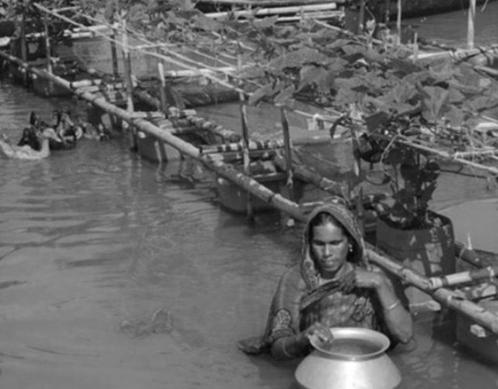
• A conversation with individuals from a range of age groups will be initiated, in hopes of understanding their current housing needs. Residents will be asked to describe the successes and shortcomings with their current housing situations as well as what can be modified to improve their quality of life.
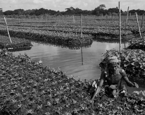
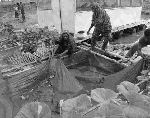
• A conversation with individuals who identify themselves as farmers or fisherman will be initiated,in hopes of understanding their current situations and techniques in terms of protecting their crops and livestock during flooding. This is essential to the planning and designing process to ensure the ability to create and self maintain the inhabitants of the floating city.
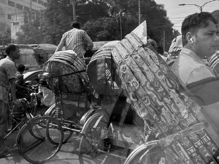
• A photographic report will be created in order to document and present the current housing provided to the residents of Sylhet. As well as conduct photographic research on the impacts of and disruption caused by the heavy rainfall.
• A mapping exercise will be conducted in order to visualize the changes in Bangladesh’s landscape through out its existence, for further understanding of the changes that have occurred over time.
• Mapping tools will be used for predictions of the percentage of Bangladesh that will be underwater by 2050 in three different scenarios - mild, moderate and extreme rising sea levels.
02. Literature Reviews
Relevant literature will be reviewed to provide objective evidence for the basis of the design interventions. This will include analysis of a series of articles reports and interviews regarding global climate change and rising tides.
03. Case Studies
To assist with the design process, series of case studies of current and passed ideations of floating cities will be analysed to further understand their successes and shortcomings.
• Triton City Buckmister Fuller
• Vision for Tokyo Kenzo Tange
• Oceanix BIG and United Nations
• Floating Farm Goldsmith Company
• Maldives Floating City DutchDocklands
• Floating office William Alexander
04. Deconstruction Process
The process involves the envisioning of the ultimate outcome, this process allows for the meticulous charting of a path towards that goal. The process allows for the project’s capabilities and success metrics to be defined upfront, as such steering the development of the project with precision.
Theoretical Framework
A basis for design
A rapidly growing research field focusing on the relationship between climate change, vulnerability and human migration has been recognized by several academics and practitioners. In the past several decades various fields of study have paid close attention to the linkage and implications of climate change and human migration.7 The consensus within the research and analysis communities of climate centered migration was the idea that environmental migrants’ migrate due to the fact that their place of origin simply does not generate sufficient or desirable opportunities for survival and/or employment due to the damage it has undergone. The conversations surrounding environmental migration has since broadened, rather than simply focusing on one’s livelihood opportunities or lack thereof. The understanding of the consequences posed on communities with environmental degradation has greatly expanded, to include factors such as safety, human rights, quality of life, community as well as ones right to self preservation.
Although the discourse on environmental migration is limited due to the lack of precise data and strong scientific understanding of the concepts, causes, dimensions and implications, the aim of this research is to convey that the implications of climate change, specifically rising sea levels, will leave a large number of displaced migrants in its wake, and therefore provide sufficient evidence to support the transition of vulnerable communities, such as Sylhet, towards floating cities.
01. Climate Change
The research is set to provide a series of data, analyzing the potential impacts of climate change in the country of Bangladesh with a specific focus on the city of Sylhet. Generative maps will provide the necessary information required for the distinction to be made between Sylhet’s most vulnerable and susceptible communities towards the threats posed by the global
7 (Rana and Ilina)
climate crisis.
One of the resources that will aid in the data collection is by the organization Climate Central. This is an independent group of scientists and communicators whose research reports on the everchanging statistics of climate change and the impact on human lives. The use of science, data and technology allows for the generation of thousands of storylines, addressing issues such as climate science, sea level rise, extreme weather, energy and related topics.
The organization’s coastal risk screening tool was utilized to generate maps showcasing areas threatened by sea level rise and coastal flooding, through the combination of advanced global models of coastal elevations with the latest projections for future flood levels. Maps could be selected to showcase projections based on five risk categories - year, water level, temperature, warming choices as well as ice sheets. The generation of maps in relation to sea level rise has provided several beneficial visuals in response to the aim of this research. Mild, moderate as well as extreme scenarios allow for the visualization of which portions of Bangladesh will be below sea level by the year 2050 based on the factors assigned to the generative map. Although several international initiatives regarding the combating of climate change are currently taking place with the aim that the most extreme scenarios would not occur, it is vital to understand the full range of consequences of our actions and how they will in turn shape our future built environment.
02. Community Organization
Although the aim of transitioning vulnerable communities of Sylhet towards offshore living is mainly targeted as a response to the threats of rising sea levels, it also has the opportunity to provide adequate solutions to the current issues faced by Bangladeshi people on a daily basis, in hopes of improving their quality of life.
The process allows for the project’s capabilities and success metrics to be defined upfront, as such steering the development of the project with precision.
The transition towards floating cities Ultimate Outcome
A Floating City
•Possibilities and challenges of a floating structure
•Transition of vulnerable small scale city infrastructure
(The aim of the foating city is to provide viable solutions to the threats of rising sea levels leaving large portions of Bangladesh permanently underwater. As such small infrastructure
Resilient Solution for Rising Sea Levels
•Introduce farming pods
•Zero waste treatments
•Self-sustaining systems (Energy/Water/Wind/Sewage/Storage)
Most Vulnerable Urban Communities
•Shared Culture
• Accessibility of floating typology
Small Scale Resilience during states of Emergency Larger Scale Implementation
• Water/Sewage Storage
• Energy Production
(The aim of the small scale intervention is to provide the occupants basic programmatic functions during the first few weeks of flooding disasters when resources are scarce and unavailable.)
Immediate Solutions for Disrupted Weather Patterns
• Understand the cultural and social identity of Bangladesh
• Locally sourced recycable materials
• Local building techniques and carpentry
•Modular Design
• Floating Ideology
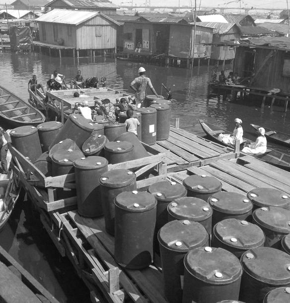
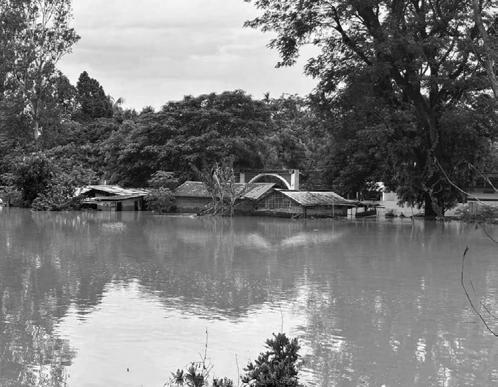
Fig 4 - Providing aid after flooding in Jamalpur
03. Housing Infrastructure
The aim of this research is to provide a basis for the need for floating dwelling typologies that will aid in mitigating the impacts of climate change onBangladesh’s urban settlements.
Several studies have examined various aspects of housing infrastructure within Bangladesh, all with diverse findings. As environmental displacement has become extreme in geographically and environmentally vulnerable areas in Bangladesh, Md. Arif Uddin Khan explains the implications on the increasing number of slum areas within Bangladesh. Displaced individuals migrate to slums due to multiple factors, but the research explains that the urban slums are mostly located in low-lying, environmentally hazardous areas that are themselves at risk. Coupled with inadequate facilities such as food, fresh water, sanitation, shelter and employment, the result is that this migration often results in a greater negative impact to their livelihoods.
Several other consequences are associated with the mass migration within Bangladesh, examined by Md. Faysal Ahmed during his research into the topic “Urbanization and Environmental Problem: An Empirical Study In Sylhet City, Bangladesh”. The cross sectional study aims to provide relevant information regarding the consequences of unplanned urbanization on Sylhet’s environment. Rapid expansion and urbanization of cities due to various factors including the climate crisis, have created social, economic, environmental and cultural issues. The research dives deeper on specific impacts of urbanization within Sylhet, including assessing the pressures placed on housing, employment, infrastructure as well as social services such as education, health and transportation systems.
The research has a stark conclusion: Bangladesh’s current infrastructure is not equipped to meet the economic, social or cultural needs of mass migrations.8
04 . Offshore Living
The architectural typology associated with floating infrastructure first emerged in the 1960’s, through several utopian projects. With the innovations and technological advancements of the 21st century as well as the need for solutions in response to rising sea levels, conversations associated with floating architecture have resurfaced. The analysis of several case studies ranging both in chronological and programmatic differentiations are vital to understanding the possibilities and limitations associated with such a typology.
Kenzo Tange’s 1960 Master Plan for Tokyo was aimed to address the challenges industrial cities faced due to urban sprawl. Several examinations have been published criticizing the proposal for a new physical order of Tokyo to support its growth and revitalization. An article published by Cambridge University examines the visionary urban scheme in terms of its mobility rather than its monumentality which is much discussed. The essay by Hyunjung Cho conveys that the unrealized offshore city was driven by the author’s firm belief in the perception that mobility was the underlying factor influencing the development of the post war Japanese economy,
8 (Ahmed, Md. Faysal & Islam, Md.)
accompanied by the strong ambition to provide proper urban infrastructure for the adequate circulation of traffic. The bold statement by Kenzo Tange in regards to his investigations of alternative urban forms launched his exploration of a series of visionary projects that culminated with the plan for Tokyo 1960. 9
Bijarke Ingels, in partnership with the United Nations, has produced a floating city concept, whose floodproof infrastructure rises with sea levels while producing its own food, energy and fresh water with a fully integrated zero water closed loop system. The city is modeled after the firm’s initial floating housing concepts that were realized in Poland, with each compartment housing 12 students. The project’s success has led to its implementation at a larger scale of 200 units in Gothenburg as well as conversations for the Paris Olympics to realize a floating village in the Seine as nomadic, inpermanent forms of architecture. The firm’s success with floating prototypes and designing architectures that combat rising sea levels has awarded them a large scale urban project in New York City which is also facing threats from rising sea levels. The firm’s success has ultimately led them to their ambitious collaboration with the United Nations for the project titled “ Oceanix City”, focused on the requirements of Busan, South Korea and aiming to assist in solving the sea level rise in the country. Complex changes are currently facing coastal cities, as such a prototype development that was approved in 2021 in an attempt to innovate breakthrough solutions to provide shelter for 10,000 inhabitants.
The prototype’s design is set to be approached through a hyper-local level according to its cofounders, to account for the rich social, economic, political and cultural uniqueness of its host country. Although the prototype is designed to hold the identity of South Korea, it plays a key role in understanding the possibilities and limitations of floating cities in the 21st century.10
Relevance
As the world’s population continues to grow, it begins to threaten the limits of essential global resources. A study published in 2018, conveyed the challenges humanity faces in terms of achieving a “high quality of life” for over seven billion people without destabilizing critical planetary processes.
Scientists concluded that the earth could sustain, at most, seven billion people, although achieving “high life satisfaction” for everyone would inevitably transgress the Earth’s biophysical boundaries, ultimately leading to ecological collapse.11 As essential resources are over consumed by human life, it is further accelerated by the human induced climate crisis, inevitably threatening all forms of life. Sustainable coastal urbanization can act as a generational opportunity to advance climate action, clean energy and environmental protection and revitalization.
As 9 of ten of the world’s largest cities are threatened by climate disruption, while also being responsible for over two thirds of all greenhouse gas emissions, the design of our future cities is a key factor to mitigating the impacts imposed on all forms of life. Floating cities may act as a viable response to some of the most pressing challenges of the future, promoting sustainability, adaptation to climate change, mitigating overpopulation and advancing building technologies, they have the potential to shape the future of our society.
0.1 Rising Sea Levels
According to the scientific magazine Nature Communications, at our current trajectory with regard to rising sea levels, 200 million people will live below sea level by the year 2100, with an additional 160 million impacted by higher annual flooding. 70% of the 200 million individuals directly affected by rising sea levels will reside within eight countries of Asia, with 32 million from Bangladesh. This will in turn trigger a mass displacement of climate refugees, both within countries and across borders.12
Our research into the climate crisis has brought forth several realities that our world must come to terms with regarding our changing environment. The United Nations Secretary General has warned that entire communities and countries will begin to disappear in the coming decades, as sea level rise continues to accelerate. With 900 million individuals currently residing within low-lying coastal cities, the development of floating architecture has inevitably become of great interest and research, as the demand for resilient and adaptive architectural solutions will continue to grow. The viability of offshore living will allow for communities to not only adapt to rising sea levels, to extreme weather conditions and flooding through the design of infrastructure that cannot be submerged and that can withstand raging flood waters. The transition towards floating cities represents a promising yet challenging frontier, as it can offer innovative solutions for harmonious living amidst the rising sea water levels.
0.2 0verpopulation -
Overpopulation is defined as an overabundance phenomenon in which a species’ population becomes larger than the carrying capacity of its environment. Approximately eight billion people make up the current population of the earth, with the United Nations suggesting the world population will grow to 9.7 billion by 2050. As the world’s population continues its upwards motion, the demand for resources such as land, fresh water and energy grows at an even greater pace. The exploitation and strain on the Earth’s resources has led to severe consequences such as deforestation, loss of biodiversity, increased carbon emissions with a direct connection to the leading effects of climate change and widespread habitat destruction, including of many of the coastal environments that in the past protected vulnerable inland agricultural lands. Managing the human population is one of the greatest challenges we continue to face as a society, as the pressures on the environment from continually expanding populations impact all areas of our world. The transition towards floating cities can act as a mitigator towards reducing the pressure on overcrowded metropolitan areas, in an aim to restore the balance between rural and urban environments.
0.3 Food Production
Scientists have concluded that if the production of food continues in the current trajectory, by the year 2050 society will face a shortage of land equivalent to the size of North America.13 The transition towards offshore cities and societies provides an opportunity to rebalance that shortage, with ample marine environments for food production, while assisting in the adaptation to intensifying climate impacts such as flooding, which decimates agricultural yield.
0.4 Renewable Resources
The prototype for floating living will ensure the self sustenance of the community which it serves. It is essential that sustainability is a key factor of the design approach as the community cannot rely on the existing infrastructure of the urban city as its fate from rising sea levels is not known. As such, floating living cities will require a certain level of renewable resources the cyclic consumption implemented to ensure its ability to sustain itself.
0.5 Affordability
A sense of intersectionality must be realized during the development of floating prototype. An approach that understands the inequalities surrounding different economic, social and cultural groups with an aim to consider them all. Floating living must ensure the accessibility and inclusivity of all diverse communities, through the use of community involvement throughout the building process.
11 (O’Neill et al.) 12 (Kulp and
Fig 5 - People gather to collect food aid after Bangladesh
Fig. 6 - Rescuers in orange life vests escort stranded people to higher ground in Bangladesh
Definitions
Floating cities
• Climate Change - changes in the earth’s weather, including changes in temperature, wind patterns and rainfall, especially the increase in the temperature of the earth’s atmosphere that is caused by the increase of particular gases, such as carbon dioxide
• Greenhouse Gas - any of the gases that are thought to cause the greenhouse effect, especially carbon dioxide
• Floodplain - an area of flat land next to a river that regularly floods when there is too much water in the river
• Monsoon - a period of heavy rain in summer in South Asia; the rain that falls during this period
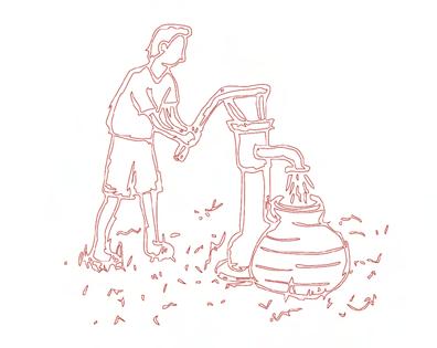
• Amphibious - able to live both on land and in water
• Prototype - the first design of something from which other forms are copied or developed
• Resilience - the ability of people or things to recover quickly after something unpleasant, such as shock, injury, etc
• Biodiversity - the existence of a large number of different kinds of animals and plants which make a balanced environment
• Flooding - large amounts of water covering an area that is usually dry; the fact of this happening
• Migration - the movement of large groups in response to changing environmental conditions
• Refugee - a person who has been forced to leave their country or home, because there is a war or for political, religious or social reasons
• Sea levels - the average height of the sea, used as the basis for measuring the height of all places on land
•
• Ice Sheets - a layer of ice that covers a large area of land for a long period of time
• Ethnographic - connected with the scientific description of different peoples and cultures, with their customs, habits and differences
• Overpopulation - the state of a population exceeding the capabilities of the environment to sustain it
• Inadequate - not enough; not good enough
Appendix
Background Information
While the Earth does have natural warming and cooling cycles, the current extreme warming is believed to be due to the impact of humans - a result of increasing industrialization and extreme damage to ecosystems caused by exploding human populations and migration towards cities and urban environments. These are often located on coastal or low-lying areas leaving large, mostly impoverished, populations extremely susceptible to the effects of climate change Pictured on the right Figure 7, depicts a family of three in search of refuge during a flash flood in the region of Bangladesh. According to scientists at the Intergovernmental Panel on Climate Change (IPCC), our world currently faces a critical tipping point towards unavoidable climate hazards over the next two decades, with expected global warming of 1.5C. The possibility of exceeding the IPCC warming level could result in even more severe irreversible impacts, posing risks to societies, including industry, agriculture, infrastructure and low-lying coastal settlements.14
The long-term change in weather patterns is already causing changes to the Earth’s local, regional and global climates. The changes observed have a broad range of effects including droughts, increased storm activity and severity, and even localized cooling in some areas as the interlocked global weather systems are disrupted. Human activities are estimated to have increased the Earth’s global average temperature, with the last four decades surpassing the average temperature increase on the Earth’s surface since 1850. There are several contributing factors, with the largest being the emission of greenhouse gases through the use of fossil fuels, such as gas,oil and coalthis is calculated to account for 90% of all carbon dioxide emissions and over 75% of all global greenhouse gas emissions.
The global climate system is an interlocking series of different systems that have a huge capacity to absorb and mitigate disruptions to the overall 14 (McGrath)
stability of the global climate, however as a result of humanity’s continued activities , the ability of these systems to compensate is almost exhausted. The rising of our sea’s levels is one of the most severe effects of the global climate crisis. Since 1880, the average sea levels have swelled over 23 cm, as our oceans continue to absorb 90% of all excess heat captured in the atmosphere by the increase in greenhouse gases. Every year, the sea rises by 3.2mm, with the rise accelerating and projected to reach 31cm by 2050.
The unparalleled toll taken on our oceans is linked to three primary factors which in turn are all induced by the ongoing global climate crisis. When water is heated it expands, approximately half of the sea-level rise in the past 25 years is attributable to warmer oceans simply occupying more space. As well as the persistently higher temperatures on the Earth’s surface leading to a greater than average summer, resulting in the melting of the globe’s frozen waters, specifically the Greenland and Antarctic ice sheets, but also of glaciers and tundra around the world. These sources are estimated to contain around 2% of the world’s water - should this all melt, the United States Geological Survey estimates that sea levels would rise 70 meters, submerging almost every major population center on the planet.
The continued warming of our earth has had devastating results on people’s health, lives and livelihoods. Our critical infrastructure, including energy and transportation systems, have been increasingly adversely affected by hazards from heatwaves, storms, drought and flooding as well as slowonset changes, such as sea level rise. Addressing this crisis will be humanity’s greatest challenge in the next 50 years.15 , 16
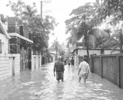
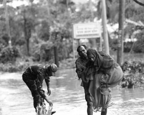
Fig 7 - People wade through the water as they look for shelter during a flood.
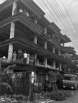
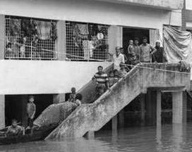
Fig 8 - People in Bangladesh are seeking shelter from flooding in buildings throughout the city
Apendix
Rising sea levels implications
There are several consequences associated with rising tides, having wide-reaching implications not just on our physical environments but on the economic, social and cultural fabrics of vulnerable nations across the world. The flooding by saltwater can cause irreversible damage on coastal habitats and poison freshwater aquifers, destroying agricultural land and disrupting fish populations, washing away critical infrastructure and industrial resources and displacing populations as their housing is destroyed and the environment becomes incapable of supporting them.
The impact rising tides plays amongst communities should also be considered from the financial and economic implications. Severe storms and flooding are already responsible for billions of dollars of annual damage and property loss. The continued rise will continue this trend and make recovery impossible as critical and immovable infrastructure around the world, such as sewage treatment plants, power stations as well as roadway infrastructure is at risk of permanent flooding.
Humanity has also made major changes to the coastal environments that naturally protect against the encroaching sea. The continued rising of sea levels will further exacerbate this by leading to an excess of beach erosion as well as the loss of coastal marshes. The natural existing shorelines offer communities protection from flooding and waves during storms, while also serving as a key habitat for several species. The threat of rising sea levels, also threatens the loss of these natural buffers.17
The flooding can also contaminate communities fresh water supplies, in turn promoting water borne diseases and threatening the physical and mental health of the affected population, while also contaminating viable farmland, as more salt compromises freshwater sources. The loss of large swaths of farmland have forced communities of people off land they occupied for generations.
These factors will ultimately cause the migration of whole populations of people from the 17 (United Nations)
affected low-lying regions. The potential refugee crisis that would occur would dwarf any previous migration and will have extreme ramifications on inland communities. Humanity has historically not reacted well when faced with mass migration events, and the potential for rich, coastal populations to move to lower income inland areas known as climate gentrification, would potentially be more disruptive than any previous migration event.
Other impacts of climate change reinforce and exacerbate the already extreme consequences of rising sea levels. The damage caused by heavy rainfall, which previously would have been classed as 500 or 1,000 year floods are now occurring 30% more frequently, impacting not only the coastal communities but also higher elevation cities that would be the potential refuges from the rising tides.18
18 (Merz, B., Blöschl, G., Vorogushyn, S.)
02 Research
Comparative Analysis
A curated selection of design interventions, drawn from a broad spectrum of projects, forms the basis of this study. Although the projects differ in their contextual and cultural frameworks, the interventions examined yield significant insights and propose viable solutions. Through comprehensive analysis, a collection of precedents was established, each of which played a direct role in shaping the final proposed design.
Case Studies
• The Buoyant Foundation Project, Nicaragua
• Makoko Floating School, Nigeria
• Floating house, Sunamganj District
• Post Tsunami Housing
• METI School
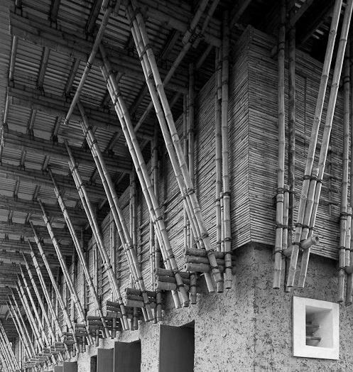
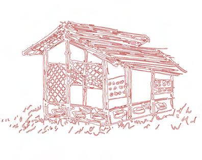
• Blooming Bamboo House
• Bangla Baton
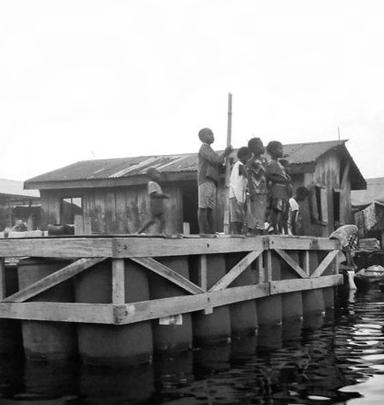
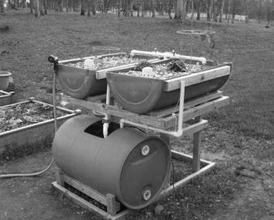
The Bouyant Foundation Project
Raft Design
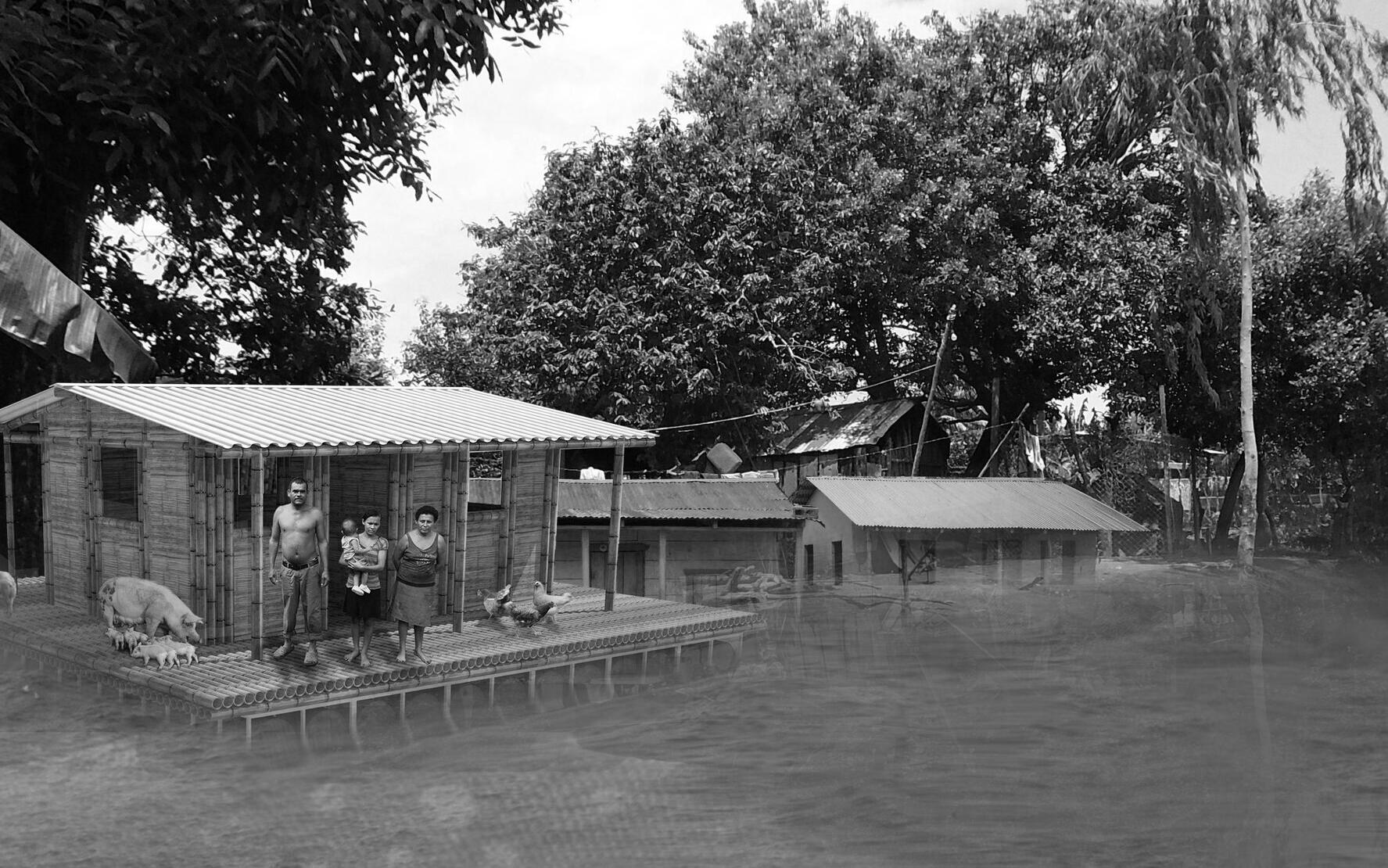
Casa Anfibia is an amphibious housing design proposal for the riverine community of Malacatoya that would allow residents to remain in their homes during and after flooding events.
Architect Professor Elizabeth English
Location Nicaragua
Materiality Bamboo & recycled plastic barrels
Completion Ongoing
Fig 1/2 - Casa Anfibia is an amphibious housing design proposal for the riverine community of Malacatoya that would allow residents to remain in their homes during and after flooding events. The amphibiation of homes in this region could be a viable strategy to break out of the repetitive cycle of relocation and rebuilding that currently plagues the lives of many in this community
3 - The design utilizes recycled plastic barrels for buoyancy due to their widespread availability and low cost. Bamboo is used to construct the house itself, as it combines low weight with a carbon footprint that is 35% lower than concrete blocks. It is also a local renewable resource that can be regrown quickly, reducing deforestation
Fig
1/2 - Recycled plastic barrels are used as floatation devices. A total of 256 recycled barrels were utilised for the project, 16 of which are utilized for water collection and as such do not aid in the bouyancy system
Fig
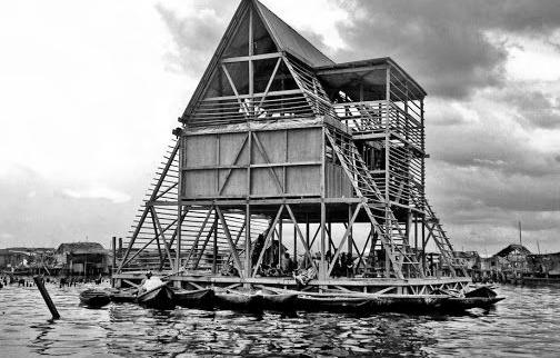
Fig 3 - The Makoko Floating School, located in Nigeria’s Lagos Lagoon, was designed by Nigerian architect Kunlé Adeyemi of NLÉ Architects. Built using locally sourced wood and bamboo, and kept afloat by recycled plastic barrels, the school features a triangular A-frame or pyramid structure (10 meters tall with a 10m x 10m base)—a form well-suited for stability on water.
The Makoko Floating School and the total planned projects makes use of local materials and resources to produce architecture that applies to the needs of people and reflects the culture of the community.
Architect NLE
Location Nigeria
Materiality Bamboo & recycled plastic barrels
Completion 2013
Makoko Floating School Flotation
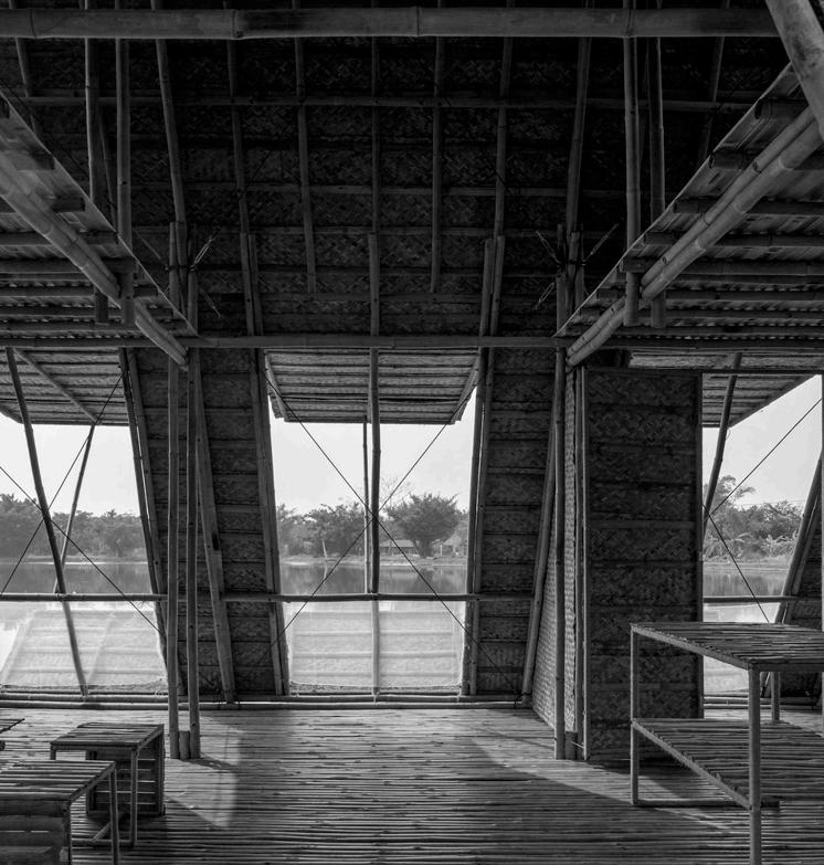
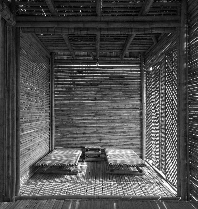
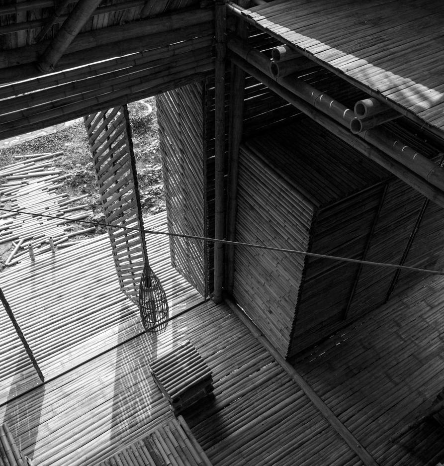
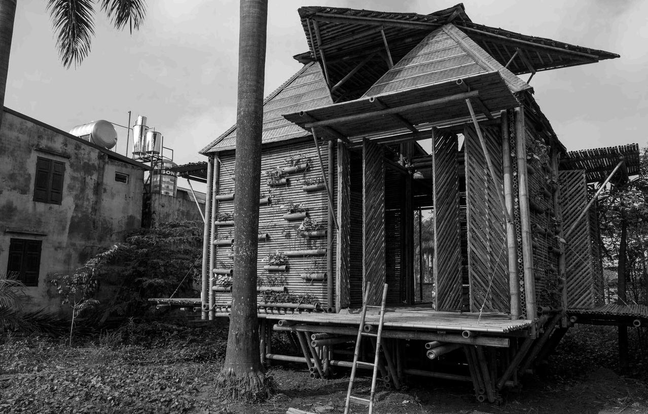
Floating Bamboo House
Flotation
Floating Bamboo House is a housing model for Vietnamese locals whose livelihoods are river-based, especially those in the Mekong Delta. It is a new type of threecompartment house made of solid cored bamboo which are joined together simply with latches and ties.
Architect H&P Architects
Location Vietnam
Materiality Bamboo & recycled plastic barrels
Completion 2022
Fig 1 - The FB House can remain floating on water thanks to its plastic drum systems tied to the floor beneath
Fig 3 - The house is covered (outside) and partitioned (inside) with light materials (compressed weaved bamboo sheets, leaves, corrugated iron, bamboo screens, etc.) and has a large roof to collect rainwater and harness solar energy. The door systems that can open and close flexibly helps make the house sturdy enough in adverse weather events while creating a typical identity
Fig 2 - The split bamboo flooring inspires the flooring for the dwelling unit
- The covered area also provides an entertainment space from which women can retreat to maintain privacy.
-
Ban’s aim was to adapt the houses to their climate, to use local labour and materials to bring profit to the region, and to respond to the villagers’ own requirements through direct consultation. For example, kitchens and bathrooms are included within each house, as requested by the villagers, but a central covered area separates them from the living accommodation, as stipulated by the government
Fig 2 - This project provides 100 houses on the southeast coast of Sri Lanka, following the destruction caused by the 2004 tsunami.
Fig 3
Shigeru
Fig 2
Post Tsunami Housing
Floorplan Design
This project provides 100 houses in a Muslim fishing village, in the region of Tissamaharama, on the southeast coast of Sri Lanka, following the destruction caused by the 2004 tsunami.
Architect Shigeru Ban Architects
Location Sri Lanka
Materiality Wood & compressed earth blocks
Completion 2007
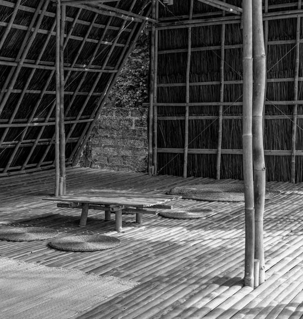
Blooming Bamboo House
Bamboo construction and panels
In Vietnam, the natural phenomena are severe and various: storm, flood, sweeping floods, landslides, drouhgt, etc. One solution to houses and homes for millions of these people is the goal of this BB home.
Architect H&P Architects
Location Vietnam
Materiality Bamboo
Completion 2013
Fig 1/2 - The users can build the house by themselves in 25 days. Besides, it can be mass produced with modules and the total cost of the house is only 2500$. Therefore, the house can warm people in the most severe conditions and help them control activities in the future
Fig 3 - From the bamboo module of f8-f10cm & f4-f5cm diameter and 3.3m or 6.6 length, each house is simply assembled with bolting, binding, hanging, placing... This pulled monolithic architecture is strong enough to suffer from phenomena like 1.5m-high flood
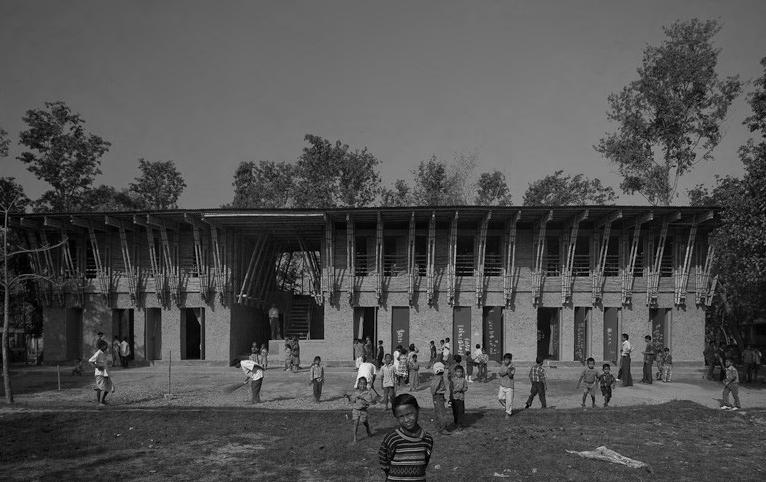
Fig 1/2 - On the ground floor with its thick earth walls, three classrooms are located each with their own access opening to an organically shaped system of ‘caves’ to the rear of the classroom. The upper floor is by contrast light and open, the openings in its bamboo walls offering sweeping views, its large interior providing space for movement
Fig 3 - The project’s main strategy is to communicate and develop knowledge and skills within the local population so that they can make the best possible use of their available resources. Historic building techniques are developed and improved and the skills passed on to local tradesmen transforming in the process the image of the building technique
METI School
Bamboo construction and panels
The project’s main strategy is to communicate and develop knowledge and skills within the local population so that they can make the best possible use of their available resources.
Architect Anna Heringer, Eike Roswag
Location Bangladesh
Materiality Bamboo & compressed earth
Completion 2007
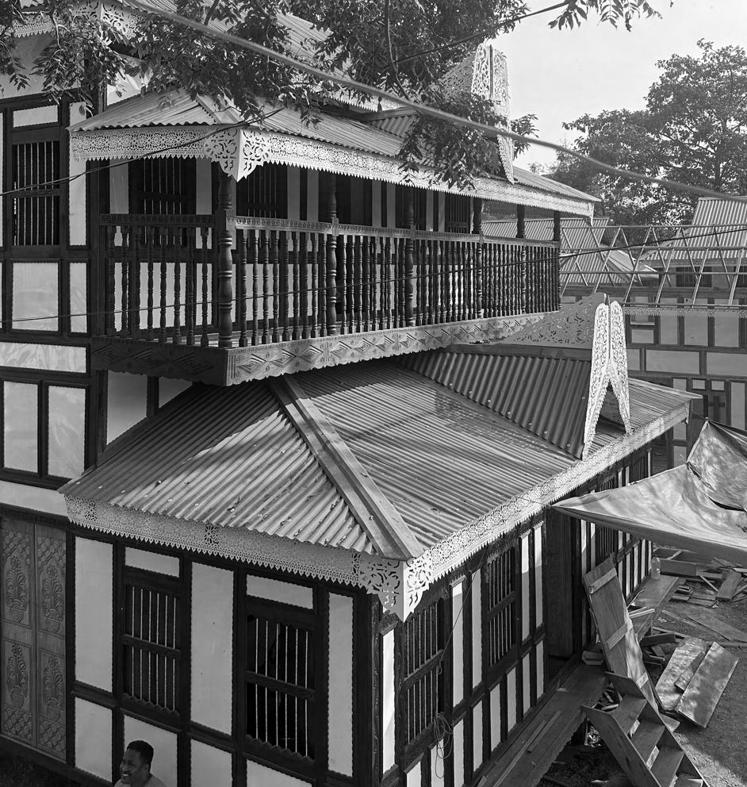
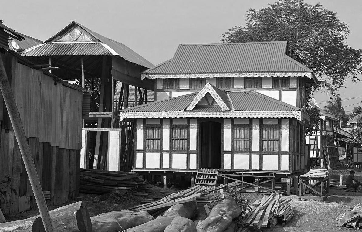
Bangla Baton - Chawdhury Residence
Dismountable Structures
As a modular and flexible construction system, it is possible to construct Bangla Baton houses from a standardised ‘kit of parts’ where wall panels and other building elements are ordered to site pre assembled.
Architect -
Location Bangladesh
Materiality Varied
Completion 1897
Fig 1/2 - The floor plan tends to be simple and open, which allows for easy reconfiguration to accommodate the changing needs of the household. The construction system is modular, so adding or subdividing rooms is comparatively easy
Fig 3 - As a vernacular housing type it is somewhat complex as it is both rooted in Bangladeshi history and context and simultaneously in its colonialist influences is uprooted from specific local context and history. The housing type uses a combination of modern and traditional materials and techniques. The architecture is inherently sustainable, as it uses local resources with low environmental impact
02 Research
Contextual Analysis
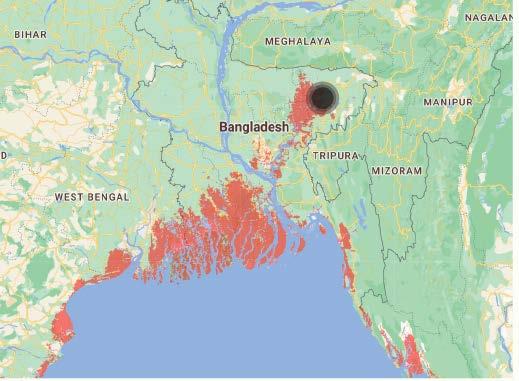
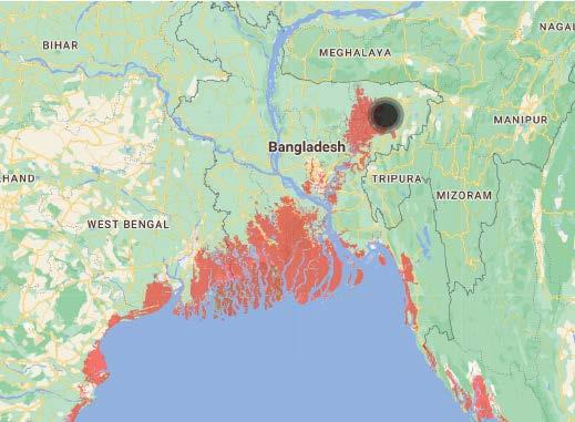
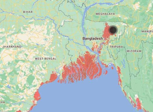
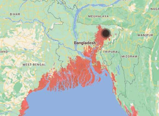
A series of mapping exercises was undertaken to visualize flood risks in Bangladesh and the threats posed by rising sea levels. Additionally, the site-specific relationship with water was analyzed to better understand its environmental and spatial dynamics
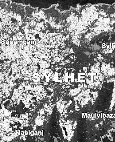
Data published by UNOSAT (United Nations
Flood Prone Areas
Sylhet Flooding 2020
Data published by UNOSAT (United Nations Satellite Centre)
• Sylhet 45% under Water
• Maulvibazar 21% under Water
• Habiganj 41% under Water
• Sunamganj 72% under Water
Flooded Areas
Sylhet Flooding 2022
Data published by UNOSAT (United Nations Satellite Centre)
• Sylhet 72% under Water
• Maulvibazar 50% under Water
• Habiganj 70% under Water
• Sunamganj 80% under Water
Flooded Areas
Sylhet Flooding 2024
Data published by UNOSAT (United Nations Satellite Centre)
• Sylhet 53% under Water
• Maulvibazar 16% under Water
• Habiganj 15% under Water
• Sunamganj 48% under Water
Flooded Areas
Sea Level Rise
Bangladesh
Predictions made through ClimateChange.org are based on the following criteria
• Projection Type - Sea level rise + Annual flood
• Pollution Pathway or Sea Level Scenario - Current Trajectory
• Luck - Medium
Flooding Depictions
Sylhet, Bangladesh
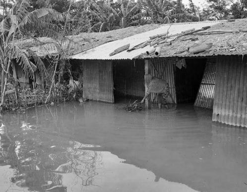
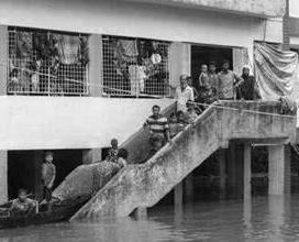
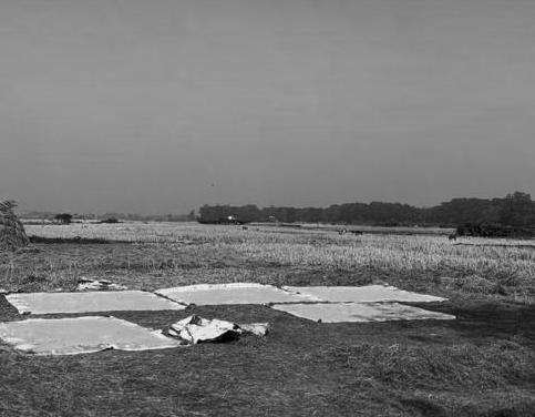
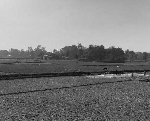
The images below convey the catastrophic impact that severe floods have had and continue to have on the vulnerable communties of Sylhet.
The images conveyed are taken from news articles covering the events
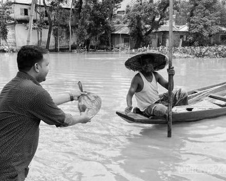
Aid Flooding 2020
Seeking Refuge
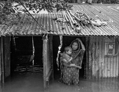
Flooding 2022
Flooded Neighbourhoods
Flooding 2024
Flooded Homes
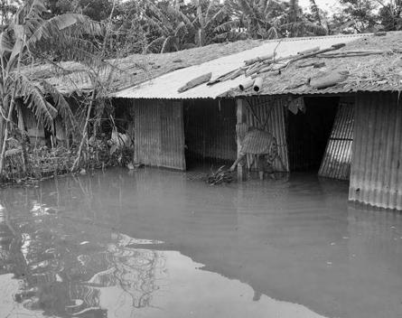
Flooding 2020
Flooded Homes Flooding 2022
Seeking Refuge Flooding 2024
Refuge Point
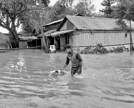
Flooding 2020
Flooded Streets Flooding 2022
Fleeing Homes Flooding 2024
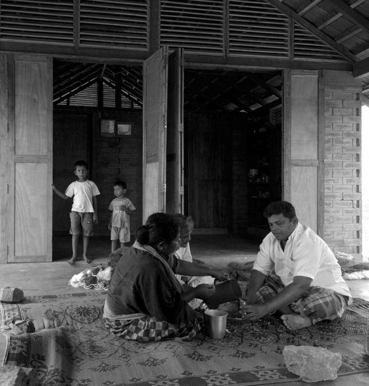
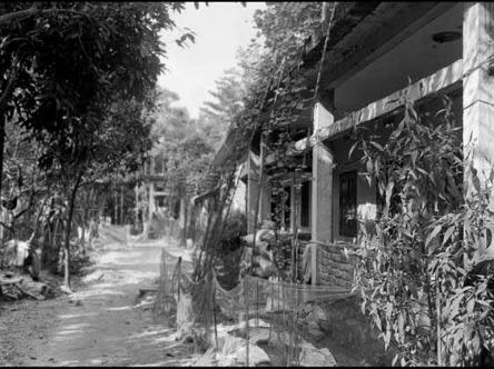
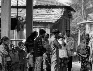
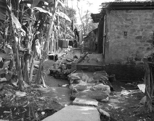
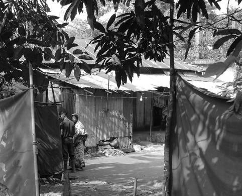
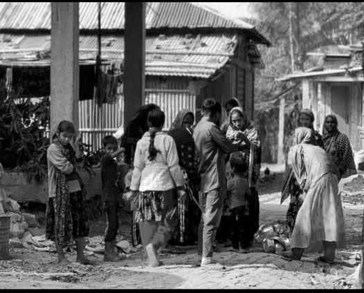
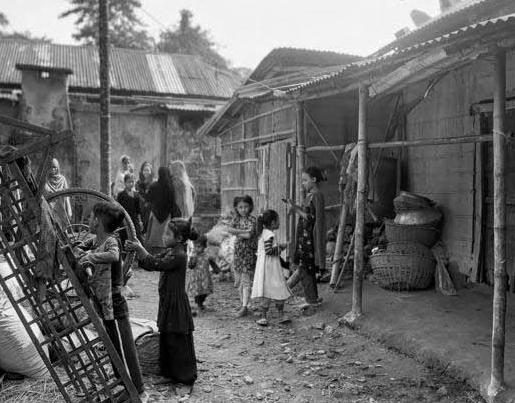
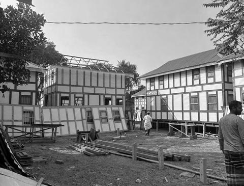
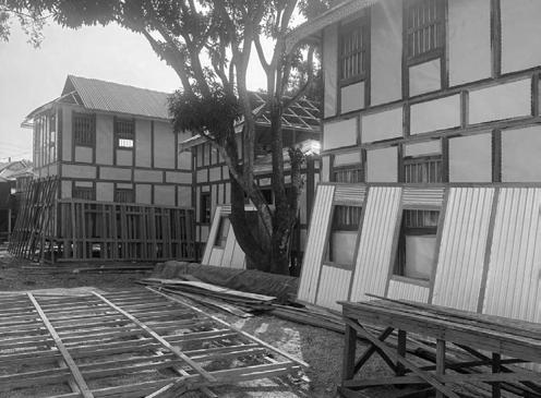
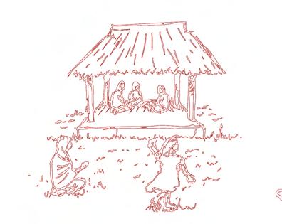
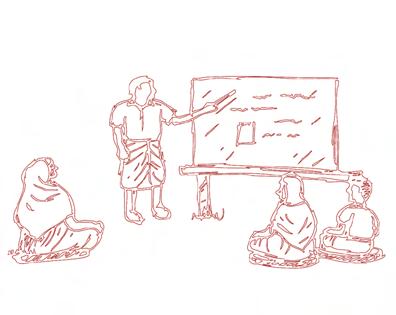
02 Research Ethnographic Research
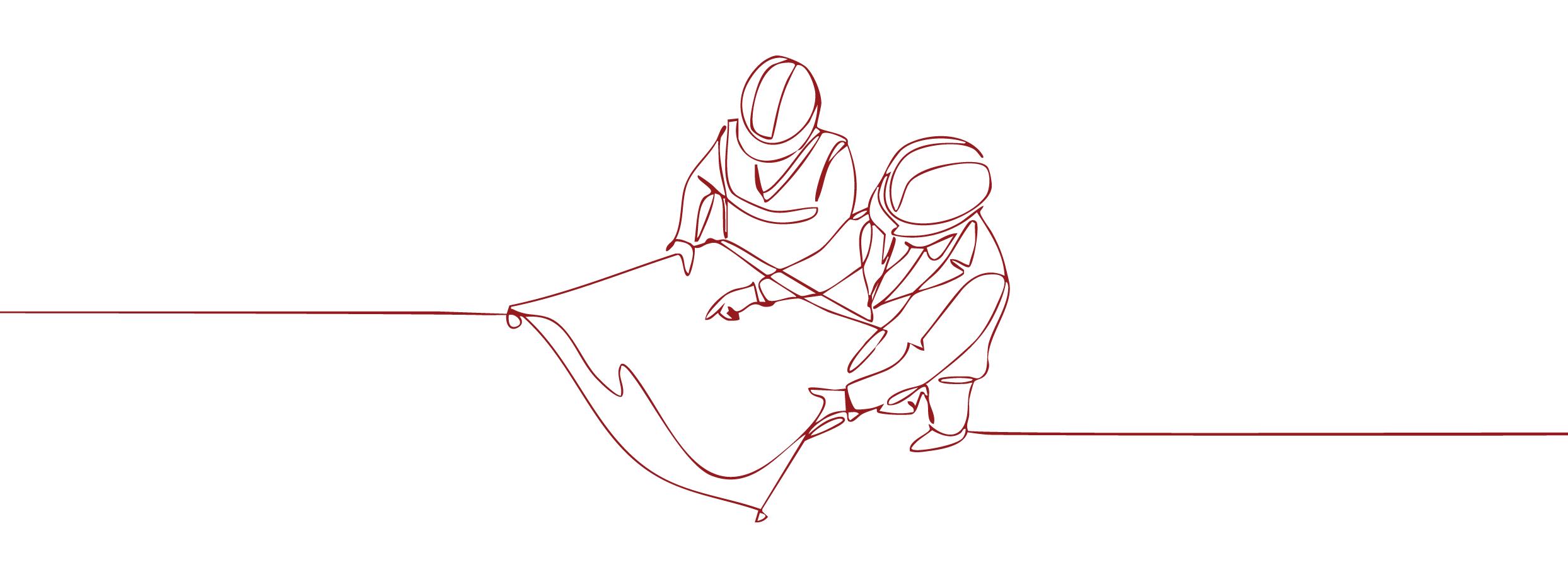
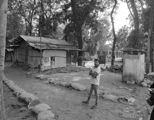
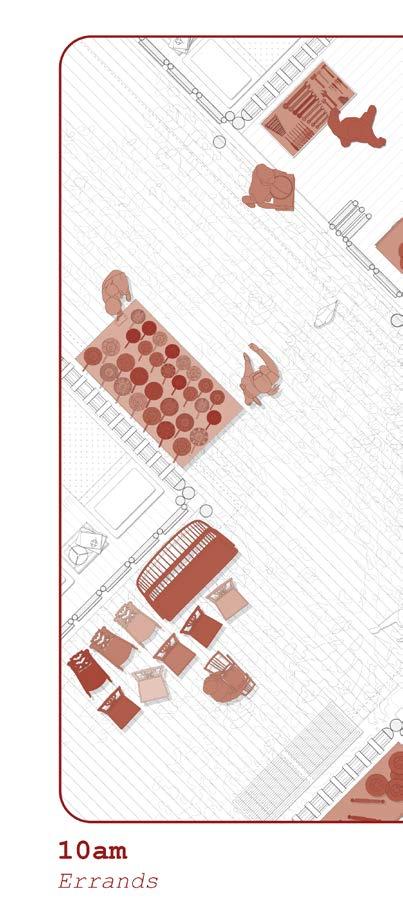
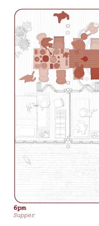
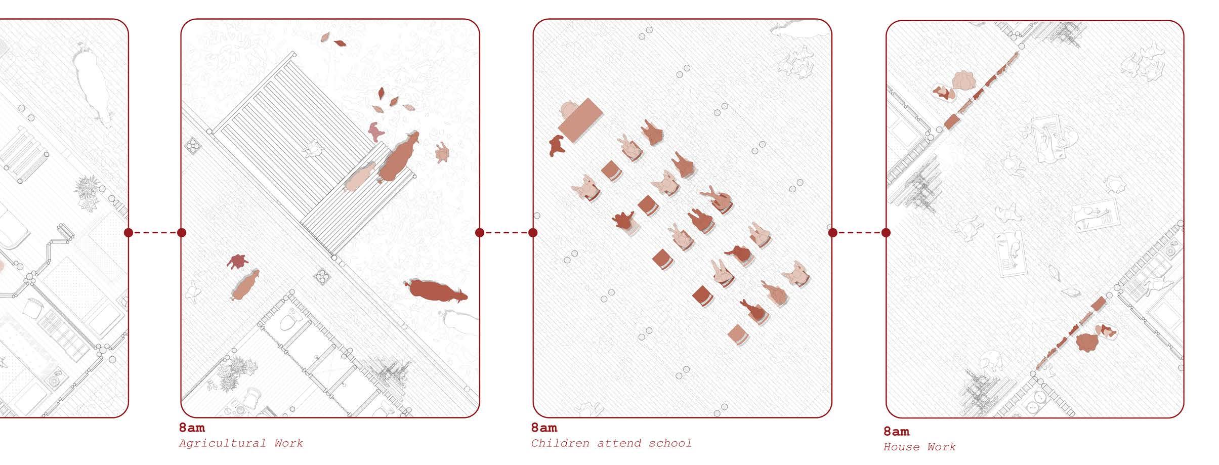
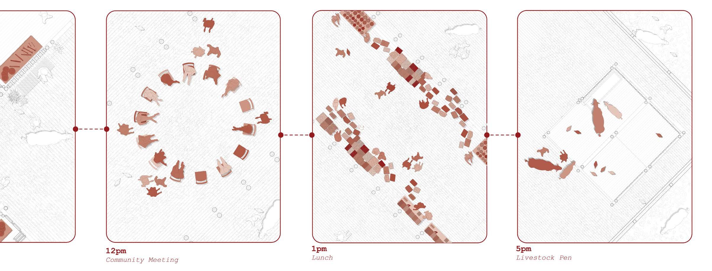
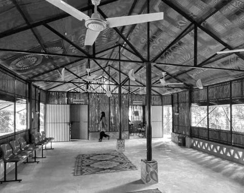
Throughout the field visit to Bangladesh, the social, economic, and cultural dimensions of the local population were closely examined. Particular emphasis was placed on the varying degrees of social engagement and the spatial configurations that facilitated these interactions.
Site Visit
Dhaka, Bangladesh
The first few days of our site visit was spent in the capital city of Dhaka.
Our group visited Dhaka, the capital city of Bangladesh for a few days before departing for Sylhet which is our design site city.
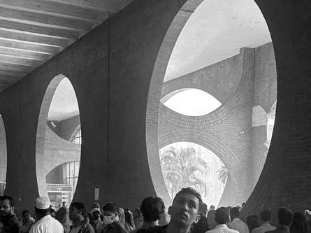
The opportunity to explore the city and visit not only architectural marvels of the country but take the opportunity to explore the cultural and social aspects of one of the bussiest cities in the world was an unparralleled learning opportunity.
The group visited a few architectural
sites in various sectors. The wide range of typologies allowed us to not only consider their dwelling typologies but also begin to understand the inner workings of their cities.
As such the few days in Dhaka provided insights on the cultural, social and economic aspects of the country. Serving as a vital precedent to not only the housing aspect of the project but the impact it may have on an urban scale.
Public
Busy Roadways
Ayub National Hospital Housing Market
Bait ur Rouf Mosque
Site Visit
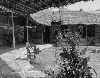
Sylhet, Bangladesh
The studio visited Bangladesh at the beginning of December to gather information to inform the proposal culturaly, socially and contextually
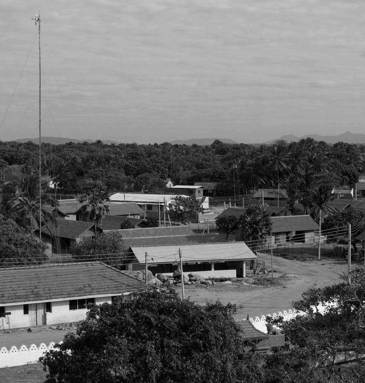
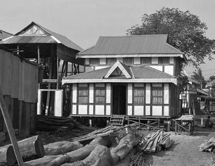
A small group of students visited the Shonatola village alongside a group of students from the local university.
We entered the village from a small path that was off the side of the main road.
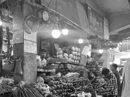
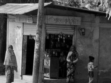
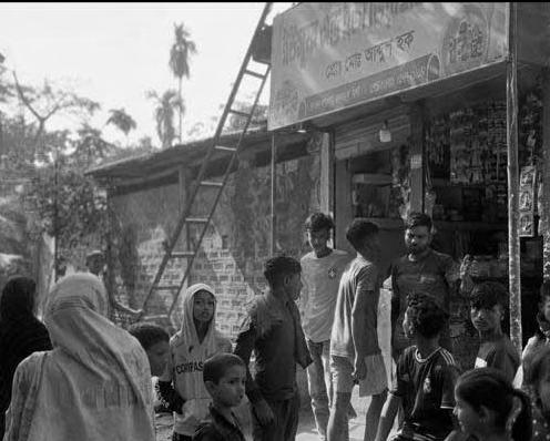
A few meters from the edge of the road was the neighbourhood market for the community. Households surround the main pathway, leading visitors towards the main square which is the neighbourhood meeting point.
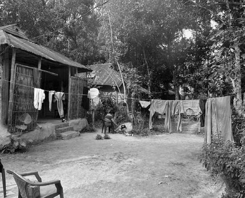
Adjacent to the path is a canal that leads water into a small village lake utilized for water and washing.
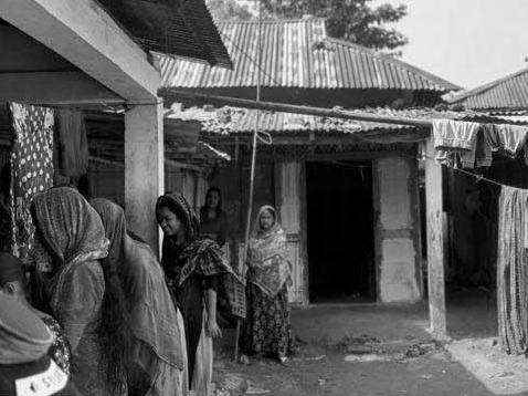
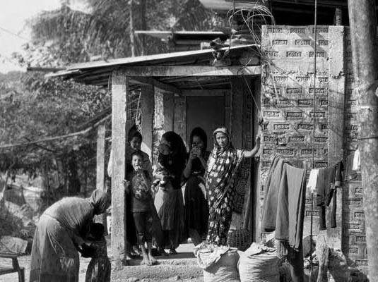
Households are clustered together to create small family compounds that surround the central square. In the small family compounds a small courtyard is
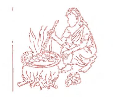
created to be utilized by the family for gatherings, chores and cooking.
The community rashed to meet us and share their thoughts and desires for their future community.
Overall the visit to the village was extremely informative and provided an oppourtunity to truly understand the reality of the context, culture and social beliefs of the community, essentially adding a face to the project so that we could proceed with great care in creating a viable solution for the people Shonatola
Neighbourhood Market
Communal Area
Small Courtyards
Semi-Private Area
Area
Large Open Areas
Communal Area
Between Dwellings
Semi-Private Area
The Dwelling Private Area
Private
The “Veranda”
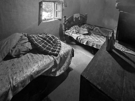
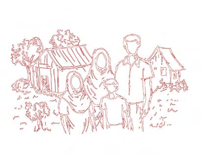
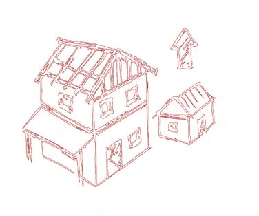
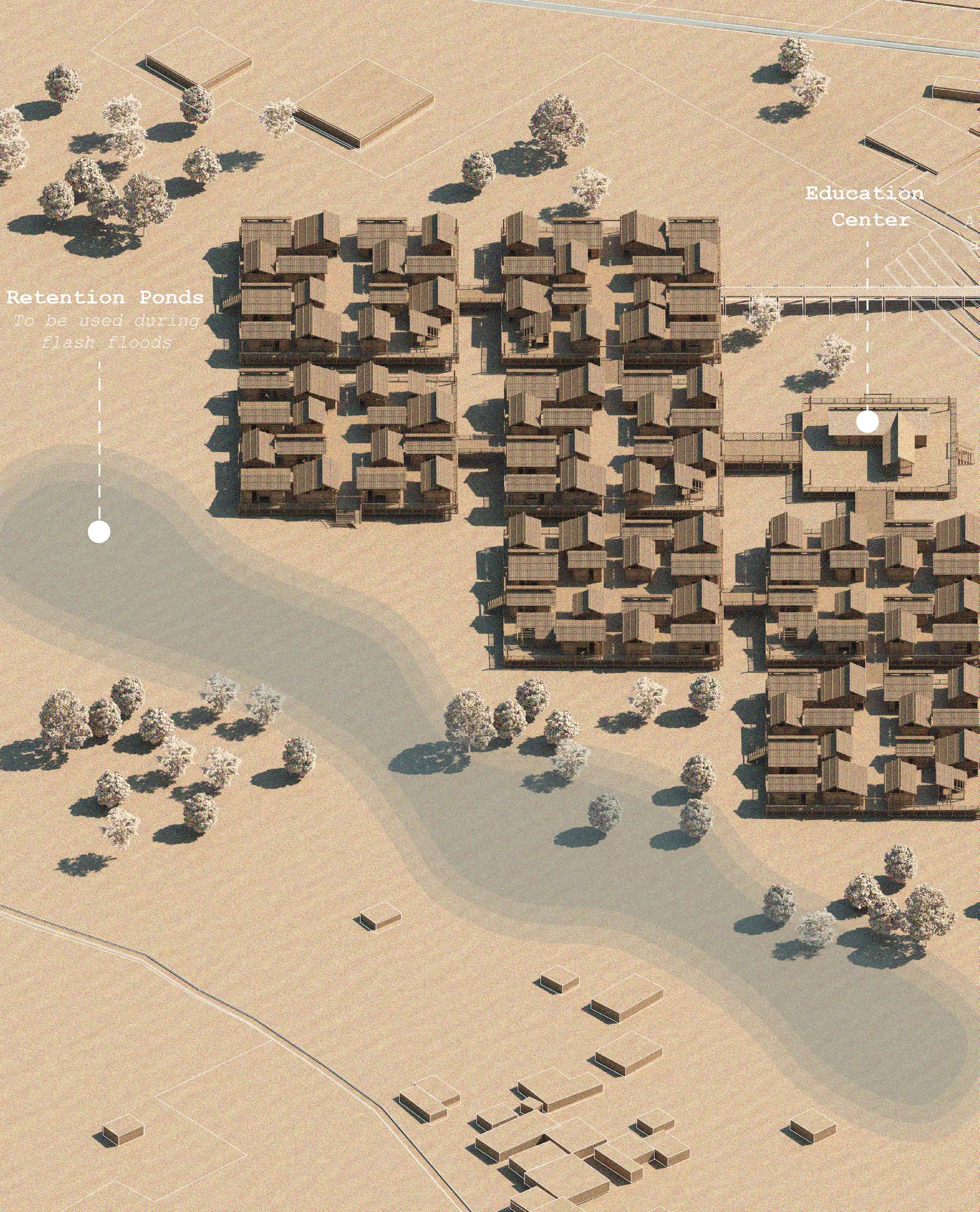
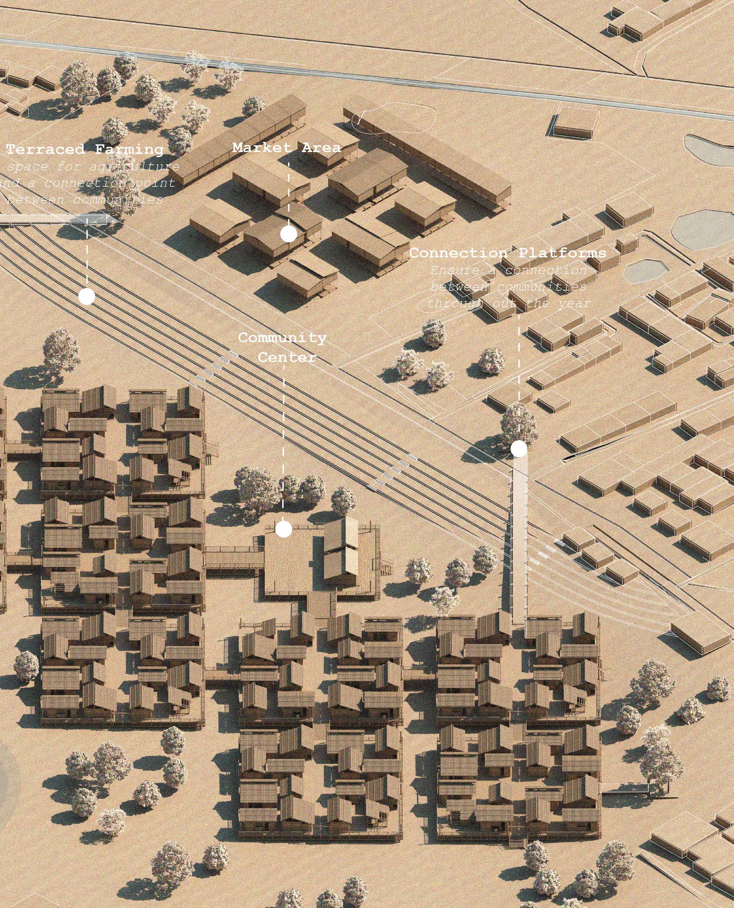
The Community
The project is designed with the community in mind. The project aims to transition the community members living within bamboo and mud housing towards amphibious dwellings due to the threats posed by the ongoing climate crisis. As well as aid in the need for affordable housing for surrounding community members employed in the city
Climate Refugees
The project acts as a prototype for transitioning vulnerable suburban communities around the world towards floating cities
The Community
Visiting Sylhet
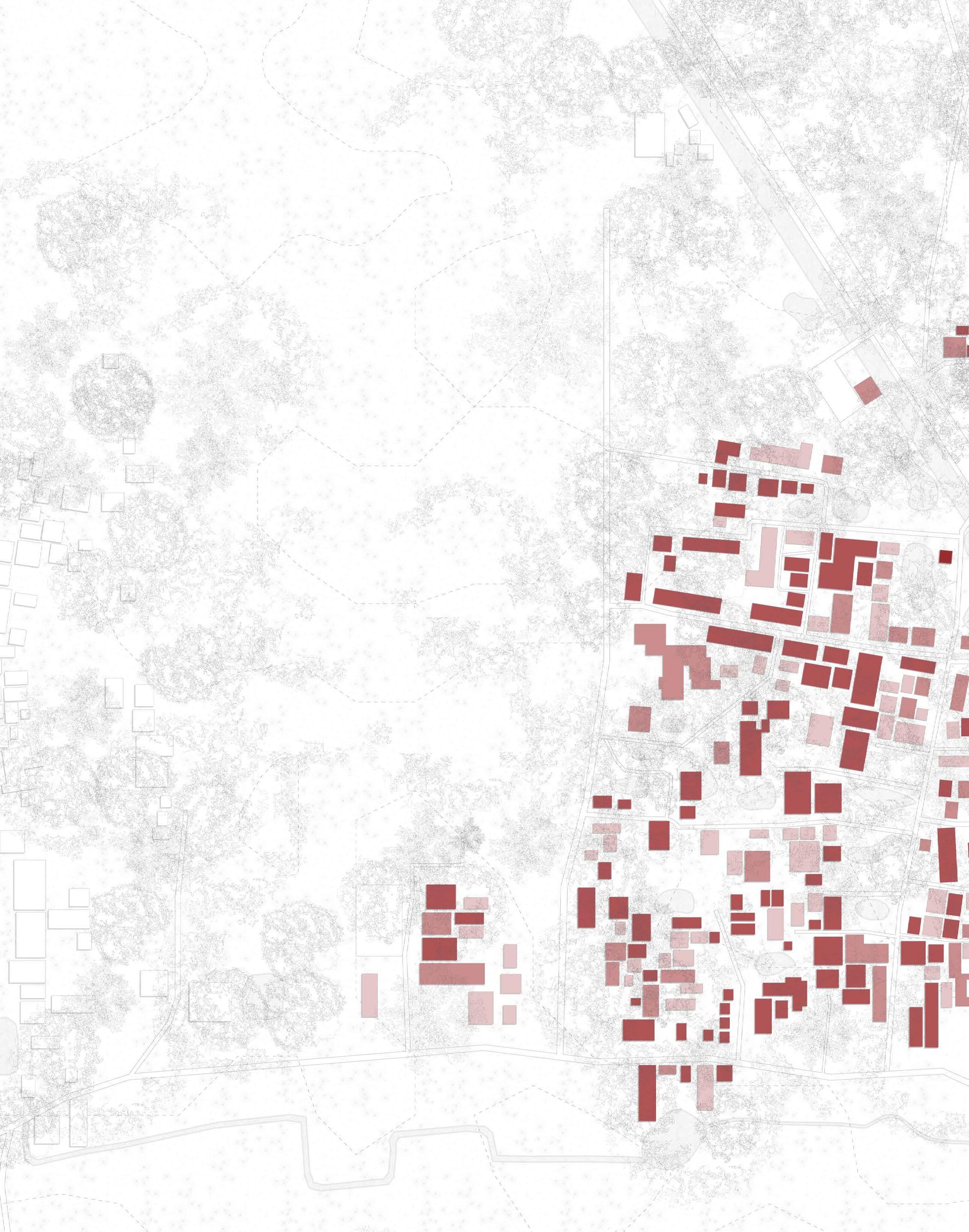
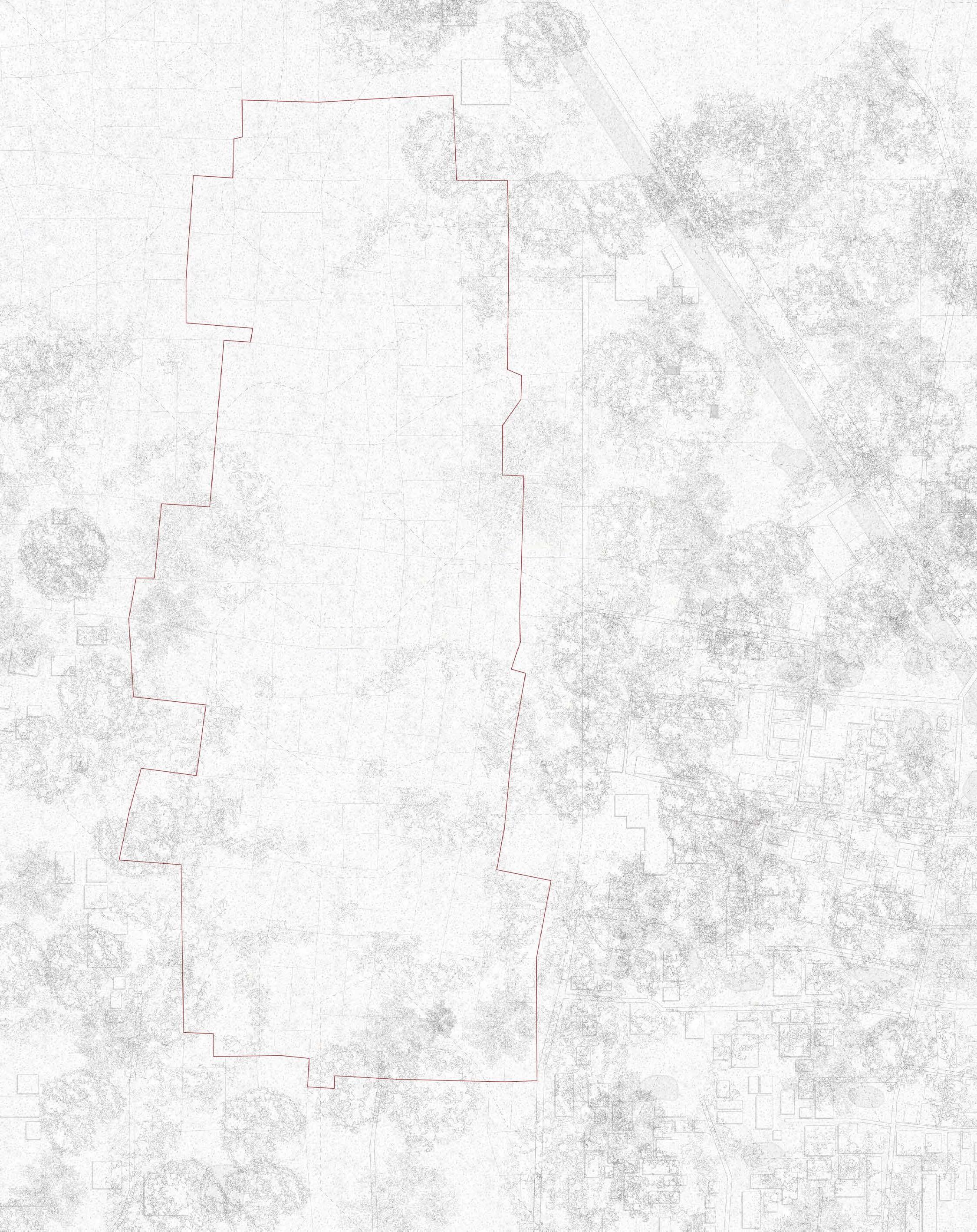
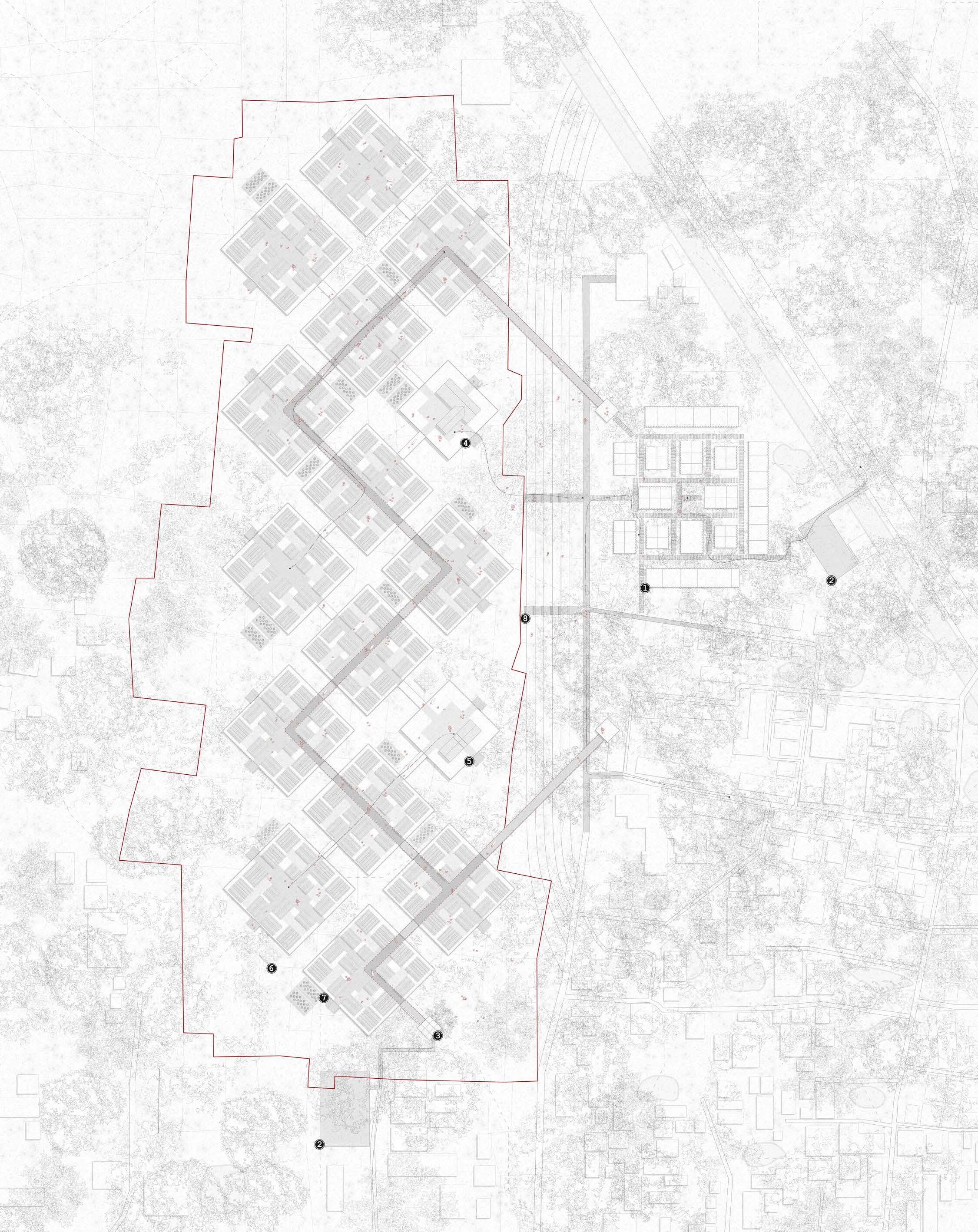
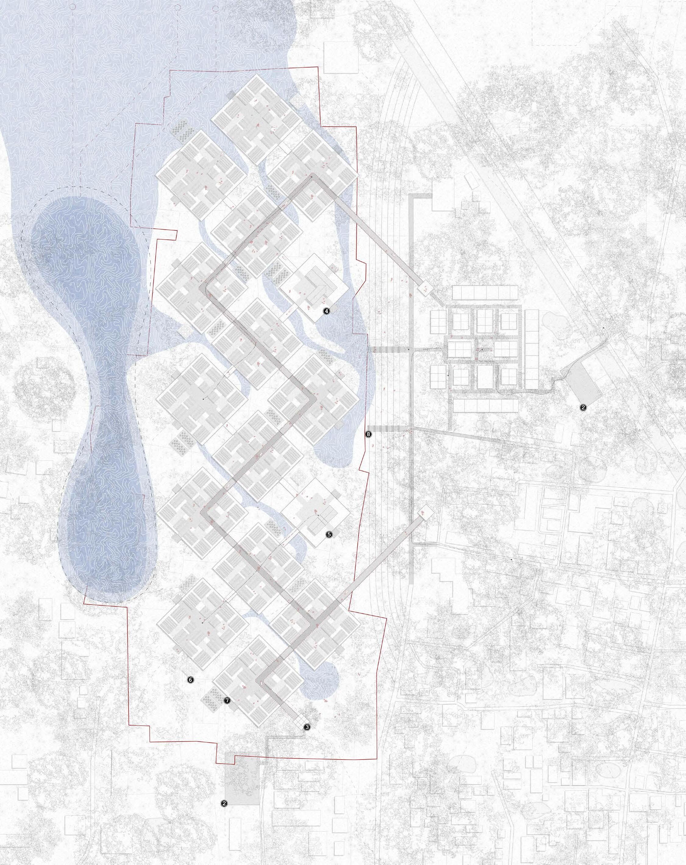
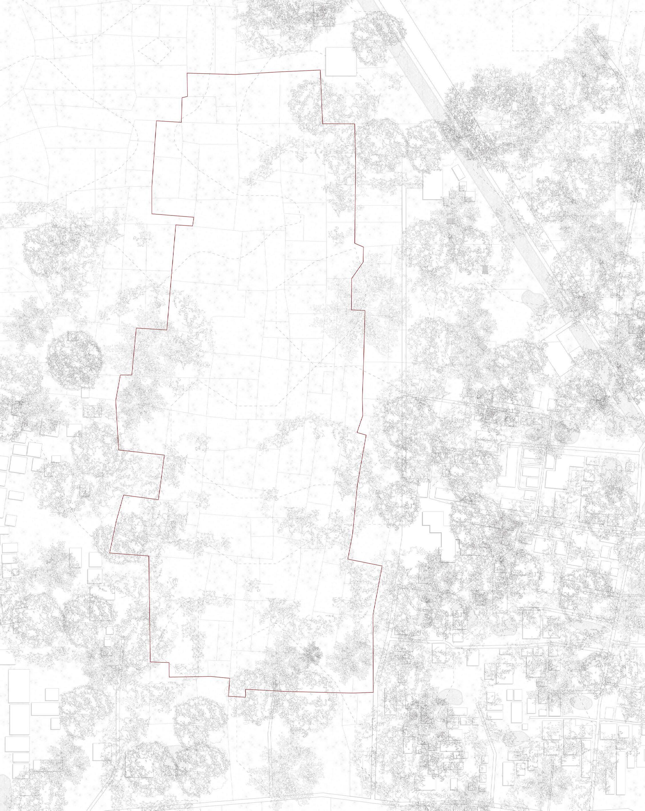
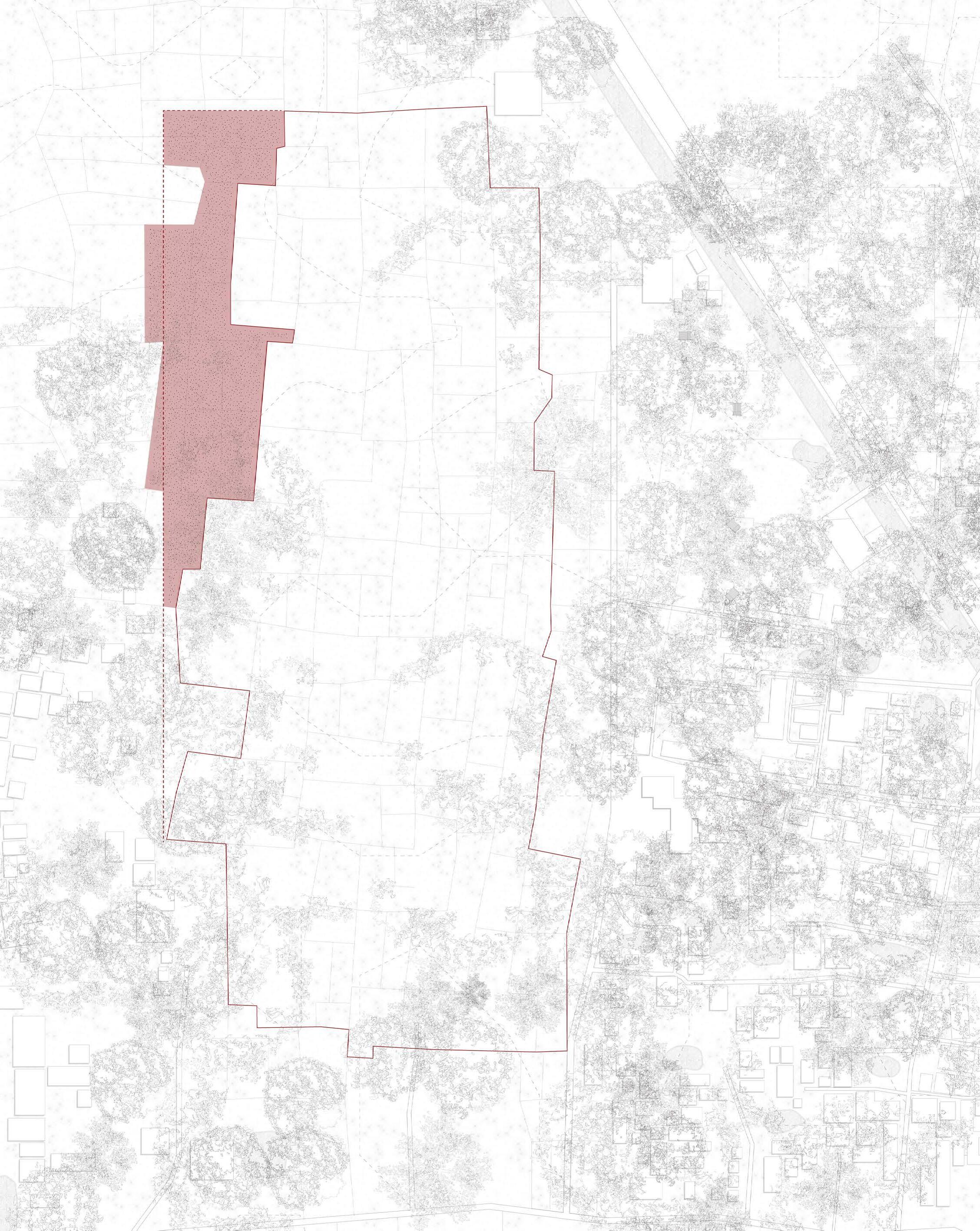
The Shonatola community is made up of three different types of dwellings. The current village sits at an elevation two meters above the agricultural land that surrounds it. The agricultural land makes up 219260.035sq.m of the site (54 Acres)
Brick Concrete Bamboo and Tin
Relationship with Water
The Shonatola Community
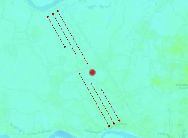
The west end of the site sits at the lowest elevation of approximately 10m. With the east end of the site at an elevation of approximately 13-15m. The site has elevations varying at approximately 4m.
Based on the topographies of the site, the following assumptions can be made for the flow of water
Highest to Lowest Elevation
The rivers flow from the mountains on the north east towards the bay of benga in the south.
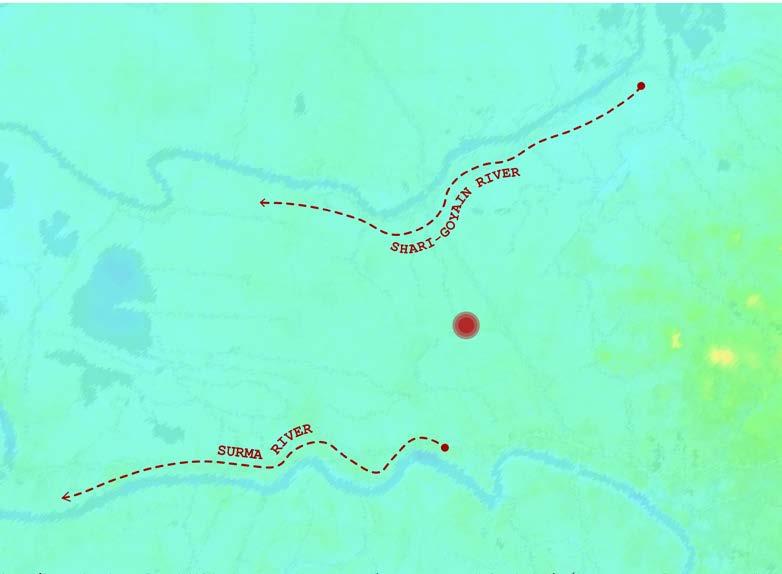
Two Rivers
The Shari-Goyain river to the north and the Surma river to the south.
2km from the Site
Once the river is at capacity water will begin to flow towards the lowest elevations
Site Elevations
The Shonatola Community sits 2m above the agricultural land
Through the Seasons
The Shonatola Community
Predictions made through ClimateChange.org are based on the following criteria
April - Summer
May - Summer
June - Rainy
July - Rainy
August - Autumn
September - Autumn
October - Late Autumn
November - Late Autumn
December - Winter
January - Winter
February - Spring
March - Spring
Pre-Monsoon 61-100mm Monsoon > 200mm
Winter 6-30mm
Pre-Monsoon 61-100mm
2024]
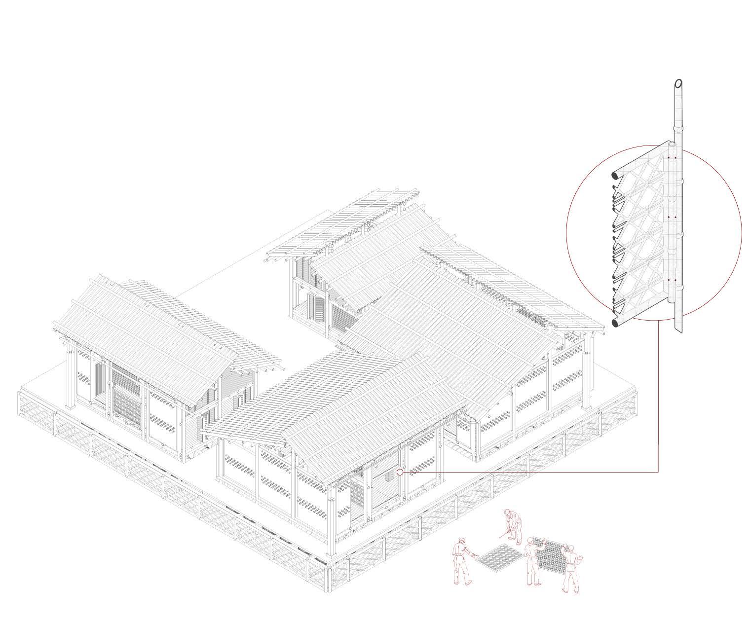
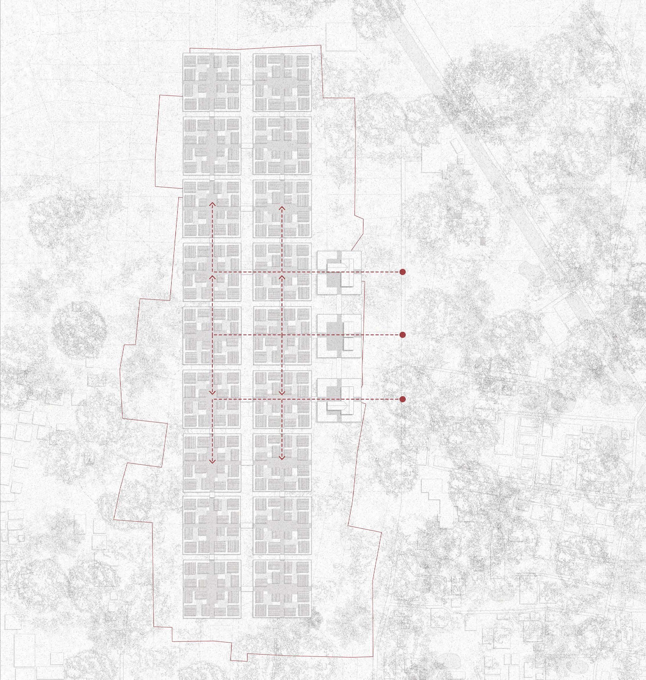
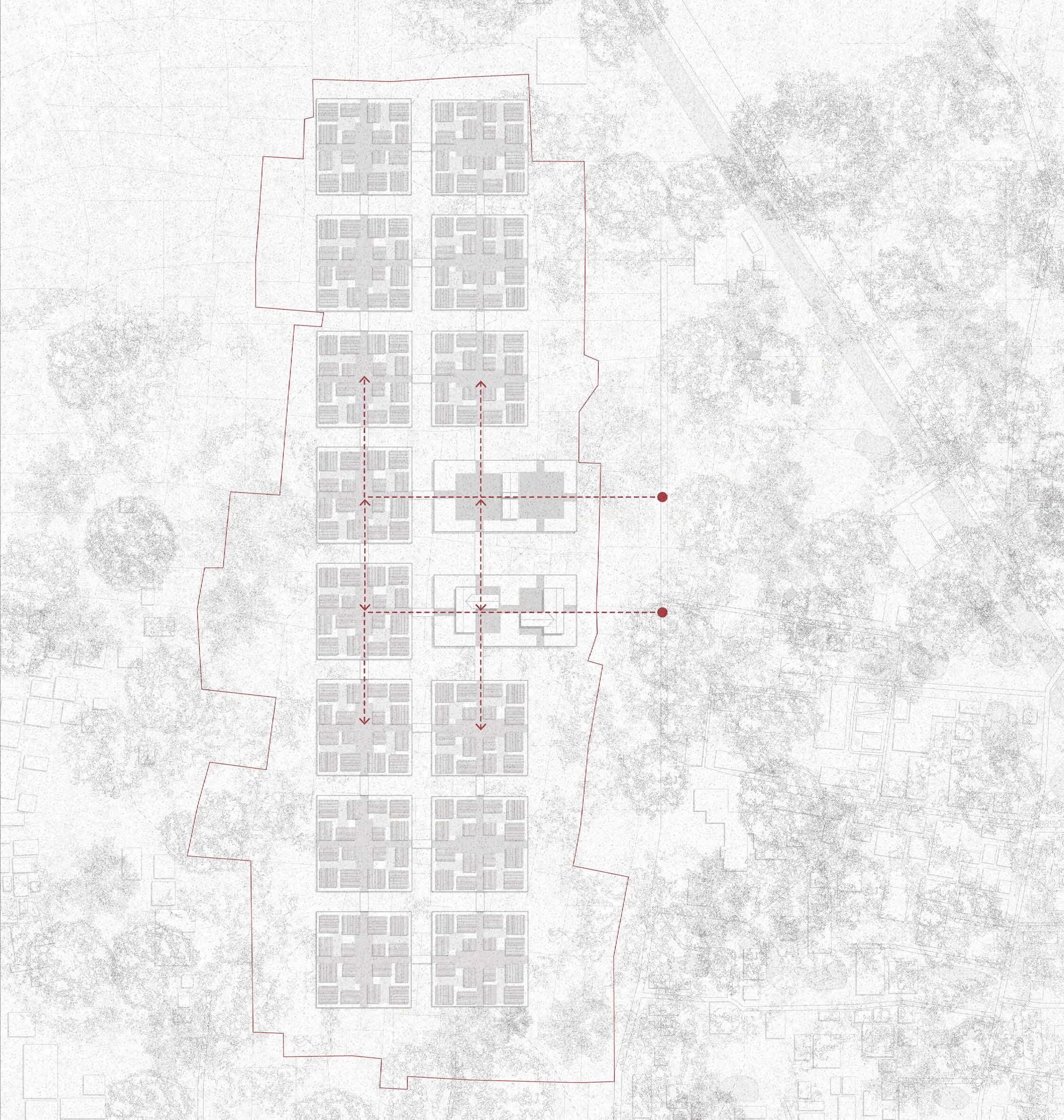
03 Design Scales
Design Principles
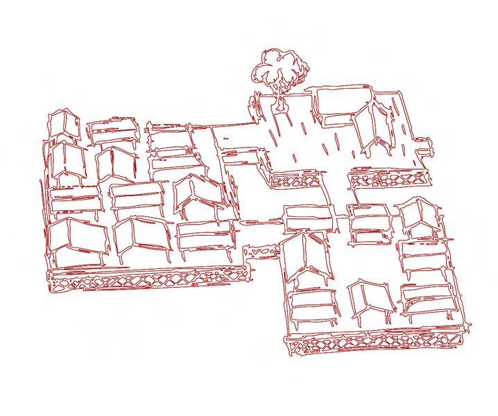
The proposal aims to offer a viable strategy for transitioning the Shonatola community toward amphibious living typologies. To ensure the approach is contextually appropriate, a set of guiding principles has been developed to address the community’s social, economic, and cultural needs.
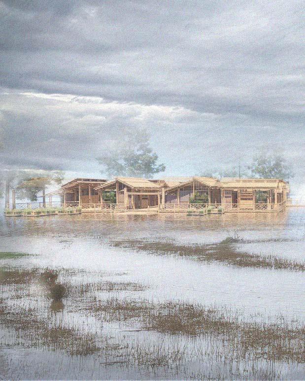
The Raft
Top Down Approach
A specified raft dimension and dwelling quantity is provided
Bottom Up Approach
The community can decide which dwelling types make up their raft
The Dwelling
Top Down Approach
The base dwelling design provided
Bottom Up Approach
Each household can dictate dwellings through a series
The Master Plan
Top Down Approach
design and dimensions are dictate the configuration of their own series of bamboo panels
A set of rules is provided to ensure the plan responds to the site’s relationship with water
Bottom Up Approach
The masterplan is flexible based on the site and community factors
Program Requirements
Key Characteristics
The creation of self reliant communities is at the forefront of the proposal. As climatic situations worsen, the dependency on existing infrastructure is unstable
Vernacular Techniques
Construction process to be undertaken by the community
Affordability
A solution for vulnerable communities
Viable Response
Combating yearly flooding and preparing for rising sea levels
Local Materials
Investing in the local community and their economy
Incremental Housing
Meeting the ever-changing needs of the occupant
Ubiquitous within Bangladesh
Meeting the everchanging needs of the community
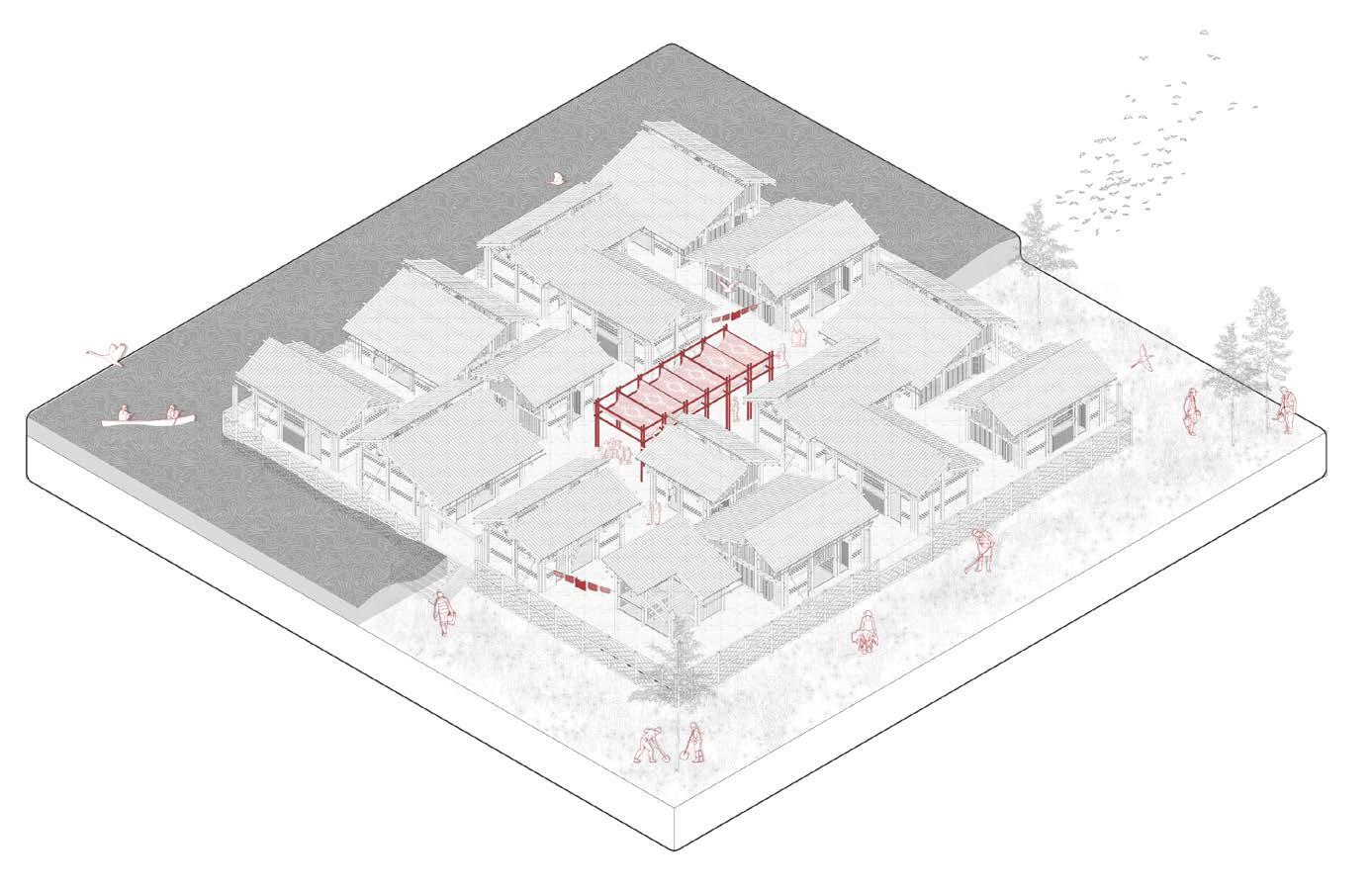
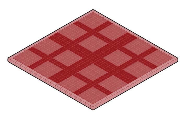
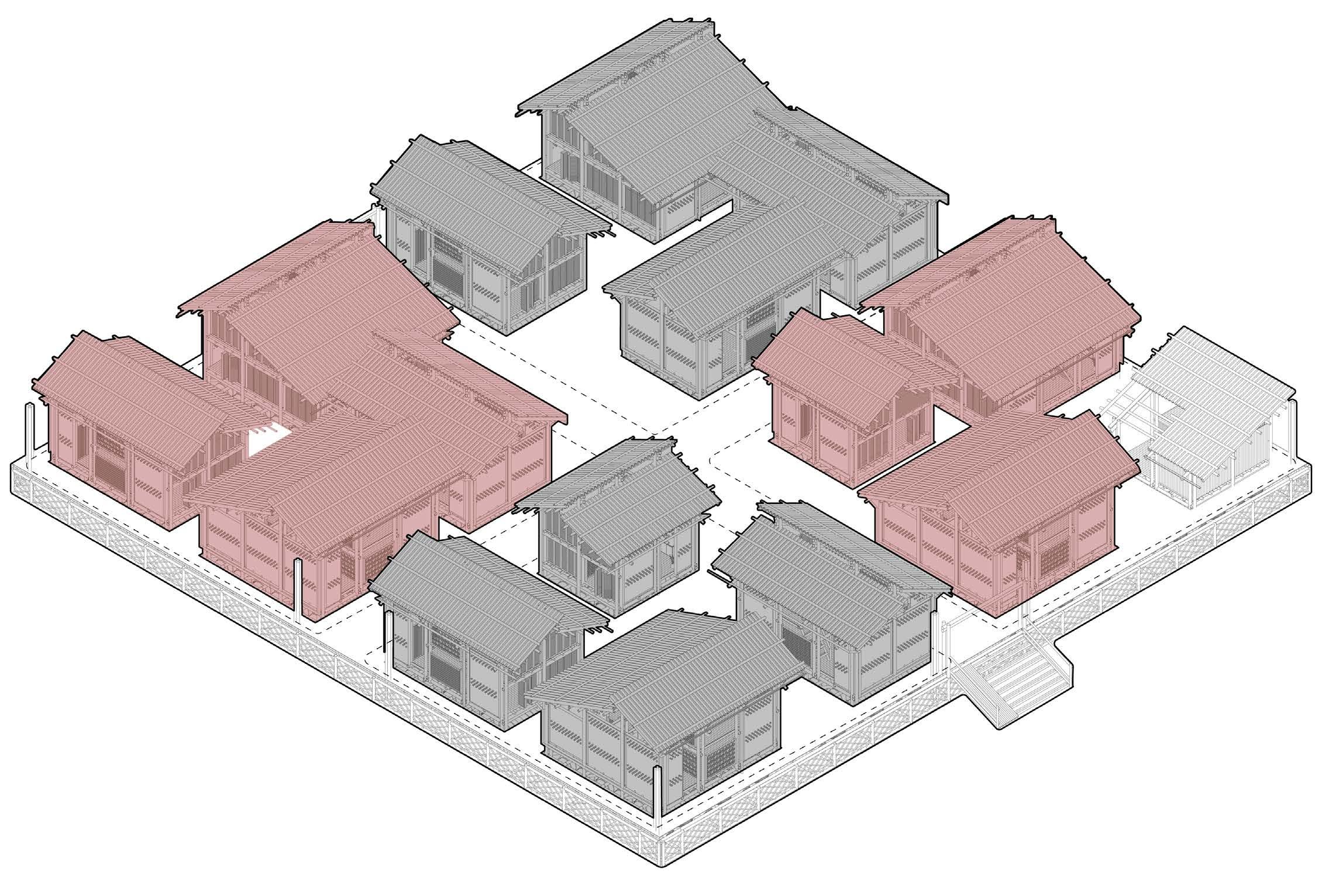
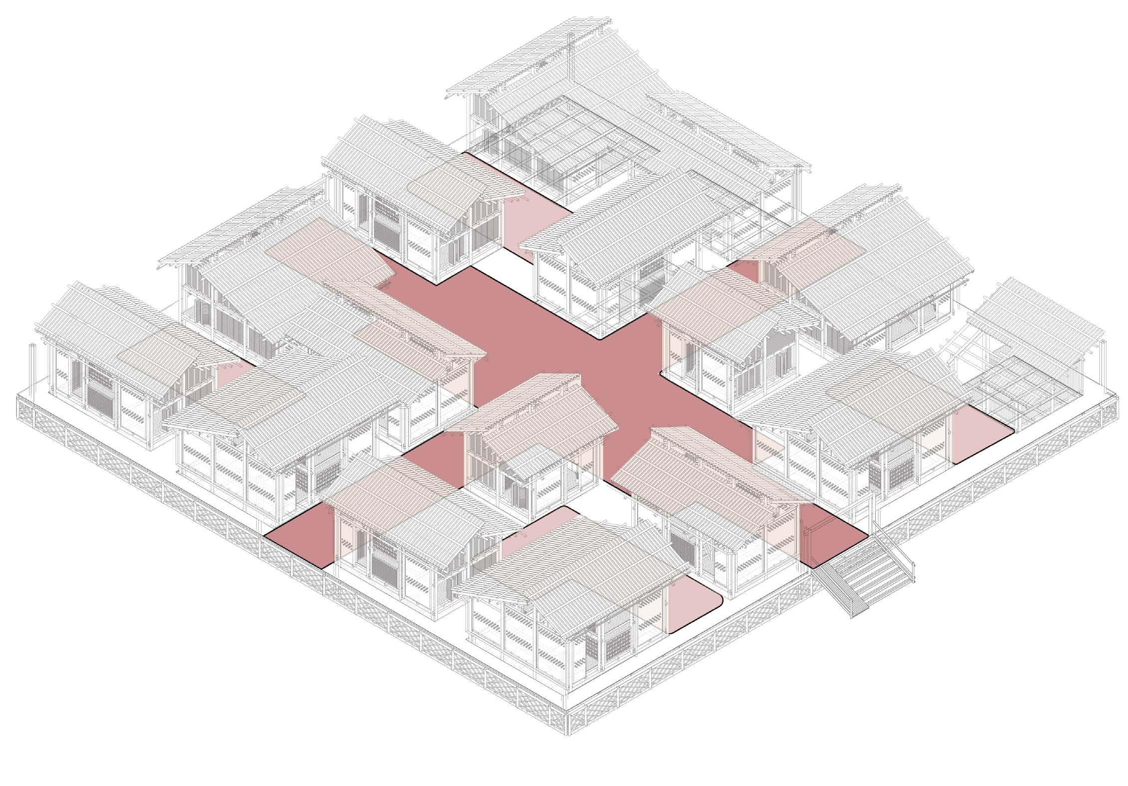
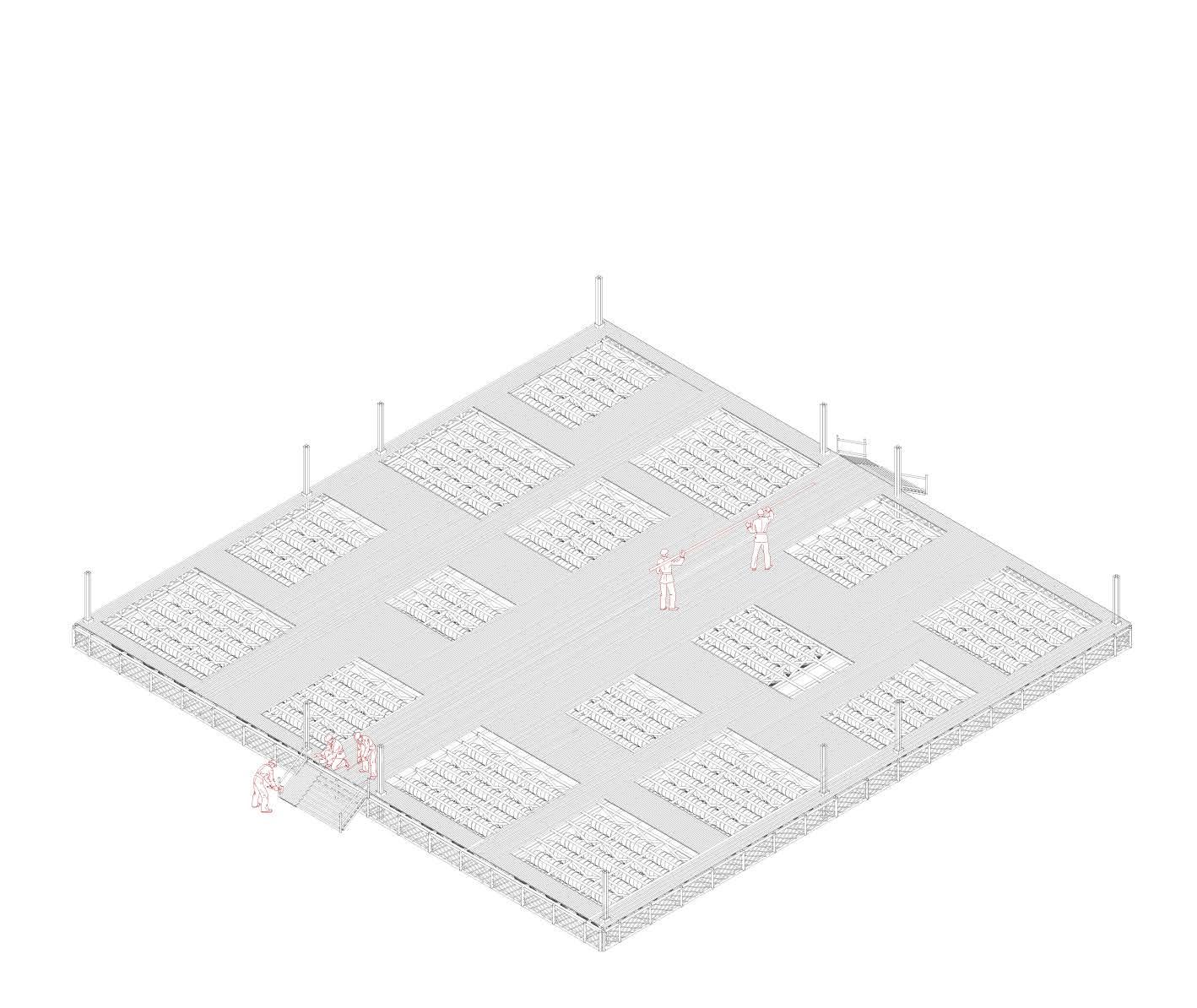
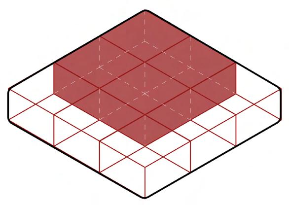
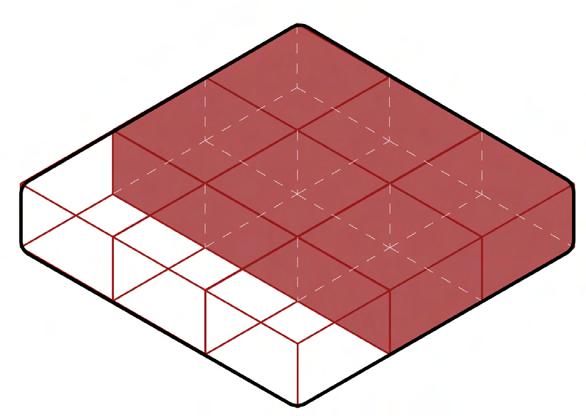
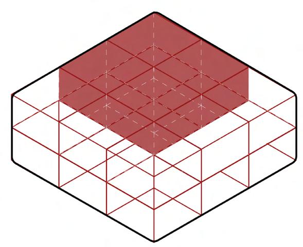
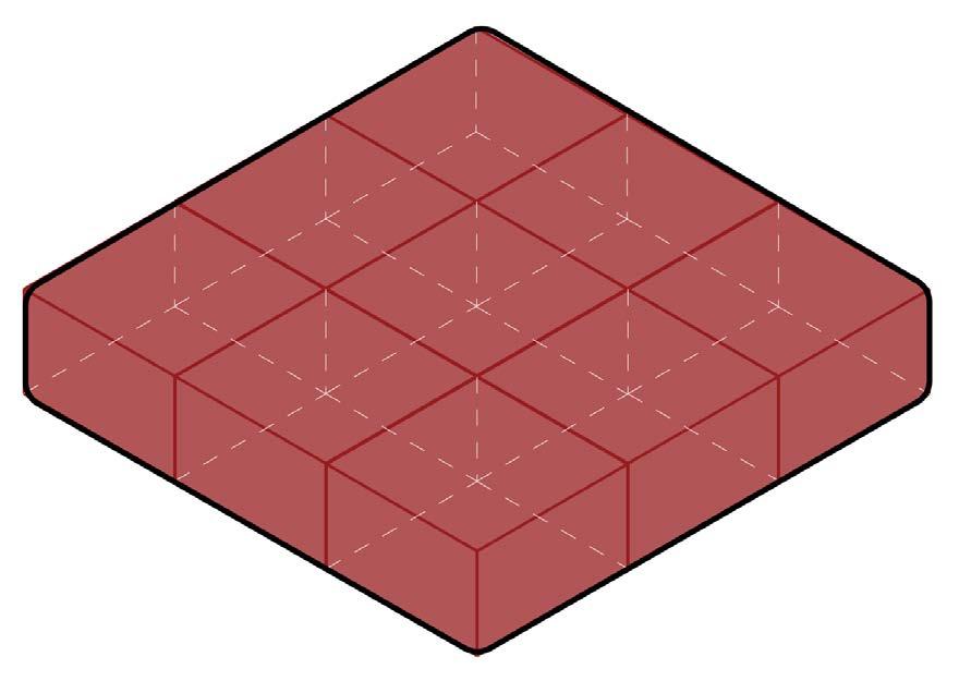
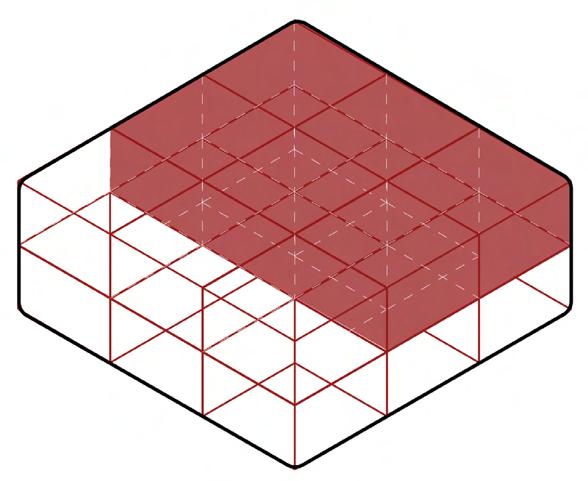
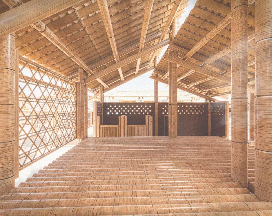
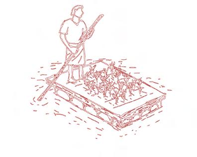
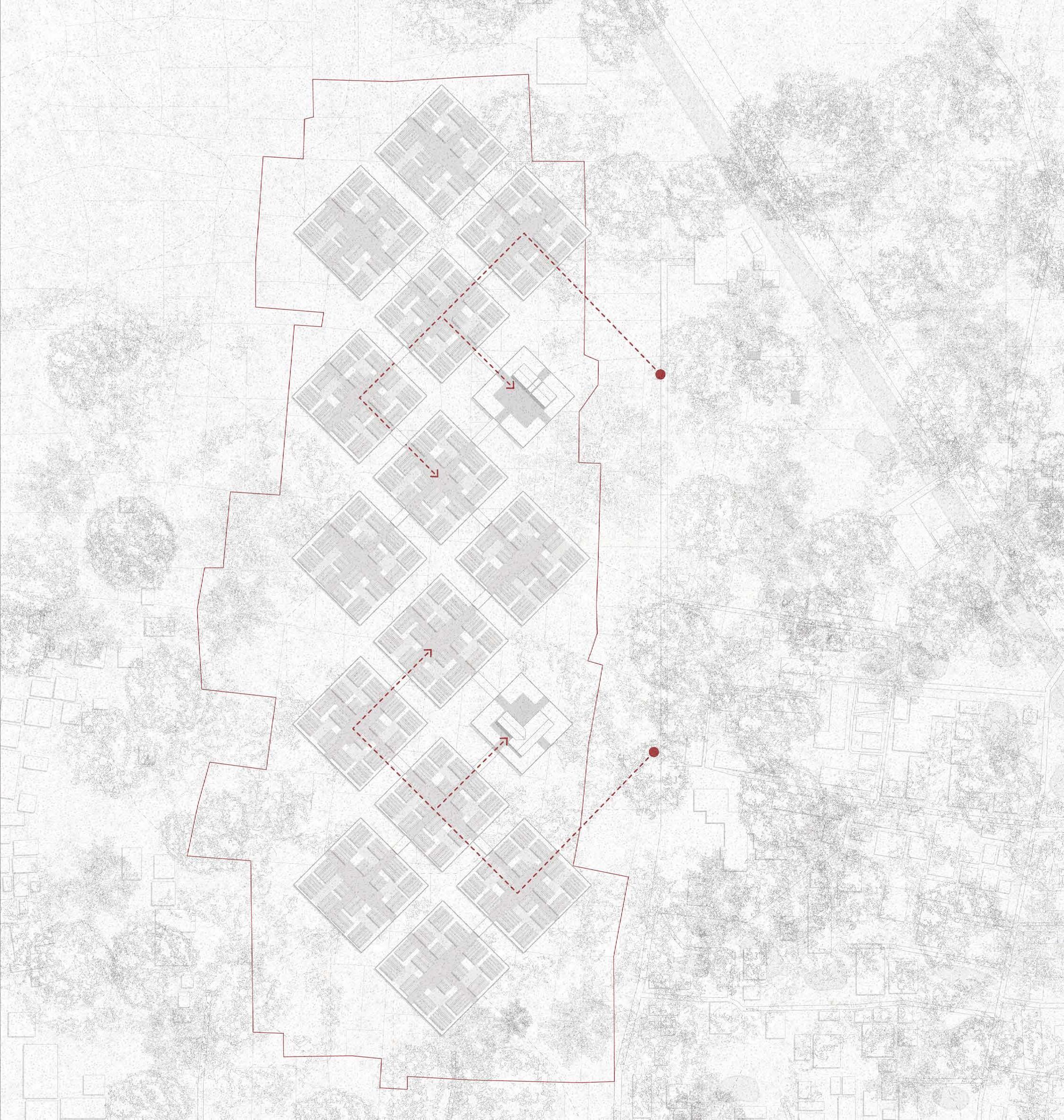
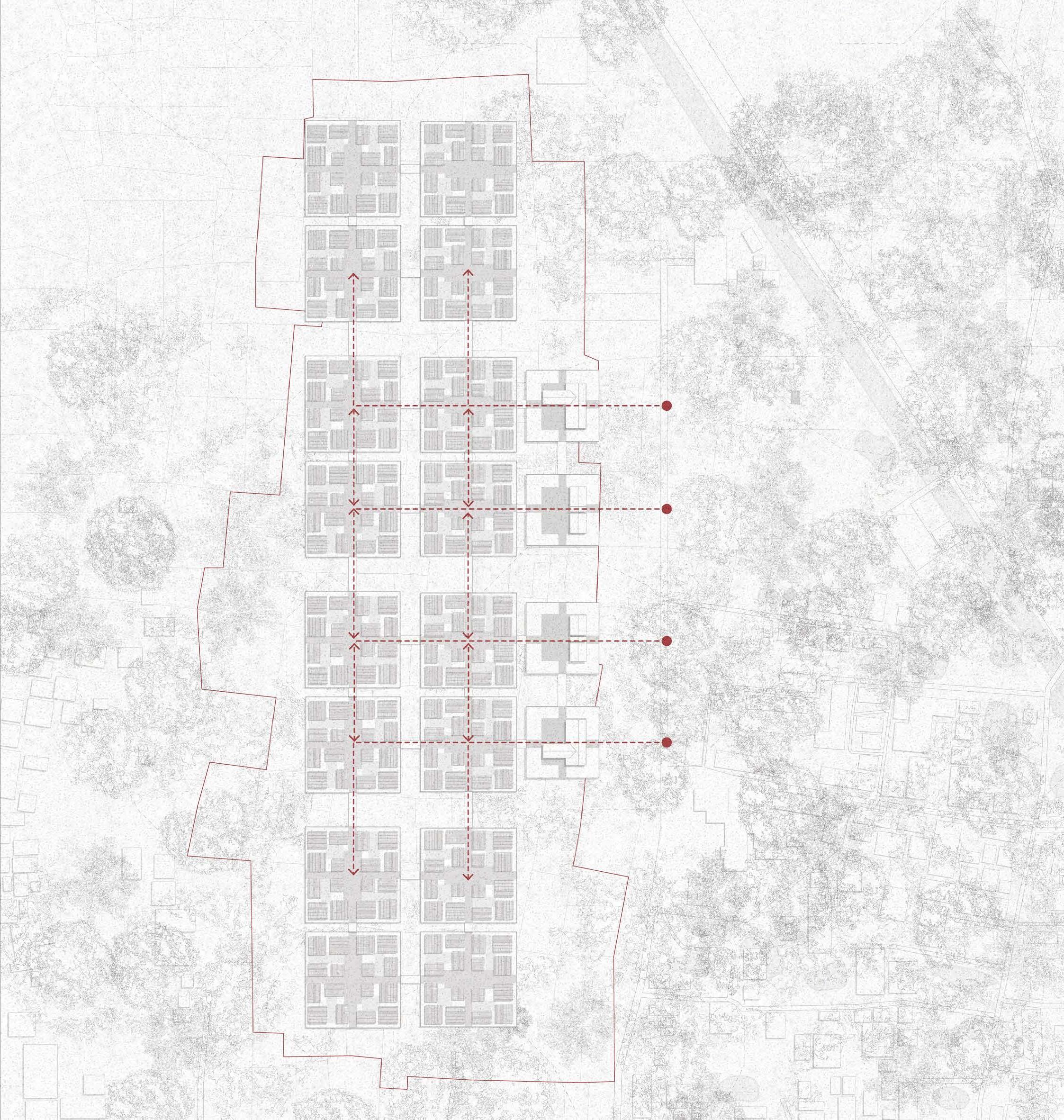
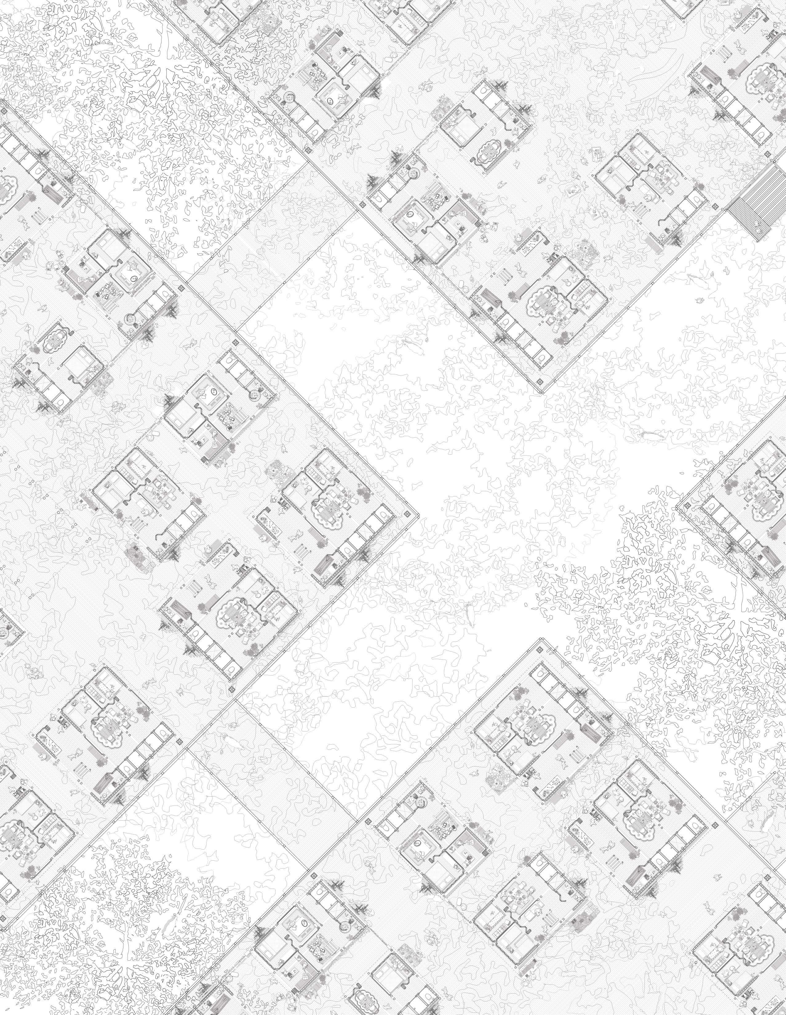
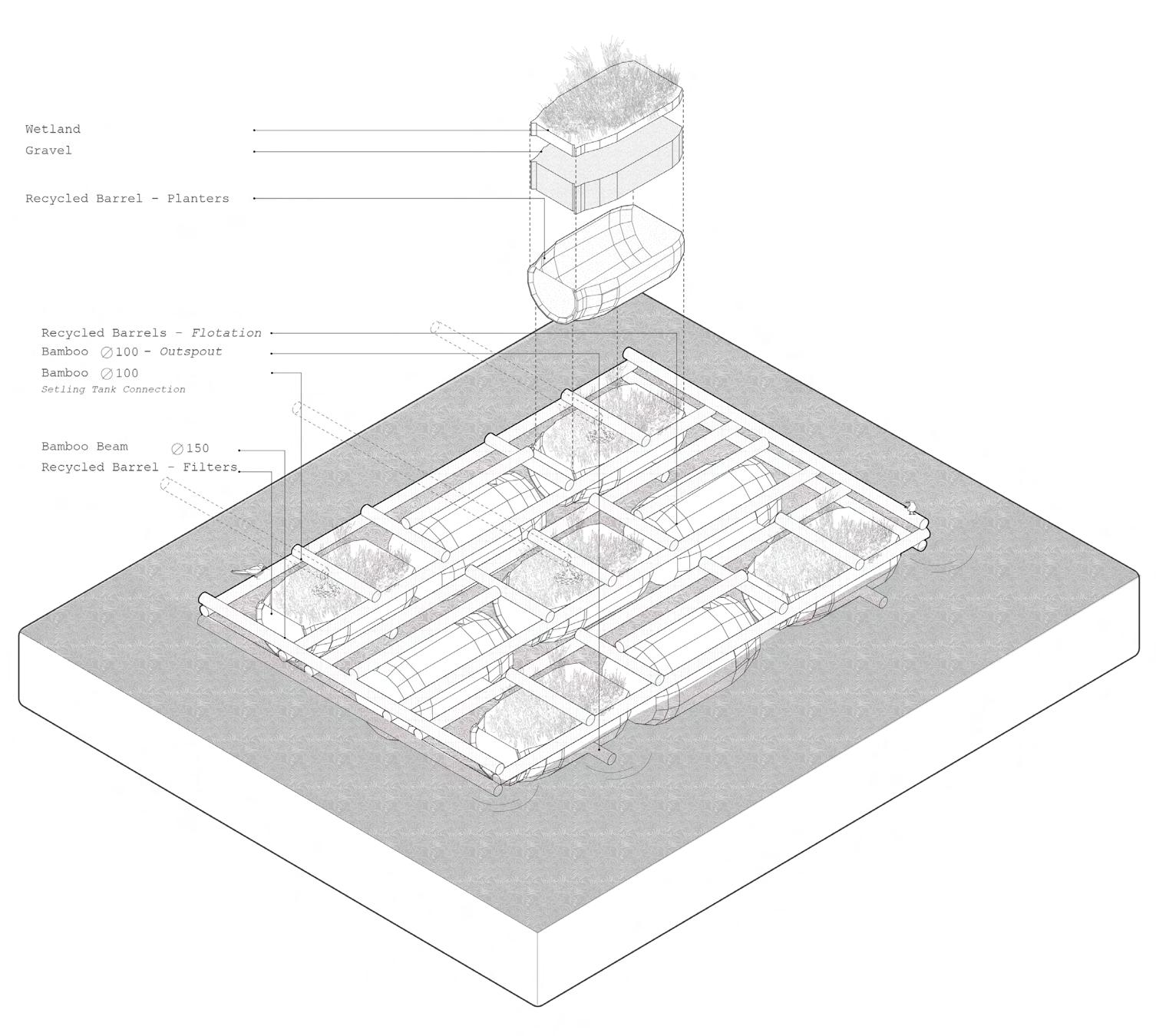
03A The Raft
“Heart of the Project”
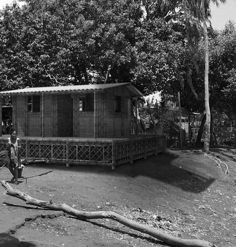
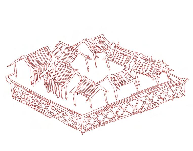
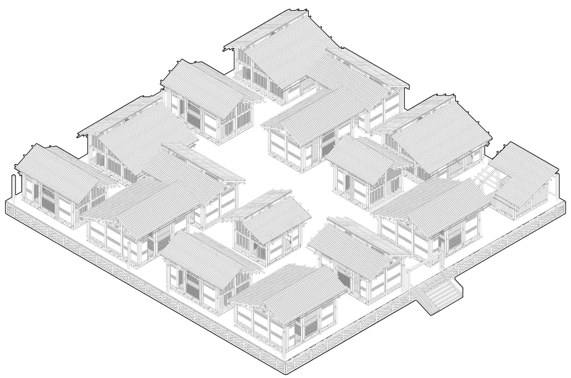
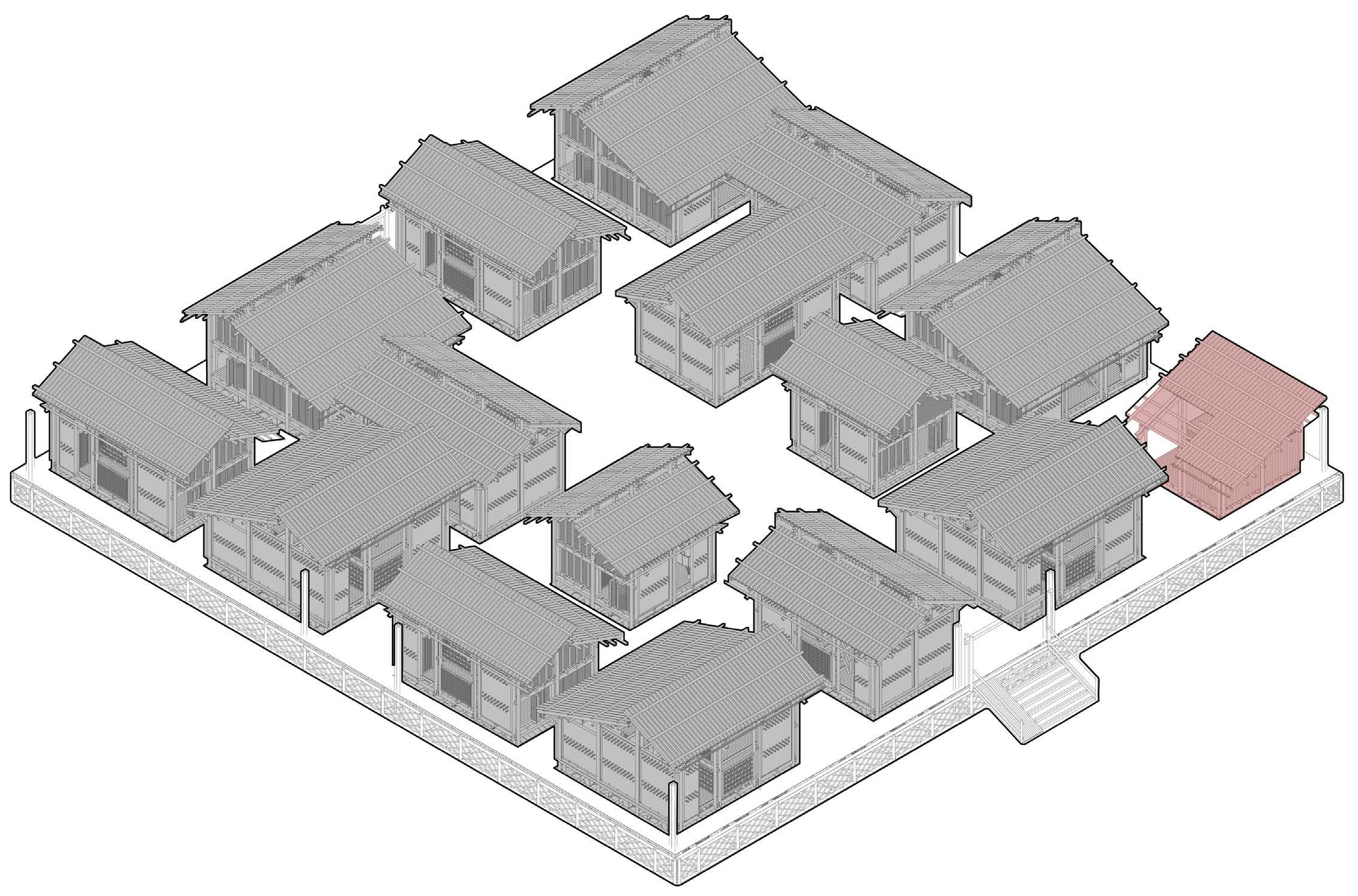
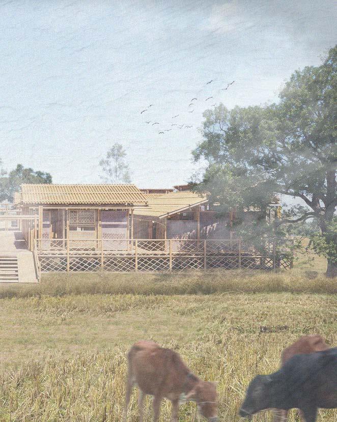
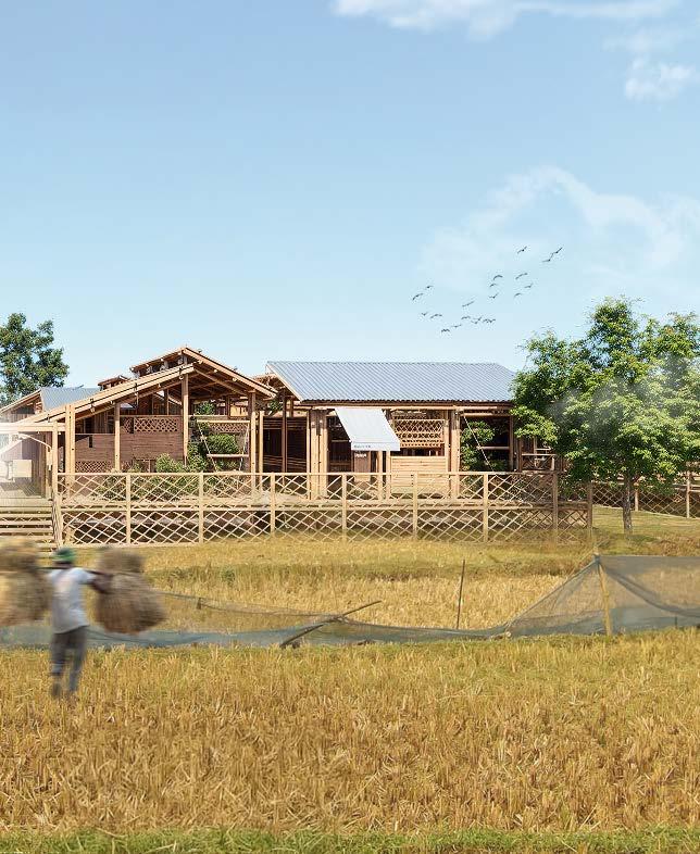
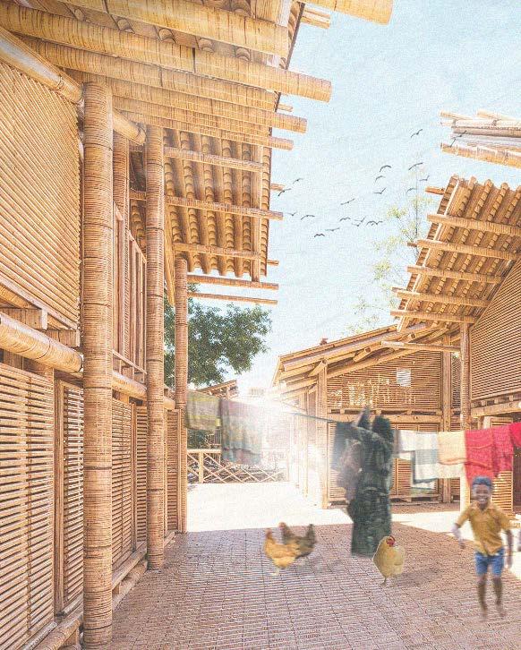
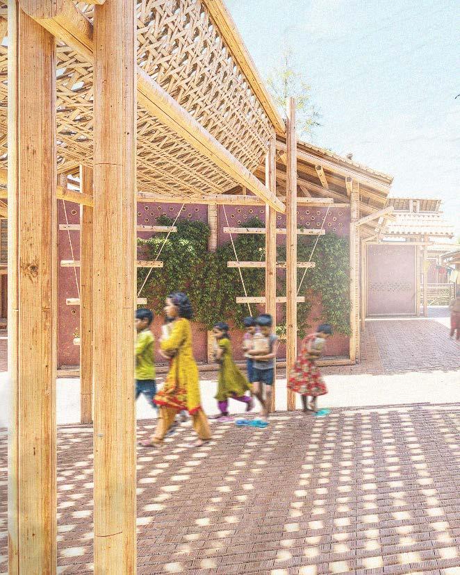
At the heart of the architectural proposal lies the raft, envisioned as a catalyst for establishing a resilient, water-based community. It aims to foster a strong sense of social cohesion and interpersonal relationships, even in the absence of permanent land. The design strategically incorporates a range of social scales—ranging from intimate to collective spaces—to support cultural expression and communal interaction, both of which are fundamental to Bangladeshi social life.
The “Raft”
The heart of the project
The proposal is based on the idea of the “Raft”. This component has been designed in a way that respects the cultural, economic and social aspects of the Bangladeshi culture.
Although the story of the “Raft” will take place within the Shonatola Community, its flexibility, scalability and modularity allow it to be implemented within vulnerable communities around the world.
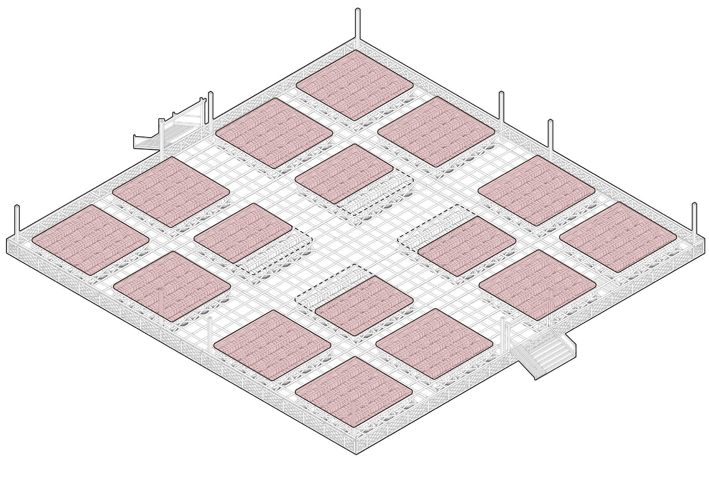
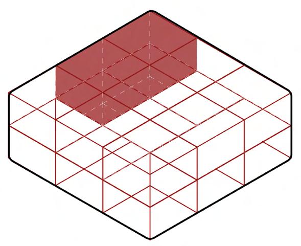
For the “Raft” to meet an FSI of 1.0, the larger dwellings must be favoured.
Living
2.5 x 2.5 x 1.5
96 Cubes per Raft
Communal
2.5 x 2.5 x 1.5
112 Cubes per Raft
Boundary
1.25 x 2.5 x 1.5
“A number of para’s (groups of dwellings) comprise a mohalla, meaning a village”
“Raft”
Plot Areas
The “Raft”
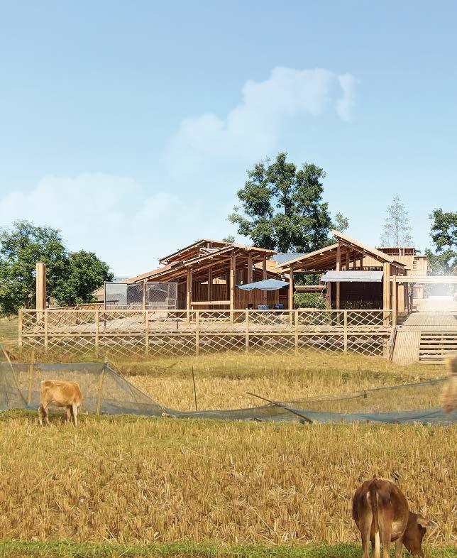
Each “Raft” can accommodate 15 homes and a space for livestock. There are three dwelling types that can be implemented within the raft
The plot areas allocated are 12 large plots of 56.25 sq.m and four smaller plots 37.5 sq.m. The smaller plots act as the framework for the communal area within the raft
The design encourages varied dwellings to be clustered in groups of four, to create pockets for communal outdoor spaces
The “Raft” Plot Areas Impression 68 Cubes per Raft
Social
The “Raft”
Although the “Raft” is a flexible component that allows communities to dictate the way they live, the number of dwellings and their arrangements are designed to foster different levels of social engagement based on Dunbar’s Number
Dunbar’s Number is a theory proposed by British anthropologist Robin Dunbar, suggesting that humans can maintain stable social relationships with approximately 150 people
The theory relates to the neocortex, the part of the brain responsible for cognition, language, and sensory perception
Within this group, it is theorized that individuals can have about five intimate friendships. The concept has been influential in understanding social networks and relationships
The Theory -
150 PEOPLE - A TRIBE
50 PEOPLE - A CLAN
15 PEOPLE - A SYMPATHY GROUP
5 PEOPLE - A SUPPORT GROUP
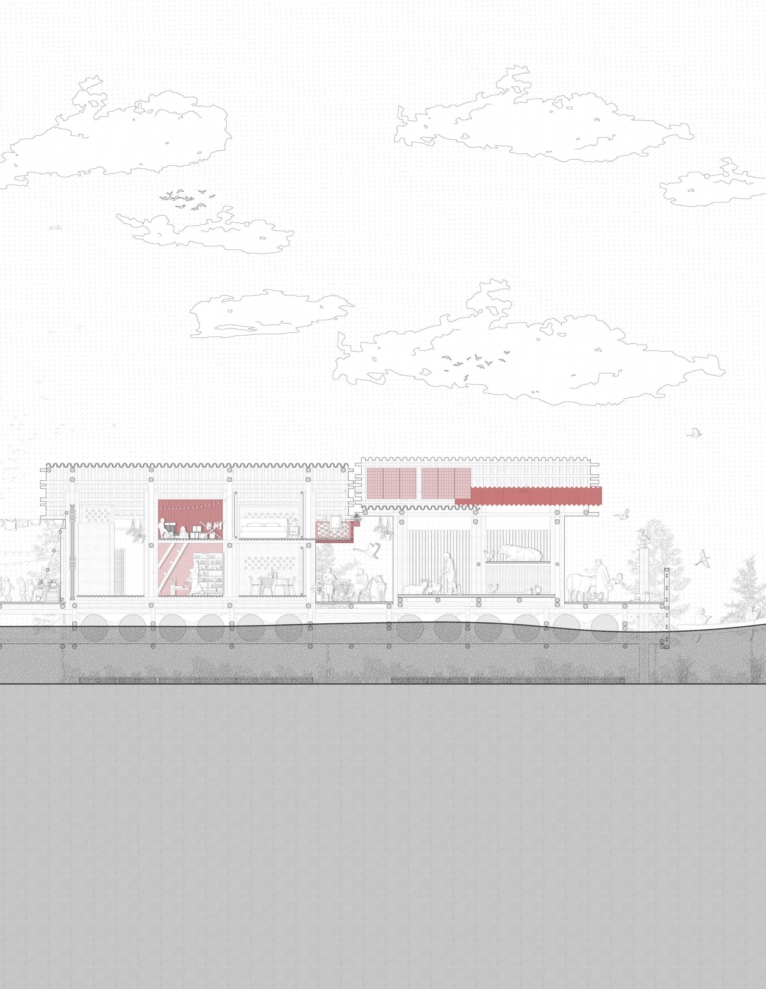
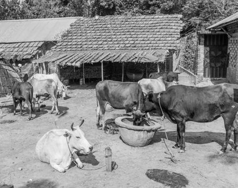
Dwellings Livestock
Small Dwelling (Type A)
Medium Dwelling (Type B)
Large Dwelling (Type C)
Dwellings
The “Raft”
Social The “Raft”
Within the larger raft smaller groupings of four dwellings have been created. This allows for a second form of social engagement within the larger community
The Theory -
150 PEOPLE - A TRIBE
50 PEOPLE - A CLAN
15 PEOPLE - A SYMPATHY GROUP
5 PEOPLE - A SUPPORT GROUP
“A number of bari (a dwelling) grouped together is a para”
Grouping of Four
Grouping of Four
The “Raft”
Communal Areas
The “Raft”
Each “Raft” promotes two different levels of social engagement, promoting relationship within the tribe and clan as explained in Dunbar’s number
Closed Areas
Living and Service
Open Areas
Veranda Paths
“The Maidan is a term used to refer to an open space or square, commonly found in various cultures. It often serves as a communal area for gatherings, protests, festivities, and significant sociocultural activities”
Central Communal Spaces
Grouping Communal Spaces
The “Raft”
Communal Areas
Community Areas
Longitudinal Section
The drawing aims to convey the different levels of community spaces. The space allocated for community areas is based on the dwelling options chosen per four clusters
Residential Adaptations
Longitudinal Section
The drawing aims to convey the various adaptations that could be made by the community over time. The adaptations that are made cannot be permanent structures as that would interfere with the amphibious system
Raft Visualization
Season
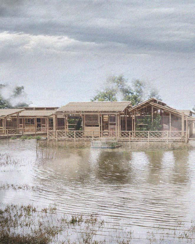
Raft Visualization Monsoon Season
Construction Sequence
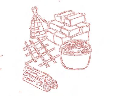
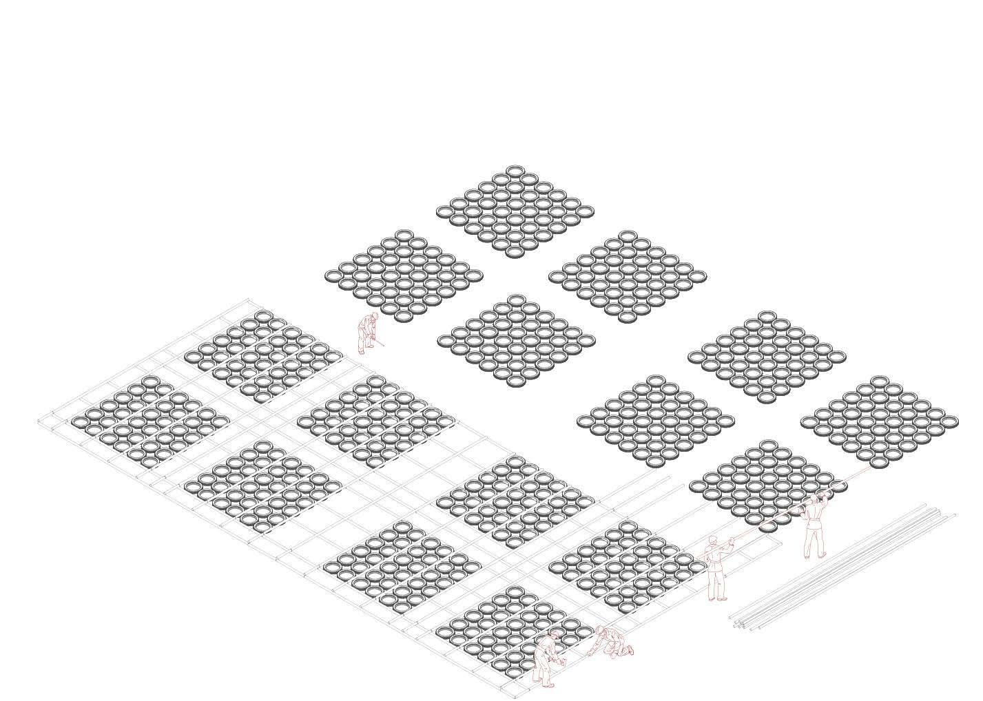
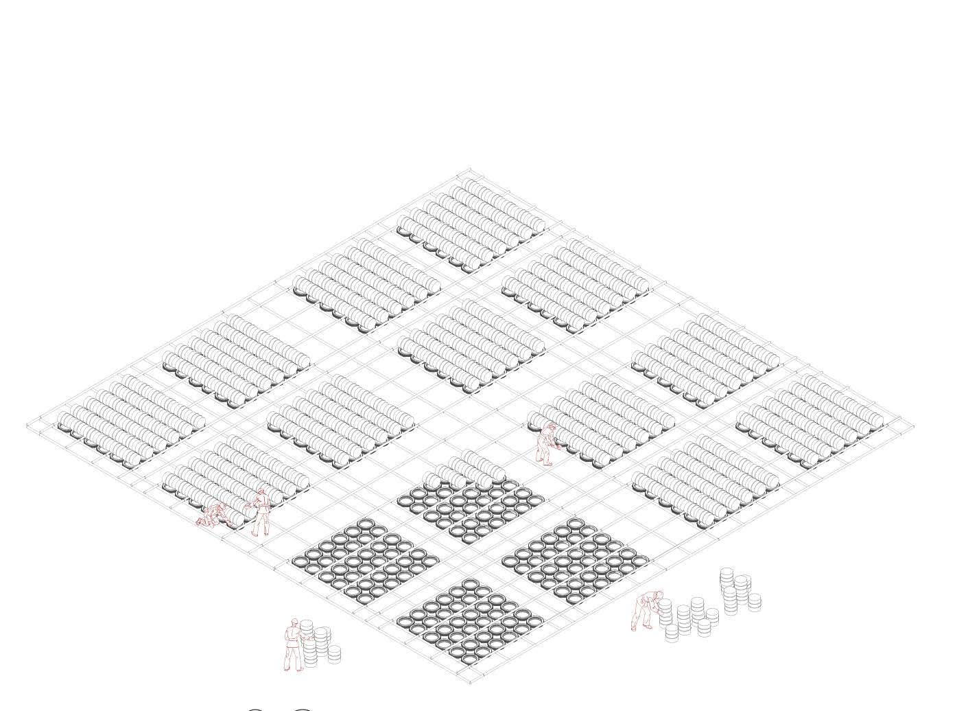
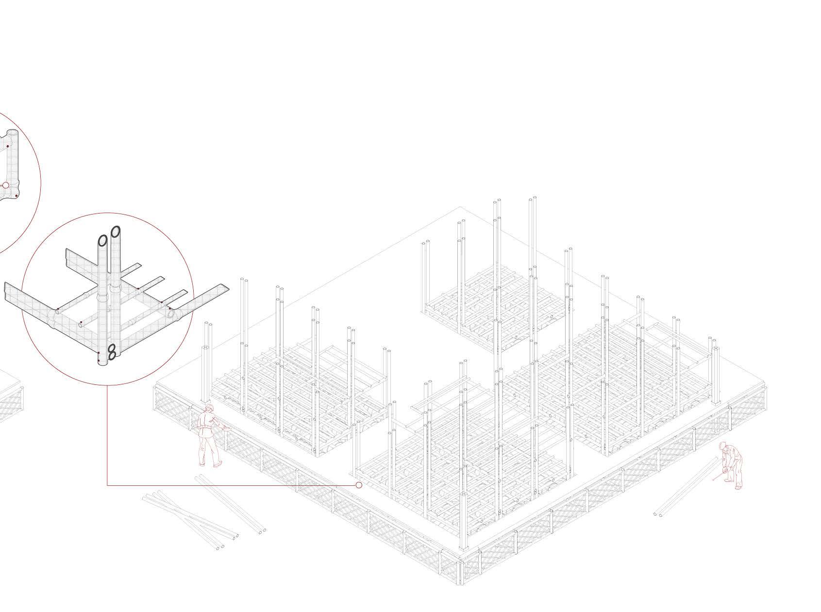
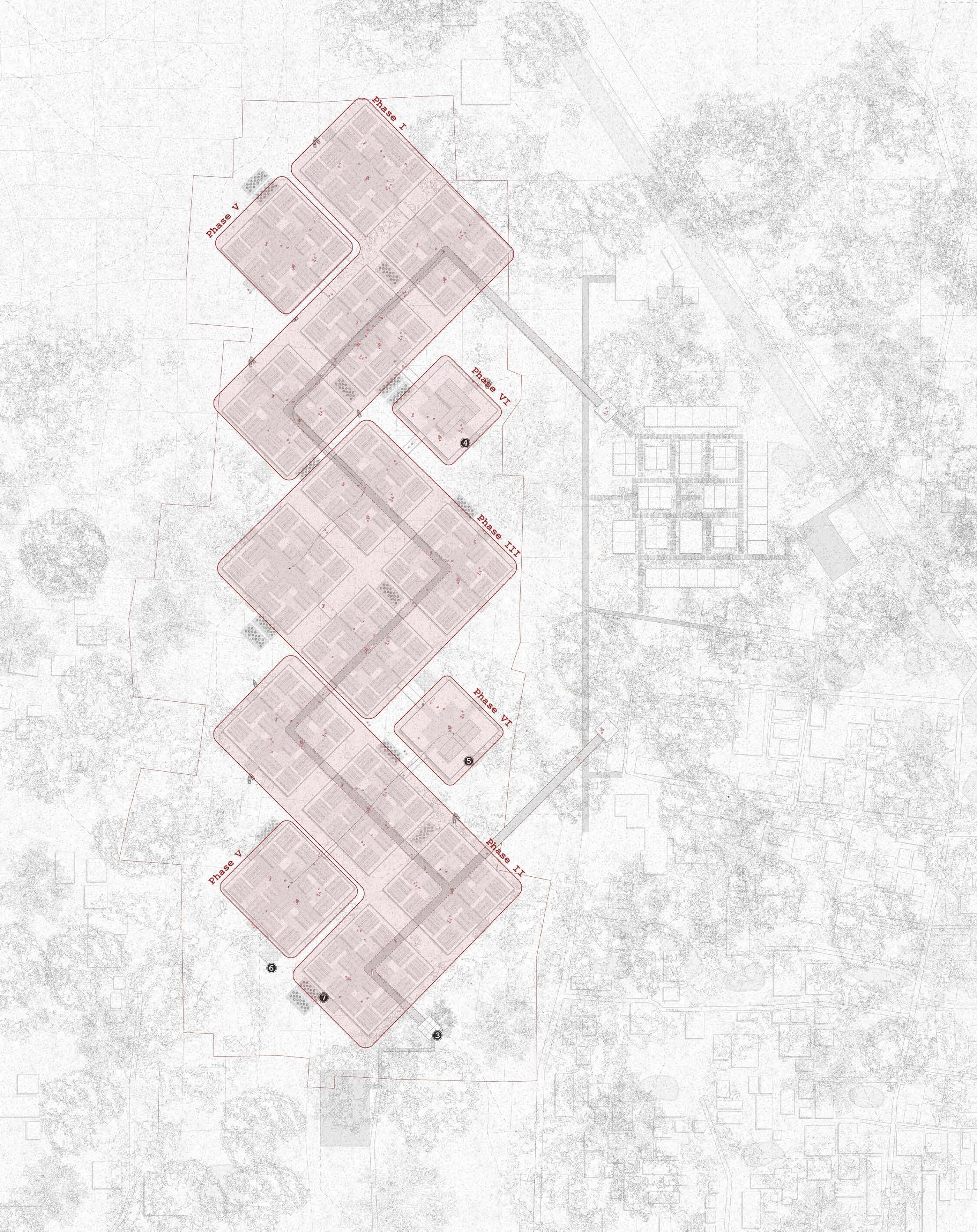
Phasing
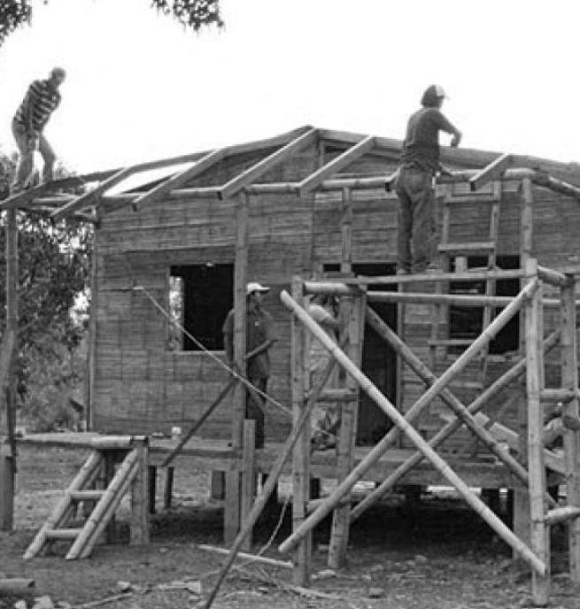
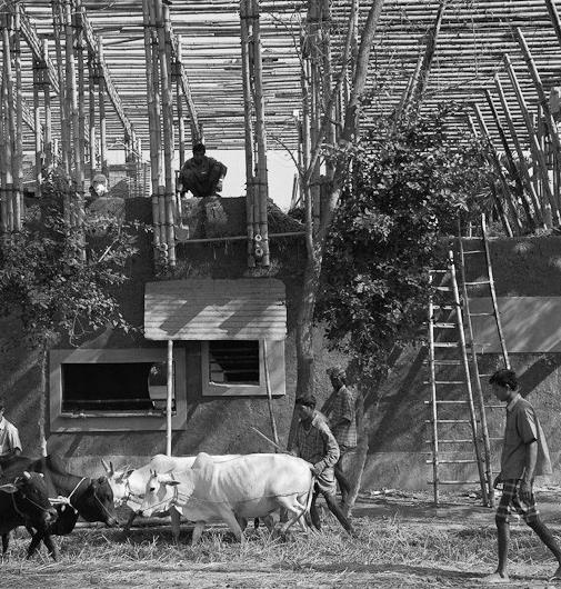
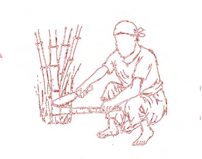
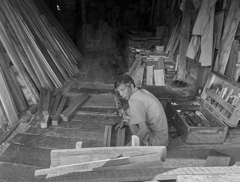
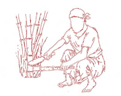
The construction of the raft is dependent on a few key points. The harvesting of the local materials and the use of community engagement for the actual assembly.
Phasing of Rafts
Four Rafts per year
• Assuming 50 Culms per mature clump
• 8,000 Culms (2,000 per raft) / 50 Culms per Clump - 160 Clumps Needed
• Assuming each clump requires 25 sq.m of space
Area Required for Project
Four Rafts per year
• 160 Clumps x 25 sq.m - - 4,000 sq.m
• 4,000 sq.m - Approximately 1 acre
One time Harvest
Four Rafts per year
• Require one acre of land
Sustainable Harvesting
Four Rafts per year
• Harvesting only 20-30% each year
• Requires 3-4 acres of land
• Allowing for healthy clumps, providing a steady supply of Bamboo
Harvesting
Four Rafts per year
• Harvest takes place during the dry season
• The project will require 4-5 years to be completed with the master plan showcased
Growing
Each raft requires approximately 2,000 bamboo culms made up of three different varieties
Waterproofing
The bamboo culms are chemically treated by applying a liquid made by boiling local Gaab fruits. This traditional Bangladeshi method waterproofs bamboo (1-2 Mature fruits are needed per culm)
Preparation
The bamboo is dimensioned into pieces that would require approximately 4-8 individuals to transport the largest pieces
Harvesting
To ensure an ongoing productive farm only 25-30% of the bamboo should be harvested each year
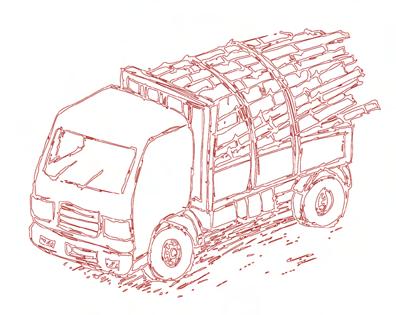
Transportation
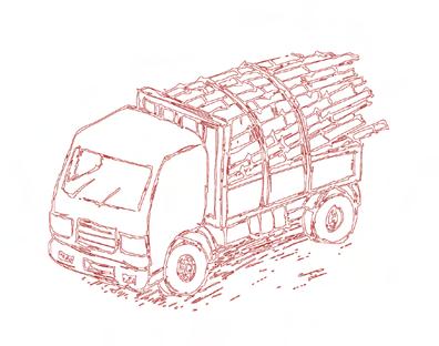
Bamboo is harvested in the Sylhet and Chittagong Divisions, and transported to the site
Assembly
The project is designed to not require large machinery to assemble
Construction Sequence
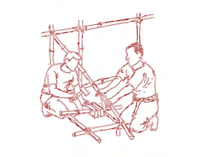
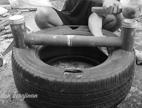
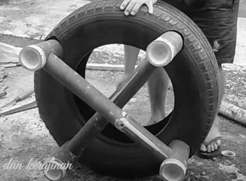
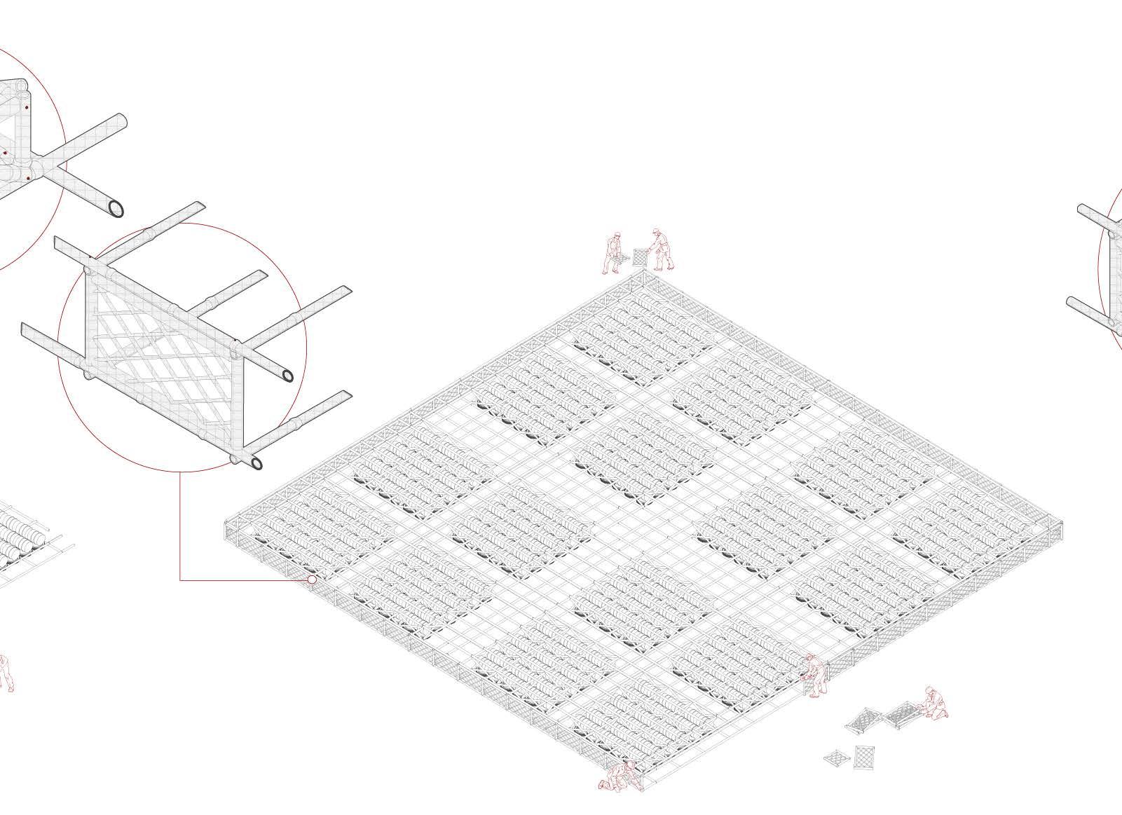
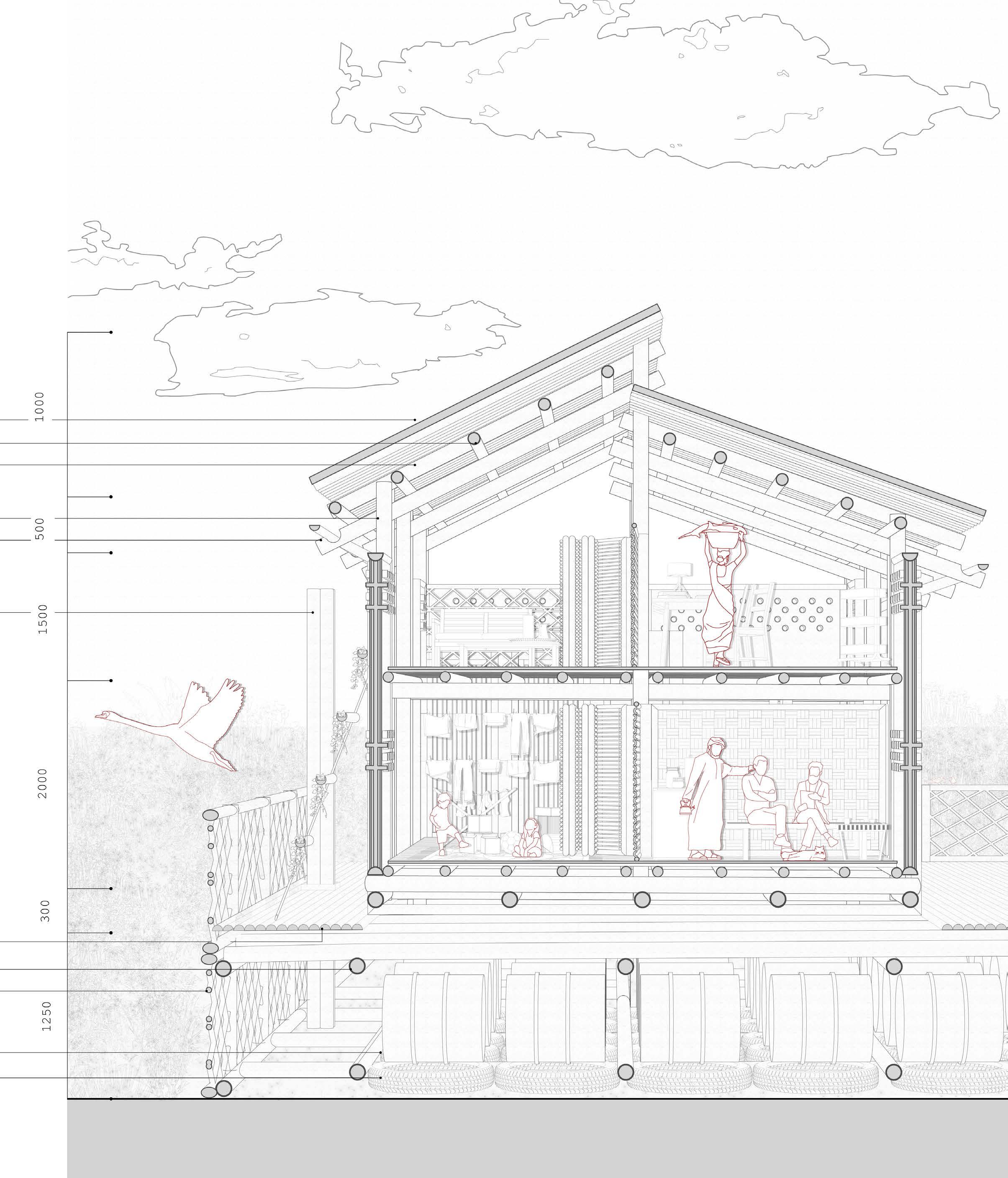
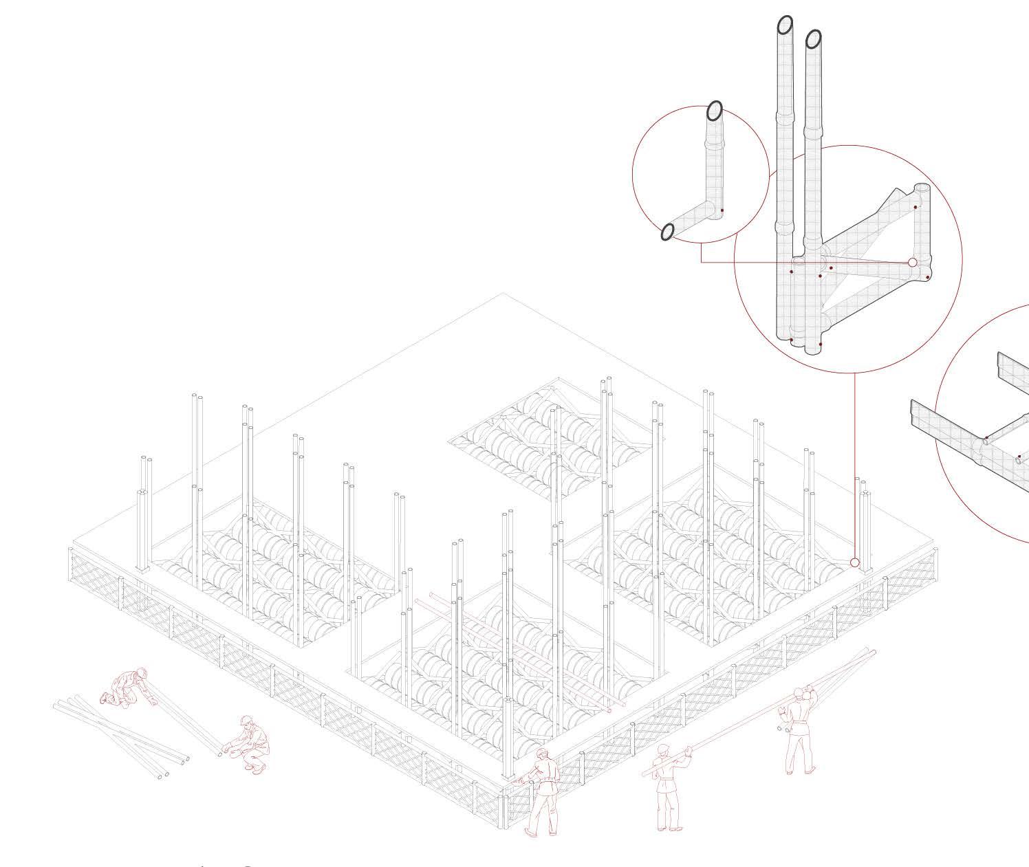
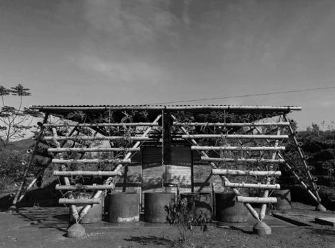
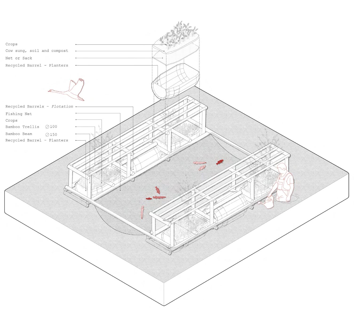
Cushioning Layer
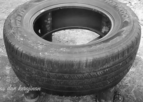
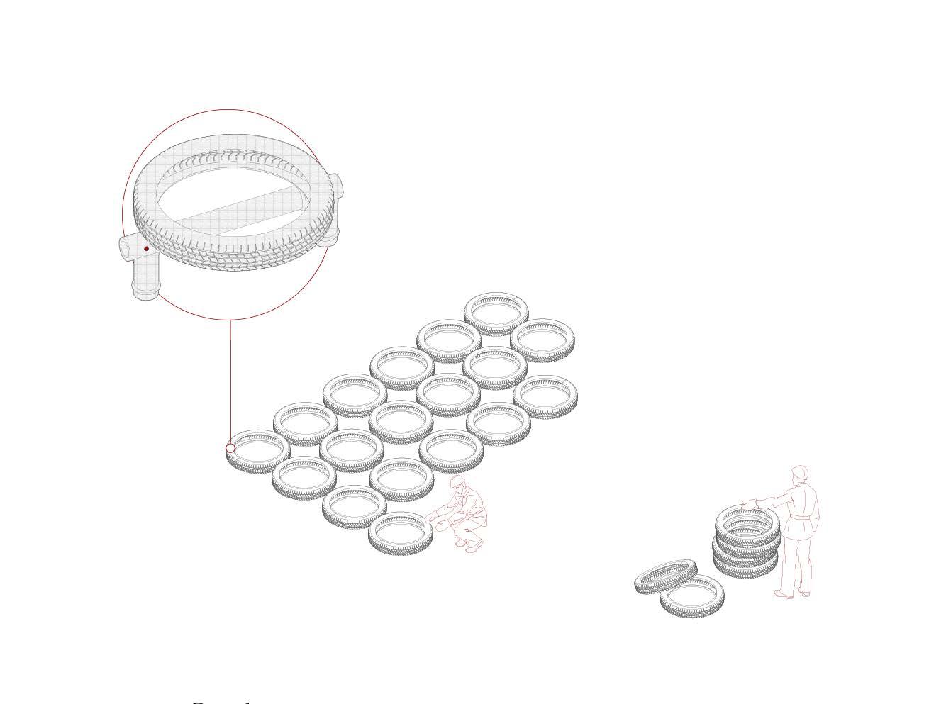
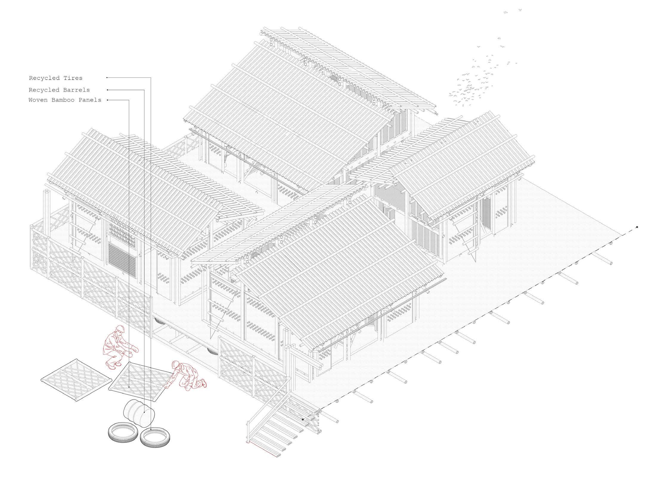
The raft assembly begins with the laying of recycled tires, as a cushioning element for the steel drums.
The tires are secured in place using a single bamboo connection and planted into the ground. The inspiration for the connection is derived from a series of projects utilizing bamboo and used tires.
“It is estimated that around 1.0 billion scrap tires are produced every year all over the world, out of which around 150,000 tons are produced by Bangladesh”
Construction Sequence
Bamboo Raft Structure
The construction of the raft structure begins with the base layer of Bamboo.
The structure is composed of Bambusa Balcooa and Steel Connections
Bambusa Balcooa
• 96 x 5m
• 200 x 18.75m
• 212 x 1.25m
• 768 x 2.5m (Cross-Bracing)
◦ Total of 6,415m of Bamboo
• 320 Bamboo Culms
In Bangladesh, the annual production of Bambusa balcooa ranges between 1,200 to 1,700 culms per hectare
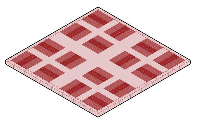
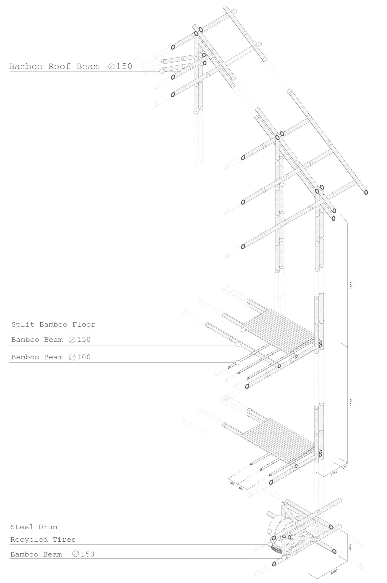
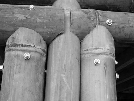
Construction Sequence
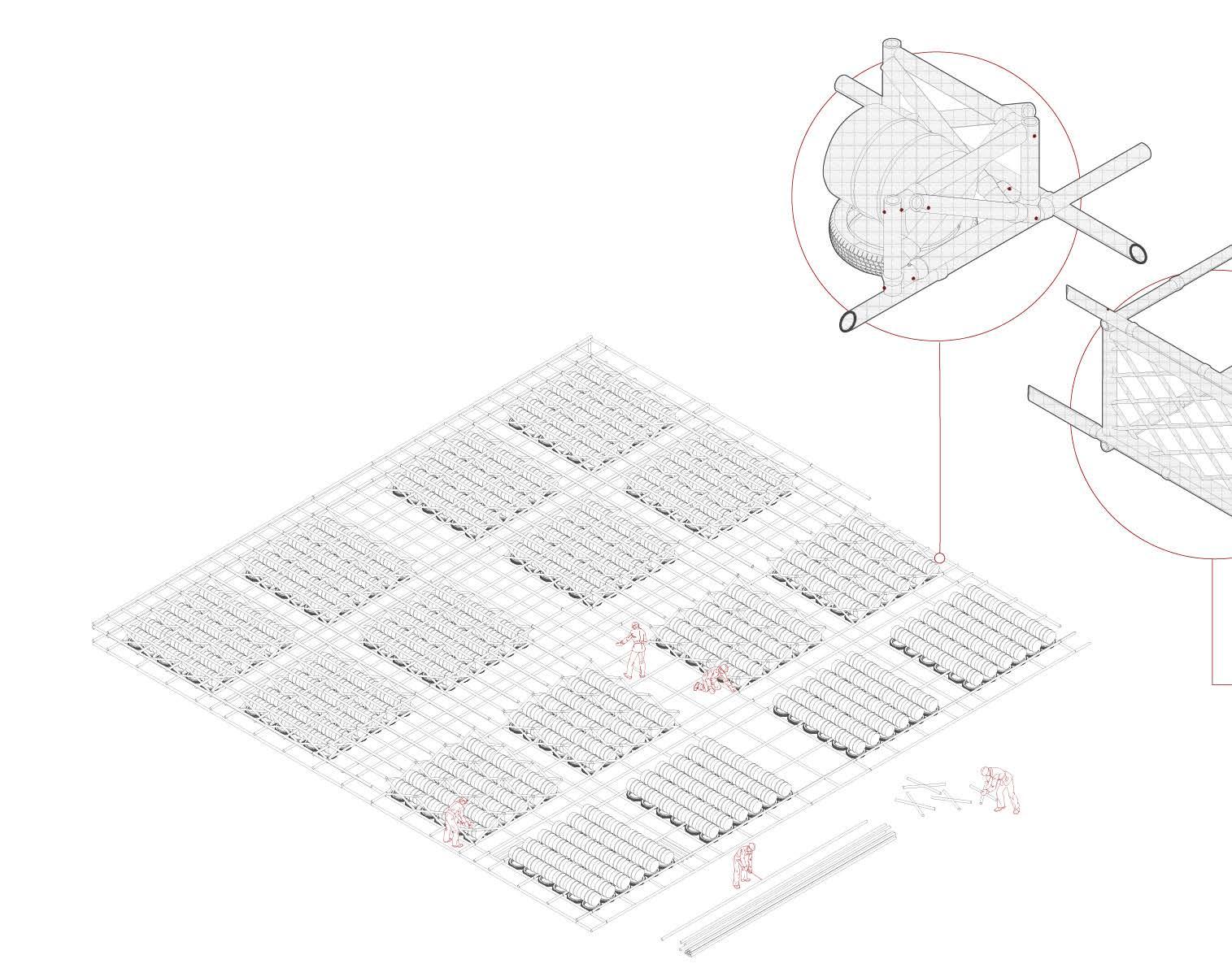
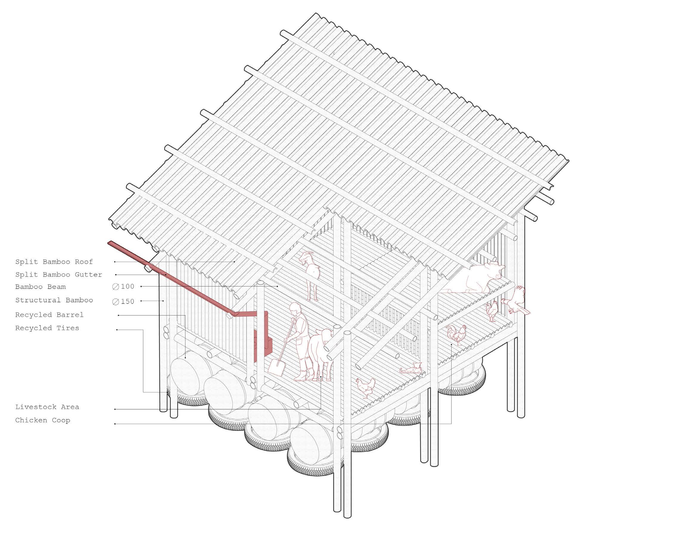
Steel Drums
After the first layer of horizontal and vertical structural elements, the steel drums are incorporated into the raft.
Each 210-liter drum has a diameter of 572mm (22.5 inches) and a height of 851mm (33.5 inches) internally. As such, each drum can displace a maximum of 210kg. To ensure the feasibility of the project a maximum of 2/3rd of this theoretical maximum is used as the maximum displacement - this accounts for the weight of the drum itself, and provides an adequate safety margin to ensure the raft floats
The drums are checked before application to ensure they are airtight and that the structure supports the weight of the dwellings without deforming the drums.
Each raft holds 576 drums, resulting in a total weight of 72,576kg being supported
Steel Drum recycling factories can be found within Old Dhaka and be transported to the site
Small
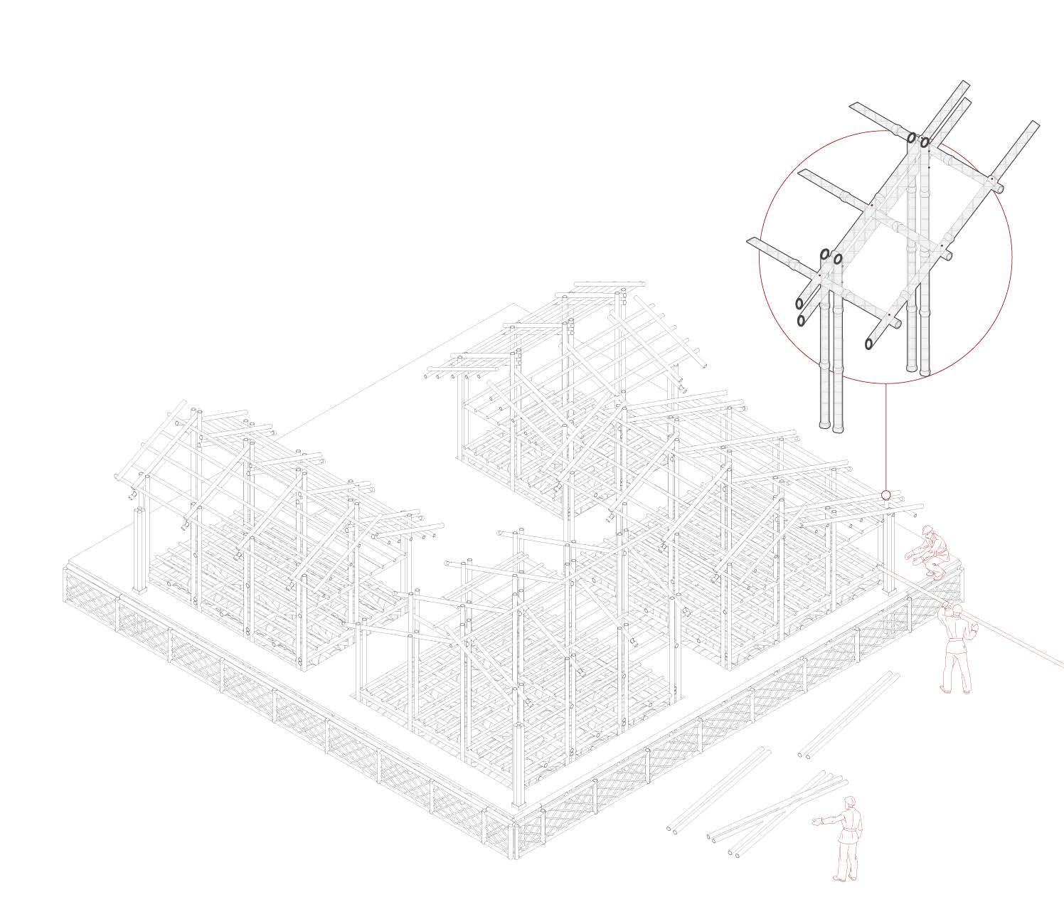
Construction Sequence
Cross Bracing
Cross bracing is added to the areas supporting the steel drums, to limit the lateral movement of the raft and prevent any deformation of the drums by the weight of the dwellings
The structure is composed of Bambusa Balcooa and Steel Connections
Once the bracing is complete the top layer of horizontal and vertical structural elements is implemented
The method aims to aid in the distribution of loads as well as resist forces from different directions
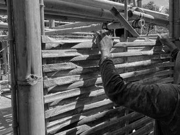
Construction Sequence
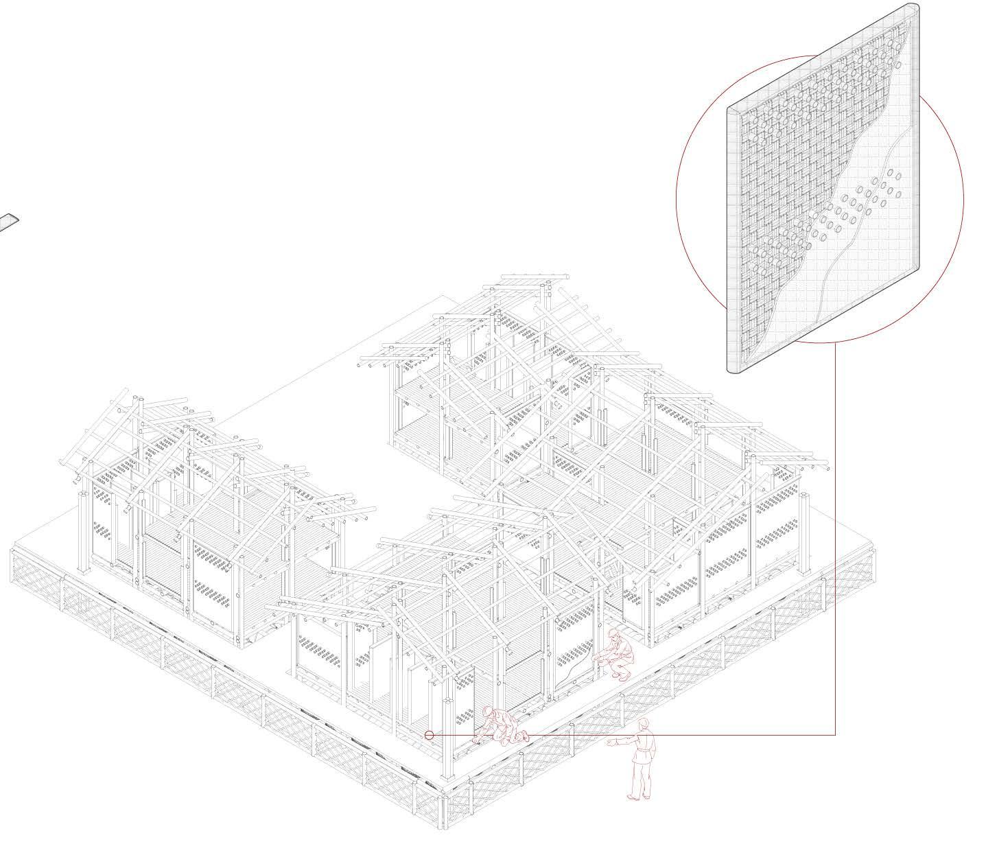
The raft structure is finished of with a set of woven panels that ensure there is no manipulation to the amphibious system
The structure is composed of Bambusa Balcooa and Steel Connections
◦ Total of 1,280m of Bamboo
• 64 Bamboo Culms
Melocanna Baccifera
• 64 x 20m
Bamboo Panels
M. baccifera occupies roughly 100,000 hectares in the Sylhet and Chittagong Hill Tracts regions. (11,000 culms per hectare)
Construction Sequence
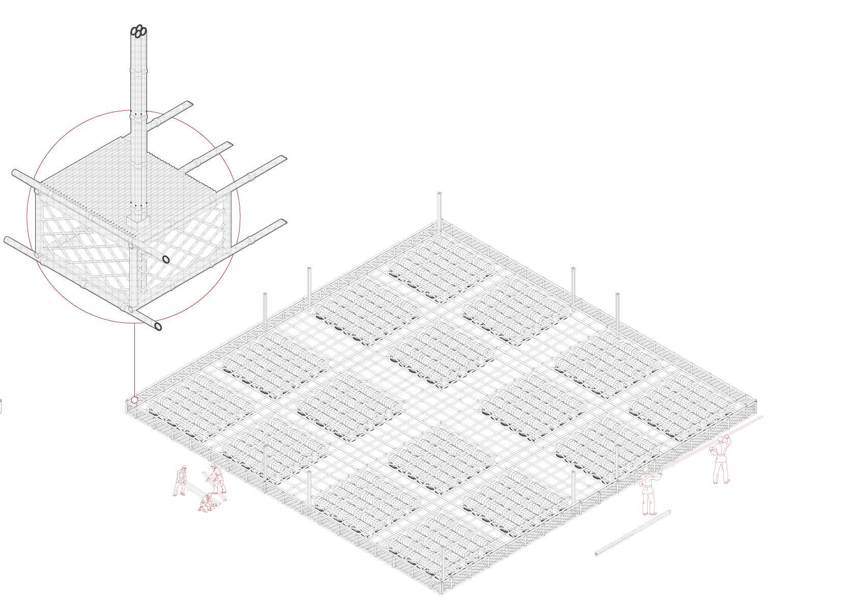
Guiding Posts
Planting of the guiding posts.
Four bamboo culms are bolted together for each guiding post
• 12 x 6m
◦ Total of 72m of Bamboo
• 3.6 Bamboo Culms
Bambusa Balcooa
Four bamboo culms are bolted together to increase the lateral strength during flash flooding
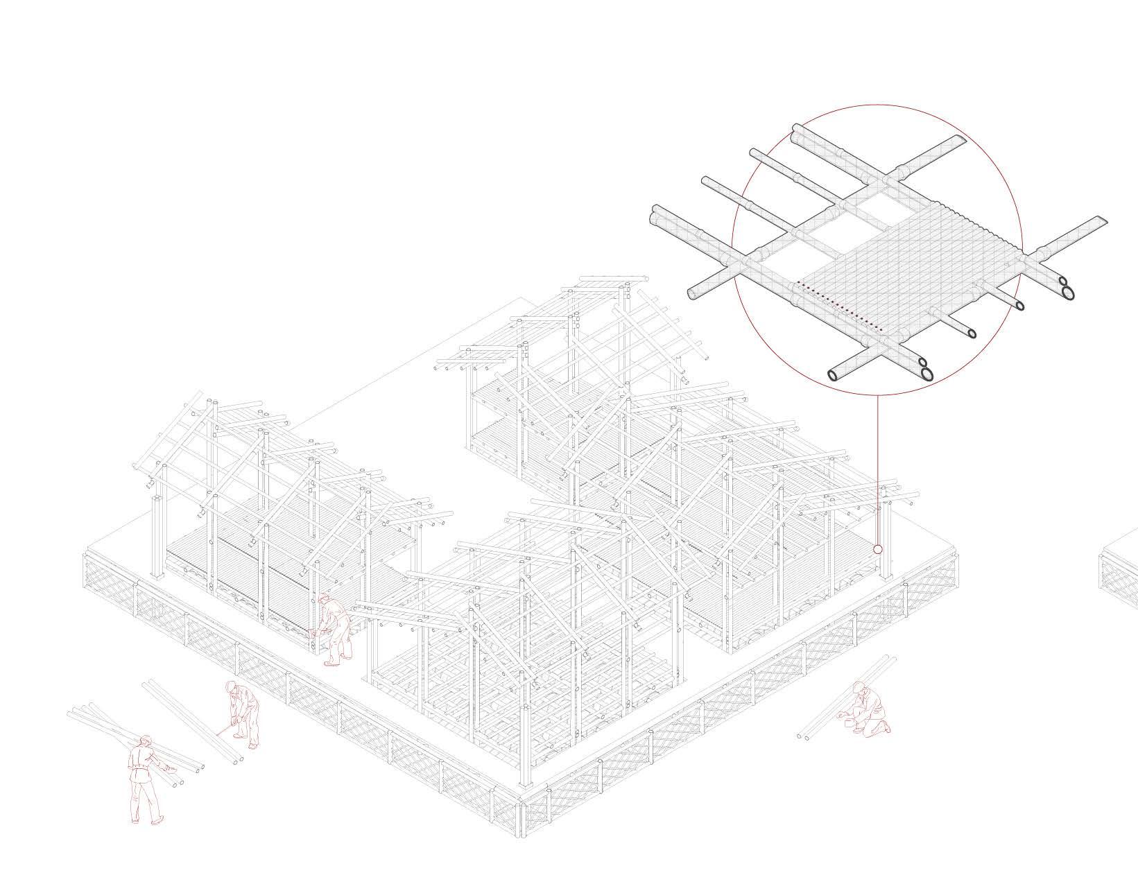
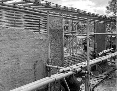
Construction Sequence
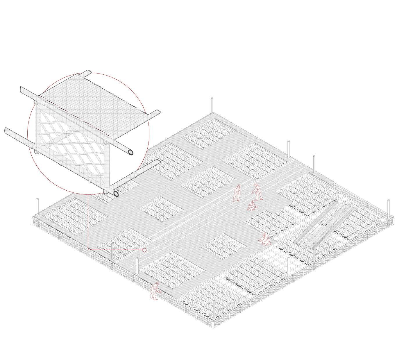
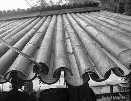
Raft Flooring
The boundaries of each home are planned per cluster, and the split bamboo flooring is mounted on the raft
The floor structure is composed of Dendrocalamus Longispathus and Steel Connections
Dendrocalamus Longispathus
▪ Approximate Total of 10,500m (18,062.5-Dwelling Base Floor Area) of Bamboo
• 700 Bamboo Culms
Gaps in the flooring are based on the dwelling perimeters that are pre-planned
Construction Sequence
Two points of access are provided for each raft with the ground and serve as boat docking areas during flooding.
A bridge system is implemented within the design and utilized during the flooding seasons to connect the rafts together. The staircase location varies based on the masterplan layout chosen per community.
Raft Staircase
The staircase design aims to create an experiential entry point onto the community raft
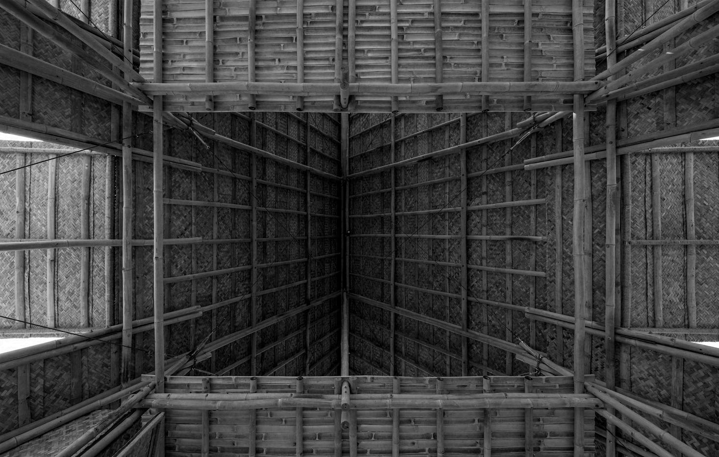
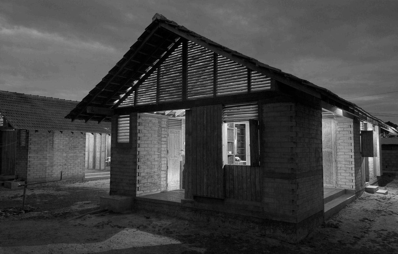
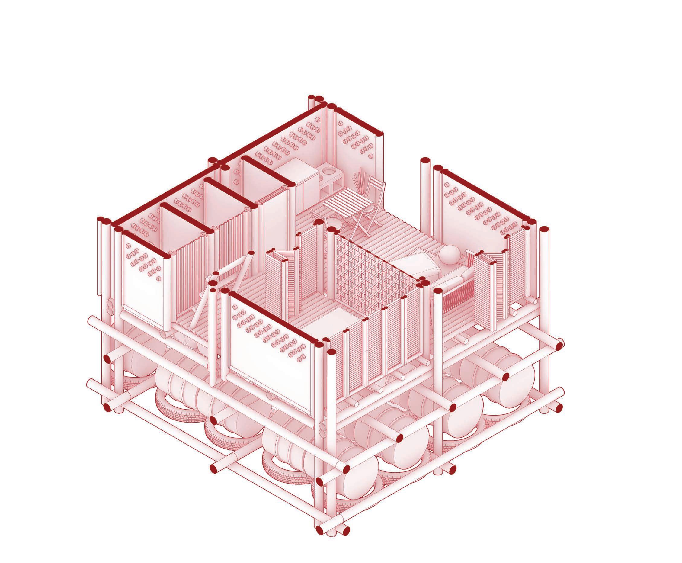
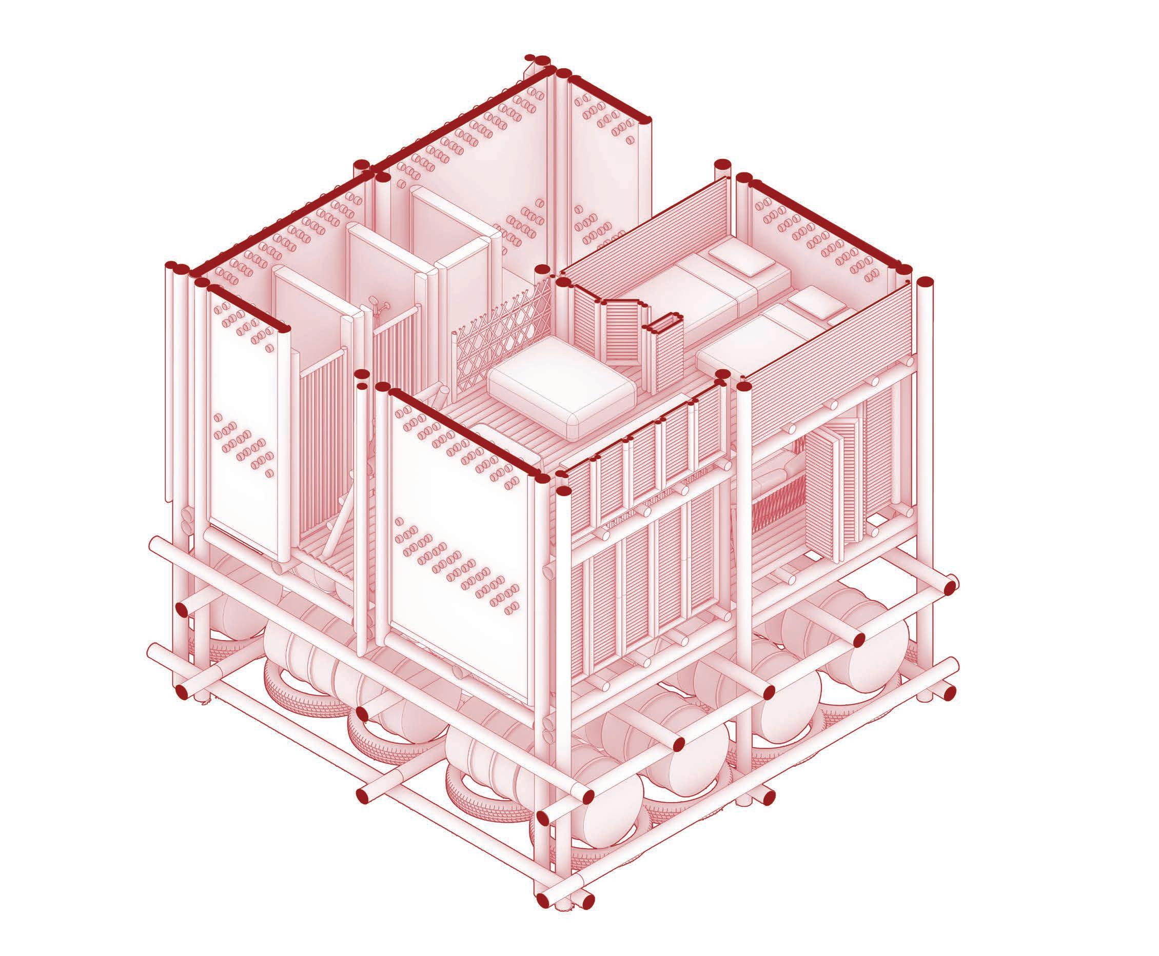
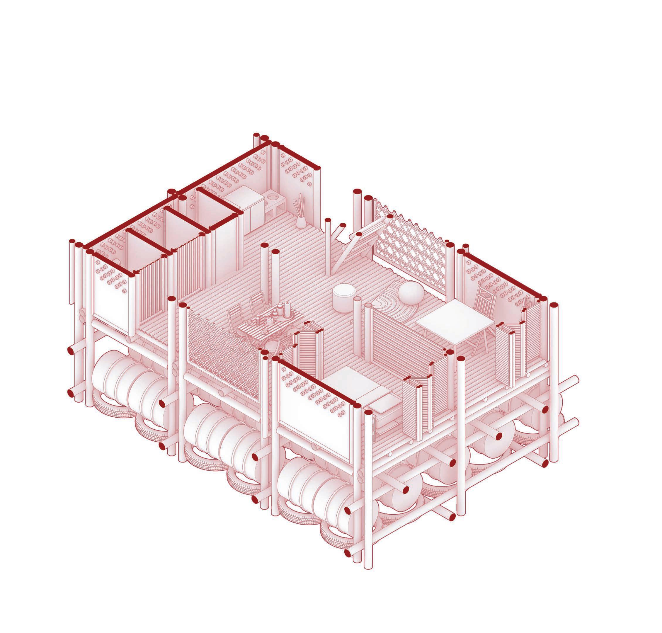
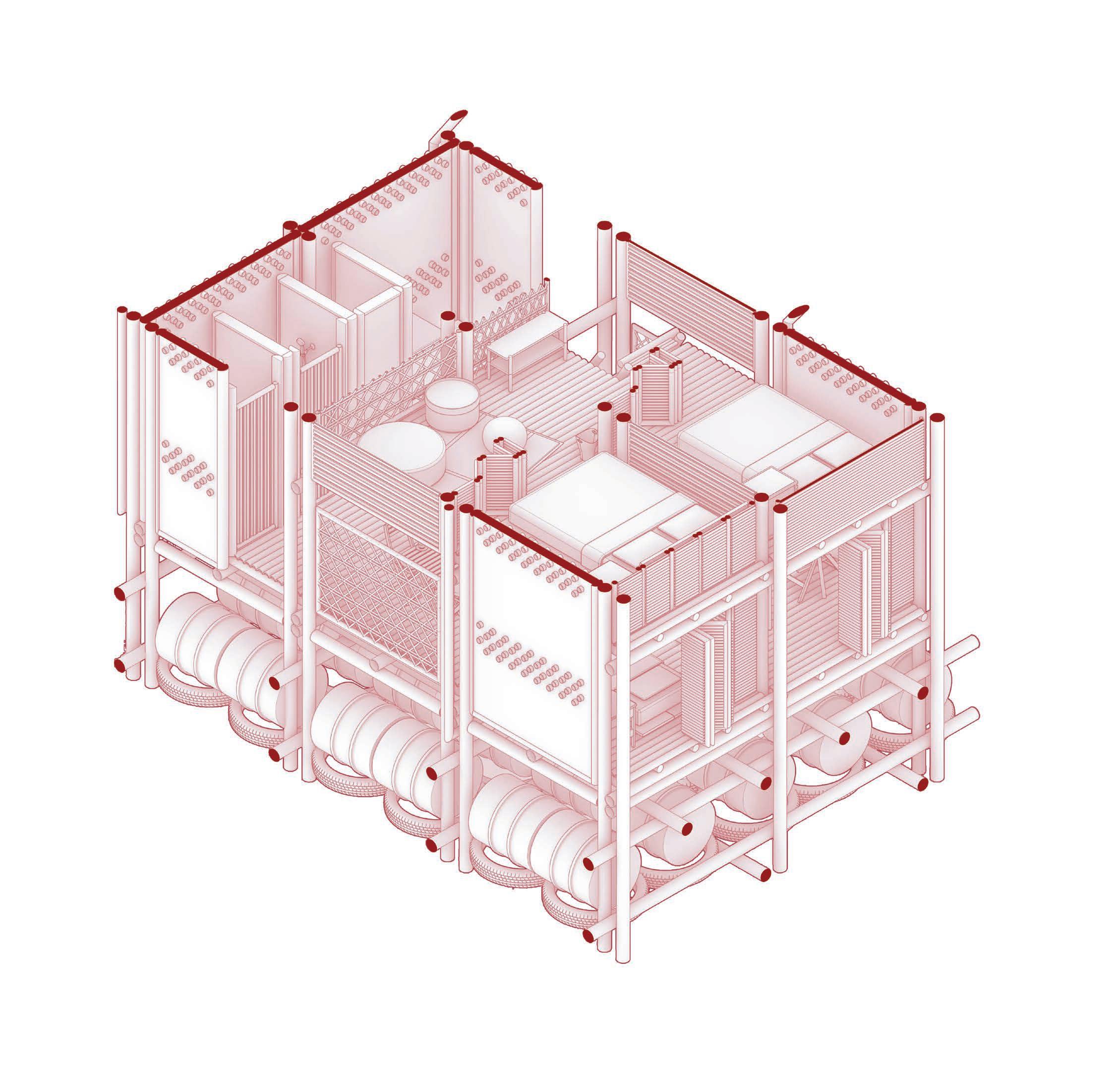
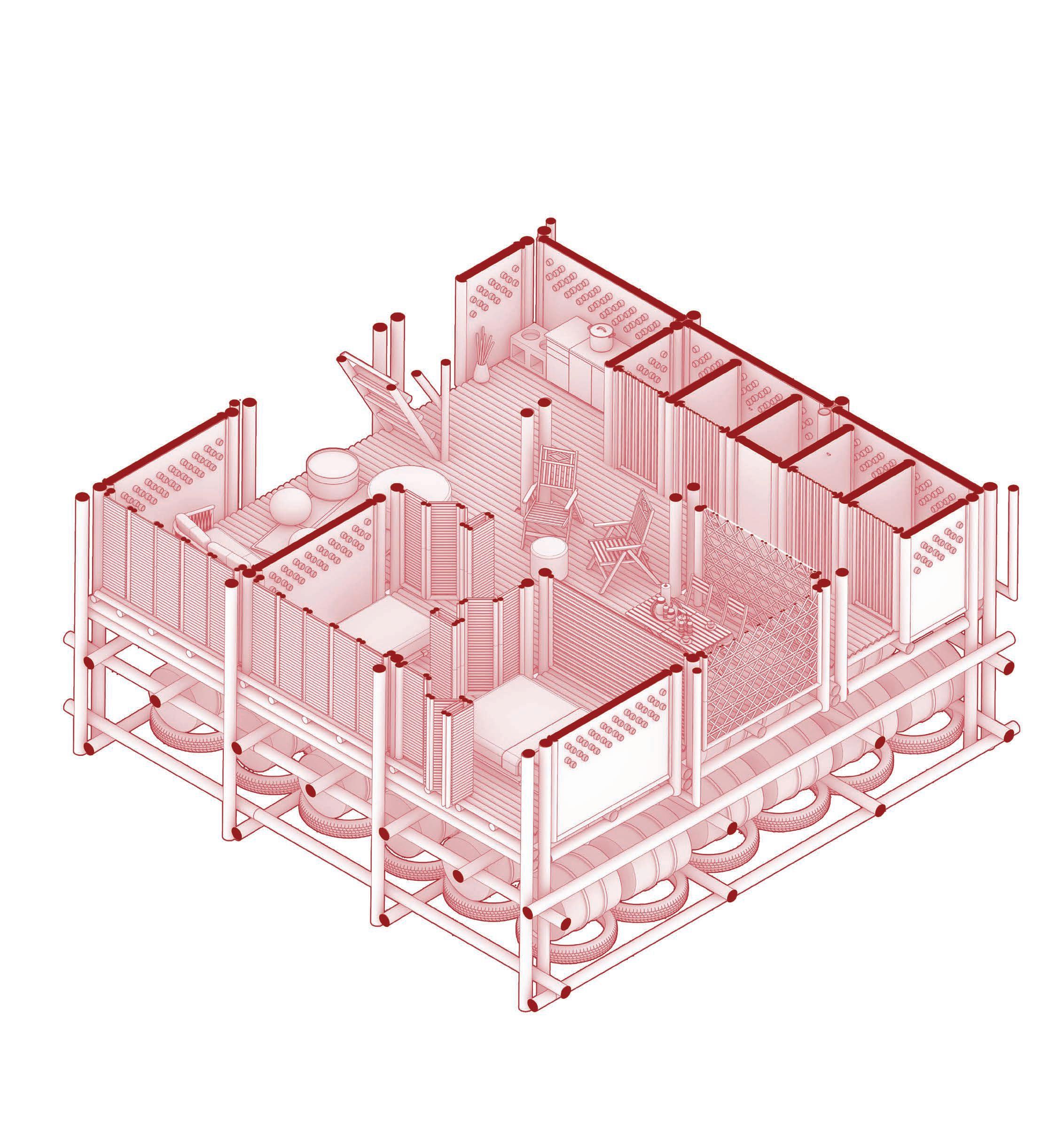
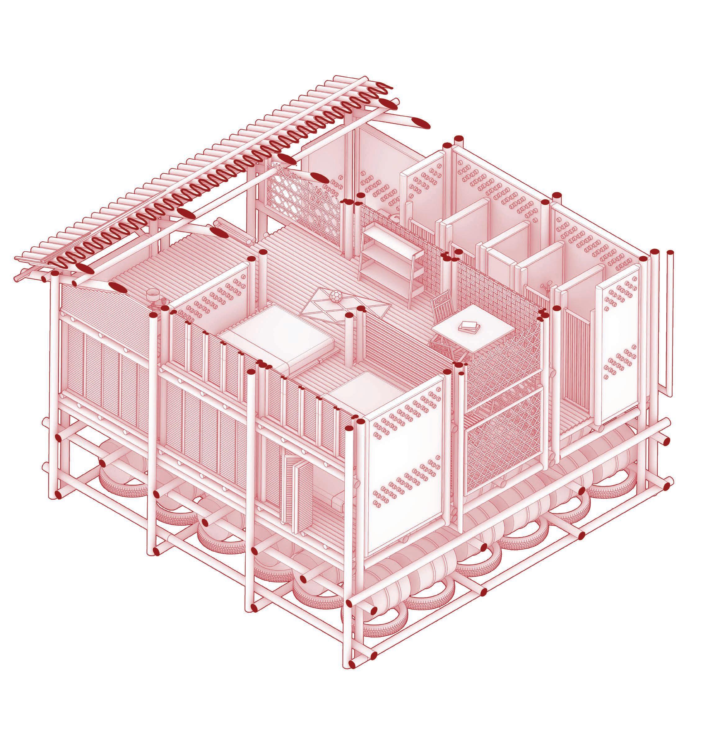
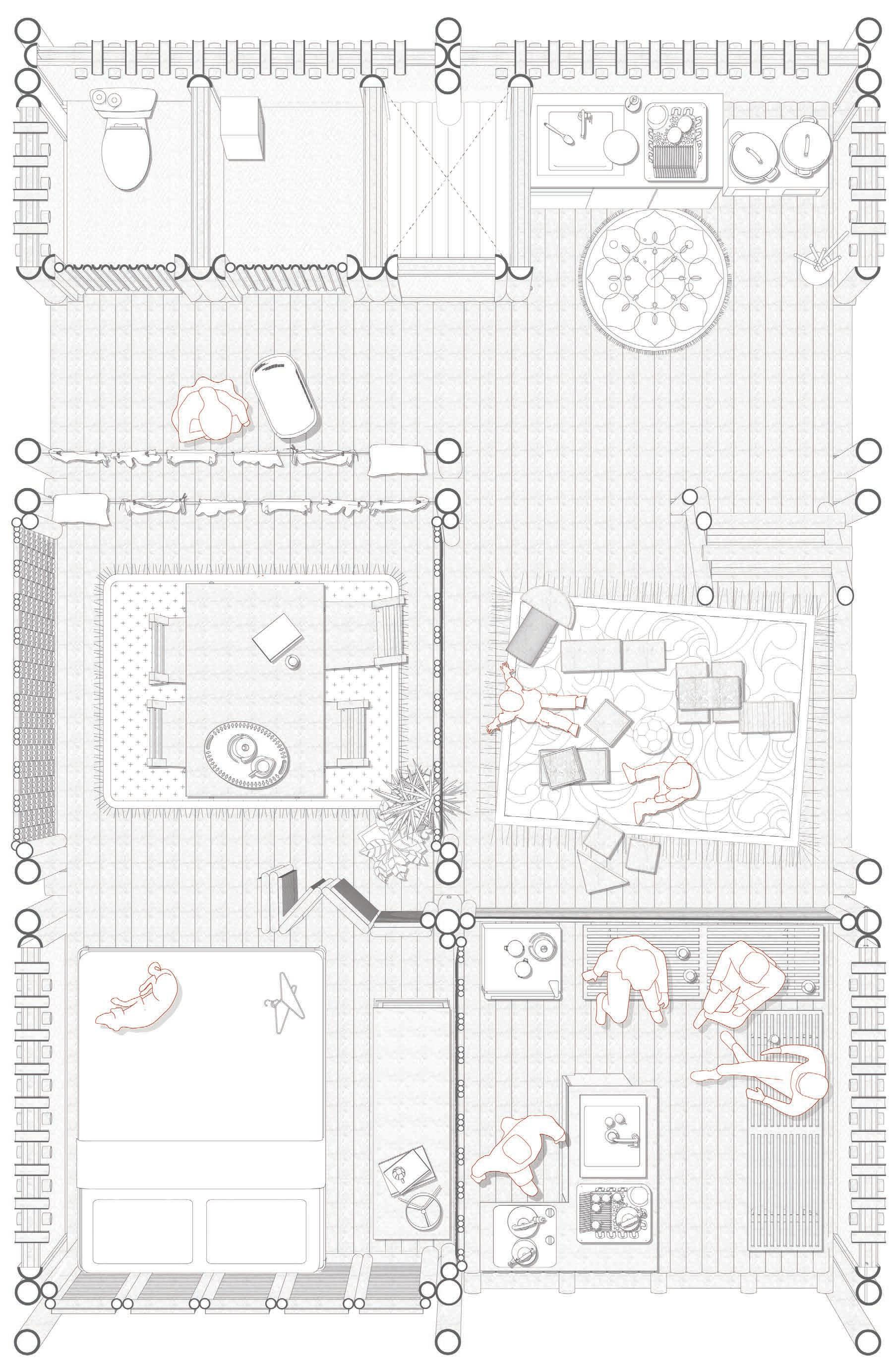
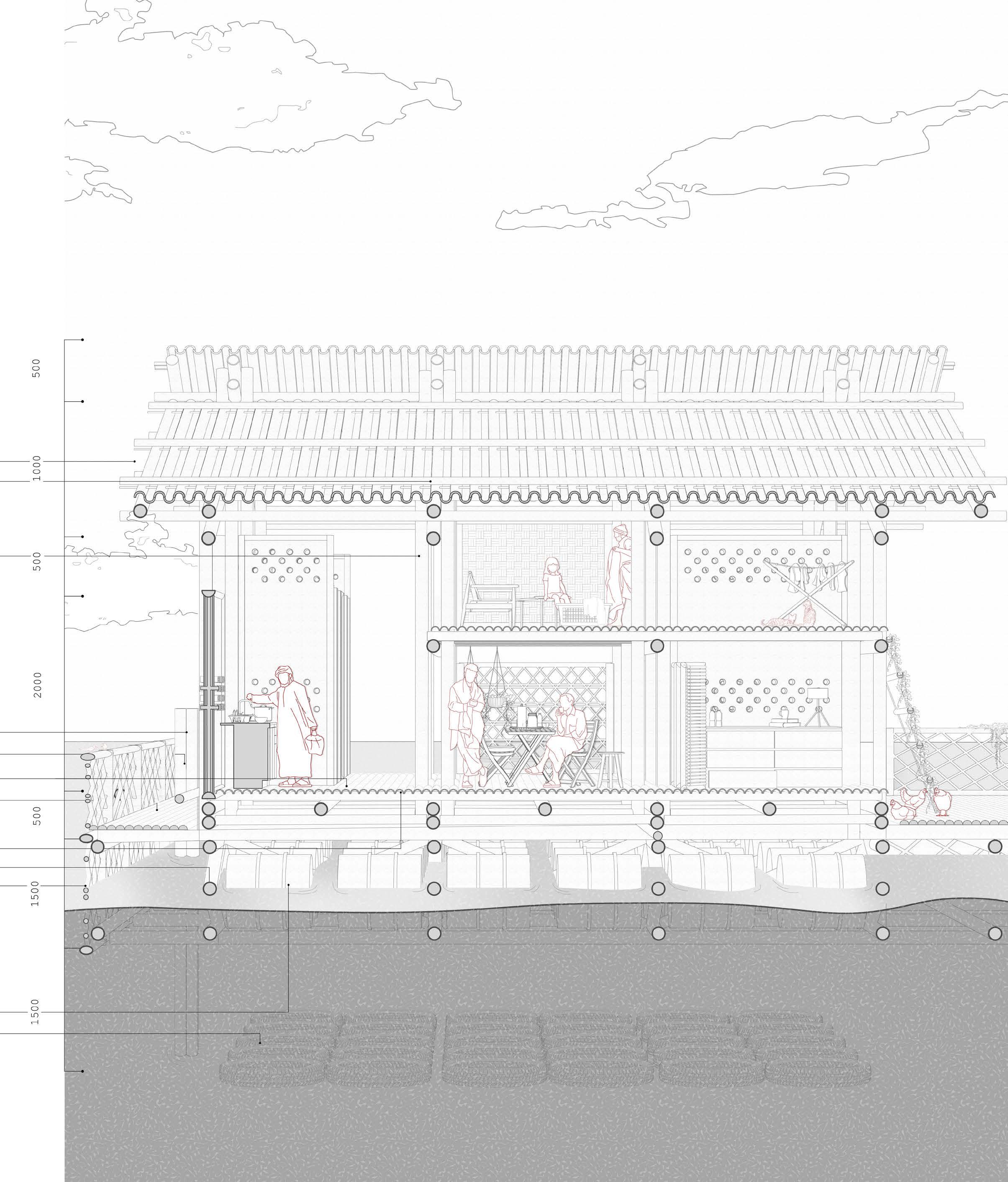
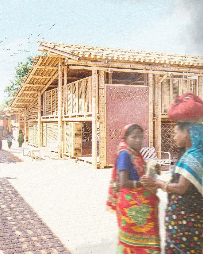
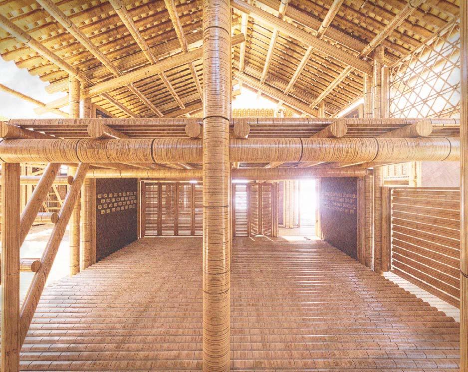
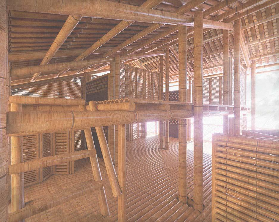
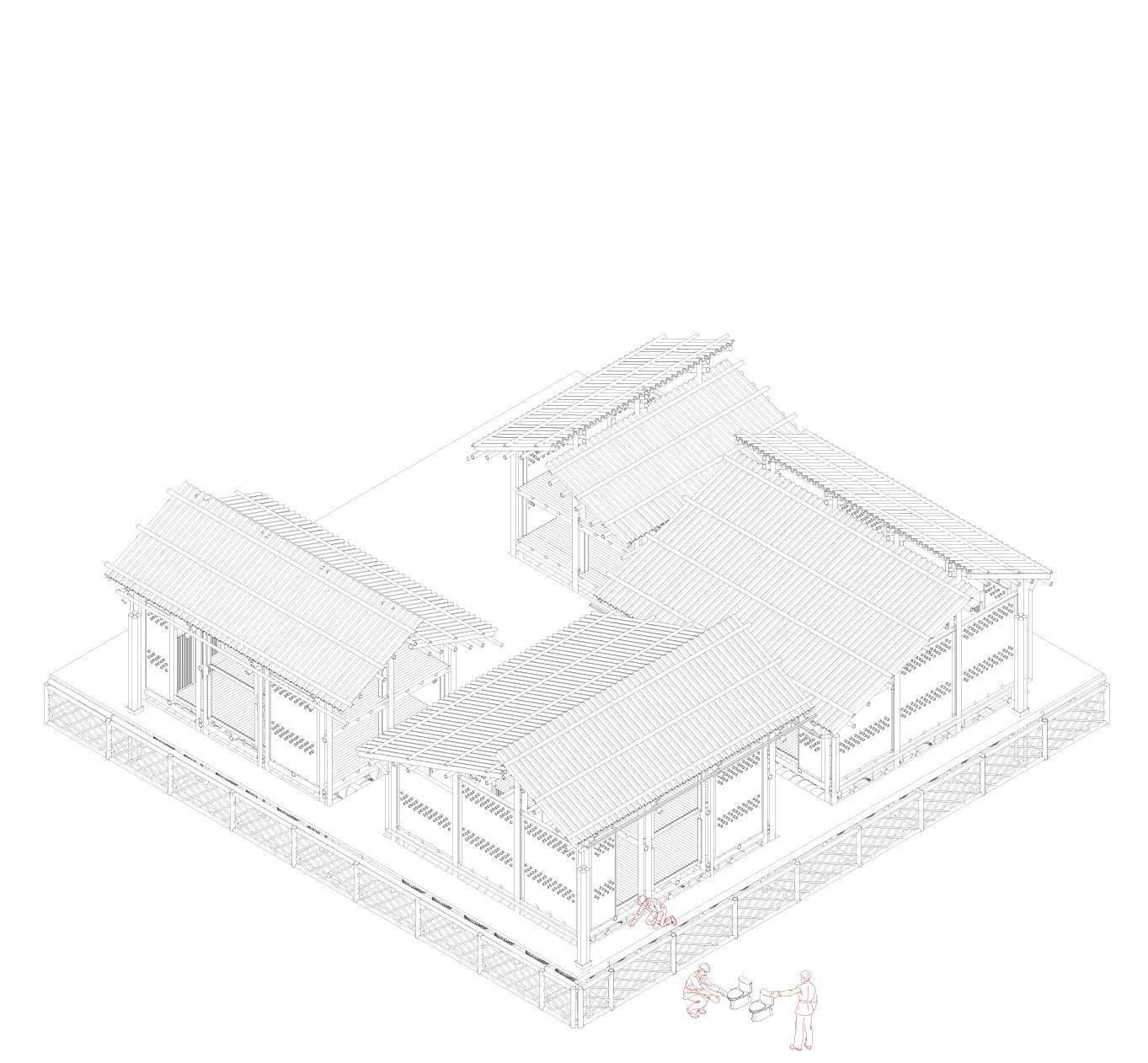
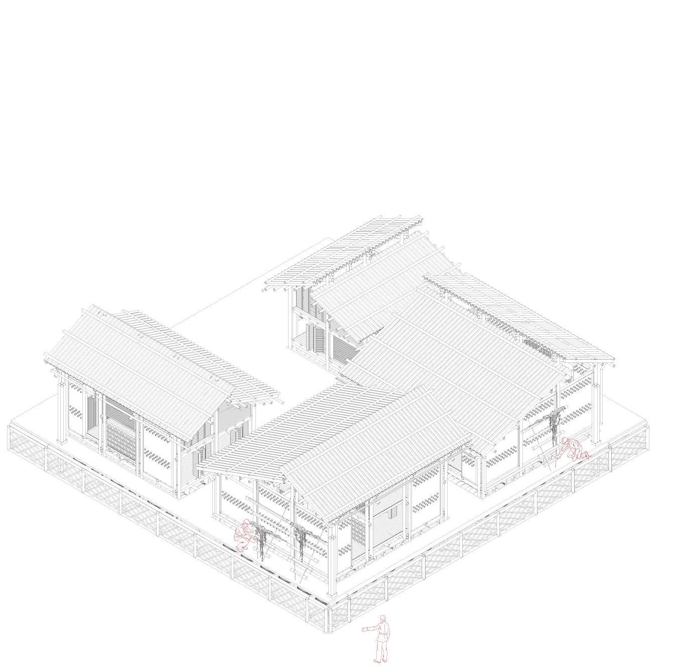
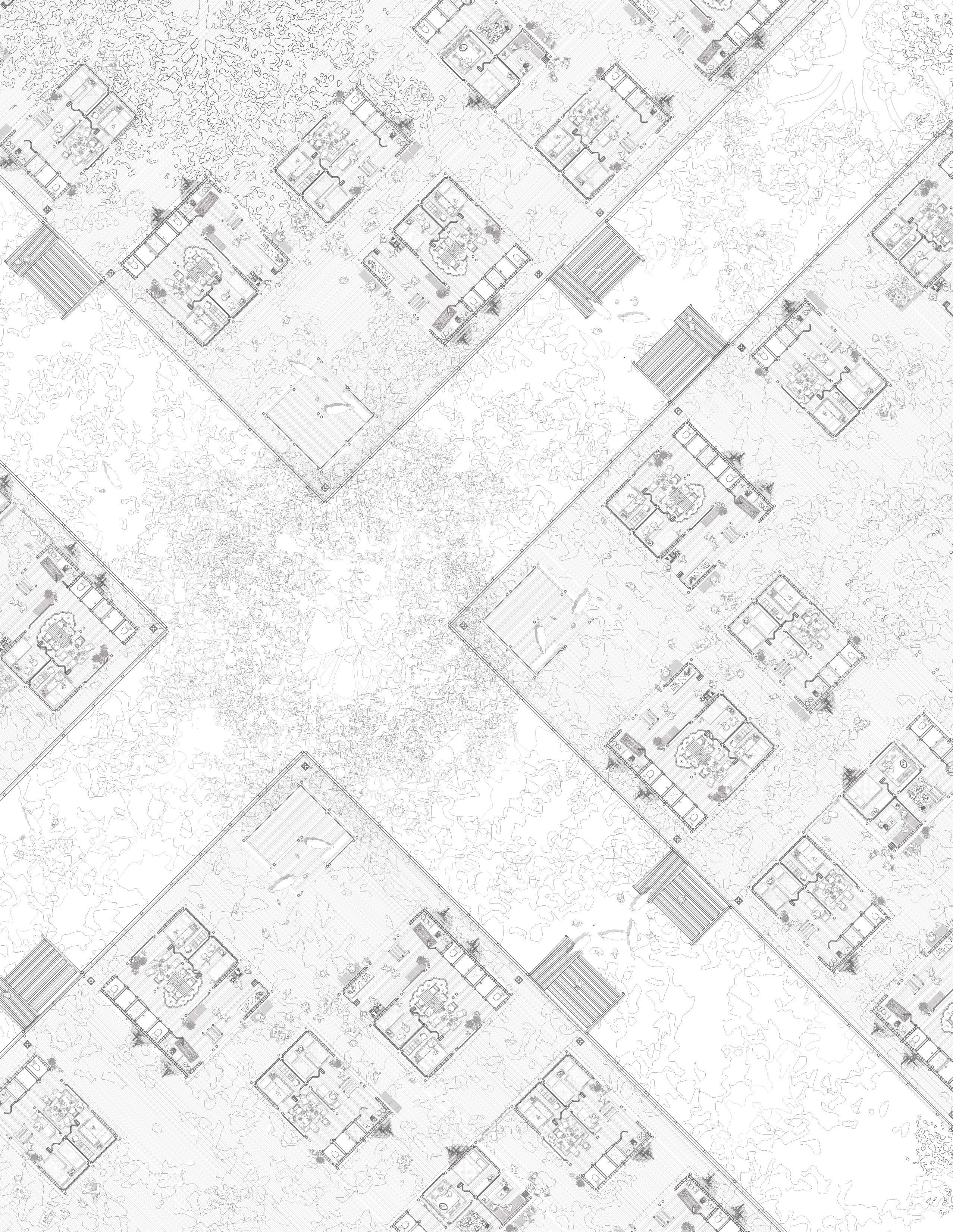
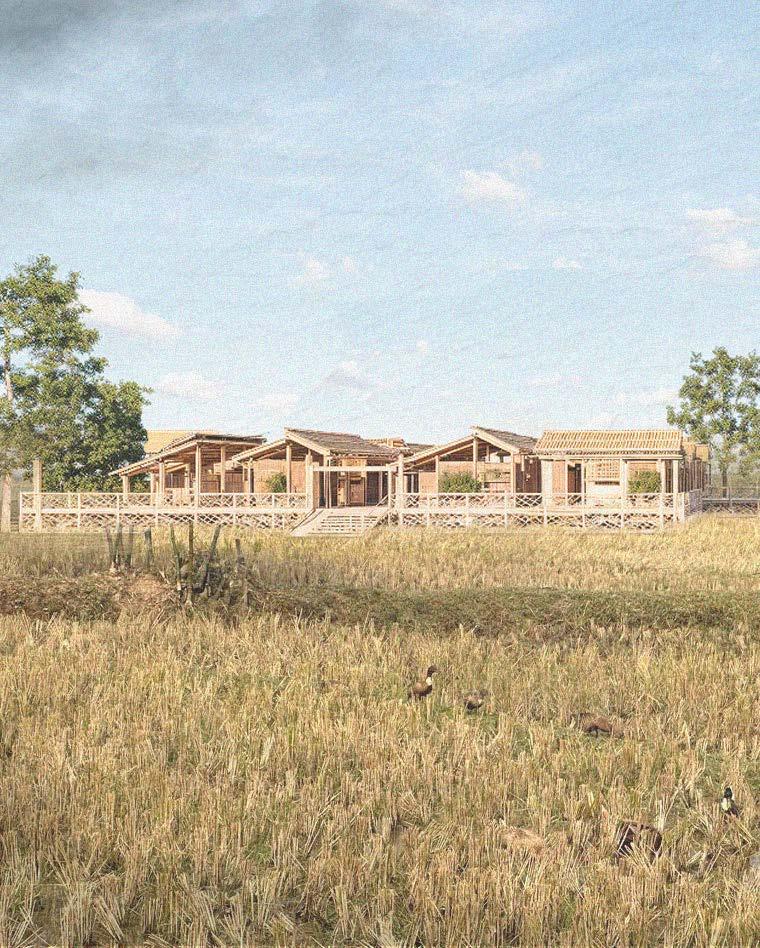
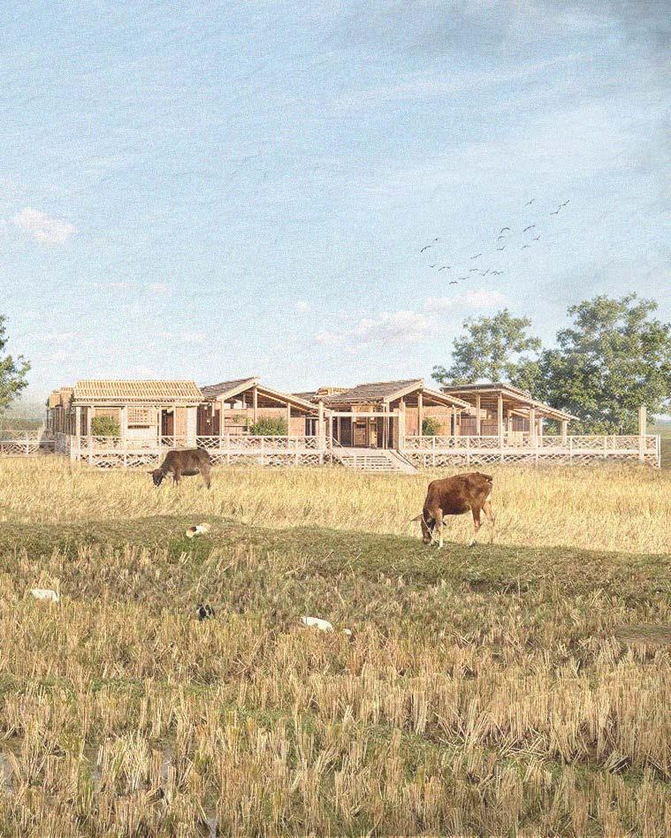
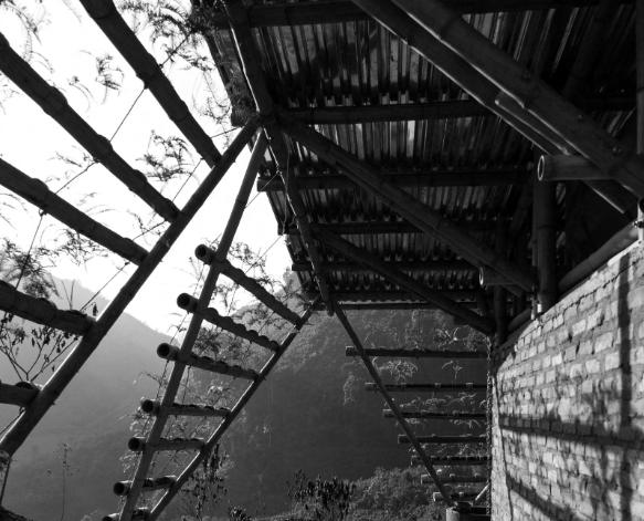
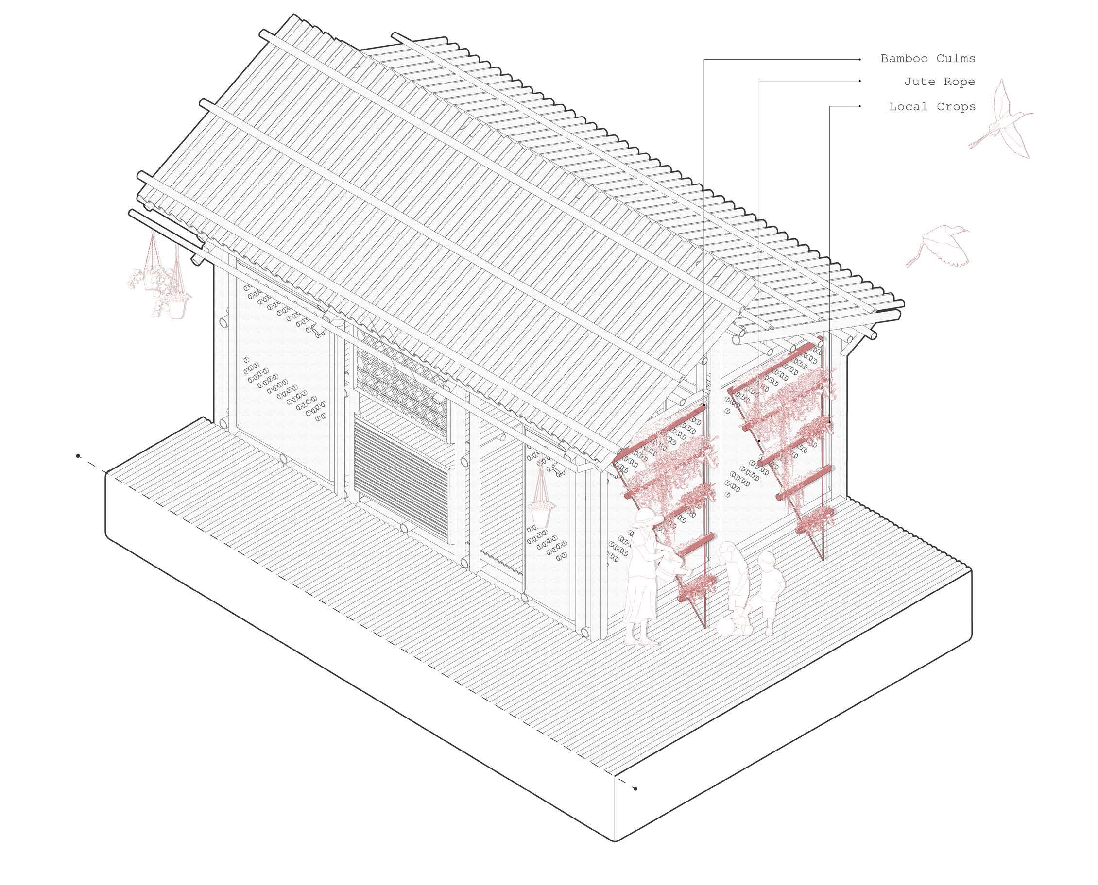
03B The Dwelling
Modular Construction
The dwelling is designed to honor the cultural and social customs of the Bangladeshi community. It is organized into three distinct zones to provide the appropriate balance of private and semi-public spaces required for daily life
Dwelling - Option A
First Floor
Dwelling A , is the smallest dwelling provided to the community. It is made up of four grid squares on the ground floor, measuring 25 sq.m. The dwelling is meant for small families of 4-6 people.
Dwelling - Option A
Second Floor
Dwelling A, has a mezzanine area that is made up of two grid squares, measuring 12.5 sq.m. The space is intended as spare bedrooms or storage spaces for the family
Dwelling - Option B
First Floor
Dwelling B, is the medium sized dwelling made up of 6 grid blocks, measuring 37.5 sq.m. The dwelling is meant for larger families of 6-8 people, with spaces for other programs to support the family economically
Dwelling - Option B
Second Floor
The upper floor of the dwelling is made up of four grid blocks, measuring 25sq.m. The space can be utilized for spare bedrooms and storage spaces and is accessible by stair
Dwelling - Option C
First Floor
Dwelling C, is the largest dwelling available to the community and is inspired by the traditional “Bari” in Bangladesh, meant for a generational family. The home allows for numerous families to reside within it and also allows for other programmatic functions. The dwelling consists of 9 grid blocks, measuring 56.25 sq.m
Dwelling - Option C
Second Floor
The upper floor of the dwelling is made up of six grid blocks, measuring 37.5 sq.m. The upper floor is intended for spare bedrooms and living areas, to allow for the ground floor to be more flexible based on the families needs
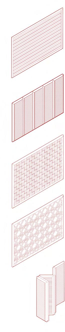
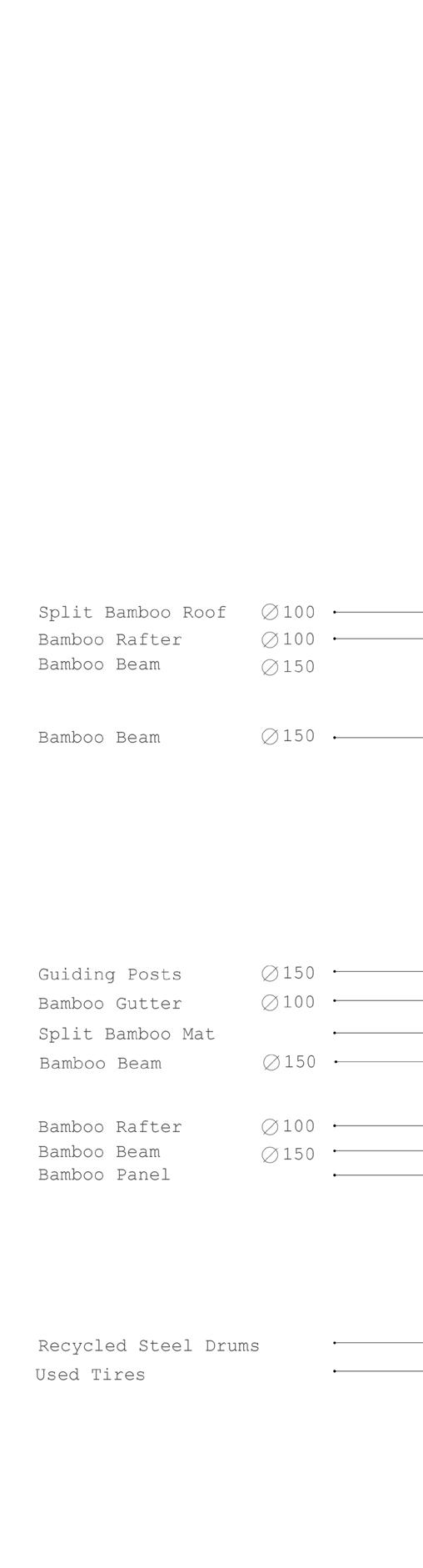
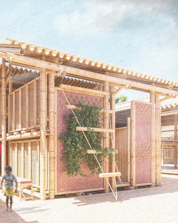
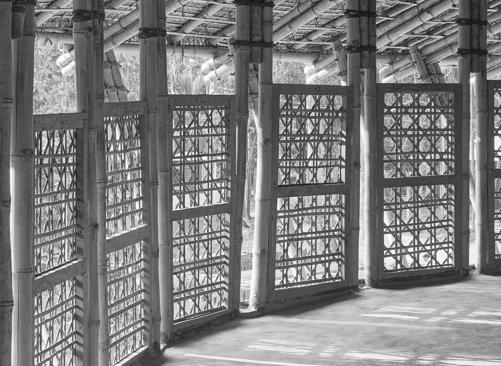
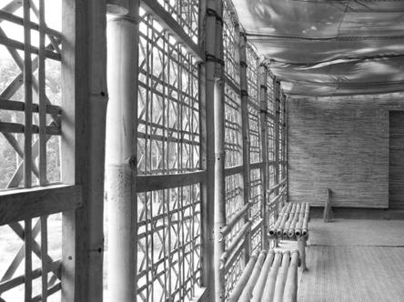
Kit of Parts
Dwelling B
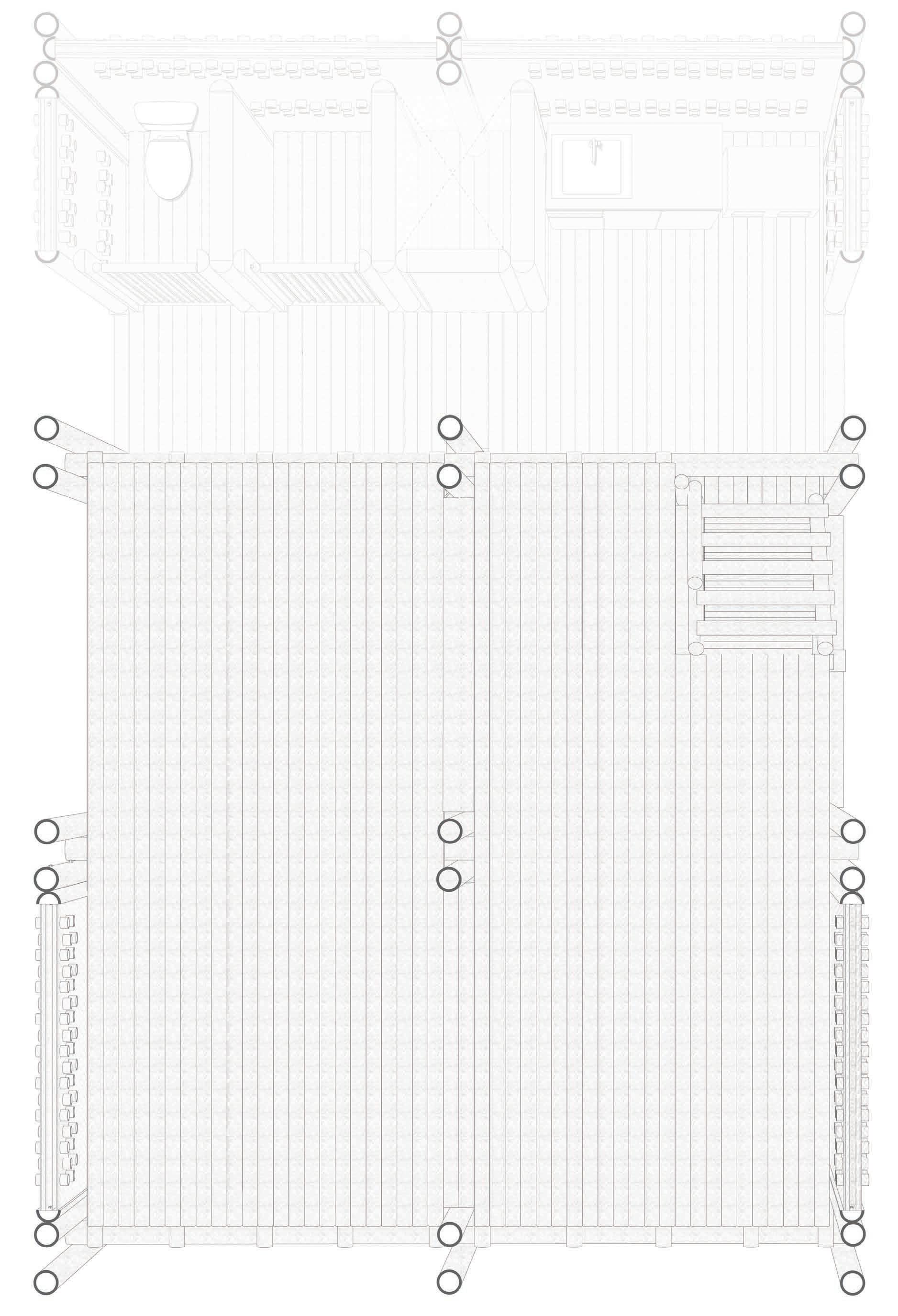
Each dwelling is made up of a standard package, similar to the traditional typology of the Bangla Baton. Occupants are able to customize their dwellings based on a series of bamboo panels, that define the program of their spaces.
Bamboo Panels
Base Dwelling
Ground Floor
Dwelling Type B
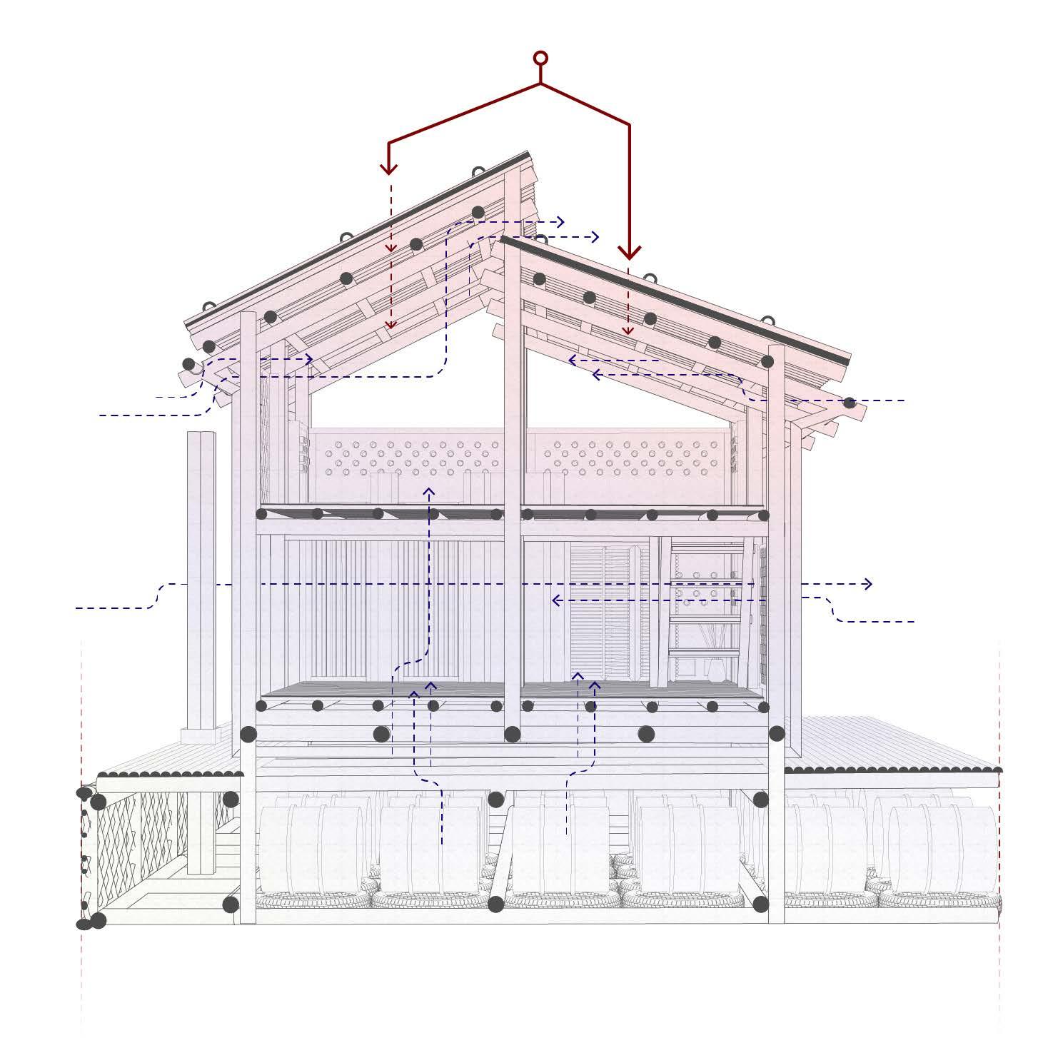
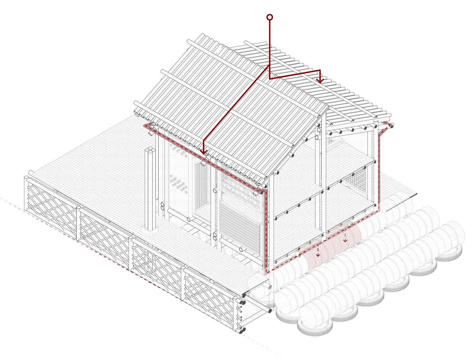
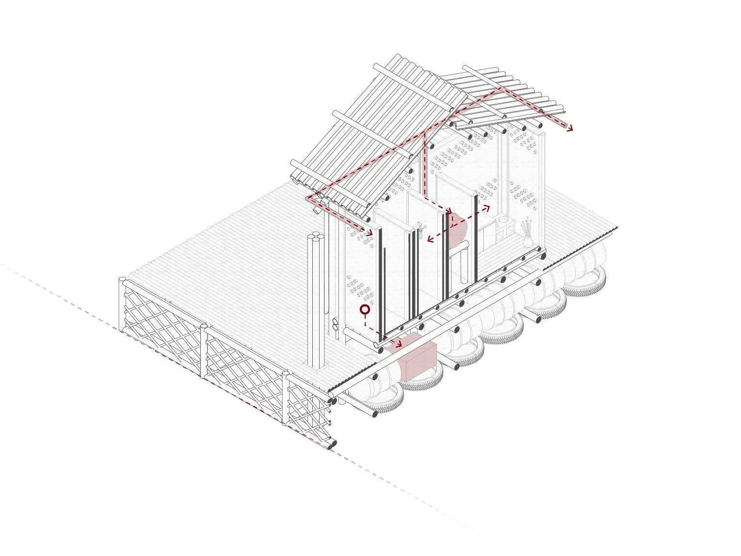
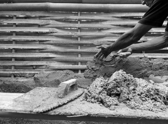
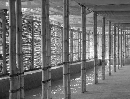
The dwelling is broken up into three zones. The service zone which makes up the kitchen and bathroom area, the semiprivate zone which acts as a veranda area, and the private zone which is enclosed with permanent walls made up of mud and lime.
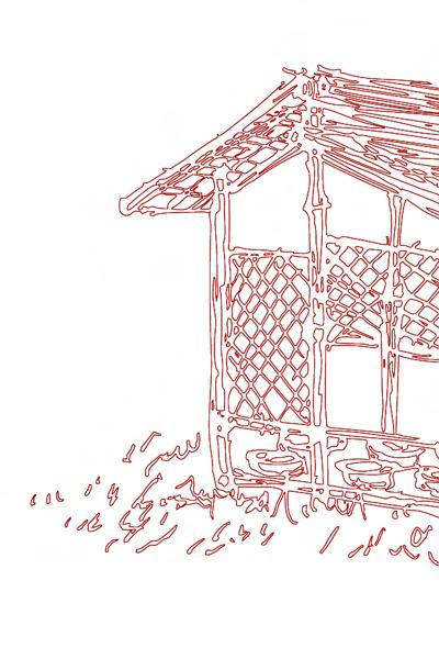
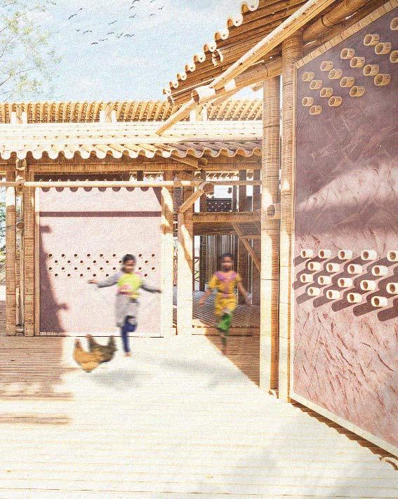
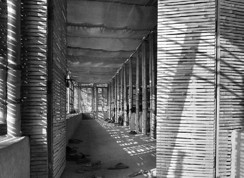
Closed Areas Living and Service
Zone A
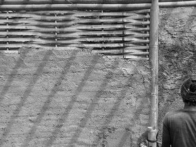
As is standard in original rural Bangladeshi architecture, the bathroom and kitchen are housed separate parts of the building
Zone B
A central covered area separates the sercice area from the living accommodation. The covered area also provides an entertainment space from which women can retreat to maintain privacy.
Zone C
The living area is enclosed within mud walls, to provide adequate privacy to the occupants.
Open Areas
Veranda Paths
Base Dwelling
Scaled (1:20)
Base
Dwelling
First Floor
Dwelling Type B
A upper level is also provided to increase the flexibility of the dwelling. The upper level is made up of four out of the six squares that make up the dwelling.
Base Dwelling
Dwelling Itirations
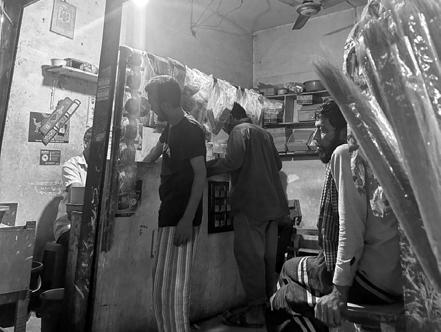
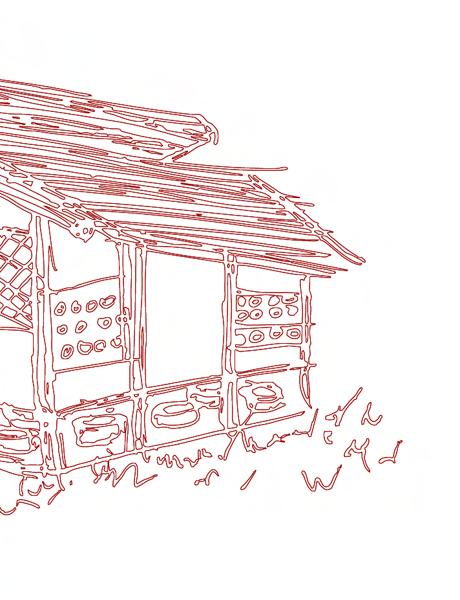
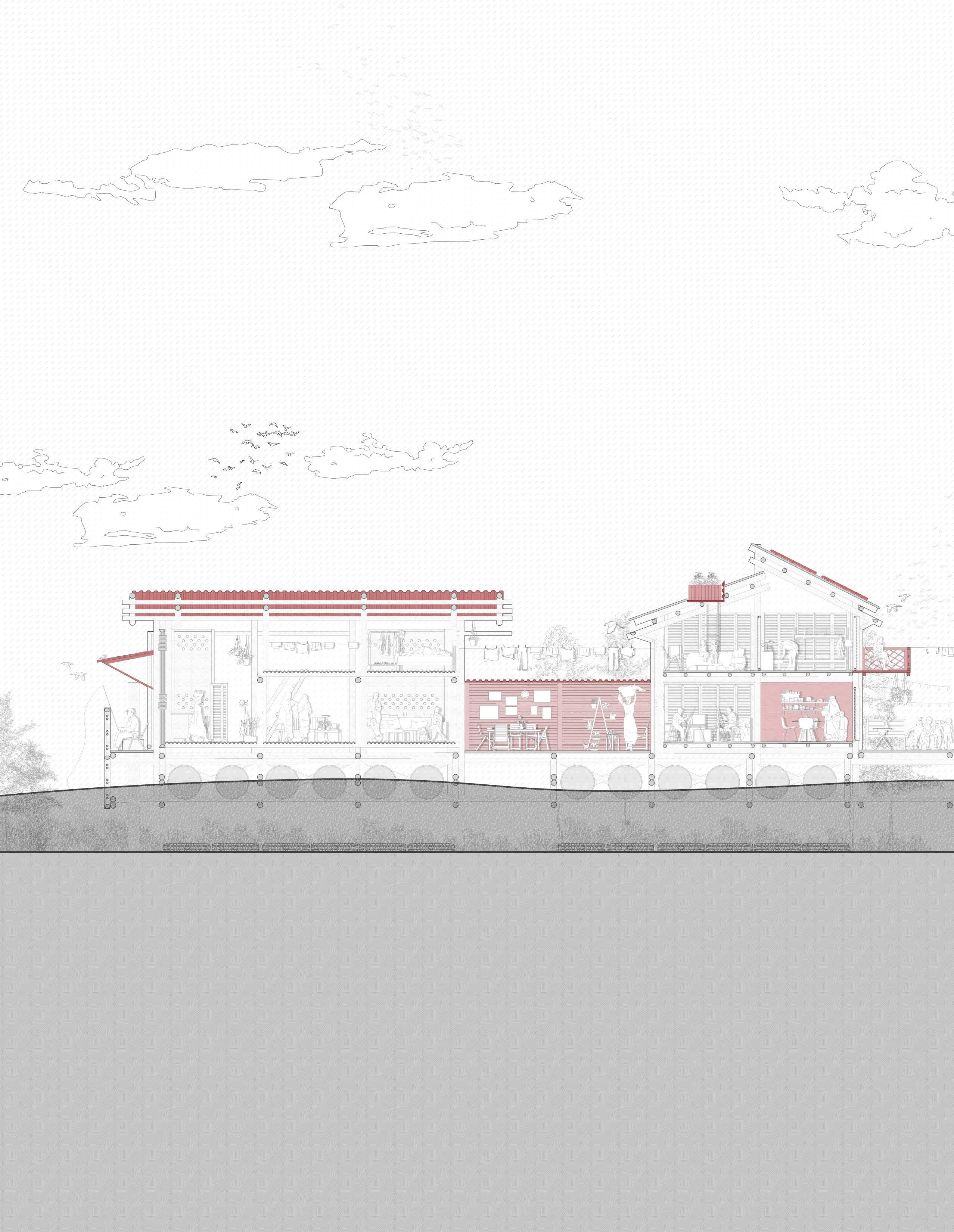
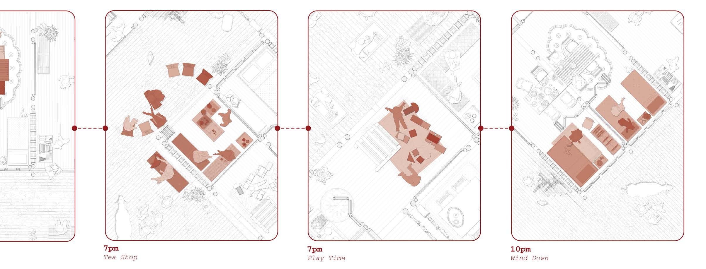
The Tea Shop
Dwelling Type B
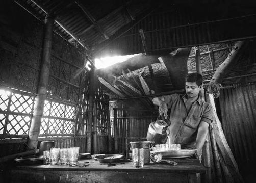
Within Bangladesh, it is quite common for individuals to open up their own small tea shops within their homes or from small roadside setups.
These informal tea stalls are often called “tong” shops, and they can be found in both rural and urban areas. Sometimes they’re attached to someone’s home or run from a small shack in front of or beside the house.
Dwelling Iterations
Scaled (1:20)
Dwelling Itirations
The Work Shop
Dwelling Type B
Within Bangladesh, households operate workshops out of their homes, especially in rural areas and low-income urban neighborhoods.
These home-based workshops are often part of the informal economy and can take many forms, such as
Tailoring and Sewing Shops – Small-scale garment work, including alterations, custom tailoring, or producing clothes for local markets or export subcontracts.
Handicrafts and Embroidery – Families may produce traditional crafts like nakshi kantha (embroidered quilts), pottery, or jute items.
Metalwork and Carpentry – Some households have small workshops for repairing or making tools, furniture, or household items.
Electronics or Bicycle Repair – Common in urban and semi-urban settings, often run from a room or a shed attached to the home.
Food Preparation – Some families prepare snacks or sweets (like samosas, pithas, or chanachur) to sell locally or supply to small shops.
Dwelling Iterations
Scaled (1:20)
Dwelling Itirations
The Family Home
Dwelling Type B
The spaces can also be expanded to create more bedrooms for a growing family. The flexibility of the bamboo panels allows for various programmatic uses.
Dwelling Iterations
Scaled (1:20)
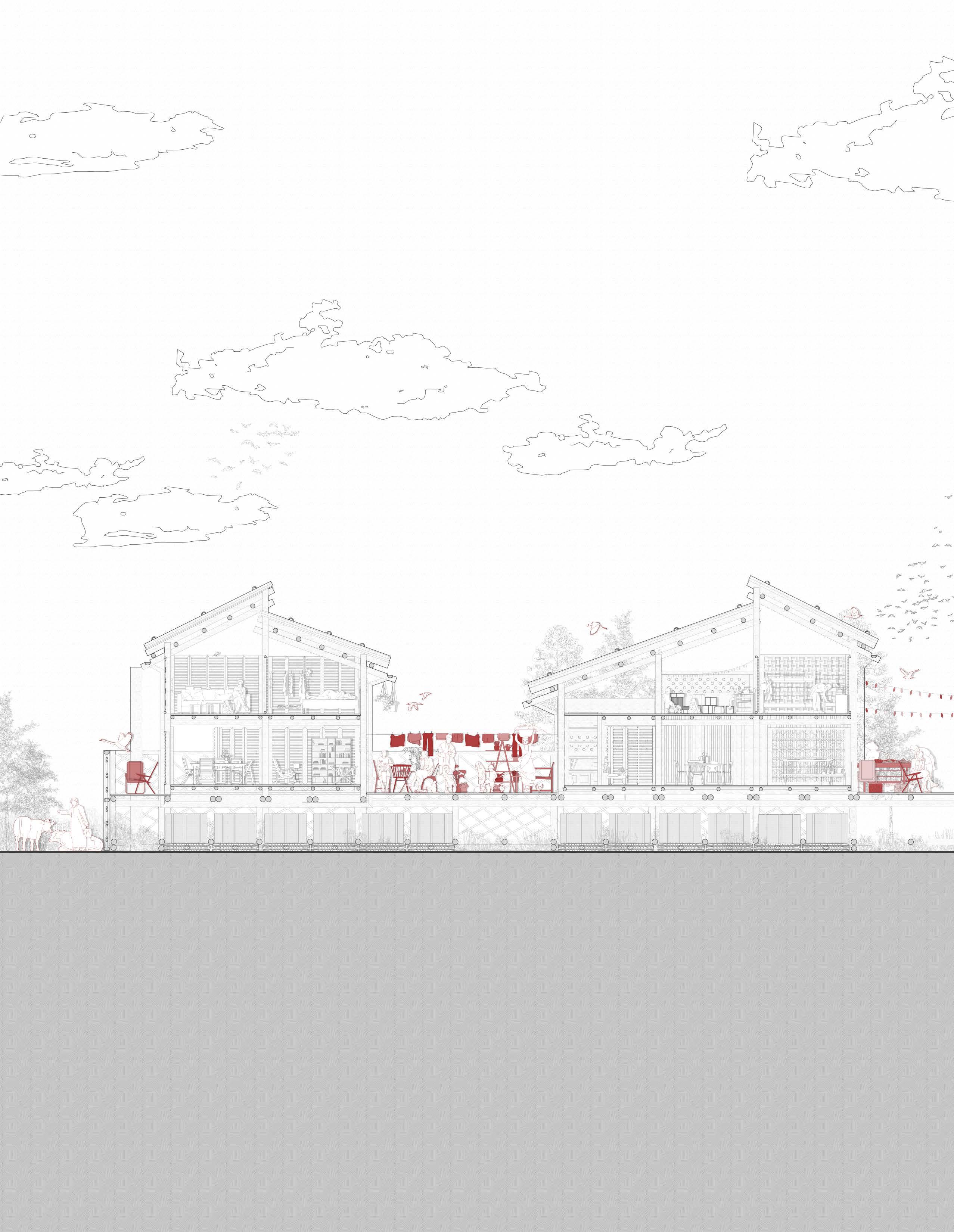
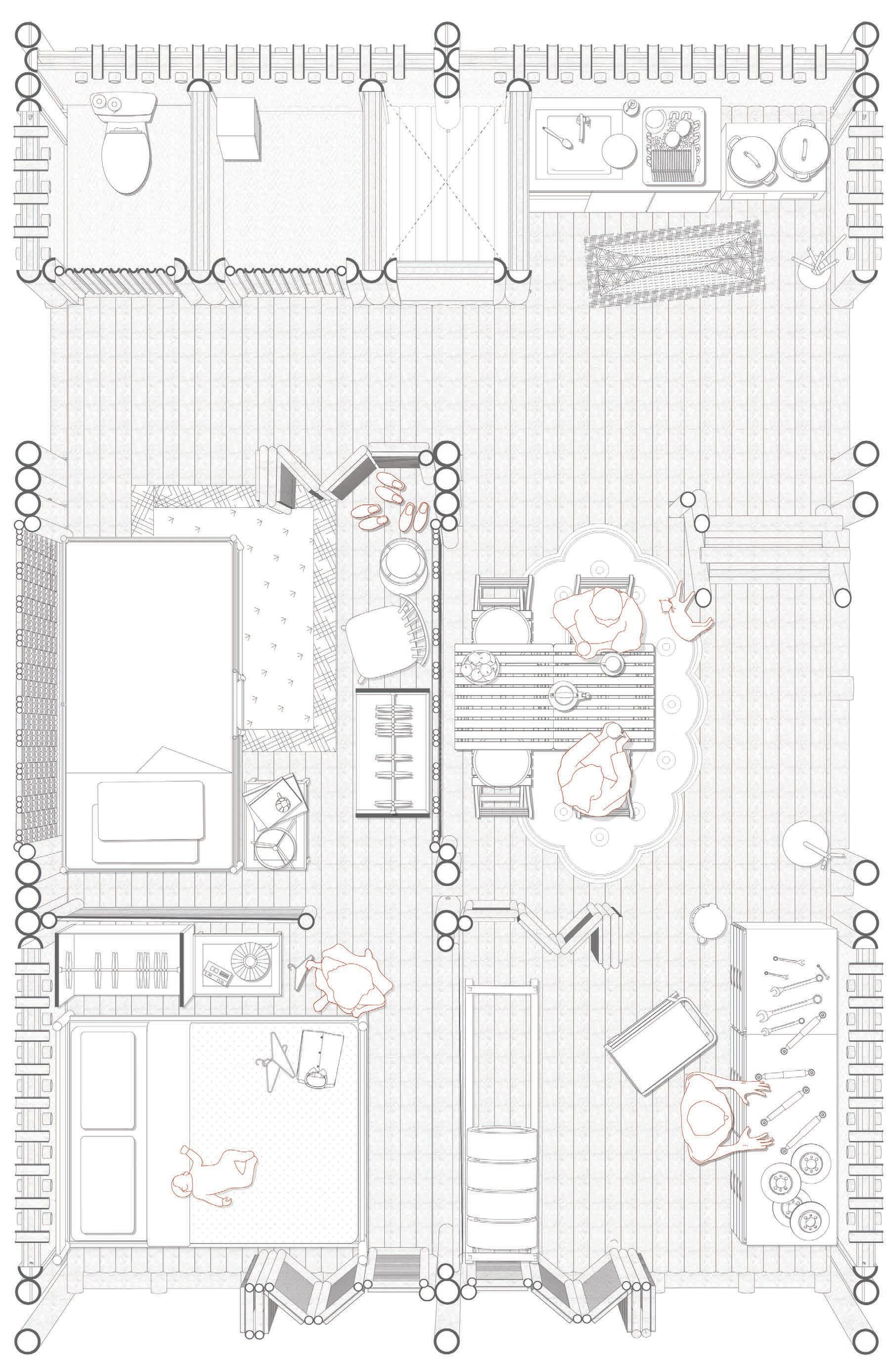
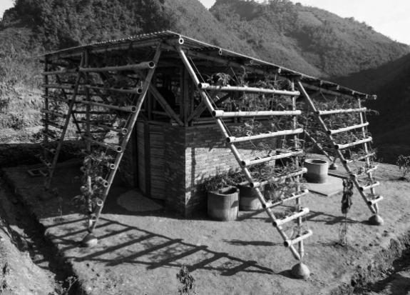
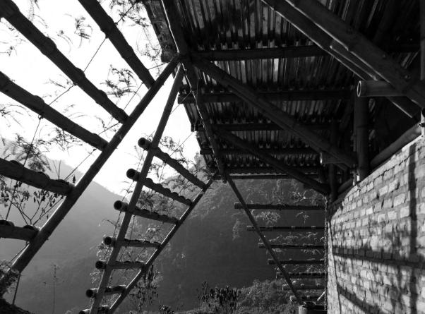
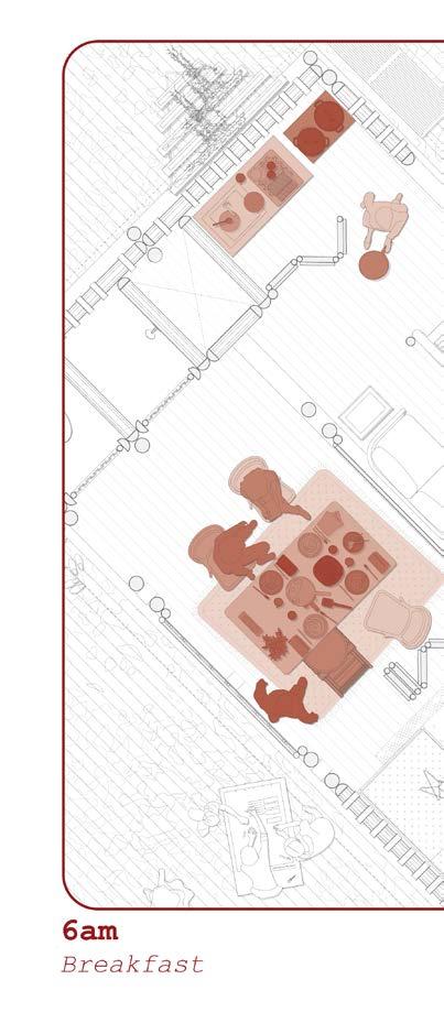
Dwelling Section Dry Season
Dwelling Type B
The section portrays a dwelling for a family whose front of house was turned into a tea shop for extra income, with the rest of the dwelling utilized to raise their children.
Perspective Section
Scale 1:20
Dwelling
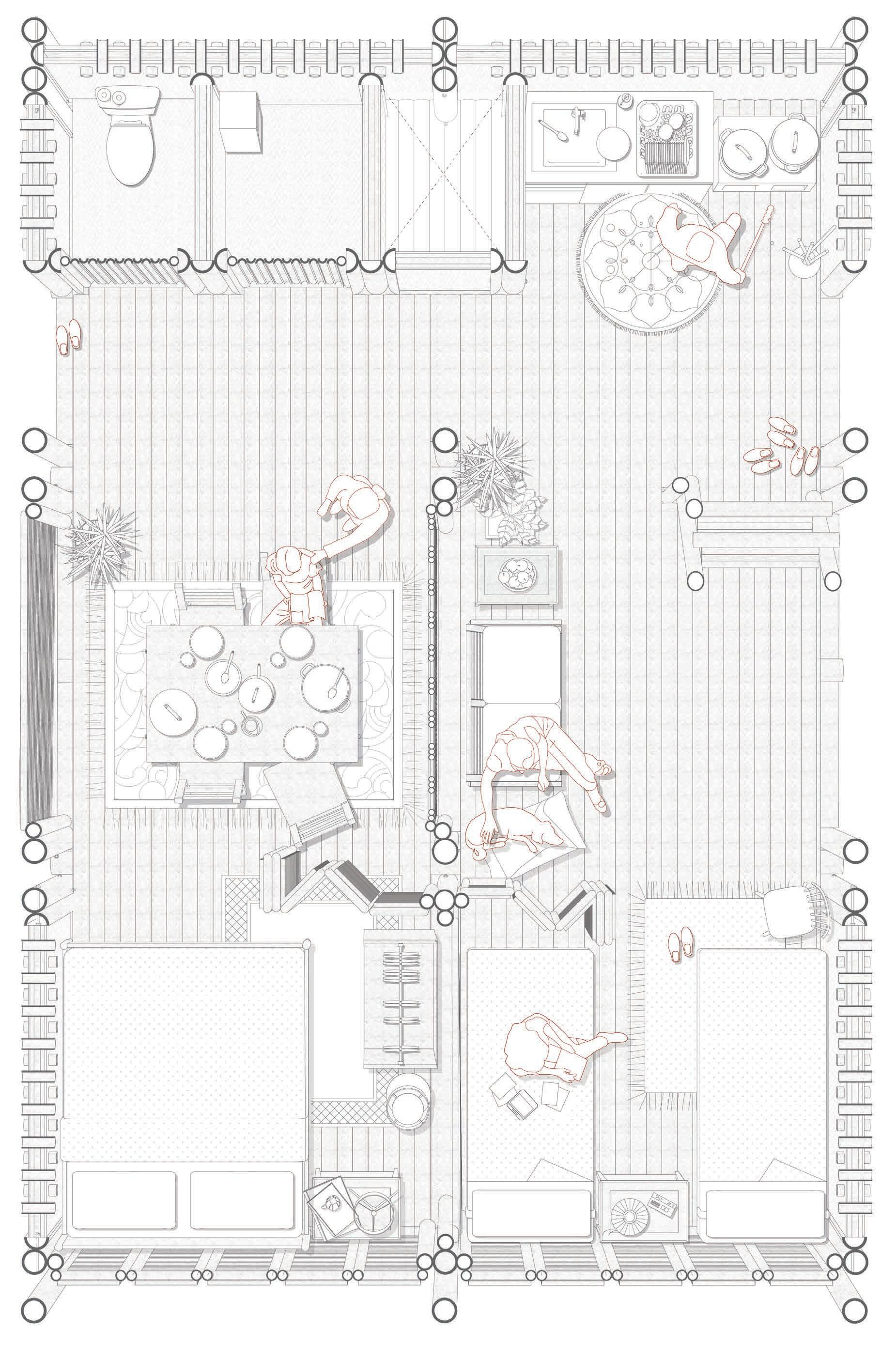
Section Monsoon Season
Dwelling Type B
The spaces can also be expanded to create more bedrooms for a growing family. The flexibility of the bamboo panels allows for various programmatic uses.
Perspective Section
Scaled (1:20)
Climate Principles
Heating and Cooling
Humidity is very high from June to September (monsoon season), making it feel much hotter
January 18–22 17–20
February 20–24 19–22
March 24–28 23–26
April 27–32 26–30
May 28–33 27–31
June 29–32 28–30
July 29–31 28–30
August 29–31 28–30
September 28–31
October 26–30
November 22–27
December 19–24 18–22
The dwelling incorporates a passive cooling system that provides comfort in various weather conditions.
Climate Principles
Water System
Bangladesh - 189 Rainy Days 10 Months a year
Approximately 16 days per month of rain
A typical family of five in Bangladesh needs approximately 100 to 150 liters of water each day for drinking, cooking, cleaning, and other household activities. However, this amount can vary based on factors such as weather conditions, access to water infrastructure, and personal usage habits
Rainy Season
May 0.12 inches
June 0.41 inches
July 0.36 inches
August 0.22 inches
September 0.20 inches
October 0.13 inches
Roof Area x Rainfall x 0.623 - Amount of Water Collected
Small Dwelling
26 sq.m Roof
• 260 sq.ft x 0.41 (June) x 0.623 - 66 Gallons of Water
Medium Dwelling
35 sq.m Roof
• 375 sq.ft x 0.41 (June) x 0.623 - 96 Gallons of Water
Large Dwelling
70 sq.m Roof
• 750 sq.ft x 0.41 (June) x 0.623 - 192 Gallons of Water
Water Storage Drums
Three drums, with a total capacity of 630 liters, are installed within the dwelling to function as a ballast system. This arrangement ensures that the household maintains an adequate water supply for approximately one week.
Split Bamboo Gutter
Bamboo Downspout
Climate Principles
Septic Tank
The septic tank is utilized for grey water which is then ran through a helophyte filter. It is approximated that 4-10 liters of grey water are produced each day depending on the usage
Conservative Estimate
Family of 6
• 6 People x 5 Liters/Day - 30 Liters/Day
• Approximately 7 days
Real-World Adjustment
Family of 6
• 6 People x 7 Liters/Day - 42 Liters/Day
• Approximately 5 days
The septic tank replaces one of the metal drums within the raft. Each dwelling is equipped with one septic tank that is connected to a helophyte filter
Split Bamboo Gutter Septic Tank Water Storage Drums
Structural System
Dwelling Type B
The intent to utilize bolted connections was the ease of assembling and disassembling the structure. The flexibility aids to the projects overall goal of having the community built the project themselves
Structural System
Scale 1:20
Structural Systems
The diagrams above showcase the floor bamboo joints.
Bamboo Joints
Structural System
The diagrams above showcase the floor bamboo joints.
Bamboo Joints
Dwelling
Interior Visualizations
The images aim to convey the environemnt that is created within the dwelling units, creating a warm atmosphere through the use of materiality and spacial organization
Bedroom Area
Dwelling B
Split View
Dwelling B
Split View
Dwelling C
Construction Sequence
Phasing
The construction of the raft is dependent on a few key points. The harvesting of the local materials and the use of community engagement for the actual assembly.
Phasing of Rafts
Four Rafts per year
• Assuming 50 Culms per mature clump
• 8,000 Culms (2,000 per raft) / 50 Culms per Clump - 160 Clumps Needed
• Assuming each clump requires 25 sq.m of space
Area Required for Project
Four Rafts per year
• 160 Clumps x 25 sq.m - - 4,000 sq.m
• 4,000 sq.m - Approximately 1 acre
One time Harvest
Four Rafts per year
• Require one acre of land
Sustainable Harvesting
Four Rafts per year
• Harvesting only 20-30% each year
• Requires 3-4 acres of land
• Allowing for healthy clumps, providing a steady supply of Bamboo
Harvesting
Four Rafts per year
• Harvest takes place during the dry season
• The project will require 4-5 years to be completed with the master plan showcased
Growing
Each raft requires approximately 2,000 bamboo culms made up of three different varieties
Waterproofing
The bamboo culms are chemically treated by applying a liquid made by boiling local Gaab fruits. This traditional Bangladeshi method waterproofs bamboo (1-2 Mature fruits are needed per culm)
Preparation
The bamboo is dimensioned into pieces that would require approximately 4-8 individuals to transport the largest pieces
Harvesting
To ensure an ongoing productive farm only 25-30% of the bamboo should be harvested each year
Transportation
Bamboo is harvested in the Sylhet and Chittagong Divisions, and transported to the site
Assembly
The project is designed to not require large machinery to assemble
Construction Sequence
Vertical Elements
Mounting vertical structural Bamboo elements per dwelling specifications.
The main dwelling structure is composed of Bambusa Balcooa and Steel Connections
Bambusa Balcooa - Small
• 7.5m x 4
• 6m x 4
• 5.5 x 4
• 4m x 4
• 3.5m x 4
◦ Total of 96m of Bamboo
• 4.8 Bamboo Culms
Bambusa Balcooa - Medium
• 7.5m x 4
• 6m x 4
• 5.5 x 8
• 4m x 4
• 3.5m x 4
◦ Total of 128m of Bamboo
• 6.4 Bamboo Culms
Bambusa Balcooa - Large
• 7.5m x 4
• 6m x 4
• 5.5 x 8
• 4m x 4
• 3.5m x 4
• 3m x 4
◦ Total of 151m of Bamboo
•8 Bamboo Culms
The vertical structural elements of the dwelling are bolted with the rafts cross bracing to ensure the stability of the project
Construction Sequence
Horizontal Elements
Mounting horizontal structural bamboo elements per dwelling specifications.
The horizontal structure is composed of Bambusa Balcooa, Dendrocalamus Longispathus and Steel Connections
Bambusa Balcooa - Small
• 5m x 10
• 2.5m x 10
◦ Total of 75m of Bamboo
• 3.75 Bamboo Culms
Dendrocalamus Longispathus - Small
• 5m x 10
• 2.5m x 10
◦ Total of 75m of Bamboo
• 5 Bamboo Culms
Bambusa Balcooa - Medium
• 5m x 14
• 2.5m x 15
◦ Total of 142.5m of Bamboo
• 7 Bamboo Culms
Dendrocalamus Longispathus - Medium
• 7.5m x 10
• 2.5m x 8
◦ Total of 120m of Bamboo
• 8 Bamboo Culms
Bambusa Balcooa - Large
• 7.5m x 14
• 2.5m x 21
◦ Total of 158m of Bamboo
• 7.8 Bamboo Culms
Dendrocalamus Longispathus - Large
• 7.5m x 10
• 2.5m x 8
◦ Total of 182.5m of Bamboo
• 12 Bamboo Culms
The horizontal structural elements are interlocked and bolted with the vertical structural elements
Construction Sequence
Roof Elements
Mounting the roof structural Bamboo elements per dwelling specifications.
The roof structure is composed of Bambusa Balcooa, Dendrocalamus Longispathus and Steel Connections
Bambusa Balcooa - Small
• 3.5m x 8
• 3.75m x 10
◦ Total of 65.5m of Bamboo
• 3.2 Bamboo Culms
Dendrocalamus Longispathus - Small
• 7.5m x 10
◦ Total of 75m of Bamboo
• 5 Bamboo Culms
Bambusa Balcooa - Medium
• 3.75m x 12
• 3.5m x 8
◦ Total of 73m of Bamboo
• 3.6 Bamboo Culms
Dendrocalamus Longispathus - Medium
• 10m x 10
◦ Total of 100m of Bamboo
• 6.6 Bamboo Culms
Bambusa Balcooa - Large
• 6.75m x 4
• 6.5 x 6
• 3.75m x 4
• 3.5m x 6
◦ Total of 102m of Bamboo
• 5 Bamboo Culms
Dendrocalamus Longispathus - Large
• 10m x 13
◦ Total of 130m of Bamboo
• 8.6 Bamboo Culms
The roof elements are interlocked and bolted with the vertical structural elements
Construction Sequence
Split Bamboo Flooring
Mounting the split bamboo flooring per dwelling
The dwelling floor is composed of Dendrocalamus
Longispathus and Steel Connections
Dendrocalamus Longispathus - Small
• 5m x75
◦ Total of 375m of Bamboo
• 25 Bamboo Culms
Dendrocalamus Longispathus - Medium
• 5m x125
◦ Total of 625m of Bamboo
• 42 Bamboo Culms
Dendrocalamus Longispathus - Large
• 7.5m x125
◦ Total of 938m of Bamboo
• 62.5 Bamboo Culms
The split bamboo flooring is placed perpendicular to the horizontal structural elements and bolted into place
Construction Sequence
Split Bamboo Roofing
The split bamboo roof and gutter system are mounted
The roof is composed of Dendrocalamus Longispathus and Steel Connections
Dendrocalamus Longispathus - Small
• 3m x150
◦ Total of 525m of Bamboo
• 35 Bamboo Culms
Dendrocalamus Longispathus - Medium
• 3.5m x200
◦ Total of 700m of Bamboo
• 46.6 Bamboo Culms
Dendrocalamus Longispathus - Large
• 3.5m x100
• 6.25m x100
◦ Total of 975m of Bamboo
• 65 Bamboo Culms
The split bamboo roof is designed with water collection in mind. A bamboo element runs through the culms and above to secure them in place
Construction Sequence
Mud and Lime Walls
The woven bamboo panels are placed and plastered
The permanent walls within the dwellings are made up of the following components
• Woven Bamboo Panel
• Mud Plaster
• Lime Coating
The traditional mud wall encapsulates the cultural, social, and environmental fabric of the country
The services provided within each dwelling are implemented
Each dwelling is equipped with basic services
• Toilet
• Shower
• Kitchen Construction Sequence Services
The services provided are based on our conversations with the Shonatola Community
Construction Sequence
Bamboo Panels
The flexible bamboo panels are mounted based on the needs of the occupant
The panels are composed of Melocanna Baccifera and Steel Connections
A series of bamboo panels have been designed to serve a series of functions within each dwelling
Construction Sequence
Personal Gardens
A series of climbing greenery walls are implemented within the dwellings
Inspiration for the construction of the planters is taken from the project below by H&P Architects
The vertical gardens encourage the purifying of the air, regulating the temperature and promotes biodiversity within the community
03C The MasterplanCommunity Development
The community is granted agency in directing the urban development of their settlements through a modular system of interconnected rafts forming an integrated whole. The density, spatial organization, and other fundamental aspects of the masterplan are calibrated in response to the unique needs and priorities of the specific community where the prototype is deployed.
Program Requirements
Key Characteristics
The creation of self reliant communities is at the forefront of the proposal. As climatic situations worsen, the dependency on existing infrastructure is unstable
Community Spaces
Encourage social engagement within the entire community
Education Spaces
A new educational facility will meet the needs of the current and future community
Waste Management System
Helophyte filters are implemented within the overall design to aid the community
Market Spaces
Spaces to foster and support the production and distribution of local goods
Food Source
Floating farms provide a viable solution for the community
Water Supply and Sanitation
A rain water collection system is incorporated within the design
Masterplan Variations
The Shonatola Community
A set of rules are set to maintain the quality of the masterplan as well as maintain the sites relationship to water
Spacing
Rafts must be placed at least 5m apart horizontally and 10m apart verticallyto allow for water flow
Communal Spaces
Communal spaces to be placed in the center of the amphibious typology, creating a connection between the existing and future village
Circulation
Each “Raft” must be accessible both by bridge and stair, as well as be connected to the larger bridge system
Farming
Designated spaces for farming must be allocated for each raft to be self sufficient
Sanitation
Each raft must be accompanied by a small helophyte filter, or a larger helophyte filter for a grouping of rafts
Site Boundary
Scaled (1:1000)
Masterplan Variations
Dry Situation
During the dry season, the rafts are accesible by stair and bridge systems. The connection to the existing village is through stairs embedded within terraced farming, as well as two main bridge access points. During the dry season, daily life involves tending to cattle and farming the surrounding land
1. Market Area 2. Parking Area 3. Amphibious Connection Point
Water enters the site from the north and rashes to the lowest point of the site, in this case the retention area. The angled nature of the rafts acts to slowl down the flow of water into the amphibious community and guide it towards the retention area
1. Market Area 2. Parking Area 3. Amphibious Connection Point 4. Educational Facility 5. Communtiy Center 6. Helophyte Filter 7. Floating Farms
8. Terraced Farming
Masterplan Variations
Monsoon Situation
During the monsoon season the rafts are accessible by bridge systems. The existing stairs which are on a hinge, float up based on the water level and act as boat docks. During the monsoon season, daily life involves tending to the floating farms while daily operations such as markets or small shops remain open
1. Market Area 2. Parking Area
Amphibious Connection Point
Educational Facility
Communtiy Center 6. Helophyte Filter 7. Floating Farms
8. Terraced Farming
Masterplan Variations
Extreme Situation
It is predicted that at some point in the near future, the village could be permanently under water, which would result in additional rafts being constructed. The situation conveys the flexibility of the plan to continue to expand as need grows
Market Area
Parking Area
Amphibious Connection Point
Educational Facility
Communtiy Center
Helophyte Filter
Floating Farms
Terraced Farming
Construction Sequence Phasing
Phasing of Rafts
Four Rafts per year
• Assuming 50 Culms per mature clump
• 8,000 Culms (2,000 per raft) / 50 Culms per Clump - 160 Clumps Needed
• Assuming each clump requires 25 sq.m of space
Area Required for Project
Four Rafts per year
• 160 Clumps x 25 sq.m - - 4,000 sq.m
• 4,000 sq.m - Approximately 1 acre
One time Harvest
Four Rafts per year
• Require one acre of land
Sustainable Harvesting
Four Rafts per year
• Harvesting only 20-30% each year
• Requires 3-4 acres of land
• Allowing for healthy clumps, providing a steady supply of Bamboo
Harvesting
Four Rafts per year
• Harvest takes place during the dry season
• The project will require 4-5 years to be completed with the master plan showcased
Cluster
Dry Situation
During the dry season the rafts rest on the agricultural land and daily activities take place
Cluster Day in the Life
The drawing depicts the daily life of families living within the raft. Various activities take place through out the day from household to household. The drawings aims to convey the community engagement that the raft aims to foster on various social scales
03D Smaller Intervention
Amphibious Solutions
The chapter below introduces a few options provided to the community to enhance their day to day life both culturally and economically. The interventions are to be adopted by the community as seen fit to meet their needs
A sustainable farming solution is proposed to support the community’s continued harvesting and fishing activities throughout both dry and flood seasons
The amphibious garden design combines the primary materials utilized within the raft design to create viable solution for the community during all seasons
Livestock Pen
Amphibious
Within each raft a livestock pen, through observations of the Shonatola village the livestock pen was a crucial part of the communities livelihood
Agriculture is at the heart of most of the villages in Bangladesh. Among these, smallholder mixed farming systems, where rice production combines with small ruminants particularly goats and dairy cows, stand tall
Helophyte Filter
Amphibious
The implementation of the helophyte filters aims to purify water using a combination of plants, bacteria, and nutrient adsorbents. These filters are designed to efficiently remove pollutants and improve water quality
During the monsoon season, the raft rises with the rising water levelsalongside the helophyte filter. This adaptive system ensures that treated water is safely discharged into the surrounding environment
The aim of the pavilion is to provide a non permanent structure that can activate the large communal area of the raft. The space can be used for a variety of activities by the community.
Pavilion
Raft Addition
During the monsoon seasons the pavilion can be utilized as a covered area for teaching as the neighbouring schools tent to flood. The space can also be utilied year round for community meetings, workshops and other activities
House Gardens
Dwelling Addition
A small hanging garden is design to adorn the exterior of the dwellings. The aim is to provide green areas on the dwelling and provide a small space for crop production
Home gardens are found in both rural and urban areas in predominantly smallscale subsistence agricultural systems
Raft Maintenance
The tires and barrels have a shorter lifespan than the bamboo. As such through out the rafts lifespan of 25 years, certain parts of the amphibious structure will have to be replaced. The tires and barrels utilized in the project have a life span of a few years depending on the environmental conditions
Tire & Barrel
The community will be able to replace any portions of the raft necessary due to the ease of the bolted connections
04 Managerial Framework Project Development
Placing the community at the core of this development, the implementation process is fundamentally centered on active and ongoing engagement with the Shonatola community. This includes a series of participatory steps such as consultations, workshops, and collaborative planning sessions designed to incorporate local knowledge, address community needs, and ensure that the proposal aligns with their social, cultural, and economic contexts
Stakeholder Analysis
Project Feasability
The projects feasability is based on the relationships fostered among a series of individuals and groups
Architect
Stakeholder
Role
The objective of the role is to identify the project’s goals and objectives, conduct research and feasibility and formulate proposals that address the current and future needs of the community
Local Community Stakeholder
Role
The primary beneficiaries and participants in the construction process. The community is involved in all aspects of the project, to ensure their traditions and needs are met and respected. They are the voter population for the CLT Board
Goverment Stakeholder
Role
The government’s cooperation is crucial for providing the infrastructure and permits for the project’s realization
Local Suppliers
Stakeholder
Role
The fostering of relationships with local suppliers to provide payment plans for the community, and provide material expertise and advice
NGO’s
Stakeholder
Role
World Bank Credit, specifically under the “Resilient Infrastructure for Adaptation and Vulnerability Reduction (RIVER)” project, will be used to provide financing for the raft construction
Strategies
Through the incorporation of the local community, local materials and building techniques the design process aims to produce scalable and replicable design principles
Strategies
The community is to be involved through out the design process, to ensure their cultural, social and economic needs are met
Interest
The interest lies on the development of viable solutions for the ongoing climate crisis, impacting millions of people within Bangladesh
Interest
As a prototype for amphibious communities, relationships could be fostered for future collaboration
Interest
Provide funding and technical expertise and monitor the project as a prototype for future amphibious developments Within vulnerable communities
Project Development
Amphibious Proposal
The proposal aims to provide a vaible solution for vulnerable communities impacted by the threats of cliamte change. The diagram conveys the steps undertaken for the proposals realisation
Project Initiation
Conceptual
The beginning stages of the project are utilized to identify the current issues facing the community. For the stakeholders involved in the process to be identified and begin collaboration
Development Feasability
The proposals feasibility is investigated, as such this stage in the process it essential for completing the ground work, such as planning, securing funding and permits and beginning early design conceptualization
Design Implimentation
The stakeholders involved in the process begin to plan out the design of the project in its entirety. Construction document sets and completing any assesments necessary
Construction Realisation
The project breaks ground, marking the beginning of the construction phase. The community begins building based on the aggreed and approved plans and timelines discussed in earlier stages
Operation & Maintenance
Post Occupancy
The project has a lifespan of 25 years, as such at some point certain parts will have to be maintained to ensure safe and adequate living conditions
Land Acquisition
CLT Fund
A Community Land Trust (CLT) is a non profit organization that holds lands on behalf of a place-based community.
The CLT will serve as the longterm steward for affordable housing, community spaces, commercial spaces and community assets
Control of the trust is by an elected board of community members and other stakeholders
Small Individual Owned Plots
Combining into One Single Landholding
Bamboo Planting
Bamboo and Mud Walls
Area Required for Project
Four Rafts per year
• 160 Clumps x 25 sq.m - - 4,000 sq.m
• 4,000 sq.m - Approximately 1 acre
The community will have to start planting 3-5 years before the project begins, if the bamboo will be harvested in a newly planted site. As such, the bamboo needs to be planted during the planning and design phase of the proposal, to mature in time of building.
Another option, is for the community to begin by harvesting existing forests for the beginign faces of the project while the planted bamboo matures. In either case 25% of the bamboo will be harvested in order to maintain a continous cycle of harvesting
Materiality
Bamboo and Mud Walls
A selection of bio sourced materials were utilized within the project
Bamboo
• Local Material
All Bamboo species utilized are native to Bangladesh
• Strength
Tensile strength comparable to steel and a compressive strength similar to concrete
• Lightweight
• Fast Growing Plant (Regenerative)
Grows much faster than traditional hardwoods
• Economic Benefits
Supporting local economies
Mud and Lime
• Thin Walls
• Lightweight
• Carbon Neutral
• Flexible
• Thermal Mass (Porous)
Moderate fluctuations of temperature
• Cost-Effective
Affordable Material
Steel Bolts
• Life Span
Life Span equal to Bamboo
• Strength
• Dismountable
• Easy Application
Traditional rope connections require specialized skill
Bolted
Bamboo Connections
Mud & Lime Walls
Bamboo Connections Bolted
Mud & Lime Walls
Woven Bamboo Walls Non-Permanent
Mud & Lime Walls
Cost Analysis
Raft
The proposal utilizes local materials and labor in order to provide a viable solution for the community while also fostering its economic growth
Bamboo
Bambusa Balcooa
Melocanna Baccifera Dendrocalamus Longispathus
Bolted Connections
Drums Tires Recycled Recycled
Labor Community
Land CLT Fund
Bamboo is utilized as the main building material for several factors. Its lightweight nature, abundant and renewable resource, strength and durability
Bolted connections are utilized to ensure ease in mountability/dismountability
Re-used plastic/Steel drums are utilized as floation devices
Re-used tires are utilized as cushioning devices fot the raft
The project proposal is designed to allow for the community to complete all aspects of the design process
The project to be based within the Shonatola community acquires its land from a CLT fund as laid out in the document
Drums
Cost Analysis
Dwelling B
The proposal utilizes local materials and labor in order to provide a viable solution for the community while also fostering its economic growth
Bamboo is utilized as the main building material for several factors. Its lightweight nature, abundant and renewable resource, strength and durability
Bolted Connections
Labor Community
Bolted connections are utilized to ensure ease in mountability/dismountability
Mud and lime walls are utilized to enclose certain areas of the dwelling
The project proposal is designed to allow for the community to complete all aspects of the design process
Bamboo
Bambusa Balcooa
Melocanna Baccifera Dendrocalamus Longispathus
Mud & Lime Walls Permanent Walls
Cost Comparison
Current Market
The data below assumes the dwelling will be built on pre-owned land, as such the cost will focus on construction and labor costs
€128–€172
€172–€240
€256–€328+
Dwelling - Option A
Base Dwelling
Total 37.5 Sq.m
Tin-shed house
€ 2,587.5
322,500 BDT
Basic brick house
€ 4,800
600,000 BDT Proposal
€ 1,224.3
70,733.06 BDT
Dwelling - Option B
Base Dwelling
Total
62.5 Sq.m
Tin-shed house
€ 4,312.5
601,393.71 BDT
Basic brick house
€ 8,000
1,115,628.91 BDT
Proposal
€ 1,371.9
191,316.41 BDT
Dwelling - Option C
Base Dwelling
Total 93.75 Sq.m
Tin-shed house
€ 6,468.75
902,090.57 BDT
Basic brick house
€ 12,000 1,673,443.37 BDT Proposal
€ 1,556.4
217,044.9 BDT
Urban Visualization Diagram
05 Physical Model
The Raft
The completion of my graduation project has been marked by numerous challenges and achievements, each contributing significantly to my personal and professional development. Engaging with a new cultural context—specifically that of Bangladesh— provided a unique opportunity to deepen my understanding of diverse social norms, values, and belief systems. This chapter offers a critical reflection on the year-long journey, examining the processes, insights, and transformative experiences that have shaped my growth as a designer
06 Reflection
The Process
The completion of my graduation project has been marked by numerous challenges and achievements, each contributing significantly to my personal and professional development. Engaging with a new cultural context—specifically that of Bangladesh— provided a unique opportunity to deepen my understanding of diverse social norms, values, and belief systems. This chapter offers a critical reflection on the year-long journey, examining the processes, insights, and transformative experiences that have shaped my growth as a designer
Introduction & Motivation
The principles related to amphibious architecture have been an aspect of our field that I have found profound passion for. I have always been inspired by the power of our profession to tackle the ever-changing nature of our built environment, through innovation and creativity as well as necessity. The world around us continues to change, and the effects of the ongoing climate crisis are speeding up that process. As designers, there will come a time where we find necessity in providing solutions for communities to live symbiotically with water. As such, for my thesis proposal, the idea of amphibious living was at the forefront for a community that constantly faces the threats posed by climate change.
Understanding the How and Why?
Bangladesh is singled out by the United Nations as one of the countries facing extreme threats due to the ongoing climate crisis, and specifically due to its geographical location and lowlying topology. As such, a solution that transitioned vulnerable communities with limited resources towards amphibious typologies was one of the few viable solutions. The choice to pursue an amphibious structure came from a few points of reflection.
• Current Flooding Projections
• Future Sea Water Rise Projections
• Challenges of Permanently Living with Water
There are several ways to potentially address floods or rising waters - some may argue the proposal could have been designed on stilts. But, once the height of the stilts is determined and executed, there is no fall back if the water rises beyond the predicted point. With the uncertainty around what exactly the
future holds, the choice to pursue a system that could accommodate any level as a response to the water present on the site was the best solution based on the research conducted.
Response to Feedback and Personal Learning
The feedback provided by both my research, design and building engineering mentors continued to drive and enrich the key aspects of my design proposal. During my P2 presentation, a few points were brought up on aspects of the design that needed attention. It was vital for my project’s feasibility to showcase both the dry and wet seasons, to provide an adequate foundation as to the necessity for such a proposal. Through a series of lectures, one-on-one tutorial sessions, case study analyses and building engineering sessions the design has evolved and progressed to what it is today. I believe there has been extreme progress made in the design, and that, with the help of my tutors, the design proposal not only addresses the need for innovative responses to climate change, but encompasses a human factor that relates back to the social, economic and cultural landscapes of Bangladesh.
Continued Learning
I completed my Bachelors in Architecture at an Art College, and throughout my time at TU Delft I have continued to grow and evolve in the technical aspects of the field. Within this studio, I have grown as a designer not only in technical aspects, but in broadening my horizons to the cultural and social landscapes of communities that were far beyond my own direct experience. It has been such a privilege to begin to understand the different ways people around the world live, to understand their needs and
aspirations for their built environment. Although I have gained knowledge on a series of architectural systems, beginning to understand Bangladeshi culture has allowed me to broaden my knowledge and become a more empathetic designer.
Relationship between Graduation Topic and Master Track
The global housing studio gives students the opportunity to design housing solutions within the Bangladeshi Delta. The studio’s main objective is to encourage students to consider Bangladeshi’s unique needs and to provide viable solutions to meet the housing needs of Bangladesh’s growing urban cities while providing solutions for the ongoing climate crisis. The studio’s objective aligns with the goals and aspirations of the architectural master track at TU Delft, to provide students a platform to understand and respond to the ever changing social conditions that impact their work both nationally and internationally.
Process Reflection
Due to the political unrest that took place in Bangladesh earlier in the year, the studio trip to visit the communities was delayed until the end of 2024. This necessitated that the students researched and created their research plans and proposals before having the opportunity to experience the culture. Although out of anyone’s hands, the approach was extremely challenging and interesting, as we had the opportunity to gather a wealth of knowledge about the people and their current social and economic landscapes but were lacking direct experience before traveling to Bangladesh. On the one hand, this allowed us to fact check assumptions and data we had used for our proposals with the source, and further solidified the approach and principles
of our proposals. On the other hand, it meant that some preconceived ideas did not survive the experience, since there is no substitute for seeing and talking to individuals to build an understanding of their culture and needs. As such, the research and proposal have gone hand in hand, and indeed it is imperative to do so, as we had no previous knowledge of the customs and traditions of the people. In order to provide a solution that not only was feasible architecturally, but also respected the communities for which they were designed for, the research played a huge part throughout the design proposal.
Academic and Societal Value
In my opinion the project respects and incorporates the cultural, economic and societal values of the Bangladeshi people. The project was designed after thorough research into the current living conditions of the community, as well as face-to-face conversations with the community about their current and future needs for their built environment. The dwelling design provides accessible, modern amenities while honing in on the cultural identity of the Bangladeshi people by providing a series of zones that respect their current values and traditions. As for the raft within the proposal, it mirrors their current societal organization while providing a response for these vulnerable communities to combat the yearly flooding and future threats of rising sea levels.
Transferability of Results
The aim of the proposal was to provide a prototype for amphibious living that can be implemented throughout Bangladesh, as well as other countries threatened by the ongoing climate crisis. The design of the raft itself can be implemented worldwide
with modifications to materiality, based on availability of materials within the context. The dwellings of each raft can be modified, if the design does not meet the environmental, cultural or societal expectations of the new community, but in my opinion the base principles of the proposal can serve as a viable solution for transitioning vulnerable communities towards amphibious living on a global scale.
Self Developed Reflection Questions
In what ways can amphibious housing systems that have been developed for rural communities in Sylhet be adapted to support displaced communities around the world facing threats posed by the ongoing climate crisis?
After research into the threats posed by rising sea levels, which are set to displace 40 million people by the year 2050, one of the main goals of the proposal was to design a solution whose key characteristics can be taken and adapted to meet the environment, customs and traditions of displaced populations globally, as well as accounting for economic factors and material availability.
In what ways can designers balance the need for architectural innovation while preserving and respecting the current traditions rooted within vulnerable communities?
The question posed above was an issue that came up throughout my design process. There have been a series of amphibious architectural projects that have been realized or are in planning for the near future that would not be culturally appropriate for the rural communities of Bangladesh. As such, I had to take a step back and begin to analyze the key components that made the structure of these projects feasible,
and implement new components that are specific or unique to Bangladesh. This allowed for the feasibility of the design to have a basis on realized projects, while meeting the needs in materiality, economic factors, available labor force and the culture of the Bangladeshi communities.
How do you believe the use of bamboo as the primary building material responds to the communities belief of the materials association with a lower class ?
Throughout our fieldwork in Bangladesh, it became apparent that many of the local communities held reservations about the use of bamboo as a primary construction material. This hesitation was largely rooted in the perception that bamboo is associated with lower socioeconomic status and is therefore considered unsuitable for modern or aspirational housing solutions. Nevertheless, when evaluating potential materials for the project, bamboo emerged as the most appropriate option based on a set of critical criteria: it is lightweight, fast-growing, cost-effective, and widely available. These characteristics make it particularly well-suited to address the urgent and long-term housing needs of flood-prone communities.
While the cultural stigma associated with bamboo presented a challenge, it is anticipated that the incorporation of innovative features—such as a buoyant raft foundation that allows the structure to rise and fall in accordance with flood levels—will reframe perceptions of the material. By aligning bamboo with technological advancement and climate resilience, the project aims to shift its association from a symbol of poverty to a component of progressive, adaptive design. Ultimately, the functional and environmental advantages offered by bamboo are expected to outweigh its negative connotations, encouraging broader community acceptance over time.
Looking Back
This has been such an incredible project to develop. Having the opportunity to work on a project that exposes one to the cultural, economic and societal landscape of communities across oceans is a rare privilege that not all designers have. The process, although rewarding, was challenging at times. Trying to understand the complicated systems that allow for structures to float, understanding how architectural systems are constructed with materials I’ve never worked on before, or trying to design units to meet all the needs of growing families while respecting their traditions and customs, had its ups and downs.
As we near the end of this academic year, I am extremely proud of the work and progress of the proposal for transitioning vulnerable communities towards amphibious cities, and will take the depth of knowledge gained throughout this experience as I begin my professional career.
Bibliography References
The references utilized through out the project, both in the research plan and through out the projects conceptualization, design and documentation are cited in the chapter below