

The2013 TownofVegreville-CountyofMinburnNo.27Intermunicipal DevelopmentPlan (IDP)identifiesSection16-54-14-W4,theNE17-5214-W4,partofSE17-52-14-W4northofHighway16,andpartofNWand NE9-52-14-W4northoftheCNRailright-of-wayforajointArea StructurePlan(ASP)project.
In2015theTownundertookanASPprojectfortheSE17whichliesentirely withintheTown’surbanboundaryandwhichisproposedtobefully servicedwithurbanservices.ThisASPaddressesthebalanceoflands originallyidentifiedintheIDPforanASPprojectwhichlieentirelywithin theCounty’sjurisdiction.Totheextentpossible,thisASPalignswiththe existingSE17ASPtocreateaseamlessplanningcontextforthearea.
ThepurposeofthisASP(thePlan)istoprovidepolicydirectionto developmentandsubdivisionauthoritiesonwhichtobasefutureland usedecisionswithinthePlanarea.Thescopeofthepoliciesaddresses issuesincludingbutnotlimitedtolanduse,compatibilityofuses, transportationandaccess,servicing,developmentstaging,screening andlandscaping,wetlands,marketfactorsandeconomicdevelopment, andotherrelatedmatters.


Background,Purpose&Scope
The2013IDPbetweentheTownofVegrevilleandtheCountyof MinburnNo.27inSection3.10outlinesthegeneraltermsofreference foranASPaddressingthesubjectlands:
■ RecognitionoftheexistingRuralIndustrialzoningontheeasthalf ofsection16-52-14-W4
■ InclusionofthefollowingadditionallandsinthePlan:
–Pt.SE17-52-14-W4,northofHighway16AandtheCNRail right-of-way,
–NE17-52-14-W4,and
–Pt.NWandNE9-52-14-W4,northoftheCNRailright-of-way.
■ InternalroadcirculationwithinthePlanarea,
■ IntegrationofinternalroadswithexistingCountyandTown municipalroads,
■ ThelimitedutilityoftheintersectionofRangeRoad143and Highway16becauseofpoorsightlinesatthisintersection,

■ CollaboratingwithAlbertaTransportationtointegrate theexistingandfuturelocalroadnetworkwithAT’s proposedHighway16interchange,
■ CollaboratingwithCNRailtoaddressthepossibilityof addingaspurlinetoprovideincreasedrailservicein thePlanarea,
■ Thedevelopmentofurbanandruralservicesinthe Planarea,
■ TheproximityofthePlanareatotheTown’ssewage lagoons,and
■ Ageneralizedlanduseconceptforappropriate industriallandusesandcomplimentarycommercial landusesthatmustbecompatiblewithadjacentland usesinboththeCountyandtheTown.
AgoalofthisASPistoreceiveendorsementfromAlberta TransportationpursuanttoSection14ofthe Municipal GovernmentAct SubdivisionandDevelopmentRegulation. Sinceapplicationsforsubdivisionanddevelopmentwithin 800metersofaProvincialHighwaymustbereferredto AlbertaTransportationforreviewandapproval, endorsementofthisASPbytheProvincecouldresultin reducedprocessingrequirementsandtimelinesfor subdivisionanddevelopmentapplications.
Additionally,itisintendedthisASPwillbeusedbythe Countytoevaluatethemeritsofindividualapplicationsfor subdivisionand/ordevelopmentthatfallwithinorare immediatelyadjacenttotheASPboundary.
Part17,Section633ofthe MunicipalGovernmentAct (MGA)outlines theminimumrequirementsforthepreparationofanAreaStructurePlan,
“AnASP
(a)mustdescribe
(i)thesequenceofdevelopmentproposedforthearea,
(ii)thelandusesproposedforthearea,eithergenerallyor withrespecttospecificpartsofthearea,
(iii)thedensityofpopulationproposedfortheareaeither generallyorwithrespecttospecificpartsofthearea,and
(iv)thegenerallocationofmajortransportationroutesand publicutilities,and
(b)maycontainanyothermattersthecouncilconsiders necessary.”


Section3.10oftheIDPidentifiedthedesireforlongerterm plansforthesubjectlands,andprovidesatermsof reference,asoutlinedin Section2.1 above.
Further,theIDPspeakstoservicingoflandswithintheplan area,identifyingthatlandswithintheTownwillbeserviced withurban-standardservicesandthatlandswithinthe Countywillbeservicedwithrural-standardservices.That beingsaid,therehasbeensomediscussionabout providingACEWaterlinewaterwithintheASPboundary,as discussedingreaterdetailin Section6.1 below.
TheMunicipalDevelopmentPlanoutlinesrequirementsfor AreaStructurePlansinAppendixB.Map10oftheMDP identifiesthejointareastructureplanlandsasdescribedin theIDP,andthisASPisconsistentwiththeMDP.
TheASPisconsistentwiththeregulationsoftheLandUse Bylaw.
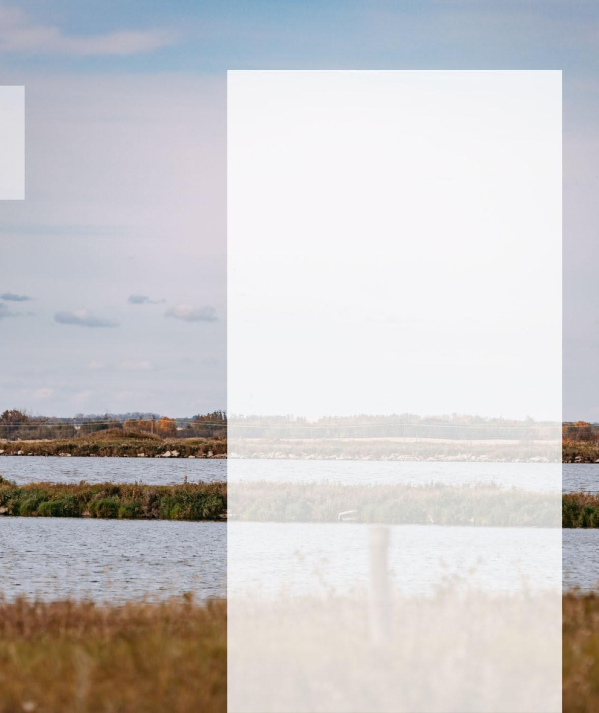
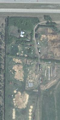
ThePlanareacomprises 337.54ha/834ac oflandlocatedtotheeast ofVegreville,justnorthoftheCNRailwayandHighway16,asshownin Map1.Theareacomprisespredominatelyprivatelyownedparcelswith thewesthalfofSection16beingownedbyprivatecorporations,as shownin Map2.
TheLandUseBylawidentifiestheeasthalfoftheASPlandsforRural Industrial(RI).TheSWof16isidentifiedasDirectControl(DC)andthe NWof16andNEof17aredistrictedasAgriculture.AportionoftheSE of16isdistrictedasMarijuanaProductionFacility–DirectControl(MPFDC)toaccommodatetheLunaversemedicalmarijuanaproduction facility(see Map3).

ThefollowingsectionsaremodifiedexcerptsfromtheX-Terra EnvironmentalServicesInc.’s BiophysicalEnvironmental Assessment datedJune,2019,preparedfortheCountyof Minburn.
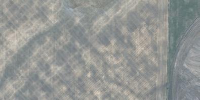
ThesoilsinthePlanareaarecomprisedofmiscellaneous poorlydrainedSolonetzicsoilsthatincludesalinesoilsand SoilswithRegoprofiles.Comprisedofundulating,high relieflandformwithalimitingslopeof4%.
TheAlbertaSoilsInformationViewerindicatestheareahas aLandSustainabilityRatingSystemratingof3(10)and4(8)–5W(2),indicatingmoderatelimitationsthatrestrictthe growthofspecificcropsandindicateslandsinthisareamay haveseveretoveryseverelimitationsthatrestrictthe growthofspecificcrops,insomeareasduetoexcesswater.
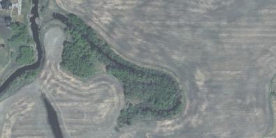
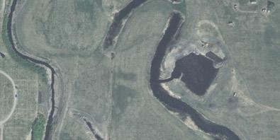
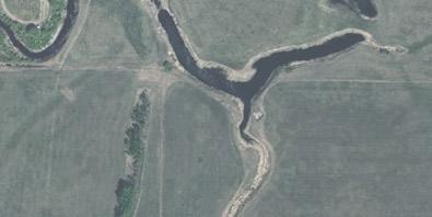
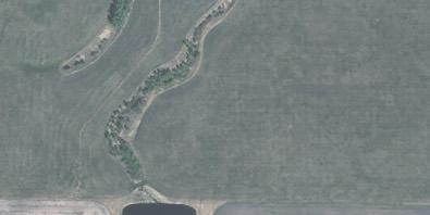
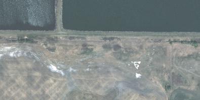
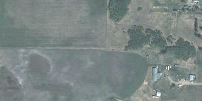
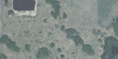
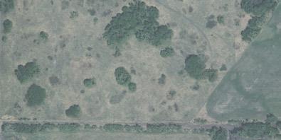
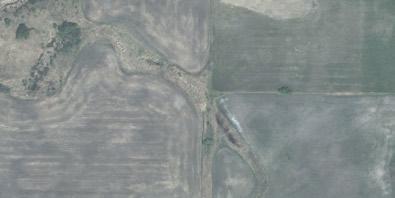
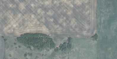
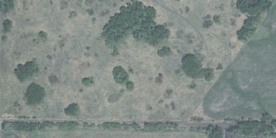
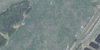
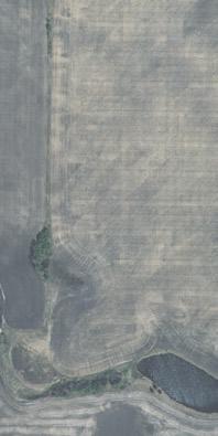
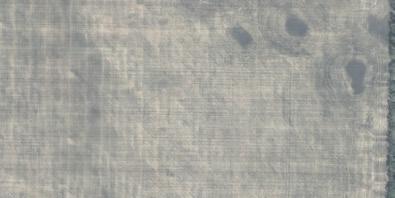
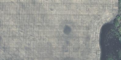
Therewere25wetlandsidentifiedinthePlanarea(see Map4).However,onlytwoweredeemedtobeofamore permanentnature,Wetlands9and12.Wetlands1,2and5 appeartohavebeenestablishedaftertheTownof Vegreville’slagoonswereconstructedandnaturalizedover time.Wetlands3,4,6-8,10,11and13-25weredetermined tobetemporaryinnatureandfarmedoverduringthe majorityoftimebetween1962and2017.
WetlandsareclassifiedbetweenAandD,withDhavingthe lowestvalueandAhavingthehighestvalue.The25 wetlandsareanticipatedtobeclassifiedasD,althougha fieldanalysisandprovincialassessmentisrequiredto confirm.
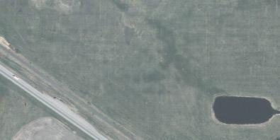
Severaltributarieswerealsoidentified.Asthesetributariesconnectto theVermilionRivertheyarecategorizedasClassCUnmapped watercourses.Theyhaveseasonaldrainagewithlittletonodefined channels,howeverfurtherassessmentmayberequiredinthefieldprior todevelopment.
Adesktopreviewwascompletedforpotentiallysensitivewildlife restrictionsandthebiophysicalreportidentifiedsharp-tailedgrouse, raptors,migratorybirdnestsandhabitatforotherpotentialendangered species.Priortodevelopmentsensitivespeciessurveysneedtobe conductedforshort-earedowls,raptors,sharp-tailedgrouseandother species.
Pre-constructionnestsweepsarerequiredwithinsevendayspriortothe onsetofconstructionbetweenApril1andAugust31.
ThePlanareahasbeenhistoricallyusedforagriculturalpurposesand futuredevelopmentmayhavefurtherimpactsonwetlands.Avoidanceof wetlanddisruptionisrecommendedasafirstpriority,followedby mitigationofimpact,andasalastresortreplacement/compensation.
Erosionandsedimentationcontrolmeasuresneedtobeputintoplace priortocommencementofdevelopment.Anerosionandsedimentation controlplanshouldformpartofadevelopmentagreement.
TheListingofHistoricalResourcesmaintainedbytheProvinceofAlberta wassearchedandconfirmedthattherearenohistoricallyvaluable resourceswithinthePlanareaandnotHeritageResourcesAct clearancesarerequired.


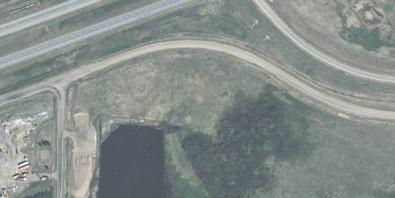


Map5 showstherearethreeabandonedwellswithintheASPboundary. Abandonedwellscanbeeither‘reclaimed’or‘non-reclaimed.’
Developmentsetbackstopipelines,abandonedandactivewellsare dependentuponanumberoffactors.TheAlbertaEnergyRegular(AER) givesdirectiononminimumsetbackrequirements.
TheAER’sDirective079:SurfaceDevelopmentinProximityto AbandonedWellspertainstosetbackstoabandonedwells,both reclaimedandnon-reclaimed,assummarizedhere:
Reclaimedabandonedwells:
■ Abandonedwellswithadepthlessthan150mdonotrequirea setbackandareexemptfromDirective079.
■ Abandonedwellswithadepth150morgreaterrequireaminimum 5msetbackradiusaroundthewell.
■ Consultationwithawelllicenseemaydeterminesetback requirementgreaterthan5m.
■ Non-reclaimedabandonedwells:
■ Allnon-reclaimedabandonedwellsrequireaworkarea(i.e.: setback)equivalenttothewell’sleasearea.
Subdivisionanddevelopmentapplicantswillberesponsiblefor contactingwelllicenseholderstodeterminesetbacksrequiredfor reclaimed,abandonedwells.
Subdivisionanddevelopmentapplicantsareresponsiblefor determiningtheleaseareaaroundnon-reclaimed,abandonedwells.
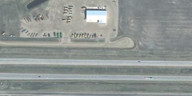
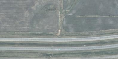
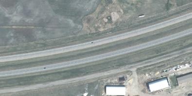
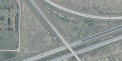
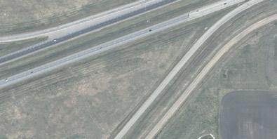
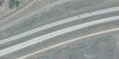
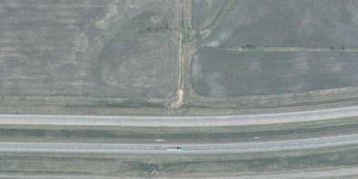
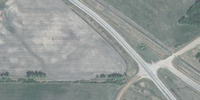
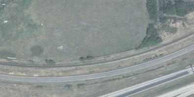
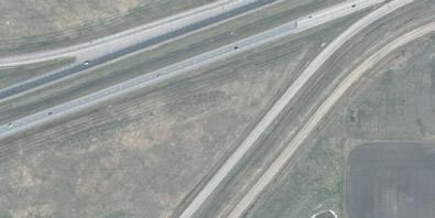
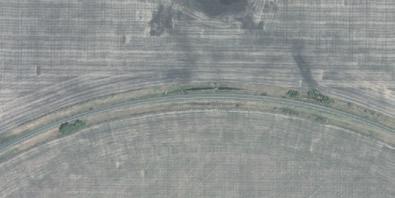
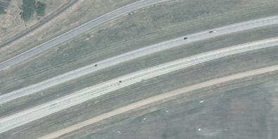
In2010AMECEnvironment&InfrastructurewasretainedbyAlberta Transportation(AT)toprepareafunctionalplanningstudyforthefuture realignmentoftheintersectionofHighway857andHighway16,whichis locatedjustsouthoftheTownofVegreville.
ThepurposeoftherealignmentistofacilitateconvertingHighway16to freewaystatusandremovingat-gradeaccesspoints.Thepreferred optionfortherealignmentisdepictedon Map6,andislocatedabout 600mwestoftheexistingflyover.Theall-accessinterchangewillconsist ofaninitialdiamondinterchangewithpotentialfutureupgradesto includetwofuturelooprampsandacollectordistributorroadsouthof Highway16.Therealignmentwillnecessitatechangestoexistingaccess intheimmediateregionaroundtheASP.
Theexistingat-gradeaccesstoHighway16willberemoved,requiring re-routingoftrafficalonglocalroadways,includingRangeRoad144 whichliesalongthewestedgeoftheASPboundary.AdditionalreroutedtrafficalongRangeRoad144maynecessitateupgradestothe road.
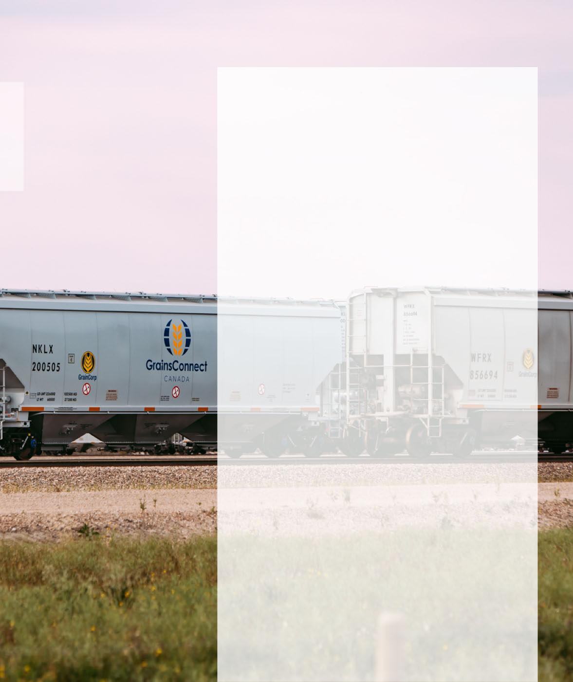
Theexistingat-gradeaccessatRangeRoad143hasalreadybeen removedbyGrainsConnectasaconditionofitsdevelopment agreementwiththeCounty.
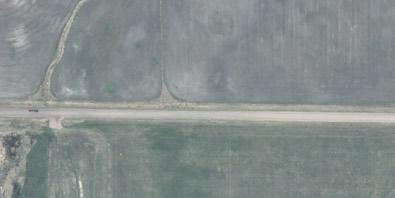
ThelocalroadsintheASPareaincludeRangeRoad144alongthe westernboundaryofthePlan,unimprovedTownshipRoad522atthe southendofthePlan,VegrevilleRoadatthesouthendofthePlan (pavedbetweenRangeRoad143and144),andRangeRoad143along theeasternboundaryofthePlan.RangeRoad143ispavedbetween Highway16andtheCNRailway.RangeRoad144isgravelled.Bothare undividedroadways.Intersectionsontheseroadsarestopcontrolled. TownshipRoad522isgravelandextendsonlypartwayalongthe southernboundaryofSW16.
BasedonAT’sfunctionalplanfortheHighway857realignment,it appearsthatRangeRoad144willberealignedtoamajorintersection withrealignedHighway857northofthefutureintersectionofHighways 16and857(see Map6).
ATransportationImpactAssessment(TIA)wasnotpreparedforthisASP asthereisnospecificdevelopmentplannedatthistime.ATIAwas preparedfortheGrainsConnectdevelopment,anditisrecommended thatallfuturedevelopmentsberequiredtopreparedTIAinconsultation withAlbertaTransportation.
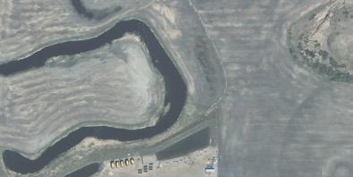
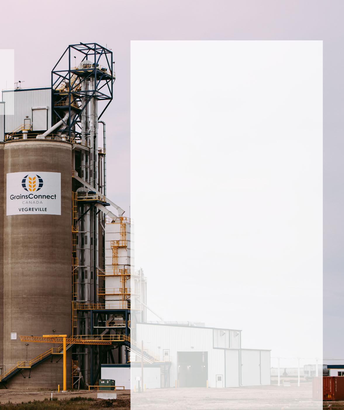
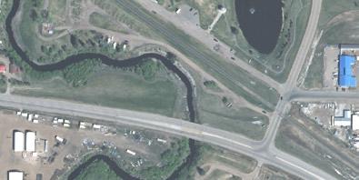
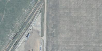
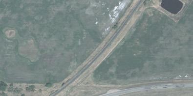
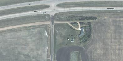
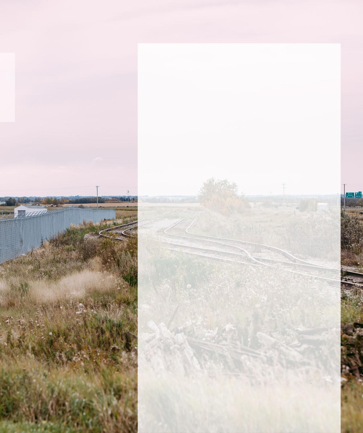
TheCNRailwayformsthesouthernboundaryofthePlanareaand curvesthroughthePlanareaacrosstheSE16.Thereisarailspur/loop thatservestheGrainsConnectdevelopmentinthenortheastquadrant ofthePlan.ThereisanadditionalspurtoBlock1,Plan8322833whichis currentlyagrainbinsalesdevelopment.Itisnotanticipatedthat additionalspurlineswouldbeextendedintotheASPboundary.
TransportCanadasetsoutproximityregulationsforroadaccessesand intersectionsnearrailways.Roadaccessesandintersectionsneedtobe setbackaminimumof30mfromthenearestrailway.Developersare responsibleforadheringtoTransportCanadaregulations.
TheFutureLandUseConcept(see Map7)illustrateshowtheASPlands maydevelopovertime,identifyingdifferentlandusedesignations, naturalandhuman-madefeatures.
ItisanticipatedtheASPlandswilltakeseveraldecadestobuildout,and consequentlylandownershipandpoliciesmaychangeovertime.This FutureLandUseConceptreflectscurrentplanningpolicies, intermunicipalunderstandingsandmarkvand,itmayneedtobe updatedovertimetoreflectthechangingneedsoftheCounty,theTown ofVegrevilleandaffectedmarketsectors.
Approximately 273.14ha/675ac isidentifiedtodevelopwithindustrial uses,inparticularindustrialusessuchasthosedescribedinPolicy3.4.1 oftheCounty’sMDP.WiththeadoptionofthisASP,developerswishing toconvertlandcurrentlyidentifiedasDC-DirectControlwithinthePlan areatoRI-RuralIndustrialwouldbesupported.
Shouldservicingbecomeavailable,moreintensiveindustrialusesmay bedeveloped.Serviceddevelopmentproposalswouldrequire alignmentwiththeCounty’scurrentpoliciesonindustrialdevelopment andthepoliciesoftheIntermunicipalDevelopmentPlan.

Map7 doesnotshowanylanddesignatedforHighway Commercialdevelopment.Atthistime,itisnotexpected thatcommercialdevelopmentinthislocationwouldbein demandorbefeasible.However,thisASPsupportsthe transitionfromtheIndustrialdesignationtoHighway Commercialdesignationforcertainparcelsoflandifthere isstrongmarketevidencetosupportsucharequest.In additiontostrongmarketevidence,thereshouldbegood accessandgoodvisibilityfromHighway16.
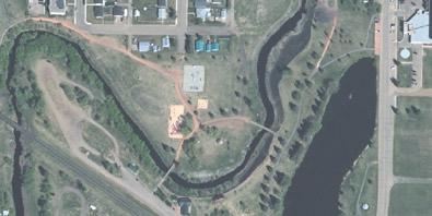
Thereisapproximately 9.37ha/23ac ofopenspacelands identifiedintheASPboundary.Theselandsincludethe TownofVegreville’soff-leashdogparkalongtheVermilion RiverinNE17aswellasthelandsabovethehighwater markofthestormwatermanagementfacilitylocatedin NE17.
Activeandpassiverecreationalpursuitsareencouragedin theOpenSpaceareas.
Approximately 5.27ha/13ac oflandisidentifiedfor ‘EnvironmentEasement’.Theselands,giventheir environmentallysensitivenature,areexpectedtobe identifiedforenvironmentreserve.Theymaybeprotected throughregistrationofenvironmentalreserveeasements duringthedevelopmentandsubdivisionprocesses.
Environmentalreserveeasementsarerecommendedbythis ASPtoallowlandtoremainunderprivateownership,inits naturalstate,yetprotectedfromdevelopment.
LandUsebyArea
Internalsubdivisionroadsareexpectedtobeconfirmedinthefutureto meetdevelopmentneedsatthattime.Minorchangestointernal roadwayconfigurationdoesnotnecessarilytriggeranamendmentto thisASP;however,discretionfordecidingifanamendmentisnecessary remainswiththeCounty.
Theproposedlotlayoutshownin Map8 isconceptualandchangestoit willnottriggeranamendmenttothisASP.Itisexpectedthatlotswillbe reconfiguredduringthesubdivisionprocessandafterwards(through consolidation,potentially)inordertotailorlotsizestomarketneeds.
Developmentstagingislikelytooccurinresponsetomarketdemand andinvestmentinupgradingroadinfrastructure,andpotentialforfuture waterandsanitaryservicing.
Inthe2017ConceptualSchemepreparedforLunaverseInc.,two developmentstagesareidentified.ThefirstbeingLot1,Block2,Plan 1920696,andthesecondbeingthenorthernpartofSE16-52-14W4M (seeMap2).AsofthewritingofthisASP,Stage1oftheLunaverseInc. developmenthadnotyetcommenced.
Overallstagingisexpectedtofollowexistingpatternsstartingwith GrainsConnect,whichisalreadydeveloped,followedbyLunaverseInc.’s Stages1and2,thenwestwardandnorthwardthroughtherestofthe Planarea.
Municipalreservetriggeredbythesubdivisionprocessshouldbe collectedinfullbytheCountyascash-in-lieu.Deferralofreserveowing bywayofdeferredreservecaveatisanticipatedfordeveloperswith largerlandholdingsand/ormulti-stageddevelopments.However, deferraltolandsownedoutsidetheASPboundaryisnotrecommended ifthoselandsareunlikelytodevelopwithinareasonabletimehorizon.
ThefollowingsectionsaremodifiedexcerptsfromtheBAREngineering WestIndustrialParkAreaStructurePlanServicingBriefdatedSeptember 10,2019,preparedfortheCountyofMinburn.
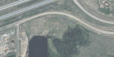
CountyofMinburndoesnotcurrentlyhaveanexistingmunicipalwater distributionsystemwithinthevicinityoftheWestIndustrialParkASPto providepotablewatertofuturedevelopment.Assuch,eitherprivateonsitepotablewatersystems,suchaswellsorcisterns,willneedtobe utilizedforthedevelopmentoraconnectiontotheAlbertaCentralEast (ACE)RegionalWaterSystemwillberequired.Ifwaterwellsareutilized forthedevelopment,groundwaterevaluationsand/orhydrogeological assessmentswillberequiredpriortoandaspartofthesubdivision processtoobtaintherequiredapprovalsandauthorizationfromAlberta EnvironmentandParksandAlbertaSustainableResourceDevelopment todivertandusegroundwater.
TheACERegionalWaterSystemsuppliesdrinkingwatertomember municipalities,whichincludestheCountyofMinburn.TheACE transmissionlineislocatedapproximately800mnorthofthenorthASP boundaryandrunseast/westalongTownshipRoad523Abetween RangeRoad145andRangeRoad144.AtRangeRoad144,the transmissionlineheadsnorthtoTownshipRoad524.

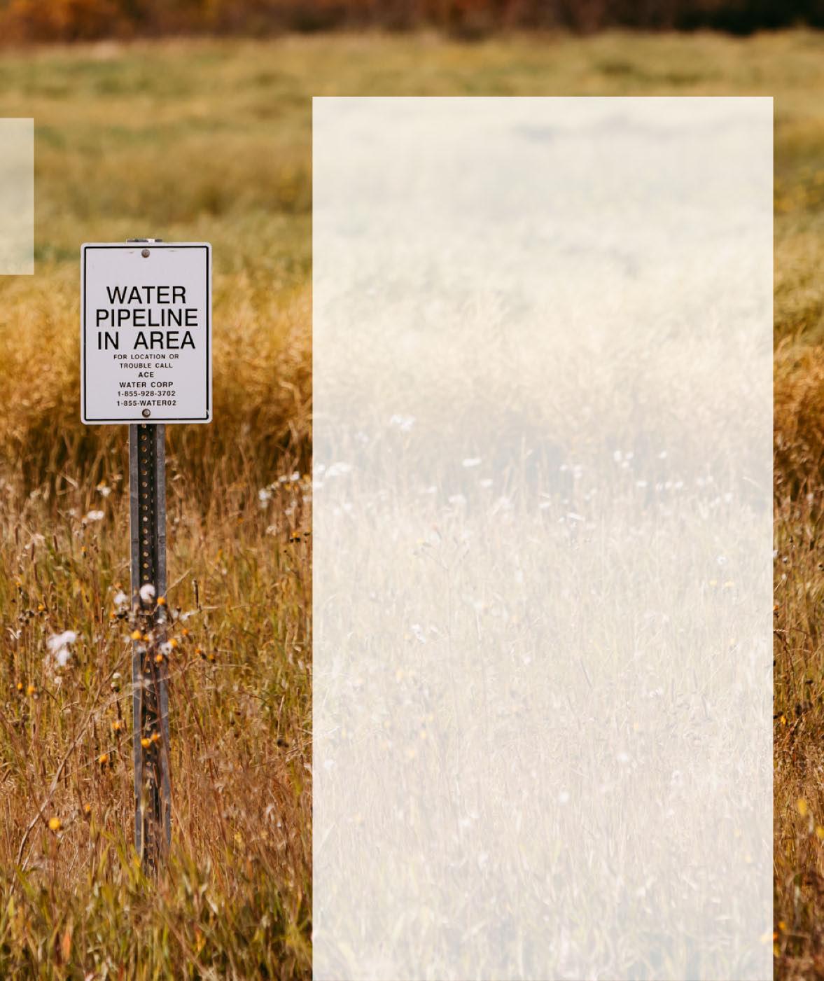
ConnectiontotheACETransmissionlineattheintersection ofTownshipRoad523AandRangeRoad144couldprovide potablewatertotheWestIndustrialPark(see Map9).A watermain,ownedandoperatedbytheCounty,wouldbe requiredfromtheconnectionpointsouthalongRange Road144andloopedthroughoutthedevelopmentto provideservicetotheRuralIndustriallots.
ItisimportanttonotethatACEdoesnotprovide distributionpressures,soeitherthewatersupplywouldbe throughatricklefeedsystemtofillprivateon-sitecisterns, ortheCountycouldconstructareservoirandpumpstation toprovideadequatedistributionpressurestotheWest IndustrialPark.ApplicationtoconnecttotheACE TransmissionLinewouldbeundertakenatfuturedesign stagesofthedevelopmentpriortosubdivision.
Ruralmunicipalwastewatercollectionsystemsarenot presentwithinorneartheWestIndustrialParkASP.Private on-sitewastewatercollectionandtreatmentsystemswillbe requiredfortheproposedruralindustrialdevelopment, whichcouldincludeholdingtanks,septictanks,and/or septicfields.Unlikemunicipalwastewatercollection systems,on-sitesewagesystemsincludeeithercollectionof thewastewaterandhaulingoffsiteorcollectingandtreating thewastewateronsitepriortodischargingtothe environment.Implementationofprivatesewagesystems shallbeinaccordancewiththeAlbertaPrivateSewage SystemscurrentStandardofPracticeatthesubdivision stage.
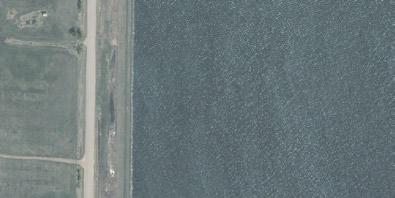
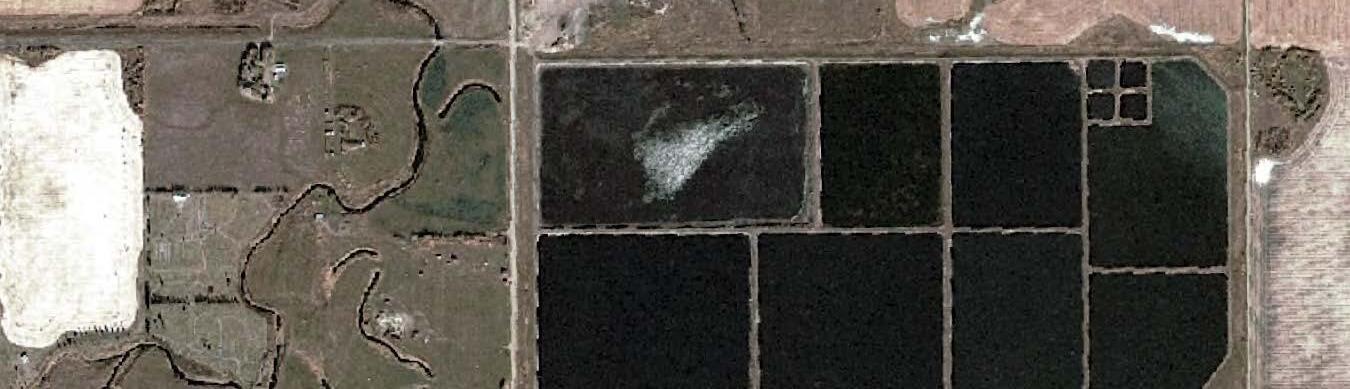
TownlagoonslocatedimmediatelynorthoftheNWandNE¼Sections 16-52-14-W4MtreatwastewatercollectedfromtheTownpriorto discharging.Itisunderstoodthat,atthistime,theCountyintendsforthe WestIndustrialParktoutilizeon-siteprivatesewagesystems.Further analysis,incollaborationwiththeTown,couldbecompletedifthe Countywishestopursueinstallationofawastewatercollectionsystem withintheWestIndustrialParktoconveywastewatertotheTown lagoons.AmunicipalwastewatercollectionsystemfortheWest IndustrialParkcouldconsistofalow-pressuresewagecollectionsystem, and/orgravitysanitarysewermainsincombinationwithliftstations.
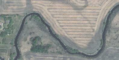
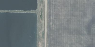
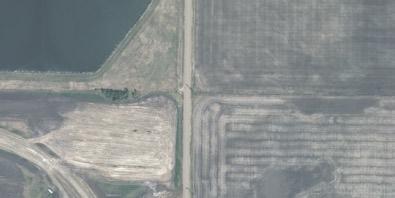
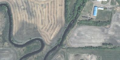
TheASPlandsgenerallyslopefromthesoutheasttothenorthwestwitha reliefofapproximately21m.ManytrappedlowswithintheASP boundarycapturestormwaterrunoffandprovidewetlandhabitat.An unnamedtributaryoftheVermilionRiverislocatedalongthewestand northpropertylinesoftheNE¼Section17-52-14-W4M,whichservesas thenaturaldrainageoutletfortheWestIndustrialPark.
AfloodhazardmappingstudywasundertakenfortheVermilionRiverto identifytheextentsofthe1:100yearfloodplain.Thefloodplainconsists oftwoareasofflowidentifiedasthefloodwayandthefloodfringe. Floodwayrepresentstheareawherethefloodwatersaredeepest, fastest,andmostdestructive.Floodfringeareareasoutsideofthe floodwaywherefloodwatersaregenerallyshallowerandflowslower. AccordingtoAlbertaEnvironmentandParks’floodhazardmapping,the unnamedtributarylocatedwithintheNE¼Section17-52-14-W4Mis locatedwithintheVermilionRiver’s1:100-yearfloodfringe.
ProposedstormwatermanagementmeasuresfortheWestIndustrial Parkincludesseriesofdrainageditches,includingroadsideditches,and stormwatermanagementfacilities(SWMF).Thesewillbeusedtoconvey andcontrolstormwaterrunofffromthefuturedevelopmentswithnatural drainagepatternsfromthesoutheasttothenorthwestbeingmaintained.
ThreeconceptualSWMFlocationshavebeenidentifiedbasedon gradingtomaintainnaturaldrainageandtheconceptualsubdivision layout(see Map10).AmaximumSWMFdischargerateof0.45L/s/ha hasbeenadoptedforthisstudybasedonthe1:100-yearVermilionRiver dischargerateprovidedinthefloodhazardmappingstudy.Further analysisincludingsizingoftheSWMFs,location,sequencing,andWater Actapplicationwillbecompletedinfuturestagesofdevelopmentprior tosubdivision.
Power,naturalgas,andcommunicationservicesarealllocatedwithinthe vicinityoftheWestIndustrialParkandwillbeextendedfromthenearest connectionlocationfortheplannedsubdivision.Applicationtotheutility providerforconnectionand/orextensionofservicetotheproposed developmentwillberequiredatthesubdivisionstage.
PowerisprovidedbyATCOElectricfortheWestIndustrialParkarea. Threephaseoverheadpowerlinesarelocatedalongtheunimproved roadallowanceofTownshipRoad522,fromRangeRoad143toRange Road144,alongthewestpropertylineoftheNE¼Section17-52-14W4Mrunningnorth/south,andalongRangeRoad143.Service connectionlocationtopowerwillbecoordinatedpriortosubdivision.
AstheASPareadevelops,centralizedsignageatentrancesto developmentnodesmaybedesirableandshouldbesupported. Individualsignagewillneedtoconformtotherequirementsofthe County’sLandUseBylaw.
Additionally,AlbertaTransportationmayhavesignageandlighting guidelinespertainingtodevelopmentsadjacenttohighwaysthatwould needtobeconsidered.
TheproximitytoandvisibilityfromHighway16suggestthatappropriate andyear-roundeffectivelandscapingand/orfencing/screeningbe appliedtodevelopmentsthatincludeoutdoorstoragethatcouldbe consideredunattractive.
InadditiontotheprovisionsoftheCounty’sLandUseBylaw,the DevelopmentOfficerand/orSubdivisionAuthority,asapplicable,is enabledbythisASPtoapplymorerigorousscreeningandlandscaping requirements.Variancestotheminimumrequiredscreeningand landscapingrequirementsoftheLandUseBylawshouldnotbe considered,especiallyinproximitytoapublicroadorProvincialHighway.

Existingagriculturaloperationswillbeallowedtocontinue inperpetuityatthewillofthelandowner.
TherearenoexistingsourgasfacilitiesintheASPboundary. TheCountymaysupportthedevelopmentofasourgas facilitydependingonitsproximitytodevelopedareasand thelimitationssuchafacilitycouldplaceonfuture development.
ThereappeartobefiveexistingresidenceswithinthePlan area.Theseresidenceswillnotbeaffectedbytheadoption ofthisBylaw.Futuredevelopmentandthecontinuationof existingresidentialusesonlandholdingwillremaininthe controlofindividuallandowners.
Policiesarewrittenusing“shall”,“should”or“may”statements.The interpretationsof“shall”,“should”and“may”thatfollowprovidethe readerwithagreaterunderstandingoftheintentofeachpolicy statement:
‘Shall’—denotescomplianceoradherencetoapreferredcourseof action.
‘Should’—denotescomplianceisdesiredoradvisedbutmaybe impracticalorprematurebecauseofvalidplanningprinciplesor unique/extenuatingcircumstances.
‘May’—denotesdiscretionarycomplianceorachoiceinapplying policy.


Applicationsforamendmentwillrequiresupporting documentationasdescribedintheMunicipalDevelopment PlanandLandUseBylaw,andmustbebasedonsound planningreasonsandgenerallyacceptedplanning practices.
ThisASPshallbereviewedandmonitoredtoensureits policiesandintentareconsistentwithcurrentplanning principlesandtheneedsoftheCountyofMinburn.
Itisrecommendedthisdocumentbereviewedatleast everyfive(5)years.
ThefollowingpolicieswillbeusedbytheCountyofMinburnNo.27, includingAdministrationandCouncil,toprovideguidanceanddirection whenmakingdecisionsonlanduse,subdivisionanddevelopmenton landswithintheASPboundary.
POLICY1
POLICY2
TheCountyofMinburnshallensurethatallfuturelanduse,subdivision anddevelopment,andamendmentdecisionsmadewithrespectto landswithintheboundaryoftheWestIndustrialParkASPcomplywith theprovisionscontainedwithinthisASP,includingtheMaps.Decisions relatedtodocument‘housekeeping’orthosethatwouldbeconsidered minordeviations,relaxationsorvariationsfromtheprovisionsofthisASP wouldnotrequireanamendmenttothisdocumentwhereitcanbe demonstratedthatthedeviation,relaxationorvariancedoesnot substantivelyaltertheintent,forceoreffectoftheprovisionsofthisASP.
AnydiscrepanciesbetweenthisASPandtheProvincialtransportation planningdocumentsreferencedhereinareunintentional,andthe Provincialtransportationplanningdocumentstakeprecedence.
POLICY3
Theexerciseofdiscretionandvariancerelatedtoanymatterordecision renderedwithrespecttothisASPaswellastheamendmentofthisASP shallbeguidedbythefollowingprinciples:
a)Theexerciseofvarianceordiscretionindecidinganapplicationor amendmenttothisASPmustbebothreasonableanddefensible withintheletterandspiritofthisASPaswellaswidelyaccepted planningprinciples;
b)IfarequirementorprovisionofthisASPistobedeviatedfromorif anamendmentistobemade,itisessentialthatthoseexercising thediscretionordecidinguponvarianceormakingthe amendmentclearlyunderstandtherationalebehindthe requirementorprovisiontheyarebeingaskedtovaryoramend;
c)Discretion,varianceandamendmentshallonlybeconsideredifit canbedemonstratedthatthediscretion,varianceoramendment beingconsideredwill,ataminimum,notjeopardisethepoliciesof thisASPand,atbest,betterservethem;
d)Anyvarianceordiscretionexercisedoranyamendmentmadeshall befullydocumentedsothatthereasonsandrationaleforthe varianceordiscretionexercisedoramendmentmadeare accuratelyrecordedandclearlyunderstood.
POLICY4
TheCountyofMinburnmayundertakeorrequirethatthe owner/developerundertakeanoverallreviewofthisASPshouldan owner/developermakerepeatedapplicationstoamendthisASPonceit isineffect.Theintentofanoverallreview,insteadofcontinuingto entertainindividual,isolatedamendmentapplications,istoconsiderand evaluatetheimplicationsoftherevisionstothisASP,ataminimum,in thecontextoftheentireASPareaand,ifwarranted,beyondthisASP area.
POLICY5
TheCountyofMinburnshouldsupportsubdivisionand/orconsolidation ofparcelstomeetmarketneeds.
POLICY6
TheCountyshallrequiredeveloperstoprovidethemaximumamountof reservelandpursuanttotheMunicipalGovernmentAct.TheCounty shouldrequirereservelanddedicationintheASPbywayofcash-in-lieu. Furthermore,theCountyshouldconsideracceptingenvironmental reservededicationintheASPbywayofagreementwithlandownersfor environmentalreserveeasements.
POLICY7
POLICY8
POLICY9
TheCountyofMinburnshouldsupportcentralizedsignageatthe entrancetodevelopmentnodes.
TheCountyofMinburnshallencouragedarknightskies.
TheCountyofMinburnshouldrequiredevelopersmitigatelight trespassfromnewdevelopmentsthroughuselightingwithfullcut-off fixturesandavoidingunnecessaryup-lightingintothenightsky.
POLICY10
POLICY11
TheCountyofMinburnshallencouragescreeningandlandscapingto improvevisualappealofdevelopments,inparticularthosewithoutdoor storage,frompublicroadways.Thiswillbeaddressedatthetimeof subdivisionand/ordevelopmentasappropriate.
TheCountyofMinburnshouldnotvaryminimumstandardsoftheLand UseBylawforscreeningandlandscapingonnewdevelopments, especiallyinproximitytoapublicroadorProvincialHighway.
POLICY12
TheCountyofMinburnshallallowexistingagriculturaloperationsto continueinperpetuityatthewillofthelandowner.Existingagricultural operationsinthedesignationAgriculturalshouldnotbeunduly impededand/orimpactedbyfuturenon-agriculturaldevelopment withintheASPboundaryandadjacenttoexistingagricultural operations.
POLICY13
TheCountyofMinburnmayrequireproponentstoengageadjacent landownersifitisdeemedtheproposeddevelopmentmaydirectly impactandevelopment.Theconsultationmustbedoneintheearly stagesoftheapplicationprocess,beappropriateandmeaningful,and theoutcomesoftheconsultationswillberecordedandsubmittedfor considerationbytheDevelopmentAuthorityand/orSubdivision Authority.
POLICY14
POLICY15
POLICY16
Developersshallensurethatallsitepreparation,publicroads,andany otherpublicfacilities/improvementsareprofessionallyengineeredand constructedtothesatisfactionoftheCountyofMinburninaccordance withtheCounty’sstandards.
Owners/developersshallensurethatsubdivisionanddevelopment permitapplicationscomplywiththeStormwaterManagement GuidelinesfortheProvinceofAlberta1999,preparedbyAlberta Environment,asapplicable,andgenerallywiththeStormwater ManagementPlancontainedinAppendix2ofthisASP.Thereshallbe nochangebetweenpre-andpost-developmentoff-siteflowsexcept wheretheapplicationconformstoanapprovedstormwater managementplanapprovedinconjunctionwiththeCountyofMinburn.
Applicantsofsubdivisionanddevelopmentpermitapplicationsshallbe responsibleformakingallnecessaryarrangementsregardingthe disposal/managementofstormwateroff-siteandprovidingto/forthe CountyofMinburnallrequireddocumentation,permission,approvals and/orotherformsofauthorizationfromallrelevantagencieshaving jurisdictioninrelationthereto.
POLICY17
POLICY18
POLICY19
POLICY20
TheprovisionsoftheWestIndustrialParkASPupholdandprotectthe integrityandfunctionofHighway16.Thisisimportanttosecureand maintainAlbertaTransportation’sendorsementofthisASP.
Theapplicant/owner/developermayberequiredtoprepareaTraffic ImpactAssessment(TIA),attheirsoleexpense,asaconditionof subdivisionordevelopmentapprovalpursuanttothisASP.Thetiming andscopeoftheTIAwillbedeterminedbytheCountyofMinburnin consultationwithAlbertaTransportation.IfaTIAshouldberequired,it willbepreparedtothesatisfactionoftheCountyaswellasAlberta Transportation.
Thedevelopershallundertake,atitssoleexpense,anyengineering, requirementsorimprovementsidentifiedinorresultingfromtheTIA approvedbytheCountyand/orAlbertaTransportation,oranyother engineering,requirementorimprovementspecifiedbyAlberta TransportationinrelationtoHighway16asaresultoforthatis attributabletothedevelopmentofthisASParea.Further,such engineeringand/orimprovementsmustbeundertakentothe satisfactionoftheCountyofMinburninconsultationwithAlberta Transportation.
DevelopersshouldengageindiscussionswithAlbertaTransportationto determinetheirobligationswithrespecttoaTIAandpossible improvementspriortosubmissionofasubdivisionordevelopment applicationtotheCountyofMinburn.
POLICY21
TheCountyofMinburnshallensurethatwhentheopportunityarisesas partofasubdivisionordevelopmentpermitapplicationwithintheASP area,andwhenconsideredwarrantedandappropriatebythe DevelopmentOfficer,roadrights-of-wayrequireduptoandincluding30 metres(100ft)intotalwidthshouldbeprotectedwithoutcompensation usingwhateverlegalmeans/formofagreementnecessaryand appropriate(rangingfromsurveyandtransfertodedicationbycaveat, etc.)atthetimeofsubdivisionordevelopmentpermitapproval,asthe casemaybe.
TheDevelopmentorSubdivisionAuthority,asthecasemaybe,in considerationofanapplicationthatinvolvesexplosivesorradioactive material,shall:
a)considertheeffectsofthestorageand/ortransportofexplosivesor radioactivematerialproposedinanapplication(e.g.the implicationsofthedevelopmentsetbacksspecifiedinthe applicableRegulationsortheprovisionsoftheTransportationof DangerousGoodsAct)ontheotherexistingandproposeduse(s) locatedorproposedtobelocatedonthesubjectparcelaswellas adjacentparcels;
b)attheirdiscretion,priortodecidingupontheapplicationbefore them,providepublicnotice,throughmeansandtowhomthey considernecessary,thatadecisionregardinganapplication involvingthestorageand/ortransportofexplosivesorradioactive materialistobemade,thatanopportunitywillbeaffordedtoany personnotifiedtomakerepresentationontheapplicationandthat therepresentationsmadeshallbetakenintoaccountwhenfinal considerationisgiventothesaidapplication;and,
c)basedonthecircumstancesoftheapplicationbeforethem,andat theirsolediscretion,eithergranttheirapproval,providedthe applicationotherwisecomplieswiththisASPoranyConceptual Schemeineffect,theapplicableMDPandLUB,subjecttothe applicantcomplyingwithallapplicableprovincialandfederalas wellasanyothermunicipalregulationsrelatedtoexplosivesor radioactivematerial(andsubmittingproofofsame–e.g.alicense orcertificate,asspecifiedbytheDevelopmentorSubdivision Authority,thattheyhavecomplied),orwithholdtheirapprovaluntil suchtimeastheapplicantdemonstrates,totheirsatisfaction, compliancewithallapplicableprovincialandfederalaswellasany othermunicipalregulationsrelatedtoexplosivesorradioactive material.
POLICY23
POLICY24
POLICY25
TheCountyofMinburnmaysupportdevelopmentofsourgasfacilities withintheASPboundary.
TheCountyofMinburnwillworkwithoilandgasinterestsandlandowners toidentifywell-sitedevelopmentandproductionschedulesthat coordinatewithlandusedesignationswithinthisASP.Inworkingwithoil andgasinterestsandlandowners,theCountywillstronglyrecommend thatthefollowingsiting/developmentprinciplesbefollowed:
a)wellsshouldbeclusteredwheneverpossible;
b)flowliningtoacommonlocationformultiplewellsshouldbe utilizedwheneverpossible;
c)clusteredwellsitesshouldbelocatedwheneverpossiblenextto publicutilitylots,stormwaterlakesandfuturemunicipalreserves (parks);
d)roadaccessestoclusteredwellsshouldbecombinedwherever possibleandaccessroutesutilizedshouldbemadetofitexisting andidentifiedfutureroadwayswheneverpossible;
e)operatingconditionsofwell/batterysitesshouldbeadjustedas follows:
i.fluidsshouldbehauled,tanksshouldbevacuumed/cleaned andservicing/maintenanceshouldtakeplaceduringregular daytimehours,
ii.storagetanktemperatureshouldbekeptatalevelsuchthat associatedimpacts,particularlyodour,areminimizedtothe fullestextentpossible,
iii.portablegeneratorsshouldnotbeusedtoprovidepower,and
iv.everyeffortneedstobemadeusingwhatevermeasures requiredtominimizeodours,noise,dust,vibrationandany othernegativeimpacts.
Subdivisionanddevelopmentapplicantswillberesponsiblefor contactingwelllicenseholderstodeterminesetbacksrequiredfor reclaimed,abandonedwells.
POLICY26
Subdivisionanddevelopmentapplicantsareresponsiblefor determiningtheleaseareaaroundnon-reclaimedabandonedwells.
POLICY27
TheCountyofMinburnmayrequirethatapplicantsforsubdivisionwithin theWestIndustrialParkASPprovideinformationoraddressanyorallof thefollowingpriortoacceptingthesubdivisionapplicationascomplete:
a)generalterrain;
b)soilcharacteristics;
c)soilscapabilitytoprovidedrainageandabsorbsewageeffluent;
d)potentialforflooding,erosionorslumpingoftheland;
e)stormwater/wetlandmanagement;
f)adequacyoftheproposedbuildingsites;
g)proposedpublicroadaccess;
h)availabilityofawatersupplythatisadequatefordrinkingandfor theintendeduseoftheparcel(s);
i)proximitytoexistingutilities;
j)proposedmeansofbufferinginrelationtoadjacentlands;
k)allexistingandhistoricoil/gasfacilitiesandmeasurestomitigate anyassociatedimpacts;
l)provision/availabilityofemergencyservices;
m)identificationandformofreservededicationasapplicableperthe MunicipalGovernmentAct;
n)howtheconfiguration,dimensions,spacingandlocationofthe proposedparcel(s)complieswiththeconceptsofthisASP;and
o)anyothermatterstheDevelopmentOfficerconsidersnecessary.
POLICY28
POLICY29
POLICY30
TheCountyofMinburnshallpursuewhateveractionsaredeemed appropriateornecessarytosecurecompliancewiththeprovisionsof thisASP.
TheCountyofMinburnmayrequireowner(s)/developer(s)toenterinto anagreementwiththeCountyasaconditionofanapprovedsubdivision ordevelopmentpermitapplicationpursuanttotheMunicipal GovernmentAct.
TheCountyofMinburnmayrequirecaveats,performancebonds,letters ofcredit,restrictivecovenantsoranyotheravailablemechanismsto secureperformanceofanyrequirementstipulatedintheprovisionsof thisASP.
POLICY31
TheCountyofMinburnwillensurethatwhenamendmentsaremadeto thisASPinthefuture,anycomplementaryamendmentstotheMunicipal DevelopmentPlanorLandUseBylawarealsomadetoensure conformancewithSection638oftheMunicipalGovernmentAct.
POLICY32
TheCountyofMinburnwillmonitortheWestIndustrialParkASPonan on-goingbasis.Notwithstanding,thisASPwillbereviewedwithinfive yearsofbeingadopted(i.e.:by2025).
DoesnotformpartofthisBylaw.
Preparedby:X-TerraEnvironmental ServicesLtd.

FUTURE DEVELOPMENT OF 16-52-14 W4M, PORTIONS OF 9-52-14 W4M, AND NE-17-52-14 W4M WITHIN THE COUNTY OF MINBURN NO. 27

JUNE 2019
104-108 RESEARCH DRIVE
SASKATOON, SK S7N 3R3
4201-66TH AVENUE
LLOYDMINSTER, AB T9V 2Y7

LIST OF FIGURES Figure
APPENDICES
Appendix A: Project Location within Topographic Overview
Appendix B: Watershed/Flood Hazard Map
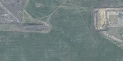
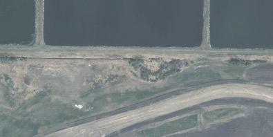
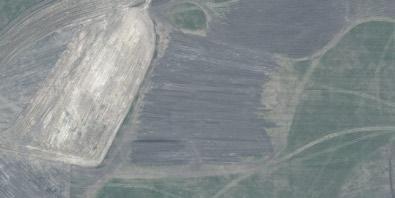
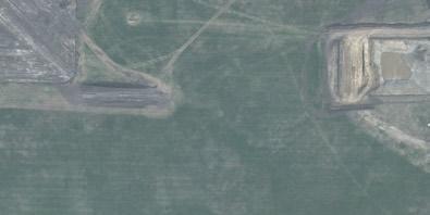
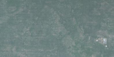
Appendix C: Historic Aerial Imagery/Air Photo Summary
Appendix D: Precipitation Data/Historical Temperatures
Appendix E: LAT Report/ACIMS Report/FWMIS Report
Appendix F: Wetland Assessment Unit and Value, and In-Lieu Rate
X-Terra Environmental Services Ltd. (X-Terra) was retained by Red Willow Planning on behalf of the County of Minburn No. 27 (COM) in May 2019 to complete an amendment to a previous Biophysical Environmental Assessment (BEA) of lands located north of Township Road 522 and Provincial Highway 16, between Range Roads 143 and 144. The previous project area encompasses section 16-52-14 W4M, approximately 2.4 km east of the most easterly border of The Town of Vegreville, Alberta within the County of Minburn No. 27 The amended report will incorporate additional adjacent lands that include northerly portions of 952-14 W4M (immediately North and adjacent to Highway 16) and NE-17-52-12 W4M.
This BEA includes a preliminary desktop assessment of the study area and any sensitive environmental features or concerns that may require consideration in order to meet environmental protection expectations and relevant regulations As such, the entire section 16-52-14 W4M, NE-17-52-12 W4M, and NW and NE-9-52-14 W4M were considered as part of this BEA. The implementation of specific m itigations has been recommended to eliminate or reduce environmental impacts within the study area
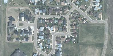
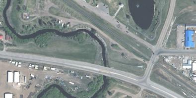
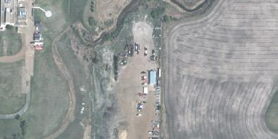
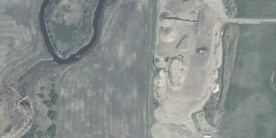
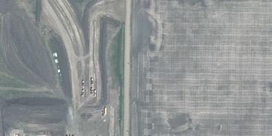
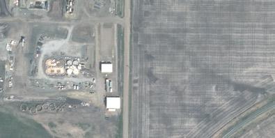
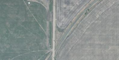
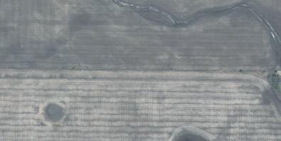
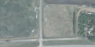
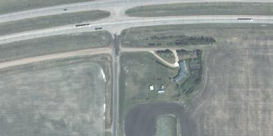
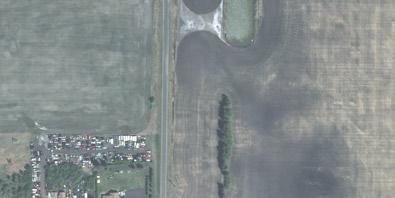
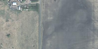
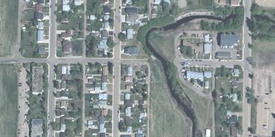
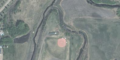
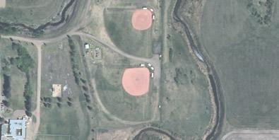
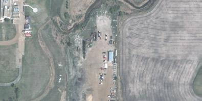
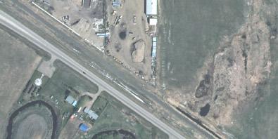
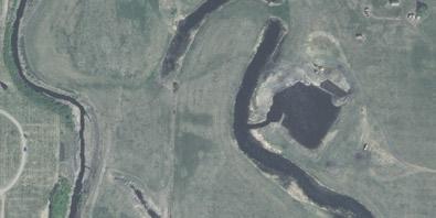
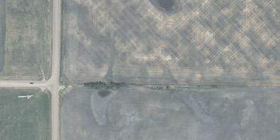
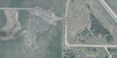
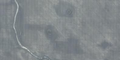
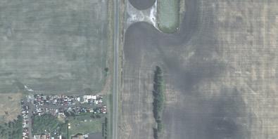
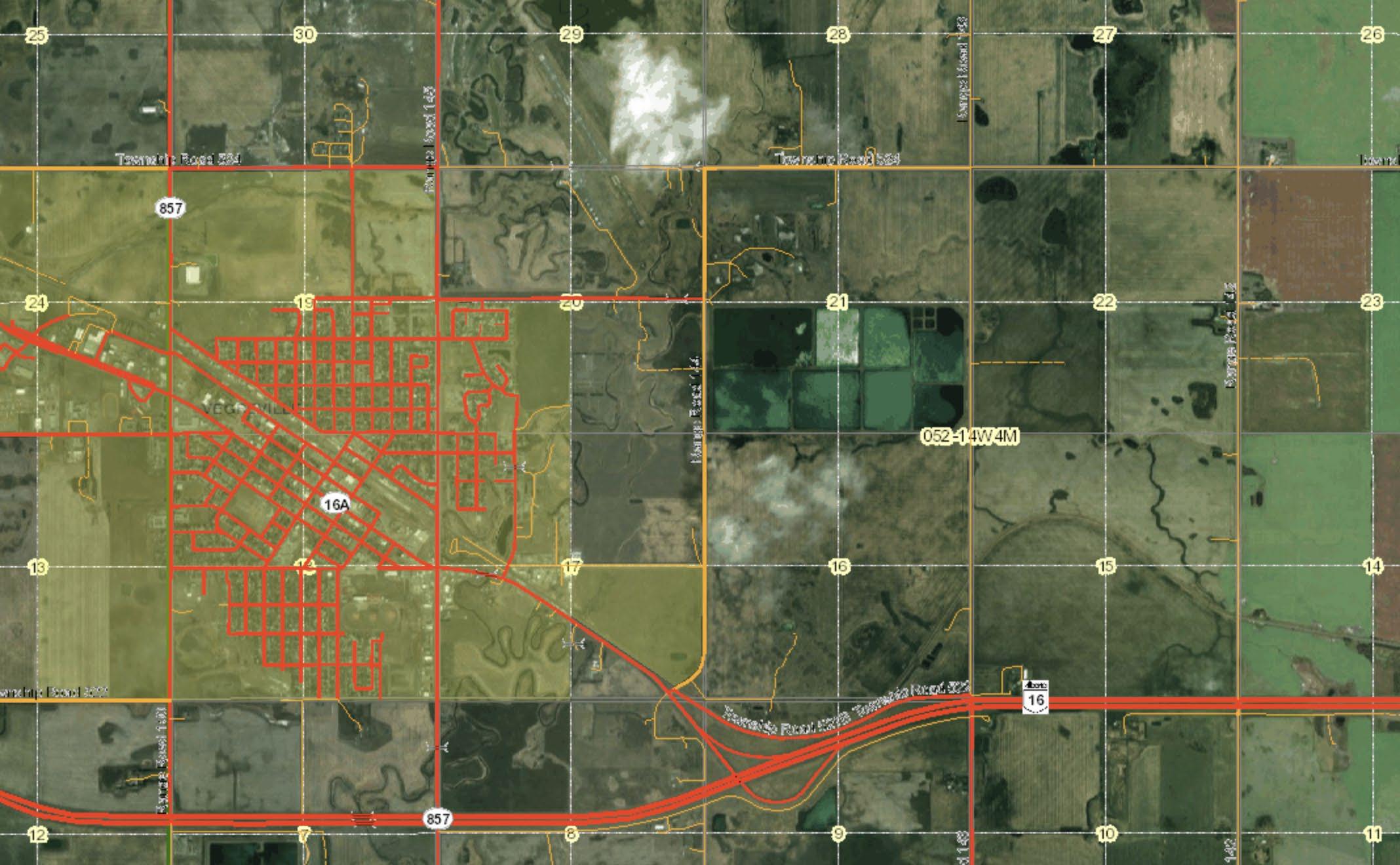
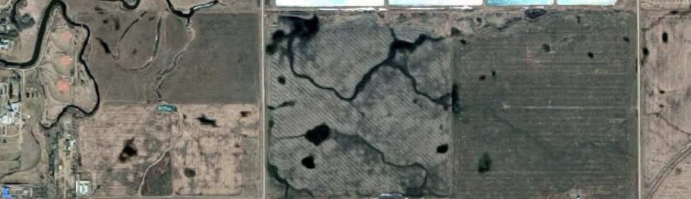
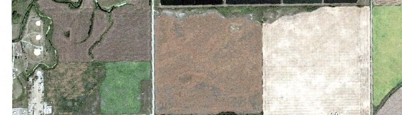
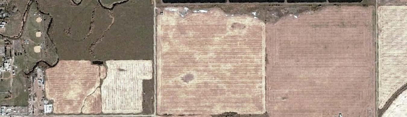
Figure 1-1. Aerial Overview Map of the Study Area in Section 16-52-14 W4M, NW and NE- 9-52-14 W4M, and NE-17-52-14 W4M
The overall objective of the Biophysical Environmental Assessment (BEA) was to identify and calculate the environmental importance and sensitivity of the lands located within, and adjacent to, the ASP lands in 16-52-14 W4M, NE-17-52-12 W4M, and NW and NE-9-52-14 W4M, and to provide recommendations to avoid or minimize environmental impacts In addition, the BEA will set out what regulatory processes may be required as a result of any future developments.
Specifically, the objectives of this BEA were:
• To conduct a desktop assessment of the ASP lands in order to identify wetlands/waterbodies and watercourses;
• To determine the potential environmental impacts that may results from the ASP lands;
• To outline mitigation recommendations that minimize the environmental impact of the ASP lands;
• To provide a high-level outline of the potential regulatory requirements and approvals needed for the development of the ASP lands.
This BEA was performed by collecting and evaluating relevant information for the study area and the surrounding lands within 16-52-14 W4M, NE-17-52-12 W4M, and NW and NE-9-5214 W4 from pertinent databases, existing documentation, regulatory resources, and interpretation and comparison of historical air photos. The information gathered throughout the study was interpreted to determine potential for negative environmental impacts that may result from any future development activities. Based on the findings, sensitive environmental features were determined, and recommendations were proposed to mitigate the negative impacts
The study area is located within, 16-52-14 W4M, NE-17-52-12 W 4M, and NW and NE-9-5214 W4M, East and Southeast of Vegreville, Alberta within the County of Minburn No. 27 (Appendix D). The study area includes all of section 16-52-14 W4M (approximately 259 ha), the Southeast ¼ Section of 17-52-12 W4M (approximately 65 ha), and a portion of the Northwest ¼ Section 9-52-14 W4M (11 ha), and portion of the Northeast ¼ Section 9-52-14 W4M (1.75 ha). This BEA primarily focusses on this specific area but also takes into consideration the lands adjacent this section of land. Portions of the SE-16-52-14 W4M have been previously assessed and documented as part of the Conceptual Scheme document as prepared for Lunaverse Inc. in August 2017; this existing documentation was reviewed and analyzed in relation to the study area and has been considered during the preparation of this report
The project area is located within the Aspen Parkland Ecoregion of east-central Alberta (Strong and Leggat, 1992). Topography varies across the region from nearly level, to gently rolling in areas, to hummocky or steeply rolling in lesser frequency when nearing the Vermilion River which is located in the northeast and the west portions of the County of Minburn
Please find a topographic overview of the project area in Appendix A of this report.
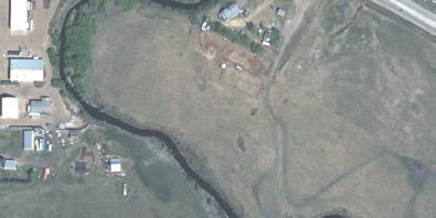
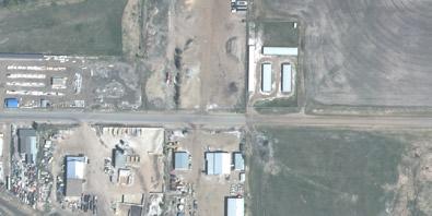
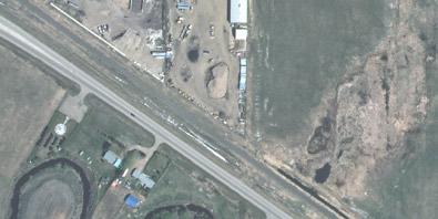
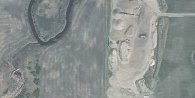
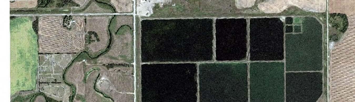
Lands to be directly impacted by future development within 16-52-14 W4M, 17-52-12 W4M, and 9-52-14 W4M are used primarily for agricultural crop and livestock production purposes. The exception being the NE-16-52-14 W4M, where a Grains Connect rail transshipment development is located and encompasses most of the quarter section, as well as the SE-16-
52-14 W 4M, which is home to a proposed Lunaverse Inc. medical marijuana facility. One suspended well owned by Alphabow Energy Ltd (Omer’s Energy Warwick 10-16-52-14) is located in NE-16-52-14 W4M; one Reclamation Certified well owned by BP Canada Energy Group ULC (Mesa Warwick 7-16-52-14) is located in SE-16-52-14 W4M; one Reclamation Certified well owned by Gain Energy Ltd. (Omer’s Energy Warwick 14-9-52-14) is located in SE-16-52-14 W4M.
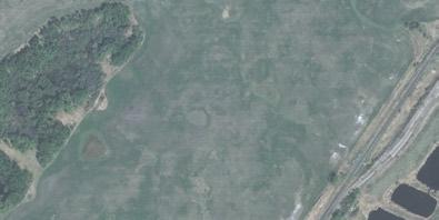
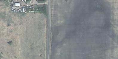
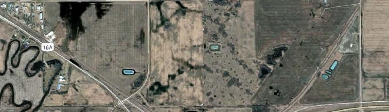
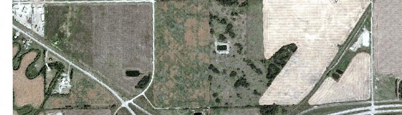
Lands surrounding 16-52-14 W4M, NE-17-52-12 W4M, and NW and NE-9-52-14 W4M include the town of Vegreville’s lagoons to the north, Provincial Highway 16 to the south, the town of Vegreville to the west, and to the east are agricultural land not identified for development at this time. Generally, lands located in proximity to the study area are utilized for agricultural purposes, or for urban purposes including infrastructure such as homes, businesses, highways and rail transportation routes, a sewage treatment facility/lagoon and a cemetery.
According to the Alberta Agriculture and Forestry’s online Soil Information Viewer (GoA, 2019), the immediate project area is known to have miscellaneous poorly drained Solonetzic soils that includes saline soils and Soils with Rego profiles; comprised of undulating, high relief landform with a limiting slope of 4%. Soils within the surrounding rural areas are comprised of poorly drained Eluviated to Solonetz Black Chernozem on medium textured (L, CL) till; comprised of undulating, high relief landform with a limiting slope of 4% (Alberta Agriculture and Forestry, accessed online December 2018/March 2019/June 3, 2019).
Statistical data gathered by the Government of Alberta between the years of 1971-2000 indicates the growing season starts between April 17-24 and ends between October 15-21 (GoA, 2018), lasting between 174 - 187 days.
According to the Alberta Soil Information Viewer, the study area has a Land Sustainability Rating System (LSRS) of 3(10) and 4(8) - 5W(2)). As per the LSRS for Agricultural Crops, the above-mentioned classifications are as follows:
• 3(10) indicates moderate limitations that restrict the growth of specific crops;
• 4(8) - 5W(2) indicates lands in this area may have severe to very severe limitations that restrict the growth of specific crops, in some areas due to excess water (not due to inundation).
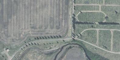
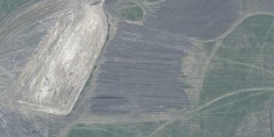
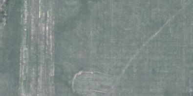
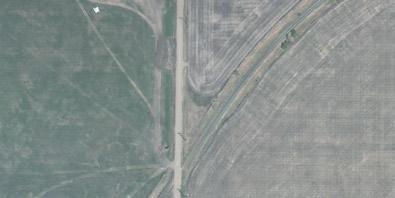
Air photo review indicates the future development area is used for primarily agricultural purposes, varying from crop production to presumed pasture/hay land to support livestock production.
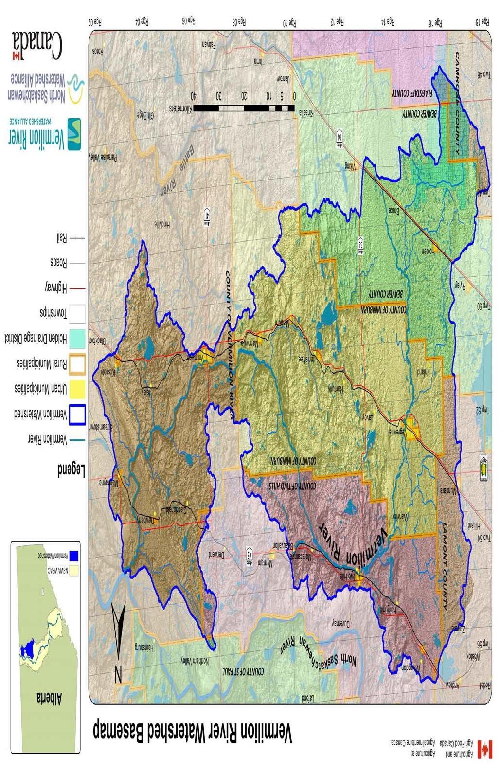
The project area is located within the North Saskatchewan River Basin (NSR). The NSR originates in the ice fields of Jasper and Banff National Parks and follows the North Saskatchewan River, flowing east towards the Alberta-Saskatchewan border. The North Saskatchewan River basin is divided into 12 watersheds, with the project area located in the Vermilion River watershed near the southern edge of the NSR basin
The Vermilion River watershed covers approximately 7860 km2, or 14% of the total NSR basin. Farming and oil and gas development are primary economical means as the watershed
is home to soils highly suitable for agriculture and petroleum reserves (State of the Watershed Report, North Saskatchewan River Watershed Alliance, 2005).
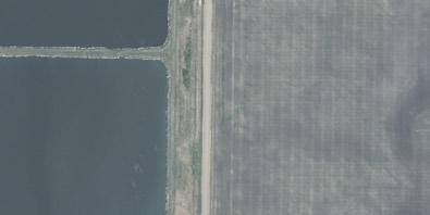
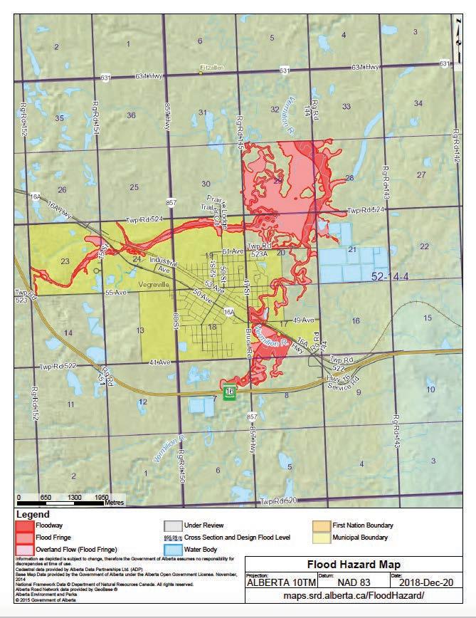
In April 1994 SNC-Lavalin Inc. of Edmonton, Alberta performed a flood hazard study that focused on the Vermilion River and tributaries and the associated flood risk to Town of Vegreville and surrounding area. According to the report summary, ‘t he headwaters of the Vermilion River originate in the prairies south of Vegreville. Channel modifications on the Vermilion River were carried out in 1977. Floods in the study area typically occur during the open water season as a result of spring snowmelt runoff but can also be caused by heavy rainfall events in summer or early fall. High flows are most likely to occur in March or April’ (Vegreville Flood Risk Mapping Study, GoA, 1994). The flood risk, in proximity to the study area is relatively close primarily with the extent of the mapped flood risk area being approximately 172m from the north corner of the site; the flood risk is primarily to the northwest and west of the study area
A visual depiction of the location of the study area in relation to the boundaries of the Vermilion River W atershed and Flood Hazard Map for the project area can be found in Appendix B
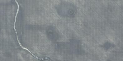
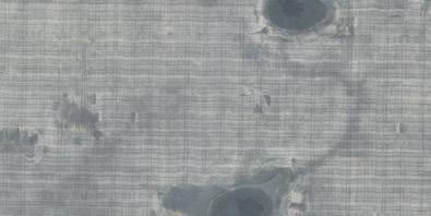
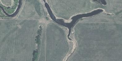
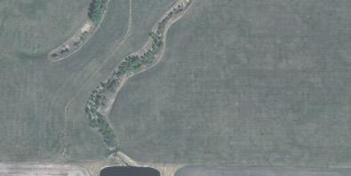
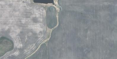
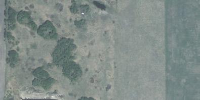
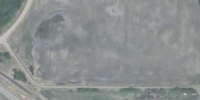
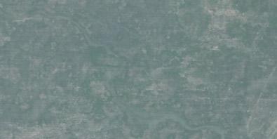
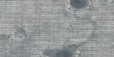
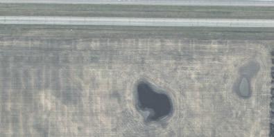
Lands within the study area were reviewed using historical air photos and information provided by Alberta Merged Wetland Inventory geospatial dataset (GoA, 2018) for the presence of water features, including wetlands, waterbodies and watercourses. Historic aerial photographs between the years of 1962 to 2017 were reviewed and compared focussing on the presence of, and changes to, sensitive environmental features within the project area, in particular, wetland and watercourse areas. The photographs were reviewed in combination with relevant climate and precipitation data in order to provide preliminary wetland delineation and permanency.
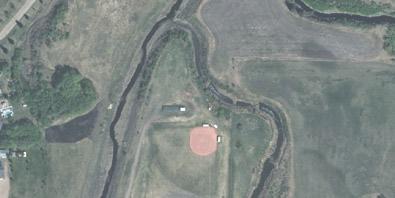
Sixteen graminoid marsh wetlands and two deciduous wooded swamp wetlands, were identified and classified within the 16-52-14 W4M study area. One graminoid m arsh wetland was identified and classified within the NW -9-52-14 W4M study area; no wetlands were identified within the NE-9-52-14 W4M study area. Seven graminoid marsh wetlands were identified and classified within the 17-52-14 W4M study area.
Through a review of historical aerial photos, it was determined that only two wetlands (W etlands 9 and 12) were deemed to be of a more permanent nature as their presence of water was consistent from 1962 to current date. Wetlands 1, 2 and 5 border the north edge of the study area and are directly adjacent to a lagoon located to the north; the presence of these wetlands has been consistent only since the construction of the lagoon. It is assumed that the natural hydrology of the area was altered due to the lagoon and the wetlands were formed due to human interactions. However, the wetlands have now become naturalized. From 1962 to present, the presence of wetlands 3, 4, 6-8, 10, 11, and 13-25 are seen to be temporary in nature. Through the historical aerial review, it was seen that these wetlands were farmed through during the majority of the years.
Wetland classes range from A to D, with D being the lowest valued wetland (AEP, 2016); it is anticipated that the impacted wetlands within the potential development area will be classed as ‘D” wetlands. An Alberta Wetland Rapid Evaluation Tool assessment should take place prior to development of the project area in order to determine the exact class of wetland, as well as to determine the appropriate mitigation measures for wetland impact.
In addition to the wetlands within the study area, several tributaries were identified; due to connectivity to the Vermilion River these tributaries are categorized as Class C Unmapped
watercourses. These Class C Unmapped watercourses are present within NE-17-52-14 W4M, NW -16-52-14 W4M, NE-16-52-14 W4M, and SW -16-52-14 W4M. Air photo review indicates these watercourses are seasonal drainages with little to no defined channel, however a field assessment would be required prior to any future development to confirm the classification of the impacted watercourses. The Code of Practice for Watercourse Crossings subject to recommendations by a Qualified Aquatic Environmental Specialist (QAES).
It should be noted that the findings of any future field assessments have the potential to identify further wetlands based on soil, vegetation and topography features. If any impacts to wetlands are to occur, Water Act Approval is required. As well, wetland replacement is required for mitigation for the disturbance of all wetlands (excluding ephemeral wetlands). In addition, any permanent or semi-permanent, shallow open water or marsh wetlands, are likely to have their ownership claimed by the provincial Crown under Section 3 of the Public Lands Act (GoA, 2000). Further investigations and regulatory applications may be required for assessing the permanence of the wetlands situated within the study area.
Any wetlands directly impacted by future development will require Water Act (GoA, 2000) approval supported by reporting and documentation as outlined in the Alberta Wetland Policy (GoA, 2013). The historical aerial imagery, including delineations of notable wetlands is located in Appendix C.
The historical climate data gathered from the Environment Canada Weather Station in Vegreville, Alberta was evaluated. The average yearly temperature from 1956 to 2017 ranges from 5.4°C in 1967, to 10.7°C in 1980; yearly lowest temperatures range from -49.85°C in 1962, to -26.26°C in 1987; yearly highest temperatures range from 28.0°C (2000) to 36.09°C (2002; average total accumulated precipitation was approximately 406.30mm (1956 to 2017); minimum precipitation was 216.30mm (2002) and maximum precipitation amount of 639.64mm (2012).
Current local climate information will be required to be reviewed as part of the Wetland Assessment and Impact Report preparation, as outlined in the Alberta Wetland Policy’s Identification and Delineation Directive (AEP, June 2015).
Please find the figures pertaining to specific climate data corresponding to historical air photos in Appendix D of this report.
Specific areas, such as wetlands and riparian habitats, provide key and critical wildlife habitat potential; when planning projects and activities, all efforts must be made to reduce impacts to critical habitats to ensure timing of activities will not detrimentally affect potential avian, fish and/or wildlife habitat.
A complete desktop review was completed in terms of potential wildlife sensitivities and species at risk for the project area. A summary of the results of the database searches and review is as follows, in Table 4.7:
Table 4-7. Summary of Potential Wildlife Restrictions
Restrictive Parameter 2Restricted Activity Period Setback Distance Details
Sharp-tailed Grouse Survey Area1
Sensitive Raptor Survey Area1
Other Sensitive and Endangered Species Ranges1
Migratory Bird Nests
year-round 500m from leks Sharp-tailed Grouse Surveys should be conducted during the appropriate periods as per the Sensitive Species Inventory Guidelines
year-round 1000m from nesting sites Sensitive Raptor Surveys should be conducted as per the Sensitive Species Inventory Guidelines
April 1st to July 15th 100m from active nest and surrounding habitat
Grassland Birds and Short-eared Owl Surveys should be conducted as per the Sensitive Species Inventory Guidelines
April 1st to August 31st 100m from nest site A pre-construction nest sweep is recommended within 7 days prior to the onset of construction activities
1Alberta Energy Regulator (AER) Landscape Analysis Tool Report – accessed March 21, 2019
2Government of Alberta (2011) – Select Wildlife Species and Habitat within Grassland & Parkland Natural Regions of Alberta
3Setback distance based on medium level of disturbance
The following databases were used to evaluate the project area for wildlife habitat potential:
4.7.1 Landscape Analysis Tool (LAT) Report – Wildlife Ranges
The Landscape Analysis Tool (AER 2015) report was generated for the project area; review of the LAT report for the project area identifies the area as a Sharp-tailed Grouse Survey area, a Sensitive Raptor Survey area and Other Sensitive and Endangered Species Survey area. As per LAT approval standards specific to the above-mentioned sensitive features, preconstruction surveys are required to be completed as per the Sensitive Species Inventory Guidelines (AEP, 2013). Any future development activities may not commence prior to these applicable sensitive species surveys being completed. In addition, pre-construction grassland bird surveys, including Short-eared Owl surveys must be completed on any native grasslands impacted by the land development, to take place between the dates of April 15 and August 15.
Should any of the above-mentioned species or evidence of said species be observed during the surveys, AEP should be consulted to determine proceedings.
A copy of the LAT Report is located in Appendix E of this report. The applicable Sensitive Species Inventory Guidelines can be found online at https://www.alberta.ca/sensitivespecies-inventory-guidelines.aspx
The Alberta Conservation Information Management System (ACIMS) database was searched (online, June 2019) for the project area regarding the occurrence of any species at risk. The ACIMS search indicated that there are no non-sensitive or sensitive elemental occurrences in or within proximity to 16-52-14 W4M, NE-17-52-12 W4M, and NW and NE-9-52-14 W4M
A copy of the ACIMS search results are located in Appendix E of this report.
4.7.3
A search of the Fish and Wildlife Management Information System (FWMIS) Internet Mapping Framework (IMF) was conducted on March 20, 2019 and June 4, 2019. The results from the FWMIS map search for the project area indicated there were no occurrences of rare or sensitive species within 1.5km of the project area, however, does show the project area occurs within a Sharp-tailed Grouse and a Bald Eagle range.
A copy of the FWMIS search results are located in Appendix E of this report.
Under Migratory Bird and Convention Act (MBCA), it is prohibited to destroy a nest or eggs for any families of migratory birds named in Article I of the convention (amended, 1995). In Canada, the general nesting period is approximately mid-March to late August. By consulting the nesting zone m aps, it can be determined that the project area is located in Zone B5, which has a nesting period of early April to late August.
A pre-construction nest sweep is recommended within 7 days prior to the onset of construction activities if they are to occur between April 1 and August 31 in order to ensure no nests or eggs are destroyed as a result of development For a larger land area development within the nesting period, it is recommended more than one nest sweep be conducted at different stages of the project in order to ensure no new species or nesting has taken place while activities are ongoing. In the event nests and/or eggs are observed, species and timing specific mitigation and/or monitoring should be applied.
4.9
According to statistical data gathered from Alberta Environment and Parks (AEP) Fish and Wildlife Management Information System (FWMIS 2019) fish species were identified within a 1.5km radius of the ASP lands The data collected is as follows:
• From the furthest W est boundary of NE-17-52-14 W4M: Fish Inventory – Brook Stickleback, Fathead Minnow, White Sucker; Stocked Inventory – Northern Pike, Rainbow Trout, Yellow Perch.
• From the further East boundary (where NE and SE quarter sections meet) of 15-5214 W4M: Fish Inventory - No Species Found in Search Extent; Stocked Inventory –No Species Found in Search Extent.
• From near the furthest North boundary of NW -16-52-14 W4M: Fish Inventory - No Species Found in Search Extent; Stocked Inventory – No Species Found in Search Extent
• From the further South boundary (where NW and NE quarter sections meet) of 9-5214 W4M: Fish Inventory - No Species Found in Search Extent; Stocked Inventory –No Species Found in Search Extent.
The Department of Fisheries and Oceans ‘Projects Near Water’ self-assessment criteria may be used determine if a request for review is required for the Class C watercourse (Vermilion River) tributaries that are associated with any future development activities.
In the event the self-assessment indicates a Request for Review is required, the project will be reviewed in terms of the best management practices described in the ‘measures to avoid harm ’ section of the Fisheries and Oceans Canada website found at: (http://www.dfo-mpo.gc.ca/pnw-ppe/measures-mesures/measures-mesures-eng.html)
A thorough field assessment in conjunction with these best management practices should be used to provide mitigation for any future developments and its potential associated impacts to the watercourses.
The Listing of Historic Resources (Alberta Culture and Tourism) is a tool that may assist developers, industry representatives and municipalities in determining if a developm ent might affect historic resources. The listing identifies lands that contain or have a high potential to contain historic resources, including archaeological sites, paleontological sites, aboriginal traditional use sites of a historic resource nature (burials, ceremonial sites, etc.), and/or historic structures. The listing can provide proponents with advance notification of possible historic resource concerns and may be used as a tool in planning projects.
The Listing of Historic Resources (accessed online June 2019) was searched for the project area. The search indicated that lands within 16-52-14 W4M, NE-17-52-12 W4M, and NW and NE-9-52-14 W4M, have no HRV, therefore a Heritage Resources Act Clearance is not required.
The future property development will modify the landscape and change the land-use within the project area which may result in negative impacts that relate to wildlife and natural hydrology within the location and surrounding areas.
The project area has been historically used for agricultural purposes. The lands adjacent to the project area include homes, businesses, highway and rail transportation routes, a sewage treatment facility/lagoon, a cemetery, and a regional airport It is suspected that a future development will modify the land-use of the project area to be similar to that of the neighbouring urban properties.
Future development activities may increase the potential for wildlife mortalities due to the destruction/alteration/reduction of wildlife habitat (removal of vegetation, alteration of wetlands, destruction of dens and nests, etc.). There may also be an increased potential for negative impacts associated with impacts to wetlands. The alteration or removal of wetlands reduces water storage and contaminant capture, decreases available habitat for wetland species, and modifies natural hydrology patterns
To reduce the potential for negative impacts to environmentally sensitive areas, that may result due to future development activities, specific mitigation measures should be considered and implemented.
It is recommended that a pre-construction wildlife sweep be conducted within 7 days prior to the onset of vegetation clearing or construction activities, if activities are to be carried out between April 1 and August 15.
The residual effects of the project on wildlife are anticipated to be low. Overall, impacts on wildlife are expected to be relatively minimal due to the close proximity of the project to existing developments and location on agricultural lands. However, temporary indirect impacts on wildlife may result from increased noise and stimuli extending for distances into adjacent habitats. This noise and stimuli may cause edge effects, resulting in some species avoiding areas of adjacent habitats during construction. The impacts of disturbances associated with the project may cause some wildlife species to favor or avoid areas adjacent to the project during the activity. However, these residual impacts are expected to be low due to the high level of development in the surrounding area.
Sensitive species surveys (noted in Section 4.7) are to be conducted as per applicable directives. The relevant Sensitive Species Inventory Guidelines can be found online at https://www.alberta.ca/sensitive-species-inventory-guidelines.aspx
6.2
The study area includes tributaries that are connected and within 2km of the Vermilion (Class C Watercourse). Due to the connectivity, these tributaries are categorized as Class C Unmapped Watercourses. The tributaries have potential for fish-bearing habitat, therefore works are subject to recommendations by a Qualified Aquatic Environmental Specialist (QAES). A QAES assessment and report may be required for activities that impact these tributaries.
The Department of Fisheries and Oceans ‘Projects Near Water’ self-assessment criteria will assist in determining if any future project development will require a Request for Review (DFO).
6.3
In terms of soil protection, erosion and sedimentation are the primary concerns associated with a development project. A plan should be developed that outlines erosion and sediment control strategies to be implemented during the construction and post construction phases of the development project. This plan should outline short-term and long-term permanent controls which will safeguard the sensitive features (e.g. wetlands, watercourses, etc.), within the project area and adjacent lands from unnecessary inputs.
In terms of vegetation, invasive species encroachment is the primary concern associated with a development project. A plan should be developed that outlines strategies for vegetation retention, revegetation and weed control (as per the Province of Alberta, Weed Control Act 2017). This plan should be implemented during the construction and post construction phases of the development project. If possible, the retention of existing vegetation is preferred as this strategy serves to prevent erosion and sedimentation and may reduce the encroachment of invasive species
A well designed and executed construction plan can help minimize the initial environmental impacts and reduce the overall environmental footprint caused by development activities. The plan should be developed to outline specific strategies to protect environmentally sensitive areas from situations that may arise as a result of construction activities This plan should itemize all construction phase environmental protection strategies such as spill response, regulatory reporting, topsoil storage, weed management, re-vegetation and vegetation retention, setback/buffer distances, erosion and sedimentation protection, etc.
Wetland avoidance, minimization and replacement mitigation strategies are outlined under the Alberta Wetland Mitigation Directive (GoA, 2015, updated 2017). These strategies are in place to reduce to preserve the presence of vital wetlands within Alberta.
As per the Alberta Wetland Mitigation Directive, the most desired option for any wetland is avoidance. There are many instances where avoidance is the only option considered; crown ownership, special designated lands, presence of endangered species, etc. For the purpose of this project, avoidance of wetlands may be feasible as development plans may be altered to avoid the wetlands within the project area.
Water Act Approval is not required if wetland avoidance is possible.
Minimization is the second preference when planning a project if avoidance is not possible. It refers to minimizing both the direct and indirect effects on the wetland and the value of the wetland during development activities For the purpose of this project, minimization of wetland impacts may be feasible as development plans may be altered to reduce impacts to the wetlands within the project area. In order to achieve this goal, alternate activities may be considered, or development plans may be modified.
Water Act Approval, and other related applications and approvals under the Act, are required if the wetland under the minimization strategy option.
If permanent wetland loss is expected, a Replacement Proposal must accompany the Water Act application. A desktop delineation, as per the directive ABWRET-D, identified twenty-four wetlands within the project area totalling approximately 10.10ha. In the event these wetlands are eliminated due to project activities a replacement payment may be required. This area of Alberta falls under the in-lieu fee rate of $8,600.00/ha therefore the approximate in-lieu payment of $202,091.00 would need to be submitted to the current and appropriate Wetland Replacement Agency for the area. The approximate in-lieu fees, per wetland, are itemized within Table 1.
A map and details pertaining to the assigned wetland assessment unit and value, and current (2019) in-lieu rates are located in Appendix F of this report.
Table 7-3. Potential In-Lieu Replacement Costs for Wetland Impacts
Wetland Identification Wetland Value* Wetland Classification
Wetland 1 D Primary [M][G][II], Secondary [M][G][II]
Wetland 2 D Primary [M][G][II], Secondary [M][G][II]
Wetland 3 D Primary [M][G][II], Secondary [M][G][II]
Wetland 4 D Primary [M][G][II], Secondary [M][G][II]
Wetland 5 D Primary [M][G][II], Secondary [M][G][II]
Wetland 6 D Primary [M][G][II], Secondary [M][G][II]
Wetland 7 D Primary [M][G][II], Secondary [M][G][II]
Wetland 8 D Primary [M][G][II], Secondary [M][G][II]
Wetland 9 D Primary [S][Wd][III], Secondary [M][G][III]
Wetland 10 D Primary [M][G][II], Secondary [M][G][II]
Wetland 11 D Primary [M][G][II], Secondary [M][G][II]
$2,719.32
$1,854.42
$7,386.06
Wetland 12 D Primary [S][Wd][III], Secondary [M][G][III] 0.5155 $9,588.30
Wetland 13 D Primary [M][G][II], Secondary [M][G][II] 0.4484 $8,340.24
Wetland 14 D Primary [M][G][II], Secondary [M][G][II] 0.1358 $2,525.88
Wetland 15 D Primary [M][G][II], Secondary [M][G][II]
$5,656.26
Wetland 16 D Primary [M][G][II], Secondary [M][G][II] 0.0572 $1,063.92
Wetland 17 D Primary [M][G][II], Secondary [M][G][II] 0.0489 $909.54
Wetland 18 D Primary [M][G][II], Secondary [M][G][II] 0.1749 $3,253.14
Wetland 19 D Primary [M][G][II], Secondary [M][G][II] 0.2264 $4,211.04
Wetland 20 D Primary [M][G][II], Secondary [M][G][II] 0.2356 $4,382.16
Wetland 21 D Primary [M][G][III], Secondary [M][G][II] 0.2803 $5,213.58
Wetland 22 D Primary [M][G][II], Secondary [M][G][II] 0.7714 $14,348
Wetland 23 D Primary [M][G][II], Secondary [M][G][II] 0.1974 $3,671.64
Wetland 24 D Primary [M][G][II], Secondary [M][G][II] 0.2730 $2,347.80
Wetland 25 D Primary [M][G][II], Secondary [M][G][II] 0.4646 $8.667.60
*Assumptions within table are based on historic values assigned to similar wetlands within the region The wetlands have been delineated wetlands as per ABWRET-D directive but have not been submitted for an ABWRET Score
** Based on desktop wetland delineations, a summary of the approximate wetland replacement for the study area (all of section 16-52-14 W4M, the Southeast ¼ Section of 17-52-12 W4M and a portion of the Northwest ¼ Section 9-52-14 W4M and portion of the Northeast ¼ Section 9-52-14 W4M. The values were calculated based on a replacement ratio of 1:1, relative wetland value assessment unit of 7, and an in-lieu rate of $18,600.00.
In addition, any permanent or semi-permanent, shallow open water or marsh wetlands, are likely to have their ownership claimed by the provincial Crown under Section 3 of the Public Lands Act (GoA, 2000) Further investigations and regulatory applications may be required for assessing the permanence of the wetlands situated within the study area.
On behalf of the County of Minburn No. 27, X-Terra Environmental Services Ltd. completed a Biophysical Environmental Assessment of lands within 16-52-14 W4M, NE-17-52-12 W4M, and NW and NE-9-52-14 W 4M, located East and Southeast of The Town of Vegreville, Alberta.
The information gathered throughout the Biophysical Environmental Assessment was interpreted to determine the potential for negative environmental impacts that may result from any future development activities. Based on the findings, sensitive environmental features were determined, and recommendations were proposed to mitigate the negative impacts.
The study area includes tributaries that are within 2km of the Vermilion River (Class C Watercourse). All Class C watercourses have potential for fish-bearing habitat, therefore works are subject to recommendations by a Qualified Aquatic Environmental Specialist (QAES). A QAES assessment and report may be required for activities that im pact these tributaries. Several ephemeral and seasonal drainages were observed within the property; however, the historic aerial photos did not show inundation, nor did the drainages appear to have defined beds and banks. These drainages may meet the definition of a wetland, therefore impacts to the ephemeral drainages may require Water Act approval prior to disturbance.
The Department of Fisheries and Oceans ‘Projects Near Water’ self-assessment criteria will assist in determining if the future project development will require a Request for Review (DFO). It is not suspected that the wetlands and watercourses present in the project are fish bearing, however avoidance semi-permanent and permanent wetlands, as well as water courses connected to the Vermilion River should be considered. In the event further assessment confirms the presence of fish, approvals may be required
Twenty-three marsh wetlands and two swamp wetlands were identified and classified within the study area. Through a review of historical aerial photos, it was determined that only two wetlands (Wetlands 9 and 12) were deemed to be of a more permanent nature as their presence was consistent from 1962 to current date. Wetlands 1, 2 and 5 border the north edge of the study area and are directly adjacent to a lagoon located to the north; the presence of these wetlands has been consistent only since the construction of the lagoon. It is assumed that the natural hydrology of the area was altered due to the lagoon and the wetlands were formed due to human interactions. However, the wetlands have now become naturalized. From 1962 to present, the presence of wetlands 3, 4, 6-8, 10, 11, and 13-25 are observed to be temporary in nature. Through the historical aerial review, it was observed that these wetlands were farmed through during most of the years. If any impacts to wetlands are to occur, Water Act Approval is required. In addition to Water Act approval, wetland replacement or in-lieu fees is required for the disturbance of all wetlands (excluding ephemeral wetlands).
In addition, any permanent or semi-permanent, shallow open water or marsh wetlands, are likely to have their ownership claimed by the provincial Crown under Section 3 of the Public Lands Act (GoA, 2000). Further investigations and regulatory applications may be required for assessing the permanence of the wetlands situated within the study area.
The existing information review indicated that Sharp-tailed Grouse, Sensitive Raptor and other sensitive and species of concern occur in the project area. Prior to development activities, sensitive species surveys are to be conducted as per the applicable Sensitive Species Inventory Guidelines.
All activities pertaining to any future developments must be in compliance with the Migratory Bird and Convention Act. A pre-construction wildlife and nest sweep is recommended within 7 days prior to the onset of construction activities.
Prior to any development activities, specific plans such as an ECO plan should be developed that outline strategies to protect the soil, minimize erosion, retain and re-establish vegetation, and control invasive weed species. Also, a construction plan should be developed to include strategies to minimize the initial environmental impacts and reduce the overall environmental footprint caused by development activities.
Respectfully submitted,

Theresa Veitch Environmental Consultant
Reviewed by,

Lacey Teasdale, RT(Ag), EP Environmental Consultant
X-Terra Environmental Services Ltd.
This report has been prepared and the work referred to within, has been undertaken by XTerra Environmental Services Ltd. (X-Terra) for the named client using generally accepted environmental consulting practices. The material within reflects X-Terra’s best judgment based on the material available at the time of preparation. It is intended for the exclusive use of the client, its affiliated companies and partners, their respective insurers, agents, employees, advisors, and applicable regulatory agencies. Any use, reliance on, or decision based on this report made by any person other than those identified above, is the sole responsibility of such other person. X-Terra makes no representation or warranty to any other person with regard to this report and the work referred to within and accepts no duty or care to any other person or any liability or responsibility whatsoever for any losses, expenses, damages, fines, penalties, or other harm that may be suffered or incurred by any other person as a result of the use of, reliance on, any decision made, or any action taken based on this report, or the work referred to in this report.
The work performed by X-Terra with respect to this report and any conclusions or recommendations made in this report reflect X-Terra’s judgment based on the conditions observed at the time set out in this report and on information available at the time of preparation. Unless otherwise stated, the findings cannot be extended to previous or future site conditions, where applicable, or to areas not directly assessed within the scope of work. Environmental conditions, other than those addressed by the investigation described in this report, may exist within the site. If site conditions or applicable standards change or if any additional information becomes available at a future date, modifications to the findings, conclusions and recommendations in this report may be necessary.
Other than by the named client, copying or distribution of this report or use of or reliance on the information contained herein, in whole or in part, is not permitted without the expressed written permission of X-Terra which will not be unreasonably withheld. Nothing in this report is intended to constitute or provide a “legal opinion”.
Any intellectual property arising from the preparation of this report will vest with the client. In all cases where X-Terra is liable to any third party for any information set out or omitted from this report, the total liability of X-Terra, whether for direct, indirect, consequential, aggravated and punitive damages and all legal costs, shall not exceed the amount paid to X-Terra for the preparation of this report.
ACIMS (Alberta Conservation Information Management System). 2019. Alberta Conservation Information Management System search. Alberta Tourism, Parks and Recreation. (Accessed: June 2019)
AEP (Alberta Environment and Parks). 2017a. Fish and Wildlife Management Information System (FWMIS) Internet Mapping Tool (FWIMT). (Online). Available from: https://maps.srd.alberta.ca/FWIMT_Pub/Viewer/?Viewer=FWIMT_Pub (Accessed: June 2019).
AER (Alberta Energy Regulator). 2019. Landscape Analysis Tool (LAT). (Online). Available from: https://maps.alberta.ca/LAT/Viewer/?Viewer=LAT
Alberta Agriculture and Forestry. 2007. Soil Information Viewer. (Online). Available from: http://www1.agric.gov.ab.ca/$department/deptdocs.nsf/all/sag10372 (Accessed: June 2019
Alberta Agricultural and Forestry. 2018. Current and Historical Alberta Weather Station Data Viewer. (Online). Available from: http://agriculture.alberta.ca/acis/alberta-weatherdata-viewer.jsp
Alberta Culture and Tourism. 2015. Listing of Historical Resources (October 2018 Edition). Heritage Division, Historic Resources Management Branch. Environment Canada. 2014. General Nesting Periods of Migratory Birds in Canada. (Online). December 2018. Available from https://www.ec.gc.ca/paomitmb/default.asp?lang=En&n=4F39A78F-1
GeoDiscover Alberta Map Viewer. 2018. Accessed: December 2018) http://geodiscover.alberta.ca/Viewer/?Viewer=GDA
GC. (Government of Canada). 2002. Species at Risk Act (S.C.2002, c.29). Current to February 28, 2019. Last amended on February 25, 2019. Minister of Justice. Ottawa, Ontario.
GC. 1994. Migratory Birds Convention Act (S.C. 1994, c. 22). Current to February 28, 2019 Last amended on December 12, 2012. Department of Justice. Ottawa, Ontario.
GOA (Government of Alberta). 2015a. Alberta Wetland Mitigation Directive. Water Policy Branch, Alberta Environment and Parks. Edmonton, Alberta.
GOA (Government of Alberta). 2015a. Alberta Wetland Identification and Delineation Directive. Water Policy Branch, Alberta Environment and Parks. Edmonton, Alberta.
GOA (Government of Alberta). 2013. Sensitive Species Inventory Guidelines. Alberta Environment and Parks. Edmonton, Alberta.
GOA (Government of Alberta). 2013. Sensitive Species Inventory Guidelines. Alberta Environment and Parks. Edmonton, Alberta.
GOA (Government of Alberta). 1994. Vegreville- Vermilion River and Tributary – Flood Hazard Study. Alberta Environment and Parks. Edmonton, Alberta.
GOA. 2000. Public Lands Act (RSA 2000, c. P-30). Current as of December 17, 2014. Alberta Queen’s Printer. Edmonton, Alberta.
GOA. 2000b. Water Act (RSA 2000, c. W -3). Current as of December 15, 2017. Alberta Queen’s Printer. Edmonton, Alberta.
GOA. 2008. Weed Control Act (2005, c. W -5.1). Current as of December 15, 2017. Alberta Queen’s Printer. Edmonton, Alberta.
GOA. 2010. Weed Control Regulations (AR 19/2010). Alberta Queen’s Printer. Edmonton, Alberta.
NSWA (North Saskatchewan River Watershed Alliance). 2005. State of the Watershed Report North Saskatchewan Watershed Alliance. Edmonton, Alberta Strong and Leggat. 2006. Natural Regions and Subregions of Alberta. Natural Regions Committee. Edmonton, Alberta


FLO OD HAZARD MAP
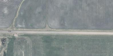
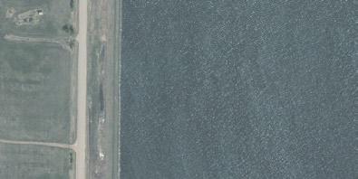
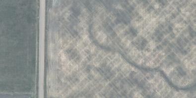
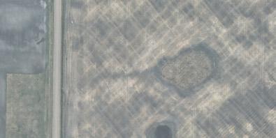
AIR PHOTO SUMMARY AND YEARLY COMPARISON
NW-20-52-14-W4
NE-21-52-14-W4
NW-21-52-14-W4
NE-20-52-14-W4
SW-20-52-14-W4
SE-20-52-14-W4
NW-22-52-14-W4
SW-22-52-14-W4
SE-21-52-14-W4
SW-21-52-14-W4
NE-17-52-14-W4
NW-17-52-14-W4
SW-17-52-14-W4
NE-16-52-14-W4
NW-16-52-14-W4
NW-15-52-14-W4
SE-17-52-14-W4
SW-16-52-14-W4
SW-15-52-14-W4
NW-8-52-14-W4
NW-9-52-14-W4
NE-9-52-14-W4
NW-10-52-14-W4
NW-20-52-14-W4
NE-21-52-14-W4
NW-21-52-14-W4
NE-20-52-14-W4
SW-20-52-14-W4
SE-20-52-14-W4
NW-22-52-14-W4
SW-22-52-14-W4
SE-21-52-14-W4
SW-21-52-14-W4
NW-17-52-14-W4
SW-17-52-14-W4
NE-17-52-14-W4
NE-16-52-14-W4 SE-17-52-14-W4
NW-16-52-14-W4
NW-15-52-14-W4
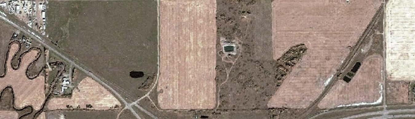
SW-15-52-14-W4
SW-16-52-14-W4
NW-8-52-14-W4
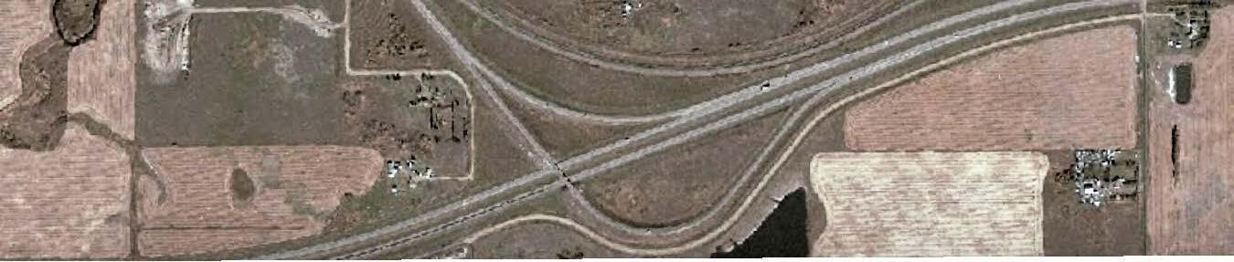
NW-9-52-14-W4
NE-9-52-14-W4
NW-10-52-14-W4
NW-20-52-14-W4
NE-21-52-14-W4
NW-21-52-14-W4
NE-20-52-14-W4
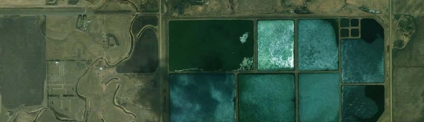
SW-20-52-14-W4
SE-20-52-14-W4
NW-22-52-14-W4
SW-22-52-14-W4
SE-21-52-14-W4
SW-21-52-14-W4
NE-17-52-14-W4
NW-17-52-14-W4
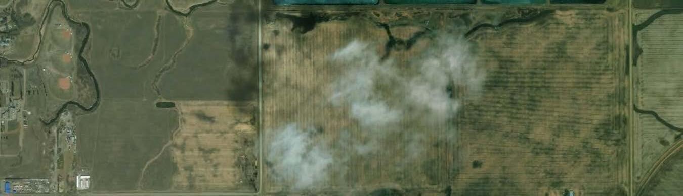
SW-17-52-14-W4
NE-16-52-14-W4
NW-16-52-14-W4
NW-15-52-14-W4
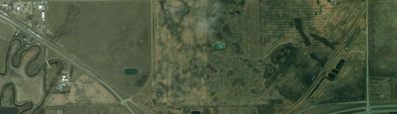
SE-17-52-14-W4
SW-16-52-14-W4
SW-15-52-14-W4
NW-8-52-14-W4
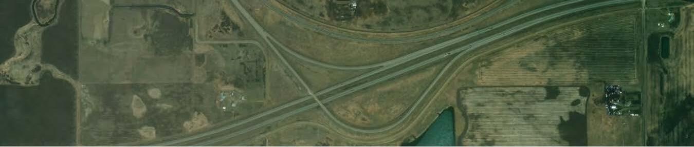
NW-9-52-14-W4
NE-9-52-14-W4
NW-10-52-14-W4
Source: Esri, DigitalGlobe, GeoEye, Earthstar Geographics, CNES/Airbus DS, USDA, USGS, AeroGRID, IGN, and the GIS
NW-20-52-14-W4
NE-21-52-14-W4
NW-21-52-14-W4
NE-20-52-14-W4
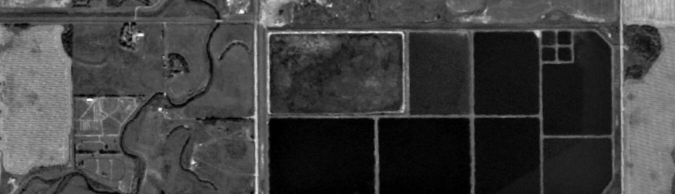
SW-20-52-14-W4
SE-20-52-14-W4
NW-22-52-14-W4
SW-22-52-14-W4
SE-21-52-14-W4
SW-21-52-14-W4
NE-17-52-14-W4
NW-17-52-14-W4
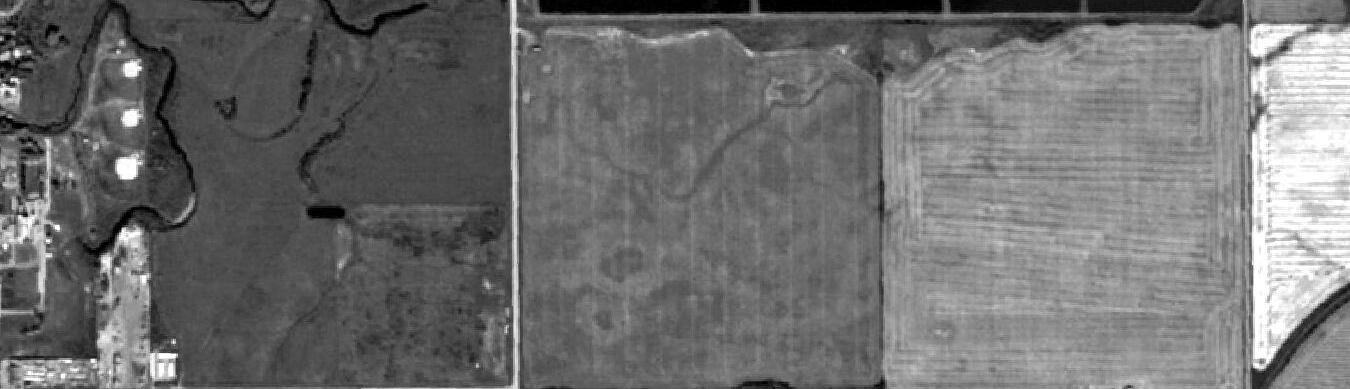
SW-17-52-14-W4
NE-16-52-14-W4
NW-16-52-14-W4
NW-15-52-14-W4
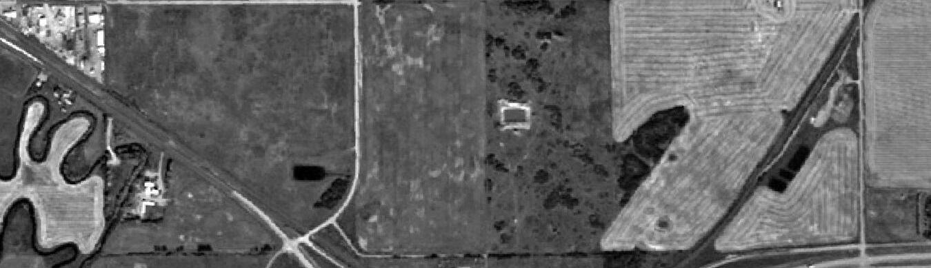
SE-17-52-14-W4
SW-16-52-14-W4
SW-15-52-14-W4
NW-8-52-14-W4
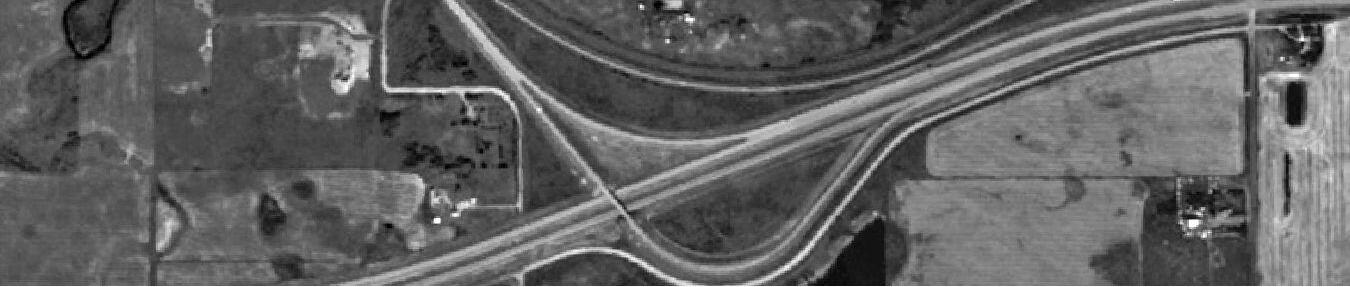
NW-9-52-14-W4
NE-9-52-14-W4
NW-10-52-14-W4
NW-20-52-14-W4
NE-21-52-14-W4
NW-21-52-14-W4
NE-20-52-14-W4
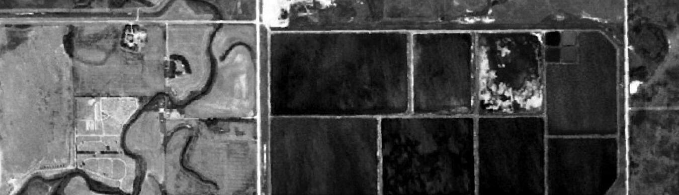
SW-20-52-14-W4
SE-20-52-14-W4
NW-22-52-14-W4
SW-22-52-14-W4
SE-21-52-14-W4
SW-21-52-14-W4
NE-17-52-14-W4
NW-17-52-14-W4
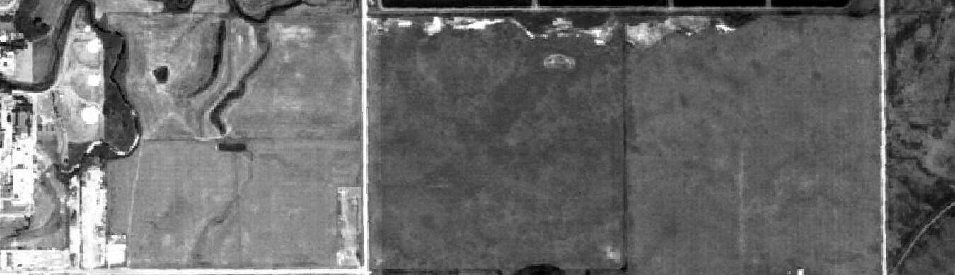
SW-17-52-14-W4
NE-16-52-14-W4
NW-16-52-14-W4
NW-15-52-14-W4
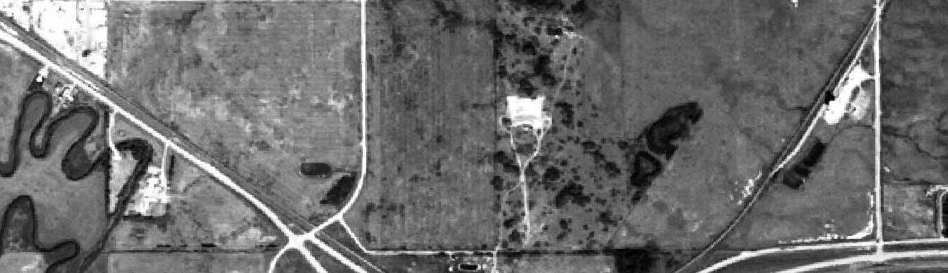
SE-17-52-14-W4
SW-16-52-14-W4
SW-15-52-14-W4
NW-8-52-14-W4
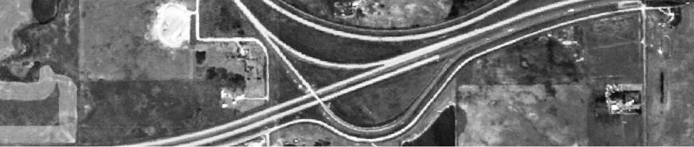
NW-9-52-14-W4
NE-9-52-14-W4
NW-10-52-14-W4
NW-20-52-14-W4
NE-21-52-14-W4
NW-21-52-14-W4
NE-20-52-14-W4
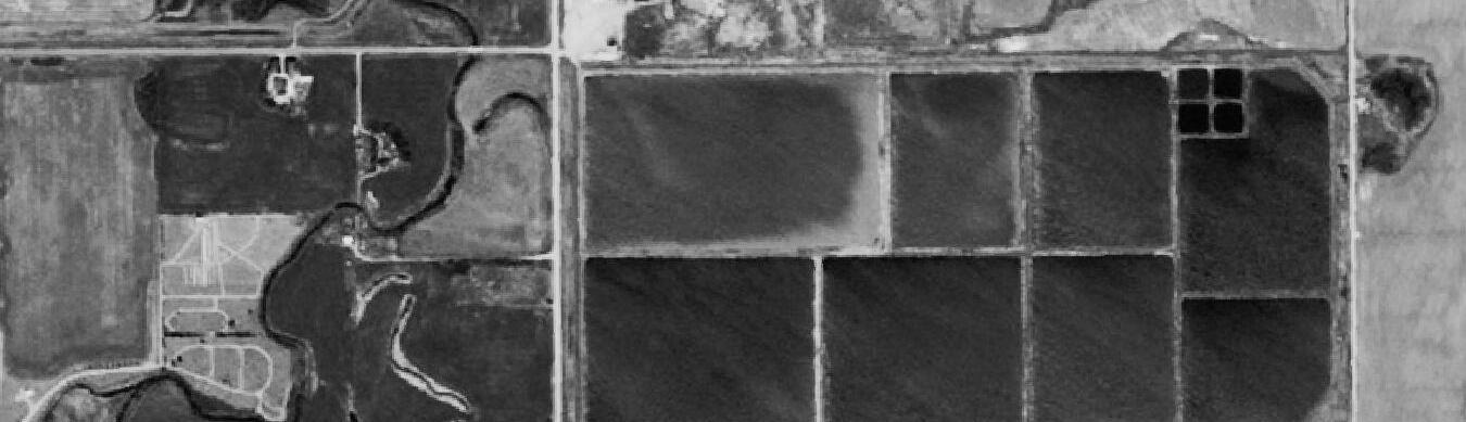
SW-20-52-14-W4
SE-20-52-14-W4
NW-22-52-14-W4
SW-22-52-14-W4
SE-21-52-14-W4
SW-21-52-14-W4
NE-17-52-14-W4
NW-17-52-14-W4
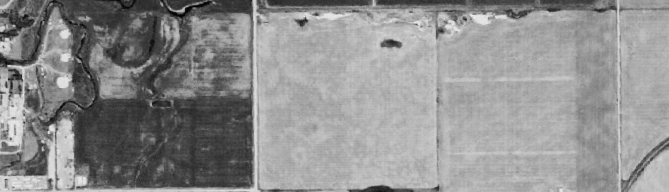
SW-17-52-14-W4
NE-16-52-14-W4
NW-16-52-14-W4
NW-15-52-14-W4
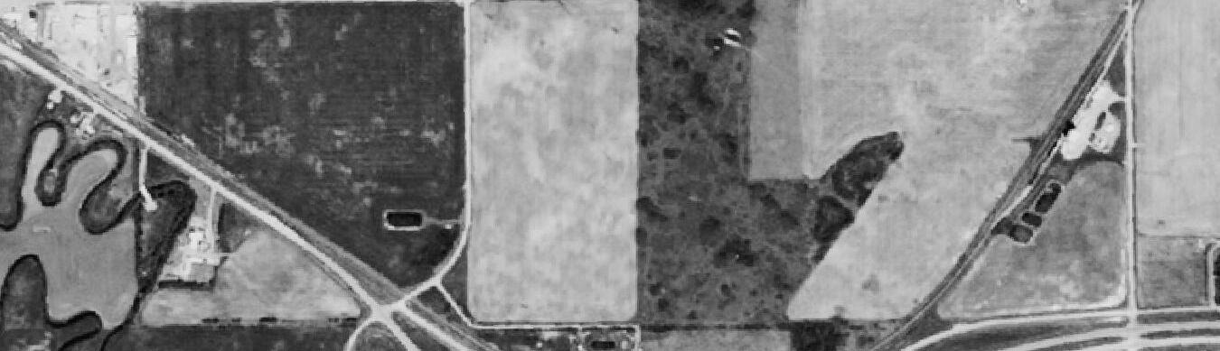
SE-17-52-14-W4
SW-16-52-14-W4
SW-15-52-14-W4
NW-8-52-14-W4
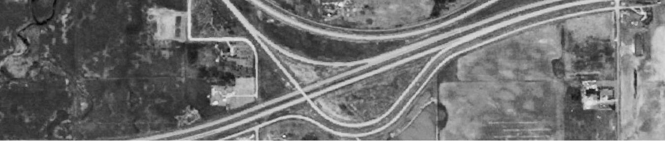
NW-9-52-14-W4
NE-9-52-14-W4
NW-10-52-14-W4
NW-20-52-14-W4
NE-21-52-14-W4
NW-21-52-14-W4
NE-20-52-14-W4
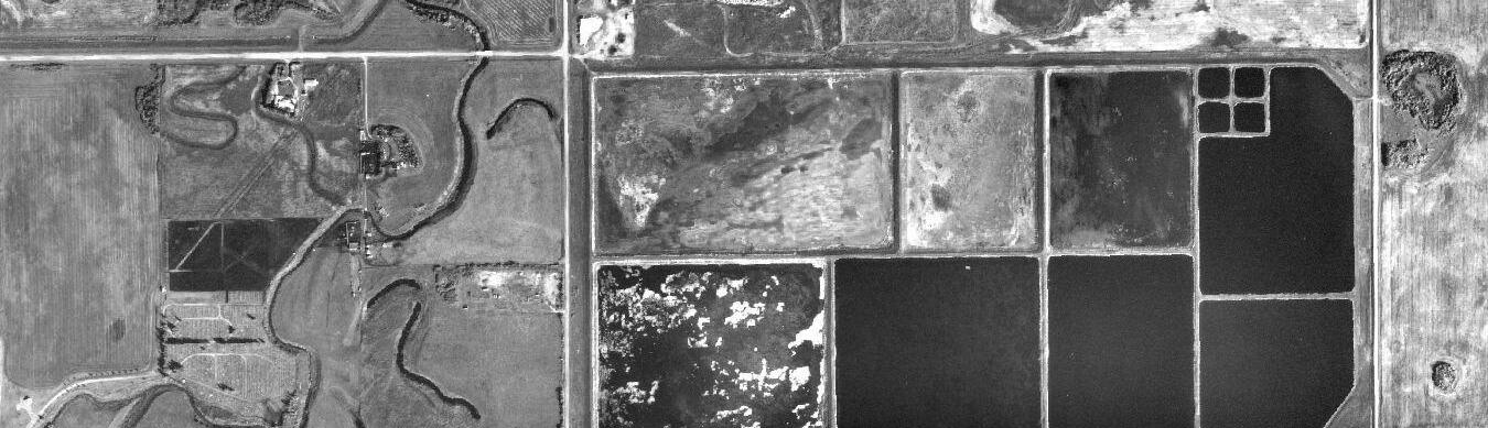
SW-20-52-14-W4
SE-20-52-14-W4
NW-22-52-14-W4
SW-22-52-14-W4
SE-21-52-14-W4
SW-21-52-14-W4
NE-17-52-14-W4
NW-17-52-14-W4
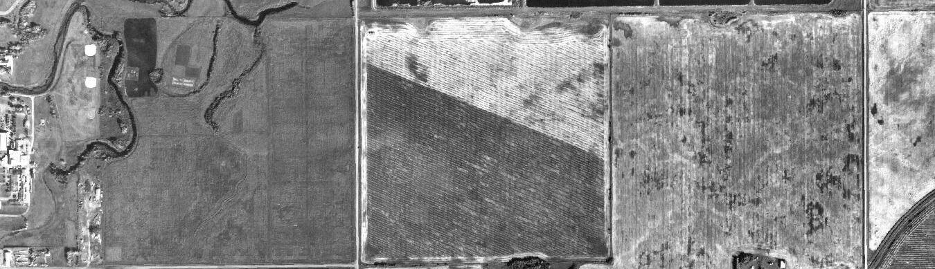
SW-17-52-14-W4
NE-16-52-14-W4
NW-16-52-14-W4
NW-15-52-14-W4
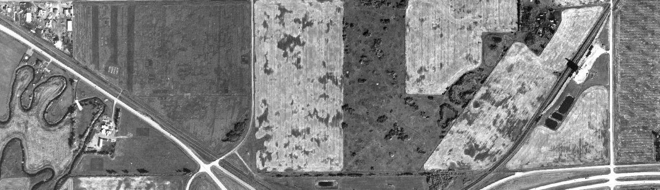
SE-17-52-14-W4
SW-16-52-14-W4
SW-15-52-14-W4
NW-8-52-14-W4
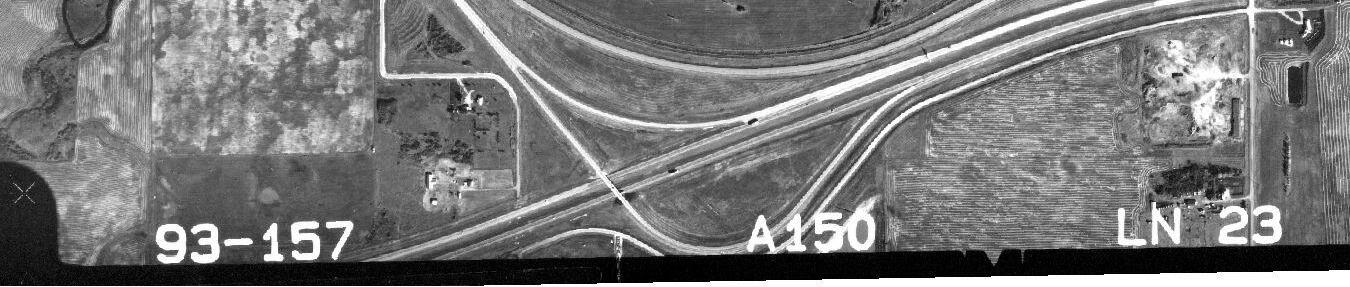
NW-9-52-14-W4
NE-9-52-14-W4
NW-10-52-14-W4
NW-20-52-14-W4
NE-21-52-14-W4
NW-21-52-14-W4
NE-20-52-14-W4
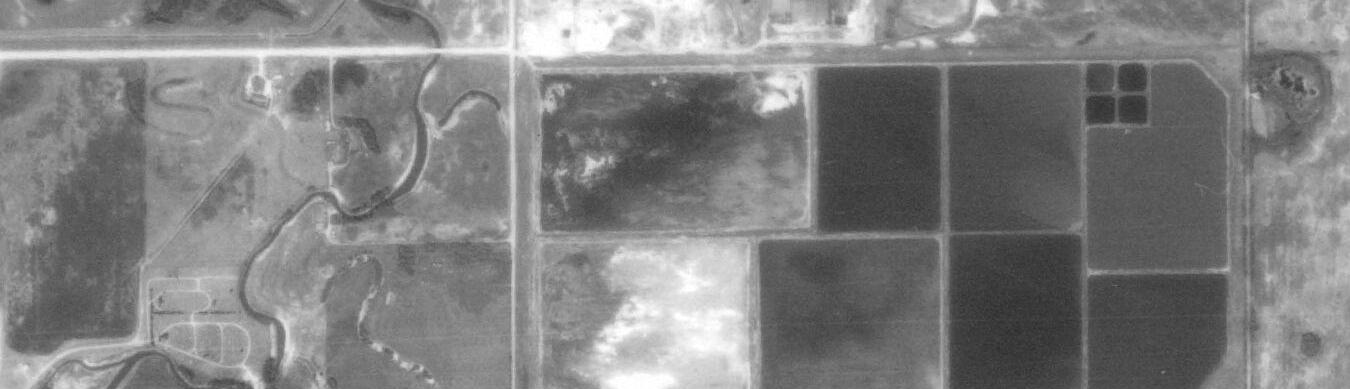
SW-20-52-14-W4
SE-20-52-14-W4
NW-22-52-14-W4
SW-22-52-14-W4
SE-21-52-14-W4
SW-21-52-14-W4
NE-17-52-14-W4
NW-17-52-14-W4
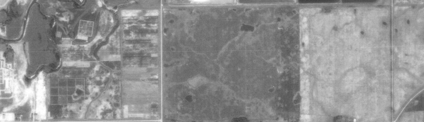
SW-17-52-14-W4
NE-16-52-14-W4
NW-16-52-14-W4
NW-15-52-14-W4
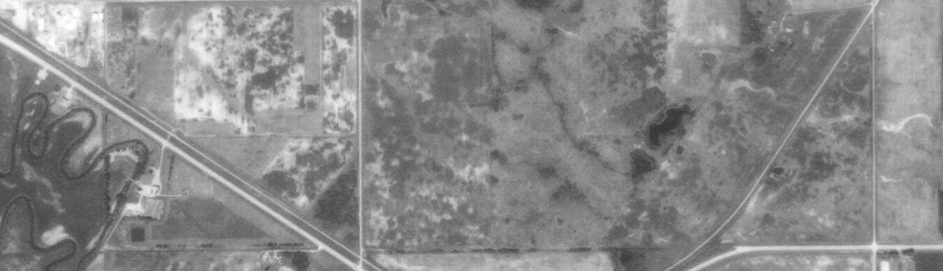
SE-17-52-14-W4
SW-16-52-14-W4
SW-15-52-14-W4
NW-8-52-14-W4
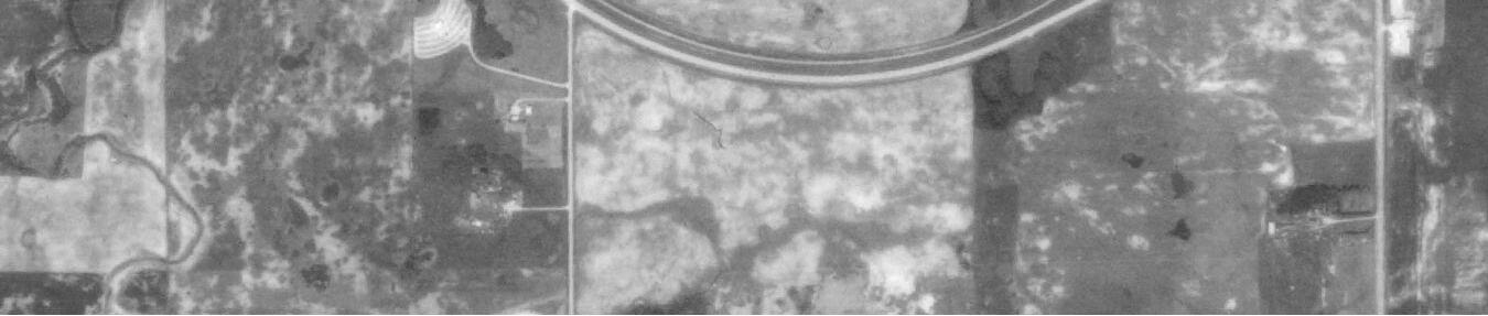
NW-9-52-14-W4
NE-9-52-14-W4
NW-10-52-14-W4
NW-20-52-14-W4
NE-21-52-14-W4
NW-21-52-14-W4
NE-20-52-14-W4
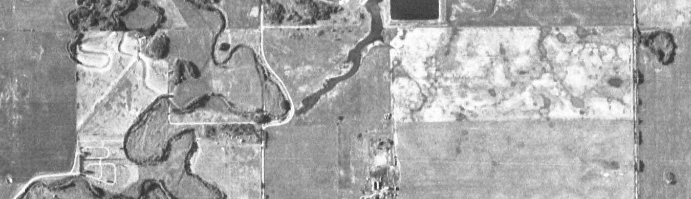
SW-20-52-14-W4
SE-20-52-14-W4
NW-22-52-14-W4
SW-22-52-14-W4
SE-21-52-14-W4
SW-21-52-14-W4
NE-17-52-14-W4
NW-17-52-14-W4
SW-17-52-14-W4
NE-16-52-14-W4
NW-16-52-14-W4
NW-15-52-14-W4
SE-17-52-14-W4
SW-16-52-14-W4
SW-15-52-14-W4
NW-8-52-14-W4
NW-9-52-14-W4
NE-9-52-14-W4
NW-10-52-14-W4
NW-20-52-14-W4
NE-21-52-14-W4
NW-21-52-14-W4
NE-20-52-14-W4
SW-20-52-14-W4
SE-20-52-14-W4
NW-22-52-14-W4
SW-22-52-14-W4
SE-21-52-14-W4
SW-21-52-14-W4
NE-17-52-14-W4
NW-17-52-14-W4
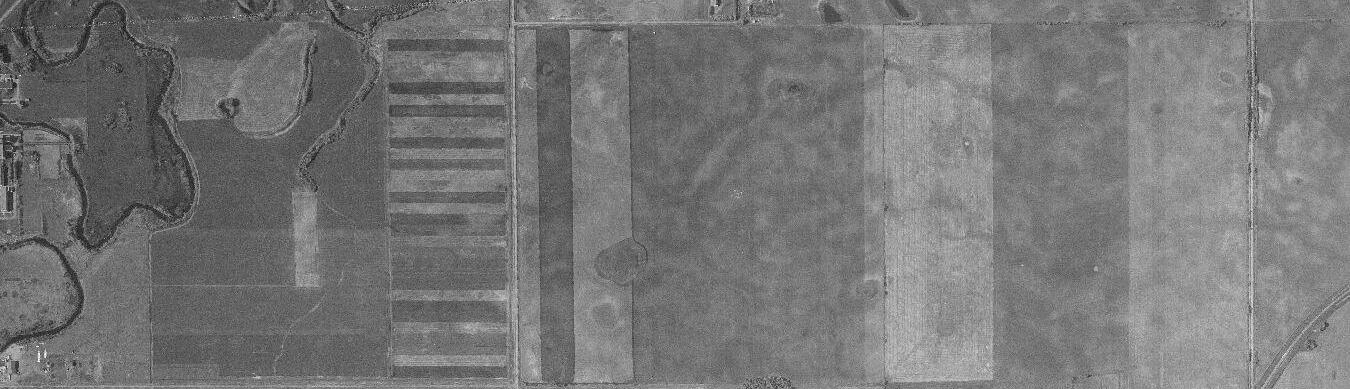
SW-17-52-14-W4
NE-16-52-14-W4
NW-16-52-14-W4
NW-15-52-14-W4
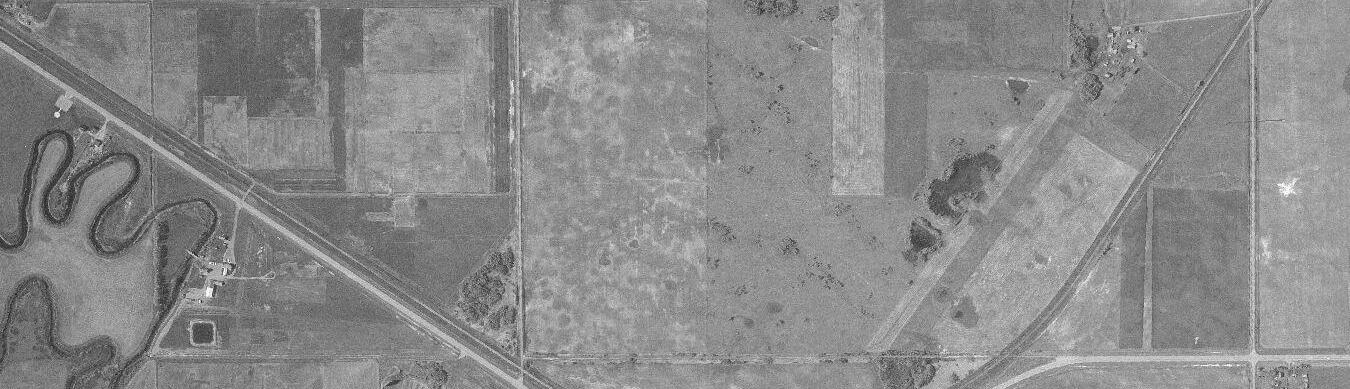
SE-17-52-14-W4
SW-16-52-14-W4
SW-15-52-14-W4
NW-8-52-14-W4
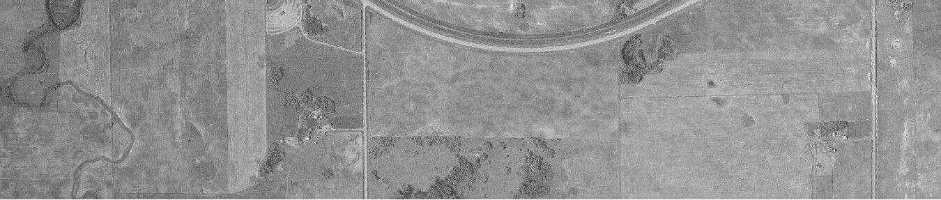
NW-9-52-14-W4
NE-9-52-14-W4
NW-10-52-14-W4
Sensitive Feature(s): 2 Consistent Wetlands, Class C Watercourse (Vermilion River) and Tributaries
AWCS Wetland Class(es): Seasonal, Temporary, Semi-Permanent and Permanent – Marshes
1962-05-23 AS 0818 LINE# 5311 PIC# 53 S W preceded by 2 below average years Third wettest month
A Coded Class C Watercourse is present within 2km of the ASP lands. As of current (2019), there are specific tributaries that are coded as Class C Unmapped watercourses that connect to the Vermilion River; they run through NE-17-52-14 W4M, NW-16-52-14 W4M, SW-16-52-14 W4M, and NE-16-52-14 W4M; during this period of time there are no landscape features that support the presence of these tributaries in all of these areas, with the exception of a presence seen within NE-17-52-14 W4M. No lagoon present to the North; wetlands are not developed on the North edge of the ASP lands, as seen in the air photos from 1993 to 2018. Minimal wetlands are present, with the exception of two significant wetlands that are located in 2 and 7-16-52-14 W4M; these wetlands have not been farmed through and are considered marshes, with a wooded riparian area. The wetlands that are visible in the air photos between 1983-2018 are not present. A single lane highway is located slightly to the South of the future development area and runs in an East/West direction. A rail line runs through the Southeast corner of the future development area; no buildings are located on the site adjacent to the rail line.
S=Spring; Sum=Summer; F=Fall; D=Dryer; N=Normal; W=Wetter; N/A=Not Available
* Assumption Based on the Details Within the Photo BIOPHYSICAL ENVIRONMENTAL ASSESSMENT | COUNTY OF MINBURN 16-52-14 W4M, NE-17-52-12 W4M, NW and NE-9-52-14 W4M
Sensitive Feature(s): 2 Consistent Wetlands, Class C Watercourse (Vermilion River) and Tributaries
AWCS Wetland Class(es): Seasonal, Temporary, Semi-Permanent and Permanent – Marshes
1970-08-15 AS 1110 LINE# 35 PIC# 138 Sum D preceded by four below average years D
A Coded Class C Watercourse is present within 2km of the ASP lands. As of current (2019), there are specific tributaries that are coded as Class C Unmapped watercourses that connect to the Vermilion River; they run through NE-17-52-14 W4M, NW-16-52-14 W4M, SW-16-52-14 W4M, and NE-16-52-14 W4M; during this period of time there are no landscape features that support the presence of these tributaries in all of these areas, with the exception of a presence seen within NE-17-52-14 W4M. No lagoon present to the North; wetlands are not developed on the North edge of the ASP lands as seen in the air photos from 1993 to 2018. Minimal wetlands are present, with the exception of two significant wetlands that are located in 2 and 7-16-52-14 W4M; these wetlands have not been farmed through and are considered marshes, with a wooded riparian area. The wetlands that are visible in the air photos between 1983-2018 are not present. A single lane highway is located slightly to the South of the future development area and runs in an East/West direction. A rail line runs through the Southeast corner of the future development area; no buildings are located on the site adjacent to the rail line.
S=Spring; Sum=Summer; F=Fall; D=Dryer; N=Normal; W=Wetter; N/A=Not Available
* Assumption Based on the Details Within the Photo BIOPHYSICAL ENVIRONMENTAL ASSESSMENT | COUNTY OF MINBURN 16-52-14 W4M, NE-17-52-12 W4M, NW and NE-9-52-14 W4M
Sensitive Feature(s): 2 Consistent Wetlands, Class C Watercourse (Vermilion River) and Tributaries
AWCS Wetland Class(es): Seasonal, Temporary, Semi-Permanent and Permanent – Marshes Photo Date
1983-07-31 AS 2793 LINE# 52 PIC# 27 Sum W preceded by one above average year Second wettest month
A Coded Class C Watercourse is present within 2km of the ASP lands. As of current (2019), there are specific tributaries that are coded as Class C Unmapped watercourses that connect to the Vermilion River; they run through NE-17-52-14 W4M, NW-16-52-14 W4M, SW-16-52-14 W4M, and NE-16-52-14 W4M; during this period of time there are minimal landscape features that support the presence of these tributaries but their presence is more significant than in previous years. The lagoon to the North is now present; wetlands look as though they are starting to develop on the North edge of the site adjacent to the lagoon that may be attributed to the lagoon development (not natural hydrology). Minimal wetlands are present, with the exception of two significant wetlands that are located in 2 and 7-16-52-14 W4M; these wetlands have not been farmed through and are considered marshes, with a wooded riparian area. A single lane highway is located slightly to the South of the future development area and runs in an East/West direction. A rail line runs through the Southeast corner of the future development area; no buildings are located on the lands adjacent to the rail line.
S=Spring; Sum=Summer; F=Fall; D=Dryer; N=Normal; W=Wetter; N/A=Not Available
* Assumption Based on the Details Within the Photo
BIOPHYSICAL ENVIRONMENTAL ASSESSMENT | COUNTY OF MINBURN 16-52-14 W4M, NE-17-52-12 W4M, NW and NE-9-52-14 W4M
Sensitive Feature(s): 2 Consistent Wetlands, Class C Watercourse (Vermilion River) and Tributaries
AWCS Wetland Class(es): Seasonal, Temporary, Semi-Permanent and Permanent – Marshes Photo Date
1993-09-13 AS 4454 LINE# 23 PIC# 181 F W preceded by three below average years N/A
A Coded Class C Watercourse is present within 2km of the ASP lands. As of current (2019), there are specific tributaries that are coded as Class C Unmapped watercourses that connect to the Vermilion River; they run through NE-17-52-14 W4M, NW-16-52-14 W4M, SW-16-52-14 W4M, and NE-16-52-14 W4M; during this period of time there are no landscape features that support the presence of these tributaries in all of these areas, with the exception of a presence seen within NE-17-52-14 W4M. A dugout, that was not present in previous years, is no present on the most Northerly border of NW-952-14 W4; this wet area is not deemed as a wetland as it has not naturalized. The lagoon to the North is now present; wetlands developed on the North edge of the future development area adjacent to the lagoon that may be attributed to the lagoon development (not natural hydrology). Minimal wetlands are present, other than those which occur near the lagoon, with the exception of two significant wetlands that are located in 2 and 7-16-52-14 W4M; these wetlands have not been farmed through and are considered marshes, with a wooded riparian area. Highway 16 (double lane) is located slightly to the South of the future development area and runs in an East/West direction. A rail line runs through the Southeast corner of the future development area; buildings are located to the Southeast of this rail line that are assumed to be loading/unloading areas.
S=Spring; Sum=Summer; F=Fall; D=Dryer; N=Normal; W=Wetter; N/A=Not Available
* Assumption Based on the Details Within the Photo
BIOPHYSICAL ENVIRONMENTAL ASSESSMENT | COUNTY OF MINBURN 16-52-14 W4M, NE-17-52-12 W4M, NW and NE-9-52-14 W4M
Sensitive Feature(s): 2 Consistent Wetlands, Class C Watercourse (Vermilion River) and Tributaries
AWCS Wetland Class(es): Seasonal, Temporary, Semi-Permanent and Permanent – Marshes
A Coded Class C Watercourse is present within 2km of the future development area. As of current (2019), there are specific tributaries that are coded as Class C Unmapped watercourses that connect to the Vermilion River; they run through NE-17-52-14 W4M, NW-16-52-14 W4M, SW-16-52-14 W4M, and NE-16-52-14 W4M; during this period of time there are no landscape features that support the presence of these tributaries in all of these areas, with the exception of a presence seen within NE-17-52-14 W4M. A dugout, that was constructed in/around 1993, is no present on the most Northerly border of NW-9-52-14 W4; this wet area is not deemed as a wetland as it has not naturalized. The lagoon to the North is now present; wetlands developed on the North edge of the ASP lands adjacent to the lagoon that may be attributed to the lagoon development (not natural hydrology). Minimal wetlands are present, other than those which occur near the lagoon, with the exception of two significant wetlands that are located in 2 and 7-16-52-14 W4M; these wetlands have not been farmed through and are considered marshes, with a wooded riparian area. Highway 16 (double lane) is located slightly to the South of the site and runs in an East/West direction. A rail line runs through the Southeast corner of the future development area; buildings are located to the Southeast of this rail line that are assumed to be loading/unloading areas.
S=Spring; Sum=Summer; F=Fall; D=Dryer; N=Normal; W=Wetter; N/A=Not Available
* Assumption Based on the Details Within the Photo
Sensitive Feature(s): 2 Consistent Wetlands, Class C Watercourse (Vermilion River) and Tributaries
AWCS Wetland Class(es): Seasonal, Temporary, Semi-Permanent and Permanent – Marshes
A Coded Class C Watercourse is present within 2km of the ASP lands
As of current (2019), there are specific tributaries that are coded as Class C Unmapped watercourses that connect to the Vermilion River; they run through NE-17-52-14 W4M, NW-16-52-14 W4M, SW-16-52-14 W4M, and NE-16-52-14 W4M; during this period of time there are minimal landscape features that support the presence of these tributaries but their presence is more significant than in previous years. A dugout, that was constructed in/around 1993, is no present on the most Northerly border of NW9-52-14 W4; this wet area is not deemed as a wetland as it has not naturalized. The lagoon to the North is now present; wetlands developed on the North edge of the future development area adjacent to the lagoon that may be attributed to the lagoon development (not natural hydrology). Minimal wetlands are present, other than those which occur near the lagoon, with the exception of two significant wetlands that are located in 2 and 7-16-52-14 W4M. Highway 16 (double lane) is located slightly to the South of the future development area and runs in an East/ West direction. A rail line runs through the Southeast corner of the future development area; buildings are located to the Southeast of this rail line that are assumed to be loading/unloading areas.
S=Spring; Sum=Summer; F=Fall; D=Dryer; N=Normal; W=Wetter; N/A=Not Available
* Assumption Based on the Details Within the Photo
Sensitive Feature(s): 2 Consistent Wetlands, Class C Watercourse (Vermilion River) and Tributaries
AWCS Wetland Class(es): Seasonal, Temporary, Semi-Permanent and Permanent – Marshes
A Coded Class C Watercourse is present within 2km of the ASP lands. As of current (2019), there are specific tributaries that are coded as Class C Unmapped watercourses that connect to the Vermilion River; they run through NE-17-52-14 W4M, NW-16-52-14 W4M, SW-16-52-14 W4M, and NE-16-52-14 W4M; during this period of time there are minimal landscape features that support the presence of these tributaries but their presence is more significant than in previous years. A dugout, that was constructed in/around 1993, is no present on the most Northerly border of NW-9-52-14 W4; this wet area is not deemed as a wetland as it has not naturalized. The lagoon to the North is now present; wetlands developed on the North edge of the future development area adjacent to the lagoon that may be attributed to the lagoon development (not natural hydrology). Minimal wetlands are present, other than those which occur near the lagoon, with the exception of two significant wetlands that are located in 2 and 7-16-52-14 W4M; these wetlands have not been farmed through and are considered marshes, with a wooded riparian area. Highway 16 (double lane) is located slightly to the South of the ASP lands and runs in an East/West direction. A rail line runs through the Southeast corner of the future development area; buildings are located to the Southeast of this rail line that are assumed to be loading/unloading areas.
S=Spring; Sum=Summer; F=Fall; D=Dryer; N=Normal; W=Wetter; N/A=Not Available
* Assumption Based on the Details Within the Photo
Sensitive Feature(s): 2 Consistent Wetlands, Class C Watercourse (Vermilion River) and Tributaries
AWCS Wetland Class(es): Seasonal, Temporary, Semi-Permanent and Permanent – Marshes
A Coded Class C Watercourse is present within 2km of the ASP lands. As of current (2019), there are specific tributaries that are coded as Class C Unmapped watercourses that connect to the Vermilion River; they run through NE-17-52-14 W4M, NW-16-52-14 W4M, SW-16-52-14 W4M, and NE-16-52-14 W4M; during this period of time there are no landscape features that support the presence of these tributaries in all of these areas, with the exception of a presence seen within NE-17-52-14 W4M. A dugout, that was constructed in/around 1993, is no present on the most Northerly border of NW-952-14 W4; this wet area is not deemed as a wetland as it has not naturalized. The lagoon to the North is now present. The lagoon to the North is now present; wetlands developed on the North edge of the future development area adjacent to the lagoon that may be attributed to the lagoon development (not natural hydrology). Minimal wetlands are present, other than those which occur near the lagoon, with the exception of two significant wetlands that are located in 2 and 7-16-52-14 W4M; these wetlands have not been farmed through and are considered marshes, with a wooded riparian area. Highway 16 (double lane) is located slightly to the South of the ASP lands and runs in an East/West direction. A rail line runs through the Southeast corner of the future development area; buildings are located to the Southeast of this rail line that are assumed to be loading/unloading areas.
S=Spring; Sum=Summer; F=Fall; D=Dryer; N=Normal; W=Wetter; N/A=Not Available
* Assumption Based on the Details Within the Photo
Sensitive Feature(s): 2 Consistent Wetlands, Class C Watercourse (Vermilion River) and Tributaries
AWCS Wetland Class(es): Seasonal, Temporary, Semi-Permanent and Permanent – Marshes
A Coded Class C Watercourse is present within 2km of the ASP lands. As of current (2019), there are specific tributaries that are coded as Class C Unmapped watercourses that connect to the Vermilion River; they run through NE-17-52-14 W4M, NW-16-52-14 W4M, SW-16-52-14 W4M, and NE-16-52-14 W4M; during this period of time there are minimal landscape features that support the presence of these tributaries but their presence is more significant than in previous years. A dugout, that was constructed in/around 1993, is now present on the most Northerly border of NW-9-52-14 W4; this wet area is not deemed as a wetland as it has not naturalized. The lagoon to the North is now present; wetlands developed on the North edge of the future development area adjacent to the lagoon that may be attributed to the lagoon development (not natural hydrology). More wetlands seem to be present in this photo; in comparing the features of the photo with Alberta Merged Wetland Inventory, it was confirmed that still only the two significant wetlands (with the exclusion of the wetlands located on the North edge of the ASP lands, South of the lagoon) have been present from 1962-2018. It is assumed that the clarity and high resolution of this photo shows low lying areas as possible wetland locations. Highway 16 (double lane) is located slightly to the South of the future development area and runs in an East/West direction. A rail line runs through the Southeast corner of the ASP lands; buildings are located to the Southeast of this rail line that are assumed to be loading/unloading areas. Of all the aerial photos reviewed, this image provides the best resolution that indicates possible low areas that may be indicative of draws; it is assumed that these locations do not carry substantial amounts of water as the majority of locations are farmed through.
S=Spring; Sum=Summer; F=Fall; D=Dryer; N=Normal; W=Wetter; N/A=Not Available
* Assumption Based on the Details Within the Photo BIOPHYSICAL ENVIRONMENTAL ASSESSMENT | COUNTY OF MINBURN 16-52-14 W4M, NE-17-52-12 W4M, NW and NE-9-52-14 W4M
PRECIPITATION DATA FOR CORRESPONDING AIR PHOTOS
HISTORICAL TEMPERATURES
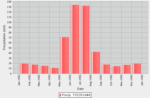
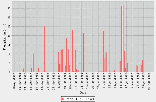
Figure 1. Precipitation data for 1962. Visual depiction of monthly rainfall received throughout the course of the year (left) and rainfall received daily the summer months (right).
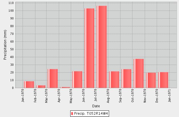
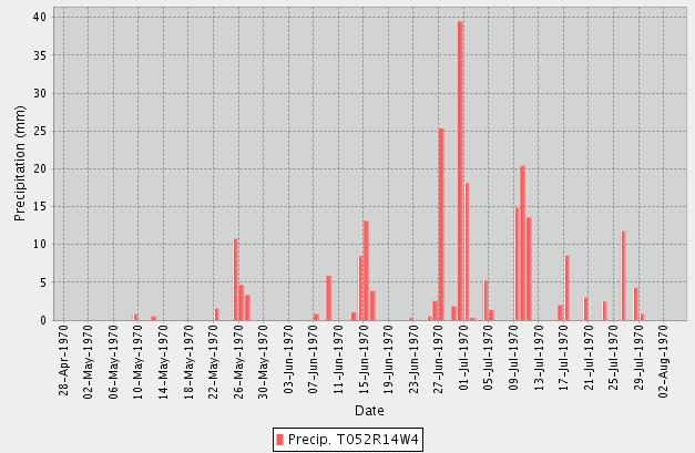
Figure 2. Precipitation data for 1970. Visual depiction of monthly rainfall received throughout the course of the year (left) and rainfall received daily the summer months (right).
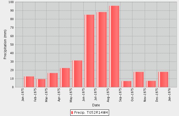
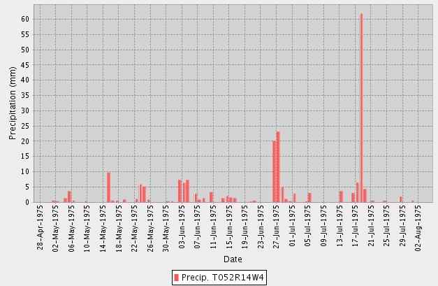
Figure 3. Precipitation data for 1975. Visual depiction of monthly rainfall received throughout the course of the year (left) and rainfall received daily the summer months (right).
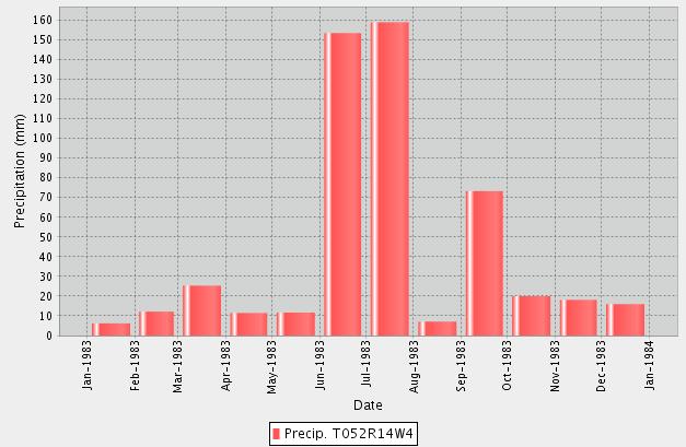
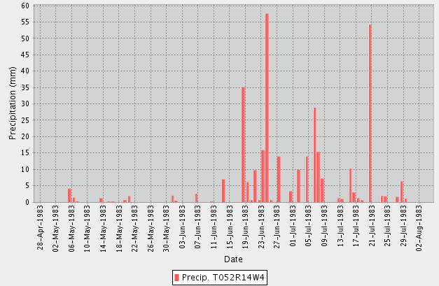
Figure 4. Precipitation data for 1983. Visual depiction of monthly rainfall received throughout the course of the year (left) and rainfall received daily the summer months (right).
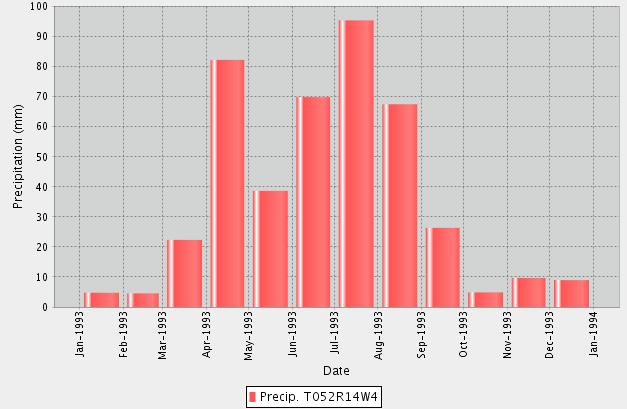
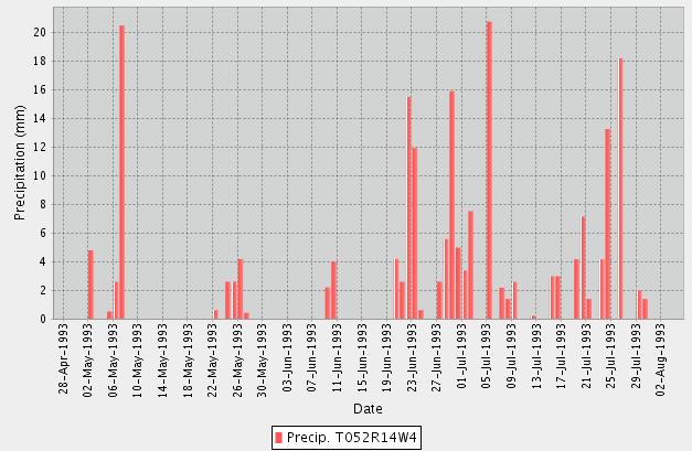
Figure 5. Precipitation data for 1993. Visual depiction of monthly rainfall received throughout the course of the year (left) and rainfall received daily the summer months (right).
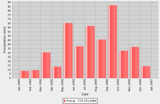
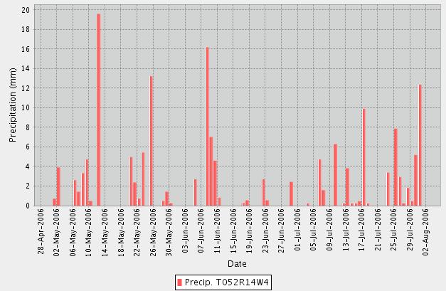
Figure 6. Precipitation data for 2006. Visual depiction of monthly rainfall received throughout the course of the year (left) and rainfall received daily the summer months (right).
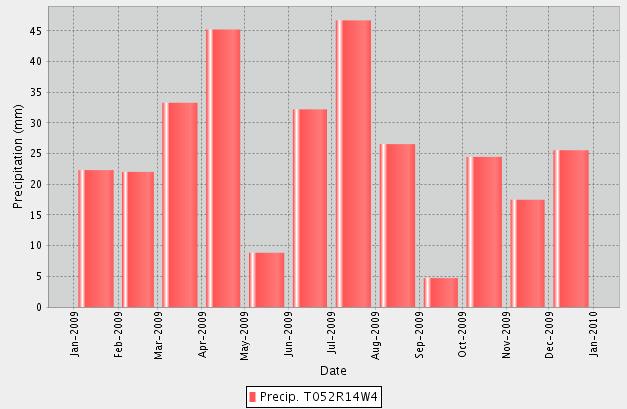
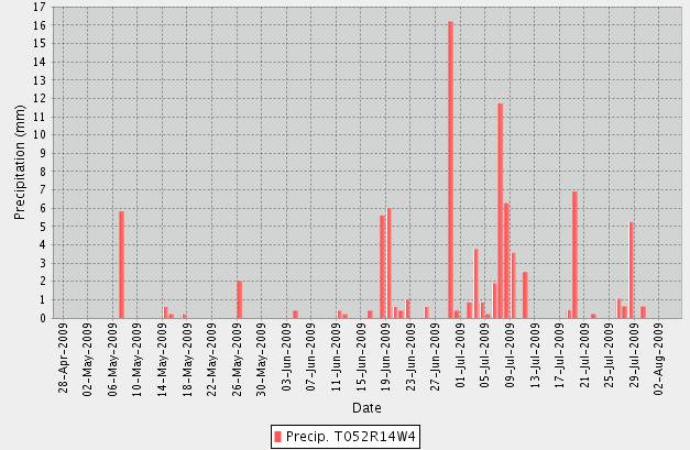
Figure 7. Precipitation data for 2009. Visual depiction of monthly rainfall received throughout the course of the year (left) and rainfall received daily the summer months (right).
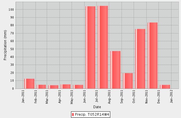
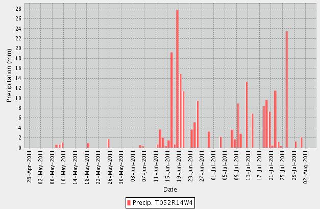
Figure 8. Precipitation data for 2011. Visual depiction of monthly rainfall received throughout the course of the year (left) and rainfall received daily the summer months (right).
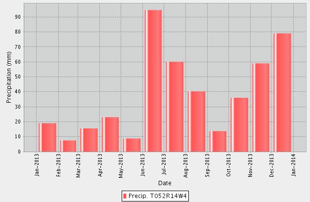
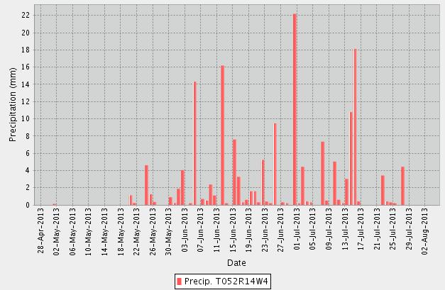
Figure 9. Precipitation data for 2013. Visual depiction of monthly rainfall received throughout the course of the year (left) and rainfall received daily the summer months (right).
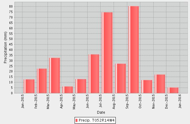
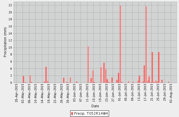
Figure 10. Precipitation data for 2015. Visual depiction of monthly rainfall received throughout the course of the year (left) and rainfall received daily the summer months (right).
LANDSCAPE ANALYSIS TOOL REPORT
ALBERTA CONSERVATION INFORMATION SYSTEM MANAGEMENT SEARCH RESULTS
FISH AND WILDLIFE MANAGEMENT INFORMATION SYSTEM SEARCH RESULTS
LAT Number: 00000578C4
Project Name:
Addendum to Biophyscial
Project Description:
LAT Date: 2019-06-03
Miscellaneous Lease 00000578C4
Page 1 of 17
11:27:11
Town Development - Additional lands added to previous biophysical assessment.
Disposition Type: DML
Purpose Type: CMDV
Activity Type: CMDV02DMLP
Miscellaneous Lease
Commercial Development
Commercial Facility
It is the applicant s responsibility to conduct a full review of the generated LAT Report, ensuring that you are aware and have a full understanding of the identified standards and conditions, and any additional limitations that may also be imposed by an approved higher level plan, reservation or notation or any other law or Order of the Province or the Government of Canada that may impact the placement, construction or operation of the proposed disposition, purpose and activity.
The applicant must assess if the proposed disposition, purpose and activity can meet the applicable standards, conditions and any limitations which will subsequently determine if the application can be submitted to the regulatory body. Applicants should complete a thorough review of regulatory and application processes including supporting procedural documents and the generated LAT Reports prior to making this determination.
Where the applicant chooses not to meet, or is not able to meet, one or more Approval Standards or higher level plans within the generated LAT Report as submitted as part of the application, or any affected reservations as identified within the land status report, the applicant is required to complete the appropriate mitigation as part of their supplement submission that addresses individually each of the items not being met.
The information provided within the LAT Tool is a spatial representation of features provided to the applicant for activity and land use planning. The accuracy of these layers varies depending on the resource value being represented. The regulatory body insists that site visits, wildlife surveys and groundtruthing efforts are completed to ensure that you, the applicant can meet the procedures detailed within the PreApplication Requirements for Formal Dispositions, the identified approval standards, operating conditions and Best Management Practices as represented within the Master Schedule of Standards and Conditions
Applicants will ensure that standards or conditions for Watercourse/Waterbody features as identified within the generated LAT Report are followed. It is the responsibility of the applicant to ensure the identified setbacks and buffers are properly established through a pre-site assessment and maintained.
NOTE: Be aware that the submission of a LAT Report as part of an application submission does not imply approval of the activity. The standards and conditions identified within the LAT Report may be subject to change based on regulatory review.
Base Features
Green/White Area
Municipality
White Area
County of Minburn No. 27
Miscellaneous Lease 00000578C4
Page 2 of 17
Provincial Grazing Reserve
Rocky Mountain Forest Reserve
PLUZ Areas
Protected Areas
Provincial Sanctuaries
Wildlife Corridors
Restricted Area
Game Bird Zone 3
Seasonal
Higher Level Plans
Integrated Resource Plan (Local)
Integrated Resource Plan (Subregional)
Access Management Plan
Landscape Management Plan
Page 3 of 17
Wildlife Survey
Historical Resources
HRV Rating Category
Historic Resources Application Required: No
Yes DND Area
Page 4 of 17
While no specific historic resource concerns have been identified within the proposed activity area, Section 31 of the Historical Resources Act states that a person who discovers a historic resource in the course of making an excavation for a purpose other than for the purpose of seeking historic resources shall forthwith notify the Minister of the discovery. Should a historic resource be encountered with the construction or operation of this disposition, information on who to contact can be found on the Ministry of Culture and Tourism s website in; Standard Requirements under the Historical Resources Act: Reporting the Discovery of Historic Resources.
Wildlife and Other Sensitive Species
Burrowing Owl Range
Caribou Range
Colonial Nesting Birds
Endangered and Threatened Plants Ranges
Federal Aquatic Critical Habitat
Greater Short-horned Lizard Habitat
Greater Short-horned Lizard Range
Greater Sage Grouse Range
Greater Sage Grouse Leks and Buffer
Grizzly Bear Zone
Key Wildlife and Biodiversity Areas
Mountain Goat and Sheep Areas
Ord's Kangaroo Rat Range
Greater Sage Grouse
Grassland and Natural Regions:
Central Parkland Yes
Central Parkland and Northern Fescue
Chinook Grasslands
Dry Mixed Grass
Foothills Fescue
Foothills Parkland Grasslands
Grassland and Parkland Natural Region Yes
Ord's Kangaroo Rat Key Habitat Area
Miscellaneous Lease 00000578C4
Page 5 of 17
Other Sensitive and Endangered Species Yes
Piping Plover Waterbodies
Sensitive Amphibian Ranges
Sensitive Raptor Range Yes
Sensitive Snake Species Range
Sharp-tailed Grouse Leks and Buffer
Sharp-tailed Grouse Survey Yes
Special Access Area
Swift Fox Range
Trumpeter Swan Buffer
Trumpeter Swan Waterbodies/Watercourse
Mixed Grass Sub-region layer
Montane
Northern Fescue
Peace River Parkland
Permafrost
Rough Fescue PNT
Subalpine or Alpine
NW 8 52 14 4
SW 9 52 14 4
SW 10
SW 16 52 14 4
SW 17 52 14 4
SE 20
SW 21 52 14 4
SW 15 52 14
SW 8 52 14 4
SW 9 52 14
SE 17 52 14
NW
Miscellaneous Lease
00000578C4
Page 6 of 17
Grassland and Parkland Natural Region,Sensitive Raptor Range,Sharp-tailed Grouse Survey,Other Sensitive and Endangered Species,Central Parkland,Green / White Area
Grassland and Parkland Natural Region,Sensitive Raptor Range,Sharp-tailed Grouse Survey,Other Sensitive and Endangered Species,Central Parkland,Green / White Area
Grassland and Parkland Natural Region,Sensitive Raptor Range,Sharp-tailed Grouse Survey,Other Sensitive and Endangered Species,Central Parkland,Green / White Area
Grassland and Parkland Natural Region,Sensitive Raptor Range,Sharp-tailed Grouse Survey,Other Sensitive and Endangered Species,Central Parkland,Green / White Area
Grassland and Parkland Natural Region,Sensitive Raptor Range,Sharp-tailed Grouse Survey,Other Sensitive and Endangered Species,Central Parkland,Green / White Area
Grassland and Parkland Natural Region,Sensitive Raptor Range,Sharp-tailed Grouse Survey,Other Sensitive and Endangered Species,Central Parkland,Green / White Area
Grassland and Parkland Natural Region,Sensitive Raptor Range,Sharp-tailed Grouse Survey,Other Sensitive and Endangered Species,Central Parkland,Green / White Area
Grassland and Parkland Natural Region,Sensitive Raptor Range,Sharp-tailed Grouse Survey,Other Sensitive and Endangered Species,Central Parkland,Green / White Area
Grassland and Parkland Natural Region,Sensitive Raptor Range,Sharp-tailed Grouse Survey,Other Sensitive and Endangered Species,Central Parkland,Green / White Area
Grassland and Parkland Natural Region,Sensitive Raptor Range,Sharp-tailed Grouse Survey,Other Sensitive and Endangered Species,Central Parkland,Green / White Area
Grassland and Parkland Natural Region,Sensitive Raptor Range,Sharp-tailed Grouse Survey,Other Sensitive and Endangered Species,Central Parkland,Green / White Area
Grassland and Parkland Natural Region,Sensitive Raptor Range,Sharp-tailed Grouse Survey,Other Sensitive and Endangered Species,Central Parkland,Green / White Area
SW 17 52 14 4
SE 21 52 14 4
SE 9 52 14 4
NE 17 52 14 4
SW 21 52 14 4
SE 17 52 14 4
SE 8 52 14 4
NW 17 52 14 4
SW 16
SW 20 52 14
NE 8
Miscellaneous Lease 00000578C4
Page 7 of 17
Grassland and Parkland Natural Region,Sensitive Raptor Range,Sharp-tailed Grouse Survey,Other Sensitive and Endangered Species,Central Parkland,Green / White Area
Grassland and Parkland Natural Region,Sensitive Raptor Range,Sharp-tailed Grouse Survey,Other Sensitive and Endangered Species,Central Parkland,Green / White Area
Grassland and Parkland Natural Region,Sensitive Raptor Range,Sharp-tailed Grouse Survey,Other Sensitive and Endangered Species,Central Parkland,Green / White Area
Grassland and Parkland Natural Region,Sensitive Raptor Range,Sharp-tailed Grouse Survey,Other Sensitive and Endangered Species,Central Parkland,Green / White Area
Grassland and Parkland Natural Region,Sensitive Raptor Range,Sharp-tailed Grouse Survey,Other Sensitive and Endangered Species,Central Parkland,Green / White Area
Grassland and Parkland Natural Region,Sensitive Raptor Range,Sharp-tailed Grouse Survey,Other Sensitive and Endangered Species,Central Parkland,Green / White Area
Grassland and Parkland Natural Region,Sensitive Raptor Range,Sharp-tailed Grouse Survey,Other Sensitive and Endangered Species,Central Parkland,Green / White Area
Grassland and Parkland Natural Region,Sensitive Raptor Range,Sharp-tailed Grouse Survey,Other Sensitive and Endangered Species,Central Parkland,Green / White Area
Grassland and Parkland Natural Region,Sensitive Raptor Range,Sharp-tailed Grouse Survey,Other Sensitive and Endangered Species,Central Parkland,Green / White Area
Grassland and Parkland Natural Region,Sensitive Raptor Range,Sharp-tailed Grouse Survey,Other Sensitive and Endangered Species,Central Parkland,Green / White Area
Grassland and Parkland Natural Region,Sensitive Raptor Range,Sharp-tailed Grouse Survey,Other Sensitive and Endangered Species,Central Parkland,Green / White Area
Grassland and Parkland Natural Region,Sensitive Raptor Range,Sharp-tailed Grouse Survey,Other Sensitive and Endangered Species,Central Parkland,Green / White Area
Grassland and Parkland Natural Region,Sensitive Raptor Range,Sharp-tailed Grouse Survey,Other Sensitive and Endangered Species,Central Parkland,Green / White Area
Grassland and Parkland Natural Region,Sensitive Raptor Range,Sharp-tailed Grouse Survey,Other Sensitive and Endangered Species,Central Parkland,Green / White Area
SW 15 52 14 4 RI
Miscellaneous Lease
00000578C4
Page 8 of 17
Grassland and Parkland Natural Region,Sensitive Raptor Range,Sharp-tailed Grouse Survey,Other Sensitive and Endangered Species,Central Parkland,Green / White Area
9 of 17
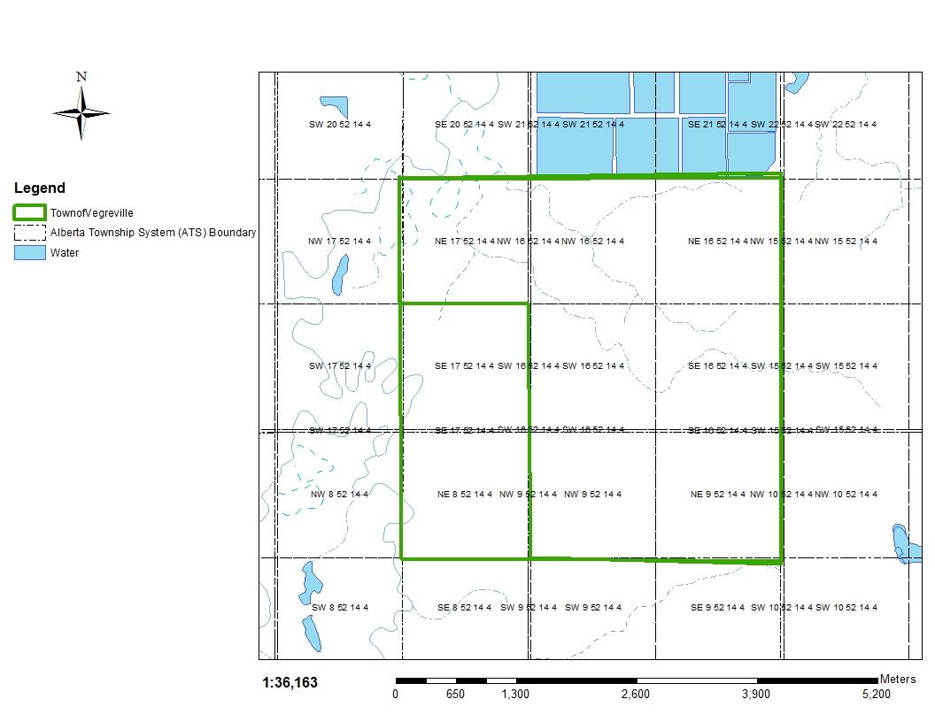
Report
Miscellaneous Lease
00000578C4
Page 10 of 17
1 1032-AS Incidental Activities* as referenced on the associated supplement that fall within the sizing parameters, as defined within the PLAR Approvals and Authorizations Administrative Procedure s as amended, identified at the time of application are subject to the conditions of the associated Disposition and available for use for a term of four years from date of Disposition approval.
2 1035-AS Where an Integrated Resource Plan or a Reservation/Protective Notation identifies a greater set back, the greater set back will prevail.
3 1036-AS The Disposition Holder must not submit additional applications for access dispositions if access under disposition already exists.
4 1037-AS Where a Higher Level Plan* exists, the Disposition Holder must follow any direction provided within that plan.
5 1039-AS With the exception of pipelines, for activities that fall within any Protective Notation (PNT) lands with a purpose code 400 Series encompassing a section of land (259 hectares) or less, located in the Provincial White Area* (i.e., Provincial settled lands), the Disposition Holder must construct all activities within lands developed as range improvement. Where no range improvement exists, activities must occur within 100 metres of the PNT perimeter (i.e., outside boundary).
6 1046 The Disposition Holder must repair or replace any identified improvements (e.g., fences, water control structures, and signage) that were damaged as a result of industry activities on the land to pre-existing condition within 30 days of entry or immediately if occupied by livestock.
7 1047 The Disposition Holder must maintain all activities for proper drainage of surface water.
8 1049 For activities that occur on Canadian Forces Bases, the Disposition Holder must coordinate all activities through Energy Industry Control at (780) 8425850 for activity on Canadian Forces Base/Area Support Unit, Wainwright, and (780) 573-7206 for activity on Canadian Forces Base/Area Support Unit, Cold Lake.
9 1051 The Disposition Holder must comply with all requirements and direction as defined within the Pre-Application Requirements for Formal Dispositions as amended from time to time.
10 1053-AS The Disposition Holder must not locate activities within 45 meters from the top of any coulees* with the exception of activities such as; access, pipelines and linear easements crossing those features.
11 1058 The Disposition Holder must remove all garbage and waste material from this site to the satisfaction of the Regulatory Body, in its sole discretion.
12 1062 The Disposition Holder must not enter the boundaries of any research or sample plot.
Miscellaneous Lease
00000578C4
Page 11 of 17
13 1063 When proposed activities cross designated or recreation trail(s)* or when operations encroach on those trail(s)*, the Disposition Holder must ensure that:
Activities crossing trails* are constructed in a manner that will not remove snow from the trail(s)*, produce ruts in the trail(s)*, or otherwise adversely affect travel.
No mechanical equipment is permitted to travel along the trail(s)*, unless approved in writing by the Regulatory Body.
Warning signs are posted along trail(s)* during construction and reclamation activities advising trail* users of the upcoming crossing location.
Any recording devices or equipment laid along the trail(s)* are placed off of the travel portion so that the geophones do not interfere with travel.
14 1071 Where a Wildfire Prevention Plan or FireSmart Plan is reviewed and approved by the Wildfire Management Branch, the Disposition Holder must ensure any proposed clearing on public land has been authorized by the Regulatory Body.
Report
15 1200 The Disposition Holder must manage all weeds as per the Weed Control Act.
16 1204
The Disposition Holder must ensure the chemical application for the purpose of vegetation control occurs in accordance with the Pesticide Regulation and Environmental Code of Practice for Pesticides.
17 1205 The Disposition Holder must salvage all merchantable timber and haul to the location of end use unless a request for waiver is approved under the Forests Act.
18 1206
19 1207
The Disposition Holder must salvage merchantable timber according to the utilization standards for the overlapping timber disposition(s) (i.e., FMA, CTL, DTL) or, where no overlapping timber disposition exists, as per the approved forest management plan.
The Disposition Holder must slash, limb and buck flat to the ground all woody debris* and leaning trees created by the activity to a length that must not exceed 2.4 metres.
20 1208 On forested lands, the Disposition Holder must dispose of excess coarse woody debris* remaining after rollback* or stockpiling for interim reclamation* and final reclamation*.
21 1209 The Disposition Holder must dispose of coarse woody debris* within FireSmart Community Zones* by burning unless a Debris Management Plan has been approved under the Forest and Prairie Protection Act.
22 1211
The Disposition Holder must not allow timber storage piles or windrows to encroach into standing timber.
Miscellaneous Lease
00000578C4
Page 12 of 17
23 1256 The Disposition Holder must not conduct any activities during adverse ground conditions*.
24 1257 The Disposition Holder must conduct all activity to prevent and control erosion* and sedimentation on or adjacent* to the Lands.
25 1258 The Disposition Holder must install and maintain erosion control* measures.
26 1259-AS The Disposition Holder must not transport from the Lands topsoil* or subsoil* unless authorized in writing by the Regulatory Body.
27 1260 Where activities have occurred on the Lands that do not involve minimal disturbance* construction, the Disposition Holder must salvage topsoil* for land reclamation as follows:
a. Salvage all topsoil* from:
i. Mineral soils
ii. Shallow organic soils*
iii. Reclaimed soils
b. Where the depth of the topsoil* is less than 15 cm, the topsoil* and part of the subsoil* to a total depth of 15 centimetres must be salvaged, unless the upper subsoil* is considered chemically unsuitable*.
28 1263 All reclamation material* must be considered suitable as defined in the May 2001 Salt Contamination Assessment Guidelines and meet the February 2016 Alberta Tier 1 Soil and Groundwater Remediation Guidelines, as amended or replaced from time to time.
29 1265 The Disposition Holder must store reclamation material* in accordance with all of the following:
a. reclamation material* must not be placed beneath the ground surface or buried in any way;
b. coarse woody debris* stored for greater than 12 months must be stored with the topsoil*; and
c. topsoil* and subsoil* must be stored separately.
30 1267 The Disposition Holder must not mix wood chips with any reclamation material*.
31 1268 The Disposition Holder must not apply wood chips to the lands at a depth greater than five (5) centimeters.
32 1269 The Disposition Holder must manage wood chips in accordance with the directive ID 2009-01 Management of Wood Chips on Public Land as amended from time to time.
33 1270 The Disposition Holder must not store piles or windrows of reclamation material* that encroach into standing timber.
34 1271 The Disposition Holder must not use soil sterilants for any activities on the Lands.
Watercourse / Waterbody
Report
Miscellaneous Lease
00000578C4
Page 13 of 17
Condition
35 1301-AS The Disposition Holder must not interrupt natural drainage (including ephemeral and fens*), block water flow or alter the water table.
36 1303-AS The Disposition Holder must construct activities outside the appropriate watercourse* setbacks, except for vehicle or pipeline crossings:
a) Intermittent watercourses* and springs must have a setback of at least 45 metres from the top of the break.
b) Small Permanent watercourses* must have a setback of at least 45 metres from the top of the break.
c) Large Permanent watercourses* must have a setback of at least 100 metres from the top of the break.
37 1304-AS The Disposition Holder must maintain the following waterbody* setbacks from the disposition edge for all site activities, or paralleling linear dispositions, or pipeline bore site:
a) A minimum setback of 45 metres of undisturbed vegetation must be maintained from non-permanent seasonal wetlands*.
b) A minimum setback of 100 metres from the bed and shore* of semipermanent and permanent ponds, wetlands*, shallow open water ponds and lakes.
38 1310 The Disposition Holder must not deposit or place debris*, soil or other deleterious materials* into or through any watercourse* and/or waterbody*, or on the ice of any watercourse* and/or waterbody*.
39 1315 The Disposition Holder must acquire an authorization for access (offdisposition) for water withdrawal activities.
40 1317 Where surface disturbance* will occur and a risk of surface erosion* exists, the Disposition Holder must install and maintain sediment* control structures to dissipate the flow of water and capture sediment* prior to it entering a watercourse* or waterbody*.
41 1325 The Disposition Holder must not remove or use water from dugouts, surface ponds, springs, or water wells within the grazing disposition unless an authorization is issued from the Environment and Parks (GoA) agrologist.
42 1327 All licences, authorizations and approvals issued under the Alberta Environmental Protection and Enhancement Act, Water Act or Public Lands Act should not be taken to mean the Disposition Holder has complied with federal legislation. The Disposition Holder should contact Habitat Management, Fisheries and Oceans in relation to the application of federal laws relating to the Fisheries Act (Canada). Fisheries Protection Program, Fisheries and Oceans Canada 867 Lakeshore Road, Burlington, Ontario, L7R 4A6 Telephone: 1-855-852-8320
Email: Fisheriesprotection@dfo-mpo.gc.ca
Web address: www.dfo-mpo.gc.ca
The Disposition Holder should also contact the Navigation Protection Program, Canadian Coast Guard, 4253-97 Street, Edmonton, Alberta, T6E 5Y7, phone: (780) 495-4220, relating to the Navigation Protection Act.
Miscellaneous Lease
00000578C4
Page 14 of 17
43 1351 For progressive reclamation* on forested lands*, the Disposition Holder must replace all reclamation materials* that have been salvaged in accordance with all of the following:
a. all salvaged subsoil* must be replaced, then all salvaged topsoil*; and
b. reclamation materials* must be replaced over the entire progressive reclamation area*; unless otherwise approved in writing by the Regulatory Body.
44 1353 The Disposition Holder must complete temporary reclamation* on the Lands within 1 growing season of construction phase* for all topsoil* and subsoil* stockpiles required for final reclamation*.
45 1354 The Disposition Holder must prior to seeding herbaceous seed in forested* or peatlands* submit a Request for Seeding in writing to the Regulatory Body that contains all of the following:
a. rationale for conducting seeding of herbaceous species*;
b. a description of the proposed site for seeding including information with respect to the following:
i. Whether the Lands are subject to high erosion*
ii. Whether the Lands are prone to invasion from agronomic or weed species
c. a proposed seed mix composition for re-vegetation of the Lands in accordance with the Native Plant Revegetation Guidelines for Alberta, 2001 as amended or replaced from time to time or a rationale for alternate species;
d. provide a seed certificate in accordance with the Seed Act for the seed mixed to be used for re-vegetation*; and
e. any other information requested by the Regulatory Body.
46 1355 The Disposition Holder must only conduct seeding in accordance with the written request for seeding as approved by the Regulatory Body.
47 1356 The Disposition Holder must when seeding cultivated lands*, use agronomic or forage seed that meets or exceeds Certified #1 as outlined in the Seeds Act and Seeds Regulations. Seed mixes are to be free of species listed in the Weed Control Act. A seed certificate must be provided to the Regulatory Body within 30 days upon request.
48 1357 The Disposition Holder must re-vegetate the Lands with trees or shrubs within the Green Area* that meet the requirements of the December 2016 Alberta Forest Genetic Resource Management and Conservation Standards document, as amended or replaced from time to time.
49 1359 The Disposition Holder must not have slash and rollback* accumulations within five (5) meters of the perimeter of the disposition boundary, greater than the percent ground cover on the surrounding undisturbed forest floor.
50 1361 The Disposition Holder must complete progressive reclamation* on forested lands* for all associated and incidental disturbances to the Disposition.
Miscellaneous Lease
00000578C4
Page 15 of 17
51 1362 The following activities are excluded from progressive reclamation* requirement on forested lands*:
a) Lands that have received authorization for clay pad construction; and b) Lands with a 4:1 or steeper slopes where a cut and fill has been constructed to level the ground surface.
52 1363 For final reclamation*, the Disposition Holder must complete all of the following:
a) contour the disturbed land to the pre-disturbance landform or to the landform approved by the Regulatory body;
b) replace all stockpiled subsoil*, then replace all stockpiled topsoil*;
c) spread all coarse woody debris* on forested lands*; and d) reclamation materials* must be replaced over the entire area from which they were removed unless otherwise approved in writing by the Regulatory Body.
53 1364 The Disposition Holder must reclaim the Lands to the pre-disturbance land use* type (forested*, grassland*, cultivated*, mineral wetland* and peatlands*) unless otherwise authorized in writing by the Regulatory Body.
54 1500 The Disposition Holder must conduct a complete and immediate Wildlife Sweep* of the Lands (plus 100 metre buffer*) subject to the disposition prior to any activity.
55 1501 The Disposition Holder must submit results from a Wildlife Sweep* to the Fisheries and Wildlife Management Information System (FWMIS) and notify the issuing Regulatory Body in writing upon request that the Wildlife Sweep* was completed.
56 1502-AS The Disposition Holder must incorporate a buffer* zone of a minimum width of 100m undisturbed vegetation, where an established buffer* does not already exist (e.g. Species at Risk) for any and all key habitat features including, but not limited to leks*, nests, dens and houses identified in the Wildlife Sweep*.
57 1503 When Wildlife Surveys* are required, the Disposition Holder must submit results from the Wildlife Survey* to the Fisheries and Wildlife Management Information System (FWMIS).
58 1509 The Disposition Holder must incorporate buffers*, setbacks and activity timing restrictions for any and all key habitat features including, but not limited to leks*, nests, dens and houses identified in the wildlife survey*.
Miscellaneous Lease
00000578C4
Page 16 of 17
59 1510 The Disposition Holder is responsible for compliance with federal laws and should contact Environment and Climate Change Canada in relation to the application of federal laws relating to the Migratory Birds Convention Act and the Species at Risk Act.
Canadian Wildlife Service
Prairie Region
Environment and Climate Change Canada
Eastgate Offices
9250 49th Street
Edmonton, Alberta T6B 1K5
Telephone: 1-855-245-0331 (toll free)
Email: ec.leprpn-sarapnr.ec@canada.ca
Web address: sararegistry.gc.ca
60 1550-AS
61 1551-AS
The Disposition Holder must conduct appropriate pre-construction wildlife* surveys for all activities occurring within the identified Species At Risk ranges of the Landscape Analysis Tool, as per the direction of the Sensitive Species Inventory Guidelines as amended from time to time.
The Disposition Holder must not conduct any activities within 1000 metres of a sensitive raptor active nest*.
Report
62 1640-AS
The Disposition Holder must conduct appropriate pre-construction wildlife surveys* for all activities occurring within the identified Species At Risk ranges of the Landscape Analysis Tool, as per the direction of the Sensitive Species Inventory Guidelines 2013 as amended from time to time.
Other Sensitive and Endangered Species
63 1780-AS
64 1781-AS
The Disposition Holder must conduct appropriate pre-construction wildlife* surveys for all activities occurring within the identified Species At Risk ranges of the Landscape Analysis Tool, as per the direction of the Sensitive Species Inventory Guidelines 2013 as amended from time to time.
Between April 15 and August 15, the Disposition Holder must not conduct any activities* within 100 meters of an active nest site for Federally listed species.
Report ID Approval Condition
65 1944 On native grasslands*, the Disposition Holder must not crimp straw* subject to the following exceptions:
a) The straw* used for crimping must be sourced from a native species* from the same ecological range site* as the Lands;
b) The weed analysis for the straw* used for crimping must comply with the Weed Control Act, as amended or replaced from time to time.
Miscellaneous Lease
00000578C4
Page 17 of 17
66 1952 In native grasslands* as identified by the Central Parkland Layer of the Landscape Analysis Tool that requires Assisted Natural Recovery*, the Disposition Holder must submit a request for Assisted Natural Recovery in writing to the Regulatory Body that contains all of the following:
1. Rationale for conducting Assisted Natural Recovery*;
2. A description of the proposed site for Assisted Natural Recovery* including information with respect to the following:
a) Whether the Lands are subject to high erosion*;
b) Whether the soil on the Lands has been disturbed to an area greater than 50m2;
c) Whether the Lands are prone to invasion from agronomic or weed species;
3. A proposed seed mix composition for re-vegetation of the Lands:
a) That is consistent with native plant communities that are adjacent* to and in the immediate vicinity of the Lands as determined by the A Preliminary Classification of Plant Communities in the Central Parkland Natural Subregion of Alberta, as amended or replaced from time to time;
b) Provide a seed certificate in accordance with the Seed Act for the seed mix to be used for Assisted Natural Recovery*; and
c) Any other information requested by the Regulatory Body.
67 1957 The Disposition Holder must not construct activities on native grassland* within the Grassland and Parkland Natural Region between April 15th and August 15th, unless grassland bird surveys are completed as per the Sensitive Species Inventory Guidelines Protocol as amended.
68 1958 The Disposition Holder must not conduct any activities within 100 meters of an active nest site between April 15th and August 15th for the following species: short-eared owl mountain plover long-billed curlew upland sandpiper Sprague s pipit
Chestnut-collared longspur
Loggerhead Shrike Bank Swallow
Date: 18/12/2018
Requestor: Consultant
Reason for Request: Land Use Planning
SEC: 16 TWP: 052 RGE: 14 MER: 4
Non-sensitive EOs: 0 (Data Updated:October 2017 )

M-RR-TTT-SSEO_IDECODES_RANKSNAMESCOMNAMELAST_OBS_D
No Non-sensitive EOs Found: Next Steps - See FAQ
Sensitive EOs: 0 (Data Updated:October 2017)
M-RR-TTTEO_IDECODES_RANKSNAMESCOMNAMELAST_OBS_D
No Sensitive EOs Found: Next Steps - See FAQ
Protected Areas: 0 (Data Updated:October 2017 )
M-RR-TTT-SS
No Protected Areas Found
Crown Reservations/Notations: 0 (Data Updated:October 2017 )
M-RR-TTT-SS NAME TYPE
No Crown Reservations/Notations Found .
Date: 3/6/2019
Requestor: Consultant
Reason for Request: Land Use Planning
SEC: 09 TWP: 052 RGE: 14 MER: 4
Non-sensitive EOs: 0 (Data Updated:October 2017 )
M-RR-TTT-SS EO_ID ECODE S_RANK SNAME SCOMNAME LAST_OBS_D
No Non-sensitive EOs Found: Next Steps - See FAQ
Sensitive EOs: 0 (Data Updated:October 2017)
M-RR-TTT EO_ID ECODE S_RANK SNAME SCOMNAME LAST_OBS_D
No Sensitive EOs Found: Next Steps - See FAQ
Protected Areas: 0 (Data Updated:October 2017 )
M-RR-TTT-SS PROTECTED AREA NAME TYPE IUCN
No Protected Areas Found
Crown Reservations/Notations: 0 (Data Updated:October 2017 )
M-RR-TTT-SS NAME TYPE
No Crown Reservations/Notations Found .
Date: 3/6/2019
Requestor: Consultant
Reason for Request: Land Use Planning
SEC: 17 TWP: 052 RGE: 14 MER: 4
Non-sensitive EOs: 0 (Data Updated:October 2017 )
M-RR-TTT-SS EO_ID ECODE S_RANK SNAME SCOMNAME LAST_OBS_D
No Non-sensitive EOs Found: Next Steps - See FAQ
Sensitive EOs: 0 (Data Updated:October 2017)
M-RR-TTT EO_ID ECODE S_RANK SNAME SCOMNAME LAST_OBS_D
No Sensitive EOs Found: Next Steps - See FAQ
Protected Areas: 0 (Data Updated:October 2017 )
M-RR-TTT-SS PROTECTED AREA NAME TYPE IUCN
No Protected Areas Found
Crown Reservations/Notations: 0 (Data Updated:October 2017 )
M-RR-TTT-SS NAME TYPE
No Crown Reservations/Notations Found .

(source database: Fish and Wildlife Management Information System (FWMIS)) 4-Jun-2019 10:20
Species Summary Report
Report Created:
Species present within the current extent :
Fish Inventory
BROOK STICKLEBACK FATHEAD MINNOW WHITE SUCKER
(X,Y):
Contact Information
For contact information, please visit:
Wildlife Inventory
No Species Found in Search Extent
AEP Forest
http://aep.alberta.ca/about-us/contact-us/fisheries-wildlife-management-area-contacts.aspx
Stocked Inventory NORTHERN PIKE RAINBOW TROUT YELLOW PERCH
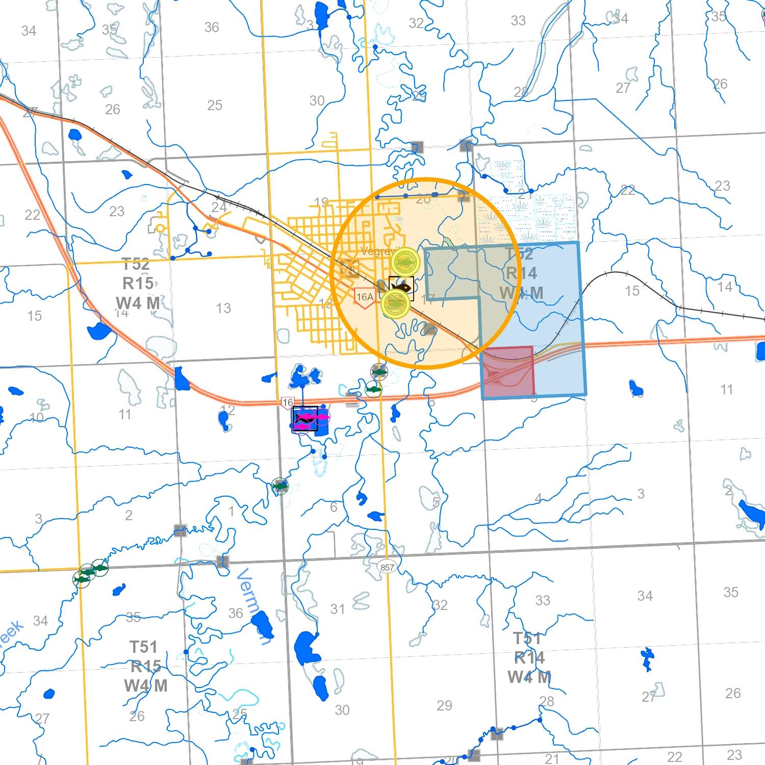
© 2019 Government of Alberta
(source database: Fish and Wildlife Management Information System (FWMIS)) 4-Jun-2019 10:25
Species Summary Report
Report Created:
Species present within the current extent :
Fish Inventory
Buffer Extent
Wildlife Inventory No Species Found in Search Extent
Stocked Inventory No Species Found in Search Extent
Centroid: (Qtr Sec Twp Rng Mer)
698678, 5927051 NW 9 52 14 4
Centroid (X,Y): 10-TM AEP Forest Projection
Contact Information
For contact information, please visit:
http://aep.alberta.ca/about-us/contact-us/fisheries-wildlife-management-area-contacts.aspx
Radius or Dimensions
1.5 kilometers
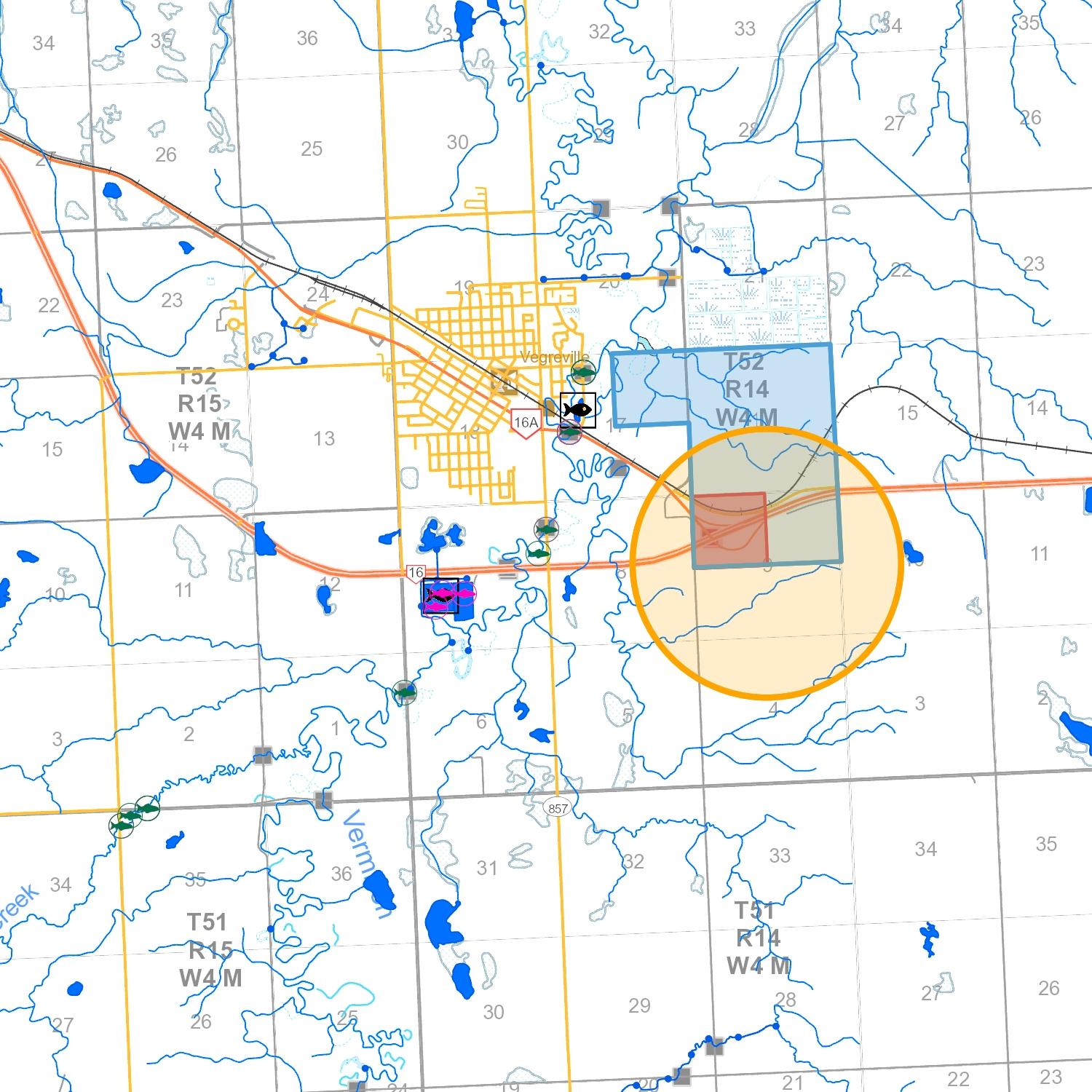
© 2019 Government of Alberta
(source database: Fish and Wildlife Management Information System (FWMIS)) 4-Jun-2019 10:27
Species Summary Report
Report Created:
Species present within the current extent :
Fish Inventory
Buffer Extent
Wildlife Inventory No Species Found in Search Extent
Stocked Inventory No Species Found in Search Extent
Centroid: (Qtr Sec Twp Rng Mer)
698258, 5929459 SW 21 52 14 4
Centroid (X,Y): 10-TM AEP Forest Projection
Contact Information
For contact information, please visit:
http://aep.alberta.ca/about-us/contact-us/fisheries-wildlife-management-area-contacts.aspx
Radius or Dimensions
1.5 kilometers
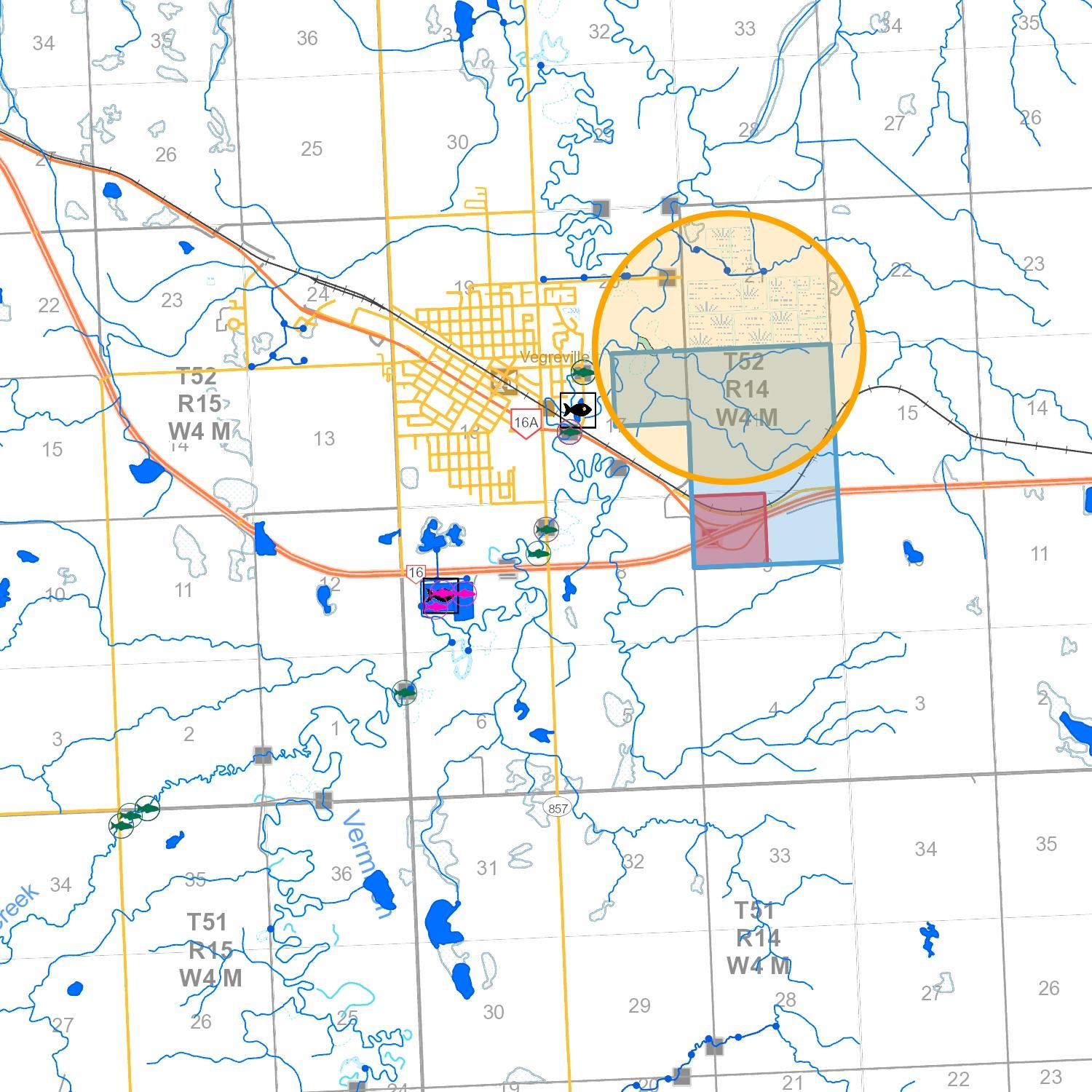
© 2019 Government of Alberta
(source database: Fish and Wildlife Management Information System (FWMIS)) 4-Jun-2019 10:28
Species Summary Report
Report Created:
Species present within the current extent :
Fish Inventory
Buffer Extent
Wildlife Inventory No Species Found in Search Extent
Stocked Inventory No Species Found in Search Extent
Centroid: (Qtr Sec Twp Rng Mer)
699443, 5928370 SW 15 52 14 4
Centroid (X,Y): 10-TM AEP Forest Projection
Contact Information
For contact information, please visit:
http://aep.alberta.ca/about-us/contact-us/fisheries-wildlife-management-area-contacts.aspx
Radius or Dimensions
1.5 kilometers
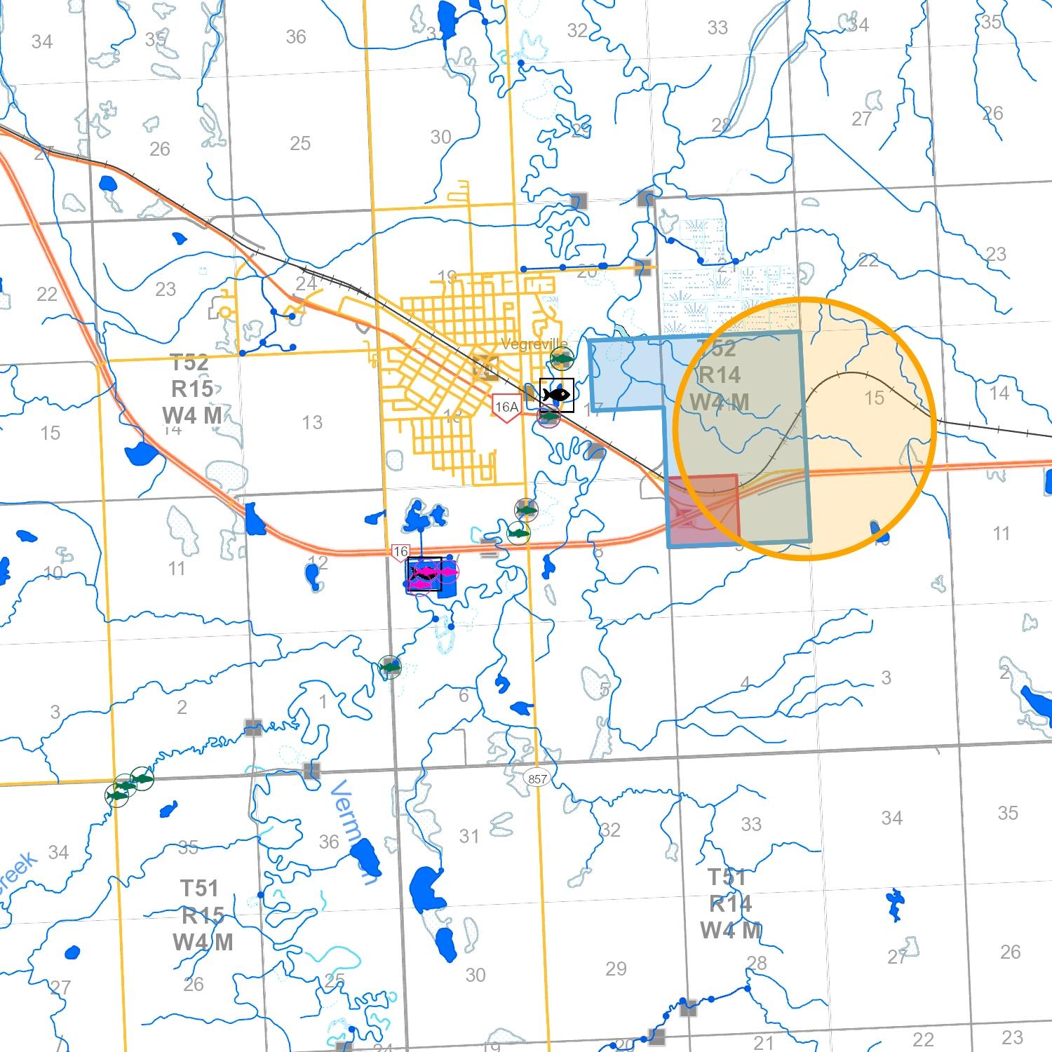
© 2019 Government of Alberta
WETLAND ASSESSMENT UNIT MAP
WETLAND ASSESSMENT REPLACEMENT VALUE
WETLAND REPLACEMENT IN-LIEU RATES
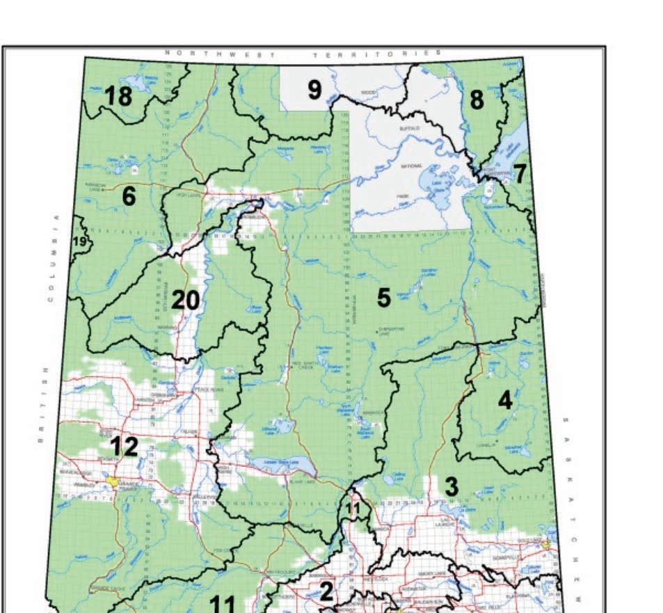
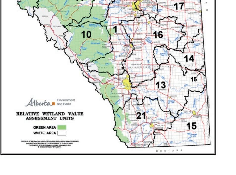
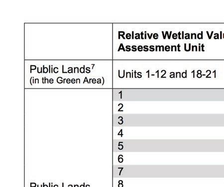
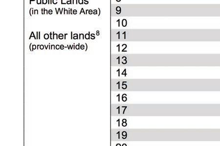
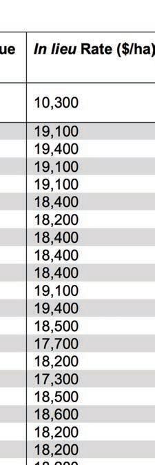
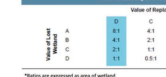
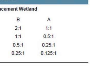
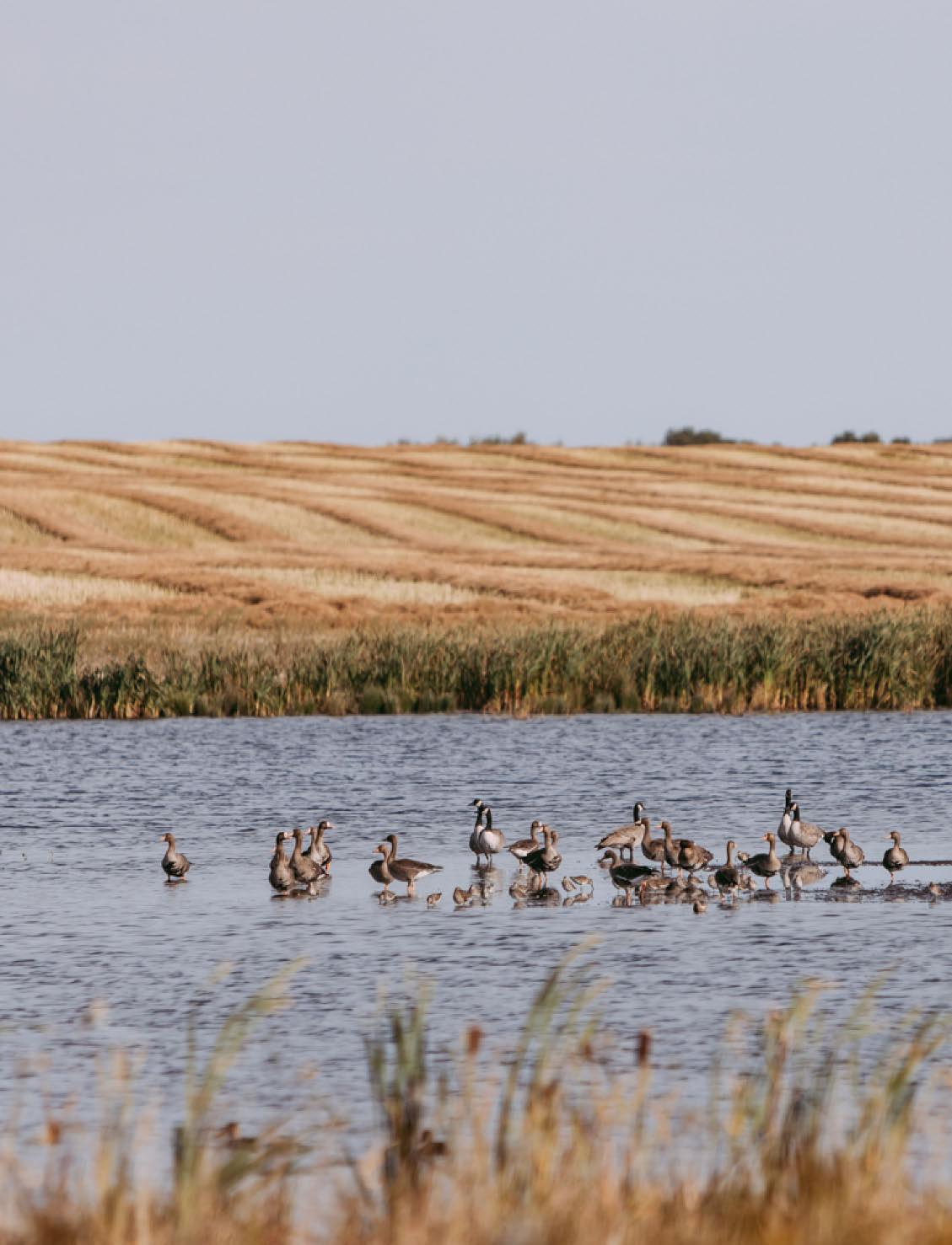

October 4, 2019 | Project No.: 18MU-352300
County of Minburn No. 27
4909 – 50 Street
Box 550
Vegreville, AB T9C 1R6
Attention: Davin Gegolick
Dear Sir:
Re: West Industrial Park Area Structure Plan – Servicing Brief
County of Minburn No. 27
Red Willow Planning, on behalf of the County of Minburn No. 27 (County), engaged BAR Engineering Co. Ltd. (BAR) to prepare a servicing brief associated with, and to compliment, the preparation of the West Industrial Park Area Structure Plan (ASP). Servicing options and recommendations for the West Industrial Park water, wastewater, stormwater management, franchise utilities, and transportation network are provided in this servicing brief.
The West Industrial Park is located within the County on the east side of the Town of Vegreville (Town) and comprises Section 16-52-14-W4M, NE ¼ Section 17-52-14-W4M, and portions of the NW and NE ¼ Sections 9-52-14-W4M. Range Road 143 bounds the West Industrial Park to the east, Town lagoons to the north, Town land to the west, and Canadian National (CN) Railway and Highway 16 right-of-way to the south. CN Rail tracks bisect the SE ¼ Section 16-52-14-W4M. Location of the West Industrial Park including the ASP boundary is shown in Figure 2-1.
Majority of the land within the West Industrial Park is currently used for agricultural purposes with the NE ¼ Section 17-52-14-W4M and the NW ¼ Section 16-52-14-W4M zoned Agricultural. According to the County’s Land Use Bylaw 1254-16, the NE and SE ¼ Sections 16-52-14-W4M and portion of NE ¼ Section 9-52-14-W4M are zoned Rural Industrial and the portion of NW ¼ Section 9 -52-14-W4M, and SW ¼ Section 16-52-W4M are zoned Direct Control. A portion of the SE ¼ Section 16 -52-14-W4M is zoned MPF Direct Control, which in recent years was redistricted for the Lunaverse Medical Marijuana Facility (Lunaverse) The County adopted a Conceptual Scheme , prepared by Lunaverse, to support the development of the land prior to the County adopting an ASP for the West Ind ustrial Park. In addition to Lunaverse, GrainsConnect is currently in the process of developing a grain terminal in the NE ¼ Section 16-52-14-W4M. Figure 2-2 illustrates the land use and identifies the locations of the Lunaverse and

County of Minburn No. 27
BAR Project No.: 18MU-352300
October 4, 2019
GrainsConnect developments.
Proposed land use for the West Industrial Park , excluding the parcel districted MPF Direct Control , is Rural Industrial district Large lot sizes are typical for rural industrial developments, which is consistent with the proposed lotting plan provided by Red Willow Planning. Proposed lot sizes range in size from roughly 3.6 acres to 15.6 acres as shown in Figure 2-3 It is important to note that the proposed lotting provided by Red Willow Planning is conceptual and will be refined during future development stages.
County of Minburn does not currently have an existing municipal water distribution system within the vicinity of the West Industrial Park to provide potable water to the development . As such, either private on-site potable water systems, such as wells or cisterns, will need to be utilized for the development or a connection to the Alberta Central East (ACE) Regional Water System will be re quired If water wells are utilized for the development, groundwater evaluations and/or hydrogeological assessments will be required prior to and as part of the subdivision process to obtain the required approvals and authorization from Alberta Environment and Park’s and Sustainable Resource Development to divert and use groundwater.
ACE Regional Water System supplies drinking water to member municipalities, which includes the County of Minburn. The ACE transmission line is located approximately 800m north of the north ASP boundary and runs east/west along Township Road 523A between Range Road 145 and Range Road 14 4. At Range Road 144, the transmission line heads north to Township Road 524 . Connection to the ACE Transmission line at the intersection of Township Road 523A and Range Road 14 4 could provide potable water to the West Industrial Park. A watermain, owned and operated by the County, would be required from the connection point south along Range Road 14 4 and looped throughout the development to provide service to the Rural Industrial lots. It is important to note that ACE does not provide distribution pressures, so either the water supply would be through a trickle feed s ystem to fill private on-site cisterns, or the County could construct a reservoir and pump station to provide adequate distribution pressures to the West Industrial Park. Figure 3-1 illustrates the location of the existing ACE Transmission Line and the possible connection point and watermain alignment to the north side of the West Industrial Park. Application to connect to the ACE Transmission Line would be undertaken at future design stages of the development prior to subdivision.
Rural municipal wastewater collection systems are not present within or near the West Industrial Park. Private on-site wastewater collection and treatment systems will be required for the proposed rural industrial development, which could include holding tanks, septic ta nks, and/or septic fields. Unlike municipal wastewater collection systems, on-site sewage systems include either collection of the
County of Minburn No. 27
BAR Project No.: 18MU-352300
October 4, 2019
wastewater and hauling offsite or collecting and treating the wastewater onsite prior to discharging to the environment. Implementation of private sewage systems shall be in accordance with the Alberta Private Sewage Systems current Standard of Practice at the subdivision stage.
Town lagoons located immediately north of the NW and NE ¼ Sections 16-52-14-W4M treat wastewater collected from the Town prior to discharging. It is understood, that at this time, the County intends for the West Industrial Park to utilize on-site private sewage systems. Further analysis , in collaboration with the Town, could be completed if the County wishes to pursue installation of a wastewater collection system within the West Industrial Park to convey wastewater to the Town lagoons. A municipal wastewater collection system for the West Industr ial Park could consist of a low-pressure sewage collection system, and/or gravity sanitary sewer mains in combination with lift stations
The ASP lands generally slope from the southeast to the northwest with a relief of approximately 21m. Many trapped lows within the ASP boundary capture stormwater runoff and provide wetland habitat. An unnamed tributary of the Vermilion River is located along the west and north property lines of the NE ¼ Section 17-52-14-W4M, which serves as the natural drainage outlet for the West Industrial Park. A flood hazard mapping study was undertaken for the Vermilion River to identify the extents of the 1:100 year flood plain. The flood plain consists of two areas of flow identifi ed as the floodway and the flood fringe. Floodway represents the area where the floodwaters are deepest, fastest, and most destructive. Flood fringe are areas outside of the floodway where floodwaters are generally shallower and flow slower. According to Alberta Environment and Park’s flood hazard mapping, the unnamed tributary located within the NE ¼ Section 17-52-14-W4M is located within the Vermilion River’s 1:100 year flood fringe.
Proposed stormwater management measures for the West Industrial Pa rk are provided in the attached Stormwater Management Plan. A series of drainage ditches, including roadside ditches, and stormwater management facilities (SWMF) will be utilized to convey and control stormwater runoff from the proposed development with natural drainage patterns from the southeast to the northwest being maintained. Three conceptual SWMF locations have been identified based on grading to maintain natural drainage and the proposed lotting plan. A maximum SWMF discharge rate of 0.45 L/s/ha has been adopted for this study based on the 1:100 year Vermilion River discharge rate provided in the flood hazard mapping study. Further analysis including sizing of the SWMFs, location, sequencing, and Water Act application will be completed in future stages of development prior to subdivision. Figure 3-2 illustrates the proposed stormwater management system including the conceptual SWMF sizing for a 1:100 year 24 hour rain event.
Power, natural gas, and communication services are all located within the vicinity of the West Industrial Park and will be extended from the nearest connection location for the planned subdivision. Application to the utility provider for connection and/or extension of service to the proposed development will be
County of Minburn No. 27
BAR Project No.: 18MU-352300
October 4, 2019
required at the subdivision stage.
Power is provided by ATCO Electric for the West Industrial Park area. Three phase overhead power lines are located along the unimproved road allowance of Township Road 522, from Range Road 143 to Range Road 144, along the west property line of the NE ¼ Section 17-52-14-W4M running north/south, and along Range Road 143. Service connection location to power will be coordinated prior to subdivision.
Access to the West Industrial Park is currently provided via Township Road 522A, Range Road 144, and Range Road 143. Township Road 522A provides access from the Town on the west side of the development. Range Road 144 connects to Highway 16A to the south , Township Road 522A, Township Road 523A, and T ownship Road 524 to the north. Range Road 143, located along the east side of the West Industrial Park, can currently be accessed from the service road/Township Road 522 to the south and Township Road 524 to the north. The road allowance width of undeveloped Township Road 522 , along the south side of the West Industrial Park , and Range Road 143 are 20m, while all other existing roads have a road allowance width of 30m. Existing roadways are shown in Figure 2-1
Transportation networks typically consist of three classifications of roadways; arterial, collector, and local. Roadway classification is determined based on connectivity of the transportation network and traffic volumes. In general, arterial roadways have higher traffic volumes and connect to collector roadways, while collector roadways connect to local roads with the least traffic volume. Direct access to private development is permitted on local and collector road classifications, but not arterial. The proposed transportation network, including roadway classifications , is shown in Figure 3-3
All proposed roadways within the West Industrial Park development will be rural cross section roads with roadside ditches to provide drainage and convey storm water runoff as noted in Section 3.3 and will be developed to the current County of Minburn’s Road Standards at time of development The following recommendations are provided for the West Industrial Park transportation network at future development stages:
• Undertake a traffic impact assessment prior to subdivision to determine if intersection upgrades or controls are required as a result of development.
• Complete a geotechnical investigation to confirm soil stratigraphy, suitability of existing soil for construction, and recommended road pavement structures based on soils and vehicular loading.
• Construct roadways to accommodate a minimum 9m finished top width for tru ck traffic.
• Widen Township Road 522 road allowance to 30m for construction of the proposed road cross section.
It should be noted that GrainsConnect Canada retained Stantec Consulting Ltd. to prepare a Transportation Impact Assessment (TIA) for the proposed grain terminal development located in the NE
County of Minburn No. 27
BAR Project No.: 18MU-352300
October 4, 2019
¼ Section 16-52-14-W4M. Recommendations from the TIA are provided in the report entitled New Grain Terminal Facility – Vegreville Transportation Impact Assessment, Stantec Consulting Ltd., October 2, 2017, which concludes that the roadway network and intersections within the TIA’s study area are expected to accommodate traffic volumes generated by the proposed grain terminal development including for future growth.
If you have any questions or require any clarifications regarding this servicing brief, please do not hesitate to contact me at (780) 875-1683 or via e-mail at scott.simons@bareng.ca
Yours truly, BAR Engineering Co. Ltd.

Scott Simons, P. Eng. Senior Engineer Municipal Division
Reviewed by, BAR Engineering Co. Ltd.
Rick Collins, P. Eng. Director Municipal Division
Attachments: West Industrial Park Stormwater Management Plan DRAFT Report, September 13, 2019
CC/cc: Red Willow Planning – Vicki Dodge
GRAINSCONNECT TERMINAL
LUNAVERSE MPF-DC
GRAINSCONNECT TERMINAL
LUNAVERSE MPF-DC
GRAINSCONNECT TERMINAL
LUNAVERSE MPF-DC
SWMF1
GRAINSCONNECT TERMINAL
LUNAVERSE MPF-DC
SWMF 1 CATCHMENT AREA
SWMF 2 CATCHMENT AREA
SWMF 3 CATCHMENT AREA
NOTE: SWMF SIZES AND LOCATIONS SUBJECT TO CHANGE PENDING DETAILED DESIGN
October 4, 2019 | BAR Project No.: 18MU-352300


County of Minburn No. 27
West Industrial Park – Stormwater Management Plan
October 4, 2019
The County of Minburn No. 27 (County) retained BAR Engineering Co. Ltd. (BAR) to prepare a stormwater management plan (SWMP) to supplement the Area Structure Plan (ASP) being prepared by Red Willow Planning for the West Industrial Park. An ASP provides the framework for decision-making regarding future subdivision of the lands, which is utilized by the Municipality and developers for development of the identified area. The SWMP outlines major overland drainage design concepts, in context with the ASP and in accordance with applicable design standards and guidelines, to facilitate development of the subject lands . Refinement of the presented stormwater management concepts will occur prior to subdivision of the lands as part of the subdivision phase
The West Industrial Park is located along the east boundary of the Town of Vegreville (Town) and is bounded by the Town to the west, Town lagoons to the north, Range Road 143 to the east, and undeveloped road allowance to the south beyond which Canadian National Railway and Highway 16 right -of-way exists. Section 16-52-14-W4M, NE ¼ Section 17-52-14-W4M, and portions of the NW and NE ¼ Section 9 -52-14-W4M are located within the West Industrial Park ASP boundary. SE ¼ Section 17-52-14-W4M, directly adjacent to the West Industrial Park, is located within the Town boundaries. A Canadian Nation al Railway Line bisects the southeast quarter section from the southwest corner of the quarter to the northeast. Figure 1-1 shows the location of the ASP lands.
According to the County’s Land Use Bylaw 1254-16, the SW ¼ Section 16 and portion of NW ¼ Section 9-52-14W4M are zoned Direct Control and the east quarter sections are zoned Rural Industrial. The NE ¼ Section 17-5214-W4M and NW ¼ Section 16-52-14-W4M are zoned Agricultural. Currently, the majority of the parcel is used as agricultural land, however, GrainsConnect is in the process of developing a grain terminal on the NE ¼ Section of 16. In addition, a portion of the SE ¼ Section of 16 has recently been redistr icted to MPF-DC: Marijuana Productions Facility – Direct Control district and is in the process of being subdivided for the Lunaverse Medical Marijuana Facility.
LiDAR survey data, provided by the County, shows that the subject lands generally drain from the southeast to the northwest with approximately 21m of relief. An unnamed tributary of the Vermilion River is located within the northwest portion of the ASP boundary and provides drainage outlet for stormwater runoff. A number of trapped lows within the ASP boundary capture runoff prior to reaching the unnamed tributary. Figure 1-2 shows the original ground contours and general flow direction within the property.
A flood hazard mapping study of the Vermilion River was completed in 1994 by SNC Lavalin for Alberta Environment and is summarized in a report entitled “Vegreville Flood Risk Mapping Study, Canada – Alberta Flood Damage Reduction Program. April 1994”. The unnamed tributary within the NE17-52-14-W4M is included in the 1:100 year flood fringe of the Vermilion River. Flood fringe is the area outside of the floodway where flows are shallower and generally slower than in the floodway. New development within the flood fringe may be permitted, but would require flood proofing. The approximate extents of the flood fringe was obtained from Alberta Environment’s Flood Hazard Map Application and is shown in Figure 1-2
The ASP development area will be redistricted and subdivided for Rural Industrial land use. Lot sizes for Rural Industrial District are not specified in the County’s Land Use Bylaw, but will be determined by the County’s Subdivision Authority at future subdivision stages. Figure 1-3 illustrates the proposed lot layout provided by Red Willow Planning.
County of Minburn No. 27
West Industrial Park – Stormwater Management Plan
October 4, 2019
Rural Industrial lots are proposed within the NE ¼ Section 17 -52-14-W4M and NW, SW, and SE 16-52-14-W4M as shown in the proposed development plan. The GrainsConnect terminal is currently being developed in the NE 1652-14-W4M and the Lunaverse Medical Marijuana Facility has been subdivided from the SE 16 -52-14-W4M as previously noted and as shown on Figure 1-3
Access to the proposed Rural Industrial lots will be provided off existing Range Road 144 and Township Road 522A. Local rural cross sectio n industrial roads will be constructed within the proposed development to provide access to the internal lots. The undeveloped road allowance of Township Road 522 will be developed to provide access to the SE ¼ Section 16-52-14-W4M, and NW and NE ¼ Sections 9-52-14-W4M, and to also provide internal looping of the development’s road network.
Phasing of the ASP lands has not been identified at this time , although phasing of the development should consider logical implementation and sequencing of the overall drainage and stormwater management system as discussed in Section 3.6. Further review and refinement of the stormwater management plan will be required at th e subdivision stage once phasing has been confirmed as the development phasing may impact proposed stormwater management facility (SWMF) locations.
GRAINSCONNECT TERMINAL
County of Minburn No. 27
West Industrial Park – Stormwater Management Plan October 4, 2019
Stormwater management regulations and engineering standards have evolved over the past several decades. An approved stormwater management plan (SWMP) must address both stormwater quality and quantity aspects under today’s regulations. The following desig n guidelines and standards were used in the development of the present stormwater management plan:
• Alberta Environment Standards and Guidelines for Municipal Waterworks, Wastewater and Storm Drainage Systems, Part 5 Stormwater Management Guidelines, March 2013;
• Alberta Environment’s Stormwater Management Drainage Systems Design Guidelines, January 1999 ; and,
• City of Edmonton Design and Construction Standards, Volume 3 Drainage, March 2015.
In addition to the above guidelines, the following reports were utilized in the development of the SWMP:
• Vegreville Flood Risk Mapping Study, Canada -Alberta Flood Damage Reduction Program, April 19 94, SNC Lavalin;
• SE 17 Industrial Area Structure Plan, August 2015, Eagle River Planning Services; and,
• Town of Vegreville North Parkway Drainage Course for Water Act Application Approval, February 9, 2015, MPE Engineering Ltd.
• Stormwater Management Pla n for GrainsConnect Canada’s Grain Elevator Facility Development at Vegreville, AB, DRAFT, April 6, 2018, Stantec Consulting Ltd.
Stormwater runoff volume and discharge rate increase with development of land due to an increase in impervious area from roads, buildings, parking lots, etc. and altering of drainage paths Stormwater management facilities (SWMFs) are used as a best management practice (BMP) within developments for flood control by temporarily storing and restricting the release rate of stormwater runoff and to provide water quality enhancement prior to discharging to downstream water bodies and watercourses. Wet ponds are commonly used SWMFs as they provide water quality enhancement through settling of runoff pollutants within the permanent poo l (dead storage) and stormwater runoff during rain events is temporarily store d above the permanent pool (live or active storage) and released downstream at a restricted rate. Alberta Environment guidelines do not specifically dictate the stormwater quantity requirements; however, they provide the following design parameters:
• 1 in 100 year storm stored within 2m above the permanent pool ( alternatively, the 2m can be used to store the 1 in 25 year storm. In such cases an emergency overflow drainage system should be constructed with the capacity to carry storm runoff from the 1 in 100 year storm event to receiving streams or downstream stormwater management facilities); and,
• Detention time of 24 hours.
The 1 in 100 year 24 hour storm design parameter will be adopted for the purposes of quantity control for this SWMP.
Generally, the release rate of a SWMF is restricted to the pre development runoff rate for a parcel of land and is commonly determined using known flow data of downstream watercourses. Matching post development stormwater
County of Minburn No. 27
West Industrial Park – Stormwater Management Plan
October 4, 2019
runoff rate to pre development will mitigate impact on downstream watercourses caused by development. The following release rates are considered based on the above noted reports:
• 24-hour drawdown time for a 1:5 year storm (North Parkway Drainage Course);
• Pre development rate of 4.0 L/s/ha (SE 17 Industrial Area Structure Plan); and,
• 0.45 L/s/ha based on 1:10 0 year Vermilion River at Vegreville flood peak of 73m 3/s and drainage area of 1,630 km2 (Vegreville Flood Hazard Mapping).
The 24-hour drawdown time for a 1:5 year storm provided in the North Parkway Drainage Course report is based on a City of Edmonton standard, which doesn’t account for pre development flow. Pre development rate of 4.0 L/s/ha provided in the SE 17 Industrial ASP was not able to be confirmed altho ugh the ASP indicates it is as per Alberta Environment 1998. Flood frequency analysis was provided for the downstream receiving watercourse, Vermilion River, in the Vegreville Flood Hazard Mapping report. Using the 1:100 year flow of the Vermilion River and the drainage area of 1,630 km2 results in a discharge rate of 0.45 L/s/ha for the Vermilion River at Vegreville , which has been adopted for this SWMP. Further analysis of the pre development discharge rate should be completed during future subdivision stages and prior to Water Act Application.
The City of Edmonton Intensity, Duration and Frequency Curves (IDF Curves) were used to develop the storm events to determine the required storage of the SWMF(s). Specifically, required storage was determined using the City of Edmonton’s 1:100 year 24 hour Huff distribution.
The infiltration method used in this study was the Horton Infiltration Method, which determines the rate that water seeps through the soil during a storm. This method is based on empirical data that shows that infiltration starts at an initial maximum rate and decreases exponentially to a minimum rate over the course of the rainfall event, which implies that the rate of infiltration decreases as the soil becomes saturated. The infiltration method is described by the following equation:
Where: fp = infiltration rate at time t (mm/hr)
k = decay rate (1/hr)
fc = minimum equilibrium infiltration rate (mm/hr)
fo = maximum infiltration rate (mm/hr)
The above parameters are based on soil properties and vegetation cover for any basin. For the purposes of this SWMP, it has been assumed that the soil in the study area is comprised of clay loam, lightly vegetated, and moist soil conditions.
County of Minburn No. 27
West Industrial Park – Stormwater Management Plan
October 4, 2019
To assist in determining the post development runoff rates and design of the Stormwater Management Facilities, a computer model was produced. This model was created using USEPA SWMM 5.0, a dynamic rainfall-runoff simulation model developed by the U.S. Environmental Protection Agency. City of Edmonton rainfall distributions were utilized in the model as previously noted, and a maximum release rate of 108 L/s was used based on a pre development release rate of 0.45 L/s/ha for a 240 ha development area. It should be noted that a pre development analysis of the West Industrial Park ASP lands was not completed, as existing stormwater reports were utilized for determination of the maximum allowable release rate for the development.
The post development basin parameters that were used in the computer model are provided in Table 2-1 Post development basins used a combined imperviousness of 72% for the rural industrial lots and subdivision roads, and 100% imperviousness for stormwater management facilities. The impervious area Manning’s ‘n’ of 0.015 is typical for concrete, asphalt, or gravel surfaces and the Manning’s ‘n’ value for pervious areas of 0.10 is typical for short natural grass. Depression storage is the depth of stormwater that is trapped in the basin due to small storage depressions. Impervious areas provide little de pression storage, typically ranging in depth from 1.0 to 2.50mm. Pervious areas, like pasture and landscaping, have a much greater potential for depression storage. The Horton Infiltration parameters for the post development basins are described in Secti on 2.3
Hydraulically Connected Impervious Area:
Impervious Area Manning’s ‘n’
Pervious Area Manning’s ‘n’
Impervious Area Depression Storage
Pervious Area Depression Storage 5.0 mm
County of Minburn No. 27
West Industrial Park – Stormwater Management Plan
October 4, 2019
Natural drainage patterns from the southeast to the northwest will be maintained with roadside ditches collecting and conveying stormwater runoff to the proposed stormwater management facilities. Overland flow is designed to run off from the industrial lots to the roadside ditches with minimum 2% lot grades and minimum roadside ditch grades of 0.2%. Three stormwater management facility locations have been identified as shown in Figure 3-1, however, phasing of the development could result in additional interconnected stormwater management facilities in locations best suited to the phasing of the development. It should be noted that excavated earth from the proposed stormwater management facilities would be used as engineered fill (i f suitable) to construct the roadways and proposed lots. GrainsConnect Terminal will control stormwater runoff from their site to predevelopment rates via an on -site stormwater management facility and control structure as outlined in the Stantec Draft Report entitled Stormwater Management Plan for GrainsConnect Canada’s Grain Elevator Facility Development at Vegreville, AB, dated April 6, 2018. The proposed onsite SWMF will disc harge to a natural drainage path at the northwest corner of the NE ¼ Section 16-52-14-W4M. Drainage will be diverted around the proposed industrial lots within the NW ¼ Section 1652-14-W4M to the Vermilion River tributary near Range Road 144 via a man-made drainage ditch along the north and west quarter lines of the NW ¼ Section 16-52-14-W4M
All proposed stormwater management facilities (SWMF) are wet retention ponds designed in accordance with Alberta Environment guidelines. The SWMFs are designed with interior side slopes of 5:1 (H:V) from 1m below normal water level (NWL) to the high water level (HWL) and 3:1 (H:V) side slopes from the pond bottom to 1m below NWL. Fencing should be placed around the perimeter of the SWMFs to mitigate the public and wildlife from entering the facilities. A minimum 0.3m freeboard is proposed as emergency storage within the SWMFs
The SWMF dead storage is the volume of water that is permanently stored in the pond and is the st orage depth measured from the NWL to the pond bottom. Alberta Environment guidelines require a minimum dead storage depth of 2.0m to mitigate vegetation growth in the pond bottom. Dead storage provides the water quality enhancement of the BMP as previously noted by allowing sediments and pollutants to settle out prior to discharging.
Proposed SWMF 1 has a catchment area of 50.8 ha, as shown in the blue hatch in Figure 3-1, and is located in the northwest portion of the SW ¼ Section 16-52-14-W4M. Ditch blocks are required in the upstream ditches to direct flow from the roadside ditches into SWMF 1. Stormwater from SWMF 1 will be discharged to the downstream roadside ditch, which conveys the stormwater to SWMF 3 and subsequently to the unnamed tributary of Vermilion River at a controlled release rate of 0.45 L/s/ha. Table 3-1 below provides the surface area and storage volume at the pond bottom, NWL, HWL, and freeboard elevations.
Table 3-1: SWMF 1 – Design Parameters
County of Minburn No. 27
West Industrial Park – Stormwater Management Plan October 4, 2019
Stormwater runoff from an area of 89.0 ha, shown in the red hatch in Figure 3-1, will drain via roadside ditches to SWMF 2 proposed in the northwest portion of the NW ¼ Section 16-52-14-W4M Similar to SWMF 1, stormwater from SWMF 2 will be discharged to an adjacent roadside ditch at a controlled release rate and conveyed to the unnamed tributary of Vermilion River through SWMF 3 . Table 3-2 below provides the surface area and storage volume at the pond bottom, NWL, HWL, and freeboard elevations.
Table
SWMF 3 is proposed in the very northwest corner of the ASP lands directly adjacent to the unnamed tributary of Vermilion River. The entire ASP lands will drain through SWMF 3 to the unnamed tributary and subsequently to Vermilion River providing a hydraulically connected stormwater management system for the entire West Industrial Park development. SWMF 3 has a catchment area of 100.2 ha , as show in the green hatch in Figure 3-1, draining directly into the facility, however, with SWMF 1 and SWMF 2 discharging through SWMF 3, the total catchment area of SWMF 3 is 240 ha. Table 3-3 below provides the surface area and storage volume at the pond bottom, NWL, HWL, and freeboard elevations.
Table 3-3:
Computer model simulations were completed for the 5, 10, 25, 50, and 100 year rainfall events. Table 3-4, Table 3-5, and Table 3-6 summarize the results of the simulations and includes the water depth, volume, and outlet discharge as well as the orifice size determined from the computer analysis for the three proposed stormwater management facilities.
Table 3-4: SWMF 1 – 24 Hour Rainfall Simulation Results
County of Minburn No. 27
Table 3-5: SWMF 2 – 24 Hour Rainfall Simulation Results
County of Minburn No. 27 West Industrial Park – Stormwater Management Plan
October 4, 2019
Table 3-6: SWMF 3 – 24 Hour Rainfall Simulation Results
The ability of a SWMF to drawdown in a reasonable amount of time after a storm event has past is an important consideration in design to allow for available capacity within the SWMF for subsequent rainfall events. Alberta Environment do not stipulate drawdown requirements within their guidelines, however, City of Edmonton Design and Construction Standards provide the following parameters:
Time after commencing drawdown from design full level
Available volume between high water level (HWL) and NWL 24 hours
Volume equivalent to runoff from 1 in 5 year storm 48 hours
Volume equivalent to runoff from 1 in 25 year storm 96 hours 90% of total storage volume above NWL
The above City of Edmonton parameters are not achievable with the ad opted maximum allowable release rate of 0.45 L/s/ha. Reducing drawdown time in SWMF ’s 1 and 2 can be achieved by allowing the SWMF ’s to discharge at a release rate greater than 0.45 L/s/ha and controlling the discharge from the entire ASP lands in SWMF 3 to the maximum allowable release rate of 0 45 L/s/ha. To achieve 90% of total storage volume above NWL within 96 hours after commencing drawdown, SWMF 1 must be discharged at a rate of 5.30 L/s/ha and SWMF 2 at 5.70 L/s/ha. Table 3-7 summarize the results of the computer model simulation of the hydraulically interconnected pond scenario for the 1:100 year 24-hour storm.
County of Minburn No. 27
Industrial Park – Stormwater Management Plan October 4, 2019
Table 3-7: SWMF 1:100 Year 24-Hour Simulation Results: Hydraulically Interconnected Ponds
Water elevations and volumes at various times after pond drawdown has commenced are provided in Table 3-8, Table 3-9, and Table 3-10 for the three proposed SWMFs. An emergency overflow on SWMF 3 sized for the 1:100 year discharge should be constructed to allow stormwater to flow directly to the unnamed tributary above the HWL elevation due to the slow drawdown resulting from the adopted maximum discharge rate of 0.45 L/s/ha The SWMF volumes at time 0 represents the dead storage capacity or permanent pool volume for the facility.
SWMF 1 would reach a maximum volume of 134,379.9 m3 in 19.0 hours. At 24 hours after pond drawdown has commenced, the live storage is at 72% of maximum capacity. The pond is 90% drained 92.65 hours after pond drawdown has commenced.
Table 3-8: SWMF 1 Drawdown – 1:100 Year 24-Hour Storm Simulation
SWMF 2 would reach a maximum volume of 240,523.6 m3 in 16.98 hours. At 24 hours after pond drawdown has commenced, the live storage is at 71% of maximum capacity. The pond is 90% drained 84.3 hours after pond drawdown has commenced.
County of Minburn No. 27 West Industrial Park – Stormwater Management Plan October 4, 2019
Table 3-9: SWMF 2 Drawdown – 1:100 Year 24-Hour Storm Simulation
SWMF 3 would reach a maximum volume of 582,736.1 m3 in 121.0 hours. At 24 hours after pond drawdown has commenced, the live storage is at 99% of maximum capacity. The pond is 90% drained 1,176.8 hours after pond drawdown has commenced. As previously stated, an emergency overflow should be constructed to allow st ormwater to discharge directly to the unnamed tributary due to the slow pond drawdown of SWMF 3.
Table 3-10: SWMF 3 Drawdown – 1:100 Year 24-Hour Storm Simulation
Wet retention ponds are one of Alberta Environment’s best management practices for removing sediments and pollutants from stormwater runoff. Alberta Environment design criteria for stormwater quality control consider storing the volume of runoff from a 25 mm 24 hour storm within the dead storage of a wet pond. This provides adequate volume for the removal of sedimentation and pollutants.
A peak elevation of 633.30m was found in SWMF 1 through computer simulation of a 25mm 24 -hour storm event. This equates to a depth of 0.30m in the facility with a runoff volume of 9,726 m3, which is 14.0% of the dead storage capacity.
SWMF 2 has a peak elevation of 631. 25m during a 25mm 24-hour storm event simulation. This equates to a depth of 0.25m in the facility with a runoff volume of 15,728 m3, which is 11.6% of the dead storage capacity.
A peak elevation of 628.64m was found in SWMF 3 through computer simulation of a 25mm 24 -hour storm event. This equates to a depth of 0.14m in the facility with a runoff volume of 17,539 m3, which is 6.8% of the dead storage capacity.
County of Minburn No. 27
West Industrial Park – Stormwater Management Plan
October 4, 2019
All three proposed stormwater management facilities have been designed to function independently of one another, however, stormwater runoff from the overall ASP area will ultimately drain through SWMF 3 prior to discharging to the downstream watercourse. In addition, stormwater drawdown of SWMF ’s 1 and 2 can be increased by utilizing SWMF 3 to restrict the discharge off-site as discussed in Section 3.4. Development of SWMF 3 and the NE ¼ Section 17-52-14-W4M in Phase 1 of the development, prior to the remainder of the ASP lands, would allow for the development to be seamlessly constructed from downstream to upstream in terms of stormwater drainage. Development of the remainder of the ASP lands could be phased independently of stormwater drainage as the downstream infrastructure to discharge stormwater will be in place and SWMF 1 and 2 are not dependent on one another.
GRAINSCONNECT TERMINAL
LUNAVERSE MPF-DC SWMF1
SWMF 1 CATCHMENT AREA
SWMF 2 CATCHMENT AREA
SWMF 3 CATCHMENT AREA
NOTE: SWMF SIZES AND LOCATIONS SUBJECT TO CHANGE PENDING DETAILED DESIGN
County of Minburn No. 27
West Industrial Park – Stormwater Management Plan
October 4, 2019
The West Industrial Park ASP area, located in the County of Minburn No. 27, consists of approximately 240 ha of rural industrial development . Stormwater management for the rural industrial development includes ditch conveyance and three stormwater management facilities to capture stormwater runoff for water quality and quantity control prior to discharging downstream to an unnamed tributary of the Vermilion River.
A pre development discharge rate of 0.45 L/s/ha was adopted for the purposes of this study based on the Vermilion River Flood Hazard Mapping Study completed by SNC Lavalin for Alberta Environment in 1994. Further analysis of the pre development release rate should be completed at future subdivision stages during detailed stormwater management design.
Stormwater runoff simulations were undertaken for various rain events and the stormwater management facilities were sized to accommodate stormwater runoff for the 1:100 yea r 24-hour City of Edmonton Huff distribution. Pond drawdown after the rain event has subsided, is critical in the design of a stormwater management facility to maximize available storage capacity within the facility for subsequent rain events. The adopt ed pre development discharge rate results in the stormwater management facilities discharging at a very slow rate. It is recommended that the internal subdivision SWMF’s 1 and 2 be discharged at release rates of 5.30 L/s/ha and 5.70 L/s/ha, respectively, and SWMF 3 control the stormwater discharge for the entire study area to the 0.45 L/s/ha pre development release rate. This will allow SWMF’s 1 and 2 to achieve recommended pond drawdown times as provided in the City of Edmonton Design and Construction St andards and is made possible by having SWMF’s 1 and 2 discharge to roadside ditches that convey stormwater runoff to SWMF 3 With SWMF 3 being located directly upstream of the receiving unnamed tributary of Vermilion River, an emergency overflow sized for the 1:100 year discharge should be constructed due to the slow pond drawdown of SWMF 3 resulting from the adopted pre development discharge rate.
All three stormwater management facilities have been designed as wet retention ponds with permanent water fo r enhancement of water quality by allowing sediments and pollutants to settle out in the pond prior to discharging to the downstream watercourse. Configuration of the stormwater management facilities include 5:1 (H:1V) side slopes from 1m below the NWL to freeboard elevation, 3:1 (H:V) side slopes from pond bottom to NWL , minimum 0.3m freeboard depth, and 2.0m permanent pool depth.
Prepared By:
BAR Engineering Co. Ltd.
Scott Simons, P. Eng. Senior Engineer
Municipal Division
Reviewed By:
BAR Engineering Co. Ltd.
Rick Collins, P. Eng. Director
Municipal Division
County of Minburn No. 27
West Industrial Park – Stormwater Management Plan October 4, 2019

5237-70 Avenue
Lloydminster AB, T9V 3N6
T: 780.875.1683 F: 780.875.2728 BAReng.ca