


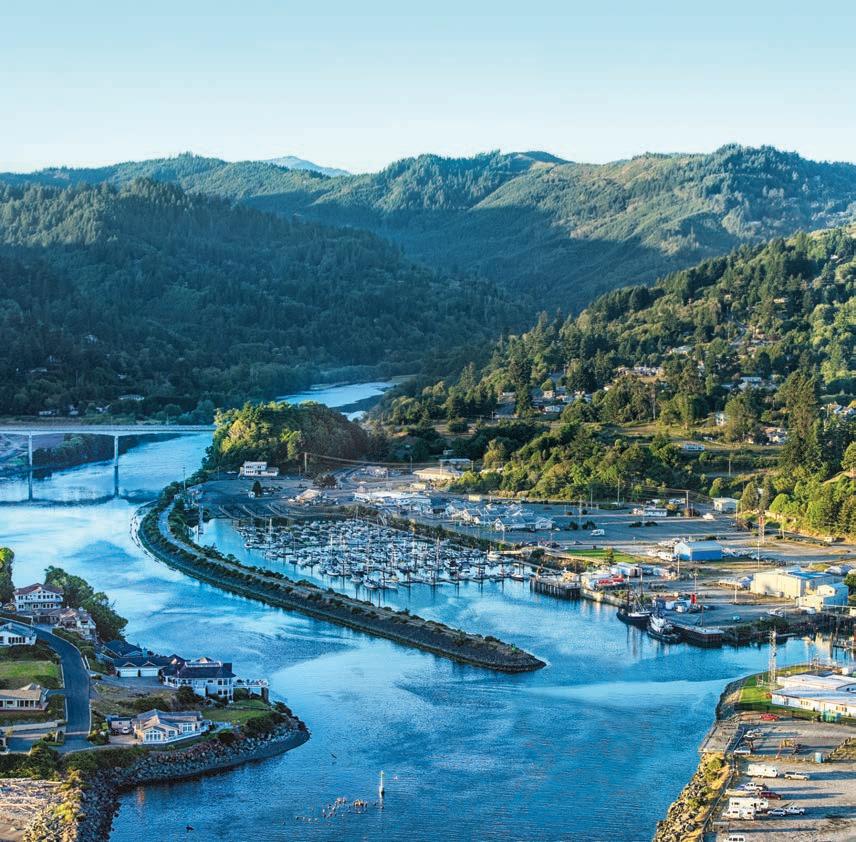
Spring / Summer 2021 WILD RIVERS COAST NORTHERN CALIFORNIA/SOUTHERN OREGON TOURIST GUIDE GO 2023 SPRING EDITION (707) 460-6727 www.triplicate.com (541) 813-1717 www.currypilot.com (707) 460-6727 www.triplicate.com (541) 813-1717 www.currypilot.com DISCOVERHiddenGems PRISTINERivers SECLUDEDBeaches DISCOVERHidden PRISTINE SECLUDEDBeaches SPRING/SUMMER WILDRIVERSCOAST NORTHERNCALIFORNIA/SOUTHERNOREGONTOURISTGUIDE GO GO 2022 FALL EDITION (541) 266-6079 www.theworldlink.com 2022 Fall Go 1-25.indd 1 9/30/22 7:10 AM (541) 266-6079 www.theworldlink.com Cover photo provided by John Kratt


Page 2 - 2022 Fall GO Wild Rivers COAST ™ Family Owned & Operated Since 194 6


2022 Fall GO Wild Rivers COAST - Page 3
INTRODUCTION
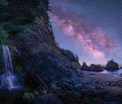
With its lofty trees, the tallest on the planet, rugged coastline and crystalline rivers, it’s easy to get lost in the beauty of the Wild Rivers Coast and northern California.
Under the eaves of a redwood forest or in a kayak on one of the many streams in the area, visitors come to the area every year to experience what it has to offer.
But for those who aren’t sure what to expect when they get here, the Go Wild Rivers Coast recreation guide can be a compass to local attractions, hidden gems as well as amenities like lodging and dining.
In using this guide, where should you begin? While the table of contents is the most logical place, here are some other useful sections in this guidebook to orient yourself and plan your travels.
Perhaps you already have a short list of things you’d like to see and do: the table of contents will guide you to specific articles with more information about topics such as beaches, camping, the redwoods, roadside attractions, golf courses, casinos and more.

Page 4 - 2022 Fall GO Wild Rivers COAST
WELCOME CENTERS
Welcome to the Wild Rivers Coast.
The hidden-away home of some of the most beautiful natural settings in the world.
Visitor centers throughout the region can be helpful for tourists looking for the area’s attractions or needing a place to stay, and for local residents eager to take a hike and learn alongside a naturalist.
The dual purposes are appropriate, according to Debbie Savage.
“I just encourage people to explore what’s in your own backyard that people travel from around the world to see,” said Savage, acting chief of interpretation for Redwood National and State Parks.
COOS BAY
Coos Bay Visitor Information Center
50 Central Ave., Coos Bay (541) 269-0215 or coosbay.org/visiting
Summer hours: Mon. - Fri, 9 a.m. - 5 p.m., Sat and Sun from 10 a.m. - 2 p.m. Winter hours: same with the exception of no hours on Sunday.
BANDON
Bandon Visitor Center
300 SE Second St., Bandon (541) 347-9616 or info@bandon.com
Hours: 10 a.m. to 4 p.m. Mon.- Sat. 1 p.m. to 4 p.m. Sun.
The Bandon Visitor Center is located in Bandon’s historic Old Town.
PORT ORFORD
Port Orford Visitor Center
520 Jefferson St., Port Orford (541) 332-4106
Hours: 10 a.m. to 4 p.m. daily; Starting in October: 10 a.m. to 2 p.m. daily
The Port Orford Visitor Center overlooks beautiful and historic Battle Rock Park. It provides a scenic place to stretch your legs and pick up information about the area.
GOLD BEACH
The Gold Beach Visitor Center
94080 Shirley Lane, Gold Beach (800) 525-2334
Hours: 9 a.m. to 4 p.m. 7 days a week
Website: www.visitgoldbeach.com
BROOKINGS
Oregon Welcome Center 14433 U.S. 101 South Brookings-Harbor
(just north of the California border) (541) 469-4117
Summer hours (May 15 to Nov. 1): 9 a.m. to 5 p.m. seven days a week
Winter hours (starting in November): 10 a.m. to 3 p.m. Fri - Mon
The Oregon Welcome Center is just the place to welcome weary travelers to the Beaver State. The 4,500-squarefoot center offers not only printed guides and maps to help visitors explore Oregon, it also is in the middle of a 40-acre state park.
The building offers spectacular views of the Pacific, and the park includes trails leading down to the beach and to the mouth of the Winchuck River.
The center includes restrooms that are open from daylight to dusk, picnic areas and RV parking.
2022 Fall GO Wild Rivers COAST - Page 5
Crescent City & Del Norte County Chamber of Commerce located at 1001 Front St., Crescent City, CA
Brookings Harbor Chamber of Commerce
703 Chetco Avenue/U.S. 101, Ste. C Brookings, in the historic Central Building (541) 469-3181
Hours: 10 a.m. to 2 p.m. Mon; 10 a.m. to 4 p.m. Tues; 10 a.m. to 5 p.m. Wed- Fri
The Brookings-Harbor Chamber of Commerce Oregon Visitor Center offers maps, brochures and travel information for local and regional attractions, businesses, hotels and parks.
Brookings Harbor
Visitor & Tour Center
16358 Lower Harbor Rd., Port of Brookings Harbor. 541-813-2300
Hours: 9 a.m. to 5 p.m. 7 days a week,
The center offers free maps, tidebooks, park guides and bookings for local fishing, kayaking and photography tours. Rentals are available for crab pots, ocean and river kayaks, and bicycles. A gift shop features locally-made artwork.
Brookings Visitor Center
898 Elk Drive, Brookings (City Hall) (541) 469-1103
Hours: 9 a.m. to 4:30 p.m., Mon-Fri
The display includes brochures and maps of local hotels, fishing guides, state parks and various places of interest in Brookings and north and south of town. The city was recently designated as “Bike Friendly” and bicyclists are encouraged to refill water, take a break and get information about bicycling in the area. www.brookings.or.us
GASQUET
Gasquet Ranger Station
10600 U.S. 199, Gasquet (707) 457-3131
Hours: 8 a.m. to 4:30 p.m. Mon- Fri
This Smith River National Recreation Area visitor center provides information about the surrounding region’s campgrounds, trails, roads and river accesses. Permits, including for campfires, are sold here. The center also provides maps, videos, exhibits, books and souvenirs about the recreation area.
HIOUCHI
Hiouchi Information Center
U.S. 199 at Hiouchi (707) 458-3294
Hours: 9 a.m. to 4 p.m. winter 9 a.m. to 5 p.m. summer
This Redwood National and State Parks facility has books for sale and an auditorium that shows an introductory film about redwood forests. It’s located on U.S. Highway 199 across from the entrance to Jedediah Smith Redwoods State Park campground.
ORICK
Prairie Creek Redwoods State Park Visitor Center (707) 488-2039
Hours: Summer: 9 a.m. to 5 p.m., daily; Winter: 9 a.m. to 4 p.m., daily. Closed Thanksgiving Day, Christmas Day and New Year’s Day
This small visitor center features coast redwood forest, wildlife and history exhibits as well as Redwood National and State Parks junior ranger activity newspapers.
Kuchel Visitor Center
U.S. 101 adjacent to beach, Orick (707) 465-7765
Hours: Spring to fall: 9 a.m. to 5 p.m., daily; Winter: 9 a.m. to 4 p.m., daily; closed Thanksgiving Day, Christmas Day and New Year’s Day
The other main informational center for Redwood National and State Parks is lo-
cated west of Orick. This facility includes an array of exhibits, maps and parks information as well as a bookstore.
CRESCENT CITY
Crescent City Information Center
Redwood National and State Parks
1111 2nd St., Crescent City (707) 465-7335
Hours: 9 a.m. to 5 p.m. spring to fall; winter hours to be announced; closed Thanksgiving Day, Christmas Day and New Year’s Day
This facility serves as the main information center in Del Norte County for Redwood National and State Parks. The center provides maps, orientation information for parks and details about ranger-led programs. The center also hosts a small shop that sells books and souvenirs.
Crescent City/Del Norte County
Chamber of Commerce Visitor Center
1001 Front St., Crescent City (707) 464-3174
Hours: Summer: 9 a.m. to 5 p.m. seven days a week; Winter (after Labor Day): 10 a.m. to 4 p.m. Tues through Sat
This center offers maps, travel information, tourism magazines, a small selection of merchandise and information on local attractions. It also provides literature about RV parks, hotels and restaurants.
Jedediah Smith Redwoods State Park Visitor Center
U.S. 199 at Hiouchi (707) 458-3496
Hours: May 31-Sept. 30: 9 a.m. to 5 p.m. seven days a week
A small visitor center near the campground amphitheater where evening campfire programs take place.
Page 6 - 2022 Fall GO Wild Rivers COAST
GO BANDON

Discover the northernmost city along the Wild Rivers Coast.
Named “the coolest small city” by Budget Travel. It’s easy to see why. Bandon is located in beautiful Coos County.
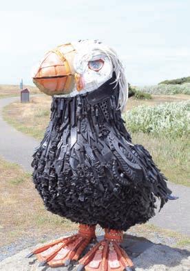
Bandon offers an array of possibilities, from plein air spots where artists can capture scenic moments along the docks to the interactive nonprofit Washed Ashore! where visitors learn about recycling and plastic pollution in the ocean.
The nearby Coquille River Lighthouse takes visitors back to the seafaring days of old.
DON’T MISS THESE HIGHLIGHTS:
Bandon Cranberry Festival
The longest-running festival on the Oregon Coast continues the weekend of Sept. 9-10 in Bandon, featuring entertainment for the entire family.
Events will happen in Old Town, the Port of Bandon waterfront, Sprague Community Theater, Bandon City Park and Bandon High School.
Highlights of the 77th annual festival include a parade, festival market and street dance and so much more!
Local and regional farmers and artisans will be featured at Cranberry City and the Festival Market. Live music will be played all three days.
For more information visit: https://bandon.com/2023-cranberryfestival-events/

Cranberry Sweets and More
You’ll get bogged down in this unique store where the fruits of the local cranberry harvest — more than 100 growers grow the fruit on 1,600 acres — are dipped in smooth chocolate, baked in decadent bars, or otherwise prepared in caramels, cookies, jellies and fudge. Free samples are available!
The flagship store is a must-see for visitors and locals seeking gift baskets of lotion, jam and other goodies. The delicious taffies and brittle toffees could well lure them there.
The store is located in Old Town Bandon, 280 First St.
Coquille River Lighthouse
Cross the bridge north of Bandon, make a left into Bullards State Park and drive along the north bank of the Coquille River to reach this historic lighthouse.
The five-year project to build “The Light” ended in 1895; the octagonal brick and stucco building now houses the maps and equipment that were needed to run the facility back in the day. Docents there are so intimately involved with the lighthouse, it’s as if they had operated the light itself 100 years ago. Call 541-347-9475.
HIDDEN GEMS

Bandon Historical Society Museum — This museum, located in Bandon at 270 Fillmore St. and Highway 101, is housed in the second building to be constructed after the 1936 fire destroyed the city. Until 1970, this building was Bandon’s city hall. It features extensive displays that date back to the earliest pioneers and includes the Big Bandon fire of 1936. Call 541-347-2164.
Bandon South Jetty Park
A favorite among locals, this park is located at the mouth of the Coquille River and provides easy beach access and allows visitors to enjoy whale watching, kite flying, beachcombing and other recreational activities. There are restrooms and abundant parking available for visitors.
Sage Place — A studio for creative arts and art education, located at the corner of 11th Street and Elmira in Bandon. Visitors are encouraged to take a variety of art classes including stained glass, beading, photography, mosaic, bead making, carving, and painting. The drop-in glass fusing studio is perfect for beginners and young artists, open from 1 to 5 p.m., Thursday through Saturday. Call 541-329-0303.
2022 Fall GO Wild Rivers COAST - Page 7
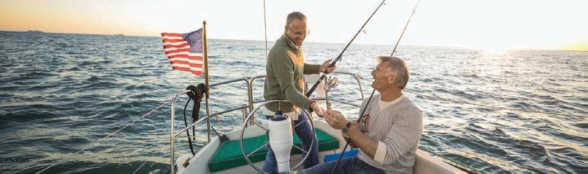
GO BOATING
BROOKINGS / GOLD BEACH
For anyone with a hankering for the taste of their own catch, there are some excellent charter services; whether you want ocean or river fishing, Brookings and Gold Beach have wonderful guides for both.
• Salmon King Lodge Guide Service (866) 877-8354
www.salmonkinglodge.com
• Fish Hawk River Company (541) 469-2422
• Early Fishing (541) 469-0525
• Wild Rivers Fishing Company and Brookings Fishing Company (541) 813-1082
• Allen’s Guide Service (541) 247-2082
• Bowman Rogue River Guide Service (541) 373-1647
• Bruce Craviotto’s Guide Service (541) 913-3759
• Cast Guide Service (541) 698-7029
• Chris Young Guide Service (541) 247-8115
• End of the Rogue Guide Service (541) 247-2049
• Ernie Rutledge (541) 247-6111
• Fish Oregon (541) 347-6338
• Five Star Charter/Gold Beach Adventure (541) 247-0217
• Greg Eide (541) 247-2608
• Helen’s Guide Service (541) 290-8402
• Jack Hunt (541) 247-6198
• John Carl’s Guide Service (541) 247-6400
• Jot’s Resort (541) 247-6676
• Lex’s Landing (541) 247-0909
• Mark Van Hook Guide Service (541) 247-6702
• Memory Makers Guide Service (541) 425-1515
• Rogue Outdoor Store (541) 247-7142
• Rogue River Guide Service (541) 247-4025
• Ross Bell (541) 247-2149
• Terry Kennedy Fishing Guide Service (541) 469-0337
• Tidewind Sport Fishing (541) 469-0337
• Tyson Crumley’s Guide Service (541) 698-8338
• Ultimate Catch Charter (541) 813-0330
For renting ocean or river kayaks:
• South Coast Tours (541) 373-0487 southcoasttours.net
• Riverside Market (541) 661-3213
CRESCENT CITY / DEL NORTE COUNTY
Del Norte County is known for its breathtaking beauty and awe-inspiring nature. Catch a glimpse of what the North Coast has to offer with one of the boating services; there’s also rafting, canoeing and kayaking for the more adventurous types. For the anglers, there’s fishing guides aplenty to haul in the perfect catch.
For a scenic boat ride on the Smith or Klamath rivers and/or guided fishing:
• Redwood Rides Adventure Outfitters (707) 951-6559 redwoodrides.com
For whale or bird watching, or ocean fishing out of Crescent City harbor:
• Tally Ho II (707) 464-1236.
For fishing guides in Crescent City, Gasquet and Klamath who tackle fish along the Smith or Klamath rivers:
• Catch My Drift Guide Service (707) 218-8066
• Gotcha Hooked Fish Trips (707) 464-8482
otchahookedfishtrip.com
• Green Water Fishing Adventures (707) 845-9588
greenwaterguides.com
• James Keeling’s Guide Service (707) 223-7438
• Kevin Brock’s Guide Service (800) 995-5543 fishkevinbrock.com
• Mike Coopman’s Guide Service (707) 218-4051
mikecoopmansguideservice.com
• Pacific West Coast Ocean Fishing Guide Service (707) 218-5573 pcwofishingguide.com
• Phil’s Smiling Salmon Guide Service (707) 487-0260
• Stella’s Adventures (707) 345-4990 stellasadventures.com
• Wild River Fishing Adventures (707) 498-4491, wildriverfishing.com
For boat rental, fuel or equipment in Crescent City harbor:

• Englund Marine Supply Company 191 Citizens Dock Road (707) 464-3230
• Indigo Creek Outfitters (541) 262-4535
indigocreekoutfitters.com
• Redwood Rides redwoodrides.com
Page 8 - 2022 Fall GO Wild Rivers COAST
You don’t have to bring your own boat to get out on the waters of the Wild Rivers Coast. Here are some services that can help.
GO LANGLOIS
Situated between Port Orford and Bandon
On the beautiful Oregon Coast Highway, Langlois (pronounced “Langless” by the locals) fits the bill of laid back fun.
Known as the “Wild Rivers Coast Windsurfing Capitol,” people flock to nearby Boice-Cope County Park, a small county park on Floras Lake featuring water sports and a campground.
THE LANGLOIS MARKET
Centrally located at 48444 Highway 101, this full service market is the meeting place for tourists, farmers and ranchers who need to stock up. Make sure to
stop in to enjoy the market’s famous, delicious hot dogs and “top secret” mustard! Hours are: Monday-Saturday 8 a.m. to 6 p.m., Sundays 10 a.m. to 5 p.m. Call 541-348-2476.
U-PICK BLUEBERRIES

This fantastic “U-Pick” location is a blueberry lovers dream come true!
The family-owned farm, located at 46760
Highway 101 (mile marker 291), practices organic farming methods since the 1950s. For the past 10 years, the Jensens have gone nearly exclusively U-pick, allowing customers to come out and fill a fourpound bucket with as many blueberries as possible for $10
Call the Jensens about picking season dates, admission, hours of operation at 541-348-2473, or e-mail them at jensenblueberrieslanglois@gmail.com.
-------- Floras Lake Getaway --------
If you are having any yearnings to “get away from it all,” you might think of the southern coast of France or Tuscany, Italy.
To your delight the southern coast of Oregon in Langlois (US101) will yield those same feelings and emotional excitement and release-Floras Lake Getaway.
A picturesque lake house separated from the ocean by the secretive sand beach spiritually forbids and dispels thoughts of COVID-19, Kiev, egg prices, cancel cul-

ture, and fuel costs, and even going to the dentist. Cancel your appointment with the psychologist for anxiety depression, adjustment disorder, now order up and treat yourself and loved ones for a few days at Floras Lake Getaway.
This retreat reminds me of more tranquil times. In the mist of the lake’s morning, I thought I saw Henry Fonda On Golden Pond enjoying himself trailing a light weight fishing line from
the stern of a small wooden boat. Yes, paddle boards and kayak are allowed. Swimming is possible and fishing is seasonally amazing. Someone well documented the story of the Coho salmon for the local river and streams. Look at their Instagram or go to floraslakerental.com for images. High vaulted ceilings of the main rooms overlook the lake and boat dock. With a 5000 sq ft main house with 6 bedrooms, your group can find repose or congenial-
2022 Fall GO Wild Rivers COAST - Page 9
ity. It is the geographic setting that complements the home’s allure. Just a 20-minute walk is the ocean to view and feel the breeze off famous cliffs. I do not know which is more spectacular the morning sunrise or evening sunset.
A return to the main house can set the day with eggs benedict before exploring the region. Christiane has her personal guidebook for each guest. Again, try paddle boarding or kayak from the dock.

Then off to Floras Lake Kite and Windsurfing. Calmer than Hood River on the Columbia – more for beginners and intermediate brave souls, the boys offer instruction too. Years ago, I stayed at the dorms of White Salmon (Hood River) and watched folks from around the world give command performances.
I was only a spectator. This lake could be your level. Maybe go to the ocean. The barrier beach and portions of Floras Creek flow north to create an ecosystem for Coho fry and migrating birds. Floras Lake State Natural Area includes Blacklock Point with trails through dense coastal forest. Kalmiopsis Audubon Society has protected the area from development and logging. Bring your cameras.
Back to main highway (US 101), I cannot recommend the Market’s worldfamous hot dogs, but otherwise a great country store. Going north for other regional excitement play one of the six courses of world-famous Bandon Dunes or more reasonably priced Bandon Crossing–also an excellent course. At the entrance to the Crossing is a jam
shop that will be a morning’s reminder from your trip. South is Port Orford and the active fishing fleet of 30 trawlers that must be hoisted daily to the high pier. Also remarkable is The Red Fish with Chris’s rather exotic gourmet offerings. Next door is a modern gallery (the other in Big Sur) with contemporary ceramics, sculptures, and oils.
All said and done either staying around the house, exploring the fantastic and memorable regional offerings, preparing unforgettable meals both inside and from an outside BBQ, sip Oregon wine and create those memorable moments with a serene evening along the southern Oregon Coast at Floras Lake Getaway. Contact: chris@floraslakerental.com. Website: https://floraslakerental.com/
Page 10 - 2022 Fall GO Wild Rivers COAST
W HEN YOU’R E IN N EED OF A G IFT, T HINK CHECKER BERRY ’S We hav e what you ’ re looking for, whether t hat ’ s a floral arrang ement, live indoor plant, women ' s apparel, home décor or outdoor garde n. Come see w hy we were voted Best flower and Best G ift shop on the South Coast. 1290 N Bayshore Dr, Coos Bay Or. 97420 (541)269 -5312 Find us on Facebook, Instagram and on the web.
GO PORT ORFORD


Nestled along Highway 101 about an hour north of the California border, Port Orford and Langlois offer a wealth of experiences for the outdoorsman, artisan, traveler and treasure-seeker.
Port of Port Orford
Picture a port without a harbor. The Port of Port Orford is one of only six “dolly docks” in the world, where vessels are lifted out of the water by two enormous cranes and then housed on custom made dollies. You would be hard pressed to find another place on earth where you can get such an up-close look at a fleet of fishing boats currently in use. Check out the boats in drydock, then stop in to Grif’s on the Dock, the local dock museum, gift shop and eatery. Directions: If you are coming from the south follow Highway 101 north, turn left on Washington Street and follow it down to the dock
Redfish Restaurant


Diners can view historic Battle Rock and coastline from this renowned oceanfront gourmet restaurant on Highway 101. The restaurant has won national acclaim from Tripadvisor and Wine Spectator and serves up vegetarian, seafood, meat and poultry dishes. When ever possible Redfish buys local produce and fresh fish directly from Port Orford. Visit their extensive wine gallery and check out Hawthorne Museum of contemporary art next door! Reservations are recommended. Call 541-366-2200
Battle Rock Park
Step into history at Battle Rock Park, home of the historic Battle Rock, where Captain William Tichenor and his men used the prominent sea stack to stave off waves of native combatants to eventually settle Port Orford. Directions: Approaching from the south on Highway 101, it’s on your left as soon as you get into town.
2022 Fall GO Wild Rivers COAST - Page 11
You
or
Homemade soups, pies and burgers too 259 6th Street • Port Orford, OR 2023 Traveler’s Choice Join our FB page 541-332-8601 WednesdaySunday Opens at 12:00 p.m.
could easily spend a day
two in the quaint communities of Port Orford and nearby Langlois during
your trip along the Wild Rivers Coast.
Battle Rock Wayside Park stuns the senses
By DAVID RUPKALVIS
Battle Rock Wayside Park stuns the senses
If you say the name Battle Rock Wayside Park, I would expect few people would know exactly where it is. But if you have ever driven south on Highway 101 to Gold Beach, I promise you have seen it.
By DAVID RUPKALVIS
If you say the name Battle Rock Wayside Park, I would expect few people would know exactly where it is. But if you have ever driven south on Highway 101 to Gold Beach, I promise you have seen it.
When you make that drive from Coos County, almost the entire trip is through the forest. As you move through Port Orford, near the end of town, you make a left on Highway 101. And then to your right, the Pacific Ocean emerges. No matter how many times you have made the trip, the view is breathtaking. That is Battle Rock Wayside Park.
When you make that drive from Coos County, almost the entire trip is through the forest. As you move through Port Orford, near the end of town, you make a left on Highway 101. And then to your right, the Pacific Ocean emerges. No matter how many times you have made the trip, the view is breathtaking. That is Battle Rock Wayside Park.
Here’s my advice. Stop and spend some time at the park. First, the city of Port Orford, which has the Battle Rock as a city park, does an excellent job maintaining and telling the story of Battle Rock Park. The city has placed extensive signage in the area telling the story of the park, the beach and the animals that live in the area.
Here’s my advice. Stop and spend some time at the park. First, the city of Port Orford, which has the Battle Rock as a city park, does an excellent job maintaining and telling the story of Battle Rock Park. The city has placed extensive signage in the area telling the story of the park, the beach and the animals that live in the area.
There is plenty of parking, clean bathrooms and paved trails to and from the beach. In the spring, the trail down to the beach is surrounded by flowers, adding to the surprise. But the real treat is down on the sand near the water.
There is plenty of parking, clean bathrooms and paved trails to and from the beach. In the spring, the trail down to the beach is surrounded by flowers, adding to the surprise. But the real treat is down on the sand near the water.
A sign I saw leading down to the sand talked about the sea life in the area, listing no less than 26 different kinds of sea life that can be seen in the area. I didn’t see them all, but it would be almost a treasure hunt to search for the species one by one.
A sign I saw leading down to the sand talked about the sea life in the area, listing no less than 26 different kinds of sea life that can be seen in the area. I didn’t see them all, but it would be almost a treasure hunt to search for the species one by one.
The different animals, birds and grasses can be seen at different times and locations depending on the tides. They range from surf grass and sea cabbage to anemone, urchins and sea cucumbers. The 26 on the list doesn’t even include the birds that are flying in the area.
The different animals, birds and grasses can be seen at different times and locations depending on the tides. They range from surf grass and sea cabbage to anemone, urchins and sea cucumbers. The 26 on the list doesn’t even include the birds that are flying in the area.
If you visit the park, go to both sides of Battle Rock. When you walk down to the beach, you will likely be on the left of the rock. On that side, there are miles of
If you visit the park, go to both sides of Battle Rock. When you walk down to the beach, you will likely be on the left of the rock. On that side, there are miles of
beaches in front of you and water as far as you can see.
beaches in front of you and water as far as you can see.
But on the other side it feels almost like a private beach. Battle Rock serves as a protector, slowing the waves and the water. A small cove has been created, which offers a quiet place to sit or even play in the water.
But on the other side it feels almost like a private beach. Battle Rock serves as a protector, slowing the waves and the water. A small cove has been created, which offers a quiet place to sit or even play in the water.
Every time I visit the rocky beaches, I am surprised by the smooth rocks and pebbles on the beach. As rocks bounce around the ocean, moving the sand and salt, it smooths them almost to a polish. It reminds me of the rocks I used to purchase to put in fish tanks.
Every time I visit the rocky beaches, I am surprised by the smooth rocks and pebbles on the beach. As rocks bounce around the ocean, moving the sand and salt, it smooths them almost to a polish. It reminds me of the rocks I used to purchase to put in fish tanks.
Getting to Battle Creek Wayside Park is easy. From Coos County, head south on Highway 101 and drive for about an hour. When you see the Pacific Ocean, you have arrived. From most of Curry County or Northern California, head north on Highway 101. As soon as you hit Port Orford and go down the hill, it will be on your left.
Getting to Battle Creek Wayside Park is easy. From Coos County, head south on Highway 101 and drive for about an hour. When you see the Pacific Ocean, you have arrived. From most of Curry County or Northern California, head north on Highway 101. As soon as you hit Port Orford and go down the hill, it will be on your left.
Page 12 - 2022 Fall GO Wild Rivers COAST
GO SHORE ACRES
 By DAVID RUPKALVIS The World
I heard about Shore Acres almost immediately after I arrived in the area, but I intentionally avoided it because I wanted my wife and children to experience it with me the first time.
So, we made our way through Charleston and went to Shore Acres as a group. During the cooler months, it is not overly crowded, so there was plenty of parking and plenty of space to avoid others.
After getting out of the car, you immediately see the Pacific Ocean pounding against rocks. During whaling season, you can also apparently catch glimpses of the whales as you walk by.
As we walked through the trail, we followed my youngest son, who often takes the trail less traveled. Every one of his trails ended with another view of the ocean, with waves pounding into the rocks below.
When we reached the botanical gardens, Shore Acres is most known for, we eagerly went inside. Early March is not the best time to visit the gardens, but it was still amazingly beautiful. Many of the flowers, and the rose garden, will be in full bloom in May, but even in early March there was a lot to see. A variety of trees, complete with signs explaining what they are, stand proudly in the garden. Even in March, some of the flowers were starting to bloom. A group of deer grazed just outside, adding more mystery to the air.
For me, the highlight of the gardens was simply the peace. It was quiet, with only the occasional bird chirping to break the silence. After walking through the gardens, we con-

tinued down the trial only to find what on that day was our own little private beach. Simpson Beach is just a short walk from the gardens, but it opens a new world to explorers, especially little explorers.
We hit the beach at low tide, which I highly recommend. With the water out, we got to climb around rocks and find a variety of tide pools to explore. Inside the tide pools, my children found living sea anemones that moved around as the water moved nearby.
There were sea snails and hermit crabs on the edges of the pools and small fish left behind waiting for the ocean to return. A whole area was covered in mussels, which we did our best to avoid as we explored.
My wife and son even ventured up to a cave, looking inside a little, although slippery rocks and the darkness inside drove them away before going in much.
In a brisk March morning, it was chilly with a steady breeze, but we had a hard time leaving. After about three hours, we made our way back out of Shore Acres fully content.
While many areas around are free, there is a $5 per car charge to visit Shore Acres. Believe me, it’s money well spent.
Talking to those who work there, it sounds like the best time to visit it probably late May through the summer as the flowers are in full bloom. But even in the winter, it was well worth the visit. If you can, shoot for low tide. It’s worth it.
To reach Shore Acres from Coos Bay, fol-


low the signs for state parks and beaches through Charleston. Follow Cape Arago Highway past Sunset Beach and the park will be on your right.
2022 Fall GO Wild Rivers COAST - Page 13


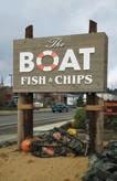


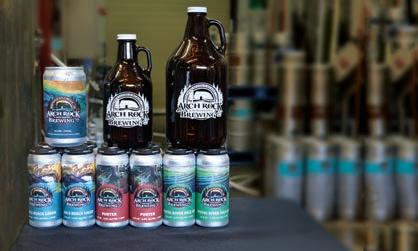
Page 14 - 2022 Fall GO Wild Rivers COAST Tasting Tour THE BOAT FISH & CHIPS 102 Hall Ave., Coos Bay, OR 97420 (541) 808-9500 to our customers for voting us FAVORITE SEAFOOD on the South Coast Thank you 2ndPlace 2022 NOW CANNING OUR 3 SIGNATURE BEERS! Featuring local artist Spencer Reynolds Find our BEER on tap and in stores throughout Oregon 541-247-0555 28779 Hunter Creek Loop Gold Beach OR, 97444 TUESDAY - FRIDAY 11 am - 6 pm SATURDAY 11 am - 5 pm Tasting Room Hours:
Novelty Oct. 1907
Alvarado
March 1945
Sujameco
Feb. 1929
The shipwreck recently discovered on the North Spit has been identified as the schooner, G.L. Olson. It ran aground near Guano Island on June 23, 1944.
Czarina Jan. 1910
25 deaths
New Carissa Feb. 1999
Captain Lincoln Jan. 1852
Sacramento Oct. 1905
6� deaths
Arago
Marconi March 1909
Santa Clara Nov. 1915
14 deaths Brush
April 1923
3 MILES N
Alaska Cedar Dec. 1962
Cygnet March 1962
1 death
YMS-133
Feb. 1943
13 deaths
Fort Bragg
Sept. 1932
Oct. 1896
13 deaths
C.A. Smith
Dec. 1923
9 deaths
Empire JettyNorth CoosBay
North Bend
Sept. 1940
G.L. Olson
June 1944
Advent Feb. 1913
Wm. T. Rossell
Sept. 1957
4 deaths
Charleston
The World, Coos Bay, Ore SOURCE: Coos County Historical and Maritime Museum.
World
© 2008
2022 Fall GO Wild Rivers COAST - Page 15
Charleston NorthSpit Cape
North Bend Coos Bay Coos Bay South Jetty
Remains of the G.L. Olson drifted to the North Spit after being towed out to sea
Shipwrecks off Coos Bay
From
Locations of significant shipwrecks off Coos Bay. The number of wrecks testify to the hazards of seagoing navigation.
Graphic by Jeff Trionfante
the Victor West collection.
Chas W. Wetmore Sept. 1892
Arago
GO PREHISTORIC
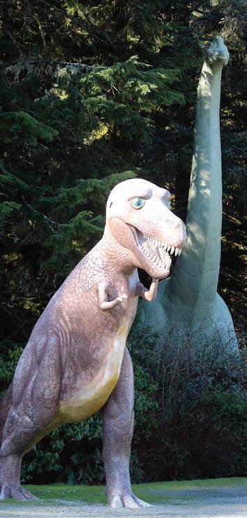
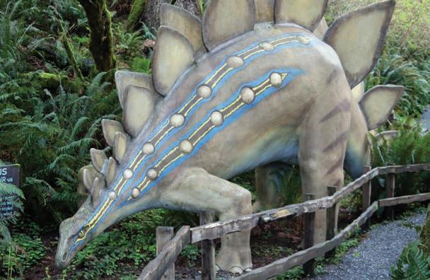
Dinosaurs lurk in an old-growth rain forest with 350-year-old trees, lush ferns and foliage plants

.
Kids, trailed by parents taking photos, excitedly follow a hand-drawn map from 40 years ago through the park that contains 23 life-size, prehistoric reptiles tucked amidst and sometimes towering above the abundant growth of native plants.
Both plants and dinosaurs have a long history at this place located halfway between Gold Beach and Port Orford on U.S. Highway 101.

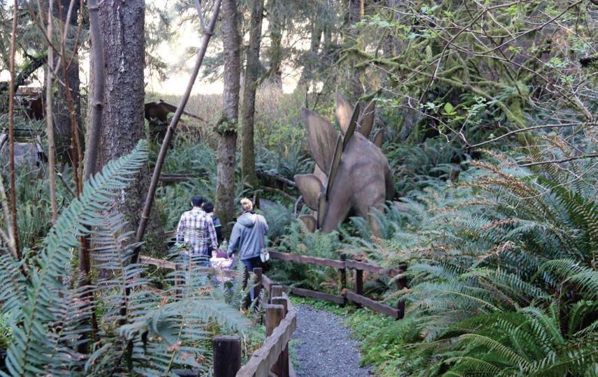
Prehistoric Gardens, after 65 years in business, is still a famous roadside attraction that is now owned and managed by Kiki McGrath. The site is a labor of love of McGrath’s family since opening in 1955. Her grandfather, Ernie Nelson, at the age of 47, and his wife Kari sold his accounting business and their Eugene home in the early 1950s to purchase the original 77 acres, according to the documentary “Strange Inheritance: Dino Park.”
Nelson dreamed of creating a roadside attraction filled with dinosaurs.
“When you have an absolute passion for something, you think other people feel the same way you do,” said his daughter Bennie Worthington in the documentary.
The gamble paid off as the U.S. highway system was developed, travel by auto became popular, and roadside attractions were prolific and popular. McGrath says during the summer season, visitors still number 200 a day.
The life-size dinosaurs are constructed with steel frames with metal lathe that is molded over the frame, then they are plastered with cement and painted. The first sculpture Nelson made, and the largest, is a Brachiosaurus that is 46 feet tall and 86 feet long. It took him 4 years to build it and required
constructing a scaffold to do the work. “The Brachiosaurus was his pride and joy,” said McGrath, pointing to a framed photo of him standing beneath the creature between its front legs.
An interpretive sign informs guests that the largest dinosaur’s live weight was estimated to be 85 tons, and he was a plant-eater from the Cretaceous period — about 125 million years ago.
The park signage provides fun facts about each of the sculptures, as well as all the indigenous plants. A spring-fed creek meanders through the grounds, with an accessible path that winds past each vignette.
Nelson engineered the sculptures based on his drawings of skeletal
Page 16 - 2022 Fall GO Wild Rivers COAST
Story by Linda Pinkham
remains and fossils found and placed in natural history museums.
“He always drew,” Worthington said in the documentary. “He came out of the womb with a pen.”
Over 30 years, Nelson constructed 23 dinosaurs.
While the sculptures are scientifically correct, the paint colors were designed to be fanciful, attractive and photogenic as a tourist attraction.
“People would ask him ‘How did you know what colors they were?’ and he said, ‘Well no one knows. It’s the artist behind the paintbrush.’ Birds are very colorful, lizards are very colorful, but we don’t know,” McGrath said.
With an average rainfall of between 6 and 10 feet per year, ferns grow to gigantic size and even the common skunk cabbage develops huge tropical leaves. Known as a temperate zone rainforest, this primeval garden developed because of its location; nestled in a valley pocket and therefore protected from the fierce winter storms that sweep the Pacific.
The landscaping requires a lot of upkeep.
“You don’t have to water anything but we do have to cut things back when it starts growing,” she said. “Some of the skunk cabbage leaves get to be about 7 feet tall.”
The dinosaurs also have upkeep. During a wind storm over the winter, one of the giant trees fell in the park on two of the sculptures. They are in the process of being repaired.
A small gift shop on the property has souvenirs for dinosaur lovers of all ages, from plush toys and coloring books for kids to fossils, agates, apparel and more for
“kids” of all ages.
Over the years, family members have helped operate the park. McGrath’s mother worked in the gift shop for a long time, and her uncle helped with building some of the park’s features. McGrath has worked at the park for 40 years.
“It’s a lot of work,” she said. Her grandparents have been gone for 21 years.
According to “Strange Inheritance,” Nelson passed away in 1999 at the age of 91. His wife Kari died soon afterward. The property was left to McGrath, her mother and her uncle. The property was listed for sale, but Kiki decided she didn’t want to sell the park. The acreage was split up, with 33 acres containing the park going to Kiki. The other 44 acres sold for $1.6 million.
“I’d like to keep the legacy going,” McGrath said. She is confident that her daughter and son would keep it going after she retires.
The park is open daily in winter (except during extreme weather) from 9 a.m. to 5 p.m. and until 6 p.m. in summer. To learn more, visit www.prehistoricgardens.com.
2022 Fall GO Wild Rivers COAST - Page 17
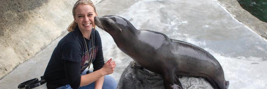
Marine mammals always a delight
Marine mammals always a delight
By DAVID RUPKALVIS The World
By DAVID RUPKALVIS The World
Exploring the southern coast of Oregon and the northern coast of California allows those of us lucky enough to live here the opportunity to see some amazing things.
Exploring the southern coast of Oregon and the northern coast of California allows those of us lucky enough to live here the opportunity to see some amazing things.
We are fortunate to live in one of the most amazing places in the world, a place where Mother Nature makes every day look like a work of art.
We are fortunate to live in one of the most amazing places in the world, a place where Mother Nature makes every day look like a work of art.
As my family and I drive around, it is still common to hear us oohing and awing just because of the scenery. Where else in the world can use see deep into the forest and be on the beach only minutes later?
As my family and I drive around, it is still common to hear us oohing and awing just because of the scenery. Where else in the world can use see deep into the forest and be on the beach only minutes later?
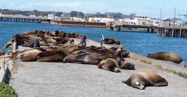
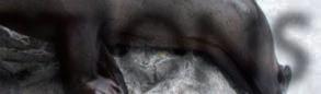
While I have written repeatedly about the amazing things we can see here, one thing I’ve seen a few times has left me in awe. As I’ve traveled the area, I feel fortunate that I’ve been able to see some amazing marine mammals. Seals, sea lions and more always make me stop every time I see one.
While I have written repeatedly about the amazing things we can see here, one thing I’ve seen a few times has left me in awe. As I’ve traveled the area, I feel fortunate that I’ve been able to see some amazing marine mammals. Seals, sea lions and more always make me stop every time I see one.
found them. At the edge of the harbor, the animals, mostly California sea lions, congregate on man-made rocks to sun. They could be seen clearly, but they were still a ways off.
found them. At the edge of the harbor, the animals, mostly California sea lions, congregate on man-made rocks to sun. They could be seen clearly, but they were still a ways off.
Since then, every time I go to Crescent City, I head back to the harbor, just in case.
Since then, every time I go to Crescent City, I head back to the harbor, just in case.
Days after I moved to Oregon, I made a trip to Brookings and Crescent City, California with my boss. While showing me around Crescent City, we stopped at the harbor, and I heard the distinct sounds of sea lions. But despite looking for 10 minutes, I never saw one.
Days after I moved to Oregon, I made a trip to Brookings and Crescent City, California with my boss. While showing me around Crescent City, we stopped at the harbor, and I heard the distinct sounds of sea lions. But despite looking for 10 minutes, I never saw one.
That just made me determined to get closer to the marine mammals. After talking to some people at my office, I was told to the top of Cape Arago and look around. So, of course, I did. At the very top, if you park and go to the right, following the trails as far they go, the trail ends overlooking some rocks in the ocean.
Persistence paid off two times. Once I went to the harbor and got out and started walking around. As I moved around the harbor, I noticed something was in the water, and it was something big.
Persistence paid off two times. Once I went to the harbor and got out and started walking around. As I moved around the harbor, I noticed something was in the water, and it was something big.
That just made me determined to get closer to the marine mammals. After talking to some people at my office, I was told to the top of Cape Arago and look around. So, of course, I did. At the very top, if you park and go to the right, following the trails as far they go, the trail ends overlooking some rocks in the ocean.
Before long, I learned what it was. Seals were swimming through the water around the boats in a hunt for fish in the harbor. For close to an hour, I walked around watching as the seals, lots of seals, went up and down in the water. The only bad part is actually getting a good picture of the seals was difficult.
The day I went up, the rocks were covered with seals and sea lions. I admit, I jumped the fence to get a closer look, and it was pretty amazing. While many of the animals were sunning on the rocks, there were many jumping in and out of the water. I stood there for 20 minutes, just watching and listening to the animals living their lives.
The day I went up, the rocks were covered with seals and sea lions. I admit, I jumped the fence to get a closer look, and it was pretty amazing. While many of the animals were sunning on the rocks, there were many jumping in and out of the water. I stood there for 20 minutes, just watching and listening to the animals living their lives.
Before long, I learned what it was. Seals were swimming through the water around the boats in a hunt for fish in the harbor. For close to an hour, I walked around watching as the seals, lots of seals, went up and down in the water. The only bad part is actually getting a good picture of the seals was difficult.
I tried repeatedly, but it felt like every time I hit the button to snap a photo, the seals went down into the water. I tried to guess where they might come up and failed every time there, too.
I tried repeatedly, but it felt like every time I hit the button to snap a photo, the seals went down into the water. I tried to guess where they might come up and failed every time there, too.
I was able to get some photos from the top of the harbor, but if the seals noticed I or anyone else, was close by, they quickly disappeared into the depths.
But even then, the creatures were a long ways off. I could see them, I could hear them, but I didn’t get a close-up experience.
But even then, the creatures were a long ways off. I could see them, I could hear them, but I didn’t get a close-up experience.
A few weeks later, I was back in Crescent City, so I went back to the harbor and back on the hunt for the marine mammals. This time, I
A few weeks later, I was back in Crescent City, so I went back to the harbor and back on the hunt for the marine mammals. This time, I
I was able to get some photos from the top of the harbor, but if the seals noticed I or anyone else, was close by, they quickly disappeared into the depths.
I found out later, schools of fish swim into the harbor as a way of evading larger fish that are hunting. In doing so, they swam right into a trap, with the seals waiting to eat.
I found out later, schools of fish swim into the harbor as a way of evading larger fish that are hunting. In doing so, they swam right into a trap, with the seals waiting to eat.
It was quite an experience to be that close as seals gorged themselves.
It was quite an experience to be that close as seals gorged themselves.
A little while later, I was back in Crescent City and I went back to where I first noticed the sea lions. This time I was in for quite the surprise. Whereas the sea lions had been out in the water before, this time they were sunning on a pier right on shore.
A little while later, I was back in Crescent City and I went back to where I first noticed the sea lions. This time I was in for quite the surprise. Whereas the sea lions had been out in the water before, this time they were sunning on a pier right on shore.
I was able to get so close to the animals, I could even smell them. For the record, it is not a pleasant smell.
I was able to get so close to the animals, I could even smell them. For the record, it is not a pleasant smell.
But from that distance, I and others stood in awe watching creatures bigger than I am moving easily in and out of the water and scrambling quickly onto the pier. I enjoyed every minute of it, and send dozens of photos to my wife.
But from that distance, I and others stood in awe watching creatures bigger than I am moving easily in and out of the water and scrambling quickly onto the pier. I enjoyed every minute of it, and send dozens of photos to my wife.
I can’t give you a specific spot to find marine mammals for certainty, but they are out there. Crescent City seems to have a steady dose, they can be seen and heard around Coos Bay, one time we even saw a bunch of seals sunning in Gold Beach.
I can’t give you a specific spot to find marine mammals for certainty, but they are out there. Crescent City seems to have a steady dose, they can be seen and heard around Coos Bay, one time we even saw a bunch of seals sunning in Gold Beach.
If you want to see marine mammals for yourself, just keep your eyes peeled when moving around the ocean. One time I saw a whole herd sunning on the beach between Gold Beach and Port Orford. I would suggest listening, too. You often hear them before you can see them. If you’re lucky, you might even get close enough to smell them.
If you want to see marine mammals for yourself, just keep your eyes peeled when moving around the ocean. One time I saw a whole herd sunning on the beach between Gold Beach and Port Orford. I would suggest listening, too. You often hear them before you can see them. If you’re lucky, you might even get close enough to smell them.
We all know there are animals in the ocean that are bigger than we are. But seeing one is rare, with the exception of the sea lions that seem to enjoy showing off in close proximity.
We all know there are animals in the ocean that are bigger than we are. But seeing one is rare, with the exception of the sea lions that seem to enjoy showing off in close proximity.
Page 18 - 2022 Fall GO Wild Rivers COAST
Photos by David Rupkalvis
While marine mammals can be seen throughout Southern Oregon and Northern California, Crescent City has some of the best places to get a look. At the harbor in Crescent City, sea lions are a constant year round while seals get up close and personal while hunting near the boats.
Page 22 - 2022 GO Wild Rivers COAST
Photos by David Rupkalvis
While marine mammals can be seen throughout Southern Oregon and Northern California, Crescent City has some of the best places to get a look. At the harbor in Crescent City, sea lions are a constant year round while seals get up close and personal while hunting near the boats.
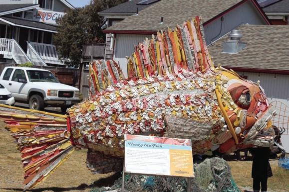
Turning trash into treasure to teach a lesson
By DAVID RUPKALVIS For The World
A Bandon art gallery with a mission far greater than just art is growing and expanding in its mission to keep trash out of the ocean. Washed Ashore, with a gallery at 325 2nd Street SE in downtown Bandon has artwork displayed in Bandon, Coos Bay and, frankly, throughout the nation.
Washed Ashore opened in 2010 when Angela Haseltine Pozzi came up with an idea to make art out of trash that washes up on beaches in the area. Pozzi, who also serves as artistic director, joined with artist Steve Wright to create masterpieces that are made almost fully out of trash.
Washed Ashore collects trash that has been removed from beaches through volunteer cleanup efforts as well as trash collected by park rangers. The items are then cleaned and used to make massive sculptures.
“We will definitely pick up whatever they find and turn it into some awesome sea creatures,” said former gallery Manager Cameron McGrew said. And by doing so, Washed Ashore hopes to spread a bigger message about keeping trash out of the ocean.
“We’re an education-based nonprofit,” McGrew said. “Our goal is to educate the public. We’ve actually done viewings in Canada. We’ve been all over the United States.”
Washed Ashore also has pieces in the Smithsonian, Florida Aquarium and different aquariums and zoos across Oregon.
But the home base is and has always been in Bandon. It is there where Pozzi and Wright come up with their ideas and it is there
where volunteers help put together the sculptures piece by piece.
After more than a decade of cleaning beaches and creating stunning art from what was collected in Bandon, Washed Ashore added a second operation in Coos Bay.
The nonprofit that uses art to spread the message of keeping plastic and other trash out of the ocean will always call Bandon home, but Washed Ashore will now create its sculptures at a warehouse it recently moved into in Coos Bay.
“We needed a place to refurbish,” Executive Director Katie Dougherty said. “The plastic breaks down, so when they come back, we need the space. It’s really the launching pad, whether it is a new build or whether it’s going to refurbished and sent on the way.”
The end result is larger than life sculptures, all showcasing sea creatures and all made from trash. “We’re cleaning the beaches, we’re educating the public and trying to engage the community,” McGrew said.
While most of the sculptures or made of plastic, some include Styrofoam, nets from fishing boats and more. The biggest problem, though, remains plastic. The issue is plastic never fully degrades, so it can remain in the ocean for years and years. And during that time, it can cause havoc on animals that live and rely on the sea. Washed Ashore is trying to spread the message that most plastic use is not necessary. At the gallery, they offer water in biodegradable milk cartons.
“Plastic is necessary to an extent,” McGrew said. “But the single-use plastic is what we’re trying to avoid, things like single-use soda
bottles, plastic wrapping around food that you’ll just take off and throw away.”
Wright has been working with Washed Ashore as an artist for four years. He said turning trash into art is a challenge, even for an experience artists like him. He said being in the Coos Bay warehouse was a big step, giving the artists room to store the plastic that was cleaned up and room to create larger sculptures. He also praised the volunteers that help with every piece.
“I can’t say how much everyone helps,” he said. “All he volunteers are so important to help make this. This is my new home. It’s hard to get away from here actually.”
Wright said the day Washed Ashore moved in, work on sculptures continued. A tiger rockfish sculpture recently unveiled in Bandon was the first created in the new space. He said when one sculpture is finished, work immediately begins on another one.
“We usually move right into another one,” he said. “I already know of two coming up. We’re doing a corral reef next for our own exhibit.” Wright pointed around the warehouse that was filled with totes of different plasticsbottles, fishing gear, toys and much more. “Everything you see is off our beaches or the ocean,” he said.
Brad Parks, the conservation and education director for Washed Ashore, said having a location is Coos Bay is already paying off. “The connection to the community and the businesses that have already welcomed us is amazing,” Parks said.
“Even with what Washed Ashore has already done, we have a bigger job in front of us.”
He said the COVID-19 pandemic has lead to a new wave of trash in the ocean - masks, gloves and medical waste. “Even more than ever, Washed Ashore is in the position where we have so much to do,” Parks said.
To make the point, McGrew likes showing a sculpture in the museum. Made largely of plastic water bottles, the majority of the bottles came from the Olympic games in Beijing, China. They washed ashore near Bandon several years later.
“Everything you buy is a vote,” McGrew said. “So, if you choose to buy boxed water, for example, you’re voting with your wallet every time you make a purchase. If we were to all just stop buying plastic soda bottles, they would get the message.” Instead, McGrew said, buy aluminum, glass and paper products that can be easily recycled.
When visitors come to Washed Ashore, McGrew or other docents will start conversations with visitors to showcase the importance of voting with their wallets. And, once again, Washed Ashore is opening and spreading that message. As a nonprofit, the gallery relies on donations, volunteers and grants. It is also now making decent money loaning its finished products to museums and other places around the country.
Inside the gallery is still the best place to get a look at the work. There are over 85 sculptures in the gallery, with the largest probably a parrot fish that is 9-1/2 feet tall, 14 feet long and six feet wide.
The Washed Ashore Gallery will be open from noon to 5 p.m. Tuesday, Wednesday and Thursday and 11 a.m. to 5 p.m. Friday and Saturday.
2022 Fall GO Wild Rivers COAST - Page 19
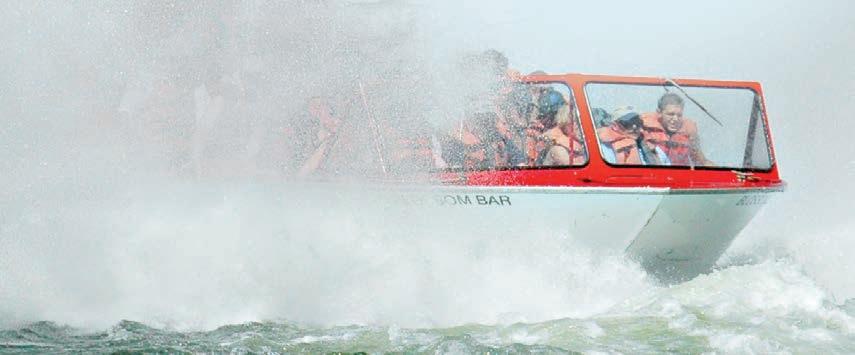
GO JET BOATS
Jerry’s Rogue Jets & Rogue River Mail Boats
Embark on a Gold Beach-based jet boat tour on the mighty Rogue River — one of the original eight Wild Rivers designated in 1968 for federal protection — with Jerry’s Rogue Jets and Mail Boats.
In the 1940s and ’50s, the original Rogue River boat tours traveled only 32 miles upriver to the town of Agness. A lunch break at one of the Agness lodges was routine; then the boat traveled downstream back to Gold Beach. In the mid-1960s the advent of Hydro-Jets enabled boatmen to test their nerves in the 20-mile wild section, which is filled with boiling white water rapids.
Jerry’s Rogue Jets has been in operation since 1958 and Rogue Mail Boats has been in operation since the 1930s. The two companies joined forces in 2010 and now offer three river tours: the original 64mile scenic tour to Agness and the more action-filled 80- and 104-mile white-water tours. The 104-mile trip
takes the river traveler to the rugged, boulder-filled Blossom Bar rapid, the end of the power-boat-navigable portion of the river.
All excursions return to the small hamlet of Agness for the daily lunch and dinner stop and rest breaks. Three lodges — Cougar Lane, Singing Springs and Lucas Lodge offer a variety of meal service options.
The Rogue River canyon abounds in a variety of native wildlife. All river tours are hosted and narrated by veteran river pilots who spot wildlife and will maneuver the boat for prime photo opportunities. Hydro-Jet technology allows the fully loaded vessels to skim the shallow riffles effortlessly.
Jerry’s Rogue Jets and Mail Boats operate between May 1 and Oct. 14 and their office and 60,000-squarefoot asphalt customer parking lot is located along Highway 101 at the north end of Gold Beach at 29985 Harbor Way at the Port of Gold Beach. Also featured on their property is a free Rogue River museum, open yearround, which captures the rich history
of the Rogue canyon.
For information, call (800) 451-3645 or visit http://www.roguejets.com.
Klamath Jet Boat Tours

During the 45-mile, two-hour roundtrip excursion along the Klamath River, an experienced captain and narrator describes the river’s rich history, local Native American culture, and thriving wildlife. See if you can spot a bear, blacktail deer, elk, soaring osprey, eagles, hawks, otters, mink and many other varieties of wildlife by looking carefully along the riverbanks.
From May 1 to Sept. 30, tours run daily from 10 a.m. to 12 p.m., 1 p.m. to 3 p.m. and 4 p.m. to 6 p.m. Tickets are $47 for adults, $42 for seniors and military, $37 for teens, $27 for children 4 to 11, children under 4 years old are free. Registration is available by phone at (800) 887-JETS or www.jetboattours. com. It also offers shuttles upriver to the Rivers West Lodge.
The journey begins at the Klamath estuary called “Rekwoi,” the Indian name for where the fresh water meets the Pacific Ocean.
Page 20 - 2022 Fall GO Wild Rivers COAST
Experience the very definition of the Wild Rivers Coast on jet boat tours of the Rogue and Klamath rivers.
GO GOLD BEACH
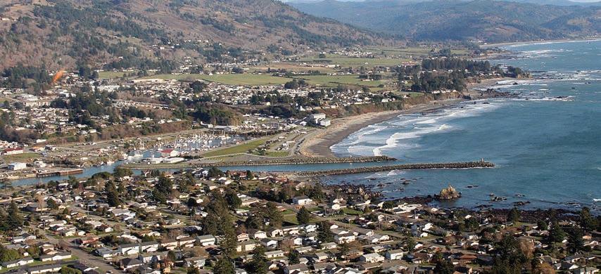
Gold Beach was named for the sparkling nuggets
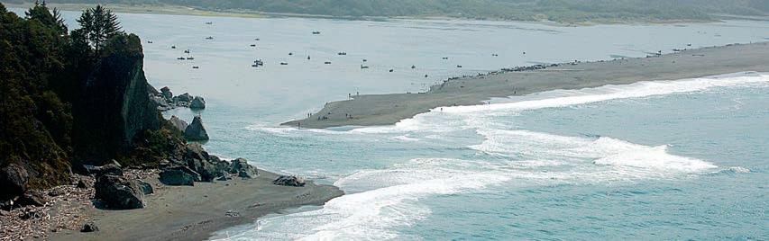
that were found on the beaches here in the mid-1800s after the mighty Rogue River left the gold as souvenirs. The rush was on!
Today this beautiful seaside town boasts more sandy beaches than any place else in the state of Oregon and is a must see destination point for fishing, hiking, biking, and camping.
Isaac Lee Patterson Bridge walk
Park at the Port of Gold Beach near the historic Mary D. Hume shipwreck and follow the paved path that skirts the edge of the Rogue River and offers breathtaking views of the river and the bay, and a unique perspective of the majestic Patterson Memorial Bridge,
built in 1932.
Visitors will spy mud swallow nests on the underneath side of the bridge and catch a glimpse of sea lions basking in the sun, gulls diving for dinner, and proud fishermen holding up their catch of giant salmon.
Agness
Motorists can take a right on Jerry’s Flat Road at the Isaac Lee Patterson Bridge and head 35 wandering miles up river to the small rural town of Agness located near the confluence of two Wild
Captains will provide a fully narrated river trip with plenty of stops to photograph spectacular vistas and wildlife. Bears are often seen feeding along the banks of the river on berries, fish and grubs. Ospreys return in April to their nesting area of the Klamath River from as far south as Brazil.
Klamath mornings and evenings are typically cool or overcast near the coast, so dress warmly in layers. As you travel upriver, be prepared to shed some
and Scenic rivers—the Lower Rogue and the Illinois.
Stop by the historic Cougar Lane Lodge and Store where tasty barbecue and blackberry cobbler await visitors.
Take several trails down to the Rogue River for a swim or to watch kayakers and jetboats zoom by. The Agness-Illahe Museum, 34470 Agness-Illahe Road, open from May through September, offers petroglyphs and Native American artifacts, and information and displays
clothing as the day heats up; hats and sunglasses are recommended.
Information provided by www.jetboattours.com.
Blue Creek Guide Service
Blue Creek Guide Service does cultural jet boat tours in addition to fly fishing for salmon and steelhead on the Klamath River. Pergish Carlson will take people about 25 miles upriver to Coon Creek. Along the trip, people can see eagles, bear, deer and turtles.
about the history of the Civilian Conservation Corps, fishing, mining and settlement. Call: 541-247-2014.
Buffington Memorial Park
Play hide-and-seek and enjoy a barbecue. The popular park at 94255 Caughell St. is a perfect place to escape the chilly breeze and enjoy amenities such as covered and open picnic facilities, tennis courts, walking paths and a “Kid Castle” play structure.
Blue Creek Guide Service’s guided fishing trips are $225 per person for a minimum of two trips and $300 per person for a single trip. Its scenic and bio-cultural tours are $100 per person and its diving trips to view salmon and steelhead are $150 per person.
To book a trip for sightseeing or fishing, you can go to the website at yurokfishingguides.com or call (707) 482-0579 or (707) 951-1284 or e-mail yurokcarlson@yahoo.com.
2022 Fall GO Wild Rivers COAST - Page 21


Page 22 - 2022 Fall GO Wild Rivers COAST GO BROOKINGS Find fantastic fun things to do in and around Brookings in spring and summer. Beachcomb, river swim, shop, hike, fish, surf, golf, birdwatch, picnic and ... 16218W.HoffeldtLane, Harbor,OR97415 703ChetcoAvenue Brookings,OR97415 MakingLife'sBiggestMovesTogether Brookings Harbor REALESTATE? BuyingorSelling
You could take at least a week to enjoy what the area has to offer. If you don’t have that much time, here are a few places to go and sights to see that can be accomplished in one day.


CHETCO POINT PARK

It’s tucked behind a sewage plant, but don’t let that deter you — Chetco Point Park has one of the most scenic views within Brookings city limits.
A 20-minute walk from city hall, the park’s main path winds down the side of a steep hill, where explorers can choose from different options. Those who go to the beach can wander among the tide pools filled with sea anemones and hermit crabs. Adventurous visitors
can head up a short wooded trail that will take them across a bridge and onto a bluff that juts out over the ocean, offering a unique look at the rocky coastline.
HARRIS BEACH

A favorite for tourists and locals, Harris Beach has something to do for everyone.


Beachcomb or explore the unique rock formations dotting the sand or hike the short, beautiful trails surrounding the park — including the steep Harris Butte, which overlooks the entire beach. The park also has ample space for both tent and RV camping, as well as picnic space for daytime visitors.
PORT OF BROOKINGS HARBOR


It’s hard to pick one just attraction here — but you can make a day out of exploring them all. At the south end of the harbor, Sporthaven Beach has ample space for RV camping and is a popular surfing destination. You can stand on the jetty and watch both fishing and sport boats enter and leave the harbor,
or take a leisurely stroll on the boardwalk. It’s also a good place to view many different kinds of wildlife — whales, seals and sea lions, pelicans and osprey, to name a few. The port has a variety of restaurants and bars, and plenty of hotels for overnight visitors. Visit www. portofbrookingsharbor.com for more details.

2022 Fall GO Wild Rivers COAST - Page 23
Over 20 vendors under one roof! 16218-B W. Hoffeldt Lane Harbor, OR HOURS: Mon. - Sat. 10 – 5 Sun. 11 – 4 541-813-2400 • Special Finds • Treasures • Antiques • Collectibles


Page 24 - 2022 Fall GO Wild Rivers COAST Real Estate CURRY COUNTY Riverfront Living Mountain Vistas ASK FOR JUDE estate services throughout the Oregon Coast.” Licensed in OR WE HAVETHEM ALL! Jude Hodge, Broker RE/MAX Coast and Country 541-813-9261 www.JudeHodgeBroker.com 703 Chetco Ave, Brookings • 541-412-9535 x117 • www.HomeWithJude.com Ocean Views Awarded Diamond 2020-2023 Rely on a dedicated Realtor! Enjoy Personalized and Knowledgeable Service! We Will Make Buying or Selling Your Home Easy! 541 412 8424 Blue Pacific Realty www.blupac.com 16289 Highway 101 S. Suite A, Brookings OR 97415 Let Us Help You Make The Right Move! Sarah Pettinger Broker 541-251-4382 sarah@blupac.com Jan Loren Broker 541-661-4197 janloren@blupac.com Diane Perkins “Deana” Broker 541-661-2373 diane@blupac.com
INDUSTRY RE/MAX® THE


Choose the brand with outstanding agents, leading brand awareness and an unmatched global presence.

NATIONAL, FULL-SERVICE BROKERAGE BRANDS


It’sreallyobviouswhyRE/MAXCoastandCountryismy foreverhome.Ichoserightthefirsttime!Astheconsumer,I encourageyoutochooserightthefirsttimeaswe’re numberonehereinCurryCountytoo!
-JudeHodge,Broker/Realtor®
Theprofessionalism,support,trainingandunfailing positiveofficeatmospherehavemademeabetteragent andperson.ThistranslatesintothewayourRE/MAXclients aretreatedandhowweconductbusiness.Itsnotajob,itsa joy.
-MichaelGeorge,Broker/Realtor®
RE/MAXissecondtonone!Thecompanyasawhole,is constantlydevelopingnewideastobetterserveusandour clientssowecansellhomesefficientlyandgiveourclients maximumexposure. IamblessedtobeapartoftheRE/MAX family!
-JenniferGates,Broker/Realtor®
IlovemyRE/MAXfamily!ThetrainingIreceivehereis unsurpassed.Weareoneofthemostmotivatedcompaniesin thisareaanditshows.Theypushmetobeabetterperson. Withprofessionaldevelopment,companygatherings,awards, etc.InturnIpassthatalongtomyclients.
-TyPierce,Broker/Realtor®
Everydaywe’resogratefultoliveandserve alongthesouthernOregoncoastline.Welove thecoastaltowns&peoplehere.We’realso easilyinspiredbyourrealestateteam. They’rehonest,passionateandfocusedon helpingothers.We’rehonoredtorepresent the#1Brandinrealestate,theRealtorson ourteamandallof thecommunitieswe serve.FromBrookings, Harbor,GoldBeach, PortOrford,toBandon. Welovewhatwedo!
-Bret&MarieCurtis, PrincipalBrokers/Owners


RE/MAXCoast&Countryhasbeenan absolutepleasuretoworkforandwith.You willnotfindbrokerswhocaremoreabout thiscommunity,takingcareofeach individualwhocomesthroughthedoors,or acommitmenttoexcellenceelsewhere.
-KatieMcDonald,HarborOfficeManager Nobodysellsmorehomesthan RE/MAXinCurryCountyandNationwide. Whataprivilegetoworkforanoutstanding localbrokerageandworld-widepowerhouse ofacompany.Thestatstellthestory. LetRE/MAXwelcomeyouhome!


-JenniferMcDonald, OfficeManager
IloveRE/MAXCoastandCounty.It’smorethanjustbeingpart ofabrokerage,it’safamilywhosupporteachotherandbuild


IloveRE/MAXCoastandCounty.It’smorethanjustbeingpart ofabrokerage,it’safamilywhosupporteachotherandbuild eachotherup.Weloveourcommunityandclientsandour numbersshowit.

-VanessaYoung,Broker/Realtor®
Iworkinapositiveandenergeticenvironmentthathelpsme bethebestagentIcanbe.RE/MAXleadsthewayinmarketing onagloballevelanddowntoearthprofessionalism.Welove whatwedoanditshowsinourdedicationtoeachclient.
-LindsayCoatney,Broker/Realtor®
IknewfromtheydayImetBretandMariethatIwasingreat hands,whichmademeverycomfortablewithmydecisiontojoin RE/MAX.IamalwaysproudtosayIworkforRE/MAXandIlook forwardtoalongfuturewiththem.

-DerekChavez,Broker/Realtor®
IloveworkingwithmyRE/MAXteam-theyreallycare!The trainingandsupportisthebest!Workinghereallowsmeto bethebestatwhatIdo.
-EricDremann,Broker/Realtor®
RE/MAXCoast&Countryislikenootheragency!Ourworking familyisencouraging,helpfulanddynamic.Weareherefor YOUthroughouttheBuyingorSellingprocesswithleading customerservice,andintegritybecausewecareaboutyour experience.
-RashellParkinson,Broker/Realtor®
RE/MAXhassomuchtooffer,thepossibilitiesareendless. Thesupportandsharedexperienceavailableare unparalleled.Theresourcesofferedfortraining,creating content,andcontinuededucationtotheiragentsin astounding.IamblessedtobeaRE/MAXAgent.
-ShelbyHuddleson, Broker/Realtor®
JoiningRE/MAXCoastandCountryhastrulybeena blessing.Iconsideritagreatprivilegetoworkinsuchan amazinglocationwithagreatteam,morethancoworkerswearefamily.
HeatherO'Connor,Broker/Realtor®


ItwasnoquestionwhenIreceivedmyrealestatelicensetowork withRE/MAXCoast&Country.Theprofessionalism,guidanceand positivitytowardstheclientsandintheofficeisunmatched.
-SavannahHickman,Broker/Realtor®
2022 Fall GO Wild Rivers COAST - Page 25 703ChetcoAvenue, Brookings,OR97415 BrookingsCoastalHomes.com MakingLife'sBiggestMovesTogether 16218HoffeldtLane, Harbor,OR97415 541-40-REMAX•541-412-9535541-69-REMAX•541-412-3000 Brookings Harbor
TRANSACTION SIDES PER U.S. AGENT 1 U.S. TRANSACTION SIDES2 U.S. BRAND AWARENESS (UNAIDED)3 COUNTRIES & TERRITORIES OFFICES WORLDWIDE AGENTS WORLDWIDE 16.1 988,480 34.0%110+8,964141,998 12.1 78,177 0.1% 45008,000 8.6 113,8622.1%332,20036,000 8.6 225,272 1.2%1 435 26,257 8.0 173,1072.3% 79 1,00025,000 8.0 753,35516.3% 41 2,200100,000 7.9 76,680 7.0% 2NA 9,700 7.7 386,073 6.0%71,50050,000 7.6 377,898 25.3%85 14,250144,700 7.5 1,275,365 12.7% 53 1,100188,121 7.1 88,9801.7%5 390 12,500 6.9 119,9820.3%640017,000 6.2444,3670.9%21NA75,000 4.1 93,6000.5%120025,000 Data is full-year or as of year-end 2021, as applicable. Except as noted, Coldwell Banker, Century 21, ERA, Sotheby’s and Better Homes and Gardens data is as reported by Realogy Corporation on SEC 10-K, Annual Report for 2021; data for all other competitors is from company websites and industry reports. U.S. transaction sides per agent are calculated from the T3 Sixty Real Estate Almanac Enterprises report. It also cites 2021 transaction sides and agent counts, some of which it estimates when company elected not to provide. 2RE/MAX and Keller Williams transactions totals are residential only, as reported to T3 Sixty. T3 Sixty transactions data for other brands may include commercial transactions when they comprise less than 3% of the total sales volume. 3MMR Strategy Group study of unaided awareness among buyers, sellers, and those planning to buy or sell; asked, when they think of real estate brands, which ones come to mind? ©2022 RE/MAX, LLC. Each office independently owned and operated. 22_304484 2022
USA VS.
GO ATTRACTIONS
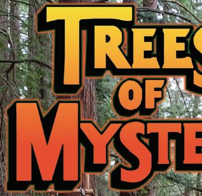
Just watch for the giant Paul Bunyan and his blue ox.
When you see them, you’ve arrived at Trees of Mystery, one of the region’s premier roadside attractions north of Klamath.
If you want to know what the canopies of Del Norte redwood forests look like and view the amazing ways redwoods adapt to their environments, Trees of Mystery has just what the arborist ordered.
“It’s a unique perspective of the redwood forest you can’t get any other way, besides being a bird,” said General Manager John Thompson, about the Sky Trail gondola ride at the attraction. The gondola follows a nearly 1-milelong trail through old-growth redwoods and includes signage and audio interpretations of exhibits.
Trees of Mystery attractions also include a world-famous Native American museum and huge gift shop.
The End of the Trail Museum includes artifacts from tribes all over North America.
“The End of the Trail Museum is said to be one of the best private collections in the world,” said Thompson. “It’s broad and very deep in its presentation.”
The hero of Trees of Mystery is Paul Bunyan, his legends carved out by loggers of long ago. The Trail of Tall Tales is devoted to the myths surrounding Bunyan, as are the mammoth-size statue of his ox, Babe, and himself.
Here is more info about roadside attractions along the Wild Rivers Coast:
TREES OF MYSTERY
A self-guided, nearly 1-mile-long hike through pristine and unique redwoods, a gondola ride through redwood treetops, a Native American museum, a cafe offering the indoors experience of eating in a forest or underneath a river, a motel and a gift shop.
-Open seven days a week; from 9 a.m.-5 p.m. in the winter and -8 a.m.-7 p.m. in the summer, however hours vary with the seasons. Visitors can call for current hours.
-15500 Highway 101 South, Klamath
-General Admission is $18 per person; seniors age 60 and older are $14; kids 6-12 are $9 and kids 5 and under are free. Museum admission is free.
-Call (707) 482-2251 or go to www. treesofmystery.net; for reservations at Motel Trees, call (800) 848-2982.
OCEAN WORLD
Hands-on, interactive experience with tidepool animals, petting leopard sharks and a guided tour, plus a huge gift shop full of local souvenirs.
-Summer hours are 8 a.m. to 9 p.m. with 45-minute tours scheduled throughout the day. Winter hours may vary.
-304 U.S. Highway 101 South, Crescent City
-General admission is $12.95 per person; children ages 4–11 are $7.95 and ages 3 and younger are free.
-Call (707) 464-4900 or go to www. oceanworldonline.com.
WEST COAST GAME PARK SAFARI
Visitors mingle with free-roaming wildlife in a walk-through safari experience. Lesssocial beasts such as bears, foxes, lions and zebras are in less-accessible displays, but their youngsters are often brought out for petting sessions.
-10 a.m. to 5 p.m. daily
-7 miles south of Bandon on HWY 101 -Ages 13 and up, $17.50; seniors 60 and older, $16.50; ages 7–12, $10; ages 2–6, $7; under 2, free (541) 347-3106.

PREHISTORIC GARDENS
The Prehistoric Gardens is not a natural history museum, but with a little imagination, these beasts can come to life. They include tyrannosaurus rex, stegosaurus and 21 other critters of an age not our own. The self-guided tour lasts 15 to 20 minutes.
-10 a.m. to 5 p.m. spring and fall; call ahead for winter hours.
- 11 miles south of Port Orford on U.S. Highway 101
-Adults, $12; ages 3-12, $8; seniors, $10; 2 or younger, free; leashed dogs welcome. (541) 332-4463.
Page 26 - 2023 GO Wild Rivers COAST
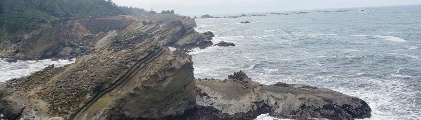
Preston Island, a hidden gem
By DAVID RUPKALVIS
Crescent City, California is rightly known as a tourist destination. With miles of beaches to the west, giant redwoods to the east, sea lions and seals that can be seen every day and plenty of things to do between, it is no surprise people plan their vacations around trips to Crescent City.
I have been to Crescent City more than a dozen times over the last six months, and every time I am drawn to something amazing. I have visited the beaches, stared at the sea lions, taken pictures of redwoods and always been amazed at what I can see.
But I am always looking for hidden spots that are a little off the radar. And sometimes you get lucky.
In January, I visited Crescent City during king tides, so I was looking for a place to take pictures of the highest tide of the year. As I drove along with the beach to my side, I stopped a couple of times to take pictures. And then I noticed this little road off to my left that drove down to the beach. So, I followed it down and found a little wonder land.
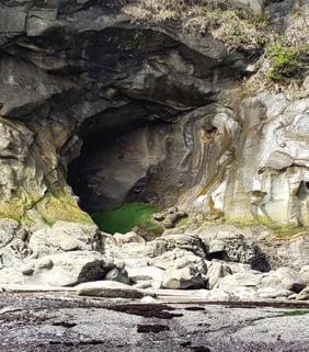
Known to locals as Preston Island, what I found was different than anything else around. There’s a small parking area at the bottom, with beaches on both sides. But directly west, heading out into the ocean is something I’ve seen nowhere else.
For hundreds of feet, what looks like volcanic rock moves out into the ocean. As you walk out, you have to find your own way as tide pools are everywhere. Many are small, just a few feet across, but some are big enough you have to find a new direction to stay dry.
The tide pools are different than those nearby. While filled with crystal-clear water, there seems to be little in them. I saw no crabs, no fish, no sea anemones, just water. I’m sure someone with an eye better trained than mine could find life in the pools, but for me it felt like walking into a different universe. The real treat was along the edges. During king tide, and again on subsequent visits, the waves crashed into the rocks, creating massive splashes of water pouring onto the rocks.
I desperately tried to take great pictures and mostly failed. Patience is probably not my greatest virtue, so I was always spinning and snapping photos just after the waves hit. For someone with more patience, and a willingness to wait with a camera trained at one spot until the wave hits, there is probably great photos to be taken.
I wandered around the rocks for more than hour before I realized it. Just the sound of the waves crashing, the feeling of the power of the water and the belief that something amazing was just ahead kept me going.
HIDDEN GEMS
Old Coast Highway - Take a short but sweet drive past lush fields, old growth forests and hidden beach access points on this single-lane predecessor to the current Highway 101. Head north out of town and take the first left, just north of the Patterson Memorial Bridge.
Like many along the South Coast, I am drawn to the ocean. And this spot in Crescent City has drawn me back many times. You feel like you’re in a different world when you’re surrounded on three sides by waves crashing into rocks. It reminded me how small we all really are in comparison to the greatness of nature.
Preston Island has a long history in Crescent City. Originally Preston Peak, the area was a sacred site for the Tolowa Nation. Years ago, the peak was mined, and the rocks removed from it became the jetty in Crescent City. What was left was Preston Island, its many tide pools and a place that has a allure of its own today.
A couple of notes. While there are sandy beaches on both sides, you will need good shoes to go out onto the rocks. The rocks are sharp and require some scrambling to move around on. I would also advise against getting too close to any of the edges. The power of the waves kept me from getting too close myself.
To get there, follow Highway 101 from Coos Bay through Bandon, Port Orford, Gold Beach and Brookings. After you reach California, continue on Highway 101 into Crescent City. Turn right on Front Street, which has signs for beaches, and continue until the road ends. Turn right onto Pebble Beach Drive and keep a close eye out for the small road that juts off to the left. Crescent City is a little more than three hours away, but there is enough to do to keep you entertained for hours.
Ellensburg Theater Company - Enjoy community theater at the Rogue Playhouse at the corner of Mary and Moore streets in downtown Gold Beach. The theater company hosts four to six shows per year, directed, acted and performed by local actors. Call 541-247-4382.
2023 GO Wild Rivers COAST - Page 27
GO OREGON BEACHES
The Wild Rivers Coast has some of the best beach access anywhere in the world. Not only are the waves and surf a breathtaking experience, incomparable sunsets and beachcombing treasures abound.
Prior to heading for the beach to visit tidal life, check the tide tables. When possible, it’s best to arrive an hour prior to low tide, as the water is still going out. Once the tide begins to come back in, it seems to return quickly. Be cautious of waves. You don’t want to be stranded on a rock.
The waters off of this coast are not only cold, but there are areas with strong undercurrents. Care too, should be taken with your footing when traversing across the rocks. Many are slippery with seaweed.
The tidepools’ environment is delicate. Remember, you’re visiting another living society’s home. If you lift up a rock to look underneath, return it to its original spot — that minimizes the effect you will have on the tidepool’s life.
To find a good spot to explore, search for the rocky areas —there are many in the Wild Rivers Coast.
BANDON STATE NATURAL AREA
Located along Bandon’s Beach Loop Road, there are several locations with beach access, picnicking, horseback riding and unsurpassed views. Parking is ample at all locations.
FACE ROCK SCENIC VIEWPOINT
There is an American Indian legend about this spot. Some say they hear a maiden’s voice on the wind, and standing on the cliff overlooking the ocean you can easily pick out the face on Face Rock. There is a well-kept trail to the beach, and several rocky intertidal areas to explore at low tide.
BULLARDS BEACH
This large park, located just two miles north of Bandon features a campground nestled among shore pines and protected from the strong ocean breezes. Take a walk or bike ride on the mostly paved pathways to the beach that weaves through the
open, grassy fields and lowland forest across a plain to the sandy dunes. All along the path are views of the Coquille River. Across the river is Bandon Marsh National Wildlife Refuge, sporting a variety of wildlife. The historic Coquille River Lighthouse is nearby.
ROCKY POINT
(Two miles south of Port Orford): Rocky Point features good access to tidepools and a clamming area. Be aware of potential red tides when harvesting clams and always check the local rules and regulations.
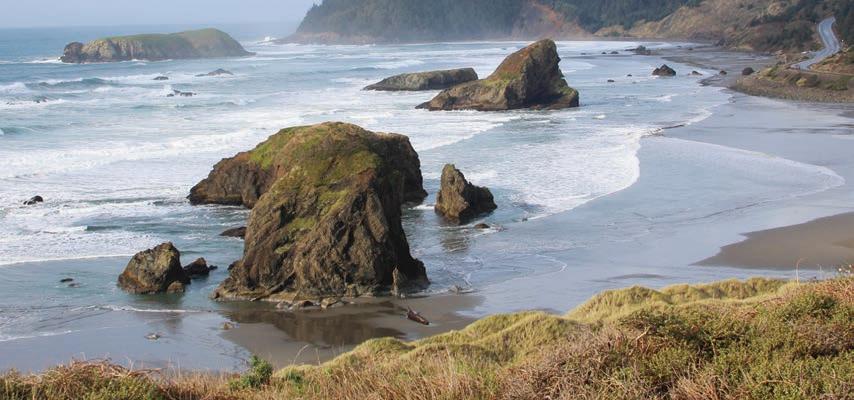
HUBBARD CREEK
(One mile south of Port Orford): This is a popular spot for surfers who are often seen in their wetsuits in the surf.
BATTLE ROCK
(Location of the Port Orford Visitors’ Center): Battle Rock features a wayfinder with plenty of parking and
Page 28 - 2023 GO Wild Rivers COAST
easy trails to the beach. There is also some picnicking available in this day use area as well as restrooms.
PORT OF PORT ORFORD
The fishermen’s memorial and a small, protected beach is offered here, framed by the port docks and Point Orford.
PARADISE POINT
(On the north side of Port Orford): Another part of Oregon’s State Parks system, Paradise Point has a nice beach for walking.
CAPE BLANCO STATE PARK
(Six miles north of Port Orford): beach access, RV and tent camping spots, cabin rentals and even an equestrian camp are located here, in addition to the lighthouse and historic Hughes House.
HUMBUG MOUNTAIN STATE PARK
(South of Port Orford): Beach access through a trail which traverses under Highway 101. Camping spots, day use area and trail to the top of Humbug Mountain.
FLORAS LAKE
(Located north of Port Orford): This area features a trail which begins at Floras Lake and continues until an expanse of ocean beach is accessible. A county park is located at the area for those wishing to camp.
OLD COAST ROAD
(Five miles north of Gold Beach): There are several areas for beach access along this stretch of one-lane road. They include Otter Point, with trails to the beach and a phenomenal view from Otter Point itself, several segments of the Coast Trail and a trail to Bailey Beach.
BEACH ROAD
In Gold Beach, west of the airport): The beach road area offers multiple areas to access the beach and highlights the Port of Gold Beach Memorial.
NORTH AND SOUTH JETTIES OF THE ROGUE RIVER
Both of these areas have beach access with surfers trying their luck near the south jetty. Driftwood is abundant here.
SOUTH BEACH PARK
(South end of Gold Beach): A small city park with handicapped beach access, this area also features plenty of parking, swings and barbecues, picnic tables and a sand volleyball court.
PISTOL RIVER STATE PARK
(At the mouth of Pistol River): Access to the beach, plenty of parking and a view of Crook Point.
MYERS CREEK BEACH
(Seven miles south of Gold Beach): Part of the Oregon State Parks system and one the most photographed beaches in the world, Myers Creek features prominent sea stacks, tidepools, several turnouts for parking, windsurfing and access through several trails to the beach.
SAMUEL H. BOARDMAN STATE PARK
Just north of Brookings, this 11-mile stretch of coastline offers stunning views and developed park areas. The area includes sections of the Oregon Coast Trail, with smaller trails leading down to isolated, pristine beaches.
HARRIS BEACH STATE PARK
Offers good parking, picnic tables and restrooms, a shower to wash sand off shoes and feet, and long stretches of scenic beaches. A well-marked park entrance at the north end of Brookings provides vehicle access to the beach.
CHETCO POINT
Is an unlikely location behind the city wastewater treatment plant, but offers some of the most interesting, accessible and little-used exploring areas. Good trails lead from a parking area to a quiet beach or to windswept bluffs above the ocean. To get there, take Wharf Street off Railroad Avenue.
OPHIR REST AREA
(Eight miles north of Gold Beach): Beach access, picnicking, restrooms.
SPORTHAVEN BEACH
At the Port of Brookings-Harbor is a favorite of local residents. It’s a good place to watch boat activity at the Chetco River bar, or to check ocean conditions. The beach also fronts a busy RV park during summer months, and many area visitors enjoy walking the beach there. Local surfers also favor ocean waves in the area of the south jetty. To get there from Brookings, turn right at the south end of the B.A. (Dot) Martin Bridge across the Chetco River. Follow Lower Harbor Road about a mile to the beach.
MCVAY PARK
Is on Oceanview Drive in Harbor, approximately 3.5 miles south of Port of Brookings Harbor. The park features a grassy field with a trail leading down a steep bluff to the beach. A dog park, with a large, fenced area, is available, as are disc golf opportunities. To get to McVay Park, drive south of Brookings on Highway 101 to West Benham Lane. Turn right on Benham Lane, and then left at Oceanview Drive. Follow Oceanview Drive south through lily fields until you see a couple of massive rocks on the right. A gated drive provides vehicle access.
CRISSEY FIELD
Just a half-mile north of the Oregon/ California border is the Crissey Field Welcome Center, where trails lead across sand dunes to a wide, sandy beach. To get there, drive south from Brookings on Highway 101 approximately five miles.
2023 GO Wild Rivers COAST - Page 29
GO BIKING
1 - WILD RIVERS COAST
SCENIC BIKEWAY
60-mile ride with news too rich to see in one day.
2
Views
Killer
8 - LITTLE BALD HILLS
Tough climb and fun drop thru varied terrain.
9 - FRENCH HILL
12 - COASTAL DRIVE
Coastal bluff overlooks and historial sites.
Visit
Easy,
6
Easy
7
A
Reward: 3 miles of sweet downhill single-track.
10 - OLD GASQUET
Siskiyou Mountain views on old mining road.
11 - OLD REDWOOD HWY
Cruise a 1930s road on Last Chance Coastal Trail.
13 - OSSAGON TRAIL LOOP
See highlights of Praire Creek by bike.
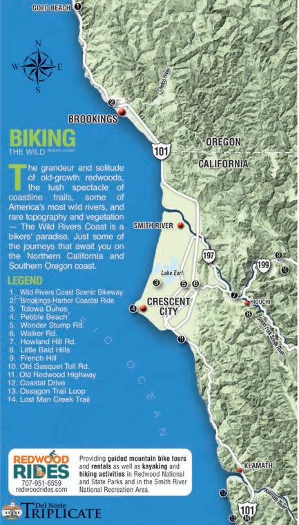
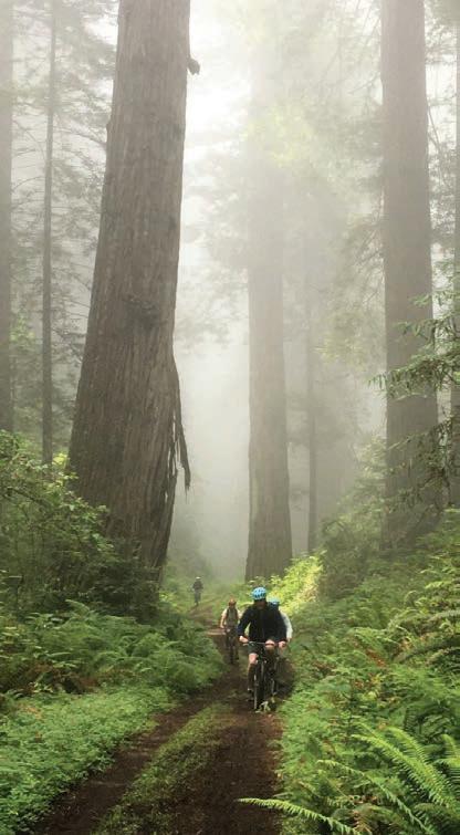
14 - LOST MAN CREEK TRAIL
Steep

Page 30 - 2023 GO Wild Rivers COAST
- BROOKINGSHARBOR COASTAL RIDE
of lush fields, elk and ocean rocks.
3 - TOLOWA DUNES
forested dunes and Indian village site.
4 - PEBBLE BEACH
coastal views from harbor to Pt. St. George.
5 - WONDER STUMP RD.
paved ride with redwoods and ranches.
- WALKER ROAD
ride in redwoods with views of Smith River.
- HOWLAND HILL RD.
rolling hills ride through scenic, old-growth redwoods.
TOLL ROAD
clumb and descent in redwood forest.
Photo by Adam Spencer of Redwood Rides Adventure Outfitters
GO SMITH RIVER
near two eponymous communities — a small farming town and a tribal nation that runs a casino 3 miles south of the Oregon state line.
Halfway between the state line and Crescent City, the highway crosses the largest completely undammed river in California. Seven miles north at the mouth of the Smith River, there’s a good vantage point to see its cold, clean current make its final plunge to sea .
MOUTH OF THE SMITH

Popular with picnickers and anglers, the mouth of the Smith River also attracts a wild menagerie — diving sea lions, seals, salmon, otters, sharks, crabs, geese and shorebirds.
On one side of a long sandbar the river fills fingers of a meandering slough, while on the other side ocean tides spray wildly, even on calm days.
To access the mouth, turn west off 101 onto the Mouth of the Smith River Road, which runs through the heart of Smith River tribal nation, 3.5 miles north of the townsite and 3.5 miles south of the state line. The road ends at a parking lot overlook with access by staircase to a sand and pebble beach.
BEACHES AND BREACHES
Edging north from the river mouth and still two miles south of the state line,
Clifford Kamph Memorial Park is a stellar spot for beachcombing, surf fishing and whale watching.
With three parking spots on a bluff overlooking the ocean, this unassuming county park has drive-up views and convenient facilities nearby, including wheelchair accessible restrooms and a ramp leading to a sandy beach. The campground is hosted year-round, with 12 tent camp sites rented on a firstcome first-served basis.
ONE FISH, TWO FISH...
Salmonids are a family of fish famous for their miraculous migration patterns: from freshwater streams out to the ocean depths and back upstream again, to spawn and die where it all began. Glimpse these revered creatures up close at Rowdy Creek Fish Hatchery, which raises steelhead trout and chinook salmon to supplement sport fishing stocks in the Smith River.
Strict regulations protect the Smith’s wild stock from overfishing. Hatchery fish, on the other hand, are always fair game, distinguishable from the wild fish by a clipped adipose fin.
The Rowdy Creek Fish Hatchery welcomes visitors during regular business hours and is situated just west of the highway behind the Smith River Post Office on 255 North Fred Haight Drive. Tours are free, though donations to the non-profit enterprise are accepted.
TOLOWA DUNES
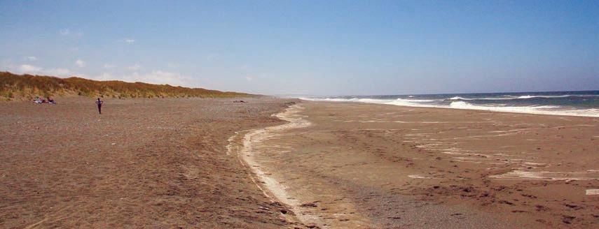
More than 4,000 acres of lush forests, rolling dunes, wetlands, meadows and 11 miles of undeveloped beach make up Tolowa Dunes State Park.
The park encompasses Dead Lake, lakes Earl and Tolowa and the mouth of the Smith River. Visitors can explore more than 30 miles of hiking trails. It’s also rich in opportunities for surfing, fishing, beachcombing and birdwatching.
Visitors to the park can even get handson experience in restoring the dunes to its original habitat. The Tolowa Dunes Stewards and the Redwood Parks Association host excursions to eradicate invasive European beach grass on the first and third Sundays of every month.
For more information visit: redwoodparksassociation.org/tolowa-dunesstate-park or tolowacoasttrails.org.
2023 GO Wild Rivers COAST - Page 31
The Smith River valley unfurls along Highway 101
Tolowa Dunes State Park, Photo credit: Tim Rochte, 2016
GO FISHING
Opportunities for great fishing on the Wild Rivers Coast are as varied as the rivers. Before fishing, it is mandatory to possess a fishing license and tags (punch cards) for either Oregon or California.
OCEAN FISHING —
California
Sport fishermen without a slip in Crescent City Harbor can get into the water from Citizens Dock and can head out to sea in search of whatever is in season from there.
Bottom fishing for rockfish and lingcod is generally one of the most reliable fisheries in Northern California, where black snappers in particular are always plentiful. The bottom fishing season in California generally runs from about May until the end of the year.
As bottom fishing opens every spring, the ocean salmon and pacific halibut seasons are quick to follow, usually starting in early May.
Usually both salmon and Pa-
cific halibut seasons remain open through September, but in recent years regulators have elected to add in periodic closures (and a full closure for ocean salmon fishing in 2017) to help ease the fishing pressure on both species of fish.
Check with the California Department of Fish and Wildlife for current information on both fishing seasons.
Additionally, several other species of ocean fish are open year round, including California halibut, sharks (except for white sharks), surfperch, sturgeon and tuna (although tuna are generally only in the area for a few weeks in the fall).
Crabbing is also open year round in California but the most popularly targeted spe-

cies of crab, Dungeness crab, are only open to recreational crabbers from early November until late in the summer.
For information about current and upcoming fishing seasons visit www.wildlife. ca.gov/Fishing/Ocean/ Regulations/Fishing-Map/ Northern

OCEAN FISHING — Oregon
There is always something in season for ocean anglers out of Oregon, with bottom fishing open all year long. Anglers out of Brookings Harbor can target rockfish and lingcod all year long and the fishing is generally pretty productive.
In 2017, the Oregon Department of Fish and Wildlife issued a rare closure of bot-
tom fishing statewide due to the quota for several species being caught much quicker than expected, but the OFDW has since revised the daily catch limits with the hope of once again allowing yearround bottom fishing.
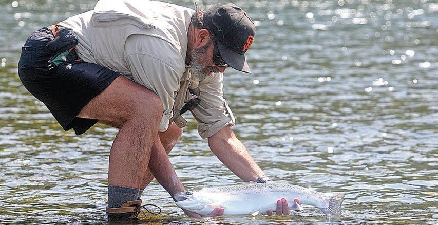
Pacific halibut seasons generally run from about May until November, but can be closed at any time during that season if the area’s yearly quota is met.
The ocean salmon season (closed for all of 2017) usually starts sometime in May and runs into the fall.
Ocean seasons for Pacific halibut are usually set in March, while the ocean salmon season is announced sometime in April.
Page 32 - 2023 GO Wild Rivers COAST
For more information about Oregon’s ocean fishing seasons and regulations, visit www.dfw.state.or.us/re sources/fishing/saltwater.asp
RIVER FISHING
Coquille River
Crabbing for Dungeness can be phenomenal in the Coquille bay at Bandon from the local crab dock in Old Town and near the Bullards State Beach boat ramp. Crabbers use crab pots, crab rings and Pineapple Butterfly Traps.
Chinook salmon start migrating upriver in robust numbers on the first full-moon cycle toward the end of August. This is an upriver trolling fishery. Anglers launch from Bullards State Beach at low tide and start trolling upriver using a Fish Flash and a cutplug herring. The Rocky Point Boat Ramp is another popular boat launch facility to put in and take out.
A wild coho river fishery has also grown in popularity in recent years, starting in September. Be sure to check the Oregon Department of Fish and Wildlife for current bag limits.
Fantastic rockfish, lingcod, halibut, tuna and salmon fishing can also be found outside the Port of Bandon, with the primary charter boat operation being Prowler Charters, located in Old Town Bandon.
Crab gear, bait, tackle and excellent seafood dishes are provided at Tony’s Crab Shack in Old Town Bandon.
Elk and Sixes Rivers
At the northern end of Curry County are two gems of the
Pacific Northwest in the land that time forgot. The Elk and Sixes are sister streams that flow so close together, it would be hard not to mention one without the other.
The Elk River empties into the ocean south of Cape Blanco, while the Sixes River flows into the Pacific just a few miles north of Cape Blanco. Both are relatively short, but don’t let their size fool you. Both rivers are known for having some of the latest runs of salmon on the Oregon Coast.
Generally speaking, the first salmon enter the river mouths in September and will progress upriver depending on the amount of rainfall.
Steelhead enter both systems around Thanksgiving and the runs peak around February.
The main float in the Elk is to put in at the Elk River Hatchery and take out at the RV park or float all the way down to Ironhead.
The main drift on the Sixes is to put in at Edson Creek and take out at either MidDrift, the Grange, or drift all the way downriver to the Hughes House. But if the winds are blowing downriver, do not drift below Highway 101. Instead, take out at the Grange. To check Elk River water conditions, call (541) 332-0405.
Lower Rogue River
There is something to fish for in the Lower Rogue River almost 12 months out of the year, from Foster Bar down to the mouth.
The first spring Chinook
begin entering the mouth in late February and the run gradually builds, peaking into April and May.
The Rogue is famous for its large fall chinook, caught from July to October.
The traditional method used here is trolling a Rogue Bait Rig or a comparable spinnerbait rig, using an anchovy on the back two hooks. Coho salmon are frequently caught in the lower bay in September and October.
Boat launches are available at the county ramp, Jot’s Resort and at Lex’s Landing. The winter steelhead run is quite prolific, as well. They enter the Rogue around Thanksgiving, depending on the water level.
Chetco River
Perhaps best known for its trophy chinook from 50 to 60 pounds, and for both wild and hatchery winter steelhead exceeding 20 pounds, the Chetco is also known for having the safest bar on the Oregon Coast.
In September, anglers in the estuary below the Highway 101 bridge begin trolling spinnerbait rigs and plug-cut herring for salmon averaging 28 pounds.
The salmon run starts petering out around mid-November, when winter steelhead begin dominating the river. By December a handful of anglers have usually landed several steelhead over 20 pounds. The run peaks in late February, but good numbers can be caught through March.
The wild and scenic section of the Chetco, above Ice Box,
will leave you breathless. The best floats are from the South Fork down to Miller Bar, from Miller Bar down to Loeb State Park, or from Loeb State Park down to Social Security Bar.
Winchuck River
Fishing for salmon and steelhead is seasonal. Check ODFW regulations for updates.www.dfw.state.or.us
Smith River
Barbless hooks are mandatory when fishing the Smith. If the Chetco River gets blown out at about 10,000 cfs and has a chocolate-brown appearance, California’s Smith River has an emerald green appearance and is plunkable the same day.
The Smith and Chetco rivers are similar in many ways. Both kick out trophy salmon and steelhead, and both empty into Pelican Bay. Salmon fishing usually picks up around September in spots like The Sand Hole, Cattle Crossing, The Piling Hole and at the mouth of Rowdy Creek.
Bobbers and sand shrimp/ cocktails can be deadly. Early in the season, fish the north bank off of the Mouth of the Smith River Road, off Highway 101. Here, it is best to fish the outgoing tide and through low slack, where the river makes a slot.
Klamath River
Barbless hooks are also mandatory on the Klamath River. The Klamath starts fishing well around May for spring Chinook heading for the Trinity River. There is little bank access, so please don’t launch here unless you have a sled with a full tank of gas.
2023 GO Wild Rivers COAST - Page 33
GO LIGHTHOUSES

For hundreds of years, seafaring ships have met their demise along the coast of Southern Oregon and Northern California.
Out of Mother Nature’s fury along these 100 nautical miles of beautiful, rugged coastline has arisen a string of lighthouses so diverse and compelling in nature that they annually attract hundreds of thousands of admirers.
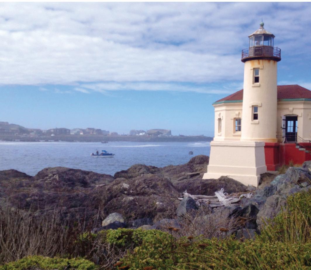
These lighthouses include the St. George Reef Lighthouse and Battery Point Lighthouse at Crescent City, Cape Blanco Lighthouse near the Sixes River north of Port Orford, Coquille River Lighthouse at Bandon, and Cape Arago Lighthouse near the entrance of Coos Bay.
ST. GEORGE REEF LIGHTHOUSE
Neither cozy nor readily visible, St. George Reef Lighthouse sits precariously on a rock 6 miles off the coast of Crescent City in some of the most
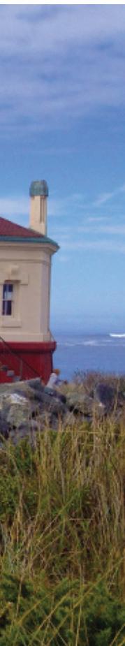
treacherous waters on the West Coast. Its construction was inspired by the Brother Jonathan disaster, which claimed the lives of nearly 200 passengers and crewmen. It took 11 years to complete in 1892.
Built on a 70-foot-high concrete pier and equipped with a tower stretching upward to 134 feet, the lighthouse was considered one of the least desirable and most dangerous assignments for lighthouse keepers.
Decommissioned in 1975 and left for a time to fend for itself against battering seas, the lighthouse has now been rescued in stages by lighthouse and history buffs of the region.
Its French-made Fresnel Lens was removed and housed in the Del Norte County Historical Society Museum in 1983. In October 2002, a new light was installed in the rebuilt lantern room atop the lighthouse. The light is powered by a solar panel and wind generator.
Once manned and supplied by boom, derrick and prayer from lifeboats often bobbing dangerously in the sea, the lighthouse now is accessible only by helicopter. On a clear day, it’s visible from points all along Pelican Bay, including Brookings, as a gray dot against the horizon.
The Del Norte County Historical Society Museum is open from 10 a.m. to 4 p.m. Monday and Saturdays. Call (707) 464-3922.
Page 34 - 2023 GO Wild Rivers COAST
BATTERY POINT LIGHTHOUSE
Much closer to shore in Crescent City is the Battery Point Lighthouse, which is accessible on foot when the tide is low. At high tide, Battery Point becomes an island.
Built in 1856 when Crescent City was becoming a bustling center for export of lumber to San Francisco and import of miners to Oregon gold fields, the lighthouse held its ground against seismic waves from the 1964 Alaska earthquake, which claimed 11 lives in Crescent City and wiped out 29 blocks of commercial and residential structures.
These days Battery Point Lighthouse houses exhibits from its storied past such as artifacts from the Brother Jonathan, the 1964 tsunami and a boat torpedoed in World War II.
Battery Point Lighthouse is open to visitors 10 a.m. to 4 p.m. on weekends, tides permitting. The lighthouse is at
the foot of A Street in Crescent City. Call (707) 464-3922.
CAPE BLANCO LIGHTHOUSE
Back on the Oregon side of the border, Cape Blanco Lighthouse holds distinction as the state’s oldest continuously operated lighthouse since 1870, and its highest at 245 feet above sea level. The beacon’s 59-foot tower beams signals 21 miles out to sea.
The lighthouse opens for tours on selected days from May through October, and volunteer guides from the Bureau of Land Management like to point out magnificent ocean vistas, including seven arch rocks on nearby Blanco Reef and Port Orford Reef.
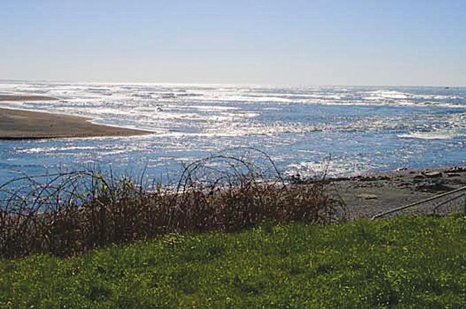
Back in the pre-electricity days of dieselfired lighting, Cape Blanco Lighthouse once had a keeper named James Langlois who spent 42 years lugging fuel up a 63-step spiral staircase to the tower. He retired in 1918, taking with him a state record for tenure that still stands.
COQUILLE RIVER LIGHTHOUSE
The Coquille River Lighthouse near Bandon sits just a few feet above the waterline not far from the point where the river meets the Pacific. It had a brief but exciting history of operation. Commonly known to mariners of the day as the Bandon Light, the Coquille River Lighthouse was one of the state’s last to go into operation in 1896 and one of the first to leave service in 1939. But during its years of operation, the Coquille River Lighthouse survived a fire in 1936 that wiped out Bandon, and was nearly rammed in the wreck of the C.A. Klose in 1903.
The low-slung lighthouse structure stood abandoned for more than 35 years until restored as a museum in 1975. Because of its picturesque setting, the lighthouse is a popular subject for photographers and landscape painters. It is easily reached by visitors through the entrance to Bullards Beach State Park north of Bandon.
2023 GO Wild Rivers COAST - Page 35
GO CAMPING
OREGON
Oregon is filled with clean, beautiful state parks. Summer is the perfect time to enjoy these spots. The parks offer breathtaking views of beaches and forests. Many of them also offer camping facilities. Reservations may be made at any of the state parks listed by calling (800) 4525687 or at oregonstateparks.org.
BULLARDS BEACH STATE PARK
Three miles north of Bandon on the other side of the Coquille River. The campground is nestled among shore pines and protected from the strong ocean breezes. The historic Coquille River Lighthouse is located in the park. It’s staffed from mid-May through the end of September with park volunteers who interpret the history of the area. The park has 4.5 miles of open beach to explore, including mountain
bike-friendly hard-packed sand along the edge of the surf.
There are 82 campsites with water and electrical hookups and another 100 sites with full hookups. There are also 13 yurts and a horse camp with eight primitive sites.
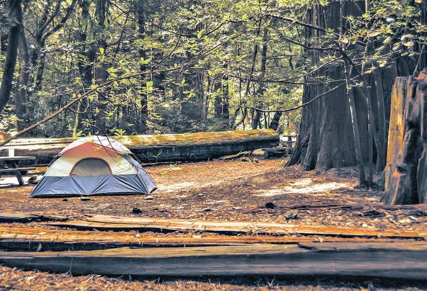
Rates: $26 electrical sites, $29 full hook-ups, $5 hiker-biker per person, $19 horse facilities, $41 yurts, $51 petfriendly yurts.
BOICE-COPE CAMPGROUND
(Curry County Parks) is a county-owned park occupying a manicured lawn near Floras Lake 4 miles southwest of Langlois. Narrow sand dunes separate the camp from the Pacific Ocean, which attracts sailboarders, kiteboarders, anglers and migrating birds. The campground has 22 RV sites and 13 sites for tent camping. All sites have
fire rings, stand-up barbecues and picnic tables. ADA compliant restrooms, showers, an R.V. dump-site, potable water and firewood are available in the center of the park. Free wi-fi is available.
Rates are as follows and are subject to change:
Peak season rates (April 1 to Sept. 30): R.V. sites with electric and water services $22 day / $132 week; RV sites (nonelectric) $18 day / $108 week, tent sites $15 day / $90 week
Reservations are accepted for electrical RV sites only. Call the camp host at 541-373-1555 between 8:30 a.m. and 5 p.m. to make reservations.
CAPE BLANCO STATE PARK
Set on the westernmost point in Oregon and is accessed by exiting U.S. 101 4 miles north of Port Orford onto
Page 36 - 2023 GO Wild Rivers COAST
Tucked into a bed inside an RV, hidden inside a tent or curled up beneath the stars, the Wild Rivers Coast has many camping options.
Cape Blanco Road. The campground offers picturesque ocean views and tours of the Cape Blanco Lighthouse and historic Hughes House.
The pet-friendly park offers several miles of hiking and horseback riding trails.
Cabins, water and electrical hook-ups, a horse camp and fire rings are just a few of the amenities available at the park.
Rates: $22 electrical sites, $5 hiker-biker per person, $17 horse facilities, $71 (plus $3 per person) group tent, $41 rustic cabins, $51 pet-friendly cabin.
HUMBUG MOUNTAIN STATE PARK
is in a lush, narrow canyon just south of Port Orford on U.S. 101. It features a fast-running trout stream and a trail under the highway to a long sandy beach that offers beachcombing and surf fishing. Hikers may find a 5.5-mile hiking trail that leads to the summit of the mountain. A section of the Oregon Coast Trail winds through the park. The park features more than 55 tent campsites, 40 sites with full utility hookups, and a hiker/biker area. The park has a full wheelchair access site, firewood station, hot showers, dump station and host.
Rates: $17 tent sites, $5 hiker-biker per person, $22 electrical sites.
HARRIS BEACH STATE PARK
Located just north of Brookings on U.S. 101. The park offers day and overnight facilities. It has full hookup spaces, electrical sites, tent sites and yurts. Cable TV hook-ups may be available at selected tent sites. Beach access is available from the campsites.
The park offers wildlife viewing opportunities and beach scenery. Because of the popularity of the park, reservations must be made as early as possible.
Rates: $20 tent sites, $28 electrical sites, $30 full hookups, $5 hiker-biker per person, $43 yurts, $53 pet-friendly yurts.
BEACHFRONT R.V. PARK
Located at the Port of Brookings Harbor, this is one of the few RV parks that
enable you to park right on the beach and enjoy the scenery and unique activities that the Southern Oregon Coast has to offer: sportfishing, hiking, surfing and whale-watching are abundant at the park and surrounding areas.
Amenities include a full hook-up that includes internet and cable television. Partial hook-up includes water and electric. There is a two-week stay limit; three-day booking for event weekends. Contact management for details. Rates: pull through, full hook-up, ocean view $51 day / $306 week; back in, full hook-up $44 day / $264 week; partial hook-up $36 day / $216 week; dry camping $32 day / $192 week; tent sites $27 day / $162 week. Make reservations at www.beachfrontrvpark.com or call 541-469-5867.
LOEB STATE PARK
Located east of Brookings, approximately 6.5 miles up the North Bank Chetco River Road, Loeb offers a variety of activities including camping, swimming in the Chetco River and picnicking. The park is nestled in a myrtlewood grove and borders the Siskiyou National Forest. Hikers may find plenty of trails to enjoy including the Riverview Nature Trail.
The park features overnight tent camping as well as three log cabins. The cabins are furnished with lights, heat, and beds with mattresses. Flush toilets, electrical hookups, fire rings and picnic tables are also available, as is handicap access.
Rates: $22 electrical sites, $50 petfriendly deluxe yurts, $40 rustic cabins.
CALIFORNIA
SMITH RIVER CORRIDOR
Many campgrounds popular among locals are located in the mountains along the Smith River east of Crescent City, where daytime summer temperatures, frequently in the 80s and 90s, are much warmer than those near the coast, and the pristine waters in the river make for great swimming and kayaking.
PATRICK CREEK CAMPGROUND
is the farthest east, located across from Patrick Creek Lodge on U.S. 199.
Reservations can be made in advance for one of this campground’s 13 sites. There is a $14 per night fee, and the campground features flush toilets, drinking water and views of the Smith River.
Patrick Creek Campground also has a few wheelchair accessible sites, as well as barrier free fishing. The site is open from May 19 through Sept. 16. Make reservations at Recreation.gov.
GRASSY FLAT
is accessed from U.S. 199 5 miles east of Gasquet and features vault restrooms and grills. Water is not available. There are 19 sites costing $10 a night, and the campground is open from May 19 through Sept. 16. Reservations at Recreation.gov.
PANTHER FLAT
is located 2.5 miles east of Gasquet on U.S. 199. It is one of the most modern campgrounds in the area and has some of the largest parking aprons. Some sites are available on a firstcome, first-served basis. Campsites are equipped with tables and campfire rings with grills. Accessible flush toilets, coin-operated hot showers and drinking water are provided. It’s just steps from the Smith River, offering a refreshing swim on hot summer days.
There are 39 sites, some of which are wheelchair accessible. Sites cost $15–$30 a night. The campground is open year-round. Reservations at Recreation.gov.
Big Flat is more secluded than the other campgrounds and is bordered by picturesque Hurdygurdy Creek.
To get there, turn off U.S. 199 a mile east of Hiouchi onto South Fork Road and follow the road 14 miles to the campsite. Along the way there are several swimming holes with toilets that make excellent day trips while staying at Big Flat.
The site features vault restrooms and drinking water. There are 27 sites costing $8 a night ($5 for an extra vehicle). All sites are first come, first served.
DEL NORTE COUNTY-OWNED
2023 GO Wild Rivers COAST - Page 37
There are three county-owned parks with amenities for travelers. Campsites are offered on a first come first serve basis and cost $15.
Florence Keller Park: Fifty campsites nestled in a redwood forest. Sites are $15 a night. The park has access to a number of walking trails. The park is 3 miles north of Crescent City off Elk Valley Crossroad.
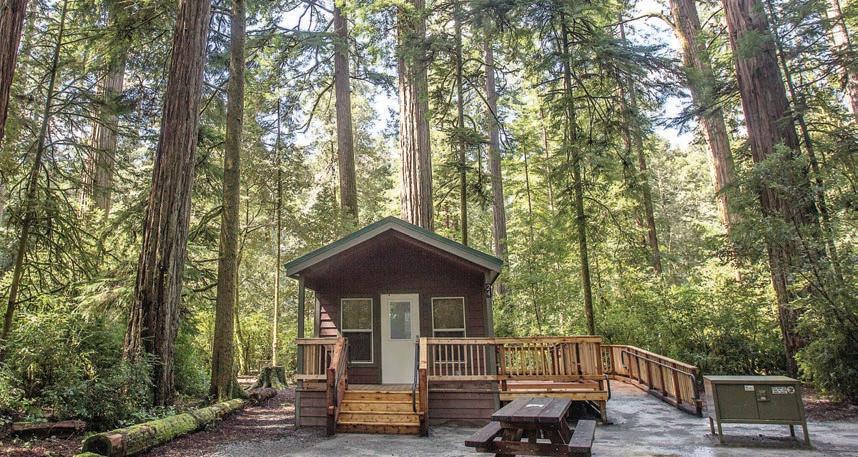
Ruby Van Deventer Park is located on the Smith River and has space for 18 campsites. Giant redwoods tower over the park, which is only yards from the river. The park is located on State Route 197 (North Bank Road) between U.S. 199 and U.S. 101.
CLIFFORD KAMPH MEMORIAL PARK
Rests on a bluff overlooking the ocean just two miles south of the Oregon border. The park has 9 tent campsites; one site is on the beach.
REDWOOD PARKS
There are also several campgrounds located in Redwood National and State Parks. Campsites are $35 and cabins $85. Reservations for paid sites can be made through reserveamerica.com.
JEDEDIAH SMITH
Campground is located in Jedediah Smith Redwoods State Park on U.S. 199 just west of the town of Hiouchi.
The campground is situated among towering redwoods on the banks of the Smith River. The campground offers swimming access on the Smith River as well as seasonal campfire programs. In the summer there is a footbridge over the river to access more hiking trails in old-growth redwood groves, including the nearby Stout Grove Trail. There are 86 tent or RV sites, although there are no RV hookups. Hiker/biker sites are also available. Four cabins were added in 2016. The cabins feature an ADA-accessible deck, bunks and a single electrical outlet.
MILL CREEK CAMPGROUND is located 7 miles south of Crescent City off U.S. 101 in Del Norte Coast Redwoods State Park.
There are 129 sites available, 22 tentonly, situated in a redwood forest, and the campground features restrooms, showers, bear-proof lockers and fire pits.
Campground programs and guided walks are also offered.
ELK PRAIRIE CAMPGROUND is located a few miles north of Orick in a redwood forest within Prairie Creek Redwoods State Park. The campground is just off Newton B. Drury Parkway (accessible from U.S. 101). This campsite is a great choice for hikers — trails through some of the largest redwoods in the world abound in this area; some have trailheads at the campsite, others are short trips away up Drury Parkway.
There are 69 sites, including four cabins and 21 for tents only.
The campground features restrooms, showers, ADA-compliant toilets and campsites and a visitor center.
Gold Bluffs Beach Campground is on a beach northeast of Orick in Prairie Creek Redwoods State Park, accessed by exiting U.S. 101 onto Davison Road 2.5 miles north of Orick and following an unpaved road for 6 miles. No trailers are allowed due to the rough condition of the road.
The campground has 24 tent-only sites. There are restrooms, showers, ADAcompliant toilets and campsites, fire rings and a campfire center.
Page 38 - 2023
GO Wild Rivers COAST
GO HIOUCHI
Hiouchi lies in the heart of Del Norte County’s tallest redwoods.
Situated on the north bank of the Smith River, a vast expanse of redwood forest park land lies to its south and west.
Some of it straddles U.S. 199 while the rest is opposite Hiouchi on the other side of the Smith, where Howland Hill Road meanders through old-growth stands with numerous trailheads along the way. At the west end of Hiouchi on U.S. 199 there is a Redwood Parks visitor center, and just a short jog down the street is the entrance to one of the larger campgrounds in the Redwood Parks.
Lying just below the Hiouchi Forks, where the Smith River and South Fork Smith River converge, Hiouchi serves as the gateway to the many wonders lying in South Fork Canyon and the secluded wildlands beyond. Below the Forks, the mainstem river widens considerably. Here there is easy tubing and drift boats can put in to fish for salmon and trout.
JEDEDIAH SMITH REDWOODS STATE PARK
This park, like the river that runs through it, gets its name from Jedediah Smith, the first European known to have crossed the Sierra Nevada to the Pacific Coast. Smith and a group of fur trappers who journeyed with him reached the Smith River in 1828. 101 years later, the state park was established, protecting 10,000 acres of ancient forest.
SMITH RIVER
Locals prize the pristine, undammed Smith River for its fishing, summer swimming, kayaking, rafting and tubing. There are a number of beaches located around the Forks, one off the highway, others on South Fork Road, and are marked with road signs.
SOUTH FORK AND BEYOND
Turn off U.S. 199 a mile east of Hiouchi onto South Fork Road to find a more secluded river experience, with several
swimming holes and kayak put-ins along the 13-mile, 30-minute drive through the South Fork Smith River’s steep canyon.
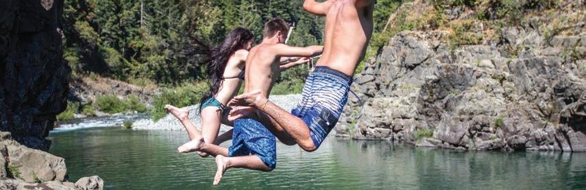
At the end of South Fork Road, a left turn onto French Hill Road will take visitors through the lush forests along Hurdygurdy Creek and up into the mountains. Near the turn is Big Flat Campground, the kind of place where the night sky is filled with brilliant stars and the only sounds are of breezes caressing the trees and creek water babbling through an adjacent ravine.
HIDDEN GEMS
Historic Hiouchi Cafe — Nestled between the forks of the Smith River and majestic redwood groves of Jed Smith State Park lies the local dining favorite Hiouchi Cafe.
Serving plate-dwarfing pancakes since 1931, the Cafe is the perfect pit stop for travelers of scenic U.S. 199. Local Favorite: Smoked pork chop and eggs. Smoked 30 miles north at Taylor’s Sausage in Cave Junction, Oregon, these chops have been converting ham and egg followers since they were added to the menu.
A classic local eatery for a weekend brunch with friends. Fishers of the mighty Smith River often begin and end their day here, complete with tales about the ones that got away.
G-O Road — was intended to be a two-lane, paved segment of a 55-mile road between the towns of Gasquet and Orleans to provide logging access to the area; however its construction was opposed by Native Americans on the grounds that it violated sacred lands, and they took their case to court, ultimately losing an appeal by the federal government in the Supreme Court. Sympathetic legislators then secured wilderness designations that barred the area from logging, and the road was never completed. Nevertheless, there are 16 miles of paved road that begin near the end of South Fork Road and follow a series of ridgetops with mountain views in all directions.
2023 GO Wild Rivers COAST - Page 39
GO SURFING / RAFTING
Despite the growing popularity of surfing and kayaking worldwide, the Southern Oregon and Northern California coastal shores and rivers remain relatively undiscovered by thrill-seekers.
Those who do take to the chilly water will experience an adrenaline rush like no other, not to mention up close and personal contact with the area’s natural beauty and array of wildlife.
In fall/winter, the coast is pummeled by powerful storms and giant waves ideal for the more experienced surfer; meanwhile the higher flow in the rivers provide excellent rapids for kayaking.
SURFING

There are many surf spots along Curry County’s coastline. Some are easy to get to, such as Sporthaven Beach at the Port of Brookings Harbor and the mouth of the Rogue River in Gold Beach. Others involve a lengthy hike or scramble down a hillside.
South Beach in Del Norte County is widely regarded as the best all-around beach to surf. The flat beach just south of Crescent City is located off of Highway 101, providing a convenient place to park while riding the waves. The long, sandy beach is a fit for surfers of all abilities, including beginners.
Farther north along the California coast, more experienced surfers can try Pebble Beach or Point St. George, which can be
rocky and rougher than South Beach.
There are several beach breaks located just north and south of the Oregon/California border, and several more located between Brookings and Gold Beach.
KAYAKING AND RAFTING
As the name implies, the Wild Rivers Coast boasts some of the most pristine and undeveloped rivers in the country, if not the world. The crystalline and jade waters of the Smith River are a holy grail for whitewater rafters and kayakers during the higher flow season from October through May, offering beginner-friendly class I-II and class III runs, Class IV wilderness canyons, expert Class V gorges and everything in between. Drift boats, rafts and kayaks are great craft for floating wold-class scenic sections of the Smith that bring boaters under ancient redwoods at any time of year.
Whether you’re an outdoors enthusiast just in need of some rental gear or a family of beginners wanting a guided river trip experience, Redwood Rides Adventure Outfitters has you covered for your epic outdoor adventure on California’s Wild Rivers Coast. Explore the crystal clear waters of the Smith River, bike through the ancient redwood for-
est, or paddle an ocean kayak past wild sea lions and a historic lighthouse on Crescent City’s scenic coastline.
“We often hear that our Redwoods by River boat tour is the overall highlight of our guests’ vacations, which usually cover a substantial chunk of the West Coast from Seattle to San Francisco,” said Adam Spencer, coowner/operator of Redwood Rides.
The Redwoods by River trips are beginner- and family-friendly scenic paddles on the main stem Smith River, where rafters and kayakers float beneath the towering old-growth redwoods of Jedediah Smith State Park, part of Redwood National Park. The tour includes a short hike into the oldgrowth redwood groves, a stunning transition from the sunny river corridor to the lush rainforest. This river run has class I - II rapids, mild enough for beginners and families, adding more excitement to paddling by the tallest living things on Earth. The Redwoods by River trip is perfect for everyone ages 3 and up, giving you a small taste of whitewater while enjoying incredible redwood views — an unmatched opportunity.
If you’re looking for more thrills, Redwood Rides also offers class II-III rafting and kayaking on the Middle and South Fork Smith.
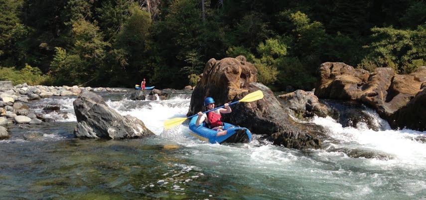
Page 40 - 2023 GO Wild Rivers COAST
Boating trips on the Smith are available year-round, since the coastal temperatures stay much warmer than inland areas in the winter time. When the weather is cooler, Redwood Rides offers drysuits to keep you warm and dry.
The outfitter’s most adventurous trip is on the North Fork Smith,
which has been called the best one-day wilderness rafting trip in the country.
Also available are guided bike tours and bike rentals with shuttle service. Enjoy a beginner to intermediate-level, 9-mile ride on Last Chance Coastal Trail, surrounded by jaw-dropping ancient redwoods and cliff-side
ocean views, or an easier ride on Howland Hill Road, a 19th century stagecoach route, traversing the magical redwoods of Mill Creek. For downhill mountain biking, you can be shuttled to the top of a few different singletrack options, while riders wanting a good climb and descent can see the unique forest diversity of Little Bald Hills Trail.
The dramatic coastline of Crescent City is perfect for ocean kayak tours. Enjoy paddling near the giant sea birds, seals and sea lions of Castle Rock National Wildlife Refuge or explore the scenic headlands surrounding historic Battery Point Lighthouse, built in 1856.
Find some time to get in the forest
By DAVID RUPKALVIS
Usually when I write these stories, the idea is to let my words give you a general idea of where I visited with the pictures telling the real story.
This week is a little different. After all, how can you take a photo that shows a 100-yearold tree that stands more than 200 feet tall? I tried, but I’ll be honest, the pictures don’t show much. A few months ago, I wrote about how much I enjoy being in the forests. In my local area, the trees are probably no more than 40 feet tall, but the vast expanse of them has kept me entranced for hours.
Since the day I moved to Oregon, I kept hearing about the mythical old-growth trees. I assumed during my travels around the region, I had seen old-growth forests because, at least to me, many of the trees felt massive and forest looked overgrown and so thick with vegetation it would be hard to even walk through them.
Now I know how wrong I was. Last year, I went to the Coquille area to do a story on work being done to repair the watershed at Woodward Creek. I met with Jeff Jackson, a fish biologist with the Bureau of Land
Management, and several other people. Jeff took me back into the forest to show me the work being done at Woodward Creek.
While driving through the forest, we moved from private land to BLM land and back to private land. That’s when I realized what I had been missing. On the private land, the forest is being managed to be cut for timber. Most of the trees in the area were about 30 years old as the landowners are using the typical cycle of cutting every 40 to 45 years.
While talking to a representative of the landowner, I asked if he knew exactly where the property line was. He told me if you watched, you could actually see it. I didn’t really understand until I did see it.
While driving through was felt like a full, deep forest, all of a sudden the property line became clear. Driving through the 40-foot-tall trees, there was a small clearing, and I could see massive giants in a straight line as we hit the BLM land. And what a difference it was. I have been in a lot of forest in my life, but I’m not sure I’ve ever seen what we drove into when we hit the BLM land that, according to rules
in place now, will never be cut for timber again.
And the scary part is the forest wasn’t technically oldgrowth. Jackson explained that the land had been cut for timber one time, likely 80 to 100 years ago. But the difference 50 or more years makes was stunning.
In the area, the BLM is working to make the forest as close to old growth as possible. And the best way to do that is to leave it alone. And leaving it alone has produced amazing results. It’s hard for me to out in words the majesty of seeing trees towering up to 200 feet tall as you are underneath them.
Under the trees, enough light filters through to have hundreds of smaller trees and bushes thriving. I didn’t see any on my trip, but Jeff said they have seen deer, bears and other animals while in the area. With Woodward Creek emptying into Evans Creek in the area, it is a location that is ripe for all kinds of natural life.
I have always been a supporter of the timber industry. I admire how the companies and landowners work to ensure there are trees to be cut down while still having
a vibrant, growing forest around us.
But I think there’s room to support the timber industry while still saying there are spots that should never be cut. Maybe the land owned by the federal government and managed by the BLM is the place to do that
While this trip was for another reason, the highlight for me was spending a little time in the massive trees that have been untouched for decades. Jeff did tell me about some places that have true old-growth trees that have never been cut, so I am planning to make my way there soon to experience the majesty of Mother Nature deep in the forest.
Usually, I would tell you here how to get to this spot. But in this case, the land is bordered by private property and the road leading in is fenced off due to damage done in the past by off-road vehicles. So, I’m making an exception and keeping it private.
But I will say this. If you have the opportunity to get into an old-growth forest, take it. Take some time to sit and look and listen. You will be glad you did.
2023 GO Wild Rivers COAST - Page 41
GO GASQUET

Nestled in a green canyon along the banks of a tumbling river,

Gasquet (pronounced “GAS-key”) is the gateway to the Smith River National Recreation Area, which encompasses much of the mountainous Smith River watershed.
Although Gasquet began as a mining community in the 19th Century, its value as a travel destination was quickly realized, and its founder, Horace Gasquet, built up the town as a health resort.
Gasquet continues to draw nature lovers to its beauty: to hike and bike the many trails that cross steep and scenic Siskiyou Mountain ridges and descend into the range’s characteristically lush, narrow canyons; to kayak and raft down the Smith River’s rapids and swim in the river’s pristine waters; and to take driving tours into its secluded wildlands.
For those wanting to get the most out of their exploration of the Smith River NRA, stop at its visitor center on U.S. 199 in Gasquet to find information and maps, enquire about campsite availability and acquire campfire permits
THE RIVER
Fed by clear mountain streams, the Smith River is the only undammed river in California, and it is prized by visitors and locals alike for its recreation opportunities: fishing, boating and swimming.
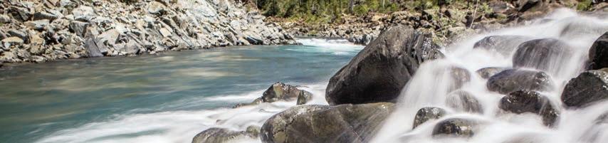
Because the Pacific Ocean remains cold year-round due to prevailing currents from the Gulf of Alaska, the best place for swimming and sunbathing on the Wild Rivers Coast is at its rivers, where summer temperatures in the canyons
are typically in the 80s and 90s, and the waters provide a refreshing delight. No river in the region offers more campgrounds, swimming holes and kayak/raft launches than the Smith.
River accesses, many of which have restrooms, are marked with U.S. Forest Service signs at numerous places along U.S. 199 both east and west of Gasquet.
Interested in more than swimming?
The river is a great place for tubing, rafting and kayaking. If you don’t have your own boat, local company Redwood Rides offers kayak rentals and guided kayaking excursions to experience the river’s many rapids. Redwood Rides also offers mountain bike rentals. Find out more at redwoodrides.com or call (707) 951-6559.
SCENIC DRIVES
Sweeping mountain vistas can be found in every direction from Gasquet, and though some roads may be in rough condition, most are navigable by two-wheel drive vehicles.
Little Jones Creek Road is the best of the bunch for accommodating vehicles with low ground clearance. The drive offers close views of the Siskiyou Crest with the Marble Mountains in the distance, and you can visit the Ship Mountain Fire Lookout, which has commanding views in all directions, including the ocean to the west. Little Jones Creek Road intersects U.S. 199 12 miles east of Gasquet at a marked exit. Take the road for 10 miles to Ship Mountain. Vehicles without 4-wheel drive will need to park at the toilet and walk up the last few feet to the lookout.
HIDDEN GEMS
Carnivorous plants — Due to the area’s seismic history, the Siskiyou region has an unusual “serpentine” geology that makes it home to a number of rare and endemic species of flora, the most notable being the carnivorous darlingtonia. Also called cobra lilies, it’s not hard to see how they got this nickname: the pitcher plant stands upright with a flared neck, head-shaped cap and forked flowers hanging down, resembling fangs. The easiest place to see them is by taking a short wheelchairaccessible trail that leads to a bog (darlingtonia’s habitat) surrounded by cedars and azaleas. Find it 3.5 miles east of Gasquet where a sign says “Botanical Trail.”
Patrick Creek Lodge — Eight miles east of Gasquet on U.S. 199, this historic lodge in operation since 1926 is a sight to behold with its log beams large stone fireplace. It offers fine dining and private cabins. If you can’t stay long, the excellent bar at least is worth a visit for your passengers.
Page 42 - 2023 GO Wild Rivers COAST
GO CRESCENT CITY
U.S. Highway 101 bypasses some of Crescent City’s most beautiful places
— rugged beaches and ancient redwood groves, islands alive with birds and sea lions, historic lighthouses and epic murals. Most pass unseen unless you stray from the beaten path.
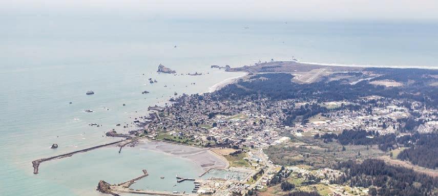
POINT ST. GEORGE
City
DELI SERVING:
sandwiches, soups, juice/smoothie bar, coffees, full salad and yogurt bar.
LARGEST SELECTION OF:


Herbs/Supplements
All Organic Produce Department, Wine/Beer Department, Specialty Items for all Dietary Needs, Imports, Gift Items, Bulk Foods and Always - Great Customer Service.

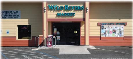

9am-7pm 7-days a week.
----------------
450 M Street, Crescent City (707) 464-1926
Turn seaward from the north end of Pebble Beach Drive to Point St. George Heritage Area, the third-most western promontory in the lower 48. Infamous for shipwrecks, St. George Reef juts out to sea from these high grassy bluffs and an off-shore lighthouse marks the edge of reasonable navigability. Panoramic views of reef, open ocean and coastal mountain ranges make this area a local favorite. A trail from the parking lot leads to grassy paths and the beach.
To access Pebble Beach Drive’s northern section and Point St. George Heritage Area from the north end of Crescent City, exit Highway 101 at Washington Boulevard and go 3 miles. At a stop sign surrounded by ocean views and pastureland, go straight another mile for the Heritage Area parking lot. From central Crescent City, turn west
on 5th Street or 9th Street and go one mile to Pebble Beach Drive.
THE HARBOR
Famous for fueling Californians’ love of Dungeness crab, Crescent City Harbor produces the highest commercial value of seafood of any California port north of Monterey. Situated on the south side of town among numerous hotels and restaurants, the harbor hosts over 200 commercial fishing boats — and lots of brash sea lions and seals.
These bulbous creatures laze over the docks and walkways in the harbor. Slipping into the water, they become swift and elegant. To view sea lions and harbor seals up close (but not too close!), turn west on Anchor Way at the harbor’s south end. Look for a pile of pinnipeds on your right, near the Chart Room restaurant.
2023 GO Wild Rivers COAST - Page 43
Go-to place for lunch in Crescent
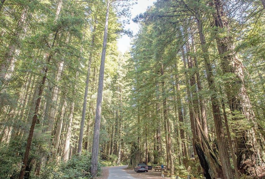


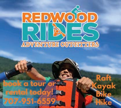
Page 44 - 2023 GO Wild Rivers COAST
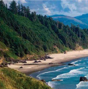
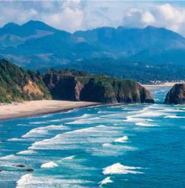
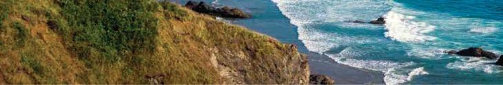


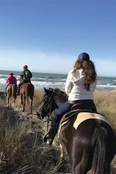


2023 GO Wild Rivers COAST - Page 45 Shop and play www.EnglundMarine.com “Serving the Crescent City area since 1981” 191 Citizens Dock Rd. Crescent City, CA 707-464-3230 We have all you need to enjoy your time on the Northern California Coast! Sport Fishing - Commercial Fishing - Rain Gear Boots & Clothing - Tools & Industrial - Boating Accessories - Rigging & Hydraulics - Fishing Licenses Crab Ring Rentals - Safety Gear And So Much More! Crescent Trail Rides 707-951-5407 • CrescentTrailRides.com On our beautiful beaches and majestic Redwoods Rides of a Lifetime


Page 46 - 2023 GO Wild Rivers COAST Real Estate DEL NORTE COUNTY Ron Reel, Principal Broker 541-244-8118 • DRE#01150174 premieroceanprop.com www.ReelProperties.realtor • RealPropertiesInc@gmail.com 340 US Highway 101 N, Crescent City, CA 95531 (707) 460-6425 Robin Hartwick, Sales Associate 707-954-2492 • DRE#01315594 RobinHartwickRealEstate.com 707-951-8146 • DRE#01146947 Shauna Scott, Sales Associate ShaunaRealtor4@gmail.com Donna DeWolf, Onsite Broker 707-954-3507 • DRE#01196287 donnadewolf.com Debbie Olson, Sales Associate 707-218-8055 • DRE#01126988 debbie-olson.com Earlene Burley, Broker Associate 707-954-7355 • DRE#00854797 EEBurley@gmail.com
Sparkling Ocean Front Beach House


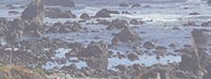

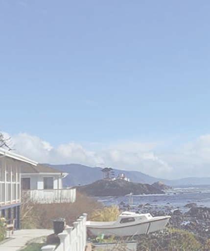
2023 GO Wild Rivers COAST - Page 47 Real Estate
COUNTY Robin Hartwick, Realtor 707-954-2492 DRE#01315594 robinhartwickrealestate.com 340 US Highway 101 N, Crescent City, CA Built to take advantage of the majestic rocky shoreline, nearly every room in this home has an ocean view. The ocean side of this home is almost all glass and drenches the home in light. The warm glow of the sunset over the ocean fills every room and demands attention. With 180-degree panoramic view from ceiling to floor windows in the home, a covered deck, open patio, or the lower of the tri-level outdoor living spaces, the hot tub deck, you have but to choose from where you will enjoy the daily events. MLS # 230067 • $2,339,900
DEL NORTE
Just steps to Del Norte’s iconic Pebble Beach where tide pools teaming with life await exploration. Be sure to check out the virtual tour www.youtube.com/watch?v=zxDyv1TmOuI View home at robinhartwickrealestate.com
GO ORICK
Situated halfway between Eureka and Crescent City on Highway 101,
Orick is a former logging town that became the heart of Redwood National and State Parks 40 years ago.
Orick boomed and busted along the banks of Redwood Creek, which is more like a raging river than a babbling brook. Its 282-square-mile basin contains much of the world’s remaining oldgrowth coastal redwoods, trees that can grow taller than 30-story buildings.
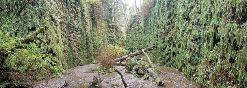
Besides superlative height, coastal redwoods can live nearly 2,000 years, longer than the Roman Empire existed. Old-growth trees around Orick have been quietly growing since Roman armies were marching across Mesopotamia. Here are some highlights:
MOUTH OF REDWOOD CREEK
Like the mouth of the Smith River 60 miles north, Redwood Creek plunges dramatically into the Pacific along an easily accessible beach. Gargantuan logs sent out to sea during high creek flows are strewn across the sand by tides, offering a different view of the redwoods.
To access the mouth of Redwood Creek, turn west off of Highway 101 two miles south of Orick, toward the Thomas H. Kuchel Visitor Center. From there, follow a boardwalk to view the creek’s slough and go north ¼ mile across the flats to view the mouth.
ELK VIEWING
Orick’s human residents are outnumbered by Roosevelt elk, the largest species of elk in North America. Most often seen grazing contentedly in dewy meadows near the coast, elk attitudes change radically during the “rutting” season in late summer and early fall, when 1,000-pound bulls armed with six-, seven- and eight-point racks spar one another for dibs on the does. It’s a spectacular display.
Elk are many things. Majestic. Powerful. Graceful. Wild. Friendly they are not. Elk do not appreciate paparazzi and have been known to charge overzealous people. They can be spotted all over the Orick Valley.
REDWOOD TRAILS
Davison Road is an access point for some incredible trails as well as the only tent camping spot in the area, Gold Bluffs Beach, located 6 miles down a dirt road that connects to Davison Road at Elk Meadow. For those interested in a short jaunt, the 2-mile Trillium Falls loop can be accessed by a foot path south of the Elk Meadow parking lot, winding through giant redwoods and culminating in a waterfall. Lady Bird Johnson Grove is another easily accessed and popular spot for viewing old growth redwoods. About a mile
north of Orick and a mile south of Davison Road, turn east on Bald Hills Road for 2 miles. The trailhead parking lot is on the right after a footbridge.
HIDDEN GEMS
Verdant walls — Entering Fern Canyon, it’s easy to imagine a stegosaurus picking its way over the fallen trees that litter the creek bed. With 50-foot walls draped in seven different kinds of ferns, the ravine provided a prehistoric backdrop for Steven Spielberg’s “The Lost World: Jurassic Park.” Visitors with sharp eyes will be able to spot a plethora of creatures including giant Pacific salamanders, banana slugs, garter snakes and birds. Turn west on Davison Road, 3 miles north of Orick and go 7 miles to the end of Gold Bluffs Beach Road.
Rare minerals — The Orick hills have other secrets, such as rare minerals found nowhere else in the Western Hemisphere. Orickite is a rare mash-up of copper, iron, hydrogen, oxygen and sulphur. Only a few grams have ever been found. The first sample came from Coyote Peak, overlooking Orick, and was sent to the Smithsonian Institution in Washington, D.C., for further study and safekeeping.
Page 48 - 2023 GO Wild Rivers COAST
BRIDGES OF CURRY COUNTY
By Diana Bosetti, Curry Coastal Pilot
Bridges can be utilitarian - connecting one place to another over an obstacle of water - or they can be timeless, like the Bridges of Curry County.
“People are drawn to beautiful places,” said Spirit Meller, a Brooking’s-based architect who drives over one of the nine Curry County bridges on his way to work each day.
“These bridges, most of them built in the late 1920’s and early 1930’s, are almost 100 years old,” he added. “They remind us that multi-generational structures are not just about function, they are an investment.”
According to the site Bridgehunter. com, there are nine functioning bridges in Curry County, dating as far back as 1924 and the most recent to 1998.
From the Reinhart Creek Bridge with its warren deck truss bridge - which is an industry-specific way of saying it employs weight-saving design elements based upon equilateral triangles - to the Isaac Lee Patterson Bridge over the Rogue River in Gold Beach - the varying design styles don’t disappoint.
“The bridges are an undiscovered part of the Oregon Coast,” said Robert Hadlow, a historian with the Oregon Department of Transportation and author of Elegant Arches, Soaring Spans: McCullough, Oregon’s Master Bridge Builder.
Much of the credit to the impressive design styles of many of Oregon’s bridges goes to Conde B. McCullough. The Dakota-territory native moved to Oregon in 1916, where for 18 years he was head of bridge design and construction for the Oregon State Highway Department, and is credited with building hundreds of custom-designed spans using efficiency, sound economics and architectural elegance, according to Hadlow.
“He was a force to be reckoned with,” said Hadlow. “In terms of engineering,
he was really pushing the envelope.” Four of the nine Curry County bridges were designed by McCullough. They include the bridges of Euchre Creek; Hunter Creek; Myers Creek and the Isaac Lee Patterson Bridge - sometimes referred to as the Wedderburn or Rogue River Bridge.
According to Hadlow, the Isaac Lee Patterson Bridge is considered to be among the six major bridges designed by McCullough, and was part of a broader push to span the three bays and three river estuaries that relied on outmoded ferry service along the highway.
A quick read on the Bridgehunter. com website describes the bridge as: Consisting of seven reinforced concrete deck arches. It was the first structure in the US constructed with the Freyssinet method of arch ring decentering and stress control, named after its French inventor. The American Society of Civil Engineers designated the bridge a National Historic Civil Engineering Landmark in 1982, and the success of the bridge led to the widespread use of prestressing techniques in concrete construction. The structure is dedicated to Isaac Lee Patterson, the Oregon governor who promoted its construction.
The Isaac Lee Patterson Bridge also features obelisk monuments - design styles that can best be described as the Art Deco included in the construction of the New York Empire State Building. Driving along the idyllic coast line, where Redwood trees meet rocky, turbulent shores, it might be easy to go over the crossings of the other five, lesser-known bridges of Curry County with hardly a notice. But that, said Meller, would be a mistake. Take, for instance, the Thomas Creek Bridge - which bills itself as the highest bridge in Oregon at 345 feet - and is located eight miles north of Brookings. “It’s a super cool bridge,” said Meller. “My girls say that when we cross it, it
feels like we are driving to the end of the world.”
The Thomas Creek Bridge includes a triple span deck truss that sits over the ocean, along coastal route 101, and is often covered in a blanket of heavy fog. The Bridge was built by engineer Ivan D. Merchant, who also designed the North and South Umpqua River I-5 bridges and the Astoria-Megler bridge over the mouth of the Columbia River.
The only drawback is that the Thomas Creek bridge can be difficult to photograph from below because most of the trails end towards the end of a precarious cliff. There is parking on both ends of the bridge, however, with trails to the south side.
There is also the Bush Creek Bridge, which is the work of engineer Robert Kaspari and is located in Humbug Mountain State Park. As the most recently-constructed of the Curry County bridges, it is the first bridge in Oregon to use stainless steel reinforcement in the deck and beams, and microsilica modified concrete for general construction - a plus considering the debilitating salt-winds that can rust and crumble apart some of the older bridge designs.
Lastly, there is Lobster Creek Bridge, which was designed by senior engineer Henry R. Angwin in 1959 utilizing a riveted, 10-panel Parker through truss reminiscent of an elevated railroad crossing.
Author Robert James Waller wrote in his book, The Bridges of Madison County, “First you must have the images, then come the words.”
Words...whether they describe elegant arches with soaring spans, Gothic or Art Deco-infused designs, or stainless steel reinforcement, the images of the Curry County Bridges are spectacular from one to the next.
2023 GO Wild Rivers COAST - Page 49
GO GAMBLING
For those interested in gambling
Del Norte County offers three casinos within 30 miles of one another.

LUCKY 7 CASINO
Open 24 hours, Lucky 7 Casino describes itself as the “Friendliest Casino on America’s Wild Rivers Coast.” Lucky 7 o ers a large gaming floor with the largest non-smoking room in the area, poker room, and bingo hall, as well as the House of Howonquet Restaurant, Club 7 Sports Bar, Howonquet Lodge, Fuel Mart, event center, meeting rooms, and free RV parking.
Lucky 7’s gaming floor o ers more than 300 slot and video games. Blackjack tables open daily at noon, with table limits $3 to $200. Play Poker four nights a week at 6 p.m., Wednesday to Saturday and Sunday cash games at 2 p.m. Play Bingo Sunday, Tuesday, and Wednesday with regular games starting at 7 p.m., doors open at 5:30 p.m.
Getting there:
From the south: Head north on Hwy. 101 past Smith River. The casino will be on the right.
From the north: Drive south from Brookings, OR on Hwy. 101. The casino will be on the left.
From U.S. Hwy. 199 or Calif. Hwy. 197: Turn north on Hwy. 101. Drive past Smith River. The casino will be on the right.
ELK VALLEY CASINO
Nestled in the redwoods, Elk Valley Casino is here to make your visit memorable. Whether you are a resident, vacationing, or just traveling through, your gaming experience will be worth the visit.
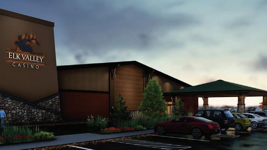
Elk Valley Casino is open 24 hours and o ers over 300 slot machines, with denominations ranging from pennies to $2 and a non-smoking room. Find all your favorites and the latest and greatest games, including 4D machines.
Blackjack tables are open daily and Pai Gow Poker is offered daily. The Deck Card Room is non-smoking and holds poker tournaments 7 days a
week with live poker games offered.
Bingo is located in the Betty Green Event Center four days a week in a nonsmoking environment. NEW to Elk Valley Casino is electronic bingo, making bingo even more exciting!
Hungry?
Visit the Full House Bar & Grill open daily for breakfast, lunch and dinner. View menus online at:
www.elkvalleycasino.com.
Getting there:
From the south: Take Hwy. 101 into Crescent City. Turn right on Elk Valley Road. Take another right onto Howland Hill Road. The casino will be on your left.
From the north:
Drive south on Hwy. 101 into Crescent City. Turn left on Elk Valley Road. Turn right on Howland Hill Road. The casino will be on the left.
Page 50 - 2023 GO Wild Rivers COAST
REDWOOD CASINO


The Redwood Hotel Casino features 50 slot machines and video poker with regular and progressive machines. The casino’s slots include “Jackpot Inferno” and “Dragon Temple 3D.”
The casino also o ers the Yurok Country Rewards Club, which allows folks to earn rewards each time they play and
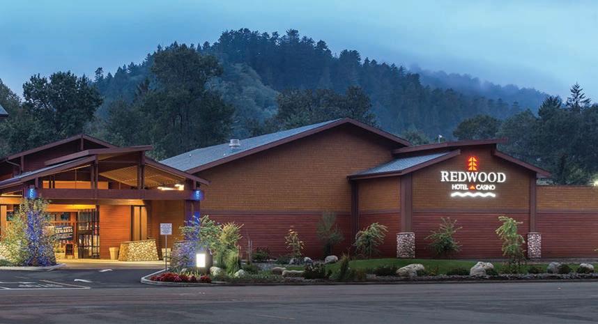


be notified of special deals with local businesses.
Abalone Bar and Grill is open from noon-2 p.m. for lunch and 5-8 p.m. for dinner. The bar opens at 5 p.m. nightly.
Getting there:
From the south: Go north on Hwy. 101
to Klamath. Take a right on Ehlers Ave. and another right on Klamath Blvd. The casino will be on the right.
From the north: Go south on Hwy. 101 to Klamath. Take a left on Ehlers Ave. and a right on Klamath Blvd. The casino will be on the right.
2023 GO Wild Rivers COAST - Page 51
GO GOLFING
OREGON
BANDON DUNES GOLF RESORT
Known the world over as one of the premier golf resorts in the United States since its opening in 1999, Bandon Dunes offers an experience unlike any other. Beautiful coastal vistas are the backdrop for five courses designed with golf’s Scottish roots in mind. Beautifully crafted, these courses are revered by golf experts around the world, with four of them garnering critical acclaim from the golfing elite. Pacific Dunes, Bandon Dunes, Old Macdonald, and Bandon Trails are all consistently rated among the best courses in the nation by top golf publications.
Another unique experience in every way, the Bandon Preserve is a 13-hole, par-3 course that delivers a level of enjoyment matched only by the spectacular views.
Opened in 2012, Bandon Preserve begins high atop a sand dune and rolls down toward the beach. The Pacific Ocean provides the backdrop to every hole. All net proceeds go directly to the Wild Rivers Coast Alliance, an organization that supports conservation, community and economy on the southern Oregon Coast. The Punchbowl, a 2.5-acre putting green used to set up a 18-hole putting course was added in 2014, providing another exciting opportunity to challenge your golf skills.
Bandon Dunes Golf Resort’s courses offer stunning, yet challenging coastal holes, steep and intimidating bunkers, and expansive greens set along the gorgeous southern Oregon coastline. Each course offers something different than the other, though all are spectacular in their own right.
Bandon Dunes’ courses were
designed with the history of golf in mind, as their layout and structure harken back to world-famous courses in golf’s birthplace, the British Isles. Keeping with that mindset, the courses are walking courses with a caddie service available (call in advance for a reservation). As a crownjewel of golf courses worldwide, a Bandon Dunes golf getaway should be on every golf fanatic’s bucket list. Bring your soft-spike cleats and passion for the sport because this is “Golf as it was meant to be played.”
For more information and fees, visit www.bandondunesgolf.com
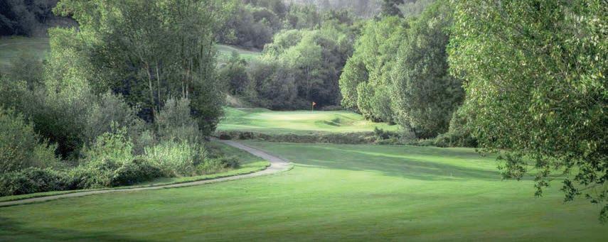
COURSE INFO:
18 holes, par 72.
• LENGTH:
Black tees – 6,732 yds.
Green tees – 6,221 yds.
Gold tees – 5,716 yds.
Orange tees – 5,072 yds.
Blue tees – 3,945 yds.
• RATING/SLOPE:
Black tees – 76.3/141.
Green tees – 71.4/133.
Gold tees – 69.5/133.
Orange tees – 66.6/126.
Blue tees - 61.5/101.
• LOCATION: 57744
Round Lake Rd., Bandon, Ore. 97411
• PHONE: (800) 742-0172
BANDON CROSSINGS
GOLF
COURSE
Since its opening, Bandon Crossings Golf Course has been recognized as a challenging course that offers beautiful vistas and plays firm and fast, year round.
Located 5 miles south of Bandon, this 18-hole, par 72 course was named one of the country’s Top Ten New Courses in 2007 by Golf Magazine.
It roams through wetlands, over streams and into open coastal forests.
Bandon Crossings offers a complete practice facility, friendly staff and excellent golf instructors. A “Get Golf Ready” program is available

Play through! Whether you are looking for a chip-shot or a challenge, the Wild Rivers Coast is a golfer’s paradise realized.
Page 52 - 2023 GO Wild Rivers COAST
for beginners of all ages. They also offer a “Long Driver Winner” annual pass for golfers living farther than 65 miles away. Curry and Coos county residents can join the “Crossings Club” at no charge.
COURSE INFO
18 holes, par 72
• LENGTH:
Black tees – 6.855 yds.
Blue – 6,270 yds.
White – 5,780 yds. Red — 5,030 yds. Gold — 4,186 yds.
• RATING/SLOPE: Black tees – 74.0/139. Blue – 71.1/127. White – 69.0/122. Red — Men 65.7-117, Women 72.7/130.
Gold — Men 62.3/107, Women 66.1/113.
• GREEN FEES:
Spring (April-May) standard
18, $64; standard 9, $38. Summer (June-Oct.) standard 18, $84; standard 9, $50.
• LOCATION:
87530 Dew Valley Lane, Bandon, Ore. 97411
• PHONE: (541) 347-3232
• WEBSITE: bandoncrossings.com
CEDAR BEND GOLF COURSE
Cedar Bend is unique among coastal courses because it not only offers great golf on a tidy 9-hole course, it has 11 RV campsites, so it is easy to stay-and-play.
Twice around the layout plays to 6,288 yards from the back tees and 5,231 from the front. Dual tees are available for 18-hole play.
The nicely manicured course, owned by its club members, crosses Cedar Creek several times. It features fairly wide, flat fairways, an anomaly for
most coastal valley courses. The course hosts several popular seasonal tournaments. Among them are The Crab String Scramble, the Stampede Tournament, and the Popeye and Olive Oil Tournament, a man and woman blind-draw event. Call for event dates and information.
A driving range, putting green, pro shop and snack bar are among the amenities.
The course is located in Cedar Valley, until recently known as Squaw Valley, between Highway 101 and North Bank Rogue River Road.
COURSE INFO
9 holes, dual tees, par 72
• LENGTH: Tournament tees –6,288 yds.
Men’s tees – 5,892 yds.
Women’s tees – 5,231 yds.
• RATING/SLOPE: TOURNAMENT TEES
69.9/127.
MEN’S — 68.1/121.
WOMEN’S — 68.6/118
• GREEN FEES: 9 holes, $20; 18 holes, $28; junior rate (under 15) 9 holes $5, 18 holes $7; student (ages 15–21), 9 holes $15, 18 holes $20. Twilight golfing after 3:30 p.m., Monday to Wednesday $15.
• LOCATION: 34391 Squaw Valley Road, Gold Beach, Ore. 97444
• PHONE: (541) 247-6911
• WEBSITE: www. cedarbendgolf.com
SALMON RUN
Salmon Run, an 18-hole championship golf course nestled in the forest 3.5 miles up the Chetco River in Brookings is in the center of Oregon’s “banana belt,” where the Mediterranean
weather is mild year-round.
Val and Gary Early of Early Management Team are pleased to share their 182-acre facility with the world. “We love the wilderness that surrounds it,” Val Early said. “You feel like you’re on an outing on a private course. We love that the wait time might just be to wait for deer to clear the green.”
Wildlife often sit in the gallery and salmon and steelhead can be seen when they swim up Jack Creek to spawn.
Salmon Run offers a course for every skill level in a setting that you will never forget. There is a pro shop with a PGA teaching staff and driving range, all of which are open to the public. There are four sets of tees stretching from 5,433 yards to more than 6,400 yards. And tournaments abound in the summer months.
“There are lush fairways and greens with a challenging layout that helps hone the accuracy game instead of relying on the long ball each time,” Val said. “Challenges vary from hole to hole. It’s a course where the rewards are great if targets are hit!”
COURSE INFO
• LENGTH: Professional tees – 6,093 yds. Tournament – 5,744 yds. Club – 5,205 yds. Resort – 4,129 yds.
• RATING/SLOPE: Ranges from 76.2/151 on professional tees to 61.8/103 on resort tees.
• GREEN FEES: 9 holes, $35; 18 holes, $44. Member guests with shared carts $39. Member guests walking, $25. Senior special (after 1 p.m.) 9 holes, $25; 18 holes, $35; Twilight (after 3 p.m.): 9 or 18 holes walking,
$15; 9 holes with cart, $28; 18 holes with cart, $33; (after 5 p.m.): 9 or 18 holes with cart, $20. Rates subject to change.
• CART FEES: $30 for one or two golfers for 18 holes, $20 for one or two golfers for 9 holes
• LOCATION: 99040 South Bank Chetco River Road, Brookings, Oregon
• PHONE: 541-469-4888
• WEBSITE: www. salmonrungolf.com
CALIFORNIA
KINGS VALLEY GOLF COURSE
Situated at the junction of Highways 101 and 199, Kings Valley Golf Course is a conveniently-located course that gives golfers a challenging short-game exercise.
The course features eight par3s and one 4-shotter routed over a relatively flat terrain. Coastal pines and alders make hitting some greens difficult. The course features a driving range, putting green, bar and snack bar.
COURSE INFO
9 holes, par 28 front, 28 back
• LENGTH:
Men’s tees – 1,259 yds.
Women’s tees – 1,197 yds.
• RATING/SLOPE:
Men’s and women’s – 55/79.
• GREEN FEES:
9 holes, $12; 18 holes $19.
• LOCATION:
3030 Lesina Rd., Crescent City, Calif. 95531
• PHONE: (707) 464-2886
2023 GO Wild Rivers COAST - Page 53
CHART ROOM

Where the view is always on the menu!


The Chart Room

Restaurant is more than a seafood restaurant, it’s a Crescent City tradition! It’s where locals go to eat and bring their out-of-town guests. It’s a “must stop” for visitors who hear about us through word of mouth.
The Chart Room provides more than just delicious
food, it also has some of the best scenery in all of Crescent City! If a picture is worth a thousand words, then we have millions. We invite you to come and take your own memorable pictures, posing with our mermaid and shark wood carvings.
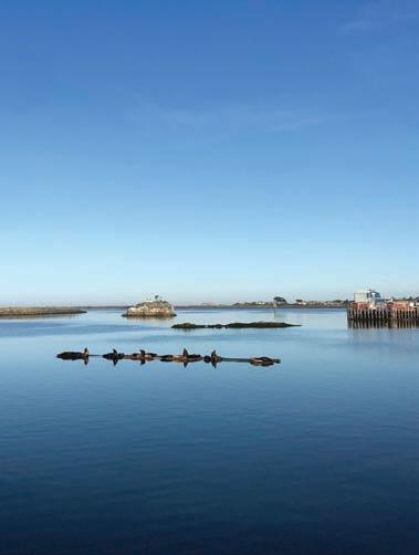
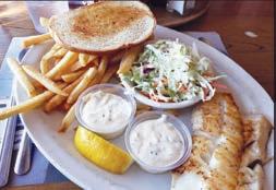
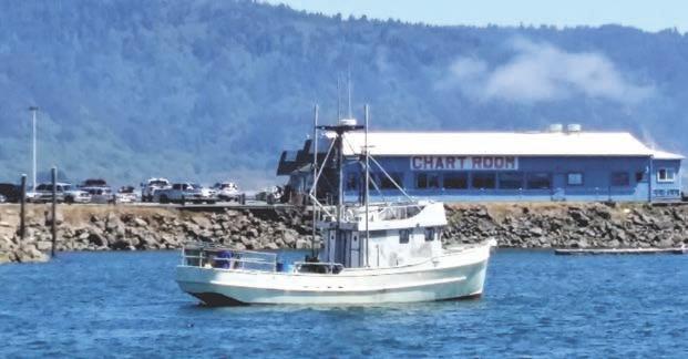
Here at the Chart Room, we have food combinations to


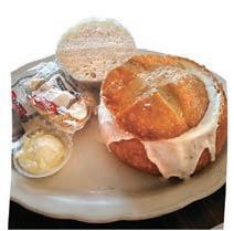


please everyone.
Stop in for lunch before or after you go out to enjoy the beautiful place we locals are so lucky to call home. When evening comes, drop your anchor here for a relaxing dinner. Watch the sunset or catch a storm, look out over the harbor at lounging sea


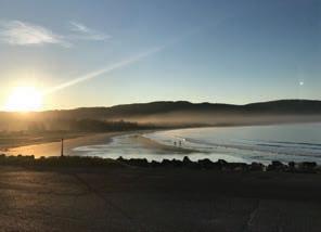
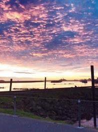
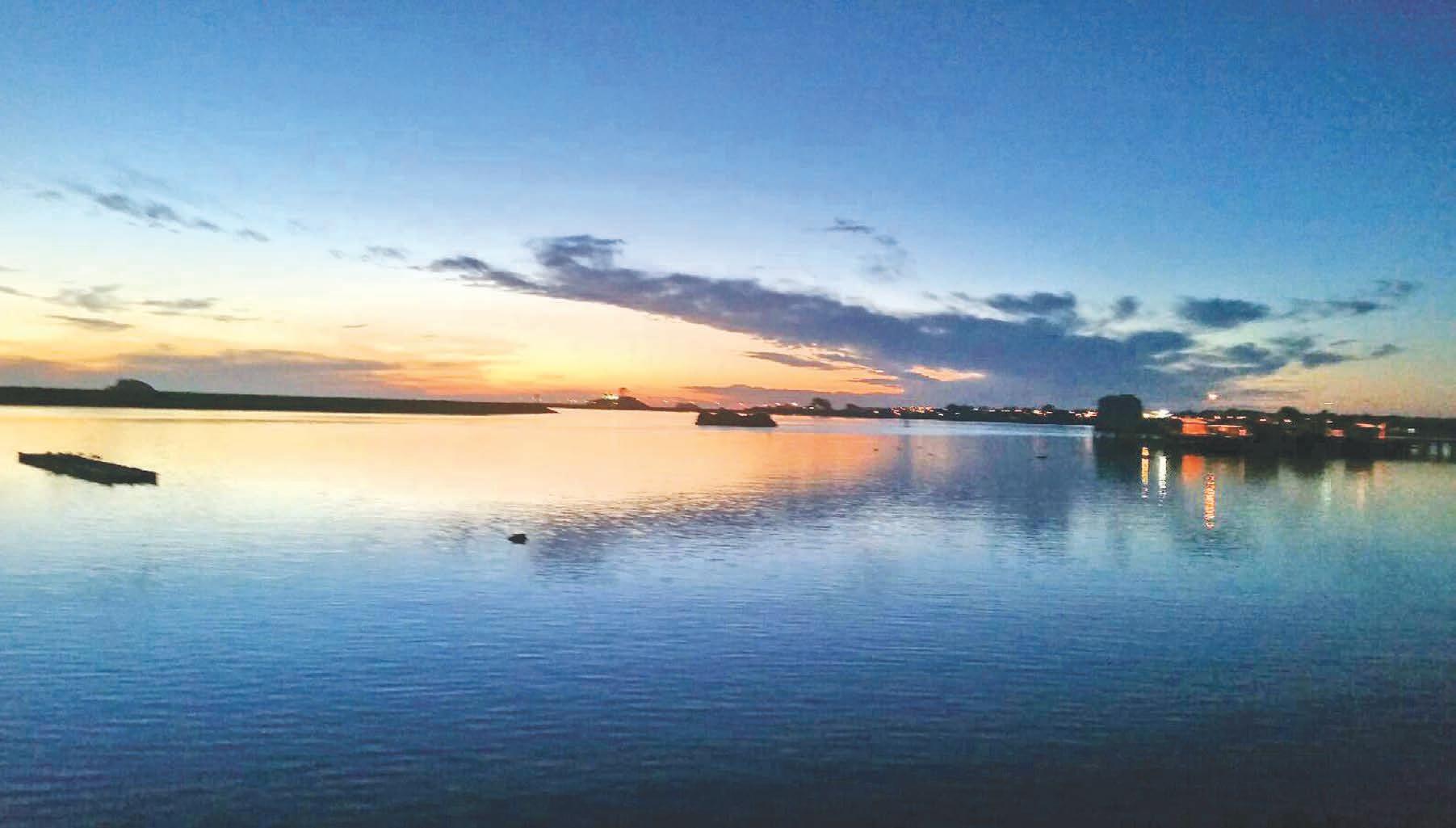
★ BEST SEAFOOD - CLAM CHOWDER - FISH & CHIPS ★ ★ FAVORITE LUNCH ★ 130 Anchor Way in Crescent City Harbor • 707-464-5993 • www. CCChartRoom .com Come taste the experience! Go READERS’ CHOICE AWARDS Del Norte Triplicate G d Winn 2023 READERS’ CHOICEAWARD S DelNorte Triplicate Br ze Winn 2023 Page 54 - 2023 GO Wild Rivers COAST
COME ENJOY OUR OUTDOOR DINING
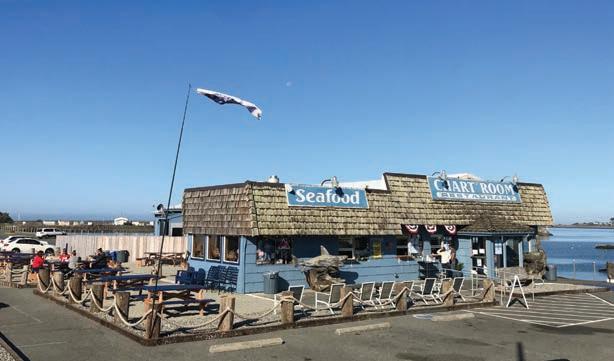
EXPERIENCE


OUTSIDE DINING - VIEWS - DOG FRIENDLY ATMOSPHERE
All have been made COVID compliant PERMANENTLY so you can enjoy it for years to come!


A LOCAL FAVORITE FOR LUNCH AND DINNER
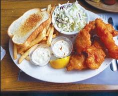
lions and our famous Battery Point Lighthouse.
Need more reasons to visit us or stay longer? How about enjoying our wide selection of beer and wine, coffee, hot chocolate, tasty appetizers, mouth watering homemade bread pudding or blackberry cobbler made with local berries.
After your meal, look for hidden treasures as you stroll along the beach, venture down to Whalers Island to look at
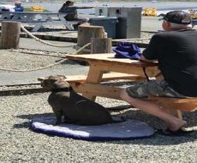
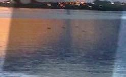
Pelican Rock, and take a walk
Pelican Rock, and take a walk through the harbor. All this making your experience even more memorable.
Not to brag, (well maybe a little) our seafood and clam chowder has been voted best in the “Readers Choice Award” by our local residents since 2007.
Our relaxing family atmosphere, friendly service, great food and amazing views will keep you lingering and


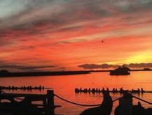

coming back for more. We, here at Chart Room, are waiting to welcome you. Thank you for letting us be a part of your Wild Rivers Coast experience. ★ FOOD TO GO ★ EASY RV PARKING ★ KIDS’ MENUS
HOURS: Wednesday-Sunday 11:00am-CLOSE
CURRENT
2023 GO Wild Rivers COAST - Page 55
GO WILDLIFE

Creatures that fly, crawl on land, swim in the sea or roam the forests and meadows can be found on the Wild Rivers Coast, for those who know where to look.
ELK
Roosevelt elk are among the largest deer in the world, second only to the moose in size. Overhunting nearly decimated the herds on California’s North Coast, but since an elk reserve was established at Prairie Creek Redwoods State Park in the 1930s, their numbers have rebounded.
Elk are among the most hazardous animals to the public at Redwood National and State Parks, Park Ranger Michael Poole said. Visitors should admire them from a distance.
Elk can be especially dangerous during the fall rut when males grow their antlers and fight each other for females. In the spring, female elk can also be dangerous if they have calves to defend. About 450 elk roam Redwood National and State Parks. The best place to view them is at the junction of Davison Road and U.S. Highway 101 north of Orick and at the end of Davison Road near the trail to Fern Canyon.
Closer to Crescent City, a herd of about 53 animals can sometimes be seen wandering south of town near U.S. Hwy 101 along Humboldt Road and Enderts Beach Road.
Another elk herd can be found in the town of Smith River, often hanging out at a field near Ship Ashore Resort on U.S. Highway 101.
Spotting elk in Curry County is challenging. Most herds stick to the county’s forested areas. But some herds have been spotted occasionally near the Brookings Airport, at 17330 Parkview Drive and the Salmon Run golf course up the south bank of the Chetco River. Elk may also be spotted on the north bank of the Rogue River east of Gold Beach.
TIDEPOOLS

During minus tides a garden of sea life can be seen clinging to the rocks and trapped in the tidepools on Del Norte County’s rocky beaches.
The best place to explore tidepools within Redwood National and State Parks is at Enderts Beach, said Park Ranger Michael Poole.
Critters include the Pacific sea anemone, which are found from Alaska to Baja California and resemble giant flowers. The purple and orange ochre sea star, webbed bat stars and the occasional sunflower starfish, which can have 16 to 24 limbs, can also be seen. Mussels
and barnacles adorn the rocks and folks may even see tiny fish swimming in the pools, Poole said.
People should also be careful not to crush anything when moving rocks around, Poole said.
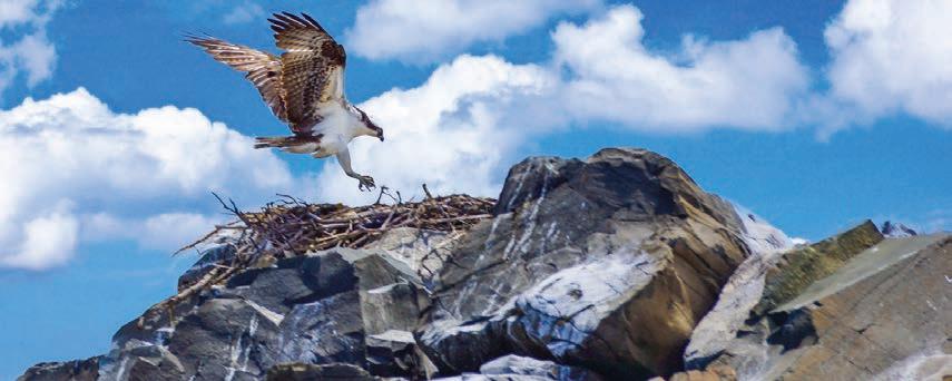
“What you really want is a minus tide during daylight hours,” he said, explaining that a minus tide is an especially low tide that occurs roughly twice a month around the full and new moons (tide tables can be found on pages 8-10).
Folks should park at the Enderts Beach overlook 3 miles south of Crescent City at the end of Enderts Beach Road off U.S. Highway 101. They can then hike down the trail to the beach and turn right to find some of the best pools.
Other good places to view tidepools include the rocky beach north of Battery Point Lighthouse, the coastline northwest of Crescent City between Pebble Beach and Point St. George, and northwest of Klamath at False Klamath Cove off U.S. Highway 101.
North of the Oregon border in Curry County is McVay State Beach, another good place to see tidepool denizens. Other good places to tidepool in Curry County include Mill Beach, a hidden
Page 56 - 2023 GO Wild Rivers COAST
beach in the heart of Brookings behind Fred Meyer.
Tidepools at Harris Beach State Park can be accessed from the first parking lot by taking the South Beach Trail to the beach and turning south toward the sea stacks and hiking on the beach for about a quarter of a mile.
At the campground entrance, before descending to the lower parking lot take the Rock Beach Trail. It’s a short trail requiring some exercise, but has tidepool life in abundance around the arch rock and rocky shores.
However, tidepooling is not without its hazards. Folks should keep an eye on the ocean, expect sneaker waves and take a friend — two- or four-footed.
BIRDING
With the area’s pristine rivers, lagoons, rocky shoreline and lofty forests, even a novice birder can spot something interesting.
Oregon’s Curry County hosts 376 bird species, according to the Kalmiopsis Audubon Society. Birding hotspots include the New River near Langlois, Cape Blanco State Park north of Port Orford, Floras Lake and the Sixes, Chetco and Rogue rivers.
Since the Southern Oregon Coast is the state’s balmiest spot, birds normally only seen in California can often be spotted in Curry County too.
For example, the Allen’s hummingbird, once rare in Curry County, is now abundant. These birds can be viewed at New River near Langlois, Cape Blanco State Park, Euchre Creek between Gold Beach and Port Orford and the mouth of the Rogue River in Gold Beach.
Short-eared owls, who hunt mostly at night, but can be seen during the day and at dusk, can also be seen at New River. They can also be seen at Lake Tolowa in Del Norte County hunting low over the fields.
Vagrant warblers on their way from the eastern U.S. to South America sometimes wind up at Cape Blanco. In Del Norte County, ducks, loons, grebes, gulls, terns, the endangered marbled murrelet and other shorebirds can be seen at the Crescent City Harbor. At Point St. George there are rock sandpipers, harlequin ducks, shearwaters and marbled murrelets.
The Castle Rock National Wildlife Area west of Pebble Beach houses the second-largest seabird colony in California, according to Brug.
From Pebble Beach Drive, folks can see tufted puffins, common murres and pigeon guillemots with a spotting scope or binoculars. Castle Rock also hosts Aleutian cackling geese, which roost in the thousands before making their way to Alaska.
The geese also congregate on pastureland between Lake Earl and the Smith River. Wetlands in that area are habitat for gulls, ducks and raptors like bald eagles, peregrine falcons, merlins and the rare golden eagle.
Mountain birds like quail, Cassin’s finches, Townsend solitaires, sooty grouse and white-headed woodpeckers can be seen on the GO Road in the Smith River National Recreation Area.
SEALS & SEA LIONS
Visitors to Wild Rivers Coast can see four species of pinniped — harbor seals, elephant seals, California sea lions and Steller sea lions — though they should keep their distance.
In Southern Oregon, seals and sea lions can be spotted at the various ports along the coast. They often sun themselves on the docks and swim among the fishing boats at the Port of Brookings Harbor.
In Gold Beach, seals and sea lions can be spotted on docks and along the shoreline and can be seen surfing the waves at the mouth of the Rogue River.
In Port Orford, favorite viewing sites include Battle Rock Park, Port Orford Heads State Park and on the docks. The many sandy beaches near Bandon and the port itself offer good vantage points to view sea mammals.
They can also be spotted in coves and isolated beaches from viewpoints along the Oregon Coast Trail within the Samuel Boardman State Park, between Brookings and Gold Beach.
Harbor seals are the most commonly seen, can reach 6 feet in length, weigh up to 300 pounds and have spotted coats ranging from a silver-gray to a black or dark brown.
The second largest seal in the world, the northern elephant seal, so named because of the proboscis found in the male, are only on land during breeding season.
Males can reach 13 feet in length and weigh 4,500 pounds, while females grow up to 10 feet in length and weigh in at 1,500 pounds. The best way to view elephant seals is through a spotting scope or on binoculars as they breed on offshore islands.
California sea lions, which use their large flippers to propel themselves on land, frequent the Crescent City Harbor near the Chart Room on Anchor Way. Ranging in color from chocolate brown to a lighter golden brown, males can grow as large as 7 feet in length and weigh 1,000 pounds. Females grow up to six feet in length and weigh up to 220 pounds.
Larger than the California sea lion, Steller sea lion males reach 11 feet in length and weigh 2,500 pounds while females grow to nine feet and weigh 1,000 pounds. Steller sea lions spend much of their time offshore and only breed on unpopulated beaches. Stellar sea lion pups are born from mid-May to mid-July.
Folks may be able to catch a rare glimpse of Steller sea lions on Castle Rock through spotting scopes and binoculars.
2023 GO Wild Rivers COAST - Page 57
GO REDWOODS
boast some of the most magnificent and accessible old-growth redwood trees in California.
The region’s rich history is inextricably tied to these ancient giants through the timber industry. Now, the trees are being preserved for current and future generations to inspire awe and wonder at any age. Compared to these aged, towering forests, we are all mere children.
Here’s just a sampling of the adventures that await you:
STOUT GROVE
This easy trail boasts some of the largest and most impressive redwoods to be seen. The trailhead is located off Howland Hill Road east of Crescent City. Parking and restroom available.
The loop trail meanders alongside the sparkling blue-green Smith River. Ferns and clovers blanket the ground, giving the grove an other-worldly feel. The trail is short, but some longer options are available.
Check at a park information station for ranger-guided walks through Stout Grove.
SIMPSON-REED GROVE
This easy and highly accessible trail is one of the first that drivers come to after leaving Crescent City on U.S. Highway 199. Be cautious when driving this stretch about 5 miles from U.S. Highway 101, because there are often people crossing the road here.
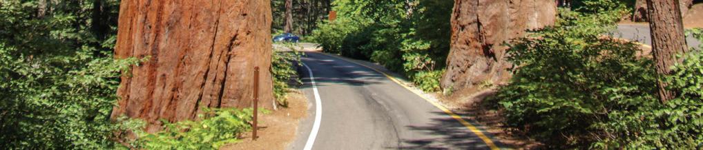
In fact, the area is so congested that park officials have moved the Simpson-Reed Grove trailhead to a location off nearby Walker Road, which also leads to other old-growth redwood trails and a stretch of the Smith River.
Informative placards along the path educate hikers about redwood trees and other vegetation found there. The Peterson Memorial Loop can be taken to extend the hike through Simpson-Reed Grove.
After crossing bridges over a babbling brook and experiencing the wonders of an ancient redwood forest, hikers can join back up with the main trail and finish the trek.
BOY SCOUT TRAIL
Off Howland Hill Road, the Boy Scout Trail (5.6 miles round-trip) is known for its forest of majestic redwoods as far as the eye can see.
And like a pot of gold at the end of a rainbow, Fern Falls treats hikers who make it to the end of this trail with the sight of cascading waters (more or less, depending on the season). The rainy winter season provides more of a rushing waterfall than the drier summer.
The Boy Scout Trail is not an easy trek, but it’s well-maintained, making the hike only moderately difficult.
The feather in the cap of the Boy Scout Trail is the Boy Scout Tree, which is located off a short, unmarked side trail at 2.4 miles into the hike. So keep a sharp eye, because hikers do not want to miss this double-trunked giant! A small wooden sign is nailed to the tree, labeling it as “Boy Scout Tree.”
Back on the main trail, hikers will enjoy (besides redwoods) the many varieties of fern, bigleaf maple, vine maple and Douglas firs.
HIOUCHI TRAIL
This easy hike (4.2 miles round-trip) through Jedediah Smith Redwoods State Park follows the pristine Smith River. The trailhead can be found just before the Hiouchi Bridge heading away from Crescent City on U.S. Highway 199. Parking is beside of the road.
The Hiouchi Trail explores some of the
most beautiful old growth redwoods in the park while giving the hiker prime views of the turquoise waters of the Smith River.
REDWOODS FROM YOUR CAR
How can you see the best of the redwoods on one short drive that’ll barely nudge your gas gauge? Three words: Howland Hill Road.
This unpaved but relatively sedan-friendly roadway is your route to old-growth redwood bliss whether you’re looking for long, medium or short hiking paths. Or, don’t even bother getting out of the car. The views from the road are that good.
South of downtown Crescent City but north of the harbor, turn east off of U.S. Highway 101 onto Elk Valley Road. Then turn right on Howland. The region’s rich history is inextricably tied to these ancient giants through the timber industry. Now, the trees are being preserved for current and future generations to inspire awe and wonder at any age. Compared to these aged, towering forests, we are all mere children.
Here’s just a sampling of the adventures that await you:
MORE INFORMATION
In Del Norte County, two parks, Jedediah Smith Redwoods State Park (accessible from U.S. Highway 199) and Del Norte Coast Redwoods State Park (accessible along U.S. Highway 101), contain most of the redwood hiking trails. In northern Humboldt County, Prairie Creek Redwoods State Park (accessible from Newton B. Drury Parkway off Highway 101) contains many more old-growth trails.
ADDITIONAL SOURCES:
Go to triplicate.com

Go to a park visitors center.
Go to the California State Parks website at parks.ca.gov.
Page 58 - 2023 GO Wild Rivers COAST
The redwood forests of Del Norte and Humboldt counties
GO KLAMATH
The Klamath area is home to many things:
the headquarters of California’s largest Native American tribe and the place where a 263-mile-long river flows spectacularly into the Pacific, to name a couple.

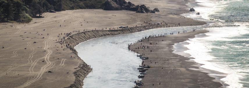
The village — relocated after a devastating flood in December 1964 — and Yurok tribal headquarters are both on the inland side of U.S. Highway 101 just north of its bridge over the Klamath River. The most spectacular scenery, however, is reached by turning west off the highway onto Requa Road.
HISTORIC REQUA INN
On your right less than a mile up Requa Road is the Historic Requa Inn, which you could consider either a big bed-and-breakfast or a small hotel.
It was built as a 22-room inn in 1914 after a fire destroyed an older hotel built on the same site in the late 1800s. Its views of the river are as scrumptious as the multiplecourse gourmet meals served in the dining room.
MOUTH OF KLAMATH OVERLOOK
Continue up Requa Road to a parking lot on your left that overlooks the Mouth of the Klamath River to the south. During salmon season, fishermen amass on the water and sandy spit.
If you think the view is good from here, walk down the Coastal Trail about half a mile, and turn left on another trail that meanders for an additional half-mile to a wooden observation platform jutting over the ocean. From here, the Mouth of the Klamath can be seen in all its splendor, and if you’re lucky you might see the spouts of gray whales at sea.
Retrace your steps to the parking lot, or continue north a little farther on a memorable stretch of the Coastal Trail.
HIDDEN GEMS

World War II relic — If they look sharp, visitors exploring Redwood National and State Parks’ coastal drive will come across an old radar station from World War II.
The U.S., fearing an attack from the Japanese, built a series of these stations on sloping hillsides, said Park Ranger Michael Poole. Because of their exposed locations, the stations were often disguised. The radar station off Coastal Drive appears at first glance to be a farmhouse.
“They had two buildings, the power station and the operations station, but they’re just cinderblock concrete,” he said. “Around one of them they built a fake farmhouse and around the other one they built a fake barn.”
Coastal Drive can be accessed at the end of Klamath Beach Road off U.S. Highway 101. Visitors should then travel down Alder Camp Road, which will reconnect them with Klamath Beach Road, forming a one-way loop.
Newton B. Drury Parkway — Visitors taking this scenic drive will plunge through an old-growth forest of coast redwood, western hemlock and Douglas fir.
Prairie Creek protects some of the world’s tallest trees, including Big Tree. Accessed from the parkway via a short paved trail, Big Tree is 304 feet tall and 21 feet wide.
Near the south end of the 10-mile drive, folks will travel through a grassy meadow where Roosevelt elk often graze; a visitors center and campground lie to the west.
The main road through Prairie Creek Redwoods State Park, the parkway connects to U.S. Highway 101 4 miles south of Klamath and again 5 miles north of Orick.
Klamath Glen — Up for a little side trip? Head east on Highway 169 for about 5 miles to the village of Klamath Glen, where you can enjoy some upriver views of the Klamath.
2023 GO Wild Rivers COAST - Page 59
GO CA BEACHES
The Wild Rivers Coast has some of the best beach access anywhere in the world
Not only are the waves and surf a breathtaking experience, incomparable sunsets and beachcombing treasures abound.
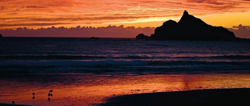
CLIFFORD KAMPH PARK
Just south of the Oregon border, is a Del Norte County facility. Long sandy beaches stretching almost as far as the eye can see are there for visitor enjoyment. The park also offers limited camping and bathroom facilities.

POINT ST. GEORGE
Four miles northwest of Crescent City is the westernmost point on the California side of the Wild Rivers Coast. Several trails lead away from a large parking lot, some to coastal bluffs with commanding views of the coastline, mountains and St. George Reef Lighthouse offshore to the northwest. Walk down a gated road to Kellogg Beach, which stretches all the way to the mouth of the Smith River, several miles away. Much of the beach is within protected areas, which feature miles of dunes, coastal forests and lakes Tolowa and Earl.
PEBBLE BEACH DRIVE
In Crescent City, the oceanfront is often overlooked by visitors whizzing through town on U.S. 101, but the spectacular beaches, from rocky to sandy, are available to the public all along this drive. To get there turn west on almost any street from downtown Crescent City
and follow your nose. You will soon be rewarded by scenic craggy rocks jutting up from the swirling Pacific. Here and South Beach periodically offer excellent whale watching opportunities.
SOUTH BEACH
The long crescent beach which gives Crescent City its name and is located just south of town. U.S. 101 runs within a stone’s throw of the beach here for people who don’t want to walk far to get their feet wet. The beach is a popular spot for surfers, who often can be seen riding the waves.
CRESCENT BEACH
A broad beach nearly two miles long at the foot of redwood-covered hills south of Crescent City. At its northern end it doglegs into South Beach. Much of Crescent Beach is within Del Norte Coast Redwoods State Park, and it is accessible from Enderts Beach Road, which intersects with U.S. 101 approximately 2 miles south of Crescent City. There is a picnic area with bathrooms. The beach is set back far enough from the road to offer a pristine, secluded experience, particularly the farther south one wanders, where tall cliffs rise above the beach.
ENDERTS BEACH
Accessed from the southern end of Enderts Beach Road, it is all but unknown to visitors but a place locals treasure.
At the end of the road is parking lot atop Crescent Beach Overlook. At the southeast end of the area is the gateway to paradise. Embarking on the scenic onehalf mile trail leads the visitor along a high bluff to the bottom of the hill where a sign at a fork in the path gives directions to the location and a campground.
Once at Enderts Beach, the beauty of it all is overwhelming. Standing on top of the small, rocky bluff that juts onto the sand, a glance to the east reveals a small, narrow canyon lined with ferns and trees. Nickel Creek, cluttered with huge drift logs that winter storms have crammed into the ravine, slowly filters through the mighty tree trunks, winds around the bluff and merges with the sea.
FALSE KLAMATH COVE
Two miles northwest of Klamath, U.S. 101 passes right by this small, scenic beach, which offers up-close views of heavy surf, rocks and seastacks around the edges of the cove. There are turnouts at the north and south

Page 60 - 2023 GO Wild Rivers COAST
ends of the beach, which is divided during high tides. Park at the front of the northern turnout during high tide to have the unique experience of feeling like your automobile is over the water. Not far past the southern turnout as the highway turns inland, there is a rest area with flush toilets, picnic tables and benches. along the edge of a picturesque pond.
KLAMATH BEACH
Is a driftwood-strewn sandbar at the mouth of the Klamath River. Providing a protected entrance to the river, it’s a popular site for fishing. The lower Klamath River is home of the Yurok Tribe, and according to their religion a large rock on the north side of the river overlooking Klamath Beach is the spirit Oregos, who took the form of a woman wearing a basket cap and carrying a baby basket on her back.
Oregos likes people, so each year she swings her leg — the sandbar — to let fish enter to feed the people. To get
there, exit U.S. 101 just south of the river onto Klamath Beach Road. After passing two RV parks, the road narrows, so RVs and vehicles with trailers are not advised. Park at the gated road and pass through the gate.
Several traditional Yurok plank houses, part of a ceremonial grounds, are adjacent to the road. Visitors are welcome to look but asked to treat the sacred grounds with care and respect.
GOLD BLUFFS BEACH
Is well off the beaten path. After exiting U.S. 101 onto Davison Road, 2.5 miles north of Orick, there is a winding 4-mile drive on unpaved road to get from U.S. 101 to the beach (RVs and trailers are prohibited). But for those who make the effort, there is ample reward at the other end. The road follows the beach for 3 miles, flanked on the inland side by steep bluffs. The beach is a great place to find elk in a particularly photogenic setting. At the far end of the road lies Fern Canyon, a narrow ravine with verti-
cal walls completely covered in ferns.
A stream runs through the ravine, so expect to get your feet wet if you visit. Gold Bluffs Beach also features a campground with 24 sites. Note: Gold Bluffs Beach requires a day use fee, payable at a booth where the road meets the beach.
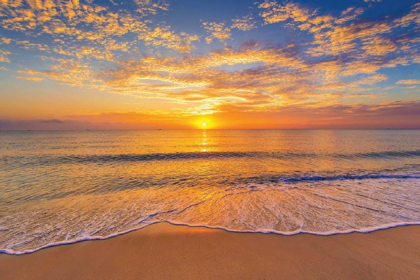
FRESHWATER LAGOON BEACH
West of Orick is a mile-long beach adjacent to U.S. 101 with sweeping views of the ocean and Redwood Coast. At its northern end can be found the Redwood National and State Parks Thomas H. Kuchel Visitor Center, which offers exhibits, a bookstore and backcountry permits. Near the visitor center is the Redwood Creek Picnic Area, with covered tables and restrooms. The shoulders along the highway are broad, offering plenty of room to park cars and RVs. On the other side of the highway is Freshwater Lagoon, which has a boat launch at the northern end.
2023 GO Wild Rivers COAST - Page 61
What everyone can do to protect the world’s oceans
The world’s oceans are facing significant challenges. According to the United Nations Regional Information Center, each year the oceans absorb 23 percent of human-caused carbon dioxide emissions and capture 90 percent of the excess heat created by these emissions. These developments are overwhelming the oceans, which are vital to the global ecosystem.
Anyone can join in the effort to protect the world’s oceans. That includes people who live in coastal communities and those who live in landlocked locales hundreds, if not thousands, of miles away from the coast. Oceana, an international advocacy organization dedicated to protecting and restoring the world’s oceans, touts the power of collective efforts to save the oceans. Though the task may seem overwhelming, that does not mean oceans are beyond saving. In fact, Oceana notes that various lifestyle choices individuals can make every day can help to protect the oceans and restore their futures.
• Help reduce demand for plastics.
Oceana estimates that 17.6 billion pounds of plastic leaks into the ocean every year. To put that in perspective, one researcher at the University of California, Santa Barbara estimated that, if
the flow of plastic into the oceans does not stop, there will be more plastic than fish in the oceans by 2050. Of course, much of the demand for plastic is driven by consumers, who can protect the oceans by purchasing plastic-free alternatives and emphasizing the need for more such alternatives to be made available. Avoid using plastic cutlery, plastic water bottles, plastic bags, and other convenient yet harmful plastics.
• Reduce your carbon footprint. Oceana notes that carbon dioxide is making oceans more acidic, which contributes to a loss of coral that serves as an essential source of food and shelter for marine life. According to the Reef-World Foundation, loss of coral threatens the existence of many marine species, producing a domino effect that ultimately decreases marine biodiversity by a significant amount. That’s problematic for marine life, but also humans, as estimates from the United Nations indicate as many as one billion people across the globe depend on coral reefs for their food and livelihoods. The threat posed to coral reefs is substantial, but the efforts to reduce your carbon footprint aren’t. Riding a bike to run errands on a warm day instead of driving a car; turning off the lights when leaving a
room; and dressing warm on cold days to reduce reliance on home heating systems are some easy ways to reduce your carbon footprint.
• Eat sustainable seafood. The National Oceanic and Atmospheric Administration notes that sustainable seafood is managed under a system of enforced environmentally responsible practices. These systems help to prevent overfishing and conserve essential fish habitats. Knowing which seafood is sustainable and which isn’t can be hard, so individuals can visit Seafoodwatch.org to quickly identify and locate sustainable seafood options where they live and travel.
• Leave nothing behind. Make sure you leave nothing behind when visiting the beach or even a park. Doing so increases the chances that trash will end up in the oceans, which are already overwhelmed by plastics. The threat posed to the world’s oceans is significant. But that threat can be overcome by a collective effort to embrace lifestyle choices that take the health of the world’s oceans into consideration.
Page 62 - 2023 GO Wild Rivers COAST
2014 Executive Award 2015-2016 Platinum Award 2017-2019 Chairman Award 2020-2023 Diamond Club Award

2020-2022 #1 RE/MAX Broker in the State of Oregon


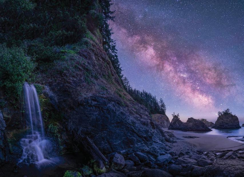
#1 Broker State of Oregon All Agencies #112 in the Country

#2 Broker State of Oregon All Agencies #192 in the Country 2017-2022 Readers Choice - Gold Award - Best Local Realtor 2023 Readers Choice Best Realtor - Silver Award 2022-2023 Readers Choice Best Local Salesperson - Gold Award 2017- 2022 #1 Realtor in Curry County - Sales and Transactions

CERTIFICATIONS:


Certi ed ELITE Luxury Home Marketing Specialist Designation Multi-Million Dollar Guild Recognition


CLHMS ELITEdesignation is awarded to Institute Members with documented sales performance in the top 10% of their market.
GUILD Elite™ designees are the best of the best with the expertise and proven experience in the multi-million-dollar market to support the most discerning a uent buyers and sellers.

ASK FOR JUDE
offer professional real estate services throughout the Oregon Coast.” Are you ready to list your home? Let’s talk.
“I
2021
2022
READERS’ CHOICEAWARDS Curry Coastal Pilot Gold Winner 2021 READERS’ CHOICEAWARDS Curry Coastal Pilot Gold Winner 2022 READERS’ CHOICEAWARDS Curry Coastal Pilot Gold Winner 2017 READERS’ CHOICEAWARDS Curry Coastal Pilot Gold Winner 2018 READERS’ CHOICEAWARDS Curry Coastal Pilot Gold Winner 2019 READERS’ CHOICEAWARDSDel Norte Triplicate G d Winn 2023 Jude Hodge, Broker 703 Chetco Ave, Brookings 541-412-9535 x117 www.HomeWithJude.com Licensed in OR 2023 GO Wild Rivers COAST - Page 63


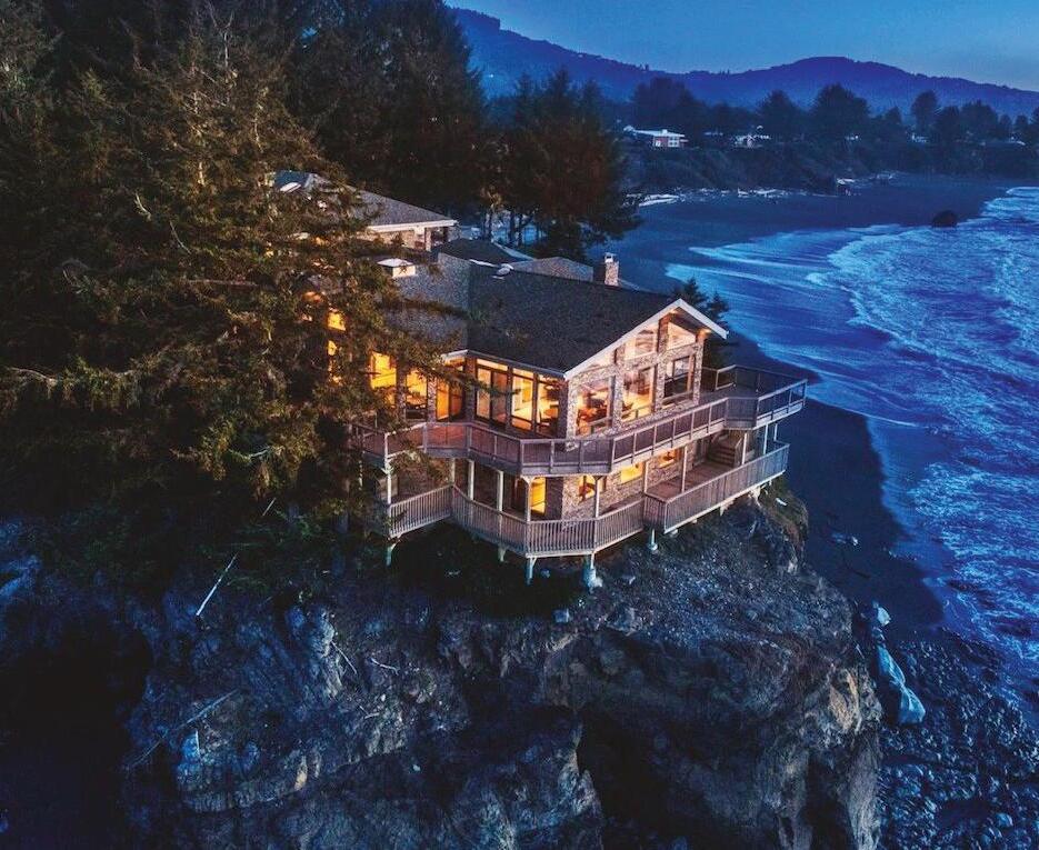


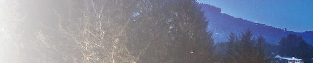


Br e tC urt is Owner/PrincipalBroker 541-661-3301 CoastalOregon.com Callorvisitustoday! Ma r ie Curt is Owner/PrincipalBroker 541-661-3056 16218HoffeldtLane,Harbor,OR97415| 541-69-REMAX•541-412-3000| 703ChetcoAvenue, Brookings,OR97415| 541-40-REMAX•541-412-9535 FEATUREDON TOP1.49% OFMORETHAN 1.6MILLION LICENSED REALTORS® NATIONWIDE. beachesandbeyond... Discover Oregon coastal Whyworkwithus? ♦ NoChargeConsultation ♦ MarketingStrategyfrom ListingtoSOLD ♦ HomeStagingConsultation ♦ BrokerPriceOpinion ♦ MarketKnowledge ♦ CommunityCentered ♦ Available7days/week ♦ National&International presence,notjustLocal ♦ TinyHomestoMegaHomes ♦ Waterfront&Luxury Properties ♦ Land&NewConstruction ♦ Commercial&BusinessOpps. ♦ Seller&Buyer Representation ♦ DesignatedCertifiedLuxury HomeSpecialist ♦ DesignatedCertified ResidentialSpecialist(CRS) Specializingin Page 64 - 2023 GO Wild Rivers COAST
CRYSTAL COVE ROCK SHOP


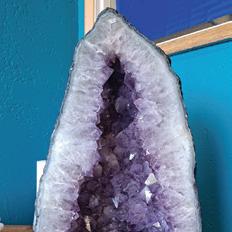


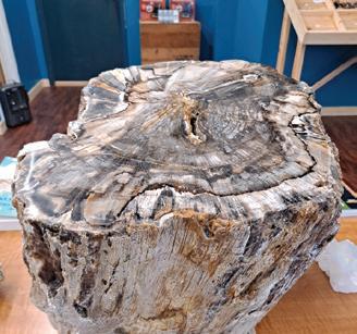


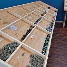


The Earth is alive! It may seem static, but, there are constant changes happening all around us that have been going on for billions of years. I’ve always been fascinated with the processes that create the land we live on, and the many treasures that are produced around the world.


I grew up in Livingston, Montana, where the Yellowstone river flows fast and strong out of Yellowstone National Park. Being the largest volcano on the planet, and having erupted many times, this region is filled with many examples of the wondrous geological goodies vulcanism creates, such as Agate, Jasper, Petrified Wood, crystals, and fossils. Oregon shares this type of geological activity and also produces similar minerals.
Rockhounding for these magical specimens has been my favorite hobby for many years, and now I’ve brought this passion with me to Brookings.
After remodeling the old Post Office space in the Harbor Shopping Center, my dream of opening a rock shop materialized at the end of January when we opened our doors! I’m pleased by the wonderful reception I’ve received and am encouraged by the level of enthusiasm expressed by everyone here who also loves rocks. Whether you simply enjoy the beauty of the natural world, or have an interest in the metaphysical properties some say minerals possess, you’re sure to find something of interest at the Crystal Cove Rock Shop. Keep rockin!
97900 Shopping Center Ave. Ste. #1 Brookings, OR 97415 crystalcoverockshop.com KEEP ROCKIN! The best rock shop on the south coast
