1 minute read
Space Snapshots


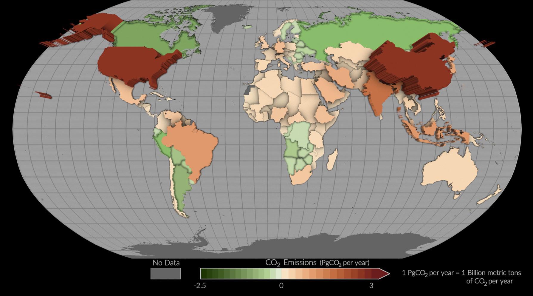
NASA Space Mission Takes Stock of Carbon Dioxide Emissions by Countries
(from a NASA release, March 2023)
This map shows mean (average) net emissions and removals of carbon dioxide from 2015 to 2020 using estimates informed by NASA’s OCO-2 satellite measurements. Countries where more carbon dioxide was removed than emitted appear as green depressions, while countries with higher emissions are tan or red and appear to pop off the page. [Image credit: NASA’s Scientific Visualization Studio]
A NASA Earth-observing satellite has helped researchers track carbon dioxide emissions for more than 100 countries around the world. The pilot project offers a powerful new look at the carbon dioxide being emitted in these countries and how much of it is removed from the atmosphere by forests and other carbon-absorbing “sinks” within their borders.
The findings demonstrate how space-based tools can support insights on Earth as nations work to achieve climate goals.
See https://climate.nasa.gov/news/3251/nasaspace-mission-takes-stock-of-carbon-dioxideemissions-by-countries/


